Storm Data and Unusual Weather Phenomena - CIG - Mesonet
Storm Data and Unusual Weather Phenomena - CIG - Mesonet
Storm Data and Unusual Weather Phenomena - CIG - Mesonet
- No tags were found...
You also want an ePaper? Increase the reach of your titles
YUMPU automatically turns print PDFs into web optimized ePapers that Google loves.
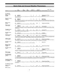
<strong>Storm</strong> <strong>Data</strong> <strong>and</strong> <strong>Unusual</strong> <strong>Weather</strong> <strong>Phenomena</strong>TimeLocal/PathLengthPathWidthNumber ofPersonsEstimatedDamageLocation Date St<strong>and</strong>ard (Miles) (Yards) Killed Injured Property Crops Character of <strong>Storm</strong>April 2005COLORADO, East CentralYuma County20 NNE Wray 20 2130MST0 0Hail (2.75)Yuma County10 S Wray 20 2137MST0 0Hail (1.00)Yuma County8 SSE Wray 20 2140MST0 0Hail (1.75)Yuma County2 E Wray to 20 2144MST0 0Hail (1.75)1 N Wray2145MSTSeveral reports of hail between nickel <strong>and</strong> golfball size were reported in <strong>and</strong> around Wray at 10:45 pm MDT.Kit Carson CountyStratton27 1645MST0 0Hail (0.75)Kit Carson CountyVona to27 1645MST0 0Thunderstorm Wind (G50)StrattonSix traffic accidents occurred on Interstate 70 in Kit Carson County, Colorado between Vona <strong>and</strong> Stratton from 5:45 pm MDT to6:00 pm MDT. Accidents were caused by strong thunderstorm outflow <strong>and</strong> rapidly reduced visibility in outflow winds.Kit Carson County17 S Burlington 27 1750MST0 0Hail (0.88)Cheyenne County13 N Arapahoe 27 1820MST0 0Hail (0.75)Cheyenne County2 W Cheyenne Wells 27 1904MST0 0Hail (1.00)COLORADO, South Central <strong>and</strong> SoutheastCOZ085>086-089-093-095>099Colorado Springs Vicinity / Southern El Paso County / Rampart Range Below 7500 Ft - Pueblo Vicinity /Pueblo County Below 6300 Ft - Crowley County - La Junta Vicinity / Otero County - Western Kiowa County- Eastern Kiowa County - Bent County - Lamar Vicinity / Prowers County - Springfield Vicinity / BacaCounty05 0600MST1700MST0 0High Wind (G63)Damaging winds caused by a strong surface low pressure system over southeast Colorado <strong>and</strong> southwest Kansas impacted southeastColorado causing fences, power lines <strong>and</strong> large tree limbs to be taken down. Power lines brought down in the La Junta area, <strong>and</strong>specifically near the airport, caused the airport to be closed for around a day. Some of the higher gradient wind gusts include 58mph at both Springfield <strong>and</strong> Sheridan Lake...60 mph wind gusts at Las Animas...61 mph wind gusts at Lamar...72 mph wind gustsat Manzanola <strong>and</strong> 76 mph wind gusts observed 4 miles to the north-northeast of La Junta.COZ084-094 Northern El Paso County / Monument Ridge / Rampart Range Below 7500 Ft - Eastern Las Animas County05 0700MST1800MST0 0 250KBlizzardBlizzard conditions caused by a strong surface low pressure system over southeast Colorado <strong>and</strong> southwest Kansas impactedsoutheast Colorado causing snow drifts several feet in depth in some areas as well as closed roads. In northern El Paso County,winds gusting over 70 mph brought down 113 power poles carrying 230,000 volts on a line which runs from Colorado Springs toLimon. All told, almost 200 power poles were brought down in northern El Paso County, causing around 600 eastern countyresidents to lose power from highway 94 north. Power substations were also knocked out. Some of the higher snow totals...whichalso included sustained winds in excess of 40 mph as well as visibilities below 1/4 mile at times included 8 to 14 inches in northernEl Paso County in <strong>and</strong> around the Black Forest <strong>and</strong> 12 inches near Branson in southern Las Animas County.COZ081>082 Teller County / Rampart Range Above 7500 Ft / Pikes Peak Between 7500 & 11000 Ft - Pikes Peak Above11000 Ft05 0700MST1700MST0 0Winter <strong>Storm</strong>A winter storm brought gusty winds <strong>and</strong> heavy snow to the west side of El Paso County <strong>and</strong> Teller County. Many areas saw inexcess of 8 inches of snow with blowing a drifting snow with winds gusting to over 40 mph...especially atop Pikes Peak.4650


