BWood Appraisal.indd - Burnley Borough Council
BWood Appraisal.indd - Burnley Borough Council
BWood Appraisal.indd - Burnley Borough Council

Create successful ePaper yourself
Turn your PDF publications into a flip-book with our unique Google optimized e-Paper software.
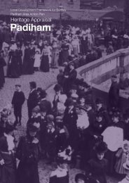
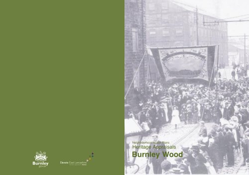
Neighbourhood Action Plans Heritage <strong>Appraisal</strong>s_Contents1. Introduction1.1 Housing Market Renewal and Neighbourhood Action Plans (NAPS) 11.2 Heritage <strong>Appraisal</strong>s1.2.1. The Importance of Heritage 11.2.2. The Purpose of Heritage <strong>Appraisal</strong>s 12. Development of <strong>Burnley</strong>2.1 Physical Context 32.2 Historic Context 4Heritage is all around us. We live our lives, whether consciously or not,against a rich backdrop formed by historic buildings, landscapes and otherphysical survivals of our past. But the historic environment is more than justa matter of material remains. It is central to how we see ourselves and to ouridentity as individuals, communities and as a nation. It is a physical record ofwhat our country is, how it came to be, its successes and failures. It is acollective memory containing an infinity of stories. Englandʼs history is agradual accumulation of movement and arrivals, new stories attachingthemselves to old. Urban and rural landscapes reflect this layering ofexperience and develop their own distinct characteristics. Building materialsand styles can define and bind regions, localities and communities just aspotently as ethnic background, dialect or sporting loyalties. Historiclandscapes or iconic buildings can become a focus of community identityand pride and proclaim that identity and pride to the wider world. At a morelocal level a historic church or park can help define a neighbourhood andcreate a sense of local cohesion. Once lost, these defining features cannotbe replaced.The Governmentʼs statement: The Historic Environment: A Force for OurFuture (DCMS/DTLR 2001)3. <strong>Burnley</strong> Wood <strong>Appraisal</strong>3.1 The Area 53.2 Historic Development 53.3 Protected Features 73.4 Area 1 Architectural, Townscape and Landscape Qualities3.4.1 Houses 93.4.8 Public Houses 113.4.10 Churches 123.4.13 Landscaping Open Spaces, views and trees 143.4.16 Changes and present character 143.5 Area 2 Architectural, Townscape and Landscape Qualities3.5.3. Layout of streets 163.5.5. Houses 163.5.7. Industrial buildings 183.5.22 Commercial buildings 243.5.24 Inns/Public Houses 253.5.26 Churches 253.5.27 Schools 273.5.28 Open Spaces, views, trees and greenery 283.5.31 Changes and Present Character 304. Heritage and Future Regeneration 335. List of Plans 346. References 34Produced by <strong>Burnley</strong> <strong>Borough</strong> <strong>Council</strong>If you would like this information translated please contact the Translation Servicesat the Town Hall, Manchester Road, <strong>Burnley</strong>, BB11 1JA Tel. No. 01282 832656.Available in large print on requestPlanning Services[t] 01282 425011 [x] 2541 / 2542 & 2545www.planning@burnley.gov.ukMarch 2004Design by ʻThe Graphics Unitʼ [t] 01282 425011 [x] 2652
oneintroduction1.1. Housing Market Renewal and Neighbourhood Action Plans (NAPS)1.1.1. Housing Market Renewal is the Governmentʼs new approach to tackling low housingdemand and abandonment in the North of England and the Midlands. Nine sub-regional MarketRestructuring Pathfinder Projects have been created to bring about market renewal and tackleassociated high levels of crime and social exclusion. The East Lancashire Pathfinder includesparts of Blackburn, Hyndburn, <strong>Burnley</strong>, Pendle and Rossendale.1.1.2. Within <strong>Burnley</strong> <strong>Borough</strong> <strong>Council</strong>ʼs Pathfinder ʻintervention areaʼ Neighbourhood ActionPlans (NAPs) are being prepared to guide the regeneration of the following priority areas,which are considered to be suffering from the worst deprivation and housing market failure:• <strong>Burnley</strong> Wood• Daneshouse, Duke Bar and Stoneyholme• South West <strong>Burnley</strong>1.1.3. The NAP areas represent a wide range of approaches used to meet the housing needsof the borough over the last 150 years. In particular, there is a predominance of pre-1919terraced housing built to house the rapidly expanding population of <strong>Burnley</strong> during the IndustrialRevolution. This type of property has experienced low demand and vacancy in the PathfinderIntervention Area. Built at high densities with very little amenity space, close to the mills andfactories that provided the main source of employment, it is considered that these dwellingswere built for purposes that are no longer relevant to modern day housingexpectations.1.1.4. It is anticipated that housing clearance will form an essential part of housing marketrenewal schemes. There is concern amongst heritage bodies that extensive clearance ofpre-1919 terraced housing, with little regard to the consideration of its historic merit, couldradically alter <strong>Burnley</strong>ʼs distinctive industrial character.1.2. Heritage <strong>Appraisal</strong>s1.2.1. The Importance of Heritage:Heritage encompasses not just buildings and streets but also gardens, parks, monuments,industrial complexes, waterways and roads, archaeological sites and open landscapes. It isestimated that only 5% of this resource is protected by statutory legislation. Our heritage alsoincludes languages, stories, traditions and foods. An awareness of heritage gives people andplaces an identity and significance. It gives localities their distinctive character and marks theirindividuality as neighbourhoods and as part of the wider town.1.2.2. The Purpose of Heritage <strong>Appraisal</strong>s:Elements of <strong>Burnley</strong>ʼs historic environment are recognised as nationally or locally important andare protected by law through statutory designation such as Listed Buildings and ConservationAreas. However, the particular local historic character of a place is not always marked by anyof these formal designations, even though it is appreciated and well known to local people.Heritage <strong>Appraisal</strong>s are a method of recognising this special quality and are now becoming anestablished approach in Conservation Planning.1.2.3. Heritage <strong>Appraisal</strong>s are being undertaken as part of the Neighbourhood Action Planningprocess to ensure that regeneration proposals are informed by a sound understanding of theheritage importance of the NAP areas and proper regard to their historic character and localdistinctiveness. They will show how seemingly mundane, normal or everyday historic elementscan contribute significantly to the overall quality and character of places or may be interestingin their own right. Opportunities to retain or enhance the local character will be identifiedthrough this process and will inform the production of urban design guidance.1.2.4. Heritage <strong>Appraisal</strong>s offer an evaluation of heritage interest and characterisation of theNAP areas. This means understanding how the historical evolution of the Nap areas hasshaped their present day character and distinctive qualities of the neighbourhoods. It isintended to use this understanding to guide regeneration proposals so that they acknowledgeand build on that character. Heritage <strong>Appraisal</strong>s recognise that change is desirable, but urgesthat it should respect, rather than detract from, the existing environment.1.2.5. Heritage <strong>Appraisal</strong>s are a way of describing and understanding the NAP areas throughproviding an assessment of the elements which give the neighbourhoods their distinctivecharacter. These elements include, amongst others:• historical development and associations• pattern of street layouts and historic transport routes – canal, rail and road• activity and vitality of land-uses• building materials, styles and architectural detailing• quality and relationship of buildings• prominent landmarks, vistas and panoramas• setting and topography• trees, parks and open spacesThese elements may make a positive contribution or they may, in some instances, detract fromthe area.1.2.6. Heritage <strong>Appraisal</strong>s will aim to:• assess the origins and development of the NAP areas to provide a good understanding of the historic environment of the neighbourhoods and its role in modern lifeand local communities;• define and evaluate the qualities which create the distinct character of the NAP areas,their heritage resources and the contribution they make to the quality of the townscape;• identify opportunities to retain, strengthen and enhance local character and identity;and• inform the production of design guidance for the redevelopment and/or renovation ofthe NAP areas that builds on strengthening distinctive local character and identity.This approach reflects the importance of local character in the definition of sense of place asemphasised in English Heritageʼs policy statement The Power of Place (2001).1 heritage appraisal heritage appraisal 2
twothe development of <strong>Burnley</strong>2.1. Physical Context2.1.1. Location<strong>Burnley</strong> is one of a number of closely neighbouring settlements which lie along the valley of theRiver Calder and its tributaries. It is positioned on the western edge of the lower slopes of thePennine Hills at the confluence of the River Calder and the River Brun. It was from the Brunthat <strong>Burnley</strong> got its name, derived from Brun Lea, “the field near the Brun”. These rivers arenow largely canalised and culverted through the built up areas of the town.2.2. Historic Context2.2.1. <strong>Burnley</strong> did not appear as a settlement until Saxon times when it was one of a group ofhamlets or scattered farmsteads in the area. By 1400, with a population of 600, <strong>Burnley</strong> ʻvilʼhad become established and contained a church, a market and a fair and a fulling mill aroundSt Peterʼs Church area and the river Calder to the west. <strong>Burnley</strong> gradually developed as amarket town and by 1650, was regarded at a national level as a small market town (with apopulation of 1,500). At this time farming was the main industry and houses and cottages hadbeen built in the hamlet and near some of the outlying farms. Fields in the wider area wereenclosed and owned or rented by townspeople. Associated industries and trades developed tomeet the needs of the growing town and woollen and linen cloth manufacturing were importantindustries in <strong>Burnley</strong>. The Church was the important centre of religion and local government.2.2.2. Gradually the textile industry replaced agriculture and spinning and weaving in cottagesbecame more important than work on the land. Until the mid 18 th Century the manufacture ofwoollens, worsteds and fustians took place mainly in workers homes. After 1750 cottonmanufacturing gradually replaced the woollen industry and the factory system, which involvedthe separation of home and work, developed. Census returns for 1801 show <strong>Burnley</strong>ʼspopulation as 3,918 but at this time the town had expanded to the same plan and design as thehandloom weaversʼ cottages with some degree of simplistic comfort.2.2.3. In comparison the first half of the 19 th Century, when the population rose to 20,828(1851), saw the unplanned development of back to back houses, cellar dwellings, andtenement houses crammed together within the core of the town from St Peterʼs (Top OʼthTown) to Westgate (Brig). Very few examples of back-to-back houses survive in <strong>Burnley</strong> today.These dwellings accommodated the families which arrived from far and near to earn a living inthe mills and factories which were being developed. At this time coal mining became moreimportant and every trade and industry expanded to meet the needs of the expandingpopulation. Living conditions for most people in these cramped and over crowded conditionswere very poor with little, if any, sanitary provision and there was a recognition thatimprovements needed to be made. This resulted, together with National changes, in thegradual decline of the Churchʼs responsibility for the government of the expanding and morecomplex town. The Improvement Act of 1846 “for better paving, lighting, cleansing, regulatingand improving the town and for better supplying the inhabitants with gas and water” entrustedthe government of the town to 60 Commissioners to be elected by the votes of ratepayers.2.1.2. Geology and TopographyThe geology and topography of the area have influenced the development and character of<strong>Burnley</strong> through its climate, minerals, rivers and lines of communication. The underlying solidgeology of the area consists of productive coal measures of the Carboniferous era whichcontributed to the early industrial exploitation of the area. The drift cover consists primarily ofPennine drift with fine textured alluvium in the valley of the Calder. These are derived almostwholly from Carboniferous rocks and contain abundant sandstone and shale fragments. It islikely that locally quarried sandstone was the dominant building material from at least thesixteenth century.2.1.3. Townscape<strong>Burnley</strong>ʼs townscape and identity is inextricably linked to the major part it played in the textilerevolution. A large part of <strong>Burnley</strong>ʼs Intervention Area was created (or in the case of the innercore redeveloped) during the Industrial Revolution. The rapid and concentrated developmentof <strong>Burnley</strong> during this period has created a rich and unique historic environment. The transportroutes (rail, road and canal), warehouses, bridges, wharves, mills, weaving sheds andchimneys, housing, schools, shops and civic buildings associated with the industrial revolutionstill dominate <strong>Burnley</strong>ʼs townscape today providing a visual illustration of the connectionbetween the past and the present.2.2.4. The town continued to expand in the second half of the 19 th Century (97,043 populationin 1901) but it was a more regulated and planned expansion. Areas of land outside thedevelopment boundary of the town were made available for development and the houseswere laid out in terraces with provision for sanitation and other amenities. <strong>Burnley</strong>ʼs section ofthe Leeds and Liverpool Canal had been completed in 1801, the East Lancashire Rail Line in1848, and the Lancashire and Yorkshire Rail Line in 1849. The canal had played a significantpart in the development of industry in the first half of the 19 th Century as a transport route formaterials and a source of water. As the town continued to develop in the second half of the19 th Century the canal and rail transport corridors and the medieval footpath/road routesinfluenced the form of its development.2.2.5. By the late nineteenth century, <strong>Burnley</strong> had secured a great majority of cotton operativesand associated industries, which were showing rapid growth and sophistication. Thegovernment of the town also progressed and in 1861 the Commissioners were replaced by the<strong>Burnley</strong> Town <strong>Council</strong> which was elected on a far more democratic basis than previously. TheTown <strong>Council</strong> played a major role in the improvement, expansion and development of the town,initiating major schemes of public works. These included the provision of water and sanitationand symbolic gestures, such as the construction of town halls, churches, schools and hospitals.Public parks and squares are also significant features of this period.3 heritage appraisal heritage appraisal 4
Moseley Farm [T]Hollingreave Farm [T]3.2.4. During the first half of the 19 th Centuryseveral small pockets of development tookplace. By 1825, back to back cottages andmills had been built alongside the canal atFinsleygate. The mills included Finsley Mills,Albion Mills (Stanley Street) and HealeyWood Mills. Between 1825 and 1844 SpringGardens Mill, together with back to backcottages, had been built between PlumbeStreet and East Gate. Along the western sideof Todmorden Road several large housesset in extensive grounds had been built. Atthe junction of Todmorden Road and HuflingLane a smallhamlet had developed aroundthe Woodman Inn and further up HuflingLane, near the railway, was a row of cottagesʻorgan rowʼ. (See Map C)Organ Row [L]three<strong>Burnley</strong> Wood3.1. THE AREA3.1.1. The majority of the <strong>Burnley</strong> Wood NAP has a clearly defined boundary with the railwayline westward, Rock Lane southwards and Todmorden Road/Oxford Road eastwards. Thenorthern boundary is less clearly defined by Temple Street, the canal “Straight Mile,” FinsleyGate and Healey Wood Road (see Plan A).3.2.5. In the second half of the 19th Century, widespread development occurred to formmost of the present day <strong>Burnley</strong> Wood and can be defined as two distinctive character areas(See Plan A):• Character Area One – Area of large stone built 19th Century houses of low densityflanking Brooklands Road and Todmorden Road.• Character Area Two – Area of high density stone built terraced housing, mills andassociated buildings built 1860 - 1890 between Hufling Lane, the canal and railwayand Oxford Road/ Todmorden Road.3.2. HISTORIC DEVELOPMENT3.2.1. As the name suggests, 16 th Century <strong>Burnley</strong> Wood was mostly covered with roughmoorland and woodland. The Nan Hey wood/ field (See 3.4.3.) was situated at the bottomof Hufling Lane on the Mosley estate in 1546.3.2.2. In Elizabethan times, <strong>Burnley</strong> Wood was a scattering of farmsteads in an outlying partof <strong>Burnley</strong> – Whittaker Farm (junction of Hufling Lane and Todmorden Road), Moseley Farm(Glebe St), Hufling Hall and Hollingreave House (Brunswick St/Hollingreave Rd). Theprincipal road followed the line of Rock Lane and the drive to Towneley Hall from CausewayEnd. Although Todmorden Road was created as a turnpike road in 1817 it dates from earliertimes. Two other roads or lanes, perhaps more important to local farmers, ran fromHollingreave to Rock Lane and along Hufling Lane. (See Plan B)3.2.3. From 1673 to 1819 the majority of <strong>Burnley</strong> Wood was in the ownership of St. PeterʼsChurch and as “glebe land” could not be developed. Even after this date, the area was notrapidly developed because of the barrier formed by the Leeds and Liverpool Canal, whichhad been completed by 1801. There were only two access points to the town, one at theTurn Bridge (Finsley Gate) and one through the ʻculvertʼ to Eastgate (now Yorkshire Street).5 heritage appraisalHousing along Finsley Gate [L]
Landscaping, Open Spaces, Views and Trees3.4.13 In the first half of the 19th Century some gardens existed off Hufling Lanestraddling the railway at the rear of Organ Row. Bennett (III p261) states that these“pleasure gardens contained fruit, a labyrinth/ puzzle walk, and a small zoologicalcollection” The houses on Brooklands Road now occupy the site.3.4.14. Towneley Park lies to the east of Todmorden Road, just outside the boundary ofthe Nap area and is a designated Historic Park and Garden(See Plan A). It is verypossible that the park setting attracted the larger villadevelopments on Todmorden Road to the area. Thebuildings faced the park to take advantage of theviews to Towneley and countryside beyond as openspace did not exist within the dense urban core ofthe town. Today the views into the park have beenobstructed by development to the east of TodmordenRoad, but glimpses into the park can still be seen fromroad junctions.3.4.15. The ten Tree Preservation Orders(See Plan A & 3.3.1.17-25 & 27) in place withinBrooklands Road,Kingsland Road, and TodmordenRoad recognise the importance of trees to the historyand character of the area.Trees dominate the scene on Todmorden RoadTowneley Station [T]3.4.11 The Lancashire and Yorkshire Railway Company completed the construction ofa line between Manchester and Leeds in 1841. This line was so successful that thecompany built a line between <strong>Burnley</strong> and Todmorden linking towns in north eastLancashire with this main Manchester- Leeds line (Bennett III, pg.161). Completed in1849, the <strong>Burnley</strong> to Todmorden line runs along the edge of <strong>Burnley</strong> Wood forming thewestern boundary of the NAP area. Towneley Station was situated at Hufling Laneand to the south of the station, mainly outside the NAP boundary, sidings developedto serve Towneley Colliery. Although the Station and sidings are no longer functioning,the line and signal box remain in use. Towneley Station house is now solely inresidential use.3.4.12 Little evidence remains of the traditional cobbledstreets of the 19th Century and parked cars now dominatemuch of the street space and are changing its urbanquality. There are areas of cobbles remaining between No1- 25 Brooklands Road (See Plan F, Cobbles). Theirretention appeals both aesthetically and in evokingmemories of days gone by. The properties on BrooklandsRoad have areas of modern ʻcobble effectʼ paviors at theirentrances. This detailing is sympathetic to the areashistoric context.Changes and Present Character3.4.16. The Brooklands Road and South Todmorden Road area has experienced verylimited change and retains its original character of low density, predominantlyresidential use in a private, well-treed environment. There is a sustained demand forthe properties for their original use, with a subsequent lack of vacancy or dereliction.Planning policies and conservation area and Listed Building regulations have servedto maintain this character, although present Government guidance for concentration ofnew residential development on brownfield sites could result in increased pressure fordevelopment of garden areas. Overall, this remains anattractive, well-maintained residential area3.4.17. The Todmorden Road area north of HuflingLane has experienced only limited change andremains, for the most part, in residential use. Somelarger properties have been converted tocommercial use, but this has not significantly affectedtheir external character and appearance. There is amodern retail development on Todmorden Road, whichdoes not contribute to the historic character but helpsto maintain the thriving street frontage.Todmorden Road Spar ShopBrooklands Road - Stone cobbles on the drivewaymeet modern setts at the pavement.13 heritage appraisalheritage appraisal 14
Character Area 2Architectural, Townscape and Landscape Qualities1 2 31 4-6 Brooklands Road is a goodexample of sympathetic design, being built from similar materials and style as thesurrounding properties.2 26- 40 Stoney Street is a typical post war development which is set back from the road.3 Hufling Court has proved to be a popular new development, being built from similar materials as the surroundingproperties, but the porches to the front are out of character.3.5.1 The townscape qualities of character area 2 are created by the continuity of formand materials used in terrace blocks, mills,churches, schools and other buildings set withina tight grid iron pattern of streets (See Plan A -Character Area). There has been consistent use oflocally quarried stone and welsh blue slate and thisrepetition provides one of the strong environmentalattractions of the area.3.4.18. There have been small infill residential developments during the 20th Centurywhich include No. 4- 6 Brooklands Road, No 11- 13 Kingsland Road, No 26- 40Stoney St and Hufling Court. These developments show varying degrees of sensitivityto the character of the area.3.5.2 The area is based on a gridiron street patternrunning north-south and east-west (see PlanA). The central part was characterised by terracesaligned north-south. Terraces to the north, west,and east, are aligned predominantly east-west.The southern tip of character area 2 lies within<strong>Burnley</strong> Wood Conservation Area (See Plan A& 3.3.1.29). The Finsley Gate area and canalStraight Mile are within the Canalside ConservationArea (See Plan A & 3.3.1.27).Aerial View - Southern Tip3.5.3 The layout of the streets was planned.Estate plans showing the layout of proposedstreets in an area were submitted for approval.For example the Hollingreave and Mosley Estatesdeveloped on the sites of the old farmlands. Therows of houses were then built one or two terracesat a time as the <strong>Burnley</strong> <strong>Borough</strong> ImprovementCommittee approved the details. Variationsbetween the blocks of terraces are found in theirsimple architectural detailing, size of windows andstone finishing. At the rear of the houses, requiredby Bye-Laws of the time, a small back yard or court area enclosed by a 4-5ʼ wallcontained a range of outbuildings and facilities. These facilities – drainage to mains,toilet, ash pit, were a vast improvement on those which had existed prior to the 1854Improvement Act although there is some indication (Bennett Volume 4 p11) that untilthe Corporation provided a properly planned sewerage system for the whole town in1870 some localised problems still arose.Aerial View - Canal straight mile3.5.4 The houses are two storey, have a fairly balanced window to wall ratio and arhythmic door, window; door, window arrangement. The windows and doors have avertical emphasis which counters the horizontal nature of the rows of houses. Many ofthe end properties of the rows have two storey outbuildings and the gables invariablyhave windows and doors. The walls dominate from the street and the roof line has agentle slope but from views into the area from surrounding hills the rows of blue slateroofs are often the dominating feature.15 heritage appraisal heritage appraisal 16
1 2 3 43.5.6 In addition to housing, mills, warehouses, churches, pubs, shops and schoolswere built in the area.3.5.7 The mills and warehouses were developed to the north and to the west of theNAP area alongside the canal and to the north east of the area alongside the RiverCalder.1 Reed Street, double window to ground floor and forecourt garden.2 Hollingreave Road, veranda roofs above large bays to ground floor and forecourt garden.3 Ash Street, simple detailing4 Marlborough Street, doorways side by sideTerraced housing around Hollingreave Road is generally larger, of more detailedarchitectural design and garden fronted. Within the core of the area the terracedhousing tends to be smaller, plainer and fronts directly onto the street. An area withinthis core, from Dall Street to Branch Road has been highlighted as an area forheritage enhancement (see Plan F).3.5.5. The most architecturally interesting part of this large housing area standsbetween the Todmorden Road/Hufling Lane junction and St. Stephenʼs Church (withinthe <strong>Burnley</strong> Wood Conservation Area, see 3.3.1.29) where cottages are characterisedby their use of high quality details such as arches, drip and hood moulds, date stonesand carved stone name plates.1 2 3 43.5.8 The mills and warehouses to the west are within the Canalside ConservationArea (see 3.3.1.27). It contains statutory listed buildings at Finsley Wharf (3.3.1.2-4) and locally listed buildings at Finsley (3.3.1.31) and Healey Royd Mills (3.3.1.32).There are also locally listed stone chutes for coal in the canal bank (3.3.1.38)adjacent to Healey Royd Works.This part of the Canalside Conservation Area has:• a strong historic character reflecting the 19th Century industrial development ofthe town• distinctive architectural qualities in its traditional canal architecture and 19thCentury industrial buildings, both employing local stone with strong forms andsimple detailing• quality townscape features based on the sinuous line of the canal and enclosingbuildings and treed areas. There is a mix of well defined spaces, open viewsacross the town and landmark buildings and structures (See Plan F - LandmarkBuildings). In addition, the historic buildings fronting Finsley Gate and CooperStreet have an important role in defining Finsley Gate on the south side.3.5.9 The earliest Mills (before 1827) were the two Finsley Mills, Albion Mills(CooperSt) and Healey Wood Mills(now demolished). In Pigotʼs1828 Commercial Directory of Cheshire, Derbyshire, andLancashire, Dean and Law are listed as Cotton Spinnersat Finsley Mill. Mannexʼ 1854 history of Mid Lancashirelists Henry Knowles and Son at Finsley Mill and anapplication for a warehouse adjacent to Exmouth Streetwas made to the <strong>Borough</strong> <strong>Council</strong> in 1856 by MessrsKnowles. It is likely that this Finsley Mill was the onewhich has now been demolished andredeveloped with modern workshops.1 Clarence Street - Hood Moulds (over the doors).2 Clarence Street - Arched Doorways.3 Oxford Road - Large bays, ornate door surrounds and drip moulds4 Oxford Road - Stone name plate, Mabel terraceThe locally listed Finsley Mill(See Plan F - LandmarkBuildings) occupied by Lambert and Howarth is shownon early plans and it is believed that the smaller stonegabled building fronting the canal to the north is C1820. The rectangular building nearest to Finsley Gate roadbridge bears a stone plaque dated 1866 but in 1875 anapplication by Witham Brothers for raising the mill by onestorey was received and this extension is clearly visibleon the present building. Witham Brothers made otheralterations and extension to the building including aBoiler House (1874), a new chimney (1880), Engine andBoiler House (1890) and new card rooms (1903 – thesingle storey structure adjoining Finsley Gate) and theirlast application for a lift shaft in 1950.Above: Finsley Mill from Finsley Gate bridgeBelow: showingthe gabled canalside frontage of the 1820ʼs building17 heritage appraisalheritage appraisal 18
Dean Mill3.5.16 Alongside the River Calder around the junction of TodmordenRoad and Parliament Street can be found another complex of 19thCentury Mills. Handbridge Mill, opposite Towneley Lodge, wasprobably the earliest Mill – Bennett (III p181) states that it was builtabout 1844 by Norton Fletcher, a plumber and glazier. The mill wasaltered in 1875 for Messrs. Crabtree and Hargreaves, CottonManufacturers, when a new single-storey-weaving shed replacedthe western part of the four-storey mill. It is this weaving shed whichremains today. Further extensions were added in 1884 and 1888 forJackson & Son & Company. It is not clear whether the existingtwo-story building occupied and refurbished by Premier Gas ispart of the original 4 storey mill or one of the later extensions.Dean Mill - nameplateOther buildings were R.Dean and Sons Saw Mill (1875), J.Marshallʼs Tannery Warehouse, Workshop and House (1868)and J. Layfieldʼs Boilermakers Shed (1875). These premisescan be seen on Plan C and plans D & E show some ofthe changes which took place over the years. Part if not all ofSpring Garden Mill had been converted to a garage, the SawMill became Dean Mill (Cotton) and the boiler works was partlyconverted to a Heald, Reed and Knitting Works. Many furtherchanges have since taken place (See .3.5.36) but the frontageof Dean Mill has recently been refurbished and retains much ofitʼs original character (see Plan F - Buildings of Local HeritageValue).3.5.17 Spa Field Mill, also known as Kayʼs Mill, now the site of abathroom showroom, was probably built about 1850/60 as therewas a building application for an additional warehouse in 1864from J. Kay. The mill appears to have been destroyed by fire in1938 and only the stone walls of the single storey weaving shedremain (see Plan F - Buildings of Local Heritage Value) .Handbridge Mill Walls of Weaving shedPlumbe Street ShedWorkshops - Plumbe Street3.5.14 Witham Brothers built Plumbe Street weaving shed in1884, an additional warehouse building in 1895 and other lateradditions until the shed was occupied by <strong>Burnley</strong> Jute Companyin 1958. The building is an example of a later shed buildingin red brick and was designed by Potts, Pickup and Dixon,Manchester and Oldham Architects. Although the single storeyshed has been demolished the two storey warehouse buildingremains.3.5.15 Small workshops were built within some of the mill yards,for example a Timber Store, Tin Smith, Joiners Workshop and acommercial garage at Spring Gardens Mill, Plumbe Street.Handbridge Mill , remaining 2 storey buildingSpa Field Mill , remaining Weaving shed wall21 heritage appraisalheritage appraisal 22
Oxford Mill, Waterloo Road<strong>Burnley</strong> Wood Mill warehousePentridge MillPentridge Mill - converted cinema buildingwith listed chimney in the background3.5.18 The original Oxford and <strong>Burnley</strong> Wood Mills mayhave been built C.1850 too. Oxford Mill appears to havebeen run by Lomas & Tunstill in 1863 when a new singlestorey weaving shed at the corner of Parliament Streetand Waterloo Road was proposed. Further new buildingswere later added and can be clearly seen along Oxfordand Waterloo Road.<strong>Burnley</strong> Wood Mill was owned by J. Kay & Sons until1891 when the <strong>Burnley</strong> Wood Mill Company built theimposing three storey warehouse building which stillstands at the junction of Oxford Road and ParliamentStreet (see Plan F - Building of Local Heritage Value).The remainder of the Mill has been much altered althoughsome of the stone walls of the single storey weaving shedhave been retained.3.5.19 The four storey Pentridge Mill was built about 1854for Mr. Lomas. The mill was extended up to Holmes Streetin 1881. In 1909 building approval was given to J.Palmer& Sons Ltd for a skating rink on the second floor of themill. In 1910 the same company converted part of theground floor to a “Cinematagraph Picture Hall” and madeextensions and alterations to the cinema until 1919. Thesealterations included removing three internal floors in 1912and in 1917 creating a new frontage to the Cinema and adress circle at a higher level. The seating capacity was for1,530 people. It was then named Pentridge Picture Hall.The working Mill still remained at the rear of the Cinemaand together with the Statutorily Listed Chimney (see3.3.1.14) retains it original character.3.5.20 Fulledge Mill was built about 1850 for WilliamHalstead and an additional shed was added in 1882. Thebuilding has been damaged by fire and only the groundfloor shell remains (see 3.5.37).Water Channel to PentridgeMillRemains of a metal structureFulledge MillAbove: 57-61 Oxford RoadBelow: 19 - 21 Branch Road3.5.21 The original mills were sited alongside the riverin order to utilise the water and evidence of this canstill be seen along its banks as illustrated. The riverwas canalised and a central channel created so thatat times of low water it would flow freely and cleanseitself. Weirs were also created alongside some of themills. The river flows under the Leeds and LiverpoolCanal Straight Mile to the west of Plumbe Street andthe Aqueduct which carries the canal over the river isStatutorily Listed, Grade II (see 3.3.1.1). Hand Bridgewhich carries Todmorden Road over the river is alsoGrade II Statutorily Listed (see 3.3.1.13).3.5.22 Oxford Road and Parliament Street were themain commercial areas for shopping. There werealso a number of shops built on Plumbe Street, bothat the ends and within terraces, but these have eitherbeen demolished or converted back to houses. Someof the shops were originally built as houses butconverted to shops as the demand for services andgoods grew. Many of the original shop frontages have beenreplaced with modern styles although some have beensensitively replaced.3.5.23. The Co-operative Society was first established in <strong>Burnley</strong>in 1860 and was originally named “The <strong>Burnley</strong> WoodCo-operative Stores”. Its aim was to allow members a chance toshare in the profits from retail trade and also toimprove the moral and intellectual culture of itsmembers. By 1880 the Society had 40 shopsand the membership was 6,400. There wereseveral stores in the <strong>Burnley</strong> Wood area - 57-61 Oxford Road (1880) included acommittee room above the store, 50 ClarenceStreet (1886) which is now being demolishedalso included the 5 houses in the same terrace and19/21 Branch Road (1893) where a painted advertisementon the gable can still be seen. (See Plan F – feature of localheritage value)The cobbled river bedParliament Street - Original shop fronts(see Plan F - Heritage Enhancement)Oxford Road - Sensitive replacementshop frontsOxford Road - Insensitive Changes(see Plan F - Unsympathetic Change)23 heritage appraisal heritage appraisal 24
The Stanley, Oxford Road.The Corporation - doorway3.4.24 There are several Inns/Public Houses in the area,built in stone with welsh slate roof and of a domestic scalealthough doorways are generally more imposing and ornate.The Corporation on Oxford Road was built c1868 but the originsof The Stanley (within <strong>Burnley</strong> Wood Conservation Area, see3.3.1.29), the Brittannia, The Oxford on Oxford Road and theRifle Volunteers on Smalley Street are unknown.3.5.25 There are also two club premises. Fulledge ConservativeClub Plumbe Street was originally built as a single storeyschool building for Messrs Lord and Wilde in 1868. It wasconverted to club rooms in 1877 and was extended in 1908 whentwo lock up shops and assembly room were added creating anew frontage to Oxford Road. The two quite different frontagescan be seen below. The shops were converted for club use in1962. (See Plan F – Local Heritage Value).<strong>Burnley</strong> Wood Conservative Club, 124 Branch Road was builtC 1890 as a dwellinghouse, lock-up shop (Branch Road)and club premises (Brunswick St). It is a plain but imposingbuilding with heritage value as a community building(See Plan F - Building of Local Heritage Value).3.5.26 There are a range of community buildingsFulledge Conservative clubAbove: Plumbe Street - former school frontageBelow: Oxford Road frontageSt. Stephenʼs Church, (1876-9) a statutorily listed church((see Plan F - Landmark Structure 3.1.12), within <strong>Burnley</strong> WoodConservation Area (see 3.3.1.29), was designed by James Greena Manchester architect and is built in snecked rock-facedsandstone, with slate roof. It has a stained glass War Memorial inthe west window. When the church was built the adjacent site wasoccupied by St. Stephenʼs School and Bennett IV p 169 datesthe school as 1865. The school building has beendemolished and a grassed area created in its place.Rehoboth Methodist Chapel, Springfield Road/CrowtherStreet, a locally listed building (see 3.3.1.43), is now in use asthe One Stop Shop community building but was originally built asthe Rehoboth Sunday School in 1880. It retains much of itsoriginal character although a low stone wall topped with ornatemetal railings originally enclosed the frontage. Bennett IV p.163writes that “ Missioners and Gospel Bands were sent out to holdprayer meetings in cottages and expand their work in developingdistricts. The Rehoboth began their prayer meetings in a cottagein Springfield Road and then in a mill. A chapel was opened in1869”. This was at the corner of Springfield Road and WaterlooRoad and later became Elim Church which was demolished in1975.Former Rehoboth Methodist Chapel25 heritage appraisalOpposite: St. Stephens Church
The Gospel HallThe Gospel Hall, Brunswick Street, also a locally listedbuilding (see 3.3.1.42), was built in 1897 and retains much ofits character although it is presently unused and therefore atrisk. It was originally built as a Liberal Club and used as suchat least until 1930. The original “Liberal Club” inscription canstill be seen above the main entrance.Several other Churches have been demolished but can beseen on plans C-E – Lincoln Street Chapel, Healey Woodarea, opened 1883; Hollingreave Congregational Church andSchool, 1887/95 redeveloped as an Anchor Housing site in1981.3.5.27 Many School buildings were associated withChurches where they developed from Sunday Schoolbuildings. The Education Act of 1870 aimed to provide freeand compulsory education for all children. Under this act the<strong>Burnley</strong> School Board was established in 1871. However thefirst Board School, Abel Street Board School, was not openuntil 1891. <strong>Burnley</strong> Wood Board School was the second tobe opened in 1892 and was designed by a London Architect,G. E. Laurence. Although much of the original building, which is within <strong>Burnley</strong> WoodConservation Area (see 3.3.1.29), remains it has been converted to houses and newhousing units built around it and the site is gated and screened by landscaping. Thebuilding retains most of its character but is somewhat concealed.Former <strong>Burnley</strong> Wood Board School3.5.28 The street pattern and high-density terraced housingdid not create opportunities for open spaces outside ofthe street network with the exception of the <strong>Burnley</strong> Woodschool grounds and St. Stephenʼs Church grounds.However,Bennett IV p 37 states that <strong>Burnley</strong> Wood Recreation groundnear towneley station had been provided by 1891 but closedin 1895 when Towneley Holmes was acquired. It is not clearwhether this was the pleasure gardens off Hufling Lane (see3.4.13) or the Recreation Ground which first appears on the1910 Ordnance Survey Plan and is still in use today.Although not within the NAP area, Towneley Park (See 3.4.14)entrance lies opposite Parliament Street on Todmorden Road.Allotments were also developed to the west of the railway line.To the north west of the area the canalside also provides alinear open space.3.5.29. The combination of the landfalls and the straight streetpattern created long, extensive views through and beyondthe area, over the town and surrounding hills to the north (seePlan F). Views to the east, west and south are less extensivebut significant, particularly in relation to the visibility of the landmarkbuilding at St. Stephenʼs Church (see Plan F) and trees outside character area 2which itself lacks soft landscaping features.Recreation groundView down Oxford RoadHollingreave Congregational Church c.1910 [L]View down Oxford Road [L]
View along the straight mile from FinsleyBridgeThe canal straight mile embankment (a landmark structure)which is within the Canalside Conservation Area (see3.3.1.27) and locally listed (see 3.3.1.28 & 30) provides avantage point from which to view the surrounding areas ascan be seen left (see Plan F).3.5.30 In contrast to Area 1, the grid iron pattern ofdevelopment in Area 2 left little space for tree planting.There are three tree preservation orders (see Plan A):-Changes and Present Character3.5.31. The core area of terraced housing west of Oxford Roadhas experienced dramatic change in past and more recent yearsafter decades as an established residential community. The largeamount of surplus old terraced housing in <strong>Burnley</strong> and the problemsof poor housing condition, lack of investment and demand,continuing crime and vandalism and subsequent loss of communityin this area have together resulted in pressure for clearance.Cleared blocks have been developed in various ways:Springfield BankWinter view of the group of protected trees atthe rear of Finsley Wharf forge.• Handbridge Todmorden Road TPO (see 3.3.1.26) where4 individual trees along the eastern river bank areprotected• Hollingreave Road TPO (see 3.3.1.16) where 7 individualtrees are protected along the railway embankmentbetween numbers 111 and 113 Hollingreave Road.• Finsley Wharf TPO (see 3.3.1.15) where 3 individualtrees to the east of the canal house and a group of treesat the rear of the former forge are protected.In addition the canal, river and railsides are treed in places providing welcomegreenery in the area. Clearance and redevelopment has also provided opportunitiesfor introducing trees and greenery (See 3.5.31-38)• new residential developments at Springfield Bank,Abbeyfield, Kay Gardens and Russell and GeraldCourts; which do not respect the original street pattern.(see Plan F - Unsympathetic Changes)• new residential terraces (Gatefield ShelteredAccommodation) at Hollingreave Road, on the site ofthe Congregational Chapel and school, which paymore respect to the traditional form and character of thearea.• new junior school, which is modern in form and detailand set in open grounds. It lies within the original streetpattern but introduces a major change in the grain of thetownscape (see Plan F - Unsympathetic Changes). Thedevelopment of the new school resulted in the conversionof the former school with new housing built around it(Atrium and Maria Courts) See 3.5.27. This again changedthe grain of the townscape and the street scene.• new recreational pitches west of Oxford Road whichcreate ʻholesʼ in the built fabric;• clearance areas which have been temporarily soiled andseeded until after-uses are determined.• Other new developments have taken place which do notrespect local character, including medical centres,social club, and Salvation Army Citadel(see Plan F - Unsympathetic Changes).Gatefield CourtNew Junior SchoolNew Development at former <strong>Burnley</strong> WoodSchoolRecreation pitches - Oxford RoadOpen cleared area with a range ofUnsympathetic new buildings29 heritage appraisal heritage appraisal 30
3.5.32.Additionally, there has been severe deterioration of the southern part of OxfordRoad, which served as a vibrant local centre for <strong>Burnley</strong> Wood, with loss of quantity,quality and variety of retail outlets. This, along with lack of investment, vacancy andunsympathetic alterations, has had a major adverse impact on the character andappearance of the area, which lies within the Conservation Area, and on theavailability of local services, facilities and employment for the remaining community.Facelifting - Oxford RoadRear extensions and other improvements- Pine Street3.5.33. Over the last few months improvements works havebegun in the core of the NAP area. The initial works haveinvolved “face-lifting” to the exterior of terraced blocks andthe stone cleaning and newly painted window and doorsurrounds has an immediate effect on the streetscene,re-inforcing the character of the area (Plan F - shows theblock 3-17 Clarence street for Heritage enhancement tocomplement these improvements).3.5.34. To the north of the area, beyond Parliament street,several streets were refurbished in the 1990ʼs as part ofthe Central Area Renewal Area Initiative. The improvementsincluded stone cleaning and rear extensions which enhancedthe character of the area. The houses remain in reasonablecondition with low vacancy rates (Part of this area is shownon Plan F for further heritage enhancement works to thestreet environment).3.5.35. The area between the canal and the railway, in thewest of the NAP area, has seen the most change althoughthe buildings adjacent to the canal still remain. Healey WoodMill, Healey Wood Brick Works and the terraced streetsbetween the mills and the railway have long been demolished.Only twoterraced blocks remain, one on Marlborough Street and one immediately south ofHealey Royd Mill (Hughes Street). Some small workshops in the south west corneradjacent to the railway also remain. Much of this cleared land has been redevelopedwith modern single storey portal framed industrial units and some land is used forsurface parking or is poor quality grassed open space (see Plan F - UnsympatheticChanges). However, there is still evidence of the original street pattern and afootpath retains links with the Healey Wood Road railway bridge with its stone wallsand cobble stone road surfaces (See Plan F - Key routes and traditional streetpatterns).The remaining mills adjacent to the canal are described in 3.5.8-11 above but somechange has taken place in this area – two modern units have replaced one of theFinsley Mill buildings on Finsley Gate (see Plan F - Unsympathetic Changes) and asurface car park has been created where back to back houses have been demolishedon Exmouth Street. Part of Albion Mills has also been demolished and a landscapedwalkway created to give access to the canalside. The Centenary Way flyover forms aboundary to this corner of the NAP and is dominant and unsympathetic (see PlanF - Unsympathetic Changes). Although these changes and recent fire damage tothe garage fronting Finsley Gate have eroded the character of the area, Finsley Milland Albion Mill retain their character and play a key role in defining the edge of theCanalside Conservation Area.3.5.36. In the area to the east of the canal straight mile theindustrial premises are mostly still in active use but many of thebuildings have been significantly altered. Dean Mill and part ofthe former Livery Stable have been sympathetically refurbished(See 3.5.13). Although part of Plumbe Street Shed remains, theformer single storey weaving shed has been demolished and thecleared site is in poor condition and attracts fly tipping. Parts ofSpring Garden Mill have been rendered with little respect for thehistoric character of the area and part of the site of the formerlivery stables buildings has been developed unsympathetically.Plan F identifies the areas around these buildings for heritageenhancement.3.5.37. The Mills adjacent to the River Calder are leastunchanged although significant change has taken place onthe Todmorden Road frontage where Spa Field Mill and, morerecently, Fulledge Mill have been damaged by fire (seePlan F - Unsympathetic Changes). The Spa Field Mill site hasbeen redeveloped with modern buildings but part of the singlestorey mill wall remains and along Springfield Road helps tomaintain the character of the <strong>Burnley</strong> Wood Conservation Area(See Plan F - Feature of Local Heritage Value). The newbuilding adjacent to Springfield Road, although modern andglass fronted has retained sections of the stone wall at thecorners and its roof line appears to pay some respect to theform of the north-light roof structure of the former building.Fulledge Mill, although it has been adapted for use, still hasthe appearance of a derelict building and a car wash businesshas been created on part of the site. Parts of <strong>Burnley</strong> Wood Millhave also undergone unsympathetic alterations on the western,southern and eastern elevations where painted rendering,modern windows and a breeze block wall detract from the characterof the area. The Parliament St gable of Oxford Mill hasalso been unsympathetically rendered and painted(see Plan F - Unsympathetic Changes).Although some buildings are unchanged they may be at riskthrough underuse and neglect or inappropriate uses.3.5.38. Redevelopment has given the opportunity to introducesome much needed greenery into the area around housing,industry and on open spaces.Redevelopment on part of the liverystables siteSpring Garden Mill from Craven StreetFormer Spa Field MillRemains of Fulledge MillBackground Image: Healeywood Mill[L]31 heritage appraisal heritage appraisal 32