The Padiham Heritage Appraisal - Burnley Borough Council
The Padiham Heritage Appraisal - Burnley Borough Council
The Padiham Heritage Appraisal - Burnley Borough Council
- No tags were found...

You also want an ePaper? Increase the reach of your titles
YUMPU automatically turns print PDFs into web optimized ePapers that Google loves.
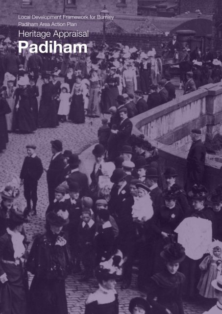
‘<strong>Heritage</strong> is all around us. We live our lives, whether consciously or not,against a rich backdrop formed by historic buildings, landscapes and otherphysical survivals of our past. But the historic environment is more than justa matter of material remains. It is central to how we see ourselves and to ouridentity as individuals, communities and as a nation. It is a physical record ofwhat our country is, how it came to be, its successes and failures. It is acollective memory containing an infinity of stories. England’s history is agradual accumulation of movement and arrivals, new stories attachingthemselves to old. Urban and rural landscapes reflect this layering ofexperience and develop their own distinct characteristics. Building materialsand styles can define and bind regions, localities and communities just aspotently as ethnic background, dialect or sporting loyalties. Historiclandscapes or iconic buildings can become a focus of community identityand pride and proclaim that identity and pride to the wider world. At a morelocal level a historic church or park can help define a neighbourhood andcreate a sense of local cohesion. Once lost, these defining features cannotbe replaced.’<strong>The</strong> Government’s statement: <strong>The</strong> Historic Environment: A Force for OurFuture (DCMS/DTLR 2001)Acknowledgment<strong>Burnley</strong> <strong>Borough</strong> <strong>Council</strong> would like to acknowledge the historical adviceand assistance given by Margaret Jones, Molly Haines, Mike Rothwell andDuncan Armstrong in the production of the <strong>Padiham</strong> <strong>Heritage</strong> <strong>Appraisal</strong>.If you would like this information translated please contact the Translation Servicesat the Town Hall, Manchester Road, <strong>Burnley</strong>, BB11 1JA Tel. No. 01282 832656.Available in large print on requestFront cover illustration: Lancashire Library photographProcession across <strong>Padiham</strong> Bridge before its widening in 1904.
1.0 Introduction1.1 Housing Market Renewal 2and Area Action Plans1.2 <strong>Heritage</strong> <strong>Appraisal</strong>s 22.0 Development of <strong>Padiham</strong>2.1 Physical Context and Location 42.2 Geology and Topography 42.3 Townscape 42.4 Historic Development 53.0 Character Area 13.1 Introduction 103.2 Housing Development 103.3 Industrial Buildings 153.4 Commercial Buildings and Shops 163.5 Public Houses and Inns 193.6 Clubs and Community Buildings 243.7 Churches 253.8 Schools 273.9 Public Buildings 293.10 Landmarks, Views, Green Spaces 30and Trees4.0 Character Area 24.1 Introduction 324.2 Area Development 324.3 Housing 324.4 Industry 364.5 Landmarks, Views, Green Spaces 37and Trees5.0 Character Area 35.1 Introduction 405.2 Area Development 405.3 Industry 405.4 Housing 465.5 Commercial Buildings 495.6 Schools 505.7 Churches 515.8 Landmarks, Views, Green Spaces 51and Trees6.0 Character Area 46.1 Introduction 526.2 Movement and Key Routes 536.3 Housing 566.4 Shops and Public Houses 646.5 Churches and Schools 676.6 Landmarks, Views, 68Green Spaces and Trees7.0 Character Area 57.1 Introduction 707.2 Area Development 707.3 Pre 1919 Housing 707.4 Late 20th Century Housing 747.5 Industrial Buildings 747.6 Commercial Buildings and Shops 787.7 Churches 817.8 Schools 817.9 Landmarks, Views and Green Spaces 828.0 Character Area 68.1 Introduction 848.2 Movement and Key Routes 848.3 Industry 888.4 Residential Area: Housing, 89Shops and Public House8.5 Public Buildings 938.6 Landmarks, Views and Green Spaces 959.0 Character Area 79.1 Introduction 969.2 Movement and Key Routes 969.3 Former Municipal Buildings 969.4 Industrial Buildings 979.5 Landmarks, Views and Green Spaces 9810.0 <strong>Heritage</strong> <strong>Appraisal</strong>10.1 <strong>Heritage</strong> and Future Regeneration 100Appendix A – Protected FeaturesListed Buildings 102Conservation Area 102Locally Listed Buildings 102Tree Preservation Orders 103Definitive Footpaths 103Appendix B – ReferencesPublished works 104List of published references 104Census 105Building Control Records 106Cartographic Evidence 106List of maps 106Photographs 106Websites 106Appendix C – Glossary of Terms 107PlansPlan AArea Action Plan Boundary,Character Areas & Protected FeaturesPlan B Extent of Urban Development 1844Plan C Ordnance Survey Map 1890Plan D Ordnance Survey Map 1910Plan E Ordnance Survey Map 1930Plan F<strong>Heritage</strong> <strong>Appraisal</strong>Produced by <strong>Burnley</strong> <strong>Borough</strong> <strong>Council</strong>Planning Services[t] 01282 425011 [x] 2541 / 2544www.burnley.gov.uk/planning ldf@burnley.gov.ukMarch 2007 Design by ‘<strong>The</strong> Graphics Unit’ [t] 01282 425011 [x] 2652
oneintroduction1.1 Housing Market Renewal1.1.1 Housing Market Renewal is the Government’s new approach to tackling low housingdemand and abandonment in the North of England and the Midlands. Nine sub-regional MarketRestructuring Pathfinder Projects have been created to bring about market renewal and tackleassociated high levels of crime and social exclusion. <strong>The</strong> East Lancashire Pathfinder includesparts of Blackburn, Hyndburn, <strong>Burnley</strong>, Pendle and Rossendale.1.1.2 Within <strong>Burnley</strong> <strong>Borough</strong> <strong>Council</strong>’s Pathfinder intervention area, Area Action Plans(AAPs) are being prepared to guide the regeneration of areas which are considered to besuffering from the worst deprivation and housing market failure.1.1.3 It is important that this regeneration is informed by an understanding of the past. This<strong>Heritage</strong> <strong>Appraisal</strong> has been undertaken in order to ensure that <strong>Padiham</strong>’s heritage is takeninto account in future housing market renewal and regeneration programmes.1.2 <strong>Heritage</strong> <strong>Appraisal</strong>s1.2.1 <strong>The</strong> Importance of <strong>Heritage</strong><strong>Heritage</strong> encompasses not just buildings and streets but also gardens, parks, monuments,industrial complexes, waterways and roads, archaeological sites and open landscapes. It isestimated that only 5% of this resource is protected by statutory legislation. Our heritage alsoincludes languages, stories, traditions and foods. An awareness of heritage gives people andplaces an identity and significance. It gives localities their distinctive character and marks theirindividuality as neighbourhoods and as part of the wider town.1.2.2 <strong>The</strong> Purpose of <strong>Heritage</strong> <strong>Appraisal</strong>sElements of the borough’s historic environment are recognized as nationally or locallyimportant and are protected by law through statutory designation such as Listed Buildingsand Conservation Areas. However, the particular local historic character of a place is notalways marked by any of these formal designations, even though it is appreciated and wellknown to local people. <strong>Heritage</strong> <strong>Appraisal</strong>s are a method of recognising this special quality andare now becoming an established approach in Conservation Planning.1.2.3 <strong>Heritage</strong> <strong>Appraisal</strong>s are being undertaken as part of the Area Action Plan (AAP)process to ensure that regeneration proposals are informed by a sound understanding of theheritage importance of the AAP areas and proper regard to their historic character and localdistinctiveness. <strong>The</strong> appraisals will show how seemingly mundane, normal or everyday historicelements can contribute significantly to the overall quality and character of places or may beinteresting in their own right. Opportunities to retain or enhance the local character will beidentified through this process.1.2.4 <strong>Heritage</strong> <strong>Appraisal</strong>s offer an understanding as to how the historical evolution ofthe AAP areas has shaped their present day character and the distinctive qualities of theneighbourhoods. It is intended to use this understanding to guide regeneration proposals sothat they acknowledge and build on that character. <strong>Heritage</strong> <strong>Appraisal</strong>s recognise that changeis desirable, but urge that it should respect, rather than detract from, the existing environment.2 heritage appraisal
Photograph of <strong>Burnley</strong> Road, Wonder Mill and Green Lane millchimney can be seen in the background.(Lancashire Library photograph)heritage appraisal 9
threecharacter area 13.1. Introduction3.1.1 This character area encompasses <strong>Padiham</strong>’s historic core, which is located above atree-covered slope on a bend of the River Calder. Church Street, the main road through thetown’s centre, twists and turns down the hill into <strong>Burnley</strong> Road. <strong>The</strong> adjoining roads, which aremore organic in their form, provide interesting, irregular street patterns around which buildingsof locally quarried sandstone and welsh blue slate have been constructed.3.1.2 Included within Area 1 is <strong>Padiham</strong>’s central core which retains much of its preindustrialmarket town character and which is designated as the <strong>Padiham</strong> Conservation Area.As such it is subject to extra planning controls to enhance and retain the area’s character andspecial interest (Plan A).3.2. Housing Development3.2.1 By the early 17th century the <strong>Padiham</strong> township appears tohave been a settlement based around Area 1, extending southwardsfrom St. Leonard’s Church towards the river. This early developmentof the town was more fluid and contrasts with the ‘gridiron’ streetpattern to the east and south of Area 1, which evolved during the19th century. This fluid development probably followed the alignmentof medieval highways and the irregular curving streets whichentered an open market area, thought to have been located to thesouth of St. Leonard’s Church (Plans B and F).View of Church Street c.1900 (Lancashire Libraryphotograph)Note the landmark tower of St Leonard’s Church,which dominates much of the skyline in <strong>Padiham</strong>3.2.2 <strong>The</strong> buildings within Area 1 originally would have openedonto narrow pavements and the road carriageway. <strong>The</strong> paving andchannelling of streets in <strong>Padiham</strong> did not take place until the LocalBoard took over in 1873. Although there are still a number ofstreets with stone setts, today many have either been replaced with,or covered by, tarmac. <strong>The</strong> retention or reinstatement of stone settshas provided one of the strong environmental characteristics in Area1 (Plan F).3.2.3 Although <strong>Padiham</strong>’s population increased during the late18th and early 19th centuries the growth of the built town wasstill mainly confined within Area 1, extending southwards by thistime along <strong>Burnley</strong> Road, west along Church Street, north upMoor Lane and east into Ightenhill Street and Guy Street (PlanB). This containment was perhaps a result of the inability of majorlandowners to lease sites for the development of mills and housing.<strong>The</strong> result was very cramped developments and high densities northof Church Street (Mitchell et al, 2004, p.23).3.2.4 Much of the original pre-industrial terraced housing stillremains within Area 1. <strong>The</strong>se buildings display varied styles,reflected in the subtle architectural differences evident betweenblocks in door and window surrounds, the arrangement of windowopenings (single/ double) and pitches of roofs. <strong>The</strong> consistent use ofsandstone and slate as the dominant building material, together withthe varying forms and layouts of the terraced houses and streets,has created the distinctive townscape quality of this character area.However, over time there has been some erosion of the specialcharacter and appearance of these streets as original windows anddoors have been replaced and chimney pots removed.10 heritage appraisal
3.2.5 Without doubt Gawthorpe Street, reputedlylaid out to the designs of Sir Charles Barry, is themost important group of statutorily listed buildingsin <strong>Padiham</strong> (Plan A). <strong>The</strong> houses, built between1841 and 1851, are rendered rubble with ashlardressings and contain two storeys with one bayeach. In the 1990s a <strong>Heritage</strong> Lottery Fund grant wasused to restore the historic street surfaces. Whilst 11Gawthorpe Street has been restored and illustratesthe original design of the whole street, a number ofproperties have experienced unsympathetic changesto architectural features, for example the replacementof original timber framed, lozenged windows withUPVC casement windows. In addition some ofthe properties appear to be in need of sensitiveimprovements to external finishes (Plan F).<strong>The</strong> reinstated cobbles and barley twist lampat Gawthorpe Street help to retain the originalcharacter of the street.3.2.6 <strong>The</strong> properties fronting main roads such asChurch Street, Whalley Road and Blackburn Roadappear to be of a higher architectural quality and arelarger than those built on the surrounding streets.<strong>The</strong>se buildings are later developments within Area 1having been constructed after 1850 (Plans B and C).3.2.7 Locally listed Osborne Terrace is ratherlarge and grand in appearance, being in an elevatedposition and accessed by a stone flight of steps withdetailed iron railings (Plan A). <strong>The</strong> datestone on thegable of 48 Osborne Terrace reads ‘Erected AD 1863.’William Waddington, the <strong>Padiham</strong> architect who wasresponsible for St. Leonard’s Church, designed thesehouses. Waddington lived with his family at 48 in the1860s. John Weir, Medical Officer of Health occupied48 in 1887 (Barrett, 1887, p.244).Osborne Terrace, Church Street3.2.8 Nos. 71-95 Church Street form a terraced block formerly known as Windsor Terrace.<strong>The</strong> block is locally listed and was constructed during the c.1870s (Plan A). <strong>The</strong> propertieshave bay windows at the ground and first floor levels with crenellated mouldings above thefirst floor bays. Barrett lists the following people as residing at Windsor Terrace in 1887 (Barrett,1887, pp.223-245):71 Henry Dean (Henry Dean & Sons, Levant Mill)73 Richard Cronshaw75 Miss Emily Helm (School)77 Rev. Isaac Pollitt (Wesleyan)83 William Wilcox (Professor of Music)85 Miss Mary Alice Shuttleworth87 Richard Smith (Cabinet Maker)89 Mark Martin (Commission Agent)91 Miss Elizabeth Howarth93 Richard Denbeigh (Steward of Liberal Club)95 Amos Sagar (Salesman)Windsor Terrace, Church Streetheritage appraisal 11
3.2.9 On Whalley Road Epworth House, named after the birthplace of John Wesley, wasbuilt c.1890 and was bought by the Methodists as the Circuit Minister’s residence. On theopposite side of the road, Crossways, a locally listed building, constructed in 1899, was formany years a doctor’s residence (BCR 54365 & Plan A).3.2.10 Other properties to the south of Church Street and situated along the ‘Banks’ includethose on Queen Street, King Street, Albert Street and Shuttleworth Street, all of which arelocally listed (Plan A). <strong>The</strong>se terraced houses appear to be of a better quality, having beenconstructed from stone with greater attention to detail, perhaps as a result of the Health andHousing Acts, which were passed during the 1850s. Completed by c.1860, these terraceswere probably designed to take advantage of the elevated panoramic views across the town.<strong>The</strong> properties along the ‘Banks’ feature gabled bays on a split-level with three storeys andlarge bays to one side and, to the other, two storeys and arched moulding detailing around thewindows and doors. Bank House, a locally listed building on Queen Street, now a residentialcare home, was the residence of Charles Waddington of Orchard and Bridge End Mills. <strong>The</strong>house was probably designed by his brother William Waddington, architect of Osborne Terracewith which it shares similarities (Plans A & B).3.2.11 It appears from old census returns that the occupants of the odd numbered side ofAlbert Street were perhaps those employed in better-paid professions capable of affordingbetter quality housing. For example 1 and 1a Albert Street were originally one large propertyoccupied by a master stonemason (1861 Census & Plan C). Other occupants in 1861 included,amongst others, a retired manufacturer (No 9), a blacksmith (No 19), a master joiner employing29 men and boys and a master ironmonger employing 35 men and boys. However, numbers21-25 Albert Street were originally back-to-back houses with one frontage on to Albert Street,and a second frontage onto Starkie Street (Plan C). Bond et al (1998) also believe thatnumbers 21-25 incorporated an additional dwelling in the basement.3.2.12 In contrast to the large houses which overlooked the ‘Banks’ were a number of backto-backhouses on the even numbered side of Albert Street. Over time these were probablyincorporated into a single row of dwellings. <strong>The</strong> OS 1890 plan (Plan C) illustrates both AlbertStreet and Back Albert Street, as do census records from 1861 and 1871. <strong>The</strong> properties onBack Albert Street housed such people as a retired foreman, a whitewasher and powerloomoverlooker (Plan C & 1871 Census).3.2.13 <strong>The</strong> most significant settlement of handloom weavers’ cottages to have survived in<strong>Padiham</strong> is located to the west of town, around the old road to Blackburn. <strong>The</strong>se propertiesmay have developed initially in a relatively rural location, but were incorporated into a sprawl of19th century industrial workers’ houses by about 1830 (Mitchell et al, 2004, p.32).Albert Street. Virgil Anderton a local architect andsurveyor who designed <strong>Padiham</strong>’s Nazareth UnitarianChurch appears to have practised his business from28 Albert Street, sharing the building with his fatherCornelius (a builder and contractor) in 1887. VirgilAnderton is also a former resident of 4 Starkie Street(Plan C & Barrett, 1887,p. 224).This picture illustrates the prominent gabled bays,which break up the roofline of the terraced blocksand also the arched mouldings surrounding the doorand window cases on properties in Albert Street. <strong>The</strong>backstreets in this area are largely cobbled and thereare a number of barley twist style lampposts, a featurethat adds to the distinctive character of this area(Plan F).90-70 West Street12 heritage appraisal
3.2.14 West Street/East Street was once the main road fromBlackburn into <strong>Padiham</strong> before the turnpike road (Church Street)was built in the mid 18th century (Plan B). <strong>The</strong> stretch of roadbetween Arbory Drive and the Hare and Hounds was also known asOld Chapel Street after the first Methodist chapel, which was builthere in 1758 (now 70 and 72) (Haines & Jones, 2006, pers comm).<strong>The</strong> section of road between the Hare and Hounds and Moor Lanewas known as Back Lane, probably after the turnpike along ChurchStreet was built.<strong>The</strong> properties on Chapel Walk are stone built houses,with a stone flag roof. Situated on a sloping cobbledstreet, they retain many of their original architecturalfeatures.3.2.15 70-90 West Street are built in the vernacular traditionof two up two down terraced properties constructed from localsandstone. 70-72 still exhibit the original stone flag roof. <strong>The</strong> otherproperties in this block may have had their original stone flag roofsreplaced over time with slate ones. Evidence of further alterationappears in the replacement windows and doors and the additionof porches. It is likely that 74-76 formed an earlier building withinthe existing block, its quoined edges suggesting that it was once adetached property.3.2.16 Other surviving examples of early 19th century workingclass housing include 34-50 West Street and locally listed WellStreet, Chapel Walk and Holland Street (Plan A). <strong>The</strong>se properties,which all pre-date the OS 1844 map, are a good example of thetypes of housing which existed in <strong>Padiham</strong> prior to the industrialrevolution (Plan B). <strong>The</strong>y also illustrate the more fluid developmentprior to the Health Acts of the 1850s, which introduced the ‘gridiron’street formation.3.2.17 It is likely that many of the town’s poorest people werehoused in the cramped developments of back-to-back and cellardwellings which were once located on Alma Street, St Giles Street(formerly known as Club Street), Double Row and Moor Laneamongst others during the 19th century (Plan B & C). For examplein 1851 it was thought that 77 households ‘or 349 people wereliving (within 66 dwellings) in St Giles Street, a figure equal to manyLancashire villages of the same date’ (Glenn & WEA, 1986, pp.24 &25). <strong>Padiham</strong> Urban District <strong>Council</strong> (PUDC) began to clear muchof this back-to-back housing in the 1920s and 1930s, consideringthem to be unfit for human habitation. This, together with increasesin the number of cases of overcrowding, brought about the decisionto build new housing estates in other areas of the town (See 4.3.1).3.2.18 As a direct result of the clearance programmes which tookplace during the inter war period of the 20th century, there are nolonger any back to back dwellings remaining in Character Area1. For example, the East Street neighbourhood was designatedas a clearance area in May 1933 and St. Giles Street by c.1937.Those people who were displaced were re-housed in other partsof the town in new social housing at Abingdon Road and BerkeleyCrescent on the Garden Street estate amongst others (Haines &Jones, 1994, pp.35-38).<strong>The</strong>se stone built houses on Holland Street (a numberof which are now rendered) have two windows at firstfloor level.Well Street, formerly known as John’s Row wasconstructed from coursed sandstone rubble, whichwas perhaps a cheaper building option than usinglarger cut stones. Building Control Record (BCR)54679 suggests that back yards were proposed forthe properties in November 1874.34-50 West Street is also constructed from coursedsandstone rubble and was known as Pump Row in1874 (BCR 54679). Plans to rebuild the row weresubmitted by Thomas Jepson Esq. c.1912. <strong>The</strong>instructions on the BCR suggest demolishing andrebuilding both the front and rear elevations andreusing the front windows in the back elevation onceit was rebuilt (BCR 54870).heritage appraisal 13
3.2.19 Much of the cleared land in Area 1 was redeveloped during two main phases in the1960s and 1980s. Social housing developments of bungalows along St Giles Street, Hall HillStreet and Alma Street were constructed during the 1960s from red brick and are partiallyrendered. <strong>The</strong> buildings also contrast sharply with their neighbouring two storey stone builtterraces and are set back from the traditional building line to provide narrow grassed strips infront of the buildings and small front and rear gardens (Plan F).3.2.20 <strong>The</strong> second phase of development to take place within the Conservation Area duringthe 20th century was Chapel Walk Mews developed during the 1980s by the Old Chapel HouseDevelopment Company to provide a sheltered housing complex. This development replaced aformer Wesleyan school and chapel that had existed since the 1840s (see 3.8.7).3.2.21 Although little remains to suggest that Area 1 once contained many back to backhouses, there is perhaps still evidence that cellar dwellings once existed in North Street. SpringGardens Terrace, constructed in 1841, is locally listed (Plan A). Today the North Street cellardwellings are no longer in use and have been incorporated within Spring Gardens Terrace.Rendering and modern garage doors have disguised and replaced the original cellar dwellingdoors and windows in the North Street elevation.Alma Street. <strong>The</strong>se bungalows were built duringthe c.1960s on the site of back-to-back dwellings.<strong>The</strong>ir building materials and design contrast with thestone and height of the opposite terraced block onAlma Street (Plan F). Also note the small rectangulargrassed space around which the properties have beenconstructedChapel Walk Mews. Although this sheltered housingcomplex does not lie entirely on the traditional buildingline, it is more sympathetic in terms of its height,construction materials and arrangement of windows onthe North Street elevation, than the 1960s bungalowsbuilt opposite on Hall Hill Street.North Street elevation of Spring Garden Terrace14 heritage appraisal
This photograph illustrates the close proximity of Claybank Milland its chimney to the housing on East Street prior to clearance(Lancashire Library’s photograph).3.3. Industrial Buildings3.3.1 <strong>The</strong> first known cotton factory in <strong>Padiham</strong> was ClayBank Mill built c.1790. By today’s standards it was very small,containing nothing more than a loom shop with handlooms. GeorgeHargreaves introduced powerloom weaving there in 1848, beforehe moved to Industry Mill in the 1850s (Armstrong, 1985, p. 18 &Rothwell, 2005, pp.6 & 9). <strong>The</strong> mill was formerly sited on ClaybankFold and was occupied by a number of different companiesincluding a printing firm before it was finally demolished in c.1996.3.3.2 <strong>The</strong> second factory in <strong>Padiham</strong>, and now its oldestsurviving industrial mill, is Helm’s Mill built by Henry Helm in1807. <strong>The</strong> building is statutorily listed Grade II (Plan A) for itsarchitectural and historic interest. <strong>The</strong> mill, once known as NewMill, appears to have been incorporated within Guy Yate Mill,which later became part of Victoria Mill. Today this old mill buildingis ‘one of a few known surviving early steam-powered mills inNortheast Lancashire (Rothwell, 2005, p.6)’. A three-storey blockformerly located on Ightenhill Street may have been used as a sizehouse. Attached to this was a further building, which had beenrendered. A base of a chimney was visible from the northwestgable end. It is thought that this section was part of Helm’s 1795buildings (Rothwell, 2005, p.6 and Mitchell et al, 2004, p.22). <strong>The</strong>sebuildings have now been cleared to make way for a new housingdevelopment.Helm Mill engine house and main block lie adjacent toa narrow sloping cobbled alleyway known as FactoryLane. Fred Pollard Textiles Ltd was the last occupantof this building.Former size house, Ightenhill Streetheritage appraisal 15
Victoria Mill, Ightenhill Street.3.3.3 In 1855 the Mannex Commercial Directory recorded Henryand James Helm as cotton spinners, manufacturers and sizers atSmithygate Mill, Victoria Mill and Old Mill. Henry and James Helmhad built Victoria Mill as a mule-spinning factory in 1852-3. Itoriginally contained 7,400 mule spindles and 126 looms driven by a25-horse power beam engine. <strong>The</strong> mill closed in 1863 and remainedso until 1873 when the <strong>Padiham</strong> Spinning Company bought thebuilding and shortly after extended the western block to double thesize of the original building. Evidence of this is found in the quoinededge of the older building in the Ightenhill Street elevation. By the1880s the mill contained 30,000 mule spindles and employed aworkforce of around 75. <strong>The</strong> mill, known locally as the Co-op, ranuntil about 1927 (Rothwell, 2005, p.11). After that time, VictoriaMill became known as Guy Works and produced cast iron schoolfurniture (Bond et al, 1998). By 1930, Eddleston and Companypurchased the mill and transferred their business to the site along with Blezard and Sons,who manufactured greenhouse boilers. Eddleston sold the firm by 1989 and moved all theirbusiness into Industry Mill. James Blezard and Sons remained in the mill and operated as aplumber’s merchants before closure in the early 1990s (Rothwell, 2005, p.11). In 1995 planningpermission was granted for the conversion of the mill into 25 apartments and cottages. Todaythis mill is a good example of a sensitive conversion (Plan F).3.3.4 To the rear of 10-18 Guy Street is the site of a formersmithy thought to have been in existence since the 17th century(Plan B). Part of the site is now used as a vehicle repair garage,the rest has been converted into cottages. <strong>The</strong> Guy Street frontageis not the original smithy wall, which is set well back inside andcontains a set of mullioned windows dating from the 16th/17thcentury (Bond et al, 1998). Number 10 Guy Street has beenconverted from two cottages into one. Evidence of a former doorcase exists around the ground floor window to the far left and withinthe arrangements of the windows on the first floor. <strong>The</strong> size of thestone lintel above the door case should also be noted.10 Guy Street3.4. Commercial Buildings And Shops3.4.1 <strong>The</strong> island block or wedge shaped area to the south east of St. Leonard’s Churchbounded by Church Street, Mill Street and <strong>Burnley</strong> Road is thought to have been the historiccore of the town (Plan B). <strong>The</strong> layout of the later town suggests that an open triangular area tothe south east of the church formed the early market place (Mitchell et al, 2004, p.1). Over timethe area between <strong>Burnley</strong> Road and Mill Street evolved into an area of permanently situatedcommercial premises. In the late 18th and early 19thcentury the market in <strong>Padiham</strong> appears to havebeen situated in the street in front of St. Leonard’sChurch. <strong>The</strong> market was poorly and unsuitablylocated and by the mid 19th century had ceased tofunction (Mitchell et al, 2004, p.26). It was revivedin the 1870s when a rag market was held in thearea around Church Street and the top of Mill Streeton Friday nights (Haines and Jones, 2006, pers.comm.).This artist’s drawing, c.1850 illustrates the early market area located infront of St. Leonard’s Church sometime after the late 18th century. <strong>The</strong>drawing depicts the old church with its 16th century tower and chancel and18th century nave. <strong>The</strong> Old Black Bull (Cellar Restaurant) is to the left.<strong>The</strong> chimney to the right may be that of Claybank Mill (Lancashire Libraryimage).16 heritage appraisal
3.4.2 <strong>The</strong> <strong>Padiham</strong> Urban District <strong>Council</strong> (PUDC) was responsible for the administration of<strong>Padiham</strong> Market. In 1894 a new open market area, which held a weekly market, was establishedin an area north of Sowerby Street/rear of the old Liberal Club in <strong>Burnley</strong> Road, not far from thesite of the present day market (Haines & Jones, 1994, p.24). In 1913, a market hall was included inthe plans for the new municipal buildings, which were proposed for the site of the old gas works onStation Road. However, when the gas works were demolished, the market was moved to the otherside of Station Road. It was a wooden building constructed partially on the site of the present firestation and was opened in January 1914. It originally comprised 42 stalls, but expanded over the next20 years to 80 stalls. Wartime shortages and rationing may have been responsible for the market’sdecline and eventual closure in 1956 (Haines & Jones, 1994, p.24). <strong>The</strong> present day open marketreopened again in 1984 and occupies the site of the former coal staithe to the rear of <strong>Burnley</strong> Road.Large wooden gateposts (Plan A) are the last remaining evidence of the coal staithe where coal from<strong>Padiham</strong> pits was brought by ginny wagons. Today the market has a number of brightly colouredpermanent stalls which occupy the site (Plan B & C).3.4.3 Throughout the early to mid 19th century Church Street remained the main shoppingarea, but towards the end of the century the focus for shopping shifted eastwards to <strong>Burnley</strong>Road (Mitchell et al, 2004, p.26). From 1881 the terminus for trams from <strong>Burnley</strong> was situatedat the bottom of the hill in <strong>Burnley</strong> Road, which may also have contributed to the shift of thecommercial centre of the town. Although most commercial premises would have been built assuch, a number of dwellings were converted into shops and businesses over time. <strong>The</strong>re arestill a number of shops situated along Church Street today, many retaining features from theiroriginal shop frontages, whilst others have been unsympathetically altered (Plan F).3.4.4 Block 3-13 Church Street was built in several stages during the 19th century and liesopposite St. Leonard’s Church. Numbers 3-11 are locally listedand appear to have been built prior to 1850 (Plans A & B & C).Large quoined detailing on the north elevation of 3 Church Streetsuggests that this property was once a separate building. Charlesand Joseph Wilkinson were known to have operated a butcher’sshop from this property by at least 1872 (Worrell, 1872, p.190).Evidence of its former use exists in the line of small iron bracketsleft on Calder Street, which were used to support a meat flight fromthe slaughterhouse to the shop (Bond et al, 1998). All properties onthe block are currently in use with shops and a restaurant at groundfloor and living accommodation above.3.4.5 One of the principal 19th century commercial buildings inArea 1 was the Oddfellows Hall. This building was constructed in1845 and has three storeys of sandstone ashlar with a slate roofand copings. <strong>The</strong> Moriah Lodge of the Order of Oddfellows onceused the first floor whilst shops, the Oddfellows Arms, flats and evena private club (1980s) have occupied others over time. <strong>The</strong> Hall is astatutorily listed Grade II building (Plan A).3.4.6 In 1878 Messrs J. and P. Webster constructed a block ofpurpose built shops with accommodation above on the junction of<strong>Burnley</strong> Road and Moor Lane (1-13 <strong>Burnley</strong> Road) (Plan A). This wasbuilt directly behind the butcher’s shop (old No 1 <strong>Burnley</strong> Road), whichwas once run by John Paul Webster until he moved his business into thenew block. <strong>The</strong> same family continued to run this business until CharlieWebster retired in the late 20th century. <strong>The</strong> terrace has attractive anddetailed mouldings around the triple arched windows to the first floors.A number of the shops in this block now appear to be vacant and othershave had unsympathetic changes made to the shop frontages. Someproperties have retained some original features. <strong>The</strong> block would benefitfrom the reinstatement of traditional architectural features to the <strong>Burnley</strong>Road frontage (Plan F).3-13 Church Street2 Bank Streeet and 4-6 North Street, knownas the Oddfellows Hall, is currently undergoingrefurbishment. On the North Street elevation of thebuilding a plaque reads ERECTED BY THE I.O. OFO.F.M.L. A.D. 1845.heritage appraisal 17
This photograph shows John Paul Webster’s butcher’sshop in <strong>Burnley</strong> Road c.1880 (Lancashire Libraryphotograph).1-13 <strong>Burnley</strong> Road 20063.4.7 Messrs J. and P. Webster also constructed 2-8 GuyStreet and 6-12 Moor Lane in 1885 as a corner block of 8 housesand shops. <strong>The</strong> block was built on land at the rear of Webster’sBuildings, which for a few years had been used as a site for themarket before it moved to a new site at the back of the Liberal Club(Haines & Jones, 2006, pers. comm). A datestone on 12 Moor Lanereads ‘J.W. Market Square AD 1885’ (J.W. being John Webster).Although only three of the properties remain in commercial usetoday evidence of the original shop frontages still remains. <strong>The</strong>retention of such features adds to the special character of the areaand suggests the types of activity that would have once taken placeat this junction (Plan A). <strong>The</strong> properties at 2-8 Guy Street havebeen sensitively converted to residential use and original shop frontfeatures including pilasters and decorative corbels have beenretained.3.4.8 A number of properties on the island block between MillStreet and <strong>Burnley</strong> Road pre-date the OS 1844 plan and todayillustrate the vernacular style of buildings prior to the industrialrevolution. A number have retained their original features includingstone flag roofs (Plan B).3.4.9 In 1868 there were two banks in <strong>Padiham</strong>, the CravenBank on <strong>Burnley</strong> Road and the Post Office Savings Bank onChurch Street (Mannex, 1868, pp.820 & 821). <strong>The</strong> Craven Bankappears to have been rebuilt in 1893, having been formerly locatedwithin 4-8 <strong>Burnley</strong> Road (Hanson Buildings BCR 54230). <strong>The</strong> newCraven Bank of 1893 was designed by William Dent of Nelson andconstructed from sandstone ashlar and polished pink granite with agreen slate roof. Later the Mercantile Bank of Lancashire occupiedthe building before it became Barclays Bank.3.4.10 In 1901 Manchester architects Mills and Murgatroyddesigned a branch bank with chambers above for ManchesterCounty Bank. A branch of the same bank had been formerly locatedat 69 <strong>Burnley</strong> Road in 1879 and then at 45 <strong>Burnley</strong> Road in 1887(Barrett, 1879, p.183 & Barrett, 1887, p.239). <strong>The</strong> new building wasboldly designed on a sloping corner site in the Free Jacobean style.It was constructed from sandstone ashlar with a slate roof andbears a datestone and shields of Manchester and Lancashire. <strong>The</strong>National Westminster Bank now occupies this building.2-8 Guy Street and 6-12 Moor LaneBuilding Control Record 54196 details the block of8 houses and shops built c. 1885 on the junctionof Guy St and Moor Lane. It is easy to see fromthis elevation that alterations to the exterior of thebuildings have been carried out sympathetically.3.4.11 Today, both these banks are statutorily listed Grade II andare prominent buildings on the hill with a row of locally listed two/three storey shops in between. This row and the adjacent block ofcommercial premises twists and turns up the hill providing a senseof enclosure and an essential element in the townscape character ofArea 1 (Plan A).18 heritage appraisal
Today the locally listed Hanson Buildings are a good example of sensitiverestoration and refurbishment of a Victorian property. This has been achievedin part through the repair and reinstatement of original shop front features andsash windows. A single commercial company now occupies the ground floorwhilst the upper two storeys have been converted into flats (Plan A).This photograph illustrates the poor condition of Hanson Buildings (4-8 <strong>Burnley</strong> Road) in 1987 prior to refurbishment. <strong>The</strong> Craven Bank isthought to have been located within 8 <strong>Burnley</strong> Road by at least 1868(Mannex, 1868, p. 821) (Lancashire Library photograph).This view is of the block of shops on the hill with boththe top and bottom banksInappropriate shop fronts have replaced many of the original ones onthe hill, <strong>Burnley</strong> Road. Although pilasters and corbels are still evidentchanges to the fascia boards, new windows and roller shutters arehaving a negative effect on the character and appearance of the area(Plan F).3.4.12 <strong>The</strong> commercial properties on the <strong>Burnley</strong> Road hill have undergone a number ofchanges over time, many having originally been built as shops with living accommodationabove. Although a number of properties have retained original architectural features such aspilasters and detailed corbels, the use of inappropriate, often oversized fascia boards, usedto either cover or replace these features, has detracted from the quality and character of theblock. <strong>The</strong>refore a scheme to reinstate lost architectural features should be supported (Plan F).3.5. Public Houses And Inns3.5.1 In 1830 the Beer Act abolished excise duty on beer and all that was required toestablish a beerhouse, or to sell beer was a two guinea licence from the local excise office.‘<strong>The</strong> result was large increases in the number of beerhouses, particularly in the poor areas oftowns, where people went to escape temporarily from the squalor of their surroundings’ (Glenn& WEA, 1986).3.5.2 <strong>Padiham</strong> was no exception with a large concentration of inns and beerhouses locatedwithin Area 1 and clustered around the original market place. <strong>The</strong> growth in the number ofdrinking establishments in <strong>Padiham</strong> has been documented in the commercial directories of the19th century. For example, prior to the Beer Act the Lancashire General Directory of 1818-1820 (p 123-4) detailed six inns in <strong>Padiham</strong>. <strong>The</strong>se were the (Old) Black Bull, Bay Horse,Swan, Weavers Arms, Masons Arms and Starkie Arms. By 1834 there were 10 taverns/publichouses and 10 retailers of beer serving a population of 3,529 (Pigot, 1834, p.507).3.5.3 However, the beerhouses were a source of complaint from churches and leading tradespersonsand by 1869 the control of licences was transferred to the local magistrates. ‘Many beerhouseswere closed after the licence transfer, not for those reasons, but because of their unsuitableaccommodation and inadequate sanitary arrangements’ (Glenn & WEA, 1986). By 1879 there were14 hotels/inns and 17 beerhouses listed, serving an estimated population of 6917 (Barrett, 1879,pp.170, 183 & 186). This equated to approximately one drinking establishment for every 223 people.heritage appraisal 19
3.5.4 Four of the oldest surviving public houses in <strong>Padiham</strong> arethe (Old) Black Bull (now known as the Cellar Restaurant), StarkieArms, (Hand and) Shuttle and the Hare and Hounds. All werein existence by 1828 and were recorded in Pigot’s CommercialDirectory of Cheshire, Derbyshire and Lancashire of the same year(pp.431-432).<strong>The</strong> Cellar Restaurant with its stone flag roof nestlesbetween the towering St. Leonard’s Church and arow of three storey shops with living accommodationabove.Hare and Hounds, West Street3.5.5 <strong>The</strong> Cellar Restaurant, (former Black Bull or the Old BlackBull) is thought to be the oldest surviving public house building in<strong>Padiham</strong>. Built during the 17th century, it was re-fronted during theearly to mid 19th century with gables added in the late 19th century.Its position and depth of foundations in relation to the build up of theroadway suggest a rebuilding on earlier foundations (Mitchell et al,2004, p.27). In the mid 19th century part of the Old Black Bull wasused as a butcher’s shop (Barrett, 1868, p.823). <strong>The</strong> building, whichis of rendered rubble with painted sandstone dressings and a roofconstructed of stone flags, is statutorily listed grade II (Plan A).<strong>The</strong> height and scale of the adjacent St. Leonard’s Church dominatethis building, which would have once been located within the marketarea.3.5.6 Dating back to at least 1828 are the locally listed Hare andHounds and the (Hand and) Shuttle (Plan A & Pigot, 1828, p.432).<strong>The</strong> Hare and Hounds Inn is set amongst a cluster of 18th centuryhandloom weavers’ cottages. Although the inn has been extendedand rebuilt over time, it still retains some of its original architecturalfeatures, including a stone flag roof and steps leading up to itsentrance. <strong>The</strong> Hare and Hounds Inn was under the stewardshipof Stephenson in 1828 (Pigot, 1828, 432). A small row of cottagesknown as Bloater Hall once occupied a space in front of the inn.<strong>The</strong>se have been cleared opening up a view of the inn from HollandStreet and West Street (Plans A & B). <strong>The</strong> Hand and Shuttle, whichis located down the hill on Eccleshill Street, was known as theShuttle in 1828 before becoming known as the Hand and Shuttle(Pigot, 1828 & 1834). <strong>The</strong> ‘hand and shuttle’ is depicted within theShuttleworth coat of arms. <strong>The</strong> building, which was simply designed,is rendered and painted cream.3.5.7 <strong>The</strong> Starkie Arms was probably built at the same time as the turnpike road fromBlackburn (Plan B). Named after the Starkie family of Huntroyde, it was in existence by c.1818(Lancashire General Directory, 1818-1820). Today the property lies at the prominent junctionof Church St, Mill Street, Moor Lane and <strong>Burnley</strong> Road. This junction was in the centre of<strong>Padiham</strong> until the mid 19th century when Church Street and Mill Street would have been filledwith market stalls. Today the public house is locally listed and evidence suggests that it mightbe timber framed (Plan A). <strong>The</strong> garages to the rear were built as coaching stables and it isthought that the pub car park is the site of the 17th century courthouse. A plaque on number12 Mill Street reads “It was within this courthouse in 1633 that presiding Justices of the PeaceRichard Shuttleworth and John Starkie heard evidence from E. Robinson of reputed witchcraft”.3.5.8 Also located at this junction adding to the cluster of public houses, are the King’s ArmsHotel and the New Black Bull. <strong>The</strong> King’s Arms, situated at 2 Mill Street, was first recorded inPigot’s directory of 1828 and was probably named after King George IV. <strong>The</strong> New Black Bulllocated next door at 4 Mill Street was in existence from at least 1834 (Pigot, 1834) havingpossibly been known earlier as the Clock Face. Both pubs remain in their original use today.20 heritage appraisal
3.5.9 <strong>The</strong> Dun Horse and the British Legion were also located onMill Street during the 19th century. <strong>The</strong> Dun Horse is likely to havebeen the Bay Horse, which was recorded in Pigot’s directory of1818-20. This building was once situated at number 18 Mill Street,but was cleared prior to 1919. Currently situated on this site is theformer Globe Cinema building, which is locally listed and occupiedby Conway Contractors (Plan A). Formerly located at 13 Mill Streetwas the British Legion (c.1827), a club for ex-servicemen. It laterbecame known as the Weavers’ Arms in c.1879 and the Cricketand Footballers’ Arms between c.1887-1890 (Barrett, 1890, 1887 &1879).3.5.10 <strong>The</strong> Free Gardeners’ Arms, located at the corner of BankStreet and St. Giles Street, was one of two beerhouses locatedon St. Giles Street during the 1800s. ‘<strong>The</strong> Free Gardeners Innwas named after the United Order of Free Gardeners. This was anational friendly society, which came into existence during the late18th century... <strong>The</strong> branch of Free Gardeners in <strong>Padiham</strong> formed in1827 and was known as Laurel Lodge’ (Glenn & WEA, 1986, p.71).<strong>The</strong> facade of the modern building dates from a slightly later periodthan the other buildings in the street but the site was used as abeerhouse in 1861. In 1933 the Free Gardeners’ was purchased byMassey’s Brewery of <strong>Burnley</strong> (WEA & Glenn, 1986, p.71).3.5.11 <strong>The</strong> second beerhouse known to have operated on St.Giles Street was the (Rifle) Volunteers. It possibly functioned asearly as 1834 (Pigot, 1834). ‘<strong>The</strong> inn took its name from the RifleVolunteer Corps, which formed on a countrywide basis from 1859after the Crimean War… <strong>The</strong> <strong>Padiham</strong> Corps was originally asubdivision of the <strong>Burnley</strong> Corps formed in 1860, and was knownas the 84th Lancashire Volunteers. <strong>The</strong>ir band was a familiar sightin <strong>Padiham</strong> in the 1870s and marched at the head of processions.’(Glenn & WEA, 1986, p.73). <strong>The</strong> Volunteers Inn was demolished in1956 as part of the PUDC clearance programme.3.5.12 <strong>The</strong> Alma Inn is a typical Victorian street corner pub,located at the junction of West Street and Alma Street. It hasassociations with the Crimean War and commemorates a battlefought at the River Alma in September 1854. <strong>The</strong> Alma Inn is notrecorded in the commercial directories until 1879 (Mannex, 1868,p.823 & Barrett, 1879, p.239). <strong>The</strong> entrances to the inn are locatedon both West Street and Alma Street today, but it is likely that theoriginal entrance, which has since been converted into a window,was found on the junction of the two roads.This interesting cluster of locally listed public housesis situated at the prominent junction of Mill Street,Moor Lane, <strong>Burnley</strong> Road and Church Street. Oncelocated within the original market place, the pubs laybeside the old toll road, which would have run alongChurch Street and into <strong>Burnley</strong> Road (Plans A & B).<strong>The</strong> Alma Inn situated on the junction of West Streetand Alma StreetFree Gardeners’ Arms, St Giles StreetThis Lancashire Library photograph illustrates theAlma Inn c.1920. Perhaps the woman in the pictureis the wife of Thomas Dickinson who ran the pub in1923 (Barrett, 1923, p.761).heritage appraisal 21
This Lancashire Library photograph depicts a St. Leonard’s Sunday schoolprocession outside the Commercial Inn on Church Street. <strong>The</strong> name abovethe inn door reads Mary Hudson. She was licensee of the inn c.1914 (Barrett,1914, p.746). Note the children looking out of the inn’s windows on the firstfloor and the grocer’s shop, which was once located next door at 54 ChurchStreet.Former Commercial Inn, Church Street<strong>The</strong> Britannia Inn has been rendered and painted.White Horse, <strong>Burnley</strong> Road22 heritage appraisal3.5.13 Close to the Alma Inn on Church Street are the locallylisted (former) Commercial Inn and Whalley Range (Plan A).<strong>The</strong> Commercial Inn, once a private house, is set within a blockof pre 1844 stone built terraced houses, a number of which arenow rendered. Its use as a beerhouse dates back to c.1879. <strong>The</strong>Whalley Range, formerly named the White House, also datesback to c.1879 (Barrett, 1879, p.239). Although this building hasbeen extended over time it appears to have retained some of itsoriginal external features including its stone flag roof (Plan B). <strong>The</strong>Commercial Inn was known locally as ‘T’ Bottom Drum’ and theWhalley Range the ‘T’ Top Drum’. Armstrong has suggested theterm ‘drum’ was either a rowdy gathering, or, more likely a nameassociated with the Volunteers Band or local militia, who used tomeet in these beerhouses after band practice (Armstrong, 1985,p.7). It was said that ‘the band’s big drum was too large to be takeninto either hostelry and had to be left on the pavement outside’(Bond et al, 1998).3.5.14 <strong>The</strong> other three functioning public houses in Area 1 arethe Britannia Inn, the Flying Dutchman and the White Horse. <strong>The</strong>Britannia Inn, with a name typically associated with the Victorianera, is located on Guy Street and forms part of an interestingsection of the former Victoria Mill complex complete with stonechimney (though capped) in the northwest corner. <strong>The</strong> storage blockstill has evidence of loading slots and hoist beams and would havebeen used as moulding shops by Blezards (Rothwell, 2005, p.12).Today the block has been sensitively converted into apartments andcottages. <strong>The</strong> mill’s reservoir would also have been in this area, butwas filled in during the 1930s and a car park now occupies the site(Plan F).3.5.15 <strong>The</strong> locally listed Flying Dutchman, which dates back toc.1854, lies further down the hill on <strong>Burnley</strong> Road (Mannex, 1854).This building has a large and attractive ornate door surround. <strong>The</strong>building’s quoined edging suggests that it was once a detachedproperty dating from an earlier period than the adjoining block ofshops (Plan A). On the opposite side of <strong>Burnley</strong> Road to the FlyingDutchman is the White Horse pub. <strong>The</strong> White Horse replacesearlier premises, which were located close by on <strong>Burnley</strong> Roadas early as 1879 (Barrett, 1879, p.183). <strong>The</strong> present White Horse
is located within a block of purpose built shops and dates back toc.1960s. Although the block is fully occupied it fails to adequatelyintegrate with the character of Area 1 (Plan F). This is due to itsdesign, siting, and materials.3.5.16 In addition to the existing public houses are a number ofbuildings once occupied by beerhouses. Although no longer in usea number of premises can still be identified within the current streetscene. <strong>The</strong>ir retention helps in understanding the previous use ofbuildings and commercial make up of the area. Such beerhousesinclude the former Joiners Arms, Oddfellows Arms, Crown Hotel,Cross Hill Inn/Tavern and Partridge Inn.3.5.17 <strong>The</strong> Joiners Arms was formerly located at 19-21 Moor Laneand sits within a block of locally listed buildings (Plan A). Its use asa beerhouse probably dates back to 1868 when William Wade wasthe licensee (Mannex, 1868,p.823). Today the large windows onthe ground floor give a suggestion of the original beerhouse streetfrontage.3.5.18 <strong>The</strong> Crown Hotel and the Oddfellows Arms were positionedclosely together on Bank Street. <strong>The</strong> Oddfellows Arms was oncesituated within the Oddfellows Hall at 2 Bank Street/8 OddfellowsBuildings from at least 1872 (Worrell, 1872, p.192). <strong>The</strong> CrownHotel formerly at 8 Bank Street was under the licence of Heys inc.1879 (Barrett, 1879, p.183). Although 6-8 Bank Street has nowbeen converted into a cabinetmaker’s workshop, evidence that partof the building was used as a beerhouse remains in the windowopenings and stone fascia.3.5.19 In 1868 Elijah Bridge was recorded as being the licenseeof a beerhouse in Bank Street (Mannex, 1868, p.823) and, in 1872,at Cross Hill (Worrell, 1872, p.192). By 1879 Cross Hill Tavern wasrecorded as a beerhouse in Barrett’s directory at 1 Bank Street(Barrett, 1879,183). Cross Hill c.1845, was the old name given tothis part of <strong>Padiham</strong>. <strong>The</strong> Cross Hill Tavern no longer operates, butits neighbouring property at 28 Church Street (formerly known asCross Hill on the OS 1892 map) has been converted to form theTrevelyan Guest House. This has been listed as a grade II building(Plan A).Former Joiners Arms, Moor LaneFormer Crown Hotel, Bank Street<strong>The</strong> Trevelyan Tavern and former Cross Hill Tavern3.5.20 <strong>The</strong> Partridge Inn, formerly located at 26 Alma Street,is perhaps the least obvious beerhouse to detect from the street.Having been established during the 1870s it is easier to locate onthe OS 1890 map (Worrell, 1872, p.192 & Barrett, 1879, p.183 &Plan C). Here it is shown as incorporating 26 and 28 Alma Street.Today little evidence remains of its former use on its Alma Streetelevation. It is quite likely that the Partridge Inn ceased to functionby c.1911 when it was converted into 2 residential properties (PlanD).Location of the former Partridge Innheritage appraisal 23
3.6 Clubs and Community BuildingsFormer Constitutional Club, Mill Street3.6.1 Area 1 contains two former club buildings (Plan A). <strong>The</strong>former Constitutional Club on Mill Street was opened in 1890and may have been developed on the site of Scar Cottage andland purchased from Ughtred Kay Shuttleworth (Programme forConservative Bazaar, 1894). <strong>The</strong> Constitutional Club built on MillStreet in 1890, would have once stood between the Dun Horse andthe New Black Bull Inn (Plan C). Viewed from Mill Street this locallylisted building is deceptive in terms of its scale and massing.Unfortunately it is vacant and although a number of original stainedglass windows are still visible on the upper floor, they, like thebuilding, are in need of sympathetic restoration and enhancement(Plans A & Plan F).3.6.2 <strong>Padiham</strong> Working Men’s Club, built in 1876, has a largestone plaque reading ‘<strong>The</strong> Grand United Order of Oddfellows’ onits front elevation. <strong>The</strong> United Order of Oddfellows built the clubin 1876. <strong>The</strong> three storey building is locally listed and constructedfrom sandstone with a slate roof. It has detailed mouldings aroundthe windows on the upper floors. <strong>The</strong> blocked up windows on theground floor are an unattractive feature on the street frontage (PlansA& F).<strong>Padiham</strong> Working Men’s Club, Church Street<strong>The</strong>se houses on Moor Lane (lower floor), have atriple lintel above each door. <strong>The</strong> Masonic Hall issituated within the upper floors of the building.3.6.3 <strong>The</strong> Dugdales of Lowerhouse were responsible forconstructing several properties in <strong>Padiham</strong> in the early 19th century,notably the block of housing with Masonic Rooms above (c. 1840s)at 14-28 Moor Lane. It is not certain whether the room above thehouses was originally used for that purpose, but from the 1860sit served as an Assembly Hall for public meetings, concerts andother entertainment, a drill room for the local Volunteers and wasused by the town’s temperance societies amongst other things. In1890 it was converted for use as a Technical School before the newbuilding in <strong>Burnley</strong> Road was opened in 1902. <strong>The</strong> Freemasonsbought the building in 1921 (Haines & Jones, 2006, pers.comm).Until 1970 Rotherham’s sweets were made here (Bond et al, 1998).<strong>The</strong> block has recently been refurbished and given an element ofuniformity by using the same blue paint on doors and window casesin the Moor Lane street elevation (Plan A).3.6.4 Within Area 1 there were a small number of formernewsrooms and reading rooms. Such establishments had a varietyof purposes including education, reading and debate for those tryingto improve themselves or as a social venue for those not wishingto attend the inns and taverns. In <strong>Padiham</strong>’s Area 1 these includedthe former Liberal Club on <strong>Burnley</strong> Road, and the former Weavers’Institute on Sowerby Street (Plan A).24 heritage appraisal
3.6.5 <strong>The</strong> former <strong>Padiham</strong> Liberal Club is a dominant andimpressive feature on <strong>Burnley</strong> Road. <strong>The</strong> three-storey, stonebuilt property is now occupied by a number of retail businessesand cafes on the ground floor and a youth centre within its upperfloors. Built in 1897/8 by architects Messrs Hitchen and Pritchardof Yorkshire, the four shops on the ground floor were incorporatedinto the original building, the club itself being on the second andthird floors. <strong>The</strong> building replaced the Trades Hall which during theCotton Famine (early 1860s) had been converted by Sir JamesKay Shuttleworth for use as a soup kitchen and workingmen’sclub. It was given to <strong>Padiham</strong> Liberal Club in 1870. <strong>The</strong> TradesHall was itself a conversion of <strong>Padiham</strong> Corn Mill, which had beenin operation on the site up to 1852 (Haines & Jones, 2006, pers.comm).Former Liberal Club, <strong>Burnley</strong> Road3.6.6 <strong>The</strong> former Weavers’ Institute on Sowerby Street appearson the 1890 OS map. <strong>The</strong> building is constructed with a sandstoneashlar elevation to Sowerby Street and coursed rubble to thegables and rear. <strong>The</strong>re has been little alteration to its exterior,which still retains its ornate door casements, and windows, eachetched with the term ‘Reading Room’.Former Weavers’ Institute, Sowerby Street3.7. Churches3.7.1 Before the 15th century there was no place of worship in<strong>Padiham</strong>. <strong>The</strong> town was part of the very large parish of Whalleyand its inhabitants would have attended the churches in Whalleyor Altham. In 1451 John Marshall, a native of <strong>Padiham</strong>, who madehis career in the church, founded a chantry chapel dedicated to St.Leonard. In the 1520s during the reign of Henry VIII the chantry wasrebuilt in stone and <strong>Padiham</strong> became a parochial chapelry carryingout the functions of a parish church with the right to baptise,marry and bury its parishioners. Abbot Paslew, the last Abbott ofWhalley before the dissolution of the monasteries, donated anoctagonal stone font to the new church, which was resited in thepresent building. <strong>The</strong> nave of the church was rebuilt in 1766. <strong>The</strong>tower and the chancel of the original building still remain. <strong>The</strong>building was completely demolished in 1866 and the present St.Leonard’s Church built in the style of 15th century Gothic by WilliamWaddington (Haines & Jones, 2006, pers.comm). Constructed fromhammer dressed sandstone with ashlar dressing, the church hasa steeply pitched slate roof. Its tower rises 118ft and houses eightbells.This view of St. Leonard’s has been taken fromChurch Lane. Today the church is statutorily listedGrade II and its tower is an important landmarkstructure dominating the town’s skyline (Plans A & F).3.7.2 <strong>The</strong> 18th and 19th centuries were a period of religiousrevival. New places of worship were needed in the expandingindustrial towns, not only for the Church of England but also fornonconformists and later the Roman Catholics.heritage appraisal 25
Former Wesley Chapel in West StreetFormer Hall Hill Chapel (Lancashire Libraryphotograph).Former Wesley Chapel, Chapel Walk (LancashireLibrary photograph).After its closure as a chapel the old Nazarethbuilding was used for industrial purposes includingthe manufacture of bleach up until the 1970s. <strong>The</strong>building has subsequently been cleared and the siteredeveloped for a private house (Armstrong, 1985,pp.7 & 16) (Lancashire Library photograph).3.7.3 <strong>The</strong> earliest nonconformists to establish a congregationin <strong>Padiham</strong> were the Wesleyans Methodists. In 1758 JamesWhitehead built the Methodists’ first licensed preaching house inWest Street, which was known as Old Chapel Street in the 19thcentury. From the outside the meeting house was constructed tolook like two cottages to avoid attracting hostile attention while itwas being built. Inside there were no interior walls and bencheswere provided to seat about 230 people. <strong>The</strong> old meeting house,now converted to two private houses (70 and 72), still stands todayin West Street next to the Hare and Hounds (Haines & Jones, 2006,pers. comm).3.7.4 In 1779 a building known as Hall Hill Chapel which seated300 people was erected off North Street (Plan B). John Wesley,founder of the Wesleyan movement, visited <strong>Padiham</strong> six times in all,most notably in 1779 before the chapel at Hall Hill was completed(Armstrong, 1985, p14). <strong>The</strong> stone tablet which was once locatedbelow the sundial on the chapel’s south elevation read: ‘<strong>The</strong>yhave thrust sore at me that I might fall but the Lord hath taken mypart with them that helped me, 1779’ (Psalm 118, verse 13). <strong>The</strong>quotation refers to the attempts to destroy the chapel while it wasbeing built. This stone can still be seen propped up against the wallin the old graveyard. This building remained as the main place ofWesleyan worship until 1847 when a Wesleyan Chapel, locatedon Chapel Walk, replaced it. However, it was finally demolishedtogether with its adjacent cottages in 1955 and is now the site ofCross Hill flats. <strong>The</strong>se flats, built of red brick and partially renderedand tiled, were constructed in 1965 and are unsympatheticallydesigned in terms of local context (Plan F). All that remains ofthe chapel are sections of the stone perimeter wall, railings andgateposts that once enclosed the chapel and burial ground on HallHill Street (Plan A).3.7.5 A Wesley Chapel on Chapel Walk known to old <strong>Padiham</strong>residents as ‘Up t’ Brow’ was built in 1847 by William Waddingtonin a Grecian style at a cost of £3,038. <strong>The</strong> chapel, which couldaccommodate nearly 900 persons, was demolished along withthe Wesley School in 1973 (Armstrong, 1985, p.6). <strong>The</strong> sitewas redeveloped during the early 1980s for sheltered housingaccommodation known as Chapel Walk Mews.3.7.6 <strong>The</strong> Unitarian Methodists held their meetings in a cottagesituated in Back Lane (East Street/ West Street) from about 1806until their first chapel, known as the Old Nazareth Chapel, wasbuilt in 1822 on a site at Old Spring Gardens, now opposite 34-50West Street (Plan B). <strong>The</strong> chapel closed in 1874 when the currentNazareth Unitarian Church was opened on the junction of ChurchStreet and Blackburn Road. This Grade II listed building lies atthe opposite end of Church Street from St Leonard’s. It’s tower andthe Nazareth spire provide a strong visual connection along ChurchStreet (Plans A & F). <strong>The</strong> Nazareth Unitarian Church, designedby Virgil Anderton, has been constructed on a slope from coursedsandstone and sandstone ashlar dressing, with a spire and slateroof with gable copings. <strong>The</strong> Sunday school rooms are located inan extension to the basement. <strong>The</strong> wall gate piers and gates, alsodesigned by Anderton, are Grade II listed (Plan A).26 heritage appraisal
3.7.7 Opposite Barclay’s Bank on <strong>Burnley</strong> Road is a stonearchway and flight of steps situated within Central Buildings. Thiswas the former entrance to the Baptist Chapel, which was builtin 1846 and could accommodate up to 360 people (See Plan C).Although the church was demolished in 1974, the former schoolbuilding (an extension to the school built in 1890), stone archwayand steps are a reminder of what used to be there.<strong>The</strong> Nazareth Unitarian Church was designed by VirgilAnderton, a member of the Unitarian congregation,and built between 1872 and 1874 (Plan A). Seatingwas originally for 577 persons but the building wouldhold 700 if necessary.3.8 Schools3.8.1 In 1605 a levy was made on some properties in <strong>Padiham</strong>to pay for the construction of a schoolhouse but it is not knownwhere this school stood. Towards the end of the 17th century aschoolhouse was built on land behind St. Leonard’s church with aroom for the master on the ground floor and a schoolroom above.Up to 1830 this served as a school for the children of <strong>Padiham</strong>,Higham, Hapton and Simonstone, run by trustees from eachtownship. It was known as <strong>Padiham</strong> Parish or Charity School.3.8.2 By 1811 ‘<strong>The</strong> National Society for Promoting the Educationof the Poor in Principles of the Established Church throughoutEngland and Wales’ was established. This society’s aim was toencourage the building of National Schools that would providechildren with an elementary education at a cheap weekly rateas well as teaching the faith of the established church (Bennett,1949, p.334). <strong>Padiham</strong>’s first National School, which included aschoolmaster’s house and playground was constructed in 1830,although the rainwater head on the building bears the date 1822(Bond, et al, 1998). <strong>The</strong> Parish or Charity School remained in useuntil the 1820s, when it appears to have been replaced by this newNational School. It is thought that the old school was demolished bythe 1840s probably for St. Leonard’s Church graveyard extension(Mitchell et al, 2004, p.29).3.8.3 <strong>The</strong> National School, situated on the junction of MillStreet and <strong>Burnley</strong> Road was originally of three storeys in dressedsandstone with slate roofs and gabled coping in the 17th centuryvernacular style. <strong>The</strong> master’s house was built in 1849 andextended twice, in 1855 and 1863. Shops occupied the groundfloor of the school building. In 1870 the school accommodated678 pupils. <strong>The</strong> school finally closed in 1905 and pupils moved tothe new building in St Giles’ Meadow – the present St Leonard’sSchool. <strong>The</strong> Cooperative Society purchased the building in1907 when extensive alterations were made to the <strong>Burnley</strong> Roadelevation. By 1981 the school building was occupied by PrestigeBeds and unfortunately suffered a roof collapse in the same year.This caused the removal of the top storey with the loss of a varietyof attractive windows. Today the building has been significantlyaltered through the loss of the top floor and the addition of modernshop front windows on the ground floor. <strong>The</strong> building is currentlylisted Grade II (Plans A & F).This Lancashire Library photograph illustrates<strong>Padiham</strong>’s National School c.1900 (Plans C & D). <strong>The</strong>building’s original second floor with its stained glassedwindow is clearly visible as is the main entrance to theschool that was located on Mill Street/ <strong>Burnley</strong> Road.Note the barley twist lamppost situated in front of theschool. Such lampposts are a familiar characteristic ofthe Conservation Area (Area 1).A further Lancashire Library picture taken in March1981 shows the building just after the roof collapsed.This picture highlights the detrimental change to thebuilding, which has occurred through the loss of thesecond floor and the addition of the modern shopfrontage, on the entire ground floor. Note that thebarley twist lamppost has been removed.This current view of the former National School is agood illustration of how this Grade II listed building hasbeen altered over time. Today the shop front windowsand fascia boards are considered to be out of characterwith the original architectural features, which include thedecorative mullioned windows (Plan F).heritage appraisal 27
3.8.4 In 1814 ‘<strong>The</strong> British and Foreign Schools Society’ wasformed and nonconformist day schools became known as BritishSchools. Both National and British schools were dependent onmaintenance from very low fees paid by the pupils and collectionsmade in churches/ chapels or via voluntary contributions. Inaddition to this the government made grants available (Bennett,1951, pp.334-335).This is a Lancashire Library artist’s impression ofhow the Baptist Church, located off <strong>Burnley</strong> Road,would once have looked. Built in the Gothic styleand designed by Mr I T Emmett, it was on two levelswith rooms for a Sunday school and day schoolbelow and the chapel above (Haines & Jones, 2006,pers. comm). Helm’s Mill on Factory Lane is in thebackground. All that remains on the site of the formerchurch is a garden area used by the properties onGuy Street.3.8.5 When the <strong>Burnley</strong> Road Baptist chapel was built in 1846,application was made to the British and Foreign Schools Societyfor funds to provide for a day school to be held in the room on theground floor of the new chapel. <strong>The</strong> school, known as the BritishSchool, continued to occupy this building until 1901 with 170 pupilsthen attending. It was forced to close for financial reasons, but thechapel still maintained a Sunday school. In 1890 land under thechapel yard was excavated and four shops and a warehouse werebuilt adjacent to Webster’s buildings (Central Buildings). <strong>The</strong> rentswere to provide income for the chapel. William Waddington and Sonbuilt them of Whitegate stone. <strong>The</strong> rooms on the second storey, stillin existence above the bakery shop in Ightenhill Street/Factory Laneand now converted into a private house, were an infant departmentand new classroom for the British school (Haines & Jones, 2006,pers.comm).Today the former British School’s exterior has beenlittle altered and together with Helm Mill and thenarrow cobbled street of Factory Lane, it forms aninteresting grouping in Area 1 (Plan A).3.8.6 Sunday schools were originally established to teach children(and in some cases adults) to read and write, using the scripturesand moral books as lessons. <strong>The</strong>y preceded the movement toprovide day schools. All the new nonconformist chapels had roomsadded for the use of Sunday schools. In addition to promotingreligious reform ‘they were at the forefront of a movement to provideday schools for the young and facilities for adult education and selfimprovement’(Bennett, 1951, p.149).3.8.7 <strong>The</strong> Wesleyans, active in promoting both educationand all forms of social service, opened the first nonconformistdenominational day school in St Giles Street. However, this school was found to be too smalland William Waddington designed a new two-storey building off North Street in 1840. By 1847the Wesleyan Chapel built to replace that at Hall Hill was constructed adjacent to the newschool (Plan B). In 1866 the number of scholars at the school was reported to have been 700(Moore, 1899, pp.181 & 182). <strong>The</strong> original school building was demolished and rebuilt c.1870and was finally demolished in 1973 (see paragraph 3.6.3).3.8.8 In addition to these schools there existed a small number of private schools/academies in <strong>Padiham</strong>. In the 1860s Mrs Eleanor Helm, the wife of the mill owner JamesHelm, was running a girls’ seminary from Isles House where the family then lived. A threestorey building in its own grounds, Isles House was built at the beginning of the 19th century.It was first let to mill owners and later in the century was occupied by the Howsin family whowere managers for the Huntroyde Estate. In 1866 after James Helm’s death his widow andtheir two daughters Emily and Hannah moved to 75 Windsor Terrace where Emily continuedthe school until the late 1880s (Plan A & Haines & Jones, 2006, pers.comm).3.8.9 During the 1850s a James Stewart was running a boys’ school in the old StGiles Street school building. In 1861 a school was opened in Church Street under thesuperintendence of a Miss Tyer from Wolverhampton. <strong>The</strong> school was strictly private,established by the manufacturers of the town for the instruction of their own children (<strong>Padiham</strong>Almanac).28 heritage appraisal
3.9 Public Buildings3.9.1 <strong>Padiham</strong>’s Local Board (forerunner to the PUDC) movedfrom its old offices in Sowerby Street into a new address on MillStreet in 1874. When the PUDC was established in 1894 theycontinued to use the Local Board Office. Although the PUDCextended and refurbished the building in 1905 to accommodateexpansion, it was soon considered to be too small and employeeshad to work within very cramped conditions (Haines & Jones, 1994,pp.38-39). Today Molly Rigby, a private club, occupies this building.3.9.2 In 1912 the PUDC advertised for the construction of newmunicipal buildings on the site of the former gas works on StationRoad (Plan C). <strong>The</strong>se buildings included a town hall and publicbaths, fire station, market hall, ambulance station and mortuary.Unfortunately this project was postponed indefinitely due to theoutbreak of the First World War in 1914 (Haines & Jones, 1994,pp.39-41).16 and 16a Bank Street lie within a block of locallylisted buildings and sit beside one of a number offormer shops on Bank Street. This particular shopbuilding has been sensitively converted into residentialuse retaining its original shop front (Plan A).3.9.3 It was not until 1933 that the PUDC authorised the preparation of a scheme toconstruct a town hall, slipper baths and lavatories and an assembly hall on the site of BridgeEnd Mill (Wonder Mill) in <strong>Burnley</strong> Road. <strong>The</strong>se buildings were finally opened on February 26th1938. <strong>The</strong> town hall was designed by Bradshaw, Gass and Hope and constructed with twobrick storeys in Flemish bond with stone dressings and green slate roof. <strong>The</strong> main façadehas a Corinthian style portico with the PUDC coat of arms in the pediment. Today the townhall, a Grade II listed building, comprises council offices, a theatre/ ballroom, a library andpublic toilet facilities (replacing the slipper baths) (Plan A). <strong>The</strong> building’s listing descriptionstates that it is the best example in the county (and an uncommonly well preserved one) ofa town hall in this (as yet) unfashionable style, which combines traditional civic dignity andcontemporary styling.3.9.4 Other buildings of special interest within Area 1 are 16-16a Bank Street. <strong>The</strong>seproperties used to house the town’s police station before it moved in 1910 to its presentlocation on Station Road. <strong>The</strong> properties have subsequently been converted to residential useand today it is difficult to imagine that these two properties used to house the town’s policestation. However, the cells within the building were reputed to be intact in 1998 (Bond et al,1998). Project <strong>Padiham</strong> fixed a fibreglass replica of the crest of the Lancashire Constabulary tothe building in 1985.<strong>Padiham</strong> Town Hallheritage appraisal 29
3.10. Landmarks, views, green spaces and trees3.10.1 Although <strong>Padiham</strong> is surrounded by picturesque hills and open countryside much ofthe town is made up of dense terraced housing and industrial buildings that do not give wayto landscaping, trees and large gardens. However, the town does contain a number of greenarteries, including watercourses, parks and a disused railway corridor.3.10.2 At the turn of the 20th century, the PUDC tried to secure the development of a parkon the Banks, an area stretching from the top of the town to the river. Land for the park wasobtained in 1921 from the Gawthorpe and Huntroyde estates, the trustees of the UnitarianChapel and from Mr Edward Drew who was selling the Knight Hill Estate. Memorial Park,dedicated to those men from <strong>Padiham</strong> who died during the First World War, was finally openedon 18th June 1921 on this site (Haines & Jones, 1994, p.31).3.10.3 Knight Hill House was built in the 1860s for Dr Booth, <strong>Padiham</strong>’s Medical Officer ofHealth from 1858 to 1885. <strong>The</strong> house and grounds were later bought by PUDC to form part ofthe new Memorial Park in 1921and the house was occupied by the park keeper with part of itbeing a museum. It is now owned by Age Concern and used as a day centre (Plan A).3.10.4 Within the park, close to the entrance between Knight HillHouse and the Unitarian Church, is a war memorial made fromred granite with accompanying gardens (Plan A). Money for thiscenotaph was raised by a private subscription and organised bythe <strong>Padiham</strong> Women’s Memorial Committee. <strong>The</strong> Hon. Rachel KayShuttleworth, whose own brothers died during the war, unveiled it inOctober 1921 (Haines & Jones, 1994, p.31).<strong>Padiham</strong> War Memorial3.10.5 Not only was the park used for exercise and recreation, butas a place to sit and listen to bands play. Although the bandstandno longer remains the park continues to be popular and won aprestigious Green Flag award in 2005/06.View of <strong>Padiham</strong> taken from Shuttleworth Street.30 heritage appraisal
This Lancashire Library photograph depicts the twohousing estates at Garden Street and Slade Lane, asthey would have looked during the early 1950s whendevelopment in the north of the town was still takingplace. Remains of the former <strong>Padiham</strong> Quarry canalso be made out to the right of the photograph.heritage appraisal 31
fourcharacter area 24.1 introduction4.1.1 Housing is the dominant land use in Area 2, which lies directly north of <strong>Padiham</strong>centre. <strong>The</strong> area is bounded by Quarry Street to the south, Hargrove Avenue to the north,Adamson Street to the west, and stretches to Town Hill Bank in the east (Plan A).4.1.2 Character Area 2 comprises three housing estates developed at low density and builtto meet the changing housing demands of the town during the 20th century. Two of theseestates date from the inter war period and their design was partly influenced by the GardenSuburb movement. <strong>The</strong> third estate was a late 20th century development. <strong>The</strong> three estateshave distinctive characteristics that mark them apart from the stone built terraces whichdominate much of the rest of the town.4.2 Area Development4.2.1 <strong>The</strong> earliest development to have occurred in Area 2 was probably Moor Lane, a preturnpike road which lies parallel to the area. This was the main route from <strong>Padiham</strong> toClitheroe via Sabden. It would also have connected <strong>Padiham</strong> with Higham and other villages inPendle (Plans B & F).4.2.2 Although there was little development within Area 2 until the late 1700s/early 1800s,there are a small number of older surviving settlements which lie adjacent to it. <strong>The</strong>se arelocated either within the town’s historic core in Area 1 or outside Area 2’s boundary to the northand east (Plans A & B). <strong>The</strong> closest post-medieval settlement outside the boundary to the northis Higher Slade Farm, which dates back to the 17th century (Mitchell et al, 2004, p.19).4.2.3 By the early 19th century <strong>Padiham</strong> had extended an arm of urban developmentnorthwards in the form of a tightly confined area of high density terraced streets and back-tobackdwellings located on Adamson Street. On the tithe plan the houses are all individuallyowned and rented out. Also at this time and to the east of Adamson Street lay a number ofenclosed fields and a large commercial sandstone quarry known as <strong>Padiham</strong> Quarry (Plan B).4.3 Housing32 heritage appraisal4.3.1 By the turn of the 20th century, many houses built prior to and during the early yearsof the Industrial Revolution had become unsanitary and overcrowded. In 1909, following aseries of Housing Acts, the <strong>Padiham</strong> Urban District <strong>Council</strong> (PUDC) declared those propertiesthat were considered to be a threat to health unfit for human habitation. As a consequenceof declaring properties unfit and recognising problems with overcrowding the PUDC wascompelled to look for solutions to the town’s housing shortage. By 1911 the situation hadbecome acute as <strong>Padiham</strong>’s population peaked at 13,637 (Haines & Jones, 1994, p.36).4.3.2 Although all thoughts of house building were abandoned by the PUDC during the FirstWorld War years it was once again a high priority by 1919 when a hundred extra houses werethought to have been required. During the 1920s additional Housing Acts were passed whichwere designed to help <strong>Council</strong>s provide decent homes for people and by 1921 the first socialhouses were completed by the PUDC in Bridge Street. In addition 24 houses were built inDryden Street during the 1920s, and a further 64 houses had been planned for Abingdon Road(Haines & Jones, 1994, 36-37).4.3.3 In 1933 ‘Clearance Area’ status was given to various other parts of <strong>Padiham</strong> includingEast Street. By 1937, Moor Lane and St. Giles Street had also been given clearance status,with residents being moved to the PUDC’s new purpose-built properties on Berkeley Crescenton the Garden Street Estate. In addition the PUDC purchased a further 24 acres of land offSlade Lane from the Gawthorpe Estate in 1935 (Haines & Jones, 1994, p.37). However,building work was again postponed because of the outbreak of the Second World War anddid not commence on the Slade Estate until the late 1940s (<strong>Burnley</strong> <strong>Council</strong>’s Building ControlRecords).
Garden Street and Slade Lane Estates circa 1950s(Lancashire Library photograph).Hargrove Avenue designed to the garden suburb layoutwith its wide street and grass verges. It also has agreen island complete with an avenue of trees, whichacts as an attractive natural barrier between both sidesof the road.4.3.4 Once completed, the estates at Garden Street and Slade provided a sharp contrast tothe earlier gridiron patterns of terraced streets as they took their form in part from the GardenSuburb movement. This movement, which began after 1919, was based on an attempt to breakaway from the customary type of street with endless rows of cramped houses, in the belief thatevery family deserved to have a good sized home with a garden.4.3.5 <strong>The</strong> Garden Suburb style is characterised by staggered arrangements of propertieson curved, wide streets often grouped around little greens or set along cul-de-sacs on theperiphery of towns. <strong>The</strong>se features are certainly evident in the Garden Street and Sladeestates. This new layout allowed for more space between buildings, provided land for front andrear gardens, and permitted the planting of grass verges and tree lined avenues. <strong>The</strong> GardenSuburb style rarely extends development to the corners of roads – often leaving them bare,paved or grass-covered. This increased amount of open space demanded by the movement issometimes seen as negative or wasted space today.Garden Street Estate4.3.6 <strong>The</strong> aptly named Garden Street estate derived its title from the unusually large frontgardens attached to the mid 19th century two-up two-down stone terraces located in thesouthern section (see 5.4.3). By contrast, the front gardens for the 20th century houses onthe northern section of the street were designed to be strictly decorative. <strong>The</strong>se houses wereintentionally set back from the road carriageway to allow space for private gardens.4.3.7 <strong>The</strong> move away from the regimented rows of dense terraces in the early 1900s alsoresulted in a variety of new housing types available to people. In Garden Street the new stylesof housing were either semi-detached properties or short terraced blocks of four. A number ofproperties also appear to be more generously proportioned than the traditional 19th centurystone two up two down terraced housing found across <strong>Padiham</strong>.4.3.8 Unfortunately due to the high cost of building materials after the Second World War<strong>Council</strong> built houses had to be constructed at lower specifications than before in order for rentsto be affordable (Haines & Jones, 1994, p.37). This resulted in the lost opportunity to designand build houses out of quality materials, which would complement the garden suburb idealismthat was popular at that time. Unlike the stone terraces, the PUDC properties were constructedfrom brick and either part or fully rendered with concrete. This render finish was a commoncost-saving construction method used by builders. Good quality bricks were expensive, anda cheaper alternative was to use poorer quality facing bricks which were then covered withpebbledash or roughcast. This offered satisfactory protection until it cracked, which happenedoften. Unfortunately, when rendering does deteriorate it can appear to be dull and unattractive,dramatically detracting from the idyllic Garden Suburb effect.heritage appraisal 33
Rendered property in the Garden Street estate withbrick detailing below the windows and still retaining itsbrick chimneystack.Berkeley Crescent terraces largely have pitchedgables, which reflect the cottage/country style that theGarden Suburb Movement was trying to achieve. <strong>The</strong>patterns in the brickwork add detail as well as helpingto break up the mass of the rendering.Building design and materials used in the mid 19thand early 20th century properties on Garden Streetcontrast sharply with one another.4.3.9 Although the PUDC properties were considered a vast improvement on the backto-back dwellings, which were being cleared elsewhere, the new houses were built adjacentto traditional terraces with little thought to how their design might be integrated with localbuilding styles and materials. <strong>The</strong> result is an unsympathetic contrast. For example, the 20thcentury rendered semi detached properties located on the northern end of Garden Streetcontrast with the mid 19th century stone terraces on the southern end. <strong>The</strong> detailing on theearly 20th century houses also sets them apart from existing older terraced housing in thearea particularly pitched gabled roofs and patterned brickwork. As a consequence of thesedifferences Garden Street has been divided between Character Areas 2 and 3 (see 5.4.3 &Plans A & F).Slade Estate4.3.10 Only a small section of the Slade Estate (also known as <strong>The</strong> Lakes Estate)has been incorporated within Area 2 (Plan A). Like Garden Street, the later Slade Estate alsodeveloped at low density with houses being built around a series of curved streets, cul-desacsand small greens. A network of footpaths and alleyways connects various parts of theestate together. However, the general layout of the highway is such that problems related toaccessibility are apparent in certain areas.4.3.11 Slade was developed over a number of phases between the late 1940s and early1950s. Plans for sections of the streets in Slade were submitted to the PUDC for approval priorto construction.4.3.12 Slade includes a mix of housing styles such as 2 and 3 bedroom type houses andbungalows (BCRs). <strong>The</strong> houses are largely built in short terraced blocks or as semi-detachedproperties. Both the houses and bungalows have also been constructed using brick, andmost are either fully or partially rendered with concrete. <strong>The</strong> properties within this estatealso contrast sharply with the design and construction materials used in the more traditionalterraced houses found across the rest of <strong>Padiham</strong> (Plan F).4.3.13 In sharp contrast to the pre 1919 terraced housing which was developed alongsideindustrial buildings, places of worship, schools, shops and community buildings, estates suchas Garden Street and Slade built during the interwar period were designed as wholly residentialdevelopments. CostCutter, located at number 7 Hargrove Avenue, is the only commercialbusiness to serve both the Slade and Garden Street Estates. This shop, with flat above, isincorporated within a block of six 2-bedroom type houses, which were given approval by thePUDC in August 1955. Today the exterior of the block and shop does not appear to havebeen much altered from its original plans (BCR 65484). Unlike Area 1, Area 2 contains onlyone public house. <strong>The</strong> Grove, formerly known as the Hargrove Arms, is situated close tothe junction of Slade Lane and Hargrove Avenue. <strong>The</strong> pub is constructed from brick and isessentially of the same character as the houses within the Slade Estate. <strong>The</strong> Catholic Churchof St. Philip the Apostle, which was built in 1953, lies just outside the boundary of Area 2 on theopposite side of Slade Lane (BCR 56481 & Plan A).34 heritage appraisal
<strong>The</strong> bungalows at 1-31 Windermere Road areconstructed from red brick and rendered. <strong>The</strong>ir originalslate roofs appear to have been replaced over timewith modern synthetic tiles. <strong>The</strong>ir design is such thatit is difficult to know which is the front and which isthe back of the bungalows. However, they do havea pleasing aspect to one side, which looks out onto open grassed space and mature trees betweenWindermere Road and Slade Lane.2-12 Windermere Road were constructed after plans tobuild six 2 bedroom and ten 3 bedroom ‘type’ houseswere approved by PUDC in January 1954 (BCR55590).A variety of housing types have been constructedaround this small green in Hargrove Avenue. <strong>The</strong>mix of house types includes a pair of semi-detachedproperties, bungalows and a short terraced blockof four. <strong>The</strong> terraced block has patterned brickworkand gabled bays, features influenced by the GardenSuburb movement.Other houses within Hargrove Avenue have smallwindows in their front rendered elevations. It is likelythat the use of such windows was a cost savingdevice, but, as a result, the opportunity was lost todesign houses with feature windows, which wouldcomplement the space created by the gardens andwide streets. <strong>The</strong> size of the windows thereforeappears to be out of character with the garden suburbideal.<strong>The</strong> Grove public househeritage appraisal 35
Fairweather Court/Town Hill BankFairweather Court, Quarry Street.Detached properties within the new estate at TownHill Bank4.3.14 Quarry Street borders Character Area 3 to the south (PlanA). This road leads to the Town Hill Bank estate, and FairweatherCourt sheltered accommodation. <strong>The</strong> British Legion HousingAssociation built Fairweather Court in the early 1970s. <strong>The</strong> style andlayout of housing at Fairweather Court echoes neither the traditionalbuild of industrial <strong>Padiham</strong>, nor the Garden Suburb influence ofBerkeley Crescent. <strong>The</strong> buildings are constructed from a lightcolouredbrick, and modern materials are used for windows and rooftiles. <strong>The</strong> internal layout of the Court is focused around a centralcourtyard, with the buildings connected by pathways and surroundedby green space. <strong>The</strong> side facing Quarry Street has low fencing atthe perimeter, and there is an 8ft high fence along the path thatleads to the playground. <strong>The</strong>se physical barriers marks an easilyrecognisable change in land use, and clearly demarcate private andpublic space (Plan F).4.3.15 <strong>The</strong> Town Hill Bank private residential estate comprisesapproximately seventy houses. <strong>The</strong> estate typifies the ‘suburbanidyll’ that has sprung up throughout towns in the UK over the lasttwo decades. <strong>The</strong>se particular houses were built c.1995/6. <strong>The</strong> styleis characterised by detached properties lying within spacious frontand back gardens, with garages and private drives, and situatedaround curved cul-de-sacs, with exclusively residential land use.Constructed from brick and modern roof tiles, the style and layout ofthese properties provide a further contrast to the pre 1919 terracesand the interwar social housing estates of Slade and GardenStreet, although there has been an effort to echo the colour of thesandstone used in older parts of the town. Modern modifications suchas conservatories are now being added to the houses, providing visualvariation and differences in character (Plan F).4.4 IndustryQuarrying36 heritage appraisal4.4.1 Before 1600 stone would have been quarried on a domestic scale to build andmaintain enclosures/stonewalls and roads. It was not until the 1600s that stone was widelyused for the construction of dwellings. As the closer the stone was to the site, the cheaperthe build costs, small domestic quarries began to appear around settlements. Commercialquarrying developed after 1600. <strong>The</strong> stone being worked by masons at the quarry providedlarge quantities of roof slates and flags, as well as sandstone, ashlar and rubble. By the early1800s the Shuttleworth family of Gawthorpe operated a number of quarry sites. However, by1850, leases had been granted to various other quarrymasters including Cornelius Andertonwho worked various sites including the Banks and <strong>Padiham</strong> Quarry (Rothwell, 2005, p.30).Anderton worked on many churches and sites with architect William Waddington, including St.Leonard’s Church.4.4.2 <strong>Padiham</strong> Quarry, located to the east of Garden Street, was the largest quarry in thetown. It began operation in the early 1800s and produced sandstone, ashlar and rubble. By1890 an additional quarry site was worked just to the east in the area known as Town HillBank. Operations appear to have ended at <strong>Padiham</strong> Quarry about 1890, whilst the smaller sitemay have continued for a few years longer. However, by 1910 this small site was known as OldQuarry, suggesting that it was no longer operational (Plans B, C & D). Little evidence remainsof this industry in the town today, and <strong>Padiham</strong> quarries have largely been filled and reclaimed.
4.5 Landmarks, views, greenspaces and trees4.5.1 An important characteristic of the garden suburb style isthat industry is separate from residential properties and this is trueof Character Area 2. In fact the only other land uses in Area 2, apartfrom one shop and pub, are a park/open space and allotments. <strong>The</strong>allotments and park are located directly behind Garden Street to theeast and have been developed on land, which has been reclaimedfrom <strong>Padiham</strong> Quarry (Plans B & F).4.5.2 <strong>The</strong> park itself appears to be separated into two distinctareas. One is a play area complete with play facilities and ball courtwhilst the other is an open grassed space which has a generousamount of trees planted on its perimeter. However, poor lighting andlimited natural surveillance make the area feel isolated.<strong>The</strong> child’s play park appears to be well used,although it is quite difficult to access and has noproper road frontage. <strong>The</strong> park is enclosed betweenhousing to the west and allotments to the east.Footpaths leading to the surrounding countryside canalso be accessed from here.4.5.3 <strong>The</strong> playground and accompanying open space is relativelydifficult to access. <strong>The</strong> main entrance appears to be located atHargrove Avenue to the north of the site, although there are othereven less obvious entrances on Garden Street and Quarry Streetto the south. <strong>The</strong> Quarry Street entrance is a narrow path that runsbetween Fairweather Court and the allotments.4.5.4 In addition to the park is the reclaimed green space onthe former quarry site at Town Hill Bank. <strong>The</strong> layout of the housesin the Town Hill Bank development appears to follow the perimeterof the former quarry site. <strong>The</strong> grassed area, which contains a smallnumber of trees in the middle of the housing development, wasonce the site of the smaller stone quarry (Plan C). <strong>The</strong> site slopesdownhill and provides views across the east side of <strong>Padiham</strong> andout towards Gawthorpe (Plan F)View from the top of the Town Hill Bank development.4.5.5 As Character Area 2 is situated on a slope that runssouthwards down towards the centre of the town it enjoys superbviews across <strong>Padiham</strong> and <strong>Burnley</strong>. <strong>The</strong> vistas down Garden Streetand Adamson Street are especially rewarding and should not bejeopardised by future development (Plan F).View from the northern end of Garden Street.heritage appraisal 37
oneintroduction38 heritage appraisal
Group of young workers outside Grove Mill, Grove Lane (Lancashire Library photograph).heritage appraisal 39
fivecharacter area 35.1 Introduction5.1.1 Character Area 3 is located to the east of <strong>Padiham</strong> and is bounded by the RiverCalder to the south, Clitheroe Street to the west, Garden Street to the north and opencountryside to the east. Sloping southwards towards the river, the area’s dominant land usescomprise a high-density industrial area of stone built mills and weaving sheds and grids ofstone terraced housing (Plan A & Plan F).5.2 Area Development5.2.1 No significant development appears to have occurred within Area 3 until the 1840s,when a number of tram roads were laid to connect a series of coal pits to the east of the areawith the former coal staithe (Plan B and 5.3.3). From the 1850s onwards the town began todevelop rapidly both to the east and south beyond the River Calder. This development includedthe high-density industrial area to the north of the river.5.2.2 It appears that housing came later following the ribbon development which formedalong Guy Street/Grove Lane towards the quarry and coal pits in the east (Plan C). By the1860/70s a grid of housing had been constructed around Dean Street whilst a larger griddeveloped around Ingham Street between 1879-1910. <strong>The</strong> need for additional housing in<strong>Padiham</strong> arose between 1851 when the population of the town was 4,509 and 1900 when itwas an estimated 13,900 (Barrett, 1899, p. 560). It is to be noted that the scale of this increasewas due in part to the reorganisation of local government in 1873 (in the form of the <strong>Padiham</strong>and Hapton Local Board), which saw the inclusion of part of Hapton in the town’s boundaries.5.3 IndustryCoal5.3.1 Coal mining has had a long history in <strong>Padiham</strong>. In medieval times local farmers wouldhave extracted coal in order to supply their own needs when <strong>Padiham</strong> was nothing morethan a hamlet (Nadin, 2003, p iii), but with the changes to the English feudal system in the14th century came the need to obtain leases from the crown to dig for coal, a situation whichcontinued until the middle of the 17th century.5.3.2 <strong>The</strong> coal which was extracted from <strong>Padiham</strong> would have come from the <strong>Padiham</strong>Thick Seam, which reaches a width of 10-11 feet. <strong>The</strong> earliest pits would have been short lived,perhaps being worked where the coal outcropped at the earth’s surface. Others may havebeen merely shallow shafts called bell pits (Nadin, 1997, p.8). During the post medieval periodthe ‘whole area from Moor Lane to the Hollins Farm in Grove Lane was cut up into large coalpillars’ (Heys, 1972, p.17). Numerous other pits were sunk to the east of Area 3 adjacent toGrove Lane and the River Calder during the 18th and 19th centuries.5.3.3 Prior to 1840 pack horses and mules were used to transport loads of coal. In 1843the surface chain haulage system was brought to <strong>Padiham</strong> and to the Shuttleworths’ new coalstaithe, which was situated adjacent to <strong>Burnley</strong> Road (Plan B). <strong>The</strong> rails linked pits in Ightenhillto the coal staithe where the tubs probably had to be pushed by hand. By 1890 the Ightenhillpits had closed and the tram road was re-laid as a ginny track, which ran from Cornfield Pit tothe east of Area 3 in a straight line over an iron bridge to a point known as ‘<strong>The</strong> Angle’ in GroveLane (Heys, 1972, p 37 and Armstrong, 1985, p 35).5.3.4 ‘By the late 19th century the tram road to Grove Mill had gone, but the other routeshad been rationalised into a straighter tramway bringing coal down from the Calder Valley toa staithe at <strong>Padiham</strong>’ (Mitchell et al, 2004, p. 24). A century later in the 1970s all coal-miningactivities had ceased in <strong>Padiham</strong>. Today little evidence remains of the tramlines and ginnytracks, which once ran through Area 3 other than the ginny turning blocks, which still remain,albeit in a ruinous condition, in Grove Lane Wood.40 heritage appraisal
Water5.3.5 <strong>The</strong> River Calder was altered from its original course north of Gawthorpe Hall by thelate 1700s. Yates Map of Lancashire 1786 appears to show the river flowing adjacent to GroveLane further north than its current location whilst Greenwoods Map of Lancashire 1818 clearlyillustrates this change in course. ‘When the new bed was dug out and completed the river ranwestwards towards Grove Lane where a sluice gate was inserted. <strong>The</strong> river then… changedits course directly south …where it took another 90-degree angle west to continue on its waythrough <strong>Padiham</strong>’ (Heys, 1972, p.35). <strong>The</strong> National Coal Board redirected the Calder to itscurrent course north of Gawthorpe Hall by c.1960 (Plans A & B).5.3.6 A goit or river channel was extracted from the River Calder probably as part of theriver’s relocation (c.1700s). <strong>The</strong> water was then supplied to the corn mill, which was built in the13th century (see Area 1 and Plan B). A dam and sluice gate were erected so the goit couldbe controlled at will, for the increasing or decreasing of water supply from the river. During theIndustrial Revolution new factories lined both sides of the goit on Wyre Street (Heys, 1972, pp.36 & 39 and Plans C, D & E). This large concentration of mills, which developed on the easternside of <strong>Burnley</strong> Road between 1850 and 1900, was known as the ‘Goit side’ of <strong>Padiham</strong>.5.3.7 <strong>The</strong> goit was still seen flowing through Area 3 until the mid 20th century (Plan E).However, today nearly all evidence that the goit ever existed has disappeared although in Area1 it is still possible to see where the culvert enters the River Calder behind the Clinic on StationRoad.<strong>The</strong> tram road on Partridge Hill and the goit on Wyre Street areclearly illustrated on Mr Edward Bridge’s plans showing the proposeddevelopment of Nos 2-46 Ingham Street in 1879 (BCR 54666).<strong>The</strong> tram road once ran down Partridge Hill adjacentto the terraced properties on the right. <strong>The</strong> humpbackbridge over the tracks has now disappeared.heritage appraisal 41
Industrial Buildings5.3.8 <strong>The</strong> ‘Goit side’ of <strong>Padiham</strong> would have been the part of the town in which coal, waterand stone would have been the most readily available, the materials necessary to build andpower the towns newly developing mills and industry (Plan A).5.3.9 Powerloom weaving had become the chief form of employment in <strong>Padiham</strong> bythe late 1800s. ‘Only one spinning mill remained in use in 1935, whilst the weaving industrydeclined at a slower rate seeing a number of closures during the 1950s and 1960s’ (Rothwell,2005, pp. 4-5). Today only one weaving shed (of modern design) remains in operation (seepara 5.3.14). <strong>The</strong> textile industry has left a rich architectural legacy of mill buildings and shedswhich defines much of the townscape character of Area 3. <strong>The</strong> cluster of mill buildings andsheds around Wyre Street/ Lune Street is an area of local heritage value and could be said tobe the industrial heart of the town (Plan F).Grove Mill5.3.10 Henry and Elijah Helm of <strong>Padiham</strong> Old Mill established locally listed Grove Millduring the c.1830s (see 3.3.2 & Plans A & B). Today the mill complex, now known as GroveIndustrial Park, is almost unrecognisable, having been much altered over time. <strong>The</strong> mill’sformer weaving sheds (which form part of the western block), have been re-roofed, in part withcorrugated sheet metal, and the gable next to Grove Lane has been rendered. <strong>The</strong> millpondshave been filled in and the land redeveloped to form extensions to the complex (Plan B). <strong>The</strong>boiler and engine house, which lie adjacent to Grove Lane to the west, also show signs ofalteration. To the rear of the boiler and engine rooms is a capped octagonal stone chimneyon a tall square base. Many of the window and door openings on the western block adjacentto the private road have been blocked up dramatically affecting its character and appearance.Adjacent to Partridge Hill on the eastern section is a single storey building, which wasformerly one of Grove Mill’s spinning blocks. It later formed part of Winchester Works, whichmanufactured motorcycles during the 1930s. This building, constructed with a stone southelevation and brick gable, contains nine long rectangular windows, which have been largelybricked up. Adjacent to Grove Lane is a 20th century extension, which also formed part ofWinchester Works (Rothwell, 2005 pp. 7-8 & Plan E).Grove Mill, Grove Lane42 heritage appraisal
Former Wellington Mill spinning block retains a datestone of 1852.<strong>Padiham</strong> Paints now occupies this former weavingshed situated on Ribble Street.This two-storey cloth warehouse, office and adjoininggate pier are nearly all that survives from Daisyfield.Wellington and Daisyfield Mills5.3.11 Watson and Sherburn established Wellington Mill, a combined mule spinning andweaving factory in 1852-3. By 1890 the Wellington included the adjoining Daisyfield Shedwhich had been established by Monk, one of the founding partners of Industry Mill, in 1854(see 5.3.19 & Plan C). By 1907 spinning ceased at Wellington and later, in the 1930’s, weavingalso came to an end. Only Wellington Mill’s spinning block, located on Ribble Street, remainstoday. <strong>The</strong> block, which contains three storeys of random stone and eight bays, appears tobe in fair condition and is occupied by a number of companies. To the north west gable is anattached beam engine house with a long arched window. A former entrance to the enginehouse is located below this window, but is now blocked. All other buildings that formed partof the Wellington Mill complex have been demolished. Today part of this site is used for carparking and a modern single storey building occupies the site of the former weaving shed(Rothwell, 2005, p 12).Britannia Mill5.3.12 <strong>The</strong> Cotton League Company built the Britannia asa cooperative mill in 1854, but in 1858 it was sold to RichardThompson & Sons who were very actively engaged in majorextensions of the mill throughout the remainder of the century.<strong>The</strong>se included a multi-storey spinning block in 1860/1, awarehouse in 1875, and further rebuilding and enlargement ofweaving sheds in 1888 and 1889. <strong>The</strong> most prominent section ofthe mill today is the rendered former spinning block on Lune Street.However, this was reduced in height after a fire in 1972. Connectedto this block are the base of the spinning block tower and a block oftwo storey warehouses, which face Ribble Street. A large weavingshed still remains and runs north from the inner wall of the spinningblock. A single storey cotton warehouse of 1875 lies to the eastof the spinning block on Lune Street. This warehouse has beenrendered which has covered up original architectural features.Also visible from Lune Street is a capped red brick chimney whichbelonged to Alma Mill (Rothwell, 2005, p.15).Today a part of the remaining buildings appear to beused for storage and carpet sales.heritage appraisal 43
Alma MillToday British Velvets occupies parts of the Daisyfield,Alma and Vale Mills sites. <strong>The</strong> shed to the right waspart of Daisyfield. <strong>The</strong> converted beam engine houseis in the centre along with the warehouse block andweaving shed of Alma Mill. To the left is a modernshed, which occupies the Vale Mill site.<strong>The</strong> 1983 shed, which replaced Vale Mill’s weavingshed, lies on the same building line.5.3.13 Bowers Birtwistle built the Alma weaving mill in 1854 (PlanC). In 1899 the mill was enlarged and a new boiler house, engineand chimney were constructed. In 1957 the mill was sold to K.Raymakers and Sons Ltd who continued to use it to produce arange of textiles. In 1979 the company expanded and built a newwarehouse on the former Commercial Mill site (see 5.3.20) and anew weaving shed on the Lily/ Vale Mill site (see 5.3.14). By 2001British Velvets had taken over use of the buildings and now theAlma is the last remaining textile mill to still be operating in <strong>Padiham</strong>(Rothwell, 2005, p.14). Most of the original exterior of Alma Millremains today. This includes the single beam engine house andweaving shed complete with north lights. <strong>The</strong> attached three-storeywarehouse/ preparation department has been converted into offices.Lily of the Valley or Vale Mill5.3.14 W. and J. Horne along with Taylor built the Lily of the Valleyor Vale Mill, in 1854 (Plan C). In 1855 Henry Helm of Grove Millbought the shed and continued to run it until 1890 (see 5.3.10).After the mill closed in 1894 it was purchased and reopened bythe <strong>Padiham</strong> Co-operative Society for use as stables, stores anda slaughterhouse and remained in their ownership until the 1950s.Weaving in the mill began again in 1954 and continued until the1980s when the shed was purchased by K. Raymakers and SonsLtd who demolished it and built a new one in 1983 (Rothwell,2005, pp. 12 & 13). British Velvets has taken over use of the 1983weaving shed and have incorporated it into their complex. <strong>The</strong>sesheds form part of a continuous wall, which stretches down WyreStreet, forming a tight enclosed built perimeter around the industrialcomplex.Albert MillConnected to Albert Mill’s spinning block are a formerengine house and a building, which may once havebeen the boiler house. A garage now occupies thissection.5.3.15 In 1854-55 William Ingham founded the Albert Mill. <strong>The</strong> firstbuilding was a three-storey mule-spinning mill to which a weavingshed was added in 1870. (Plan C). Further enlargements weremade in 1877 and 1881. In 1926-7 spinning at Albert Mill ceasedand by 1948 only 20 looms were running. <strong>The</strong> 1854-55 three storeyspinning block located at the junction of Wyre Street and FleetwoodRoad is currently vacant and in need of restoration work (PlanF). <strong>The</strong> block is constructed from coursed sandstone rubble andcontains three gables and ten bays, each with long rectangularwindows. A number of the window openings have been closedunsympathetically with breezeblocks. Unfortunately, all that remainsof the 1870s weaving shed located to the rear of the spinning blockis its outer wall. This wall adjoins Holmes Street and is constructedfrom coursed sandstone rubble and forms part of the continuouswall, which stretches down Wyre Street, Holmes Street and LuneStreet. Located at the end of Fleetwood Road is a warehouse andyarn preparation block. At the boundary of the mill wall is a formerstable block and two storey smithy with a brick gable end. Bothappear to be vacant (Rothwell, 2005, pp. 13 & 14).<strong>The</strong> outer stone perimeter of Albert Mill, HolmesStreet44 heritage appraisal
Riverside Mill5.3.16 William Ingham and Sons of Albert Mill erectedRiverside in 1888. <strong>The</strong> mill finally ceased textile productionin the 1990s and today its buildings are used by a number ofnon-textile companies. <strong>The</strong> buildings situated along FleetwoodRoad would have once been the weaving preparation,warehousing and power departments (Rothwell, 2005, p 21-22).This view of the perimeter wall of Riverside mill formspart of the continuous boundary wall around theindustrial area.Gothic Works5.3.17 In addition to the mid 19th century mill buildings andsheds are the later 20th century developments, which arealso located on Wyre Street. Although these modern industrialdevelopments have been constructed from different materials,their scale, massing and employment uses are essentially thesame as the older remaining mills and sheds in the area.5.3.18 <strong>The</strong> site of Gothic works occupies about 8 acres of land north of the River Calder.Glover and Main Ltd established the Works in 1955. Initially the building comprised a singlestorey factory built on the site of <strong>Padiham</strong>’s former football ground (Plans C&D). During themid 1960s the plant produced white goods such as washing machines, boilers and spin dryers.By 1992 Gothic was in the ownership of Baxi, manufacturers of oil and gas boilers, and iscurrently part of the Baxi-Potterton Group (Rothwell, 2005, p.29). <strong>The</strong> main building is a singlestorey factory, although it has a multi-storey office block elevation on to Wyre Street. <strong>The</strong>re areadditional buildings on the site and all appear to have been constructed from a steel frame withsteel clad walls and corrugated roofs.Industry and Enterprise Mills5.3.19 Industry Mill was built by Wilkinson, Bibby and Monk in1851. Hargreaves of Clay Bank Mill (see 3.3.1) opened the adjacentEnterprise Shed slightly later in 1853. A succession of ownersand tenants occupied the buildings well into the second half of thetwentieth century (Rothwell, 2005, pp. 9 &10). Today a van hirecompany uses the shed and the exterior of the buildings appearmuch altered incorporating a modern warehouse with a corrugatedmetal elevation to Wyre Street.Commercial Mill5.3.20 <strong>The</strong> original Commercial Mill building was constructedin 1851 as the first of two co-operative weaving mills in <strong>Padiham</strong>.<strong>The</strong> <strong>Padiham</strong> Commercial Company opened the mill and althoughit received initial support from many local cotton workers, itunfortunately was not a successful venture. A succession ofcompanies operated from the mill during the remainder of the 19thcentury. This period also saw the construction of a second weavingshed adjoining the original mill in 1862 and a further addition tothe mill in 1881. <strong>The</strong> buildings were cleared by the 1980s when K.Raymakers and Sons Limited of Alma Mill constructed a modernbrick built warehouse on the site (see 5.3.13 & Rothwell, 2005, p.9).<strong>The</strong> original weaving shed walls are thought to beretained within the modern warehouse unit. At the rearof the shed is the base of a circular stone chimney.Site of former Commercial Mill, Wyre Street.heritage appraisal 45
5.4. Housing5.4.1 Victorian neighbourhoods within <strong>Padiham</strong> are characterised by uniform rows of twostorey-terraced houses set within a tight and regular gridiron network of straight connectedstreets. <strong>The</strong>y are built at high densities alongside factories, mills and weaving sheds, shops,churches, schools and other public buildings of the same period. <strong>The</strong>se traditional terracesdominate the street scene and views across the town are defined largely by rows of blue slateroofs with chimneys providing vertical emphasis and interest to the roofscape. Within theseneighbourhoods there has been a consistent use of locally quarried stone and blue slate,which provides one of the strong environmental qualities of the townscape. However, there aremodest differences between the blocks of two up two down terraced housing. Although thereis a balanced wall to window ratio and a predominantly rhythmic door window pattern, furthersubtle differences occur within the mouldings around windows, doors and bay windows. <strong>The</strong>sehelp to give terrace blocks individual character and distinctiveness.5.4.2 Most of the properties open directly on to the pavement, although some have smallfront gardens, which provide a limited amount of private space. Parked cars now dominatemuch of the street and are changing its urban quality. Roads and pavements have alsobeen altered with the introduction of the car and are now predominantly tarmaced althoughstone setts remain in some places. Access to the rear of the terraces is gained by narrowback streets, which lie between the terraced blocks and a small number of these have alsoretained their original cobbled surfaces (Plan F). <strong>The</strong> majority of the Victorian housing,which survives in <strong>Padiham</strong> today, was built between 1870-1880. Prior to 1873 <strong>Padiham</strong> wasunder the authority of a Select Vestry, which had little control over housing development.<strong>The</strong> Local Board (1873-1894) was able to influence the design of the new housing throughthe application of minimum standards and as estate and building plans were approved priorto construction. However, the use of byelaws to control the quality of new housing did notbecome widespread until the Public Health Act of 1875 and even then they were not fully usedin <strong>Padiham</strong> until the birth of the <strong>Padiham</strong> Urban District <strong>Council</strong> in 1894 (Mitchell et al, 2004,p.39).Development to the North of Grove Lane c.1860-18795.4.3 Records indicate that much of the housing that developednorth of Grove Lane in Area 3 was constructed during the 1860/70sas ribbon development leading from <strong>Padiham</strong>’s centre up Guy Streetand Quarry Street towards <strong>Padiham</strong> Quarry. Quarry Garden Terracewas in existence by the 1860s (1871 Census) and probably lieswithin the existing stone terraced blocks on the southwest sectionof Garden Street. Further stone terraces extended north duringthe mid 1870s whilst an additional block was constructed on thesoutheast section in 1878 (BCR 54526). <strong>The</strong> southwest terracedblocks on Garden Street are constructed from stone with a slateroof, each property having a large cellar window, which suggeststhat workrooms/ living space existed below ground. At the top ofeach long, narrow and private garden is a short flight of steps, whichleads up to each front door. Originally the tenants would have grownfood in these gardens, but they are now only ornamental and add tothe attractiveness of these blocks.<strong>The</strong>se properties on Garden Street may haveoriginally formed part of Quarry Garden Terrace.46 heritage appraisal
Numbers 2-10 Quarry Street first appears on the 1871CensusView south from Dean Street (Plan F).Cliff Street, formerly known as Oak Street, wasconstructed over several phases during the 1860s and70s (Plan C, 1871 Census & BCR 54808). A modernstreet sign now obscures the original stone streetname.5.4.4 A short compact grid of four stone terraced streets wasdeveloped on land adjacent to Quarry Street during the 1860s and1870s (1871 Census & Plan C). <strong>The</strong>se blocks are typical two up twodown houses with simple arched mouldings around the windowsand door surrounds. <strong>The</strong>ir stone gutters and carved stones bearingthe street names and age enrich the character to the blocks.5.4.5 Ribbon development also formed eastwards along GroveLane towards a number of 18th and 19th century coal pits. <strong>The</strong>most notable development here is locally listed Grove House, builtin 1843 for Elijah Helm (see 5.3.1 & Plans A & C). This large stonehouse has a high stone perimeter wall and ornate door surroundcomplete with datestone. It was home to the Helm family who ranOld Mill and Grove Mill during the 1800s. <strong>The</strong> house has now beenconverted into a private day nursery and much of its original gardenhas been incorporated into the extended Grove Industrial Estate. Agarage situated at the rear of Grove House, displays a datestoneof 1920. Today Grove House is an important reminder of one of<strong>Padiham</strong>’s first industrial families and is testament to their wealthand influence in the early industrial activities of <strong>Padiham</strong> during the19th century. A short row of properties named Grove Terrace oncelay adjacent to Grove House on Grove Lane. However, this blockwas cleared during the mid 20th century.5.4.6 Block number 1-5 Grove Lane appears to be larger andof a more detailed design than the terraces found elsewhere inArea 3. <strong>The</strong>se properties have small, private front gardens and twoof the terraces are constructed with bay windows to the groundfloor. All three houses have two windows to the first floor anddormer windows above. Number 5 has retained much of its originalcharacter and features including sash windows.<strong>The</strong> retention of these stone setts on Cliff Streetprovides a strong element to the character of Area 3(Plan F).<strong>The</strong> 1871 Census records Henry Helm of GroveHouse as a ‘widower and cotton spinner andmanufacturer employing 290 persons.’ After HenryHelm left <strong>Padiham</strong> the Methodists used the house asa residence for the Circuit Minister. It was acquired in1893 by Norman Blezard a partner of James Blezardand Sons (Haines & Jones, 2006, pers. comm).1-5 Grove Laneheritage appraisal 47
7-23 Grove Lane. 21 Grove Lane appears to have been the home ofEbenezer Helm, the youngest son of Henry Helm whotook over the running of his father’s firm (1881 Census& Barrett, 1887, 228).5.4.7 It is thought that the blocks numbered 7-21 & 23-25a GroveLane and 2 Wade Street were built prior to 1-5 and may have beenoriginally known as Grove Place (1871 and 1881 Census). 7-21 hasstone hood moulds above the doors, stone gutters and small frontgardens. 21 Grove Lane is larger than the other properties on theattached block. It has a slightly more ornate door surround and originalstained glass windows to its front elevation. 23-25a were originally twolarge houses, but 25 has been divided into two properties over time.It is suggested that James Pollard, a collierymanager, lived in one of these cottages in 1887(Barrett, 1887, p 232).5.4.8 At the boundary of Area 3 on Grove Lane lies a smallblock of cottages which once housed colliers. Heys wrote that tubswere taken from the chain haulage road, which ran from Ightenhill to<strong>Padiham</strong> via Grove Lane, and repaired at the colliery’s cottages. Anold colliery shaft was situated here and one of the cottages may haveoriginally been home to a colliery manager, whilst a blacksmith’s shopwas next door. <strong>The</strong> Executors. of John Hargreaves also let the cottagesto families who worked for the colliery company (Heys, 1972, p 65).Development to the South of Grove Lane 1876-1906<strong>The</strong> rear of this block of properties on LawrenceStreet have nearly all been painted or rendered.5.4.9 <strong>The</strong> south sloping compact area of long gridiron stoneterraced streets around Ingham Street casts views northwards towardsGrove Lane and southwards towards the industrial complex at WyreStreet (Plan F). <strong>The</strong> terraced blocks within the Ingham Street gridappear to be of a good standard for 19th century working class housing,even though some may have been built without the application ofbyelaws (Mitchell et al, 2004, p.34). However, as a cost saving method,cut stones were used only in the front elevations whilst rubble was usedin the construction of the gables and back elevations. Today, many ofthe front and back elevations have either been rendered or paintedwhich together with the tarmac covering the stone setts has changedthe original character of many back streets.5.4.10 Garden fronted 2-14 Partridge Hill Street, built in 1876,was the first block of terraced housing to have been developed southof Grove Lane in Area 3. <strong>The</strong> block was constructed to a very simpledesign but the retention of its stone setts, York stone paving andgardens (including in one or two cases the original iron gates), givesthis street a distinctive character (BCR 54883 & Plan F).Partridge Hill Street.48 heritage appraisal
Ingham Street5.4.11 Three separate builders constructed Ingham Street overseveral stages in the late 1870s. Although the blocks are essentiallyof the same character, having been simply built from stone withplain window and door surrounds, the replacement of originalwooden sash window frames and doors with modern designs andstyles in UPVC has damaged the architectural integrity of the block.Like other Victorian terraced housing in <strong>Padiham</strong> the individualproperties on Ingham Street have small back yards or court areas,which are enclosed by a stone wall. Originally these yards wouldhave contained facilities for drainage to the mains, a toilet and anash pit. Today most of these outbuildings and facilities are no longerrequired and have been cleared or replaced by a range of additionsand extensions.View of Cobden Street.5.4.12 <strong>The</strong> west side of Lawrence Street was built between 1887-8 (BCR’s 54698, 54699, 54700, 54701). Later still came blocks2-20 and 22-40 Lawrence Street, which were built in 1901 & 1906by Messrs Foster (BCR 54704 & 54706). Although 2-20 and 22-44Lawrence Street do not have any detailed architectural features anumber of properties do have double windows to the ground floorand all have small narrow front gardens. Land at the rear of theseblocks has been divided into allotment gardens.5.5 Commercial Buildings5.5.1 During the late 19th and early 20th centuries Area 3contained a small number of commercial businesses. <strong>The</strong>sewere either located within purpose built shops or within terracedproperties where part of the ground floor was given over to thebusiness. <strong>The</strong> commercial directories of the 19th century providean insight into the types of commercial businesses, which onceoperated in this part of <strong>Padiham</strong>.View of Lawrence Street.5.5.2 Today the only remaining independent commercialbusiness in Area 3 is the chip shop on Ingham Street. Like manyother Victorian neighbourhoods Area 3 has experienced a significantdecline in independent commercial businesses over the latter partof the 20th century. This decline can be attributed to society’schanging shopping habits, increased mobility, and the growingnumber of supermarkets.5.5.3 Where shops and businesses have operated either withinterraced properties or purpose built shops, they are often convertedback into residential use. However, evidence of their former usecan often be found in retained shop front features and large shopwindow openings.<strong>The</strong> chip shop on Ingham Street has been convertedfrom residential to commercial use over time. <strong>The</strong>original front elevation of Ingham Street has not beenaltered whilst a mural decorates the gable end.heritage appraisal 49
Number 46 Ingham Street was originally part of aplan for 23 houses and 1 shop submitted by MessrsLancaster, Wilkinson and Holland in 1879. It wasoccupied by William Marsden, greengrocer, in 1887and remained in commercial use until recently (Barrett,1887, 244). Elements of the shop front, notably thewindow opening, have been retained.George Hargreaves, grocer/ tea dealer, was listed at25 High Street in 1879 (Barrett, 1879, 186). Today thebuilding has been converted into residential use, butthe ground floor shop window openings are a reminderof the building’s past use.A stone plaque commemorating the coronation of KingEdward VII on 26-28 Grove Lane reads ‘P.I.C.S. LTDCoronation Buildings 1902’ (<strong>Padiham</strong> IndependentCooperative Society). Although planning permissionwas granted for change of use from commercial toresidential in 2000 parts of the original shop front havebeen retained.5.5.4 <strong>The</strong> only other commercial business in Area 3 is the Somerfield supermarket, whichwas built on the junction of <strong>Burnley</strong> Road/ Waddington Street during the 20th century. OrchardMill built in 1852-3 by John and Charles Waddington once occupied this site overlooking theRiver Calder. <strong>The</strong> only evidence of this mill today is part of its stone boundary wall along WyreStreet.5.6 Schools5.6.1 <strong>The</strong> first school in Partridge Hill was an infants school which originated in 1858 underthe direction of Sir James Kay Shuttleworth. He later provided a girls department in 1870together with a schoolhouse and later a boys department in 1871. <strong>The</strong> school known as St.Matthews in the 1870’s became associated with St. Matthew’s Church, which was also builtat that time, although it accepted children from all denominationalbackgrounds (Haines & Jones, 2006, pers. comm & 5.7.1). Althoughthe school closed and was cleared during the mid 20th century, thelocally listed stone schoolhouse and stone perimeter school wallremain today (Plan F). <strong>The</strong> schoolhouse has a stone plaque, whichreads School House 1870.Sarah Brown and Elizabeth Holmes were bothrecorded as lodgers and schoolmistresses livingat this schoolhouse in 1871 and teaching at St.Matthew’s in 1872 (1871 Census & Worrell 1872,195).5.6.2 An infants’ school, run by Isobella Taylor was located withinone of the terraced properties on ‘Mitton Street’ in 1868, but tradedirectories suggested that it did not operate for very long (Mannex,1868, p 821 and Plan C). Mytton Street was cleared during the mid20th century and the sloping site has now been simply landscapedwith grass and trees.5.6.3 By the late 19th century, there was also a private school/academy for a short time located within 17 Grove Place where itsproprietor John Cocks possibly taught shorthand and bookkeeping(Barrett, 1887, 238). He was recorded as a schoolteacher andmathematician living next door at number 19 in 1891(Census 1891).Today this mid terraced property has reverted back to residentialuse and it is difficult to imagine that part of it was formerly used as aschool.5.6.4 After the Education Act of 1870, the church and chapelauthorities in the town built three new schools in <strong>Padiham</strong> in the early1870s, thereby removing the need for any new state or secular schoolsto be provided under the new legislation (Haines & Jones, 2006, pers.comm ).John S. Cocks’ school/academy was located within17 Grove Place in 1887 (Bennett, 1887, p.238)50 heritage appraisal
5.7 Churches5.7.1 A site to the rear of Quarry Garden Terrace was donated by Sir James KayShuttleworth for the building of St. Matthew’s mission church/temporary iron church (Hainesand Jones, 2006, pers. comm). Funded by public subscription the building was able to seat200 and opened in 1870. <strong>The</strong> church closed in 1919 and was cleared before 1930. <strong>The</strong> siteis now incorporated into an area of green space behind Garden Street and Berkeley Crescent(Plans C & E).5.7.2 A Congregational Chapel founded in 1882 was situated within a row of cottages onthe north side of Guy Street. It later became known as Bethel Independent School Chapelbefore it was finally taken over in 1890 as a Salvation Army Hall until its demolition in the1940s (Haines and Jones, 2006, pers. comm. & Plan C). Cottages on either side of it were alsodemolished at this time. No trace of these buildings remains today, the steeply sloping site hasbeen grassed over and a small number of trees planted.5.7.3 A grassed space also occupies the site of the former Temperance Mission Hall whichwas situated on Back Quarry Street in 1911 (Plan D & BCR 55506). It is likely that this buildingwas cleared along with other properties on Kay Street and High Street during the 20th century.5.8 Landmarks, views, greenspaces and trees5.8.1 Although Area 3 is situated close to open countryside on the east of <strong>Padiham</strong> theearly grid pattern of high-density terraced streets in this area did not give the opportunity forformal open spaces, the retention or planning of trees or landscaping. <strong>The</strong>refore small forecourtgardens, rear yards and front and rear cobbled streets had an important role in providingamenity space for residents. Today many of the back streets are no longer used as amenityspace due to poor lighting and fear of anti-social behaviour and rear yard space is being takenup with new build additions to properties. <strong>The</strong> amenity value of front streets has also beeneroded with greater priority being given to the car than the pedestrian.5.8.2 <strong>The</strong> clearance programme of the mid 20th century has opened up some spacesbetween the dense grids of terraces in Area 3, but often these sites lack the imaginative aftertreatments and landscaping to give them any real amenity and recreational value.5.8.3 <strong>The</strong> steeply sloping site which once occupied the Salvation Army Hall and cottagesprovides panoramic views across <strong>Padiham</strong> and to the landmark tower of St Leonard’s Church(Plan F). Today this area has been grassed over and a small number of trees have beenplanted.5.8.4 <strong>The</strong> clearance of the Temperance Mission Hall and blocks of terraced housing onBack Quarry Street, Kay Street and High Street during the mid 20th century has resulted in thecreation of a large open grassed area and a site for private garages. <strong>The</strong> clearance of a site onHigh Street has created further views across <strong>Padiham</strong> (Plan F).5.8.5 Grove Terrace once occupied the steeply sloping embankment on the north sideof Grove Lane. This Terrace, which was built during the c.1860’s, was cleared by 1969(Armstrong 1985, 26). Other sections of this embankment on Grove Lane are used asallotments.5.8.6 A small children’s play park complete with ball court occupies the site of St Matthew’sSchool on Partridge Hill. <strong>The</strong> two cleared sites at Mytton Street slope downhill towards thesouth (Plan F). <strong>The</strong>se sites have been grassed over and a small number of trees planted onthem.heritage appraisal 51
sixcharacter area 46.1. Introduction6.1.1 Character area 4 is defined by the River Calder to the north, to the west by thedisused <strong>Padiham</strong> branch railway line which runs north west to south east and by Green Brook,a Calder tributary. Boundaries to the south and east are those of the <strong>Padiham</strong> Area ActionPlan (Plan A).6.1.2 Character area 4 includes part of the settlement known as Stockbridge. <strong>The</strong> areais principally residential but also contains an important shopping centre along <strong>Burnley</strong> Road.Overlooked from the elevated historic core of <strong>Padiham</strong> town centre, the character area slopesgently down towards the river from south to north and there is also a downward east-westslope towards the railway embankment, this slope being more pronounced on streets at bothends of the character area.6.1.3 <strong>The</strong> area’s main architectural and heritage interest lies in the integrity of the latenineteenth and early twentieth century historic terraces, whose typical ‘gridiron’ layout contrastswith the more fluid layout of older <strong>Padiham</strong>. Also contributing to the area’s significant interest isthe diversity of building styles and detail, with both vernacular and polite influences, evidencedwithin the compact settlement.A procession winds its way across <strong>Padiham</strong> Bridge before itwas widened in 1904 (Lancashire Library photograph).52 heritage appraisal
6.2. Movement And Key Routes6.2.1 Within the character area the only existing roads shown on the OS 1844 map (PlanB), were <strong>Burnley</strong> Road, Green Lane and the early stages of what is now Victoria Road toStockbridge House, which was the only settlement existing within the character area at thattime. Beyond Stockbridge House a track led to the farm at Scolebank to the south.6.2.2 Movement within the character area is constrained by physical barriers, the RiverCalder, Green Brook and the railway embankment, which have influenced the form and layoutof the settlement. Bridges/crossing points over the river, brook and railway are a feature of thecharacter area. <strong>The</strong>se are discussed in more detail below. More recently, traffic levels on themain <strong>Burnley</strong> Road have become a different kind of barrier to movement.6.2.3 <strong>Burnley</strong> Road, Green Lane (public transport routes) and Victoria Road bear most ofthe local traffic. Other key routes are those which, like Green Lane, pass over or under therailway line: Dryden Street, Shakespeare Street and Pendle Street. <strong>The</strong> disused railway lineitself is an important, though underdeveloped, route and link to other parts of the town (Plan F).<strong>Padiham</strong> Bridge and River Footbridges6.2.4 <strong>Padiham</strong> Bridge over the River Calder, which links thecharacter area with <strong>Padiham</strong> town centre, is a landmark structurewhich is locally listed (Plan A). As its inscription indicates, theexisting stone-built twin-arched structure dates from 1904, thebridge and road layout having been redesigned and widened toremove the sharp bend which had previously proved troublesomeparticularly since the advent of trams in the 1880s (Haines andJones 1994). <strong>The</strong> road is clearly marked as the major route through<strong>Padiham</strong> on Yates 1786 map, having become, in 1754/5, partof the turnpike road from Blackburn to <strong>Burnley</strong>, the first in EastLancashire (Marshall et al, 2004) (Plan B). Maintenance of thebridge had, however, been crucial to <strong>Padiham</strong>’s development longbefore that (Haines and Jones 1994).6.2.5 A metal footbridge over Green Brook at the western edgeof the character area links Green Lane to Station Road (Area 5). Afootbridge appears to have been established here between 1892and 1910. On the C alder at the eastern edge of the character area,Bendwood footbridge opened in 1931 linking industrial areas onboth banks of the river.<strong>Padiham</strong> Bridge today looking south towards theBridge Inn.<strong>Padiham</strong> Branch Railway Line and Railway Bridges6.2.6 <strong>The</strong> 1.5 mile Rose Grove to <strong>Padiham</strong> section of the line,includes, within the character area, part of the 1 in 40 descent(known as <strong>Padiham</strong> Bank) and a tight westward curve, whichcommences towards the former site of <strong>Padiham</strong> station (see Area6). Very close to properties on both sides but particularly to thewest, the line’s embankment falls dramatically from near roof heightto ground level, and as such is a key visual landmark and heritagefeature (Plan F).Inscription, <strong>Padiham</strong> Bridge.heritage appraisal 53
6.2.7 Though disused, the line still has a single track in place and remains under thejurisdiction of the rail authorities as technically ‘operational’. Passenger services ended in1957 but the line continued to be used for freight into the 1960s. With freight use no longerviable, the line, which is designated as a Wildlife Corridor, is protected as a potential greentransport/recreational route of regional significance in the <strong>Burnley</strong> Local Plan (Plan F). In April2006 planning permission was granted for change of use of the land to footpath, cycleway andbridleway from Rose Grove to Shuttleworth Mead (site of former <strong>Padiham</strong> Power Station, nowa business park).6.2.8 <strong>The</strong> line’s true potential as an amenity remains unfulfilled due to its derelict andneglected condition which attracts nuisance activities, particularly flytipping. An unsightly varietyof broken walls, fencing and railings are to be found along its length as are numerous informalpaths accessing the line via the embankment.6.2.9 Railway bridges are a feature of the character area and carry the line over DrydenStreet, Shakespeare Street, Green Lane and Green Brook. Dryden Street bridge is of half inchplate and is of the standard pattern for the branch. At Shakespeare Street the bridge is narrowwith very limited head clearance (pedestrian/cyclist only). Bridges over Green Lane and GreenBrook at the north western boundary of the character area have a plate dividing span betweenthe lines and are larger and wider than the preceding three (Westall, 1993).View showing level of railway line above adjacentstreets and incline of ‘<strong>Padiham</strong> Bank’Railway Bridge over Green Brook taken from thefootbridge at the rear of Waterside Mews54 heritage appraisal
Dryden Street bridge in 2005.A hansom cab passes under the railwayat Dryden Street (Lancashire Libraryphotograph).heritage appraisal 55
6.3. Housing6.3.1 Development began at the northern end of the characterarea around 1860 and continued southwards. By 1890 CardwellStreet and Graham Street marked the southern limit of the newsettlement (Plan C). Although it does not depart from the basic‘gridiron’ layout and form, the post 1890 housing contrasts withearlier streets in many aspects of style and design.Looking down Pendle Street towards <strong>Burnley</strong> Road.Typical rear yard wall with former coal shoot to leftof door.6.3.2 <strong>The</strong> principal routes of <strong>Burnley</strong> Road and Victoria Road runfor the most part in the same southeast-northwest direction to therailway line. <strong>The</strong> earlier northern streets of Altham Street, WesleyStreet, Peel Street and Pitt Street have a similar orientation whilein the later eastern section all secondary streets run perpendicularto the railway (northeast-southwest). <strong>The</strong> dominance of ‘gridiron’terraced housing constructed in fairly regular blocks divided byalleyways, and the lack of large non-residential sites, gives the areaa relatively fine grain.6.3.3 Of the uniform rows of high density, two storey terracedhouses, the majority have flat facades with a rhythmic door/windowpattern and little or no set back from narrow pavements, openingdirectly onto the street in a consistent building line. Short frontgardens, common among the later houses, can also be found insome of the simpler, earlier properties, for example on WesleyStreet. At the rear of the houses, small back yards, enclosed bystone walls, provided ash pit, toilet and drainage to the mains. Someof these yards have since been taken up by rear extensions.6.3.4 In the plain earlier terraces windows and doors, combinedwith the narrow plot and street widths, create a vertical emphasiswhich counters the horizontal nature of the rows of houses.Chimney stacks and, where they remain, their terracotta pots,continue the vertical emphasis and interest into the roofscape.Two storey outriggers, rear of Victoria Road.6.3.5 Throughout the character area traditional sandstone wallsdominate the streetscene at ground level and exhibit a variety oftextures and colours. Welsh blue slate dominates the roofscape. Pre1890 most of the sandstone used for facades is coarse although inthe earliest properties ashlared stone is evident, for example in SpaStreet, Veevers Street, (and adjacent houses on <strong>Burnley</strong> Road) andpart of Altham Street. In the more substantial later houses the useof ashlared stone is more widespread. Uncoursed sandstone rubblewas widely used for rear walls, sculleries and outriggers and theseare often rendered. Many of the coarse stone facades are stonepainted in a range of colours. Floor surfaces within the characterarea are now dominated by tarmac and modern paving whichhave widely replaced traditional street and footpath materials butstone setts survive at Back Altham Street, Veevers Street, InstituteStreet (rear), part of Pendle Street, Shakespeare Street and MiltonStreet (around Horeb Chapel) and along the southern boundary of<strong>Padiham</strong> County Primary School at the rear of houses on VictoriaRoad and Spenser Street (Plan F).Property on Spa Street showing contrasting buildingmaterial and styles at front and rear of building.56 heritage appraisal
Early Settlement: StockbridgeStockbridge House6.3.6 Stockbridge House is a Grade II* listed building and oneof <strong>Padiham</strong>’s oldest existing properties (Plan A). It is thought tohave been built some time before 1669 by John Roe whose familyhad owned land in the area for a considerable time. In architecturalterms it is a small gentry house which reflects, in its layout, designand use, the aspirations of John Roe to be seen as a gentleman. Incontrast to yeomen whose houses were the centre of their workinglives with a layout designed to suit their working needs, gentlemenhad a higher standard of living, a larger number of servants andtheir houses show little adaptation to farming or other occupations(Pearson 1985). An inventory of Roe’s property dated 1669 liststhe following rooms: hall, parlour, kitchen, milkhouse and buttery,chambers over each and higher chambers over kitchen and buttery(Glenn 1989-1990). Some rebuilding of the south end and first floorover the hall took place in the nineteenth century.10 Victoria Road6.3.7 From 1861 a Wesleyan Minister’s residence is recordedclose to Stockbridge House (Plan A). Described in the 1861 and1871 censuses as the ‘Wesleyan Cottage’ and the ‘WesleyanParsonage’ respectively, this attractive simple stone detachedGeorgian town house, was the residence of successive Wesleyanministers, probably until Cross Bank Chapel was built in 1892(see 6.5). <strong>The</strong> property, now 10 Victoria Road and locally listed,has arched windows with stone relief surrounds but modern upvccasement window frames have replaced original sash. <strong>The</strong>re is apediment above the doorway. <strong>The</strong> narrow garden area is boundedby a low stone wall with four stone posts.10 Victoria RoadStockbridge House from Victoria Road.Stockbridge House has three tiers of windows,including those lighting the attic, and these areelaborately mullioned and transomed.heritage appraisal 57
Early residential area 1860-18906.3.8 <strong>The</strong> next properties to be built in the character area were eleven dwellings on VictoriaTerrace (now shops at 133-153 <strong>Burnley</strong> Road), a group of eight adjacent properties thenknown as Veevers Houses (2-10 Veevers Street and 155-159 <strong>Burnley</strong> Road), and on theother side of <strong>Burnley</strong> Road, James Street and the beginnings of Hapton Street (1861Census).<strong>The</strong> properties on Victoria Terrace would originally have had front gardens prior to wideningof <strong>Burnley</strong> Road in 1903 (Plans C & D). Census records of 1861 and 1871 show these earlyproperties to be predominantly inhabited by higher ranking textile workers/managers and otherskilled tradesmen/businessmen. One of these was William Foster who founded the adjacentSpa mule spinning Mill on the south bank of the Calder in 1860/61 and lived at that time at3 Veevers Houses. <strong>The</strong> close mix of industry and housing in this early settlement was furtheremphasised in 1867 when Spa or Victoria Foundry was established at the rear of VictoriaTerrace by Francis Helm, continuing there until 1894 when it relocated within the Spa Mill site(Plan C). Spa Mill and Spa Street (originally known as Victoria Street) take their name fromthe nearby well which was the most significant on that side of the river. Much of the Spa Millsite including the base of the chimney was cleared in 1992/3 and the demolition of remainingbuildings (weaving shed) was carried out in 2005. Development of the site for housing iscurrently underway.6.3.9 Number 1 Victoria Street (Spa Street) and Veevers Houses (155-159 <strong>Burnley</strong> Roadand 2-10 Veevers Street) are properties of significant character built of ashlared sandstonewhose characteristic orangey hue is still evident away from the polluting effects of main road.1 Victoria Street was occupied in 1861 by John Smith who was appointed <strong>Padiham</strong>’s AssistantOverseer (poor rate collector) in 1855 and Inspector of Nuisances in 1857. 153-159 <strong>Burnley</strong>Road have a prominent position close to a recognised gateway into <strong>Padiham</strong> (see 6.3.20). Likethose on the adjacent Victoria Terrace, the properties originally had front gardens. <strong>The</strong>y retainoriginal ornate door surrounds but the quality of the stonework and detailing generally haseroded over time.6.3.10 Veevers Houses may have been developed by Ambrose Veevers, a mechanic whowas resident in Victoria Terrace in 1868 (Mannex 1868) but there are no building recordsto confirm this. Numbers 2-10 (pre 1861) have a distinctive small and narrow plan withlow sunken doorways. <strong>The</strong> street has retained its traditional stone setts and a cast ironstreetlighting column (Plan F). Today’s Veevers Street is hidden away behind the <strong>Burnley</strong> Roadproperties. However, a new housing development on the former Spa Mills site will includepedestrian access via Spa Street and this may increase the usage and profile of these earlystreets.6.3.11 <strong>The</strong>se houses on <strong>Burnley</strong> Road (153-159) and those on Veevers Street (2-10) andSpa Street have been identified as Buildings of Local <strong>Heritage</strong> Value and recommended for<strong>Heritage</strong> Enhancement (Plan F).6.3.12 Off <strong>Burnley</strong> Road, the construction (by 1861) of James Street (37 houses) and 2houses on Hapton Street marked the development of the gridiron network of streets whichcharacterises much of the area (Plan C). By 1871 James Street (front and back) had 55houses, Hapton Street had 12 and Altham Street had 24 houses. However, by the time theLocal Board was formed in 1873, James Street was the only paved street in the town and<strong>Padiham</strong> exhibited many of the problems associated with rapid expansion. <strong>The</strong>re was no wayof dealing with the sewage which went into the river by stone drains and the water was impure.(Haines and Jones 1994).6.3.13 Throughout the 1870s development continued steadily in the surrounding area withPendle Street, Wesley Street/Cross Bank, Bright Street, Pitt Street, Peel Street, HambledonStreet all under construction before 1878. Only the parallel running Peel Street and Pitt Streetdepart from the straight grid, their ‘dog legs’ providing visual interest, briefly heightening thesense of enclosure before the streets straighten out and open views are restored.58 heritage appraisal
Pendle Street party c1919 (Lancashire LibraryCollection donated by Mr Taylor)6.3.14 Within a planned estate framework, development occurredin a piecemeal fashion, usually in small groups of houses oftenincluding a residence for the builder himself. One such builder wasJames Simpson, listed in the directory of 1879 as a stonemason,builder and quarrymaster of 12 Hapton Street. In the same year hisplans for six cottages on Peel Street were approved (BCR 54436).A year later he submitted plans for six higher quality houses, thefirst on Victoria Road (12-22) and he was listed as living at No 12in 1887 (BCR 54978). Many of the houses on Cardwell Street werethe work of J & G Duxbury, one of <strong>Padiham</strong>’s leading family buildingfirms who were based outside the character area (see Areas 1and 6). Built between 1888 and 1890, the superior quality of thesehouses, fronting proudly onto the railway, with their bay windows,gardens and, on some, dormers, is very evident in relation to thesimpler adjacent streets (BCRs 54321, 54322).This row of shops on <strong>Burnley</strong> Road were originallyin residential use and known as Victoria Terrace.6.3.15 Little or no architectural detailing is evident in the plainearly houses on Graham Street, Bright Street, Pitt Street, HaptonStreet and Wesley Street while some minimal detailing is evident ondoors and windows (sometimes only ground floor ones) on PendleStreet and Hambledon Street.155-159 <strong>Burnley</strong> Road, once known as part of‘Veevers Houses’.2-10 Veevers Street 23-35 Cardwell StreetView down Peel Streetheritage appraisal 59
Former shops within the wider street network6.3.16 Streets in the older northern part of the character area werepeppered with small shops and businesses from the 1860s. Thiscontinued to be the case until the late twentieth century with theadvent of supermarkets and other economic and social changessuch as increased car ownership.Part of the original plans for the Co-op and sevenhouses, Peel Street<strong>The</strong> former Coop store, Peel Street6.3.17 Situated at the intersection of Bright Street and Peel Streetin the heart of the community, the residential property at 33 PeelStreet was once a Co-op store established in 1884 as the datestoneon the building confirms. <strong>The</strong> <strong>Padiham</strong> Industrial CooperativeSociety’s main headquarters had been established on <strong>Burnley</strong>Road (see Area 1) ten years earlier and Peel Street was the firstbranch store to be built by the Society in <strong>Padiham</strong>. Building recordsindicate that the Society built seven of the neighbouring houses atthe same time and went on to develop further houses in the street(BCR 54431) (Plan F).6.3.18 Commercial directories show how the number of shopsand businesses within the main residential area increasedsteadily between 1880 and 1890 by which time the following wererecorded: Peel Street: 2 and 28 (shopkeepers); 31 (grocer); 22(boot, shoe and clog maker); 47 (milliner and dressmaker). GreenLane: 5 (shopkeeper). Hapton Street: 3 (shopkeeper) 16 (grocer).Pendle Street: 12 and 22 (grocers); 1 (butcher). Pitt Street: 3(draper), James Street: 29 (shopkeeper); 35 (lamp and oil dealer).Hambledon Street had several shops on its (now demolished) oddnumbered side.Later residential area 1890-19106.3.19 <strong>The</strong> years between 1890 and 1910 saw the development of Institute Street, HerbertStreet, Milton Street, Raleigh Street, Villiers Street and much of Shakespeare Street andSpenser Street. Characteristic features of terraced properties on these streets include shorter,more individual blocks, wider streets, front gardens and bay windows. <strong>The</strong>re is less consistencyin building lines and also in rooflines with a move towards taller buildings, often with attics inthe gables which punctuate the blocks. Six villas, 161-171 <strong>Burnley</strong> Road, built in 1893, are agood example. This changing architectural character reflects the greater emphasis on individualexpression and private space which prevailed in the late Victorian period.6.3.20 <strong>The</strong> area around the junction of <strong>Burnley</strong> Road and Victoria Road is recognised in the<strong>Burnley</strong> Local Plan as an important gateway into <strong>Padiham</strong>. <strong>The</strong> gateway draws its significancefrom a number of distinctive surrounding buildings and from historical associations as theformer site of landmarks such as the fountain donated by Sir Ughtred Kay-Shuttleworth (1888)(now located outside <strong>Padiham</strong> Leisure Centre) and the former <strong>Padiham</strong> Technical Institute(1901), which was also built on Shuttleworth land and after which Institute Street is named.6.3.21 Plans show that Shuttleworth also donated land for the development of Dr GeorgeGrant’s residence and surgery (Woodthorpe) at this same junction, this being approved in 1891(BCR 54986). In the context of the character area, Woodthorpe is a highly individual building.A large, imposing detached residence standing in its own grounds on a curved plot, it is theonly significant red brick building in the character area. Lintels, bays and garden walls arestone and the roof has smaller, decorative tiles with pierced ridge tiles. Although two storey,the property’s roof line is significantly higher than that of surrounding properties and its gablesincrease this effect.60 heritage appraisal
6.3.22 On <strong>Burnley</strong> Road, at the southern edge of the character area, 126b and 126c <strong>Burnley</strong>Road form an imposing pair of semi-detached properties. Built before 1910, these propertieshave ground floor bays with angled sides and narrower, square first floor bays. <strong>The</strong>y feature alarge double windowed (mullioned) dormer supported from the front wall of the building givingthe impression of a partial third storey.6.3.23 Victoria Road continued to attract the wealthier members of local society but in 1887and 1890 their professions (overlookers, mill manager, yarn salesman) were still largely relatedto the cotton industry (Barrett 1887, 1890). <strong>The</strong> character and design of this housing reflectsthe increasing confidence and wealth of the area. By 1911 <strong>Padiham</strong>’s population was at itsheight, the majority of the current settlement within the character area was in place and VictoriaRoad had become a commercial centre for burgeoning middle class professions. Barrett’sdirectory of 1911 lists three surgeons, a dentist, insurers, solicitors, accountants, as well as arange of other shops and businesses.Six villas with attic rooms, Nos 161-173<strong>Burnley</strong> RoadWoodthorpeDistinctive corner property (126 <strong>Burnley</strong> Road) atjunction with Victoria RoadPre 1910 semi-detached properties, 126b and 126c<strong>Burnley</strong> Roadheritage appraisal 61
Architectural features and detailingContrasting window detail on adjacent blocks,Milton StreetStained glass windows, Spenser Street1-11 Institute Street: Decorative frieze at first floor levelDoor and window detailing, Shakespeare Street. Notealso the pierced ridge tiles36-46 Victoria Road: deeper pentagonal single storeybays with hipped roofs8-2 Raleigh Street: single storey angled bays withindividual roofs62 heritage appraisalShakespeare Street /Victoria Road: two storey angledbays with individual roofs at first floor level and gableswith attic windows.39-49 Victoria Road: Bay roof broken up with smallgables
Modern housing development6.3.24 Since 1910 there has been only a relatively small amount of new development in thearea. Properties on Dryden Street (36-64) were built by <strong>Padiham</strong> UDC, shortly after the SecondWorld War. While it may have marked a general improvement in housing conditions at thetime of its construction, in 1962, James Street was declared a clearance area and 46 houseswere demolished. <strong>The</strong> cleared site was eventually used for the development of low rise flatsknown today as St James Place. This development is out of keeping with the character of theneighbouring housing area in terms of its density, orientation and materials (Plan F).6.3.25 Waterside Mews is a 1980s cul-de-sac development on the site of the formerPerseverance Mill and <strong>Council</strong> depot adjacent to Green Brook. <strong>The</strong> mill had been built in 1861by William Bear, sizer. Bear had also bought Spa Mill in 1869 but in 1872, in which year hewas recorded as living at Stockbridge House, he was declared bankrupt. While the designand layouts of the houses departs from those of the older ‘grid’, the scale and location of theproperties and the use of stone and grey tiles means the development is not unsympathetic.6.3.26 <strong>The</strong> ‘Water’s Edge’ estate currently under construction on the former Spa Mill site isa major development comprising 55 stone built dwellings on the southern bank of the Calder.Due to its location, behind and below <strong>Burnley</strong> Road properties, the new estate is not visuallyprominent from much of the character area, although it does have a riverside frontage visiblefrom Lune Street (Area 3). While the density and layout of the development, with its mix of twostorey, three storey and larger detached properties, is very different from that of the historicsettlement, it does incorporate some typical architectural features and influences (bay windowsand attic rooms, for instance).Post war bungalows at 36-64 Dryden StreetWaterside MewsSt James PlaceNew riverside development at former Spa Mill sitefrom Lune Streetheritage appraisal 63
Looking up <strong>Burnley</strong> Road from the Bridge Inn towardsthe former Technical Institute at the southern edge of thecharacter area. <strong>The</strong> photo probably dates from the earlytwentieth century (Lancashire Library photograph).6.4 Shops and Public HousesShops: <strong>Burnley</strong> Road6.4.1 Once very much a secondary shopping area relative to <strong>Padiham</strong> Town Centre,<strong>Burnley</strong> Road has retained a high proportion of retail uses and is a vibrant retail location withlow vacancy levels.6.4.2 68-100 <strong>Burnley</strong> Road opposite Victoria Terrace were mainly commercial and areshown on the OS 1892 map without front gardens. Most of these businesses were in existenceby the late 1870s (Barrett 1879). In addition to the well established Bridge Inn, no. 82 wasshown as a post office. 100-112 date from the same period but like 114-124 were mainlyresidential and the 1892 plan shows them with front gardens. On the other side of the roadopposite the Bridge Inn building control records show that the two shops backing directly ontothe river (now Blockbuster video) were developed by Mr W Hull in 1880 (BCR 54039).6.4.3 Three shops on <strong>Burnley</strong> Road are locally listed (Plan A):• 70 <strong>Burnley</strong> Road. Along with the Bridge Inn which it adjoins, this property was amongthe first to be built in the character area and was listed as a grocer’s shop in the 1861Census. <strong>The</strong> best preserved original shopfront in the <strong>Burnley</strong> Road centre, it retainsrecessed timber front with mullioned and transomed windows; a simple string course,with sash windows above, narrow fascia, simple pilasters and cast iron drainpipe.However, traffic barriers and road signage detract from the appearance of this shopfront.• 104 <strong>Burnley</strong> Road. This is a traditional shopfront with recessed entrance and finelydetailed pilasters and corbels. <strong>The</strong> fascia is excessively deep and sash windowsabove are in need of repair. <strong>The</strong> property has a cast iron drainpipe and stone guttering.Chimney pots are missing.• 112 <strong>Burnley</strong> Road. This property underwent significant change in the 1980s. Nowflat fronted with a large expanse of windows, it has excessively deep fascias but hasretained pilasters. Flats above have installed modern windows. Chimney pots have gone.This is considered to be an unsympathetic shopfront.6.4.4 Unfortunately some unsympathetic development of shopfronts continues, a recentexample being changes to the former baker’s shop at 88 <strong>Burnley</strong> Road, a traditional shopfrontwith curved recessed entrance, mullioned windows, and finely detailed pilasters and corbels.<strong>Heritage</strong> enhancements are recommended to <strong>Burnley</strong> Road shop frontages (Plan F).6.4.5 <strong>The</strong>re are a number of shops on Victoria Road including 23 (post office) which carriesthe datestone 1898.64 heritage appraisal
Unsympathetic modern shop development at 117-119 <strong>Burnley</strong> Road.Shopfront at 88 <strong>Burnley</strong> Road prior to alteration in200688 <strong>Burnley</strong> Road after alterations.Shopfront at 70 <strong>Burnley</strong> Road Shopfront at 104 <strong>Burnley</strong> Road Unsympathetic shopfront at 112 <strong>Burnley</strong> RoadPublic Houses6.4.6 <strong>The</strong>re are no records of any other pubs within the character area apart from the twowhich are there today, namely the Bridge Inn and the Victoria Hotel, both on <strong>Burnley</strong> Road.<strong>The</strong>se pubs appear to be first recorded in directories for 1868 although census records showthe Bridge to have been in existence as early as 1861 (Plan F). Interestingly, the entry for theBridge in an 1899 directory shows it offered tram waiting rooms (Barrett 1899).6.4.7 Both pubs are of a domestic scale and style. <strong>The</strong> Georgian style Victoria is the moreattractive building with its painted quoins, entrance with impressive pilasters and archedwindows with decorative detailing. <strong>The</strong> Bridge is in a similar style with three first floor windowsand two ground floor but these are of a simple rectangular design.6.4.8 Late nineteenth century directories list only two ‘grocer and beersellers’ within thecharacter area: at 112 <strong>Burnley</strong> Road, and 16 Hapton Street.Victoria Hotel <strong>The</strong> Bridge Inn Advertisement, Barrett’s directory 1879heritage appraisal 65
66 heritage appraisalCross Bank Day Schoolclass from around 1900(Margaret Jones collection)Cross Bank Chapel
6.5. Churches and schools6.5.1 By the mid 1890s there were three churches within thecharacter area. <strong>The</strong> most impressive of these architecturally,Cross Bank Wesleyan Chapel, designed by local architectsWilliam Waddington and Sons, had opened in 1892 next door tothe Wesleyan Day School which was founded some twenty yearsearlier. <strong>The</strong> chapel and school building were demolished in 1991and part of the site was used for a small development of newhouses (Cross Bank).6.5.2 <strong>The</strong> Mount Zion Chapel, Pendle Street is a locally listedbuilding (Plan A). It has a datestone of 1876. An 1892 plan of<strong>Padiham</strong> Town Centre describes the chapel as ‘Particular Baptist’with seats for 400 following its extension in the same year. <strong>The</strong>Particular Baptists had seceded from the main Baptists on <strong>Burnley</strong>Road in 1866. After 1900 many churches suffered a decline and in1948 the chapel closed and the Co-op took over the building. In1970, however, the building was restored to its original use by the<strong>Burnley</strong> Baptists.6.5.3 <strong>The</strong> nearby Horeb Union Chapel/Sunday School onVictoria Road, now used as a nursery, was opened in 1896 at acost of £2,000 by a separate group of Baptists who had split from<strong>Burnley</strong> Road Baptists. Land for the chapel was bought from theGawthorpe estate and the foundation stones laid in 1895. <strong>The</strong>chapel which was capable of seating 900, was known as the HorebUnion Free Congregational chapel, the Congregationalists beinga minor sect in <strong>Padiham</strong> with only one small chapel (adjacent toVictoria Mill) in 1882. Having closed sometime between the wars,the chapel subsequently became the town’s Labour Exchange, aDriving Test Centre and <strong>Padiham</strong> Job Centre. <strong>The</strong> building is notlocally listed but is considered to have local heritage value (Plan F).6.5.4 <strong>Padiham</strong> UDC opened the County Primary School in1910 following the closure of Cross Bank Methodist Day School.<strong>The</strong> <strong>Council</strong> school provided much improved accommodationfor elementary pupils in that part of <strong>Padiham</strong> (Haines and Jones1994). <strong>The</strong> <strong>Burnley</strong> Road building with its imposing gables, walledplayground and iron railings is typical of its period in which schoolbuildings would have been the responsibility of the County Surveyorand were thus largely of standard design.Mount Zion Baptist Chapel, Pendle Street showingdatestone 1892 on extensionFormer Horeb Union Chapel/Sunday School,Victoria Road, datestoneCounty Primary School, <strong>Burnley</strong> RoadCross Bank Chapelheritage appraisal 67
6.6. Landmarks, views, greenspaces and trees6.6.1 <strong>The</strong> River Calder is the area’s main focal point. <strong>The</strong>re is a small river viewing areaadjacent to <strong>Padiham</strong> Bridge which affords attractive views of <strong>Padiham</strong> town centre above thenorthern riverbank. Looking east downriver from <strong>Padiham</strong> Bridge, 117-119 <strong>Burnley</strong> Road risedramatically from the bank but improvement to the appearance of the rear of properties couldenhance this view. Bendwood footbridge also affords fine views of the river. <strong>The</strong> footbridgeover the less prominent Green Brook offers interesting views of a more enclosed, industrialcharacter framed by the arch of the adjacent stone railway bridge (Plan F).6.6.2 <strong>The</strong> railway embankment affords panoramic views of the surrounding townscape,particularly as it rises towards the southern end of the character area. Bridges add furtherinterest by providing visual pinch points. Within the housing area, alleyways and narrowspaces between blocks combine with topographical changes to create interesting views andperspectives (Plan F).6.6.3 <strong>The</strong> gridiron, high density layout of housing provided little opportunity for openspaces or the retention or planting of trees or landscaping. As a result the disused railway lineis now the principal greenspace and recreational amenity within the character area in additionto being its major landmark (Plan F).6.6.4 Potential public spaces exist where redevelopment has not occurred followingclearance. <strong>The</strong> car park and grassed area on Hambledon Street created following thedemolition of part of the street in the 1960s is the largest. <strong>The</strong> grassed area lacks imaginativeafter treatment in the form of landscaping, planting or provision for public use (e.g. seating).<strong>The</strong> space is now partially enclosed by the backs of houses on Pendle Street and <strong>Burnley</strong>Road which were not designed for public view.6.6.5 Other sites which could benefit from some sympathetic landscaping include spacearound the flats at St James Place and the small car parking area between Hambledon Streetand Hapton Street, created by the demolition of Cross Bank Wesleyan Methodist Chapel.6.6.6 Today there are only a few mature trees within the grounds of Woodthorpe andStockbridge House (which are protected by Tree Preservation Order (TPO)) and at therear of the County Primary School (not protected). <strong>The</strong>re are a number of vandalised treesamong scrubby vegetation along the railway line. Garden space introduced with more recentdevelopments has provided some extra greenery and associated biodiversity value within thecharacter area.View from <strong>Padiham</strong> Bridge showing potential forimprovements to rear of properties on <strong>Burnley</strong> Road.Car park and open space at Hambledon Street.68 heritage appraisal
<strong>The</strong> demolition of Jubilee Millchimney during the late 1980sheritage appraisal 69
sevencharacter area 57.1 Introduction7.1.1 Character Area 5 straddles Green Brook, a tributary of the River Calder, to the southwest of <strong>Padiham</strong>. <strong>The</strong> area is bounded by <strong>Padiham</strong> rail line to the north and east, allotmentsto the west and the early 20th century housing estate at Abingdon Road to the south.Development includes areas of ‘gridiron’ terraced housing interspersed with mill buildings andsmall pockets of late 20th century residential development (Plan A).7.2 Area Development7.2.1 <strong>The</strong> most significant settlement outside the main medieval village of ‘Padynngeham’,but within the town’s current urban boundary was ‘Kagildegrene’ (Bennett, 1946, p.36 &Mitchell et al, 2004, p.17). Having first been recorded in the late 13th century, the settlementwas situated to the south of the river in an area which later formed part of the HaptonTownship. <strong>Padiham</strong> Green (farmhouse), which was constructed on the site of Kagildegrene,was the only development to appear in Area 5 on the OS 1844 map (Plan B).7.2.2 During the 1850/60s mills and terraced housing began to form along Green Lane(Hapton Road), but it was after the opening of the rail line in the 1870s that the majordevelopment of Area 5 took place, a trend which continued into the early 20th century. Thisincluded additional mill buildings and weaving sheds along Green Brook and further rows ofterraced housing around Green Lane (Hapton Road), Railway (Russell) Terrace, StockbridgeRoad and Thompson Street (Plans B, C, D & E).7.2.3. <strong>The</strong>re was little new development within Area 5 between 1919 and 1970 and it wasnot until the demolition of Jubilee Mill in the 1980s and Holme Mill in the mid 1990s that anyadditional housing developed here (Plans A, D & E).7.3 Pre 1919 HousingJohn Moorhouse was recorded as a farmer at<strong>Padiham</strong> Green Farm in 1871 whilst Richard Toddwas listed as a farmer at <strong>Padiham</strong> Green between1879 and 1899 (1871 Census, Barrett, 1879 &Barrett, 1899).7.3.1 Grade II listed Green Farmhouse and Cottage is the oldestsurviving property in Area 5 (Plans A & B). <strong>The</strong> farmhouse andcottage now lie adjacent to the former St. Anne and St. ElizabethChurch. <strong>The</strong> building comprises a 17th century hall-range (Farm)and an early 17th century cross wing (Cottage) to the right. Its twostoreys are built of coursed sandstone rubble with stone slates onthe cross wing whilst concrete tiles now cover the hall. Linked hoodmoulds rest on top of a number of mullioned windows located onthe front and rear elevations and there are 20th century extensionsbehind the hall range. Today this area is known locally as the Greenor <strong>Padiham</strong> Green.7.3.2 A small grid of terraced housing developed close to GreenFarmhouse on land to the west of Green Lane (Hapton Road)by the 1860s. <strong>The</strong>se terraced blocks included Green Terrace(located within 2-24 Hapton Road), Riley Street (1-9 St. Anne’sStreet), Green Street (Nos. 1-27), Cotton Street, Calder Street (3-5Elizabeth Street) and 2-6 Collinge Street (1871 Census and Plans B& C). Field Street was not built until 1909 (BCR 55429). <strong>The</strong> blocksof terraced properties situated around Green Street, Cotton Streetand Collinge Street are the most distinctive as they are connectedvia arched gable end properties. <strong>The</strong> retention of stone waterguttering and stone setts within the backstreets also adds furtherinterest (Plan F).Arched gable end properties at 8-10 St. Anne’sStreet connect Cotton Street to Collinge Street.70 heritage appraisal
Green Terrace c.1905. 67-107 Hapton Road haveyet to be built (Lancashire Library photograph).7.3.3 <strong>The</strong> 1871 Census recorded nine households at Riley Street(1-9 St. Anne’s Street), in properties owned by John Webster. Todaythese properties still retain their stone guttering and have short frontgardens and a rhythmic door window arrangement. In 1878 MrsSagar applied to the <strong>Padiham</strong> and Hapton Local Board to build 9additional properties at 11-27 Riley Street (BCR 55007). Althoughthese properties look very similar to 1-9, they have wooden guttersrather than stone ones and a slightly higher roofline. Numbers 29-65St. Anne’s Street appear to have been built later at the turn of the20th century and all have large bay windows to the ground floor,a window-door-door-window arrangement and short front gardens(Plans C & D).7.3.4 2-24 Hapton Road (formerly Green Lane) and 1-3 GreenStreet, once known as Green Terrace, were situated within theHapton Township during the 1860s (1871 Census). Constructedfrom stone with stone gutters and a slate roof, the block has singlewindows, at both the ground and first floors, which are encasedwithin simple arched moulded surrounds. A short garden leads toeach front door which is set beneath a hood and drip mould anda fanlight. Other than 41-65 (built between 1880/90) the remainingterraces on Hapton Road were constructed between 1900 and1909 (Plan C & D). Although there is some variation in the design ofindividual blocks they all have similar features, such as short frontgardens, and large bay windows to the ground floor. <strong>The</strong> variationsin design include the use of continuous roofs that extend over thefront doors and the bays, and the window/door arrangements. <strong>The</strong>use of such roofs appears to be a typical design feature of thisperiod.7.3.5 Improvements to Green Lane to aid the approach to thenew railway station in the 1870s probably stimulated additionalresidential development in Area 5. Messrs John Thompson and Sonconstructed 23-43 Green Lane and 1 Hapton Road between 1875and 1877 and 2-34 Hill Street between 1877/1878 (BCRs 54394,54395, 54579 & 54580). Hill Street, known as Green Hill Street inthe 1870s, slopes steeply down into Thompson Street. <strong>The</strong> terracedproperties were built in several phases to a very simple two-up-twodowndesign.View of Green Terrace, Hapton Road April 2006.1-9 St. Anne’s Street29-65 St. Anne’s Street<strong>The</strong> backstreets at Field Street, Green Street andCotton Street have retained their cobbled surfaces.A property with a continuous roof above the windowand doorheritage appraisal 71
7.3.6 Numbers 21-43 Green Lane, known as St. Anne’s Terrace, would have onceoverlooked <strong>Padiham</strong> railway station (Plan C). Houses within the block, which slopes downhilltowards Thompson Street/Station Road, all have 2 windows on the first floor. 41-43 have largebay windows on the ground floor. A carved date stone between 21-23 Green Lane reads ‘St.Anne’s Terrace 1877’.7.3.7 Canning Street, constructed for Rob Whittaker in 1867, preceded much of thedevelopment of terraced housing on the eastern side of Green Brook. Russell Terrace wasconstructed shortly after. Known as Railway Terrace during the late 1800s, the blocks werebuilt in close proximity to the rail line. Wilkinson Wilkinson built the earliest properties onRussell Terrace between 1872-74. <strong>The</strong>se are located within 10-58 and were constructed priorto the opening of the rail line in 1877 (1871 & 1881 Census & BCR 54941). A stone plaque on10 reads ‘Railway Terrace’. <strong>The</strong> additional blocks of terraces were then built over a number ofphases with 176-196 being the last block to have been built in 1901.7.3.8 <strong>The</strong> character of Russell Terrace is largely defined byits close proximity to the rail line embankment. Block 2-64 liesthe closest with only a narrow pedestrian footpath between theshort gardens and the embankment’s stone wall. <strong>The</strong> later blockson Russell Terrace were set further back allowing for a roadcarriageway to be constructed between the embankment and theblocks’ front gardens. Although the properties have been very simplydesigned from stone with slate roofs and plain window and doorsurrounds, 130-152 have large bay windows, which break up someof the uniformity in the design of the blocks at this point.<strong>The</strong> blocks of properties on Russell Terrace werebuilt very close to the rail line.Numbers 33-41 may have been some of the earliesthouses to be constructed on Stockbridge Road.Note the additional windows in the front elevation.<strong>The</strong>se properties at 56-68 Stockbridge Road havedouble windows on both the ground and first floors.<strong>The</strong> retention of stone jambs between the windowshelps retain some of the block’s original design.7.3.9 <strong>The</strong> area between Russell Terrace and Green Lane/ HaptonRoad appears to have been largely developed during the 1880safter the opening of the rail line. Stockbridge Road lies parallel toand to the west of the rail line and Russell Terrace. A small numberof properties were constructed here close to the junction of GreenLane during the early 1870s but the majority of the other terracedblocks were built later in the 1880s. Properties within 13-53 appearto be the first to have been constructed with 41-53 having been builtby Mr Edward Bridge in 1874 (BCR 55044 & 54941).7.3.10 <strong>The</strong>re are only slight variations in design within the terracedblocks on Stockbridge Road. <strong>The</strong> use of single or double windowsat the ground and first floors and the introduction of short frontgardens on later blocks are examples. Evidence of the subdivisionof an upper bedroom to form a new bathroom or bedroom in the20th century can be found in the later addition of a first floor window.7.3.11 Named after 19th century prime ministers, both MelbourneStreet and Palmerston Street lie at a right angle to StockbridgeRoad and slope downhill to the west towards Green Brook. Bothstreets were built during the 1880s by various builders includingBenjamin Naylor, Edward Bright and the Co-operative Society(BCRs 54768, 54885 & 54886). At the bottom of Palmerston Streetis a footbridge which connects the west side of Area 5 to the eastside. <strong>The</strong> terraced block at 1-31 Palmerston Street, which wouldhave originally backed on to Jubilee Mill, is accessed straight off thestreet whilst 2-22 Palmerston Street have short front gardens and24 has a larger side garden overlooking the brook. <strong>The</strong> retention oforiginal iron railings on some of the low garden walls between 4-24provides some interest. <strong>The</strong> designs of the blocks on MelbourneStreet are also simple.72 heritage appraisal
7.3.12 Thompson Street lies in the centre of Area 5 and connectsGreen Lane to Abingdon Road. During the late 19th and early 20thcenturies the street would have been busy with vehicles and peoplegoing to and from Levant, Holme and Jubilee Mills (see 7.5). <strong>The</strong>blocks of terraces, which only line the eastern side of the street,appear to have been built in the 1880s, around the same timeas these mills. 11-25, constructed in 1883, were the first terracedhouses to have been built on Thompson Street. This block appearsto have been built on a split-level with two storeys facing ThompsonStreet and three storeys on Livesey Street.7.3.13 Wheat Street, Oat Street and Levant Street wereconstructed at a similar time to the properties on Thompson Street.Bright and Sagar built blocks on Wheat Street in 1886/7 whilstMessrs J and G Duxbury built Oat Street in 1888. Dickinson built anumber of properties on Levant Street during the 1880s and laterbuilt Barley Street in 1894 (BCRs 54875, 54876, 54731, 54732 &54186).7.3.14 <strong>The</strong>se blocks of terraces all slope steeply downhill towardsThompson Street in the east, and this has created a number ofviews across the grey slate terraced roofs within Areas 4 and 5(Plan F). <strong>The</strong> design of the properties within these blocks is simplealthough Wheat Street has short front gardens and the propertieswithin 2-26 Oat Street have two windows on the first floor. BarleyStreet and Levant Street are more distinctive as they lie adjacent toan open green space, which sets them apart from the other terracedblocks in the area.7.3.15 <strong>The</strong> final blocks of terraced housing to be built within Area5 during the early 20th century are located in the south east of thearea at Beech Street and Burns Street. In 1911 Griffith and Co.built the 36 houses on Beech Street, which slopes downhill towardsGreen Brook. <strong>The</strong> houses have plain window and door surroundsand open directly onto the pavement. <strong>The</strong> blocks on Beech Streethave rear yards and are surrounded by open green space, whilst1-25 have additional allotment gardens. <strong>The</strong> terraced propertieson Burns Street built in 1913/14 are also of a simple design andthey too are front of pavement. 1-21 Burns Street back on to theembankment of the former rail line whilst a narrow piece of grasswith railings divides the rear of 2-20 from Green Brook (BCRs55477, 55534, 55535 & 55536).View over Green Brook taken from the footbridge atthe end of Palmerston Street.<strong>The</strong> front elevation of 1-29 Thompson StreetView from the top of Levant Street.<strong>The</strong> <strong>Padiham</strong> and Hapton Local Board approvedplans by Messrs Duxbury for 4 cottages and abakehouse at 22-30 Burns Street in 1914.heritage appraisal 73
7.4 Late 20th century housing7.4.1 A mix of 40 bungalows and 12 flats at 26-48 and 33-47Palmerston Street and Hathaway Fold were built on the site ofJubilee Mill in the late 1980s. Although this development offers theresidents of <strong>Padiham</strong> a choice of housing types, the form and layoutof the development is in sharp contrast to the surrounding ‘gridiron’terraced streets (Plan F). However, the modern grey roof tiles andlight coloured stone used in their construction is more in keepingwith the traditional building materials used in the pre-1919 terracedhousing found throughout Area 5.<strong>The</strong> late 1980s development of bungalows and twostorey flats on Palmerston Street7.4.2 Inglewhite Fold was constructed on the site of Holme Millin the late 1990s. <strong>The</strong> properties have been built in short blocks ofthree and provide off-street parking and rear gardens. <strong>The</strong> layout,and light coloured stone and modern grey roof tiles used in theirconstruction, respect some of the character of the existing Victorianterraces in the area.Inglewhite Fold7.5 Industrial buildings7.5.1 <strong>The</strong> railway and the ready access to water at Green Brook attracted the developmentof mill buildings and associated industries into Area 5 during the second half of the 19thcentury. Although none of these mills now manufacture textile goods, their retention is a majorinfluence on the character of this area.Green Lane Foundry and Mill7.5.2 Dewhirst established an iron foundry on Green Lane in 1850. After adding a smallweaving shed in 1856 the mill was enlarged again in 1864-5 when a multi-storey spinningblock was added (Plan C). Fire gutted the mill in 1903 and in 1905 the remaining walls werereduced in height and re-roofed to create a second weaving shed. An additional three storeyswere added to the preparation block in 1907 and by the 1930s the foundry buildings had beenincorporated within Green Lane Mill (BCR 55377 & Plan E). After a period of closure J and MSherry reopened the weaving shed in 1983 and although weaving ceased in 2000, Sherry’scontinue to operate a mill shop within the weaving shed (Rothwell, 2005, pp.16-17).7.5.3 Much of the mill complex remains today, including the rendered three storey winding,tape sizing and warehousing block on Green Lane, which appears to be occupied by theStockbridge Mill Company. To the rear of this block is the weaving shed occupied by Sherry’smill shop. Beyond that shed on Stockbridge Road is a smaller weaving shed which was thespinning block prior to the mill fire in 1903. Unlike the three storey rendered block, the walls ofthese weaving sheds still have much of their stone exposed and have retained their north lightsand roof with cast iron rain water hoppers and down spouts marking the roof guttering above.74 heritage appraisal
7.5.4 <strong>The</strong> two-storey block situated at 7-9 Green Lane was built in 1926 as an extension tothe Green Lane Mill warehouse (BCR 55378). This block is still partly occupied by a companythat has been trading in handkerchief fabric at the mill since the 1960s. A random stonemoulding shop is located to the rear of this block and was probably part of Dewhirst’s originaliron foundry. A range of single storey buildings of varying heights are also still situated withinthe mill complex adjacent to Green Brook. On the opposite side of Green Brook on LiveseyStreet are a number of buildings, which may have been used as small-scale engineers andtextile accessory makers (Rothwell, 2005, p.27).<strong>The</strong> rendered 1907 former spinning block at GreenLane MillThis view over the bridge at Green Lane depicts someof the buildings which were probably associated withthe 19th century Green Lane MillGreen Bridge Mill7.5.5 Kay built Green Bridge Mill at the junction of Green Lane and Station Road in 1855. <strong>The</strong>mill, once known as the ‘Diving Bell’, originally comprised a sawmill and bobbin turning shop. Aweaving shed built in 1865 was enlarged in 1882 and again in 1888 (Plan C). <strong>The</strong> extensionswere known as the ‘New Diving Bell Shed’. In 1905 Ryden, who re-equipped the weavingshed and incorporated the bobbin works into the mill, purchased the complete site (Plan D &Rothwell, 2005, pp.17-18). <strong>The</strong> mill continued to be leased to a number of other textile firmsuntil recently. Robert Scott and Sons Ltd appear to occupy the buildings today.7.5.6 <strong>The</strong> former bobbin works is situated on the northeast cornerof the site south of the railway embankment and adjacent to GreenBrook (Plan C). Although much of the original building remains, all12 windows on the east elevation have been blocked up. <strong>The</strong> boilerand engine houses stand between the former bobbin works andweaving shed which fronts Green Lane. <strong>The</strong> east elevation of theformer weaving shed has been rendered whilst the other elevationsstill have the original stone exposed. A corrugated metal roof hasreplaced the weaving shed’s original glazed and slated northlightroof.Access into part of the Green Bridge Mill complex isgained via a small bridge, which has been erectedover Green Brook.heritage appraisal 75
Levant Mill7.5.7 Butterworth and Bridge built Levant Mill on ThompsonStreet as a room and power shed in 1881-2. <strong>The</strong> shed was enlargedin 1906 and the mill was sold in 1912. Textiles continued to bemanufactured at the mill by various companies for some timeafterwards (Rothwell, 2005, p.20 & Plan C). More recently nontextilecompanies have used the mill buildings.View of Levant Mill from Canning Street7.5.8 A large portion of the mill complex remains today. Thisincludes the engine and boiler houses, which are located within thetwo storey building in the centre of the site. <strong>The</strong> base of the chimneyis located on the apex of the roof. Adjacent to this is a single storeyblock with north lights, a tape sizing and winding department, yarnstore and office. This complex can be accessed by Thompson Streetand via a footbridge across Green Brook.Holme Mill7.5.9 J. R. Sagar, a former partner in Green Lane Mill, built Holme Mill’s weaving shed onThompson Street in 1881, whilst the Executors of J. R. Sagar added a storeroom in 1885 (BCR55147). Thomas Noble built an additional shed, which was driven by the engine of the adjacentLevant Mill, in 1904 (BCR 55148). Although a number of textile companies operated within themill, all weaving finally ceased in 1965. Gainsborough Conrad Limited was the last company tooccupy the mill, but closed their operations in the early 1970s (Rothwell, 2005, p.19-20). <strong>The</strong>site was completely cleared in 1996 and redeveloped as a housing area, known as InglewhiteFold.<strong>The</strong> former entrance into the head quarters of the5th Battalion East Lancashire Regiment (built 1913)7.5.10 <strong>The</strong>re are a small number of other workshops and garagessituated on Thompson Street, including the offices and garage forMini Sport. <strong>The</strong> War Office commissioned the construction of thisbuilding as the proposed new headquarters for the 5th BattalionEast Lancashire Regiment in June 1913. However, it is difficult toknow if the plans were implemented in full due to the outbreak ofthe First World War a year later. <strong>The</strong> building was also recordedas a drill hall on the OS 1930 map (Plan E & BCR 54606). Itsmain entrance fronted Thompson Street and was faced with stone,whilst the remainder of the building was constructed from red brick.A window now replaces the main door but the decorative stonequoins and hood moulds, which made up the door casement,have been retained (Plan F).7.5.11 <strong>The</strong> car company that now occupies this site appears tohave extended the building to the south. This red brick extension liesbehind the former drill hall and access is gained via a service roadoff Thompson Street adjacent to Levant Mill. Additional alterationsinclude the blocking up of windows and doors on to the building’sHope Street elevation.Example of a small workshop on Thompson Street76 heritage appraisal
Perhaps Robert Campbell listed as a butcher inGreen Terrace in 1871 and 1872, occupied number2 Hapton Road prior to Rollinson in 1887 (1871Census & Worrell, 1872, 192).John Bertwistle was recorded as a beer seller (‘off thepremises’) and grocer/provisions dealer at 24 GreenTerrace in 1899 (Barrett, 1899, pp.587 & 590)<strong>The</strong> chip shop at 26 Hapton Road is located at thejunction with Collinge Street7.6.8 Additional commercial businesses were in operation within the small grid of terracesto the west of Hapton Road (Green Lane) during the late 1800s. However, only 4 St. Anne’sStreet remains in commercial use today and forms one of the arched gable end propertieslinking Green Street to Cotton Street. <strong>The</strong> original shop was entered via 5 Green Street in 1879where evidence of an entrance door and windows can still be located (Barrett, 1879, p.186).Today, 5 Green Street is known as 4 St. Anne’s Street and is occupied by a hair salon.7.6.9 James Thompson was recorded as a shopkeeper at 2 Green Street between 1879-1890 (Barrett, 1879, p.188 & Barrett, 1890, p.293). This is now known as 2 St. Anne’s Streetand is in residential use. However, evidence of its former shop front features can be foundabove the ground floor windows.7.6.10 Commercial directories also refer to Septimus Coulthard,shopkeeper, at 15 Riley Street (15 St. Anne’s Street) in 1887 andJ. Park, shopkeeper, in Cotton Street in 1899 (Barrett, 1887, p.244& Barrett, 1899, p.593). However, little exterior evidence suggeststhat commercial businesses operated within either of these terracedblocks.7.6.11 A variety of tradespeople including butchers, bakers,confectioners, shopkeepers, boot and shoemakers, milliners/dressmakers, and even fried fish dealers conducted theirbusinesses on the east side of Green Brook within shops onStockbridge Road. Although few businesses still operate on thisstreet today, evidence of some properties’ previous uses can stillbe identified on the exterior of a number of individual terracedproperties.William Horne, grocer and tea dealer, was recordedat 5 Green Street in 1879. John Horne was laterrecorded as grocer and provisions dealer at 4St. Anne’s Street in 1899 (Barrett, 1879, p.186 &Barrett, 1899, p.591).Elijah Holland was recorded as grocer andprovisions dealer at 2 Green Street in 1899 (Barrett,1879, p.188)heritage appraisal 79
Stockbridge Road: Barrett’s Directories, 1890 & 1899(Classifications of Trades and Professions):34, 1899, Norval Denbigh, fried fish dealer36, 1890, John Wilkinson - fried fish dealer38, 1890, W. Fawcett – boot, shoe and clog maker40, 1890, Lily Hill, drapers42, 1890, Patefield and Nevin, grocer & tea dealerStockbridge Road: Barrett’s Directories, 1911 & 1914(Classifications of Trades and Professions):44, 1911, Richard Robinson, drapers46, 1914, Jeremiah Aldred, grocersand provisions dealers7.6.12 34-46 are perhaps the most recognisable cluster of late 19th and early 20th centurycommercial properties on Stockbridge Road. Most notable is 46, which still retains its early20th century shop front features. 38, 40 and 46 remain in commercial use today, whilst 34-36and 42-44 are now in residential use.7.6.13 A number of other commercial businesses were located within 2-32 Stockbridge Roadduring the late 19th and 20th centuries. Although no businesses operate within either blocktoday evidence of former shop fronts can be identified, particularly at no. 26 with its two largewindows on either side of the front door. Number 32 Stockbridge Road was also in commercialuse and operated as a butchers shop during the late 1800s. This building was probably singlestorey originally, but has had additional storeys added over time.7.6.14 Messrs Duxbury constructed 5-11 Stockbridge Road as three cottages and a shop in1900. It was later occupied by William Berry a boot, shoe and clog maker in 1911 (Barrett,1911, p.724). Although 5 with its flat roof was originally a shop, it now appears to have beenincorporated within 7, and is now in residential use.7.6.15 A small number of individuals living in the Thompson Street area were recorded to be incommercial trades and professions during the late 19th and early 20th centuries. Both 2 WheatStreet and 24 Thompson Street have evidence of a former commercial use. In 1890 Atkinsonwas recorded as a grocer and tea dealer at 2 Wheat Street (Barrett, 1890, p.291). Today theground floor shop windows of 2 Wheat Street appear to have been partially blocked up, whilst24 Thompson Street has retained original pilasters and corbels. Its shop fascia, which wouldhave been situated above the ground floor window, has been removed as the property wasconverted to residential use.26 Stockbridge Road was originally occupied byClegg, a shopkeeper, in 1879 and remained incommercial use well into the 20th century (Barrett,1879, p.188 & Barrett 1923, p.765)32 Stockbridge Road was a butcher’s shop between1890-1899 (Barrett 1890 and 1899)24 Thompson Street80 heritage appraisal
7.7 Churches7.7.1 Major Starkie of Huntroyd gave land and money for theconstruction of St Anne and St Elizabeth Church, which wasdesigned by Messers Stevens and Robinson of Derby. <strong>The</strong>foundation stone was laid in July 1874 and its unusual dedication isbelieved to be in memory of Major Starkie’s sister Anne ElizabethHortin who had died in 1869. <strong>The</strong> intention was that the churchshould be a larger building, but the plan was abandoned in 1911when the then adjacent primary school was extended (Plans C, D& E). <strong>The</strong> existing building, which opened in 1881, was intendedas the chancel and was constructed from local stone with a slateroof (Haines & Jones, 2006, pers. comm). <strong>The</strong> building, which isnow locally listed, lies in a prominent location and there are viewsof the church from various points around the town (Plan F). <strong>The</strong>church finally closed in 2003 before it was sold and, more recently,converted into residential use.7.7.2 <strong>The</strong> Primitive Methodists, who first appeared in <strong>Burnley</strong> in1822, were known to have met in the Assembly Room in Guy Streetin April 1858. Later in 1867, the trade directories detail their meetingat the Weavers’ Institute (Mannex, 1868, p.820). During the early1880s, a wooden mission tent was built in Station Road near therailway and services were held there over a short period. By 1882the <strong>Burnley</strong> Circuit of the Primitive Methodists prepared to establisha permanent mission and chapel in the town. An applicationwas then submitted to the <strong>Padiham</strong> and Hapton Local Board toconstruct a new school/chapel and permission was granted and thefoundation stones laid in March 1883 (BCR 55157). <strong>The</strong> school/chapel known as the Ebenezer Chapel was designed by Dean of<strong>Burnley</strong> and built on Thompson Street in local stone with a slateroof by September 1883 (Haines & Jones, 2006, pers.comm &Plan C). Further permission was sought for change of use in June1934 by the <strong>Padiham</strong> Ambulance and Nursing Division to form anambulance depot (BCR 55809). More recently the chapel buildinghas undergone a further change of use to form a private children’sday nursery.<strong>The</strong> conversion of St. Anne and St. ElizabethChurch into residential use does not appear to haveadversely affected the character of the exterior ofthe building.<strong>The</strong> former Primitive Methodist Chapel7.8 Schools7.8.1 <strong>The</strong> earliest school to have been reported in Area 5 was located within Green BridgeHouse and run by the Misses Kay (Worrell, 1872, p.195). Green Bridge House, known asGreen Brook House in the 1871 Census, was likely to have been located close to the bridgeover Green Brook on Green Lane. In 1874 a further day and Sunday school opened in a rentedshop in 24 Green Terrace (24 Hapton Road). <strong>The</strong> foundation stones for a new school buildingwere also laid in 1874 at the same time as SS. Anne and Elizabeth Church. St. Anne’s mixedNational School opened a year later in October 1875, whilst a new wing was added in 1889and an infants building in 1911-12 (Plans C & D). <strong>The</strong> original St. Anne’s School buildingshave now been cleared and recently replaced within a modern school building. <strong>The</strong> school wasrenamed <strong>Padiham</strong> Green Church of England School during the 20th century.heritage appraisal 81
7.9 Landmarks, views, green spaces and trees7.9.1 Green Brook winds through the centre of Area 5 and no doubt attracted thedevelopment of mill buildings during the 19th century. Although there are a number of vehicularbridges and a footbridge over the Brook, it is fairly difficult to access and there is no opportunityto follow its course throughout the Area. However, the bridges do provide some limited accessto views up and down stream (Plan F).7.9.2 Allotments surround Area 5 to the west and provide some relief from the gridironpattern of high-density 19th century terraced streets. Today, neither front streets nor backstreets, which once provided some recreation space, are used due to greater priority beinggiven to vehicles over the pedestrian, and in some cases, poor lighting and anti-socialbehaviour.7.9.3 <strong>The</strong> only large open green space within the terraced housing in Area 5 is locatedbetween Levant Street and Barley Street, but this only offers limited amenity value due to itssteeply sloping nature. Although terraced blocks lie on each side of this grassed space it hasnever been developed.7.9.4 To the south of Area 5 and beyond the terraced housing is a large area of open spacebetween the rail line and Green Brook to the east, Kings Drive to the south and Rutland Placeto the west. This open space appears to have a number of different uses including allotmentgardens for 1-35 Beech Street. A children’s play area with play equipment is located at the rearof Rutland Place, whilst the remainder of the site is grassed and slopes steeply down to theeast where Green Brook runs through the area.82 heritage appraisal
View of character area 6 taken fromMemorial Park around the 1950s(Lancashire Library photograph).heritage appraisal 83
eightcharacter area 68.1. Introduction8.1.1 Character Area 6 is defined by the looping River Calder to the east, north and west,its tributary Green Brook to the south east and by the disused former <strong>Padiham</strong> branch railwayline to the south (Plan A). Smaller than Character Areas 1-5, it currently has two main landuses: a limited amount of private, mainly late nineteenth century housing to the east and therecreational areas of Memorial Park to the west (Plan A).8.1.2 <strong>The</strong> character area is overlooked from the adjoining <strong>Padiham</strong> Conservation Areaand Memorial Park beyond the river (Area 1). With a relatively level topography, it offers anattractive riverside environment of high amenity and ecological value.8.1.3 <strong>The</strong> significant interest of the character area lies mainly in the mix of public buildings,commercial properties and dwellings which once made this an important extension of<strong>Padiham</strong>’s town centre with a high public profile as a gateway to <strong>Padiham</strong> station.8.2. Movement and key routes8.2.1 <strong>The</strong> Ordnance Survey map of 1844 shows the character area as part of anuninhabited land known as the Eyses or Eases which stretched from the banks of the RiverCalder to the settlement at <strong>Padiham</strong> Green to the south. Until the development of StationRoad and Bridge in 1875 the area was isolated from the main core of <strong>Padiham</strong> to the north,the nearest major crossing point being <strong>Padiham</strong> Bridge accessed via Green Lane to the southeast (Plan B). Throughout the main period of its development, the character area was knownand referred to as part of Hapton district, administered under the <strong>Padiham</strong> and Hapton LocalBoard (1873-1894).8.2.2 Until the mid nineteenth century, the Eases had been the site of <strong>Padiham</strong> Races, andwas subsequently used as a ground for fairs and shows. In 1888 the Eases were given to thetown by Colonel Starkie of Huntroyde and later became <strong>Padiham</strong>’s recreation ground (Hainesand Jones 1994 and pers. comm). <strong>The</strong> OS map of 1910 (Plan D) shows the ground completewith skating rink.8.2.3 Today, movement within the character area is constrained by the physical barriers ofthe river and the railway embankment. Bridges/crossing points over these barriers are a keyfeature of the character area. In addition to the Station Road Bridge over the Calder, there is avariety of railway bridges. <strong>The</strong>se are discussed in more detail below.8.2.4 <strong>The</strong> character area has two main thoroughfares. At its northern end Station Road linksthe area to <strong>Padiham</strong>’s main centre via its bridge over the Calder. Turning south east andcontinuing beyond the railway line it links to the wider areas of <strong>Padiham</strong>’s expansion south ofthe river. Park Road, running south west through recreational areas and parallel with the river,links Station Road and <strong>Padiham</strong> Town Centre in the north with industrial/municipal sites beyondthe railway line.8.2.5 <strong>The</strong> location of Station Road (both sections) adjacent to the river and the presence oflarge scale public and industrial buildings, restrict movement around and between its blocks.Permeability within the western part of character area is also restricted by the presence oflarge areas of formal recreation facilities, although the clear, high quality footpath network andareas of open space that exist in the area compensate for this coarser grain of development.84 heritage appraisal
Station Road Bridge (1875)8.2.6 Station Road Bridge over the River Calder is a stone builttwin arched structure and is locally listed (Plan A). <strong>The</strong> view ofthe bridge from the rear of <strong>Burnley</strong> Road is dramatic as buildingson both sides appear to rise up from the sheer stone river bankwalls which give the effect of a ‘moat’. <strong>The</strong> bridge carries carvedinscription stones positioned on the outward facing sides perhapsto prevent them being damaged by the goods traffic which wouldonce have used the bridge heavily, travelling to and from the nearbystation and gas works (Heys 1973).On the south facing side the inscription reads:Station Road Bridge from riverbankThis bridge was erected at the expense of Major L.G.NStarkie of Huntroyde and the free use of the same is given tothe town of <strong>Padiham</strong> for the benefit of its trade and commerceAD 1875. S Meek, Engineer, Tho’s Stone, Contractor.8.2.7 Meek was the Lancashire and Yorkshire RailwayCompany’s engineer and Stone, of Newton-le Willows, hadsuccessfully tendered for the difficult Blackburn to <strong>Padiham</strong>section of the line (Westall 1993), underlining that the bridge wasan important part of the wider railway project. A similar stone isalso found on the north side of the bridge. This bears two shieldstogether, these being the Starkie crest and probably the crest of theTowneley family who around this period owned the west bank of theRiver Calder as part of the Towneley estate of Hapton (Heys 1973).‘Hidden’ Inscription, Station Road Bridge<strong>Padiham</strong> Branch Railway Line and Railway Bridges8.2.8 <strong>The</strong> opening of the <strong>Padiham</strong> Branch Railway Line in 1875 was a primary influence onthe development of the character area. Like the Station Road Bridge, the first developmentswithin the area were directly related to the railway and took place whilst it was underconstruction. <strong>The</strong> railway station’s extensive collection of buildings and yards dominated thesouthern and eastern parts of the character area and by the 1880s much of the southernsection of today’s Station Road was in place including a number of shops and other businesses(Plan C).8.2.9 However, while the area clearly grew and prospered as a result of the railway andwas favoured by railway workers and railway related businesses, it is evident from census anddirectory records that its residents were, as in other areas of the town, predominantly employedin cotton manufacture and associated trades.8.2.10 Within the character area the railway embankment continues its downward slopeand westward curve from Green Brook, passing through the former <strong>Padiham</strong> station site.<strong>The</strong> station was demolished in 1967 and no trace of it remains today, the site having beenredeveloped for industry (see Area 7). <strong>The</strong> landscape through which the line passes is moreopen here, in contrast to Areas 4 and 5 where housing forms a dense, built-up boundary onboth sides.8.2.11 <strong>The</strong> bridge carrying the line over Green Brook is built of stone and there are further platebridges over Park Road and Station Road. Adjacent to the latter and to the south was originally aseparate railway bridge to carry goods traffic to the station’s goods yard and large timber goods shed.(Plan C). Located immediately south of the railway line, the goods yard was a vital hub for trade. Coalfor the gas works, cotton mills and other industries in <strong>Padiham</strong> was the most significant commodityand there would have been numerous coal merchants around the station. <strong>The</strong> opening of <strong>Padiham</strong>power station in 1926/7 brought even more coal onto the line. <strong>The</strong> line was used to bring cotton to<strong>Padiham</strong>’s mills and after weaving it was sent out to Salford (Westall 1993).heritage appraisal 85
Wakes Week, 1920s – a large crowd stands on the up platformprobably waiting for a Blackpool or Southport excursion special.<strong>The</strong> large modern building is the goods shed and the tallchimney belongs to the gas works (Duncan Armstrong).View of station buildings (Lancashire Libraryphotograph).86 heritage appraisal
<strong>Padiham</strong> Railway Station before 1922 looking towardsRose Grove (Lancashire Library photograph).<strong>Padiham</strong> Station, not earlier than 1960(Lancashire Library photograph).View over former goods yard, <strong>Padiham</strong> Station c1965 (Lancshire Library photograph).Railway bridge and footbridge over the CalderPlate railway Bridge over Station Roadheritage appraisal 87
8.2.12 In terms of its architecture, setting and the views it affords, the viaduct over the RiverCalder at the western boundary of the character area is impressive (Plan F). It is a large threearched structure built of heavy masonry with ashlar lining to the arches. An attractive ironfootbridge forms part of the viaduct at a lower level along its northern flank. Both viaduct andfootbridge are shown on the 1890 plan of the area (Plan C). <strong>The</strong> footbridge is considered torequire maintenance works to improve its appearance.8.3. Industry8.3.1 Only two significant industrial sites remain within the character area.Railway Saw Mills, Station Road (1874)8.3.2 <strong>The</strong> locally listed former Railway Saw Mills, located adjacent to the railway line atthe south eastern corner of the character area, was probably theearliest development, pre-dating both the opening of the railway lineand Station Road Bridge. Established in 1874 by J & L Bertwistle, itcontinued to operate until a recent date. Buildings included timberdrying sheds and a saw mill with a square stone chimney (Rothwell2005). <strong>The</strong> saw mill was one of the leading joinery businesses inthe district and had carried out work at the Parish Church, WhalleyAbbey, a number of local mills, St Leonard’s Church, and <strong>Burnley</strong>Wood <strong>Council</strong> School (Haines and Jones 1994). <strong>The</strong> site is nowoccupied by a firm producing all weather surfaces for equestrianevents.Former Railway Saw Mills, Station RoadFormer Unity Mill, Station RoadFormer Unity Mill site, Station Road (1883)8.3.3 Immediately north of the Railway Saw Mills yard is theformer Unity Mills. Previously known as Greenbank or StationWorks, it was built in 1883 by Thomas Blezard (formerly of JamesBlezard and sons) to manufacture temples, ranges and schoolfurniture. In 1900 the business was sold as a going concern to theUnity Wood and Iron Company which also made school furniture.By 1920 the business had ended, and the works was subsequentlyused by chemical and textile companies. <strong>The</strong> original random stoneblock runs between Station Road and Green Brook. A chimney wasattached to the riverside gable of the works. Additional brick built,two storey blocks are sited behind the houses on Station Road.(Rothwell 2005)8.3.4 Smaller scale light industrial premises were located at thenorth eastern edge of the character area near the river at the rearof Station Road and Park Road/Park View (Park View Works).<strong>The</strong> earliest of these tradesmen (Foster and Sons, slaters andplasterers, and Middlebrough, a wheelwright/blacksmith) operatedhere before going on to developing adjacent housing. From the latenineteenth century Park View Works was the site of a builder’s yardbelonging to the Duxburys who also established a steam laundry(Central Laundry) there in 1906. From the early 20th century untilthe death of its proprietor in the mid 1950s, a firm (Liveseys) makingreeds for the textile industry occupied the northern part of the site.(Rothwell 2005). This riverside area remained in business use until itwas cleared for residential development in 2006.Park View Works taken before clearance forhousing development. <strong>The</strong> site consisted of a rangeof single and two storey buildings constructed ofengineering brick.88 heritage appraisal
Workers at Livesey’s Park View reedmaking factory(Lancashire Library photograph).8.4. Residential area: housing, shops and public house8.4.1 Although some new development has taken place inthe 1990s and further additions are in progress, most housingwithin the area dates from the late 19th and early 20th century.Although limited in extent, it follows the ‘gridiron’ layout andform typical of <strong>Padiham</strong> in that period. However, Station Roadand Park Road, as main routes through the area are wider andconsequently less enclosed in character. All the late 19th and early20th century housing is of a basic, high density, two storey designwith no set back from narrow pavements. Façades are largelyflat but on Station Road there is a high proportion of propertieswith architectural detailing such as pilasters around doorways.<strong>The</strong>re are no examples of larger late Victorian houses with theircharacteristic bay windows and short front gardens.8.4.2 As in <strong>Padiham</strong> generally, traditional sandstone walls androofs of Welsh blue slate are the predominant materials for houses,the majority of which have stone painted facades. Throughoutthe area there is a typical variety of type and quality of sandstonematerials used ranging from random rubble on gable and rear yardwalls to more refined stonework and high quality ashlar blocks inthe later public buildings such as the Police Station and Post Office.Floor surfaces includes cobbled walkways around the edge of thecleared housing development site at the rear of Park View/ParkRoad (Plan F).Stone setts, rear of Park Road/Park Viewheritage appraisal 89
1870s: Railway Road8.4.3 Building records show that the stretch of Station Road running south towards therailway line was known originally as Kay Street, after Kay’s Bobbin Works just south of thecharacter area (see Area 5) before changing its name to Railway Road around the mid 1870s.8.4.4 Utilising land leased from Major Starkie, residential development commenced at thesouthern end of Railway Road (both sides) in 1875 and continued through the 1870s. Projectswere typically short runs of terraces (up to eight properties) including a combination of housesand shop units. With the addition of five properties at its northern end (junction of Park Road),Railway Road (minus the later public buildings) was in place by 1890 (Plan C). Among itsresidents according to the 1891 census was Thomas Blezard who established Green BankFoundry or Station Works nearby (see paragraph 8.3.3). Another was William Kay who by 1888had succeeded his father as manager of Kay’s bobbin works.8.4.5 At its height with its mix of shops, other businesses, dwellings and public buildings,Railway Road would have been a bustling secondary high street on the approach to thestation. Today a significant group of buildings reflecting this mix remains on the eastern side ofthe road, though some appear to be in poor visual condition. <strong>The</strong> different ages and functionsof the buildings means that the row departs from the consistent building lines and heightsmaintained in the wider housing area. (See photo below).Station Road (1877) 70-66 are two houses plusshop and house built by Richard Wade in 1877.Virgil Anderton was the architect. Pilasters onthe houses balance those on the shopfront. (BCR54960) <strong>The</strong> art shop at 64 and the house at 62pre-date Wade’s property, having being built in1875 by J & D Howarth. (BCR 54961) <strong>The</strong> latter aredistinguished by the finer stonework and detailingaround windowsOriginal plans of 40-44 Station Road. <strong>The</strong>se threehouses above shops of unusual design were builtby Admiral Moorhouse, a photographer, in 1877(BCR 54959).Former shops: 40 Station Road (centre) and 42(left) are much altered since they were built. Bycontrast features of the design of the former shop at38 (right) have survived.<strong>The</strong> Railway Hotel8.4.6 <strong>The</strong> Railway Inn, as it was originally known, was built forthe benefit of travellers at the same time as the station (Westall1993). Building records for adjacent properties on Railway Road(62-64) dating from 1875 show the Railway Inn to have alreadybeen in existence at that time (BCR 54961), but it was not listedin Barrett’s directory of 1872. Later plans (undated) by G D LFernandies for a coach house and stables were later approved andlocated adjacent to Green Brook/River Calder at the rear of theproperty (BCR 54951). <strong>The</strong> OS Plan of 1890 (Plan C) shows a linkacross to the river to the rear of the Inn from the rear of Bridge EndMill on <strong>Burnley</strong> Road via stepping stones and a footbridge.<strong>The</strong> Railway Hotel, Station Road90 heritage appraisal
21-25 Station Road8.4.7 In 1877 25 Station Road was developed on land leased from Major Starkie by JohnSutcliffe, a <strong>Burnley</strong> solicitor and John Simpson (BCR 54958). <strong>The</strong> latter traded there as agreengrocer and hay and straw dealer. Plans for 23 Station Road are undated but showSimpson’s property already in place. Number 23 was developed as a house by John Harrison,a slater and plasterer and was designed by Virgil Anderton, a leading local architect (BCR54963). Plans for a carriage house and stables at the rear of the property were submitted in1893 (BCR 54964).8.4.8 21 Station Road is a locally listed building (Plan A). Built in 1878 by John Hacking,a local stonemason and contractor of 1 Albert Street, <strong>Padiham</strong>, the building was originallydesigned as a house (BCR 54968). <strong>The</strong> 1881 Census records the property’s head ofhousehold as a coal merchant, a use which would be appropriate in terms of the house’slayout with its carriage entrance and extensive storage space to the rear and northern side.By 1891 the property was occupied by a butcher. Building records from 1893 (BCR 54964)show it as ‘Cooperative House’ and a Railway Road branch of the Cooperative Society islisted in Barrett’s business directory of 1887. <strong>The</strong> property has been vacant for many yearsand appears to be in a poor condition. Stonework on the string course and lintels is damagedbut original detailing is still apparent, namely, the sash windows with stained-glass andquoined window openings. Doors are still in place behind the impressive stone pilastersof the carriageway. <strong>The</strong> group of buildings from the Police Station to the Railway Hotel isrecommended for heritage enhancement (Plan F).View down Station Road (former Railway Road) fromrailway line25 Station RoadPlan, 21 Station Road (1878)21 Station Roadheritage appraisal 91
1880s Whittaker Street8.4.9 Development continued westwards in 1881 with terraced residential properties builton the southern part of Park View, then known as Whittaker Street, along with 5 Park Road.Mr J Whittaker who had also built early houses in Railway Road where he himself lived, builtthe earliest of these houses (41-43) on Colonel Starkie’s land in 1881, and gave the street itsoriginal name of Whittaker Street which it held until 1928. 35-39 were developed by AdmiralMoorhouse (see Railway Road above) in 1885.8.4.10 5 Park Road is the only property listed on Park Road in the 1891 census. It was builtby the Duxbury Brothers, one of <strong>Padiham</strong>’s leading stonemasons and building contractors in1886 at the same time as the adjoining commercial property (presumably their yard). 5 ParkRoad subsequently became the family residence of John Duxbury. 13-21 Park View were laterbuilt on the yard which moved across Station Road to Park View works.1890s and later8.4.11 14-22 Station Road were the first properties built on the northern section of StationRoad, adjoining Station Road Bridge. Dating from c.1890, they have slightly narrower-thanusualplan widths with quite large windows and dormers which distinguish these houses fromothers in the area. <strong>The</strong> houses had attics and cellars. <strong>The</strong>y were built by T and J Foster whowere recorded as living at 22 Station Road in 1891 census. Foster and Sons were slaters,plasterers and painters whose offices and workshops were located in the yard at the rear ofthese houses. Stonework is smaller and neater than on adjacent later houses. Number 14, nextto Station Road Bridge, has quoins and was a originally a shop with the door on the oppositeside. 22 with adjacent passage was originally a house. On some early building records this partof Station Road is referred to as Gas Street (BCR 54901). <strong>The</strong> Gas Works were then locatedover Station Road Bridge just outside the character area (Plan B). Fosters built 26-28 in 1906(BCR 54909).8.4.12 24 and 30-32 Station Road were built by W Middlebroughbetween 1892 and 1906. Middlebrough’s wheelwrights was alreadylocated adjacent to Foster and Sons when he added a smithy in1887 which was later moved away from the new houses and closerto the river’s edge. Middlebrough lived at 13 Whittaker Street beforebuilding the house at 24 Station Road as his own residence in 1892(BCR 54901) He developed 30-32 in 1906. Building records for thisperiod also show that Foster, Middlebrough and their neighbour andfellow builder, Duxbury, also collaborated on other developments inthe area (BCR 55208).Gable end of 14 Station Road on the river withformer Park View works in background shortlybefore its demolition8.4.13 <strong>The</strong> early 20th century saw the addition of the northernsection of Whittaker Street (now 1-11 Park View) and the westwardextension of Station Road and Park Road. All these properties wereadded between 1892 and 1910. Differences between the earlier andlater parts of the respective streets in terms of colour, texture andsize of stonework are clearly discernible.Stained glass windows, 30-32 Station Road92 heritage appraisal
Late 20th and 21st century development8.4.14 Carrwood Green (including 74-76 Station Road) is a modern residential cul-de-sacbordered by the railway and Station Road and built on the site of the former station approach.Consisting of exclusively detached properties, each with a garage, driveway, and spacious frontand back gardens, the estate is in stark contrast to the rest of the housing area in terms ofdensity, design and layout but there has been some attempt to complement the surroundingswith the use of stone and roof materials.8.4.15 Apartments have recently been constructed on the site of the former Grand <strong>The</strong>atreon Station Road (between Telephone Exchange and Police Station). <strong>The</strong> Grand <strong>The</strong>atre,demolished in 2004, had opened in March 1914 and was recognised as one of the bestcinemas in the <strong>Burnley</strong> area. <strong>The</strong> design of the new apartment block which is built in sandstonecoloured materials with ashlar window dressings and quoins adorning two projecting gablesat the front, draws on that of later villa type Victorian housing found elsewhere in <strong>Padiham</strong>. Itsfaçade contains only small, simple windows and central passageway for vehicle access. <strong>The</strong>three storey (plus attic) block respects the building line and height of the adjacent locally listedPolice Station but is unable to mitigate the unsympathetic design and layout of the TelephoneExchange building on the other side.Carrwood GreenGrand <strong>The</strong>atre in 1980 (Lancashire Libraryphotograph).New apartments, to the right of former TelephoneExchange on Station Road8.5. Public buildings8.5.1 In addition to commercial activity, the importance of the station approach later gave riseto the development of public buildings on Railway Road.Police Station8.5.2 <strong>The</strong> Police Station, built in 1898, is a locally listed building(See Map A). With its Corinthian style pilasters, stained glasswindows and ornamental detailing above the doorways, the buildinggives the street a grand impetus and is of significant architecturalinterest to the area. Its frontage of Yorkshire stone was designedby Mr Henry Littler, County Architect, and built by the Duxburys.<strong>The</strong> building has an unusually high second storey and a hippedroof. According to Barrett’s directory of 1923 ‘the buildings includedinspector’s house, constable’s house, charge offices and four cellsetc, the whole being fitted up with the latest modern appliances’(Plan A).<strong>The</strong> County Police Stationheritage appraisal 93
Post Office8.5.3 <strong>The</strong> Post Office, constructed in 1914, was also built byDuxbury. Less detailed but no less impressive than the PoliceStation, its three-storeys of coursed ashlar act as a reference pointwithin the area. Completed sixteen years after the Police Station, itattempted to mirror its classical character by including undecoratedpilasters in the façade and by using similar building materials. <strong>The</strong>building is currently vacant. (Plan F).Former Telephone Exchange<strong>The</strong> old Post Office, Station Road8.5.4 <strong>The</strong> architectural highlights of the Police Station andPost Office are marred by this unsympathetic development foundon the corner of Station Road. <strong>The</strong> former Telephone Exchangedates from the early 1970s and does not complement or respectthe scale, massing, materials or style of the buildings around it.Located awkwardly between the Post Office and Police Station ona prominent corner site, its white concrete rendering is prominentagainst the surrounding stone-built houses (Plan F).<strong>Padiham</strong> Leisure Centre and other recreational facilitiesFormer Telephone Exchange, Station Road<strong>Padiham</strong> leisure Centre and fountain, Park Road8.5.5 Leisure uses occupy approximately half of the entirecharacter area. Formal facilities include two bowling greensand tennis courts (established in the 1930s) and more recentlyadded swimming baths and Leisure Centre, children’s play area,skateboard park, and ‘Teen Zone’ shelter. In contrast to the baths,smaller structures associated with these activities add detail,diversity and interest to the townscape.8.5.6 <strong>Padiham</strong> Leisure Centre is the dominant structure withinthe formal recreational area. <strong>The</strong> design of this late 1960s buildingis functional and there is a lack of activity or interest within itsextensive red brick elevations. Within one of the landscaped areasoutside the baths is an important landmark, a fountain donatedby Ughtred Kay Shuttleworth in 1888 and originally located at thejunction of Victoria Road and <strong>Burnley</strong> Road. It was moved to theentrance of Whitegate Park, <strong>Padiham</strong> in 1937 and to its current siteon the opening of the swimming baths in 1969 (Plan F).94 heritage appraisal
8.6. Landmarks, views, greenspaces and trees8.6.1 <strong>The</strong> River Calder is the most important natural featurewithin the character area. Bridges over the river are key gatewaysand landmarks at the eastern and western boundaries of thecharacter area and both offer splendid views of the river and thenatural setting of the Conservation Area above.8.6.2 Green Brook merges with the Calder at the rear of StationRoad (between the Railway Hotel and the Police Station). Withinthis character area, however, the Brook is not publicly accessiblebeing located at the rear of industrial sites. As such its amenityvalue, both current and potential, is limited.8.6.3 <strong>The</strong> formal open space and sports/activity areas areattractive and well maintained. <strong>The</strong> Leisure Centre is set withinlandscaped areas consisting largely of formal lawn.Mature trees along Park Road by the river8.6.4 <strong>The</strong> unmanaged nature of the greenspace afforded by therailway line provides a valuable contrast to the formality of muchof the recreational area. Where vegetation allows, the railwayembankment provides some excellent views of the character area(for instance down Station Road from the railway bridge) and itssetting below <strong>Padiham</strong> town centre beyond the river. However,views of the now derelict industrial site adjoining the line to thesouth have a negative impact on the character and appearance ofthe area.8.6.5 <strong>The</strong> character area enjoys a high level of tree coverrelative to other character areas and its treescape is generally of ahigh quality and diversity. <strong>The</strong> railway embankment and adjoiningplanted areas provide a significant corridor of dense, scrubbysemi mature vegetation offering valuable habitat. Within theformal recreation area of Memorial Park is an attractive avenue ofmature trees lining Park Road. Mature woodland is present alongthe Calder banks. Other significant amenity trees include matureconifers adjacent to the Leisure Centre. Trees and shrubs plantedwithin the grounds of the various recreational facilities and in thegardens of recent development at Carrwood Green add to the leafyfeel of the area and contribute to its biodiversity.View of Calder banks from Memorial ParkfootbridgeSimilar view of Calder banks (LancashireLibrary photograph).heritage appraisal 95
ninecharacter area 79.1 introduction9.1.1 Character Area 7 lies south west of the town centre and is bordered by <strong>Padiham</strong> GreenC E School and allotment gardens to the south, the disused railway line to the north, StationRoad to the east, and the River Calder to the west. <strong>The</strong>re is no housing within this smallcharacter area, which is given over predominantly to light industrial and municipal uses.9.1.2 Municipal uses, including gas works and waste disposal facilities, were dominant in thearea until the latter part of the 20th century. Remaining buildings relating to these uses datefrom the late 19th and early 20th century and provide the area’s main interest.9.2 Movement and key routes9.2.1 Park Road runs straight and in a southerly direction through the character area in whichit is the only road. Private development adjoins both sides of the road until it terminates atthe southern boundary of the character area. Public footpaths continue south, west and eastthrough and around allotment gardens. Traffic movement within the area is limited largelyto daytime business access only. Through movement of pedestrians/cyclists accessing thefootpath network may be constrained by a negative perception of the Park Road corridorcreated by poor legibility/signposting and by poor lighting and lack of surveillance after close ofbusiness.9.3 Former municipal buildings9.3.1 <strong>The</strong> yard and buildings adjacent to the railway on the west side of Park Road are usedas a <strong>Burnley</strong> <strong>Borough</strong> <strong>Council</strong> depot. At the southern end of the yard at right angles to ParkRoad is an attractive two storey former stable block. Constructed of Yorkshire point masonryfeaturing ashlar dressed arched windows (blocked) and small central turret set in a cobbledcourtyard with ornate stone gateposts, this building is considered to be a feature of localheritage value (Plan F). A plain two storey stone built former <strong>Padiham</strong> UDC office buildingfronts onto Park Road. <strong>The</strong> offices and stable block were in place by 1910 (see Plan D). Afurther block in engineering brick on the opposite side of the courtyard is of later origin (before1930).Former stable block, Park RoadFormer <strong>Padiham</strong> UDC office block, Park Road96 heritage appraisal
9.3.2 <strong>Padiham</strong>’s gas works were originally located just beforethe bridge in Station Road (Area 1) but explosions in 1905 and1906 gave impetus to relocate the works, the new site for which,in Park Road, had been identified as early as the 1887. Remainsof these new gas works, completed in 1910, are located withinthe character area along the east side of Park Road. Along theroadside is a range of single storey buildings in the then fashionableAccrington brick with Yorkshire stone details. <strong>The</strong>se buildings oncehoused office, workshops and meter stores. <strong>The</strong>ir original wroughtiron gates are still in place. <strong>The</strong> design of the works reflected thecivic pride and confidence of the time and as some of the remainingstructures are considered features of local heritage value (PlanF). <strong>The</strong> complex was described in <strong>Padiham</strong>’s Official Guide of1936 as ‘one of the most pleasant and well-laid out works in theNorth of England…enclosing a rectangular piece of ground laid outwith flowers, shrubs, etc., which in summer has quite a charmingeffect…’ (Haines and Jones 1994).9.3.3 In addition to the outer façade wall the base of the higherlevel, which gave access to the railway sidings, also survives. After1910 the gasworks were linked to the railway sidings to the northby narrow gauge tramway which delivered coal to the works andalso handled by-products such as tar. <strong>The</strong> gas works and subsidiaryservices were taken over by the North West Gas Board in 1949.Production was phased out in the 1960s and the gasholders wereused until c.1980. <strong>The</strong> latter were located at the southern end ofthe site, part of which is now used as a Household Waste RecyclingCentre (Haines and Jones 1994).Red brick façade and wrought iron entrance gatesof former gasworks site, Park RoadFormer gasholder site now a Household WasteRecycling Centre on Park Road9.3.4 Opposite the Household Waste Recycling Centre the smallsingle storey building with a hipped roof was part of the mortuarywhich was on the site by 1930. Adjacent to this is a former tripeworks now used as a garage. To the south are buildings which onceformed part of <strong>Padiham</strong> Urban District <strong>Council</strong>’s household wastedestructor which was built in 1901.9.4 Industrial buildings9.4.1 On Station Road, the former Turkington Engineeringfactory (previously Riley’s Snooker factory) dominates the vicinity. Ahuge building of some 100,000 sq ft on a site of some five acres, itsuffered in one of the biggest fires in the town’s history on October30th 2005 and is currently vacant. Built in 1985 on the former siteof <strong>Padiham</strong> railway station and goods yard, it has served as aprominent feature in <strong>Padiham</strong> ever since.View down Park Road with part of former UrbanDistrict <strong>Council</strong> waste destructor site in foreground.Former mortuary building is just behind parked carin the centre of the photograph.Former Turkington Engineering Factory, Station Roadview.Vacant factory on the former railway station siteviewed from the railway line.heritage appraisal 97
9.5 Landmarks, views, green spaces and trees9.5.1 <strong>The</strong>re are no desirable open spaces in this character areaas the majority of the land has been developed. Furthermore,because development extends up to the bank, no views of the RiverCalder are available, creating a negative sense of enclosure. Streettrees help to mitigate the negative impact of some of the industrialunits fronting Park Road while there are pleasant views lookingsouth across green space and allotments from the head of the culde-sac.View down Park Road towards allotments98 heritage appraisal
<strong>Padiham</strong> Station, not earlier than 1960(Lancashire Library photograph).heritage appraisal 99
tenheritage and future regeneration10.1. Although the <strong>Padiham</strong> Conservation Area includeselements of a pre-industrial market town, the main development tothe east and south over the River Calder occurred during the midto late 19th century. This substantial new growth was in responseto rapid industrialisation, the advance of the rail line into <strong>Padiham</strong>and demand for new housing by an ever-increasing population. <strong>The</strong>development of associated public buildings, churches, schools andcommercial businesses all set within <strong>Padiham</strong>’s natural featuresof water courses and varied topography has created distinctivecharacter areas which include a number of special features andbuildings of special architectural and historic interest.10.2 It is vital that <strong>Padiham</strong>’s industrial heritage is not lost whennew development takes place and that the town’s heritage andnatural features are preserved and enhanced. It is considered thatinterpreting and promoting <strong>Padiham</strong>’s heritage is essential to thetown’s future prosperity. It is essential that local people can engage in the regeneration processand find confidence in <strong>Padiham</strong>’s unique sense of place and pride in the town’s historic andnatural assets. This can be achieved by:• Encouraging local schools and groups to carry out heritage studies and projects.• Encouraging developers to consider heritage issues and incorporate them within theirproposals.• Reintroducing forgotten local neighbourhood names and traditionsView east down the River Calder from Bendwoodfootbridge10.3. <strong>The</strong> challenge in regenerating <strong>Padiham</strong> is to create a sustainable 21st century livingenvironment, which respects and enhances its character and history. To help in this processPlan A illustrates statutorily and locally listed buildings, conservation areas, footpaths, treepreservation orders and character areas. Plans B-E are 19th and early 20th century OS mapswhich can be used to plot the town’s development and Plan F summarises the findings of theappraisal and identifies:• Statutorily listed buildings• Locally listed buildings• Additional areas, buildings and features of local heritage value• Other areas, buildings and features where heritage enhancement would make asignificant impact• Proposal for investigations to be carried out into an extension to the <strong>Padiham</strong>Conservation Area• Key routes and traditional street patterns• Views and landmark structures• Open Space• Stone setts/cobbles• Uncharacteristic development• Gateways• Interface between early 19th Century and inter-war/late 20th Century housing areas100 heritage appraisal
10.4. <strong>The</strong> following guidelines aim to help all those involved in the regeneration process tomeet this challenge:1. Statutorily listed buildings should be retained, restored and reused in recognition of theirhistoric, architectural and townscape qualities.2. Locally listed buildings are a major contributor to the character of the area and some areimportant landmarks. Locally listed buildings should be retained where possible. <strong>The</strong>reshould be a presumption against demolition, but the significance of the building must bebalanced against the need to create a well-planned and sustainable neighbourhood.3. <strong>The</strong> <strong>Padiham</strong> Conservation Area with its pre industrial character is an asset to the townand its historic and architectural quality should be protected and enhanced. Empty orunder-utilised buildings within the Conservation Area should be restored and reused.Further study should also be undertaken in order to consider an extension to theConservation Area.4. Unlisted historic buildings also have an important role in the heritage and townscapequality of the area.5. Clearance in areas of archaeological significance may give an opportunity to carry outground investigations prior to redevelopment. All redevelopment proposals in potentiallysignificant areas require discussion with Lancashire County Archaeology as early aspossible.6. New build must respect the form, materials and character of the area and retain andreuse traditional street patterns with traditional cobbled stone surfaces where possible.7. If clearance takes place the following options must be considered:• Retaining building facades where structurally sound and feasible• Reusing stone, slate and other materials, including ornate stone door and windowsurrounds• Incorporating historic features and name and date stones into new buildings on site.heritage appraisal 101
appendixa-protected featuresA range of buildings are statutorily and locally protected (See Plan A)Listed BuildingsArbory Drive, Arbory Lodge,Grade IIArbory Drive, Isles HouseGrade IIBank Street, Nos 2 & 22-26Grade II<strong>Burnley</strong> Road, No 17, Barclay’s BankGrade II<strong>Burnley</strong> Road, No 47, National Westminster Bank Grade II<strong>Burnley</strong> Road, Town HallGrade IIChurch Street, No 2, Cellar RestaurantGrade IIChurch Street, No 28, Trevelyan TavernGrade IIChurch Street, Church of St. LeonardGrade IIChurch Street, Nazareth Unitarian ChurchGrade IIChurch Street, gate piers & gates at N. U. Church Grade IIFactory Lane, No 2, Helms MillGrade IIGawthorpe Street, Nos 1-21 & 2-6Grade IIHapton Road, Green Farm and CottageGrade IIMill Street, No 29Grade IIMill Street, Prestige Bedding CentreGrade IIMoor Lane, Nos 1-3Grade IINorth Street, Nos 4-6Grade IIShakespeare Street, Engine House at Jubilee Mill Grade IIVictoria Road, Stockbridge House Grade II *Conservation Area102 heritage appraisal<strong>Padiham</strong> Conservation AreaLocally Listed BuildingsAlbert Street, Nos 1-35Albert Street, Nos 2-44Alma Street, Nos 2-4Bank Street, Nos 6, 8, 12-20, 28, 29Blackburn Road, Knight Hill House, Old People’s Rest Centre<strong>Burnley</strong> Road, entrance gateposts to former coal staithe<strong>Burnley</strong> Road, Nos 1-13<strong>Burnley</strong> Road, Nos 4-8<strong>Burnley</strong> Road, Nos 19-45<strong>Burnley</strong> Road, Nos 24-30<strong>Burnley</strong> Road, No 34, Bradford and Bingley Building Society<strong>Burnley</strong> Road, Nos 59-65<strong>Burnley</strong> Road, No. 70<strong>Burnley</strong> Road, <strong>Padiham</strong> Bridge<strong>Burnley</strong> Road, Nos 89, Flying Dutchman<strong>Burnley</strong> Road, No. 104<strong>Burnley</strong> Road, No. 112Calder Street, Nos 2-8Chapel Walk, Nos 1-19Church Street, No 1, Starkie’s Arms PHChurch Street, Nos 3-11Church Street, Nos 4-60Church Street, Nos 80-84Church Street, Nos 45-95Church Street, War MemorialDragon Street, Nos 1-3Guy Street, Nos 1-3
Guy Street, Nos 2-10Hapton Road, St Anne and St Elizabeth ChurchInkerman Street, Nos 3, 6-8Mill Street, Nos 2-16Mill Street, Nos 19-27Mill Street, Nos 36-38North Street, Burial GroundNorth Street, Nos 19-25Pendle Street, Baptist ChapelQueen Street, Bank HouseQueen Street, Nos 1-9Shuttleworth Street, Nos 2-30Spring Gardens Terrace, Nos 1-7Station Road, No 2Station Road, Road Bridge over CalderStation Road, No. 21Station Road, Police StationStation Road, Railway SawmillVictoria Road, No. 10Well Street, Nos 2-18West Street, Nos 70-90West Street, Former Unitarian ChapelWest Street, Hare and Hounds PHWhalley Road, CrosswaysTree Preservation OrdersB131 (D) Stockbridge House, <strong>Padiham</strong>B132 (B) Crossways, <strong>Padiham</strong> No 2B134 (N) <strong>Burnley</strong> (Arbory Drive, <strong>Padiham</strong>)B134 (W) Stockbridge House No 2, <strong>Padiham</strong>B138 (H) 22 Whalley RoadB139(G) Land at Institute StreetB139 (H) Arbory Lodge, Arbory DriveDefinitive FootpathsNumbers FP6, FP7, FP10, FP11, FP17, FP18, FP19, FP23, FP28, FP32, FP35heritage appraisal 103
appendixb-sourcesUnlike <strong>Burnley</strong> and many of the other towns in Lancashire there has never been a detailedgeneral history written of <strong>Padiham</strong>. As a result the <strong>Padiham</strong> <strong>Heritage</strong> <strong>Appraisal</strong> has had to usea variety of different source materials including various published works, newspaper articles,the census, ordnance survey maps, building control records and old photographs in orderto gain an insight and understanding into the development of the town. <strong>The</strong>se sources arereferenced throughout the appraisal and listed in Appendix C.Published Works104 heritage appraisal<strong>The</strong> lack of a comprehensive history has meant that the <strong>Padiham</strong> <strong>Heritage</strong> <strong>Appraisal</strong> has hadto rely heavily on a small number of published works. <strong>The</strong>se publications have been usedto lay the foundations for the information given on the historic development of the town andto assess the historic and architectural significance of a number of buildings and features.For example the trade directories of the 19th and early 20th centuries have provided vitalinformation on the local economy and on the trades and professions of those living in <strong>Padiham</strong>.Bennett’s four volume series entitled a ‘History of <strong>Burnley</strong>’ published between 1946 and 1951was until recently the most modern published historical account of <strong>Padiham</strong>. Although the mainfocus is on <strong>Burnley</strong>, Bennett does give a brief account of <strong>Padiham</strong> during the Middle Agesthrough into the 19th century.In the late 20th century a small number of other local historians also had work published on<strong>Padiham</strong>’s history. <strong>The</strong>se include Armstrong, Glenn and Haines and Jones. Armstrong’s 1985‘Owd <strong>Padiham</strong>’ contains a pictorial history of the town during the late 19th and early 20thcenturies. Armstrong also gives some interesting facts and information about the buildings,places, features and people illustrated in the photographs.Between 1989 and 1990 Glenn wrote a series of articles published in the Red Rose Magazine,which give a detailed history of <strong>Padiham</strong>. Glenn also worked with members of the WorkersEducational Association (WEA) Local History Class at <strong>Padiham</strong> Adult Education Centre toproduce ‘St. Giles St: <strong>The</strong> History of a Working Class Street’ in 1986. <strong>The</strong> information givenprovides not only an insight into the work, lives and living conditions of those living in St. GilesStreet but also those living and working in <strong>Padiham</strong> during the 19th century.Haines and Jones produced ‘<strong>Padiham</strong> Urban District <strong>Council</strong> 1894-1974: Eighty Years of LocalGovernment’ in 1994. This publication has been used to understand the administration of localgovernment during the town’s industrial and development boom.More recently Lancashire County <strong>Council</strong> and Egerton Lea Consultancy have produced aseries of Historic Town Assessment Reports. <strong>The</strong> draft ‘<strong>Padiham</strong> Historic Town AssessmentReport’ published in 2004 provides a useful overview of the development of the town frommedieval settlements through to modern day developments. This draft report has alsoevaluated, assessed and characterised buildings, streets and neighbourhoods in the town.In addition Rothwell’s ‘Industrial <strong>Heritage</strong>: A Guide to the Industrial Archaeology of <strong>Padiham</strong>and District’, 2005 has provided the core information on <strong>Padiham</strong>’s industrial buildings used inthe <strong>Appraisal</strong>.List of Published ReferencesArmstrong D 1985. Owd <strong>Padiham</strong>, AccringtonArmstrong D, Catlow R, & Ellis D 1976. <strong>Padiham</strong>…A Town Trail, <strong>Burnley</strong>Barrett P & Co 1879. General and Commercial Directory of <strong>Burnley</strong> and District 1879, PrestonBarrett P, & Co 1887. General and Commercial Directory of <strong>Burnley</strong> and District 1887, PrestonBarrett P & Co, 1890. General and Commercial Directory of <strong>Burnley</strong> and District 1890, PrestonBarrett P & Co 1899. General and Commercial Directory of <strong>Burnley</strong> and District 1899, PrestonBarrett P & Co 1911. General and Commercial Directory of <strong>Burnley</strong> and District 1911, PrestonBarrett P & Co 1914. General and Commercial Directory of <strong>Burnley</strong> and District 1914, Preston
Barrett P & Co 1923. General and Commercial Directory of <strong>Burnley</strong> and District 1923, PrestonBennett W 1946. <strong>The</strong> History of <strong>Burnley</strong> to 1400, (Part 1), <strong>Burnley</strong>Bennett W 1947. <strong>The</strong> History of <strong>Burnley</strong> 1400 to 1650, (Part 2), <strong>Burnley</strong>Bennett W 1949. <strong>The</strong> History of <strong>Burnley</strong> 1650 to 1850, (Part 3), <strong>Burnley</strong>Bennett W 1951. <strong>The</strong> History of <strong>Burnley</strong> from 1850, (Part 4), <strong>Burnley</strong>Bond C, Rushton H & Stinton C 1998. A Town Trail, Revised Edition, <strong>Burnley</strong>Caffyn, L 1986. Workers Housing in West Yorkshire 1750-1920. Royal Commission on theHistoric Monuments of England/ West Yorkshire Metropolitan County <strong>Council</strong>. SupplementarySeries 9. London HMSO.Ellis, N 2000. <strong>The</strong> Lancashire and Yorkshire Railway on Old Picture Postcards. Yesterday’sRailways No 1. Reflections of a Bygone Age, Keyworth Nottingham.English <strong>Heritage</strong>, 2001, Power of Place, LondonGlenn G & <strong>The</strong> WEA 1986. St Giles Street <strong>Padiham</strong>. <strong>The</strong> History of a Working Class Street,<strong>Burnley</strong>Glenn G 1989-90. A History of <strong>Padiham</strong>. A series of eight articles compiled by Stephen M Childoriginally published in the Red Rose Magazine.Haines M, & Jones M 1994. <strong>Padiham</strong> Urban District <strong>Council</strong>: Eighty Years of LocalGovernment, <strong>Padiham</strong> WEA.Harris J 1994 Private Lives, Public Spirit: Britain 1870-1914. Penguin Social History of Britain.Penguin. Harmondsworth.Heys G M 1972. Industrial History of <strong>Burnley</strong> CoalfieldsMarshall J 1970. <strong>The</strong> Lancashire and Yorkshire Railway (vol 2). David and Charles, NewtonAbbottMitchell, Newman, Newman & Darlington, 2004, Draft <strong>Padiham</strong> Historic Town AssessmentReport Draft, February 2004. Eagerton Lea and Lancashire County <strong>Council</strong>.Mannex P & Co, 1868. Directory of North and East Lancashire 1868, PrestonMoore B 1899. History of Wesleyan Methodism in <strong>Burnley</strong> and East Lancashire, <strong>Burnley</strong>Muthesius, S 1982 <strong>The</strong> English Terraced House, Yale University Press, London.Nadin J 1997. <strong>The</strong> Coal Mines of East Lancashire, WorksopNadin J 2003. Images of England: Collieries of North East Lancashire, StroudPearson S 1985. Rural Houses of the Lancashire Pennines 1560-1760. Royal Commission onHistorical Monuments of England. Supplementary Series 10. London HMSO.Pevsner, N (1969) <strong>The</strong> Buildings of England. Lancashire 2: <strong>The</strong> Rural North, London.Pigot 1828. Commercial Directory of Cheshire, Derbyshire and LancashirePigot 1834. National Commercial Directory, Lancashire Section 1834Rogerson T 1818 Lancashire General Directory for 1818, ManchesterRogerson T 1819 Lancashire General Directory for 1819, ManchesterRogerson T 1820 Lancashire General Directory for 1820, ManchesterRothwell M 2004. A Guide to the Industrial Archaeology of <strong>Padiham</strong> and District, BridgestonePress, AccringtonStephens W B & Unwin R W 1987. Materials for the Local and Regional Study of Schooling1700-1900Taylor S 1995. Round the <strong>Padiham</strong> Loop in Journey Through East Lancashire. Scenes fromthe past 26 Part 1. Journeys by excursion train from East Lancashire Part One: Colne, Nelson,<strong>Burnley</strong>, Accrington, Blackburn. Foxline. Stockport.<strong>The</strong> Cooperative Wholesale Society 1991. <strong>The</strong> Cooperative Wholesale Society in the 19thCentury. CWS. Manchester.Victorian County History of Lancashire Vol 6 1911.Westall, K D 1993. <strong>The</strong> North Lancs Loop. Branchline Series No 10. Lancashire and YorkshireRailway Society, Wakefield.Worrell J 1872.Directory of <strong>Burnley</strong>, OldhamCensus<strong>The</strong> 1851,1861,1871,1881,1891, and 1901 census records have been used to date theconstruction of particular streets and buildings in the town where no other records have beenobtained. <strong>The</strong>y have also provided a useful insight into the trades and professions of thoseliving in <strong>Padiham</strong> during the second half of the 19th century.heritage appraisal 105
Building Control Records<strong>Burnley</strong> <strong>Borough</strong> <strong>Council</strong> has retained a large number of original building control records(BCRs) for the <strong>Padiham</strong> Area. Information on these records includes the name of the individualseeking permission to build and the date of approval, the original drawings of the building/s,their siting and original use. This information has been used throughout the appraisal in orderto date properties, to understand how a building has been used and provide evidence of wherechange has occurred over time. References to individual BCR file numbers are supplied withinthe text.Cartographic EvidenceSome of the earliest cartographic information available for the area can be found on Yatescounty map of 1786. However, due to the scale of the map, the only information that canbe obtained is the town’s position in relation to other towns and villages of the time. <strong>The</strong> 1stedition Ordnance Survey (OS) map of 1844 has been extremely useful in understanding thedevelopment of the pre-industrial <strong>Padiham</strong> and has been referred to throughout the appraisal.Unfortunately <strong>Burnley</strong> <strong>Borough</strong> <strong>Council</strong> does not appear to have retained any of the original19th century estate plans of the <strong>Padiham</strong> area. Later editions of OS maps produced in 1890,1910, 1930 and an up to date OS map have also been used to understand the development ofthe town.List of MapsYates Map of Lancashire 1786 (www.lancashire.gov.uk/environment/oldmaps)Hennet’s Map 1829 (www.lancashire.gov.uk/environment/oldmaps)Ordnance Survey 1844Ordnance Survey 1890Ordnance Survey 1892 (Town Centre <strong>Padiham</strong>)Ordnance Survey 1910Ordnance Survey 1930Photographs<strong>The</strong> historic photographs contained within the <strong>Heritage</strong> <strong>Appraisal</strong> have been provided byLancashire County Library and Information Service (<strong>Burnley</strong> and <strong>Padiham</strong> libraries). <strong>Burnley</strong><strong>Borough</strong> <strong>Council</strong> has provided the modern photographs.Websiteswww.aboutlancs.com (Lords of the Honor of Clitheroe: <strong>The</strong> DeLacys)www.britishbattles.com/crimean-war/inkerman.htm (Crimean War)www.communigate.co.uk (Historic Ightenhill)www.hargreave-mawson.demon.co.uk (Crimean War)www.imagesofengland.org.uk (Listed buildings)www.lancashire.gov.uk/oldmaps (Historic maps)www.padihamlife.co.uk (History of <strong>Padiham</strong>)www.lfhs.org.uk (Lancashire Family History and Heraldry Society)106 heritage appraisal
appendixc-glossary of termsReferences: Grieve, N (1996) <strong>The</strong> Urban Conservation Glossary. University of Dundee.www.trp.dundee.ac.uk/research/glossary/glossary.htmlalso: www.bradford.gov.uk (Glossary of architectural terms)Area Action Plan (AAP) A statutoryplanning document forming part of theLocal Development Framework, an AAPguides new development and coordinatesregeneration activity within the defined area.Ashlar dressings Sandstone cut to asmooth face and used in contrast to themain building material to highlight features,particularly doors and windows.Back to back Form of Victorian terracedworkers’ housing where two houses share arear wall.Barley twist lamp Lamp on which thecolumn is turned to resemble a screw thread.Beerhouse After the Beer Act of 1830 beercould be sold on any premises with a twoguinea licence obtained from the local exciseoffice.British School In 1814 ‘<strong>The</strong> British andForeign Schools Society’ was formed andnonconformist day schools became known asBritish Schools.Casement Frame of a window with panesusually opening inwards or outwards.Chamfered Surface formed by cutting off asquare edge or cornerCoal staithe A depot for coals brought fromthe collieries for shipment, furnished withstaging and chutes for loading.Conservation Area Local authorities havethe power to designate conservation areas inany area of ‘special architectural or historicinterest’ whose character or appearance isworth protecting or enhancing.Within the Conservation Area the authorityhas extra controls over demolition, minordevelopments and the protection of trees.Co-operative Movement <strong>The</strong> bandingtogether of groups of people for mutualassistance in trade, manufacture, thesupply of credit, housing, or other services.<strong>The</strong> original principles of the cooperativemovement were laid down in 1844 by theRochdale Pioneers, under the influence ofRobert Owen, and by Charles Fourier inFrance.Copped/ Coping (Stone) Top course of awall designed to prevent water penetratinginto the core of the wall. Copes are oftenshaped and can frequently be quitedecorative.Corbel Projecting block supporting aparapet or sill. Often carved.Crenellated Indented or notched as in thebattlements on a castle.Dormer Any window which projects from thepitch of a roof.Drift cover General term for materialdeposited directly by glacial movement or bywater running off it.Drip mould Projection from cornice or silldesigned to protect area below from water.Enclosures Enclosure is the process ofsubdivision of common land for individualownership. Historically, enclosures areprimarily associated with the subdivisionof land in England from the 12th to 19thcenturies.Fanlight Window above a door designed tobrighten the hallway inside.Fascia <strong>The</strong> broad horizontal boards over ashopfront which carry the name of the shopand can be ornamental.Feudal system Medieval social system,the fundamental characteristic of which waseconomic: the peasants held land from thelord of an estate in return for fixed dues inkind, money, and services.Flemish bond Type of brickwork featuringalternation of headers (short side of brick)and stretchers (long side of brick) on eachcourse.Free Jacobean An early phase of EnglishRenaissance architecture and decoration. Itformed a transition between the Elizabethanand the pure Renaissance style laterintroduced by Inigo Jones.Gable <strong>The</strong> vertical part of the end wall of abuilding contained within the roof slope.Gate piersPillars, perhaps ornate, at either side of aresidence’s gate.Ginny track Tramway track built fortransporting coal.Glacial till deposits Glacial till is that part ofglacial drift which was deposited directly bythe glacier. It may vary from clays to mixturesof clay, sand, gravel and boulders.Gothic Gothic architecture is a style ofarchitecture, particularly associated withcathedrals and other churches, whichflourished in Europe during the high and latemedieval period.Gridiron Characteristic plan of Victorianindustrial towns comprising uniform rows ofterraced houses set within a tight and regularnetwork of straight, connected streets andbuilt at high densities alongside factories,mills and weaving sheds, shops, pubs,schools and other public buildings of thesame period.heritage appraisal 107
Handloom weaver Independent artisan mostof whose life centred on family and home/farm. Owned or rented loom.Housing Market Renewal (HMR) <strong>The</strong>Government’s new approach to tackling lowhousing demand and abandonment in theNorth of England and the Midlands.Intervention Area Area covered byGovernment’s Pathfinder Housing MarketRenewal initiative.Hood mould Projecting moulding over dooror window designed to throw off water.Jamb <strong>The</strong> sides of a window or dooropening. Usually constructed of a solid slabof stone.Lintel Horizontal beam or stone bridging anopening.Listed Building and Locally ListedBuilding When buildings are listed theyare placed on statutory lists of buildingsof ‘special architectural or historic interest’compiled by the Secretary of State forCulture, Media and Sport under the Planning(Listed Buildings and Conservation Areas) Act1990, on advice from English <strong>Heritage</strong>.A Locally Listed Building is a building,structure or feature which, whilst not listedby the Secretary of State, a local authorityfeels to be an important part of the area’sheritage due to its architectural, historic orarchaeological significance.Local Board <strong>The</strong> <strong>Padiham</strong> and Hapton LocalBoard replaced a Select Vestry (see below)as the local government body in 1873 beforebeing replaced in turn by the <strong>Padiham</strong> UrbanDistrict <strong>Council</strong> in 1894.Mule spinning A heavy and complex kind ofspinning carried out on a machine called a‘mule.’Mullion Vertical member between windowlights.National School Promoted by ‘<strong>The</strong> NationalSociety for Promoting the Education of thePoor in Principles of the Established Churchthroughout England and Wales’ (founded1811), National Schools aimed to providechildren with an elementary education at acheap weekly rate as well as teaching thefaith of the established church.Overlooker Supervisor in a textile mill.Pathfinder Project Nine sub-regionalHousing Market Restructuring PathfinderProjects have been created to bringabout housing market renewal and tackleassociated high levels of crime and socialexclusion. <strong>The</strong> East Lancashire Pathfinderincludes parts of Blackburn, Hyndburn,<strong>Burnley</strong>, Pendle and Rossendale.Pediment A formalised gable derived fromthat of a classical temple. Also triangularspace at the top of a wall or over a doorwaythat looks like a gable. Sometimes containsdecoration.Pilaster Flat version of a classical column inshallow relief. Often used on shop frontages.Powerloom Invented in 1784 by EdmundCartwright. Originally shuttle operated.Quoin <strong>The</strong> stone blocks on the outsidecorner of a building which are usuallydifferentiated from the adjoining walls bymaterial, colour, texture, size or projection.Sash window A window in which two sashes,separated by parting beads, slide within aframe, counterbalanced by weights hung onropes.Select Vestry A select number of personschosen in large and populous Englishparishes to represent and manage theconcerns of the parish for one year.Forerunner of the Local Board.Setts Square blocks ususally of granite,forming a street surface.Snecked Coursed sandstone where thesquared stones have not been fully dressedand the coursing is varied by smaller stones(snecks).Stall riser <strong>The</strong> panel below the sill of a shopwindow.Tape sizer ‘Tape sizer’ or ‘taper’ isresponsible for applying a ‘size’ to yarn, asubstance which gives it strength, stiffnessand smoothness and thereby improves itsweaving qualities.Temperance Movement Movement aimingto reduce the amount of alcohol consumed.Temple <strong>The</strong> part of a loom that keeps thecloth being woven stretched to the correctwidth.Tree Protection Order (TPO) Made by localauthority to protect specific trees or woodlandfrom deliberate damage or destruction.Turnpike A turnpike, toll road or tollpike is aroad on which a toll authority collects a feefor use.Vernacular A term used to categorizea method of construction which usesimmediately available resources to addressimmediate needs.108 heritage appraisal
<strong>Padiham</strong> celebrates the Diamond Jubilee ofQueen Victoria (Lancashire Library photograph).heritage appraisal 109
Designed by Graphics, <strong>Burnley</strong> <strong>Council</strong> 2007. [t] 01282 425011 [x] 2653. jb_1969.