The Padiham Heritage Appraisal - Burnley Borough Council
The Padiham Heritage Appraisal - Burnley Borough Council
The Padiham Heritage Appraisal - Burnley Borough Council
- No tags were found...

Create successful ePaper yourself
Turn your PDF publications into a flip-book with our unique Google optimized e-Paper software.
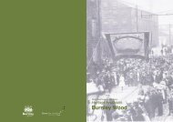
fivecharacter area 35.1 Introduction5.1.1 Character Area 3 is located to the east of <strong>Padiham</strong> and is bounded by the RiverCalder to the south, Clitheroe Street to the west, Garden Street to the north and opencountryside to the east. Sloping southwards towards the river, the area’s dominant land usescomprise a high-density industrial area of stone built mills and weaving sheds and grids ofstone terraced housing (Plan A & Plan F).5.2 Area Development5.2.1 No significant development appears to have occurred within Area 3 until the 1840s,when a number of tram roads were laid to connect a series of coal pits to the east of the areawith the former coal staithe (Plan B and 5.3.3). From the 1850s onwards the town began todevelop rapidly both to the east and south beyond the River Calder. This development includedthe high-density industrial area to the north of the river.5.2.2 It appears that housing came later following the ribbon development which formedalong Guy Street/Grove Lane towards the quarry and coal pits in the east (Plan C). By the1860/70s a grid of housing had been constructed around Dean Street whilst a larger griddeveloped around Ingham Street between 1879-1910. <strong>The</strong> need for additional housing in<strong>Padiham</strong> arose between 1851 when the population of the town was 4,509 and 1900 when itwas an estimated 13,900 (Barrett, 1899, p. 560). It is to be noted that the scale of this increasewas due in part to the reorganisation of local government in 1873 (in the form of the <strong>Padiham</strong>and Hapton Local Board), which saw the inclusion of part of Hapton in the town’s boundaries.5.3 IndustryCoal5.3.1 Coal mining has had a long history in <strong>Padiham</strong>. In medieval times local farmers wouldhave extracted coal in order to supply their own needs when <strong>Padiham</strong> was nothing morethan a hamlet (Nadin, 2003, p iii), but with the changes to the English feudal system in the14th century came the need to obtain leases from the crown to dig for coal, a situation whichcontinued until the middle of the 17th century.5.3.2 <strong>The</strong> coal which was extracted from <strong>Padiham</strong> would have come from the <strong>Padiham</strong>Thick Seam, which reaches a width of 10-11 feet. <strong>The</strong> earliest pits would have been short lived,perhaps being worked where the coal outcropped at the earth’s surface. Others may havebeen merely shallow shafts called bell pits (Nadin, 1997, p.8). During the post medieval periodthe ‘whole area from Moor Lane to the Hollins Farm in Grove Lane was cut up into large coalpillars’ (Heys, 1972, p.17). Numerous other pits were sunk to the east of Area 3 adjacent toGrove Lane and the River Calder during the 18th and 19th centuries.5.3.3 Prior to 1840 pack horses and mules were used to transport loads of coal. In 1843the surface chain haulage system was brought to <strong>Padiham</strong> and to the Shuttleworths’ new coalstaithe, which was situated adjacent to <strong>Burnley</strong> Road (Plan B). <strong>The</strong> rails linked pits in Ightenhillto the coal staithe where the tubs probably had to be pushed by hand. By 1890 the Ightenhillpits had closed and the tram road was re-laid as a ginny track, which ran from Cornfield Pit tothe east of Area 3 in a straight line over an iron bridge to a point known as ‘<strong>The</strong> Angle’ in GroveLane (Heys, 1972, p 37 and Armstrong, 1985, p 35).5.3.4 ‘By the late 19th century the tram road to Grove Mill had gone, but the other routeshad been rationalised into a straighter tramway bringing coal down from the Calder Valley toa staithe at <strong>Padiham</strong>’ (Mitchell et al, 2004, p. 24). A century later in the 1970s all coal-miningactivities had ceased in <strong>Padiham</strong>. Today little evidence remains of the tramlines and ginnytracks, which once ran through Area 3 other than the ginny turning blocks, which still remain,albeit in a ruinous condition, in Grove Lane Wood.40 heritage appraisal