From Cairns to Craters: Conservation Heritage Assessment of ...
From Cairns to Craters: Conservation Heritage Assessment of ...
From Cairns to Craters: Conservation Heritage Assessment of ...

Create successful ePaper yourself
Turn your PDF publications into a flip-book with our unique Google optimized e-Paper software.
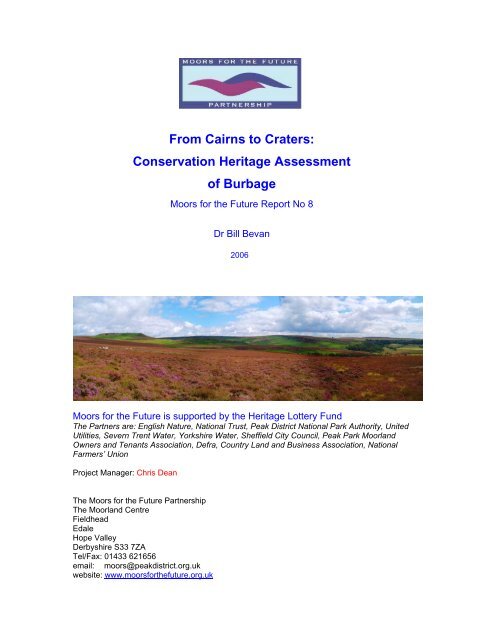
<strong>From</strong> <strong>Cairns</strong> <strong>to</strong> <strong>Craters</strong>:<strong>Conservation</strong> <strong>Heritage</strong> Assessmen<strong>to</strong>f BurbageMoors for the Future Report No 8Dr Bill Bevan2006Moors for the Future is supported by the <strong>Heritage</strong> Lottery FundThe Partners are: English Nature, National Trust, Peak District National Park Authority, UnitedUtilities, Severn Trent Water, Yorkshire Water, Sheffield City Council, Peak Park MoorlandOwners and Tenants Association, Defra, Country Land and Business Association, NationalFarmers’ UnionProject Manager: Chris DeanThe Moors for the Future PartnershipThe Moorland CentreFieldheadEdaleHope ValleyDerbyshire S33 7ZATel/Fax: 01433 621656email: moors@peakdistrict.org.ukwebsite: www.moorsforthefuture.org.uk
CONTENTSPageAbstract 1Introduction 2Location, Geology, Topography and Soils 2Summary <strong>of</strong> <strong>Heritage</strong> Features 3Summary <strong>of</strong> Archaeological His<strong>to</strong>ry 5Condition <strong>of</strong> the Archaeological <strong>Heritage</strong> 25Methods for Safeguarding the Archaeological <strong>Heritage</strong> 27Interpreting the <strong>Heritage</strong> <strong>of</strong> Burbage 29List <strong>of</strong> <strong>Heritage</strong> Features 30Recommendations for Further Work 103Acknowledgements 104Bibliography 105ILLUSTRATIONSPho<strong>to</strong>graphs and DrawingsPage1 Location <strong>of</strong> Burbage Survey Area. 22 Burbage Survey - areas covered by Archaeological Features Plans After Page 23 Winyards Nick cairn field 74 Carl Wark from the north-west 95 Mills<strong>to</strong>ne Edge was a major s<strong>to</strong>ne quarry from the Medieval period <strong>to</strong> the 20 th century 136 Domed mills<strong>to</strong>nes below Carl Wark 147 Mills<strong>to</strong>ne blanks exposed from the ground at Mothers Cap Quarry 158 Large crushing s<strong>to</strong>ne below Burbage Edge 159 The Duke <strong>of</strong> Rutland’s Green Drive (the yellow line running through the bracken19below Burbage Edge)10 World War 2 bullet scars used by climbers for bouldering 2311 Footpath erosion on Carl Wark. Left: northern end <strong>of</strong> western rampart. Right: entrance 2512 Carl Wark from the south-east 3013 Carl Wark from Higger Tor showing natural scarp edge 33
14 The entrance <strong>to</strong> Carl Wark, showing build <strong>of</strong> southern wall 3315 Build <strong>of</strong> the southern wall <strong>of</strong> Carl Wark 3416 Carl Wark’s western rampart 3417 Shelter adjacent <strong>to</strong> Carl Wark, looking south-west 3718 Standing s<strong>to</strong>ne with cairn in background, Winyards Nick cairn field 3819 Round house, looking west 3920 Plan <strong>of</strong> Winyards Nick Burial Barrow 4021 Propped part-carved mills<strong>to</strong>ne, north-east <strong>of</strong> Carl Wark 4222 Plan <strong>of</strong> Toads Mouth Burial Barrow 5123 Mothers Cap quarry 5324 Mills<strong>to</strong>ne Edge quarry face 5625 Quarry building at Mills<strong>to</strong>ne Edge 5726 Bloomery waste mounds 6327 Bloomery slag eroding from the <strong>to</strong>p <strong>of</strong> a waste mound 6428 Building from north-east 6529 Mortar scar on a boulder 6730 Chisel marks on a boulder 6931 Burbage Quarry quarry face 7132 Packhorse bridge 7433 Ringinglow Roundhouse, an ornate 18 th century <strong>to</strong>ll house 85Survey Theme PlansAfter page1 Prehis<strong>to</strong>ry 52 Communication Routes 103 Industrial 124 Enclosure 165 Recreation 186 World War 2 21Archaeological Features PlansAfter page1 Higger Tor - Carl Wark 302 Mills<strong>to</strong>ne Edge - Toads Mouth 463 Upper Burbage Bridge – Burbage Edge 604 Burbage Edge – Lower Burbage Bridge 665 Ringinglow – Houndkirk Road 786 Houndkirk Hill 867 Fox House – Piper House 92
1AbstractA <strong>to</strong>tal <strong>of</strong> 157 archaeological features and 19 artefacts findspots have been identifiedin Burbage by the current survey. Twenty features and all 19 findspots are recorded inthe South Yorkshire or Derbyshire Sites and Monuments Record (SMR). Thisrepresents a 785% increase in known archaeological features as a result <strong>of</strong> the currentsurvey. A further 6 sites recorded in the South Yorkshire and Derbyshire SMRs areconsidered not <strong>to</strong> be antiquities. Eight features are Scheduled Monuments, two areListed Buildings. Other features may seem insignificant in their own right, but theirimportance lies in what they tell us about the overall his<strong>to</strong>ric landscape <strong>of</strong> Burbage.The earliest features date from prehis<strong>to</strong>ry. These include the later prehis<strong>to</strong>ric enclosureon Carl Wark, later Neolithic/early Bronze Age burial barrows and ring cairns, Bronze<strong>to</strong> Iron Age cairnfields and a round building. There are a number <strong>of</strong> findspots <strong>of</strong> s<strong>to</strong>ne<strong>to</strong>ols dating from the Mesolithic <strong>to</strong> the Bronze Age.During the Medieval period the survey area was within the manors <strong>of</strong> Hathersage andDore. The network <strong>of</strong> long-distance packhorse routes and Mills<strong>to</strong>ne productionoriginated in the Medieval period, and an iron-smelting bloomery complex was inoperation.Mills<strong>to</strong>ne production expanded in the post-Medieval period, eventually ending in themid-20 th century. Packhorse routes were replaced with turnpikes between the mid-18 thand early 19 th centuries, and passage was barred by dry-s<strong>to</strong>ne walls built as a result <strong>of</strong>Parliamentary Enclosure <strong>of</strong> Hathersage and Dore in the early 19 th century.Burbage was enclosed by two Parliamentary Acts. The Hathersage, Derwent andOutseats Act was passed in 1808, with the Award following in 1830. The Dore Actwas passed in 1809 and the Award drawn up in 1822. This resulted in the creation <strong>of</strong>six new farmsteads and the physical enclosure <strong>of</strong> four moorland areas.The Duke <strong>of</strong> Rutland acquired the moorlands in the 1820s, building nearby LongshawLodge. He built a scenic drive along Burbage Valley and used the moors for grouseshooting. His tenants continued <strong>to</strong> pasture sheep on the moors, but this was limited <strong>to</strong>benefit the grouse.Rambling became an important aspect <strong>of</strong> the moorlands by the early 20 th century, <strong>of</strong>tenpitching walkers and gamekeepers in confrontation with each other. Public accessslowly increased after Sheffield City Corporation bought Rutland’s estate in 1927 forwater, with the Sheffield Clarion Ramblers at the forefront <strong>of</strong> campaigning for access.Burbage played two roles in World War 2. A bomber decoy was built on HoundkirkMoor <strong>to</strong> deflect bombing raids from Sheffield and a number <strong>of</strong> military units usedBurbage Valley for training between 1941 and 1945.
2IntroductionThe archaeological survey <strong>of</strong> Burbage has been commissioned by the Moors for theFuture Partnership <strong>to</strong> provide an audit <strong>of</strong> heritage features and a summary <strong>of</strong> the area’sarchaeological his<strong>to</strong>ry. The report is based on original fieldwork and documentaryresearch.The aim <strong>of</strong> the survey is <strong>to</strong> provide essential information on the nature and condition<strong>of</strong> surviving archaeological features and the his<strong>to</strong>rical development <strong>of</strong> the area <strong>to</strong>further the conservation, public interpretation, accessibility and education aims <strong>of</strong> theMoors for the Future project.This report accompanies a GIS database <strong>of</strong> all sites included in the list <strong>of</strong>heritage features. The database is held by Moors for the Future and the PeakDistrict National Park Authority.Location, Geology, Topography and SoilsThe Burbage survey area is located 2km <strong>to</strong> the south-west <strong>of</strong> the edge <strong>of</strong> the Sheffieldcity conurbation and 1.5km east <strong>of</strong> Hathersage village (Illustration 1). It lies at theintersection between the Eastern Moors and the High Peak, immediately north <strong>of</strong>where the east-west width <strong>of</strong> the unimproved moorland narrows <strong>to</strong> less than 1.5km.The vast majority <strong>of</strong> the area lies within the bounds <strong>of</strong> Sheffield city, while the verywestern extremity is within Derbyshire. It comprises Burbage Moor, Burbage Valley,Hathersage Moor and Houndkirk Moor (Illustration 2). Together, these form a block<strong>of</strong> land measuring approximately 10km 2 centred on NGR. 4270 3819.Illustration 1. Location <strong>of</strong> Burbage survey area.The whole survey area lies above Mills<strong>to</strong>ne Grit (Aitkenhead et al 2002), and includesthree different <strong>to</strong>pographies.
3The high, heather-dominated plateau <strong>of</strong> Burbage and Houndkirk Moors forms theeastern half <strong>of</strong> the area. Reaching <strong>to</strong> a height <strong>of</strong> 438m above sea level, the <strong>to</strong>p <strong>of</strong> theplateau has thin soils with outcropping mills<strong>to</strong>ne bedrock and boulder fields. Theplateau rises steeply from the east, where it is dissected by two watercourses whichdrain extensive areas <strong>of</strong> wet bog on the plateau. A more gradual slope rises from thesouth, while the west is bounded by Burbage Edge.Burbage Edge is a southern extension <strong>of</strong> Stanage Edge and forms the eastern rim <strong>of</strong>the natural bowl-like amphitheatre that is Burbage Valley. The Valley hangs above theeastern side <strong>of</strong> the Derwent Valley between 300m and 400m above sea level. Thewestern rim consists <strong>of</strong> a less precipi<strong>to</strong>us ridge for most <strong>of</strong> its length, turning in<strong>to</strong>Mills<strong>to</strong>ne Edge <strong>to</strong>wards the south. Gently sloping valley sides descend <strong>to</strong>wardsBurbage Brook, the watercourse that runs through the valley, draining highermoorland <strong>to</strong> the north in<strong>to</strong> the River Derwent. Flat-<strong>to</strong>pped and dramatic mills<strong>to</strong>neoutcrops called Higger Tor (438m above sea level), Carl Wark (380m above sea level)and Over Owler Tor (380m above sea level) rise above the valley sides. The Mills<strong>to</strong>needges and outcrops create vertical scarp edges backed by outcropping bedrock andboulder fields. Boulders are scattered across the slopes below the scarps. The outcropsand many <strong>of</strong> the boulders below the edges are rounded from weathering, though inplaces more blocky, less weathered material exists on the ground surface. Vegetationis a mix <strong>of</strong> heather, bracken and coarse grasses.West <strong>of</strong> Mills<strong>to</strong>ne Edge we find the upper valley side <strong>of</strong> the Derwent Valley. Arelatively steep drop below the ridge gives away <strong>to</strong> a more gently inclined shelf. Mos<strong>to</strong>f this area has been enclosed and improvement attempted.The centre <strong>of</strong> Burbage Valley is dominated by a conifer plantation, planted bySheffield City Council between 1968 and 1971.Summary <strong>of</strong> <strong>Heritage</strong> FeaturesA <strong>to</strong>tal <strong>of</strong> 157 archaeological features and 19 artefacts findspots have been identifiedin Burbage by the current survey. Twenty features and all 19 findspots are recorded inthe South Yorkshire or Derbyshire Sites and Monuments Record (SMR). Thisrepresents a 785% increase in known archaeological features as a result <strong>of</strong> the currentsurvey. A further 6 sites recorded in the South Yorkshire and Derbyshire SMRs areconsidered not <strong>to</strong> be antiquities.A number <strong>of</strong> features are given statu<strong>to</strong>ry protection by government legislation eitheras Scheduled Monuments (SMs) or Listed Buildings.There are eight Scheduled Monuments (431.1, 431.3, 431.4, 431.6, 431.27, 431.28,431.33, 431.149). Any damage or disturbance <strong>to</strong> the designated areas <strong>of</strong> SMs isillegal without scheduled monument consent from the Department <strong>of</strong> Culture,Media and Sport (as at 2006). Scheduling covers the fabric <strong>of</strong> the archaeologicalfeature itself, and may also extend a little distance beyond the obvious earthworks <strong>to</strong>create a protected buffer zone. In the case <strong>of</strong> two cairnfields (431.4, 431.28),scheduling incorporates extensive areas that include the land surface in between the
visible archaeological features. English <strong>Heritage</strong> also consider the setting <strong>of</strong> SMs andneed <strong>to</strong> be consulted prior <strong>to</strong> planned ground-disturbing activities in the vicinity <strong>of</strong>SMs.Two buildings are Listed Buildings (431.114, 431.153). Any alteration <strong>to</strong> a listedbuilding is likely <strong>to</strong> need listed building consent from the local planningauthority. In some cases planning permission may also be required. Unauthorisedalteration <strong>of</strong> a listed building is a criminal <strong>of</strong>fence. Listing covers the whole <strong>of</strong> thebuilding inside and out and includes any <strong>of</strong> curtilage buildings and boundary walls.Features <strong>of</strong> National or Regional ImportanceThere are 47 features <strong>of</strong> national or regional importance.Two extensive prehis<strong>to</strong>ric cairn fields/settlement areas. These are Winyard’s Nick(431.4), which comprises cairns, linear clearance banks and small standing s<strong>to</strong>nes, andToad’s Mouth (431.28) which consists <strong>of</strong> at least 76 cairns, linear clearance and apossible round house location.Four prehis<strong>to</strong>ric barrows (burial mounds), probably built between 2500 and 1500 BC(431.3, 431.6, 431.26, 431.33). These are important prehis<strong>to</strong>ric funerary sites.Two ring cairns, probably contemporary with the burial barrows (431.27, 431.149),which were used for ceremonies by local communities.The later prehis<strong>to</strong>ric enclosure on Carl Wark (feature 431.1), which was probably amajor tribal focal point from the late 2 nd millennium BC onwards.A s<strong>to</strong>ne-footed round house (431.5) that could date <strong>to</strong> the 2 nd or 1 st millennium BC.Such s<strong>to</strong>ne-footed prehis<strong>to</strong>ric buildings are very unusual in the Peak District.A Medieval bloomery – iron smelting – complex (431.59), comprising two separateareas with a <strong>to</strong>tal <strong>of</strong> eight waste mounds, a small s<strong>to</strong>ne enclosure and the stronglikelihood <strong>of</strong> the sub-surface survival <strong>of</strong> hearths.A probable Medieval shieling – a temporary agricultural settlement – comprising asmall ruined building associated with a trough and corn-grinding s<strong>to</strong>ne (431.2).The survey area is crossed by a significant and extensive network <strong>of</strong> long-distancepackhorse routes (431.9, 431.16, 431.18, 431.21, 431.22, 431.30, 431.37, 431.39,431.67, 431.97, 431.98, 431.123, 431.140, 431.146, 431.152). Many <strong>of</strong> these wouldhave originated in the Medieval period and continued in use until the construction <strong>of</strong>turnpikes from the mid-18 th century and the Enclosure <strong>of</strong> the moorland under the 1822Dore Enclosure Award. The routes include a s<strong>to</strong>ne bridge (431.81) and an inscribedwaymarker (431.103).Burbage and Hathersage were one <strong>of</strong> the main centres in England for mills<strong>to</strong>neproduction from the Medieval period until the mid-20 th century. There are threeextensive day-working areas (431.8, 431.34, 431.70), and three more industrial-scale4
quarries at Mothers Cap, Mills<strong>to</strong>ne Edge and Burbage Edge (431.35, 431.40, 431.73).All contain many part-finished products.Fox House (431.153) and Ringinglow Roundhouse (431.114) are important 18 thcentury standing buildings.There are two ruined 19 th century Enclosure Movement farmsteads with wellpreservedlayouts. These are Oxdale Lodge (431.104) and Piper House (431.143).There are two significant uses <strong>of</strong> the moorlands during World War 2 that have literallyleft their mark on the landscape. British and Canadian troops trained on Burbage,leaving swathes <strong>of</strong> bullet- and mortar-scarred rocks and a number <strong>of</strong> fox holes(431.19, 431.41, 431.54, 431.66). Houndkirk Decoy was one <strong>of</strong> the first World War 2bomber decoys built in Britain, and one <strong>of</strong> only two surviving examples <strong>of</strong> six originalsites built <strong>to</strong> protect the strategically important Sheffield steelworks (431.87, 431.88,431.89, 431.138).Features <strong>of</strong> Local ImportanceAll archaeological features <strong>of</strong> local importance within the surveyed area are <strong>of</strong> postmedievaldate, although some hollow ways may have Medieval origins (see Table 1).The most common types <strong>of</strong> site are terraced trackways and hollow-ways that are notlong-distance packhorse routes. There are a number <strong>of</strong> redundant structures related <strong>to</strong>past agricultural use <strong>of</strong> the moorlands, including sheepfolds, sheepwashes, sheep lees,shelters and other farm buildings. Small areas <strong>of</strong> s<strong>to</strong>ne quarrying exist outside <strong>of</strong> themajor quarries and day-working areas. Buildings include farmhouses, cottages and achapel. Other features include a line <strong>of</strong> grouse shooting butts, the Duke <strong>of</strong> Rutland’sGreen Drive, and a number <strong>of</strong> s<strong>to</strong>ne cairns which may be prehis<strong>to</strong>ric in date.Although many <strong>of</strong> the archaeological features on the moorland, when taken inisolation, may first appear <strong>to</strong> be <strong>of</strong> only limited interest, when viewed in <strong>to</strong>tal aselements <strong>of</strong> the overall his<strong>to</strong>ric landscape they become <strong>of</strong> much greater value. Theyillustrate continuity in the ways the moorland has been used that goes back centuries.The low-lying nature <strong>of</strong> much <strong>of</strong> the moorlands in the survey area has enabled a longand complex pattern <strong>of</strong> past land use <strong>to</strong> develop that has resulted in the creation andsurvival <strong>of</strong> many types <strong>of</strong> archaeological features. There has been little destruction <strong>of</strong>these sites on Burbage, as with the other moorlands <strong>of</strong> the Peak District, because <strong>of</strong>the lack <strong>of</strong> agricultural improvement and intensive cultivation. As well as the featuresthat survive as earthworks, there may be good survival <strong>of</strong> Prehis<strong>to</strong>ric features belowthe peat. The finds <strong>of</strong> artefacts indicate something <strong>of</strong> this presence.Summary <strong>of</strong> Archaeological His<strong>to</strong>ryPrehis<strong>to</strong>ry: Life, Death and the Mystery <strong>of</strong> Carl Wark(see Survey Theme Plan 1 Prehis<strong>to</strong>ry)Little can be said <strong>of</strong> Burbage for the mesolithic and early neolithic periods. Sevenfindspots <strong>of</strong> flint <strong>to</strong>ols eroding from under the peat indicate that people visited the area5
(431.159, 431.162, 431.170, 431.171, 431.173, 431.178, 431.179). These were lost ordiscarded by early hunter-gatherers who visited these high areas, after the lastglaciation and before the advent <strong>of</strong> peat growth (between c. 10,000 and 4000 BC),camping here seasonally (presumably in summer), probably <strong>to</strong> hunt game such asdeer.More evidence survives from later prehis<strong>to</strong>ry in the form <strong>of</strong> Carl Wark enclosure(feature 431.1), Toad’s Mouth and Winyard’s Nick cairn fields (431.4, 431.28), fourdefinite burial barrows (features 431.3, 431.6, 431.26, 431.33), four probable barrows,three <strong>of</strong> which are s<strong>to</strong>ne cairns and the other a disturbed mound (431.15, 431.23,431.25, 431.129), a grouse shooting butt that may have been made in a barrow(431.134), two ring cairns (431.27, 431.149), a s<strong>to</strong>ne-footed round house (431.5) andsix findspots <strong>of</strong> flint <strong>to</strong>ols or waste flakes (431.161, 431.163, 431.164, 431.169,431.174, 431.176). Some <strong>of</strong> the cairns in the two cairn fields may also contain burials.Death and Ceremony: Barrows and Ring <strong>Cairns</strong>Burial barrows and ring cairns are broadly contemporary, dating from the laterNeolithic/early Bronze Age, between the mid 3 rd and mid 2 nd millennia BC. Over 500barrows are found across much <strong>of</strong> the limes<strong>to</strong>ne plateau and the grits<strong>to</strong>ne moors(Barnatt 1989, 1996). Locations are very varied, but tend <strong>to</strong> be on the lower shelvesand plateaux overlooking valleys, or on low ridges and hill<strong>to</strong>ps, which themselvesoverlook the lower shelves (Barnatt 1996). Barrows were built <strong>to</strong> mark the graves <strong>of</strong>specially chosen individuals. There are both single and multiple inhumations andcremations found both under and within the barrow mound. Barrow burial was not thenormative funeral rite, the majority <strong>of</strong> people were either buried in unmarked gravesor excarnated - left exposed <strong>to</strong> the elements. Barrows show how important it was <strong>to</strong>mark the burial places <strong>of</strong> chosen individuals in the landscape. The prominent moundswould constantly remind the living <strong>of</strong> their dead. In a time before title deeds andproperty ownership, this would reinforce their connections <strong>to</strong> the surroundinglandscape. Three <strong>of</strong> the barrows on Burbage (431.6, 431.26, 431.33) are placed inlocally prominent locations that are visible from nearby areas occupied by fieldsystems (431.4, 431.28). This indicates that these permanent funerary markers wereprobably built by the communities living at the cairn fields <strong>to</strong> serve their own religiousand emotional needs.Ring cairns are akin <strong>to</strong> s<strong>to</strong>ne circles, and are found exclusively across the grits<strong>to</strong>neuplands with the majority on the Eastern Moors (Barnatt 1990). They vary in sizefrom 5m <strong>to</strong> 30m in diameter and character: free-standing s<strong>to</strong>nes, upright s<strong>to</strong>nes placedin a circular embankment and embankments without orthostats (Edmonds andSeaborne 2001). They were probably places for holding smaller, family-basedceremonies, such as those connected with the agricultural season, fertility andindividual rites <strong>of</strong> passage such as birth, puberty and death (Barnatt 2000; Edmondsand Seaborne 2001). One ring cairn (431.27) is in between two field systems (431.4,431.28), being approximately 100m from one and over 200m from the other. This ringcairn would have been a place for small ceremonies held by the occupants <strong>of</strong> either orboth field systems. There is no identifiable field system near <strong>to</strong> the other ring cairn(431.149). It is likely that more ephemeral remains <strong>of</strong> settlements and fields have beenswept away by later improvement associated with the enclosure <strong>of</strong> this area.6
7Living and Farming: Cairn FieldsThe two later prehis<strong>to</strong>ric cairn fields occupy areas on gentle south and east-facingslopes situated between 310m and 370m above sea level (431.4, 431.28). These nowpeat-covered podsols would have been light, sandy soils in prehis<strong>to</strong>ry. The largenumber <strong>of</strong> cairns at Toad’s Mouth (431.28) are probably the result <strong>of</strong> the clearance <strong>of</strong>s<strong>to</strong>nes <strong>to</strong> facilitate cultivation and pasture improvement, though some may alsocontain burials. Winyard’s Nick (431.4) comprises a rectangular cleared area boundedby cairns and long sections <strong>of</strong> linear clearance that probably define a field boundary.Both areas may well have contained timber round houses, the evidence for which maystill survive below ground. A semi-circular kink in one linear clearance in Toad’sMouth suggests the location <strong>of</strong> a round building.Illustration 3. Winyards Nick cairn field.As yet, we cannot be sure if the barrows and ring cairns are contemporary with thesurviving remains <strong>of</strong> the field systems due <strong>to</strong> a lack <strong>of</strong> dating evidence. The closephysical relationship does suggest a chronological association between thefunerary/ceremonial monuments and some form <strong>of</strong> settlement activity (Barnatt 1986,2000). Both cairn fields are undated, and could date anywhere from the early BronzeAge <strong>to</strong> Iron Age.Close relationships with barrows and ring cairns, and radio-carbon dates forboundaries on Eagles<strong>to</strong>ne Flat and Sir William Hill, suggest that some cairn fields
originated in the later Neolithic/early Bronze Age (Barnatt 2000). Three <strong>of</strong> thebarrows (431.6, 431.26, 431.33) and one ring cairn on Burbage (431.27) are closelyassociated with the two cairnfields. Buildings excavated on Gardom’s Edge have allbeen dated <strong>to</strong> the late Bronze Age/early Iron Age – approximately 1000 years later(Barnatt et al 2002, forthcoming). It is likely that at least some <strong>of</strong> the areas withsurviving cairn fields were occupied in the later Neolithic/early Bronze Age and werere-used and modified over time.The spatial separation <strong>of</strong> cairn fields, the proliferation <strong>of</strong> barrows and s<strong>to</strong>ne circles andthe siting <strong>of</strong> these features in relation <strong>to</strong> local <strong>to</strong>pography, indicates a greaterinvestment in demarcating land associated with smaller communal groups such as kin,families and individual households. It is possible that each cairn field was inhabited bya kin-group or extended family, who saw the fields and associated open pastures asbeing in their tenure (Barnatt 2000). They may have occupied these areas permanentlyor moved between a small group <strong>of</strong> similar areas according <strong>to</strong> traditions <strong>of</strong> land-use.The presence <strong>of</strong> cairn fields across the Eastern Moors is highly attuned <strong>to</strong> <strong>to</strong>pography.The majority survive at low altitudes suitable for growing crops, in locations withlight sandy soils suitable for prehis<strong>to</strong>ric ards or spades. Much <strong>of</strong> Burbage andHoundkirk Moors was probably <strong>to</strong>o high for successful, sustained cultivation. Lowerslopes along the Derwent Valley may have also been occupied in prehis<strong>to</strong>ry, butsubsequent agriculture has swept away prehis<strong>to</strong>ric remains. Much <strong>of</strong> the loweraltitudes in the Derwent Valley have heavier, clay-dominated soils, and wouldprobably have been much wetter in prehis<strong>to</strong>ry due <strong>to</strong> an absence <strong>of</strong> field drainage. Theextent <strong>to</strong> which these were exploited prior <strong>to</strong> the introduction <strong>of</strong> iron ploughs in theIron Age is debatable. Burbage Valley, where the two cairn fields are found, is at anideal altitude for prehis<strong>to</strong>ric farming.Enclosure and Enigma: Carl WarkThe most prominent archaeological feature in the area, and one <strong>of</strong> the most importantprehis<strong>to</strong>ric sites in the Peak District, is Carl Wark (431.1). The dramatic 230m longboulder-strewn outcrop, defined <strong>to</strong> the north and east by vertical mills<strong>to</strong>ne edges, isenclosed within a walled boundary. Along the south <strong>of</strong> the outcrop this takes the form <strong>of</strong>a low coursed and orthostatic wall built against the <strong>to</strong>p <strong>of</strong> the scarp. There is a 2m widein-turned entrance through this southern wall. To the west, it has an impressive 3m highand 8m wide earthen rampart faced with a s<strong>to</strong>ne wall on its exterior. There is noboundary along the cliffs around the remainder <strong>of</strong> the outcrop. Most <strong>of</strong> the interior iscovered in large boulders. An excavation in 1950 through the rampart was inconclusivein dating its construction (Piggott 1951).Most interpretations <strong>of</strong> the site have believe it <strong>to</strong> be an early Iron Age hillfort, thoughNeolithic and early Medieval dates have also been suggested (Barnatt 2000; Edmondsand Seabourne 2001; Gould 1903; Trustram 1911; Pres<strong>to</strong>n 1947 and 1954; Piggott1951). The boulder-strewn interior precludes extensive settlement <strong>of</strong> the sort seen atMam Tor, while the lack <strong>of</strong> running water makes it unsuitable as a defensive refuge.The closest parallel in the Peak District is the Gardom’s Edge enclosure (Barnatt et al2001). Here, a carefully faced rubble bank, punctured by four entrances, encloses adense area <strong>of</strong> earthfast boulders behind a natural scarp edge. Gardom’s Edge has been8
adio-carbon dated <strong>to</strong> the later Bronze Age, between 1300 and 900 BC, and wasprobably a place for ceremonial gatherings (Barnatt et al forthcoming). Carl Wark ismost likely <strong>to</strong> be the same date and use.9Illustration 4. Carl Wark from the north-west.Was there a Roman Road?The only possible Roman feature in the survey area is the line <strong>of</strong> a postulated militaryroad, which is thought <strong>to</strong> have run between Navio fort at Brough with that atTemplebrough, Rotherham. Earthworks <strong>of</strong> the road have been recorded at a number <strong>of</strong>locations (431.20, 431.100, 431.160). It has also been postulated that the HoundkirkRoad (see page 10) has Roman origins, though these were disputed as early as 1925(Ward 1925-26, 110-112).None <strong>of</strong> the surviving earthworks are convincingly Roman in origin. The route hasbeen postulated as much on the basis that it ‘should be there’ than strongarchaeological or his<strong>to</strong>rical evidence. This route crosses relatively good traversablemoorland <strong>to</strong>pography, utilising the break in Burbage Edge, on an approximatelystraight line between the two known forts.Medieval <strong>to</strong> Post-Medieval periods: Laying down <strong>to</strong>day’s landscapeMedieval landholdings, place names and the county boundary
The placename ‘Burbage’ is derived from Old English and reputedly means ‘streamnear a fortified place’ (Cameron 1959). This would seem very apt for the area withCarl Wark being such a prominent landscape feature (431.1). It is first recorded inapproximately 1230 AD as the ‘Burbache’ (ibid).Since the Medieval period, the survey area has lain close <strong>to</strong> the boundary betweenYorkshire and Derbyshire. In 1086, the area was divided between two Derbyshiremanors. To the east was Dore, then held by Roger de Beusli, incorporated HoundkirkMoor, Burbage Moor and part <strong>of</strong> Burbage Valley east <strong>of</strong> Burbage Brook. Hathersage,was <strong>to</strong> the west, owned by Ralph Fitzhubert in 1086, and including Hathersage Moorand Mills<strong>to</strong>ne Edge. The county boundary ran <strong>to</strong> the east, through Ringinglow. Itstayed <strong>to</strong> the east until the 1930s when Dore was transferred from Derbyshire <strong>to</strong>Yorkshire. The county boundary now runs further west <strong>to</strong> follow the western edge <strong>of</strong>open moorland below Mills<strong>to</strong>ne Edge and west <strong>of</strong> Higger Tor which was bounded byroads and the limit <strong>of</strong> enclosed land.Iron SmeltingThere is a small medieval iron smelting bloomery, comprising two distinct workingareas defined by small mounds <strong>of</strong> slag (431.59). Bloomeries were used <strong>to</strong> smelt ironfrom the Iron Age until the 15 th century, when they began <strong>to</strong> be superseded by blastfurnaces and finery forges. The majority <strong>of</strong> bloomeries date <strong>to</strong> the Medieval period,but the technology did continue in use in some areas, such as north-west England,until the 18 th century. Bloomeries used hand or water-powered bellows <strong>to</strong> heat ironore mixed with charcoal inside the hearth <strong>to</strong> reduce the ore’s iron oxide in<strong>to</strong> malleableiron. The smelted iron formed a slag-rich ‘bloom’.The hearths may have used iron ore from ore seams in the Coal Measures or bog ironfrom a nearby fen, with the charcoal fuel possibly coming from surrounding woodlandsuch as in Padley Gorge or below Burbage Edge. It is unknown who was responsiblefor smelting, but it would have probably been undertaken under the authority orapproval <strong>of</strong> the lord <strong>of</strong> Dore manor.It was also during the medieval period that two significant elements <strong>of</strong> the his<strong>to</strong>riclandscape originated. This was the development <strong>of</strong> long-distance packhorse routes andquarrying for mills<strong>to</strong>ne production and other s<strong>to</strong>ne working. Packhorse routescontinued in use until the 18 th and 19 th centuries, while quarrying continued until themid-20 th century. Both leave extensive archaeological features that are difficult <strong>to</strong> datewith any fine chronological resolution.Communication Routes(see Survey Theme Plan 2 Communication Routes)<strong>From</strong> Packhorse Trains <strong>to</strong> Turnpike RoadsThe complex network <strong>of</strong> packhorse routes developed over a long time period (431.9,431.16, 431.18, 431.21, 431.22, 431.30, 431.37, 431.39, 431.67, 431.97, 431.98,431.123, 431.140, 431.146, 431.152). The origins <strong>of</strong> some <strong>of</strong> the hollow-ways thatsurvive on the ground probably lie in the Medieval period, but some <strong>of</strong> the routes10
themselves could be much older. Packhorse teams searched for suitable <strong>to</strong>pography <strong>to</strong>navigate across the landscape, seeking out the paths <strong>of</strong> least resistance throughsometimes difficult terrain <strong>of</strong> steep slopes, cliffs, watercourses and bogs. Thesenatural routeways were in many instances the obvious directions <strong>to</strong> follow by peopletravelling between different areas, so they were probably used for communicationlong before the Medieval period.Between the Medieval period and the 19 th century, trains <strong>of</strong> packhorses were the mainform <strong>of</strong> goods transport between market <strong>to</strong>wns, production areas and industrialcentres. Raw materials and finished goods included salt from Cheshire, quarried s<strong>to</strong>neand finished s<strong>to</strong>ne products from Peak District quarries, bales <strong>of</strong> wool – anything thatwas needed in large supply. The growing city <strong>of</strong> Sheffield was a massive importer <strong>of</strong>raw materials <strong>to</strong> feed its foundries and <strong>of</strong> finished goods and agricultural produce <strong>to</strong>supply its non-farming population.A train <strong>of</strong> packhorses could travel up <strong>to</strong> 40km in a day, each animal carrying over150kg. Inns grew up at regular intervals along the packhorse routes. Routes wererights <strong>of</strong> way, open across moorland and walled in<strong>to</strong> lanes through farmland, thatanyone had access <strong>to</strong>. Topographical constraints, resulting in certain routes being usedagain and again, caused erosion and the formation <strong>of</strong> hollow-ways. Braids <strong>of</strong> hollows<strong>of</strong>ten occur where popular routes cross slopes.The packhorse routes across Burbage directly connected Dore, Totley, Sheffield,Hathersage and Grindleford as well as more distant markets such as Castle<strong>to</strong>n,Tideswell and Bux<strong>to</strong>n. The major directions taken by the routes are north-east <strong>to</strong>south-west from Ringinglow <strong>to</strong> Winyard’s Nick via a packhorse bridge acrossBurbage Brook (431.81) and <strong>to</strong>wards Longshaw via Fox House. The immediatedestination west <strong>of</strong> the Nick is Hathersage, from Fox House it is Grindleford. Acomplicated set <strong>of</strong> braided hollow-ways runs north <strong>to</strong> south just west <strong>of</strong> BurbageBrook, and this appears <strong>to</strong> have been a heavily used route between Grindleford andHathersage avoiding farmland. A similarly well-used and braided route runs southfrom Houndkirk Moor <strong>to</strong>wards Froggatt Edge. This either carried on along the <strong>to</strong>p <strong>of</strong>Froggat or dropped down <strong>to</strong> Grindleford via Padley Gorge.The waymarker on Houndkirk Moor shows the routes’ importance in linking market<strong>to</strong>wns (431.103). It signposts Bux<strong>to</strong>n and Tideswell, not the much closer villages,because these were the destinations seen as important <strong>to</strong> the local authorities.Waymarkers and s<strong>to</strong>ne bridges (431.81) were erected from the 17 th century onwards.In 1697, an Act <strong>of</strong> Parliament formalised the erection <strong>of</strong> guide posts and rebuilding <strong>of</strong>packhorse bridges in s<strong>to</strong>ne <strong>to</strong> facilitate trade (Hey 1980). Trade had been expandingsince the 16 th century and the Act was passed in response <strong>to</strong> mounting complaintsfrom the merchant class about road conditions. The Act called for county justices <strong>of</strong>the peace <strong>to</strong> erect guide posts, where cross-roads were remote from villages.Packhorse routes were replaced by turnpike roads in the 18th and 19th centuries.Turnpikes were built around and across Burbage from the mid-18 th century onwards(Radley and Penny 1972). Parliamentary Acts for the first two roads were passed in1758. These ran west from Ringinglow roughly following the lines <strong>of</strong> existingpackhorse routes. The Sparrowpit Gate Turnpike Road ran from Sheffield <strong>to</strong>11
Sparrowpit Gate (between Castle<strong>to</strong>n and Chapel-en-le-Frith) along the north <strong>of</strong>Burbage via Upper Burbage Bridge, Hathersage and Castle<strong>to</strong>n. The Bux<strong>to</strong>n Turnpike,now known as Houndkirk Road (431.99), crossed Burbage Moor from Ringinglow <strong>to</strong>Bux<strong>to</strong>n via Fox House and Grindleford (431.153). An ornately designed octagonal <strong>to</strong>llhouse was built at Ringinglow in 1795 <strong>to</strong> collect <strong>to</strong>lls on both roads (431.114). Theseturnpikes were followed by an Act in 1781 for a road between Hathersage andGreenhill via Fox House which became the road skirting the south <strong>of</strong> the survey area.The descent <strong>of</strong> the Sparrowpit Gate turnpike from Burbage Moor in<strong>to</strong> Hathersage wasdiverted in 1811 <strong>to</strong> give a gentler gradient, so creating the road that now runs alongthe west <strong>of</strong> the survey area below Mills<strong>to</strong>ne Edge. The final turnpike <strong>to</strong> be built onHoundkirk was the Banner Cross <strong>to</strong> Fox House road, linking the previouslyconstructed roads, which was built after 1812. This skirts the south-west edge <strong>of</strong> thesurvey area. A moorland <strong>to</strong>ll cottage lies just inside the survey area (431.145). Thisroad, with the construction <strong>of</strong> a short joining road from Ringinglow, eventually led <strong>to</strong>the abandonment <strong>of</strong> the Houndkirk Road sometime after 1822 (Fairbank 1822).The Burbage turnpikes are part <strong>of</strong> a national network <strong>of</strong> turnpikes that were constructedin the 18 th and 19 th centuries by trusts formed <strong>of</strong> the local gentry and merchantsprimarily <strong>to</strong> improve the road system for goods traffic. In the Peak District turnpiketrusts were set up from the mid-18th century in<strong>to</strong> the early 19th century (Radley andPenny 1972). Whereas previously road maintenance had been the responsibility <strong>of</strong>parishes, the turnpike trusts levied <strong>to</strong>lls for the use <strong>of</strong> roads and were themselvesresponsible for their upkeep. The traditional system <strong>of</strong> rights <strong>of</strong> way was not seen as aneffective way <strong>of</strong> maintaining roads suitable for the increasing volume <strong>of</strong> traffic, norwere many <strong>of</strong> the routes in the uplands suitable for coaches and carriages because theycrossed moorlands and climbed steep slopes. Capital costs <strong>of</strong> building or improving aroad were raised by mortgage and recouped by collecting <strong>to</strong>lls from travellers at <strong>to</strong>llgates (Dodd and Dodd 1974). The first Act in England was in 1663 and by 1830 a<strong>to</strong>tal <strong>of</strong> 3,783 trusts had been set up in England and Wales (ibid.). Turnpikes were theeffective commodification <strong>of</strong> transport, and <strong>to</strong> start with some packhorse trainsavoided payment by using existing packhorse routes <strong>to</strong> circumnavigate <strong>to</strong>ll bar gates.The packhorse routes across Burbage could have continued in use in<strong>to</strong> the 19 thcentury. Two main developments eventually forced their abandonment. Most directly,the Enclosure <strong>of</strong> the moorland by the 1822 Dore Enclosure Award resulted in thebuilding <strong>of</strong> walls that barred passage along the traditional routes (see below). Theother impact was the speeding up <strong>of</strong> communication along the better roads, allied <strong>to</strong>improving transport technology, so giving a competitive economic edge <strong>to</strong> haulierswho paid the <strong>to</strong>lls.Grits<strong>to</strong>ne Quarries(see Survey Theme Plan 3 Industrial)“they dig mills<strong>to</strong>nes from small delves on Hathersage Moor and Gardom’s Edge,whilst elsewhere they quarry the s<strong>to</strong>ne from the face <strong>of</strong> the escarpment.”Defoe 1724-27Quarries are found throughout much <strong>of</strong> the survey area. Many are small delvesproducing s<strong>to</strong>ne for nearby walls or buildings. Others are deeper and larger holes with12
spoil heaps producing s<strong>to</strong>ne for a local need over a short period <strong>of</strong> time. Some <strong>of</strong> theseare marked on 19 th century Ordnance Survey maps. There are also a series <strong>of</strong> importantquarries that produced s<strong>to</strong>ne products for wider export. These are largely <strong>of</strong> two distinctforms. One group comprises extensive distributions <strong>of</strong> small quarry hollows andindividual boulders. The other consists <strong>of</strong> large intensively worked quarries made in<strong>to</strong>the edges which have high vertical faces. Both produced a wide range <strong>of</strong> products,including mills<strong>to</strong>nes, troughs, lintels, door steps and gate posts. All are excavated in<strong>to</strong>the coarse Mills<strong>to</strong>ne Grit which forms the underlying geology <strong>of</strong> the area.13Illustration 5. Mills<strong>to</strong>ne Edge was a major s<strong>to</strong>ne quarry from the Medieval period <strong>to</strong>the 20 th centuryMills<strong>to</strong>nesHathersage was the main centre <strong>of</strong> mills<strong>to</strong>ne production from at least the 16 th century(Hey 2002). There were thirteen mills<strong>to</strong>ne makers living in the <strong>to</strong>wnship in 1590, eachearning about 10d a week which was comparable <strong>to</strong> other craftsmen. Each makerproduced twelve pairs <strong>of</strong> s<strong>to</strong>nes a year, or one s<strong>to</strong>ne a fortnight, <strong>to</strong>talling 312mills<strong>to</strong>nes a year. Given that s<strong>to</strong>nes were produced around Hathersage for severalcenturies, it is likely that tens <strong>of</strong> thousands were manufactured in <strong>to</strong>tal. Bars andchains were used <strong>to</strong> manoeuvre suitable boulders in<strong>to</strong> position, which were chocked atan angle <strong>to</strong> facilitate dressing using a pick, hammer and chisel (Tomlinson 1981).Many mills<strong>to</strong>nes and other products are still found amongst the quarries, mostlyunfinished or broken pieces, <strong>to</strong>gether with some finished examples that were neverremoved. S<strong>to</strong>nes were abandoned at all stages <strong>of</strong> production, from roughouts, whereonly the approximate shape has been defined, <strong>to</strong> others where virtually all the finedressing has been done when the s<strong>to</strong>ne cracked or a flaw became apparent. Somemills<strong>to</strong>nes are still placed on their chock where dressing was taking place.Most mills<strong>to</strong>nes associated with extensive quarries, and with earlier phases <strong>of</strong>production at the large Edge quarries, have rounded edges. The majority also have onedomed surface. <strong>From</strong> at least the 16 th century, these s<strong>to</strong>nes were exported via the por<strong>to</strong>f Bawtry <strong>to</strong> mills<strong>to</strong>ne merchants based in East Anglia (Hey 2002). The 17 th centurywas the most prosperous period <strong>of</strong> mills<strong>to</strong>ne production in the Peak District,especially when war interrupted trade with France or Germany. Mills<strong>to</strong>nes from theRhine and Paris were favoured because they had a superior milling edge and didn’tdiscolour wheat flour, but became unavailable during the 17 th century. Peak mills<strong>to</strong>nesleft a grey colour in milled wheat. Oats, barley, rape, peas, beans and animal fodderwere milled using Peak s<strong>to</strong>nes because the grey discolouration was not a problem. The
industry declined as white wheat bread became more popular but revived duringanother interruption in supplies <strong>of</strong> favoured s<strong>to</strong>nes caused by the Napoleonic Wars.14Illustration 6. Domed mills<strong>to</strong>nes below Carl Wark.Rise <strong>of</strong> the Edge QuarriesFlat-edged s<strong>to</strong>nes appear <strong>to</strong> be later than domes and round-edged s<strong>to</strong>nes, and were thedominant type from the 19 th century onwards. They were used for a variety <strong>of</strong> millingand crushing purposes. Most county mills had German or French s<strong>to</strong>nes for wheat andPeak s<strong>to</strong>nes for other uses until the end <strong>of</strong> the 19 th century (Tucker 1977). In DorsetPeak s<strong>to</strong>nes were specifically used for barley and farm meals (Tomlinson 1981). In1874 there were over 20 corn mills and 6 paper mills in Sheffield, and each corn millhad at least one pair <strong>of</strong> Peak s<strong>to</strong>nes (ibid). Flat-edged s<strong>to</strong>nes were also used forindustrial processes, including crushing lead ore, pulping wood and crushingingredients <strong>to</strong> make paint. S<strong>to</strong>nes were exported <strong>to</strong> Scandinavia, Russia and NorthAmerica for pulping wood <strong>to</strong> make paper, with the last s<strong>to</strong>nes from the area being sold<strong>to</strong> Sweden in the 1930s (Hey 2002).It appears that the larger quarries on the escarpments, including Mills<strong>to</strong>ne Edge,Burbage Edge and Mother Cap quarries, dominated production in the 19 th centurywith the more extensive delves falling out <strong>of</strong> use. It was not that the escarpmentquarries were new, they had probably been worked since the Medieval period, buteconomies <strong>of</strong> scale made them the more pr<strong>of</strong>itable method <strong>of</strong> quarrying in the 19 thcentury. Suitable s<strong>to</strong>ne blocks were separated from the bedrock in the 18 th and 19 thcenturies by boring horizontal holes under the block, inserting kiln-dried pegs andwetting them (Hey 2002). As the wood expanded, the block was lifted separate. In the1851 census, Hathersage had 8 mills<strong>to</strong>ne makers, 3 masons, 2 s<strong>to</strong>ne getters and 1s<strong>to</strong>ne cutter. Two 10 year old boys are one <strong>of</strong> the getters and one <strong>of</strong> the makers.
15Illustration 7. Mills<strong>to</strong>ne blanks exposed from the ground at Mothers Cap Quarry.Production <strong>of</strong> crushing s<strong>to</strong>nes at Mills<strong>to</strong>ne Edge almost ended when the paper millindustry collapsed in the 1920s. The last s<strong>to</strong>nes were sold <strong>to</strong> a paper mill in Sweden in1939. The surviving stacks <strong>of</strong> s<strong>to</strong>nes date from this period.Illustration 8. Large crushing s<strong>to</strong>ne below Burbage Edge.
16Grinding S<strong>to</strong>nesSome s<strong>to</strong>nes were used for grinding, but the pebble beds found in grits<strong>to</strong>ne limited theuse <strong>of</strong> Hathersage and Burbage s<strong>to</strong>nes for this purpose, because they would easilyexplode when used, so causing fatal injuries (Tomlinson 1981). Those that were usedfrom the area were coarse and middling coarse grades that weren’t used for fine workthsuch as knife grinding. Some mills<strong>to</strong>nes were used in Hathersage in the 19 centuryfor grinding needles.Sand PoachersSome <strong>of</strong> the small delves near <strong>to</strong> Houndkirk Road and Jumble Road (431.99, 431.116)were illegal sand quarries (Ward 1937-38, 133-135). These were excavated in thesecond half <strong>of</strong> the 19 th century by ‘sand poachers’ who dodged gamekeepers <strong>to</strong> dig thesand for sale <strong>to</strong> builders constructing houses in Dore. The sand was dug out and riddledat night then carried <strong>to</strong> an agreed meeting place, a load fetching about 25% <strong>of</strong> alabourer’s weekly wage. It was in demand because <strong>of</strong> the proximity, its good mixingqualities and absence <strong>of</strong> salt. Small surface s<strong>to</strong>nes were also collected from nearroadsides for making garden rockeries in the same houses. A <strong>to</strong>n weight would sell forapproximately half a labourer’s weekly wage. The reason that these informal sandquarrying and s<strong>to</strong>ne collection was seen as poaching was because the whole <strong>of</strong> Burbagehad been enclosed early in the 19 th century and therefore privately owned.Enclosing the Moors(see Survey Theme Plan 4 Enclosure)<strong>From</strong> Common <strong>to</strong> PrivilegedThe moorlands <strong>of</strong> Burbage, Hounkirk and Hathersage had been common land sincethe Medieval period. They were owned by the respective lords <strong>of</strong> the manors <strong>of</strong> Doreand Hathersage but the inhabitants <strong>of</strong> those manors, tenants <strong>of</strong> the lords, had certainrights <strong>of</strong> use. These included pasturing lives<strong>to</strong>ck. There is no archaeological evidencefor peat cutting for domestic fire fuel, although this was another cus<strong>to</strong>mary right onmany moorlands. Travellers also had rights <strong>of</strong> access <strong>to</strong> cross the moorlands, creatingthe network <strong>of</strong> long-distance packhorse routes that connected market <strong>to</strong>wns andvillages <strong>to</strong> either side <strong>of</strong> Burbage (see above). Such rights tended <strong>to</strong> be enshrined intenurial documents, <strong>of</strong>ten referred <strong>to</strong> as ‘agreed by cus<strong>to</strong>m’.This relationship between landlord and tenant was always a delicate one that wastested by both parties. Landlords would try and limit tenant rights, for example barringtheir tenants from specific areas, while tenants would try and get as much as theycould, such as taking timber reserved for the sole use <strong>of</strong> their landlord or squatting oncommon land. The presence <strong>of</strong> commons in the landscape began <strong>to</strong> changedramatically in the 18 th century as landowners radically changed their perceptions <strong>of</strong>common land. With the acceptance <strong>of</strong> the Enlightenment and the development <strong>of</strong>Capitalism came a more rational approach <strong>to</strong> the world, with a belief in the benefits <strong>of</strong>
progress, that improving the world <strong>to</strong> make it more efficient was a good thing in itsown right. Ideals <strong>of</strong> improvement spread amongst the landowners who saw it as theirnational duty <strong>to</strong> improve their own landholdings. Land was one <strong>of</strong> the fundamentalpillars that their social position rested upon, so improvement was a key way <strong>to</strong>augment social position. Making your land more productive and efficient wasperceived as a necessity for enhancing Britain’s relationships with other nation states,providing the food <strong>to</strong> fuel industrialisation, economic strength and military power.Hundreds <strong>of</strong> Acts <strong>of</strong> Parliament were passed in the 18 th and 19 th centuries <strong>to</strong> Enclosethe majority <strong>of</strong> the common land in England, removing cus<strong>to</strong>mary rights and placingthe common land under direct private ownership. These were brought <strong>to</strong> Parliamentby local landowners <strong>to</strong> be passed by MPs who were usually also landowners for thegreat good <strong>of</strong> the nation. This was effectively a mass land privatisation. Once the Actwas passed, the land was surveyed, maps were produced and Awards drawn up thatallotted plots <strong>of</strong> land <strong>to</strong> the new landowners. These might be a combination <strong>of</strong> theexisting lord <strong>of</strong> the manor and other farmers in the manor. Land could then byphysically enclosed, improved, settled with new model farms, rented out <strong>to</strong> tenants orsold.Acts <strong>of</strong> PrivationBurbage was enclosed by two Parliamentary Acts, one for each <strong>of</strong> the manors. TheHathersage, Derwent and Outseats Act was passed in 1808, with the Award following22 years later in 1830 (anon. 1830). The Dore Act was passed in 1809 and the Awarddrawn up in 1822 (Fairbank 1822). The Duke <strong>of</strong> Devonshire had acquired bothmanors by the time <strong>of</strong> Enclosure, Hathersage in 1705 and Dore in the 1780s.Both Awards resulted in the physical enclosure <strong>of</strong> small areas <strong>of</strong> the moorlandcommon on Burbage, with ruler-straight boundaries subdividing the land in<strong>to</strong> regularfields. In Hathersage, this resulted in a series <strong>of</strong> new fields on gently sloping groundbelow, and <strong>to</strong> the west <strong>of</strong> Mills<strong>to</strong>ne Edge that were probably farmed from HathersageBooths. Three distinct areas were physically enclosed in Dore. Sheephill wasparcelled up in<strong>to</strong> small fields, improved and farmed from a new farmstead – SheephillFarm (431.108) built between 1822 and 1840 (Fairbank 1822; Ordnance Survey1840). Ox S<strong>to</strong>nes was divided in<strong>to</strong> two large rectangular areas by a dry-s<strong>to</strong>ne wall anda ditch and bank. This was farmed from Oxdale Lodge (431.104), located on theHoundkirk Road and also built between 1822 and 1840. The area <strong>of</strong> moorland <strong>to</strong> thewest <strong>of</strong> Fox House (431.153), running along the north side <strong>of</strong> the current A6187, wasdivided in<strong>to</strong> a series <strong>of</strong> regular fields that were farmed from three newly built farms.Parson House (431.154) was built between 1822 and 1840, while S<strong>to</strong>ne House(431.147) and Piper House (431.143) followed between 1840 and 1880 (Fairbank1822; Ordnance Survey 1840, 1880). Another, unnamed, farmstead was built inBurbage Valley but never occupied (431.60) (Ward 1930-31, 161).Nineteenth century enclosure therefore resulted in two new physical manifestations <strong>to</strong>the Burbage landscape – farmsteads and field walls enclosing improved grass pasture.These all appeared within a 58 year time period, between 1822 and 1880. The newwalls barred passage along the packhorse routes, so forcing all traffic <strong>to</strong> follow therecently created turnpikes. Large areas <strong>of</strong> the private moorland were retained forgrazing and grouse shooting. Enclosure also involved a fundamental shift in how the17
moorland was accessed, used and perceived. This led <strong>to</strong> conflicting recreational uses<strong>of</strong> the moorlands that would come <strong>to</strong> the fore in the second half <strong>of</strong> the 19 th century andfirst half <strong>of</strong> the 20 th century.Landscapes <strong>of</strong> Leisure: Rights <strong>of</strong> Recreation(see Survey Theme Plan 5 Recreation)“Burbage Valley – the finest many-tinted moorland valley near Sheffield.”Ward 1925-26, 110At the Duke <strong>of</strong> Rutland’s PleasureThe 5 th Duke <strong>of</strong> Rutland acquired a large estate in the 1820s that incorporated a block<strong>of</strong> moorland from Burbage and Houndkirk moors in the north <strong>to</strong> Gardom’s andBirchen Edges in the south. He was the first <strong>of</strong> a succession <strong>of</strong> five Dukes <strong>to</strong> use theestate as a recreational retreat.The Duke built Longshaw Lodge as a ‘shooting box’ during the 1820s. Howeverdifferent sources give different dates, with a privately held plan made from a surveyundertaken in 1824 <strong>to</strong> 1825 reputedly depicting the house (Ward 1941-42, 145-146)though Pevsner dates it <strong>to</strong> circa 1827 (Pevsner 1978). The land required for the Lodgeand the enclosed fields adjacent were taken out <strong>of</strong> common land as a result <strong>of</strong> the 1808Hathersage Enclosure Act and subsequent Award <strong>of</strong> 1830 (anon. 1830). The 1820sdate <strong>of</strong> the Lodge implies that some enclosure was commenced before the final Awardwas made. If so, this shows how confident the Duke was that his position was <strong>to</strong>opowerful for anyone <strong>to</strong> question how he divided his estate before the Award wasfinalised. The Lodge comprised accommodation for the Duke, family and guests,servants and stabling for horses.The Duke’s creation <strong>of</strong> a shooting estate went hand in hand with the ParliamentaryEnclosure <strong>of</strong> Hathersage and Dore. As well as the new fields and farmsteads, the Dukehad a number <strong>of</strong> features built <strong>to</strong> facilitate his enjoyment <strong>of</strong> the grouse shooting estate.Various trackways were built leading out across the estate from the Lodge as Drives.These allowed the Duke access <strong>to</strong> different moorland areas by horse or carriage forgrouse shooting and <strong>to</strong> show his estate <strong>to</strong> guests. Lines <strong>of</strong> grouse shooting butts werebuilt, along with shooting lodges where refreshments could be served. Gamekeeperswere employed <strong>to</strong> manage the moorlands for grouse breeding, with a cottage for thekeeperon Burbage located at the northern entrance <strong>to</strong> the Lodge.18
19Illustration 9. The Duke <strong>of</strong> Rutland’s Green Drive (the yellow line running throughthe bracken below Burbage Edge).The Duke had one line <strong>of</strong> grouse butts built on Burbage (431.134) and at least onerefreshments lodge (431.12). These are located on opposite sides <strong>of</strong> the moorland,showing that butts were not an essential element <strong>of</strong> a shooting trip. A drive wascreated along Burbage Valley between 1857 and 1870 and known as the Green Drive(431.57) (Ward 1939-40). This was a gently graded terraced trackway that ran directlyfrom Longshaw Lodge <strong>to</strong> Upper Burbage Bridge. The northern entrance <strong>to</strong> the Drive,at Upper Burbage Bridge, was walled up by the Duke in 1922 (Ward 1925-26, 110-112). By November 1925 the wall had been attacked by passers-by and thendemolished.Britain’s longest continuous held sheep dog trials are reputedly the Longshaw Trials(Ward 1930-31, 148). They began in 1894 as a competition between the Duke'sshepherds and farmers who had sheep on Burbage and Longshaw moors, and possiblythe head gamekeeper, <strong>to</strong> see who was best at controlling a dog. Winners were awardedquarts <strong>of</strong> beer. The contest led <strong>to</strong> the first <strong>of</strong>ficial Trials in 1898 and they have beenheld every year since, with the exception <strong>of</strong> the two world wars.The Duke’s farmers and shepherds held spring gatherings every March where all <strong>of</strong>the sheep were checked for infections and infestations (ibid, 150). The tap room <strong>of</strong> theFox House was covered in straw during rough weather so that the sheep could besalved indoors. If thick snow coincided with the gathering, some farmers drove <strong>to</strong> theFox House by horse-drawn sledge (ibid).The 9 th Duke <strong>of</strong> Rutland sold his estate <strong>to</strong> Sheffield City Corporation in 1927, the cityaiming <strong>to</strong> dam the Upper Burbage Valley and create a reservoir. This nevermaterialized. The National Trust soon <strong>to</strong>ok ownership <strong>of</strong> Longshaw Lodge.Clarion Call for Ramblers“A rambler made is a man improved”GHB WardIn the final decades <strong>of</strong> the 19 th century people from the cities neighbouring the PeakDistrict, especially Sheffield and Manchester, began <strong>to</strong> escape the industrial pollutionby taking <strong>to</strong> the moors near <strong>to</strong> them for recreational walking. Rambling was promoted
as way <strong>of</strong> improving moral spirit, increasing good health and developing well-roundedindividuals. Rambling became a social and political movement for the urban workingclasses, and the Enclosure <strong>of</strong> moorlands 50 years or more previously set thismovement on a collision course with the rural landed gentry. It was a class strugglefocused on the Peak District. The Sheffield Clarion Ramblers were founded in 1900by a Sheffield engineer called GHB Ward who inaugurated the club with a walkaround Kinder. They were one <strong>of</strong> a national network <strong>of</strong> Clarion Clubs founded <strong>to</strong>enable more labourers <strong>to</strong> go on rambles, and their political aspirations are highlightedin the affiliation with the Labour Representation Committee. As one <strong>of</strong> the mostprolific organisers <strong>of</strong> walks and campaigners for public access <strong>to</strong> the Dark Peak, theSheffield Clarion Ramblers were a leading organisation in the access campaign thateventually led <strong>to</strong> the creation <strong>of</strong> the Peak District National Park in 1951. Wardpublished the Sheffield Clarion Handbook <strong>to</strong> educate readers about the moorlands andhis<strong>to</strong>rical rights <strong>of</strong> access (Sissons 2002). Ward chaired the Ramblers until his death in1957.Ward wrote regularly about Burbage and Houndkirk Moors in the Handbook between1915 and 1945. He concentrated on old place names, traditional rights <strong>of</strong> way and theinjustices <strong>of</strong> private ownership <strong>of</strong> moorland common for grouse shooting. The FoxHouse inn soon became an important landmark for Sheffield ramblers.Almost all <strong>of</strong> the traditional routes were barred <strong>to</strong> the public when owned by the Duke<strong>of</strong> Rutland. Ward wrote against the inequity <strong>of</strong> this, and his earlier research was basedon proving that that were ancient rights <strong>of</strong> way crossing the Peak District moorlandsthat should be reopened. Some <strong>of</strong> his articles demonstrate that he trespassed on privategrouse moors, such as detailed directions given <strong>to</strong> get <strong>to</strong> Cicely Low ring cairn (Ward1941-42, 118-122). The Green Drive was described as ‘so <strong>of</strong>ten the track wherethundery objections were made by gamekeepers’ (Ward 1945-46, 89).20“…making a new Earth,”Ward 1941-42, 88-89The access situation changed after Sheffield City Corporation bought the area fromthe Duke <strong>of</strong> Rultand in 1927 (Ward, 1928-29). The Sheffield Clarion Ramblerslobbied the Corporation <strong>to</strong> reopen some <strong>of</strong> the tracks <strong>to</strong> public access that had beenclosed by the Dore and Hathersage Enclosure Acts. This led <strong>to</strong> the Corporationcreating a concession for the use <strong>of</strong> two trackways, known as the Dore-HathersageBridleway, between Oc<strong>to</strong>ber and March and in July every year. They entered Burbagefrom the east at 4288 3816 and ran west <strong>to</strong> the north side <strong>of</strong> Carl Wark (431.1) via thepackhorse bridge over Burbage Brook (431.81). <strong>From</strong> there one ran west <strong>to</strong> join anexisting footpath between Higger Lodge and the road (431.12). The other ran northfrom Carl Wark across Higger Tor <strong>to</strong> Upper Burbage Bridge. These tracks are stillpublic rights <strong>of</strong> way <strong>to</strong>day. Ward thought they were Medieval packhorse routes, whichfor most <strong>of</strong> the case is right based on surviving hollow-ways (431.67, 431.131).However, there is no evidence that the line north <strong>of</strong> Carl Wark was part <strong>of</strong> a packhorseroute, with a line clearly visible running south <strong>to</strong>wards Winyard’s Nick (431.9,431.20, 431.21). The route over the <strong>to</strong>p <strong>of</strong> Higger Tor was certainly not a packhorseroute, the original route here running <strong>to</strong> the east <strong>of</strong> the Tor (431.18). This was animportantmoment in the city-based ramblers’ campaign for access <strong>to</strong> the Peak District
moorlands. It was made possible by the work <strong>of</strong> the Sheffield Clarion Ramblers andthe change <strong>of</strong> ownership <strong>of</strong> Burbage from the Duke <strong>of</strong> Rutland <strong>to</strong> the less hostileSheffield City Corporation. The Corporation originally only allowed access betweenDecember and February because they had rented the land <strong>to</strong> a grouse shooting tenantwho had argued against access, claiming it would disturb grouse breeding. In 1936access <strong>to</strong> the Dore-Hathersage Bridleway was allowed all year, but the remainder <strong>of</strong>the moors remained out <strong>of</strong> bounds (Ward 1941-42, 88-89). The case demonstrateshow GHB Ward used archaeological and his<strong>to</strong>rical evidence <strong>to</strong> promote and campaignfor moorland access, basing it on the existence <strong>of</strong> traditional routes that had beenbarred by Enclosure.By 1945 the Green Drive was ‘well used’, having been opened <strong>to</strong> the public in 1928by Sheffield Corporation under an agreement with the National Trust in exchange forthe city taking water from Longshaw springs (Ward, 1945-46, 89).Ward argued for full “Access <strong>to</strong> Moorlands” throughout the 1940s and 50s, deridingthe Sheffield Labour Party for failing <strong>to</strong> provide agreements on this <strong>to</strong> city-ownedmoors and citing disappointment at the 1939 Access <strong>to</strong> Mountains Act.A <strong>to</strong>tal <strong>of</strong> ten footpaths were promoted for public use by the Sheffield ClarionRamblers in 1945 (ibid, 89-94). Many <strong>of</strong> these routes became the network <strong>of</strong> publicrights <strong>of</strong> way that still cross the moorland <strong>to</strong>day. Public access <strong>to</strong> the moorlands wasavailable in practice from the 1950s and was formally drawn up in<strong>to</strong> an agreementbetween the Peak District National Park Authority and Sheffield City Council in 1991,pre-dating the Countryside and Rights <strong>of</strong> Way Act <strong>of</strong> 2000 by nine years.The Moors in World War 2(see Survey Theme Plan 6 World War 2)Burbage and Houndkirk Moors played a role in World War 2, contributing both <strong>to</strong> thedefence <strong>of</strong> Britain and <strong>to</strong> the allied invasion <strong>of</strong> Europe.Defending Sheffield’s SteelworksSheffield was the first city in Britain whose World War 2 defences were augmentedby the construction <strong>of</strong> bomber decoys. These were designed <strong>to</strong> lure German bombersaway from their intended urban and industrial targets using fires and lights (Dobinson2000; Payne 2006). Sheffield was the first city chosen <strong>to</strong> be defended this way because<strong>of</strong> the strategic importance <strong>of</strong> the city’s steelworks. The first decoy was builtsomewhere <strong>to</strong> the west <strong>of</strong> the city in August 1940. This was followed by a system <strong>of</strong>six decoys known as Special Fire (SF) sites, later known as Civil Starfish. The first SFsite was built at Curbar Gap by late 1940. Others followed by the end <strong>of</strong> the year,located at Thorpe Salvin near Worksop, Nor<strong>to</strong>n, Bramley, Ulley and Houndkirk. Theseringed the city and were originally intended <strong>to</strong> be operational for up <strong>to</strong> 18 months(Payne 2006). Houndkirk is one <strong>of</strong> only two surviving sites, the other being the one atCurbar Gap (ibid).Houndkirk decoy was decommissioned in December 1945 (ibid). It comprised asystem <strong>of</strong> ditches laid out <strong>to</strong> represent the city’s railway marshalling yard and streets21
ased on a plan drawn by an artist who had been flown over Sheffield at night(431.89). There was also a control bunker, which was later converted <strong>to</strong> anexperimental radar station, an access track loop and access control point <strong>to</strong> the south(feature 431.87, 431.88, 431.138). The decoy used controlled fires and lights <strong>to</strong>replicate the fires <strong>of</strong> Sheffield’s steel furnaces when opened <strong>to</strong> cool the molten metal,the railway marshalling yard and the sparks made by tram power conduc<strong>to</strong>rs on theelectric cables. An account written in 2000 by Oliver Murphy, a member <strong>of</strong> the RoyalArtillery’s Searchlight Regiment during World War 2 describes the laying out <strong>of</strong> theditches. Theatre lights were used <strong>to</strong> duplicate the cooling furnaces. Different sets <strong>of</strong>fires were also lit <strong>to</strong> simulate the effects <strong>of</strong> enemy bombs hitting a city, includingbasket fires <strong>to</strong> recreate incendiary devices and other fires erected on scaffolding. Mos<strong>to</strong>f these structures have left no archaeological trace, though a cruciform arrangemen<strong>to</strong>f ditches and banks may be the foundation remains <strong>of</strong> a device known as a grid fire(ibid). The decoy was operated by soldiers billeted in Dore who camped on siteovernight (Ron Priestley pers comm.).In 1945 the control bunker was used <strong>to</strong> test a radar station, Air Ministry ExperimentalStation 149 (anon. 1992). The station comprised a mobile signal van, fuel s<strong>to</strong>re,genera<strong>to</strong>rs, wooden s<strong>to</strong>rage and workshop huts, antenna, telegraph pole with wires <strong>to</strong>the opera<strong>to</strong>rs’ van and a van used as a rest room. The opera<strong>to</strong>rs were mostly RoyalCanadian Air Force, billeted in Dore.Apartfrom the now lost evidence for bomb craters near <strong>to</strong> the access control point, thereis no record <strong>of</strong> the decoy or surrounding area having been bombed. How successful thedecoys were may be gauged by Sheffield having not been significantly bombed after the‘Sheffield Blitz’ in December 1940.Training the Libera<strong>to</strong>rsBurbage Valley was used for military training during World War 2 by a number <strong>of</strong>units between at least 1941 and 1944. Ron Priestley, whose family grazed sheep onthe moorland recalls the moors being regularly closed <strong>to</strong> the public while training wasundertaken.22
23Illustration 10. World War 2 bullet scars used by climbers for bouldering. PhilippaDavey.The evidence for military training stretches across a large area <strong>of</strong> the Burbage Valley(431.19, 431.41, 431.54, 431.65, 431.66). It comprises numerous earthfast bouldersscarred with bullet holes, mortar shell scars and at least four filled-in foxholes. Some<strong>of</strong> the boulders give the appearance <strong>of</strong> concrete pill boxes. The majority <strong>of</strong> bouldersare usually hit only on one side. To the south-east <strong>of</strong> Carl Wark and below thesouthern part <strong>of</strong> Burbage Edge there are groups <strong>of</strong> shot boulders that appear <strong>to</strong> showareas where troops advanced in one direction as if assaulting a series <strong>of</strong> positions.Where these trails <strong>of</strong> bullet-ridden rocks stretch for hundreds <strong>of</strong> metres, the direction<strong>of</strong> assault is always uphill. There are also at least four foxholes (square pits withearthen embankments dug as defensive positions), including three in an approximateline at SK267815 that face north-east <strong>to</strong>wards part <strong>of</strong> Burbage Edge where bouldersare covered in a dense pattern <strong>of</strong> bullet and mortar scars. An outcrop just south <strong>of</strong>Upper Burbage Bridge was also the scene <strong>of</strong> a ferocious assault.Military training was undertaken on Burbage from at least 1941 until 1945 (RonPriestley and Mr K. Rackham pers comm). Specific events that we know <strong>of</strong> comprisethe following. The British 2 nd Batallion Rifle Brigade fired mortars west fromBurbage Edge <strong>to</strong>wards an area south <strong>of</strong> Carl Wark in 1941 (Mr K. Rackham perscomm.), though this appears not <strong>to</strong> be responsible for any <strong>of</strong> the visible evidence.Troops who weren’t British, possibly US or Canadian, fired heavy guns north fromToad’s Mouth in 1943 (Mr E Drabble pers comm.). Troops advanced west fromBurbage Edge <strong>to</strong> Surprise View a number <strong>of</strong> times in 1943/44 (Mr Labul pers comm.).The witness was not close enough <strong>to</strong> see who they were but collected spent .303cartridges afterwards, which were British army issue also used by the Canadian army
utnot the US. Mr Labul thinks they may have been British and Canadianparatroopers who he remembers were based at Totley at the time.The mo<strong>to</strong>r mechanic who had a garage at Fox House in the 1940s and 1950s <strong>to</strong>ld agroup <strong>of</strong> archaeologists who visited in the 1950s that American airborne troops hadpracticed in Burbage valley in World War 2. However, a search <strong>of</strong> his<strong>to</strong>ries <strong>of</strong>American airborne units based in Britain prior <strong>to</strong> D-Day suggests that they were allstationed in south-west England and Leicestershire. Some Americans were based atHigh Green, Sheffield, but these were a transport unit (Steven Acaster pers comm.).An American unit was stationed at Blackshaw Moor, Staffordshire (a few miles northeas<strong>to</strong>f Leek) in 1944 prior <strong>to</strong> D-Day (Tony Lack pers comm.), but this is probably <strong>to</strong><strong>of</strong>ar for them <strong>to</strong> have trained on Burbage. An American unit reputedly camped nearBaslow (Joe White pers comm), but little else is known about when or who they were.It is possible that Canadian troops were mistakenly identified as American. The HomeGuard also trained in the area, but this appears <strong>to</strong> have all been further east near <strong>to</strong>Houndkirk quarry (Steven Acaster pers comm).Some <strong>of</strong> the troops who trained on Burbage may have been deployed in the Normandylandings, or subsequent action during the liberation <strong>of</strong> Europe. Canadian forces wereresponsible for landing at “Juno” beach on D-Day on June 6 th 1944, includingparatroopers who dropped on the eastern flank <strong>of</strong> the bridgehead. British paratrooperswere dropped at “Gold” and “Sword”. The following year, British airborne troopslanded at Arnhem on September 17 th 1944 in an attempt <strong>to</strong> capture a bridge across theRhine. On March 23 rd 1945 Canadian paratroopers dropped east <strong>of</strong> the river near the<strong>to</strong>wn <strong>of</strong> Wesel. Any <strong>of</strong> these units may have been the soldiers who trained on Burbageprior <strong>to</strong> combat action.24
25Condition <strong>of</strong> the Archaeological <strong>Heritage</strong>Condition <strong>of</strong> Features and Potential ThreatsMONUMENTS AT RISKThere is erosion on one footpath which passes across Carl Wark (431.1), causingdamage <strong>to</strong> the northern terminal <strong>of</strong> the western rampart and <strong>to</strong> the ground surface atthe southern entrance. Repair work has been undertaken <strong>to</strong> the footpath approachingthe western end <strong>of</strong> the rampart from Higger Tor (Ullathorne and Rylatt 2004). Thefootpath requires moni<strong>to</strong>ring where it crosses the Scheduled Monument, andconsideration should be given <strong>to</strong> redirecting the path <strong>to</strong> the west <strong>of</strong> the scheduled area.Two barrows (431.6, 431.26), have patches <strong>of</strong> bare earth or minor erosion that requirerepair and returfing.A causeway (431.20), Medieval bloomery (431.59), building (431.60) and grouseshooting butts (431.134) are also suffering from minor erosion and require moni<strong>to</strong>ring.Illustration 11. Footpath erosion on Carl Wark. Left: northern end <strong>of</strong> western rampart. Right: entrance.Many archaeological features have survived for hundreds or thousands <strong>of</strong> years. Each feature is a uniquerecord <strong>of</strong> past human activity, even though it may be similar <strong>to</strong> others. Once destroyed, it is gone forever.An individual archaeological feature is not only important in its own right. Sometimes it is the generalarchaeological character <strong>of</strong> a landscape, including its many features <strong>of</strong> "local importance" that isarchaeologically valuable. The 'humps and bumps' identified as archaeology may be the "tip <strong>of</strong> aniceberg" where more extensive archaeological deposits <strong>of</strong> settlement or ritual activity are concealed belowground.Not all archaeological features or landscapes can be conserved, nor is it desirable that the countrysidebecomes a 'cultural theme park' where everything is fossilised. However, many features can besafeguarded at little or no inconvenience <strong>to</strong> landowners or tenants.Many archaeological features have been destroyed in the past due <strong>to</strong> lack <strong>of</strong> knowledge <strong>of</strong> either theirnature or value. Once farmers and other land managers realise that collectively such features tell us muchabout our past, they are usually happy <strong>to</strong> safeguard them, particularly if there is no significant conflict <strong>of</strong>interest with the pr<strong>of</strong>itable management <strong>of</strong> the holding.Only a small number <strong>of</strong> the most important features are protected by law against ground disturbance andare designated as Scheduled Monuments by the Department <strong>of</strong> Culture, Media and Sport, advised byEnglish <strong>Heritage</strong>. Other features can be conserved under schemes such as Defra's Countryside
Stewardship Scheme and Farm Environment Programme or the Peak District National Park Authority'sEnvironmental Enhancement Scheme.The general condition and survival <strong>of</strong> archaeological sites is good because <strong>of</strong> the limited farmingactivity on the moorland in recent centuries. Signs <strong>of</strong> active destruction <strong>of</strong> features was virtually absent.The only identified damage is erosion caused by visi<strong>to</strong>rs or lives<strong>to</strong>ck.That little active damage was identified does not necessarily mean the archaeology is safe. In apredominantly moorland landscape like Burbage, any destruction <strong>of</strong> archaeological features will takeplace as one-<strong>of</strong>f events, <strong>of</strong>ten comprising the levelling <strong>of</strong> earthworks or hollows. The most likelydamage will be from erosion along footpaths where they cross archaeological features. The southernentrance and northern terminal <strong>of</strong> the western rampart on Carl Wark are particularly vulnerable <strong>to</strong> suchdamage. Such activity is normally not identifiable by this type <strong>of</strong> survey in itself, but needs <strong>to</strong> besupplemented by periodic moni<strong>to</strong>ring once the base-line survey has taken place.1. The identified archaeological features are potentially under threat <strong>of</strong> destruction at any time (withthe exception <strong>of</strong> Scheduled Monuments). Such activity could happen because the nature andvalue <strong>of</strong> the archaeological features is not recognised.2. The overall value <strong>of</strong> minor archaeological features should not be overlooked, and every effortmade <strong>to</strong> conserve them.3. All archaeological features should be preserved wherever possible, particularly if conservation <strong>of</strong>the features is at no disadvantage or inconvenience <strong>to</strong> farmers. All <strong>to</strong>o <strong>of</strong>ten archaeologicalfeatures are damaged or destroyed because no one recognised their nature or interest.4. If the plantations in the survey area are felled, the areas should be surveyed <strong>to</strong> the National ParkAuthority’s Phase 1 standard. Plantations such as these mask surviving archaeological featuresthat may only be fully recorded after felling.26
27Methods for Safeguarding the Archaeological <strong>Heritage</strong>Surface RemainsAfter having survived for hundreds or thousands <strong>of</strong> years, the safeguarding <strong>of</strong> archaeological features is<strong>of</strong>ten easy - they are usually best left well alone, by continuing the management traditional <strong>to</strong> the field ormoor where they are found. When locating new activities or buildings, conservation <strong>of</strong> archaeologicalfeatures can usually be achieved by choosing alternative sites which are <strong>of</strong> little archaeologicalimportance.Vehicles repeatedly crossing an area will quickly cause damage, especially when the ground is wet. Theuse <strong>of</strong> vehicles for moorland res<strong>to</strong>ration work, including heather cutting, could seriously damagearchaeological features. All archaeological features should be avoided, however where this is impossible –for example when crossing long-distance hollow-ways, different routes should be followed each time theyare crossed. Special care should be taken when turning vehicles because <strong>of</strong> the intense ground disturbancecaused by wheels.Heather Burning When correctly controlled heather burning does minimal damage <strong>to</strong> archaeologicalfeatures and does not pose a serious threat <strong>to</strong> their survival. However, if the burn is fierce and does nottravel across the ground quickly enough it begins <strong>to</strong> burn in<strong>to</strong> the peat. This can cause serious damage <strong>to</strong>both visible and buried features and deposits initially through heat and subsequently through erosion <strong>of</strong> theexposed ground surface. The care that is required for heather burning should be given special attentionacross the whole <strong>of</strong> the moors and especially when in the vicinity <strong>of</strong> known archaeological features.People burning heather should also be made aware <strong>of</strong> known archaeological features in the area <strong>of</strong> anyproposed burn. Old, woody heather can also mask archaeological features which may lie unrecorded untilafter the heather has been burnt. We would be grateful if we could be notified <strong>of</strong> any potentialarchaeological features revealed after a burn.Heather cutting should not be undertaken from areas with earthworks or s<strong>to</strong>ne features that would bedamaged by vehicles.Ploughing and ro<strong>to</strong>vating may sometimes be necessary from a financial point <strong>of</strong> view, however, fieldscontaining important archaeological features can sometimes be managed as permanent grass and otherfields ploughed with equal pr<strong>of</strong>it. In some cases, ro<strong>to</strong>vating or direct drilling cause little damage now,because shallow ploughing has taken place several times over the last two centuries. In contrast, deepploughing may damage intact burials and other deposits. This said, any ploughing will reduce the heigh<strong>to</strong>f earthworks.Lives<strong>to</strong>ck damage can be reduced by placing supplementary feeders and licks away from archaeologicalfeatures, or by moving their locations regularly where remains are extensive, for example, in areas withridge and furrow.Tree planting should avoid archaeological features where possible. To avoid damage from pulling ordigging out stumps, it is better <strong>to</strong> cut the trees close <strong>to</strong> the ground and then <strong>to</strong> poison the stump and leaveit <strong>to</strong> rot. Trees can seriously damage features through root activity. When trees have <strong>to</strong> be felled, on ornear archaeological features, it is necessary <strong>to</strong> consider in which direction they will fall, where the brashwill be burnt, and the route vehicles will take when removing the timber. With large plantations,archaeological advice should ideally be sought in advance <strong>of</strong> new planting, replanting, thinning and clearfelling. The deep ploughing which is <strong>of</strong>ten undertaken when preparing for new moorland plantingdestroys most archaeological features.Tipping and dumping (some <strong>of</strong> which may need planning permission) should be avoided as much aspossible as they bury archaeological features, making their recognition and interpretation impossible. Iftipping has <strong>to</strong> take place, a detailed pho<strong>to</strong>graphic or measured record <strong>of</strong> archaeological features may bedesirable before such takes place.
28Field BoundariesWalls and hedges are <strong>of</strong>ten on old boundary lines which go back hundreds <strong>of</strong> years, and havearchaeological landscape value even when they have recently been rebuilt or replanted. all furniture, suchas sheep throughs, field stiles, gate posts and water troughs should be retained when walls are rebuilt.BuildingsA major exception <strong>to</strong> easy management <strong>of</strong> the archaeological resource is the care <strong>of</strong> standing buildings.Once these have become redundant they are expensive <strong>to</strong> maintain. If alternative uses or sources <strong>of</strong> repairgrant cannot be found, then there is <strong>of</strong>ten little choice but <strong>to</strong> let them decay or <strong>to</strong> demolish them. In thesad event <strong>of</strong> this happening, the Peak Park Survey Archaeologists would welcome the opportunity <strong>to</strong> d<strong>of</strong>urther recording, either by taking pho<strong>to</strong>graphs, or exceptionally, by making measured drawings.New buildings (some <strong>of</strong> which will need planning permission) should, wherever possible, be sited <strong>to</strong>avoid archaeological features.Metal DetectingMetal detecting can cause major damage <strong>to</strong> a feature and the important information it may contain andshould not be allowed <strong>to</strong> take place on archaeological features. Such activities rarely produce anything <strong>of</strong>financial value and <strong>of</strong>ten the only finds that can date a feature are removed. Knowing that a find is from afeature is usually <strong>of</strong> little use unless its exact relationship <strong>to</strong> particular structures and layers is known.Metal detecting should not be permitted on land in an agri-environmental agreement without firstconsulting with Defra, RDS and the National Park Authority.Specialist AdviceThe above notes present a few general guidelines on good practice which we hope will help safeguard thearchaeology without causing serious inconvenience.If there are any specific questions about management or planned development then please seek advicefrom the National Park Cultural <strong>Heritage</strong> Team.If buildings have <strong>to</strong> be demolished or earthworks levelled, then detailed archaeological recording workshould ideally be undertaken. If several months notice is given, then this allows a considered course <strong>of</strong>action <strong>to</strong> be followed through, and work <strong>to</strong> be carried out with minimal inconvenience and delay <strong>to</strong> thelandowner.Ideally a holistic approach <strong>to</strong> management should be adopted that also includes ecological and landscapeconsiderations.
29Interpreting the <strong>Heritage</strong> <strong>of</strong> BurbageThe many archaeological features and the overall his<strong>to</strong>ric landscape <strong>of</strong> Burbage <strong>of</strong>fer grea<strong>to</strong>pportunities for promoting an understanding <strong>of</strong> landscape development and cultural heritage <strong>to</strong> thewider public. Burbage is a very popular and well-visited area with a good visi<strong>to</strong>r infrastructure.Interpretation has the potential <strong>to</strong> reach a large audience.Particular key themes that can be communicated <strong>to</strong> the public include: The his<strong>to</strong>ric development <strong>of</strong> the moorland from prehis<strong>to</strong>ry <strong>to</strong> the modern day. Personal s<strong>to</strong>ries <strong>of</strong> past occupants <strong>of</strong> Burbage. How the current landscape is the result <strong>of</strong> a long his<strong>to</strong>ry <strong>of</strong> land-use. How the Burbage landscape has looked very different through the ages. How organisations work in partnership <strong>to</strong> manage the his<strong>to</strong>ric environment <strong>to</strong>day.Specific key messages include: The Prehis<strong>to</strong>ric world <strong>of</strong> Burbage, including the impressive Carl Wark enclosure and cairnfields. Changing communication routes, from Medieval packhorse routes <strong>to</strong> 18 th century turnpikes. Mills<strong>to</strong>ne working and s<strong>to</strong>ne quarrying. Enclosure and the Duke <strong>of</strong> Rutland’s ownership. The access movement and the Sheffield Clarion Ramblers. Burbage in World War 2.Media that are effective in conveying these themes comprise: Leaflet introducing the his<strong>to</strong>ric landscape and archaeology <strong>of</strong> the area. Popular publication or guide book incorporating a landscape his<strong>to</strong>ry and guided walks. Self-guided walking trails. Permanent exhibition at the Moorland Centre. On-site display panels at appropriate locations. His<strong>to</strong>ric Burbage website component. Education packs for schools.Interpretation can be presented in dedicated heritage packages and integrated with other key themes.
30List <strong>of</strong> <strong>Heritage</strong> Features431.1. Carl Wark Enclosure (South Yorks SMR 130; SM 29791) (Sheet 1)NGR: 424940 381470Illustration 12. Carl Wark from the south-east.Carl Wark is a hill-<strong>to</strong>p enclosure that occupies a sub-oval Mills<strong>to</strong>ne Grit promon<strong>to</strong>ry within the centre <strong>of</strong>the Burbage Valley. Standing at 380m above Ordnance datum, it looks over Burbage Brook <strong>to</strong> the southand east and is overlooked by Higger Tor <strong>to</strong> the north-west.Geology and TopographyThe natural promon<strong>to</strong>ry is oriented south-east <strong>to</strong> north-west, and is 230m long and 60m wide. It rises ou<strong>to</strong>f the valley side <strong>to</strong> the west <strong>of</strong> Burbage Brook and, therefore, the ground around the promon<strong>to</strong>ry dropsaway from west <strong>to</strong> east. This effectively means that the outcrop gains height and, concurrently, the scarpslopes become steeper from west <strong>to</strong> east. The slopes form intermittent vertical cliff edges around much <strong>of</strong>the eastern half <strong>of</strong> the promon<strong>to</strong>ry. These reach a height <strong>of</strong> 10m at their greatest. The <strong>to</strong>p <strong>of</strong> thepromon<strong>to</strong>ry slopes gently down along two places, one running the length <strong>of</strong> the feature from south-east <strong>to</strong>north-west, and the other running across it from north-east <strong>to</strong> south-west. Approximately 50% <strong>of</strong> thesurface is strewn with large earthfast boulders, mostly occupying its eastern half – where the enclosurewas built.Physical DescriptionLocation on promon<strong>to</strong>ryThe builders <strong>of</strong> the enclosure specifically chose <strong>to</strong> enclose approximately 80% <strong>of</strong> the promon<strong>to</strong>ry, takingin the higher, steeper-sided and more boulder-strewn part. They did not enclose the whole <strong>of</strong> thepromon<strong>to</strong>ry or concentrate on the less boulder-covered western area. This would have been a deliberatedecision. The enclosure is approximately 180m long and 60m wide, enclosing 0.7ha <strong>of</strong> land.BoundaryThe precipi<strong>to</strong>us natural scarp edges were used as part <strong>of</strong> the enclosure’s boundary. A walled boundary <strong>of</strong>large roughly-dressed mills<strong>to</strong>ne grit blocks was constructed <strong>to</strong>wards the <strong>to</strong>p <strong>of</strong> the scarp along its southernside and partly at the south-eastern end. It does not form an unbroken built structure, but links sections <strong>of</strong>sheer cliff and massive earthfast boulders. It was constructed by cutting back the <strong>to</strong>p 1-1.5m <strong>of</strong> scarp edge<strong>to</strong> form a steep lynchet. The wall was built against this lynchet, in effect like a s<strong>to</strong>ne revetment, on <strong>to</strong>p <strong>of</strong>the natural slope <strong>of</strong> the scarp. In places it was built over large earthfasts. The wall is approximately 2-2.5mhigh and, where it survives well, it rises above the <strong>to</strong>p <strong>of</strong> the scarp by one course <strong>of</strong> s<strong>to</strong>nes <strong>to</strong> a maximum<strong>of</strong> 1m high. In places, a 1.5-2m wide and 0.10m high s<strong>to</strong>ne and earth bank survives behind the wall.Towards the wall’s eastern end it becomes a line <strong>of</strong> irregular boulders, some set on edge.
The builders appear <strong>to</strong> have wanted <strong>to</strong> mimic the natural s<strong>to</strong>ne cliffs, which only rise above thepromon<strong>to</strong>ry in a small number <strong>of</strong> places, rather than build a high, defensive, wall. In places, the wall hasslipped, <strong>of</strong>ten where it crosses sloping earthfasts, however there is very little evidence for tumble furtheror robbing. There is the possibility that there was a wooden palisade behind the wall, along the linefollowed by the bank.The western boundary that crosses the promon<strong>to</strong>ry is somewhat different in conception than the scarpedgewall, forming an impressive built rampart. It comprises an outer facing wall <strong>of</strong> large, dressedgrits<strong>to</strong>ne blocks, some <strong>of</strong> which have <strong>to</strong>ol marks, which rests against an internal turf bank that slopessteeply down in<strong>to</strong> the interior <strong>of</strong> the enclosure. This boundary is 40m long, 8m wide at the base and up <strong>to</strong>3m high. The wall is formed <strong>of</strong> two straight sections angled slightly inwards, the change <strong>of</strong> directionoccurring on <strong>to</strong>p <strong>of</strong> a massive earthfast boulder. The southern end <strong>of</strong> the wall curves <strong>to</strong>wards the southeast<strong>to</strong> join with a section <strong>of</strong> the scarp-<strong>to</strong>p wall along the southern side <strong>of</strong> the promon<strong>to</strong>ry. The northernend also curves <strong>to</strong> meet the natural cliff. It has been robbed at both ends, most extensively at the south,presumably <strong>to</strong> construct the small rectangular building that is located immediately outside <strong>of</strong> the wall(431.2). Rampart foundations survive within both areas <strong>of</strong> robbing.The western wall is the only boundary <strong>of</strong> the enclosure that prevents those in the interior from seeing theground immediately outside. This creates only mid-distance views <strong>to</strong> the surrounding landscape, identical<strong>to</strong> the exterior views gained from anywhere else in the enclosure by looking across the scarp edge.EntranceThe only visible formal way in<strong>to</strong> the enclosure is a 2m wide in-turned entrance within the southern scarp<strong>to</strong>pwall, located approximately 10m from the enclosure’s western end. The scarp wall is at its mostimpressive <strong>to</strong> either side <strong>of</strong> the entrance, standing <strong>to</strong> 2.5m high. The entrance is approached from the southvia a steep rise through the boulder-strewn scarp slope. When reaching the entrance, you then have <strong>to</strong>scramble over two large earthfast boulders. Given the erosion suffered in the entrance from walkers, it isimpossible <strong>to</strong> say what the original ground surface within the entrance was like and whether theseearthfasts were exposed as they are <strong>to</strong>day. However, what is clear is that entering the enclosure was notmade easy through the positioning <strong>of</strong> the entrance in the scarp-wall and immediately in front <strong>of</strong> theearthfasts. A much easier passage could have been made through the western wall. The survivingfoundations in the western wall’s gaps suggest that this was the only original entrance <strong>to</strong> the enclosure. Itmay be significant that the entrance is oriented south-south-west, so facing the direction <strong>of</strong> the only longdistanceview from Carl Wark, south along the Derwent Valley (see Topographical Setting).InteriorThe interior <strong>of</strong> the enclosure is strewn with large earthfast boulders that cover most <strong>of</strong> the ground surface.Soils appear <strong>to</strong> be thin, with the possibility that they have suffered from erosion. Immediately inside thewestern rampart there is a relatively large flat cleared area covering 400m 2 . It also appears that smallerboulders may have been cleared from throughout the enclosure’s interior. It is likely that cleared areaswere created in the process <strong>of</strong> using boulders from the interior within the enclosure’s walls.The flat area inside the western rampart and two other small level, cleared areas, are the only locationswhere prehis<strong>to</strong>ric buildings could have been built. The remainder <strong>of</strong> the ground is either boulder-strewn orslopes with no evidence for building platforms. Taken <strong>to</strong>gether, all <strong>of</strong> the level and clear areas do notallow much space for settlement.Adjacent later s<strong>to</strong>ne-workingThere is post-medieval mills<strong>to</strong>ne production concentrated outside <strong>of</strong> the eastern <strong>of</strong> the enclosure (feature431.8). It has been speculated whether the enclosure wall was robbed for such later s<strong>to</strong>ne-working. Theenclosure’s western wall certainly was robbed <strong>to</strong> make a small building that is either medieval or postmedieval(431.2). Two things suggest that there was little robbing apart from this. All evidence for s<strong>to</strong>neworking is found below the enclosure’s eastern end, over 130m away from the only obvious robbing. Theonly s<strong>to</strong>ne products identified during this survey were mills<strong>to</strong>nes, which require larger s<strong>to</strong>nes than wereused in the enclosure wall. No gateposts, lintels, doorsteps, or other architectural elements have been31
found. If the enclosure wall was higher than the scarp edge at its eastern end, near <strong>to</strong> the mills<strong>to</strong>neproduction, and had been robbed, we would expect <strong>to</strong> see evidence for this in the form <strong>of</strong> part-finishedproducts that had cracked before completion. These are common in other s<strong>to</strong>ne-working areas elsewhere(see features 431.8, 431.34, 431.70, 431.80). It is also apparent that quarrying has not significantlyeffected the natural scarp <strong>of</strong> the north side with no evidence for s<strong>to</strong>neworking except amongst the boulderfield below the cliff.Topographical SettingThe Carl Wark promon<strong>to</strong>ry is a highly distinctive natural rock formation that is prominent from thesurrounding landscape. It can be seen from surrounding moors <strong>to</strong> the south and east, and fromapproximately 10km south along the Derwent Valley.<strong>From</strong> within Carl Wark, views across the landscape are enabled and limited by the surrounding landformsand altitudes. To the north, Higger Tor and the northern scarp <strong>of</strong> Burbage Valley limit views <strong>to</strong> within1.5km, while both east and west are constrained by watersheds <strong>to</strong> less than 1km.Higger Tor must be considered in relation <strong>to</strong> Carl Wark, because <strong>of</strong> its similarity in landform andproximity. This larger and higher promon<strong>to</strong>ry is only 400m <strong>to</strong> the north-west <strong>of</strong> Carl Wark and is 55mhigher at 435m above sea level. The striking formation, <strong>to</strong>pped with vertical cliffs and silhouettedoutcrops, <strong>to</strong>wers above the enclosure. If the enclosure builders had wanted <strong>to</strong> choose the most prominentplace with the greatest views within this immediate locale, then Higger Tor would have provided thebetter location. Comparing viewsheds from both Higger Tor and Carl Wark shows that from the enclosureentrance the only long-distance views were <strong>to</strong> the south-south-west, roughly along the course <strong>of</strong> theDerwent Valley, and west across the Hope Valley. The view from Higger Tor encompasses this wholearea, which forms approximately 40% <strong>of</strong> Higger Tor’s viewshed.We cannot be sure why Carl Wark was chosen in preference, but the relationship between the two wouldhave been significant. One difference is that Higger Tor is a much larger feature, potentially being biggerthan required by the builders <strong>of</strong> Carl Wark and requiring a much greater effort <strong>to</strong> build an enclosingboundary. The specific view from Carl Wark is also important. Minninglow Neolithic <strong>to</strong>mb is visible onthe centre <strong>of</strong> the southern horizon. The desire <strong>to</strong> manipulate long-distance views is shown by the use <strong>of</strong>the western rampart <strong>to</strong> block the view across the Hope Valley <strong>to</strong> anyone standing inside the enclosure.Perhaps crucially, this prevents a view <strong>of</strong> Mam Tor which would otherwise have been a prominentlandmark when seen from Carl Wark. It appears that those responsible for building the Carl Warkenclosure did not want this large hillfort <strong>to</strong> be seen.InterpretationMost interpretations <strong>of</strong> the site have concluded that it is an early Iron Age slight univallate hillfortpossibly dating from the 8 th <strong>to</strong> 5 th centuries BC (Gould 1903; Trustram 1911; Pres<strong>to</strong>n 1947 and 1954;Piggott 1951). There has only been one limited excavation <strong>of</strong> the site conducted by F.G. Simpson in 1950(Piggott 1951). Simpson cut a narrow slot trench through the embankment upon which the western wall<strong>of</strong> the site rests. Unfortunately the details <strong>of</strong> this excavation have never been published and apparently noartefactual or dating evidence was recovered from the excavation. In the absence <strong>of</strong> excavated evidencethe site has been consigned <strong>to</strong> a number <strong>of</strong> differing dates and interpretations. Edmonds and Seabourne(2001.0) and Barnatt (2000) believe that elements <strong>of</strong> the monument could date from as early as theNeolithic. In contrast Piggott (1951) believes that the western wall might have been built as late as theEarly Medieval (5 th <strong>to</strong> 6 th centuries) as the turf construction <strong>of</strong> the bank is reminiscent <strong>of</strong> Early Medievalramparts in Scotland. Dating the enclosure will greatly inform interpretations <strong>of</strong> its use.Settlement?Many hill-<strong>to</strong>p enclosures and hillforts have produced evidence for substantial occupation, possibly evenpermanent settlement (Guilbert 1981; Hogg 1984). Good examples are Maiden Castle, Somerset,Danebury, Hampshire, and Moel y Gaer, north-east Wales. The archaeological remains <strong>of</strong> buildings,internal boundaries, trackways, s<strong>to</strong>rage pits, various other structures and possibly even shrines havebeen identified at these sites.32
33Illustration 13. Carl Wark from Higger Tor showing natural scarp edge.Illustration 14. The entrance <strong>to</strong> Carl Wark, showing build <strong>of</strong> southern wall.
34Illustration 15. Build <strong>of</strong> the southern wall <strong>of</strong> Carl Wark.Illustration 16. Carl Wark’s western rampart.A settlement community requires a largely clear interior for a number <strong>of</strong> round houses, ancillarybuildings and other structures. A natural water supply inside the enclosure is not so important as long asthere is one nearby. Burbage Brook is only 300m from Carl Wark. However, the boulder-strewninterior suggests that Carl Wark was not an enclosed settlement. The boulders leave virtually no spacefor a settlement amongst the earthfasts. The cleared area behind the western wall is barely large enoughfor one house, and the scale <strong>of</strong> work evident at Carl Wark implies its construction by a largercommunity than one family.
If the builders have wanted <strong>to</strong> make an enclosed settlement, they would have incorporated the westernpart <strong>of</strong> the outcrop in<strong>to</strong> the enclosure. Lying immediately outside <strong>of</strong> the western rampart, are relativelylarger areas <strong>of</strong> level ground that would have made suitable locations for buildings. That they are outsidethe rampart suggests that settlement was not a reason behind the building <strong>of</strong> the enclosure.Defence?Hill-<strong>to</strong>p enclosures such as Carl Wark were first interpreted as hillforts during the 19 th century. Easilydefended hill-<strong>to</strong>p locations and impressive ramparts suggested a defensive function <strong>to</strong> the militarymindedVic<strong>to</strong>rian archaeologists, many <strong>of</strong> whom had been army <strong>of</strong>ficers. They assumed prehis<strong>to</strong>riccombat <strong>to</strong> be similar <strong>to</strong> medieval or 19 th century warfare, involving the defense/siege <strong>of</strong> fortifiedpositions by competing armies. However, anthropological studies suggest it was more ritualized array<strong>of</strong> display and posturing through small-scale raids and formal challenges. Large enclosure walls wouldreduce the chances <strong>of</strong> a community being easily taken by surprise from raids, especially if theysupported high wooden s<strong>to</strong>ckades. But formal challenges might require honour <strong>to</strong> be met byacceptance, and combat would probably then be fought away from the ramparts.Though Carl Wark is a good defensive position, the enclosure is unlikely <strong>to</strong> have been built as adefensive site. Without a settlement, who is there <strong>to</strong> defend? One possibility is the enclosure being aform <strong>of</strong> refuge for a population living in the surrounding landscape. It is tempting <strong>to</strong> think <strong>of</strong> dispersedfamilies flocking <strong>to</strong>gether, gaining safety in numbers behind the protection <strong>of</strong> its walls, as a raidingparty rides through the area. But if so, it does not make a very good refuge. It lacks a water supply orthe space <strong>to</strong> graze lives<strong>to</strong>ck. Those sheltering behind its walls would only be safe if any aggressorsmoved quickly away.Many UsesDuring the 20 th century, more hillforts were examined in detail and the variations in location,<strong>to</strong>pography, construction, presence or absence <strong>of</strong> settlement and dates became more apparent (Bowdenand McOmish 1987). Some sites were simply not defensive, some had evidence for long-termoccupation while others appeared never <strong>to</strong> have been occupied. A number <strong>of</strong> enclosures have now beeninterpreted as lives<strong>to</strong>ck corals for communities grazing their animals on shared, open pastures. Othersappear <strong>to</strong> be places where large numbers <strong>of</strong> communities from a wide geographical area gathered <strong>to</strong>hold ceremonies.Social Importance <strong>of</strong> BoundariesIt is now recognised that boundaries have as much social and symbolic importance as practicaldefensive uses. For example, they help <strong>to</strong> define the social extent <strong>of</strong> a settled community. They canseparate the carrying out <strong>of</strong> special activities and ceremonies from the everyday outside. Boundariescan prominently display the importance <strong>of</strong> a location <strong>to</strong> the wider world. Whatever the use <strong>of</strong> theenclosure itself, the boundaries that define it are as significant as what happens inside.At Carl Wark, the boundaries are not simply set down <strong>to</strong> form a complete circuit <strong>of</strong> the outcrop. Theyare only built where there is no natural scarp or where it is low. There is no wall along the <strong>to</strong>p <strong>of</strong> thehigh cliff face that forms the north and east sides <strong>of</strong> the outcrop. The wall begins at the eastern end <strong>of</strong>the outcrop and continues along the lower scarp <strong>of</strong> the southern side. The whole <strong>of</strong> the outcrop is alsolower along the south and the wall helps <strong>to</strong> increase its visually impact from the south. The mostimpressive and highest stretch <strong>of</strong> walling is across the outcrop’s western dip slope, which creates asubstantial vertical face.The boundaries, therefore, make more sense as a whole when Carl Wark is looked at from outside.Their varying height and nature are attuned <strong>to</strong> the <strong>to</strong>pography <strong>of</strong> the outcrop <strong>to</strong> enhance its naturalfeatures. The builders seem <strong>to</strong> want <strong>to</strong> ensure that wherever viewed from, Carl Wark is visible as animpressive cliff.If this was not <strong>to</strong> deter aggressors, then the most likely interpretation is <strong>of</strong> Carl Wark as a communalceremonial monument. The Gardom’s Edge enclosure is perhaps the closest parallel <strong>to</strong> Carl Wark in thePeak District (Barnatt et al 2001). Built above a natural scarp edge, a carefully faced rubble bankencloses a dense area <strong>of</strong> earthfast boulders. Dating <strong>to</strong> the later Bronze Age, between 1300 and 900 BC,35
it was most likely a place for ceremonial gatherings (Barnatt et all forthcoming). Another similarenclosure is at Cratcliffe Rocks, near Birchover, which is also undated.The alignment <strong>of</strong> the only entrance on the long-distance view south across the Derwent Valley suggeststhat those gathering at Carl Wark were somehow connected <strong>to</strong> this specific area. That the view <strong>to</strong> MamTor was blocked, possibly a contemporary site if Carl Wark’s date is similar <strong>to</strong> Gardom’s Edge, alsosuggests some form <strong>of</strong> relationship between the communities using each location. Perhaps competition?ConditionMost <strong>of</strong> Carl Wark is in good and stable condition. The southern enclosure wall has collapsed in thepast, possibly in antiquity, but the tumble from previous collapse episodes currently appear <strong>to</strong> be stable.The enclosure is suffering from some erosion focused at a small number <strong>of</strong> locations.The enclosure entrance.The entrance is on the line <strong>of</strong> a right <strong>of</strong> way. The steep ground has resulted in erosion <strong>of</strong> the groundsurface which has undermined the wall <strong>to</strong> either side <strong>of</strong> the enclosure. Footpath stabilisation and repairhas halted damage from erosion at present. The area requires regular moni<strong>to</strong>ring <strong>to</strong> assess futurecondition and check for continuing erosion. This is a very important area within this importantmonument and, therefore, any potential further erosion must be prevented.The western wall.The northern end <strong>of</strong> the western wall is crossed by a right <strong>of</strong> way that passes through an existing gap inthe wall created by collapse or robbing <strong>of</strong> the fabric. There is a small amount <strong>of</strong> ground surface erosionon steep ground immediately outside the wall and across the surviving foundations. At the time <strong>of</strong> thesurvey, the wall fabric itself did not appear <strong>to</strong> be suffering from obvious damage. In November 2004,repairs had been made <strong>to</strong> the footpath approaching the western end <strong>of</strong> the rampart from Higger Tor(Ullathorne and Rylatt 2004). The area requires regular moni<strong>to</strong>ring <strong>to</strong> check for continuing erosion.Rolling Boulders.In the first half <strong>of</strong> 2005 someone used wooden posts as levers <strong>to</strong> loosen a boulder at the eastern end <strong>of</strong>the enclosure and tip over the cliff edge. This is a significant and serious development, which we hoperepresents a one-<strong>of</strong>f event. However, it is highly possible that it could happen again in the future.PDNPA notices have gone up at the time <strong>of</strong> the survey <strong>to</strong> request people not <strong>to</strong> damage the monument,and <strong>to</strong> remind them that harming a scheduled monument can result in a fine. Rangers should be madeaware <strong>of</strong> this incident and asked <strong>to</strong> check for any suspicious behaviour or further damage while onpatrols.431.2. Building/Probable Shieling/Squatter Settlement (Sheet 1)NGR: 425847 381475The ruins <strong>of</strong> a square, dry-s<strong>to</strong>ne building measuring 4m x 5m and standing <strong>to</strong> 0.5m high. It is builtagainst a large, flat-sided earthfast. S<strong>to</strong>ne blocks from the western wall <strong>of</strong> Carl Wark (feature 431.1)have been used <strong>to</strong> construct the walls.There is a worked flat block inside the building which has a small circular depression pecked in<strong>to</strong> itsupper surface, and which has been hit with a WWII mortar, leaving a scar. This appears <strong>to</strong> be a quern orcorn grinding s<strong>to</strong>ne. An earthfast at the south-west corner <strong>of</strong> the building has been carved <strong>to</strong> create ashallow water trough.The building does not appear on any his<strong>to</strong>rical maps available during the current survey, though thetrough is marked in 1880 by the Ordnance Survey.It is most probably a shieling, a building used for shelter while lives<strong>to</strong>ck were grazed on remotepastures away from the farmstead during the summer. Shielings have been recorded throughout theuplands <strong>of</strong> Britain between the early medieval and post medieval periods. A precise date for thisbuilding is unknown; it could have been built anytime between approximately 500 and 1800 AD. It isunlikely <strong>to</strong> be a s<strong>to</strong>ne-worker’s shelter because there is no day-working evidence in the immediate36
vicinity, the nearest being over 100m <strong>to</strong> the east (feature 431.8). Neither is the building located at theaccess point <strong>to</strong> the workings.The feature is in good, stable condition and requires continuing conservation under the current landmanagement regime.37Illustration 17. Shelter adjacent <strong>to</strong> Carl Wark, looking south-west.431.3. Burial Barrow (South Yorks SMR 4565, SM 29800) (Sheet 1)NGR: 425205 3813798A s<strong>to</strong>ne sub-circular round barrow, approximately 8m in diameter and 0.4m high. It is a type <strong>of</strong> barrowbuilt during the later Neolithic <strong>to</strong> earlier Bronze Age, approximately 3500 <strong>to</strong> 4500 years ago, as alocation for burying the dead. Many similar barrows in the Peak District were constructed containingcremations placed in urns or inhumations (Barnatt 1996). No burials have been found and noarchaeological excavations have been recorded at this site.The barrow is built on the <strong>to</strong>p <strong>of</strong> a prominent ridge overlooking the Derwent Valley, on a slight rise thatincreases views <strong>to</strong> the west and south. The ridge, though not the barrow itself, is visible from Winyard’sNick field system (431.4) <strong>to</strong> the south.A barrow makes the location <strong>of</strong> the burial(s) a prominent feature in the landscape. The barrow’spositioning on the knoll with land dropping away in all directions heightens this prominence. Barrowssuch as this one have been interpreted as helping <strong>to</strong> remind the living <strong>of</strong> their ancestry, <strong>of</strong> their kinshipwith their community and <strong>of</strong> their association with a geographic location.The barrow is a scheduled ancient monument. Any damage or disturbance <strong>to</strong> the site is illegal withoutscheduled monument consent from the Department <strong>of</strong> Culture, Media and Sport (as at 2001).The feature is in good, stable condition and requires continuing conservation under the current landmanagement regime.431.4. Winyard’s Nick Prehis<strong>to</strong>ric Field System (South Yorks SMR 853, SM 29800) (Sheet 1 & 2)NGR: 42525 38110
38Illustration 18. Standing s<strong>to</strong>ne with cairn in background, Winyards Nick cairn field.A prehis<strong>to</strong>ric cairnfield comprising at least 22 s<strong>to</strong>ne cairns, 3 sections <strong>of</strong> s<strong>to</strong>ne banks/linear clearanceand 4 small standing s<strong>to</strong>nes. The cairns are all round or oval and vary in size from 3m <strong>to</strong> 9m. Theyoccupy an approximately rectangular, 22,000 square metre area <strong>of</strong> gently sloping cleared ground thatdrops down <strong>to</strong> a watercourse 150m <strong>to</strong> the east. This area has been largely cleared <strong>of</strong> s<strong>to</strong>ne while thesurrounding land is boulder-strewn.There are 3 small probable standing s<strong>to</strong>nes associated with this linear clearance (431.4/a). They varyfrom 0.5m high, 0.5m long and 0.2m wide <strong>to</strong> 0.7m high, 1m long and 0.4m wide. The ratios <strong>of</strong> each areapproximately the same height and length, with the width being half the height/length. Most arechocked with small s<strong>to</strong>nes around their base. There is another, similar standing s<strong>to</strong>ne approximately130m <strong>to</strong> the south-east, 40m north-west <strong>of</strong> a burial barrow (431.26).No certain building remains are identifiable, though there is one sub-circular level area terraced in<strong>to</strong> thesloping ground, measuring 9m x 7m, that may be a building platform (431.4/b).The cairnfield is typical <strong>of</strong> Bronze Age fields identified on the Eastern Moors (Barnatt 1986, 1987,1999). Prehis<strong>to</strong>ric cairnfields tend <strong>to</strong> be found on areas <strong>of</strong> light, sandy soil suitable for cultivation withwooden spades and ards, situated between 250 metres and 350 metres A.O.D. The cairns were createdas a result <strong>of</strong> clearance and cultivation in the immediately surrounding area. The linear clearance formsthe southern boundary <strong>of</strong> the cairn field and indicates the edge <strong>of</strong> cultivation, probably from cleareds<strong>to</strong>ne dumped against a hedge or fence. Fields such as this one which mainly comprise cairns ratherthan extensive boundaries are more common above 300 metres A.O.D. while those principallyconsisting <strong>of</strong> boundaries lie predominantly below 300 metres.The cairnfield is associated with burial barrows <strong>to</strong> the north (431.3, 431.6) and south (431.26), and iscrossed by hollow-ways <strong>of</strong> a long-distance packhorse route (431.9).The cairnfield and a surrounding buffer is a scheduled ancient monument. Any damage or disturbance<strong>to</strong> the site is illegal without scheduled monument consent from the Department <strong>of</strong> Culture, Media andSport (as at 2001).The feature is in good, stable condition and requires continuing conservation under the current landmanagement regime.431.5. Prehis<strong>to</strong>ric Round Building (Sheet 2)NGR: 425670 381060
A s<strong>to</strong>ne and earthen bank, which forms a circular enclosure, measuring approximately 6m in diameterand 05.m high, situated next <strong>to</strong> a watercourse. There is a 0.7m wide gap in the south-east facing sidewhich appears <strong>to</strong> be an entrance. A line <strong>of</strong> s<strong>to</strong>nes cross the centre <strong>of</strong> the feature. These are eitherdisturbed from their original positions, form an internal wall or indicate the line <strong>of</strong> the actual enclosureboundary. If the latter, the feature was originally a smaller, D-shaped enclosure and what appear <strong>to</strong> bebanks either side <strong>of</strong> the entrance could therefore be bracken stands.The feature is probably a prehis<strong>to</strong>ric s<strong>to</strong>ne-footed round building. It’s size is similar <strong>to</strong> round buildingsfound elsewhere on the Eastern Moors, such as one building excavated at Gardom’s Edge (Barnatt et al1995; Barnatt et al 2002) and at Swine Sty (Machin 1971, 1975; Richardson and Pres<strong>to</strong>n 1969). Themajority <strong>of</strong> known prehis<strong>to</strong>ric buildings are timber-built, with Swine Sty being the only other identifieds<strong>to</strong>ne-footed example.The feature is in good, stable condition and requires continuing conservation under the current landmanagement regime.39Illustration 19. Round house, looking west.
40431.6. Winyards Nick Burial Barrow (South Yorks SMR 853, SM 29802) (Sheet 1)NGR: 425773 381300Illustration 20. Plan <strong>of</strong> Winyards Nick Burial Barrow. John Barnatt.A s<strong>to</strong>ne sub-rectangular burial mound comprising 2-3 barrows or platforms adjoining each other.Approximately 12.5m long, 6m wide and 0.6m high. The feature(s) appear <strong>to</strong> be formed <strong>of</strong> two abuttingor overlapping subrectangular platforms with a later subcircular barrow built over their northern edge.Together, they form a funerary site built during the later Neolithic <strong>to</strong> earlier Bronze Age, approximately3500 <strong>to</strong> 4500 years ago. It is either a series <strong>of</strong> barrows for burying the dead or one-two excarnationplatforms used for exposing the dead <strong>to</strong> the elements with a barrow added later. Whichever, andsometimes people changed between these two funerary practices at the same feature, it was enlargedand added <strong>to</strong> over time during prehis<strong>to</strong>ry showing the return <strong>to</strong> and reworking <strong>of</strong> this important burialsite. There are many similar barrows and platforms throughout the Peak District (Barnatt 1996, 27.6),containing cremations placed in urns, inhumations or the ‘left over’ bones from excarnating a body. Noarchaeological excavations have been recorded, though a dished surface in the mound suggests possiblerobbing in the past. The archaeologist Leslie Butcher mentions urn and bronzes being found here in hisfield notes <strong>of</strong> a visit made in the 1950s.
41The feature is located on the <strong>to</strong>p <strong>of</strong> a gentle slope overlooking a cairnfield located approximately 140m<strong>to</strong> the south (feature 431.4). The feature is visible from the immediate surrounding landscape, includingthe cairnfield. Visibility from the feature is focused on surrounding land <strong>to</strong> the south and east, notablythe cairnfield and Carl Wark, with longer distance views also constrained <strong>to</strong> the south.A barrow makes the location <strong>of</strong> the burial(s) a prominent feature in the landscape. The barrow’spositioning on the knoll with land dropping away in all directions heightens this prominence. Barrowssuch as this one have been interpreted as helping <strong>to</strong> remind the living <strong>of</strong> their ancestry, <strong>of</strong> their kinshipwith their community and <strong>of</strong> their association with a geographic location.The barrow is a scheduled ancient monument. Any damage or disturbance <strong>to</strong> the site is illegal withoutscheduled monument consent from the Department <strong>of</strong> Culture, Media and Sport (as at 2001).The feature is in good, stable condition though the northern barrow is largely bare <strong>of</strong> vegetation. Itrequires continuing conservation under the current land management regime with consideration given<strong>to</strong> returfing the bare s<strong>to</strong>nes. The site should be moni<strong>to</strong>red for erosion every five years. If erosion doesget worse, the Cultural <strong>Heritage</strong> Team <strong>of</strong> the Peak District National Park Authority and SouthYorkshire Archaeology Service should be contacted.431.7. Possible Quern Rough-out (Sheet 1)NGR: 425880 381460Within the s<strong>to</strong>ne tumble below the southern scarp <strong>of</strong> Carl Wark is a s<strong>to</strong>ne which appears <strong>to</strong> be worked.It is a pentagonal slab, approximately 05m in diameter and 0.2m deep.The s<strong>to</strong>ne resembles the rough-out <strong>of</strong> a beehive quern, used for corn-grinding during later prehis<strong>to</strong>ryand the Romano-British period. It may, alternatively, be a building block from Carl Wark’s enclosurewall (feature 431.1).The feature is in good, stable condition and requires continuing conservation under the current landmanagement regime.431.8. Day-working Area (Sheet 1)NGR: 426040 381380An area <strong>of</strong> unfinished mills<strong>to</strong>nes, surface quarries and quarry waste within the boulder-field around theeast end <strong>of</strong> Carl Wark (feature 431.1). The area is restricted <strong>to</strong> a certain type <strong>of</strong> surface s<strong>to</strong>ne. Thiscomprises the more recent, in geological time, tumble from Carl Wark, which comprises the moreangular and finer-gritted s<strong>to</strong>ne found in the Burbage Valley. More weathered boulders scatteredthroughout the valley appear not <strong>to</strong> have been <strong>to</strong>uched for quarrying.Mills<strong>to</strong>ne production appears <strong>to</strong> have been the main s<strong>to</strong>ne-working activity in this area. There are atleast 9 domed mills<strong>to</strong>nes and another 4 where the type <strong>of</strong> mills<strong>to</strong>ne cannot be categorized. Most have achocking s<strong>to</strong>ne wedged underneath <strong>to</strong> prop them at a shallow angled <strong>to</strong> facilitate dressing. There aretwo distinct clusters <strong>of</strong> mills<strong>to</strong>nes.Hathersage was the main centre <strong>of</strong> mills<strong>to</strong>ne production from at least the 16 th century (Hey 2002).There were thirteen mills<strong>to</strong>ne makers living in the <strong>to</strong>wnship in 1590, each earning about 10d a weekwhich was comparable <strong>to</strong> other craftsmen. Each maker produced twelve pairs <strong>of</strong> s<strong>to</strong>nes a year, or one afortnight, <strong>to</strong>talling 312 mills<strong>to</strong>nes a year. Bars and chains were used <strong>to</strong> manoeuvre suitable bouldersin<strong>to</strong> the angled position, where they were carved using a pick, hammer and chisel (Tomlinson 1981). In1728, Daniel Defoe described mills<strong>to</strong>nes being ‘dug’ out <strong>of</strong> small delves on Hathersage Moor and thequarrying <strong>of</strong> s<strong>to</strong>ne from escarpments.<strong>From</strong> at least the 16 th century, most s<strong>to</strong>nes were exported via the port <strong>of</strong> Bawtry <strong>to</strong> mills<strong>to</strong>ne merchantsbased in East Anglia (Hey 2002). The 17 th century was the most prosperous period <strong>of</strong> mills<strong>to</strong>neproduction in the Peak District, especially when war interrupted trade with France or Germany.
Mills<strong>to</strong>nes from the Rhine and Paris were favoured because they had a superior milling edge and didn’tdiscolour wheat flour. Peak mills<strong>to</strong>nes left a grey colour in milled wheat. The industry declined aswhite wheat bread became more popular but revived during another interruption in supplies <strong>of</strong> favoured42Illustration 21. Propped part-carved mills<strong>to</strong>ne, north-east <strong>of</strong> Carl Wark.s<strong>to</strong>nes caused by the Napoleonic Wars. Small-scale working may have ended in the 18 th century (ibid).It is generally considered that the domed and round-edged s<strong>to</strong>nes date from before the 19 th century.The feature is in good, stable condition and requires continuing conservation under the current landmanagement regime.431.9. Packhorse Route (Sheet 1 & 2)NGR: 425400 381120A series <strong>of</strong> braided hollow-ways run approximately east <strong>to</strong> west across the western side <strong>of</strong> the surveyarea. To the east the hollow-ways ford a stream and join other routes which continue east and south(features 431.21, 431.30). To the west they run through Winyard’s Nick, a natural gap in an otherwisesteep ridge, before dropping downslope <strong>to</strong> join another packhorse route (feature 431.16). The hollowwaysform part <strong>of</strong> complex network <strong>of</strong> long-distance packhorse routes that cross the survey area(features 431.16, 431.18, 431.21, 431.22, 431.30, 431.37, 431.39, 431.67, 431.81, 431.97, 431.98,431.123, 431.140, 431.146, 431.152). These directly connected Sheffield, Hathersage and Grindlefordas well as more distant markets including Tideswell and Bux<strong>to</strong>n.They were used <strong>to</strong> transport goods between markets, salt from Cheshire and the various s<strong>to</strong>ne productsthat were made on the moorland. Packhorse routes were created by packhorse teams searching outsuitable <strong>to</strong>pography <strong>to</strong> navigate across the landscape, seeking out the paths <strong>of</strong> least resistance throughsometimes difficult terrain <strong>of</strong> steep slopes, cliffs, watercourses and bogs. They were used by rightCertain routes would become used again and again over time, <strong>of</strong>ten constrained by the <strong>to</strong>pography.Hollow-ways were formed by erosion along these repeatedly used routes, and braids <strong>of</strong> hollows <strong>of</strong>tenoccur on popular routes across slopes and through wet areas where erosion was greatest. Theyoriginated in the medieval period and were replaced by turnpike roads in the 18th and 19th centuries.The feature is in good, stable condition and requires continuing conservation under the current landmanagement regime.
43431.10. Quarries (Sheet 1)NGR: 425300 381850 & 425100 381620Two groups <strong>of</strong> small quarries and spoil heaps <strong>to</strong> the south-west <strong>of</strong> Higger Tor.The quarries could have provided grits<strong>to</strong>ne for a variety <strong>of</strong> use, including walling, building and roadmaking. The absence <strong>of</strong> part-finished products, such as mills<strong>to</strong>nes, troughs and gate posts, suggests thiswas not an area <strong>of</strong> day-working. They are near the line <strong>of</strong> a packhorse route (feature 431.16) and aturnpike road built in 1811 (Radley and Penny 1972), both <strong>of</strong> which could have given access <strong>to</strong> thequarries.The quarries do not appear on any his<strong>to</strong>rical maps available <strong>to</strong> the present survey.The feature is in good, stable condition and requires continuing conservation under the current landmanagement regime.431.11. Bank and Ditch (Sheet 1)NGR: 425304 381673An earthen bank and ditch that runs north-south <strong>to</strong> the south-west <strong>of</strong> Higger Tor. It is associated with arectangular dry-s<strong>to</strong>ne walled moorland enclosure and is likely a drain for this enclosure.The enclosure is not shown on the 1830 Hathersage Enclosure plan (anon. 1830) or 1840 OrdnanceSurvey but does appear on the 1880 Ordnance Survey. This suggests it was built as a result <strong>of</strong> theParliamentary Enclosure <strong>of</strong> Hathersage.The feature is in good, stable condition and requires continuing conservation under the current landmanagement regime.431.12. Higger Lodge (Sheet 1)NGR: 425260 381650Large sub-rectangular area <strong>of</strong> grits<strong>to</strong>ne rocks, approximately 16m x 16m wide and 0.5m high. There arestraight edges on three sides, but an irregular north-east edge, which may be the result <strong>of</strong> moving thes<strong>to</strong>ne.The feature is the site <strong>of</strong> a building known as Higger Lodge which was present by 1880 (OrdnanceSurvey 1880). This was a shooting lodge for the Duke <strong>of</strong> Rutland. It was occupied by a relative <strong>of</strong> localfarmer Ron Priestly in the 1930s, who used <strong>to</strong> serve tea <strong>to</strong> the shooters, and was demolished about 1945(Ron Priestly pers. comm.).The feature is in good, stable condition and requires continuing conservation under the current landmanagement regime.431.13. Building (Sheet 1)NGR: 425210 381380A ruined building, approximately 5m x 5m, surviving as a low platform.The building do not appear on any his<strong>to</strong>rical maps available <strong>to</strong> the present survey, suggesting it eitherpre-dates 1830 (the earliest map <strong>to</strong> show this area), or was <strong>to</strong>o short lived <strong>to</strong> have been mapped.The feature is in good, stable condition and requires continuing conservation under the current landmanagement regime.431.14. Grits<strong>to</strong>ne Blocks (Sheet 1)NGR: 425729 381772
A small dump <strong>of</strong> square and rectangular worked grits<strong>to</strong>ne blocks, typical <strong>of</strong> walling and building s<strong>to</strong>ne.They were probably left here during transportation from one <strong>of</strong> the day-working areas or small quarries<strong>to</strong> the south-east and south-west (features 431.8, 431.10, 431.70).The feature is in good, stable condition and requires continuing conservation under the current landmanagement regime.431.15. Cairn and Probable <strong>Cairns</strong> (Sheet 2)NGR: 425149 380989An oval, flat-<strong>to</strong>pped s<strong>to</strong>ne cairn and two possible cairns located in a group. The southernmost cairn isoval, measuring 7m x 4m and 0.5m high. It comprises rounded boulders enclosed within larger blocks.This construction indicates that the cairn has been deliberately ‘designed’ rather than simply dumped.The feature is possibly a prehis<strong>to</strong>ric burial barrow or ceremonial monument and may be associated witha cairn field approximately 80m <strong>to</strong> the east (feature 431.4). Alternatively, they may be clearance cairnsfrom short lived cultivation.A barrow makes the location <strong>of</strong> the burial(s) a prominent feature in the landscape. The barrow’spositioning on the knoll with land dropping away in all directions heightens this prominence. Barrowssuch as this one have been interpreted as helping <strong>to</strong> remind the living <strong>of</strong> their ancestry, <strong>of</strong> their kinshipwith their community and <strong>of</strong> their association with a geographic location.The other two features are similar but less well formed than the definite cairn. They are probablyfurther cairns, though may possibly be natural features.The group is located on a gently sloping shelf below a steep sloping scarp edge that forms a watershed.There are other cairns (features 431.23, 431.24) built on this ridge.The feature is in good, stable condition and requires continuing conservation under the current landmanagement regime.431.16. Packhorse Route (Sheet 1)NGR: 425200 381600A series <strong>of</strong> braided hollow-ways run approximately north <strong>to</strong> south along the western side <strong>of</strong> Higger Tor.To the north the hollow-ways fade away near <strong>to</strong> the line <strong>of</strong> the modern road which was built in 1811(Radley and Penny 1972), while <strong>to</strong> the south they drop down the valley side <strong>to</strong>wards Hathersage but arelost under Enclosure Movement fields created sometime after the Hathersage, Outseats and DerwentParliamentary Enclosure Award <strong>of</strong> 1830 (anon. 1830). The hollow-ways form part <strong>of</strong> complex network<strong>of</strong> long-distance packhorse routes that cross the survey area (features 431.9, 431.18, 431.21, 431.22,431.30, 431.37, 431.39, 431.67, 431.81, 431.97, 431.98, 431.123, 431.140, 431.146, 431.152). It isdirectly connected with one route that runs east (feature 431.9). These directly connected Sheffield,Hathersage and Grindleford as well as more distant markets including Tideswell and Bux<strong>to</strong>n, until theconstruction <strong>of</strong> the nearby road in 1811.They were used <strong>to</strong> transport goods between markets, salt from Cheshire and the various s<strong>to</strong>ne productsthat were made on the moorland. Packhorse routes were created by packhorse teams searching outsuitable <strong>to</strong>pography <strong>to</strong> navigate across the landscape, seeking out the paths <strong>of</strong> least resistance throughsometimes difficult terrain <strong>of</strong> steep slopes, cliffs, watercourses and bogs. They were used by rightCertain routes would become used again and again over time, <strong>of</strong>ten constrained by the <strong>to</strong>pography.Hollow-ways were formed by erosion along these repeatedly used routes, and braids <strong>of</strong> hollows <strong>of</strong>tenoccur on popular routes across slopes and through wet areas where erosion was greatest. Theyoriginated in the medieval period and were replaced by turnpike roads in the 18th and 19th centuries.The feature is in good, stable condition and requires continuing conservation under the current landmanagement regime.44
45431.17. Quarries (Sheet 1)NGR: 425610 382160A group <strong>of</strong> small quarry delves, spoil heaps and shallow vertical rock-cut faces that form an area <strong>of</strong>s<strong>to</strong>ne-getting and day-working on the north-western flank <strong>of</strong> Higger Tor.The quarries could have provided grits<strong>to</strong>ne for a variety <strong>of</strong> use, including walling, building and roadmaking. The absence <strong>of</strong> part-finished products, such as mills<strong>to</strong>nes, troughs and gate posts, suggests thiswas not an area <strong>of</strong> day-working.The quarries do not appear on any his<strong>to</strong>rical maps available <strong>to</strong> the present survey.The feature is in good, stable condition and requires continuing conservation under the current landmanagement regime.431.18. Packhorse Route (Sheet 1 & 3)NGR: 425680 382300A braided hollow-way that runs approximately north <strong>to</strong> south along the eastern side <strong>of</strong> Higger Tor. Thehollow-ways would have given local access <strong>to</strong> the area <strong>of</strong> moorland between Higger Tor and CarlWark, possibly for the transport <strong>of</strong> mills<strong>to</strong>nes and other s<strong>to</strong>ne products (feature 431.8). They wouldhave also formed part <strong>of</strong> the network <strong>of</strong> long-distance packhorse routes that cross the survey area,potentially linking with other routes and a packhorse bridge <strong>to</strong> the south (features 431.9, 431.16,431.21, 431.22, 431.30, 431.37, 431.39, 431.67, 431.81, 431.97, 431.98, 431.123, 431.140, 431.146,431.152). To the north, the route could have continued <strong>to</strong> Hathersage, Outseats and the ‘LongCauseway’, a heavily-used packhorse route between Sheffield and Hope.The route is overlain by the current road at the north-western edge <strong>of</strong> the survey area.They were used <strong>to</strong> transport goods between markets, salt from Cheshire and the various s<strong>to</strong>ne productsthat were made on the moorland. Packhorse routes were created by packhorse teams searching outsuitable <strong>to</strong>pography <strong>to</strong> navigate across the landscape, seeking out the paths <strong>of</strong> least resistance throughsometimes difficult terrain <strong>of</strong> steep slopes, cliffs, watercourses and bogs. They were used by rightCertain routes would become used again and again over time, <strong>of</strong>ten constrained by the <strong>to</strong>pography.Hollow-ways were formed by erosion along these repeatedly used routes, and braids <strong>of</strong> hollows <strong>of</strong>tenoccur on popular routes across slopes and through wet areas where erosion was greatest. Theyoriginated in the medieval period and were replaced by turnpike roads in the 18th and 19th centuries.The feature is in good, stable condition and requires continuing conservation under the current landmanagement regime.431.19. World War 2 Practice Area (Sheet 1)NGR: 409431 385979 - 426170 380950Across a large area between the eastern end <strong>of</strong> Carl Wark and Burbage Brook are numerous earthfastboulders which have been used for target practice. Each boulder is peppered with bullet holes, usuallyonly on one side <strong>of</strong> each rock. There is one filled-in foxhole (see feature 431.41).The majority <strong>of</strong> bullets have been shot from the south-east, suggesting a mock assault uphill <strong>to</strong>wardsCarl Wark from the watercourse. However, at least two boulders have been shot at from the north-west,from the direction <strong>of</strong> Carl Wark.Burbage Valley was used for military training during World War 2 by a number <strong>of</strong> units between atleast 1941 and 1944 (Ron Priestley pers comm.). We have personal memoirs <strong>of</strong> the British 2 nd BatallionRifle Brigade firing mortars west from Burbage Edge in 1941 (Mr K. Rackham pers comm.), <strong>of</strong> US orCanadian troops firing heavy guns north from Toad’s Mouth in 1943 (Mr E Drabble pers comm.) and<strong>of</strong> British and Canadian paratroopers advancing west from Burbage Edge <strong>to</strong> Surprise View about1943/44 (Mr Labul pers comm.).
46The feature is in good, stable condition and requires continuing conservation under the current landmanagement regime.431.20. Causeway identified as Roman Road (South Yorks SMR 3974) (Sheet 1)NGR: 4260000 381200The South Yorkshire SMR contains an entry for the possible line <strong>of</strong> a Roman road in this area, locatedat approximately NGR 426000 381200. The area around the location was searched specifically for anyremains <strong>of</strong> a Roman road. No convincing evidence for the level <strong>of</strong> road engineering employed by theRomans was identified. The only possible feature is an earthen causeway, approximately 7m wide and0.5m high running south-west <strong>to</strong> north-east. The feature is cut by a right <strong>of</strong> way running north <strong>to</strong> CarlWark. Inspection <strong>of</strong> the section created by the footpath revealed no s<strong>to</strong>ne fabric in the causeway,neither hardcore bedding material or surface metalling. Nor were aggers (ditches) identified. Thecauseway is built solely by mounding earth from the surrounding area. There is a break in its line acrossa boggy area, which would appear <strong>to</strong> negate its use as a causeway, the precise point that raisedtrackway would have been most useful. However, the feature may have deteriorated most across thewet ground.The causeway is on the line <strong>of</strong> a long-distance packhorse route that connected Sheffield, Hathersageand Grindleford as well as more distant markets including Tideswell and Bux<strong>to</strong>n. The routes survive asbraided hollow-ways and a s<strong>to</strong>ne packhorse bridge across Burbage Brook (see features 431.21, 431.67,431.81).They were used <strong>to</strong> transport goods between markets, salt from Cheshire and the various s<strong>to</strong>ne productsthat were made on the moorland. Packhorse routes were created by packhorse teams searching outsuitable <strong>to</strong>pography <strong>to</strong> navigate across the landscape, seeking out the paths <strong>of</strong> least resistance throughsometimes difficult terrain <strong>of</strong> steep slopes, cliffs, watercourses and bogs. They were used by rightCertain routes would become used again and again over time, <strong>of</strong>ten constrained by the <strong>to</strong>pography.Hollow-ways were formed by erosion along these repeatedly used routes, and braids <strong>of</strong> hollows <strong>of</strong>tenoccur on popular routes across slopes and through wet areas where erosion was greatest. Theyoriginated in the medieval period and were replaced by turnpike roads in the 18th and 19th centuries.The majority <strong>of</strong> the feature is in good, stable condition and requires continuing conservation under thecurrent land management regime. The only erosion is where the feature is crossed by the right <strong>of</strong> wayand this appears <strong>to</strong> have stabilised at its present limit. This section should be moni<strong>to</strong>red every 10 years<strong>to</strong> check if footpath erosion is spreading wider. If so, the PDNPA Cultural <strong>Heritage</strong> Team should beconsulted for advice.431.21. Packhorse Route (Sheet 1 & 2)NGR: 425760 381120A series <strong>of</strong> braided hollow-ways, and a possible causeway, run east <strong>to</strong> west between fords acrossBurbage Brook and a watercourse <strong>to</strong> the west. They form part <strong>of</strong> complex network <strong>of</strong> long-distancepackhorse routes that cross the area (features 431.9, 431.16, 431.18, 431.22, 431.30, 431.37, 431.39,431.67, 431.81, 431.97, 431.98, 431.123, 431.140, 431.146, 431.152). These directly connectedSheffield, Hathersage and Grindleford as well as more distant markets including Tideswell and Bux<strong>to</strong>n.They were used <strong>to</strong> transport goods between markets, salt from Cheshire and the various s<strong>to</strong>ne productsthat were made on the moorland. Packhorse routes were created by packhorse teams searching outsuitable <strong>to</strong>pography <strong>to</strong> navigate across the landscape, seeking out the paths <strong>of</strong> least resistance throughsometimes difficult terrain <strong>of</strong> steep slopes, cliffs, watercourses and bogs. They were used by rightCertain routes would become used again and again over time, <strong>of</strong>ten constrained by the <strong>to</strong>pography.Hollow-ways were formed by erosion along these repeatedly used routes, and braids <strong>of</strong> hollows <strong>of</strong>tenoccur on popular routes across slopes and through wet areas where erosion was greatest. Theyoriginated in the medieval period and were replaced by turnpike roads in the 18th and 19th centuries.
The feature is in good, stable condition and requires continuing conservation under the current landmanagement regime.431.22. Packhorse Route (Sheet 2)NGR: 425330 380930A series <strong>of</strong> braided hollow-ways run approximately east <strong>to</strong> west across the western side <strong>of</strong> the surveyarea. To the east the hollow-ways run <strong>to</strong>wards a stream where they fade away. The route probablyturned south <strong>to</strong> join with another route that enters the survey area from the south (feature 431.30). Tothe west, they cross a watershed, before dropping downslope and turning <strong>to</strong>wards another packhorseroute (feature 431.16). The hollow-ways form part <strong>of</strong> complex network <strong>of</strong> long-distance packhorseroutes that cross the survey area (features 431.9, 431.16, 431.18, 431.21, 431.22, 431.30, 431.37,431.39, 431.67, 431.81, 431.97, 431.98, 431.123, 431.140, 431.146, 431.152). These directly connectedSheffield, Hathersage and Grindleford as well as more distant markets including Tideswell and Bux<strong>to</strong>n.They were used <strong>to</strong> transport goods between markets, salt from Cheshire and the various s<strong>to</strong>ne productsthat were made on the moorland. Packhorse routes were created by packhorse teams searching outsuitable <strong>to</strong>pography <strong>to</strong> navigate across the landscape, seeking out the paths <strong>of</strong> least resistance throughsometimes difficult terrain <strong>of</strong> steep slopes, cliffs, watercourses and bogs. They were used by rightCertain routes would become used again and again over time, <strong>of</strong>ten constrained by the <strong>to</strong>pography.Hollow-ways were formed by erosion along these repeatedly used routes, and braids <strong>of</strong> hollows <strong>of</strong>tenoccur on popular routes across slopes and through wet areas where erosion was greatest. Theyoriginated in the medieval period and were replaced by turnpike roads in the 18th and 19th centuries.The feature is in good, stable condition and requires continuing conservation under the current landmanagement regime.431.23 S<strong>to</strong>ne Cairn (Sheet 2)NGR: 425150 380890An oval, s<strong>to</strong>ne cairn, measuring 8m by 5m and 0.3m high. The feature is most likely a prehis<strong>to</strong>ric burialbarrow or ceremonial monument and may be associated with a cairn field approximately 80m <strong>to</strong> theeast (feature 431.4).A barrow makes the location <strong>of</strong> the burial(s) a prominent feature in the landscape. The barrow’spositioning on the knoll with land dropping away in all directions heightens this prominence. Barrowssuch as this one have been interpreted as helping <strong>to</strong> remind the living <strong>of</strong> their ancestry, <strong>of</strong> their kinshipwith their community and <strong>of</strong> their association with a geographic location.There are similar cairns in the vicinity (features 431.15, 431.25).The feature is in good, stable condition and requires continuing conservation under the current landmanagement regime.431.24. Possible Standing S<strong>to</strong>ne (Sheet 2)NGR: 425575 380974An upright s<strong>to</strong>ne, measuring 1.1m x 1.8m and 0.7m high. The s<strong>to</strong>ne is similar <strong>to</strong> probable standings<strong>to</strong>nes within a cairn field <strong>to</strong> the north east (feature 431.4). However, there are no packing s<strong>to</strong>nesaround its base and it is relatively isolated, though there are cairns near <strong>to</strong> the west and north (features431.15, 431.23, 431.25). It could therefore be an earthfast boulder that has been moved by glacialaction.The feature is in good, stable condition and requires continuing conservation under the current landmanagement regime.47
48431.25. S<strong>to</strong>ne Cairn (Sheet 2)NGR: 425125 380689An oval, s<strong>to</strong>ne cairn, measuring 2.2m x 1.8m and 0.25m high. It comprises rounded boulders enclosedwithin larger blocks that lean against the body <strong>of</strong> the cairn and may have been added after the fill wasdeposited. This construction indicates that the cairn has been deliberately ‘designed’ rather than simplydumped. The feature is most likely a prehis<strong>to</strong>ric burial barrow or ceremonial monument and may beassociated with a cairn field approximately 80m <strong>to</strong> the north-east (feature 431.4).A barrow makes the location <strong>of</strong> the burial(s) a prominent feature in the landscape. The barrow’spositioning on the knoll with land dropping away in all directions heightens this prominence. Barrowssuch as this one have been interpreted as helping <strong>to</strong> remind the living <strong>of</strong> their ancestry, <strong>of</strong> their kinshipwith their community and <strong>of</strong> their association with a geographic location.There are similar cairns in the vicinity (features 431.15, 431.24).The feature is in good, stable condition and requires continuing conservation under the current landmanagement regime.431.26. Burial Barrow (Sheet 2)NGR: 425590 380940A s<strong>to</strong>ne-built sub-circular round barrow, measuring approximately 7m x 6m in diameter and 0.5m high.It is a type <strong>of</strong> barrow built during the later Neolithic <strong>to</strong> earlier Bronze Age, approximately 3500 <strong>to</strong> 4500years ago, as a location for burying the dead. Many similar barrows in the Peak District wereconstructed containing cremations placed in urns or inhumations (Barnatt 1996). No burials have beenfound and no archaeological excavations have been recorded, though a dished surface indicates that ithas been robbed in the past, as evidenced by a subcircular pit in the barrow’s surface.The barrow is built on a gentle slope below Winward’s Nick cairnfield located approximately 180m <strong>to</strong>the north-west (feature 431.4). There is also a ring cairn 100m <strong>to</strong> the east (431.27) and Toad’s Mouthcairnfield (431.28) approximately 250m <strong>to</strong> the south-east. It is visible from Winyard’s Nick cairnfieldand from the edge <strong>of</strong> Toad’s Mouth cairnfield. At the barrow, views are restricted <strong>to</strong> the immediatesurroundings by rising ground except <strong>to</strong> the north, where Winyard’s Nick cairnfield and Carl Wark arevisible, and <strong>to</strong> the south where there are views along the Derwent Valley.A barrow makes the location <strong>of</strong> the burial(s) a prominent feature in the landscape. The barrow’spositioning on the knoll with land dropping away in all directions heightens this prominence. Barrowssuch as this one have been interpreted as helping <strong>to</strong> remind the living <strong>of</strong> their ancestry, <strong>of</strong> their kinshipwith their community and <strong>of</strong> their association with a geographic location.The feature is suffering minor erosion from lives<strong>to</strong>ck or wildlife, restricted <strong>to</strong> two or three small areas.It should be moni<strong>to</strong>red every five years <strong>to</strong> check if erosion increases. If erosion does get worse, theCultural <strong>Heritage</strong> Team <strong>of</strong> the Peak District National Park Authority and South Yorkshire ArchaeologyService should be contacted. Otherwise, the feature should be maintained under the current landmanagement regime.431.27. Ring Cairn (South Yorks SMR 4564; SM 29801) (Sheet 2)NGR: 425680 380932A sub-circular enclosure approximately 10m in diameter defined by a line <strong>of</strong> grits<strong>to</strong>ne blocks forming aboundary 0.2m high, with a south-south-west facing 1m wide entrance. Most <strong>of</strong> the boundary appears<strong>to</strong> be a slight bank enclosing a single line <strong>of</strong> s<strong>to</strong>nes, though in places a more constructed wall <strong>of</strong> at leasttwo courses can be seen. The enclosure is located on an area <strong>of</strong> almost level ground lying adjacent <strong>to</strong>the western bank <strong>of</strong> a watercourse.The feature is almost certainly a ring cairn, a small, ceremonial structure akin <strong>to</strong> a s<strong>to</strong>ne circle datingfrom the later Neolithic/early Bronze Age. There are at least 26 small s<strong>to</strong>ne circles or ring cairns in the
Peak District (Barnatt 1990). The majority are found on the Eastern Moors, between Peins<strong>to</strong>ne andMatlock. The numbers, small size and relationship with locally prominent locations, suggests that ringcairns were places for holding family-based ceremonies, such as those connected with the agriculturalseason, individual rites <strong>of</strong> passage and fertility (Barnatt 2000; Edmonds and Seaborne 2001). However,the similarity <strong>of</strong> the small monuments across the region shows that small communities were aware andparticipated in wider social values beyond that <strong>of</strong> the family (Kitchen 2000).The ring cairn is likely <strong>to</strong> be broadly contemporary with burial barrows in the surrounding area (431.3,431.6, 431.26, 431.33), and possibly with settlement and agricultural plots surviving as cairnfields(431.4, 431.28).The ring cairn is a scheduled ancient monument. Any damage or disturbance <strong>to</strong> the site is illegalwithout scheduled monument consent from the Department <strong>of</strong> Culture, Media and Sport (as at 2001).The feature is in good, stable condition and requires continuing conservation under the current landmanagement regime.431.28. Toad’s Mouth Cairnfield/Barrow Cemetery (South Yorks SMR 3795; SM 29797) (Sheet 2)NGR: 425940 380830A prehis<strong>to</strong>ric cairnfield and/or barrow cemetery comprising at least 76 s<strong>to</strong>ne cairns, sections <strong>of</strong> s<strong>to</strong>nebanks/linear clearance and the possible site <strong>of</strong> a round building (28/a). The cairns are all round or ovaland vary in size from approximately 3m <strong>to</strong> 9m. They occupy an approximately 60 square metres area <strong>of</strong>gently sloping cleared ground that drops down <strong>to</strong> the south. This area has been largely cleared <strong>of</strong> s<strong>to</strong>newhile the surrounding land is boulder-strewn.No certain building remains are identifiable, though there is a curving section <strong>of</strong> s<strong>to</strong>ne bank that mayhave respected the location <strong>of</strong> a timber round house when created.The cairnfield is typical <strong>of</strong> Bronze Age fields identified on the Eastern Moors (Barnatt 1986, 1987,1999). Prehis<strong>to</strong>ric cairnfields tend <strong>to</strong> be found on areas <strong>of</strong> light, sandy soil suitable for cultivation withwooden spades and ards, situated between 250 metres and 350 metres A.O.D. The cairns were createdas a result <strong>of</strong> clearance and cultivation in the immediately surrounding area. The linear clearance formsthe southern boundary <strong>of</strong> the cairn field and indicates the edge <strong>of</strong> cultivation, probably from cleareds<strong>to</strong>ne dumped against a hedge or fence. Field systems such as this one which mainly comprise cairnsrather than extensive boundaries are more common above 300 metres A.O.D. while those principallyconsisting <strong>of</strong> boundaries lie predominantly below 300 metres.The cairnfield is associated with a ring cairn and burial barrow <strong>to</strong> the west (431.27, 431.33). There isanother cairnfield nearby <strong>to</strong> the north-west (431.4). Hollow-ways <strong>of</strong> a long-distance packhorse route(431.9) cross the cairn field.The cairnfield and a surrounding buffer is a scheduled ancient monument. Any damage or disturbance<strong>to</strong> the site is illegal without scheduled monument consent from the Department <strong>of</strong> Culture, Media andSport (as at 2001).The feature is in good, stable condition and requires continuing conservation under the current landmanagement regime.The cairnfield is a scheduled ancient monument. Any damage or disturbance <strong>to</strong> the site is illegalwithout scheduled monument consent from the Department <strong>of</strong> Culture, Media and Sport (as at 2001).The feature is in good, stable condition and requires continuing conservation under the current landmanagement regime.431.29. Quarry (Sheet 2)NGR: 425882 38108649
50A small quarry dug in<strong>to</strong> outcropping grits<strong>to</strong>ne below a north-facing scarp.It would have been worked <strong>to</strong> provide s<strong>to</strong>ne for a range <strong>of</strong> building purposes and does not appear onany his<strong>to</strong>rical maps available <strong>to</strong> the survey.431.30. Packhorse Route (Sheet 2)NGR: 425839 380539A series <strong>of</strong> braided hollow-ways, some deep, which run approximately north <strong>to</strong> south. They enter thesurvey area from the Longshaw estate <strong>to</strong> the south, where the line <strong>of</strong> the route can be seen <strong>to</strong> continue.To the north, the various lines join with other hollow-ways that run from east <strong>to</strong> west (feature 431.21).Different braids have been created that wind between the numerous prehis<strong>to</strong>ric cairns (feature 431.28)that form a dense cairnfield on sloping ground north <strong>of</strong> the survey area boundary. Four braids that run<strong>to</strong> the west <strong>of</strong> the cairnfield are the deepest, suggesting that this route was the most heavily used. Itleads <strong>to</strong> a ford across a watercourse <strong>to</strong> the north-west and the route continues as further hollow-ways(feature 431.9) via Winyard’s Nick <strong>to</strong> Hathersage.The hollow-ways form part <strong>of</strong> complex network <strong>of</strong> long-distance packhorse routes that cross the surveyarea (features 431.9, 431.16, 431.18, 431.21, 431.22, 431.37, 431.39, 431.67, 431.81, 431.97, 431.98,431.123 431.140, 431.146, 431.152). These directly connected Sheffield, Hathersage and Grindlefordas well as more distant markets including Tideswell and Bux<strong>to</strong>n.They were used <strong>to</strong> transport goods between markets, salt from Cheshire and the various s<strong>to</strong>ne productsthat were made on the moorland. Packhorse routes were created by packhorse teams searching outsuitable <strong>to</strong>pography <strong>to</strong> navigate across the landscape, seeking out the paths <strong>of</strong> least resistance throughsometimes difficult terrain <strong>of</strong> steep slopes, cliffs, watercourses and bogs. They were used by rightCertain routes would become used again and again over time, <strong>of</strong>ten constrained by the <strong>to</strong>pography.Hollow-ways were formed by erosion along these repeatedly used routes, and braids <strong>of</strong> hollows <strong>of</strong>tenoccur on popular routes across slopes and through wet areas where erosion was greatest. Theyoriginated in the medieval period and were replaced by turnpike roads in the 18th and 19th centuries.The feature is in good, stable condition and requires continuing conservation under the current landmanagement regime.431.31. Toad’s Mouth Carving (Sheet 2)NGR: 426069 380675An outcropping boulder covered in graffiti that includes a single cup and ring carving on the north-eastfacing side <strong>of</strong> the rock. There is a small circular cup enclosed within a ring diameter.The rock bares a resemblance <strong>to</strong> a <strong>to</strong>ad’s head with a fault for its mouth. The carving represents the eye<strong>of</strong> the <strong>to</strong>ad <strong>of</strong> Toad’s Mouth and is presumably a 19 th or 20 th century addition.431.32. Building (Sheet 2)NGR: 425854 380599A rectangular grits<strong>to</strong>ne building, measuring 7m x 5m and standing <strong>to</strong> 1m high. There is a 1m-wideentrance in the south-east facing side. A shallow, 2m-wide trench surrounds the building on the treesides without the door. This was probably dug <strong>to</strong> excavate walling material.The building does not appear on any his<strong>to</strong>rical maps available <strong>to</strong> the present survey. The lack <strong>of</strong>slumping around the sides <strong>of</strong> the feature suggest a relatively recent date, possibly 19 th or 20 th century.Possible uses may be associated with the Duke <strong>of</strong> Rultand’s Longshaw estate or World War 2 practice.The feature is in good, stable condition and requires continuing conservation under the current landmanagement regime.
51431.33. Toads Mouth Burial Barrow (South Yorks SMR 856; SM 29798) (Sheet 2)NGR: 425765 380575Illustration 22. Plan <strong>of</strong> Toads Mouth Burial Barrow. John Barnatt.A small s<strong>to</strong>ne-built round barrow, approximately 8m in diameter and 0.9m high. It is a type <strong>of</strong> barrowbuilt during the later Neolithic <strong>to</strong> earlier Bronze Age, approximately 3500 <strong>to</strong> 4500 years ago, as alocation for burying the dead. Many similar barrows in the Peak District were constructed containingcremations placed in urns or inhumations (Barnatt 1996, 27.7). No burials have been found and noarchaeological excavations have been recorded at this site, though the dished surface suggests possiblerobbing in the past. The barrow is built on the <strong>to</strong>p <strong>of</strong> a gently-sloping knoll, which is only prominentfrom nearby. The barrow is located <strong>to</strong>wards the north <strong>of</strong> the knoll and is only perceptible when seenfrom within a distance <strong>of</strong> 500m and in an arc between the north-west and north-east <strong>of</strong> the knoll. Thismakes the barrow visible from the cairnfield (feature 431.28) <strong>to</strong> the east and ring cairn (feature 431.27)<strong>to</strong> the north but invisible from anyone approaching from the south.A barrow makes the location <strong>of</strong> the burial(s) a prominent feature in the landscape. The barrow’spositioning on the knoll with land dropping away in all directions heightens this prominence. Barrowssuch as this one have been interpreted as helping <strong>to</strong> remind the living <strong>of</strong> their ancestry, <strong>of</strong> their kinshipwith their community and <strong>of</strong> their association with a geographic location.The barrow is a scheduled ancient monument. Any damage or disturbance <strong>to</strong> the site is illegal withoutscheduled monument consent from the Department <strong>of</strong> Culture, Media and Sport (as at 2001).The feature is in good, stable condition and requires continuing conservation under the current landmanagement regime.
52431.34. Day-working Area (Sheet 2)NGR: 425050 380650An area <strong>of</strong> unfinished mills<strong>to</strong>nes and crushing s<strong>to</strong>nes, surface quarries, quarry waste and chisel markswithin the boulder-field that follows the outcropping edge <strong>of</strong> Over Owler Tor. The area is restricted <strong>to</strong>more angular and finer-gritted s<strong>to</strong>ne.Mills<strong>to</strong>ne and crushing s<strong>to</strong>ne production appears <strong>to</strong> have been the main s<strong>to</strong>ne-working activity in thisarea. There are at least 8 domed and mills<strong>to</strong>nes 4 flat mills<strong>to</strong>nes with rounded edges. There is also oneflat-edged s<strong>to</strong>ne, which would have most probably been an industrial crushing s<strong>to</strong>ne. Another 10 s<strong>to</strong>nescannot be categorized because they have been abandoned very early in the production process. Manyhave a chocking s<strong>to</strong>ne wedged underneath <strong>to</strong> prop them at a shallow angle <strong>to</strong> facilitate dressing.Hathersage was the main centre <strong>of</strong> mills<strong>to</strong>ne production from at least the 16 th century (Hey 2002).There were thirteen mills<strong>to</strong>ne makers living in the <strong>to</strong>wnship in 1590, each earning about 10d a weekwhich was comparable <strong>to</strong> other craftsmen. Each maker produced twelve pairs <strong>of</strong> s<strong>to</strong>nes a year, or one afortnight, <strong>to</strong>talling 312 mills<strong>to</strong>nes a year. Bars and chains were used <strong>to</strong> manoeuvre suitable bouldersin<strong>to</strong> the angled position, where they were carved using a pick, hammer and chisel (Tomlinson 1981). In1728, Daniel Defoe described mills<strong>to</strong>nes being ‘dug’ out <strong>of</strong> small delves on Hathersage Moor and thequarrying <strong>of</strong> s<strong>to</strong>ne from escarpments.<strong>From</strong> at least the 16 th century, most s<strong>to</strong>nes were exported via the port <strong>of</strong> Bawtry <strong>to</strong> mills<strong>to</strong>ne merchantsbased in East Anglia (Hey 2002). The 17 th century was the most prosperous period <strong>of</strong> mills<strong>to</strong>neproduction in the Peak District, especially when war interrupted trade with France or Germany.Mills<strong>to</strong>nes from the Rhine and Paris were favoured because they had a superior milling edge and didn’tdiscolour wheat flour. Peak mills<strong>to</strong>nes left a grey colour in milled wheat. The industry declined aswhite wheat bread became more popular but revived during another interruption in supplies <strong>of</strong> favoureds<strong>to</strong>nes caused by the Napoleonic Wars. Small-scale working may have ended in the 18 th century (ibid).It is generally considered that the domed and round-edged s<strong>to</strong>nes date from before the 19 th century.There is a larger-scale, centralised quarry producing flat-edge crushing/mills<strong>to</strong>nes (feature 431.35) <strong>to</strong>the south <strong>of</strong> the day-working area.The feature is in good, stable condition and requires continuing conservation under the current landmanagement regime.
53431.35. Mother Cap Quarry (Sheet 2)NGR: 425195 380395Illustration 23. Mothers Cap quarry.A deep vertical-face quarry with associated crushing s<strong>to</strong>nes/mills<strong>to</strong>nes, quarry waste and a building.The quarry is approximately 40m long x 20m wide. It has been blasted in<strong>to</strong> the scarp edge <strong>to</strong> create thevertical face. A narrow entrance leads in<strong>to</strong> a triangular working area. Quarry waste forms a large, flat<strong>to</strong>ppedspoil heap measuring approximately 30m x 40m. It is located immediately outside the entrance,which was used as a working area <strong>to</strong>wards the latter part <strong>of</strong> the quarry’s working life.There are at least 20 complete s<strong>to</strong>nes, 13 <strong>of</strong> them stacked inside the quarry ready for sale, the remainderare scattered around the spoil heap. There is another part-finished broken s<strong>to</strong>ne. Interestingly, there aretwo part-worked s<strong>to</strong>nes still in situ in two beds <strong>of</strong> grits<strong>to</strong>ne in the quarry side – cultural objects in theprocess <strong>of</strong> emerging out <strong>of</strong> the natural earth. Identifiable s<strong>to</strong>ne types are 17 slightly domed s<strong>to</strong>nes withflat edges and 6 flat s<strong>to</strong>nes with flat edges. These are all either industrial crushing s<strong>to</strong>nes or flatmills<strong>to</strong>nes. They vary in size from 0.8m diameter and 0.2m deep <strong>to</strong> 1.5m diameter and 0.3m deep.The building is a rectangular grits<strong>to</strong>ne building measuring 6m x 3m and surviving <strong>to</strong> 0.5m high. It islocated immediately outside the quarry entrance on the northern edge <strong>of</strong> the spoil heap, and orientedeast <strong>to</strong> west. There is a 8m x 3m rectangular platform attached <strong>to</strong> the western gable.It is south <strong>of</strong> an extensive day-working area (feature 431.34).Flat-edged s<strong>to</strong>nes appear <strong>to</strong> be later than domes and round-edged s<strong>to</strong>nes, and were the dominant typefrom the 19 th century onwards. They were used for a variety <strong>of</strong> milling and crushing purposes. Oats,barley, rape, peas, beans and animal fodder were milled using Peak s<strong>to</strong>nes because the greydiscolouration was not a problem. Most county mills had German or French s<strong>to</strong>nes for wheat and Peaks<strong>to</strong>nes for other uses until the end <strong>of</strong> the 19 th century (Tucker 1977). In Dorset Peak s<strong>to</strong>nes werespecifically used for barley and farm meals (Tomlinson 1981). In 1874 there were over 20 corn millsand 6 paper mills in Sheffield, and each corn mill had at least one pair <strong>of</strong> Peak s<strong>to</strong>nes (ibid). Flat-edgeds<strong>to</strong>nes were also used for more industrial processes, including crushing lead ore, pulping wood andcrushing ingredients <strong>to</strong> make paint. S<strong>to</strong>nes were exported <strong>to</strong> Scandinavia, Russia and North America forpulping wood <strong>to</strong> make paper, with the last s<strong>to</strong>nes from the area being sold <strong>to</strong> Sweden in the 1930s (Hey2002).Suitable s<strong>to</strong>ne blocks were separated from the bedrock in the 18 th and 19 th centuries by boringhorizontal holes in a circle under the block, inserting kiln-dried pegs and wetting them (Hey 2002). As
the wood expanded, the block was lifted separate. In the 1851 census, Hathersage had 8 mills<strong>to</strong>nemakers, 3 masons, 2 s<strong>to</strong>ne getters and 1 s<strong>to</strong>ne cutter. Two 10 year old boys are one <strong>of</strong> the getters andone <strong>of</strong> the makers.Production <strong>of</strong> crushing s<strong>to</strong>nes at Mills<strong>to</strong>ne Edge almost ended as the paper mill industry in collapsed inthe 1920s. S<strong>to</strong>nes had been exported <strong>to</strong> Scandinavia, other parts <strong>of</strong> Europe, US and Canada. The lasts<strong>to</strong>nes were sold <strong>to</strong> a paper mill in Sweden in 1939. The surviving stacks <strong>of</strong> s<strong>to</strong>nes date from thisperiod.Some s<strong>to</strong>nes were used for grinding, but the pebble beds founding grits<strong>to</strong>ne limited the use <strong>of</strong>Hathersage and Burbage s<strong>to</strong>nes for this purpose, because they would easily explode when used, socausing fatal injuries (Tomlinson 1981). Those that were used from the area were coarse and middlingcourse grades that weren’t used for fine work such as knife grinding. Some mills<strong>to</strong>nes were used inHathersage in the 19 th century for grinding needles.The feature is largely in good, stable condition and requires continuing conservation under the currentland management regime. It is sometimes used as an informal campsite, resulting in the remains <strong>of</strong>small camp fires, litter and some graffiti. This, in itself, does not damage the feature; however there hasbeen occasional minor damage from people smashing rocks on unfinished s<strong>to</strong>ne products. There wouldappear little that could be done about this and, at present, the damage is minimal.431.36. Quarry (Sheet 2)NGR: 425220 380260A vertical-face quarry with associated crushing s<strong>to</strong>nes/mills<strong>to</strong>nes and quarry waste. The quarry issubrectangular in plan and approximately 10m x 10m wide. It has been blasted in<strong>to</strong> the scarp edge <strong>to</strong>create the vertical face. Quarry waste is piled immediately outside the quarry.The range <strong>of</strong> products includes mills<strong>to</strong>nes/crushing s<strong>to</strong>nes, troughs and dressed s<strong>to</strong>ne blocks. There areat least 2 domed mills<strong>to</strong>nes, 2 flat s<strong>to</strong>nes with round edges and a flat flat-edged crushing/mills<strong>to</strong>ne.Hathersage was the main centre <strong>of</strong> mills<strong>to</strong>ne production from at least the 16 th century (Hey 2002).There were thirteen mills<strong>to</strong>ne makers living in the <strong>to</strong>wnship in 1590, each earning about 10d a weekwhich was comparable <strong>to</strong> other craftsmen. Each maker produced twelve pairs <strong>of</strong> s<strong>to</strong>nes a year, or one afortnight, <strong>to</strong>talling 312 mills<strong>to</strong>nes a year. Bars and chains were used <strong>to</strong> manoeuvre suitable bouldersin<strong>to</strong> position, which were chocked at an angle <strong>to</strong> facilitate dressing using a pick, hammer and chisel(Tomlinson 1981). In 1728, Daniel Defoe described mills<strong>to</strong>nes being ‘dug’ out <strong>of</strong> small delves onHathersage Moor and the quarrying <strong>of</strong> s<strong>to</strong>ne from escarpments.<strong>From</strong> at least the 16 th century, most s<strong>to</strong>nes were exported via the port <strong>of</strong> Bawtry <strong>to</strong> mills<strong>to</strong>ne merchantsbased in East Anglia (Hey 2002). The 17 th century was the most prosperous period <strong>of</strong> mills<strong>to</strong>neproduction in the Peak District, especially when war interrupted trade with France or Germany.Mills<strong>to</strong>nes from the Rhine and Paris were favoured because they had a superior milling edge and didn’tdiscolour wheat flour. Peak mills<strong>to</strong>nes left a grey colour in milled wheat. The industry declined aswhite wheat bread became more popular but revived during another interruption in supplies <strong>of</strong> favoureds<strong>to</strong>nes caused by the Napoleonic Wars. Small-scale working may have ended in the 18 th century (ibid).Flat-edged s<strong>to</strong>nes appear <strong>to</strong> be later than domes and round-edged s<strong>to</strong>nes, and were the dominant typefrom the 19 th century onwards. They were used for a variety <strong>of</strong> milling and crushing purposes. Oats,barley, rape, peas, beans and animal fodder were milled using Peak s<strong>to</strong>nes because the greydiscolouration was not a problem. Most county mills had German or French s<strong>to</strong>nes for wheat and Peaks<strong>to</strong>nes for other uses until the end <strong>of</strong> the 19 th century (Tucker 1977). In Dorset Peak s<strong>to</strong>nes werespecifically used for barley and farm meals (Tomlinson 1981). In 1874 there were over 20 corn millsand 6 paper mills in Sheffield, and each corn mill had at least one pair <strong>of</strong> Peak s<strong>to</strong>nes (ibid). Flat-edgeds<strong>to</strong>nes were also used for more industrial processes, including crushing lead ore, pulping wood andcrushing ingredients <strong>to</strong> make paint. S<strong>to</strong>nes were exported <strong>to</strong> Scandinavia, Russia and North America forpulping wood <strong>to</strong> make paper, with the last s<strong>to</strong>nes from the area being sold <strong>to</strong> Sweden in the 1930s (Hey2002).54
55Suitable s<strong>to</strong>ne blocks were separated from the bedrock in the 18 th and 19 th centuries by boringhorizontal holes in a circle under the block, inserting kiln-dried pegs and wetting them (Hey 2002). Asthe wood expanded, the block was lifted separate. In the 1851 census, Hathersage had 8 mills<strong>to</strong>nemakers, 3 masons, 2 s<strong>to</strong>ne getters and 1 s<strong>to</strong>ne cutter. Two 10 year old boys are one <strong>of</strong> the getters andone <strong>of</strong> the makers.Production <strong>of</strong> crushing s<strong>to</strong>nes at Mills<strong>to</strong>ne Edge almost ended as the paper mill industry in collapsed inthe 1920s. S<strong>to</strong>nes had been exported <strong>to</strong> Scandinavia, other parts <strong>of</strong> Europe, US and Canada. The lasts<strong>to</strong>nes were sold <strong>to</strong> a paper mill in Sweden in 1939. The surviving stacks <strong>of</strong> s<strong>to</strong>nes date from thisperiod.Some s<strong>to</strong>nes were used for grinding, but the pebble beds founding grits<strong>to</strong>ne limited the use <strong>of</strong>Hathersage and Burbage s<strong>to</strong>nes for this purpose, because they would easily explode when used, socausing fatal injuries (Tomlinson 1981). Those that were used from the area were coarse and middlingcourse grades that weren’t used for fine work such as knife grinding. Some mills<strong>to</strong>nes were used inHathersage in the 19 th century for grinding needles.431.37. Packhorse Route (Sheet 2)NGR: 42500 380460A series <strong>of</strong> braided hollow-ways run approximately north <strong>to</strong> south above Mills<strong>to</strong>ne Edge. To the south,the hollow-ways appear just north <strong>of</strong> another hollow-way (feature 431.39). To the north, it drops downa valley side where the route would have connected with other packhorse routes (features 431.16,431.22), though the hollow-ways fade away before physically joining. The hollow-ways form part <strong>of</strong>complex network <strong>of</strong> long-distance packhorse routes that cross the survey area (features 431.9, 431.16,431.18, 431.21, 431.22, 431.30, 431.39, 431.67, 431.81, 431.97, 431.98, 431.123, 431.140, 431.146,431.152). These directly connected Sheffield, Hathersage and Grindleford as well as more distantmarkets including Tideswell and Bux<strong>to</strong>n.They were used <strong>to</strong> transport goods between markets, salt from Cheshire and the various s<strong>to</strong>ne productsthat were made on the moorland. Packhorse routes were created by packhorse teams searching outsuitable <strong>to</strong>pography <strong>to</strong> navigate across the landscape, seeking out the paths <strong>of</strong> least resistance throughsometimes difficult terrain <strong>of</strong> steep slopes, cliffs, watercourses and bogs. They were used by rightCertain routes would become used again and again over time, <strong>of</strong>ten constrained by the <strong>to</strong>pography.Hollow-ways were formed by erosion along these repeatedly used routes, and braids <strong>of</strong> hollows <strong>of</strong>tenoccur on popular routes across slopes and through wet areas where erosion was greatest. Theyoriginated in the medieval period and were replaced by turnpike roads in the 18th and 19th centuries.The feature is in good, stable condition and requires continuing conservation under the current landmanagement regime.431.38. Quarries/Day-working (Sheet 2)NGR: 42500 38000A series <strong>of</strong> small quarry delves and a flat-edged mills<strong>to</strong>ne or crushing s<strong>to</strong>ne, situated <strong>to</strong> either side <strong>of</strong> apackhorse route (feature 431.39). Some <strong>of</strong> the quarrying has followed an outcropping bed <strong>of</strong> grits<strong>to</strong>ne<strong>to</strong> create a low vertical edge.431.39. Packhorse Route (Sheet 2)NGR: 425006 380068A series <strong>of</strong> braided hollow-ways run approximately east <strong>to</strong> west <strong>to</strong> the southern end <strong>of</strong> Mills<strong>to</strong>ne Edge.To the west, they drop down Mills<strong>to</strong>ne edge <strong>to</strong>wards Hathersage. To the east, they appear from underthe Surprise View car park. The packhorse route is overlain by the modern line <strong>of</strong> the A6187, whichwas built as a turnpike sometime after 1781 (Radley and Penny 1972). The hollow-ways form part <strong>of</strong>complex network <strong>of</strong> long-distance packhorse routes that cross the survey area (features 431.9, 431.16,431.18, 431.21, 431.22, 431.30, 431.37, 431.67, 431.81, 431.97, 431.98, 431.123, 431.140, 431.146,
431.152). These directly connected Sheffield, Hathersage and Grindleford as well as more distantmarkets including Tideswell and Bux<strong>to</strong>n.They were used <strong>to</strong> transport goods between markets, salt from Cheshire and the various s<strong>to</strong>ne productsthat were made on the moorland. Packhorse routes were created by packhorse teams searching outsuitable <strong>to</strong>pography <strong>to</strong> navigate across the landscape, seeking out the paths <strong>of</strong> least resistance throughsometimes difficult terrain <strong>of</strong> steep slopes, cliffs, watercourses and bogs. They were used by rightCertain routes would become used again and again over time, <strong>of</strong>ten constrained by the <strong>to</strong>pography.Hollow-ways were formed by erosion along these repeatedly used routes, and braids <strong>of</strong> hollows <strong>of</strong>tenoccur on popular routes across slopes and through wet areas where erosion was greatest. Theyoriginated in the medieval period and were replaced by turnpike roads in the 18th and 19th centuries.The feature is in good, stable condition and requires continuing conservation under the current landmanagement regime.431.40. Mills<strong>to</strong>ne Edge Quarry (Sheet 2)NGR: 424850 38040056Illustration 24. Mills<strong>to</strong>ne Edge quarry face.A large, deep vertical-face quarry with associated mills<strong>to</strong>nes/crushing s<strong>to</strong>nes, quarry waste, drill holes,buildings, associated structures and access tracks. The quarry is actually a series <strong>of</strong> individual workingfaces created along most <strong>of</strong> the length <strong>of</strong> the Mills<strong>to</strong>ne Edge natural scarp, formerly known as BoothEdge. The <strong>to</strong>tal area covered by quarry activity is approximately 650m long and 100m wide. Verticaland horizontal drill holes survive where the explosive charges were inserted in<strong>to</strong> the rock. The faces arebehind level working floors, from 20m <strong>to</strong> 40m deep, which are in part created by the act <strong>of</strong> quarryingitself and in part by the building up <strong>of</strong> quarry waste <strong>to</strong> form steep-sided spoil heaps that drop downbelow the edge. Further spoil mounds are piled <strong>to</strong> either side <strong>of</strong> each working faces.
57Illustration 25. Quarry building at Mills<strong>to</strong>ne Edge.There are six buildings and other structures associated with the quarry.40/a. Rectangular, mortared grits<strong>to</strong>ne building 8m x 4m and surviving up <strong>to</strong> 0.5m high.40/b. Rectangular, mortared grits<strong>to</strong>ne building, 7m x 3m with a flat concrete ro<strong>of</strong>.40/c. Rectangular, mortared grits<strong>to</strong>ne structure, 14m x 6m. Either the foundations <strong>of</strong> a building or aworking platform.40/d. Rectangular, brick and concrete building with flat concrete ro<strong>of</strong> and attached working platform.Whole structure measures 20m x 10m.40/e. Rectangular, brick and concrete building with flat concrete ro<strong>of</strong> and attached working platform.Whole structure measures 30m x 10m.40/f. Two s<strong>to</strong>ne and concrete pillars, each approximately 3m x 3m and 1.5m high, and approximately3m apart. There are steel securing plates and a girder fixed <strong>to</strong> the pillars. This was presumably used <strong>to</strong>support machinery for moving s<strong>to</strong>ne blocks.Products surviving in situ include mills<strong>to</strong>nes/crushing s<strong>to</strong>nes, troughs and dressed s<strong>to</strong>ne blocks. Thereare at least 5 complete s<strong>to</strong>nes surviving; 4 domed mills<strong>to</strong>nes and 1 flat-edged crushing s<strong>to</strong>ne. There arealso 2 practice pieces. These are two irregular shaped, fragmentary blocks with curving edges that havebeen worked around the edges. They could never have been made in<strong>to</strong> crushing/mills<strong>to</strong>nes.Access <strong>to</strong> the working faces and buildings are provided by a network <strong>of</strong> terraced trackways that connectthe quarry with the A6187, which was built as a turnpike sometime after 1781 (Radley and Penny1972).Hathersage was the main centre <strong>of</strong> mills<strong>to</strong>ne production from at least the 16 th century (Hey 2002). Thedomes mills<strong>to</strong>nes on Mills<strong>to</strong>ne Edge date from between the medieval period and the end <strong>of</strong> the 18 thcentury. There were thirteen mills<strong>to</strong>ne makers living in the <strong>to</strong>wnship in 1590, each earning about 10d aweek which was comparable <strong>to</strong> other craftsmen. Each maker produced twelve pairs <strong>of</strong> s<strong>to</strong>nes a year, orone a fortnight, <strong>to</strong>talling 312 mills<strong>to</strong>nes a year. Bars and chains were used <strong>to</strong> manoeuvre suitableboulders in<strong>to</strong> position, which were chocked at an angle <strong>to</strong> facilitate dressing using a pick, hammer andchisel (Tomlinson 1981). In 1728, Daniel Defoe described mills<strong>to</strong>nes being ‘dug’ out <strong>of</strong> small delveson Hathersage Moor and the quarrying <strong>of</strong> s<strong>to</strong>ne from escarpments. The Ash<strong>to</strong>ns <strong>of</strong> Hathersage Hallbought many <strong>of</strong> the quarries at Mills<strong>to</strong>ne Edge at the end <strong>of</strong> the 17 th century (ibid).
<strong>From</strong> at least the 16 th century, most s<strong>to</strong>nes were exported via the port <strong>of</strong> Bawtry <strong>to</strong> mills<strong>to</strong>ne merchantsbased in East Anglia (Hey 2002). These mills<strong>to</strong>nes had rounded edges and <strong>of</strong>ten were domed on oneside. Examples can be found amongst the spoil heaps below Mills<strong>to</strong>ne Edge. The 17 th century was themost prosperous period <strong>of</strong> mills<strong>to</strong>ne production in the Peak District, especially when war interruptedtrade with France or Germany. Mills<strong>to</strong>nes from the Rhine and Paris were favoured because they had asuperior milling edge and didn’t discolour wheat flour. Peak mills<strong>to</strong>nes left a grey colour in milledwheat. The industry declined as white wheat bread became more popular but revived during anotherinterruption in supplies <strong>of</strong> favoured s<strong>to</strong>nes caused by the Napoleonic Wars. Small-scale working mayhave ended in the 18 th century (ibid).Flat-edged s<strong>to</strong>nes appear <strong>to</strong> be later than domes and round-edged s<strong>to</strong>nes, and were the dominant typefrom the 19 th century onwards. They were used for a variety <strong>of</strong> milling and crushing purposes. Oats,barley, rape, peas, beans and animal fodder were milled using Peak s<strong>to</strong>nes because the greydiscolouration was not a problem. Most county mills had German or French s<strong>to</strong>nes for wheat and Peaks<strong>to</strong>nes for other uses until the end <strong>of</strong> the 19 th century (Tucker 1977). In Dorset Peak s<strong>to</strong>nes werespecifically used for barley and farm meals (Tomlinson 1981). In 1874 there were over 20 corn millsand 6 paper mills in Sheffield, and each corn mill had at least one pair <strong>of</strong> Peak s<strong>to</strong>nes (ibid). Flat-edgeds<strong>to</strong>nes were also used for more industrial processes, including crushing lead ore, pulping wood andcrushing ingredients <strong>to</strong> make paint. S<strong>to</strong>nes were exported <strong>to</strong> Scandinavia, Russia and North America forpulping wood <strong>to</strong> make paper, with the last s<strong>to</strong>nes from the area being sold <strong>to</strong> Sweden in the 1930s (Hey2002).Suitable s<strong>to</strong>ne blocks were separated from the bedrock in the 18 th and 19 th centuries by boringhorizontal holes in a circle under the block, inserting kiln-dried pegs and wetting them (Hey 2002). Asthe wood expanded, the block was lifted separate. In the 1851 census, Hathersage had 8 mills<strong>to</strong>nemakers, 3 masons, 2 s<strong>to</strong>ne getters and 1 s<strong>to</strong>ne cutter. Two 10 year old boys are one <strong>of</strong> the getters andone <strong>of</strong> the makers.Production <strong>of</strong> crushing s<strong>to</strong>nes at Mills<strong>to</strong>ne Edge almost ended as the paper mill industry in collapsed inthe 1920s. S<strong>to</strong>nes had been exported <strong>to</strong> Scandinavia, other parts <strong>of</strong> Europe, US and Canada. The lasts<strong>to</strong>nes were sold <strong>to</strong> a paper mill in Sweden in 1939. The surviving stacks <strong>of</strong> flat-edged s<strong>to</strong>nes date fromthis period.Some s<strong>to</strong>nes were used for grinding, but the pebble beds founding grits<strong>to</strong>ne limited the use <strong>of</strong>Hathersage and Burbage s<strong>to</strong>nes for this purpose, because they would easily explode when used, socausing fatal injuries (Tomlinson 1981). Those that were used from the area were coarse and middlingcourse grades that weren’t used for fine work such as knife grinding. Some mills<strong>to</strong>nes were used inHathersage in the 19 th century for grinding needles.The buildings below Mills<strong>to</strong>ne Edge would have been used as site <strong>of</strong>fices, working sheds and possiblya gunpowder s<strong>to</strong>re. Life expectancy <strong>of</strong> a mills<strong>to</strong>ne maker in the 19 th century was 40-45 years. Silicosiswas a common problem caused by dust from working in the sheds (ibid).A.Siddall operated a quarry on Mills<strong>to</strong>ne Edge in the 1930s (Tomlinson 1981). Reputedly, he could tellby looking at a block <strong>of</strong> mills<strong>to</strong>ne how many s<strong>to</strong>nes could be made from it and what trades they wouldbe suitable for. These included mills<strong>to</strong>nes for corn, grinding cork for linoleum, timber pulping inSweden, cider making, grinding mustard seeds, paint making trade and grinds<strong>to</strong>nes for saws andcutlery.The feature is largely in good, stable condition and requires continuing conservation under the currentland management regime. It is sometimes used as an informal campsite, resulting in the remains <strong>of</strong>small camp fires and litter. This, in itself, does not adversely damage the feature.431.41. World War 2 Foxhole (Sheet 1)NGR: 426190 38114058
A small, shallow square trench measuring approximately 2m square and 0.2m deep. It is a siltedfoxhole associated with the use <strong>of</strong> this area for military training during World War 2 (see feature431.19).The feature is in good, stable condition and requires continuing conservation under the current landmanagement regime.431.42. Day-working Area (Sheet 2)NGR: 424780 380750An area <strong>of</strong> surface quarries, unfinished mills<strong>to</strong>nes/crushing s<strong>to</strong>nes, worked s<strong>to</strong>ne blocks, quarry wasteand chisel marks at the northern end <strong>of</strong> Mills<strong>to</strong>ne Edge.There are two flat mills<strong>to</strong>nes with rounded edges and two unfinished mills<strong>to</strong>nes/crushing s<strong>to</strong>nes <strong>of</strong> anunknown type.Hathersage was the main centre <strong>of</strong> mills<strong>to</strong>ne production from at least the 16 th century (Hey 2002).There were thirteen mills<strong>to</strong>ne makers living in the <strong>to</strong>wnship in 1590, each earning about 10d a weekwhich was comparable <strong>to</strong> other craftsmen. Each maker produced twelve pairs <strong>of</strong> s<strong>to</strong>nes a year, or one afortnight, <strong>to</strong>talling 312 mills<strong>to</strong>nes a year. Bars and chains were used <strong>to</strong> manoeuvre suitable bouldersin<strong>to</strong> position, which were chocked at an angle <strong>to</strong> facilitate dressing using a pick, hammer and chisel(Tomlinson 1981). In 1728, Daniel Defoe described mills<strong>to</strong>nes being ‘dug’ out <strong>of</strong> small delves onHathersage Moor and the quarrying <strong>of</strong> s<strong>to</strong>ne from escarpments.<strong>From</strong> at least the 16 th century, most s<strong>to</strong>nes were exported via the port <strong>of</strong> Bawtry <strong>to</strong> mills<strong>to</strong>ne merchantsbased in East Anglia (Hey 2002). The 17 th century was the most prosperous period <strong>of</strong> mills<strong>to</strong>neproduction in the Peak District, especially when war interrupted trade with France or Germany.Mills<strong>to</strong>nes from the Rhine and Paris were favoured because they had a superior milling edge and didn’tdiscolour wheat flour. Peak mills<strong>to</strong>nes left a grey colour in milled wheat. The industry declined aswhite wheat bread became more popular but revived during another interruption in supplies <strong>of</strong> favoureds<strong>to</strong>nes caused by the Napoleonic Wars. Small-scale working may have ended in the 18 th century (ibid).There is the much larger-scale, centralised quarry <strong>of</strong> Mills<strong>to</strong>ne Edge (feature 431.40) <strong>to</strong> the south.The feature is in good, stable condition and requires continuing conservation under the current landmanagement regime.431.43. Guidepost/Lives<strong>to</strong>ck Tethering Post/Rubbing Post (Sheet 2)NGR: 424530 380910A roughly worked grits<strong>to</strong>ne post, approximately 1.2m high. The post is located within an EnclosureMovement field and is possibly for tethering lives<strong>to</strong>ck or placed for lives<strong>to</strong>ck <strong>to</strong> rub themselves against.However, the post would have probably been on the line <strong>of</strong> a packhorse route. Hollow-ways thatrepresent the lines <strong>of</strong> packhorse routes drop <strong>to</strong>wards this area from Hathersage Moor <strong>to</strong> the east(features 431.16, 431.22, 431.37). They all fade away before reaching the field wall but would havemost likely have continued through the Enclosure Movement fields <strong>to</strong>wards Hathersage. Enclosure <strong>of</strong>these fields would have blocked the routes, and later improvement destroyed hollow-ways.431.44. Sheep Lees (Sheet 2)NGR: 424600 38106Two short dry-s<strong>to</strong>ne sheep lees, each approximately 35m long and oriented perpendicular <strong>to</strong> each other.431.45. Terraced Trackway (Sheet 2)NGR: 426032 380896A narrow terraced trackway that runs diagonally up a steep slope from Burbage Brook on<strong>to</strong> a smallinclined plateau. The trackway leads <strong>to</strong>wards the lines <strong>of</strong> packhorse routes (feature 431.21, 431.40), andmay have been part <strong>of</strong> these long-distance tracks.59
60The feature is in good, stable condition and requires continuing conservation under the current landmanagement regime.431.46. Day-working Area (Sheet 2)NGR: 426060 38071010 on planA small area <strong>of</strong> surface quarries, a cairn, a worked grits<strong>to</strong>ne block and short terraced trackway within aboulder-field.S<strong>to</strong>ne troughs, lintels, doorsteps, mills<strong>to</strong>nes and crushing s<strong>to</strong>nes were all made by small-scale quarryingand s<strong>to</strong>ne-carving known as day-working.Hathersage was the main centre <strong>of</strong> mills<strong>to</strong>ne production from at least the 16 th century (Hey 2002).There were thirteen mills<strong>to</strong>ne makers living in the <strong>to</strong>wnship in 1590, each earning about 10d a weekwhich was comparable <strong>to</strong> other craftsmen. Each maker produced twelve pairs <strong>of</strong> s<strong>to</strong>nes a year, or one afortnight, <strong>to</strong>talling 312 mills<strong>to</strong>nes a year. Bars and chains were used <strong>to</strong> manoeuvre suitable bouldersin<strong>to</strong> position, which were chocked at an angle <strong>to</strong> facilitate dressing using a pick, hammer and chisel(Tomlinson 1981). In 1728, Daniel Defoe described mills<strong>to</strong>nes being ‘dug’ out <strong>of</strong> small delves onHathersage Moor and the quarrying <strong>of</strong> s<strong>to</strong>ne from escarpments.<strong>From</strong> at least the 16 th century, most s<strong>to</strong>nes were exported via the port <strong>of</strong> Bawtry <strong>to</strong> mills<strong>to</strong>ne merchantsbased in East Anglia (Hey 2002). The 17 th century was the most prosperous period <strong>of</strong> mills<strong>to</strong>neproduction in the Peak District, especially when war interrupted trade with France or Germany.Mills<strong>to</strong>nes from the Rhine and Paris were favoured because they had a superior milling edge and didn’tdiscolour wheat flour. Peak mills<strong>to</strong>nes left a grey colour in milled wheat. The industry declined aswhite wheat bread became more popular but revived during another interruption in supplies <strong>of</strong> favoureds<strong>to</strong>nes caused by the Napoleonic Wars. Small-scale working may have ended in the 18 th century (ibid).The feature is in good, stable condition and requires continuing conservation under the current landmanagement regime.431.47 Cairn (Sheet 2)NGR: 425726 380961A small sub-circular s<strong>to</strong>ne cairn, measuring approximately 3m by 2m, placed on an earthfast boulder.The cairn is within an area crossed by the braided hollow-ways <strong>of</strong> a packhorse route (431.30) and inbetween prehis<strong>to</strong>ric features, including a cairnfield (431.28), ring cairn (431.27) and round building(431.5). It could be a clearance <strong>of</strong> s<strong>to</strong>ne from one <strong>of</strong> the hollow-way braids or the remains <strong>of</strong> awaymarker for the packhorse route, though it is <strong>to</strong>o insignificant <strong>to</strong> have been prominently visible.The feature is in good, stable condition and requires continuing conservation under the current landmanagement regime.431.48. Sheepwash (Sheet 3)NGR: 426195 382359A sub-circular s<strong>to</strong>ne walled enclosure situated immediately adjacent <strong>to</strong> Burbage Brook. The enclosureis approximately 14m long by 10m wide and the boundary survives <strong>to</strong> between 0.1 and 0.3m high. Mos<strong>to</strong>f the boundary is a ruined bank, but in places its original construction <strong>of</strong> a double-faced wall is visible.There is a 3m x 3m internal s<strong>to</strong>ne-walled enclosure located within the northern end <strong>of</strong> feature. A 1.5mwide entrance faces the brook, which has been dammed at this point <strong>to</strong> create a 4m by 4m pool oppositethe enclosure.
The enclosure would have been a sheepwash, used for managing a flock while washing them in theadjacent stream prior <strong>to</strong> the introduction <strong>of</strong> chemical dips during the early-20th century. It is marked asa sheepfold on the Ordnance Survey <strong>of</strong> 1880.The feature is in good, stable condition and requires continuing conservation under the current landmanagement regime.431.49. Quarries and Spoil (Sheet 3)NGR: 425912 382734A small quarry excavated in<strong>to</strong> the end <strong>of</strong> a scarp edge, approximately 15m in diameter, and a number <strong>of</strong>quarry delves with spoil on the land above.The quarries could have provided grits<strong>to</strong>ne for a variety <strong>of</strong> use, including walling, building and roadmaking. The absence <strong>of</strong> part-finished products, such as mills<strong>to</strong>nes, troughs and gate posts, suggests thiswas not an area <strong>of</strong> day-working.It is marked on the Ordnance Survey <strong>of</strong> 1880 as an ‘old quarry’, suggesting it was already abandonedby this date.The feature is in good, stable condition and requires continuing conservation under the current landmanagement regime.431.50. Spoil Mounds and Quarries (Sheet 3)NGR: 425754 382449A series <strong>of</strong> large spoil mounds and small quarry delves alongside the road that defines the north-westboundary <strong>of</strong> the survey area. The feature was probably created as part <strong>of</strong> the road construction.The feature does not appear on any his<strong>to</strong>rical maps available <strong>to</strong> the present survey.The feature is in good, stable condition and requires continuing conservation under the current landmanagement regime.431.51. Dry-s<strong>to</strong>ne Wall (Sheet 3)NGR: 426169 382808A short section <strong>of</strong> ruined dry-s<strong>to</strong>ne wall, approximately 55m long, built next <strong>to</strong> and parallel withBurbage Brook. The wall appears <strong>to</strong> be an old property or land-use boundary and may be all thatsurvives <strong>of</strong> a much longer line.It is marked on the Ordnance Survey <strong>of</strong> 1880.The feature is in good, stable condition and requires continuing conservation under the current landmanagement regime.431.52. Unfinished Gate Post (Sheet 3)NGR: 426201 382794A single, unfinished gatepost lies in isolation near <strong>to</strong> Burbage Brook. This is evidence for day-workingin the north part <strong>of</strong> Burbage Valley.The feature is in good, stable condition and requires continuing conservation under the current landmanagement regime.431.53. Sheepfold/Sheepwash (Sheet 3)NGR: 426124 38293461
A small, sub-triangular enclosure measuring 12m x 10m and situated on sloping ground by theconfluence <strong>of</strong> two watercourses.The enclosure is a sheepfold or sheepwash, probably used for managing a flock while washing them inthe adjacent stream prior <strong>to</strong> the introduction <strong>of</strong> chemical dips during the early-20th century. It is markedas a sheepfold on the Ordnance Survey <strong>of</strong> and 1880.The feature is in good, stable condition and requires continuing conservation under the current landmanagement regime.431.54. World War 2 Practice area (Sheet 3)NGR: 426090 382996A grits<strong>to</strong>ne outcrop beside the road at Upper Burbage Bridge is riddled with bullet holes from smallarms or machine guns fired from the south. There is also one mortar shell scar. Below the outcrop aretwo shallow depressions which may be day-working quarries or mortar craters (feature 431.55).Burbage Valley was used for military training during World War 2 by a number <strong>of</strong> units between atleast 1941 and 1944 (Ron Priestley pers comm.). We have personal memoirs <strong>of</strong> the British 2 nd BatallionRifle Brigade firing mortars west from Burbage Edge in 1941 (Mr K. Rackham pers comm.), <strong>of</strong> US orCanadian troops firing heavy guns north from Toad’s Mouth in 1943 (Mr E Drabble pers comm.) and<strong>of</strong> British and Canadian paratroopers advancing west from Burbage Edge <strong>to</strong> Surprise View about1943/44 (Mr Labul pers comm.).The feature is in good, stable condition and requires continuing conservation under the current landmanagement regime.431.55. Quarries or Mortar <strong>Craters</strong> (Sheet 3)NGR: 426106 382979Two shallow, circular depressions, lying adjacent <strong>to</strong> each other and approximately 8m in diameter.They are probably day-working quarry delves but could be mortar craters given the proximity <strong>of</strong> bulletscars on the adjacent outcrop (feature 431.54).431.56. Quarries (Sheet 3)NGR: 426177 382974There are a series <strong>of</strong> shallow, s<strong>to</strong>ne-getting quarries along the line <strong>of</strong> the Duke <strong>of</strong> Rutland’s GreenDrive, a terraced trackway which runs the length <strong>of</strong> Burbage Valley (feature 431.57). They eitherprovided s<strong>to</strong>ne for the trackway or were quarried as a result <strong>of</strong> the access from the track.The feature is in good, stable condition and requires continuing conservation under the current landmanagement regime.431.57. Duke <strong>of</strong> Rutland’s Green Drive (Sheet 3 & 4)NGR: 426781 381764Terraced trackway that runs the length <strong>of</strong> Burbage Valley. The trackway is revetted in places with largeboulders and approximately 5m wide. It joins with the road <strong>to</strong> the south <strong>of</strong> the survey area, the currentA6187. At its northern end, the trackway terminates at a steep, rocky slope. It gives access <strong>to</strong> the areabetween Burbage Edge and Burbage Brook from the A6187. A number <strong>of</strong> other trackways connect withthe route, including a number <strong>of</strong> hollow-ways (feature 431.78) associated with day-working (feature431.70) and a terraced trackway (feature 431.75) leading <strong>to</strong> spoil below Burbage Quarry (feature431.73). It is also associated with a terraced trackway/quarry working area (feature 431.74) and anumber <strong>of</strong> small s<strong>to</strong>ne-getting quarries (feature 431.36). The trackway overlies a braided hollow-way(feature 431.67), which formed the Sheffield <strong>to</strong> Hathersage packhorse route.62
The trackway, called the Green Drive, was built by the Duke <strong>of</strong> Rutland between 1857 and 1870 as par<strong>to</strong>f a network <strong>of</strong> drives across his Longshaw estate (Ward 1939-40). They were designed andconstructed <strong>to</strong> allow the Duke, his family and guests <strong>to</strong> take rides <strong>to</strong> view and enjoy the estate. Openingpublic access <strong>to</strong> the track after the sale <strong>of</strong> Longshaw <strong>to</strong> the National Trust and Sheffield Corporationwas seen by the Sheffield Clarion Rambler’s, an organisation who campaigned for open access <strong>to</strong>moorland, as a major triumph (ibid).The feature is in good, stable condition and requires continuing conservation under the current landmanagement regime.431.58. Possible Semi-Natural Ancient Woodland (Sheet 3)NGR: 426752 382343There is an area <strong>of</strong> open woodland below Burbage Edge comprising mostly oaks with a scattering <strong>of</strong>other species such as rowan. Some <strong>of</strong> the trees appear <strong>to</strong> have been roughly pollarded and coppiced,though more informally than conventional management <strong>of</strong> trees as a crop. The woodland occupies adense boulder-strewn area, and the boulders have restricted the growth patterns <strong>of</strong> the trees.The woodland is shown on the Ordnance Survey <strong>of</strong> 1880.and is possibly the remnant <strong>of</strong> much greatertree-cover <strong>of</strong> the Burbage Valley.The feature is in good, stable condition and requires continuing conservation under the current landmanagement regime.431.59. Bloomery (South Yorks SMR 4041) (Sheet 3)NGR: 426589 381848 & 426602 38179263Illustration 26. Bloomery waste mounds.Two areas containing mounds <strong>of</strong> industrial waste and an enclosure, separated from each other by 40m,represent the sites <strong>of</strong> two bloomeries.The southern area comprises three mounds and a small, dry-s<strong>to</strong>ne walled enclosure are grouped withina 100m 2 area and represent the site <strong>of</strong> an iron-working hearth. The mounds are sub-circular and broadlysimilar in size: 7m x 6m x 0.8m, 9m x 6m x 1m and 7m x 3m x 0.5m. One <strong>of</strong> the mounds contains ironsmeltingbloomery slag, which is eroding from the <strong>to</strong>p <strong>of</strong> the feature. Adjacent <strong>to</strong> the southern mound isa small enclosure, approximately 3m x 1m across. The wall stands <strong>to</strong> 0.5m high. It is built against anearthfast, using the boulder <strong>to</strong> form one side <strong>of</strong> the enclosure, and gently slopes with the naturalgradient <strong>of</strong> the valley side. There is no evidence for burning inside the enclosure.
64Illustration 27. Bloomery slag eroding from the <strong>to</strong>p <strong>of</strong> a waste mound.There are five mounds in the northern area, covering a similar area <strong>to</strong> the south. The mounds aresubcircular: 2m x 2m x 0.5m, 4m x 4m x 0.5m, 6m x 5m x 0.7m, 9m x 5m x 0.6m and 12m x 8m x 2m.One mound has a shallow 1.5m x 1.0m square hole in the <strong>to</strong>p. This could be the result <strong>of</strong> an excavationthat was reputedly carried out somewhere in the bloomery complex in the 1980s (Daid Crossley pers.comm.).The feature is a complex <strong>of</strong> at least two bloomery hearths. A bloomery was a type <strong>of</strong> iron-smeltingfurnace used between the Iron Age and early post-medieval periods. The mounds – the visiblearchaeological remains – are waste dumps from two or more adjacent hearths that are not visible aboveground surface. The enclosure is most likely an iron ore washing area or ore s<strong>to</strong>re.Bloomeries used hand or water-powered bellows <strong>to</strong> heat iron ore mixed with charcoal inside the hearth<strong>to</strong> above 800 o C <strong>to</strong> create a reducing atmosphere where oxygen in the air reacts with carbon in the fuel<strong>to</strong> produce carbon monoxide. This reacts with iron oxide in iron ore <strong>to</strong> form carbon dioxide and reducethe iron oxide in<strong>to</strong> malleable iron. The smelted iron formed a ‘bloom’, which included high quantities<strong>of</strong> slag. Slag, the waste product, is made as the iron oxide reacts with other oxides, such as silica, iniron ore and charcoal. Slag was either allowed <strong>to</strong> collect in the bot<strong>to</strong>m <strong>of</strong> the hearth or was tappedthrough a hole <strong>to</strong> the outside. The whole process would take approximately a day <strong>to</strong> complete. Hearthsitself were small compared <strong>to</strong> more modern furnaces and generally made from clay or s<strong>to</strong>ne.Bloomeries were superseded from the end <strong>of</strong> the 15 th century onwards by blast furnaces and fineryforges. These could reach temperatures <strong>of</strong> 1500 o C where pure iron was made. The majority <strong>of</strong>bloomeries date <strong>to</strong> the medieval period, but the technology did continue in use in some areas, such asnorth-west England, until the 18 th century.The feature is in good condition but is suffering from ongoing erosion <strong>to</strong> the <strong>to</strong>p <strong>of</strong> one <strong>of</strong> the mounds,which is probably affected by lives<strong>to</strong>ck. This mound requires returfing over the erosion scars <strong>to</strong> preventfurther damage. The site should also be moni<strong>to</strong>red every 5 years <strong>to</strong> identify whether erosion continues.Overall, continuing conservation should be met under the current land management regime.431.60. Building and Enclosure (Sheet 3)NGR: 426543 382029A ruined, rectangular s<strong>to</strong>ne building within a rectangular walled enclosure. The building measures 10mx 5m and the walls survive <strong>to</strong> 1m high. The building is constructed <strong>of</strong> mortared, dressed grits<strong>to</strong>neblocks, with <strong>to</strong>ol marks from dressing visible, laid in regular courses. The enclosure measures 24m x14m and stands <strong>to</strong> 0.4m high. Its boundary wall is built <strong>of</strong> regularly laid blocks, with some blocks <strong>of</strong> theinternal face laid on edge, located on a platform/mound above a boggy delve immediately <strong>to</strong> the north.
It is shown on the Ordnance Survey <strong>of</strong> 1880. It was reputedly built in the mid-19 th century afterParliamentary Enclosure <strong>of</strong> this area following the Hathersage Act <strong>of</strong> 1808 (Ward 1930-31, 161).According <strong>to</strong> the Priestley family, it was built as a farmhouse by a vicar but never inhabited and quicklyfell in<strong>to</strong> disrepair.The feature is in good condition but is suffering from ongoing erosion in the form <strong>of</strong> wall collapses.This erosion is most likely the slow result <strong>of</strong> natural processes, but might be hastened by the presence<strong>of</strong> lives<strong>to</strong>ck. It requires continuing conservation under the current land management regime. There isthe risk <strong>of</strong> further collapse <strong>of</strong> walls over time, and the site should be moni<strong>to</strong>red every 10 years <strong>to</strong>identify whether the rate <strong>of</strong> damage is significant.65Illustration 28. Building from north-east.431.61. Cairn and Linear Feature (Sheet 3)NGR: 426705 381864A linear s<strong>to</strong>ne feature which appears <strong>to</strong> be a terraced trackway with a low s<strong>to</strong>ne- revetment. However, itleads <strong>to</strong> a locally steep slope that is not easily traversable without any evidence for the continuation <strong>of</strong>the terrace or the formation <strong>of</strong> a hollow-way.Above the linear feature is a small cairn, measuring 1m in diameter and 0.2m high.It is possible that these two features are connected.The feature is in good, stable condition and requires continuing conservation under the current landmanagement regime.431.62. Possible Rock Art (Sheet 3)NGR: 426540 382680A large earthfast boulder above Burbage Edge has a series <strong>of</strong> faint cups, rings and lines. There appear<strong>to</strong> be three cups, and a faint partial ring or curving line, plus other straight lines. These may representthe weathered remains <strong>of</strong> prehis<strong>to</strong>ric rock art (Paul Ardron pers comm), though they may also be theresult <strong>of</strong> natural erosion or much later human activity. The cups look more like bullet scars and couldbe part <strong>of</strong> the remains <strong>of</strong> World War 2 military training.The feature is in good, stable condition and requires continuing conservation under the current landmanagement regime.431.63. Iron Fences (Sheet 3 & 6)NGR: 426450 382790
66Two iron-fenced square compounds, each approximately 3m across. These are on the line <strong>of</strong> a waterpipeline.The feature is in good, stable condition and requires continuing conservation under the current landmanagement regime.431.64. Carved Cross (Sheet 3)NGR: 426920 381902A small cross carved in<strong>to</strong> a heart shaped boulder perched on <strong>to</strong>p <strong>of</strong> an earthfast. This is presumablyChristian graffiti.The feature is in good, stable condition and requires continuing conservation under the current landmanagement regime.431.65 World War 2 Practice Area (Sheet 3)NGR: 426726 382185A small area below Burbage Edge contains at least four earthfast boulders which have been used fortarget practice. Each boulder is peppered with bullet holes on one side <strong>of</strong> each rock. Above the Edgethere are at least two boulders which have been hit by mortar shells.Burbage Valley was used for military training during World War 2 by a number <strong>of</strong> units between atleast 1941 and 1944 (Ron Priestley pers comm.). We have personal memoirs <strong>of</strong> the British 2 nd BattalionRifle Brigade firing mortars west from Burbage Edge in 1941 (Mr K. Rackham pers comm.), <strong>of</strong> US orCanadian troops firing heavy guns north from Toad’s Mouth in 1943 (Mr E Drabble pers comm.) and<strong>of</strong> British and Canadian paratroopers advancing west from Burbage Edge <strong>to</strong> Surprise View about1943/44 (Mr Labul pers comm.).The feature is in good, stable condition and requires continuing conservation under the current landmanagement regime.431.66. World War 2 Practice Area (Sheet 3 & 4)NGR: 426513 381306An extensive area below Burbage Edge contains numerous earthfast boulders which have been used fortarget practice. Each boulder is peppered with bullet holes, usually only on one side <strong>of</strong> each rock. Thereare also a number <strong>of</strong> boulders which have been hit by mortar shells, leaving a distinct explosive typescar. Towards the north end <strong>of</strong> the area are three silted foxholes, each approximately 2m by 2m wide,which might have been used for machine guns or mortars. One has distinct spoil heaps around threesides suggesting that whatever weapon was fired from it, faced north. Part <strong>of</strong> Burbage Edge <strong>to</strong> the north<strong>of</strong> the foxhole is covered in bullet holes and one mortar hit.
67Illustration 29. Mortar scar on a boulder.Burbage Valley was used for military training during World War 2 by a number <strong>of</strong> units between atleast 1941 and 1944 (Ron Priestley pers comm.). We have personal memoirs <strong>of</strong> the British 2 nd BatallionRifle Brigade firing mortars west from Burbage Edge in 1941 (Mr K. Rackham pers comm.), <strong>of</strong> US orCanadian troops firing heavy guns north from Toad’s Mouth in 1943 (Mr E Drabble pers comm.) and<strong>of</strong> British and Canadian paratroopers advancing west from Burbage Edge <strong>to</strong> Surprise View about1943/44 (Mr Labul pers comm.).The feature is in good, stable condition and requires continuing conservation under the current landmanagement regime.431.67. Packhorse Route (Sheet 4)NGR: 426879 381417A series <strong>of</strong> braided hollow-ways, some deep, run south-west <strong>to</strong> north-west between a packhorse bridge(431.81) across Burbage Brook and the gap in the vertical scarp <strong>of</strong> Burbage Edge. They form part <strong>of</strong>complex network <strong>of</strong> long-distance packhorse routes that cross the area (features 431.9, 431.16, 431.18,431.21, 431.22, 431.30, 431.37, 431.39, 431.67, 431.81, 431.97, 431.98, 431.123, 431.140, 431.146,431.152). These directly connected Sheffield, Hathersage and Grindleford as well as more distantmarkets including Tideswell and Bux<strong>to</strong>n.They were used <strong>to</strong> transport goods between markets, salt from Cheshire and the various s<strong>to</strong>ne productsthat were made on the moorland. Packhorse routes were created by packhorse teams searching outsuitable <strong>to</strong>pography <strong>to</strong> navigate across the landscape, seeking out the paths <strong>of</strong> least resistance throughsometimes difficult terrain <strong>of</strong> steep slopes, cliffs, watercourses and bogs. They were used by rightCertain routes would become used again and again over time, <strong>of</strong>ten constrained by the <strong>to</strong>pography.Hollow-ways were formed by erosion along these repeatedly used routes, and braids <strong>of</strong> hollows <strong>of</strong>tenoccur on popular routes across slopes and through wet areas where erosion was greatest. Theyoriginated in the medieval period and were replaced by turnpike roads in the 18th and 19th centuries.The feature is in good, stable condition and requires continuing conservation under the current landmanagement regime.431.68. Earthfast with carved panel and socket (Sheet 4)NGR: 426654 381403
A large earthfast boulder is carved on <strong>to</strong>p and on one side. The <strong>to</strong>p has a roughly circular ‘cup’ 0.5m indiameter and 0.10m deep, with a 2cm wide ledge around the vertical side, and a flat bot<strong>to</strong>m. The southfacingside <strong>of</strong> the earthfast has a square recess, 0.6m across and 1cm deep.The cup may have been designed <strong>to</strong> hold a short wooden or grits<strong>to</strong>ne post, while the recess may haveheld a panel.The earthfast is approximately 15m <strong>to</strong> the north-west <strong>of</strong> a hollow-way that formed part <strong>of</strong> a longdistancepackhorse route (feature 431.67). The panel faces the hollow-way, and would have beenupslope <strong>to</strong> and visible by people travelling north along the route.The carvings probably represent the settings for a waymarker or memorial made in perishablematerials.The feature is in good, stable condition and requires continuing conservation under the current landmanagement regime.431.69. Possible Prehis<strong>to</strong>ric Cup Mark (Sheet 4)NGR: 426617 381231A small circular cup in the <strong>to</strong>p <strong>of</strong> an earthfast boulder. The cup is 0.20m in diameter and 5cm deep. Itappears <strong>to</strong> be carved but could be the result <strong>of</strong> natural weathering. Roughly circular holes appear inearthfasts in this area, formed by erosion around large quartz inclusions.Human-made cup marks are found across Britain and date from prehis<strong>to</strong>ry, probably from the Neolithicor Bronze Age though they are difficult <strong>to</strong> date directly. They are usually enclosed within carved rings.The feature is in good, stable condition and requires continuing conservation under the current landmanagement regime.431.70. Day-working Area (Sheet 4)NGR: 426376 380885A very extensive area <strong>of</strong> surface quarries, unfinished carved grits<strong>to</strong>ne blocks, chisel marks, blanks(which have had blocks taken <strong>of</strong>f them), quarry waste, working platforms and a shelter that occupiesthe boulder-strewn sloping ground below the southern half <strong>of</strong> Burbage Edge. This is an important area<strong>of</strong> day-working, a small-scale form <strong>of</strong> quarrying that is found throughout the grits<strong>to</strong>ne uplands <strong>of</strong> thePeak District. The area is restricted <strong>to</strong> a certain type <strong>of</strong> surface s<strong>to</strong>ne. This comprises the more recent, ingeological time, tumble from Burbage Edge, which comprises the more angular and finer-gritted s<strong>to</strong>nefound in the Burbage Valley. More weathered boulders scattered throughout the valley appear not <strong>to</strong>have been <strong>to</strong>uched for quarrying.Small sub-circular quarry pits are found throughout the area, with a particularly dense concentration onthe gentle slope at the southern end <strong>of</strong> Burbage Rocks. Various unfinished s<strong>to</strong>ne products are scatteredthroughout the whole area, including mills<strong>to</strong>nes, crushing s<strong>to</strong>nes, gate posts, troughs and sucharchitectural features as door steps, lintels and ro<strong>of</strong> ridge tiles.There are at least 31 mills<strong>to</strong>nes <strong>of</strong> different types, including 24 domed, 5 flat with round edges, and 3that are so unfinished its form cannot be categorized. The majority are found in a 350 long band justbelow Burbage Edge.68
69Illustration 30. Chisel marks on a boulder.There are at least 13 flat edged s<strong>to</strong>nes, which vary in size from 1.5m diameter and 0.3m deep <strong>to</strong> 2m indiameter and 0.5m deep. Most <strong>of</strong> these are crushing s<strong>to</strong>nes, though some may have been used in millsfor non-wheat flour uses.Hathersage was the main centre <strong>of</strong> mills<strong>to</strong>ne production from at least the 16 th century (Hey 2002).There were thirteen mills<strong>to</strong>ne makers living in the <strong>to</strong>wnship in 1590, each earning about 10d a weekwhich was comparable <strong>to</strong> other craftsmen. Each maker produced twelve pairs <strong>of</strong> s<strong>to</strong>nes a year, or one afortnight, <strong>to</strong>talling 312 mills<strong>to</strong>nes a year. Bars and chains were used <strong>to</strong> manoeuvre suitable bouldersin<strong>to</strong> position, which were chocked at an angle <strong>to</strong> facilitate dressing using a pick, hammer and chisel(Tomlinson 1981). In 1728, Daniel Defoe described mills<strong>to</strong>nes being ‘dug’ out <strong>of</strong> small delves onHathersage Moor and the quarrying <strong>of</strong> s<strong>to</strong>ne from escarpments.<strong>From</strong> at least the 16 th century, most s<strong>to</strong>nes were exported via the port <strong>of</strong> Bawtry <strong>to</strong> mills<strong>to</strong>ne merchantsbased in East Anglia (Hey 2002). The 17 th century was the most prosperous period <strong>of</strong> mills<strong>to</strong>neproduction in the Peak District, especially when war interrupted trade with France or Germany.Mills<strong>to</strong>nes from the Rhine and Paris were favoured because they had a superior milling edge and didn’tdiscolour wheat flour. Peak mills<strong>to</strong>nes left a grey colour in milled wheat. The industry declined aswhite wheat bread became more popular but revived during another interruption in supplies <strong>of</strong> favoureds<strong>to</strong>nes caused by the Napoleonic Wars. Small-scale working may have ended in the 18 th century (ibid).Flat-edged s<strong>to</strong>nes appear <strong>to</strong> be later than domes and round-edged s<strong>to</strong>nes, and were the dominant typefrom the 19 th century onwards. They were used for a variety <strong>of</strong> milling and crushing purposes. Oats,barley, rape, peas, beans and animal fodder were milled using Peak s<strong>to</strong>nes because the greydiscolouration was not a problem. Most county mills had German or French s<strong>to</strong>nes for wheat and Peaks<strong>to</strong>nes for other uses until the end <strong>of</strong> the 19 th century (Tucker 1977). In Dorset Peak s<strong>to</strong>nes werespecifically used for barley and farm meals (Tomlinson 1981). In 1874 there were over 20 corn millsand 6 paper mills in Sheffield, and each corn mill had at least one pair <strong>of</strong> Peak s<strong>to</strong>nes (Tomlinson1981). Flat-edged s<strong>to</strong>nes were also used for more industrial processes, including crushing lead ore,pulping wood and crushing ingredients <strong>to</strong> make paint. S<strong>to</strong>nes were exported <strong>to</strong> Scandinavia, Russia andNorth America for pulping wood <strong>to</strong> make paper, with the last s<strong>to</strong>nes from the area being sold <strong>to</strong>Sweden in the 1930s (Hey 2002).Some s<strong>to</strong>nes were used for grinding, but the pebble beds founding grits<strong>to</strong>ne limited the use <strong>of</strong>Hathersage and Burbage s<strong>to</strong>nes for this purpose, because they would easily explode when used, socausing fatal injuries (Tomlinson 1981). Those that were used from the area were coarse and middling
course grades that weren’t used for fine work such as knife grinding. Some mills<strong>to</strong>nes were used inHathersage in the 19 th century for grinding needles.Suitable s<strong>to</strong>ne blocks were separated from the bedrock in the 18 th and 19 th centuries by boringhorizontal holes in a circle under the block, inserting kiln-dried pegs and wetting them (Hey 2002). Asthe wood expanded, the block was lifted separate. In the 1851 census, Hathersage had 8 mills<strong>to</strong>nemakers, 3 masons, 2 s<strong>to</strong>ne getters and 1 s<strong>to</strong>ne cutter. Two 10 year old boys are one <strong>of</strong> the getters andone <strong>of</strong> the makers.The majority <strong>of</strong> the other pieces <strong>of</strong> unfinished s<strong>to</strong>ne work comprise architectural fragments. Thesewould have been used for buildings throughout northern Derbyshire and the Sheffield area.One unusual carving is a naturally disc-shaped boulder, approximately 1.2m in diameter and 0.4m deep,which has been worked <strong>to</strong> create a flat <strong>to</strong>p surface. A small cup, 0.4m across and 0.1m deep, has beencarved in the centre <strong>of</strong> the flat surface and a narrow channel connects the cup <strong>to</strong> the boulder’s outeredge. It appears <strong>to</strong> have been designed <strong>to</strong> hold water and allow the water <strong>to</strong> overflow along the channelwithout flooding the whole <strong>of</strong> the <strong>to</strong>p. Its specific use is unknown, though it is similar <strong>to</strong> grouse watertroughs on Stanage Edge.Evidence for other working comes in the form <strong>of</strong> large boulders that have had rectangular blocksremoved from them, and boulders with chisel marks indicating the early abandonment <strong>of</strong> working thes<strong>to</strong>ne.There are a number <strong>of</strong> water troughs. Most are rectangular, and there is one particularly good example<strong>of</strong> a large, near-finished circular trough.Two small rectangular s<strong>to</strong>ne platforms are found in the southern part <strong>of</strong> the area. One <strong>of</strong> these isassociated with a short terraced trackway, and the other is associated with a pile <strong>of</strong> s<strong>to</strong>ne waste andwould have been a working platform. They would have been used <strong>to</strong> load finished products on<strong>to</strong> carts.At the northern end <strong>of</strong> the day-working area, there is a small ruined, square, dry-s<strong>to</strong>ne, shelter builtagainst a large, flat-sided earthfast boulder. It measures 2.5m by 2.5m and survives <strong>to</strong> 1.3m high. Thereare two mounds <strong>of</strong> s<strong>to</strong>ne quarry waste within 5m <strong>of</strong> the shelter.Some s<strong>to</strong>nes bear the initials <strong>of</strong> quarry-workers. These include a domed mills<strong>to</strong>ne carved with the letter‘S’ and a worked earthfast with the letter ‘A’. Workers staking claim <strong>to</strong> those pieces <strong>of</strong> rock carved theinitials. An earthfast boulder above Burbage Edge is also carved with the letter ‘S’ in identical style <strong>to</strong>that on the domed mills<strong>to</strong>ne.The feature is in good, stable condition and requires continuing conservation under the current landmanagement regime.431.71. Terraced Trackway (Sheet 4)NGR: 426582 381042A s<strong>to</strong>ne-revetted ramp built <strong>to</strong> access the large amount <strong>of</strong> quarry spoil at the north end <strong>of</strong> BurbageQuarry (see feature 431.73). The chronological relationship between the trackway and the spoil isunclear. The trackway may pre-date the spoil, giving access <strong>to</strong> workings at the bot<strong>to</strong>m <strong>of</strong> Burbage Edgesince covered by the spoil. Alternatively, it may have been used <strong>to</strong> access the quarry spoil for furtherworking. Products from Burbage Quarry itself were removed by a terraced trackway running south <strong>of</strong>the quarry (see feature 431.79).The feature is in good, stable condition and requires continuing conservation under the current landmanagement regime.70
71431.72 Terraced Trackway (Sheet 4)NGR: 426669 381111A terraced trackway leading <strong>to</strong> a group <strong>of</strong> part-finished domes mills<strong>to</strong>nes within an extensive area <strong>of</strong>day-working (feature 431.70).431.73. Burbage Quarry (Sheet 4)NGR: 426500 380950Illustration 31. Burbage Quarry quarry face.A large, vertical-face quarry with associated mills<strong>to</strong>nes/crushing s<strong>to</strong>nes, quarry waste, drill holes,buildings and access tracks. The quarry comprises two individual working faces blasted in<strong>to</strong> theBurbage Edge natural scarp. Quarry working may have also been undertaken along the edge betweenthe two obvious faces, The <strong>to</strong>tal area covered by quarry activity is approximately 300m long and variesfrom 20m <strong>to</strong> 90m deep. Vertical and horizontal drill holes survive where the explosive charges wereinserted in<strong>to</strong> the rock. The faces are behind level working floors, from 10m <strong>to</strong> 20m deep, which are inpart created by the act <strong>of</strong> quarrying itself and in part by the building up <strong>of</strong> quarry waste <strong>to</strong> form steepsidedspoil heaps that drop down below the edge. Further spoil mounds are piled <strong>to</strong> either side <strong>of</strong> eachworking faces.There are three buildings associated with the quarry.73/a. Rectangular, grits<strong>to</strong>ne mortared building 5m x 3m and surviving up <strong>to</strong> 0.6m high.73/b. Rectangular, grits<strong>to</strong>ne mortared building, 4m x 4m and surviving up <strong>to</strong> 0.7m high.73/c. Rectangular, grits<strong>to</strong>ne mortared building, 3m x 3m and surviving up <strong>to</strong> 0.1m high. It isconstructed within and on part <strong>of</strong> the spoil heap.Towards the north end <strong>of</strong> the quarry there is a large rock with a near vertical face that faces west. Thisface is covered in dozens <strong>of</strong> drill holes but does not appear <strong>to</strong> have been quarried - the surface isweathered. It is unclear why so many holes should have been drilled in this location.Productssurviving in situ include 22 mills<strong>to</strong>nes/crushing s<strong>to</strong>nes. Nineteen <strong>of</strong> these can be identified asflat-edged crushing s<strong>to</strong>nes, the majority <strong>of</strong> which are 1m <strong>to</strong> 1.2m in diameter and 0.2 <strong>to</strong> 0.3m deep.There are also 3 unfinished s<strong>to</strong>nes which can not be categorized.
72Access <strong>to</strong> the working faces and buildings are provided by a terraced trackway (feature 431.79) thatconnects the quarry with the A6187, which was built as a turnpike sometime after 1781 (Radley andPenny 1972).Flat-edged s<strong>to</strong>nes appear <strong>to</strong> be later than domes and round-edged s<strong>to</strong>nes, and were the dominant typefrom the 19 th century onwards. They were used for a variety <strong>of</strong> milling and crushing purposes. Oats,barley, rape, peas, beans and animal fodder were milled using Peak s<strong>to</strong>nes because the greydiscolouration was not a problem. Most county mills had German or French s<strong>to</strong>nes for wheat and Peaks<strong>to</strong>nes for other uses until the end <strong>of</strong> the 19 th century (Tucker 1977). In Dorset Peak s<strong>to</strong>nes werespecifically used for barley and farm meals (Tomlinson 1981). In 1874 there were over 20 corn millsand 6 paper mills in Sheffield, and each corn mill had at least one pair <strong>of</strong> Peak s<strong>to</strong>nes (Tomlinson1981). Flat-edged s<strong>to</strong>nes were also used for more industrial processes, including crushing lead ore,pulping wood and crushing ingredients <strong>to</strong> make paint. S<strong>to</strong>nes were exported <strong>to</strong> Scandinavia, Russia andNorth America for pulping wood <strong>to</strong> make paper, with the last s<strong>to</strong>nes from the area being sold <strong>to</strong>Sweden in the 1930s (Hey 2002).Some s<strong>to</strong>nes were used for grinding, but the pebble beds founding grits<strong>to</strong>ne limited the use <strong>of</strong>Hathersage and Burbage s<strong>to</strong>nes for this purpose, because they would easily explode when used, socausing fatal injuries (Tomlinson 1981). Those that were used from the area were coarse and middlingcourse grades that weren’t used for fine work such as knife grinding. Some mills<strong>to</strong>nes were used inHathersage in the 19 th century for grinding needles.Suitable s<strong>to</strong>ne blocks were separated from the bedrock in the 18 th and 19 th centuries by boringhorizontal holes in a circle under the block, inserting kiln-dried pegs and wetting them (Hey 2002). Asthe wood expanded, the block was lifted separate.The quarry is shown as in operation in 1880 by the Ordnance Survey, who mark two cranes setimmediately outside the two deep working faces.The feature is largely in good, stable condition and requires continuing conservation under the currentland management regime.431.74. Terraced Trackway (Sheet 4)NGR: 426359 381011A terraced trackway revetted downslope with large boulders that parallels and joins with the terracedtrackway which runs the length <strong>of</strong> Burbage Valley (feature 431.57). The area between the two routeshas been cleared <strong>of</strong> s<strong>to</strong>ne and levelled, suggesting its use as a s<strong>to</strong>ne-working area.The feature is in good, stable condition and requires continuing conservation under the current landmanagement regime.431.75 Terraced Trackway (Sheet 4)NGR: 426288 380894A terraced trackway, revetted on its downslope side with large boulders, and approximately 2m wide,runs <strong>to</strong>wards the spoil below Burbage Quarry (feature 431.73) from the main Burbage Valley through-(feature 431.57). The trackway passes between two large s<strong>to</strong>ne platforms (feature 431.76), whichroutewould have been associated with its use.The trackway has either been overlain by the spoil from Burbage Quarry or gave access <strong>to</strong> the spoil forreworking/removing s<strong>to</strong>ne. The physical stratigraphic relationship is unclear, but it most likely pre-the spoil. If so, the trackway would have been used <strong>to</strong> access the bot<strong>to</strong>m <strong>of</strong> the cliff edge for andatesearlier phase <strong>of</strong> quarrying than that <strong>of</strong> Burbage Quarry itself. The level <strong>of</strong> work put in<strong>to</strong> making thetrackway and the presence <strong>of</strong> the associated platforms (feature 431.76), suggests that such a phasewould probably have been on a similar large, intensive scale <strong>to</strong> that <strong>of</strong> Burbage Quarry rather than themore dispersed, extensive scale <strong>of</strong> day-working.
73The feature is in good, stable condition and requires continuing conservation under the current landmanagement regime.431.76 Platforms (Sheet 4)NGR: 426312 380909Two large s<strong>to</strong>ne platforms located opposite each other <strong>to</strong> either side <strong>of</strong> a terraced trackway (431.75).Both measure approximately 10m by 10m. One, <strong>to</strong> the north, is a free-standing large revetted pile <strong>of</strong>grits<strong>to</strong>ne boulders, while the other is cut in<strong>to</strong> the scarp <strong>of</strong> the southern end <strong>of</strong> Burbage Edge. Remnants<strong>of</strong> metal fixings survive on the northern pile.The platforms are clearly associated with quarry working and the terraced trackway, but their exact useis uncertain. The northern platform may have supported a crane or both could have held beams forblock and tackle, used <strong>to</strong> load finished products from the southern platform on<strong>to</strong> carts. If so, the scalesuggests they may have manoeuvred the particularly large crushing s<strong>to</strong>nes that are found nearby(431.70). These were probably used in the paper pulp industry, suggesting a later date for the platforms.The feature does not appear on any <strong>of</strong> the his<strong>to</strong>rical maps available <strong>to</strong> the current survey.The feature is in good, stable condition and requires continuing conservation under the current landmanagement regime.431.77 Ruined walls and gate posts (Sheet 4)NGR: 426200 380810Two ruined dry-s<strong>to</strong>ne walls are located near the southern end <strong>of</strong> Burbage Edge, running just below thebreak <strong>of</strong> slope between steeper ground below the Edge and a flatter area east <strong>of</strong> Burbage Brook. Theyare aligned approximately north-west <strong>to</strong> south-east. The northern wall turns <strong>to</strong> run upslope and containstwo gateposts where it is crossed by the Green Drive (431.57).The north-west <strong>to</strong> south-east aligned walls were part <strong>of</strong> a longer, single, boundary between BurbageBrook and the southern end <strong>of</strong> Burbage Edge that was in place by 1830 (anon. 1830). By 1880 the wallshad become reduced <strong>to</strong> the two shorter lengths with upslope return that survives <strong>to</strong>day (OrdnanceSurvey 1880). The return and gateposts were probably built in association with the Duke <strong>of</strong> Rutland’sconstruction <strong>of</strong> the Green Drive.The feature is in good, stable condition and requires continuing conservation under the current landmanagement regime.431.78. Terraced Trackways/Hollow-ways (Sheet 4)NGR: 426290 380732There are a series <strong>of</strong> hollow-ways and terraced tracks associated with the extensive day-working areaeast <strong>of</strong> Burbage Brook (feature 431.70). They connect individual working areas with the Green Drive(431.57), suggesting that the Drive utilised an existing and his<strong>to</strong>rical trackway.The feature is in good, stable condition and requires continuing conservation under the current landmanagement regime.431.79. Burbage Quarry Access Track (Sheet 4)NGR: 426410 380766A terraced trackway runs along Burbage Edge, immediately <strong>to</strong> the west <strong>of</strong> the <strong>to</strong>p <strong>of</strong> the edge, from theA6187 <strong>to</strong> Burbage Quarry (feature 431.73). The trackway is well graded and approximately 4m wide.The trackway gives access <strong>to</strong> Burbage Quarry from the road, which was built sometime after 1781(Radley and Penny 1972). It is depicted on the Ordnance Survey <strong>of</strong> 1880.
74The feature is in good, stable condition and requires continuing conservation under the current landmanagement regime.431.80. Probable Day-working Area (Sheet 4)NGR: 426120 380810An area comprising six round and linear cairns, and an unfinished gate post, which occupies a flatterarea <strong>of</strong> ground east <strong>of</strong> Burbage Brook.The cairns are substantial features. The smallest is 3m long, 2.5m wide and 0.5m high while the largestmeasures 26m x 4m and is 1m high. They all appear <strong>to</strong> comprise s<strong>to</strong>ne that has been dumped on <strong>to</strong>p <strong>of</strong>and between earthfast boulders.Within the area is an unfinished grits<strong>to</strong>ne gate post.The cairns may have been created by natural processes, possibly water erosion or even glacially action.However, it is likely that they represent waste s<strong>to</strong>ne within an area <strong>of</strong> day-working. S<strong>to</strong>ne troughs,lintels, door steps, mills<strong>to</strong>nes and crushing s<strong>to</strong>nes were all made by small-scale quarrying and s<strong>to</strong>necarvingknown as day-working.The feature is in good, stable condition and requires continuing conservation under the current landmanagement regime.431.81. Packhorse Bridge (South Yorks SMR 4040) (Sheet 4)NGR: 426345 381425Illustration 32. Packhorse bridge.A single-arch grits<strong>to</strong>ne packhorse bridge crosses Burbage Brook just north <strong>of</strong> its confluence withanother watercourse. The bridge is 1.8m high with a 3m long span. It is 1.5m wide and is <strong>to</strong>pped with a1m wide grits<strong>to</strong>ne flag path.The bridge is on the line <strong>of</strong> a long-distance packhorse route between Sheffield <strong>to</strong> the east, Hathersage <strong>to</strong>the east and Grindleford <strong>to</strong> the south (see features 431.9, 431.16, 431.18, 431.21, 431.22, 431.30,431.37, 431.39, 431.67, 431.97, 431.98, 431.123, 431.140, 431.146, 431.152). It directly linksrouteways 431.10 and 431.22.There are bullet scars on the south-facing side <strong>of</strong> the arch and a mortar scar on the western end <strong>of</strong> thepath from WWII military training.
The bridge probably dates from the 18 th century. An Act <strong>of</strong> Parliament in 1697 formalised the erection<strong>of</strong> guide posts, rebuilding <strong>of</strong> packhorse bridges in s<strong>to</strong>ne and paving stretches <strong>of</strong> boggy ground withs<strong>to</strong>ne flags (Hey 1980). It was largely in response <strong>to</strong> complaints from the merchant classes that the Acthad been passed.431.82. Ruined Wall (Sheet 4)NGR: 426335 381646A short section <strong>of</strong> ruined dry-s<strong>to</strong>ne field wall.The wall does not appear on any his<strong>to</strong>rical maps available <strong>to</strong> the current survey. It is likely <strong>to</strong> be asheep lee.The feature is in good, stable condition and requires continuing conservation under the current landmanagement regime.431.83. Building (Sheet 3 & 4)NGR: 426482 381774A small, square building, approximately 3m x 3m with ruined walls standing <strong>to</strong> 0.2m high. Thebuilding is abutting a field wall. There is very little tumble associated with the building, suggestingeither that it had timber walls or it has been dismantled and the s<strong>to</strong>ne re-used elsewhere.The wall appears <strong>to</strong> have been built between 1822 and 1880 as a result <strong>of</strong> the Parliamentary Enclosure<strong>of</strong> Dore (Fairbank 1822; Ordnance Survey 1880).The feature is in good, stable condition and requires continuing conservation under the current landmanagement regime.431.84. Day-working Area (Sheet 4)NGR: 426650 380180An area <strong>of</strong> occasional surface quarries, worked blocks, worked edges and quarry waste scattered acrossthe moorland.The feature is in good, stable condition and requires continuing conservation under the current landmanagement regime.431.85. <strong>Cairns</strong> (Sheet 4)NGR: 427050 381100Two small cairns <strong>of</strong> weathered s<strong>to</strong>nes joined by a line <strong>of</strong> boulders, some <strong>of</strong> which could be earthfasts.The cairns are 1.2m diameter and 0.2m high, and 1.5m diameter and 0.3m high.The feature could date from prehis<strong>to</strong>ry onwards, though its relationship <strong>to</strong> land use <strong>of</strong> the moor isunclear.The feature is in good, stable condition and requires continuing conservation under the current landmanagement regime.431.86. Wall Footings (Sheet 4)NGR: 426961 380910A short section <strong>of</strong> wall footings that runs approximately parallel <strong>to</strong> an Enclosure Movement wall that isthe limit <strong>of</strong> moorland enclosure behind Parson House Farm (431.154). A ditch or drain runs alongside thefootings.75
The footings are the remnants <strong>of</strong> a boundary that enclosed a narrow forestry plantation that was createdbetween 1822 and 1840, following Parliamentary Enclosure <strong>of</strong> Dore after the Enclosure Award <strong>of</strong> 1822(Fairbank 1822; Ordnance Survey 1840).The feature is in good, stable condition and requires continuing conservation under the current landmanagement regime.431.87. World War 2 Control Bunker/Radar Station (South Yorks SMR 4353) (Sheet 6)NGR: 427494 381339A large, square limes<strong>to</strong>ne, gravel and iron slag platform, measuring 21m x 21m wide and 0.5m high.Steelwork is evidence, including a pipe on the east side which may have been part <strong>of</strong> the air circulationsystem. It is located on a part <strong>of</strong> Houndkirk Moor with extensive, uninterrupted long-distance views <strong>to</strong> theeast. With good visibility much <strong>of</strong> South Yorkshire can be seen, at least as far as Rotherham over 22km <strong>to</strong>the east.The platform was built in 1940 as a control bunker for the World War 2 Houndkirk Decoy (431.89)(Payne 2006). Known as a Starfish Control Centre, the bunker was built <strong>to</strong> a specific design (Dobinson2000). This comprised a square room set in<strong>to</strong> a level earth and s<strong>to</strong>ne mound. The room was lined with ablast-pro<strong>of</strong> concrete wall and was accessed from the side, with an emergency exit on the <strong>to</strong>p.In 1945 the platform was used <strong>to</strong> site and test a radar station, Air Ministry Experimental Station 149(anon. 1992). The station comprised a mobile signal van, fuel s<strong>to</strong>re, genera<strong>to</strong>rs, wooden s<strong>to</strong>rage andworkshop huts, antenna, telegraph pole with wires <strong>to</strong> the opera<strong>to</strong>rs’ van and a van used as a rest room. Theopera<strong>to</strong>rs were mostly Royal Canadian Air Force, billeted in Dore.The feature was reputedly bombed, with craters for at least six incendiary bombs existing on the oppositeside <strong>of</strong> Houndkirk Road until levelled during the laying <strong>of</strong> the British Gas pipeline.The feature has been severely truncated from its original height as a control bunker, being reduced byapproximately 2m. This is thought <strong>to</strong> be the result <strong>of</strong> adjacent pipe line work by British Gas andassociated with the deposit <strong>of</strong> iron slag, (Payne 2006), however it may have been modified whenconverted <strong>to</strong> the radar station.The feature is in good, stable condition and requires continuing conservation under the current landmanagement regime.431.88. World War 2 Army Truck Trackway (Sheet 6)NGR: 427860 381408A terraced trackway that runs south from Houndkirk Road (431.99) in<strong>to</strong> a level area <strong>of</strong> moorland where itturns back and rejoins itself <strong>to</strong> form a D-shaped circuit. The trackway is edged with a single course <strong>of</strong>grits<strong>to</strong>ne blocks.The trackway was a turning circle for army lorries servicing the decoy, including the delivery <strong>of</strong> fuel <strong>to</strong>operate the site (431.87, 431.89).The feature is in good, stable condition and requires continuing conservation under the current landmanagement regime.431.89. World War 2 Decoy (South Yorks SMR 3796) (Sheet 6)NGR: 427660 381560A rectangular enclosure, approximately 40m by 30m wide, comprising well-defined banks and ditches,a series <strong>of</strong> short s<strong>to</strong>ne banks, two small trenches within a larger dry-s<strong>to</strong>newall enclosure. The walled76
enclosure was probably constructed as a sheepfold as part <strong>of</strong> the Parliamentary Enclosure <strong>of</strong> HoundkirkMoor after 1822 (Fairbank 1822). Approximately 7m <strong>to</strong> the south <strong>of</strong> the enclosure lie at least fourrectangular platforms, measuring 10m x 5m, aligned south-west <strong>to</strong> north-east. An indistinct trackwayruns from the Houndkirk Road (431.99) past the platforms and <strong>to</strong>wards the moorland <strong>to</strong> the east <strong>of</strong> theenclosure where there are short ditches. These ditches are the remnants <strong>of</strong> three larger complexes <strong>of</strong>ditches that extended <strong>to</strong> the north east (427890 381700). They were visible on 1945 aerial pho<strong>to</strong>graphsbut are now silted (Payne 2006).As a group, the features were a World War 2 decoy, known as the Houndkirk Decoy, which was designed<strong>to</strong> lure German bombers who were aiming for Sheffield (Dobinson 2000; Payne 2006). The decoy wasconstructed in 1940 and continued in use until 1945 (Payne 2006). It used controlled fires and lights <strong>to</strong>replicate the fires <strong>of</strong> Sheffield’s steel furnaces when opened <strong>to</strong> cool the molten metal, the city’s railwaymarshalling yard and the sparks made by tram power conduc<strong>to</strong>rs on the electric cables. An account writtenin 2000 by Oliver Murphy, a member <strong>of</strong> the Royal Artillery’s Searchlight Regiment during World War 2describes the laying out <strong>of</strong> the ditches following a plan drawn by an artist who had been flown overSheffield at night. Theatre lights were used <strong>to</strong> duplicate the cooling furnaces. Different sets <strong>of</strong> fires werealso lit <strong>to</strong> simulate the effects <strong>of</strong> enemy bombs hitting a city, including basket fires <strong>to</strong> recreate incendiarydevices and other fires erected on scaffolding. Most <strong>of</strong> these structures have left no archaeological trace,though the cruciform enclosure may be the foundation remains <strong>of</strong> a device known as a grid fire (ibid).It is associated with a control bunker/radar station platform, track loop and access control point <strong>to</strong> thesouth (feature 431.87, 431.88, 431.138).The decoy was reputedly operated by soldiers billeted in Dore who camped on site overnight (RonPriestly pers comm.). A feature <strong>to</strong> the north (431.118) though one contemporary account claims that nosoldiers were stationed here (Steven Acaster pers comm.).The Houndirk Decoy was one <strong>of</strong> many sites known as Special Fire sites, later called Civil Starfish, builtacross Britain under RAF supervision. There were originally six sites around Sheffield, the only other <strong>to</strong>survive being at Curbar Gap (ibid).Apart from the now lost evidence for bomb craters near <strong>to</strong> the access control point (431.138), there is norecord <strong>of</strong> the decoy or surrounding area having been bombed. How successful the decoys were may begauged by Sheffield having not been significantly bombed after the ‘Sheffield Blitz’ in December 1940.The feature is in good, stable condition and requires continuing conservation under the current landmanagement regime.431.90. Quarry (Sheet 6)NGR: 427570 381645A small quarry, approximately 40m by 20m wide, cut in<strong>to</strong> a scarp edge. Vertical quarry faces remainon part <strong>of</strong> the bed rock.The quarry does not appear on any his<strong>to</strong>rical maps available <strong>to</strong> the current survey. It is probablyassociated with the building <strong>of</strong> the Houndkirk Road in 1758 <strong>to</strong> provide surface s<strong>to</strong>ne.The feature is in good, stable condition and requires continuing conservation under the current landmanagement regime.431.91. Shelter/Building (Sheet 6)NGR: 427710 381590A rectangular, approximately 3m by 1m wide, dry-s<strong>to</strong>ne building. It is built against the inside <strong>of</strong> alarger dry-s<strong>to</strong>ne wall enclosure, constructed after the Parliamentary Enclosure <strong>of</strong> Dore in 1822(Fairbank 1822). The enclosurewall was built between 1840 and 1880 (Ordnance Survey 1840, 1880).The building is probably a shepherd’s shelter and the enclosure a sheepfold.77
78The feature is in good, stable condition and requires continuing conservation under the current landmanagement regime.431.92 Gate Post (Sheet 5)NGR: 427641 383413A single gate post surviving on the line <strong>of</strong> a ruined wall, large parts <strong>of</strong> which are now nit visible or werenever finished.The gate and wall were either built in 1758 when the road was constructed or between 1830 and 1840 as aresult <strong>of</strong> the Hathersage Parliamentary Enclosure Act (anon. 1830; Ordnance Survey 1840).The feature is in good, stable condition and requires continuing conservation under the current landmanagement regime.431.93. Bank and Ditch (Sheet 3, 5 & 6)NGR: 428000 382150An earthen bank and ditch that runs north-west <strong>to</strong> south-east across Houndkirk Moor. To the north, its<strong>to</strong>ps at the road running along the northern side <strong>of</strong> the survey area that was built as the Sparrowpit GateTurnpike Road in 1758. To the south, it ends at the Houndkirk Road (431.99) also built in 1758. In places,the bank is <strong>to</strong>pped with the footings and ruined remains <strong>of</strong> a dry-s<strong>to</strong>ne wall.The boundary appears on the Dore Enclosure Award plan <strong>of</strong> 1822 (Fairbank 1822). Presumably it wasbuilt after the award as part <strong>of</strong> the apportioning <strong>of</strong> Burbage Moor.The feature is in good, stable condition and requires continuing conservation under the current landmanagement regime.431.94. Quarries (Sheet 5)NGR: 427710 383390Two groups <strong>of</strong> quarry delves cut in<strong>to</strong> outcropping rock on Houndkirk Moor.They don’t appear on any his<strong>to</strong>rical maps available <strong>to</strong> the present survey. One is overlain by a wallassociated with the Parliamentary Enclosure <strong>of</strong> Dore and appears on the Award plan <strong>of</strong> 1822 (Fairbank1822). The quarry must pre-date the wall which was built between 1822 and 1840 (Ordnance Survey1840).The feature is in good, stable condition and requires continuing conservation under the current landmanagement regime.431.95. Building (Sheet 5)NGR: 427800 383250A square ruined dry-s<strong>to</strong>ne building measuring 4m across and standing <strong>to</strong> under 1m high. It has a south-door, now blocked, and a square bench or fireplace in the south-east corner. The building isfacingattached <strong>to</strong> a wall associated with the Parliamentary Enclosure <strong>of</strong> Dore, which was built between 1822and 1840 (Fairbank 1822; Ordnance Survey 1840).The feature is in good, stable condition and requires continuing conservation under the current landmanagement regime.431.96 Possible Hollow-way (Sheet 5)NGR:427860 383360
79A slight linear hollow which is probably a branch <strong>of</strong> a braided hollow-way forming a long-distancepackhorse route (431.146).The feature is in good, stable condition and requires continuing conservation under the current landmanagement regime.431.97. Packhorse Route (Sheet 5)NGR: 428290 383110A series <strong>of</strong> braided hollow-ways run approximately north <strong>to</strong> south across the eastern side <strong>of</strong> HoundkirkMoor. To the north the hollow-ways are overlain by the road running along the northern edge <strong>of</strong> thesurvey area. To the south they are overlain by a field system enclosed between 1822 and 1840, reachingits final form by 1893 (Fairbank 1822; Ordnance Survey 1840, 1895). They join with another packhorseroute (431.98) immediately before the fields. The hollow-ways form part <strong>of</strong> complex network <strong>of</strong> long-distance packhorse routes that cross the survey area (features 431.16, 431.18, 431.21, 431.22, 431.30,431.37, 431.39, 431.67, 431.81, 431.98, 431.123, 431.140, 431.152). These directly connectedSheffield, Hathersage and Grindleford as well as more distant markets including Tideswell and Bux<strong>to</strong>n.They were used <strong>to</strong> transport goods between markets, salt from Cheshire and the various s<strong>to</strong>ne productsthat were made on the moorland. Packhorse routes were created by packhorse teams searching outsuitable <strong>to</strong>pography <strong>to</strong> navigate across the landscape, seeking out the paths <strong>of</strong> least resistance throughsometimes difficult terrain <strong>of</strong> steep slopes, cliffs, watercourses and bogs. They were used by rightCertain routes would become used again and again over time, <strong>of</strong>ten constrained by the <strong>to</strong>pography.Hollow-ways were formed by erosion along these repeatedly used routes, and braids <strong>of</strong> hollows <strong>of</strong>tenoccur on popular routes across slopes and through wet areas where erosion was greatest. Theyoriginated in the medieval period and were replaced by turnpike roads in the 18th and 19th centuries.The feature is in good, stable condition and requires continuing conservation under the current landmanagement regime.431.98. Packhorse Route (Sheet 5)NGR: 428790 382660A series <strong>of</strong> braided hollow-ways run approximately east <strong>to</strong> west across the eastern side <strong>of</strong> HoundkirkMoor. To the west the hollow-ways are overlain by the Houndkirk Road, built in 1758 as the Sheffield<strong>to</strong> Bux<strong>to</strong>n Turnpike Road <strong>to</strong> replace the packhorse route. They would have formed a single route withother hollow-ways (431.123, 431.152). To the south they are overlain by a field system enclosedbetween 1822 and 1840, reaching its final form by 1893 (Fairbank 1822; Ordnance Survey 1840, 1893).They join with another packhorse route (431.98) immediately before the fields. The hollow-ways formpart <strong>of</strong> complex network <strong>of</strong> long-distance packhorse routes that cross the survey area (features 431.16,431.18, 431.21, 431.22, 431.30, 431.37, 431.39, 431.67, 431.81, 431.97, 431.140, 431.146, 431.152).These directly connected Sheffield, Hathersage and Grindleford as well as more distant marketsincluding Tideswell and Bux<strong>to</strong>n.They were used <strong>to</strong> transport goods between markets, salt from Cheshire and the various s<strong>to</strong>ne productsthat were made on the moorland. This particular route, along with others overlain by the HoundkirkRoad (431.123, 431.152) was known as the ‘Salter’s Track’ in the 18 th century (Hey 2002). Packhorseroutes were created by packhorse teams searching out suitable <strong>to</strong>pography <strong>to</strong> navigate across thelandscape, seeking out the paths <strong>of</strong> least resistance through sometimes difficult terrain <strong>of</strong> steep slopes,cliffs, watercourses and bogs. They were used by right Certain routes would become used again andagain over time, <strong>of</strong>ten constrained by the <strong>to</strong>pography. Hollow-ways were formed by erosion along theserepeatedly used routes, and braids <strong>of</strong> hollows <strong>of</strong>ten occur on popular routes across slopes and throughwet areas where erosion was greatest. They originated in the medieval period and were replaced byturnpike roads in the 18th and 19th centuries.The feature is in good, stable condition and requires continuing conservation under the current landmanagement regime.
80431.99. Houndkirk Road (South Yorks SMR 3832) (Sheet 5)NGR: 427859 382002The Houndkirk Road is a major walled lane that runs east <strong>to</strong> west across the moor from Ringinglow <strong>to</strong>Fox House (431.153). The road overlies earlier packhorse routes (431.98, 431.123, 431.152) and isassociated with a waymarker (431.103) that would have originally been erected for the packhorseroutes.The road constructed in 1758 as the Sheffield <strong>to</strong> Bux<strong>to</strong>n turnpike road (Radley and Penny 1972). Theconstruction is typical <strong>of</strong> turnpike roads, comprising a s<strong>to</strong>ne pitched surface approximately 6m wide,with broad verges <strong>to</strong> either side. It is enclosed with dry-s<strong>to</strong>ne walls. The walls may be contemporary orthbuilt as part <strong>of</strong> the 19 century enclosure <strong>of</strong> the moorland. It was abandoned and replaced by the DoreTurnpike Road in 1812.The road enabled the opening <strong>of</strong> the moorland <strong>to</strong> greater land-use, and a building called Oxdale Lodge(431.104) which was built adjacent <strong>to</strong> it between the 1822 Parliamentary Award and 1840 (Fairbank1822; Ordnance Survey 1840). During World War 2, the road became the access route for a bomberdecoy (431.87, 431.88, 431.89, 431.138).The feature is largely in good, stable condition. However, most <strong>of</strong> the original road surface has beenlost and the surface is now the underlying bedrock. The original surface does survives between 428370382490 & 428670 382690 and between 427590 381510 & 427960 382160. This should continue <strong>to</strong> beconserved under the current land management regime, and consultation with the Cultural <strong>Heritage</strong>Team <strong>of</strong> the Peak District National Park Authority should be made before any works are undertakenalong the road. The surface should be moni<strong>to</strong>red every 10 years for condition.431.100. Bank and Ditch (Sheet 5)NGR: 428640 382790A wide earthen bank, approximately 130m long, 6m wide and 0.25m high, flanked by ditchesapproximately 1m wide and 0.1m deep. There is a shorter bank and ditch immediately <strong>to</strong> the south,approximately 50m long, with a 3m wide and 0.3m high bank and a 4m wide parallel ditch. To the east,the feature is overlain by hollow-ways <strong>of</strong> a packhorse route (431.97) and <strong>to</strong> the west by a 19 th centuryenclosure movement road (431.116). There is no evidence for the bank continuing in either direction.However, Lady Canning’s Plantation <strong>to</strong> the east will have masked or destroyed the feature if itcontinued this far.The feature had been suggested as the remains <strong>of</strong> a Roman road between Navio, Brough andTempleborough near Rotherham (Phil Sidebot<strong>to</strong>m pers comm.). This is a possibility but no datingevidence has been found <strong>to</strong> corroborate this suggestion. Alternatively, it may have been laid out in the18 th century as an attempted route for the turnpike road that became the Houndkirk Road, running closeby <strong>to</strong> the east (431.99).The bank runs <strong>to</strong>wards a steep drop, beyond which is a 200m wide boggy area. If it was a road it musthave bridged this area. It is unlikely that a drop <strong>of</strong> this gradient would have been incorporated in<strong>to</strong> theroad surface without modification. There is no evidence for regrading the drop. It is also unlikely thatththe boggy area would have been bridged with a wooden bridge in the 18 century, with an earth ands<strong>to</strong>ne causeway more likely. There is no evidence for a causeway. However, the boggy area may havebeen created by the damming effect <strong>of</strong> the Houndkirk Road and may not have existed <strong>to</strong> the sameextent before this time.There is a possible continuation <strong>of</strong> this feature <strong>to</strong> the north <strong>of</strong> Oxdale Lodge (feature 431.104). A broadand low intermittent possible bank is visible but it is difficult <strong>to</strong> state that it is a feature with anycertainty.Thefeature is therefore something <strong>of</strong> a mystery that can only be addressed by further documentary orarchaeological research.
81The feature is in good, stable condition and requires continuing conservation under the current landmanagement regime.431.101. Turf Bank (Sheet 5)NGR: 428290 383180A turf bank which comprises a vertical sided wall constructed <strong>of</strong> stacked turves that runs along thenorthern side <strong>of</strong> a trackway (431.116). This type <strong>of</strong> wall construction is very unusual in the PeakDistrict.The wall was probably built at the same time as the trackway. The track runs north-south acrossmoorland <strong>to</strong> connect three turnpike roads, including the Houndkirk Road (431.99). Houndkirk Roadand the turnpike <strong>to</strong> the north were built in 1758, while the turnpike at the southern end <strong>of</strong> the trackwaywas built in 1811 (Radley and Penny 1972).The bank and trackway would have been built some time after 1758. The trackway appears on the 1822Enclosure map <strong>of</strong> Burbage and Houndkirk Moors, though it is unclear whether it was already inexistence or <strong>to</strong> be built as a result <strong>of</strong> Enclosure (Fairbank 1822).The feature is in good, stable condition and requires continuing conservation under the current landmanagement regime.431.102. Quarries (Sheet 5)NGR: 428700 382640There a series <strong>of</strong> small quarries near <strong>to</strong> the Houndkirk Road (431.99). They probably provided s<strong>to</strong>ne forthe road, walls or buildings such as Oxdale Lodge (431.104).The feature is in good, stable condition and requires continuing conservation under the current landmanagement regime.431.103. Waymarker (Sheet 5)NGR: 428400 382510An engraved grits<strong>to</strong>ne squared block, 1.5m high. It is a waymarker for the packhorse route (431.143)and has the following directions carved on the north-east face:To MilesTideswell – 10Bux<strong>to</strong>n – 17Though these two locations are not the nearest <strong>to</strong>wns <strong>to</strong> Houndkirk Moor, they are significant becausethey held important markets. Tideswell gained its market charter in 1251 and Bux<strong>to</strong>n in 1154. Thisindicates that long-distance trade and communication between important market centres and Sheffieldwas one <strong>of</strong> the main reasons for the development <strong>of</strong> the packhorse routes across Houndkirk andBurbage. Nearer <strong>to</strong>wns and villages, such as Hathersage, were more staging posts along the longerjourneys rather than destinations in their own right.Many waymarkers such as this were erected in the 18 th century. In 1697, an Act <strong>of</strong> Parliamentformalised the erection <strong>of</strong> guide posts <strong>to</strong> facilitate trade which had been expanding since the sixteenthcentury (Hey 1980). The Act called for county justices <strong>of</strong> the peace <strong>to</strong> erect guide posts, where crossroadswere remote from villages.The feature is in good, stable condition and requires continuing conservation under the current landmanagement regime.
82431.104. Oxdale Lodge/Badger House (Sheet 5)NGR: 428292 382459The remains <strong>of</strong> a building comprising a series <strong>of</strong> platforms, floor surfaces, walls, gate posts and gardenplots adjacent <strong>to</strong> the Houndkirk Road (431.99). It is located immediately south <strong>of</strong> a small watercoursewhich has been partly revetted and dammed <strong>to</strong> make a small pond.A wall reduced <strong>to</strong> footings runs alongside the road. Behind this is a subrectangular building platformapproximately 15m long and 8m wide with areas <strong>of</strong> preserved s<strong>to</strong>ne and mortar flooring. It issubdivided in<strong>to</strong> two areas by a cross wall. A large grits<strong>to</strong>ne slab at the northern edge probablyrepresents the location <strong>of</strong> a fireplace. There are two doors visible in the wall footings, with the lowerparts <strong>of</strong> door jambs surviving at one. The side <strong>of</strong> the Houndkirk Road has been revetted north-east <strong>of</strong>this area.Upslope and <strong>to</strong> the north-west <strong>of</strong> the levelled area is a rectangular building platform, approximately20m by 8m in extent, oriented perpendicular. This is defined along its north facing side, overlookingthe stream, as a steep earth and s<strong>to</strong>ne lynchet. There is a gatepost at its north-western end. Parallel <strong>to</strong>the south-west <strong>of</strong> this platform is a long s<strong>to</strong>ne revetment.Three small square walled enclosures and a series <strong>of</strong> hollow-ways (431.117) are associated with thebuilding. The enclosure <strong>to</strong> the south <strong>of</strong> the buildings contains a square building platform in its northerncorner.The buildings were constructed between 1822 and 1840 as a result <strong>of</strong> Parliamentary Enclosure <strong>of</strong> themoorland (Fairbank 1822; Ordnance Survey 1840). The house is called Oxdale Lodge on the 1840 and1880 Ordnance Survey. It is depicted in 1880 as an H-shaped range <strong>of</strong> buildings with the cross bar <strong>of</strong>the H oriented perpendicular <strong>to</strong> Houndkirk Road. The surviving door and fireplace were within a smallbuilding attached <strong>to</strong> the outside <strong>of</strong> this H. There was a long narrow outbuilding alongside the revetmentthat lies parallel <strong>to</strong> the platform, a small L-shaped range <strong>to</strong> the west and two small outbuildings besidethe revetment adjacent <strong>to</strong> the Houndkirk Road. The platform located in the enclosure supported a smalloutbuilding.The building appears <strong>to</strong> be a model farm associated with attempted improvement <strong>of</strong> the moorland afterEnclosure. If so, the lack <strong>of</strong> adjoining improved fields would indicate that it was unsuccessful and neverreally developed. Alternatively, it may have been the house <strong>of</strong> a shepherd or gamekeeper.By 1921 it was renamed Badger House on the Ordnance Survey. Most <strong>of</strong> the outbuildings had becomeabandoned leaving only the H-shaped range and an outbuilding beside the revetment adjacent <strong>to</strong> theHoundkirk Road. The plot <strong>of</strong> land depicted on the 1822 Dore Enclosure Award plan that Oxdale Housewas built on was awarded <strong>to</strong> a Joseph Badger.The buildings were described as two houses in 1925, both called Oxdale Lodge, and were thought <strong>to</strong>have been a public house at one time because <strong>of</strong> the presence <strong>of</strong> a skittle-alley slab at the rear <strong>of</strong> thehouse (Ward 1925-26, 110-112).The feature is in good, stable condition and requires continuing conservation under the current landmanagement regime.431.105. Quarry (Sheet 5)NGR: 428990 382550A small quarry with spoil heap. It does not appear on any his<strong>to</strong>rical maps available <strong>to</strong> the presentsurvey.The feature is in good, stable condition and requires continuing conservation under the current landmanagement regime.
83431.106. Hollow-way (Sheet 5)NGR: 428990 382540A short section <strong>of</strong> hollow-way.The feature is in good, stable condition and requires continuing conservation under the current landmanagement regime.431.107 Houndkirk Quarry (Sheet 5)NGR: 428765 382977A rectangular quarry excavated between 1880 and 1921 (Ordnance Survey 1880, 1921). The quarrywas backfilled at the end <strong>of</strong> World War 2, during which it was used <strong>to</strong> dispose <strong>of</strong> unwanted HomeGuard ordnance (Gordon Danks pers comm.).The feature is in good, stable condition and requires continuing conservation under the current landmanagement regime but it’s probably best not <strong>to</strong> jump up and down on it.431.108. Sheephill Farm (Sheet 5)NGR: 429150 383090A grits<strong>to</strong>ne farmstead comprising a 2-s<strong>to</strong>rey L-shaped range <strong>of</strong> barns and cottages, with a grits<strong>to</strong>nes<strong>to</strong>ne tile ro<strong>of</strong> over one cottage, a 2-s<strong>to</strong>rey grits<strong>to</strong>ne farmhouse with attached cottage, and a 2-s<strong>to</strong>reybarn.The farmhouse was built between 1822 and 1840 (Fairbank 1822; Ordnance Survey 1840). The plot <strong>of</strong>land for the farmhouse was laid out on the 1822 Enclosure Award plan and called Sheephill.The feature is in good, stable condition and requires continuing conservation under the current landmanagement regime.431.109. Quarry (Sheet 5)NGR: 429050 382890A small quarry in the corner <strong>of</strong> a field. The quarry is depicted on the 1880 Ordnance Survey.The field was created between 1840 and 1880 as part <strong>of</strong> the Parliamentary Enclosure <strong>of</strong> Dore, as laidout in the Enclosure Award <strong>of</strong> 1822 (Fairbank 1822; Ordnance Survey 1840, 1880).The feature is in good, stable condition and requires continuing conservation under the current landmanagement regime.431.110. Turnpike Road (Sheet 6)NGR: 428577 381425Lying adjacent <strong>to</strong> the current A6187 is a semi-circular level area terraced in<strong>to</strong> the sloping moorland.This is an original bend <strong>of</strong> the Dore Turnpike Road, built in 1812 (Radley and Penny 1972). It wasstraightened after 1921 (Ordnance Survey 1921). There was also a quarry along the northern edge <strong>of</strong>the bend in 1921.The feature is in good, stable condition and requires continuing conservation under the current landmanagement regime.431.111. Moor Cottage (Sheet 5)NGR: 429008 383537A 2-s<strong>to</strong>rey grits<strong>to</strong>ne house with s<strong>to</strong>ne tile ro<strong>of</strong>, grits<strong>to</strong>ne chimney stacks and a dressed grits<strong>to</strong>ne wall.
84The house post-dates 1895 (Ordnance Survey 1893). It replaced a house called Moorcock House whichoccupied the same garden plot but was located adjacent <strong>to</strong> the road in the garden’s north-east corner.Moorcock House was built by 1880 with its garden laid out in 1822 as part <strong>of</strong> the Dore EnclosureAward (Fairbank 1822; Ordnance Survey 1880).The feature is in good, stable condition and requires continuing conservation under the current landmanagement regime.431.112. Fulwood Church Mission (South Yorks SMR 3830) (Sheet 5)NGR: 429067 383669A 2-s<strong>to</strong>rey coursed grits<strong>to</strong>ne building, with a s<strong>to</strong>ne tile ro<strong>of</strong>, grits<strong>to</strong>ne kneelers and square cupola onsouth-east gable. There is a grits<strong>to</strong>ne plaque on the south-east facing gable that calls the building the‘Fulwood Church Mission.’It is recorded in the South Yorkshires SMR as the Ringinglow Chapel-<strong>of</strong>-Ease, an Anglican chapelprovided by congregationalists in 1864 at the cost <strong>of</strong> £100. It was a place <strong>of</strong> worship and day school.The building was converted for residential use in 1988/89. Some internal and external features survive.The feature is in good, stable condition and requires continuing conservation under the current landmanagement regime.431.113 Outbuilding/Sheephill Cottage (Sheet 5)NGR: 429079 383703A 1-s<strong>to</strong>rey grits<strong>to</strong>ne outbuilding with s<strong>to</strong>ne tile ro<strong>of</strong>. There is a modern 2-s<strong>to</strong>rey house <strong>to</strong> the south-wes<strong>to</strong>f the outbuilding.A building was constructed at the location occupied by the outbuilding between 1840 and 1893(Ordnance Survey 1840, 1893). The original building, oriented with its long side adjacent <strong>to</strong> the road,was longer and narrower than the current building. The existing building may have been the northernpart <strong>of</strong> this longer structureThe feature is in good, stable condition and requires continuing conservation under the current landmanagement regime.431.114 Rinninglow Roundhouse (South Yorks SMR 4248; Listed Building Grade 2 741-1/8/617)(Sheet 5)NGR: 429085 383717Octagonal s<strong>to</strong>ne building, comprising two main s<strong>to</strong>reys and a third s<strong>to</strong>rey in the ro<strong>of</strong>. The walls are nowrendered. Casement windows in gothic style with blind quatrefoils above. A number <strong>of</strong> the windows arenow blank. Eaves and with semi-battlements, above which is a pyramidal s<strong>to</strong>ne ro<strong>of</strong> that is now tarred.A central chimney stack with two chimneys <strong>to</strong>ps the ro<strong>of</strong>. There are also two small single-s<strong>to</strong>reyedwings/extensions, one with an entrance.The building is known as the Round House and was originally built in 1795 as a <strong>to</strong>ll house at thejunction <strong>of</strong> two turnpike roads. The roads were built in 1758 and known as the Sparrowpit Gate and theBux<strong>to</strong>n turnpikes in 1822 (Fairbank 1822; Radley and Penny 1972). The Round House is now adomestic building.The feature is in good, stable condition and requires continuing conservation under the current landmanagementregime.
85thIllustration 33. Ringinglow Roundhouse, an ornate 18 century <strong>to</strong>ll house.431.115 Deep Sick Coal Mine (South Yorks SMR 3735) (Sheet 5)NGR: 429038 383651A sub-circular mine shaft. The sides <strong>of</strong> the shaft have collapsed leaving a 3m deep hole, approximately5m in diameter.This is the site <strong>of</strong> Deep Sick Coal Mine.Farey describes the pit as Ringing-low-bar, naming it after the nearby <strong>to</strong>ll bar associated with theRound House <strong>to</strong>llhouse (431.114) (Farey 1811). He describes the products as 2 nd series coal andganister (Crows<strong>to</strong>ne). His refers <strong>to</strong> seeing ganister in the pit itself, suggesting that it was being workedat this time. It is depicted on the 1880 Ordnance Survey as ‘Old Coal Pit’, indicating that it had fallenout <strong>of</strong> use by then.The feature is in good, stable condition and requires continuing conservation under the current landmanagement regime.431.116. Jumble Road (Sheet 5)NGR: 428740 382452A walled trackway running approximately north-west <strong>to</strong> south-east across Houndkirk Moor. It connectsturnpike roads running along either side <strong>of</strong> the moor, a road built in 1758 and known as SparrowpitGate Turnpike <strong>to</strong> the north and a road built in 1812 which was called Dore Turnpike (Fairbank 1822).The trackway crosses another turnpike, originally known as Bux<strong>to</strong>n or Ringinglow Turnpike and nowcalled the Houndkirk Road (431.99) and replaced earlier hollow-ways (431.97). Houndkirk Road wasbuilt in 1758 and abandoned as a turnpike with the building <strong>of</strong> the Dore Turnpike.Jumble Road was known as Ox S<strong>to</strong>ne Dale Road in 1822 (Fairbank 1822). It is unclear whether it wasalready in existence in 1822 or built as a result <strong>of</strong> the Dore Enclosure Award <strong>of</strong> that year.The feature is in good, stable condition and requires continuing conservation under the current landmanagement regime.
86431.117. Hollow-ways (Sheet 5)NGR: 428255 382459A series <strong>of</strong> hollow-ways associated with Oxdale Lodge (431.104). The hollow-ways represent the line<strong>of</strong> a short trackway that gave access <strong>to</strong> the associated field from Oxdale Lodge. They may also haveearlier origins as one line <strong>of</strong> a packhorse route that ran across Houndkirk Moor from Sheffield <strong>to</strong>Hathersage (431.98, 431.123, 431.152).The feature is in good, stable condition and requires continuing conservation under the current landmanagement regime.431.118. Building/Structure (Sheet 5)NGR: 428354 382442A small dry-s<strong>to</strong>ne building or structure. Measuring 3m x 2m and standing <strong>to</strong> 1m high, it is part-revettedin<strong>to</strong> earth that has been built up <strong>to</strong> form a mound around three sides <strong>of</strong> the structure. The building doesnot appear <strong>to</strong> be a normal outbuilding or shelter and may have been used <strong>to</strong> s<strong>to</strong>re explosives.It has been suggested that it was used in connection with the World War 2 Houndkirk Decoy (431.89),specifically associated with a troop billeting area, based on finds <strong>of</strong> artefacts dating <strong>to</strong> the 1940s (Payne2006).The feature is in good, stable condition and requires continuing conservation under the current landmanagement regime.431.119. Enclosure (Sheet 5)NGR: 428350 382422A rectangular enclosure bounded with a ruined dry-s<strong>to</strong>ne wall. The enclosure was created between1840 and 1880 as part <strong>of</strong> the Enclosure <strong>of</strong> Houndkirk Moor as laid out in the Dore Enclosure Award <strong>of</strong>1822 (Fairbank 1822; Ordnance Survey 1840, 1880). It was associated with Oxdale Lodge (431.104).The feature is in good, stable condition and requires continuing conservation under the current landmanagement regime.431.120. Quarry (Sheet 5)NGR: 429009 382434A small sub-circular quarry excavated in<strong>to</strong> the sloping moorland and located adjacent <strong>to</strong> the roadrunning along the south-east edge <strong>of</strong> the survey area.The quarry was a gravel pit and was operational in 1880 (Ordnance Survey 1880). It was abandoned by1921 (Ordnance Survey 1921).The feature is in good, stable condition and requires continuing conservation under the current landmanagement regime.431.121. Day-working (Sheet 6)NGR: 427569 381642A series <strong>of</strong> very small day-working quarry areas associated with a grits<strong>to</strong>ne edge <strong>to</strong> the north-west <strong>of</strong>Houndkirk Road (431.99).The evidence is <strong>of</strong> scattered and small-scale working <strong>of</strong> earthfasts.The feature is in good, stable condition and requires continuing conservation under the current landmanagement regime.
87431.122. Bullet Holes (Sheet 6)NGR: 427672 382067A small number <strong>of</strong> bullet holes on one side <strong>of</strong> a grits<strong>to</strong>ne boulder.The rock may have been shot for small-scale target practice by soldiers operating the Houndkirk Decoy,approximately 450m <strong>to</strong> the south (431.89).The feature is in good, stable condition and requires continuing conservation under the current landmanagement regime.431.123. Packhorse Route (Sheet 5 & 6)NGR: 428156 382280A series <strong>of</strong> braided hollow-ways, some relatively deep, that run approximately north-east <strong>to</strong> south-westacross Houndkirk Moor. The hollow-ways run adjacent <strong>to</strong> and are overlain by the Houndkirk Road(431.99). The Road replaced the packhorse route.The hollow-ways form part <strong>of</strong> a long-distance packhorse route along with other hollow-ways (431.98,431.152). They were used <strong>to</strong> transport goods between markets, salt from Cheshire and the various s<strong>to</strong>neproducts that were made on the moorland. This particular route, which includes other hollow-waysoverlain by the Houndkirk Road (431.98, 431.152) was known as the ‘Salter’s Track’ in the 18 thcentury (Hey 2002). Packhorse routes were created by packhorse teams searching out suitable<strong>to</strong>pography <strong>to</strong> navigate across the landscape, seeking out the paths <strong>of</strong> least resistance throughsometimes difficult terrain <strong>of</strong> steep slopes, cliffs, watercourses and bogs. They were used by right.Certain routes would become used again and again over time, <strong>of</strong>ten constrained by the <strong>to</strong>pography.Hollow-ways were formed by erosion along these repeatedly used routes, and braids <strong>of</strong> hollows <strong>of</strong>tenoccur on popular routes across slopes and through wet areas where erosion was greatest. Theyoriginated in the medieval period and were replaced by turnpike roads in the 18th and 19th centuries.The building <strong>of</strong> the Houndkirk Road as a turnpike in 1758 replaced the earlier right-<strong>of</strong>-way with a <strong>to</strong>llroad, effectively privatising the route.The feature is in good, stable condition and requires continuing conservation under the current landmanagement regime.431.124. Quarries (Sheet 6)NGR: 428235 382360A series <strong>of</strong> small quarries made in<strong>to</strong> bedrock. The quarries cut in<strong>to</strong>, and are therefore later than, hollowwaysthat form part <strong>of</strong> a packhorse route (431.123), and are aligned adjacent <strong>to</strong> the Hounkirk Road(431.99). They would have been worked <strong>to</strong> provide s<strong>to</strong>ne for the road during construction prior <strong>to</strong> 1758or for its boundary walls which may have been built during 19 th century Enclosure.The quarries are not depicted on any his<strong>to</strong>rical maps available <strong>to</strong> the current survey.The feature is in good, stable condition and requires continuing conservation under the current landmanagement regime.431.125. Quarries (Sheet 6)NGR: 428785 382307A small quarry made in<strong>to</strong> bedrock. It would have provided s<strong>to</strong>ne for general building work or wallconstruction.The quarries are not depicted on any his<strong>to</strong>rical maps available <strong>to</strong> the current survey.
The feature is in good, stable condition and requires continuing conservation under the current landmanagement regime.431.126. Day-working area (Sheet 6)NGR: 428380 381810An area <strong>of</strong> day-working comprising small quarry delves, unfinished blocks and a flat-edged mills<strong>to</strong>neswithin a boulder-field around Houndkirk Hill.Hathersage was the main centre <strong>of</strong> mills<strong>to</strong>ne production from at least the 16 th century (Hey 2002).There were thirteen mills<strong>to</strong>ne makers living in the <strong>to</strong>wnship in 1590, each earning about 10d a weekwhich was comparable <strong>to</strong> other craftsmen. Each maker produced twelve pairs <strong>of</strong> s<strong>to</strong>nes a year, or one afortnight, <strong>to</strong>talling 312 mills<strong>to</strong>nes a year. Bars and chains were used <strong>to</strong> manoeuvre suitable bouldersin<strong>to</strong> position, which were chocked at an angle <strong>to</strong> facilitate dressing using a pick, hammer and chisel(Tomlinson 1981). In 1728, Daniel Defoe described mills<strong>to</strong>nes being ‘dug’ out <strong>of</strong> small delves onHathersage Moor and the quarrying <strong>of</strong> s<strong>to</strong>ne from escarpments.<strong>From</strong> at least the 16 th century, most s<strong>to</strong>nes were exported via the port <strong>of</strong> Bawtry <strong>to</strong> mills<strong>to</strong>ne merchantsbased in East Anglia (Hey 2002). The 17 th century was the most prosperous period <strong>of</strong> mills<strong>to</strong>neproduction in the Peak District, especially when war interrupted trade with France or Germany.Mills<strong>to</strong>nes from the Rhine and Paris were favoured because they had a superior milling edge and didn’tdiscolour wheat flour. Peak mills<strong>to</strong>nes left a grey colour in milled wheat. The industry declined aswhite wheat bread became more popular but revived during another interruption in supplies <strong>of</strong> favoureds<strong>to</strong>nes caused by the Napoleonic Wars. Small-scale working may have ended in the 18 th century (ibid).Flat-edged s<strong>to</strong>nes appear <strong>to</strong> be later than domes and round-edged s<strong>to</strong>nes, and were the dominant typefrom the 19 th century onwards. They were used for a variety <strong>of</strong> milling and crushing purposes. Oats,barley, rape, peas, beans and animal fodder were milled using Peak s<strong>to</strong>nes because the greydiscolouration was not a problem. Most county mills had German or French s<strong>to</strong>nes for wheat and Peakths<strong>to</strong>nes for other uses until the end <strong>of</strong> the 19 century (Tucker 1977). In Dorset Peak s<strong>to</strong>nes werespecifically used for barley and farm meals (Tomlinson 1981). In 1874 there were over 20 corn millsand 6 paper mills in Sheffield, and each corn mill had at least one pair <strong>of</strong> Peak s<strong>to</strong>nes (Tomlinson1981). Flat-edged s<strong>to</strong>nes were also used for more industrial processes, including crushing lead ore,pulping wood and crushing ingredients <strong>to</strong> make paint. S<strong>to</strong>nes were exported <strong>to</strong> Scandinavia, Russia andNorth America for pulping wood <strong>to</strong> make paper, with the last s<strong>to</strong>nes from the area being sold <strong>to</strong>Sweden in the 1930s (Hey 2002).Some s<strong>to</strong>nes were used for grinding, but the pebble beds founding grits<strong>to</strong>ne limited the use <strong>of</strong>Hathersage and Burbage s<strong>to</strong>nes for this purpose, because they would easily explode when used, socausing fatal injuries (Tomlinson 1981). Those that were used from the area were coarse and middlingcourse grades that weren’t used for fine work such as knife grinding. Some mills<strong>to</strong>nes were used inthHathersage in the 19 century for grinding needles.The feature is in good, stable condition and requires continuing conservation under the current landmanagement regime.431.127. Day-working Area (Sheet 6)NGR: 428590 381680A very small day-working area comprising a number <strong>of</strong> small waste cairns.The feature is in good, stable condition and requires continuing conservation under the current landmanagement regime.431.128. Quarry (Sheet 6)NGR: 428710 381650A small quarry located next <strong>to</strong> the A6187.88
89The quarry is shown on(Ordnance Survey 1921).Ordnance Survey maps <strong>of</strong> 1840 and 1880. It was abandoned by 1921The feature is in good, stable condition and requires continuing conservation under the current landmanagement regime.431.129. Probable Burial Barrow (Sheet 6)NGR: 428640 381640A circular round disc <strong>of</strong> s<strong>to</strong>ne and earth, approximately 8m in diameter and 0.2m high. This is possiblythe remaining rim <strong>of</strong> a dug out burial barrow built during the later Neolithic <strong>to</strong> earlier Bronze Age,approximately 3500 <strong>to</strong> 4500 years ago (Barnatt 1999, 27:20).Circular rims such as this are sometimes all that remains <strong>of</strong> barrows that have been significantlyrobbed, usually for walling s<strong>to</strong>ne. There is quarrying activity nearby (431.127, 431.129). Subsurfacedeposits, such as graves, may still survive.The feature is in good, stable condition and requires continuing conservation under the current landmanagement regime.431.130. Possible Hollow-ways (Sheet 6)NGR: 428350 381420A series <strong>of</strong> at least three narrow, slight channels which are possible hollow-ways.The feature is in good, stable condition and requires continuing conservation under the current landmanagement regime.431.131. Hollow-ways (Sheet 6)NGR: 428520 381550A deeply incised hollow-way that fans out in<strong>to</strong> a series <strong>of</strong> braids at its upslope and downslope ends.Downslope it is overlain by the A6187, which was built in 1812 as a turnpike and known locally as theDore Turnpike (Fairbank 1822; Radley and Penny 1972).The hollow-ways would have probably formed part <strong>of</strong> a long-distance packhorse route as well as localaccess on<strong>to</strong> Houndkirk Moor. The route probably originated in the Dore/Totley area <strong>of</strong> Sheffield.The feature is in good, stable condition and requires continuing conservation under the current landmanagement regime.431.132. Day-working Area (Sheet 6)NGR: 427825 381355An area <strong>of</strong> small quarry delves, mills<strong>to</strong>nes/crushing s<strong>to</strong>nes and quarry waste dispersed around and on agrits<strong>to</strong>ne scarp edge.Mills<strong>to</strong>ne and crushing s<strong>to</strong>ne production appears <strong>to</strong> have been the main s<strong>to</strong>ne-working activity in this area.There are at least 1 domed mills<strong>to</strong>ne, 2 flat-edged crushing s<strong>to</strong>nes, and another 6 s<strong>to</strong>nes that cannot becategorized because they have been abandoned very early in the production process. Many have achocking s<strong>to</strong>ne wedged underneath <strong>to</strong> prop them at a shallow angled <strong>to</strong> facilitate dressing.Hathersage was the main centre <strong>of</strong> mills<strong>to</strong>ne production from at least the 16 th century (Hey 2002).There were thirteen mills<strong>to</strong>ne makers living in the <strong>to</strong>wnship in 1590, each earning about 10d a weekwhich was comparable <strong>to</strong> other craftsmen. Each maker produced twelve pairs <strong>of</strong> s<strong>to</strong>nes a year, or one afortnight, <strong>to</strong>talling 312 mills<strong>to</strong>nes a year. Bars and chains were used <strong>to</strong> manoeuvre suitable bouldersin<strong>to</strong>position, which were chocked at an angle <strong>to</strong> facilitate dressing using a pick, hammer and chisel
90(Tomlinson 1981). In 1728, Daniel Defoe described mills<strong>to</strong>nes being ‘dug’ out <strong>of</strong> small delves onHathersage Moor and the quarrying <strong>of</strong> s<strong>to</strong>ne from escarpments.<strong>From</strong> at least the 16 th century, most s<strong>to</strong>nes were exported via the port <strong>of</strong> Bawtry <strong>to</strong> mills<strong>to</strong>ne merchantsbased in East Anglia (Hey 2002). The 17 th century was the most prosperous period <strong>of</strong> mills<strong>to</strong>neproduction in the Peak District, especially when war interrupted trade with France or Germany.Mills<strong>to</strong>nes from the Rhine and Paris were favoured because they had a superior milling edge and didn’tdiscolour wheat flour. Peak mills<strong>to</strong>nes left a grey colour in milled wheat. The industry declined aswhite wheat bread became more popular but revived during another interruption in supplies <strong>of</strong> favoureds<strong>to</strong>nes caused by the Napoleonic Wars. Small-scale working may have ended in the 18 th century (ibid).Flat-edged s<strong>to</strong>nes appear <strong>to</strong> be later than domes and round-edged s<strong>to</strong>nes, and were the dominant typefrom the 19 th century onwards. They were used for a variety <strong>of</strong> milling and crushing purposes. Oats,barley, rape, peas, beans and animal fodder were milled using Peak s<strong>to</strong>nes because the greydiscolouration was not a problem. Most county mills had German or French s<strong>to</strong>nes for wheat and Peakths<strong>to</strong>nes for other uses until the end <strong>of</strong> the 19 century (Tucker 1977). In Dorset Peak s<strong>to</strong>nes werespecifically used for barley and farm meals (Tomlinson 1981). In 1874 there were over 20 corn millsand 6 paper mills in Sheffield, and each corn mill had at least one pair <strong>of</strong> Peak s<strong>to</strong>nes (Tomlinson1981). Flat-edged s<strong>to</strong>nes were also used for more industrial processes, including crushing lead ore,pulping wood and crushing ingredients <strong>to</strong> make paint. S<strong>to</strong>nes were exported <strong>to</strong> Scandinavia, Russia andNorth America for pulping wood <strong>to</strong> make paper, with the last s<strong>to</strong>nes from the area being sold <strong>to</strong>Sweden in the 1930s (Hey 2002).Some s<strong>to</strong>nes were used for grinding, but the pebble beds founding grits<strong>to</strong>ne limited the use <strong>of</strong>Hathersage and Burbage s<strong>to</strong>nes for this purpose, because they would easily explode when used, socausing fatal injuries (Tomlinson 1981). Those that were used from the area were coarse and middlingcourse grades that weren’t used for fine work such as knife grinding. Some mills<strong>to</strong>nes were used inthHathersage in the 19 century for grinding needles.Suitable s<strong>to</strong>ne blocks were separated from the bedrock in the 18 th and 19 th centuries by boringhorizontal holes in a circle under the block, inserting kiln-dried pegs and wetting them (Hey 2002). Asthe wood expanded, the block was lifted separate. In the 1851 census, Hathersage had 8 mills<strong>to</strong>nemakers, 3 masons, 2 s<strong>to</strong>ne getters and 1 s<strong>to</strong>ne cutter. Two 10 year old boys are one <strong>of</strong> the getters andone <strong>of</strong> the makers.The feature is in good, stable condition and requires continuing conservation under the current landmanagement regime.431.133. <strong>Cairns</strong> (Sheet 6)NGR: 428040 381350A group <strong>of</strong> at least six small sub-circular cairns, comprising weathered and angular s<strong>to</strong>ne. The cairnsare between 2m and 4m across and up <strong>to</strong> 0.2m high.The weathered s<strong>to</strong>ne suggests that these are not quarry waste dumps, which would produce angularspalls <strong>of</strong> worked s<strong>to</strong>ne waste, despite the proximity <strong>of</strong> a day-working area nearby (431.132). They aremore characteristic <strong>of</strong> clearance s<strong>to</strong>ne and may represent the surviving elements <strong>of</strong> a small prehis<strong>to</strong>riccairn field.The feature is in good, stable condition and requires continuing conservation under the current landmanagement regime.431.134. Grouse Shooting Butts/Burial Barrow (South Yorks SMR 1219, 2948) (Sheet 6)NGR: 428080 381190A line <strong>of</strong> six earth and s<strong>to</strong>ne sub-circular mounds. Most are similar in form and size. They are sub-between approximately 6m x 6m and 10m x 10m in diameter. Each one varies in height fromcircular,0.1m – 0.3m high <strong>to</strong> the south, <strong>to</strong> 0.5m-0.7m high <strong>to</strong> the north. This results in a sloping pr<strong>of</strong>ile,
91descending in height <strong>to</strong> the south. Each feature has an internal sub-circular dished pit and a shallowencircling ditch <strong>to</strong> the north-west and north-east..The one exception <strong>to</strong> this pattern is the north-westernmost feature, which is a semi-circular s<strong>to</strong>ne bank, 2mdiameter and 0.2m high. This is recorded in the South Yorkshire SMR as a hut circle (SMR 2948).However, this is unlikely given its alignment on the other butts and because there is no evidence for abuilding platform on the sloping ground. The size is also suggestive <strong>of</strong> a grouse butt unless it has beenseverely disturbed.One <strong>of</strong> the features, the third from the west, is recorded in the South Yorkshire SMR as a prehis<strong>to</strong>ric burialbarrow (SMR 1219). There is another sub-circular mound approximately 5m <strong>to</strong> the north-east, measuring5.5m diameter and 0.6m high with a 0.4m deep and 2m diameter pit excavated in<strong>to</strong> its centre. This secondmound is an anomaly for grouse shooting butts. Either this is the barrow, or both features are barrows andthe larger one has been re-used as a shooting butt.Grouse shooting began during the 18th century and active moorland management for game is evident inthe region as early as the late 18th century (anon. 1779). The beating <strong>of</strong> grouse over prepared positionswas reputedly introduced during the mid-19th century, only then leading <strong>to</strong> the construction <strong>of</strong> grouseshootingbutts (Byford 1981). This line <strong>of</strong> butts could date from the mid-19 <strong>to</strong> mid-20 century. Theththsloping pr<strong>of</strong>ile indicates that grouse would have been beaten <strong>to</strong>wards the butts from the north, across anarea <strong>of</strong> moorland that gently slopes down <strong>to</strong>wards the butts so creating a near horizon <strong>to</strong> heighten the‘surprise’ <strong>of</strong> the grouse overhead.The features are mostly in good, stable condition and require continuing conservation under the currentland management regime. There is some minor lives<strong>to</strong>ck erosion which should be moni<strong>to</strong>red at regularintervals.431.135. Quarries (Sheet 6 & 7)NGR: 428260 381080A series <strong>of</strong> small quarry delves and larger surface quarries with spoil. A number <strong>of</strong> the quarries have beenexcavated in<strong>to</strong> hollow-ways that form long-distance packhorse routes (features 431.140, 431.152), andwere dug after these routes were abandoned, others are associated with field walls. All would haveprovided walling s<strong>to</strong>ne for walls constructed after Enclosure <strong>of</strong> the moorland through the Dore EnclosureAward <strong>of</strong> 1822 (Fairbank 1822).The quarries were part <strong>of</strong> the transition from common moorland crossed by long-distance packhorseroutes used by right-<strong>of</strong>-way <strong>to</strong> a more private and highly controlled landscape <strong>of</strong> fields divided by wallsthat was circumnavigated by turnpikes for which a <strong>to</strong>ll was paid for passage. This transition occurredbetween the mid-18 th and mid-19 th century.The features are in good, stable condition and require continuing conservation under the current landmanagement regime.431.136. Building (Sheet 6 & 7)NGR: 427626 381239A small, square mortared grits<strong>to</strong>ne building built in<strong>to</strong> the line <strong>of</strong> the moorland enclosure wall. Thebuilding is approximately 6m square, with walls standing <strong>to</strong> 1.2m high. There is a 0.8m wide door in theeast-facing wall.The building is possibly a shepherd’s shelter, contemporary with the Enclosure <strong>of</strong> the moorland after the1822 Dore Enclosure Award (Fairbank 1822). It has also been interpreted as a shelter associated with theWorld War 2 Houndkirk Decoy (Mike Ander<strong>to</strong>n quoted in Payne 2006). However, an eye witness accoun<strong>to</strong>f the decoy in operation refers <strong>to</strong> soldiers billeted at Dore camping at the decoy site overnight (RonPriestlypers comm.).
The feature is in good, stable condition and requires continuing conservation under the current landmanagement regime.431.137. Hollow-way (Sheet 6)NGR: 427677 381265A short hollow-way that runs up the steep slope at the southern end <strong>of</strong> a grits<strong>to</strong>ne scarp edge.The hollow-way was probably created as a result <strong>of</strong> local access <strong>to</strong> this area, for s<strong>to</strong>ne quarrying orshepherding, or as a short-cut between different long-distance packhorse routes (features 431.97,431.152).The feature is in good, stable condition and requires continuing conservation under the current landmanagement regime.431.138. World War 2 Houndkirk Decoy Southern Access Point (Sheet 7)NGR: 427400 381100A rectangular levelled area, measuring 13m x 5.5m, <strong>to</strong> the east <strong>of</strong> the Houndkirk Road (431.99). withinthe levelled area there are a number <strong>of</strong> concrete slabs set in<strong>to</strong> the ground, a series <strong>of</strong> steps and at leasttwo sections <strong>of</strong> iron pipe. There are two small trenches <strong>to</strong> the west and south.The feature is thought <strong>to</strong> be the site <strong>of</strong> a wooden building that controlled access <strong>to</strong> the HoundkirkDecoy situated approximately 300m <strong>to</strong> the north (431.87-89) (Payne 2006).The feature is in good, stable condition and requires continuing conservation under the current landmanagement regime.431.139. Quarry (Sheet 6 & 7)NGR: 428320 381010An extensive quarry comprising a defined rectilinear area containing delves and spoil heaps.The quarry is not depicted on the 1880 Ordnance Survey and unfortunately the 1921 OS wasunavailable <strong>to</strong> the present survey. There is something which could be a quarry marked here on thesmaller scale 1840 Ordnance Survey, however the feature is not clear. Most <strong>of</strong> the quarry is enclosedwithin walls built as a result <strong>of</strong> the 1822 Dore Enclosure Award (Fairbank 1822), and appears <strong>to</strong> postdatetheir construction.The feature is in good, stable condition and requires continuing conservation under the current landmanagement regime.431.140. Packhorse route (Sheet 7)NGR: 427640 380630A series <strong>of</strong> braided hollow-ways run approximately east <strong>to</strong> west along the southern edge <strong>of</strong> the surveyarea, parallel <strong>to</strong> the current A6187. To the west, they run in the direction <strong>of</strong> Fox House Inn (feature431.153), and their line is continued as a short hollow-way (feature 431.157). To the east, they appearin the survey area from under the A6197 at NGR. 428340 380970. The route goes via Piper House farm(feature 431.143) and S<strong>to</strong>ne House (feature 431.147).The hollow-ways form part <strong>of</strong> complex network <strong>of</strong> long-distance packhorse routes that cross the surveyarea (features 431.9, 431.16, 431.18, 431.21, 431.22, 431.30, 431.37, 431.67, 431.81, 431.97, 431.146,431.152). These directly connected Sheffield, Hathersage and Grindleford, feature 431.140 runningbetweenSheffield and Grindleford as well as more distant markets including Tideswell and Bux<strong>to</strong>n.92
The hollow-ways are overlain, and therefore right <strong>of</strong> way blocked, by field walls built as a result <strong>of</strong> the1822 Dore Enclosure Award (Fairbank 1822). The route was replaced by the line <strong>of</strong> the modern A6187,built as a turnpike in 1812 and known locally as the Dore Turnpike in 1822 (Fairbank 1822; Radley andPenny 1972). The route actually circumvents a <strong>to</strong>ll bar on this turnpike and may have continued in useas an alternative, free right <strong>of</strong> way until Enclosure in or after 1822.Packhorse routes were used <strong>to</strong> transport goods between markets, salt from Cheshire and the variouss<strong>to</strong>ne products that were made on the moorland. They were created by packhorse teams searching outsuitable <strong>to</strong>pography <strong>to</strong> navigate across the landscape, seeking out the paths <strong>of</strong> least resistance throughsometimes difficult terrain <strong>of</strong> steep slopes, cliffs, watercourses and bogs. They were used by rightCertain routes would become used again and again over time, <strong>of</strong>ten constrained by the <strong>to</strong>pography.Hollow-ways were formed by erosion along these repeatedly used routes, and braids <strong>of</strong> hollows <strong>of</strong>tenoccur on popular routes across slopes and through wet areas where erosion was greatest. Theyoriginated in the medieval period and were replaced by turnpike roads in the 18th and 19th centuries.The feature is in good, stable condition and requires continuing conservation under the current landmanagement regime.431.141. Day-working Area (Sheet 7)NGR: 428260 380850An area <strong>of</strong> extensive day-working comprising small quarry delves, the worked edges <strong>of</strong> bed rock andearthfast boulders and part-finished gateposts/door steps/lintels.The area overlies and is later than the hollow-ways <strong>of</strong> a packhorse route (431.140). It may therefore becontemporary with enclosure <strong>of</strong> the moorland in and after 1822 (Fairbank 1822).The feature is in good, stable condition and requires continuing conservation under the current landmanagement regime.431.142. Terraced Trackway (Sheet 7)NGR: 428240 380790A terraced trackway that connects Piper House farmstead (431.143) with the modern A6187 (originallybuilt in 1812 as a turnpike road). The trackway also leads <strong>to</strong> a day-working area (431.141) east <strong>of</strong> PiperHouse. The route will be mid <strong>to</strong> late 19 th century in date, contemporary with the farmstead and/orquarrying.The feature is in good, stable condition and requires continuing conservation under the current landmanagement regime.431.143. Piper House Farm (Sheet 7)NGR: 428220 380810A ruined farmstead comprising a range <strong>of</strong> adjoining buildings/rooms measuring approximately 20mlong by 7m wide, and located on a level platform terraced in<strong>to</strong> the sloping hillside. The main building isa house comprising four main rooms arranged in a cross pattern, with at least one adjoining ancillaryroom <strong>to</strong> the north. A narrow building, probably an outbuilding, adjoins the southern gable. There is aseries <strong>of</strong> small outhouses and a wall <strong>to</strong> the south-west. All <strong>of</strong> the walls are mortared grits<strong>to</strong>ne and stand<strong>to</strong> a maximum <strong>of</strong> 1.5m high. Most <strong>of</strong> the rooms are part filled with building rubble. Worked door jambsand window frames survive. Those that are visible were blocked before demolition or collapse.The building was built between 1840 and 1880 as a result <strong>of</strong> the 1822 Dore Enclosure Award (Fairbank1822; Ordnance Survey 1840, 1880). The plot <strong>of</strong> land it occupies was laid out on the 1822 Award plan.It takes its name from Henry Piper who bought the plot from the original awardees soon after theAward was finalised (Ward 1945-46, 77).93
It is depicted on the 1880 Ordnance Survey in the floorplan preserved by the ruins and known as PiperHouse. An outbuilding is shown <strong>to</strong> the south-east, approximately where a roadside field boundary nowexists (431.143a).The feature is in good, stable condition and requires continuing conservation under the current landmanagement regime.431.144 Pond (Sheet 7)NGR: 427891 380762A small circular pond dug in<strong>to</strong> the corner <strong>of</strong> two moorland enclosures. The pond is probablycontemporary with the walls, which were built as a result <strong>of</strong> the Dore Enclosure Award <strong>of</strong> 1822 (Fairbank1822).The feature is in good, stable condition and requires continuing conservation under the current landmanagement regime.431.145. S<strong>to</strong>ny Ridge Toll Bar/The Broom Shop (South Yorks SMR 3826/3827) (Sheet 7)NGR: 427660 380614A square grits<strong>to</strong>ne building, approximately 5m square with walls standing <strong>to</strong> 0.3m high, situated adjacent<strong>to</strong> the roadside wall. Three metres <strong>to</strong> the south <strong>of</strong> the building is a large square, grits<strong>to</strong>ne block engraved‘STONY RIDGE TOLL BAR CLOSED 1884’.The building is probably the <strong>to</strong>ll booth for the <strong>to</strong>ll bar associated with the Dore Turnpike road. The barwas a gate across the adjacent road where <strong>to</strong>lls were collected. The turnpike was built in 1812 <strong>to</strong> replacean earlier turnpike across the moorland (431.99) (Radley and Penny 1972).The cottage and surroundinggarden wall are depicted on the Dore Enclosure Award plan <strong>of</strong> 1822. The Ordnance Survey <strong>of</strong> 1880 callsthe building S<strong>to</strong>nyridge T.P.In the early 20 th century the house was known as the ‘Broom Shop’ and was occupied by the Peat familylived and made besoms (Garland & Young, 1973). The Peat family reputedly made besoms since thebuilding <strong>of</strong> the house by Mr Hancock <strong>of</strong> Dore (Ward 1930-31). Ward thought the house was built in 1826,though its appearance on the 1822 Award plan, when other houses built as a result <strong>of</strong> the Award aren’tdepicted, suggests its earlier construction. Heather <strong>to</strong> make the besoms was cropped from adjoining landwhich had been awarded <strong>to</strong> Hancock in the Dore Enclosure Award <strong>of</strong> 1822.The feature is in good, stable condition and requires continuing conservation under the current landmanagement regime.431.146 Packhorse Route (Sheet 6 & 7)NGR: 427715 380770A series <strong>of</strong> braided hollow-ways run approximately north <strong>to</strong> south across Houndkirk Moor. To the north,the hollow-ways appear at the base <strong>of</strong> a steep scarp after crossing an area <strong>of</strong> level moorland where nohollow-ways formed. The route would have continued north <strong>to</strong>wards Sheffield and joined with otherhollow-ways (feature 431.123) that have been overlain by the Houndkirk Road (feature 431.99). To thesouth <strong>to</strong> exit the survey area at the edge <strong>of</strong> the A6187 and would have continued <strong>to</strong>wards Grindleford. Thehollow-ways form part <strong>of</strong> complex network <strong>of</strong> long-distance packhorse routes that cross the survey area(features 431.9, 431.16, 431.18, 431.21, 431.22, 431.30, 431.37, 431.39, 431.67, 431.81, 431.97, 431.140,431.146, 431.152, 431.157). These directly connected Sheffield, Hathersage and Grindleford as well asmore distant markets including Tideswell and Bux<strong>to</strong>n.Packhorse routes were used <strong>to</strong> transport goods between markets, salt from Cheshire and the variouss<strong>to</strong>ne products that were made on the moorland. They were created by packhorse teams searching outsuitable <strong>to</strong>pography <strong>to</strong> navigate across the landscape, seeking out the paths <strong>of</strong> least resistance throughsometimes difficult terrain <strong>of</strong> steep slopes, cliffs, watercourses and bogs. They were used by rightCertainroutes would become used again and again over time, <strong>of</strong>ten constrained by the <strong>to</strong>pography.94
Hollow-ways were formed by erosion along these repeatedly used routes, and braids <strong>of</strong> hollows <strong>of</strong>tenoccur on popular routes across slopes and through wet areas where erosion was greatest. Theyoriginated in the medieval period and were replaced by turnpike roads in the 18th and 19th centuries.The feature is in good, stable condition and requires continuing conservation under the current landmanagement regime.431.147. S<strong>to</strong>ne House Farmstead (Sheet 7)NGR: 427468 380678The remains <strong>of</strong> three grits<strong>to</strong>ne buildings and a walled yard are visible. Two <strong>of</strong> the buildings survive aspart-ruined walls and piles <strong>of</strong> rubble, one 15m x 6m (147/a) and the other 10m x 8m (147/b) . Walls standup <strong>to</strong> 1.5m high. All that survives <strong>of</strong> the third building is one wall containing a small window, standing <strong>to</strong>1.6m high (147/c). The farmstead is associated with a small pond (feature 431.148).The farmstead is built in<strong>to</strong> the corner <strong>of</strong> a field created during the enclosure <strong>of</strong> the moorland as a result <strong>of</strong>the 1822 Dore Enclosure Award (Fairbank 1822). It was built between 1840 and 1880 (Ordnance Survey1840, 1880). In 1880 the farmstead formed a ‘zig-zag’ range <strong>of</strong> buildings, two <strong>of</strong> which correspond <strong>to</strong>visible remains. The third 1880 building is <strong>to</strong> the south <strong>of</strong> the surviving sites and is part preserved as theline <strong>of</strong> a field wall.Most <strong>of</strong> the feature is in good, stable condition and requires continuing conservation under the currentland management regime. However, the farmstead site is used for activities related <strong>to</strong> lives<strong>to</strong>ck pasturingon the moorland, including sheep sorting and folding. In one way this reduces the visual impact <strong>of</strong>constructing a new sheep fold on open land. However, associated activities may damage the settlementsite and a management plan should be put in place with the owner/tenant <strong>to</strong> mitigate impacts on bothabove ground and sub-surface archaeological features.431.148. Pond (Sheet 7)NGR: 427427 380671A circular pond associated with S<strong>to</strong>ne House (feature 431.147).The feature is in good, stable condition and requires continuing conservation under the current landmanagement regime.431.149. Cicely Low Ring Cairn (South Yorks SMR 852; SM 29816) (Sheet 7)NGR: 427509 380779A circular enclosure approximately 20m in diameter defined by a low earth and s<strong>to</strong>ne bank 0.3m-0.5mhigh and 3m wide. There is a north-west facing 4m wide entrance. The enclosure is located on an area <strong>of</strong>gently sloping ground.The feature is a ring cairn, a small, ceremonial structure akin <strong>to</strong> a s<strong>to</strong>ne circle dating from the laterNeolithic/early Bronze Age. There are at least 26 small s<strong>to</strong>ne circles or ring cairns in the Peak District(Barnatt 1990). This feature is one <strong>of</strong> the larger examples.The majority <strong>of</strong> s<strong>to</strong>ne circles and ring cairns are found on the Eastern Moors. The numbers, small size andrelationship with locally prominent locations, suggests that ring cairns were places for holding familybasedceremonies, such as those connected with the agricultural season, individual rites <strong>of</strong> passage andfertility (Barnatt 2000; Edmonds and Seaborne 2001). However, the similarity <strong>of</strong> the small monumentsacross the region shows that small communities were aware and participated in wider social valuesbeyond that <strong>of</strong> the family (Kitchen 2000).There are no broadly contemporary features in the immediate surrounding area.S<strong>to</strong>ne was recorded in the 1880s as having been robbed from the cairn during the building <strong>of</strong> the adjacentfield wall between 1822 and 1840 (Ward 1941-42,118-122).95
The ring cairn is a scheduled ancient monument. Any damage or disturbance <strong>to</strong> the site is illegal withoutscheduled monument consent from the Department <strong>of</strong> Culture, Media and Sport (as at 2001).The feature is in good, stable condition and requires continuing conservation under the current landmanagement regime.431.150 Pond (Sheet 7)NGR: 427545 380895A small oval pond.96The feature is in good,management regime.stable condition and requires continuing conservation under the current land431.151. Day-working Area (Sheet 7)NGR: 427500 380980An area <strong>of</strong> small rectangular pits, quarry delves, quarry waste, square blocks and chisel marks dispersedacross an area <strong>of</strong> outcropping grits<strong>to</strong>ne and moorland <strong>to</strong> the south. There are a number <strong>of</strong> steep-sidedrectangular pits that vary in size from 0.8m x 0.5m x 0.2m <strong>to</strong> 2m x 1m x 0.3m. The cut, vertical face <strong>of</strong> anearthfast boulder forms at least one side <strong>of</strong> each pit. Each pit is where one or more rectilinear s<strong>to</strong>ne blockshas been removed.The feature is in good, stable condition and requires continuing conservation under the current landmanagement regime.431.152. Packhorse route (Sheet 7)NGR: 427210 380690A series <strong>of</strong> braided hollow-ways run approximately south-west <strong>to</strong> north-east across Houndkirk Moor.To the south-west, they run in the direction <strong>of</strong> Fox House Inn (feature 431.153), where they join withanother series <strong>of</strong> hollow ways (feature 431.140). To the north-east, they are overlain by HoundkirkRoad (feature 431.99) and would have formed one route with other hollow-ways overlain by the road(431.98, 431.123). They form part <strong>of</strong> complex network <strong>of</strong> long-distance packhorse routes that cross thesurvey area (features 431.9, 431.16, 431.18, 431.21, 431.22, 431.30, 431.37, 431.67, 431.81, 431.98,431.123, 431.140). These directly connected Sheffield, Hathersage and Grindleford, as well as moredistant markets including Tideswell and Bux<strong>to</strong>n.They were used <strong>to</strong> transport goods between markets, salt from Cheshire and the various s<strong>to</strong>ne productsthat were made on the moorland. This particular route, along with others overlain by the HoundkirkRoad (431.98, 431.123) was known as the ‘Salter’s Track’ in the 18 th century (Hey 2002). Packhorseroutes were created by packhorse teams searching out suitable <strong>to</strong>pography <strong>to</strong> navigate across thelandscape, seeking out the paths <strong>of</strong> least resistance through sometimes difficult terrain <strong>of</strong> steep slopes,cliffs, watercourses and bogs. They were used by right Certain routes would become used again andagain over time, <strong>of</strong>ten constrained by the <strong>to</strong>pography. Hollow-ways were formed by erosion along theserepeatedly used routes, and braids <strong>of</strong> hollows <strong>of</strong>ten occur on popular routes across slopes and throughwet areas where erosion was greatest. They originated in the medieval period and were replaced byturnpike roads in the 18th and 19th centuries.The feature is in good, stable condition and requires continuing conservation under the current landmanagement regime.431.153. Fox House Inn (South Yorks SMR 3828. Listed Building Grade 2 784-1/8/413) (Sheet 7)NGR: 426600 380250A 2-s<strong>to</strong>rey grits<strong>to</strong>ne inn with s<strong>to</strong>ne tile ro<strong>of</strong>. An irregular group <strong>of</strong> grits<strong>to</strong>ne buildings enclose 3 sides <strong>of</strong>a courtyard that opens <strong>to</strong> the south-west. The main building is architecturally built in Nineteenthcentury Elizabethan character with elaborate gables, mullioned hans<strong>to</strong>ned windows and bays. The back
ange has s<strong>to</strong>ne door jambs, the west range mullioned windows and coach doors. It has been greatlyaltered and extended over time, with the rest range recently being converted in<strong>to</strong> accommodation.One room bears the date 1690 but on evidence <strong>of</strong> wills has been postulated <strong>to</strong> have been built in 1773(Garland and Young 1973). According <strong>to</strong> the memories <strong>of</strong> the Fox family, who lived in Callow duringthe early 20 th century, Fox House was originally been built ‘about the middle <strong>of</strong> the 18 th century’ as atwo-room cottage and occupied by a shepherd (Ward 1930-31, 152). This original building is reputed <strong>to</strong>be the range that that adjoins the rear <strong>of</strong> the inn. The building was converted <strong>to</strong> an inn sometimebetween the end <strong>of</strong> the 18 th century and the mid-19 th century <strong>to</strong> service the turnpikes that pass adjacent.A range <strong>of</strong> buildings is depicted on this site in 1822, 1840 and 1880 (Fairbank 1822; Ordnance Survey1840, 1880). It is called Fox House in 1822 and 1840 and Fox House Inn in 1880. It <strong>to</strong>ok its name froma member <strong>of</strong> the Fox family <strong>of</strong> Callow near Hathersage who supposedly built the original cottage(Garland and Young 1973). It was greatly extended by the Duke <strong>of</strong> Rutland’s agent in the 1840s (ibid).The map evidence suggests that extension work was carried out between 1822 and 1840 (Fairbank1822; Ordnance Survey 1840). The western range appears <strong>to</strong> have been added <strong>to</strong> a simple rectangularbuilding situated on the approximate site <strong>of</strong> the inn between these dates. The floorplan was much as it is<strong>to</strong>day by 1880 (Ordnance Survey 1880).The feature is in good, stable condition and requires continuing conservation under the current landmanagement regime.431.154. Parson House Farm (Sheet 7)NGR: 427750 380910Two ranges <strong>of</strong> 2-s<strong>to</strong>rey grits<strong>to</strong>ne buildings forming a large farmstead comprising a house, barns andoutbuildings built around a central courtyard.The farmstead was built as a result <strong>of</strong> the enclosure <strong>of</strong> the moorland under the 1822 Dore EnclosureAward (Fairbank 1822). This was contemporary with the physical enclosing <strong>of</strong> the land adjacent <strong>to</strong> thefarmstead, the field system <strong>of</strong> straight walls being created for the farmstead. Prior <strong>to</strong> this date, the areawas open moorland. The farmstead and outline <strong>of</strong> the field system was created by 1840 (OrdnanceSurvey 1840). It was called Parson House by this time.By 1880 the northern range <strong>of</strong> buildings were constructed and followed the approximate floorplan theydo <strong>to</strong>day. The southern range was added sometime later. It is now an Outdoor Pursuits Centre.The feature is in good, stable condition and requires continuing conservation under the current landmanagement regime.431.155. Square Pit (Sheet 7)NGR: 426927 380611A small, flat-bot<strong>to</strong>med square pit, 1m by 1m wide and 0.25m deep.The feature is similar <strong>to</strong>, though smaller than World War 2 training foxholes found in the BurbageValley (features 431.41).The feature is in good, stable condition and requires continuing conservation under the current landmanagement regime.431.156. Platform (Sheet 7)NGR: 426929 380575A subrectangular platform, approximately 8m by 8m and 0.7m high. There are steel fixings or bracketsimmediately<strong>to</strong> the north-east <strong>of</strong> the platform.97
The date and use <strong>of</strong> the feature are unknown, but it is likely <strong>to</strong> be 20 th century in origin. It may beassociated with the World War 2 Houndkirk Decoy (431.89).The feature is in good, stable condition and requires continuing conservation under the current landmanagement regime.431.157. Hollow way (Sheet 7)NGR: 426880 380470A short section <strong>of</strong> hollow-way that runs parallel <strong>to</strong> the main road along the south boundary <strong>of</strong> thesurvey area. It is a continuation <strong>of</strong> braided hollow-ways <strong>to</strong> the east that form part <strong>of</strong> a long-distancepackhorse route (feature 431.140).The feature is in good, stable condition and requires continuing conservation under the current landmanagement regime.Findspots and Discarded SMR Entries and Other Unidentified Sites431.158 Findspot <strong>of</strong> a Prehis<strong>to</strong>ric Blade (South Yorks SMR 3136) (Sheet 1)NGR: 425616 382106A Prehis<strong>to</strong>ric flint or chert blade was found at this approximate location.No further details are available at time <strong>of</strong> writing.431.159 Findspot <strong>of</strong> Mesolithic Flints (South Yorks SMR 854) (Sheet 1)NGR: 425587 381883A Mesolithic arrowhead and flint miscellaneous <strong>to</strong>ol were found at this approximate location.The <strong>to</strong>ols are types used between 10,000 and 6,000 years ago and show that the area was visited bynomadic hunter-gatherers sometime during this period.No further details are available at time <strong>of</strong> writing.431.160. SMR entry for possible Roman road (Derbys SMR 422830060; South Yorks SMR 3974)(Sheet 1)NGR: 425994 381206The Derbyshire and South Yorkshire SMRs record the possible line <strong>of</strong> a Roman road at these twolocations. The road reputedly ran between Hathersage and Ringinglow.No earthworks likely <strong>to</strong> be that <strong>of</strong> a Roman road were found during the current survey. The area <strong>of</strong> theDerbyshire SMR entry was under bracken at the time and it is possible that an earthwork was maskedby vegetation. There are earthen causeways <strong>to</strong> the south-west and south-east <strong>of</strong> the South Yorks SMRarea (431.20, 431.21). These represent the line <strong>of</strong> a raised routeway that could be Roman in origin,however, they are more likely <strong>to</strong> be elements <strong>of</strong> medieval packhorse routes.431.161. Findspot <strong>of</strong> Bronze Age Knife and Blade (South Yorks SMR 864) (Sheet 1)NGR: 425889 381390A flint knife and blade dating from the Bronze Age were found at this approximate location.They show that this area was visited or inhabited sometime between 2,000 and 800 BC. They could becontemporary with Carl Wark or the two cairnfields nearby (431.1, 431.4, 431.28).N<strong>of</strong>urther details are available at time <strong>of</strong> writing.98
99431.162. Findspot <strong>of</strong> a Mesolithic Flint (South Yorks SMR 869) (Sheet 1)NGR: 425200 381200A Mesolithic flint was found at this approximate location.It dates <strong>to</strong> between 10,000 and 6,000 years ago and shows that the area was visited by nomadic hunter-this gatherers sometime during period.No further details are available at time <strong>of</strong> writing.431.163. Findspot <strong>of</strong> a Neolithic/Bronze Age Flint (South Yorks SMR 855) (Sheet 2)NGR: 425200 381200A Neolithic/Bronze Age flint was found at this approximate location.This could be contemporary with the nearby s<strong>to</strong>ne cairn (431.23).No further details are available at time <strong>of</strong> writing.431.164. Findspot <strong>of</strong> a Neolithic/Bronze Age Arrowhead (South Yorks SMR 855) (Sheet 2)NGR: 425200 380900A Neolithic/Bronze Age flint arrowhead was found at this approximate location.This could be contemporary with the nearby s<strong>to</strong>ne cairn (431.23).No further details are available at time <strong>of</strong> writing.431.165. Record <strong>of</strong> Bank (South Yorks SMR 3132) (Sheet 2)NGR: 425300 380900The South Yorkshire SMR records a bank earthwork at this location <strong>of</strong> unknown date.No feature was identified in this area, covered by heather, during the current survey.It is possible that the SMR entry refers <strong>to</strong> a misinterpretation <strong>of</strong> natural <strong>to</strong>pography or a mislocating <strong>of</strong>the linear clearance bank which is part <strong>of</strong> Winyard Nick’s cairnfield, approximately 90m <strong>to</strong> the north(431.4).431.166. Record <strong>of</strong> Barrow (South Yorks SMR 3132) (Sheet 2)NGR: 425330 380900The South Yorkshire SMR records a burial barrow at this location.No feature was identified in this area, covered by heather, during the current survey.It is possible that the SMR entry refers <strong>to</strong> a misinterpretation <strong>of</strong> natural <strong>to</strong>pography or a mislocating <strong>of</strong>one <strong>of</strong> two s<strong>to</strong>ne cairns in the vicinity (431.23, 431.25).31.167. Record <strong>of</strong> Neolithic/Bronze Age Cist (South Yorks SMR 1785) (Sheet 2)NGR: 425100 380700The South Yorkshire SMR records a burial cist <strong>of</strong> Neolithic or Bronze Age date at this location. A cistis a small s<strong>to</strong>ne box that held a cremation or inhumation.No feature was identified in this area during the current survey. The area is a shoulder <strong>of</strong> boulder-land and it is possible that such a small s<strong>to</strong>ne feature as a cist was strewnoverlooked.
10031.168. Record <strong>of</strong> Hut Group (South Yorks SMR 3794) (Sheet 2)NGR: 426100 380900The South Yorkshire SMR records a hut group at this location, most likely referring <strong>to</strong> a series <strong>of</strong>prehis<strong>to</strong>ric round buildings.No appropriate features were identified in this area during the current survey. The area is slopingground, mostly covered by a wet flush, above Burbage Brook and is an unlikely location <strong>to</strong> findprehis<strong>to</strong>ric buildings.431.169. Findspot <strong>of</strong> a Neolithic/Bronze Age Flint (South Yorks SMR 855) (Sheet 2)NGR: 425000 380500A Bronze Age flint arrowhead was found at this approximate location.No further details are available at time <strong>of</strong> writing.431.170. Findspot <strong>of</strong> a Mesolithic Blade (South Yorks SMR 857) (Sheet 3)NGR: 426700 382700A Mesolithic flint or chert blade was found at this approximate location.The blade was a type <strong>of</strong> <strong>to</strong>ol used between 10,000 and 6,000 years ago and shows that the area wasvisited by nomadic hunter-gatherers sometime during this period.No further details are available at time <strong>of</strong> writing.431.171. Findspot <strong>of</strong> a Mesolithic Microlith (South Yorks SMR 3142) (Sheet 3)NGR: 427000 382000A Mesolithic flint or chert microlith was found at this approximate location.The microlith was a type <strong>of</strong> <strong>to</strong>ol used between 10,000 and 6,000 years ago and shows that the area wasvisited by nomadic hunter-gatherers sometime during this period.No further details are available at time <strong>of</strong> writing.431.172. Findspot <strong>of</strong> Medieval Pottery (South Yorks SMR 3146) (Sheet 4)NGR: 426410 381400Medieval pottery was found at this approximate location.The pottery may be associated with the nearby packhorse route (431.67, 431.81).No further details are available at time <strong>of</strong> writing.431.173. Findspot <strong>of</strong> a Mesolithic Arrowhead (South Yorks SMR 2710) (Sheet 4)NGR: 427200 381200A Mesolithic arrowhead was found at this approximate location.The microlith was a type <strong>of</strong> <strong>to</strong>ol used between 10,000 and 6,000 years ago and shows that the area wasvisited by nomadic hunter-gatherers sometime during this period.No further details are available at time <strong>of</strong> writing.431.174. Findspot <strong>of</strong> a Bronze Age Arrowhead (South Yorks SMR 2709) (Sheet 4)NGR: 427400 381500
101A Bronze Age flint arrowhead was found at this approximate location.No further details are available at time <strong>of</strong> writing.431.175. Location <strong>of</strong> a Cairn (South Yorks SMR 1328) (Sheet 7)NGR: 427300 381100The approximate location <strong>of</strong> a cairn recorded by the SMR according <strong>to</strong> a documentary record.No feature was identified in this area during the present survey.431.176. Findspot <strong>of</strong> a Bronze Age Arrowhead (South Yorks SMR 867) (Sheet 7)NGR: 427500 381100A Bronze Age flint arrowhead was found at this approximate location.No further details are available at time <strong>of</strong> writing.431.177. Findspot <strong>of</strong> Prehis<strong>to</strong>ric flints (South Yorks SMR 2711) (Sheet 7)NGR: 427700 381100Unknown Prehis<strong>to</strong>ric flint flakes were found at this approximate location.No further details are available at time <strong>of</strong> writing.431.178. Findspot <strong>of</strong> a Mesolithic Arrowhead (South Yorks SMR 870) (Sheet 7)NGR: 427700 380900A Mesolithic flint or chert arrowhead was found at this approximate location.No further details are available at time <strong>of</strong> writing.431.179. Findspot <strong>of</strong> a Mesolithic Arrowhead (South Yorks SMR 858) (Sheet 7)NGR: 427500 380800A Mesolithic flint or chert arrowhead was found at this approximate location.No further details are available at time <strong>of</strong> writing.431.180. Findspot <strong>of</strong> a Chamber Pot (South Yorks SMR 3148) (Sheet 5)NGR: 427950 383060A late 18 th century s<strong>to</strong>neware chamber pot was found in this approximate location after heather burning.Approximately 90mm high, 100mm diameter with 1 handle. The pot was found on an area <strong>of</strong> openmoorland, at an exposed location known as the Ox S<strong>to</strong>nes. It may be associated with a small area <strong>of</strong>quarry working <strong>to</strong> the west but seems a pessimistic requirement for the level <strong>of</strong> quarrying suggested byscant evidence. The nearest farmhouse (431.104) is approximately 67m <strong>to</strong> the south, a ratherinconvenient distance for a convenience.No further details are recorded on paper.431.181. Findspot <strong>of</strong> a Wedge (South Yorks SMR 3144) (Sheet 5)NGR: 427950 383060An iron wedge was found at this approximate location. It was a s<strong>to</strong>ne masons iron wedge found ingrits<strong>to</strong>neconcretion buried in roadside.
102No further details are available at time <strong>of</strong> writing.431.182. Locations <strong>of</strong> Hut Circles (South Yorks SMR 2947, 2948, 2950, 2951, 3133) (Sheet 6)NGR: 428370 381770The approximate locations <strong>of</strong> eight earthworksbuildings.reputed <strong>to</strong> represent the sites <strong>of</strong> Prehis<strong>to</strong>ric roundNo features were identified in the vicinities <strong>of</strong> any <strong>of</strong> these areas during the present survey. Some areas areclearly unsuitable for locating a prehis<strong>to</strong>ric building, including the exposed <strong>to</strong>ps <strong>of</strong> scarp edges and a bog.The locations are <strong>of</strong> course approximate may only be associated with these <strong>to</strong>pographic features because<strong>of</strong> that.431.183 Findspot <strong>of</strong> a rubbing s<strong>to</strong>ne/microburin/flake (South Yorks SMR 3135) (Sheet 6)NGR: 428100 381900A small group <strong>of</strong> Prehis<strong>to</strong>ric s<strong>to</strong>ne artefacts were found at this approximate location. They included arubbing s<strong>to</strong>ne, microburin and a waste flake from <strong>to</strong>ol production.No further details are available at time <strong>of</strong> writing.431.184. Location <strong>of</strong> a Cairn (South Yorks SMR 1218) (Sheet 5)NGR: 428700 382600The approximate location <strong>of</strong> a cairn, possibly a funerary site, is recorded by the SMR.No feature was identified in this area during the present survey.
103Recommendations for Further Work1. If and when the conifer plantations are felled, permission should be sought <strong>to</strong> survey the felledareas <strong>to</strong> the National Park Authority’s Phase 1 Archaeological Survey standard.2. To understand the date and function <strong>of</strong> Carl Wark requires more intensive archaeologicalinvestigation. This is an important site for understanding the prehis<strong>to</strong>ric development <strong>of</strong> themoorlands.2.1 Watching briefs should be undertaken during any future footpath work across or near thescheduled area.2.2 The 1950s excavation trench should be re-opened <strong>to</strong> retrieve archaeological and environmentaldeposits that may furnish dating, environmental and cultural data.2.3 A metrical con<strong>to</strong>ur survey should be undertaken <strong>of</strong> the scheduled area <strong>to</strong> establish a detailedrecord <strong>of</strong> the nature and condition <strong>of</strong> the monument.2.4 A geophysical survey <strong>of</strong> the interior and area <strong>of</strong> outcrop <strong>to</strong> the west <strong>of</strong> the western rampartshould be carried out <strong>to</strong> identify the potential existence <strong>of</strong> sub-surface deposits.2.5 Archaeological excavations should be considered on the basis <strong>of</strong> work carried out under 2.3and 2.4, targeted at identified features that may help greater understanding <strong>of</strong> the monumentand <strong>to</strong> assess the condition <strong>of</strong> buried deposits and structural features. Both the boundary andthe interior should be investigated.3 A sample <strong>of</strong> prehis<strong>to</strong>ric features, including barrows, cairns and round buildings, should be givenmore intensive archaeological investigation. This is required <strong>to</strong> gain adequate dates, identify theassociated environment, fully understand their function and <strong>to</strong> assess the condition <strong>of</strong> burieddeposits and structural features. A programme <strong>of</strong> work should involve metric con<strong>to</strong>ur survey,geophysical survey and archaeological excavation. These are important sites for understanding theprehis<strong>to</strong>ric development <strong>of</strong> the moorlands.4 The iron-working bloomery should be investigated <strong>to</strong> understand the technological processescarried out at this site, <strong>to</strong> identify its date and <strong>to</strong> assess the condition <strong>of</strong> buried deposits andstructural features. This should take the form <strong>of</strong> metric con<strong>to</strong>ur survey, geophysical survey, slagcharacterisation and small-scale archaeological excavation. Burbage Valley should be surveyed forpossible sources <strong>of</strong> iron ore.5 A detailed analysis <strong>of</strong> s<strong>to</strong>ne-working and quarrying sites should be carried out <strong>to</strong> more fullyunderstand the mills<strong>to</strong>ne and other s<strong>to</strong>ne-production industry <strong>of</strong> this important area. This shouldinvolve detailed characterisation <strong>of</strong> individual s<strong>to</strong>ne products and quarry sites.6 A detailed building survey <strong>of</strong> all standing and part-ruined buildings and the packhorse bridgeshould be undertaken <strong>to</strong> identify architectural traditions, as well as the importance and condition <strong>of</strong>surviving architectural features.
104AcknowledgementsThis report was undertaken by Bill Bevan for and funded by the Moors for the Future Project.Many thanks <strong>to</strong> Sheffield City Council and the owners <strong>of</strong> Sheephill Farm for their co-operation inallowing access <strong>to</strong> the land. A special thanks goes <strong>to</strong> the many people who responded <strong>to</strong> the pressrelease about military units training on Burbage for their information. These include Steven Acaster,Edwin and Ella Drabble, Mr Labul, Tony Lack, Ron Priestley and Mr K. Rackham. Andy Payne kindlyprovided a pre-publication copy <strong>of</strong> his book on the Houndkirk Decoy. Paul Ardron showed me a piece<strong>of</strong> possible rock art he had found.The Derbyshire Record Office and Sheffield Archive Office provided access <strong>to</strong> his<strong>to</strong>rical maps. JohnBarnatt provided on-site advice for a number <strong>of</strong> features, and commented on the text along with KenSmith. Angela Johnson digitised plans and produced maps. Philippa Davey edited the text. PhilippaDavey and Steve Manchester carried out the duplication <strong>of</strong> illustrations and the binding <strong>of</strong> the report.
105Bibliographyanon. 1779 [Documents Relating <strong>to</strong> the Eviction <strong>of</strong> Dorothy Barber from her House at Twothornfield].Chatsworth Archives, L 96/5.anon. 1830 Enclosure Plan <strong>of</strong> Hathersage, Outseats and Derwent. Derbyshire Record Office.anon. 1992 Burbage Moor GH. [Field Notes].Aitkenhead, N., Barclay, W.J., Brandon, A., Chadwick, R.A., Chisholm, J.L., Cooper, A.H. andJohnson, E.W. 2002 British Regional Geology: the Pennines and adjacent areas. Nottingham:British Geological Survey. 4 th ed.Barnatt, J. 1986 Bronze Age remains on the East Moors <strong>of</strong> the Peak District. DerbyshireArchaeological Journal 106, 18-101.Barnatt, J. 1987 Bronze Age settlement on the grits<strong>to</strong>ne East Moors <strong>of</strong> the Peak District <strong>of</strong> Derbyshireand South Yorkshire. Proceedings <strong>of</strong> the Prehis<strong>to</strong>ric Society 53: 393-418.Barnatt, J. 1989 The Peak District Barrow Survey (8 volumes). Unpublished report for the DerbyshireArchaeological Advisory Committee: The Peak Park Joint Planning Board archaeologicalarchive.Barnatt, J. 1990 The Henges, S<strong>to</strong>ne Circles and Ringcairns <strong>of</strong> the Peak District. Sheffield: University<strong>of</strong> Sheffield.Barnatt, J. 1996 Barrows in the Peak District: a review and interpretation <strong>of</strong> extant sites and pastexcavations. In Barnatt, J. and Collis, J. Barrows in the Peak District: recent research, 3-94.Sheffield: J.R. Collis.Barnatt, J. 1999 Taming the land: Peak District farming and ritual in the Bronze Age. DerbyshireArchaeological Journal, 119, 19-78Barnatt, J. 2000 To each their own: Later Prehis<strong>to</strong>ric farming communities and their monuments in thepeak. Derbyshire Archaeological Journal, 120, 1-86.Barnatt, J., Bevan, B. and Edmonds, M. 1995 A Prehis<strong>to</strong>ric Landscape at Gardom’s Edge, Baslow,Derbyshire: Excavations 1995. Unpublished 1st interim report.Barnatt, J., Bevan, B. and Edmonds, M. 2001 A time and place for enclosure: Gardom’s Edge,Derbyshire. In Darvill, T. and Thomas, J. (eds) Neolithic Enclosures in Atlantic NorthwestEurope, 111-131. Oxford: Oxbow. Neolithic Studies Group Seminar Papers 6.Barnatt, J., Bevan, B. and Edmonds, M. 2002 Gardom’s Edge: a landscape through time. Antiquity, 76,50-56.Barnatt, J., Bevan, B. and Edmonds, M. forthcoming Gardom’s Edge.Bowden, M. and McOmish, D. 1987 The required barrier. Scottish Archaeological Review, 4, 76-84.Cameron, K. 1959 The Place-Names <strong>of</strong> Derbyshire (3 Vols.). Cambridge: Cambridge University Press.Defoe, D. 1724-27 Tour Through the Whole Island <strong>of</strong> Great Britain.Dobinson, C. 2000 Fields <strong>of</strong> Deception. Methuen: London.Dodd, A. E. and Dodd, E. M. 1974 Peakland Roads and Trackways. Ashbourne: Moorland.Edmonds, M. and Seabourne, T. 2001 Prehis<strong>to</strong>ry in the Peak. Stroud, Tempus.Fairbank, B. & Fairbank, J. 1822 A Map <strong>of</strong> that Part <strong>of</strong> Dore referred <strong>to</strong> by the Commissioners Award.DRO Q/RI 35Farey, J. 1811 General View <strong>of</strong> the Agriculture and Minerals <strong>of</strong> Derbyshire, Vol. 1. London.Garland, E. and Young, B. 1973 Dore <strong>to</strong> Door booklet <strong>of</strong> local walks. [?: ?]Guilbert, G. (ed) 1981 Hill-fort Studies: papers presented <strong>to</strong> A.H.A. Hogg. Leicester: LUP.Gould, I.C. 1903 Carl's Wark. Derbyshire Archaeological Journal, 25, 175-180.Hey, D. 1980 Packmen, Carriers and Packhorse Roads. Leicester: Leicester University Press.Hey, D. 2002 His<strong>to</strong>ric Hallamshire: his<strong>to</strong>ry in Sheffield’s countryside. Ashbourne: Landmark.Hogg, A.H.A. 1984 A Guide <strong>to</strong> the Hillforts <strong>of</strong> Britain. London: Paladin.Kitchen, W. 2000 Later Neolithic and Bronze Age Land Use and Settlement in the Derbyshire PeakDistrict: cairnfields in context. Unpublished PhD thesis, University <strong>of</strong> Sheffield. 2v.Machin, M.L. 1971 Further excavations <strong>of</strong> the enclosure at Swine sty, Big Moor, Baslow. Transactions<strong>of</strong> the Hunter Archaeological Society, 10, 5-13.Machin, M.L. and Beswick, P. 1975 Further excavations <strong>of</strong> the enclosure at Swine sty, Big Moor.Transactions <strong>of</strong> the Hunter Archaeological Society, 10, 204-207.Ordnance Survey 1840 One Inch <strong>to</strong> a Mile map, Derbyhsire, First Edition.Ordnance Survey 1880 Twenty-Five Inch <strong>to</strong> a Mile maps, Derbyshire, First Edition.Ordnance Survey 1893 Twenty-Five Inch <strong>to</strong> a Mile maps, Yorkshire, First Edition.Ordnance Survey 1921 Twenty-Five Inch <strong>to</strong> a Mile maps, Derbyshire, Rev. Edition.
Payne, A. 2006 Houndkirk Decoy: a survey and interpretation. Sheffield: Scaramouch.Pevsner, N. 1978 The Buildings <strong>of</strong> England: Derbyshire (second edition). Harmondsworth: Penguin.Piggott, C.M. 1951 Notes and News. Antiquity 25:100, 210-2.Pres<strong>to</strong>n, F.L. 1947 Hillforts in South-west Yorkshire. Transactions <strong>of</strong> the Hunter ArchaeologicalSociety 6, 85-94.Pres<strong>to</strong>n, F.L. 1954 Hillforts <strong>of</strong> the Peak. DAJ, 74, 1-30.Radley, J. and Penny, S. R. 1972 The turnpike roads <strong>of</strong> the Peak District. Derbyshire ArchaeologicalJournal 92, 93-109.Richardson, G.G.S. and Pres<strong>to</strong>n, F.L. 1969 Excavations at Swine Sty, Big Moor, Baslow 1967-9.Transactions <strong>of</strong> the Hunter Archaeological Society, 9, 261-263.Sissons, D. 2002 The Best <strong>of</strong> the Sheffield Clarion Ramblers’ Handbooks. Devon: Halsgrove.Tomlinson, T.D. 1981 Querns, Mills<strong>to</strong>nes and Grinds<strong>to</strong>nes made in Hathersage and district.Hathersage: Hathersage Parochial Council.Trustram, E. 1911 The Promon<strong>to</strong>ry Forts <strong>of</strong> Derbyshire. Derbyshire Archaeological Journal, 33, 1-18.Tucker, D.G. 1977 Mills<strong>to</strong>nes, quarries and mills<strong>to</strong>ne-makers. Post-medieval Archaeology, 11, 1-21.Ullathorne, A. and Rylatt, J. 2004 Archaeological Observation <strong>of</strong> Footpath Res<strong>to</strong>ration Works at CarlWark, Sheffield, South Yorkshire. Unpublished report for PDNPA.Ward, G. H. B. 1925-26. Place names on Burbage Moor and Ankirk Moor. Sheffield ClarionRamblers 1925-26, 110-112.Ward, G. H. B. 1928-29. Longshaw Estate and the sale <strong>of</strong> Longshaw Moors. Sheffield ClarionRamblers 1928-29, 158-175.Ward, G. H. B. 1930-31. The s<strong>to</strong>ry <strong>of</strong> Fox House Inn and Callow Farm. Sheffield Clarion Ramblers1930-31, 142-163.Ward, G.H.B. 1937-38. How the building sand and ‘rockeries’ came from Burbage Moors. SheffieldClarion Ramblers 1937-38, 133-135.Ward, G. H. B. 1939-40. More about Longshaw and the 20 miles <strong>of</strong> drives, etc. Sheffield ClarionRamblers 1939-40, 102-110.Ward, G. H. B. 1941-42. The Burbage Moor Concessions. Sheffield Clarion Ramblers, 88-89.Ward, G. H. B. 1941-42. Fingerem s<strong>to</strong>ne and Cicely Low – beside the old Houndkirk Road. SheffieldClarion Ramblers, 118-122.Ward, G. H. B. 1941-42. More about Longshaw and Friars Ridge. Sheffield Clarion Ramblers, 145-146.Ward, G. H. B. 1945-46. Burbage Moor and concessions <strong>to</strong> ramblers. Sheffield Clarion Ramblers, 70-94.106