Environmental & Social Management Framework - About ...
Environmental & Social Management Framework - About ...
Environmental & Social Management Framework - About ...

You also want an ePaper? Increase the reach of your titles
YUMPU automatically turns print PDFs into web optimized ePapers that Google loves.
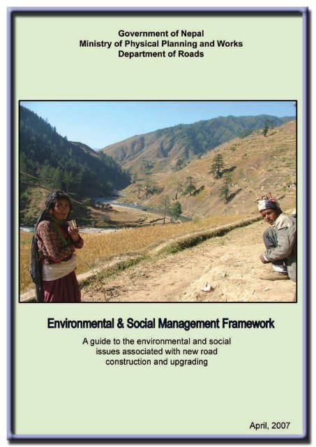
Government of NepalMinistry of Physical Planning and WorksDepartment of Roads<strong>Environmental</strong> & <strong>Social</strong> <strong>Management</strong> <strong>Framework</strong>A guide to the environmental and socialissues associated with new roadconstruction and upgrading(Final Version) April, 2007
Acknowledgement:This document was prepared as part of the Sector Wide Road Programme &Priority Investment Plan Study by DHV Consultants in association with SILTConsultants (P) Ltd., TAEC Consult (P) Ltd. and Consolidated <strong>Management</strong>Services Nepal (P) Ltd. under funding from World Bank / InternationalDevelopment Agency / Road Maintenance and Development Project.
TABLE OF CONTENTS<strong>Environmental</strong> & <strong>Social</strong> <strong>Management</strong> <strong>Framework</strong>PageTABLE OF CONTENTS................................................................................................................... i~vLIST OF TABLES .............................................................................................................................. viLIST OF FIGURES ........................................................................................................................... viiLIST OF ACRONYMS.....................................................................................................................a~bCHAPTER 1 – BACKGROUND AND RATIONALE FOR AN ENVIRONMENTAL ANDSOCIAL MANAGEMENT FRAMEWORK FOR THE SRN PROJECT ...... 1-1~1-91.1 Introduction .......................................................................................................................... 1-11.1.1 Background .............................................................................................................. 1-11.2 Project Description............................................................................................................... 1-21.3 Rationale and Approach for the <strong>Environmental</strong> and <strong>Social</strong> <strong>Management</strong> <strong>Framework</strong> ......... 1-31.3.1 Key Objectives of the ESMF ...................................................................................... 1-31.3.2 Methods Applied to Prepare the ESMF ...................................................................... 1-31.3.3 Sources of Information .............................................................................................. 1-51.4 Potential Users of this <strong>Environmental</strong> and <strong>Social</strong> <strong>Management</strong> <strong>Framework</strong> ........................ 1-61.5 Structure of the ESMF Document ........................................................................................ 1-8CHAPTER 2 - PROPOSED METHODOLOGICAL FRAMEWORK FOR SRN-RELATEDENVIRONMENTAL AND SOCIAL ASSESSMENT STUDIES............... 2-1~2-382.1 Embedding the EA Studies in Project Cycles for DoR Projects ........................................... 2-12.2 Specific Activities and Responsibilities in the EA Process ................................................... 2-32.2.1 The Procedural Steps in Road IEEs and EIAs ............................................................ 2-52.2.2 <strong>Environmental</strong> Auditing............................................................................................ 2-332.3 <strong>Environmental</strong> Code of Practice.............................................................................. ………2-36CHAPTER 3 - LEGAL ACTS, POLICIES, REGULATIONS AND GUIDELINES ......3-1~3-223.1 Principal Guiding Documents for IEE, EIA and SIA (including Resettlement) Related tothe Road and Transport Sector Development in Nepal........................................................ 3-13.2 Relevant Acts, Regulations and Guidelines ......................................................................... 3-13.2.1 Constitution of Kingdom of Nepal, 1990 ..................................................................... 3-13.2.2 Local Self-Governance Act, 1999............................................................................... 3-13.2.3 Nepal <strong>Environmental</strong> Policy and Action Plan (NEPAP), 1993 ...................................... 3-23.3 <strong>Environmental</strong> and Natural Resources Protection ............................................................... 3-23.3.1 The <strong>Environmental</strong> Protection Act, 1996 (EPA) .......................................................... 3-23.3.2 The <strong>Environmental</strong> Protection Rule, 1997 (first amendment, 1999) ............................ 3-23.3.3 Soil and Watershed Conservation Act, 1982............................................................... 3-33.3.4 Forest Policy, 1993 ................................................................................................... 3-43.3.5 Forest Act, 1993........................................................................................................ 3-43.3.6 Forest Rule, 1995 ..................................................................................................... 3-43.3.7 Forest Produce Collection and Sales Distribution Guidelines, 2001............................. 3-4April 2007TOC - i
<strong>Environmental</strong> & <strong>Social</strong> <strong>Management</strong> <strong>Framework</strong>3.3.8 The Aquatic Animal Protection Act, 1961 ................................................................... 3-53.3.9 The National Wetland Policy, 2003 ............................................................................ 3-53.3.10 National Parks and Wildlife conservation Act, 1973 and Rules .................................... 3-53.3.11 Mountain National Park Regulation, 1979................................................................... 3-53.3.12 The Buffer Zone <strong>Management</strong> Regulation, 1996 ........................................................ 3-53.3.13 International Legal Provisions with Likely Relevance for Road Projects ....................... 3-63.4 Road Construction and Land Acquisition ............................................................................. 3-63.4.1 Explosive Material Act, 2018 BS ................................................................................ 3-63.4.2 Public Road Act, 2031 BS ........................................................................................ 3-63.4.3 Land Acquisition Act, 1997 ........................................................................................ 3-73.4.4 Guthi Sansthan Act, 2033 BS .................................................................................... 3-83.4.5 Land Acquisition Guidelines 1989 .............................................................................. 3-83.4.6 Land Reform Act, 1964 (2021 BS) .......................................................................... 3-103.4.7 Local Self Governance Act 1998 and Local Self-Governance Rule 1999 ................... 3-103.4.8 Land Revenue Act, 1977 (2034 BS)......................................................................... 3-103.4.9 Child Labour Act, 1993 (2048 BS) and Child Labour Act, 2001 (2056 BS) ................. 3-113.5 The GoN Tenth Five Year Plan, 2002-2007....................................................................... 3-113.6 Relevant Sectoral Policies and Guidelines Prepared by the DoR ...................................... 3-123.6.1 <strong>Environmental</strong> Assessment in the Road Sector of Nepal, January, 2000 ................... 3-123.6.2 <strong>Environmental</strong> <strong>Management</strong> Guidelines, GESU/DoR, July, 1997 ............................. 3-123.6.3 Reference Manual for <strong>Environmental</strong> and <strong>Social</strong> Aspects of Integrated RoadDevelopment, MPPW/DoR, 2003 ..................................................................................3-133.6.4 The National Transport Policy, 2001..............................................................................3-133.6.5 Land Infrastructure Development Policy 2004...............................................................3-133.6.6 Public Infrastructure Built and Operate Policy, (2000)...................................................3-133.7 GoN Policies Supporting Vulnerable Communities ............................................................ 3-133.8 Relevant Policies and Guidelines of World Bank ............................................................... 3-163.8.1 <strong>Environmental</strong> Assessment EA (OP 4.01).....................................................................3-163.8.2 Natural Habitats (OP 4.04).............................................................................................3-173.8.3 Forestry (OP 4.36) .........................................................................................................3-173.8.4 Involuntary Resettlement (OP 4.12)...............................................................................3-173.8.5 Cultural Property (OPN 11.03).......................................................................................3-183.8.6 Indigenous People (OP 4.20).........................................................................................3-193.8.7 <strong>Environmental</strong> Assessment Sourcebook .......................................................................3-193.8.8 Roads and the Environment: A Hand Book ...................................................................3-193.9 ADB and Other Donor Agencies’ Policies .......................................................................... 3-203.9.1 ADB Resettlement Policy...............................................................................................3-203.9.2 ADB Policy on Indigenous People .................................................................................3-203.9.3 ADB Environment Policy................................................................................................3-203.9.4 Resolving Outstanding Issues with Regard to a Pre-defined RoW ...............................3-213.9.5 Policies of other Donor Agencies relating to Involuntary Resettlement.........................3-22TOC - ii April 2007
<strong>Environmental</strong> & <strong>Social</strong> <strong>Management</strong> <strong>Framework</strong>CHAPTER 4 – IDENTIFICATION OF POTENTIAL ENVIRONMENTAL AND SOCIALIMPACTS OF ROAD PROJECTS (INCLUDING SRN SUB-PROJECTS)4-1~4-274.1 Potential <strong>Environmental</strong> and <strong>Social</strong> Impact of Project Components .................................... 4-14.2 Beneficial Impacts................................................................................................................ 4-24.2.1 Generation of Employment ..............................................................................................4-34.2.2 Opportunities of New Income Generating Activities (IGAs).............................................4-34.2.3 Increase in Land Values ..................................................................................................4-44.2.4 Enhancement in Technical Skills and Know-How............................................................4-44.2.5 Easement of Former <strong>Environmental</strong> Problems................................................................4-44.2.6 Improved Access to Services and Decrease in Transportation Cost ..............................4-44.2.7 Gender-Specific Benefits .................................................................................................4-54.2.8 Exploitation of Untapped Potential...................................................................................4-54.2.9 Poverty Alleviation............................................................................................................4-54.3 Adverse Impacts .................................................................................................................. 4-64.3.1 Impacts on the Physical Environment and Land..............................................................4-74.3.2 Impacts on Biological Resources...................................................................................4-184.3.3 Impacts on Socio-Economic Environs ...........................................................................4-20CHAPTER 5 - PUBLIC CONSULTATION FRAMEWORK ............................................ 5-1~5-75.1 <strong>Social</strong> and Economic Development and Participation Issues in SRN Sub-Projects............. 5-15.2 Identification of Project Stakeholders and Integration of their Perspectives in thePlanning and <strong>Management</strong> Process .................................................................................... 5-25.3 Screening <strong>Framework</strong> involving Participatory Approach...................................................... 5-35.4 Public Disclosure of Information........................................................................................... 5-45.5 Establishing a Collaborative Partnership Mechanisms between Communities, LocalAuthorities and the Project <strong>Management</strong> ............................................................................. 5-45.6 Public Consultation throughout Project Cycle to Secure Support ........................................ 5-6CHAPTER 6 - ENVIRONMENTAL AND SOCIAL IMPACT MITIGATION MEASURES 6-1~6-256.1 Introduction .......................................................................................................................... 6-16.2 Phase-wise Mitigation Measures for <strong>Environmental</strong> and <strong>Social</strong> Safeguards ....................... 6-16.2.1 During Road Design Stage ..............................................................................................6-16.2.2 During Construction Stage...............................................................................................6-26.2.3 Potentially Induced and Cumulative <strong>Environmental</strong> and <strong>Social</strong> Impacts afterCompletion of the Road Projects ...................................................................................6-20CHAPTER 7- RESETTLEMENT POLICY FRAMEWORK (RPF) ................................ 7-1~7-247.1 Introduction .......................................................................................................................... 7-17.2 Comparison of the GoN’s and Donor Agencies Policies on Involuntary Resettlementand Land Acquisition............................................................................................................7-27.2.1 Common Principles..........................................................................................................7-27.2.2 Identification of Gaps and Limitations in the National Policies ........................................7-27.2.3 Recommendations to Bridge the Gaps............................................................................7-37.3 Eligibility, Entitlement and Valuation .................................................................................... 7-6April 2007TOC - iii
<strong>Environmental</strong> & <strong>Social</strong> <strong>Management</strong> <strong>Framework</strong>7.3.1 Eligibility ...........................................................................................................................7-67.3.2 Entitlement <strong>Framework</strong> ....................................................................................................7-77.4 Carrying Out the Valuation of Affected Assets................................................................... 7-137.5 Public Participation, Consultation and Grievance Mechanism ........................................... 7-147.5.1 Mechanisms of Consultation and Participation of PAPs................................................7-147.5.2 Establishment of Grievance Redress Mechanisms .......................................................7-157.6 Monitoring and Evaluation ................................................................................................. 7-167.6.1 Monitoring <strong>Social</strong> Aspects Pertaining to RAP and VCDP in the Sub-Projects ..............7-167.6.2 Types of Monitoring Applied ..........................................................................................7-167.6.3 <strong>Social</strong> Indicators to Monitor the Effectiveness of the Proposed RAPs and VCDPs ......7-177.7 Institutional Responsibilities and Implementation Arrangements for RAP.......................... 7-207.7.1 Key Agencies at Different Level.....................................................................................7-207.7.2 Geo-Environment and <strong>Social</strong> Unit (GESU)/or <strong>Social</strong> Unit (SU) of DoR.........................7-217.7.3 Implementing NGOs.......................................................................................................7-217.8 Implementations Schedule for the Resettlement Action Plan ............................................ 7-227.9 Cost Estimate and Financing for the RAP.......................................................................... 7-237.10 Recommended Procedures for the Resettlement Action Plan ........................................... 7-23CHAPTER 8- VULNERABLE COMMUNITY DEVELOPMENT FRAMEWORK ............ 8-1~8-88.1 Introduction .......................................................................................................................... 8-18.2 Implications for the SRN Program........................................................................................ 8-18.3 Potential Vulnerable Communities in Nepal......................................................................... 8-28.4 Legal <strong>Framework</strong> and Policies Focusing on Vulnerable Groups.......................................... 8-38.5 Preparation of VCDPF for the SRN Sub-Projects ................................................................ 8-48.5.1 Objectives ........................................................................................................................8-48.5.2 Approach..........................................................................................................................8-48.5.3 Components of the VDCP................................................................................................8-58.5.4 Preliminary Screening......................................................................................................8-58.5.5 Consultation and Information Disclosure Mechanism for the VCDP ...............................8-68.5.6 <strong>Social</strong> Impact Assessment (SIA) and Inclusion of Community DevelopmentPrograms..........................................................................................................................8-68.6 Institutional Responsibilities and Implementation Arrangement........................................... 8-78.6.1 Linkage and Overall Responsibilities for Implementing the VCDP..................................8-78.6.2 Contracting Experienced NGOs.......................................................................................8-78.7 VCDP Budget....................................................................................................................... 8-78.8 Monitoring and Evaluation ...................................................................................................8-8CHAPTER 9- INSTITUTIONAL FRAMEWORK FOR IMPLEMENTING THE ESMF ..... 9-1~9-59.1 Key Players involved in the Implementation of the ESMF.................................................... 9-19.1.1 Governmental and Non-Governmental Organizations.....................................................9-19.1.2 Consultants ......................................................................................................................9-49.1.3 Contractors.......................................................................................................................9-49.2 Interactions and Arrangements between the Key Institutions .............................................. 9-5TOC - iv April 2007
<strong>Environmental</strong> & <strong>Social</strong> <strong>Management</strong> <strong>Framework</strong>CHAPTER 10- INSTITUTIONAL STRENGTHENING OF THE GEO-ENVIRONMENTAND SOCIAL UNIT OF THE DEPARTMENT OF ROADS................ 10-1~10-1410.1 Identification of Opportunities, Weaknesses and Limitations ............................................. 10-110.2 Organisation of the Geo-Environment & <strong>Social</strong> Unit of DoR .............................................. 10-210.2.1 Development of the Unit ................................................................................................10-210.2.2 Organisational Linkage and Sections of the GESU .......................................................10-410.3 Findings on the Institutional and Organizational Capacity of the Geo-Environment &<strong>Social</strong> Unit of DoR.............................................................................................................. 10-410.3.1 General Institutional and Organisational Issues Identified by Donors ...........................10-410.3.2 In-house Assessment of the Institutional Limitations and Weaknesses of GESU.........10-410.3.3 Specific Issues Identified at Institutional Level ..............................................................10-510.3.4 Specific Issues Identified at Staff and Logistic Level .....................................................10-510.3.5 Specific Issues Identified at Procedural Level ...............................................................10-610.4 Conclusions ....................................................................................................................... 10-710.5 Recommendations for Upgrading the Institutional Capacity of the GESU ......................... 10-810.5.1 Develop Standardized Procedures ................................................................................10-810.5.2 Prepare Regular Business Plans ...................................................................................10-910.5.3 Allocate Clearly Defined Responsibilities.......................................................................10-910.5.4 Enhance Inter-Agency Coordination............................................................................10-1010.5.5 Enhance and Ensure Quality Control for Private Sector Involvement .........................10-1010.5.6 Formalize Supervision and Compliance Mechanisms.................................................10-1110.5.7 Carry out Institutional Training for Skill Development..................................................10-1110.5.8 Re-Organisation of the Geo-Environment & <strong>Social</strong> Unit..............................................10-12ANNEXESAnnex 1Annex 2Annex 3Annex 4The Consultant’s Terms of Reference for Preparing the ESMF<strong>Environmental</strong> Code of PracticeGlossary for Technical Terms used in the ESMFReference ListApril 2007TOC - v
<strong>Environmental</strong> & <strong>Social</strong> <strong>Management</strong> <strong>Framework</strong>LIST OF TABLESTable No. Description Pages1.1 Main Stakeholders and Users of the ESMF 1-72.12.22.3<strong>Environmental</strong> and social assessment and management steps for the proposedprojects under the SRN ProgramThe six major activities and responsibilities during different project stages forconducting road EA studies in NepalLegal Criteria for Selecting an IEE or EIA in the Road Sector, andcomparison of requirements prescribed by the GoN and the WB2.4 ToR for EA Studies in Nepal Requiring Approval of MoPPW or MoEST 2-72.5 Table of Content of an IEE Report pertaining to SRN sub-projects 2-102.6Checklist for <strong>Environmental</strong> Impact Prediction during differentProject Phases2.7 <strong>Environmental</strong> and <strong>Social</strong> Mitigation Measures – General Solutions 2-202.8 Mitigation Implementation – Description of Arrangements 2-232.9 Monitoring Indicators Selected for this IEE 2-262.10 <strong>Framework</strong> for Monitoring <strong>Environmental</strong> Aspects 2-302.11 Table of Content of an EIA Report pertaining to SRN sub-projects 2-322.12 <strong>Environmental</strong> Audit Plan 2-342.13General <strong>Environmental</strong> Codes of Practice for the SRN Road DevelopmentProgramme3.1 Procedural Steps in the Land Acquisition Process 3-93.2 Support Programs for Dalits laid out in the Tenth Plan 3-154.1 Opportunities and Risks from Road Construction Activities 4-24.2 Vehicle emission components and their principal environmental effects 4-155.1 Project Stage and Nature of Participation of PAPs in the Process 5-26.1 General Guideline for Slope Cutting Table 6-57.1Comparison of GoN and World Bank Policies on Entitlement for LandAcquisition, Gaps and Recommendations7.2 Entitlement Matrix 7-87.3<strong>Framework</strong> for Monitoring <strong>Social</strong> Issues Related to Resettlement andVulnerable Groups7.4 Phase-wise <strong>Social</strong> Monitoring & Evaluation Indicators for SRN 7-197.5 Implementation Schedule for individual RAPs 7-227.6Exemplary Costs (in Rs) for Resettlement, Land Acquisition and Monitoringfor Satbanjh-Jhulaghat Feeder Road (37 km) Upgrading Works8.1 Classification of Vulnerable Groups/Janajati in Nepal 8-22-22-42-62-162-377-47-177-23TOC - vi April 2007
<strong>Environmental</strong> & <strong>Social</strong> <strong>Management</strong> <strong>Framework</strong>LIST OF FIGURESFigure No. Description Pages1.1 Map of Strategic Roads in Western Nepal Selected for SRN Program 1-2*2.1 Integration of the EA Process in Road Project Cycles 2-12.2 Steps to Conduct an IEE or EIA Study 2-32.3 Schematic Diagram on Possible <strong>Environmental</strong> Impacts of Road DevelopmentActivities2-157.1 Diagram of key agencies involved in the resettlement process for rural roaddevelopment projects7-209.1 GESU’s organizational relationship with other DoR entities with respect toongoing road development projects9-510.1 Organizational Chart of the Department of Roads and the embedding of theGeo-<strong>Environmental</strong> & <strong>Social</strong> Unit10-310.2 Proposed Re-Structuring of the GEU into a Geo-Environment and <strong>Social</strong> Unit 10-13April 2007TOC - vii
<strong>Environmental</strong> & <strong>Social</strong> <strong>Management</strong> <strong>Framework</strong>List of AcronymsADBAsian Development BankAFAffected FamiliesBOTBuild -Operate -TransferCBOsCommunity Based OrganizationsCBSCentral Bureau of StatisticsCDCChief District OfficerCDOChief District OfficerCFCommunity ForestCFCCompensation Fixation CommitteeCFUGCommunity Forest User GroupCITESConvention on International Trade in Endangered Species of WildFauna and FloraDDCDistrict Development CommitteeDDCDistrict Development CommitteeDDGDeputy Director General of Department of RoadsDFIDUK Department for International DevelopmentDFODistrict Forest OfficeDGDirector General (of Department of Roads)DHVDHV Consultants, The NetherlandsDoLIDARDepartment of Local Infrastructure and Agricultural RoadDoRDepartment of RoadsDPSUDistrict Project Support UnitDWSCDepartment of Watershed and Soil ConservationEA<strong>Environmental</strong> AssessmentEIA<strong>Environmental</strong> Impact AssessmentEIRREconomic Internal Rate of ReturnEMAP<strong>Environmental</strong> <strong>Management</strong> Action PlanEMP<strong>Environmental</strong> <strong>Management</strong> PlanEPA<strong>Environmental</strong> Protection Act,1996EPR <strong>Environmental</strong> Protection Rules,1997 (amended 1999)ESAEquivalent Standard AxleESMF<strong>Environmental</strong> and <strong>Social</strong> <strong>Management</strong> <strong>Framework</strong>FRCUForeign Cooperation Unit (of DoR)FSFeasibility StudyGDPGross Domestic ProductGESUGeo-Environment and <strong>Social</strong> Unit, DoRGISGeographic Information SystemGoNGovernment of NepalGPSGlobal Positioning SystemGTZ"Deutsche Gesellschaft für Technische Zusammenarbeit" (GermanTechnical Cooperation)haHectare (= 19.64 ropani)HMGNHis Majesty's Government of Nepal (now GoN)HMISHighway <strong>Management</strong> Information SystemHRDHuman Resource DevelopmentICBInternational Competitive BiddingIEEInitial <strong>Environmental</strong> ExaminationIPDPIndigenous People’s Development PlanJICAJapan International Cooperation AgencyLAALand Acquisition ActLCFLocal Consultative ForumApril 2007List of Acronyms - a
<strong>Environmental</strong> & <strong>Social</strong> <strong>Management</strong> <strong>Framework</strong>LFBLocal Forum of BeneficiariesLROLand Revenue OfficerMoESTMinistry of Environment, Science and TechnologyMoFMinistry of FinanceMoLDMinistry of Local DevelopmentMoPEMinistry of Population and Environment (now included in MoEST)MoPPWMinistry of Physical Planning and Worksmsl Mean sea level (altitude in m)mtmetric tonNEPAPNepal <strong>Environmental</strong> Policy and Action PlanNGONon Governmental OrganizationNPCNational Planning CommissionNTFPnon-timber forest productOPOperational PolicyOPNOperational Policy NoteORNOverseas Road Note, TRL, UKPAFProject Affected FamiliesPAPProject Affected PersonsPIPPriority Investment PlanPIUProject Implementation UnitPRAParticipatory Rapid AppraisalPSCProject Supervision ConsultantPWDPublic Works DirectiveRAPResettlement Action PlanRIDPRural Infrastructure Development ProjectRMDPRoad Maintenance and Development ProjectRoWRight of WayRPResettlement PlanRPFResettlement Plan <strong>Framework</strong>RRARural Rapid AppraisalRsNepalese Rupees [rate of exchange per 15 Nov.06: 1 US$ =70.6 Rs]SA<strong>Social</strong> Assessment/ AnalysisSAP<strong>Social</strong> Action PlanSIA<strong>Social</strong> Impact Assessment/ AnalysisSIA<strong>Social</strong> Impact AnalysisSLCSchool Leaving CertificateSPAFSeriously Project Affected FamiliesSPAPSeriously Project Affected PopulationSRESenior Resettlement ExpertSRNStrategic Road NetworkSWRPSector Wide Road ProgramSWRP& PIP Sector Wide Road Program and Priority Investment PlanTATechnical AssistanceToRTerms of ReferenceUNUnited NationsVCDAPVulnerable Community Development Action PlanVCDFVulnerable Community Development <strong>Framework</strong>VCDPVulnerable Community Development PlanVDCVillage Development CommitteeVpdVehicles per DayWBWorld BankZOIZone of impactList of Acronyms - b April 2007
<strong>Environmental</strong> and <strong>Social</strong> <strong>Management</strong> <strong>Framework</strong>Chapter 11 Background and Rationale for an <strong>Environmental</strong> and<strong>Social</strong> <strong>Management</strong> <strong>Framework</strong> for the SRN Project1.1 IntroductionThis <strong>Environmental</strong> and <strong>Social</strong> <strong>Management</strong> <strong>Framework</strong> report (ESMF) isprepared for the Department of Roads (DoR) to compile in an overview andguidance manner, various safeguard and compliance aspects of environmentaland social issues related with the Sector Wide Road Program and the PriorityInvestment Plan Study for Nepal’s Strategic Road Network (SRN) planning for2007 to 2016. The Study commenced in September 2005 and was completed inDecember 2006.1.1.1 BackgroundAt present the National Road Network has altogether 15,308 km roads, including4,522 km blacktop, 3,646 km gravel and 7,140 km earth roads. Put alternatively,the National Road Network comprises 15,308 km roads including 4,977 kmstrategic roads 1,984 km urban roads and 8,347 km district roads. GoN hasproposed Strategic Road Network of about 12,600 km in the coming decade.Nepal’s economic and social development cannot be seen separately from itsgeography and accessibility. Adequate road connectivity and quality of roads aredirectly related with the country’s productive sectors such as agriculture, market,commerce, industry, and social sectors including education, health,communication, livelihood and quality of life. Good road connectivity is notablylinked with poverty alleviation. Among Nepal’s 75 district headquarters, 17 are notconnected by a motorable road, and 60 percent of the main road network andalmost all rural roads are dry-weather tracks that are not operational during therainy season. Based on the GoN policy and focus to achieve poverty alleviationalso through transportation network development, road network in Nepal hasgrown immensely over the past half century. Nevertheless, in hills, an estimated39% of the population (5 million) live at more than 4hrs walk from all weatherroads (AWR) and in the Terai, 13% (1.4 million) live at more than 2hrs walk fromthe nearest AWR. Many in these isolated communities rely on foot trails and muletracks, and have to walk to reach the nearest dry-season road. Inadequate andinefficient rural transport service therefore is a major factor constraining the useof social services and markets by communities, including education, medicalfacilities and agriculture markets. This problem is particularly acute in remoteareas and is a contributing factor to rural poverty. The strategic planning of DoRrecognizes the need for improving both strategic as well as rural transportconnectivity in the country.Road construction incurs various environmental and social impacts, includingboth beneficial as well as adverse ones. Particularly in a country like Nepal, whichhas young and fragile geology, widespread poverty in the mostly remote ruralregions, vulnerable communities, rich natural biodiversity, road construction canApril 2007 Chapter 1-1
<strong>Environmental</strong> and <strong>Social</strong> <strong>Management</strong> <strong>Framework</strong>bring significant adversities to the local, regional and national environmentalsetting and socio-cultural fabric of the affected population.A common weakness generally observed in Nepal rural road developmentprograms is inadequate integration of environmental and social recommendationsinto project plans, designs and bill of quantity. This is partly because of latecommissioning of environmental and social studies. The ESMF is meant tosuggest mechanisms, in line with the current legal and policy framework, to makethis effective. With foresight, appropriate research and diligent planning andimplementation of mitigation measures and monitoring, many, if not all, of theadverse impacts can be minimized or avoided or dealt with positive andconstructive ways.Next to environmental study performance the environmental monitoring in roaddevelopment programs is one of the weakest areas in Nepal. Therefore, thisESMF makes efforts to recommend strengthening the respective institutions inthis regard, particularly the Geo-Environment and <strong>Social</strong> Unit of the DoR andselected units/departments within the MoPPW.1.2 Project DescriptionThe Department of Roads (DoR) is the main agency responsible for planning,design, operation and maintenance of the Strategic Road Network (SRN)throughout Nepal. The This study, which is funded under a loan 1 from the WorldBank / International Development Association (IDA), is designed to assist theDoR and Government of Nepal (GoN) with the preparation of sector wideinvestment plan and the development of the SRN over the next ten years.In the period since the previous planning study was completed in 1972, the ruralroad network has expanded dramatically but there has been only relativelymodest progress on the extension of the strategic network and substantial areasof the country are still without all-weather motorable road access. Therefore, thiscore of this program is to identify further strengthening of the Strategic RoadNetwork throughout the country by selecting corresponding road sections(hereunder referred as SRN sub-projects). The present Study, of which the EMSFis a vital part for the loan effecting, aims to assist in this process and to prioritizeextensions and improvements to the network over the period to 2016.The Study aims to assist the GoN in the process of reviewing the extent of theSRN, which is the prime responsibility of DoR, and is preparing a long-term planfor the future development of the road network. The Study will also identify andprepare detailed feasibility studies for an initial 87 km of new construction and728 km for upgrading, which will be proposed for funding under the next IDAcredit for Nepal. The locations of the proposed sections for the SRN areillustrated in Fig. 1.1.1 Nepal, Road maintenance & Development Project: Loan: IDA Credit 3293-NEP2 Priority Investment Plan Project, WSA, February 1997Chapter 1-2 April 2007
<strong>Environmental</strong> and <strong>Social</strong> <strong>Management</strong> <strong>Framework</strong>1.3 Rationale and Approach for the <strong>Environmental</strong> and <strong>Social</strong> <strong>Management</strong><strong>Framework</strong>Road construction activities bear the risks for potential environmental impactslikely to occur in the physical, biological, social, cultural and sometimesarchaeological spheres. Landslides, slope failures, soil erosion, loss of nationalpark, forest and agricultural lands and interference with water courses, irrigationfacilities, run-off and sedimentation are among the major impacts resulting fromroad construction that need thorough addressing in design and construction,incorporating proven mitigation measures that will bring adverse effects down toacceptable levels.Awareness and appreciation of the opportunities and risks involved due to roadproject implementation are often beyond the comprehension of local people. Theymay greet the new construction with high expectations, or anxiety, suspicion,concern or resistance. It is among the principal objectives of this ESMF to providedecision makers, engineers and supervisors of road maintenance works with areference document that will demonstrate the government’s proponents efforts toaddress properly the potential risks associated with road works, and to divulgatethe management options and environmental/social safeguard measures to thebroad public to gain full understanding and support of those using the nationalroad network.1.3.1 Key Objectives of the ESMFThe ESMF intends to provide technical and managerial inputs and guidance intothe design of the strategic roads (both designated for rehabilitation and, to lesserextent, to new construction, in the Western Districts of Nepal), throughidentification of key environmental and social issues related to the foreseenprojects (hereunder referred as “SRN sub-projects”), mitigate potential impactsand concerns and, devise opportunities to enhance the benefits. The frameworkintegrates in a step-wise approach the most important environmental and socialconsiderations into all stages of project preparation, implementation, monitoringand operation and is applicable to all future sub-projects funded under the SRNprogram. Based on both the Consultants’ ToR and discussions held with theClient (DoR/WB), the key objectives to be addressed in the ESMF are:• Review GoN’s existing policies, regulations, operational guidelines andinstitutional arrangements to address and mitigate environmental and socialimpacts of national roads.• Assess the compatibility of the core principles of GoN policies with policies ofthe donor agencies, identify gaps, and present recommendations foraddressing the gaps.• Describe the tools and procedural steps to assess the environmental andsocial issues for all project-related activities, and describe stepwise thecorresponding management requirements in the entire project cycle.• Prepare a screening and consultation framework for environmental andsocial assessment of the proposed sub-projects; this framework shall includeall parties involved, particularly focusing on service providers to ensure thatthe safeguard measures prescribed in the EMAPs are duly followed andenforced.• Refer to established principles relating to environmental and social safeguardmechanisms to be incorporated in DoR’s road development programs; TheCode of Good Practice compiled in this document (Annex 2) and the <strong>Social</strong>Assessment and Consultation <strong>Framework</strong>s (Chapter 6 to 8) shall form aninstrumental basis in carrying out new road development projects.• Planners and users of this ESMF should also consult other documentationthat will give ample accounts on lessons learned with respect toApril 2007 Chapter 1-3
<strong>Environmental</strong> and <strong>Social</strong> <strong>Management</strong> <strong>Framework</strong>environmental and social safeguard aspects, and how to avoid adverseimpacts and how to enhance beneficial ones. In this context, specialreference is made to a supplementary report referring to ‘Lessons ofExperience – Case Studies of Complemented Projects’ prepared andsubmitted in Sept. 2006 by the Consultants, as well as to the ‘ProjectCompletion Report for RMDP, prepared by SMED/CEMAT in June 2005.• Assist the GESU of DoR in the preparation of IEEs, EIAs and SIAs to beused as standard operational assessment and management models forfuture sub-projects becoming selected under the SRN road program.• Prepare an exemplary matrix of mitigation measures to manage the identifiedimpacts.• Identify practical, feasible, credible and cost effective measures to offset or toreduce adverse environmental and social impacts to acceptable level, andways to enhance positive impacts. As applicable, also address secondary,induced and cumulative impacts that may be associated with the forthcomingroad construction activities.• Make specific reference to the public consultation process and theconsultation framework, describing adequate participatory mechanismsparticularly with respect to local employment, gender issues, empowermentand local control instruments.• Prepare a Resettlement Policy <strong>Framework</strong>.• Prepare a Vulnerable Community Development <strong>Framework</strong>.• Recommend measures to strengthen project implementation mechanismsand institutional arrangements at different phases of the project cycles, withrespect to the <strong>Environmental</strong> and <strong>Social</strong>/ Resettlement <strong>Management</strong> Plans.• Provide a detailed account on strengthening the institutional capacity of DoR,in specific of the unit in charge, the GESU. Based on a need assessment(Chapter 10) This should be followed by a an in-house training program onenvironmental and social impact assessment skill development. 31.3.2 Methods Applied to Prepare the ESMFThe methodology adopted for preparation of the ESMF included:Review of relevant GoN environmental and land acquisition legislation andoperational guidelines;(i) Review of pertaining operational guidelines from various donor agencies(WB, ADB, JICA, DFID) being actively involved in the country’s road andtransport sector programs 4 ;(ii) Consultation of meteorological, hydrological, and geological sourceinformation (atlases, thematic maps, scientific data compilation, statisticalmaterial etc.) for the said regions;(iii) Site-specific E&S assessments, collecting environmental and socialbaseline data for sub-projects selected by the Client;(iv) Identification of stakeholders and carry out public consultation at selectedsites on environmental and social issues 5 ;3 Prepared and submitted by the Consultants in a separate document.4 Key documents included the Land Acquisition Act (1977) and the World Bank’s OperationalPolicy 4.12 on Involuntary Resettlement and Operational Directive 4.20 on Indigenous Peoples5 Carried out in randomly selected sample subprojects in the Terai and Hill Districts. Details seethe social impact assessment reports of the PIP Consultations were held with differentstakeholders, including VDCs, DDC’s, Local Road User Groups (LRUG), local NGOs, as wellas other government departments. Separate interviews were held with vulnerable groups,women, disabled and landless.Chapter 1-4 April 2007
<strong>Environmental</strong> and <strong>Social</strong> <strong>Management</strong> <strong>Framework</strong>(v)(vi)(vii)(viii)(ix)(x)Conduct primary field investigations on the environmental and socialsetting in the feasibility study candidates;Identification of local adverse environmental and social impacts andstrategies of how they could be minimized or mitigated;Identification of positive impacts and how they could be enhanced;Incorporation of the consultation and field observation findings/recordsinto the proposed designs;Establishment of indicators and mechanisms for monitoring andevaluation; and,Discussions with the Client to identify needs for institutional strengtheningwith respect to the EA arrangements.The environmental and social screening criteria to identify the sub-project’senvironmental and social impacts have been discussed with the Client and withWorld Bank and are integrated in this ESMF. The social screening criteria willidentify the loss of land, assets, structures, livelihoods, the willingness of affectedpeople/communities to voluntarily donate any required land, the presence ofindigenous, ethnic, vulnerable people and other significant social impacts. <strong>Social</strong>screening will also enable the categorization of subprojects based on their levelsof impacts. Where the extent of adverse social impacts is minor and nodisplacement or loss of assets or livelihoods expected, no further action isrequired. However, where the social screening indicates that land acquisition,relocation, or loss of assets is unavoidable, appropriate mitigation instruments(sub-project resettlement action plans) will need to be prepared.<strong>Environmental</strong> and social screening has been carried out as part of the feasibilitystudies for selected sub-projects. As far as the social assessment is concerned,the following approach has been adopted:(i)Identification of social Impacts in sample sub-projects: Key beneficialparameters to be assessed were enhanced access to motorable transportand social services, reduction in travel time and transport costs, andemployment opportunities for work on project through beneficiarycommunities. On the perception of adverse project, key parametersassessed were land acquisition, compensation and resettlement.(ii) Development of <strong>Social</strong> Impact <strong>Management</strong> Guidelines: The social issuesidentified provided the analytical underpinnings for preparing appropriatemitigation strategies. A Resettlement Policy <strong>Framework</strong> (RPF) has beenprepared to define the policy and institutional framework to guide thecompensation/entitlement for loss of land, assets, livelihoods and othersocial impacts. Similarly, a Vulnerable Community Development Plan(VCDF) has been prepared to address impacts on vulnerable groups andensure their inclusion in the project activities.(iii) The ESMF is applicable to all proposed subproject activities and through allstages of the subproject cycle: pre-planning, planning and design,implementation, and post-implementation.1.3.3 Sources of InformationRelated to specific aspects, sources of information were as follows:(a) Physical Resources• Land, Water and Air• Maps (thematic / GIS maps), Satellite images etc.• Survey data from geological and hydrological studiesApril 2007 Chapter 1-5
<strong>Environmental</strong> and <strong>Social</strong> <strong>Management</strong> <strong>Framework</strong>• Climate and statistical data published by Bureau of Statistics• Other published documentation on these subjects.(b) Biological Resources• Scientific publications on local biota surveys• Species distribution maps• Ecological studies carried out in the project area (particularlywhen protected areas are in close vicinity, e.g. Rara Lake)• Direct observations carried out by specialized surveyors• Accounts on habitats and species given by local residentscontacted during public consultation processes• Other relevant documentation.(c) Socio-economic and Cultural Resources• Scientific publications on previous local surveys• Published demographic data and maps• Household surveys carried out by the Consultants Field Team1.4 Potential Users of this <strong>Environmental</strong> and <strong>Social</strong> <strong>Management</strong><strong>Framework</strong>The Report is prepared as an after due discussion with the Client at DOR and thedonor at the office of World Bank. It was advised to the Consultant to prepare thedocument in such a way that stakeholders affiliated or affected by the forthcomingsub-projects of the SRN, as well as other road projects of similar size andregional setting, will make use of this report in various aspects of managing theenvironmental and social implications during planning, design andimplementation of the envisaged program.The ESMF is applicable to all proposed subproject activities and through allstages of the subproject cycle, i.e. from pre-planning, planning and design,implementation to post-implementation. The design flow of ESMF activities willbe coordinated and integrated into the project cycle. This does not waive thenecessity of any project proponent to refer and comply with the nationalregulatory provisions as outlined in Chapter 2 of this ESMF.The mainstreaming of environmental and social aspects in the project cycle willbe achieved through:• Incorporation of environmental and social activities in the OperationalGuidelines for each sub-project.• Development of supportive programs in the areas of vulnerable communities’development, resettlement and rehabilitation, and monitoring and evaluation.• Establishment of appropriate institutional arrangements for environmentaland social impact management.• Development of a communications/information dissemination strategy.• In-house training and capacity building on environmental and social impactmanagement.• Intensive use and application of the guidelines prepared by previous effortsof the Geo-Environment Unit, namely the ‘<strong>Environmental</strong> <strong>Management</strong>Guidelines May 1997’, and the ’Reference Manual for <strong>Environmental</strong> and<strong>Social</strong> Aspects of Integrated Road Development, 2003’.• Intensive use and application of the ‘Roadside Bio-Engineering Manual 1999’prepared under DFID funding,• Intensive consultation of all documentation available on Good Practice inroad construction under local conditions, particularly referring to the ODAManual on ‘Principles of low cost road engineering in mountainous regions(ORN # 16) and other principles provided in Annex 2 of this document.Chapter 1-6 April 2007
<strong>Environmental</strong> and <strong>Social</strong> <strong>Management</strong> <strong>Framework</strong>• Consultation of the completion documents that were recently developedunder the RMDP Program.The concepts and procedures presented in this framework is intended to helpDoR, stakeholders and project proponents to fulfil their environmental and socialresponsibilities as required under the National <strong>Environmental</strong> Impact AssessmentGuidelines of 1993 and GoN policies and regulations detailed in Chapter 2. Thefocal addressee within the DoR is the GESU (Geo-Environment & <strong>Social</strong> Unit)who is responsible for supervising and managing E&S aspects in all phases ofstrategic road network development. Details are given in Chapter 9 and 10 of thisESMFThis ESMF will help keep the overriding E&S responsibilities firmly in mind duringthe scoping process while writing the Terms of Reference (ToR), whileconducting the Initial <strong>Environmental</strong> Examination (IEE) or the <strong>Environmental</strong>Impact Assessment (EIA) with reference to the proposed and sector-wide roaddevelopment. It will also aid in the process of compliance monitoring in regards toeach project's <strong>Environmental</strong> <strong>Management</strong> Action Plans (EMAP), <strong>Social</strong> ActionPlans (SAP) and related plans and resettlement (RP/RAP).Table 1.1 Main Stakeholders and Users of the ESMF1) ROAD AGENCY : DEPARTMENT OF ROADS• Planning and Design Branch• Geo-Environment & <strong>Social</strong> Unit• Monitoring and Evaluation Unit• Road and Traffic Unit• Roads Sector Skills Develop. Unit• Highway <strong>Management</strong>Information System Unit2) GOVERNMENT LINE AGENCIES• Ministry of Physical Planning andWorks• Nepal Roads Board (in asupervisory role)• Ministry of Labor and Transport<strong>Management</strong>• Dept. of Transport <strong>Management</strong>3) OTHER RELEVANT GOVERNMENT MINISTRIES• Ministry of Forest and SoilConservation• Dept of Forests• Department of National Parks andWildlife Conservation• Department of Soil Conservationand Watershed <strong>Management</strong>4) CONSULTANTS• <strong>Environmental</strong>/EIA Consultants• <strong>Social</strong>/SIA Consultants5) CONTRACTORS• Construction Implementing Contracts• Foreign Cooperation Branch• Road Project managers• Maintenance Branch• 5 Regional Road Directorates• 25 Divisional Road Offices• Ministry of Local Development• Department of Local InfrastructureDevelopment and Agricultural Roads(where agricultural roads and/orother local infrastructure areaffected)• Ministry of Water Resources• Ministry of Culture, Tourism and CivilAviation• Department of Archaeology• Nepal Electricity Authority / Dept. ofElectricity Development• Nepalese Army• Technical/Engineering Consultants• Legal ConsultantsApril 2007 Chapter 1-7
<strong>Environmental</strong> and <strong>Social</strong> <strong>Management</strong> <strong>Framework</strong>6) COMMUNITY LEVEL STAKEHOLDERS• Local Authorities (LAs)• District Development Community• Village Development Community• Municipalities• Community Based Organizations• Non-Governmental Organizations7) PRIVATE INVESTORS• Local Constructive Forums• Compensation DeterminationCommittee (CDC)• Road Neighbors• Political Leaders and Representatives• Private Investors under BUILD OPERATE AND TRANSFER (BOT)• Private Investors under BUILD OWN OPERATE AND TRANSFER (BOOT)1.5 Structure of the ESMF DocumentThis <strong>Environmental</strong> and <strong>Social</strong> <strong>Management</strong> <strong>Framework</strong> Report, following thisintroductory section, contains further 10 Chapters:Chapter 2: Proposed Methodological <strong>Framework</strong> for SRN-related <strong>Environmental</strong>Assessment Studies: contains details of the necessary activities carried outduring various stages of the project planning, study, design and implementation.This chapter contains major framework conditions to be provided by the ESMF. Itstepwise details on carrying out environmental and social assessment in projectsfor sector wide application, guiding the user on what to be conducted with whatmethodology at various stages of the EA study, including the environmentalauditing. It also provides the basic principles for planning, implementing andmonitoring mitigation measures while considering this road development project.Chapter 3: Legal <strong>Framework</strong>: Policies, Regulations and Guidelines: Review ofthe Legal <strong>Framework</strong>: Policies, Regulations and Guidelines of the Government ofNepal, and those of the major donor agencies, that bear relevance to theforthcoming SRN program.Chapter 4: Identification of Potential <strong>Environmental</strong> and <strong>Social</strong> Impacts in SRNSub-Projects: Describes in specific details the various impacts that may occurdue to implementation of the envisaged road sub-projects. It contains bothbeneficial as well as adverse impacts experienced in different ecological settingsof the country. Experiences of other / similar road projects implemented in Nepalhave also been included. However, additional compilation of the impacts basedon the experience of this Study as well as past studies conducted in the countryis still being carried out.Chapter 5: Public Consultation <strong>Framework</strong>: presents the specific publicconsultation framework that needs to be applied while carrying out the respectiveEAs for the corresponding sub-projects It also includes the consultativeprocedures required for different project implementation phases as outlined in the<strong>Environmental</strong> <strong>Management</strong> Plan and in the <strong>Social</strong> Action Plan.Chapter 6: A Compendium of <strong>Environmental</strong> and <strong>Social</strong> Impacts MitigationMeasures in Road Projects Planned under SRN: Provides technical aspects howto maximize beneficial impacts and how to avoid or minimize of adverse impactsunder the typical setting in the forthcoming road development program.Chapter 7: Resettlement Policy <strong>Framework</strong>: contains the framework preparedfor carrying out land and property acquisition, compensation and resettlementduring project implementation. It follows the GON and WB policy and provisions.The National Resettlement Policy <strong>Framework</strong> is currently being prepared byNational Planning Commission, and is expected to be finalized within couple ofmonths. Once this is finalized, the RPF will also refer to this binding document.Chapter 1-8 April 2007
<strong>Environmental</strong> and <strong>Social</strong> <strong>Management</strong> <strong>Framework</strong>Nevertheless, the draft version of this has already been followed while preparingthis RPF under the current study.Chapter 8: Vulnerable Community Development <strong>Framework</strong>: contains theframework prepared for vulnerable community development while carrying out EAand their implementation in road projects under a sector wide concept.Chapter 9: Institutional Arrangement for ESMF Implementation: contains anassessment of the institutional arrangements and managerial proceduresnecessary for implementation of the overall sector wide environmental and socialmanagement framework in the envisaged SRN sub-projects.Chapter 10: Institutional Strengthening of DoR: This chapter identifies gaps andneeds related to institutional strengthening of DoR, focusing on the unitsresponsible for environmental and social components of road and trafficmanagement planning and supervision.Attached appendices are:ANNEX 1: The Consultant’s Terms of Reference for Preparing the ESMFANNEX 2: <strong>Environmental</strong> Code of Practice – a Practical Guidance: Providestechnically specified solutions illustrating the general principles of environmentallysound and sustainable planning, design and construction of road structures. Italso refers to drainage and flood prevention, roadside planting, work safety andhealth concerns, and protection of wildlife and cultural assets. The guideline isreferring to a number of manuals already available at the GESU of DoR, andprovides a number of modifications of other useful guidelines.ANNEX 3: Glossary for Technical Terms used in the ESMFANNEX 4:Reference ListApril 2007 Chapter 1-9
<strong>Environmental</strong> and <strong>Social</strong> <strong>Management</strong> <strong>Framework</strong>Chapter 22 Proposed Methodological <strong>Framework</strong> for SRN-Related <strong>Environmental</strong> and <strong>Social</strong> AssessmentStudies2.1 Embedding the EA Studies in Project Cycles for DoR ProjectsThis section provides an overview of the sequential methodological steps that areto be followed in each assessment exercise that bears relevance to both theenvironmental and the social impacts that are likely to occur in the forthcomingroad development projects under the SRN Program. The process is in line withthe current operational guidelines provided by GoN’s Manual for environmentaland social aspects of Integrated Road Development, MoPPW/DoR, 2003 thatrequire the integration of the EA process in project cycles (Fig. 2.1).Fig. 2.1: Integration of the EA Process in Road Project CyclesDetailed assessment of significant impacts. Alternateanalysis; Identification of mitigation needs.Input to cost/benefit analysisPre-feasibilityFeasibilityDetailed design ofmitigation measuresSite Selection,environmentalscreeningProjectConceptDesign andEngineeringImplementationImplementation ofmitigation measuresand environmentalstrategyMonitoring and evaluationMonitoring and postauditing lessons forfuture projectsApril 2007 Chapter 2-1
<strong>Environmental</strong> and <strong>Social</strong> <strong>Management</strong> <strong>Framework</strong>The methodology outlined in this Chapter is intended to assist the IEE, EIA or SIApractitioner as well as the designers, engineers, supervision and monitoringpersonnel involved in these projects. It gives practical guidance on the processrequired by the legal provisions (see Ch. 3) from field identification, preparation ofassessment reports, submission and approval, to the implementation of theprescribed management options. The assessment process itself is summarized inthe GoN’s Public Works Directives 2002, as shown in Tab. 2.1.Table 2.1: <strong>Environmental</strong> and social assessment and managementsteps for the proposed projects under the SRN ProgramStages in ProjectCycleProject Identification/ Pre-Feasibility Study
<strong>Environmental</strong> and <strong>Social</strong> <strong>Management</strong> <strong>Framework</strong>2.2 Specific Activities and Responsibilities in the EA ProcessThe linkage of the stepwise assessment activities for road development projectsin Nepal is illustrated in the following diagram:Fig. 2.2: Steps to Conduct an IEE or EIA StudyApril 2007 Chapter 2-3
<strong>Environmental</strong> and <strong>Social</strong> <strong>Management</strong> <strong>Framework</strong>The major activities and the relating responsibilities as well as an estimation of the timerequired for each sub-activity are shown in Table 2.2:Table 2.2: The six major activities and responsibilities during different projectstages for conducting road EA studies in NepalStage Steps / Activites Description ResponsibilityPlanningand PrefeasibilityPrefeasibility/planningPrefeasibility/planningPrefeasibilityandStep 1: ScreeningUndertake ScreeningPrepare a document containing environmentalinformation covering potential environmentalimpacts, mitigation measures, evidence ofpublic consultation, etc Take no further actionfor projects, which do no require EAStep 2: Scoping to identify type of EA StudyScoping Exercise Identify, by using checklists and based onpreliminary field examination the necessity toconduct an IEE or an EIA, as per EPRProduce Environment related document tocompetent authority for approvalStep 3: Terms of Reference for EA StudiesPreparation of Termsof ReferenceApproval of TORDefine the main <strong>Environmental</strong> Concerns andIssues related to proposed road, which must beaddressed by EAReview, Comment and Approve Terms ofReferenceDoR asProponent oraccreditedprofessionalsProponentassisted byprofessionalsDoR/GESUassisted by Prof.EA TeamMPPW for IEEMoEST for EIAStep 4: Preparatory Work for EA studiesAssigning the work Determine whether to conduct EA using inhousestaff, or whether to outsource itGESU/DoRGESU/DOREA Team Formation Form Team as per TOR EA TeamEA TeamPlanning prepare Work Plan Establish a work plan that gives appropriateweight to all activitiesPlanningand DesignPlanningand DesignPlanningand DesignStep 5: Undertake EA StudiesDesk StudiesSecondary Source of Collect and review appropriate published data,Informationsuch as maps, reports, etcInitiation, Interaction Discuss the proposed road and its potentialand Consultation environmental impacts with knowledgeablePreparation ofInformation Summarypersons and concerned stakeholdersDraft a summary of the information that isrelevant to the project and its possibleenvironmental effectsSelection of methods Determine the methods by which the field workand techniques for EA will be conductedImprove Work Plan Revise the work plan on basis of desk studiesField WorkField Equipment Collect and Arrange Field Equipment requiredfor EA studiesField Survey for Walkover survey, interacting with localCollection of Baseline communities, and investigate the issuesInformationidentified during desk studyCollect baseline environmental information interms of physical, biological, and socioeconomicand cultural aspectsData Analysis and InterpretationIdentification of<strong>Environmental</strong>ImpactsImpact PredictionEstablish what environmental Impacts will occuras result of interaction of environmental settingand road construction and operation activitiesEstablish the extent of environmentalconsequences of the road construction andoperationEA TeamEA TeamEstimatedTime3 weeks3 to 4weeks3 to 6weeks4 weeks2 weeks2 weeksChapter 2-4 April 2007
<strong>Environmental</strong> and <strong>Social</strong> <strong>Management</strong> <strong>Framework</strong>Stage Steps / Activites Description ResponsibilityProjectAppraisal/ApprovalDesign,Implementation<strong>Environmental</strong>AuditAssessment ofsignificance of impactMitigation Measures<strong>Environmental</strong><strong>Management</strong> PlanPublic ConsultationReview and Approvalof EA ReportImplementation ofEMP, MonitoringStep 6:AuditingJudge whether the consequences aresignificant enough to require action to be takenDesign Mitigation Measures: to avoid, reduce,minimize and compensate for adverseenvironmental and social impacts; andmaximize beneficial impacts.Prepare EMP covering Monitoring and Project<strong>Management</strong> to ensure the implementation ofmitigation measures.Occurs at various stages in the assessmentprocess to ensure quality, comprehensivenessand effectiveness, and that stakeholders’ viewsare adequately addressed.Check completeness, adequacy, credibility,facilitate the decision-making process; decide ifproject should proceed, or if further alternativesmust be examined.Post Construction AuditApproval of EA Report/Rejectiondetermines compliance with EMP<strong>Environmental</strong> Audit: conducted two years afterproject completionEA TeamEA Team,DoR/GESUGESU/DoR willreview, commentand forward toMoPPW forreview, commentand approval forIEE Report. ForEIA, MoPPW willforward it forreview, commentand approval toMoEST.MoPPW orMoESTDoR/GESU;MoPPWMoEST for EIAStudyEstimatedTime4 weeks2-3 weeks6 weeksEntireconstructionperiodDuringOperationperiod2.2.1 The Procedural Steps in Road IEEs and EIAsThe following describes in more details the single steps outlined in the previoustable:STEP 1:ENVIRONMENTAL SCREENINGScreening in GoN is based on project-type threshold criteria, whereas most ofdonors’ approach is screening on the basis of potential environmentalconsequences. According to GoN approach, IEE is required for Minor FeederRoads. However, the common approach proposed in donors guidelines is to dealon case-by-case basis. The forthcoming IEEs/EIAs will have to be fully in line withthe legal provisions given by GoN in order to obtain timely approval.At the initial stage of the project planning, information on the detailed projectdesign will not be available, but the basic nature of the project will be known (forexample, a strategic road or a district road). The area of land which is likely to beconverted into road and the alignment along which the project is being proposedto be implemented are taken into account. At this stage, the "screening" exerciseis mainly meant to pre-identify the likelihood of environmental and social impactsassociated with the planned project activities, at all of its phases. The screeningprocess at this stage is best performed with the help of established (orprescribed) environmental screening checklist to ensure some form ofcompleteness.April 2007 Chapter 2-5
<strong>Environmental</strong> and <strong>Social</strong> <strong>Management</strong> <strong>Framework</strong>At this early stage, quick environmental overview/reconnaissance or preliminaryenvironmental study can indicate, whether any of the alternatives proposed areenvironmentally harmful, such as• identification of "viable" alternatives (from an environmental viewpoint), and• provision of an early indication of likely significant impacts for further EIAwork.STEP 2:PROJECT SCOPINGIn Nepal, projects to be considered for application of IEE and EIA are listed in theSchedule 1 and Schedule 2 related to Rule 3 of <strong>Environmental</strong> Protection Rule,1997 (first amendment, 1999) of GoN. The legal criteria are shown in Tab. 2.3.Accordingly; all road development projects must be considered for conductingeither an IEE or a full EIA, depending on their length, project costs and, above all,f they are new constructions or just rehabilitation and upgrading works. For thesub-projects pertaining to this ESMF, all but one fall in the category of IEE.Table 2.3: Legal Criteria for Selecting an IEE or EIA in the RoadSector, and comparison of requirements prescribed by the GoN andthe WBType of ProjectType of EARequiredEA Categoryas per WBConstruction of National Highways EIA AConstruction of Major Feeder Roads EIA AConstruction of Minor Feeder Roads IEE BConstruction of District Roads IEE BConstruction of Urban Roads IEE BConstruction of Rural Roads IEE BConstruction of 1 to 5 km long Ropeways IEE BConstruction of more than 5 km long Ropeways EIA AConstruction of 1 to 5 km long Cable Car IEE BConstruction of more than 5 km long Cable Car EIA AConstruction of Major Bridges IEE BConstruction of Minor or Medium Bridges EXEMPTED CConstruction of Tunnels IEE BRoutine, Recurrent, Periodic, and Emergency Maintenance EXEMPTED CUpgrading, Rehabilitation and Reconstruction of National HighwaysIEEBand Feeder RoadsAny Project which requires Deforestation, Clearance Felling orRehabilitation of National Forest of an Area up to 5 Hectares IEE BAny Project which requires Deforestation, Clearance Felling orRehabilitation of National Forest of an Area more than 5 Hectares EIA AAny Projects which is to be constructed within Sensitive Area(Historical, Cultural and Archaeological; Ecologically Sensitive andWetland Area; National Park, Wildlife Sanctuaries and ConservationArea; Semi-arid, Mountainous and Himalayan Regions; Flood-Proneand other Dangerous Areas; Residential, School and Hospital Areas;Areas that are main source of public water supply)Project with investment cost of Rs. 10 million to 100 millionIEEBProject with investment cost of over Rs. 100 million EIA ASource: EPR, 2054 (Schedule 1& 2 pertaining to Rule 3), and MoPE ‘Additional Notice’, Nepal Gazette August23, 1999. See also Public Works Directives, 2002, Part I, §3.2 (p. 3-1)EIAAChapter 2-6 April 2007
<strong>Environmental</strong> and <strong>Social</strong> <strong>Management</strong> <strong>Framework</strong>The objectives for Scoping are:• Provide an opportunity for the Proponents, Consultants, relevantauthorities and interested and affected parties to exchange informationand express their views and concerns regarding a proposal before anIEE/EIA is undertaken; and• Focus the study in reasonable alternatives and relevant issues, to ensurethat the resulting IEE/EIA is useful to the decision maker and addressesthe concerns of interested and affected parties, as well as to facilitate anefficient EA process that saves time and resources while reducing the riskof costly delays.STEP 3:TERMS OF REFERENCE FOR EA STUDYThe Rule 5 under Section 2 of the <strong>Environmental</strong> Protection Rule 1997 requiresthat the project prepares his own ‘Terms of Reference’ in the format prescribed inSchedule 3 before going ahead with an IEE or EIA. The approval of going aheadis given by MoPPW in case of IEEs, and by MoEST in case of EIAs.Accordingly, the ToR Document to be submitted (to either MoPPW or MoEST)should contain adequate information on• Intended project activities, Location and magnitude, beneficiaries• Systematization of working procedures• Delineation of specific activities to be undertaken,• Embedding of the proposed EA study into the context of existing policies,rules and administrative procedures• Setting out of time requirement of expert manpower• Technical guidance to proponent/consultantsThe Proponent responsible for submission of the ToR Report should answer thefollowing questions:• Who will do it?• Why will it be done?• How will it be done?• When will it be done?Experience shows that the provisions given in the EPR with respect to the format(Table 2.4) of the Terms of Reference for EA studies are meticulously to befollowed to avoid rejection of approval and delays in the planning and executionof the proposals.Table 2.4: ToR for EA Studies in Nepal Requiring Approval of MoPPW orMoESTSectionTable of ContentNo.1 Name and address of the individual or institution (proponent) preparing theIEE/EIA report2 Proposals:a. General introductionb. Relevancy of the proposal3 Procedure to be adopted while preparing the IEE report4 Policies, laws, rules, and manuals to be taken into account while preparing theIEE/EIA report5 Preparation of the IEE report:a. Timeb. Estimated budgetApril 2007 Chapter 2-7
<strong>Environmental</strong> and <strong>Social</strong> <strong>Management</strong> <strong>Framework</strong>SectionTable of ContentNo.6 Specific impact of the implementation of the proposal:a. <strong>Social</strong> and Economicb. Cultural and Physicalc. Chemicald. Biological7 Alternatives for the implementation of the proposal:a. Designb. Project sitec. Technology, procedure of operation, time schedule, raw materials to be used8 Matters concerning prevention of impacts from implementation of the proposalon the environment9 Matters to be monitored while implementing the proposal10 Other necessary matters(Ref.: EPR 1997 Schedule 3)Publish Public Notice: Within the process of preparing the ToR and screening forthe baseline conditions, the public general has to be informed about the plannedactivities. The Proponent (DoR in case of SRN) shall inform theVDCs/Municipalities, DDCs and other important stakeholders, individual ororganizations concerned the implementation of the project and its impactsthrough a 15-day notice to be published in a national daily newspaper andnotified at VDC/Municipality, DDC, school, hospital/health post. Comments andsuggestions received through such a notice needs to be included in the IEE/EIAreport.STEP 4: PREPARATORY WORK FOR EA STUDIESThe main achievement in this step is to obtain the approval from the respectivegovernmental authority (see above) to go ahead with the EA study as specifiedand approved in the ToR.At the same time this phase of the EA comprises basic administrative activitieswhile preparing the logistics for carrying out the field studies, identifying thepersonnel for the EA and providing contractual arrangements.Other keystone activities represent the search and provision of access tobaseline information and compilation of a project data base that will servesubsequently for planning, designing, supervision, monitoring and auditingpurposes.STEP 5: UNDERTAKE THE ENVIRONMENTAL ASSESSMENTThe field survey teams are well advised to utilize all forms of documentationtechniques that will facilitate further works, for example taking (digital camera)photos, geo-reference 1 sites proposed for construction, and consult referenceliterature/data on physical, biological, social and cultural elements in the plannedroad area. It is also recommendable to define for certain aspects the extend ofpotential impacts, the so-called zone of impact. This may vary from few meters11 Using GPS techniques (Global Positioning System)Chapter 2-8 April 2007
<strong>Environmental</strong> and <strong>Social</strong> <strong>Management</strong> <strong>Framework</strong>next to the road formation (e.g. accident risks, roadside vegetation clearing,encroachment) to few and dozens of kilometres (e.g. water pollution, effects bymigrant workers and land values).a) for IEE Studies:(1) Baseline Information CollectionBaseline information on bio-physical, social, socio-economic and culturalenvironment is collected from secondary sources and field investigations. Theinformation is required for collected for two main purposes:• to provide a description of the status and trends of environmental factorsagainst which predicted changes can be compared and evaluated in terms ofimportance; and• to provide a means of detecting changes by monitoring once a project hasbeen initiated.(2) Identification and Analysis of Potential ImpactsA checklist, as the one provided by the GoN Public Works Department in theirProcedural Directives Part II, Chapter 3 <strong>Environmental</strong> Assessment, January2002, shall serve for the EA Team as basis to identify potential impacts that arelinked to the proposed project activities, and that shows the different natural andhuman sectors being potentially affected.(3) Outline of Major/Relevant Mitigation MeasuresMitigation measures should be designed to maximize project benefits andminimize or even set-off undesirable impacts. A wide range of mitigationmeasures may be proposed, but the following are relevant to most ruralinfrastructure development projects. Such measures may include:• project alternatives in terms of scale, technology used, location, alignment,design and time schedule to minimize impacts;• preventive and corrective measures;• compensatory measures to restore, rehabilitate or replace damagedresources.(4) Preparation of a Monitoring PlanSupervision and monitoring are essential means to ensure that the project iscarried out in the way the environmental and social management plan prescribes.Monitoring will also refer to effect monitoring, i.e. to identify whether the proposedmitigation measures are sufficient to alleviate or set off the anticipated negativeimpacts and to enhance beneficial impacts. The monitoring will also providefeedback to improve the infrastructure quality and/or to modify some mitigationmeasures.(5) IEE-Report Preparation and ApprovalThe IEE Report follows a standard format provided by the ministerial guidelinesand the EPR 1997, including proponent, project description, basic informationabout the bio-physical and socio-economic conditions and the likely nature andscale of impacts that could be expected with the proposed project. Accordingly,the report shall also identify the management options (personnel, type ifmeasures, required technologies, implementation, supervision monitoring andmonitoring responsibilities) for a set of feasible and credible mitigation measures.The environmental and social management options shall be documented withsufficient data, maps and other sources of verification. Table 2.5 belowsummaries the content of an IEE Report, as prescribed in Schedule 5 related toRule 7 of the EPR.April 2007 Chapter 2-9
<strong>Environmental</strong> and <strong>Social</strong> <strong>Management</strong> <strong>Framework</strong>The Ministry of Physical Planning and Works (MoPPW) is the Concerned Agencyas per EPR, and is authorized to review and approve the IEE Report. TheMoPPW has the mandate to approval/rejection within 21 days of submission. Incase the IEE recommends further EIA study to be undertaken, the proponent hasto carry out the full scale EIA which comes under the jurisdiction of MoEST.Table 2.5:Table of Content of an IEE Report pertaining to SRN subprojectsChSub-Chapters Required in IEE Report1 1. Name and address of individual or institution preparing the report (proponent)2 2. Executive Summary, indicating- Proposal and detailed particulars of the area where the project is implemented- Objectives of proposal- Impacts on Land-use- Adverse impacts on environment, impacts on human life, population pressure- Damage to be suffered by local goods or objects- Other necessary matters3 3. Technical Information3.1 Type of proposal and Project Description (nature, location)3.2 Technology and materials to be used3.3 Emissions resulting from the implementation of the proposal3.4 Energy to be used3.5 Manpower requirements3.6 Resources required for the implementation of the proposals3.7 Other necessary matters4 4. Impacts of implementation of the proposal on the environment:4.1 Physical impacts4.2 Biological impacts4.3 Impacts on social, economic, and cultural domain5 5. Alternatives for implementation of the proposal6 6. Measures to reduce or control the impact of implementation of the proposal on theenvironment7 7. Matters to be monitored while implementing the proposal8 8. Other necessary matters9 9. (or Annex): Data, maps, photographs, tables, charts, graphs, etc. as required[Ref.: in accord with EPR 1997, Schedule 5]To summarize, an IEE is essentially a miniform of EIA which involves impactidentification, mitigation measures, monitoring and public involvement. However,as the impacts and mitigation measures of the project implementation aregenerally identified as moderate and/or manageable, detailed investigation, asrequired in EIA, is not required to be undertaken in IEE. Information is mainlyretrieved from secondary sources, with limited efforts in field studies. Householdlevel survey is not necessary and Focus Group Discussions are generallysufficient for collecting primary information. In most cases where road upgradingis the main activity of a proposed project, an IEE is sufficient enough to provide adefinite solution to cope with anticipated environmental problems, and even todescribe all necessary arrangements for dislocation of people should this be anessential requirement for, e.g. widening a road to the desired formation width.Under the condition that this will affect only a very limited number of houses andpeople (up to 100, as specified threshold in the EPF, 1977)) an EIA is generallynot required and an IEE will suffice. Regardless of whether an IEE or EIA iscarried out, each will result in a detailed, site-specific <strong>Environmental</strong> <strong>Management</strong>Action Plan (EMAP) that forms the basis for supervision and monitoring (both theeffects and the compliance monitoring).The scoping exercise must be based on a rapid site reconnaissance surveyconducted by professional EA practitioners.Chapter 2-10 April 2007
<strong>Environmental</strong> and <strong>Social</strong> <strong>Management</strong> <strong>Framework</strong>b) For EIA Studies:(1) Screening and ScopingThe screening process is similar to the procedures described above for IEEStudies. However, the scoping exercise for EIA involves the presentation of moredetailed background data, and a comprehensive Public Consultation andnotification process that should also include a workshop to be held at that stage.Following the Scoping, equally the proponent must write and submit the Terms ofReference for the EIA, as described above. The results of the scoping shouldprovide an opportunity for the Proponents, Consultants, relevant authorities andinterested and affected parties to exchange information and express their viewsand concerns regarding a proposal before an EIA is undertaken The scoping willfocus on feasible, credible and cost-effective alternatives for the proposedproject, and identify means to ensure that the resulting EIA is useful to thedecision maker and addresses the concerns of interested and affected parties, aswell as to facilitate an efficient EIA process that saves time and resources whilereducing the risk of costly delays. The scoping exercise for EIA includes theactivities that are stepwise shown in the following Box 2.1:The Scoping Process for EIA StudiesBox 2.1(i) Presentation of Background Material for the ProposalPrepare, in Nepali language, relevant material including purpose and need for theproject, proposed actions, location, timing and method of operation, likely impacts onaffected bio-physical and social environment It should be clear and concise, avoidingunnecessary technical and scientific terms. This document should be made available tothe public and adequate time should be given for them to read it thoroughly.(ii) Involvement-Identification and NotificationA Scoping List should be prepared which should include a list of authorities, interestedparties and affected groups or communities that are likely to be involved in the Scopingprocess, methods of notifying them, methods to inform them about the proposal andsolicit their comments and concerns, and a determination of the stages where theirinputs are required.(iii) Participation in ScopingPublic Notice: It is mandatory as per EPR, for the proponent to publish a public notice innational daily newspaper, requesting concerned people, VDCs / Municipalities, schools,health posts, hospitals and organizations to provide suggestions and comments inwriting within fifteen days of the date of first publication of this notice.(iv) Public Meeting(s):Gathering, at site, interested and affected communities to present and exchangeinformation and views on a proposal. In public meetings, local and illiterate stakeholderscan also voice their concern. This method supplements public notices and is veryeffective for ensuring local public involvement. The presence and concerns of all peopleparticipating in meeting should be recorded. An adequate number of meetings shouldbe organized, if applicable, in form of workshops.(v) Site ReconnaissanceA rapid site reconnaissance should be carried out by professional experts to determinesignificant environmental impacts. During such survey, the scoping notice is publishedin the office of VDC, DDC, school, health post, post office etc of the project area and‘public deed of act’ (Muchulka) of such propagation of notice is collected. Similarly,scoping meetings are held and concerns recorded. Rapid walkthrough survey of theproject area is carried out and information collected from public and secondary sourcesare verified, and new issues are recorded.April 2007 Chapter 2-11
<strong>Environmental</strong> and <strong>Social</strong> <strong>Management</strong> <strong>Framework</strong>Preparation of the Scoping Document: Based on the information disseminatedand response of stakeholders, the proponent will prepare a Scoping Documentthat presents in an overview manner the major issues of public concern, evaluatethe significance of issues on the basis of available information, establish prioritiesfor environmental assessment, develop strategy for addressing priority issues,and prepare a plan for public involvement, and prepare Scoping Document. Asample table of content of such Scoping Document for a typical road project EIAis given in Box 2.2. Note that the format is prescribed by EPR 1997. Documentsdeviating from this standard format are likely to be rejected by the reviewingagencies.Standard Content for a Scoping Document for EIA StudiesBox 2.2Executive Summary, Abbreviations1. Introduction1.1 Background1.2 The Proponent1.3 Project Description1.4 Policies, laws, Guidelines1.5 Objectives of the Scoping1.6 Project Area Delineation2. Existing <strong>Environmental</strong> Condition2.1 Physical Environment2.2 Biological Environment2.3 Socio-economic Environment2.4 Cultural Environment3. Scoping Methodology3.1 Literature Review3.2 Public Notice3.3 Walkover Survey3.4 Issues Prioritization Methods4. Issues Identified and Raised Stake holders4.1 Issues Identified4.2 Issues Raised by Stakeholders5. Issues Prioritized for EIA Study5.1 Physical Issues5.2 Biological Issues5.3 Socio-economic Issues5.4 Cultural Issues5.5 <strong>Management</strong> Issues6. Work ScheduleAnnexes: Road Design Standards adopted,Photos, Maps,List of Contact PersonsPublic Notices,Suggestions / Comments / Issues,Composition and schedule of Study TeamChapter 2-12 April 2007
<strong>Environmental</strong> and <strong>Social</strong> <strong>Management</strong> <strong>Framework</strong>(2) Baseline Information CollectionThe baseline information on bio-physical, social, socio-economic and culturalenvironment is more detailed and complex than the one required for an IEE.Basic data are not collected from secondary sources but extensively fromobservations and public consultation events during the field investigations.Tabulated data should always indicate the source and be incorporated asAnnexes to the Main EIA Report.Baseline data are required, among others, for the various aspects of the physicalenvironment (including unstable and erosion-prone areas, drainage and floodpattern, hydrological and climatic conditions, soil, geology and seismicity.As for the biological resources, information shall include main vegetation pattern(diversity, used species, timber volume, NTFP, medicinal plants) and ecologicallysensitive areas (protected areas, forests, wetlands), rare and threatened species,human uses of natural resources and natural impacts without the project.With regard to the socio-economic and cultural environment, basic data willinclude demographic features, infrastructure, utilities, business, trade, communityproperties, agricultural and other livelihood, gender issues, indigenous andvulnerable groups. The development trends need to be described, as well ascurrent forms of settlement and trade structures. Information needs also becollected for the cultural environment, focusing on those assets that are likely tobe affected by the project.The information is required for two main purposes:• Know the status of environmental conditions of the project areas andindication of trend of resources use,• Detect of resources likely to be affected by the project activities,• Develop important reference points for environmental monitoring, and• Provide relevant information for the decision making process.The baseline information should be sufficiently analyzed before identification,prediction and evaluation of environmental impacts. One of the most usefulinstrument while processing these baseline data is the creation of thematic/GISmaps that refer to the most important factors being investigated for likely projectinducedimpacts. Thematic maps and site photographs are among the bestsources of later verification and monitoring the project’s effects.(3) Project DescriptionA list of project activities for construction and operational period needs to beprepared referring to the list of impacts that are likely to be induced by theproject. The list should ideally follow the chronological and logical sequence ofthe planned activities. A sample matrix is presented in Table 2.5 above. Thefollowing information related to project description for impact identification of SRNneeds to be compiled:• Nature of the Project and its geographic location (including maps);• Construction technology ( machine, labour based, mixed, etc),• Resources consumed including possible sources (community land, utilities,water, sand, gravel, clay, timber, bitumen, etc);• Implementation mechanism (through local institutions, users’ committee,contractors, mixed);• Description of the EA team carrying out the environmental and socialplanning, design and implementation arrangements;April 2007 Chapter 2-13
<strong>Environmental</strong> and <strong>Social</strong> <strong>Management</strong> <strong>Framework</strong>• Institutions involved in project implementation (roles, strength andweakness) at different project stages, as well as supervision andmonitoring arrangements;• Maintenance approach (fund, institutional mechanism, human resources).(4) Identification and Analysis of Project AlternativesThis part of the EIA Report consists of a comprehensive discussion of pros andcons for alternative alignment of the proposed road (in map and description). Ithas to provide the explanation and argumentation for choice of options, takinginto account the respective environmental, socio-economic and costconsiderations. For each alternative, the potential impact on the environmentaland social setting needs to be discussed. Alternative assessment may include:Project Alternative• Alternative Route and Location• Alternative Design and Construction Methods• Alternative Resources (alternative construction materials)• Do nothing Alternative.(5) Identification and Analysis of Potential Direct and Indirect ImpactsFor the chosen project area all receptors of project-induced impacts need to bediscussed separately. This section of the report needs also the description anddefinition of the predicted zone of project influence. Typically, receptors includewater, air, soil, forest, fauna, flora, human beings, cultural assets, structures,buildings etc. The principal task of this section is to identify, predict andevaluate the intensity, extent and duration in which a project activity will have animpact on a receptor or multiple receptors, and multiple activities having impactson receptor, or how receptors(s) might have on project and its activities. Theresulting impacts (positive and negative) will be categorized, preferably in amatrix form (see below) as direct, indirect, combined/cumulative, synergistic,short termed, medium termed, long termed, reversible, irreversible, severe,moderate and insignificant (see Box 2.3).Box 2.3Types of Impacts Commonly Associated with Road Construction ProjectsDirect Impacts: Alteration of the existing environmental conditions as a directconsequence of project activity. These are site specific impacts such as if the roadpasses through forest and trees or vegetations are cleared as part of site clearance.Indirect or Induced Impacts: Such impacts occur when the effect of project activityon one component produces repercussions on other components. A direct impactmay also induce indirect or secondary impacts on environment. For examplelandslides that occur due to construction of road may lead to damage of cultivatedland and eventually loss of agricultural production.Cumulative Impacts: This is referred as the combination of impacts of two or moreprojects or combination of impacts of several activities of one project.Reversible Impacts: Impacts generated by particular action of project can beminimized through mitigation measures or by nature itself.Irreversible Impact: Impacts generated by project action that is unlikely (or costineffective)to be replaced by mitigation measures or by nature itself over the time.Beneficial Impacts: Road projects will generate various beneficial impacts onenvironment and society and will contribute to improve the quality of human life. ForChapter 2-14 April 2007
<strong>Environmental</strong> and <strong>Social</strong> <strong>Management</strong> <strong>Framework</strong>example, the road construction will increase the quality of life in terms of decreasein transportation cost, time and improve safety.Adverse Impacts: Road also bears the risk for various negative impacts on theenvironment and local population. For example loss of forest for site clearance maylead to increase in time for collection of fuel and fodder for local communities.Magnitude of Impacts: Defined as the severity of each potential impact, to becategorized as high, medium and low, or other conventional forms of scaling.Extent of Impacts: Road Impacts may range from its origin to different placedepending upon the type and nature of project. The spatial extent or Zone ofinfluence of an impact can be categorized as site specific (limited), local (e.g., withina watershed or community), regional (e.g., beyond a watershed or community),national (affecting natural or socio-cultural resources on a national scale), andtransboundary.Duration of Impacts: Impacts may have temporal dimensions (time factor) thatshould be considered during impact assessment. The duration (when and how longit will last) of impacts can be categorized in terms of short term (3 to 9 years),medium terms (10 to 20 years), and long term (more than 20 years) after projectcompletion.A sample of direct, indirect and cumulative impacts that are likely to occur in anyof the proposed SRN sub-projects is presented in Fig. 2.3.Fig. 2.3: Schematic Diagram on Possible <strong>Environmental</strong> Impacts ofRoad Development ActivitiesApril 2007 Chapter 2-15
<strong>Environmental</strong> and <strong>Social</strong> <strong>Management</strong> <strong>Framework</strong>At this early conception period the most analytic tool are environmental impactchecklists that will allow the EIA team to carry out a comprehensive check of thelikely impacts associated with the proposed projects, and to prepare forappropriate mitigation and monitoring of these impacts at the different stageswhen they occur. To assist the EA practitioners, a checklist already used invarious road construction projects in Nepal, funded by World Bank, is presentedhereunder:Table 2.6: Checklist for <strong>Environmental</strong> Impact Prediction duringdifferent Project Phases[Abbr. For Impact Prediction: L = long-term; M = medium-term; S = short-term]a. Construction PhaseProjectUndertakingOperation ofquarries andborrow pitsSpoil andconstructionwaste disposalBaselineInformationPhysical EnvironmentLocation/topography/soil/geologyNatural drainagepatternWater bodiesnearbyBiological EnvironmentForest locatedalong the alignment,,area/type/conditionList of locallyfound &endangeredspeciesPhysical EnvironmentLocation/TopographyLand used/AreaNatural drainagepatternWater bodiesPossible ImpactDisruption of naturalland contour resultingslope instability andlandslide/ erosionDisturbance tonatural drainagepatterns resulting inwater loggingContamination ofsurface water bodiesRemoval ofvegetationDisturbance towildlife population;Creation of mosquitobreeding groundsScouring of valleyside slopes resultinglandslides anderosionDestruction ofproperty (agricultureland, irrigation etc.)Disruption of naturaldrainageSiltation of surfacewaterField AnalysisQuarrying method andpossibility of slipping ofoverburdensQuantify specifications likerestriction to small area,confined to existing quarrysites, not close to tree cover,60 m away from dwellings,200 m away from archaeologicaland cultural sitesWater logging, groundwaterlevel disturbanceTurbidity, observation ofharmful / toxic substancesAny vegetation removal fromquarry site, their quantityPotential for development ofbreeding sites for waterbornedisease vectors. Wildlifesighting in the area accordingto localsSpoil disposal practiceadopted by the project.LandslidesSpoil disposal practice(designated site/compaction/leveling/rehabilitation with plantingvegetation)Land use nearby disposal siteWater loggingCross road drainage / side,drainage/surface drainageconstructionTurbidityImpactPredictionL M SMitigation/CommentChapter 2-16 April 2007
<strong>Environmental</strong> and <strong>Social</strong> <strong>Management</strong> <strong>Framework</strong>Work campoperationLabor campsStockpiling ofconstructionmaterialsBiological EnvironmentLocation/vegetati Disturbance toon type vegetationLocally found Disturbance toaquatic life in the Aquatic life due toWater bodies siltationPhysical EnvironmentUse ofmachineries andlocal ambienceWater bodiesnearbyArea and type ofland occupied orhiredWater bodiesnearbyBiological EnvironmentLocation/vegetation typeLocal wildlifeincluding endangeredspeciesPhysical EnvironmentArea and type ofland occupied orhiredLocationBiological EnvironmentArea/Type/conditionof forestnearbyLocally foundfauna includingendangeredonesLocal aquaticorganismsWater bodiesnearbyShort-term air andnoise pollution frommachine operationContamination ofwater bodies due torun-offTemporary loss oflandContamination ofwaterDisturbance tovegetation due to siteclearancePossibility of illegalhunting/trapping/fishingTemporary loss ofland (agricultureland/forest land)Solid waste disposalissuesPressure to the forestvicinity for fuel woodPossibility of illegalhunting/trapping/Fishing / tradingArea of vegetation disturbedand conditionTurbidity of the waterbodies/change in availability ofaquatic lifeSite observationWater quality of the nearbystreamLocation of work campRunoff to water bodies nearby,sanitary condition, waterqualityProvision of rehabilitation afterthe project completionArea of vegetation disturbedand conditionIllegal hunting, trapping ofwildlifePrevious land use of thecamp/condition of the campsiteWaste disposal site and wastedisposal systemProvision of rehabilitation afterthe project completionFuel wood consumption byworkersCondition of forest in vicinityIllegal hunting, trapping andtrading of wildlifeImpact due to surfaceand ground waterNumber and condition ofcontamination fromtoilets at campunsanitary disposal oftoilet wasteSiltation of surfacewater resulting fromuncontrolled runofffrom storage pilesVisual turbidity of surfacewatersDisturbance to tree andvegetationDisturbance to houses andprime agricultural landApril 2007 Chapter 2-17
<strong>Environmental</strong> and <strong>Social</strong> <strong>Management</strong> <strong>Framework</strong>b. Operation PhaseProjectUndertakingOperation oftrafficandMaintenanceworksBaselineInformationTraffic volumeTraffic volumeCondition of theforest in vicinityLocal faunaincludingendangeredspeciesNatural drainagepatternPossible ImpactRoad safetyAir PollutionNoise pollutionIllegal harvesting offorest resourcesIllegal hunting andtrapping of wildlifeDisturbance tonatural drainageTopography/slope/slope stabilitySlope instabilitymeasures adoptedin constructionField AnalysisAccidents resulting inhospitalization/loss of lifeInstallation of traffic signsTraffic generating significantdust and vehicular exhaust,and noiseCondition of forest in vicinity ofroad alignmentComplains from Users groupsIllegal hunting and trading ofwildlifeFormation of water pondingand waterborne diseasesDesign of drainage slopeGroundwater fluctuationsLandslidesErosion or gully developmentDebris falling or being washedon to farmlandImpactPredictionI M SMitigation/Commentc. Specific <strong>Social</strong> and Socio-Cultural ComponentsComponent Baseline Information Possible ImpactResource UseForestryAgricultureWatersupply anduseLand use bymigrantsHealthSocio-EconomicPopulation/DemographyCommunityInfrastructureExisting CFUGs/LF nearby thealignment and othercomponents of the roadFlow of the migrants/theirsources of forestry productExisting cropping pattern andagricultural practicesExisting water supply systemChanging land use patternExisting medical facilities/Prevailing diseases; type andnumber of complainsPossibility of flow of migrantsExisting Public infrastructureand that might be affected byExisting public service facilitiesEmployment Existing occupation/availability/Income of skilled /unskilled laborersCultural HeritageExisting important sites in theareaCFUG and LF user groups affecteddue to acquisition of their forest landConflict for the use of forestryresources between locals and inmigrants,depletion of NTFPresources; invasive speciesDisturbance to agriculturalproduction, influx of invasive speciesand pestsDisturbance/demolition of watersupply infrastructures; groundwaterchanges leading to drinking waterand irrigation problemsAcquisition of land and property;social conflicts, resettlement issuesIntroduction and spreading ofcommunicable diseasesIn-migration affecting the local socialand economic conditionsAcquisition of public infrastructureLocal public infrastructure unable tocope with increased populationLess employment opportunity tolocalsSites of historical / cultural/architectural / archaeologicalimportance being disturbedImpactPredictionI M SMitigationCommentChapter 2-18 April 2007
<strong>Environmental</strong> and <strong>Social</strong> <strong>Management</strong> <strong>Framework</strong>(6) Conduct Public Consultation and Disclose NoticeMost of the international donor agencies financing road development programsput emphasis on a thorough consideration of the vision and comments of all kindof stakeholders related to the project. The EA team therefore needs to identify thespectrum of stakeholders potentially affected by in the planned activities, and todevise mechanisms for public hearings and meetings.The EIA should consider the broad public’s perspective and include them in theassessment process. In particular, suggestions forwarded by the stakeholdersconsulted should be incorporated to the extent possible into the environmentaland social management planning. It is recommended in this framework tocompile the obtained information in a tabular form, indicating date ofconsultation(s), location, number of participants (male(female), issues raised bythe consulted stakeholders and measures to be followed up in the environmentalmanagement planning. It is essential that the EMAP reflects the perceptions,concerns and suggestions as much as they are feasible, credible and sitespecific.The agenda and the result of the public consultation activities carried out undereach EIA/SIA needs to be well documented and made public for receivingcomments. In accord to the EPR regulations, the duration of the public notice is15 days. Received comments need to be incorporated in the project’s design andmanagement plan (see below).(7) Identification of Suitable <strong>Management</strong> and Mitigation MeasuresThe principles adopted for this ESMF are that all proposed mitigation measuresare designed to recommended actions that reduce, avoid or offset the potentialadverse environmental consequences of the proposed project activities. Theproposed actions must be feasible, credible, manageable and cost-effective. Afundamental requirement is that all proposed mitigation would lead to moreenvironmental and social sustainability.The approaches for mitigation measures are ruled by the followingconsiderations:(i)(ii)(iii)(iv)Seek alternatives to avoid particular impacts: Consider alternatives to aproposed project activity, and examine alternative ways to achieve theobjectives to maximize benefits and minimize undesirable impacts.Arrange compensation where particular impacts are unavoidable : Restoredamaged resources, such as, water source, irrigation system, forest.Proper rehabilitation scheme, such as, skills training, new employment.Adequate compensation payments to affected persons for damage or lossof property, livelihood and provision of rehabilitation measures.Take Corrective Measures to reduce unavoidable effects: Considercorrective measures to reduce adverse impacts to acceptable standards,such as, remove, store and reuse top soil material during construction, usespoil material to reclaim low and degraded land, replace or relocatecommunity water source, assist in school expansion to handle influx oflaborers' children, and others.Implement Preventive Measures to avoid some impacts altogether. Prepreparationfor minimizing adverse impacts, such as, implement healtheducation program, initiate public awareness programs.April 2007 Chapter 2-19
<strong>Environmental</strong> and <strong>Social</strong> <strong>Management</strong> <strong>Framework</strong>Mitigation measures foreseen may fall in three categories:• Avoidance: for example changing a road route or prohibiting blasting;• Rectification and abatement measures, e.g. planting vegetation on cutslope, use retaining walls to protect slope failure, restoring disturbednatural drainage line or damages resources, landscaping;• Compensation. For example afforestation to compensate forest landoccupied by a project or paying cash compensation, off-site program toenhance some other aspect of environment.In a more generic way, commendable mitigation measures suitable for theproposed SRN sub-projects may look as those presented in the following table.More specific details for mitigation measures are presented in Chapter 6 of thisdocument.Table 2.7: Recommended <strong>Environmental</strong> and <strong>Social</strong> Mitigation MeasuresCategory Potential Problem Recommended Mitigation MeasuresSlopestabilitySpoildisposalWatermanagementLand usePlants andwildlifeQuarriesand borrowpitsLandslides or otherforms of massinstability on theslopesDevelopment oferosion or gullyingRoad crosses majorareas of deepseatedinstabilityHigh volume ofwaste/spoilSpoil tipped awayfrom designatedareasSpoil failing or beingwashed on thefarmlandScour and erosionbelow unprotecteddrainage out fallsDisruption of drinkingor irrigation waterHouses need to beremovedLoss of agriculturallandLoss of forest landLarge numbers oftrees being removedDisturbance towildlifePollution,disturbance anddanger from quarryoperationsSafety risks fromabandoned quarriesor borrow pitsGeological/geo-morphological studies conducted to investigateand recommend best available options.Civil engineering structures and bio-engineering measuresused.Measures taken to avoid undercutting of slope toes.Quarrying prohibited in river beds, where flood discharge issignificant.Selection of appropriate construction equipmentCheck dams and bio-engineering measures used as necessary.Width and surfacing slander (relaxed for short lengths, asrequired.Minimize spoil by balancing cut and fill wherever possibleSafe tipping areas identified and enforced.Spoil traps constructed.Land owner compensated.Mattresses check dams and other protection measuresconstructed as necessary.Cascades constructed, to be as long as necessary.Measures to resolve these problems incorporated into projectworks, or compensation paid.Compensation paid to house owners.Compensation paid to land owners.Forest User Groups compensated for trees and products lost.Check impacts are limited to compensated trees and products.Felled trees replaced, using the same species, if appropriate, at1:25 ratio as per the policy of Dept. of Forest.Trees planted wherever land is available.Damage to wildlife habitats avoided as far as possible.Habitats re-created on marginal roadside land.Construct bunds to screen noise and dust.Enforce access restrictions.Quarries made safe by re-grading slopes and installingstructures as necessary.Chapter 2-20 April 2007
<strong>Environmental</strong> and <strong>Social</strong> <strong>Management</strong> <strong>Framework</strong>Category Potential Problem Recommended Mitigation MeasuresStonecrushing &asphaltplantsHazardousmaterialsand WorkSafetyCampoperationDust andnoise<strong>Social</strong>IssuesandWorkConditionsLand seriouslydisturbed or lost fromproductionQuarries continue tobe used byunauthorizedpersonsDust and noisepollutionAccidents; Spills,leaks or injuries fromany type of hazardousmaterial (e.g.bitumen, cement,paint, explosives,fuels, lubricants)Bleeding bitumenPollution from workand labor campsLaborers cut treesfor firewoodLand remainsdamaged afterconstructionDust generated fromconstruction worksDust from a roadwith an earth orgravel surfaceNoise from largework sitesPositive impact ofroad confined towealthier sections ofsocietyLocal peopleexcluded fromproject activitiesPromises were madeto local peopleduring feasibility andplanning phasesSignificant disparitiesemerge in levels ofcompensationRoad Safety: fastertraffic resulting froma new, smootherroad surfaceChild Labor; in spiteof legal provisionsGender biasedwages, unfairpayment to womenlaborSpread of STDs dueto labor influxQuarry and borrow areas rehabilitated to productive plantationsusing bio-engineering techniques.Unauthorized quarrying stopped, where necessary by workingwith the VDC or DDC AuthorityPlants re-sited or compensation arranged if pollution is caused.Observe minimum distances to human settlement; Use filters,earth bunds and plant hedges/bushes/trees to reduceemissions.Checks to ensure that storage is good and that there are nolosses or leaks.Checks to ensure that all provisions made in the health & safetyprovisions made in the Contracts are followed, especiallyensuring/monitoring that protective clothing and safetymeasures are used. Ensuring that the contractors will haveinsurance provisions for all laborers.Appropriate chippings spread and rolled into the affected areas.Checks to ensure that camps are not polluting neighboringareas, especially from sewerage and rubbish disposal.Kerosene stoves and kerosene provided to laborers.Checks to ensure camp areas are fully restored, including re-topsoiling and tree planting if appropriate.Speed controlled using speed bumps. If water is available, theroad surface should be sprayed on a frequent schedule.Permanent speed bumps installed in villages and bazaars toreduce traffic speeds in inhabited areas.Bitumen surface constructed in bazaars, with speed controls.Dense vegetation planted on roadside.Large earth bunds constructed and vegetated to reduce noise.Work schedule to minimize disturbance, ban night work hours.Other agencies encouraged to develop activities beneficial topoor and excluded sections of society.Designs incorporate methods within the skills of local people.Contractors encouraged using local labor wherever possible.Checks to ensure that the promises are fulfilled; if they prove tobe not possible, reasonable alternatives must be negotiated.Compensation levels rationalized to ensure reasonable parity.Traffic safety measures installed, such as warning signs,delineators and barriers.Awareness of road safety raised among affected communitiesRoad safety audits carried out and recommendationsimplemented.Ensure legal provisions defined in the Child Labor Act are dulyfollowed and included in the Contracts. Stern supervision andmonitoring of contractors during construction phase.As above, stringent monitoring of contractors that provisionsmade ion the Contracts for equal and fair payment to womenlabor are followed. Establishment of grievance offices. Ensuringthat each claim is documented and followed up.Include awareness campaigns both at labor and localcommunity level, to be carried out by contractors and NGOs.April 2007 Chapter 2-21
<strong>Environmental</strong> and <strong>Social</strong> <strong>Management</strong> <strong>Framework</strong>To become meaningful all proposed or identified mitigation measures must beintegrated into project design, the tender documents and in the works contracts(see Box 2.4). They should follow the guidelines to be established by DoR/GESUfor good and proven technical practices as outlined in the <strong>Environmental</strong> Code ofPractice (see Annex 2)Using this approach, the mitigation measures will automatically become part ofthe project construction and operation phase. By including mitigation measures inthe contract or in specific items in the Bill of Quantities, monitoring andsupervision of mitigation implementation will be covered under the engineeringsupervision provisions of the contract. For this the provisions mentioned in PublicWorks Directives of the Government of Nepal must be followed.<strong>Environmental</strong> and <strong>Social</strong> Safeguard and Mitigation Measuresmust be included in:Box 2.4Project Design: Mitigation measures should be integrated in the design of theproject itself. The need to adhere to the <strong>Environmental</strong> Code of Practice. Suchapproach will enhance the mitigation measures in terms of specific mitigationdesign, cost estimation of the mitigation measure, and specific implementationcriteria. Integration of mitigation measures in the design phase will also help instrengthening the benefits and sustainability of the project.Project Work Contracts: The project contractor should be bound by theparameters contractual clauses identified in the environmental and socialassessment pertaining to specific mitigation measures in the contract. It needsto be ensured that the contractor is aware and understand the respectivecontractual clauses ad obligations. The final acceptance of the completed worksshould not occur until the environmental clauses have been satisfactorilyimplemented.Bill of Quantities: The tender instruction to bidders should explicitly mentionthe site-specific mitigation measures to be performed, the materials to be used,the specified and excluded sites for material retrieval, labour campspecifications, arrangements, and waste management and disposal areas, aswell other site-specific environmental requirements. Such a definition wouldclearly exhibit the cost requirement to undertake mitigation measures, whichotherwise might be lost as the bidders in an attempt to be more competitivemay not include the price realistic enough to fund mitigation measures andother protection measures.Supervision and Monitoring: The purpose of supervision is to make sure thatspecific mitigation parameters identified in the environmental and socialassessment and as bound by the contract is satisfactorily implemented.Likewise, monitoring is necessary such that the mitigation measures areactually put into practice.Chapter 2-22 April 2007
<strong>Environmental</strong> and <strong>Social</strong> <strong>Management</strong> <strong>Framework</strong>Slope stability(8) Preparation of the <strong>Environmental</strong>/<strong>Social</strong> <strong>Management</strong> Action Plan (EMAP)An <strong>Environmental</strong> <strong>Management</strong> Action Plan (EMAP) 2 consists of the descriptiveset of mitigation, monitoring, and institutional measures to be taken duringimplementation and operation to eliminate adverse environmental impacts, offsetthem, or reduce them to acceptable levels. The guiding principles and technicalsolution aspects, tailored for Nepalese conditions, are reflected in the<strong>Environmental</strong> Code of Practice outlined in Ch. 2.3. and Annex 2 of this ESMF.Any construction will not begin before an EMAP is prepared and approved by theconcerned agency.The EMAP shall also clearly identify the roles and responsibilities of institutionsand involved (contractual) parties to carry out the management activities, anddefine the location of verification of the prescribed measures. It is recommendedthat the implementation tables being prepared for the forthcoming sub-projectsunder the SRN Program utilize a standard tabulated format in presenting thearrangements for implementing the mitigation measures, as shown in Table. 2.8:Table 2.8: Mitigation Implementation – Description of ArrangementsMitigationImplementation ResponsibilityActivity Project Design Contract Bill of Quantity MonitoringContractor must Identify stabilizationcomply with clauses area.Specify bio-engineering pertaining to Provide list ofand relevant techniques. safeguard and species to formitigation clauses in plantingthe contract. requirementsSpoil disposalWatermanagementLand usePlants andwildlifeQuarries andborrow pitsStone crushingand asphaltplantsIdentify mass balancetechniques.Safe tipping areasidentified and enforced.Design spoil traps.Design safe dischargedrainage and techniques(check dam) to naturalwater course.Explore use of marginalland.Check impacts arelimited to compensatedtrees and products.Consider constructionaffecting forests andproductive crop lands.Design bunds to screennoise and dust.Design re-gradingslopes.Use bio-engineeringtechniques forrehabilitation.Specify noise andemission requirements;Specify siting criteriaDoDoDo -Do, especiallyexclude hunting andcollecting activitiesDoDoQuantify disposaland extractionvolume.Physical works forsafe dischargedrainage listed.-Quantify restorationcosts and presenttechnicalspecifications.Amount to beincluded incontractor's ownexpense.Disallow non-permissiblespeciesAdequacy, quality ofvegetation.Survival rate of plants.Presence of scouring,erosion, damage to property,water supply disruption.Complaints from localpeopleEvidence of fresh surfaceerosion, presence of gullies,increase in water turbidity,loss of agriculture forestland.Slope condition.Public complaints.Quantify actual land usepattern for construction andother activities.Public complaints.Check habitats re-createdon marginal roadside land.Check for water ponding,formation of gullies, waterturbidity.Check unauthorizedquarrying activities.Control siting and emission.Dust control equipmentbeing utilized.Public complaints.2 Sometimes referred as to <strong>Environmental</strong> <strong>Management</strong> Plan (EMP)April 2007 Chapter 2-23
<strong>Environmental</strong> and <strong>Social</strong> <strong>Management</strong> <strong>Framework</strong>MitigationImplementation ResponsibilityActivity Project Design Contract Bill of Quantity MonitoringSpecify storage facilitiesAmount to befor explosives and toxicincluded inmaterials. Identify andcontractor's ownDorestrict locations. Specifyexpense throughprotection/safetyrate for supplyingmeasuresmaterials.HazardousmaterialsCamp operationDust and noise<strong>Social</strong> issuesandWork ConditionsIdentify camp grounds.Specify minimumhygienic and sanitationrequirements, watersupply, medical care,contingency planningIndicate use of modernand safe pollution controlequipment.Incorporate sociallyacceptable designspecifications.DoDoDo -Amount to beincluded incontractor's ownexpense throughwork camp itemexpense. Specifyawarenesscampaigns.Specify buffer areas.Amount to beincluded incontractor's ownexpense throughwork camp itemexpense.Work safety and health Do Specify in detailGender wage rates andchild labor preventionSTDs preventionDoDoSpecify inaccordance withlaws and regulationsSpecify in contracts,assure NGO participationin awarenesscampaignsChecks to ensure thatstorage is good and thatthere are no losses or leaks.Checks to ensure thatprotective clothing andsafety measures are used.Latrine construction andeffective waste disposal.Check disruption in watersupply. Fire extinguishers;Replantation, rehabilitationof site. Ensure HIV/AIDSprevention campaignsAir pollution controlequipment.Dust deposition on cropsand vegetation.Survival rate of plants.Public complaints.Check issues pertaining tosocial concern.Regular and unannouncedchecks, interviews, reviewdocumented complaintsRegular and unannouncedchecks, interviews, reviewdocumented complaintsIt is essential that all proposed supplementary programs (e.g. communityawareness, training, public health, road safety etc, livelihood programs,agricultural / forestry extension etc) are clearly described in the main text of theenvironmental management plan, and worded out as well-defined action whichdescribe scope, specific aspects to be addressed, implementing schedule,implementing agency and responsible monitoring agency. Care has to be takenthat all proposed actions are included and itemized in the detailed cost estimateat the end of the EMAP descriptive part. The above elements are summarized inthe following Box 2.5:DoComponents that need to be addressed in theforthcoming EMAPs for SRN Sub-ProjectsBox 2.5a) Mitigation: The EMP identifies site-specific, cost-effective and detailed measuresthat will reduce the identified adverse environmental impacts to acceptable levels.The EMP should include compensatory measures in case mitigation measures arenot feasible, cost-effective, or sufficient. The proposed measures shall follow theestablished <strong>Environmental</strong> Code of Practice (see below, Ch. 2.3)b) Monitoring: <strong>Environmental</strong> monitoring during project implementation shouldinclude a systematic assessment of key environmental indicators that determine thedegree of environmental impacts of the project and the effectiveness of mitigationChapter 2-24 April 2007
<strong>Environmental</strong> and <strong>Social</strong> <strong>Management</strong> <strong>Framework</strong>measures. Such information enables the borrower and the Bank to evaluate thesuccess of mitigation as part of project supervision, and allows corrective action to betaken when needed. Therefore, the EMP identifies monitoring objectives andspecifies the type of monitoring, with linkages to the impacts assessed in the EAreport and the mitigation measures described in the EMP.c) Capacity Development and Training: To support timely and effectiveimplementation of environmental project components and mitigation measures, theEMP draws on the EA's assessment of the existence, role, and capability ofenvironmental units on site or at the agency and ministry level. If necessary, theEMP recommends specific, targeted training for project staff, contractors, andcommunity groups, to ensure the implementation of EA recommendations. Inaddition, the EMP, when necessary, should provide specific recommendations foroperational arrangements to carry out mitigation and monitoring measures.d) Implementation Schedule and Cost Estimates: For all mitigation, monitoring,and capacity development, the EMP provides (a) an implementation schedule formeasures that must be carried out as part of the project, showing phasing andcoordination with overall project implementation plans; and (b) cost estimates andsources of funds for implementing the EMP. These figures are also integrated into thetotal project cost tables.(9) MonitoringLessons learned from the WB-supported Road Maintenance and DevelopmentProject show that without proper and timely monitoring, and clear instructions andcontractual obligations most Contractors carrying out road works in Nepal do notput strong inclination to observe the provisions made in the EMAP.Monitoring is an important element of environmental and social management, aswell as identifying and reacting to project-induced changes in the socio-economicand cultural environment. To improve the implementation and quality of mitigationmeasures, the following activities must be undertaken during environmentalmonitoring.• Elaborate quantifiable monitoring indicators.• Determine indicators to be used, by means of establishing objectivelyverifiable parameters that can be easily measured ad reported by nontechnicalthird parties.• Draw rational conclusions and recommend improved corrective measureto Implementing Agencies.This ESMF recommends that the monitoring staff shall use standard checklistsand formats for site surveys. Most monitoring activities relate to quantifying theobserved impacts, and to verify the nature and extent of impacts, photos,parameter tests, local accounts by stakeholders and technical/social experts, andgeo-referencing the observed site/area with GPS. The monitoring shall alsoinclude specific cause-effect analyses for the impacts observed. The followingtable shall serve as guidance for the Field Teams to consider practical and easilyverifiable parameters to be typically monitored under the prevailing conditions inWestern and Central Nepal:April 2007 Chapter 2-25
<strong>Environmental</strong> and <strong>Social</strong> <strong>Management</strong> <strong>Framework</strong>Table 2.9: Monitoring Indicators Selected for this IEEMonitored SectorSoils, Landslides,ErosionWastemanagementSitesMonitored SectorBio-engineeringSeismicityWater Pollution,Water Resourcesand their uses:Surface/ groundwaterIrrigation watersDrinking waterPublic tapsAir and NoiseLevelIn relation totraffic volumeRoad SafetyWildlife % HabitatDisturbanceImpacts onForest ResourcesPlantationsSocio-economicDevelopment nearroad alignmentResettledHouseholds andlivelihoodrestorationParameters Selected for Monitoring• Number, location and extent of slope failures• Cause analysis for slope failure Natural/man-made• Area (ha) of land, forest and properties affected• Nos and extent of gully erosions and pavement failures• Nos and extent of road subsiding effects• Suitability of corrective/bio-engineering measures• Nos of days and nature of traffic delays due to slides• Sites and suitability for safe disposal of wastes and garbageParameters Selected for Monitoring• Nos and plant species selected for bio-engineering,disaggregated by protective function• magnitude of local seismic activities and respective damage tostructures, including road• Nos and magnitude of local seismic activities and respectivedamage to structures, including road• Nos and extent of water-logging at operative and/ordecommissioned construction sites• Incidents & trends in development of waterborne diseases• Nos of days and nature of traffic delays due to water loggingand inundation• Blockage of waterways - extent and secondary impacts• Water pollution incidents due to unsafe disposal of waste andspoil, analysing effects on local fisheries• Observations on car washing practices in rivers, and analysisof potential environmental effects• Damage to farm lands due to water shortage or pollution• Catch particulars and economics of local fisher folk• Trend analysis for local fisheries• Records of seasonal groundwater fluctuations• Laboratory tests for drinking water quality, determining pH,particulars, turbidity, BOD, fecal bacteria, NH x, NO x SO x , PO 4,hydrocarbons, selected heavy metals.• Point source measurements in dB (A) at settlementsites/sensitive spots for noise level at 2, 5 and 15 m from roadshoulder• Qualitative analysis of dust development at selectedsites/sensitive spots• Traffic volume measurements• Speed measurements at selected spots• Nos and type of road accidents recorded in the TrafficPolice/DO and in local health service centres• Suitability of local road signs• Records on public road safety awareness campaigns• Nos and extent of road accidents inflicting wildlife• DFO records of illegal timber extraction and wildlife trade• Nos, extents and causes for forest fires• Observations and handling of invasive species• Success/failure of roadside/compensatory planting & nurseries• Demographic, economic and education data• Nos and extent of new settlements /types and ethnic groups• Nos and extent of new businesses /types and ethnic groups• Nos and extent of new services and utilities• Nos of HH and site analysis of the area receiving the resettlers• HH questionnaire to identify livelihood conditions of resettlers• Income situation and opportunities for the resettlers• Verification of compensation and assistance to resettlersChapter 2-26 April 2007
<strong>Environmental</strong> and <strong>Social</strong> <strong>Management</strong> <strong>Framework</strong>Communityawarenessprograms relatingtoenvironmentprotection andavoidance ofsocial conflicts• Nos/schedule of campaigns and nos of beneficiaries• Revision of training agenda & propagated information material• Questionnaire evaluation, interviewing selected participants onthe impacts of the training provided by NGOs and Contractors• Nos/quality of erected signboards for environmental education• Nos of beneficiaries having received awareness trainingagainst the spread of HIV/AIDS and girl/boy trafficking• Records from locals and local police concerning social conflictsThe detailed monitoring aspects are briefly discussed thereunder.Monitoring activities for typical road development projects, including the SRNProgram, encompass three types:(i) Pre-Construction and Baseline <strong>Environmental</strong> Effects Monitoring(ii) Construction Phase Monitoring; this is generally sub-divided in tworelated activities:- Compliance Monitoring- Impact/Effect Monitoring on <strong>Environmental</strong> / <strong>Social</strong> Changes(iii) Operational Phase Monitoring; this is generally sub-divided in tworelated activities:- Compliance Monitoring during Maintenance and Road OperationActivities- Impact/Effect Monitoring on <strong>Environmental</strong> / <strong>Social</strong> Changesattributable to the project.ad i) Pre-Construction and Baseline MonitoringThe core of these monitoring activities focus on• verification that the EA mitigation recommendations relevant to theContractor’s responsibility are incorporated in the tender, BOQ itemrates and in the work contract specifications;• verification that all government permits and approvals are in place priorto construction;• verification that land, property and crop and livestock disturbancecompensation valuations have been completed satisfactorily prior toconstruction;• verification that all the necessary sub-plans within the framework of theenvironmental mitigation plan have materialised, such as:- Acquisition, Compensation, and Rehabilitation Plan orResettlement Action Plan;- confirm that all procedures regarding land acquisition andcompensation have been properly set out and followed, and thatthe construction mitigation plan is in place;- the Indigenous People Development Plan is prepared;- Tree Restoration and (if applicable) a Re-vegetation Plan;- Gender Development Plan;- all necessary activities are in place, associated with planned jobjob opportunities for local community members, community;- awareness programs (e.g. on health, road safety, environmentalprotection), voluntary social service program.The rationale for baseline monitoring at this early stage is to compare theenvironmental conditions in the project area prior to implementation of projectrelated activities against the impacts occurred due to implementation of theproject. This will primarily help to identify needs and possibilities to modifyApril 2007 Chapter 2-27
<strong>Environmental</strong> and <strong>Social</strong> <strong>Management</strong> <strong>Framework</strong>mitigation measures at an early stage to avoid any disastrous consequences.The same approach also applies during <strong>Environmental</strong> Audit to be carried out twoyears after completion of each road project. These monitoring activities will alsoindicate how accurate was the impact prediction, and how efficient were thecorresponding mitigation measures. The main monitoring instrument is the set ofindicators identified in the EMAP.An important verification instrument are thematic (GIS) maps, especially thosereferring to ecologically, sociologically and culturally sensitive areas, as well asmaps showing the pre-construction land-use activities and community properties.ad ii)Monitoring Activities during Construction Phase.Compliance monitoring will be done by the Project <strong>Management</strong> (in-house orappointed individual professional or professional organization), and closelymonitored by the DoR/GESU at the central level to ensure that EMAPrecommendations are complied.The main parameters for measurement will include, among others:• Verification that the EA mitigation recommendations relevant to theContractor’s are understood well by the contractors and his foremen / fieldsupervisors• health and sanitation aspects with respect to the ongoing construction works;• waste management precautions and procedures;• use, storage and handling procedures for hazardous and constructionmaterial;• social impacts and/or imbalances associated with the ongoing activities;• Gender issues observed;• employment pattern and schedules;• restriction of children’s work.The impact monitoring during this project phase focuses on pre-identified (in theEMP) indicators to assess whether the impacts have been accurately predicted,and whether the mitigation measures are sufficient and effective. Effectparameters would include, among others:• quality and quantities (at different seasons) of water resources at criticaladjacent areas like crossing of major water bodies;• quality and quantities (at different seasons) of potable water supply to workcamps and affected villages;• disposal areas and hazardous waste dump areas for leaching or run-off;• natural and/or artificial re-vegetation at erosion-prone areas;• status and disturbance of flora and fauna in areas adjacent or in the reach ofinfluence of the construction activities;• status of forests and forest species diversity, including community forests;• status and/or maintenance requirement for re-vegetation and slopestabilization;• effects of project-related employment and resettlement on both environmentaland human resources the local (or host) communities depend on.• public safety and security aspects with respect to the construction works underway;• public health;• community conflicts and social imbalances.Chapter 2-28 April 2007
<strong>Environmental</strong> and <strong>Social</strong> <strong>Management</strong> <strong>Framework</strong>ad iii)Monitoring Activities during Operation PhaseLike in the construction phase monitoring, there will be compliance and impacteffect monitoring. The compliance monitoring will focus on determining that theprescribed mitigation and enhancement measures are duly carried out duringroad maintenance and operation of the road. The responsibility of operationphase monitoring lies with District or Division Road Office/DoR. The monitoringwill again focus on key indicators to assess whether the impacts have beenaccurately predicted and whether the mitigation measures are sufficient andeffective. The main parameters for monitoring in this phase will include:• Life standards and level of acceptance of resettled households to their newhomes and communities;• quality and quantities of potable water supply to affected villages and,temporarily, to maintenance worker colony• forest, water resources, soils and land use changes;• status and potential damage to community forestland;• effects of access and control measures on forest, wildlife habitats andpopulations;• illegal hunting, trapping and trading of wildlife and tree felling;• public safety and security issues related to the road project;• health and sanitation issues related to the road project;• effects of project-related employment and resettlement on both environmentaland human resources the local (or host) communities depend on.The foreseen methods for monitoring the implementation of mitigation measuresor environmental effects should be as simple as possible, consistent withcollecting useful information, so that community members can apply themthemselves. For example, they could just be regular observers of subprojectactivities or sites during construction and operation. Most observations ofinappropriate behaviour or adverse effects should lead to common-sensesolutions.All monitoring activities described and proposed need to be included in the<strong>Environmental</strong> and <strong>Social</strong> <strong>Management</strong> section for cost estimation. Based onprevious experience (RMDP) and on consultations with various stakeholders thatoften it was not possible for contractors to implement the environmentalmanagement measures as no budgetary provision is made to cover the extracosts involved in carrying out environment management works. The cost ofmitigation measures and environmental monitoring should therefore beincorporated within the project cost estimates. Furthermore, if the in-house DoRstaff is not capable to carry out environmental monitoring, the project should hireprofessionals from private sector to ensure independent compliance and impactmonitoring activities. All environmental costs should be presented in EXCEL worksheets, and follow the chronological itemization of all proposed activities thatneed to enter the project’s budget.To summarize the above monitoring aspects, Tab. 2.10 provides a matrix for theMonitoring <strong>Framework</strong> for environmental parameters. Concerning the monitoringframework for social parameters, especially those linked to resettlement andvulnerable groups, reference is made to Chapter 9 of this ESMF.April 2007 Chapter 2-29
<strong>Environmental</strong> and <strong>Social</strong> <strong>Management</strong> <strong>Framework</strong>Table 2.10: <strong>Framework</strong> for Monitoring <strong>Environmental</strong> AspectsIssue Verification Schedule ResponsibilityA. Pre-Construction PhaseIntegration of local people'senvironmental concerns.Undertaking required levelof environmentalassessmentPotential loss of land,properties and businessLikely ResettlementIncorporation of mitigationmeasures andenvironmental codes ofconduct into designsB. Construction PhaseSite selection of workcampsSite selection for asphaltmix plant and crusherConstruction and locationof drainage facilitiesProper use ofexplosives/blasting.Care and safe storage oftop soil for later use.Care for vegetation in theRoW and immediatevicinity.Safeguarding ofCommunity InfrastructuresSafe disposal of excavatedmaterials and otherconstruction wastes.Impacts on agricultural landdue to spoil disposal/soilerosion/waterLogging due toconstruction.Proper reclamation ofdisposal sites.Care for local utilitiesReview design reports,discussion with localstakeholders.Review of screening,scoping, and IEE/EIAdocumentsThorough field and HHsurvey, documentation ofpotential losses.Identification of resettlementissues and potentialresettlement options/sitesReview detaildesign/drawings andContractors’ BOQ of theproject to ensure EMPprovisions are included.Find environmentallyacceptable sites toprevent emission andother impacts on publicSite inspections at placeswhere such drains arerequired.Site observation anddiscussion with localresidents, workers.Public alert; Contingencyplanning.Inspection of siteclearance practices, topsoil storage sites.Inspection of siteclearance activities.Site observation.,discussion and seekingof feasible solutionsUse of permitted disposalsites and observation ofdisposal practice.Site observation anddiscussion and finding offeasible solutions withlocal residents.Observation of finisheddisposal sites.Observation; Protectionof local utilities anddiscussion with localpeople.During the study anddesign process andprior to approval.Prior to projectapproval.Prior to projectapproval.Prior to projectapproval.During projectapproval.Before mobilizationand construction ofcampDuring activeconstruction.Whenever blastingtakes place.As necessary, Bi-Weekly duringconstruction.Weekly duringconstruction.During andimmediately afterconstruction in thewater source vicinity.Weekly.Weekly.Before startingdisposal, middle ofcompletion, and aftercompletionWeekly.Project <strong>Management</strong> (PM)while preparing Env. & <strong>Social</strong>Screening.Project <strong>Management</strong> (PM) incoordination withGESU/DoR and MPPW whilereviewing and approving IEEand MoEST while approvingEIA.Project <strong>Management</strong> (PM)while preparing Env. & <strong>Social</strong>Screening.Project <strong>Management</strong> (PM)while preparing Env. & <strong>Social</strong>Screening; GESU/DoRPM; GESU/DoRPM/DoR, Consultant,ContractorPM/DoR, Consultant,ContractorPM/DoR, Consultant,ContractorPM/DoR, Consultant,Contractor/RBGPM/DoR, Consultant, Contractor/RBG;Independentlymonitored by DFO.PM/DoR, Consultant,Contractor, CBO/VDC.PM/DoR, Consultant,Contractor/RBGPM/DoR, Consultant,ContractorPM/DoR, Consultant/RBG,Contractor, Land Owner,VDC, CBOPM/DoR, Consultant,Contractor/RBG, VDC, CBOChapter 2-30 April 2007
<strong>Environmental</strong> and <strong>Social</strong> <strong>Management</strong> <strong>Framework</strong>Issue Verification Schedule ResponsibilityPlantation of vegetation inthe cut slope.Timely construction ofother slope protectionmeasures, such as,retaining walls.Site inspection;As applicable, generatesocial forestry programCommunity-basedplanting / slopemaintenance programPeriodically, as peradequate season.Immediately afterconstruction.PM/DoR, Consultant,Contractor/RBG, socialforestry programPM/DoR, Consultant,Contractor communityprogramProper siting of food stalls,Camp sanitation facilitiesQuality of surface water,and groundwater levelchangesAir pollution nearsettlements.Damage to privateproperties.Protection of culturallysensitive spots.Operation and closure ofquarries and borrow pitsrequirements related tolocation, vegetationprotection, soilconservation, erosioncontrol, siltation, stabilityC. Operation PhaseEncroachment/degradationof forest.Encroachment intocommon property.Inappropriate use ofmarginal lands.Surface flow interruptionand its consequences.Air pollution, vehicularemission, noise, trafficvolume.Maintenance of road androad structures.Condition of environmentalmitigation measures usedin the road.Landscape aesthetics.Observation of thosesites.Use field kit/visualobservation.Observation of goodconstruction practices;discussion with residentsand workers.Observation anddiscussion with propertyowners.Site observation,discussion with localresidents.Site inspection,discussion with workersand local people.Visit identified forest,discussion with localpeople, forest usergroups, local forestauthority.Discuss with localpeople, prior mappingand seek consensus withcommunity leaders.Discuss with localpeople, reference to priormapping.Visit the area, mapping,discussion with localpeople.Travel along the road,discussion with localpeople, pedestrians,passengers, transportoperators.Inspection of road androad structures, checkmaintenance record.Inspection of suchmeasures and discussionwith maintenanceworkers.Observation, views oflocal people and touristsWeekly.Weekly or whenconstruction takingplace near waterbody.Periodically (weekly)Upon demand, bimonthlyUpon demand,Monthly.During quarryoperation or biweekly.Half Yearly.Upon demand, halfyearlyUpon demand, halfyearlyUpon demand, halfyearlyUpon demand, halfyearlyAnnuallyAnnuallyAnnuallyPM/DoR, Consultant,ContractorPM/DoR, Consultant,ContractorPM/DoR, Consultant,ContractorPM/DoR, Consultant,ContractorPM/DoR, Consultant,Contractor, VDC/DDCPM/DoR, Consultant,Contractor/RBGDistrict Road Office/DoR,VDC, CDOlocal forest authorityDistrict Road Office/DoR,VDC, CDODistrict Road Office/DoR,VDC, CDODistrict Road Office/DoR,ContractorDistrict Road Office/DoR,CBO/NGODistrict Road Office/DoR,Contractor/RBGGESU/DoRGESU/DoRApril 2007 Chapter 2-31
<strong>Environmental</strong> and <strong>Social</strong> <strong>Management</strong> <strong>Framework</strong>(9) EIA-Report Preparation and ApprovalThe borrower's decision to proceed with a project, and the Bank’s decision tosupport it, is predicated in part on the expectation that the EMAP will be executedeffectively. Consequently, the World Bank expects the EMAP to be site specificand detailed in its description of the individual mitigation and monitoringmeasures and its assignment of institutional responsibilities, and it must beintegrated into the project's overall planning, design, budget, and implementation.The following table summarizes the content of an EIA Report, tailored for theproposed SRN sub-project and in accord with the prescribed in Schedule 5related to Rule 7 of the EPR:Table 2.11: Table of Content of an EIA Report pertaining to SRN subprojectsStandard Format Required for EIA Reports1. Name and address of individual or institution preparing the report (proponent)2. Executive Summary, in Nepali and English, indicating• Name and location of the proposed project• Brief description of the project• List of development permits or public financial assistance• Summary of identified alternatives• Summary of potential environmental impacts• - List of key mitigation measures3. Detailed Description of the Project• Type, size, and proposed use of project• Objective and anticipated benefits of the project• Description of physical characteristics of the project and its surrounding, illustration withlocation map and site plan in appropriate scale and level of details• A time table, approximate cost, and methods and timing of construction of the project.• Other necessary matters4. Existing <strong>Environmental</strong> Condition – Description and analysis of physical, biological,chemical, economic, and social condition of the project site, surroundings and theregion.• Physical Environment – topography, geology, seismicity, hydrology (surface andground water), climate, air quality, and noise,• Biological Environment - Plants, animals and habitats, national parks, sanctuary, rareand endangered species, sensitive ecological areas• Socio-economic and cultural- Population, settlement, community Infrastructures (Irrigation, drinking water, schools, etc), Agricultural land, Potential for development (cash crop, industry, etc), recreational resources, scenic qualities, open spaces,historical, cultural and religious sites,5. Impact Identification, prediction and Evaluation – Analysis of positive, negative,direct, indirect, extent, duration, reversibility and magnitude. The impact should beidentified in relation to the construction, and operation stages• Physical• Biological• Socio-economic and Cultural6. Alternatives of Project• Project Alternative• Alternative Route• Alternative Design and Construction Methods• Do Nothing AlternativeChapter 2-32 April 2007
<strong>Environmental</strong> and <strong>Social</strong> <strong>Management</strong> <strong>Framework</strong>7. Mitigation Measures – make reference to the <strong>Environmental</strong> Code of Practice• Beneficial Impacts in pre-construction, construction, and operation phases of project- Physical- Biological- Socio-economic and cultural• Adverse Impacts in pre-construction, construction, and operation phases of project- Physical- Biological- Socio-economic and cultural• Implementation schedule and responsibilities of the proposed mitigation measures8. <strong>Environmental</strong> <strong>Management</strong> Plan• General• <strong>Environmental</strong> Monitoring Plan (compliance and impact monitoring)9. Review of Policy and Legal Provisions10. Conclusion and Recommendations11. References – documents and data sources used for this EIA12. Appendices• Photographs• Response to the comments• Supporting Documents, baseline data, maps, drawings, etc• Details of Public Consultation/List of people participated• Copy of questionnaire/Checklists/Formats/Charts• Climatic Records• Records of Flora and Fauna• Records of Geological data• Air, noise and water quality data• Copy of approved Terms of Reference[Ref.: in accord with EPR 1997, Schedule 5]2.2.2 <strong>Environmental</strong> AuditingPraxis and legal provision in Nepal require that an <strong>Environmental</strong> Auditing shouldbe carried out two years after the project comes into in operation. Informationfrom baseline data and data on monitoring should be utilized for carrying out the<strong>Environmental</strong> Auditing. The responsible agency for carrying out the<strong>Environmental</strong> Audit is the MoEST.The environmental auditing should gather information on the following areas:• The condition of natural/social/economic resources prior to the projectimplementation and after project construction is completed;• Whether impacts forecasted by IEE/EIA occurred and, if so, the extent ofthese impacts;• Whether or not the mitigation measures implemented are effective to controladverse impacts or enhance beneficial impacts;• Whether or not all landscape degraded due to project implementation havebeen restored to their original/better conditions;• Long-lasting and residual environmental, social and economic impactsresulting from the work forces at the time of construction;• The overall effect on the local economy of project implementation;• Have land acquisition compensation and resettlement been achievedaccording to RAP principle, and are there any resettlement related outstandingdisputes?April 2007 Chapter 2-33
<strong>Environmental</strong> and <strong>Social</strong> <strong>Management</strong> <strong>Framework</strong>Specifically, the following activities, and others as deemed necessary, need to beaddressed for environmental auditing:• How have the environmental conditions changed from the baselineconditions?• Are there problems relating to slope stability in the project area?• How slope stability and erosion control measures adopted by the project beeneffective in minimizing slope stability, erosion and landslide?• Are there any bare or degraded areas around the project? What is thecondition of the quarry sites, borrow areas, and spoil disposal areas?• What are the conditions of local forest?• How are the families resettled by project adapting to their new hostcommunities?• How have the local construction workers adapted to the loss of their jobsfollowing the end of construction activities?• What is the attitude of the local people towards the project?• What has been the impact of the project on local and national economy?• Were compensation payments sufficient to replace lost assets?• Did transfer and relocation payments cover the costs?• Were business displacement allowances for reestablishment of enterprise andcrop production distributed? How was the fund utilized?• Have enterprises affected received sufficient assistance to re-establishthemselves?• Have vulnerable groups been provided income earning opportunities? Arethese effective and sustainable?• Are jobs ( e.g. road maintenance, roadside planting, slope protection) providedto PAPs to restore pre-project income levels and maintain their original livingstandards?Table 2.12 provides the framework for planning the <strong>Environmental</strong> Audit in theforthcoming SRN Sub-Projects:Table 2.12: <strong>Environmental</strong> Audit PlanParameters Indicators Location Method SourcesA. Physical EnvironmentDisposal of Initiated Erosion, affectedDesignated Observation/IntConstruction aesthetic value, forest, andSiteserviewSpoilsagricultural landPhotosSide Casting ofExcavated Soilsand WastesErosion and SlopeStabilityAir QualityNoiseInitiated Land Erosion, localdrainageErosion and unstable areason natural slopeAdequate drainage facilitiessuch as side drain, catchdrain, and othersTotal Suspended Solid, Sox,Nox, dust from constructionactivities in houses,vegetation, surroundingareasNoise level and theircomparison with ambientstandardsAlong the roadalignmentAlong roadalignmentAlong the roadalignmentAlong the roadalignmentAlong the roadalignmentObservation/InterviewObservationandMeasurementObservation,photographs,etcVisualinspection,measurement,MeasurementLocal People andObservation,Local People andObservation,PhotosLocal Information,photographs,observationLocal Information,photographs,observationMeasurementresultsinformation formlocal peopleMeasurementresults andinformationChapter 2-34 April 2007
<strong>Environmental</strong> and <strong>Social</strong> <strong>Management</strong> <strong>Framework</strong>Parameters Indicators Location Method SourcesConstructionAny case of hearingVibration onsites, location Interview,impairment, crack existed inStructuresof cracked observationhouses, and compensationbuildingsWater QualityB. Biological EnvironmentLoss of TimberAlternative Energyfor cooking forlaborHarvesting andtrade of medicinalplantsPhysical Conditionof forestWildlifeTemperature, TSS, DSS,Sodium, Oil, grease,Volume of fuel wood trade,location of timber depot, fuelwood sale, in project areaNos. of stumps of cut treesin nearby area forestVolume and type of fuelused in the project areaSale of medicinal herbsincreasedGeneral Condition of forestin nearbyWildlife hunting, tapping,poaching, by work forceTrading of wildlife product (dried meat, hides, and furs)Frequency of birds,mammals seen in the projectareaC. Socio-economic and Cultural EnvironmentNumber of local laboremployed in the projectconstructionEmployment Nos of women in workforces and fair wagesTrade commerceand industryCompensationOccupationalHealth and SafetyMajorDrainageProject site,Roadcheckpoints,market, andsettlementareasNear by forestareasProject siteProject siteand marketForest innearby theprojectForest areanear theproject siteProject siteand marketProject areaProject siteProject siteWater Samplecollection andtestingRecords,ObservationExamination offorestRecord fromcontractorsInformationfrom localpeopleObservationInterview withlocal people,Observation,interviewObservation,records ofquantitativesampling if athandAnalysis ofrecords andinterviewRecordsNo child work Project site RecordsNos. of shops increased,decreased, nos. of shopsstill in operationNos of industries in vicinityof projectRental of houses, landspaces after the projectUse of compensationreceivedTypes and number ofaccident occurred duringconstructionAdequacy of occupationalsafety measures, STDprevention campaignsRoad sidesand in projectsiteProject siteandsurroundingLocal AreaLocal area/outof areaProject siteProject SiteRecords,interviewRecords,interviews,InterviewInterviewInterview,recordsRecord ReviewCampaignsLocal People,observationAnalysis of DataLocal people,photos, availableinformation,observation, Dist.Forest officeLocal People,observation,Photos+ Satellite Images /GIS MapsLocal People,observationLocal People, Dist.Forest officeInformation, localpeopleObservation,interview with localpeople, Dist. ForestofficeLocal people, Dist.Forest officeLocal people, Dist.Forest office ,scientific reportsRecords fromcontractors, DDC,and local peopleRecords, localpeopleRecords, localpeopleLocal people,PhotosObservation, localpeople, DDC,PhotosLocal tenants, localpeople, DDC,PhotosLocal AffectedPeople, PhotosRecords from localhealth facilities,police, contractorsand local peopleRecord fromContractors andlocal peopleApril 2007 Chapter 2-35
<strong>Environmental</strong> and <strong>Social</strong> <strong>Management</strong> <strong>Framework</strong>Parameters Indicators Location Method SourcesFacility of first aidRecords fromInterview,emergency servicesProject Sitecontractors andrecordsprovidedlocal peopleResettlementSuccess/FailureDamages andCompensationCoordination andCommunicationSocio-economicChangeLocal PriceEscalationCompensation to the loss oflife or disabilityStatus and living condition ofdisplaced or affectedpersonsTypes of damages onpersonal propertiesDamages to localinfrastructures such as foottrail, irrigation, etcCompensation formaintenance andrehabilitation ofinfrastructuresLosses caused by blasting,vibration and noisecompensation paidCoordination among localauthorities, projects,contractors, laborInformation Dissemination tolocal people about theprojectChange in land use patternChange in local economy(changes in standard ofliving)Rise in price of essentialcommodities as compare tobefore the projectProject SiteProject Siteand/orResettlementSite(s)Project siteand its vicinityWithin theproject areaProject AreaProject AreaOffice of localauthoritiesCBOsHeadquartersProject Siteand vicinityProject AreaProject AreaInterview,recordsInterviews,detailed HHsurveys,incomeanalyses,grievancerecordsInterview andobservationInterview andobservationInterview andRecordsInterview andRecordsRecordsMeetingsInterview/surveyInterview/surveyRecords fromcontractors, DDCand local peopleHH survey data,local statistics andadministrationoffices, photosLocal People,observation,records, PhotosLocal People,observation,records, PhotosLocal People,observation,records, PhotosLocal People,observation,records, PhotosLocal authority,CBO/NGO andother stakeholdersLocal PeopleLocal people, VDC,Photos + SatelliteImages / GIS MapsLocal people, VDCLocal Market Market Survey Local people, VDC2.3 <strong>Environmental</strong> Code of PracticeAn important aspect in securing the incorporation of environmental and socialsustainability in any road development project in the country is to adhere to theextent possible to a Good Code of Practice 3 . The addressing of environmentalissues in the forthcoming SRN sub-projects shall therefore adhere to specificcode of practice which is detailed in Annex 2 of this ESMF.It is suggested to use this Annex as a field guide to planners, engineers,contractors and those involved in supervision and monitoring to incorporatecommonsense as well as critical thinking and established technical solutions inthe project design and implementation arrangements. It is believed, that theincorporation of the proposed procedures will yield tangible benefits for longperiods in terms of environmental and financial sustainability.3 This Code of Conduct has also been utilized in a WB-financed program relating to the RuralAccess Improvement and Decentralization Project DoLIDAR, 2005Chapter 2-36 April 2007
<strong>Environmental</strong> and <strong>Social</strong> <strong>Management</strong> <strong>Framework</strong><strong>Environmental</strong> IssueLand UseandRoWMaterialUseSlopeStabilityWildlifeDrainageProtectionofVegetationThe following tabular overview provides a summary of proposed code of practiceto be observed in the SRN sub-projects, referring to Annex 2 for more details.Table 2.13: General <strong>Environmental</strong> Codes of Practice for the SRNProgramPotential ImpactPre-construction and Construction Phase• Road alignment may pass through densesettlements leading to high levels of landacquisition, displacement, compensation andpublic dissatisfaction• Road alignment may pass through cultivatedand forested land resulting in a permanentloss of the resources.• While the landowner has to part away with hisland ownership, the environmental effects canamplify if proper operation and maintenanceschedules are overruled.• Excess extraction of local resources, such aswood, sand, soil, boulders, etc.• Degradation of forests, erosion and landslideat steep locales due to stone extraction.• Change in river/stream ecosystem due tounchecked sand extraction.• Extraction of forest products and cutting oftrees in the steep slopes increases soilerosion/landslide due to loss of soil bindingmaterials.• Wrong alignment can trigger slope failure• Haphazard disposal of construction wastecan disturb slopes• Improper drainage facilities can result inerosion and landslides• Wildlife habitats at forests, shrub land alongroad alignment are affected from the roadconstruction activities.• Wildlife and human conflicts increase aswildlife might destroy the crops or attack theconstruction worker.• Higher flow rate of surface water and waterlogging induce land slides, erosion.• Quality of road diminishes due to poordrainage such as water logging, immenseflow rate of surface water.• Protected areas and highly forested areas.• Degradation of forest areas.• Degradation of agricultural land.Code of Practice• Plan road alignment to minimize RoWwithin settlements.• Reduce RoW to the minimum required,but to keep options for future wideningif regional development potentialindicates.• Plan road alignment to minimize loss offarmland and forest resources.• Avoid width of road of more than 4.5 min hilly area.• Demarcate RoW to avoidencroachment.• Extract materials only on need basis.• Avoid sensitive areas, such as steepslopes and water-ways.• Extract carefully and secure the topsoil within 25 cm from the surface.• Limit down grading of the road to 5 %.• If down grading exceeds 7 %,construct side drainages• Keep optimum balance in extractionand filling of soil works.• geo-hazardous assessment /mapping• Use designated disposal site and avoidside-casting of spoil• Provide proper drainage• Bio-engineering on exposed slopes• Avoid as much as possible areas withhigh biodiversity.• Efficient movement of machinery andother traffic.• Control poaching activities andregulate movement of labor force andtheir dependents into the forest area.• District Forest Office and its subsidiarybody should be involved in monitoringthe activities of the constructionworkers and officials to forbid wildlifeharassing, trapping, poaching, trading.• Cross drainage outlets must bechanneled to confirmed natural drains.• If slope exceeds 5%, construct flowcontrol devices every 20m.• Use minimum and efficient use ofwood products for construction.• Initiate plantation at damaged anddamage prone areas.• Increase liability of local forest usergroups.• Avoid protected areas or denselyforested areasApril 2007 Chapter 2-37
<strong>Environmental</strong> and <strong>Social</strong> <strong>Management</strong> <strong>Framework</strong><strong>Environmental</strong> IssueDisposalofConstruction WastesDisposalof SanitaryWastesImpactsonamenitiesalongRoWPollution<strong>Social</strong> andpublichealthissuesEncroachmentInterruption of WaterFlowalongRoWPollution/VehicularEmissionLandscapeAestheticsPotential Impact• Dumping of wastes along the road orelsewhere.• Unmanaged sanitary waste disposal creatinghealth problems and public nuisance.• Road crossings at water supply, irrigationlines may be disturbed/damaged.• Dust generation from construction activities,construction vehicular movement increasesair pollution.• Noise pollution likely from constructionmachinery operation and vehicularmovement.• Sanitary problems likely at the constructionand workforce quarters.• Disparities in employment opportunities• Gender biased labor and wages• Child labor• STD propagation due to labor influx• Unmanaged settlement, construction alongthe RoW.• Concentrated flow left unattended might havesevere impact at the downhill alignment of theroad.Code of Practice• Selected spoil dumping sites be used.• After disposal, the area should beleveled and compacted.• Conserve the soil by plantingindigenous plants including grasses.• Wastes could also be used as levelingmaterials along the roadside.• Demarcate proper sanitation area• Check for hygiene of work force.• Avoid as much as possible thecrossing over such amenities.• Possibly construction period should beduring August to December when soilmoisture content is highest.• Consider construction of road at 50 mfrom settlement.• Enforce speed limit of vehicles andconstruct the road according to volumeand size of traffic movement.• Ensure national policies andregulations regarding employment(local communities, gender, children)are duly respected• Carry out regular health awarenesscampaigns among labor forces andlocal communities, involvingexperienced locally working NGOs.Operation Phase / Maintenance Works• Establish RoW properly and enforce itslimits.• Cross drain structures, namely pipeculverts, slab culverts, box culverts,need to be maintained.• Outlet of these structures would becarrying the concentrated run off flowof the respect-tive catchment, whichwill be quite high during rainy season,which in turn requires proper planningof drainage systems.• Dust generation from vehicular movementincreases air pollution.• Noise pollution from vehicular movement.• Road construction is likely to increaselandscape scars along the road alignment.• In addition if the construction spoils aredisposed off improperly, the groundvegetation would be destroyed which will bevisible from a distance.• Enforce speed limit of vehicles.• Maintain traffic size movement.• Discourage use of horns.• Such damage cannot be avoided butcan be minimized through re-plantationof indigenous species and greenerydevelopment.Chapter 2-38 April 2007
<strong>Environmental</strong> and <strong>Social</strong> <strong>Management</strong> <strong>Framework</strong>Chapter 33 Legal Acts, Policies, Regulations and Guidelines3.1 Principal Guiding Documents for IEE, EIA and SIA (includingResettlement) Related to the Road and Transport Sector Developmentin NepalA. Government of Nepal (GoN)3.2 Relevant Acts, Regulations and Guidelines3.2.1 Constitution of Kingdom of Nepal, 1990Article 26 (4) of the Constitution of the Kingdom of Nepal, 2047 BS as supremelaw of the land, proclaims that: “the state shall give priority to the protection of theenvironment and also to the prevention of its further damage due to physicaldevelopment activities by increasing the awareness of the general public aboutenvironmental cleanliness, and the state shall also make arrangements for thespecial protection of the rare wildlife, the forest and vegetation”. Thus, theprovision clearly indicates the need of environmental impact assessment to becarried out for development projects, as it is the only proven tool for identifyingpotential impacts long before they arise and for suggesting preventive mitigationmeasures.With respect to property rights and land selling, the Constitution provides thefollowing: Article 17 (1) of the Constitution establishes property rights to everycitizen of Nepal whereby every citizen is entitled to earn use sell and exercisetheir right of property under existing rules and regulations. Article 17 (2) statesthat except for public welfare, the state will not acquire or obtain or exerciseauthority over individual property. Article 17 (3) adds that in case the stateacquires or establishes rights over individuals’ property for public welfare, thestate will compensate for the loss of property and the basis and the procedure forsuch compensation will be specified under relevant acts. The basis ofcompensation and the procedures for delivering compensation for any propertyacquired by the State shall therefore be as prescribed by the law.3.2.2 Local Self-Governance Act, 1999The Local Self-Governance Act, 1999 empowers the local bodies for theConservation of soil, forest and other natural resources and implementsenvironmental conservation activities. Sections 28 and 43 of the Act provide theVillage Development Committee a legal mandate to formulate and implementprograms related to protection of environment and bio-diversity. Similarly,Sections 189 and 201 of the Act provide that the District DevelopmentCommittees are liable to formulate and implement programs related to protectionof environment and give adequate priority for protection of environment duringformulation and implementation of district level plan (s). As this is the nationallevel priority road project, the respective VDCs and DDC can regulate soil andApril 2007 Chapter 3-1
<strong>Environmental</strong> and <strong>Social</strong> <strong>Management</strong> <strong>Framework</strong>water conservation activities that support to stabilize the road slopes andminimize likely adverse impacts on the road and by the road.3.2.3 Nepal <strong>Environmental</strong> Policy and Action Plan (NEPAP), 1993The Nepal <strong>Environmental</strong> Policy and Action Plan (NEPAP) were endorsed in1993 to institutionalize environmental protection in the development processes. Itbasically addresses industrial and urban development, as well as infrastructuredevelopment. The action plan for infrastructure development in NEPAPrecommended development of EIA guideline for road sector, among others.Subsequent document NEPAP II has been prepared which includesrecommendations for implementing environmental programs and action plans.3.3 <strong>Environmental</strong> and Natural Resources Protection3.3.1 The <strong>Environmental</strong> Protection Act, 1996 (EPA)The <strong>Environmental</strong> Protection Act. 1996 and <strong>Environmental</strong> ProtectionRegulation, 1997 (first amendment, 1999) contain several provisions toinstitutionalize the integration of environmental aspects in development projectsincluding road sector, and empowers the then Ministry of Population andEnvironment (MoPE) and now the Ministry of Environment, Science andTechnology (MoEST, as MoPE has been recently annexed to Ministry of Scienceand Technology- MoEST) to approve EIA report. Similarly, in case of IEE levelstudy, the line Ministries, which is Ministry of Physical Planning and works(MoPPW) for the proposed Project, is authorized to approve the Final IEE Report.Following are the highlight of the EPA, 1996.The Act recognizes the interdependence between development and theenvironment and shows the concerns for minimizing the impacts of environmentaldegradation on people, animal, and plant species and their physicalsurroundings,The Act obliges the proponent to undertake IEE and EIA of proposal, plans orprojects which may cause changes in existing environmental condition andauthorizes the then MoPE (now MoEST) to clear all EIA and line ministries forIEE study. It empowers the then MoPE (now MoEST) to prohibit the use of anymatter, fuel, equipment or plant, which has adverse effects on the environment.The Act makes provisions that polluters or liable persons for environmental andprivate property damage have to compensate affected persons from pollutingactivities. The Act empowers GoN to provide additional incentives to any industry,occupation, technology or process, which has positive impacts on environmentalconservation. It also makes provision to establish an <strong>Environmental</strong> ProtectionFund to be used for environmental protection, pollution control and heritageconservation, and gives the government the authority to declare specific areas asenvironmentally protected area.3.3.2 The <strong>Environmental</strong> Protection Rule, 1997 (first amendment, 1999)(EPR)With respect to the forthcoming needs of IEE, EIA and SIA for the SRN subprojects,this regulatory provision bears the principal provisions for any projectproponent involved in this program. In the process of implementing EPA (1996)effectively, the <strong>Environmental</strong> Protection Rule (EPR) has been enforced in 1997and amended in 1999. EPR contains the elaborative provisions on the process tobe followed during the preparation and approval of projects requiring EIA and IEEincluding scoping document, terms of reference, information dissemination, publicconsultation and hearing, and environmental monitoring and auditing. EPR callsfor the public consultation prior to the preparation of scoping document andTerms of Reference and public hearing prior to the approval of EIA Report.Chapter 3-2 April 2007
<strong>Environmental</strong> and <strong>Social</strong> <strong>Management</strong> <strong>Framework</strong>The environmental laws stipulate the requirements and procedures for theapproval process of the <strong>Environmental</strong> Assessment. Section 3 to 6 of the EPA,1996 and Rule- 3 to 11 of the EPR, 1997contain such provisions, Rule 12 of theEPR, 1997 (first amendment 1999) requires the proponent to comply with thematters mentioned in the report and other conditions, if any, prescribed by theapproving agency or concerned agency, while Rule 13 and 14 are related toenvironmental monitoring and environmental auditing.The environmental legislation empowers concerning Ministry to monitor theenvironmental activities including mitigation measures and the then MoPE (nowMoEST) for environmental auditing. For IEE, the concerning Ministry, which isMinistry of Physical Planning and Works in case of the proposed Project, isauthorized to approve the Final IEE Report. The EPR also lists the environmentalscreening through depicting the types of development activities requiring IEE orEIA Level Study. It also gives an outline of content of Terms of Referencedocument, IEE and EIA Report.The preparation of <strong>Environmental</strong> <strong>Management</strong> Plan (EMP) is determined as akey part of the EIA report. The proponent is required to implement the mitigationmeasures, while the environmental monitoring works should be performed by theconcerned agency (ministries), and auditing by the Ministry of Population andEnvironment (the then MoPE (now MoEST) in accordance with the provisions ofthe EPR, 1997.The environmental law has made the public consultation a pre-requisite to all theprescribed projects to provide different stakeholders an opportunity to raise theirconcerns right from the Project Scoping stage to the approval of EIA Report.Provision of intense public participation and consultation has been mademandatory for EIA through Public consultation during Scoping and Public Hearingafter Draft Report Preparation. Such participation of the related stakeholders takeplace during entire period of preparation of EIA report. Section 18 of the EPA,1996 empowers the prescribed authority to close down such act immediately andimpose fine up to one hundred thousand rupees in case any person implementsa proposal requiring environmental assessment without any approval or carriesany act in contrary to the approved proposal.3.3.3 Soil and Watershed Conservation Act, 1982In order to properly manage the watersheds of Nepal, the Soil and WatershedConservation act, 1982 was enacted. Section 3 of the act empowers thegovernment to declare any area as a protected watershed area. Section 4 of theact provides that a watershed conservation officer has the authority to implementthe following works in protected watershed areas:• Construct and maintain dam, embankment, terrace improvements,diversion channels and retaining walls• Protect vegetation in landslide-prone areas and undertake afforestationprograms, and• Regulate agricultural practices pertinent to soil and watershedconservation.Under Section 10 of the act, power is extended to the Watershed ConservationOfficer to grant permission to construct dams, drainage ditches, canals, cutprivately owned trees, excavate sand, boulders and soil, discharge solid waste,and establish industry or residential areas within any protected watershed. TheAct outlines the essential parameters necessary for proper watershedmanagement (including rivers and lakes). The act is applicable to protectedwatersheds.April 2007 Chapter 3-3
<strong>Environmental</strong> and <strong>Social</strong> <strong>Management</strong> <strong>Framework</strong>3.3.4 Forest Policy, 1993The forest policy is attracted when a development project directly or indirectlyimpacts on the forest resources. The forest policy is directed, inter alias, tocontribute food production through effective interaction between forestry andfarming system, to protect land against degradation by soil erosion, landslide,and other effects of ecological disturbances, and to conserve ecosystem andgenetic resources. However, the forest policy re-emphasizes to avoid forestdestruction or tree cutting while constructing infrastructures duringimplementation of project other than forest sector. The policy has prioritized theprotection of Siwalik, the geologically vulnerable area, with a view to ensurewatershed conservation, and maintenance of water recharge. The policy alsostresses conservation of endangered species. It has reiterated that forest areawill not be used for any activities other than prescribed in Operational Forest<strong>Management</strong> Plan. The forest policy emphasizes the implementation ofcommunity and private forestry development programs, national parks andconservation areas management programs, soil and watershed conservationprogram, management and development of medicinal plants, and conservation ofbiological diversity.3.3.5 Forest Act, 1993The Forest Act, 1993 recognizes the importance of forests in maintaining ahealthy environment. The Act requires decision makers to take account of allforest values, including environment services and bio-diversity, not justproduction of timber and other commodities. The basis of Act is resource orientedrather than use oriented.The Forest Act, 1993, (amendment, 1998) contains several provisions to ensurethe development, conservation, management and sustainable use of forestresources, based on an approved work plan. The work plan should contain a listof activities that should be implemented in the different forest categories -national forests, community forests, leasehold forests, private forests, andreligious forests. Section 23 of the Act empowers the government to delineateany part of the national forest, which has ‘special environmental, scientific orcultural importance’, as a protected forest. Section 49 of the Act prohibitsreclaiming lands, setting fires, grazing cattle, removing and damaging forestproducts, felling trees of plants, wildlife hunting and extracting boulders sand andsoil from the National forest without the prior approval. However, the governmentmay enforce Section 68 of the Forest Act to provide parts of any type of forest forthe implementation of a national priority plan with the assurance that it does notadversely affect the environment significantly.3.3.6 Forest Rule, 1995The Forest Rules 1995 (amendment, 1999) further elaborate legal measures forthe conservation of forests and wildlife. Based on forest legislation, thirteen plantspecies are included in the level protection list. Of them, GoN has banned thefelling, transportation and export of Champ (Michelia champacta), Khayer (Acaciacatechu) and Sal (Shorea robusta). The Rule also stipulates that the entireexpenses for cutting and transporting the forest products in a forest area to beused by the approved project shall be borne by the proponents of the project.3.3.7 Forest Produce Collection and Sales Distribution Guidelines, 2001Clause 3 to 10 of the Guideline have specified various procedure and formats forgetting approvals for vegetation clearance, delineation of lands for vegetationclearance, evaluation of the wood volume etc. and government offices andofficials responsible for the approval, delineation and evaluation.Chapter 3-4 April 2007
<strong>Environmental</strong> and <strong>Social</strong> <strong>Management</strong> <strong>Framework</strong>3.3.8 The Aquatic Animal Protection Act, 1961This Act indicates an early recognition of the value of wetlands and aquaticanimals, Section 3 renders punishable to any party introducing poisonous,noxious or explosive materials into a water source, or destroying any dam, bridgeor water system with the intent of catching or killing aquatic life. Under Section 4of the Act, Government is empowered to prohibit catching, killing and harming ofcertain kinds of aquatic animals by notification in Nepal Gazette.3.3.9 The National Wetland Policy, 2003The National Wetland Policy, 2003 also includes the need for carrying out EIA inaccordance with the provision of the existing laws for development projects andactions, which are planned for implementation nearby the wetland1.3.3.10 National Parks and Wildlife Conservation Act, 1973 and RulesThe National Parks and Wildlife Conservation Act, 1973 address for conservationof ecologically valuable areas and indigenous wildlife. The Act prohibits anymovement of a person without written permission within the parks and thereserves (Article 4). The Act further prohibits wildlife hunting, construction ofhouses and huts, damage to plants and animals etc., within the reserve, withoutthe written permission of the authorized person (Article 5). The Act has also listed26 species of mammals, 9 species of birds and 3 species of reptiles as protectedwildlife (Sch.1).3.3.11 Mountain National Park Regulation, 1979This regulation governs the Langtang National Park, Sagarmatha National Park,and Rara National Park 2 . Article 7 of this regulation prohibits the followingactivities within Mountain National Parks without a written permission of thewarden:• Build a house, hut or other construction and use such structure• Encroach any piece of land, and clear, damage or remove any vegetationand cultivate or harvest any crops• Graze or water any domestic animals or birds• Cut, prune, remove, or set fire on vegetation, plants or damage any tree,bush, or plants in any other manner• Stay overnight, camp, or campfire• Plough or mine or remove stone, sand, mud, minerals or damage the landin any manner• Block, divert or use hazardous or explosive materials in the rivers flowingwithin the national parks or in the sources of water, and• Bring and leave any exotic plants, animals, and birds inside the nationalparks3.3.12 The Buffer Zone <strong>Management</strong> Regulation, 1996The Buffer Zone <strong>Management</strong> Regulation, 1996 has mandatory requirement tohave permission of Warden to carry out following activities within a buffer zonearea:• Occupying any land without legal ownership or cutting trees, clear forest orcultivate forestland• Any activity damaging forest resources or setting fire in the forest1 Nepal is also a signatory to the RAMSAR Convention.April 2007 Chapter 3-5
<strong>Environmental</strong> and <strong>Social</strong> <strong>Management</strong> <strong>Framework</strong>• Excavating stone, earth, sand or mine or removing minerals, earth or othersuch materials• Using any harmful poison or explosive substances into the river, stream orsource of water flowing in the buffer zone, and• Hunting illegally and any act damaging to the wildlife.This regulation is applicable for the new road construction between Nagma andGamgadhi which will lead through the buffer zone of Rara Lake National Park.3.3.13 International Legal Provisions with Likely Relevance for RoadProjectsNepal is signatory to many international conventions, which deal with theprotection of environment and have to some extent also bearing on road projectdesigning. For example, the convention on Biological Diversity was signed byNepal at Rio de Janeiro on June 12, 1992. The convention provides a broadframework on the need for carrying out EIA to minimize adverse impacts of theprojects and programs on biodiversity. The Article 14 of this convention providesthe provision of impact assessment and minimization of adverse impacts. Inbroader sense, it calls upon the signatory parties to introduce appropriateprocedures for EIA and ensure public participation, exchange information onadverse effects on biodiversity of other states, notify immediately possiblyaffected other states in case of danger or damage to biodiversity and to initiateaction to prevent or minimize such damages.Other legal obligations relate to the following international conventions andagreements:• The Basel Convention on the Control of Transboundary Movements ofHazardous Wastes and Their Disposal, 1989• The Vienna Convention for Protection of Ozone Layer, 1985• UN <strong>Framework</strong> Convention on Climate Change, 1992• The Agreement on the Network of Aquaculture Centres in Asia and thePacific, 1988• The Plant Protection Agreement for the South East Asia and the Pacific (asamended), 1956,• The Convention on International Trade in Endangered Species of WildFauna and Flora, (CITES), 1973• The Ramsar Convention (Convention on Wetlands of InternationalImportance Especially as Water Fowl Habitat), 1971• The Convention for Protection of the World Cultural and Natural Heritage,1972• The UN Convention to Combat Desertification, 19943.4 Road Construction and Land Acquisition3.4.1 Explosive Material Act (2018 BS)If construction activities require the use of explosive, in accordance with theExplosive Material Act 2018 BS, prior approval of the Chief District Officer (CDO)is needed to purchase explosives. Any development projects intending to useexplosives needs to obtain a license in accord with Article 4 of the Act, relating toprocurement, storage, application and transportation of explosives.3.4.2 Public Road Act (2031 BS)The Public Road Act is the governing legislation for construction and operation ofroads in Nepal. The Act prohibits the construction of permanent structures(buildings) in a defined distance from the rural road, i.e., the road agency has theauthority over everything within the right of way. The act makes provision forChapter 3-6 April 2007
<strong>Environmental</strong> and <strong>Social</strong> <strong>Management</strong> <strong>Framework</strong>cases where road projects temporarily require land and/or other properties duringconstruction, rehabilitation and maintenance. A Compensation FixationCommittee CFC 3 determines compensation in case of loss of assets, business orproduction. Provisions are also detailed for compensation for the extraction ofconstruction materials. Article 19 of the Act mandates requirement of permissionfrom the Department of Roads to carry out activities within the limits of the roadboundaries. As per Article 29, local governmental offices have to give notice tothe DoR prior to the start of activities in the limits of the public roads.The Act empowers DoR to acquire any land on a temporary basis (for storagefacilities, construction camps, etc.) during road construction and upgrading. Thetemporary acquisition of land containing any buildings (e.g. houses, sheds,temples and schools) is avoided wherever possible. The Act also empowers DoRto “lift earth, stone or sand from any adjoining land” during construction andupgrading works.The Act does not provide for leasing of land. However, DoR is required to paycompensation for any damages caused to buildings, crops and trees, where thefarming activity of the landowner is interrupted, and where the landowner has toincur expenses to restore the land after its return. Compensation is determinedbetween DoR and the titleholder, or through mediation, involving officials from therelevant VDC and District.The GoN may prohibit, through notification in the Nepal Rajapatra (GovernmentGazette), the construction of any permanent structure (other than walls) within 6m of the road formation edge.3.4.3 Land Acquisition Act, 1977Land Acquisition Act, 1977 (2034 BS) with amendment in 1993 (2049 BS) guidesthe compulsory acquisition of land in the country. The Land Acquisition Act 1977and the Land Acquisition Rules 1969 (2026 BS) are the two main legalinstruments that specify procedural matters of land acquisition andcompensation. Government can acquire land at any place in any quantity bygiving compensation pursuant to the Act for the land acquired for any publicpurposes or for operation of any development project initiated by governmentinstitutions (Section 3 and 4). The powers given under these sections are verybroad as government is empowered to acquire any land in the name of publicworks. The Constitution of the Kingdom of Nepal, 1990 (2047 BS) Article 17 (3)provides for compensation to be paid to the individual if the state takes land fordevelopment purposes.With respect to the resettlement policy framework, the following legal provisionsoutlined in the Land Acquisition act are relevant:• The acquisition and compensation of privately-owned assets areundertaken according to a formal procedure, consisting of (a) initialprocedures, (b) a preliminary investigation process, (c) acquisitionnotification, (d) compensation notification, and (e) appeal procedures.• Compensation Determination Committees are established (at district level)to ascertain compensation rates for land and other assets.• Compensation must be paid (a) for damages caused as a result ofinvestigations during the preliminary investigation process, and (b) for landand assets permanently acquired by the project (including, standing crops,trees and houses).• Compensation must take depreciation for salvage materials into account.3 Sometimes also referred as to “Compensation Determining Committee CDC”April 2007 Chapter 3-7
<strong>Environmental</strong> and <strong>Social</strong> <strong>Management</strong> <strong>Framework</strong>• Compensation must be in cash (lump sum), although titleholders who havelost all of their landholdings may be given replacement land, if available.• Compensation will be made to the person who has the right to claim for thecompensation; to be entitled to compensation for land, a person mustsubmit an official land registration certificate at the time of compensation.• Titleholders are required to submit compensation claims or complaintswithin a specified period after the land acquisition notice had been issuedby the Local Authority (Chief District Officer). Compensation for land is paidafter determination of rates and verification of the list of entitled applicantsby the CFC.• Two separate rates of compensation can be paid i) to titleholders who loseall their land, and ii) to titleholders who lose only some part of their land.• In determining the compensation amount, the committee has to considerrelevant periodic guidelines of GoN and the loss suffered by persons due toacquisition of land, shift of residence or place of business to another place.• If the land has to be acquired the CFC has to consider the following indetermining the compensation amount: price of the land prevailing at thetime of notification of land acquisition, price of standing crops and structure,and damage incurred by persons being compelled to shift their residence orplace of business due to land acquisition.3.4.4 Guthi Corporation Act, 1976 (2033 BS)Land acquisition must also comply with the provisions set out in the GuthiCorporation Act, 1976 (2033 BS). Section 42 of this Act states that Guthi(religious trust land) acquired for a development must be replaced with other land(rather than compensated in cash).3.4.5 Land Acquisition Guidelines 1989Two sets of guidelines related to land acquisition are significant for DoR SectorWide use. They are the Land Acquisition Guidelines of 1989 and guidelinespursuant to section 16 and 17 of the Land Acquisition Act 1977 (2034 BS). Theseguidelines specify two categories of affected families, Project Affected Families(PAF) and Seriously Project Affected Family (SPAF). A PAF consists of themembers of a household including elderly dependents and minor children (under18 years) residing under one roof and operating as a single economic unit, whoare adversely affected by the project. SPAF is defined as a family who loosesover 25% of its total land holdings or whose land is reduced to an uneconomicholding (less than 5.0 katha) or who is being displaced.Under these guidelines the concerned officials, with the assistance of the projectteam, are to carry out assessments of project affected families to identify theirstandard of living and types of assets. Valuation of land and asset lost were tobe based on comparative market values of similar assets in the vicinity. Theguidelines also included arrangements for rehabilitation of project-affectedfamilies. For PAF's, the compensation package includes cash for assets acquiredor damaged by the project and a rehabilitation grant (assistance allowance) tocover any suffering and hardship. For SPAF's, the compensation additionallyinclude employment for one family member and provision of skill training.The Guidelines specify the establishment of an Acquisition and RehabilitationCommittee (also known as Compensation Fixation Committee, “CFC”)consisting of the concerned Chief District Officer (Chair), Land Revenue Officer,representative of the District Panchayat (now DDC) and the Project Manager andothers as deemed necessary. The Committee is responsible for acquiring landand paying compensation. In 1993, a second set of guidelines reduced theAcquisition and Rehabilitation Committee to a four-member CompensationFixation and Rehabilitation <strong>Management</strong> Committee by dropping the LandChapter 3-8 April 2007
<strong>Environmental</strong> and <strong>Social</strong> <strong>Management</strong> <strong>Framework</strong>Revenue Officer and other governmental appointees. The functions and powersof the committee were clarified, as were methods of payment and means ofensuring fair valuation of land quality.The legal provisions prescribe 21 steps in the Land Acquisition Process:Table 3.1: Procedural Steps in the Land Acquisition ProcessStepActionResponsibilityRequired in LAATime Clause No.1 Identify the areas of land to be acquired and requests authorization Project Determined 3,4from the concerned Ministry or Department to proceed with acquisition Manager(PM)duringfeasibility/design work2 Ministry/Department officially authorizes the PM to initiate preliminary Ministry ½ month 5action for land acquisitionof Dept.3 Issues notice of preliminary action and affix it in proper places for PM 1 month 6 (1)information.4 After 3 days, start land survey and prepare maps, measure PM 1-2 months 6 (2,3)dimensions of houses/walls, count of trees to be felled and assess theamount of standing crops to be cut, etc. Estimate compensation for78 (1)lost houses, trees, crops. Complete preliminary action within 15 days,submit all documents to Chief District Officer (CDO) for further action.5 PAPs may complain to the CDO about the amount of compensation Land ½ month 7 (3)for houses, trees, crops, etc.Owner6 Review of the PM's documents from preliminary action and decides on CDO 2 months 9 (1)complaints of compensation for losses. The CDO's decision is final.7 Issuing of a land acquisition notice, to be publicly displayed at the CDO 2-3 months 9 (2)following places:• The local office of the concerned project• District Administration Office• The concerned VDC/Municipality offices• Land Administration or Revenue office• Thoroughfares located around the concerned lands• Other places as the CDO may deem appropriate.The notice should also indicate that the land owners shall submit anapplication claiming compensation within a minimum time limit of 15days, with evidence of the land ownership certificate. The time limitwill be allowed for the owners to fell trees or cut standing crops,demolish houses or walls to the land owners.8 Information to land owners who may not become aware of the notice. CDO ½ month 9 (3)9 After receiving the land acquisition notice, suspends any land Land ½ month 9 (4)transaction until the CDO directs it to lift the suspension.Revenue10 CDO forms a Compensation Fixing Committee (CFC) of the followingofficers to determine the amount of compensation payable:• CDO• Land Administrator of Chief of the Revenue office• PM in the case of a project and officer designated by the CDO forother purposes• A representative of the DDCThe CFC will determine the amount of compensation considering:• Current price of land• Value of standing crop, houses, walls, sheds, etc.• Loss incurred as a result of shifting residence or place ofbusinessOfficeCFC 2 months 13 (2)11 The CDO prepares list of persons entitled to compensation and issues CDO ½ month 18 (1)notice of the same.12 Any person who is not satisfied with the list may file a complaint to CDO 1 month 18 (2)Ministry of Home (MoH) within 15 days.13 PAPs may complain to MoH through the CDO within 7 days giving Land ½ month 11 (1)reason why his land should not acquired.Owner14 Before taking a decision on the complaint filed, the MoH shall consult MoH 3 months 11 (2)the officer responsible for preliminary action and, if necessary, the11 (3)April 2007 Chapter 3-9
<strong>Environmental</strong> and <strong>Social</strong> <strong>Management</strong> <strong>Framework</strong>StepActionCDO. MoH shall exercise the powers vested in a district court, suchas summoning witnesses recording statements, or procuringdocument. The MoH will notify the CDO about the final decision of thecomplaint.15 GoN takes possession of the concerned land and hands it over toconcerned office for which it is acquired after:• Finalization of the amount of compensation by the CFC• Decision has been made on complaint, or• At any time after expiry of the time limit for filing complaints16 The CDO notifies the amount of compensation payable by theconcerned ministry or department.17 Authorization to the PM to make compensation payment to the landowners.18 PM makes payment to land owners in presence of Revenue Officer,CDO and DDC officers' representatives.19 Landowners must receive compensation amount within a time limit of3 months after which he will not be entitled to any compensation20 The CDO takes possession of the land and hands it over to theconcerned Ministry or Department and notifies HMG/N.21 The PM obtains land ownership certificate and deposits copies withconcerned ministry, department and project office(s).Source: Public Works Directives, PWD <strong>Management</strong> Unit, MoPPW, 20023.4.6 Land Reform Act 1964 (2021 BS)ResponsibilityTimeRequiredClause No.in LAACDO 2 months 12 (10CDO ½ month 19Ministry ½ month 13 (1)or Dept.PM 2 months 13 (2)Land 3 months 37OwnerCDO 2 months 22PM1 monthThe provisions of the Land Reform Act 1964 pertaining to the maximum permittedsize of individual landholdings also apply to land acquisition, since a landownermay not be compensated for more land than he is entitled to under the LandAcquisition regulations.The Land Reform Act additionally specifies the compensation entitlements ofregistered tenants on land sold by the owner or acquired for developmentpurposes. The Act amended most recently in 2001 (2058 BS) has established arule that when the state acquires land under tenancy, the tenant and the landlordwill each be entitled to 50 percent of the total compensation amount.3.4.7 Local Self-Governance Act 1998 and Local Self-Governance Rule 1999The Local Self-governance Act has been enacted to provide greater political,administrative and financial autonomy to local bodies and facilitate communityparticipation at the local level. In accordance with the Act, local bodies havebeen formed at three levels: Village of Development Committee (VDC) at villagelevel, Municipality at town level, District Development Committee (DDC) at districtlevel. The Act empowers these local bodies to formulate and implementperiodical and annual plans within their own jurisdiction.3.4.8 Land Revenue Act 1977 (2034 BS)Land acquisition for the project involves change of ownership of land. Article 8 ofthis act states that registration, change in ownership, termination of ownershipright, and maintenance of land records are done by Local Land Revenue office.Similarly article 16 affirms, if land revenue is not paid by the concerned owner forlong period of time, the revenue can be collected through auction of the parcel ofland for which revenue has been due. In any case, the details of land acquisitionand ownership transfer involved during acquisition and payment of compensationare directly or indirectly guided by this act.Chapter 3-10 April 2007
<strong>Environmental</strong> and <strong>Social</strong> <strong>Management</strong> <strong>Framework</strong>3.4.9 Child-Related Act 1993 (2048 BS) and Child Labour Act 2001 (2056)The Child-Related Act 1993 and the Child Labour (abolition and regulation) Act,2001 are the major acts related to child labour in Nepal. The Article 2 (Ka) ofthese acts refers “Child” to the children below 16 years of age. The Child Labour(Abolition and Regulation) Act is the most recent and revolutionary decision toovercome the child labour problem in Nepal. Article 3 clause1 of the act statesthat any child below the age of 14 years prohibited for labour employment.However, clause 2 states that it is prohibited to engage children below 16 yearsin works in risk-prone sectors such as public transportation and constructionrelated works. In other words, any employment of children below the age of 16 isto be excluded from becoming contracted in any of the SRN sub-projects’construction works. Children between 14 and 16 years of age may becomeengaged in other light and low-risk jobs such as roadside planting and drainageclearing.3.5 The GoN Tenth Five Year Plan, 2002-2007The Tenth Plan 2002-2007 incorporates national priorities, existing problems, anddevelopment potentials, agriculture development, sustainable management ofnatural resources and biodiversity. Those relevant in one way or another for theenvisaged SRN projects are briefly discussed hereunder:The Tenth Plan has also adopted following major policies and policy actions forthe sector of environment management:• Programs for replenishing the deteriorating natural resources, bio-diversityand cultural heritages in the country will be brought forward. Priority will begiven to the conservation of specially bio-diversity, geological resourcesand cultural heritage.• Considering the interrelationship between poverty and environmentaldegradation, an emphasis has been laid on social, economic andenvironmental development in accordance with the principle of sustainabledevelopment as adopted by Rio Earth Summit, 1992. While developinginfrastructures, using natural resources and utilizing biodiversity foreconomic growth, special focus has been given to environmentalconservation and pollution-control activities. Likewise, various programsshall be launched aiming at environmental health, environmental education,protection, rehabilitation and proper utilization of environmental resources.• Local institutions will be made capable and responsible for management oflocal natural resources on the basis of Local Self Governance Act 2000, soas to increase the involvement of local institutions in environmentalprotection.• Vision of environment protection and conservation will be brought in themainstream of socio-economic development programs.• Procedure for <strong>Environmental</strong> Impact Assessment of development projectswill be made effective. Monitoring and evaluation will be conducted in theprojects in which environmental impact assessment has been done.Besides, even small activities will be made alert from the environmentalpoint of view.• International conventions in environment will be followed while carrying outvarious projects, irrespective of their size.• Programs will be implemented by fixing standard of air, water, sound andland pollution, and effective monitoring system will be implemented.April 2007 Chapter 3-11
<strong>Environmental</strong> and <strong>Social</strong> <strong>Management</strong> <strong>Framework</strong>• Necessary policies and programs will be gradually formulated to implementthe Agenda 21 at national level, and indicators of sustainable developmentwill be identified and programs will be integrated accordingly.• In Chure hill areas, including other environmentally vulnerable areas, theplan provides for an integrated management approach.• An emphasis will be given for recording the preservation of traditionalbehaviour and technique relating to environmental protection. Besides,environmental information and data bank will be established andstrengthened.• While constructing roads in mountainous and high hilly regions, researchfor appropriate technology will be conducted; environmental impacts andcost aspects will be considered; and programs will be launchedaccordingly. Likewise, necessary research work will be undertaken toreduce existing high construction costs of other roads as well.• <strong>Environmental</strong> aspects will be taken into account while building rural andagricultural roads, and appropriate technology for labour-oriented roads willbe adopted in order to enhance employment opportunities.• The Tenth and Eleventh Plan period is intended as ‘agriculture decade’ forthe successful implementation of the Agriculture Perspective Plan (APP). Inthe context of existing complementary and strong relationship betweenagriculture and natural resource management, it has become necessary tointegrate natural resources management and biodiversity with agriculture.3.6 Relevant Sectoral Policies and Guidelines Prepared by the DoR3.6.1 <strong>Environmental</strong> Assessment in the Road Sector of Nepal: A PolicyDocument, GEU/DoR, January, 2000The purpose of the Policy Document is to explain, basically the DoR Engineerson what environmental assessment procedures involve and to propose astraightforward set of procedures which make it workable and useful. Thedocument lists Screening, IEE, Scoping, EIA and Monitoring as the five maintypes of environmental assessment activities during different project phases. Thedocument lists the category of environmental adverse impacts, the problems andtheir general mitigation measures. The document then guides the various stepsto be taken while carrying out an EA. There is also an indicative environmentalmonitoring checklist in the document.3.6.2 <strong>Environmental</strong> <strong>Management</strong> Guidelines, GESU/DoR, July, 1997The Guideline, prepared by the Geo-Environment & <strong>Social</strong> Unit (GESU) of DoR,stipulates the integration of environmental mitigation measures in surveying,design, tender document preparation, contract document preparation,construction, maintenance, rehabilitation and operation of road projects. Theguideline results from a program undertaken jointly by GoN and the World Bankunder the Road Maintenance and Rehabilitation Project (RMDP). The Guidelinehas been formally approved by Minister level decision on Kartik 22, 1997 (2053BS).The Guideline is the part of operational practices for all road maintenance,rehabilitation and construction activities under DoR schemes. The environmentalmitigation measures are broken down into twelve categories including (i)Quarries; (ii) Borrow Pits; (iii) Spoil and Construction Waste Disposal; (iv) WorkCamp Location and Operation; (v) Labour Camp Location and Operation; (vi)Earthwork/Slope Stabilization; (vii) Use of Bitumen; (viii) Stockpiling of Materials;(ix) Explosive, Combustible and Toxic Materials <strong>Management</strong>; (x) Setting Up andOperation of Stone Crushing Plants; (xi) Water <strong>Management</strong>; (xii) Air & NoiseChapter 3-12 April 2007
<strong>Environmental</strong> and <strong>Social</strong> <strong>Management</strong> <strong>Framework</strong>Pollution. The Guideline suggests methods for determining how and when thepublic should be included in the environmental analysis.Apart from providing a comprehensive list for mitigation measures to beincorporated into DoR projects, it describes the procedures for publicparticipation, and other socio-economic safeguard considerations. It gives adviceon assessing socio-economic impacts and strategies for reducing or avoidingpotential adverse impacts, and for maximizing the positive ones for the benefit oflocal residents. The Socio-economic impacts include important issues of landacquisition and compensation and other economic impacts related with marketsfor agriculture production, agriculture inputs, nutrition, extraction of naturalresources beyond replenishment, migration and influx of migrants, landspeculation, illegal logging and mining, carrying goods by porters etc. It alsoincludes the handling of impacts on cultural heritage.3.6.3 Reference Manual for <strong>Environmental</strong> and <strong>Social</strong> Aspects of IntegratedRoad Development, MPPW/DoR, 2003This Manual is designed to help integrate social and environmentalconsiderations, including public involvement strategies, with technical roadconstruction practices. It suggests stepwise process of addressing E&S issuesalongside the technical, financial and others. The Manual is a suggestive, and notexhaustive, and advise and recommends various environmental and socialapproaches, actions and strategies to assist developers in following mandatoryrequirements of the law and improving public involvement. The Manual is basedon the experiences of Nepal, as well as incorporates the national (EPA, 1996;EPR, 1997/1999) and international ‘best practices’. It suggests process ofenvironmental and social assessment process, roles and responsibilities ofstakeholders at various stages of the project, advice on impact mitigation actionplans, and process for involving the public.3.6.4 The National Transport Policy, 2001This policy states, among others, that the entire process of land acquisition andtransferring of land ownership to the project shall be established prior to thecommencement of road project implementation. Equally, a basis for livelihoodshall be established to the fully displaced families by way of rehabilitation or byany other means.3.6.5 Land Infrastructure Development Policy 2004Includes the provisions related to the requirement of advance acquisition of landfor major transport sector projects, bearing long-term consequences on thedevelopment of the nation.3.6.6 Public Infrastructure Built and Operate Policy, (2000)States that the GoN may acquire the necessary land and provide it to theconcessionaire as per prevailing rules but the cost shall be born by the privatesector.3.7 GoN Policies Supporting Vulnerable CommunitiesIn all regions where roads are to be newly built or upgraded under the SRNProgram, there is high incidence of poverty and vulnerable groups. Accordingly,all Project Designs shall give sufficient consideration, based on current policiesand good practices, to develop strategies while addressing uplift of livelihoods ofthese groups. Nepal does not have a standalone policy on Indigenous Peoples,However in the Tenth Plan significant emphasis has been placed on deliveringApril 2007 Chapter 3-13
<strong>Environmental</strong> and <strong>Social</strong> <strong>Management</strong> <strong>Framework</strong>basic services to the disadvantaged and indigenous people, Dalits 4 , women,disabled and other vulnerable groups including the Adhibasi / Janajati indigenouspeople. One of the main thrusts of the Tenth Plan is the implementation oftargeted programs for the uplift, employment and basic security of Dalits,indigenous people and disabled class. The policy provision also outlines that thegovernment should pilot strong and separate package of program of basicsecurity for vulnerable sections of society.The National Dalit Commission (commission for oppressed) was constituted inthe Ninth Plan for the protection of their rights and inclusion in the mainstream ofdevelopment programs. The acts and regulations of the commission areformulated as well as work related to setting up institutional structure has beenundertaken.GoN’s Tenth Plan is the guiding policy document for any development project tointegrate programs aimed at poverty reduction, especially among the poor. TheTargeted Program is one of the four strategic poverty reduction pillars upon whichthe Tenth Plan is formulated and being implemented. Targeted programs in thecontext of poverty reduction are meant to enhance the capability of thosecommunities and areas which are lagging behind in the main stream ofdevelopment. The Plan states that targeted and empowerment programs shall bepromoted to enhance the welfare of vulnerable, disadvantaged and exploitedgroups, the Dalits and indigenous scheduled caste groups.The objective of the targeted program is to raise productive capabilities of peoplebelong to marginalized, deprived, disadvantaged, remote and isolated areas. Theexpected results of Targeted Programs are (i) improving livelihood of Dalits,indigenous people, and any other deprived local groups, and (ii) empowerment ofthese groups for self-help development.The Tenth Plan also defines that the areas where more than 50 percent ofpopulation is poor and the families have no extra income other than their ownhousehold production and which is sufficient for less than 9 months aredesignated as the ‘poor areas’. Likewise families whose income is sufficient forless than three months is categorized as ‘ultra poor’ who need to be supportedfor their livelihoods. The Tenth Plan makes specific reference and povertyalleviation activities, such as:• Construction of Local Level Infrastructure and Local Development Program:One of the targeted programs in the Tenth Plan is the construction of locallevel infrastructure development. Infrastructure like drinking water, minorirrigation, foot/ mule trails, school and health posts are amongst suchprograms.• Programs of Increasing Income Generating Opportunities: There is alsoincreased emphasis in implementing different types of income generationsupportive programs targeting the poor and vulnerable people. It is alsorecognized that some dalit groups like Kami (blacksmith), Damai (tailor),Sarki (cobbler) etc. have been losing markets of their traditionaloccupations. The imported cheaper goods in the market have greatlyreplaced the demand of local made goods both in urban and rural areas.4 Dalits are traditionally the most poor and vulnerable communities elsewhere in the countryleaving a very few exceptions who are educated and economically better off. The customarypractice while defining the poor is that all dalits are put in to this category implying the fact thatpoverty is prevalent widely among the dalits of Nepal.According to census survey (CBS, 2001), NPC has estimated a total of 3.1 million populationas Dalits with more than 20 different ethnic groups. This figure accounts for 13.3 percent of thetotal population of Nepal. The hill dalits include mainly Damai, Kami Sarki Gaine, Pode Kusle,Kasai etc while the Terai Dalits constitute Teli, Dusadh, Chamar Musahar and others.Chapter 3-14 April 2007
<strong>Environmental</strong> and <strong>Social</strong> <strong>Management</strong> <strong>Framework</strong>Towards solving this problem, it seems necessary to design and implementdifferent types of skill training programs aiming at specified groups.Strategies: As stated in the Tenth Plan it is necessary to undertake programs ofcorrecting various human development indexes related for the Dalits andneglected communities through targeted programs since they are generallyisolated from development mainstream. The Plan outlines four major strategiesaiming at inclusion and greater representation of Dalits and neglectedcommunities as follows.• By identifying oppressed, exploited, neglected communities the socialdiscrimination against them will be abolished through the economic andsocial development of this class.• Through social and economic empowerment their knowledge, skills andintelligence will be mainstreamed in the development process, and theirpossible contribution in the national level will be identified and encouragedto put into practice.• The traditional occupations of the downtrodden and oppressed communitywill be modernized and the goods produced by them will be madecompetitive. Necessary arrangements for marketing their products will alsobe undertaken.• <strong>Social</strong> dignity promoting programs will be emphasized for Dalits and othersocially oppressed groups.In line of the strategies devised in the Tenth Plan aiming at social and economicimprovement of Dalits and neglected communities programs are to be designedfor these groups is as presented below in Table 3.2.Table 3.2: Support Programs for Dalits laid out in the Tenth PlanSector<strong>Social</strong>ProgramsEducationalProgramsHeathProgramsEconomicProgramsProgram DetailsPrograms to discourage religious and social conservatism amongnon dalits; capacity building and leadership development of Dalitsand women.Free education up to secondary level to the children of Dalits; easyaccess to higher education, mainly technical and vocational;appointment of dalit females in teaching position; types and amountof scholarship for dalits to be raised; development of Dalit studentoriented curriculum; special education programs for Dalits.Awareness raising of Dalits on health food and sanitary condition;increased access to primary health; provision of safe drinking water;basic and primary health care services; programs on reducing infantmortality, child mortality and family planning among dalits; selectionof Dalit women for female workers if possible.Priority in land distribution for home- and landless Dalits; preferencein foreign employment opportunities (e.g. road construction);modernization of traditional skills and knowledge through training;provide access to loans to run commercial enterprises etc.April 2007 Chapter 3-15
<strong>Environmental</strong> and <strong>Social</strong> <strong>Management</strong> <strong>Framework</strong>B. Donor Agencies3.8 Relevant Policies and Guidelines of World BankWith respect to <strong>Environmental</strong> Strategies the World Bank pursues threeinterrelated objectives:(1) Improving the quality of life(2) Improving the prospects for and the quality of growth(3) Protecting the quality of the regional and global environmentalcommons.Concerning Safeguard Policies, the operations of World Bank are guided by acomprehensive set of policies and procedures, taking into account the Bank’score development objectives and goals, the instrument for pursuing them, andspecific requirements for Bank financed operations. The core of this guidance liesin the Operational Policies (OPs) which are short, focused statements that followfrom the Bank’s Articles of Agreement, its general conditions and from policiesspecifically approved by the Board. Within the overall set of Operational Policies,Bank has identified ten key policies that are critical to ensuring that potentiallyadverse environmental and social consequences are identified, minimized andmitigated. These ten policies are known as the “<strong>Environmental</strong> and <strong>Social</strong>Safeguard Policies” and receive particular attention during the Project preparationand approval process. These Operational Policies are short and focusedstatements that follow the Bank’s Article of Agreement, the general condition andpolicies approved by the Board. Safeguard policies are mechanisms forintegration of environmental and social issues into decision making. It supportsparticipatory approaches and transparency. They provide a set of specializedtools to support development processes as follows:3.8.1 <strong>Environmental</strong> Assessment EA (OP 4.01)The objectives of EAs are to (i) ensure that the projects proposed for Bankfinancing are environmentally and socially sound and sustainable; (ii) informdecision makers of the nature of environmental and social risks; and (iii) increasetransparency and participation of decision makers in the decision-makingprocess. To satisfy the Bank’s <strong>Environmental</strong> Assessment requirements, thereare various instruments suggested including EIA, <strong>Environmental</strong> Audit,<strong>Environmental</strong> <strong>Management</strong> Plan etc. Any World Bank project, which is likely tohave potential adverse environmental risks and impacts in its area of influence,requires an <strong>Environmental</strong> Analysis, indicating the potential risks, mitigationmeasures and environmental management framework or plan.For ascertaining which extent and type of environmental assessment is required,the Bank undertakes environmental screening of each proposed project. TheBank classifies the Project in to one of the four categories depending upon thetype (project or specific components have inherent environmental risks), location(proximity to environmentally, socially and culturally important areas), sensitivity(potential impacts may be irreversible or environment sensitive to changes, andscale (extent of environmental and social issues) of the project and the natureand magnitude of its potential environmental impacts:o Category A: if it is likely to have significant adverse environmentalimpacts that are sensitive, diverse or unprecedented.These impacts may affect an area broader than the sites orfacilities subject to physical works. This is where EIA islevel study is needed.o Category B: if potential adverse impacts are less adverse than those ofCategory A projects; these impacts are site specific; few inany of them are irreversible; and in most cases mitigationChapter 3-16 April 2007
<strong>Environmental</strong> and <strong>Social</strong> <strong>Management</strong> <strong>Framework</strong>oomeasures are readily designed. An IEE level study isneeded here.Category C: If it is likely to cause minimal or no adverse environmentalimpacts. Here, no additional environmental assessment isneeded beyond environmental screening.Category F: if it involves investment of Bank funds through a financialintermediary, in sub-projects that may result in adverseenvironmental impact. It requires appropriate environmentalreview for each sub-project.3.8.2 Natural Habitats (OP 4.04)Natural habitats are land and water areas where most of the original native plantand animal species are still present. Natural habitats comprise many types ofterrestrial, freshwater, coastal, and marine ecosystems. They include areas lightlymodified by human activities, but retaining their ecological functions and nativespecies.The Natural habitats policy is triggered by any project (including any subprojectunder a sector investment or financial intermediary loan) with the potential tocause significant conversion (loss) or degradation of natural habitats, whetherdirectly (through construction) or indirectly (through human activities induced bythe project).The main objective of this OP is (i) safeguard natural habitats and theirbiodiversity; (ii) ensure sustainability of services and products which naturalhabitats provide to human society; (iii) Bank does not finance Projects thatconvert critical Natural Habitats; (iv) requires inclusion of mitigation measures ifsignificant conversion or degradation of a (non-critical) natural habitat is neededto achieve project’s objectives, includes establishing or strengthening anecologically similar compensatory protected area.3.8.3 Forestry (OP 4.36)This policy is triggered by forest sector activities and other Bank sponsoredinterventions which have the potential to impact significantly upon forested areas.The Bank does not finance commercial logging. Instead, the Bank aims to reducedeforestation, enhance the environmental contribution of forested areas, promoteafforestation, reduce poverty and encourage economic development. It is theobjective of the OP that (i) forests are managed in a sustainable manner; (ii)significant areas of forest are not encroached upon; (iii) the rights of communitiesto use their traditional forest areas in a sustainable manner are not compromised.3.8.4 Involuntary Resettlement (OP 4.12)This policy is the principal social safeguard policies of the World Bank applyingfor resettlement. The key objectives of the policy on involuntary resettlementincludes to (i) avoid or minimize involuntary resettlement and related disruptionwhere feasible; (ii) explore all viable alternatives for project design; (iii) providetransparent compensation procedures for the involuntary acquisition of land; (iv)assist the affected and displaced persons in their efforts to improve theirstandards of living, income earning capacity, and production level, or at least inrestoring them, implemented through a resettlement action plan; (v) encouragecommunity participation in planning and implementing resettlement; (vi) provideassistance to affected people regardless of the legality of land tenure. The policycovers not only physical relocation but any loss of land or other assets resultingin relocation or loss of shelter; loss of assets or access to assets; loss of incomesources or means of livelihood whether or not the affected people must move toanother location. When the policy is triggered, a Resettlement Action Plan mustApril 2007 Chapter 3-17
<strong>Environmental</strong> and <strong>Social</strong> <strong>Management</strong> <strong>Framework</strong>be prepared. An abbreviated plan may be prepared when less than 200 peopleare affected by the project. In situations, where all the precise impacts cannot beassessed during project preparation, provision is made for preparing aResettlement Policy <strong>Framework</strong> (RPF). The RAP/RPF must ensure that all theBank’s policy provisions detailed in OP 4.12 are addressed particularly thepayment of compensation for affected assets at their replacement cost.More specific and relevant to the SRN Program, the following provisions aregiven in this policy:The implementation of resettlement activities is linked to the implementation ofthe investment component to ensure that displacement does not occur beforenecessary measures for resettlement are in place. The measures (i. e. the RP)include provision of compensation and of other assistance required for relocation,prior to displacement, and preparation and provision of resettlement sites withadequate facilities, where required. Land and assets acquisition should takeplace only after compensation has been paid and, where applicable, resettlementsites and moving allowances have been provided to the DPs. The measures areimplemented in accordance with the plan of action as part of the project.Preference should be given to organize land-based resettlement program for theDPs whose livelihoods are land-based. In such case, the land should havecombination of higher comparative advantage or at least equivalent to the landtaken. If the land is not the preferred options of the DPs, or equivalent land couldnot be available, non-land-based options built around opportunities foremployment/livelihood should be provided in addition to cash compensation forland and other assets lost. Cash compensation to the DPs should be sufficient toreplace the lost land and other assets at full replacement cost in local markets.DPs and their communities, and any host communities receiving them, areprovided timely and relevant information, consulted on resettlement options, andoffered opportunities to participate in planning, implementing, and monitoringresettlement. Appropriate and accessible grievance mechanisms should beestablished for these groups.Infrastructure and public services are provided as necessary to improve, restoreor maintain accessibility and levels of service for the DPs and host communities.Alternative or similar resources are provided to compensate for the loss of accessto community resources.DPs who have formal legal rights to land and those who don’t have at the time ofcensus survey but have a claim to such land or assets or become recognizedthrough a process identified in the resettlement plan are provided compensationand other assistance for the land they lose. In the case of DPs who have norecognizable legal right or claim to the land they are occupying are providedresettlement assistance in lieu of compensation for the land they occupy, andother assistance as necessary, if they occupy the project area prior to a cut offdate. Any encroachers settling after the cut-off date are not entitled tocompensation or other form of resettlement assistance.3.8.5 Cultural Property (OPN 11.03)Physical cultural resources are defined as movable or immovable objects, sites,structures, groups of structures, natural features and landscapes that havearchaeological, palaeontological, historical, architectural, religious, aesthetic orother cultural significance. Physical cultural resources may be located in urban orrural settings, and may be above ground, underground or underwater. The Bankseeks to assist countries to manage their physical cultural resources and to avoidor mitigate adverse impact of development projects on these resources. Thispolicy is triggered for any project that requires an EA.Chapter 3-18 April 2007
<strong>Environmental</strong> and <strong>Social</strong> <strong>Management</strong> <strong>Framework</strong>The objective of the OP is to (i) ensure that physical cultural resources areidentified and protected in World Bank’s projects; (ii) national laws governing theprotection of physical cultural property are complied with; (iii) coversarchaeological and historical sites, historic urban areas, sacred sites, graveyardsand burials.3.8.6 Indigenous People (OP 4.20)The key objective of the Indigenous Peoples Policy are to (i) ensure that theindigenous people affected by World Bank funded projects have a voice in projectdesign and implementation; (ii) ensure that the indigenous peoples are affordedrespect for their dignity and cultural uniqueness in the development process; (iii)do not suffer adverse effects; (iv) benefit from prior consultation and informedparticipation; (v) ensure that benefits intended for indigenous peoples areculturally appropriate. An Indigenous Peoples Development Plan / VulnerableCommunities Development Plan is prepared to identify whether there are anyadverse impacts on indigenous peoples and how these will be mitigated as wellas measures to ensure consultation throughout project preparation andimplementation.3.8.7 <strong>Environmental</strong> Assessment SourcebookThe <strong>Environmental</strong> Assessment Sourcebook of WB is designed to facilitate theenvironmental assessment process. The Sourcebook is a reference manualwhich contains the information needed to manage the process of environmentalassessment according to the requirements of the World Bank’s OperationalDirectives on EA (OD 4.00). The <strong>Environmental</strong> Assessment Sourcebook hasthree volumes, out of which the first two are of relevance for SRN projects:Volume I:Volume II:Volume III:Policies, Procedures, and Cross-Sectoral IssuesSectoral GuidelinesGuidelines for <strong>Environmental</strong> Assessment of Energy and IndustryProjects.Chapter 9 of Volume II of the EA Sourcebook provides the list of potentialenvironmental impacts due to Highways and Roads. It lists 24 numbers of directand 6 numbers of indirect potential negative impacts due to implementation ofhighway and road projects and their mitigation measures.3.8.8 Roads and the Environment: A Hand BookThis Hand Book published by WB in 1994 intends to integrate environmentalprotection aspects into road planning and management. The handbook providesa description of practical methods which are useful in designing and executingeffective environmental assessments from planning to construction tomaintenance. The techniques described can be applied to in-depth environmentalassessment studies, or to modest action plans for dealing with environmentalaspects of small projects. It also provides a detailed discussion of each of themajor actions involved in environmental assessment, including impact mitigationof road projects. The list of impacts under each component covers further issuesthan discussed in the EA Sourcebook of the World Bank.April 2007 Chapter 3-19
<strong>Environmental</strong> and <strong>Social</strong> <strong>Management</strong> <strong>Framework</strong>3.9 ADB and Other Donor Agencies’ Policies3.9.1 ADB Resettlement PolicyLand acquisition, compensation and the resettlement on the proposed project willseek to comply with the ADB’s guidelines, Handbook on resettlement: A Guide toGood Practice (1998). The main objectives and principles of the ADB are asfollows:• Involuntary resettlement should be avoided where feasible.• Where population displacement is unavoidable, it should be minimized byexploring all viable project options.• People unavoidably displaced should be compensated and assisted, sothat their economic and social future would be generally as favourable asit would have been in the absence of the project.• People affected should be informed fully and consulted on resettlementand compensation options.• Existing social and cultural institutions of resettlers and their hosts shouldbe supported and used to the greatest extent possible, and resettlersshould be integrated economically and socially into host communities.• The absence of a formal legal title to land by some affected groupsshould not be a bar to compensation; particular attention should be paidto households headed by women and other vulnerable groups, such asindigenous peoples and ethnic minorities, and appropriate assistanceprovided to help them improve their status.• As far as possible, involuntary resettlement should be conceived andexecuted as a part of the project.• The full costs of resettlement and compensation should be included inthe presentation of project costs and benefits.• Costs of resettlement and compensation may be considered for inclusionin Bank loan financing for the project.3.9.2 ADB Policy on Indigenous PeopleThis policy was formulated in consultation with its developing member countries(DMCs) and their Indigenous Peoples communities in 1998. The policy wasincorporated into the ADB Operations Manual in 2004 to ensure that IP benefitfrom ADB's development activities. The policy ensures that all ADB interventionsaffecting IP are:• consistent with their needs and aspirations• compatible in substance and structure with their culture and social andeconomic institutions• conceived, planned, and implemented with their informed participation• equitable in terms of development efforts and impact, and• not imposing the negative effects of development without appropriate andacceptable compensation.3.9.3 ADB Environment PolicyThis policy is grounded in ADB's Poverty Reduction Strategy that recognizes thatenvironmental sustainability is a prerequisite for pro-poor economic growth andefforts to reduce poverty. The Policy addresses five main challenges:• the need for environmental interventions to reduce poverty• the need to mainstream environmental considerations into economicgrowth and development planning• the need to maintain regional and global life support systemsChapter 3-20 April 2007
<strong>Environmental</strong> and <strong>Social</strong> <strong>Management</strong> <strong>Framework</strong>• the need to work in partnership with others• the need to further strengthen the processes and procedures foraddressing environmental concerns in ADB's own operationsThe policy is supported by ADB's <strong>Environmental</strong> Assessment Guidelines (2003).These Guidelines describe how to fulfil the requirements outlined in ADB'sEnvironment Policy and the Operations Manual on <strong>Environmental</strong> considerationsin ADS Operations. Information on ADB's policies and procedures for conductingand reporting on the environmental assessment is also provided for all types ofprojects. Strategic tools such as country environmental analysis and strategicenvironmental assessment are also included. The main contents of the guidelinesare as follows:• Country <strong>Environmental</strong> Analysis• <strong>Environmental</strong> Categorization and Rapid <strong>Environmental</strong> AssessmentChecklists• <strong>Environmental</strong> Assessment of Project Loans• <strong>Environmental</strong> Assessment of Program Loans• <strong>Environmental</strong> Assessment of Sector Loans• <strong>Environmental</strong> Assessment Reporting Formats• <strong>Environmental</strong> <strong>Management</strong> Plans• Public Consultation and Information Disclosure3.9.4 Resolving Outstanding Issues with Regard to a Pre-defined RoWADB has recently drafted a document entitled “Technical Guidelines onCompensation for Resettlement in Development Projects” and submitted thisproposal to the National Planning Commission NPC. In this draft there is aproposal to adopt a policy that will allow the GoN to acquire for rural roaddevelopment projects a RoW corridor of 15 m at each side of the centreline. Untilnow, common practice in rural road construction works required a land acquisitionthat would enable the project proponent to secure land to carry out constructionand upgrading works, normally encompassing a corridor that would represent thewidth for road formation (commonly 4.5 m, with a leeway of another 0.5 to 1 m aslocally required for supplementary or additional structures such as drainage). Anyadditional land acquisition should be avoided by planners in order to avoidresettlement, social tensions, loss of farm land and, above all, to keep projectcosts as low as possible.The new proposal to acquire a RoW corridor of 30 m impinges a number ofissues that need to be resolved should they become national policy. At the timeof preparing this ESMF there was still lack of clarity on how the GoN will in futuredeal with the policy proposed by a recent document forwarded by ADB to theNPC. This document needs to be amended to end the confusion of how muchRoW needs to be acquired by the government in rural road development projectsin addition to the actual road formation width 5 . For example, the DoR has recentlypurchased a 30 m wide RoW corridor for a 34 km section of the Jumla-Kalikot ofthe RMDP project. Insofar, such purchase of land has no precedence in theWestern Province.Considering a RoW corridor up to 30 m in the nearby region (e.g. the newlyplanned road from Nagma to Gamgadhi) creates grand confusion with bothplanners and the affected population. The remaining issue needs to be clarified5 The current practice is that the Department of Roads determines the Right of Way for feeder andnational roads whilst the Department of Local Infrastructure and Agricultural Roads (DoLIDAR) isempowered to fix the RoW for local level roads.April 2007 Chapter 3-21
<strong>Environmental</strong> and <strong>Social</strong> <strong>Management</strong> <strong>Framework</strong>how to subject the affected landowners in this corridor to relocation and/or furtheruse of their properties located in this corridor. It also needs to be appreciated thatthe proposal of acquiring a 30 m RoW corridor for rural areas where most peoplelive close to existing roads and tracks will substantially increase the overall costsfor upgrading or building new roads, apart from the expected magnitude ofresettling those people. In other words, rural road upgrading will then become amajor financial and social issue for the GoN. Other complications are foreseen inthe legal rights of local communities and land owners who wish to continue theircustomary land use of any land adjacent to the road formation line, be it foragriculture, plantations or other non-structure works and welfare purposes.Unless the policy directions regarding compulsory land acquisition for rural roaddevelopment are not resolved and clearly applicable throughout the country for allnational highways, this ESMF will adhere to the practical solution, i.e. consideringthe acquisition of a road formation RoW corridor only, and consider arecommendation to provide policy directions that would subject land owners fornot further erecting permanent structures in a pre-defined corridor (e.g. a RoW of15 to 30 m width) that will individually be adjusted by the project proponent (i.e.DoR and/or MoPPW).Notwithstanding, policies and legal provisions are needed to determine easementfees and payment for crop damages to land owners and entitled persons tocompensate those whose fields may be subject to periodic intrusion into a predefinedRoW for maintenance and operation purposes. Such provisions arenecessary to exclude claims regarded (temporary) restrictions on land use. At thesame time, legal provisions need to be created that regulate restrictions in thepre-defined RoW such as constructing new structures which may result indismantling for maintenance, operation and potential road widening, andpenalties for violators as per law.3.9.5 Policies of other Donor Agencies relating to Involuntary ResettlementIn recent years, a number of multilateral and bilateral agencies have preparedand adopted resettlement policies and guidelines that are similar to those of theWorld Bank and ADB. The Inter-American Development Bank adopted a set ofresettlement guidelines in 1990. In 1991, the Organization for EconomicCooperation and Development (OECD) approved the adoption of uniformresettlement guidelines by their countries’ aid agencies. The OverseasDevelopment Administration in the United Kingdom has adopted guidelines thatare essentially the same as those of the World Bank. The Overseas EconomicCooperation Fund of Japan issued checklists on involuntary resettlement basedon World Bank directives. Japan International Cooperation Agency (JICA) hasprepared its own technical guidelines for resettlement with World Bank advice.Chapter 3-22 April 2007
<strong>Environmental</strong> and <strong>Social</strong> <strong>Management</strong> <strong>Framework</strong>Chapter 44 Identification of Potential <strong>Environmental</strong> and <strong>Social</strong>Impact of Road Projects (including SRN Sub-Projects)This Chapter identifies the potential environmental and social impacts associatedwith road development projects at various stages of the project cycle 1 . TheChapter is applicable generally to the full range of conditions that occur typicallywith rural and feeder road development in Nepal. Being explicitly a frameworkdocument this ESMF does not provide site-specific details for the on-goingimprovement projects, as these are subject to specific field surveys and EAsbeing prepared under the guidance of this ESMF. The overall intent of thisdocument is to provide guidance for environmental and social management of allprojects in the roads sector, with specific application to the current SRN subprojects.4.1 Potential <strong>Environmental</strong> and <strong>Social</strong> Impact of Project ComponentsBased on the consultations and field surveys conducted, it appears that the SRNsub-projects proposed under the current program will not have any majorenvironmental and social impacts, as most (with the exception of the 88kmNagma-Gamghadi Road, accessing Mugu District) involve only the upgrading orimprovement of existing roads.Minimal adverse impacts can therefore be expected, compared with the loss ofland, damage to local infrastructure, loss of vegetation, and slope cutting, thatwould be associated with the construction of new tracks. With prudentmanagement options incorporated in the planning it is believed that most of theseimpacts can adequately be mitigated. The ESMF makes provision that all roadsconsidered under this program will have an <strong>Environmental</strong> <strong>Management</strong> Plan anda <strong>Social</strong> <strong>Management</strong> Plan, including, as required, a Resettlement Action Plan. Itis intended to involve to the extent possible the local communities, especially theunderprivileged strata, in road construction as well as monitoring activities.Hill roads often suffer from problems related to slope failure and erosion. TheSRN project will improve existing areas with unstable slopes, using protectionstructures and bio-engineering and it will use labour-based technology which willminimize damage to fragile slopes.In the Terai, almost all the proposed roads are north-south roads. The potentialfor flood damage is less in these roads than east-west roads. Furthermore, assome of the north-south roads also function as embankments, the roads willassist in flood control.The proposed road development project bring both opportunities and risks forboth the bio-physical and the social environment as illustrated in table 4.1 for thesocial sector:1 Reference is also made to the World Bank’s “Roads and the Environment: Handbook” as wellas other sources quoted in the context.April 2007 Chapter 4-1
<strong>Environmental</strong> and <strong>Social</strong> <strong>Management</strong> <strong>Framework</strong>Table 4.1: Opportunities and Risks from Road Construction Activities 2Sector Opportunities RisksLand Resettlement, rehabilitation andincrease in quality of lifeLandless, displacement, and decrease in qualityof lifeShelter Reconstruction of project acquired Homelessness and displacement, destitutionhouses, improved housing standardsEmployment Job opportunity Joblessness<strong>Social</strong> <strong>Social</strong> inclusion<strong>Social</strong> marginalization, destitution, conflictsChange<strong>Social</strong> Network and community linkage <strong>Social</strong> dysfunction and conflictsCohesionHealth Improved health care Increased morbidity and endemic diseases,spread of STDs, drugs, people traffickingNutrition Adequate nutrition Food insecurityCommonResourcesRestoration of community resourceassets and servicesLoss of access to common property resources,environmental hazards (irreversible, long-term)Education New or improved schoolopportunities for allChildren’s education restricted to wealthypeopleInfrastructure Rebuilding or strengthening Infrastructure failureCulturalHeritageSaving or re-siting cultural artefacts Heritage degradation or loss, cultural conflicts4.2 Beneficial ImpactsRoad Projects are generally intended to improve the economic and social welfareof people. The development efforts of the SRN Program, particularly thedevelopment of a strategic transportation network will have multifold beneficialimpacts. The majority of the communities receiving new and/or improved roadsbelieves that improved accessibility resulting from the project will improve theirstandard of living, give access to nearby markets and resources, education andhealth facilities. Unanimously the consulted communities are willing to provideassistance and to provide/donate voluntarily land for the RoW.The immediate beneficial impacts form road development become apparent inthe construction phase. Depending on the demographic and socio-economicsetting in a given location there will be various employment opportunities for thelocal population.During operation stage, an improved road access will bring in most if not alllocalities an improvement of food security situation, and will result in an overalleconomic and social stability. Increased road capacity and improved pavementsare expected to reduce travel times and lower the costs of vehicle use. At thesame time, good and reliable road links will increase access to markets, jobs,education, and health services and reducing transport costs for both freight andpassengers. In the long term, the road will provide safe and fast transport ofgoods and services from rural areas to urban centres and vice versa. This willbring about increase in productivity in rural areas and eventually improve theoverall socio-economic condition of people living in or nearby road corridors. At amore detailed level, the single benefit aspects are discussed hereunder andexpected to be detailed in the specific assessments in the forthcoming SRN subprojects.2 See also Reference Manual for <strong>Environmental</strong> and <strong>Social</strong> Aspects of Integrated RoadDevelopment, Road Maintenance and Development Project, Department of Roads / WorldBank, 2003Chapter 4-2 April 2007
<strong>Environmental</strong> and <strong>Social</strong> <strong>Management</strong> <strong>Framework</strong>4.2.1 Generation of EmploymentOne of the major direct beneficial impacts is the creation of employment. Thesub-projects would require a large number of skilled and unskilled manpower. Forexample, for Mirchaiya-Katari-Sunkoshi Road, assuming 18 months of theconstruction period, about 100 skilled, 850 unskilled labours will be requiredevery day which gives the ample opportunity for the local people to work.. Thesocio-economic information indicates that about 70 percent of the local peopleare economically active and most of them out-migrate during the agriculture offseason.As the road upgrading works require labourers, it is likely that they will prefer towork in these projects to stay close to their families. The project shall provideadequate training for masonry works and carpentering to increase the skills oflocal work candidates. Among the key requirements for employment of locallabourers are:• No gender disparity in terms of number of unskilled workers and wages forequal type of work,• Preference to disadvantaged ad vulnerable local groups,• Strict avoidance of children (up to age 16) work, and• Scheduling the construction works as much as feasible during the agriculturaloff-season to enable local people to become engaged, and to bridge thelenient/income-low season to secure food sufficiency.4.2.2 Opportunities of New Income Generating Activities (IGAs)The construction activities will not only increase the income sources of the localpeople, but will open opportunities for additional business opportunities such asthe establishment of local tea stalls and ‘dal bhat’ shops. As a result, a significantamount of cash from the project works will be channelled into the local economyand will generally foster the development off other micro-enterprises.Once an all-year road access is available, local farmers may be encouraged tostart additional or other small scale agro-industries, cold storage, juice andcandy, ketchup, bakery etc. When completed, improved road connectivity willbring about opportunities for the promotion of trade and business. All weatherroad facilities will enhance the trade and business because of round the yearaccess and reduced transportation cost. The flow of goods from and to theproject influence area will be continuous. Local products could be transportedoutside markets at low cost, thereby benefiting the producers.The local agricultural and horticulture products (citrus, apple, tropical fruits) thatuse to go rotten and waste previously can be processed and transported. Thusan improved road linkage with other markets opens potential opportunities for theproduction of off-season vegetables.In this context, however, care must be taken to channel IGAs to ensure thatbenefits are equally distributed among the local communities. In Nepal, quiteoften migrants or outsiders tend to overtake the locals in terms of realizingbenefits from the new development much faster and at costs of thelocal/disadvantaged communities. Therefore it is recommended to install effectivesocial mobilization from NGOs to encourage local people to tap the newopportunities, which includes also the creation of credit facilities, support fromgovernment agencies, extension services as well as support from the roadprogram itself.April 2007 Chapter 4-3
<strong>Environmental</strong> and <strong>Social</strong> <strong>Management</strong> <strong>Framework</strong>4.2.3 Increase in Land ValuesRoad construction leads to appreciation of land values in many places,particularly along the road corridor, which directly contributes to increasedproperty value of the households. The value of land increases sharply as soon asthe road link is developed ensuring reliable transportation. Road also contributesto rapid commercialization of agriculture which is also a major factor to raise theland value as a result of which many villagers are in a position to initiate modernfarming and diversify their production. Increased land values also enhancefarmers’ capability for borrowing loans on collaterals. High value lands are easilyacceptable to banks and micro-finance institutions to provide loans. Local farmfamilies in particular are benefited due to increased value of land after theconstruction of road and this will have significant ramifications in addressingpoverty of many poor families living along the road corridor.In the context of increasing land values it needs to be considered that this willalso have negative aspects for some groups. This refers to a common trend thatpoor locals are pressurized to sell their lands to the wealthy and influentialpeople, often outsiders, and would eventually be displaced from their home area.4.2.4 Enhancement in Technical Skills and Know-HowThe underlying policy of the DoR to propose maximum use of local people forconstruction works lies in the unique chances for the transfer of skills andtechnical know-how in construction and related technical sectors. Considerablenumber employed work forces will convert themselves into fully skilled labourersin works such as masonry, gabion wires weaving, construction of dry andfoundation walls, slope cutting and stabilization, rock cutting, bio-engineeringworks etc. These skills will not only benefit the locals by providing long-termemployment opportunity but also contribute to local human resource developmentin regions that otherwise have restricted opportunities.4.2.5 Easement of Former <strong>Environmental</strong> ProblemsOne of the major problems of the gravel and earthen road is dust which directlyaffects the health of the people living in the vicinity. As applicable andincorporated in the project design, sealed gravel standard or bituminous surfaceroad will substantially reduce the dust nuisance. It will also make easy for vehiclemovement thereby reducing amounts of unborn carbon, oxides of sulphur andnitrogen. This impact has beneficial implications on human health. Schoolchildren, health posts, market areas along the road pedestrians etc. will relievedfrom dust nuisance.One of the major activities of the road works in the envisaged program is tostabilize slopes through proper drainage management, retaining structures andbio-engineering. The project will treat rill and sheet erosion. Similarly, slopefailures and landslides will be stabilized. This is a direct and identified beneficialimpact as potential landslide and erosion areas will be stabilized and protected byconstruction and maintenance of road.4.2.6 Improved Access to Services and Decrease in Transportation CostRoads, especially paved roads will provide all weather transportation service tothe local people and others. Quick access to, for example health posts may becrucial in everyday life. In addition, the overall vehicle operating cost will bereduced and thereby transportation cost will be decreased. The journey will becomfortable and travel time will be saved. Similarly, the wear and tear of thevehicles will be less; and fuel consumption of the vehicles will also be lessresulting into saving in the hard currency for the import of these commodities.Chapter 4-4 April 2007
<strong>Environmental</strong> and <strong>Social</strong> <strong>Management</strong> <strong>Framework</strong>Access to inputs and services is severely constrained without suitable roadtransportation facilities. In most of Nepal’s remote areas, porters and mules arethe only means of transporting any input or output in the area. As a result ofdifficult and expensive access, the use of inputs and services is far below thepotential in all sub sectors of the economy such as agriculture, horticulture andlivestock and, to lesser extent, handicraft products.Once the road comes into operation, people will have improved access to manyinputs such as seeds, chemical fertilizer, irrigation and technology leading toincreased agricultural production and diversification. Crop investment andoperation costs are expected to become considerably reduced. Same would bethe case for marketing the local products, which have experienced difficult accessto get into the bigger markets. This will enhance economic activities within thearea through the increase of employment opportunities and income level. Theservice sector will equally benefit from improved road access. This will includesetting up new educational facilities in private and public sector, andimplementation of health, hygiene and drinking water programs by governmentand NGOs. The operation of road will also contribute to raise quality services insocial sector as more competent agencies and people will enter into the area toprovide the services. Road transportation will also encourage students to enrol inhigher grades at campus level, which will become possible after the operation ofregular vehicles along the road. Students can attend classes even in distantareas after efficient transportation service. Qualified doctors and other serviceproviders will be encouraged to stay in the area.4.2.7 Gender-Specific BenefitsRoad transportation will benefit local women by providing improved access tomarket facilities. Mobility will considerably increase while more efficient roadtransportation systems will be in place. Women, in specific, may therefore get intoa better position to attend various service agencies such as hospitals, healthclinics, training institutes, women development programs etc. More frequent visitto such organizations will increase women's knowledge and awareness level. Girlstudents will be encouraged to go to schools that will become easier accessible.In Nepal, road development in rural areas will thus contribute to women’sempowerment and facilitate their struggle in escaping widespread discriminationand economic disadvantages.4.2.8 Exploitation of Untapped PotentialImproved road connectivity will provide access to sites insofar recognized for theircultural scientific, historic, scenic and social values but practically secluded fromprospering from these values. This holds particularly true for the potential todevelop tourism that will both geared towards environmental education and tobring economic opportunities to the local area.4.2.9 Poverty AlleviationCase studies analyzed in the ADB special evaluation (IES: REG 2003-15) TheImpact of Rural Roads on Poverty Reduction October 2002 showed that roadaccess significantly alleviated poverty by improving economic opportunities andaccess to services. However, benefits varied depending on the geographicalcontext, such as the regional economy, agricultural potential, proximity totransport networks, world market prices, availability of services, as well as socialstructure and concentration of assets.April 2007 Chapter 4-5
<strong>Environmental</strong> and <strong>Social</strong> <strong>Management</strong> <strong>Framework</strong>On the basis of these consultations and field surveys, it appears that the SRNprojects will have no major environmental and social impacts, for the followingreasons:Almost all sub-projects (with the exception of the 87 km Nagma-Gamghadi Roadin Mugu District, consist of upgrading or improving existing roads. Therefore,minimal adverse impacts are to be expected, such as loss of land, damage tolocal infrastructure, loss of vegetation, and slope cutting, that are related toopening up of new tracks. With prudent management options incorporated in theplanning it is believed that most of these impacts can adequately be mitigated.The ESMF makes provision that all roads considered under this program willhave an <strong>Environmental</strong> <strong>Management</strong> Plan and an <strong>Social</strong> <strong>Management</strong> Plan,including, as required, an Resettlement Action Plan. It is intended to involve tothe extent possible the local communities, especially the underprivileged strata, inroad construction as well as monitoring activities.Hill roads often suffer from problems related to slope failure and erosion. TheSRN project will improve existing areas with unstable slopes, using protectionstructures and bio-engineering and it will use labour-based technology which willminimize damage to fragile slopes.In the Terai, almost all the proposed roads are north-south roads. The potentialfor flood damage is less in these roads than east-west roads. Furthermore, assome of the north-south roads also function as embankments, the roads willassist in flood control.4.3 Adverse ImpactsThere appears a broad consensus among the local people consulted during theongoing surveys for the SRN Program that there will be very little, if any, adverseenvironmental and social impacts and many expect the project to improveenvironmental conditions caused by existing roads. These mainly include poordrainage conditions in the Terai and unstable slopes in some areas in the hills,and subsequently some adverse effects on local forest and agricultural lands.Few people fear that the newly rehabilitated or constructed roads will result indamages on wildlife and aquatic resources.Depending on the environmental setting, some construction practices are moresensitive in terms of environmental hazards than others. For example, inmountain terrain gradual widening, of a narrow track of typically 2 m width bearsmuch more risks than doing the same in flat terrain. In the first case intensiveslope stabilisation measures or blasting might be required, all of which mayinclude significant residual risks of failure and cumulative impacts. In contrast, thesecond setting may require much more consideration of preventing losses offarmlands and suitable sites for habitation. Similarly, the use of labour and handtools instead of heavy machinery will result in completely different environmentalimpacts in certain conditions. Conservation/protection of soils, water resources,fauna and flora need equally be seen in the local context, including other externalimpacts like rainfall, seismicity, over-use of certain natural resources, law / ordersituation etc.The following sub-section gives an overview of potential adverse environmentaland social impacts that are likely to occur during the different stages of the roadprojects proposed under the SRN Program.Chapter 4-6 April 2007
<strong>Environmental</strong> and <strong>Social</strong> <strong>Management</strong> <strong>Framework</strong>4.3.1 Impacts on the Physical Environment and Landa. Public Anxiety in Connection with Land Acquisition and with Loss ofPrivate Properties in the RoWThe narrow and linear character of roads makes the impact of lost land seemminimal, but when width of RoW is multiplied with its length, total area of landremoved from production becomes much significant. According to the newlyproposed policy the standard RoW of feeder roads in Nepal is 15 meter on eitherside from the centre line and that for highways is 25m. It needs to be noted,however, that the immediate zone of impacts, i.e. the actual formation width ofthe road, is only 4.5 m. Any enforcement and land acquisition beyond thiscorridor, e.g. in adhering to the 15 m RoW, will invariably incur in a substantialincrease in land that has to be acquired and protected from furtherencroachment. It also remains subject to governmental decisions on whether theprivate houses and structures are subject to acquisition, demolishing homes andstructures, relocation and compensation. Unless well informed on who will beaffected by such land acquisition, and to what extent and time schedule will theRoW be enforced, local communities will be left in a stage of uncertainty andinsecurity. This will also trigger a number of undesired spin-offs such as landspeculation and additional/fraudulent establishment of new structures. Anotherundesired side effect would be the incited displacement and out-migration of poorresidents. More detailed discussions on a recent proposal made by ADB to theNPC with respect to the land acquisition of a broader (up to 30 m) RoW corridorare presented in Chapter 3.9.4 of this document.b. Change in Land Use and Loss of Productive SoilChanges of land use due to the construction of road are mainly conversion ofagricultural land, forest land, grazing land, public spaces and other forms of landuse into built up area may result in numerous social and ecologicalconsequences (see case examples, Box.1).In this context, major impacts them include reduction of fertile and cultivated land,leading to loss of crops, loss of productive area, increase in food deficiency,increase in malnutrition, loss of habitat of wildlife etc. In addition, change of landuse due to road construction also results into relocation of private houses andproperties, losses of public places, grazing land and social conflicts.Case Examples demonstrating Land-use Changesfollowing Road Development in NepalBox 1Road crossing the extensive forest areas of the Churia and Mahabharat rangesappear to have had little impact on forest quality. The harsh terrain and lack ofsurface water have been major hindrances to forest exploitation and settlement. Theadvent of roads has not changed this, except in a few valleys such as Chinchu(Surkhet) where deep tubewells can now be sunk. In recent years there have beensignificant changes where agriculture has encroached on to steep forest land in anumber of locations, such as in the lower Trishuli Valley.Road development has seen an intensification of agricultural land-uses, mainly inthe greater production of vegetables as cash crops. Examples are at Palung(Tribhuvan Rajpath), Ranipauwa (Kathmandu-Trishuli Road) and around Dhadingdistrict roads. This is normally seen as a beneficial change, since it implies animprovement in the agricultural economy.In the 1980s, new roads appeared at times to lead to forest exploitation in parts ofthe middle mountains. There were certainly cases of this on the Dharan-Dhankutaroad. However, widespread success of community forestry in the middle mountainsduring the 1990s has seen a reversal of this trend and an improvement in forestquality along a number of roads, such as the Lamosangu-Jiri and Dharan-DhankutaApril 2007 Chapter 4-7
<strong>Environmental</strong> and <strong>Social</strong> <strong>Management</strong> <strong>Framework</strong>roads. There are other examples of apparently sustainable forest managementalong some mountain roads, particularly the extraction of Pine resin on the farwestern roads as far north as Darchula, and the numerous forest products(firewood, poles, bamboo, and cardamom) produced along the Mechi highway.One of the most common changes of land-use found on new roads is thedevelopment of bazaars (market centres) in specific areas. These tend to occur onrelatively stable sites, and thereby frequently occupy agriculture land. This oftengives rise to localized land price boom and allow development of centre of localeconomic importance. Due to this, small areas of good agriculture land areirreversibly lost.[Source: Briefing Paper on <strong>Environmental</strong> Issues and <strong>Environmental</strong> Assessment in Road Sector,RAP, 1999]c. Landslides, Slope Destabilization and Soil ErosionSoil is an important component of the natural environment, and is primarymedium for many biological and human activities, including agriculture. Instablesoils, landslides and severe erosion and, to lesser extent, earthquakes and flushfloods, are the major environmental drawbacks associated with most roadconstruction in Nepal. Consequences of landslides and soil erosion not onlyaffect the safety and serviceability condition of roads but also have chain effectson the farmers (loss of crops or farmland), land (degradation due to silt/debrisdeposition), water (degradation of quality), river and streams (change in regime),vegetation (loss and impact) and on other infrastructures like reservoirs (silting).Fisher folk may loose the basis of theirlivelihood because of sedimentation and oxygendepletion in rivers and lakes, road users beingexposed to hazardous terrain and delayed whenroad embankments or structures collapse.Slope stability can be upset by creation of roadcuts or embankments. Excessive steepness ofcut slopes, deficiency of drainage, altered andconcentrated water flows, and excessive slopeloading from spoil disposal can result inlandslides. Consequences of landslides and soilerosion not only affect the safety andserviceability condition of roads but also havechain effects on the farmers (loss of crops orfarmland), land (degradation due to silt/debrisdeposition), water (degradation of quality), riverand streams (change in regime), vegetation(loss and impact) and on other infrastructureslike reservoirs (silting). The degree of slopeinstability increases during the road constructionand offer regular sliding during later operationalphase as well. Further, it creates a number ofpartly significant risks for the down hill and/ordownstream settlements.Destabilization of SlopesDisturbance during construction (vibration, spoil disposal, borrow and quarryareas operation, slope cutting and exposed surface, construction carried out inrainy season without proper water control and drainage facilities etc.) can upsetthe often delicate balance between stabilizing factors, such as vegetation andothers which seek to destabilize, such as running water. Sometimes, cumulativeresult of all these may have impacts far beyond the road itself, affecting slopes,Chapter 4-8 April 2007
<strong>Environmental</strong> and <strong>Social</strong> <strong>Management</strong> <strong>Framework</strong>streams, rivers, and dams at some distance from the initial impact. Fresh cuts areoften vulnerable to wind and rain, instigating erosion. Similarly, haphazarddisposal of construction spoils, unsuitable locations of quarry sites and borrowpits, fresh quarrying and borrowing activities, construction carried out in rainyseason without proper water control and drainage facilities; and improperconstruction methods which leave soils exposed unnecessarily, etc. are alsoreason for erosion and possible consecutive landslides. The consequences oflandslides and soil erosion not only affect the safety and serviceability conditionof roads but also have chain effects on the farmers (loss of crops or farmland),land (degradation due to silt/debris deposition), water (degradation of quality),river and streams (change in regime), vegetation (loss and impact) and on otherinfrastructures like reservoirs (silting). The costs of correcting these problems areoften many times greater than the costs of simple preventive measures.The problem of road-associated landslides generally results from interactionbetween water flow and soil, both of which are disturbed by road construction.The situation gets worse if vegetation is also cleared. Improperly disposedconstruction spoil may worsen this situation. Fresh cut slopes and embankmentsare relatively more vulnerable to landslides and soil erosion, particularly due toimproper water management in the vicinity. During the construction period,instability, landslides and soil erosion problems may result because of:• steeper cut and fill (embankment) slopes and their construction qualities• environmentally hazardous disposal of construction spoils (e.g. near waterbodies or drinking water sources, wetlands, karstic landscapes, sensitivehabitats);• unsuitable locations of quarry sites and borrow pits (eventually leading touncontrolled, unaesthetic and hazardous dump sites and mosquito breedinggrounds)• rash quarrying and borrowing activities• construction carried out in rainy season without proper water control anddrainage facilities; and• improper construction methods which leave soils exposed unnecessarily, etc.During the operational phase the instability, landslides and soil erosion result notonly from the road and its structures but also from heavy rainfall, seismicactivities and from general vehicle movement on the road. Common problemsassociated with slope failures are:- blockage or deficiency drainage structures,- modification of water paths leading to concentrated flows (mayalso be caused by blocked ditches),- high gradient in cut or fill slopes, and- cleared areas which have been left without re-plantation or otherappropriate rehabilitation measures.d. Hazards due to Spoil DisposalIn hills and mountains, large amounts of spoil can be generated during roadconstruction. Sometimes it is difficult to keep balance between cut and fill, andhaulage to disposal site will be expensive. Thus, spoils are often side-tipped,which invites most hazardous environmental and social impacts. Suchconstruction practices overload instable slope areas triggering slides, causevaluable soil erosion, destroy vegetation, cause hazard to settlement at downhillside, disrupt natural drainages and pollute water sources etc.April 2007 Chapter 4-9
<strong>Environmental</strong> and <strong>Social</strong> <strong>Management</strong> <strong>Framework</strong>Frequently, ploughing the RoW for cultivation to the very edge of the roadshoulder makes the adjacent land susceptible to erosion and landslides.Similarly, water leaking from the irrigation canals located near the road or fromthe irrigated land, quarrying of soil (for mud plastering of houses) and stone fromroad slopes, destruction of vegetation due to animal grazing, impacts from hoofedanimals on embankment slopes, fodder collection (mowing), slash and burncultivation in road corridors and road reserves, etc. may also result in locallandslides and soil erosion.Examples for hazardous spoil disposal and the controversies associated withdepositing spoil in rivers are illustrated in the following Box 2.Spoil Disposal in Rivers: A fact in contradictionBox 2Disposal of spoil in water courses and rivers is considered internationally as a practice which isdamaging to the environment. This has arisen as a result of greater environmental awareness incountries with smaller rivers and less variation between normal and peak river discharges. In Nepal,the reverse is probably is the case. The mountains of Nepal are so unstable, and the natural ratesof degradation so high, that it is unlikely that man can add significantly to this. The large rivers carryenormous sediment loads: (Brunsden et al.,1981) quote the following rates per unit area of the rivercatchments:Rivers of Nepal Sediment yield (m 3 /km 2 /yr. Basin denudation rate (mm/yr.)Arun (1947) 1,830 1.8Arun (1947 – 1960) 1,889 1.9Sun Koshi 2,480 2.5Tamur (1948 – 50) 4,730 4.7Smaller rivers often have steep bed gradients and in floods show significant aggradation orsedimentation, depending on the nature of the storm and the landslide activity in the uppercatchment. For example, in a flood in 1997, the bed of the Leoti Khola beside the Dharan-Dhankutaroad rose by an average of about 5 m. Seasonal rivers in Churia and Mahabharat ranges oftenhave bed gradients of about 15 0 and in floods can take on the characteristics of a debris flow ratherthan a river.Against this background, the disposal of debris into rivers, if possible, seems a better course ofaction than trying to retain it on slopes which are already at a marginal factor of safety. Problemsoccurred with spoil disposal along Naubise-Mugling and Mugling-Marsyangdi road sectionsbecause spoil was left hanging on the steep slopes rather than being pushed right down into river.Between 1992 - 1995, millions of cubic meters of limestone and shale debris were removed eachyear by the Trishuli from the Jogimara landslide site alone, with no appreciable downstream effects.It therefore seems clear that disposal of almost any quantity of spoil into river, seasonal orperennial, with a bed gradient of less than 20 0 , is an acceptable solution. Gullies with steeper bedgradients may become re-activated as a result of scour generated by disposed spoil, and so thislimit should not be exceeded.Source: Briefing Paper on <strong>Environmental</strong> Issues and <strong>Environmental</strong> Assessment in Road Sector, RAP, 1999e. Water Flow DiversionRoads that intersect drainage basins generally modify the natural flow of surfacewater by concentrating flows at certain points and, in many cases, increase thespeed of flow. Diversion or disruption of natural surface water flow and drainageis often inevitable in road projects.Blockage of natural drainage path during construction or maintenance – forexample by environmentally hazardous disposal of spoil material - may generatewater depletion, water logging, a concentration of water flow as well as increasethe speed of flow, which will be erosive in nature. Diversion as well asoverloading existing drains results in water flowing where it normally would not,Chapter 4-10 April 2007
<strong>Environmental</strong> and <strong>Social</strong> <strong>Management</strong> <strong>Framework</strong>e.g. on vulnerable soils where frequent effects are scouring, gullying, bank cuttingand soil erosion. The dramatic final effect of these incremental impacts usuallycumulates in massive landslides, which in turn can cause slope instability andlandslides. In absence of proper water management a concentrated flow can leadto scouring, gullying and soil erosion at downstream land, which in turn cancause slope instability and trigger landslides. The effects of disruption can extendwell beyond the immediate vicinity of a road or point sources of any immediateimpact (e.g. spoil deposit, see example, Box 3).Box 3Case Examples demonstrating Water Flow Disruption and unsafe SpoilDepositfollowing Road Development in NepalWidening of the Naubise-Mugnling road gave rise to large quantities of spoil, whichwere left hanging on the steep slopes below the road in many sections. Heavy rainin 1991 and 1993 triggered a number of mass slump failures, where the slopecollapsed on a plane below the original ground, taking part of the road with it. Thiscould have been easily avoided if the debris had been simply pushed down theslopes into the river below. Similar problems have occurred on the sites on thePokhara-Baglung, Bhalubang-Pyuthan and Syauli-Silgadi roads.Gullying in fresh, tipped debris is generally common in recently constructed roads,where spoil is side-tipped without proper spoil management. The Kamphek-Rajaraniand Baitadi-Darchula roads, both of which have alignment sections near the top ofvery long steep slopes , are probably the worst examples. Other examples of roadshaving similar problems are Mugling-Marsyangdi, Butwal-Tansen, Pokhara-Baglung,Sahajpur-Dadeldhura, Silghadi-Sanfe Bagar, Khodpe-Bajhang, and Baitadi-Darchula roads.Side tipping on the steep Mahabharat slopes crossed by the Surkhet – Dailekh roadled to disruption to the Surkhet Water Supply, which has been a well knownexample of problem of spoil disposal.In Terai, road embankment often acts like a low height dam across agriculture fields.In the absence of adequate cross drainage structures, water ponding, water loggingand flooding on upstream command area occurs, often damaging road itself as wellas land and property.Source: Briefing Paper on <strong>Environmental</strong> Issues and <strong>Environmental</strong> Assessment in Road Sector, RAP, 1999Roads can act as low height dams and cause disruption of natural drainage,water logging, water pounding, flooding. In the Terai plains, for example, theconcentration of water from an impermeable road surface, via side drains to aconcentrated flow in a gully is an acute hazard. In the Silgadhi-Sanfebagar,Surkhet-Dailekh, Baitadi-Darchula, Pokhara-Baglung and Basantpur-Terhathumroads, inadequate drainage provision around hairpin stacks has led to extensivegullying which has led to widespread damage both to the road itself and toadjacent lands.Stagnant pools of water or water-logged depressions as well as abandonedborrow pits may become a vector breeding area thereby causing incrementalimpacts on public health, e.g. spread of malaria and dengue fever.Common problems likely to be encountered in Nepal's rural roads are terminationof road drains on agricultural land which gets damaged by silt and graveldeposits, creation of new water bodies in the borrow pits, and flooding of farmsand settlements because of inadequate number of culverts and their improperplacing (particularly in Terai and in the upstream side of the embankments).April 2007 Chapter 4-11
<strong>Environmental</strong> and <strong>Social</strong> <strong>Management</strong> <strong>Framework</strong>f. Groundwater Flow ModificationSubsequent impacts of water flow diversion or blocking by embankmentstructures are often dramatic changes in local groundwater level that will result inchanging vegetation pattern or even destroy vegetation and crops, and may leadeither to water logging, increase in waterborne diseases, or to severe waterdepletion and to local desertification. In many cases such activities will alsocause subsequent impacts withfar-reaching and long-termimplications for aquatic life,habitat changes for fish andreduction in the local andregional fisheries production.Similarly, excavation activitiescan lower the water table insurrounding areas. Somecommon problems likely to beencountered in Nepal's ruralroads are termination of roaddrains on agricultural land whichgets damaged by silt and graveldeposits, creation of new waterbodies in the borrow pits, andflooding of farms andsettlements because ofinadequate number of culvertsand their improper placing(particularly in the Terai).g. Pollution of Water ResourcesConstruction activities such as cuttingand filling, disposal of constructionwaste and spoil, erosion and soilmovement due to quarrying andborrowing, etc. cause increase inturbidity of streams, rivers and lakes.Improper sanitation of workers or localinhabitants, (e.g. lack of appropriatesanitary facilities, defecation in openfield) disposal of wastewater fromlabor camps, unauthorized washing ofvehicles and unauthorized/unsuitablegarbage dump sites, may also pollutewater, particularly the drinking watersources.Modifications in water table as a result of Road ConstructionGround water contamination from roadsAccidents of tankers carrying oil and other environmentally hazardous chemicalscan also cause pollution due to their spillage in large quantity. The typical primaryand secondary effects of water pollution include health hazards to thedownstream water users and impact on local fisheries. Increased silt contentcould cause unnecessary sediment deposition in downstream areas whichcauses the rising of river beds resulting flood in downstream areas. Pollutedwater may become unfit for bathing, drinking, animal consumption, irrigation, etc.and affect fish and other aquatic life.Chapter 4-12 April 2007
<strong>Environmental</strong> and <strong>Social</strong> <strong>Management</strong> <strong>Framework</strong>h. Contamination of SoilSoil contamination can arise from inappropriate construction practice, as well asfrom accidents during both construction and operation stage. Pollution risksoriginate from transportation of hazardous materials during road construction andsubsequent traffic operations. Metals such as chromium, lead, and zinc remainand continue to be an environmental hazard in the soil for hundreds of years.Pollutants settling in roadside soil can impair the growth of vegetation and thegrowth of soil organisms, thus increasing the likelihood of soil depletion anderosion. These impacts tend to be localized, affecting only a narrow zone oneither side of the road.In colder climatic zones in mountainous area, salting of roads can lead to soilcontamination, and subsequent decrease in soil fertility and losses of organismsvital for good soil quality.i. Quarrying of Construction MaterialsThe construction of road, particularly the structures such as retaining walls,culverts, bridges, road surface works etc. require large quantity of boulders,gravels, sand, and other types of construction materials. Good road buildingmaterials are hard to find. Poor quality of material will often lead to prematurefailures of the road pavement. As a result, it is normally necessary to extractmaterials from wherever a good enough source is available, mostly locally. Suchmaterials are normally mined in nearby locations on local streams and placesnear the road alignment with a view to save the transportation cost.Uncontrolled quarrying by contractors from non-approved sources is a damagingactivity which must be controlled. However, sometimes such activities are beyondthe control of the road constructing engineers (see Box 4).Box 4Case Examples demonstrating Local Impacts from External Quarry ActivitiesThe Jogimara, on Naubise-Pokhara road is a most significant negative example ofhow quarrying operations, that have no context to road works, result in massiveenvironmental hazards.. During the 1980s and early 1990s, an outcrop of limestonewas quarried just above the road to supply a number of cement factories. Thequarrying was not properly supervised and contributed to a catastrophic scale ofinstability.River beds are common source of materials for roads and other constructions. Ifextracted in relatively small quantities, this appears to have no damaging effect.However, in a number of places the extraction of stones from river beds has becomeexcessive. The worst example is the Naubise Khola and its tributaries, which supplya constant stream of stone, crushed aggregates, gravel and sand to the constructionactivities in the Kathmandu Valley. The result is that the river beds have beenstripped entirely of the larger debris which helps to regulate flood velocities. It maybe that the flood of July, 1993 which caused so much damage to the Naubise-Mugling road would have been slower and less damaging if it was carrying a heaviersediment load.Source: Briefing Paper on <strong>Environmental</strong> Issues and <strong>Environmental</strong> Assessment in Road Sector, RAP, 1999The extraction of materials from inappropriate places or in excessive amount canseriously damage the local environment. For example, quarrying from a highslope and fragile terrain can result slope instability; extraction of sand and gravelin excessive amount from river can cause river bank cutting and erosion andchanges in river regime. This will eventually affect the local environment in termsof erosion, flooding of cultivated land, damage to community infrastructures,affect road itself, and eventually affect the entire livelihood of local people.April 2007 Chapter 4-13
<strong>Environmental</strong> and <strong>Social</strong> <strong>Management</strong> <strong>Framework</strong>Disruption of natural land contours and vegetation resulting in acceleratederosion, landslides, disturbance in natural drainage patterns, siltation of surfacewaters, ponding and water logging, and water pollution are the potential adverseimpacts of quarry and borrow pits operation. General scouring of river bedsresulting in endangerment of bridges and continuous degradation of the riverregime are also potential impacts of quarry operation.j. Stone Crushing PlantsStone crushing plants are temporary work sites, occurring during constructionand rehabilitation of roads. They are normally established in quarries and riverbeds from where the stones are derived. In addition, stones are often broken forrural roads by hands in these locations by labour force. The operation of crushingplants and stone breaking by labour causes inconvenience to nearby settlementsin terms of air and noise pollution. Siltation and pollution of surface waterresulting from uncontrolled runoff from storage piles, and damage to the localcrops and surface water are also potential impacts. Excessive noise and dustfrom the plant will create disturbance to nearby settlements, school, health postsetc. Crushing plant site is also a high risk area for accidents and injuries. Also,there will be continuous flow of heavy vehicles for carrying the materials toconstruction sites. If their path is along school and busy market area, there willalways be potential risk of serious accidents.k. Stockpiling of Materials and Disposal of Spoil MaterialConstruction materials are usually stockpiled for relatively short period withoutcovering. It is often done on river beds or river banks, forest area, open spaces,and cultivated land. This situation may lead to environmental degradation interms of air pollution, land pollution, pollution of surface water and permanentchanges of land use if not rehabilitated after the completion of constructionworks. Standing crop or future cultivation on land is disrupted. If not appropriatelystockpiled with drainage facility, rain water can carry the sediment into waterbodies affecting their quality as well as aquatic life.Surplus construction material, cut material, drainage cleaning debris, andlandslide mass (spoil) can cause significant environmental hazards, mainly on theadjacent hydrology and habitats if they are side-tipped downhill withoutappropriate spoil management. This impact occurs both during construction andmaintenance operations. Among the common negative consequences areoverloads instable areas causing slope instability and slides, smothering andremoval of trees, vegetation and topsoil, causes or promote erosion, killvegetation, destruction of private property, crops and irrigation systems atfoothills, disrupt natural drainages and surface water sources, and pollute water.l. Air PollutionAir pollution due to vehicle emission (particulate matter, nitrogen oxides,hydrocarbons, carbon monoxide, sulfur dioxide, lead, aldehydes) and dust raisedby plying of construction vehicles and operation of machineries, crushing plantetc. may cause nuisance to roadside walkers and nearby residents (Table 4.2).Dust layer accumulates on the leaves of roadside vegetation limiting their growthand assimilation capacities, and affects the roadside settlements. Many of the airpolluting agents re known to cause respiratory and eye disease to peopleexposed for long duration. Roadside tea shops and cafeterias usually keep foodin open, over which dust layer naturally settles. This is directly consumed bypeople. Although the evidence of concrete health hazards is often not known, it isdefinitely not hygienic, and may cause stomach ailments. Dust may considerablyaffect school going children, school and health posts besides the road. Lowquality of fuel, age and poor quality of vehicles, lead from petrol engines are theChapter 4-14 April 2007
<strong>Environmental</strong> and <strong>Social</strong> <strong>Management</strong> <strong>Framework</strong>other causes of pollution. Also driver’s behaviour may dramatically contribute ordiminish local air pollution: Engines produce higher emissions while decelerating,accelerating, and climbing grades, so any road features which encourage theseactions also encourage higher emissions.Table 4.2: Vehicle emission components and their principal environmentaleffectsPollutantCarbonmonoxide(CO)Oxides ofNitrogen(NOx)Hydrocarbons (HC)AldehydesParticulateMatterLead (Pb)Sulphurdioxide(SO2)Health Effect onHumansReduces the ability of theblood to carry oxygen.Symptoms of exposureinclude: headaches,dizziness, impairedmental functions,aggravatedcardiovascular problems,impaired fetaldevelopment, and fatalasphyxiation.Aggravate and inducerespiratory andcardiovascular problemssuch as asthma,emphysema, tuberculosisand bronchitis.Contribute to eye, noseand throat irritation.Benzene is a knowncarcinogen.Eye, throat, and lungirritation. In some cases.Allergic reactions.Eye and respiratoryirritation, aggravation ofasthma. Some aresuspected carcinogens.Nervous disorders,impaired mental function,and behavior problems,especially in children.Also anemia, possiblybrain damage.Aggravates respiratoryailments such as asthma,bronchitis, emphysema.[Source: after Lee, 1985].Effect on Faunaand FloraIt is anticipated, however,that most traffic-generatedair pollution effectsidentified in humans arelikely to occur in animals.Flying animals (bird,insects) may particularlysuffer from air pollution asthis will impair manyphysiological functions.Acidification of aquaticecosystems has definiteimplications on aquaticorganisms.Plants: Acidification ofsurface water fromcombination with SO2 caninterfere with nutrientuptake by roots and affectgrowth. NOx causelocalized death of leaftissue (leaf necrosis).Animals: Physiologicalimpairment, much of whichis similar to those in humanphysiologyEthylene has detrimentalhormonal influence on plantgrowth. In reaction withNOx it stimulates ozonewhich cause localized deathof leaf tissue (leaf necrosis).Same pollution effectsidentified in humans arelikely to occur in animalsDust settles on leaves andcan interfere with pollinationand photosynthetic function.Animals: RespiratoryproblemsPlants can absorb toxicpollutants such as lead fromthe air, making theconsumption of these plantshazardous.SO2 cause localized deathof leaf tissue (leaf necrosis).n.a.Effect on BuiltInfrastructurePossible reaction(degradation) withconstructions made insandstone.Objects in use by humansare vulnerable to airpollution on two fronts:staining and corrosion.Particulate are responsiblefor dirtifying all manner ofstructures, includingmodern buildings,monuments and culturalheritage sites.Acid deposition associatedwith NOx and SO2 isespecially destructive oflimestone, marble, or limemortar structures.Acidity originating fromvehicular emission is alsoblamed for deterioration ofpaints and acceleratedcorrosion of metals.April 2007 Chapter 4-15
<strong>Environmental</strong> and <strong>Social</strong> <strong>Management</strong> <strong>Framework</strong>Dust and emissions from asphalt mixing plants is a significant pollution problem,although more of localized and temporary nature (over a period of months). Acurrent example of this is the plant situated near Naubise for the rehabilitation ofthe Thankot-Naubise road, which affected a relatively wide area of the valley. Inplaces it seems that the local community tolerated this kind of intrusion onaccount of the large number of jobs created during its operation. Elsewhere cashcompensation is demanded.. During the reconstruction of Malekhu-Mugling road,the project had to contribute for extension of a school building at Charaundi inreturn for access to a nearby river bank site to locate there an asphalt plant.Air pollution isintercepted by localbuildings, monumentsand cultural heritagesites, which aregenerally stained,corroded and dirtiedas a result. They areinhaled directly fromair or ingested whenhuman eat food cropsgrown near busy roadsand which have hadparticulates settled onthem. They areThe emission propagation processingested whenhumans touch surfaces in their environment and then make contact with theirmouths while eating or playing. Lead commonly finds its way into children’sbodies in this way. Pollutants are washed out of the air by falling raindrops andfall as acid precipitation.m. Noise PollutionRoad construction and maintenance generally require the use of heavymachinery and crusher plants. Noise associated with road development has fourmain sources: (i) vehicles (engines, transmission, exhaust and suspension); (ii)friction between tire of vehicles and road surface; (iii) driver behaviour (excessivehonking, loud music, shouting at each other, causing tire to squeal by suddenbreaking or acceleration); and (v) construction and maintenance activity.Although the construction activities are intermittent and localized, theynevertheless contribute to significant amounts of sustained noise duringequipment operation. Chronic noise exposure can be a source of nuisance,creating communication problems and leading to elevated stress levels as well asassociated behavioural and health effects. It can cause auditory fatigue,temporary and permanent lessening of hearing ability, sleep disorders, and cancontribute to learning problems in children.Noise may prevent many animal species from approaching or crossing roadcorridors because they are afraid. As a result, road corridor becomes a barrier toregular wildlife migration routes, and effectively rendering roadside habitat areasinaccessible to some species. Such disturbance reduces the success of thesespecies and contributes to ecological alteration. Livestock and wildlife mayexperience breeding problems and other forms of behavioural disturbances.The vibration induced by the resonance of traffic noise can have a detrimentaleffect on structures standing near the road. This is of particular concern in thecase of cultural heritage sites.Chapter 4-16 April 2007
<strong>Environmental</strong> and <strong>Social</strong> <strong>Management</strong> <strong>Framework</strong>n. Hazards caused by Explosive, Combustible and Toxic MaterialsDuring road construction activities, explosive materials are needed to blast hardrocks to open road track. The use of explosives, if not done carefully, can lead toextensive environmental damages in terms of causing slope instability, excessiverock fracturing, damage to nearby property due to vibration as well as rocksplinters, injury, disturbance to wildlife, air pollution etc.The safeguarding of explosive from theft is also a major concern. The regulationsof the Government of Nepal for transporting both the gelatin and detonators arewell laid out and are carefully adhered to. A police guard and a responsible officerhave to accompany eachshipment. Problems more usuallyoccur with theft from stores inremote areas. In the past,explosives are thought to havebeen stolen for fishing or othercriminal activities. Recently it hasbecome a serious securityconcern.Contractors may store fuel, oil andlubricants, diesel and petrol,bitumen, solvents and other toxicchemicals for use in constructionwork. Inappropriate storage ofsuch materials or accidents oftankers may cause spillage orleakage, polluting surface and groundwater, contaminate soil, cause fire andexplosion hazards and nuisance to human health.Combustible materials mostly comprise fuels and lubricants, bitumen, and jutenetting. The most common risk involved is bitumen distributors catching fire.Cement, a widely used material but can cause minor chemical burns and skinproblems to the users. Protective clothing is rarely provided or used. In hotweather, it may be uncomfortable and therefore its use difficult to enforce.Explosives need particular handling and precautionary measures, both in termsof safety and in affecting the environment. Rock blasting may, for instance,trigger slope instability. Excessive rock fracturing is common feature in Kamphek-Rajarani and Chhinchu – Jajarkot roads. Minor widening of the Mugling –Marsyangdi section of Prithivi Highway led to a massive rock fall in November1994. This was cleared, but large falls continued at intervals in the same place.The slope was relatively stable before the widening was carried out, but itappears that the contractor’s use of explosives gave rise to a severe stabilityproblem.o. Potential impacts caused by BitumenThe use of bitumen is one of the most hazardous materials used for roadconstruction and maintenance activities. Bitumen storage is a frequentenvironmental problem that can only be met by special precautionary measures.Bitumen drums often get damaged during transit, leading to a leakage in storageplaces which often are not or not adequately cleaned up afterwards: Negativeexamples are plenty in Nepal, e. g. former storage area of Kurintar, where poolsof split bitumen can still be found in cattle grazing areas, many years after therehabilitation of the road was completed.During application, workers are often (for various but unacceptable reasons) notadequately protected. Bitumen is applied at a high temperature, leading to aApril 2007 Chapter 4-17
<strong>Environmental</strong> and <strong>Social</strong> <strong>Management</strong> <strong>Framework</strong>considerable risk of burns. However, it is most often applied in hot weather,making protective clothing uncomfortable, and enforcement of its use difficult.A problem frequently associated with layering of bitumen in Nepal is theexploitation of local forest timber as firewood for heating bitumen. Release ofbitumen into the environment through runoff into surface water is anotherenvironmental hazard, with secondary effects discussed above in section (g).4.3.2 Impacts on Biological Resourcesa. Clearing of Forest and Habitat Disturbance or LossA road that passes through forest converts forest area into built up area. Treevegetation has to be cleared, resulting in loss of habitat of wildlife and loss oftimber and forest species. Where new roads intersect defined habitats, the areaoccupied by the road itself, borrow pits, and quarries is subtracted from the totalhabitat area available to flora and fauna.With road connection, forests become easily accessible and render animalgrazing, collection of firewood and NTFPs, and hunting. Roads may alsoconsiderably contribute and/or accelerate logging activities and timber exports.A road transgressing forest areas is likely to disturb irreversibly wildlife activities.A road may contribute to increased hunting and poaching of wildlife. Theunderlying cause is the improved accessibility by road to former difficult or remotelands such as forests, national parks, wildlife reserve areas, community forests,religious forests, private forests. Additional (illicit) activities of the work-force mayalso create pressure on the forest and forest resources include firewoodcollection and hunting birds/animals. This can lead to increased timber cutting(legal or illegal) in pristine or vulnerable forests and illegal collection and export ofmedicinal plants. Development stimulated by the road may promote activitiessuch as use of firewood to meet the demand of both locals and tourists whoconsume forest resources and increase pressure on it. All these factors maycause significant deforestation and degradation of local forests or othervaluable/vulnerable biotopes.b. Habitat Fragmentation and Barrier to Wildlife Movement CorridorWhen a road cuts through an ecosystem, the sum of the two parts created by thecut is less than the value of the initial whole, even when the habitat loss isignored. Ecosystems are characterized by complex, interdependent relationsbetween component species and their physical environment, and the integrity ofthe ecosystem relies on the maintenance of those interactions. By slicing throughhabitat, roads affect an ecosystem’s stability and health. Without careful planning,roads tend to fragment an area into weaker ecological sub-units, thus making thewhole more vulnerable to invasions and degradation.A road with wider width and higher vertical alignment may cause a physical andpsychological barrier for wildlife, and act as a barrier across their movementcorridor. When a road intersects or blocks a wildlife corridor, the result is eithercessation of use of the corridor because animals are reluctant to cross the road,and increase of mortality due to collisions with vehicles, or a delay in migrationwhich may result in the weakening or disappearance of an entire generation ofthe population. Unfortunately, some animals are attracted to roads for variousreasons, including protection from predators, good food supplies, better travelconditions, and so forth. This often leads to accidental death and poaching. Onbusy roads, the death rate for the local amphibian, reptiles or other slow-movinganimal populations can be as high as one in ten.Chapter 4-18 April 2007
<strong>Environmental</strong> and <strong>Social</strong> <strong>Management</strong> <strong>Framework</strong>c. Disturbance of Biodiversity and WildlifeRoads frequently pose a number of threats to local wildlife that can, in worstcases, lead to reduction of biodiversity. Due to clearance of forest and loss ofhabitat, but also due to increased vehicular movement and disturbance bypeople, rare floral and faunal species may become adversely affected or mighteven disappear at all from those areas. It may happen that entire ecosystemsmay get disturbed and destroyed due to excessive intrusion of human activities(hunting, forest fires), due to filling (e.g. swamplands) or intensive extraction ofresources.Development of road-side settlement, often in the form of undesirable ribbondevelopment of squatters, commonly results in increased pressure on forestresources for caused by firewood and cattle fodder collection, and due tointensive grazing by cattle. Otherwise, forest fire (incidental or intended) occur farmore frequent in such settlement conditions which will further enhanceenvironmental degradation.Roads are effective vectors for the spread of diseases, which can have markedimpacts on populations of plant and animal species and thereby poseconsiderable direct and cumulative impacts on the native biodiversity. Invasivespecies and pests, carried by road vectors, bring about diseases to which thelocal flora and fauna may not have developed adequate defence mechanismsagainst such intruders.Transportation of livestock, exotic fish (e.g. Tilapia) and plant products, such asfirewood, animal feed and fruit may also aid in spreading disease among the localanimal and plant species. Such impacts will, particularly with respect to theaquatic fauna, result in significant disappearance of endemic species andadverse effects on local fisheries.Flow of nutrient and materials is a major determinant in ecosystem structure andfunction. Road construction can easily disrupt this vital flow through alteration ofsurface water and groundwater, removal of vegetation cover, and relocation oftopsoil. Also, increased human activity can be a major source of change innutrient supply to local water resources (sewage, animal dung, eroded topsoil)which can raise turbidity and BOD of water to a point where certain species,particularly micro-organisms cannot survive while others will react with explosivepopulation growth that will subsequently damage the balance of the aquaticsystems.Construction activities in roads that pass through forest areas may also disturbwildlife. Road construction activities may contribute to increased hunting andpoaching of wildlife by the labours and other construction crew. Constructionactivities and noise may offend wildlife and may restrict their movements andbreeding and alter/destroy their habitat. Activities of the work-force that createpressure on the forest and forest resources include firewood collection andhunting birds/animals, destructive fishing etc.Activity of construction labours may lead to forest and other bush fires, which willhave sudden, severe and wide-ranging impacts on all kind of living organisms.Similarly, fire hazards are common at construction sites, workshops whereactivities related with fire (such as welding etc) is carried out.d. Damage of Aquatic HabitatsRoad development has perhaps its most serious effects on aquatic ecosystemsthough it is not seen directly. Erosion from poorly constructed and rehabilitatedsites can lead to downstream siltation, ruining spawning beds for fish.Constrictions of flows at water crossing can make the current too fast for somespecies. Alteration of flood cycles, tidal flows, and water levels can upset trophicApril 2007 Chapter 4-19
<strong>Environmental</strong> and <strong>Social</strong> <strong>Management</strong> <strong>Framework</strong>dynamics by affecting the life cycle of plankton, and have corresponding effectson the rest of the food chain.Re-channelling of waterways is often undertaken as part of road construction toavoid flooding and make crossing structures simpler. In the process, naturalstreambeds are dug up and useful obstructions, including large boulders, areremoved. The same applies to shade trees on the banks. Frequently, the result isa straight, featureless channel, which may be an efficient evacuator of water, buthas little in the way of the eddies, shaded areas, sheltering ledges, andturbulence essential to the health and existence of so many aquatic species.Effects of stream re-channellingRoads may serve as barrier to movement of migratory aquatic species, especiallywhere culverts are used. Often migratory fish species are intensively fished/overfishedat sites where culverts and bridges tend to block the natural migratorypathways.4.3.3 Impacts on Socio-Economic Environsa. Loss of Productive LandThe most immediate effect of road development on soil is the elimination of theproductive capacity of the soil covered by roads. Unfortunately, the best sites forroad development (flat and stable) are also ideal for agriculture. The narrow andlinear character of road makes the impact of lost land seem minimal, but whenthe width of RoW is multiplied by its length, total area of land removed fromproduction becomes much more significant. It impacts on local economy, foodsufficiency of the area and have socio-economic implications, leakage of oil andlubricants and other chemicals on cultivable soil and communal water resources.Soil productivity can also be reduced significantly as a result of compaction withheavy machinery during construction leakage of oil and lubricants and otherchemicals on soil etc.b. Land and Property Acquisition, Compensation, Resettlement andRehabilitationRoad development often requires the procurement of privately owned land. Thisland has to be acquired by the government from its current owners. While it issometimes possible to negotiate a price for voluntary sale of a property,governments often have to use their rights to compulsory acquisition of propertiesfor public projects. By its nature, expropriation may cause economic losses andsocial and psychological disruption for the affected individuals and their families.Chapter 4-20 April 2007
<strong>Environmental</strong> and <strong>Social</strong> <strong>Management</strong> <strong>Framework</strong>An increase in commercial activities like general shops, lodges, hotels, liquorshops, as a consequence of opening new road links may lead to the increase (orin some cases decrease) in land values (adjoining and others). Operation ofroads may bring about changes in the agricultural practices, productivity, cropvariety,etc. and land-uses (increase in built-up areas, decrease in agriculturalareas, forest areas, etc.), farmers' livelihood and may also encourage tourism.The induced changes are not necessarily limited to the immediate vicinity of theroad route. Both positive and negative social and environmental consequencesare possible from such changes. After construction of road and better access, asituation may develop in which the value of land in a particular area is increased(as discussed above, Ch. 4.2.3), leading to higher rental value, a turnover inoccupancy, and a replacement of lower income tenants and residents by thosewho can afford the higher rents (often migrants and/or outsiders). This process,known as gentrification, is mainly a distributional issue, recognizing that a roaddevelopment project can harm the weaker segments of the community whilefavouring the wealthier ones.The government's right to expropriate carries with it a responsibility to ensure thatthose affected do not bear an unfair share of the costs of a project which willbring benefits to others. In the simplest terms, this responsibility should be toensure that the standard of living of all affected persons is restored to the levelenjoyed before the commencement of the road project. Depending on how wellthe resettlement is planned, it may go a long way in compensating for the lossand disruption, or it may exacerbate the suffering. More details on resettlement,compensation and eligibility are presented in Chapter 7 of this document. Incases where local settlements are affected in road upgrading projects, thespecific IEEs/EIAs under the forthcoming SRN Program make due reference onhow to solve locally the problems of relocating and compensating privatestructures and business (particularly in locations where the upgrading workshappen in rural market areas, like in sections of the studied roads in Satbanj-Jhulaghat, Khodpe-Jhota and Chinchu-Chegegad).The economic impacts of expropriation may include the loss of houses orbusinesses, or the loss of business income, either temporary or permanent. Thesocial and psychological impacts and associated costs are more complex, andthey are often much more devastating. Business people may find theirestablished clientele cut off from their shops or experience changes in businesspractices they neither anticipate nor like. These kinds of social and economicchanges often find personal expression in a variety of physical or psychologicaldisorders.The existence or new establishments of squatters on the right-of-way poseparticular challenges for road and land-use manager. There are many reasonswhy the poor, the homeless, those pursuing informal economic activities, andsmall-scale farmers encroach upon the publicly owned right-of-way and, in manycases, the existing road surface. More often than not, road projects tend todisplace these persons whose very presence signifies their need for specialattention. Legally, projects often recognize only formal registered titles. The resultis commonly impacting the road structure, and impedes proper maintenanceoperations. Among the most frequent encroachment observable in rural settingsof Nepal are:• Selling of goods, whether from individual kiosks or more expansive markets;• Small business such as cafes and vehicle repair shops;• Uncontrolled stops by buses, taxis, and informal public transport;• Unregulated parking, often related associated with business activities;• Production of bricks on the road surface; and• Growing of crops and drying of farm produce within the road reserve.April 2007 Chapter 4-21
<strong>Environmental</strong> and <strong>Social</strong> <strong>Management</strong> <strong>Framework</strong>Various forms of informal or unregistered title, including usufruct rights(permanent or temporary use), seasonal use rights, rights of access to commons,and others that adds to the complex nature of resolving land-use conflicts.However, lack of legal tenure of land or assets should not be regarded as acriterion for withholding financial compensation or assistance in relocation.Instead, it is important to distinguish those who were living in the project areaprior to project approval from those who have invaded the area simply to benefitfrom the relocation.New road generally stimulate ribbon settlement along the alignment, oftenresulting in incremental adverse environmental and socio-economic problems ifnot properly managed. Some of the undesirable activities of people living ormoving near roads are over-grazing of terrains otherwise needed forembankment stabilization, unauthorized and inappropriate collection offirewood/fodder/mowing from road reserve and vicinity, cultivation withoutterracing in the immediate vicinity of road, cultivation to the very edge of terracesor cut slopes, uncontrolled quarrying of stone and clay from the road cut slopes,poor construction and maintenance of irrigation canals causing water to seep intoroad slopes and slash and burn cultivation in road vicinity.It is strongly emphasized to control and restrict ribbon development after new orupgraded road projects come into operation. Good land-use planning must bedeveloped to reverse the direction of such undesired development. In specific,markets areas need to be planned for further expansion to avoid increasedcongestions, accident risks and impediments for large transport vehicles anddelivery of goods. As applicable, road bypass solutions need to be considered asprincipal mitigation and future planning measure.c. Disruption of Community Structure and LivelihoodRural communities owe much of their vitality to economic and social interactions.Ironically, while roads are central to continuing interaction, new or widening ofroads can cause disruption to local interactions which outweigh benefit. Thus,both new road and significant widening has the potential to split a community.Neighbourhoods can be disrupted and, in the worst instances, broken upcompletely by large construction projects. People who meet on a daily basis andwho constantly do each other small but important favours may be left deprivedwhen separated by physical barriers or long travel distances. The split effect ofroads crossing through settlement poses specific risks when school children haveto cross that road repetitively during school days.Introduction of faster traffic, access controls, and median barriers generally cutstraditional lines communication. Alternative routes for local movements providedafter new construction can be sometimes substantially longer, directly affectingbusinesses, pedestrians, and users of non-motorized transport. The burden ofaccommodating to changesis generally greater forthe poor. In rural areas,the normal links betweenvillagers and theirfarmlands may be cut by anew road or increasedtraffic.By-pass roads can alsocreate social conflictsbetween road use andcommunity interests. Onthe positive side, by-passChapter 4-22 April 2007
<strong>Environmental</strong> and <strong>Social</strong> <strong>Management</strong> <strong>Framework</strong>roads reduce the immediate impacts of traffic on the community, and localcommercial activities sometimes flourish as a result.On the negative side, communities may fear a loss of business from the diversionof traffic, and some community activities may “migrate” to the new route,potentially changing existing land use patterns and possibly undermining theobjective of greater control of access on the new route. By-passes, like otherroad projects, can also cause changes in vehicle flow on the secondary network,possibly creating nuisances if traffic should increase at some locations.d. Conflicts in or with nearby Host CommunitiesWhile most resettlement planning concentrates on those people who need to beresettled, the community or communities that receive and absorb the resettlersmust also be taken into consideration. In regions where arable land is scarce, orwhether other basic resources such as fuel wood and water are in short supply,the impacts on the host community from the influx of a new group of ''users" canbe severe and highly controversial, leading at times to frictions and even physicalclashes.The host areas' ability to sustain a resettled population without serious resourcedepletion should also be assessed. Important factors to consider include:• Availability of clean water (in all seasons)• Amount of productivity of agricultural land• Utilities• Health services• Education facilities• Sewage disposal and water delivery systems• Road networkGreat care must be taken to avoid resettling people in areas where they will beviewed as trespassers talking up resources in short supply, or in areas which aretotally foreign to them. In the former case, the resettlement can become a majorsource of tension within the community and may end up being the basis forenduring conflict. In the later case, people who are resettled in unfamiliarenvironments may have considerable difficulty adjusting, e.g. having to learn newagricultural methods to apply on different soils. Resettlement may drive thesepeople into long-lasting poverty or destituteness.e. Impacts on Vulnerable Indigenous People and DalitsIndigenous people and Dalits are commonly among the poorest segments of apopulation, especially in the remote areas of Nepal. Dalits have the lowest statusin all sense, i.e. lacking land resources, livestock, education, sufficient income,access to all services and facilities (including cultural and religious). In many ruralareas it is the tradition that Dalits depend on Adhibasi/Janajatis (indigenouspeople) and so-called higher castes for livelihood whereas the indigenous groupsdepend partly on higher castes for supporting their livelihoods. Indigenous peopleengage in economic activities that range from shifting agriculture in or nearforests to wage labour or even small-scale market-oriented activities.The cultural, social, political and economic integrity that characterizes indigenouspeoples renders their lives vulnerable to disruptions from outside. Whether a roadis being planned to cross an area inhabited by indigenous peoples or to open upthat same area, it will have a marked effect on their lives. A ‘Cultural ShockEffect’ is not uncommon when isolated communities are exposed relativelyrapidly to increased communication with the outside world.April 2007 Chapter 4-23
<strong>Environmental</strong> and <strong>Social</strong> <strong>Management</strong> <strong>Framework</strong>The general principle that should be followed throughout the SRN Program is toapply to the maximum extent a strategy that specifically adopts the goodopportunities for vulnerable groups and women. The sub-projects shall thereforeexplore processes to engage local (experienced) NGOs/CBOs who will mobilizelocal groups to become engaged as unskilled labourers in the planned workconstruction activities. The NGOs/CBOs will coordinate the contracting processand ensure that the Contractors will pay fair, timely and gender-equal salaries tosame category of works. The NGOs/CBOs may also explore possibilities toarrange for funds where part of the salaries will be added. These funds then maybe used for establishing cooperatives for developing other income-generatingoptions, and avoid that newly gained incomes will not be lost.The foreseen construction works must also take into due account that the newaccess situation to formerly remote and backward regions will invariably affectsocial cohesion, produce physiological effects on the individual. Road planners,working closely with indigenous community representatives and sociologists,must attempt to enable indigenous people to adapt at a pace and in ways thatthey can manage and control, and explore all means to avoid social tensions andconflicts between outside staff (mainly technicians, suppliers) and local people.Impacts on indigenous people from poorly planned road projects can be:• Loss of Traditional Sense of Identity: For many traditional groups, the land isan inextricable part of themselves, their lifestyle, and their livelihood. Floraand fauna are typically considered beings that are integral part of theircosmos. Thus, the very definition of self is bound up with the land, and itsflora and fauna, in a manner often alien to outsiders. Roads can too easilydisrupt this sense of identity and may lead to an ecological imbalance whenthe local population looses the responsibility for their proper environment.• Loss of Livelihoods and Violation of Traditionally-exercised Land Rights: Newand improved roads bring increased contact with outside people, who eitheroccupy the land for farming or exploit other resources such as minerals,forests, or wildlife. The increased competition for existing resources can putthe indigenous people at a disadvantage, especially when the settlersintroduce ecologically inappropriate and unsustainable production systems.Often indigenous people have no recognized land ownership, and they arenot compensated for the land that is taken from them. Rather than fight fortheir rights in an alien national legal system, they may withdraw from the newpopulation centres, thus increasing the population pressures on another,already traditionally occupied land. In extreme cases, physical conflicts canbreak out between settlers and the host communities when the latter try toreclaim their heritage and traditional rights.• Health and <strong>Social</strong> Problems: The new arrivals of migrants, as well as the roadconstruction crews, often bring with them serious health and social problems,including endemic diseases, sexually transmitted diseases, violence, crime,alcohol abuse and other conflicts that destabilize traditional lifestyles and cantake a heavy toll among relatively isolated indigenous people.f. Damages of Community InfrastructuresExperience has shown that road construction activities often disrupt communityinfrastructures such as irrigation canal, drinking water supply systems, electricpoles, telephone lines, water ponds, schools, foot trails and cattle trails.Disruption is caused by siltation or burial of irrigation canals, exposure anddamages of water supply pipes. Such situation may lead to inconvenience torural population in terms of carrying out their routine lifestyle due to disruption offacilities. This can potentially cause social conflicts and will affect smoothprogress of works.Chapter 4-24 April 2007
<strong>Environmental</strong> and <strong>Social</strong> <strong>Management</strong> <strong>Framework</strong>g. Potential Impacts and Conflicts associated with RoadConstruction Work Forces• Occupational Health and Safety (OHS) of workers is an important issueduring construction. The occupational health and safety concern arise fromthe operation of stone crushing, bitumen use, operation of earth movingequipment, use of blasting materials, and all other construction activities.Accidents may occur during the construction and operation of roads causinginjuries or loss of property and life. Some common reasons for accidents inrural road works include unsafe excavation, collapse of trenches, injuries fromunsafe tools/equipment, lack of protective clothing, debris falling from hillslopes, inappropriate disposal of construction and campsite wastes, electricfailures, etc. OHS can only be maintained by stringent awareness trainingthrough the contractor, and by providing adequate medical arrangementsready in case of emergency, including provisions for fatal accidents andinvalidity. Similarly, OHS issue also covers the quality of living space, facilityof clean drinking water, sanitary practices with toilets and solid wastemanagement system etc. within the labour camps. Dust raised byconstruction activities and blown by air may pose health risks to the workersand inhabitants near the road alignment. Construction practice should employdust control practices/measures and construction activities should bescheduled taking this into account.• Vector Diseases is another common problem associated with the suddeninflux of work personnel. Gathering and contacting local people may lead totransmission of infectious/communicable diseases. Disease transmission isfacilitated by the migration of people, particularly among migrant labourers. Ifproper sanitary conditions are not maintained in the camps, it may create poolof waters and pile of waste which will attract vermins and vector diseases.Such vectors and new diseases may spread to local population, who are notimmune to such diseases. Stagnant water bodies created due to roadconstruction such as borrow-pits and quarries may become breeding sites fordisease vectors. This may contribute to increase in number and type ofdisease vectors and incidence of water-related infectious diseases. Increasedmovements of people (from or to outside) may introduce new diseases to thearea (particularly, communicable diseases like Tuberculosis, cholera)• HIV/AIDS and other STDs are of particular concern in border regions withIndia. Spread of these communicable diseases is one of the prime concernsassociated with large construction camps. Effective countermeasures andhighest level of attention are mandatory in road development projects plannedin areas with highly affected HIV prevalence. Effective measures are frequentawareness campaigns, involving both the labour forces and the localcommunities, and regular health check-ups among both to detect and controltransmission of such diseases. Such activities are to be carried out by bothspecifically engaged NGOs in junction with the contractors who must beobliged for such actions in specific contract clauses.• Competition for local water supply and water contamination are otherpotential sources of conflicts between the work forces and local communities.Extraction of large amount of domestic use waters and surface orgroundwater contamination often occurs when an influx of people associatedwith the road project overloads the local sanitation infrastructure, andencourages the spread of water-borne diseases. Accidents involving spillageof fuel and chemicals may pollute water source and contaminate watersupply.• Cultural and social conflicts may arise when outside workers get in contactwith locals of different cultural background. Often conflicts may be associatedwith increased consume and availability and consumption of alcohol andApril 2007 Chapter 4-25
<strong>Environmental</strong> and <strong>Social</strong> <strong>Management</strong> <strong>Framework</strong>drugs. Adequate efforts should be made to maintain social harmony and cooperationamong the workers and local residents. Other social issues duringconstruction are payment to the workers/labours (in time and adequately);protection, improvement and integration of approach trails and tracks,chautaras, etc. to the road as special features; road-side new incomegeneration activities (tea-stalls, dal-bhat shops, PCO/telephone booth, milkbooth etc.); traditional activities (cultivation, porter goods).h. Road Safety ImpactsRoad safety issues naturally increase when the upgraded/new roads go intooperation. Inherently, roads bear accident risks that may cause adverse effects tothe individuals afflicted, and may lead to a variety of direct and indirectenvironmental damages. Traffic accidents because of negligent crossing orwalking, undefined crossing sites, narrow road, low quality shoulder surface, poorvisibility, careless driving in high speed, rushing in the roadway, lack of nonmotorizedlanes, inadequate traffic signs, inappropriate road standards anddesigns, and by natural disasters.There are many features of a road and its associated structures which influencethe risk or the severity of a road. Pertaining parameters include:• pavement and shoulder condition, roughness and surface grip;• presence of roadside poles, trees, ditches, steep slopes, and barriers;• signage, markings, intersection layout;• roadside access, parking, and bus stop arrangements;• provision of pedestrian, cyclist and other non-motorized road users.• traffic control and enforcement of traffic rules• drivers behaviour and license system• public safety awareness and educational standards• vehicle maintenance• road maintenance;i. Impact on Cultural and Historical AssetsCultural heritage is sites, structures, and remains of archaeological, historical,religious, cultural, and aesthetic value 3 . Cultural heritage is a particular form ofexpression of human values which serves to record past achievements anddiscoveries. It is important to assess site to understand the significance of a site,according to its aesthetic, historic, scientific, and social value, in addition to itsamenity value.Cultural and historic sites may be threatened by road construction and associatedworks such as excavation, filling, quarrying and spoil disposal, andunregulated/increased access to cultural heritage sites. It can destroy the sitesor alter their character. Aesthetic impacts on cultural monuments andarchaeological sites can occur. Road many result in illegal occupation orencroachment of the culturally and historically important areas (temples, shrines,dharamsala, sattal/pati, religious sites, mela, jatra, caves, graveyards, forts,palaces) or the land belonging to these sectors. On the other hand, the increasedaccessibility may attract visitors to these areas which encourage better use, careand conservation of the same.3Baitadi District in the far west is particularly rich in terms of religious monuments, templesand shrines. Road planners must therefore make careful assessment of such sites to avoidundesired and irreversible impacts on such heritage.Chapter 4-26 April 2007
<strong>Environmental</strong> and <strong>Social</strong> <strong>Management</strong> <strong>Framework</strong>j. Impact on Landscape AestheticsNegative aesthetic impact can commonly result from poor design, faultyidentification of likely impacts during the process of EA, and lack of commitmentfrom responsible agencies and stakeholders. Badly designed road structures andaffiliated structures. Landscape sores relates particularly to ill-designed ormonitored activities resulting from borrow pit and quarrying operations, fromlandslides that could have been avoided, and from indiscriminate dumping ofspoil material. Deteriorating aquatic systems are equally sources of reducedlandscape values, especially when signs and secondary effects of pollutantsbecome evident.A road can be visually attractive or unsightly depending on its physical layoutwithin the surrounding landscape and how far the attention is given to detaileddesigns, road-side planting and maintenance. In contrast, road design may lackaesthetical considerations when a landscape is distorted by repellent cuts,repulsive borrow pits, unused quarries, and landslides, all leading to depreciationand loss of scenic values of the site. Road induced activities may lead to thegeneration and mismanagement of wastes (solid and liquid) in the roadsides andcreate scars on the landscape. Construction of road may cause loss of orencroachment to unique geological and geographical sites (e.g. caves,karstlands, wetlands, sensitive ecological terrains), natural beauty spots andscenic sites that attract both domestic and international tourists, and sites ofscientific interests.Last but not least the right choice of alignment, taking into account the aestheticqualities of both natural architectural and cultural sites will help to increase theattractiveness of new road development projects.April 2007 Chapter 4-27
<strong>Environmental</strong> and <strong>Social</strong> <strong>Management</strong> <strong>Framework</strong>Chapter 55 Public Consultation <strong>Framework</strong>5.1 <strong>Social</strong> and Economic Development and Participation Issues in SRNSub-ProjectsDevelopment interventions in any road construction project, including thoseenvisaged under the SRN Program, are expected to achieve positive socialdevelopment outcomes such as increased social equity and social cohesion,empowerment, promotion of accountable and transparent governance, avoidgender discrimination as well as the mitigation of adverse impacts arising out ofthe project. Project designs are obliged to aim for sustainable environmentaldevelopment and for provisions of precautionary measures for protecting thenatural resources and the ecological functioning in the zones of project influence.As a whole the construction operation has to create positive social andenvironmental benefits in the area. In case of adverse social impacts they shouldnot fall disproportionately on the poor and vulnerable groups which worse off theircondition than they would have been without the project.Participation mechanisms facilitate the consultative process and includeinformation sharing, consultation with APs and other stakeholders, and activeinvolvement of APs in project tasks, committees, and decision-making. Thisrefers to collection of opinions from people with vested interest in the project, be itfor safeguarding and improving the living standards for local communities, be itfor ensuring best protection for the bio-physical and cultural environment. Toachieve these goals, sharing of information on all aspects appealing to aproposed project is the foremost principle of participation. In turn, the Project<strong>Management</strong> must share with the stakeholders all aspects of the envisagedproject (policies, planning, design, alternative options), and possible/anticipatedimpacts of the project) at the project identification as well as during planning andimplementation stages. To maintain social balance and confidence with the localpeople, all information needs to be disclosed to the public on the project’s likelypositive and negative impacts, the established compensation and paymentschedules, <strong>Environmental</strong> <strong>Management</strong> Action Plan (EMAP), RAP, VCDP,implementing institutions and timetable and grievances procedures.Public participation, consultation and information dissemination in a project mustbe an integral part in all environmental and social impact assessment activitiesduring the initial phases of project preparation. Concerned stakeholders will beregularly provided with information on the project prior to and during the processof IEE or EIA, respectively while the Consultants prepare the EMAP, RAP andVCDP documents as applicable.Established mechanisms of public participation include:• Contact representatives of line agencies responsible or social, economic,environmental, agriculture, forestry, land-use planning) in the project area;• Consult experienced and well-established NGOs working locally in the abovesectors;• Consult researchers working in the said areas;April 2007 Chapter 5-1
<strong>Environmental</strong> and <strong>Social</strong> <strong>Management</strong> <strong>Framework</strong>• Formation of committees and/or groups comprising of stakeholders at variousstages of the project,• Information campaign through media and other means• Interviews with PAPs1 to identify issues for resettlement, compensation andgrievance redress mechanisms• Focus group discussions, seminaries and workshops• Socioeconomic baseline survey as well provides an opportunity forconsultation with the concerned public.Specific public participation and consultation activities that should take in theproject cycle with respect to PAPs are summarized in the following table:Table 5.1: Project Stage and Nature of Participation of PAPs in theProcessProjectStageProjectIdentificationFeasibilityStudy andResettlementPlanningProjectImplementationMonitoring &EvaluationMaintenanceParticipation of Project Affected Personsand target beneficiariesIdentification/prioritization of community problemsParticipate in public meetingsIdentify alternatives to minimize resettlementAssist in developing and choosing alternative options forrelocation and income restorationHelp to choose resettlement siteFacilitate/ participate in surveyParticipate in meetings with host populationProvide suggestions to entitlement provisionsProvide inputs in RP preparationSuggest mechanism for grievance redress and conflict resolutionParticipate in implementation processJoin local decision making committees like in CDCDecide on management of common propertyUse established mechanisms for grievance redressProvide inputs to LCFParticipation in road constructionEnsure quality of the project and activitiesParticipate in the monitoring teamParticipation in maintenance as employee/caretaker5.2 Identification of Project Stakeholders and Integration of theirPerspectives in the Planning and <strong>Management</strong> ProcessEarlier (Chapter 1) the ESMF has already provided information (see Table 1.1) onthe targeted institutions and governmental agencies who have a vested interestsand also different responsibilities with regard to the proposed road developmentprogram.On the non-governmental level, Individuals, families, social groups,environmental conservationists and research institutions with interest in the roaddevelopment program are the principal stakeholders of the project. The primarystakeholders of the project are those directly affected by the road constructionsub-project either as beneficiaries or as those affected by loss of property or lossof livelihood. Secondary stakeholders are intermediaries in relation to the projectand not directly affected but show their concern in one way or the other in theproject as a whole such as donor, implementing agency, government, NGOs,1 The EA teams shall ensure that a fair mix of representatives of various stakeholder groups aswell as vulnerable communities will be included in the consultation process.Chapter 5-2 April 2007
<strong>Environmental</strong> and <strong>Social</strong> <strong>Management</strong> <strong>Framework</strong>environmental protection agencies, civil social society and private sectororganizations involved in monitoring and advocacy.The project aims to promote social development and participation of all thestakeholders during the project cycle. However, experience shows that localelites and political parties dominate in the consultation processes ant theirproceedings. Low caste and minority groups are largely excluded fromparticipation by attitudes towards their status, education and wealth. The situationof women, low caste groups, the poor and vulnerable people can be particularlydifficult, resulting in their exclusion from decision-making at this most basic level.To avoid this situation, the proposed sub-projects will work towards improving thissituation by holding separate meetings with disadvantaged and excluded groupsduring both the <strong>Environmental</strong> and the <strong>Social</strong> Impact Assessment. It isanticipated that taking part in separate, NGO led, project related meetings andsuccessful outcome of the sub-projects, will encourage these groups to takegreater part in project related meetings and hence the planning process. Theinputs, perspectives ad recommendations of the stakeholders received duringpublic consultation will be incorporated in the planning and managementdocuments.The formation of local consultative forums (LCF) is one mechanism to ensurePAP’s participation in the decision making process of the RAP implementation.This group approach is a convenient way of expressing their individual andcommunity concerns and bringing to the notice of the project management. TheLCF meetings will be held as and when necessary at the local level in order toensure the participation of affected households. Representation from PAPs andthe VDC to the Compensation Determination Committee (CDC) is expected topromote ownership and reduce disputes related to compensation fixation andpayment.Local labour especially from the vulnerable and PAFs will receive priority to workduring road construction and maintenance. People willing to participate in theconstruction work from the PAPs and vulnerable communities will be organized inRBGs. At least 30 % of employment will be reserved for women. The NGO will beresponsible for monitoring local labour employment. It will also ensure thatwomen are adequately participating and fairly paid for similar type of work likemen, and that child labour is being avoided.5.3 Screening <strong>Framework</strong> involving Participatory ApproachTo assess the precise nature and magnitude of social impacts, environmentaland social screening involving local stakeholders to the degree possible will becarried out as part of the feasibility studies for each sub-project. To ensureconsistency in the application of screening criteria, standard formats will be usedfor both aspects. As for the screening format for environmental impacts,reference is made to previous Chapter 2 of this ESMF.The standard social screening is based on current Department of Roads (DoR)screening guidelines for environmental and social impacts. <strong>Social</strong> screening willidentify the potential for loss of land, assets/structures, livelihoods, and othersignificant social impacts. <strong>Social</strong> screening will also enable the categorization ofsub-projects based on their level of social impacts. Where the extent of adversesocial impacts is minor and no displacement or loss of assets or livelihoods isexpected, no further action is required. However, where the social screeningindicates that land acquisition and/or loss of assets is unavoidable, and there isadverse impact on PAPs including vulnerable communities, then appropriateresettlement action plans as well as vulnerable communities development planwill be prepared in accordance with the provisions of the framework forresettlement and for vulnerable groups development. During the social screeningApril 2007 Chapter 5-3
<strong>Environmental</strong> and <strong>Social</strong> <strong>Management</strong> <strong>Framework</strong>process, information will be shared on preliminary project design andresettlement related impacts. Furthermore, alternatives will be explored throughconsultations to minimize resettlement and adverse social impacts on PAPs andvulnerable groups.5.4 Public Disclosure of InformationMost often a development project, including its socio-economic andenvironmental setting, fails due to lack of information or misinformation. For thesuccess of a given program the management must share all information obtainedabout the proposed activities and their expected results with the affected and/orinterested public. Information dissemination in a project begins with environmentand social impact assessment activities during the initial phases of projectpreparation. Through respective local authorities and NGOs, APs should beregularly provided with information on the project and the resettlement processprior to and during the RAP and VCDP preparation and implementation stage.Agencies working for nature conservation or other ecological aspects should alsobe informed at both local and national level about the ongoing and planedactivities, to identify jointly appropriate protective or corrective measures.For the forthcoming SRN program, it is recommended to adopt the followingmethodological approach for disseminating project-relevant information to thepublic general:Distribution of the project documents: A series of project related informationmaterials in Nepali version will be distributed prior to each construction work inthe proposed road projects to local officials, LCFs, PAP and other concerned.Such information includes entitlement frameworks various periodic informationsheets on compensation entitlements, project time frames etc.Workshops: A series of scheduled RAP and VCDAP workshops will be held in thesub-project sites for information sharing with the target beneficiaries andstakeholders concerned.Mass media: Local media Project related information will be also broadcastedthrough local radio/FM, TV and newspapersAn information centre will be established during the implementation stage todisseminate all the documents related to the project and its activities. The centrewill be accessible to any person interested/concerned to the project.The project proponent, together with the donor agency’s own policy on publicinformation disclosure, will develop and update a website and put the findings ofthe EIA, IEE, SIA, RAP, VCDAP and other relevant information in the Internet.5.5 Establishing a Collaborative Partnership Mechanisms betweenCommunities, Local Authorities and the Project <strong>Management</strong>To reach the local communities and to ensure maximum employment amonglocal population, as well as ensuring the inclusion of vulnerable groups andwomen in the income-generating process associated with the road constructionworks, each sub-project will establish mechanisms and structures to involve allproject-affected people and stakeholders.At first stage before contractors will move into the area, the <strong>Social</strong> AssessmentTeams preparing the SIA need to conduct a local labour availability survey,producing a list of wo/men from the each ward/road section willing to work in roadconstruction. The survey shall also assess the level of skill available among thelocal communities. Skilled labour will be given priority in employment. If the labourrequired for the work will be insufficient in the local area, outside labourers will beChapter 5-4 April 2007
<strong>Environmental</strong> and <strong>Social</strong> <strong>Management</strong> <strong>Framework</strong>allowed to meet the shortfall only. It is proposed from the past practices that atleast 70 % of the labour should be reserved for the PAFs in particular and localpopulation in general. Public meetings will be held that explain this strategy anddemonstrate the job opportunities to the local population. This arrangement willpromote local economy and help PAFs and local community to gain skill relatedto road construction and maintenance. This will also increase feeling ofownership over the road and will ensure maintenance assistance in the future.The Project Proponent will then engage qualified NGOs or CBOs who will beresponsible, throughout the construction period, for community mobilization andfacilitation of employment. The mobilization and facilitation activities will include anumber of awareness and skill training programs that will put the potential workcandidates in a better understanding of the works requires, and the risks andopportunities associated with such work. Specific awareness aspects will relate toenvironment protection, agriculture, health, STDs and social conflict avoidance.Specific attention will be paid to the following principles while generating incomeopportunities for local people:a. EmpowermentEmpowerment is the process of transforming existing power relations and ofgaining greater control over the sources of power. Empowerment builds people’scapacity to gain understanding and control over personal, social, economic andpolitical forces to act individually as well as collectively to make informed choicesabout the way they want to be and do things in their best interest to improve theirlife situations. Empowerment can occur in economic, socio-cultural, political,legal, inter-personal and psychological dimensions. Empowerment of the LCF,PAFs and the vulnerable families will lead to increased self-confidence andbroaden their social capabilities, including quality of life as education, skills,health, access to safe water and sanitation, information and communication.b. Avoidance of Gender DiscriminationThere are ample opportunities and practical means to address gender issuesduring the public consultation process for the planned sub-projects. Women willbe fully informed of the process and procedures of resettlement, as well of thechances and rights they may want to enjoy from forthcoming job opportunities.Contractors need to be made liable to observe gender quota in awarding jobs tounskilled labour. Earning income will raise women’s status in the home and in thecommunity, and encouraging savings will enable women to retain control over asmall proportion of their income and resources. Unfortunately, genderdiscrimination against women is deeply rooted in Nepalese society. Existingsocial norms and values have discriminated Nepali women of all background. Ateach level of the caste system and within all ethnic groups, women are moredisadvantaged than men. Stereotyped roles, limited access to education andskills/vocational training, discriminatory wage rates, legal discrimination, anddeprivation of the rights to property are some factors that negatively affectwomen’s participation in the development activities.Gender norms and practices vary among different cultural groups in Nepal.Janajati women are generally known to have greater freedom and decisionmakingat the household level than the ‘high caste’ Hindu women. But in terms ofaccessing state resources like education and employment, Janajati women lagbehind ‘high caste’ women. The literacy and health status of Dalit women is by farthe worst. Hence, resettlement policies and programs should take account of thediversity in status of women within Nepal and consider different positions andconditions of women based on income level, marital status, caste, ethnicity,culture and geographical location.April 2007 Chapter 5-5
<strong>Environmental</strong> and <strong>Social</strong> <strong>Management</strong> <strong>Framework</strong>The SRN program shall therefore make efforts to gradually mainstream thegender equity issue at all stages of project cycle (need assessment, projectplanning/design, implementation, monitoring and evaluation). This strategy willinvolve the assessment of existing roles and responsibility of men, women, boys,girls, elderly, disabled and widows, single mothers etc and increasing theirparticipation and ownership in all stages of project cycle.More specific, the strategy will target primarily disadvantaged women, such assingle woman, widows, or women in polygamy marital relationships within andoutside a household. Women-headed households would be given special priorityin resettlement packages. Appropriate capacity building programs 2 would beintroduced to increase participation and receive valued inputs from womenthemselves.c. Education on Worker’s Rights and Grievance Resolving ProcessesThe work candidates will also receive appropriate information on their rights withrespect to health care, remuneration and payment conditions. A specificgrievance and complain mechanism will be established to ensure the addressingof claims brought forward by the engaged workers.Poor, lower caste women and those from indigenous and tribal communities willreceive preference in selecting wage labourers. Observing (caste-wise) genderquota (suggested is a minimum of 33% in the overall employment of unskilledlabour) will help these women to participate and benefit from the project and toalleviate their status of poverty. Such reservation is proposed to keep at least 33percent for women. A locally contracted NGO will be responsible for monitoringlocal labour employment to ensure that female participation in construction workare maintained and that child labour is avoided.The consultation process shall provide full information and explanation that notonly equal access to employment opportunities are maintained, but that equalwages will be paid for similar work for both men and women. Contractors shallalso be obliged to make payment in frequent and agreed intervals, equally to bothmen and women employed. Payments schedules and amounts need to becontinually monitored by NGOs and CBOs to ensure that both men and womenreceive the payments they are entitled to, and at schedules specified in theircontract.5.6 Public Consultation throughout Project Cycle to Secure SupportConsultation helps identify impacts, sources of vulnerabilities, the householdsand groups likely to be affected and appropriate measures to addressappropriately. Similarly, because the APs know their economic, social, and biophysicalsurroundings best, consultation is useful in formulating environmentalmitigation measures or resettlement options that balance the APs needs andcapabilities with the technical requirements of the options. In carrying out publicconsultation, a number of advantages for smooth project implementation will besecured which are briefly discussed hereunder:The project-affected communities should be continually consulted by the Project<strong>Management</strong> (including supervision and monitoring personnel) to identifyupcoming needs, constraints and priorities and discuss success/mobility needsas well as the levels and kinds of services needed, or what kind of environmentalcorrective measures need to be pursued during the different phases of the road2 Similarly, emphasis is given to include women representatives in the Committees for LandAcquisition and Compensation (CDC), who can rightfully assess and calculate resettlementeffects on women and children.Chapter 5-6 April 2007
<strong>Environmental</strong> and <strong>Social</strong> <strong>Management</strong> <strong>Framework</strong>development activities. As such consultation becomes a two way transfer ofinformation or joint discussion between project staff and the project affectedpopulation (APs). Consultation provides some of the detail that planners cannotor may not foresee. For example, land acquisition and displacement oftengenerate a wide spectrum of impacts, even within the same project. Similarly,gender discrimination may easily be overlooked if not explicitly embedded both inthe public consultation and the monitoring process of a given project.Public consultation is also a viable instrument to addressing AP’s anxieties and tosecure their support. Communities of the proposed project may be anxious thatthey will lose their property or livelihoods due to the land acquisition or activitiesthat may hamper their production (e.g. fisher folk may lose income as catches willdiminish due to increased sedimentation rates in the fishing grounds, resultingfrom ill-managed spoil disposal). Participation in planning and managing theproject activities might help to reduce such fears and will give the consultedpersons equally the opportunity to participate in key decisions. Thus they will bothunderstand and support better the proposed measures, particularly when viableincome alternatives can be offered. In other word, a frequent Public Consultationthat will give due account to the concerns and perceptions of the affectedpersons will be the best way in creating a feeling of ownership among the people,particularly when they gain the confidence that their concerns and suggestionsforwarded are taken into consideration in the design and the construction. Onlythen the local communities will collaborate and support the beneficial aspects andmeasures of the project(s).In addition, local people must receive adequate feedback for imposed correctivemeasures: One of the effective mechanisms of continued consultation with theproject communities also could be public audit to conduct at a regular intervalduring implementation and operation so that project beneficiaries are informedtimely on the project activities, and are invited to provide feedback for furtherimprovement.In contrast, project activities implemented without (adequate) public consultationmay lead to undesired counter-actions (e.g. opposition or blockage of works,theft, delays, cost increases, penalties), social disturbance and eventual crime.With proper and timely consultation, initial opposition to a project may betransferred into constructive participation. In addition, providing continualinformation on the project and, at the same time, asking the public forconstructive suggestions will eventually make the local communities ready to feelthe ownership and support the beneficial aspects of the project.April 2007 Chapter 5-7
<strong>Environmental</strong> and <strong>Social</strong> <strong>Management</strong> <strong>Framework</strong>Chapter 66 <strong>Environmental</strong> and <strong>Social</strong> Impact Mitigation Measures6.1 IntroductionThis Chapter presents a set of technical aspects to guide planners andcontractors to cope with typical environmental and social impacts as they arelikely to occur in the forthcoming SRN road development program. The Chapter isorganized to provide the framework for the planners and practitioners of the EAswhile considering typical mitigation measures as they occur in the chronologicalsequence of road development projects in Nepal.It is also attempted to give guidance in elaborating credible, feasible and costeffectiveactions to implement the proposed mitigation measures, and how toensure that these actions will later be implemented in the desired manner. Whiledoing so, this framework presents practical and proven methods to maximize thebeneficial impacts, and at the same time to avoid or minimize adverse impacts.The mitigation measures basically follow common-sense approach that aims toviable, practical, and cost effective solutions, which in turn would supplement itsenvironmental and social sustainability. As such, four approaches are pursued:preventive measures, seeking alternatives, undertake corrective measures, andarrange for compensation where particular impacts are unavoidable.More detailed technical discussion on environmental principles for corrective andpreventive measures in road construction works are provided in ANNEX 2(<strong>Environmental</strong> Code of Practice).6.2 Phase-wise Mitigation Measures for <strong>Environmental</strong> and <strong>Social</strong>Safeguards6.2.1 During Road Design StageThe mitigation measures adopted during design or pre-construction phases are ofpreventive in nature with two basic objectives: (1) avoiding costly mitigation, and(2) awareness among the stakeholders for environment protection whileconstructing and operating infrastructure services.a. Route SelectionProper selection of appropriate route for the road alignment can be one of themajor preventive environmental mitigation measures. The appropriate routeselection avoids or minimizes the environmental degradation primarily in terms ofloss of flora and fauna, minimum or no slope instability or soil erosion, disruptionof water bodies, minimum loss of fertile cultivated land, no loss of valuablepersonal properties etc.Adequate measures should be taken while surveying to avoid forests, sensitivehabitats, cultivable lands and settlements while carrying out alignment section ordesigning geometrical improvements or widening of road.April 2007 Chapter 6-1
<strong>Environmental</strong> and <strong>Social</strong> <strong>Management</strong> <strong>Framework</strong>b. Detailed Survey and DesignAt this stage, the survey consultants shall conduct a census survey and assessthe potential impacts and losses on properties and lands, and establish thebaseline data for compensation. The detailed survey and design shall include allpossible preventive measures to avoid or minimize slope instability, disruption ofwater systems, minimize disturbance to settlements, minimize forest loss, andaffecting cultural assets and the aesthetic value of the landscape.The design shall adopt the labour-intensive approach, minimising/avoidingblasting and use of mechanized method, as far as practical. Bio-engineering canbe used for slope stabilization in an environment friendly manner, and plan forusing local resources and manpower. More details, see ANNEX 2.c. Inclusion of EMAP requirements in BOQTo become effective and verifiable, all provisions mentioned in the EMAP shouldbe reflected in the Bill of Quantity (BOQ) explicitly while issuing Tender Documentfor the Contractors. The contractors must clearly quote these activities in BOQrate, and provide beforehand any comments in case of opposing these clauses.6.2.2 During Construction Stage(i)Benefit Augmentation Measuresa. Increased Income and Employment OpportunitiesThe road construction work will use large numbers of man-days of unskilled locallabourers. All sub-projects under this SRN Program will follow prescribedprinciples as outlined in Chapter 5. This will increase the individual live standardof the selected beneficiaries and enhance the local economy The coordination forlocal employment arrangements will be facilitated by NGO/CBO as well asthrough local authorities as applicable. Supplementary activities and programsmight be considered that will equally be facilitated through contracted NGOs, e.g.access to micro finance, cooperatives, cottage industries and diversification ofcrop and non-farm productsb. Enhancement of Technical SkillsDuring the road upgrading works, the local labourers will be given training inroad, soft engineering structures construction and bio-engineering works. Thiscan help them to find job as skilled workers in future projects as an alternativeoccupation in addition to agriculture.c. Enhancement of the Local EconomyDuring construction, there will be large number of people and construction crewworking in the area. Consequently, there will be large demand for consumablegoods and local products such as vegetables, poultry and diary products, cereals,and fish. Small food shops and tea stalls will be in demand. The proposedenhancement measure is to facilitate the process where local people may bewilling to obtain micro-credits to start some enterprises.(ii)Adverse Impacts Mitigation Measures(1) Impact Mitigation relating to the Physical Environmenta. Addressing Changes in Land-use and Loss of LandMany problems associated with the loss of valuable land may be avoided bychoosing the right alignment and reducing the area of ground clearance. In casesChapter 6-2 April 2007
<strong>Environmental</strong> and <strong>Social</strong> <strong>Management</strong> <strong>Framework</strong>where loss of land is unavoidable, appropriate mitigation measures shall aim atincreasing the production of the remaining land• Applying specific/additional protective measures that the remaining land willnot be lost due to erosion and other detrimental effects (caused or not causedby the road development)• Improving agricultural extension service• Improving/widening forestry extension services to increase productivity andNTFP diversification in Community Forests• Increase nature and wildlife protection measures• Give due consideration in spoil deposits to avoid secondary impacts on soilsand aquatic systems• Choose good sites for compensatory plantation in response to the vegetationcleared due to construction works.b. Coping with Slope Failure and ErosionGood practices and prevention measures to cope with erosion and associatedproblems are :• Minimizing the area of ground clearance• Avoiding sensitive alignments, such as those which include steep hillside,erosion prone areas• Balancing filling and cutting requirements through route choice, so as to avoidthe production of excess spoil material and reduce the need for borrow pits• Choose the best work period to limit risks of erosion- avoid rainy season• Avoiding previously contaminated sites• Avoiding the creation of cut spots and embankments which are of an anglegreater than the natural angle of repose for the local soil type,• Protecting trees and vegetation in the road alignment vicinity and revegetationof cut slopes as soon as possible.• Maximum destruction to the vegetation in the right of way.• Replanting disturbed areas immediately after disturbance has stopped, notafter construction has been completed, and their maintenance, and• Drainage improvement to control location, volume and speed of water flows inwater courses in the vicinity of exposed soils and slopes.Bio-engineering methods should be employed to the maximum extent possible toprotect slopes 1 . Replanting cleared areas and slopes is the most effective actionto be taken in reducing erosion and stability problems. It should be undertaken asearly as possible in construction process, as soon as the soil becomes stabilizedand before erosion becomes too advanced. The benefits of such bio-engineeringsolutions are:- Catch and retain material moving over the surface;- Armour the surface against erosion and abrasion by interceptingraindrops (leaves);- Reinforce the soil profile by increasing its shear resistance (roots);- Drain the soil profile by drawing water out through the roots andreleasing it to the air by transpiration; and- Facilitate infiltration of water through the soil profile, thereby reducingthe proportion of water flowing over the soil surface (roots).1 For detailed application of bio-engineering solutions, reference shall be made to the followingguidebooks:(1) Roadside Bio-engineering Site Manual and Handbook, 1999, ODA(2) “Vegetation Structures for Stabilizing Highway Slopes - A Manual for Nepal”, DoR(3) Maintenance of Roadside Vegetation, 1999, MoPPW/ DoR;(4) Use of Bio-engineering in Road Sector, 1997, MoPPW/ DoRApril 2007 Chapter 6-3
<strong>Environmental</strong> and <strong>Social</strong> <strong>Management</strong> <strong>Framework</strong>Re-plantation in slope locations should be carried out promptly and their routinemaintenance, controlling speed and volume of water flows, and with appropriateawareness campaigns. The latter refers both to contractors, work forces, public,local extension services and livestock holders. As for the designers and planners,construction practices that are sensitive to and incorporate soil conservationaspects are to be duly incorporated in the road design. Good practice should alsoencourage protection of trees and vegetation in the road vicinity and revegetationof cut slopes as soon as possible. There should be minimumdestruction to the vegetation in the RoW. The quality of ‘cut and fill’ mode ofconstruction and the drainage structures is equally important.In many cases, vegetation alone may not be enough to prevent erosive damageto slopes, and various engineering measures may be needed to complement orreplace it. The use of slope retaining techniques may be necessary when slopesare unstable because they are too high and steep; climatic conditions are suchthat establishment of vegetation is slow or impossible; there is risk of internalerosion or localized rupture because of drainage difficulties. Well-establishedengineering measures for slope protection include followings:- Intercepting ditches at the tops and bottoms of slopes.- Gutters and spillways are used to control the flow of water down aslope;- Terraced or stepped slopes to reduce the steepness of a slope;- Riprap or rock material embedded in a slope face, sometimescombined with planting;- Use of retaining structures such as gabion, cribs etc. with battered backagainst the slope;- Gravity stonewall or RCC wall.In addition there are a variety of mitigation measures at choice, such as jutenetting, bamboo terracing, turfing, construction of Hessian-bag walls, dry-stoneretaining walls, gabion walls, drainage ditches/works, etc. that may be used forslope protection. Change of road alignment may also become necessary at someinstances. The sophisticated techniques like the use of traditional retaining wallsshould only be adopted in the most difficult cases when there is no other viablesolution. Other precautionary measures include undertaking cut and fill activitiesduring dry season, construction of drains and ditches to avoid the damages bywater flow and the regular maintenance of the slope protection measures.Compensatory measures to cope with erosion and associated problems are:Topsoil (15 to 25 cm top layer) is an important natural resource that needs to bepreserved to the extent possible. It takes a long time to form a layer of topsoil,and is therefore high priority is accorded to the conservation of the soil duringroad construction. Topsoil must be carefully stripped separately from subsoil andcollected from area of excavation and stored at a designated safe place for lateruse. It should be stored with protective measures, including covering, makingbund and drainage around the stockpile etc. It should be reused to reclaim land,form a cover layer on spoil disposal and landscaped areas, reclaimed land, slopeof embankments prior to turfing or replanting or developing as farmland. Thisway, the productive area lost can be compensated to some extent. Othermeasures may include remediation of soils whose productive capacity has beenreduced during the construction phase, for example by using a subsoiler to breakup hardpan produced by compaction with heavy equipment.Chapter 6-4 April 2007
<strong>Environmental</strong> and <strong>Social</strong> <strong>Management</strong> <strong>Framework</strong>c. Addressing Destabilisation of SlopesDue to the complex interaction between water, soil, fragile geology, seismicevents and topography, common features particularly in hilly regions of Nepal areslope failures, landslides, and mass wasting. These factors can easily be furtheraggravated by road construction activities such as earth excavation, namely inunstable zones, drainage works, quarrying and spoil disposal. Practical mitigationmeasures are at hand such as:- First, design the road with optimum balance in cut and fill with goodpositioning of road and good construction supervision;- Second, do not undertake road construction during peak rainy season.In mountainous terrain, gradual widening, i.e. construction of narrow track oftypically 2 m width in the first year and widening later, provides opportunity tonatural stabilization of the slopes and growth of vegetation during rainy season.This helps to control slope failure and soil loss in the hills and mountains;The high geometric standard of highways and feeder roads of DoR/GoN isdifficult to achieve in many areas with irregular terrain. Although the main slopesare often massive, there is very often a micro-topography of spurs and reentrantswhich make it difficult to achieve the geometric standard without aconsiderable amount of slope cutting. Older roads such as the Tribhuvan-Rajpathand the Kathmandu – Trishuli road, built to a lower geometric standarddemonstrates how this can be avoided at the expense of travel speed andcomfort.e. Precaution Measures during Slope Cutting ActivitiesSlope cutting should be done based on the natural type of material, and naturalslope should be maintained. Following Table 5.1 presents the general angle ofslope cutting in different types of geological characteristics.6.1 General Guideline for Slope Cutting TableType of Material and Natural ConditionAngle of Cutting(vertical : horizontal)Loose clay and vulnerable geology 2:1Compacted soil with slope towards road 4:1Soft rock 6:1Hard rock 8:1It is mainly the slope of toe that is vulnerable to slides and erosion. Thus,appropriate measure must be adopted while cutting the slope, as pictoriallypresented below.In cut areas, the exposedslope should be protectedusing conventional civilengineering structures inconjunction with bioengineeringtechniques. Itis also advised to dominimum damage tovegetation during construction.Exposed slopesshould be planted withsuitable vegetation assoon as possible usingpreviously stockpiled topsoil.April 2007 Chapter 6-5
<strong>Environmental</strong> and <strong>Social</strong> <strong>Management</strong> <strong>Framework</strong>All areas susceptible to erosion, such as cut and fill areas, shall be protected byeither temporary or permanent drainage works. Measures should be taken toprevent ponding of surface water and scouring of slopes. Newly eroded channelsshould be backfilled and restored to natural contours. Where crossing unstableterrain is unavoidable, minimize the road width for the section affected to reducedisruption to the slope. Pay special attention to drainage and leave a temporaryroad surface until a stable condition is achieved.e. Avoiding Hazards due to Unsafe Spoil DisposalConstruction work implies that extensive excavations will be carried out toprepare for the RoW. Spoil should be well managed with appropriate terracing atappropriate locations. Spoil should be managed adopting the following principlesand methodologies:• Preventive Measures:Careful selection of the road centre line by adjustment up or down the slopeshould aim to achieve balance between cut and fill within a reasonable haulagelength. Alignments on ridges are considered to be best alignment avoidingexcessive excavation. Other suitable options include to balance cut and fill forminimizing spoil generation, and to use phased construction techniques.• Mitigative Measures:- Wherever possible, use surplus spoil to fill eroded gullies and depressedareas.- If feasible, spoil material may be disposed in abandoned quarries andborrow pits as means to help restore original contours.- It is advised to use the excavated materials for reclaiming the degradedland in near vicinity in consultation with local communities on theirpreferences.- Never dispose spoil on fragile slopes, flood ways, wetland, farmland,forest areas, natural drainage path, religious and culturally sensitive sites,wetlands, canals and other infrastructures.- Acidic and saline spoil shall not be spread onto agriculture land.- Never dispose spoils on areas that will create inconvenience to the localcommunity or it will deprive the livelihood of people.- Spoil material may be discharged to a landfill that is constructed using aseries of small spoil benches to prevent slope overloading;- During disposal, place the spoil in layers of about 15 cm and compacteach layer at optimum moisture content,- After the disposal, the site should be landscaped, provided with properdrainage, plant with vegetation, and provide adequate protection againsterosion and scouring.- Spoil should not be disposed in rivers, lakes and water bodies;- Exposed areas should be planted with suitable vegetation at the earliestopportunity following the GESU/DoR Manual on ’Vegetation Structures forStabilizing Highway Slopes- A Manual for Nepal’.• Compensatory Measures:- Provide adequate compensation to land and property damaged by spoilstorage and disposal;- Use well-covered spoil to build community facilities like playground orpark by reclaiming land in public area;- Use spoil in local road net and embankment construction works.Chapter 6-6 April 2007
<strong>Environmental</strong> and <strong>Social</strong> <strong>Management</strong> <strong>Framework</strong>f. Avoiding Hazards due to Water Flow DiversionAs discussed in Ch. 4, construction work for roads often implies water flowdiversion, with a number of induced sequential secondary impacts on both thebio-physical and socio-economic environment (e.g. fisheries). Adequatemitigation measures are therefore of paramount importance to ensureenvironmental soundness of such projects.• Preventive Measures:- Avoid alignments which are highly unstable fragile zones susceptible toerosion, and landslides;- Avoid alignments in the close vicinity of wetlands and sensitive waterbodies;- Wherever possible, drainage structures should be designed andconstructed to have minimum interference with and impact on the naturaldrainage patterns in the area;- Avoid surface water discharge onto farmlands or risky locations. Alwaysconsult local communities regarding location of drainage outfalls. Provideadequate protection measures like apron and walls at the disposal pointsto prevent scour and undercutting.- Do not divert water away from a natural watercourse unless it isabsolutely necessary or otherwise environmentally desirable;- Avoid blockage or diversion of natural channels due to construction ofroad embankment and disposal of spoils• Mitigative Measures:- Provide suitable water management and gully protection works, e.g.check-dam and bank protection, in the affected areas. In the hills andmountains, it is often necessary to extend these measures well outsidethe right of way, typically up to 500 m.- Flow speed control: Protect, conserve and promote ground vegetationincluding use of grasses (turfing) or replantation of trees which absorbssurface run-off, reduces overland water flow speed and providesprotection against erosion. Structures like riprap and other devices inwater channels and dispersal structures in main drains reduces waterspeed and can substantially reduce potential impacts at their dischargepoints;- Paving: section of gravel roads prone to erosion and likely to be a sourceof sediment can be paved to reduce amount of sediment produced. Thisis especially relevant near water crossings.g. Avoiding Hazards originating from Quarry and Borrow ActivitiesCollection of construction material may have long-term and sometimesirreversible effects, for example road-side borrow pits may pose increasedaccident risks, or if left unmanaged, may become filled with garbage andstagnant water being both an eyesore and source of breeding ground formosquitoes and other disease vectors.• Preventive Measures:- Always select sites which will not result in slope instability, erosion,disruption to natural drainage patterns, river bank cutting, destruction toforest/vegetation, damage to farmlands or other social economic culturalresources.- Borrow sites should be located away from cultivable lands andsettlements, drinking water intakes;- Quarry and borrow pit should be located in structurally stable area, even ifsome distance from construction site. In long run, unsound quarries andborrow pits can promote slides and further aggravate maintenance andtraffic flow resulting in higher overall costs.April 2007 Chapter 6-7
<strong>Environmental</strong> and <strong>Social</strong> <strong>Management</strong> <strong>Framework</strong>- Quarry and borrow pit location shown in design documents are providedonly as a guide. It is the Contractor’s responsibility to verify the suitabilityof all material sources, and to obtain the approval of the Engineer. Ifpossible, seek borrow pit locations not immediately adjacent to the roadshoulder.- The sustainable rate and total amount of extraction from the sites shouldbe assessed.For both quarries and borrow pits, locations should be selected inconsultation with local residents and water users and ensure thatirrigation intakes, water intakes, bunds and local fishing areas andactivities are not adversely affected.- Educate local communities not to use abandoned quarries and borrowpits as garbage dump sites, and alert them on the inherent health riskswhen doing so.• Mitigative Measures:- Extraction of sand and stone from seasonal rivers should be avoided dueto the impact on complex flood hydrology, which can result in much moreserious storm floods.- Extraction of stone and sand should be spread over the longest lengthpossible so that no section of river bed is excessively disturbed;- Clearing of trees and other desirable vegetation should be discouraged.Only those trees which are absolutely necessary to operate the sitesshould be cleared;- If clearing of trees is needed, then the cost of replanting and maintenancefor a 12-month period should be included in the Bill of Quantities. As analternative, the contract for replanting and maintaining the trees can beawarded to local communities, people or NGO;- Stripped material shall be stored so as to not disrupt natural drainage andshall be protected to prevent erosion and migration of soil particles intosurface water.- Temporary ditches and / or settling basins should be dug to collect runoffwater and to prevent erosion and contamination of surface water;- The undesirable ponding of water shall be prevented through temporarydrains discharging to natural drainage channels;- In case ponding takes place, at the time of decommissioning the site,insecticide spraying may be considered to combat water-borne diseasevectors.- Extraction locations should not be near bridge and river trainingstructures;- Location of extraction should be selected where there is little fine materialto be carried downstream;- The site should be restored after completion of construction activities, andleft in stable condition without steep slopes;- If possible the sites should be filled, final surface should be graded toprovide surface water drainage, stripped material should be spread tostable contours in order to promote percolation and re-growth of naturalvegetation, and also planted with vegetation to provide protection againstinstability, erosion and scouring;- The restored site should be drained, and no standing water shall remain.Stagnant waters become disease vectors breeding site and pose threat topublic health;- The sites must always be closed and restored in a planned andappropriate manner to suit local conditions and in consultation with theconcerned owners and/or community. It should be done before spreadingequipment is allowed to leave the site;- Apply proper fencing so nobody can deposit garbage and other wastematerial in the decommissioned sites.Chapter 6-8 April 2007
<strong>Environmental</strong> and <strong>Social</strong> <strong>Management</strong> <strong>Framework</strong>- Land utilized for river bed extraction and quarry site access roads shouldalso be restored, as applicable;- Exposed areas should be planted with suitable vegetation at the earliestopportunity, and the contractor shall follow the recommendationsspecified by the staff of GESU/DoR.• Compensatory Measures:- Provide adequate compensation to the landowner for providing his areafor quarry and borrow pit operation;- Provide adequate compensation to land and property damaged by thequarry and borrow pit operation;h. Address Risks associated with Stone Crushing PlantsCrushers commonly cause problems associated with air and noise pollution.Much of such impacts can be controlled by sensible technical solutions (filters,canvas) and proper site selection criteria.• Preventive Measures:- The selected site should avoid being in the main wind direction that wouldcarry emissions to nearby human settlements or sensitive ecologicalhabitats.- Sites for Stone Crushing Plant should be located away from settlement,school, health posts/hospitals;- Stone Crushing Plant should be located away from drinking watersources and intakes, cultivable land and sensitive ecosystem areasincluding wildlife habitat;- The Contractor must submit a plan indicating the exact plant location,construction schedule and an operation plan to obtain approval of theEngineer before locating and operating stone crushing plants.- The plan should clearly mention in the technical specification thetechnical preventive measures to control dust, erosion protection, waterpollution prevention and safety measures. These measures arecompulsory to be adopted by the Contractor;- The Contractor must exert all efforts to supervise this work site, especiallyto prevent children from approaching the plant.• Mitigative Measures:- Stone Crushing equipment should be fitted with approved dust controldevices and operated in accordance with manufacturer’s specifications;- Stone Crushing Plant should be operated only during daytime. Ifnecessary and if requested by locals based on rational reasons, timing ofoperation should be planned in consultation with local communities so asnot to disturb local schools, health posts, markets, settlement areas etc.• Compensatory Measures:- Compensation for land and crops damaged due to operation of crushingplant should be given by the Contractor to the affected landowners;- The site should be cleaned and brought to original condition after closureand dismantling of the crusher.i. Addressing Issues associated with Stockpiling of Materials• Preventive Measures:- Sites for stockpiling of material should be located away from cultivablelands and settlements, drinking water intakes, public places, near schooland health centres;- Sites for stockpiling of material should be located away from forest area,sensitive ecosystem, fragile and landslide prone slope or terraces etc.April 2007 Chapter 6-9
<strong>Environmental</strong> and <strong>Social</strong> <strong>Management</strong> <strong>Framework</strong>- The Contractor must submit and obtain approval for a plan on locationand mention the erosion protection, water pollution prevention andprotection from dust nuisance to be adopted by the Contractor;- The Contractor must submit and obtain approval for a plan on access tostockpile location, which must bypass school, health centres, market andother community canters to avoid risk of potential accident.• Mitigative Measures:- Stockpiling of earth fill shall in most cases not be permitted during therainy season unless covered by a suitable material;- Stripped material should not be stored where natural drainage will bedisrupted;- Stockpiled material should be protected from erosion prior to rainyseason, including construction of drainage, trenches and ponds aroundthe heap;- As necessary, seal the area so surface water pollution does not occur;- Storage of material on private property will be allowed only if writtenpermission is obtained from the owner of authorized lessee.• Compensatory Measures:- Compensation for land and crops damaged due to stockpiling of materialsshould be given by the Contractor to the affected landowners;- The site should be cleaned and brought to original condition after closureand removal of the stockpile.j. Avoiding Water Pollution• Preventive Measures:- Avoid alignments which are susceptible to erosion, such as thosecrossing steep slopes;- Minimize the number of water crossings by the road, wherever possible;- Use only “clean” fill materials around watercourses, such as quarried rockcontaining no fine soil;- Leave buffer zones of undisturbed vegetation (width increased inproportion to slope) between road sites and bodies of water;- Do not dispose spoils, other hazardous substances near water sources orwater bodies; and- Do not wash vehicle, or dispose cement slurry etc. in water bodies;- Enforce law and penalties to violators.• Mitigative Measures:- Flow speed control: water speed reduction measures, including use ofgrasses (turfing), riprap, and other devices in water channels anddispersal structures in main drains can substantially reduce potentialimpacts.- Settling basins: settling basins are sometimes used to remove silt,pollutants, and debris from road runoff water before it is discharged toadjacent streams or rivers.- Paving: section of gravel roads prone to erosion and likely to be a sourceof sediment can be paved to reduce amount of sediment produced. Thisis especially relevant near water crossings.- Infiltration ditches: infiltration ditches can be used to reduce overland flowby encouraging the movement of runoff down through the soil profile. Thevolume of flow in downstream drainage structures is reduced, the flow ofpollutants is localized, and groundwater is recharged.- Oxidating macrophytes such as cattails in temperate climates can beused to remove some pollutants naturally from settling basins. Suchsolutions, however, shall only be pursued if it there is proven records thatChapter 6-10 April 2007
<strong>Environmental</strong> and <strong>Social</strong> <strong>Management</strong> <strong>Framework</strong>these species will not bloom or present competition to other aquaticorganisms (such is the case of water hyacinths which rapidly become aninvasive nuisance).- Water collection, control and treatment: This is relatively expensive optionfor polluted runoff from pavements and slopes, but may be called for inparticularly sensitive areas.• Compensatory Measures:- Compensatory measure should be considered if they prove more costeffectivethan mitigation or if mitigation proves impossible.- Moving a bore hole away from an adversely affected site, provided thelocal ground water distribution permits this;- Drilling wells for local residents who previously relied on surface water fordrinking;- Creating a replacement habitat for wildlife;- Consider aquaculture development programs to compensate for losses incatch fisheries, and- Incorporating environmental enhancements in the projects.k. Avoid Air Pollution• Preventive Measures:- Route alignment of road away from populated areas. As a general rule,avoiding densely populated sites means fewer potential impacts andreduced need for traffic management measures;- Take measures to reduce traffic congestion (e.g. control encroachmenton RoW);- By-pass can keep traffic out of settlements;- Pre-identify the status of air cleanliness or pollution by measuring atselected sites (near proposed alignment) by measuring pre-definedparameters (e.g. CO, hydrocarbons, NOx, dust and particulate matter);- ensure proper driver licensing system- ensure proper training of drivers- Ensure proper maintenance status of vehicles with respect to emissions.• Mitigative Measures:- Selecting road alignments which avoid passing close to housing, school,and work places;- Avoid placement of busy intersections, tunnel vents and openings nearhousing, school and workplaces;- All heavy equipment and machinery shall be fitted with air pollutioncontrol devices that are operating correctly;- Stockpiled sand and soil shall be slightly wetted before loading,particularly in windy condition;- Vehicles transporting sand and soil shall be covered with a tarpaulin;- Dirt and gravel roads through residential areas shall either be blacktoppedor surfaced with bamboo-reinforced concrete;- Sprinkle water on sites with ongoing construction activities. On associatedgravel or dirt roads thrice a day to protect road users from dust nuisance;- Take account of prevailing wind direction when siting roads and roadfeatures, including re-fuelling stations, near population centres;- Avoid steep grades and sharp curves which would promote deceleration,acceleration and shifting wherever possible;- Seal high-use dirt roads, where they pass through populated areas, tocontrol dust;- Plant tall, leafy and dense vegetation between roads and humansettlements to filter pollutants (see figure below);April 2007 Chapter 6-11
<strong>Environmental</strong> and <strong>Social</strong> <strong>Management</strong> <strong>Framework</strong>Filtering role of vegetation• Compensatory Measures:- Provision of farmland improvements or more economic space for farmerswhose crop options have been restricted, or whole soil has beencontaminated due to movement of heavy vehicles during construction;- Provide adequate fund to be used in additional cleaning and maintenanceof important buildings and monuments;- Improvement of local health care facilities which will aid in treatment ofpollution-related ailments;- Promote community development programs that aim at reducing indoorpollution by introduction of more efficient and less smoke-producingcooking techniques.l. Control of Noise Pollutions• Preventive Measures:- Select route alignment of road away from populated areas, school, healthposts, temples and other sensitive areas;- Take measures to reduce traffic congestion by preventing encroachment;- By-pass can keep traffic out of settlements, near school and healthcentres;- Carry out road checks to identify faulty vehicles.- The Contractor must use good condition vehicles with appropriatelymaintenance and having proper silencer;- Avoid placement of quarry and borrow pit access, stockpile access,construction sites near settlements residential areas, school andworkplaces;• Mitigative Measures:- All heavy equipment and machinery shall be fitted with noise pollutioncontrol devices that are operating correctly;- Application of bituminous layer produce less noise than over wornconcrete surface or open-graded asphalt or avoiding surface dressings insensitive areas;- Avoid steep grades and sharp bends to reduce noise during design andconstruction;- Provide ear mufflers to construction crew working at high noise exposureareas;- Use noise barriers. They are most effective if they break the line of sightbetween the noise source and the receptors being protected, and if theyare thick enough to absorb or reflect the noise received. Various materialsand barrier, façade patterns can be used to obtain maximum reflection,Chapter 6-12 April 2007
<strong>Environmental</strong> and <strong>Social</strong> <strong>Management</strong> <strong>Framework</strong>absorption or dispersion of noise without being aesthetically ugly. Noisebarriers commonly employed consist of earth mounds or walls of wood,metal, or concrete which form a solid obstacle between the road androadside communities;- Consider erection of noise barriers by planting bushes/hedges in thevicinity of sensitive road sections (e.g. in front of schools and healthfacilities).- Include education of local drivers in the awareness training providedthrough the projects.m. Handling Hazardous Materials• Preventive Measures:- Oblige the Contractor to present a plan for explosive, combustible andtoxic materials. An appropriate and approved management plan for safehandling and storage of hazardous material must be compulsory andapproved by the Resident Engineer.- Oblige the Contractor to include in this management plan an emergencyplal in case of major accidents associated with improper handling or spillof hazardous materials.- The contractor must include fire-fighting training for labourers in his workroutine• Mitigative Measures:- Hazardous materials shall not be stored near surface waters;- All used lubricants and oil should be collected and recycled or disposedoff site in appropriate manner by not causing environmental degradation;- Hazardous materials should be stored only on impervious (concrete orplastic sheeting as approved by Engineer) floor with drainage andcollection sump so as to retain leaks and spills;- Apply sealing or binding material in case of major spills of (liquid)hazardous materials;- Soil contamination can be controlled to some extent by using phytoremediationby incorporating roadside planting strategies to control soilcontamination problems. Some plant species render common roadderivedcontaminants harmless, while other species accumulate them intheir tissue, making cutting plants and removing the debris for properdisposal an effective way to get rid of soil contaminants caused byoperation of the road.- Immediately inform the MoEST in case of major hazards involvinghazardous material and imminent risks for the adjacent natural resources.- Contaminated runoff from storage areas shall be captured in ditches orponds with an oil trap at the outlet;- Contaminated and worn plastic sheeting shall be packed into drums anddisposed off site;- The use and storage of explosives should be as per GoN regulations;- The Contractor must install all safety and warning devices beforecommencing blasting operation;• Compensatory Measures:- In case where damage occurred to vegetation, due compensationplantation needs to be carried out, as directed by the local ForestryOfficers.- In case water resources get polluted, consider due compensationmeasures and/or payment to those having experienced losses (e.g.farmers, fisher folk, and livestock cultivators).April 2007 Chapter 6-13
<strong>Environmental</strong> and <strong>Social</strong> <strong>Management</strong> <strong>Framework</strong>n. Avoiding Hazards caused by the use of Bitumen• Mitigative Measures:- The contractors must use bitumen emulsion where feasible;- In hilly areas with steep road gradients, cut-back bitumen should be used;- Use of fuel wood for heating bitumen shall be discouraged;- Where heating is required, bitumen heaters should be used, fuelled byeither kerosene, diesel or gas;- Bitumen should not be applied during strong winds and rainy periods, or ifrain is likely;- No bituminous materials should be discharged into side drains;- Nearby trees, vegetation and private property should be protected (withcloth, plastic sheets, straw) during bitumen spraying work;- Bitumen drums should be stored at designated locations and notscattered along the road.- Work personnel handling hot bitumen must wear all time protective cloths(appropriate shoes, gloves). Work time with bitumen should be confinedto maximum 4 consecutive hrs/day to prevent respiratory hazards.(2) Impact Mitigation relating to the Biological Environmenta. Clearing of Forest Land and Habitat Damage or LossRoad development projects have manifold direct ad indirect (induced) impactsaffecting the ecological conditions in the zone of influence at various time andspace extent. This holds particularly true for aquatic systems where projectinducedimpacts are often noticed at much further distance and time lapse. Roadprojects also bear the inherent risk of attracting ad accelerating illegal timberextraction if not strictly controlled.• Preventive Measures:- The likelihood of serious environmental impacts on forest land or onaquatic systems as a result of road projects can be reduced by:- Sensitive natural environment areas should be identified early in theplanning process so that alternate routes and designs may beconsidered. Therefore consult forestry and land-use maps, as well aslocal/regional development plans;- Wherever possible, road developments should be located more than onekilometre away from sensitive areas to avoid severe impacts on flora andfauna;- Establishment of barriers to control entrance to forest areas;- Strict implementation of environmental work code.- Preparation of land-use plan that incorporates environmental sensitivelocations of at least the environmental corridor and strict adherence to thesame can help to preserve the forest and wildlife.- To protect aquatic resources, provide for designated sites for disposal ofoil/grease/chemicals,• Mitigative Measures:- Clear trees only when absolutely necessary. Trees falling in right-of-waybut not on formation width need not be cleared, rather consider newplantation of selected (non-exotic) species;- Planting in road right of way, adjacent areas and other public areas inconsultation with local people can help to support local flora and fauna. Insome cases, compensatory planting in locations away from the roadimpact zone may provide additional habitats and migration routes for localanimals, while also guarding against erosion;- Compensatory plantation should be done in the ratio of 1:25 for eachcleared tree, as per decision of the Department of Forest.Chapter 6-14 April 2007
<strong>Environmental</strong> and <strong>Social</strong> <strong>Management</strong> <strong>Framework</strong>- Border plant species need to be chosen for resistance to wind or fire insome areas;- Planting should be done wherever possible with native species, which arelikely to require little maintenance and may prove beneficial in maintainingecosystem integrity;- In cases where non-native species of plants are deemed essential,careful monitoring should be planned, to ensure that they do not competetoo successfully with native species and spread uncontrollably.- To protect aquatic resources, provide precautionary mechanisms to avoidaccidental spills, controlling of open-field defecation by work staff andrestrict access and amount to drinking water sources other than agreedwith local communities and entitled users.- Stream re-channelling should be avoided as much as possible, but whereit must be done, efforts should be made to recreate lost channel diversity;- Careful attention should be paid to erosion control techniques nearwatercourses;- Culvert crossings should be designed with the needs of migratory aquaticspecies in mind;- Baffles might be installed to slow the flow enough to allow fish and othersto swim against the current and culvert bottoms should be set below thelevel of stream bed;- Pre-development streambed gradients should be maintained whereverpossible;- Destructive fishing technique by the labour-force and technicians, such asuse of dynamite, fish poisoning and application of gill and electro-fishingshall be strictly prohibited during project implementation period.- Supply meat and fish by contractor to the labour force and constructionareas from outside the project area, as possible.- To prevent the introduction of invasive species (by work personnel,supply trucks and machinery used), the project should make adequateprovisions and control mechanisms. Visual control for invasive species(e.g. pests, rodents, spoiled vegetables) and adequate destroymechanisms shall be put in place.• Compensatory Measures:- Replacing damaged or lost biotopes with others of equal or similarcharacteristics and ecological significance as compensation for lostecosystem and biodiversity.- Ecologically valuable biotopes damaged by roads can be restored, andnearby biotopes of the same significance can be protected as parks orreserves.- Compensation for lost fish diversity and reduced fisheries production canbe compensated by stocking nearby or other fishing grounds withartificially hatched/reared fish fries and fingerlings. Thus, impediments ofthe livelihood of fishermen families could be eased or set off.- For compensatory aquaculture measures it must be strictly prevented toconsider the introduction of exotic species (such as Nile Perches, Tilapia)since these may put the local and indigenous fish fauna and the entireecosystem balance at hazard. Any compensatory fish stocking mustfollow a thorough feasibility analysis and assessment by the regionalfisheries extension services or experts before adopting this measure.b. Avoiding Habitat Fragmentation• Preventive Measures:- Water crossing should be minimized, and buffer zones of undisturbedvegetation should be left between roads and watercourses;April 2007 Chapter 6-15
<strong>Environmental</strong> and <strong>Social</strong> <strong>Management</strong> <strong>Framework</strong>- Major roads should not be constructed through national parks or otherprotected areas.• Mitigative Measures- Road cross-section should be appropriately planned so as to reduceimpacts on the environment. Using narrow widths, lower verticalalignments, smaller cuts and fills, flatter side slopes and less clearing ofexisting vegetation should be adopted. Narrower rights-of-way and lowervertical alignment may make crossings easier for animals that find roadsa physical and psychological barrier;- Animal crossings can be used to assist the migration of animals. Atimportant crossing points, animal tunnels or bridges have some timesbeen used to reduce collision rates, especially for protected orendangered species. Tunnels are sometimes combined with culvers orother hydraulic structures (see fig below).Wildlife underpass hydraulic structureThese measures are expensive and should be used only at a few locations wherethey are both justified (by the importance of the animal and population and thecrossing route) and affordable (relative to the cost of the project and the fundsavailable).In forest areas, particularly tropical forest, reducing the width of vegetationclearance in selected areas may allow trees to touch over the roadway, providinga means of crossing for canopy dwellers.c. Control of Illegal Harvest of Forest Products and Poaching onWildlifeThe large size of labours will basically depend on forest products for their energyrequirement, if not provided alternate fuel for cooking and heating. Without strictcontrol and management, labourers are likely to collect the fuel wood from thenearby forest.• Preventive Measures:- The Contractor documents must include provisions to restrict work forceswith regard to forest product and wildlife collection and trade.- The contract documents must include provisions to should instruct orarrange alternate energy such as kerosene, LPG and micro hydropowerfor labour by making provision in contract document should be minimized,and buffer zones of undisturbed vegetation should be left between roadsand watercourses.Chapter 6-16 April 2007
<strong>Environmental</strong> and <strong>Social</strong> <strong>Management</strong> <strong>Framework</strong>• Mitigative Measures:- The Contractor must prevent illegal cutting of forest wood by labour forceshould. He is also liable for penalties to violators.- Equally, collection of non-timber forest products (e.g. bamboo, medicinalplants, mushrooms) by work staff must be prohibited and enforced.- The project management should instruct the project officials, labour force,contractors, consultants and other stakeholder not to indulge in suchactivities and abide by the forest act and its regulation.- The project should closely coordinate with Forest Office and its outlets tocontrol illegal poaching and trapping by the project stakeholders or otheroutside wildlife poachers, wildlife traders and timber smugglers.(3) Impact Mitigation relating to the Socio-Economic and Cultural Environmenta. Loss of Properties and Productive Land• Preventive Measures:- Make adequate provisions and compensation arrangements in theResettlement Action Plan ad the Land Acquisition Plan to satisfy andcompensate all PAPs in a fair and timely manner.- Align the road such that acquisition of productive and irrigated agriculturalland (khet) is minimized.• Mitigative and Compensatory Measures:- Implement the Resettlement Action Plan, as described in Chapter 7.- Encourage the involvement of agricultural extension services to increaselocal crop production and adopt better hill farming techniques;- Encourage community development programs to increase productdiversification and development of alternative livelihood activities.- Use spoil to reclaim lowland and waste places and cover them by at leastone meter of top soil to use it as agriculture field;- Adopt compensatory plantation for lost trees, fruit orchards etc;- Arrange/assist in food supply programs for food deficiency areas.b. Avoid Impacts on Indigenous PeopleIndigenous people are commonly among the poorest segments of a population.They engage in economic activities that range from shifting agriculture in or nearforests to wage labour or even small-scale market-oriented activities. Thecultural, social, political and economic integrity that characterizes indigenouspeoples renders their lives extremely vulnerable to disruptions from outside.Whether a road is being planned to cross an area inhabited by indigenouspeoples or to open up that same area, it will have a marked effect on their lives.• Preventive Measures:- Align the road such that need for acquisition of communal land, houseand properties of indigenous people are avoided or minimized as far aspossible.- Make adequate provisions and compensation arrangements in theResettlement Action Plan and the Land Acquisition Plan to satisfy andcompensate all indigenous and vulnerable groups in a fair and timelymanner.• Mitigative Measures:- Engage locally operating and experienced NGOs to assist indigenouspeople in coping better with the new situation, to ensure social cohesionand maintenance of identity and livelihood. The NGOs shall developprograms that will specifically address the losses of traditional sense ofidentity, the change in the traditionally adopted land rights and use ofnatural resources. The programs need to take into consideration thatApril 2007 Chapter 6-17
<strong>Environmental</strong> and <strong>Social</strong> <strong>Management</strong> <strong>Framework</strong>indigenous people often have no recognized land ownership, and theyare not compensated for the land that is taken from them. Rather thanfight for their rights in an alien national legal system, they may withdrawfrom the new population centres, thus increasing the populationpressures on other, already traditionally occupied lands. In extremeinstances, physical conflict can break out between new settlers and theindigenous peoples, as the latter try to reclaim their heritage.- Address in the assistance programs specific health and social problems:The proposed assistance program needs to take into account that newarrivals of migrants, as well as the road construction crews, often bringwith them serious health and social problems to indigenous groups whonormally have weak defence mechanisms, for example againstintroduced disease, alcohol abuse, violence, sexual abuse, etc.c. Damages to Community Infrastructure and <strong>Social</strong> Life QualityExperience has shown that road construction activities often disrupt communityinfrastructures such as irrigation canals, drinking water supply systems, waterponds, schools and trails. Disruption is caused by siltation or burial of irrigationcanals, exposure and damages of water supply pipes. Such situation may lead toinconvenience to rural population in terms of carrying out their routine lifestyledue to disruption of facilities. Even worse, the effects of such impacts can haveserious consequences on public health and cause social conflicts. Equally, suchconflicts are likely to affect any smooth progress of works.• Preventive Measures:- Make adequate provisions and identify compensation arrangements inthe project’s planning documents, above all in the EMAP.- Include all identified precautionary measures in the works contracts andtailor the verification indicator in accordance to the respectivespecification clauses.- The project as well as the contractors should follow established rules andregulations for work safety and health, especially with respect to thoseactivities that bear on community life and resources (details see belownext point.• Mitigative Measures:- Explore the possibilities to engage a local experienced NGO to assist incommunity awareness program that depicts all aspects to facilitatesmooth progress of the work progress and addresses potential sources ofgrievances and social conflicts. The program shall also includeenvironmental awareness to promote the people’s conscience by actingas stewards for their natural environs.- CBOs, together with local health workers, shall control and regularlymonitor the quality and quantity of the water resources used by both thecommunity and the work forces. Incidents and observations of spills,pollutants or exceptional development of the groundwater table shouldbring to the immediate attention of the Resident Engineer who shall directthe Contractor for corrective measures, as applicable.- Both Contractor and representatives from the community and VDC shouldestablish an emergency (contingency) plan in case of major accidents (oilspill, fire) resulting from construction activities.- The Contractor shall inform the VDC and the community in due timeabout operations that may represent severance and nuisance, particularlyto announce traffic diversions, detour routes, river barrages and blasting.- Work activities causing air and noise emission in the neighbourhood ofsettlements should be avoided during night hours (8 p.m. to 5 a.m.).Chapter 6-18 April 2007
<strong>Environmental</strong> and <strong>Social</strong> <strong>Management</strong> <strong>Framework</strong>- Local health workers or organizations working in the health sector shalldevelop community programs that will specifically address the avoidanceand control of vector diseases. Commonly traditional people in remoteareas lack adequate sanitary facilities and rarely are aware of hygienicrequirements to prevent communicable diseases, including highlyinfective diseases such as cholera, tuberculosis, intestinal ailments,HIV/AIDS and other STDs. Similarly, people often are unaware of howsettling pattern and avoidance of stagnant waters can contribute in thecontrol of waterborne diseases (malaria, dengue, worms, snails). Anappropriate awareness program would therefore be of significant value tocope with the potential risk of the above mentioned diseases. Theprogram shall also include representatives of the contractor and the workforces.- Promotion of health programs that propagate safe sex, use of condom.Local NGO/CBOs shall be responsible for distribution of condom, as wellas controlling prostitution alcohol and drug abuse.- Mobilize CBOs for local landscape improvement programs aiming at fillingand draining of stagnant water can avoid or reduce chances of waterborneinfectious diseases.- The Contractors shall make provisions to maximize local employments,observe gender equity payment for similar works, strictly prevent childlabour and observance of local rites and festivals. A contractor shouldaccept, following agreement with the community, new income activitiesalong the construction sites, such as small tea-stalls and 'dal-bhat' shops.d. Observation of Occupational Health and Safety (OHS)Apart from the basic requirements ensuring work safety, the Contractors shall beobliged to make adequate efforts to maintain social harmony and co-operationamong the workers and local residents.• Preventive Measures:- OHS clauses established by DoR must be included in the workscontracts. This refers basically the FIDIC rules for road constructionworks, encompassing all accident preventing measures which potentiallycan happen at work sites and in the camps.- The OHS clauses are identifying adequate living, sanitary, washing andcooking conditions for the work camps.- An approved site management and waste disposal plan is equally anintegral part of the works contract.- The OHS clauses shall make provision for insurance and indemnities, aswell as payments in case of injuries, invalidity and death of workers andaffected local persons.- Both the Contractor and representatives from the community and VDCshould establish an emergency (contingency) plan in case of majoraccidents (oil spill, fire) resulting from construction activities. Necessaryplanning and safety approach should be made for rescue duringemergency. Local health unit and hospitals should be assisted to stayready for emergency cases.• Mitigative Measures:- The Contractor shall inform the VDC and the community in due timeabout operations that bear the risk of nuisance and accidents, especiallywhen blasting operations are under way.- Provision and wearing of proper safety gear and clothes must bestandard in all work operations.- The contractor is responsible for provision of adequate first aid boxes,medical supply and routine medical service to all work forces. AsApril 2007 Chapter 6-19
<strong>Environmental</strong> and <strong>Social</strong> <strong>Management</strong> <strong>Framework</strong>necessary, he is obliged to give immediate and free of charge transport tonext/adequate health facility in case of a worker is inflicted in an accident.- CBOs, together with local health workers, shall control and regularlymonitor the quality of living conditions in the workers camps as specifiedin the contracts. Of special concern is the provision of safe drinking waterand hygienic latrines for the workers, as required, separately for men andwomen.- The contractor is obliged to keep accurate records of accidents andcorrective OHS measures.- The contractor is responsible (upon advice of the Resident Engineer and<strong>Environmental</strong> Supervision Expert) for erecting signs and signal onsensitive and unsafe areas, which should be visible from long distance.- The contractor is responsible to regularly control open defecation andpollution of water bodies by construction crews.- The contractor is responsible for regularly training of all work forces inOHS requirements and mechanisms. He should make record on thesetraining activities an all OHS observations, subject to supervision by DoR.e. Avoiding Impacts on Cultural and Historical PropertiesCultural heritage are sites, structures, and remains of archaeological, historical,religious, cultural, and aesthetic value. Cultural heritage is a particular form ofexpression of human values which serves to record past achievements anddiscoveries. It is important to assess site to understand the significance of a siteand to provide due protection according to its aesthetic, historic, scientific, andsocial value.• Preventive Measures:- Specify in the works contracts all required steps, notifications andpreservative actions in case new / undiscovered archaeological or otherculturally interesting items are encountered during excavation works. Theclauses will specify whom to inform and how to proceed with works afterthe respective approval.- Align the road such that acquisition of sites known for cultural heritage isavoided at good distance (to prevent possible damage by road-inducedemissions like air pollutants, vibrations and noise).• Mitigative Measures:- The contractor is responsible for strictly instructing workers to stay awayfrom and respect local cultural assets, to avoid any direct harm to thoseitems or to hurt the traditional feelings of local people.- Avoid any actions that bear the risk to destroy the sites or alter theirscientific or aesthetic character.- In case of accidental damages, the Contractor will be obliged to informimmediately the archaeological department who will then decide furtheractions.- In case of accidental damages, the Contractor will be obliged to carry outimmediate corrective and repair measures to satisfy the local populationand, as applicable, the representative of the archaeological department.6.2.3 Potentially Induced and Cumulative <strong>Environmental</strong> and <strong>Social</strong> Impactsafter Completion of the Road Projects(i)Benefit Augmentation MeasuresAt this stage it is not intended by the ESMF to develop further measures toincrease or maximize some of the aspects discussed below. This sub-sectionshall rather serve as reference for development programs that might beconsidered for each of the regions where the SRN road development programChapter 6-20 April 2007
<strong>Environmental</strong> and <strong>Social</strong> <strong>Management</strong> <strong>Framework</strong>becomes operative. Much of the development options that come along withimproved road accessibility is under the umbrella of projects that relate to social,agricultural and health aspects, all of which are not the mandate of theDepartment of Roads. However, which of the sectors briefly discussed hereunderwill be directly or indirectly assisted by the MoPPW/DoR is not subject of thisESMF. Among the prominent elements that might be tackled in near future in therespective regions are the followinga. Improved Access to Services and FacilitiesThe proposed road development project will increase the Government’s capacityto further deliver infrastructure to the area, through cooperation with localauthorities as well as direct spin offs from forthcoming development programswhich invariably require good road access. This will be partly reflected in furtherdevelopment of the regional road connectivity.Beneficial aspects which are likely to be induced by the SRN roads will promotethe development of regional health and education facilities, and improve theregional communication system:• Major benefits will be felt in the health sector, where patients (e.g. childbirth)will have safer, quicker and more comfortable access to health facilities;accordingly, child mortality and other causes of death due to insufficient andtime-consuming access would be significantly be reduced.• Operation of Public Motor Vehicles and freight and passenger operationsferrying people between various destinations will increase the development offacilities and services;• Increased access to schools and universities for people who formerly wereexcluded from those benefits, thus enabling them to find more prosperousincome opportunities;• Improved access to markets and new market outlets (e.g. directed towardstourist sector).• Improved trade links for products in high demand (e.g. precious stones, salt,off-season vegetables, livestock, forest products, dairy products, betel nut).• Improved access to commercial centres for banking and technology.• Increased use of permanent and semi-permanent building materials(providing better and healthier shelter) enabled by road transport.• Promotion of cross-cultural communication, with good potential to bring aboutpolitical and economic stability to formerly secluded regions.• Greater circulation of printed media and dissemination of information.b. Promotion of Small Scale BusinessesAfter the completion of the project, the road built under the project will provideaccess to the local farmers to sell their products to bigger markets at better price.In case of the Western Districts of Nepal, this will encourage local people toestablish small-scale industries, cultivate/harvest citrus, apples and vegetablesand other cash crops, dairy products and NTFPs, and expand other microenterprises. All these will increase productivity, and earning of the people. Thebenefit augmentation measure will thus be to promote cooperative, and providebank finance for setting-up business enterprises. Examples for likelydevelopment of business opportunities would include:• Fuel stations, vehicle maintenance and repair shops• Small trade store businesses along the route, opportunities to sell fish,agricultural products, and sawn or processed timber.• Development of accommodation facilities and potential for eco-tourism.April 2007 Chapter 6-21
<strong>Environmental</strong> and <strong>Social</strong> <strong>Management</strong> <strong>Framework</strong>c. Enhancement of Quality of LifeAs a by-product of increase in productivity and subsequent increase in incomelevel, it is also expected that there will be improvement in quality of life of ruralpeople. The improvements can be seen as students can study at night time,people will feel more comfortable with electric light, people can keep television forbetter media communication and recreation, women can work at night and earnmore. All these will subsequently enhance the people’s quality of life.(i)Addressing Negative Aspects associated with the Improved RoadsConcerning the time after the sections for the specific SRN sub-projects becomecompleted, the ESMF makes generally reference to typical mitigation measuresfor those impacts that are associated with safety and maintenance works bearingsome similarities to those during the construction works.a. Slope Instability and ErosionThe consequences of land slide and soil erosion are far wider than repair andmaintenance of the road is able to cope with. Potential impacts of slope instabilityand erosion will be in terms of damage of agricultural land and property,reduction in agricultural production, reduction in forest area etc. High speed ofvehicles will increase which may disturb the stability of the slope thereby lead tothe slope failure. Depending on the situation, measures to mitigate such impactsmay include:- Correction of the maintenance of the slope protection measures (bioengineering)and drainage works;- Rill and gully formations should be regularly monitored and immediatelyfixed at critical areas;- Correcting the effects of minor landslides, erosion and mass wastingshould be immediately cleared and slope restored with appropriatetechnology (bio-engineering);- Promotion/support/assistance to community forestry programs, not only inthe right of way, but also beyond in erosion-prone lands;- Soil amelioration methods in the right of way and beyond should bepromoted;- Community development programs for local communities to stimulateself-help initiatives to carry out minor but instantly needed roadmaintenance works, such as removal of stones falling down from slopes,fallen trees, correction of minor gully erosion damage, removal of earthand debris from drainage structures after heavy rainfall, etc.b. Road Safety and Speed Limit ControlsAfter the operation of road services there are incremental risks for accidentsaffecting persons, vehicles and goods transported. A number of environmentalimpacts may result from vehicle accidents such as spill of hazardous liquid andsolid materials, soil and water contamination, forest fire, damage to properties,utilities and cultural assets.In order to mitigate these impacts, the safety measures suggested by this ESMFinclude the following:- Provide proper signage regulating permissible speed-limits;- Incorporate physical barriers in the road design to reduce speed atsensitive sections;- Ensure regular road police patrolling and enforcement;- Incorporate environmentally friendly roadside delineators, such as bushesand hedges, as prescribed in the bio-engineering guidebook.- Conduct, at certain schedules, public meetings to assess the adequacy ofroad signage and installed safety measures. When upgradingChapter 6-22 April 2007
<strong>Environmental</strong> and <strong>Social</strong> <strong>Management</strong> <strong>Framework</strong>/maintaining roads because of increasing traffic demand, consider designimprovement in the pavement condition and geometry of the road,- As applicable, provide proper signage on sections with increasedaccident rates, ant at sites with critical slope development. Includeappropriate speed-limit measures (road police patrolling andenforcement, speed bumpers).c. Control Air, Noise and Water PollutionIncreased traffic movements on the road will invariably cause incrementalpollution due to vehicular emission and dusts. The movement of vehicles willincrease local noise levels. Similarly, disposal of oil and grease of water bodysurface run-off from road surface may cause water pollution. Depending on thesituation, corrective measures to mitigate such impacts may include:- Community and road user awareness programs should be organized toenhance public understanding on how individuals can contribute toreduce environmental impacts associated with road uses;- Provide proper signage on accident-prone spots, and include appropriatespeed-limit measures (road police patrolling and enforcement, speedbumpers);- Control and enforce vehicle emission standards, and stipulate vehicleowners to engage in proper and regular vehicle maintenance;- Ensure proper use and sale of (clean fuel) at local pump stations;- For control of dust nuisance, sprinkling of water, speed limit of vehicleand vegetative barrier of earthen bounds should be designed.- In congested settlement and sensitive areas (Schools, health posts,hospitals) consider sealed surface of the road for the stretch it passthrough the sensitive area. Include appropriate roadside planting (bushes,hedges, trees) where possible, to enhance absorption of vehicleemissions by the plants.d. Control of Cross-Drainage Outfall and GulliesCross-drainage outfall and gullies will be carrying concentrated water dischargefrom the respective catchments. They could lead to the downstream erosion ifoutfall area is not protected or guided properly. This impact is more severe in hillroads. Depending on the situation, measures to mitigate such impacts mayinclude:- Provide proper signage on spots with (seasonal) drainage problems, andinclude appropriate speed-limit measures (road police patrolling andenforcement, speed bumpers);- Road-side and the gullies shall be connected to the natural drains withprotected outfall.- Regular maintenance of the drains shall be carried out and blockagescleared; use local community members contracted for such works.e. Depletion of Forest ResourcesRoad development often induces or accelerates the pressure on forestresources. Counteract measures are difficult to realize, but to some extent thefollowing mitigation mechanisms may be successful:- Provide support to local communities for preserving their forest especiallythe community forestry;- Promote homestead activities to cultivate non-timber-forest products (e.g.medicinal plants, ornamental plants, ornamental animal farming,mushroom cultivation, bamboo);April 2007 Chapter 6-23
<strong>Environmental</strong> and <strong>Social</strong> <strong>Management</strong> <strong>Framework</strong>- Promote replacement of firewood by non-forest energy source such asmicro hydro, bio-gas and solar energy;- Introduce or promote energy-saving and improved models for cookingstoves.- Introduce selected and alternative building material for houses;- Encourage and support local community for controlling illegal harvestingof forest resources;f. Collision and Disturbance Afflicting WildlifeAccidents inflicting wildlife is an almost inevitable risk associated with roadspassing through remote and forested areas. Among the proved mitigationmeasures are:- Alert drivers of possible wildlife crossing: Provide proper signage wherethe road transects sensitive habitats and include appropriate speed-limitmeasures (education signboards, road police patrolling and enforcement,speed bumpers).- Lower speed limit at sensitive sections during night hours as wildlife ismore prone to be inflicted in road accidents when disturbed by vehicleheadlights;- In cases where protection of rare or endangered species is of highimportance, impacts may be mitigated through translocation them inhomologous habitat of nearby vicinity. Such actions should be based ondetailed studies and carried only by experts.- Local community, forest user groups, school going children should begiven awareness training on protection of forest and wildlife.Consequently, the chances of harassing, poaching or trapping of wildlifewill be reduced.- In case certain road sections will cause repeated or incremental risks ofwildlife collision, rehabilitation works may be considered to incorporatewildlife under passages.- Other effective prevention means include the erection of roadside fencesthat will prevent terrestrial wildlife entering the road corridor. However, theestablishment of fences needs to be implemented with caution as thismay severely impact migratory species or species travelling to feedingand breeding habitats across the road 2 . Wildlife fence establishmentneeds therefore an adequate study of possible effects on the local fauna,taking into full account a full season of observation on migratory species.- Roadside reflectors may be used to scare animals away from theroadway when vehicles approach at night.g. Control of Ribbon Settlement along the Road and Encroachmentin the RoWOnce a road passing through new (remote) lands is completed there are likelychances of growing ribbon settlements and undesired squatter development.Apart from land-use and other social conflicts, this will cause congestions to roadusers and increased accident risks.Mitigative measures depend much on the local government ability for good landuseplanning and governance to discourage and/or remove such newly upcomingsettlements along the road. Effective means include:2Fencing may also simply shift the points of migratory road crossing to other areas (e.g.settlement) where other types of impacts would then be the consequence Fencing may alsosometimes interfere in predator-prey relationships, allowing predators to gain significantadvantage because prey escape routes are restricted.Chapter 6-24 April 2007
<strong>Environmental</strong> and <strong>Social</strong> <strong>Management</strong> <strong>Framework</strong>- Establish public notes that specify the acquisition / property rights of theRoW, and that explain at the same time non-permissive uses of the RoWby non-entitled persons.- Establish and propagate an effective land-use plan for the region; suchland-use plan should clearly incorporate future visions for acquiring landfor further road net expansion.- Prepare good cadastral records that can easily be verified by land-useplanners.- Good demarcation of RoW, incorporating physical barriers andappropriate planting (through community forestry programs) of selectedzones adjacent to the road.- Incorporate physical barriers in zones of potential / prospectedencroachment risks, e.g. by roadside plantation schemes;- Initiate, by engaging local NGOs/CBOs, community awareness andassistance programs to prevent undesired land-take and roadsidesquatter development.- Put in place appropriate mechanisms for grievance resolution to settledisputes between new squatterers and local communities.- Exert all legal and socially acceptable means to evict illegal occupants ofthe RoW, but take in due consideration the needs and constraints ofvulnerable and indigenous groups.- Consider long-term solutions to avert undesired growth (e.g. expandingmarkets along road or in different axis) by planning for road bypasses incongested areas.April 2007 Chapter 6-25
<strong>Environmental</strong> and <strong>Social</strong> <strong>Management</strong> <strong>Framework</strong>Chapter 77 Resettlement Policy <strong>Framework</strong> (RPF)7.1 IntroductionThe Government of Nepal (GoN) currently prepares the second ten year SectorWide Road Program and Priority Investment Plan (SWRP & PIP) for theDepartment of Roads (DoR) as part of the World Bank funded Road Maintenanceand Development Project (RMDP). This study/program includes both theStrategic Road Network (SRN) as well as Rural Accessibility Issues. The scopeof the study includes the new construction and upgrading of strategic roadnetworks, district roads as well as the feeder roads of about 815 km of roads inmid and far west of the country. The list of candidate roads has been agreed withDoR to include in the study for which the Resettlement Policy <strong>Framework</strong> (RPF)has been developed. The RPF is developed to deal with land acquisition as wellas resettlement component of project-affected persons (PAPs).This Resettlement Policy <strong>Framework</strong> establishes the resettlement andcompensation principles, organizational arrangements and design criteria to beapplied to meet the needs of the people who may be affected by the projectactivities resulting due to land acquisition loss of shelter, assets or livelihoods,and/or loss of access to economic resources. The RPF is prepared to thestandards of the GoN as specified in relevant legislation and the policy of theWorld Bank, Operational Policies (OP) 4.12. The RPF will be applicable to allsub-projects under the study project as well as in other projects planned in theroad sector where land acquisition and/or resettlement is required as part of theproject implementation. All resettlement actions will be approached uniformly inall sub-projects.The objective of the RPF is to implement the proposed Project smoothly tocontrol or minimize any adverse effect on the people affected by the project TheRPF makes comprehensive reference to the policies and guidelines discussed inChapter 3 of this ESMF (Legal <strong>Framework</strong> Analysis) document to guide theprocess of land acquisition and resettlement on subproject roads, and vulnerablecommunity development initiatives within the zone of impact of the proposed subprojectroads. Specific terms relating to this chapter are summarized in ANNEX 3.The surveys for the SRN Program indicate that none of the per sub-projectsdealing with road rehabilitation will exceed more than 20 households to becomefully affected and be subject for complete resettlement. As per GoNrequirements, only for one (Nagma-Gamgadhi new road) a Resettlement ActionPlan will be required. The survey is yet to be completed, and it will probably resultin more than 20 HHs affected. In any case, Resettlement Action Plans (RAP) willbe required for all future rural road development projects where majorresettlement actions are unavoidable. This is even more the case when newproposals for land acquisition policies will materialize that aim at the acquisition ofa 30 m RoW corridor (see discussion Ch. 3.9.4 in this ESMF document). Withsuch policy, the number of even small rural upgrading projects will raise thenumber of PAFs considerably and will require substantial planning forresettlement.April 2007 Chapter 7-1
<strong>Environmental</strong> and <strong>Social</strong> <strong>Management</strong> <strong>Framework</strong>7.2 Comparison of the GoN’s and Donor Agencies Policies on InvoluntaryResettlement and Land Acquisition:Upon request of the Client, this ESMF shall carry out a comparative analysis ofthe national and donor agencies policies on involuntary resettlement/landacquisition, and presents recommendations to bridge identified gaps.7.2.1 Common PrinciplesGenerally, both the donors’ and the policy of GoN support the following basicprinciples:• Involuntary resettlement shall be avoided or minimized to the extent possible,through the incorporation of social consideration into design options andalignment selections.• Where displacement is unavoidable, i.e. people losing assets, livelihood andother resources shall be assisted in improving or at a minimum regaining theirformer status of living at no cost to themselves.There are some areas, however, where additional measures or furtherspecifications for the entitlements under national guidelines and laws arenecessary to meet the standards of the World bank (OP 4.12), ADB (Handbookon resettlement: A Guide to Good Practice) and other agencies. These additionalmeasures are essential for ensuring that the principles mentioned above will beachieved. In addition, a well thought out, specific entitlement framework wouldprotect the project from major delays caused by confusion.7.2.2 Identification of Gaps and Limitations in the National PoliciesThe main gaps and limitations of the national legal and policy framework are:• National law makes provision for compensation to the titled landholder onlyand, by default, omits all other PAP, including non-registered tenant farmers,landless farmers, squatters, agricultural labourers, shopkeepers, artisangroups and Dalits. There are also no provisions to protect the interests ofvulnerable groups.• National law does not make any provision for encroachers or squattersregarding to the entitlement for compensation. The reason to them is to assistpoor people whose assets and livelihoods may be lost or disrupted by theproject.• Accordingly, there is no provision for rehabilitation assistance for suchvulnerable groups.• When GoN requires assets, national law does not specify about the provisionof mandatory replacement cost.• The Land Acquisition Act, 1977 does not emphasize transparency andstakeholder participation for various decisions that directly affect the longtermwellbeing of PAPs. Also, the CDC does not require participation of eitherthe representatives of PAPs or representatives from the localVDC/municipalities.• There are no clear directives to look at project design options that avoid orminimize involuntary resettlement.• Only cash compensation is considered for payment. It is the easiest mode ofoperation but its long- term impact on families who are not used to large cashflow can be more negative than otherwise.• There is a provision in the Land Acquisition Act, 2034 for land-for-landcompensation such that if a titleholder loses all his/her land and opts for landas compensation, the government may provide land if there is ailani(unclaimed land) or other government land available. Past experience,however, indicates that the relevant clauses are too general and do not obligeChapter 7-2 April 2007
<strong>Environmental</strong> and <strong>Social</strong> <strong>Management</strong> <strong>Framework</strong>implementation. It is not clear if PAPs can exercise this right or it is entirelythe decision of the government.• Lack of consideration of the apparent time gap between notification ofacquisition and the payment of compensation is another limitation of theexisting legal framework.The summary of this analysis is presented in tabular form in the Table 71. below.7.2.3 Recommendations to Bridge the GapsThe results of this policy review of both the World Bank and GoN are taken intodue account in the development of a Resettlement Policy <strong>Framework</strong> (RPF)including a policy matrix for entitlements to compensate losses from projectinterventions. In addition, a Vulnerable Communities Development <strong>Framework</strong>(VCDF) had been prepared (see Chapter 8 of this ESMF) to ensure thatprovisions of the policies articulated in the GoN Tenth Plan on the support toindigenous, ethnic and vulnerable groups as well as the provisions forwarded bythe World Bank’s OD 4.20 on Indigenous Peoples are addressed properly by theforthcoming project.Policy recommendations to close the identified gaps and limitations are:• A project affected person needs to be defined as a person or householdwhose livelihood or living standard is adversely affected through loss of land,housing and other assets, income, or access to services as a consequence ofthe implementation of the project, causing a change in land use.• Entitlements should be established for each category of loss.• Special attention should be given to protect the interest of vulnerable groups.With a census date as cut-off date, no fraudulent encroachments after thisdate should be considered eligible for entitlements of compensation.However, landless farmers/ squatters who have been occupying public landfor at least 3 years before the cut-off date, but without legal title, which hasnot been claimed by others, should be entitled to compensation for the lostland and entitled to be legalized on the remaining unaffected portion, if theydo not have title to any other agricultural land. Non-land assets should becompensated at replacement value and their relocation and transportationmust be assisted. Support for vulnerable groups should be provided toimprove their livelihood.• Practical provisions must be made for the compensation for all lost assets tobe made at replacement cost without depreciation or reductions for salvagematerials. Efforts must be made to assess the real replacement costs of landto the extent possible. A procedure should be established for determiningcompensation rates accurately plus rigorous efforts to assess thereplacement costs and market rates for all assets, including labour costs forconstruction.• There must be legal provision of PAPs and local representatives ofVDC/Municipalities participation in settling the resettlement issues related tocompensation, relocation and rehabilitation.April 2007 Chapter 7-3
<strong>Environmental</strong> and <strong>Social</strong> <strong>Management</strong> <strong>Framework</strong>Table 7.1: Comparison of GoN and World Bank Policies on Entitlement for Land Acquisition, Gaps and RecommendationsType ofImpactEntitlementUnitGoN Policy World Bank Policy RecommendationsA. LANDLoss ofprivate LandLoss ofuntitled landFamilies,householdsNon-title holder(squatters andencroachers)Cash compensation ratesestablished by aCompensation FixingCommittee (CFC),consisting of: (i) ChiefDistrict Officer; (ii) RevenueBoard Land Administrator;and, (iii) a DDCrepresentative.Compensation at full replacement cost.For agriculture land pre-project or predisplacement,which ever is higher, marketvalue of land of equal productive potentialwithin the same vicinity.For urban land, pre-displacement market valueof land of equal size and use, with similarfacilities and sources within the same vicinity.Replacement land of equivalent productivepotential.Resettlement assistance in lieu ofcompensation for land occupied (land, cash,other assets, employment) to at least restoretheir livelihoods and standards of living to predisplacementlevels.Cash compensation equivalent to the amount asper Land Acquisition Act; andResettlement allowance in cash equivalent to thedifference between compensation as per the LandAcquisition Act and full replacement value as percurrent values in the same vicinity, plus value ofall land transaction fees and charges.Families who become landless will receive allottedland as per provisions of the Land Act.Resettlement assistance to those most vulnerableto restore pre-displacement level livelihoods.Vulnerable groups may include but not be limitedto ethnic minority groups present in the Terai andHill districts as categorized by GoN, womenheaded households, the most poor (based onpoverty line and the local wealth ratings), thedisabled, the elderly and landless/kamaiyafamilies.Encroachers will not be entitled to anycompensation for their affectedunauthorized/illegal extensions over public land.Vulnerable encroachers with economic lossesmay be entitled to assistance as a vulnerablegroup.Chapter 7-4 April 2007
<strong>Environmental</strong> and <strong>Social</strong> <strong>Management</strong> <strong>Framework</strong>- ditto -Income lossesfor affectedHHB. HOMES/ STRUCTURESFamilies,households,structureownersC. ECONOMIC ASSETSFamilies,householdsD. INCOMELocal HHs Affectedperson,families,householdsCash compensationdetermined byCompensation FixingCommittee on the currentvalue of houses andstructures, in accordancewith the Land Acquisition Actand Land AcquisitionRegulations.Compensation at full replacement cost. Forhouses and structures the market cost of thematerials and labour to build a replacementstructure of a similar quality or better than theaffected structure.Compensation at full replacement cost.Measure to assist affected people in improvingtheir former living standards, income earningcapacity, and production levels, or at leastrestoring them.Cash compensation in accordance to the LandAcquisition Act. To ensure compensation is atreplacement cost, additional resettlementassistance in cash equivalent to coverdepreciation over and above compensationamounts provided.Compensate and replace lost assets at the theirreplacement cost.Compensation for perennial crops and treescalculated as annual net product value multipliedby number of years for new crop to startproducing.Compensation in cash for lost standing crop.Rehabilitation assistance for lost or severedlivelihoods.LocalcommunitiesAffectedcommunities/familiesMeasures to assist impacted communities tore-establish or re-develop lost communityresources.Compensation for re-establishing or reconstructinglost community resources such asreligious and cultural structures.April 2007Chapter 7-5
<strong>Environmental</strong> and <strong>Social</strong> <strong>Management</strong> <strong>Framework</strong>• Land acquisition and resettlement should be avoided or minimized wherefeasible, exploring all viable alternative project designs.• Options for compensation should be kept open; decision should be made onlyafter project detailed analysis, consultation, and acceptance by the projectaffected families, based on full information being made available to themabout the implications of the various options. In rural areas, land-for-landshould be the preferred option offered to PAPs, and cash compensation inurban areas.• Titleholders who are severely affected through loss of their agricultural landshould be offered a choice of assistance with the identification and purchaseof suitable privately owned cultivation land in the community (if there is nosuitable unallocated replacement land), or cash compensation. They shouldalso be entitled to rehabilitation assistance such as skills training for onehousehold member.• Full compensation for all losses, including land, at current market price shallbe paid promptly before evacuation. In the case of residential land, currentmarket price of similar land or replacement land of equivalent size must beprovided together with transfer arrangements in the case of displacement,and cash compensation in the case of partial loss without displacement.Tenants renting residential land will be compensated in cash and assisted infinding suitable alternative residence.7.3 Eligibility, Entitlement and Valuation7.3.1 EligibilityThe World Bank Policy on Involuntary Resettlement requires compensation forthe lost assets at replacement costs to both titled and non-title holders ( i.e.squatters, encroachers and tenants) and resettlement assistance for lost incomeand livelihoods. In the proposed project, the absence of formal titles will not be abar to resettlement assistance and rehabilitation. Further, the principles adoptedherein contain special measures and assistance for any vulnerable affectedperson (AP). Persons affected by land acquisition, and relocation and/orrehabilitation of structures/assets (businesses, houses, etc.) are entitled to acombination of compensation measures and resettlement assistance, dependingon the nature of ownership rights of lost assets and scope of the impact, includingsocial and economic vulnerability of the affected persons. Thus, the affectedpersons in the project will be entitled to various types of compensation andresettlement assistance that will help in the restoration of their livelihoods, atleast, to the pre-project standards.The cut-off date of eligibility for entitlement is when the census survey iscompleted and when publicly announced. Persons who has encroached the areaafter the given cut-off-date are not entitled to compensation or any other form ofresettlement assistance.During planning and design phase of road construction, efforts will made tominimize impacts on land, people and property and access to resources due toexpansion, rehabilitation or construction of road facilities. However in case whereland acquisition will cause adverse impact on people and property or people’saccess to land or property, the resettlement and cash compensation paymentshall be made in accordance to the World Bank OP 4.12, and GoN’s LandAcquisition Act, 2034 (1977) and Road Act 2031 (1975).For the 21 procedural steps that are described in detail in the GoN LandAcquisition Guidelines, reference is made to Table 3.1 of Chapter 3.Chapter 7-6 April 2007
<strong>Environmental</strong> and <strong>Social</strong> <strong>Management</strong> <strong>Framework</strong>7.3.2 Entitlement <strong>Framework</strong>The project will affect property owners and occupants, their dependents andcommunity groups through acquisition of private and community assets. TheEntitlement Policy accordingly specifies compensation and/or rehabilitationmeasures for two units of entitlement; individuals (i.e. affected individuals andtheir households) and groups. Entitlements for each type of APs are based on thetypes and levels of losses. Details on the entitlement framework by type of lossand entitlement unit are shown in Table 7.2.In Nepal, the following types of entitlement practices exist 1 :Those who have formal legal rights to land (including tenancy, customary andtraditional rights recognized under the Land Related Act, 2021 (1964) will receive:• In case of tenancy land, 50 percent of the evaluated amount (value ofthe affected land) will go to the owner and 50 percent is paid to thetenant.• Those who do not have formal legal rights to land at the time of thecensus begins but have a recognizable legal right or claim to suchland or assets. They are the persons waiting for the Land Certificate(“Lal Purja”) to be approved by the District authority but who havedocuments to prove as such. They are all entitled to full compensationat replacement cost.• Those who occupy land temporarily or on a leased-basis allocated tothem by the individual, community and any private or publicorganization with the written permission or signed contract.Entitlement will be provided according to the lease arrangement.• Those who have no recognizable legal rights or claim to the land theyare occupying i.e. squatters, ownerships under dispute etc. GoN lawsand regulations do not provide any compensation to this category.However, with an assumption that people of this category are poorand vulnerable, the Project will compensate for the loss of crops atmarket prices and structures at full replacement cost. For poor andvulnerable affected persons who have no other land, the Project willsuggest to allocate land and provide temporary or lease land rights tothem as well as relocation allowances and rehabilitation measures.Landless PAP will not be displaced until the project provides land oralternatives for the poor and vulnerable.• Guthi, Public or Community Land Area can also be subject to loss ofland due to the Project. If the recovered land belongs to the Guthi itwill be treated according to the Guthi Corporation Act, 2033 (seeCh.3). . On public and community land, the Project will relocate theland or pay cash compensation on consensus basis.1 Currently there is a new Resettlement Policy discussed in the NPC which may cause, whenapproved, some changes in the presented Entitlement Matrix.April 2007 Chapter 7-7
<strong>Environmental</strong> and <strong>Social</strong> <strong>Management</strong> <strong>Framework</strong>Table 7.2: Entitlement MatrixType ofLossEntitlement Unit Description of Entitlement /Compensation Policy Implementation issues/procedures1. Agricultural, Residential, Commercial, Pasture and Forestry Land1.1 Loss of • TitleholderPrivate Landunder anyform oftenure• Encroacher/ Squatter onpublic land1.2 Loss ofTenancyLand1.3 Loss ofGuthi(Trust)Land)1.4TemporaryLoss ofPrivate Land• Landlord and Tenant bya written agreement(That is yet in practiceand to be processed asper 2058 B.S.amendment in LandReform Act).• Renter/lease holderEntitled Person/ institutionsand tenant in accordancewith the Guthi CorporationAct 2033.TitleholderTenants and landlord (Asboth are the owner of equal(i.e. 50 %) share, hencetreated as private land1. Provide compensation at full replacement cost, or2. Provide full title to land of equal area and productivity acceptable to owner inthe vicinity.3. If land is not available elsewhere then provide cash compensation at fullreplacement cost based on current market rate or Government rate whichever is higher.4. In case of vulnerable groups preference should be to replace land for land5. Squatter/encroacher cultivating the effected land for at least three years priorto the cut-off date will be entitled to allocation of land if ailani or othergovernment land is available. However illegal occupants after the cut-off datedo not qualify for compensation for land losses.6. Resettlement assistance in lieu of compensation for land occupied (land, otherassets, employment) at least restore their livelihoods and standards of livingto pre-displacement levels.7. In the case of farmland, the AP will be entitled the cultivation disruptionallowance equal to one-year production.1. Both the landlord & the tenant will be entitled for 50 percent of landcompensation amount each (As per 2058 B.S. amendment in Land ReformAct) .2. Non-registered tenant/renter/lease holder does not qualify for compensationfor land losses; however they will be entitled to compensation for crops.As per Guthi Corporation Act, 20331. Compensation for crop, land productivity and other property losses for theduration of temporary occupation.2. Compensation for other disturbances & damages caused to property.3. Or, Contractor to negotiate a contract agreement on the rental rate with theowner for temporary acquisition of land.• A List of available ailani land in each affected VDC isrequired• A list of affected and entitled persons and the area of landloss is required• Notice to vacate will be served at least 35 days prior toacquisition date.• If any owner having significant impact receives cashcompensation for farmland and purchases replacementfarmland within 1 year from the date of receivingcompensation, all related land registration fees, taxes andduties will be borne by the project.• Case-wise compensation will be either by cash or cheque,depending on the owner’s preferences.• To ensure fair compensation, determination of rates willbe established not more than one year prior to propertyacquisition.• Where a renter/leaseholder has a sharecroppingarrangement, the compensation payable should beapportioned according to the arrangement.• The owner/entitled party will sign a temporary occupationcontract specifying:‣ Period of occupancy,‣ The terms and conditions for calculation ofproduction losses,Chapter 7-8 April 2007
<strong>Environmental</strong> and <strong>Social</strong> <strong>Management</strong> <strong>Framework</strong>Type ofLoss2. Crops and Trees2.1 Loss ofTrees &PerennialCrops2.2 Loss ofNonperennialcropsEntitlement Unit Description of Entitlement /Compensation Policy Implementation issues/proceduresholder. 4. Project and the Contractor to ensure that persons other than the owneraffected as a result of temporary acquisition are compensated for thetemporary period.5. Land should be returned to the owner at the end of temporary acquisitionperiod, restored to its original condition or improved as agreed with owner.• Titleholder• Lessee/cultivatorshaving agreement withthe owner• Landless squatter/encroachers on publicland1. Advance notice to harvest crops2. Net value of existing crops where harvesting is not possible.3. The crops, which live, in short time will be paid in accordance with one-yearoutput value. The crops which have lived for several years will becompensated at market value on the basis of loss of future production, basedon 5 years annual net production for fruit & fodder trees & 3 years annual netproduction for timber/ fuel wood trees & other perennial crops.3. Houses, Structures and Other basic facilities3.1 Loss of • Full Titleholder1. Compensation for full or partial loss of house and other structures at fullown house &Privately• Tenant/Renter/Leaseholder (ownreplacement cost of materials and labor according to house/structure type,with no deduction for depreciation.owned other accommodation) 2. Every displaced household is entitled to a housing displacement allowance,structures • Landless squatter/based on the established rates per HH, capita, capita income and/or3.2 Loss of encroachers on public minimum wage rate.commercial land3. Every household will receive transportation allowance on actual cost basis.establishment.4. However, loss of structures other than household and commercialestablishments does not entail payment of a displacement allowance5. Resettlement assistance to those most vulnerable households to restore predisplacementlivelihoods.6. Every displaced household with business affected will be entitled to receive‣ The frequency of compensation payment, and‣ Land protection and rehabilitation measures.The land will be returned to the owner at the end of temporaryacquisition, restored to its original condition.• Inventory of the tree and plant species list• List of owner, non-perennial crops and the area (ifapplicable) of cultivation should be prepared• The APs will get notice 3-6 months in advance regardingcrop harvesting. Crops grown after the issue of the noticewill not be compensated.• The work schedule has to be adjusted considering thecrop seasons so that for avoiding crop damage.• Crop/trees/bamboo market values will be determined bythe CFCs in consultation with District agriculture andforestry office.• Where a tenant/renter/lessee & landowner have asharecropping arrangement, the compensation payableshould be apportioned according to the arrangement.• Materials may be salvaged with no deduction fromcompensation• Replacement cost at market value of house and structureswill be determined by the CDC in consultation with localexperts and compensation prices will be finalized withparticipation of LCF/AP representatives.• Formal resettlement planning will be undertaken wheremore than 10 households from one settlement/residentialarea are displaced, if the households having significantimpacts opt for group resettlement site.• Other structures include: toilet, sheds, walls, fences, watermills, workshop etc.• Materials may be salvaged with no deduction fromcompensationApril 2007 Chapter 7-9
<strong>Environmental</strong> and <strong>Social</strong> <strong>Management</strong> <strong>Framework</strong>Type ofLoss3.3 Loss ofrentedaccommodation3.4 OtherbasichouseholdfacilitiesEntitlement Unit Description of Entitlement /Compensation Policy Implementation issues/proceduresRenter/Lessee holder• Titleholder• Tenant/lesseeholder/renter• Landless squatter / encroacheron public land.4. Community and Cultural Assets/ Facilities4.1 Loss of Local community/ User’scommunity groupbuildings/structures,culturalassets4.2 Loss ofland4.3 Loss ofcommunityforests andother naturalresourcesdue toconstructionLocal community user’sgroupForest user’s group/OtherGroups Concernedone time lump sum grant; minimum one month’s income based on the natureof business and type of losses assessed on a case to case basis. Dailyminimum wage rate may be used as compensation for business loss asbasis for calculation when and as applicable.7. One time cash assistance (displacement allowance) equivalent to onemonths rent for moving to alternative premises for commercial establishment8. The household will be entitled to a rental stipend for loss of rentedaccommodation9. Cash compensation for damages to structures resulting from temporaryoccupation of land at replacement cost.1. Payment of installation charge or compensation for relocation of electricity,telephone line, TV cable drinking water and other infrastructure to theinstaller, if these exists.1. Cash compensation for restoring affected community and cultural resources.2. Restoration of affected community buildings and structures to at leastprevious condition, or replacement in areas identified in consultation withaffected communities and relevant authorities.3. Restoration before commencement of the project where necessary, or to bedetermined in consultation with the community.• Non-titleholder (squatters, encroachers) will not beentitled to any compensation for their affectedunauthorized/illegal extensions over public land.• Vulnerable encroachers with economic losses may beentitled to assistance as a vulnerable group, atestablished rates determined by the CDC.• Renter/ lessee holder will not be entitled forcompensation of structures. However if the structures aremade by them, they will be entitled to compensation or willbe according to the lessee agreement• The concerned authority will be requested to assist thehouseholds to reinstall or permit the facilities in their newlocation if applicable/required.• Community resources/facilities include: schools,temples/monastery, religious tree, graveyards, ghats,waiting sheds, including the community hall etc.established by the local community/ CBOs.1. Restoration of access to community resources • The land revenue office in the district and concernedVDC/municipality will be requested to assist communitiesfor land replacement identifying the area nearby.1. Mitigation measures should be initiated to control erosion caused by treecutting, and to stabilize and rehabilitate the slopes with suitablebioengineering works and vegetation.2. Community forestland lost due to road construction should be replaced andreforested according to DoF regulations including others concerned.3. Advance notice to harvest resources from affected community forest areas.4. Compensation for trees to the FUG• List of plant and tree species lost and an assessment formaintaining that kind of vegetation• Compensation for trees calculated on the basis of type,age, and productive value of affected trees in consultationof concerned forestry office and FUG.• To minimize damage the department of Forestry will berequested for necessary action.Chapter 7-10 April 2007
<strong>Environmental</strong> and <strong>Social</strong> <strong>Management</strong> <strong>Framework</strong>Type ofEntitlement Unit Description of Entitlement /Compensation Policy Implementation issues/proceduresLoss5. Displacement Allowances5.1 Displacementofhouseholds5.2 Displacementofcommercialenterprise5.3Transportationallowance5.4 Severedisruption tocultivation• Titleholder• Tenant /Lessee holder,Renter• Landless squatter /Encroachers on publicland.1. Every households displaced will be entitled to a housing displacementallowance.2. Each displaced renter, lessee holder household will be entitled to a rentalstipend for loss of rented accommodation.3. The households affected by partial loss of structures that can be repaired willbe entitled to repair allowance for mitigating the loss, not displacementallowance.4. Every household of displaced businesses will be entitled to a businessdisplacement allowance for loss of commercial establishment.5. Each displaced household will be entitled to transportation assistance to movetheir belongings.6. Cultivation disruption allowance for severe disruption to household cultivationlevels.• Each displaced household will receive housingdisplacement allowance equivalent to two months povertyline income (PLI).• Displaced households living on rent will receive 35 daysnotice or rental stipend equivalent to 0.5 month PLI plustransportation assistance by the project.• Allowances will be paid prior to displacement.• Partial loss to be calculated as per the cost ofreplacement material and labour cost.• The following cultivation disruption allowances will apply to‣ households with total landholdings of 0.25 ha and smallerwho loose more than 10 % of their landholdings;‣ households with total landholdings above0.25 ha who loose more than 25 % of their landholdings;‣ households whose production levels are severely affectedthrough participatory assessment with LCFs.‣ The cultivation disruption allowance will be equal to oneseason’s production on the area of land lost, based onpublished District/VDC production figures, land type andcrop market prices for the year of acquisition.6. Group Losses, Vulnerability and Rehabilitation Measures6.1Loss ofincomeindirectly dueto the project• Persons in the vicinity ofthe road who may beadversely affected bythe project although theydo not lose assets.1. Rehabilitation assistance such as information dissemination regardingproject impacts, compensation alternatives and risks.2. Preferential access to project construction employment opportunities, to theextent possible.3. Assessment of current economic activities and potential for improvement to(employmentfor portersand otherlaborers)• Female communityliving near constructionsectionthese activities, as well as alternative income earning opportunities.4. Counseling/information dissemination/ skill development training for jobupgrading/diversification and other possible support services.5. Employment opportunity for unskilled labor to female should makecompulsory at established rate of at least 33 % female participation.• List of SPAF with potential impact should be preparedin consultation with LCF & Civil Society and may include:‣ Porters and other providers of non-vehiculartransport.‣ Ethnic, occupational cast people‣ Having aged people as household head and havingdisabled family members in the households‣ Women headed poor households‣ Poorest of the poor landless households & squatters• Provide clauses in Work Contracts that will requirespecific employment quota for local female residents,taking into special account vulnerable groups.April 2007 Chapter 7-11
<strong>Environmental</strong> and <strong>Social</strong> <strong>Management</strong> <strong>Framework</strong>Type ofLoss6.2 Severeloss ofassetsdirectly dueto theproject, andsevereimpactindirectlycaused bythe project.Entitlement Unit Description of Entitlement /Compensation Policy Implementation issues/procedures• Households/ APshaving significantimpacts• Households of theVulnerable categories• APs family membersover 16 years of age1. Information dissemination regarding project impacts, compensationalternatives and risks, and resettlement options (where required).2. Technical support on saving schemes and cash management.3. Preferential access to road construction employment opportunities, to theextent possible.4. Assessment of current economic activities and potential for improvement tothese activities, as well as alternative income earning opportunities.5 Assistance with training in life skills that would help in obtaining employmentand/or earning livelihood.6. The project will investigate training programs and institutions. In such a case,Funds will be paid directly to the relevant institutions. Or, project by itself willarrange suitable program for its mitigation.8. Assistance through the implementation of Vulnerable Community DevelopmentPlan.7. Damages Caused during Construction7.1 any kindof Privateand PublicPropertiesAll categories of entitledpersons1. Extreme care should be taken by Contractors to avoid damaging public andprivate property unnecessarily.2. Where damages do occur to public or private property as a result ofconstruction works, the affected parties shall be compensated immediatelyfor damages to crops and trees, damaged land, structure and infrastructureshall be restored immediately to their former conditions.8. Government Property8.1 Loss ofinfrastructureand facilities8.2 Loss offorest areas• The rehabilitation measures will be targeted to APs havingsignificant adverse impact and to vulnerable groups in thevicinity of the project area, even though they do not loseassets.• Training on road construction and hiring workers will beincluded in Contractors' contracts.• APs having significant impact who opt for trainingassistance will be entitled to a training subsistenceallowance equal to a maximum of one three month’sminimum wage as established at the national or locallevel, whichever amount is higher, for the duration of thetraining course.• The respective Agriculture and forestry related Institutionswill be requested to assist in implementing the forestryand agriculture program if required. Any costs required forthis will be borne by the project.• The same entitlement policies will apply as for other landacquisition.Relevant agency 1. Facilities will be repaired or replaced. • To be undertaken in consultation with the relevantdepartment or ministryDepartment of Forest 1. Mitigation by means of afforestation. • An assessment for maintaining that kind of vegetation• To be undertaken in consultation with Department ofForestryChapter 7-12 April 2007
7.4 Carrying Out the Valuation of Affected Assets<strong>Environmental</strong> and <strong>Social</strong> <strong>Management</strong> <strong>Framework</strong>All assets that will be affected, as identified by the survey teams, will be properlyrecorded and verified in the presence of the concerned persons. The detailedsurvey asset information will be computerized to monitor the reestablishment ofPAPs. The valuation of affected assets will be undertaken by the District-levelCompensation Fixation Committees (CFCs). It is also recommendable to georeferencethe said assets (land, structures) with the help of a Global PositioningSystem (GPS) to facilitate monitoring and to be used in case of later claims.Each asset will be enumerated and inscribed on a register. Values for eachtypes of asset will be pre-printed, shown to the affected person, and set againstthe type and number of such losses that the individual will sustain. The totalcompensation for that category of loss will be explained to the AP, and the total ofall losses shown as well. The valuators must ensure that the AP will fullyunderstand the compensation calculation, and that the entire process isexplained in local dialect, as applicable. The inventory and evaluation sheet willthen be signed and a copy given on the spot to the affected person. The form willalso state, and the affected person will be notified, that the inventory will not beofficial until a second signed copy, verified by project supervisory staff, isreturned to the affected person. At that time, a copy of the grievance proceduredescribed below (explaining the rights of the AP to forward claims) will also begiven to the affected person.When valuing affected assets, the CFCs will take account of rates in the openlocal market and information gathered during RAP preparation to ensure thatcompensation is at replacement value. Compensation rate for all types of losseswill be prepared. The established price list for land and other assets will be usedfor compensation of property acquisition. During the course of projectimplementation, the rate will be continuously reviewed and updated on an annualbasis by the CFC. The respective data will be stored in an updated data bankadministered by the <strong>Social</strong> Division of the Geo-Environment and <strong>Social</strong> Unit ofDoR.The methods of valuation for verifying the replacement for each type of losses,which will be carried out by the CFC and resettlement committee, are, but notlimited to, the following:Land:• Recent land use rights transfer on land• Determine whether the established rates are sufficient or not to purchase thesame quality and quantity of land.Structures:• Evaluate whether the compensation for the structures will enable APs torebuild their affected structures by consulting landowners, based in aninventory of(i) types of structures, size, stories, rooms, land area,materials used and the cost of various materials(ii) Who built the structures (AP or Contractor) and whetherhired labour will be used or not.• Obtain cost estimates by consulting at least three local/regional contractorsand suppliers in order to:(i) Identify local/typical cost of materials and labour,(ii) Identify cost of different types of houses according tocategories,(iii) Compare prices with those prevailing in the District.April 2007 Chapter 7-13
<strong>Environmental</strong> and <strong>Social</strong> <strong>Management</strong> <strong>Framework</strong>Crops and Production Trees:Information will be collected to establish the average market price for these items.Current market prices will be determined in the same and adjoining districts fordifferent types of crops and plants in consultation with District Agriculture Officeand the District Forestry Office.The final valuation shall be based on the principle that the project-affectedfamilies shall be compensated in a way to guarantee that their living standard isat least the same as before, if not better. Accordingly, the assessment ofcompensation for affected assets will be based on the principle of current marketprice at replacement value. The prices per square meter for different category ofstructures will be based on the total affected area of a structure, and not theusable area. As matter of principle, all compensation should be equivalent orhigher than the prevailing market price.7.5 Public Participation, Consultation and Grievance MechanismPublic participation and consultation are the basic the principles in arranging forproper resettlement and compensation mechanisms in all forthcoming subprojects.Public consultation includes comprehensive and timely dissemination tothe project-affected people, while involving at the same time all agencies who willimplement and monitor the process. Care will be taken to maintain transparencyof the Project, reduce potential conflicts, minimize the risk of project delays, andenable the Project to design the resettlement and the rehabilitation program as acomprehensive development program to suit the needs and priorities of the APs.7.5.1 Mechanisms of Consultation and Participation of PAPsThis framework recommends a set of public consultation activities andinformation dissemination to affected people. Public consultation will include bothlocal governments and civil society where the APs would be regularly providedwith information on the project and the resettlement process prior to and duringthe preparation for resettlement actions. Mechanisms of consultation andparticipation will include:(1) Public meetings in the project area(2) Information/ awareness campaigns through engaged NGOs(3) Interviews/surveys in project affected households(4) Focus group discussions,(5) Formation of committees and/or groups including stakeholdersat various stages of the project.(6) Development of grievance redresses mechanism in the Projectpremises.At early stage of initiating the resettlement process a Local Consultative Forum(LCF) will be formed at VDC level to ensure PAP’s participation in the decisionmaking process of the RAP implementation. The LCF will play a key role in allpublic consultation activities.During the process of preparing RAP, discussions will be held with the directlyaffected families, institutions and the representatives of the directly affectedVDCs. PAP as well as other stakeholders will be requested to participate inmeetings of the RAP processes and express their concerns about variousaspects of the project.The information dissemination will be effected through electronic and print media,during public consultation/LCF’s meetings, and direct discussion with the affectedfamilies and institutions.Chapter 7-14 April 2007
<strong>Environmental</strong> and <strong>Social</strong> <strong>Management</strong> <strong>Framework</strong>PAPs’ participation should also be ensured during final assessment ofcompensation, resettlement and monitoring.Details of these consultations including dates, names of participants, issuesraised and how these have been addressed will be documented in the subprojectRAPs.7.5.2 Establishment of Grievance Redress MechanismsFor each sub-project a grievance redress mechanism will be established to allowAPs to appeal any disagreeable decisions, practices and Activities arising fromcompensation for land, assets settlements, and technical and general projectrelateddisputes. The APs will be made fully aware of their rights and theprocedures for doing so verbally and in writing during consultation, survey, andtime of compensation.For each sub-project, there is the potential for two types of grievances:grievances related to land acquisition and resettlement requirements, andgrievances related to compensation or entitlement.The APs will have access to both locally constructed grievances redresscommittees specified under existing government mechanism i.e. LCF and formalcourts of appeal system. Under the latter system every AP can appeal to thecourt if they feel that they are not compensated appropriately. They may appealto appellate court within 35 days of the public notice given to them.Special project grievance mechanisms such as on site provision of complainhearings allows project affected persons to get fair treatment on time. The LCFwill be established in each road affected VDC to handle initial grievances of theproject-affected people. The Project will handle issues regarding thecompensation damages done during construction. The APs will have unhinderedaccess to the Grievance Office to forward and file their complains without beingintimidated or being deterred by excessive bureaucratic hurdles. The provisionsof Local Community Liaison Assistant (CLA) in the project implementation aregood practices in this regard. CLA can be mobilised in order to help APs to filethe complaints and concerns to the concerned agency. APs will be exempt fromall administrative fees incurred, pursuant to the grievance redressal proceduresexcept for cases filed in court.A three-stage procedure for redress of grievances is proposed for theforthcoming sub-projects (see Box 1)Proposed Mechanisms for Grievance ResolutionBox 1Stage 1: Complaints of APs on any aspect of compensation, relocation, orunaddressed losses shall in first instance be settled verbally or inwritten form in field based project office (PO).The complaint can bediscussed in an informal meeting with the AP by the concernedpersonnel to settle the issues at the VDC level. The communityconsultation, involvement of social and resettlement experts andNGOs will be helpful in this regard. It will be the responsibility of theLCF and project manager to resolve the issue within 15 days fromthe date of the complaint received.Stage 2: If no understanding or amicable solution reached or no response fromthe PO, the AP can appeal to the CDC. While lodging the complaint,the AP must produce documents to support his/her claim. The CDCwill provide the decision within 15 days of registering the appeal.Stage 3: If the AP is not satisfied with the decision of CDC or in the absence ofany response of its representatives, within 35 days of the complaint,the AP, in his/her last resort, may submit its case to the District Court.April 2007 Chapter 7-15
<strong>Environmental</strong> and <strong>Social</strong> <strong>Management</strong> <strong>Framework</strong>7.6 Monitoring and EvaluationThe land acquisition and resettlement and vulnerable communities’ componentswill be monitored both internally and externally with the objective of providingfeedback to management on implementation and identifying problems andsuccesses as early as possible to facilitate timely adjustment of implementationarrangements.7.6.1 Monitoring <strong>Social</strong> Aspects Pertaining to RAP and VCDP in the Sub-ProjectsThe objectives of the monitoring program are:• to ensure that the standard of living of APs are restored or improved;• to monitor whether the time lines for resettlement and compensation are met;• to assess if compensation, rehabilitation measures and social developmentsupport program are sufficient;• to identify problems or potential social, ethnic or other conflicts; and• to identify methods of responding immediately to mitigate problems.The monitoring and evaluation of project-related activities with regard to thesocial implications will be carried out at two stages: First during the mid-term anda second yet to be determined by the DoR, most likely just before the projectcompletion. The mid-term evaluation will focus more on the process part and willexamine if the project is in the right track in implementation in terms of its projectdesign/planning and right processes are being followed. It will also assess thetype of adjustments/adaptations being made during the course of implementationas a result of the monitoring.7.6.2 Types of Monitoring AppliedFor sub-projects where resettlement and land acquisition will be required, specificmonitoring and evaluation program will be implemented to (i) record and assessproject inputs and the number of persons affected and compensated, and (ii)confirm that former subsistence levels and living standards are being reestablished.The range of activities and issues that would therefore have to berecorded and checked, include:a. land acquisition and transfer procedures;b. compensation payments;c. construction of replacement houses by displaced households;d. re-establishment of displaced households and businessenterprises;e. reaction of severely affected households, in particular, toresettlement and compensation packages; andf. re-establishment of income levels.Two main monitoring mechanisms will be applied:(1) Internal MonitoringThis type of monitoring studies the ongoing process and the respective outputs,compared against established social indicators. The projects, will be responsiblefor internal monitoring of RAP implementation. The GESU of DoR will supervisethe land acquisition and Vulnerable Community Development Plan (VCDP)components of the RAP. The <strong>Social</strong> Division of GESU give guidance on themonitoring and prepare quarterly reports on the findings of the monitoring reportsreceived from the sub-projects. The funding agency (World Bank) will receivecopies of these monitoring reports.Chapter 7-16 April 2007
<strong>Environmental</strong> and <strong>Social</strong> <strong>Management</strong> <strong>Framework</strong>(2) External MonitoringThus type of monitoring, carried out by an independent monitoring agency, willassess the extent to which resettlement and rehabilitation objectives have beenmet. The Project Implementing Units (with approval from World Bank as to ToRand qualifications and experience of monitoring agency) will recruit, for the entireproject, an independent external monitoring agency/consultants for independentbi-annual review of RAP and VCDP implementation to determine whetherintended goals are being achieved, and if not, what corrective actions areneeded. The independent monitoring agency shall carry out a replacement costsurvey to verify and update the district compensation rates in each and ensurethat the current market rates are applied and are acceptable as replacementvalues to both APs and DoR. The independent agency will carry out field visitsand consultation with the vulnerable and endogenous communities. The findingsof the external monitoring reports will be subject to public disclosure through apublic consultation a meeting. External monitoring reports will be submitteddirectly to GESU/DoR with copies to the funding agency (World Bank).7.6.3 <strong>Social</strong> Indicators to Monitor the Effectiveness of the Proposed RAPsand VCDPsThe following table presents the basic indicators that are recommended underthis framework for monitoring the success/failure of the resettlement activities andthe development programs for vulnerable groups.Table 7.3 <strong>Framework</strong> for Monitoring <strong>Social</strong> Issues Related toResettlement and Vulnerable GroupsType Indicator VariablesProcessmonitoringindicatorsOutputIndicator-monitoringindicatorsPAPinvolvement inongoingproject works,Consultation,Participation,andGrievanceResolutionProcedures inOperationAcquisition ofLandStructuresTrees andCropsNumber of LCFs formedNumber of local workers employed through NGO/CBO mobilization andfacilitation initiativesNumber of persons belong to vulnerable groups being employedNumber of women being employedNumber of consultation / participation programs involving stakeholdersGrievances by type and resolutionNumber of field visits by DoR/GESU staffNumber of CBOs (Users’ Committee) and labour groups participatingNumber of PAPs who know their entitlementsNumber of PAPs receiving compensationNumber of vulnerable people’s household supportedCensus and CFC asset verification/quantification procedures in placeEffectiveness of compensation delivery systemNumber of land transfers effectedCoordination between Project Implementation Unit and line agenciesNumber of households/PAPs to be resettled because of displacement.Status of livelihood restoration activities.Number of targeted beneficiaries provided support with employment, microcreditdisbursed, number of income generating activities etc.)Area of cultivation land acquired by road sectionArea of other private land acquiredArea of communal/government land acquiredCompliance of established norms in land acquisitionNumber of disputes resolved related to land acquisitionNumber, type and size of private structures acquiredNumber, type and size of community structures acquiredNumber, type and size of government structures acquiredNumber and type of private crops and trees acquiredNumber and type of government/community crops and trees acquiredCrops destroyed by area, type and number of ownersApril 2007 Chapter 7-17
<strong>Environmental</strong> and <strong>Social</strong> <strong>Management</strong> <strong>Framework</strong>Type Indicator VariablesOutcome/ImpactIndicator-evaluationindicatorsCompensationandRehabilitationRestablishmentofcommunityresourcesHouseholdEarningCapacityChanges toStatus ofWomenChanges toStatus ofChildrenSettlementandPopulationMultipliereffectNumber of households affected (land, buildings, trees, crops)Number of owners compensated by type of lossAmount compensated by type and ownerNumber and amount of allowances paidNumber of replacement houses constructed by concerned ownersNumber of replacement businesses constructed by ownersNumber of owners requesting assistance for purchase of replacement landNumber of replacement land purchases effectedNumber of delivery of entitlementsNumber of use of entitlements by APsSuitability of entitlements to APs as per RAP objectivesNumber of poor and vulnerable APs requesting assistance to allocate landand provide lease/temporary rightsNumber of assistance made related to poor and vulnerable APsNumber of community buildings/facilities repaired/ replacedNumber of saplings supplied by typeNumber of trees planted by government agencyEmployment status of economically active membersLandholding area cultivated, production volume by cropTypes and value of livestock raisedSelling of cultivation landChanges to agricultural income-earning activities – pre- and postdisturbanceChanges to off-farm income-earning activities – pre- and post disturbanceAmount and balance of income and expenditureNumbers of vulnerable groups received livelihood opportunitiesNumber of APs received employment opportunities to restore pre-projectincome levels and maintain their original living standards.Participation in users’ committees, disaggregated by subjectParticipation in training programs, disaggregated by subjectParticipation and types of saving/ credit facilitiesParticipation in road construction employment contracts and paymentParticipation in commercial enterprisesChange in ownership over assetsChange in status in decision makingChange in the mobility and participation in public affairs and user groups (ifformed).School attendance rates (male/female)(illegal) participation in road constructionIncidences of traffickingGrowth in number and size of settlements, inside and outside RoWGrowth in market areas along the road alignmentInflux of illegal settlers/encroachers on the road performanceIncrease in public facilitiesChanges in the economic activities, enterprises and functions of the marketChanges in the employment status of the populationChanges in the economic and social infrastructuresChanges in the pattern of consumption and provision of electricityTo assist the field work in the ongoing Project, this ESMF also provides atabulated guidance (Tab. 7.4) which indicates the likely social parameters to bemeasured during the different stages of the road development sub-project. Thefollowing template is to be understood in this sense. It also indicates the likelyschedule and the responsibilities for each monitoring task.Chapter 7-18 April 2007
<strong>Environmental</strong> and <strong>Social</strong> <strong>Management</strong> <strong>Framework</strong>Table 7.4: Phase-wise <strong>Social</strong> Monitoring & Evaluation Indicators for SRNIssue Verification Schedule ResponsibilityA. Construction PeriodEmployment of local labourincluding women andchildren and wage ratesEmployment of localeconomically weak sectionof population (unemployedyouths)B. Operation PeriodEncroachment into publicland/open space/commonproperty (grazing land, openmarket, temples, etc)Development of new orexpansion of oldsettlements/ businessestablishments / squatterdevelopment along roadsideMigration to the road side/displacement of local peopleRoad accidentsIncidence of communicablediseases e.g. respiratorydiseases, HIV/AIDS, TB etc.Upgrading of old andestablishment of newschools/colleges along theroad and vicinity.Student’s enrolment forhigher studies in near bytowns (girls, boys).Changes in the land price,land use, agriculturalpractices, productivity andcrop exportState of social harmony andsocial security (e.g.alcoholism, drug abuse,prostitution, violence)Changes in the livingstandard of peopleDisplacement of traditionalemployment (porters,traditional mode oftransportation, such asmules, carts)Condition of cultural andhistorical areas andaesthetic qualities.Site observation regarding illegalchild works; attendance record,interaction with Project &contractors.Job lists, job opportunities bygender; amount of workawarded. Site observation,attendance record, interactionwith Project & contractors.Visit the identified public land/open space, interact with localpeople, photographicdocumentation, geo-referencingObservation, recording of sites,photographic documentation,geo-referencing objects; status ofaffected familiesReview of land holding records,discussion with localpeople/groups. PhotographsDiscuss with local people,Consult hospitals/health postsrecords.Discuss with local people, healthworkers/ health post/ records.Discuss with local people,political leaders and localgroups/CBOs.Discuss with local people, schoolteachers and local groupsDiscuss with farmers andextension workers, agriculturalstatistics of District Agr. Office,Agric.-Input Corp., District FoodCorp. Office, land use maps,photographic documentationPolice records, discussion withlocal residents.Interview with families, VDCrecords, discussion with localleaders, CBOs.Discuss with local residents,DDC, communityVisit the area; discuss withpeople, observation andphotographs.WeeklyWeeklyHalfYearlyHalfYearlyAnnuallyAnnuallyAnnuallyAnnuallyAnnuallyAnnuallyAnnuallyPeriodicallyAnnuallyAnnuallyPM/DoR,Consultant,Contractor,NGO/CBOPM/DoR,Consultant,Contractor,NGO/CBOPM/DoR,Consultant,Contractor,NGO/CBO, DDCDivision orDistrict RoadOffice/DoR,NGO/CBO, DDCDivision orDistrict RoadOffice/DoR,NGO/CBO, DDCTraffic PoliceDistrict RoadOffice/DoR,NGO/CBO,District RoadOffice/DoR,NGO/CBO,Health Unit, DDCDist. EducationOffice, DDC,NGO/CBODistrict RoadOffice/DoR, Dist.Education OfficeDistrict RoadOffice/DoR,DistrictAgricultureOffice, LocalAuthorityDistrict RoadOffice/DoR,Local Authority,Police OfficeDistrict RoadOffice/DoR,Local Authority,NGO/CBODistrict RoadOffice/DoRDistrict RoadOffice/DoR,NGO/CBOApril 2007 Chapter 7-19
<strong>Environmental</strong> and <strong>Social</strong> <strong>Management</strong> <strong>Framework</strong>7.7 Institutional Responsibilities and Implementation Arrangements for RAP7.7.1 Key Agencies at Different LevelAt central level, the Ministry of Physical Planning and Works (MoPPW) will be theExecuting Agency (EA) and Department of Roads (DoR) will be the ImplementingAgency (IA) for this Sector Wide Road Program. For all sub-projects forthcomingunder this Program a Project Implementation Unit (PIU) will be established atDoR, headed by the Project Manager (PM). This PIU will be responsible for theoverall planning, implementation and coordination of the sub-projects. All aspectsrelating to resettlement and land acquisition activities will be addressed in closeconsultation and collaboration of the GESU of DoR (see below).At District and village level, offices of various line ministries such as Home,Physical Planning and Works, Agriculture and Co-operatives, Forest, Health,Education and Sports and others will be consulted during RAP implementation.Similarly, CBOs, NGOs and Civil Society of the concerned project area willequally be considered during the preparation and the implementation of the RAP.The roles of key agencies involved are illustrated in Fig. 7.1.Fig. 7.1: Diagram of key agencies involved in the resettlement processfor rural road development projectsMinistry pf Physical Planningand WorksDepartmentofRoadsProjectImplementation UnitConsultantGeo-Environmentand <strong>Social</strong> UnitSen. ResettlementExpertResettlementExpertDistrict Officeof DoRLocal AuthoritiesChief District OfficerNGOs /CBOsCompensationFixationCommitteeLocalConsultativeForumDisputeResolutionOfficeProject-AffectedPeopleentitled for Resettlementand CompensationChapter 7-20 April 2007
<strong>Environmental</strong> and <strong>Social</strong> <strong>Management</strong> <strong>Framework</strong>7.7.2 Geo-Environment and <strong>Social</strong> Unit (GESU)/or <strong>Social</strong> Unit (SU) of DoRThe Geo-Environment and <strong>Social</strong> Unit (GESU) plays a key role whileincorporating proper social safeguard measures in all projects designs related toroad development in Nepal. The GESU will have a Senior Resettlement Expert(SRE) to assist PIU. The SRE will monitor of land acquisition and resettlementoperations and vulnerable/indigenous people’s issues. S/he will report to theProject Manager at PIU. S/he will work in close coordination with the concerningDivision Road Offices under DoR, field-based consultants’ offices and ProjectNGO/s on the day-to-day activities of the resettlement plan implementation. A<strong>Social</strong> Development/Resettlement Specialist from the Project SupervisionConsultants will support the SRE updating the subproject RAPs based ondetailed design. S/he will also be responsible in supervision and coordination ofall activities related to resettlement implementation for all the sub-projects.In this context, the responsibilities of the GESU of DoR will include:• Provide guidance and assistance to the project-engaged NGOs/CBOs in theimplementation of public information dissemination, consultation andparticipation process among various stakeholders;• Guide and assist all support units operating in the district, including theConsultants and the NGOs in the implementation of RAPs;• Review and approve the RAPs prepared by the TA Team during the subproject’splanning phases• Review and propose necessary RAP budget;• Monitor RAP implementation and progress;• Supervise the compensation payment process;• Assist in redressing grievances concerning RAP activities;• Coordinate with concerned government agencies and other ministries; and• Consolidate all RAPs submitted by consultant and submit them to the fundingdonor(s) for review.7.7.3 Implementing NGOsNGOs experienced in resettlement, rehabilitation and livelihood restoration will beengaged as partner organization with PSC to provide facilitation services forimplementation of resettlement plan and Activities.The IA may establish at village Local Consultative Forums (LCFs). These LCFswill assist the Project, the Consultants’ survey teams and the CompensationFixation Committees (CFC) in informing people about the likely resettlementimpact and solicit views of the affected people regarding compensation andrelocation options.The Resettlement Expert from the Consultants, with support from the LCFs andCFCs of the respective districts and partner NGO will execute and monitor theprogress of the work. S/He will ensure coordination between the relevantdepartments, NGO, the Grievance Redress Committee and the affected persons.Close coordination will be ensured between District authorities and PIU on a dayto day basis. If delays are experienced in land acquisition and compensation,DoR will engage special revenue officials for this purpose. Delays at District levelwill be minimized through close coordination and with the assistance of ChiefDistrict Officers.The concerned NGO staff will undergo a week-long orientation and training inresettlement policy and management prior to the implementation of resettlementActivities. Refresher training will also provided to them after 1-2 months ofprogram implementation for verifying and updating their knowledge on concernedissues.April 2007 Chapter 7-21
<strong>Environmental</strong> and <strong>Social</strong> <strong>Management</strong> <strong>Framework</strong>A summary of Resettlement Action Plans in Nepali language will be madeavailable to the local level NGOs and public offices in the sub-project sites.7.8 Implementation Schedule for the Resettlement Action PlanThe Project Proponent will ensure that funds are delivered on time to the CFCand the implementing Consultants and partner NGOs for timely preparation andimplementation of the RAP, as applicable. Civil works contracts will not beawarded unless required compensation payment has been completed. However,social preparation initiatives including income rehabilitation measures maycontinue and be completed even after civil works has begun.The envisaged SWRP Program is expected to commence in early 2007. Atpresent, the program foresees only one sub-project where a full RAP needs to beprepared, while the other sub-projects will make provisions for (minor)resettlement actions as provided in the respective management plans in theIEEs.Civil works contracts for each sub-project road will only be awarded aftercompletion of all compensation payments and title transfer activities of bothvoluntary and involuntary contribution of land and,For the only new road construction project (Nagma-Gamgadhi) an indicativeschedule for implementing the RAP is shown in the following table, assuming asequential order of proposed activities. Some of these steps will overlap in theirtiming and some will be repeated throughout the project cycle.Table 7.5: Implementation Schedule for individual RAPsActivitiesScheduleDevelop a centralized resettlement and social management unit atDoR (GESU)Deploy and train PIU in DoR, GESU*) and NGOsFirst yearMobilize Resettlement/<strong>Social</strong> Development Specialist from the First yearPSCContinue implementing consultation, information dissemination First yearand participation programs and grievance resolutionsConsultation with local officials, APs and concerned groups/departmentsPrepare and distribute copies of RAP, entitlement framework to First yearaffected APs/communitiesVerify inventory of lossesFirst yearFinalize list of entitled persons, establish compensation rates, First yeareffect compensation payments, ensure appropriate advanceevacuation notification and implement land transfer proceduresProvide rehabilitation support and other social preparation/ social First Yearmobilization programsContract and mobilize independent Monitoring agency 2008Implement internal and external monitoring programs 2008*) for institutional capacity building for GESU, see Chapter 10 of this ESMFChapter 7-22 April 2007
7.9 Cost Estimate and Financing for the RAP<strong>Environmental</strong> and <strong>Social</strong> <strong>Management</strong> <strong>Framework</strong>For each sub-project of the SRN Program, the associated costs of landacquisition and resettlement, if any, will be itemized and included in the overallproject costs under the budget for ‘<strong>Environmental</strong> and <strong>Social</strong> <strong>Management</strong>Costs’. The detailed cost erstimates for the currently selected 16 sub-projects ofthe SRN Program are presented in the respective IEEs, EIAs and, whereapplicable in the respective RAPs.The cost estimates will include measures for (i) planning and budgeting for landacquisition and resettlement costs, annual budget, and sources of funding; (II)arrangements for approval of resettlement plan cost estimates; and (III) the flowof funds to reach people affected.In this ESMF only indicative figures are provided (Tab. 7.6) to illustrate thebudget estimate for an exemplary road upgrading project (Satbanjh-Jhulaghat, 37km, in the far Western Nepal). Note that this specific example budget hasincluded the costs for land acquisition for the required formation width of the roadbeing 4.5 m. In this specific case, much of the existing road had already been inplace, thus requiring only minimal (0.9 ha) land acquisition. However, should theGoN decide to acquire a total of 15 m of land on each side of the centre line of anew or upgraded road under this Program, the budget would be inflatedaccordingly.Table 7.6: Exemplary Costs (in Rs) for Resettlement, Land Acquisitionand Monitoring for Satbanjh-Jhulaghat Feeder Road (37 km)Upgrading WorksMeasures/Activities Costs in Rs RemarksHouse acquisition andcompensation paymentsResettlement assistances,allowances for 5 HHsLand acquisition and compensationfor production losses1,000,000 For 5 nos of houses @ Rs 200,000per house, type 2 stories, mud wall,corrugated iron sheet roof200,000 Transport and displacement / hardshipallowance4,000,000 0.9 ha (19.4 ropani) @ Rs 200,000per ropani plus crop losses<strong>Social</strong> Monitoring 500,000 1 social expert, 4 MM, plus officesupply, transport<strong>Social</strong> Audit 300,000 1 social expert, 2 technicians, 2MM, plus office supply, transportSUB-TOTAL 6,000,0007.10 Recommended Procedures for the Resettlement Action PlanAs requested by the Client, this ESMF shall also come forward withrecommendations, as far as applicable for the forthcoming resettlement actionplanning.The main recommendation is to implement, to the extent possible, all mitigationand monitoring measures as outlined in this framework, and as indicated inChapter 6 of this document. Other suggestions would include:(i)The project will consider alternative-engineering designs to minimize adversesocial impacts resulted from land acquisition. Where the social impactassessment indicates that land acquisition and/ or loss of assets isunavoidable, and in cases where a full EIA is applicable (see Ch. 3), a subprojectRAP needs to be prepared. Generally, GoN requirements specify theApril 2007 Chapter 7-23
<strong>Environmental</strong> and <strong>Social</strong> <strong>Management</strong> <strong>Framework</strong>undertaking of a RAP if the land acquisition in the project site affects morethan 200 people, takes more than 10 percent of any holding, and involvesphysical relocation of population.(ii) An abbreviated RAP is generally acceptable if fewer than 200 people aredisplaced even if more than 200 people are affected, and land acquisition isless than 10 percent and no physical relocation is involved. In case of mostsub-projects of the SRN Program, however, the number of affected HHs thatneed physically to be relocated due to road upgrading works is expected notto exceed 20. The respective provisions are therefore subject to be includedin the <strong>Environmental</strong> and <strong>Social</strong> <strong>Management</strong> Plan which are the core of theIEEs to be prepared for such project types.(iii) In case of new road constructions (as is the case in the forthcoming SRNsub-project in Western Nepal, from Nagma to Gamgadhi in Jumla and MuguDistricts) the preparation of the RAP will require data from house-to-houseand plot-to-plot socio-economic baseline survey and income restorationmeasures. The individual RAP documents will be prepared in closeconsultation with APs, along with active participation of secondarystakeholders, such as local or national government, policy makers, advocacygroups, elected officials and NGOs and the local VDC Chairperson and willbe disclosed to the APs. Further consultation and participation program willbe conducted to ensure that information on the project objectives,implementation schedule, resettlement and land acquisition, eligibility andcompensation issues are properly understood and accepted by the affectedcommunities.(iv) During project implementation, resettlement process will be coordinated withthe timing of the civil works. The project will provide adequate notificationand assistance to affected people so that they will be able to move withoutundue hardship before the commencement of civil works.(v) In the case of land acquisition, the procedures will follow the provisions of theLand Acquisition Act, and the RPF. The subproject RAP after its approval byGoN and the World Bank, will be translated into the local language and madeavailable in a public place accessible to affected people and otherstakeholders. The project will ensure that civil works are not started on anysubproject sites before compensation and assistance to the affectedpopulation have been provided in accordance with the Resettlement Policy<strong>Framework</strong>.Chapter 7-24 April 2007
<strong>Environmental</strong> and <strong>Social</strong> <strong>Management</strong> <strong>Framework</strong>Chapter 88 Vulnerable Community Development <strong>Framework</strong>8.1 IntroductionThe Sector Wide Road Program and Priority Investment Plan (SWRP & PIP)aims to carry out detailed technical and economic feasibility studies for newconstruction, upgrading and improvement of some 815 Km. The key objective ofthe study is to generate the total length of all weather national grid of roadnetworks comprising both strategic and rural roads to allow accessibility to thepopulace not farther than four hours walk in the hills and two hours walk in theTerai. The project aims to carry out technical and economic feasibility studies fornew construction, upgrading and improvement (rehabilitation) of selectedstrategic road network.During the project implementation, the project may affect vulnerable people’scommunities in the areas of the planned sub-projects. Therefore, a VulnerableCommunity Development Policy <strong>Framework</strong> needs to be prepared as aprecautionary measure to define the policy, institutional and implementationframework to address impacts on vulnerable communities throughout the variousstages of the foreseen sub-projects.<strong>Social</strong> field surveys are carried out by the project’s Consultants to identify allareas and sites where there will be adverse impact on vulnerable communities,especially where land acquisition and resettlement might be needed. In suchcases a Vulnerable Community Development Plan (VCDP) will be developed toaddress particularly the needs of such vulnerable people. The Plan will makeprovisions to ensure meaningful consultations of target beneficiaries in all stagesof the project, and to develop suitable assistance in accordance with the specificpriorities and habits of those groups.8.2 Implications for the SRN ProgramThe two major fields where the forthcoming road development projects potentiallyaffect the entire local population are land acquisition and resettlement. In additionthere are many other likely risks associated with the road construction works thatmay particularly impinge on vulnerable communities living in the zone of influenceof the sub-project areas.Issues of resettlement and vulnerable community support must therefore beaddressed simultaneously within the framework or process. The framework forVCDP is prepared for the study project under the MoPPW/DoR in compliancewith the World Bank1 OP 4.10 and 4.12 on Indigenous Peoples and InvoluntaryResettlement Policies, and the GoN’s legal provisions and policies on thevulnerable communities. The VCDP <strong>Framework</strong> will be applicable to all subprojectsunder the SRN Program where construction work may possibly affect1 Equally taking into due account ADB’s policies and operational manuals on the same subjectsApril 2007 Chapter 8-1
<strong>Environmental</strong> and <strong>Social</strong> <strong>Management</strong> <strong>Framework</strong>vulnerable communities. It will take the following categories of people intoparticular account:• Poorest of the poor, irrespective of class, cast, gender and ethnicity (basedon the local wealth ranking)• Women headed poor households• All Dalit and ethnic minorities/ indigenous groups as categorized by GoNbeing vulnerable• Community members who are less able to care themselves without family orother support• Landless, squatters and encroachers.8.3 Potential Vulnerable Communities in NepalIn the context of Nepal, vulnerable community means communities living in aremote location who are commonly landless, marginal farmers living belowsubsistence level and often ex-kamaias (bonded labourers). Moreover, thesegroups have no or limited access to public resources, and they almost neverparticipate in national planning, policy, and do not partake in decision makingprocesses or in development initiatives. As a result, their risk of falling below theincome poverty line is extraordinarily high.Formal and informal studies reveal that most of the Janajati, Adhibasi, Dalit andgenerally women fall under the category of vulnerable persons in Nepal. This isalso reflected in the Government’s Tenth Plan (see Chapter 3) which recognizeswomen, disabled, ethnic minorities and Dalit groups as the prominent poor andmarginalized groups. Women in all social groups and regions have been provenas more disadvantaged than their male counterpart and even among women,widows, separated divorced and women headed households are particularlydisadvantaged.In Nepal, the term indigenous people (Adhibasi) equates with ethnic groups(Janajati). The constitution of Nepal recognizes indigenous people as Janajatis orNationalities. The National Foundation for Improving the Living Standard ofAdhibasi/Janajati has defined indigenous people as ‘those ethnic groups orcommunities who have their own mother tongue and traditional customs, distinctcultural identity, distinct social structure and written or oral history of their own’.Following this definition, the same source identified 59 groups in Nepal as ethnicindigenous groups or nationalities.Table 8.1: Classification of Vulnerable Groups/Janajati in NepalEndangered Bankariya, Kusunda, Kushbadia, Raute, Surel, Hayu, Raji, Kisan,GroupsLepcha, Meche (10 groups)Highly Marginalized Santhal, Jhangad, Chepang, Thami, Majhi, Bote, DhanukGroups(Rajbansi), Lhomi (Singsawa), Thudamba, Siyar (Chumba),Baramu, Danuwar (12 groups)Marginalized Sunuwar, Tharu, Tamang, Bhujel, Kumal, Rajbansi (Koch),GroupsGangai, Dhimal, Bhote, Darai, Tajpuria, Pahari, Dhokpya(Topkegola), Dolpo, Free, Magal, Larke (Nupriba), Lhopa, Dura,Walung (20 groups)Disadvantaged Jirel, Tangbe (Tangbetani), Hyolmo, Limbu, Yakkha, Rai,GroupsChhantyal, Magar, Chhairotan, Tingaunle Thakali, Bahragaunle,Byansi, Gurung, Marphali Thakali, Sherpa. (15 groups)Advanced Groups Newar, Thakali (2 groups)[Source: National Foundation for Indigenous Nationalities (NEFIN) 2004]Chapter 8-2 April 2007
<strong>Environmental</strong> and <strong>Social</strong> <strong>Management</strong> <strong>Framework</strong>Adhibasi/Janajati among themselves are a diverse group who do not all comeunder one economic system. Based on the economic status and social features,the National Foundation for Indigenous Nationalities (NEFIN) 2004 has classifiedthe Adhibasi indigenous groups in Nepal into five different categories (Table 7.1)into (i) endangered, ii) highly marginalized, iii) marginalized, iv) disadvantagedand v) advantaged groups. The first and second category of the ethnic groupsseems more delicate from the involuntary resettlement point of view in Nepal.The National Dalit Commission 2 defines Dalits as most deprived social groups inthe country, comprising some 13% of the total population. This group lags behindothers in every human development indicators: Literacy rate of Dalits (22.8%) isfar below the national average (65%). Life expectancy of Dalits is 42 years ascompared to the national average of 55. Dalit poverty is as high as 68%. Countrywideabout 4.5 million Dalits are estimated to live below the poverty. The status ofwomen, children and girls among Dalits are particularly worse.Small farmers, landless, ex-Kamayas, squatters and encroachers due to theirlimited access to the economic resources and livelihood are equally classified ashighly vulnerable group which is at permanent risk of facing severe poverty inNepal. Elderly people, children and the individuals less able to care themselveswithin the communities are also persons who are any time prone to vulnerability.Depending on the local conditions, up to 10% of these groups may suffer fromdifferent forms of disability 3 . This strata of population is also highly vulnerable toany kind of adverse effects that may originate directly or indirectly from theproposed road project interventions. Therefore, they should be given dueattention during involuntary resettlement activities of the road construction.8.4 Legal <strong>Framework</strong> and Policies Focusing on Vulnerable GroupsNepal does not have a separate plan and policy on vulnerable and indigenouspeople. However the groups potential to vulnerability such as children, elderlycitizens, disabled, landless and small farmers, women, Dalits and marginalized,aboriginal and ethnic groups etc. are covered under different headings in thetenth five year national plan (2002-2007).The Tenth Plan of GoN also defines that the areas where more than 50 percentof population is poor and the families have no extra income other than their ownhousehold production and which is sufficient for less than 9 months aredesignated as the poor areas. Likewise a family whose income is sufficient forless than three months is categorized as ultra poor who need to be supported fortheir livelihoods. One of the main thrusts of the Tenth Plan is the implementationof targeted programs for upgrading, employment and basic security of Dalits,indigenous people and disabled class. The policy provision also outlines that thegovernment should pilot strong and separate package of program of basicsecurity for vulnerable sections of society. Policies and actions for their protectionand development have been also developed in the plan. The Plan states thattargeted and empowerment programs shall be promoted to enhance the welfareof vulnerable, disadvantaged and exploited groups, the Dalits and indigenousscheduled caste groups.The Plan has given emphasis in implementing different types of incomegeneration supportive programs targeting the poor and vulnerable people. It isalso recognized in the Plan that some Dalits being occupied as kami2 The National Dalit Commission was constituted in the Ninth Plan for the protection of theirrights and inclusion in the mainstream of development programs. The acts and regulations ofthe commission are formulated as well as work related to setting up institutional structure hasbeen undertaken.3National Foundation for Indigenous Nationalities (NEFIN) 2004April 2007 Chapter 8-3
<strong>Environmental</strong> and <strong>Social</strong> <strong>Management</strong> <strong>Framework</strong>(blacksmith), damai (tailor) and sarki (cobbler) have suffered in recent years fromloosing traditional markets for their products due to the increasing import ofcheaper goods from urban foreign markets. Towards solving this problem, itseems necessary to design and implement different types of skill trainingprograms aiming at specified groups.Some of the other related acts 4 on various vulnerable communities are (i)National Foundation for Upliftment of Adhibasi/Janajati, Act 2058 (2002) (ii)Bonded Labour Abolition Act, 2058, (iii) Children related Act, 2048 and (iv) ChildLabour (abolition and regulation) Act, 2056. However, detailed plan and policieson vulnerable communities in Nepal is yet to be developed particularly oninvoluntary resettlement for the vulnerable communities.The World Bank policy includes “the poor, women, and indigenous peoples,those less able to care for themselves (children, the elderly, and the disabled);and other groups not protected by national land compensation law (those withoutland use rights; host communities; and community members remaining in theoriginal area after resettlement)” as vulnerable people’s communities. The ADBpolicy document on involuntary resettlement defines vulnerable groups as ‘thosethat fall below the poverty line, those without legal title to assets, householdheaded by women, indigenous people, ethnic minorities, and pastoralist.” Thesedonor agencies have given major focus to provide special attention to thevulnerable communities during involuntary resettlement activities.8.5 Preparation of VCDPF for the SRN Sub-Projects8.5.1 ObjectivesThis framework for preparing a VCDP is based on the development strategies ofGoN as well as World Bank operational policies and guidelines. The principleobjectives pursued are to:• ensure that the project benefits are accessible to all vulnerable communitiesliving in project areas;• ensure that any specific impacts on vulnerable people are minimized andmitigated;• ensure that the vulnerable communities’ participation in the entire process ofpreparation, implementation and monitoring of the project activities;• minimize further social and economic imbalances within communities; and• develop appropriate training/income generation activities in accordance totheir own defined needs and priorities.8.5.2 ApproachTo fulfil these objectives, the following approach is suggested to be adopted inthe forthcoming sub-project management of the SRN Program:• Any loss or negative impact caused by the project will be mitigated as per theprovisions of the Resettlement Planning <strong>Framework</strong> (RPF);• frequent meetings, periodical review (like public audit) and interactions will beorganized to monitor the project impact to mitigate any problem ifencountered in time:• to work closely with local NGOs working for vulnerable communities;• provide opportunity to vulnerable communities for employment on the projectworks;4 for more details, reference is made to Chapter 3 of the ESMFChapter 8-4 April 2007
<strong>Environmental</strong> and <strong>Social</strong> <strong>Management</strong> <strong>Framework</strong>• design, plan and involve vulnerable communities in training and incomegeneration activities for skill enhancement so that they would come out fromthe state of vulnerability.8.5.3 Components of the VCDPThe VCDP will include mitigation measures of potential negative impacts throughmodification of project design and development assistance to enhancedistribution of project benefits. In case of land acquisition or structural losses invulnerable communities, the Project will ensure that their rights will not beviolated and that they will be compensated for the use of any part of their land orproperty in a manner that is socially and culturally acceptable to them. Thecompensation measures will follow the RPF of the Project.Where the baseline survey and social impact assessments indicate the presenceof vulnerable groups a sub-project VCDP will be prepared. Typically, a subprojectVCDP document will follow the format shown in Box.1:Format suggested for Preparing aVulnerable Community Development PlanBox 11. Description of the Sub-Project and implications for local vulnerable groups2. Number of vulnerable people (by category of gender, caste, ethnicity andincome level disaggregated baseline data) impacted negatively and by lossesfrom project interventions and the magnitude and nature of these impacts.3. Land tenure information4. Documentation of consultations with vulnerable groups to ascertain their viewsabout project design and proposed mitigation measures.5. Targeted assistance to these groups, including training and income generationactivities (Training and income generation activities will be based onComparative Advantage Analysis of the area).6. Modalities to ensure regular and meaningful consultations with these groupsduring project preparation and implementation.7. Institutional arrangement and linkage with other project arrangements8. Monitoring and evaluation, indicating where being supplementary to the overallenvironmental and social monitoring9. Cost estimate and financing plan10. Implementation schedule8.5.4 Preliminary ScreeningDuring the planning and design phase of the study, the census household surveyand other baseline socioeconomic survey will be conducted within the RoW andin the vicinity of the proposed sub-project area. The study team from the projectpreparation consultant will visit the sub-project sites. DoR and consultants willarrange public meetings in selected communities and interact with village leadersto exchange information about the project. At this visit, vulnerable people’scommunities, relevant community leaders, civil society, NGOs working for themand local authorities will be consulted. The screening will look into the name(s)and details of vulnerable households in the village especially assessing thenumber and percentage of such peoples’ households along the zone of influenceof the proposed project. If the results show that there are vulnerable householdsin the zone of influence of the proposed projects, a social impact assessment(see below) will incorporate vulnerable communities’ issues and developmentopportunities in the area.April 2007 Chapter 8-5
<strong>Environmental</strong> and <strong>Social</strong> <strong>Management</strong> <strong>Framework</strong>8.5.5 Consultation and Information Disclosure Mechanism for the VCDPThis ESMF seeks to ensure that vulnerable households in the sub-project areasare informed, consulted and mobilized to participate in the proposed project.Their participation can either provide benefits with more certainly, or protect themfrom any potential adverse impacts of the sub-projects. The main pre-requisite ofthe VCDP will be a preliminary screening process. Following to this, a socialimpact assessment will be conducted to determine the degree and nature ofimpact of each sub-project after that. Based on the findings, an actionplan/mitigation measures (i.e. the VCDP) will be drafted.The VDCPs will be submitted to the World Bank for review and approval threemonths before the commencement of sub-project activities. The VCDP will bemade available at both central and district level project offices. Further, summaryof VCDPs in Nepali language will be made available to the local level NGOs andthe others concerned in the sub-project sites.8.5.6 <strong>Social</strong> Impact Assessment (SIA) and Inclusion of CommunityDevelopment ProgramsThe Design Consultant will be responsible for conducting the SIA and thedevelopment of an action plan with the help of vulnerable groups andorganizations working for them. The SIA will gather relevant information ondemographic data; social, cultural and economic situation; and both negative andpositive social, cultural and economic impacts. Information will be collected fromseparate group meetings within the vulnerable communities. Ethnic minoritiesand Dalits’ men and women, elderly peoples and children will be separatelyconsulted from the zone of influence of the sub-project areas. Discussions willfocus on the positive and negative impacts of the sub-projects and will collect anddocument the people’s recommendations for the design and the project’smanagement options.If the SIA indicates that the potential impact of the proposed sub-project will besignificantly adverse, threatening the existing socio-economic condition, or thatthe entire vulnerable groups in the area are likely to reject the proposed project,the EA in consultation with their representative, the civil society and NGOs, is welladvised to consider other design options to minimize the anticipated or perceivedpotential impacts. In cases where the SIA identifies that a proposed sub-project islikely to have significant differential impact compared to the mainstreampopulation a VCDP will be prepared.Furthermore, specific social development programs might be considered toinclude in the project design:a. <strong>Social</strong>/Community Development Program:To improve livelihood and standards of living of vulnerable communities of thesub-project area, the SWRP & PIP may provide assistance through training/orproviding opportunities of income generating activities. Consultations will becarried out with vulnerable groups during SIA to identify their skill, needs andpriorities and training programs. A Comparative Advantage Area Analysis of thecommunity will be carried out if the assessment team feel its requirement. Basedon the findings, supplementary social/community development programs will bedeveloped if required. Some of the examples of the program assessed by suchpre-studies may include:• Skill training on repair and maintenance and construction works(electrical, mechanical, house wiring, masonry, carpentry, sewing/knitting, handicrafts);• Training on income generating activities (vegetable production, nontimberproducts collection and cultivation, food processing, agriculturalChapter 8-6 April 2007
<strong>Environmental</strong> and <strong>Social</strong> <strong>Management</strong> <strong>Framework</strong>micro-enterprises, poultry, fishery/fish culture, bee-keeping, livestockraising, storing wood in the women’s sheds , NTFPs, community forestryschemes etc.);• Literacy courses to women;• Hygiene and sanitation campaigns;• Saving and credit schemes;• Nursery establishment, plantation of fodder and fruit trees, improvedgrasses;• Improved hill farming techniques and soil protection measures againsterosion and mineral depletion.8.6 Institutional Responsibilities and Implementation Arrangement8.6.1 Linkage and Overall Responsibilities for Implementing the VCDPThe Resettlement Action Plan (RAP) and the VCDP will be implementedsimultaneously in close coordination with each other. The Ministry of PhysicalPlanning and Work (MoPPW) will be the Executing Agency (EA) and Departmentof Roads (DoR) will be the Implementing Agency (IA) for the entire SWRP. AProject Implementation Unit (PIU) at DoR, headed by the Project Manager (PM)will be established at the central department, which will be responsible for theoverall planning, implementation and coordination of the proposed sub-project aswell as the overall SRN Program. The same unit and institutional arrangementestablished within DoR for RAP implementation will also be responsible toimplement the VCDP activities.8.6.2 Contracting Experienced NGOsSince vulnerable peoples’ issues are sensitive, a local NGO experienced invulnerability issues and livelihood restoration will be hired. This NGO will work aspartner organization with the Engineering Supervision Consultant to providefeedback and facilitation services for implementation of the proposed VCDPactivities. The project leadership has to ensure that the NGO is familiar with thepolicies of GoN, World Bank, ADB and other donor agencies’ requirement onvulnerable communities.The Senior Resettlement/ <strong>Social</strong> Development Expert will seek support fromDistrict project support units, Local Consultative Forums and the field offices ofthe Consultant to collaborate with the partner NGO will execute and monitor theprogress of the work. S/He will ensure coordination between the relevantdepartments, organizations, NGO and the vulnerable groups. Another core taskof this expert is to ensure that gender discrimination will be avoided by all supportprograms considered.8.7 VCDP BudgetEach sub-project VCDP will have, as applicable, its own budget. A detailedbudget will be prepared by the consultant taking into account of all activitiesassociated with the formulation and implementation of the VCDP. The budget willinclude cost associated with recommended program activities, human resourcecost, monitoring and other associated cost. Such budgets will be an integral partof the project cost, to be included in the cost item for <strong>Environmental</strong> and <strong>Social</strong><strong>Management</strong> costs.The budget will be made available during project implementation. The EA willensure that adequate budget is available to implement VCDP. The EA will alsoApril 2007 Chapter 8-7
<strong>Environmental</strong> and <strong>Social</strong> <strong>Management</strong> <strong>Framework</strong>ensure that funds are delivered on time to the implementing Consultant and thepartner NGOs for timely implementation of supplementary programs as devisedin the VCDP.8.8 Monitoring and EvaluationA monitoring and evaluation program will be implemented to (i) record andassess project inputs and the number of persons in the vulnerable groupsassisted, and (ii) confirm that former subsistence levels and living standards arebeing re-established.The implementation of VCDP will be monitored both internally and externally withthe objective of providing feedback to management on implementation andidentifying problems and successes as early as possible to facilitate timelyadjustment of implementation arrangements. DoR will establish a quarterlymonitoring system involving project staff, implementing NGO, affected vulnerablecommunities, and local organizations of the vulnerable communities to ensureparticipatory monitoring arrangements. A set of monitoring indicators will bedeveloped during VCDP implementation. Appropriate monitoring formats will bedeveloped for effective internal and external monitoring and reportingrequirements. In particular, the monitoring aims:• to ensure that the standard of living of vulnerable groups are restored orimproved;• to monitor whether the time lines of the activities planned in the VCDP arebeing met;• to assess if social uplift measures or social development support program aresufficient;• to identify problems or potential problems; and• to identify measures of responding immediately to mitigate problems.Monitoring indicators are in principle the same as identified in the Resettlement<strong>Management</strong> <strong>Framework</strong> (see previous Chapter), applying two monitoringmechanisms, i.e. ongoing internal monitoring of process and output indicators;and external monitoring by an independent monitoring agency or establishingsocial audit system to assess the extent to which VCDP objectives have beenmet.An overall impact evaluation will be carried out in the final year of the project toassess the changes in the overall living standards contributed by the project. ThisAudit shall be part of the foreseen <strong>Social</strong> Audit as described in the previousChapter. For effective monitoring of the project impacts on the vulnerable groups,the socio-economic baseline established for the project will serve as comparativebasis to cross-check and to verify project-induced impacts (positive and negative)on representative vulnerable households. Monitoring indicators will includegender, ethnic groups and income group specific indicators, and monitoringreports will present data accordingly. Indicators that can be monitored for thispurpose will include how many vulnerable people participated actively in projectactivities, benefited from target assistance to enhance livelihoods, documentationof their opinions on project impacts and if any of their specific concerns wereaddressed during implementation.Chapter 8-8 April 2007
<strong>Environmental</strong> and <strong>Social</strong> <strong>Management</strong> <strong>Framework</strong>Chapter 99 Institutional <strong>Framework</strong> for Implementing the ESMF9.1 Key Players involved in the Implementation of the ESMF9.1.1 Governmental and Non-Governmental OrganizationsThe various stages of the processes outlined in the previous chapters involvemore than one government agency, different management levels within eachagency, and various other parties, such as project unit, consultant, contractor,local community bodies, and the affected people themselves. The success of theproposed EA mechanisms depends heavily on a clear identification andallocation of responsibilities and functions throughout the ESMF process, as wellas on the ability of the Project <strong>Management</strong> personnel, in collaboration withspecialists from other agencies, to undertake appropriate actions throughout thevarious stages of the entire road development process. During the course of theimplementation of the roads under sector wide concept, and depending on eitherupgrading or and new road works, a number of agencies/organizations maybecome involved such as: Department of Roads (DoR), including the Geo-Environment & <strong>Social</strong> Unit; National Planning Commission (NPC); Ministry of Physical Planning and Works (MoPPW); Ministry of Environment, Science and Technology (MoEST); District Development Committee (DDC) / Village Development Committee (VDC); Ministry of Forest & Soil Conservation (MoFSC) /District Forest Office (DFO); Ministry of Culture, Tourism & Civil Aviation, including Dept. of Archaeology; Ministry of Water Resources (MoWR); Ministry of Finance (MoF); Community based organisations; Non-governmental organisations; Compensation Determination Committee.More specifically, the following key institutions have the following responsibilitieswith respect to implementing the ESMF:1) Ministry of Physical Planning and Works (MoPPW)The MoPPW is the umbrella agency in Nepal undertaking the planning andconstruction of the Strategic Road Network (SRN), to be implemented through itsDepartment of Works (DoR). The overall responsibilities of the MoPPW comprisethe coordination with the NPC and MoF for the final selection of the SRN subprojectsections, and the finalization concerning budget allocation.April 2007 Chapter 9-1
<strong>Environmental</strong> and <strong>Social</strong> <strong>Management</strong> <strong>Framework</strong>(2) Department of Roads and its Geo-Environment & <strong>Social</strong> Unit (GESU)The DoR, being the project proponent for the SRN Program, has primaryresponsibility for planning, surveying and supervision of the program. Itcoordinates, supervises and monitors the progress of road project developmentactivities in the country at various stages of their implementation. The Departmentselects the sub-projects for the SRN program and prioritises the constructionworks, while the GESU’s mandate is to supervise the environmental and socialassessment activities. The DoR is also responsible for all feasibility studiesrelating to the selected projects, as currently being carried out by the DesignConsultants.With respect to the ESMF and the SRN program, the responsibilities of the Geo-Environment & <strong>Social</strong> Unit (GESU) encompass:• Increase the awareness of DoR personnel involved in road developmentand maintenance programs with regard to environment and socialsafeguard aspects. Means to create this awareness are workshops andtraining courses both in-house and in the Division Road Offices.• Participate in the EA screening and scoping processes• Prepare the Initial <strong>Environmental</strong> Examination (IEE) Reports for all roadprojects where DoR is the proponent (e.g. in rehabilitation/upgradingworks).• Prepare the <strong>Environmental</strong> Impact Assessment (EIA) Reports for of roadprojects where DoR is the proponent (e.g. new road construction).• Review, accept or reject recommendations submitted by the FeasibilityStudy for new projects, covering for example, alternative alignments,specific mitigation measures, propose environmentally sound techniques(e.g. bio-engineering) in construction and maintenance works,identify/change monitoring parameters and schedules• Provide / verify / modify budget estimates for environmental and socialsafeguard measures.• Reviewing the ToR for the environmental and social assessment studies,and forwarding them to MoEST or MoPPW for approval.• Preparing Contract Specification, ensuring that specific environmental andsocial safeguard clauses are duly incorporated in the bidding documents,the BOQs, and in the construction contracts.• Conduct geo-technical Investigations of roads under SRN to identify thepotential sites requiring early attention to prevent the road closures ondemand from DRO.• Performing (or outsourcing) supervision and monitoring for compliance.• Monitor compliance with <strong>Environmental</strong> (and <strong>Social</strong>) <strong>Management</strong> ActionPlans as stipulated by the respective IEEs and EIAs• Monitor compliance of <strong>Social</strong> & <strong>Environmental</strong> Impact (CSEI) and of roadconstruction / rehabilitation projects as outlined in the Compliance of<strong>Social</strong> Action Plans (CSAP)• Monitor compliance with Resettlement Action Plans (RAP) as applicable• Coordinating with other agencies for implementing the EMP, RAP andVulnerable Community Development Plan (VDCP).• Conduct <strong>Social</strong> and <strong>Environmental</strong> Audit of road projects as required andscheduled.Chapter 9-2 April 2007
<strong>Environmental</strong> and <strong>Social</strong> <strong>Management</strong> <strong>Framework</strong>(3) Ministry of Environment, Science and Technology (MoEST)The MoEST 1 has responsibility for providing adequate environmental and socialsafeguards in the design and implementation of the SRN.• The Ministry provides regulations and policies relating to environmentalprotection. It also determines the content and format for environmentalassessment studies.• The Ministry is responsible for the review of the Scoping Documents andthe approval of the ToR for EIAs. It also reviews, comments andapproves/rejects the reports obtained from proponents who are obliged tocarry out a full EIA in line with the legal provisions, based on the findingduring the scoping process.• The Ministry reserves the right to supervise all project-related activitiesthat are likely to have impacts on the social and environmental sectors. Ithas the mandate to enforce the EMP in coordination with otherstakeholders.• The National EIA guidelines (1993) and the Environment ProtectionRegulation (1997) specify that the MoEST is to conduct generalenvironmental and socio-economic audits 2 years after a project comesinto operation, to verify the project’s performance in relation to the plannedsafeguard measures.4) National Planning Commission (NPC)The NPC has the responsibility for formulating the periodic plans for the country.It also prepares policies relating to various economic and development sectors.Within the NPC, the Environment Council formulates environmental policiesrelating to all areas of the government’s operations. The Council is directlyresponsible to the Prime Minister and therefore has direct access to all executivedecision making in Nepal.(5) Ministry of Forest and Soil Conservation (MoFSC)The MoFSC has the responsibility for all forestry management aspects for anyroads which pass through forest land, conservation area, national park, wetland,buffer zone, or areas of sensitive ecological habitats. In such circumstances, theMoFSC has to be consulted and involved during IEE/EIA studies (FeasibilityStudy Stage), and when any trees are felled during the construction stage, to givetheir prior approval or ask for corrective and compensatory measures.(6) Local Authorities DDC / VDC and Ministry of Local Development (MoLD)Where road construction is to be labour-based and staged, it may be necessaryto coordinate with Local Authorities. Formation of Road Building Groups (RBG) isamong the main responsibilities of the Local Authorities. RBGs are utilised, forexample, in roadside and/or compensatory plantation and the maintenance ofplantations.Special tasks of the Local Authorities may include, but not be limited, to:• Coordination and undertaking of social and economic developmentactivities.• Similarly, for using public land, quarry/borrow areas, spoil disposal,relocation of infrastructure facilities etc. will also need coordination withlocal authorities.1 formerly the Ministry of Population and Environment (MoPE)April 2007 Chapter 9-3
<strong>Environmental</strong> and <strong>Social</strong> <strong>Management</strong> <strong>Framework</strong>• Reporting claims brought forward by PAPs to higher authorities• Reporting to higher authorities on direct and indirect observations onproject-induced impacts.• Facilitation and promotion of employment of vulnerable groups andSPAPs.• Participation in the <strong>Environmental</strong> Audit.7) Department of ArchaeologyThis Department has responsibility for all aspects relating to historical sites andassets that may be affected by any intended projects. The DoR guidelines statethat the Department of Archaeology must be informed when a road alignment islocated within 50 m of a cultural or religious site. They may be involved in thefinalisation of IEE/EIA studies. The Department must also be notified immediatelyby the contractor and the Project <strong>Management</strong>/ Supervision Engineer in caseswhere the excavation works detect archaeological items. In such cases,excavations must stop immediately, until the Department gives approval forcontinuing the works or requires conservation of the site 2 .9.1.2 ConsultantsThere has been a consulting industry in Nepal for about three decades. However,environmental assessments are still new and unfamiliar to many firms. Under theproposed sector-wide road development works, the proponent (DoR) will appointa qualified consulting firm to carry out the environmental and social assessmentworks. Similarly, expert consultants would also be engaged to carry outenvironmental compliance monitoring of the EMAP, the RAP and the VCDP.Furthermore, the consultants have responsibility for supervising all social andenvironmental safeguard measures outlined in the EMAP/RAP. They haveresponsibility to verify that all safeguards are reflected correctly and clear in thebidding documents, in the BoQs and in the works contracts.9.1.3 ContractorsThe capacity of the construction industry has been increasing in terms ofequipments and human resources in Nepal. However, it is noted that in general,contractors have not yet developed adequate sensitivity for environmentalprotection, nor awareness of its importance.The main responsibilities of contractors during the implementation of road relatedprojects include undertaking construction works in accordance with the biddingdocuments, including compliance with this EMP and social safeguard measures,prepared during EIA / IEE Studies, and those identified in the RAP and theVCDP. Contractors are, among others, responsible for occupational health andsafety measures.2 Note that contract clauses must make provisions for adequate regulation of defect liabilities incase of such findings, causing delay of works beyond the control of the contractor.Chapter 9-4 April 2007
<strong>Environmental</strong> and <strong>Social</strong> <strong>Management</strong> <strong>Framework</strong>9.2 Interactions and Arrangements between the Key InstitutionsThe process of <strong>Environmental</strong> and <strong>Social</strong> Impact Assessment as well as themonitoring of the EMAP involves substantial linkage and coordination betweenvarious line agencies.As illustrated in diagram 9.1 the Geo-Environment & <strong>Social</strong> Unit plays a key rolein coordinating and managing this process. This is particularly important inbringing uniformity to the environmental and social assessment, reporting,management, and the monitoring process for the relatively large number ofprojects that will be contained in the SRN Program during the next decade.The GESU will also liase with NGOs that are contracted by short-listing forgrassroot work with project-affected communities. These NGOs areinstrumental in supporting the implementation of the ESMF.Fig. 9.1: GESU’s organizational relationship with other entities,with respect to ongoing road development projectsMaintenanceBranch andSMD forintegration ofplannedroadsidemaintenanceDirector GeneralDoRP & D BranchGEO - ENVIRONMENTAL& SOCIAL UNITDOR/ DonorProjectsDirectorate forRMDP WorksContracted NGOsto work with PAPsForeignCooperationBranch forRMDP worksRegional Directoratesand Division RoadOffices for provisionof technical supportin geotechnical andbio-engineeringWith multilateral and bilateraldonor organisations workingin road for environmental,social and slope stabilizationactivitiesInstitutionalstrengtheningof GESUCoordination with other national and international agenciesactive in work related with slope management, social andenvironmental aspects of road construction and donors suchas WB, ADB DFID, SDC, JICA etc.April 2007 Chapter 9-5
<strong>Environmental</strong> & <strong>Social</strong> <strong>Management</strong> <strong>Framework</strong>Chapter 1010 Institutional Strengthening of the Geo-Environmentand <strong>Social</strong> Unit of the Department of RoadsUpon request of the Client (WB and DoR) the Consultants had to focus oninstitutional strengthening of the Geo-Environment and <strong>Social</strong> Unit of theDepartment of Roads. Following their ToRs, the Consultants studied in closeconsultation with the representatives of the Geo-Environment & <strong>Social</strong> Unit(GESU) 1 at various levels the institutional capacity relating to the Unit’s ability tofulfil its functions efficiently and effectively. Emphasis was laid on identifying gapswith respect to the forthcoming Strategic Road Network (SRN) Program and itsrequirements, to adequately address the social and environmental assessmentand management aspects.10.1 Identification of Opportunities, Weaknesses and LimitationsThe Geo-Environment and <strong>Social</strong> Unit (GESU) of the DoR has, among others,the responsibility for social and environmental issues, as well as geo-technicaland bio-engineering aspects pertaining to road building and maintenance withinthe DoR. Details referring to the current and tasks and mandates of the GESUare presented in the previous Chapter 9 of this ESMF.The joint study of GESU’s institutional and organizational capacity relates to bothindividual and organizational competence and effectiveness in identifyingproblems, making recommendations for their resolution and implementing therecommendations in the form of service delivery to the wider environment. Beingrelevant not only for the SRN Program but all of the Department’s roaddevelopment activities, this relates primarily to capacity building aspects withinthe GESU of DoR, aiming at individual strengthening in terms of expertise andskills, goal-orientation and the organization’s resources to undertakeresponsibilities for social and environmental safety aspects to be properlyincluded in all of Nepal’s road development programs. The training plan, being aresult of this need identification process, is presented in a separate documententitled ‘Training Plan for <strong>Environmental</strong> and <strong>Social</strong> Safeguard MeasuresRelating to Road Development Projects in Nepal’.The process of review and assessment was initiated by the Consultant’s <strong>Social</strong>Expert, including extensive literature study 2 and interviews and consultations withrelevant senior officials within the DoR 3 , World Bank and other specialists1 The Unit was formerly nominated ‘Geo-Technical and <strong>Environmental</strong> Unit’ (GEU), butchanged since Sept.06 into ‘Geo-Environment and <strong>Social</strong> Unit (GESU)2 See Annex 8 of the ESMF3 Initial discussions of the Consultants were held with Mr. G. Regmi, Deputy Director General,DoR; Mr. Kamal Pande, DDG, Planning & Design Branch, DoR; Mr. Ayodhya Pd. Shrestha,Chief, GEU/DOR on 12/27/2005; Mr. Kamal Pande, DDG, Planning & Design Branch, DoR; Mr.April 2007 Chapter 10-1
<strong>Environmental</strong> & <strong>Social</strong> <strong>Management</strong> <strong>Framework</strong>involved in similar donor funded projects. In particular, the <strong>Social</strong> and<strong>Environmental</strong> <strong>Management</strong> <strong>Framework</strong> prepared for the Rural AccessImprovement and Decentralization Project (RAIDP, 2004) proved to beparticularly helpful in identifying institutional capacity issues related to thecountry’s road and transport sector.The Consultant undertook an updating and comprehensive analysis of the latestsetting in the Unit, together with the Head of GESU, Mr. Krityanand Thakur in lateOctober-November, 2006. Based on this consultation, a set of institutionalreforms for the GESU and improvements is recommended to increase theircapacity for better coping with the ongoing and forthcoming environmental andsocial management tasks entailed by road projects in Nepal.The need assessment for increasing the Unit’s capacity took three aspects intoaccount:(i) institutional issues linked to coordination, interactions andcommunications with external entities,(ii) organisational issues relating to internal structural, manpowerlevels and mix, budgets, logistics, and(iii) individual level, referring to manpower, level of expertise, training,task distribution and responsibilities.The updated need assessment formed the basis of an institutional strengtheningproposal, described in detail in a separate document entitled ‘Training Plan for<strong>Environmental</strong> and <strong>Social</strong> Safeguard Measures Relating to Road DevelopmentProjects in Nepal’.10.2 Organisation of the Geo-Environment & <strong>Social</strong> Unit of DoR10.2.1 Development of the UnitOriginally, a Unit was set up in 1988 as the “<strong>Environmental</strong> <strong>Management</strong>Coordination Unit” of the DoR to support the Arun Access Road for the proposedArun-III Hydropower Project and reformed as a permanent cell under Planning &Design Branch with a new name as Geo-Environment Unit (GEU) in the year1994. In the beginning from 1994 to 1999 the unit remained supported withOverseas Development Agency (British) and World Bank financial support forRoad Maintenance and Rehabilitation Projects. The British support was mainlyfocused in DoR's capability building and strengthening in bio-engineering areawhereas World Bank’s support was focused in the field of environmental sector.The preparation of a Reference Manual on <strong>Environmental</strong> and <strong>Social</strong> Aspects ofIntegrated Road Development was completed later in 2003, funded by DoR’sInstitutional Strengthening Component of the Road Maintenance andDevelopment Project (RMDP).Ayodhya Pd. Shrestha, former Chief, GEU/DoR on 03/19/2006, for analyzing the institutionalaspects of the GEU.In addition, institutional capacity information had been obtained through contacting the RMDPInstitutional Strengthening Project Office between December 2005 and March 2006.Chapter 10-2 April 2007
<strong>Environmental</strong> & <strong>Social</strong> <strong>Management</strong> <strong>Framework</strong>Fig. 10.1: Organizational Chart of the Department of Roads and the embedding of the Geo-Environment & <strong>Social</strong> UnitDIRECTOR GENERAL (DG)DG's OfficeForeign CooperationBranch, DDGPlanning &Design Branch,DDGMechanicalBranch, DDGMaintenanceSectionBi-LateralCo-operation UnitMulti-LateralCo-operation UnitDisputeUnitResolutionHighway<strong>Management</strong>InformationSystem UnitPlanningProgram,Monitoring &evaluationunitGeoEnvironment& <strong>Social</strong> UnitRoad SectorSkillsDevelopmentUnitCentralLaboratoryQualityControl UnitRoad andTraffic UnitBridge UnitEquipmentmaintenance<strong>Management</strong>Section&EquipmentProcurement &Training SectionMechanicalTraining CentreHeavy EquipmentDivisions (6)MechanicalOffices (9)AdministrativeSectionPersonalAdministrationLegal and LandCompensationInternalAdministrationCentral StoreFinancialAdministrativeSectionCentral level& AuditingOperationSectionApril 2007Chapter 10-3
<strong>Environmental</strong> & <strong>Social</strong> <strong>Management</strong> <strong>Framework</strong>In 2005, DoR in its Master Plan for Strategic Road Network stressed ondevelopment of road to supplement Poverty Reduction Program. After theinitiation of implementation of enhancing poverty reduction impacts in some roadprojects in 2006, assisted by a foreign donor Asian Development Bank (ADB), therole of GEU was further expanded to incorporate the social aspects of roaddevelopment projects. Thus DoR has renamed GEU into Geo- <strong>Environmental</strong> &<strong>Social</strong> Unit (GESU) to cover the social aspect & render prompt & efficientservices with the development & strengthening of the roads.10.2.2 Organisational Linkage and Sections of the GESUThe organisational chart of the DoR (Fig.10.1) shows its different branches andunits indicating their respective functions.The GESU Unit consists currently of four sections:(i)(ii)(iii)(iv)<strong>Environmental</strong> Section;Administration and Facilities;Geo-Technical Section and Bio-Engineering Section; andResearch & Development Section.Note, that there is yet no section established to administer all tasks associatedwith social aspects in road development programs. At present, GESU is staffedwith only 3 engineers, none of which has participated in previous institutionalstrengthening programs focusing on environmental and social assessment skills.10.3 Findings on the Institutional and Organizational Capacity of the Geo-Environment & <strong>Social</strong> Unit of DoRThe findings of this preliminary institutional and organisational assessment werepresented by the Consultants in an in-house seminar at DoR in April 2006, aswell as in detailed discussions with the GESU staff in October/November 2006 Inadditions the findings and recommendations were broadly presented in a worksession with major donors at the DoR auditorium on 22 November 2006. Thus,the parties involved unanimously adopted the recommendations describedhereunder.10.3.1 General Institutional and Organisational Issues Identified by DonorsWorld Bank experience in relation to the environmental and social dimensions ofroads and road projects in Nepal, indicates a lack of political and administrativecommitment in the adherence by project authorities to their legal and policyobligations particularly with respect to social issues. The Bank also appears to beconcerned with inadequate initiatives by project implementers in the areas of:• carrying out social analysis for planning and preparing social andenvironmental plans,• unreliable costing estimates in such plans, and• Unsatisfactory scheduling of resettlement activities with civil works.The lack of proper implementation of EMAP and SAP standards reportedlyresults in inadequate attempts to mitigate the losses and sufferings to thoseaffected by projects. Another area of concern, identified by the World Bank in theprojects it funds, is the lack of public participation in the project cycle.Chapter 10-4 April 2007
<strong>Environmental</strong> and <strong>Social</strong> <strong>Management</strong> <strong>Framework</strong>10.3.2 In-house Assessment of the Institutional Limitations and Weaknessesof GESUThe DoR/GESU’s core concerns are threefold. First, ensuring appropriateinstitutional arrangements for road management and maintenance. Second,enhancing the staff capacity, equipment and budget framework of its Geo-Environment and <strong>Social</strong> Unit to adequately address potential environmental andsocial impacts associated with project executions. Third, establishing appropriateinstitutional arrangements and mechanism for safeguarding the interest of theProject Affected Persons (PAPs) including Vulnerable Communities andIndigenous Peoples likely to be impacted by the implementation of road projects.To meet the latter end, the DoR has prepared a number of useful manuals andguidelines to manage issues of environmental and bio-engineering, as well asother technical aspects of road construction and maintenance. However, theseare applied on ad-hoc basis, and apparently only a limited number of engineers atthe Kathmandu headquarter are aware and have direct access to these sources,but not the supervision personnel at work sites and at the Divisional RoadOffices.During the past years DoR’s own Institutional Strengthening Program includedseveral important steps towards addressing these shortcomings: The mostprominent document in this direction was the preparation of the ‘ReferenceManual for <strong>Environmental</strong> and <strong>Social</strong> Aspects of Integrated Road Development(2003)’ consisting of environmental and social issues related road development.However, this Manual lacks an in-depth review of the required legal framework asa result of which its implementation in the social and environmental fields may beproblematic.10.3.3 Specific Issues Identified at Institutional LevelDuring the need assessment and gap identification process, the following keyissues were identified that relate to institutional arrangements and coordination:• There is no clear allocation of responsibility for social and environmentalissues between the relevant institutions. For example, there is noestablished linkage between the GESU and other Ministries orDepartments for projects having far-reaching implication on social andenvironmental issues. At best, the Unit is invited to attend respectiveplanning and follow-up meetings as an observer only.• Lack of adequate and timely inter-departmental and inter-ministerialcoordination to remove implementation bottlenecks and resolve problemsof overlapping authority and coordination. Long process of clearance andapproval of projects involving other Ministries and Departments delayproject implementation. Clearer allocation of responsibilities and formalisedconsultation processes should greatly reduce these problems.• There are no or only weak internal or self evaluation mechanisms in placethat could be used as reference (lessons learned) from former projectimplementations and offer opportunities for corrective measures in theongoing processes, leading to more efficient solutions and minimizingenvironmental and social damages in the field.10.3.4 Specific Issues Identified at Staff and Logistic Level• The Unit at present suffers from frequent changes in its leadership oftenresulting in a discontinuation of initiatives. Four Chiefs have headed theUnit during the last two years. This is caused by the current poor PublicSector HR arrangements and undue external influence in all aspects of theday-to-day operations of the DoR. It appears that all public sectorApril 2007 Chapter 10-5
<strong>Environmental</strong> & <strong>Social</strong> <strong>Management</strong> <strong>Framework</strong>institutions suffer from this problem, and can only be resolved by either awholesale reform throughout the public sector, or by establishing a RoadAuthority that is free to operate outside the current public sector constraints• A large number of engineers have received training abroad inenvironmental issues, whilst employed in the Unit. However, the Unit hasnot retained any of them, meaning that all training efforts are largelywasted.• GESU staff has no skill and expertise for conducting survey works requiredfor data analysis and project preparation.• With the increase in the DoR road construction, upgrading andmaintenance activities, the demand for increased volume of environmentaland social tasks has also increased, without a corresponding increase inthe capacity of the Unit to manage this increased workload.• .In spite of it’s relative new mandate to deal with all social aspects of roadprojects (e.g. preparation of Resettlement Action Plans as necessary) theUnit has no staffing provision, training material and guidelines to executesuch tasks. Without provision of a permanent position for a Senior <strong>Social</strong>Expert there will be severe shortcomings in implementing the ESMF, ininstitutionalising the process from planning to monitoring phases, and therewill be no successful internalisation of the lessons learned and documentedfrom ongoing and past projects.• Key officials and engineers assigned to the Unit do not have adequatetraining in social and environmental issues. The Unit has hardly anyexpertise to review or evaluate projects documents (environmental andsocial assessment studies) prepared by consultants. Of the 248 officialsand engineers trained in social and environmental issues over the years,none of them could be utilised by the Unit.• The Unit at present is suffering from a severe shortage of experts andskilled manpower to cope with the ongoing and forthcoming tasks (e.g. thisSRN program alone will produce, on behalf of DoR/GESU, a series of 15IEE and one EIA document that need to be reviewed, commented andprepared for submission to the MoPPW and MoEST respectively – a timeframe of at least 6 months of intensive labour would be foreseen, under thecondition that skilled and sufficient staff would be at hand for only thesetasks.• The Unit has no separate Monitoring and Evaluation (M&E) Desk orSection that could be effectively used in improving its operations and/orproviding suggestions for procurement of external consulting and contractservices.• The lack of incentives adversely affects motivation and commitment of theofficials.10.3.5 Specific Issues Identified at Procedural Level• The Research and Development Section (R&D) has no System Analystand hence lacks a database needed to construct a MIS for the Unit. Thismakes the wider dissemination of the data on a systematic basisimpossible.• The DoR itself takes a long time in processing project proposals, IEE /EIAReports, etc. due to a shortage of skilled technical personnel.• The DoR is equipped with various <strong>Environmental</strong> Laws, Manuals,Handbooks, etc., but these are used on ad-hoc basis.Chapter 10-6 April 2007
<strong>Environmental</strong> and <strong>Social</strong> <strong>Management</strong> <strong>Framework</strong>• <strong>Environmental</strong> auditing is seldom done due to lack of funds, logistics andexpertise in the field.• The Reference Manual is used during the design and implementationstages. However, it appears that this Manual lacks an appropriate legalframework for its implementation to meet donor requirements forcompensation.• Poor budgeting and lack of required logistics and facilities adversely affectthe Unit’s performance and capability to carry out the tasks it is mandatedfor.10.4 ConclusionsPolicymakers and project planners are becoming increasingly aware of thepotential negative environmental and social impacts of road projects in Nepal. Asa result, the need for inclusion of environmental and social considerations,techniques and skills to be included in road planning and management has beenidentified. Such awareness is particularly prevalent among policymakers andproject planners in the DoR. It is this awareness within the DoR, together withidentical concerns by Donors and their Agencies, that has led to the presentstudy concerning social and environmental issues in DoR road projects. But theDoR in its present form has inadequate resources and operational autonomy todeal with the issues.The preliminary assessment of the capacity of GESU both at institutional andindividual levels shows inherent weaknesses in the Unit’s ability to effectivelycoordinate with other concerned agencies and to address the social andenvironmental issues of road projects. The findings and discussions with relevantrepresentatives also suggest that the GESU in its present form, including oneHead of Unit and two engineers, has very limited capacity to either manage ormitigate the various side effects during road project implementation.The present conclusions are:(i) At its institutional and organisational level, the GESU enjoys only an observerstatus in policymaking and implementation in DoR as well as in otherconcerned agencies. Its authority to manage effective coordination istherefore very limited.(ii) The GESU, in its present situation, has very little capacity to deal with themost of the social issues that are potentially associated with roaddevelopment projects, because it does neither have a social desk nor thepersonnel and budget required.(iii) The Unit’s environmental desk lacks the capacity to perform supervision andcompliance monitoring for ongoing road development projects.(iv) The Unit does not have the required resources and suffers from inadequateand unpredictable funding. As a result, it is unable to discharge its assignedtasks satisfactorily, perform at desired level and hence, deliver the expectedservices at an optimum (or required) level.(v) At an individual level, the Unit has benefited from training in bio-engineering.Engineers trained in this field have succeeded in stabilising and protectinghighway slopes. However, it lacks experts and skilled manpower in the fieldof environmental and social assessment, and, above all, in adequatelyreviewing and preparing IEEs and EIAs.(vi) The existing staff does not have adequate incentives or motivation toundertake works that are often considered thankless and not valued. As aApril 2007 Chapter 10-7
<strong>Environmental</strong> & <strong>Social</strong> <strong>Management</strong> <strong>Framework</strong>result, the Unit has failed to retain experts trained in social and environmentalfields.10.5 Recommendations for Upgrading the Institutional Capacity of theGESUThe existing weaknesses in the ability to implement adequate environmental andsocial safeguards for road projects are caused by a combination of weaktechnical and resource capacity, low morale, inadequate enforcement andmonitoring. However, these all stem from inappropriate institutional arrangementsbetween the many institutions currently involved in these important functions.Unless these external weaknesses are addressed adequately, the DoR’s GESUwill be unable to carry out its functions properly, regardless of its internalcapacity.These recommendations therefore address constraints that are external to theGESU (institutional recommendations), and constraints internal to the GESU(organisational recommendations).10.5.1 Develop Standardized ProceduresClarity is required in the roles, responsibilities and hence functions for each of theinstitutions involved in the development, implementation and enforcement ofenvironmental and social functions associated with road projects in Nepal. Suchclarity is necessary if these institutions are to fulfil their functions efficiently,without duplication with other institutions. It will also make the purpose ofreporting much clearer and make monitoring, auditing and problem identificationmuch more straightforward. Most importantly, all of these benefits should alsoresult in a far more effective implementation and enforcement of appropriateenvironmental and social policies and standards. At present, such institutionalclarity and clearly defined mandates are lacking, with the result that decisionmaking is slow, cumbersome and bureaucratic; problems are difficult to identify(and hence rectify); and accountability, reporting and auditing weak.The following set of recommendations is made to overcome these existinginstitutional weaknesses:(1) <strong>Environmental</strong>/social and internal standard regulations should beestablished clearly by the Ministry for the Environment. These should beclear and include detailed project preparation, supervision and reportingrequirements (defined in terms of what information is to be provided, nothow the work is to be carried out, which should be the responsibility of theimplementing agency, i.e. the GESU and DoR).(2) Standards need to be elaborated that should stipulate study and surveymechanisms related to the environmental and social assessmentactivities, such as techniques for baseline information, methods formeasuring standard (and really required) bio-physical and socialparameters, formalization of household surveys, monitoring indicators andverification techniques, compliance control and enforcement,compensation requirements, and public consultation processes, grievanceprocedures, audit procedures,(3) In establishing appropriate policies and standards, the MoEST shoulddiscuss what measures should be included from the Department ofForestry and Department of Archaeology. However, responsibility for thisfunction should ultimately rest with the MoEST who should ensure that theresulting policies and standards are consistent and realistic. Note thatChapter 10-8 April 2007
<strong>Environmental</strong> and <strong>Social</strong> <strong>Management</strong> <strong>Framework</strong>these standards and policies may well cover many or all governmentsectors.(4) The implementation of these standards and regulations should be theresponsibility of the relevant implementing agency, which for roads is theDoR. Thus the DoR should be ultimately responsible for ensuring that theenvironmental and social policies established by the MoEST areimplemented and enforced properly, as applicable for road projects.10.5.2 Prepare Regular Business Plans(5) Based on the Policies and Standards imposed on it by the MoEST, DoRsenior managers should inform the GESU managers what it expects fromthe Unit over the coming year (and longer if possible).(6) In return, the GESU management should be required to submit aBusiness Plan for its Unit for the start of each financial year, detailingwhat resources it believes that it will require over the coming year, interms of expertise, physical resources and finance, in order to achieve itsobjectives. These plans would therefore include some proposals for stafftraining, risk management assessment and a cash flow forecast for theUnit for the coming year. This Business Plan would (following discussionsbetween the GESU and DoR managers) be approved and would form thebasis on which the obligations of each would be explicitly described.10.5.3 Allocate Clearly Defined Responsibilities(7) Within the DoR, the senior management should clearly allocateresponsibility for environmental and social aspects for all of its projects tothe GESU (as the relevant unit). The Unit’s manager would be required toaccount for the Unit’s performance to senior DoR managers. This wouldpredominantly involve the submission of relevant reports to senior DoRmanagers, who should stipulate what summary information and formatthese reports should take.(8) Subsequently, the responsibility of DoR managers is to ensure that theresources allocated in the Unit’s approved Business Plan are providedcompletely and on a timely basis. They would also monitor theperformance of the Unit through the submission of regular reports fromthe Unit’s managers, and the use of expert and independent audits.(9) The responsibility of the Unit’s managers is to organise the availableresources within the Unit in whatever way they deem appropriate, in orderto achieve the Unit’s objectives. They should be given far greatermanagerial and operational autonomy in this respect. They would also berequired to submit reports on the performance of the Unit in the formatstipulated by the DoR managers, on a regular and timely basis.(10) In carrying out its mandatory functions, the GESU would delegate on-siteauthority to the relevant supervising Engineer, stipulating what are hisenvironmental and social obligations (and any operational requirements.This includes any requirement to involve Local Authorities during thework. These requirements would be detailed in the contract documents.(11) The DOR has a policy to move towards labour-based methods andstaged construction, in combination with using private sector contractorsfor construction works. If labour-based construction methods are adopted,the role of Local Authorities including VDC, DDC under the Ministry ofLocal Development (MoLD) may increase and needs accordingly bedefined. Close coordination with Local Authorities should help inmobilising local communities, particularly when employing bio-engineeringApril 2007 Chapter 10-9
<strong>Environmental</strong> & <strong>Social</strong> <strong>Management</strong> <strong>Framework</strong>works, compensatory plantation and the subsequent care for the saplings.Additional coordination with DDCs will be necessary if socio-economicactivities such as micro credit, cooperatives, skill trainings etc. are to bepromoted, implemented and sustained for an adequate period after thecompletion of the project implementation.(12) Where possible, the formation of Local Road User Committees, DistrictRoad Construction Committees or Village Road Construction Committeesmight be considered when seeking both support from local communities,be it for monitoring or implementation of supplementary support programs.10.5.4 Enhance Inter-Agency Coordination(13) To increase the overall project implementation efficiency, closecoordination between GESU/DoR and ES/MoPPW is needed. Apermanent mechanism with officially defined responsibilities should beestablished between the two units. Any review works, comments andapproval should be carried out by the established mechanism. Despite theprovisions made by the <strong>Environmental</strong> Protection Act (1996) makesGESU/DoR 'the Proponent' and MoPPW the 'Concerned Agency' acombined review, discussions and comments on IEE Final Report beforeapproval and EIA Reports before forwarding it to MoEST will saveconsiderable time, labour and resources for finalizing EA studies.(14) A close coordination between local agencies and project managementthrough District Road Office is also equally important if the projects are tobe implemented on labour-based concept. It becomes more relevant ifsocio-economic enhancement program are also to be implemented underthe road project. For sustainability of such socio-economic enhancementprograms, it will be necessary to clearly define time frames and paymentconditions to exclude undesired later claims.(15) Institutional linkage between the road sub-projects and the Department ofForest is also an important issue, particularly when the road passes nearforest protection or conservation areas, national parks, wetlands etc. Insuch instances, looking at importance level of possible impact on forestresources, representation from Department of Forest can also be invitedas observer in the mechanism developed between GESU/DoR andES/MPPW for finalizing IEE Report and forwarding EIA related documentsto MoEST.(16) Institutional Linkage will be necessary between the Project managementOffice/DoR and Office of Chief District Officer (CDO), Chief of districtoffice of Land Revenue and Local Development Officer in DistrictDevelopment Committee, particularly for planning and implementingResettlement Action Plan. A compensation Determination Committee(CDC) will be formed by involving above said officials to determinecompensation rate for land and property, and approve theirimplementation. They also participate in grievance resolution related withacquisition, compensation and rehabilitation issues.(17) Linkage between Project <strong>Management</strong> Office and Local Stakeholders,NGOs/CBOs are also needed for developing a system of coordination,cooperation, grievance resolution and smooth implementation of projectwithout social tension and problems.10.5.5 Enhance and Ensure Quality Control for Private Sector InvolvementCoordination, networking and linking with civil service and private sectorenvironment will expand the Unit’s capacity to perform and deliver service whichcan in the long run help its institutionalisation and survival. Implementation ofChapter 10-10 April 2007
<strong>Environmental</strong> and <strong>Social</strong> <strong>Management</strong> <strong>Framework</strong>project/sub-project specific plans can be undertaken by the proposed reorganizedUnit (GESU) mainly by outsourcing through local consultants andimplementing NGOs.(18) Standardize and ensure transparency and accountability for outsourcingcontracts, both for consulting activities (e.g. preparation of environmentaland social assessment studies) and construction works. Contracts shouldonly be awarded to companies with proven good records in previous orsimilar development projects, based on credible and accountablereferences. Data on private sector companies becoming involved in suchcontracts shall be subjected to a meticulous evaluation system which is tobe stored in the data bank of the M&S Section (see organisational chart,Fig. 10.2).(19) The implementation task will be awarded through open tender. Theconsultants (local) winning the contract will engage, subject to approvalby GESU, an implementing NGO to work in the field of publicconsultation, focussing on resettlement procedures, compensation andad hoc environmental requirements. The Consultants (and the contractedNGO) will be responsible to prepare, upon request, awareness material,and leaflets in vernacular for information dissemination, conductdisclosure sessions, etc. All contracted parties will be requested to followthe prescribed reporting formats and schedules.(20) Roadside monitoring and evaluation of the environmental & socialsafeguard measures will be done first by the concerned implementingagency (mainly the implementing NGOs), to be followed by theSupervising Consultants. At the same time, GESU staff must be put in aposition to be present at sites in order to evaluate the implementationactivities to ensure their transparency and accountability and assessproject effectiveness 4 .10.5.6 Formalize Supervision and Compliance Mechanisms(21) Similarly for Studies, the Unit shall be made responsible for developingdetailed environmental & social safeguard guidelines that are to befollowed by all contracted parties working in DoR projects. The Unit mustensure that the content and spirit of such guidelines are duly reflected inthe ToRs for the contract documents. The process should be formalisedand standardised to facilitate the supervision, monitoring and auditing ofthe contracted works by the Unit at pre-defined schedules. In such way itcan be ensured that the contracted parties have complied with therequired standards and policies. Appropriate penalties (as specified in thecontract documents) need to be strictly applied in case of any noncompliance.10.5.7 Carry out Institutional Training for Skill Development(22) A Training Plan should be implemented at earliest stage, in line with thetraining modules prepared for the SRN Program. Priority training modules,to be carried out as DoR in-house courses, are (i) skill training for<strong>Environmental</strong> and <strong>Social</strong> Assessment Studies, (ii) training in Code ofGood Practice in road construction works typical for Nepali conditions, (iii)procurement and quality control in procuring private sector service, and4 The concerned Donor Agencies will continue to respond to any objections raised byconcerned stakeholders by conducting their own monitoring and evaluation. They can alsoengage independent monitors and evaluators 2 to 3 years after project termination to assessproject effectiveness, if necessaryApril 2007 Chapter 10-11
<strong>Environmental</strong> & <strong>Social</strong> <strong>Management</strong> <strong>Framework</strong>(iv) Training of Trainers on the above topics relating to environmental andsocial safeguards in road development programs. The training is designedfor selected staff of the DoR (including all candidates for GESU) and fromline agencies like the MoPPW, MoEST and others. The training might alsoinclude selected representatives from the private sector.(23) Based on specific need assessment a similar institutional strengtheningprogram may considered to include selected staff of the MoPPW who isinvolved in reviewing and approval of EA studies associated with roaddevelopment programs. Under the present arrangements, the<strong>Environmental</strong> Section of the Ministry of Physical Planning and Works(ES/MoPPW) is authorised to review and approve the TOR and FinalReport of IEE study into road (SRN) projects. They are also authorised toforward the scoping document, TOR and EIA Report to MoEST forapproval for SRN roads. Thus, there is a close linkage betweenES/MoPPW and GESU. However, there is no such permanent institutionalmechanism yet adopted to maintain a close coordination for maximumefficiency in review and approval process of EA studies. It is thusrecommended to include selected staff of the MoPPW that will beengaged in reviewing tasks of environmental and social assessmentdocuments. At the same time it must be assured continuity of the trainedpersonnel remaining involved in these review tasks.10.5.8 Re-organisation of the Geo-Environment & <strong>Social</strong> UnitWithin the GESU, the following recommendations are made, in order that it canfulfil its responsibilities (as specified above) efficiently and effectively: The Unitshould be structured as shown in Figure 10.2 below.The Unit should be headed by an <strong>Environmental</strong> (Civil) Engineer of the rank of aDivisional Engineer with a minimum tenure of three years. It is recommended thatthis manager should have the combine qualifications of both an technical and anenvironmental engineer. He/she should be sourced from either the public orprivate sector, wherever the best candidate is available. It is of significantimportance to create this post as a long-term occupation in order to ensurecontinuity and sustainability of organisational re-structuring. However, he/sheshould not have permanent tenure, and the DoR senior managers should be ableto remove him if he fails to fulfil his duties (as should be the case for all other DoRstaff).In order to ensure adequate professionalism and motivation, as well as retentionof key staff, this individual should receive conditions of employment andremuneration that are set by the DoR senior management and are commensuratewith that available in the private sector. The candidate’s public sector grade ofemployment should be irrelevant. In return, the conditions of employment shouldstipulate his/her functions and obligations.The recommendations include a re-structuring at both institutional andorganization levels the addition of three more sections, namely a <strong>Social</strong> Section.a Monitoring and Evaluation (M&E) Section, and a Grievance Desk.a) The <strong>Social</strong> Section should be headed by a trained Socio-Economist. Incase, such expertise is not available internally, efforts should be made to get onefrom other Ministries/Departments. If that is not feasible, procurement should bemade from the private consulting market on contract basis. The section should beadequately manned with skill and expertise in view of the complex nature ofsocial plans, frameworks and guidelines which the Unit may be required to applyas mitigation measures. The addition of a <strong>Social</strong> Section will also justify forrecently renaming the Unit as Geo <strong>Environmental</strong> and <strong>Social</strong> Unit (GESU).Chapter 10-12 April 2007
<strong>Environmental</strong> and <strong>Social</strong> <strong>Management</strong> <strong>Framework</strong>b) The proposed M&E section should be staffed in similar manner. Theimportance of M&E in project implementation can hardly be overemphasized.Monitoring is required for project success on regular basis for continuousassessment of project implementation in relation to agreed schedules, use ofinputs, infrastructure and services provided. Monitoring provides managers andother stakeholders with continuous feedback on implementation. It also identifiesactual or potential implementation bottlenecks at an early stage helping projectmanagers to facilitate timely adjustments to project implementation. Evaluation isthe periodic assessment of a project’s relevance, performance, efficiency andimpact (both predicted and unanticipated), and to judge whether or not projectimplementation is on its right track. Impact evaluation should be made, byindependent evaluators, at least two years after project termination. A slot shouldbe created for engaging a senior and experienced System Analyst to prepare asound data base for the Unit as well as networking with the other Departmentsand sections of the DoR. Such a data base can be the basis of a MIS.c) It is further recommended to include a Grievance Desk in the GESU toenable the Unit to take up timely and adequate corrective measures whileaddressing the incoming grievances from ongoing projects. This section shouldbe furnished with a well publicised and dedicated telephone hotline and fax toreceive suggestions and comments pertaining to environmental and social issuesfrom PAPs and/or other stakeholders sharing their concerns and interest inongoing and planned road projects.In the light of the above, the following Organizational Chart may be proposed fora reorganized Geo-EU (see Fig. 10.2).Fig 10.2: Proposed Re-Structuring of the GEU into a Geo-Environmentand <strong>Social</strong> UnitDDGPlanning & Design BranchGeo-Environment & <strong>Social</strong> UnitSr. Env. Engineer 1 st Class<strong>Environmental</strong>SectionEnv. Engineer<strong>Social</strong>SectionProposedSocio-EconomistMonitoring &EvaluationSectionE&MSpecialistAdministrationOfficers forbudget andpersonnelGeo-TechnicalSectionEng. GeologistBio-EngineeringSectionForest Eng.BotanistGrievanceDeskEngineerResettlementSpecialistResearchSectionCivil Engineer,MS SpecialistApril 2007 Chapter 10-13
<strong>Environmental</strong> & <strong>Social</strong> <strong>Management</strong> <strong>Framework</strong>The single 4 WHD vehicle is that is currently deployed under this unit is totallyinsufficient. Apart, this vehicle is more than 10 years old it requires major repairand maintenance. For the time being at least two nos. of motorbikes are requiredas transportation facility to motivate the Engineers working in the unit.Above all, the GESU needs to be furnished with sufficient and regular budget tomanage the above mentioned tasks and to ensure efficient functioning of the unit.Chapter 10-14 April 2007
![j:6 ]zg cfof ]hgf](https://img.yumpu.com/51286794/1/190x245/j6-zg-cfof-hgf.jpg?quality=85)
![x'nfsL /fhdfu { cfof ]hgf](https://img.yumpu.com/50581959/1/190x245/xnfsl-fhdfu-cfof-hgf.jpg?quality=85)