The optimum offshore survey workflow for high-quality GIS ... - Caris
The optimum offshore survey workflow for high-quality GIS ... - Caris
The optimum offshore survey workflow for high-quality GIS ... - Caris
- No tags were found...
You also want an ePaper? Increase the reach of your titles
YUMPU automatically turns print PDFs into web optimized ePapers that Google loves.
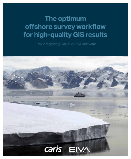
<strong>The</strong> <strong>optimum</strong><strong>offshore</strong> <strong>survey</strong> <strong>workflow</strong><strong>for</strong> <strong>high</strong>-<strong>quality</strong> <strong>GIS</strong> results… by integrating CARIS & EIVA software
As a result of a unique and dedicated partnership, CARIS andEIVA offer the <strong>optimum</strong> solution <strong>for</strong> <strong>offshore</strong> <strong>survey</strong> projectsfrom acquiring and processing <strong>survey</strong> data through to managingand manipulating the data in an enterprise <strong>GIS</strong> environment. <strong>The</strong>integration of cutting-edge CARIS and EIVA software combine thebest of hydrographic and subsea engineering software tools in asingle <strong>workflow</strong> saving you valuable time and money.60 strong sails ensure full speed aheadWith more than 60 years of combined international experienceand worldwide presence in the marine industry, the best in class ofsurface-based hydrography meets <strong>high</strong>-end subsea engineeringthrough an integrated solution.Regardless of the challenges and tasks you’re facing, the integrated,fit-<strong>for</strong>-purpose software solutions will meet your needs, givingyou the full <strong>GIS</strong> picture.Cost-efficient <strong>offshore</strong> <strong>survey</strong>software tool boxProven solution directly targeting your needsthrough 60 years of combined experience in the marine industryReduce errors by eliminating data conversionthrough a complete integration allowing <strong>for</strong> direct file supportA single solution covering the full <strong>workflow</strong>through one-stop-shopping of dedicated softwareEasier and faster <strong>survey</strong> processthrough a streamlined <strong>workflow</strong>Minimised downtimethrough world class software supportNo guessing– Eliminate the need <strong>for</strong> data conversion
Complete integration equals no data conversionDirect file support throughout the <strong>survey</strong> <strong>workflow</strong> eliminates the risk of errors due to data conversion, which vastly increasesthe <strong>quality</strong> of the <strong>survey</strong> results and enables faster processing.NaviScan enables real-time coverage and data<strong>quality</strong> control of multi-beam and sonar data acquisitionwith a time-tagging accuracy better than 50 µSec.HIPS and SIPS is a comprehensive bathymetric,seafloor imagery and water column data processingsoftware enabling simultaneous processing ofmultibeam, side scan, LiDAR and single beam data.Bathy DataBASE delivers a robust and scalablesolution <strong>for</strong> the storage and analysis of ever-expandingvolumes of seabed <strong>survey</strong> data and associatedstandards based metadata.In NaviModel, 3D visualisation of digital modelsunlimited in size ensures a comprehensive overviewof the <strong>survey</strong> data.One-stop-shopping and worldclass supportWhen you choose the software bundle of the integratedCARIS and EIVA software, you get a package that coversthe full <strong>survey</strong> process from a single vendor. This allows<strong>for</strong> a procurement process that saves you both time andmoney.During the <strong>survey</strong>, downtime is minimised as you canaddress your support issues regardless of their nature toeither company and still rely on a quick response.
<strong>The</strong> <strong>optimum</strong> <strong>offshore</strong><strong>survey</strong> <strong>workflow</strong><strong>The</strong> <strong>workflow</strong> rendered possible through the integration of CARISand EIVA software is characterised by streamlined processing andflexibility. This is supported by a range of options you can use asdesired during the entire <strong>workflow</strong>, and the possibility of returningto any previous step in the process.<strong>The</strong> direct file support exists throughout the <strong>workflow</strong> from acquisitionto processing, data modelling and final data management. Thiseliminates the risk of errors due to wrongly converted data, and allows<strong>for</strong> easier and faster <strong>workflow</strong> transitions, translating into efficienciesin time and money.… supporting various export <strong>for</strong>matsThis solution increases the possible applications <strong>for</strong> your results, asthe <strong>survey</strong> data can be exported to various third-party <strong>GIS</strong> applicationsand easily shared through standard Open Geospatial Consortium®(OGC) web interfaces.New features <strong>for</strong> existing usersIf you are already using CARIS or EIVA software, you can upgrade to this completely integrated <strong>workflow</strong> at a minimum cost. <strong>The</strong>software bundle adds new features to your existing solution, and because of the streamlined <strong>workflow</strong> this new setup will only requireminimum training of your crew.Courtesy of Statoil and DOF SubseaExisting CARIS users benefit from additional features tothe <strong>survey</strong> setup such as subsea-based data acquisition,pipeline detection and inspection and advanced 3Dmodelling and analysis.Existing EIVA users benefit from the ability to processbathymetry, seafloor imagery and water column data, aswell as other data sources such as LiDAR. It also allowsthe creation of sophisticated chart products and <strong>GIS</strong> datadeliverables.
Navigation & data acquisitionSensorprocessingData modellingandanalysis<strong>GIS</strong>EIVANaviEditEIVANaviPacEIVANaviScanEIVANaviModelCARIS BathyDataBASECARIS SpatialFusionEnterpriseCARISHIPS and SIPSIn<strong>for</strong>mation products<strong>GIS</strong> <strong>for</strong>matsWEBSSDMNaviPlotS-100<strong>The</strong> technical detailsOnline acquisition is carried out using NaviPac surface andunderwater positioning together with NaviScan sonar integrationand recording. <strong>The</strong> EIVA SBD data <strong>for</strong>mat is read directly intoHIPS and SIPS. This allows <strong>for</strong> processing of bathymetry,seafloor imagery and water column data in HIPS and SIPS andprocessing of subsea positioning data through NaviEdit.HIPS bathymetry, in CARIS HDCS <strong>for</strong>mat, can be opened <strong>for</strong>subsequent processing and pipeline specific tasks in NaviModel.Moreover, NaviModel can connect to Bathy DataBASE usingCARIS CSAR <strong>for</strong>mat <strong>for</strong> <strong>survey</strong> management and creation ofbathymetric products, such as contours and sounding features,in industry standard <strong>GIS</strong> <strong>for</strong>mats.Spatial Fusion Enterprise offers a OGC® web server and viewer<strong>for</strong> easy storing, sharing and visualisation of the <strong>GIS</strong> results viathe web.Spatial Fusion Enterprise includes a powerful OGC webserver <strong>for</strong> web enabling your <strong>survey</strong> data as well as a <strong>high</strong>lyconfigurable viewer to present your <strong>survey</strong> deliverablesquickly and effectively to your clients.
What’s included• EIVA NaviPac – Navigation and positioning• EIVA NaviScan – Sonar data acquisition• EIVA NaviEdit – Navigation, positioning and sensor processing• CARIS HIPS and SIPS – Sonar data processing• EIVA NaviModel – Data modelling and analysis• CARIS Bathy DataBASE – Data storing and managing• EIVA NaviPlot – Chart production• CARIS Spatial Fusion Enterprise – Web based data discovery<strong>The</strong> list covers all CARIS and EIVA standard key features, andrelevant add-ons are available as optional extras.Learning the ropesWhy not turn to the source <strong>for</strong> training? Experienced CARIS and EIVA instructorswill ensure that your crew members are completely up to speed,making certain that you get the most out of the advanced solution’s manyfeatures.We offer training courses at various locations throughout the world, includingat your premises.… and strengthening themAssisting our customers with any question or challenge that may ariseis second nature to us, and we’re constantly working on improving oursoftware solutions according to user inputs, new requirements and futuretechnologies.We offer a comprehensive level of industry leading support via onlineservices, mail and telephone. On www.eiva.com and www.caris.com, youcan find timely, accurate and up-to-date in<strong>for</strong>mation about our productsand services to help keep your solution on the cutting edge and runningefficiently.
EIVAEIVA is an engineering company with more than 30 years’experience in the <strong>offshore</strong> construction and <strong>survey</strong> industry.We provide software, hardware and turn-key solutions to awide range of segments <strong>for</strong> virtually any subsea task.Seeing our solutions out to the deck<strong>The</strong> key purpose of our solutions is to optimise ourcustomers’ marine construction or <strong>survey</strong> businesses. Weknow and understand the challenges they face and workclosely together with them in choosing and implementingthe solution that will offer the most value to their oftenmission-critical operations with all that implies.Worldwide customer base and workplaceOur extensive customer base comprises organisations andcompanies from the international industry. This means thatour staff are as familiar with the inside of aircraft cabins asthey are with the seabed from travelling worldwide to assistour customers on-site.CARISEstablished in 1979, CARIS is a leading developer ofgeospatial software designed to cater the marine <strong>GIS</strong> communityand built on decades of hydrographic experience.Solutions <strong>for</strong> the entire hydrographic <strong>workflow</strong>CARIS marine <strong>GIS</strong> solutions deliver an integrated andseamless solution <strong>for</strong> the entire <strong>workflow</strong> of hydrographicin<strong>for</strong>mation from the echo-sounder ping to the productionand distribution of the chart. <strong>The</strong> CARIS Ping-to-Chartsolution includes products that address the need to processsonar data, analyse large elevation data sets, producemultiple chart types and discover marine spatial data overthe internet.Extensive international customer networkFind out why CARIS software is selected by nationalmapping and charting agencies, <strong>survey</strong> companies, port andwaterway authorities, oil and gas companies and academicinstitutions worldwide by visiting www.caris.com.EIVA officesEIVA representativesCARIS officesCARIS representatives
T +1.506.458.8533 • info@caris.com • CARIS.comT +45 8628 2011 • eiva@eiva.com • EIVA.com


