Fremantle Port Inner Harbour and Channel ... - Fremantle Ports
Fremantle Port Inner Harbour and Channel ... - Fremantle Ports
Fremantle Port Inner Harbour and Channel ... - Fremantle Ports
- No tags were found...
You also want an ePaper? Increase the reach of your titles
YUMPU automatically turns print PDFs into web optimized ePapers that Google loves.
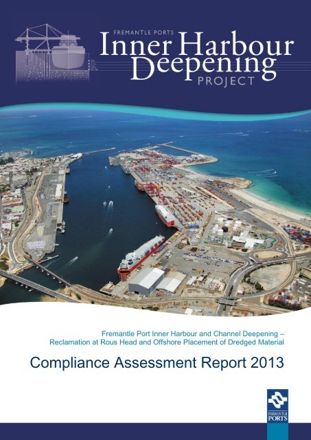
P:\<strong>Fremantle</strong><strong>Port</strong>s\977_<strong>Inner</strong><strong>Harbour</strong>DredgingCAR2012\001_OriginalScope\Reports\CAR2013\FPIHDCAR2013_Rev0_20130819.docm<strong>Fremantle</strong> <strong>Port</strong> <strong>Inner</strong> <strong>Harbour</strong> <strong>and</strong> <strong>Channel</strong> Deepening – Reclamation atRous Head <strong>and</strong> Offshore Placement of Dredged MaterialCompliance Assessment Report 2013Prepared for<strong>Fremantle</strong> <strong>Port</strong>sPrepared byOceanica Consulting Pty LtdAugust 2013Report No. 977_001/2_Rev0
DisclaimerThis report has been prepared on behalf of <strong>and</strong> for the exclusive use of <strong>Fremantle</strong> <strong>Port</strong>s, <strong>and</strong> is subject to <strong>and</strong> issuedin accordance with the agreed terms <strong>and</strong> scope between <strong>Fremantle</strong> <strong>Port</strong>s <strong>and</strong> Oceanica Consulting Pty Ltd.Oceanica Consulting Pty Ltd accepts no liability or responsibility for it in respect of any use of or reliance upon thisreport by any third party.Copying this report without prior written consent of <strong>Fremantle</strong> <strong>Port</strong>s or Oceanica Consulting Pty Ltd is not permitted.The Oceanica logo is a registered trademark of Oceanica Consulting Pty Ltd that is protected by law. You may notuse this trademark without first obtaining the permission of Oceanica Consulting Pty Ltd.© Copyright 2013 Oceanica Consulting Pty Ltd
ContentsExecutive Summary .................................................................................................................. iii1. Introduction ....................................................................................................................... 11.1 Background <strong>and</strong> project status ............................................................................................ 11.2 Scope ....................................................................................................................................... 22. Compliance Summary ....................................................................................................... 43. Annual Survey Footprint of Offshore Disposal Ground ................................................. 94. Benthic Primary Producer Habitat Supplementary Monitoring .................................... 155. Summary .......................................................................................................................... 166. References ....................................................................................................................... 19Oceanica: <strong>Fremantle</strong> <strong>Port</strong>s: <strong>Fremantle</strong> <strong>Port</strong> <strong>Inner</strong> <strong>Harbour</strong> <strong>and</strong> <strong>Channel</strong> Deepening, Compliance Assessment Report 2013i
List of FiguresFigure 1.1 Dredge areas, reclaimed area, <strong>and</strong> offshore disposal area used duringProject works ........................................................................................................ 3Figure 3.1 Depths of the Offshore Disposal Area, two years after deposition of dredgedmaterials (December 2012) ..................................................................................10Figure 3.2 Depths of disposal area immediately after deposition of dredged material in2010 .....................................................................................................................11Figure 3.3 Depths of disposal area one year after deposition (December 2011) ...................12Figure 3.4 Wave heights at the Rottnest Waverider (November 2010 throughDecember 2012) ..................................................................................................13List of TablesTable 1.1 Key elements of the Project .................................................................................. 1Table 2.1 Action implementation status (as defined by DEC 2009) ....................................... 4Table 2.2 Audit table ............................................................................................................. 5Table 5.1 Summary of relevant actions completed for the 2012 - 2013 monitoringperiod ...................................................................................................................17Appendix A Ministerial Statement 801List of Appendicesii Oceanica: <strong>Fremantle</strong> <strong>Port</strong>s: <strong>Fremantle</strong> <strong>Port</strong> <strong>Inner</strong> <strong>Harbour</strong> <strong>and</strong> <strong>Channel</strong> Deepening, Compliance Assessment Report 2013
Figure 1.1Dredge areas, reclaimed area, <strong>and</strong> offshore disposal area used during Project worksOceanica: <strong>Fremantle</strong> <strong>Port</strong>s: <strong>Fremantle</strong> <strong>Port</strong> <strong>Inner</strong> <strong>Harbour</strong> <strong>and</strong> <strong>Channel</strong> Deepening, Compliance Assessment Report 2013 3
Table 2.2AuditCode801:M1.1801:M2.1801:M2.2Audit tableSubject Action How Evidence Satisfy Advice Phase When Status Ref.ProposalImplementationProponentNomination <strong>and</strong>Contact DetailsProponentNomination <strong>and</strong>Contact DetailsThe proponent shall implement the proposal asdocumented <strong>and</strong> described in schedule 1 of thisstatement subject to the conditions <strong>and</strong> proceduresof this statementThe proponent for the time being nominated by theMinister for Environment under sections 38(6) or38(7) of the Environmental Protection Act 1986 isresponsible for the implementation of the proposalThe proponent shall notify the Chief ExecutiveOfficer of the Department of Environment <strong>and</strong>Conservation (CEO) of any change of the name <strong>and</strong>address of the proponent for the serving of noticesor other correspondence within 30 days of suchchange.Project implemented as describedin StatementProponent nominated toimplement the proposalWritten adviceAnnual ComplianceAssessment ReportProponent detailsas listed onMinisterialStatement 801Letter to CEOnotifying of changeof contact name<strong>and</strong> addressMin for EnvMin for EnvCEOOverallOverallOverallFor the life of theProposalFor the life of theProposalWithin 30 days of suchchange.Completed.Proposal implemented. See statusof conditions below.Completed.Proponent is <strong>Fremantle</strong> <strong>Port</strong>s aslisted on Ministerial Statement801.Satisfactory during this period.No change in proponent.801:M3.1Time Limit ofAuthorisationThe authorisation to implement the proposalprovided for in this statement shall lapse <strong>and</strong> bevoid five years after the date of this statement if theproposal to which this statement relates is notsubstantially commencedWritten adviceComplianceAssessmentReports, writtennotificationMin for EnvOverallCommenced by 18August 2014CompletedProposal was commenced withinfive years.Section 1.1801:M3.2801:M4.1801:M4.2801:M4.3Time Limit ofAuthorisationComplianceReportingComplianceReportingComplianceReportingThe proponent shall provide the CEO with writtenevidence which demonstrates that the proposal hassubstantially commenced on or before the expirationof five years from the date of this statementThe Proponent shall prepare <strong>and</strong> maintain aCompliance Assessment Plan to the satisfaction ofthe CEOThe Proponent shall submit to the CEO, theCompliance Assessment Plan required by Condition4.1 within 6 months of the date of this StatementThe Proponent shall assess compliance withconditions in accordance with the ComplianceAssessment Plan required by Condition 4.1Written advicePrepare Compliance AssessmentPlanThe Compliance Assessment Planshall indicate: 1. the frequency ofcompliance reporting; 2. theapproach <strong>and</strong> timing ofcompliance assessments; 3. theretention of complianceassessments; 4. reporting ofnon-compliances <strong>and</strong> correctiveactions taken; 5. the table ofcontents of ComplianceAssessment Reports; <strong>and</strong> 6.public availability of compliancereports.Follow Compliance AssessmentPlan when assessing complianceLetter to CEO ofOEPA outliningsubstantialcommencementComplianceAssessment PlanComplianceAssessment PlanComplianceAssessmentReportsDECCEOCEOOverallDesignCEO Overall AnnuallyWithin one month ofcommencementFor the life of theProposalWithin 6 months of thedate of this Statement.That is by 18 February2010CompletedLetter sent 5 February 2010 <strong>and</strong>approved 11 March 2010.CompletedCompliance Assessment Planprepared, maintained <strong>and</strong>approved (18 March).CompletedDraft Compliance Assessment Plansubmitted to OEPA 16 February2010, <strong>and</strong> approved 18 March.Completed.This Compliance AssessmentReport assesses complianceagainst the ComplianceAssessment Plan.ComplianceAssessmentReport: Phase 1(Oceanica 2010b)This document801:M4.4ComplianceReportingThe Proponent shall retain reports of all complianceassessments described in the ComplianceAssessment Plan required by Condition 4.1 <strong>and</strong> shallmake those reports available when requested by theCEOCompliance Assessment Reportswill be placed on <strong>Fremantle</strong> <strong>Port</strong>swebsiteReports on website CEO OverallWhen requested of theCEOCompletedCompliance Assessment Report:Phase 1 (Oceanica 2010b) madeavailable to the CEO <strong>and</strong> placed on<strong>Fremantle</strong> <strong>Port</strong>s website.Compliance Assessment Report:Phase 2 (Oceanica 2011) madeavailable to the CEO <strong>and</strong> placed on<strong>Fremantle</strong> <strong>Port</strong>s website.ComplianceAssessmentReport: Phase 1(Oceanica 2010b)ComplianceAssessmentReport: Phase 2(Oceanica 2011)Compliance Assessment Report:2012 (Oceanica 2012) madeavailable to the CEO.ComplianceAssessmentReport: 2012(Oceanica 2012)801:M4.5ComplianceReportingThe Proponent shall advise the CEO of any noncomplianceas soon as practicableA letter describing the noncompliancewill be sent to theCEO of OEPALetter to CEO ofOEPACEOOverallWithin 72 hours of anon-compliance beingidentified (subsequent toprocessing of data)Completed.There have been no noncomplianceswith the conditions ofMinisterial Statement 801 asspecified by this audit table todate.This TableOceanica: <strong>Fremantle</strong> <strong>Port</strong>s: <strong>Fremantle</strong> <strong>Port</strong> <strong>Inner</strong> <strong>Harbour</strong> <strong>and</strong> <strong>Channel</strong> Deepening, Compliance Assessment Report 2013 5
AuditCode801:M4.6801:M5.1801:M5.2801:M5.3Subject Action How Evidence Satisfy Advice Phase When Status Ref.ComplianceReportingMarine Ecology– BenthicPrimaryProducerHabitatMarine Ecology– BenthicPrimaryProducerHabitatMarine Ecology– BenthicPrimaryProducerHabitatThe Proponent shall submit to the CEO a ComplianceAssessment Report annually from the date of issueof this Statement addressing the previous twelvemonthperiod or other period as agreed by the CEO.The date of the first Compliance Assessment Reportshall be 15 months from the date of this Statement,with each subsequent report 12 months from thedate of the previous ReportPrior to dredging activities the proponent shallprepare maps showing the: 1. Gage Roads BenthicPrimary Producer Habitat Management Unit; 2.location <strong>and</strong> extent of the benthic primary producerhabitat types; 3. boundaries of the directdisturbance area <strong>and</strong> predicted levels of impact,including coordinates; 4. boundaries of the indirectdisturbance area <strong>and</strong> predicted levels of indirectimpact, including coordinates; 5. the spatiallydefined offshore spoil disposal ground, includingcoordinates; <strong>and</strong> 6. boundary of the Rous Headreclamation area, including coordinatesThe proponent shall ensure that there are no director indirect losses of coral or macroalgal BenthicPrimary Producer Habitat within the Gage Roadsmanagement unit (referred to in condition 5-1)caused by this dredging campaign <strong>and</strong> that losses ofseagrass BPPH within this management unit causedby the dredging campaign do not exceed 50hectaresThe proponent shall monitor <strong>and</strong> record the loss ofBenthic Primary Producer Habitat (seagrass,macroalgae, coral) within the Gage Roadsmanagement unit referred to in condition 5-1 for theduration of the dredging campaign <strong>and</strong> for sixmonths following the dredging campaign if impactsare within predicted levels, or for up to 5 years ifimpacts exceed predictions, to the requirements ofthe Department of Environment <strong>and</strong> ConservationThe Compliance AssessmentReport shall: 1. be endorsed bythe Proponent’s Chief ExecutiveOfficer or a person, approved inwriting by the Department ofEnvironment <strong>and</strong> Conservation,delegated to sign on the ChiefExecutive Officer’s behalf; 2.include a statement as towhether the Proponent hascomplied with the conditions; 3.identify all non-compliances <strong>and</strong>describe corrective <strong>and</strong>preventative actions taken; 4. bemade publicly available inaccordance with the approvedCompliance Assessment Plan;<strong>and</strong> 5. indicate any proposedchanges to the ComplianceAssessment Plan required byCondition 4.1Prepare maps listed under ActioncolumnMeasurement of baseline coral,macro-algal <strong>and</strong> seagrass BPPHextent (801: M5.1) <strong>and</strong>comparative post-dredging BPPHsurvey to ensure that there areno losses of coral or macroalgalBPPH <strong>and</strong> no more than 50 ha ofseagrass BPPHMeasurement of baseline coral,macro-algal <strong>and</strong> seagrass BPPHextent (801: M5.1) <strong>and</strong>comparative post-dredging BPPHsurvey/s to ensure that there areno losses of coral or macroalgalBPPH <strong>and</strong> no more than 50 ha ofseagrass BPPHAnnual ComplianceAssessmentReportsMaps to beprovided to OEPAwithin the firstComplianceAssessmentReport.ComplianceAssessment Reportincluding habitatloss calculationsComplianceAssessment Reportincluding habitatloss calculations;Monitoring resultsprovided to theCEO of OEPA asoutlined in M5.4CEOMin for EnvMin for EnvCEOOverallDesignOverallOverallAnnually with the firstreport due 15 monthsfrom the date of issue ofthis Statement. Thatwas on 18 November2010.Maps prepared prior todredging activities, to beprovided together withcomparative maps fromBPPH monitoringsurveys referred to in801:M5.2, 801:M5.3 <strong>and</strong>801:M5.4. Maps to beprovided within the firstCompliance AssessmentReport.Two months followingthe completion of theproposalThroughout the dredgingcampaign <strong>and</strong> for sixmonths following thedredging campaign ifimpacts are withinpredicted levels, or forup to 5 years if impactsexceed predictionsCompleted.Compliance Assessment Report:Phase 1 (Oceanica 2010b)submitted 18 November 2010.Compliance Assessment Report:Phase 2 (Oceanica 2011)submitted by 18 November 2011.Compliance Assessment Report:2012 (Oceanica 2012) submittedby 18 November 2012Compliance Assessment Report:2013 (this document) submitted by18 November 2013CompletedMaps <strong>and</strong> coordinates provided inCompliance Assessment Report:Phase 1 (Oceanica 2010b).CompletedPost-dredging BPPH surveydetermined no direct or indirectnet losses of coral, macroalgal orseagrass Benthic Primary ProducerHabitat within the Gage Roadsmanagement unit.CompletedPost-dredging BPPH surveydetermined no direct or indirectnet losses of coral, macroalgal orseagrass Benthic Primary ProducerHabitat within the Gage Roadsmanagement unit.ComplianceAssessmentReport: Phase 1(Oceanica 2010b)ComplianceAssessmentReport: Phase 2(Oceanica 2011)ComplianceAssessmentReport: 2012(Oceanica 2012)This documentComplianceAssessmentReport: Phase 1(Oceanica 2010b)ComplianceAssessmentReport: Phase 2(Oceanica 2011)ComplianceAssessmentReport: Phase 2(Oceanica 2011)801:M5.4Marine Ecology– BenthicPrimaryProducerHabitatTwo months following the conclusion of monitoringof each program referred to in condition 5-3 theproponent is to report to the CEO of the Departmentof Environment <strong>and</strong> Conservation the totalcumulative loss of each Benthic Primary ProducerHabitat type (seagrass, macroalgae, <strong>and</strong> coral) inthe Gage Roads management unit referred to incondition 5-1. The report is to include a mapshowing area <strong>and</strong> losses of benthic primary producerhabitat typeCalculate cumulative habitatlosses based on monitoringresults. Prepare a report withthese losses as well as a mapshowing area <strong>and</strong> losses of BPPH.ComplianceAssessment Reportincluding a map<strong>and</strong> cumulativehabitat losscalculations foreach BPPH type;Report provided tothe CEO of OEPACEOOverallTwo months followingthe conclusion ofmonitoring of eachprogram referred to incondition 5-3CompletedPost-dredging BPPH surveydetermined no direct or indirectnet losses of coral, macroalgal orseagrass Benthic Primary ProducerHabitat within the Gage Roadsmanagement unit.ComplianceAssessmentReport: Phase 2(Oceanica 2011)801:M5.5Marine Ecology– BenthicPrimaryProducerHabitatThe proponent shall annually survey the footprint(as per coordinates) of the offshore spoil ground fortwo years after completion of the disposal activities<strong>and</strong> after any severe storm event within the twoyear period exceeding a one in five year ARI for thepurposes of demonstrating that the dredging spoilhas remained within the footprint of the approveddredge spoil disposal groundAnnually survey footprint ofoffshore disposal ground for twoyears after completion ofdisposal. Survey after anysevere storm event exceeding aone in five-year annualrecurrence interval within thetwo-year period.Provide surveydetails to OEPAwithin annualcompliance reportMin for EnvOverallAnnually for two yearsafter completion of thedisposal activities <strong>and</strong>after any severe stormevent within the twoyear period exceeding aone in five year ARICompleted.The first annual survey of theoffshore spoil ground was duringDecember 2011.The second annual survey of theoffshore spoil ground was duringDecember 2012.A one in five-year storm did notoccur within the two year periodafter completion of disposalactivities (as determined by anoffshore wave height of Hs > 8 m).Section 36 Oceanica: <strong>Fremantle</strong> <strong>Port</strong>s: <strong>Fremantle</strong> <strong>Port</strong> <strong>Inner</strong> <strong>Harbour</strong> <strong>and</strong> <strong>Channel</strong> Deepening, Compliance Assessment Report 2013
AuditCode801:M5.6801:M6.1801:M6.2801:M6.3801:M6.4Subject Action How Evidence Satisfy Advice Phase When Status Ref.Marine Ecology– BenthicPrimaryProducerHabitatMarine WaterQuality <strong>and</strong>SedimentQualityMarine WaterQuality <strong>and</strong>SedimentQualityMarine WaterQuality <strong>and</strong>SedimentQualityMarine WaterQuality <strong>and</strong>SedimentQualityThe future use of the offshore disposal site fordisposal outside the approved coordinates is notpermitted under this assessment <strong>and</strong> thereforerequires an additional consideration under the EP ActTo achieve the Environmental Quality Objectives(EQOs) established for the marine environment bythe Environmental Protection Authority in PerthCoastal Waters Environmental Values <strong>and</strong>Objectives, specifically for the ‘high’ EcologicalProtection Area adjacent to the reclamation returnwater discharge zone, the proponent shall prepare<strong>and</strong> implement a Water Quality Monitoring Program(WQMP) as a component of the Dredge SpoilDisposal Management Plan (DSDMP) to thesatisfaction of the CEO of the Department ofEnvironment <strong>and</strong> ConservationPrior to dredging activities causing sedimentdispersion into the marine environment theproponent shall prepare a map defining the levels ofEcological Protection that will apply for the durationof the dredging campaign including: 1. Theboundary of the Rous Head reclamation area <strong>and</strong>adjacent seabed where the level of ecologicalprotection is reduced to ‘moderate’ for the durationof the project implementation 2. The boundary ofthe Rous Head reclamation area <strong>and</strong> adjacentseabed where a high level of ecological protectionwill be met after completion of the dredgingcampaign 3. Identify environmental qualityindicators <strong>and</strong> associated ‘trigger’ levels, based onthe guidelines <strong>and</strong> recommended approaches in theAustralian <strong>and</strong> New Zeal<strong>and</strong> Guideline for Fresh <strong>and</strong>Marine Water Quality (ANZECC & ARMCANZ, 2000)<strong>and</strong> the Environmental Quality Criteria ReferenceDocument for Cockburn Sound (2003 – 2004) (EPA,2005), for assessing the performance of thedischarges in meeting the EQOs for the moderateecological protection areas <strong>and</strong> at the boundary ofthe ‘high’ Ecological Protection Area, both during <strong>and</strong>after completion of the dredging campaign 4. Design<strong>and</strong> employ protocols <strong>and</strong> schedules for reportingperformance against the EQOs using theenvironmental quality ‘trigger’ levels for discharges5. Specify appropriate management <strong>and</strong> mitigationmeasures to be applied if monitoring demonstratesthat the environmental quality ‘trigger’ levels areexceeded at any point during the dredging <strong>and</strong>reclamation program, or if they are exceeded for ahigh level of ecological protection adjacent to RousHead after completion of the dredging campaignIf the Water Quality Monitoring Program required incondition 6-1 demonstrates that the environmentalquality ‘trigger’ levels (as determined in condition6.2) are not met, the proponent shall immediatelyreport to the CEO of the Department of Environment<strong>and</strong> Conservation with the remedial management<strong>and</strong>/or preventative actions to be implementedMonitoring shall be conducted for the duration of thedredging <strong>and</strong> disposal program <strong>and</strong> for six monthsfollowing completion of the program, or until it hasbeen demonstrated that the High EcologicalProtection values have re-established adjacent toRous Head. The results of monitoring shall bereported to the CEO of the Department ofEnvironment <strong>and</strong> ConservationNo offshore disposal will occur tothe site described in MS801 otherthan that approved under thisassessment.Implement the Water QualityMonitoring Program (WQMP).Prepare Water Quality MonitoringProgram (WQMP) to include: mapdefining levels of ecologicalprotection as described in actioncolumn; environmental qualityindicators <strong>and</strong> associated triggerlevels; protocols <strong>and</strong> schedulesfor reporting performanceagainst the EQOs; <strong>and</strong>management <strong>and</strong> mitigationmeasuresProvide report to the CEO of theOEPA with the remedialmanagement <strong>and</strong>/or preventativeactions to be implementedfollowing the exceedance oftrigger levelsThe Compliance AssessmentReport shall include the initialpredictions of the proponent asdescribed in the PublicEnvironmental Review <strong>and</strong>proponent’s response tosubmissions, <strong>and</strong> an analysis ofhow, <strong>and</strong> to what extent theresults of monitoring varied fromthe predictionsRecords of volumedumped will beprovided to theDEC in the annualreportsResults of theWater QualityMonitoring Programwill be provided inannual ComplianceAssessmentReports.Fortnightly WQMPdata reports to besubmitted to theOEPA.Min for Env Overall AnnuallyCEOOverallWQMP Min for Env DesignReport to the CEOof the OEPAComplianceAssessment Reportsubmitted to theCEO of the OEPA.CEOCEOOverallOverallCompliance assessmentreports to be submittedannually through thedredging campaign.Fortnightly WQMP datareports to be submittedto the OEPASubmit WQMP prior todredging activitiescausing sedimentdispersion into themarine environmentWithin 72 hours of anexceedanceofenvironmental quality‘trigger’levels(subsequenttoprocessing of data).Within two months ofcompletion of themonitoring <strong>and</strong> analysisCompleted.The spoil ground has not beenused by <strong>Fremantle</strong> <strong>Port</strong>s to receivematerial from unapproved sources.CompletedResults of the WQMP during bothphases of the Project works wereprovided fortnightly to the OEPA<strong>and</strong> posted on <strong>Fremantle</strong> <strong>Port</strong>swebsite, <strong>and</strong> have beensummarised in prior ComplianceAssessment Reports.CompletedWQMP (Oceanica 2010c) preparedto the requirements of Condition801:M6.2 <strong>and</strong> approved by theOEPA on 4 January 2010, prior todredging activities.CompletedAny exceedances were reported tothe OEPA within 72 hours, togetherwith intended managementmeasures, as required during theProject.CompletedCompliance Assessment ReportPhase 2 compared monitoringresults against the initialpredictions as described in thePublic Environmental Review <strong>and</strong>proponent’s response tosubmissionsThis reportComplianceAssessmentReport: Phase 2(Oceanica 2011)Water QualityManagement Plan(Oceanica 2010c)WQMP DataReportssubmitted toOEPA & posted<strong>Fremantle</strong> <strong>Port</strong>swebsiteComplianceAssessmentReport: Phase 1(Oceanica 2010b)ComplianceAssessmentReport: Phase 2(Oceanica 2011)Oceanica: <strong>Fremantle</strong> <strong>Port</strong>s: <strong>Fremantle</strong> <strong>Port</strong> <strong>Inner</strong> <strong>Harbour</strong> <strong>and</strong> <strong>Channel</strong> Deepening, Compliance Assessment Report 2013 7
3. Annual Survey Footprint of Offshore Disposal GroundThe second annual survey of the offshore spoil ground was undertaken in December 2012.Bathymetric data from this survey shows a disposal area with relatively low relief (16-20 m)throughout the whole area, with a small area of depression (to 22 m depth) near the southwesterncorner (Figure 3.1). The 2012 survey results show similar relief to the 2010bathymetric survey (Figure 3.2) at the completion of disposal activities <strong>and</strong> 2011 bathymetricsurvey (Figure 3.3).The changes in bathymetry between the 2010 <strong>and</strong> 2012 surveys, shows limited amounts ofredistribution of seabed material (-0.3 to 0.3 m change in depth) across the majority of thearea, suggesting that the materials deposited within the footprint have settled <strong>and</strong> areremaining within the footprint. Small areas of greater change in bathymetry appear to befrom the settling or redistribution of materials from high spots in topography (-16 to-18 m LWMF) to lower 'trough' areas (-18 to -21 m LWMF), or from disturbance by shipsanchors.A one in five year storm event (as determined by an offshore wave height of Hs > 8 m) hasnot occurred during the monitoring period of 1 November 2010 to 31 December 2012(Figure 3.4) therefore no additional surveys of the offshore spoil ground were undertaken.Oceanica: <strong>Fremantle</strong> <strong>Port</strong>s: <strong>Fremantle</strong> <strong>Port</strong> <strong>Inner</strong> <strong>Harbour</strong> <strong>and</strong> <strong>Channel</strong> Deepening, Compliance Assessment Report 2013 9
Figure 3.1Depths of the Offshore Disposal Area, two years after deposition of dredgedmaterials (December 2012)10 Oceanica: <strong>Fremantle</strong> <strong>Port</strong>s: <strong>Fremantle</strong> <strong>Port</strong> <strong>Inner</strong> <strong>Harbour</strong> <strong>and</strong> <strong>Channel</strong> Deepening, Compliance Assessment Report 2013
Figure 3.2 Depths of disposal area immediately after deposition of dredged material in 2010Oceanica: <strong>Fremantle</strong> <strong>Port</strong>s: <strong>Fremantle</strong> <strong>Port</strong> <strong>Inner</strong> <strong>Harbour</strong> <strong>and</strong> <strong>Channel</strong> Deepening, Compliance Assessment Report 2013 11
Figure 3.3 Depths of disposal area one year after deposition (December 2011)12 Oceanica: <strong>Fremantle</strong> <strong>Port</strong>s: <strong>Fremantle</strong> <strong>Port</strong> <strong>Inner</strong> <strong>Harbour</strong> <strong>and</strong> <strong>Channel</strong> Deepening, Compliance Assessment Report 2013
Significant Wave Height Hs (m)8Rottnest Directional Waverider765432101 Nov 2010 1 Jan 2011 3 Mar 2011 3 May 2011 3 Jul 2011 2 Sep 2011 2 Nov 2011 2 Jan 2012 3 Mar 2012 3 May 2012 3 Jul 2012 2 Sep 2012 2 Nov 2012 2 Jan 2013Figure 3.4 Wave heights at the Rottnest Waverider (November 2010 through December 2012)Oceanica: <strong>Fremantle</strong> <strong>Port</strong>s: <strong>Fremantle</strong> <strong>Port</strong> <strong>Inner</strong> <strong>Harbour</strong> <strong>and</strong> <strong>Channel</strong> Deepening, Compliance Assessment Report 2013 13
4. Benthic Primary Producer Habitat SupplementaryMonitoringSupplementary benthic primary producer habitat monitoring occurred at sites adjacent to theGage Roads Offshore Disposal Area during the early summer periods of 2011/2012 <strong>and</strong>2012/2013. This monitoring project is entitled "Gage Roads Offshore Disposal Area SeagrassRecovery Project" (with details provided in the previous compliance report; Oceanica 2013).The purpose of the supplementary monitoring is to investigate the rate <strong>and</strong> controllingmechanisms of Posidonia angustifolia (Cambridge <strong>and</strong> Kuo) seagrass recovery within <strong>and</strong>surrounding the Gage Roads Offshore Disposal Area, subsequent to the <strong>Inner</strong> <strong>Harbour</strong> <strong>and</strong><strong>Channel</strong> Deepening (IHD) Project.The specific objectives of the surveys, within <strong>and</strong> immediately surrounding the OffshoreDisposal area, are to:1. Define the spatial extent of seagrass habitat;2. Determine seagrass health, as indicated by P. angustifolia shoot density <strong>and</strong> percentagecover, within "undisturbed", "transitional" <strong>and</strong> "disturbed" zone specific sites; <strong>and</strong>3. Assess the sediment chemistry <strong>and</strong> physical characteristics of coincident sites, to enablespatial assessment of potential physicochemical controls on seagrass health.Fifteen permanent seagrass monitoring sites were set up in November 2011 surrounding theOffshore Disposal Area; with five sites in each undisturbed, transitional <strong>and</strong> disturbed "zone".These permanent sites have all been placed in locations where seagrass habitat existed priorto sediment disposal in depths of 18-21 m. Site determination consisted of semi-qualitativemethods of towed video to select undisturbed, transitional <strong>and</strong> disturbed seagrass "zones",within which monitoring sites were established based on initial survey data of seagrasspercentage cover <strong>and</strong> shoot density. This determination process created a robust three zoneexperimental design, capable of capturing changes in P. angustifolia cover <strong>and</strong> shoot density.'Undisturbed’ seagrass sites were located outside, but within 1600 m, of the OffshoreDisposal Area. These undisturbed sites included the use of reference monitoring sites used inthe WQMP (Oceancia 2010c) during the Project works. Transitional sites had seagrass coverwhich appeared impacted by dredging material, but not drastically disturbed. Disturbed siteswere located at the fringe of the transitional areas with low seagrass coverage <strong>and</strong> adjacentto barren areas with apparent deposition of dredge materials.The initial survey in 2011 collected baseline data <strong>and</strong> produced:1. an updated benthic habitat map;2. seagrass health (shoot density <strong>and</strong> percentage cover) data <strong>and</strong> baseline comparisons;<strong>and</strong>,3. physico-chemical properties at each site which showed no sediment parameters whichwould complicate seagrass recovery.Findings showed seagrass loss modelling undertaken prior to the dredging <strong>and</strong> disposalactivities were accurate within the zones of loss, potential loss <strong>and</strong> potential effect.A second seagrass survey was completed in December 2012 <strong>and</strong> designed to measure forchanges in percentage cover <strong>and</strong> shoot density after two years of recovery (Oceanica 2013).Finally, a third seagrass survey is scheduled for the 2014/2015 summer period, to continueto measure these changes in seagrass health, subsequent to five years of recovery.Oceanica: <strong>Fremantle</strong> <strong>Port</strong>s: <strong>Fremantle</strong> <strong>Port</strong> <strong>Inner</strong> <strong>Harbour</strong> <strong>and</strong> <strong>Channel</strong> Deepening, Compliance Assessment Report 2013 15
5. SummaryThere were zero non-compliance issues with the conditions of Ministerial Statement 801during the 2012-2013 post Project works period. The relevant actions required <strong>and</strong> theircompliance status is summarised in Table 5.1.Since there are no ongoing compliance monitoring or reporting requirements required byMinisterial Statement 801, this document is the final Compliance Assessment Report to besubmitted to the CEO of the OEPA.16 Oceanica: <strong>Fremantle</strong> <strong>Port</strong>s: <strong>Fremantle</strong> <strong>Port</strong> <strong>Inner</strong> <strong>Harbour</strong> <strong>and</strong> <strong>Channel</strong> Deepening, Compliance Assessment Report 2013
Table 5.1AuditCode801:M4.3Summary of relevant actions completed for the 2012 - 2013 monitoring periodSubject Action How Evidence Satisfy Advice Phase When Status Ref.ComplianceReportingThe Proponent shall assess compliance withconditions in accordance with theCompliance Assessment Plan required byCondition 4.1Follow Compliance Assessment Plan whenassessing complianceCompliance AssessmentReportsCEO Overall AnnuallySatisfactory during this period.This Compliance Assessment Reportassesses compliance against theCompliance Assessment Plan.Thisdocument801:M4.4ComplianceReportingThe Proponent shall retain reports of allcompliance assessments described in theCompliance Assessment Plan required byCondition 4.1 <strong>and</strong> shall make those reportsavailable when requested by the CEOCompliance Assessment Reports will beplaced on <strong>Fremantle</strong> <strong>Port</strong>s websiteReports on website CEO OverallWhen requested ofthe CEOSatisfactory during this period.Compliance Assessment Report: Phase 1(Oceanica 2010b) made available to theCEO <strong>and</strong> placed on <strong>Fremantle</strong> <strong>Port</strong>swebsite.Compliance Assessment Report: Phase 2(Oceanica 2011) made available to theCEO <strong>and</strong> placed on <strong>Fremantle</strong> <strong>Port</strong>swebsite.ComplianceAssessmentReport: Phase1 (Oceanica2010b)ComplianceAssessmentReport: Phase2 (Oceanica2011)801:M4.5801:M4.6ComplianceReportingComplianceReportingThe Proponent shall advise the CEO of anynon-compliance as soon as practicableThe Proponent shall submit to the CEO aCompliance Assessment Report annuallyfrom the date of issue of this Statementaddressing the previous twelve-monthperiod or other period as agreed by theCEO. The date of the first ComplianceAssessment Report shall be 15 months fromthe date of this Statement, with eachsubsequent report 12 months from the dateof the previous ReportA letter describing the non-compliance willbe sent to the CEO of OEPAThe Compliance Assessment Report shall:1. be endorsed by the Proponent’s ChiefExecutive Officer or a person, approved inwriting by the Department of Environment<strong>and</strong> Conservation, delegated to sign on theChief Executive Officer’s behalf; 2. include astatement as to whether the Proponent hascomplied with the conditions; 3. identify allnon-compliances <strong>and</strong> describe corrective<strong>and</strong> preventative actions taken; 4. be madepublicly available in accordance with theapproved Compliance Assessment Plan; <strong>and</strong>5. indicate any proposed changes to theCompliance Assessment Plan required byCondition 4.1Letter to CEO of OEPA CEO OverallAnnual ComplianceAssessment ReportsCEOOverallWithin 72 hours ofa non-compliancebeing identified(subsequent toprocessing of data)Annually with thefirst report due 15months from thedate of issue of thisStatement.That was on 18November 2010.Compliance Assessment Report: 2012(Oceanica 2012a) made available to theCEO <strong>and</strong> Compliance AssessmentReport:2013 made available to the CEO<strong>and</strong> placed on website..Satisfactory during this period.There have been no non-complianceswith the conditions of MinisterialStatement 801 as specified by this audittable to date.Satisfactory during this period.Compliance Assessment Report: Phase 1(Oceanica 2010b) submitted 18November 2010.Compliance Assessment Report: Phase 2(Oceanica 2011) submitted by 18November 2011.Compliance Assessment Report: 2012(Oceanica 2012a) submitted by 18November 2012Compliance Assessment Report: 2013(this document) submitted by 18November 2013Satisfactory during this period.ComplianceAssessmentReport: 2012(Oceanica2012a)This TableComplianceAssessmentReport: Phase1 (Oceanica2010b)ComplianceAssessmentReport: Phase2 (Oceanica2011)ComplianceAssessmentReport: 2012(Oceanica2012a)Thisdocument801:M5.5801:M5.6Marine Ecology –Benthic PrimaryProducer HabitatMarine Ecology –Benthic PrimaryProducer HabitatThe proponent shall annually survey thefootprint (as per coordinates) of theoffshore spoil ground for two years aftercompletion of the disposal activities <strong>and</strong>after any severe storm event within the twoyear period exceeding a one in five yearARI for the purposes of demonstrating thatthe dredging spoil has remained within thefootprint of the approved dredge spoildisposal groundThe future use of the offshore disposal sitefor disposal outside the approvedcoordinates is not permitted under thisassessment <strong>and</strong> therefore requires anadditional consideration under the EP ActAnnually survey footprint of offshoredisposal ground for two years aftercompletion of disposal. Survey after anysevere storm event exceeding a one in fiveyearannual recurrence interval within thetwo-year period.No offshore disposal will occur to the sitedescribed in MS801 other than thatapproved under this assessment.Provide survey details toOEPA within annualcompliance reportRecords of volumedumped will be providedto the DEC in the annualreportsMinEnvMinEnvforforOverallOverallAnnually for twoyears aftercompletion of thedisposal activities<strong>and</strong> after anysevere storm eventwithin the two yearperiod exceeding aone in five yearARIAnnuallyThe first annual survey of the offshorespoil ground was during December2011.The second annual survey of theoffshore spoil ground was duringDecember 2012.A one in five-year storm did not occurwithin the two year period aftercompletion of disposal activities (asdetermined by an offshore wave heightof Hs > 8 m).Satisfactory during this periodThe spoil ground has not been used by<strong>Fremantle</strong> <strong>Port</strong>s to receive material fromunapproved sources.Section 3This reportOceanica: <strong>Fremantle</strong> <strong>Port</strong>s: <strong>Fremantle</strong> <strong>Port</strong> <strong>Inner</strong> <strong>Harbour</strong> <strong>and</strong> <strong>Channel</strong> Deepening, Compliance Assessment Report 2013 17
6. ReferencesDEC (2009) Guidelines for Proponents – Performance Review Reporting (Draft), Prepared byEnvironmental Regulation Division, Department of Environment <strong>and</strong> Conservation,February 2009EPA (2011a) <strong>Fremantle</strong> <strong>Port</strong>s <strong>Inner</strong> <strong>Harbour</strong> <strong>and</strong> <strong>Channel</strong> Deepening, Reclamation at RousHead <strong>and</strong> Offshore Placement of Dredged Material, Attachment 1 to MinisterialStatement 801 – A change to the location of offshore placement of dredged materialfrom <strong>Fremantle</strong> <strong>Port</strong>s <strong>Inner</strong> <strong>Harbour</strong> <strong>and</strong> <strong>Channel</strong> Deepening, <strong>and</strong> related works, DrPaul Vogel, Chairman, Environmental Protection Authority, 6 August 2011EPA (2011b) <strong>Fremantle</strong> <strong>Port</strong>s <strong>Inner</strong> <strong>Harbour</strong> <strong>and</strong> <strong>Channel</strong> Deepening, Reclamation at RousHead <strong>and</strong> Offshore Placement of Dredged Material (Ministerial Statement 801) –Section 45C Application, Letter of Approval to Lyle Banks from Dr Paul Vogel,Chairman, Environmental Protection Authority, 24 March 2011Oceanica (2010a) <strong>Fremantle</strong> <strong>Port</strong> <strong>Inner</strong> <strong>Harbour</strong> <strong>and</strong> <strong>Channel</strong> Deepening – Reclamation atRous Head <strong>and</strong> Offshore Placement of Dredged Material: Compliance Assessment Plan,Prepared for <strong>Fremantle</strong> <strong>Port</strong>s by Oceanica Consulting Pty Ltd, Report no. 816_003/1,Perth, Western Australia, February 2010Oceanica (2010b) <strong>Fremantle</strong> <strong>Port</strong> <strong>Inner</strong> <strong>Harbour</strong> <strong>and</strong> <strong>Channel</strong> Deepening – Reclamation atRous Head <strong>and</strong> Offshore Placement of Dredged Material: Compliance AssessmentReport: Phase 1 Works, Prepared for <strong>Fremantle</strong> <strong>Port</strong>s by Oceanica Consulting Pty Ltd,Report no. 816_003/2, Perth, Western Australia, November 2010Oceanica (2010c) <strong>Fremantle</strong> <strong>Port</strong> <strong>Inner</strong> <strong>Harbour</strong> <strong>and</strong> <strong>Channel</strong> Deepening – Reclamation atRous Head <strong>and</strong> Offshore Placement of Dredged Material: Water Quality MonitoringProgram, Prepared for <strong>Fremantle</strong> <strong>Port</strong>s by Oceanica Consulting, January 2010.Oceanica (2011) <strong>Fremantle</strong> <strong>Port</strong> <strong>Inner</strong> <strong>Harbour</strong> <strong>and</strong> <strong>Channel</strong> Deepening - Reclamation at RousHead <strong>and</strong> Offshore Placement of Dredged Material: Compliance Assessment Report:Phase 2 Works, Prepared for <strong>Fremantle</strong> <strong>Port</strong>s by Oceanica Consulting Pty Ltd, ReportNo 816_003/4, Perth, Western Australia, November 2010Oceanica (2012) <strong>Fremantle</strong> <strong>Port</strong> <strong>Inner</strong> <strong>Harbour</strong> <strong>and</strong> <strong>Channel</strong> Deepening – Reclamation atRous Head <strong>and</strong> Offshore Placement of Dredged Material – Compliance AssessmentReport 2012. Prepared for <strong>Fremantle</strong> <strong>Port</strong>s by Oceanica Consulting Pty Ltd, Report No977_001/1, Perth, Western Australia, November 2012Oceanica (2013) <strong>Fremantle</strong> <strong>Port</strong>s - Gage Roads Offshore Disposal Area Seagrass RecoveryProject, Phase II – Initial Survey, Prepared for <strong>Fremantle</strong> <strong>Port</strong>s by Oceanica ConsultingPty Ltd, Report No 910_001/2, Perth, Western Australia, August 2013SKM (2009) <strong>Fremantle</strong> <strong>Port</strong> <strong>Inner</strong> <strong>Harbour</strong> <strong>and</strong> <strong>Channel</strong> Deepening, Reclamation at RousHead <strong>and</strong> Offshore Placement of Dredged Material, Public Environmental Review,Prepared for <strong>Fremantle</strong> <strong>Port</strong>s by Sinclair Knight Merz, January 2009Oceanica: <strong>Fremantle</strong> <strong>Port</strong>s: <strong>Fremantle</strong> <strong>Port</strong> <strong>Inner</strong> <strong>Harbour</strong> <strong>and</strong> <strong>Channel</strong> Deepening, Compliance Assessment Report 2013 19
Appendix AMinisterial Statement 801
STATUS OF THIS DOCUMENTThis document has been produced by the Office of the Appeals Convenor as an electronic version ofthe original Statement for the proposal listed below as signed by the Minister <strong>and</strong> held by this Office.Whilst every effort is made to ensure its accuracy, no warranty is given as to the accuracy orcompleteness of this document.The State of Western Australia <strong>and</strong> its agents <strong>and</strong> employees disclaim liability, whether in negligenceor otherwise, for any loss or damage resulting from reliance on the accuracy or completeness of thisdocument.Copyright in this document is reserved to the Crown in right of the State of Western Australia.Reproduction except in accordance with copyright law is prohibited.Published on 18 August 2009 Statement No 801STATEMENT THAT A PROPOSAL MAY BE IMPLEMENTED(PURSUANT TO THE PROVISIONS OF THEENVIRONMENTAL PROTECTION ACT 1986)FREMANTLE PORTS INNER HARBOUR AND CHANNEL DEEPENING,RECLAMATION AT ROUS HEAD AND OFFSHORE PLACEMENT OF DREDGEDMATERIALProposal:The proposal is to deepen the <strong>Fremantle</strong> <strong>Inner</strong> <strong>Harbour</strong>,Entrance <strong>Channel</strong> <strong>and</strong> the Deep Water <strong>Channel</strong> by dredgingapproximately 3.1 million cubic metres to provide for furtherreclamation at Rous Head of approximately 27 hectares <strong>and</strong> foroffshore disposal.The proposal is further documented in schedule 1 of thisstatement.Proponent:<strong>Fremantle</strong> <strong>Port</strong>sProponent Address: 1 Cliff Street, <strong>Fremantle</strong>, WA 6160Assessment Number: 1621Report of the Environmental Protection Authority: Report 1330The proposal referred to in the above report of the Environmental Protection Authority maybe implemented. The implementation of that proposal is subject to the following conditions<strong>and</strong> procedures:1 Proposal Implementation1-1 The proponent shall implement the proposal as documented <strong>and</strong> described inschedule 1 of this statement subject to the conditions <strong>and</strong> procedures of thisstatement.Published on:
2 Proponent Nomination <strong>and</strong> Contact Details2-1 The proponent for the time being nominated by the Minister for Environment undersections 38(6) or 38(7) of the Environmental Protection Act 1986 is responsible forthe implementation of the proposal.2-2 The proponent shall notify the Chief Executive Officer of the Department ofEnvironment <strong>and</strong> Conservation (CEO) of any change of the name <strong>and</strong> address of theproponent for the serving of notices or other correspondence within 30 days of suchchange.3 Time Limit of Authorisation3-1 The authorisation to implement the proposal provided for in this statement shalllapse <strong>and</strong> be void five years after the date of this statement if the proposal to whichthis statement relates is not substantially commenced.3-2 The proponent shall provide the CEO with written evidence which demonstrates thatthe proposal has substantially commenced on or before the expiration of five yearsfrom the date of this statement.4 Compliance Reporting4.1 The Proponent shall prepare <strong>and</strong> maintain a Compliance Assessment Plan to thesatisfaction of the CEO.4.2 The Proponent shall submit to the CEO, the Compliance Assessment Plan requiredby Condition 4.1 within 6 months of the date of this Statement. The ComplianceAssessment Plan shall indicate:1. the frequency of compliance reporting;2. the approach <strong>and</strong> timing of compliance assessments;3. the retention of compliance assessments;4. reporting of non-compliances <strong>and</strong> corrective actions taken;5. the table of contents of Compliance Assessment Reports; <strong>and</strong>6. public availability of compliance reports.4.3 The Proponent shall assess compliance with conditions in accordance with theCompliance Assessment Plan required by Condition 4.1.4.4 The Proponent shall retain reports of all compliance assessments described in theCompliance Assessment Plan required by Condition 4.1 <strong>and</strong> shall make thosereports available when requested by the CEO.4.5 The Proponent shall advise the CEO of any non-compliance as soon as practicable.4.6 The Proponent shall submit to the CEO a Compliance Assessment Report annuallyfrom the date of issue of this Statement addressing the previous twelve month periodor other period as agreed by the CEO. The date of the first Compliance Assessment2
Report shall be 15 months from the date of this Statement, with each subsequentreport 12 months from the date of the previous Report. The ComplianceAssessment Report shall:1. be endorsed by the Proponent’s Chief Executive Officer or a person, approvedin writing by the Department of Environment <strong>and</strong> Conservation, delegated tosign on the Chief Executive Officer’s behalf;2. include a statement as to whether the Proponent has complied with theconditions;3. identify all non-compliances <strong>and</strong> describe corrective <strong>and</strong> preventative actionstaken;4. be made publicly available in accordance with the approved ComplianceAssessment Plan; <strong>and</strong>5. indicate any proposed changes to the Compliance Assessment Plan required byCondition 4.1.5 Marine Ecology – Benthic Primary Producer Habitat5-1 Prior to dredging activities the proponent shall prepare maps showing the:1. Gage Roads Benthic Primary Producer Habitat Management Unit;2. location <strong>and</strong> extent of the benthic primary producer habitat types;3. boundaries of the direct disturbance area <strong>and</strong> predicted levels of impact,including coordinates;4. boundaries of the indirect disturbance area <strong>and</strong> predicted levels of indirectimpact, including coordinates;5. the spatially defined offshore spoil disposal ground, including coordinates; <strong>and</strong>6. boundary of the Rous Head reclamation area, including coordinates.5-2 The proponent shall ensure that there are no direct or indirect losses of coral ormacroalgal Benthic Primary Producer Habitat within the Gage Roads managementunit (referred to in condition 5-1) caused by this dredging campaign <strong>and</strong> that lossesof seagrass BPPH within this management unit caused by the dredging campaign donot exceed 50 hectares.5-3 The proponent shall monitor <strong>and</strong> record the loss of Benthic Primary ProducerHabitat (seagrass, macroalgae, coral) within the Gage Roads management unitreferred to in condition 5-1 for the duration of the dredging campaign <strong>and</strong> for sixmonths following the dredging campaign if impacts are within predicted levels, orfor up to 5 years if impacts exceed predictions, to the requirements of theDepartment of Environment <strong>and</strong> Conservation.5-4 Two months following the conclusion of monitoring of each program referred to incondition 5-3 the proponent is to report to the CEO of the Department ofEnvironment <strong>and</strong> Conservation the total cumulative loss of each Benthic PrimaryProducer Habitat type (seagrass, macroalgae, <strong>and</strong> coral) in the Gage Roads3
6-3 If the Water Quality Monitoring Program required in condition 6-1 demonstratesthat the environmental quality ‘trigger’ levels (as determined in condition 6.2) arenot met, the proponent shall immediately report to the CEO of the Department ofEnvironment <strong>and</strong> Conservation with the remedial management <strong>and</strong>/or preventativeactions to be implemented.6-4 Monitoring shall be conducted for the duration of the dredging <strong>and</strong> disposal program<strong>and</strong> for six months following completion of the program, or until it has beendemonstrated that the High Ecological Protection values have re-establishedadjacent to Rous Head. The results of monitoring shall be reported to the CEO of theDepartment of Environment <strong>and</strong> Conservation. The report shall include the initialpredictions of the proponent as described in the Public Environmental Review <strong>and</strong>proponent’s response to submissions, <strong>and</strong> an analysis of how, <strong>and</strong> to what extent theresults of monitoring varied from the predictions.Notes1. Where a condition states “on advice of the Environmental Protection Authority”, theEnvironmental Protection Authority will provide that advice to the Department ofEnvironment <strong>and</strong> Conservation for the preparation of written notice to theproponent.2. The Environmental Protection Authority may seek advice from other agencies ororganisations, as required, in order to provide its advice to the Department ofEnvironment <strong>and</strong> Conservation.3. The Minister for Environment will determine any dispute between the proponent <strong>and</strong>the Environmental Protection Authority or the Department of Environment <strong>and</strong>Conservation over the fulfilment of the requirements of the conditions.Donna Faragher JP MLCMINISTER FOR ENVIRONMENT; YOUTH5
Schedule 1Table 1: BPPH assessmentThe table below is a summary of the project’s predicted footprint from dredging from direct(dredged area <strong>and</strong> spoil placement) <strong>and</strong> indirect (sediment plume dispersion <strong>and</strong> settlement).The proponent has modelled the zone of effect for indirect impacts as a result of sedimentplumes across two timing scenarios (November <strong>and</strong> January).BPPH Loss CalculationsTotal Size of Management Unit(ha)Types of Benthic PrimaryProducer HabitatHistorical Area of Total BPPH(ha)BPPH Management Unit (MU)Gage RoadsDeep Water<strong>Channel</strong>Category ECategory DNovember JanuaryCoastal UnitCategory C6825 10521 6411Dominant seagrass withmacroalgae <strong>and</strong> coralMacroalgaeon limestonepavement,occasionalseagrassDominantseagrass withmacroalgaeon limestonepavement1108 1532 642Current Area of Total BPPH (ha) 1050 1532 642EPA Category <strong>and</strong> LossThreshold (2004b)Potential Permanent SeagrassLoss due to Project (ha <strong>and</strong> %)Estimated Historic Seagrass Loss(ha <strong>and</strong> %)Potential Total CumulativeSeagrass Loss (Historical +this Project) (ha <strong>and</strong> %)Potential Permanent MacroalgalLoss due to Project (ha <strong>and</strong> %)Estimated Historic MacroalgalLoss (ha <strong>and</strong> %)Potential Total CumulativeMacroalgal Loss (Historical +this Project) (ha <strong>and</strong> %)Potential Permanent Direct CoralLoss due to Project (ha <strong>and</strong> %)Estimated Historic Coral Loss(ha <strong>and</strong> %)Potential Total CumulativeCoral Loss (Historical + thisProject) (ha <strong>and</strong> %)E 10% D 5% C 2%99.0 9.3% 69.0 6.5% 11.0 2.9% 0.0 0.0%47.0 4.4% 47.0 4.4% 0.0 0.0% 0.0 0.0%146.0 13.8% 116.0 10.9% 11.0 2.9% 0.0 0.0%0.0 0.0% 0.0 0.0% 11.0 1.0% 0.0 0.0%11.0 25.0% 11.0 25.0% 0.0 0.0% 0.0 0.0%11.0 25.0% 11.0 25.0% 11.0 1.0% 0.0 0.0%0.0 0.0% 0.0 0.0% 0.0 0.0% 0.0 0.0%0.0 0.0% 0.0 0.0% 0.0 0.0% 0.0 0.0%0.0 0.0% 0.0 0.0% 0.0 0.0% 0.0 0.0%The Proposal (Assessment No. 1621)The main characteristics of the proposal are summarised in Table 2 below. A detaileddescription of the proposal is provided in Section 2 of the project referral document,<strong>Fremantle</strong> <strong>Port</strong>s <strong>Inner</strong> harbour <strong>and</strong> <strong>Channel</strong> Deepening, Reclamation at Rous Head <strong>and</strong>Offshore Placement of Dredged Material (PER, 2009).6
Table 2: Summary of key proposal characteristicsElementDescriptionGeneralConstruction of a sea wall1000 m longReclamationApprox 27 ha at Rous HeadDredging • <strong>Inner</strong> <strong>Harbour</strong>, from a depth of RL -13.0 m to a depth of RL -15.0 m LowWater Mark <strong>Fremantle</strong> (LWMF)• Entrance <strong>Channel</strong> from depths of RL-13.2 to 13.4 m to depths betweenRL -16.0 m (LWMF) <strong>and</strong> RL -16.8m (LWMF) to provide adequatedepth for turning ships• Deep Water <strong>Channel</strong> to a depth ofRL -16.5 m (LWMF) on straightsections <strong>and</strong> RL -18.0 m (LWMF) onbends, within an area of approx169haRelocation of dredged materials • From the <strong>Inner</strong> <strong>Harbour</strong> (approx 0.9Mm3) <strong>and</strong> the inner section ofEntrance <strong>Channel</strong> (approx 1.1 Mm3)to Rous Head• from the Deep Water <strong>Channel</strong>(approx 1.1 Mm3) to a proposedspoil ground located at Gage Roads(placement of approx 1.45 Mm3within an area of approx 150ha)Timing • Dredging campaign to commence inNovember for 20-26 weeks.KeyM metresM3 cubic metresFigures1. <strong>Fremantle</strong> <strong>Port</strong>s project location2. <strong>Fremantle</strong> <strong>Port</strong>s project location – Satellite3. <strong>Fremantle</strong> <strong>Port</strong>s project location – <strong>Inner</strong> <strong>Harbour</strong> dredging <strong>and</strong> reclamation4. <strong>Fremantle</strong> <strong>Port</strong>s project location – Rous Head extension7


