Part 1 Western Sydney Light Rail Feasibility Report - Parramatta City ...
Part 1 Western Sydney Light Rail Feasibility Report - Parramatta City ...
Part 1 Western Sydney Light Rail Feasibility Report - Parramatta City ...

You also want an ePaper? Increase the reach of your titles
YUMPU automatically turns print PDFs into web optimized ePapers that Google loves.
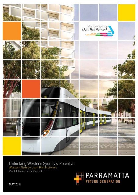
<strong>Parramatta</strong> <strong>City</strong> Council<strong>Western</strong> <strong>Sydney</strong> <strong>Light</strong> <strong>Rail</strong> Network - <strong>Part</strong> 1<strong>Feasibility</strong> <strong>Report</strong>15 March 2013i
FOREWORDIt is my great pleasure to release the <strong>Western</strong> <strong>Sydney</strong> <strong>Light</strong> <strong>Rail</strong> Network <strong>Feasibility</strong><strong>Report</strong>.This Council initiative will transform The <strong>City</strong> of <strong>Parramatta</strong>. It will connect the CBD toimportant priority areas, such as Westmead, Rydalmere, Macquarie Park and Castle Hill.From the first stage outlined in this document, the light rail network will grow and evolve tomeet the future economic and social needs of <strong>Western</strong> <strong>Sydney</strong>.Further, it addresses the long-term transportation needs of the whole of <strong>Sydney</strong>, providing efficient access tojobs, recreation and cultural events and facilities – to greater numbers of people.The <strong>Western</strong> <strong>Sydney</strong> <strong>Light</strong> <strong>Rail</strong> Strategy will confirm <strong>Parramatta</strong>’s role as <strong>Sydney</strong>’s Premier Regional <strong>City</strong>, asoutlined in the State Government’s recent draft Metropolitan Strategy for <strong>Sydney</strong>.This is an extremely encouraging document, and I believe it represents an efficient and cost effectivesolution to the region’s congestion and public transport shortfalls. The <strong>Western</strong> <strong>Sydney</strong> <strong>Light</strong> <strong>Rail</strong> Network isa real solution that will deliver more effective connections – comfortably, reliably and sustainably.Let’s get <strong>Sydney</strong>’s transport networks back on track!Lord Mayor of <strong>Parramatta</strong>Cr John Chedidi
EXECUTIVE SUMMARYThis report was commissioned to examine the feasibility of a <strong>Western</strong> <strong>Sydney</strong> <strong>Light</strong> <strong>Rail</strong> Network centred on<strong>Parramatta</strong> and covering the central area of <strong>Sydney</strong>. The <strong>Feasibility</strong> Study refines the public transportnetwork originally suggested by <strong>Parramatta</strong> <strong>City</strong> Council in November 2011, identifying a proposed futurelight rail network. This document sets a framework for land use and transport planning moving into the futureand aims to achieve strategically aligned government outcomes.The results of the <strong>Feasibility</strong> Study show light rail can deliver city building outcomes and not just improvedpublic transport. It is also more effective at enabling the <strong>Parramatta</strong> and <strong>Western</strong> <strong>Sydney</strong> region tosustainably grow, accommodating projections for population and employment growth. This strategy has beenfurther reiterated in the State Government’s draft Metropolitan Strategy which says “50% of <strong>Sydney</strong>siders willbe residents in <strong>Western</strong> <strong>Sydney</strong> and will be serviced by <strong>Parramatta</strong>” (Pg22).Divided into two parts, <strong>Part</strong> 1 of the <strong>Feasibility</strong> Study (this document) is the first step in investigating publictransport improvements for <strong>Western</strong> <strong>Sydney</strong>, with <strong>Parramatta</strong> at its centre. The study builds upon policiesand priorities produced by all levels of government including Local, State and Federal and identifies that bylinking key activity centres in the <strong>Western</strong> <strong>Sydney</strong> region, light rail can be a suitable public transport and cityshaping model.As a city building initiative, the proposed <strong>Western</strong> <strong>Sydney</strong> <strong>Light</strong> <strong>Rail</strong> Network aims to deliver new andimproved regional public transport links which drives employment and facilitates residential growth alongcorridors and in centres in a sustainable city form – improving economic productivity and the liveability of<strong>Western</strong> <strong>Sydney</strong> and <strong>Sydney</strong> as a whole. This proposed increase in public transport accessibility will alsobegin to tackle existing social disadvantage by increasing access to the growing range of educational andemployment opportunities in the region.The study draws attention to the geographic central area of the <strong>Sydney</strong> metropolitan region with <strong>Parramatta</strong>as its centre. The proposed regional light rail network aims to change the shape of the region from a <strong>Sydney</strong>CBD-centric focus towards a ‘city of cities’ model as outlined in the draft Metropolitan Strategy. The studyalso considers the role of Greater <strong>Parramatta</strong> and reviews several sites and precincts that are under currentand potential future development plans, including <strong>Parramatta</strong> Square, ‘auto alley’; Westmead medicalprecinct; urban renewal of State Government sites in North <strong>Parramatta</strong>, <strong>Parramatta</strong> Stadium and Universityof <strong>Western</strong> <strong>Sydney</strong> to name a few.Taking these regions into consideration, the study focused on a 15km radius around <strong>Parramatta</strong>, stretchingfrom Macquarie Park and Strathfield in the east to Rouse Hill in the north-west, Bankstown and Liverpool inthe south and Wetherill Park and Blacktown in the west. This revealed 15 possible corridors, filling themissing gaps in an integrated public transport network for <strong>Western</strong> <strong>Sydney</strong>. These were first assessedagainst transport and land use criteria to identify the top five corridors. Alignments were identified withinthese corridors and a second process of assessment was undertaken considering transport; environment;economy; social health; and land use criteria to identify the preferred five alignments. The third stage of theassessment considered more detailed assessment, and the addition and economic analysis and patronagemodelling to identify a proposed first stage.The project team, led by Council, considered all of the information developed during the course of the projectand has concluded the preferred feasible first stage of the <strong>Western</strong> <strong>Sydney</strong> <strong>Light</strong> <strong>Rail</strong> Network is acombination of alignments 1 (<strong>Parramatta</strong> to Castle Hill) and 2b (<strong>Parramatta</strong> to Macquarie Park viaEastwood). This first stage network forms the basis for Council’s vision of a future network.Identifying key corridors, <strong>Parramatta</strong> to Macquarie Park and <strong>Parramatta</strong> to Castle Hill as the proposed firststage, the study addresses areas that are currently served by a lower level of public transport, and in thefuture will provide significant opportunities to connect to key infrastructure initiatives such as the North West<strong>Rail</strong> Link, as well as provide a new direct connection to Macquarie Park with its growing employmentopportunities.The <strong>Parramatta</strong> to Castle Hill route estimates patronage of 9,000 to 10,200 in morning peak period (3½ hrs)or 5,000 in the peak hour, and would strengthen the existing public transport corridor. This route will have theadded benefit of a key interchange with the North West <strong>Rail</strong> Link at Castle Hill. As indicated, high riseii
esidential development is highly feasible for <strong>Parramatta</strong> and this growth will be short to medium term forCastle Hill. Long term, there is the possibility of renewal and growth in North <strong>Parramatta</strong>. Social benefits aregenerally limited considering the existing densities and demographics. Environmental impacts are generallyminor.Study outcomes indicate the <strong>Parramatta</strong> to Macquarie Park route offers the greatest patronage and userbenefits compared to other alignments. A route to Macquarie Park via Eastwood provides the most directalignment between the two centres with estimated patronage of 9,000 to 11,500 during a morning peakperiod (3½ hrs) or 5,000 in the peak hour. <strong>Parramatta</strong> <strong>City</strong> Council’s own goal to deliver at least 10,000additional jobs in <strong>Parramatta</strong> CBD every five years and potential growth at the University of <strong>Western</strong> <strong>Sydney</strong>of 20,000 students by 2020 would significantly contribute to further patronage.This route also provides interchange with the rail network at Eastwood and Macquarie Park andacknowledges high rise residential development is highly feasible in the short term for <strong>Parramatta</strong> andMacquarie Park with long term growth anticipated in Rydalmere and Macquarie Park.Both routes link Greater <strong>Parramatta</strong> together by connecting the key precincts of the CBD, Westmead andUniversity of <strong>Western</strong> <strong>Sydney</strong> at Rydalmere as well as other key precincts in between which will be furtherdeveloped in Council second part of the study as well investigating land use changes to support the network.Moving forward from Council’s study, additional detailed planning is required which needs funding andsupport from all tiers of government. It is estimated that the next stage of planning for this regionaltransportation solution will require funding of $20 million to undertake detailed investigations and develop abusiness case for the first stage in unlocking the potential of <strong>Parramatta</strong> and <strong>Western</strong> <strong>Sydney</strong>’s future.iii
CONTENTSContentsOverview 1Study objectives 6Challenges 7Context 12Transport links 15Option assessment 25Conclusions 40Way forward 45iv
1. OVERVIEW1.1.1 Purpose of the Study<strong>Parramatta</strong> <strong>City</strong> Council (Council) proposes a <strong>Western</strong> <strong>Sydney</strong> <strong>Light</strong> <strong>Rail</strong> Network centred on <strong>Parramatta</strong>and covering the central area of <strong>Sydney</strong> (<strong>Parramatta</strong> <strong>City</strong> Council, 2012). The network stretches fromMacquarie Park and Strathfield in the east to Rouse Hill in the north, Bankstown and Liverpool in the southand Wetherill Park and Blacktown in the west (Figure 1.1).The proposed light rail network will link key activity centres in the region and will be seamlessly integratedinto the existing public transport network.The <strong>Western</strong> <strong>Sydney</strong> <strong>Light</strong> <strong>Rail</strong> Network is not just about providing more public transport – but aboutfundamentally changing the way <strong>Western</strong> <strong>Sydney</strong> lives, works, and accesses recreation and culture –transforming the city by unlocking the economic potential of the region.The primary reason for proposing the regional light rail network is to change the shape of the region from a<strong>Sydney</strong> CBD-centric focus towards a ‘city of cities’ model. This city building initiative aims to deliver improvedregional public transport which drives employment and facilitates residential growth along corridors and incentres in a sustainable city form – improving economic productivity and the liveability of <strong>Western</strong> <strong>Sydney</strong> forpeople. This proposed increase in public transport accessibility will also begin to tackle existing socialdisadvantage by increasing access to the growing range of educational and employment opportunities in theregion.Figure 1.1Council’s proposed <strong>Western</strong> <strong>Sydney</strong> <strong>Light</strong> <strong>Rail</strong> Network<strong>Parramatta</strong> <strong>City</strong> Council <strong>Western</strong> <strong>Sydney</strong> <strong>Light</strong> <strong>Rail</strong> Network - <strong>Part</strong> 1 <strong>Feasibility</strong> <strong>Report</strong> 1
1.2 Study area1.2.1 <strong>Western</strong> <strong>Sydney</strong>The study area is shown in Figure 1.2 and consists of the geographic central area of the <strong>Sydney</strong>metropolitan region with <strong>Parramatta</strong> as its centre. This is based on the Marchetti principle of the one-hourcity. The Department of Planning has indicated this as approximately a 15 km radius as part of their ‘<strong>City</strong> ofCities’ planning concept.Figure 1.2Study area1.2.2 Greater <strong>Parramatta</strong>The study has developed the concept of Greater <strong>Parramatta</strong>. The precincts within this broad planning terminclude several sites that are under current and potential future development plans. The precincts shown inFigure 1.3 include:• growth of the CBD including <strong>Parramatta</strong> Square and ‘auto alley’• employment growth of the Westmead medical precinct• residential growth for North <strong>Parramatta</strong>• urban renewal of State Government sites (<strong>Parramatta</strong> Gaol, Cumberland Hospital, Old King’s School)and <strong>Parramatta</strong> Stadium• in Rydalmere, expansion of the University of <strong>Western</strong> <strong>Sydney</strong> and a potential knowledge park• renewal of industrial and entertainment lands in Camellia and Rosehill.2 <strong>Parramatta</strong> <strong>City</strong> Council <strong>Western</strong> <strong>Sydney</strong> <strong>Light</strong> <strong>Rail</strong> Network - <strong>Part</strong> 1 <strong>Feasibility</strong> <strong>Report</strong>
<strong>Part</strong> 1 of the study has considered Greater <strong>Parramatta</strong> as a single centre. The alignments within this areahave only been used to assist in identifying a preferred first stage scheme. The growth of Greater <strong>Parramatta</strong>is a major focus of the study and details how future public transport serves this important area are to beinvestigated in <strong>Part</strong> 2 of the study, including the connection to Westmead.Figure 1.3Greater <strong>Parramatta</strong>1.2.3 Study process<strong>Parramatta</strong> <strong>City</strong> Council has undertaken a feasibility study into the proposed <strong>Western</strong> <strong>Sydney</strong> <strong>Light</strong> <strong>Rail</strong>Network. The study refines the proposed public transport network suggested by Council and identifies a firststage light rail project. The <strong>Feasibility</strong> Study assembles outputs of separate but closely related studies intransport, land use, environment, social outcomes and economics. However, this <strong>Feasibility</strong> Study is not abusiness case, but an initial feasibility review of the <strong>Western</strong> <strong>Sydney</strong> <strong>Light</strong> <strong>Rail</strong> Network proposal.The <strong>Feasibility</strong> Study has two parts. These are:• <strong>Part</strong> 1: Identifies a connected public transport network for <strong>Western</strong> <strong>Sydney</strong> centred on <strong>Parramatta</strong>, andundertakes a multi-criteria analysis and modelling to identify a preferred first stage scheme.• <strong>Part</strong> 2: Refines and develops the transport and land use planning aspects of the preferred first stagescheme, including an initial engineering feasibility.This document is <strong>Part</strong> 1 of the <strong>Feasibility</strong> Study.Project group<strong>Part</strong> 1 of the <strong>Feasibility</strong> Study entails five separate but integrated work streams being undertaken byconsultants to provide the key indicators and outcomes, as outlined in Diagram 1.1 below:<strong>Parramatta</strong> <strong>City</strong> Council <strong>Western</strong> <strong>Sydney</strong> <strong>Light</strong> <strong>Rail</strong> Network - <strong>Part</strong> 1 <strong>Feasibility</strong> <strong>Report</strong> 3
Economics Study(PricewaterhouseCoopersassisted by ARUP)Land Use Study(Hassell assisted byHillPDA & ARUP)Environmental Study(GHD)Transport Study(Parsons Brinckerhoff)<strong>Western</strong><strong>Sydney</strong> <strong>Light</strong><strong>Rail</strong> Network<strong>Part</strong> 1<strong>Feasibility</strong><strong>Report</strong>Social Study(Elton Consultingassisted by ARUP)Diagram 1.1 Consultant work streamsTasks on the project were developed collaboratively, with inputs and outputs of each essential to thecompletion of each individual work stream.A governance structure was also established for the project, including:• Project Group which includes <strong>Parramatta</strong> <strong>City</strong> Council, Transport for New South Wales (TfNSW) andthe consultant team.• Steering Committee, where at key points during the project development, the key elements andfindings are presented to the group for information and feedback. The committee includesrepresentatives from Transport for NSW, Department of Planning and Infrastructure, InfrastructureNSW, Federal Department of Infrastructure and Transport, WSROC, Transport and Tourism Forum,Committee of <strong>Sydney</strong>, <strong>Sydney</strong> Business Chamber and the University of <strong>Western</strong> <strong>Sydney</strong>.• Stakeholder Group who have been consulted for their inputs and feedback during the studydevelopment. A list of the members of this group is noted in Diagram 1.2 below.4 <strong>Parramatta</strong> <strong>City</strong> Council <strong>Western</strong> <strong>Sydney</strong> <strong>Light</strong> <strong>Rail</strong> Network - <strong>Part</strong> 1 <strong>Feasibility</strong> <strong>Report</strong>
Diagram 1.2 Stakeholder groupBusiness and CommunityRepresentatives<strong>Western</strong> <strong>Sydney</strong> Community Forum<strong>Sydney</strong> Business ChamberCommittee of <strong>Sydney</strong>Transport and Tourism ForumState and Federaldepartments and agenciesTransport for New South WalesInfrastructure NSWFederal Department of Infrastructure and TransportDepartment of Planning and InfrastructureRoads and Maritime Services<strong>Sydney</strong> Metropolitan Development AuthorityUniversity of <strong>Western</strong> <strong>Sydney</strong><strong>Sydney</strong> Olympic Park Authority<strong>Western</strong> <strong>Sydney</strong> Local Health DistrictSouth West <strong>Sydney</strong> Local Health DistrictUniversity of <strong>Western</strong> <strong>Sydney</strong>South <strong>Western</strong> <strong>Sydney</strong> Institute of TAFE<strong>Western</strong> <strong>Sydney</strong> Institute of TAFELocalHills Shire CouncilBlacktown <strong>City</strong> CouncilHolroyd <strong>City</strong> CouncilStrathfield CouncilCanada Bay CouncilFairfield <strong>City</strong> CouncilAuburn <strong>City</strong> CouncilBankstown <strong>City</strong> CouncilLiverpool <strong>City</strong> Council<strong>City</strong> of Ryde Council<strong>Parramatta</strong> <strong>City</strong> Council<strong>Western</strong> <strong>Sydney</strong> Regional Organisation ofCouncils<strong>Parramatta</strong> <strong>City</strong> Council <strong>Western</strong> <strong>Sydney</strong> <strong>Light</strong> <strong>Rail</strong> Network - <strong>Part</strong> 1 <strong>Feasibility</strong> <strong>Report</strong> 5
2. STUDY OBJECTIVES2. Study objectives<strong>Parramatta</strong> <strong>City</strong> Council identified the following objectives for a <strong>Western</strong> <strong>Sydney</strong> <strong>Light</strong> <strong>Rail</strong> Network:• Residential – accommodate residential growth in accessible locations• Employment – support employment growth in accessible centres• Renewal – stimulate urban renewal of key brownfield sites for both residential and commercial use• Transport – improve transport choice to reduce car dependency and increase daily walking, cyclingand public transport use• Environment – shift to more environmentally efficient transport while minimising the environmentalimpact• Economic – improve economic productivity across the region, through transport and land use changes,and efficiently managing growth• Social – close the gap on social disadvantage by improving accessibility to housing, employment andeducation which are the building blocks of life• Health – improve the health of the local community by increasing active transport options as well asaccessibility to health services.Similarly, in working through the various technical elements of the project, Council also looked to engage thevarious stakeholders throughout the process. This engagement included gathering key information for use inthe various study work streams, informing the stakeholders about the project, and reporting progress andoutcomes at strategic points to bring internal and external project stakeholders through the development.6 <strong>Parramatta</strong> <strong>City</strong> Council <strong>Western</strong> <strong>Sydney</strong> <strong>Light</strong> <strong>Rail</strong> Network - <strong>Part</strong> 1 <strong>Feasibility</strong> <strong>Report</strong>
3. CHALLENGES3. ChallengesThere are several key challenges which the study considers and addresses. These challenges include:• Economic – improving economic productivity in <strong>Western</strong> <strong>Sydney</strong>• Land Use – addressing issues surrounding population and employment growth for the region• Transport – providing greater access to transport through and into <strong>Parramatta</strong> from the surroundingregion• Social and Health – improving the social disadvantage in the <strong>Western</strong> <strong>Sydney</strong> region.Each of these key challenges is further discussed below.3.1 EconomicIn <strong>Sydney</strong>, there is an arc of concentrated and interconnected jobs and activities spanning from <strong>Sydney</strong>Airport through to Macquarie Park. The State Government’s draft Metropolitan Strategy for <strong>Sydney</strong> to 2031shows the latest version of the Global Economic Corridor (see Figure 3.1).Source: Draft Metropolitan Strategy for <strong>Sydney</strong> to 2031Figure 3.1Global economic corridor<strong>Parramatta</strong> <strong>City</strong> Council <strong>Western</strong> <strong>Sydney</strong> <strong>Light</strong> <strong>Rail</strong> Network - <strong>Part</strong> 1 <strong>Feasibility</strong> <strong>Report</strong> 7
Organisations have concentrated in this arc for a range of reasons, which include access to internationalgateways such as <strong>Sydney</strong> Airport and Port Botany, access to government offices and decision makers in the<strong>Sydney</strong> CBD, environment and amenity, proximity to a skilled workforce and close proximity to partners andother services needed to undertake business. This last reason, often termed the ‘agglomeration’ effect, is ofparticular interest.In recent years there has been considerable concern that <strong>Sydney</strong> has been losing its advantage incompeting in the national and global services industry sector - that the (agglomeration) benefits tobusinesses that follow from being located in <strong>Sydney</strong> and in close proximity to other services sector activitiesare being eroded by reductions in the amenity and accessibility of centres. In other words, the intensity ofactivity in centres along the Global Economic Corridor (especially <strong>Sydney</strong> CBD, the Airport and Port Botany)and the ways these activities are organised and serviced is in part causing the difficulty of access that areeroding the benefits. The Bureau of Infrastructure, Transport and Regional Economics calculates that thecosts of road congestion in <strong>Sydney</strong> could reach $7.8 billion a year by 2020 if no action is taken (MetropolitanPlan for <strong>Sydney</strong> 2036, p. 87). Two key aspects of addressing the dis-benefits that are affecting <strong>Sydney</strong>’scompetitive advantage are:• Land use – Is it better to further concentrate economic activity in the Global Economic Corridor or toallow and/or encourage companies (and jobs) to concentrate outside the Corridor when growingpopulation is predicted to be located further west? An analysis of employment opportunities in <strong>Western</strong><strong>Sydney</strong> (O’Neill, 2008) has shown that a strongly growing national economy is not, on its own, sufficientto generate the targeted number of jobs needed for <strong>Western</strong> <strong>Sydney</strong> to support likely population growth.<strong>Western</strong> <strong>Sydney</strong> has high concentrations of unemployed or underemployed households. The evidencefrom the last decade shows that falling national unemployment rates have not been accompanied by thestructural shifts in <strong>Western</strong> <strong>Sydney</strong> needed to allow it to shift from a manufacturing-based economy tothe next phase of jobs generation in services and other industries (Australian Government, 2010). Thisfurther promotes the potential for rapid transit to catalyse uplift in higher order job types.• Transport – meeting existing and projected travel growth. If agglomeration benefits and competitiveadvantage are to be secured by companies due to locating in other centres, then efficient transport linksto provide high quality access to these centres is vital.3.2 Land use<strong>Sydney</strong>’s population is forecast to grow by 1.4 million people over the next 20 years, rising from 4.26 millionto 5.62 million (NSW Government, 2012). Much of this population growth is expected to occur in <strong>Western</strong><strong>Sydney</strong> in the north-west and south-west growth centres. <strong>Western</strong> <strong>Sydney</strong> in itself is a rapidly growing regionwith an expected:• population to more than double to 3 million by 2046• additional 500, 000 dwellings by 2046• additional 420, 000 workers by 2046.<strong>Parramatta</strong> CBD currently houses 43,000 jobs and is the largest economy in <strong>Western</strong> <strong>Sydney</strong>. However,employment is (and will continue to be) most strongly located in eastern <strong>Sydney</strong> – especially the <strong>Sydney</strong>CBD, resulting in a continued jobs deficit in the <strong>Western</strong> <strong>Sydney</strong> region.The draft Metropolitan Strategy recognises the importance of extending the Global Economic Corridor toboth the north-west and Norwest Business Park as well as Greater <strong>Parramatta</strong> including the CBD,Westmead and University of <strong>Western</strong> <strong>Sydney</strong>.Greater <strong>Parramatta</strong> has the potential for additional 10,000 jobs above existing metro plan targets(27,000 jobs). Similarly, Westmead, a specialised centre containing a major cluster of health and education8 <strong>Parramatta</strong> <strong>City</strong> Council <strong>Western</strong> <strong>Sydney</strong> <strong>Light</strong> <strong>Rail</strong> Network - <strong>Part</strong> 1 <strong>Feasibility</strong> <strong>Report</strong>
facilities is projected to add 7, 000 jobs by 2031. The University of <strong>Western</strong> <strong>Sydney</strong> is planned to grow to20,000 students by 2020.By 2036 it is estimated that <strong>Western</strong> <strong>Sydney</strong> will have 50% of the population but only 30% of the jobs(Larcombe, Strategic Economics and SGS, May 2012).However, providing access to more jobs closer to where residents of <strong>Western</strong> <strong>Sydney</strong> live has significantadvantages in improving social outcomes, reducing trip lengths and the need for expensive transportinfrastructure. This could take pressure off the transport system and reduce the on-going need for expensivetransport capacity improvements focused on the <strong>Sydney</strong> CBD. The challenge is how best to facilitate andstimulate the job growth to <strong>Western</strong> <strong>Sydney</strong> and simultaneously manage the impacts in centres whereaccess constraints affect economic activity, amenity and liveability.The upgrade of the M2 Motorway and the North West <strong>Rail</strong> Link will serve the development of the GlobalEconomic Corridor towards the north-west. However, no similar transport improvements are yet proposedfrom Macquarie Park towards <strong>Parramatta</strong>.3.3 TransportThe transport network in <strong>Sydney</strong> is focused on the <strong>Sydney</strong> CBD with limited cross-regional connectivity.There are relatively few non-CBD connections (both road but particularly public transport), especially northsouthcross regional connections. The location of jobs and amenities surrounding these existing corridors,including the <strong>Western</strong> Line, results in overall travel being dominated by the east-west movements. The CBDcentric connections are consequently becoming congested, especially during the peak periods with not justworkers travelling to CBD jobs but those using radial routes to navigate across the metropolitan arearesulting in commuters generally experiencing longer travel times on their journeys.Current evidence indicates that the public transport system is less successful in providing reasonable accesstimes to jobs generally, than private vehicles. Figure 3.2 below identifies the proportion of metropolitan jobsaccessible by public transport and private vehicle in the AM peak. Similarly, the public transport system iseven less successful in providing access to jobs in <strong>Western</strong> <strong>Sydney</strong> compared to Eastern <strong>Sydney</strong>. Theaccess challenges for public transport, combined with the availability of inexpensive and convenient parkingfurther promotes an environment where travel by car is preferable to travel using public transport.Today, <strong>Western</strong> <strong>Sydney</strong> has 47% of <strong>Sydney</strong> residents and 37% of <strong>Sydney</strong> jobs (LTTMP, p. 181 andseparate analysis). Jobs in <strong>Western</strong> <strong>Sydney</strong> are less likely to be found in centres and are more dispersedthan in Eastern <strong>Sydney</strong> and this means that <strong>Western</strong> <strong>Sydney</strong> residents on average commute further thanEastern <strong>Sydney</strong> residents. They are also proportionally lower users of public transport for commuter trips dueto the difficultly of accessing out of centre employment by public transport (although some deficiencies in thecoverage and frequency of public transport are also a cause). Overall the proportion of trips taken by publictransport is significantly lower in <strong>Western</strong> <strong>Sydney</strong> than in Eastern <strong>Sydney</strong>.Cross-regional links provide an opportunity to support the development of centres (and potentially generateredevelopment of housing stock for higher density development). The links themselves, as well as thedevelopment of the centres, would help to capture more public transport trips taking pressure off the <strong>Sydney</strong>CBD centric connections. Access to jobs, education and health facilities would be improved for more thanjust <strong>Western</strong> <strong>Sydney</strong> residents.<strong>Parramatta</strong> <strong>City</strong> Council <strong>Western</strong> <strong>Sydney</strong> <strong>Light</strong> <strong>Rail</strong> Network - <strong>Part</strong> 1 <strong>Feasibility</strong> <strong>Report</strong> 9
Source:Figure 3.2NSW Long Term Transport Master PlanProportion of metropolitan jobs accessible with 30 minutes by public transport and privatevehicle3.4 Social and healthThe World Health Organisation’s (WHO) definition of health as ‘a state of complete physical, mental andsocial wellbeing and not merely the absence of disease or infirmity’ (WHO 2011). The broad socio-economicmodel of health used in this study encompasses conventional health impacts such as communicabledisease, accidents and risk, along with wider determinants of health outside the influence of health servicesyet vital to achieving good health and wellbeing. This includes income, employment, education, housing,lifestyle and access to social networks and support.Transport is an important determinant of health, particularly by facilitating access to key socio-economicdeterminants of health (NHS Scotland 2007 p.13). The relationship between transport, access and health iscomplex, as the relative importance of different types of transport may vary across different contexts and fordifferent groups (NHS Scotland 2007). Transport that is affordable and accessible is important to enableessential economic and social activities. Conversely, unequal provision or access to transport for all groupshas the potential to lead to social exclusion and inequality – in terms of reduced affordability and reducedaccess to employment, study, healthcare and other services (Falzon 2009; Hurni 2006; NHS Scotland 2007).Transport related social exclusion is more likely to be experienced by those with no or limited access to acar, such as people who are unemployed, young people, single parents, older people, people with healthproblems, people with disability, those in low income groups, the Indigenous community and migrantsincluding refugees (Falzon 2009; NHS Scotland 2007; WHO 2011). In order to ensure public transport isaccessible to all it is necessary to provide: mainstream public transport services that are accessible to peoplein wheelchairs, those with other impairments and elderly people; service routes that use accessible low-floorentrances; accessible taxi services with user-side subsidies to assist older travellers and those with limitedmobility; door to door services such as community buses for people who need further assistance to reachtheir destination (BMA 2012). Figure 3.3 below shows the relative socio-economic disadvantage of the<strong>Western</strong> <strong>Sydney</strong> region, which is predominantly in the southern and south-western portion of <strong>Parramatta</strong> andWestmead, with a particular focus on the centres of Fairfield, Liverpool, Bankstown and Blacktown. The datasuggests a moderate degree if relative socio-economic advantage and disadvantage in the corridor between<strong>Parramatta</strong>, Westmead and Blacktown.10 <strong>Parramatta</strong> <strong>City</strong> Council <strong>Western</strong> <strong>Sydney</strong> <strong>Light</strong> <strong>Rail</strong> Network - <strong>Part</strong> 1 <strong>Feasibility</strong> <strong>Report</strong>
Figure 3.3Relative socio-economic advantage/disadvantage in <strong>Western</strong> <strong>Sydney</strong><strong>Parramatta</strong> <strong>City</strong> Council <strong>Western</strong> <strong>Sydney</strong> <strong>Light</strong> <strong>Rail</strong> Network - <strong>Part</strong> 1 <strong>Feasibility</strong> <strong>Report</strong> 11
4. CONTEXT4. ContextThis two part feasibility study is the first step in investigating public transport improvements for <strong>Western</strong><strong>Sydney</strong>, with <strong>Parramatta</strong> at its centre. <strong>Parramatta</strong> <strong>City</strong> Council has suggested the concept of a regional lightrail network following State Government’s decision to not prioritises the <strong>Parramatta</strong> Epping <strong>Rail</strong> Link (PERL)within the 20 year NSW Long Term Transport Master Plan. <strong>Parramatta</strong> <strong>City</strong> Council believes the option oflight rail is cheaper and quicker to deliver than PERL and more effective at enabling the region to sustainablygrow population and employment.<strong>Part</strong> 1 of the feasibility study (this document) builds upon policies and priorities produced by all levels ofgovernment including Local, State and Federal. Together these documents set a framework for land use andtransport planning moving into the future. It is important that work was completed in alignment with thesedocuments and aims to assist in achieving government strategic outcomes.4.1 Land Use Context<strong>Parramatta</strong> is the key centre of <strong>Western</strong> <strong>Sydney</strong>. It plays an important regional, state and national role withthis importance to increase over coming years. The Metropolitan Plan for <strong>Sydney</strong>, 2036 identified <strong>Parramatta</strong>as <strong>Sydney</strong>’s ‘second CBD’. Much of <strong>Sydney</strong>’s population growth is expected to occur in <strong>Western</strong> <strong>Sydney</strong>especially the north-west and south-west Growth Centres.‘Our Cities, Our Future’ presents the Australia Federal Governments agenda on future major cities, and<strong>Parramatta</strong> is identified as an example of a regional centre whose development should be encouraged asit will help to reduce travel demand by co-location of jobs, people and facilities rather than broadly dispersedacross suburbs or solely within an inner CBD.<strong>Parramatta</strong> <strong>City</strong> Council in its submission in the Metropolitan Strategy – <strong>Sydney</strong> over the Next 20 YearsDiscussion Paper emphasises the need for employment growth in <strong>Parramatta</strong> CBD and Greater <strong>Parramatta</strong>,including Westmead, to cater for the growing population of the region.All levels of Government agree that <strong>Parramatta</strong> needs to continue to grow economically and sustainably toprovide more opportunities for the residents of <strong>Western</strong> <strong>Sydney</strong>.4.2 Transport contextTransport needs to be improved along with commercial, educational and cultural facilities to encouragebusinesses to locate there and increase opportunities for existing and future residents. High quality transportconnections to other major centres also needs to be established to strengthen <strong>Parramatta</strong> and <strong>Western</strong><strong>Sydney</strong>’s role in the national economy and unlocking the potential productivity gains to be made.The NSW government released the NSW Long Term Transport Plan (LTTMP) in December 2012 andprovides the strategic framework to guide transport services and infrastructure delivery over the next20 years, and identified priorities in the short, medium and long term.<strong>Parramatta</strong> <strong>City</strong> Council and State Government recognise that in the short to medium term improving andstrengthening bus services is the priority. The view to the future is to further enhance the transport corridorsto an intermediate transport mode (light rail/bus rapid transit). State Government acknowledges theimportance of Council’s light rail feasibility study in investigating this as well as investigation the option of busrapid transit for some corridors.12 <strong>Parramatta</strong> <strong>City</strong> Council <strong>Western</strong> <strong>Sydney</strong> <strong>Light</strong> <strong>Rail</strong> Network - <strong>Part</strong> 1 <strong>Feasibility</strong> <strong>Report</strong>
<strong>Sydney</strong>’s transport network is focused on getting people to the <strong>Sydney</strong> CBD. The lack of connectivity andquality transport connections are cited as the main barriers to public transport in <strong>Western</strong> <strong>Sydney</strong>. In addition<strong>Parramatta</strong> and <strong>Western</strong> <strong>Sydney</strong> in general have higher average levels of car dependency with 71% of tripsmade by private vehicles in <strong>Parramatta</strong>. This leads to growing congestion and travel time delays for thosetravelling in <strong>Western</strong> <strong>Sydney</strong>.<strong>Parramatta</strong> <strong>City</strong> Council recognises the importance of Greater <strong>Parramatta</strong> as a centre of key activity centres,such as Westmead and Rydalmere that would benefit from increased connectivity. Highlighted is also thelack of cross regional transport links, especially north-south through <strong>Western</strong> <strong>Sydney</strong>, not only by road, but inparticular by public transport.A range of government policy and priority documents were reviewed during <strong>Part</strong> 1of the <strong>Feasibility</strong> Study.There were several key themes identified across the policies and priorities which relate to the study and itsobjectives. Table 4.1 below provides a summary of the key documents.<strong>Parramatta</strong> <strong>City</strong> Council <strong>Western</strong> <strong>Sydney</strong> <strong>Light</strong> <strong>Rail</strong> Network - <strong>Part</strong> 1 <strong>Feasibility</strong> <strong>Report</strong> 13
Table 4.1Key government policies and prioritiesCommonwealthGovernmentNSW Government<strong>Parramatta</strong> <strong>City</strong> Council<strong>Western</strong> <strong>Sydney</strong> RegionalOrganisation of CouncilsOur Cities,Our FutureLTTMPDraftMetropolitanStrategyNSW2021<strong>Western</strong> <strong>Sydney</strong><strong>Light</strong> <strong>Rail</strong>NetworkSolving <strong>Sydney</strong>’sGrowth Dilemma<strong>Parramatta</strong> <strong>City</strong> CentreIntegrated Transport Plan2009/10–2014/15<strong>Sydney</strong> over the next20 years<strong>Parramatta</strong> as second CBD Yes Yes Yes Yes Yes Yes<strong>Parramatta</strong> needs improved public transport connections from other regional and towncentres in <strong>Western</strong> <strong>Sydney</strong> to strengthen its role as <strong>Sydney</strong>’s second CBD.Increase employment, social and recreational opportunities in <strong>Parramatta</strong> and stimulatethe economy.Yes Yes Yes Yes YesYes Yes Yes YesMissing cross-regional links Yes Yes Yes YesCross-regional connections are a clear missing (and vital) element in the public transportnetwork in <strong>Western</strong> <strong>Sydney</strong>.Yes Yes Yes Yes YesThere is a lack of north-south links. Yes Yes Yes YesConnecting centres Yes Yes Yes Yes YesThe connection of centres (including employment lands) with public transport links willreduce the reliance on the car, free up capacity on other major links, provide alternative,more direct links and stimulate development.Yes Yes Yes Yes Yes^ YesCross-city links Yes YesServices should be through-routed through <strong>Parramatta</strong> to reduce interchange andcirculation through the CBD.Yes* YesTransport change supporting land use change Yes Yes Yes Yes YesThe provision of quality cross-regional transport links connecting centres will have thepotential to attract both development and businesses as a variety of spatial interactionsare possible.Yes Yes Yes Yes YesIntegration of network and services Yes Yes YesThe public transport network for <strong>Western</strong> <strong>Sydney</strong> needs to be integrated with the whole<strong>Sydney</strong> region network – becoming more than a collection of individual public transportlinks or individual modes.Yes Yes YesConnections between links need to be seamless, timed and regardless of mode. Yes Yes Yes* Whilst cross-city bus routes through <strong>Parramatta</strong> are not specific NSW Government policy, cross-city bus routes in general are.^ Focuses on connecting to <strong>Parramatta</strong> and less of a focus on connecting other centres in <strong>Western</strong> <strong>Sydney</strong>.14 <strong>Parramatta</strong> <strong>City</strong> Council <strong>Western</strong> <strong>Sydney</strong> <strong>Light</strong> <strong>Rail</strong> Network - <strong>Part</strong> 1 <strong>Feasibility</strong> <strong>Report</strong>
5. TRANSPORT LINKS5. Transport linksThe <strong>Feasibility</strong> Study has two parts. <strong>Part</strong> 1 shows the development of a connected public transport networkwith <strong>Parramatta</strong> as a major hub. It also identifies priority alignment(s) for further consideration in <strong>Part</strong> 2,where initial assessment of the implementation of the first stage scheme will also be undertaken.This <strong>Feasibility</strong> Study <strong>Part</strong> 1:• describes the challenges facing <strong>Western</strong> <strong>Sydney</strong> and provide the strategic context for developing anenhanced public transport network• develops a connected public transport network with <strong>Parramatta</strong> as the major hub, including identifyingpriority alignments• brings together assessments of the priority alignments across transport, land use, environment, socialand economic aspects and determine their effectiveness as public transport services• develops and runs an integrated transport and land use model for the priority alignments• suggests a first stage project to be further investigated.<strong>Part</strong> 2 will refine and develop the transport and land use analysis, including initial engineering assessmentfor the first stage scheme.5.1 MethodologyThe methodology for the <strong>Part</strong> 1 feasibility study is shown in Figure 5.1. In accordance with the NationalGuidelines for Transport System Management in Australia, a Strategic Merit Test (SMT) identified prioritycorridors and a Rapid Appraisal (RA) was undertaken on the alignment options within the corridors identifiedas priorities through the SMT.The SMT was based on transport and land use criteria, while the RA was assessed on transport, land use,environment, social and cost criteria, with assessments provided by the various work streams for the<strong>Feasibility</strong> Study.Following the multi-criteria assessment economic analysis and patronage modelling was undertaken on thepreferred alignments.FILTER 1: STRATEGIC MERIT TEST<strong>Parramatta</strong> <strong>City</strong> Council <strong>Western</strong> <strong>Sydney</strong> <strong>Light</strong> <strong>Rail</strong> Network - <strong>Part</strong> 1 <strong>Feasibility</strong> <strong>Report</strong> 15
ALL PROPOSED INITIATIVESFILTER 1:STRATEGIC MERIT TESTFILTER 1:RAPID APPRAISALFILTER 1:DETAILED APPRAISALBEST INITIATIVESSource: Australian Transport Council 2006Figure 5.1 Study methodology5.2 <strong>Western</strong> <strong>Sydney</strong> public transport networkThe identification of a <strong>Western</strong> <strong>Sydney</strong> public transport network through the study was undertaken by:• using the framework for transport planning outlined in the NSW Long Term Transport Master Plan• identifying and classifying the activity centres• undertaking a gap analysis of the network• applying an agreed set of planning principles for the development of a public transport network that isconnected and integrated• holding a workshop with the stakeholders (local councils, State and Federal agencies and departments,and key industry and community organisations).Figure 5.2 below shows a proposed <strong>Western</strong> <strong>Sydney</strong> Public Transport Network consisting of 15 candidatecorridors in addition to the existing links in the regional transit network. This addresses the study objectivesby focussing on <strong>Parramatta</strong> as the main hub of the public transport network in <strong>Western</strong> <strong>Sydney</strong>, includingconnecting cross-regional links which is well integrated into <strong>Sydney</strong>’s overall public transport network.The existing transport links in form part of the proposed <strong>Western</strong> <strong>Sydney</strong> Pubic Transport Network. However,there is a strong case for the services on some of these links to be substantially improved - notably the T-Ways and Cumberland Line.16 <strong>Parramatta</strong> <strong>City</strong> Council <strong>Western</strong> <strong>Sydney</strong> <strong>Light</strong> <strong>Rail</strong> Network - <strong>Part</strong> 1 <strong>Feasibility</strong> <strong>Report</strong>
The corridors shown are intended to indicate the need to connect between the centres – they do not implyroutes by which the centres should be linked or a mode for the connection. Alignment and mode are laterdecisions. The requirement here is to develop a connected network that can serve the travel needs in<strong>Western</strong> <strong>Sydney</strong>. Note that the majority of the proposed corridors reside in the eastern portion of the studyarea, filling gaps in the existing network, where the western half of the study area is currently well served bypublic transport, limiting the need for further corridors.The proposed public transport network was developed for the purpose of the study and is not governmentpolicy.Figure 5.2Candidate corridors and existing regional transit network<strong>Parramatta</strong> <strong>City</strong> Council <strong>Western</strong> <strong>Sydney</strong> <strong>Light</strong> <strong>Rail</strong> Network - <strong>Part</strong> 1 <strong>Feasibility</strong> <strong>Report</strong> 17
5.3 Strategic Merit TestA Strategic Merit Test (SMT) was undertaken on the 15 corridors shown in Figure 5.2. The purpose of theSMT was to define the higher priority corridors. All the links in the network were established as strategicallyimportant through the planning process outlined in the development of the <strong>Western</strong> <strong>Sydney</strong> Public TransportNetwork. This test assessed the corridors against seven criteria under the following headings:• Enhance the transport network:• <strong>City</strong> shaping:• Accessibility:addresses a gap in the networkimproves quality of transport connectionsupports identified dwelling and employment growth along corridorsupports identified dwelling and employment growth at destination centresconnects communities with education and healthconnects <strong>Parramatta</strong> with surrounding centresserves areas with significant existing population.The criteria were collaboratively developed and agreed between by the project team and are based on thetransport and land use related project objectives for this <strong>Feasibility</strong> Study. The assessments using the criteriawere made individually, with a common assessment confirmed by the project team thereafter.Figure 5.3 below highlights the five preferred corridors arising from the SMT:• Corridor 1: Castle Hill–<strong>Parramatta</strong>• Corridor 2: Macquarie Park–<strong>Parramatta</strong>• Corridor 5: Rhodes–<strong>Parramatta</strong>• Corridor 6: Burwood–<strong>Parramatta</strong>• Corridor 9: Bankstown–<strong>Parramatta</strong>The proposed network has identified more potential corridors in the east than the west as the western studyarea is already served by mass transit such as the western line, South-West and North-West T-ways.18 <strong>Parramatta</strong> <strong>City</strong> Council <strong>Western</strong> <strong>Sydney</strong> <strong>Light</strong> <strong>Rail</strong> Network - <strong>Part</strong> 1 <strong>Feasibility</strong> <strong>Report</strong>
Figure 5.3High priority corridors resulting from SMTThe preferred corridors identified appear to fill immediate gaps in the existing public transport network. Thisincludes key corridors such as <strong>Parramatta</strong>–Macquarie Park and <strong>Parramatta</strong>–Castle Hill that are currentlyserved by a lower level of public transport, and in the future will provide significant opportunities to connect tokey infrastructure initiatives (NWRL). Other corridors ranked lower in the SMT due to their limited ormoderate ‘city shaping’ potential or limited benefits in connecting high population areas and/or amenities toeach other.Table 5.1 on the following page displays the outcomes of the SMT.<strong>Parramatta</strong> <strong>City</strong> Council <strong>Western</strong> <strong>Sydney</strong> <strong>Light</strong> <strong>Rail</strong> Network - <strong>Part</strong> 1 <strong>Feasibility</strong> <strong>Report</strong> 19
Table 5.1Strategic Merit Test on candidate corridorsEnhance the transportnetwork<strong>City</strong> ShapingAccessibilityCorridorAddresses agap in thenetworkImprovesthe qualityof transportconnectionSupportsidentifieddwelling andemploymentgrowthalongcorridorSupportsidentifieddwelling andemploymentgrowth atdestinationcentresConnectscommunitieswithemployment,education andhealth in<strong>Western</strong> <strong>Sydney</strong>Connect<strong>Parramatta</strong> withsurroundingcentresServes areaswith significantexistingpopulationScoreRank1 <strong>Parramatta</strong>–Castle Hill 2 3 1 3 4 4 3 20 42 <strong>Parramatta</strong>–Macquarie Park 3 4 3 5 2 5 4 26 13 <strong>Parramatta</strong>–<strong>Sydney</strong> CBD 1 2 1 3 3 3 3 16 =114 Rhodes–Macquarie Park 2 3 1 3 3 2 3 17 =95 <strong>Parramatta</strong>–Rhodes 4 4 1 3 1 4 2 19 56 <strong>Parramatta</strong>–Burwood 3 4 5 2 2 4 4 24 37 Bankstown–Burwood 3 3 1 2 2 2 4 17 =98 Bankstown–Rhodes 3 3 1 2 3 2 4 18 =69 <strong>Parramatta</strong>–Bankstown 4 4 2 4 2 4 5 25 210 Bankstown–Fairfield 4 3 1 1 2 1 3 15 1411 Bankstown–Liverpool 4 3 2 3 2 2 2 18 =612 Fairfield–Prairiewood 4 3 1 1 1 1 2 13 1513 <strong>Parramatta</strong>–Huntingwood/Eastern Creek 3 4 1 3 1 3 3 18 =614 Blacktown–Prairiewood 5 4 1 1 2 1 2 16 =1115 Blacktown–Castle Hill 2 3 4 1 1 2 3 16 =11Corridors highlighted in orange where carried through into the Rapid Appraisal.20 <strong>Parramatta</strong> <strong>City</strong> Council <strong>Western</strong> <strong>Sydney</strong> <strong>Light</strong> <strong>Rail</strong> Network - <strong>Part</strong> 1 <strong>Feasibility</strong> <strong>Report</strong>
5.4 Rapid AppraisalThe purpose of the Rapid Appraisal (RA) was to identify the preferred alignment(s) for a first stage publictransport project. Alternative alignments (routes) were identified for each of the five high priority corridors.Shortlisted alignments are shown in Figure 5.4 on the following page. The alignments were assessed against17 criteria. The criteria were grouped into categories and are as follows:Transport• Impact on existing transport networks (public,road and active)• Allows interchange with existing and plannedtransport links• Directness of alignment• Facilitates connections to feeder servicesand active transport• Existing public transport demand.Social• Opportunities to improve accessibility forpeople in areas of social disadvantage• Connects to regional education, health andrecreational facilities• Potential to improve community health andpublic safety.Land use• Connects destination centres identified forfeasible growth to 2036• Connects corridor centres/areas identified forfeasible growth to 2036• Connects alignment areas likely to renew by2036• Connects centres and areas likely to grow to2060• Potential growth to 2060 without transit.Environment• Impact on biodiversity• Issues with water/flooding.Cost and Implementation• Capital and operating costs• Risks from community perceptions.These criteria were collaboratively developed, discussed and agreed by the project team with the criteria arebased on the project objectives.Three alignments within Corridor 2 – <strong>Parramatta</strong> to Macquarie Park scored well (top three). Both alignmentswithin Corridor 9 – <strong>Parramatta</strong> to Bankstown also scored well (within the top five). It was determined onealignment for the Bankstown Corridor - Alignment 9a (via Woodville Road and Chester Hill) and alsoAlignment 1 – <strong>Parramatta</strong> to Castle Hill, the next highest scoring alignment provided a balanced crosssection of routes within the study area.The determination of the agreed routes was a culmination of the collaborative process, with the project teaminvolved throughout the assessment process, with agreement amongst the parties achieved at variousstages of development.<strong>Parramatta</strong> <strong>City</strong> Council <strong>Western</strong> <strong>Sydney</strong> <strong>Light</strong> <strong>Rail</strong> Network - <strong>Part</strong> 1 <strong>Feasibility</strong> <strong>Report</strong> 21
Figure 5.4Alignment options consideredIt should be noted that these alignments are not mode specific. They are considered intermediate transitalignment options. The mode assessment occurs with the land use scenario testing. Based on the results ofthe RA the following five alignments were then carried forward to the detailed assessment:• Alignment 1: <strong>Parramatta</strong>–Castle Hill• Alignment 2b: <strong>Parramatta</strong>–Macquarie Park via Eastwood• Alignment 2c: <strong>Parramatta</strong>–Macquarie Park via Top Ryde• Alignment 2e: <strong>Parramatta</strong>–Macquarie Park via Rhodes• Alignment 9a: <strong>Parramatta</strong>–Bankstown via Villawood22 <strong>Parramatta</strong> <strong>City</strong> Council <strong>Western</strong> <strong>Sydney</strong> <strong>Light</strong> <strong>Rail</strong> Network - <strong>Part</strong> 1 <strong>Feasibility</strong> <strong>Report</strong>
Table 5.2Rapid appraisal on identified alignments12a2b2c2d2e5a5b6a6b9a9bAlignment<strong>Parramatta</strong>–Castle Hill viaBaulkham Hills<strong>Parramatta</strong>–Macquarie Parkvia Pennant HillsRd & Epping<strong>Parramatta</strong>–Macquarie Parkvia Eastwood<strong>Parramatta</strong>–Macquarie Parkvia West Ryde &Top Ryde<strong>Parramatta</strong>–Macquarie Parkvia Carlingfordline & CarlingfordRd<strong>Parramatta</strong>–Macquarie Parkvia SOP &Rhodes<strong>Parramatta</strong>–Rhodes viaRosehill/Camellia<strong>Parramatta</strong>–Rhodes via SOP& Nth Strathfield<strong>Parramatta</strong>–Burwood viaSilverwater &SOP<strong>Parramatta</strong>–Burwood viaRosehill/Camellia& SOP<strong>Parramatta</strong>–Bankstown viaWoodville Rd,Villawood &Chester Hill<strong>Parramatta</strong>–Bankstown viaSouth GranvilleImpact onexistingtransportnetworks(public,road andactive)Allowsinterchangewith existingand plannedtransportlinksTransport Land use Social EnvironmentDirectness ofalignmentFacilitatesconnectionsto feederservices andactivetransportExistingpublictransportdemandConnectsdestinationcentresidentified forfeasiblegrowth to2036Connectscorridorcentres/areasidentified forfeasiblegrowth to 2036Connectsalignmentareas likelyto renew by2036Connectscentresand areaslikely togrow to2060Potentialgrowth to2060withouttransitOpportunitiesto improveaccessibility forpeople in areasof socialdisadvantageConnects toregionaleducation,health andrecreationalfacilitiesPotential toimprovecommunityhealth andpublicsafetyImpacton biodiversityFloodriskCost &Implementation3 3 5 2 5 1 2 4 1 3 2 3 2 4 4 5 2 51 62 4 4 2 3 5 3 4 3 2 2 3 3 2 3 4 1 50 74 4 5 4 2 5 2 5 3 3 3 4 3 1 2 4 2 56 22 4 4 4 3 5 2 5 3 1 4 5 4 3 3 2 3 57 12 4 4 2 3 5 3 3 4 2 3 3 2 1 1 3 3 48 83 3 1 5 3 5 5 5 4 2 3 5 5 1 1 1 3 55 34 2 4 3 2 4 2 3 2 3 2 1 1 2 2 4 4 45 103 2 2 4 2 4 4 2 3 3 3 4 3 1 1 3 3 47 92 3 4 4 2 1 2 4 2 3 4 3 2 1 2 2 3 44 123 3 4 4 3 1 3 3 2 3 3 3 2 1 1 2 4 45 103 2 4 5 2 3 2 1 1 4 5 3 5 4 4 3 4 55 33 3 4 5 2 3 1 1 1 4 5 3 5 4 3 3 3 53 5CapitalandoperatingcostsRisks fromcommunityperceptionsScoreRankAlignments highlighted in orange were carried through into the detailed assessment.<strong>Parramatta</strong> <strong>City</strong> Council <strong>Western</strong> <strong>Sydney</strong> <strong>Light</strong> <strong>Rail</strong> Network - <strong>Part</strong> 1 <strong>Feasibility</strong> <strong>Report</strong> 23
The detailed scoring from the RA is included in Table 5.2 on the previous page. Whilst there are a number ofcorridors and alignments that have been discarded in this process, it does not mean they are not potentiallyworthy of further investigation, only that they did not rank as high as others through the agreed criteria forthis analysis. Reasons why some of the other alignments did not proceed include:2a (<strong>Parramatta</strong>–Macquarie Park via Pennant Hills Road & Epping) – this alignment scored very closely withthe others, however, was the a lower rated option for the <strong>Parramatta</strong> to Macquarie Park options, where it didnot achieve a high level of benefit in any one category and suffered a bit more than the others on cost andimplementation.2d (<strong>Parramatta</strong>–Macquarie Park via Carlingford line & Carlingford Road) – similar to 2a above, this alignmentscored very closely with the others, however, was the a lowest rated option for the <strong>Parramatta</strong> to MacquariePark options with lower scores on the environmental criteria.5a (<strong>Parramatta</strong>–Rhodes via Rosehill/Camellia) – this alignment ranks lower due to missing the key centre onone end (such as Macquarie Park), as well as receiving lower scores in the social and environmental criteria.5b <strong>Parramatta</strong>–Rhodes via <strong>Sydney</strong> Olympic Park & North Strathfield – this alignment ranks lower due tomissing a key centre on one end, as well as receiving lower scores in the transport and environmentalcriteria.6a <strong>Parramatta</strong>–Burwood via Silverwater & <strong>Sydney</strong> Olympic Park – this alignment ranks lower due toreceiving lower scores in the land use and environmental criteria. It should also be noted that there is astrong rail and bus connection currently serving the two ends of this corridor.6b <strong>Parramatta</strong>–Burwood via Rosehill/Camellia & <strong>Sydney</strong> Olympic Park – this alignment ranks lower due toreceiving lower scores in the land use and environmental criteria. It should also be noted that there is astrong rail and bus connection currently serving the two ends of this corridor.24 <strong>Parramatta</strong> <strong>City</strong> Council <strong>Western</strong> <strong>Sydney</strong> <strong>Light</strong> <strong>Rail</strong> Network - <strong>Part</strong> 1 <strong>Feasibility</strong> <strong>Report</strong>
6. Option assessment6. OPTION ASSESSMENTAs noted through the RA process, the following five alignments as shown in Figure 6.1 were carried forwardinto the detailed assessment:• Alignment 1: <strong>Parramatta</strong>–Castle Hill• Alignment 2b: <strong>Parramatta</strong>–Macquarie Park via Eastwood• Alignment 2c: <strong>Parramatta</strong>–Macquarie Park via Top Ryde• Alignment 2e: <strong>Parramatta</strong>–Macquarie Park via Rhodes• Alignment 9a: <strong>Parramatta</strong>–Bankstown via Villawood.Figure 6.1Preferred alignments<strong>Parramatta</strong> <strong>City</strong> Council <strong>Western</strong> <strong>Sydney</strong> <strong>Light</strong> <strong>Rail</strong> Network - <strong>Part</strong> 1 <strong>Feasibility</strong> <strong>Report</strong> 25
6.1 Transport and land use modellingA robust spread sheet transport and land use model was developed for this study. The model reported onthe weekday morning peak 3.5 hours (6.00 am–9.30 am).6.1.1 Key modelling assumptions and mode considerationAs noted previously, the alignments selected were not mode specific and considered intermediate transitalignment options. Consideration to mode was given at this point in the study. The following characteristicswere adopted for light rail transit (LRT) and bus rapid transit (BRT):• both assumed to operate at 30 kph (including picking up passengers)• within the generalised cost equations, the in-vehicle time (IVT) weight is different (BRT = 0.9,LRT = 0.85) reflecting a more positive perception of travel by light rail over bus (based on AustralianTransport Council (ATC) Guidelines)• a service frequency for BRT (12 services per hour in each direction) of double that of LRT (6 servicesper hour in each direction) to maintain the same capacity on the route for each mode.A complete set of alternative land use forecasts (population and employment) were developed for eachalignment, mode and forecast year. These forecasts were to reflect additional growth that might begenerated by improved public transport. The core adjustments to land use are made for each light railalignment in 2031 and applied to the base BTS forecasts, and it has generally been assumed that light railwill generate greater growth than BRT due to the generally more positive perception of this mode and thepotential for developments to be marketed on this perception.Transport modelling outputs are included under each alignment later in this chapter.Economic modellingUsing inputs from the land use and transport modelling, an economic study of the potential future networkwas undertaken. The objectives were to assess the ability of the future network to achieve desired outcomesand identify the wider economic impacts of the network (light rail operation). This is not a formal economicappraisal, and further detailed analysis is required to conduct a cost benefit analysis. The study adopted a‘multi-faceted’ approach which applied aspects from a range of methodologies to provide a snap-shot of theconventional and wider economic benefits and impacts of WSLR. Taken together, the outputs of theEconomic Study provide a holistic view of economic merit.Figure 6.2 presents the results of the economic study and Table 6.1 outlines the set of financial and fulleconomic indicators developed to quantify and monetise (where possible) the impact of the light rail network.26 <strong>Parramatta</strong> <strong>City</strong> Council <strong>Western</strong> <strong>Sydney</strong> <strong>Light</strong> <strong>Rail</strong> Network - <strong>Part</strong> 1 <strong>Feasibility</strong> <strong>Report</strong>
LandvalueEconomicImpacts:construction& operationLand value uplift‣ Global Economic Arc, job uplift, time savings, low land value$1.9b capex and $66m in opex in <strong>Sydney</strong>‣ Construction: $5.1b in value added and 2,500 jobs (<strong>Sydney</strong>)‣ Operation: $242m in value added and 170 jobs (<strong>Sydney</strong>)Economic impacts:activity transfer‣ Job creation/relocation: 22,584 jobs (2031) – $3.4b - $3.8b (GRP)‣ Office accommodation : $2.0b in value added and 1,000 jobsTransport user andcommunity benefits‣ Transport user benefits: $50m in 2031Resource and social cost savingsfrom changing city shape‣ Benefits from city shaping: $35m in savings for asingle yearFigure 6.2Results of economic studyTable 6.1Short-run component elasticity estimatesImpactsFinancial impactsMacro-economicimpacts fromconstruction andoperationMacro-economicimpacts from activitytransferTransport user andcommunity benefitsResource and socialcost savings fromchanges todevelopment patternsEconomic opportunity provided by thelight rail networkPotential to stimulate urban renewal andintensification of land use along transportalignments which will generate financialbenefits to home owners.Direct expenditures on transport projectsduring construction and operation have thepotential to flow through as payments to anumber of sectors and in turn stimulateflow-on effects across the whole economy.Improved public transport links in andaround <strong>Parramatta</strong> may induce businessesto relocate from outside the study area.They may also induce growth within thestudy area.A wide range of benefits to individualsliving in the catchment of alignments andthe wider <strong>Sydney</strong> region from the light railnetwork. Improved public transport willincrease the efficiency of transport.The land use change that can flow fromnew public transport projects can changetravel and development patterns thatcontribute to a range of social andenvironmental benefits. These benefits canadd to the total economic value of publictransport to the community.Methodology to assess impactsMeasures the primary financial impact whichaccompanies urban uplift as an increase inproperty value.Analysis of direct expenditures associated withconstruction and operation.Analysis of direct expenditures associated withthe growth and relocation of businesses andpersonnel under various scenarios.Estimates these benefits:• time saving• decongestion• crash savings• air quality and greenhouse gas emissions• health benefits• greater social inclusion.Identify and quantify where possible thebenefits of:• reduced development pressure on theurban fringe• infrastructure cost savings• household energy savings• household water savings.The total cost of the future network is estimated by applying the unit capital cost to the notional track lengthcomprising the network. The total operating cost is estimated by applying the unit cost per hour to the totalannual service hours estimated by transport consultant. This was based on comparable projects which arecurrently under construction, including the Gold Coast LRT project and the Edinburgh Trams project. This<strong>Parramatta</strong> <strong>City</strong> Council <strong>Western</strong> <strong>Sydney</strong> <strong>Light</strong> <strong>Rail</strong> Network - <strong>Part</strong> 1 <strong>Feasibility</strong> <strong>Report</strong> 27
analysis resulted in notional unit costs of $75 million per km for construction of a light rail corridor in <strong>Western</strong><strong>Sydney</strong>, and $400 per hour operating costs.6.2 Alignment 1: <strong>Parramatta</strong>–Castle HillTable 6.2 summarises the results of the detailed assessment of the <strong>Parramatta</strong>–Castle Hill alignment.Table 6.2Detailed assessment of the <strong>Parramatta</strong>–Castle Hill alignment<strong>Parramatta</strong>–Castle Hill alignment (10.7 km long with 11 stops)Land use• Connects to <strong>Parramatta</strong> and Castle Hill (7,500 additional dwellings and 32,000 additional jobs). High rise residentialdevelopment is highly feasible in the short term for <strong>Parramatta</strong> centre and the short to medium term for Castle Hillcentre.• Moderate corridor renewal with medium to high density around centres. Good to excellent feasibility for higherdensity residential in short term.• Long term growth likely in North <strong>Parramatta</strong>.Social and health• Limited scope to improve accessibility of social disadvantaged as much of the route passes through areas ofrelative advantage.• Provides access to three key educational, health and recreational facilities.• Limited opportunity for improve community health and public safety due to relatively low density.Environment• Biodiversity - Small areas ecological communities. No listed flora or fauna species are within the corridor.• Flooding - Some areas have been identified as flood prone, mostly due to proximity to the <strong>Parramatta</strong> River andDarling Mills Creek and other low lying areas.• Contaminated sites – Several potential site (five service stations) are located adjacent to the alignment.• Noise and air quality – Some sensitive receptors including education, retirement village, hospital, churches, libraryand residential.Transport• Land use and transport modelling suggests strong patronage – 9,000 to 10,200 in morning peak 3.5 hours(4,500 to 5,100 in peak hour) at 2031.• Route would qualify as ‘intermediate transit’ in the public transport hierarchy adopted in the NSW Long TermTransport Master Plan (LTTMP).• Most activity on this route is in North <strong>Parramatta</strong> and <strong>Parramatta</strong> CBD. See Figures 6.3 and 6.4.Economics• $802.5M capital and $12.7M operating costs per year.• Considered low risk of adverse community perceptionFigures 6.3 and 6.4 show the boardings and alightings forecast from the land use and transport model for2031 for trips in the morning peak from Castle Hill to <strong>Parramatta</strong> via light rail. The land use assumptions inthese outputs are the population and employment by Travel Zone as estimated by the Bureau of TransportStatistics.28 <strong>Parramatta</strong> <strong>City</strong> Council <strong>Western</strong> <strong>Sydney</strong> <strong>Light</strong> <strong>Rail</strong> Network - <strong>Part</strong> 1 <strong>Feasibility</strong> <strong>Report</strong>
<strong>Parramatta</strong> to Castle HillBoardings3,0002,500AlightingsLoading intostation3,0002,5002,0002,0001,5001,5001,0001,000500500PTA PT1 NPC WR4 WR3 WR2 WR1 BHL ON2 ON1 CASFigure 6.3Forecast boarding and alightings at 2031 <strong>Parramatta</strong> to Castle Hill (3.5 hour AM peak, lightrail, including uplift)Castle Hill to <strong>Parramatta</strong>Boardings6,0005,000AlightingsLoading intostation6,0005,0004,0004,0003,0003,0002,0002,0001,0001,000CAS ON1 ON2 BHL WR1 WR2 WR3 WR4 NPC PT1 PTAFigure 6.4Forecast boardings and alightings at 2031 Castle Hill to <strong>Parramatta</strong> (3.5 hour AM peak, lightrail, including uplift<strong>Parramatta</strong> <strong>City</strong> Council <strong>Western</strong> <strong>Sydney</strong> <strong>Light</strong> <strong>Rail</strong> Network - <strong>Part</strong> 1 <strong>Feasibility</strong> <strong>Report</strong> 29
6.3 Alignment 2b: <strong>Parramatta</strong>–Macquarie Park via EastwoodTable 6.3 summarises the results of the detailed assessment of the <strong>Parramatta</strong>–Macquarie Park alignmentvia Eastwood.Table 6.3Detailed assessment of the <strong>Parramatta</strong>–Macquarie Park via Eastwood alignment<strong>Parramatta</strong>–Macquarie Park via Eastwood alignment (13 km long with 14 stops)Land use• Connects to <strong>Parramatta</strong> and Macquarie Park (13,500 additional dwellings and 46,000 additional jobs). High riseresidential development is highly feasible in the short term for <strong>Parramatta</strong> and Macquarie Park centres.• Rydalmere, Dundas and Eastwood (500 additional dwellings and 300 additional jobs.• Along the route moderate corridor renewal in east, constrained in west and limited around centres. Excellentfeasibility for higher density residential in short term.• Long term growth in Rydalmere and Macquarie Park. Without public transport improvements limited renewal in theeast and around centres, and no renewal in the west.Social and health• Most of the route passes through areas with near median advantage however there are pockets of high need socialdisadvantage.• Provides access to six key educational, health and recreational facilities.• Density is low, but the route might provide opportunity for moderate benefits to community health and safety.Environment• Biodiversity - Several areas of impacted ecological communities. Brush Farm Park may be impacted. No listed floraor fauna species are within the corridor• Flooding - There are several areas that have been identified as flood prone. This is due to the location of thealignment to <strong>Parramatta</strong> River and other areas such as Ponds Creek, and Shrimptons Creek. This alignment has ahigh risk of flooding impacts.• Contaminated sites - one contaminated site on Victoria Road (service station).• Noise and air quality – Some sensitive receptors including education, nursing home and residential.Transport• Land use and transport modelling suggests strong patronage – 9,000 to 11,500 in morning peak 3.5 hours(4,500 to 5,750 in peak hour) at 2031. #• Route would qualify as ‘intermediate transit’ in the public transport hierarchy adopted in the NSW Long TermTransport Master Plan (LTTMP).• Most activity on this route is between <strong>Parramatta</strong> CBD and Rydalmere (see Figures 6.5 and 6.6). Modellingindicates strong demand at Eastwood and Macquarie Park.Economics• $915.0M capital and $19.0M operating costs per year.• Considered low risk of adverse community perception.#Potential trips generated by UWS are not included due to limitations on available data.Figures 6.5 and 6.6 show the boardings and alightings forecast from the land use and transport model for2031 for trips in the morning peak from <strong>Parramatta</strong> to Macquarie Park via light rail. The land useassumptions in these outputs are the population and employment by Travel Zone as estimated by theBureau of Transport Statistics. Similarly, boardings and alightings from UWS will likely increase whenadditional data are made available and included in future modelling.30 <strong>Parramatta</strong> <strong>City</strong> Council <strong>Western</strong> <strong>Sydney</strong> <strong>Light</strong> <strong>Rail</strong> Network - <strong>Part</strong> 1 <strong>Feasibility</strong> <strong>Report</strong>
<strong>Parramatta</strong> to Macquarie ParkBoardings3,5003,000AlightingsLoading intostation3,5003,0002,5002,5002,0002,0001,5001,5001,0001,000500500PTA NPC EPT RYD RYE CAL STP LSW BSF EWD ESW NRD KRD MQPFigure 6.5Forecast boarding and alightings at 2031 <strong>Parramatta</strong> to Macquarie Park via Eastwood(3.5 hour AM peak, light rail, including uplift)Macquarie Park to <strong>Parramatta</strong>Boardings3,5003,000AlightingsLoading intostation3,5003,0002,5002,5002,0002,0001,5001,5001,0001,000500500MQP KRD NRD ESW EWD BSF LSW STP CAL RYE RYD EPT NPC PTAFigure 6.6Forecast boardings and alightings at 2031 Macquarie Park to <strong>Parramatta</strong> via Eastwood(3.5 hour AM peak, light rail, including uplift)<strong>Parramatta</strong> <strong>City</strong> Council <strong>Western</strong> <strong>Sydney</strong> <strong>Light</strong> <strong>Rail</strong> Network - <strong>Part</strong> 1 <strong>Feasibility</strong> <strong>Report</strong> 31
6.4 Alignment 2c: <strong>Parramatta</strong>–Macquarie Park via Top RydeTable 6.4 summarises the results of the detailed assessment of the <strong>Parramatta</strong> – Macquarie Park alignmentvia Top Ryde.Table 6.4Detailed assessment of the <strong>Parramatta</strong>–Macquarie Park via Top Ryde alignments<strong>Parramatta</strong>–Macquarie Park via Top Ryde alignment (15.4 km long with 15 stops)Land use• Connects to <strong>Parramatta</strong> and Macquarie Park (13,500 additional dwellings and 46,000 additional jobs). High riseresidential development is highly feasible in the short term for <strong>Parramatta</strong> and Macquarie Park.• Rydalmere, Dundas, West Ryde and Ryde (1,700 additional dwellings and no jobs data).• Considerable renewal with medium to high density around centres. High feasibility for higher density residential inshort term.• Without public transport improvement high density still likely to occur in short to medium term.Social and health• Opportunity to improve accessibility for people in areas of high social disadvantage including parts of Rydalmere,Ermington, and Denistone.• Provides access to 9 key educational, health and recreational facilities.• Due to high density along the route it is likely that community health will improve as route likely to induce physicalactivity.Environment• Biodiversity - Several areas of impacted ecological communities. No listed flora or fauna species are within thecorridor.• Flooding - There are seven separate areas that have been identified as flood prone. This is due to the location ofthe alignment to <strong>Parramatta</strong> River and its tributaries such as Subiaco Creek.• Contaminated sites – Several potential sites including 4 service stations and a chemical manufacturer locatedapproximately 450 metres from the alignment.• Noise and air quality – Some sensitive receptors including education, golf course, libraries and residential.Transport• Land use and transport modelling suggests strongest patronage on this route – 11,500 to 14,500 in morning peak3.5 hours (5,750 to 7,250 peak hour) at 2031.• Route would strongly qualify as ‘intermediate transit’ in the public transport hierarchy adopted in the NSW LongTerm Transport Master Plan (LTTMP).• Route operates strongly as a bi-directional centre to centre link with solid demand to both <strong>Parramatta</strong> andMacquarie Park and consistent boardings and alightings along the route. (see Figures 6.7 and 6.8). This issupported by the existing strong bus corridor.Economics• $975.0M capital and $19.0M operating costs per year.• Not investigated as part of network analysis by the economics team.Figures 6.7 and 6.8 show the boarding and alightings forecast from the land use and transport model for2031 for trips in the morning peak from <strong>Parramatta</strong> to Macquarie Park via light rail. The land useassumptions in these outputs are the population and employment by Travel Zone as estimated by theBureau of Transport Statistics.32 <strong>Parramatta</strong> <strong>City</strong> Council <strong>Western</strong> <strong>Sydney</strong> <strong>Light</strong> <strong>Rail</strong> Network - <strong>Part</strong> 1 <strong>Feasibility</strong> <strong>Report</strong>
<strong>Parramatta</strong> to Macquarie ParkBoardings4,5004,0003,5003,0002,5002,0001,5001,000500AlightingsLoading intostation4,5004,0003,5003,0002,5002,0001,5001,000500PTA NPC EPT RYD RYE ERM EME MSR SBY WRD BWD TRY QRY COX MQPFigure 6.7Forecast boardings and alightings at 2031 <strong>Parramatta</strong> to Macquarie Park via Top Ryde(3.5 hour AM peak, light rail, including uplift)Macquarie Park to <strong>Parramatta</strong>Boardings4,5004,0003,5003,0002,5002,0001,5001,000500AlightingsLoading intostation4,5004,0003,5003,0002,5002,0001,5001,000500MQP COX QRY TRY BWD WRD SBY MSR EME ERM RYE RYD EPT NPC PTAFigure 6.8Forecast boardings and alightings at 2031 Macquarie Park to <strong>Parramatta</strong> via Top Ryde(3.5 hour AM peak, light rail, including uplift)<strong>Parramatta</strong> <strong>City</strong> Council <strong>Western</strong> <strong>Sydney</strong> <strong>Light</strong> <strong>Rail</strong> Network - <strong>Part</strong> 1 <strong>Feasibility</strong> <strong>Report</strong> 33
6.5 Alignment 2e: <strong>Parramatta</strong>–Macquarie Park via <strong>Sydney</strong> Olympic ParkTable 6.5 summarises the results of the detailed assessment of the <strong>Parramatta</strong>–Macquarie Park alignmentvia <strong>Sydney</strong> Olympic Park.Table 6.5Detailed assessment of the <strong>Parramatta</strong>–Macquarie Park via <strong>Sydney</strong> Olympic Park alignment<strong>Parramatta</strong>–Macquarie Park via <strong>Sydney</strong> Olympic Park alignment (21.5 km long with 20 stops)Land use• Connects to <strong>Parramatta</strong> and Macquarie Park (13,500 additional dwellings and 46,000 additional jobs). High riseresidential development is highly feasible in the short term for <strong>Parramatta</strong> and Macquarie Park.• Opportunities for growth in Newington, <strong>Sydney</strong> Olympic Park, Bakehouse Quarter, Rhodes and Ryde(9,300 additional dwellings and 23,600 additional jobs). Excellent feasibility for higher density residential in shortterm.• Limited corridor renewal with medium to high density around the north. Good to excellent feasibility for higherdensity residential in short term.• Without public transport improvement higher density residential still likely to be feasible in short to medium term.Social and health• Route passes through mixture of near medium and high disadvantaged and also areas of average advantage.• Provides access to 11 key educational, health and recreational facilities.• Route provides an opportunity to induce physical activity due to variety of land uses, densities and activity types.Environment• Biodiversity – High impact on ecological communities including Mangrove/Saltmarsh Complex. Possibility of theGreen and Golden Bell Frog and the Grey-headed flying fox within the alignment.• Downy Wattle is identified within the alignment and possible impacts on riparian vegetation and aquatic life along<strong>Parramatta</strong> River, Haslams Creek, and Duck River.• Flooding - There are eight separate areas that have been identified as flood prone. This is due to the location of thealignment to <strong>Parramatta</strong> River and Duck River.• Contaminated sites – High impact with potentail19 contaminated sites of which 10 are in Camellia which is highrisk. There are also 4 sites in Silverwater.• Noise and air quality – Some sensitive receptors including education, library, golf course and residential.Transport• Land use and transport modelling suggests strong patronage – 9,000 to 11,500 in morning peak 3.5 hours(4,500 to 5,750 peak hour) at 2031.• Route would strongly qualify as ‘intermediate transit’ in the public transport hierarchy adopted in the NSW LongTerm Transport Master Plan (LTTMP).• Route operates strongly as a bi-directional centre to centre link with good demand to both <strong>Parramatta</strong> andMacquarie Park and consistent boardings and alightings along the route. Route is indirect as a link between<strong>Parramatta</strong> and Macquarie Park, but it does generate good intermediate patronage (see Figures 6.9 and 6.10).Economics (<strong>Parramatta</strong> to Rhodes section only)• $1,095.0M capital and $15.6M operating costs per year.• Considered moderate risk of adverse community perception – largely from the environmental impacts.Figures 6.9 and 6.10 show the boarding and alightings forecast from the land use and transport model for2031 for trips in the morning peak from <strong>Parramatta</strong> to Macquarie Park via light rail. The land useassumptions in these outputs are the population and employment by Travel Zone as estimated by theBureau of Transport Statistics.34 <strong>Parramatta</strong> <strong>City</strong> Council <strong>Western</strong> <strong>Sydney</strong> <strong>Light</strong> <strong>Rail</strong> Network - <strong>Part</strong> 1 <strong>Feasibility</strong> <strong>Report</strong>
Boardings and Alightings, paxBoardings and Alightings, paxService loading, paxService loading, pax<strong>Parramatta</strong> to Macquarie ParkBoardings3,5003,000AlightingsLoading intostation3,5003,0002,5002,5002,0002,0001,5001,5001,0001,000500500‐PTA RLL CEL ECM SLW SLV CCR OPN OLY DFO NSF CCW HOS RHS RHN MWE TRY QRY COX MQP‐Figure 6.9Forecast boardings and alightings at 2031 <strong>Parramatta</strong> to Macquarie Park via <strong>Sydney</strong> OlympicPark (3.5 hour AM peak, light rail, including uplift)Macquarie Park to <strong>Parramatta</strong>Boardings3,5003,000AlightingsLoading intostation3,5003,0002,5002,5002,0002,0001,5001,5001,0001,000500500‐MQP COX QRY TRY MWE RHN RHS HOS CCW NSF DFO OLY OPN CCR SLV SLW ECM CEL RLL PTA‐Figure 6.10 Forecast boardings and alightings at 2031 Macquarie Park to <strong>Parramatta</strong> via <strong>Sydney</strong> OlympicPark (3.5 hour AM peak, light rail, including uplift)<strong>Parramatta</strong> <strong>City</strong> Council <strong>Western</strong> <strong>Sydney</strong> <strong>Light</strong> <strong>Rail</strong> Network - <strong>Part</strong> 1 <strong>Feasibility</strong> <strong>Report</strong> 35
6.6 Alignment 9a: <strong>Parramatta</strong>–Bankstown via VillawoodTable 6.6 summarises the results of the detailed assessment of the <strong>Parramatta</strong>–Bankstown via Villawood.Table 6.6Detailed assessment of the <strong>Parramatta</strong>–Bankstown via Villawood alignment<strong>Parramatta</strong>–Bankstown via Villawood alignment (15.6 km long with 15 stops)Land use• Connects to <strong>Parramatta</strong> and Bankstown (16,100 additional dwellings and 31,000 additional jobs).Potential for highdensity residential in <strong>Parramatta</strong> in the short term and in Bankstown in the short to medium term.• Opportunities for growth in centres at Merrylands, Chester Hill and Yagoona (5,100 additional dwellings and no jobsdata). Good feasibility for higher density residential in short to medium term.• Potential long term renewal of ‘Auto Alley’ area south of the <strong>Parramatta</strong> CBD. Limited corridor renewal withoutpublic transport improvement.Social and health• The majority of the route passes through areas of high disadvantage particularly around Bass Hill and Villawood.• Provides access to three key educational, health and recreational facilities.• Strong opportunity to improve community health and public safety with public transport improvement.Environment• Biodiversity – High impact on areas of ecological communities, approximately 4 ha.• Downy Wattle is identified within the alignment and is listed as venerable vegetation.• Flooding - There are eight separate areas that have been identified as flood prone. This is due to the severalcreeks and tributaries crossing the alignment. However the impact is classed as low.• Contaminated sites –Potentially three contaminated sites including two service stations and a chemical factory inVillawood.• Noise and air quality – Some sensitive receptors including education, child care, retirement village and residential.Transport• Land use and transport modelling suggests moderate patronage – 4,500 in morning peak 3.5 hours (2,750 in peakhour)) at 2031.• Route would still qualify as ‘intermediate transit’ in the public transport hierarchy adopted in the NSW Long TermTransport Master Plan (LTTMP). However, the forecast patronage is lower than the other alignments.• The forecast of patronage may be affected by the existing low level of public transport use in the corridor. As themodel uses observed data to make forecasts, this may be leading to a lower forecast than could be achieved inreality – the model (as with all transport models) does not address the issue of suppressed demand, which is likelyto be high in this corridor (see Figures 6.11 and 6.12).Economics• $1,170.0M capital and $19.0M operating costs per year.• Considered comparatively high risk of adverse community perception.Figures 6.11 and 6.12 show the boarding and alightings forecast from the land use and transport model for2031 for trips in the morning peak from Bankstown to <strong>Parramatta</strong> via light rail. The land use assumptions inthese outputs are the population and employment by Travel Zone as estimated by the Bureau of TransportStatistics.36 <strong>Parramatta</strong> <strong>City</strong> Council <strong>Western</strong> <strong>Sydney</strong> <strong>Light</strong> <strong>Rail</strong> Network - <strong>Part</strong> 1 <strong>Feasibility</strong> <strong>Report</strong>
<strong>Parramatta</strong> to BankstownBoardings3,0002,500AlightingsLoading intostation3,0002,5002,0002,0001,5001,5001,0001,000500500PTA PTS GVS PKS GLD OGL CHN CHH CHS BST GSC YGW GLS BKW BWUFigure 6.11 Forecast boardings and alightings at 2031 <strong>Parramatta</strong> to Bankstown via Villawood (3.5 hourAM peak, light rail, including uplift)Bankstown to <strong>Parramatta</strong>Boardings3,0002,500AlightingsLoading intostation3,0002,5002,0002,0001,5001,5001,0001,000500500BWU BKW GLS YGW GSC BST CHS CHH CHN OGL GLD PKS GVS PTS PTAFigure 6.12 Forecast boardings and alightings at 2031 Bankstown to <strong>Parramatta</strong> via Villawood (3.5 hourAM peak, light rail, including uplift)<strong>Parramatta</strong> <strong>City</strong> Council <strong>Western</strong> <strong>Sydney</strong> <strong>Light</strong> <strong>Rail</strong> Network - <strong>Part</strong> 1 <strong>Feasibility</strong> <strong>Report</strong> 37
6.7 Future networkA future network was determined by the project team led by <strong>Parramatta</strong> Council based on the five preferredalignments which formed the basis of the economic modelling.This network is considered a reasonable future network solution to improving access to <strong>Parramatta</strong> andwithin the study area with the following advantages:• the currently constrained Castle Hill connection (Alignment 1) is addressed through increased capacityand improved reliability• the connection from <strong>Parramatta</strong> to Macquarie Park (Alignment 2b) provides an important cross-regionallink between the two largest employment centres outside the <strong>Sydney</strong> CBD; it also strengthens access toUniversity of <strong>Western</strong> <strong>Sydney</strong> at Rydalmere• in a similar way, a modified alignment 2e (<strong>Parramatta</strong> to Rhodes only) strengthens connections to<strong>Sydney</strong> Olympic Park and Rhodes improving access to <strong>Parramatta</strong> and providing opportunities forresidential development and employment growth as well as industrial land renewal• the <strong>Parramatta</strong> to Bankstown connection (Alignment 9a) will provide the catalyst for renewal in this areaand provides the opportunity to address issues of social disadvantage and transport access.The proposed future network (Figure 6.13 below) was modelled with light rail operation with an estimated23,318 passengers in the AM peak period (6.00 am to 9.30 am) at 2031 assuming land use uplift beinggenerated by the light rail network. Without the uplift patronage was estimated at 22,408. Proportionatelyless uplift was assumed for the modelling of the network than for any individual alignment. This accounts forwhy the patronage estimates for the network are less than the sum of the patronage estimates for eachindividual alignment.38 <strong>Parramatta</strong> <strong>City</strong> Council <strong>Western</strong> <strong>Sydney</strong> <strong>Light</strong> <strong>Rail</strong> Network - <strong>Part</strong> 1 <strong>Feasibility</strong> <strong>Report</strong>
Figure 6.13 Future networkThe key operational data (corridor length and service hours) is summarised by corridor below in Table 6.7.Table 6.7Corridor assumptions used to estimate total costCorridor ID AlignmentLength(km)Capital cost($m)Service hours(annual)Operating cost($m/year)<strong>Parramatta</strong> toCastle Hill1 <strong>Parramatta</strong> toCastle Hill10.7 802.5 31,740 12.7<strong>Parramatta</strong> toMacquarie Park2b via Eastwood 12.2 915.0 47,610 19.0<strong>Parramatta</strong> toRhodes2e #via <strong>Sydney</strong> OlympicPark14.6 1,095.0 38,925 15.6<strong>Parramatta</strong> toBankstown9avia Woodville Roadand Chester Hill15.6 1,170.0 47,610 19.0TOTALS 3,982.5 165,885 66.4#Modified to terminate at Rhodes instead of Macquarie ParkThe summary data shown above indicates that the construction of the preferred medium term network wouldinvolve capital expenditure of approximately $4 billion. Based on an average service hours of 166,000 peryear, annual total operating cost would be approximately $66 million.<strong>Parramatta</strong> <strong>City</strong> Council <strong>Western</strong> <strong>Sydney</strong> <strong>Light</strong> <strong>Rail</strong> Network - <strong>Part</strong> 1 <strong>Feasibility</strong> <strong>Report</strong> 39
7. onclusions7. CONCLUSIONSThe <strong>Feasibility</strong> Study provided a multi-criteria investigation and analysis to identify a preferred first stage of afuture <strong>Western</strong> <strong>Sydney</strong> public transport network centred on <strong>Parramatta</strong>.The primary reason for proposing the regional light rail network is to change the shape of the region from acongested <strong>Sydney</strong> CBD-centric focus towards a more efficient ‘city of cities’ model. This city building initiativeaims to deliver improved regional public transport. This will drive employment and facilitate residential growthalong corridors and in centres in a sustainable city form – improving economic productivity and the liveabilityof <strong>Western</strong> <strong>Sydney</strong>. This proposed increase in public transport accessibility will also begin to tackle existingsocial disadvantage by increasing access to the growing range of educational and employment opportunitiesin the region.The conclusions briefly outline the findings of this <strong>Part</strong> 1 feasibility study and consider the investigation of thefive study areas - transport, land use, social, environmental and economic studies. Conclusions are based ona holistic consideration of all aspects of the <strong>Part</strong> 1 feasibility study. Transport benefits were a focus of thestudy however a key driver was the opportunity to implement a significant city building project for <strong>Western</strong><strong>Sydney</strong>.All five alignments performed well in terms of patronage modelling as part of a <strong>Western</strong> <strong>Sydney</strong> PublicTransport Network. In the hierarchy used in the LTTMP they would be intermediate transit (Bus RapidTransit/<strong>Light</strong> <strong>Rail</strong> Transit). The transport modelling indicates slightly more patronage for BRT than LRTbased on the assumption that the same level of passenger capacity is provided. This assumption results inBRT having twice the frequency of LRT as BRT has less passenger capacity per vehicle than LRT.Sensitivity testing showed that if LRT operated at the same frequency as BRT then LRT patronage wouldincrease 24%. There are significant impacts upon <strong>Parramatta</strong> CBD of running twice the number of busescompared to light rail, mainly around road capacity, but the scale of the impact is dependent on whether theservices terminate or operate through the CBD.The patronage difference between BRT and LRT is not significant at this early stage of development, andfurther sensitivity testing on the variables and assumptions used are required in future studies. Variousstudies from around the world have indicated that an investment in LRT is superior for changing the shape ofcities by stimulating development and renewal (land use uplift), when compared to BRT, which can offer aless expensive transport alternative. LRT has been selected over BRT as the preferred mode due to its citybuilding ability in line with the study objectives.The <strong>Parramatta</strong> to Macquarie Park alignments (2b, 2c and 2e) appear to offer the greatest patronage anduser benefits compared to other alignments. A key reason for this is the attractiveness of the two growingcentres of <strong>Parramatta</strong> and Macquarie Park and that current public transport network offers a relatively poorlink. Council believes there is potential for at least 10,000 additional jobs in <strong>Parramatta</strong> CBD within its owndevelopment portfolio. In addition, <strong>Part</strong> 1 has not fully considered the potential growth of 20,000 students by2020 at the University of <strong>Western</strong> <strong>Sydney</strong>. It is expected that this growth would significant contribute toincreased patronage.Of the three preferred alignments reviewed in this corridor, alignment 2b (via Eastwood) provides the mostdirect alignment between the two centres with estimated (2031) patronage of between 9,000 to 11,500 inmorning peak. It provides good interchange with heavy rail at <strong>Parramatta</strong>, Eastwood and Macquarie Park.High rise residential development is highly feasible in the short term for <strong>Parramatta</strong> and Macquarie Park withlong term growth in Rydalmere and Macquarie Park. There is limited opportunity to improve socialdisadvantage, but moderate benefits to community health and safety may be possible. Environmentalimpacts are minor to moderate.40 <strong>Parramatta</strong> <strong>City</strong> Council <strong>Western</strong> <strong>Sydney</strong> <strong>Light</strong> <strong>Rail</strong> Network - <strong>Part</strong> 1 <strong>Feasibility</strong> <strong>Report</strong>
Alignment 2c (via Top Ryde) will provideimproved transport over the existingservices. It has the highest expectedpatronage (between 11,500 to 14,500 inmorning peaks) which corresponds to thehighest level of existing public transportwhich it would largely serve. It is a longeralignment than 2b. Similar to 2b, high riseresidential development is highly feasiblein the short term for <strong>Parramatta</strong> andMacquarie Park with long term growth inRydalmere and Macquarie Park. Similarly,there are opportunities to improveaccessibility for areas of high socialdisadvantage, improve community healthand public safety, and provide access to anumber of key facilities through transit.Environmental impacts are minor tomoderate, with higher contaminationrisks.Source: <strong>Parramatta</strong> <strong>City</strong> CouncilFigure 7.1 Artist Impression of LRT at Rydalmere, UWS.Alignment 2e (via <strong>Sydney</strong> Olympic Park and Rhodes) is substantially longer than the other alignments andhas an estimated (2031) patronage of 9,000 to 11,500 in morning peak. It fills a gap in the transport networkin reaching future development. However, it is benefitted by accessing several key centres and areas oftargeted growth in jobs and dwellings at Camellia, Newington, <strong>Sydney</strong> Olympic Park, Bakehouse Quarter,Rhodes and Ryde. Similar to 2b and 2c, high rise residential development is highly feasible in the short termfor <strong>Parramatta</strong> and Macquarie Park, with long term growth in Camellia, Rhodes and Macquarie Park. Thelength of the route passes through a mixture of socially advantaged and disadvantaged areas, and this routeconsequently provides opportunities for improved accessibility, health and public safety benefits, as well asaccess to numerous community facilities along the route. This alignment has the highest environmentalimpacts with ecological, flooding and contamination high risk elements present.<strong>Parramatta</strong> to Castle Hill alignment 1 generally performs well (with estimated patronage of 9,000 to 10,200 inmorning peak), and would serve as a transport upgrade over existing services along the corridor, and willhave the added benefit of linking to a key interchange with NWRL at Castle Hill. High rise residentialdevelopment is highly feasible in the short term for <strong>Parramatta</strong> and the short to medium term for Castle Hill,while other centres along corridor are likely to experience growth with transit. Long term, there is thepossibility of renewal and growth in North <strong>Parramatta</strong>. Social benefits are generally limited with the existingdensities and demographics. Environmental impacts are generally minor.<strong>Parramatta</strong> to Bankstown (via Woodville Road, Villawood and Chester Hill) alignment 9a will providesignificant transport improvements over the existing bus and heavy rail services with a patronage estimate of4,500 in morning peak due to the existing low density. High rise development is feasible in <strong>Parramatta</strong> in theshort term and in Bankstown for the short to medium term. Opportunities for growth exist in the centres atMerrylands, Chester Hill and Yagoona, with potential long term renewal of Auto Alley. Environmental impactsare moderate, with high risk on ecological communities in small number of locations.7.1 Preferred first stage schemeThe project team, led by Council has considered all of the information developed during the course of theproject and has concluded the preferred first stage of the <strong>Western</strong> <strong>Sydney</strong> <strong>Light</strong> <strong>Rail</strong> Network is acombination of alignments 1 (<strong>Parramatta</strong> to Castle Hill) and 2b (<strong>Parramatta</strong> to Macquarie Park via Eastwood)as light rail. This first stage scheme forms the basis for Council’s vision of a future network.The Macquarie Park corridor was selected because of the strength of connecting <strong>Parramatta</strong> to MacquariePark (and University of <strong>Western</strong> <strong>Sydney</strong>). Of the alignments, the Eastwood alignment (2b) was chosen asit offers the most direct route between the two key activity centres. The Ryde alignment (2c) could interferewith the existing strong bus corridor to <strong>Sydney</strong> CBD and is more likely to be bus rapid transit in the futurerather than light rail, and thus likely to focus on transport benefits rather than city transformation benefits.<strong>Parramatta</strong> <strong>City</strong> Council <strong>Western</strong> <strong>Sydney</strong> <strong>Light</strong> <strong>Rail</strong> Network - <strong>Part</strong> 1 <strong>Feasibility</strong> <strong>Report</strong> 41
In addition, the Lane Cove Road section of the Ryde alignment presents a significant challenge in securing adedicated public transport corridor. Lane Cove Road forms a critical part of <strong>Sydney</strong>’s road network as it is akey north-south road corridor across the metropolitan region. The alignment via Rhodes provides an indirectlink between the two centres and also relies on securing public transport space on one of <strong>Sydney</strong>’s keynorth-south roads from Rhodes to Macquarie Park.The Castle Hill alignment was thestrongest north-south corridor, andtogether with the Macquarie Parkalignment via Eastwood could provide acontinuous route through Greater<strong>Parramatta</strong>.The initial cost estimates of any onealignment as light rail is approximately$1b and dependent on the specificalignment and infrastructure required tooperate the service.This scheme will provide public transportlinks that will benefit <strong>Western</strong> <strong>Sydney</strong>,enhancing opportunities for growth inemployment and city shaping.Directing of growth beyond the presentSource: <strong>Parramatta</strong> <strong>City</strong> CouncilGlobal Economic Corridor provides an Figure 7.2 Artist Impression of LRT on Windsor Road, Northmead.excellent opportunity to enhanceemployment in <strong>Parramatta</strong> and enablegreater access to jobs from disadvantaged areas in <strong>Western</strong> <strong>Sydney</strong>.The alignments chosen are strongly consistent with government policies and priorities, especially with theNSW Long Term Transport Master Plan (LTTMP). These alignments are also within identified strategiccorridors and possess strong potential for urban renewal.7.2 Greater <strong>Parramatta</strong>There is significant potential that light railcould provide benefits in connecting thekey precincts within Greater <strong>Parramatta</strong>(shown in Figure 7.4). Opportunity existsto deliver additional benefits, most notablyan improved connection between<strong>Parramatta</strong> CBD and Westmead,including Westmead Children’s Hospitalwhich is approximately 1km from theexisting railway station. Further work isrequired to investigate the complexities ofthis improved access between <strong>Parramatta</strong>CBD and activities within Westmead.Continued development of thesealignment(s) will contribute to refining thenetwork and identifying potential addedbenefits and opportunities which mayfurther strengthen the outcomes of theproposed scheme.Source: <strong>Parramatta</strong> <strong>City</strong> CouncilFigure 7.3 Artist Impression of LRT at <strong>Parramatta</strong> CBD,Church Street and Macquarie Street42 <strong>Parramatta</strong> <strong>City</strong> Council <strong>Western</strong> <strong>Sydney</strong> <strong>Light</strong> <strong>Rail</strong> Network - <strong>Part</strong> 1 <strong>Feasibility</strong> <strong>Report</strong>
Consistent with LTTMP, it is critical that opportunities to preserve corridors by continuing to strengthen publictransport corridors along alignments to benefit buses in the short term is realised, with the medium to longterm priority on light rail to transition bus corridors to possible future light rail corridors.Figure 7.4<strong>Western</strong> <strong>Sydney</strong> <strong>Light</strong> <strong>Rail</strong> network connecting Greater <strong>Parramatta</strong>7.3 Network visionCouncil’s vision for a future light rail network (shown in Figure 7.5 below) includes links between <strong>Parramatta</strong>and Bankstown, as well as from <strong>Parramatta</strong> to Olympic Park, Rhodes and Strathfield which build on thestage 1 preferred scheme.The reasons for selecting these are that there is little benefit in providing additional routes between<strong>Parramatta</strong> and Macquarie Park and therefore it was decided to modify alignment 2e to link <strong>Parramatta</strong> toRhodes only. This also avoids the challenges of securing public transport space between Rhodes toMacquarie along the existing critical transport corridors. The Ryde corridor was not selected as there is littlebenefit in improving only half of the strong public transport corridor to <strong>Sydney</strong> CBD along Victoria Road. Thealignment to Bankstown provides a strong north-south link opening up this area to renewal and socialadvantage.The economic study estimated the wider economic value of this future light rail network to be:• $5b in construction activity (2,500 jobs) and $242m during operation (170 jobs)• $3b regional uplift in employment with additional $2b (1,000 jobs) to construction new employmentspace• $50m in users benefits per annumBased on the detailed assessment and modelling of the preferred alignments it is recommended that theyform part of the future light rail network. This <strong>Western</strong> <strong>Sydney</strong> <strong>Light</strong> <strong>Rail</strong> Network should be fully integratedinto <strong>Sydney</strong>’s wider public transport network, providing easy interchange to existing and planned publictransport network.<strong>Parramatta</strong> <strong>City</strong> Council <strong>Western</strong> <strong>Sydney</strong> <strong>Light</strong> <strong>Rail</strong> Network - <strong>Part</strong> 1 <strong>Feasibility</strong> <strong>Report</strong> 43
Figure 7.5Preferred light rail network44 <strong>Parramatta</strong> <strong>City</strong> Council <strong>Western</strong> <strong>Sydney</strong> <strong>Light</strong> <strong>Rail</strong> Network - <strong>Part</strong> 1 <strong>Feasibility</strong> <strong>Report</strong>
8. Way forward8. WAY FORWARDThe <strong>Feasibility</strong> Study <strong>Part</strong> 2 will further investigate and develop the preferred first stage <strong>Western</strong> <strong>Sydney</strong><strong>Light</strong> <strong>Rail</strong> Network (<strong>Parramatta</strong> to Castle Hill and Macquarie Park), including an initial engineeringassessment and assessment of opportunities and risks, as well as a refinement of the land use assessment,including an urban design study to outline future built form, and a summary of key points of a draft structureplan.After successful completion of <strong>Part</strong> 2 of Council’s funded study, the State Government would need to leadany further detailed development of the light rail scheme and this would require the continued involvementand cooperation of multiple tiers of Government and stakeholders. Council initiated this study but the StateGovernment is responsible for providing public transport services in <strong>Western</strong> <strong>Sydney</strong>.The next steps in the further development of the scheme will likely entail:• undertaking further feasibility studies for demandforecasting and economic/financial appraisal toidentify an economically and financially viablenetwork (including staging)• identifying project risks, benefits and detailedcosts, including an impact assessment todevelop a business case• identifying available funding mechanisms andmarket sounding to assess appetite from privatesector to fund projects• initiating further on-going stakeholderengagement activities• development of concept designs and completingan environmental assessment• completing detailed assessments of impacts(including integrated transport and trafficmodelling) and detailed designs• construction, testing, commissioning, and initial operationsSource: <strong>Parramatta</strong> <strong>City</strong> CouncilFigure 8.1 Artist Impression of LRT in<strong>Parramatta</strong> CBDTransformational projects of this scale and magnitude take time to occur but long term planning is essential ifthey are to occur at all. The Gold Coast Rapid Transit light rail concept was introduced in 1996 by Council,and the full feasibility study started in 2001, taking 3 years to complete. Construction began in 2010, with thefirst stage due to start operating from 2014, nearly 18 years after it was originally conceived. Howeverattention is already turning towards stage 2 and future expansion of the network.This evolution will not only involve the design and construction of significant infrastructure, but also atransformation in the land use and densities with a focus on <strong>Parramatta</strong> as a second CBD for <strong>Sydney</strong>, aninflux of development capital, and a fundamental change in the manner in which people are willing and ableto move about the region.<strong>Parramatta</strong> <strong>City</strong> Council <strong>Western</strong> <strong>Sydney</strong> <strong>Light</strong> <strong>Rail</strong> Network - <strong>Part</strong> 1 <strong>Feasibility</strong> <strong>Report</strong> 45
46 <strong>Parramatta</strong> <strong>City</strong> Council <strong>Western</strong> <strong>Sydney</strong> <strong>Light</strong> <strong>Rail</strong> Network - <strong>Part</strong> 1 <strong>Feasibility</strong> <strong>Report</strong>