
You also want an ePaper? Increase the reach of your titles
YUMPU automatically turns print PDFs into web optimized ePapers that Google loves.
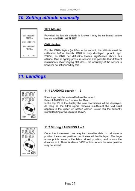
Manual V1.00_2009_V510. Setting altitude <strong>manual</strong>ly10.1 Alti-setProvided the launch altitude is known it may be calibrated beforelaunch in MENU / ALTI SETQNH display:For the QNH-display (in hPa) to be correct, the altitude must becalibrated before launch. QNH is only displayed up until app.2000m, as QNH per definition looses significance above thisaltitude. Due to ageing pressure sensors it is possible that differentinstruments show varying altitudes – the accuracy of the sensor ishowever not influenced by this.11. Landings11.1 LANDING search 1 – 33 landings may be entered before the launchSelect LANDING 1 – 3 to see the Menu.In the top 1/3 of the display the new coordinates will be displayed.As long as the GPS signal remains insufficient the text BADappears in the upper left screen corner. Below this the currentlystored landing or waypoint is shown.11.2 Storing LANDINGS 1 – 3Once the instrument has acquired satellite data to calculate aposition the current position coordinates will be displayed. The largearrow points towards the latest stored position, and shows thedistance to it. There is also a SAVE option, where the new positionmay be stored.Page 27