HKU Libraries - The University of Hong Kong
HKU Libraries - The University of Hong Kong
HKU Libraries - The University of Hong Kong
Create successful ePaper yourself
Turn your PDF publications into a flip-book with our unique Google optimized e-Paper software.
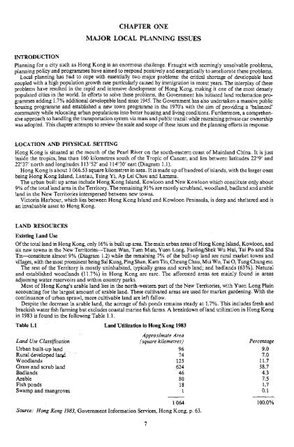
ONEMAJOR LOCAL PLANNINGINTRODUCTIONPlanning for a city such as <strong>Hong</strong> <strong>Kong</strong> is an enormous challenge. Fraught with seemingly unsolvable problems,planning policy and programmes have aimed to respond positively and energetically to ameliorate these problems.Local planning has had to cope with essentially two major problems: the critical shortage <strong>of</strong> developable landcoupled with a high population growth rate particularly caused by immigration in recent years. <strong>The</strong> interplay <strong>of</strong> theseproblems have resulted in the rapid and intensive development <strong>of</strong> <strong>Hong</strong> <strong>Kong</strong>, making it one <strong>of</strong> the most denselypopulated cities in the world. In efforts to solve these problems, the Government has initiated land reclamation programmesadding 1.7% additional developable land since 1945. <strong>The</strong> Government has also undertaken a massive publichousing programme and established a new town programme in the 1970's with the aim <strong>of</strong> providing a 'balanced'community while relocating urban populations into better housing and living conditions. Furthermore, a comprehensiveapproach to handling the transportation system via mass and public transit while restraining private car ownershipwas adopted. This chapter attempts to review the scale and scope <strong>of</strong> these issues and the planning efforts in response.LOCATION AND PHYSICAL SETTING<strong>Hong</strong> <strong>Kong</strong> is situated at the mouth <strong>of</strong> the Pearl River on the south-eastern coast <strong>of</strong> Mainland China. It is justinside the tropics, less than 160 kilometres south <strong>of</strong> the Tropic <strong>of</strong> Cancer, and lies between latitudes 22 C 9' and22°37 / north and longitudes 113°52' and 114°30' east (Diagram 1.1).<strong>Hong</strong> <strong>Kong</strong> is about 1 066.53 square kilometres in area. It is made up <strong>of</strong> hundred <strong>of</strong> islands, with the larger onesbeing <strong>Hong</strong> <strong>Kong</strong> Island, Lantau, Tsing Yi, Ap Lei Chau and Lamma.<strong>The</strong> urban built up areas include <strong>Hong</strong> <strong>Kong</strong> Island, Kowloon and New Kowloon which constitute only about9% <strong>of</strong> the total land area in the Territory. <strong>The</strong> remaining 91 % are mostly scrubland, woodland, badland and arableland in the New Territories interspersed between new towns.Victoria Harbour, which lies between <strong>Hong</strong> <strong>Kong</strong> Island and Kowloon Peninsula, is deep and sheltered and isan invaluable asset to <strong>Hong</strong> <strong>Kong</strong>.LAND RESOURCESExisting Land UseOf the total land in <strong>Hong</strong> <strong>Kong</strong>, only 16% is built up area. <strong>The</strong> main urban areas <strong>of</strong> <strong>Hong</strong> <strong>Kong</strong> Island, Kowloon, andsix new towns in the New Territories—Tsuen Wan, Tuen Mun, Yuen Long, Fanling/Shek Wu Hui, Tai Po and ShaTin—constitute almost 9% (Diagram 1.2) while the remaining 7% <strong>of</strong> the built-up land are rural market towns andvillages, with the most prominent being Sai Kung, Ping Shan, Kam Tin, Cheung Chau, Mui Wo, Tai O, Tung Chung etc.<strong>The</strong> rest <strong>of</strong> the Territory is mostly uninhabited, typically grass and scrub land; and badlands (63%). Naturaland established woodlands (11.7%) in <strong>Hong</strong> <strong>Kong</strong> are rare. <strong>The</strong> afforested areas are mainly found in areasadjoining water reservoirs and within country parks.Most <strong>of</strong> <strong>Hong</strong> <strong>Kong</strong>'s arable land lies in the north-western part <strong>of</strong> the New Territories, with Yuen Long Plainaccounting for the largest amount <strong>of</strong> arable land. <strong>The</strong>se cultivated areas are used for market gardening. With thecontinuance <strong>of</strong> urban sprawl, more cultivable land are left fallow.Despite the decrease in arable land, the acreage <strong>of</strong>fish ponds remains steady at 1.7%. This includes fresh andbrackish water fish farming but excludes coastal marine fish farms. A breakdown <strong>of</strong> land utilization in <strong>Hong</strong> <strong>Kong</strong>in 1983 is found in the following Table 1.1.Table 1.1 Land Utilization in <strong>Hong</strong> <strong>Kong</strong> 1983Approximate AreaLand Use Classification (square kilometres) PercentageUrban built-up land 96 9.0Rural developed laiid 74 7.0Woodlands 125 11.7'.Grass and scrub land 624 58.7Badlands 46 4.3Arable 80 7.5Fishponds 18 1.7Swamp and mangroves 1 0.11 064 100.0%Source: <strong>Hong</strong> <strong>Kong</strong> 1983, Government Information Services, <strong>Hong</strong> <strong>Kong</strong>, p. 63.


