Water Level - Alaska Tsunami Education Program
Water Level - Alaska Tsunami Education Program
Water Level - Alaska Tsunami Education Program
- No tags were found...

Create successful ePaper yourself
Turn your PDF publications into a flip-book with our unique Google optimized e-Paper software.
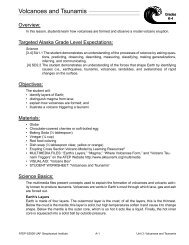
<strong>Water</strong> <strong>Level</strong>Overview:Grades3-4In this lesson the teacher leads students in exploring the measurement and influences of water levelby creating a model of an older type of tide gauge.Targeted <strong>Alaska</strong> Grade <strong>Level</strong> Expectations:Science[3-4] SA1.1 The student demonstrates an understanding of the processes of science by asking questions,predicting, observing, describing, measuring, classifying, making generalizations,inferring, and communicating.[3] SA1.2 The student demonstrates an understanding of the processes of science by observing anddescribing the student’s own world to answer simple questions.[3] SA2.1 The student demonstrates an understanding of the attitudes and approaches to scientificinquiry by answering “how do you know?” questions with reasonable answers.[3] SE2.1 The student demonstrates an understanding that solving problems involves different waysof thinking, perspectives, and curiosity by identifying local tools and materials used in everydaylife.[4] SE2.1 The student demonstrates an understanding that solving problems involves different waysof thinking, perspectives, and curiosity by identifying the function of a variety of tools (e.g.,spear, hammer, hand lens, kayak, computer).Math[3] PS-2 The student communicates his or her mathematical thinking by representing mathematicalproblems using manipulatives, models, pictures, and/or everyday language to explainthinking about the problem-solving strategies and solutions to problems.Objectives:The student will:• observe a model tide gauge; and• evaluate the relationship between water level and measurements by an analog-to-digital (ADR)gauge and tide staff.Materials:• 12-inch – 18-inch long clear plastic tube (T12 tube guards cut to length)• push pin• clear container (about the size of a small to medium sized aquarium)• water• string (12-18 inches)• cork or Model Magic (small enough to float freely in the tube)• 2 rulers• tape• STUDENT WORKSHEET: “<strong>Water</strong> <strong>Level</strong>”• VISUAL AID: “Tide Gauge”ATEP ©2006-2009 UAF Geophysical Institute A-93 <strong>Water</strong> <strong>Level</strong>
1Whole Picture:Most ocean waves are generated by wind. Wind waves cause water particles to move in a circularTide gauges measure water level. Mariners use the information gathered from tide gauges to determinewhen and where to travel. This information is also used for tsunami and storm surge warnings.Long-term tide records are used for marine boundary determinations, tidal predictions, monitoringsea level trends, oceanographic research, and climate research. Changes in water level also affectbridge, breakwater and deep-water channel construction.The older style of tide gauge consists of a tide house, often along a pier, that contains a stilling tubethat extends well below the water surface. The tide house also contains a analog-to-digital recorder(ADR) that records water level at timed intervals by determining the length of a wire that extendsdown the stilling tube to a float on the water surface. Measurement from nearby tide staffs, permanentlyfixed measuring devices that act as a vertical reference, are compared to measurements gatheredby the ADR. Geodetic benchmarks are also placed on land nearby as another comparison andto determine the amount of uplift or subsidence in relation to water level.Newer versions of tide gauges rely on computer-based technology that determine water level bysending acoustic signals down a sounding tube to the water surface.Activity Preparation:Build the model tide gauge.2 3 4 5 6 7 8 9 10 11 121. Poke holes all around the lower 1/3 of the clear plastic tube using the push pin.2. Tape a ruler to the side of the clear container.3. Attach the float (cork or small piece of model magic) to one end of the string.ATEP ©2006-2009 UAF Geophysical Institute A-94 <strong>Water</strong> <strong>Level</strong>
Activity Procedure:1. Explain that students will learn how scientists record water level and how the information is used.2. Ask students how they know if the tide is high or low. Discuss landmark or vegetation indicators.3. Display VISUAL AID: “Tide Gauge” and explain that tide gauges measure the water level. Marinersuse the information gathered from tide gauges to know when and where to travel. This information isalso used for tsunami and storm surge warnings.4. Display the model tide gauge and explain what each part of the model represents (tube: stilling well;cork and string: float and wire; ruler: tide staff).5. Fill the container with about three inches of water. Insert the float and make sure that is can movefreely in the tube with the string coming out of the top of the tube. Explain that tide gauges have timersin the tide house that record the length of the float wire. Measure the length of the string from the floatto the top of the tube using the other ruler. Record this information on the board.6. Point out that the tide staff is there for scientists to observe. This way they can compare their measurementsto something to help make sure the tide gauge is working correctly. Record the measurementon the board.Critical Thinking: Think-Pair-Share method. Pose a critical thinking question. Ask students to pairup and talk about the question. Once they have explored the question, ask students to share theirideas with the class.• Ask students to think about why scientists would measure the water in a stilling well instead ofplacing the float on top of the ocean water? (The stilling well doesn’t allow waves and wind toaffect the measurement of the water level.)• Ask students what will happen to the measurement of the wire and the tide staff if the water levelgoes up? (The measurement of the wire will decrease and the measurement on the tide staff willincrease)7. Add about another three inches of water to the container and repeat recording of the string and rulerto compare to student responses.8. Distribute STUDENT WORKSHEET: “<strong>Water</strong> <strong>Level</strong>” for student completion.Extension Ideas:• Interview a local Elder about local and traditional knowledge on tide levels.• Carry out a tide-related activity from the book, Tlingit moon & tide by Dolly Garza.Lesson Information Sources:Garza, D. A. (1999). Tlingit moon & tide teaching resource: Elementary level. University of <strong>Alaska</strong> SeaGrant, SG-ED-33. Fairbanks, <strong>Alaska</strong>: University of <strong>Alaska</strong> Sea Grant.National Oceanic and Atmospheric Administration. Changing technology for tide measurements: The wayit was. http://celebrating200years.noaa.gov/foundations/tides/welcome.html#introNational Oceanic and Atmospheric Administration. noaa ocean service education: Tides and water levels.http://www.oceanservice.noaa.gov/education/kits/tides/National Oceanic and Atmospheric Administration. The story of the tide observer. http://celebrating-200years.noaa.gov/magazine/tide_observer/#introNational Oceanic and Atmospheric Administration. Tides & Currents: About water levels, tides and currents.http://tidesandcurrents.noaa.gov/about2.htmlATEP ©2006-2009 UAF Geophysical Institute A-95 <strong>Water</strong> <strong>Level</strong>
Answers:1. Answers will vary but should reflect knowledge of a known benchmark, like vegetation levels, visiblerocks, level on a pier.2.tide housefloattide stafffloat wirestilling welltide housefloat wiretide staffstilling wellfloat3. shorter4. increaseATEP ©2006-2009 UAF Geophysical Institute A-96 <strong>Water</strong> <strong>Level</strong>
Name:____________________________________<strong>Water</strong> <strong>Level</strong>Student Worksheet (page 1 of 2)Grades3-41. How do you know if the water level is high or low without using a tide gauge?______________________________________________________________________________________________________________________2. Label the following on the picture below.tide housefloattide stafffloat wirestilling welltide housefloat wiretide staffstilling wellfloatATEP ©2006-2009 UAF Geophysical Institute A-97 <strong>Water</strong> <strong>Level</strong>
Name:____________________________________<strong>Water</strong> <strong>Level</strong>Student Worksheet (page 2 of 2)Grades3-4Circle the correct answer.3. When the water level goes up, the wire becomesshorterlonger.4. When the water level goes up, the measurement on the tide staffincreasesdecreases.ATEP ©2006-2009 UAF Geophysical Institute A-98 <strong>Water</strong> <strong>Level</strong>