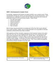
where U is the total velocity at a height z from the ground; is von Karman's constant (=0.41), z ois the effective roughness height of the ground terrain; and U r is the reference velocity at thereference height z r . The total friction velocity U* is given by:U*= U r /ln(z r /z o )The reference velocity was taken to be 10m/s at a reference height of 10m. The effectiveroughness height was taken to be 0.25m.In this case, a WIND object was employed. As the wind direction does not match the grid, theWIND object decomposes the wind speed into the velocity components at the up-wind domainfaces and fixed pressure boundaries at the down-wind faces and the sky boundary. The WINDfeature allows changes in wind direction to be introduced easily.Treatment of terrainA terrain data file was supplied, but it did not appear to cover the same area as the geometryfiles. When it was imported at its nominal position, it covered a smaller area than the buildings,leaving a step on the ground plane. Many buildings also disappeared under the ground planewhich did not appear correct. The Tsim Shah Tsui area is predominantly flat in any case, hence, inthe interests of expedience, it was decided to omit the terrain object from the demonstration anduse a flat ground plane with a roughness height of 0.25m. In principle, any terrain would beimported and handled in the same manner as the buildings.ConclusionsOnce the initial geometry issues had been and established and resolved, the above reduced-sizecase was created and run with a few hours of man-time effort, and 72 hours of computer timewhen running in parallel-mode on a quad-core computer. The case occupied 13GB of RAM.The results readily show the variation in wind speed through the street canyons, areas of highturbulence, and calm regions. The plots shown below have been generated using the standardVR-Viewer post-processor which can display vectors, contours, iso-surfaces, high & low spots, andanimated view options.In the same way that alternative CAD products can be used for geometry creation and import intoPHOENICS, users also have the option to export the results to third-party post-processors [such asFEMView, Fieldview, Paraview, TECPLOT and Wavefront] for which interfaces are available withinPHOENICS.The case has been passed onto the customer for onward modification and refinement uponlarger-capacity computers to meet the stated meshing requirement. It should be noted that thedomain may need to be enlarged to meet the original specification, and the meshing increased toprovide the stated mesh density requirement. From a practical viewpoint, the resultingcalculation will be enormous, and it is then doubtful if it will produce substantially moremeaningful results, overall, than the reduced-size model. A more pragmatic solution would be toconcentrate mesh in particular areas of interest, rather than model the entire cityscape with thesame degree of accuracy.
ResultsThe following images were generated and are shown below:PLAN VIEW1. <strong>Wind</strong> velocity contours @ 2m above ground2. <strong>Wind</strong> velocity contours @ 5m above ground3. <strong>Wind</strong> velocity contours @ 10m above ground4. <strong>Wind</strong> velocity contours @ 20m above ground5. <strong>Wind</strong> velocity vectors @ 2m above ground6. <strong>Wind</strong> velocity vectors @ 5m above ground7. <strong>Wind</strong> velocity vectors @ 10m above ground8. <strong>Wind</strong> velocity vectors @ 20m above ground9. Zoom image - <strong>Wind</strong> velocity vectors @ 2m above ground10. Zoom image - <strong>Wind</strong> velocity vectors @ 5m above ground11. Zoom image - <strong>Wind</strong> velocity vectors @ 10m above ground12. Zoom image - <strong>Wind</strong> velocity vectors @ 50m above ground13. Zoom image - <strong>Wind</strong> velocity vectors @ 75m above ground14. <strong>Wind</strong> velocity contours @ 75m above ground15. <strong>Wind</strong> velocity vectors @ 75m above groundANGLED VIEW16. Zoom image - <strong>Wind</strong> velocity vectors @ 75m above ground17. Streamlines @ 2m above ground18. Streamlines @ 20m above ground19. Streamlines @ 50m above ground