Rural Data Collection Technology - FHWA Operations - U.S. ...
Rural Data Collection Technology - FHWA Operations - U.S. ...
Rural Data Collection Technology - FHWA Operations - U.S. ...
- No tags were found...

Create successful ePaper yourself
Turn your PDF publications into a flip-book with our unique Google optimized e-Paper software.
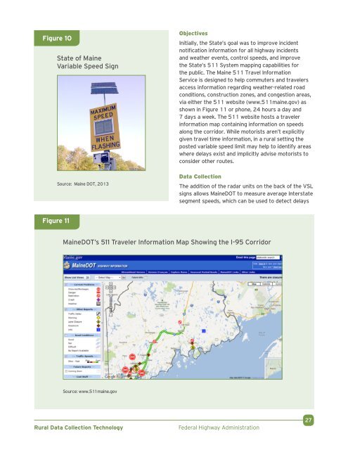
Figure 10State of MaineVariable Speed SignSource: Maine DOT, 2013ObjectivesInitially, the State’s goal was to improve incidentnotification information for all highway incidentsand weather events, control speeds, and improvethe State’s 511 System mapping capabilities forthe public. The Maine 511 Travel InformationService is designed to help commuters and travelersaccess information regarding weather-related roadconditions, construction zones, and congestion areas,via either the 511 website (www.511maine.gov) asshown in Figure 11 or phone, 24 hours a day and7 days a week. The 511 website hosts a travelerinformation map containing information on speedsalong the corridor. While motorists aren’t explicitlygiven travel time information, in a rural setting theposted variable speed limit may help to identify areaswhere delays exist and implicitly advise motorists toconsider other routes.<strong>Data</strong> <strong>Collection</strong>The addition of the radar units on the back of the VSLsigns allows MaineDOT to measure average Interstatesegment speeds, which can be used to detect delaysFigure 11MaineDOT’s 511 Traveler Information Map Showing the I-95 CorridorSource: www.511maine.gov<strong>Rural</strong> <strong>Data</strong> <strong>Collection</strong> <strong>Technology</strong>Federal Highway Administration27