Contaminant pathways in Port Curtis: Final report - OzCoasts
Contaminant pathways in Port Curtis: Final report - OzCoasts
Contaminant pathways in Port Curtis: Final report - OzCoasts

Create successful ePaper yourself
Turn your PDF publications into a flip-book with our unique Google optimized e-Paper software.
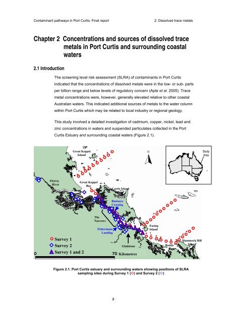
<strong>Contam<strong>in</strong>ant</strong> <strong>pathways</strong> <strong>in</strong> <strong>Port</strong> <strong>Curtis</strong>: F<strong>in</strong>al <strong>report</strong>2: Dissolved trace metalsChapter 2 Concentrations and sources of dissolved tracemetals <strong>in</strong> <strong>Port</strong> <strong>Curtis</strong> and surround<strong>in</strong>g coastalwaters2.1 IntroductionThe screen<strong>in</strong>g level risk assessment (SLRA) of contam<strong>in</strong>ants <strong>in</strong> <strong>Port</strong> <strong>Curtis</strong><strong>in</strong>dicated that the concentrations of dissolved metals were <strong>in</strong> the low- or sub- partsper billion range and below levels of regulatory concern (Apte et al. 2005). Tracemetal concentrations were, however, generally elevated relative to other coastalAustralian waters. This <strong>in</strong>dicated additional sources of metals to the water columnwith<strong>in</strong> <strong>Port</strong> <strong>Curtis</strong> which may be related to local <strong>in</strong>dustry or regional geology.This study <strong>in</strong>volved a detailed <strong>in</strong>vestigation of cadmium, copper, nickel, lead andz<strong>in</strong>c concentrations <strong>in</strong> waters and suspended particulates collected <strong>in</strong> the <strong>Port</strong><strong>Curtis</strong> Estuary and surround<strong>in</strong>g coastal waters (Figure 2.1).Great KeppelIslandStudyAreaFitzroyRiverGreat KeppelBay<strong>Curtis</strong> IslandRamsaysCross<strong>in</strong>gTheNarrowsFishermansLand<strong>in</strong>gFac<strong>in</strong>gIslandSurvey 1Survey 2Survey 1 and 2GladstoneKilometresRoddsBayHummock HillIslandFigure 2.1. <strong>Port</strong> <strong>Curtis</strong> estuary and surround<strong>in</strong>g waters show<strong>in</strong>g positions of SLRAsampl<strong>in</strong>g sites dur<strong>in</strong>g Survey 1 (!) and Survey 2 (")8