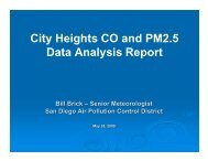
City Heights CO and PM2.5 Data Analysis Report - Air Pollution ...
City Heights CO and PM2.5 Data Analysis Report - Air Pollution ...
City Heights CO and PM2.5 Data Analysis Report - Air Pollution ...

You also want an ePaper? Increase the reach of your titles
YUMPU automatically turns print PDFs into web optimized ePapers that Google loves.
PROJECT DESCRIPTIONEarly in 2008, the San Diego <strong>Air</strong> <strong>Pollution</strong> Control District (District) was contacted by amember of County Board of Supervisors Ron Roberts’ (District 4) staff regarding airpollution concerns in <strong>City</strong> <strong>Heights</strong>. This air pollution concern stemmed from the completionof State Route 15 (SR-15) through the <strong>City</strong> <strong>Heights</strong> area many years ago, <strong>and</strong> the creation ofTeralta Park, which spans over SR-15.A previous agreement with the community of <strong>City</strong> <strong>Heights</strong> <strong>and</strong> the California Department ofTransportation (CALTRANS) called for carbon monoxide (<strong>CO</strong>) monitoring at Teralta Parkfollowing completion of the park over SR-15. The <strong>City</strong> <strong>Heights</strong> community wanted thismonitoring to ensure that there were no health issues related to SR-15 at Teralta Park. <strong>CO</strong>was chosen as the pollutant to monitor as it is a relatively direct measure of pollutantsemitted from vehicles, <strong>and</strong> therefore would show potential impacts from traffic on SR-15(based on various study documents from the 1970s, 1980s, <strong>and</strong> 1990s).The District has been monitoring <strong>CO</strong> in populated areas of San Diego County since the early1970s. With the exception of the wildfires of 2003, San Diego has not violated federal airquality st<strong>and</strong>ards for <strong>CO</strong> since 1990 or the state st<strong>and</strong>ards since 1991.CALTRANS retained a local consulting firm, CH2M Hill, to conduct the <strong>CO</strong> monitoring atTeralta Park. CH2M Hill set up <strong>and</strong> operated the <strong>CO</strong> analyzer, <strong>and</strong> the District providedquality assurance/quality control (QA/QC) calibrations, weekly checks, <strong>and</strong> audits of the <strong>CO</strong>monitoring equipment during the project. The <strong>CO</strong> monitoring project is described in moredetail in reports provided to CALTRANS by CH2M Hill.In the years following completion of SR-15 through <strong>City</strong> <strong>Heights</strong> <strong>and</strong> the creation of TeraltaPark, health studies have shown that particulate matter of 2.5 microns <strong>and</strong> less in diameter(known as <strong>PM2.5</strong>) has become a pollutant of concern. The community therefore wanted the<strong>CO</strong> monitoring at Teralta Park combined with <strong>PM2.5</strong> monitoring at Central ElementarySchool. The District was tasked with providing <strong>PM2.5</strong> monitoring support for this project.As details of the monitoring program were worked out with the community group, it becameclear that the <strong>CO</strong> <strong>and</strong> <strong>PM2.5</strong> monitoring should be conducted during winter months in orderto measure the maximum air quality impact from SR-15 on the local community. Themonitoring project was therefore scheduled for November 2008 through January 2009. Withcommunity input it was also decided to split the <strong>CO</strong> monitoring between Teralta Park(southwest corner) <strong>and</strong> Central Elementary School (southeast corner of the park) in order tosee if there were any differences on the west <strong>and</strong> east sides of SR-15.The postponement of monitoring also allowed the District to obtain two, real-time <strong>PM2.5</strong>monitors (known as EBAM) <strong>and</strong> one filter-based, Federal Reference Method (FRM) <strong>PM2.5</strong>analyzer to provide more definitive measurements of <strong>PM2.5</strong> in the community of <strong>City</strong><strong>Heights</strong>. The Central Elementary School location was chosen as the location for one EBAMunit as well as the FRM. Wilson Middle School, a few blocks to the northwest, was chosenas the location for the second EBAM unit. The placement of these analyzers allowed for- 2 -