Staff Report and WELO Ordinance - StopWaste.Org
Staff Report and WELO Ordinance - StopWaste.Org
Staff Report and WELO Ordinance - StopWaste.Org
- No tags were found...

You also want an ePaper? Increase the reach of your titles
YUMPU automatically turns print PDFs into web optimized ePapers that Google loves.
LIVERMORECALIFORNIAPLANNING COMMISSION AGENDA REPORTAPPLICATION NO.: Municipal Code Amendment 09-005APPLICANT:PROJECT PLANNER:City of LivermoreFrank Guido, Associate PlannerPROJECT DESCRIPTION: A request to amend Municipal Code Chapter 13.25,the Water Efficient L<strong>and</strong>scape <strong>Ordinance</strong>, to beconsistent with an updated State model waterefficient l<strong>and</strong>scape ordinanceRECOMMENDATION:LOCATION:ZONING:GENERAL PLAN:SITE AREA:CEQA STATUS:NOTICE AREA:<strong>Ordinance</strong> adoptionCitywideVariousVariousVariousExempt under the California Environmental QualityAct per the General Rule in 15061(b)(3) because itcan be seen with certainty that there is no possibilitythat the activity in question may have a significanteffect on the environment.Citywide via newspaper of general circulationMEETING DATE:10-19-10AGENDA ITEM:8.015
LIVERMOREPLANNING COMMISSION AGENDA REPORTTO:Chairperson West <strong>and</strong>Members of the Planning CommissionPREPARED BY: Frank Guido, Associate PlannerREVIEWED BY:Paul Spence, Principal PlannerScott Lee, Senior PlannerDATE: October 19, 2010SUBJECT:Municipal Code Amendment 09-005 (amendment of WaterEfficient L<strong>and</strong>scape <strong>Ordinance</strong>)SUMMARY RECOMMENDATION<strong>Staff</strong> recommends the Planning Commission recommend the City Council introduce anordinance amending Municipal Code, Chapter 13.25, Water Efficient L<strong>and</strong>scapes.BACKGROUNDIn July 1992, the State of California enacted the Water Conservation in L<strong>and</strong>scaping Act(Assembly Bill 325), resulting in a State Model Water Efficient L<strong>and</strong>scape <strong>Ordinance</strong> witha requirement for cities to adopt an equivalent ordinance. In December 1992, the Cityadopted an ordinance at least as effective as <strong>and</strong> closely adhering to the 1992 Statemodel, found at Chapter 13.25 of the Municipal Code, Water Efficient L<strong>and</strong>scaping(attached).In September 2006, the Governor signed Assembly Bill 1881 into law, which amendedthe original Water Conservation in L<strong>and</strong>scaping Act, including a requirement to updatethe Model Water Efficient L<strong>and</strong>scape <strong>Ordinance</strong>. In September 2009, the CaliforniaDepartment of Water Resources adopted a final updated model ordinance (Attached).The intent of the State's Model Water Efficient L<strong>and</strong>scape <strong>Ordinance</strong> is to achieveincreased l<strong>and</strong>scape water use efficiency in new development.16
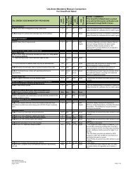
Since the City did not adopt an ordinance locally by this past January 1, 2010, theupdated 2009 State model is effective until such time the City adopts its own localversion. <strong>Staff</strong> has prepared the attached amended Chapter 13.25 as the City's updatedWater Efficient L<strong>and</strong>scape <strong>Ordinance</strong>.It is beneficial for the City to adopt its own amended ordinance as it can balanceflexibilities with additional sustainable practices to result in an amended ordinance that isat least as effective or more effective than the updated State Model Water Efficient<strong>Ordinance</strong>; that can cross reference other l<strong>and</strong>scape related ordinances, policies, <strong>and</strong>codes; <strong>and</strong> that is reformatted <strong>and</strong> reorganized to integrate into our Municipal Codeformat.The goal of the Water Efficient L<strong>and</strong>scape <strong>Ordinance</strong> is to save water, which in turnsaves the l<strong>and</strong>owner in long-term water costs <strong>and</strong> is good for the environment. All otherjurisdictions in the State have a similar ordinance or use the State model, which createsconsistent st<strong>and</strong>ards for property owners <strong>and</strong> developers. This update does not changethe entitlement process for projects, the timeline for approval, nor create any new permitsor fees.In amending the City ordinance, staff consulted with Zone 7 Water Agency, CaliforniaWater Service Company, our own municipal Water Service, Livermore Area Recreation<strong>and</strong> Park District, a soil laboratory, the Irrigation Association, <strong>and</strong> a small selection ofirrigation auditors, l<strong>and</strong>scape designers including Gates <strong>and</strong> Associates, architects,l<strong>and</strong>scape maintenance companies, <strong>and</strong> builders to solicit input on the ordinance.PROJECT DESCRIPTION/ANALYSISSummary OverviewThe Model Water Efficient L<strong>and</strong>scape <strong>Ordinance</strong> places requirements on newl<strong>and</strong>scapes using very specific sets of requirements in l<strong>and</strong>scape <strong>and</strong> irrigation design.The requirements are specific as to establishing a water budget; estimating l<strong>and</strong>scapewater use from the expected water needs of selected plants; <strong>and</strong> determiningspecifications for soil management, irrigation system design, <strong>and</strong> grading.Side-by-Side Comparison DocumentAn 11-inch-by-17-inch document is provided in the packet, which consolidates <strong>and</strong>compares side-by-side the 2009 updated State model (with modifications recommendedby <strong>StopWaste</strong>.<strong>Org</strong> as explained below); existing Municipal Code Chapter 13.25 text; <strong>and</strong>the proposed Municipal Code Chapter 13.25 recommended by staff for adoption toimplement the updated State Model Water Efficient <strong>Ordinance</strong>.Stopwaste.org is the Alameda County Waste Management Authority <strong>and</strong> the AlamedaCounty Source Reduction <strong>and</strong> Recycling Board operating as one public agency. Theside-by side comparison includes the State model with highlighted (italicized)27
ecommendations provided by <strong>StopWaste</strong>.<strong>Org</strong> to its member agencies, since staffincorporated some of their recommendations. These recommendations include a set ofprinciples called Bay-friendly l<strong>and</strong>scaping, which generally promotes better soil health,water conservation, water quality protection, pollution prevention, <strong>and</strong> protection ofnatural resources in general <strong>and</strong> especially the San Francisco Bay watershed.The State Model Water Efficient L<strong>and</strong>scape <strong>Ordinance</strong> sections <strong>and</strong> 1992 City ordinancesections are re-ordered to correspond to the proposed amended City ordinance sectionsin order to allow for side-by-side comparison. In some cases, parts of a State ModelWater Efficient L<strong>and</strong>scape <strong>Ordinance</strong> section may appear more than once because aprovision may affect more than one proposed City ordinance section.ApplicabilityThe ordinance would apply only to development projects requiring a City approval. Itapplies to new residential <strong>and</strong> non-residential development projects <strong>and</strong> redesignedl<strong>and</strong>scapes meeting minimum size criteria. However, homeowners redesigning theirl<strong>and</strong>scaping would be exempt.An important difference between the 1992 <strong>and</strong> 2009 State model ordinances is that the1992 model exempted sites using recycled water from the ordinance, <strong>and</strong> the currentmodel does not. However, it does increase the amount of water allowed l<strong>and</strong>scapesirrigated with recycled water, as compared to non-recycled water irrigated l<strong>and</strong>scapes.For projects needing City approval, such as a design review or building permit, perproposed Section 13.25.030(B), the ordinance would apply to the following, which isconsistent with the new State model:"1. New construction <strong>and</strong> rehabilitated l<strong>and</strong>scapes for public agency projects <strong>and</strong>private non-residential development projects with a total project l<strong>and</strong>scapearea equal to or greater than 2,500 square feet;2. New construction <strong>and</strong> rehabilitated l<strong>and</strong>scapes, which are developer-installedin single-family <strong>and</strong> multi-family projects with a total project l<strong>and</strong>scape areaequal to or greater than 2,500 square feet; or3. New construction l<strong>and</strong>scapes, which are homeowner-provided <strong>and</strong>/orhomeowner-hired in single-family <strong>and</strong> multi-family residential developmentprojects with a total project l<strong>and</strong>scape area equal to or greater than 5,000square feet."It should be noted that "rehabilitated" l<strong>and</strong>scapes mean those in which at least 50 percentof the l<strong>and</strong>scape is being completely redesigned <strong>and</strong> does not refer to routinemaintenance, such as replacing plants like for like.The ordinance includes exemptions from its provisions per the State model for historicsites, ecological restoration projects, mined l<strong>and</strong> reclamation projects, <strong>and</strong> plantcollections, such as botanical gardens. The ordinance also explicitly states that it is not83
Hydrozones, Plant Factors, <strong>and</strong> Irrigation Efficiency"Hydrozones" are areas containing plants with similar water needs <strong>and</strong> irrigationequipment with similar efficiency. The formulas for estimating irrigation water use rely onnumeric figures assigned to hydrozones called "plant factors" <strong>and</strong> "irrigation efficiencies,"both of which are briefly explained below.Plant FactorsA plant factors is an estimate of a plant species' water need relative to other plants (e.g.,low, medium, <strong>and</strong> high water use plants). The numbers are on a scale of 0 to 1 (e.g., 0.1is very low water need <strong>and</strong> 0.9 is very high). Generally, a plant's water needs are lower ifthey are drought tolerant or are accustomed to temperate climates, such as theLivermore region <strong>and</strong> accordingly lower plant factor numbers are assigned to them.Plants are assigned a higher plant factor number if they are less drought tolerant <strong>and</strong>need relatively more frequent applications of water to survive.The State model specifies using as a primary source for estimating relative water use, theWater Use Classification of L<strong>and</strong>scape Species published by the University of CaliforniaCooperative Extension (WUCOLS). (Proposed Section 13.25.060(B)(4)).Irrigation EfficiencyIrrigation efficiency is another important factor in calculating estimated water use, <strong>and</strong> is ameasure of a given irrigation equipment category's relative efficiency in delivering water.It is expressed on a scale of 0 to 1 with a higher number (e.g., 0.8) indicating a higherproportion of applied water is expected to actually reach the plant's root zones, with lowernumbers indicating less efficiency.Generally, equipment that targets lower volumes of water in a smaller area at or near theplants' base is more efficient (e.g., drip irrigation). Conversely, equipment that sprayshigher volumes <strong>and</strong> pressures of water over a larger more dispersed area is lessefficient.The 1992 City ordinance included charts of plant factors <strong>and</strong> irrigation efficiencies as anassist to staff in administering <strong>and</strong> designers in applying the ordinance. <strong>Staff</strong>recommends retaining these charts.<strong>Staff</strong> recommends minor adjustments in plant factors to add temporarily irrigated areasas required by the State model. The recommended adjustments also recognizeLivermore's hotter climate (<strong>and</strong> higher plant water needs) compared to cooler morehumid microclimates, such as San Francisco's with which Livermore is regionallygrouped in the above-referenced WUCOLS book.105
<strong>Staff</strong> also recommends minor adjustments in the irrigation efficiency chart to recognizeadvancements in equipment efficiency in delivering water; State model restrictions onspray irrigation in very small l<strong>and</strong>scape areas to avoid water waste; <strong>and</strong> use of updateddefined terms.Other Important Provisions of the <strong>Ordinance</strong>.OverviewThe 1992 <strong>and</strong> 2009 State models both contain requirements for several important <strong>and</strong>interrelated l<strong>and</strong>scape design concepts that can affect water use beyond the waterbudget calculation <strong>and</strong> use of hydrozones in l<strong>and</strong>scape design.These areas include the l<strong>and</strong>scape design itself (plant selection <strong>and</strong> their organization ina plan), soil analysis, grading design, <strong>and</strong> irrigation design, <strong>and</strong> a final verification to beprovided by the permit applicant's qualified l<strong>and</strong>scape professional that the l<strong>and</strong>scapeinstallation conforms to the approved l<strong>and</strong>scape <strong>and</strong> irrigation design.The proposed amendments to the City ordinance is consistent with the 2009 State ModelWater Efficient L<strong>and</strong>scape <strong>Ordinance</strong> as summarized below with notablerecommendations highlighted.Soil ManagementProposed Section 13.25.060(0) contains soil analysis specifications. The State modelallows for deferring soil analysis if mass grading occurs, which makes sense as the soiltested could be much different following mass grading <strong>and</strong> which is included in proposedSection 13.25.060(C)(2).<strong>Staff</strong> recommends requiring use of organic fertilizers as recommended by Stopwaste.org ;however, with an option to use chemical fertilizers provided they are slow release. Forlarger l<strong>and</strong>scapes of 10,000 square feet or more, staff recommends a more detailed soilanalysis <strong>and</strong> soil treatment approach as cost-justified by the greater economies of scaleassociated with a larger l<strong>and</strong>scape. Such measures include more intensive soil analysis<strong>and</strong> recommendations to increase soil organic content <strong>and</strong> the use of soil amendmentsspecifically designed to ensure greater air <strong>and</strong> water access to the roots of trees adjacentto compacted areas, such as parking lot trees.L<strong>and</strong>scape DesignThe proposed City ordinance is consistent with the State model relative to l<strong>and</strong>scapest<strong>and</strong>ards, with additional provisions to conserve water noted below. The State modelprevents new common interest developments from containing provisions in theirCovenants, Codes <strong>and</strong> Restrictions having the effect of discouraging low water useplants or requiring turf (proposed in Section 13.25.050(D)(1)(f)).611
<strong>Staff</strong> also recommends that if grey water is ever used in irrigation that it be applied withlow-volume irrigation. Grey water is non-toilet, non-kitchen-sink wastewater recycled forirrigation use. Such systems are not currently in use in Livermore but could be proposedin the future. Therefore, staff recommends allowing for the possibility of grey water use inirrigation but requiring low volume irrigation to avoid aerosolizing grey water with higherpressure spray.Grading DesignProposed Section 13.25.060(F) covers grading design.<strong>Staff</strong> recommends incorporating a topsoil protection provision indicated as important by<strong>StopWaste</strong>.org (Section 13.25.070(F)(3)) <strong>and</strong> recommended by the local USDA soilscientist. Topsoil stockpiling is a relatively simple way to utilize existing site resources, asthe top few inches of native soil are usually richer in biomass, texture <strong>and</strong> nutrientsconducive to plant growth, instead of allowing it to be "lost in the shuffle" of development.L<strong>and</strong>scape Irrigation Installation CertificationThe above described l<strong>and</strong>scape design components would be reviewed for compliancewith the ordinance as part of a permit application. Following compliance, a permit can beissued.The proposed City ordinance is consistent with the State model by requiring a signedverification that the l<strong>and</strong>scape <strong>and</strong> irrigation system that is installed is consistent with thedesign approved pursuant to the permit <strong>and</strong> is, therefore, water efficient (see Section13.25.070). <strong>Staff</strong> consulted with irrigation auditors <strong>and</strong> irrigation maintenance companiesto inform the proposed code text. The verification requirements are to be completed by aqualified irrigation professional <strong>and</strong> include an evaluation of the irrigation system toensure it is properly installed; that scheduling programming is tailored to the l<strong>and</strong>scape,<strong>and</strong> that key provisions of the irrigation design requirements are met.Public EducationThe 1992 <strong>and</strong> 2009 State model ordinances require cities to make water conservationinformation available to residents <strong>and</strong> that model home complexes make available detailsabout the water conserving aspects of the development to potential homebuyers. Theseprovisions are in proposed Section 13.25.080.<strong>Staff</strong> also recommends requiring model home complexes provide homebuyers thecontroller manual, a diagram of the home's l<strong>and</strong>scape plant palette <strong>and</strong> irrigation system,<strong>and</strong> a copy of <strong>StopWaste</strong>.<strong>Org</strong>'s Bay-Friendly Gardening Guide, or an equivalentinformation source describing environmentally sustainable l<strong>and</strong>scape design, irrigation,soil management, <strong>and</strong> maintenance practices.813
ordinances, policies, <strong>and</strong> codes, <strong>and</strong> can balance flexibilities with additional sustainablepractices to result in an equivalently effective l<strong>and</strong>scape water conservation ordinance.The goal of the Water Efficient L<strong>and</strong>scape <strong>Ordinance</strong> is to save water, which in turnsaves the l<strong>and</strong>owner in long-term water costs <strong>and</strong> is good for the environment. All otherjurisdictions in the State have a similar ordinance or use the State model, which createsconsistent st<strong>and</strong>ards for property owners <strong>and</strong> developers.OTHER AGENCY/DEPARTMENT COMMENTS<strong>Staff</strong> consulted with various agencies as noted in the report <strong>and</strong> considered receivedcomments in the draft ordinance.Public CommentsNo public comments were received in response to the public notice as of the date ofreport preparation.ENVIRONMENTAL DETERMINATIONThe project is exempt from the California Environmental Quality Act (CEQA) per theGeneral Rule in Section 15061(b)(3) of the CEQA Guidelines, because it can be seenwith certainty that there is no possibility that the activity in question may have a significanteffect on the environment. The proposed ordinance will not decrease <strong>and</strong>, in some cases,will increase measures to promote water efficiency in l<strong>and</strong>scaping as compared to the1992 City Water Efficient L<strong>and</strong>scaping <strong>Ordinance</strong>, <strong>and</strong> it is at least as effective as the2009 State Model Water Efficient L<strong>and</strong>scape <strong>Ordinance</strong> in promoting l<strong>and</strong>scape waterefficiency.RECOMMENDATION<strong>Staff</strong> recommends the Planning Commission adopt the attached resolution, making thefindings, <strong>and</strong> recommend the City Council:1. instruct the staff to file the Notice of Exemption with the Alameda County Clerk;<strong>and</strong>2. adopt Municipal Code Amendment 09-005.ATTACHMENTS1. Resolution Recommending Adoption2. 1992 City <strong>Ordinance</strong>3. 2009 State Model4. 2010 Proposed City <strong>Ordinance</strong> Text5. Letter from USDA6. USDA Invasive Species List1015
7. California Invasive Plant Council Invasive Species List8. Side- by-Side Texts of 2009 Model, 1992 City <strong>Ordinance</strong>, <strong>and</strong> 2010 Proposed City<strong>Ordinance</strong> (on 11-inch-by-17-inch paper in Commissioners' packets only <strong>and</strong>available at the meeting)1611
IN THE PLANNING COMMISSIONOF THE CITY OF LIVERMORESTATE OF CALIFORNIAA RESOLUTION RECOMMENDING ADOPTIONOf an amended Municipal Code Chapter 13.25, the Water Efficient L<strong>and</strong>scape <strong>Ordinance</strong>,to be consistent with the updated 2009 State Model Water Efficient L<strong>and</strong>scape <strong>Ordinance</strong>WHEREAS, the City initiated an application for Municipal Code Amendment 09-005;WHEREAS, a Public Hearing Notice was published in a newspaper of localcirculation; <strong>and</strong>WHEREAS, the Planning Commission held a public hearing on October 19, 2010,considered the staff recommendation for recommending adoption, heard public testimony,<strong>and</strong> adopted the following findings:The proposed ordinance is consistent with the General Plan. The proposedordinance is consistent with Climate Change Element (CLI) policies, specifically toreview <strong>and</strong> update the water efficient l<strong>and</strong>scape ordinance (Policy CLI-1.4-P3). Asthe Climate Change Element states, "Water is an important <strong>and</strong> scarce resource <strong>and</strong>the importation of water to the City requires energy, which produces GHG(Greenhouse Gas) emissions. As a result, water conservation <strong>and</strong> efficiency bothhelp to reduce GHGs." Additionally the proposed ordinance is consistent with theInfrastructure <strong>and</strong> Public Services Element (INF) which requires compliance with them<strong>and</strong>atory state model ordinance (Policy INF-1.3-P4).2. The proposed ordinance is consistent with the Development Code. DevelopmentCode Chapter 4.05 (L<strong>and</strong>scape St<strong>and</strong>ards) references compliance with the WaterEfficient L<strong>and</strong>scape <strong>Ordinance</strong>. The proposed ordinance is consistent with thisprovision <strong>and</strong> other provisions of the Development Code.3. The project is exempt from the California Environmental Quality Act (CEQA) per theGeneral Rule in Section 15061(b)(3) of the CEQA Guidelines, because it can beseen with certainty that there is no possibility that the activity in question may have asignificant effect on the environment. The proposed ordinance will not decrease, <strong>and</strong>in some cases, will increase measures to promote water efficiency in l<strong>and</strong>scaping ascompared to the 1992 City water efficient l<strong>and</strong>scaping ordinance <strong>and</strong> it is at least aseffective as the 2009 State model ordinance in promoting l<strong>and</strong>scape water efficiency.BE IT RESOLVED by the Livermore Planning Commission that, based on the abovefindings, Municipal Code Amendment 09-005 is recommended to the City Council foradoption.Resolution No.17
On the motion by Commissioner , seconded by Commissioner , theforegoing Resolution was adopted at the Planning Commission meeting of October 19,2010, by the following vote:AYES:NOES:ABSENT:Darryl L. West, Chairpersonby Fred Osborn, Planning ManagerSecretary to the Planning Commission18-2- Resolution No.
Chapter 13.25WATER EFFICIENT LANDSCAPESections:13.25.010 Authority.13.25.020 Findings — Purpose.13.25.030 Applicability.13.25.040 Definitions.13.25.050 L<strong>and</strong>scape documentation package required.13.25.060 Elements of a l<strong>and</strong>scape documentation package.13.25.070 Public education.13.25.010 Authority.This chapter is enacted under the Water Conservation <strong>and</strong> L<strong>and</strong>scaping Act(Government Code Section 65591 et seq.) <strong>and</strong> is a "water efficient l<strong>and</strong>scapeordinance" adopted by a local agency under that Act. (Ord. 1399 § 1, 1992)13.25.020 Findings — Purpose.A. The city council finds <strong>and</strong> declares that the state of California is historicallyan arid environment with limited amounts of water resources. There areenormous costs to the citizens <strong>and</strong> ecosystem of the state to maintain currentwater resources systems <strong>and</strong> create new systems to meet current <strong>and</strong> futuredem<strong>and</strong>s for water. Therefore, the city council finds that it is in the public interestof the citizens of the city <strong>and</strong> the state to require the wise <strong>and</strong> efficient use of alimited <strong>and</strong> costly resource through regulations that require <strong>and</strong> promote waterconservation.B. The purpose of this chapter is to establish st<strong>and</strong>ards for designing,installing, <strong>and</strong> maintaining water efficient l<strong>and</strong>scapes in new <strong>and</strong> existingdevelopment projects. This is accomplished through the requirements forresponsible l<strong>and</strong>scape design, irrigation <strong>and</strong> management which utilizereasonable amounts of water while ensuring that aesthetic, functional, energy<strong>and</strong> environmental benefits of l<strong>and</strong>scapes are achieved with the maximumamount of design freedom. (Ord. 1399 § 1, 1992)13.25.030 Applicability.A. Except as noted in subsections B <strong>and</strong> C of this section, the provisions of thischapter apply to:1. All new <strong>and</strong> rehabilitated l<strong>and</strong>scaping installed either for or by publicagencies;2. All new <strong>and</strong> rehabilitated l<strong>and</strong>scaping for commercial <strong>and</strong> industrialdevelopment projects that require a permit or discretionary approval from the city;3. All new <strong>and</strong> rehabilitated developer-installed l<strong>and</strong>scaping in multifamilyresidential projects;4. All new developer-installed l<strong>and</strong>scaping in single-family residentialprojectsB. Only the water budget provisions of this chapter (LMC 13.25.060(B)) shallapply to:ient1.....memoaftoemerweameral.a.19
1. All new homeowner provided l<strong>and</strong>scaping in single-family projects.LMC 13,25.060(G)(2)(a) requiring a separate l<strong>and</strong>scaping water meter, does notapply to single-family homes.C. The following categories of users are exempt from this chapter:1. Cemeteries;2. Registered historical sites;3. Ecological restoration projects <strong>and</strong> mined-l<strong>and</strong> reclamation projectsthat do not require a permanent irrigation system;4. Projects using reclaimed water as defined <strong>and</strong> approved by the city;5. Projects that contain less than 2,500 square feet of l<strong>and</strong>scape area.(Ord. 1399 § 1, 1992)13.25.040 Definitions.1. "Amendment" means any material added to the soil to alter the pH orimprove the physical properties of the soil.2. "Anti-drain or check valve" means a valve, located under a sprinkler head<strong>and</strong> installed lower than the lowest head on the system, to hold water in thesystem so it minimizes drainage from the lower elevation sprinkler heads.3. "Application rate" means the depth of water applied to a given area, usuallymeasured in inches per hour4. "Applied water" means the portion of water supplied by the irrigation systemto the l<strong>and</strong>scape.5. "Automatic controller" means a mechanical or solid state timer, capable ofoperating valve stations to set the days <strong>and</strong> length of time of a water application.6. "Backflow prevention device" means a safety device used to preventpollution or contamination of the water supply due to the reverse flow of waterfrom the irrigation system.7. "Bubbler" means an irrigation head that delivers water to the root zone by"flooding" the planted area, usually measured in gallons per minute. Bubblersexhibit a trickle, umbrella, or short stream pattern.8. "Conversion factor" means a number that converts the maximum l<strong>and</strong>scapewater allowance from square feet to gallons per square foot per year.9. "Cycle" means the complete operation of an irrigation controller station.10. "Drip irrigation" means surface or subsurface irrigation systems whichapply water through low volume emitters.11. "Ecological restoration project" means a project where the site isintentionally altered to establish a defined, indigenous, historic ecosystem.12. "Established l<strong>and</strong>scape" means the point in time at which plants in thel<strong>and</strong>scape have developed roots into the soil adjacent to the root ball.13. "Establishment period" means the first year after installing the plant in thel<strong>and</strong>scape.14. "Estimated applied water use" means the annual total amount of waterestimated to be needed to keep the plants in the l<strong>and</strong>scape healthy.15. "ET adjustment factor" means a factor of 0.7 applied to referenceevapotranspiration, that adjusts for plant factors <strong>and</strong> irrigation efficiency, the twomajor influences upon the amount of water that needs to be applied to thel<strong>and</strong>scape.220
16. "Evapotranspiration" means the quantity of water evaporated from adjacentsoil surfaces <strong>and</strong> transpired by plants during a specific time, expressed in inchesper day, month or year.17. "Flow rate" means the rate at which water flows through pipes <strong>and</strong> valves(gallons per minute or cubic feet per second).18. "Grading" means earthwork performed to alter the natural contours of anarea.19. "Hydrozone" means a portion of the l<strong>and</strong>scaped area having similarmicroclimate, <strong>and</strong> soil conditions, <strong>and</strong> plants with similar water needs that areserved by a valve or set of valves with the same schedule. A hydrozone may beirrigated or nonirrigated. For example, a naturalized area planted with nativevegetation that will not need supplemental irrigation once established in anonirrigated hydrozone.20. "Hardscape" means <strong>and</strong> includes paving, decks, patios, <strong>and</strong> other hard,nonporous surfaces.21. "Infiltration rate" means the rate of water entry into the soil expressed as adepth of water per unit of time (inches per hour).22. "Irrigated l<strong>and</strong>scape area" means the entire parcel less the buildingfootprint, driveways, nonirrigated portions of parking lots, <strong>and</strong> other hardscapeareas. L<strong>and</strong>scape areas encompass all portions of a development site to beimproved with planting <strong>and</strong> irrigation. They include water bodies such asfountains, swimming pools <strong>and</strong> ponds. Natural open spaces without irrigationsystems are not included.23. "Irrigation efficiency" means the measurement of the amount of waterbeneficially used divided by the amount of water applied. Irrigation efficiency isderived from measurements <strong>and</strong> estimates of irrigation system, characteristics<strong>and</strong> management practices.24. "Irrigation system" means a complete connection of system components,including the water source, the water distribution network, controller <strong>and</strong> thenecessary irrigation equipment.25. "L<strong>and</strong>scape irrigation audit" means a process to perform site inspections,evaluate irrigations systems, <strong>and</strong> develop efficient irrigation schedules.26. "Lateral line" means the water delivery pipeline that supplies water from thesource to the emitters or sprinklers from the valve or outlet.27. "Low water using or extra-drought-tolerant plant" means a plant that cansurvive without irrigation throughout the year once established, althoughsupplemental water may be desirable during drought periods for improvedappearance <strong>and</strong> disease resistance. Plants in Water-Conserving-Plants <strong>and</strong>L<strong>and</strong>scape for the Bay Area (second edition), published by East Bay MunicipalUtility District, that can tolerate "no water after second year" are examples ofsuch plants.28. "Main line" means the pressurized pipeline that delivers water from thewater source to the valve or outlet.29. "Maximum applied water allowance" or "water budget." For design purpose,it is the upper limit of annual applied water for the established l<strong>and</strong>scaped area. It321
is based upon the area's reference evapotranspiration, the ET adjustment factor,<strong>and</strong> the size of the l<strong>and</strong>scaped area.30. "Median" means a planted area which separates two roadways or divides aportion of a road into two or more lanes.31. "Moderate water using or semi-drought-tolerant plant" means a plant thatcan survive throughout the year with occasional irrigation.32. "Mined-l<strong>and</strong> reclamation projects" means any surface mining operation witha reclamation plan approved in accordance with the Surface Projects: Mining <strong>and</strong>Reclamation Act of 1975.33. "Mulch" means materials such as leaves, bark, straw, or sawdust, left loose<strong>and</strong> applied to the soil surface to retain moisture, retard weed growth, or preventerosion.34. "High water using or nondrought-tolerant plant" means a plant that willrequire regular irrigation for adequate appearance, growth <strong>and</strong> diseaseresistance.35. "Operating pressure" means the pressure at which a system of sprinklers isdesigned to operate, usually indicated at the base of a sprinkler.36. "Overspray" means water which is delivered beyond the l<strong>and</strong>scaped area,wetting pavements, walks, structures, or other nonl<strong>and</strong>scaped areas.37. "Plant factor" means a factor that when multiplied by referenceevapotranspiration estimates the amount of water used by plants.38. "Point of connection" means the point at which an irrigation systemconnects into public water system. This is usually that point at which the meter<strong>and</strong> back-flow prevention device is located or will be installed.39. "Precipitation rate" means the rate of water arriving at the soil surface viarainfall or an irrigation system discharge, expressed as a depth of water per unitof time (inches per hour).40. "Rain sensing device" means a device wired to the automatic controller thatshuts off the irrigation system when it rains.41. "Recreational area" means of active play or recreation such as sportsfields, school yards, picnic grounds, or other areas with intense foot traffic.42. "Recycled water" or "reclaimed water" means treated or recycledwastewater of a quality reclaimed water suitable for nonpotable uses such asl<strong>and</strong>scape irrigation; not intended for human consumption.43. "Reference evapotranspiration" means the evapotranspiration rate for aparticular geographical area, such as the city.44. "Rehabilitated l<strong>and</strong>scape" means any planting area in which at least 50percent of the l<strong>and</strong>scape area is replaced or modified. Examples include achange of l<strong>and</strong>scape, installations of a new irrigation system, <strong>and</strong> gradingmodifications.45. "Remote control valve" means a valve in an irrigation system which isactivated by an automatic electric controller via an electric control wire.46. "Runoff' means water which is not absorbed by the soil to which it isapplied. Runoff usually occurs when water is applied at too great a precipitationrate, when water is applied to saturated soils, or when water is applied to a steepslope.422
47. "Site plan" means a base sheet that includes the basic information that willappear on all plans, such as natural features, roads, buildings, or other structuresto remain on-site.48. "Soil moisture sensor" means an instrument for measuring the moisturecontent of the soil <strong>and</strong> capable of interruption of the irrigation cycle sensor whenexcessive or inadequate moisture is detected.49. "Soil texture" means the classification of soil based on the percentage ofs<strong>and</strong>, silt, <strong>and</strong> clay in the soil.50. "Spray head" means an irrigation head that sprays water through a nozzle.51. "Stream head" means an irrigation head that projects water through a rotorin single or multiple streams.52. "Static water pressure" means the pipeline or municipal water supplypressure when water is not flowing.53. "Station" means an area served by one valve or a set of valves thatoperate simultaneously.54. "Turf" means a surface layer of earth containing mowed grass with itsroots. Annual bluegrass, Kentucky bluegrass, Perennial ryegrass, Red fescue,<strong>and</strong> Tall fescue are cool-season grasses. Bermudagrass, Kikuyugrass, Seashorepaspalum, St. Augustinegrass, Zoysiagrass, <strong>and</strong> Buffalo grass are warm-seasongrasses.55. "Valve" means a device used to control the flow of water in the irrigationsystem.56. "Water conservation concept statement" means a one-page checklist <strong>and</strong> anarrative summary of the project. (Ord. 1399 § 51, 1992)13.25.050 L<strong>and</strong>scape documentation package required.A. For projects subject to all of the provisions of this chapter, the propertyowner must submit a l<strong>and</strong>scape documentation package to the city in compliancewith the requirements of this chapter in order to be eligible for the issuance of abuilding permit. No building permits will be issued for projects that includeincomplete packages, or that include plans which are inconsistent with theprovisions of this chapter. The package must be prepared by an architect orl<strong>and</strong>scape architect licensed by the state <strong>and</strong> it must include the following items.The items listed in this section are described in more detail in LMC 13.25.060.1. Water conservation concept statement;2. Calculation of maximum applied water allowance;3. Calculation of the estimated applied water use;4. L<strong>and</strong>scape design plan;5. Irrigation design plan;6. Irrigation schedule;7. Maintenance schedule;8. L<strong>and</strong>scape irrigation audit schedule;9. Grading plan;10. Soil analysis;11. Certification of substantial completion (to be submitted afterinstallation of the project);12. Architect or l<strong>and</strong>scape architect stamp.523
B. The property owner shall submit items 1-6, 9, 10, <strong>and</strong> 12 from subsection Aof this section for review <strong>and</strong> approval concurrently with submittal of the designreview committee application for the project. The irrigation plan for this submittalmay be conceptual in nature, that is, it may consist of a written description <strong>and</strong>diagram that depicts what types of irrigation equipment (drip, spray sprinklers,stream sprinklers, etc.) shall be used in what areas of the plan. (Ord. 1399 § 1,1992)13.25.060 Elements of a l<strong>and</strong>scape documentation package.A. Water Conservation Concept Statement. Each l<strong>and</strong>scape documentationpackage shall include a cover sheet referred to as the water conservationconcept statement. It shall serve as a checklist to verify that the elements of thel<strong>and</strong>scape documentation package have been completed <strong>and</strong> shall include anarrative summary of the project.B. The Maximum Applied Water Allowance (Water Budget).1. A project's maximum applied water allowance shall be calculated usingthe following formula:MAWA = (LA) (20.5) where:MAWA = Maximum applied water allowance (gallons per year)LA = L<strong>and</strong>scaped area (square feet)20.5 = Conversion factor (square feet to gallons per square foot per year).The conversion factor is made up of the reference evapotranspiration (47.2)multiplied by the ET adjustment factor (0.7) multiplied by .62 to convert squarefeet to gallons per square foot per year.2. An example calculation of the maximum applied water allowance is:L<strong>and</strong>scaped area of 10,000 square feetin Livermore.MAWA = (LA) (20.5)= (10,000 square feet) (20.5)= 205,000 gallons per year= 274 100 cubic feet per year (205,000/748 = 274).3. Portions of l<strong>and</strong>scaped areas in public <strong>and</strong> private projects such asparks, playgrounds, sports fields, golf courses, or school yards where turfprovides a playing surface or serves other recreational purposes are permitted torequest an increase in the maximum applied water allowance. A statement shallbe included with the l<strong>and</strong>scape design plan, designating areas to be used forsuch purposes <strong>and</strong> specifying any needed amount of additional water above themaximum applied water allowance because of high plant factors (but not due toirrigation inefficiency). Such requests shall be evaluated <strong>and</strong>, if the plan useswater efficiently throughout the project, approved by the planning director.C. Estimated Applied Water Use.1. The estimated applied water use shall not exceed the maximumapplied water allowance.2. A calculation of the estimated applied water use shall be submitted withthe l<strong>and</strong>scape documentation package. It shall be calculated by summing theamount of water recommend in the irrigation schedule, or calculated from thefollowing formula.624
3. The estimated total water use of the entire l<strong>and</strong>scaped equals the sumof the estimated water use of all hydrozones in that l<strong>and</strong>scaped area.EWU (hydrozone) = (47.2) (PF) (HA) (0.62)(1E)EWU = Estimated water use, per hydrozone (in gallons per year)47.2 = Reference evapotranspiration rate for Livermore (in inches per year)PF = Plant factorHA = Hydrozone area (in square feet)0.62 = Conversion factor (from inches to gallons)IE= Irrigation efficiency.4. Precipitation may not be used as a source of water in this calculation.D. Plant Factors. For the purpose of this chapter, the following plant factorsshall be used for each type of plant material. These figures are based on averageplant densities <strong>and</strong> average microclimate conditions. For the purpose of thischapter, plants are divided into high, medium <strong>and</strong> low water requirementcategories. A list of plants within each of these categories is on file with theplanning department. That list is not comprehensive, <strong>and</strong> is designed to assistthe designer in choosing appropriate plant materials. The designer is encouragedto use plants not on the list; provided, that appropriate information is provided tosubstantiate the water requirements of those plants. Such information mightconsist of reference material from a published source or other data acceptable tothe director of planning.Plant Type Plant FactorRecirculating water features 1.0Uncovered pools <strong>and</strong> spas 0.8Cool season grasses 0.8Warm season grasses 0.7High water using trees,shrubs <strong>and</strong> groundcovers 0.7Moderate water using trees,shrubs <strong>and</strong> groundcovers 0.5Covered pools <strong>and</strong> spas 0.5Low water using trees,shrubs <strong>and</strong> groundcovers 0.2E. Irrigation Efficiency. For the purpose of this chapter, the following irrigationefficiency numbers shall be used for each of the following irrigation equipmentcategories.Irrigation Equipment Type Irrigation EfficiencyDrip emitters(both above <strong>and</strong> below ground) 0.9Bubblers 0.85Stream sprinklers in planter strips10 feet or wider 0.75Spray sprinklers in planter strips10 feet or wider 0.625Sprinklers in planter strips less725
than 10 feet wide 0.4F. L<strong>and</strong>scape Design Plan. A l<strong>and</strong>scape design plan shall be submitted as partof the l<strong>and</strong>scape documentation package.1. Plant Selection <strong>and</strong> Grouping.a. Any plants may be used in the l<strong>and</strong>scape, providing the estimatedapplied water use recommended does not exceed the maximum applied waterallowance <strong>and</strong> that the plants meet the specifications set forth in subsections(F)(1)(b) <strong>and</strong> (F)(1)(c) of this section.b. Plants having similar water use shall generally be groupedtogether in distinct hydrozones.c. Plants having nearly similar water use may be grouped together,that is, high <strong>and</strong> medium water using plants may be grouped, or medium <strong>and</strong> lowwater using plants may be grouped together. However, high <strong>and</strong> low water usingplants shall not be grouped together in the same hydrozone. For mixed planthydrozones, the more water intensive plant factor (higher number) shall be usedfor the entire hydrozone.2. Water Features.a. Recirculating water shall be used for all decorative water features.3. L<strong>and</strong>scape Design Plan Specifications. The l<strong>and</strong>scape design planshall be drawn on project base sheets at a scale that accurately <strong>and</strong> clearlyidentifies the following:a. Designation of hydrozones;b. L<strong>and</strong>scape materials, trees, shrubs, ground cover, turf, <strong>and</strong>existing vegetation. Planting symbols shall be clearly drawn <strong>and</strong> plants labeledby botanical name, common name, container size, spacing <strong>and</strong> quantities ofeach group of plants indicated;c. Property lines <strong>and</strong> street names;d. Streets, driveways, walkways, <strong>and</strong> other paved areas;e. Pools, spas, ponds, water features, fences <strong>and</strong> retaining walls;f. Existing <strong>and</strong> proposed buildings <strong>and</strong> structures including thelocation of windows <strong>and</strong> doorways;g. Natural features, including, but not limited to, rock outcroppings;h. Soil, planting, <strong>and</strong> irrigation details;i. A calculation showing the square footage of each hydrozone <strong>and</strong>the total l<strong>and</strong>scaped area;j. Designation of special recreational areas such as playgrounds, orsports fields where turf serves as a playing surface.G. Irrigation Design Plan. An irrigation design plan meeting the followingconditions shall be submitted as part of the l<strong>and</strong>scape documentation package.1. Irrigation Design Criteria.a. Point of Connection. All irrigation equipment must be connected tothe l<strong>and</strong>scape water meter for a project. No portion of the irrigation system maybe connected to the domestic water meter, unless only one water meter isrequired for the property.b. Runoff <strong>and</strong> Overspray. The irrigation system shall deliver water ata rate compatible with the soil types <strong>and</strong> infiltration rates of the site. All irrigation826
systems shall be designed to avoid runoff, low head drainage, overspray, orother similar conditions where water flows onto adjacent property, nonirrigatedareas, walks, roadways or structures. Proper irrigation equipment <strong>and</strong> schedules,including such features such as repeat cycles, shall be used to closely matchmaximum application rates to infiltration rates.2. Equipment.a. Water Meters. Separate l<strong>and</strong>scape water meters shall be installedfor all newly installed or renovated projects subject to this chapter (except singlefamilyhomes). All irrigation equipment throughout all projects must be connectedto the l<strong>and</strong>scape water meter.b. Controllers. Automatic electronic controllers shall be required forall irrigation systems <strong>and</strong> must be able to accommodate all aspects of the design.At a minimum the controller shall have the capability to create two independentprograms, include three cycle start times per program, have a battery backup toprotect the program in the case of power failure, <strong>and</strong> contain a rain switch tointerrupt the program in the case of rain.c. Valves. Electronic valves are required for all irrigation systems. Avalve may irrigate a maximum of one hydrozone of plants with similar water useas described in the plant selection <strong>and</strong> grouping section.d. Sprinkler Heads <strong>and</strong> Emitters. Heads <strong>and</strong> emitters shall havecompatible application rates within each control valve circuit. Sprinkler headsshall be selected for proper area coverage, application rate, operating pressure,adjustment capability, <strong>and</strong> ease of maintenance.e. Antidrain (Check) Valves. Antidrain valves shall be installed atstrategic low points throughout the plan to avoid low-head drainage.f. Rain Sensing Override Devices. Rain sensing override devices arerecommended on all irrigation systems <strong>and</strong> are required on all projects thatcontain at least 10,000 square feet of l<strong>and</strong>scape area.g. Soil Moisture Sensing Devises. Soil moisture sensing devices arerecommended on all irrigation systems.3. Irrigation Design Plan Specifications. The irrigation system shall bedesigned to be consistent with the planting design hydrozones. The irrigationdesign plan shall be drawn on project base sheets. It should be separate from,but use the same format as, the l<strong>and</strong>scape design plan. The scale shall be thesame as that used for the l<strong>and</strong>scape design plan.The irrigation design plan shall accurately <strong>and</strong> clearly identify:a. Location <strong>and</strong> size of separate water meters for l<strong>and</strong>scapeirrigation;b. Location, type, <strong>and</strong> size of all components of the irrigation system,including automatic controllers, main <strong>and</strong> lateral lines, valves, sprinkler heads,emitters, moisture sensing devices, rain sensing devices, quick couplers, <strong>and</strong>backflow prevention devices;c. Static water pressure at the point of connection to the public watersupply;d. Flow rate (gallons per minute), application rate (inches per hour,<strong>and</strong> design operating pressure (psi) for each station.927
H. Irrigation Schedules. Irrigation schedules satisfying the following conditionsshall be submitted as part of the l<strong>and</strong>scape documentation package.1. An annual irrigation program with monthly irrigation schedules shall berequired for the plant establishment period, for the established l<strong>and</strong>scape, <strong>and</strong> forany temporarily irrigated areas.2. The irrigation schedule shall:a. Include run time (in minutes per cycle) suggested number ofcycles per day, <strong>and</strong> frequency of irrigation for each station; <strong>and</strong>b. Provide the amount of applied water (in 100 cubic feet <strong>and</strong>gallons) recommended on a monthly <strong>and</strong> annual basis.3. The total amount of water for the project shall include water designatedin the estimated total water use calculation including any water needed for anywater features.4. Recreational areas designated in the l<strong>and</strong>scape design shall behighlighted <strong>and</strong> the irrigation schedule shall indicate if any additional water isneeded above the maximum applied water allowance because of high plantfactors (but not due to irrigation inefficiency).5. Whenever possible, irrigation scheduling shall incorporate the use ofevapotranspiration data such as those from the California Irrigation ManagementSystem (CIMIS) weather stations to apply the appropriate levels of water fordifferent climate.6. L<strong>and</strong>scape irrigation shall normally be scheduled during nondaylighthours to reduce irrigating during times of high wind or high temperature.I. Maintenance Schedules. A regular maintenance schedule satisfying thefollowing conditions shall be submitted as part of the l<strong>and</strong>scape documentationpackage:1. L<strong>and</strong>scaping shall be maintained to ensure water efficiency. A regularmaintenance schedule shall include, but not be limited to, checking, adjusting,<strong>and</strong> repairing irrigation equipment, resetting the automatic controller, aerating<strong>and</strong> dethatching turf areas, replenishing mulch; fertilizing; pruning, <strong>and</strong> weedingin all l<strong>and</strong>scaped areas.2. Repair of irrigation equipment shall be done with the originally specifiedmaterials or their equivalents.J. L<strong>and</strong>scape Irrigation Audit Schedules. A schedule of l<strong>and</strong>scape irrigationaudits, for all but single-family residences, satisfying the following conditions shallbe submitted to the city as part of the l<strong>and</strong>scape documentation package:1. At a minimum, audits shall be in accordance with the State of CaliforniaL<strong>and</strong>scape Water Management Program as described in the L<strong>and</strong>scapeIrrigation Auditor H<strong>and</strong>book.2. The schedule shall provide for l<strong>and</strong>scape irrigation audits to beconducted by certified l<strong>and</strong>scape auditors once every five years. Thisrequirement shall be waived if, in the last five years, the project has not at anytime used more water on an annual basis than permitted by the maximumapplied water allowance.1028
3. An audit shall also be required if the project's water use exceeds itsmaximum applied water allowance by 10 percent or more on an annual basis orby 20 percent or more on a monthly basis.K. Grading Design Plan. Grading design plans satisfying the followingconditions shall be submitted as part of the submittal requirements.1. A grading design plan shall be drawn on project base sheets. Forclarity, it may be separate from but use the same format as the l<strong>and</strong>scape designplan.2. The grading plan shall indicate finished configurations <strong>and</strong> elevationsof the l<strong>and</strong>scaped area, including the height of graded slopes, drainage patterns,pad elevations, <strong>and</strong> finish grade. It should also include existing spot elevations atthe base of each existing shrub or tree that will remain, including proposedelevation changes within their drip lines.L. Soils.1. A soil analysis satisfying the following conditions shall be submitted aspart of the submittal requirements.a. Determination of soil texture, indicating the percentage of organicmatter;b. An approximate soil infiltration rate (either measured or derivedfrom soil texture/infiltration rate tables). A range of infiltration rates shall be notedwhere appropriate;c. Measure of pH, <strong>and</strong> total soluble salts.2. A mulch of at least three inches shall be applied to all planting areasexcept turf.M. Certification. The city shall not grant a final certificate of occupancy for anyproject subject to the provisions of this chapter until the property owner submits acertificate of substantial completion to the city planning department consistentwith this section.1. Upon completing the installation of the l<strong>and</strong>scaping <strong>and</strong> the irrigationsystem, an irrigation audit shall be conducted by an architect, l<strong>and</strong>scape architector licensed contractor prior to the final field inspection by the city.2. A licensed architect, l<strong>and</strong>scape architect or contractor shall conduct afinal field observation <strong>and</strong> shall provide a certificate of substantial completion tothe city planning department. The certificate shall specifically indicate that plantswere installed as specified, that the irrigation audit has been performed, alongwith a list of any observed deficiencies, <strong>and</strong> documentation that thosedeficiencies have been corrected. A sample of such a form is available in the cityplanning department. (Ord. 1399 § 1, 1992)13.25.070 Public education.A. Publication.1. The city shall provide information to owners of all new, single-familyresidential homes explaining their maximum applied water allowance (waterbudget) <strong>and</strong> regarding the design, installation <strong>and</strong> maintenance of water efficientl<strong>and</strong>scapes.2. The city shall also provide information about the efficient use ofl<strong>and</strong>scape water to all water users throughout the city.1129
3. The city shall also recognize those projects that are the most efficientusers of l<strong>and</strong>scaping water based on a comparison to their water budget.B. Model Homes. All model home complexes that include l<strong>and</strong>scaping shalldemonstrate the principles of water efficient l<strong>and</strong>scapes as described in thischapter.1. The project developer shall make available to all visitors of the modelhome complex a brochure depicting the l<strong>and</strong>scape plan for each model,identifying all plant material by both common <strong>and</strong> botanical name, identifyingwhether each plant is a low, medium or high water using plant, describinghydrozones within the plan, describing the irrigation equipment used, <strong>and</strong>describing any other features which contribute to the overall water efficiency ofthe l<strong>and</strong>scape plan.2. For at least one model home in each project, the developer shall placesigns to:a. Identify it as a water efficient l<strong>and</strong>scape;b. Identify all plant materials within the plan by both common <strong>and</strong>botanical name, including their relative water use;c. Identify hydrozones, irrigation equipment, <strong>and</strong> any other featureswhich contribute to the overall water efficiency of the plan.3. All model homes are strongly encouraged to be more water efficientthan the minimum required by this chapter, especially for the model home withsigns. (Ord. 1399 § 1, 1992)1230
Model Water Efficient L<strong>and</strong>scape <strong>Ordinance</strong>California Code of Regulations131
Title 23. WatersDivision 2. Department of Water ResourcesChapter 2.7. Model Water Efficient L<strong>and</strong>scape <strong>Ordinance</strong>§ 490. Purpose.(a) The State Legislature has found:(1) that the waters of the state are of limited supply <strong>and</strong> are subject to ever increasingdem<strong>and</strong>s;(2) that the continuation of California's economic prosperity is dependent on the availability ofadequate supplies of water for future uses;(3) that it is the policy of the State to promote the conservation <strong>and</strong> efficient use of water <strong>and</strong> toprevent the waste of this valuable resource;(4) that l<strong>and</strong>scapes are essential to the quality of life in California by providing areas for active<strong>and</strong> passive recreation <strong>and</strong> as an enhancement to the environment by cleaning air <strong>and</strong> water,preventing erosion, offering fire protection, <strong>and</strong> replacing ecosystems lost to development; <strong>and</strong>(5) that l<strong>and</strong>scape design, installation, maintenance <strong>and</strong> management can <strong>and</strong> should bewater efficient; <strong>and</strong>(6) that Section 2 of Article X of the California Constitution specifies that the right to use wateris limited to the amount reasonably required for the beneficial use to be served <strong>and</strong> the rightdoes not <strong>and</strong> shall not extend to waste or unreasonable method of use.(b) Consistent with these legislative findings, the purpose of this model ordinance is to:(1) promote the values <strong>and</strong> benefits of l<strong>and</strong>scapes while recognizing the need to invest water<strong>and</strong> other resources as efficiently as possible;(2) establish a structure for planning, designing, installing, maintaining <strong>and</strong> managing waterefficient l<strong>and</strong>scapes in new construction <strong>and</strong> rehabilitated projects;(3) establish provisions for water management practices <strong>and</strong> water waste prevention forexisting l<strong>and</strong>scapes;(4) use water efficiently without waste by setting a Maximum Applied Water Allowance as anupper limit for water use <strong>and</strong> reduce water use to the lowest practical amount;(5) promote the benefits of consistent l<strong>and</strong>scape ordinances with neighboring local <strong>and</strong>regional agencies;(6) encourage local agencies <strong>and</strong> water purveyors to use economic incentives that promotethe efficient use of water, such as implementing a tiered-rate structure; <strong>and</strong>(7) encourage local agencies to designate the necessary authority that implements <strong>and</strong>enforces the provisions of the Model Water Efficient L<strong>and</strong>scape <strong>Ordinance</strong> or its locall<strong>and</strong>scape ordinance.Note: Authority cited: Section 65593, Government Code. Reference: Sections 65591, 65593,65596, Government Code.§ 490.1 Applicability(a) After January 1, 2010, this ordinance shall apply to all of the following l<strong>and</strong>scape projects:(1) new construction <strong>and</strong> rehabilitated l<strong>and</strong>scapes for public agency projects <strong>and</strong> privatedevelopment projects with a l<strong>and</strong>scape area equal to or greater than 2,500 square feetrequiring a building or l<strong>and</strong>scape permit, plan check or design review;(2) new construction <strong>and</strong> rehabilitated l<strong>and</strong>scapes which are developer-installed in singlefamily<strong>and</strong> multi-family projects with a l<strong>and</strong>scape area equal to or greater than 2,500 squarefeet requiring a building or l<strong>and</strong>scape permit, plan check, or design review;(3) new construction l<strong>and</strong>scapes which are homeowner-provided <strong>and</strong>/or homeowner-hired insingle-family <strong>and</strong> multi-family residential projects with a total project l<strong>and</strong>scape area equal to or322
greater than 5,000 square feet requiring a building or l<strong>and</strong>scape permit, plan check or designreview;(4) existing l<strong>and</strong>scapes limited to Sections 493, 493.1 <strong>and</strong> 493.2; <strong>and</strong>(5) cemeteries. Recognizing the special l<strong>and</strong>scape management needs of cemeteries, new<strong>and</strong> rehabilitated cemeteries are limited to Sections 492.4, 492.11 <strong>and</strong> 492.12; <strong>and</strong> existingcemeteries are limited to Sections 493, 493.1 <strong>and</strong> 493.2.(b) This ordinance does not apply to:(1) registered local, state or federal historical sites;(2) ecological restoration projects that do not require a permanent irrigation system;(3) mined-l<strong>and</strong> reclamation projects that do not require a permanent irrigation system; or(4) plant collections, as part of botanical gardens <strong>and</strong> arboretums open to the public.Note: Authority Cited: Section 65595, Government Code. Reference: Section 65596,Government Code.§ 491. Definitions.The terms used in this ordinance have the meaning set forth below:(a) "applied water" means the portion of water supplied by the irrigation system to thel<strong>and</strong>scape.(b) "automatic irrigation controller" means an automatic timing device used to remotely controlvalves that operate an irrigation system. Automatic irrigation controllers schedule irrigationevents using either evapotranspiration (weather-based) or soil moisture data.(c) "backflow prevention device" means a safety device used to prevent pollution orcontamination of the water supply due to the reverse flow of water from the irrigation system.(d) "Certificate of Completion" means the document required under Section 492.9.(e) "certified irrigation designer" means a person certified to design irrigation systems by anaccredited academic institution a professional trade organization or other program such as theUS Environmental Protection Agency's WaterSense irrigation designer certification program<strong>and</strong> Irrigation Association's Certified Irrigation Designer program.(f) "certified l<strong>and</strong>scape irrigation auditor" means a person certified to perform l<strong>and</strong>scapeirrigation audits by an accredited academic institution, a professional trade organization orother program such as the US Environmental Protection Agency's WaterSense irrigationauditor certification program <strong>and</strong> Irrigation Association's Certified L<strong>and</strong>scape Irrigation Auditorprogram.(g) "check valve" or "anti-drain valve" means a valve located under a sprinkler head, or otherlocation in the irrigation system, to hold water in the system to prevent drainage from sprinklerheads when the sprinkler is off.(h) "common interest developments" means community apartment projects, condominiumprojects, planned developments, <strong>and</strong> stock cooperatives per Civil Code Section 1351.(i) "conversion factor (0.62)" means the number that converts acre-inches per acre per year togallons per square foot per year(j) "drip irrigation" means any non-spray low volume irrigation system utilizing emission deviceswith a flow rate measured in gallons per hour. Low volume irrigation systems are specificallydesigned to apply small volumes of water slowly at or near the root zone of plants.(k) "ecological restoration project" means a project where the site is intentionally altered toestablish a defined, indigenous, historic ecosystem.(I)"effective precipitation" or "usable rainfall" (Eppt) means the portion of total precipitationwhich becomes available for plant growth.(m) "emitter" means a drip irrigation emission device that delivers water slowly from the systemto the soil.333
(n) "established l<strong>and</strong>scape" means the point at which plants in the l<strong>and</strong>scape have developedsignificant root growth into the soil. Typically, most plants are established after one or twoyears of growth.(o) "establishment period of the plants" means the first year after installing the plant in thel<strong>and</strong>scape or the first two years if irrigation will be terminated after establishment. Typically,most plants are established after one or two years of growth.(p) "Estimated Total Water Use" (ETWU) means the total water used for the l<strong>and</strong>scape asdescribed in Section 492.4.(q) "ET adjustment factor" (ETAF) means a factor of 0.7, that, when applied to referenceevapotranspiration, adjusts for plant factors <strong>and</strong> irrigation efficiency, two major influences uponthe amount of water that needs to be applied to the l<strong>and</strong>scape.A combined plant mix with a site-wide average of 0.5 is the basis of the plant factor portion ofthis calculation. For purposes of the ETAF, the average irrigation efficiency is 0.71. Therefore,the ET Adjustment Factor is (0.7)=(0.5/0.71). ETAF for a Special L<strong>and</strong>scape Area shall notexceed 1.0. ETAF for existing non-rehabilitated l<strong>and</strong>scapes is 0.8.(r) "evapotranspiration rate" means the quantity of water evaporated from adjacent soil <strong>and</strong>other surfaces <strong>and</strong> transpired by plants during a specified time.(s) "flow rate" means the rate at which water flows through pipes, valves <strong>and</strong> emission devices,measured in gallons per minute, gallons per hour, or cubic feet per second.(t) "hardscapes" means any durable material (pervious <strong>and</strong> non-pervious).(u) "homeowner-provided l<strong>and</strong>scaping" means any l<strong>and</strong>scaping either installed by a privateindividual for a single family residence or installed by a licensed contractor hired by ahomeowner. A homeowner, for purposes of this ordinance, is a person who occupies thedwelling he or she owns. This excludes speculative homes, which are not owner-occupieddwellings.(v) "hydrozone" means a portion of the l<strong>and</strong>scaped area having plants with similar waterneeds. A hydrozone may be irrigated or non-irrigated.(w) "infiltration rate" means the rate of water entry into the soil expressed as a depth of waterper unit of time (e.g., inches per hour).(x)"invasive plant species" means species of plants not historically found in California thatspread outside cultivated areas <strong>and</strong> can damage environmental or economic resources.Invasive species may be regulated by county agricultural agencies as noxious species."Noxious weeds" means any weed designated by the Weed Control Regulations in the WeedControl Act <strong>and</strong> identified on a Regional District noxious weed control list. Lists of invasiveplants are maintained at the California Invasive Plant Inventory <strong>and</strong> USDA invasive <strong>and</strong>noxious weeds database.(y) "irrigation audit" means an in-depth evaluation of the performance of an irrigation systemconducted by a Certified L<strong>and</strong>scape Irrigation Auditor. An irrigation audit includes, but is notlimited to: inspection, system tune-up, system test with distribution uniformity or emissionuniformity, reporting overspray or runoff that causes overl<strong>and</strong> flow, <strong>and</strong> preparation of anirrigation schedule.(z) "irrigation efficiency" (1E) means the measurement of the amount of water beneficially useddivided by the amount of water applied. Irrigation efficiency is derived from measurements <strong>and</strong>estimates of irrigation system characteristics <strong>and</strong> management practices. The minimum averageirrigation efficiency for purposes of this ordinance is 0.71. Greater irrigation efficiency can beexpected from well designed <strong>and</strong> maintained systems.(aa) "irrigation survey" means an evaluation of an irrigation system that is less detailed than anirrigation audit. An irrigation survey includes, but is not limited to: inspection, system test, <strong>and</strong>written recommendations to improve performance of the irrigation system.344
(bb) "irrigation water use analysis" means an analysis of water use data based on meterreadings <strong>and</strong> billing data.(cc) "l<strong>and</strong>scape architect" means a person who holds a license to practice l<strong>and</strong>scapearchitecture in the state of California Business <strong>and</strong> Professions Code, Section 5615.(dd) "l<strong>and</strong>scape area" means all the planting areas, turf areas, <strong>and</strong> water features in al<strong>and</strong>scape design plan subject to the Maximum Applied Water Allowance calculation. Thel<strong>and</strong>scape area does not include footprints of buildings or structures, sidewalks, driveways,parking lots, decks, patios, gravel or stone walks, other pervious or non-pervious hardscapes,<strong>and</strong> other non-irrigated areas designated for non-development (e.g., open spaces <strong>and</strong> existingnative vegetation).(ee) "l<strong>and</strong>scape contractor" means a person licensed by the state of California to construct,maintain, repair, install, or subcontract the development of l<strong>and</strong>scape systems.(ff) "L<strong>and</strong>scape Documentation Package" means the documents required under Section 492.3.(gg) "l<strong>and</strong>scape project" means total area of l<strong>and</strong>scape in a project as defined in "l<strong>and</strong>scapearea" for the purposes of this ordinance, meeting requirements under Section 490.1.(hh) "lateral line" means the water delivery pipeline that supplies water to the emitters orsprinklers from the valve.(ii) "local agency" means a city or county, including a charter city or charter county, that isresponsible for adopting <strong>and</strong> implementing the ordinance. The local agency is also responsiblefor the enforcement of this ordinance, including but not limited to, approval of a permit <strong>and</strong> plancheck or design review of a project.(jj) "local water purveyor" means any entity, including a public agency, city, county, or privatewater company that provides retail water service.(kk) "low volume irrigation" means the application of irrigation water at low pressure through asystem of tubing or lateral lines <strong>and</strong> low-volume emitters such as drip, drip lines, <strong>and</strong> bubblers.Low volume irrigation systems are specifically designed to apply small volumes of water slowlyat or near the root zone of plants.(II) "main line" means the pressurized pipeline that delivers water from the water source to thevalve or outlet.(mm) "Maximum Applied Water Allowance" (MAWA) means the upper limit of annual appliedwater for the established l<strong>and</strong>scaped area as specified in Section 492.4. It is based upon thearea's reference evapotranspiration, the ET Adjustment Factor, <strong>and</strong> the size of the l<strong>and</strong>scapearea. The Estimated Total Water Use shall not exceed the Maximum Applied Water Allowance.Special L<strong>and</strong>scape Areas, including recreation areas, areas permanently <strong>and</strong> solely dedicatedto edible plants such as orchards <strong>and</strong> vegetable gardens, <strong>and</strong> areas irrigated with recycledwater are subject to the MAWA with an ETAF not to exceed 1.0.(nn) "microclimate" means the climate of a small, specific area that may contrast with theclimate of the overall l<strong>and</strong>scape area due to factors such as wind, sun exposure, plant density,or proximity to reflective surfaces.(oo) "mined-l<strong>and</strong> reclamation projects" means any surface mining operation with a reclamationplan approved in accordance with the Surface Mining <strong>and</strong> Reclamation Act of 1975.(pp) "mulch" means any organic material such as leaves, bark, straw, compost, or inorganicmineral materials such as rocks, gravel, <strong>and</strong> decomposed granite left loose <strong>and</strong> applied to thesoil surface for the beneficial purposes of reducing evaporation, suppressing weeds,moderating soil temperature, <strong>and</strong> preventing soil erosion.(qq) "new construction" means, for the purposes of this ordinance, a new building with al<strong>and</strong>scape or other new l<strong>and</strong>scape, such as a park, playground, or greenbelt without anassociated building.(rr) "operating pressure" means the pressure at which the parts of an irrigation system aredesigned by the manufacturer to operate.535
(ss) "overhead sprinkler irrigation systems" means systems that deliver water through the air(e.g., spray heads <strong>and</strong> rotors).(tt) "overspray" means the irrigation water which is delivered beyond the target area.(uu) "permit" means an authorizing document issued by local agencies for new construction orrehabilitated l<strong>and</strong>scapes.(vv) "pervious" means any surface or material that allows the passage of water through thematerial <strong>and</strong> into the underlying soil.(ww) "plant factor" or "plant water use factor" is a factor , when multiplied by ETo, estimates theamount of water needed by plants. For purposes of this ordinance, the plant factor range forlow water use plants is 0 to 0.3, the plant factor range for moderate water use plants is 0.4 to0.6, <strong>and</strong> the plant factor range for high water use plants is 0.7 to 1.0. Plant factors cited in thisordinance are derived from the Department of Water Resources 2000 publication "Water UseClassification of L<strong>and</strong>scape Species".(xx) "precipitation rate" means the rate of application of water measured in inches per hour.(yy) "project applicant" means the individual or entity submitting a L<strong>and</strong>scape DocumentationPackage required under Section 492.3, to request a permit, plan check, or design review fromthe local agency. A project applicant may be the property owner or his or her designee.(zz) "rain sensor" or "rain sensing shutoff device" means a component which automaticallysuspends an irrigation event when it rains.(aaa) "record drawing" or "as-builts" means a set of reproducible drawings which showsignificant changes in the work made during construction <strong>and</strong> which are usually based ondrawings marked up in the field <strong>and</strong> other data furnished by the contractor.(bbb) "recreational area" means areas dedicated to active play such as parks, sports fields,<strong>and</strong> golf courses where turf provides a playing surface.(ccc) "recycled water", "reclaimed water", or "treated sewage effluent water" means treated orrecycled waste water of a quality suitable for non-potable uses such as l<strong>and</strong>scape irrigation<strong>and</strong> water features. This water is not intended for human consumption.(ddd) "reference evapotranspiration" or "ETo" means a st<strong>and</strong>ard measurement ofenvironmental parameters which affect the water use of plants. ETo is expressed in inches perday, month, or year as represented in Section 495.1, <strong>and</strong> is an estimate of theevapotranspiration of a large field of four- to seven-inch tall, cool-season grass that is wellwatered. Reference evapotranspiration is used as the basis of determining the MaximumApplied Water Allowance so that regional differences in climate can be accommodated.(eee) "rehabilitated l<strong>and</strong>scape" means any re-l<strong>and</strong>scaping project that requires a permit , plancheck, or design review, meets the requirements of Section 490.1, <strong>and</strong> the modified l<strong>and</strong>scapearea is equal to or greater than 2,500 square feet, is 50% of the total l<strong>and</strong>scape area, <strong>and</strong> themodifications are completed within one year.(fff) "runoff' means water which is not absorbed by the soil or l<strong>and</strong>scape to which it is applied<strong>and</strong> flows from the l<strong>and</strong>scape area. For example, runoff may result from water that is applied attoo great a rate (application rate exceeds infiltration rate) or when there is a slope.(ggg) "soil moisture sensing device" or "soil moisture sensor" means a device that measuresthe amount of water in the soil. The device may also suspend or initiate an irrigation event.(hhh) "soil texture" means the classification of soil based on its percentage of s<strong>and</strong>, silt, <strong>and</strong>clay.(iii)"Special L<strong>and</strong>scape Area" (SLA) means an area of the l<strong>and</strong>scape dedicated solely to edibleplants, areas irrigated with recycled water, water features using recycled water <strong>and</strong> areasdedicated to active play such as parks, sports fields, golf courses, <strong>and</strong> where turf provides aplaying surface.(jjj) "sprinkler head" means a device which delivers water through a nozzle.366
(kkk) "static water pressure" means the pipeline or municipal water supply pressure whenwater is not flowing.(Ill) "station" means an area served by one valve or by a set of valves that operatesimultaneously.(mmm) "swing joint" means an irrigation component that provides a flexible, leak-freeconnection between the emission device <strong>and</strong> lateral pipeline to allow movement in anydirection <strong>and</strong> to prevent equipment damage.(nnn) "turf" means a ground cover surface of mowed grass. Annual bluegrass, Kentuckybluegrass, Perennial ryegrass, Red fescue, <strong>and</strong> Tall fescue are cool-season grasses.Bermudagrass, Kikuyugrass, Seashore Paspalum, St. Augustinegrass, Zoysiagrass, <strong>and</strong>Buffalo grass are warm-season grasses.(000) "valve" means a device used to control the flow of water in the irrigation system.(ppp) "water conserving plant species" means a plant species identified as having a low plantfactor.(qqq) "water feature" means a design element where open water performs an aesthetic orrecreational function. Water features include ponds, lakes, waterfalls, fountains, artificialstreams, spas, <strong>and</strong> swimming pools (where water is artificially supplied). The surface area ofwater features is included in the high water use hydrozone of the l<strong>and</strong>scape area. Constructedwetl<strong>and</strong>s used for on-site wastewater treatment or stormwater best management practices thatare not irrigated <strong>and</strong> used solely for water treatment or stormwater retention are not waterfeatures <strong>and</strong>, therefore, are not subject to the water budget calculation.(rrr) "watering window" means the time of day irrigation is allowed.(sss) "WUCOLS" means the Water Use Classification of L<strong>and</strong>scape Species published by theUniversity of California Cooperative Extension, the Department of Water Resources <strong>and</strong> theBureau of Reclamation, 2000.Note: Authority Cited: Section 65595, Government Code. Reference: Sections 65592, 65596,Government Code,§ 492. Provisions for New Construction or Rehabilitated L<strong>and</strong>scapes.(a) A local agency may designate another agency, such as a water purveyor, to implementsome or all of the requirements contained in this ordinance. Local agencies may collaboratewith water purveyors to define each entity's specific responsibilities relating to this ordinance.Note: Authority Cited: Section 65595, Government Code. Reference: Section 65596,Government Code.§ 492.1 Compliance with L<strong>and</strong>scape Documentation Package.(a) Prior to construction, the local agency shall:(1) provide the project applicant with the ordinance <strong>and</strong> procedures for permits, plan checks, ordesign reviews;(2) review the L<strong>and</strong>scape Documentation Package submitted by the project applicant;(3) approve or deny the L<strong>and</strong>scape Documentation Package;(4) issue a permit or approve the plan check or design review for the project applicant; <strong>and</strong>(5) upon approval of the L<strong>and</strong>scape Documentation Package, submit a copy of the WaterEfficient L<strong>and</strong>scape Worksheet to the local water purveyor.(b) Prior to construction, the project applicant shall:(1) submit a L<strong>and</strong>scape Documentation Package to the local agency.737
(c) Upon approval of the L<strong>and</strong>scape Documentation Package by the local agency, the projectapplicant shall:(1) receive a permit or approval of the plan check or design review <strong>and</strong> record the date of thepermit in the Certificate of Completion;(2) submit a copy of the approved L<strong>and</strong>scape Documentation Package along with the recorddrawings, <strong>and</strong> any other information to the property owner or his/her designee; <strong>and</strong>(3) submit a copy of the Water Efficient L<strong>and</strong>scape Worksheet to the local water purveyor.Note: Authority Cited: Section 65595, Government Code. Reference: Section 65596,Government Code.§ 492.2 Penalties.(a) A local agency may establish <strong>and</strong> administer penalties to the project applicant for noncompliancewith the ordinance to the extent permitted by law.Note: Authority Cited: Section 65595, Government Code. Reference: Section 65596,Government Code.§ 492.3 Elements of the L<strong>and</strong>scape Documentation Package.(a) The L<strong>and</strong>scape Documentation Package shall include the following six (6) elements:(1) project information;(A) date(B) project applicant(C) project address (if available, parcel <strong>and</strong>/or lot number(s))(D) total l<strong>and</strong>scape area (square feet)(E) project type (e.g., new, rehabilitated, public, private, cemetery, homeowner-installed)(F) water supply type (e.g., potable, recycled, well) <strong>and</strong> identify the local retail water purveyor ifthe applicant is not served by a private well(G) checklist of all documents in L<strong>and</strong>scape Documentation Package(H) project contacts to include contact information for the project applicant <strong>and</strong> property owner(I) applicant signature <strong>and</strong> date with statement, "I agree to comply with the requirements of thewater efficient l<strong>and</strong>scape ordinance <strong>and</strong> submit a complete L<strong>and</strong>scape DocumentationPackage".(2) Water Efficient L<strong>and</strong>scape Worksheet;(A) hydrozone information table(B) water budget calculations1. Maximum Applied Water Allowance (MAWA)2. Estimated Total Water Use (ETWU)(3) soil management report;(4) l<strong>and</strong>scape design plan;(5) irrigation design plan; <strong>and</strong>(6) grading design plan.Note: Authority Cited: Section 65595, Government Code. Reference: Section 65596,Government Code.§ 492.4 Water Efficient L<strong>and</strong>scape Worksheet.38
(a) A project applicant shall complete the Water Efficient L<strong>and</strong>scape Worksheet which containstwo sections (see sample worksheet in Appendix B):(1) a hydrozone information table (see Appendix B, Section A) for the l<strong>and</strong>scape project; <strong>and</strong>(2) a water budget calculation (see Appendix B, Section B) for the l<strong>and</strong>scape project. For thecalculation of the Maximum Applied Water Allowance <strong>and</strong> Estimated Total Water Use, aproject applicant shall use the ETo values from the Reference Evapotranspiration Table inAppendix A. For geographic areas not covered in Appendix A, use data from other citieslocated nearby in the same reference evapotranspiration zone, as found in the CIMISReference Evapotranspiration Zones Map, Department of Water Resources, 1999.(b) Water budget calculations shall adhere to the following requirements:(1) The plant factor used shall be from WUCOLS. The plant factor ranges from 0 to 0.3 for lowwater use plants, from 0.4 to 0.6 for moderate water use plants, <strong>and</strong> from 0.7 to 1.0 for highwater use plants.(2) All water features shall be included in the high water use hydrozone <strong>and</strong> temporarilyirrigated areas shall be included in the low water use hydrozone.(3) All Special L<strong>and</strong>scape Areas shall be identified <strong>and</strong> their water use calculated as describedbelow.(4) ETAF for Special L<strong>and</strong>scape Areas shall not exceed 1.0.(c) Maximum Applied Water AllowanceThe Maximum Applied Water Allowance shall be calculated using the equation:MAWA = (ETo) (0.62) [(0.7 x LA) + (0.3 x SLA)]The example calculations below are hypothetical to demonstrate proper use of the equations<strong>and</strong> do not represent an existing <strong>and</strong>/or planned l<strong>and</strong>scape project. The ETo values used inthese calculations are from the Reference Evapotranspiration Table in Appendix A, forplanning purposes only. For actual irrigation scheduling, automatic irrigation controllers arerequired <strong>and</strong> shall use current reference evapotranspiration data, such as from the CaliforniaIrrigation Management Information System (CIMIS), other equivalent data, or soil moisturesensor data.(1) Example MAWA calculation: a hypothetical l<strong>and</strong>scape project in Fresno, CA with anirrigated l<strong>and</strong>scape area of 50,000 square feet without any Special L<strong>and</strong>scape Area (SLA= 0,no edible plants, recreational areas, or use of recycled water). To calculate MAWA, the annualreference evapotranspiration value for Fresno is 51.1 inches as listed in the ReferenceEvapotranspiration Table in Appendix A.MAWA = (ETo) (0.62) [(0.7 x LA) + (0.3 x SLA)]MAWA = Maximum Applied Water Allowance (gallons per year)ETo = Reference Evapotranspiration (inches per year)0.62 = Conversion Factor (to gallons)0.7 = ET Adjustment Factor (ETAF)LA = L<strong>and</strong>scape Area including SLA (square feet)0.3 = Additional Water Allowance for SLASLA = Special L<strong>and</strong>scape Area (square feet)MAWA = (51.1 inches) (0.62) [(0.7 x 50,000 square feet) + (0.3 x 0)]= 1,108,870 gallons per yearTo convert from gallons per year to hundred-cubic-feet per year:= 1,108,870/748 = 1,482 hundred-cubic-feet per year(100 cubic feet = 748 gallons)939
(2) In this next hypothetical example, the l<strong>and</strong>scape project in Fresno, CA has the same ETovalue of 51.1 inches <strong>and</strong> a total l<strong>and</strong>scape area of 50,000 square feet. Within the 50,000square foot project, there is now a 2,000 square foot area planted with edible plants. This2,000 square foot area is considered to be a Special L<strong>and</strong>scape Area.MAWA = (ETo) (0.62) [(0.7 x LA) + (0.3 x SLA)]MAWA = (51.1 inches) (0.62) [(0.7 x 50,000 square feet) + (0.3 x 2,000 square feet)]= 31.68 x [35,000 + 600] gallons per year= 31.68 x 35,600 gallons per year=1,127,808 gallons per year or 1,508 hundred-cubic-feet per year(d) Estimated Total Water Use.The Estimated Total Water Use shall be calculated using the equation below. The sum of theEstimated Total Water Use calculated for all hydrozones shall not exceed MAWA.ETWU = (ETo)(0.62) ( PE x HA + SLAWhere:ETWU = Estimated Total Water Use per year (gallons)ETo = Reference Evapotranspiration (inches)PF = Plant Factor from WUCOLS (see Section 491)HA = Hydrozone Area [high, medium, <strong>and</strong> low water use areas] (square feet)SLA = Special L<strong>and</strong>scape Area (square feet)0.62 = Conversion FactorIE = Irrigation Efficiency (minimum 0.71)(1) Example ETWU calculation: l<strong>and</strong>scape area is 50,000 square feet; plant water use type,plant factor, <strong>and</strong> hydrozone area are shown in the table below. The ETo value is 51.1 inchesper year. There are no Special L<strong>and</strong>scape Areas (recreational area, area permanently <strong>and</strong>solely dedicated to edible plants, <strong>and</strong> area irrigated with recycled water) in this example.Plant HydrozonePlant Water Factor Area (HA) PF x HAHydrozone Use Type(s) (PF)* (square feet) (square feet)1 High 0.8 7,000 5,6002 High 0.7 10,000 7,0003 Medium 0.5 16,000 8,0004 Low 0.3 7,000 2,1005 Low 0.2 10,000 2,000*Plant Factor from WUCOLSSum 24,700ETWU = ( 51.1)(0.62) (24 700' +00.71= 1,102,116 gallons per yearCompare ETWU with MAWA: For this example MAWA = (51.1) (0.62) [(0.7 x 50,000) + (0.3 x0)] = 1,108,870 gallons per year. The ETWU (1,102,116 gallons per year) is less than MAWA(1,108,870 gallons per year). In this example, the water budget complies with the MAWA.4010
(2) Example ETWU calculation: total l<strong>and</strong>scape area is 50,000 square feet, 2,000 square feetof which is planted with edible plants. The edible plant area is considered a Special L<strong>and</strong>scapeArea (SLA). The reference evapotranspiration value is 51.1 inches per year. The plant type,plant factor, <strong>and</strong> hydrozone area are shown in the table below.HydrozonePlantFactor(PF)*HydrozoneArea (HA)(squarefeet)Plant WaterUse Type(s)1 High 0.8 7,000 5,6002 High 0.7 9,000 6,3003 Medium 0.5 15,000 7,5004 Low 0.3 7,000 2,1005 Low 0.2 10,000 2,000PF x HA(square feet)Sum 23,5006 SLA 1.0 2,000 2,000Factor from WUCOLS*PlantETWU = (51.1)(0.64 23 '500 + 2,0000.71= (31.68) (33,099 + 2,000)= 1,111,936 gallons per yearCompare ETWU with MAWA. For this example:MAWA = (51.1) (0.62) [(0.7 x 50,000) + (0.3 x 2,000)]= 31.68 x [35,000 + 600]= 31.68 x 35,600=1,127,808 gallons per yearThe ETWU (1,111,936 gallons per year) is less than MAWA (1,127,808 gallons per year). Forthis example, the water budget complies with the MAWA.Note: Authority Cited: Section 65595, Government Code. Reference: Section 65596,Government Code.§ 492.5 Soil Management <strong>Report</strong>.(a) In order to reduce runoff <strong>and</strong> encourage healthy plant growth, a soil management reportshall be completed by the project applicant, or his/her designee, as follows:(1) Submit soil samples to a laboratory for analysis <strong>and</strong> recommendations.(A) Soil sampling shall be conducted in accordance with laboratory protocol, includingprotocols regarding adequate sampling depth for the intended plants.(B) The soil analysis may include:1. soil texture;2. infiltration rate determined by laboratory test or soil texture infiltration rate table;3. pH;1141
4. total soluble salts;5. sodium;6. percent organic matter; <strong>and</strong>7. recommendations.(2) The project applicant, or his/her designee, shall comply with one of the following:(A) If significant mass grading is not planned, the soil analysis report shall be submitted to thelocal agency as part of the L<strong>and</strong>scape Documentation Package; or(B) If significant mass grading is planned, the soil analysis report shall be submitted to the localagency as part of the Certificate of Completion.(3) The soil analysis report shall be made available, in a timely manner, to the professionalspreparing the l<strong>and</strong>scape design plans <strong>and</strong> irrigation design plans to make any necessaryadjustments to the design plans.(4) The project applicant, or his/her designee, shall submit documentation verifyingimplementation of soil analysis report recommendations to the local agency with Certificate ofCompletion.Note: Authority Cited: Section 65595, Government Code. Reference: Section 65596,Government Code.§ 492.6 L<strong>and</strong>scape Design Plan.(a) For the efficient use of water, a l<strong>and</strong>scape shall be carefully designed <strong>and</strong> planned for theintended function of the project. A l<strong>and</strong>scape design plan meeting the following design criteriashall be submitted as part of the L<strong>and</strong>scape Documentation Package.(1) Plant Material(A) Any plant may be selected for the l<strong>and</strong>scape, providing the Estimated Total Water Use inthe l<strong>and</strong>scape area does not exceed the Maximum Applied Water Allowance. To encouragethe efficient use of water, the following is highly recommended:1. protection <strong>and</strong> preservation of native species <strong>and</strong> natural vegetation;2. selection of water-conserving plant <strong>and</strong> turf species;3. selection of plants based on disease <strong>and</strong> pest resistance;4. selection of trees based on applicable local tree ordinances or tree shading guidelines; <strong>and</strong>5. selection of plants from local <strong>and</strong> regional l<strong>and</strong>scape program plant lists.(B) Each hydrozone shall have plant materials with similar water use, with the exception ofhydrozones with plants of mixed water use, as specified in Section 492.7(a)(2)(D).(C) Plants shall be selected <strong>and</strong> planted appropriately based upon their adaptability to theclimatic, geologic, <strong>and</strong> topographical conditions of the project site. To encourage the efficientuse of water, the following is highly recommended:1. use the Sunset Western Climate Zone System which takes into account temperature,humidity, elevation, terrain, latitude, <strong>and</strong> varying degrees of continental <strong>and</strong> marine influenceon local climate;2. recognize the horticultural attributes of plants (i.e., mature plant size, invasive surface roots)to minimize damage to property or infrastructure [e.g., buildings, sidewalks, power lines]; <strong>and</strong>3. consider the solar orientation for plant placement to maximize summer shade <strong>and</strong> wintersolar gain.(D) Turf is not allowed on slopes greater than 25% where the toe of the slope is adjacent to animpermeable hardscape <strong>and</strong> where 25% means 1 foot of vertical elevation change for every 4feet of horizontal length (rise divided by run x 100 = slope percent).(E) A l<strong>and</strong>scape design plan for projects in fire-prone areas shall address fire safety <strong>and</strong>prevention. A defensible space or zone around a building or structure is required per Public4212
Resources Code Section 4291(a) <strong>and</strong> (b). Avoid fire-prone plant materials <strong>and</strong> highlyflammable mulches.(F) The use of invasive <strong>and</strong>/or noxious plant species is strongly discouraged.(G) The architectural guidelines of a common interest development, which include communityapartment projects, condominiums, planned developments, <strong>and</strong> stock cooperatives, shall notprohibit or include conditions that have the effect of prohibiting the use of low-water use plantsas a group.(2) Water Features(A) Recirculating water systems shall be used for water features.(B) Where available, recycled water shall be used as a source for decorative water features.(C) Surface area of a water feature shall be included in the high water use hydrozone area ofthe water budget calculation.(D) Pool <strong>and</strong> spa covers are highly recommended.(3) Mulch <strong>and</strong> Amendments(A) A minimum two inch (2") layer of mulch shall be applied on all exposed soil surfaces ofplanting areas except in turf areas, creeping or rooting groundcovers, or direct seedingapplications where mulch is contraindicated.(B) Stabilizing mulching products shall be used on slopes.(C) The mulching portion of the seed/mulch slurry in hydro-seeded applications shall meet themulching requirement.(D) Soil amendments shall be incorporated according to recommendations of the soil report<strong>and</strong> what is appropriate for the plants selected (see Section 492.5).(b) The l<strong>and</strong>scape design plan, at a minimum, shall:(1) delineate <strong>and</strong> label each hydrozone by number, letter, or other method;(2) identify each hydrozone as low, moderate, high water, or mixed water use. Temporarilyirrigated areas of the l<strong>and</strong>scape shall be included in the low water use hydrozone for the waterbudget calculation;(3) identify recreational areas;(4) identify areas permanently <strong>and</strong> solely dedicated to edible plants;(5) identify areas irrigated with recycled water;(6) identify type of mulch <strong>and</strong> application depth;(7) identify soil amendments, type, <strong>and</strong> quantity;(8) identify type <strong>and</strong> surface area of water features;(9) identify hardscapes (pervious <strong>and</strong> non-pervious);(10) identify location <strong>and</strong> installation details of any applicable stormwater best managementpractices that encourage on-site retention <strong>and</strong> infiltration of stormwater. Stormwater bestmanagement practices are encouraged in the l<strong>and</strong>scape design plan <strong>and</strong> examples include,but are not limited to:(A) infiltration beds, swales, <strong>and</strong> basins that allow water to collect <strong>and</strong> soak into theground;(B) constructed wetl<strong>and</strong>s <strong>and</strong> retention ponds that retain water, h<strong>and</strong>le excess flow, <strong>and</strong> filterpollutants; <strong>and</strong>(C) pervious or porous surfaces (e.g., permeable pavers or blocks, pervious or porousconcrete, etc.) that minimize runoff.(11) identify any applicable rain harvesting or catchment technologies (e.g., rain gardens,cisterns, etc.);(12) contain the following statement: "I have complied with the criteria of the ordinance <strong>and</strong>applied them for the efficient use of water in the l<strong>and</strong>scape design plan"; <strong>and</strong>(13) bear the signature of a licensed l<strong>and</strong>scape architect, licensed l<strong>and</strong>scape contractor, orany other person authorized to design a l<strong>and</strong>scape. (See Sections 5500.1, 5615, 5641,1343
5641.1, 5641.2, 5641.3, 5641.4, 5641.5, 5641.6, 6701, 7027.5 of the Business <strong>and</strong>Professions Code, Section 832.27 of Title16 of the California Code of Regulations, <strong>and</strong> Section6721 of the Food <strong>and</strong> Agriculture Code.)Note: Authority Cited: Section 65595, Government Code. Reference: Section 65596,Government Code <strong>and</strong> Section 1351, Civil Code.§ 492.7 Irrigation Design Plan.(a) For the efficient use of water, an irrigation system shall meet all the requirements listed inthis section <strong>and</strong> the manufacturers' recommendations. The irrigation system <strong>and</strong> its relatedcomponents shall be planned <strong>and</strong> designed to allow for proper installation, management, <strong>and</strong>maintenance. An irrigation design plan meeting the following design criteria shall be submittedas part of the L<strong>and</strong>scape Documentation Package.(1) System(A) Dedicated l<strong>and</strong>scape water meters are highly recommended on l<strong>and</strong>scape areas smallerthan 5,000 square feet to facilitate water management.(B) Automatic irrigation controllers utilizing either evapotranspiration or soil moisture sensordata shall be required for irrigation scheduling in all irrigation systems.(C) The irrigation system shall be designed to ensure that the dynamic pressure at eachemission device is within the manufacturer's recommended pressure range for optimalperformance.1. If the static pressure is above or below the required dynamic pressure of the irrigationsystem, pressure-regulating devices such as inline pressure regulators, booster pumps, orother devices shall be installed to meet the required dynamic pressure of the irrigation system.2. Static water pressure, dynamic or operating pressure. <strong>and</strong> flow reading of the water supplyshall be measured at the point of connection. These pressure <strong>and</strong> flow measurements shall beconducted at the design stage. If the measurements are not available at the design stage, themeasurements shall be conducted at installation.(0) Sensors (rain, freeze, wind, etc.), either integral or auxiliary, that suspend or alter irrigationoperation during unfavorable weather conditions shall be required on all irrigation systems, asappropriate for local climatic conditions. Irrigation should be avoided during windy or freezingweather or during rain.(E) Manual shut-off valves (such as a gate valve, ball valve, or butterfly valve) shall berequired, as close as possible to the point of connection of the water supply, to minimize waterloss in case of an emergency (such as a main line break) or routine repair.(F) Backflow prevention devices shall be required to protect the water supply fromcontamination by the irrigation system. A project applicant shall refer to the applicable localagency code (i.e., public health) for additional backflow prevention requirements.(G) High flow sensors that detect <strong>and</strong> report high flow conditions created by system damage ormalfunction are recommended.(H) The irrigation system shall be designed to prevent runoff, low head drainage, overspray, orother similar conditions where irrigation water flows onto non-targeted areas, such as adjacentproperty, non-irrigated areas, hardscapes, roadways, or structures.(I) Relevant information from the soil management plan, such as soil type <strong>and</strong> infiltration rate,shall be utilized when designing irrigation systems.(J) The design of the irrigation system shall conform to the hydrozones of the l<strong>and</strong>scapedesign plan.4414
(K) The irrigation system must be designed <strong>and</strong> installed to meet, at a minimum, the irrigationefficiency criteria as described in Section 492.4 regarding the Maximum Applied WaterAllowance.(L) It is highly recommended that the project applicant or local agency inquire with the localwater purveyor about peak water operating dem<strong>and</strong>s (on the water supply system) or waterrestrictions that may impact the effectiveness of the irrigation system.(M) In mulched planting areas, the use of low volume irrigation is required to maximize waterinfiltration into the root zone.(N) Sprinkler heads <strong>and</strong> other emission devices shall have matched precipitation rates, unlessotherwise directed by the manufacturer's recommendations.(0) Head to head coverage is recommended. However, sprinkler spacing shall be designed toachieve the highest possible distribution uniformity using the manufacturer'srecommendations.(P) Swing joints or other riser-protection components are required on all risers subject todamage that are adjacent to high traffic areas.(0) Check valves or anti-drain valves are required for all irrigation systems.(R) Narrow or irregularly shaped areas, including turf, less than eight (8) feet in width in anydirection shall be irrigated with subsurface irrigation or low volume irrigation system.(S) Overhead irrigation shall not be permitted within 24 inches of any non-permeable surface.Allowable irrigation within the setback from non-permeable surfaces may include drip, drip line,or other low flow non-spray technology. The setback area may be planted or unplanted. Thesurfacing of the setback may be mulch, gravel, or other porous material. These restrictionsmay be modified if:1. the l<strong>and</strong>scape area is adjacent to permeable surfacing <strong>and</strong> no runoff occurs; or2. the adjacent non-permeable surfaces are designed <strong>and</strong> constructed to drain entirely tol<strong>and</strong>scaping; or3. the irrigation designer specifies an alternative design or technology, as part of theL<strong>and</strong>scape Documentation Package <strong>and</strong> clearly demonstrates strict adherence to irrigationsystem design criteria in Section 492.7 (a)(1)(H). Prevention of overspray <strong>and</strong> runoff must beconfirmed during the irrigation audit.(T) Slopes greater than 25% shall not be irrigated with an irrigation system with a precipitationrate exceeding 0.75 inches per hour. This restriction may be modified if the l<strong>and</strong>scapedesigner specifies an alternative design or technology, as part of the L<strong>and</strong>scapeDocumentation Package, <strong>and</strong> clearly demonstrates no runoff or erosion will occur. Preventionof runoff <strong>and</strong> erosion must be confirmed during the irrigation audit.(2) Hydrozone(A) Each valve shall irrigate a hydrozone with similar site, slope, sun exposure, soil conditions,<strong>and</strong> plant materials with similar water use.(B) Sprinkler heads <strong>and</strong> other emission devices shall be selected based on what is appropriatefor the plant type within that hydrozone.(C) Where feasible, trees shall be placed on separate valves from shrubs, groundcovers, <strong>and</strong>turf.(D) Individual hydrozones that mix plants of moderate <strong>and</strong> low water use, or moderate <strong>and</strong>high water use, may be allowed if:1. plant factor calculation is based on the proportions of the respective plant water uses <strong>and</strong>their plant factor; or2. the plant factor of the higher water using plant is used for calculations.(E) Individual hydrozones that mix high <strong>and</strong> low water use plants shall not be permitted.(F) On the l<strong>and</strong>scape design plan <strong>and</strong> irrigation design plan, hydrozone areas shall bedesignated by number, letter, or other designation. On the irrigation design plan, designate the1545
areas irrigated by each valve, <strong>and</strong> assign a number to each valve. Use this valve number inthe Hydrozone Information Table (see Appendix B Section A). This table can also assist withthe irrigation audit <strong>and</strong> programming the controller.(b) The irrigation design plan, at a minimum, shall contain:(1) location <strong>and</strong> size of separate water meters for l<strong>and</strong>scape;(2) location, type <strong>and</strong> size of all components of the irrigation system, including controllers, main<strong>and</strong> lateral lines, valves, sprinkler heads, moisture sensing devices, rain switches, quickcouplers, pressure regulators, <strong>and</strong> backflow prevention devices;(3) static water pressure at the point of connection to the public water supply;(4) flow rate (gallons per minute), application rate (inches per hour), <strong>and</strong> design operatingpressure (pressure per square inch) for each station;(5) recycled water irrigation systems as specified in Section 492.14;(6) the following statement: "I have complied with the criteria of the ordinance <strong>and</strong> appliedthem accordingly for the efficient use of water in the irrigation design plan"; <strong>and</strong>(7) the signature of a licensed l<strong>and</strong>scape architect, certified irrigation designer, licensedl<strong>and</strong>scape contractor, or any other person authorized to design an irrigation system. (SeeSections 5500.1, 5615, 5641, 5641.1, 5641.2, 5641.3, 5641.4, 5641.5, 5641.6, 6701, 7027.5 ofthe Business <strong>and</strong> Professions Code, Section 832.27 of Title 16 of the California Code ofRegulations, <strong>and</strong> Section 6721 of the Food <strong>and</strong> Agricultural Code.)Note: Authority Cited: Section 65595, Government Code. Reference: Section 65596,Government Code.§ 492.8 Grading Design Plan.(a) For the efficient use of water, grading of a project site shall be designed to minimize soilerosion, runoff, <strong>and</strong> water waste. A grading plan shall be submitted as part of the L<strong>and</strong>scapeDocumentation Package. A comprehensive grading plan prepared by a civil engineer for otherlocal agency permits satisfies this requirement.(1) The project applicant shall submit a l<strong>and</strong>scape grading plan that indicates finishedconfigurations <strong>and</strong> elevations of the l<strong>and</strong>scape area including:(A) height of graded slopes;(B) drainage patterns;(C) pad elevations;(D) finish grade; <strong>and</strong>(E) stormwater retention improvements, if applicable.(2) To prevent excessive erosion <strong>and</strong> runoff, it is highly recommended that project applicants:(A) grade so that all irrigation <strong>and</strong> normal rainfall remains within property lines <strong>and</strong> does notdrain on to non-permeable hardscapes;(B) avoid disruption of natural drainage patterns <strong>and</strong> undisturbed soil; <strong>and</strong>(C) avoid soil compaction in l<strong>and</strong>scape areas.(3) The grading design plan shall contain the following statement: "I have complied with thecriteria of the ordinance <strong>and</strong> applied them accordingly for the efficient use of water in thegrading design plan" <strong>and</strong> shall bear the signature of a licensed professional as authorized bylaw.Note: Authority Cited: Section 65595, Government Code. Reference: Section 65596,Government Code.§ 492.9 Certificate of Completion.(a) The Certificate of Completion (see Appendix C for a sample certificate) shall include thefollowing six (6) elements:4616
(1) project information sheet that contains:(A) date;(B) project name;(C) project applicant name, telephone, <strong>and</strong> mailing address;(D) project address <strong>and</strong> location; <strong>and</strong>(E) property owner name, telephone, <strong>and</strong> mailing address;(2) certification by either the signer of the l<strong>and</strong>scape design plan, the signer of the irrigationdesign plan, or the licensed l<strong>and</strong>scape contractor that the l<strong>and</strong>scape project has been installedper the approved L<strong>and</strong>scape Documentation Package;(A) where there have been significant changes made in the field during construction, these "asbuilt"or record drawings shall be included with the certification;(3) irrigation scheduling parameters used to set the controller (see Section 492.10);(4) l<strong>and</strong>scape <strong>and</strong> irrigation maintenance schedule (see Section 492.11);(5) irrigation audit report (see Section 492.12); <strong>and</strong>(6) soil analysis report, if not submitted with L<strong>and</strong>scape Documentation Package, <strong>and</strong>documentation verifying implementation of soil report recommendations (see Section 492.5).(b) The project applicant shall:(1) submit the signed Certificate of Completion to the local agency for review;(2) ensure that copies of the approved Certificate of Completion are submitted to the localwater purveyor <strong>and</strong> property owner or his or her designee.(c) The local agency shall:(1) receive the signed Certificate of Completion from the project applicant;(2) approve or deny the Certificate of Completion. If the Certificate of Completion is denied, thelocal agency shall provide information to the project applicant regarding reapplication, appeal,or other assistance.Note: Authority Cited: Section 65595, Government Code. Reference: Section 65596,Government Code.§ 492.10 Irrigation Scheduling.(a) For the efficient use of water, all irrigation schedules shall be developed, managed, <strong>and</strong>evaluated to utilize the minimum amount of water required to maintain plant health. Irrigationschedules shall meet the following criteria:(1) Irrigation scheduling shall be regulated by automatic irrigation controllers.(2) Overhead irrigation shall be scheduled between 8:00 p.m. <strong>and</strong> 10:00 a.m. unless weatherconditions prevent it. If allowable hours of irrigation differ from the local water purveyor, thestricter of the two shall apply. Operation of the irrigation system outside the normal wateringwindow is allowed for auditing <strong>and</strong> system maintenance.(3) For implementation of the irrigation schedule, particular attention must be paid to irrigationrun times, emission device, flow rate, <strong>and</strong> current reference evapotranspiration, so that appliedwater meets the Estimated Total Water Use. Total annual applied water shall be less than orequal to Maximum Applied Water Allowance (MAWA). Actual irrigation schedules shall beregulated by automatic irrigation controllers using current reference evapotranspiration data(e.g., CIMIS) or soil moisture sensor data.(4) Parameters used to set the automatic controller shall be developed <strong>and</strong> submitted for eachof the following:(A) the plant establishment period;(B) the established l<strong>and</strong>scape; <strong>and</strong>(C) temporarily irrigated areas.1747
(5) Each irrigation schedule shall consider for each station all of the following that apply:(A) irrigation interval (days between irrigation);(B) irrigation run times (hours or minutes per irrigation event to avoid runoff);(C) number of cycle starts required for each irrigation event to avoid runoff;(D) amount of applied water scheduled to be applied on a monthly basis;(E) application rate setting;(F) root depth setting;(G) plant type setting;(H) soil type;(I) slope factor setting;(J) shade factor setting; <strong>and</strong>(K) irrigation uniformity or efficiency setting.Note: Authority Cited: Section 65595, Government Code. Reference: Section 65596,Government Code.§ 492.11 L<strong>and</strong>scape <strong>and</strong> Irrigation Maintenance Schedule.(a) L<strong>and</strong>scapes shall be maintained to ensure water use efficiency. A regular maintenanceschedule shall be submitted with the Certificate of Completion.(b) A regular maintenance schedule shall include, but not be limited to, routine inspection;adjustment <strong>and</strong> repair of the irrigation system <strong>and</strong> its components; aerating <strong>and</strong> dethatchingturf areas; replenishing mulch; fertilizing; pruning; weeding in all l<strong>and</strong>scape areas, <strong>and</strong>removing <strong>and</strong> obstruction to emission devices. Operation of the irrigation system outside thenormal watering window is allowed for auditing <strong>and</strong> system maintenance.(c) Repair of all irrigation equipment shall be done with the originally installed components ortheir equivalents.(d) A project applicant is encouraged to implement sustainable or environmentally-friendlypractices for overall l<strong>and</strong>scape maintenance.Note: Authority Cited: Section 65595, Government Code. Reference: Section 65596,Government Code.§ 492.12 Irrigation Audit, Irrigation Survey, <strong>and</strong> Irrigation Water Use Analysis.(a) All l<strong>and</strong>scape irrigation audits shall be conducted by a certified l<strong>and</strong>scape irrigation auditor.(b) For new construction <strong>and</strong> rehabilitated l<strong>and</strong>scape projects installed after January 1, 2010,as described in Section 490.1:(1) the project applicant shall submit an irrigation audit report with the Certificate of Completionto the local agency that may include, but is not limited to: inspection, system tune-up, systemtest with distribution uniformity, reporting overspray or run off that causes overl<strong>and</strong> flow, <strong>and</strong>preparation of an irrigation schedule;(2) the local agency shall administer programs that may include, but not be limited to, irrigationwater use analysis, irrigation audits, <strong>and</strong> irrigation surveys for compliance with the MaximumApplied Water Allowance.Note: Authority Cited: Section 65595, Government Code. Reference: Section 65596,Government Code.4818
§ 492.13 Irrigation Efficiency.(a) For the purpose of determining Maximum Applied Water Allowance, average irrigationefficiency is assumed to be 0.71. irrigation systems shall be designed, maintained, <strong>and</strong>managed to meet or exceed an average l<strong>and</strong>scape irrigation efficiency of 0.71.Note: Authority Cited: Section 65595, Government Code. Reference: Section 65596,Government Code.§ 492.14 Recycled Water.(a) The installation of recycled water irrigation systems shall allow for the current <strong>and</strong> futureuse of recycled water, unless a written exemption has been granted as described in Section492.14(b).(b) Irrigation systems <strong>and</strong> decorative water features shall use recycled water unless a writtenexemption has been granted by the local water purveyor stating that recycled water meeting allpublic health codes <strong>and</strong> st<strong>and</strong>ards is not available <strong>and</strong> will not be available for the foreseeablefuture.(c) All recycled water irrigation systems shall be designed <strong>and</strong> operated in accordance with allapplicable local <strong>and</strong> State laws.(d) L<strong>and</strong>scapes using recycled water are considered Special L<strong>and</strong>scape Areas. The ETAdjustment Factor for Special L<strong>and</strong>scape Areas shall not exceed 1.0.Note: Authority Cited: Section 65595, Government Code. Reference: Section 65596,Government Code.§ 492.15 Stormwater Management.(a) Stormwater management practices minimize runoff <strong>and</strong> increase infiltration whichrecharges groundwater <strong>and</strong> improves water quality. Implementing stormwater bestmanagement practices into the l<strong>and</strong>scape <strong>and</strong> grading design plans to minimize runoff <strong>and</strong> toincrease on-site retention <strong>and</strong> infiltration are encouraged.(b) Project applicants shall refer to the local agency or Regional Water Quality Control Boardfor information on any applicable stormwater ordinances <strong>and</strong> stormwater management plans.(c) Rain gardens, cisterns, <strong>and</strong> other l<strong>and</strong>scapes features <strong>and</strong> practices that increaserainwater capture <strong>and</strong> create opportunities for infiltration <strong>and</strong>/or onsite storage arerecommended.Note: Authority Cited: Section 65595, Government Code. Reference: Section 65596,Government Code.§ 492.16 Public Education.(a) Publications. Education is a critical component to promote the efficient use of water inl<strong>and</strong>scapes. The use of appropriate principles of design, installation, management <strong>and</strong>maintenance that save water is encouraged in the community.(1) A local agency shall provide information to owners of new, single-family residential homesregarding the design, installation, management, <strong>and</strong> maintenance of water efficientl<strong>and</strong>scapes.1949
(b) Model Homes. All model homes that are l<strong>and</strong>scaped shall use signs <strong>and</strong> written informationto demonstrate the principles of water efficient l<strong>and</strong>scapes described in this ordinance.(1) Signs shall be used to identify the model as an example of a water efficient l<strong>and</strong>scapefeaturing elements such as hydrozones, irrigation equipment, <strong>and</strong> others that contribute to theoverall water efficient theme.(2) Information shall be provided about designing, installing, managing, <strong>and</strong> maintaining waterefficient l<strong>and</strong>scapes.Note: Authority Cited: Section 65595, Government Code. Reference: Section 65596,Government Code.§ 492.17 Environmental Review.(a) The local agency must comply with the California Environmental Quality Act (CEQA), asappropriate.Note: Authority cited: Section 21082, Public Resources Code. Reference: Sections 21080,21082, Public Resources Code.§ 493. Provisions for Existing L<strong>and</strong>scapes.(a) A local agency may designate another agency, such as a water purveyor, to implementsome or all of the requirements contained in this ordinance. Local agencies may collaboratewith water purveyors to define each entity's specific responsibilities relating to this ordinance.Note: Authority Cited: Section 65595, Government Code. Reference: Section 65596,Government Code.§ 493.1 Irrigation Audit, Irrigation Survey, <strong>and</strong> Irrigation Water Use Analysis.(a) This section, 493.1, shall apply to all existing l<strong>and</strong>scapes that were installed before January1, 2010 <strong>and</strong> are over one acre in size.(1) For all l<strong>and</strong>scapes in 493.1(a) that have a water meter, the local agency shall administerprograms that may include, but not be limited to, irrigation water use analyses, irrigationsurveys, <strong>and</strong> irrigation audits to evaluate water use <strong>and</strong> provide recommendations asnecessary to reduce l<strong>and</strong>scape water use to a level that does not exceed the MaximumApplied Water Allowance for existing l<strong>and</strong>scapes. The Maximum Applied Water Allowance forexisting l<strong>and</strong>scapes shall be calculated as: MAWA = (0.8) (ETo)(LA)(0.62).(2) For all l<strong>and</strong>scapes in 493.1(a), that do not have a meter, the local agency shall administerprograms that may include, but not be limited to, irrigation surveys <strong>and</strong> irrigation audits toevaluate water use <strong>and</strong> provide recommendations as necessary in order to prevent waterwaste(b) All l<strong>and</strong>scape irrigation audits shall be conducted by a certified l<strong>and</strong>scape irrigation auditor.Note: Authority Cited: Section 65595, Government Code. Reference: Section 65596,Government Code.§ 493.2 Water Waste Prevention.(a) Local agencies shall prevent water waste resulting from inefficient l<strong>and</strong>scape irrigation byprohibiting runoff from leaving the target l<strong>and</strong>scape due to low head drainage, overspray, orother similar conditions where water flows onto adjacent property, non-irrigated areas, walks,5020
oadways, parking lots, or structures. Penalties for violation of these prohibitions shall beestablished locally.(b) Restrictions regarding overspray <strong>and</strong> runoff may be modified if:(1) the l<strong>and</strong>scape area is adjacent to permeable surfacing <strong>and</strong> no runoff occurs; or(2) the adjacent non-permeable surfaces are designed <strong>and</strong> constructed to drain entirely tol<strong>and</strong>scaping.Note: Authority cited: Section 65594, Government Code. Reference: Section 65596,Government Code.§ 494. Effective Precipitation.(a) A local agency may consider Effective Precipitation (25% of annual precipitation) in trackingwater use <strong>and</strong> may use the following equation to calculate Maximum Applied Water Allowance:MAWA= (ETo - Eppt) (0.62) [(0.7 x LA) + (0.3 x SLA)].Note: Authority Cited: Section 65595, Government Code. Reference: Section 65596,Government Code.Appendices.Appendix A. Reference Evapotranspiration (ETo) Table.2151
52Appendix A - Reference Evapotranspiration(ETo) Table*County <strong>and</strong> City Jan Feb Mar Apr May Jun Jul Aug Sep Oct Nov DecAnnuaEToALAMEDAFremont 1.5 1.9 3.4 4.7 5.4 6.3 6.7 6.0 4.5 3.4 1.8 1.5 47.0Livermore 1.2 1.5 2.9 4.4 5.9 6.6 7.4 6.4 5.3 3.2 1.5 0.9 47.2Oakl<strong>and</strong> 1.5 1.5 2.8 3.9 5.1 5.3 6.0 5.5 4.8 3.1 1.4 0.9 41.8Oakl<strong>and</strong> Foothills 1.1 1.4 2.7 3.7 5.1 6.4 5.8 4.9 3.6 2.6 1.4 1.0 39.6Pleasanton 0.8 1.5 2.9 4.4 5.6 6.7 7.4 6.4 4.7 3.3 1.5 1.0 46.2Union City 1.4 1.8 3.1 4.2 5.4 5.9 6.4 5.7 4.4 3.1 1.5 1.2 44,2ALPINEMarkleeville 0.7 0.9 2.0 3.5 5.0 6.1 7.3 6.4 4.4 2.6 1.2 0.5 40.6AMADORJackson 1.2 1.5 2.8 4.4 6.0 7.2 7.9 7.2 5.3 3.2 1.4 0.9 48.9Shan<strong>and</strong>oah Valley 1.0 1.7 2.9 4.4 5.6 6.8 7.9 7.1 5.2 3.6 1.7 1.0 48.8BUTTEChico 1.2 1.8 2.9 4.7 6.1 7.4 8.5 7.3 5.4 3.7 1.7 1.0 51.7Durham 1.1 1.8 3.2 5.0 6.5 7.4 7.8 6.9 5.3 3.6 1.7 1.0 51.1Gridley 1.2 1.8 3.0 4.7 6.1 7.7 8.5 7.1 5.4 3.7 1.7 1.0 51.9Oroville 1.2 1.7 2.8 4.7 6.1 7.6 8.5 7.3 5.3 3.7 1.7 1.0 51.5CALAVERASSan Andreas 1.2 1.5 2.8 4.4 6.0 7.3 7.9 7.0 5.3 3.2 1.4 0.7 48.8COLUSAColusa 1.0 1.7 3.4 5.0 6.4 7.6 8.3 7.2 5.4 3.8 1.8 1.1 52.8Williams 1.2 1.7 2.9 4.5 6.1 7.2 8.5 7.3 5.3 3.4 1.6 1.0 50.8CONTRA COSTABenicia 1.3 1.4 2.7 3.8 4.9 5.0 6.4 5.5 4.4 2.9 1.2 0.7 40.3Brentwood 1.0 1.5 2.9 4.5 6.1 7.1 7.9 6.7 5.2 3.2 1.4 0.7 48.3Concord 1.1 1.4 2.4 4.0 5.5 5.9 7.0 6.0 4.8 3.2 1.3 0.7 43.422
Courtl<strong>and</strong> 0.9 1.5 2.9 4.4 6.1 6.9 7.9 6.7 5.3 3.2 1.4 0.7 48.0Martinez 1.2 1.4 2.4 3.9 5.3 5.6 6.7 5.6 4.7 3.1 1.2 0.7 41.8Moraga 1.2 1.5 3.4 4.2 5.5 6.1 6.7 5.9 4.6 3.2 1.6 1.0 44.9Pittsburg 1.0 1.5 2.8 4.1 5.6 6.4 7.4 6.4 5.0 3.2 1.3 0.7 45.4Walnut Creek 0.8 1.5 2.9 4.4 5.6 6.7 7.4 6.4 4.7 3.3 1.5 1.0 46.2DEL NORTECrescent City 0.5 0.9 2.0 3.0 3.7 3.5 4.3 3.7 3.0 2.0 0.9 0.5 27.7EL DORADOCamino 0.9 1.7 2.5 3.9 5.9 7.2 7.8 6.8 5.1 3.1 1.5 0.9 47.3FRESNOClovis 1.0 1.5 3.2 4.8 6.4 7.7 8.5 7.3 5.3 3.4 1.4 0.7 51.4Coalinga 1.2 1.7 3.1 4.6 6.2 7.2 8.5 7.3 5.3 3.4 1.6 0.7 50.9Firebaugh 1.0 1.8 3.7 5.7 7.3 8.1 8.2 7.2 5.5 3.9 2.0 1.1 55.4FivePoints 1.3 2.0 4.0 6.1 7.7 8.5 8.7 8.0 6.2 4.5 2.4 1.2 60.4Fresno 0.9 1.7 3.3 4.8 6.7 7.8 8.4 7.1 5.2 3.2 1.4 0.6 51.1Fresno State 0.9 1.6 3.2 5.2 7.0 8.0 8.7 7.6 5.4 3.6 1.7 0.9 53.7Friant 1.2 1.5 3.1 4.7 6.4 7.7 8.5 7.3 5.3 3.4 1.4 0.7 51.3Kerman 0.9 1.5 3.2 4.8 6.6 7.7 8.4 7.2 5.3 3.4 1.4 0.7 51.2Kingsburg 1.0 1.5 3.4 4.8 6.6 7.7 8.4 7.2 5.3 3.4 1.4 0.7 51.6Mendota 1.5 2.5 4.6 6.2 7.9 8.6 8.8 7.5 5.9 4.5 2.4 1.5 61.7Orange Cove 1.2 1.9 3.5 4.7 7.4 8.5 8.9 7.9 5.9 3.7 1.8 1.2 56.7Panoche 1.1 2.0 4.0 5.6 7.8 8.5 8.3 7.3 5.6 3.9 1.8 1.2 57.2Parlier 1.0 1.9 3.6 5.2 6.8 7.6 8.1 7.0 5.1 3.4 1.7 0.9 52.0Reedley 1.1 1.5 3.2 4.7 6.4 7.7 8.5 7.3 5.3 3.4 1.4 0.7 51.3Westl<strong>and</strong>s 0.9 1.7 3.8 6.3 8.0 8.6 8.6 7.8 5.9 4.3 2.1 1.1 58.8Appendix A - Reference Evapotranspiration (ETo) Table*County <strong>and</strong> City Jan Feb Mar Apr May Jun Jul Aug Sep Oct Nov DecAnnuaEToGLENNOrl<strong>and</strong> 1.1 1.8 3.4 5.0 6.4 7.5 7.9 6.7 5.3 3.9 1.8 1.4 52.1Willows 1.2 1.7 2.9 4.7 6.1 7.2 8.5 7.3 5.3 3.6 1.7 1.0 51.3HUMBOLDTEureka 0.5 1.1 2.0 3.0 3.7 3.7 3.7 3.7 3.0 2.0 0.9 0.5 27.5Ferndale 0.5 1.1 2.0 3.0 3.7 3.7 3.7 3.7 3.0 2.0 0.9 0.5 27.5Garberville 0.6 1.2 2.2 3.1 4.5 5.0 5.5 4.9 3.8 2.4 1.0 0.7 34.9Hoopa 0.5 1.1 2.1 3.0 4.4 5.4 6.1 5.1 3.8 2.4 0.9 0.7 35.6IMPERIALBrawley 2.8 3.8 5.9 8.0 10.4 11.5 11.7 10.0 8.4 6.2 3.5 2.1 84.2Calipatria/Mulberry 2.4 3.2 5.1 6.8 8.6 9.2 9.2 8.6 7.0 5.2 3.1 2.3 70.7El Centro 2.7 3.5 5.6 7.9 10.1 11.1 11.6 9.5 8.3 6.1 3.3 2.0 81.7Holtville 2.8 3.8 5.9 7.9 10.4 11.6 12.0 10.0 8.6 6.2 3.5 2.1 84.7Melol<strong>and</strong> 2.5 3.2 5.5 7.5 8.9 9.2 9.0 8.5 6.8 5.3 3.1 2.2 71.6Palo Verde II 2.5 3.3 5.7 6.9 8.5 8.9 8.6 7.9 6.2 4.5 2.9 2.3 68.2Seeley 2.7 3.5 5.9 7.7 9.7 10.1 9.3 8.3 6.9 5.5 3.4 2.2 75.4Westmorel<strong>and</strong> 2.4 3.3 5.3 6.9 8.7 9.6 9.6 8.7 6.9 5.0 3.0 2.2 71.4Yuma 2.5 3.4 5.3 6.9 8.7 9.6 9.6 8.7 6.9 5.0 3.0 2.2 71.6INY0Bishop 1.7 2.7 4.8 6.7 8.2 10.9 7.4 9.6 7.4 4.8 2.5 1.6 68.3Death Valley Jct 2.2 3.3 5.4 7.7 9.8 11.1 11.4 10.1 8.3 5.4 2.9 1.7 79.12353
Independence 1.7 27 3A 6.6 8.5 9.5 9.8 8.5 7.1 3.9 2.0 1.5 65.2Lower Haiwee Res. 1.8 2.7 4.4 7.1 8.5 9.5 9.8 8.5 7.1 4.2 2.6 1.5 67.6Oasis 2.7 2.8 5.9 8.0 10.4 11.7 11.6 10.0 8.4 6.2 3.4 2.1 83.1KERNArvin 1.2 1.8 3.5 4.7 6.6 7.4 8.1 7.3 5.3 3.4 1.7 1.0 51.9Bakersfield 1.0 1.8 3.5 4.7 6.6 7.7 8.5 7.3 5.3 3.5 1.6 0.9 52.4Bakersfield/Bonanza 1.2 2.2 3.7 5.7 7.4 8.2 8.7 7.8 5.7 4.0 2.1 1.2 57.9Bakersfield/Greenlee 1.2 2.2 3.7 5.7 7.4 8.2 8.7 7.8 5.7 4.0 2.1 1.2 57.9Belridge 1.4 2.2 4.1 5.5 7.7 8.5 8.6 7.8 6.0 3.8 2.0 1.5 59.2Blackwells Corner 1.4 2.1 3.8 5.4 7.0 7.8 8.5 7.7 5.8 3.9 1.9 1.2 56.6Buttonwillow 1.0 1.8 3.2 4.7 6.6 7.7 8.5 7.3 5.4 3.4 1.5 0.9 52.0China Lake 2.1 3.2 5.3 7.7 9.2 10.0 11.0 9.8 7.3 4.9 2.7 1.7 74.8Delano 0.9 1.8 3.4 4.7 6.6 7.7 8.5 7.3 5.4 3.4 1.4 0.7 52.0Famoso 1.3 1.9 3.5 4.8 6.7 7.6 8.0 7.3 5.5 3.5 1.7 1.3 53.1Grapevine 1.3 1.8 3.1 4.4 5.6 6.8 7.6 6.8 5.9 3.4 1.9 1.0 49.5lnyokern 2.0 3.1 4.9 7.3 8.5 9.7 11.0 9.4 7.1 5.1 2.6 1.7 72.4Isabella Dam 1.2 1.4 2.8 4.4 5.8 7.3 7.9 7.0 5.0 3.2 1.7 0.9 48.4Lamont 1.3 2.4 4.4 4.6 6.5 7.0 8.8 7.6 5.7 3.7 1.6 0.8 54.4Lost Hills 1.6 2.2 3.7 5.1 6.8 7.8 8.7 7.8 5.7 4.0 2.1 1.6 57.1McFarl<strong>and</strong>/Kern 1.2 2.1 3.7 5.6 7.3 8.0 8.3 7.4 5.6 4.1 2.0 1.2 56.5Shafter 1.0 1.7 3.4 5.0 6.6 7.7 8.3 7.3 5.4 3.4 1.5 0.9 52.1Taft 1.3 1.8 3.1 4.3 6.2 7.3 8.5 7.3 5.4 3.4 1.7 1.0 51.2Tehachapi 1.4 1.8 3.2 5.0 6.1 7.7 7.9 7.3 5.9 3.4 2.1 1.2 52.9KINGSCaruthers 1.6 2.5 4.0 5.7 7.8 8.7 9.3 8.4 6.3 4.4 2.4 1.6 62.7Corcoran 1.6 2.2 3.7 5.1 6.8 7.8 8.7 7.8 5.7 4.0 2.1 1.6 57.1Hanford 0.9 1.5 3.4 5.0 6.6 7.7 8.3 7.2 5.4 3.4 1.4 0.7 51.5Kettleman 1.1 2.0 4.0 6.0 7.5 8.5 9.1 8.2 6.1 4.5 2.2 1.1 60.2Lemoore 0.9 1.5 3.4 5.0 6.6 7.7 8.3 7.3 5.4 3.4 1.4 0.7 51.7Stratford 0.9 1.9 3.9 6.1 7.8 8.6 8.8 7.7 5.9 4.1 2.1 1.0 58.7Appendix A - Reference Evapotranspiration (ETo) Table*AnnuaCounty <strong>and</strong> City Jan Feb Mar Apr May Jun Jul Aug Sep Oct Nov Dec EToLAKELakeport 1.1 1.3 2.6 3.5 5.1 6.0 7.3 6.1 4.7 2.9 1.2 0.9 42.8Lower Lake 1.2 1.4 2.7 4.5 5.3 6.3 7.4 6.4 5.0 3.1 1.3 0.9 45.4LASSENBuntingville 1.0 1.7 3.5 4.9 6.2 7.3 8.4 7.5 5.4 3.4 1.5 0.9 51.8Ravendale 0.6 1.1 2.3 4.1 5.6 6.7 7.9 7.3 4.7 2.8 1.2 0.5 44.9Susanville 0.7 1.0 2.2 4.1 5.6 6.5 7.8 7.0 4.6 2.8 1.2 0.5 44.0LOS ANGELESBurbank 2.1 2.8 3.7 4.7 5.1 6.0 6.6 6.7 5.4 4.0 2.6 2.0 51.7Claremont 2.0 2.3 3.4 4.6 5.0 6.0 7.0 7.0 5.3 4.0 2.7 2.1 51.3El Dorado 1.7 2.2 3.6 4.8 5.1 5.7 5.9 5.9 4.4 3.2 2.2 1.7 46.3Glendale 2.0 2.2 3.3 3.8 4.7 4.8 5.7 5.6 4.3 3.3 2.2 1.8 43.7Glendora 2.0 2.5 3.6 4.9 5.4 6.1 7.3 6.8 5.7 4.2 2.6 2.0 53.1Gorman 1.6 2.2 3.4 4.6 5.5 7.4 7.7 7.1 5.9 3.6 2.4 1.1 52.45424
Hollywood Hills 2.1 2.2 3.8 5.4 6.0 6.5 6.7 6.4 5.2 3.7 2.8 2.1 52.8Lancaster 2.1 3.0 4.6 5.9 8.5 9.7 11.0 9.8 7.3 4.6 2.8 1.7 71.1Long Beach 1.8 2.1 3.3 3.9 4.5 4.3 5.3 4.7 3.7 2.8 1.8 1.5 39.7Los Angeles 2.2 2.7 3.7 4.7 5.5 5.8 6.2 5.9 5.0 3.9 2.6 1.9 50.1Monrovia 2.2 2.3 3.8 4.3 5.5 5.9 6.9 6.4 5.1 3.2 2.5 2.0 50.2Palmdale 2.0 2.6 4.6 6.2 7.3 8.9 9.8 9.0 6.5 4.7 2.7 2.1 66.2Pasadena 2.1 2.7 3.7 4.7 5.1 6.0 7.1 6.7 5.6 4.2 2.6 2.0 52.3Pearblossom 1.7 2.4 3.7 4.7 7.3 7.7 9.9 7.9 6.4 4.0 2.6 1.6 59.9Pomona 1.7 2.0 3.4 4.5 5.0 5.8 6.5 6.4 4.7 3.5 2.3 1.7 47.5Redondo Beach 2.2 2.4 3.3 3.8 4.5 4.7 5.4 4.8 4.4 2.8 2.4 2.0 42.6San Fern<strong>and</strong>o 2.0 2.7 3.5 4.6 5.5 5.9 7.3 6.7 5.3 3.9 2.6 2.0 52.0Santa Clarita 2.8 2.8 4.1 5.6 6.0 6.8 7.6 7.8 5.8 5.2 3.7 3.2 61.5Santa Monica 1.8 2.1 3.3 4.5 4.7 5.0 5.4 5.4 3.9 3.4 2.4 2.2 44.2MADERAChowchilla 1.0 1.4 3.2 4.7 6.6 7.8 8.5 7.3 5.3 3.4 1.4 0.7 51.4Madera 0.9 1.4 3.2 4.8 6.6 7.8 8.5 7.3 5.3 3.4 1.4 0.7 51.5Raymond 1.2 1.5 3.0 4.6 6.1 7.6 8.4 7,3 5.2 3.4 1.4 0.7 50.5MARINBlack Point 1.1 1.7 3.0 4.2 5.2 6.2 6.6 5.8 4.3 2.8 1.3 0.9 43.0Novato 1.3 1.5 2.4 3.5 4.4 6.0 5.9 5.4 4.4 2.8 1.4 0.7 39.8Point San Pedro 1.1 1.7 3.0 4.2 5.2 6.2 6.6 5.8 4.3 2.8 1.3 0.9 43.0San Rafael 1.2 1.3 2.4 3.3 4.0 4.8 4.8 4.9 4.3 2.7 1.3 0.7 35.8MARIPOSACoulterville 1.1 1.5 2.8 4.4 5.9 7.3 8.1 7.0 5.3 3.4 1.4 0.7 48.8Mariposa 1.1 1.5 2.8 4.4 5.9 7.4 8.2 7.1 5.0 3.4 1.4 0.7 49.0Yosemite Village 0.7 1.0 2.3 3.7 5.1 6.5 7.1 6.1 4.4 2.9 1.1 0.6 41.4MENDOCINOFort Bragg 0.9 1.3 2.2 3.0 3.7 3.5 3.7 3.7 3.0 2.3 1.2 0.7 29.0Hopl<strong>and</strong> 1.1 1.3 2.6 3.4 5.0 5.9 6.5 5.7 4.5 2.8 1.3 0.7 40.9Point Arena 1,0 1.3 2.3 3.0 3.7 3.9 3.7 3.7 3.0 2.3 1.2 0.7 29.6Sanel Valley 1.0 1.6 3.0 4.6 6.0 7.0 8.0 7.0 5.2 3.4 1.4 0.9 49.1Ukiah 1.0 1.3 2.6 3.3 5.0 5.8 6.7 5.9 4.5 2.8 1.3 0.7 40.9MERCEDKesterson 0.9 1.7 3.4 5.5 7.3 8.2 8.6 7.4 5.5 3.8 1.8 0.9 55.1Los Banos 1.0 1.5 3.2 4.7 6.1 7.4 8.2 7.0 5.3 3.4 1.4 0.7 50.0Merced 1.0 1.5 3.2 4.7 6.6 7.9 8.5 7.2 5.3 3.4 1.4 0.7 51.5Appendix A - Reference Evapotranspiration (ETo) Table*AnnuaCounty <strong>and</strong> City Jan Feb Mar Apr May Jun Jul Aug Sep Oct Nov Dec EToMODOCModoc/Alturas 0.9 1.4 2.8 3.7 5.1 6.2 7.5 6.6 4.6 2.8 1.2 0.7 43.2MONOBridgeport 0.7 0.9 2.2 3.8 5.5 6.6 7.4 6.7 4.7 2.7 1.2 0.5 43.0MONTEREYArroyo Seco 1.5 2.0 3.7 5.4 6.3 7.3 7.2 6.7 5.0 3.9 2.0 1.6 52.6Castroville 1.4 1.7 3.0 4.2 4.6 4.8 4.0 3.8 3.0 2.6 1.6 1.4 36.2Gonzales 1.3 1.7 3.4 4.7 5.4 6.3 6.3 5.9 4.4 3.4 1.9 1.3 45.7Greenfield 1.8 2.2 3.4 4.8 5.6 6.3 6.5 6.2 4.8 3.7 2.4 1.8 49.52555
56King City 1.7 2.0 3.4 4.4 4.4 5.6 6.1 6.7 6.5 5.2 2.2 1.3 49.6King City-Oasis Rd. 1.4 1.9 3.6 5.3 6.5 7.3 7.4 6.8 5.1 4.0 2.0 1.5 52.7Long Valley 1.5 1.9 3.2 4.1 5.8 6.5 7.3 6.7 5.3 3.6 2.0 1.2 49.1Monterey 1.7 1.8 2.7 3.5 4.0 4.1 4.3 4.2 3.5 2.8 1.9 1.5 36.0Pajaro 1.8 2.2 3.7 4.8 5.3 5.7 5.6 5.3 4.3 3.4 2.4 1.8 46.1Salinas 1.6 1.9 2.7 3.8 4.8 4.7 5.0 4.5 4.0 2.9 1.9 1.3 39.1Salinas North 1.2 1.5 2.9 4.1 4.6 5.2 4.5 4.3 3.2 2.8 1.5 1.2 36.9San Ardo 1.0 1.7 3.1 4.5 5.9 7.2 8.1 7.1 5.1 3.1 1.5 1.0 49.0San Juan 1.8 2.1 3.4 4.6 5.3 5.7 5.5 4.9 3.8 3.2 2.2 1.9 44.2Soled ad 1.7 2.0 3.4 4.4 5.5 5.4 6.5 6.2 5.2 3.7 2.2 1.5 47.7NAPAAngwin 1.8 1.9 3.2 4.7 5.8 7.3 8.1 7.1 5.5 4.5 2.9 2.1 54.9Carneros 0.8 1.5 3.1 4.6 5.5 6.6 6.9 6.2 4.7 3.5 1.4 1.0 45.8Oakville 1.0 1.5 2.9 4.7 5.8 6.9 7.2 6.4 4.9 3.5 1.6 1.2 47.7St Helena 1.2 1.5 2.8 3.9 5.1 6.1 7.0 6.2 4.8 3.1 1.4 0.9 44.1Yountville 1.3 1.7 2.8 3.9 5.1 6.0 7.1 6.1 4.8 3.1 1.5 0.9 44.3NEVADAGrass Valley 1.1 1.5 2.6 4.0 5.7 7.1 7.9 7.1 5.3 3.2 1.5 0.9 48.0Nevada City 1.1 1.5 2.6 3.9 5.8 6.9 7.9 7.0 5.3 3.2 1.4 0.9 47.4ORANGEIrvine 2.2 2.5 3.7 4.7 5.2 5.9 6.3 6.2 4.6 3.7 2.6 2.3 49.6Laguna Beach 2.2 2.7 3.4 3.8 4.6 4.6 4.9 4.9 4.4 3.4 2.4 2.0 43.2Santa Ana 2.2 2.7 3.7 4.5 4.6 5.4 6.2 6.1 4.7 3.7 2.5 2.0 48.2PLACERAuburn 1.2 1.7 2.8 4.4 6.1 7.4 8.3 7.3 5.4 3.4 1.6 1.0 50.6Blue Canyon 0.7 1.1 2.1 3.4 4.8 6.0 7.2 6.1 4.6 2.9 0.9 0.6 40.5Colfax 1.1 1.5 2.6 4.0 5.8 7.1 7.9 7.0 5.3 3.2 1.4 0.9 47.9Roseville 1.1 1.7 3.1 4.7 6.2 7.7 8.5 7.3 5.6 3.7 1.7 1.0 52.2Soda Springs 0.7 0.7 1.8 3.0 4.3 5.3 6.2 5.5 4.1 2.5 0.7 0.7 35.4Tahoe City 0.7 0.7 1.7 3.0 4.3 5.4 6.1 5.6 4.1 2.4 0.8 0.6 35.5Truckee 0.7 0.7 1.7 3.2 4.4 5.4 6.4 5.7 4.1 2.4 0.8 0.6 36.2PLUMASPortola 0.7 0.9 1.9 3.5 4.9 5.9 7.3 5.9 4.3 2.7 0.9 0.5 39.4Quincy 0.7 0.9 2.2 3.5 4.9 5.9 7.3 5.9 4.4 2.8 1.2 0.5 40.2RIVERSIDEBeaumont 2.0 2.3 3.4 4.4 6.1 7.1 7.6 7.9 6.0 3.9 2.6 1.7 55.0Blythe 2.4 3.3 5.3 6.9 8.7 9.6 9.6 8.7 6.9 5.0 3.0 2.2 71.4Cathedral City 1.6 2.2 3.7 5.1 6.8 7.8 8.7 7.8 5.7 4.0 2.1 1.6 57.1Coachella 2.9 4.4 6.2 8.4 10.5 11.9 12.3 10.1 8.9 6.2 3.8 2.4 88.1Desert Center 2.9 4.1 6.4 8.5 11.0 12.1 12.2 11.1 9.0 6.4 3.9 2.6 90.0Elsinore 2.1 2.8 3.9 4.4 5.9 7.1 7.6 7.0 5.8 3.9 2.6 1.9 55.0Indio 3.1 3.6 6.5 8.3 10.5 11.0 10.8 9.7 8.3 5.9 3.7 2.7 83.9Appendix A - Reference Evapotranspiration (ETo) Table*AnnuaCounty <strong>and</strong> City Jan Feb Mar Apr May Jun Jul Aug Sep Oct Nov Dec EToRIVERSIDELa Quinta 2.4 2.8 5.2 6.5 8.3 8.7 8.5 7.9 6.5 4.5 2.7 2.2 66.2Mecca 2.6 3.3 5.7 7.2 8.6 9.0 8.8 8.2 6.8 5.0 3.2 2.4 70.8Oasis 2.9 3.3 5.3 6.1 8.5 8.9 8.7 7.9 6.9 4.8 2.9 2.3 68.426
Palm Deser 2.5 3.4 5.3 6.9 8.7 9.6 9.6 8.7 6.9 5.0 3.0 2.2 71.6Palm Springs 2.0 2.9 4.9 7.2 8.3 8.5 11.6 8.3 7.2 5.9 2.7 1.7 71.1Rancho California 1.8 2.2 3.4 4.8 5.6 6.3 6.5 6.2 4.8 3.7 2.4 1.8 49.5Rancho Mirage 2.4 3.3 5.3 6.9 8.7 9.6 9.6 8.7 6.9 5.0 3.0 2.2 71.4Ripley 2.7 3.3 5.6 7.2 8.7 8.7 8.4 7.6 6.2 4.6 2.8 2.2 67.8Salton Sea North 2.5 3.3 5.5 7.2 8.8 9.3 9.2 8.5 6.8 5.2 3.1 2.3 71.7Temecula East II 2.3 2.4 4.1 4.9 6.4 7.0 7.8 7.4 5.7 4.1 2.6 2.2 56.7Thermal 2.4 3.3 5.5 7.6 9.1 9.6 9.3 8.6 7.1 5.2 3.1 2.1 72.8Riverside UC 2.5 2.9 4.2 5.3 5.9 6.6 7.2 6.9 5.4 4.1 2.9 2.6 56.4Winchester 2.3 2.4 4.1 4.9 6.4 6.9 7.7 7.5 6.0 3.9 2.6 2.1 56.8SACRAMENTOFair Oaks 1.0 1.6 3.4 4.1 6.5 7.5 8.1 7.1 5.2 3.4 1.5 1.0 50.5Sacramento 1.0 1.8 3.2 4.7 6.4 7.7 8.4 7.2 5.4 3.7 1.7 0.9 51.9Twitchell Isl<strong>and</strong> 1.2 1.8 3.9 5.3 7.4 8.8 9.1 7.8 5.9 3.8 1.7 1.2 57.9SAN BENITOHollister 1.5 1.8 3.1 4.3 5.5 5.7 6.4 5.9 5.0 3.5 1.7 1.1 45.1San Benito 1.2 1.6 3.1 4.6 5.6 6.4 6.9 6.5 4.8 3.7 1.7 1.2 47.2San Juan Valley 1.4 1.8 3.4 4.5 6.0 6.7 7.1 6.4 5.0 3.5 1.8 1.4 49.1SANBERNARDINOBaker 2.7 3.9 6.1 8.3 10.4 11.8 12.2 11.0 8.9 6.1 3.3 2.1 86.6Barstow NE 2.2 2.9 5.3 6.9 9.0 10.1 9.9 8.9 6.8 4.8 2.7 2.1 71.7Big Bear Lake 1.8 2.6 4.6 6.0 7.0 7.6 8.1 7.4 5.4 4.1 2.4 1.8 58.6Chino 2.1 2.9 3.9 4.5 5.7 6.5 7.3 7.1 5.9 4.2 2.6 2.0 54.6Crestline 1.5 1.9 3.3 4.4 5.5 6.6 7.8 7.1 5.4 3.5 2.2 1.6 50.8Lake Arrowhead 1.8 2.6 4.6 6.0 7.0 7.6 8.1 7.4 5.4 4.1 2.4 1.8 58.6Lucerne Valley 2.2 2.9 5.1 6.5 9.1 11.0 11.4 9.9 7.4 5.0 3.0 1.8 75.3Needles 3.2 4.2 6.6 8.9 11.0 12.4 12.8 11.0 8.9 6.6 4.0 2.7 92.1Newberry Springs 2.1 2.9 5.3 8.4 9.8 10.9 11.1 9.9 7.6 5.2 3.1 2.0 78.2San Bernardino 2.0 2.7 3.8 4.6 5.7 6.9 7.9 7.4 5.9 4.2 2.6 2.0 55.6Twentynine Palms 2.6 3.6 5.9 7.9 10.1 11.2 11.2 10.3 8.6 5.9 3.4 2.2 82.9Victorville 2.0 2.6 4.6 6.2 7.3 8.9 9.8 9.0 6.5 4.7 2.7 2.1 66.2SAN DIEGOChula Vista 2.2 2.7 3.4 3.8 4.9 4.7 5.5 4.9 4.5 3.4 2.4 2.0 44.2Escondido SPV 2.4 2.6 3.9 4.7 5.9 6.5 7.1 6.7 5.3 3.9 2.8 2.3 54.2Miramar 2.3 2.5 3.7 4.1 5.1 5.4 6.1 5.8 4.5 3.3 2.4 2.1 47.1Oceanside 2.2 2.7 3.4 3.7 4.9 4.6 4.6 5.1 4.1 3.3 2.4 2.0 42.9Otay Lake 2.3 2.7 3.9 4.6 5.6 5.9 6.2 6.1 4.8 3.7 2.6 2.2 50.4Pine Valley 1.5 2.4 3.8 5.1 6.0 7.0 7.8 7.3 6.0 4.0 2.2 1.7 54.8Ramona 2.1 2.1 3.4 4.6 5.2 6.3 6.7 6.8 5.3 4.1 2.8 2.1 51.6San Diego 2.1 2.4 3.4 4.6 5.1 5.3 5.7 5.6 4.3 3.6 2.4 2.0 46.5Santee 2.1 2.7 3.7 4.5 5.5 6.1 6.6 6.2 5.4 3.8 2.6 2.0 51.1Torrey Pines 2.2 2.3 3.4 3.9 4.0 4.1 4.6 4.7 3.8 2.8 2.0 2.0 39.8Warner Springs 1.6 2.7 3.7 4.7 5.7 7.6 8.3 7.7 6.3 4.0 2.5 1.3 56.0SAN FRANCISCOSan Francisco 1.5 1.3 2.4 3.0 3.7 4.6 4.9 4.8 4.1 2.8 1.3 0.7 35.1SAN JOAQUINFarmington 1.5 1.5 2.9 4.7 6.2 7.6 8.1 6.8 5.3 3.3 1.4 0.7 50.0Appendix A - Reference Evapotranspiration (ETo) Table*2757
58County <strong>and</strong> City Jan Feb Mar Apr May Jun Jul Aug Sep Oct Nov DecAnnuaEToSAN JOAQUINLodi West 1.0 1.6 3.3 4.3 6.3 6.9 7.3 6.4 4.5 3.0 1.4 0.8 46.7Manteca 0.9 1.7 3.4 5.0 6.5 7.5 8.0 7.1 5.2 3.3 1.6 0.9 51.2Stockton 0.8 1.5 2.9 4.7 6.2 7.4 8.1 6.8 5.3 3.2 1.4 0.6 49.1Tracy 1.0 1.5 2.9 4.5 6.1 7.3 7.9 6.7 5.3 3.2 1.3 0.7 48.5SAN LUIS OBISPOArroyo Gr<strong>and</strong>e 2.0 2.2 3.2 3.8 4.3 4.7 4.3 4.6 3.8 3.2 2.4 1.7 40.0Atascadero 1.2 1.5 2.8 3.9 4.5 6.0 6.7 6.2 5.0 3.2 1.7 1.0 43.7Morro Bay 2.0 2.2 3.1 3.5 4.3 4.5 4.6 4.6 3.8 3.5 2,1 1.7 39.9Nipomo 2.2 2.5 3.8 5.1 5.7 6.2 6.4 6.1 4.9 4.1 2.9 2.3 52.1Paso Robles 1.6 2.0 3.2 4.3 5.5 6.3 7.3 6.7 5.1 3.7 2.1 1.4 49.0San Luis Obispo 2.0 2.2 3.2 4.1 4.9 5.3 4.6 5.5 4.4 3.5 2.4 1.7 43.8San Miguel 1.6 2.0 3.2 4.3 5.0 6.4 7.4 6.8 5.1 3.7 2.1 1.4 49.0San Simeon 2.0 2.0 2.9 3.5 4.2 4.4 4.6 4.3 3.5 3.1 2.0 1.7 38.1SAN MATEOHal Moon Bay 1.5 1.7 2.4 3.0 3.9 4.3 4.3 4.2 3.5 2.8 1.3 1.0 33.7Redwood City 1.5 1.8 2.9 3.8 5.2 5.3 6.2 5.6 4.8 3.1 1.7 1.0 42.8Woodside 1.8 2.2 3.4 4.8 5.6 6.3 6.5 6.2 4.8 3.7 2.4 1.8 49.5SANTA BARBARABetteravia 2.1 2.6 4.0 5.2 6.0 5.9 5.8 5.4 4.1 3.3 2.7 2.1 49.1Carpenteria 2.0 2.4 3.2 3.9 4.8 5.2 5.5 5.7 4.5 3.4 2.4 2.0 44.9Cuyama 2.1 2.4 3.8 5.4 6.9 7.9 8.5 7.7 5.9 4.5 2.6 2.0 59.7Goleta 2.1 2.5 3.9 5.1 5.7 5.7 5.4 5.4 4.2 3.2 2.8 2.2 48.1Goleta Foothills 2.3 2.6 3.7 5.4 5.3 5.6 5.5 5.7 4.5 3.9 2.8 2.3 49.6Guadalupe 2.0 2.2 3.2 3.7 4.9 4.6 4.5 4.6 4.1 3.3 2.4 1.7 41.1Lompoc 2.0 2.2 3.2 3.7 4.8 4.6 4.9 4.8 3.9 3.2 2.4 1.7 41.1Los Alamos 1.8 2.0 3.2 4.1 4.9 5.3 5.7 5.5 4.4 3.7 2.4 1.6 44.6Santa Barbara 2.0 2.5 3.2 3.8 4.6 5.1 5.5 4.5 3.4 2.4 1.8 1.8 40.6Santa Maria 1.8 2.3 3.7 5.1 5.7 5.8 5.6 5.3 4.2 3.5 2.4 1.9 47.4Santa Ynez 1.7 2.2 3.5 5.0 5.8 6.2 6.4 6.0 4.5 3.6 2.2 1.7 48.7Sisquoc 2.1 2.5 3.8 4.1 6.1 6.3 6.4 5.8 4.7 3.4 2.3 1.8 49.2Solvang 2.0 2.0 3.3 4.3 5.0 5.6 6.1 5.6 4.4 3.7 2.2 1.6 45.6SANTA CLARAGilroy 1.3 1.8 3.1 4.1 5.3 5.6 6.1 5.5 4.7 3.4 1.7 1.1 43.6Los Gatos 1.5 1.8 2.8 3.9 5.0 5.6 6.2 5.5 4.7 3.2 1.7 1.1 42.9Morgan Hill 1.5 1.8 3.4 4.2 6.3 7.0 7.1 6.0 5.1 3.7 1.9 1.4 49.5Palo Alto 1.5 1.8 2.8 3.8 5.2 5.3 6.2 5.6 5.0 3.2 1.7 1.0 43.0San Jose 1.5 1.8 3.1 4.1 5.5 5.8 6.5 5.9 5.2 3.3 1.8 1.0 45.3SANTA CRUZDe Laveaga 1.4 1.9 3.3 4.7 4.9 5.3 5.0 4.8 3.6 3.0 1.6 1.3 40.8Green Valley Rd 1.2 1.8 3.2 4.5 4.6 5.4 5.2 5.0 3.7 3.1 1.6 1,3 40.6Santa Cruz 1.5 1.8 2.6 3.5 4.3 4.4 4.8 4.4 3.8 2.8 1.7 1.2 36.6Watsonville 1.5 1.8 2.7 3.7 4.6 4.5 4.9 4.2 4.0 2.9 1.8 1.2 37.7Webb 1.8 2.2 3.7 4.8 5.3 5.7 5.6 5.3 4.3 3.4 2.4 1.8 46.2SHASTABurney 0.7 1.0 2.1 3.5 4.9 5.9 7.4 6.4 4.4 2.9 0.9 0.6 40.9Fall River Mills 0.6 1.0 2.1 3.7 5.0 6.1 7.8 6.7 4.6 2.8 0.9 0.5 41.828
Glenburn 0.6 1.0 2.1 3.7 5.0 6.3 7.8 6.7 4.7 2.8 0.9 0.6 42.1McArthur 0.7 1.4 2.9 4.2 5.6 6.9 8.2 7.2 5.0 3.0 1.1 0.6 46.8Redding 1.2 1.4 2.6 4.1 5.6 7.1 8.5 7.3 5.3 3.2 1.4 0.9 48.8Appendix A - Reference Evapotranspiration (ETo) Table*County <strong>and</strong> City Jan Feb Mar Apr May Jun Jul Aug Sep Oct Nov DecAnnuaEToSIERRADownieville 0.7 1.0 2.3 3.5 5.0 6.0 7.4 6.2 4.7 2.8 0.9 0.6 41.3Sierraville 0.7 1.1 2.2 3.2 4.5 5.9 7.3 6.4 4.3 2.6 0.9 0.5 39.6SISKIYOUHappy Camp 0.5 0.9 2.0 3.0 4.3 5.2 6.1 5.3 4.1 2.4 0.9 0.5 35.1MacDoel 1.0 1.7 3.1 4.5 5.9 7.2 8.1 7.1 5.1 3.1 1.5 1.0 49.0Mt Shasta 0.5 0.9 2.0 3.0 4.5 5.3 6.7 5.7 4.0 2.2 0.7 0.5 36.0Tule lake FS 0.7 1.3 2.7 4.0 5.4 6.3 7.1 6.4 4.7 2.8 1.0 0.6 42.9Weed 0.5 0.9 2.0 2.5 4.5 5.3 6.7 5.5 3.7 2.0 0.9 0.5 34.9Yreka 0.6 0.9 2.1 3.0 4.9 5.8 7.3 6.5 4.3 2.5 0.9 0.5 39.2SOLANODixon 0.7 1.4 3.2 5.2 6.3 7.6 8.2 7.2 5.5 4.3 1.6 1.1 52.1Fairfield 1.1 1.7 2.8 4.0 5.5 6.1 7.8 6.0 4.8 3.1 1.4 0.9 45.2Hastings Tract 1.6 2.2 3.7 5.1 6.8 7.8 8.7 7.8 5.7 4.0 2.1 1.6 57.1Putah Creek 1.0 1.6 3.2 4.9 6.1 7.3 7.9 7.0 5.3 3.8 1.8 1.2 51.0Rio Vista 0.9 1.7 2.8 4.4 5.9 6.7 7.9 6.5 5.1 3.2 1.3 0.7 47.0Suisun Valley 0.6 1.3 3.0 4.7 5.8 7.0 7.7 6.8 5.3 3.8 1.4 0.9 48.3Winters 0.9 1.7 3.3 5.0 6.4 7.5 7.9 7.0 5.2 3.5 1.6 1.0 51.0SONOMABennett Valley 1.1 1.7 3.2 4.1 5.5 6.5 6.6 5.7 4.5 3.1 1.5 0.9 44.4Cloverdale 1.1 1.4 2.6 3.4 5.0 5.9 6.2 5.6 4.5 2.8 1.4 0.7 40.7Fort Ross 1.2 1.4 2.2 3.0 3.7 4.5 4.2 4.3 3.4 2.4 1.2 0.5 31.9Healdsburg 1.2 1.5 2.4 3.5 5.0 5.9 6.1 5.6 4.5 2.8 1.4 0.7 40.8Lincoln 1.2 1.7 2.8 4.7 6.1 7.4 8.4 7.3 5.4 3.7 1.9 1.2 51.9Petaluma 1.2 1.5 2.8 3.7 4.6 5.6 4.6 5.7 4.5 2.9 1.4 0.9 39.6Santa Rosa 1.2 1.7 2.8 3.7 5.0 6.0 6.1 5.9 4.5 2.9 1.5 0.7 42.0Valley of the Moon 1.0 1.6 3.0 4.5 5.6 6.6 7.1 6.3 4.7 3.3 1.5 1.0 46.1Windsor 0.9 1.6 3.0 4.5 5.5 6.5 6.5 5.9 4.4 3.2 1.4 1.0 44.2STANISLAUSDenair 1.0 1.9 3.6 4.7 7.0 7.9 8.0 6.1 5.3 3.4 1.5 1.0 51.4La Grange 1.2 1.5 3.1 4.7 6.2 7.7 8.5 7.3 5.3 3.4 1.4 0.7 51.2Modesto 0.9 1.4 3.2 4.7 6.4 7.7 8.1 6.8 5.0 3.4 1.4 0.7 49.7Newman 1.0 1.5 3.2 4.6 6.2 7.4 8.1 6.7 5.0 3.4 1.4 0.7 49.3Oakdale 1.2 1.5 3.2 4.7 6.2 7.7 8.1 7.1 5.1 3,4 1.4 0.7 50.3Patterson 1.3 2.1 4.2 5.4 7.9 8.6 8.2 6.6 5.8 4.0 1.9 1.3 57.3Turlock 0.9 1.5 3.2 4.7 6.5 7.7 8.2 7.0 5.1 3.4 1.4 0.7 50.2SUTTERNicolaus 0.9 1.6 3.2 4.9 6.3 7.5 8.0 6.9 5.2 3.4 1.5 0.9 50.2Yuba City 1.3 2.1 2.8 4.4 5.7 7.2 7.1 6.1 4.7 3.2 1.2 0.9 46.7TEHAMACorning 1.2 1.8 2.9 4.5 6.1 7.3 8.1 7.2 5.3 3.7 1.7 1.1 50.7Gerber 1.0 1.8 3.5 5.0 6.6 7.9 8.7 7.4 5.8 4.1 1.8 1.1 54.72959
Gerber Dryl<strong>and</strong> 0.9 1.6 3.2 4.7 6.7 8.4 9.0 7.9 6.0 4.2 2.0 1.0 55.5Red Bluff 1.2 1.8 2.9 4.4 5.9 7.4 8.5 7.3 5.4 3.5 1.7 1.0 51.1TRINITYHay Fork 0.5 1.1 2.3 3.5 4.9 5.9 7.0 6.0 4.5 2.8 0.9 0.7 40.1Weaverville 0.6 1.1 2.2 3.3 4.9 5.9 7.3 6.0 4.4 2,7 0.9 0.7 40.0TULAREAlpaugh 0.9 1.7 3.4 4.8 6.6 7.7 8.2 7.3 5.4 3.4 1.4 0.7 51.6Badger 1.0 1.3 2.7 4.1 6.0 7.3 7.7 7.0 4.8 3.3 1.4 0.7 47.3Delano 1.1 1.9 4.0 4.9 7.2 7.9 8.1 7.3 5.4 3.2 1.5 1.2 53.6Appendix A - Reference Evapotranspiration (ETo) Table*County <strong>and</strong> City Jan Feb Mar Apr May Jun Jul Aug Sep Oct Nov DecAnnuaEToTULAREDinuba 1.1 1.5 3.2 4.7 6.2 7.7 8.5 7.3 5.3 3.4 1.4 0.7 51.2Lindcove 0.9 1.6 3.0 4.8 6.5 7.6 8.1 7.2 5.2 3.4 1.6 0.9 50.6Porterville 1.2 1.8 3.4 4.7 6.6 7.7 8.5 7.3 5.3 3.4 1.4 0.7 52.1Visalia 0.9 1.7 3.3 5.1 6.8 7.7 7.9 6.9 4.9 3.2 1.5 0.8 50.7TUOLUMNEGrovel<strong>and</strong> 1.1 1.5 2.8 4.1 5.7 7.2 7.9 6.6 5.1 3.3 1.4 0.7 47.5Sonora 1.1 1.5 2.8 4.1 5.8 7.2 7.9 6.7 5.1 3.2 1.4 0.7 47.6VENTURACamarillo 2.2 2.5 3.7 4.3 5.0 5.2 5.9 5.4 4.2 3.0 2.5 2.1 46.1Oxnard 2.2 2.5 3.2 3.7 4.4 4.6 5.4 4.8 4.0 3.3 2.4 2.0 42.3Piru 2.8 2.8 4.1 5.6 6.0 6.8 7.6 7.8 5.8 5.2 3.7 3.2 61.5Port Hueneme 2.0 2.3 3.3 4.6 4.9 4.9 4.9 5.0 3.7 3.2 2.5 2.2 43.5Thous<strong>and</strong> Oaks 2.2 2.6 3.4 4.5 5.4 5.9 6.7 6.4 5.4 3.9 2.6 2.0 51.0Ventura 2.2 2.6 3.2 3.8 4.6 4.7 5.5 4.9 4.1 3.4 2.5 2.0 43.5YOLOBryte 0.9 1.7 3.3 5.0 6.4 7.5 7.9 7.0 5.2 3.5 1.6 1.0 51.0Davis 1.0 1.9 3.3 5.0 6.4 7.6 8.2 7.1 5.4 4.0 1.8 1.0 52.5Esparto 1.0 1.7 3.4 5.5 6.9 8.1 8.5 7.5 5.8 4.2 2.0 1.2 55.8Winters 1.7 1.7 2.9 4.4 5.8 7.1 7.9 6.7 5.3 3.3 1.6 1.0 49.4Woodl<strong>and</strong> 1.0 1.8 3.2 4.7 6.1 7.7 8.2 7.2 5.4 3.7 1.7 1.0 51.6Zamora 1.1 1.9 3.5 5.2 6.4 7.4 7.8 7.0 5.5 4.0 1.9 1.2 52.8YUBABrowns Valley 1.0 1.7 3.1 4.7 6.1 7.5 8.5 7.6 5.7 4.1 2.0 1.1 52.9Brownsville 1.1 1.4 2.6 4.0 5.7 6.8 7.9 6.8 5.3 3.4 1.5 0.9 47.4* The values in this table were derived from:1) California Irrigation Management Information System (CIMIS);2) Reference EvapoTranspiration Zones Map, UC Dept. of L<strong>and</strong>, Air & Water Resources <strong>and</strong> CaliforniaDept of Water Resources 1999; <strong>and</strong>3) Reference Evapotranspiration for California, University of California, Department of Agriculture <strong>and</strong>Natural Resources(1987) Bulletin 1922, 4) Determining Daily Reference Evapotranspiration, Cooperative Extension UCDivision of Agriculture <strong>and</strong> Natural Resources (1987), Publication Leaflet 214266030
Appendix B — Sample Water Efficient L<strong>and</strong>scape Worksheet.WATER EFFICIENT LANDSCAPE WORKSHEETThis worksheet is filled out by the project applicant <strong>and</strong> it is a required element of theL<strong>and</strong>scape Documentation Package.Please complete all sections (A <strong>and</strong> B) of the worksheet.SECTION A. HYDROZONE INFORMATION TABLEPlease complete the hydrozone table(s) for each hydrozone. Use as many tables as necessaryto provide the square footage of l<strong>and</strong>scape area per hydrozone.Hydrozone*ZoneorValveIrrigationMethod**Area(Sq.Ft.)% ofL<strong>and</strong>scapeArea* HydrozoneHW = High Water Use PlantsMW = Moderate Water Use PlantsLW = Low Water Use Plants—**Irrigation MethodMS = Micro-sprayS = SprayR = RotorB= BubblerD= Drip0 = Other3161
SECTION B. WATER BUDGET CALCULATIONSSection Bl. Maximum Applied Water Allowance (MAWA)The project's Maximum Applied Water Allowance shall be calculated using this equation:MAWA = (ETo) (0.62) [(0.7 x LA) + (0.3 x SLA)]where:MAWA = Maximum Applied Water Allowance (gallons per year)ETo = Reference Evapotranspiration from Appendix A (inches per year)0.7 = ET Adjustment Factor (ETAF)LA = L<strong>and</strong>scaped Area includes Special L<strong>and</strong>scape Area (square feet)0.62 = Conversion factor (to gallons per square foot)SLA = Portion of the l<strong>and</strong>scape area identified as Special L<strong>and</strong>scape Area (square feet)0.3 = the additional ET Adjustment Factor for Special L<strong>and</strong>scape Area (1.0 - 0.7 = 0.3)Maximum Applied Water Allowance =gallons per yearShow calculations.Effective Precipitation (Eppt)If considering Effective Precipitation, use 25% of annual precipitation. Use the followingequation to calculate Maximum Applied Water Allowance:MAWA= (ETo — Eppt) (0.62) [(0.7 x LA) + (0.3 x SLA)]Maximum Applied Water Allowance =gallons per yearShow calculations.6 2
Section B2. Estimated Total Water Use (ETWU)The project's Estimated Total Water Use is calculated using the following formula:ETWU = (ETo)(0.62) ( x HA + SLAIEwhere:ETWU = Estimated total water use per year (gallons per year)ETo = Reference Evapotranspiration (inches per year)PF = Plant Factor from WUCOLS (see Definitions)HA = Hydrozone Area [high, medium, <strong>and</strong> low water use areas] (square feet)SLA = Special L<strong>and</strong>scape Area (square feet)0.62 = Conversion Factor (to gallons per square foot)IE = Irrigation Efficiency (minimum 0.71)Hydrozone Table for Calculating ETWUPlease complete the hydrozone table(s). Use as many tables as necessary.HydrozonePlant WaterUseType(s)PlantFactor(PF)Area (HA)(squarefeet)PF x HA(squarefeet)r-SLASu3363
Estimated Total Water Use =gallonsShow calculations.Appendix C — Sample Certificate of Completion.CERTIFICATE OF COMPLETIONThis certificate is filled out by the project applicant upon completion of the l<strong>and</strong>scape project.DatePART 1. PROJECT INFORMATION SHEETProject NameName of Project ApplicantTelephone No.Fax No.TitleEmail AddressCompanyStreet AddressCity State Zip CodeProject Address <strong>and</strong> Location:Street AddressCityParcel, tract or lot number, if available.Latitude/Longitude (optional)StateI Zip Code_I6434
Property Owner or his/her designee:NameTelephone No.Fax No.TitleEmail AddressCompanyStreet AddressCity State Zip CodeProperty Owner"I/we certify that I/we have received copies of all the documents within the L<strong>and</strong>scapeDocumentation Package <strong>and</strong> the Certificate of Completion <strong>and</strong> that it is our responsibility tosee that the project is maintained in accordance with the L<strong>and</strong>scape <strong>and</strong> IrrigationMaintenance Schedule."Property Owner SignatureDatePlease answer the questions below:1. Date the L<strong>and</strong>scape Documentation Package was submitted to the localagency2. Date the L<strong>and</strong>scape Documentation Package was approved by the localagency3. Date that a copy of the Water Efficient L<strong>and</strong>scape Worksheet (including the Water BudgetCalculation) was submitted to the local water purveyorPART 2. CERTIFICATION OF INSTALLATION ACCORDING TO THE LANDSCAPEDOCUMENTATION PACKAGE"I/we certify that based upon periodic site observations, the work has been substantiallycompleted in accordance with the ordinance <strong>and</strong> that the l<strong>and</strong>scape planting <strong>and</strong> irrigationinstallation conform with the criteria <strong>and</strong> specifications of the approved L<strong>and</strong>scapeDocumentation Package."Signature*DateName (print)Telephone No.3565
Fax No.TitleEmail AddressLicense No. or Certification No.CompanyStreet AddressCity State Zip Code*Signer of the l<strong>and</strong>scape design plan, signer of the irrigation plan, or a licensed l<strong>and</strong>scapecontractor.PART 3. IRRIGATION SCHEDULINGAttach parameters for setting the irrigation schedule on controller per ordinance Section492.10.PART 4. SCHEDULE OF LANDSCAPE AND IRRIGATION MAINTENANCEAttach schedule of L<strong>and</strong>scape <strong>and</strong> Irrigation Maintenance per ordinance Section 492.11.PART 5. LANDSCAPE IRRIGATION AUDIT REPORTAttach L<strong>and</strong>scape Irrigation Audit <strong>Report</strong> per ordinance Section 492.12.PART 6. SOIL MANAGEMENT REPORTAttach soil analysis report, if not previously submitted with the L<strong>and</strong>scape DocumentationPackage per ordinance Section 492.5.Attach documentation verifying implementation of recommendations from soil analysis reportper ordinance Section 492.5.66
Draft 10-13-10Proposed Amended Chapter 13.25Water Efficient L<strong>and</strong>scape13.25.010 Authority.13.25.020 Findings — Purpose.13.25.030 Applicability.13.25.040 Definitions.13.25.050 Submittal Requirements.13.25.060 L<strong>and</strong>scape Design Documentation Package Elements.13.25.070 L<strong>and</strong>scape Installation Certification Package Elements.13.25.080 Public Education.13.25.090 Water Waste Prevention.13.25.100 Violation.13.25.010 Authority.This chapter is enacted under the Water Conservation in L<strong>and</strong>scaping Act (GovernmentCode Section 65591 et seq.) <strong>and</strong> is a "water efficient l<strong>and</strong>scape ordinance" adopted by a localagency under that Act.13.25.020 Findings — Purpose.A. Findings. The city council finds <strong>and</strong> declares that the state of California is historically anarid environment with limited amounts of water resources subject to ever increasingdem<strong>and</strong>s. There are enormous costs to the residents <strong>and</strong> ecosystem of the state to maintaincurrent water resources systems <strong>and</strong> create new systems to meet current <strong>and</strong> futuredem<strong>and</strong>s for water. The State's, region's, <strong>and</strong> City's continued economic prosperity isdependent on continued water availability. L<strong>and</strong>scapes are essential to our quality of life, forexample by providing areas for passive recreation <strong>and</strong> enhancing the environment bycleaning air <strong>and</strong> water <strong>and</strong> preventing erosion. L<strong>and</strong>scape design, installation, maintenance,<strong>and</strong> management can be water efficient. Therefore, the city council finds that it is in the publicinterest of the residents of the city <strong>and</strong> the state to require the wise <strong>and</strong> efficient use of alimited <strong>and</strong> costly resource through regulations that require <strong>and</strong> promote water conservation.B. Purpose. The purpose of this chapter is to establish st<strong>and</strong>ards for designing, installing,<strong>and</strong> maintaining water efficient l<strong>and</strong>scapes that avoid runoff <strong>and</strong> other water waste inl<strong>and</strong>scape projects. This is accomplished through the requirements for responsible l<strong>and</strong>scapedesign, soil care, irrigation design <strong>and</strong> scheduling, <strong>and</strong> management which utilize reasonableamounts of water while ensuring that aesthetic, functional, energy <strong>and</strong> environmental benefitsof l<strong>and</strong>scapes are achieved with design flexibility.13.25.030 Applicability.A. Projects meeting the applicability criteria of subsection B of this section, <strong>and</strong> for which anapplication is deemed complete on or after the date of adoption of this ordinance, shallcomply with the submittal requirements of section 13.25.050.B. Except as noted in subsections C, D <strong>and</strong> E of this section, the provisions of this chapterapply to l<strong>and</strong>scape projects that require a permit, as that term is defined in section 13.25.040,<strong>and</strong> are:1Attac67
Draft 10-13-101. New construction <strong>and</strong> rehabilitated l<strong>and</strong>scapes for public agency projects <strong>and</strong>private non-residential development projects with a total project l<strong>and</strong>scape area equal to orgreater than 2,500 square feet;2. New construction <strong>and</strong> rehabilitated l<strong>and</strong>scapes which are developer-installed insingle-family <strong>and</strong> multi-family projects with a total project l<strong>and</strong>scape area equal to or greaterthan 2,500 square feet; or3. New construction l<strong>and</strong>scapes which are homeowner-provided <strong>and</strong>/or homeownerhiredin single-family <strong>and</strong> multi-family residential development projects with a total projectl<strong>and</strong>scape area equal to or greater than 5,000 square feet.C. The exceptions to the requirements of subsection A of this section are that:1. Only the water budget, irrigation evaluation, <strong>and</strong> l<strong>and</strong>scape <strong>and</strong> irrigationmaintenance schedule requirements shall apply to cemeteries (See sections 13.25.060(B);13.25.070(B); <strong>and</strong> 13.25.070(D)); <strong>and</strong>2. A separate l<strong>and</strong>scape water meter is not required for a single family home.D. Installed l<strong>and</strong>scapes not meeting the criteria of subsection A of this section are subjectonly to the water waste prevention provisions of section 13.25.090.E. The following categories of uses are exempt from this chapter:1. Rehabilitated l<strong>and</strong>scape projects that are homeowner-provided l<strong>and</strong>scaping;2. Agricultural <strong>and</strong> horticultural commerce (for example commercial activities such asfarming of grains, wine grapes, vegetables, fruit <strong>and</strong> nut trees <strong>and</strong> other agricultural cropproduction; greenhouses; nurseries; <strong>and</strong> floriculture facilities);3. Plant collections, as part of botanical gardens <strong>and</strong> arboretums open to the public;4. Registered historical sites;5. Ecological restoration projects <strong>and</strong> mined-l<strong>and</strong> reclamation projects that do notrequire a permanent irrigation system; <strong>and</strong>6. Community gardens open to the public.F. Other related ordinances. Project applicants shall be required to consult other applicableordinances, policies, <strong>and</strong> regulations with l<strong>and</strong>scaping related requirements applicable in theCity including but not limited to:1. Tree Preservation ordinance (see Livermore Municipal Code chapters 12.20 (Article II);2. The l<strong>and</strong>scape sections of any checklists or scorecards which may be required by Cityordinance including but not limited to the Civic Green Building ordinance; Civic Residential<strong>and</strong> Non-Residential Green Building ordinance; <strong>and</strong> Civic Bay-Friendly L<strong>and</strong>scapingordinance (see Livermore Municipal Code chapters 15.32, 15.76, <strong>and</strong> 15.80, respectively);3. The current Alameda Countywide Clean Water Program requirements <strong>and</strong> publishedassociated technical guidance;4. City of Livermore Design St<strong>and</strong>ards <strong>and</strong> Guidelines5. The current Building Code st<strong>and</strong>ards applicable in the City of Livermore; <strong>and</strong>6. Any applicable specific plan.13.25.040 Definitions.1. "Amendment" means any material added to the soil to alter the pH or improve the naturalphysical properties of the soil, such as increased organic content, water retention, waterinfiltration, <strong>and</strong> drainage.2. "Anti-drain or check valve" means a valve, located under a sprinkler head <strong>and</strong> installed268
Draft 10-13-10lower than the lowest head on the system, to hold water in the system when not in use so itminimizes drainage from the lower elevation sprinkler heads.3. "Application rate" means the depth of water applied to a given area, usually measured ininches per hour.4. "Applied water" means the portion of water supplied by the irrigation system to thel<strong>and</strong>scape.5. "Automatic controller" means a mechanical or solid state timer, capable of operatingvalve stations to set the days <strong>and</strong> length of time of a water application.6. "Backflow prevention device" means a safety device used to prevent pollution orcontamination of the water supply due to the reverse flow of water from the irrigation system.7. "Bay-Friendly" is a holistic approach to gardening <strong>and</strong> l<strong>and</strong>scaping developed <strong>and</strong>espoused by <strong>StopWaste</strong>.<strong>Org</strong> that works in harmony with the natural conditions of the SanFrancisco Bay watershed. Bay-Friendly practices foster soil health, conserve water <strong>and</strong> othervaluable resources while reducing waste <strong>and</strong> preventing pollution.8. "Bay-Friendly L<strong>and</strong>scape Guidelines" means the most recent version of the guidelinesdeveloped by <strong>StopWaste</strong>.<strong>Org</strong> for use in the professional design, construction <strong>and</strong>maintenance of l<strong>and</strong>scapes. .8. "Bubbler" means an irrigation head that delivers water to the root zone by flooding theplanted area, usually measured in gallons per minute. Bubblers exhibit a trickle, umbrella, orshort stream pattern.9. "Certified l<strong>and</strong>scape irrigation auditor" means a person certified to perform l<strong>and</strong>scapeirrigation audits by an accredited academic institution, a professional trade organization orother program.10. "CIMIS" means the California Irrigation <strong>and</strong> Management Information System, which isa network of weather stations located around the state which collects referenceevapotranspiration data <strong>and</strong>managed by the California Department of Water Resources.11. "Compost" is an organic amendment that is the product of controlled biologicaldecomposition of organic materials, often including urban plant debris <strong>and</strong> food waste. It isan organic matter resource that has the unique ability to improve the chemical, physical <strong>and</strong>biological characteristics of soils or growing media. It contains plant nutrients but is typicallynot characterized as a fertilizer.12. "Conversion factor" means a number that converts the maximum l<strong>and</strong>scape waterallowance from inches per square feet to gallons per square foot per year.13. "Cycle" means the complete operation of an irrigation controller station.14. "Director" means the Community Development Department Director or his or herdesignee.15. "Department" means the Community Development Department.16. "Distribution Uniformity, lower quarter" means a measure of the uniformity of appliedirrigation water over an area. It is a ratio of the average of the lowest twenty-five percentmeasurements to the overall average measurement, gathered through the use of distributedcatch cans, commonly used to evaluate the uniformity of coverage of one or more irrigationsprinkler heads.17. "Drip irrigation" means surface or subsurface irrigation systems which apply waterthrough low volume emitters.18. "Drought resistant soil" means soil that has been supplemented, for example byaddition of an amendment such as compost <strong>and</strong> by covering with mulch, to maximize rainfallinfiltration, increase the soil's capacity to hold water, <strong>and</strong> allow for plant roots to penetrate <strong>and</strong>proliferate such that the l<strong>and</strong>scape can survive with less than the Maximum Applied WaterAllowance.369
Draft 10-13-1019. "Drought tolerant, extra." "Extra drought tolerant" refers to a plant or l<strong>and</strong>scape that cansurvive without irrigation throughout the year once established, although supplemental watermay be desirable during drought periods for improved appearance <strong>and</strong> disease resistance.Plants in Water-Conserving-Plants <strong>and</strong> L<strong>and</strong>scape for the Bay Area (latest edition), publishedby East Bay Municipal Utility District, that can tolerate "no water after second year" areexamples of such plants. Also known as "xeric" or "xeriscape" plants or l<strong>and</strong>scapes.20. "Ecological restoration project" means a project where the site is intentionally altered toestablish a defined, indigenous, historic ecosystem.21. "Emitter" means a drip irrigation emission device that delivers water slowly from thesystem to the soil.22. "Established l<strong>and</strong>scape" means the point in time at which plants in the l<strong>and</strong>scape havedeveloped roots into the soil adjacent to the root ball. Typically most plants are establishedafter one or two years of growth.23. "Establishment period" means the first year after installing the plant in the l<strong>and</strong>scape orthe first two years if irrigation will be terminated after establishment.24. "Estimated applied water use" means the annual total amount of water estimated to beneeded to keep the plants in the l<strong>and</strong>scape healthy.25. "ET adjustment factor" (ETAF) means a factor of 0.7 applied to referenceevapotranspiration, that establishes the amount of water available to maintain the l<strong>and</strong>scape<strong>and</strong> that will influence plant selection <strong>and</strong> take into account irrigation efficiency. See"reference evapotranspiration."26. "Evapotranspiration" means the quantity of water evaporated from adjacent soilsurfaces <strong>and</strong> transpired by plants during a specific time, expressed in inches per day, monthor year. See, too, "reference evapotranspiration,"27. "Fertilizer" means a substance added to soil to provide it nutrients.28. "Flow rate" means the rate at which water flows through pipes <strong>and</strong> valves (gallons perminute or cubic feet per second).29. "Grading" means earthwork performed to alter the natural contours of an area.30. "Grasses, cool-season." Cool-season grasses means grasses that green up <strong>and</strong> growmore during the spring, sets seed in early summer, then go dormant during warmer seasonsuntil fall, when they begin growing again; e.g., Annual bluegrass, Kentucky bluegrass,Perennial ryegrass, Red fescue, <strong>and</strong> Tall fescue.31. "Grasses, warm-season." Warm-season grasses mean grasses that green up <strong>and</strong> growmore during the summer, set seed in fall, <strong>and</strong> go dormant during cold seasons, e.g.,Seashore paspalum, St. Augustine grass, Zoysiagrass, Bahiagrass. <strong>and</strong> Buffalo grass.32. "Green roof" means a roof of a structure is partially or completely covered withvegetation <strong>and</strong> a growing medium, typically planted over a waterproofing membrane. It mayalso include additional layers such as a root barrier <strong>and</strong> drainage <strong>and</strong> irrigation systems.33. "Grey water" means wastewater generated from on-site activities such as laundry,bathroom wash basins, <strong>and</strong> bathing, which can be recycled <strong>and</strong> treated so it becomessuitable for uses such as l<strong>and</strong>scape irrigation <strong>and</strong> constructed wetl<strong>and</strong>s, <strong>and</strong> which meets allapplicable local, state, <strong>and</strong> federal regulations <strong>and</strong> is approved for such uses by the city.Greywater does not include toilet water, waste water from kitchen sinks, <strong>and</strong> laundry waterfrom soiled diapers.34. "Hardscape" means <strong>and</strong> includes paving, decks, patios, <strong>and</strong> other hard, nonporoussurfaces.35. "High flow sensors" or "flow meters" detect <strong>and</strong> report high flow conditions created bysystem damage or malfunction.36. "High water using plant" means a plant that will require regular irrigation for adequate470
Draft 10-13-10appearance, growth <strong>and</strong> disease resistance. The primary initial reference which shall beconsulted for determining the water use category of a plant is the plant list in the Water UseClassification of L<strong>and</strong>scape Species (see definition of "WUCOLS").37. "Homeowner-provided l<strong>and</strong>scaping" means any l<strong>and</strong>scaping either installed by aprivate individual for an owner-occupied detached or attached single family residence orinstalled by a licensed contractor hired by a homeowner.38. "Hydrozone" means a portion of the l<strong>and</strong>scaped area having similar microclimate, <strong>and</strong>soil conditions, <strong>and</strong> plants with similar water needs that are served by a valve or set of valveswith the same schedule. A hydrozone may be irrigated or nonirrigated. For example, anaturalized area planted with native vegetation that will not need supplemental irrigation onceestablished in a nonirrigated hydrozone.39. "Infiltration rate" means the rate of water entry into the soil expressed as a depth ofwater per unit of time (e.g., inches per hour). This value depends to a great extent on thetexture of the soil <strong>and</strong> whether the soil is overly compacted.40. "Invasive plant species" means species of plants not historically found in California thatspread outside cultivated areas <strong>and</strong> can also damage environmental or economic resources.Their growth habits tend to be aggressive <strong>and</strong> they typically have high reproductive capacity<strong>and</strong> tendency to overrun the ecosystem they inhabit. Invasive species may be regulated bycounty agricultural agencies as noxious weeds. "Noxious weeds" means any weeddesignated by the Weed Control Regulations in the Noxious Weed Control Act <strong>and</strong> identifiedon a Regional District noxious weed control list. Lists of invasive plants include but are notlimited to the California Invasive Plant Council inventory; the USDA invasive <strong>and</strong> noxiousweeds database; <strong>and</strong> California Department of Food <strong>and</strong> Agriculture database.41. "Irrigated" means supplied with equipment that can apply water from an irrigationsystem.42. "Irrigation efficiency" means the measurement of the amount of water beneficially useddivided by the amount of water applied. Irrigation efficiency is derived from measurements<strong>and</strong> estimates of irrigation system characteristics <strong>and</strong> from management practices. Anexample of how estimating can be done is by comparing water meter readings to estimatedwater need over a period of time such as a billing period.43. "Irrigation system" means a complete connection of system components, including thewater source, the water distribution network, controller <strong>and</strong> the necessary irrigationequipment.44. "L<strong>and</strong>scape architect" means a person licensed to practice l<strong>and</strong>scape architecture inthe state of California Business <strong>and</strong> Professions Code, Section 5615 whose license is in goodst<strong>and</strong>ing.45. "L<strong>and</strong>scape area" means the total cumulative area of the portions of a projectdevelopment site to be improved with planting <strong>and</strong> irrigation. It includes water bodies suppliedwith water such as fountains, swimming pools <strong>and</strong> ponds. It is the area subject to theMaximum Applied Water Allowance calculation. Natural open spaces <strong>and</strong> non-irrigatedstormwater treatment areas (e.g., a detention pond, or non-irrigated bio-swales), buildingfootprints, walkways, decks, patios, driveways, non-irrigated synthetic turf, nonirrigatedportions of parking lots, <strong>and</strong> other non-irrigated hardscape areas are not included.46. "L<strong>and</strong>scape contractor" means a person licensed by the state of California to construct,maintain, repair, install, or subcontract the development of l<strong>and</strong>scape systems whose licenseis in good st<strong>and</strong>ing.47. "L<strong>and</strong>scape irrigation audit" means an in-depth evaluation of the performance of anirrigation system conducted by a professional qualified to be a Certified L<strong>and</strong>scape IrrigationAuditor. An irrigation audit includes, but is not limited to, site inspections, verification of proper571
Draft 10-13-10equipment, proper installation <strong>and</strong> proper adjustment, evaluation of irrigations systems (e.g.,system test with distribution uniformity, reporting <strong>and</strong> recommending mitigations for oversprayor runoff that causes overl<strong>and</strong> flow <strong>and</strong> development of efficient irrigation schedules).48. "L<strong>and</strong>scape irrigation survey" means an evaluation of an irrigation system that is lessdetailed than an irrigation audit. An irrigation survey includes, but is not limited to: inspection,system test, <strong>and</strong> written recommendations to improve performance of the irrigation system.49. "L<strong>and</strong>scape irrigation water use analysis" means an analysis of water use data basedon meter readings <strong>and</strong> billing data.50. "L<strong>and</strong>scape project" means the l<strong>and</strong>scape area subject to the provisions of this chapterper section 13.25.030.51. "Lateral line" means the water delivery pipeline that supplies water from the source tothe emitters or sprinklers from the valve or outlet.52. "Low water using plant" means a plant that can survive throughout the year with littleirrigation <strong>and</strong> is semi-drought tolerant. The primary initial reference which shall be consultedfor determining the water use category of a plant is the plant list in the Water UseClassification of L<strong>and</strong>scape Species (see definition of "WUCOLS").53. "Low volume irrigation" means the application of irrigation water at low pressure througha system of tubing or lateral lines <strong>and</strong> low-volume emitters which may include but are notlimited to drip, drip lines, micro-sprayers, <strong>and</strong> bubblers <strong>and</strong> whichtarget small volumes ofwater at or near the root zone of plants.54. "Main line" means the pressurized pipeline that delivers water from the water source tothe valve or outlet.55. "Matched precipitation rate" means that the emitter or sprinkler heads in a system orzone have similar precipitation rates.56. "Maximum applied water allowance" or "water budget" meansthe calculated annualupper limit of annual applied water for the established l<strong>and</strong>scaped area, based upon thearea's reference evapotranspiration (ET), the ET adjustment factor, <strong>and</strong> the size of thel<strong>and</strong>scaped area.57. "Median" means a planted area which separates two roadways or divides a portion of aroad into two or more lanes.58. "Micro-spray" means spray irrigation through micro tubing to a series of nozzlesattached to risers delivering water in small volumes <strong>and</strong> which suchrisers may be fixed ordesigned to pop-up.59. "Microclimate" means the climate of a small, specific area that may contrast with theclimate of the overall l<strong>and</strong>scape area due to factors such as wind, sun exposure, plantdensity, slope, or proximity to reflective surfaces.60. "Mined-l<strong>and</strong> reclamation projects" means any surface mining operation with areclamation plan approved in accordance with the Surface Projects: Mining <strong>and</strong> ReclamationAct of 1975.61. "Moderate water using or semi-drought-tolerant plant" means a plant that can survivethroughout the year with occasional irrigation. The primary initial reference which shall beconsulted for determining the water use category of a plant is the plant list in the Water UseClassification of L<strong>and</strong>scape Species (see definition of "WUCOLS").62. "Mulch" means materials such as leaves, arbor or wood chips, recycled wood waste,straw, compost, sawdust, or inorganic mineral materials such as rocks, gravel, <strong>and</strong>decomposed granite left loose <strong>and</strong> applied to the soil surface to retain moisture, retard weedgrowth, moderate soil temperature, or prevent erosion.63. "New construction" means, for the purposes of this ordinance, a new building with al<strong>and</strong>scape or other new l<strong>and</strong>scape, such as a park, playground, streetscape l<strong>and</strong>scaping672
Draft 10-13-10such as median or planter strip, or greenbelt without an associated building.64. "Operating pressure" means the pressure at which a system of sprinklers is designed tooperate, usually indicated at the base of a sprinkler.65. "Overspray" means water which is delivered beyond the l<strong>and</strong>scaped area, wettingpavements, walks, structures, or other nonl<strong>and</strong>scaped areas.66. "Permit" means an authorization issued by the City for new construction or rehabilitatedl<strong>and</strong>scapes <strong>and</strong> can include but not be limited to a building or l<strong>and</strong>scape permit, plan check,l<strong>and</strong> use entitlement, design review, encroachment permit, or capital improvement projectapproval.67. "Permeable" has the same meaning as pervious.68. "Pervious" means any surface or material that allows the substantial passage of waterthrough the material <strong>and</strong> into the underlying soil such that runoff is substantially avoided.69. "Plant factor" means a factor that when multiplied by reference evapotranspirationestimates the amount of water used by plants.70. "Point of connection" means the point at which an irrigation system connects into thepublic water system <strong>and</strong> is usually the point at which the meter <strong>and</strong> back-flow preventiondevice is located or will be installed.71. "Precipitation rate" means the rate of water arriving at the l<strong>and</strong>scape surface via rainfallor an irrigation system discharge, expressed as a depth of water per unit of time (inches perhour).72. "Project development site" means the area of l<strong>and</strong> under common ownership <strong>and</strong> usewhich contains the l<strong>and</strong>scape area subject to a permit, <strong>and</strong> which may contain other featuresincluding but not be limited to buildings, structures, <strong>and</strong>/or circulation routes.73. "Rain sensor" or "Rain sensing shutoff device" means a device in wired or wirelesscommunication with the automatic controller that shuts off the irrigation system when it rains.74. "Record drawing" or "as built" drawings means a set of construction plans or computerfile including the original design <strong>and</strong> noting all design deviations approved by the director.These drawings should also show the location of all major underground components,dimensioned from permanent features. .75. "Recreational area" means areas designed for passive or active physical activity orrecreation such as parks, sports fields, school yards, golf courses, picnic grounds, or othersimilar areas where turf typically provides all or a portion of the l<strong>and</strong>scape surface; turf areasin private residential non-street-frontage yards; decorative water features (e.g., fountains)open to public access; pools designed for human swimming; <strong>and</strong> hot tubs.76. "Recycled water" means treated or recycled wastewater of a quality suitable for nonpotableuses such as l<strong>and</strong>scape irrigation <strong>and</strong> water features not intended for humanconsumption, <strong>and</strong> which is provided by the water purveyor or may be provided on site asgrey water if approved for l<strong>and</strong>scape irrigation use via an approved grey water irrigationsystem.77. "Reference evapotranspiration" or "ETo" means the evapotranspiration rate for aparticular geographical area, such as the city. Reference evapotranspiration means ast<strong>and</strong>ard measurement of environmental parameters that acts as a reference point forestablishing relative differences in the water use of plants. For purposes of this ordinance it isexpressed in inches per year. Reference evapotranspiration is used as the basis ofdetermining the maximum applied water allowance so that regional differences in climate canbe accommodated.78. "Registered Historical Site" means a site that is listed in a national, state or localregister or inventory of historic resources or is zoned with a historic preservation (HP)combining district overlay.773
74Draft 10-13-1079. "Rehabilitated l<strong>and</strong>scape means any existing planting area in which at least 50 percentof the l<strong>and</strong>scape area is substantially redesigned, which may include but not be limited to newplant pallette, substantially replaced irrigation system, <strong>and</strong> substantial grading modifications,but excludes replacement of plants like for like as part of ongoing or routine maintenance.80. "Remote control valve" means a valve in an irrigation system which is activated by anautomatic electric controller via a wired or wireless signal.81. "Runoff' means water which is not absorbed by the surface to which it is applied.Runoff usually occurs when water is applied at too great a precipitation rate (e.g., applicationrate exceeds soil infiltration rate), when water is applied to saturated soils, or when water isapplied to a steep slope.82. "Smart irrigation controller" means an electronic automatic irrigation controller that isweater- or soil- moisture based with a timing device used to operate remote control valvesthat operate an irrigation system, which schedules irrigation events using evapotranspiration(weather-based) data such as that from the California Irrigation <strong>and</strong> Management InformationSystem (see definition of CIMIS) <strong>and</strong>/or data from an integral or auxiliary soil-moisture or rainsensor, <strong>and</strong> which may also include a high flow sensor for high flow damage or malfunctioncontrol.83. "Soil moisture sensor" means an instrument for measuring the moisture content of thesoil <strong>and</strong> capable of interruption of the irrigation cycle sensor when excessive moisture isdetected.84. "Soil texture" means the classification of soil based on the percentage of s<strong>and</strong>, silt, <strong>and</strong>clay in the soil. Soil texture largely determines the amount of water that can be stored in a soilas well as the soil infiltration rate.85. "Special L<strong>and</strong>scape Area" (SLA) means areas of the l<strong>and</strong>scape irrigated with recycledwater; water features using recycled water; areas dedicated solely to edible plants;recreational areas as that term is defined in this section; <strong>and</strong> areas necessary for stormwatertreatment such as bioswales which are irrigated.86. "Sprinkler" means irrigation that projects pressurized water through the air (e.g., sprayheads <strong>and</strong> rotors).87. "Sprinkler, rotor head" means a sprinkler head that projects a rotating stream orstreams of water.88. "Sprinkler, spray head" means -a sprinkler head that sprays water through a spraynozzle.89. "Static water pressure" means the pipeline or municipal water supply pressure whenwater is not flowing.90. "Station" means an area served by one valve or a set of valves that operatesimultaneously.91. "Temporarily irrigated area" means a hydrozone which will be irrigated for only the plantestablishment period, not to exceed two years from the date of planting.92. "Topsoil" means the top approximately 6 to 8 inches of undeveloped site soil.93. 'Turf' means a surface layer of earth containing mowed grass with its roots. Seedefinitions of "grasses, warm-season" <strong>and</strong> "grasses, cool-season."94. "Valve" means a device used to control the flow of water in the irrigation system.95. "Very low water using plant" means a plant that can survive throughout the year withlittle or no irrigation <strong>and</strong> is generally extra drought tolerant. The primary initial reference whichshall be consulted for determining the water use category of a plant is the plant list in theWater Use Classification of L<strong>and</strong>scape Species (see definition of "WUCOLS").96 "Water conserving plant species" means a plant species identified as having a low plantfactor.8
Draft 10-13-1097. "Water feature" means a design element where artificially applied open water performsan aesthetic or recreational function, including ponds, lakes, waterfalls, fountains, artificialstreams, spas, <strong>and</strong> swimming pools. Constructed wetl<strong>and</strong>s such as bioswales used for onsitewastewater treatment or stormwater best management practices that are not irrigated<strong>and</strong> used primarily for water treatment or stormwater retention or detention are not waterfeatures <strong>and</strong>, therefore, are not subject to the water budget calculation.98. "Water purveyor" means the public or private owner or operator of the water supplyingan approved water supply which provides the water that will be used to irrigate a l<strong>and</strong>scapeproject.99. "WUCOLS" means the most recent (2000 or later edition) Water Use Classification ofL<strong>and</strong>scape Species published by the University of California Cooperative Extension, theDepartment of Water Resources <strong>and</strong> the Bureau of Reclamation.13.25.050 Submittal requirements.A. For projects subject to the provisions of this chapter, the property owner or propertyowner's authorized agent must submit a l<strong>and</strong>scape design documentation package meetingthe requirements of subsection B of this section prior to issuace of a permit <strong>and</strong> a l<strong>and</strong>scapeinstallation certification package meeting the requirements of subsection C of this sectionfollowing l<strong>and</strong>scape installation.B. L<strong>and</strong>scape design documentation package: The property owner shall submit al<strong>and</strong>scape design documentation package consisting of items 1 through 6 below for review<strong>and</strong> approval with any permit application for the project. A complete l<strong>and</strong>scape designdocumentation package must be submitted to the city in compliance with the requirements ofthis chapter <strong>and</strong> approved in order to be eligible for the issuance of a permit. The packagemust be prepared by an architect or l<strong>and</strong>scape architect licensed by the state in goodst<strong>and</strong>ing <strong>and</strong> it must include the following items which are detailed in section 13.25.060 of thischapter.1. L<strong>and</strong>scape design documentation package checklist (See subsection 13.25.060(A)of this chapter);2. Water budget <strong>and</strong> hydrozone calculations (see subsection 13.25.060(B) of thischapter);3. Soil management plan (see subsection 13.25.060(C) of this chapter);4. L<strong>and</strong>scape design plan (see subsection 13.25.060(D) of this chapter);5. Irrigation design plan (see subsection 13.25.060(E) of this chapter); <strong>and</strong>6. Grading plan (see section 13.25.060(F) of this chapter).C. L<strong>and</strong>scape installation certification package: Following installation <strong>and</strong> prior tooccupancy, the property owner shall submit a l<strong>and</strong>scape installation certification packageconsisting of items 1 through 4 below for review <strong>and</strong> approval. A complete l<strong>and</strong>scapeinstallation certification package must be submitted to the city in compliance with therequirements of this chapter <strong>and</strong> approved in order to be eligible for a final inspection sign-offor certificate of occupancy. The package must be prepared by an architect, l<strong>and</strong>scapearchitect, or l<strong>and</strong>scape contractor licensed by the state in good st<strong>and</strong>ing <strong>and</strong> it must includethe following items which are described in more detail in section 13.25.070 of this chapter.1. L<strong>and</strong>scape installation certification <strong>and</strong> checklist (see subsection 13.25.070(A) ofthis chapter);2. Irrigation evaluation (see subsection 13.25.070(B) of this chapter);975
Draft 10-13-103. Irrigation scheduling parameters (see subsection 13.25.070(0) of this chapter);4. L<strong>and</strong>scape <strong>and</strong> irrigation maintenance schedule (see subsection 13.25.070(D) ofthis chapter).13.25.060 L<strong>and</strong>scape design documentation package elements.A. Checklist <strong>and</strong> project information. Each l<strong>and</strong>scape design documentation package shallinclude a checklist signed by a licensed architect or l<strong>and</strong>scape architect on a form approvedby the director <strong>and</strong> listing <strong>and</strong> verifying that all elements required by this section have beencompleted <strong>and</strong> submitted.B. Water budget <strong>and</strong> hydrozone calculations. The l<strong>and</strong>scape project's maximum appliedwater allowance, hydrozone summary, <strong>and</strong> estimated applied water use, as described below,shall be submitted with the l<strong>and</strong>scape design documentation package.1. Maximum Applied Water Allowance (MAWA, or water budget). A project's maximumapplied water allowance shall be calculated using the following formula:MAWA = (47.2)(0.62) x [(0.7 x LA) + (0.3 x SLA)]MAWA = Maximum applied water allowance (gallons per year)47.2 = Livermore reference evapotranspiration (Eto) in inches per square foot peryear0.62 = Conversion factor from inches to gallons per square foot0.7 = Evapotranspiration (ET) Adjustment Factor (ETAF)LA = L<strong>and</strong>scape area (square feet)0.3 = Additional water allowance for special l<strong>and</strong>scape area (SLA)SLA = L<strong>and</strong>scape area that meets this chapter's definition of special l<strong>and</strong>scapearea (square feet)a. An example calculation of the maximum applied water allowance for ahypothetical total project l<strong>and</strong>scape area of 10,000 square feet, with no speciall<strong>and</strong>scape area, is below.MAWA = (47.2)(0.62) x [(0.7 x 10,000 sq ft) + 0 sq ft)]= (29.264)(7,000) gallons per year= 204,848 gallons per yearb. An example calculation of the maximum applied water allowance for ahypothetical total project l<strong>and</strong>scape area of 10,000 square feet, including 2,000 squarefeet of special l<strong>and</strong>scape area, is below.MAWA = (47.2)(0.62) x [(0.7 x 10,000 sq ft) + (0.3 x 2,000 sq ft)]= 29.264 x [(0.7 x 10,000 sq ft) + (0.3 x 2,000 sq ft)]= 29.264 x (7,000 + 600) gallons per year= 29.264 x 7,600 gallons per year= 222,406 gallons per yearc. An example calculation of the maximum applied water allowance for ahypothetical total project l<strong>and</strong>scape area of 10,000 square feet, all of which is speciall<strong>and</strong>scape area, is below.MAWA = (47.2)(0.62) x [(0.7 x 10,000 sq ft) + (0.3 x 10,000 sq ft)]= 29.264 x (7,000 + 3,000) gallons per year= 29.264 x 10,000 gallons per year= 292,640 gallons per year1076
Draft 10-13-102. Estimated Applied Water Use. The total estimated applied water use shall not exceedthe maximum applied water allowance. Precipitation may not be used as a source of water incalculating total estimated applied water use. The total estimated applied water use shall bethe sum of the estimated applied water use calculated for each of the l<strong>and</strong>scape design planhydrozones using the following formula.EAWU = EAWU (non-SLA hydrozones) + EAWU (SLA)EAWU = Total project estimated applied water use in gallons per yearEAWU (non-SLA hydrozones) = [(47.2)(0.62)1 x [(PF x HA)/IE] calculated separatelyfor each hydrozone not meeting the definition of special l<strong>and</strong>scape area (SLA), thenadded together for all such hydrozones.EAWU (SLA) = [(47.2)(0.62)] x (SLA)47.2 = Livermore reference evapotranspiration (Eto) in inches per square foot peryear0.62 = Conversion factor from inches to gallons per square footHA = Hydrozone area (in square feet)PF = Hydrozone plant factor selected per subsection (B)(4) of this sectionIE = Hydrozone irrigation efficiency elected per subsection (B)(5) of this sectionSLA = L<strong>and</strong>scape area that meets this chapter's definition of special l<strong>and</strong>scapearea (square feet)3. Hydrozone summary. A summary table form of the l<strong>and</strong>scape <strong>and</strong> irrigation designplan's hydrozones (see subsections D <strong>and</strong> E of this section) shall be submitted <strong>and</strong> whichshall include at a minimum for each hydrozone:a. Its area in square feet <strong>and</strong> a designation (e.g., a number or letter) matchingeach hydrozone to the corresponding l<strong>and</strong>scape <strong>and</strong> irrigation design plan hydrozones.b. The highest water requirement category of its plant material <strong>and</strong> correspondingplant factor selected from the list of plant factors in subsection (B)(4) of this section; <strong>and</strong>c. Its proposed type of irrigation equipment <strong>and</strong> corresponding irrigation efficiencynumber selected from the list of irrigation efficiency numbers in subsection (B)(5) of thissection.4. Plant Factors. For the purpose of this chapter, the following plant factors shall beused for each type of plant material. These figures are based on average plant densities <strong>and</strong>general microclimate conditions of Livermore. For the purpose of this chapter, plants aredivided into high (H), moderate (M), low (L) <strong>and</strong> very low (VL) water requirement categories.The initial reference which shall be consulted for determining the category of a plant is theplant list in the Water Use Classification of L<strong>and</strong>scape Species (WUCOLS) , as defined insection 13.25.040 of this chapter), a copy of which is on file with the Department. Projectapplicants may request an alternate plant factor number for a specific plant species providedthe request is substantiated by reference material from a published source or other datasubmitted to <strong>and</strong> approved by the director. As to plant selection, that list is notcomprehensive, <strong>and</strong> the designer may use plants not on the list, provided that appropriateinformation is provided to substantiate the water requirements of those plants, such asreference material from a published source or other data acceptable to the director.Plant TypePlantFactorRecirculating water features (use 1.0surface area)1177
Draft 10-13-10Uncovered pools <strong>and</strong> spas 0.9Cool season grasses 0.8High water using trees,0.8shrubs <strong>and</strong> groundcoversWarm season grasses 0.7Moderate water using trees,0.5shrubs <strong>and</strong> groundcoversCovered pools <strong>and</strong> spas 0.5Low water using trees,0.3shrubs <strong>and</strong> groundcoversTemporarily irrigated areas 0.3Very Low or extra drought tolerantwater using trees, shrubs <strong>and</strong>groundcovers0.095. Irrigation Efficiency. For the purpose of this chapter, the following irrigation efficiencynumbers shall be used for each of the following irrigation equipment categories. Projectapplicants may request an alternate irrigation efficiency number for specific equipmentprovided the request is substantiated by reference material from a published source or otherdata such as manufacturer s ecifications submitted to <strong>and</strong> approved by the director.Irrigation Equipment TypeIrrigationEfficiencyDrip irrigation0.9(both above <strong>and</strong> below ground)Bubblers <strong>and</strong>/or micro spray 0. 85Rotor head sprinklers in planter areas 0.758 feet or widerRotor head sprinklers in planter areasless than 8 feet wideSpray head sprinklers in planter areas8 feet or widerSpray head sprinklers in planter areasless than 8 feet wideWater features0.710.71notpermittedApplicantto proposebased onhow waterapplied6. If requested by the local water purveyor, the city shall require the project applicant tosubmit a copy of the water budget calculations required by this section to the water purveyor.C. Soil Management Plan.1278
Draft 10-13-101. The purpose of this section is to improve the soil's ability to absorb <strong>and</strong> retainwater; have generally drought resistant soil; reduce runoff <strong>and</strong> erosion; <strong>and</strong> promote healthyplant growth.2. If mass grading is proposed that will remove a foot or more of existing grade,submittal of the soils analysis report required by subsections (C)(3) <strong>and</strong> (C)(4) of this sectionmay be deferred until after rough grading is completed at the discretion of the director,provided that the requirements of subsections (C)(3) <strong>and</strong> (C)(4) of this section are completed<strong>and</strong> made available with resulting recommendations to the project l<strong>and</strong>scape professional<strong>and</strong> incorporated into the l<strong>and</strong>scape design plan in the final approved construction plans.Deferred soil analysis shall analyze sample(s) of topsoil preserved per grading requirementsof subsection (F)(2)(b) of this section <strong>and</strong> other soils likely to be planted.3. A soil analysis report using adequate sampling depth for the intended plantssatisfying the following conditions shall be submitted as part of the submittal requirements.a. Determination of soil texture, indicating the percentage of organic matter;b. An approximate soil infiltration rate (either measured or derived from soiltexture/infiltration rate tables). A range of infiltration rates shall be noted where appropriate;c. Measure of pH, <strong>and</strong> total soluble salts;d. Any recommended amendments to the soil to meet the purpose of this section.e. Fertilizers if used shall be specified as either organic <strong>and</strong> non-synthetic, orcontrolled release (slower release) if synthetic.f. Recommendations shall be tailored to recycled water if applicable.4. Additional requirements for larger l<strong>and</strong>scapes: In addition to the requirements ofsubsection (C)(3) of this section, the following soil analysis report requirements shall apply toproject development sites with a total l<strong>and</strong>scape area of 10,000 square feet or more, <strong>and</strong> arerecommended for smaller l<strong>and</strong>scape areas. The soil analysis shall also identify:a. Measurement of essential nutrients;b. Identification of critical soil limitations including but not limited to, compacted,water logged, or thin soils;c. Areas of quality topsoil to be preserved;d. Actions to mitigate identified critical soil limitations;e. Amendment of soils designed to promote healthy water <strong>and</strong> air access to theroot zone of trees to be planted within 5 feet of any pavement or other compactedarea; <strong>and</strong>f. The amount of compost to achieve a minimum 3.5% organic matter content bydry weight unless the soil report recommends an alternative percent of organicmatter tailored to the plant materials specified in the l<strong>and</strong>scape design plan.5. Mulch.a. A mulch of at least three inches shall be applied to all planting areas exceptturf.b. Stabilizing mulch products shall be applied to slopes of 3 to 1 or greater(where 3 to 1 means 1 foot of vertical elevation change for every 3 feet of horizontallength).c. The mulching portion of the seed/mulch slurry in hydroseed applications shallmeet the requirement of at least 3 inches of mulch.D. L<strong>and</strong>scape Design Plan. A l<strong>and</strong>scape design plan satisfying the following conditions1379
Draft 10-13-10shall be submitted as part of the l<strong>and</strong>scape design documentation package.1. Plant Selection <strong>and</strong> Grouping. Any plants may be used in the l<strong>and</strong>scape, with waterconserving plant species encouraged, subject to the following conditions.a. Water budget compliance. The estimated applied water use recommendeddoes not exceed the maximum applied water allowance.b. Use of hydrozones. Plants having similar water use shall generally be groupedtogether in distinct hydrozones (see subsection (B)(3) of this section). Other considerationsfor establishing hydrozones may include sun exposure, soil condition, <strong>and</strong> slope. Plantshaving nearly similar water use may be grouped together, that is, high <strong>and</strong> medium waterusing plants may be grouped, or medium <strong>and</strong> low water using plants may be groupedtogether. However, high <strong>and</strong> low water using plants shall not be grouped together in the samehydrozone. For mixed plant hydrozones, the more water intensive plant factor (highernumber) shall be used for the entire hydrozone.c. Amount of turf. Total irrigated areas specified as turf shall be limited to 50% forresidential uses <strong>and</strong> 25% for non-residential uses, with turf bioswales necessary forstormwater treatment <strong>and</strong> recreational areas exempted.d. Invasive plant species. Plants listed as invasive (A, B, <strong>and</strong> C rated) by theCalifornia Department of Food <strong>and</strong> Agriculture (CDFA), or listed as invasive (high ormoderate rated) by the California Invasive Plant Council's (IPC) database of invasive species,shall not be used, except a turf plant rated C by CDFA or rated Moderate by Cal-IPC shall bepermitted for use on sports fields <strong>and</strong> high traffic recreation areas. Project applicants mayrequest to use other plant specie(s) rated C by CDFA or rated Moderate by Cal-IPC providedthe request is substantiated by evidence submitted to <strong>and</strong> approved by the director thatclearly establishes that due to plant or site characteristics the use of the requested plant willnot have detrimental ecological effects on parks, greenbelts, waterbodies, water ways, <strong>and</strong>open spaces.e. Fire prone areas. L<strong>and</strong>scapes in fire prone wildl<strong>and</strong> areas shall be designed tocomply with any applicable Fire Department regulations <strong>and</strong> to create a defensible spacearound a building as required by Public Resources Code Section 4291.f. Homeowners Associations <strong>and</strong> Common Interest Developments. Thecovenants, codes <strong>and</strong> restrictions (i.e., CC&Rs) of a common interest development, whichmay include but not be limited to community apartment projects, condominiums, planneddevelopments, stock cooperatives, or single family subdivisions governed by a HomeownersAssociation shall not prohibit or include conditions that have the effect of prohibiting the useof low-water use plants as a group. Further, said guidelines shall not prohibit the removal ofturf, nor restrict or prohibit the reduction of turf in lieu of more water efficient alternatives.2. Water Features.a. Recycled water where it is an approved supply of water shall be used for alldecorative water features.b. Recirculating water shall be used for all decorative water features.c. Pool <strong>and</strong> spa covers are highly recommended.3. Soil erosion <strong>and</strong> runoff management.a. The l<strong>and</strong>scape <strong>and</strong> grading plans shall be coordinated to minimize irrigation<strong>and</strong> stormwater runoff <strong>and</strong> to maximize on-site retention <strong>and</strong> infiltration of irrigation water <strong>and</strong>stormwater. Examples of practices include but are not limited to directing runoff to l<strong>and</strong>scapeareas, bioswales, rain gardens <strong>and</strong>/or similar features.1480
Draft 10-13-10b. Turf shall not be specified on slopes of 4 to 1 or greater if the toe of the slopeis next to an impermeable surface (where 4 to 1 means 1 foot of vertical elevation change forevery 4 feet of horizontal length).4. L<strong>and</strong>scape Design Plan Submittal Requirements. The l<strong>and</strong>scape design plan shalldemonstrate how it meets the requirements of sub-sections (D)(1) (plant selection <strong>and</strong>grouping), (D)(2) (water features) if applicable, <strong>and</strong> (D)(3) (soil erosion <strong>and</strong> runoffmanagement) of this section, <strong>and</strong> shall be drawn on project base sheets at a scale thataccurately <strong>and</strong> clearly identifies <strong>and</strong> includes the following:a. Designation of hydrozones. Depict each hydrozone <strong>and</strong> its plant factor.Provide the square footage of each hydrozone <strong>and</strong> the total l<strong>and</strong>scaped area that matchesthe square footage amounts in the hydrozone summary table required by subsection (B)(3) ofthis section;b. Designation <strong>and</strong> square footage of l<strong>and</strong>scape areas or features meeting thischapter's definition of special l<strong>and</strong>scape area if any;c. L<strong>and</strong>scape materials, trees, shrubs, ground cover, turf, <strong>and</strong> existingvegetation. Planting symbols shall be clearly drawn <strong>and</strong> plants labeled by botanical name,common name, container size, spacing <strong>and</strong> quantities of each group of plants indicated.Include the water requirement category of each plant material (very low (VL), low (L),moderate (M) or high (H)) as described in subsection (B)(4) (Plant Factors) of this section;d. Natural features, including, but not limited to, rock outcroppings <strong>and</strong> existingtrees. Include trunk circumference measured four <strong>and</strong> one-half feet above grade for existingtrees (see Tree Preservation in LMC Chapter 12.20 Article II);e. Soil management information (see subsection (C) (soil management plan) ofthis section;f. Context information including but not limited to property lines, adjacent streetname(s), existing <strong>and</strong> proposed buildings, structures, <strong>and</strong> retaining walls;f. Impermeable surface information including but not limited to streets, driveways,walkways, <strong>and</strong> other paved areas adjacent to or integrated with the l<strong>and</strong>scape project;g. Pools, spas, ponds, <strong>and</strong> water features <strong>and</strong> the surface area in square feet ofall such features;h. Location of slopes greater than 25% (where 25% means one foot of verticalelevation change for every four feet of horizontal length);i. Location <strong>and</strong> description of any proposed rain harvesting or catchmentfacilities, bioswales, green waste recycling areas, <strong>and</strong>/or green roofs; <strong>and</strong>j. The statement, "I have complied with the criteria of Livermore Municipal CodeChapter 13.25 <strong>and</strong> have applied them for efficient use of water in the l<strong>and</strong>scape design plan,"<strong>and</strong> the signature of a licensed architect or l<strong>and</strong>scape architectE. Irrigation Design Plan. An irrigation design plan meeting the following conditions shall besubmitted as part of the l<strong>and</strong>scape design documentation package.1. Purposes. The purpose of an irrigation design plan shall be to apply water in a waythat does not exceed the maximum applied water allowance, <strong>and</strong> that meets plant waterneeds while avoiding water waste such as overspray, runoff, <strong>and</strong> low head drainage.Irrigation systems shall be designed to achieve a minimum 0.71 irrigation efficiency.2. For design review the irrigation design plan may be conceptual, consisting of awritten description <strong>and</strong> diagram depicting hydrozones <strong>and</strong> what types of irrigation equipment(drip, spray sprinklers, stream sprinklers, etc.) shall be used in each hydrozone, provided thatcompliance with all requirements is fully documented within approved construction plans1581
Draft 10-13-103. Irrigation Design Criteria.a. Hydrozones. The irrigation design plan shall be zoned to implement thehydrozones identified in the summary table <strong>and</strong> the l<strong>and</strong>scape design plan (subsections(B)(3) <strong>and</strong> (D)(1) of this section);b. Point of Connection. All irrigation equipment must be connected to thel<strong>and</strong>scape water meter for a project. No portion of the irrigation system may be connected tothe domestic water meter, unless only one water meter is required for the property.c. Runoff <strong>and</strong> Overspray. The irrigation system shall deliver water at a ratecompatible with the soil types <strong>and</strong> infiltration rates of the site. All irrigation systems shall bedesigned to avoid runoff, low head drainage, overspray, or other similar conditions wherewater flows onto adjacent property, nonirrigated areas, walks, roadways or structures. Properirrigation equipment <strong>and</strong> schedules, including such features such as repeat cycles, shall beused to closely match maximum application rates to infiltration rates.d. Pressure regulation. The irrigation system shall be designed to keep dynamicpressure at each emission device within the manufacturer's recommended pressure range.Static water pressure shall be measured at the point of connection if available at the designstage, or otherwise shall be estimated. If static pressure is outside the irrigation system'srequired dynamic pressure range, then pressure-regulating devices such as inline pressureregulators, booster pumps, or other devices shall be specified.e. Recycled water. If a separate l<strong>and</strong>scape water meter is required <strong>and</strong> whererecycled water is an approved supply of water, recycled water shall be used for l<strong>and</strong>scapeirrigation.4. Equipment.a. Water Meters. Separate l<strong>and</strong>scape water meters shall be installed for all newconstruction or rehabilitation l<strong>and</strong>scape projects subject to this chapter (except single-familyhomes). All irrigation equipment throughout all projects must be connected to the l<strong>and</strong>scapewater meter.b. Controllers. Smart irrigation controllers shall be required for all irrigationsystems <strong>and</strong> must be able to accommodate all aspects of the design. Individual controllersirrigating an area of 10,000 or more square feet shall be installed with a rain sensor(s) whichshall be properly installed (e.g., in a location suitable for detecting rain without interferencefrom structures <strong>and</strong> irrigation spray).c. Valves. Electronic valves are required for all irrigation systems. A valve mayirrigate a maximum of one hydrozone of plants with similar water use. Where feasible, treesshall be placed on separate valves from shrubs, groundcovers, <strong>and</strong> turf.d. Sprinkler Heads shall have compatible application rates within each controlvalve circuit. Sprinkler heads shall be selected for proper <strong>and</strong> uniform area coverage,application rate, operating pressure, adjustment capability, <strong>and</strong> ease of maintenance. Riserprotection devices (e.g., swing joints) shall be specified for damage prone or high trafficareas.e. Sprinkler heads must match precipitation rates unless otherwiserecommended by the manufacturer.f. Sprinkler irrigation for any contiguous turf area that is 10,000 or more squarefeet in size must be designed to achieve a minimum 0.7 lower quarter distribution uniformity,to be verified by the l<strong>and</strong>scape installation certification.g. Anti-drain (Check) Valves. Anti-drain valves shall be installed at strategic lowpoints throughout the plan to avoid low-head drainage.h. Low volume equipment areas. Low volume irrigation shall be used in all the1682
Draft 10-13-10following areas, unless an alternative design having the effect of low volume irrigation (e.g.,micro-sprayers) <strong>and</strong> which will avoid runoff <strong>and</strong> erosion is approved by the director as part ofthe l<strong>and</strong>scape design documentation package <strong>and</strong> verified by the l<strong>and</strong>scape installationcertification.1. L<strong>and</strong>scape areas less than 8 feet in width in any direction;2. Mulched areas;3. Within 24 inches of a non-permeable surface unless no runoff occurs orthe adjacent non permeable surface drains entirely to permeablesurfaces capable of admitting <strong>and</strong> retaining the irrigation runoff;4. On slopes greater than 25% (where 25% means one foot of verticalelevation change for every four feet of horizontal length); <strong>and</strong>5. Any l<strong>and</strong>scape area irrigated with grey water.i. Irrigation of slopes greater than 25% shall not exceed an application rate of0.75 inches per hour, unless an alternative design avoiding overspray <strong>and</strong> runoff is approvedby the director (e.g., the toe of the slope drains entirely to permeable surfaces).5. Irrigation Design Plan Submittal Requirements. The irrigation design plan shall bearthe signature of an architect, l<strong>and</strong>scape architect, or l<strong>and</strong>scape contractor licensed by thestate in good st<strong>and</strong>ing. The irrigation design plan shall demonstrate how it meets therequirements of sub-sections (E)(3) (irrigation design criteria) <strong>and</strong> (E)(4) (equipment) of thissection, <strong>and</strong> shall be drawn on project base sheets at a scale that accurately <strong>and</strong> clearlyidentifies <strong>and</strong> includes the following:a. Location <strong>and</strong> size of separate water meters for l<strong>and</strong>scape irrigation;b. Location, type, <strong>and</strong> size of all components of the irrigation system, includingautomatic controllers, main <strong>and</strong> lateral lines, valves, sprinkler heads, emitters, moisturesensing devices, rain sensing devices, quick couplers, <strong>and</strong> backflow prevention devices;c. Static water pressure at the point of connection to the public water supply;d. Flow rate (gallons per minute), application rate (inches per hour), <strong>and</strong> designoperating pressure (psi) for each station;e. Each area to be irrigated by each valve;f. Location of soil moisture or rain sensor(s) if any; <strong>and</strong>g. The statement, "I have complied with the criteria of Livermore Municipal CodeChapter 13.25 <strong>and</strong> have applied them for efficient use of water in the l<strong>and</strong>scape design plan,"<strong>and</strong> the signature of an architect, l<strong>and</strong>scape architect, or l<strong>and</strong>scape contractor licensed by thestate in good st<strong>and</strong>ing.F. Grading Design Plan. Grading design plans satisfying the following conditions shall besubmitted as part of the l<strong>and</strong>scape design documentation package.1. Grading design purposes. Grading of a project l<strong>and</strong>scape area shall be designed tominimize soil erosion; avoid compaction of <strong>and</strong> protect topsoil where space allows stockpilingtopsoil; maximize on-site retention <strong>and</strong> infiltration of water; confine runoff to the property;direct runoff to permeable surfaces; <strong>and</strong> avoid soil compaction in l<strong>and</strong>scape areas. Ifapplicable, the grading design plan shall also comply with any best management practiceguidelines, stormwater ordinances, stormwater management plans <strong>and</strong> any other relatedrequirements that have been adopted by any federal, State of California, regional <strong>and</strong>/or cityagency for any activity, operation or facility which may cause or contribute to stormwaterpollution.2. Grading Design Submittal Requirements. The grading design plan shall meet the1783
Draft 10-13-10purposes of 13.25.060(F)(1), may be separate from but use the same format as thel<strong>and</strong>scape design plan, <strong>and</strong> shall be drawn on project base sheets at a scale that accurately<strong>and</strong> clearly identifies <strong>and</strong> includes the following:a. The grading plan shall indicate finished configurations <strong>and</strong> elevations of thel<strong>and</strong>scaped area, including the height of graded slopes, drainage patterns, pad elevations,<strong>and</strong> finish grade. It should also include existing spot elevations at the base of each existingshrub or tree that will remain, including proposed elevation changes within their drip lines.b. The grading plan shall include specifications to avoid topsoil compaction.Additionally, if storage space exists, the grading plan shall indicate areas to stockpile topsoilfor reincorporation into planting areas <strong>and</strong> specify to the grading contractor to remove <strong>and</strong>store topsoil prior to rough grading, <strong>and</strong> protect it from wind <strong>and</strong> rain erosion.13.25.070 L<strong>and</strong>scape Installation Certification Package Elements.A. Signed certification. The city shall not grant a final inspection sign-off or certificateof occupancy for any project until the property owner submits a l<strong>and</strong>scape installationcertification package to the Department consistent with this section for review <strong>and</strong> approvalby the director. A licensed architect, l<strong>and</strong>scape architect, or l<strong>and</strong>scape contractor shallprepare the package. The l<strong>and</strong>scape installation certification package shall consist of asigned certification on a form approved by the director <strong>and</strong> attachments 1-5 below <strong>and</strong>attachment 6 below, if applicable. The certification shall specifically indicate that thel<strong>and</strong>scape project was installed per the l<strong>and</strong>scape design documentation package <strong>and</strong> thatthe irrigation evaluation has been performed, along with a list of any observed deficiencies,<strong>and</strong> documentation that those deficiencies have been corrected. A sample of such a form isavailable in the Department.1. An irrigation evaluation per the requirements of subsection B of this section;2. A summary of controller setting parameters per the requirements of subsectionC of this section;3. A maintenance schedule per the requirements of subsection D of this section;4. Verification of implementation of soil management recommendations meetingthe requirements of subsection 13.25.060(C) of this chapter; <strong>and</strong>5. The statement, "The l<strong>and</strong>scape project has been installed substantially inaccordance with the approved l<strong>and</strong>scape documentation package," <strong>and</strong>signature of the person preparing the certification.6. Record drawings of the irrigation system if irrigation system installationdeviated, with approval of the director, from the design submitted <strong>and</strong> approvedwith the l<strong>and</strong>scape design documentation package.B. Irrigation Evaluation. A l<strong>and</strong>scape irrigation evaluation meeting the following conditionsshall be submitted with the l<strong>and</strong>scape certification package.1. Audit or survey requirement. For newly installed irrigation systems, a l<strong>and</strong>scape irrigationsurvey, as that term is defined in 13.25.040, shall be conducted. For projects relying on a preexistingirrigation system, a l<strong>and</strong>scape irrigation audit, as that term is defined in section13.25.040 of this chapter, shall be conducted. The l<strong>and</strong>scape design plan, irrigation designplan, <strong>and</strong> irrigation schedule shall be made available to the person conducting the irrigationevaluation.2. For projects developed into multiple saleable lots, the irrigation evaluation may be limitedto a common area (e.g., project green space or park) <strong>and</strong> a representative sample of the lots.1884
Draft 0-13-103. Minimum criteria. The irrigation evaluation required by subsection (B)(1) of this sectionshall include but not be limited to, inspection, system test, reporting overspray or run off thatcauses overl<strong>and</strong> flow, <strong>and</strong> documenting controller parameters, <strong>and</strong> shall at minimum verifythe following.a. That if the controller relies on soil moisture or rain sensors, that these sensorsare properly installed (e.g., that a rain sensor is in a location suitable for detecting rain withoutinterference from structures <strong>and</strong> irrigation spray) per subsection 13.25.060(E)(4)(b) of thischapter.b. That if the l<strong>and</strong>scape contains a contiguous turf area that is 10,000 square feetor more in size, that it is irrigated to achieve at least a minimum of 0.7 lower quarterdistribution uniformity in accordance with subsection 13.25.060(E)(3)(f) of this chapter asverified by a distribution uniformity test of at least one representative contiguous turf area of10,000 square feet or more in size.c. That all areas specified in subsection 13.25.060 (E)(4)(h) of this chapter forlow volume irrigation are irrigated with low volume irrigation or an approved equivalent thatavoids runoff <strong>and</strong> erosion (e.g., such that overspray or runoff to adjacent permeable surfacesis negligible or completely drains to permeable surfaces).d. That if the project contains slopes steeper than 4 to 1 (meaning 1 foot ofvertical elevation change for every 4 feet of horizontal length), that per subsection 13.25.060(E)(4)(i) of this chapter they are not irrigated with a precipitation rate exceeding 0.75 inchesper hour, unless irrigation exceeding this rate is done in a way that avoids runoff, overspray<strong>and</strong> erosion (e.g., the toe of the slope drains entirely to permeable surfaces).4. Corrective measures. The irrigation evaluation required by subsection (B)(1) of thissection shall include corrective measures if necessary to meet the criteria of subsection (B)(2)of this section, <strong>and</strong> shall document that the corrective measures have been completed.C. Irrigation Scheduling. For the efficient use of water, all irrigation schedules shall bedeveloped <strong>and</strong> evaluated to utilize the minimum amount of water required to promote <strong>and</strong>maintain plant health. For projects developed into multiple saleable lots, submittal of irrigationschedule parameters may be limited to any park, any representative common area, <strong>and</strong> arepresentative sample of the lots. Irrigation schedules shall meet the following conditions.1. Controllers. Irrigation scheduling shall be regulated by automatic irrigationcontrollers. Total annual applied water shall not exceed the maximum applied waterallowance (MAWA).For implementation of the irrigation schedule, particular attention must bepaid to irrigation run times, emission device, flow rate, <strong>and</strong> current referenceevapotranspiration, so that applied water meets the total estimated applied water useincluding any water needed for any water features.2. Schedule parameters. Parameters used to set the automatic controller shall bedeveloped <strong>and</strong> submitted for:a. At a minimum the plant establishment period; established l<strong>and</strong>scape if any;<strong>and</strong> temporarily irrigated areas if any; <strong>and</strong>1985
Draft 10-13-10b. All of the following that apply for each station:1. Type of irrigation equipment;2. Irrigation interval (days between irrigation);3. Run time (hours or minutes per cycle to avoid runoff);4. Suggested number of cycles per day to avoid runoff;5. The amount of applied water (in 100 cubic feet <strong>and</strong> gallons)recommended on a monthly <strong>and</strong> annual basis;6. Application rate setting;7. Root depth setting8. Plant type setting;9. Soil type, infiltration rate, water holding capacity, <strong>and</strong> mulch depth;10. Slope factor setting;11. Shade factor setting; <strong>and</strong>12. Irrigation uniformity or efficiency setting.3. Time of operation. Overhead sprinkler irrigation shall normally be scheduled duringnon-daylight hours to reduce irrigating during times of high wind or high temperature.D. L<strong>and</strong>scape <strong>and</strong> Irrigation Maintenance Schedules. A regular maintenance schedulesatisfying the following conditions shall be submitted as part of the l<strong>and</strong>scape installationcertification package:1. L<strong>and</strong>scaping <strong>and</strong> the irrigation system shall be maintained to ensure waterefficiency. A regular maintenance schedule shall include, but not be limited to, checking,adjusting, clearing obstructions in, <strong>and</strong> repairing irrigation equipment; resetting the automaticcontroller; aerating <strong>and</strong> dethatching turf areas; replenishing mulch; fertilizing; <strong>and</strong> pruning <strong>and</strong>weeding in all l<strong>and</strong>scaped areas.2. Repair of irrigation equipment shall be done with the originally specified materials ortheir equivalents.3. Indicate with details if green waste recycling is part of the maintenance program.Sustainable <strong>and</strong> environmentally-friendly maintenance practices, such as, integrated pestmanagement, are also encouraged.E. If requested by the local water purveyor, the city shall require the project applicant tosubmit, a copy of all or a portion of the l<strong>and</strong>scape installation certification package required bythis section to the water purveyor13.25.080 Public education.A. Publication.1. The city shall provide information upon request:a. To owners of all new, single-family residential homes explaining theirmaximum applied water allowance (water budget) <strong>and</strong> regarding the design,installation <strong>and</strong> maintenance of water efficient l<strong>and</strong>scapes; <strong>and</strong>b. To water users about the efficient use of l<strong>and</strong>scape water in the city; <strong>and</strong>c. About integrated pest management.B. Model Homes. All model home complexes that include l<strong>and</strong>scaping shall demonstratethe principles of water efficient l<strong>and</strong>scapes as described in this chapter.2086
Draft 10-13-101. Information.a. The project developer shall make available to all visitors of the model homecomplex a brochure <strong>and</strong>/or diagram depicting the l<strong>and</strong>scape plan for each model,identifying all plant material by both common <strong>and</strong> botanical name, identifying whethereach plant is a low, medium or high water using plant, depicting <strong>and</strong> describinghydrozones within the plan, describing the irrigation equipment used, <strong>and</strong> describingany other features which contribute to the overall water efficiency of the l<strong>and</strong>scapeplan.b. The project developer shall provide each buyer of a home in the project:1. A copy of the information described in subsection B(1)(a) of thissection;2. A copy of the operations manual for the irrigation controller; <strong>and</strong>3. A copy of the latest edition of "Bay-Friendly Gardening Guide" or anequivalent information source or sources describing environmentally sustainablel<strong>and</strong>scape design, irrigation, soil management, <strong>and</strong> maintenance practices.2. For each model home in each project, the developer shall place signs to:a. Identify it as a water efficient l<strong>and</strong>scape;b. Identify all plant materials within the plan by both common <strong>and</strong> botanicalname, including their relative water use;c. Identify hydrozones, irrigation equipment, <strong>and</strong> any other features whichcontribute to the overall water efficiency of the plan.13.25.090 Water waste preventionA. Maintenance. L<strong>and</strong>scapes <strong>and</strong> their irrigation systems shall be maintained <strong>and</strong> managedto promote plant health with the least necessary amount of water; prevent water wastagefrom irrigation system breakages; <strong>and</strong> minimize, runoff diversion from target l<strong>and</strong>scape areasor other permeable surfaces due to low head drainage, overspray, inefficient irrigationscheduling, or other similar conditions. Environmentally-friendly maintenance practices suchas those found in the "Bay-Friendly L<strong>and</strong>scape Guidelines" are encouraged (for example,integrated pest management, especially in areas that drain to bioswales, rain gardens <strong>and</strong>similar water treatment features).B. L<strong>and</strong>scapes one acre or larger. Property owners of l<strong>and</strong>scapes which do not otherwisemeet the applicability criteria (e.g., type <strong>and</strong> size of project) of subsection 13.25.030(B) of thischapter <strong>and</strong> which are one acre or more in area shall:1. Cooperate with their water purveyors who may provide water waste preventionrecommendations resulting from a l<strong>and</strong>scape irrigation water use analysis, l<strong>and</strong>scapeirrigation audit, <strong>and</strong>/or l<strong>and</strong>scape irrigation survey;2. Be subject to maintaining irrigation levels not exceeding a water budget calculatedper subsection 13.25.060(B)(1) of this chapter if the site has a water meter. (Note: theaforementioned water budget requirement takes into account that prior water efficientl<strong>and</strong>scape regulations (<strong>Ordinance</strong> 1399 adopted December 21, 1992) used anevapotranspiration (ET) adjustment factor of 0.7, as does this chapter.)2187
Draft 10-13-103. Attaining to the greatest extent practicable, taking into account the limitations of theexisting irrigation system <strong>and</strong> if necessary by retrofitting sprinkler heads, a minimum of 0.7lower quarter distribution uniformity for contiguous turf areas that are 10,000 or more squarefeet in area.C. Homeowners Associations <strong>and</strong> Common Interest Developments. The covenants, codes<strong>and</strong> restrictions (i.e., CC&Rs) of a common interest development, which may include but notbe limited to community apartment projects, condominiums, planned developments, stockcooperatives, or single family subdivisions governed by a Homeowners Association, shall notprohibit or include conditions that have the effect of prohibiting the use of low-water useplants as a group. Further, said guidelines shall not prohibit the removal of turf, nor restrict orprohibit the reduction of turf in lieu of more water efficient alternatives. For registeredhistorical sites only, the requirements of this subsection may be waived if it is determined bythe director or Historic Preservation Commission, via referral for determination from thedirector, that this requirement will significantly diminish the ability of the registered historicalsite to convey its historic significance.13.25.100 ViolationA. Violations of any provision of this <strong>Ordinance</strong> may result in the immediate suspension ofany development permit previously issued for the property upon which said violationoccurred, until compliance with all the requirements of this <strong>Ordinance</strong> is demonstrated to thesatisfaction of the director.2288
From: He, Ling - Livermore, CA [mailto:Ling.He@ca.usda.gov]Sent: Friday, May 14, 2010 4:53 PMTo: Guido, FrankCc: VanHoorn, Pete - Livermore, CASubject: RE: Opportunity to review by May 14 - Livermore draft Water Efficient L<strong>and</strong>scape<strong>Ordinance</strong>Hi Frank,Thanks for the opportunity to review <strong>and</strong> comment on the Livermore draft Water EfficientL<strong>and</strong>scape <strong>Ordinance</strong>. The following are our comments:In "Doc 1...", 13.25.060 (D) (1) d. Section currently discourages invasive species, especiallyCAL-IPC high or moderate-rated species.The environmental <strong>and</strong> economic impacts of invasive weeds to our local public <strong>and</strong> privatel<strong>and</strong>owners, <strong>and</strong> surrounding communities, are daunting. Combined with the widespreadavailability of a wide variety of non-invasive alternatives, this warrants a restriction on newplantings of listed invasive species. The California Department of Food <strong>and</strong> Agriculture'sPest Ratings of Noxious Weed Species is another vital list that includes some requirementsfor State <strong>and</strong> County government to restrict the spread of these species. This effort to revisethe code is a real opportunity to have a positive impact on an uphill battle to fight invasivespecies, an issue of state <strong>and</strong> national importance, without impacting l<strong>and</strong>scape architects'ability to select from many readily available plants with desirable aesthetic <strong>and</strong> maintenanceproperties.Instead of the current language, we suggest:Plants listed as invasive (A, B, <strong>and</strong> C rated) by the California Department of Food <strong>and</strong>Agriculture, or listed as highly or moderately invasive by the California Invasive PlantCouncil's database of invasive species, shall not be used. The use of other invasive plantspecies is strongly discouraged, especially near parks, greenbelts, waterbodies, water ways,<strong>and</strong> open spaces because of their potential to harm natural resources <strong>and</strong> agriculturaloperations.Thanks,Pete Van HoornRange ConservationistAlameda County Resource Conservation District3585 Greenville Road, Suite 2Livermore, CA 94550(925) 371-0154 x123Miao Ling HeRangel<strong>and</strong> Management SpecialistNatural Resources Conservation Service3585 Greenville Rd., Suite 2Livermore, CA 94550(925)371-0154 Ext 130Atta _Jent_89
STATE OF CALIFORNIADEPARTMENT OF FOOD AND AGRICULTUREDIVISION OF PLANT HEALTH & PEST PREVENTION SERVICESIMPORTANT NOTICE January, 2010All plant ratings are based upon information currently available <strong>and</strong> arc subject to change as new information is developed or now weedspecies arc discovered <strong>and</strong> evaluated. Species rated "Q" are in accordance with the Pest Rating Advisory No. 3-2009 dated May 13, 2009..The absence of a taxon on this list does not exonerate it as a potential pest plant. Taxa submitted to the Botany Laboratory/Herbarium(CDA) for identification are evaluated <strong>and</strong> given an A, B or C rating as specified from this list, or are given a Q or H (nursery grownmaterial) rating (based on current evidence of potentially aggressive or invasive behavior). A Z rating is a provisional rating given to weedytaxa that arc of low exclusion priority due to their current widespread distribution in California or due to their low likelihood of seriousimpacts on California agriculture or ecosystems. Cultivated material of extremely low likelihood of weediness <strong>and</strong> most native taxa arcassigned a D rating, signifying that the taxon is deemed innocuous. Taxa assigned a Q or H rating arc to he reviewed in a timely manner bythe Pest Rating Committee <strong>and</strong> subsequently given a permanent rating (A, B, C) which will appear on future versions of this list.NOMENCLATURAL NOTE:1. Current literature sources do not always agree on synonymy <strong>and</strong> name misapplication. On the following lists every attempt has beenmade to apply properly both the accepted <strong>and</strong> synonymized names. However, not all botanical references follow exactly these applications."The Jepson Manual - Higher Plants of California" (Hickman ed., 1993) is here considered the primary source of accepted names forCalifornia. Exceptions occur only where clearly convincing taxonomic or nomenclatural evidence contradicts the established name, orimportant information is gained by utilizing an alternative treatment. Moreover, the synonymies provided are not meant to he exhaustive,with both these <strong>and</strong> the accepted names subject to change as new information or evidence becomes available. An * after a taxonomicsynonym denotes that this may be the preferred name in the future, but that the currently accepted name is used for convenience.Most authorship citations follow the Kew Abbreviation (Brumi t, R. K. <strong>and</strong> C. E. Powell, 1992. - Authors of Plant Names", RoyalBotanic Gardens, Kew).Explanations or taxonomic names immediately below a listed name are provided in technical format in order to communicate precisely <strong>and</strong>accurately alternative nomenclatural applications. True taxonomic or nomenclatural synonyms are supplied in brackets; later homonymsare referenced by the use of "non" between two alternative taxonomic,' authorities, with the first being responsible for the name applied in agiven instance; misapplied non-synonyms are cited using "auct. non _ between the epithet <strong>and</strong> taxonomic authority, meaning "in thesense used by other authors not in the sense of ". The former cases (synonymy or homonymy) reference the taxon via a differenttaxonomic concept, an invalid name, or both. The latter misapplied names remain appropriately applied to a different taxon, although thevalidity or appropriate application of those names is not implied <strong>and</strong> must be assessed independently. The term "nee" indicates a thirdhomonym was available; the term is equivalent to the English "also not" or "nor". The use of "sensu lato" means "in the broad taxonomicsense", while "pro parte" indicates that only a portion of the alternative taxon's variation is referable to the accepted name.90At
STATE OF CALIFORNIADEPARTMENT OF FOOD AND AGRICULTUREDIVISION OF PLANT HEALTH & PEST PREVENTION SERVICESPEST RATINGS OF NOXIOUS WEED SPECIESAND NOXIOUS WEED SEEDIncludes synonymy, misapplications <strong>and</strong> discussion based on current literature.Type specimens have not been viewed.RATING SCIENTIFIC NAME COMMON NAMEAcacia paradoxa DC.[A. armuta R. Br.)kangaroothornA Acaena anserinifitha (J. R. Forst. & R. Forst.) Druce bronze piri-p burB Acaena magellanica Vahl bidi-bidiA Acaena novae-zelancliae Kirk biddy-biddy[A. anserinifolia auct. non (J.R. Forst. & G. Forst.) Druce pro parte;Acaena sanguisorbae s.s. auct. non V ahl.; A. s. var. novae-zel<strong>and</strong>iae (Kirk) Bitter]A Acaena pallida (Kirk) J.W. Dawson pale biddy-biddy[A. anserinifinia auct. non (J.R. Forst. & G. Forst.) Bruce pro parte; A. nova-zel<strong>and</strong>iae Kirkvar. pallida Kirk; A. pallida (Kirk) Allan, nomen invalid (later homonym)]A A chnutherunt brachychaerum (Godr.) Barkworth punagrass[Amelichloa bruchychaeta (Godr.) Arriaga & Barkworth*;Stipa bruchychaeta Godr.; .4 cicmdestinum auct. non(Hack.) Barkworth; Nassella hrachychaeta (Godr.) Skuth]B Acroptilon repens (L.) DC. Russian knapweed[Rhaponticum repens (L.) Hidalgos; Centaurea repens L.]B Aegilops cylindrica Host jointed goatgrass[ A. tauschii auct. Non Coss.; cylindropyrum. cylindricum (Host) A. love; Triticum cylindricum (Host)Ces.; :Triticum caudatum (L.) Godr. & Gren.; Aegilops caudata ssp. cylindrica L. (Host) Hegi; Aegilopscaudata var. cvclindrica L. (Host) Fiori]B Aegilops ovata L. ovate goatgrass[A. geniculuta Roth which = A. OVUM Nevski non L. nec Roth in Usteri; A. neglecta Req. ex Bertol.;Calif. plants referable to A. genic•zelata Roth scnsu stricto]B Aegilops triunciar • L. barb goatgrassA A eschynomene rudis Benth. rough jointvetchC Ailanthus altissima (Mill.) Swingle tree-of-heaven[Ailanthus gl<strong>and</strong>ulosa Desf.; Toxicodendron ult issimum Miller]A A lhagi maurorum Medik. sensu lato camcIthorn[A. pseudalhagi (M. Bieb.) Desv. nomen nudum; A. graecorum Boiss.; A. kirghisorum Schrenk;A. turcorum Boiss.; A. camelorum Fisch. ex DC. nomen nudum.]B Allium paniculatum L. sensu tato panicled onion[California plants referable to ssp. paniculaturn sensu W.T. Steam in Flora Furopaca V. 5, pp. 60-61 .Rating would also apply to sspp.fuscum (Waldst. & Kit.) Arcangcli; euhoicum (Rech.f.) Steam,<strong>and</strong> villosulum (Halacsy) Steam should referable plants be found in the State.]91
Album vineale L. non Sch.-Bip. ex Regel sensu latowild garlic[non A. vineale Sch.-Bip. ex Regcl. California plants show variations referable to several intraspecifictaxa sometimes recognized in the Old World. The following taxonomic synonyms refer also to at leasta portion of A. vineale sensu lato: A. affine, Boiss. & Heldr. non Ledeb.; A. as.vimile Halacsy;A. compactmn rilaense Panov.]A Alternanthera philoxeroides (Mart.) Griseb. alligatorweed[Bucholzia philnxemides Mart.; Telanthera p. (Mart.) Moq. in DC.; ogiphanes p. (Mart.) ParodilA Ahernanthera sessilis (L.) R. Br. ex DC. non Lem. (1865) sessile joyweed[Achyranthes sessilis (L.)Desf. exstcnd., Alternanthera achyranthoides Forsk.,Alternantheraglabra Moq.,Alternanthera repens Gmel.,.Gomphrena sessilis L.; Illicebrum sessile L.: Ahernantheraficoidea (L.) P.Beauv.]B Ambrosia trllida L. scnsu lato giant ragweed[including material referable to A. t. var. aptera Ktze.; var. heterophylla Ktze; var. integriMia(Muhl. ex Wind.) Torr. & A. Gray; forma integrifolia (Muhl. ex Willd.) Fern.;var. normalis Ktze; var. pnlyploidea Rousseau; var. texana Scheele]B Araujia sericifera Brot. bladderflower[A. sericojera (orthographic variant, see Forster & Bruyns, 1992,Taxon 41:746-749); sometimes sold as Schtthertia albens sensu auct. (nomen nutium)]A Arctotheca calendula (L.) Lcvyns capeweed[Arctotis calendula L.; Cryptostemma calendulaceum (L.) R.Br.; not A. prostrate (Sails.) Britten 4. calendula hort.]B A rondo donax L. giant reed[A. aegyptiu Dclilc; A. bumbusili.dia Hook. f.; A. bifutna Retz.:Q Asphodelus fistulosus L. onionweed[A. ienztifolius Cay.]A triplex amnicola P. G. Wilson river sa nbush[A. cephalantha Aellen]C Bacopa monnieri (L.) Pennell water-hyssop[Bramia monnieri (L.) Drake; Lysirnachia monnier L.]B Berterna incana (L.) DC. hoary alyssum[Alyssum incanum L.]A Brachypoclium sylvaticum (Hods.) P. Beauv. slender false- brome[Brevipodium silvaticum (thuds.) A. & D.Liive• Festuca silvutica Hudson non Villars; Triticum .vilvaticum Moetichnon Salisbury; Bromussilvuticus Pollich]B Cabomba caroliniana A. Gray Carolina fanwortCut-dart(' chalepensis (L.) H<strong>and</strong>.-Mazz.[Lepidiurn chalepense L. non Fisch ex DC. nec Ledeb.*]lens-podded hoarycressB Curdaria draba (L.) Desv. heart-podded hoarycress[Lepidium draba L.*; Cochlearia d. (L.) L.; Nasturtium d. (L.) Crantz; Jundzillia d (L.) Andrz.]B Cardaria pubescens (C.A. Mey.) Jarmo" globe-podded hoarycress[Lepidium appellianum Al-Shehbaz*: Hymenophysa pubescens C.A. Mey.; Cardaria p. (C.A. Mey.) Rollins,nomen invalid, later homonym; Cardaria p. var. elongata Rollins]A Carduus acanthoides L. sensu lato plumeless thistle[non C acanthoides Gren. & Godr.; non Hornem. nee Huds. nee Urv.; C. a. forma albiflora (L.) Gross;Ca. forma mulligamii B. Boivin; C. a. forma ochranthus Walk.; C. fortior Klokov; C. camporum Boiss.;C. velebiticus Borbas; Carduus murfatlari Nyar. & Prodan; Carduus crispus auct. non L.]3F, nn92
Cat-chats crispus L.welted thistleCarduus nutans L. sensu latomusk thistle[C. leiophyllus Petrovic; C. n. var. lemphyllus (Petrovic) auct. (a nomen nudummistakenly attributed to Arenes); C. n. subsp. leiophyllus (Petrovic) Stoj. & Stef.;C. thoermeri Weinm.; C n. var. vestitus (Hater) Boivin; C n. var. macrocephalus (Desf.) Boivin;C. n. ssp. macrocephalus (Desf.) Nyman; C macrocephalus Desf.; C. n. ssp. maerolepis (Peterm.) Kazmi;C macrolcpis Peterm.; C. n. var. armenus Boiss.; C. n. var. songaricus Winkl. ex 0. Fedtsch. & B. Fedtsch.;C. songaricus (Winkl. ex 0. Fedtsch. & B. Fedtsch.) Tamamsch.]C Carclutts pycnocephalus L. Italian thistleIC. 19tcwocepha/us subsp. alhidus (Bieb.) Kazmi; C. ulbidus M.Bicb.;C. p. subsp. cinereus (Bicb.) P.H. Davis; C. cinereus sensu M.Bieb.]C Carduus tenni/lona Curtis slenderflowered thistle[C. pycnocephalus L. var. tental7ort (Curtis) Fiori; C malacitanus Boiss. & Rent.;C sardous DC.]B Carthamus haeticus (Boiss. & Reut.) Nyman smooth distaff thistle[Carduus bueticus Boiss. & Reut.; Kentrophyllum baeticum (Boiss. & Reut) Boiss. & Reut.;Cart humus lanatus ssp. bacticus (Boiss. & Reuter) Nyman]B Cartharnus lanatus L. woolly distaff thistle[C. lanatus ssp. creticus (L.) Hohnboe; C. ereticus L.]A Carthatnus leucocaulos Sibth. & Sm. whitestem distaff thistleC Cenchrus echinatus L. southern s<strong>and</strong>hurC Cerichru.s. incertus M.A. Curtis coast s<strong>and</strong>bur[C. panciflorus Benth.; C. .spintfex auct. N. Am. non Cay., C. parviceps Shinn.]C Cenchrus longispinus (Hackel) Fernald mat s<strong>and</strong>hur[C. pauciflorus auct. non Benth.; Cenchrus echinatus L. forma longispinus Hackel]B Centaurea calcitrapa L. purple starthistleA Centaurea diffusa Lam. diffuse knapwcedA Centaurea iberica Trev. ex Sprcng. sensu lato Iberian starthistle[includes C. i.. ssp. holzmanniana (Boiss.) Dostal]A Centaurea maculosa auct. non Lam. spotted knapweed[The proper scientific name for the form of - spotted knapweed" in North America is apparentlystoebe L. ssp. micranthos (Gugler) Hayek]C Centaurea melitensis L. tocalotc; Malta starthistleCentaurea X moncktonii C. E. Brittonmeadow knapweed[C pratensis Thuill. Non Salisb. nec Homem.; C. debeauxii Godr. & Gren. var. thuilleri (Dostal) P.D. Sell]C Centaurea so/cattails I,. sensu lato yellow starthistle[including individuals referable to C. s. ssp. schouivii (DC.) Dostal;C. s. ssp. mythracantha ( -4alacsy) Dostal.; C. s. ssp. sots/it/a/is sensu Vol. V, Flora Europaca,Heywood et al. eds. 1976; C. s. ssp. aclatnii (Willd.) Nyman (this variant possibly not in California).All but the latter variant appear r<strong>and</strong>omly throughout the State.A Centaurea squarrosa Willd. non Roth squarrose knapwecd[C. virgata Lam. var. squarrosa (Willd.) Boiss.; C. v. sap. squarrosa (Willd.) Guglernon C. squarrosa Roth (Ccualecta fuse. ii., p.178. 1800) (= C. virgatu Lam.);C. triumfettii auct. N.Am. non All.]493
B Centaurea sulphurea Wind. Sicilian sta stle[C. sicula sensu auct. Ca., non L.]B Ceratopteris thaliciroides (L.) Brogn. watersprite.[Ceratopteris deltordea Benedict; Ceratopteris siliquosa (L.) Copel<strong>and</strong>]A Chondrillajuncea L. skeletonweed[C. imybacea Friv.; C. laciniata Stev.; C latifolia M. Bieb.; C. hum' Dulac; C rigens Rchb.;C. viminea Bubani; C. virgata J.&C. Presi.; C. viscosa Gilib.]B Chorispora tenella (Pall.) DC. purple mustard[Raphanus tenellusB Cirsium arvense (L.) Scop. Canada thistle[Serratula arvensis L.; Breea arvensis (L.) Less.; Carduus arvensis (L.) Robson;Cephalonoplo,s arvensis (L.) Fourr.; Cnicus arvensis (L.) Hoffm.; Cirsium arvense var. setosumLcdeb., <strong>and</strong> all other proposed infraspecific taxa not listed here.;Cephalonoplos setosus (Ledeb.) Kitamura; Cirsium ochrolepideum Juz.;C.'ephalonoplos ochrolepideum (Juz.) Juz.]B Cirsiurn japonicum DC. Japanese thistle[Cnicus japonicus (DC.) Maxim.; Cnicus j. var. intermcdius Maxim; Cirsium lacinulatum Nakai;Cirsium senile Nakai; Cirsium rnaackii var. kiusianum Nakai; rating includes the following intraspecifictaxa: Cirsiurn j'aponicum var. horrid/on Nakai; C. j. var. ussuriense (Rcgcl) Kitam.;C. j. var. ibukiense Nakai; C./. var. vestinem Kitam.; C./. var. die/by/le/4m (Kitam.) Kitam.A Cirsiurn ochrocentrum A. Gray yellowspine thistle[C'nicus ochrocentrus (A. Gray) A. Gray]Cirsium undulatum (Nutt.) Sprcng.wavyleaf thistle[Carciuu.s undulants Nutt; includes C. undulatum var. albescens D.C. Eat.; C. tr. var, ciliolatum blend.;C. it. var. megacephalum (A. Gray) Fern.; C. u. var. tracyi (Rydb.) Welsh]* It is a weed in coastal counties where it is not native.Cirsium vulgare (Savi) Ten.bull thistle[Carduus lanceolatus L., Cirsium lanceolatum (L.) Scop. non Hill, Cnicus lanceolatus Willd.]C Convolvulus arvensis L. field bindweedB Coronopus squamatus (Forskall) Asch. swinecress[Lepidium coronopus (L.) Al-Shchbaz*; Lepidium squctmaturn Forskall; Coronopus procumbens Gilib.;Senehiera coronopus (L.) Poir. Carara coronopus (L.) Medic.; Alyagrum coronopus (L.) Crantz;Coronopus coronopus (L.) Karst., non= invalid (tautonym); C'oronopus coronopus (L.) Britt.,nomen invalid (tautonym, later homonym)]B Cortaderia jubata (Lemoine ex Carriere) Stapf jubata grass[Gynerium jubatum Lemoine ex Carriere]Comics mexicana (DC.) Cabrerapygmy brass buttons[Saliva mexicana DC.; Cotula pygmaea (Kunth) Benth. & Hook.f. cx Heinsl.; Saliva pygmaea Kunth;Cotula minuta (L. f.) Schinz; Hippia mimeo L. f.; Gvinnostyles minuta (L. f.) Spreng.;Lancisia minuta (L. f.) Rydb.; Saliva minuta (L. f.) Sweet]Crupina vulgaris Pers. cx Cass.[C. alpestris Arvet.; C. brachypappa Jord. & Fourr.; C. pauciflora Kar & KirCentaurea crupina L.]bearded creeperA Cucumis melo L. var. dudaim (L.) Naudin dudaim melon[Cucumis cludcrim L.]B Cucumis myriocarpus Naudin paddy melonICal94
Cuscuta spp. [non-native]giant dodder[There currently are 2 introduced Cuscuta spp. in California, C. appmximata Bab. <strong>and</strong> C. japonica Choisy (giant dodder).This rating applies to any non-native species. C. r(flexci should he looked for.]C Cuscuta spp. [native] dodder[There are 14 native Cuscuta spp. in California, of which only C. indecora Choisy<strong>and</strong> C pentagons Engelm. consistently parasitize cultivated material.B Cynara cardunculus L. artichoke thistle[C. horrida Ait.]B Cypertis esculentus L. yellow nutsedge[Pycreus esculentus (L.) Hayek; Cypertts melanorhizus Delile, Cyperus. aureus Ten., non Gcorgi;includes C. esculentus var. sativus Bocekelcr - cultivated form with larger, more elongate tubers;C. e. var. heermannii (Buckl.) Britt.; var. lepto.stachyus Bocekelcr; var. macrostachytts Boechelcr]B Ciperus rotundus L. purple nutsedge[Pycreus rotundus (L.) Hayek]C Cytisus scoparius (L.) Link Scotch broom[Spartium scoparium L.; Genista scoparia (L) Lam., non Vili. sensu tato; Genista scoparia Vill. (invalid);Sarothamnus scoparius (L.) Wimmer & Koch; C. scoparius ssp. cantabricus (Willk.) M. Lainz ex Rivas -Martinez,Izeo & M. Coste; Sorothanmus cantabricus Willk.; C scoparius ssp. reverchonii (Degen & Hervier) Rivas-Goday& Rivas-Martinez; Sorothumnus riverchonii Degen & Hervier; C scoparius var. <strong>and</strong>reanus (Puiss.) Dippel,<strong>and</strong> ssp. tnaritimus (Rouy) Heywood, Genista scoparia (L.) Lam. var. maritima Rouy]B Delairect odorant Lem. cape-ivy[Senecio mikunioides Otto ex Walp.]B Diodia virginianct L. buttonweed[Diodia hirsuta Pursh, Diodiatetragona Walt.]B Diymaria cordata (L.) Willd. cx Schutt whit now[Holosteum cordata LiC Egeria densa Planch. Brazilian watcrweed[Anacharis densa (Planch.) Victorin; Elodea densa (Planch.) Caspary;Philotria densa (Planch.) Small & St. John]Q Egeria nafas Planck narrow-leaf elodeaC Eichhornia crassipes (Mart.) Solms water hyacinth[Pontederia crassipes Mart.; P. crassipes R. & S.; Piaropus crassipes (Mart.) Raf.;Piaropus crassipes Britt.]Elytrigia repens (L.) Desv. cx Nevski quackgrass[Agropyron repens (L.) P. Bcauv.; Etyma repens (L.) Gould; Triticum repens L.]A Euphorbia esula L. leafy spurge[E. e. var. orientalis Boiss.; var. uralensis (Fisch. cx Link) Dom]B Euphorbia graminea Jacq. grasslealspurge[Agaloinu graminea (Jacq.) D. B. Ward]B Euphorbia oblongata Griseb. oblong spurge[E. platyphylla sensu auct. CA., non L.]A Euphorbia serrata L. serrate spurgeB Euphorbia terracina L. Geraldton carnation spurge695
B Fulona citiosa (Thunbcrg) Nakai hairy crabweed[Urtica villosa Thunb. non Salim. Ex Miq.]Gaunt see OenotheraC Genista monspessulana (L.) L.A.S. Johnson French broom[Cytisus monspes.sulanus L.]A Hatimodendron halndendrnn (Pall.) Voss Russian salt tree[including H. halodendron var. albillorion (Kar. & Kir.) Prjech.;Robiniu halndendrum Pall.; H. halocienciron Druce (nomen invalid); Caragana argenteum Lam.H. argenteum (Lain.) DC., including H. argenteum var. albillnrum Kar. & Kir.; H. trillorum Willd. ex Link;H. subvirescens 0. Don; H. cusp/datum Jaub. et Spach; H. margination Jaub. et Spach]A Halogetnn glomeratus (M. Bieb.) C.A. Mcy. halogeton[Anabasis glomerata M. Bieb.; SaIsola glomerata (M. Bieb.) Steph. ex Ldh.]A Helianthus cili ris DC. blueweedA Hydrilla verticillata (L.f.) Royle hydrilla[Serpicula veroalatu LidA Hydrocharis morsus-ranae L. frogbit[H. asarifolia Gray; H. asiatica Miq.; H. batrachyodegma St. - Lag.; H. cellulosa Buch. -Ham.;H. cordtfolia St. -Lag.; H. rotundifolia Gilib.]A Hygrophila polysperma (Roxb.) T. Anders. swampweed[Justicia polysperma Roxb., Fl. Ind, 1:120. 1820;Hemidelphis pnlysperma (Roxb.) Nees in Wall., Pl. Asiat. Rar. 3:30. 1832]C Hyoscyamus niger L. black henbaneB Hypericum cunariense L. Canary Isl<strong>and</strong> St. JohnswortC Hypericum polOratum L. KlamathweedQ Iris pseudacorus L. yellow flagB Isatis (inc/aria L. dyer's woadC /va ay/Hai-Ls Pursh sensu lam povertyweed[includes I. a. var. robustior Hook.; I. a. subs!), robustior (Hook.) Bassett]A Lagarosiphon major (Ridl.) Moss curly water-weed[" Elodea crispa" Hort.]B Lepidium latifolium L. perennial peppercress[numerous infraspecific taxa described in the Old World, including L. 1. var. velutinum Hayek ex Thell,,of which to date only the typical variety has been found in California]Limnobium laevigatum (Humb. & Bonpl. ex Willd.) HeineSouth American spongeplant[Hydromystria laevigata (1-Turnb. & Bonpl. Ex Willd.) Lowden;,Limnobium spongia (Bose) Steud, subsp. luevigatum (Numb. & Bonpl. ex Willd.) Heine]A Limnobium spongia (Bose) Steud. sensu stricto spongeplant[often sold as Hydrocharis morsus-ranae L; L. spongia subsp. spongia; Limnobium bosci Rich.]A Litnnophila indica (L.) Druce ambulia[Hottonia indica L.; Ambulia indica (L.) W.F. Wight; Terehinthina indica (L.) Kuntze;L. gratioloides R. Br.; Ambulia gratiotoides (R. Br.) Haiti.;also including L. hicloviciana Thieret (= L. indica X L. sessiliflora. (Vahl) Blume)]96
A Lirnnophila sessiliflora (Vahl) Blume dwarf ambuliaALinuria gcmstifOlia (L.) Mill.subsp. dalmaticct (L.) Mane & Pctitm.[Antirrhinum dalmaticum L.; Linaria clalmutica (L.) Mill. scnsu tato]Dalmatian toadflaxA Ludwigia peruviana (L.) H.Hara water primrose[lussiaea gr<strong>and</strong>illora L.; Jussiaea peruviana L.]B Lythrum salicaria L. purple loosestr feB Muhlenbergia schreberi .F. Gmelin nimblewillB Myosmon aquaticum (L.) Moench giant chickweed[Stellaria aquatica L.; Cerastium aquaticum L.]C Myriophyllum spicatum L. non Gmel. Eurasian watermilfo I[no M. spicatum auct. non Gmel.]C Nassella tenuissima (Trin.) Barkworth feather needlegrass[Stipa tenuissima Trin.; Stipa cirrosa E.Foum. cx Hemsl.; Stipa geniculata Phil.;Stipa nzendocdna Phil.; Stipa oreophila Spcg.; Stipa subulata E.Fourn. ex Nernst.]B Nothoscordunz gracile (Ait.) Steam scnsu lato fragrant false garlic[includes N. borhoniczim Kunth (fake-garlic); Allizim gracile Ait.; Nothoscordumgracile (Ait.) Steam; N. fragrans (Vent.) Kunth; Minim fi-agrans Vent., Nothoscordum inodorumauct. non (Ait.) Nicholson (misapplied, = Allium neapolitanum)]B Nvmphaea mexicana Zuce. banana waterlilyC Nymphaea odorata Aiton fragrant waterlily[Cavtalia odorata (Aiton) Wood]B Oenothera xenogaura W. L. Wagner & Hoch Drummond's gaura[Gaura drummondii (Spach) Ton -. & A. Gray; G. odorata auct. non Sesse ex Lag.]B Oenothera smuosa W L, Wagner & Hoch wavy-leaved gaura[Gaura sinuata Ser.]Ononts alopecuroides L.foxtail restharrow[0. salrmanniana Boiss. & Reut. non sensu Ivimcy-Cook in Flora Europaea V. 2, 1968]A Onopordum acanthium L. scnsu lato Scotch thistle[including the numerous infraspccific taxa recognized in the Old World, of which to dateonly the typical has been found in N. America]A Onopordum illyricum L. Illyrian thistleA Onopordum tauricum Willd. Taurian thistleA Orohanche ramosa L. branched broomrapcB Orval rufipogon tariff. perennial wild red rice[provisionally non Otyza saliva L. forma spontanea Roshcv 1931, non Backer, 1928.Roshev's type not seen by Duistemtaat (Blumca 32: 157-193, 1987)]B Panicum antidotale Rctz. blue panicgrassA Peganum harmala L. harmel[including P. h. var. stenophyllum Boiss. <strong>and</strong> P. h. var. multisecta Maxim. described from the Old World.but not (yet) recorded for North America]897
Pennisetum cl<strong>and</strong>estinum Chiov.K kuyugrassA Physulis longifolia Nutt. long-leaf groundcherry[Physalis virginiana Mill. var. sonorac (Torr.) Watcrf.; P. pumila Nutt. var. sonorae Torr.;P. rigida Pollard & Ball]Physulis viscosa L,grape groundcherryPistia stratiotes L.water lettuce[Apiosperfnum occiclentalis Blume, Limonesis commulata Klotzsch, L. friedrichsthalianu Klotzsch,Pistio aethiopica Fcnzl ex Klotzsch, P. africanaC. Prcsl., P. conumaata Schleid., P. crispata Blume.,P. oceidentalis Blume]B Polygonum cuspidatum Siebold & Zucc. Japanese knotweed[Fallopiajaponica (Houtt.) Ronse Deer.*; Polygonum zuccarinii Small; Reynoutria japonica Houtt.]B Polygonum polystachyum Mcissn. Himalayan knotweed[Persicaria wcillichii Grouter & Burdet*]B Polygonum sachalinense Maxim. giant knotweed[Fallopia sachalinensis (F. Schmidt ex Maxim.) Ronse Decr.*; Reynozaria sachalinensis (F. Schmidt ex 1.)Nakai]Q Pontederia cordatu L. pickerclweedA Potentilla recta L. sulfur cinquefoilA Prosopis strombuliferu (Lam.) Benth. creeping mesquite[Mimosa strombultfera Lam.]B Retama monosperma (L.) Boiss. bridal broom[Genista monosperma (L.) Lam.; Spartium tnonospermum L.]B Rorippa austriaca (Crantz) Bcsscr Austrian field cress[Nasturtium austriacum Crantz]B Rorippa sylvestris (L.) Besser creeping yellow field cress[Slsymbrium sylvestre L.]C Rotala rotundifolia (Buch.-Ham. ex Roxb.) Koehnc roundleaf rotala(Ammannia rotundifolia Ruch.-Ham. ex Roxb. )A Salsola collina Pall, spineless RussianthistleC Salsolu pcmlsenii Litv. barbwirc Russianthistle[S. pellucida D.I. Litvinov]C Salsola tragus L. common Russianthistle[S. australis auct non R. Br.; S. iberica (Sennen & Pau) Botsch.; S. kali auct. non L.;S. ruthenica Iljin in B. Keller et al. as used in numerous references; S pestifer A. Nelson;all cf. Mosyakin, S.L., 1996, Hrusa, O.F. & J.F. Gaskin, 2008]A Salsola vermiculata L. worinleaf saltwort[California material may be the segregate species S. damascena Botsch sensu strict()cf. Mosyakin, S.L., Ann, Missouri Bot. Gard. 83: 387-395. 1996. Synonymy forS. damascena follows Mosyakin 1996: S. rigida Pall, var. tenuifolia Boiss. pro parte;S. rigida Pall. subsp. tenuifolia (Boiss.) Botsch. pro parte auct. non Delile pro parte,S. vertniculata L. subsp. villas(' auct. non (Delile) Eig pro parte].B Salvia aethiopis L. Mediterranean sageA Salvia yirgata Jacq. southern meadow sage91 6 nn98
[S. pratensis F. pro parte; some specimens appear referable to Salvia superba Stapf non Hort. cxa hybrid between S. nemorosa L. <strong>and</strong> S. pratensis F. s.s., our material fide Ian Hedge, RBG Edinburghas S. virgata JUN.]A Sulviniu auriculata Aubl. sensu lato giant salvinia[includes S. auriculata Aubl. s.s.; S. hilobci Raddi; S. herzogii de la Sota;<strong>and</strong> S. molesia D.S. Mitch.]A Scolymus hispanicus L. golden thistle[Scolymus gr<strong>and</strong>iflorus Desf.]B Senecio jacobaea L. tansy ragwort[Jacohaea vulgaris Gaertn.*; S j. var. flosculosum DC.; S./ var. gr<strong>and</strong>iflorus Korsh, non Turz. ex DC.;S. j. var. g. Turz ex DC. non Korsh.; S. jacobaeoides wink.]Q Senecio linearifolius A. Rich. narrowleaf ragwortB Senecio squalidus L. Oxford ragwort[S. laeiniatus S.F. Gray; S. nebrodensis auct. non L.]Q Senna obtusifolia (L.) H. S. Irwin & Barneby sicklepod[Cassia humilis Collad.; Cassia obtusifolia L.; Cassia torn auct. non. Cassia Lora L. var, humdis (Collad.) Gonad.Cassia torn L. var. ohtusiPlia (L.) Haines; Cassia toroides Raf.; Cassia toroides Roxb.; D allobus Meatus Raf.Diallobus unillorus Raf.; Senna toroides Roxb.]B Sesbanicr punicea (Cay.) Benth, scarlet wisterir[Piscidia punicea Cay. ; Emerus puniceus (Cay.) Kuntze;Dauhentonia punicea (Cay.) DC.; Sesbania tripetii Hort. ex F. T. Hubbard]B Setaria faberi R.A.W. Herrrn. giant foxtail[5, macrocarpa Luchnik]A Solarium cardiaphyllum Lindl. heartleaf nightshade[may = S. boldoense Dunal]B Solunum carolinense L. Carolina horsenettle[including S. c. var.floridanum (Shuttlw. cx Dunal) Chapman; S. c. var. hirsutum (Nutt.) A. Gray]A Solarium dimidiatum Raf. Torrey's nightshadeB Solunum claeagnilblium Cay. white horsenettle[S. dealhatum Lindl.; S. ohtusilblium Dunal; S. elaeagnifolium var. obtusifo/ium (Dunal) Dunal;S. flavidurn Torn; S. saponaceum Dunal; S. texense Engelm. & A. Gray;S. elaeagruf blizon forma benkei St<strong>and</strong>l.; S. e. var. angustifolium Kuntze; S. leprosum OrtegaS. e. var. argyrocroton Griscb.; S. e. var. gr<strong>and</strong>iflorum Griseb.; S. e. var. ovalifolium Kuntze]B Solanum lanceolatum Cay., non Ruiz & Pavon, 1799 lanceleaf nightshade[S. densillorum M. Martens & Galeottii; S. floccosum M. Martens & Galcottii; S. hartwegiiBenthlB Solanurn mar-ginatum L.f. white-margined nightshadeA Sonchus arvensis L. perennial sowthistic[Hieracium arvense (L..) Scop.; including S. brczchyotus DC; S. arvensis formabrachyotu.s (DC.) Kirp.; S. a. ssp. brachyotus (DC.) Kitam.; S. uliginosus M. Bieb.;S. arvensis ssp. uliginosu.s (M. Bicb.) H. Neumayer; S. a. var. uliginosus (M. Bieb.) Trautv.;S. a. var. glabrescens Gunth., Grab. & Wimm.; S. a. var. laevipes Boiss., non Koch, 1837]C Sorghum halepense (L.) Pers. johnsongrass[Holcus halepensis L.; applies also to other perennial Sorghum spp. including but notlimited to Sorghum almum Parodi]Spartium junceum L.Spanish broom1099
A Sphaerophysa salsula (Pall.) DC. Austrian pcawecd[Phaca salsula Pall.; Swainsona salsula (Pall.) Taubert in Engl. & Prantl]A Striga asiatica (L.) Kuntze witchweed[Buchnera asiatica L.; S. ham Lour.]B Symphvtum asperum Lepechin rough comfrey[S. armeniacum Bucknall]C Taeniatherum caput-medusae (L.) Nevski medusahead[Elymus caput-medusae L.; Hordeum caput-meduscie (L.) Crosson & Dur<strong>and</strong>;Cuviera caput-medusae (L.) Simk. Taeniatherum asperum (Simk.) Nevski; T. caput-medusae subsp.asperum (Simk.) Melderis; Taeniatherum crinitum (Schreb.) Nevski var. caput-medusae (L.) Wip ff.]A Tagetes minuta L. wild marigold[T. bonariensis Pers.; T gl<strong>and</strong>uliPra Schrank; T. gl<strong>and</strong>ulosa Link; T. porophyllum Veil.]B Tamarix chinensis Lour. Chinese tamarisk[T. caspica Hort. Gall. Ex Dippel; T. gallica Thunb.; T japonica Hort. Ex Dippel]B Tamarix gallica L. - French tamarisk[T. canariensis Willd.; T. ehrenbergii Presl ex Bunge; T. elegans Spach; T. epacroides Sm.; T. evermanniPresl. Ex Ledeb.; T. indica Willd.; T. les.singli presl. Ex Bunge; T. libanotica Hort. Ex K.Koch; P munniJeraKotschy ex Bunge; T. narbonensis Garsault; T nilotica (Ehrenb.) Bunge; T. paltrestina Bertol.; T palla.5iiDesv.; T paniculata Stev. Ex DC.; P pent<strong>and</strong>ra Pall.; T. senegalensis DC.; T. tetr<strong>and</strong>ra Gucbh. Ex Bunge]B Tamarix parviflora DC. smallflowcr tamarisk[T. cretica Bunge; T. gallica Sieber ex Nyman; T. pent<strong>and</strong>ra Hampe. Ex Bunge; T. peueri Presl ex Bunge;B Tamarix ramostssitna Ledeb. saltcedar[sometimes included in T. gallica s.I.]C Tribulus terrestris L. puncturevineB Ulex europaeus L., non Brotero (1804), nee Savi gorse[U. e. ssp. borealis Rothm.; U. e. ssp. /a/ebructeurus (Mariz.) Rothm.]H Vallisneria app. eelgrassB Viscum album L. European mistletoe[including V. abietis (Wiesb.) Fritsch.; V. austriacurn Wiesb.; V. artscriactun var. abietis Wiesb.;V. album ssp. abietis (Wiesb.) Abram.; V. a. ssp. meridianum (Danser) Long]A Zostera japonica Ascher & Graebner Japanese eclgrass[Nanozostera japonica (Asch. & Graebn.) P. Toml & U. Posl.]A Zygophyllum fabago L. Syrian beancaper[Z. f var. brachycarpum auct. non Boiss,]11ts nn100
Encycloweediarage r orEncycloweediaEneyeloweedia: Weed RatingsA noxious weed is a plant that has been defined as a pest by law or regulation. Both California <strong>and</strong> the U.S government maintainlists of plants that are considered threats to the well being of the state or the country. The two lists differ significantly.In California, biologists of the California Department of Food <strong>and</strong> Agriculture recommend plants for listing, after consultation withoutside experts <strong>and</strong> the Agricultural Commissioners of California's counties (CACs). If a plant is found to probably be"troublesome, aggressive, intrusive, detrimental, or destructive to agriculture, silviculture, or important native species, <strong>and</strong> difficultto control or eradicate", the Department will designate the plant as a noxious weed.At the time that CDFA lists a species, it also receives a rating of A, B, C, D, or Q. These ratings reflect CDFA's view of thestatewide importance of the pest, the likelihood that eradication or control efforts would be successful, <strong>and</strong> the present distributionof the pest within the state. The ratings are not laws, but are policy guidelines that indicate the most appropriate action to takeagainst a pest under general circumstances. Local conditions may dictate more stringent actions at the discretion of the CAC, <strong>and</strong>the rating may change as circumstances change.The precise policy language is given below. This system has been in place since at least 1977, <strong>and</strong> revised in May 2009. Theterm "commissioners" refers to the County Agricultural Commissioners.ACTION ORIENTED RATING SYSTEi .To advise commissioners as to the Department's policy regarding any pest action.DEFINITIONSA pest of known economic or environmental detriment <strong>and</strong> is either not known to be established in California or it is present in alimited distribution that allows for the possibility of eradication or successful containment. A-rated pests are prohibited fromentering the state because, by virtue of their rating, they have been placed on the of Plant Health <strong>and</strong> Pest Prevention ServicesDirector's list of organisms "detrimental to agriculture" in accordance with the FAC Sections 5261 <strong>and</strong> 6461. The only exception isfor organisms accompanied by an approved CDFA or USDA live organism permit for contained exhibit or research purposes. Iffound entering or established in the state, A-rated pests are subject to state (or commissioner when acting as a state agent)enforced action involving eradication, quarantine regulation, containment, rejection, or other holding action."B"An pest of known economic or environmental detriment <strong>and</strong>, if present in California, it is of limited distribution. B-rated pests areeligible to enter the state if the receiving county has agreed to accept them. If found in the state, they are subject to state endorsedholding action <strong>and</strong> eradication only to provide for containment, as when found in a nursery. At the discretion of the individualcounty agricultural commissioner they are subject to eradication, containment, suppression, control, or other holding action."C"A pest of known economic or environmental detriment <strong>and</strong>, if present in California, it is usually widespread. C-rated organisms areeligible to enter the state as long as the commodities with which they are associated conform to pest cleanliness st<strong>and</strong>ards whenfound in nursery stock shipments. If found in the state, they are subject to regulations designed to retard spread or to suppress atthe discretion of the individual county agricultural commissioner. There is no state enforced action other than providing for pestcleanliness.An organism or disorder suspected to be of economic or environmental detriment, but whose status is uncertain because ofincomplete identification or inadequate information.„ D„An organism known to be of little or no economic or environmental detriment, to have an extremely low likelihood of weediness, oris known to be a parasite or predator. There is no state enforced action.ICopyright (.9.) 2010 State of Californiahttp://www.cdfa.ca.gov/phppsfipc/encycloweedia/winfo weedratings.htm 10104010
Cal-[PC: The Inventory Database Page 1 of 11e • ' ,URL of this page: http://www.cal-ipc.org/ip/inventory/weedlist.phpPC » Invasive Plants > California Invaslve Plant inventory •OCalifornia Invasive Plant Inventory Databaserutefore looking at this database, please read the information on the Invasive Plant Inventory, including how plants were listed <strong>and</strong> what theratings mean.^ eaU p) antoFilter plants by region:Selecting a floristic province will show only plants found in all regions of that province, not those found in only one or a few regions. Select an individual region tosee all plants found there.• CA Floristic Province (CA-FP) • Great Basin Province (GB) • Plants invasive in all provinces (All CA)o Cascade Range (CaR) o Modoc Plateau (MP)o Central West (CW) o Sierra Nevada East (SNE) > See map of regionso Great Valley (GV)• Desert Province (D)o Northwest (NW)o Sierra Nevada (SN) o Mojave Desert (DMoj)S,.o Southwest (SW) o Sonoran Desert (DSon) > Read how the Inventory was compiled.Click on column heading to sort the table. Click on the scientific name for the Plant Assessment Form, or thea tab-delimited file of this data which can be imported into Microsoft Excel or other programs..con for the Plant Profile. You can also download, ,AegHopssbarb goatgrassHigh A A B 3.6 • CaR • CW • GV• SN MPGrassl<strong>and</strong>, oak woodl<strong>and</strong>; spreading in NW<strong>and</strong> in Central Valley.Alternantheraphiloxeroidesalligator weedHigh A B C 2.9 • GV • SW Freshwater aquatic systems, includingmarshesArundo donaxgiant reedHigh A B A 2.8 • CW • GV • NW• SN • SW • DRiparian areas, commercially grown formusical instrument reeds, structuralmaterial, etc.Bromus madritensisss- p rubensCentaureamaculosared bromespotted knapweedHigh A B A 3.0 -All CA Scrub, grassl<strong>and</strong>, desert washes, woodl<strong>and</strong>sHigh A B B 3.4 -CA-FP •GB Riparian, grassl<strong>and</strong>s, wet meadows, forests.More widely distributed in other westernstates.http://www.cal-ipe.org/ip/inventory/weedlist.php?region —GV&print—y 10/13/2010
Cal-WC: The inventory DatabasePage 2 of 11Centaure.asolstitialisCytisus scopariusEgeria densaEichhornia crassipesuium vulgareyellow starthistleScotch broomBrazilian egeriawater hyacinthfennelHigh A B A 3.0 • CA-FP Grassl<strong>and</strong>s, woodl<strong>and</strong>s, occasionally riparianHigh A B A 3.2 • CA-FP Coastal scrub, oak woodl<strong>and</strong>, horticulturalvarieties may also be invasive.High A A B 3.1 • GV • SN •SW• SNEStreams, ponds, sloughs, lakes,Sacramento-San Joaquin Delta.High • A A C 3.2 • CW • GV • SW Aquatic systems in Sacramento-San JoaquinDeltaHigh A B A 3.0 • CA-FP Grassl<strong>and</strong>s, scrub.Hedera helix , H. English ivy, Algerian ivycanariensisHigh A A A 2.7 • CA-FP Coastal forests, riparian areas. Speciescombined due to genetics questions.Hydrilla verticiliataLepidium latifollumLudwigia peploidesssp. montevidensisLythrum salicariaMyriophy lumspicatumOnopordumacanthiumRubus armeniacushydrillaperennial pepperweed, tallwhitetopcreeping water-primrosepurple loosestrifeEurasian watermilfoilScotch thistleHimalaya blackberryHigh • A B C 3.2 • GV • NW •SN• SW • DHigh A A A 3.1 • CA-FP • GB• DMojHigh A B B 2.5 • CW • GV • NW• SN • SW• DMojFreshwater aquatic systems. The mostimportant submerged aquatic invasive insouthern states.Coastal <strong>and</strong> inl<strong>and</strong> marshes, riparian areas,wetl<strong>and</strong>s, grassl<strong>and</strong>s; potential to invademontane wetl<strong>and</strong>s.Freshwater aquatic systems. Clarificationneeded on taxonomic identification.High A A B 3.8 • GV • NW • SW Wetl<strong>and</strong>s, marshes, riparian areas• MPHigh A A B 2.8 • CW • GV • SN Freshwater aquatic systemsHigh B B B 2.9 • CA-FP • MP Wet meadows, sage brush, riparian areasHigh A A A 3.0 • CA-FP Riparian areas, marshes, oak woodl<strong>and</strong>sSesbania punicred sesbania, scarlet wisteriaHigh •A B C 3.2 • CA-FP • DSon Riparian areasSpartium unceumTaeniatherurn caput-medusae •Spanish broommedusaheadHigh A B B 3.2 • CA-FP • DMoj Coastal scrub, grassl<strong>and</strong>s, wetl<strong>and</strong>s, oakwoodl<strong>and</strong>, forestsHigh A A A 3.4 • CA-FP • MP Grassl<strong>and</strong>s, scrub, woodl<strong>and</strong>cpTamarix parviflora-Tamarix ramosi masmallflower tamarisksaltcedar, tamariskHigh A A B 3.1 • CaR • CW • GV Riparian areas, desert washes, coastal scrub• SN -SW -SNE• DMojHigh A A A 3.3 Desert washes, riparian areas, seeps <strong>and</strong>http://www.cal-ipc.org/ip/inventory/weedlist.php?region —GV&print=y 10/13/2010
Cal-IPC: The Inventory DatabasePage 3 of 11ramAcropUon repensAilanthus aitissirna LRussian knapweedtree-of-heaven• CW • GV • NW• SN • SW • SNE• DspringsModerate B B B 3.2 • CA-FP • GB Scrub, grassl<strong>and</strong>s, riparian, pinyon-juniperwoodl<strong>and</strong>, forest. Severe impacts in otherwestern states. Spreading in many areas ofCA.Moderate B B B 3.0 • CA-FP •GB Riparian areas, grassl<strong>and</strong>s, oak woodl<strong>and</strong>.Impacts highest in riparian areas.Alhagi maurorumcamelthornModerate B B 3.2 • GV • SW • SNE• DGrassl<strong>and</strong>, meadows, riparian <strong>and</strong> desertscrub, Sonoran thorn woodl<strong>and</strong>. Veryinvasive in southwestern states. Limiteddistribution in CA.Asphodelu sfistulosusAtriolex semibaccataBrachypodiurndistachyonBrassica nigraonionweedAustralian saltbushannual false-brome, falsebrome, purple false broom,stiff bromeblack mustardModerate • B A C 2.9 • GV • SW Coastal dunes, prairie, grassl<strong>and</strong>s. Moreinvasive in Australia. High invasiveness butlimited distribution in CA.Moderate B 2.9 • All CA Coastal grassl<strong>and</strong>s, scrub, upper salt marsh.Limited distribution, but can be veryinvasive regionally.Moderate B B B 2.6 • CaR • CW •GV• SNValley <strong>and</strong> foothill grassl<strong>and</strong>, cimontanewoodl<strong>and</strong>Moderate B B A 2.0 • CA-FP Widespread. Primarily a weed of disturbedsites, but can be locally a more significantproblem in wildl<strong>and</strong>s.Bromus dianCardariachalepensissripgut bromelens-podded white-topModerate B B A 3.3 • All CA Dunes, scrub, grassl<strong>and</strong>, woodl<strong>and</strong>, forest.Very widespread, but monotypic st<strong>and</strong>suncommon.Moderate • B B C 3.2 • CA-FP • GB Central Valley wetl<strong>and</strong>s. Limited distributionin CA. May not be as invasive as C. draba.CarduuspycnocephalusItalian thistleModerate B B A 2.9 • CW • GV • NW• SN • SW• DMojForest, scrub, grassl<strong>and</strong>s, woodl<strong>and</strong>. Verywidespread. Impacts may be variableregionally.C:entaureacalcitrap<strong>and</strong>riila junco:Orsium arvensepurple starthistlerush skeletonweedCanada thistleModerate B B B 2.7 • CW •GV • NW Grassl<strong>and</strong>s. Impacts regionally variable.• SN •SW •MP Distribution relatively limited.Moderate B B B 3.1 • CaR • CW • GV• NW • SNGrassl<strong>and</strong>s. Very invasive in other westernstates, but currently limited in distribution inCA.Moderate B B B 2.8 • CA-FP • DMoj Grassl<strong>and</strong>s, riparian areas, forests. Severehttp://www.eal-ipc.org/ip/inventory/weedlist.php?region —GV&print=y 10/13/2010
Ca - PC: The Inventory Database Page 4 of 11impacts in other western states. Limiteddistribution in CA.Cirsium vulgarebull thistleModerate B B B 3.3 • CA-FP • GBRiparian areas, marshes, meadows.Widespread, can be very problematicregionally.Conium maculatumpoison - hemlockModerate B B B 2.8 • CA-FPRiparian woodl<strong>and</strong>, grassl<strong>and</strong>. Widespread indisturbed areas. Abiotic impacts unknown.Impacts can vary locally.Cynodon clactylonbermudagrassModerate B B B 3.3 • CA-FP • DRiparian scrub in southern CA. Commonl<strong>and</strong>scape weed, but can be very invasive indesert washes.Cynosurus echinatushedgehog dogtailgrassModerate B B A 2.5 • CW • GV • NW• SN • SWOak woodl<strong>and</strong>, grassl<strong>and</strong>. Widespread,impacts vary regionally, but typically not inmonotypic st<strong>and</strong>s.Dittric hiadraveolensstinkwortModerate • B A C 3.0 • CW • GV • NW• SN • SWGrassl<strong>and</strong>s, riparian scrub. Spreadingrapidly, impacts may become moreimportant in future.ElaeagnusangustifoliaRussian-oliveModerate B A B 3.3 • CW • GV • SW• SNE • DMojInterior riparian. Impacts more severe inother western states. Current distributionlimited in CA.Eucalyptus globulusTasmanian blue gumModerate B 2.8 • CW • GV • NW• SWRiparian areas, coastal grassl<strong>and</strong>s, scrub.Impacts can be much higher in coastalareas.uca ar Ain :eatall fescueModerate B B A 2.9 • CA-FPCoastal scrub, grassl<strong>and</strong>s; common foragegrass. Widespread, abiotic impactsunknown.Ficus caricaedible figModerate B A B 2.6 • CW • GV • SWRiparian woodl<strong>and</strong>. Can spread rapidly.Abiotic impacts unknown. Can be locallyvery problematic.Geranium dissecturncutleaf geraniumModerate C B A 1.7 • CA-FPNumerous habitats but impacts appearminor.Glyceria declinatawaxy mannagrassModerate B B B 1.9 • GV • SWVernal pools, moist grassl<strong>and</strong>s. Oftenconfused with native Glyceria. Impactslargely unknown, but may be significant invernal pools.eklia iricanashortpod mustard, summermustardModerate B B A 1.9 • CW • GV • NW• SN • SW• DMojScrub, grassl<strong>and</strong>s, riparian areas. Impactsnot well understood, but appear to begreater in southern CA.cpHolcus lanatuscommon velvet grassModerate B B A 2.9 • CA-FP • GB• DMojCoastal grassl<strong>and</strong>s, wetl<strong>and</strong>s. Impacts canbe more severe locally, especially in wetl<strong>and</strong>http://www.cal-ipc ,org/ip/inventory/weedlist.php?region—GV &pri nt=y 10/13/2010
Cal-IPC: The Inventory Database Page 5 of 11cr)areas.Hordeummu; inureum , H, Mediterranean barley, harebarley, wall barleyModerate B B A 2.8 • All CAGrassl<strong>and</strong>s; H. marinum invades drierhabitats, while H. murinum invadeswetl<strong>and</strong>s. Widespread, but generally do notform dominant st<strong>and</strong>s.Hypericurnr-, rfo ,at,, mcommon St. John's wort,klamathweedModerate B B B 3.7 • CW • GV • NW.SWMany northern CA habitats. Abiotic impactslow. Biological control agents have reducedoverall impact.Hypochaerisrough catsear, hairyradicata • d<strong>and</strong>elionModerate C B A 2.2 • CA-FPCoastal dunes, scrub, <strong>and</strong> prairie; woodl<strong>and</strong>,forest. Widespread. Impacts unknown orappear to be minor.Koch ia scopariakochiaModerate B C B 3.2 • CW • GV • SW• GB • DScrub, chaparral, grassl<strong>and</strong>sLinaria genistifoliassp. dalmaticaDalmation toadflaxModerate B B B 2.8 • CA-FPGrassl<strong>and</strong>s, forest clearings. Limiteddistribution. More severe impacts in otherwestern states.Linaria vulgarsyellow toadflax, butter <strong>and</strong>eggsModerateBBB2.3• CA - FPvalley <strong>and</strong> foothill grassl<strong>and</strong>, Great Basingrassl<strong>and</strong>, riparian woodl<strong>and</strong>, lowermontane coniferous forest, upper montaneconiferous forestrnuitiflorumItalian ryegrassModerateABA2.6• CA-FPGrassl<strong>and</strong>s, oak woodl<strong>and</strong>, pinyon-juniperwoodl<strong>and</strong>; widely used for post-fire erosioncontrol. Widespread. Impacts can vary withregion.Mentha pulegiumpennyroyalModerate C A A 2.7 • CW -GV • NW• SWVernal pools, wetl<strong>and</strong>s. Poisonous tolivestock. Spreading rapidly. Impacts largelyunknown.N(cotiana glaucatree tobaccoModerate B B B 2.5 • GV • NW • SN• SW • DCoastal scrub, grassl<strong>and</strong>s, riparianwoodl<strong>and</strong>. Abiotic impacts unknown.Impacts vary locally. Rarely in dense st<strong>and</strong>s.Pen c_setaceu : crimson fountaingrassModerate B B B 2.9 • CW • GV • SW• DCoastal dunes <strong>and</strong> scrub, chaparral,grassl<strong>and</strong>s. Some horticultural cultivarssterile. Very invasive in Hawaii.PolygonumcuspidatumJapanese knotweedModerate •B B D 2.7 • CaR • CW • GV• NW • SNRiparian areas, wetl<strong>and</strong>s, forest edges. Moresevere impacts in NW wetl<strong>and</strong>s. Distributionlimited in CA.PolygonumsachalinenseSakhalin knotweedModerate •B B D 2.5 • CaR • CW • GV• NW • SNRiparian areas. More severe impacts in NWwetl<strong>and</strong>s. Distribution limited in CA.pot7mogeton crispuscurlyleaf pondweedModerate B B B 3.2 • CW • GV • NW• SW • DMojFreshwater aquatic systems. Can be veryinvasive locally.httn://www.cal-inc.org/ip/inventory/weedlist.php?region —GV&print--y 10/13/2010
Cal-IPC: The Inventory Database Page 6 of 11Rumex acetosellaSaccharurnred sorrel, sheep sorrelravennagrassModerate B B A 2.3 • CA-FPModerate •B A C • GV • DSonMany habitats, riparian areas, forest,wetl<strong>and</strong>s. Widespread. Abiotic impactsunknown. Impacts can vary locally.riparian scrub, marsh <strong>and</strong> swampravennae ISapium sebiferumChinese tallowtreeModerate •B B C 3.2 • CW • GV • NWRiparian areas. Impacts severe in southeastUS. Limited distribution in California, butspreading rapidly regionally.Sisyrnbrium irioLondon rocketModerate B B A 1.9 • GV • SWScrub, grassl<strong>and</strong>s. Widespread. Primarily indisturbed sites. Impacts vary locally.Torilis arvensishedgeparsleyModerate C B B 2.3 • CA-FPExp<strong>and</strong>ing range. Appear to have onlymoderate ecological impacts.Trifolium hirtumrose cloverModerate B B 2.8 • CA-FPGrassl<strong>and</strong>s, oak woodl<strong>and</strong>. Widely planted inCA. Impacts relatively minor in most areas.Vinca majorbig periwinkleModerate B B 2.8 • CA-FP • DMojRiparian, oak woodl<strong>and</strong>s, coastal scrub.Distribution currently limited but spreadingin riparian areas. Impacts can be higherlocally.Vulpia myurosrattail fescueModerate B B A 3.0 • CA-FP • DCoastal sage scrub, chaparral. Widespread.Rarely forms monotypic st<strong>and</strong>s, but locallyproblematicAgrostis avenacea .Pacific bentgrassLimited C C 2.4 • CW • GV • NW• SN • SWVernal pools, coastal prairie, meadows,grassl<strong>and</strong>s. Impacts are low in most areas.Agrostis screeping bentgrassLimited C B C 1.9 • CW •GV • NW• SN • SWWetl<strong>and</strong>s, riparian; grown for domesticforage. Limited distribution <strong>and</strong> impactsunknown.hyssopifoliafivehook bassiaLimited C C B 2.7 • All CAAlkaline habitats. Weed of agriculture ordisturbed sites. Impacts minor in wildl<strong>and</strong>s.Bra ra sa birdsrape mustard, fieldmustardLimited C B B 1.8 • CA-FP • SNECoastal scrub, grassl<strong>and</strong>s meadows,riparian. Primarily in disturbed areas,Impacts appear to be minor or unknown inwildl<strong>and</strong>s.mus hordeaceussoft bromeLimited B C A .2.8 • All CAGrassl<strong>and</strong>s, sagebrush, serpentine soils,many other habitats. Very widespread, butprimarily in converted annual grassl<strong>and</strong>s.Bromus japonicus:Japanese brome, JapanesechessLimited B C B 2.6 • CA-FP •GB •DGreat Basin grassl<strong>and</strong>, valley <strong>and</strong> foothillgrassl<strong>and</strong>, pinon <strong>and</strong> juniper woodl<strong>and</strong>,lower montane coniferous forestCarciar pubes 'enshairy whitetopLimited C B C 2.5 • GV •SWGrassl<strong>and</strong>s <strong>and</strong> meadows. Impacts unknownO-.4httn://www.cal-inc.org/in/inventory/weedlist.php?region —GV&print—y 10/13/2010
Cal-IPC: The Inventory DatabasePage 7 of 11Dactylis glomerataDescurainia soph:aErodium cicutaorchardgrassflixweed, tansy mustardredstem filareebut may be significant in meadows of CaR.Limited C B B 2.9 • CA-FP •GB Grassl<strong>and</strong>s, broadleaved forest, woodl<strong>and</strong>s;common forage species. Impacts appear tobe minor.Limited C B B 1.9 • All CA Scrub, grassl<strong>and</strong>, woodl<strong>and</strong>. Impacts appearto be minor, but locally more invasive in NECA.Limited C C A 3.1 • All CA Many habitats. Widespread. Impacts minorin wildl<strong>and</strong>s. High-density populationstransient.Eucalyptuscamaldulensis .red gumLimited C C C 2.2 -CW •GV • NW• SWMainly southern CA urban areas. Impacts,invasiveness <strong>and</strong> distribution all minor.Euphorbia oblongataHypochaeris glabraIris pseudacorusLythrumhyssopifoliuma reMedicagopolymorphafvlyosotis latifo iaoblong spurgesmooth catsearyellowflag irishyssop loosestrifewhite horehoundCalifornia burclovercommon forget-me-notLimited C C B 2.0 • CaR • CW • GV Meadows, woodl<strong>and</strong>s. Limited distribution.• NW • SN Impacts unknown. Locally in dense st<strong>and</strong>s.Limited C B B 3.1 • CA-FP Scrub <strong>and</strong> woodl<strong>and</strong>s. Widespread. Impactsappear to be minor. Some local variability.Limited C B C 2.3 • CaR •CW • GV Riparian, wetl<strong>and</strong> areas, esp. southern CA.• NW • SW Limited distribution. Abiotic impactsunknown.Limited C B B 3.0 • CA-FP Grassl<strong>and</strong>s, wetl<strong>and</strong>s, vernal pools.Widespread. Impacts unknown, but appearto be minor.Limited C C B 2.8 • CA-FP • DMoj Grassl<strong>and</strong>s scrub, riparian areas.Widespread. Rarely in dense st<strong>and</strong>s.Impacts relatively minor.Limited C C A 2.8 • CA-FP Grassl<strong>and</strong>s. Widespread weed of agriculture<strong>and</strong> disturbed areas. Impacts in wildl<strong>and</strong>sminor.Limited C B B 2.2 • CA-FP • DMoj Coniferous forest, riparian. Little informationon impacts.Giea europaeaoliveLimited C B B 2.5 • CW • GV • NW-SWA problem in Australia. Currently a rareescape in CA but is of concern due to thepossibility of spread from planted groves.PhytolaccaamericanaPicris echioidescommon pokeweedbristly oxtongueLimited C B C 2.8 -CA-FP riparian forest, riparian woodl<strong>and</strong>Limited C B B 2.4 • CA-FP Coastal prairie, scrub, riparian woodl<strong>and</strong>.Widespread locally. Abiotic impactsunknown.httn://www.cal-ine.or2/in/inventorv/weedlist.php?region=GV&print=yr 10/13/2010
Cal-IPC: The Inventory Database Page 8 of 11Piptatherummiliaceurnsmilograss Limited C B B 2.4 • CW -GV - NW• SN - SWCoastal dunes, scrub, riparian, grassl<strong>and</strong>.Exp<strong>and</strong>ing range. Impacts largely unknown.Plantago I o buckhorn plantain, EnglishplantainLimited C C B 2.1 • CA-FP Many habitats. Turf weed primarily. Lowdensity <strong>and</strong> impact in wildl<strong>and</strong>s.Poa pratensis Kentucky bluegrass Limited C B B 2.7 -All CA Grassl<strong>and</strong>s scrub, riparian areas.Widespread turf plant. Abiotic impactsunknown.Polypogonmonspei.emsis <strong>and</strong>subspp. •rabbitfoot polypogon, annualbeardgrassLimited C C B 2.3 -All CA Margins of ponds <strong>and</strong> streams, seasonallywet places, edge of coastal dunes.Widespread. Impacts appear to be minor.Raphanus sativus radish Limited C C B 2.5 -CA-FP Present at low levels in numerous habitats.Widespread in disturbed sites.Ric us unis castorbean Limited C B B 2.5 • CaR • CW • GV Coastal scrub <strong>and</strong> prairie, riparian areas.• SN • SW Widespread in southern CA. Impacts locally• DMojvariable.Rob n apseudoocociablack locust Limited C B B 2.8 • CA-FP • GB Riparian areas, canyons. Severe impacts insouthern states. Impacts minor in CA.Rumex crispus curly dock Limited C C A 2.7 -All CA Grassl<strong>and</strong>s, vernal pool, meadows, riparian.Widespread. Impacts appear to be minor.Salsol a tragus Russian - thistle Limited C B B 2.8 -All CA Desert dunes <strong>and</strong> scrub, alkali playa.Widespread. Impacts minor in wildl<strong>and</strong>s.Saponaria offieinalis bouncingbet Limited C B C 2.5 • CW • GV • NW• SW • GBSchinus rriolie Peruvian peppertree Limited C B B 2.5 • CW • GV • SN• SWRiparian scrub <strong>and</strong> woodl<strong>and</strong>. Impactsunknown or minor, but appear to be locallyvariable.Riparian. Limited distribution. Impactslargely unknown in CA.Schismus arobicus,Schismus barbatusmediterraneangrass Limited B C A 2.3 • CW • GV -SWDScrub, thorn woodl<strong>and</strong>. Widespread indeserts. Impacts can be more importantlocally.Senecio jacobaea tansy ragwort Limited C B B 2.8 -CA-FP Grassl<strong>and</strong>s, riparian. Impacts generallyminor. Can be locally important in NW CA.Silybuni blessed milkthistle Limited C C A 3.5 • CA-FP Grassl<strong>and</strong>s, riparian. Widespread, primarilyin disturbed areas Impacts can be higherlocallySinapis arvensis wild mustard, charlock Limited C C C 2.9 -CA-FP Grassl<strong>and</strong>s. Primarily in disturbed sites.Impacts minor or unknown in wildl<strong>and</strong>s.OCOTamarix ophylia athel tamarisk Limited C B B 3.5 • GV -SW • D Desert washes, riparian areas. Limiteddistribution. Impacts minor, but can ber„„inn --7-1;ILTRT rirint =-‘7 10/13/201C
Ca-IPC: The Inventory Database Page 9 of 11locally higher.Aes ynomene rudisrough jointvetchEval NoListD C D 3.2 • GV Serious agricultural weed, but not known tohave impacts in wildl<strong>and</strong>s.Aira caryophylieasilver hairgrassEval NoListD C A 2.6 -CA-FP Widespread in grassl<strong>and</strong>s, but impactsappear negligible.Anthemmayweed chamomile, dogfennelEval NoListD B B 2.4 • CW • GV • NW Abiotic <strong>and</strong> wildife impacts unknown• SN • SWChorisnora tenellablue mustardEval NoListU C C 1.5 • CaR • GV • SW Impacts unknown• GBConvolvulus arvensisfield bindweedEval NoListC B B 3.5 • All CA Only known as agricultural weedDaucus carotawild carrot, Queen Anne's lace Eval NoListD C B 2.7 • All CA Very widespread, but primarily in disturbedsites, particularly roadsidesD morphothecasinuataAfrican daisyEval NoListD C B 1.8 • CW • GV • SW Impacts to abiotic processes <strong>and</strong> plantcommunities unknownErodium botrysbroadleaf filareeEval NoListD C A 2.8 • CA-FP Present in wildl<strong>and</strong>s but known impacts arenegligible. Often transient.Erodiumbrachycarpumshort-fruited filareeEval NoListC C A 2.6 • CA-FP Present in wildl<strong>and</strong>s but known impacts arenegligible.Often transient.Erodium moschatumwhitestem filareeEval NoList2.7 • CA-FP Primarily an agricultural weed, little impactin wildl<strong>and</strong>s.Euphorbia lathyriscaper spurgeEval NoListD C B 2.2 • CW • GV • NW Abiotic impacts unknown• SWGeranium moliedovefoot geraniumEval NoListB A 1.7 • CA-FP Present in wildl<strong>and</strong>s, but known impacts arenegligibleGleditsia triacanthoshoney locustEval NoListB C 3.3 • GV Impacts unknown <strong>and</strong> distribution verylimitedLactuea s -nolaprickly lettuceEval NoListD B B 3.1 • All CA Primarily an agricultural <strong>and</strong> roadside weedLotus corn ic:a la trbirdsfoot trefoilEval NoListD B B 2.8 • CA-FP • GB Primarily a turf or agricultural weed in CAMelilotus officinayellow sweetcloverEval NoListD C C 3.3 • CA-FP •GB Present in human-disturbed habitats onlyNerium ole<strong>and</strong>erole<strong>and</strong>erEval NoListD B D 2.6 • CaR •GV Not known to be invasive, although reportedfrom riparian areas in Central Valley <strong>and</strong>San Bernardino Mtns-I 1: -« \ Rri-vri nt=-v 10/13/201C
Cal-IPC: The Inventory DatabasePage 10 of 11Nothoscorciurn gracile false garlicEval No D B D 2.1 • CW • GV • SW Mainly an urban garden weed.ListNymphaea odorataOxalis cornicuiatafragrant waterlilycreeping woodsorrelEval No D B C 2.3 • GV • SN • SW Present only at one site.ListEval No D C C 2.2 .All CA Primarily a turf weed in CAListParkinsonia aculeataMexican Palo VerdeEval NoListD B D 2.2 • GV • SW Has not escaped into wildl<strong>and</strong> enough tocause impacts.Plantago coronopuscutleaf plantainEval No U C B 1.7 • CW • GV • NW Impacts unknown. Common on north coastList• SN • SWSolanumelaeagnifoliumsilverleaf nightshadeEval NoListD B C 2.8 • CA-FP • D Primarily agricultural weed, but escaping towildl<strong>and</strong>s in other countries. May prove to bemore important in future.Sonchus asperspiny sowthistleEval No D B B 3.1 • All CA Primarily an agricultural weedListTaraxacum officinale common d<strong>and</strong>elionEval No D B B 2.8 • CA-FP • GB Primarily a turf weed in CAListTragopogon dubiusyellow salsifyEval NoListD C B 3.2 • CW • GV •SN• SWGenerally a minor component of disturbedareas.tlimus purnilaSiberian elmEval No D B B 2.5 • GV • SN Impacts unknownList• DMojVerbena bonariensis, tall vervain, seashore vervainVerbena litoralisEval No D B C 2.1 • CaR • GV • NW Often in disturbed areas of irrigation canalsListVicia villosahairy vetchEval NoListD C B 2.8 • CA-FP Primarily an agricultural weed, Widespreadbut impacts minor in wildl<strong>and</strong>s.Vulpia bromoidesPhragcrutesaustralissquirreltail fescuecommon reedEval No D C B 2.9 • CA-FP Less common than V. myurosListNative B B B 2.5 -All CA Genetic issues make it unclear which strainsare native to CA,". ,Imp. =ImpactInv. = InvasivenessDis. = DistributionDoc. = Documentation Level (Documentation level averaged)A = SevereB = ModerateC = LimitedD = NoneU = Unknownhttp: //www. cal- ipc .org/ip/inventory/weedlistphp?region=GV&prinry 1 0/1 3/201 0
Ca1- PC: The Inventory Database Page 11 of 11Scientific names are based on The Jepson Manual.For each species, the first common name is based on the Weed Science Society of America's "Composite List of Weeds", followed by other names used in California.Cal-IPC. 2006. California Invasive Plant Inventory. Cal-IPC Publication 2006-02. California Invasive Plant Council: Berkeley, CA.10/13/2010
AAA.V,...11 V, . ILAILLill ,11101 yPage 3 ofassessment forms list the rationale <strong>and</strong> applicable references used to arrive at each criterion's score. The level of documentation for each question is also rated,<strong>and</strong> translated into a numerical score for averaging. The documentation score presented in the tables is a numeric average of the documentation levels for all 13criteria.Each plant on the list received an overall rating of High, Moderate or Limited based on evaluation using the criteria system. The meaning of these overall ratings isdescribed below. In addition to the overall ratings, specific combinations of section scores that indicate significant potential for invading new ecosystems triggers anAlert designation so that l<strong>and</strong> managers may watch for range expansions. Some plants were categorized as Evaluated But Not Listed because either we lacksufficient information to assign a rating or the available information indicates that the species does not have significant impacts at the present time.• High - These species have severe ecological impacts on physical processes, plant <strong>and</strong> animal communities, <strong>and</strong> vegetation structure. Their reproductivebiology <strong>and</strong> other attributes are conducive to moderate to high rates of dispersal <strong>and</strong> establishment. Most are widely distributed ecologically.• Moderate - These species have substantial <strong>and</strong> apparent—but generally not severe—ecological impacts on physical processes, plant <strong>and</strong> animalcommunities, <strong>and</strong> vegetation structure. Their reproductive biology <strong>and</strong> other attributes are conducive to moderate to high rates of dispersal, thoughestablishment is generally dependent upon ecological disturbance. Ecological amplitude <strong>and</strong> distribution may range from limited to widespread.• Limited - These species are invasive but their ecological impacts are minor on a statewide level or there was not enough information to justify a higherscore. Their reproductive biology <strong>and</strong> other attributes result in low to moderate rates of invasiveness. Ecological amplitude <strong>and</strong> distribution are generallylimited, but these species may be locally persistent <strong>and</strong> problematic.The California Invasive Plant Inventory serves as a scientific <strong>and</strong> educational report. It is designed to prioritize plants for control, to provide information to thoseworking on habitat restoration, to show areas where research is needed, to aid those who prepare or comment on environmental planning documents, <strong>and</strong> toeducate public policy makers. Plants that lack published information may be good starting points for student research projects. The Inventory cannot address, <strong>and</strong>is not intended to address, the range of geographic variation in California, nor the inherently regional nature of invasive species impacts. While we have notedwhere each plant is invasive, only the cumulative statewide impacts of the species have been considered in the evaluation. The impact of these plants in specificgeographic regions or habitats within California may be greater or lesser than their statewide rating indicates. Management actions for a species should beconsidered on a local <strong>and</strong> site-specific basis, as the inventory does not attempt to suggest management needs for specific sites or regions. The criteria system wasdesigned to be adapted at multiple scales, <strong>and</strong> local groups are encouraged to use the criteria for rating plants in their particular area.ditIf you have additional information to add to a plant assessment, please complete this form <strong>and</strong> email to info@cal-ipc.org ,Icrtip://www.cal-ipc.org/ip/inventory/index.php?print —y 10/1 2010
NOTES