Section 12 - Airport Safeguarding Strategy - Melbourne Airport
Section 12 - Airport Safeguarding Strategy - Melbourne Airport
Section 12 - Airport Safeguarding Strategy - Melbourne Airport

You also want an ePaper? Increase the reach of your titles
YUMPU automatically turns print PDFs into web optimized ePapers that Google loves.
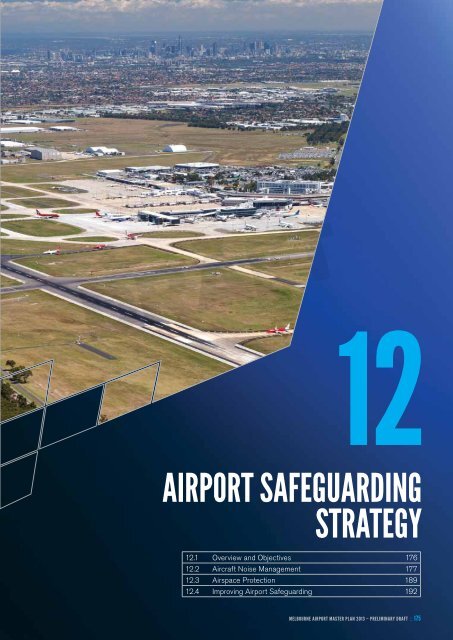
DRAFT<strong>12</strong>AIRPORT SAFEGUARDINGSTRATEGY<strong>12</strong>.1 Overview and Objectives 176<strong>12</strong>.2 Aircraft Noise Management 177<strong>12</strong>.3 Airspace Protection 189<strong>12</strong>.4 Improving <strong>Airport</strong> <strong>Safeguarding</strong> 192MELBOURNE <strong>Airport</strong> Master plan 2013 – PRELIMINARY DRAFT : : 175
<strong>12</strong>. <strong>Airport</strong> <strong>Safeguarding</strong> <strong>Strategy</strong><strong>12</strong>.1 Overview and ObjectivesAs the main gateway to Victoria and a focal pointof Victoria’s economy, the long-term and effectivesafeguarding of <strong>Melbourne</strong> <strong>Airport</strong> is critical to maintainthe social and economic benefits it contributes to localcommunities, <strong>Melbourne</strong> and Victoria, and to protectsurrounding communities.Throughout a long history of collaboration between theairport operator and all levels of government, <strong>Melbourne</strong><strong>Airport</strong>’s ongoing operation is supported by a range oflegislation, planning controls, studies, strategies andother measures. These include but are not limited to:• legislation and associated regulations, including the<strong>Airport</strong>s Act 1996 (<strong>Airport</strong>s Act), Civil Aviation Act1988, the Victorian Planning and Environment Act1987 (particularly Part 3C) and local planning schemes• national policies including the National Aviation PolicyWhite Paper 2009 and the National <strong>Airport</strong>s<strong>Safeguarding</strong> Framework• State Government policies including the StatePlanning Policy Framework and the metropolitanplanning strategy <strong>Melbourne</strong> 2030 – Planning forSustainable Growth• land use strategies and plans such as the <strong>Melbourne</strong><strong>Airport</strong> <strong>Strategy</strong> 1990, the <strong>Melbourne</strong> <strong>Airport</strong> LandUse Study 1992 and the <strong>Melbourne</strong> <strong>Airport</strong> Environs<strong>Strategy</strong> Plan 2003• planning controls embedded in the Victoria PlanningProvisions and local planning schemes, including theUrban Growth Boundary, Green Wedge Zones and<strong>Melbourne</strong> <strong>Airport</strong> Environs Overlay• aircraft noise management measures such as theAustralian Noise Exposure Forecast, AustralianStandard AS2021-2000, the <strong>Melbourne</strong> <strong>Airport</strong>Environs Overlay and noise monitoring systems• airspace protection measures, particularly the <strong>Airport</strong>s(Protection of Airspace) Regulations 1996 and CivilAviation (Building Control) Regulations 1988• measures to deal with hazards to aircraft operationssuch as birdstrikes, dangerous lighting and interferencewith air navigation aids• environmental protection measures including the<strong>Melbourne</strong> <strong>Airport</strong> Environment Policy, Environment<strong>Strategy</strong> and Environmental Management System (EMS)• economic and social impact assessments thathighlight the significant contribution the airport makesat the local, state and national levels in creatingeconomic value, generating employmentand connecting communities• education and communication measures designed toinform and consult with interested parties about theairport and issues associated with it, including the<strong>Melbourne</strong> <strong>Airport</strong> Planning Coordination Forum,Community Aviation Consultation Group and NoiseAbatement Committee.These measures form a safeguarding framework thathelps maintain, protect and support <strong>Melbourne</strong> <strong>Airport</strong>’songoing operations, as well as balance the needs ofcommunities surrounding the airport. The two mostimportant components of this framework are the aircraftnoise and airspace protection measures, which arediscussed in more detail below.<strong>Safeguarding</strong> the airport is an ongoing and sharedresponsibility between all levels of government and theairport. There is strong support from government forairport safeguarding, but it has become clear thatimprovements can be made to <strong>Melbourne</strong> <strong>Airport</strong>’ssafeguarding framework. The National Aviation PolicyWhite Paper and the National <strong>Airport</strong>s <strong>Safeguarding</strong>Advisory Group have both highlighted the need toimprove airport safeguarding measures around Australia.This issue is discussed further in <strong>Section</strong> <strong>12</strong>.4.DRAFTThe objectives of the airport safeguarding strategy are to:• strengthen <strong>Melbourne</strong> <strong>Airport</strong>’s role within the state’seconomic and transport infrastructure and protect itsongoing 24-hour operation• enable the airport to effectively and competitivelyoperate at national and international levels• ensure any new land use or development aroundthe airport does not prejudice its safe and long-termoperations, and avoids or minimises incompatibleland uses• protect the airport’s curfew-free status• manage and, where possible, minimise the impactof airport and aircraft operations on surroundingareas and communities• ensure that strategic planning for metropolitan<strong>Melbourne</strong> recognises and protects <strong>Melbourne</strong><strong>Airport</strong>, and that land use decisions are integrated,appropriate land use buffers are in place and provisionis made for future growth and development• continue to respect the safeguarding role of theGreen Wedges and restrict incompatible land usesin these areas.176
<strong>Airport</strong> <strong>Safeguarding</strong> <strong>Strategy</strong> :: <strong>12</strong><strong>12</strong>.2 Aircraft Noise ManagementAircraft noise is perhaps the most important issue forall airports in terms of land use protection. The site forthe airport was originally selected, in part, to minimisethe impact of aircraft noise on surrounding areas,which at the time was largely rural. Since then urbandevelopment has encroached closer to the airportand under its flight paths.Aircraft noise is an unavoidable by-product of an airport’soperation, and while modern aircraft are relatively quietcompared to their predecessors, it is still an issue thatrequires considerable attention. Accordingly, there are anumber of systems and procedures designed to deal withaircraft noise.<strong>12</strong>.2.1 Australian Noise Exposure ForecastThe <strong>Airport</strong>s Act requires a Master Plan to include anAustralian Noise Exposure Forecast (ANEF) to determinelikely noise exposure around the airport. A description ofthe ANEF system and the associated land use compatibilityadvice for areas in the vicinity of airports is contained inAustralian Standard AS2021-2000 Acoustics – AircraftNoise Intrusion – Building Siting and Construction.There are three types of aircraft noise charts producedusing the ANEF system:• Australian Noise Exposure Index (ANEI)• Australian Noise Exposure Concept (ANEC)• Australian Noise Exposure Forecast (ANEF).These charts are described in the Glossary.The ANEI is a contour map that shows actual historicalaircraft noise levels over a given time period. The mostrecent ANEI for <strong>Melbourne</strong> <strong>Airport</strong> covers the period from1 July 2009 to 30 June 2010 and is shown in Figure <strong>12</strong>.1.The ANEF chart shows the cumulative noise effectof a full year of operations so that seasonal changes inweather patterns and airline schedules are taken intoaccount. The resulting contours are therefore a measureTable <strong>12</strong>.1: ANEC ScenariosConceptof the total noise exposure over a <strong>12</strong>-month perioddivided by 365 to show an average annual day. They donot represent the maximum exposure on any day or themaximum exposure caused by a single aircraft. The ANEFmust be endorsed for technical accuracy by Airservices.The first <strong>Melbourne</strong> <strong>Airport</strong> ANEF was issued in 1993 andupdates were published in 1996, 1998, 2003 and 2008.A new ANEF chart was produced in conjunction with thepreparation of this Master Plan (refer Figure <strong>12</strong>.2).As with previous ANEFs, the 2013 ANEF contoursrepresent the airport’s forecast ultimate noise impact,based on current information, after taking into accountthe development stages of the four-runway system and along-term maximum of 410,000 fixed wing and rotary wingflights. This ultimate capacity ANEF is a compilation of thelatest ANEI and three ANECs prepared for the majoroperational stages of the airport’s development:DRAFT• ANEC 1: Two existing runways at maximum capacity• ANEC 2: Three runways at maximum capacity (paralleleast–west runway as the third runway)• ANEC 4: Four runways at maximum capacity (parallelnorth–south runway as the fourth runway).Table <strong>12</strong>.1 shows the annual aircraft movements for eachANEC scenario.The basis of these aircraft movement forecast levels wasdiscussed in <strong>Section</strong> 6.Since 1990, the airport’s Master Plans have shown twoadditional runways; one north–south and one east–west.In this Master Plan <strong>Melbourne</strong> <strong>Airport</strong> has nominated theeast–west runway as its preferred orientation for theairport’s third runway. As a result, ANEC 3, which wasincluded in the previous ANEFs, has not been includedin this latest ANEF. ANEC 3 related to the scenariowhereby the selected third runway was the parallelnorth–south runway, but as the east–west runway hasnow been selected, the ANEC relating to this scenariois no longer relevant.Annual aircraft movementsFixed wing Rotary wing Total operationsANEC1 265,000 7,300 272,300ANEC2 380,000 10,000 390,000ANEC4 400,000 10,000 410,000MELBOURNE <strong>Airport</strong> Master plan 2013 – PRELIMINARY DRAFT : : 177
The latest version of the Integrated Noise Model (INM)was used to produce the ANEIs and ANECs in accordancewith Commonwealth Government requirements. The INMis now aircraft noise modelling software produced by theUnited States Federal Aviation Administration. The modeluses a much wider range of aircraft types than wasavailable for the previous noise modelling. The operationallevels for the various runway layouts were broken downby aircraft type, arrival or departure, day or night, sectororigin or destination, and INM stage length. When feasibleunder the prevailing weather and traffic demand conditions,runway operating modes used in the modelling haveconsidered noise abatement procedures aimed atdirecting noise away from heavily populated areas.All aircraft flight paths, operating procedures and aircraftallocation to runways used in preparing the ANEF havebeen supplied or endorsed by Airservices, the organisationthat manages the airspace and air traffic control. TheANEF itself has been endorsed for technical accuracyby Airsevices.The ANEC 2 noise contours are shown in Figure <strong>12</strong>.3.This chart shows the contours for the airport operatingwith three runways at maximum capacity (parallel east–west runway as the third runway). This chart is included toshow the ultimate forecasted effect of the third runway interms of noise contours, compared to the current situationshown in the ANEI chart.Figures <strong>12</strong>.4 and <strong>12</strong>.5 illustrate the indicative aircraftarrival and departure tracks adopted for the four-runwayANEC. In practice, aircraft tracks can vary either side ofthe theoretical flight paths due to factors such as weather,aircraft type and payload. The computer modellingprocess has allowed for track dispersal to accommodatesuch variations.The flight paths shown on Figures <strong>12</strong>.4 and <strong>12</strong>.5 aregenerally the same as those shown in the previous MasterPlan, except for the following new flight paths which arenow proposed (for noise modelling purposes):• new arrivals paths from the west for the paralleleast–west runway (Runway 09R)• new departures path to the east/south for the paralleleast–west runway (Runway 09R).The new departures flight path for Runway 09R is aright-hand turn to join the existing Runway 16 departurepath, and it is planned that this turn will largely be withinthe airport site, which will help reduce the impact on newareas. As was the case with the flight paths shown inthe previous Master Plan, Figure <strong>12</strong>.5 does not show aRunway 09R straight-out departure path to the east.As such, according to the airport’s current modelling andAirservices advice, there will only be a requirement forarrivals over the areas to the east of the third (paralleleast–west) runway. The noise model also envisages thatthere will be minimal arrivals at night from the east on thethird runway. All operations will be subject to compliancewith the associated noise abatement procedures tominimise the impact on surrounding communities.DRAFT180
<strong>Airport</strong> <strong>Safeguarding</strong> <strong>Strategy</strong> :: <strong>12</strong>Fig. <strong>12</strong>.3DRAFTMELBOURNE <strong>Airport</strong> Master plan 2013 – PRELIMINARY DRAFT : : 181
Fig. <strong>12</strong>.4DRAFT182
<strong>Airport</strong> <strong>Safeguarding</strong> <strong>Strategy</strong> :: <strong>12</strong>Fig. <strong>12</strong>.5DRAFTMELBOURNE <strong>Airport</strong> Master plan 2013 – PRELIMINARY DRAFT : : 183
It should be noted that further studies and processes wouldneed to be carried out before introducing flight paths forthe third and fourth runways. Likewise, construction of thethird runway will be subject to an MDP process underthe <strong>Airport</strong>s Act and detailed environmental impactassessments. All aircraft flight paths, operating proceduresand aircraft allocation to runways used to prepare thisANEF are subject to these separate processes.The area of land affected by the new ultimate capacityANEF contours (shown in Figure <strong>12</strong>.2) has overalldecreased by approximately five per cent (7 squarekilometres) when compared to the previous 2008 ANEF.While in some areas the contours have decreased,particularly to the south of the airport, in other areas,particularly to the east, the contours have increased.Overall, the net difference between the 2008 and 2013ANEFs is an increase of approximately 300 residentialproperties. However the impact varies depending onthe location. The increase of the ANEF contours affectsapproximately 3,025 additional residential properties tothe east of the airport and approximately 140 additionalresidential properties to the west, when compared to the2008 contour. It is estimated that the decrease of thecontour to the south of the airport will be approximately2,880 residential properties. It is important to keep inmind that there will also be residents within the existingnoise contours who will experience noise for the first timewhen the new east-west runway becomes operational.These changes are attributed, in the main, to thefollowing factors:• advice from Airservices regarding the operationof parallel runways and a revised Airfield CapacityStudy, which resulted in changes to runway usage• increases in the planned use of parallel east–westrunways compared to the 2008 ANEF (ANEC 2previously comprised 272,000 movements, andnow comprises 380,000 movements)• changes to the aircraft fleet mix forecasts toincorporate quieter new-generation aircraft, whichhave a reduced departures noise footprint• decrease in the forecast general aviation (light aircraft)activity levels• the INM noise modelling software, which is now morecomprehensive and can more realistically modela greater range of aircraft types.There are no properties zoned for residential purposeswithin the 30 ANEF contour.<strong>12</strong>.2.2 <strong>Melbourne</strong> <strong>Airport</strong> Environs OverlayLand use controls for the areas around <strong>Melbourne</strong> <strong>Airport</strong>have been in place since 1992. These controls ensurethat inappropriate land use and development in thenoise-affected areas surrounding the airport do notaffect its efficient operation.The Victoria Planning Provisions in 1996 introduced the<strong>Airport</strong> Environs Overlay (AEO), which was based on the1992 <strong>Melbourne</strong> <strong>Airport</strong> Environs Area controls. The AEOis a standard provision in the Victoria Planning Provisionsthat can be used by any airport in Victoria. In May 2007a new overlay, the <strong>Melbourne</strong> <strong>Airport</strong> Environs Overlay(MAEO), based on the 2003 ANEF contours, wasintroduced into the Victoria Planning Provisions. Thisoverlay incorporates improved and enhanced provisionsspecifically for <strong>Melbourne</strong> <strong>Airport</strong> in accordance with theoutcomes of the <strong>Melbourne</strong> <strong>Airport</strong> Environs <strong>Strategy</strong>Plan 2003.DRAFTThe State Government has indicated that the MAEOboundaries will be reviewed after the 2013 Master Planand associated ANEF have been approved.The purposes of the MAEO controls are to:• implement the State Planning Policy Framework andthe Local Planning Policy Framework, including theMunicipal Strategic Statement and local planning policies• ensure that land use and development are compatiblewith <strong>Melbourne</strong> <strong>Airport</strong>’s operation in accordance withthe relevant airport strategy or Master Plan, and withsafe air navigation for aircraft approaching anddeparting the airfield• assist in shielding people from the impact of aircraftnoise by requiring appropriate noise attenuation measuresin dwellings and other noise-sensitive buildings• provide for appropriate levels of noise attenuationdepending on the level of forecasted noise exposure.The MAEO controls generally apply to land on theapproaches to the airport’s existing and proposedrunways. The total area covered by the MAEO controlsis shown in Figure <strong>12</strong>.6 9 , which also shows the two levelsof controls – the MAEO Schedule 1 (orange) and MAEOSchedule 2 (blue). The MAEO boundaries are based onthe recommendations of AS2021 and the 2003 UltimateCapacity ANEF boundaries. The MAEO1 boundariesare defined by the 25 ANEF contour and the MAEO2boundaries are defined by the 20 ANEF contour.9 Figure <strong>12</strong>.6 also shows the location of the Urban Growth Boundary (UGB) relative to the <strong>Melbourne</strong> <strong>Airport</strong> site and MAEO1 and MAEO2.The UGB helps protect the airport from encroachment by noise-sensitive urban development.184
Fig. <strong>12</strong>.7DRAFT186
<strong>Airport</strong> <strong>Safeguarding</strong> <strong>Strategy</strong> :: <strong>12</strong>The details and requirements of MAEO1 and MAEO2 arein the local planning schemes of the five councils coveredby these controls: Brimbank, Hume, Melton, MooneeValley, and Whittlesea. In accordance with AS2021,the MAEO1 controls are more restrictive than those ofMAEO2. For example, under MAEO1 certain noisesensitiveuses such as schools, hospitals and certaintypes of accommodation are prohibited, whereas MAEO2requires a permit for these uses. All new noise-sensitiveuses in both areas must be assessed for AS2021acoustic requirements.<strong>12</strong>.2.3 Limitations of the ANEF SystemThe ANEF system forms the basis for the airport’s currentpublished noise contours and associated planning controls(the MAEO schedules). However, experience has shownthat aircraft noise is not confined to areas inside theANEF noise contours, nor does the noise stop at a lineon a map. In fact, most complaints relating to aircraftnoise at Australian airports, including <strong>Melbourne</strong> <strong>Airport</strong>,come from people who live outside the published ANEFnoise contours (that is, outside the 20 ANEF contour). 10It is now generally recognised that basing land useplanning decisions solely on ANEF noise contours,without reference to other information, is likely to leadto a less than optimal outcome for airports and thecommunity. 11 At best, the ANEF and AS2021 systemsets minimums and, in the end, the system is onlyintended to mitigate noise effects within buildings.Additional or supplementary noise planning tools arerequired to better support the airport’s ongoing operationand protect surrounding communities.<strong>12</strong>.2.4 N60, N65 and N70 Noise ContoursHaving regard to the recognised limitations of the ANEFsystem, the National <strong>Airport</strong>s <strong>Safeguarding</strong> Framework(NASF) Guideline A: Measures for Managing Impactsof Aircraft Noise recommends using the N60/N65/N70noise contour system to supplement the ANEF contours.The N60/N65/N70 system is a complementary aircraftnoise contour system which produces contours showingthe potential number of aircraft noise events above 60dB(A),65dB(A) or 70dB(A). These contours, sometimes called‘number above’ or just ‘N’ contours, have severaladvantages over the ANEF system: 11• N contours report noise by the number of singleevents, which is how individuals generally experienceand perceive aircraft noise.• The information can be relatively easily verified– for example, by cross-comparing with a measuredN70 chart.• N contours are useful for showing noise exposure in ameaningful way for short time periods, for example,evenings, as it takes information beyond the ‘average day’.The N70 system reports aircraft noise in the way thata person perceives it – as a number of noise eventsper day above a certain decibel level.This system is not a new concept, but contours derivedfrom it have never been published for <strong>Melbourne</strong> <strong>Airport</strong>.As recommended in NASF Guideline A, N contours havebeen produced in parallel with this Master Plan to providean additional level of noise information. The N contoursare shown in Figure <strong>12</strong>.7. Like the ANEF, the N contoursreflect modelling of ultimate runway capacity and are notintended to represent actual runway utilisation at a specificpoint in time. These contours also form part of <strong>Melbourne</strong><strong>Airport</strong>’s online noise tool, which can be found on theairport’s website at www.melbourneairport.com.au/noise-tool. This tool is discussed further in <strong>Section</strong><strong>12</strong>.2.9.DRAFTIt should be noted that the N contours are basedon the NASF Guideline A, which was agreed to at theStanding Council on Transport and Infrastructure meetingon 18 May 20<strong>12</strong>. However, that agreement was subjectto the Commonwealth Government’s intention to seeka review of AS2021 by Standards Australia, whichwill involve considering a range of aircraft noise metricsincluding the N contour system. Until that review iscompleted, the N contours are provided for informationonly and a precautionary approach should be adopted ifthey are to be used for land use planning purposes.<strong>12</strong>.2.5 Noise Monitoring SystemsAirservices has set up permanent noise monitoringequipment in a number of suburbs around <strong>Melbourne</strong><strong>Airport</strong> to measure aircraft noise. When any of theseterminals detect a noise event, the computerised Noiseand Flight Path Monitoring System can identify the flightpath and altitude of every aircraft operating in the vicinityof the monitor at that time, as well as the general level of10 Safeguards for airports and the communities around them – Discussion Paper, Department of Infrastructure, Transport,Regional Development and Local Government, June 2009.11 Guidance Material for Selecting and Providing Aircraft Noise Information, Department of Environment and Heritageand Department of Transport and Regional Services, 2003.MELBOURNE <strong>Airport</strong> Master plan 2013 – PRELIMINARY DRAFT : : 187
ackground noise. This system can be used to determinewhether a noise complaint is due to a particular aircraftand whether an aircraft was operating in accordancewith approved flight procedures.Airservices also has a 24-hour noise enquiry unit calledthe Noise Complaints and Information Service thatreceives, logs and investigates noise enquiries andcomplaints. These are monitored on a monthly basisto determine whether there are any particular trendsor issues, or whether any aircraft has operated outsideits approved flight procedures, so that appropriateinvestigations can be initiated and corrective actiontaken if required.The Aircraft Noise Ombudsman conducts independentadministrative reviews of Airservices’ management ofaircraft noise-related activities, including:• handling of complaints or enquiries made toAirservices about aircraft noise• community consultation processes related toaircraft noise• presenting and distributing aircraft noise-relatedinformation.<strong>12</strong>.2.6 Noise Abatement Procedures<strong>Melbourne</strong> <strong>Airport</strong>’s noise abatement procedures(NAPs) are designed and implemented by Airservicesto reduce the impact of aircraft noise on the community.They include procedures for runway use and flightpaths to reduce flights over residential areas. Air trafficcontrol implements these procedures but they are notmandatory, and their use depends on weather conditionsand aircraft requirements.When possible, flights are directed over the green wedgeareas to the north and west of the airport and overnon-residential areas. For example, aircraft are generallyrouted to avoid flying over Bulla, Craigieburn, Greenvale,Keilor, Meadow Heights, St Albans, Sunbury, Sydenhamand other areas notified by local instruction. If flying overthese suburbs cannot be avoided, a minimum height overthese areas is applied:• jet aircraft – not below 5,000 feet above ground level• propeller aircraft – not below 3,000 feet aboveground level.Airservices’ NAPs comprise preferred runways andpreferred flight paths:• Preferred runways only operate in light winds. Between6.00am and 11.00pm, when there is no heavy traffic,the preferred runways for landing are Runways 16and 27, and the preferred runways for departure areRunways 27 and 34. During busy periods between6.00am and 11.00pm, the preferred runways for landingare Runways 27 and 34, and the preferred runways fordeparture are Runways 27 and 34. Between 11.00pmand 6.00am, the preferred runways for landing areRunways 16 and 27, and the preferred runways fordeparture are Runways 27 and 34.• Preferred flight paths are designed to maximiseoverflight of non-residential areas.Further details of these NAPs are available on theAirservices website.DRAFTAirservices conducts regular reviews to check theeffectiveness of noise abatement procedures andto seek improvements. At major airports, it consults withcommunity forums on the terms of reference for reviewingthe procedures and publishes reports on its website.<strong>12</strong>.2.7 Smart TrackingIn recent years, satellite assistance has proved to be aquantum leap in aircraft navigation capability and newaircraft are increasingly being designed to be morecapable in this regard. Satellite-assisted navigation isrecognised internationally for its safety benefits, whichare achieved by navigating with high precision.This technology is referred to as ‘Smart Tracking’.To achieve the best aircraft safety, noise and emissionsoutcomes for <strong>Melbourne</strong> <strong>Airport</strong>, Airservices is workingtowards making Smart Tracking technology permanentlyavailable for all suitably equipped aircraft landing at theairport. Smart Tracking aircraft have been successfullytrialled at <strong>Melbourne</strong> <strong>Airport</strong> since 2009 and at 16 otherAustralian airports.188
<strong>Airport</strong> <strong>Safeguarding</strong> <strong>Strategy</strong> :: <strong>12</strong><strong>12</strong>.2.8 Noise Abatement CommitteeThe Noise Abatement Committee is chaired by <strong>Melbourne</strong><strong>Airport</strong> and comprises representatives from Airservices,the major airlines, the Environment Protection Authority(EPA) Victoria, Victoria Department of Transport,Planning and Local Infrastructure, the CommonwealthDepartment of Infrastructure and Transport, and localcouncils. The Committee reviews the impact of aircraftnoise exposure on the surrounding community and makesrecommendations to minimise it. The Committee meets ona quarterly basis and works closely with the <strong>Melbourne</strong><strong>Airport</strong> Community Aviation Consultation Group.<strong>12</strong>.2.9 Online Flight Path and Noise ToolsAirservices has an online tool called WebTrak that allowsanyone to get information about where and how highaircraft fly over metropolitan areas near <strong>Melbourne</strong> <strong>Airport</strong>and other major airports. It displays a map of suburbswithin 55 kilometres of the airport, on which anyone canview information about past arriving and departingaircraft, up to the past three months.<strong>Melbourne</strong> <strong>Airport</strong> has also developed a flight path andnoise tool that allows residents to locate their home andassess current and future noise levels. It is available atwww.melbourneairport.com.au/noise-tool.<strong>12</strong>.3 Airspace ProtectionAfter aircraft noise management, the other mostsignificant form of protection necessary for the immediateand long-term operation of an airport is the protection ofits surrounding airspace from physical intrusions such astall buildings or towers and non-physical intrusions, suchas industrial chimney discharges and bright lights, it isimportant to secure immediate and long-term operations.These matters are controlled by the <strong>Airport</strong>s (Protection ofAirspace) Regulations 1996 and other airspace regulations.<strong>12</strong>.3.1 Prescribed Airspace RegulationsUnder the Part <strong>12</strong> of the <strong>Airport</strong>s Act (Protection of airspacearound airports) and the <strong>Airport</strong>s (Protection of Airspace)Regulations 1996, the airspace around specific airportsmay be declared as Prescribed Airspace to protect theairspace for the safe arrival and departure of aircraft.Prescribed Airspace is the airspace above either anObstacle Limitation Surface (OLS) or Procedures forAir Navigational Services (PANS-OPS) surface, whichare defined as follows:• Obstacle Limitation Surface (OLS): This surfaceis usually the lowest of the two surfaces that makeup Prescribed Airspace, and is designed to provideprotection for visual flying, or VFR (when the pilotis flying by sight)• Procedures for Air Navigational Services – AircraftOperations (PANS – OPS): This surface is usuallyhigher than the OLS and provides protection forinstrument flying, or IFR (when the pilot is flying byinstruments). These surfaces may also protectairspace around the navigational aids thatare critical for instrument flying.Under section 182 of the <strong>Airport</strong>s Act, activities thatresult in intrusions into an airport’s Prescribed Airspaceare called ‘controlled activities’, and cannot be carried outwithout approval. The airport operator or the CommonwealthDepartment of Infrastructure and Transport must assessapplications to carry out controlled activities, and mayimpose conditions on approval.Under the <strong>Airport</strong>s Act, local councils with boundariesthat fall within <strong>Melbourne</strong> <strong>Airport</strong>’s protected airspace arerequired to review all building and development applicationsthey receive for any infringements on Prescribed Airspace.DRAFTIt is an offence to carry out a controlled activitywithout approval, or to breach a condition of a controlledactivity approval.<strong>12</strong>.3.2 <strong>Melbourne</strong> <strong>Airport</strong>’sPrescribed Airspace<strong>Airport</strong> operators are required to prepare plans of thePrescribed Airspace surfaces relating to their airportand have those surfaces declared under the airspaceregulations. <strong>Melbourne</strong> <strong>Airport</strong>’s airspace has beendeclared as Prescribed Airspace under the regulationsby the Commonwealth Department of Infrastructure andTransport.<strong>Melbourne</strong> <strong>Airport</strong>’s Prescribed Airspace is shown inFigures <strong>12</strong>.8 and <strong>12</strong>.9. Figure <strong>12</strong>.8 shows the ObstacleLimitation Surfaces based on the ultimate four-runwaylayout. Figure <strong>12</strong>.9 shows Procedures for Air NavigationalServices – Aircraft Operations surfaces based on theultimate four-runway layout.It is important to note the distances covered by thePrescribed Airspace. In some areas the PrescribedAirspace extends beyond 25 kilometres from the airport.At least 16 municipalities are either wholly or partlyaffected by the airport’s Prescribed Airspace.<strong>12</strong>.3.3 Other Airspace ProtectionRegulationsIn addition to the <strong>Airport</strong>s (Protection of Airspace)Regulations 1996, the Civil Aviation (Building Control)Regulations 1988 and the Civil Aviation SafetyRegulations 1998 are also relevant to controllingobstacles and hazards around airports.MELBOURNE <strong>Airport</strong> Master plan 2013 – PRELIMINARY DRAFT : : 189
Fig. <strong>12</strong>.8DRAFT190
<strong>Airport</strong> <strong>Safeguarding</strong> <strong>Strategy</strong> :: <strong>12</strong>Fig. <strong>12</strong>.9DRAFTMELBOURNE <strong>Airport</strong> Master plan 2013 – PRELIMINARY DRAFT : : 191
Under the Civil Aviation Safety Regulations 1998, aperson who proposes to construct a building or structureof 110 metres or more above ground level must informthe Civil Aviation Safety Authority.Such an approach would be consistent with the policydirection in the Commonwealth Government’s NationalAviation Policy, which recognises the need to complementexisting safeguarding measures with other tools.<strong>12</strong>.3.4 Airspace Protection Planning ControlsPrescribed Airspace should not be confused with theMAEO. The MAEO relates specifically to aircraft noiseand limiting noise-sensitive uses (e.g. houses) whereaircraft noise is a potential problem. The MAEO does thisby implementing the airport’s ANEF and the AustralianStandard AS2021-2000: Acoustics – Aircraft NoiseIntrusion – Building Siting and Construction. The MAEOdoes not relate to Prescribed Airspace and does notcontrol the height of structures.While <strong>Melbourne</strong> <strong>Airport</strong>’s Prescribed Airspace isprotected by the <strong>Airport</strong>s Act and <strong>Airport</strong>s (Protectionof Airspace) Regulations 1996, there is evidence thatthis is not widely known or understood by developers,local government officers and councillors, or the generalpublic. In Victoria, unlike in some other states, thePrescribed Airspace requirements are not incorporatedor linked into local planning schemes. While the MAEOcontrols land use in relation to noise, there is no equivalentmechanism in the Victoria Planning Provisions thatcontrols the height of structures or other land useproposals that may impact on Prescribed Airspace.<strong>Melbourne</strong> <strong>Airport</strong> considers that improvements tothe Victorian planning system need to be made toprovide greater certainty and rigour in protecting itsPrescribed Airspace.The State Government’s response to the Urban GrowthBoundary Logical Inclusions Review (June 20<strong>12</strong>) generallyreaffirmed the buffers that currently protect <strong>Melbourne</strong><strong>Airport</strong>. The government noted in its response thatthe Logical Inclusions Advisory Committee statedin its final report:“<strong>Melbourne</strong> <strong>Airport</strong> is critical State and Nationalinfrastructure, and planning near the airport needsto be carefully managed. The current suite of planningtools including the SPPF, Urban Growth Boundary andGreen Wedge Zone and MAEO provide a sound basisfor protecting and ensuring the long term operationof the airport, including its curfew free status.”However, the Advisory Committee also identified a numberof issues, including:DRAFT“While the SPPF identifies the airport as a keydetermination in planning decisions, there is a vacuumbetween the policy objective of not prejudicing theoperations of the airport, and what this means in termsof restrictions on development.”“Given that the ANEF that underpins the MAEOis subject to review, it does not seem a secure basisfor determining the extent of urban development nearthe airport”.“The Committee agrees with APAM that aligning theUGB to noise contours is not appropriate.”<strong>12</strong>.4 Improving <strong>Airport</strong> <strong>Safeguarding</strong>Given <strong>Melbourne</strong> <strong>Airport</strong>’s social and economicimportance to the local region and the state, planners andthe planning system should adopt a precautionaryapproach to protecting this nationally significant asset.This is essential when looking back at the developmentof Australia’s cities and their airports over the last 80years, which has seen many airports’ operationsrestricted by encroaching urban development.On this basis, certain improvements need to be madeto <strong>Melbourne</strong> <strong>Airport</strong>’s current safeguarding regime.Improvements to state and local planning policies andcontrols relating to land use and development around theairport are required to avoid the restrictions other airportshave faced, but it is also important that there is a balancebetween the need for growth on and off the airport.While a precautionary approach to airport safeguardingshould be adopted, not all urban growth will affect theairport. It is important that airport safeguarding measuresdo not unreasonably or unfairly curtail urban growth.There needs to be a balance between growth of theairport and growth off the airport.<strong>12</strong>.4.1 National <strong>Airport</strong>s <strong>Safeguarding</strong>FrameworkThe National <strong>Airport</strong>s <strong>Safeguarding</strong> Framework (NASF)comprises of:• Principles for National <strong>Airport</strong>s <strong>Safeguarding</strong> Framework• Guideline A: Measures for Managing Impacts ofAircraft Noise• Guideline B: Managing the Risk of BuildingGenerated Windshear and Turbulence at <strong>Airport</strong>s• Guideline C: Managing the Risk of Wildlife Strikesin the Vicinity of <strong>Airport</strong>s192
<strong>Airport</strong> <strong>Safeguarding</strong> <strong>Strategy</strong> :: <strong>12</strong>• Guideline D: Managing the Risk of Wind TurbineFarms as Physical Obstacles to Air Navigation• Guideline E: Managing the Risk of Distractionsto Pilots from Lighting in the Vicinity of <strong>Airport</strong>s• Guideline F: Managing the Risk of Intrusions intothe Protected Airspace of <strong>Airport</strong>s.Commonwealth, State and Territory Ministers consideredthe Framework at the Standing Council on Transport andInfrastructure meeting on 18 May 20<strong>12</strong>. The Frameworkwas agreed at that meeting, but was subject to theCommonwealth Government’s intention to seek a reviewof AS2021 by Standards Australia.<strong>Melbourne</strong> <strong>Airport</strong> supports the NASF guidelines andhas already started using them to guide the considerationof on-airport developments and as the basis of responsesto off-airport development proposals. For these guidelinesto be fully effective, <strong>Melbourne</strong> <strong>Airport</strong> believes theyshould be incorporated into the Victorian planningsystem, specifically the Victoria Planning Provisions.It is the responsibility of each jurisdiction to implementthe Framework into their respective planning systems.However, it is acknowledged that statutory implementationof Guideline A should not proceed until the review ofAS2021 is completed.<strong>12</strong>.4.3 New Metropolitan Planning <strong>Strategy</strong>As discussed in <strong>Section</strong> 4.3.3 of this Master Plan,the State Government is currently developing a newmetropolitan planning strategy for <strong>Melbourne</strong> to replace<strong>Melbourne</strong> 2030 – Planning for Sustainable Growth.This strategy is expected to be completed in late 2013.While the initial metropolitan strategy discussion paper,<strong>Melbourne</strong>, let’s talk about the future, recognises theimportance of <strong>Melbourne</strong> <strong>Airport</strong>, it is critical that thenew strategy contains appropriate planning measures tosupport and protect the airport and its 24-hour curfewfreestatus. This should include strategies to preventfurther urban encroachment and reverse sensitivityissues affecting the airport’s operations.<strong>Melbourne</strong> <strong>Airport</strong> will work with the State Governmentto achieve these aims.DRAFT<strong>12</strong>.4.4 Role of Urban Growth Boundaryand Green WedgesThe Urban Growth Boundary and associated GreenWedge Zones play an important role in protecting<strong>Melbourne</strong> <strong>Airport</strong>. Figure <strong>12</strong>.10 shows the UrbanGrowth Boundary and green wedge areas around<strong>Melbourne</strong> <strong>Airport</strong>.<strong>12</strong>.4.2 Supplementary Aircraft NoiseInformationThe ANEF contours, as a source of aircraft noiseinformation, should be supplemented by information fromother sources, such as flight path charts and ‘numberabove’ contours, to provide a more detailed and accuratereflection of the potential aircraft noise effects around<strong>Melbourne</strong> <strong>Airport</strong>. This information, combined with theANEF contours, should be used to better inform planningand land use decisions around <strong>Melbourne</strong> <strong>Airport</strong>.<strong>Melbourne</strong> <strong>Airport</strong> believes that the N60/N65/N70contours should be incorporated into the planning regime,at least as an additional consideration over and abovethe ANEF contours and MAEO, particularly when UrbanGrowth Boundary and zoning changes are proposednear the airport and its flight corridors. These contoursalso give the community a better tool to understand theimpact of aircraft noise.The Urban Growth Boundary is a planning tool that theState Government implemented to manage <strong>Melbourne</strong>’sgrowth. It sets a clear boundary for the outwarddevelopment of metropolitan <strong>Melbourne</strong>, and directsgrowth to areas where it can be best serviced by existingand planned infrastructure and services. The Boundaryalso protects valuable land from urban development,including the green wedges and safeguards land on thecity’s fringe needed for environment, farming and tourismand infrastructure assets such as <strong>Melbourne</strong> <strong>Airport</strong>.Under Clause 11.04-6 of the State Planning PolicyFramework, one aim of the Green Wedges is to “protectmajor transport facilities that serve the wider Victoriancommunity, such as airports and ports with theirassociated access corridors”.By limiting development in the green wedges around theairport, the Urban Growth Boundary and Green WedgeZones help protect flight path corridors from encroachingdevelopment, which may conflict with current or futureaircraft operations.MELBOURNE <strong>Airport</strong> Master plan 2013 – PRELIMINARY DRAFT : : 193
Fig. <strong>12</strong>.10DRAFT194
<strong>Airport</strong> <strong>Safeguarding</strong> <strong>Strategy</strong> :: <strong>12</strong><strong>Melbourne</strong> <strong>Airport</strong> believes that the role the Urban GrowthBoundary and Green Wedge Zones play in safeguardingthe airport needs to be formally recognised in State andlocal planning policy (including the new metropolitanplanning strategy for <strong>Melbourne</strong>). Moreover, future reviewsof or changes to these tools should only occur once thelong-term safeguarding of the airport has been fullyconsidered.From the airport’s perspective, moving the present UrbanGrowth Boundary should be discouraged to prevent‘urban creep’ towards or into green wedge areas whichaccommodate flight paths and aircraft noise contours.The present boundary broadly accords with what theairport has always regarded as its ‘sphere of influence’, ina land use planning sense. This principle was supportedby the Urban Growth Boundary Logical InclusionsAdvisory Committee when it stated in its report that“any further encroachment of residential developmenttowards the airport should be avoided”.<strong>12</strong>.4.5 Review of <strong>Melbourne</strong> <strong>Airport</strong>Environs OverlayThe primary statutory planning tool currently protecting<strong>Melbourne</strong> <strong>Airport</strong> is the MAEO, which is based on theairport’s ANEF noise contours. The MAEO only relates toland within the 2003 20 ANEF contour and has a numberof limitations. As discussed in <strong>Section</strong> <strong>12</strong>.2.3, basing landuse planning decisions solely on ANEF noise contoursis likely to lead to less than optimal outcomes insafeguarding the airport.<strong>Melbourne</strong> <strong>Airport</strong> believes there is a clear need toreview the MAEO provisions to address these issues,given the large amount of land (approximately 131 squarekilometres) inside the 20 ANEF contour and the potentialfor further development near to its boundary.<strong>12</strong>.4.6 Prescribed Airspace and AircraftHazard ControlsAs discussed in <strong>Section</strong> <strong>12</strong>.3.4, at present there areno planning controls incorporated into local planningschemes to protect <strong>Melbourne</strong> <strong>Airport</strong>’s PrescribedAirspace or control hazards to aircraft.The MAEO does not control intrusions into PrescribedAirspace or other potential hazards to aircraft operationssuch as dangerous lighting, air emissions or wildlife hazards.<strong>Melbourne</strong> <strong>Airport</strong> believes that improvements to theseprovisions can be made to better protect <strong>Melbourne</strong><strong>Airport</strong>’s Prescribed Airspace and control potentialhazards to aircraft operations. This could take the formof a new overlay control or Particular Provision in theVictoria Planning Provisions.<strong>12</strong>.4.7 Review of <strong>Melbourne</strong> <strong>Airport</strong> Environs<strong>Strategy</strong> Plan<strong>Melbourne</strong> <strong>Airport</strong> is recognised under Part 3C of thePlanning and Environment Act 1987 (Vic) through the<strong>Melbourne</strong> <strong>Airport</strong> Environs <strong>Strategy</strong> Plan, approvedby the Minister for Planning in 2003. Amendments toplanning schemes in the <strong>Melbourne</strong> <strong>Airport</strong> EnvironsArea must be consistent with the approved <strong>Strategy</strong> Plan.Its primary intent is to ensure <strong>Melbourne</strong> <strong>Airport</strong> retainsits 24-hour curfew-free operations and to appropriatelymanage the impact of aircraft noise on adjacentresidential areas. However, the <strong>Strategy</strong> Plan primarilyrelates to land inside the 20 ANEF contour and haslittle effect outside it.<strong>Melbourne</strong> <strong>Airport</strong> believes that a review of the <strong>Strategy</strong>Plan is required. The Department of Transport, Planningand Local Infrastructure is likely to be the lead agency forthis review.DRAFT<strong>12</strong>.4.8 <strong>Safeguarding</strong> Working GroupDeveloping an improved safeguarding framework for<strong>Melbourne</strong> <strong>Airport</strong> will require a range of stakeholdersto be involved, including the State Government, localcouncils, local communities and the business sector.While <strong>Melbourne</strong> <strong>Airport</strong> will play a key role in developingthe improved planning regime, the State Governmentwill need to lead the process.<strong>Melbourne</strong> <strong>Airport</strong> is working with the CommonwealthGovernment, the State Government, local governmentsand industry to ensure that the airport’s long-term operationis protected for the benefit of <strong>Melbourne</strong> and Victoria.The <strong>Melbourne</strong> <strong>Airport</strong> Planning Coordination Forumis playing a critical role in this regard.These matters have been discussed at PlanningCoordination Forum meetings in 20<strong>12</strong> and it has beenagreed that a <strong>Safeguarding</strong> Working Group will beestablished to discuss improvements to the currentframework. <strong>Melbourne</strong> <strong>Airport</strong> supports this initiative andis looking forward to working with relevant stakeholderson developing improved airport safeguarding measures.MELBOURNE <strong>Airport</strong> Master plan 2013 – PRELIMINARY DRAFT : : 195