Section 9 - Ground Transport Plan - Melbourne Airport
Section 9 - Ground Transport Plan - Melbourne Airport
Section 9 - Ground Transport Plan - Melbourne Airport

Create successful ePaper yourself
Turn your PDF publications into a flip-book with our unique Google optimized e-Paper software.
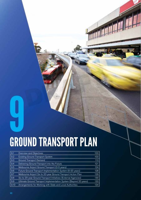
9<br />
DRAFT<br />
GROUND TRANSPORT PLAN<br />
9.1 Overview and Objectives 103<br />
9.2 Existing <strong>Ground</strong> <strong>Transport</strong> System 103<br />
9.3 <strong>Ground</strong> <strong>Transport</strong> Demand 113<br />
9.4 Delivering <strong>Ground</strong> <strong>Transport</strong> into the Future 121<br />
9.5 <strong>Melbourne</strong> <strong>Airport</strong> <strong>Ground</strong> <strong>Transport</strong> (0-5 years) 124<br />
9.6 Future <strong>Ground</strong> <strong>Transport</strong> Implementation System (6-20 years) 128<br />
9.7 <strong>Melbourne</strong> <strong>Airport</strong> Six to 20-year <strong>Ground</strong> <strong>Transport</strong> Action <strong>Plan</strong> 129<br />
9.8 Six to 20-year <strong>Ground</strong> <strong>Transport</strong> Initiatives (External Agencies) 130<br />
9.9 Ultimate <strong>Ground</strong> <strong>Transport</strong> Implementation System (Beyond 20 years) 133<br />
9.10 Arrangements for Working with State and Local Authorities 134<br />
102
9. <strong>Ground</strong> <strong>Transport</strong> <strong>Plan</strong><br />
<strong>Ground</strong> <strong>Transport</strong> <strong>Plan</strong> :: 9<br />
As <strong>Melbourne</strong> <strong>Airport</strong> grows, getting passengers, staff<br />
and visitors to and from the airport precinct in a timely<br />
and efficient way will become increasingly important.<br />
With continued growth in aircraft movements and<br />
passenger numbers, it’s critical that <strong>Melbourne</strong> <strong>Airport</strong><br />
has a vision and systems to manage the growth of<br />
infrastructure and services to overcome transport<br />
network congestion now and into the future.<br />
The <strong>Melbourne</strong> <strong>Airport</strong> <strong>Ground</strong> <strong>Transport</strong> <strong>Plan</strong> 2013<br />
replaces the <strong>Melbourne</strong> <strong>Airport</strong> <strong>Ground</strong> <strong>Transport</strong> <strong>Plan</strong><br />
2009 and is the first to be incorporated into the Master<br />
<strong>Plan</strong>, in compliance with amendments to the <strong>Airport</strong>s Act<br />
1996 (<strong>Airport</strong>s Act), and sets out <strong>Melbourne</strong> <strong>Airport</strong>’s<br />
areas of transport focus over the next five-year period<br />
(2013–2018).<br />
9.1 Overview and Objectives<br />
<strong>Melbourne</strong> <strong>Airport</strong>’s vision is for an interconnected<br />
ground transport system that supports safe, efficient and<br />
reliable journeys for all modes of transport. The <strong>Ground</strong><br />
<strong>Transport</strong> <strong>Plan</strong> outlines how this will be achieved.<br />
Access to the airport is currently limited to road-based<br />
public and private transport. Demand levels at peak times<br />
result in congestion and queues on some roads leading to<br />
the Terminal Precinct. The road network is well structured,<br />
as the original airport development includes excellent<br />
connectivity to state arterial roads and a sound internal<br />
road network. The airport’s growth now calls for the<br />
internal transport network to be reinforced to meet the<br />
increased demand, as well as a renewed emphasis on<br />
making greater use of high-occupancy vehicles, preferably<br />
not just road-based. These initiatives must be supported<br />
by reliable and efficient transport links between the<br />
airport, the <strong>Melbourne</strong> CBD, the local region and the<br />
wider metropolitan area.<br />
Travel demand modelling shows that passenger numbers<br />
will increase to approximately 64.37 million per year by<br />
2033. To support this growth, the airport requires a<br />
multi-modal ground transport system that can meet<br />
the requirements of a 21st century capital city airport,<br />
underpinned by 24 hours a day, seven days a week<br />
access, efficiency, safety, sustainability, customer<br />
choice and value for money.<br />
It’s not just passengers who have to get to and from the<br />
airport more efficiently. More than 14,300 people work in<br />
airport-related jobs and that number is expected to grow<br />
to 23,000 by 2033, making the airport a major centre of<br />
employment and economic activity.<br />
Exporters across Victoria also depend on reliable access<br />
to the airport so they can transport their products to<br />
interstate and overseas markets. Better transport<br />
connections to the aviation gateway will contribute<br />
to economic productivity.<br />
The <strong>Ground</strong> <strong>Transport</strong> <strong>Plan</strong> provides an integrated<br />
framework to improve transport access to the airport.<br />
It is also linked with land use planning outlined in this<br />
Master <strong>Plan</strong>.<br />
<strong>Melbourne</strong> <strong>Airport</strong> is committed to working with<br />
governments and the relevant authorities to implement<br />
the <strong>Ground</strong> <strong>Transport</strong> <strong>Plan</strong> and jointly develop better road<br />
and transport connections.<br />
For the first time, this plan also outlines a long-term<br />
solution to the ongoing congestion experienced in peak<br />
periods. This includes developing the elevated loop road<br />
and ground transport hubs.<br />
DRAFT<br />
The objectives of the <strong>Ground</strong> <strong>Transport</strong> <strong>Plan</strong> are to:<br />
• improve ground transport access for all modes of<br />
travel, including a rail link<br />
• provide a transport network capable of meeting<br />
projected demand over a 20-year period<br />
• separate different transport modes to improve safety<br />
and reduce congestion, which will involve separating<br />
passengers and vehicles<br />
• integrate the airport’s ground transport network<br />
into the wider local and state-wide networks<br />
• encourage a range of travel modes to provide<br />
equitable travel for the airport’s users<br />
• support safe, secure and sustainable transport solutions.<br />
Reducing congestion in and around the airport will be<br />
critical to the success of the <strong>Ground</strong> <strong>Transport</strong> <strong>Plan</strong>.<br />
9.2 Existing <strong>Ground</strong> <strong>Transport</strong> System<br />
9.2.1 External Road Network<br />
<strong>Melbourne</strong> <strong>Airport</strong> relies on both internal and external<br />
road systems. These networks are fundamental to<br />
the airport’s operation and provide access for public<br />
transport, shuttles, taxis, freight, aviation support vehicles,<br />
emergency services and private vehicles. Table 9.1<br />
describes the prominent arterial/access roads to<br />
<strong>Melbourne</strong> <strong>Airport</strong>.<br />
MELBOURNE <strong>Airport</strong> Master plan 2013 – PRELIMINARY DRAFT : : 103
Due to its proximity to <strong>Melbourne</strong>’s freeway network,<br />
the airport is well serviced in terms of road access.<br />
High-capacity links within the airport support these<br />
systems; however, given high travel demands, congestion<br />
is a regular problem on both the internal and external road<br />
network during peak periods. Figure 9.1 summarises the<br />
<strong>Melbourne</strong> metropolitan transport system in the context<br />
of <strong>Melbourne</strong> <strong>Airport</strong>, including a broad understanding of<br />
the road and rail networks and bus systems.<br />
Over the last 10 years, <strong>Melbourne</strong> <strong>Airport</strong> has developed<br />
a management system based on a digital model of the<br />
road network. This system is called the <strong>Melbourne</strong> <strong>Airport</strong><br />
Landside Traffic Model and is used to test the existing<br />
road capacity and planned improvements. The Landside<br />
Traffic Model is a valuable tool for predicting and<br />
managing route congestion, and can identify locations<br />
or features that are causing traffic flow problems on the<br />
internal road network.<br />
Access to <strong>Melbourne</strong> <strong>Airport</strong> is provided from the<br />
Tullamarine Freeway, Melrose Drive and Sunbury Road. The<br />
main access to the airport is from the Tullamarine Freeway.<br />
Figure 9.2 provides details of the arterial road network close<br />
to the airport, giving a visual understanding of the route<br />
options from the greater <strong>Melbourne</strong> freeway network.<br />
It is noted that the Tullamarine Freeway, from the M80<br />
Ring Road to <strong>Melbourne</strong> <strong>Airport</strong>, is part of the National<br />
Land <strong>Transport</strong> Network pursuant to the Nation Building<br />
Program (National Land <strong>Transport</strong> Network) Act 2009.<br />
Table 9.1: Existing External Road Network<br />
Road name Orientation Access Capacity<br />
Calder Freeway East–West CBD, CityLink Tollway,<br />
North and West, regional<br />
Victoria<br />
M80 Ring Road Orbital CBD, Metropolitan Ring<br />
Road, West, regional<br />
Victoria<br />
Tullamarine Freeway/<br />
CityLink<br />
A review of the internal road network using this model,<br />
along with stakeholder consultations, identified the<br />
following pressures:<br />
• Connections with the Tullamarine Freeway are<br />
approaching capacity. Traffic queues on Terminal<br />
Drive can affect the Tullamarine Freeway during daily<br />
peak periods.<br />
• Growth in residential areas will increase traffic<br />
volumes from the outer northern and western suburbs<br />
of metropolitan <strong>Melbourne</strong>. New road infrastructure,<br />
including connections to <strong>Melbourne</strong> <strong>Airport</strong>, will be<br />
required to cater for these trips.<br />
DRAFT<br />
6 lanes, two-way ✗<br />
4–6 lanes, two-way ✗<br />
Northwest–Southeast CBD, East 4–8 lanes, two-way.<br />
Express lane each<br />
direction between<br />
Brunswick Road and<br />
Bell Street<br />
Melrose Drive North–South Terminal Precinct from<br />
Tullamarine Freeway<br />
Keilor Park Drive North–South Sharps Road from<br />
M80 Ring Road<br />
<strong>Airport</strong> Drive Northwest–Southeast Sharps Road from<br />
M80 Ring Road<br />
Sharps Road East–West Links South Centre Road<br />
with Keilor Park Drive<br />
and Tullamarine Freeway<br />
Sunbury Road North–South North to Terminal<br />
Precinct, Tullamarine<br />
Freeway<br />
Direct access<br />
to <strong>Melbourne</strong><br />
<strong>Airport</strong><br />
✓<br />
2–6 lanes, two-way ✓<br />
4 lanes, two-way ✗<br />
4 lanes, two-way ✓<br />
4 lanes, two-way ✗<br />
2 lanes, two-way ✓<br />
104
<strong>Ground</strong> <strong>Transport</strong> <strong>Plan</strong> :: 9<br />
Fig. 9.1<br />
DRAFT<br />
MELBOURNE <strong>Airport</strong> Master plan 2013 – PRELIMINARY DRAFT : : 105
Fig. 9.2<br />
DRAFT<br />
106
<strong>Ground</strong> <strong>Transport</strong> <strong>Plan</strong> :: 9<br />
9.2.2 Internal Road Network<br />
<strong>Melbourne</strong> <strong>Airport</strong> manages and funds the internal road network. Within the airport boundary, there are a number<br />
of roads that provide access for passengers, employees, visitors, freight and local traffic. The key internal airport<br />
roads are detailed in Table 9.2, including function and current operational capacity characteristics.<br />
Table 9.2: Existing Internal Road Network<br />
Road name Orientation Access Current capacity<br />
Terminal Drive<br />
Centre Road<br />
Departure Drive<br />
Arrival Drive<br />
Service Road<br />
Depot Drive<br />
Grants Road<br />
Melrose Drive<br />
Mercer Drive<br />
APAC Drive<br />
Francis Briggs Road<br />
South Centre Road<br />
East–West road linking<br />
Tullamarine Freeway to the<br />
terminal forecourt<br />
North–South road linking<br />
Sunbury Road and APAC Drive,<br />
intersecting Terminal Drive and<br />
<strong>Melbourne</strong> Drive<br />
Raised one-way loop road<br />
between multi-level car park<br />
and terminal buildings,<br />
intersecting Centre Road<br />
<strong>Ground</strong>–level one-way loop<br />
road between multi-level car<br />
park and terminal buildings,<br />
intersecting Centre Road<br />
North–South road on landside<br />
boundary of terminal precinct.<br />
Parallel to Centre Road<br />
East–West road intersecting<br />
Service Road and Centre Road<br />
East–West road intersecting<br />
Service Road and Centre Road<br />
North–South road linking<br />
the Tullamarine Freeway and<br />
Centre Road<br />
Access to the terminal forecourt<br />
for passengers, staff, meeters<br />
and greeters from the<br />
Tullamarine Freeway<br />
Access to the long-term and<br />
ground-level car parks. Key<br />
access route for passenger<br />
vehicle and taxi re-circulation<br />
Facilitates passenger drop-off<br />
for private vehicles, shuttles<br />
and taxis<br />
Facilitates passenger pick-up<br />
for private vehicles, shuttles,<br />
taxis and buses<br />
Connects business and<br />
terminal precincts. Provides<br />
connection between forecourt<br />
and taxi feeder area<br />
Access to business and<br />
commercial precinct<br />
Access to business and<br />
commercial precinct<br />
Access to the airport, linking<br />
the terminal precinct, Business<br />
Park, long-term car park and<br />
taxi-holding area<br />
2–4 lanes, one-way<br />
2–6 lanes, two-way<br />
3 lanes, one-way: 2<br />
circulation lanes and<br />
one drop-off lane<br />
DRAFT<br />
East–West road linking the<br />
Tullamarine Freeway and<br />
Melrose Drive<br />
East–West road linking the<br />
Tullamarine Freeway and<br />
Melrose Drive Road<br />
East–West road intersecting<br />
Centre Road and APAC Drive<br />
North–South road<br />
between Sharps Road<br />
and Operations Road<br />
Access to the taxi-holding<br />
area and business and<br />
industrial precinct<br />
On-ramp for Tullamarine<br />
Freeway and taxi re-circulation<br />
route. Primary access for freight<br />
Access to rental car parks and<br />
SkyBus holding area<br />
Access to business and<br />
industrial precincts<br />
3 lanes, one-way:<br />
One marked bus lane,<br />
one circulation lane<br />
and one drop-off lane<br />
4–6 lanes, two-way,<br />
two lane for drop-off/<br />
pick-up, two taxi feeder<br />
lanes<br />
4 lanes, two-way<br />
2 lanes, two-way<br />
2–4 lanes, two-way<br />
2 lanes, two-way<br />
2–4 lanes, two-way<br />
2 lanes, two-way<br />
2–4 lanes, two-way<br />
MELBOURNE <strong>Airport</strong> Master plan 2013 – PRELIMINARY DRAFT : : 107
Road name Orientation Access Current capacity<br />
Link Road<br />
Operations Road<br />
Annandale Road<br />
Northeast–Southwest road<br />
intersecting South Centre Road<br />
and Melrose Drive<br />
North–South road running<br />
parallel with major north–south<br />
runway<br />
East–West road intersecting<br />
Arundel Road and South<br />
Centre Road<br />
The internal road system provides access to a range<br />
of land uses that generate passenger, employee and<br />
commercial trips. Passenger trips are generally<br />
concentrated in the terminal precinct and car parking<br />
areas, and there is congestion in these areas during<br />
peak and shoulder periods. Employee and commercial<br />
trips are usually concentrated in the business and<br />
industrial precincts.<br />
The <strong>Melbourne</strong> <strong>Airport</strong> Landside Traffic Model has<br />
identified the following areas where the airport’s internal<br />
roads could be improved:<br />
• Key passenger routes such as Terminal Drive, Arrival<br />
Drive, Departure Drive and Centre Road are currently<br />
approaching or exceeding capacity. Congestion on<br />
these roads usually occurs during the peak periods<br />
(7am–10am and 3pm–11pm) and is predominantly<br />
associated with queuing from the terminal forecourt<br />
or the Centre Road intersection.<br />
• Key intersections with Centre Road, including Terminal<br />
Drive, Departure Drive, Arrival Drive and Melrose Drive,<br />
often operate above capacity during peak periods,<br />
although not effectively. Taxi re-circulation and private<br />
vehicles contribute to congestion.<br />
• Some congestion on major internal roads affects<br />
timetabled services including SkyBus, metropolitan<br />
buses and the long-term car park shuttle. Longer travel<br />
times and unreliable services affect the patronage and<br />
operation of these services.<br />
Connects business and<br />
industrial precincts with<br />
Melrose Drive<br />
Access to the business<br />
and industrial precincts,<br />
the fire station and air traffic<br />
control tower<br />
Access to Qantas staff<br />
car park, business and<br />
industrial precincts, and<br />
the <strong>Melbourne</strong>-bound lanes<br />
of the Calder Freeway<br />
2 lanes, two-way<br />
2 lanes, two-way<br />
2 lanes, two-way<br />
Recent improvements undertaken to ease traffic movement<br />
and reduce congestion across the airport have been<br />
successful. They include constructing an additional<br />
<strong>Melbourne</strong>-bound entry onto the Tullamarine Freeway<br />
at APAC Drive. This has relieved traffic at the Centre<br />
Road–<strong>Melbourne</strong> Drive intersection, which has had<br />
positive impacts across the internal road network.<br />
The other critical improvement has been the additional<br />
lanes within the main terminal forecourt, providing<br />
greater drop-off capacity that has allowed better traffic<br />
movement in and out of the area.<br />
DRAFT<br />
9.2.3 Parking<br />
There are approximately 25,000 car parking spaces at<br />
<strong>Melbourne</strong> <strong>Airport</strong> for employees and passengers. There<br />
are also a number of off-airport car parking operators,<br />
most within five kilometres of the terminal precinct.<br />
<strong>Melbourne</strong> <strong>Airport</strong> provides a wide range of parking<br />
options at a range of price points. Parking utilisation is<br />
carefully monitored so that additional bays are regularly<br />
provided in a timely manner to meet growing demand.<br />
108
<strong>Ground</strong> <strong>Transport</strong> <strong>Plan</strong> :: 9<br />
9.2.4 Rail<br />
<strong>Melbourne</strong> <strong>Airport</strong> is currently not served by rail. SkyBus is<br />
the predominant form of public transport (other than taxis)<br />
connecting <strong>Melbourne</strong> <strong>Airport</strong> to the CBD. While very<br />
successful, this service is entirely reliant on the State<br />
arterial road network that is approaching capacity.<br />
The nearest rail station is at Broadmeadows on the<br />
Craigieburn Rail Line and is located some six kilometres<br />
to the east of the terminal. Bus connections are available<br />
from Broadmeadows Station every 15 minutes between<br />
6.30am and 9.00pm on weekdays. That service reduces<br />
to every 30 minutes in the early morning and late evening.<br />
While this service is an option for passengers, it is not<br />
adequate as a sustainable long-term solution.<br />
<strong>Melbourne</strong> <strong>Airport</strong> supports a direct rail link to the airport<br />
as a critical transport option to enable the airport’s future<br />
growth, and to further reduce the reliance on the road<br />
network. This Master <strong>Plan</strong>, like previous Master <strong>Plan</strong>s,<br />
makes provisions for developing a rail link, including<br />
reserving land to be used for rail. These provisions are<br />
consistent with an ‘Albion East’ alignment which the<br />
<strong>Melbourne</strong> <strong>Airport</strong> Rail Link Study determined was the<br />
best route for a <strong>Melbourne</strong> <strong>Airport</strong> rail link. <strong>Melbourne</strong><br />
<strong>Airport</strong> encourages Victorian and Federal Governments<br />
to commit funding for these important rail projects to<br />
support the future growth of Victoria’s aviation<br />
connections with the world. Figure 9.3 shows public<br />
transport networks that provide access to the airport.<br />
9.2.5 Bus Services<br />
<strong>Melbourne</strong> <strong>Airport</strong> is served by numerous bus services<br />
that link the airport to the local area, the <strong>Melbourne</strong> city<br />
centre, metropolitan <strong>Melbourne</strong> and regional Victoria.<br />
i. Metropolitan Bus<br />
Metropolitan public bus services include Route 478<br />
(Moonee Ponds–<strong>Melbourne</strong> <strong>Airport</strong>), Route 479<br />
(Sunbury–Moonee Ponds via <strong>Melbourne</strong> <strong>Airport</strong>) and<br />
Route 500 (Broadmeadows–Sunbury). These services<br />
generally have limited hours of operation and low<br />
frequency, running every one to two hours.<br />
Route 901 (Frankston–<strong>Melbourne</strong> <strong>Airport</strong>) is a SmartBus<br />
service, which provides more frequent services (every<br />
15 minutes) and operates from approximately 6.30am<br />
to 9pm on weekdays. The service runs every 30 minutes<br />
in the early morning and late evening.<br />
The SkyBus airport service runs between Southern<br />
Cross Station in the CBD and <strong>Melbourne</strong> <strong>Airport</strong>. SkyBus<br />
provides a 24/7 direct shuttle service, with buses every<br />
10 minutes during peak times. It currently operates 125<br />
in-bound services every weekday.<br />
In addition to SkyBus, there are other privately operated<br />
airport-route buses that link the airport with metropolitan<br />
<strong>Melbourne</strong>. These include the Dandenong, Frankston and<br />
Peninsula airport shuttles and the Eastside <strong>Airport</strong> Bus.<br />
<strong>Melbourne</strong> <strong>Airport</strong> continues to work with Public <strong>Transport</strong><br />
Victoria to improve the hours of operation and frequency<br />
of these services, to better respond to the travel demands<br />
of all patrons, but specifically for employees from higher<br />
concentration locations, including Moonee Ponds,<br />
Sunbury and Broadmeadows.<br />
ii. Regional Bus<br />
DRAFT<br />
V-Line operates two bus services from Southern Cross<br />
Station to Barham and Deniliquin via <strong>Melbourne</strong> <strong>Airport</strong>.<br />
These services provide access to regional communities<br />
including Barham, Rochester, Cohuna, Bendigo,<br />
Heathcote, Deniliquin, Echuca and Wallan, among others.<br />
There are several privately operated buses that service<br />
regional centres. Buses link Ballarat, Bendigo, Geelong,<br />
Warragul and Shepparton with <strong>Melbourne</strong> <strong>Airport</strong>.<br />
These regional buses operate two to 15 in-bound<br />
services per weekday.<br />
9.2.6 Taxi/Hire Car (VHA)<br />
Taxis are an attractive mode of transport for travel to and<br />
from <strong>Melbourne</strong> <strong>Airport</strong> due to their convenience and the<br />
airport’s proximity to <strong>Melbourne</strong>’s city centre. Journeys<br />
to <strong>Melbourne</strong> <strong>Airport</strong> make up approximately 13 per cent<br />
of all taxi movements in <strong>Melbourne</strong> and approximately<br />
30 per cent of taxi revenue. Taxis and hire cars will<br />
continue to be important for <strong>Melbourne</strong> <strong>Airport</strong>. These<br />
services are flexible, convenient and provide transport<br />
options for those areas not well serviced by buses or rail.<br />
Currently, taxi drop-offs predominantly use Departure<br />
Drive, and the supply of pick-up services at the Arrival<br />
Drive forecourt is managed by a series of holding areas.<br />
Licensed hire cars, operated by VHA, are also based at<br />
<strong>Melbourne</strong> <strong>Airport</strong>. A dedicated area adjacent to the<br />
existing multi-level car park caters for their specific<br />
parking and circulation requirements.<br />
MELBOURNE <strong>Airport</strong> Master plan 2013 – PRELIMINARY DRAFT : : 109
Fig. 9.3<br />
DRAFT<br />
110
<strong>Ground</strong> <strong>Transport</strong> <strong>Plan</strong> :: 9<br />
9.2.7 Active <strong>Transport</strong><br />
Active transport is an access mode that involves physical activity and typically focuses on walking and cycling networks.<br />
<strong>Melbourne</strong> <strong>Airport</strong>’s active transport network includes existing bicycle links to the airport, and the pedestrian environment<br />
within the airport boundary. Existing walking and cycling networks within a five-kilometre radius of the airport are shown<br />
in map 9.1.<br />
Map 9.1: Existing Walking and Cycling Networks Within a Five km Radius of <strong>Melbourne</strong> <strong>Airport</strong><br />
DRAFT<br />
MELBOURNE <strong>Airport</strong> Master plan 2013 – PRELIMINARY DRAFT : : 111
i. Cycling<br />
In March 2009, the Victorian Government released the<br />
Victorian Cycle Strategy ‘Cycling into the Future 2013–<br />
2023’, an initiative that focused on five strategic directions:<br />
• build networks to connect communities<br />
• promote and encourage a culture of cycling<br />
• reduce conflicts and risks for cyclists<br />
• better integrate cycling with public transport<br />
• integrate cycling into land use planning.<br />
In 2012, the Victorian Government reinforced the same<br />
messages with the Victorian Cycling Action <strong>Plan</strong> 2013–<br />
2014, which also articulated guidelines for growing and<br />
supporting cycling in Victoria.<br />
Cycling access depends primarily on the provision of<br />
safe and convenient bicycle routes and access to quality<br />
end-of-trip facilities (including showers, changing rooms<br />
and secure bicycle parking). It is an important initiative for<br />
thriving metropolitan areas that is sustainable, carries<br />
health benefits and reduces congestion on roads,<br />
all of which are supported by <strong>Melbourne</strong> <strong>Airport</strong>.<br />
However, the aviation industry’s primary focus is not<br />
readily compatible with cycling as a strong transport<br />
alternative. Airline passengers typically carry baggage<br />
and generally travel a considerable distance, which<br />
makes cycling an unrealistic option. Freight and logistics<br />
also derive little benefit.<br />
<strong>Melbourne</strong> <strong>Airport</strong>’s main focus in promoting active<br />
transport is to enable its large workforce to travel to<br />
and from work, particularly those who live close to the<br />
airport and work during daylight hours. This will improve<br />
workforce health and reduce traffic.<br />
In 2002, the Victorian Department of <strong>Transport</strong> released<br />
an updated Principal Bicycle Network (PBN), which<br />
describes existing and proposed on-street and off-street<br />
bicycle networks (refer Map 9.1). The PBN identified<br />
proposed Bicycle Priority Routes that aim to provide<br />
clear bicycle links. Priority Routes to the airport include<br />
Melrose Drive, Centre Road and Marker Road connecting<br />
with the Moonee Ponds Creek Trail (which runs from<br />
Mickleham Road to the airport).<br />
There are currently no continuous bicycle routes from<br />
surrounding suburbs that directly connect with the airport<br />
boundary. On-road bicycle lanes exist along Melrose<br />
Drive in the vicinity of Link Road but do not connect<br />
directly with the airport. While there is an informal route<br />
along the Moonee Ponds Creek Trail that provides access<br />
to the airport, the connections and signage could be<br />
improved to encourage cyclists.<br />
<strong>Melbourne</strong> <strong>Airport</strong> is adjacent to bicycle paths that are part<br />
of <strong>Melbourne</strong>’s PBN, heading to Sunbury, Broadmeadows<br />
and Keilor, where a substantial number of airport staff<br />
members live. The <strong>Airport</strong> Drive extension will provide<br />
paths that will enable a future airport link to the<br />
Maribyrnong path, subject to VicRoads approval.<br />
ii. Walking<br />
The pedestrian environment at <strong>Melbourne</strong> <strong>Airport</strong> is a<br />
critical interchange component between travel modes.<br />
It is important to consider the pedestrian journey as both<br />
employees and passengers must travel from their homes<br />
to terminals and airline gates.<br />
DRAFT<br />
Due to the size and location of the airport precinct and<br />
the presence of major roads and airside operations,<br />
walking to the airport from surrounding suburbs is<br />
considered difficult. As a result, the major pedestrian<br />
concern is facilitating appropriate internal movements.<br />
The airport’s existing walking network consists of internal<br />
footpaths that are provided within the road reserve. Links<br />
between different land uses, such as the multi-level car<br />
park and terminal areas, are provided by elevated<br />
pedestrian bridges where possible to reduce vehicle<br />
and pedestrian conflict.<br />
The major area of pedestrian circulation occurs at the<br />
terminal frontage. This area is a major source of vehicle<br />
activity on Arrival Drive and Departure Drive. Pedestrian<br />
crossing movements that intersect with high vehicle<br />
volumes present safety risks and a potential traffic<br />
congestion concern. In addition, the presence of<br />
uncollected luggage trolleys reduces the available space<br />
for pedestrians waiting on Arrival Drive. The separation of<br />
pedestrians and vehicles continues to be a strong focus,<br />
particularly in the program of improvement/development<br />
of forecourt precincts.<br />
Away from the terminal precincts, the pedestrian network<br />
provides a degree of access to key businesses and<br />
dedicated staff and other car parks. The continued<br />
development of the internal footpath network has been<br />
a recent focus, including improved links along APAC<br />
Drive reinforced by high commercial growth and large<br />
numbers of employees.<br />
112
<strong>Ground</strong> <strong>Transport</strong> <strong>Plan</strong> :: 9<br />
9.2.8 Freight and Logistics<br />
<strong>Melbourne</strong> <strong>Airport</strong> is an important freight hub in Victoria<br />
and Australia, and internationally. It operates 24 hours<br />
a day, seven days a week and currently processes over<br />
250,000 tonnes of international air freight per annum.<br />
Freight transport accesses the airfield through the various<br />
freight terminals at the end of the Southern Precinct.<br />
Freight terminals in this area are designed to interface<br />
goods from landside for transfer to and from the aircraft.<br />
Security and regulatory requirements are administered<br />
within that location.<br />
The road network must retain capacity to cater for<br />
freight growth. This poses challenges that go beyond the<br />
volume of vehicles. Road transport operators are being<br />
encouraged to use larger vehicles that are increasingly<br />
designed to minimise road damage and in some cases,<br />
work with existing road geometry. The new roads being<br />
planned by <strong>Melbourne</strong> <strong>Airport</strong> to service the freight<br />
area and Business Park (including <strong>Airport</strong> Drive and<br />
Link Road) are being designed to cater for larger vehicles<br />
such as B-Doubles and where appropriate B-Triples.<br />
This will promote more efficient freight movement.<br />
Logistics is also an important element in the movement<br />
of goods within the airport road network. A number of<br />
businesses operate within the airside (secured) area<br />
on the airfield, and goods are delivered to and waste<br />
removed from these businesses. The airside area is also<br />
used by other traffic, including aviation support vehicles<br />
such as refuelling, catering, maintenance and security<br />
services. Access to this area has traditionally been<br />
provided through Gate 35 at the northern end of Services<br />
Road. However, this caused congestion at the Southern<br />
Terminal Precinct and was recently relocated to Gate 27,<br />
which provides access from the newly constructed section<br />
of Francis Briggs Road. A dedicated goods and waste<br />
management (logistics centre) facility is being planned.<br />
9.3 <strong>Ground</strong> <strong>Transport</strong> Demand<br />
<strong>Melbourne</strong> <strong>Airport</strong> has developed detailed future traffic<br />
projections using a modelling and forecasting process.<br />
The airport has considered air patronage growth,<br />
land use development and projected employment<br />
when developing transport demand projections for<br />
the next 20 years.<br />
DRAFT<br />
This section discusses existing and future passenger,<br />
employment, commercial, and freight and logistics<br />
demand. Graph 9.1 shows percentage comparisons<br />
of air passenger vehicle trips which comprise the majority<br />
of traffic demand at <strong>Melbourne</strong> <strong>Airport</strong>.<br />
Graph 9.1: Traffic Demand by User Type<br />
Commercial development, freight and logistics<br />
24%<br />
Staff<br />
20%<br />
56%<br />
Passenger<br />
MELBOURNE <strong>Airport</strong> Master plan 2013 – PRELIMINARY DRAFT : : 113
9.3.1 Passengers<br />
Passenger movement and amenity is a fundamental consideration for the <strong>Ground</strong> <strong>Transport</strong> <strong>Plan</strong>. <strong>Melbourne</strong> <strong>Airport</strong><br />
currently has approximately 29.1 million passengers per year, generating the equivalent of around 62,000 vehicle trips<br />
per day.<br />
With passenger numbers forecast to reach 64.37 million by 2033, the airport could generate up to 140,000 passenger<br />
vehicle trips per day if current mode splits prevail. This will lead to increased demand for parking and circulation space.<br />
The data is only forecasts and will be reviewed on a regular basis, including benchmarking, to reflect any modal shifts.<br />
Graph 9.2 shows the projected increases in daily vehicle volumes if current mode splits prevail. This data highlights the<br />
importance of increasing the use of high-occupancy vehicles.<br />
DAILY VEHICLE TRIPS<br />
Graph 9.2: Projected Growth in Daily Passenger Vehicle Trips for 2013–2033<br />
160,000<br />
140,000<br />
120,000<br />
100,000<br />
80,000<br />
60,000<br />
40,000<br />
DRAFT<br />
20,000<br />
0<br />
2013 2014 2015 2016 2017 2018 2019 2020 2021 2022 2023 2024 2025 2026 2027 2028 2029 2030 2031 2032 2033<br />
YEAR<br />
114
<strong>Ground</strong> <strong>Transport</strong> <strong>Plan</strong> :: 9<br />
A breakdown of existing passenger transport is shown in Graph 9.3. This allocation has been projected to stay consistent<br />
between now and 2033. However, these proportions could be furthered altered through future infrastructure and service<br />
changes.<br />
Graph 9.3: Existing Passenger Travel<br />
Taxi/VHA<br />
Bus<br />
23.1%<br />
11.7%<br />
64.3%<br />
Car<br />
0.9% Other<br />
DRAFT<br />
It is also important to understand the profile of passenger demand across the day. The peak period for passenger<br />
movements reflects air travel patterns, with peaks in the morning and evening. Graph 9.4 shows the existing and future<br />
passenger movement profiles (based on projected <strong>Melbourne</strong> <strong>Airport</strong> timetables).<br />
Graph 9.4: Existing (2013) and Future (2033) Passenger Movement Profiles<br />
18,000<br />
16,000<br />
PASSENGERS (hour) (rolling 5 min)<br />
14,000<br />
12,000<br />
10,000<br />
8,000<br />
6,000<br />
4,000<br />
2,000<br />
0<br />
0:00<br />
3:00 6:00 9:00 12:00 15:00 18:00 21:00 0:00<br />
TIME<br />
Existing profile<br />
Future profile<br />
MELBOURNE <strong>Airport</strong> Master plan 2013 – PRELIMINARY DRAFT : : 115
Passenger demand for trips between the airport and the <strong>Melbourne</strong> CBD is expected to remain high. Growth in the<br />
western and northern suburbs of metropolitan <strong>Melbourne</strong> will also increase passenger trips.<br />
Map 9.2: Passenger Demand for Trips to <strong>Melbourne</strong> <strong>Airport</strong><br />
DRAFT<br />
116
<strong>Ground</strong> <strong>Transport</strong> <strong>Plan</strong> :: 9<br />
Map 9.2 shows the distribution of existing and future passenger trips from greater metropolitan <strong>Melbourne</strong> to the airport.<br />
This is a broad overview of how passenger trips from each area of <strong>Melbourne</strong> are expected to evolve over the next<br />
20 years. The figure shows the percentage of total trips coming from each area of <strong>Melbourne</strong> now and in the future.<br />
While passenger participation from rural and regional Victoria is lower in line with the state population distribution, it<br />
remains important and significant. Map 9.3 gives a graphic indication of passenger distribution. This data was collected<br />
during the latter years of the last decade as part of the <strong>Melbourne</strong> <strong>Airport</strong> <strong>Ground</strong> Travel Study and confirms the<br />
distribution aligns with population density.<br />
Map 9.3: Distribution of Origin and Destination Passenger Trips using <strong>Melbourne</strong> <strong>Airport</strong><br />
DRAFT<br />
9.3.2 Employment<br />
<strong>Melbourne</strong> <strong>Airport</strong> employees form a substantial component of the total transport demand. In 2013, around 14,300<br />
employees generated approximately 23,000 vehicle trips per day. The number of employees supporting <strong>Melbourne</strong><br />
<strong>Airport</strong>’s growth is expected to increase to approximately 23,000 by 2033, with modelling suggesting this would<br />
equate to 35,000 daily vehicle trips. Graph 9.5 shows the projected increases in employee traffic volumes between<br />
2013 and 2033.<br />
MELBOURNE <strong>Airport</strong> Master plan 2013 – PRELIMINARY DRAFT : : 117
Graph 9.5: Projected Employee Vehicle Trips for 2013–2033<br />
35,000<br />
30,000<br />
DAILY VEHICLE TRIPS<br />
25,000<br />
20,000<br />
15,000<br />
10,000<br />
5,000<br />
0<br />
DRAFT<br />
2013 2014 2015 2016 2017 2018 2019 2020 2021 2022<br />
2023 2024 2025 2026 2027 2028 2029 2030 2031 2032 2033<br />
YEAR<br />
Based on <strong>Melbourne</strong> <strong>Airport</strong> staff surveys, current employees overwhelmingly rely on car travel, with approximately 95<br />
per cent of employees driving to and parking at the airport. The existing and future projected mode share is shown in<br />
Graph 9.6, based on the current scenario of modal splits prevailing. While service planning needs to acknowledge this<br />
conservative position, it does not distract from the objective of enabling rail services to the airport. The rail link, along<br />
with enhanced bus services, will achieve a stronger mode shift.<br />
Graph 9.6: Existing Employees’ Travel Mode Share<br />
1.4% Public transport<br />
3.8% SkyBus<br />
94.7%<br />
Car<br />
118
<strong>Ground</strong> <strong>Transport</strong> <strong>Plan</strong> :: 9<br />
Peak employee transport demand periods place the greatest stress on the ground transport network, particularly<br />
if they align with passenger demand peaks. Peak periods for employee movements were estimated based on arrivals<br />
and departures at the <strong>Melbourne</strong> <strong>Airport</strong> staff car park (refer Graph 9.7). Employee trips are predominantly made<br />
between 5am and 6am, and between 2pm and 3pm, and present an additional peak to passenger demand.<br />
Graph 9.7: Existing Employee Arrival and Departure Profile<br />
400<br />
EMPLOYEES (Arrivals per hour)<br />
350<br />
300<br />
250<br />
200<br />
150<br />
100<br />
50<br />
0<br />
0:00<br />
DRAFT<br />
Arrival profile<br />
3:00 6:00 9:00 12:00 15:00 18:00 21:00 0:00<br />
TIME<br />
Departure profile<br />
9.3.3 Commercial Development, Freight and Logistics<br />
The wider airport boundary houses a significant number of airport-related and non–airport related businesses.<br />
Trips associated with commercial development and freight and logistics make significant demands on the ground<br />
transport network.<br />
Based on current land use estimates and accepted traffic-generation rates, there were approximately 25,000 vehicle<br />
trips associated with commercial development and freight and logistics per day in 2011. This number is projected to<br />
increase to approximately 54,000 daily vehicle trips in 2033. Graph 9.8 shows the projected increases in commercial<br />
vehicle volumes.<br />
MELBOURNE <strong>Airport</strong> Master plan 2013 – PRELIMINARY DRAFT : : 119
Graph 9.8: Projected Growth in Daily Commercial Development, Freight and Logistics Trips, 2013–2033<br />
60,000<br />
50,000<br />
DAILY VEHICLE TRIPS<br />
40,000<br />
30,000<br />
20,000<br />
10,000<br />
0<br />
2013 2014 2015 2016 2017 2018 2019 2020 2021 2022 2023 2024 2025 2026 2027 2028 2029 2030 2031 2032 2033<br />
YEAR<br />
9.3.4 Total Vehicle Demand<br />
DRAFT<br />
All vehicles in the <strong>Melbourne</strong> <strong>Airport</strong> precinct will generate approximately 120,000 vehicle trips per day in 2013.<br />
Increases in passenger, employee, commercial development, and freight and logistics trips are projected to generate<br />
an upper-limit estimate of 225,000 vehicle trips per day in 2033.<br />
Graph 9.9 shows the projected upper-limit increases in total vehicle volumes, based on the need to plan for the worst<br />
case possibility while pursuing mode change.<br />
Graph 9.9: Projected Upper Limit Increases in Total Vehicle Volumes<br />
250,000<br />
200,000<br />
DAILY VEHICLE TRIPS<br />
150,000<br />
100,000<br />
50,000<br />
0<br />
2013 2014 2015 2016 2017 2018 2019 2020 2021 2022 2023 2024 2025 2026 2027 2028 2029 2030 2031 2032 2033<br />
YEAR<br />
Passenger vehicle trips Employee vehicle trips Commercial, freight and logistics vehicle trips<br />
120
<strong>Ground</strong> <strong>Transport</strong> <strong>Plan</strong> :: 9<br />
9.4 Delivering <strong>Ground</strong> <strong>Transport</strong><br />
into the Future<br />
The existing road infrastructure has served the airport well<br />
over the last 40 years. As highlighted above, demand for<br />
air travel is increasing, and so will the need for improved<br />
ground transport capacity. To support the aviation and<br />
business developments outlined in this Master <strong>Plan</strong>,<br />
<strong>Melbourne</strong> <strong>Airport</strong> recognises that major investment into<br />
the ground transport network is required. This <strong>Ground</strong><br />
<strong>Transport</strong> <strong>Plan</strong> articulates the vision to improve the<br />
ground transport network over the next 20 years, with a<br />
focus on the first five years. The <strong>Plan</strong> identifies changes<br />
that are required within the airport’s transport network<br />
and, where appropriate, how the wider state and local<br />
transport networks will also need to grow.<br />
There are four areas of focus that will provide significant<br />
and sustainable improvement to transport access to the<br />
airport. These will commence in the next five years and<br />
continue beyond 2018.<br />
1. Additional internal airport road capacity.<br />
The development of a new, primarily elevated highcapacity<br />
road system will supplement existing roads and<br />
provide extensive additional capacity. This program<br />
includes a number of high-efficiency roads to be built<br />
within the airport that will alleviate current congestion.<br />
Figure 9.4 shows the detail of these road improvements<br />
including:<br />
a. The construction of a single-direction elevated loop<br />
road, which will be built above existing roads and<br />
allow intersection-free access to the terminal<br />
precincts. This network will provide considerably<br />
better access in and out of the airport via the<br />
Tullamarine Freeway and the M80 Ring Road, and<br />
from the north via Sunbury Road in the short term<br />
and the Outer Metropolitan Ring <strong>Transport</strong> Corridor<br />
once constructed. This loop road will also remove<br />
traffic from the current road network, improving<br />
access for the general day-to-day operations at the<br />
airport. An artist’s impression of the elevated road<br />
network is provided over page. It is proposed to<br />
build the loop road in stages over several years.<br />
The first stage is expected to begin in 2015.<br />
b. The completion of the <strong>Airport</strong> Drive route<br />
connecting the M80 Ring Road to the airport. The<br />
construction of this major arterial road, also within<br />
airport land, will allow more direct and congestionfree<br />
access to the airport for passengers who use<br />
the M80 Ring Road from the north-east and the<br />
west. This link also diversifies the high-capacity<br />
access in the event of an incident on the Tullamarine<br />
Freeway. This project is programmed to commence<br />
in 2013, subject to planning and board approval.<br />
This project will also see the construction of a bicycle<br />
path along this alignment, connecting two existing<br />
Principal Bicycle Network routes on Sharps Road<br />
and Melrose Drive.<br />
2. <strong>Ground</strong> transport hubs. To further streamline traffic<br />
flow around the front of the terminal, the Master <strong>Plan</strong><br />
includes ground transport hubs that separate different<br />
transport modes. The hubs will be built to allow<br />
passenger pick-up and drop-off access to public<br />
transport and parking. The first transport hub is<br />
proposed as part of the Southern Precinct Program.<br />
DRAFT<br />
3. Multi-mode access. Providing multi-mode access,<br />
with good public transport links, into the airport will be<br />
critical. The Master <strong>Plan</strong> and proposed developments<br />
make provisions for the development of a rail link,<br />
including reserving land to be used for rail. This is<br />
consistent with the Albion-East alignment identified as<br />
the best route for a <strong>Melbourne</strong> <strong>Airport</strong> Rail link by the<br />
State Government. The decision to build a rail link<br />
ultimately rests with the Victorian Government.<br />
<strong>Melbourne</strong> <strong>Airport</strong> will continue to work with the<br />
Victorian Government to progress this project.<br />
The additional capacity within the road network will<br />
also provide greater opportunity for dedicated bus<br />
lanes within the current road system, improving<br />
high-occupancy vehicle transport. Given rail capacity<br />
constraints closer to the <strong>Melbourne</strong> CBD that are the<br />
subject of separate state-funded projects, it is likely<br />
that a rail link will be outside the five-year focus of this<br />
Master <strong>Plan</strong>. As an interim measure, the Master <strong>Plan</strong><br />
has identified opportunities to prioritise and provide<br />
additional bus services to the airport, and provide<br />
better links from metropolitan and regional rail services<br />
to the airport. <strong>Melbourne</strong> <strong>Airport</strong> will continue to work<br />
with PTV on these initiatives.<br />
MELBOURNE <strong>Airport</strong> Master plan 2013 – PRELIMINARY DRAFT : : 121
Fig. 9.4<br />
DRAFT<br />
122
<strong>Ground</strong> <strong>Transport</strong> <strong>Plan</strong> :: 9<br />
4. Additional road capacity and access points into<br />
the airport. Currently, <strong>Melbourne</strong> <strong>Airport</strong> is primarily<br />
accessed via the Tullamarine Freeway. The Tullamarine<br />
Freeway is just two lanes wide at critical locations<br />
heading north past Essendon <strong>Airport</strong>, and north of the<br />
M80 Ring Road, and is often congested. Residential<br />
development in the outer northern and western<br />
suburbs of metropolitan <strong>Melbourne</strong> will put further<br />
demands on this freeway.<br />
Additional road capacity and access points will be<br />
required. This will include finalising the M80 Ring Road<br />
works that will reinforce the benefits of the <strong>Airport</strong><br />
Drive extension. Funding of upgraded capacity on the<br />
Tullamarine Freeway is a priority for <strong>Melbourne</strong> <strong>Airport</strong>.<br />
In addition, <strong>Melbourne</strong> <strong>Airport</strong> also intends to improve<br />
the bus, taxi and freight system and enhance walking<br />
and cycling networks. The sections below outline the<br />
implementation of this overarching strategy.<br />
Artist’s Impression of the Elevated Loop Road<br />
DRAFT<br />
MELBOURNE <strong>Airport</strong> Master plan 2013 – PRELIMINARY DRAFT : : 123
9.5 <strong>Melbourne</strong> <strong>Airport</strong> <strong>Ground</strong> <strong>Transport</strong><br />
<strong>Plan</strong> (0-5 years)<br />
The next five years of <strong>Melbourne</strong> <strong>Airport</strong>’s development<br />
will involve significant transport improvements, including a<br />
focus on implementing the foundations of the four<br />
strategies outlined above. There will also be a number of<br />
key projects for each mode of transport, which will<br />
improve access into the airport and address specific<br />
congestion issues.<br />
Table 9.3: <strong>Melbourne</strong> <strong>Airport</strong> Five-Year <strong>Ground</strong> <strong>Transport</strong> Action <strong>Plan</strong><br />
Recommendation<br />
Internal roads<br />
Tables 9.3 and 9.4 outline the detailed list of <strong>Ground</strong><br />
<strong>Transport</strong> <strong>Plan</strong> implementation actions for the next five<br />
years. Table 9.3 discusses the actions that the airport<br />
is to deliver, largely within airport land. Table 9.4 lists<br />
the initiatives that impact airport growth and which<br />
require attention in the life of the Master <strong>Plan</strong> but are<br />
the responsibility of external agencies. <strong>Melbourne</strong> <strong>Airport</strong><br />
will continue to support the relevant agencies in their<br />
achievement of these outcomes.<br />
Responsible<br />
authority<br />
Timing<br />
Implement the upgrades associated with the Southern Precinct Program APAM 0–5 years<br />
Complete the forecourt redevelopment APAM 0–5 years<br />
Duplicate Melrose Drive APAM 0–5 years<br />
Extend <strong>Airport</strong> Drive and realign Link Road APAM 0–5 years<br />
Extend Francis Briggs Road APAM 0–5 years<br />
Commence the implementation of the elevated loop road APAM 0–5 years<br />
Commence the realignment of relevant sections of Melrose Drive in conjunction<br />
with the development of <strong>Airport</strong> Drive<br />
APAM<br />
0–5 years<br />
Complete Watson Drive in conjunction with the Melrose Drive realignment APAM 0–5 years<br />
Construct <strong>Melbourne</strong> <strong>Airport</strong> Business Park additional roads, including<br />
Link Road West and Sky Road<br />
<strong>Transport</strong> infrastructure<br />
APAM<br />
0–5 years<br />
<strong>Plan</strong> for transport hubs APAM 0-5 years<br />
Build first transport hub as part of new Southern Precinct Program APAM 0-5 years<br />
Vehicle parking<br />
Implement the transport hub within the Southern Precinct multi-level structure APAM 0–5 years<br />
Increase long-term ground-level car parking APAM 0–5 years<br />
Minimise shuttling of rental vehicles<br />
APAM/Rental 0–5 years<br />
Develop additional staff car parking capacity APAM 0–5 years<br />
Relocate Ring and Ride to a more convenient location with access to the major arterials APAM 0–5 years<br />
Bus<br />
Consolidate bus routes on <strong>Melbourne</strong> <strong>Airport</strong> roads APAM/PTV 0–5 years<br />
Implement bus kerbside operation improvements on airport roads APAM/PTV 0–5 years<br />
Investigate combining bus and airline ticketing at the point of sale<br />
Airlines/APAM 0–5 years<br />
Provide an improved bus interchange facility in the Main Terminal Precinct APAM/PTV 0–5 years<br />
Rail<br />
DRAFT<br />
Assist the state to plan for the <strong>Melbourne</strong> <strong>Airport</strong> rail link APAM 0–5 years<br />
124
<strong>Ground</strong> <strong>Transport</strong> <strong>Plan</strong> :: 9<br />
Recommendation<br />
Taxi/VHA<br />
Responsible<br />
authority<br />
Timing<br />
Relocate existing taxi-holding infrastructure APAM 0–5 years<br />
Consider a taxi-sharing program at <strong>Melbourne</strong> <strong>Airport</strong> APAM 0–5 years<br />
Improve management of VHA operations within the airport APAM/VTD 0–5 years<br />
Active transport<br />
Provide end-of-trip facilities at places of employment at <strong>Melbourne</strong> <strong>Airport</strong> APAM 0–5 years<br />
Improve the condition of existing on-road and off-road paths within airport land APAM 0–5 years<br />
Improve footpath network at <strong>Melbourne</strong> <strong>Airport</strong> APAM 0–5 years<br />
Provide pedestrian separation through the Southern Precinct APAM 0–5 years<br />
Complete <strong>Airport</strong> Drive share path, linking M80 Ring Road paths<br />
to Moonee Ponds Creek path system<br />
Freight<br />
APAM<br />
0–5 years<br />
Relocate main airside access gate to Francis Briggs Road APAM 0–5 years<br />
Demand management<br />
DRAFT<br />
Develop an Operational Traffic Management System for <strong>Melbourne</strong> <strong>Airport</strong><br />
on the Elevated Loop Road<br />
APAM<br />
0–5 years<br />
Create a green travel plan for <strong>Melbourne</strong> <strong>Airport</strong> staff APAM 0–5 years<br />
Continue provisions for electric vehicle parking APAM 0–5 years<br />
Table 9.4 identifies important projects that will enable airport growth and ground transport capability where the<br />
responsibility for delivery lies with external agencies. <strong>Melbourne</strong> <strong>Airport</strong> will continue to work with these agencies to<br />
achieve the necessary outcomes.<br />
Table 9.4: External Agency Five-Year <strong>Ground</strong> <strong>Transport</strong> Initiatives<br />
Recommendation<br />
External road<br />
Responsible<br />
authority<br />
Timing<br />
Investigate feasibility of widening the Tullamarine Freeway VicRoads 0–5 years<br />
Provide dedicated rapid bus transit lane, at least in peak periods VicRoads 0–5 years<br />
Bus<br />
Improve the frequency and hours of operation for existing public bus services PTV 0–5 years<br />
Provide new public bus routes PTV 0–5 years<br />
Investigate new express bus routes PTV 0–5 years<br />
Investigate junction priority for buses<br />
PTV/VicRoads 0–5 years<br />
Integrate SkyBus ticketing into Myki PTV 0–5 years<br />
Rail<br />
<strong>Plan</strong> for the <strong>Melbourne</strong> <strong>Airport</strong> rail link PTV/APAM 0–5 years<br />
MELBOURNE <strong>Airport</strong> Master plan 2013 – PRELIMINARY DRAFT : : 125
9.5.1 Internal Roads<br />
The elevated loop road and the accompanying connections<br />
to the existing roads and transport hubs is the critical<br />
piece of infrastructure that will shape the internal road<br />
network. As a matter of priority, work will commence on<br />
designing and implementing the elevated loop road. Given<br />
the scale of the project, valued at over $300 million, the<br />
new road will be built in stages. The first stage (subject to<br />
approval) is programmed to start in 2014–2015 and will<br />
target the existing intersections that cause the congestion<br />
to and from the airport and the Tullamarine Freeway.<br />
Francis Briggs Road is being extended south from APAC<br />
Drive to connect to Melrose Drive at the Mercer Drive<br />
intersection. This will provide dedicated access for taxis<br />
from the primary taxi-holding area. It will enable the<br />
airport to maintain response time for passengers and<br />
surety for the necessary taxi response times in the<br />
terminal precincts. The road will also provide access to<br />
the new Airside Gate (27) to service the logistics supply<br />
to the commercial sites in the Airside Precinct. Francis<br />
Briggs Road will also allow access to the taxi-holding<br />
area and relocated staff car park, providing additional<br />
capacity on Melrose Drive by removing congestion<br />
arising out of the previous vehicle entries and exits.<br />
Melrose Drive will enjoy the benefit of the duplication<br />
of the final section just east of Centre Road. This will<br />
reinforce access into the Southern Precinct Terminal<br />
area and to the freight precinct.<br />
Terminal Drive will also benefit from an additional lane<br />
and improvements to the intersection with Centre Road,<br />
which will help with capacity until the elevated loop road<br />
is built.<br />
The <strong>Airport</strong> Drive extension will complete the approach<br />
to the airport from the M80 Ring Road. The <strong>Airport</strong> Drive<br />
extension will provide a secondary entry point into the<br />
airport precinct and relieve some of the congestion on<br />
the Tullamarine Freeway and the amount of airport traffic<br />
using Melrose Drive. The <strong>Airport</strong> Drive extension will<br />
consist of a four-lane divided road (two lanes in each<br />
direction), with the provision to expand to six lanes at<br />
a later time.<br />
The existing section of <strong>Airport</strong> Drive between the M80<br />
Ring Road and Sharps Road is currently a four-lane<br />
divided road managed by VicRoads. It is understood<br />
there are no current plans for that section to be widened,<br />
noting that there are physical constraints that may impact<br />
that possibility.<br />
9.5.2 <strong>Melbourne</strong> <strong>Airport</strong> Forecourt<br />
Development<br />
The growth of the internal road network will improve<br />
capacity within the airport. However, there is an equally<br />
important need to maintain a corresponding capability<br />
for passenger drop-off and pick-up within terminal<br />
precincts. The main forecourt precinct underwent major<br />
renovation during 2011, 2012 and 2013 that has involved<br />
creating additional traffic lanes for drop-off and pick-up<br />
in front of the T1, T2 and T3 terminals, and streamlining<br />
the use of the area for the various modes of transport<br />
including taxis, bus services and general private vehicles.<br />
Work continues to improve the precinct’s amenity, safety<br />
and security.<br />
DRAFT<br />
Equally important is the Southern Precinct Program.<br />
<strong>Plan</strong>ning is underway to separate pedestrians and<br />
vehicles and provide high capacity access to and from<br />
the road network by developing a ground transport hub.<br />
This facility will work in harmony with the elevated loop<br />
road to minimise, if not eliminate, congestion for the life<br />
of this Master <strong>Plan</strong>.<br />
9.5.3 External Roads<br />
Reliable and efficient transport links between <strong>Melbourne</strong><br />
<strong>Airport</strong>, the CBD and the metropolitan area are critical<br />
to ensure there are appropriate levels of access to the<br />
state’s major airport. Currently 80 per cent of all vehicles<br />
accessing the airport use Tullamarine Freeway. Given the<br />
reliance on this arterial road, and the current congestion<br />
levels that occur, <strong>Melbourne</strong> <strong>Airport</strong> believes the State<br />
Government must consider widening the Tullamarine<br />
Freeway as a matter of priority, particularly the section<br />
that continues to impact airport-bound traffic.<br />
126
<strong>Ground</strong> <strong>Transport</strong> <strong>Plan</strong> :: 9<br />
9.5.4 <strong>Transport</strong> Hubs<br />
Separating different modes of transport is a key<br />
implementation principle of the <strong>Ground</strong> <strong>Transport</strong> <strong>Plan</strong>.<br />
<strong>Melbourne</strong> <strong>Airport</strong> will commence planning for these<br />
transport hubs to allow passenger pick-up and drop-off,<br />
access to public transport and parking.<br />
Safety and security is a priority for <strong>Melbourne</strong> <strong>Airport</strong>.<br />
As such, the planning and design of the transport hubs<br />
will consider this. The first transport hub, as part of the<br />
Southern Precinct Program, will be completed within the<br />
next five years on the lower level of a proposed multi-level<br />
structure. This facility will embrace safety and security<br />
principles with a clear separation from the front of the<br />
terminal and with appropriate management of parked<br />
vehicles.<br />
The Ring and Ride Zone provides drivers with a safe<br />
waiting area to collect arriving passengers. It provides<br />
free parking for up to 20 minutes. This zone will be<br />
relocated to a more convenient location with access<br />
to the major arterials.<br />
9.5.5 Vehicle Parking<br />
The majority of additional vehicle parking will be associated<br />
with the Southern Precinct Program. The new multi-level<br />
structure associated with the new terminal will provide an<br />
additional 2,400 to 2,800 spaces for parking, passenger<br />
drop-off and pick-up, and car rentals.<br />
<strong>Melbourne</strong> <strong>Airport</strong> also proposes expanding ground-level<br />
parking in line with monitored growth in demand. This is<br />
expected to provide additional long-term parking spaces<br />
and more staff car parking spaces within the next<br />
five years.<br />
9.5.6 Rail<br />
<strong>Melbourne</strong> <strong>Airport</strong> believes a rail link is critical for future<br />
airport development. The airport continues to make<br />
provisions for the development of a rail link, including<br />
reserving land to be used for rail, and earmarking an<br />
appropriate location for the station in conjunction<br />
with PTV.<br />
Given the feasibility, planning and funding required for a<br />
new rail line, it is unlikely that a rail link to the airport will<br />
be operational within the next five years. As such, interim<br />
measures will have to be considered and these are<br />
outlined below.<br />
There may be opportunities to further improve links from<br />
metropolitan and regional rail services to <strong>Melbourne</strong><br />
<strong>Airport</strong>, using existing or proposed connecting bus<br />
routes from Broadmeadows, Watergardens, Deer Park,<br />
St Albans, Sunshine and Footscray stations.<br />
9.5.7 Bus<br />
A renewed focus on building capacity and encouraging<br />
the use of multi-passenger vehicles, including all forms of<br />
public transport, will be a high priority. Bus access will be<br />
particularly important, given transport to the airport at this<br />
stage is dependent on road capacity. The introduction of<br />
the proposed elevated road network and the <strong>Airport</strong> Drive<br />
extension will benefit more than just the vehicles using<br />
these roads.<br />
Public transport high-occupancy vehicles will benefit from<br />
half the traffic shifting from the existing roads to the new<br />
network. This will provide opportunities for more reliable<br />
routes into the terminal precincts for the remaining vehicles,<br />
including public transport. There may be the possibility of<br />
dedicated lanes, all of which is currently being investigated<br />
with the development of the elevated road network<br />
planning project. Specific details are not yet available;<br />
however, capacity improvements are expected.<br />
DRAFT<br />
9.5.8 Taxi/Hire Cars (VHA)<br />
Just under a quarter of passengers use taxi or hire cars<br />
(VHA) to access the airport. Recent improvements to the<br />
VHA waiting area have been achieved through the forecourt<br />
development. The reliability and timeliness of the taxi feed<br />
system is being reinforced through the construction of<br />
Francis Briggs Road. This will alleviate the intersection<br />
constraints that exist at the Mercer Drive roundabout<br />
and provide a dedicated road to the taxi feeder area close<br />
to the terminals.<br />
The most significant initiative to provide long-term traffic<br />
efficiency for taxi services and road-based public transport<br />
will be the construction of the proposed elevated loop<br />
road. The road will remove half the traffic from the current<br />
road network. That reduction in traffic will enable more<br />
effective vehicle movement and an opportunity to introduce<br />
dedicated lanes in critical locations. These opportunities<br />
are currently being planned.<br />
MELBOURNE <strong>Airport</strong> Master plan 2013 – PRELIMINARY DRAFT : : 127
The efficiency and effectiveness, in terms of average<br />
vehicle occupancy, of taxi movement within the airport<br />
could be significantly improved. <strong>Melbourne</strong> <strong>Airport</strong> is<br />
committed to working with the Victorian Taxi Directorate,<br />
Taxis Services Commission or relevant authority on<br />
improving taxi movements. Over the next five years, the<br />
airport proposes to encourage and trial new taxi-sharing<br />
initiatives and make improvements to VHA services.<br />
<strong>Melbourne</strong> <strong>Airport</strong> could also benefit from changes<br />
identified in the State Government’s Taxi Industry Inquiry.<br />
The airport will work with the Victorian Government on<br />
implementation of the Inquiry’s recommendations.<br />
9.5.9 Active <strong>Transport</strong><br />
Active transport, where possible, will continue to promote<br />
walking and cycling. This is primarily aimed at providing<br />
active transport opportunities for employees.<br />
The proposed improvements include enhancing the<br />
existing bicycle path network and the quality of existing<br />
network infrastructure, and providing additional end-of-trip<br />
facilities such as safe, accessible storage for bicycles and<br />
change facilities for cyclists. This active transport network<br />
will be significantly improved by constructing a shared<br />
pedestrian and bike path adjacent to the <strong>Airport</strong> Drive<br />
extension, which will link two roads that are currently<br />
part of the Principal Bicycle Network in Sharps Road<br />
and Melrose Drive. The same path will also enable the<br />
airport to be connected to the M80 Ring Road bike<br />
network in the future.<br />
The cycle networks will also benefit from half the traffic<br />
shifting from existing roads to the new elevated loop road<br />
when it is completed. This will provide safer routes into<br />
employment areas and greater separation of pedestrians<br />
and cyclists from vehicles. The details of any opportunities<br />
are currently being investigated as part of the elevated<br />
road network planning project. Specific details are not<br />
yet available as the upper road network routes are being<br />
finalised, which in turn will influence the traffic uses,<br />
capacities and opportunities on the existing roads.<br />
However, active transport improvements are expected.<br />
9.5.10 Freight<br />
As demand increases, freight access to and within<br />
<strong>Melbourne</strong> <strong>Airport</strong> will be improved with the development<br />
of the elevated road network, which will separate freight<br />
vehicles from passenger vehicles. The first steps have<br />
been realised with the recently completed APAC Drive<br />
on-ramp to the Tullamarine Freeway. Over the next five<br />
years, the <strong>Airport</strong> Drive route will be established to<br />
provide access from the <strong>Melbourne</strong> <strong>Airport</strong> Business<br />
Park, rather than direct traffic through the terminal<br />
precinct.<br />
9.6 Future <strong>Ground</strong> <strong>Transport</strong><br />
Implementation System (six–20 years)<br />
Within the six to 20-year period, <strong>Melbourne</strong> <strong>Airport</strong><br />
will commit to implementing the <strong>Ground</strong> <strong>Transport</strong><br />
<strong>Plan</strong>. This will achieve <strong>Melbourne</strong> <strong>Airport</strong>’s vision for an<br />
interconnected ground transport system that supports<br />
safe, efficient and reliable journeys for all modes of<br />
transport and airport users.<br />
DRAFT<br />
In addition to increasing passenger demand and<br />
employment expected at <strong>Melbourne</strong> <strong>Airport</strong>, a number<br />
of external factors will contribute to or affect transport<br />
access. These include an ageing population; the increasing<br />
role of technology; the move towards high-productivity<br />
vehicles for moving goods; limitations on the supply of<br />
non-renewable energy sources; a continued focus on<br />
equity, security and safety; and the potentially increasing<br />
role of the private sector in infrastructure investment.<br />
These external factors will be considered when<br />
implementing the plan.<br />
128
<strong>Ground</strong> <strong>Transport</strong> <strong>Plan</strong> :: 9<br />
9.7 <strong>Melbourne</strong> <strong>Airport</strong> Six to 20-Year <strong>Ground</strong> <strong>Transport</strong> Action <strong>Plan</strong><br />
Table 9.5 lists the <strong>Ground</strong> <strong>Transport</strong> <strong>Plan</strong> implementation actions over the next six to 20 years.<br />
Table 9.5: Six to 20-Year Action <strong>Plan</strong><br />
Recommendation<br />
Internal road<br />
Responsible<br />
authority<br />
Timing<br />
Complete the elevated loop road APAM 6–20 years<br />
Widen <strong>Airport</strong> Drive to six lanes APAM 6–20 years<br />
Duplicate South Centre Road APAM 6–20 years<br />
Extend Sky Road (east and west) APAM 6–20 years<br />
Rail<br />
<strong>Plan</strong> with PTV for an underground rail station and rail alignment PTV/APAM 6–20 years<br />
Bus<br />
Address bus road space priority on <strong>Melbourne</strong> <strong>Airport</strong> roads<br />
PTV/VicRoads 6–20 years<br />
Investigate dynamic bus bay allocation APAM/PTV 6–20 years<br />
Work with PTV to trial off-airport check-in at external sites<br />
e.g. Southern Cross Station<br />
APAM/PTV/<br />
Skybus/<br />
Airlines<br />
6–20 years<br />
Provide a transport interchange facility APAM/PTV 6–20 years<br />
Active transport<br />
Construct new on-road and off-road links that provide internal access<br />
and, where possible link, with paths external to the airport<br />
Private vehicle parking<br />
DRAFT<br />
APAM<br />
6–20 years<br />
Increase long-term ground-level car parking APAM 6–20 years<br />
Develop additional at-grade car parking capacity APAM 6–20 years<br />
Develop additional multi-level car parking capacity APAM 6–20 years<br />
Develop additional staff car parking capacity APAM 6–20 years<br />
MELBOURNE <strong>Airport</strong> Master plan 2013 – PRELIMINARY DRAFT : : 129
9.8 Six to 20-Year <strong>Ground</strong> <strong>Transport</strong> Initiatives (External Agencies)<br />
Table 9.6 identifies important projects that will enable airport growth and ground transport capability where the<br />
responsibility for delivery lies with external agencies. <strong>Melbourne</strong> <strong>Airport</strong> will continue to work with these agencies<br />
to achieve the necessary outcomes.<br />
Table 9.6: Six to 20-Year External Agency Initiatives<br />
Recommendation<br />
External road<br />
Responsible<br />
authority<br />
Timing<br />
Extend the express lanes on the Tullamarine Freeway to <strong>Melbourne</strong> <strong>Airport</strong> VicRoads 6–20 years<br />
Construct the Bulla Bypass VicRoads 6–20 years<br />
Bus<br />
Work with airlines to trial off-airport check-in at external sites e.g. Southern Cross<br />
Station<br />
Demand management<br />
Roll out TravelSmart for <strong>Melbourne</strong> <strong>Airport</strong>. TravelSmart is a Victorian Government<br />
initiative to reduce people’s dependency on cars and encouraged them to choose<br />
sustainable transport alternatives such as cycling, walking and public transport.<br />
Rail<br />
APAM/<br />
Skybus/PTV/<br />
Airlines<br />
DRAFT<br />
PTV<br />
6–20 years<br />
6–20 years<br />
<strong>Airport</strong> rail link implementation PTV 6–20 years<br />
9.8.1 Internal Roads<br />
Completing the elevated loop road will be a priority.<br />
This critical piece of road infrastructure will substantially<br />
increase capacity and reduce travel times. The elevated<br />
loop road will be substantially completed during the life<br />
of this Master <strong>Plan</strong>; however, there will be ongoing<br />
refinement of the connections to the existing underlying<br />
roads, ground transport hubs, forecourts and car parks<br />
over subsequent years.<br />
Further development of the underlying road network will<br />
continue, providing local access to airport commercial<br />
development as it occurs.<br />
9.8.2 External Roads<br />
The most immediate need within the external road<br />
network is to increase capacity on the Tullamarine<br />
Freeway, and the State Government is considering<br />
funding to further that initiative. Victoria’s Infrastructure<br />
Australia submission sought Commonwealth funding<br />
to develop ‘managed motorways’ that, if successful,<br />
will benefit the Tullamarine Freeway.<br />
The VicRoads ‘managed motorway’ is the term used to<br />
describe a motorway that brings together complementary<br />
technologies to maximise the road infrastructure’s<br />
performance. A suite of communication systems and<br />
coordinated traffic management tools create a fully<br />
managed road environment that combines intelligence,<br />
control and information.<br />
130
<strong>Ground</strong> <strong>Transport</strong> <strong>Plan</strong> :: 9<br />
The proposed road transport system will need to connect<br />
with new road links, most notably the Outer Metropolitan<br />
Ring <strong>Transport</strong> Corridor in the long term and the Bulla<br />
Bypass in the medium term. <strong>Plan</strong>ning for these initiatives<br />
is currently underway, particularly for the Bulla Bypass<br />
project. However, construction is unlikely to occur within<br />
five years for either project. These initiatives will ultimately<br />
provide additional capacity for traffic from the growth<br />
corridors to the north, north west and west. It will also<br />
safeguard the existing roads’ effectiveness as they are<br />
affected by rapid population growth in these areas.<br />
Much of the improvement on the Tullamarine Freeway<br />
will not occur in the next five years but will be critically<br />
needed, and expected, within the 20-year timeframe of<br />
this Master <strong>Plan</strong>.<br />
9.8.3 <strong>Transport</strong> Hubs<br />
The further development of the purpose-built transport<br />
hubs will streamline vehicle access into the airport. These<br />
hubs will also move private vehicles away from the front<br />
of terminals to allow expansion and improvement of<br />
pedestrian spaces. In addition, the hubs will allow<br />
travellers to remain under cover. The hubs provide<br />
the opportunity to integrate potential new check-in<br />
technologies into the transport journey. As these systems<br />
are developed and refined, they will be incorporated into<br />
strategic locations including transport hubs.<br />
9.8.4 Vehicle Parking<br />
In the long term, further parking facilities will be required<br />
to provide the parking bays proposed for development<br />
in the next 20 years. Depending on the type of parking,<br />
these facilities would ideally be located close to the existing<br />
or proposed terminal areas and visible from main roads.<br />
<strong>Melbourne</strong> <strong>Airport</strong> remains committed to offering users<br />
a wide range of value-for-money parking options. These<br />
will range from remote economy car parks to premium<br />
undercover locations close to terminal precincts. The<br />
multi-level structure with parking and a ground transport<br />
interchange that is currently being designed as part<br />
of the Southern Precinct Program is a good example.<br />
The new elevated road network within the airport will<br />
allow greater access and therefore a greater variety<br />
of car parking options that, in general, will result in<br />
improved proximity to terminals and reduce travel time<br />
for airport users.<br />
9.8.5 Bus<br />
In the long term, the bus system will be expanded and<br />
improved to provide more reliable, comfortable, safe,<br />
affordable and frequent services, with comparable or<br />
better travel times than for private vehicles. The new bus<br />
network will connect key activity centres and provide a<br />
viable and equitable transport choice for all airport trips.<br />
The new elevated road network will provide buses<br />
at ground level with priority access to new transport<br />
interchanges with high-quality facilities, retail areas, and<br />
dynamic information on arrival and departure times.<br />
DRAFT<br />
A renewed focus on building capacity and multi-passenger<br />
vehicles, including all forms of public transport, will<br />
be a high priority for <strong>Melbourne</strong> <strong>Airport</strong> and all levels of<br />
government. This includes developing traffic management<br />
systems as congestion grows.<br />
Increasing bus usage and the need for additional services<br />
will be important, particularly if a rail link continues to be<br />
unavailable. In that event, bus services will need to fill the<br />
void so that the imperative of increasing the use of<br />
high-occupancy vehicles continues to be met. The<br />
increase in bus services would cater for regional and<br />
metropolitan passengers.<br />
MELBOURNE <strong>Airport</strong> Master plan 2013 – PRELIMINARY DRAFT : : 131
9.8.6 Rail<br />
In 10 years, <strong>Melbourne</strong> <strong>Airport</strong> will be serving more than<br />
40 million passengers a year. A rail link is expected to<br />
carry more than six million passengers a year, or the<br />
equivalent of more than 11,000 private vehicle trips<br />
a day, delivering major productivity improvements and<br />
environmental benefits.<br />
A new heavy rail link is proposed to provide access to<br />
the terminals precinct. The services will be frequent and<br />
reliable, with high-quality interchange facilities closely<br />
connected with the terminals. <strong>Melbourne</strong> <strong>Airport</strong> is aiming<br />
to increase all trips to the airport by public transport by<br />
2022 to 15–25 per cent, making the rail link vital. In the<br />
long term, <strong>Melbourne</strong> <strong>Airport</strong> seeks public transport<br />
usage of no less than 30 per cent.<br />
The Victorian Government identified a corridor for a rail<br />
link to the airport in the Environmental Impact Study<br />
undertaken as part of the <strong>Melbourne</strong> <strong>Airport</strong> Strategy<br />
1990, and reserved land for the rail link in May 2005.<br />
Over the past five years, the former Department of<br />
<strong>Transport</strong> (now the Department of <strong>Transport</strong>, <strong>Plan</strong>ning<br />
and Local Infrastructure), Public <strong>Transport</strong> Victoria and<br />
<strong>Melbourne</strong> <strong>Airport</strong> have worked together to refine the<br />
proposed rail corridor. These efforts have reduced the<br />
length of the proposed underground rail from previous<br />
proposals. This refined corridor was considered as part<br />
of the new elevated road network development. The<br />
corridor is consistent with the Albion-East alignment<br />
which was identified as the best route for a <strong>Melbourne</strong><br />
<strong>Airport</strong> Rail Link by the State Government.<br />
The rail link corridor will be accommodated within the<br />
central reserve of the new road link along <strong>Airport</strong> Drive,<br />
continuing from Mercer Drive to a station in the main<br />
terminal precinct. According to the proposal, the corridor<br />
will continue to be refined with Public <strong>Transport</strong> Victoria<br />
to ensure its viability. The goal is to preserve the options<br />
of above-ground, ground-level and below-ground systems<br />
wherever possible. Under the ultimate plan for airport<br />
expansion, new rail links would be considered to link any<br />
new terminals where travel distances become onerous.<br />
9.8.7 Taxi/VHA<br />
Many of the road improvements outlined in this Master<br />
<strong>Plan</strong> will increase the capability of the taxi system to<br />
move large numbers of passengers. Within the life of<br />
this plan and beyond, specific influences will impact<br />
on current operating systems, particularly in relation<br />
to security requirements.<br />
9.8.8 Freight<br />
The local road network, particularly within airport land,<br />
will have local access roads created as the business park<br />
develops, including the freight terminal area. These will<br />
be constructed to standards that maximise efficiency,<br />
particularly freight movement. <strong>Airport</strong> Drive and the<br />
elevated loop road will reduce intersection conflict and<br />
congestion and have roads that accommodate freight<br />
transport. Within the next 20 years but following this<br />
Master <strong>Plan</strong>, there will be refinements to the elevated loop<br />
road and <strong>Airport</strong> Drive will be upgraded to six lanes.<br />
On the external road network, the additional lane on the<br />
Tullamarine Freeway and the Bulla Bypass Road will<br />
provide valuable capacity to move freight into and from<br />
the airport.<br />
9.8.9 Demand Management<br />
As the airport grows, the need to roll out initiatives to<br />
encourage people to use high-occupancy vehicles or<br />
walk or cycle becomes increasingly important. Each will<br />
be embraced as detailed in the relevant section of the<br />
Master <strong>Plan</strong>. Technology and communications will also<br />
be developed to improve existing network capability.<br />
DRAFT<br />
A partnership between <strong>Melbourne</strong> <strong>Airport</strong> and<br />
Commonwealth, State and local governments and private<br />
sector operators is expected to support infrastructure<br />
planning and delivery.<br />
9.8.10 Active <strong>Transport</strong><br />
Following on from the completion of the <strong>Airport</strong> Drive<br />
shared path within the life of this Master <strong>Plan</strong>, the Outer<br />
Metropolitan Ring <strong>Transport</strong> Corridor and the Bulla<br />
Bypass projects will be planned, with the latter likely to<br />
commence construction within the life of this plan. The<br />
Bulla Bypass project will see an extension of the off-road<br />
bicycle paths that will enable greater safety on Sunbury<br />
Road, a component of the Principal Bicycle Network.<br />
In addition, during this period the lower road network will<br />
be significantly refined as a result of shifting traffic from<br />
existing roads to the elevated loop road. ‘On road’ paths<br />
will become viable and will be developed. This will<br />
reinforce the connection to other existing active transport<br />
facilities and establish more flexible to internal<br />
movements.<br />
132
<strong>Ground</strong> <strong>Transport</strong> <strong>Plan</strong> :: 9<br />
9.9 Ultimate <strong>Ground</strong> <strong>Transport</strong> Implementation System (Beyond 20 years)<br />
The ultimate implementation plan for improvements to the ground transport system is outlined in Table 9.7 and 9.8 which<br />
will be addressed outside the next 20 years.<br />
Beyond the 20-year period, <strong>Melbourne</strong> <strong>Airport</strong> will continue to implement ground transport capability. This will also<br />
improve its vision for an interconnected ground transport system that supports safe, efficient and reliable journeys<br />
for all modes of transport and airport users.<br />
The specific details of the longer term initiatives are clearly less refined. While all aspects of ground transport will<br />
continue to grow, there are two specific elements that can be acknowledged in this plan.<br />
Table 9.7: Ultimate Action <strong>Plan</strong><br />
Recommendation<br />
External road<br />
<strong>Plan</strong> for road access to future terminals<br />
Rail<br />
Responsible<br />
authority<br />
APAM/<br />
VicRoads<br />
Timing<br />
Ultimate<br />
<strong>Plan</strong> for shuttle connections to future terminals PTV/APAM Ultimate<br />
Table 9.8 identifies important projects that will enable airport growth and ground transport capability where the<br />
responsibility for delivery lies with external agencies. <strong>Melbourne</strong> <strong>Airport</strong> will continue to work with these agencies to<br />
achieve the necessary outcomes.<br />
Table 9.8: Ultimate External Agency Initiatives<br />
Recommendation<br />
DRAFT<br />
Responsible<br />
authority<br />
Timing<br />
Provide alternative access to the M80 Ring Road VicRoads Ultimate<br />
Construct the Outer Metropolitan Ring <strong>Transport</strong> Corridor VicRoads Ultimate<br />
<strong>Plan</strong> for road access to future terminals<br />
APAM/<br />
VicRoads<br />
Ultimate<br />
9.9.1 Internal Road Network<br />
The new elevated road network was designed to supplement existing roads and provide additional capacity well beyond<br />
this Master <strong>Plan</strong>. Modelling using the <strong>Melbourne</strong> <strong>Airport</strong> Landside Traffic Model confirms that the current queues onto the<br />
Tullamarine Freeway as a consequence of the Terminal Drive/Centre Road intersection should not occur under the new<br />
network well beyond the 20-year horizon. This road network provides a new high-efficiency system above the current network,<br />
allowing for considerable additional capacity.<br />
The airport’s key challenge beyond 20 years will be increasing the capacity within the forecourt area or ground transport<br />
hubs to match the high level of road capacity.<br />
MELBOURNE <strong>Airport</strong> Master plan 2013 – PRELIMINARY DRAFT : : 133
9.9.2 External Road Network<br />
Beyond the next 20 years, the airport’s internal road<br />
network is expected to be able to manage all growth in<br />
ground transport. The need for external roads to deliver<br />
the same capacity will become increasingly important.<br />
Pressure will fall on the Tullamarine Freeway in particular,<br />
even though improvements within the airport aim to<br />
diversify access into the airport.<br />
The proposed Outer Metropolitan Ring <strong>Transport</strong><br />
Corridor is one initiative that will provide additional<br />
capacity to the external network beyond the 20-year<br />
horizon. This road may also introduce additional traffic<br />
and reinforce the northern entrance to the airport as a<br />
viable option for northern and western suburbs. It may<br />
also introduce additional traffic onto the Tullamarine<br />
Freeway. The airport will continue to work with VicRoads<br />
and the State Government on planning this road and the<br />
consideration of impacts on access to terminals.<br />
Table 9.8 lists the initiatives that impact airport growth<br />
and which require attention in the life of the Master <strong>Plan</strong><br />
but are the responsibility of external agencies. <strong>Melbourne</strong><br />
<strong>Airport</strong> will continue to support the relevant agencies to<br />
achieve these outcomes.<br />
9.10 Arrangements for Working with<br />
State and Local Authorities<br />
<strong>Melbourne</strong> <strong>Airport</strong> recognises the success of ground<br />
transportation to and within the site requires a collaborative<br />
approach between the airport and key state and local<br />
authorities, and is committed to working with these parties.<br />
To this end, the initiatives described in this section<br />
will be progressed through existing forums such as the<br />
<strong>Melbourne</strong> <strong>Airport</strong> <strong>Plan</strong>ning Coordination Forum, the<br />
<strong>Melbourne</strong> <strong>Airport</strong> <strong>Transport</strong> Committee and meetings<br />
with relevant government agencies.<br />
<strong>Section</strong> 13.8 further discusses implementation of this<br />
Master <strong>Plan</strong>.<br />
DRAFT<br />
134