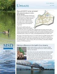
Stormwater Management Master Plan - MSD
Stormwater Management Master Plan - MSD
Stormwater Management Master Plan - MSD

Create successful ePaper yourself
Turn your PDF publications into a flip-book with our unique Google optimized e-Paper software.
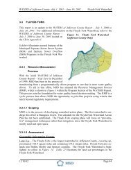
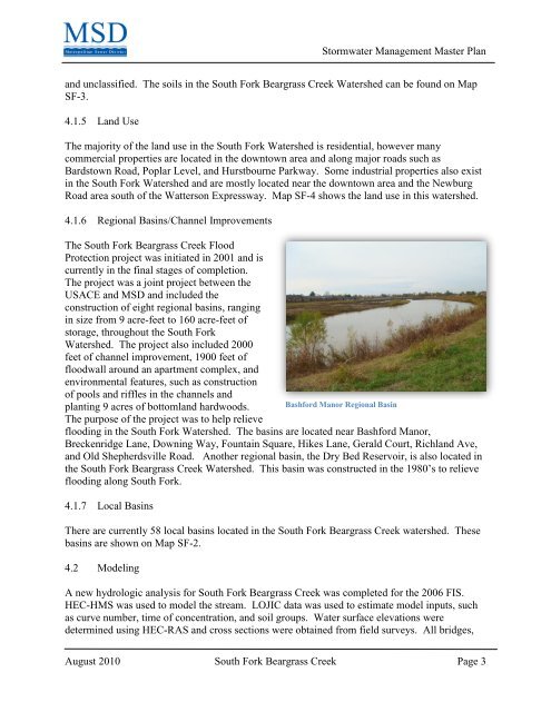
<strong>Stormwater</strong> <strong>Management</strong> <strong>Master</strong> <strong>Plan</strong>and unclassified. The soils in the South Fork Beargrass Creek Watershed can be found on MapSF-3.4.1.5 Land UseThe majority of the land use in the South Fork Watershed is residential, however manycommercial properties are located in the downtown area and along major roads such asBardstown Road, Poplar Level, and Hurstbourne Parkway. Some industrial properties also existin the South Fork Watershed and are mostly located near the downtown area and the NewburgRoad area south of the Watterson Expressway. Map SF-4 shows the land use in this watershed.4.1.6 Regional Basins/Channel ImprovementsThe South Fork Beargrass Creek FloodProtection project was initiated in 2001 and iscurrently in the final stages of completion.The project was a joint project between theUSACE and <strong>MSD</strong> and included theconstruction of eight regional basins, rangingin size from 9 acre-feet to 160 acre-feet ofstorage, throughout the South ForkWatershed. The project also included 2000feet of channel improvement, 1900 feet offloodwall around an apartment complex, andenvironmental features, such as constructionof pools and riffles in the channels andplanting 9 acres of bottomland hardwoods. Bashford Manor Regional BasinThe purpose of the project was to help relieveflooding in the South Fork Watershed. The basins are located near Bashford Manor,Breckenridge Lane, Downing Way, Fountain Square, Hikes Lane, Gerald Court, Richland Ave,and Old Shepherdsville Road. Another regional basin, the Dry Bed Reservoir, is also located inthe South Fork Beargrass Creek Watershed. This basin was constructed in the 1980’s to relieveflooding along South Fork.4.1.7 Local BasinsThere are currently 58 local basins located in the South Fork Beargrass Creek watershed. Thesebasins are shown on Map SF-2.4.2 ModelingA new hydrologic analysis for South Fork Beargrass Creek was completed for the 2006 FIS.HEC-HMS was used to model the stream. LOJIC data was used to estimate model inputs, suchas curve number, time of concentration, and soil groups. Water surface elevations weredetermined using HEC-RAS and cross sections were obtained from field surveys. All bridges,August 2010 South Fork Beargrass Creek Page 3