You also want an ePaper? Increase the reach of your titles
YUMPU automatically turns print PDFs into web optimized ePapers that Google loves.
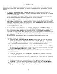
–33–Dataset Contents: Header• Besides <strong>the</strong> voxel numerical values, a dataset also containsauxiliary information, including (some of which is optional):! xyz dimensions of each voxel (in mm)! Orientation of dataset axes;for example, x-axis=R-L, y-axis=A-P, z-axis=I-S$ axial slices (we call this orientation “RAI”)! Location of dataset in scanner coordinateso Needed to overlay one dataset onto ano<strong>the</strong>ro Very important to get right in <strong>FMRI</strong>, since we deal with many datasets! Time between sub-bricks, for 3D+time datasetso Such datasets are <strong>the</strong> basic unit of <strong>FMRI</strong> data (one per imaging run)! Statistical parameters associated with each sub-bricko e.g., a t-statistic sub-brick has degrees-of-freedom parameter storedo e.g., an F-statistic sub-brick has 2 DOF parameters stored–34–<strong>AFNI</strong> Dataset Files - I• <strong>AFNI</strong> formatted datasets are stored in 2 files! The .HEAD file holds all <strong>the</strong> auxiliary information! The .BRIK file holds all <strong>the</strong> numbers in all <strong>the</strong> sub-bricks• Datasets can be in one of 3 coordinate systems (AKA views)! Original data or +orig view: from <strong>the</strong> scanner! AC-PC aligned or +acpc view:o Dataset rotated/shifted so that <strong>the</strong> anterior commissure andposterior commissure are horizontal (y-axis), <strong>the</strong> AC is at(x,y,z)=(0,0,0), and <strong>the</strong> hemispheric fissure is vertical (z-axis)! Talairach or +tlrc view:o Dataset has also been rescaled to conform to <strong>the</strong> Talairach-Tournoux atlas dimensions (R-L=136 mm; A-P=172 mm; I-S=116 mm)o AKA Talairach or Stererotaxic coordinateso Not quite <strong>the</strong> same as MNI coordinates, but very close