Download PDF (1.96 MB) - ReliefWeb
Download PDF (1.96 MB) - ReliefWeb
Download PDF (1.96 MB) - ReliefWeb

You also want an ePaper? Increase the reach of your titles
YUMPU automatically turns print PDFs into web optimized ePapers that Google loves.
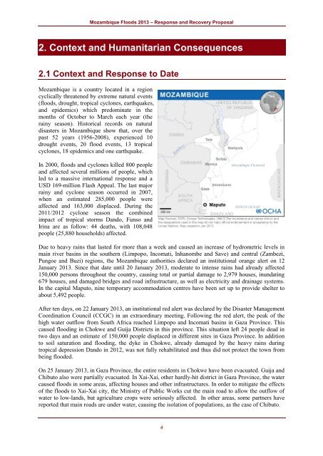
Mozambique Floods 2013 – Response and Recovery Proposal2. Context and Humanitarian Consequences2.1 Context and Response to DateMozambique is a country located in a regioncyclically threatened by extreme natural events(floods, drought, tropical cyclones, earthquakes,and epidemics) which predominate in themonths of October to March each year (therainy season). Historical records on naturaldisasters in Mozambique show that, over thepast 52 years (1956-2008), experienced 10drought events, 20 flood events, 13 tropicalcyclones, 18 epidemics and one earthquake.In 2000, floods and cyclones killed 800 peopleand affected several millions of people, whichled to a massive international response and aUSD 169-million Flash Appeal. The last majorrainy and cyclone season occurred in 2007,when an estimated 285,000 people wereaffected and 163,000 displaced. During the2011/2012 cyclone season the combinedimpact of tropical storms Dando, Funso andIrina are as follow: 44 deaths, with 108,048people (25,880 households) affected.Due to heavy rains that lasted for more than a week and caused an increase of hydrometric levels inmain river basins in the southern (Limpopo, Incomati, Inhanombe and Save) and central (Zambezi,Pungoe and Buzi) regions, the Mozambique authorities declared an institutional orange alert on 12January 2013. Since that date until 20 January 2013, moderate to intense rains had already affected150,000 persons throughout the country, causing total or partial damage to 2,979 houses, inundating679 houses, and damaged bridges and road infrastructure, as well as electricity and drainage systems.In the capital Maputo, nine temporary accommodation centres have been set up to provide shelter toabout 5,492 people.After ten days, on 22 January 2013, an institutional red alert was declared by the Disaster ManagementCoordination Council (CCGC) in an extraordinary meeting. Following the red alert, the peak of thehigh water outflow from South Africa reached Limpopo and Incomati basins in Gaza Province. Thiscaused flooding in Chokwe and Guija Districts in this province. This situation left 24 people dead intwo days and an estimate of 150,000 people displaced in different sites in Gaza Province. In additionto soil saturation and flooding, the dyke in Chokwe, already damaged by the heavy rains duringtropical depression Dando in 2012, was not fully rehabilitated and thus did not protect the town frombeing flooded.On 25 January 2013, in Gaza Province, the entire residents in Chokwe have been evacuated. Guija andChibuto also were partially evacuated. In Xai-Xai, other hardly-hit district in Gaza Province, the watercaused floods in some areas, affecting houses and other infrastructures. In order to mitigate the effectsof the floods to Xai-Xai city, the Ministry of Public Works cut the main road to allow the outflow ofwater to low-lands, but agriculture crops were seriously affected. In other areas, some partners havereported that main roads are under water, causing the isolation of populations, as the case of Chibuto.4