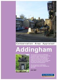
Landscape Character Supplementary Planning Document ...
Landscape Character Supplementary Planning Document ...
Landscape Character Supplementary Planning Document ...

Create successful ePaper yourself
Turn your PDF publications into a flip-book with our unique Google optimized e-Paper software.
City of Bradford Metropolitan District CouncilLocal Development Framework For Bradford7.0 EVOLUTION OF THE NATURAL LANDSCAPE7.1 INTRODUCTION7.1.1 The landscape of Bradford is the product of the interaction of both physical and humaninfluences. This chapter describes the main physical influences including topography,geology, soils, climate and biodiversity.7.1.2 The City of Bradford Metropolitan District comprises about 370 km 2 . Only about onethird of the District is built up but this area contains about 86% of the population. SeeFigure 3 – Settlement Map. The main population areas of Bradford, Keighley, Shipley,Bingley and Ilkley are separated by areas of agricultural land, isolated villages, areas ofundeveloped moorland, woodland and parkland. See Figure 4 - Landcover Map.7.1.3 The District is characterised by dramatic contrasts from the fringes of the SouthPennines in the west to the Wharfe Valley in the east.7.2 LANDFORM7.2.1 The District comprises a series of escarpments of plateaux with elevations up to 455mO.D., and a general decrease in the height of plateau in the east. The escarpments aredissected by the Rivers Aire and Wharfe and a number of smaller rivers, includingBradford Beck and the River Worth. The valley sides are commonly very steep, incontrast to the flat nature of the valley bottoms. The main urban areas and transportroutes occur within the valley floor of the district. Within these urbanised areas thetopography has often been altered artificially, with large areas of made ground, disturbedground and excavation.7.2.2 Geographically, the area is considered to be part of the upland Pennine peneplaingenerally slopes eastward complicated by valley incisions, and a series of step likefeatures marking breaks in slope.7.2.3 Rivers tend to flow eastwards following the actual slope of the land along major faultlines. See Figure 5 - Landform Map.<strong>Landscape</strong> <strong>Character</strong> <strong>Supplementary</strong> <strong>Planning</strong> <strong>Document</strong>October 2008 Page 20