Title 18 ZONING - City of Sand City
Title 18 ZONING - City of Sand City
Title 18 ZONING - City of Sand City

You also want an ePaper? Increase the reach of your titles
YUMPU automatically turns print PDFs into web optimized ePapers that Google loves.
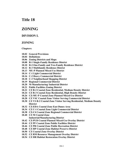
<strong>Title</strong> <strong>18</strong><strong>ZONING</strong>DIVISION I.<strong>ZONING</strong>Chapters:<strong>18</strong>.02 General Provisions<strong>18</strong>.04 Definitions<strong>18</strong>.06 Zoning Districts and Maps<strong>18</strong>.08 R-1 Single-Family Residence District<strong>18</strong>.10 R-2 One-Family and Two-Family Residence District<strong>18</strong>.12 R-3 Multifamily Residence District<strong>18</strong>.13 MU-P Planned Mixed Use District<strong>18</strong>.14 C-1 Light Commercial District<strong>18</strong>.16 C-2 Heavy Commercial District<strong>18</strong>.<strong>18</strong> C-3 Neighborhood Shopping District<strong>18</strong>.19 Regional Commercial District<strong>18</strong>.20 M-Manufacturing/ Industrial District<strong>18</strong>.21 Public Facilities Zoning District<strong>18</strong>.22 CZ R-2 Coastal Zone Residential, Medium Density District<strong>18</strong>.24 CZ R-3 Coastal Zone Residential, High Density District<strong>18</strong>.26 CZ-MU-P Coastal Zone Planned Mixed-Use District<strong>18</strong>.28 CZ VSC Coastal Zone Visitor Serving Commercial District<strong>18</strong>.30 CZ VS R-2 Coastal Zone Visitor Serving Residential, Medium DensityDistrict<strong>18</strong>.32 CZ-EDA Coastal Zone East Dunes Area<strong>18</strong>.34 CZ C-1 Coastal Zone Light Commercial District<strong>18</strong>.38 CZ-C4 Coastal Zone Regional Commercial District<strong>18</strong>.40 CZ M Coastal ZoneIndustrial/Manufacturing District<strong>18</strong>.42 CZ-PUD Coastal Planned Mixed-Use Overlay District<strong>18</strong>.44 CZ PF Coastal Zone Public Facilities District<strong>18</strong>.46 CZ PR Coastal Zone Public Recreation District<strong>18</strong>.48 CZ HP Coastal Zone Habitat Preserve District<strong>18</strong>.50 CZ Coastal Zone Overlay District<strong>18</strong>.52 CZ RM Resource Management Overlay District<strong>18</strong>.54 CZ HR Habitat Restoration Overlay District<strong>18</strong>-1
<strong>18</strong>.56 CZ ST Special Treatment Areas Overlay District<strong>18</strong>.58 DC Design Control District<strong>18</strong>.59 Density Bonuses/Incentives<strong>18</strong>.60 PUD Planned Unit Development District<strong>18</strong>.62 Special Use Conditions<strong>18</strong>.63 Accessory Dwelling Units<strong>18</strong>.64 Parking and Loading Areas<strong>18</strong>.66 Sign Regulations<strong>18</strong>.68 Site Plan<strong>18</strong>.69 Uses Prohibited in all Districts<strong>18</strong>.70 Nonconforming and Conditional Uses<strong>18</strong>.72 Permits<strong>18</strong>.74 Conditional Use Permits<strong>18</strong>.76 Variances<strong>18</strong>.78 Exceptions and Modifications<strong>18</strong>.80 Amendments<strong>18</strong>.82 Enforcement and PenaltiesDIVISION II.<strong>ZONING</strong>-RELATED PROVISIONSChapters:<strong>18</strong>.84 Local Coastal Program<strong>18</strong>.86 Time Share Projects<strong>18</strong>.88 Flood Protection<strong>18</strong>.90 Surface Mining and Reclamation<strong>18</strong>.92 Temporary Use Permits<strong>18</strong>.94 Assemblages <strong>of</strong> One Hundred People or More-Special Permit Required<strong>18</strong>.96 Trip ReductionDIVISION I.<strong>ZONING</strong>Chapter <strong>18</strong>.02GENERAL PROVISIONS<strong>18</strong>-2
Sections:<strong>18</strong>.02.010 <strong>Title</strong> and purpose.<strong>18</strong>.02.020 Establishment <strong>of</strong> zoning districts.<strong>18</strong>.02.030 Minimum standard specified.<strong>18</strong>.02.010 <strong>Title</strong> and purpose. This title shall be known as and may be cited andreferred to as the "<strong>Sand</strong> <strong>City</strong> zoning ordinance." (Ord. 84-1 §1-1, 1984)<strong>18</strong>.02.020 Establishment <strong>of</strong> zoning districts. The zoning regulations set out in thistitle consist <strong>of</strong> the establishment <strong>of</strong> various zoning districts within the city, withinwhich it shall be lawful only to erect, construct, alter or maintain certain buildings orto conduct certain uses <strong>of</strong> land or <strong>of</strong> buildings; within which certain open spacesshall be required about future buildings; and consisting further <strong>of</strong> appropriateregulations to be enforced in such districts, all as set forth in the ordinance codifiedin this title. (Ord. 84-1 §1-2, 1984)<strong>18</strong>.02.030 Minimum standards specified. In their interpretation and application,the provisions <strong>of</strong> this title shall be held to minimum requirements. Where this titleimposes a greater restriction than is imposed or required by other rules or regulationsor ordinances <strong>of</strong> the city, the provisions <strong>of</strong> this title shall control. (Ord. 84-1 §1-3,1984)Chapter <strong>18</strong>.04DEFINITIONSSections:<strong>18</strong>.04.005 Purpose.<strong>18</strong>.04.010 Access.<strong>18</strong>.04.015 Access, bluff top.<strong>18</strong>.04.020 Access, lateral.<strong>18</strong>.04.025 Access, vertical.<strong>18</strong>.04.030 Accessory use or structure.<strong>18</strong>.04.035 Agent <strong>of</strong> owner.<strong>18</strong>.04.040 Aggrieved person.<strong>18</strong>.04.045 Alley or lane.<strong>18</strong>.04.050 Archaeological resources.<strong>18</strong>.04.055 Automobile repair, major.<strong>18</strong>.04.060 Automobile repair, minor.<strong>18</strong>.04.065 Automobile or trailer sales area.<strong>18</strong>-3
<strong>18</strong>.04.070 Automobile service station.<strong>18</strong>.04.075 Automobile wrecking.<strong>18</strong>.04.080 Bakery.<strong>18</strong>.04.085 Beginning <strong>of</strong> construction.<strong>18</strong>.04.090 Biological survey and habitat protection plan.<strong>18</strong>.04.091 Single Price Point Retail Use and Price Point Retail Use.<strong>18</strong>.04.095 Boardinghouse or lodging house.<strong>18</strong>.04.100 Buffer.<strong>18</strong>.04.105 Building.<strong>18</strong>.04.110 Building, height <strong>of</strong>.<strong>18</strong>.04.115 Building, main.<strong>18</strong>.04.120 Carport.<strong>18</strong>.04.125 <strong>City</strong> council or council.<strong>18</strong>.04.130 Cluster development.<strong>18</strong>.04.135 Coastal bluff.<strong>18</strong>.04.140 Coastal-dependent development or use.<strong>18</strong>.04.145 Coastal development.<strong>18</strong>.04.150 Coastal development permit.<strong>18</strong>.04.155 Coastal emergency.<strong>18</strong>.04.160 Coastal zone.<strong>18</strong>.04.165 Coastal zone structure.<strong>18</strong>.04.170 Combination zone.<strong>18</strong>.04.175 Communications equipment building.<strong>18</strong>.04.<strong>18</strong>0 Conditional use.<strong>18</strong>.04.<strong>18</strong>5 Court.<strong>18</strong>.04.190 Creamery.<strong>18</strong>.04.195 Department store.<strong>18</strong>.04.200 Design storm wave run-up.<strong>18</strong>.04.205 Distance between residential structures.<strong>18</strong>.04.210 District.<strong>18</strong>.04.215 Drive-in restaurant, refreshment stand and sidewalk cafe.<strong>18</strong>.04.220 Dwelling.<strong>18</strong>.04.225 Dwelling group.<strong>18</strong>.04.230 Dwelling unit.<strong>18</strong>.04.235 Environmentally sensitive habitat area.<strong>18</strong>.04.240 Essential services.<strong>18</strong>.04.241 Extreme Value Retail<strong>18</strong>.04.245 Family.<strong>18</strong>.04.250 Feasible.<strong>18</strong>.04.255 Fence or wall.<strong>18</strong>.04.260 Garage, private.<strong>18</strong>.04.265 Garage, public.<strong>18</strong>.04.270 General plan.<strong>18</strong>.04.275 Hedge.<strong>18</strong>-4
<strong>18</strong>.04.280 Home occupation.<strong>18</strong>.04.285 Household pets.<strong>18</strong>.04.290 Kennel.<strong>18</strong>.04.295 Laundry and dry cleaning pickup station.<strong>18</strong>.04.300 Laundry, dry cleaning and dyeing plant.<strong>18</strong>.04.305 Laundry, dry cleaning or dyeing establishment.<strong>18</strong>.04.310 Local Coastal Implementation Plan.<strong>18</strong>.04.315 Local Coastal Land Use Plan.<strong>18</strong>.04.320 Local Coastal Program.<strong>18</strong>.04.325 Lot.<strong>18</strong>.04.330 Lot area.<strong>18</strong>.04.335 Lot, corner.<strong>18</strong>.04.340 Lot depth.<strong>18</strong>.04.345 Lot, interior.<strong>18</strong>.04.350 Lot lines.<strong>18</strong>.04.355 Lot width.<strong>18</strong>.04.360 Major energy facility.<strong>18</strong>.04.365 Major public works facility.<strong>18</strong>.04.370 Mobile home.<strong>18</strong>.04.375 Motel or motor hotel.<strong>18</strong>.04.380 Nonconforming use.<strong>18</strong>.04.381 Odd-lot/Close-out Retail<strong>18</strong>.04.385 Office, administrative and executive.<strong>18</strong>.04.390 Office, business.<strong>18</strong>.04.395 Office, medical.<strong>18</strong>.04.400 Office, pr<strong>of</strong>essional.<strong>18</strong>.04.405 Parking area, private.<strong>18</strong>.04.410 Parking area, public.<strong>18</strong>.04.415 Parking space.<strong>18</strong>.04.420 Parking layout.<strong>18</strong>.04.425 Performance standards.<strong>18</strong>.04.430 Pharmacy.<strong>18</strong>.04.435 Planned unit development.<strong>18</strong>.04.440 Premises.<strong>18</strong>.04.445 Public and quasi-public uses.<strong>18</strong>.04.450 Recreation, commercial.<strong>18</strong>.04.455 Recreation, private, noncommercial.<strong>18</strong>.04.460 Right-<strong>of</strong>-way, public.<strong>18</strong>.04.465 Right-<strong>of</strong>-way, private.<strong>18</strong>.04.470 Row house.<strong>18</strong>.04.475 Salvage or wrecking yard.<strong>18</strong>.04.480 Screen fence or screen hedge.<strong>18</strong>.04.483 Service commercial.<strong>18</strong>.04.485 Setback.<strong>18</strong>-5
<strong>18</strong>.04.490 Sign.<strong>18</strong>.04.495 Story.<strong>18</strong>.04.500 Street.<strong>18</strong>.04.505 Structure.<strong>18</strong>.04.510 Structural alteration.<strong>18</strong>.04.515 Substation, public utility.<strong>18</strong>.04.520 Trailer (including camp trailer).<strong>18</strong>.04.525 Trailer camp, trailer park or mobile home park.<strong>18</strong>.04.530 Unreasonable delays.<strong>18</strong>.04.535 Usable open space.<strong>18</strong>.04.540 Visitor serving residential timeshare units.<strong>18</strong>.04.545 Water allocation.<strong>18</strong>.04.550 Wire mesh fencing.<strong>18</strong>.04.555 Yard, exterior.<strong>18</strong>.04.560 Yard, front.<strong>18</strong>.04.565 Yard, interior.<strong>18</strong>.04.570 Yard, rear.<strong>18</strong>.04.575 Yard, side.<strong>18</strong>.04.580 Zoning map.<strong>18</strong>.04.005 Purpose. Unless the context otherwise requires, the followingdefinitions shall be used in the interpretation and construction <strong>of</strong> this title, and wordsused in the present tense shall include the future; the singular number shall includethe plural, and the plural the singular; the word "building" shall include the word"structure"; the word "used" shall include "arranged," "designed," "constructed,""altered," "converted," "rented," "leased," or "intended to be used"; and the word"shall" is mandatory and not directory. The words "section" and "article" refer to thesections and article <strong>of</strong> this code. (Ord. 84-1 §2-1, 1984)<strong>18</strong>.04.010 Access. "Access" means the provision <strong>of</strong> public pedestrian access from apublic thoroughfare to and along the shoreline. (Ord. 84-1 §2-2, 1984)<strong>18</strong>.04.01 Access, Bluff top. “Blufftopaccess" means a path or trail located along the top <strong>of</strong> a coastal bluff. (Ord. 84-1§2-3, 1984)<strong>18</strong>.04.020 Access, lateral. "Lateral access" means continuous access along thebeach parallel to the mean high tide line. (Ord. 84-1 §2-4, 1984)<strong>18</strong>.04.025 Access, vertical. "Vertical access" means a path or trail which connectsthe nearest public roadway with a shoreline destination via a reasonably direct route.(Ord. 84-1 §2-5, 1984)<strong>18</strong>.04.030 Accessory use or structure. "Accessory use" or "accessory structure"<strong>18</strong>-6
means a use or structure subordinate to the principal use <strong>of</strong> a building on the samepremises and serving a purpose customarily incidental to the use <strong>of</strong> the principalbuildings. (Ord. 84-1 §2-6, 1984)<strong>18</strong>.04.035 Agent <strong>of</strong> owner. "Agent <strong>of</strong> owner" means any person who, by affidavitfiled with the planning department, furnishes written pro<strong>of</strong> <strong>of</strong> such agency. (Ord. 84-1 §2-7, 1984)<strong>18</strong>.04.040 Aggrieved person. "Aggrieved person" means, for the purposes <strong>of</strong> acoastal development permit appeal, any person who, in person or through arepresentative, appeared at a public hearing <strong>of</strong> the city council in connection with thedecision or action appealed, or who, by other appropriate means prior to a hearinginformed the city council <strong>of</strong> the nature <strong>of</strong> his concerns or who for good cause wasunable to do either. (Ord. 84-1 §2-8, 1984)<strong>18</strong>.04.045 Alley or lane. "Alley" or "lane" means a public or private right-<strong>of</strong>-way,not more than twenty feet wide, affording only secondary means <strong>of</strong> access toabutting property. (Ord. 84-1 §2-9, 1984)<strong>18</strong>.04.050 Archaeological resources. "Archaeological resources" means materialremains <strong>of</strong> past human life and activities. Examples <strong>of</strong> material remains are fossilrelics, artifacts and monuments. (Ord. 84-1 §2-10, 1984)<strong>18</strong>.04.055 Automobile repair, major. General repair, rebuilding or reconditioning<strong>of</strong> engines, motor vehicles or trailers; collision service, including body, frame orfender straightening or repair; overall painting or paint shop; or three (3) or moreemployees.(Ord. 88-3 §1, 1988; Ord. 84-1 §2-11, 1984)<strong>18</strong>.04.060 Automobile repair, minor. Upholstering and motor tune-up servicelimited to changing or supplementing <strong>of</strong> vehicle fluids and the adjustment <strong>of</strong>mechanical components to passenger cars and trucks not exceeding one and one-halftons capacity, but not including any operation named under “automobile repair,major,” or any other repair similar thereto; or a maximum <strong>of</strong> two (2) employees.(Ord. 88-3 §1, 1988; Ord. 84-1 §2-12, 1984)<strong>18</strong>.04.065 Automobile or trailer sales area. "Automobile or trailer sales area"means an open area, other than a street, used for display, sale or rental <strong>of</strong> new orused motor vehicles or trailers in operable condition and where no repair work isdone. (Ord. 84-1 §2-13, 1984)<strong>18</strong>.04.070 Automobile service station. "Automobile service station" means a placewhere gasoline, kerosene or any other motor fuel or lubricating oil or grease foroperating motor vehicles is <strong>of</strong>fered for sale to the public and deliveries are madedirectly into motor vehicles, including greasing and oiling on the premises. Repair<strong>18</strong>-7
service shall be incidental and no storage or parking space shall be <strong>of</strong>fered for rent.(Ord. 84-1 §2-14, 1984)<strong>18</strong>.04.075 Automobile wrecking. "Automobile wrecking" means the dismantlingor disassembling <strong>of</strong> used motor vehicles or trailers, or the storage, sale or dumping<strong>of</strong> dismantled, partially dismantled, obsolete or wrecked vehicles for their parts.(Ord. 84-1 §2-15, 1984)<strong>18</strong>.04.080 Bakery. "Bakery" means a retail sales facility which <strong>of</strong>fers bakeryproducts for sale to the public and which, as an accessory use, may include thepreparation <strong>of</strong> products normally sold in bakeries for sale on the premises. This useshall not permit the preparation <strong>of</strong> bakery products for sale at other locations, driveinsales facilities or facilities that permit consumption <strong>of</strong> food on the premises. (Ord.84-1 §2-16, 1984)<strong>18</strong>.04.085 Beginning <strong>of</strong> construction. "Beginning <strong>of</strong> construction" means theincorporation <strong>of</strong> labor and material within the foundation <strong>of</strong> the building orbuildings. (Ord. 84-1 §2-17, 1984)<strong>18</strong>.04.090 Biological survey and habitat protection plan. "Biological survey andhabitat protection plan" means a field survey conducted by a qualified biologist oragency hired by the applicant and subsequent protection plan for any developmentproposed within a resource management zone district, a habitat preserve, or for dunerelocation/restoration areas as specified in the Local Coastal Land Use Plan. (Ord.84-1 §2-<strong>18</strong>, 1984)<strong>18</strong>.04.091 Single Price point Retail Use and Price Point Retail Use. “Single PriceRetail Use” and “Price Point Retail Use” means and refers to a retail store that sellsmerchandise with a preponderance <strong>of</strong> single pricing for all items in the store.Merchandise may be but is not limited to generic or private label products speciallymanufactured for such stores, products manufactured cheaply for a foreign marketand imported, products purchases from another retailer or distributor as overstockcloseout or seasonal merchandise at the end <strong>of</strong> the season, and promotional goodsmanufactured to coincide with an event that has since past. (Ord. 10-01, § 2-3, 2010)<strong>18</strong>.04.095 Boardinghouse or lodging house. "Boardinghouse" or "lodging house"means a dwelling or part there<strong>of</strong> where meals and/or lodging are provided, forcompensation, for five or more persons not transients. (Ord. 84-1 §2-19, 1984)<strong>18</strong>.04.100 Buffer. "Buffer" means an area <strong>of</strong> land separating two distinct land uses,such as residential and industrial or residential and commercial, which acts to s<strong>of</strong>tenor reduce the effect <strong>of</strong> one land use on another. For instance, landscaping issometimes used to buffer or reduce the effects <strong>of</strong> a commercial area on nearbyresidential units. (Ord. 84-1 §2-20, 1984)<strong>18</strong>-8
<strong>18</strong>.04.105 Building. "Building" means any structure having a ro<strong>of</strong> supported bycolumns or walls. (Ord. 84-1 §2-21, 1984)<strong>18</strong>.04.110 Building, height <strong>of</strong>. “Height <strong>of</strong> building" means the vertical distancefrom the average contact ground level at the front wall <strong>of</strong> the building to the highestpoint <strong>of</strong> the building, excluding chimneys and other building accessories. (Ord. 84-1§2-22, 1984)<strong>18</strong>.04.115 Building, main. "Main building" means a building in which isconducted the principal use <strong>of</strong> the site on which it is situated. In any residentialdistrict, any dwelling shall be deemed to be a main building on the building site uponwhich the same is located. (Ord. 84-1 §2-23, 1984)<strong>18</strong>.04.120 Carport. "Carport" means a covered structure used as a private garageand open on portions <strong>of</strong> at least two sides, one <strong>of</strong> which shall be for vehicle entry.All exposed internal carport wall or panel surfaces shall be finished. Any structureused, or designed for use, for the storage or shelter <strong>of</strong> motor vehicles, and not fallingunder this definition, shall be considered to be a garage and shall be equipped with agarage door. (Ord. 84-1 §2-24, 1984)<strong>18</strong>.04.125 <strong>City</strong> council or council. "<strong>City</strong> council" or council" means the council<strong>of</strong> the city <strong>of</strong> <strong>Sand</strong> <strong>City</strong>, California. (Ord. 84-1 §2-25, 1984)<strong>18</strong>.04.130 Cluster development."Cluster development" means a method <strong>of</strong> development in which many dwellingunits are placed close together or attached, usually for the purpose <strong>of</strong> retaininganother area in open space. Many condominium and townhouse developmentsutilize this method when they are adjacent to a natural area to be retained, or whenthey wish to create a focal point (such as a swimming pool or community complex).(Ord. 84-1 §2-26, 1984)<strong>18</strong>.04.135 Coastal bluff. "Coastal bluff" means a natural high bank or boldheadland with a broad precipice, almost perpendicular, sometimes rounded cliff faceoverlooking the ocean, subject to coastal erosional processes. Vertical relief must beten feet or more in height. (Ord. 84-1 §2-27, 1984)<strong>18</strong>.04.140 Coastal-dependent development or use. "Coastal-dependentdevelopment or use" means any development or use which requires a site on, oradjacent to, the sea to be able to function at all. (Ord. 84-1 §2-28, 1984)<strong>18</strong>.04.145 Coastal development. "Coastal development" means, on land, in orunder water, the placement or erection <strong>of</strong> any solid material or structure; dischargeor disposal <strong>of</strong> any dredged material or <strong>of</strong> any gaseous, liquid, solid or thermal waste;<strong>18</strong>-9
grading, removing, dredging, mining or extraction <strong>of</strong> any materials; change in thedensity or intensity <strong>of</strong> use <strong>of</strong> land, including, but not limited to, subdivision pursuantto the Subdivision Map Act (commencing with Section 66410 <strong>of</strong> the GovernmentCode), and any other division <strong>of</strong> land, including lot splits, except where the landdivision is brought about in connection with the purchase <strong>of</strong> such land by a publicagency for public recreational use; change in the intensity <strong>of</strong> use <strong>of</strong> water, or <strong>of</strong>access thereto; construction, reconstruction, demolition, or alteration <strong>of</strong> any structure' including any facility <strong>of</strong> any private, public or municipal utility; and the removal orharvesting <strong>of</strong> major vegetation other than for agricultural purposes, and kelpharvesting. (Ord. 84-1 §2-29, 1984)<strong>18</strong>.04.150 Coastal development permit. "Coastal development permit" means apermit for any development within the coastal zone. (Ord. 84-1 §2-30, 1984)<strong>18</strong>.04.155 Coastal emergency. "Coastal emergency" means a sudden, unexpectedoccurrence demanding immediate action to prevent or mitigate loss or damage tolife, health, property or essential public services. (Ord. 84-1 §2-31, 1984)<strong>18</strong>.04.160 Coastal zone. "Coastal zone" means an area within the jurisdiction <strong>of</strong>the California Coastal Act. The zone includes all <strong>of</strong> <strong>Sand</strong> <strong>City</strong> west <strong>of</strong> Highway 1, astrip <strong>of</strong> land two hundred feet wide east <strong>of</strong> Highway 1, Southern Pacific Railroad'sright-<strong>of</strong>-way and one hundred feet west <strong>of</strong> the right-<strong>of</strong>-way. (Ord. 84-1 §2-32, 1984)<strong>18</strong>.04.165 Coastal zone structure. "Coastal zone structure" means a building orother facility including but not limited to any road, retaining wall, pipe, flume,conduit, siphon, aqueduct, telephone line, electrical power transmission ordistribution line. (Ord. 84-1 §2-33, 1984)<strong>18</strong>.04.170 Combination zone. Combination zones are zones which aresuperimposed over other zones and which either add further requirements or replacecertain requirements <strong>of</strong> the underlying zone. (Ord. 84-1 §2-34, 1984)<strong>18</strong>.04.175 Communications equipment building. "Communications equipmentbuilding" means a building housing electrical and mechanical communicationequipment and the administrative staff necessary for the conduct <strong>of</strong> a publiccommunications business and open only to personnel necessary for the operation andmaintenance <strong>of</strong> such equipment and administrative functions. (Ord. 84-1 §2-35,1984)<strong>18</strong>.04.177Residential Care Facility. A place where non-medical care andsupervision is given to six (6) or fewer individuals that are primarily mentally,physically, and/or developmentally disabled, and are in need <strong>of</strong> a supportive livingenvironment. These Facilities must be approved by the State <strong>of</strong> California, with liveinsupervision by State-licensed individuals.” (Ord 07-04, 2007)<strong>18</strong>-10
<strong>18</strong>.04.<strong>18</strong>0 Conditional use. "Conditional use" means any use authorized only by aconditional use permit, as provided in this title. (Ord. 84-1 §2-36, 1984)<strong>18</strong>.04.<strong>18</strong>5 Court. "Court" means an open, unoccupied and unobstructed space,other than a yard, on the same lot with a building or group <strong>of</strong> buildings. (Ord. 84-1§2-37, 1984)<strong>18</strong>.04.190 Creamery. "Creamery" means a retail sales facility which <strong>of</strong>fers dairyproducts in bulk for sale to the public and which, as an accessory use, may includethe making <strong>of</strong> ice cream for sale on the premises. This use shall not include drive-insales facilities, the preparation <strong>of</strong> ice cream for sale at other locations, facilities thatprocess or package dairy products other than ice cream, or facilities that permitconsumption <strong>of</strong> food on the premises. (Ord. 84-1 §2-38, 1984)<strong>18</strong>.04.195 Department store. "Department store" means a store or group <strong>of</strong> shopsunder unified management, selling a variety <strong>of</strong> merchandise, normally includingclothing, appliances, hardware, furniture, etc. (Ord. 84-1 §2-39, 1984)<strong>18</strong>.04.200 Design storm wave run-up. "Design storm wave run-up" means therun-up distance expected above the mean high water mark based on the design waveconditions, combining local winds and open ocean storms. The design wave shall bebased on significant wave heights, which are the average <strong>of</strong> the highest one thirdwave heights characteristic <strong>of</strong> the area. (Ord. 84-1 §2-40, 1984)<strong>18</strong>.04.205 Distance between residential structures. "Distance betweenresidential structures" means the shortest horizontal distance measured between thevertical walls <strong>of</strong> two residential structures, as defined in this chapter, perpendicularto an axis, midway between such walls. Regulations which limit the minimumpermitted distance between structures apply only to buildings or structures that arelocated on a single lot or premises. (Ord. 84-1 §2-41, 1984)<strong>18</strong>.04.210 District. "District" means a portion <strong>of</strong> the territory <strong>of</strong> the city withinwhich certain uniform regulations and requirements or various combinations there<strong>of</strong>apply under the provisions <strong>of</strong> this title. Where certain uses are required to be aspecified distance from "any R district" district shall include any portion there<strong>of</strong>designated for future residential uses in the general plan. (Ord. 84-1 §2-42, 1984)<strong>18</strong>.04.215 Drive-in restaurant, refreshment stand and sidewalk cafe. A driveinrestaurant or refreshment stand is any facility where food or beverages areconsumed upon the premises other than in a building or other enclosed area andwhere self-service by customers is permitted. A sidewalk cafe is any facility wherefood or beverages are consumed upon the premises other than in a building or otherenclosed structure, but where table service is <strong>of</strong>fered and no self-service by<strong>18</strong>-11
customers is permitted. (Ord. 84-1 §2-43, 1984)<strong>18</strong>.04.220 Dwelling. "Dwelling" means any building or portion there<strong>of</strong> designedor used exclusively as the residence or sleeping place <strong>of</strong> one or more persons, but notincluding a tent, cabin, trailer or mobile home.A. "Single-family dwelling" means a building designed for or used exclusively forresidence purposes by one family.B. "Two family dwelling" or "duplex" means a building designed for or usedexclusively for residence purposes by two families.C. "Multiple dwelling" means a building or portion there<strong>of</strong> designed for or usedexclusively for residence purposes by three or more families. (Ord. 84-1 §2-44,1984)<strong>18</strong>.04.225 Dwelling group. "Dwelling group" means a group <strong>of</strong> two or moredetached single, duplex or multiple dwellings, located on a parcel <strong>of</strong> land in oneownership. (Ord. 84-1 §2-46, 1984)<strong>18</strong>.04.230 Dwelling unit. "Dwelling unit" means one room, or a suite <strong>of</strong> two ormore rooms, designed for or used by one family for living and sleeping purposes andhaving only one kitchen or kitchenette. (Ord. 84-1 §2-45, 1984)<strong>18</strong>.04.235 Environmentally sensitive habitat area. "Environmentally sensitivehabitat area" means any area in which plant or animal life or their habitats are eitherrare or especially valuable because <strong>of</strong> their special nature or role in an ecosystem andwhich could easily be disturbed or degraded by human activities and developments.(Ord. 84-1 §2-47, 1984)<strong>18</strong>.04.240 Essential services. "Essential services" means the erection, construction,alteration or maintenance by public utilities or municipal or other governmentalagencies, <strong>of</strong> underground or overhead gas, electrical, steam or water transmission ordistribution systems, collection, communication, supply or disposal systems,including poles, wires, mains, drains, sewers, pipes, conduits, cables, fire alarmboxes, police call boxes, traffic signals, hydrants and other similar equipment andaccessories in connection therewith, reasonably necessary for the furnishing <strong>of</strong>adequate service by such public utilities or municipal or other governmentalagencies or for the public health or safety or general welfare, but not includingbuildings. (Ord. 84-1 §2-48, 1984)<strong>18</strong>.04.241 Extreme Value Retail Use. “Extreme Value Retail Use” means andrefers to retail store <strong>of</strong>fering more than seventy percent (70%) <strong>of</strong> a diversifiedinventory for ten dollars ($10.00) or less.(Ord. 10-01 §2-1, 2010)<strong>18</strong>-12
<strong>18</strong>.04.245 Family. "Family" means a person living alone, or two or more personsliving together as a single housekeeping unit in a dwelling unit, as distinguishedfrom a group occupying a boardinghouse, lodging house, motel or hotel, fraternity orsorority house. (Ord. 84-1 §2-49, 1984)<strong>18</strong>.04.250 Feasible. "Feasible" means capable <strong>of</strong> being accomplished in asuccessful manner within a reasonable period <strong>of</strong> time, taking into account economic,environmental, social and technological factors. (Ord. 84-1 §2-50, 1984)<strong>18</strong>.04.255 Fence or wall. "Fence" or "wall" means a vertical barrier whichsupports no load other than its own weight and which is designed to delimit an areaor limit access or visibility into such area. (Ord. 84-1 §2-51, 1984)<strong>18</strong>.04.260 Garage, private. "Private garage" means a detached accessory buildingor a portion <strong>of</strong> the principal building used only for the storage <strong>of</strong> passenger vehiclesor trailers by the families resident upon the premises. (Ord. 84-1 §2-52, 1984)<strong>18</strong>.04.265 Garage, public. "Public garage" means a structure or portion there<strong>of</strong>,other than a private garage, used for the storage, sale, care, repair or refinishing <strong>of</strong>self-propelled vehicles or trailers. (Ord. 84-1 §2-53, 1984)<strong>18</strong>.04.270 General plan. "General plan" means the general plan for the city asadopted by the council, and as amended from time to time. (Ord. 84-1 §2-54, 1984)<strong>18</strong>.04.275 Hedge. "Hedge" means any plant, trees or shrubs planted in acontinuous line to form a dense thicket or barrier. (Ord. 84-1 §2-55, 1984)<strong>18</strong>.04.280 Home occupation. "Home occupation" means any use conductedentirely within a dwelling and carried on by the inhabitants there<strong>of</strong>, which use isresidential in nature, is clearly incidental and secondary to the use <strong>of</strong> the dwelling fordwelling purposes and does not change the character there<strong>of</strong> or adversely affect theuses permitted in the residential district <strong>of</strong> which it is a part. Such use shall notcreate additional traffic, require additional parking space, involve employment <strong>of</strong>persons other than domestic help, involve the use <strong>of</strong> mechanical equipment otherthan that necessary for normal domestic purposes, or involve the indoor or outdoorstorage <strong>of</strong> materials, equipment or supplies other than that necessary for normaldomestic purposes. Clinics, barber- shops, cosmetology establishments, business andpr<strong>of</strong>essional <strong>of</strong>fices and retail or wholesale dealerships involving the storing <strong>of</strong> morethan fifty pounds <strong>of</strong> merchandise on the premises shall not be deemed to be homeoccupations. (Ord. 84-1 §2-56, 1984)<strong>18</strong>.04.285 Household pets. “House- hold pets" means any domestic animalnormally owned or kept as a pet, including cats, dogs, rabbits, ducks, hens, raccoons,parrots, pigeons and other animals deemed by the council to be appropriate as<strong>18</strong>-13
domestic pets; provided such animals are confined to the limits <strong>of</strong> the residentialproperty occupied by the owner <strong>of</strong> such pets. Household pets shall not include anyanimals or birds maintained for commercial purposes, whether or not such animal orbird may be appropriate as a domestic pet. (Ord. 84-1 §2-57, 1984)<strong>18</strong>.04.290 Kennel. "Kennel" means any premises where five or more dogs, tenweeks in age or older, are kept. (Ord. 84-1 §2-58, 1984)<strong>18</strong>.04.295 Laundry and dry cleaningpickup station. "Laundry and dry cleaning pickup station" means a retailpersonal service facility not including dry cleaning or laundry operations on thepremises; provided, however, that launderettes and self-service dry cleaningfacilities containing equipment used solely by customers, and approved by properauthority for use solely by customers, shall be included in this definition. (Ord. 84-1§2-59, 1984)<strong>18</strong>.04.300 Laundry, dry cleaning and dyeing plant. "Laundry, dry cleaning anddyeing plant" means a heavy commercial facility which includes laundering, drycleaning or dyeing, or all <strong>of</strong> such operations, on a major scale and to which customerpickup and delivery on the premises is an accessory use subordinate to thelaundering, dry cleaning or dyeing operation. (Ord. 84-1 §2-61, 1984)<strong>18</strong>.04.305 Laundry, dry cleaning or dyeing establishment. "Laundry, drycleaning or dyeing establishment" means a retail service facility which may includelaundering, dry cleaning and/or dyeing <strong>of</strong> goods received at and picked up at suchlocation by customers. This use shall not include major plants for the usesmentioned, or facilities in which a major portion <strong>of</strong> receipt and delivery <strong>of</strong> suchgoods is not through personal contact with customers. (Ord. 84-1 §2-60, 1984)<strong>18</strong>.04.310 Local Coastal Implementation Plan. “Local Coastal ImplementationPlan" means that report, adopted by the city council and certified by the StateCoastal Commission, which describes the various administrative and legalprocedures, ordinances, regulations and other actions to be pursued to carry out theLocal Coastal Land Use Plan. (Ord. 84-1 §2-62, 1984)<strong>18</strong>.04.315 Local Coastal Land Use Plan. "Local Coastal Land Use Plan" meansthat report, adopted by the city council and certified by the State CoastalCommission, which, in response to the Coastal Act <strong>of</strong> 1976 becomes part <strong>of</strong> thecity's general plan and contains maps, public access component policies and otherresource and land use policies and guidelines for the city's coastal zone. (Ord. 84-1§2-63, 1984)<strong>18</strong>.04.320 Local Coastal Program. "Local Coastal Program" means a localgovernment's (a) land use plans, (b) zoning ordinances, (c) zoning district maps and<strong>18</strong>-14
(d) other implementing actions, which, when taken together, meet the requirements<strong>of</strong>, and implement the provisions and policies <strong>of</strong>, the Coastal Act at the local level.The abbreviation for the Local Coastal Program is LCP. (Ord. 84-1 §2-64, 1984)<strong>18</strong>.04.325 Lot. "Lot" means a piece or parcel <strong>of</strong> land occupied or intended to beoccupied by a principal building or a group <strong>of</strong> such buildings and accessorybuildings, or utilized for a principal use and uses accessory thereto, together withsuch open spaces as required by this title, and having frontage on or access to animproved and accepted public street. (Ord. 84-1 §2-65(part), 1984)<strong>18</strong>.04.330 Lot area. "Lot area" means the computed area contained within the lotlines. (Ord. 84-1 §2-65(f), 1984)<strong>18</strong>.04.335 Lot, corner. "Corner lot" means a lot abutting upon two or more streetsat their intersection or upon two parts <strong>of</strong> the same street, such streets or parts <strong>of</strong> thesame street forming an interior angle <strong>of</strong> less than one hundred thirty-five degrees.The point <strong>of</strong> intersection <strong>of</strong> the street right-<strong>of</strong>-way lines or the extension <strong>of</strong> suchlines to a point, is the "corner." (Ord. 84-1 §2-65(a), 1984)<strong>18</strong>.04.340 Lot depth. "Lot depth" means the mean horizontal distance between thefront and rear lot lines. (Ord. 84-1 §2-65(c), 1984)<strong>18</strong>.04.345 Lot, interior. "Interior lot" means a lot other than a corner lot. (Ord.84-1 52-65(b), 1984)<strong>18</strong>.04.350 Lot lines. "Lot lines" means the property lines bounding a lot asfollows:A. "Exterior lot line" means any lot line separating a lot from a street to which thatlot has legal access.1. "Front lot line" means the shortest exterior lot line on any lot.2. "Side street lot line" means any exterior lot line other than the front lot line(corner lot).B. "Interior lot line" means any lot line not an exterior lot line.1. "Rear lot line" means the interior lot line opposite and most distant from the frontlot line.2. "Side lot line" means any interior lot line other than the rear lot line.3. "Alley lot line" means any lot line separating a lot from an alley. (Ord. 84-1 §2-<strong>18</strong>-15
65(d), 1984)<strong>18</strong>.04.355 Lot width. "Lot width" means the mean width <strong>of</strong> the lot measured atright angles to its depth. (Ord. 84-1 §2-65(e), 1984)<strong>18</strong>.04.360 Major energy facility. "Major energy facility" means, within the coastalzone, any public or private processing, producing, generating, storing, transmittingor receiving facility for electricity, natural gas, petroleum, coal or other source <strong>of</strong>energy for which the estimated construction costs exceed twenty-five thousanddollars. (Ord. 84-1 §2-66, 1984)<strong>18</strong>.04.365 Major public works facility. "Major public works facility" means, inthe coastal zone, any public works project located within an area for which coastaldevelopment permits are appealable, and that cost more than twenty-five thousanddollars, except where service by a public agency is required to protect life and publicproperty from imminent danger, or to restore, repair or maintain public works,utilities or services destroyed, damaged, or interrupted by natural disaster or seriousaccident. (Ord. 84-1 §2-67, 1984)<strong>18</strong>.04.370 Mobile home. "Mobile home" means any standard make <strong>of</strong> trailer ormobile home equipped and constructed in such a manner as to permit permanentoccupancy there<strong>of</strong> as living quarters for a family. In general, any trailer overseventeen feet in length may be considered a mobile home; provided, that suchtrailer complies with all applicable laws and regulations controlling the design,construction, equipment or occupancy there<strong>of</strong>. An independent mobile home is amobile home equipped with toilet, washbasin, and shower or bathtub and thenecessary equipment to permit connection with city utility lines including water,electricity and sanitary sewer. A dependent mobile home is a mobile home thatlacks any <strong>of</strong> the facilities required above in an independent mobile home. (Ord. 84-152-68, 1984)<strong>18</strong>.04.375 Motel or motor hotel. "Motel" or "motor hotel" means a building orgroup <strong>of</strong> buildings comprising individual sleeping or living units for theaccommodation <strong>of</strong> transient guests. (Ord. 84-1 §2-69, 1984)<strong>18</strong>.04.380 Nonconforming use. "Nonconforming use" means a building, structureor premises legally existing and/or used at the time <strong>of</strong> adoption o-f the ordinancecodified in this title or any amendment thereto, which such building, structure orpremises is not in full conformity with the use regulations <strong>of</strong> the district in whichsame is located; provided, however, that a use shall not be considered anonconforming use solely on the basis <strong>of</strong> an inadequate number <strong>of</strong> parking spaces.(Ord. 84-1 §2-70, 1984)<strong>18</strong>.04.381 Odd-lot/Close-out Retail Use. “Odd lot/Close Out Retail Use” means<strong>18</strong>-16
and refers to a retail store <strong>of</strong>fering the preponderance <strong>of</strong> its products at a price whichis marked down more than forty-percent (40%) from normal retail price because thegoods are irregular, or as a result <strong>of</strong> manufacturing over-production, an overflow <strong>of</strong>product shipments or manufacturers’ close-outs. (Ord. 10-01 §2-3, 2010)<strong>18</strong>.04.385 Office, administrative and executive. "Administrative and executive<strong>of</strong>fices" means those <strong>of</strong>fices, organizationally part <strong>of</strong> a larger operation, which areengaged in general administration, supervision, purchasing, accounting or othermanagement functions. (Ord. 84-1 §2-71, 1 9 8 4)<strong>18</strong>.04.390 Office, business. "Business <strong>of</strong>fice" means a place <strong>of</strong> business providing aservice <strong>of</strong> general administration, including, and <strong>of</strong> the same general character as areal estate and insurance agency, accounting firm, business consultant, stenographicservice, but not including wholesale or retail activities involving stock-in-trade onthe premises. (Ord. 84-1 §2-72, 1984)<strong>18</strong>.04.395 Office, medical. "Medical <strong>of</strong>fice" means an <strong>of</strong>fice where medical andhealth services are provided to individuals by physicians, surgeons, dentists,psychologists, psychiatrists, optometrists, chiropractors, licensed physical therapistsand persons practicing related pr<strong>of</strong>essions, but not including medical and dentallaboratories and clinics. (Ord. 84-1 §2-73, 1984)<strong>18</strong>.04.400 Office, pr<strong>of</strong>essional. "Pr<strong>of</strong>essional <strong>of</strong>fice" means an <strong>of</strong>fice which dealsprimarily in pr<strong>of</strong>essional services such as surveying, engineering, architecture,planning and law, but not including medical <strong>of</strong>fices. (Ord. 84-1 §2-74, 1984)<strong>18</strong>.04.405 Parking area, private. "Private parking area" means an open area forthe same uses as a private garage. (Ord. 84-1 §2-75, 1984)<strong>18</strong>.04.410 Parking area, public. "Public parking area" means an open area, otherthan a street or other publicway, used for the parking <strong>of</strong> automobiles and available tothe public whether for a fee, free or as an accommodation for clients or customers.(Ord. 84-1 §2-76, 1984)<strong>18</strong>.04.415 Parking space. "Parking space" means a permanently surfaced area forthe parking <strong>of</strong> a motor vehicle. Such space shall not measure less than eight andone-half feet by nineteen feet and shall contain not less than one hundred sixty-oneand one-half square feet, excluding paved area necessary for access andmaneuvering. A compact space is eight and one-half feet by sixteen feet. (Ord. 84-1§2-77, 1984)<strong>18</strong>.04.420 Parking layout. "Parking layout" means the area required to maneuverand provide access to and from any parking space, driveway and aisle. (Ord. 84-1<strong>18</strong>-17
52-78, 1984)<strong>18</strong>.04.425 Performance standards. "Performance standards" means regulationsfor the control <strong>of</strong> "dangerous or objectionable elements." (Ord. 84-1 §2-79, 1984)<strong>18</strong>.04.430 Pharmacy. "Pharmacy" means any facility used primarily for thepurpose <strong>of</strong> compounding and dispensing medical prescriptions. (Ord. 84-1 §2-80,1984)<strong>18</strong>.04.435 Planned unit develop-ment. "Planned unit development" means a form<strong>of</strong> development usually characterized by a unified site design for a number <strong>of</strong>housing units, clustering buildings and providing common open space, densityincreases and a mix <strong>of</strong> building types and land uses. (Ord. 84-1 §2-81, 1984)<strong>18</strong>.04.440 Premises. "Premises" refers to any lot or parcel or any group <strong>of</strong> lots orparcels and all improvements thereon which are generally, but not necessarily, undersingle ownership. The term is inclusive rather than exclusive and shall beinterpreted broadly. (Ord. 84-1 §2-82, 1984)<strong>18</strong>.04.445 Public and quasi-public uses. "Public uses" and "quasi-public uses"means those uses open to the general public which are maintained and supported bypublic or nonpr<strong>of</strong>it agencies or organizations, communications equipment buildings,and other public utility facilities which are necessary to provide service to the area.Included in this category are uses <strong>of</strong> a recreational, educational, religious or culturalnature and facilities for public services such as police, fire and library. (Ord. 84-152-83, 1984)<strong>18</strong>.04.450 Recreation, commercial. "Commercial recreation" means recreationalfacilities operated as a business and open to the general public for a fee. (Ord. 84-1§2-84, 1 9 8 4)<strong>18</strong>.04.455 Recreation, private, noncommercial."Private noncommercial recreation" means clubs or recreationalfacilities, operated by a nonpr<strong>of</strong>it organization and open only to bona fide members<strong>of</strong> such nonpr<strong>of</strong>it organization, whether or not a fee is charged. (Ord. 84-1 §2-85,1984)<strong>18</strong>.04.460 Right-<strong>of</strong>-way, public. "Public right-<strong>of</strong>-way" means any parcel <strong>of</strong> landwhich has been dedicated to, sold to, condemned by or otherwise transferred to andaccepted by the city for the purpose <strong>of</strong> providing either present or future unrestrictedpublic access to any lot, parcel or premises. A public right-<strong>of</strong>-way is any right-<strong>of</strong>wayfor which the city assumes responsibility for maintenance, whether or, not suchright-<strong>of</strong>-way is improved to the standards <strong>of</strong> the city. In accepting a public right-<strong>of</strong>way,the city accepts no responsibility for improving such right-<strong>of</strong>-way to a greater<strong>18</strong>-<strong>18</strong>
standard than that which prevailed at the time <strong>of</strong> such acceptance. (Ord. 84-1 §2-86,1984)<strong>18</strong>.04.465 Right-<strong>of</strong>-way, private. "Private right-<strong>of</strong>-way" means any parcel <strong>of</strong> landthe right-<strong>of</strong>-way <strong>of</strong> which has been transferred by the owner there<strong>of</strong> to any otherparty, and which right-<strong>of</strong>-way is controlled by a private agreement between thegrantor and grantee. A private right-<strong>of</strong>-way may or may not be recorded with therecorder <strong>of</strong> Monterey County. (Ord. 84-1 §2-87, 1984)<strong>18</strong>.04.470 Row house. "Row house" means a single family attached or semiattacheddwelling unit located on a separate parcel <strong>of</strong> land in one ownership. (Ord.84-1 §2-88, 1984)<strong>18</strong>.04.475 Salvage or wrecking yard. "Salvage or wrecking yard" means aplace where waste, discarded or salvaged materials are bought, sold, exchanged,baled, packed, disassemb- led, stored or handled, including auto wrecking yards,house-wrecking yards, used lumber yards and places or yards for storage <strong>of</strong> salvagedmaterials and equipment; but not including such places where such uses areconducted entirely within a completely enclosed building. The sale <strong>of</strong> used cars inoperable condition, or the use <strong>of</strong> salvage materials incidental to manufacturingoperations. (Ord. 84-1 §2-89, 1984)<strong>18</strong>.04.480 Screen fence or screen hedge. A "screen fence" or "screen hedge" is afence or hedge which restricts visibility by seventy-five percent or more. Visibilityrestriction is seventy-five percent or more when the ratio <strong>of</strong> opaque areas to openareas is three to one or higher. A planting <strong>of</strong> five-gallon shrubs or trees <strong>of</strong> a size orspecies that will, within four years, restrict visibility by seventy-five percent or moreto the required height, shall be allowed as a screen hedge. (Ord. 84-1 §2-90, 1984)<strong>18</strong>.04.483 Service commercial. “Service Commercial” uses means those uses andbusinesses that are establishments primarily engaged in rendering services on a feeor contract basis for all phases <strong>of</strong> building construction and maintenance; or thatrender services to other businesses such as advertising, employment services,management and consulting services, and protective services. (Ord. 02-03, 2002)<strong>18</strong>.04.485 Setback. "Setback" means the minimum allowable horizontal distancefrom a given point or line <strong>of</strong> reference such as a street right-<strong>of</strong>-way to the nearestvertical wall or other element <strong>of</strong> a building or structure as defined in this chapter.(Ord. 84-1 §2-91, 1984)<strong>18</strong>.04.490 Sign. "Sign" means any advertising display or structure. (Ord. 84-1§2-92, 1984)<strong>18</strong>.04.495 Story. "Story" means that portion <strong>of</strong> a building included between the<strong>18</strong>-19
surface <strong>of</strong> any floor and the surface <strong>of</strong> the floor next above it, or, if there be no floorabove it, then the space between any floor and the ceiling next above it. (Ord. 84-1§2-93, 1984)<strong>18</strong>.04.500 Street. "Street" means an improved public right-<strong>of</strong>-way more thantwenty feet in width which provides a public means <strong>of</strong> access to abutting property.The term "street" shall include avenue, drive, circle, road, parkway, boulevard,highway, thoroughfare or any other similar term. (Ord. 84-1 52-94, 1984)<strong>18</strong>.04.505 Structure. "Structure" means anything constructed, the use <strong>of</strong> whichrequires permanent location on the ground or attachment to something having apermanent location on the ground. (Ord. 84-1 §2-95, 1984)<strong>18</strong>.04.510 Structural alteration. "Structural alteration" means any change in thestructural members <strong>of</strong> a building, such as walls, columns, beams or girders. (Ord. 84-1 §2-96, 1984)<strong>18</strong>.04.515 Substation, public utility. "Public utility substation" means a stationwhere electric power is transformed to a distribution voltage level or where water ispumped into a local or neighborhood distribution system. (Ord. 84-1 §2-97, 1984)<strong>18</strong>.04.520 Trailer (including camp trailer). "Trailer" (including camp trailer)means any vehicle constructed in such a manner as to permit temporary occupancythere<strong>of</strong> as sleeping quarters (i.e., camp trailer) or the conduct <strong>of</strong> any business, tradeor occupation, or use as a selling or advertising device, or use for storage orconveyance for tools, equipment or machinery, and so designed that it is mounted onwheels and may be used as a conveyance on highways and streets, propelled ordrawn by other motive power. Camp trailers are considered structures for thepurposes <strong>of</strong> this title when they are parked in a trailer camp or park. (Ord. 84-1 §2-98, 1984)<strong>18</strong>.04.525 Trailer camp, trailer park or mobile home park. "Trailer camp,""trailer park" or "mobile home park" means any lot or part there<strong>of</strong>, or any parcel <strong>of</strong>land, which is used or <strong>of</strong>fered as a location for two or more camp trailers or mobilehomes used for any <strong>of</strong> the residential purposes. (Ord. 84-1 §2-99, 1984)<strong>18</strong>.04.530 Unreasonable delays. "Unreasonable delays" are those exceeding fiveminutes unless there is equipment failure. (Ord. 84-1 52-100, 1984)<strong>18</strong>.04.535 Usable open space. “Usableopen space" means an area or a series <strong>of</strong> areas on a lot <strong>of</strong> such shape or shapesthat it or they can be efficiently utilized for recreation and outdoor living. (Ord. 84-152-101, 1984)<strong>18</strong>-20
<strong>18</strong>.04.540 Visitor serving residential timeshare units. "Visitor serving residentialtimeshare units" means, within the coastal zone, residential units which are sold tovisitors for specified periods <strong>of</strong> time throughout the year. These units are to beinterval units, in which the purchaser acquires one or more intervals, an intervalusually being one or two week periods. Permitted timeshare residential units shallbe restricted to purchase in thirty-one-day maximum increments and to occupancyfor thirty-one-day maximum periods. (Ord. 84-1 §2-102, 1984)<strong>18</strong>.04.-545 Water allocation. "Water allocation" means the total annual amount <strong>of</strong>water allocated to the city by the Monterey Peninsula Water Management District aspart <strong>of</strong> the peninsula water allocation system. As a result <strong>of</strong> this city water allocationand as part <strong>of</strong> the LCP, water consumption for land uses within and outside thecoastal zone were projected to insure that the city will not exceed its current annualwater allocation. (Ord. 84-1 §2-103, 1984)<strong>18</strong>.04.550 Wire mesh fencing. "Wire mesh fencing" is fence material whichderives its strength from metal strands crossing in a regular pattern. Wire meshfencing includes, but is not limited to, those materials known as chain link, Cycloneand chicken-wire fencing, but does not include ornamental iron fencing. (Ord. 84-1§2-104, 1984)<strong>18</strong>.04.555 Yard, exterior. "Exterior yard" means any yard adjacent to an exteriorlot line. (Ord. 84-1 §2-105, 1984)<strong>18</strong>.04.560 Yard, front. "Front yard" means an open space extending the full width<strong>of</strong> the lot measured between the building closest to the front line and said front lotline, which open space is unoccupied and unobstructed from the ground upwardexcept as specified elsewhere in this title and which such space provides access tothe principal or formal access to the main building located on such lot.Front Yard, Least Depth, How Mea- sured. Such depth shall be measured at allelevations from the right-<strong>of</strong>-way line <strong>of</strong> the existing street on which the lot fronts(the front lot line); provided, however, that if the proposed location <strong>of</strong> the right-<strong>of</strong>wayline <strong>of</strong> such street as adopted by the city differs from that <strong>of</strong> the existing street,then the required front yard least depth shall be measured from the future right-<strong>of</strong>wayline <strong>of</strong> such streets as adopted. (Ord. 84-1 §2-106, 1984)<strong>18</strong>.04.565 Yard, interior. "Interior yard" means any yard adjacent to an interior lotline. (Ord. 84-1 §2-107, 1984)<strong>18</strong>.04.570 Yard, rear. "Rear yard" means an open space extending the full width <strong>of</strong>a lot between the building closest to the rear lot line and such rear lot line, whichopen space is unoccupied and unobstructed from the ground upward, except asspecified elsewhere in this title. (Ord. 84-1 52-108, 1984)<strong>18</strong>-21
<strong>18</strong>.04.575 Yard, side. "Side yard" means an open space extending from the frontyard to the rear yard between the building closest to the nearest side lot line and suchlot line, which open space is unoccupied and unobstructed from the ground upward,except as specified elsewhere in this title.Side Yard, Least Width, How Measured. Such width shall be measured at allelevations from the nearest side lot line and, in case the nearest side lot line is a sidestreet lot line, from the right-<strong>of</strong>-way line <strong>of</strong> the existing street; provided, however,that if the proposed location <strong>of</strong> the right-<strong>of</strong>-way line <strong>of</strong> such street, as adopted by thecity, differs from that <strong>of</strong> the existing street, then the required side yard least widthshall be measured from the future right-<strong>of</strong>-way line <strong>of</strong> such street as adopted. (Ord.84-1 §2-109, 1984)<strong>18</strong>.04.580 Zoning map. "Zoning map" means the zoning map <strong>of</strong> the city, togetherwith all amendments thereto subsequently adopted. (Ord. 84-1 §2-110, 1984)Chapter <strong>18</strong>.06<strong>ZONING</strong> DISTRICTS AND MAPSSections:<strong>18</strong>.06.010 Designation <strong>of</strong> districts.<strong>18</strong>.06.020 Overlay or combining districts.<strong>18</strong>.06.030 Adoption <strong>of</strong> zoning map.<strong>18</strong>.06.040 Determination <strong>of</strong> boundaries.<strong>18</strong>.06.050 Conformance.<strong>18</strong>.06.060 Zoning map.<strong>18</strong>.06.010 Designation <strong>of</strong> districts. The several districts established and into whichthe city is divided are designated as follows:R-1 district Single-familyR-2 district One and two-family residenceR-3 district MultifamilyC-1 (CL) district Light commercial<strong>18</strong>-22
C-2 (CH) district Heavy commercialC-3 (CN) district Neighborhood shoppingM district Manufacturing/ industrialIP district Industrial parkCZ R-2 district Coastal zone residential, medium densityCZ R-3 district Coastal zone residential, high densityCZ VSC district Coastal zone visitor serving commercialCZ VS R-1 district Coastal zone visitor serving residential, low densityCZ VS R-2 district Coastal zone visitor serving residential, medium densityCZ C-1 district Coastal zone light commercialCZ C-2 district Coastal zone heavy commercialCZ-CDI district Coastal zone coastal dependent industrialCZ M district Coastal zone industrial/manufacturingCZ IP district Coastal zone industrial parkCZ PF district Coast zone public facilitiesCZ PR district Coastal zone public recreationCZ HP district Coastal zone habitat preserve(Ord. 84-1 §3-1, 1984)<strong>18</strong>.06.020 Overlay or combining districts. In addition to the standard zoningdistricts, certain combining districts are established and designated as follows:CZ district Coastal zoneCZ RM district Resource managementCZ HR district Habitat restorationCZ ST district Special treatment areasDC district Design controlPUD district Planned community(Ord. 84-1 §3-2, 1984)<strong>18</strong>.06.030 Adoption <strong>of</strong> zoning map.The designations, locations and boundaries <strong>of</strong> the districts set out in Sections<strong>18</strong>.06.010 and <strong>18</strong>.06.020 are set forth in Section <strong>18</strong>.06.060, which consists <strong>of</strong> thezoning map <strong>of</strong> the city. Such map and all notations, references and otherinformation shown thereon shall be and are adopted and made a part <strong>of</strong> the ordinancecodified in this title. (Ord. 97-4 §3, 1997; Ord. 84-1 §3-3, 1984)<strong>18</strong>.06.040 Determination <strong>of</strong> boundaries. Where uncertainty exists as to theboundaries <strong>of</strong> any <strong>of</strong> the districts set out in Sections <strong>18</strong>.06.010 and <strong>18</strong>.06.020 asshown on such zoning map, the city council, upon written application or upon itsown motion, shall determine the location <strong>of</strong> such boundaries. (Ord. 84-1 §3-4, 1984)<strong>18</strong>.06.050 Conformance. Except as hereinafter noted:<strong>18</strong>-23
A. No building or part there<strong>of</strong> <strong>of</strong> other structure shall be erected, altered, addedto or enlarged, nor shall any land, building, structure or premises be used, designatedor intended to be used for any purpose, or in any manner, other than those which areincluded among the uses hereinafter listed as permitted in the district in which suchbuilding, land or premises is located.B. No building or part there<strong>of</strong> or other structure shall be erected, reconstructedor structurally altered to exceed in height the limit hereinafter designated for thedistrict in which such building is located.C. No building or part there<strong>of</strong> or other structure shall be erected, nor shall anyexisting building be altered, enlarged or rebuilt or moved into any district, nor shallany open space be encroached upon or reduced in any manner, except in conformityto the yard, building site area and building location regulations hereinafterdesignated for the district in which such building or open space is located.D. No yard or other open space provided about any building for the purpose <strong>of</strong>complying with the provisions <strong>of</strong> this title shall be considered as providing a yard orother open space for any other building, and no yard or other open space on onebuilding site shall be considered as providing a yard or open space for a building onany other building site. (Ord. 84-1 §3-5, 1984)<strong>18</strong>.06.060 Zoning map. This section consists <strong>of</strong> the zoning map <strong>of</strong> the city, made apart <strong>of</strong> this title under the provisions <strong>of</strong> Section <strong>18</strong>.06.030. Such map, properlyattested, shall and does remain on file in the <strong>of</strong>fice <strong>of</strong> the city clerk. The zoning map<strong>of</strong> the city is set out as Appendix A attached to the ordinance codified in this title. Itis on file in the <strong>of</strong>fice <strong>of</strong> the city clerk. (Ord. 97-05, 1997; Ord. 97-02, 1997; Ord.95-02, 1995; Ord. 95-01, 1995; 84-1 §4-1, 1984)Chapter <strong>18</strong>.08R-1 SINGLE-FAMILY RESIDENCE DISTRICTSections:<strong>18</strong>.08.010 Purpose.<strong>18</strong>.08.020 Principal permitted uses.<strong>18</strong>.08.030 Accessory uses.<strong>18</strong>.08.040 Conditional uses.<strong>18</strong>.08.050 Height regulations.<strong>18</strong>.08.060 Minimum requirements.<strong>18</strong>.08.070 Other required conditions.<strong>18</strong>-24
<strong>18</strong>.08.010 Purpose. The purpose <strong>of</strong> the R-1 district is to stabilize and protectthe residential characteristics <strong>of</strong> the district and to promote and encourage a suitableenvironment for family life. The R-1 district is intended for single-family homesand the community services appurtenant thereto. (Ord. 84-1 §5-1, 1984)<strong>18</strong>.08.020 Principal permitted uses. Principal permitted uses in the R-1 districtare as follows:A. Single-family dwellings;B. Rooming and boarding <strong>of</strong> not over two persons;C. Signs not exceeding in the aggregate, six square feet in area, for eachbuilding site, may be displayed for the purpose <strong>of</strong> advertising the sale or lease <strong>of</strong>property upon which is displayed;D. Mobile or manufactured homes. (Ord. 84-1 §5-2, 1 9 8 4)<strong>18</strong>.08.030 Accessory uses. Accessory uses permitted in the R-1 district are asfollows:A. Living quarters for persons regularly employed on the premises, but not rented orotherwise conducted as a business; provided, that no kitchen facilities are provided;B. Home occupations;C. Private swimming pools;D. Temporary tract <strong>of</strong>fices;E. Other accessory uses, and accessory buildings customarily appurtenant to apermitted use. (Ord. 84-1 §5-3, 1984)<strong>18</strong>.08.040 Conditional uses. Conditional uses permitted in the R-1 district are asfollows:A. Public and quasi-public buildings and uses <strong>of</strong> a recreational, educational,religious, cultural or public service type; not including corporation yards, storage orrepair yards and warehouses;B. Licensed foster homes;C. Commercial parking lots;<strong>18</strong>-25
D. Public utility substations and public utility communication equipment buildings;E. Dwelling groups. (Ord. 84-1 §5-4, 1984)<strong>18</strong>.08.050 Height regulations. Height regulations permitted in the R-1 district areas follows: no principal building shall exceed thirty feet in height and no detachedaccessory building shall exceed fifteen feet in height. (Ord. 84-1 §5-5, 1984)<strong>18</strong>.08.060 Minimum requirements. The following minimum requirements shallbe observed in the R-1 district, except where increased for conditional uses ormodified herein:A. Minimum building site area required, three thousand seven hundred fifty squarefeet;*B. Minimum building site width required, fifty feet;C. Percentage <strong>of</strong> building site cover- age permitted, sixty percent;D. Minimum front yard setback required, five feet;E.. Minimum side yard setback required, five feet;*F. Minimum rear yard setback required, ten feet;G. Parking spaces required, two per dwelling unit (one covered);* Those holding single twenty-five-foot lots, with separate owners on each side <strong>of</strong>them at the time the ordinance codified in this title is adopted, can develop them asthey exist with design review. A minimum zero side yard setback will be allowed.Applicants for development on a twenty-five-foot lot will be required to show pro<strong>of</strong><strong>of</strong> ownership by producing a recorded deed or notarized contract <strong>of</strong> sale dated priorto ordinance adoption. Change <strong>of</strong> ownership will not affect the status <strong>of</strong> a twentyfive-footlot if, in fact, it was a twenty-five-foot lot prior to ordinance adoption.However, pro<strong>of</strong> <strong>of</strong> such will still be necessary as described above.H. Maximum driveway width, twelve and one-half feet (to allow curb room for <strong>of</strong>fsiteparking). (Ord. 84-1 §5-6, 1984)<strong>18</strong>.08.070 Other required conditions. Other required conditions in the R-1district are as follows:<strong>18</strong>-26
A. Site plan approval required <strong>of</strong> all conditional uses set out in Section <strong>18</strong>.08.040;B. Off-street parking required for all uses as set out in this chapter, two spaces perunit to be within a two-car,enclosed garage;C. Design control regulations apply within the R 1 district. (Ord. 84-1 §5-7, 1984)Chapter <strong>18</strong>.10R-2 ONE-FAMILY AND TWO-FAMILY RESIDENCEDISTRICTSections:<strong>18</strong>.10.010 Purpose.<strong>18</strong>.10.020 Principal permitted uses.<strong>18</strong>.10.030 Accessory uses.<strong>18</strong>.10.040 Conditional uses.<strong>18</strong>.10.050 Height regulations.<strong>18</strong>.10.060 Area, lot width and yard requirements.<strong>18</strong>.10.070 Other required conditions.<strong>18</strong>.10.010 Purpose. The purpose <strong>of</strong> the R-2 district is to stabilize and protect theresidential characteristics <strong>of</strong> the district and to promote and encourage a suitableenvironment for family life. The R-2 district is intended for one- and two-familyresidences and the community services appurtenant thereto. (Ord. 84-1 §6-1, 1984)<strong>18</strong>.10.020 Principal permitted uses. Principal permitted uses in the R-2 districtare as follows:A. Single-family dwellings;B. Duplex or two-family dwellings. (Ord. 84-2 §6-2, 1984)C. Residential Care Facility for six (6) or fewer persons. (Ord. 07-04, 2007)<strong>18</strong>.10.030 Accessory uses.Accessory uses permitted in the R-2 district are as follows:A. Room and boarding <strong>of</strong> not more than one person per unit;<strong>18</strong>-27
B. Home occupations;C. Private swimming pools;D. Temporary tract <strong>of</strong>fices and building yards;E. Other accessory uses and accessory buildings customarily appurtenant to apermitted use. (Ord. 84-1 §6-3, 1984)<strong>18</strong>.10.040 Conditional uses. Conditional uses permitted in the R-2 district are asfollows:A. Public and quasi-public buildings and uses <strong>of</strong> a recreational, educational,religious, cultural or public service type; not including corporation yards, storageor repair yards and warehouses;B. Multiple family dwelling units;C. Nursery schools, licensed foster homes, homes for ambulatory aged person andnursing or convalescent homes;D. Commercial parking lots;E. Public utility substations and public utility communication equipment buildings;F. Dwelling groups;G. Mobile homes (renewable annually). (Ord. 84-1 §6-4, 1984)<strong>18</strong>.10.050 Height regulations. Height regulations in the R-2 district are as follows:no principal building shall exceed thirty feet in height; no detached accessorybuildings shall exceed fifteen feet in height. (Ord. 84-1 §6-5, 1984)<strong>18</strong>.10.060 Area, lot width and yard requirements. The following minimumrequirements shall be observed in the R-2 district, except where increased forconditional uses. The minimum requirements shall be those <strong>of</strong> the following thatcorrespond with the district classification designated on the zoning map.A. Single-family dwellings; same as in R-1 district regulations; andB. Two-family dwellings, designated as follows:1. Minimum lot area, three thousand seven hundred fifty square feet,2. Mean lot width, fifty feet (interior lot),<strong>18</strong>-28
3. Mean lot depth, fifty feet (corner lot),4. Percentage <strong>of</strong> building site coverage permitted, sixty percent,5. Parking spaces per dwelling unit, two (one and one-half covered),6. Side yard setbacks, five,*7. Exterior yards:a. Front yard setback, five feet,b. Rear yard setback, ten feet,8. Driveway width, twelve and one-half feet to seventeen feet (to allow <strong>of</strong>f-streetparking). (Ord. 84-1 §6-6, 1984)*Setbacks can be applied to either side yard (total <strong>of</strong> ten feet minimum), with a zeroside yard on the opposite side.<strong>18</strong>.10.070 Other required conditions. Other required conditions in the R-2district are as follows:A. Site plan approval by the city council required <strong>of</strong> all conditional uses;B. Off-street parking required for all uses, as above;C. On any corner lot, each exterior yard which abuts the front yard <strong>of</strong> an adjacentlot shall be not less than twenty feet in depth. Any other exterior yard on a corner lotmay be reduced to fifteen feet;D. Applicable fence height limitations and other regulations relating to fences andhedges;E. Design control district regulations apply. (Ord. 84-1 §6-7, 1984)Chapter <strong>18</strong>.12R-3 MULTI-FAMILY RESIDENCE DISTRICTSections:<strong>18</strong>-29
<strong>18</strong>.12.010 Purpose.<strong>18</strong>.12.020 Principal permitted uses.<strong>18</strong>.12.030 Accessory uses.<strong>18</strong>.12.040 Conditional-uses.<strong>18</strong>.12.050 Area, height, lot width and yard requirements.<strong>18</strong>.12.060 Other require conditions.<strong>18</strong>.12.010 Purpose. The purpose <strong>of</strong> the R-3 district is to stabilize and protect theresidential characteristics <strong>of</strong> the district and to promote, ins<strong>of</strong>ar as is compatible withthe intensity <strong>of</strong> land use, a suitable environment for family life. (Ord. 84-1 §7-1,1984)<strong>18</strong>.12.020 Principal permitted uses. Principal permitted uses in the R-3 district areas follows:A. Multiple dwellings;B. Single-family dwellings and duplexes, subject to all restrictions and requirements<strong>of</strong> the R-1 district; andC. Licensed homes for ambulatory aged persons over sixty-five years <strong>of</strong> age. (Ord.84-1 §7-2, 1984)D. Residential Care Facility for six (6) or fewer persons. (Ord. 07-04, 2007)<strong>18</strong>.12.030 Accessory uses. Access- ory uses permitted in the R-3 district are asfollows:A. Rooming and boarding <strong>of</strong> not more than two persons;B. Temporary tract <strong>of</strong>fices and building yards; andC. Other accessory uses and accessory buildings customarily appurtenant to apermitted use. (Ord. 84-1 §7-3, 1 9 8 4)<strong>18</strong>.12.040 Conditional uses. Conditional uses permitted in the R-3 district are asfollows:A. Rooming houses and boarding houses and foster homes for any number <strong>of</strong>guests;B. Mobile homes, renewable annually;C. Incidental services, such as: restaurants and retail sales to serve residents only;<strong>18</strong>-30
provided, that there is not exterior display or advertising and such activities areconducted in spaces which are integral parts <strong>of</strong> a main building;D. Social halls, lodges, fraternal organizations and clubs, except those operated for apr<strong>of</strong>it;E. Nursery schools, licensed foster homes and homes for ambulatory aged persons;F. Public and quasi-public buildings and uses <strong>of</strong> a recreational, educational,religious, cultural or public service type, but not including corporation yards, storageor repair yards and warehouses;G. Commercial parking lots; andH. Public utility substations and public utility communication equipment buildings.(Ord. 84-1 §7-4, 1984)<strong>18</strong>.12.050 Area, height, lot width and yard requirements. The followingminimum requirements shall be observed in the R-3 district, except where increasedfor conditional uses. The minimum requirements shall be those <strong>of</strong> the following thatcorrespond with the district classification designated on the zoning map.Single Story:Minimum siteDwelling unitsper lot (25x75)Maximum buildingheight3,750 sq. ft.1 or more16 feetPercentage <strong>of</strong> buildingsite coverage permitted1 and no bedroom unit 70%2 bedroom unit 70%3 or more bedroom unit 70%Mean lot width75 feetSide yard setback<strong>18</strong>-31
2.0 stories or less 5 feet2.5 stories or more N/ADistance betweenstructuresFront yard setbackRear yard setbackDriveway width (in feetmeasured to sidewalk)Parking spaces perdwelling unit with 2 orfewer bedrooms(covered)Parking spaces perdwelling unit with 3 ormore bedrooms(covered)Land area per dwellingunit10 feet5 feet15 feet17 feet1.5 spaces2 spaces1,000 sq. feetMulti-story:Minimum siteDwelling unitsper lot (25x75)Maximum buildingheight3,750 sq. ft.1 or more36 feetPercentage <strong>of</strong> building site Coverage permitted1 and no bedroom unit 65%2 bedroom unit 65%3 or more bedroom unit 65%<strong>18</strong>-32
Mean lot width75 feetSide yard setback2.0 stories or less 5 feet2.5 stories or more 10+2 feet for each story over 2.5Distance between structuresTwo times otherwise required minimum interior yardFront yard setbackRear yard setbackDriveway width (in feetmeasured to sidewalk)Parking spaces perdwelling unit with 2 orfewer bedrooms(covered)Parking spaces perdwelling unit with 3or more bedrooms(covered)Land area per dwellingunit5 feet15 feet17 feet1.5 spaces2 spaces1,000 sq. feetWhen more than six units are proposed, a PUD permit will be required. (Ord. 84-1§7-5, 1984)<strong>18</strong>.12.060 Other required conditions. Other required conditions in the R-3district are as follows:A. Site plan approval by the city council is required for all construction or physicalalterations in the R-3 district;B. All existing buildings and structures located on the property shall be brought intocomplete conformity with all building and other sections <strong>of</strong> the city building code orshall be removed prior to issuance <strong>of</strong> certificate <strong>of</strong> occupancy for new construction;<strong>18</strong>-33
C. All structures in the R-3 district shall be constructed under require- ments forcondominiums as set forth in the Uniform Building Code as adopted by the city;D. Design control district regulations apply. (Ord. 84-1 §7-6, 1984)Chapter <strong>18</strong>.13MU-P PLANNED MIXED USE DISTRICTSections:<strong>18</strong>.13.010 Purpose.<strong>18</strong>.13.020 Principal Permitted Uses.<strong>18</strong>.13.030 Accessory Uses.<strong>18</strong>.13.040 Conditional Uses.<strong>18</strong>.13.050 Development Standards.<strong>18</strong>.13.060 Other Required Conditions.<strong>18</strong>.13.010 Purpose. The purpose <strong>of</strong> the MU-P district is to: (a) implement the <strong>Sand</strong><strong>City</strong> General Plan land use policies relating to the mixed use classification illustratedon the General Plan Diagram; (b) encourage development and redevelopment <strong>of</strong>mixed residential, commercial and light-industrial uses that ensure land usecompatibility; (c) encourage the creation <strong>of</strong> living wage jobs; (d) provide for thecontinued availability <strong>of</strong> light manufacturing and commercial businesses; (e) provideopportunities for <strong>of</strong>fice development where it will not unduly interfere with lightmanufacturing and commercial uses: (f) allow on-site ancillary retail use to maintainand enhance the economic viability <strong>of</strong> manufacturers, artists and artisans in thedistrict; (g) allow buildings and site areas where living and working environmentscan be combined in an effort to reduce work commutes and provide for a more livelyarea <strong>of</strong> town; and (h) establish a conditional use permit procedure for all new andproposed commercial, light industrial and residential uses within the district to insureland use compatibility and real estate marketability.<strong>18</strong>.13.020 Principal Permitted Uses. Principal permitted uses in the MU-P districtare:A. All legal businesses and uses existing within the MU-P district at the time <strong>of</strong> theadoption <strong>of</strong> this ordinance shall be considered permitted uses, but only on the sitesthey currently occupy. All businesses and uses with existing conditional usepermits at the time <strong>of</strong> the adoption <strong>of</strong> this ordinance shall be allowed to continue as ause permitted by conditional use permit, and only on the site they currently occupy.Expansion <strong>of</strong> any <strong>of</strong> these uses beyond their current locations will require<strong>18</strong>-34
conditional use permit approval by the <strong>City</strong> Council and will be subject to the MU-Pdevelopment standards and land use compatibility requirements.B. Expansion <strong>of</strong> existing commercial and industrial uses on-site or substantialremodeling or renovation resulting in more than a twenty-five percent (25%)increasein floor area or building coverage shall require the issuance <strong>of</strong> a conditional usepermit and will subject the entire commercial or industrial use to the current sitedevelopment standards <strong>of</strong> the MU-P district.<strong>18</strong>.13.030 Accessory Uses. Accessory uses in the MU-P district are uses andbuildings that are customarily appurtenant to a permitted or conditional use.<strong>18</strong>.13.040 Conditional Uses. Conditional uses, subject to the issuance <strong>of</strong> aconditional use permit from the <strong>City</strong> Council, are:A. Public or quasi-public uses;B. Commercial recreation;C. Light-manufacturing;D. Live/Work units at a density no greater than 1 unit/<strong>18</strong>75 square feet <strong>of</strong> lot area;E. Art/Craft Studios;F. Laboratories, motion picture studios, photo processing;G. Open Air Markets;H. Brew pubs;I. Retail Establishments;J. Restaurants;K. Bakeries;L. Service Commercial;M. Hotels, motels, inns;N. Medical and pr<strong>of</strong>essional <strong>of</strong>fices;O. Single-family and multi-family development at a density no greater than 1unit/<strong>18</strong>75 square feet <strong>of</strong> lot area;<strong>18</strong>-35
P. Any other use the <strong>City</strong> Council finds to be consistent with the goals and policies<strong>of</strong> the <strong>Sand</strong> <strong>City</strong> General Plan and the purposes <strong>of</strong> this district.<strong>18</strong>.13.050 Area and Setback Requirements. Area and setback requirements in theMU-P district are:A. No parcel or lot created after January 17, 1984 shall have an area <strong>of</strong> less than3,750 square feet; provided, however, that the minimum land area <strong>of</strong> a parcel or lotin the MU-P district created after January 17, 1984 and improved with a singlefamilyresidence shall be 1,875 square feet.B. Minimum front yard setback: as approved by site plan review <strong>of</strong> the <strong>City</strong>Council.C. Minimum side and rear yard setbacks: as approved by site plan review <strong>of</strong> the<strong>City</strong> Council.<strong>18</strong>.13.060 Other Required Conditions.A. Applicable fence height limits and other regulations as contained in Sections<strong>18</strong>.62.050 and <strong>18</strong>.62.060;B. Site plan approval by the <strong>City</strong> Council is required for all construction andphysical alterations in the MU-P district;C. On-site parking and loading facilities required for all uses, as provided in Chapter<strong>18</strong>.64;D. Height Limitations: Maximum sixty feet (60');E. Design Review Regulations apply;F. A coastal development permit shall be required for all construction and physicalalterations in the MU-P district where said district also falls within the coastal zoneboundaries <strong>of</strong> the <strong>City</strong>. In such cases, these areas shall be shown on the zoning mapas CZ-MU-P and uses within this area shall be subject to the same limitations asreferenced herein;G. In order to determine if proposed new businesses and residential uses within theMU-P district are compatible with ambient conditions, the following additionalsubmittals may be required as part <strong>of</strong> the conditional use permit, coastaldevelopment permit or site plan review process: (1) material safety data sheets; (2)fire department approval and agreement to annual inspections if hazardous materials<strong>18</strong>-36
are involved with the proposed use; and (3) an acoustical analysis by a licensedacoustical engineer. Above-standard sound pro<strong>of</strong>ing may be required to insurecompatibility with nearby or planned residential uses. (Ord. 02-04, 2002)Chapter <strong>18</strong>.14C-1 LIGHT COMMERCIAL DISTRICTSections:<strong>18</strong>.14.010 Purpose.<strong>18</strong>.14.020 Principal permitted uses.<strong>18</strong>.14.030 Accessory uses.<strong>18</strong>.14.040 Conditional uses.<strong>18</strong>.14.050 Area requirements.<strong>18</strong>.14.060 Other required conditions.<strong>18</strong>.14.010 Purpose. The purpose <strong>of</strong> the C-1 district is to provide for a lightcommercial district with commercial uses and services necessary to service the <strong>Sand</strong><strong>City</strong> area as a whole. (Ord. 84-1 §8-1, 1984)<strong>18</strong>.14.020 Principal permitted uses. Principal permitted uses in the C-1 district areas follows:A. Stores, shops and <strong>of</strong>fices supplying commodities or performing services forresidents <strong>of</strong> the city as a whole or the surrounding communities;B. Garages, including those having facilities for automobile storage and minorrepairs, as defined herein and commercial parking lots;C. Telephone booths and communication equipment buildings;D. Administrative or executive <strong>of</strong>fices;E. Hotels and motor hotels;F. Retail business and service establishments, such as:1. Automobile parts and accessories,2. Electrical and household appliances, and<strong>18</strong>-37
3. General hardware merchandise;G. New automobile sales;H. Restaurants, cocktail lounges, theaters and similar enterprises;I. Any other retail business or service establishment which the council finds to beconsistent with the purpose <strong>of</strong> this chapter and which will not impair the present orpotential use <strong>of</strong> adjacent properties;J. Existing residential units shall remain as conforming uses in the C-1 district andwill be allowed accessory uses, buildings and mobile homes,, as deemed appropriateby the city council. Site plans will be required for all construction or physicalalterations in the C-1 district. (Ord. 84-1 §8-2, 1984)<strong>18</strong>.14.030 Accessory uses. Accessory uses permitted in the C-1 district are theaccessory uses and buildings customarily appurtenant to a permitted use. (Ord. 84-1§8-3, 1984)<strong>18</strong>.14.040 Conditional uses. Conditional uses permitted in the C-1 district are asfollows:A. Public and quasi-public uses appropriate in the light commercial district;B. Bakeries, creameries, retail laundries, cleaning and dyeing establishments;C. Nightclubs, bowling alleys, dancehalls and roller skating rinks;D. Used car sales within an enclosed building;E. Automobile service stations;F. Sidewalk cafes;G. Printing and publishing or lithographic shops;H. Public utility substation;I. 1. Allow construction <strong>of</strong> secondary rental units as part <strong>of</strong> new commercial andindustrial developments and as part <strong>of</strong> existing residential units after city review perthe following criteria:a. Limit amount <strong>of</strong> residential square footage per commercial/industrial squarefootage to no more than fifty percent <strong>of</strong> the total commercial/ industrial square<strong>18</strong>-38
footage shall be residential,b. Limit maximum size <strong>of</strong> a secondary unit, such as to six hundred fifty square feet,C. Require that the residential unit be suitable for living with regard to all healthand safety requirements, noise conditions <strong>of</strong> surrounding uses, etc.,d. Acknowledge priority <strong>of</strong> commercial/industrial uses by requiring that a statementbe issued to potential renters advising them <strong>of</strong> potential nuisances <strong>of</strong> surroundinguses, and that subsequent complaints may not be valid. The statement will beprovided by the city,e. At least one parking space per unit is provided and any traffic concernsaddressed. The parking requirement may be waived for one unit if dual parking useis feasible,f. Projects will be evaluated on a case-by-case basis, utilizing those criteria.2. As an incentive allow a waiver <strong>of</strong> development tax, plan check and buildingpermit fees up to two thousand dollars for construction <strong>of</strong> a secondary residentialrental unit. Require that secondary units be used for rental purposes only. Require aminimum five-year residential rental period through deed restriction if a waiver <strong>of</strong>fees has been granted by the city. (Ord. 84-1 §8-4, 1984)<strong>18</strong>.14.050 Area requirements. Area requirements in the C-1 district are as follows:No parcel located in the C-1 district shall be divided into lots containing less thanthree thousand seven hundred fifty square feet.A. Front yard setback, zero feet, with the provision that all parking requirements canbe met;B. Side and rear yard setback, zero feet;C. Building height (maximum), thirty-six feet;D. Parking, to be in accordance with Chapter <strong>18</strong>.64;E. Signing and fencing to be in accordance with Chapter <strong>18</strong>.64 and Sections<strong>18</strong>.62.050 and <strong>18</strong>.62.060. (Ord. 84-1 §8-5, 1984)<strong>18</strong>.14.060 Other required conditions. Other required conditions in the C-1district are as follows:<strong>18</strong>-39
A. In a C-1 district directly across a street or thoroughfare from any R districtdesignated for future residential use in the general plan, the parking and loadingfacilities shall maintain an average distance <strong>of</strong> eight feet from such street;B. All uses shall be conducted wholly within a completely enclosed building, exceptfor service stations, public utility substations, and <strong>of</strong>f-street parking and loadingfacilities; except that the council may permit the outdoor operation <strong>of</strong> any permitteduse by approving a conditional use permit therefor;C. Site plan review by the city council for all construction or physical alterations inthe C-1 zoning district;D. Design control regulations apply. (Ord. 84-1 §8-6, 1984)Chapter <strong>18</strong>.16C-2 HEAVY COMMERCIAL DISTRICTSections:<strong>18</strong>.16.010 Purpose.<strong>18</strong>.16.020 Principal permitted uses.<strong>18</strong>.16.030 Accessory uses.<strong>18</strong>.16.040 Conditional uses.<strong>18</strong>.16.050 Development standards.<strong>18</strong>.16.060 Other required conditions.<strong>18</strong>.16.010 Purpose. (Ord. 02-02, 2002; Ord. 97-01 §1, 1997; Ord. 84-1§9-1, 1984)<strong>18</strong>.16.020 Principal permitted uses. Principal permitted uses in the C-2 district areas follows:A. Wholesale business, storage or warehousing;B. Automobile, truck, trailer, boat and farm implement establishments, includingmajor repair;C. Building material sales yard, not including concrete mixing;D. Public utility buildings, service yards, telephone booths and substations;E. Contractor's equipment storage yard, or storage and rental <strong>of</strong> equipment<strong>18</strong>-40
commonly used by contractors;F. Carpenter, electrical, plumbing, heating or machine shop; printing, publishing orlithographic shop; furniture upholstering shop, greenhouse or horticultural nursery;G. New and used automobile sales and automobile service stations;H. Animal hospitals, veterinary clinics and kennels;I. Bakeries, creameries, s<strong>of</strong>t drink bottling plants; laundries, cleaning and dyeingplants;J. Truck depots;K. Any other commercial use or service establishment determined by the council tobe <strong>of</strong> the same general character as the above-permitted uses;L. Existing residential units; (Ord. 97-01 §1, 1997; Ord. 84-1 §9-2, 1984)M. New single family residential units (for non-coastal zone C-2 Districts only.(Ord. 97-01 §1, 1997)<strong>18</strong>.16.030 Accessory uses.Accessory uses permitted in the C-2 district are the accessory uses and buildingscustomarily appurtenant to a permitted use. (Ord. 84-1 §9-3, 1984)<strong>18</strong>.16.040 Conditional uses. Conditional uses permitted in the C-2 district are asfollows:A. Public or quasi-public uses appropriate to the C-2 district;B. Concrete mixing and asphalt mixing yards;C. Commercial recreation facilities, including bowling alleys;D. Other retail commercial uses, listed as principal permitted uses in the C-1 districtappropriate in or necessary to serve a heavy commercial area;E. 1. Allow construction <strong>of</strong> secondary rental units as part <strong>of</strong> new commercial andindustrial developments and as part <strong>of</strong> existing residential units after city review perthe following criteria:a. Limit amount <strong>of</strong> residential square footage per commercial/industrial squarefootage to no more than fifty percent <strong>of</strong> the total commercial/ industrial squarefootage shall be residential,<strong>18</strong>-41
. Limit maximum size <strong>of</strong> a secondary unit, such as to six hundred fifty square feet,c. Require that the residential unit be suitable for living with regard to all healthand safety requirements, noise conditions <strong>of</strong> surrounding uses, etc.,d. Acknowledge priority <strong>of</strong> commercial/industrial uses by requiring that a statementbe issued to potential renters advising them <strong>of</strong> potential nuisances <strong>of</strong> surroundinguses, and that subsequent complaints may not be valid. The statement will beprovided by the city,e. At least one parking space per unit is provided and any traffic concernsaddressed. The parking requirement may be waived for one unit if dual parking useis feasible,f. Projects will be evaluated on a case-by-case basis, utilizing those criteria.2. As an incentive allow a waiver <strong>of</strong> development tax, plan check and buildingpermit fees up to two thousand dollars for construction <strong>of</strong> a secondary residentialrental unit. Require that secondary units be used for rental purposes only. Require aminimum five-year residential rental period through deed restriction if a waiver <strong>of</strong>fees has been granted by the city. (Ord. 84-1 §9-4, 1984)F. Mobile homes (for non-coastal zone C-2 Districts only). (Ord. 97-01 §1, 1997)<strong>18</strong>.16.050 Area and setback requirements. Area and setback requirements inthe C-2 district are as follows:A. No parcel or lot created after January 17, 1984 in the C-2 district shall have anarea <strong>of</strong> less than three thousand seven hundred fifty square feet; provided, however,that the minimum land area <strong>of</strong> a parcel or lot in the C-2 district created after January17, 1984 and improved with a single family residence shall be one thousand eighthundred and seventy-five square feet.B. Minimum front yard setback required is twenty feet;C. Minimum side and rear yard setback is zero feet. (Ord. 97-01 §1, 1997; Ord. 84-1 §9-5, 1984)<strong>18</strong>.16.060 Other required conditions. Other required conditions in the C-2 districtare as follows:A. Applicable fence height limits and other regulations are contained in Sections<strong>18</strong>.62.050 and <strong>18</strong>.62.060;<strong>18</strong>-42
B. Site plan approval by the city council required for all construction or physicalalterations in the C-2 district;C. Off-site parking and loading facilities required for all uses, as provided inChapter <strong>18</strong>.64;D. Height requirements, maximum thirty-six feet;E. Design control regulations apply. (Ord. 84-1 §9-6, 1984)Chapter <strong>18</strong>.<strong>18</strong>C-3 NEIGHBORHOOD SHOPPING DISTRICTSections:<strong>18</strong>.<strong>18</strong>.010 Purpose.<strong>18</strong>.<strong>18</strong>.020 Principal permitted uses.<strong>18</strong>.<strong>18</strong>.030 Accessory uses.<strong>18</strong>.<strong>18</strong>.040 Conditional uses.<strong>18</strong>.<strong>18</strong>.050 Height regulations.<strong>18</strong>.<strong>18</strong>.060 Yard requirements.<strong>18</strong>.<strong>18</strong>.070 Other required conditions.<strong>18</strong>.<strong>18</strong>.010 Purpose. The purpose <strong>of</strong> the C-3 district is to provide an attractive areafor the day-to-day shopping needs <strong>of</strong> the residential neighborhood in which it islocated. Service to the neighborhood shall be the principal factor considered by thecouncil in approving the precise location <strong>of</strong> a neighborhood shopping center.Competitive advantage shall not be a consideration. Neighboring shopping centersshall be consistent throughout the center.New C-3 districts shall be created only in conjunction with a planned unitdevelopment permit. New C-3 districts shall be located only in accordance with thegeneral plan and where an analysis <strong>of</strong> the residential population and buying powerdemonstrates that a neighborhood shopping center is, or will be, economicallyjustified. (Ord. 84-1 §10-1, 1984)<strong>18</strong>.<strong>18</strong>.020 Principal permitted uses. Principal permitted uses in the C-3 district areas follows:A. Any local retail business or service establishment, such as a grocery store, bake<strong>18</strong>-43
shop, drugstore, barber and beauty shop, clothes cleaning and laundry pickup station,child care center, business or pr<strong>of</strong>essional <strong>of</strong>fice or bank, supply commodities orperforming services for residents <strong>of</strong> the neighborhood;B. Restaurant, cafe and soda fountain, not including entertainment or dancing orsale <strong>of</strong> liquor, beer or other alcoholic beverages by the glass or for consumption onthe premises;C. Commercial parking lots for passenger vehicles;D. Telephone booths;E. Any other retail business which is determined by the council to be <strong>of</strong> the samegeneral character as the above permitted retail business or service area. (Ord. 84-1§10-2, 1984)<strong>18</strong>.<strong>18</strong>.030 Accessory uses. Accessory uses permitted in the C-3 district areaccessory uses and buildings customarily appurtenant to a permitted use, such asincidental storage facilities. (Ord. 84-1 §10-3, 1984)<strong>18</strong>.<strong>18</strong>.040 Conditional uses. Conditional uses permitted in the C-3 district are asfollows:A. Public and quasi-public uses appropriate to the C-3 district;B. Automobile service stations;C. Social halls, lodges, fraternal organizations;D. Public utility substations and communications equipment buildings. (Ord. 84-1§10-4, 1984)<strong>18</strong>.<strong>18</strong>.050 Height regulations. Height regulations in the C-3 district are as follows:No principal building shall exceed thirty feet in height. (Ord. 84-1 §10-5, 1984)<strong>18</strong>.<strong>18</strong>.060 Yard requirements. The following minimum requirements shall beobserved except where increased for conditional uses:Yards:Front yard setback................. 20 feetRear and side yardsetbacks..............None, except when abutting an R district, then not less than ten<strong>18</strong>-44
feet.(Ord. 84-1 §10-6, 1984)<strong>18</strong>.<strong>18</strong>.070 Other required conditions. Other required conditions in the C-3 districtare as follows:A. All uses shall be conducted wholly within a completely enclosed building, exceptfor service stations, public utility substations and <strong>of</strong>f-street parking and loadingfacilities; except that the council may permit the outdoor operation <strong>of</strong> any permitteduse by approving a conditional use permit therefor;B. In any C-3 district directly across the street from any R district, the parking andloading facilities shall maintain an average distance <strong>of</strong> eight feet from the street andstructures at least twenty feet from the street;C. Goods for sale shall consist primarily <strong>of</strong> new merchandise and shall be sold atretail on the premises;D. Not more than three persons shall be engaged in the fabrication, repair or otherprocessing <strong>of</strong> goods in any establishment, and not more than five aggregatehorsepower shall be employed in the operation <strong>of</strong> all machines employed for theaforesaid purposes;E. Site plan approval required for all construction or physical alterations in the C-3district;F. Off-street loading and parking required for all uses, as provided in Chapter<strong>18</strong>.64;G. Applicable fence height limits and other regulations relating to fences andhedges are contained in Sections <strong>18</strong>.62.050 and <strong>18</strong>.62.060;H. Design control regulations apply. (Ord. 84-1 §10-7, 1984)CHAPTER <strong>18</strong>.19C-4 REGIONAL COMMERCIAL DISTRICTSections:<strong>18</strong>.19.010 Purpose.<strong>18</strong>-45
<strong>18</strong>.19.020 Principal permitted uses.<strong>18</strong>.19.030 Condition uses.<strong>18</strong>.19.035 Prohibited uses.<strong>18</strong>.19.040 Area requirements.<strong>18</strong>.19.050 Other requirements.<strong>18</strong>.19.010 Purpose. To provide location and performance standards for regionalcommercial centers that proved retail, service, and general commercial uses designedto reflect the historical, cultural, and physical character <strong>of</strong> the area. This district isintended to strengthen the local economy and diversify commercial uses. (Ord. 89-1§1, 1989)Section <strong>18</strong>.19.020 Principal Permitted Uses.A. The following regional retail uses, provided they are greater than 2,000 squarefeet in gross floor area. A regional retail use is one that will serve areas outside <strong>of</strong>the community in which the use is located, usually within a radius <strong>of</strong> 20 miles.1. Membership warehouse clubs that are retail in nature, provided that service usesappurtenant to a principal permitted use do not exceed 10% <strong>of</strong> the gross floor area <strong>of</strong>the building in which they are located;2. General retail establishments, such as discount stores, department stores, largescalesporting goods, home building supply, electronics, drug stores, and similarestablishments;3. Tenant, employee, and patron parking facilities appurtenant to a principalpermitted use and consistent with the requirements <strong>of</strong> section <strong>18</strong>.19.060;4. Administrative <strong>of</strong>fice uses appurtenant to a principal permitted use, provided thatthey do not exceed 25% <strong>of</strong> the gross floor area <strong>of</strong> the building in which they arelocated. (Ord. 89-1 §1, 1989)Section <strong>18</strong>.19.030. Conditional Uses.A. Any use permitted under section <strong>18</strong>.19.020 which is less than 2,000 square feet.B. Retail, service, or general commercial uses, limited to the following uses:Retail1. Accessory uses appurtenant to a principal permitted use, including but notlimited to incidental storage facilities;<strong>18</strong>-46
2. Antique shops;3. Art galleries;4. Cake shops when operated in conjunction with a retail store;5. Electrical and household appliances;6. Feed and grain store;7. Food preparation and food-serving establishments, including fast food, subject tothe provisions <strong>of</strong> section <strong>18</strong>.62.170 <strong>of</strong> the municipal code;8. Furniture store, provided that the service uses do not exceed 10 percent <strong>of</strong> thegross floor area <strong>of</strong> the building in which the use is located;9. General hardware retail sales and service (including, but not limited to, building,heating, cabinet, painting, plumbing, electrical) provided that the service uses do notexceed 10 percent <strong>of</strong> the gross floor area <strong>of</strong> the building in which the use is located;10. Gift shops;11. Hobby supply stores;12. Jewelry stores with incidental repairs;13. New automobile sales and incidental service and repairs;14. Printing or lithographic shop;15. Soda fountains;16. Stationary stores;17. Trees, Christmas;<strong>18</strong>. Used automobile sales and incidental service and repairs when done inconjunction with new automobile sales.Service:19. Barber and beauty shops;20. Child-care centers;<strong>18</strong>-47
21. Dry cleaners;22. Pr<strong>of</strong>essional services (e.g., insurance, stock brokerage, real estate, banks, andrelated financial services);23. Telephone booths.Other Commercial:24. Any other retail use which the <strong>City</strong> Council determines to be <strong>of</strong> the same generalcharacter as the above conditional uses:25. Pr<strong>of</strong>essional and executive <strong>of</strong>fices not appurtenant to a principal permitted use;26. Radio and television broadcasting studios. (Ord. 89-1 §1 (1989)Section <strong>18</strong>.19.035 Prohibited uses. The following uses are prohibited in the C-4Regional Commercial Zoning District:A. Extreme Value Retail Use.B. Odd-lot/Close Out Retail Use.C. Single Price Point Retail Use.D. Price Point Retail Use.(Ord. 10-01 §3-03, 2010)Section <strong>18</strong>.19.040. Area requirements. Lot:A. Area: Regional Commercial Centers. A minimum site area <strong>of</strong> five (5) acresshall be provided for the entire regional commercial center, including, but notlimited to, buildings, access, circulation, parking, storage areas, accessory buildings,landscaping and open space. Separate lots within the regional commercial centermay be created for individual users, provided that the lots are at least 5,000 squarefeet and satisfy such requirements as may be imposed by the <strong>City</strong> Council to insureadequate parking and operation for the regional commercial center as a whole.B. Width: As approved by the <strong>City</strong> Council.C. Depth: As approved by the <strong>City</strong> Council.D. Coverage: No requirement; subject to required parking, setbacks, landscaping,<strong>18</strong>-48
and open space.Building:A. Height:Maximum building height shall not exceed fifty (50) feet.B. Setbacks: As approved by the <strong>City</strong> Council. However, in any case, thefollowing minimum setbacks shall be required.Perimeter Setback:Shall be set back a minimum <strong>of</strong> ten (10) feet from all property lines. All requiredsetbacks shall be landscaped in accordance with an approved landscape plan. In thecase <strong>of</strong> a residential or sand dune interface, the following setbacks shall be required:Residential Interface: A minimum setback equal to the required setback in theresidential zoning district. Buildings and parking areas abutting residential usesshall provide a setback equal to the yard required in the residential zoning district towhich it abuts.<strong>Sand</strong> Dune Interface: Buildings and parking abutting a large sand dune area shall beset back as determined by a qualified botanist. A written determination from thebotanist shall be submitted with the site plan. (Ord. 89-1 §1, 1989)Section <strong>18</strong>.19.050. Other require- ments.A. All uses shall be conducted wholly within a completely enclosed building,except for service stations, screened service areas, public utility substations, and <strong>of</strong>fstreetparking and loading facilities; except that the <strong>City</strong> Council may permit theoutdoor operation <strong>of</strong> any permitted use by approving a conditional use permittherefor;B. Off-street parking and loading facilities shall be required for all uses, as providedin chapter <strong>18</strong>.64;C. Applicable fence height limits and other regulations relating to fences andhedges are contained in section <strong>18</strong>.62.060;D. A site plan approval by the <strong>City</strong> Council is required for all new developmentproposals, including all exterior alterations. The <strong>City</strong> Council may condition siteplan approvals. Site plans for grocery stores shall include provisions for recyclingfacilities. As a part <strong>of</strong> site plan approval, all areas containing designatedenvironmentally sensitive habitat shall be permanently maintained in a sceniceasement or some other device acceptable to the <strong>City</strong> Council;<strong>18</strong>-49
Landscape plan approval by the <strong>City</strong> Council is required for all developmentproposals. The development proposal shall include a minimum <strong>of</strong> five percent (5%)<strong>of</strong> the project site devoted to landscaping, exclusive <strong>of</strong> dedicated areas.Design Control (DC) regulations apply. (Ord. 89-1 §1, 1989)Chapter <strong>18</strong>.20M-MANUFACTURING/INDUSTRIAL DISTRICTSections:<strong>18</strong>.20.010 Purpose.<strong>18</strong>.20.020 Principal permitted uses.<strong>18</strong>.20.030 Conditional uses.<strong>18</strong>.20.040 Uses prohibited in the M district.<strong>18</strong>.20.050 Other required conditions and provisions.<strong>18</strong>.20.060 Development standards.<strong>18</strong>.20.010 Purpose. The purpose <strong>of</strong> the M district is to provide land for a widerange <strong>of</strong> manufacturing, wholesale and other industrial-related activities. The Mdistrict would accommodate those uses where noise, glare, outdoor storage, heavytrucking and rail operations and other similar factors are common and which shouldbe set <strong>of</strong>f from other activities, particularly residential, which would be adverselyaffected by these characteristics. (Ord. 84-1 §11-1, 1984)<strong>18</strong>.20.020 Principal permitted uses. Principal permitted uses in the M district areas follows:A. Manufacture, processing, storage and packaging <strong>of</strong> food, concrete, asphalticconcrete, sand, gravel and storage <strong>of</strong> petroleum based products;B. Fish and meat packing;C. Wholesaling, storage, warehousing and heavy equipment storage;D. Printing, publishing and bookbinding plants;E. Railroad terminal facilities, truck depots;F. Public utility buildings and substations;<strong>18</strong>-50
G. Uses appurtenant to a permitted use such as <strong>of</strong>fices, storage, repair andmaintenance;H. Existing residential units shall remain as conforming uses in the M district, andwill be allowed accessory uses, buildings and mobile homes as deemed appropriateby the city council. Site plans will be required for all construction or physicalalterations in the M district. (Ord. 84-1 §11-2, 1984)<strong>18</strong>.20.030 Conditional uses. Conditional uses permitted in the M district are asfollows:A. Public and quasi-public uses appropriate in the M district;B. Retail commercial uses such as restaurants and service stations necessary forservice to uses within the district;C. Any other manufacturing/ industrial uses deemed appropriate for the M districtby the city council;D. Other manufacturing, assembly, processing and packaging or other industrialoperations when, in the determination <strong>of</strong> the council, all resulting dust, dirt, cinders,fumes, gases, smoke and odor shall be confined effectively to the premises or sodisposed <strong>of</strong> as to avoid air pollution, and where any noise, vibration or flashing isnot normally unreasonable;E. 1. Allow construction <strong>of</strong> secondary rental units as part <strong>of</strong> new commercial andindustrial developments and as part <strong>of</strong> existing residential units after city review perthe following criteria:a. Limit amount <strong>of</strong> residential square footage per commercial/industrial squarefootage so no more than fifty percent <strong>of</strong> the total commercial/ industrial squarefootage shall be residential,b. Limit maximum size <strong>of</strong> a secondary unit, such as to six hundred fifty square feet,c. Require that the residential unit be suitable for living with regard to all healthand safety requirements, noise conditions <strong>of</strong> surrounding uses, etc.,d. Acknowledge priority <strong>of</strong> commercial/industrial uses by requiring that a statementbe issued to potential renters advising them <strong>of</strong> potential nuisances <strong>of</strong> surroundinguses, and that subsequent complaints may not be valid. The statement will beprovided by the city,e. At least one parking space per unit is provided and any traffic concerns<strong>18</strong>-51
addressed. The parking requirement may be waived for one unit if dual parking useis feasible,f. Projects will be evaluated on a case-by-case basis, utilizing these criteria.2. As an incentive allow a waiver <strong>of</strong> development tax, plan check and buildingpermit fees up to two thousand dollars for construction <strong>of</strong> a secondary residentialrental unit. Require that secondary units be used for rental purposes only. Require aminimum five-year residential rental period through deed restriction if a waiver <strong>of</strong>fees has been granted by the city. (Ord. 84-1 §11-3, 1984)<strong>18</strong>.20.040 Uses prohibited in the M district. Uses prohibited in the M district areas follows:A. Production <strong>of</strong> coal, coke and tar;B. Production <strong>of</strong> dry fertilizers, gelatine, animal glue and sizing;C. Production <strong>of</strong> turpentine, matches and paint;D. The following processes: nitrating <strong>of</strong> cotton or other materials; magnesiumfoundry; reduction, refining, smelting and alloying <strong>of</strong> metal or metal ores; refiningpetroleum products such as kerosene, gasoline, naphtha and lubricating oil;distillation <strong>of</strong> wood or bones; or tanning <strong>of</strong> raw, green or salted hides <strong>of</strong> skins;E. Stockyards, slaughterhouses;F. Storage <strong>of</strong> fireworks or explosives. (Ord. 84-1 §11-4, 1984)<strong>18</strong>.20.050 Other required conditions and provisions. Other required conditionsand provisions in the M district are as follows: applicable fence height limits andother regulations relating to fences and hedges are contained in Sections <strong>18</strong>.62.050and <strong>18</strong>.62.060;Site plan approval is required for all construction or physical alterations in the Mdistrict. The city council shall consider architectural style and landscape treatmentas a condition <strong>of</strong> site plan approval. (Ord. 84-1 §11-5, 1984)<strong>18</strong>.20.060 Development standards.Development standards in the M district are as follows:A. Off-street parking and loading requirements:1. Off-street parking and loading requirements are contained in Chapter <strong>18</strong>.64;<strong>18</strong>-52
2. Where a building located in the manufacturing district is to be used for a nonmanufacturingoperation such as, but not limited to, wholesale and storage uses,parking for a more intense manufacturing use shall be provided on-site or at another<strong>of</strong>f-street location thereto at the time <strong>of</strong> conversion to such a use.B. Area and yard requirements:Minimum Area3,750 sq. feetYards:Front* 20Rear & Side 0Floor Area Ratio 1.0* Corner lot setbacks are subject to review by the city council.Covered or uncovered loading docks may be located within required yards.C. Existing Nonconforming Uses. Those uses existing at the time <strong>of</strong> enactment <strong>of</strong>the ordinances codified in this title, which are nonconforming in nature maycontinue in operation. A building that is dimensionally nonconforming in a specificyard or yards may be expanded into that yard or yards to the extent <strong>of</strong> existingnonconformance; provided, that occupants <strong>of</strong> such a building shall file a site plan <strong>of</strong>their entire property showing all buildings then existing thereon with the firstapplication for expansion there<strong>of</strong> following enactment <strong>of</strong> this section.D. Design control district regulations apply;E. Height requirement: maximum seventy-five feet. (Ord. 84-1 §11-6, 1984)Chapter <strong>18</strong>.21PF Public Facilities DistrictSections:<strong>18</strong>.21.010 Purpose.<strong>18</strong>.21.020 Permitted uses.<strong>18</strong>-53
<strong>18</strong>.21.030 Conditional Uses.<strong>18</strong>.21.040 Height Regulations.<strong>18</strong>.21.050 Minimum Requirements.<strong>18</strong>.21.060 Other Required Conditions.<strong>18</strong>.21.010 Purpose. The PF, public facilities, district is intended to accommodategovernmental public utility, educational and community service or recreationalfacilities. The PF district is to be applied to existing public facilities as identified bythe general plan and other areas where deemed appropriate.<strong>18</strong>.21.020 Permitted uses. Permitted uses in the PF district are as follows:A. All facilities owned or leased and operated or used by the city, the county, thestate, the government <strong>of</strong> the Untied States or the Monterey Peninsula Unified SchoolDistrict.<strong>18</strong>.21.030 Conditional Uses. The following uses may be conditionally allowed inthe PF district, subject to issuance <strong>of</strong> a conditional use permit in accordance withChapter <strong>18</strong>.74 <strong>of</strong> this title:A. Facilities <strong>of</strong> all public utilities, as defined in the Public Utilities Code <strong>of</strong> the state,and corporations or other organizations whose activities are under the jurisdiction <strong>of</strong>the Federal Communications Commission or the Interstate Commerce Commission;B. Private educational facilities;C. Day Care Centers;D. Business or trade schools;E. Outdoor recreation services;F. Churches, lodges and assembly halls;G. Any other use which the <strong>City</strong> Council finds to be <strong>of</strong> a similar nature to permittedor conditional uses specified in this chapter for the PF zoning district.<strong>18</strong>.21.040 Minimum Requirements.The following site development regulations shall apply in the PF district:A. Minimum lot area: 3,750 square feet.B. Maximum building coverage: 60 percent.C. Minimum setbacks: as determined by site plan review and approval by the <strong>City</strong>Council or the Design Review Committee for lots within the East Dunes PlanningArea.D. Maximum height: three stories <strong>of</strong> thirty-five feet.E. Parking requirements: As specified in Chapter <strong>18</strong>.64 <strong>of</strong> this title;F. Areas used for outdoor storage shall meet the minimum design standardsapplicable to <strong>of</strong>f-street parking facilities with respect to paving, grading, drainage,access to public streets, safety and protective features, lighting, landscaping and<strong>18</strong>-54
screening.G. Signs shall be regulated as specified in Chapter <strong>18</strong>.66 <strong>of</strong> this title.<strong>18</strong>.21.050 Other required conditions.A. Design permit shall be required for all new construction and significantremodeling <strong>of</strong> existing structures within the PF zoning district. (Ord. 05-03, 2005)Chapter <strong>18</strong>.22CZ R-2 COASTAL ZONE RESIDENTIAL, MEDIUMDENSITY DISTRICTSections:<strong>18</strong>.22.010 Purpose.<strong>18</strong>.22.020 Permitted uses, subject to coastal development permit approval.<strong>18</strong>.22.030 Height regulations.<strong>18</strong>.22.040 minimum requirements.<strong>18</strong>.22.050 Other required conditions.<strong>18</strong>.22.010 Purpose. The purpose <strong>of</strong> the CZ R-2 district is to stabilize and protectthe residential characteristics <strong>of</strong> the district, to promote and encourage a suitableenvironment for family life, and to encourage clustered multiple family attachedstructures at medium density. (Ord. 84-1 §13-1, 1984; Ord. 04-03, 2004)<strong>18</strong>.22.020 Permitted uses, subject to coastal development permit approval.Permitted uses in the CZ R-2 district, subject to coastal development permit approvalare as follows:A. Clustered multiple family attached structures at medium density, subject tosubmittal and approval <strong>of</strong> Planned Unit Development (PUD) application, and publicrecreation areas. For Assessor’s Parcel Number (APN) 011-501-014, allow allpermitted uses in the medium density designation to be intermixed with other types<strong>of</strong> units or uses allowed on the parcel under the Visitor Serving Commercial, VisitorServing Residential, and Medium Density Residential zoning designations, subjectto an overall site development plan for the entire parcel, such that the proportion <strong>of</strong>residential uses relative to the specified acreage in the LCP Land Use Plan is notincreased, but encourage clustered multifamily attached structures at mediumdensity.For APN 011-501-014, Medium Density Residential development shall not exceed<strong>18</strong>-55
175 units at a maximum <strong>of</strong> 25 units per acre on 7 acres.B. Duplex units;C. Modular and mobile homes;D. Single-family dwellings;E. Public uses within development projects such as picnic areas, wind shelters,promenades or other indoor public recreational area uses where outdoor recreationmay not be favorable. (Ord. 97-04 §2, 1997; Ord. 84-1 §13-2, 1984)<strong>18</strong>.22.030 Height regulations. No building in the CZ R-2 district shall exceedthirty-six feet as measured from the existing grade. All development within onehundred feet <strong>of</strong> the freeway right-<strong>of</strong>-way (considered as the main thoroughfare right<strong>of</strong>-way,excluding on/<strong>of</strong>f ramps) shall be designed so as to minimize significantadverse visual impacts and shall be limited to twenty-five feet in height. Views overdevelopment, as specified in the local coastal land use plan, shall be preserved bylimiting heights as necessary to assure compliance with policies contained in thelocal coastal land use plan. (Ord. 84-1 §13-3, 1984)<strong>18</strong>.22.040 Minimum requirements. Minimum requirements in the CZ R-2 districtare as follows:A. Density: allow fourteen to twenty-five dwelling units per acre;B. The following minimum requirements shall be observed unless clustereddevelopment is proposed:1. Percentage <strong>of</strong> building site coverage, sixty percent,2. Minimum front yard setback, five feet,3. Minimum side yard setback, zero feet,4. Minimum rear yard setback, ten feet,5. Parking spaces required, two per dwelling unit (covered),6. Maximum driveway width, twelve and one-half feet;C. Clustered development shall be subject to planned unit developments (PUD)applications and approval, including requirements <strong>of</strong> this CZ R-2 district (other thansubsection B <strong>of</strong> this section) and the policies and requirements <strong>of</strong> the coastal landuse plan. (Ord. 84-1 §13-5, 1984)<strong>18</strong>.22.050 Other required conditions. Other required conditions in the CZ R-2district are as follows:<strong>18</strong>-56
A. Coastal development permit required; CZ district regulations apply;B. Off-street parking required for all uses as indicated in this chapter. (Ord. 84-1§13-5, 1984)Chapter <strong>18</strong>.24CZ R-3 COASTAL ZONE RESIDENTIAL, HIGH DENSITYDISTRICTSections:<strong>18</strong>.24.010 Purpose.<strong>18</strong>.24.020 Permitted uses, subject to coastal development permit approval.<strong>18</strong>.24.030 Height regulations.<strong>18</strong>.24.040 Minimum requirements.<strong>18</strong>.24.050 Other required conditions.<strong>18</strong>.24.010 Purpose. The purpose <strong>of</strong> the CZ R-3 district is to stabilize and protectthe residential characteristics <strong>of</strong> the district and to promote planned unitdevelopments that encourage small lot consolidation, provision <strong>of</strong> open space, andprovision <strong>of</strong> residential units in a suitable environment for family life. (Ord. 84-1§14-1, 1984, Ord. 04-03, 2004)<strong>18</strong>.24.020 Permitted uses, subject to coastal development permit approval.Permitted uses in the CZ R-3 district, subject to coastal development permit approvalare as follows:A. Clustered multifamily attached structures at high density subject to a PUDapplication;B. Duplex units;C. Single-family dwellings;D. Modular and mobile homes;E. Public uses within development projects such as picnic areas, wind shelters,promenades or other indoor public recreational area uses where outdoor recreationmay not be favorable. (Ord. 84-1 §14-2, 1984)<strong>18</strong>-57
<strong>18</strong>.24.030 Height regulations. No building in the CZ R-3 district shall exceedthirty-six feet as measured from the existing grade. All developments within onehundred feet <strong>of</strong> the freeway right-<strong>of</strong>-way (considered as the main thoroughfare right<strong>of</strong>-way,excluding on/<strong>of</strong>f ramps) shall be designed so as to minimize significantadverse visual impacts and shall be limited to twenty-five feet in height. (Ord. 84-1§14-3, 1984)<strong>18</strong>.24.040 Minimum requirements. Minimum requirements for the CZ R-3 districtare as follows:A. Density: allow twenty-five to thirty-five dwelling units per acre. In areasdesignated as special treatment area zone (where a PUD is applied for), thefollowing standards shall apply as incentives for lot consolidation:1. Allow one dwelling unit per existing recorded lot (recorded as <strong>of</strong> 1981) betweenone thousand eight hundred seventy-five and two thousand two hundred fifty squarefeet;2. Allow two dwelling units per every two thousand two hundred fifty square feet,but only for existing recorded lots (recorded as <strong>of</strong> 1981) greater than two thousandtwo hundred fifty square feet or for lots that are consolidated to create new lotsgreater than two thousand two hundred fifty square feet.B. The following minimum requirements shall be observed unless clustereddevelopment is proposed:1. Percentage <strong>of</strong> building site coveragea. Single story, seventy percent,b. Multistory, sixty-five percent;2. Minimum front yard setback, five feet;3. Minimum side yard setback, zero feet;4. Minimum rear yard setback, fifteen feet;5. Driveway width, seventeen feet;6. Parking spaces required per unit:a. Two or fewer bedrooms, one and one-half. spaces per dwelling unit,<strong>18</strong>-58
. Three or more bedrooms, two spaces per dwelling unit;C. Clustered developments shall be subject to planned unit development (PUD)application and approval, including requirements <strong>of</strong> this zoning district, other thansubsection B <strong>of</strong> this section, and the policies and requirements <strong>of</strong> the local coastalland use plan. (Ord. 84-1 §14-4, 1984)<strong>18</strong>.24.050 Other required conditions. Other required conditions in the CZ R-3district are as follows:A. Coastal development permit required; CZ district regulations apply;B. Off-street parking required for all uses as indicated in this chapter. (Ord. 84-1§14-5, 1984)Chapter <strong>18</strong>.26CZ MU-P COASTAL ZONE PLANNED MIXED-USEDISTRICTSections:<strong>18</strong>.26.010 Purpose.<strong>18</strong>.26.020 Permitted Uses.<strong>18</strong>.26.030 Accessory Uses.<strong>18</strong>.26.040 Conditional Uses.<strong>18</strong>.26.050 Area and Setback Requirements.<strong>18</strong>.26.060 Other Required Conditions.<strong>18</strong>.26.010 Purpose. The purpose <strong>of</strong> the CZ-MU-P district is to: (a) Implement the<strong>Sand</strong> <strong>City</strong> General Plan land use policies relating to the mixed use classificationillustrated on the General Plan Diagram; (b) encourage development andredevelopment <strong>of</strong> mixed residential, commercial and light-industrial uses that ensureland use compatibility; (c) encourage the creation <strong>of</strong> living wage jobs; (d) providefor the continued availability <strong>of</strong> light manufacturing and commercial businesses: (e)provide opportunities for <strong>of</strong>fice development where it will not unduly interfere withlight manufacturing and commercial uses; (f) allow on-site ancillary retail use tomaintain and enhance the economic viability <strong>of</strong> manufactures, artists and artisans inthe district; (g) allow buildings and site areas where living and workingenvironments can be combined in an effort to reduce work commutes and providefor a more lively area <strong>of</strong> town; and (h) establish a coastal development/use permitprocedure for all new and proposed commercial, light industrial, and residential uses<strong>18</strong>-59
within the district to insure land use compatibility and real estate marketability.(Ord. 04-03, 2004)<strong>18</strong>.26.020 Permitted uses. Subject to Coastal Development Permit approval are:A. All legal businesses and uses existing within the MU-P district at the time <strong>of</strong>adoption <strong>of</strong> this ordinance shall be considered permitted uses, but only on the sitesthey currently occupy. All businesses and uses with existing coastal developmentpermits at the time <strong>of</strong> adoption <strong>of</strong> this ordinance shall be allowed to continue as a usepermitted by a coastal development permit, and only on the site they currentlyoccupy. Expansion <strong>of</strong> any <strong>of</strong> these uses beyond their current locations will requirecoastal development permit approval by the <strong>City</strong> Council and will be subject to theCZ-MU-P development standards and land use compatibility requirements.B. Expansion <strong>of</strong> existing commercial and industrial uses on-site or substantialremodeling or renovation resulting in more than a twenty-five percent (25%)increase in floor area or building coverage shall require the issuance <strong>of</strong> a coastaldevelopment permit and will subject the entire commercial or industrial use to thecurrent site development standards <strong>of</strong> the MU-P district. (Ord. 04-03, 2004)<strong>18</strong>.26.030 Accessory uses. Accessory uses in the MU-P district are uses andbuildings that are customarily appurtenant to a permitted or conditional use. (Ord.04-03, 2004)<strong>18</strong>.26.040 Conditional uses. Subject to the issuance <strong>of</strong> a coastal developmentpermit from the <strong>City</strong> Council, are:A. Public or quasi-public uses;B. Commercial recreationC. Light-manufacturingD. Live/Work units at a density no greater than 1 unit/<strong>18</strong>75 square feet <strong>of</strong> lot area.E. Art/Craft StudiosF. Laboratories, motion picture studios, photo processingG. Open Air MarketsH. Brew pubsI. Retail establishments;J. Restaurants;K. Bakeries;L. Service commercial;M. Hotels, motels, inns;N. Medical and pr<strong>of</strong>essional <strong>of</strong>fices;O. Single-family and multi-family development at a density no greater than one (1)unit per 1,875 square feet <strong>of</strong> lot area.P. Any other use the <strong>City</strong> Council finds to be consistent with the goals and policies<strong>of</strong> the <strong>Sand</strong> <strong>City</strong> General Plan and the purposes <strong>of</strong> this district. (Ord. 04-03,<strong>18</strong>-60
2004)<strong>18</strong>.26.050 Area and setback requirements. Area and setback requirements in theCZ-MU-P district are:A. No parcel or lot created after January 17, 1984 shall have an area <strong>of</strong> less than3,750 square feet; provided, however, that the minimum land area <strong>of</strong> a parcel or lotin the CZ-MU-P district created after January 17, 1984 and improved with a singlefamilyresidence shall be 1,875 square feet;B. Minimum front yard setback: as approved by site plan review <strong>of</strong> the <strong>City</strong>Council;C. Minimum side and rear yard setbacks: as approved by site plan review <strong>of</strong> the<strong>City</strong> Council. (Ord. 04-03, 2004)<strong>18</strong>.26.060 Other Required Conditions.A. Applicable fence height limits and other regulations as contained in Sections<strong>18</strong>.62.050 and <strong>18</strong>.62.060;B. Site plan approval by the <strong>City</strong> Council is required for all construction andphysical alterations in the CZ-MU-P district;C. On-site parking and loading facilities required for all uses, as provided in Chapter<strong>18</strong>.64;D. Height Limitations: Maximum sixty feet (60-ft);E. Design Review Regulations apply;F. A coastal development permit shall be required for all construction and physicalalterations in the CZ-MU-P district where said district falls within the coastal zoneboundaries <strong>of</strong> the <strong>City</strong>. In such cases, these areas shall be shown on the zoning mapas CZ-MU-P, and uses within this area shall be subject to the same limitations asreferenced herein;G. In order to determine if proposed new businesses and residential uses within theCZ-MU-P district are compatible with ambient conditions, the following additionalsubmittals may be required as part <strong>of</strong> the conditional use permit, coastaldevelopment permit, or site plan review process: (1) material safety data sheets; (2)fire department approval and agreement to annual inspections if hazardous materialsare involved with the proposed use; and (3) an acoustical analysis by a licensedacoustical engineer. Above-standard sound pro<strong>of</strong>ing may be required to ensurecompatibility with nearby or planned residential uses. (Ord. 04-03, 2004)<strong>18</strong>-61
Chapter <strong>18</strong>.28CZ VSC COASTAL ZONE VISITOR SERVINGCOMMERCIAL DISTRICTSections:<strong>18</strong>.28.010 Purpose.<strong>18</strong>.28.020 Permitted uses, subject to coastal development permit approval.<strong>18</strong>.28.030 Height regulations.<strong>18</strong>.28.040 Minimum requirements.<strong>18</strong>.28.050 Other required conditions.<strong>18</strong>.28.010 Purpose. The purpose <strong>of</strong> the CZ VSC district is to promote and designthe orderly development <strong>of</strong> a commercial business area to serve the needs <strong>of</strong> coastalvisitors and to encourage development <strong>of</strong> such facilities that provide services to meeta range <strong>of</strong> visitor needs. (Ord. 84-1 §15-1, 1984)<strong>18</strong>.28.020 Permitted uses, subject to coastal development permit approval.Permitted uses in the CZ VSC district, subject to coastal development permitapproval are as follows:A. Hotels, motels, vacation clubs/timeshares, public recreation areas, and accessoryshops (such as gift shops, travel agencies, beauty shops, etc.) and any other visitorservinguse as determined by the <strong>City</strong> Council to serve the purpose <strong>of</strong> this district.Vacation clubs/timeshares are defined as accommodation facilities with guest orowner stays limited to not more than 29 consecutive days, and not more than a total<strong>of</strong> 84 days in each calendar year. For projects involving the development <strong>of</strong>vacation clubs/timeshares, the property owner shall be required to record a deedrestriction prior to the issuance <strong>of</strong> a coastal development permit, indicating thelength <strong>of</strong> stay limitations and that the project is a visitor--serving use available to thegeneral public through a rental pool program when not in use by vacationclub/timeshare owners <strong>of</strong> members. For Assessor’s Parcel Number (APN) 011-501-014, where other uses are allowed, those uses under the Visitor-serving Residentialand Residential Medium Density zoning designations may be intermixed, subject toan overall site development plan for the entire parcel such that the proportion <strong>of</strong>visitor-serving uses relative to the specified acreage in the LCP Land Use Plan is notdecreased.For APN 011-501-014, Visitor-Serving Commercial development shall not exceed amaximum <strong>of</strong> 375 hotel/vacation club/timeshare units on 17 acres. All other visitorservingcommercial uses shall be limited according to the water allocation presentedin Appendix F <strong>of</strong> the LUP.<strong>18</strong>-62
B. Food service establishments, service stations, recreation retail shops and services(such as bike rentals);C. Campgrounds, recreational vehicle parks, and other recreational facilitiesoperated as a business and open to the general public for a fee.D. Public uses within development projects such as picnic areas, wind shelters,promenades or other indoor public recreational area uses where outdoor recreationmay not be favorable. (Ord. 97-04 §2, 1997; Ord. 84-1 §15-2, 1984)<strong>18</strong>.28.030 Height regulations. No building in the CZ VSC district shall exceedthirty-six feet as measured from the existing grade except hotel uses shall bepermitted variation in height to forty-five feet. All development within one hundredfeet <strong>of</strong> the freeway right-<strong>of</strong>-way (considered as the main thoroughfare right-<strong>of</strong>-way,excluding on/<strong>of</strong>f ramps) shall be designed so as to minimize significant adversevisual impacts and shall be limited to twenty-five feet in height. Views overdevelopment, as specified in the local coastal land use plan, shall be preserved bylimiting heights as necessary to assure compliance with policies contained in thelocal coastal land use plan. (Ord. 84-1 §15-3, 1984)<strong>18</strong>.28.040 Minimum requirements. Minimum requirements in the CZ VSC districtare as follows:A. Density. For visitor serving hotels, allow up to seventy-five rooms per acre. Thenumber <strong>of</strong> hotel rooms shall be limited as follows:Area Designatedon Zoning MapMaximum RoomsAllowedCZ-VSC-B 375CZ-VSC-C 0CZ-VSC-D 375For visitor serving motels, allow up to thirty-seven rooms per acre to be limited asfollows:Area Designatedon Zoning MapMaximum RoomsAllowedCZ-VSC-a 229CZ-VSC-b 141B. The following minimum requirements shall be observed:<strong>18</strong>-63
1. Require PUD application for visitor serving commercial developments;2. Parking shall be provided in accordance with Chapter <strong>18</strong>.64, except as otherwiseindicated in this section;3. Parking spaces required: the number <strong>of</strong> <strong>of</strong>f-street parking spaces shall berequired as set forth below in this section. In applying these requirements, the term"floor area" means the gross floor area within the exterior walls <strong>of</strong> any building orstructure.a. Dancehalls and assembly halls without fixed seats, one space for each onehundred square feet <strong>of</strong> floor area used for assembly or dancing,b. Hotels, motels, one space for each room,c. Campgrounds and recreational vehicle parks, one space for each sleeping area,d. Restaurants, taverns and nightclubs, one space <strong>of</strong> each fifty square feet wherethe capacity is not determined by a fixed number <strong>of</strong> seats; otherwise one space foreach two and one-half seats,e. Retail shops, stores and other visitor serving commercial uses, one space perthree hundred square feet <strong>of</strong> floor area,f. Public parking: In addition to on-site parking requirements for each specific use,an additional ten percent <strong>of</strong> the project's total required parking shall be required forpublic parking either on-site or at another location that would serve to benefit publicaccess, with the location to be subject to city council approval;4. Signing, fencing and landscaping shall be in accordance with coastal zonerequirements and Chapters <strong>18</strong>.62, <strong>18</strong>.64 <strong>18</strong>.66, <strong>18</strong>.70 and <strong>18</strong>.72.C. Dune restoration programs are required as indicated on the zoning map and perthe habitat restoration (HR zone) and LUP Standards. (Ord. 84-1 §15-4, 1984)<strong>18</strong>.28.050 Other required conditions. Other required conditions in the CZ VSCdistrict are as follows:A. Coastal development permit required; CZ district regulations apply;B. Off-street parking required for all uses as indicated above;C. Location <strong>of</strong> any uses permitted in this CZ VSC district shall not preclude theestablishment <strong>of</strong> a CZ-CD district according to permitted uses <strong>of</strong> the CZ-CD districtand shall not prohibit access to such a use. (Ord. 84-1 §15-5, 1984)<strong>18</strong>-64
Chapter <strong>18</strong>.30CZ VS R-2 COASTAL ZONE VISITOR SERVINGRESIDENTIAL, MEDIUMDENSITY DISTRICTSections:<strong>18</strong>.30.010 Purpose.<strong>18</strong>.30.020 Permitted uses, subject to coastal development permit approval.<strong>18</strong>.30.030 Height regulations.<strong>18</strong>.30.040 Minimum requirements.<strong>18</strong>.30.050 Other required conditions.<strong>18</strong>.30.010 Purpose. The purpose <strong>of</strong> the CZ VS R-2 district is to promote visitorserving residential timeshare uses. (Ord. 84-1 §17-1, 1984; Ord. 04-03, 2004)<strong>18</strong>.30.020 Permitted uses, subject to coastal development permit approval.Permitted uses in the CZ VS R-2 district, subject to coastal development permitapproval are as follows:A. Cluster multiple family structures with a rental pool at medium densitysubject to Planned Unit Development (PUD) application and approval, and publicrecreation areas. For Assessor’s Parcel Number (APN) 011-501-014, allow allpermitted uses in the Visitor-Serving Residential, Medium Density designation to beintermixed with other types <strong>of</strong> units or uses permitted on the parcel under theVisitor-Serving Commercial and Residential Medium Density zoning designations,subject to an overall site development plan for the entire parcel, such that theproportion <strong>of</strong> residential uses relative to the specified acreage in the LCP Land UsePlan is not increased.For APN 011-501-014, Visitor-Serving Residential\, Medium Density developmentshall not exceed 100 units maximum at a maximum density <strong>of</strong> 25 units per acre on 4acres.B. Public uses within development projects such as picnic areas, wind shelters,promenades or other indoor public recreational area uses where outdoor recreationmay not be favorable. (Ord. 97-04 §2, 1997; Ord. 84-1 §17-2, 1984)<strong>18</strong>.30.030 Height regulations. No building in the CZ VS R-2 district shallexceed thirty-six feet as measured from the existing grade. All development withinone hundred feet <strong>of</strong> the freeway right-<strong>of</strong>-way (considered as the main thoroughfare<strong>18</strong>-65
ight-<strong>of</strong>-way, excluding on/<strong>of</strong>f ramps) shall be designed so as to minimize significantadverse visual impacts and shall be limited to twenty-five feet in height. Views overdevelopment, as specified in the local coastal land use plan, shall be preserved bylimiting heights as necessary to assure compliance with policies contained in thelocal coastal land use plan. (Ord. 84-1 §17-3, 1984)<strong>18</strong>.30.040 Minimum requirements. Minimum requirements in the CZ VS R-2district are as follows:A. Density: allow fourteen to twenty-five dwelling units per acre;B. Parking spaces required: one and one-half per dwelling unit (covered);parking standards for units constructed as fee simple shall be the same as those in thecoastal zone residential, medium density district;C. Clustered development shall be subject to planned unit development (PUD)application and approval, including requirements <strong>of</strong> this CZ VS R-2 district, and thepolicies and requirements <strong>of</strong> the coastal land use plan;D. All uses within this district shall be visitor serving timeshare units and shallbe restricted to purchase in thirty-one-day maximum increments and to occupancyfor thirty-one-day maximum periods with the following exception: units may beconstructed as fee simple specifically to accommodate the transfer <strong>of</strong> density creditprogram as established in the local coastal land use plan;E. Dune restoration programs are required as indicated on the zoning map andper the habitat restoration (HR) zone and LUP Standards. (Ord. 84-1 §17-4, 1984)<strong>18</strong>.30.050 Other required conditions. Other required conditions in the CZ VS R-2district are as follows:A. Coastal development permit required; CZ district regulations apply;B. Off-street parking required for all uses as indicated in this chapter. (Ord. 84-1§17-5, 1984)<strong>18</strong>-66
Chapter <strong>18</strong>.32CZ-EDA COASTAL ZONE EAST DUNES AREA DISTRICTSections:<strong>18</strong>.32.010 Purpose.<strong>18</strong>.32.020 Development Summary.<strong>18</strong>.32.010 Purpose. Future planning for the East Dunes area <strong>of</strong> the <strong>City</strong> is intendedto create an attractive, residential enclave consisting primarily <strong>of</strong> coastal style twostoryresidences with intimate streets and coastal-tolerant landscaping. It isanticipated that a majority <strong>of</strong> the residential units will be single family; however,multiple family residential units and/or mixed use residential/pr<strong>of</strong>essional <strong>of</strong>fice usesmay also be integrated into the development design. All development types will berequired to adhere to design standards and guidelines.Development may occur as a single comprehensive project or smaller individualprojects. Lot consolidation is encouraged to facilitate desired design features andcirculation layouts. If development occurs through smaller individual projects,transitions between existing and proposed developments must be considered so thata cohesive neighborhood environment is ultimately created. Particular attentionshould also be given to primary entrances into this neighborhood. (Ord. 04-03,2004)<strong>18</strong>.32.020 Development Summary. Densities in the East Dunes area will rangefrom nine (9) to twenty (20) dwelling units per net acre with a maximum buildingcoverage <strong>of</strong> 0.60. Building heights will be limited to three stories (36-feet),consistent with this document. Planned Unit Developments (PUD) <strong>of</strong> higher densitymay also be allowed, subject to <strong>City</strong> Council approval.The East Dunes area is anticipated to accommodate approximately 29 dwelling units.Secondary units may be permitted in accordance with State law and applicable <strong>City</strong>codes. It is anticipated that approximately 19,400 square feet <strong>of</strong> pr<strong>of</strong>essional <strong>of</strong>ficespace will be integrated into the residential neighborhood. (Ord. 04-03, 2004)Chapter <strong>18</strong>.34CZ C-1 COASTAL ZONE LIGHT COMMERCIALDISTRICT<strong>18</strong>-67
Sections:<strong>18</strong>.34.010 Purpose.<strong>18</strong>.34.020 Permitted uses, subject to coastal development permit approval.<strong>18</strong>.34.030 Accessory Uses, subject to coastal development permit approval.<strong>18</strong>.34.040 Conditional uses, subject to coastal development permit approval.<strong>18</strong>.34.050 Height regulations.<strong>18</strong>.34.060 Minimum requirements.<strong>18</strong>.34-070 Other required conditions.<strong>18</strong>.34.010 Purpose. The purpose <strong>of</strong> the CZ C-1 district is to provide for a lightcommercial district with commercial uses and services to service the entire city andlocal area. (Ord. 97-03 §1, 1997; Ord. 84-1 §<strong>18</strong>-1, 1984)<strong>18</strong>.34.020 Permitted uses, subject to coastal development permit approval.Permitted uses in the CZ C-1 district, subject to coastal development permit approvalare as follows:A. Stores, shops and <strong>of</strong>fices supplying commodities or performing services forresidents <strong>of</strong> the city as a whole or surrounding communities.B. Garages, including those having facilities for automobile storage and minorrepairs, as defined herein and commercial parking lots;C. Telephone booths and communication equipment buildings;D. Administrative or executive <strong>of</strong>fices;E. Hotels and motor hotels;F. Retail business and service establishments, such as:1. Automobile parts and accessories,2. Electrical and household appliances, and3. General hardware merchandise;G. New automobile sales;H. Restaurants, cocktail lounges, theatres and similar enterprises;1. Any other retail business or service establishment which the <strong>City</strong> Councilfinds to be consistent with the purpose <strong>of</strong> this chapter and which will not impair thepresent or potential use <strong>of</strong> adjacent properties;<strong>18</strong>-68
J. Existing residential units shall remain as conforming uses in the CZ C-Idistrict and will be allowed accessory uses, buildings and mobile homes as deemedappropriate by the <strong>City</strong> Council. Site plans will be required for all construction orphysical alterations in the CZ C-1 district. (Ord. 97-03 §1, 1997; Ord. 96-05, 1996)<strong>18</strong>.34.030 Accessory Uses, subject to coastal development permit approval.Accessory uses in the CZ C-1 district, subject to coastal development permitapproval are as follows:Accessory uses and buildings customarily appurtenant to a permitted use. (Ord. 97-03 §1, 1997; Ord. 96-05, 1996)<strong>18</strong>.34.040 Conditional uses, subject to coastal development permit approval.Conditional uses in the CZ C-1 district, subject to coastal development permitapproval are as follows:A. Public and quasi-public uses appropriate in the light commercial district;B. Bakeries, creameries, retail laundries, cleaning and dyeing establishments;C. Nightclubs, bowling alleys, dancehalls, and roller skating rinks;D. Used car sales within an enclosed building;E. Automobile service stations;F. Sidewalk cafes;G. Printing and publishing or lithographic shops;H. Public utility substations;I. 1. Allow construction <strong>of</strong> secondary rental units as part <strong>of</strong> new commercialand industrial developments and as part <strong>of</strong> existing residential units after <strong>City</strong> reviewper the following criteria:a. Limit amount <strong>of</strong> residential square footage per commercial/industrial squarefootage to no more than fifty percent <strong>of</strong> the total commercial/industrial squarefootage.b. Limit maximum size <strong>of</strong> a secondary unit to six hundred and fifty square feet(650 s.f.).<strong>18</strong>-69
c. Require that the residential unit be suitable for living with regard to all healthand safety requirements, noise conditions <strong>of</strong> surrounding uses, etc.d. Acknowledge priority <strong>of</strong> commercial/industrial uses by requiring that astatement be issued to potential renters advising them <strong>of</strong> potential nuisances <strong>of</strong>surrounding uses, and that subsequent complaints may not be valid. The statementwill be provided by the <strong>City</strong>.e. At least one parking space per unit is provided and any traffic concerns areaddressed. The parking requirement may be waived for one unit if dual parking useis feasible.f. Projects will be evaluated on a case-by-case basis, utilizing the abovecriteria.2. As an incentive, allow a waiver <strong>of</strong> building development fee, plan check andbuilding permit fees up to two thousand dollars, for construction <strong>of</strong> a secondaryresidential rental unit. Require that secondary units be used for rental purposes only.Require a minimum <strong>of</strong> five-year residential rental period through a deed restriction ifa waiver <strong>of</strong> fees has been granted by the <strong>City</strong>. (Ord. 97-03 §1, 1997; Ord. 96-05,1996)<strong>18</strong>.34.050 Height reputations. No building in the CZ C-1 district shall exceedthirty-six (36) feet in height as measured from the existing grade. All developmentwithin one hundred feet <strong>of</strong> the freeway right-<strong>of</strong>-way (considered as the mainthoroughfare right-<strong>of</strong>-way, excluding on/<strong>of</strong>f ramps) shall be designed to minimizeadverse visual impacts and shall be limited to twenty-five feet in height. (Ord. 97-03§1, 1997; Ord. 96-05, 1996)<strong>18</strong>.34.060 Minimum requirements. Allow 40 percent (40%) lot coverageexcept in Special Treatment zone allow 45% lot coverage for existing lots over12,000 square feet, or where lot consolidation occurs to create lots over 12,000square feet and where cluster development is provided. (Ord. 97-03 §1, 1997; Ord.96-05, 1996)<strong>18</strong>.34.070 Other required conditions. Other required conditions in the CZ C-1district are as follows:A. Coastal development permit required; coastal zone combining districtregulations apply;B. Off-street parking, signing, fencing, and landscaping shall be in accordancewith coastal zone requirements and applicable implementation plan sections relatedto these topics;<strong>18</strong>-70
C. In a CZ C-1 district directly across a street or thoroughfare from any Rdistrict designated for future residential use in the local coastal plan or general plan,the parking and loading facilities shall maintain an average distance <strong>of</strong> eight feetfrom such street. (Ord. 97-03 §1, 1997; Ord. 96-05, 1996)Chapter <strong>18</strong>.38CZ C-4 COASTAL ZONE LIGHT COMMERCIALDISTRICTSections:<strong>18</strong>.38.010 Purpose.<strong>18</strong>.38.020 Permitted Uses.<strong>18</strong>.38.030 Prohibited Uses.<strong>18</strong>.38.040 Minimum Requirements.<strong>18</strong>.38.010 Purpose. To provide location and performance standards for regionalcommercial centers that provide retail, service, and general commercial usesdesigned to reflect the historical, cultural, and physical character <strong>of</strong> the area. (Ord.04-03, 2004)<strong>18</strong>.38.020 Permitted uses. Permitted uses subject to Coastal Development Permitapproval are: Retail and Service uses that attract customers from within and outsidethe community, usually within a radius <strong>of</strong> 20 miles. Primary uses includemembership warehouse clubs that are retail in nature, discount stores, departmentstores, retail factory outlets, large-scale sporting goods stores, home/building supplyestablishments, electronics and large-scale drug stores. Other smaller retail,restaurant, service, and entertainment establishments may be considered inconjunction with a larger development. Projects generally include a unifyingarchitectural theme, site plan layout, landscaping design, and internal trafficcirculation system. (Ord. 04-03, 2004)<strong>18</strong>.38.030 Prohibited uses. New mini-storage, warehouse storage, and moving vanstorage uses are prohibited. (Ord. 04-03, 2004)<strong>18</strong>.38.040 Minimum requirements. Maximum height and lot coverages are 50-feetand 0.80, respectively. (Ord. 04-03, 2004)<strong>18</strong>-71
Chapter <strong>18</strong>.40CZ M COASTAL ZONEINDUSTRIAL MANUFACTURING DISTRICTSections:<strong>18</strong>.40.010 Purpose.<strong>18</strong>.40.020 Permitted uses, subject to coastal development permit approval.<strong>18</strong>.40.030 Conditional uses, subject to coastal development permit approval.<strong>18</strong>.40.040 Secondary uses, subject to coastal development permit approval.<strong>18</strong>.40.050 Uses prohibited in the CZ M district.<strong>18</strong>.40.060 Height regulations.<strong>18</strong>.40.070 Minimum requirements.<strong>18</strong>.40.080 Other required conditions.<strong>18</strong>.40.010 Purpose. The purpose <strong>of</strong> the CZ M district is to provide land for awide range <strong>of</strong> manufacturing, wholesale and other industrial-related activities. (Ord.84-1 §21-1, 1984)<strong>18</strong>.40.020 Permitted uses, subject to coastal development permit approval.Permitted uses in the CZ M district, subject to coastal development permit approvalare as follows:A. Manufacture, processing, removal, storage and packaging <strong>of</strong> foods, concretes,sands, gravels and heavy equipment;B. All permitted uses allowed in the M district. (Ord. 84-1 §21-2, 1984)<strong>18</strong>.40.030 Conditional uses, subject to coastal development permit approval.Conditional uses in the CZ M district, subject to coastal development permitapproval are as follows:All conditional uses allowed in the M district. (Ord. 84-1 §21-3, 1984)<strong>18</strong>.40.040 Secondary uses, subject to coastal development permit approval.Secondary uses in the CZ M district, subject to coastal development permit approvalare as follows:On those parcels which are dual designated as provided in the land use plan, allow asecondary land use designation as indicated on the zoning map. The secondary usewill be allowed after it is demonstrated to the city that the industrial use is no longerimportant or feasible in the regional context, and that the secondary use is consistent<strong>18</strong>-72
with the local coastal program and coastal zone requirements. At that time uses <strong>of</strong>the coastal zone visitor serving commercial district will be permitted, according tothe provisions <strong>of</strong> that district. (Ord. 84-1 §21-4, 1984)<strong>18</strong>.40.050 Uses prohibited in the CZ M district. Uses prohibited in the CZ Mdistrict are as follows:All uses prohibited in the M district. (Ord. 84-1 §21-5, 1984)<strong>18</strong>.40.060 Height regulations. No building in the CZ M district shall exceedthirty-six feet in height for new developments as measured from the existing grade.Industrial uses east <strong>of</strong> Highway 1 will be permitted a maximum <strong>of</strong> seventy-five feet.Within one hundred feet <strong>of</strong> the freeway right-<strong>of</strong>-way (considered as the mainthoroughfare right-<strong>of</strong>-way, excluding on/<strong>of</strong>f ramps), all developments will bepermitted a maximum height <strong>of</strong> twenty-five feet, except as may be necessary toaccommodate repair, maintenance and replacement <strong>of</strong> existing structures (notexceeding a ten percent increase in height or floor space). Views over development,as specified in the local coastal land use plan shall be preserved by limiting heightsas necessary to assure compliance with policies contained in the local coastal landuse plan. (Ord. 84-1 §21-6, 1984)<strong>18</strong>.40.070 Minimum requirements. Minimum requirements in the CZ M districtare as follows:A. Off-street parking and loading requirements:1. Off-street parking and loading shall be provided in accordance with therequirements in Chapter <strong>18</strong>.64;2. Where a building located in the CZ M district is used for a non-manufacturingoperation such as, but not limited to, wholesale and storage uses, and the usechanges to a more intense manufacturing use, parking for a more intensemanufacturing use shall be provided on-site or contiguous thereto at the time <strong>of</strong>conversion to such a use.B. Area and yard requirements:1. Minimum square area, three thousand seven hundred fifty square feet;2. Front yard setback, ten feet;3. Rear and side yard setbacks, zero feet.C. Covered or uncovered loading docks may be located within required yard<strong>18</strong>-73
setbacks. Public utility substations, pumping stations and other similar unmannedfacilities shall not be subject to the minimum requirements <strong>of</strong> this section.D. Existing Nonconforming Uses. Those uses existing at the time <strong>of</strong> enactment <strong>of</strong>this chapter which are nonconforming in nature may continue in operation. Timelimitations will not be established for nonconforming uses. Expansion <strong>of</strong>nonconforming uses established by the local coastal program will not be allowed.E. Dune restoration programs are required as indicated on the zoning map and perthe habitat restoration (HR) zone and LUP Standards. (Ord. 84-1 §21-7, 1984)<strong>18</strong>.40.080 Other required conditions. Other required conditions in the CZ Mdistrict are as follows:A. Coastal development permit required; coastal zone district regulations apply;B. Off-street parking and signing required in accordance with coastal zonerequirements and Chapter <strong>18</strong>.64;C. Require water reclamation or recycling and encourage water reuse forlandscaping wherever possible and economically feasible. (Ord. 84-1 §21-8, 1984)Chapter <strong>18</strong>.42CZ IP COASTAL ZONE INDUSTRIAL PARK DISTRICTSections:<strong>18</strong>.42.010 Purpose.<strong>18</strong>.42.020 Permitted uses, subject to coastal development permit approval.<strong>18</strong>.42.030 Height regulations.<strong>18</strong>.42.040 Minimum requirements.<strong>18</strong>.42.050 Outdoor storage.<strong>18</strong>.42.060 Fence and hedge regulations.<strong>18</strong>.42.070 Other required conditions.<strong>18</strong>.42.010 Purpose. The purpose <strong>of</strong> the CZ IP district is to provide for acompatible mixing <strong>of</strong> certain commercial and industrial land uses into employmentcenters that are attractive and functional. The CZ IP district allows creation <strong>of</strong>industrial park combining zones so that special controls and exceptions can beadapted to the needs <strong>of</strong> specific industrial park locations. (Ord. 84-1 §22-1, 1984)<strong>18</strong>-74
<strong>18</strong>.42.020 Permitted uses, subject to coastal development permit approval.Permitted uses in the CZ IP district, subject to coastal development permit approvalare as follows:A. Manufacturing, assembly, processing, packaging and similar industrial uses;B. Offices associated with a permitted use;C. All permitted uses allowed in the IP district. (Ord. 84-1 §22-2, 1984)<strong>18</strong>.42.030 Height regulations. No building in the CZ IP district shall exceedthirty-six feet in height for new developments as measured from the existing grade.Industrial uses east <strong>of</strong> Highway 1 will be permitted a maximum <strong>of</strong> seventy-five feet.Within one hundred feet <strong>of</strong> the freeway right-<strong>of</strong>-way (considered as the mainthoroughfare, right-<strong>of</strong>-way, excluding on/<strong>of</strong>f ramps), all development will bepermitted a maximum height <strong>of</strong> twenty-five feet, except as may be necessary toaccommodate repair, maintenance and replacement <strong>of</strong> existing structures (notexceeding a ten percent increase in height or floor space. (Ord. 84-1 §22-3, 1984)<strong>18</strong>.42.040 Minimum requirements. Minimum requirements in the CZ IP districtare as follows:A. The minimum lot size, width and depth requirements will be established whenthe lots involved are part <strong>of</strong> a planned cluster-type development served by a commondriveway and parking area;B. Parking requirements vary by type <strong>of</strong> land use as provided in Chapter <strong>18</strong>.64. Ifno use has been designated for a parcel at the time <strong>of</strong> site plan review then theparking requirement shall be one space per five hundred square feet <strong>of</strong> grossbuilding area. Off-street loading spaces shall be provided in accordance withChapters <strong>18</strong>.62 and <strong>18</strong>.64. No parking shall be allowed in any exterior yard. Parkingareas shall be either:1. Landscaped as provided in Chapter <strong>18</strong>.62, which requires earth berm andlandscape screening averaging three or more feet in height to separate parking areasand streets, or2. Separated from exterior lot lines by six foot screen fence, or3. Be in compliance with other requirements provided by the city;C. Landscaping shall conform to coastal zone regulations and Chapter <strong>18</strong>.62, whichrequires detailed landscape plans and sets standards for quality <strong>of</strong> plant materials,irrigation systems and maintenance;<strong>18</strong>-75
D. Lighting and light reflection shall be reasonably confined to the site. (Ord. 84-1§22-4, 1984)<strong>18</strong>.42.050 Outdoor storage. Outdoor storage in the CZ IP district is permitted asfollows:A. Areas proposed for outdoor storage shall be shown on the required site plan.B. Proposed outdoor storage shall be permitted if it is determined by the citycouncil that the location, screening and type <strong>of</strong> equipment and materials to be storedare such that there will be no significant adverse visual impact on the appearance <strong>of</strong>the industrial park or on any specific property within the park.C. Any area used for outdoor storage shall be appropriately surfaced. (Ord. 84-1§22-5, 1984)Fence and hedge regulations in the CZ IP district are as follows:All fence and hedge regulations <strong>of</strong> the IP district are applicable to this CZ IP district.(Ord. 84-1 §22-6, 1984)<strong>18</strong>.42.070 Other required conditions. Other required conditions in the CZ IPdistrict are as follows:A. Coastal development permit required; coastal zone district regulations apply;B. Off-street parking required in accordance with coastal zone requirements andChapter <strong>18</strong>.64;C. All utility lines shall be placed underground and all transformers shall be placedunderground unless otherwise required by the utility company. Where transformersmust be pad-mounted aboveground, they shall be located away from the generalpublic view or shall be effectively concealed by a screen fence <strong>of</strong> a design approvedby the utility company and by the city council;D. Signs shall conform to the district sign requirements as provided in Chapter<strong>18</strong>.34;E. Undeveloped areas reserved for future expansion shall be kept in a weed-free,litter free condition;F. Require water reclamation or recycling and encourage water reuse forlandscaping wherever possible and economically feasible;G. Site plans will be required for all buildings and open storage. (Ord. 84-1 §22-7,<strong>18</strong>-76
1984)Chapter <strong>18</strong>.44CZ PF COASTAL ZONE PUBLIC FACILITIES DISTRICTSections:<strong>18</strong>.44.010 Purpose.<strong>18</strong>.44.020 Permitted uses, subject to coastal development permit approval.<strong>18</strong>.44.030 Height regulations.<strong>18</strong>.44.040 Minimum requirements.<strong>18</strong>.44.050 Other required conditions.<strong>18</strong>.44.010 Purpose. The purpose <strong>of</strong> the CZ PF district is to provide a compatiblemix <strong>of</strong> public facilities with other land use in the coastal zone. The CZ PF districtregulates design, landscaping and other requirements. (Ord. 84-1 §23-1, 1984)<strong>18</strong>.44.020 Permitted uses, subject to coastal development permit approval.Permitted uses in the CZ PF district, subject to coastal development permit approvalare as follows:A. Public utilities such as the sewage treatment plant, pump stations and publicutility pipelines;B. Police and fire department infrastructure;C. <strong>City</strong> corporation yards;D. Other public buildings and equipment as approved by the city council. (Ord. 84-1§23-2, 1984)<strong>18</strong>.44.030 Height regulations. No building in the CZ PF district shall exceedthirty-six feet as measured from the existing grade. All developments within onehundred feet <strong>of</strong> the freeway right-<strong>of</strong>-way (considered as the main thoroughfare right<strong>of</strong>-way,excluding on/<strong>of</strong>f ramps) shall be designed so as to minimize significantadverse visualimpacts and shall be limited to twenty-five feet in height. Views over developments,as specified in the local coastal land use plan, shall be preserved by limiting heightsas necessary to assure compliance with policies contained in the local coastal landuse plan. (Ord. 84-1 §23-3, 1984)<strong>18</strong>-77
<strong>18</strong>.44.040 Minimum requirements. Minimum requirements in the CZ PF districtare as follows:A. Parking and landscaping shall be provided in accordance with coastal zonerequirements and Chapters <strong>18</strong>.62 and <strong>18</strong>.64.B. Dune restoration programs are required as indicated on the zoning map and perthe habitat restoration (HR) zone and LUP Standards. (Ord. 84-1 §23-4, 1984)<strong>18</strong>.44.050 Other required conditions. Other required conditions in the CZ PFdistrict are as follows:Coastal development permit required; coastal zone district regulations apply. (Ord.84-1 §23-5, 1984)Chapter <strong>18</strong>.46CZ PR COASTAL ZONE PUBLIC RECREATION DISTRICTSections:<strong>18</strong>.46.010 Purpose.<strong>18</strong>.46.020 Permitted uses, subject to coastal development permit approval.<strong>18</strong>.46.030 Height regulations.<strong>18</strong>.46.040 Minimum requirements.<strong>18</strong>.46.050 Other required conditions.<strong>18</strong>.46.010 Purpose. The purpose <strong>of</strong> the CZ PR district is to provide areas forpublic use and enjoyment <strong>of</strong> the coast, and to enhance the recreational opportunitiesalong the city's shoreline. (Ord. 84-1 §24-1, 1984)<strong>18</strong>.46.020 Permitted uses, subject to coastal development permit approval.Permitted uses in the CZ PR district, subject to coastal development permit approvalare as follows:A. Public parks, picnic areas, parking areas and sandy beaches;B. Accessways which are publicly owned or over which access easements are to berequired as a condition <strong>of</strong> development;C. Other support facilities for public recreational uses;<strong>18</strong>-78
D. Controlled public access and/or educational programs in areas <strong>of</strong> dunerestoration programs. (Ord. 84-1 §24-2, 1984)<strong>18</strong>.46.030 Height regulations. No building in the CZ PR district shall exceedthirty-six feet. Navigation aids and lifeguard towers may exceed this limit. Viewsover development, as specified in the local coastal land use plan, shall be preservedby limiting heights as necessary to assure compliance with policies contained in thelocal coastal land use plan. (Ord. 84-1 §24-3, 1984)<strong>18</strong>.46.040 Minimum requirements. Minimum requirements in the CZ PR districtare as follows:A. Pavement coverage shall be minimized and in no case exceed forty percent <strong>of</strong> thesite;B. Development, except for signs and lifeguard towers, shall be located accordingto the following priorities:1. First, <strong>of</strong>f-<strong>of</strong> sandy beaches,2. Second, in portions <strong>of</strong> sandy beaches least usable for open space activities;C. Picnic and other recreation facilities shall not be permitted unless they can befound not to cause interference with recreational uses typically associated with opensandy beaches. (Ord. 84-1 §24-4, 1984)<strong>18</strong>.46.050 Other required conditions. Other required conditions in the CZ PRdistrict are as follows:Coastal development permit required; coastal zone district regulations apply. (Ord.84-1 524-5, 1984)Chapter <strong>18</strong>.48CZ HP COASTAL ZONE HABITAT PRESERVE DISTRICTSections:<strong>18</strong>.48.010 Purpose.<strong>18</strong>.48.020 Permitted uses, subject to coastal development permit approval.<strong>18</strong>.48.030 Minimum requirements.<strong>18</strong>-79
<strong>18</strong>.48.010 Purpose. The purpose <strong>of</strong> the CZ HP district is to protect identifiedenvironmentally sensitive habitat areas. (Ord. 84-1 §25-1, 1984)<strong>18</strong>.48.020 Permitted uses, subject to coastal development permit approval.Permitted uses in the CZ HP district, subject to coastal development permit approvalare as follows:A. Research and education;B. Removal <strong>of</strong> ice plant;C. Fencing or other means <strong>of</strong> public access control;D. Native habitat enhancement activities as specified in the local coastal land useplan. (Ord. 84-1 §25-2, 1984)<strong>18</strong>.48.030 Minimum requirements. Minimum requirements in the CZ HP districtare as follows:A. Biological field surveys and management plan are required for any developmentor specific plan. The survey shall be prepared by a qualified biologist to determineexact locations <strong>of</strong> environmentally sensitive habitat areas and to recommendmitigation measures to minimize habitat impacts. Surveys shall be preparedaccording to standards established in the local coastal land use plan.B. Coastal development permit required; coastal zone district regulations apply.(Ord. 84-1 §25-3, 1984)Chapter <strong>18</strong>.50CZ COASTAL ZONE OVERLAY DISTRICTSections:<strong>18</strong>.50.010 Purpose.<strong>18</strong>.50.020 Criteria.<strong>18</strong>.50.030 Coastal development permit application and fee.<strong>18</strong>.50.040 Developments exempt from coastal development permit procedures.<strong>18</strong>.50.050 Notice--Hearing.<strong>18</strong>.50.060 Action by city council.<strong>18</strong>.50.070 Review <strong>of</strong> legal documents.<strong>18</strong>.50.080 Emergency permits.<strong>18</strong>-80
<strong>18</strong>.50.090 Permit conditions.<strong>18</strong>.50.100 Access requirements.<strong>18</strong>.50.110 Permit issuance.<strong>18</strong>.50.120 Appeals.<strong>18</strong>.50.130 Amendments.<strong>18</strong>.50.010 Purpose. The purpose <strong>of</strong> the CZ overlay district is to allow properconsideration <strong>of</strong> the local coastal land use and implementation plans in order toimplement these plans and to allow coastal developments and issuance <strong>of</strong> coastaldevelopment permits, as set forth in this chapter; provided, that such developmentsare consistent with the local coastal program and this chapter. The CZ overlaydistrict is an overlay district to be combined with the districts designated in theordinance codified in this title. The CZ overlay district classification is limited tothose properties located within the city coastal zone. (Ord. 84-1§26-1, 1984)<strong>18</strong>.50.020 Criteria. In addition to the criteria established by the ordinancecodified in this title and the city municipal code, criteria shall be applied todevelopments within the CZ overlay district, as set forth in the local coastalprogram. All developments within the coastal zone are subject to the requirements<strong>of</strong> the CZ overlay district and the underlying district with which it is combined.(Ord. 84-1 §26-2, 1984)<strong>18</strong>.50.030 Coastal development permit application and fee. All developmentswithin the coastal zone must obtain a coastal development permit. Application for acoastal development permit shall be made by the owner <strong>of</strong> the property or authorizedrepresentatives on an application form provided by the city. The application for acoastal development permit shall be accompanied by any maps, drawings and othernecessary supplementary materials as indicated on the application form. Theapplication fee shall be set by the city council and no part <strong>of</strong> such fee shall berefundable.The determination <strong>of</strong> whether a development is categorically excluded,nonappealable or appealable for purposes <strong>of</strong> notice, hearing and appeals proceduresshall be made by the local government at the time the application for developmentwithin the coastal zone is submitted. Where an applicant, interested person, or alocal government has a question as to the appropriate designation for thedevelopment, the following procedures shall establish whether a development iscategorically excluded, nonappealable or appealable:A. The local government shall make its determination as to what type <strong>of</strong>development is being proposed and shall inform the applicant <strong>of</strong> the notice andhearing requirements for that particular development;B. If the determination <strong>of</strong> the local government is challenged by the applicant or aninterested person, or if the local government wishes to have a commission<strong>18</strong>-81
determination as to the appropriate designation, the local government shall notify thecommission by telephone <strong>of</strong> the dispute/question and shall request an executivedirector's opinion;C. The executive director shall, within two working days <strong>of</strong> the local governmentrequest (or upon completion <strong>of</strong> a site inspection where such inspection is warranted),transmit his/her determination as to whether the development is categoricallyexcluded, nonappealable or appealable;D. Where, after the executive director's investigation, the executive director'sdetermination is not in accordance with the local government determination, thecommission shall hold a hearing for purposes <strong>of</strong> determining the appropriatedesignation for the area. The commission shall schedule the hearing on thedetermination for the next commission meeting (in the appropriate geographic region<strong>of</strong> the state) following the local government request. (Ord. 84-1 §26-3, 1984)<strong>18</strong>.50.040 Developments exempt from coastal development permit procedures.The coastal zone regulations and coastal development permit requirements shall notbe applied to those areas and classes <strong>of</strong> development categorically excluded byactions <strong>of</strong> the California Coastal Commission.No coastal development permit shall be required for the following types <strong>of</strong>development:A. Improvements to existing single-family residences as outlined below, exceptwithin fifty feet <strong>of</strong> the edge <strong>of</strong> a coastal bluff, or involving a significant alteration <strong>of</strong>a sand dune, or where the development permit issued for the original structure by thecoastal commission indicated that any future additions would require a developmentpermit; or involving a change in the intensity <strong>of</strong> use:1. Additions <strong>of</strong> less than five hundred square feet outside the appeal jurisdiction <strong>of</strong>the coastal commission,2. Additions <strong>of</strong> up to ten percent <strong>of</strong> the floor area <strong>of</strong> the existing structure, withinthe appeal jurisdiction <strong>of</strong> the coastal commission,3. Other improvements to an existing single-family residence, includingimprovements to any fixtures or structures directly attached to the residence or tostructures on the property normally associated with a single-family residence such asgarages, swimming pools, fences and storage sheds,4. Landscaping on the lot,5. Replacement <strong>of</strong> water storage tanks, wells or septic systems serving existing<strong>18</strong>-82
legal single-family residences;B. Improvements to any structure other than an existing single-family residence or apublic works facility as outlined below, except within fifty feet <strong>of</strong> the edge <strong>of</strong> acoastal bluff, or involving a significant alteration <strong>of</strong> a sand dune, or where thedevelopment permit issued for the original structure by the coastal commissionindicated that any future additions would require a development permit; or involvinga change in the intensity <strong>of</strong> use:1. Additions <strong>of</strong> less than five hundred square feet outside the appeal jurisdiction <strong>of</strong>the coastal commission,2. Additions <strong>of</strong> up to ten percent <strong>of</strong> the floor area <strong>of</strong> the existing structure, withinthe appeal jurisdiction <strong>of</strong> the coastal commission,3. Other improvements to an existing structure, including improvements to anyfixtures and other structures directly attached to the structures,4. Landscaping on the lot,5. Replacement <strong>of</strong> wells or septic systems serving existing legal structures;This exemption does not include any improvement which would change the intensity<strong>of</strong> use <strong>of</strong> the structure;C. Repair and maintenance <strong>of</strong> existing public roads including routine maintenanceand those activities necessary to preserve the highway as it was constructed;provided, that there is no excavation or disposal <strong>of</strong> fill outside the roadway prismand there is no addition to or expansion <strong>of</strong> the existing public road facility and anyother repair and maintenance activities that do not result in an addition to, orenlargement <strong>of</strong>, the object <strong>of</strong> such repair or maintenance activities, except:1. Any method <strong>of</strong> repair <strong>of</strong> maintenance <strong>of</strong> a seawall revetment, bluff retainingwall, breakwater, groin, culvert, outfall or similar shoreline work that involves:a. Repair or maintenance involving substantial alteration <strong>of</strong> the protective workincluding pilings and other surface or subsurface structures,b. The placement, whether temporary or permanent, <strong>of</strong> rip-rap, artificial berms <strong>of</strong>sand or other beach materials, or any other forms <strong>of</strong> solid materials, on a beach or incoastal waters, streams, wetlands, estuaries and lakes or on a shoreline protectivework except for agricultural dikes within enclosed bays or estuaries,C. The replacement <strong>of</strong> twenty percent or more <strong>of</strong> the materials <strong>of</strong> an existingstructure with material <strong>of</strong> a different kind, or<strong>18</strong>-83
d. The presence, whether temporary or permanent, <strong>of</strong> mechanized constructionequipment or construction materials on any sand area <strong>of</strong> bluff or within twenty feet<strong>of</strong> coastal waters or streams,2. The replacement <strong>of</strong> fifty percent or more <strong>of</strong> a seawall, revetment, bluff retainingwall, breakwater, groin or similar protective work under one ownership, unlessdestroyed by natural disaster,3. Any repair or maintenance to facilities or structures or work located in anenvironmentally sensitive habitat area, any sand area, within fifty feet <strong>of</strong> the edge <strong>of</strong>a coastal bluff or environmentally sensitive habitat area, or within twenty feet <strong>of</strong>coastal waters or streams that include:a. The placement or removal, whether temporary <strong>of</strong> permanent, <strong>of</strong> rip-rap, rocks,sand or other beach materials or any other forms <strong>of</strong> solid materials,b. The presence, whether temporary or permanent, <strong>of</strong> mechanized equipment orconstruction materials;D. The installation, testing and placement in service or the replacement <strong>of</strong> anynecessary utility connection between an existing service facility and anydevelopment; provided, that the activity does not new roads, and there will be noclearing in habitat areas defined in the local coastal land use plan;E. The replacement <strong>of</strong> any structure, other than a public works facility, destroyed byfire, flood, explosion, wind, earthquake, war, riot or other calamity other than awilful act by the property owner. Such replacement structure shall be for the sameuse as the destroyed structure, shall not exceed either the floor area, height or bulk <strong>of</strong>the destroyed structure by more than ten percent and shall be sited in the samelocation on the affected property as the destroyed structure;F. Any category <strong>of</strong> development, or any category <strong>of</strong> development within aspecifically defined geographic area, that the California Coastal Commission, afterpublic hearing, has described or identified and with respect to which the commissionhas found that there is no potential for any significant adverse effect, eitherindividually or cumulatively, on coastal resources or on public access to, or along,the coast. (Ord. 84-1 §26-4, 1984)<strong>18</strong>.50.050 Notice--Hearing. Upon receipt <strong>of</strong> a filed application, with the requiredfee and all accessory maps and materials, the city shall set the matter for hearing asfollows:A. A public hearing date on a coastal development permit application shall be set<strong>18</strong>-84
within ten working days upon completion <strong>of</strong> environmental review. If action onother permits or approvals is required for the project, the city shall act concurrentlyon the coastal development permit.B. Not less than ten calendar days prior to a scheduled public hearing the city shallsend notice by first class mail <strong>of</strong> the date, time and place <strong>of</strong> such hearing and othercontents required by this section to a newspaper <strong>of</strong> general circulation and to eachapplicant, all property owners and residents within one hundred feet <strong>of</strong> the projectsite, to the State Coastal Commission, and to all other persons who request suchnotice by submitting a self-addressed, stamped envelope to the city.C. Contents <strong>of</strong> the notice shall include a statement that the development is withinthe coastal zone; name <strong>of</strong> the applicant; date <strong>of</strong> filing; project location anddescription; application number; statement <strong>of</strong> the coastal status; the date, time andplace <strong>of</strong> the public hearing; a brief description <strong>of</strong> the city's general procedureconcerning the hearing process; and a description <strong>of</strong> the appeal process.D. A least one public hearing shall be held on a coastal development permitapplication. If a decision on a permit is continued to a time which is neitherpreviously stated in the notice, nor announced at the hearing as being continued to acertain time, the city shall provide notice <strong>of</strong> further hearings as described above.(Ord. 84-1 526-5, 1984)<strong>18</strong>.50.060 Action by city council. The city council shall weigh the evidencepresented and render a decision on the coastal development permit application, andits decision shall be to approve, conditionally approve, or disapprove the application.In its decision, the city council shall adopt findings that indicate whether or not theproposed development is in conformity with the local coastal program. The citycouncil must find that the development is in conformity with the local coastalprogram, prior to approving an application for a coastal development permit. Withinseven calendar days <strong>of</strong> a final decision by the city council on a coastal developmentpermit application, the city shall provide notice <strong>of</strong> its action by first class mail to theapplicant, the State Coastal Commission, and any other persons who have requestedsuch notice by submitting a self-addressed, stamped envelope to the city. The noticeshall contain the city council's adopted findings, conditions <strong>of</strong> approval andprocedures for appeal to the State Coastal Commission. (Ord. 84-1 §26-6, 1984)<strong>18</strong>.50.070 Review <strong>of</strong> legal documents. Prior to issuance <strong>of</strong> a coastal developmentpermit, all legal documents pertaining to public access and open space orconservation easements which are conditions <strong>of</strong> approval <strong>of</strong> a coastal developmentpermit shall be reviewed and approved by the city attorney for legal adequacy andconsistency with the requirements <strong>of</strong> potential accepting agencies. The documentsshall then be forwarded to the executive director <strong>of</strong> the coastal commission for hisreview and approval, unless and until the commission approves a program for local<strong>18</strong>-85
eview, and then shall be recorded. Upon completion <strong>of</strong> recordation <strong>of</strong> documents,the city shall forward copies <strong>of</strong> such legal documents to the executive director <strong>of</strong> thecoastal commission. (Ord. 84-1 §26-7, 1984)<strong>18</strong>.50.080 Emergency permits. A. Emergency coastal development permits maybe granted at the discretion <strong>of</strong> a local <strong>of</strong>ficial designated by the city for projectsnormally requiring a coastal development permit approval which must be undertakenas emergency measures to prevent loss <strong>of</strong> or damage to life, health or property, or torestore, repair or maintain public works, utilities and services during andimmediately following a natural disaster or serious accident.B. Applications in cases <strong>of</strong> emergencies shall be made to the city by letter if timeallows, and by telephone or in person if time does not allow. The applicant shallsubmit the appropriate fees at the time <strong>of</strong> application for an emergency permit.C. The information to be reported during the emergency, if it is possible to do so, orto be fully reported after the emergency, shall include the following:1. The nature <strong>of</strong> the emergency;2. The cause <strong>of</strong> the emergency, ins<strong>of</strong>ar as this can be established;3. The location <strong>of</strong> the emergency;4. The remedial, protective, or preventive work required to deal with theemergency; and5. The circumstances during the emergency that appeared to justify the course(s) <strong>of</strong>action taken, including the probable consequences <strong>of</strong> failing to take action.D. The city may request, at the applicant's expense, verification by a qualifiedpr<strong>of</strong>essional <strong>of</strong> the nature <strong>of</strong> and solutions to the emergency situation. Within ninetydays <strong>of</strong> issuance <strong>of</strong> an emergency permit, the applicant shall submit a completedcoastal development permit application and required technical reports.E. The emergency work authorized under approval <strong>of</strong> an emergency permit shall belimited to activities necessary to protect the endangered structure or essential publicstructure. The emergency approval shall be voided if the approved activity is notexercised within fifteen days <strong>of</strong> issuance <strong>of</strong> the emergency permit. The approvalshall expire sixty days after issuance. Any work completed outside <strong>of</strong> these timeperiods requires a regular coastal development permit approval unless an extensionis granted by the city. (Ord. 84-1 §26-8, 1984)<strong>18</strong>.50.090 Permit conditions.<strong>18</strong>-86
A. The city council may impose such conditions as it deems necessary to achieveconsistency with the local coastal program and to protect adjacent properties.B. At the minimum, the following shall be required for issuance <strong>of</strong> any coastaldevelopment permit:1. Compliance with the provisions <strong>of</strong> the design control (DC) overlay zone districtand issuance <strong>of</strong> a design permit;2. Compliance with all provisions <strong>of</strong> Chapters <strong>18</strong>.62 and <strong>18</strong>.64 regarding parkingand landscaping;3. Utilization <strong>of</strong> appropriate native coastal plants in landscaping;4. Provision <strong>of</strong> buffers between conflicting land uses;5. Utilization <strong>of</strong> water conservation fixtures and landscaping that maximizes theplanting <strong>of</strong> drought tolerant plants as provided in the city's water conservationordinance codified in Chapter 15.12 <strong>of</strong> this code;6. Clustered development shall be subject to planned unit development (PUD)application and approval, including requirements <strong>of</strong> this CZ overlay district and thepolicies and requirements <strong>of</strong> the coastal land use plan;7. Compliance with the provisions <strong>of</strong> any applicable specific plan.C. In considering a coastal development permit application, the city council shallgive due regard to the local coastal program in order to approve a development andthe council shall make findings that approval <strong>of</strong> the permit is consistent with thelocal coastal program, including but not limited to:1. Project complies with provisions for public access;2. Appropriate legal documents are submitted to insure provision <strong>of</strong> vertical andlateral access or in-lieu fees paid as may be required by the LCP Land Use Plan;3. Project complies with provisions for public visitor serving facilities and services;4. Identified geologic, flood, groundwater and fire hazards are mitigated asrecommended in the geologic and soils reports pursuant to the Local Coastal PlanLand Use Plan and deed restrictions are recorded which provide:a. That the permittee(s) understand that the site is subject to extraordinary hazardand the permittee(s) assume(s) the liability for this (these) hazard(s),<strong>18</strong>-87
. That the permittee(s) unconditionally waive any claim <strong>of</strong> liability on the part <strong>of</strong>the city or other regulatory agency for any damage from such hazard(s), andc. That the permittee(s) understand that construction in the face <strong>of</strong> the knownhazard(s) may make them ineligible for public disaster funds or loans for repair,replacement or rehabilitation <strong>of</strong> the property in the event <strong>of</strong> storms or naturaldisasters;5. Project complies with measures in approved habitat restoration plan to protectidentified environmentally sensitive habitats and archaeological resources and/ordevelop dune restoration programs;6. Provision <strong>of</strong> view corridors and vista points pursuant to the Local Coastal LandUse Plan and appropriate easements or other legal mechanisms to insure theirpermanent provision;7. Approval by city design committee <strong>of</strong> project design, siting, landscaping andprovision <strong>of</strong> view corridors from Highway 1 to the ocean in conformance withpolicies and guidelines set forth in the Local Coastal Program Land Use andImplementation Plans;8. Demonstrated ability and adequacy <strong>of</strong> water and sewer services. If there is alimit placed on the amount <strong>of</strong> wastewater that may flow into the Seaside TreatmentPlant or pump station, then no coastal permits for new development which requiresewer hookups shall be issued until the city council adopts a wastewater allocationplan. This plan must allocate at least fifty percent <strong>of</strong> the city's remaining capacity tocoastal dependent and visitor serving uses within the coastal zone;9. Provision <strong>of</strong> minimal water flow rates and fire response times;10. Compliance with city water allocation;11. Provision <strong>of</strong> adequately sized water and sewer lines;12. Provision <strong>of</strong> required parking;13. Uses proposed adjacent to existing industrial manufacturing uses and the sewagetreatment plant will be sited and designed in a manner that is compatible with theseuses;14. New uses proposed adjacent to locations <strong>of</strong> known environmentally sensitivehabitat shall be sited and designed to prevent impacts which would significantlydegrade such areas and shall be compatible with the continuance <strong>of</strong> such habitatareas based on the standards set forth by the city in the Local Coastal Land Use Plan;<strong>18</strong>-88
15. Project complies with policies regarding shoreline structures.D. The city shall not approve or renew a coastal permit for new or expanded surfzone sand mining if it finds that such new or expanded sand mining, eitherindividually or cumulatively, will have significant adverse impacts on shorelineerosion. Such determination shall be made upon consideration <strong>of</strong> the results <strong>of</strong> thecontinuing shoreline erosion monitoring program, available evidence on the impact<strong>of</strong> surf zone sand mining on coastal erosion, and other relevant social, economic,environmental and technological factors. Any coastal permit issued for new surfzone sand mining or expansion <strong>of</strong> existing surf zone sand mining shall be issuedsubject to a condition that will permit the city to require that sand mining activity bereduced to previous levels (prior to the issuance <strong>of</strong> a coastal permit) or terminated (inthe case <strong>of</strong> a new sand mining operation) if the continuing analysis or other availableevidence on the impact <strong>of</strong> beach and surf zone sand mining on shoreline erosionshows that such operations have a significant adverse impact on shoreline erosion.(Ord. 84-1 §26-9, 1984)<strong>18</strong>.50.100 Access requirements.A. Offers to dedicate or grant public access easements shall be made in accordancewith the provisions <strong>of</strong> the Local Coastal Land Use Plan. The <strong>of</strong>fer <strong>of</strong> dedication orgranting shall be made on forms provided by the city and approved by the cityattorney. An <strong>of</strong>fer to dedicate or grant an access shall revert to the owner after fiveyears from development project completion (including access improvements) if ishas not been accepted by an appropriate public or private agency. Accesswayswhose title is maintained in private ownership shall remain open to the public duringdaylight hours subject to a deed restriction recorded on or prior to the time <strong>of</strong>reversion <strong>of</strong> the <strong>of</strong>fer <strong>of</strong> dedication.B. Access easements shall be provided in accordance with provisions <strong>of</strong> theLocal Coastal Land Use Plan and the following:1. Vertical beach accessway easements shall be a minimum width <strong>of</strong> ten feetand shall extend from the nearest public roadway to the sandy beach frontage.Improvements to be made shall be as prescribed in the Local Coastal Land Use Planand by the city council.2. Lateral beach accessway shall be provided by an easement with a minimum<strong>of</strong> twenty-five feet dry sandy beach or the entire sandy beach if the width <strong>of</strong> thebeach is less than twenty-five feet.3. Blufftop access easements shall run along the edge <strong>of</strong> the bluff, and be <strong>of</strong> awidth adequate to provide safe access.<strong>18</strong>-89
C. Future developments shall dedicate rights-<strong>of</strong>-way for roads and bikeways asshown in the Local Coastal Land Use Plan and on forms as provided by the city.D. Required in-lieu fees shall be based on current fair market value <strong>of</strong> land anddevelopment costs in areas where accessways are planned, and shall be based on theequivalent <strong>of</strong> the parcel having to accommodate a vertical accessway. The feescollected shall be used only for the purpose <strong>of</strong> providing or enhancing publicaccessways or ancillary facilities to or along the shoreline. (Ord. 84-1 §26-10, 1984)<strong>18</strong>.50.110 Permit issuance.A. The coastal development permit shall become effective ten working days after thecity's final decision, unless an appeal is filed with the State Coastal Commission.Denials <strong>of</strong> a permit application shall become effective immediately.B. Decisions on applications for appealable developments shall becomeeffective after the ten working day appeal period to the coastal commission hasexpired and no appeal has been filed. The ten day appeal period shall start the day <strong>of</strong>the receipt by the coastal commission <strong>of</strong> adequate notice <strong>of</strong> the final local action.C. A coastal development permit will expire on the latest expiration date <strong>of</strong> anyother applicable permit, unless no other permits are required, then the coastaldevelopment permit shall expire two years from its date <strong>of</strong> approval if the project hasnot been commenced during that time. The two-year period shall be tolled duringany legal proceedings brought to challenge the approval or conditions <strong>of</strong> the permit.(Ord. 84-1 §26-11, 1984)<strong>18</strong>.50.120 Appeals.A. An appeal <strong>of</strong> a decision regarding a coastal development permit may be madeto the State Coastal Commission for the following types <strong>of</strong> development:1. Developments approved located between the sea and the first public roadparalleling the sea or within three hundred feet <strong>of</strong> the inland extent <strong>of</strong> any beach orthree hundred feet <strong>of</strong> the mean high tide line <strong>of</strong> the sea where there is no beach,whichever is the greater distance;2. Developments approved located on tidelands, submerged lands, public trustlands, within one hundred feet <strong>of</strong> any wetland, estuary, stream, or within threehundred feet <strong>of</strong> the top <strong>of</strong> the seaward face <strong>of</strong> any coastal bluff;3. Any development which constitutes a major public works project or a majorenergy facility.B. All appealable developments may be appealed by an applicant, any two members<strong>of</strong> the State Coastal Commission or an aggrieved person. Coastal commission<strong>18</strong>-90
eview <strong>of</strong> appeals shall be based on findings <strong>of</strong> consistency with the city's LocalCoastal Land Use Plan. Grounds for appeal <strong>of</strong> an approved coastal developmentpermit for developments described in subsection Al <strong>of</strong> this section are limited to thefollowing:1. The development fails to provide adequate physical access, public or privatecommercial use or interferes with such uses;2. The development fails to protect public views from any public road or from arecreational area to and along the coast;3. The development is not compatible with the established physical scale <strong>of</strong> thearea;4. The development may significantly alter existing natural land forms;5. The development does not comply with the shoreline erosion and geologicsetback requirements.The grounds for appeal for development described in subsection A2 and 3 <strong>of</strong> thissection are limited to consideration <strong>of</strong> whether or not the proposed development is inconformity with the certified local coastal program. (Ord. 84-1 §26-12, 1984)<strong>18</strong>.50.130 Amendments. An applicant may petition to amend a coastaldevelopment permit by filing a new application pursuant to the requirements <strong>of</strong> thischapter. Any amendment approved for development in the coastal zone shall befound consistent with all applicable local coastal program requirements. Requests toamend coastal development permits approved by the coastal commission must besubmitted to the city for review and comment but will be acted upon by thecommission. (Ord. 84-1 §26-13, 1984)Chapter <strong>18</strong>.52CZ RM RESOURCE MANAGEMENT OVERLAY DISTRICTSections:<strong>18</strong>.52.010 Purpose.<strong>18</strong>.52.020 Permitted uses, subject to coastal development permit approval.<strong>18</strong>.52.030 Minimum requirements.<strong>18</strong>-91
<strong>18</strong>.52.010 Purpose. The purpose <strong>of</strong> the CZ RM district is to consider potentialenvironmentally sensitive habitat areas in the coastal zone that require considerationto protect identified resources against disruption <strong>of</strong> habitat values consistent withpolicies contained in the Local Coastal Land Use Plan. The CZ RM district is anoverlay district to be combined with other districts designated in the ordinancecodified in this title. (Ord. 84-1 §27-1, 1984)<strong>18</strong>.52.020 Permitted uses, subject to coastal development permit approval.Permitted uses in the CZ RM district, subject to coastal development permitapproval are as follows:Uses in the underlying zone district are permitted only after approval <strong>of</strong> a biologicalsurvey, habitat protection plan and specific plan (if required) which demonstratesthat the habitat can be consolidated, enhanced, preserved, or consolidated <strong>of</strong>f-sitepursuant to standards established in the Local Coastal Land Use Plan. (Ord. 84-1§27-2, 1984)<strong>18</strong>.52.030 Minimum requirements. Minimum requirements in the CZ RM districtare as follows:A. A biological field survey and habitat protection plan is required prior to theapproval <strong>of</strong> any development or specific plan which may affect habitat preserveareas to determine exact locations <strong>of</strong> sensitive habitat areas and to recommendmitigation measures to minimize habitat impacts according to standards establishedin the Local Coastal Land Use Plan. If the plan includes habitat relocation or <strong>of</strong>fsiterestoration activities, it shall be forwarded to the Department <strong>of</strong> Fish and Game forreview and approval. Plans involving rare or endangered species should also beforwarded to the U.S. Fish and Wildlife Service for consultation.B. New uses proposed adjacent to locations <strong>of</strong> identified environmentally sensitivehabitats shall be sited and designed to prevent impacts which would significantlydegrade such areas, and shall be compatible with the continuance <strong>of</strong> such habitatareas based on standards set forth by the city in the Local Coastal Land Use Plan.C. Projects within identified environmentally sensitive habitat areas shall utilizeonly native coastal plants in landscaping plans.D. Permanent protection shall be ensured for areas designated as habitat preservesas determined by the required field survey and habitat management plan througheasements or dedications to public agencies to be reviewed and approved by the cityattorney and/or the executive director <strong>of</strong> the coastal commission pursuant to CZ"review <strong>of</strong> legal documents" provisions. (Ord. 84-1 §27-3, 1984)<strong>18</strong>-92
Chapter <strong>18</strong>.54CZ HR HABITAT RESTORATION OVERLAY DISTRICTSections:<strong>18</strong>.54.010 Purpose.<strong>18</strong>.54.020 Permitted uses.<strong>18</strong>.54.030 Minimum requirements.<strong>18</strong>.54.010 Purpose. The purpose <strong>of</strong> the CZ HR district is to provide areas suitablefor dune restoration, relocation, and/or stabilization as part <strong>of</strong> future developments asdesignated in the Local Coastal Land Use Plan. (Ord. 84-1 §28-1, 1984)<strong>18</strong>.54.020 Permitted uses. Permitted uses in the CZ HR district are as follows:A. Restoration or enhancement <strong>of</strong> native dune plant habitats or establishment <strong>of</strong>new habitat for rare and endangered species;B. Grading and other activities necessary to implement a habitat restoration activity;C. Native plant relocation as established in the Local Coastal Land Use Plan.Only the above permitted uses are allowed; no other permitted uses <strong>of</strong> the underlyingdistrict are allowed within this overlay. (Ord. 84-1 §28-2, 1984)<strong>18</strong>.54.030 Minimum requirements. Minimum requirements in the CZ HR districtare as follows:A. A biological field survey and habitat protection plan is required to be preparedaccording to standards established in the Local Coastal Land Use Plan. If the planincludes habitat relocation or <strong>of</strong>f-site restoration activities, it shall be forwarded tothe Department <strong>of</strong> Fish and Game for review and approval. Plans involving rare orendangered species should also be forwarded to the U.S. Fish and Wildlife Servicefor consultation.B. Permanent protection shall be ensured for areas designated as habitat preservesas determined by the required field survey and habitat management plan througheasements or dedications to public agencies to be reviewed and approved by the cityattorney and/or the executive director <strong>of</strong> the coastal commission pursuant to CZ"review <strong>of</strong> legal documents" provisions. (Ord. 84-1 §28-3, 1984)<strong>18</strong>-93
Chapter <strong>18</strong>.56CZ ST SPECIAL TREATMENT AREAS OVERLAYDISTRICTSections:<strong>18</strong>.56.010 Purpose.<strong>18</strong>.56.020 Criteria.<strong>18</strong>.56.030 Other required conditions.<strong>18</strong>.56.010 Purpose. The purpose <strong>of</strong> the CZ ST district is to consider specialdesign, environmental, or natural features during the planning process for areas inthe coastal zone, where planned developments are appropriate due to specialsiting/design considerations; where density standards vary; where land uses need tobe made compatible with existing surrounding land uses, or where small lotsubdivisions exist. The CZ ST district is an overlay district to be combined withother districts in this title. (Ord. 84-1 §29-1, 1984)<strong>18</strong>.56.020 Criteria. Changes in required density <strong>of</strong> the underlying zone districtmay occur within the CZ ST district as follows:Coastal zone residential, high density: allow one dwelling unit per existing recordedlot (recorded as <strong>of</strong> 1981) between one thousand eight hundred seventy-five squarefeet and two thousand two hundred fifty square feet; allow two dwelling units perevery two thousand two hundred fifty square feet, but only for existing recorded lots(recorded as <strong>of</strong> 1981) greater than two thousand two hundred fifty square feet or forlots that are consolidated to create new lots greater than two thousand two hundredfifty square feet, except where a PUD application has been filed. (Ord. 84-1 §29-2,1984)<strong>18</strong>.56.030 Other required conditions. Other required conditions in the CZ STdistrict are as follows:A. Coastal development permit required; coastal zone district regulations apply;B. All proposed developments shall be consistent with an area-wide specific planfor developments. Such plans may be prepared by a developer for city approval orby the city.(Ord. 84-1 §29-3, 1984)<strong>18</strong>-94
Chapter <strong>18</strong>.58DC DESIGN CONTROL DISTRICTSections:<strong>18</strong>.58.010 Purpose.<strong>18</strong>.58.020 Criteria.<strong>18</strong>.58.030 Conditional uses.<strong>18</strong>.58.040 Design Committee--Composition.<strong>18</strong>.58.050 Coastal zone design control.<strong>18</strong>.58.060 Appeal procedure.<strong>18</strong>.58.070 Design Review and Permit Authority within the East Dunes Area.<strong>18</strong>.58.010 Purpose. The purpose <strong>of</strong> the DC district is to set standards intended toachieve desired results in housing, commercial and industrial development and foruses within the coastal zone. (Ord. 84-1 §30-1, 1984)<strong>18</strong>.58.020 Criteria. An application for a design permit pursuant to this chaptershall be accompanied by drawings showing front, side and rear elevations <strong>of</strong> theproposed building structure, sign, fence or improvement and addition thereto, and bya statement indicating the proposed color scheme for such plans or drawingsshowing, in reasonable detail, proposed building or structure location, topography,existing vegetation, proposed parking layout and location, and proposed landscapingarea. (Ord. 84-1 §30-2, 1984)<strong>18</strong>.58.030 Conditional uses. All proposed uses in the DC design control overlaydistrict shall require a design permit. An application shall be made on a formprescribed by the city and shall be accompanied by a fee as established by the citycouncil. The application shall be accompanied by maps, drawings or sketchesshowing existing and proposed site plans, elevations <strong>of</strong> proposed buildings orstructures, types <strong>of</strong> materials to be used, proposed landscaping and treatment <strong>of</strong>grounds, locations, appearance, wording and lighting <strong>of</strong> any signs proposed, and anyother drawings as may be requested by the design review committee. (Ord. 84-1§30-3, 1984)<strong>18</strong>.58.040 Design committee--Composition. A design committee shall beestablished to review and make decisions upon all design permit applications. Thedesign committee members shall be appointed by the city council for two-year termsand shall serve at the pleasure <strong>of</strong> the city council. The design committee shallconsist <strong>of</strong> a minimum <strong>of</strong> five members. (Ord. 98-01 §1, 1998; Ord. 88-7 §1, 1988)All appointees shall serve for a two-year term and may be removed at the discretion<strong>18</strong>-95
<strong>of</strong> the city council. Three <strong>of</strong> the committee members shall be appointed for termsending in even-numbered years, and two <strong>of</strong> the members shall be appointed forterms ending in odd-numbered years. The term <strong>of</strong> three <strong>of</strong> the members initiallyappointed when the ordinance codified in this chapter takes effect shall terminateOctober 30, 1986; and the term <strong>of</strong> the remaining two members initially appointedshall terminate October 30, 1985. A member's seat shall be deemed vacated upontwo consecutive absences from regular meetings without being excused by thechairperson.The design committee shall meet on the second Thursday <strong>of</strong> each month and mayadopt such rules as needed for the conduct <strong>of</strong> its meetings, including the selection <strong>of</strong>the member who shall serve as chairperson.The planning director or his representative shall serve as an ex-<strong>of</strong>ficio member.(Ord. 84-1 §30-4, 1984)<strong>18</strong>.58.050 Coastal zone design control.A. This chapter shall apply to all developments proposed within the coastal zone,consistent with the coastal zone regulations except that requirements for designpermit applications as set forth in this chapter shall be waived in the coastal zone, ifall the materials required by this chapter are provided in the coastal developmentpermit application.B. Design Committee Review Findings. The design committee shall reviewproposed coastal zone developments according to standards and guidelinesestablished in the local coastal program. The committee shall make conditions, ifnecessary, and issue a design permit only if it is found that the development is sited,designed and landscaped in a manner that is consistent with Local Coastal Land UsePlan policies including those governing required view corridors, dunepreservation/restoration areas and height restrictions. (Ord. 84-1 §30-5, 1984)<strong>18</strong>.58.060 Appeal procedure. Any applicant aggrieved by a decision <strong>of</strong> the designcommittee may appeal to the city council. The applicant may appeal to the citycouncil in writing within ten days after a final decision by the design committee.The city council, at its next regular city council meeting, shall consider the appeal.If the council wishes to continue consideration <strong>of</strong> the appeal hearing, it may do so atits discretion. The city council shall consider design permit appeals for coastal zonedevelopments at the time it considers the coastal development permit application.Appeal decisions by the city council to approve, deny or modify a design permitapproved by the design committee shall be final, unless the city council requestsadditional review by the design committee. (Ord. 84-1 §30-6, 1984)<strong>18</strong>-96
<strong>18</strong>.58.070 Design Review and Permit Authority Within the East Dunes Area.A. For that area <strong>of</strong> the <strong>City</strong>, generally bounded by Contra Costa Street,, CaliforniaAvenue, East Avenue, Merle Street, Tioga Avenue and Highway One, and furtherknown as the East Dunes, the Design Committee shall have the authority to makefinal decisions on all applications for use permits, variances, special uses, designpermits and any other quasi-judicial land use determination. (Ord. 02-07, 2002)B. Legislative and quasi-legislative acts such as rezonings and general planamendments shall remain the exclusive authority <strong>of</strong> the <strong>City</strong> Council, although theDesign Committee shall advise the Council on such applications within the EastDunes Area.C. Decisions <strong>of</strong> the Design Committee on all permits authorized by this <strong>Title</strong> shallbe subject to public hearing in accordance with procedures established within stateplanning law.D. Decisions <strong>of</strong> the Design Committee shall be final unless appealed to the <strong>City</strong>Council pursuant to section <strong>18</strong>.58.060. Any member <strong>of</strong> the <strong>City</strong> Council may alsoappeal decisions <strong>of</strong> the Design Committee within ten (10) days following the DesignCommittee decision. Ord. 94-09 §1, 1994)Any ordinance <strong>of</strong> <strong>Sand</strong> <strong>City</strong> or provision <strong>of</strong> the <strong>Sand</strong> <strong>City</strong> Municipal Code inconflict with Chapter <strong>18</strong>.58.070 is hereby repealed. (Ord. 94-09 §2, 1994)Severability: If any section, sentence, clause, phrase, or portion <strong>of</strong> this ordinance isfor any reason held to be invalid by the decision <strong>of</strong> any court <strong>of</strong> competentjurisdiction, such decision shall not affect the remaining portions <strong>of</strong> this ordinance.The <strong>City</strong> Council <strong>of</strong> <strong>Sand</strong> <strong>City</strong> hereby declares that it would have adopted thisordinance and each section, subsection, sentence, clause, phrase or portion there<strong>of</strong>,irrespective <strong>of</strong> any such decision. (Ord. 94-09 §3, 1994)Chapter <strong>18</strong>.59DENSITY BONUSES / INCENTIVESSections:<strong>18</strong>.59.010 Purpose.<strong>18</strong>.59.020 Projects Qualifying for Density Bonus/ Incentive.<strong>18</strong>.59.030 Incentives/Concessions.<strong>18</strong>.59.040 Density Bonus Calculation.<strong>18</strong>-97
<strong>18</strong>.59.010 Purpose. The purpose <strong>of</strong> this Chapter is to implement the requirements<strong>of</strong> Assembly Bill <strong>18</strong>66 (2002) requiring cities and counties to provide zoning densitybonuses, and/or incentives when “affordable housing” is provided as part <strong>of</strong>residential developments within the meaning and standards <strong>of</strong> that legislation.<strong>18</strong>.59.020. Projects Qualifying for Density Bonus/Incentive. When a housingdeveloper <strong>of</strong> five or more dwelling units agrees to construct at least one <strong>of</strong> thefollowing development types, a 25 percent density bonus and one additionalincentive/concession shall be granted by the <strong>City</strong> and/or Redevelopment Agency,except as further provided in subsection E, below.Twenty percent (20%) <strong>of</strong> the total residential units proposed for the housingdevelopment are to be provided to lower income households, as defined in Section50079.5 <strong>of</strong> the Health and Safety Code. This generally means that the units must beaffordable to persons earning eighty percent (80%) or less <strong>of</strong> the area medianincome, adjusted for family size.A. Ten percent (10%)<strong>of</strong> the total units <strong>of</strong> a housing development are to be providedto very low income households, as defined in Section 50105 <strong>of</strong> the Health and SafetyCode. This generally means that the units must be affordable to persons earningfifty percent (50%) or less <strong>of</strong> the area median income, adjusted for family size.B. Fifty percent (50%) <strong>of</strong> the total dwelling units <strong>of</strong> a housing development are tobe provided to qualifying residents as defined in Section 51.3 <strong>of</strong> the Civil Code.This generally means that the units must be provided to persons 62 years <strong>of</strong> age orolder, or 55 years <strong>of</strong> age older in s senior citizen housing development.C. Twenty percent (20%) <strong>of</strong> the total dwelling units in a condominium project are tobe provided to persons and families <strong>of</strong> moderate income as defined in Section 50093<strong>of</strong> the Health and Safety Code. This generally means that the units must beaffordable to persons earning between 81 percent and 120 percent <strong>of</strong> the area medianincome, adjusted for family size. If this type <strong>of</strong> development is proposed, a tenpercent (10%) density bonus shall be granted unless a lesser percentage is elected bythe applicant, over the otherwise maximum allowable residential density under theapplicable zoning ordinance and land use element <strong>of</strong> the general plan as <strong>of</strong> the date<strong>of</strong> the application.D. If an applicant agrees to construct both twenty percent <strong>of</strong> the total units for lowerincome households and ten percent <strong>of</strong> the total units for very low incomehouseholds, the developer is entitled to only one density bonus and one additionalconcession or incentive as identified in Section <strong>18</strong>.59.030.<strong>18</strong>.59.030 Incentives/Concessions. For the purposes <strong>of</strong> this Chapter, concessionor incentive means any <strong>of</strong> the following:<strong>18</strong>-98
1. A reduction in site development standards or a modification <strong>of</strong> zoning coderequirements or architectural design requirements that exceed minimum buildingstandards. These include, but are not limited to, a reduction in setback, buildingcoverage or parking requirements that would otherwise be required.2. Approval <strong>of</strong> mixed use zoning in conjunction with the housing project ifcommercial, <strong>of</strong>fice, industrial, or other land uses will reduce the cost <strong>of</strong> the housingdevelopment and if the commercial, <strong>of</strong>fice, industrial, or other land uses arecompatible with the housing project and the existing or planned development in thearea where the proposed housing project will be located.3. Other regulatory incentives or concessions proposed by the developer or the citythat result in identifiable and actual cost reductions.<strong>18</strong>.59.040 Density Bonus Calculation. For the purposes <strong>of</strong> this Chapter, densitybonus means a density increase <strong>of</strong> at least 25 percent, unless a lesser percentage iselected by the applicant, over the otherwise maximum allowable residential densityunder the applicable zoning ordinance and land use element <strong>of</strong> the general plan as <strong>of</strong>the date <strong>of</strong> residential development application to the city. All density calculationsresulting in fractional units shall be rounded up to the next whole number. Thegranting <strong>of</strong> a density bonus shall not be interpreted, in and <strong>of</strong> itself, to require ageneral plan amendment, local coastal plan amendment, zoning change, or otherdiscretionary approval. The density bonus shall not be included when determiningthe number <strong>of</strong> housing units which is equal 10, 20, or 50 percent <strong>of</strong> the total. Thedensity bonus shall apply to housing developments consisting <strong>of</strong> five or moredwelling units. (Ord. 03-02, 2003)Chapter <strong>18</strong>.60PUD PLANNED UNIT DEVELOPMENT DISTRICTSections:<strong>18</strong>.60.010 Purpose.<strong>18</strong>.60.020 Principal permitted uses.<strong>18</strong>.60.030 Accessory buildings and accessory uses permitted.<strong>18</strong>.60.040 Number <strong>of</strong> dwelling units permitted.<strong>18</strong>.60.050 Application for change <strong>of</strong> zone to PUD by owner.<strong>18</strong>.60.060 Application for a planned unit development permit.<strong>18</strong>.60.070 Fee for application.<strong>18</strong>-99
<strong>18</strong>.60.080 Findings required.<strong>18</strong>.60.090 Conditions.<strong>18</strong>.60.010 Purpose. The purpose <strong>of</strong> the PUD district is to provide for the longterm development containing or to contain a variety <strong>of</strong> land uses which are underunified ownership and unified development control. In certain instances, theobjectives <strong>of</strong> this chapter may be better achieved by the development <strong>of</strong> plannedunits which do not conform in all respects with the zoning district regulationsprescribed by this title. A planned unit development may include developmentswhich are sited and designed to take advantage <strong>of</strong> unique site characteristics and/orunified ownership, and which harmonize with existing and proposed land uses in thevicinity. (Ord. 84-1 §31-1, 1984)<strong>18</strong>.60.020 Principal permitted uses. A planned unit development may be locatedin any zoning district upon the granting <strong>of</strong> a PUD permit in accordance with theprovisions <strong>of</strong> this chapter. A planned unit development shall include only usespermitted either as permitted uses or conditional uses in the zoning district in whichthe planned unit development is located. (Ord. 84-1 §31-2, 1984)<strong>18</strong>.60.030 Accessory buildings and accessory uses permitted. Accessorybuildings and uses are permitted in the PUD district when appurtenant to anypermitted development. (Ord. 84-1 §31-3, 1984)<strong>18</strong>.60.040 Number <strong>of</strong> dwelling units permitted. The number <strong>of</strong> dwelling units ina PUD district shall be determined based upon the ability <strong>of</strong> the site to support, and<strong>of</strong> the city to provide, adequate services. The planning staff shall make arecommendation, based on standard planning criteria, concerning the density <strong>of</strong>intensity <strong>of</strong> use. (Ord. 84-1 §31-4, 1984)<strong>18</strong>.60.050 Application for change <strong>of</strong> zone to PUD by owner. Any application forchange <strong>of</strong> zone to PUD by owner shall be signed by all persons owning an interest inthe property for which the PUD is planned (or by their legal representatives) andshall be accompanied by an application for a planned unit development permit. (Ord.84-1 §31-5, 1984)<strong>18</strong>.60.060 Application for a planned unit development permit. Any applicationfor a planned unit development permit shall be made on forms provided by the cityand shall be accompanied by a general development plan showing the combination<strong>of</strong> uses, dimensions, types and locations <strong>of</strong> proposed and existing structures and <strong>of</strong>areas to be reserved for vehicular and pedestrian circulation, parking, public usessuch as playgrounds, landscaping and other spaces, and architectural drawings andsketches demonstrating the designs and character <strong>of</strong> the proposed uses and physicalrelationship <strong>of</strong> the uses, including relationship to uses adjacent to the plannedcommunity district. Such other pertinent information shall be included as may be<strong>18</strong>-100
necessary to a determination that the contemplated arrangement <strong>of</strong> the developmentmakes it desirable to apply regulations and requirements differing from thoseordinarily applicable under this title. (Ord. 84-1 §31-6, 1984)<strong>18</strong>.60.070 Fee for application.Application for such planned unit development permit shall be accompanied by thefee determined by the fee schedule then in effect. (Ord. 84-1 531-7, 1984)<strong>18</strong>.60.080 Findings required.Before a planned unit development permit shall be granted, the city council shallfind:A. Such development will be in harmony with the character <strong>of</strong> the surroundingneighborhood;B. Any development that is needed as part <strong>of</strong> the development scheme at theproposed location will not create traffic congestion, has adequate <strong>of</strong>f- and on-siteparking, will be an attractive center which fits harmoniously into the neighborhoodand will not adversely affect the neighborhood;C. Adequate provision has been made to assure proper care and maintenance <strong>of</strong>landscaping and common areas;D. Appropriate environmental review has been performed with proper mitigationand the project meets the requirements <strong>of</strong> the California Environmental Quality Act,as amended; andE. Planned unit development is consistent with the city's local coastal program. (Ord.84-1 §31-8, 1984)<strong>18</strong>.60.090 Conditions. The city council may impose such conditions upon theplanned unit development as may be reasonably required to assure that a harmoniousdevelopment is constructed within a reasonable time, including the posting <strong>of</strong> bondand the dedication <strong>of</strong> streets, ways and facilities to the public. (Ord. 84-1 §31-9,1984)Chapter <strong>18</strong>.62SPECIAL USE CONDITIONS<strong>18</strong>-101
Sections:<strong>18</strong>.62.010 Repair <strong>of</strong> unsafe buildings.<strong>18</strong>.62.020 Required area or space cannot be reduced.<strong>18</strong>.62.030 Performance standards.<strong>18</strong>.62.040 Planned unit development approval.<strong>18</strong>.62.050 Maintenance <strong>of</strong> landscaping.<strong>18</strong>.62.060 Fence and hedge regulations in the C, IP, CZ C, CZ IP, CZ M andM districts.<strong>18</strong>.62.070 Accessory buildings.<strong>18</strong>.62.080 Service stations.<strong>18</strong>.62.090 Mobile homes, trailers, mobile home and trailer parks.<strong>18</strong>.62.100 Dwelling groups.<strong>18</strong>.62.110 Home occupations.<strong>18</strong>.62.120 Community buildings, social halls, lodges, fraternal organizationsand other clubs in R districts.<strong>18</strong>.62.130 Temporary tract <strong>of</strong>fice or building yard.<strong>18</strong>.62.140 Public utility lines.<strong>18</strong>.62.150 Salvage and wrecking yards.<strong>18</strong>.62.160 Restrictions on multiple family residences in R-2 districts.<strong>18</strong>.62.170 Drive-in restaurant, refreshment stand and sidewalk cafe.<strong>18</strong>.62.<strong>18</strong>0 Temporary use <strong>of</strong> land.<strong>18</strong>.62.010 Repair <strong>of</strong> unsafe buildings. Nothing in this title shall prevent thestrengthening or restoring to a safe condition <strong>of</strong> any part <strong>of</strong> any building or structuredeclared unsafe by proper authority. (Ord. 84-1 §32-7, 1984)<strong>18</strong>.62.020 Required area or space cannot be reduced. No lot, yard, court,parking area or other space shall be reduced in area or dimension so as to make sucharea or dimension less than the minimum required by this title, and if already lessthan the minimum required by the ordinance codified in this title, such area ordimension shall not be further reduced. (Ord. 84-1 §32-14, 1984)<strong>18</strong>.62.030 Performance standards. All uses described as prohibited uses in theindustrial zone (M designation) are also prohibited in all other zones and districtswithin the city.When application for a discretionary use permit, rezoning or imposition <strong>of</strong> anoverlay district is made to the city, the same shall not be approved except upon anaffirmative showing supported by substantial evidence that the discretionary permit,rezoning or overlay district as mitigated, does not by its nature, design, siting andproximity to other existing uses, zones and districts, detrimentally affect thoseexisting uses, zones and districts or the health, safety and welfare <strong>of</strong> persons<strong>18</strong>-102
esiding, working and conducting businesses therein. (Ord. 84-1 §32-15, 1984)<strong>18</strong>.62.040 Planned unit development approval.A. Purpose. The purpose <strong>of</strong> planned unit development approval is to allowdiversification in the relationships <strong>of</strong> various buildings, structures, and open spacesin planned building groups and the allowable heights <strong>of</strong> such buildings andstructures, while insuring substantial compliance to the district regulations and otherprovisions <strong>of</strong> this title. It is the intent <strong>of</strong> the ordinance codified in this title thatadequate standards related to the public health, safety and general welfare shall beobserved without unduly inhibiting the advantages <strong>of</strong> modern large-scale siteplanning for residential, commercial or industrial purposes. Where use is made <strong>of</strong>the planned unit development process, as provided in this section, a building permitshall not be issued for such development or any part there<strong>of</strong> until the city council hasapproved the plan therefore.B. Defined. The development <strong>of</strong> any parcel or parcels <strong>of</strong> land may be considered aplanned unit development for purposes <strong>of</strong> this title if the property is owned or itsdevelopment controlled by a single individual or legally constituted corporation, or ifthe property is in various ownerships, all parties owning or controlling property inthe area to be developed become a party to a legal agreement binding them to abideby the planned unit development plan as approved, such agreement to run with theland as a condition <strong>of</strong> future sale or lease.C. Application. Application shall be made on a form prescribed for this purpose bythe city. (Ord. 84-1 §36-4, 1984)<strong>18</strong>.62.050 Maintenance <strong>of</strong> landscaping.A. This section shall apply to landscaping or landscaped areas required by theprovisions <strong>of</strong> this title or required by the terms <strong>of</strong> a conditional use permit, plannedunit development permit or coastal development permit issued pursuant to provisions<strong>of</strong> this title.B. Landscaping or landscaped areas shall consist <strong>of</strong> live plant material, and plantsshall be appropriate in number, size and species to achieve the purpose for whichsuch landscaping is intended.C. When landscape plans are required by other provisions <strong>of</strong> this title or required bythe terms <strong>of</strong> a conditional use permit, planned unit development permit, or coastaldevelopment permit, then detailed landscape plans shall be submitted showing thefollowing:1. Location, type and size <strong>of</strong> all plant materials and ground covers or mulch;2. Any mounding shown with one-foot contour lines;<strong>18</strong>-103
3. The constructed layout <strong>of</strong> the irrigation system, if an irrigation system is requiredby subsection H <strong>of</strong> this section;4. Details <strong>of</strong> any screen fences or walls, trellises, retaining walls, planter boxes,flagpoles, pedestrian paths and sitting areas. Such detailing shall include proposedcolors and materials.D. All landscape plans will be subject to city staff review prior to consideration bythe design committee and prior to issuance <strong>of</strong> a building permit. Landscaping shallbe continuously maintained in a healthy, growing condition.E. All required landscape areas shall be continuously maintained in a weed-free,litter-free condition and all plant materials shall be continuously maintained in ahealthy, growing condition.F. All landscaped areas adjacent to paved parking areas and driveways shall beprotected from vehicle damage by a six-inch-high continuous curb or by such othermeans as may be approved by the city council.G. Provision shall be made for the positive control <strong>of</strong> soil erosion, and any looseground cover such as gravel, rock or bark shall not be allowed to scatter outside thelandscaped area onto adjacent parking areas, driveways, sidewalks, or streets. Therequired control may be achieved by installation <strong>of</strong> a six-inch-high continuous curb,installation <strong>of</strong> a redwood header, or by such other means as may be approved by thecity council.H. Facilities to provide for irrigation <strong>of</strong> landscaped areas shall be available within orin close proximity to each individual planter section. In individual landscape plantersections with an area greater than two hundred square feet, a permanent irrigationsystem shall be installed and used. In individual landscape planter sections with anarea greater than seven hundred fifty square feet, a permanent irrigation system withan automatic timing device to regulate time and amount <strong>of</strong> irrigation isrecommended.I. The city will encourage the development <strong>of</strong> landscaped areas wherever possible.Specific encouragement will be given to existing buildings, especially when permitsare required.J. The foregoing are minimum requirements, and may be supplemented ormodified under provisions <strong>of</strong> a conditional use permit or planned unit developmentpermit, or coastal development permit. (Ord. 84-1 §32-17.1, 1984)<strong>18</strong>-104
<strong>18</strong>.62.060 Fence and hedge regulations in the C, IP, CZ C, CZ IP, CZ M andM districts.A. Height Regulations.1. Fences and hedges up to thirty inches in height shall be permitted in any frontyard, with the exception <strong>of</strong> open storage uses.2. Fences and hedges up to eight feet in height shall be permitted behind any frontyard setback line and in any required side or rear yard.B. Outdoor Storage to be Screened. A screen fence <strong>of</strong> seven feet or more shallenclose the perimeter <strong>of</strong> any parcel(s) used for outdoor storage <strong>of</strong> equipment andmaterials or that portion <strong>of</strong> the parcel(s) used for such where the equipment ormaterials are on a parcel which abuts a residential district, except as provided insubsections B3 and 4. The screen fence is to be cyclone, with diagonal redwoodslats.1. For purposes <strong>of</strong> this subsection, the term "storage" shall be defined as anykeeping, accumulating, or retention <strong>of</strong> nonfixed equipment or materials for anypurpose, except sale in the regular course <strong>of</strong> business, for a period longer than twoweeks.2. Vehicles used or sold in the regular course <strong>of</strong> business shall not be consideredequipment subject to this requirement.3. This requirement shall only be applied to a parcel when it is developed for thefirst time in a permitted use or in conjunction with the issuance <strong>of</strong> a discretionarypermit by the city. (Ord. 84-1 §32-17.2, 1984)<strong>18</strong>.62.070 Accessory buildings. A. An accessory building may be erecteddetached from the principal building or may be erected detached from the principalbuilding or connected therewith by a breezeway or similar structure.B. An accessory building attached to the main building shall be made structurally apart <strong>of</strong> and have a common wall with the main building and shall comply in allrespects with the requirements <strong>of</strong> this title applicable to the main building.Unless so attached, an accessory building in an R district shall be located at least tenfeet from any dwelling existing or under construction on the same lot.Except as otherwise provided in this title, any accessory building not used forresidential purposes may be located on an interior lot line on the rear half <strong>of</strong> any lot;provided, that an unpierced solid masonry wall shall be constructed on each suchinterior lot line in accordance with the requirements <strong>of</strong> the Uniform Building Code;<strong>18</strong>-105
and further provided, that a gutter or other device to prevent drainage onto theadjacent lot is installed thereon. If no such wall and gutter system is provided, suchaccessory building shall not be closer than five feet to any lot line. No accessorybuilding closer than five feet to any property line shall exceed ten feet in height atthe exterior line. (Ord. 84-1 §33-1 (a) , (b) , 1984)<strong>18</strong>.62.080 Service stations.A. Unless otherwise permitted in the district in which an automobile service stationis located, service station activities shall be limited to the sale <strong>of</strong> motor vehicle fuelsand lubricants, tires, batteries, accessory items and other similar services for motorvehicles. Servicing <strong>of</strong> motor vehicles shall be limited to lubrication; nonmechanicalwashing; replacement <strong>of</strong> spark plugs, lamps, fan belts and batteries; the repair orreplacement <strong>of</strong> tires and tubes; and other similar minor repairs. Major mechanicalrepairs shall not be allowed. All such allowed servicing shall be done in an enclosedbuilding; however, minor adjustments and replacement <strong>of</strong> minor parts (e. g.,replacing a windshield wiper blade) shall be permitted while a vehicle is beingserviced at a pump island.B. Unless otherwise permitted as a principal use in the district in which anautomobile service station is located, no product shall be sold other than thoseproducts pertaining directly to the service <strong>of</strong> automobiles with petroleum productsand other accessories such as tires and batteries. The sale or rental <strong>of</strong> equipmentsuch as lawn mowers, concrete mixers, automobiles, trucks, trailers, gardenequipment or spare parts not installed on the premises, and the conduct <strong>of</strong> any othercommercial enterprise not directly related to the necessary operation <strong>of</strong> anautomobile service station, shall be prohibited. No special service such asupholstery or convertible top replacement shall be conducted on the premises.C. Except for identifying signs and one price sign or readerboard at least fifteen feetfrom each exterior property line, no outdoor signing or advertising material shall bepermitted.D. All interior property lines <strong>of</strong> all service stations, used car sales lots and parkinglots may be required by the city council to be fenced or screened with a visual barriersuch as an evergreen hedge, solid fence or masonry screen wall, when, in the opinion<strong>of</strong> the council, the character <strong>of</strong> adjacent property requires such protection.E. Any area that is required for unobstructed intersection visibility by an ordinance<strong>of</strong> the city shall be developed and maintained as a landscaped area. Except asotherwise permitted, the height <strong>of</strong> any structure or any plant material therein shallnot be greater than thirty inches above the adjacent sidewalk.F. The entire length <strong>of</strong> all exterior property lines not required for ingress to oregress from permitted driveways on any service station site or on any parking lot or<strong>18</strong>-106
used car sales lot with a total capacity in excess <strong>of</strong> twenty-five vehicles shall beprovided with a landscaped barrier <strong>of</strong> living plant material not less than four feet inaverage width.G. All landscaped areas shall be continuously maintained in a litter-free, weed-freecondition and all plant material shall be continuously maintained in a healthy,growing condition.H. Maximum building height <strong>of</strong> service stations shall be twenty-five feet. (Ord. 84-1 §33-1(c)--(j), 1984)<strong>18</strong>.62.090 Mobile homes, trailers, mobile home and trailer parks.A. All requirements normally required for single-family dwellings, except forarchitectural review (in any zoning district) shall apply to mobile homes ormanufactured housing.B. Architectural standards that are to be applied to a mobile home or manufacturedhouse shall deal with ro<strong>of</strong> overhang, ro<strong>of</strong>ing materials and siding materials.C. Sanitary regulations prescribed by the state, city and/or county, together with allamendments thereto subsequently adopted and as may otherwise be required by law,shall be complied with. (Ord. 84-1 §33-2, 1984)<strong>18</strong>.62.100 Dwelling groups. Dwelling groups in those districts where permittedshall conform to all <strong>of</strong> the following conditions and requirements:A. The area requirements for buildings in a dwelling group shall be the same asrequired in the zoning district in which such buildings are first permitted.B. Each lot upon which a dwelling group is located shall front on either a street orpublic right-<strong>of</strong>-way at least thirty feet wide. (Ord. 84-1 §33-3, 1984)<strong>18</strong>.62.110 Home occupations. Customary home occupations, such as handicraft,dressmaking, millinery, laundering, preserving and home cooking, in any districtwhere permitted, shall be conducted solely by resident occupants in their residence;provided, that not more than one-quarter <strong>of</strong> the area <strong>of</strong> one floor <strong>of</strong> such residenceshall be used for such purposes; that no such use shall require internal or externalalterations or involve construction features or the use <strong>of</strong> mechanical equipment notcustomary in dwellings; that the entrance to the space devoted to such use shall befrom within the dwelling. No commercial or pr<strong>of</strong>essional identification sign shall bepermitted. (Ord. 84-1 §33-4, 1984)<strong>18</strong>.62.120 Community buildings, social halls, lodges, fraternal organizationsand other clubs in R districts. Community buildings, private clubs, lodges, social<strong>18</strong>-107
or recreational establishments may engage in retail sales for guests only; provided,that:A. There shall be no external evidence <strong>of</strong> any commercial activity, nor any access toany space used for commercial activity other than from within the building group.B. That there shall be no harm to adjacent existing or potential residentialdevelopment due to excessive traffic generation or noise or other circumstances.(Ord. 84-1 §33-5, 1984)<strong>18</strong>.62.130 Temporary tract <strong>of</strong>fice or building yard.A. A temporary tract <strong>of</strong>fice may be permitted within a residential subdivision orplanned residential development at a location and under such conditions as may beapproved by the city council at the time <strong>of</strong> approval <strong>of</strong> a tentative map or plannedunit development permit. Any such <strong>of</strong>fice use shall cease when all dwelling units, orcommercial or industrial lots, in the subdivision or development have been sold.B. A building yard may be permitted within the boundaries <strong>of</strong> a subdivision orplanned unit development which is under construction. The building yard shall belocated within the subdivision unit or in that portion <strong>of</strong> the planned developmentwhich is currently under construction, unless another location is approved by theissuance <strong>of</strong> a conditional use permit.C. The use <strong>of</strong> any building yard shall be prohibited when construction ceases or isinterrupted for a period <strong>of</strong> thirty days or longer. Upon completion <strong>of</strong> constructionwithin the subdivision unit or portion <strong>of</strong> the planned development, the building yardsite will be completely cleaned; all building materials and equipment, trash, debris,signs and sign supports, and temporary electrical service will be removed. (Ord. 84-1§33-6, 1984)<strong>18</strong>.62.140 Public utility lines. Public utility distribution and transmission lines,both overhead and underground, shall be permitted in all districts, without thenecessity <strong>of</strong> obtaining a conditional use permit therefore; transmission line plansshall be submitted to the council for approval prior to acquisition <strong>of</strong> rights-<strong>of</strong>-waytherefore. Undergrounding <strong>of</strong> utilities will be required wherever feasible. All usespermitted pursuant to this section shall be consistent with coastal zone regulations.(Ord. 84-1 §33-7, 1984)<strong>18</strong>.62.150 Salvage and wrecking yards. All salvage or wrecking operations andsimilar types <strong>of</strong> operations shall be subject to review by the city council. In addition,all such operations shall be conducted entirely behind a cyclone fence with diagonalredwood slats not less than seven feet high. The city council may require, amongother special conditions, a planted barrier. (Ord. 84-1 §33-8, 1984)<strong>18</strong>.62.160 Restrictions on multiple family residences in R-2 districts. The citycouncil may grant a conditional use permit for a multiple family residence in an R-2<strong>18</strong>-108
district under the following circumstances and not otherwise:A. A single property owner owns two or more adjacent lots <strong>of</strong> record, but such lotsare smaller than the minimum required lot size in the district in which they arelocated, or that only one lot is owned, but such lot is substantially larger than theminimum required lot size in the district in which it is located; provided in eithercase, that more efficient site planning and development will be required by suchconditional use permit than would have been possible without it.B. That all existing buildings located on the property to which such conditional usepermit applies shall be brought into complete conformity with all such building andother sections <strong>of</strong> the city building code or shall be removed prior to issuance <strong>of</strong> anybuilding permit for new construction. (Ord. 84-1 §33-9, 1984)<strong>18</strong>.62.170 Drive-in restaurant, refreshment stand and sidewalk cafe. A drive-inrestaurant, refreshment stand or sidewalk cafe shall be so located and designed thatno customer service can be conducted to or from a public sidewalk or street. Thecustomer service window or counter shall abut a patio area confined by a planter orfence. Such patio area shall be <strong>of</strong> adequate size and be properly equipped, in theopinion <strong>of</strong> the city council, so as to provide appropriate and desirable space for theon-site consumption <strong>of</strong> food and beverages sold on the premises. Such space shallbe adequate to accommodate the peak customer load as anticipated by the owner oroperator. Upon a finding by the city council that the area provided in accordancewith and approved under this section is inadequate, the council shall require itsreasonable expansion. Site shall provide automobile and truck ingress and egressand parking and loading spaces so designed as to minimize traffic hazard andcongestion. All such parking and loading areas shall be fenced in such a manner asto prevent wastepaper and other debris from blowing onto any adjacent public orprivate property. Proponent shall show that adequate controls or measures will betaken to prevent the use from becoming a nuisance to adjoining property or uses.(Ord. 84-1 §33-10, 1984)<strong>18</strong>.62.<strong>18</strong>0 Temporary use <strong>of</strong> land. A. Definition. "Temporary use <strong>of</strong> land"means any use <strong>of</strong> land not involving the erection <strong>of</strong> any structure, as defined in thistitle, other than a sign, which use is intended to be intermittent or to remain for alimited period <strong>of</strong> time, not exceeding six months. Such use need not be listed as apermitted use in the zoning district in which it is located.B. Temporary Uses <strong>of</strong> Land in the C, M, R and CZ Districts.1. Temporary uses <strong>of</strong> land in the C, M, R and CZ districts may include, but are notlimited to, temporary <strong>of</strong>fices, construction yards (not located on the property whereconstruction is taking place), parking lots, circuses or carnivals, parking lot sales,special exhibits and displays, sales <strong>of</strong> merchandise from a vehicle and sales <strong>of</strong><strong>18</strong>-109
seasonal merchandise (Christmas trees, pumpkins and the like).2. Temporary uses <strong>of</strong> land shall be prohibited in the R districts, except as follows:a. Where the use is permitted by other provisions <strong>of</strong> this title or this code.(Examples: home occupations, temporary tract <strong>of</strong>fices, garage sales);b. Where a contractor's yard is needed in conjunction with the installation <strong>of</strong> anearby public improvement , subject to the procedures set forth in subsections C, Dand E <strong>of</strong> this section.C. Application. Any person may apply to the city or approval <strong>of</strong> a temporary use <strong>of</strong>land not less than three weeks prior to a city council meeting. Such application shallbe on a form prescribed for that purpose, and shall include the written consent <strong>of</strong> theowner <strong>of</strong> the property on which the use is to be located.D. Approval.1. Any temporary use <strong>of</strong> land must be approved in writing by the council beforesuch use commences. The city council may approve, conditionally approve, ordisapprove an application for such use.2. The city council may require a conditional use permit for approval <strong>of</strong> atemporary use <strong>of</strong> land where it finds that the proposed use may be <strong>of</strong> particularinterest or concern to surrounding property owners or to the public at large. Aconditional use permit must be required for those uses which would require aconditional use permit under other provision <strong>of</strong> this title.E. Conditions <strong>of</strong> Approval.1. The city council may approve an application for temporary use <strong>of</strong> land for aperiod not to exceed six months only upon making all <strong>of</strong> the following findings:a. The proposed use will not adversely affect adjacent structures and uses or thesurrounding neighborhood;b. The proposed use will not adversely affect the circulation and flow <strong>of</strong> vehicularand pedestrian traffic in the immediate area;c. The proposed use will not create a demand for additional parking which cannotbe met safely and efficiently in existing parking areas;d. The proposed use will not conflict with the terms or intent <strong>of</strong> any planned unitdevelopment permit or conditional use permit currently in effect on the property;<strong>18</strong>-110
e. The proposed use will not otherwise constitute a nuisance or be detrimental tothe public welfare <strong>of</strong> the community;f. The proposed use is consistent with coastal zone regulations.2. In addition, the city council may not finally approve an application for temporaryuse <strong>of</strong> land until the applicant and property owners have certified in writing thefollowing:a. The use will be limited to the dates and times (or period <strong>of</strong> time), nature andextent prescribed by the city council;b. All work, including electrical and plumbing, will conform to all requirements <strong>of</strong>applicable codes;c.. Provisions for fire protection and fire vehicle access will be made as prescribedby the fire chief;d. Signing will be limited to that approved by the city council;e. The site will be continuously maintained free <strong>of</strong> weeds, litter and debris;f. Within three days after removal <strong>of</strong> the temporary use, the site will be completelycleaned; all trash, debris, signs and sign supports and temporary electricalservice will be removed;g. Any additional limitations imposed by the city council as conditions <strong>of</strong> approvalwill be met.F. Extension <strong>of</strong> Approval. Not less than five months after initial approval, the citycouncil may consider an application for extension <strong>of</strong> a temporary use <strong>of</strong> land for anadditional period not exceeding six months. Such application shall be subject to allforegoing provisions <strong>of</strong> this section.G. Violation--Penalty. Any person who undertakes, operates or maintains atemporary use <strong>of</strong> land in any district other than in strict compliance with theprovisions <strong>of</strong> this section or the terms and conditions <strong>of</strong> any written approval grantedtherefor, shall be subject to penalties. (Ord. 84-1 §33-11, 1984)Chapter <strong>18</strong>.63ACCESSORY DWELLING UNITS<strong>18</strong>-111
Sections:<strong>18</strong>.63.010 Purpose<strong>18</strong>.63.020 Definition <strong>of</strong> Accessory Dwelling Unit<strong>18</strong>.63.030 Designation <strong>of</strong> Areas Where Accessory Units are Permitted<strong>18</strong>.63.040 Development Standards<strong>18</strong>.63.050 Density Created Does Not Alter Consistency with the General Planand Applicable Zoning District<strong>18</strong>.63.010 Purpose. The purpose <strong>of</strong> this Chapter is to comply with therequirements <strong>of</strong> Assembly Bill <strong>18</strong>66 (2002) regarding the permitting <strong>of</strong> “secondunits” in certain designated areas <strong>of</strong> a <strong>City</strong>. For purposes <strong>of</strong> this Chapter, accessorydwelling units shall mean and be equivalent to second units as specified in thatlegislation.<strong>18</strong>.63.020 Definition <strong>of</strong> Accessory Dwelling Unit. Accessory dwelling unitmeans an attached or a detached residential dwelling unit which provides completeindependent living facilities for one or more persons. It shall include permanentprovisions for living, sleeping, eating, cooking, and sanitation on the same parcel asthe single-family dwelling is situated.<strong>18</strong>.63.030 Designation <strong>of</strong> Areas Where Accessory Units Are Permitted. Whenthe standards <strong>of</strong> this Chapter are satisfied, accessory dwelling units shall be allowedin all areas within the General Plan designation <strong>of</strong> “East Dunes Specific Plan” andwithin the MU-P (Planned Mixed Use) zoning district, the two primary areas <strong>of</strong> townwhere residential development is encouraged by the Housing Element.<strong>18</strong>.63.040 Development Standards. Accessory Dwelling units shall be allowedby an accessory dwelling unit permit for parcels larger than 1,875 square feet in allareas <strong>of</strong> <strong>Sand</strong> <strong>City</strong> that are designated for their use as specified in Section <strong>18</strong>.63.030,provided the following development standards are applied to each permitapplication. The permit must be approved if the application meets all <strong>of</strong> thefollowing standards.A. The unit shall not be sold separately from the principal dwelling unit(s) on theproperty and it may be rented.B. The lot or parcel on which the accessory dwelling unit is proposed alreadycontains an existing, single-family detached dwelling unit.C. The accessory dwelling unit may be attached to the existing dwelling or detachedfrom the existing dwelling, subject to review and approval by the Design ReviewCommittee (DRC)<strong>18</strong>-112
D. The increased floor area <strong>of</strong> an attached accessory dwelling unit shall not exceed30 percent <strong>of</strong> the existing floor area <strong>of</strong> the single-family residence.E. The total floor area for a detached second unit shall not exceed 800 square feet.F. Requirements relating to height, setback, lot coverage, architectural review, siteplan review, fees, charges and all other zoning requirements shall be applicable asthey relate to the zoning district in which the proposed accessory unit will belocated.G. All building code requirements shall be satisfied.H. The applicant for an accessory dwelling unit permit shall be an owner-occupant<strong>of</strong> the property in which the accessory unit is proposed.<strong>18</strong>.63.050 Density Created Does Not Alter Consistency with the General Planand Applicable Zoning District. As provided in the state legislation requiringcities and counties to adopt second unit regulations, an accessory dwelling unitconsistent with the standards <strong>of</strong> this Chapter shall not change the density calculation<strong>of</strong> the relevant parcel and shall be considered consistent with the density limitations<strong>of</strong> the respective zoning and general plan designations <strong>of</strong> the property on which it islocated. (Ord. 03-02, 2003)Chapter <strong>18</strong>.64PARKING AND LOADING AREASSections:<strong>18</strong>.64.010 Off-street loading space required.<strong>18</strong>.64.020 Off-street parking spaces required-Generally.<strong>18</strong>.64.030 Off-street parking--Alternate methods.<strong>18</strong>.64.040 Off-street parking—Size and access.<strong>18</strong>.64.050 Off-street parking--Number <strong>of</strong> spaces required.<strong>18</strong>.64.060 Development and maintenance <strong>of</strong> parking areas.<strong>18</strong>.64.070 Exception--Appeal.<strong>18</strong>.64.080 On-site circulation standards.<strong>18</strong>.64.010 Off-street loading spaces required.A. In any district, in connection with every building or part there<strong>of</strong> hereafter erected<strong>18</strong>-113
and having a gross floor area <strong>of</strong> two thousand square feet or more, which is to beoccupied by manufacturing, storage, warehouse, goods display, retail store,wholesale store, market, hotel, laundry, dry cleaning or other use similarly requiringthe receipt or distribution by vehicles <strong>of</strong> material or merchandise, there shall beprovided and maintained, on the same lot with such building, at least one <strong>of</strong>f-streetloading space to be used exclusively for such purpose for each five thousand squarefeet <strong>of</strong> gross floor area so used; provided, that not more than two such loading spacesshall be required unless such gross floor area exceeds eighty thousand square feet, inwhich case there shall be provided one additional loading space for each fortythousand square feet or major fraction there<strong>of</strong> in excess <strong>of</strong> eight thousand squarefeet.B. Each loading space shall be not less than twelve feet in width, forty feet in lengthand sixteen feet in height, and shall be clearly marked for this use. Buildings <strong>of</strong>three thousand square feet or less will be allowed a length reduction <strong>of</strong> ten feet andallowed to use a portion <strong>of</strong> the building interior. (Ord. 84-1 §32-16 (a), 1984)<strong>18</strong>.64.020 Off-street parking spaces required--Generally. At the time <strong>of</strong> erection<strong>of</strong> any building or structure in connection with any use in any district, adequate onsiteparking shall be provided as required by this chapter. At the time that anybuilding or structure is enlarged or increased in capacity by adding floor area or seatsor at the time any such building is changed in use so that the new use requires moreparking spaces under these regulations than the former use, additional parking shallbe provided to the extent required for such new construction, enlargement, increasedcapacity or change in use. Adequate provision for ingress and egress shall be made,and the parking space shall thereafter be maintained in good condition. Nothingherein, however, shall be interpreted to require the provision <strong>of</strong> additional parkingfor buildings or structures that have remained, or are, idle or vacant unless suchbuildings or structures are enlarged, increased in capacity or changed in use.Parking provided in any area reserved for future street widening by an <strong>of</strong>ficial planline shall not be deemed to meet the requirements <strong>of</strong> this chapter. (Ord. 84-1 §32-16(b)(1), 1984)<strong>18</strong>.64.030 Off-street parking--Alternate methods. If the required <strong>of</strong>f-streetparking for any use cannot be provided on the same parcel on which the use islocated because <strong>of</strong> the size or shape <strong>of</strong> the parcel, then the required parking may beprovided on other property under the following circumstances and conditions:A. The parking shall be set aside from other parking on the same premises and shallbe clearly marked for the exclusive use <strong>of</strong> the customers and employees <strong>of</strong> the usefor which it is provided.B. Signs showing the availability and location <strong>of</strong> such parking shall be placed onthe parcel on which the use is located.<strong>18</strong>-114
C. The parking shall be developed, improved and maintained in accordance with therequirements <strong>of</strong> Section <strong>18</strong>.64.060.D. The parking shall be developed in accordance with the local coastal program andcoastal zone regulations, if applicable. (Ord. 84-1 §32-16 (b)(2), 1984)<strong>18</strong>.64.040 Off-street parking--Size and access. Each <strong>of</strong>f-street parking spaceshrill be <strong>of</strong> usable shape,-arrangement and condition and shall be not less than eightand one-half feet by nineteen feet measured along the angle <strong>of</strong> parking and acompact parking space eight and one-half feet by sixteen feet. A maximum <strong>of</strong> fiftypercent <strong>of</strong> the parking shall be for compact cars in the commercial and industrialdistricts. Parking areas shall be suitably paved, drained, lighted and appropriatelyplanted and fenced for the protection <strong>of</strong> adjacent properties in accordance withspecifications <strong>of</strong> the city and shall be arranged for convenient access, egress andsafety <strong>of</strong> vehicles and pedestrians. All circulation within a parking lot shall beinternal and shall not be dependent upon a public right-<strong>of</strong>-way although alleys maybe used. Where a lot does not abut on a public or private alley or easement <strong>of</strong>access, there shall be provided an access drive not less than ten feet in width in thecase <strong>of</strong> a single dwelling, and not less than twenty feet in width in all other cases,leading to the required parking, storage or loading. There shall be a driveway to anyenclosed garage or other enclosed structure provided for the parking <strong>of</strong> a motorvehicle. (Ord. 84-1 §32-16 (b)(3), 1984)<strong>18</strong>.64.050 Off-street parking--Number <strong>of</strong> spaces required. The number <strong>of</strong> <strong>of</strong>fstreetparking spaces required shall be as set forth in this section. In applying theserequirements, the term "floor area" means the total floor area within the exteriorwalls <strong>of</strong> any building or structure.A. Automobile or Machinery Sales and Service Garages.1. Machinery sales, one space per five hundred square feet <strong>of</strong> floor area,2. Automotive repair, major, five spaces per bay or working area, with a minimum<strong>of</strong> ten spaces. No bay or service area may itself be used to satisfy this requirement.3. Automotive repair, minor, four spaces per bay or working area, with a minimum<strong>of</strong> five spaces. No bay or working area may itself be used to satisfy thisrequirement,4. Automotive parts and accessories, sales and service, one space per two hundredfifty square feet <strong>of</strong> floor area;B. Banks and post <strong>of</strong>fices, one space per two hundred square feet <strong>of</strong> floor area;C. Business and pr<strong>of</strong>essional <strong>of</strong>fices other than medical or dental <strong>of</strong>fices, one space<strong>18</strong>-115
per three hundred feet <strong>of</strong> floorarea;D. Churches, one space for each six seats in the auditorium or one space for eachfifteen classroom seats, whichever is greater;E. Dancehalls and assembly halls without fixed seats, exhibition halls except churchassembly rooms in conjunction with auditorium, one space for each one hundredsquare feet <strong>of</strong> floor area used for assembly or dancing;F. Dwellings, single-family and duplex, two spaces per dwelling unit. Singlefamilyis required to have one <strong>of</strong> those spaces covered, duplexes, one and one-half;G. Dwellings, multiple (apartments, condominiums, or other multiple familydevelopments), one and one-half covered parking spaces per unit <strong>of</strong> which at leastone parking space per unit shall be covered for units <strong>of</strong> zero through two bedrooms;two spaces per unit for units <strong>of</strong> three or more bedrooms, <strong>of</strong> which at least oneparking space per unit shall be covered. (Ord. 07-03, 2007)H. Dwellings, mobile-and manufactured homes (mobile homes),two per unit (onecovered);I. Furniture and appliance stores; furniture repair shops, one for each five hundredsquare feet <strong>of</strong> floor area;J. Roominghouses and lodging-houses, one for each bedroom;K. Manufacturing plants, research or testing laboratories, bottling plants; the greater<strong>of</strong>: one space for every two employees in the maximum work shift; or one parkingspace for each seven hundred square feet <strong>of</strong> gross floor area devoted tomanufacturing, shipping or receiving, plus one space for each three hundred squarefeet <strong>of</strong> gross floor area devoted to <strong>of</strong>fice use;L. Medical or dental <strong>of</strong>fices, five spaces per doctor in each medical or dental <strong>of</strong>fice;M. Launderettes and self-service laundries, one space per two washers and dryers;N. Hotels and motels, one space for each living or sleeping unit;0. Restaurants, taverns and nightclubs, one space for each fifty square feet wherethe capacity is not determined by fixed seats, one space for each two and one-halfseats;P. Retail stores, shops, etc., one space per three hundred square feet <strong>of</strong> floor area;Q. Childrens' homes, one space for each four beds plus one space for each<strong>18</strong>-116
employee;R. Visitor serving commercial (coastal zone):1. Dancehalls and assembly halls, one space for each one hundred square feet <strong>of</strong>floor area used for assembly or dancing,2. Hotels, motels, one space for each room,3. Campgrounds and recreational vehicle parks, one space for each sleeping area,4. Restaurants, taverns and nightclubs, one space for each fifty square feet wherecapacity is not determined by fixed number <strong>of</strong> seats; otherwise one space for eachtwo and one-half seats,5. Retail shops, stores and other visitor serving commercial use, one space per threehundred square feet <strong>of</strong> floor area,6. In addition to on-site parking requirements for each use, an additional ten percent<strong>of</strong> the project's total required parking shall be required for public parking, either onsiteor at another location that would serve to benefit public access, with the locationsubject to city council approval;S. Wholesale establishments, warehouses or utility buildings, one space for eachone thousand square feet <strong>of</strong> gross floor area or one parking space for each twoemployees on the maximum shift, whichever is greater. Self-storage facilities,including mini-storage shall require one space for every 50 rental storage units.(Ord. 98-05, §1, 1998)T. Regional Commercial (C-4 district: All uses in the C-4 district shall have onespace per two hundred fifty (250) square feet <strong>of</strong> floor area. (Ord. 89-1 §2.0, 1989)In the case <strong>of</strong> any use which is not specifically mentioned herein, the parkingprovisions for a similar use shall apply. (Ord. 86-10 §1.0, 1986; Ord. 84-1 §32-16(b)(4), 1984)<strong>18</strong>.64.060 Development and maintenance<strong>of</strong> parking areas. Every parcel <strong>of</strong> land hereafter used as a public or privateparking area, including an automobile, equipment, trailer or other open-air sales lot,shall be developed and maintained in accordance with the following requirements:A. Screening and Landscaping. Off-street parking areas for more than five vehiclesshall be effectively screened on each side which adjoins or faces any R district orinstitutional premises by a visual barrier such as an evergreen hedge, solid fence,masonry screen wall, or preferably a dune berm, where appropriate. Such visual<strong>18</strong>-117
arrier shall be not less than four feet nor more than six feet in height and shall bemaintained in good condition without any advertising thereon.B. Surfacing. An <strong>of</strong>f-street parking area shall be surfaced with an asphaltic,cement, or some other appropriate pavement material so as to provide a durable anddustless surface, shall be so graded and drained as to dispose <strong>of</strong> all surface wateraccumulated within the area, and shall be so arranged and marked as to provide fororderly and safe loading or unloading, parking and storage <strong>of</strong> vehicles.C. Lighting. Any lighting use to illuminate any <strong>of</strong>f-street parking area shall be soarranged as to reflect the light away from the adjoining premises in any district.D. Parking Space Use. Off-street parking areas shall not be used for the repair,servicing or storage <strong>of</strong> materials, machinery or trailers; the sale <strong>of</strong> any goods orservices; or, as a work area. No structure is permitted in any <strong>of</strong>f-street parking area.E. Wheel Stops. Bumpers, posts, wheel stops or any other acceptable device shallbe provided for all parking spaces. All such devices shall be firmly attached to theground.F. Striping. All <strong>of</strong>f-street parking spaces shall be striped to show the requireddimensions <strong>of</strong> the parking spaces. Each line or stripe shall be a minimum <strong>of</strong> fourinches wide. (Ord. 86-10 §2.0, 1986; Ord. 84-1 §32-16 (b)(5), 1984)<strong>18</strong>.64.070 Exception--Appeal.Except in the coastal zone, the city council may authorize, on appeal, a modification,reduction or waiver <strong>of</strong> the foregoing requirements only if it should find that in theparticular case appealed, the nature <strong>of</strong> the use, or the exceptional shape or size <strong>of</strong> theproperty or other exceptional situation or condition, justifies such action. (Ord. 84-1532-16 (b)(6), 1984)<strong>18</strong>.64.080 On-site circulation standards. A paved, unobstructed access drive notless than twenty-four feet in width for two-way traffic nor less than fifteen feet inwidth for one-way traffic must be provided to within one hundred feet <strong>of</strong> eachdwelling unit or apartment. Provision for turnaround must be designed into anydead-end or stub-end driveway which exceeds one hundred fifty feet from face <strong>of</strong>curb. Acceptable means <strong>of</strong> turnaround will be a cul-de-sac, key or T configuration<strong>of</strong> a minimum standard approved by the city council. In instances where existinglots <strong>of</strong> record have been partially developed and a twenty-four-foot access drive isnot obtainable in the area <strong>of</strong> the existing development, an access drive <strong>of</strong> not lessthan twenty feet may be approved by the city council if, in its opinion, thecirculation and access requirements can be met. (Ord. 84-1 §32-16 (c), 1984)<strong>18</strong>-1<strong>18</strong>
Chapter <strong>18</strong>.66SIGN REGULATIONSSections:<strong>18</strong>.66.010 Definitions.<strong>18</strong>.66.020 Sign regulations for signs in the R-1, R-2 and R-3 districts.<strong>18</strong>.66.025 Sign Regulations forSigns in the C-4 District.<strong>18</strong>.66.030 Sign regulations for signs in the C-3 (C-N) district.<strong>18</strong>.66.040 Sign regulations for signs in the C-1 and C-2 districts.<strong>18</strong>.66.060 Sign regulations for signs in the M district.<strong>18</strong>.66.070 Sign regulations in the CZ district.<strong>18</strong>.66.080 Abatement <strong>of</strong> non-conforming signs.<strong>18</strong>.66.090 Sign maintenance.<strong>18</strong>.66.100 Design control.<strong>18</strong>.66.110 Political Signs.<strong>18</strong>.66.120 Application for Sign.<strong>18</strong>.66.010 Definitions. For the purpose <strong>of</strong> this chapter, the words set out in thissection shall have the following meanings:A. "Animated sign" means a sign with action or motion, flashing color changesactivated by electrical energy, electronic or manufactured sources <strong>of</strong> supply, but notincluding wind-actuated elements such as flags, banners or pennants.B. "Continuous lighting" means illumination <strong>of</strong> a sign in which the artificial lightor lights are maintained in a stationary condition and remaining constant in intensityand color at all times when such sign is illuminated.C. "Directional or directing sign" means an on-premises incidental sign designed toguide or direct pedestrian or vehicular traffic.D. "Directory sign" means a sign containing no pictorial matter and only theminimum amount <strong>of</strong> reading matter necessary to identify the names, pr<strong>of</strong>essions andlocations <strong>of</strong> the occupants <strong>of</strong> the building to which such sign is appurtenant.E. "Double-faced sign" means a sign with two surfaces against, upon or throughwhich the message is displayed. Both surfaces <strong>of</strong> a double-faced sign must beparallel to each other and must be tied together into one integral unit with no visibleair space between the surfaces.<strong>18</strong>-119
F. "Freestanding sign" means any sign erected upon or standing on the ground,also referred to as a ground sign. For the purpose <strong>of</strong> this section, said signs shall besupported from the ground by one or more poles, columns, uprights or braces. Thisdefinition is applicable only to on-site signing.G. “Freeway sign” means a sign directed towards the State Route One corridor as itpasses through <strong>Sand</strong> <strong>City</strong>.H. "Indirect lighting" means the illumination <strong>of</strong> a sign by a light source that is not acomponent part <strong>of</strong> the sign.I. "Internal lighting" means the illumination <strong>of</strong> a sign by a light source that is acomponent part <strong>of</strong> the sign itself.J. "Obsolete sign" means a sign which no longer serves its originally intendedfunction or is declared unsafe by the building <strong>of</strong>ficial.K. "Occupancy frontage" means the length <strong>of</strong> that portion <strong>of</strong> a building occupied bya single business abutting a street, alley, parking area, or other means <strong>of</strong> customeraccess such as an arcade, mall or walkway.L. Occupancy Frontage Computation. For the purpose <strong>of</strong> establishing the squarefootage <strong>of</strong> signing for an occupancy, each occupancy frontage will be the solemeasure for the square footage <strong>of</strong> signing allowable for that same frontage.M. "Off-site sign" means a sign whose sponsor does not maintain <strong>of</strong>fices and/orprovide services at the site <strong>of</strong> the sign.N. "On-site sign" means any sign used exclusively:1. To advertise the sale or lease <strong>of</strong> the property upon which such sign is located;2. To designate the name <strong>of</strong> the owner or occupant <strong>of</strong> the premises or to identifysuch premises;3. To advertise the business conducted or services rendered or the goods producedor sold upon the property upon which such sign is located if the sign is on the sameside <strong>of</strong> any public street or highway and within eight hundred feet <strong>of</strong> the point on theproperty or within eight hundred feet <strong>of</strong> the entrance to the site at which the businessis conducted or services are rendered or goods are produced or sold.O. “Political sign” means any temporary sign which encourages a particular vote ina scheduled election.<strong>18</strong>-120
P. "Projecting sign" means any sign which is suspended from or is supported by awall or building and which projects outward therefrom.Q. "Revolving sign" means a sign which revolves three hundred sixty degrees butdoes not exceed eight rpm.R. "Ro<strong>of</strong> sign" means a sign mounted upon and projecting above a ro<strong>of</strong> or otherarchitectural features such as, but not limited to, mansards, parapets and the like.S. "Shopping center" means a group <strong>of</strong> commercial establishments, the perimeter <strong>of</strong>which is clearly definable, developed on a continuous area <strong>of</strong> land, planned anddeveloped as a single unit and providing on-site parking appropriate to the number,types and sizes <strong>of</strong> stores.T. "Sign" means any structure, symbol, display, device or painting on or in anyother manner making representation on or attached to the land, building(s),structure(s) or part there<strong>of</strong>. Such structures, displays, symbols, devices or paintingsinclude but are not limited to letters, numbers, words, illustrations, decorations,emblems, trademarks and lights. Signs used by public utilities for the safety, welfareor convenience <strong>of</strong> the public shall be exempt from the provisions <strong>of</strong> this definition:examples <strong>of</strong> such signs are "Danger--High Voltage," "Public Telephone," or"Underground Cable."U. Sign Area Computation. The area <strong>of</strong> each sign surface shall be computed bycalculating the area within the frame enclosing the letters or material whichcomposes the sign, or, where there is no frame, by calculating the area <strong>of</strong> the surfaceupon, against, or through which the message is displayed. Where a sign is composed<strong>of</strong> separate letters which are placed or painted on a building or other similar surfacenot designed specifically for sign presentation, the sign area shall be computed onthe basis <strong>of</strong> a shape closest to the extremities encompassing individual letters orwords.V. “Sign Plan” means and includes the location <strong>of</strong> sign or signs, size, type, method<strong>of</strong> mounting, colors; the distinction between overall building complex or buildingidentification, individual business signs, and the relation between all signs in size,shape, type, color, etc.W. "Street frontage" means the property line <strong>of</strong> a lot abutting the right-<strong>of</strong>-way line <strong>of</strong>public streets, excluding alleys to which such property has the legal right <strong>of</strong> access.X. "Temporary sign" means any sign, banner, pennant or advertising displayconsisting <strong>of</strong> any material intended to be displayed for a short period <strong>of</strong> time only.Y. "Wall sign" means any sign posted or painted on, suspended from or otherwise<strong>18</strong>-121
affixed to the wall <strong>of</strong> any building or structure in such a position that is essentiallyparallel to the wall <strong>of</strong> the building and not more than one foot from such wall. (Ord.88-4, §1.0, 1988; Ord. 84-1 §34-1, 1984)<strong>18</strong>.66.020 Sign regulations for signs in the R-1, R-2 and R-3 districts.A. The following signs shall be permitted subject to approval <strong>of</strong> a Sign Plan:1. One sign one square foot in area with a maximum height <strong>of</strong> six (6) feet for thepurposes <strong>of</strong> identifying the name and address <strong>of</strong> the occupant <strong>of</strong> the premises.2. One sign not to exceed a total <strong>of</strong> sixteen (16) square feet for any permittedinstitutional or multi-family use.3. One temporary sign not more than six (6) square feet in area pertaining to thesale, lease, or rental <strong>of</strong> the premises on which it is located.4. Subdivision Directional Signs. Unlighted, temporary subdivision directionalsigns not to exceed thirty two (32) square feet in area, for the purposes <strong>of</strong> providingnecessary travel directions to a subdivision development located in the city, may bepermitted as a conditional use. Said sign may contain, in addition to traveldirections, the name <strong>of</strong> the land development project to which it pertains, including acharacteristic trademark or other identifying insignia. The city may impose anyconditions which it deems necessary in order to make the sign, to the extent possible,compatible to the development in the vicinity, including the requirement <strong>of</strong> a signedstatement by the applicant, owner <strong>of</strong> the signs and the owner or lessee <strong>of</strong> theproperty on which the signs are to be placed, agreeing that if such signs are notremoved within five days after expiration <strong>of</strong> permit, they may be removed by thecity without further notice.5. All signs, except subdivision directional signs and construction signs, may beilluminated if the lighting is continuous or indirect, and shielded from abuttingproperties or the street. Said signs shall be stationary and contain no visible movingparts;6. All signs shall meet zoning setback requirements.7. All signs attached to or projecting from a wall, and all free-standing signs, shallrequire a building permit.B. The following signs may be permitted with a conditional use permit subject tocity council approval:1. Signs larger than those specified above but only if it is demonstrated that a larger<strong>18</strong>-122
sign is essential to the operation <strong>of</strong> the building or use, not detrimental tosurrounding properties, or <strong>of</strong> exceptional design. Such increase shall not exceedthirty percent <strong>of</strong> the permitted dimensions.C. Signs not permitted in these districts:1. Off-site signs;2. Animated signs;3. Revolving signs;4. Ro<strong>of</strong> signs;5. Freeway signs with the exception <strong>of</strong> wall signs which are located on streetfrontage. ( Ord. 88-4 §1.0, 1988; Ord. 84-1 §34-2, 1984)<strong>18</strong>.66.025 Sign Regulations for Signs in the C-4 District.A. The following detached signs shall be permitted subject to approval <strong>of</strong> a signplan:1. Two (2) pylon signs displaying the name <strong>of</strong> the regional commercial center andmajor anchor tenants may be permitted if the design is compatible with thearchitectural theme <strong>of</strong> the regional commercial center. The pylon may be amaximum <strong>of</strong> two hundred and fifty (250) square feet in area on each face. Eachpylon sign may be visible from Highway 1.2. One (1) monument sign at each primary entrance to the regional commercialcenter. Each monument sign shall include the name <strong>of</strong> the regional commercialcenter and may include the names <strong>of</strong> major anchor tenants. Each monument signmay not exceed ten (10) feet in height. Each monument sign may be a maximum <strong>of</strong>one hundred and fifty (150) square feet on each face. Monument signs may bevisible from Highway 1.3. One (1) kiosk not exceeding ten (10) feet in height and six (6) feet in diameter,containing community service information only. No tenant advertising or locationdirectory will be allowed and the kiosk shall be kept clean and orderly.4. General directory signs no larger than twenty-five (25) square feet for the totalcenter or two (2) square feet for each use represented therein, whichever is greater.The sign shall not exceed ten (10) feet in height inclusive <strong>of</strong> ornamentation and shallnot be a part <strong>of</strong> any other sign structure.B. The following attached signs shall be permitted subject to approval <strong>of</strong> a signplan:1. The size <strong>of</strong> signs for an approved regional retail use shall not exceed one andone-half (1.5) square feet per linear foot <strong>of</strong> tenant’s building frontage. The location<strong>18</strong>-123
and type <strong>of</strong> any attached sign shall be reviewed and approved by the Design ReviewCommittee. Advertising <strong>of</strong> a product available on the premises is permitted on any<strong>of</strong> the permitted signs provided that such advertising does not occupy more than oneeighth(1/8) <strong>of</strong> any individual sign.2. Individual signs shall be either wall signs (signs attached flat against the wall) orhanging signs (signs hanging under the building eave).C. The following signs are permitted subject to approval by the city council:1. Signs larger than those permitted in this chapter, if it is demonstrated that alarger sign is essential to the operation <strong>of</strong> the use or building, not detrimental tosurrounding properties, or <strong>of</strong> exceptional design;2. Sign lighting other than that permitted below may be permitted provided thatsuch lighting is not detrimental to surrounding properties and provided that it servesa useful purpose.D. All signs may be illuminated if the lighting is continuous, indirect or internal,and shielded from surrounding properties. Said signs shall be stationary and containno visible moving or flashing parts.E. Design Review Committee review and approval shall be obtained for all signs.F. Building permit shall be obtained for all signs. (Ord. 89-1 §3.0, 1989; Ord. 88-4§1, 1988)<strong>18</strong>.66.030 Sign regulations for signs in the C-3 (C-N) district.A. The following signs shall be permitted subject to approval <strong>of</strong> a Sign Plan:1. One free-standing sign to identify the neighborhood shopping center. Said signshall not exceed twenty-five (25) feet in height or thirty (30) square feet in area onany one face. The total sign area <strong>of</strong> signs with more than two faces shall not exceedsixty (60) square feet;2. One individual sign for any retail use. The size <strong>of</strong> the sign shall not exceed onehalfsquare foot per foot <strong>of</strong> occupancy frontage. No matter how small the frontage<strong>of</strong> an establishment, at least eight (8) square feet <strong>of</strong> signing will be allowed. Thesign shall be located under the eave line, unless otherwise specified in the plannedunit development permit approved for the center;3. For the purpose <strong>of</strong> establishing the square footage <strong>of</strong> signing for any occupancy,each occupancy frontage will be the sole measure for the square footage <strong>of</strong> signingallowable for that same frontage; (Ord. 88-4, §1, 1988)<strong>18</strong>-124
4. The vertical dimension <strong>of</strong> individual signs shall not exceed three (3) feet;5. A general announcement or directory sign for a shopping center no larger thansixteen (16) square feet for the total center or two (2) square feet for each userepresented therein, whichever is greater. If detached, the sign shall not exceed six(6) feet in height inclusive <strong>of</strong> ornamentation and shall not be part <strong>of</strong> any other signstructure;6. All signs may be illuminated if the lighting is continuous, indirect or internal andshielded from abutting properties. Said signs shall be stationary and contain novisible moving or flashing parts;7. Advertising <strong>of</strong> a product available on the premises is permitted on any <strong>of</strong> thepermitted signs provided that such advertising does not occupy more than one-eighth<strong>of</strong> any individual sign;8. There shall be a common theme to the signing <strong>of</strong> a shopping center. The themeshould include some identifiable common element or elements such as: dimension,construction material, color scheme, lighting or lettering style. All signs in thecenter shall be integral components <strong>of</strong> the common theme;9. All signs attached to or projecting from a wall, and all free-standing signs, shallrequire a building permit. (Ord. 88-4, §1, 1988)B. The following signs may be permitted with a conditional use permit subject tocity council approval:1. Signs larger than those specified above but only if it is demonstrated that a largersign is essential to the operation <strong>of</strong> the building or use, not detrimental tosurrounding properties, or <strong>of</strong> exceptional design. Such increase shall not exceedthirty (30) percent <strong>of</strong> the permitted dimensions.2. Sign lighting other than that permitted in subsection (a) may be permittedprovided that such lighting is not detrimental to surrounding properties and providedthat it serves a useful purpose such as improving the environment or establishing anarchitectural theme.C. Signs not permitted in this district:1. Off-site signs;2. Temporary signs;3. Animated signs;4. Revolving signs;5. Ro<strong>of</strong> signs;<strong>18</strong>-125
6. Freeway signs with the exception <strong>of</strong> wall signs which are located on streetfrontage. (Ord. 88-4 §1.0, 1988; Ord. 84-1 §34-3, 1984)<strong>18</strong>.66.040 Sign regulations for signs in the C-1 and C-2 districts. A. Thefollowing signs shall be permitted subject to approval <strong>of</strong> a Sign Plan:1. The total area <strong>of</strong> signing shall not exceed one square foot for each foot <strong>of</strong>occupancy frontage. For multi-faced signs, all surfaces will be included as part <strong>of</strong>the total area <strong>of</strong> signing;2. For the purpose <strong>of</strong> establishing the square footage <strong>of</strong> signing for an occupancy,each occupancy frontage will be the sole measure for the square footage <strong>of</strong> signingallowable for that same frontage.3. For the purpose <strong>of</strong> determining square footage <strong>of</strong> allowable signing for outdoorsales-type uses (i.e., used car lots, service stations and similar uses), street frontagewill be substituted for occupancy frontage. The total signing in such a case in the C-1 zone shall not exceed one square foot <strong>of</strong> signing for each linear foot <strong>of</strong> streetfrontage; in the C-2 zone, it shall not exceed two square feet <strong>of</strong> signing for eachlinear foot <strong>of</strong> street frontage;4. Subdivision Directional Signs. Unlighted, temporary, subdivision directionalsigns not to exceed thirty-two (32) square feet in area, for the purpose <strong>of</strong> providingnecessary travel directions to a subdivision development located in the city, may bepermitted as a conditional use. Said sign may contain, in addition to traveldirections, the name <strong>of</strong> the land development project to which it pertains, including acharacteristic trademark or other identifying insignia. The city may impose anyconditions which it deems necessary in order to make the sign, to the extent possible,compatible to the development in the vicinity, including the requirement <strong>of</strong> a signedstatement by the applicant, owner <strong>of</strong> the signs and the owner or lessee <strong>of</strong> theproperty on which the signs are to be placed, agreeing that if such signs are notremoved within five (5) days after expiration <strong>of</strong> permit, they may be removed by thecity without further notice;5. Window Signs. Signs attached to or painted on window surfaces may not exceedmore than twenty-five percent <strong>of</strong> the window area. The square footage <strong>of</strong> suchsigning shall not be chargeable to the otherwise allowed signing. No temporarysigns shall be affixed to the outside surface <strong>of</strong> any window;6. Within the limitations <strong>of</strong> the above measures, signing may consist <strong>of</strong> anycombination <strong>of</strong> free-standing signs, signs attached flat against the wall, projectingsigns, and wall signs;7. In the case <strong>of</strong> a shopping center:<strong>18</strong>-126
a. One additional free-standing center identification sign is permitted. Such a signshall not exceed twenty-five (25) feet in height or thirty-two (32) feet in area on anyone face. The total area <strong>of</strong> a sign with more than two faces shall not exceed sixtyfour(64) square feet. Height <strong>of</strong> the sign may be increased to a maximum <strong>of</strong> twentyfive(25) feet by providing one foot <strong>of</strong> setback for each additional foot in height,b. One general announcement or directory sign is permitted. Such a sign shall beno larger than sixteen (16) square feet for the total center or two (2) square feet foreach use represented therein, whichever is greater. If detached, the sign shall notexceed six (6) feet in height inclusive <strong>of</strong> ornamentation and shall not be part <strong>of</strong> anyother sign structure,c. For each individual occupancy, the total area <strong>of</strong> signing shall not exceed one-halfsquare foot <strong>of</strong> signing for each foot <strong>of</strong> occupancy frontage,d. Signs for each individual occupancy shall be either wall signs, signs attached flatagainst the wall, or signs hanging under the eave parallel to the building frontage.8. A free-standing sign shall not exceed a height <strong>of</strong> fifteen (15) feet at property line.This height may be increased to a maximum <strong>of</strong> twenty-five (25) feet by providingone foot <strong>of</strong> setback for each additional foot in height.9. All signs, except subdivision directional signs and construction signs, may beilluminated only with continuous neon lighting or with continuous indirect orinternal lighting;10. Advertising <strong>of</strong> a product available on the premises is permitted on any <strong>of</strong> thepermitted signs provided that such advertising does not occupy more than oneeighth <strong>of</strong> any individual sign;11. All signs attached to or projecting from a wall, and all free-standing signs, shallrequire a building permit.B. Signs not permitted in this district:1. Freeway signs with the exception <strong>of</strong> wall signs which are located on streetfrontage. (Ord. 88-4 §1.0, 1988; (Ord. 84-1 §34-4, 1984)<strong>18</strong>.66.060 Sign regulations for signs in the M district.A. The following signs shall be permitted subject to approval <strong>of</strong> a Sign Plan:1, Wall signs to identify the premises not to exceed one (1) square foot for everyone (1) linear foot <strong>of</strong> building frontage up to a maximum <strong>of</strong> one hundred (100)<strong>18</strong>-127
square feet. In the case <strong>of</strong> buildings with frontage on two or more streets, thesigning on any one street shall not exceed the above requirements. Such signs shallbe flat against the building and shall not extend above the top <strong>of</strong> the wall to which itis attached.2. Directional signs; provided, that they conform to standard traffic directionalsigns and symbols;3. One ground sign not to exceed thirty-two (32) square feet in area per side. Thetotal <strong>of</strong> signs with more than two faces shall not exceed sixty-four (64) square feet;4. All signs, except subdivision directional signs and construction signs, may beilluminated only with indirect neon or internal continuous lighting;5. All signs painted on, attached to or projecting from a wall, and all freestandingsigns, shall require a building permit.6. One temporary sign pertaining to the sale, lease, or rental <strong>of</strong> the premises onwhich it is located is permitted. Such a sign shall not exceed thirty-two (32) squarefeet in size and shall be removed after no longer than one year.B. The following signs may be permitted with a conditional use permit subject tocity council approval:1. Signs larger than those specified above but only if it is demonstrated that a largersign is essential to the operation <strong>of</strong> the building or use, not detrimental tosurrounding properties, or <strong>of</strong> exceptional design. Such increase shall not exceedthirty percent <strong>of</strong> the permitted dimensions;2. Ro<strong>of</strong> signs or revolving signs if located at least one hundred fifty feet from anyresidential or C-3 zone. The subject and structure <strong>of</strong> such sign must be an integralpart <strong>of</strong> the architectural design <strong>of</strong> the building. Said sign shall only identify thepremises.C. Signs not permitted in this district:1. Animated signs;2. Off-site signs;3. Freeway signs with the exception <strong>of</strong> wall signs which are located on streetfrontage. (Ord. 88-4 §1.0, 1988; Ord. 84-1 §34-6, 1984)<strong>18</strong>.66.070 Sign regulations in the CZ district.A. Sign regulations <strong>of</strong> similar uses outside the coastal zone shall apply to coastal<strong>18</strong>-128
zone uses, consistent with coastal zone regulations.B. All signs erected within the coastal zone shall be subject to design reviewaccording to guidelines established in the local coastal program.C. Signs not permitted in this district:1. Freeway signs with the exception <strong>of</strong> wall signs which are located on he streetfrontage. (Ord. 88-4 §1.0; Ord. 84-1 §34-7, 1984)<strong>18</strong>.66.080 Abatement <strong>of</strong> nonconforming signs. Signs which are nonconformingor become nonconforming through zone change or provisions <strong>of</strong> this article,including approved variances and amendments hereto, shall be removed or made toconform when the use or structure is changed or altered, or when a discretionaryaction is necessary. (Ord. 88-4 §1.0, 1988; Ord. 84-1 §34-8, 1984)<strong>18</strong>.66.090 Sign maintenance. All signs in the city <strong>of</strong> <strong>Sand</strong> <strong>City</strong> shall be kept in asafe and attractive condition. The city council, at its discretion, may require that asign be removed or repaired if it is determined to be a visual nuisance. (Ord. 88-4§1.0, 1988; Ord. 84-1 §34-9, 1984)<strong>18</strong>.66.100 Design control. All new signs or any signs that are to be changed oraltered in the city, pertaining to all permitted and conditional uses, shall be subject toreview by the Design Review Committee and the procedures and standards specifiedin Chapter <strong>18</strong>.58. No sign, unless exempted by this ordinance, shall be erected, orconstructed without first obtaining permission from the Design Review Committeepursuant to this ordinance. (Ord. 88-4 §1.0; Ord. 84-1 §34-10, 1984)<strong>18</strong>.66.110 Political Signs.A. Temporary political signs shall be permitted:1. But not be placed sooner than ninety (90) days prior to the scheduled election.2. Removed within ten (10) days after election.3. With a sign area no larger than thirty-two (32) square feet.B. Temporary political signs are exempt from the requirements for application anddesign review committee review. (Ord. 88-4 §1.0, 1988)<strong>18</strong>.66.120 Application for Sign.A. Prior to the erection <strong>of</strong> any sign, the applicant shall apply for the sign on a formprovided by the city and pay the appropriate fees. The form shall be signed by theapplicant and the landowner. (Ord. 88-4 §1.0, 1988)<strong>18</strong>-129
Chapter <strong>18</strong>.68SITE PLANSections:<strong>18</strong>.68.010 Site plan approval.<strong>18</strong>.68.020 Site plan review--Requirements--Fee.<strong>18</strong>.68.010 Site plan approval. The purpose <strong>of</strong> site plan approval is to determinecompliance with this title. A building permit shall not be issued until site planapproval has been obtained for the following uses:A. For any use requiring site plan approval;B. For any use requiring a conditional use permit or planned unit developmentpermit. (Ord. 84-1 §36-3, 1984)<strong>18</strong>.68.020 Site plan review--Requirements--Fee.A. The city shall charge a one hundred dollar fee for site plan review.B. Any applicant for site plan review shall, at the applicant's own expense, supplysuch maps, information and reports as may be prescribed by city <strong>of</strong>ficers forpurposes <strong>of</strong> making the determinations required. The applicant shall pay all costsincurred by the city in obtaining information for reports, and in preparing,evaluating, posting and-advertising in connection therewith. The city council mayrequire advance deposit <strong>of</strong> anticipated costs. The city shall also receive and considerany information in connection with the project <strong>of</strong>fered by any member <strong>of</strong> the publicor any other public agency. A cost estimate (for costs to be incurred) shall beprepared by the city planner for each project that the city council determines willexceed that amount as listed in subsection A <strong>of</strong> this section.C. The site plan review fee shall be due and payable upon submittal <strong>of</strong> theapplication to the city clerk. (Ord. 82-5 §1.0--3.0, 1982)Chapter <strong>18</strong>.69USES PROHIBITED IN ALL DISTRICTS<strong>18</strong>-130
Sections:<strong>18</strong>.69.010 Marijuana Dispensaries<strong>18</strong>.69.010 Marijuana Dispensaries.A. Medical marijuana dispensaries and any marijuana sales establishments areprohibited in all zoning districts within the <strong>City</strong>, including those within the coastalzone. A “medical marijuana dispensary” shall mean any facility or location wheremarijuana (cannabis) is made available for medical purposes and/or distributed to aprimary caregiver, qualified patient, or person with an identification card. “Primarycaregiver”, “qualified patient”, and “person with an identification card” shall be asdefined in Health and Safety Code Section 11362.7.B. The establishment or operation <strong>of</strong> any medical marijuana dispensary within the<strong>City</strong> is hereby declared to be a public nuisance. The city attorney shall, upon order <strong>of</strong>the council, immediately commence a civil action or proceeding for the abatementand removal and enjoinment <strong>of</strong> any medical marijuana dispensary. In any civilaction to enforce the provisions <strong>of</strong> Section <strong>18</strong>.69.010.A, where the <strong>City</strong> seeksrecovery <strong>of</strong> its costs and attorneys’ fees, the prevailing party shall be entitled torecover from the losing party its reasonable costs including but not limited toattorneys’ fees, the costs <strong>of</strong> investigation, court costs and the costs <strong>of</strong> monitoringcompliance with any order or judgment entered in such an action. Upon entry <strong>of</strong> asecond or subsequent civil judgment within a two-year period for abatement <strong>of</strong>medical marijuana dispensary, the court may order the property owner to pay treblethe costs <strong>of</strong> abatement, except as otherwise provided by State law.C. Notwithstanding any other provision <strong>of</strong> the <strong>Sand</strong> <strong>City</strong> Municipal Code, includingbut not limited to the provisions <strong>of</strong> Chapter 1.16 <strong>of</strong> the <strong>Sand</strong> <strong>City</strong> Municipal Code,the operation <strong>of</strong> a medical marijuana dispensary shall not be prosecuted by the <strong>City</strong>as a criminal <strong>of</strong>fense.Chapter <strong>18</strong>.70NONCONFORMING AND CONDITIONAL USESSections:<strong>18</strong>.70.010 Continuing existing uses.<strong>18</strong>.70.020 Conditional uses.<strong>18</strong>.70.030 Nonconforming uses <strong>of</strong> buildings or other property.<strong>18</strong>.70.040 Extension <strong>of</strong> non-conforming uses.<strong>18</strong>.70.050 Cessation <strong>of</strong> non-conforming uses.<strong>18</strong>.70.060 Construction approved prior to ordinance adoption.<strong>18</strong>-131
<strong>18</strong>.70.070 Motor vehicle repair--Use permits required.<strong>18</strong>.70.080 Nonconforming uses by virtue <strong>of</strong> performance standardsConformance.<strong>18</strong>.70.090 Replacement <strong>of</strong> damaged or destroyed nonconforming uses.<strong>18</strong>.70.100 Changes in permitted uses.<strong>18</strong>.70.110 Repairs to nonconforming uses--Limitations.<strong>18</strong>.70.120 Conversion <strong>of</strong> dwellings to nonresidential uses.<strong>18</strong>.70.130 Discontinuance <strong>of</strong> nuisances.<strong>18</strong>.70.010 Continuing existing uses. Except as hereinafter specified, any use,building or structure existing at the time <strong>of</strong> the enactment <strong>of</strong> the ordinance codifiedin this title may be continued, even though such use, building or structure may notconform with the provisions <strong>of</strong> this title for the district in which it is located;provided, however, that this section does not apply to any use, building or structureestablished in violation <strong>of</strong> the California Coastal Zone Conservation andDevelopment Act <strong>of</strong> 1972 or <strong>of</strong> the California Coastal Act <strong>of</strong> 1976 or <strong>of</strong> any zoningordinance previously in effect in the city, unless such use, building or structure nowconforms with this title. (Ord. 84-1 §32-1, 1984)<strong>18</strong>.70.020 Conditional uses. Any use legally existing on the effective date <strong>of</strong> theordinance codified in this title, which is listed as a conditional use in the districtwherein located, shall be and remain a nonconforming use until a conditional usepermit is obtained as provided in this title. (Ord. 84-1 §32-2, 1984)<strong>18</strong>.70.030 Nonconforming uses <strong>of</strong> buildings or other property. No existingbuilding or premises or use there<strong>of</strong>, nonconforming in the district in which suchbuilding, premises or use is located, shall be enlarged, extended, reconstructed,substituted, structurally altered, or otherwise changed, except when required by lawor <strong>of</strong>ficial order, unless such building, premises or use is changed to a use permittedin the district in which the building, premises or use is located, except as otherwiseprovided herein. (Ord. 84-1 §32-3, 1984)<strong>18</strong>.70.040 Extension <strong>of</strong> nonconforming uses.A. Whenever a nonconforming use has been changed to a conforming use, such useshall not thereafter be changed to a nonconforming use;B. When authorized by the city council in accordance with the provisions <strong>of</strong> thistitle, enlargement or completion <strong>of</strong> a building devoted to a nonconforming use upona lot occupied by such building, where such enlargement is necessary and incidentalto the existing use <strong>of</strong> such building, may be made;C. When authorized by the city council in accordance with the provisions <strong>of</strong> thistitle, a nonconforming use may be extended throughout those parts <strong>of</strong> a buildingwhich were designed or arranged for such use prior to the date when such use <strong>of</strong><strong>18</strong>-132
such building became nonconforming, if no structural alterations, except thoserequired by law, are made therein; andD. In authorizing any extensions <strong>of</strong> nonconforming uses under this section the citycouncil shall be guided by the following criteria:1. Restrict such extension to the recorded parcel upon which the nonconforminguse is located,2. Require that all existing structures be in full compliance with applicablestandards <strong>of</strong> the district in which such nonconforming use is located,3. Allow change in use to be only to a use allowed in a more restrictive zone,4. Extension <strong>of</strong> a nonconforming use should be allowed only in compliance withapplicable standards <strong>of</strong> the district in which such nonconforming use is located,5. Authorization for such expansion or change in use should be in the form <strong>of</strong> awritten agreement between the property owner and the city. Such agreement shouldincorporate an approved site plan showing existing and proposed structures andimprovements. (Ord. 84-1 532-4, 1984)<strong>18</strong>.70.050 Cessation <strong>of</strong> nonconforming uses.A. Cessation <strong>of</strong> Use <strong>of</strong> Building Designed for Nonconforming Use. No building orstructure which was originally designed for a nonconforming use, where such usehas ceased six months or more, shall again be put to a nonconforming use.B. Cessation <strong>of</strong> Use <strong>of</strong> Building Not Designed for Nonconforming Use. Nobuilding or structure which was not originally designed as nonconforming use,where such use has ceased for three months or more, shall again be put to anonconforming use.C. Cessation <strong>of</strong> Use <strong>of</strong> Nonconforming Use <strong>of</strong> Land. No noncon-forming use <strong>of</strong>land, not involving any building or structure, except minor structures such as fences,signs and buildings less than four hundred square feet in area, where such use hasceased for sixty days or more, shall again be put to a nonconforming use.D. Cessation <strong>of</strong> Use Defined. As used herein, a use shall be deemed to have ceasedwhen it has been discontinued either temporarily or permanently, whether with theintent to abandon such use or not. (Ord. 84-1 §32-5, 1984)<strong>18</strong>.70.060 Construction approved prior to ordinance adoption. Nothing hereincontained shall require any change in the overall layout, plans, construction, size ordesignated use <strong>of</strong> any development, building, structure, or part there<strong>of</strong>, where<strong>18</strong>-133
<strong>of</strong>ficial approvals and required building permits have been granted before theenactment <strong>of</strong> the ordinance codified in this title or any amendment there<strong>of</strong>, theconstruction <strong>of</strong> which conforming with such plans, shall have been started prior tothe effective date <strong>of</strong> the ordinance codified in this title and completion there<strong>of</strong>carried on in a normal manner within the subsequent six months' period, and notdiscontinued until completion except for reasons beyond the builder's control. (Ord.84-1 §32-6, 1984)<strong>18</strong>.70.070 Motor vehicle repair--Use permits required.A. In all zoning districts where motor vehicle repair or servicing establishments arenot prohibited uses, the use <strong>of</strong> any property for said uses shall be conditional uses asprovided in this <strong>Title</strong> <strong>18</strong>, requiring conditional use permits.B. Any use <strong>of</strong> property for motor vehicle repair or servicing establishments legallyexisting on the effective date <strong>of</strong> the ordinance codified in this chapter shall be andremain a nonconforming use until a conditional use permit is obtained as provided inthis title.C. Any nonconforming use referred to in subsection B <strong>of</strong> this section is subject tothe provisions <strong>of</strong> Article 32 <strong>of</strong> zoning ordinance 84-1 codified in Chapters <strong>18</strong>.62,<strong>18</strong>.64 and <strong>18</strong>.70. (Ord. 84-15 §§l--3, 1984)<strong>18</strong>.70.080 Nonconforming uses by virtue <strong>of</strong> performance standards--Conformance. All uses nonconforming at the time <strong>of</strong> the adoption <strong>of</strong> the ordinancecodified in this title by reason <strong>of</strong> noncompliance with performable standardsestablished herein shall adopt necessary measures to conform therewith within threeyears <strong>of</strong> the adoption <strong>of</strong> the ordinance codified in this title. (Ord. 84-1 §32-8, 1984)<strong>18</strong>.70.090 Replacement <strong>of</strong> damaged or destroyed nonconforming uses. Anynonconforming building or structure damaged by fire, flood, explosion, wind,earthquake, war, riot or other calamity or act <strong>of</strong> God, may be restored orreconstructed and used as before such happenings; provided, that it shall besubstantially complete within six months <strong>of</strong> such happening. (Ord. 84-1 §32-9, 1984)<strong>18</strong>.70.100 Changes in permitted uses. No building or use that is a permitted usein the zoning district in which it is located shall be changed to another permitted useuntil a zoning permit therefore has been issued by the city council as provided in thistitle. (Ord. 84-1 §32-10, 1984)<strong>18</strong>.70.110 Repairs to non- conforming uses--Limitations. Such repairs andmaintenance work as required to keep it in sound condition may be made to anonconforming building or structure; provided, no structural alterations shall bemade except such as are required by law or ordinance or authorized by the council.Except as otherwise provided elsewhere in this title, the total structural repairs and<strong>18</strong>-134
alterations that may be made in a nonconforming building or structure shall not,during its life subsequent to the date <strong>of</strong> its becoming a nonconforming use, exceedfifty percent <strong>of</strong> its then reasonable market value as determined by the city council atsuch time, unless such building or structure is changed to a nonconforming use.(Ord. 84-1 532-11, 1984)<strong>18</strong>.70.120 Conversion <strong>of</strong> dwellings to nonresidential uses.A. The conversion <strong>of</strong> an existing dwelling, or any part there<strong>of</strong> to any nonresidentialuse, including <strong>of</strong>fice, storage, retail sales, or any other use listed as a permitted usein the district in which the dwelling is located, may be done only upon the issuance<strong>of</strong> a conditional use permit therefore, as provided in Section <strong>18</strong>.74.010.B. In granting a conditional use permit for such conversion, the city council shallinsure, as minimum requirements, that adequate provisions are made for parking, onsitecirculation, fencing and landscaping in accordance with the requirements <strong>of</strong> thistitle. Adequate provisions must be made for all <strong>of</strong>f-site improvements foundnecessary by the city council, and all applicable provisions <strong>of</strong> the building and firecodes must be met. (Ord. 84-1 §32-12, 1984)<strong>18</strong>.70.130 Discontinuance <strong>of</strong> nuisances. Nothing in this title shall be construedas permitting the continuance <strong>of</strong> a prohibited or nonconforming use found by thecouncil to be a public nuisance for any period <strong>of</strong> time, provided such nuisance couldbe abated by reasonable means in a shorter time than the maximum time providedfor herein. (Ord. 84-1 §32-13f 1984)Chapter <strong>18</strong>.72PERMITSSection:<strong>18</strong>.72.010 Zoning permits.<strong>18</strong>.72.020 Outside Storage: Discretionary Permit Approval Required.<strong>18</strong>.72.010 Zoning permits. The purpose <strong>of</strong> the zoning permit is to determinecompliance with the provisions <strong>of</strong> this title. No owner shall use or permit the use <strong>of</strong>any land, structure, or building, or part there<strong>of</strong>, hereafter created, erected, changed,converted or enlarged, wholly or partly, until a zoning permit has been issued by thecity council.A. Application shall be made by the property owner or agent there<strong>of</strong> on a formprescribed by the city.<strong>18</strong>-135
B. The application fee shall be set by the council. No part <strong>of</strong> such fee shall berefundable.C. The application shall be accompanied by drawings required by the UniformBuilding Code and, in addition, by a plot plan showing the lot lines and dimensionsand locations <strong>of</strong> improvements with dimensions and any other data necessary toshow than yard requirements, parking requirements and all other provisions <strong>of</strong> thistitle are fulfilled.D. It shall be the duty <strong>of</strong> the city council to issue a zoning permit, provided it issatisfied that the structure, building or premises, and the proposed use there<strong>of</strong>,conform with all requirements <strong>of</strong> this title, and that all other reviews and actions, ifany, called for herein have been complied with and all necessary approvals securedtherefor.E. Land or buildings may be occupied and used only for the use for which thezoning permit is issued. Such zoning permit shall be displayed on the site until allrequirements there<strong>of</strong> have been met.F. The zoning permit may be revoked whenever the conditions <strong>of</strong> such permit havenot been or are not being complied with. The permittee shall be given notice <strong>of</strong>intention to revoke such permit at least ten days prior to revocation. Afterconclusion <strong>of</strong> such ten days, such permit may be revoked. (Ord. 84-1 §36-1, 1984)<strong>18</strong>.72.020 Outside Storage: Discretionary Permit Approval Required.No person shall have outside storage <strong>of</strong> any object or material on property zoned ascommercial, manufacturing, mixed use or planned unit development unless saidstorage is allowed as part <strong>of</strong> an approved use permit, coastal development permit,planned unit development, site plan, design permit or other discretionary approvalrelated to the associated business activity. Outside storage as a principal use on nonresidentiallyzoned property shall also require use permit approval by the <strong>City</strong>Council in all zoning districts. Outside storage as a principal use within residentiallyzoned properties shall not be allowed. (Ord. 84-1 §36-6, 1984; Ord. 01-06, 2001)Chapter <strong>18</strong>.74CONDITIONAL USE PERMITSSection:<strong>18</strong>.74.010 Generally.<strong>18</strong>-136
<strong>18</strong>.74.020 Application.<strong>18</strong>.74.030 Fee.<strong>18</strong>.74.040 Accompanying maps and drawings.<strong>18</strong>.74.050 Hearing.<strong>18</strong>.74.060 Approval.<strong>18</strong>.74.070 Use permit renewals.<strong>18</strong>.74.010 Generally. The purpose <strong>of</strong> the conditional use permit is to allow theproper integration into the community <strong>of</strong> uses which may be suitable only in specificlocations in the zoning district or only if such uses are designed or laid out on thesite in a particular manner. A conditional use permit shall be required for all useslisted as conditional uses in the district regulations or elsewhere in this title that arehereafter created, changed, converted or enlarged, either wholly or in part. Inconsidering an application for a conditional use, the city council shall give dueregard to the nature and condition <strong>of</strong> all adjacent uses and structures. In authorizinga conditional use, the city council may impose such requirements and conditionswith respect to location, construction, maintenance and operation, and site planning,in addition to those expressly stipulated in this chapter for the particular use, as itdeems necessary for the protection <strong>of</strong> adjacent properties and the public interest.(Ord. 84-1 §36-5(part), 1984)<strong>18</strong>.74.020 Application. Application shall be made to the city council on a formprescribed for the purpose by the city. The application shall be signed by the personapplying for the conditional use permit or his duly authorized agent; provided, that ifthis person is not the owner <strong>of</strong> the subject property, then the application shall becountersigned by the property owner or his duly authorized agent to indicateknowledge <strong>of</strong> the contents <strong>of</strong> the application. Conditional use permit, revocable,conditional or valid for a term period, may be issued for any <strong>of</strong> the uses or purposesfor which such permits are required or permitted by the terms <strong>of</strong> this title. Granting<strong>of</strong> a conditional use permit does not exempt the applicant from complying with therequirements <strong>of</strong> the building code or other applicable sections <strong>of</strong> this title. (Ord. 84-1§36-5(a), 1984)<strong>18</strong>.74.030 Fee. The application fee shall be set by the council in an amountconsistent with the actual cost <strong>of</strong> processing an application. No part <strong>of</strong> such fee shallbe refundable. (Ord. 84-1 536-5(b), 1984)<strong>18</strong>.74.040 Accompanying maps and drawings. The application shall beaccompanied by such maps and drawings necessary to demonstrate that conditionsset forth herein are fulfilled. (Ord. 84-1 §36-5(c), 1984)<strong>18</strong>.74.050 Hearing. The city council shall set the matter for public hearing not lessthan thirty days after date <strong>of</strong> application. Notice <strong>of</strong> the action shall be posted in alocal newspaper <strong>of</strong> general circulation not less than ten days prior to the date <strong>of</strong> such<strong>18</strong>-137
hearing. Failure to read notice <strong>of</strong> hearing shall in no way affect the validity <strong>of</strong> theaction taken. (Ord. 84-1 §36-5(d), 1984)<strong>18</strong>.74.060 Approval. Provided that the city council is satisfied that the proposedstructure or use conforms to the requirements and the intent <strong>of</strong> this division and thegeneral plan, that any additional conditions stipulated by the city council as deemednecessary in the public interest will be met, and that such use will not, under thecircumstances <strong>of</strong> the particular case, constitute a nuisance or be detrimental to thepublic welfare <strong>of</strong> the community, the city council shall approve the issuance <strong>of</strong> aconditional use permit. (Ord. 84-1 §36-5(e), 1984)Chapter <strong>18</strong>.76VARIANCESSections:<strong>18</strong>.76.010 Generally.<strong>18</strong>.76.020 Application.<strong>18</strong>.76.030 Fee.<strong>18</strong>.76.040 Accompanying documents.<strong>18</strong>.76.050 Hearing by city council.<strong>18</strong>.76.060 Action by city council.<strong>18</strong>.76.070 Conditions for granting a variance.<strong>18</strong>.76.080 Coastal zone variances.<strong>18</strong>.76.090 Issuance <strong>of</strong> a building permit.<strong>18</strong>.76.100 Duration <strong>of</strong> variance.<strong>18</strong>.76.010 Generally. The purpose <strong>of</strong> the variance is to allow variation from thestrict application <strong>of</strong> the terms <strong>of</strong> this title where, by reason <strong>of</strong> the exceptionalnarrowness, shallowness, or unusual shape <strong>of</strong> a specific piece <strong>of</strong> property, or byreason <strong>of</strong> exceptional topographic conditions or other extraordinary situation orcondition <strong>of</strong> such piece <strong>of</strong> property, or by reason <strong>of</strong> the use or development <strong>of</strong>property immediately adjoining the piece <strong>of</strong> property in question, the literalenforcement <strong>of</strong> the requirements <strong>of</strong> this chapter would cause undue hardshipunnecessary to carry out the spirit and purpose <strong>of</strong> this chapter. In no case shall avariance be granted to permit a use other than a use permitted in any district or topermit relief in excess <strong>of</strong> fifty percent <strong>of</strong> any requirement <strong>of</strong> this chapter unlessotherwise specified herein. (Ord. 84-1 §36-2 (part), 1984)<strong>18</strong>.76.020 Application. Application for a variance from the provisions <strong>of</strong> thischapter shall be made by the owner <strong>of</strong> the property for which the variance is sought<strong>18</strong>-138
or the authorized representative <strong>of</strong> such owner on a form provided for that purposeby the city. (Ord. 84-1 §36-2(a), 1984)<strong>18</strong>.76.030 Fee. The application fee for a variance shall be as set by the city counciland no part <strong>of</strong> such fee shall be refundable. (Ord. 84-1 §36-2(b), 1984)<strong>18</strong>.76.040 Accompanying documents. The application for a variance shall beaccompanied by any maps, drawings or other supplementary materials, necessary toshow that the conditions required for the granting <strong>of</strong> a variance, as hereinafter setout, apply to the subject property. (Ord. 84-1 §36-2 (c) , 1984)<strong>18</strong>.76.050 Hearing by city council. Upon receipt <strong>of</strong> an application duly filed,together with the required fee and all necessary maps and drawings, the city councilshall set the matter for hearing as follows:A. A hearing on a variance application shall be conducted by the city council withinforty-five days from the date <strong>of</strong> such application;B. The city council shall send notice on the time and place <strong>of</strong> such hearing to theapplicant or to the owners <strong>of</strong> all property located within one hundred feet <strong>of</strong> theproperty for which the variance has been requested, not less than ten days prior tothe date <strong>of</strong> such hearing. The failure <strong>of</strong> any property owner to receive notice <strong>of</strong> thehearing shall in no way affect the validity <strong>of</strong> the action taken by the city council;C. At the hearing, the city council shall take evidence, shall afford the right <strong>of</strong>cross-examination to the applicant or to any person or persons opposing theapplication. (Ord. 84-1 536-2(d), 1984)<strong>18</strong>.76.060 Action by city council. The city council shall weigh the evidencepresented and render a decision on the variance application and its decision shall beto approve, conditionally approve or disapprove such application. In the event theapplication is approved or conditionally approved, the city council shall forthwithissue a variance in writing to the applicant, which variance shall clearly set forth theconditions under which it is granted. Should the city council deny the application, itshall promptly notify the applicant <strong>of</strong> such denial. (Ord. 84-1 §36-2(e), 1984)<strong>18</strong>.76.070 Conditions for granting a variance. The city council shall grant avariance only when the following conditions are found:A. That a hardship peculiar to the property and not created by any act <strong>of</strong> the ownerexists. In this context, personal, family or financial difficulties, loss <strong>of</strong> prospectivepr<strong>of</strong>its, and neighboring violations are not hardships justifying a variance. Further, aprevious variance can never have set a precedent, for each case must be consideredonly on its individual merits;<strong>18</strong>-139
B. That such variance is necessary for the preservation and enjoyment <strong>of</strong> substantialproperty rights possessed by other properties in the same zoning district and in thesame vicinity, and that a variance, if granted, would not constitute a special privilege<strong>of</strong> the recipient not enjoyed by his neighbors;C. That the authorizing <strong>of</strong> such variance will not be <strong>of</strong> substantial detriment toadjacent property and will not materially impair the purposes <strong>of</strong> this title or thepublic interest;D. That the condition or situation <strong>of</strong> the specific piece <strong>of</strong> property for which suchvariance is sought is not so general or recurrent in nature as to make reasonablypracticable the formulation <strong>of</strong> a general regulation for such condition or situation.(Ord. 84-1 §36-2(f), 1984)<strong>18</strong>.76.080 Coastal zone variances. Any variance approved for development in thecoastal zone shall be found to be consistent with the Local Coastal Land Use Plan.(Ord. 84-1 §36-2(g) , 1984)<strong>18</strong>.76.090 Issuance <strong>of</strong> a building permit. Following the issuance <strong>of</strong> a variance bythe city council, the building inspector shall issue a building permit if one has beenrequested; provided, that the applicant therefore has complied with all other sections<strong>of</strong> this chapter and all rules and regulations <strong>of</strong> the city. The building inspector andthe city council shall ensure that the development pursuant to the permit isundertaken and completed only in conformity to approved plans. (Ord. 84-1 536-2(h), 1984)<strong>18</strong>.76.100 Duration <strong>of</strong> variance. Unless specified otherwise at the time thevariance is granted, the variance applies to subject property for an indefinite timeand is transferable to any future owner <strong>of</strong> subject property. (Ord. 84-1 §36-2Ii) ,1984)Chapter <strong>18</strong>.78EXCEPTIONS AND MODIFICATIONSSections:<strong>18</strong>.78.010 Modifications.<strong>18</strong>-140
<strong>18</strong>.78.020 Existing lots <strong>of</strong> record.<strong>18</strong>.78.030 Height limits.<strong>18</strong>.78.040 Distance between residential structures, exceptions andmodifications.<strong>18</strong>.78.050 Projections into required yards.<strong>18</strong>.78.060 Requests for Reasonable Accommodation: Applicability.<strong>18</strong>.78.010 Modifications. The requirements and regulations specified hereinbeforein this title shall be subject to the exceptions, modifications and interpretations setout in this chapter. (Ord. 84-1 §35-1, 1984)<strong>18</strong>.78.020 Existing lots <strong>of</strong> record. In any district where there exists a legal lot <strong>of</strong>record on the effective date <strong>of</strong> the ordinance codified in this title and not in violation<strong>of</strong> any ordinance on the date <strong>of</strong> the recordation <strong>of</strong> such lot, and irrespective <strong>of</strong> itsarea or width, any use permitted in the zoning district in which such lot <strong>of</strong> record islocated shall be permitted on said lot <strong>of</strong> record; provided, however, that all otherrequirements for permitted uses in such district shall be met except as specificallymodified elsewhere herein. (Ord. 84-1 §35-2, 1984)<strong>18</strong>.78.030 Height limits. Except in the coastal zone, height limitations stipulatedelsewhere in this division shall not apply:A. To transmission towers, lines and poles, chimneys, smokestacks, flagpoles, radiotowers and aerials;B. To water tanks, monitors, air conditioning units, scenery l<strong>of</strong>ts, and othernecessary accessory units mounted on buildings, provided no linear dimension <strong>of</strong>any such structure exceeds fifty percent <strong>of</strong> the corresponding linear dimension <strong>of</strong> thebuilding upon which such unit is mounted; or to towers and monuments, fire towers,hose towers, cooling towers, gas holders or other structures where the manufacturingprocess requires a greater height; provided, however, that all such structures abovethe heights otherwise permitted in the district shall not occupy more than twenty-fivepercent <strong>of</strong> the area <strong>of</strong> the lot and shall be distant not less than twenty-five feet in allparts from every lot line not less than twenty-five feet in all parts from every lot linenot a street lot line;C. To communications equipment buildings in districts where height limitations arethirty-five feet or less. (Ord. 84-1 §35-3, 1984)<strong>18</strong>.78.040 Distance between residential structures, exceptions andmodifications. The distance between residential structures may be varied where theside walls <strong>of</strong> adjoining buildings on a single lot are not parallel or are broken orotherwise irregular. In such case the average distance between residences shall notbe less than the otherwise required least distance; provided, however, that such<strong>18</strong>-141
distance shall not be less at any point than one-half the otherwise required leastdistance. (Ord. 84-1 §35-4, 1984)<strong>18</strong>.78.050 Projections into required yards. Certain architectural features mayproject into required yards or courts as follows:A. Cornices, canopies, eaves or other architectural features may project a distancenot exceeding two feet six inches; provided, such projection shall not exceed onehalfthe otherwise required yard;B. Fire escapes, stairways, open balconies, open porches and chimneys may projecta distance not exceeding four feet; provided such features do not occupy, in theaggregate, more than one-third <strong>of</strong> the area <strong>of</strong> the building wall on which they arelocated. (Ord. 84-1 §35-5, 1984)<strong>18</strong>.78.060 Requests for Reasonable Accommodation: Applicability. A requestfor reasonable accommodation may be made by any person with a disability, theirrepresentative or any entity, when the application <strong>of</strong> a zoning law or other land useregulation, policy or practice acts as a barrier to fair housing opportunities. A personwith a disability is a person who has a physical or mental impairment that limits orsubstantially limits one or more major life activities, anyone who is regarded ashaving such impairment or anyone who has a record <strong>of</strong> such impairment. ThisSection is intended to apply to those persons who are defined as disabled under theFederal Fair Housing Act and the California Fair Employment and Housing Act (theActs).A request for reasonable accommodation may include a modification or exception tothe rules, standards and practices for the siting, development and use <strong>of</strong> housing orhousing-related facilities that would eliminate regulatory barriers and provide aperson with equal opportunity to housing <strong>of</strong> their choice. Requests for reasonableaccommodation shall be made in the manner prescribed by Section <strong>18</strong>.78.060(A).A. Application Requirements. Requests for reasonable accommodation shall besubmitted on an application form provided by the Community DevelopmentDepartment, or in the form <strong>of</strong> a letter to the Community Development Director andshall contain the following information:1. The applicant’s name, address and telephone number.2. Address <strong>of</strong> the property for which the request is being made.3. The current use <strong>of</strong> the property.4. The basis for the claim that the individual is considered disabled under the Acts.<strong>18</strong>-142
5. The zoning ordinance provision, regulation or policy from which reasonableaccommodation is being requested.6. Why the reasonable accommodation is necessary to make the specific propertyaccessible to the individual.B. Review with other land use applications. If the project for which the request forreasonable accommodation is being made also requires some other discretionaryapproval (including but not limited to a conditional use permit, design review,general plan amendment, zoning change, etc.), then the applicant shall file theinformation required by Subsection A together for concurrent review with theapplication for discretionary approval.C. Review Authority. Requests for reasonable accommodation shall be reviewed bythe Community Development Director if no discretionary land use approval issought other than the request for reasonable accommodation. Requests forreasonable accommodation submitted for concurrent review with anotherdiscretionary land use application requiring design review committee (DRC) or citycouncil approval shall be reviewed by the authority reviewing the discretionary landuse application.D. Review Procedure. When the request is under the Community DevelopmentDirector’s purview, he/she shall make a written determination within 45 days andeither grant, grant with modifications, or deny a request for reasonableaccommodation in accordance with Section <strong>18</strong>.78.060(E). When the request isrelated to another discretionary review by the design review committee or the citycouncil, the written determination to grant or deny the request for reasonableaccommodation shall be made in accordance with Section <strong>18</strong>.78.060(E).E. Findings and Decisions. The written decision to grant or deny a request forreasonable accommodation will be consistent with the Acts and shall be based onconsideration <strong>of</strong> the following factors. In granting a request for reasonableaccommodation, the reviewing authority may impose any conditions <strong>of</strong> approvaldeemed reasonable and necessary to insure that the reasonable accommodationcomplies with the required findings.1. Whether the housing which is the subject <strong>of</strong> the request will be used by anindividual disabled under the Acts.2. Whether the request is necessary to make specific housing available to anindividual with a disability under the Acts.3. Whether the requested accommodation would impose an undue financial oradministrative burden on the <strong>City</strong>.<strong>18</strong>-143
4. Whether the requested accommodation would require a fundamental alteration inthe nature <strong>of</strong> a <strong>City</strong> program or law, including but not limited to land use and zoning.5. Potential impact on surrounding uses.6. Physical attributes <strong>of</strong> the property and structure(s).7. Alternative reasonable accommodations which may provide an equivalent level <strong>of</strong>benefit.F. Appeal <strong>of</strong> Determination. Should the <strong>City</strong> Council ultimately decide on therequest for reasonable accommodation due to its related land use authority, thatdecision shall be non-appealable and final. If, however, the CommunityDevelopment Director or the Design Review Committee denied the request <strong>of</strong>reasonable accommodation, said decision shall be appealable to the <strong>City</strong> Council forfinal resolution. (Ord. 07-02, 2007).Chapter <strong>18</strong>.80AMENDMENTSSections:<strong>18</strong>.80.010 Generally.<strong>18</strong>.80.020 Initiation and fees.<strong>18</strong>.80.030 Accompanying maps and data.<strong>18</strong>.80.040 Hearing by the city council.<strong>18</strong>.80.050 Action by city council.<strong>18</strong>.80.060 No reapplication for one year following denial.<strong>18</strong>.80.010 Generally. The ordinance codified in this title may be amended bychanging the boundaries <strong>of</strong> districts or by changing any other provisions hereinwhenever, in the judgment <strong>of</strong> the city council, the public necessity, convenience andgeneral welfare require such amendment. Any amendment which changes anyaspect <strong>of</strong> zoning within the coastal zone shall not be effective until approved by theCalifornia Coastal Commission within the scope <strong>of</strong> its jurisdiction at the time <strong>of</strong> theamendment. (Ord. 84-1 §38-1, 1984)<strong>18</strong>.80.020 Initiation and fees. An amendment <strong>of</strong> this title may be initiated in anyone <strong>of</strong> the following ways:<strong>18</strong>-144
A. Upon application to the city <strong>of</strong> any owner(s) <strong>of</strong> property affected by the proposedrezoning together with the required application fee;B. By the city council upon its own motion. (Ord. 84-1 §38-2, 1984)<strong>18</strong>.80.030 Accompanying maps and data. An application for amendment by aproperty owner(s) shall be accompanied by maps, drawings and data necessary todemonstrate that the proposed amendment is in general conformance with the citygeneral plan and that public necessity, convenience and general welfare require theadoption <strong>of</strong> the proposed amendment. An accurate legal description and a map <strong>of</strong>the property showing all existing buildings, streets, drainage, channels and propertylines adjacent to or within the boundaries <strong>of</strong> subject property shall be submitted withthe application. (Ord. 84-1 538-3, 1984)<strong>18</strong>.80.040 Hearing by the city council. Upon receipt <strong>of</strong> the findings andrecommendations <strong>of</strong> the city staff, the city council shall set the matter for publichearing and give notice <strong>of</strong> such hearing by at least one publication in a newspaper <strong>of</strong>general circulation at least ten days prior to such hearing. (Ord. 84-1 §38-4, 1984)<strong>18</strong>.80.050 Action by city council. In the event new evidence is presented at thecity council hearing, which evidence has not been reviewed, or should the councilfind that further consideration and recommendation by the city staff is necessaryprior to final determination <strong>of</strong> the proposal, the city council may refer the matter <strong>of</strong>the proposed amendment back to staff for further proceedings and report consistentwith council direction if any. The findings and recommendations <strong>of</strong> city staff shallbe advisory only and same may be approved, modified or disapproved by the citycouncil. At the conclusion <strong>of</strong> all hearings, if it finds that the public necessity,convenience and general welfare so require, the city council may adopt an ordinanceaffecting the amendment in such form as it may determine. (Ord. 84-1 §38-5, 1984)<strong>18</strong>.80.060 No reapplication for one year following denial. Where an applicationfor amendment to the ordinance codified in this title is disapproved by the citycouncil no new application for an amendment substantially the same as the onedisapproved will be considered for a period <strong>of</strong> one year following such disapproval.This section shall not be construed as a limitation upon the right <strong>of</strong> the city councilor planning commission to initiate proposed zoning amendments even though thesame or a similar proposal failed <strong>of</strong> adoption within any one-year period. (Ord. 84-1§38-6, 1984)Chapter <strong>18</strong>.82<strong>18</strong>-145
ENFORCEMENT AND PENALTIESSections:<strong>18</strong>.82.010 Issuance <strong>of</strong> permits.<strong>18</strong>.82.020 Violations unlawful.<strong>18</strong>.82.030 Penalties.<strong>18</strong>.82.010 Issuance <strong>of</strong> permits. All <strong>of</strong>ficials and public employees <strong>of</strong> the cityvested with the duty or authority to issue permits shall conform to the provisions <strong>of</strong>this title, and shall issue no permit, certificate, or license for uses, buildings orpurposes in conflict with the provisions <strong>of</strong> the ordinance codified in this title. Anysuch permit, certificate or license issued in conflict with the provisions <strong>of</strong> theordinance codified in this title, intentionally or otherwise, shall be null and void. Itshall be the duty <strong>of</strong> the building inspector and the city administrator to enforce theprovisions <strong>of</strong> this title pertaining to the erection, construction, reconstruction,moving, conversion, alteration or addition to any building or structure and the use <strong>of</strong>any land, building or premises. (Ord. 84-1 537-1, 1984)<strong>18</strong>.82.020 Violations unlawful. Any building or structure set up, erected,constructed, altered, enlarged, converted, moved or maintained contrary to theprovisions <strong>of</strong> this title, and any use <strong>of</strong> land, building or premises established,conducted, operated or maintained contrary to the provisions <strong>of</strong> this title, shall beand the same is declared to be unlawful and a public nuisance. The city attorneyshall, upon order <strong>of</strong> the council, immediately commence action or proceedings forthe abatement and removal and enjoinment there<strong>of</strong> in the manner provided by law,and shall take such other steps and shall apply to such courts as may havejurisdiction to grant such relief as will abate and remove such building or structure,and restrain and enjoin any person, firm, or corporation from setting up, erecting,building, maintaining or using any such-building, structure or property contrary tothe provisions <strong>of</strong> this title. The remedies provided for herein shall be cumulative andnot exclusive. (Ord. 84-1 §37-2, 1984)<strong>18</strong>.82.030 Penalties. Except as otherwise provided, any person, firm, orcorporation, whether as principal, agent, employee or otherwise, violating or causingthe violation <strong>of</strong> any <strong>of</strong> the provisions <strong>of</strong> this title, shall be guilty <strong>of</strong> a misdemeanor.(Ord. 84-1 §37-3, 1984)DIVISION II. <strong>ZONING</strong>-RELATED PROVISIONSChapter <strong>18</strong>.84<strong>18</strong>-146
LOCAL COASTAL PROGRAMSections:ARTICLE I.IN-LIEU FEES<strong>18</strong>.84.010 Purpose.<strong>18</strong>.84.020 General requirements.<strong>18</strong>.84.030 Consistency with local coastal program.<strong>18</strong>.84.040 Fee schedule.ARTICLE II.PREPARATION OF SPECIFIC PLANS<strong>18</strong>.84.050 Purpose.<strong>18</strong>.84.060 Consistency with local coastal program.<strong>18</strong>.84.070 Contents.<strong>18</strong>.84.080 Procedures.<strong>18</strong>.84.090 Specific plan consistency.ARTICLE III.AMENDMENTS<strong>18</strong>.84.100 Actions constituting amendment.<strong>18</strong>.84.110 Initiation.<strong>18</strong>.84.120 Frequency.<strong>18</strong>.84.130 Application.<strong>18</strong>.84.140 Public notice.<strong>18</strong>.84.150 Council action.<strong>18</strong>.84.160 Local coastal program amendment certification.ARTICLE I. IN-LIEU FEES<strong>18</strong>.84.010 Purpose. Where no access is shown on city planning documents orcannot be achieved consistent with local coastal program policies, payment <strong>of</strong> in-lieufees will provide revenue for development and maintenance <strong>of</strong> accessways. (Ord.84-6 §l, 1984)<strong>18</strong>-147
<strong>18</strong>.84.020 General requirements. As a condition <strong>of</strong> approval <strong>of</strong> a coastaldevelopment permit, the applicant shall provide public access in accord with LCPrequirements. Where no access is shown on LCP land use plan maps and otheraccess easements are not available and/or consistent with LUP policies, payment <strong>of</strong>an in-lieu fee for development and maintenance <strong>of</strong> accessways will be required.(Ord. 84-6 §2, 1984)<strong>18</strong>.84.030 Consistency with local coastal program. In the coastal zone, all accessplans, easements, dedications or grants <strong>of</strong> easement shall be consistent with theprovisions <strong>of</strong> the adopted local coastal program including all implementingordinances. It is also intended that this article structuring access in-lieu fees be fullyconsistent with the city's adopted LCP policies and requirements. (Ord. 84-6 §3,1984)<strong>18</strong>.84.040 Fee schedule. Access in-lieu fees shall be applied as follows:Consistent with the provisions in this article and the city's general plan and localcoastal plan policies and maps. A 0.05 fee per square foot <strong>of</strong> gross floor area shallbe assessed. (Ord. 84-6 §4, 1984)ARTICLE II.PREPARATION OF SPECIFIC PLANS<strong>18</strong>.84.050 Purpose. The purpose <strong>of</strong> this article is to establish procedures foradoption, maintenance and administration <strong>of</strong> specific plans for areas <strong>of</strong> the city inaccordance with the provisions <strong>of</strong> Section 65450 et seq. <strong>of</strong> the Government Codeand as may be required for the systematic execution <strong>of</strong> the local coastal land useplan. Specific plans are intended to provide a planning framework to guide futurepublic and private developments in areas where planned developments areappropriate because <strong>of</strong> special design/siting consideration, existing small lotsubdivisions, and/or the need to make land uses compatible with surrounding uses.This article establishes procedures and regulations which apply to the development,adoption, amendment and administration <strong>of</strong> specific plans. (Ord. 84-7 §1, 1984)<strong>18</strong>.84.060 Consistency with local coastal program. In the coastal zone, allspecific plans shall be consistent with the provisions <strong>of</strong> the adopted local coastalprogram including the implementing ordinances. Any proposed specific plan whichis not consistent with the provisions <strong>of</strong> the existing adopted and certified localcoastal program may only be adopted concurrent with the adoption <strong>of</strong> otherappropriate amendments to the local coastal program necessary to maintainconsistency. Specific plans shall be processed pursuant to the hearing and<strong>18</strong>-148
notification provisions <strong>of</strong> <strong>Sand</strong> <strong>City</strong>. (Ord. 84-7 §2, 1984)<strong>18</strong>.84.070 Contents.A. Specific plans shall include detailed regulations, conditions and programs as arenecessary or convenient for the systematic implementation <strong>of</strong> the general plan and itsvarious elements (including the local coastal land use plan) as may be appropriate.B. The contents <strong>of</strong> the specific plan shall be determined by the city and may includeany or all <strong>of</strong> the following:1. Project description: Description <strong>of</strong> project uses and scale, form <strong>of</strong> ownership andland use density;2. Dune management program and habitat preservation/restoration plans;3. Identification <strong>of</strong> geological hazards setbacks;4. Provision <strong>of</strong> public accessways and view corridors and dedication or grant <strong>of</strong>easement <strong>of</strong> public lands;5. Design concepts for planned unit development;6. Description <strong>of</strong> proposed lot consolidation program and transfer <strong>of</strong> developmentcredits;7. Architectural design and landscaping concepts;8. Description <strong>of</strong> provisions for sewer/water service and streets;9. Description <strong>of</strong> provisions to insure compatibility with surrounding land use;10. Analysis <strong>of</strong> consistency with the city's adopted housing element for residentialprojects;11. Supporting documentation such as biological surveys, geology reports, andmaps. (Ord. 84-7 §3, 1984)<strong>18</strong>.84.080 Procedures.A. Preparation.1. A specific plan may be prepared by a developer for city approval, or by the city.If the specific plan is prepared by the city, the city council may impose a special feeupon persons seeking approvals for projects within the specific plan.<strong>18</strong>-149
2. The amount <strong>of</strong> fees shall be established so that, in the aggregate, they defray, butas estimated do not exceed, the cost <strong>of</strong> development and adoption <strong>of</strong> the specificplan. As nearly as may be estimated, the fee charged shall be a prorated amount inaccordance with the applicant's relative benefit derived from the specific plan.B. Adoption. Prior to adoption <strong>of</strong> a specific plan, the city council shall hold at leastone public hearing. Notice <strong>of</strong> the time and place <strong>of</strong> such hearing shall be given atleast ten calendar days before the hearing and shall be published at least once in anewspaper <strong>of</strong> general circulation. For specific plans developed in the coastal zone,hearing and notice procedures as established in the coastal zone overlay district <strong>of</strong>the <strong>Sand</strong> <strong>City</strong> zoning ordinance shall be followed. Adoption <strong>of</strong> the specific plan bythe city council shall be by ordinance or resolution.C. Amendment. Amendments to an adopted specific plan shall follow the sameprocedures identified in subsection B <strong>of</strong> this section. (Ord. 84-7 §4, 1984)<strong>18</strong>.84.090 Specific plan consistency.A. Land Use Regulation. Within an area included in an adopted specific plan allland shall be zoned consistent with the specific plan; and no discretionary land useproject, public or private, shall be approved by the city unless it is found to beconsistent with any applicable specific plan. If rezoning <strong>of</strong> property is required, or atransfer <strong>of</strong> development credits program is included, a local coastal programamendment is required.B. Public Works Project. Pursuant to California Government Code Section 65553,no public building or works including new streets, sewers, or schools, shall beconstructed within an area included within an adopted specific plan until suchproject has been reviewed by the city council to insure conformity with the specificplan. (Ord. 84-7 §5, 1984)ARTICLE III.AMENDMENTS<strong>18</strong>.84.100 Actions constituting amendment. The following actions shallconstitute an amendment to the local coastal program if found by the ExecutiveDirector <strong>of</strong> the California Coastal Commission to constitute an amendment to thelocal coastal program:A. Any general plan amendment which affects the coastal zone including anychanges to the certified policies, tables, maps or definitions <strong>of</strong> the local coastalprogram land use plan.<strong>18</strong>-150
B. Any revision to the following ordinances which affect the coastal zone:1. Zoning;2. Water conservation;3. Surface mining and reclamation;4. Subdivision;5. Park dedication;6. Specific plan;7. Time share.C. Any zone district in the coastal zone.D. The amendment <strong>of</strong> any specific plan which affects the coastal zone. Theadoption <strong>of</strong> a specific plan is an amendment requiring commission approval if thespecific plan differs from the local coastal land use plan or includes a transfer <strong>of</strong>development credits program. (Ord. 84-8 §1, 1984)<strong>18</strong>.84.110 Initiation. Local coastal program amendments may be initiated at anytime by an application from any person or public agency, or by a resolution <strong>of</strong>intention adopted by the city council upon its own motion or upon therecommendation <strong>of</strong> the planning staff. (Ord. 84-8 §2, 1984)<strong>18</strong>.84.120 Frequency. The local coastal program shall not be amended more thanthree times during any calendar year. Each amendment may include severaldifferent changes. (Ord. 84-8 §3, 1984)<strong>18</strong>.84.130 Application.An application to amend the local coastal program shall be made on forms providedby the city and be submitted concurrently with the application to amend the generalplan, specific plan, ordinance, or zoning district designation which constitutes thelocal coastal program amendment. A processing fee as established by resolution <strong>of</strong>the city shall accompany the application. (Ord. 84-8 §4, 1984)<strong>18</strong>.84.140 Public notice.A. Notice Recipients. Notice <strong>of</strong> public hearing for a local coastal programamendment shall be provided a minimum <strong>of</strong> ten days prior to the hearing before thecity council in the following manner:1. Publication in a newspaper <strong>of</strong> general circulation within the area or areas<strong>18</strong>-151
affected by the proposed amendment; publication may be in the form <strong>of</strong> publication<strong>of</strong> the scheduled agenda for the hearing body; and2. A mailed notice shall be sent to:a. Any member <strong>of</strong> the public who has so requested;b. Each local government contiguous with the area that is the subject <strong>of</strong> the LCPamendment;c. Local governments, special districts, or port or harbor districts that could bedirectly affected by or whose development plans should be considered in the LCPamendment;d. All <strong>of</strong> the state and federal agencies listed in Appendix A <strong>of</strong> the Local CoastalProgram Manual;e. Local libraries and media; andf. Other regional or federal agencies that may have an interest in or be affected bythe LCP.3. If specific parcels are affected by the proposed amendment, notices shall beposted in prominent locations on and in the area <strong>of</strong> the subject property; and amailed notice shall be sent to the property owner and all residents within onehundred feet <strong>of</strong> the perimeter <strong>of</strong> the subject parcel.B. Notice Contents. The public notice shall include the following information:1. A statement that an amendment to the local coastal program is proposed.2. A description <strong>of</strong> the proposed amendment.3. The date, time, place and decision-making body for the scheduled public hearing.4. The procedure for submitting written or oral comments for the public hearing.C. Continued Hearings. If a public hearing on a proposed amendment is continuedto a time which has not been stated in the public notice or at the public hearing,notice <strong>of</strong> the continued hearing shall be provided in the same manner as provided inthis section. (Ord. 84-8 §5, 1984)<strong>18</strong>.84.150 Council action.A. Approval. The city council shall hold at least one public hearing on a proposedlocal coastal program amendment following public notice. The city council may<strong>18</strong>-152
approval the proposed amendment by a resolution which shall include the following:1. A statement <strong>of</strong> the reasons for the amendment.2. Findings <strong>of</strong> consistency with the general plan and all components <strong>of</strong> the localcoastal program.3. Findings <strong>of</strong> compliance with the California Environmental Quality Act.B. An amendment approved by the city council shall not be effective until certifiedby the California Coastal Commission.C. Denial. Denial <strong>of</strong> a local coastal program amendment by the city council shallbe final except for denial <strong>of</strong> amendments which would allow public works or energyfacility projects applications which may be refiled with the California CoastalCommission pursuant to Public Resources Code Section 30515. (Ord. 84-8 §6, 1984)<strong>18</strong>.84.160 Local coastal program amendment certification.A. Following approval by the city council, a local coastal program amendment shallbe submitted to the California Coastal Commission accompanied by a fulladministrative record <strong>of</strong> the city council hearings including:1. A copy <strong>of</strong> the approved amendment including policies, maps, ordinances, etc., asadopted.2. A copy <strong>of</strong> the public notice with a list <strong>of</strong> all persons and entities noticed.3. Supporting documents including reports, maps, exhibits, environmentaldocuments, minutes, and supplemental data and hearing submittals. Such materialshall include copies or summaries <strong>of</strong> significant public comments and localgovernment's response, a discussion <strong>of</strong> the proposed amendment's relationship to andeffect on the other sections <strong>of</strong> the certified LCP, and an indication <strong>of</strong> any zoningmeasures to be used to carry out the amendment.4. A copy <strong>of</strong> the adopting resolution including statements and findings supportingthe amendment.B. Amendments shall not be submitted to the California Coastal Commission more<strong>of</strong>ten than three times in a calendar year; each submittal, however, may containseveral different program changes.C. An amendment approved by the coastal commission will require formal citycouncil adoption after commission approval. (Ord. 84-8 §7, 1984)<strong>18</strong>-153
Chapter <strong>18</strong>.86TIME SHARE PROJECTS*Sections:<strong>18</strong>.86.010 Definitions.<strong>18</strong>.86.020 Limited to certain district.<strong>18</strong>.86.030 Coastal development permit required.<strong>18</strong>.86.040 Time limitation.<strong>18</strong>.86.050 Information and documentation.<strong>18</strong>.86.060 Transient lodging tax.<strong>18</strong>.86.070 Additional information.<strong>18</strong>.86.010 Definitions. As used in this chapter:A. "Developer" means, in the case <strong>of</strong> any given property, any person or entity whichis in the business <strong>of</strong> creating or which is in the business <strong>of</strong> selling its own time shareintervals in any time share project.B. "Development, "project," or “property" means all <strong>of</strong> the real property subject to aproject instrument.C. "Person" means one or more natural persons, corporations, partnerships,associations, trusts, other entities or any combination there<strong>of</strong>.D. "Project instrument" means one or more recordable documents applicable to thewhole project by whatever name denominated, containing restrictions or covenantsregulating the use, occupancy or disposition <strong>of</strong> an entire project, including anyamendments to the documents, but excluding any law, ordinance or governmentalregulation.E. "Purchaser" means any person other than a developer or lender who acquires aninterest in a time share interval.F. "Time share estate" is a right <strong>of</strong> occupancy in a time share project which iscoupled with an estate in the real property.G. "Time share instrument" means any document by whatever name denominated,creating or regulating time share projects, but, excluding any law, ordinance orgovernmental regulation.<strong>18</strong>-154
H. "Time share interval" means a time share estate or a time share use.I. "Time share project" or "time sharing project" is one in which a purchaserreceives the right in perpetuity, for life, or for a term <strong>of</strong> years, to the recurrent,exclusive use or occupancy <strong>of</strong> a lot, parcel, unit, or segment <strong>of</strong> real property,annually or on some other periodic basis, for a period <strong>of</strong> time that has been or will beallotted from the use or occupancy periods into which the project has been divided.J. "Time share use" is a license, contractual or membership right <strong>of</strong> occupancy in atime share project which is not coupled with an estate in the real property.K. "Unit" means each portion <strong>of</strong> the real property or real property improvement in aproject which is divided into time share intervals. (Ord. 83-8 §1, 1983)<strong>18</strong>.86.020 Limited to certain district. Time sharing projects are prohibited in alldistricts <strong>of</strong> the city other than designated coastal zone visitor serving residentialdistricts. (Ord. 83-8 §2, 1983)<strong>18</strong>.86.030 Coastal development permit required. A. Time sharing projects shallbe allowed only if a coastal development permit is issued by the city council. Thecity council may enact reasonable standards and guidelines concerning the issuance<strong>of</strong> such permits, in addition to those standards and guidelines hereinafter set forth,which may be amended from time to time. Such standards and guidelines include,but are not necessarily limited to, those set forth in <strong>Sand</strong> <strong>City</strong>'s local coastal programand local coastal land use and implementation plans, and may include anyinformation submitted to the department <strong>of</strong> real estate, and other appropriateinformation on the property which may be reasonably required due to its proposeduse as a time sharing project.B. In addition, the city council, in determining whether, and under what conditionsto issue any such permit, among other things may consider the impact <strong>of</strong> the timesharing project on present and future city services, the desirability <strong>of</strong> requiring thatan <strong>of</strong>fice <strong>of</strong> the developer be located locally or on-site as appropriate, and whetherthe project will have a significant adverse impact on the health, safety and welfare <strong>of</strong>the general public. (Ord. 83-8 §3, 1983)<strong>18</strong>.86.040 Time limitation. No time sharing project shall be allowed unless theunits are made available for sale in maximum increments <strong>of</strong> thirty-one days and anyone purchaser's occupancy <strong>of</strong> a particular unit is limited to a maximum <strong>of</strong> thirty-oneconsecutive days. (Ord. 83-8 §4, 1983)<strong>18</strong>.86.050 Information and documentation. The applicant shall provide the citycouncil with at least the following information as part <strong>of</strong> their application for a<strong>18</strong>-155
coastal development permit:A. The legal description, street address, or other description sufficient to identify thetime share estate property.B. Identification <strong>of</strong> time share intervals by name, street address, time periods, type<strong>of</strong> units, or combination there<strong>of</strong>, identification <strong>of</strong> the units that are in the timesharing project and the length <strong>of</strong> time that each <strong>of</strong> the units are committed to the timesharing project, and the method whereby additional time share intervals may becreated, deleted, or substituted.C. The formula, fraction or percentage <strong>of</strong> the common expenses and any votingrights assigned to each time share interval and, where applicable, to each unit in aproject that is not subject to the time share project.D. Any restrictions on the use, occupancy, alteration or alienation <strong>of</strong> time shareintervals, including identification <strong>of</strong> the deed restrictions or contractual restrictionsto be contained in the project instrument and to be enforceable against all presentand future time share unit purchasers.E. A completed coastal development permit application with any required maps andstudies.F. A copy <strong>of</strong> any material submitted to the department <strong>of</strong> real estate forcertification.G. A description <strong>of</strong> the methods proposed to be employed to guarantee the futureadequacy, stability and continuity <strong>of</strong> a satisfactory level <strong>of</strong> management andmaintenance <strong>of</strong> the time sharing project.H. A description <strong>of</strong> the method proposed to be employed to guarantee that the city ispromptly notified <strong>of</strong> such things as the identity <strong>of</strong> the purchasers, the purchase pricepaid, the portion, unit or interest acquired, and the amounts <strong>of</strong> any and allmaintenance fees, management fees, operations fees or other such fees.I. Any other matters the developer or city council deems reasonably necessary toconsideration <strong>of</strong> the time share project application including any requiredenvironmental documents. (Ord. 83-8 §5, 1983)<strong>18</strong>.86.060 Transient lodging tax.A. All time sharing projects shall be subject to a transient lodging tax in an amounthereafter specified: An eight-percent transient lodging tax is to be imposed upon thegross receipts from the occupancy <strong>of</strong> lodging facilities. For purposes <strong>of</strong> the<strong>18</strong>-156
applicability <strong>of</strong> the transient lodging tax to time sharing projects, the "gross receipts"deemed payable on account <strong>of</strong> time share occupancy by a transient shall be the"rental value" <strong>of</strong> the unit which accommodated such occupancy, which "rentalvalue" shall be computed by determining the pro rata share <strong>of</strong> the total purchaseprice <strong>of</strong> the time share interval (whether or not involving an estate or any ownershipin real property), which share is allocable to the period <strong>of</strong> transient occupancycurrently involved, and adding thereto the total applicable operating costs including,but not limited to, the applicable real and personal property taxes, plus the totalamount <strong>of</strong> any and all fees, assessments, charges and expenses (not including thepreviously referred to taxes) charged by the operator as attributable to the time shareoccupancy <strong>of</strong> the transient by whatever name such fees, assessments, charges orexpenses may be denominated, whether "occupying fee,” “maintenance oroperations charge," "per diem fee," "management fee," or like name or otherwise. Inmaking the computation referred to above <strong>of</strong> the pro rata share <strong>of</strong> the total purchaseprice, in any case wherein the time share right or entitlement is in perpetuity or forlife or otherwise not for a definite or ascertainable term, such proration shall bemade upon an assumed term <strong>of</strong> forty years.B. Each developer shall establish a homeowners association whose responsibility itwill be to collect the transient lodging tax and pay such tax moneys to the citytreasurer. The amount <strong>of</strong> tax shall be separately stated from the purchase price orother occupying fee, managing fee, or other such fee charged on all receipts, andeach purchaser shall receive a receipt for all such payments from the homeownersassociation.C. Each homeowners association shall, on or before the tenth day <strong>of</strong> each month orat the close <strong>of</strong> any different reporting period which may be established by the citytreasurer, make a return to the city treasurer, <strong>of</strong> the gross receipts charged, received,or allocable to the period <strong>of</strong> transient occupancy currently involved, and the amount<strong>of</strong> tax collected for transient occupancies during the month or other reporting periodimmediately preceding. At the time the return is filed, the full amount <strong>of</strong> taxcollected shall be remitted to the city treasurer. The city treasurer may establishshorter reporting periods for any homeowners association if the city treasurer deemsit necessary in order to insure collection <strong>of</strong> the tax, and he or she may require furtherinformation in the return.D. It shall be the duty <strong>of</strong> every homeowners association responsible for thecollection and payment to the city <strong>of</strong> any tax imposed by this chapter to keep andpreserve for a period <strong>of</strong> at least three years, all such records as may be necessary todetermine the amount <strong>of</strong> tax. The city treasurer or his or her nominee shall have theright to inspect such records at any reasonable time and place, which records are tobe available for inspection within the city boundaries.<strong>18</strong>-157
E. Revenue generated from the transient lodging tax shall be <strong>of</strong> unrestricted use tothe city and placed in the city's general fund. (Ord. 83-8 §6, 1983)<strong>18</strong>.86.070 Additional information. The city council may impose such additionalconditions on its issuance <strong>of</strong> a time sharing project coastal development permit as itmay deem necessary to protect the public's health, safety and welfare, and mayrequest additional information as a condition <strong>of</strong> project approval. (Ord. 83-8 §7,1983)Chapter <strong>18</strong>.88FLOOD PROTECTIONSections:<strong>18</strong>.88.000 Statutory Authorization Findings <strong>of</strong> Fact, Purpose and Methods.<strong>18</strong>.88.010 Definitions.<strong>18</strong>.88.020 Enforcement.<strong>18</strong>.88.030 Additional responsibilities <strong>of</strong> the floodplain administrator.<strong>18</strong>.88.040 Official map.<strong>18</strong>.88.050 Permits.<strong>18</strong>.88.060 Development permit application review.<strong>18</strong>.88.070 Requirements.<strong>18</strong>.88.080 Standards for Subdivisions.<strong>18</strong>.88.090 Standards for Manufactured Homes.<strong>18</strong>.88.100 Standards for Recreational Vehicles.<strong>18</strong>.88.110 New and Replacement Water and Sewer Systems.<strong>18</strong>.88.120 Alteration or Relocation <strong>of</strong> Watercourse - Notification.<strong>18</strong>.88.130 Exceptions.<strong>18</strong>.88.140 Conflicting Ordinances-Precedence-Amendments.<strong>18</strong>.88.000 Statutory authorization, findings <strong>of</strong> fact, purpose and methods. A.Statutory authorization. Government Code Sections 65302, 65560, and 65800confer upon local government authority to adopt regulations designed to promote thepublic health, safety, and general welfare. The <strong>City</strong> Council <strong>of</strong> the <strong>City</strong> <strong>of</strong> <strong>Sand</strong> <strong>City</strong>does hereby adopt the following floodplain management regulations to provide thepublic health and safety.B. Purpose.1. Limited areas <strong>of</strong> the <strong>City</strong> are subject to periodic inundation which may result inloss <strong>of</strong> life and property, health and safety hazards, disruption <strong>of</strong> commerce andgovernmental services, extraordinary public expenditures for flood protection andrelief, and impairment <strong>of</strong> the tax base, all <strong>of</strong> which adversely affect the public health,<strong>18</strong>-158
safety, and general welfare.2. These potential flood losses may be caused by uses that are inadequatelyelevated, floodpro<strong>of</strong>ed, or protected from flood damage. The cumulative effect <strong>of</strong>obstructions in areas <strong>of</strong> special flood hazards which increase flood heights andvelocities also contribute to potential flood loss.3. It is the purpose <strong>of</strong> these regulations to promote the public health, safety, andgeneral welfare, and to minimize public and private losses due to flood conditions inspecific areas by provisions designed to:a. Protect human life and health;b. Minimize expenditure <strong>of</strong> public money for costly flood control projects;c. Minimize the need for rescue and relief efforts associated with flooding andgenerally undertaken at the expense <strong>of</strong> the general public;dMinimize prolonged business interruptions;e. Minimize damage to public facilities and utilities such as water and gas mains;electric, telephone and sewer lines; and streets and bridges located in areas <strong>of</strong> specialflood hazard;f. Help maintain a stable tax base by providing for the sound use and development<strong>of</strong> areas <strong>of</strong> special flood hazard so as to minimize future blighted areas caused byflood damage;g. Ensure that potential buyers are notified that property is in an area <strong>of</strong> specialflood hazard; andh. Ensure that those who occupy the areas <strong>of</strong> special flood hazard assumeresponsibility for their actions.4. In order to accomplish its purposes, these regulations include methods andprovisions to:a. Restrict or prohibit uses which are dangerous to health, safety, and property dueto water or erosion hazards, or which result in damaging increases in erosion orflood heights or velocities;b Require that uses susceptible to flooding, including facilities which serve suchuses, be protected against flood damage at the time <strong>of</strong> initial construction;c. Control filling, grading, dredging, and other development which may increase<strong>18</strong>-159
flood damage potential; andd. Prevent or regulate the construction <strong>of</strong> flood barriers which could artificiallydivert floodwaters or which may increase flood hazards in other areas. (Ord. 96-01,1996)<strong>18</strong>.88.010 Definitions. Unless specifically defined in this section, words orphrases used in this chapter shall be interpreted so as to give them the meaning theyhave in common usage. The following are as they relate to these flood preventionacquisitions.A. "Accessory use" means a use which is incidental and subordinate to the principaluse <strong>of</strong> the parcel <strong>of</strong> land on which it is located.B. "Appeal" means a request for a review <strong>of</strong> the Floodplain Administrator'sinterpretation <strong>of</strong> any provision <strong>of</strong> this chapter.C. "Area <strong>of</strong> shallow flooding" means an AO or AH Zones designated on the FloodInsurance Rate Map (FIRM). The base flood depths range from one to three feet; aclearly defined channel does not exist; the path <strong>of</strong> flooding is unpredictable andindeterminate; and velocity flow may be evident. Such flooding is characterized byponding or sheet flow.D. “Area <strong>of</strong> special flood hazard” - See “Special flood hazard area.” (Ord 00-03,2000)E. "Area <strong>of</strong> special flood-related erosion hazard" is the land within a communitywhich is most likely to be subject to severe flood-related erosion losses. The areamay be designated as Zone E on the Flood Insurance Rate Map (FIRM).F. "Base flood" means a flood which has a one percent chance <strong>of</strong> being equaled orexceeded in any given year (also called the "100-year flood"). Base flood is the termused throughout this chapter.G. "Basement" means any area <strong>of</strong> a building having its floor subgrade -- i.e., belowground level -- on all sides.H. "Breakaway wall" is any type <strong>of</strong> wall, whether solid or lattice, and whetherconstructed <strong>of</strong> concrete, masonry, wood, metal, plastic or any other suitable buildingmaterial which is not part <strong>of</strong> the structural support <strong>of</strong> the building and which isdesigned to break away under abnormally high tides or wave action without causingany damage to the structural integrity <strong>of</strong> the building on which it is used or anybuilding to which it might be carried by floodwaters. A breakaway wall shall havea safe design loading resistance <strong>of</strong> not less than ten and no more than twenty pounds<strong>18</strong>-160
per square foot. Use <strong>of</strong> breakaway walls must be certified by a registered engineeror architect and shall meet the following conditions:1. Breakaway wall collapse shall result from a water load less than that which wouldoccur during the base flood; and2. The elevated portion <strong>of</strong> the building shall not incur any structural damage due tothe effects <strong>of</strong> wind and water loads acting simultaneously in the event <strong>of</strong> the baseflood.I. "Building" - see "Structure".J. "Coastal high hazard area" means an area <strong>of</strong> special flood hazard extending from<strong>of</strong>fshore to the inland limit <strong>of</strong> a primary frontal dune along the coast and any otherarea subject to high-velocity wave action from storms or seismic sources. It is anarea subject to high-velocity waters, including coastal and tidal inundation ortsunamis. The area is designated on the Flood Insurance Rate Map (FIRM) as ZoneV1-V30, VE, or V.K. "Development" means any man-made change to improved or unimproved realestate, including but not limited to buildings or other structures, mining, dredging,filling, grading, paving, excavation or drilling operations or storage <strong>of</strong> equipment ormaterials.L. "Encroachment" means the advance or infringement <strong>of</strong> uses, plant growth, fill,excavation, buildings, permanent structures or development into a floodplain whichmay impede or alter the flow capacity <strong>of</strong> a floodplain.M. "Existing manufactured home park or subdivision" means a manufactured homepark or subdivision for which the construction <strong>of</strong> facilities for servicing the lots onwhich the manufactured homes are to be affixed (including, at a minimum, theinstallation <strong>of</strong> utilities, the construction <strong>of</strong> streets, and either final site grading or thepouring <strong>of</strong> concrete pads) is completed before the effective date <strong>of</strong> the floodplainmanagement regulations adopted by <strong>Sand</strong> <strong>City</strong>.N. "Expansion to an existing manufactured home park or subdivision" means thepreparation <strong>of</strong> additional sites by the construction <strong>of</strong> facilities for servicing the lotson which the manufactured homes are to be affixed (including the installation <strong>of</strong>utilities, the construction <strong>of</strong> streets, and either final site grading or the pouring <strong>of</strong>concrete pads).O. "Flood, flooding, or floodwater" means:1. A general and temporary condition <strong>of</strong> partial or complete inundation <strong>of</strong> normally<strong>18</strong>-161
dry land areas from the overflow <strong>of</strong> inland or tidal waters; the unusual and rapidaccumulation or run<strong>of</strong>f <strong>of</strong> surface waters from any source; and2. The condition resulting from flood-related erosion -- see "Flood-related erosion".P. "Flood Boundary and Floodway Map (FBFM)" means the <strong>of</strong>ficial map on whichthe Federal Emergency Management Agency or Federal Insurance Administrationhas delineated both the areas <strong>of</strong> special flood hazards and the floodway.Q. "Flood Hazard Boundary Map" means the <strong>of</strong>ficial map on which the FederalEmergency Management Agency or Federal Insurance Administration has delineatedthe areas <strong>of</strong> flood hazards.R. "Flood Insurance Rate Map (FIRM)" means the <strong>of</strong>ficial map on which theFederal Emergency Management Agency or Federal Insurance Administration hasdelineated both the areas <strong>of</strong> special flood hazards and the risk premium zonesapplicable to the <strong>Sand</strong> <strong>City</strong>. The FIRM map for <strong>Sand</strong> <strong>City</strong> is shown as Exhibit A.S. "Flood Insurance Study" means the <strong>of</strong>ficial report provided by the FederalInsurance Administration that includes flood pr<strong>of</strong>iles, the Flood Insurance Rate Map,the Flood Boundary and Floodway Map, and the water surface elevation <strong>of</strong> the baseflood.T. "Floodplain or flood-prone area" means any land area susceptible to beinginundated by water from any source -- see "Flooding".U. "Floodplain Administrator" is the individual appointed to administer and enforcethe floodplain management regulations.V. "Floodplain management" means the operation <strong>of</strong> an overall program <strong>of</strong>corrective and preventive measures for reducing flood damage and preserving andenhancing, where possible, natural resources in the floodplain, including but notlimited to emergency preparedness plans, flood control works, floodplainmanagement regulations, and open space plans.W. "Floodplain management regulations" means the flood protection regulations <strong>of</strong>Chapter <strong>18</strong>.88 <strong>of</strong> the Municipal Code.X. "Floodpro<strong>of</strong>ing" means any combination <strong>of</strong> structural and nonstructural additions,changes, or adjustments to structures which reduce or eliminate flood damage to realestate or improved real property, water and sanitary facilities, structures, and theircontents. (Refer to FEMA Technical Bulletins TB 1-93, TB 3-93, and TB 7-93 forguidelines on dry and wet floodpro<strong>of</strong>ing.)<strong>18</strong>-162
Y. "Flood-related erosion" means the collapse or subsidence <strong>of</strong> land along the shoreas a result <strong>of</strong> undermining caused by waves or currents <strong>of</strong> water exceedinganticipated cyclical levels or suddenly caused by an unusually high water level,accompanied by a severe storm, or by an unanticipated force <strong>of</strong> nature, such as aflash flood or an abnormal tidal surge, or by some similarly unusual andunforeseeable event which results in flooding.Z. "Flood-related erosion area" or "Flood-related erosion-prone area" means a landarea adjoining the shore <strong>of</strong> a lake or other body <strong>of</strong> water, which due to thecomposition <strong>of</strong> the shoreline or bank and high water levels or wind-driven currents,is likely to suffer flood-related erosion damage.AA. “Flood-related erosion area management" means the operation <strong>of</strong> an overallprogram <strong>of</strong> corrective and preventive measures for reducing flood-related erosiondamage, including but not limited to emergency preparedness plans, flood-relatederosion control works, and floodplain management regulations.BB. "Fraud and victimization" as related to Section <strong>18</strong>.88.130, Excep-tions, <strong>of</strong> thischapter, means that the near exception granted must not cause fraud on orvictimization, <strong>of</strong> the public. In examining this requirement, the <strong>City</strong> <strong>of</strong> <strong>Sand</strong> <strong>City</strong>will consider the fact that every newly constructed building adds to governmentresponsibilities and remains a part <strong>of</strong> the community for fifty to one hundred years.Buildings that are permitted to be constructed below the base flood elevation aresubject during all those years to increased risk <strong>of</strong> damage from floods, while futureowners <strong>of</strong> the property and the community as a whole are subject to all the costs,inconvenience, danger, and suffering that those increased flood damages bring. Inaddition, future owners may purchase the property, unaware that it is subject topotential flood damage, and can be insured only at very high flood insurance rates.CC. "Functionally dependent use" means a use which cannot perform its intendedpurpose unless it is located or carried out in close proximity to water. The termincludes only docking facilities, port facilities that are necessary for the loading andunloading <strong>of</strong> cargo or passengers, and ship building and ship repair facilities, anddoes not include long-term storage or related manufacturing facilities.DD. "Governing body" means the <strong>City</strong> <strong>of</strong> <strong>Sand</strong> <strong>City</strong> which is empowered to adoptand implement regulations to provide for the public health, safety and generalwelfare.EE. "Hardship" as related to Section <strong>18</strong>.88.130, Exceptions, <strong>of</strong> this chapter meansthat exceptional hardship would result from a failure to grant the requestedexception. The <strong>City</strong> <strong>of</strong> <strong>Sand</strong> <strong>City</strong> requires that the exception be unusual, andpeculiar to the property involved. Mere economic or financial hardship alone is notexceptional. Inconvenience, aesthetic considerations, physical handicaps, personal<strong>18</strong>-163
preferences, or the disapproval <strong>of</strong> one's neighbors likewise cannot, as a rule, qualifyas an exceptional hardship. All <strong>of</strong> these problems can be resolved through othermeans without granting a variance, even if the alternative is more expensive, orrequires the property owner to build elsewhere or put the parcel to a different usethan originally intended.FF. "Highest adjacent grade" means the highest natural elevation <strong>of</strong> the groundsurface prior to construction next to the proposed walls <strong>of</strong> a structure.GG. "Historic structure" means any structure that is:1. Listed individually in the National Register <strong>of</strong> Historic Places (a listingmaintained by the U. S. Department <strong>of</strong> the Interior) or preliminarily determined bythe Secretary <strong>of</strong> the Interior as meeting the requirements for individual listing on theNational Register;2. Certified or preliminarily determined by the Secretary <strong>of</strong> the Interior ascontributing to the historical significance <strong>of</strong> a registered historic district or a districtpreliminarily determined by the Secretary to qualify as a registered historic district;3. Individually listed on a state inventory <strong>of</strong> historic places in states with historicpreservation programs which have been approved by the Secretary <strong>of</strong> the Interior; or4. Individually listed on a local inventory <strong>of</strong> historic places in communities withhistoric preservation programs that have been certified either by an approved stateprogram as determined by the Secretary <strong>of</strong> the Interior or directly by the Secretary <strong>of</strong>the Interior in states with approved programs.HH. "Levee" means a person-made structure, usually an earthen embankment,designed and constructed in accordance with sound engineering practices to contain,control or divert the flow <strong>of</strong> water so as to provide protection from temporaryflooding.II. "Levee system" means a flood protection system which consists <strong>of</strong> a levee, orlevees, and associated structures, such as closure and drainage devices, which areconstructed and operated in accord with sound engineering practices.JJ. "Lowest floor" means the lowest floor <strong>of</strong> the lowest enclosed area, includingbasement. An unfinished or flood resistant enclosure, usable solely for parking <strong>of</strong>vehicles, building access or storage in an area other than a basement area (see"Basement") is not considered a building's lowest floor, provided it conforms toapplicable non-elevation design requirements, including, but not limited to: (1) thewet floodpro<strong>of</strong>ing standard in Section <strong>18</strong>.88.090; (2) the anchoring standards inSection <strong>18</strong>.88.090; (3) the construction materials and methods standards in Section<strong>18</strong>-164
<strong>18</strong>.88.090; and (4) the standards for utilities in Sections <strong>18</strong>.88.090 and <strong>18</strong>.88.110.For residential structures, all subgrade enclosed areas are prohibited as they areconsidered to be basements (see “Basement” definition.) This prohibition includesbelow-grade garages and storage areas. (Ord 00-03, 2000)KK. "Manufactured home" means a structure, transportable in one or more sections,which is built on a permanent chassis and is designed for use with or without apermanent foundation when attached to the required utilities. The term"manufactured home" does not include a "recreational vehicle."LL. "Manufactured home park or subdivision" means a parcel (or contiguousparcels) <strong>of</strong> land divided into two or more manufactured home lots for rent or sale.MM. “Market Value” shall be determined by estimating the cost to replace thestructure in new condition and adjusting that cost figure by the amount <strong>of</strong>depreciation which has accrued since the structure was constructed. The cost <strong>of</strong>replacement <strong>of</strong> the structure shall be based on a square foot cost factor determinedby reference to a building cost estimating guide recognized by the buildingconstruction industry. The amount <strong>of</strong> depreciation shall be determined by takinginto account the age and physical deterioration <strong>of</strong> the structure and functionalobsolescence as approved by the floodplain administrator, but shall not includeeconomic or other forms <strong>of</strong> external obsolescence. Use <strong>of</strong> replacement costs oraccrued depreciation factors different from those contained in recognized buildingcost estimating guides may be considered only if such factors are included in a reportby an independent pr<strong>of</strong>essional appraiser and supported by a written explanation <strong>of</strong>the differences. (Ord 00-03, 2000)NN. "Mean sea level" means the National Geodetic Vertical Datum (NGVD) <strong>of</strong>1929 or other datum, to which base flood elevations shown on the Flood InsuranceRate Map (FIRM) are referenced.OO. "New construction", for floodplain management purposes, means structures forwhich the "start <strong>of</strong> construction" commenced on or after the effective date <strong>of</strong>floodplain management regulations <strong>of</strong> the city, and includes any subsequentimprovements to such structures.PP. "New manufactured home park or subdivision" means a manufactured homepark or subdivision for which the construction <strong>of</strong> facilities for servicing the lots onwhich the manufactured homes are to be affixed (including at a minimum, theinstallation <strong>of</strong> utilities, the construction <strong>of</strong> streets, and either final site grading or thepouring <strong>of</strong> concrete pads) is completed on or after the effective date <strong>of</strong> floodplainmanagement regulations adopted by this community.QQ. “Market Value” shall be determined by estimating the cost to replace the<strong>18</strong>-165
structure in new condition and adjusting that cost figure by the amount <strong>of</strong>depreciation which has accrued since the structure was constructed. The cost <strong>of</strong>replacement <strong>of</strong> the structure shall be based on a square foot cost factor determinedby reference to a building cost estimating guide recognized by the buildingconstruction industry. The amount <strong>of</strong> depreciation shall be determined by takinginto account the age and physical deterioration <strong>of</strong> the structure and functionalobsolescence as approved by the floodplain administrator, but shall not includeeconomic or other forms <strong>of</strong> external obsolescence. Use <strong>of</strong> replacement costs oraccrued depreciation factors different from those contained in recognized buildingcost estimating guides may be considered only if such factors are included in a reportby an independent pr<strong>of</strong>essional appraiser and supported by a written explanation <strong>of</strong>the differences. (Ord. 00-03, 2000)RR. "Obstruction" includes, but is not limited to, any dam, wall, wharf,embankment, levee, dike, pile, abutment, protection, excavation, channelization,bridge, conduit, culvert, building, wire, fence, rock, gravel, refuse, fill, structure,vegetation or other material in, along, across or projecting into any watercoursewhich may alter, impede, retard or change the direction and/or velocity <strong>of</strong> the flow<strong>of</strong> water, snare or collect debris carried by the flow <strong>of</strong> water, or is likely to be carrieddownstream.SS. "One-hundred year flood" or “100-year flood" -- see "Base flood".TT. "Primary frontal dune" means a continuous or nearly continuous mound or ridge<strong>of</strong> sand with relatively steep seaward and landward slopes immediately landwardand adjacent to the beach and subject to erosion and overtopping from high tides andwaves during major coastal storms. The inland limit <strong>of</strong> the primary frontal duneoccurs at the point where there is a distinct change from a relatively mild slope.UU. "Principal structure" means a structure used for the principal use <strong>of</strong> theproperty as distinguished from an accessory use.VV. "Public safety and nuisance" as related to Section <strong>18</strong>.88.130, Variances, <strong>of</strong> thischapter means that the granting <strong>of</strong> a variance must not result in anything which isinjurious to safety or health <strong>of</strong> an entire community, neighborhood, or anyconsiderable number <strong>of</strong> persons, or unlawfully obstructs the free passage or use, inthe customary manner, <strong>of</strong> any navigable waterway.WW. "Recreational vehicle" means a vehicle which is:1. Built on a single chassis;2. 400 square feet or less when measured at the largest horizontal projection;<strong>18</strong>-166
3. Designed to be self-propelled or permanently towable by a light-duty truck; and4. Designed primarily not for use as a permanent dwelling but as temporary livingquarters for recreational, camping, travel, or seasonal use.XX. "Regulatory floodway" means the channel <strong>of</strong> a watercourse and the adjacentland areas that must be reserved in order to discharge the base flood withoutcumulatively increasing the water surface elevation more than one foot.YY. "Remedy a Violation" means to bring a structure or other development intocompliance with these regulations, or, if this is not possible, to reduce the impacts <strong>of</strong>its noncompliance. Methods that impacts may be reduced include protecting astructure or other affected development from flood damages, implementing theenforcement provisions <strong>of</strong> this chapter or otherwise deterring future similarviolations, or reducing Federal financial exposure with regard to the structure orother development.ZZ. "<strong>Sand</strong> dunes" means naturally occurring accumulations <strong>of</strong> sand in ridges ormounds landward <strong>of</strong> the beach.AAA. "Sheet flow area" -- see "Area <strong>of</strong> shallow flooding".BBB. "Special flood hazard area (SFHA)" means an area having special flood, orflood-related erosion hazards, and shown on an FHBM or FIRM as Zone A, AO,A1-A30, AE, A99, AH, E, M, V1-V30, VE or V.CCC. "Start <strong>of</strong> construction" includes substantial improvement and other proposednew development and means the date the building permit was issued, provided theactual start <strong>of</strong> construction, repair, reconstruction, rehabilitation, addition,placement, or other improvement was within <strong>18</strong>0 days from the date <strong>of</strong> the permit.The actual start means either the first placement <strong>of</strong> permanent construction <strong>of</strong> astructure on a site, such as the pouring <strong>of</strong> slab or footings, the installation <strong>of</strong> piles,the construction <strong>of</strong> columns, or any work beyond the stage <strong>of</strong> excavation; or theplacement <strong>of</strong> a manufactured home on a foundation. Permanent construction doesnot include land preparation, such as clearing, grading, and filling; nor does itinclude the installation <strong>of</strong> streets and/or walkways; nor does it include excavation fora basement, footings, piers, or foundations or the erection <strong>of</strong> temporary forms; nordoes it include the installation on the property <strong>of</strong> accessory buildings, such asgarages or sheds not occupied as dwelling units or not part <strong>of</strong> the main structure.For a substantial improvement, the actual start <strong>of</strong> construction means the firstalteration <strong>of</strong> any wall, ceiling, floor, or other structural part <strong>of</strong> a building, whether ornot that alteration affects the external dimensions <strong>of</strong> the building.DDD. "Structure" means a walled and ro<strong>of</strong>ed building that is principally above<strong>18</strong>-167
ground; this includes a gas or liquid storage tank or a manufactured home.EEE. "Substantial damage" means damage <strong>of</strong> any origin sustained by a structurewhereby the cost <strong>of</strong> restoring the structure to its pre-damaged condition would equalor exceed 50 percent <strong>of</strong> the market value <strong>of</strong> the structure before the damageoccurred.FFF. "Substantial improvement" means any reconstruction, rehabilitation, addition,or other proposed new development <strong>of</strong> a structure, the cost <strong>of</strong> which equals orexceeds 50 percent <strong>of</strong> the market value <strong>of</strong> the structure before the "start <strong>of</strong>construction" <strong>of</strong> the improvement. This term includes structures which haveincurred "substantial damage", regardless <strong>of</strong> the actual repair work performed. Theterm does not, however, include either:1. Any project for improvement <strong>of</strong> a structure to correct existing violations or stateor local health, sanitary, or safety code specifications which have been identified bythe <strong>Sand</strong> <strong>City</strong> code enforcement <strong>of</strong>ficial and which are the minimum necessary toassure safe living conditions; or2. Any alteration <strong>of</strong> a "historic structure", provided that the alteration will notpreclude the structure's continued designation as a historic structure.GGG. “Violation” the failure <strong>of</strong> a structure or other development to be fullycompliant with this ordinance. A structure or other development without theelevation certificate, other certifications, or other evidence <strong>of</strong> compliance required inthis chapter is presumed to be in violation until such time as that documentation isprovided. (Ord. 00-03, 2000)HHH. "V zone" -- see "Coastal high hazard area". (Ord. 00-03, 2000)III. "Water surface elevation" means the height, in relation to the National GeodeticVertical Datum (NGVD) <strong>of</strong> 1929 (or other datum where specified), <strong>of</strong> floods <strong>of</strong>various magnitudes and frequencies in the floodplains <strong>of</strong> coastal or areas within<strong>Sand</strong> <strong>City</strong>. (Ord. 00-03, 2000)JJJ. "Watercourse" means a lake, river, creek, stream, wash, arroyo, channel, waverun-up area or other topographic feature on or over which waters flow at leastperiodically. Watercourse includes specifically designated areas in which substantialflood damage may occur. (Ord. 00-03, 2000)<strong>18</strong>.88.020 Enforcement.A Designation <strong>of</strong> floodplain administrator. The Community Development Directoris hereby designated to administer, implement, and enforce these regulations by<strong>18</strong>-168
granting or denying development permits in accordance with these provisions.The <strong>City</strong> Council shall hear and decide appeals when it is alleged there is an error inany requirement, decision, or determination made by the floodplain Administrator inthe enforcement or administration <strong>of</strong> these regulations.B. Police Department. The police department <strong>of</strong> the city is authorized and directedto enforce all the provisions <strong>of</strong> this chapter. (Ord. 85-6 §1, 1985: Ord. 83-2 §1,1983)C. Compliance. No structure shall hereafter be constructed, located, extended,converted, or altered without full compliance with these regulations. Violation <strong>of</strong>these requirements (including violations <strong>of</strong> conditions and safeguards established inconnection with conditions) shall constitute a misdemeanor. Nothing herein shallprevent the <strong>City</strong> from taking such lawful action as is necessary to prevent or remedyany such violation.D. Interpretation. In the interpretation and application <strong>of</strong> these regulations, allprovisions shall be:1. Considered as minimum requirements;2. Liberally construed in favor <strong>of</strong> maximizing flood protection; and3. Deemed neither to limit nor repeal any other powers granted under state statutes.E. Warning and disclaimer <strong>of</strong> liability. The degree <strong>of</strong> flood protection required bythese regulations is considered reasonable for regulatory purposes and is based onscientific and engineering considerations. Larger floods can and will occur on rareoccasions. Flood heights may be increased by man-made or natural causes. Theseregulations do not imply that land outside the areas <strong>of</strong> special flood hazards or usespermitted within such areas will be free from flooding or flood damages. Theseregulations shall not create liability on the part <strong>of</strong> the <strong>City</strong> <strong>of</strong> <strong>Sand</strong> <strong>City</strong>, any <strong>of</strong>ficeror employee there<strong>of</strong>, the State <strong>of</strong> California, or the Federal InsuranceAdministration, Federal Emergency Management Agency, for any flood damagesthat result from reliance on these regulations or any administrative decision lawfullymade hereunder.F. Severability. These regulations and the various parts there<strong>of</strong> are hereby declaredto be severable. Should any section <strong>of</strong> these regulations be declared by the courts tobe unconstitutional or invalid, such decision shall not affect the validity <strong>of</strong> theregulations as a whole or any portion there<strong>of</strong>, other than the section so declared to beunconstitutional or invalid. (Ord. 96-01, 1996)<strong>18</strong>-169
<strong>18</strong>.88.030 Duties and responsibilities <strong>of</strong> the floodplain administrator. The dutiesand responsibilities <strong>of</strong> the Floodplain Administrator shall include, but not be limitedto, those listed in Section <strong>18</strong>.88.060. (Ord. 96-01, 1996)<strong>18</strong>.88.040 Official map.A. Lands to which these regulations apply. These regulations shall apply to allareas <strong>of</strong> special flood hazards within the jurisdiction <strong>of</strong> the <strong>City</strong> <strong>of</strong> <strong>Sand</strong> <strong>City</strong>.B. Basis for establishing the areas <strong>of</strong> special flood hazard. The areas <strong>of</strong> specialflood hazard identified by the Federal Insurance Administration (FIA) <strong>of</strong> the FederalEmergency Management Agency (FEMA) in the Flood Insurance Study (FIS) datedJune 3, 1986 and accompanying Flood Insurance Rate Maps (FIRMs) and FloodBoundary and Floodway Maps (FBFMs), dated June 3, 1986 and all subsequentamendments and/or revisions, are hereby adopted by reference and declared to be apart <strong>of</strong> these regulations. This FIS and attendant mapping is the minimum area <strong>of</strong>applicability <strong>of</strong> these regulations and may be supplemented by studies for other areaswhich allow implementation <strong>of</strong> these regulations and which are recommended to the<strong>City</strong> Council by the Floodplain Administrator. The study, FIRMs and FBFMs are onfile at the <strong>City</strong> Hall. (Ord. 96-01, 1996; Ord. 85-6 §3, 1985; Ord. 83-2 §3, 1983)<strong>18</strong>.88.050 Permits. Establishment <strong>of</strong> development permit. A development permitshall be obtained before any construction or other development begins within anyarea <strong>of</strong> special flood hazard established in Section <strong>18</strong>.88.040. Application for adevelopment permit shall be made on forms furnished by the FloodplainAdministrator and shall include the following information.A. A site plan, including, but not be limited to:1. for all proposed structures, spot ground elevations at building corners and 20-foot or smaller intervals along the foundation footprint, or one foot contourelevations throughout the building site; and2. proposed locations <strong>of</strong> water supply, sanitary sewer, and utilities and3. if available, the base flood elevation from the Flood Insurance Study and/orFlood Insurance Rate Map; and4. if applicable, the location <strong>of</strong> the regulatory floodway; and (Ord. 00-03, 2000)B. foundation design detail, including, but not limited to:1. Proposed elevation, in relation to mean sea level, <strong>of</strong> the lowest floor (includingbasement) <strong>of</strong> all structures; and<strong>18</strong>-170
2. for a crawl-space foundation, location and total net area <strong>of</strong> foundation openingsas required in this Chapter and FEMA Technical Bulletins 1-93 and 7-93; and3. for foundations placed on fill, the location and height <strong>of</strong> fill, and compactionrequirements (compacted to 95 percent using the Standard Proctor method); and(Ord. 00-03, 2000)C. Proposed elevation in relation to mean sea level to which any non-residnetialstructure will be floodpro<strong>of</strong>ed, if required in Section <strong>18</strong>.88.070 C3 <strong>of</strong> this chapterand FEMA Technical Bulletin TB3-93; and (Ord. 00-03, 2000)D. All appropriate certifications listed in Section <strong>18</strong>.88.060D <strong>of</strong> these regulations;andE. Description <strong>of</strong> the extent to which any watercourse will be altered or relocated asa result <strong>of</strong> proposed development.E. Application. To obtain a permit, the applicant shall first file an application on aform furnished for that purpose. Every application shall:1. Identify and describe the work to be covered by the permit for which applicationis made;2. Describe the land on which the proposed work is to be performed done by lot,block, tract and house and street address, or similar description that will readilyidentify and locate the proposed building or work;3. Indicate the use for which the proposed work is intended;4. Be accompanied by plans and specifications for proposed construction;5. Be assigned by the permittee or his authorized agent who may be required tosubmit evidence to indicate such authority;6. Within designated flood prone areas, be accompanied by elevations (in relationto mean sea level) <strong>of</strong> the lowest floor elevation (including basement) or in the case<strong>of</strong> flood-pro<strong>of</strong>ed nonresidential structures, the elevation to which it has been floodpro<strong>of</strong>ed.Documentation or certification <strong>of</strong> such elevations will be maintained by thecity engineer;7. Give such other information as reasonably may be required by the city engineer.(Ord. 96-01, 1996; Ord. 85-6 §4, 1985: Ord. 83-2 §4, 1983)<strong>18</strong>-171
<strong>18</strong>.88.060 Development permit application review. The Planning Departmentshall review all development permit applications to determine if the site <strong>of</strong> theproposed development is reasonably safe from flooding and that all necessarypermits have been received as required by federal or state law. (Ord. 96-01, 1996;Ord. 85-6 §5, 1985: Ord. 83-2 §5, 1983)A. Application Review. All development permit applications shall be reviewed todetermine that:1. Permit requirements <strong>of</strong> these regulations have been satisfied;2. All other required state and federal permits have been obtained;3. The site is reasonably safe from flooding; and4. The proposed development does not adversely affect the carrying capacity <strong>of</strong>areas where base flood elevations have been determined but a floodway has not beendesignated. For purposes <strong>of</strong> these regulations, "adversely affects" means that thecumulative effect <strong>of</strong> the proposed development when combined with all otherexisting and anticipated development will increase the water surface elevation <strong>of</strong> thebase flood more than one foot at any point.B. Review and Use <strong>of</strong> Any Other Base Flood Data.1. When base flood elevation data has not been provided in accordance withSection <strong>18</strong>.88.040 B, the Floodplain Administrator shall obtain, review, andreasonably utilize any base flood elevation and floodway data available from afederal or state agency, or other source in order to administer Section <strong>18</strong>.88.070.Any such information shall then be submitted to the <strong>City</strong> for adoption.2. If no base flood elevation data is available from a federal or state agency or othersource, then a base flood elevation shall be obtained using one <strong>of</strong> two methods fromthe FEMA publication “Managing Floodplain Development in Approximate Zone AAreas - A Guide for Obtaining and Developing Base (100-year) Flood Elevations”dated July 1995 in order to administer Section <strong>18</strong>.88.070:a. Simplified method: 100 year or base flood discharge shall be obtained using theappropriate regression equation found in a U.S. Geological Survey publication, orthe discharge-drainage area method; and the base flood elevation shall be obtainedusing the Quick-2 computer program developed by FEMA; orb. Detailed method: 100 year or base flood discharge shall be obtained using theU.S. Army Corps <strong>of</strong> Engineers’ HEC-HMS computer program; and base floodelevation shall be obtained using the U.S. Army Corps <strong>of</strong> Engineers’ HEC-RAScomputer program. (Ord. 00-03, 2000)<strong>18</strong>-172
C. Documentation <strong>of</strong> Floodplain Development. Obtain and maintain for publicinspection and make available as needed the following:1. Certification required by Section <strong>18</strong>.88.070 C.1 (lowest floor elevations);2. Certification required by Section <strong>18</strong>.88.070 C.2 (elevation or floodpro<strong>of</strong>ing <strong>of</strong>nonresidential structures);3. Certification required by Sections <strong>18</strong>.88.070 C.3 (wet floodpro<strong>of</strong>ing standard);4. Certification <strong>of</strong> elevation required by Section <strong>18</strong>.88.080 B (subdivisionstandards);5. Certification required by Section <strong>18</strong>.88.120 A.1 (floodway encroachments); and6. Information required by Section <strong>18</strong>.88.120 B.6 (coastal construction standards).D. Map Determinations. Interpretations as to the exact location <strong>of</strong> the boundaries <strong>of</strong>the areas <strong>of</strong> special flood hazard shall be made by the Floodplain Administrator.Where there appears to be a conflict between a mapped boundary and actual fieldconditions, grade and base flood elevations shall be used to determine the boundaries<strong>of</strong> the special flood hazard area. The person contesting the location <strong>of</strong> the boundaryshall be given a reasonable opportunity to appeal the interpretation as provided insubsection F, below. (Ord. 00-03, 2000)E. Remedial Action. Violations <strong>of</strong> this chapter shall be remedied as specified inSection <strong>18</strong>.88.020 C.F. Appeals. The <strong>City</strong> Council shall hear and decide appeals when it is alleged thereis an error in any requirement, decision, or determination made by the FloodplainAdministrator in the enforcement or administration <strong>of</strong> these regulations. (Ord. 96-01, 1996)<strong>18</strong>.88.070 Requirements. Provisions for flood hazard reduction: Standards <strong>of</strong>Construction. In all areas <strong>of</strong> special flood hazards the following standards arerequired:A. Anchoring1. All new construction and substantial improvements shall be adequately anchoredto prevent flotation, collapse or lateral movement <strong>of</strong> the structure resulting fromhydrodynamic and hydrostatic loads, including the effects <strong>of</strong> buoyancy.2. All manufactured homes shall meet the anchoring standards <strong>of</strong> Section<strong>18</strong>-173
<strong>18</strong>.88.090.B. Construction materials and methods. All new construction and substantialimprovement shall be constructed:1. With flood-resistant materials as specified in FEMA Technical Bulletin TB 2-93,and utility equipment resistant to flood damage; (Ord. 00-03, 2000)2. Using methods and practices that minimize flood damage;3. With electrical, heating, ventilation, plumbing and air conditioning equipmentand other service facilities that are designed and/or located so as to prevent waterfrom entering or accumulating within the components during conditions <strong>of</strong> flooding;andC. Elevation and floodpro<strong>of</strong>ing. (See Section <strong>18</strong>.88.010 - Definitions for“basement”, lowest floor”, "new construction," "substantial damage" and"substantial improvement".) (Ord. 00-03, 2000)l. Residential construction, new or substantial improvement, shall have the lowestfloor, including basement:a. In all zones, the lowest floor is to be elevated at least one foot above the baseflood elevation. (The State <strong>of</strong> California recommends the lowest floor be elevated atleast two feet above the base flood elevation.) (Ord. 00-03, 2000)Upon the completion <strong>of</strong> the structure, the elevation <strong>of</strong> the lowest floor includingbasement shall be certified by a registered pr<strong>of</strong>essional engineer or surveyor, orverified by the building inspector to be properly elevated. Such certification orverification shall be provided to the Floodplain Administrator.2. Nonresidential construction shall either be elevated to conform with Section<strong>18</strong>.88.070 C.1 or together with attendant utility and sanitary facilities:a. Be floodpro<strong>of</strong>ed below the elevation recommended under Section <strong>18</strong>.88.070 C.1so that the structure is watertight with walls substantially impermeable to the passage<strong>of</strong> water;b. Have structural components capable <strong>of</strong> resisting hydrostatic and hydrodynamicloads and effects <strong>of</strong> buoyancy; andc. Be certified by a registered pr<strong>of</strong>essional engineer or architect that the standards<strong>of</strong> this section (<strong>18</strong>.88.070 C.2) are satisfied. Such certification shall be provided tothe Floodplain Administrator.<strong>18</strong>-174
3. All new construction and substantial improvement with fully enclosed areasbelow the lowest floor (excluding basements) that are usable solely for parking <strong>of</strong>vehicles, building access or storage, and which are subject to flooding, shall bedesigned to automatically equalize hydrostatic flood forces on exterior walls byallowing for the entry and exit <strong>of</strong> floodwater. Designs for meeting this requirementshall follow the guidelines in FEMA Technical Bulletins TB 1-93 and TB 7-93 andmust exceed the following minimum criteria: (Ord. 00-03, 2000)a. Be certified by a registered pr<strong>of</strong>essional engineer or architect; orb. Be certified to comply with a local floodpro<strong>of</strong>ing standard approved by theFederal Insurance Administration, Federal Emergency Management Agency; orc. Have a minimum <strong>of</strong> two openings having a total net area <strong>of</strong> not less than onesquare inch for every square foot <strong>of</strong> enclosed area subject to flooding. The bottom<strong>of</strong> all openings shall be no higher than one foot above grade. Openings may beequipped with screens, louvers, valves or other coverings or devices provided thatthey permit the automatic entry and exit <strong>of</strong> floodwater.4. Manufactured homes shall also meet the standards in Section <strong>18</strong>.88.090. (Ord.96-01, 1996)<strong>18</strong>.88.080 Standards for subdivisions.A. All preliminary subdivision proposals shall identify the special flood hazard areaand the elevation <strong>of</strong> the base flood. (Ord. 00-03, 2000)B. All subdivision plans will provide the elevation <strong>of</strong> proposed structure(s) andpad(s). If the site is filled above the base flood elevation, the final first floor and padelevations shall be certified by a registered pr<strong>of</strong>essional engineer or surveyor andprovided to the Floodplain Administrator.C. All subdivision proposals shall be consistent with the need to minimize flooddamage.D. All subdivision proposals shall have public utilities and facilities such as sewer,gas, electrical and water systems located and constructed to minimize flood damage.E. All subdivisions shall provide adequate drainage to reduce exposure to floodhazards. (Ord. 96-01, 1996; Ord. 85-6 §7, 1985; Ord. 83-2 §7, 1983)<strong>18</strong>.88.090 Standards for manufactured homes.A. All manufactured homes that are placed or substantially improved within Zones<strong>18</strong>-175
A1-30, AH, and AE on the Flood Insurance Rate Map, on sites located:1. Outside <strong>of</strong> a manufactured home park or subdivision,2. In a new manufactured home park or subdivision,3. In an expansion to an existing manufactured home park or subdivision, or4. In an existing manufactured home park or subdivision on a site upon which amanufactured home has incurred "substantial damage" as the result <strong>of</strong> a flood, shallbe elevated on a permanent foundation such that the lowest floor <strong>of</strong> themanufactured home is at least one foot above the base flood elevation (the State <strong>of</strong>California recommends at least two feet above the base flood elevation) and besecurely anchored to an adequately anchored foundation system to resist flotationcollapse and lateral movement. (Ord. 00-03, 2000)B. All manufactured homes that are placed or substantially improved on siteslocated within Zones V1-30, V, and VE on the Flood Insurance Rate Map will meetthe requirements <strong>of</strong> Section <strong>18</strong>.88.090 A and Section <strong>18</strong>.88.120 B.C. All manufactured homes to be placed or substantially improved on sites in anexisting manufactured home park or subdivision within Zone V1-30 on the FloodInsurance Rate Map that are not subject to the provisions <strong>of</strong> Section <strong>18</strong>.88.090 Awill be elevated so that either the:1. Lowest floor <strong>of</strong> the manufactured home is at least one foot above the base floodelevation (the State <strong>of</strong> California recommends at least two feet above the base floodelevation), or (Ord. 00-03, 2000)2. Manufactured home chassis is supported by reinforced piers or other foundationelements <strong>of</strong> at least equivalent strength that are no less than 36 inches in heightabove grade and be securely anchored to an adequately anchored foundation systemto resist flotation, collapse, and lateral movement. (Ord. 96-01, 1996)Upon the completion <strong>of</strong> the structure, the elevation <strong>of</strong> the lowest floor includingbasement shall be certified by a registered pr<strong>of</strong>essional engineer or surveyor, andverified by the city building inspector to be properly elevated. Such certification andverification shall be provided to the Floodplain Administrator. (Ord. 00-03, 2000)<strong>18</strong>.88.100 Standards for recreational vehicles.A. All recreational vehicles placed on sites within Zones A1-30, AH, and AE on thecommunity's Flood Insurance Rate Map must:1. Be on the site for fewer than <strong>18</strong>0 consecutive days; and<strong>18</strong>-176
2. Be fully licensed and ready for highway use -- a recreational vehicle is ready forhighway use if it is on its wheels or jacking system, is attached to the site only byquick disconnect type utilities and security devices, and has no permanently attachedadditions; or3. Meet the permit requirements <strong>of</strong> Section <strong>18</strong>.88.050 <strong>of</strong> this chapter and theelevation and anchoring requirements for manufactured homes in Section <strong>18</strong>.88.090A.B. Recreation vehicles placed on sites within Zones V1-30, V, and VE on thecommunity's Flood Insurance Rate Map will meet the requirements <strong>of</strong> Section<strong>18</strong>.88.100 A and Section <strong>18</strong>.88.120 B. (Ord. 96-01, 1996)<strong>18</strong>.88.110 New and replacement water and sewer systems. Standards ForUtilities:A. All new and replacement water supply and sanitary sewage systems shall bedesigned to minimize or eliminate:1. Infiltration <strong>of</strong> floodwaters into the systems; and2. Discharge from the systems into floodwaters.B. On-site waste disposal systems shall be located to avoid impairment to them, orcontamination from them, during flooding. (Ord. 96-01, 1996; Ord. 85-6, §10, 1985;Ord. 83-2 §10, 1983)<strong>18</strong>.88.120 Alteration or relocation <strong>of</strong> watercourse--notification. The city willinsure that the flood-carrying capacity within the altered or relocated portion <strong>of</strong> anywatercourse is maintained. The city will notify, in riverine situations, adjacentcommunities and the State Coordinating Office prior to any alteration or relocation<strong>of</strong> a watercourse, and submit copies <strong>of</strong> such notifications to the administrator.Moreover, the city will work with appropriate state and federal agencies in everyway possible in complying with the National Flood Insurance Program inaccordance with the National Flood Disaster Protection Act <strong>of</strong> 1973. (Ord. 87-07,1987; Ord. 85-6 §9, 1985: Ord. 83-2 §9, 1983)A. Floodways. Located within areas <strong>of</strong> special flood hazard established in Section<strong>18</strong>.88.040 B are areas designated as floodways. All such areas are located west <strong>of</strong>Highway One. Since the floodway is an extremely hazardous area due to thevelocity <strong>of</strong> floodwaters which carry debris, potential projectiles, and erosionpotential, the following provisions apply:<strong>18</strong>-177
1. Prohibit encroachments, including fill, new construction, substantialimprovement, and other new development unless certification by a registeredpr<strong>of</strong>essional engineer or architect is provided demonstrating that encroachmentsshall not result in any increase in [the base] flood elevation during the occurrence <strong>of</strong>the base flood discharge.2. If Section <strong>18</strong>.88.120 A.1 is satisfied, all new construction, substantialimprovement, and other proposed new development shall comply with all otherapplicable flood hazard reduction provisions <strong>of</strong> Sections <strong>18</strong>.88.070 through<strong>18</strong>.88.120.B. Coastal high hazard areas. Within coastal high hazard areas as established underSection <strong>18</strong>.88.040 B, the following standards shall apply.1. All new construction and substantial improvement shall be elevated onadequately anchored pilings or columns and securely anchored to such pilings orcolumns so that the lowest horizontal portion <strong>of</strong> the structural members <strong>of</strong> the lowestfloor (excluding the pilings or columns) is elevated one foot above the base floodlevel. The pile or column foundation and structure attached thereto is anchored toresist flotation, collapse, and lateral movement due to the effects <strong>of</strong> wind and waterloads acting simultaneously on all building components. Water loading values usedshall be those associated with the base flood. Wind loading values used shall bethose required by applicable state or city building standards.2. All new construction and other development shall be located on the landwardside <strong>of</strong> the reach <strong>of</strong> mean high tide.3. All new construction and substantial improvement shall have the space below thelowest floor free <strong>of</strong> obstructions or constructed with breakaway walls as defined inSection <strong>18</strong>.88.010 <strong>of</strong> this chapter. Such enclosed space shall not be used for humanhabitation and will be usable solely for parking <strong>of</strong> vehicles, building access orstorage.4. Fill shall not be used for structural support <strong>of</strong> buildings.5. Alteration <strong>of</strong> sand dunes which would increase potential flood damage isprohibited.6. The Floodplain Administrator shall obtain and maintain the following records:a. Certification by a registered engineer or architect that a proposed structurecomplies with Section <strong>18</strong>.88.120 B.1.b. The elevation (in relation to mean sea level) <strong>of</strong> the bottom <strong>of</strong> the lowest<strong>18</strong>-178
structural member <strong>of</strong> the lowest floor (excluding pilings or columns) <strong>of</strong> all new andsubstantially improved structures, and whether such structures contain a basement.C. Flood-related erosion-prone areas.1. The Floodplain Administrator shall require permits for proposed constructionand other development within all flood-related erosion-prone areas as known to thecommunity.2. Permit applications shall be reviewed to determine whether the proposed sitealterations and improvements will be reasonably safe from flood-related erosion andwill not cause flood-related erosion hazards or otherwise aggravate the existinghazard.3. If a proposed improvement is found to be in the path <strong>of</strong> flood-related erosion orwould increase the erosion hazard, such improvement shall be relocated or adequateprotective measures shall be taken to avoid aggravating the existing erosion hazard..4. A setback is required for all new development from Monterey Bay to create asafety buffer consisting <strong>of</strong> a natural vegetative or contour strip. This buffer shall bedesignated according to the flood-related erosion hazard and erosion rate, in relationto the anticipated 50-year economic life <strong>of</strong> structures, and depending upon thegeologic, hydrologic, and topographic characteristics <strong>of</strong> the land. The buffer may beused for suitable open space purposes, such as for outdoor recreation and wildlifehabitat areas, and for other activities using temporary and portable structures only.(Ord. 96-01, 1996; Ord. 87-07, 1987)<strong>18</strong>.88.130 Exceptions.A. Nature <strong>of</strong> exceptions. The exception criteria set forth in this section are based onthe general principle <strong>of</strong> zoning law that variances pertain to special propertycharacteristics and are not personal in nature. An exception may be granted for aparcel <strong>of</strong> property with physical characteristics so unusual that complying with therequirements <strong>of</strong> these regulations would create an exceptional hardship to theapplicant or the surrounding property owners. The characteristics must be unique tothe property and not be shared by adjacent parcels. The unique characteristic mustpertain to the land itself, not to the structure, its inhabitants, or the property owners.It is the duty <strong>of</strong> the <strong>City</strong> <strong>of</strong> <strong>Sand</strong> <strong>City</strong> to help protect its citizens from flooding. Thisneed is so compelling and the implications <strong>of</strong> the cost <strong>of</strong> insuring a structure builtbelow flood level are so serious that exceptions from the flood elevation or fromother requirements in this chapter are quite rare.B. " Exception" means a grant <strong>of</strong> relief from the requirements <strong>of</strong> this chapter which<strong>18</strong>-179
permits construction in a manner that would otherwise be prohibited by this chapter.C. Appeal board.1. In passing upon requests for exceptions, the <strong>City</strong> Council shall consider alltechnical evaluations, all relevant factors, standards specified in other sections <strong>of</strong> thischapter and:a. Danger that materials may be swept onto other lands to the injury <strong>of</strong> others;b. Danger <strong>of</strong> life and property due to flooding or erosion damage;c. Susceptibility <strong>of</strong> the proposed facility and its contents to flood damage and theeffect <strong>of</strong> such damage on the existing individual owner and future owners <strong>of</strong> theproperty;d. Importance <strong>of</strong> the services provided by the proposed facility to the community;e. Necessity to the facility <strong>of</strong> a waterfront location, where applicable;f. Availability <strong>of</strong> alternative locations for the proposed use which are not subject t<strong>of</strong>looding or erosion damage;g. Compatibility <strong>of</strong> the proposed use with existing and anticipated development;h. Relationship <strong>of</strong> the proposed use to the comprehensive plan and floodplainmanagement program for that area;i. Safety <strong>of</strong> access to the property in time <strong>of</strong> flood for ordinary and emergencyvehicles;j. Expected heights, velocity, duration, rate <strong>of</strong> rise, and sediment transport <strong>of</strong> thefloodwaters expected at the site; andk. Costs <strong>of</strong> providing governmental services during and after flood conditions,including maintenance and repair <strong>of</strong> public utilities and facilities such as sewer, gas,electrical, and water system, and streets and bridges.2. Any applicant to whom an exception is granted shall be given written notice overthe signature <strong>of</strong> the floodplain administrator that:a. The issuance <strong>of</strong> an exception to construct a structure below the base flood levelwill result in increased premium rates for flood insurance up to amounts as high as$25 for $100 <strong>of</strong> insurance coverage; and<strong>18</strong>-<strong>18</strong>0
. Such construction below the base flood level increases risks to life and property.3. The Floodplain Administrator will maintain a record <strong>of</strong> all exception actions,including justification for their issuance, and report such exceptions issued in itsbiennial report submitted to the Federal Insurance Administration <strong>of</strong> the FederalEmergency Management Agency.C. Conditions for Exceptions.1. Generally, exceptions may be issued for new construction, substantialimprovement, and other proposed new development to be erected on a lot <strong>of</strong> one-halfacre or less in size contiguous to and surrounded by lots with existing structuresconstructed below the base flood level, providing that the procedures <strong>of</strong> Sections<strong>18</strong>.88.050 through <strong>18</strong>.88.120 <strong>of</strong> this chapter have been fully considered. As the lotsize increases beyond one-half acre, the technical justification required for issuingthe exception increases.2. Exceptions may be issued for the repair or rehabilitation <strong>of</strong> "historic structures"(as defined in Section <strong>18</strong>.88.010 <strong>of</strong> this chapter) upon a determination that theproposed repair or rehabilitation will not preclude the structure's continueddesignation as an historic structure and the exception is the minimum necessary topreserve the historic character and design <strong>of</strong> the structure.3. Exceptions shall not be issued within any mapped regulatory floodway if anyincrease in flood levels during the base flood discharge would result.4. Exceptions shall only be issued upon a determination that the exception is the"minimum necessary" considering the flood hazard, to afford relief. "Minimumnecessary" means to afford relief with a minimum <strong>of</strong> deviation from therequirements <strong>of</strong> these regulations. For example, in the case <strong>of</strong> exceptions to anelevation requirement, this means the <strong>City</strong> <strong>of</strong> <strong>Sand</strong> <strong>City</strong> need not grant permissionfor the applicant to build at grade, or even to whatever elevation the applicantproposes, but only to that elevation which the city believes will both provide reliefand preserve the integrity <strong>of</strong> these regulations.5. Exceptions shall only be issued upon:a. Showing <strong>of</strong> good and sufficient cause;b. Determination that failure to grant the exception would result in exceptional"hardship" (as defined in Section <strong>18</strong>.88.010 <strong>of</strong> this chapter) to the applicant; andc. Determination that the granting <strong>of</strong> an exception will not result in increased floodheights, additional threats to public safety, or extraordinary public expense; create a<strong>18</strong>-<strong>18</strong>1
nuisance (see "public safety or nuisance" as defined in Section <strong>18</strong>.88.010), causefraud or victimization (as defined in Section <strong>18</strong>.88.010) <strong>of</strong> the public, or conflictwith existing local laws or ordinances.6. Exceptions may be issued for new construction, substantial improvement, andother proposed new development necessary for the conduct <strong>of</strong> a functionallydependent use provided that the provisions <strong>of</strong> Section <strong>18</strong>.88.130 C.1 through C.5 aresatisfied and that the structure or other development is protected by methods thatminimize flood damages during the base flood and does not result in additionalthreats to public safety and does not create a public nuisance.7. Upon consideration <strong>of</strong> the factors <strong>of</strong> Section <strong>18</strong>.88.130 B.3 and the purposes <strong>of</strong>this chapter, the city may attach such conditions to the granting <strong>of</strong> exceptions as itdeems necessary to further the purposes <strong>of</strong> this chapter. (Ord. 96-01, 1996; Ord. 87-07, 1987)<strong>18</strong>.88.140 Conflicting ordinances--precedence--amendments. The ordinancecodified in this chapter shall take precedence over conflicting ordinances or parts <strong>of</strong>ordinances. The city council may, from time to time, amend the ordinance codifiedin this chapter to reflect any and all changes in the National Flood DisasterProtection Act <strong>of</strong> 1973. The regulations <strong>of</strong> this chapter are in compliance with theNational Flood Insurance Program Regulation as published in the Federal Register,Volume 41, Number 207, dated October 26, 1976. (Ord. 96-01, 1996; Ord. 87-07,1987; Ord. 85-6 §10, 1985: Ord. 83-2 §10, 1983).Sections:Chapter <strong>18</strong>.90SURFACE MINING AND RECLAMATION*<strong>18</strong>.90.010 Purpose and intent.<strong>18</strong>.90.020 Definitions.<strong>18</strong>.90.030 Scope.<strong>18</strong>.90.040 Permit--Reclamation plan--Reporting requirements.<strong>18</strong>.90.050 Review procedure.<strong>18</strong>.90.060 Responsibility for reclamation--Guarantees.<strong>18</strong>.90.070 Public records.<strong>18</strong>.90.080 Periodic review.<strong>18</strong>.90.090 Amendments to reclamation plan.<strong>18</strong>.90.100 Variances.<strong>18</strong>.90.110 Enforcement.<strong>18</strong>-<strong>18</strong>2
<strong>18</strong>.90.010 Purpose and intent.A. The ordinance codified in this chapter is adopted pursuant to the CaliforniaSurface Mining and Reclamation Act <strong>of</strong> 1975, Chapter 9, Public Resources Code.B. The city council finds and declares that the extraction <strong>of</strong> minerals is essential tothe continued economic well-being <strong>of</strong> the city and to the needs <strong>of</strong> the society, andthat the reclamation <strong>of</strong> mined lands is necessary to prevent or minimize adverseeffects on the environment and to protect the public health and safety.C. The city council further finds that the reclamation <strong>of</strong> mined lands as provided inthis chapter will permit the continued mining <strong>of</strong> minerals and will provide for theprotection and subsequent beneficial use <strong>of</strong> the mined and reclaimed land.D. The city council further finds that surface mining takes place in diverse areaswhere the geologic, topographic, biological and social conditions may besignificantly different and that reclamation operations and the specifications thereformay vary accordingly.E. The council further finds that the sand found within the city is unique andsuitable for a coastal dependent industry. (Ord. 84-3 §0ll, 1984)<strong>18</strong>.90.020 Definitions. For the purpose <strong>of</strong> this chapter, the following words shallhave the following meanings:A. "Coastal permit" means a permit for any development within the coastal zone asset forth in <strong>Title</strong> <strong>18</strong> <strong>of</strong> this code.B. Expanded Surf Zone Mining. "Expansion <strong>of</strong> existing surf zone miningoperations" means a significant increase in dragline capacity through multipledraglines, larger buckets or change in dragline location.C. "Exploration" or "prospecting" means the search for minerals by geological,geophysical, geochemical or other techniques, including, but not limited to,sampling, assaying, drilling, or any surface or underground works needed todetermine the type, extent, or quantity <strong>of</strong> minerals present.D. "Local coastal program" means the adopted Local Coastal Land Use andImplementation Plan for the city as certified by the California Coastal Commission.E. "Mined lands" means and includes the surface, subsurface and groundwater <strong>of</strong> anarea in which surface mining operations will be, are being, or have been conducted,including private ways and roads appurtenant to any such area, land excavations,workings, mining waste, and areas in which structures, facilities, equipment,<strong>18</strong>-<strong>18</strong>3
machines, tools, or other materials or property which result from, or are used in,surface mining operations are located.F. "Minerals" means any naturally occurring chemical element or compound, orgroups <strong>of</strong> elements and compounds, formed from inorganic processes and organicsubstances, including, but not limited to, coal, peat and bituminous rock, butexcluding geothermal resources, natural gas and petroleum.G. "Mining waste" means and includes the residual <strong>of</strong> soil, rock, mineral, liquid,vegetation, equipment, machines, tools or other materials or property directlyresulting from, or displaced by, surface mining operation.H. "Operator" means any person who is engaged in surface mining operations,himself, or who contracts with others to conduct operations on his behalf.I. "Overburden" means soil, rock, or other materials that lie above a natural mineraldeposit or in between deposits, before or after their removal, by surface miningoperations.J. "Permit" means any formal authorization from, or approved by, the city, theabsence <strong>of</strong> which would preclude surface mining operations.K. "Person" means any individual, firm, association, corporation, organization orpartnership, or any city, county, district, or the state or any department or agencythere<strong>of</strong>.L. "Reclamation" means the process <strong>of</strong> land treatment that minimizes waterdegradation, air pollution, damage to aquatic or wildlife habitat, flooding, erosionand other adverse effects from surface mining operations, including adverse surfaceeffects incidental to underground mines, so that mined lands are reclaimed to ausable condition which is readily adaptable for alternate land uses and create nodanger to public health or safety. The process may extend to affected landssurrounding mined lands, and may require backfilling, grading, resoiling,revegetation, soil compaction, stabilization or other measures.M. "State Board" means the State Mining and Geology Board, in the Department <strong>of</strong>Conservation, state <strong>of</strong> California.N. "State Geologist" means the individual holding <strong>of</strong>fice as structured in Section677 <strong>of</strong> Article 3, Chapter 2 <strong>of</strong> Division 1 <strong>of</strong> the Public Resources Code.0. "Stockpiled sand" means existing and proposed stockpiled areas <strong>of</strong> harvested,processed sand whose removal will not impact a natural dune formation, and islocated in areas designated for such sand on a map approved by the city consistentwith Local Coastal Land Use Plan policies.<strong>18</strong>-<strong>18</strong>4
P. "Surface mining operations" means all or any part <strong>of</strong> the process involved in themining <strong>of</strong> minerals on mined lands by removing overburden and mining directlyfrom the mineral deposits, open-pit mining <strong>of</strong> minerals naturally exposed, mining bythe auger method, dredging and quarrying, or surface work incident to anunderground mine. Surface mining operations shall include, but are not limited to:1. In-place distillation, retorting or leaching;2. The production and disposal <strong>of</strong> mining waste;3. Prospecting and exploratory activities. (Ord. 84-3 §012, 1984)<strong>18</strong>.90.030 Scope.A. The provisions <strong>of</strong> this chapter shall apply to the incorporated areas <strong>of</strong> the city.B. The provisions <strong>of</strong> this chapter are not applicable to:1. Excavations or grading conducted for on-site construction or for the purpose <strong>of</strong>restoring land following a natural disaster;2. Prospecting and exploration for minerals <strong>of</strong> commercial value where less thanone thousand cubic yards <strong>of</strong> overburden is removed in any one location <strong>of</strong> one acreor less;3. Road clearing and removal <strong>of</strong> stockpile sand;4. Any surface mining operation that does not involve either the removal <strong>of</strong> a total<strong>of</strong> more than one thousand cubic yards <strong>of</strong> minerals, ores and overburden, or involvemore than one acre in any one location;5. Surface mining operations that are required by federal law in order to protect amining claim, if such operations are conducted solely for that purpose;6. Such other mining operations that the city determines to be <strong>of</strong> an infrequentnature, and which involve only minor surface disturbances and are categoricallyidentified (no such identification made as <strong>of</strong> the effective date <strong>of</strong> the regulationscodified in this chapter) by the State Board pursuant to Section 2714(d) and 2758(c),California Surface Mining and Reclamation Act <strong>of</strong> 1975. (Ord. 84-3 §013, 1984)<strong>18</strong>.90.040 Permit--Reclamation plan--Reporting requirements.A. Any person, except as provided in Section 2776, California Surface Mining and<strong>18</strong>-<strong>18</strong>5
Reclamation Act <strong>of</strong> 1975, who proposes to engage in surface mining operations asdefined in this chapter shall, prior to the commencement <strong>of</strong> such operations, obtain:1. A permit to mine; and2. Approval <strong>of</strong> a reclamation plan, in accordance with the provisions set forth inthis chapter and as further provided in Article 5, California Surface Mining andReclamation Act <strong>of</strong> 1975.A fee as established for the permitted uses in the city fee ordinance, shall be paid tothe city at <strong>City</strong> Hall at the time <strong>of</strong> filing.All applications for a reclamation plan for surface mining operations shall be madeon forms provided at <strong>Sand</strong> <strong>City</strong> <strong>City</strong> Hall and as called for by Section 2772 <strong>of</strong>California Surface Mining and Reclamation Act <strong>of</strong> 1975.B. No person who has obtained a vested right to conduct a surface mining operationprior to January 1, 1976, shall be required to secure a permit pursuant to theprovisions <strong>of</strong> this chapter as long as such vested right continues; provided, that nosubstantial change is made in that operation except in accordance with the provisions<strong>of</strong> this chapter. A person shall be deemed to have such vested rights if, prior toJanuary 1, 1976, he has in good faith and in reliance upon a permit or otherauthorization, if such permit or other authorization was required, diligentlycommenced and continued surface mining operations.A person who has obtained a vested right to conduct surface mining operations priorto January 1, 1976, shall submit to the <strong>City</strong> Hall and receive within a period <strong>of</strong> twoyears or a time period as determined by the planning director, approval <strong>of</strong> areclamation plan for operations to be conducted after January 1, 1976, unless areclamation plan was approved by the city prior to January 1, 1976, and the personsubmitting that plan has accepted responsibility for reclaiming the mined lands inaccordance with that plan. Nothing in this chapter shall be construed as requiringthe filing <strong>of</strong> a reclamation plan for, or the reclamation <strong>of</strong>, mined lands on whichsurface mining operations were conducted prior to, but not after, January 1, 1976.C. The State Geologist shall be notified <strong>of</strong> the filing <strong>of</strong> all permit applications.D. This chapter shall be continuously reviewed and revised, as necessary, in order toensure that it is in accordance with the state policy for mined lands reclamation.E. New surf zone mining or expansion <strong>of</strong> existing surf zone sand mining shall beallowed only pursuant to approval <strong>of</strong> a coastal permit, mining permit and areclamation plan.F. The city shall also establish a method <strong>of</strong> monitoring shoreline erosion along the<strong>18</strong>-<strong>18</strong>6
city coast for the purpose <strong>of</strong> analyzing future mining proposals. This method shallconsist <strong>of</strong> the submission by sand mining operations, on an annual basis, <strong>of</strong>meaningful information on shoreline retreat by way <strong>of</strong> a benchmark program orother equally effective measurement. In order to establish reference base data for thepurpose <strong>of</strong> monitoring shoreline erosion it is required that all operators <strong>of</strong> existingmining operations submit to the planning department a brief written statementspecifying the approximate annual volume <strong>of</strong> sand being removed and a topographicmap, at a scale <strong>of</strong> one inch equals one hundred feet, with two-foot contour intervals.All elevations on said map shall be based on city data. Said maps may also beprepared by a licensed surveyor or civil engineer. All areas being mined shall beclearly and accurately outlined on said topographic map. The information specifiedabove shall be certified for accuracy and be submitted by the operator to the city.1. Initial Submittal. Initial submittal <strong>of</strong> the reference base data shall be completedby existing operators within six months from the effective date <strong>of</strong> the ordinancecodified in this chapter.2. Subsequent Resubmittal. Updated reference base data shall be resubmitted to theplanning department by January 1, 1985, and every January lst thereafter.3. New Mining Operations. New mining operations will be required to submitreference base data concurrent with the application for a mining permit andreclamation plan approval and shall also be required to resubmit updated referencebase data every January lst thereafter.G. Development <strong>of</strong> dune management programs shall be required as part <strong>of</strong>reclamation plans. (Ord. 84-3 §014, 1984)<strong>18</strong>.90.050 Review procedure. The city council shall review the permit applicationand the reclamation plan and shall schedule a public hearing within thirty days <strong>of</strong> thefiling <strong>of</strong> both the permit application and the reclamation plan. Such public hearingshall be held by the council for the purpose <strong>of</strong> consideration <strong>of</strong> the issuance <strong>of</strong> apermit for the proposed surface mining operation.The city council retains the right subsequent to mining permit review and/orreclamation plan review to modify the terms <strong>of</strong> any mining permit and/orreclamation plan to assure continuing compliance with the local coastal program.Furthermore, the city council may consider and approve modifications <strong>of</strong> any miningpermits and/or reclamation plans so long as it finds that any such modification is incompliance with the local coastal program and any approved reclamation plan.The city shall not approve or renew a coastal permit for new or expanded surf zonesand mining if it finds that such new or expanded sand mining, either individually orcumulatively, will have significant adverse impacts on shoreline erosion. Such<strong>18</strong>-<strong>18</strong>7
determination shall be made upon consideration <strong>of</strong> the results <strong>of</strong> the continuingshoreline erosion monitoring program, available evidence on the impact <strong>of</strong> surf zonesand mining on coastal erosion, and other relevant social, economic, environmentaland technological factors. (Ord. 84-3 §015, 1984)<strong>18</strong>.90.060 Responsibility for reclamation--Guarantees. The reclamation planshall state that the operator, applicant, and permittee guarantee and acceptresponsibility for all reclamation work for the life <strong>of</strong> the surface mining operationand for a period <strong>of</strong> two years after completion <strong>of</strong> such operation or such greaterperiod as may be determined necessary to assure the permanence <strong>of</strong> physicalreclamation features. (Ord. 84-3 §016, 1984)<strong>18</strong>.90.070 Public records. Reclamation plans, reports, applications and otherdocuments submitted pursuant to this chapter are public records unless it can bedemonstrated to the satisfaction <strong>of</strong> the city that the release <strong>of</strong> such information, orpart there<strong>of</strong>, would reveal production, reserves, or rate <strong>of</strong> depletion entitled toprotection as proprietary information. The city shall identify such proprietaryinformation as a separate part <strong>of</strong> each application. A copy <strong>of</strong> all permits,reclamation plans, reports, applications, and other documents submitted pursuant tothis chapter, including proprietary information, shall be furnished to the districtgeologist <strong>of</strong> the State Division <strong>of</strong> Mines and Geology by the city. Proprietaryinformation shall be made available to persons other than the State Geologist onlywhen authorized by the mine operator and by the mine owner in accordance withSection 2778, California Surface Mining and Reclamation Act <strong>of</strong> 1975. (Ord. 84-3§017, 1984)<strong>18</strong>.90.080 Periodic review. As a condition <strong>of</strong> approval for the permit or thereclamation plan, or both, a schedule for periodic inspections <strong>of</strong> the site shall beestablished to evaluate continuing compliance with the permit and the reclamationplan and the city's local coastal program. (Ord. 84-3 §0<strong>18</strong>, 1984)<strong>18</strong>.90.090 Amendments to reclamation plan. Amendments to an approvedreclamation plan may be submitted to the city at any time, detailing proposedchanges from the original plan. Substantial deviations from the original plan shallnot be undertaken until such amendment has been filed with, and approved by, thecity. (Ord. 84-3 5019, 1984)<strong>18</strong>.90.100 Variances. Variances from an approved reclamation plan may beallowed upon request <strong>of</strong> the operator and applicant, and upon a finding by the citycouncil that each requested variance is necessary to achieve the prescribed or higherpost-mining use <strong>of</strong> the reclaimed land and is consistent with the city local coastalprogram if property is located within the coastal zone. (Ord. 84-3 §020, 1984)<strong>18</strong>.90.110 Enforcement. The provisions <strong>of</strong> this chapter shall be enforced by the city<strong>18</strong>-<strong>18</strong>8
council or such other persons as may be designated by the city council. (Ord. 84-3§021, 1984)Chapter <strong>18</strong>.92TEMPORARY USE PERMITSSections:<strong>18</strong>.92.010 Authorization.<strong>18</strong>.92.020 Issuance approval.<strong>18</strong>.92.030 Expiration.<strong>18</strong>.92.040 Relevance in consideration <strong>of</strong> formal permit.<strong>18</strong>.92.050 Application.<strong>18</strong>.92.060 Fee.<strong>18</strong>.92.070 Suspension or revocation.<strong>18</strong>.92.010 Authorization. The city clerk <strong>of</strong> the city <strong>of</strong> <strong>Sand</strong> <strong>City</strong> is authorized toissue temporary use permits for periods <strong>of</strong> time not to exceed sixty days, whichtemporary use permits are necessary to carry out the purposes <strong>of</strong> this chapter. (Ord.83-7 Sl, 1983)<strong>18</strong>.92.020 Issuance approval. Such temporary use permits shall be issued only toapplicants who have recently acquired a business or property and whose temporaryuse permit application requests approval to use the property in generally the samemanner as the property was previously used, which use was previously approved bythe city council for that property. The city clerk shall deny an application for atemporary use permit if in his or her judgment its issuance would not comply withthe purposes <strong>of</strong> this chapter. (Ord. 83-7 52, 1983)<strong>18</strong>.92.030 Expiration. All temporary use permits are to expire within sixty days<strong>of</strong> their issuance or upon consideration by the city council <strong>of</strong> the applicant's usepermit application, whichever occurs sooner. (Ord. 83-7 §3, 1983)<strong>18</strong>.92.040 Relevance in consideration <strong>of</strong> formal permit. The issuance by the cityclerk <strong>of</strong> a temporary use permit is only a convenience to the applicant and has nobearing whatsoever on the city council's consideration <strong>of</strong> the applicant's formal usepermit application. (Ord. 83-7 §4, 1983)<strong>18</strong>.92.050 Application. Any person desiring a temporary use permit shall submit awritten application therefor to the city clerk, in such form as the city clerk mayprescribe, setting forth such information as he or she may reasonably require to<strong>18</strong>-<strong>18</strong>9
secure the purposes <strong>of</strong> this chapter. (Ord. 83-7 §5, 1983)<strong>18</strong>.92.060 Fee. Any person desiring a temporary use permit shall pay anonrefundable fee <strong>of</strong> fifty dollars for the temporary use permit prior to receiving thetemporary use permit, which fee shall not be applied toward or <strong>of</strong>fset against anyother fees or taxes charged by the city. (Ord. 83-7 §6, 1983)<strong>18</strong>.92.070 Suspension or revocation. The city clerk may suspend or revoke anytemporary use permit issued pursuant to this chapter if he or she discovers that theapplicant is using the subject property for purposes other than those recited inapplicant's temporary use permit application or that the applicant has misrepresentedany material fact in the application. (Ord. 83-7 §7, 1983)Chapter <strong>18</strong>.94ASSEMBLAGES OF ONE HUNDRED PEOPLE OR MORESPECIAL PERMIT REQUIREDSections:<strong>18</strong>.94.010 Findings.<strong>18</strong>.94.020 Terms defined.<strong>18</strong>.94.030 Permit requirements.<strong>18</strong>.94.040 Enforcement.<strong>18</strong>.94.010 Findings. The city council <strong>of</strong> <strong>Sand</strong> <strong>City</strong>, state <strong>of</strong> California, has adopteda zoning ordinance under the provisions <strong>of</strong> which precise zoning regulations may beapplied to any area within the boundaries <strong>of</strong> the city. The city council finds:A. That the existing zoning ordinance as amended does not provide acomprehensive scheme under which use permits may be granted for activitiesinvolving the assemblage within the boundaries <strong>of</strong> the city <strong>of</strong> large numbers <strong>of</strong>persons.B. That zoning studies are being conducted by the city council concerning the use<strong>of</strong> land and structures thereon for activities involving the assemblage <strong>of</strong> largenumbers <strong>of</strong> persons.C. That the uses hereinafter prohibited may be in conflict with the contemplatedzoning proposals which the city council are considering.<strong>18</strong>-190
D. That the assembling <strong>of</strong> large numbers <strong>of</strong> people creates problems seriouslyaffecting the public safety, health and welfare.E. That due to the necessity for detailed and careful study <strong>of</strong> regulationsgoverning activities involving the assemblage <strong>of</strong> large numbers <strong>of</strong> peopleconsiderable time necessarily will elapse before the adoption <strong>of</strong> such regulations andplan.F. That due to mandatory notices and public hearings necessary for the adoption<strong>of</strong> precise regulations considerable time will elapse before such adoption.G. That the regulations set out in this chapter are <strong>of</strong> an interim or urgency natureand are necessary to be adopted at this time in order to protect the public safety,health and welfare. (Ord. 70-66 §1, 1970)<strong>18</strong>.94.020 Terms defined. As used in this chapter, unless otherwise apparentfrom the context, words used in the present tense include the future as well as thepresent, words in the masculine gender include the feminine and neuter and thesingular number includes the plural, and the plural the singular. (Ord. 70-66 §2,1970)<strong>18</strong>.94.030 Permit requirements. A. No person, firm or corporation shallhereafter, within the boundaries <strong>of</strong> the city, use or conspire to use any land or erect,construct, or use or conspire to erect, construct or use, any building, structure orenclosure for any activity involving the assemblage, at any one time <strong>of</strong> more thanone hundred people, including but not limited to concerts, circuses, carnivals,festivals and races, unless and until a special permit therefor shall have been firstsecured.B. Application for such special permit shall be made to the city council and suchcouncil shall have the power to hear and decide applications for, and to issue or denyspecial permits.C. In order to grant any special permit, the findings <strong>of</strong> the city council shall bethat the establishment, maintenance or operation <strong>of</strong> the use or building applied forwill not under the circumstances <strong>of</strong> the particular case, be detrimental to health,safety, peace, morals, comfort, and general welfare <strong>of</strong> persons residing or working inthe area affected by such proposed use or be detrimental or injurious to property andimprovements in the area affected by such proposed use or to the general welfare <strong>of</strong>the city. In this regard, the city council shall require a showing to be made on thepart <strong>of</strong> the applicant as follows:<strong>18</strong>-191
1. That through the sale <strong>of</strong> tickets or other means, the approximate size <strong>of</strong> theassemblage can be estimated with reasonable certainty so that the adequacy <strong>of</strong>measures to insure the public safety, health, and welfare, can be determined.2. That adequate bathroom facilities will be provided in accordance withrecommendations <strong>of</strong> the Monterey County Health Department.3. That adequate provision has been made for the supplying <strong>of</strong> potable water inaccordance with the recommendations <strong>of</strong> the Monterey County Health Department.4. That adequate parking space will be available allowing adequate access tothe scheduled activity.5. That adequate provision has been made for the collection and disposal <strong>of</strong> allwaste material resulting from the scheduled activity.6. That adequate provision has been made for cleaning up after the scheduledactivity and for restoring the area to its previous condition.7. That the serving <strong>of</strong> any food or beverage in connection with the scheduledactivity is in accordance with the recommendations <strong>of</strong> the Monterey County HealthDepartment.8. That provision has been made for adequate law enforcement <strong>of</strong> the scheduledactivity when it appears that due to the number <strong>of</strong> persons in attendance, theresources <strong>of</strong> the <strong>Sand</strong> <strong>City</strong> police department may be insufficient to provide properpolice protection.9. That adequate provision has been made to insure the protection <strong>of</strong> any plantand animal life within the boundaries <strong>of</strong> the city that might be endangered by thesudden influx <strong>of</strong> large numbers <strong>of</strong> persons.10. That adequate provision has been made to insure the protection andpreservation <strong>of</strong> any private property within the boundaries <strong>of</strong> the city that might beendangered by the sudden influx <strong>of</strong> large numbers <strong>of</strong> persons.D. The city council may designate such conditions in connection with thespecial permit as it deems necessary to secure the purposes <strong>of</strong> this chapter. The citycouncil may also require such bond and guarantees be obtained by the applicant orby the owner <strong>of</strong> any property used in connection with the uses specified herein as itdeems appropriate to assure the compliance with the conditions. (Ord. 70-66 53,1970)<strong>18</strong>.94.040 Enforcement.<strong>18</strong>-192
A. It shall be the duty <strong>of</strong> all <strong>of</strong>ficers and employees <strong>of</strong> the city charged by lawwith the enforcement <strong>of</strong> ordinances <strong>of</strong> the county to enforce all <strong>of</strong> the provisions <strong>of</strong>this chapter. Any person, firm or corporation, whether as principal agent, employeeor other wise violating any <strong>of</strong> the provisions <strong>of</strong> this chapter shall be guilty <strong>of</strong> amisdemeanor and upon conviction there<strong>of</strong> shall be punishable by a fine <strong>of</strong> not morethan five hundred dollars, or by imprisonment in the county jail for a term notexceeding six months or by both such fine and imprisonment. Such persons, firm orcorporation shall be deemed to be guilty <strong>of</strong> a separate <strong>of</strong>fense for each and every dayduring any portion <strong>of</strong> which any violation <strong>of</strong> this chapter is committed by suchperson, firm or corporation and shall be punishable as herein provided.B. Any building or structure set up, erected, constructed, altered, enlarged,converted, moved or maintained contrary to the provisions <strong>of</strong> this chapter, and anyland, building or premises established, conducted, operated, used or maintainedcontrary to the provisions <strong>of</strong> this chapter shall be, and the same is declared to beunlawful and a public nuisance and the city attorney shall, upon order <strong>of</strong> the citycouncil, immediately commence action or proceedings for the abatement andremoval and enjoinment there<strong>of</strong> in the manner provided by law. The remediesprovided for herein shall be cumulative and not exclusive. (Ord. 70-66 §4, 1970)Chapter <strong>18</strong>.96TRIP REDUCTION ORDINANCESections:<strong>18</strong>.96.010 Definitions.<strong>18</strong>.96.020 Employer Voluntary Trip Reduction Program<strong>18</strong>.96.030 Facilities-Oriented Element.<strong>18</strong>.96.040 Purpose.<strong>18</strong>.96.050 Applicability.<strong>18</strong>.96.060 Compliance.<strong>18</strong>.96.070 Responsibilities <strong>of</strong> Residential Developer and Developments.<strong>18</strong>.96.080 Responsibilities <strong>of</strong> Tourist-Oriented Developers andDevelopments.<strong>18</strong>.96.090 Provisions for Commercial Developers and Developments.<strong>18</strong>.96.100 Implementation Schedule.<strong>18</strong>.96.110 Reporting <strong>of</strong> Jurisdictions.<strong>18</strong>.96.120 Enforcement and Penalties.<strong>18</strong>.96.130 Administrative Appeals.<strong>18</strong>.96.140 Severability.<strong>18</strong>.96.150 Resources for Implementation.<strong>18</strong>-193
<strong>18</strong>.96.160 Transportation Demand Management Techniques (TDM).<strong>18</strong>.96.170 Average Vehicle Ridership Methodology.<strong>18</strong>.96.010 Definitions. For the purpose <strong>of</strong> this Trip Reduction Ordinance(hereafter referred to as "TRO"), the following words and phrases are defined andexplained:1. "Alternative Transportation Modesmeans any mode <strong>of</strong> travel that serves as an alternative to the single occupant vehicle.This can include all forms <strong>of</strong> ridesharing such as carpooling or vanpooling, publictransit, bicycling, walking or alternative methods such as telecommuting.2. "Applicable Development" means any new development that is determined tomeet or exceed the 50 employee threshold or any existing development that appliesto increase its floor areas by 25,000 gross square feet. Applicable Developmentsinclude complexes exceeding the 50 employee threshold and residentialdevelopments with 25 or more units. To determine the number <strong>of</strong> employees, thechart below is used. For purposes <strong>of</strong> determining whether a new or expandingemployer is subject to this ordinance, the total employment figure will be determinedby the jurisdiction as follows:a. Employment projections developed by the project applicant, subject toapproval by the TRO Program Manager; orb. Employment projections provided to sewer and water agencies in connectionwith the new or expanded use; orc. The following employee generation factors by type <strong>of</strong> use:CategoryCommercial (Regional,Community orNeighborhood)Office/Pr<strong>of</strong>essionalIndustrialHotel/Motel roomMixed UseNo. <strong>of</strong> Employees1/500 gross square feet1/250 gross square feet1/525 gross square feet.8 per roomSum <strong>of</strong> individual figures for each useRestaurant1 per 10 seats<strong>18</strong>-194
Hospital/Other Medical 1 per 4 beds(Locally generated using springtime [May-Sept.] figures may be substituted oncecollected and approved by TAMC.)3. "Average Vehicle Ridership" (AVR) means the figure derived by dividing thenumber <strong>of</strong> employees (including those telecommuting) at a regulated work site whocommute to and from work between 6:00 AM to 10:00 AM Monday through Friday,by the number <strong>of</strong> vehicles driven by these employees between home and the worksite over that five-day period. The methodology for calculating AVR is contained inAppendix 2.4. "Buspool" means a heavy duty vehicle occupied by at least 16 passengers and therouting/scheduling for which is arranged between employer(s) and transit operators.5. "Carpool" is a light duty motor vehicle occupied by at least two (2) but not morethan six (6) employees traveling together.6. "Commercial Developer" means a developer <strong>of</strong> a commercial project that fallsunder the definition <strong>of</strong> "applicable development" above.7. "Complex" means any business park, shopping center, or mixed use developmentin separate or common ownership, which can be identified by two or more <strong>of</strong> thefollowing characteristics:a. It is known by a common name given to the project by its developer.b. It is governed by a common set <strong>of</strong> covenants, conditions, and restrictions.c. It was approved, or is to be approved as an entity by <strong>Sand</strong> <strong>City</strong>.d. It is covered by a single tentative or final subdivision map or has beenrepresented to <strong>Sand</strong> <strong>City</strong> as a single site and development.e. It is located on a single assessor's parcel.At the discretion <strong>of</strong> <strong>Sand</strong> <strong>City</strong>, a complex may also include the Central Businessdistrict and/or strip commercial areas.8. "Congestion Management Program" (CMP) is the county-wide programdeveloped in accordance with California Government Code Sections 65088 et seq.,requiring local jurisdictions and Congestion Management Agencies to adopt andimplement a trip reduction and travel demand element. The CMP law also requires<strong>18</strong>-195
designation <strong>of</strong> a CMP principal arterial network, a transit network, a land use impactanalysis program, a Deficiency Plan and Level <strong>of</strong> Service monitoring system, and aseven year capital improvement program.9. "Developer" means the individual or company who is responsible for theplanning, design, and/or construction <strong>of</strong> an applicable development project. Thedeveloper is the individual who signs all permit applications on behalf <strong>of</strong> theproperty owner.10. "Facility(ies)" means the total <strong>of</strong> all buildings, structures and grounds thatencompass a development site, at either single or multiple locations, that comprise orare associated with an applicable development project.11. "Indirect Source Review Pro-gram" means the program included in the 1991 AirQuality Management Plan for North Central Coast Air Basin to reduce emissionsfrom indirect sources (land uses which generate vehicle trips).12. "Mixed-Use Development" means any development projects that combineresidential with any one <strong>of</strong> these land uses; day care, <strong>of</strong>fice, commercial, lightindustrial, retail, and business park.13. "Monterey Bay Unified Air Pollution Control District" (MBUAPCD) is theregional governmental body responsible for the development and enforcement <strong>of</strong>regulations for control <strong>of</strong> air pollution within the Counties <strong>of</strong> Monterey, Santa Cruzand San Benito.14. "Park-and-Ride Lot" means a parking lot located near residential communities oralong highways which is served by a transit route or can be used by commuters as astaging area for carpool formation or for catching a bus. (A Park-and-Ride lot mayalso be used by visitors as a staging area for tourist shuttle buses.) Parking is free forcommuters or visitors using a park-and-ride lot.15. "Parking Cash Out Program" means an employer funded, tax deductible programwhere employers provide a cash allowance to an employee equivalent to the parkingsubsidy the employer would otherwise provide. Cities and counties are required togrant appropriate parking requirement reductions for developments that implementparking cash out programs.16. "Parking Management" means comprehensive management <strong>of</strong> the location, costand availability <strong>of</strong> parking to effect changes in travel behavior, trips generated, andmode used. Parking management can involve:Ë charging for employee parking,<strong>18</strong>-196
Ë providing an employee transportation monetary allowance for use in paying for abus pass or other alternative commute mode,Ë or charging for a parking space.Parking Management can also mean:Ë <strong>of</strong>fering preferential, priority or reserved free parking for those employees whouse alternative modes, or;Ë changing time limits for parking lot or street parking to reduce employee parkers.17. "Residential Developer" shall mean an individual, group or designee responsiblefor the development <strong>of</strong> single family or multiple family housing units in whichtwenty-five (25) or more housing units will be constructed as a part <strong>of</strong> a singleapplication.<strong>18</strong>. "Site Development Plan/Permit" means a precise plan <strong>of</strong> development that maybe subject to public hearing before the Planning Commission, or that may or may notbe subject to a discretionary permit.19. "Special Event" means a seasonal, recurring activity or a singular event whichattracts both residents and non-residents to a facility for recreational or otheractivities.20. "Telecommuting" means a method <strong>of</strong> conducting work without leaving one'sresidence and thereby eliminating the commute round trip.21. "Tourist Oriented Development" means a development that will attract visitorsor non-residents to the jurisdictions within Monterey County.22. "Transportation Demand Management" (TDM) means the implementation <strong>of</strong>programs, plans, pricing, or policies designated to encourage changes in individualtravel behavior. TDM can include pricing to effect travel mode change; an emphasison alternative travel modes to the single occupant vehicle (SOV) such as carpools,vanpools and transit; reduction or elimination <strong>of</strong> vehicle trips, or shifts in the time <strong>of</strong>vehicle commutes to other than the peak period. A listing <strong>of</strong> TDM techniques isincluded as the Appendix 1.23. "Transportation Management Association" means a group <strong>of</strong> employers or otheruses joining together in a formal association with the intent to reduce trips.24. "Trip Reduction" means reducing the number <strong>of</strong> trips made in single occupantvehicles.<strong>18</strong>-197
25. "Trip Reduction Checklist" is the mechanism to be used by development tooutline TDM measures they will implement to reduce trips.26. "Vanpool" means seven or more persons traveling to work in one vehicle.27. "Vehicle Trip" means a point to point journey or trip in one direction utilizing amotorized vehicle. For example, an employed mother driving a car and dropping <strong>of</strong>ftwo children at two daycare facilities and then going to an instant cash facility on theway to her job, makes a total <strong>of</strong> four vehicle trips. (Ord. 96-03 §2, 1996); Ord. 94-01, 1994)<strong>18</strong>.96.020 Employer Voluntary Trip Reduction Program. The TransportationAgency <strong>of</strong> Monterey County (as directed on January 27, 1993), in cooperation with<strong>Sand</strong> <strong>City</strong>, AMBAG, MST, and the private sector, will implement a two yearvoluntary Trip Reduction Demonstration Program focused on areas experiencingtraffic congestion, LOS deficiencies, and/or parking congestion. The Employer TripReduction Demonstration Program was begun by TAMC on July 1, 1993. Theeffectiveness <strong>of</strong> the demonstration program will be evaluated by TAMC andsummarized at the end <strong>of</strong> the two year program. Program evaluations will also beperformed by TAMC as specific programs are implemented so that programs can befine-tuned as needed. (Ord. 96-03 §2, 1996) Ord. 94-01, 1994)<strong>18</strong>.96.030 Facilities-Oriented Element. The purpose <strong>of</strong> this section is to outlinethe requirements for the Facilities-oriented element <strong>of</strong> the <strong>Sand</strong> <strong>City</strong> Trip ReductionOrdinance. It includes one set <strong>of</strong> definitions and residential and tourist/ commercialland use considerations for assisting in achieving the overall goals <strong>of</strong> 1.3 percent peryear trip reduction, 1.35 Average Vehicle Ridership, or 60 percent Drive Alone Rate.(Ord. 96-03 §2, 1996; Ord. 94-01, 1994)<strong>18</strong>.96.040 Purpose. The purpose <strong>of</strong> the facilities-oriented element is to insure thatfacilities such as new development, redevelopment, and expansion <strong>of</strong> existingdevelopment in <strong>Sand</strong> <strong>City</strong> contains the needed infrastructure and programs to bothreduce the need to travel in the first place, and encourage alternative mode usage inthe second place. "Trip" as used herein refers to all trip purposes.(Ord. 96-03 §2, 1996; Ord. 94-01, 1994)<strong>18</strong>.96.050 Applicability. This ordinance shall apply to all residential developers,commercial developers, or tourist- oriented facility developers proposing and allapplicable developments. (Ord. 96-02 §2, 1996; Ord. 94-01, 1994)<strong>18</strong>.96.060 Compliance.A. Compliance shall be ascertained by: The jurisdiction reviewing residential<strong>18</strong>-198
development proposals and applying the ordinance and insuring/enforcing itsimplementation. TAMC shall occasionally audit the Trip Reduction Checklistelements that are implemented as part <strong>of</strong> new developments, and determine whetherTrip Reduction techniques are incorporated into the Zoning Ordinance, SubdivisionOrdinance, and development standards when Draft TROs are submitted to it forreview. Transit operator input shall be sought in this process.B. In addition, compliance is the responsibility <strong>of</strong> <strong>Sand</strong> <strong>City</strong> as they condition andapprove new residential developments. (Ord. 96-03 §2, 1996; Ord. 94-01, 1994)<strong>18</strong>.96.070 Responsibilities <strong>of</strong> Resi-dential Developer and Develop- ments.A. All developers <strong>of</strong> applicable new residential developments with 25 or more unitsmust submit a Trip Reduction Checklist as part <strong>of</strong> the Plan Check process prior tothe issuance <strong>of</strong> a building permit. The Checklist shall identify proposed designelements and facilities that encourage alternative transportation usage by residents <strong>of</strong>the development.B. <strong>Sand</strong> <strong>City</strong> shall take into consideration the nature and size <strong>of</strong> the project whenreviewing the Trip Reduction Checklist. <strong>Sand</strong> <strong>City</strong> will determine the necessaryprograms as part <strong>of</strong> the permit approval process. After review <strong>of</strong> the Trip ReductionChecklist prepared by the developer, <strong>Sand</strong> <strong>City</strong> may require, but not be limited to,one or all <strong>of</strong> the following programs:1. Provide ridesharing, public transportation and nearby licensed child care facilityinformation to tenants/ buyers as part <strong>of</strong> move-in materials.2. Print transit scheduling information on all promotional materials.3. Install bicycle amenities, such as bicycle racks and bicycle lanes (whereappropriate).4. Provide bus pull-outs, pedestrian access, transit stops, shelters and amenities aspart <strong>of</strong> the site plan, as described in the MST Development Review Guidebook orsubsequent publications.5. Provide locked and secure transportation information centers or kiosks with busroute/schedule information, as part <strong>of</strong> common areas.6. Provide pedestrian facilities linking transit stops and common areas.7. Provide resources for site amenities that reduce vehicular tripmaking.8. Park-and-ride facilities.<strong>18</strong>-199
9. On-site child care facilities.10. Local TSM Improvements defined as shuttle bus services/ bus pools orimproved transit service as part <strong>of</strong> the development.11. Facilities to encourage Tele-commuting.12. Trip Generation Fees with proceeds to go toward provision <strong>of</strong> transit service,Transportation Management Associations, Ridesharing services and other alternativetransportation services.13. Mixed land uses designed to reduce the length and number <strong>of</strong> vehicle trips.14. Pedestrian and bicycle system improvements.15. Transit Oriented Design and/or Pedestrian Oriented Design.16. <strong>Sand</strong> <strong>City</strong> may require other measures to be added to or substituted for any orall <strong>of</strong> the above. Additional techniques for reducing trips are acceptable. (Ord. 96-3§2, 1996; Ord. 94-01, 1994)<strong>18</strong>.96.080 Responsibilities <strong>of</strong> Tourist-Oriented Developers and Developments:A. All developers <strong>of</strong> applicable new tourist-oriented developments must submit aTrip Reduction Checklist as part <strong>of</strong> the Plan Check process prior to the issuance <strong>of</strong> abuilding permit or a special event permit. The Checklist shall identify proposeddesign elements and facilities that encourage alternative transportation usage byvisitors to the development.B. <strong>Sand</strong> <strong>City</strong> shall take into consideration the nature and size <strong>of</strong> the project whenreviewing the Trip Reduction Checklist. <strong>Sand</strong> <strong>City</strong> will determine the necessaryprograms as part <strong>of</strong> the permit approval process and in consultation with the transitoperator. After review <strong>of</strong> the Trip Reduction Checklist prepared by the touristorienteddeveloper or special event promoter, <strong>Sand</strong> <strong>City</strong> may require, but not belimited to, one or all <strong>of</strong> the following programs:1. Provide park-and-ride, public transportation shuttles, and associated marketingto special event ticket purchasers as part <strong>of</strong> the special event promotion orsite/business promotion.2. Print transit scheduling information on all promotional materials.3. Install bicycle amenities, such as bicycle racks and bicycle lanes (where<strong>18</strong>-200
appropriate), paths or routes, and at internodal connection points.4. Provide bus pull-outs, pedestrian access, transit stops, shelters and amenities aspart <strong>of</strong> the site plan, as described in the MST Development Review Guidebook orsubsequent documents.5. Provide locked and secure transportation information centers or kiosks with busroute/schedule information, as part <strong>of</strong> common areas and at intermodal connectionpoints.6. Provide pedestrian facilities linking transit stops and common areas and atintermodal connection points.7. Provide resources for site amenities that reduce vehicular tripmaking.8. Provide park-and-ride facilities.9. Local TSM Improvements defined as shuttle bus service/ bus pools or improvedtransit service as part <strong>of</strong> the development.10. Trip Generation Fees with pro-ceeds to go toward provision <strong>of</strong> transit service,Transportation Management Associations, Ridesharing services and other alternativetransportation services.11. Mixed land uses designed to reduce the length and number <strong>of</strong> vehicle trips.12. Pedestrian and bicycle system improvements.13. Provide alternative transportation from the airport, provide airport informationdisplays, contribute to the marketing or fare promotions <strong>of</strong> transit service and transitpasses, provide concierges as sources <strong>of</strong> tourist transit promotion, rent bicycles tovisitors, provide contributions <strong>of</strong> funds for implementing rail service to the area,provide transit information displays.14. Education and marketing strategies designed to induce tourists to reduce theirvehicular trips.15. Programs and projects to provide alternatives to automobile transportation intoMonterey County.16. <strong>Sand</strong> <strong>City</strong> may require other measures to be added to or substituted for any orall <strong>of</strong> the above. Additional measures which reduce trips are acceptable. (Ord. 96-03 §2, 1996; Ord. 94-01, 1994)<strong>18</strong>-201
<strong>18</strong>.96.090 Provisions for Commercial Developers and Developments:A. All developers <strong>of</strong> applicable new commercial developments must submit a TripReduction Checklist as part <strong>of</strong> the Plan Check process prior to the issuance <strong>of</strong> abuilding permit. The Checklist shall identify proposed design elements and facilitiesthat encourage the use <strong>of</strong> alternative transportation.B. <strong>Sand</strong> <strong>City</strong> shall take into consideration the nature and size <strong>of</strong> the project whenreviewing the Trip Reduction Checklist. <strong>Sand</strong> <strong>City</strong> will determine the necessaryprograms as part <strong>of</strong> the permit approval process and in consultation with the transitoperator. After review <strong>of</strong> the Trip Reduction Checklist prepared by the developer,<strong>Sand</strong> <strong>City</strong> may impose Trip Reduction requirements to mitigate the impacts <strong>of</strong> theproposed development except that any employee trip reduction program to beimplemented by an employer shall not be mandatory. Available trip reductionprograms include, but are not limited to:1. Provide ridesharing, public transportation and nearby child care facilityinformation to employees as part <strong>of</strong> orientation materials.2. Provide on-site daycare for customers and employees.3. Provide on-site banking ATMs, restaurants, dry cleaners, grocery, and othertypically needed services to reduce the need to travel. Link these uses withconvenient and pedestrian oriented paths. Provide transit access that allows buspassengers convenient access to uses with a minimum <strong>of</strong> walking distance.4. Site building entrances close to bus stops with access uninterrupted by parkinglots, parking aisles, and interior roadways. Place parking at the rear <strong>of</strong> thedevelopment and the transit stop as the front <strong>of</strong> the development near the mainentrance.5. Print transit information in employee paychecks occasionally. Provide on-sitetransit information displays.6. Install bicycle racks and land, paths or routes.7. Provide bus pull-outs, pedestrian access, transit stops, shelters and amenities aspart <strong>of</strong> the development as described in the MST Development Review Guidebookor subsequent documents.8. Provide locked and secure alternative mode information kiosks.9. Offer a parking cash out program for employees.<strong>18</strong>-202
10. Provide park-and-ride facilities within the development which are not limitedto the sites customers or employees.11. Provide preferential parking for employees who rideshare.12. Provide local TSM improvements defined as shuttle bus services/bus pools orimproved transit service as part <strong>of</strong> the development.13. Facilities and policies to encourage telecommuting.14. Provide pedestrian, bicycle, and transit system improvements.15. <strong>Sand</strong> <strong>City</strong> may require other measures to be added to or substituted for any orall <strong>of</strong> the above. Additional measures which reduce trips are acceptable. (Ord. 96-03 §2, 1996; Ord. 94-01, 1994)<strong>18</strong>.96.100 Implementation Schedule. <strong>Sand</strong> <strong>City</strong> shall incorporate measuresand amenities into their zoning ordinances, development standards, and subdivisionordinances as appropriate within six months <strong>of</strong> adopting this ordinance.The Ordinance will be implemented thereafter through application <strong>of</strong> the zoningordinances, development standards, and subdivision ordinances <strong>of</strong> the jurisdiction.(Ord. 96-03 §2, 1996; Ord. 94-01, 1994)<strong>18</strong>.96.110 Reporting <strong>of</strong> Jurisdictions. As part <strong>of</strong> the annual conformance process<strong>of</strong> the Congestion Management Program, <strong>Sand</strong> <strong>City</strong> shall provide the TAMC withmaterial and documentation as needed. Compliance shall be ascertained by alsoreviewing tourist shuttle implementation, special event transportation shuttles andparking programs, park-and-ride lot development, provisions for bicyclists andpedestrians, and other parking, pricing, marketing efforts, and educational strategiesto induce reduced trips.The TAMC staff will from time to time audit the implementation <strong>of</strong> the <strong>Sand</strong> <strong>City</strong>Trip Reduction Program in order to assure that it is being implemented. In addition,feedback from the transit operator(s) will be obtained to ascertain whether theoperators needs are being met by the development standards in place. The TAMCwill from time to time monitor the effectiveness <strong>of</strong> various TRO implementationprograms and provide reports and information on effectiveness to the jurisdictionsand other interested parties.MBUAPCD: In order to provide the MBUAPCD with information necessary todetermine whether <strong>Sand</strong> <strong>City</strong> is in compliance with the Indirect Source ReviewProgram Rule, <strong>Sand</strong> <strong>City</strong> shall provide the MBUAPCD with all the material and<strong>18</strong>-203
documentation required. (NOTE: To date no MBUAPCD rule is adopted orproposed. MBUAPCD is cooperating with TAMC and SCCRTC and using the tripreduction programs <strong>of</strong> these agencies.) (Ord. 96-03 §2, 1996; Ord. 94-01, 1994)<strong>18</strong>.96.120 Enforcement and Penal-ties. Enforcement will occur via thejurisdiction implementing its zoning ordinances, subdivision ordinances, anddevelopment standards and permit conditions upon project completions and finalinspection and insuring compliance with permit conditions thereafter. Thejurisdiction issuing the permit enforces the conditions.A. Violation <strong>of</strong> this Ordinance.1. A violation <strong>of</strong> any <strong>of</strong> the provisions <strong>of</strong> this chapter shall be an infraction.2. Failure to respond to the needs <strong>of</strong> a transit operator and to incorporate TripReduction techniques into new or expanded development is a violation <strong>of</strong> thisordinance.3. Failure to submit the Trip Reduction Checklist is a violation <strong>of</strong> this ordinance.4. Each day that a provision <strong>of</strong> this ordinance, or the terms and conditions <strong>of</strong> anyapproved Trip Reduction Checklist are violated shall constitute a separate violation.5. Falsifying information is a violation <strong>of</strong> this ordinance.6. Failure to withhold building permits until Trip Reduction techniques are shownon plans is a violation <strong>of</strong> this ordinance.7. Failure to withhold certificates <strong>of</strong> occupancy until Trip Reduction amenities arein place is a violation <strong>of</strong> this ordinance.8. Failure to insure that required amenities are available for alternative modes forthe life <strong>of</strong> the development or until the development permit conditions are otherwiseamended is a violation <strong>of</strong> this ordinance.B. Enforcement.For purposes <strong>of</strong> ensuring that the provisions <strong>of</strong> this chapter are fully adhered to,<strong>Sand</strong> <strong>City</strong> shall, following written notice, initiate enforcement action(s) against suchparty(ies) or designee(s) which may include, but not be limited to, the following:1. Withhold issuance or renewal <strong>of</strong> business license.2. Withhold approval <strong>of</strong> development permits.<strong>18</strong>-204
3. Issue stop work order.4. Initiate proceedings to revoke the site development permit or other discretionaryaction.5. Withhold issuance <strong>of</strong> a Certificate <strong>of</strong> Occupancy.6. Withhold finial Building Permit sign-<strong>of</strong>f.7. Withhold consideration <strong>of</strong> other applications pending from the same developer.C. Fines.Violations <strong>of</strong> this Ordinance shall be punishable under the same methods asviolations <strong>of</strong> the Subdivision Ordinance, Zoning Ordinance, or DevelopmentStandards within the jurisdictions.Revenues received from fines shall be used to support alternative transportation.(Ord. 96-03 §2, 1996; Ord. 94-01, 1994)<strong>18</strong>.96.130 Administrative Appeals. The <strong>City</strong> Council <strong>of</strong> <strong>Sand</strong> <strong>City</strong> shall serve asan Appeals Board for any dispute arising out <strong>of</strong> this ordinance.(Ord. 96-03 §2, 1996; Ord. 94-01, 1994)<strong>18</strong>.96.140 Severability. If any subsection, division, sentence, clause, phrase, orportion <strong>of</strong> this ordinance, is for any reason held to be invalid or unconstitutional bythe decision <strong>of</strong> any court <strong>of</strong> competent jurisdiction, such decision shall not affect thevalidity <strong>of</strong> the remaining portions <strong>of</strong> this ordinance. (Ord. 96-03 §2, 1996; Ord. 94-01, 1994)<strong>18</strong>.96.150 Resources for Implementation. Resources for Implementation <strong>of</strong> thisOrdinance include but are not limited to:AB 2766 FundsParking RevenuesFines CollectedTransit Operator ServicesRidesharing ServicesCongestion Management Agency ServicesMonterey County TRO Program Manager ServicesPlanned Training programs for Employee Transportation CoordinatorsState Grants for Transportation Management Agency formation DemonstrationGrants (Ord. 96-03 §2, 1996; Ord. 94-01, 1994)<strong>18</strong>-205
<strong>18</strong>.96.160 Transportation Demand Management Techniques (TDM). TDMtechniques MAY include the following:1. Ridesharinga. carpool/vanpool matchingb. preferential parking for carpools and vanpoolsc. carpool/vanpool financial subsidies or rewardsd. employer-provided vehicles for carpools/vanpoolse. employer-sponsored vanpoolsf. rideshare marketing campaignsg. financial subsidy <strong>of</strong> vanpool liability insurance2. Transita. work site transit ticket salesb. transit ticket financial subsidiesc. transit route maps and schedules distributed and displayed on-site at theworkplaced. shuttle to transit lines3. Trip Eliminationa. compressed work weeksb. work-at-home programsc. telecommuting4. Parking Pricing (market-oriented TRO elements)a. establishing fees for employee parking at least as expensive as a monthly buspassb. elimination <strong>of</strong> any employer parking financial subsidyc. transition from employer parking financial subsidy to general transportationmonetary allowance for all employeesd. reduced parking rates for carpools and vanpools5. Bicycle and Pedestriana. bicycling financial subsidies or rewardsb. financial subsidy to employees for the purchase <strong>of</strong> bicycles for commute trip usec. bicycle lockers or other secure, weather-protected bicycle parking facilitiesd. bicycle access to building interiore. bicycle and/or walking route information<strong>18</strong>-206
f. on-site bicycle registration6. On-Site Facilities/Servicesa. employee shower facilities and clothes lockersb. site modifications that would encourage walking, transit, carpool, vanpool, andbicycle usec. one-site services to reduce mid-day vehicle trips, e.g. direct deposit <strong>of</strong> payroll,cafeteria, Automatic Teller Machines, apparel cleaning, etc.d. on-site transportation fair to promote commute alternatives7. Othera. membership in a Transportation Management Association that provides servicesand incentivesb. establishment <strong>of</strong> employee committee to help design, develop, and monitor thetrip reduction programc. guaranteed ride home programd. financial subsidies or rewards for using walking and other non-motorizedtransportation modes, transit or carpoolse. shuttles between multiple work sitef. providing child day care at/near work siteg. enhanced trip reduction efforts8. Any additional techniques not listed here which bring about the desiredreductions in vehicle trips.(Ord. 96-03 §2, 1996; Ord. 94-01, 1994)<strong>18</strong>.96.170 Average Vehicle Ridership Methodology. The averaging periodcannot contain a holiday and shall be for a normal, representative week. AVR forthe work site is calculated by dividing the total "employee days" by the total "vehicletrip days" for the survey week. The survey will be done at least annually for thesame sample week."Employee-Days" are the total number <strong>of</strong> employees reporting or assigned to a worksite during the peak period each work day <strong>of</strong> the survey week. The followingprocedures are used in totaling employee-days:1. Employees who telecommute or are <strong>of</strong>f due to a compressed work week scheduleare counted as reporting to the work site in calculating the total employee-days.2. The following employees are not included in the employee- days total:a. Employees not working because <strong>of</strong> vacation, sickness or other time <strong>of</strong>f.<strong>18</strong>-207
. Employees who report to a different work site or an <strong>of</strong>f-site work-relatedactivity.c. Disabled employees."Vehicle Trip-Days:” The total number <strong>of</strong> vehicles used by employees in reportingto the work site each work day <strong>of</strong> the survey week. A vehicle trip-day is based onthe means <strong>of</strong> transportation used for the greatest distance <strong>of</strong> an employee's home-toworkcommute trip. The following numerical values are used in calculating vehicletrip-days:1. Single occupant vehicle (drive alone) = 1.2. Employee dropped-<strong>of</strong>f vehicle by another person = 1.3. Carpool = 1 divided by the number <strong>of</strong> employees in the carpool, regardless <strong>of</strong>whether the other employees in the carpool work for the employer or at the worksite.4. Vanpool = 1 divided by the number <strong>of</strong> employees in the vanpool, regardless <strong>of</strong>whether the other employees in the vanpool work for the employer or at the worksite.5. Motorcycle, moped, scooter, or motor bike = 1.6. The following = 0 vehicle trip-days:a. public transitb. private buspoolc. bicycled. walking and other non-motorized transportation modese. employees who telecommute (only on the days those employees work at homefor the entire day)f. employees who work a compressed work week schedule (only on theircompressed day(s) <strong>of</strong>f)g. disabled employee vehicles at all times. (Ord. 96-03 §2, 1996; Ord. 94-01, 1994)<strong>18</strong>.96.<strong>18</strong>0 Example <strong>of</strong> AVR Calculation. Based on 100 employees all commutingto and from work.Employees reporting to work:Monday 100Tuesday 100Wednesday 100Thursday 100Friday 100TOTAL 500Number <strong>of</strong> vehicles driven to work site by these employees:<strong>18</strong>-208
Monday 77Tuesday 79Wednesday 72Thursday 68Friday 74TOTAL 370AVR is calculating by dividing the number <strong>of</strong> employees reporting to work by thenumber <strong>of</strong> vehicles driven to work:500 employees370 vehicle = 1.35 Average Vehicle Ridership(Ord. 96-03 §2, 1996; Ord. 94-01, 1994)<strong>18</strong>-209