
You also want an ePaper? Increase the reach of your titles
YUMPU automatically turns print PDFs into web optimized ePapers that Google loves.
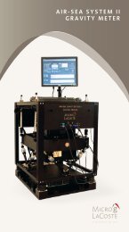
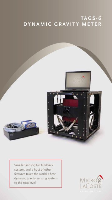
<strong>TAGS</strong>-6Dynamic Gravity MeterSmaller sensor, full feedbacksystem, anda host of otherfeatures takes the world’s bestdynamic gravity sensing systemto the next level.
<strong>TAGS</strong>-6 represents the latest developmentin a long line of LaCoste-based airborne gravity systems,stretching back to the first successful airborne gravity flightsin 1958 and building on the success of the <strong>TAGS</strong> System. For over50 years, LaCoste gravimeters have acquired hundreds of thousandsof line kilometers of gravity data during academic, government,and commercial surveys. <strong>TAGS</strong>-6 blends the latest in GPS and dataacquisition technology with the solid foundation of the LaCostedynamic gravimeter.<strong>TAGS</strong>-6 is an upgrade to the <strong>TAGS</strong>/Air III gravity meter, and isdesigned specifically for airborne operations. The system incorporatesa time-tested, low-drift, zero-length-spring gravity sensor mounted ona gyro-stabilized gimbal platform. The sensor has a worldwide gravitymeasuring range (no reset necessary) of 20,000 milliGals.NEW FEATURES• Smaller sensor/gimbal (60%)• Lighter sensor/gimbal (30%)• New slip ring technology on the gimbal makes for amore robust and reliable stable platform• 20 Hz GPS and gravity data: Better GPS and gravity timing• Larger range of aircraft pitch and roll• Full feedback 500,000 mGal range on beam: more robustin turbulence• Double oven temperature control• Temperature controlled electronics• Microprocessor control• Separate, rack-mountable electronic unit andcomputer allow for more flexibility in configuration• Lockable gimbal
applications include• Geoid Mapping• Regional Geophysics• Petroleum Exploration• Mineral ExplorationComparison withOriginal <strong>TAGS</strong> System• 100 times the dynamic acceleration range• Larger Pitch (25° vs. 22°) and larger Roll (30° vs. 25°) ranges• Static Repeatability improved (0.02 vs. 0.05 millGals)• Reduced Power requirements (75 vs. 240W)• Greatly reduced size: 48% smaller(59 x 53 x 56cm vs. 71 x 56 x 84cm)• Greatly reduced weight (73kg vs. 140kg)Shown above are the older <strong>TAGS</strong> on the left (without safety cages installed),and <strong>TAGS</strong>-6 on the right (no safety cages necessary).www.microglacoste.com
AeroGravProcessing SoftwareThe AeroGrav Data Processing softwareis designed to be used in the field to quicklyprocess data after each survey flight.The raw field data from the survey aircraft and ground GPS basestation can be quickly processed to produce the free-air and Bougergravity anomalies along survey lines. The processed data can beexported to mapping packages such as Geosoft Oasis Montaj or theGeneric Mapping Tools (GMT) for such tasks as survey line leveling,gridding and mapping. With rapid data turnaround, possibledata quality issues or system problems can be identified andoperation issues are dealt with in a timely fashion.
Sample Data20Stacked repeat lines after adjustmentSurvey: SYS6 Ft Wayneσ = 0.73 milliGals filter 100 sec101.11.21.31.41.51.60Free−air anomaly (milliGals)−10−20−30−4020 40 60 80 100 120 140 160 180 200 220Distance (km)Shown above are six repeat measurements of the free-air anomaly acquired on a flightline near Fort Wayne, Indiana. With a 100 second filter, the standard deviation of therepeats was 0.73 milliGals. Note that during the acquisition of Line 1.1, the aircraftencountered a large wake turbulence event (figure below) which produced no measurableeffect in the processed gravity.Fort Wayne Line 1.120 Meter Bump64006395Altitude (meters)639063856380637503/22/12−14:25 14:30 14:35 14:40 14:45 14:50135.5Speed (meters/second)135134.5134133.5133132.513203/22/12−14:25 14:30 14:35 14:40 14:45 14:50TimeAltitude (meters) and speed (meters/second) of the aircraft for Line 1.1 in theabove figure. Horizontal axis is GMT time. Note that the large vertical accelerationexperienced by the aircraft is not reflected in the resultant gravity measurement.
specificationscomponent variable specificationsSENSORSTABILIZEDPLATFORMCONTROLSYSTEMSYSTEMPERFORMANCEmiscellaneousWORLDWIDE Range:DYNAMIC Range:Drift:Temperature Setpoint:PLATFORM PITCH:PLATFORM ROLL:CONTROL:PeriodDampingRECORDING RATE:SERIAL OUTPUT:ADDITIONAL I/O:RESOLUTION:STATIC REPEATABILITY:ACCURACY:50,000 mGalHorizontal Acceleration100,000 mGalHorizontal Acceleration100,000 mGalVertical AccelerationOPERATING TEMPERATURE:STORAGE TEMPERATURE:POWER EQUIPMENTS:DIMENSIONS:20,000 milliGals±500,000 milliGals3 milliGals per month or less45° to 65°C± 25 degrees± 30 degrees4 to 4.5 Minutes0.707 of critical20 HzRS-232Sensor Temperature0.01 milliGals0.02 milliGals0.6 milliGals or better0.25 milliGals0.50 milliGals0.25 milliGals5° to 50°C-10° to 50°C75W @ 27°C Nominal300W Peak80-265VAC, 47 – 63Hz58.4 x 53.3 x 55.9cm(not including electronics)Specifications subject to change1401 Horizon Ave. | Lafayette, CO 80026phone (303) 828-3499 FAX (303) 828-3288email info@microglacoste.comwww.microglacoste.com