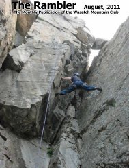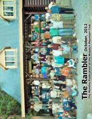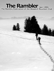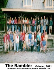
The Rambler
Aug - Wasatch Mountain Club
Aug - Wasatch Mountain Club

You also want an ePaper? Increase the reach of your titles
YUMPU automatically turns print PDFs into web optimized ePapers that Google loves.
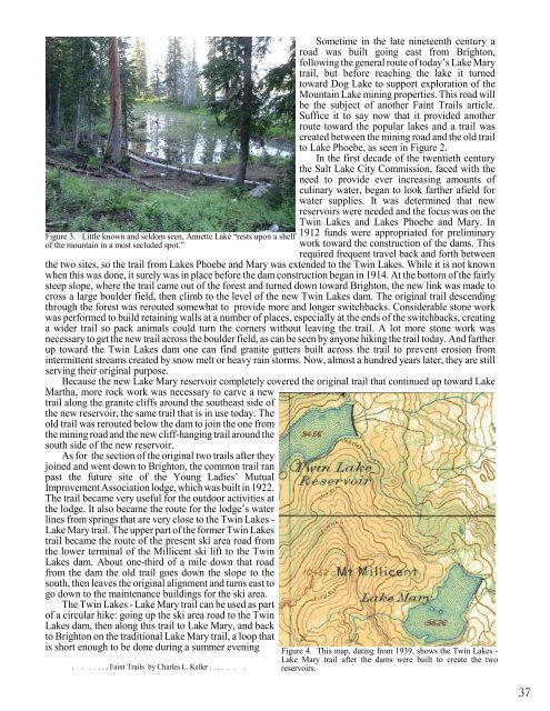
Figure 3. Little known and seldom seen, Annette Lake “rests upon a shelf<br />
of the mountain in a most secluded spot.”<br />
Sometime in the late nineteenth century a<br />
road was built going east from Brighton,<br />
following the general route of today’s Lake Mary<br />
trail, but before reaching the lake it turned<br />
toward Dog Lake to support exploration of the<br />
Mountain Lake mining properties. This road will<br />
be the subject of another Faint Trails article.<br />
Suffice it to say now that it provided another<br />
route toward the popular lakes and a trail was<br />
created between the mining road and the old trail<br />
to Lake Phoebe, as seen in Figure 2.<br />
In the first decade of the twentieth century<br />
the Salt Lake City Commission, faced with the<br />
need to provide ever increasing amounts of<br />
culinary water, began to look farther afield for<br />
water supplies. It was determined that new<br />
reservoirs were needed and the focus was on the<br />
Twin Lakes and Lakes Phoebe and Mary. In<br />
1912 funds were appropriated for preliminary<br />
work toward the construction of the dams. This<br />
required frequent travel back and forth between<br />
the two sites, so the trail from Lakes Phoebe and Mary was extended to the Twin Lakes. While it is not known<br />
when this was done, it surely was in place before the dam construction began in 1914. At the bottom of the fairly<br />
steep slope, where the trail came out of the forest and turned down toward Brighton, the new link was made to<br />
cross a large boulder field, then climb to the level of the new Twin Lakes dam. <strong>The</strong> original trail descending<br />
through the forest was rerouted somewhat to provide more and longer switchbacks. Considerable stone work<br />
was performed to build retaining walls at a number of places, especially at the ends of the switchbacks, creating<br />
a wider trail so pack animals could turn the corners without leaving the trail. A lot more stone work was<br />
necessary to get the new trail across the boulder field, as can be seen by anyone hiking the trail today. And farther<br />
up toward the Twin Lakes dam one can find granite gutters built across the trail to prevent erosion from<br />
intermittent streams created by snow melt or heavy rain storms. Now, almost a hundred years later, they are still<br />
serving their original purpose.<br />
Because the new Lake Mary reservoir completely covered the original trail that continued up toward Lake<br />
Martha, more rock work was necessary to carve a new<br />
trail along the granite cliffs around the southeast side of<br />
the new reservoir, the same trail that is in use today. <strong>The</strong><br />
old trail was rerouted below the dam to join the one from<br />
the mining road and the new cliff-hanging trail around the<br />
south side of the new reservoir.<br />
As for the section of the original two trails after they<br />
joined and went down to Brighton, the common trail ran<br />
past the future site of the Young Ladies’ Mutual<br />
Improvement Association lodge, which was built in 1922.<br />
<strong>The</strong> trail became very useful for the outdoor activities at<br />
the lodge. It also became the route for the lodge’s water<br />
lines from springs that are very close to the Twin Lakes -<br />
Lake Mary trail. <strong>The</strong> upper part of the former Twin Lakes<br />
trail became the route of the present ski area road from<br />
the lower terminal of the Millicent ski lift to the Twin<br />
Lakes dam. About one-third of a mile down that road<br />
from the dam the old trail goes down the slope to the<br />
south, then leaves the original alignment and turns east to<br />
go down to the maintenance buildings for the ski area.<br />
<strong>The</strong> Twin Lakes - Lake Mary trail can be used as part<br />
of a circular hike: going up the ski area road to the Twin<br />
Lakes dam, then along this trail to Lake Mary, and back<br />
to Brighton on the traditional Lake Mary trail, a loop that<br />
is short enough to be done during a summer evening<br />
. . . . . . . Faint Trails by Charles L. Keller . . . . . . .<br />
Figure 4. This map, dating from 1939, shows the Twin Lakes -<br />
Lake Mary trail after the dams were built to create the two<br />
reservoirs.<br />
37