Lava cascade in Thunderbolt Distributary of Labyrinth Cave system
report
report
Create successful ePaper yourself
Turn your PDF publications into a flip-book with our unique Google optimized e-Paper software.
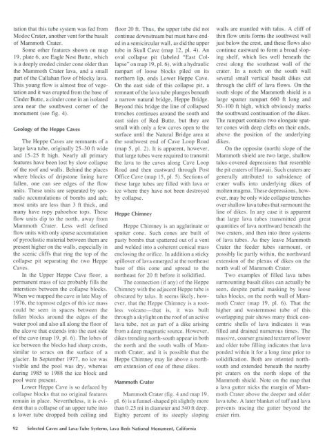
tation that this tube <strong>system</strong> was fed from<br />
Modoc Crater, another vent for the basalt<br />
<strong>of</strong> Mammoth Crater.<br />
Some other features shown on map<br />
19, plate 6, are Eagle Nest Butte, which<br />
is a deeply eroded c<strong>in</strong>der cone older than<br />
the Mammoth Crater lava, and a small<br />
part <strong>of</strong> the Callahan flow <strong>of</strong> blocky lava.<br />
This young flow is almost free <strong>of</strong> vegetation<br />
and it was erupted from the base <strong>of</strong><br />
C<strong>in</strong>der Butte, a c<strong>in</strong>der cone <strong>in</strong> an isolated<br />
area near the southwest corner <strong>of</strong> the<br />
monument (see fig. 4).<br />
Geology <strong>of</strong> the Heppe <strong>Cave</strong>s<br />
The Heppe <strong>Cave</strong>s are remnants <strong>of</strong> a<br />
large lava tube, orig<strong>in</strong>ally 25-30 ft wide<br />
and 15-25 ft high. Nearly all primary<br />
features have been lost by slow collapse<br />
<strong>of</strong> the ro<strong>of</strong> and walls. Beh<strong>in</strong>d the places<br />
where blocks <strong>of</strong> dripstone l<strong>in</strong><strong>in</strong>g have<br />
fallen, one can see edges <strong>of</strong> the flow<br />
units. These units are separated by sporadic<br />
accumulations <strong>of</strong> bombs and ash;<br />
most units are less than 3 ft thick, and<br />
many have ropy pahoehoe tops. These<br />
flow units dip to the north, away from<br />
Mammoth Crater. Less well def<strong>in</strong>ed<br />
flow units with only sparse accumulation<br />
<strong>of</strong> pyroclastic material between them are<br />
present higher on the walls, especially <strong>in</strong><br />
the scenic cliffs that r<strong>in</strong>g the top <strong>of</strong> the<br />
collapse pit separat<strong>in</strong>g the two Heppe<br />
<strong>Cave</strong>s.<br />
In the Upper Heppe <strong>Cave</strong> floor, a<br />
permanent mass <strong>of</strong> ice probably fills the<br />
<strong>in</strong>terstices between the collapse blocks.<br />
When we mapped the cave <strong>in</strong> late May <strong>of</strong><br />
1976, the topmost edges <strong>of</strong> this ice mass<br />
could be seen <strong>in</strong> spaces between the<br />
fallen blocks around the edges <strong>of</strong> the<br />
water pool and also all along the floor <strong>of</strong><br />
the alcove that extends <strong>in</strong>to the east side<br />
<strong>of</strong> the cave (map 19, pl. 6). The lobes <strong>of</strong><br />
ice between the blocks had sharp crests,<br />
similar to seracs on the surface <strong>of</strong> a<br />
glacier. In September 1977, no ice was<br />
visible and the pool was dry, whereas<br />
dur<strong>in</strong>g 1985 to 1988 the ice block and<br />
pool were present.<br />
Lower Heppe <strong>Cave</strong> is so defaced by<br />
collapse blocks that no orig<strong>in</strong>al features<br />
rema<strong>in</strong> <strong>in</strong> place. Nevertheless, it is evident<br />
that a collapse <strong>of</strong> an upper tube <strong>in</strong>to<br />
a lower tube dropped both ceil<strong>in</strong>g and<br />
floor 20ft. Thus, the upper tube did not<br />
cont<strong>in</strong>ue downstream but must have ended<br />
<strong>in</strong> a semicircular wall, as did the upper<br />
tube <strong>in</strong> Skull <strong>Cave</strong> (map 12, pl. 4). An<br />
oval collapse pit (labeled "East Collapse"<br />
on map 19, pl. 6), with a hydraulic<br />
rampart <strong>of</strong> loose blocks piled on its<br />
northern lip, ends Lower Heppe <strong>Cave</strong>.<br />
On the east side <strong>of</strong> this collapse pit, a<br />
remnant <strong>of</strong> the lava tube plunges beneath<br />
a narrow natural bridge, Heppe Bridge.<br />
Beyond this bridge the l<strong>in</strong>e <strong>of</strong> collapsed<br />
trenches cont<strong>in</strong>ues around the south and<br />
east sides <strong>of</strong> Red Butte, but they are<br />
small with only a few caves open to the<br />
surface until the Natural Bridge area at<br />
the southwest end <strong>of</strong> <strong>Cave</strong> Loop Road<br />
(map 5, pl. 2). It is apparent, however,<br />
that large tubes were required to transmit<br />
the lava to the caves along <strong>Cave</strong> Loop<br />
Road and then eastward through Post<br />
Office <strong>Cave</strong> (map 15, pl. 5). Sections <strong>of</strong><br />
these large tubes are filled with lava or<br />
ice where they have not been destroyed<br />
by collapse.<br />
Heppe Chimney<br />
Heppe Chimney is an agglut<strong>in</strong>ate or<br />
spatter cone. Such cones are built <strong>of</strong><br />
pasty bombs that spattered out <strong>of</strong> a vent<br />
and welded <strong>in</strong>to a coherent conical mass<br />
enclos<strong>in</strong>g the orifice. In addition a sticky<br />
spillover <strong>of</strong> lava emerged at the northeast<br />
base <strong>of</strong> this cone and spread to the<br />
northeast for 20 ft before it solidified.<br />
The connection (if any) <strong>of</strong> the Heppe<br />
Chimney with the adjacent Heppe tube is<br />
obscured by talus. It seems likely, however,<br />
that the Heppe Chimney is a rootless<br />
volcano-that is, it was built<br />
through a skylight on the ro<strong>of</strong> <strong>of</strong> an active<br />
lava tube, not as part <strong>of</strong> a dike aris<strong>in</strong>g<br />
from a deep magmatic source. However,<br />
dikes trend<strong>in</strong>g north-south appear <strong>in</strong> both<br />
the north and the south walls <strong>of</strong> Mammoth<br />
Crater, and it is possible that the<br />
Heppe Chimney may lie above a northern<br />
extension <strong>of</strong> one <strong>of</strong> these dikes.<br />
Mammoth Crater<br />
Mammoth Crater (fig. 4 and map 19,<br />
pl. 6) is a funnel-shaped pit slightly more<br />
than 0. 25 mi <strong>in</strong> diameter and 340 ft deep.<br />
Eighty percent <strong>of</strong> its steeply slop<strong>in</strong>g<br />
walls are mantled with talus. A cliff <strong>of</strong><br />
th<strong>in</strong> flow units forms the southwest wall<br />
just below the crest, and these flows also<br />
cont<strong>in</strong>ue eastward to form a broad slop<strong>in</strong>g<br />
shelf, which lies well beneath the<br />
crest along the southeast wall <strong>of</strong> the<br />
crater. In a notch on the south wall<br />
several small vertical basalt dikes cut<br />
through the cliff <strong>of</strong> lava flows. On the<br />
south slope <strong>of</strong> the Mammoth shield is a<br />
large spatter rampart 660 ft long and<br />
50-100ft high, which obviously marks<br />
the southward cont<strong>in</strong>uation <strong>of</strong> the dikes.<br />
The rampart conta<strong>in</strong>s two elongate spatter<br />
cones with deep clefts on their ends,<br />
above the position <strong>of</strong> the underly<strong>in</strong>g<br />
dikes.<br />
On the opposite (north) slope <strong>of</strong> the<br />
Mammoth shield are two large, shallow<br />
talus-covered depressions that resemble<br />
the pit craters <strong>of</strong> Hawaii. Such craters are<br />
generally attributed to subsidence <strong>of</strong><br />
crater walls <strong>in</strong>to underly<strong>in</strong>g dikes <strong>of</strong><br />
molten magma. These depressions, however,<br />
may be only wide collapse trenches<br />
over shallow lava tubes that surmount the<br />
l<strong>in</strong>e <strong>of</strong> dikes. In any case it is apparent<br />
that large lava tubes transmitted great<br />
quantities <strong>of</strong> lava northward beneath the<br />
two craters, and then <strong>in</strong>to three <strong>system</strong>s<br />
<strong>of</strong> lava tubes. As they leave Mammoth<br />
Crater the feeder tubes surmount, or<br />
possibly lie partly with<strong>in</strong>, the northward<br />
extension <strong>of</strong> the plexus <strong>of</strong> dikes on the<br />
north wall <strong>of</strong> Mammoth Crater.<br />
Two examples <strong>of</strong> filled lava tubes<br />
surmount<strong>in</strong>g basalt dikes can actually be<br />
seen, despite partial mask<strong>in</strong>g by loose<br />
talus blocks, on the north wall <strong>of</strong> Mammoth<br />
Crater (map 19, pl. 6). That the<br />
higher and westernmost tube <strong>of</strong> this<br />
overlapp<strong>in</strong>g pair shows many thick concentric<br />
shells <strong>of</strong> lava <strong>in</strong>dicates it was<br />
filled and dra<strong>in</strong>ed numerous times. The<br />
massive, coarser gra<strong>in</strong>ed texture <strong>of</strong> lower<br />
and older tube fill<strong>in</strong>g <strong>in</strong>dicates that lava<br />
ponded with<strong>in</strong> it for a long time prior to<br />
solidification. Both are oriented northsouth<br />
and extended beneath the nearby<br />
pit craters on the north slope <strong>of</strong> the<br />
Mammoth shield. Note on the map that<br />
a lava gutter nicks the marg<strong>in</strong> <strong>of</strong> Mammoth<br />
Crater above the deeper and older<br />
lava tube. A later blanket <strong>of</strong> tuff and lava<br />
prevents trac<strong>in</strong>g the gutter beyond the<br />
crater rim.<br />
92 Selected <strong>Cave</strong>s and lava-Tube Systems, lava Beds National Monument, California


