Lava cascade in Thunderbolt Distributary of Labyrinth Cave system
report
report
You also want an ePaper? Increase the reach of your titles
YUMPU automatically turns print PDFs into web optimized ePapers that Google loves.
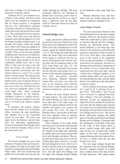
thus forms a bridge over the broken-up<br />
floor jam <strong>of</strong> balcony blocks.<br />
Upstream 95 ft-just southwest <strong>of</strong> a<br />
collapse to the surface-the floor <strong>of</strong> the<br />
upper level has tumbled so completely<br />
that its former position is recognized<br />
only by a few small balcony remnants<br />
4-6ft above the jam <strong>of</strong> collapsed balcony<br />
rubble that forms the present floor <strong>of</strong> the<br />
cave. The explanation for these relations<br />
is clear. These floor jams and balcony<br />
remnants show that the upper level, from<br />
the former skylight northeastward, is an<br />
unstable fill formed with<strong>in</strong> the middle<br />
level. After its 90° bend, the middle level<br />
rejo<strong>in</strong>s the small upper tube at the former<br />
skylight. What we see from the skylight<br />
northeastward is the record <strong>of</strong> a high-lava<br />
fill <strong>in</strong> the middle level, which persisted<br />
at this height long enough for its top to<br />
completely solidify from wall to wall.<br />
After a solid crust less than a few feet<br />
thick had formed, the molten lava beneath<br />
cont<strong>in</strong>ued downstream and ultimately<br />
dra<strong>in</strong>ed to a level 5 ft or more<br />
below its former stand. This allowed part<br />
<strong>of</strong> the crusted-over floor to subside and<br />
thereby form a jam <strong>of</strong> balcony blocks <strong>in</strong><br />
parts <strong>of</strong> the tube and a bridge <strong>in</strong> a narrow<br />
part close to the ro<strong>of</strong>. The balcony level<br />
also survived completely <strong>in</strong>tact <strong>in</strong> the<br />
small upper tube, which cont<strong>in</strong>ued<br />
straight. Remnants <strong>of</strong> thi s balcony,<br />
chang<strong>in</strong>g <strong>in</strong> places to slop<strong>in</strong>g alcoves,<br />
also occur along the middle level all the<br />
way to its head <strong>in</strong> the shallow collapse<br />
bas<strong>in</strong>.<br />
In summary, this shallow collapse<br />
bas<strong>in</strong> and the middle level <strong>of</strong> Paradise<br />
Alleys constitute the ma<strong>in</strong> distributary<br />
that supplied lava to the Catacombs<br />
<strong>system</strong> <strong>of</strong> lava tubes. The lower and<br />
upper levels, the balcony, and the floor<br />
jams are <strong>in</strong>terest<strong>in</strong>g supplementary<br />
records <strong>of</strong> fluctuation <strong>in</strong> the height <strong>of</strong> the<br />
lava <strong>in</strong> both the Paradise Alleys and <strong>in</strong><br />
the Catacombs <strong>Cave</strong>.<br />
Former Skylight<br />
The former skylight just east <strong>of</strong> the<br />
entrance to Paradise Alleys provides further<br />
evidence <strong>of</strong> a high-level stand <strong>of</strong> the<br />
molten lava pour<strong>in</strong>g through the Paradise<br />
Alleys tubes. The lava overflowed and<br />
spilled out to the north and east onto the<br />
surface through the skylight. The more<br />
prom<strong>in</strong>ent spillovers are <strong>in</strong>dicated by<br />
dashed l<strong>in</strong>es (enclos<strong>in</strong>g arrows that <strong>in</strong>dicate<br />
the direction <strong>of</strong> flow) on map 4,<br />
plate 2. Spillovers from the last highstand<br />
<strong>of</strong> Catacombs Bas<strong>in</strong> lava lake are<br />
similarly shown.<br />
Natural Bridge Area<br />
Large, spectacular collapse trenches<br />
are present <strong>in</strong> the area where <strong>Cave</strong> Loop<br />
Road crosses the Mammoth Crater-Post<br />
Office <strong>Cave</strong> l<strong>in</strong>e <strong>of</strong> breakdowns over the<br />
feature named the Natural Bridge (map<br />
5, pl. 2). This bridge also marks the po<strong>in</strong>t<br />
where the feeder tubes from Mammoth<br />
Crater began to subdivide <strong>in</strong>to the numerous<br />
distributaries that built the slop<strong>in</strong>g<br />
pla<strong>in</strong> and the numerous tubes <strong>of</strong> the<br />
<strong>Cave</strong> Loop Road area (fig. 14). The<br />
Paradise Alleys-Catacombs <strong>Cave</strong> <strong>system</strong><br />
and the Hercules Leg-Juniper <strong>Cave</strong> <strong>system</strong><br />
have their upstream beg<strong>in</strong>n<strong>in</strong>gs here.<br />
Four short near-surface lava-tube<br />
caves-Sunsh<strong>in</strong>e, Battered Sherman,<br />
Juniper Pole, and Gail-are with<strong>in</strong> this<br />
area, as are numerous small spillover<br />
lobes <strong>of</strong> lava, small collapse bas<strong>in</strong>s, and<br />
m<strong>in</strong>iature breakdowns, and lava trenches.<br />
Because the deep collapse trenches<br />
are large features, the scale chosen for<br />
the Natural Bridge area map is reduced<br />
more than that <strong>of</strong> the other maps. To<br />
clarify the spatial relations between the<br />
trenches and nearby cave <strong>system</strong>s, the<br />
area around Ovis <strong>Cave</strong>, the head <strong>of</strong><br />
Paradise Alleys, and the part <strong>of</strong> Hercules<br />
Leg <strong>Cave</strong> upstream from its entrance<br />
have been replotted on map 5, plate 2 at<br />
a larger scale.<br />
Short remnants <strong>of</strong> two large feeder<br />
tubes have survived nearly <strong>in</strong>tact beneath<br />
Natural Bridge. One can walk through<br />
two strands <strong>of</strong> the upper tube (separated<br />
by a pillar) and visit a short section <strong>of</strong> the<br />
lower tube through crawlholes. The easiest<br />
and most <strong>in</strong>terest<strong>in</strong>g way to visit one<br />
<strong>of</strong> these large tubes, however, is to take<br />
the trail through Ovis <strong>Cave</strong>. Ovis <strong>Cave</strong>'s<br />
position and the trails at its downstream<br />
end are shown on map 5, plate 2. Ovis<br />
<strong>Cave</strong>, the tube under Ovis Bridge, and<br />
the upper tube beneath Natural Bridge<br />
are all remnants <strong>of</strong> the same large lava<br />
tube.<br />
Battered Sherman <strong>Cave</strong> and Sunsh<strong>in</strong>e<br />
Arch are located along the lava<br />
channel lead<strong>in</strong>g to Sunsh<strong>in</strong>e <strong>Cave</strong>.<br />
Large Collapse Trenches<br />
The most spectacular features <strong>of</strong> the<br />
Natural Bridge area are the deep collapse<br />
trenches. However, the amount <strong>of</strong> space<br />
with<strong>in</strong> the central part <strong>of</strong> such a trench,<br />
as between Natural and Ovis Bridges,<br />
presents an <strong>in</strong>terest<strong>in</strong>g puzzle. This<br />
trench def<strong>in</strong>itely is too deep and volum<strong>in</strong>ous<br />
to be ascribed to a ro<strong>of</strong> fall <strong>in</strong> the<br />
upstream cont<strong>in</strong>uation <strong>of</strong> the lava tube <strong>in</strong><br />
Ovis <strong>Cave</strong>. How then is the additional<br />
room <strong>in</strong> this trench to be expla<strong>in</strong>ed?<br />
There are three possibilities. (1) The tube<br />
<strong>in</strong>creased <strong>in</strong> size upstream, due both to a<br />
th<strong>in</strong>n<strong>in</strong>g <strong>of</strong> the ro<strong>of</strong> and to a deepen<strong>in</strong>g <strong>of</strong><br />
the channel, (2) two or three tubes were<br />
superposed one above the other, and all<br />
<strong>of</strong> them have collapsed together, or (3)<br />
collapse began while lava was actively<br />
flow<strong>in</strong>g through the tube, and the fallen<br />
blocks were rafted down the tube before<br />
volcanism ceased.<br />
From evidence downstream (map 4,<br />
pl. 2, map 15, pl. 5, and map 18, pl. 6,<br />
and "Ovis," "Post Office," and "Crystal<br />
<strong>Cave</strong>" sections) it is apparent that multiple<br />
collapse is the most probable explanation.<br />
In fact, by superpos<strong>in</strong>g the<br />
map <strong>of</strong> Ovis <strong>Cave</strong> on that <strong>of</strong> Crystal <strong>Cave</strong><br />
one notes that the deepest tube exposed<br />
<strong>in</strong> Crystal <strong>Cave</strong> lies demolished beneath<br />
the deepest section <strong>of</strong> the trench between<br />
Ovis Bridge and Ovis <strong>Cave</strong>. The second<br />
theory sufficiently expla<strong>in</strong>s the added<br />
space <strong>in</strong> the deep trench between Natural<br />
Bridge and Ovis Bridge. Consistent with<br />
this explanation, the pr<strong>of</strong>ile <strong>of</strong> the talus<br />
on the walls <strong>of</strong> this trench shows a<br />
narrow medial trough with steep cliff<br />
sides giv<strong>in</strong>g way to gentle talus slopes<br />
higher on the walls-the pr<strong>of</strong>ile to be<br />
expected because the lower tube <strong>in</strong> Crystal<br />
<strong>Cave</strong> is smaller than the one that<br />
formed Ovis <strong>Cave</strong>.<br />
The very large collapse trench that<br />
lies upstream from the Natural Bridge,<br />
however, conta<strong>in</strong>s evidence <strong>of</strong> a much<br />
more complex history that may <strong>in</strong>volve<br />
all three processes. This trench shows<br />
32 Selected <strong>Cave</strong>s and <strong>Lava</strong>-Tube Systems, <strong>Lava</strong> Beds National Monument, California


