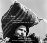
EASTERN CRETE
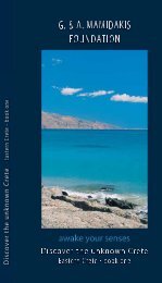
Discover the unknown Crete. Easter Crete, Book one G&A MAMIDAKIS FOUNDATION
Discover the unknown Crete. Easter Crete, Book one
G&A MAMIDAKIS FOUNDATION

Create successful ePaper yourself
Turn your PDF publications into a flip-book with our unique Google optimized e-Paper software.
The G. & A. Mamidakis Foundation, has for two decades<br />
now made ongoing efforts to present to the public major<br />
cultural events, always directly related to Tourism.<br />
Taking as our point of departure our native island of Crete,<br />
a crossroads of cultures from East and West, we have<br />
sought to propose seminal exhibitions of Greek and<br />
international Contemporary Art for art lovers.<br />
Perhaps unique for the 48 sculptures on display in its<br />
gardens, the MINOS BEACH ART HOTEL boasts of a<br />
substantial collection of works by leading Greek and<br />
international artists.<br />
Continuing our cultural activities today, we have<br />
established, illustrated, documented and explored<br />
untrodden paths of Eastern Crete in a tasty 144-page<br />
catalogue titled:<br />
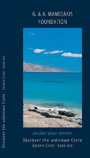
Awake your Senses<br />
Discover the unknown Crete<br />
Eastern Crete - book one<br />
We trust that the publication of these practical catalogues,<br />
which also provide information about other unknown<br />
destinations-monasteries, archaeological sites-will enable<br />
modern-day travellers to experience another side of Crete,<br />
the authentic, unexplored inland regions of the island, just<br />
like the international travellers who discovered and<br />
recorded the charms of our land in the 17th and 18th<br />
centuries.<br />
Gina Mamidakis<br />
President<br />
G. & A. Mamidakis Foundation
JUDITH LANGE MARIA STEFOSSI<br />
awake your senses<br />
DISCOVER THE UNKNOWN <strong>CRETE</strong><br />
Eastern Crete - Book One<br />
Publication of this book has been made possible thanks to Gina<br />
Mamidakis, President of the G.& A. Foundation and bluegr Mamidakis<br />
Hotels group, and long-time patron of culture and the arts. The book is<br />
dedicated to those ever-curious travellers who wish to learn more of<br />
the beautiful region of eastern Crete.<br />
© copyright text and photographs by Judith Lange - Maria Stefossi<br />
© copyright edition by the G.& A. Foundation and bluegr Mamidakis hotels group.<br />
All rights reserved. No part of this book may be reproduced in any form without written<br />
permission from the authors.
4
Crete is the island of which Homer sang, "Along the winedark<br />
sea, by water ringed, there lies a land both fair and<br />
fertile", a mysterious and magical land, source of the myths<br />
of the Greek world. Zeus, king of the gods of the ancient<br />
Greeks, was born in a grotto here, and it was here too that<br />
he died and came back to life.<br />
This book tells of the beauty of eastern Crete, of the<br />
Prefecture of Lasithi, with its mountain ranges, vast<br />
plateaus, fertile valleys, arid plains, magnificent beaches<br />
and its ancient memories. To discover the authentic Crete<br />
one must travel slowly, drawn by curiosity not only to the<br />
great archaeological sites and monuments, but also to the<br />
landscape and the sky, the houses and the rocks, because<br />
on Crete everything is myth, legend and history: the<br />
mountains, the grottoes, the gorges, the trees, the stones<br />
and even the scent of the shrubs in bloom.<br />
5
MINOS BEACH art hotel<br />
Escape in style<br />
Experience the wonder of Cretan luxury with aromatic gardens<br />
and distinctive architecture.<br />
Located on the waterfront in the magical area of Ayios Nikolaos,<br />
in the eastern part of Crete, the town centre is a mere ten minute<br />
walk away.<br />
Set within a serene landscape and unique environs thus ensuring<br />
an unforgettable experience in one of the 129 beautifully and<br />
spaciously appointed bungalows. All are equipped with balconies<br />
or private terrace with unique views of the azure sea and<br />
extensive gardens, air-condition, direct dial telephone, mini bar,<br />
TV, in room safe, hairdryer and bathroom. Our Executive and<br />
Presidential suites are spacious and offer a private swimming<br />
pool.<br />
6
MINOS BEACH art hotel<br />
You can awaken your senses at Minos Beach Art hotel, with its<br />
unique artistic environment of 45 works of Greek and foreign<br />
artists. A local and international culinary choice of traditional<br />
Cretan cuisine and unique gourmet tastes for exquisite dining in<br />
our restaurants or enjoy an array of thirst-quenching cocktails in<br />
our two bars.<br />
An abundance of<br />
recreational activities<br />
and leisure facilities will<br />
ensure fun and<br />
entertainment<br />
throughout your stay<br />
in an environment of<br />
tranquillity and luxury.<br />
7
CANDIA PARK VILLAGE<br />
Experience a world of fun<br />
and recreation<br />
Candia Park Village is an ideal place for<br />
families and couples<br />
of all ages. Modelled on a traditional Cretan<br />
village, all 222 apartments are spaciously equipped and offer a<br />
magnificent waterfront location overlooking the turquoise<br />
waters of Mirabello Bay.<br />
Set in the environs of a traditional Cretan Village with extensive<br />
gardens, the clock square, the Greek coffee house, all add to the<br />
charm of this picturesque village of traditional hospitality.<br />
All apartments are spacious of 40 m2 and 60 m2 offering private<br />
balconies or terrace. Each can accommodate from 2 to 6 persons<br />
and are fully equipped with airconditioning, bathroom, direct<br />
dial telephone and a kitchenette to prepare afternoon coffee or<br />
tea or perhaps a light meal.<br />
A variety of restaurants with a wide choice of a la carte items,<br />
sunny bars for thirst-quenching drinks and light snacks provide a<br />
unique ambience with panoramic views of Mirabello bay. A mini<br />
market is available.<br />
8
CANDIA PARK VILLAGE<br />
The Candia Park Village is a complete holiday village making it<br />
the ideal place for relaxation and amusement. Facilities include<br />
sea water and fresh water swimming pools, Jacuzzi, tennis<br />
courts, private beach, water sports and recreational areas for all<br />
tastes and age groups. The highlight is our mini club for our<br />
young friends from 4 to 12 years of age that offers stimulating<br />
activities, competitions and games.<br />
9
CHAPTER 1<br />
SACRED AND PROFANE<br />
IN THE SHADOW<br />
OF MOUNT DIKTI
AYIOS NIKOLAOS<br />
KRITSA<br />
PANAYIA Y KERA<br />
LATO<br />
KATHARO<br />
LASSITHI<br />
KARPHI
C H A P T E R 1<br />
Ayios Nikolaos<br />
An engraving<br />
representing the<br />
Venetian castle of<br />
Ayios Nikolaos:<br />
today nothing<br />
remains of this<br />
fortress<br />
The excavations of<br />
the ancient town in<br />
the city<br />
It is hard to imagine that a century and<br />
a half ago Ayios Nikolaos - one of Crete's<br />
richest and liveliest cities - was, as an old<br />
document attests, only a tiny village of just<br />
95 souls. Ayios Nikolaos, capital of the<br />
Prefecture of Lasithi, has the appearance of<br />
a relatively new city, but its history is very<br />
ancient, even if the evidence of its turbulent<br />
past is now buried under modern buildings.<br />
Thanks to its splendid position<br />
overlooking the gulf of Mirambelo (or as the<br />
Venetian has it, Mirabello or "beautiful view")<br />
the site was chosen by the ancient Dorians<br />
(ninth to seventh centuries B.C.) for the port<br />
of Lato, an important fortified settlement<br />
between the mountains near Kritsa. The city<br />
was then called Lato pros Kamara and was<br />
famous for its safe harbour. One of the<br />
wonders of the place was considered to be<br />
the small lake of Voulismeni - today linked<br />
to the sea by a narrow canal and surrounded<br />
by restaurants and cafes - a lake of dark and<br />
unfathomable waters, also known as<br />
12
Xepatomeni (bottomless), sacred to Athena<br />
and Artemis who, as the legend goes,<br />
bathed their divine bodies here.<br />
The city declined after the Roman<br />
conquest but acquired new importance<br />
during the Byzantine period, when it<br />
became the seat of the bishopric of Kamara:<br />
of that era there remains the little church of<br />
Ayios Nikolaos of the tenth or eleventh<br />
century, with rare frescoes from the<br />
iconoclast period when the ecclesiastical<br />
authorities forbad the physical<br />
representation of sacred images.<br />
At the beginning of the thirteenth<br />
century the Genoese and Venetians fought<br />
for possession of the coast and initially the<br />
Genoese, led by the gentleman-pirate Enrico<br />
Pescatore, prevailed. Pescatore erected the<br />
castle of Mirambelo, promptly destroyed by<br />
the Venetians to whom the island of Crete<br />
was assigned by the treaty of Adrianoupoli<br />
in 1204.<br />
Hurriedly reconstructed, the castle was<br />
briefly occupied by the Turks in 1645, then<br />
The small church of<br />
Ayios Nikolaos<br />
dating from the<br />
tenth or eleventh<br />
century<br />
Lake Voulismeni<br />
13
C H A P T E R 1<br />
A medieval<br />
archer from the<br />
region of Sfakia:<br />
during the<br />
nineteenth<br />
century many<br />
sfakiotes arrived<br />
in Ayios Nikolaos<br />
taken back by the Venetians who, however,<br />
decided to destroy it once more themselves<br />
for the sake of not leaving it in Turkish<br />
hands: not one stone remains of the<br />
celebrated fort atop the highest<br />
hill of Ayios Nikolaos.<br />
The city was entirely<br />
abandoned when, during the<br />
second half of the nineteenth<br />
century, groups of exiled<br />
sfakiotes arrived from the<br />
mountains of western Crete,<br />
and the place slowly began to<br />
come to life again. From that<br />
moment onwards the reborn<br />
city would be called Ayios<br />
Nikolaos, taking its name from<br />
the little ninth-century<br />
Byzantine church which was the<br />
only surviving testimony to<br />
have resisted all the turbulence<br />
of this history. Every 6th<br />
December there is a great feast<br />
dedicated to St. Nicholas,<br />
patron saint of fishermen.<br />
One must is a visit to the city's<br />
Archaeological Museum which possesses<br />
beautiful finds from the past forty years of<br />
excavations in eastern Crete: ceramics, gold,<br />
idols (among which there are a large number<br />
of votive offerings from the Minoan peak<br />
sanctuaries), sarcophagi and glass.<br />
14
ARCHAEOLOGICAL MUSEUM<br />
OF AYIOS NIKOLAOS<br />
Skull with a wreath of gold leaves<br />
from the Roman cemetery at<br />
Potamos, first century A.D. and<br />
Late Minoan clay sarcophagi or<br />
larnakes<br />
Late Minoan<br />
female<br />
worshipper<br />
from the<br />
cemetery at<br />
Myrsini<br />
Pottery dating<br />
from the Late<br />
Minoan period<br />
Clay vessel<br />
from the<br />
fourteenth<br />
century B.C.<br />
found in the<br />
Palace of Malia<br />
and<br />
Daedalic<br />
figurines from<br />
the eighth and<br />
seventh<br />
centuries B.C.
C H A P T E R 1<br />
Kritsa and Panayia y Kera<br />
Kritsa stretches out like a white lizard<br />
above a sea of olive trees at the mouth of a<br />
dark gorge beneath the mountain heights of<br />
the Dikti that surround two high plains, the<br />
immense Lasithi plateau and the more<br />
modest Katharo plateau.<br />
The white village<br />
of Kritsa above a<br />
green valley of<br />
olive trees<br />
Kritsa, with its narrow alleyways, the low<br />
houses jumbled one over another, its very<br />
colourful traditional costumes, its numerous<br />
kafeneion and taverns, seems the archetypal<br />
"Cretan village", even if the definition<br />
"village" seems reductive for this fairly large,<br />
extended country town. It is so very "Cretan"<br />
that in 1957 the American film director Jules<br />
Dassin chose Kritsa and its inhabitants for<br />
the setting of the film He, who must die<br />
based on Nikos Kazantzakis' famous novel<br />
The Greek Passion which told a modern<br />
version of the passion of Christ. Every year<br />
on Good Friday there is a sumptuous<br />
procession through Kritsa during which the<br />
epitaphios, a catafalque covered with<br />
flowers, is carried through the town, amidst<br />
prayers, laments and song.<br />
However, before arriving at Kritsa one<br />
should pay a visit to one of the most<br />
beautiful and important Byzantine churches<br />
on Crete: the Panayia y Kera (the Madon-<br />
16
Among the narrow<br />
alleyways of Kritsa<br />
na of the Creation) dating from the<br />
thirteenth or fourteenth century, with three<br />
naves and an unusual three-pointed facade,<br />
surrounded by tall cypresses.<br />
The arrangement of the<br />
paintings that cover each of<br />
the internal walls observes the<br />
rigid hierarchy required in that<br />
period: first God and the<br />
angels, then the life of Jesus<br />
and Mary, followed by<br />
representations of Paradise and the Last<br />
Judgement, biblical stories, saints and,<br />
finally, images of men known for their faith.<br />
The saturated colours (the dark red of ripe<br />
pomegranates, the green of the leaves of<br />
ancient olive trees, the ochre and dark<br />
brown of the earth) and the close-packed<br />
sequence of images, each different, each<br />
powerful and vigorous, immersed in the<br />
semi-darkness, rather dizzy the viewer, and<br />
this was, perhaps, precisely what the artist<br />
intended.<br />
The Byzantine<br />
church of Panayia y<br />
Kera with its<br />
beautiful frescoes<br />
17
C H A P T E R 1<br />
Lato<br />
Lato, once an<br />
important Dorian<br />
city-state, amidst<br />
a beautiful<br />
mountainous<br />
landscape<br />
These small<br />
daedalic figurines<br />
are typical of the<br />
Doric style of<br />
sculpture that<br />
flourished during<br />
the eighth and<br />
seventh centuries<br />
B.C.<br />
As everywhere in Greece, on Crete the<br />
sacred and the profane live side-by-side, and<br />
if on one hand churches and monasteries<br />
record the profound religiousness of the<br />
population, numerous ancient ruins evoke<br />
the foreign powers, wars and conflicts that<br />
have tormented the island over the<br />
centuries. Some kilometres before arriving at<br />
Kritsa a turning off the main road leads to<br />
Lato, one of the island's best-preserved<br />
ancient cities, enclosed between two hills<br />
below Mount Thylakas. The city-state, which<br />
took its name from the goddess Leto,<br />
mother of Apollo and Artemis, was founded<br />
in the eighth century B.C. by Dorians hailing<br />
from the Greek mainland, who invaded<br />
Crete in around 1000 B.C., chasing the native<br />
inhabitants from their lands: they spoke a<br />
dialect similar to Greek and proclaimed<br />
themselves descendents of the offspring of<br />
Hercules. Strengthened by their absolute<br />
authority over the island after the fall of the<br />
Minoan and Mycenaean kingdoms, they<br />
18
made new laws, minted coins with the<br />
effigies of Artemis and Hermes and imposed<br />
a new social order on the population of the<br />
area.<br />
Lato was born as a fortified city<br />
stretching across six terraces with a double<br />
acropolis, a vast agora and a prytaneion,<br />
which functioned as administrative centre<br />
and banqueting hall for the guests of<br />
honour who dined here sitting on the stone<br />
benches of the hestiatorion. A monumental<br />
stairway marks the entrance to the<br />
prytaneion, while another, not far from a<br />
large temple (perhaps dedicated to Apollo)<br />
has been identified as the "theatre space".<br />
The city flourished up until the Hellenistic<br />
period and the ancient writers affirm that<br />
this was the birthplace of Niarchos, valorous<br />
general and friend of Alexander the Great.<br />
A careful observation of the structure and<br />
the materials that form the buildings, the<br />
roads and the doors is worthwhile: the<br />
ancient system of construction has been<br />
handed down through the centuries, and<br />
some of the same architectural details can<br />
still be seen in the old stone-built country<br />
houses dotted among the mountains<br />
around Kritsa.<br />
With its strong<br />
walls and<br />
monumental<br />
buildings, Lato<br />
is the bestpreserved<br />
of the<br />
Cretan cities of<br />
the Doric/ Classical<br />
period<br />
19
C H A P T E R 1<br />
The Katharo Plateau<br />
Less well-known, smaller and more hidden<br />
than Lasithi, the plateau of Katharo is<br />
reached via a road (all curves) that begins at<br />
the crest of the town of Kritsa. Climbing up<br />
amidst silver-grey rocks that glitter in the<br />
sunlight in contrast with the red soil, and<br />
among low tough-leaved shrubs that form<br />
anthropomorphic and zoomorphic figures<br />
like little sculptures, one has the sensation of<br />
travelling through an archaic land, fixed and<br />
solid, as though it were petrified. The few<br />
trees have dark hat-shaped crowns that give<br />
shade to the roots and offer relief to sheep<br />
and goats in search of some cool.<br />
A dark grotto on<br />
the way to the<br />
Katharo plateau<br />
Halfway along the route towards the<br />
plateau (where there is a magnificent view<br />
across the gulf of Mirambelo) a small road<br />
sign indicates the existence of a grotto<br />
which is to be found about three-hundred<br />
metres further along the slope, not difficult<br />
to reach. The triangular mouth of the grotto<br />
allows a glimpse of a steep descent through<br />
two galleries into the dark bowels of the<br />
earth amid grey and pink-ochre striped<br />
rocks.<br />
Continuing along the road and looking<br />
attentively towards the hills, one notes the<br />
mitates - now in ruins and camouflaged in<br />
the landscape, but with a very interesting<br />
architectural structure: these are the<br />
20
small stone houses of the shepherds and<br />
peasants who took refuge here during the<br />
months of mountain pasture. Almost always<br />
rectangular in form - but also, at times,<br />
circular like the tholos (beehive) tombs - the<br />
building of the mitates involved choosing<br />
with care the individual stones, evaluating<br />
the shape and dimensions in order to lay<br />
them expertly one on top of another until a<br />
perfect wall was formed through which<br />
there filtered neither sun, nor wind nor rain.<br />
At the centre of the single room a robust<br />
tree trunk with a forked top functions as a<br />
column, holding up the roof of branches and<br />
canes, whilst the entrance is marked by two<br />
vertical pilasters surmounted by a stone slab,<br />
a modest version of the monumental portals<br />
of the ancient cities or of megalithic houses.<br />
Now abandoned and used only<br />
sporadically, the mitates contain small signs<br />
of an austere life: a blackened hearth, the<br />
occasional cooking pot with a hole in it,<br />
frayed ropes for tying up the animals, or<br />
troughs cut into the stone. Observing these<br />
lifeless houses it is natural to wonder how<br />
much longer they will resist sun, wind and<br />
rain before crumbling definitively.<br />
The remains of<br />
old stone houses<br />
or mitates are<br />
part of the<br />
landscape as<br />
much as the<br />
rocky hills and<br />
withered trees<br />
21
C H A P T E R 1<br />
Every season<br />
has its own<br />
colours at the<br />
Kataharo<br />
plateau: green<br />
fields in<br />
springtime,<br />
yellow earth in<br />
summer<br />
Curve after curve, between oaks and<br />
carobs with their tormented outlines that<br />
seem born from the rock, the mountain<br />
suddenly opens out offering a spectacular<br />
view over the entire Katharo plateau,<br />
surrounded by the bare mountains of the<br />
Dikti. Fields cultivated with grain and<br />
vegetables, fruit trees (in particular pears,<br />
apples, figs and pomegranates) and great<br />
stretches of meadows for pasture, few<br />
houses, few men and the odd little white<br />
church form a unified and compact pattern.<br />
The plateau, which in springtime is full of<br />
flowers and green grasses, in summer is<br />
coloured yellow with stubble and the<br />
ploughed soil that becomes as fine and<br />
dusty as face-powder. Katharo is the summer<br />
reserve of the people of Kritsa and at given<br />
periods all the flocks of sheep in the zone<br />
converge here for shearing: imagine the<br />
sound produced by the bleating of<br />
thousands of animals echoing through<br />
the mountains!<br />
22
From Katharo a stony trail (to follow<br />
only in a robust car or on foot) climbs back<br />
down towards the coast in the direction of<br />
Kroustas, initially crossing through desolate<br />
landscapes with strange cumuli of dark<br />
green stones that glitter in the sunlight like<br />
shards of glass. The road follows the course<br />
of an underground river, dry on the surface,<br />
which creates little oases of green amidst the<br />
stones. Along the highest pass there opens<br />
up extraordinary scenery: the simultaneous<br />
vista of the northern coast of Crete looking<br />
towards Europe and of the southern coast<br />
that looks towards Africa at the point at<br />
which the island is narrowest, on one side<br />
the gulf of Mirambelo and on the other the<br />
Libyan Sea. A panorama from which one<br />
understands the wonders of Cretan<br />
geography.<br />
From this point one can continue east<br />
along a road that is asphalted only in parts<br />
towards Kroustas and Kritsa or to Istron on<br />
the coast. Near Kritsa we encounter the<br />
church of Ayios Ioannis Theologos with<br />
three apses and very beautiful iconostasis<br />
while near Kroustas one can visit the small<br />
white church of Ayios Ioannis, decorated<br />
with rare paintings dating from 1347, with<br />
images of severe saints and fathers of the<br />
church.<br />
Ayios Ioannis<br />
and Ayios<br />
Ioannis<br />
Theologos: two<br />
churches with<br />
interesting<br />
frescoes and old<br />
icons<br />
23
C H A P T E R 1<br />
The Lasithi Plateau<br />
"Situated above the mountain summits,<br />
flat and very beautiful, and an almost<br />
miraculous work of nature," this is how<br />
a Venetian document of 1600 describes the<br />
Lasithi plateau. The plain appears like an<br />
immense shell, not unlike a spent crater,<br />
amid the mountain crags of the Dikti, at<br />
a height of around 850 metres: patterned<br />
with the rigid and regular geometries of the<br />
fields, its divisions recall the city plan of<br />
ancient Miletus. Here there grow fruit trees<br />
of every kind, vegetables, potatoes, grain<br />
and walnuts, and in the spring millions of<br />
poppies blossom creating a red carpet that<br />
stretches out between the mountains.<br />
Isolated houses, small villages and the<br />
monasteries of Vidianis and Kroustalenias<br />
crown the plateau which, although<br />
remaining essentially agricultural, has given<br />
over to an intense tourism.<br />
Monastery Vidianis<br />
and Monastery<br />
Kroustalenia:<br />
places of worship<br />
26
Not many years ago,<br />
when the place was<br />
still only accessible<br />
on mule-back,<br />
around 10,000<br />
windmills ornate<br />
with white canvas<br />
sails pumped up the<br />
water that served for<br />
the crops, but now<br />
very few remain.<br />
27
C H A P T E R 1<br />
The grotto of<br />
Trapeza was a<br />
site of cult<br />
activity up to<br />
the Early<br />
Minoan period<br />
Once an inaccessible region, the<br />
plateau has been inhabited since the<br />
Neolithic period, around 7,000 years ago,<br />
as testified by the bone fragments and tools<br />
discovered in the grotto of Trapeza, which<br />
remained sacred for the Minoans, as a<br />
dwelling place of the gods of the<br />
underworld. Because of its protected<br />
position amid the mountains, Lasithi<br />
became a place of refuge for the native<br />
populations from the period of the Dorian<br />
invasions to the Venetian and Turkish<br />
occupations, and even during the Second<br />
World War. For fear of the rebel groups, in<br />
1263 the Venetians deported all the<br />
inhabitants of the plateau down towards the<br />
valley, prohibiting any form of cultivation<br />
for 200 years. Without its fruits, this fertile<br />
land suffered terrible famine and in the mid<br />
1400 s it was decided to repopulate the<br />
plain, which in the meantime had become a<br />
swampland requiring large-scale<br />
reclamation. During the Turkish dominion<br />
too, Lasithi was continuously besieged, but<br />
never completely taken.<br />
There are numerous grottos and<br />
caverns in the rocky walls around the plain,<br />
ideal hiding places from the most ancient<br />
of times. The most famous cave is Psychro<br />
or Diktaion Antron which contends with<br />
another grotto (that on Mount Ida in<br />
28
The Diktaion<br />
Antron of<br />
Psychro is<br />
believed to have<br />
been the<br />
birthplace of<br />
Zeus<br />
western Crete) the honour of being the<br />
birthplace of the Greeks on supreme god,<br />
Zeus. In Hesiod's Theogony we read that<br />
Cronus, king of the Titans and husband of his<br />
own sister Rhea, devoured his children<br />
(among whom Demeter, Hades, Poseidon,<br />
Hestia and Hera) because a prophecy had<br />
foretold that one of them would dethrone<br />
him. At the birth of Zeus, Rhea tricked<br />
Cronus, having him swallow a rock wrapped<br />
in swaddling bands in the place of the child,<br />
and immediately afterwards she escaped<br />
with the newborn into the grotto of Psychro.<br />
Fed on the honey of the bees and the milk of<br />
the goat Amalthea and defended by the<br />
warlike Kouretes who beat their shields hard<br />
to cover the sound of the infant's cries, Zeus<br />
was saved. Once grown, he killed his cruel<br />
father (not before having forced him to<br />
vomit up his siblings), taking on the role of<br />
chief divinity in the Greek pantheon.<br />
In 1900, to explore the immense cavern,<br />
as dark and humid as maternal placenta,<br />
filled with stalactites and stalagmites of the<br />
most varied forms and colours, the English<br />
archaeologist David Hogarth even had to<br />
use dynamite to make a route for himself<br />
through the narrow underground<br />
passageways: there he found idols, ceramics,<br />
cult objects, gold and ivory, seals and jewels,<br />
altars for sacrifices and a niche that was<br />
identified as the "crib of Zeus".<br />
For many centuries<br />
the grotto of<br />
Psychro was a place<br />
of worship, from<br />
the Middle Minoan<br />
period to Roman<br />
times, and rich<br />
votive offerings<br />
have been found by<br />
the archaeologists<br />
29
C H A P T E R 1<br />
The Diktaion Antron was also a sacred site<br />
for King Minos of Knossos, who every nine<br />
years descended into the cavern to receive<br />
laws directly from Zeus.<br />
All around the plateau, amid low<br />
vegetation and scented bushes of broom<br />
and thyme there are to be found small<br />
villages, some inhabited, others abandoned,<br />
lying beneath the slope of the mountains<br />
like birds' nests. An excursion on the Dikti,<br />
starting from the village of Katofigi, leaves<br />
one breathless: lunar landscapes of silver<br />
rocks, isolated trees with majestic crowns<br />
and rough, stony outcrops alternate with<br />
steppe-like terrain and low<br />
vegetation from which<br />
sheepfolds spring up. At times<br />
one's way is barred by fencing<br />
and gates tied shut with knotted<br />
ropes to keep in the livestock:<br />
they can be opened on the<br />
condition that one is scrupulous<br />
in closing them again to prevent<br />
the animals from wandering.<br />
30
Karphi<br />
One particular attraction is an enormous<br />
rocky mass that rises above Lasithi to an<br />
altitude of 1,100 metres, visible from far off.<br />
The place came to be called Karphi (nail) for<br />
its strange cylindrical shape. Below the<br />
ragged peaks of the mountain there is<br />
hidden a Late Minoan settlement completely<br />
camouflaged amid the stone and inhabited<br />
from 1150 to 1000 B.C. by the last groups of<br />
Minoans - also known as Eteocretans (true<br />
Cretans) - in flight from the Dorian invaders.<br />
The city, which could hold up to 3500<br />
inhabitants, was regular in plan like Gournia,<br />
with the houses built one up against another<br />
Because of its<br />
particular shape,<br />
this mountain is<br />
called karphi,<br />
meaning nail<br />
and with steep streets and flights of steps<br />
among the rocky terracing. Explored<br />
between 1937 and 1939 by the<br />
archaeologist J. D. S. Pendlebury, the site has<br />
yielded numerous cult objects (female idols<br />
with raised arms, bull horns, bird heads,<br />
rhytons) which testify to the survival of<br />
Minoan culture and religion even after the<br />
fall of the palace kingdoms.<br />
The Eteocretan city<br />
was built on the<br />
slope of the giant<br />
"nail"<br />
31
CHAPTER 2<br />
THE AUSTERITY OF STONE<br />
AND THE SPLENDOURS OF MALIA
OLOUS<br />
SPINALONGA<br />
DREROS<br />
KARYDI<br />
FOURNI<br />
MONI ARETIOU<br />
MILATOS<br />
MALIA<br />
NEAPOLI
C H A P T E R 2<br />
The austerity of stone and<br />
the splendours of Malia<br />
On Crete there are apparently-forgotten<br />
lands, ignored by the normal tourist guides,<br />
but which nevertheless possess a particular<br />
beauty, "quieter" and hard to define. One of<br />
these is the silent and almost uninhabited<br />
hinterland above Ayios Nikolaos, Neapoli<br />
and Malia, in complete contrast with the<br />
overcrowded beaches that stretch out in<br />
front of Spinalonga. Following this itinerary,<br />
it is a good idea to travel without a precise<br />
destination, losing oneself in the hilly<br />
landscape, among small, partly-abandoned<br />
villages, mills and tumble-down houses,<br />
monasteries and white churches. The very<br />
stones of this place recall dramatic and<br />
painful stories, stories of sieges and of<br />
conquests, of the battle against hunger and<br />
illnesses of a population in continual revolt<br />
against foreign invaders - Dorians, Romans,<br />
Saracens, Venetians and Turks.<br />
36
37
C H A P T E R 2<br />
Spinalonga<br />
Linked to the mainland by a narrow<br />
isthmus, the Spinalonga peninsula<br />
extends as far as a small rocky islet, it too<br />
called Spinalonga. A natural harbour suitable<br />
for small boats, Spinalonga has been known<br />
since the time of the Minoans, and legend<br />
has it that Daedalus, the brilliant architect of<br />
Knossos, created for the inhabitants a very<br />
beautiful statue of Britomartis (the Cretan<br />
Artemis - protectress of hunters and<br />
fishermen). Documents from the fourth<br />
century B.C. attest to the existence of a city,<br />
Olous was a citystate<br />
in Classical<br />
Greek times and<br />
later became an<br />
important Christian<br />
cult centre. Of the<br />
Basilica there<br />
remains only the<br />
floor with its black<br />
and white mosaic<br />
decoration<br />
Olous, which controlled the maritime traffic<br />
of ships coming from Rhodes and Cyprus<br />
and which honoured herself in the fight<br />
against the pirates who infested that stretch<br />
of coast. In the ninth century Olous was<br />
occupied by the Saracens, but not long<br />
afterwards the entire city crumbled thanks<br />
to a terrible earthquake which was followed<br />
by the sinking of the isthmus. There are few<br />
traces of Olous still visible on the surface:<br />
most of the city was swallowed by the<br />
waters. On the partly-swampy terrain the<br />
foundations of an early Christian basilica of<br />
the seventh century with precious mosaic<br />
paving, with floral and geometric motifs,<br />
dolphins and inscriptions in Greek have<br />
been discovered.<br />
38
The history of the island of Spinalonga<br />
is equally dramatic, famous for the imposing<br />
Venetian fort which was erected in 1579 and<br />
considered unassailable because equipped<br />
with one of the most powerful batteries of<br />
cannon in all<br />
Crete. Not even<br />
the Turks could<br />
succeed in taking<br />
it. Only during the<br />
first half of the<br />
eighteenth<br />
century, by which<br />
time Venice had<br />
lost all authority over Crete, did the Turks<br />
take possession of the little island which<br />
then became a smugglers' haunt. In 1903,<br />
after Greece's liberation from foreign<br />
dominion, Spinalonga was transformed into<br />
a leper colony, and the bastions, the<br />
storerooms and the military barracks were<br />
occupied by hundreds of sufferers and their<br />
families until 1953 when the sanatorium was<br />
closed and the island with its imposing walls<br />
and towers became a tourist attraction.<br />
Climbing up the hills behind Elounda one<br />
has a magnificent view across the red roofs<br />
of the villages of Epano Elounda and Pines,<br />
across the olive trees and the low stone<br />
walls, as far as the bay with its peninsula and<br />
the little rock of Spinalonga.<br />
The island of<br />
Spinalonga was<br />
fortified by the<br />
Venetians in 1579<br />
and was handed<br />
over to the<br />
Ottomans only in<br />
1715 - the last of<br />
Venice's territories<br />
on Crete<br />
39
C H A P T E R 2<br />
Stone as art<br />
Far from the<br />
beaches a<br />
completely<br />
different world<br />
appears with stony<br />
fields and old<br />
abandoned houses.<br />
After the seaside resort of Plaka<br />
we can abandon the beautiful<br />
beaches to search out the quiet of<br />
the hills, the villages and the great<br />
empty spaces where nature has reappropriated<br />
the land. Many people<br />
have abandoned living here, be it<br />
for poverty and hunger, be it for<br />
lack of natural resources or lack of<br />
work. Where once there grew<br />
immense fields of corn and where<br />
olive trees were cultivated with<br />
their small green fruit, to be<br />
savoured with a few drops of lemon<br />
juice and raki, now there often remain only<br />
stony outcrops and the outlines of<br />
windmills that have fallen in on themselves:<br />
they seem spectres, from the past, of a hard<br />
and laborious life, pierced by the lances of<br />
an invisible Cretan Don Quixote doing battle<br />
with time and nature. Great halo-like marks<br />
appear alongside the windmills, like magical<br />
circles from an archaic ritual; these are level<br />
circles of stone raised slightly higher than<br />
the surrounding terrain that served for the<br />
threshing of the grain with mules or oxen.<br />
Between Kato and Epano Loumas the<br />
mills are made of an ochre-coloured stone,<br />
with the remains of steps that follow the<br />
curve of the roofless circular buildings:<br />
40
the sail-arms are broken, the giant wheels<br />
are mute and the cogs rusty. Apart from the<br />
windmills there also survives the occasional<br />
old olive-mill, its huge rooms crowned with<br />
arches and the remains of antique<br />
machinery. Those restorations that have<br />
taken place regard only a few mills close to<br />
the areas frequented by tourists, while the<br />
others are all destined for slow destruction.<br />
In serried ranks like soldiers in arms,<br />
atop a hill there appear the mills of<br />
Marnelides near Lakonia, with traces of<br />
plaster and well-bolted doors because they<br />
are still used by the farmers as storerooms.<br />
Along the road between Petros and Dreros,<br />
two stone giants<br />
protrude among spiny<br />
thistles: they are<br />
monumental mills, fairly<br />
well-preserved, each<br />
with an external<br />
staircase, a doorway<br />
framed with white<br />
blocks of stone and a<br />
small window. The<br />
facade is convex, the<br />
stones are perfectly smooth and the overall<br />
aspect is one of robustness, but peering<br />
inside one notes only a pile of stones, iron<br />
and burnt wooden beams.<br />
Giant windmills are<br />
the silent guardians<br />
of this wild and<br />
archaic landscape<br />
41
C H A P T E R 2<br />
Statues from the<br />
Roman era, when<br />
Dreros was still a<br />
living city, are<br />
conserved in the<br />
Museum of Neapoli<br />
Similarly, ancient Dreros, a Dorian city<br />
of the eighth century B.C. that survived into<br />
the Roman era, is nothing but a mass<br />
of stones and low walls dotted amidst thick<br />
vegetation. One arrives at the site of Dreros<br />
via a path between two hills in an<br />
atmospheric landscape, but it takes a lot<br />
of imagination to believe that here there<br />
once rose up an important archaic city with<br />
grand buildings, a vast agora and an<br />
important seventh-century B.C. temple<br />
dedicated to Apollo Delphinios, of whom<br />
a bronze effigy has been discovered<br />
together with two statues representing<br />
Artemis and Leto.<br />
Stone walls<br />
crossing the hills<br />
and small, fertile<br />
plains: signs of<br />
the farmers' toil<br />
Wandering<br />
among<br />
streets and<br />
paths traced<br />
out by grey<br />
stone walls<br />
that snake<br />
up and<br />
down the<br />
hills, one<br />
encounters<br />
numerous<br />
villages: the<br />
white<br />
Fourni full<br />
of flowers<br />
that seem to<br />
42
grow out of the very mortar of the houses,<br />
or Dories, also white, with its beautiful<br />
church of Ayios Konstatinos, and also<br />
Karydi which has the charm of an authentic<br />
rural village with beautiful stone walling to<br />
protect the vegetable gardens and the sown<br />
fields from the herds of livestock.<br />
The villages are<br />
white and full of<br />
flowers<br />
43
C H A P T E R 2<br />
Not far from the main square of Karydi,<br />
climbing in the direction of the windmills,<br />
we find the ruins of the monastery of<br />
Chardemutsa, constructed like a fort in a<br />
perfect mixture of Venetian and traditional<br />
Cretan styles, with a great paved courtyard,<br />
a vestibule with pointed arches and large<br />
rooms containing old liturgical objects.<br />
The ruins of<br />
monasteries like<br />
Chardemutsa or<br />
Perambela testify<br />
to the religious<br />
devotion of the<br />
population, and<br />
the noble<br />
architecture<br />
continues to<br />
remind us of the<br />
richness of<br />
monastic life<br />
44
Many villages have<br />
been completely<br />
abandoned, like, for<br />
example, Hondrovolaki,<br />
which overlooks<br />
a gorge not far from<br />
Valtos: roofless houses,<br />
black doorways that<br />
look like toothless<br />
mouths, empty window<br />
casements like blind eyes and streets<br />
through which stray dogs run, are all that<br />
remains of a village which survives only in<br />
the memory of inhabitants who will never<br />
return. Just as no one will ever again inhabit<br />
the beautiful compound of a rural villa close<br />
by the village of Ayios Georgios: built of wellcut<br />
dry stone, with various rooms on several<br />
floors with arches, stone steps, oven and<br />
fireplaces and with a spectacular view of<br />
the coast, the house must have belonged<br />
to a fairly well-off family. The large grounds<br />
were terraced almost right down to the sea<br />
and almonds and olive trees still grow there<br />
from which no one gathers the fruit. From<br />
above one sees the ragged coastline with<br />
few isolated houses, the monastery of Ayios<br />
Andreas and the cave church of Ayios<br />
Antonios: it is a strange scenery of ochre,<br />
pink and black rocks, corroded by the wind<br />
and by the tides which render difficult both<br />
landing and embarkation.<br />
Some farm houses<br />
were very big and<br />
inhabited by large<br />
family clans. This<br />
kind of rural<br />
complex was<br />
entirely selfsufficient<br />
and could<br />
provide food,<br />
water, tools and<br />
clothes for<br />
everybody<br />
45
46<br />
C H A P T E R 2
Aretiou Monastery<br />
The religious heart of this little-frequented<br />
territory is the sixteenth-century Aretiou<br />
Monastery (or Monastery of the Holy<br />
Trinity) articulated in various buildings<br />
around an ample courtyard with the<br />
katholikon, the monks' church, which still<br />
contains some precious seventeenthcentury<br />
icons. The founder, Marcos<br />
Papadopoulos, gathered around him many<br />
of the famous artists and intellectuals of the<br />
period, and on his death in 1603 he left<br />
generous donations to the monastery asking<br />
that they be used to continue his charitable<br />
work for the poor, but also to support those<br />
artists of holy images who were worthy and<br />
talented, as was Kosmas Vartzagis, known as<br />
"the Master of Areti". Surrounded by high<br />
walls, the monastery defended itself well<br />
against the continual attacks by the<br />
Ottomans, and survived. Nowadays Aretiou<br />
Monastery is the most important monastic<br />
complex on the Gulf of Mirambelo and is the<br />
destination for many pilgrims and travellers<br />
in search of tranquillity and reflection.<br />
Aretiou<br />
Monastery<br />
is a fortified<br />
monastery and<br />
survived the<br />
Turkish occupation<br />
with no<br />
great damage<br />
47
C H A P T E R 2<br />
The Cave of Milatos<br />
The grotto of<br />
Milatos is formed<br />
of a series of<br />
caverns and<br />
corridors stretching<br />
several miles<br />
Next page:<br />
Turning one's<br />
gaze towards the<br />
mountains, one<br />
notes a low hill<br />
with the white<br />
church of Ayios<br />
Elias: this was the<br />
peak sanctuary<br />
of Malia, in which<br />
the votive<br />
offerings to the<br />
gods were<br />
deposited<br />
Journeying towards the coast one arrives<br />
at the village of Milatos built not far from the<br />
ruins of the ancient Militos (or Miletus),<br />
already inhabited in the Late Minoan period<br />
and mentioned by Homer, Strabo and<br />
Pausanias. Myth tells that the local ruler,<br />
Pindareos, stole Zeus's favourite dog and<br />
gave it to Tantalus. For this impudence<br />
Pindareos and his wife were cruelly<br />
punished by the gods and condemned to<br />
death, while their daughters became slaves<br />
of the Furies. In the third century B.C. Miletus<br />
was destroyed by the inhabitants of<br />
Lyttos: only a few stones and some<br />
tombs carved out of the rock remain<br />
visible.<br />
Even more terrible is the story<br />
of the cave of Milatos, site of a<br />
ferocious massacre at the hands of<br />
the Ottomans. In the February of<br />
1823 around 3600 inhabitants of<br />
the area, men, women and children,<br />
rebels, priests and ordinary citizens, took<br />
refuge in the deep cavern of Milatos to<br />
escape the cruelties of General Hassan<br />
Pasha. Betrayed by a Turkish townsman, the<br />
cave was besieged for a long period and<br />
many died of hunger and thirst. Deceived by<br />
the Turks' false promise that in the case of<br />
surrender they would spare women and<br />
children, the men left the cavern, but to the<br />
cry of "death to the infidels" the massacre of<br />
the fugitives began. Every last one of them<br />
was killed. In a large space inside the grotto<br />
a catafalque has been laid out with<br />
commemorative stones and a small cave<br />
church dedicated to St. Thomas where each<br />
year the martyrs of Milatos are<br />
commemorated.<br />
48
49
C H A P T E R 2<br />
Malia<br />
Golden bee<br />
pendant from<br />
the Chryssolakos<br />
cemetery at Malia<br />
Right on the border between the<br />
Prefectures of Lasithi and Heraklion the vast<br />
archaeological area of Malia stretches out,<br />
with its grand Minoan palace, second only<br />
to Knossos and Phaestos. Tradition has it<br />
that Malia was the residence of Sarpedon,<br />
the younger brother of Minos and<br />
Rhadamanthus, all born of the union of Zeus<br />
and Europa.<br />
Stone kernos for<br />
ritual offerings at<br />
the Palace of Malia<br />
The most ancient part of the palace<br />
dates back to the Middle Minoan period<br />
(circa 2000 B.C.) but of that era there remain<br />
few traces because the site was destroyed by<br />
a violent earthquake and completely rebuilt<br />
in around 1650 B.C.. Smaller than Knossos<br />
and Phaestos, but for this no less interesting<br />
in its structure and functions - religious,<br />
political and economic - the palace complex<br />
ceased to "live" in 1450 B.C. after a<br />
devastating fire. The site was discovered<br />
in 1915 by the Greek archaeologist Joseph<br />
Hadjidakis, while from the 1950s onwards<br />
the excavations have continued with the<br />
French Archaeological School of Athens<br />
under the direction of Henri van Effenterre.<br />
Opening off the great Central Court,<br />
with an altar set into the paving, there are<br />
a series of rooms essential to court life<br />
50
of the Minoans: the Throne Room with stairs<br />
that lead to the upper floor, the banqueting<br />
chamber and the crypt, a monumental<br />
stairway with beside it a kernos (a circular<br />
table with a central hollow and with 34<br />
smaller bowls along the edge for the ritual<br />
offering of the first fruits), the archive and<br />
a vast portico held up by columns alternated<br />
with pilasters which gave access to the great<br />
palace storerooms.<br />
Other courtyards and numerous<br />
corridors lead to the wing reserved for<br />
habitation, to the guest apartments and<br />
to the<br />
artisans'<br />
workshops.<br />
Almost all of<br />
the spaces are<br />
paved with<br />
the typical<br />
local stone, a<br />
bluish<br />
limestone,<br />
and a<br />
sandstone<br />
known as<br />
ammouda.<br />
The necropolis, also known as<br />
Chryssolakos ("the gold mine") for the great<br />
quantity of gold objects discovered in the<br />
tombs, is to be found down by the sea and<br />
is laid out like the palace of the living with<br />
rooms and porticos. The excavations at Malia<br />
have rendered up a vast quantity of splendid<br />
objects, jewels and ceramics dating from<br />
the First Palace period to the Second Palace<br />
period, among which are a sceptre in the<br />
form of a leopard, some very fine jewellery<br />
such as the pendant with two bees and<br />
a gold pommel from a sword-hilt embossed<br />
with the figure of a vaulting acrobat,<br />
preserved in the museums of Heraklion and<br />
Ayios Nikolaos.<br />
Directly beyond<br />
the entrance one<br />
can make out the<br />
huge circular<br />
storerooms,<br />
called kouloures,<br />
which held the<br />
reserves of grain<br />
for the<br />
population that<br />
inhabited the<br />
various quarters<br />
around the Palace<br />
51
C H A P T E R 2<br />
Tales of Neapoli<br />
and surroundings<br />
The small Museum<br />
of Neapoli contains<br />
an important<br />
collection of statues<br />
from Classical and<br />
Roman times<br />
The fountain in<br />
Houmeriakos was<br />
built during the<br />
long Turkish<br />
occupation of<br />
Crete<br />
Travelling back towards Ayios Nikolaos<br />
and passing through a deep gorge crowned<br />
by the Monastery of Ayios Georgios Selinari,<br />
one arrives at Neapoli, a lively agricultural<br />
town beneath the mountain of Mavro Dasos<br />
which has a beautiful little museum with<br />
finds from the excavations of Dreros and<br />
statues from the Roman era. In 1340 at Kares,<br />
the oldest part of Neapoli, a certain Petros<br />
Philargi was born, a young man of great<br />
intelligence who was sent to study in Paris<br />
and in Oxford in order to follow a career in<br />
the priesthood. He became archbishop of<br />
Milan and then cardinal, and finally, at the<br />
time of the schism in the Western Church<br />
(which saw the curia of Rome in opposition<br />
to that of Avignon) Petrus Philatri was made<br />
Pope, taking the name of Alexander V: he<br />
held the position for only a year, from 1409<br />
to 1410 and died poisoned by his<br />
adversaries.<br />
A few kilometres from Neapoli, in the<br />
little village of Houmeriakos there remain<br />
some traces of Venetian influence, among<br />
which a little villa with<br />
an attractive ashlarwork<br />
doorway, which<br />
the Cretans call a<br />
Roman door. The town<br />
chronicles recount<br />
that in this house there<br />
once lived a Turk<br />
called Hussein who<br />
having fallen for the<br />
daughter of the local<br />
priest, kidnapped her with the intention of<br />
making her his lover. But at nightfall the<br />
maiden strangled the pasha, let herself<br />
down from the window disguised as a<br />
52
man, joined the<br />
rebels and fled to<br />
the plain of Lasithi.<br />
Her true identity<br />
was revealed when<br />
the swipe of a<br />
sword slashed<br />
open her clothes,<br />
but she continued<br />
to fight until her<br />
death. The<br />
monument<br />
commemorating<br />
this Cretan "Joan<br />
of Arc" is to be found at the entrance to the<br />
town of Kritsa.<br />
The so-called<br />
"Roman door"<br />
and white steps<br />
at Houmeriakos<br />
Again travelling on from Neapoli,<br />
climbing up in the direction of the Lasithi<br />
plateau, one can visit Kremaston<br />
Monastery, sited on a rocky ridge (hence its<br />
name which means "suspended"), which is<br />
inhabited by a community of monks.<br />
Founded in 1593 and built like a small fort,<br />
the monastery has been rebuilt several<br />
times, and in the twentieth century opened<br />
a school for children and ceded its<br />
agricultural lands to the Agricultural<br />
Commission which turned them into a<br />
model farm.<br />
The monastery<br />
of Kremaston was<br />
recently restored<br />
53
CHAPTER 3<br />
FROM COAST TO COAST<br />
THROUGH THE MOUNTAINS
IERAPETRA<br />
GOURNIA<br />
VASILIKI<br />
EPISKOPI<br />
KAVOUSI<br />
CHAMEZI<br />
ACHLADIA<br />
MOCHLOS<br />
PSIRA
C H A P T E R 3<br />
Where nature is king<br />
Near Istron the<br />
waters of the gulf<br />
of Mirambelo are<br />
a deep turquoise<br />
in contrast with<br />
the grey rocks,<br />
the evergreen<br />
trees and the<br />
rock-plants in<br />
bloom<br />
Between Istron and Ierapetra the island<br />
of Crete narrows like a bottleneck and<br />
stretches a mere 16 kilometres between<br />
the gulf of Mirambelo and the Libyan sea.<br />
The trip will take us through the villages of<br />
the Thryptis and Orno mountains as far as<br />
the gates of Sitia. Here nature reigns, barely<br />
grazed by the hand of man: centuries-old<br />
olive trees, wild figs, shady plane trees,<br />
flower-filled fields, arid open spaces, deep<br />
gorges, small torrents and multicoloured<br />
rocks.<br />
58
59
C H A P T E R 3<br />
From Gournia to Ierapetra<br />
Orthodox<br />
monasteries<br />
are always<br />
hidden<br />
away in silent<br />
places far from<br />
the crowds<br />
A short deviation from the main coastal<br />
road leads us towards the Monastery of<br />
Faneromeni, clinging to the mountain top.<br />
The road meanders amid bushes of thyme<br />
and sage as far as the little cave church of<br />
the monastery which houses a precious icon<br />
of the "Death of the Virgin", believed to have<br />
miraculous powers. Legend tells of a<br />
shepherd who had lost his way during the<br />
night, but was drawn to a light in the<br />
darkness: it came from the holy icon and, in<br />
thanks to the Virgin who had helped him<br />
find his way once more, the first church of<br />
Faneromeni was erected on the site.<br />
Gournia, the<br />
"Minoan Pompei"<br />
Back on the main road, the ancient city<br />
of Gournia appears, luminous, on a low hill,<br />
like a map open to the skies: one can clearly<br />
see the walls of the houses, the streets and<br />
the courtyards, so much so that it is known<br />
as the "Minoan Pompei". Already inhabited<br />
in the Early- and Middle-Minoan era, the<br />
ruins that we see today belong largely to the<br />
Late Minoan era (circa 1600 B.C.) and to the<br />
period of the arrival of the Mycenaeans who<br />
erected a sanctuary here. The inhabitants of<br />
Gournia were artisans, merchants and<br />
fishermen, but they too wanted to erect a<br />
palace and a theatre space of their own<br />
modelled on Knossos, naturally much<br />
inferior in scale.<br />
60
In the Middle<br />
Minoan period<br />
Gournia had its own<br />
local governor who<br />
resided in a palace<br />
high on the hill<br />
The several-floored houses and the<br />
shops, which face onto the lanes, the steps<br />
and around the marketplace, form a<br />
compact urban weave where the walls back<br />
one onto the other and often share roofs.<br />
The excavations between 1901 and 1904 by<br />
the American archaeologist<br />
Harriet Boyd-Hawes, have<br />
yielded up many brightlycoloured<br />
ceramics with<br />
marine motifs and various<br />
everyday objects like mortars,<br />
millstones and jars for oil and<br />
for wine. Continuing on<br />
towards Ierapetra one can see<br />
the remains of the Proto-Minoan settlement<br />
of Vasiliki, almost directly opposite the<br />
clean break made by the Ha gorge which<br />
looks as though it had been cut open<br />
At the foot of<br />
the Ha gorge<br />
archaeologists<br />
have discovered<br />
remains of an<br />
ancient settlement<br />
61
C H A P T E R 3<br />
The inner walls<br />
of the houses<br />
of Vasiliki were<br />
originally<br />
plastered and<br />
painted red<br />
by a giant's sword. Vasiliki too, lying in the<br />
shade of wind-bent olive trees, retains the<br />
perfect outline of the city layout and is<br />
famous for the discovery of a great quantity<br />
of "flame-mottled" pottery with decorations<br />
in red and black, known as Vasiliki Ware. The<br />
corners of the small complex are orientated<br />
towards the four points of the compass, as<br />
was the practice in the constructions of Asia<br />
Minor: the settlement was destroyed.<br />
The town of Episkopi, midway along<br />
our route, has ancient origins as is testified<br />
by the sarcophagi found by pure chance<br />
whilst road works were being done near<br />
the double church of Ayios Georgios and<br />
Ayios Haralambos. The church dates back to<br />
the seventh or eighth century and is<br />
characterised by the double facades<br />
62
with one triangular pediment and one<br />
arched, and by an unusual brick dome with<br />
many niches that were once frescoed.<br />
Ierapetra, the ancient Hierapytna,<br />
is the largest port-town on the southern<br />
coast of Crete. It grew to be an important<br />
centre in the Graeco-Roman era when it was<br />
furnished with temples, baths, an<br />
amphitheatre and two theatres, porticos<br />
and an aqueduct, of which, however, there<br />
remains no trace. In the thirteenth century<br />
the Venetians built an imposing castle with<br />
battlements and ramparts. The Turks also<br />
embellished Ierapetra with mosques and<br />
fountains and there are corners of the city<br />
that retain a decidedly oriental aspect.<br />
The Venetian and<br />
Ottoman ruins are<br />
the most attractive<br />
monuments in<br />
Ierapetra, while<br />
nothing has<br />
survived from the<br />
Minoan, Greek or<br />
Roman periods<br />
On 26 th June 1798 the city had an<br />
illustrious guest in the person of Napoleon<br />
Bonaparte who, returning from the Egyptian<br />
campaign, spent a night here in a small<br />
house (now known as spiti tu Napoleonta or<br />
Napoleon’s House) not far from the church<br />
of Afendi Christou.<br />
Ierapetra has a fine Archaeological<br />
Museum with glass cabinets brimming with<br />
Minoan finds, ceramics, painted sarcophagi<br />
and statues dating from the Classical,<br />
Hellenistic and Roman eras.<br />
63
64<br />
C H A P T E R 3
Kavousi and the<br />
Thryptis and Orno mountains<br />
The road to Kavousi begins with a sea of<br />
dark olive trees. Here one can admire the<br />
oldest olive tree in Crete: how many years<br />
or centuries old it is no one knows, but its<br />
immense trunk, rough and scarred with<br />
hardened swellings like the body of a<br />
prehistoric animal, gives the impression<br />
that this tree/monument has seen more<br />
things than we humans are capable of<br />
imagining. Its branches were used to weave<br />
the crowns for the Athens Olympics in 2004.<br />
On the mountain that overlooks the<br />
village of Kavousi one can make out the<br />
foundations of two archaic settlements from<br />
the Early Bronze Age: a hilltop encampment<br />
and a settlement built around a rocky terrace<br />
with a view across the sea. Following the<br />
Dorian invasion the Eteocretans chose the<br />
sites on which to build their villages with<br />
care: fairly inaccessible, but with an ample<br />
vista that allowed them to control passing<br />
traffic without been seen. Hidden among<br />
luxuriant bushes of yellow-gold broom and<br />
wild sage there are numerous tholos tombs<br />
in which arms, jewellery and armour of the<br />
Geometric period have been found.<br />
The circular tombs<br />
of Kavousi are<br />
partly hidden by<br />
flowering bushes<br />
65
C H A P T E R 3<br />
From ancient Kavousi one can continue<br />
along rough roads (to be braved in a fourwheel-drive)<br />
that wind through the<br />
Thryptis and Orno mountains. One has to<br />
be a lover of wild and archaic landscapes to<br />
appreciate this itinerary which takes us<br />
through bare mountains, passes hazardously<br />
above deep ravines and where the only<br />
signs of life are the birdsong and the<br />
bleating of the goats. Once up in the<br />
Thryptis mountains it is a good idea to make<br />
a excursion on foot as far as the Ha gorge<br />
among perfumed bushes and silvery rocks.<br />
The bare<br />
mountainside<br />
is the reign of<br />
sheep and<br />
goats<br />
The Orno mountains<br />
are formed of many<br />
rocky cones with dark,<br />
solitary trees, where<br />
the white road passes<br />
through a valley with<br />
isolated cultivated<br />
fields, figs, pome -<br />
granates and even<br />
vines which grow at a<br />
surprisingly high<br />
altitude. A single small<br />
village of just a few<br />
houses, Bembonas,<br />
offers the chance for<br />
66
The best way to<br />
discover the beauty<br />
of this countryside<br />
is by travelling<br />
slowly and<br />
whenever possible<br />
on foot<br />
a rest at the little kafeneion which is frequented<br />
by the farmers and shepherds of the area.<br />
Having arrived at Chryssopighi the road<br />
is asphalted once again: further ahead on the<br />
right one comes to the pretty village of Orino<br />
with its myrtle bushes and their white<br />
headily-perfumed flowers, while on the<br />
slopes of the Orno one arrives at Dafni and<br />
Skordillo amid great groves of olives. At that<br />
point a geological peculiarity has created<br />
bright white rocks of limestone and chalk that<br />
thrust up from the dark earth like sharp<br />
blades and calcified bones. In the fissures<br />
there grow anemones and cyclamens that<br />
bring to mind certain details, painted with<br />
brush-tip, in medieval miniatures.<br />
67
C H A P T E R 3<br />
The stones of history<br />
Beyond the tiny hamlet of Riza there lies<br />
the village of Achladia and venturing along<br />
the little roads among olives groves,<br />
orchards and vineyards, one can go in search<br />
of a Minoan villa and a tholos tomb, wellhidden<br />
by the trees. The perfectly preserved<br />
tholos in all probability dates back to 1300<br />
B.C., to the Mycenaean period. A long<br />
dromos, a ramp faced with large dressed<br />
stones, runs down towards a doorway<br />
formed of great monolithic blocks which<br />
leads into a dark chamber roofed with a<br />
dome formed of horizontal courses of stone<br />
[corbelling]. The burial chamber has a false<br />
door which perhaps served to allow<br />
communication between the world of the<br />
dead and that of the living.<br />
The tholos<br />
tomb at<br />
Achladia is the<br />
best preserved<br />
in eastern Crete<br />
Rendered almost invisible by the olive<br />
grove that grows above it, the Minoan villa<br />
at Achladia is a large rural construction with<br />
various rooms built around an expansive<br />
courtyard with a kiln for producing ceramics.<br />
Of the villa there remain only the foundations,<br />
which do however give a good idea of how<br />
Minoan country life was organised.<br />
68
Decidedly more interesting is the<br />
ancient Minoan complex of Hamezi, dating<br />
back to 2000 B.C., which occupies the entire<br />
crest of a bare hill called Souvloti Mouri<br />
("pointed hill"). Built of a rosy stone, and in a<br />
strange elliptical form (the only one of its kind<br />
on Crete) it was long believed to be a peak<br />
sanctuary,<br />
but was more<br />
probably a<br />
rural villa<br />
housing<br />
several<br />
families who<br />
found<br />
themselves<br />
forced to<br />
adapt the<br />
shape of the<br />
house to that<br />
of the hillside<br />
terrain. The<br />
rooms are<br />
arranged in<br />
a circle around a deep cistern which served<br />
to collect rainwater because the hill has no<br />
springs or wells.<br />
The view from the<br />
top of the hill of<br />
Hamezi looks over<br />
large olive groves<br />
and vineyards right<br />
down to the sea's<br />
edge<br />
69
C H A P T E R 3<br />
Nowadays the<br />
traditional<br />
handicrafts of<br />
Crete are to be<br />
found only in<br />
the Folklore<br />
Museum<br />
In the modern village of Hamezi there<br />
is an interesting Folklore Museum with<br />
traditional agricultural instruments and<br />
craftsmens' tools, costumes, furnishings and<br />
finely embroidered cloths shown in various<br />
rooms which recreate the atmosphere of<br />
a real peasant home of the past.<br />
Basket-shaped<br />
vase with<br />
double axes -<br />
the symbol of<br />
Minoan<br />
religion and<br />
power - from<br />
the island of<br />
Psira<br />
70
Psira and Mochlos<br />
Turning back onto the main road towards<br />
Ayios Nikolaon one meanders through the<br />
mountains as far as a panoramic<br />
promontory, after the village of Mirsini, from<br />
which there can be seen two small islands,<br />
Mochlos and Psira, and also a huge gypsum<br />
quarry which over time has taken on the<br />
appearance of a pyramid.<br />
It was once possible<br />
to reach the small<br />
island of Mochlos<br />
on foot, walking<br />
along the isthmus<br />
Mochlos emerges from the water for<br />
only 45 metres, and once formed part of the<br />
mainland, but during the Roman era the<br />
waves began to climb and submerged the<br />
isthmus. Mochlos is one of the most ancient<br />
settlements on Crete, and in its rock tombs,<br />
where the local rulers were buried, there<br />
have been found rich grave-goods: gold<br />
jewellery in filigree, silver cups, alabaster<br />
vases and objects in faience.<br />
Gold diadem from<br />
Early Minoan<br />
period, found at<br />
Mochlos<br />
71
C H A P T E R 3<br />
The bold, dark<br />
profile of the<br />
rocky island of<br />
Psira<br />
The gypsum<br />
quarry once<br />
ruined the<br />
coastline but<br />
now seems part<br />
of the natural<br />
landscape<br />
Psira is larger and further from the<br />
coast and was inhabited from the time of<br />
the Minoans until the Byzantine era. It had<br />
an important port with the houses built<br />
amphitheatre-style around it and was well<br />
sheltered from the winds. Psira controlled<br />
the rich maritime trade between Crete and<br />
the East and the inhabitants must have been<br />
very wealthy merchants: their houses were<br />
frescoed and decorated with reliefs of very<br />
fine workmanship, worthy of a royal palace.<br />
72
73
CHAPTER 4<br />
ETEOCRETANS AND RELICS<br />
OF THE VENETIANS
SITIA<br />
PETRAS<br />
TRIPYTOS<br />
AYIA PHOTIA<br />
ZOU<br />
PRINIAS<br />
ETIA<br />
VOILA<br />
LITHINES<br />
MAKRYYIALOS<br />
KOUFONISSI
C H A P T E R 4<br />
The Venetian castle<br />
of Sitia in an old<br />
engraving. Today<br />
the fortress, known<br />
as kazarma and<br />
which was<br />
destroyed by the<br />
Ottomans, has been<br />
partially restored.<br />
The Venetian<br />
influence in<br />
architecture and<br />
arts is still to be felt<br />
in many places<br />
around Sitia<br />
Starting out from Sitia (the city which has<br />
lent its name to the whole region, in that<br />
Lasithi is simply a distortion of the Venetian<br />
"La Sitia"), our journey takes us into the most<br />
hidden lands of the Eteocretans, the "true<br />
Cretans", who, after the destruction of the<br />
Minoan palaces, preserved the customs, the<br />
language and the religion of the Minoans for<br />
many centuries. Following the end of the<br />
ancient world it was, however, the Venetians<br />
who left a strong imprint on the region, and<br />
their traces can be found in the cities, the<br />
small villages and the ruins dotted about<br />
the territory. In a document of the era, the<br />
Venetians describe the population of Sitia<br />
as "peaceable and respectful of the laws<br />
and lovers of feasts".<br />
The Turkish presence was also strong,<br />
governing the region with an iron fist, and<br />
the occupiers were guilty of innumerable<br />
massacres many of which were the work of<br />
Khaireddin Barbarossa, a pirate in the pay<br />
of the Ottomans.<br />
78
79
C H A P T E R 4<br />
Sitia from Minoan times<br />
to Venetian dominion<br />
Clear, light waters<br />
and a wide horizon<br />
characterize the<br />
bay of Sitia<br />
Like a white amphitheatre, Sitia hugs the<br />
bay with its port from which the ships that<br />
sail towards the islands of the Dodecanese<br />
leave. In ancient times the port was called<br />
Eteia and belonged to the city of Pressos<br />
(Praisos), a settlement on the hills inland that<br />
remained important from Minoan times to<br />
the Hellenistic period.<br />
Later the Romans were to occupy Sitia as<br />
an eastern Cretan outpost: the remains of<br />
a large fish tank date back to this period,<br />
whilst all traces of the earlier civilisations<br />
were destroyed by the continual incursions<br />
of pirates and by the numerous earthquakes<br />
that have plagued the area.<br />
80<br />
Before the ninth century an important<br />
diocese was founded in Sitia, to then be<br />
devastated shortly after by the Saracens.<br />
For this reason it was decided to transfer<br />
the bishopric to Episkopi, less exposed to<br />
raids and pillaging. On the Byzantine ruins<br />
the Genoese Enrico Pescatore built a fortress<br />
which the Venetians took possession of in<br />
1280, and which became, together with<br />
Hania, Rethymnon and Heraklion, one of<br />
Crete's most powerful strongholds.
The Venetian Castle<br />
overlooking the<br />
town of Sitia<br />
For many centuries Sitia remained one<br />
of the most important fiefs of the aristocratic<br />
families of the Venetian Republic. The<br />
fortress (commonly known as Kazarma) was<br />
destroyed along with the rest of the city in<br />
1538 by the pirate Khaireddin Barbarossa,<br />
but immediately rebuilt by the Venetians,<br />
although it was then captured by the Turks<br />
at the end of the eighteenth century. The<br />
signs left by the devastation that Barbarossa<br />
wreaked can still be seen in the little fireblackened<br />
church of the monastery of<br />
Faneromeni, few kilometres distant from<br />
Sitia, built above a gorge of white rock and<br />
visible from the sea, therefore easy prey for<br />
the foreign hordes who landed on the coast.<br />
In the period between the end of Venetian<br />
rule and the imminent occupation by the<br />
Turks, one of the island's most famous<br />
writers, Vincenzo Cornaro (or Vincente<br />
Kornaros), was born in Sitia, possibly of<br />
noble Venetian origins or a Cretan aristocrat<br />
who adopted an Italian name as was the<br />
A small hamlet<br />
was built near the<br />
monastery of<br />
Faneromeni<br />
81
C H A P T E R 4<br />
Archaeological Museum<br />
of Sitia<br />
The Minoan<br />
"prince" in gold<br />
and ivory from<br />
Palaekastro is one<br />
of the most<br />
precious finds to<br />
have come out of<br />
eastern Crete<br />
The Museum's rich collection<br />
includes pottery, clay figurines,<br />
votive offerings, tablets with<br />
Minoan inscriptions, tools,<br />
jewellery and fragments of<br />
murals<br />
82
fashion at the time. His epic chivalric poem<br />
"Erotokritos" (he who is tormented by Eros)<br />
is composed of 1680 verses and tells, in<br />
flowery language, of the heroic battle<br />
between princes and warriors for the hand<br />
of the Princess Aretusa, who after terrible<br />
misadventures comes to marry the<br />
protagonist Erotokritos. The romance unites<br />
myth, legend, magic, passion, adventure,<br />
proverbs and folk wisdom and today the old<br />
folk still know the verses by heart, and sing<br />
them as they did in the past.<br />
With the Ottoman occupation the city<br />
fell into ruin until 1870, when an illuminated<br />
Turk, Avni Pasha, drew up the new city plan<br />
and had it rebuilt, in spite of the outbreaks<br />
of rebellion that hinted at the imminent<br />
demise of the Sultans' dominion. Following<br />
the liberation and independence of the<br />
island, Sitia was gradually repopulated and<br />
became the lively and beautiful town,<br />
oriental in character, with narrow streets,<br />
cafes, taverns and open-air markets, that it<br />
is today. One should not miss out on a visit<br />
to the Folklore Museum and above all the<br />
Archaeological Museum which houses<br />
important finds from the Minoan civilisation<br />
- including many votive<br />
offerings from the<br />
nearby peak<br />
sanctuaries and a<br />
splendid Minoan<br />
"prince" in gold and<br />
ivory found at<br />
Palaekastro, along with<br />
numerous daedalic<br />
figurines in the<br />
Egyptian style and<br />
objects from the Greek<br />
and Roman periods.<br />
This engraving<br />
from 1651 shows<br />
the town of Sitia at<br />
the time of the<br />
famous poet<br />
Vincenzo Cornaro,<br />
author of the epic<br />
"Erotokritos"<br />
Daedalic figurines<br />
were very common<br />
in Doric time<br />
83
A white-rock<br />
gorge leads to a<br />
stony beach and<br />
the monastery of<br />
Faneromeni, with<br />
its dark<br />
katholikon, the<br />
monks' Byzantine<br />
church with<br />
beautiful icons<br />
and frescocovered<br />
walls
C H A P T E R 4<br />
Traces of the ancients<br />
around Sitia<br />
The double axe<br />
symbol is found<br />
engraved on<br />
stone and clay<br />
vessels<br />
wherever the<br />
Minoans<br />
founded a<br />
settlement<br />
An inscription on a Minoan tablet bears<br />
the word "se-to-i-ja", the most ancient name<br />
given to the city of Sitia, used right up to our<br />
own times. Its precise location is not known,<br />
but some scholars believe that it may have<br />
lain on the hill at Petras, where Minoan<br />
constructions with enormous blocks of<br />
dressed stone have been discovered. Petras<br />
is also cited by Plato in the Protagoras where<br />
he mentions it as the birthplace of Myson,<br />
one of the Seven Sages of ancient Greece.<br />
Other Minoan ruins have been found at the<br />
gates of Sitia, along the edge of the road<br />
that leads towards the Libyan sea: they are<br />
the remains of a Minoan villa dating from<br />
1600 B.C. with a series of rooms arranged<br />
across terraces, two well - preserved<br />
stairways and a crypt.<br />
Again near Sitia, to be found on a hill<br />
overlooking the sea is Tripytos, a large<br />
settlement with houses, workshops and<br />
storerooms built on the sandstone slope:<br />
86
Hellenistic-Roman period. Continuing along<br />
the road towards the east, after a few<br />
kilometres one comes to Ayia Photia, one<br />
of the largest<br />
Minoan<br />
necropolises<br />
on the island,<br />
with 252<br />
tombs, some<br />
cut into the<br />
rock, some in<br />
the form of<br />
tholoi. Next to the necropolis, on the crest of<br />
a low hill, a large fortified Minoan villa from<br />
the Middle Minoan period has been<br />
Sitia is surrounded<br />
by Minoan<br />
settlements, rural<br />
villas and<br />
cemeteries dating<br />
from the Middle<br />
Minoan period to<br />
the time when the<br />
Eteocretans took<br />
refuge in the<br />
mountain of<br />
eastern Crete<br />
uncovered with 37 rooms and two circular<br />
structures: even if the archaeological<br />
remains are little but outlines, the place has<br />
its own particular fascination, between the<br />
blue of the sea and rocks overrun with a<br />
blanket of succulents with bright purple<br />
flowers.<br />
87
C H A P T E R 4<br />
The Minoans from war and work<br />
to religion<br />
On the road that leads from Sitia to<br />
Makryyialos along the coast of the Libyan<br />
Sea we come across a series of settlements<br />
and sanctuaries of the later generations of<br />
Minoans and Eteocretans who, amid these<br />
hills, sought refuge from the Dorian invaders<br />
in around 1000 B.C.. These sites enable us to<br />
better-understand three of the fundamental<br />
aspects of Minoan culture: country life, town<br />
life and the religious cults.<br />
Minoan country<br />
villas like that of<br />
Zou were very<br />
important in the<br />
Eteocretan period,<br />
since they provided<br />
the population's<br />
sustenance<br />
Near Zou, famous for its springs which<br />
provided fresh water for all of the<br />
surrounding area as far as Sitia, a rural villa<br />
has been discovered dating back to around<br />
1600 B.C., built of dressed stone on a very<br />
steep slope on a sandy and fragile terrain<br />
that threatens to crumble. The house is<br />
composed of various rooms, workshops and<br />
a kiln for ceramics, and a large number of<br />
tools and agricultural instruments have been<br />
found there.<br />
Travelling south one can make out a<br />
small sandstone ridge in the middle of a<br />
dense grove of olives: this is the Minoan<br />
88
Even very small<br />
settlements were<br />
built in the form of<br />
miniature royal<br />
palaces<br />
settlement of Ayios Georgios which, in its<br />
form and structure, is more like a miniature<br />
Gournia than a simple country house. The<br />
entrance is marked by a steep staircase<br />
formed of monolithic blocks which leads to<br />
a myriad of small chambers with the massive<br />
walls of a fortress. From the foot of the hill<br />
the green countryside stretches out<br />
immersed in absolute silence, and it is easy<br />
to believe that the ancients who inhabited<br />
this place loved to surround themselves<br />
with beauty.<br />
More imposing in appearance is<br />
Pressos (Praisos), a Late Minoan city which<br />
was active up until the Roman period, with<br />
a triple acropolis built on a cone-shaped hill<br />
entirely surrounded by fortified walls: from<br />
afar the hill seems built up in a spiral, like<br />
old representations of the tower of Babel.<br />
Pressos lies exactly halfway between the two<br />
coasts and was of strategic importance,<br />
allowing control over the traffic of people<br />
and goods across a vast territory. In the<br />
Greek era it was the most powerful city-state<br />
of eastern Crete, together with Itanos<br />
89
C H A P T E R 4<br />
The dominion<br />
of the powerful<br />
Pressos<br />
extended over<br />
the whole<br />
region of Sitia,<br />
and a treaty<br />
was even made<br />
with the distant<br />
Itanos in order<br />
to avoid<br />
surrender to<br />
the rival city of<br />
Hierapytna<br />
Every Minoan<br />
settlement had its<br />
own mountain-top<br />
sanctuary:<br />
the sanctuary of<br />
Pressos lay on the<br />
peak of Prinias<br />
with which it was<br />
linked by friendship,<br />
and Hierapytna<br />
(Ierapetra), the<br />
eternal rival,<br />
especially as far as<br />
the lucrative trade in<br />
purple dye which was<br />
extracted from a<br />
particular species<br />
of mollusc which<br />
abounded in the<br />
coastal waters was<br />
concerned.<br />
Pressos venerated<br />
Zeus Dikteo and<br />
practiced a strange cult, that of the "sacred<br />
pig", as a result of which the populace was<br />
forbidden to eat pork. Governed by a<br />
democratic aristocracy, Pressos was an<br />
extremely wealthy city that minted coins<br />
with the effigies of Apollo, Hercules, Zeus<br />
and Demeter. In the buildings from the<br />
Greek/Hellenistic period, in the sanctuary<br />
and in the tombs, precious finds have been<br />
made: terracotta figures, painted lions,<br />
helmets, shields and pectorals in bronze and<br />
two Athenian amphorae of the sixth century<br />
B.C. which probably belonged to a local<br />
athlete who had won prizes at the<br />
Panathenian Games.<br />
When Ierapetra openly declared war on<br />
Pressos, the inhabitants turned for<br />
protection to the allied city of Itanos and<br />
also to Ptolemy Philimetor, ruler of Egypt<br />
90
with whom they had commercial dealings,<br />
but, despite their repeated appeals for help,<br />
in 146 B.C. Ierapetra succeeded in destroying<br />
the city. In decline and no longer<br />
independent, in 58 B.C. Pressos was<br />
occupied by the Romans who partially<br />
rebuilt the city. However it had, lost all its<br />
power.<br />
The Minoans and Eteocretans of these<br />
lands chose a "holy mountain" to take their<br />
votive offerings to the gods. The most<br />
imposing of these peak sanctuaries is found<br />
on the mountain of Prinias, which is very<br />
difficult to scale because defended by a very<br />
steep wall of jagged rocks on its western<br />
face and by a<br />
deep gorge on<br />
the east. In the<br />
past shepherds,<br />
farmers and<br />
townsfolk<br />
climbed as far as<br />
the summit<br />
carrying offerings<br />
of figurines and<br />
objects in<br />
terracotta, bronze<br />
and gold which<br />
were deposited in<br />
a sacred enclosure or hidden in the cracks<br />
between the rocks.<br />
The mountain-top sanctuaries were not<br />
always situated on the highest mountain<br />
peaks. Even low hills which were unusual in<br />
form or simply emerged from flat terrain<br />
could function as holy mountains for the<br />
population: for example the little mount<br />
Katrinia at Piskokephala, nowadays<br />
cultivated with olive groves and vineyards,<br />
and the low ridge of Alia, crowned with<br />
a small white church between Sykia and<br />
Papagianades, where many votive offerings<br />
have been found (now exhibited in the<br />
museums of Sitia and Ayios Nikolaos).<br />
At Prinias in<br />
particular there<br />
a large number of<br />
horned scarabs in<br />
clay have been<br />
found, the rinoceros<br />
orytes commonly<br />
known as<br />
"rhinoceros scarab"<br />
and believed, in the<br />
"household" cults,<br />
to be talismanic.<br />
91
C H A P T E R 4<br />
The Venetian feudal<br />
territories<br />
As we wander among the roads that lead<br />
from Sitia to the Libyan sea, history moves<br />
forward in great bounds because in an area<br />
of only a few kilometres we find ourselves<br />
immersed in Minoan remains and then<br />
immediately afterwards in the feudal<br />
possessions of the Venetians.<br />
Kato Episkopi is the village to which,<br />
in the eleventh century, the bishopric of Sitia<br />
was transferred to escape the devastations<br />
wreaked by the Saracens. The three-naved<br />
church of the Ayioi Apostoloi with its cupola<br />
that recalls Islamic architecture, was noted<br />
by Venetian sources for a peculiarity: it had<br />
Under Venetian<br />
rule Kato and<br />
Epano Episkopi<br />
were seats of<br />
the Catholic<br />
bishopric, but in<br />
the churches<br />
both Orthodox<br />
and Catholic<br />
rites were<br />
celebrated<br />
two altars, one dedicated to the Latin rite<br />
and one to the Greek, and often the liturgies<br />
of the respective priests were celebrated<br />
simultaneously. Another beautiful old<br />
church, Panayia, is to be found at Epano<br />
Episkopi and is worth a visit.<br />
A small sign indicates the road to Forte<br />
castle, which is recognisable from far off<br />
thanks to its stern outline above a rocky spur<br />
rising up in front of the Orno mountain<br />
range. The road winds through cultivated<br />
fields and sweet-scented meadows with<br />
92
eautiful panoramas, as far as the ruins of<br />
the castle which was once property of the<br />
Genoese and later recovered by the<br />
Venetians who called it Monforte. Climbing<br />
to the crest one has a splendid view over the<br />
easternmost part of Crete as far as the<br />
Libyan sea. In the sixteenth century the<br />
fortress was abandoned and fell into ruin for<br />
lack of care. Later the site became a refuge<br />
for the peoples persecuted by the Ottomans<br />
and it is said that up to 3000 people could<br />
take shelter within its walls.<br />
To visit some of the most important<br />
lands of the noble families of Venice one<br />
must push on through narrow roads<br />
between vineyards and orchards in the<br />
direction of Ziros. One of the most<br />
fascinating sites is Etia, property of the<br />
powerful Venetian De Mezzo family, who<br />
built their residence here in the sixteenth<br />
century, a large palace, well-conserved and<br />
restored, with two churches alongside it,<br />
Ayia Ekaterina and Ayios Ioannis. Atop the<br />
main door is the family crest of two<br />
mermaids, while inside it opens onto a large<br />
hall with barrel-vaulting and a stairway<br />
which once led to the now non-existent<br />
upper floor.<br />
Castles, churches<br />
and palaces testify<br />
to the power of<br />
Venetian rule which<br />
lasted for over four<br />
centuries<br />
93
The palace at Etia<br />
with its two small<br />
churches has<br />
been carefully<br />
restored and is<br />
now listed as a<br />
national<br />
monument<br />
The mansion house at<br />
Etia is one of the most<br />
representative<br />
examples of Venetian<br />
architecture in<br />
eastern Crete. There<br />
was originally a<br />
second floor but the<br />
building fell in at the<br />
beginning of the<br />
nineteenth century
Continuing on towards Armeni and<br />
Handras (two agricultural villages famous<br />
for their wine and the production of<br />
sultanas, which are left to dry on great<br />
sheets stretched out in the sun), one arrives<br />
at Voila, another important Venetian feudal<br />
estate belonging to the Zeno family who,<br />
following the Turkish conquest, converted<br />
to Islam: their sons became fanatical<br />
janissaries, transforming the Italian surname<br />
into Tzin-Ali. Of the Venetian/Turkish village<br />
there remains the imposing tower of the<br />
palace/fortress with crests and relief<br />
sculptures carved on the entrances.<br />
The fertile valley<br />
near Armeni e<br />
Handras was once<br />
Venetian territory,<br />
but after the feud of<br />
Voila was ruled by a<br />
Turkish-Venetian<br />
janissary<br />
Alongside the palace we can see the<br />
ruins of the church of Ayios Panteleimonas<br />
and some stone houses with blackened<br />
ovens and fireplaces that attest to their<br />
sporadic use by shepherds and local farmers.<br />
Coming back down past scattered rocks and<br />
boulders, one arrives at a beautiful fountain<br />
in the Turkish style with an enclosed garden.<br />
Overhead is the church of Ayios Georgios<br />
which houses the tomb of the Cretan<br />
95
C H A P T E R 4<br />
Salomons, the family which<br />
was to give Greece one of<br />
her famous theologians,<br />
Jacopo, and the poet<br />
Diorisi.<br />
Another village,<br />
Katelionas (which would<br />
be almost camouflaged<br />
among the rocks were it<br />
not for two white churches<br />
that shine in the sunlight) contains traces<br />
of the Venetian presence of the sixteenth<br />
century, when it was a large town with a<br />
population of thousands. The Ottomans<br />
forced the residents to convert to Islam or<br />
risk expulsion. Katelionas slowly emptied<br />
and was never repopulated.<br />
96
Returning towards Armeni, where on<br />
the crest of the hill the blades of a wind farm<br />
spin dizzyingly, on the plain below one can<br />
make out the ruins of the monastery of Ayia<br />
Sofia, of which there remain some Venetianera<br />
rooms surmounted by wide arches and<br />
blocks from columns and capitals. Used for<br />
a short time as a school during the Turkish<br />
occupation, but ever since with neither<br />
students nor vocation, the grey stone<br />
monastery has fallen into total abandon.<br />
Ruins and small<br />
churches are<br />
reminders of the<br />
past centuries,<br />
often troubled and<br />
rife with<br />
intolerance<br />
Lifting one's eyes up from the<br />
monastery to the high wall of rock that<br />
faces onto a narrow gorge, one can see two<br />
small cave churches dedicated to Ayio<br />
Pneuma. Both little churches are modest,<br />
dug into the rock, and their iconostases too<br />
are simple screens between the altar and the<br />
space reserved for the faithful, with a few<br />
icons of the saints, but it is worthwhile<br />
climbing up this far to sit on the stone<br />
benches and meditate, on the beauty of<br />
the nature here and of the sky amid the<br />
great silence.<br />
97
C H A P T E R 4<br />
In the silent villages<br />
Time seems to stop<br />
in the archaic and<br />
unsullied landscape<br />
around Perivolakia<br />
To better understand the spirit of this<br />
region we would suggest a visit to the<br />
villages that tourism has forgotten, like<br />
Perivolakia and Drongari, set into a<br />
landscape both wild and sensual and<br />
approachable via a narrow path along the<br />
gorge that lies halfway down the slope<br />
beneath the little churches of Ayio Pneuma.<br />
Where the gorge ends one encounters a<br />
small plateau with thistles and thorny<br />
bushes amid farmhouses, all deserted, save<br />
one which appears to be inhabited by<br />
someone fairly eccentric who has decorated<br />
the house with odds and ends that vary from<br />
old pieces of iron to ox-horns and empty tin<br />
cans. The place is called Epano Perivolakia<br />
and was abandoned after a terrible<br />
earthquake.<br />
98<br />
Further down, settled among the olive<br />
trees, Kato Perivolakia appears, a group of<br />
low white houses with flat roofs and<br />
terracotta chimney pots. In Venetian times it<br />
was a rich agricultural village, but now the<br />
life in its streets seems to have stopped still<br />
and the few remaining inhabitants gaze
in wonder at the rare visitors who come this<br />
far. Yet more desolate is the old stone<br />
hamlet on a ridge at the beginning of the<br />
Perivolakia gorge, which descends between<br />
great boulders and open tree trunks towards<br />
Kapsa Monastery on the southern coast. The<br />
site has the rough beauty of a fortified<br />
village and it is with amazement that one<br />
notices that behind those impenetrable<br />
walls some homes have been rebuilt with<br />
tiny gardens in which there grow almonds<br />
and pomegranates.<br />
Continuing along a dirt road in the<br />
direction of Apidia one can visit the ruins<br />
of the medieval village of Drongari, which<br />
emerges amid hay fields and olive trees with<br />
its grey stones that once formed homes,<br />
shops, stables and storehouses. Over the last<br />
few years it has all but completely fallen in,<br />
Great silence and<br />
the scent of wild<br />
flowers are this<br />
spot's only riches<br />
but one can still make out arched doorways<br />
and rooms with stairs, niches and stone<br />
seats. On the platform that marks the<br />
entrance to the ruins, a bare white church<br />
has been erected with a wooden iconostasis<br />
with brightly-coloured paintings.<br />
99
C H A P T E R 4<br />
Along the coast of<br />
the Libyan sea<br />
From outside the<br />
church seems<br />
rather poor, but<br />
inside it boasts<br />
surprisingly<br />
beautiful frescoes<br />
and holy icons<br />
Back on the main road leading to the sea,<br />
the white town of Lithines comes into view,<br />
and merits a stop: it is a lively and well-kept<br />
place with restored houses, flower-filled<br />
gardens and labyrinthine streets. The site<br />
was know as far back as pre-Hellenistic<br />
times, but acquired real importance only in<br />
the Byzantine and Venetian eras when it<br />
took the name of the aristocratic Lithini<br />
family who, in 1591, built the church of Ayios<br />
Athanasios in the town square. Here was<br />
buried the Venetian patrician Gerolamo<br />
Vlasto, fighter for the freedom of Crete and<br />
refined man of letters. Of the small castle<br />
which was once to be found in the middle<br />
of the village there remain only a few<br />
fragments of reliefs which are now<br />
incorporated into the church.<br />
100
101
C H A P T E R 4<br />
The Venetian<br />
style of<br />
architecture<br />
and decoration<br />
continued to be<br />
adopted by<br />
local craftsmen<br />
even after<br />
Venetian rule<br />
ended<br />
Mysteriously dark, the church of<br />
Panayia Hodegetria ("the Virgin who shows<br />
the true path") is entirely frescoed.<br />
Blackened with smoke from the candles, it<br />
houses a precious icon of the Madonna from<br />
the fourteenth century:<br />
from the image there<br />
hang hundreds of silver<br />
ex votos - eyes, hands,<br />
feet, figures of men,<br />
women and children<br />
invoking mercy - held by<br />
fine chains so that they<br />
form a wide, tiered skirt<br />
of metal right down to<br />
the floor.<br />
The third church of Lithines is dedicated<br />
to the Ayia Triada and to Ayios Haralambos.<br />
It has two apses and dates back to 1886. Its<br />
beautiful portals with relief sculptures were<br />
probably salvaged from an older Venetian<br />
building.<br />
102<br />
After Lithines the road drops steeply<br />
towards the Libyan sea where we find the<br />
coastal village of Makryyialos with a small<br />
fishing port. Two ancient constructions have<br />
been found here, a Roman villa facing the<br />
sea and a Minoan villa on a flat area of land<br />
higher up, both hidden among the modern<br />
houses.
The Roman villa dates back to the first<br />
century A.D. and has a regular plan with a<br />
central courtyard surrounded by many<br />
rooms including small baths and a semicircular<br />
pool - possibly a fish pond. Judging<br />
from the precious pavement mosaics and<br />
the fragments of marble that decorated the<br />
walls, this was a luxury abode.<br />
The large Minoan villa belongs to the<br />
Second Palace period, it has a surrounding<br />
wall and is divided into numerous rooms<br />
with traces of cobbled flooring. The villa had<br />
strong links with the religious cults of the<br />
Minoans because inside there have been<br />
found stone altars, a chamber for ritual<br />
banquets and a magnificent seal on which<br />
there is inscribed a ship with a sanctuary<br />
floating on the waves, symbol of the sea<br />
gods.<br />
Turning instead towards the line of<br />
coast that leads eastwards, we encounter<br />
the fifteenth-century monastery of Kapsa,<br />
clinging to the high rocks and dedicated to<br />
St John the Baptist. In the mid 1800s the<br />
monastery became the property of the<br />
adventurer Yerontoyiannis, a decidedly<br />
controversial character: repenting of a life<br />
of dissolution he became a monk, dedicating<br />
himself to the poor, healing the sick and<br />
working miracles. Ever since Yerontoyiannis<br />
has been venerated as a saint and every 29 th<br />
August a great feast is dedicated to him at<br />
the monastery.<br />
The ancient<br />
settlements, villas<br />
and monasteries<br />
were rarely built on<br />
exposed stretches<br />
of coast because<br />
the population<br />
feared foreign<br />
invaders coming<br />
from the sea<br />
103
C H A P T E R 4<br />
The island of Koufonissi:<br />
a very special outing<br />
Murex shells are<br />
still to be found<br />
on the sandy<br />
beaches of the<br />
island of<br />
Koufonissi<br />
In the summer when the sea is calm, a<br />
passenger ferry sets out from the port of<br />
Makryyialos for the uninhabited island of<br />
Koufonissi (the ancient Lefki). White<br />
beaches, crystalline, turquoise waters and<br />
ancient remains make this island an<br />
uncontaminated little paradise, and<br />
exploring it on foot leaves one feeling as free<br />
as the birds that wheel between its sea and<br />
the sky. Koufonissi has not always been so<br />
silent: in the Graeco-Roman period the<br />
island had a flourishing industry producing<br />
the red-purple dye that is extracted from the<br />
muscles of the murex shellfish that are to be<br />
caught in the surrounding sea, a dye which<br />
was sold on at great price. The inhabitants of<br />
Koufonissi had commercial dealings with the<br />
city states of Hierapytna, Itanos and Pressos<br />
and also with Athens and Rome where use<br />
of the colour purple was reserved for the<br />
clothing of the aristocracy.<br />
A twelve-tiered Roman theatre of the<br />
fourth century A.D., a temple dedicated to<br />
104
Zeus, an aqueduct and the remains of a<br />
Roman villa with columns of porphyry and<br />
mosaic floors all attest to the wealth of the<br />
past. Koufonissi was inhabited up until the<br />
Byzantine era, as is demonstrated by the<br />
walls beside the sea. Sailing around the<br />
island, one notes graffiti on the rocks<br />
representing sailing-ships, smaller boats and<br />
holy images: they were scratched there by<br />
the shipwrecked and by sailors and pirates<br />
whom the wind had driven onto the rocks.<br />
105
107
CHAPTER 5<br />
PLACES OF WORSHIP<br />
UNDER A VAST SKY
PEAK SANCTUARIES<br />
MONI TOPLOU<br />
ITANOS<br />
PALAEKASTRO<br />
KARYDI<br />
ZAKROS<br />
ETIA<br />
AMBELOS
C H A P T E R 5<br />
Mountain-top sanctuaries<br />
In the easternmost part of Crete we find<br />
the traces of one of the most important and<br />
mysterious religious manifestations of the<br />
Minoan Civilization: the rites of worship that<br />
took place on the mountain peaks. The peak<br />
sanctuaries originated in the Middle<br />
Minoan period, around 2000 B.C., and<br />
remained functional up to the time of the<br />
Eteocretans. According to the Greek<br />
archaeologist Costis Davaras, in the area<br />
between Itanos and Goudouras alone there<br />
are concentrated a full nine sacred<br />
mountains, the best-known of which are<br />
Petsofas and Modi above Palaekastro,<br />
Traostalos and Vigla on the road to Zakros,<br />
Kalamaki near Itanos, and Prinias and<br />
Piskokephalo which are found just outside<br />
Sitia.<br />
110<br />
Our knowledge of<br />
Minoan religion is<br />
still very limited.<br />
The finds from<br />
peak-sanctuaries,<br />
caves, domestic<br />
shrines and tombs<br />
seem to indicate<br />
that the natural<br />
world played an<br />
important part in<br />
magical<br />
ceremonies<br />
The traveller notes nothing in<br />
particular, if not the mountain peaks with<br />
irregular rock formations which contrast<br />
with the surrounding landscape and catch<br />
the eye: a conical summit, jagged boulders,<br />
rings of rock or majestic ridges. Many of<br />
these sanctuaries did not even have a sacred<br />
enclosure (only on the mountain of Petsofas<br />
do the walls of a temenos remain), and for<br />
this reason scholars believe that the devout<br />
made their way to the mountain tops simply<br />
to pray close to the sky, where the gods
111
C H A P T E R 5<br />
The peak<br />
sanctuary on<br />
Mount Petsofas<br />
is one of the few<br />
sacred sites<br />
with remains of<br />
a shrine<br />
A quantity of<br />
clay scarabs<br />
have been<br />
found at the<br />
peak sanctuary<br />
of Prinias<br />
could more easily manifest themselves. The<br />
mountain belonged to the gods, and to<br />
indicate the sacredness of the place was<br />
unnecessary.<br />
The Minoans brought precious<br />
offerings to the gods - objects in gold, ivory<br />
and bronze, or spontaneous gifts modelled<br />
in clay: domestic animals such as goats,<br />
oxen, bulls and sheep, but also birds, snakes,<br />
tortoises and insects and many figurines,<br />
both male and female, in the gesture of<br />
worship with both arms raised above the<br />
head or with a closed fist held to the<br />
forehead. They invoked the benevolence<br />
of the gods, for a good year, for an abundant<br />
harvest or for the healing of their physical<br />
ills: many feet, hands, arms, legs and little<br />
heads have been found in the crevasses<br />
between the rocks, along with miniature<br />
vases and objects of domestic and<br />
agricultural use.<br />
Votive<br />
offerings were<br />
hidden in<br />
fissures and<br />
cracks in the<br />
rocks<br />
112
Which deities were<br />
worshipped at the<br />
peak sanctuaries is<br />
still unknown, but<br />
sacred figures -<br />
especially female -<br />
are often<br />
identifiable<br />
engraved on seals<br />
or painted on<br />
pottery and clay<br />
sarcophagi<br />
For the Minoans nature was sacred and<br />
had no need of manipulation. Many plant<br />
symbols appear on their seals and in their<br />
painting: olive trees, fig trees, palms, oaks,<br />
pillars<br />
crowned with<br />
treetops,<br />
flowers, fruit<br />
and scattered<br />
leaves, and<br />
water was<br />
present too:<br />
the waves of<br />
the sea on<br />
which there<br />
sailed the<br />
boats with<br />
their sacrificial<br />
altars.<br />
Many of the<br />
discoveries made relating to these peak<br />
sanctuaries are owed to the French scholar,<br />
and tireless traveller, Paul Faure who, in the<br />
mid twentieth century scoured the<br />
mountains and grottos of Crete on foot in<br />
search of the traces of the civilian and<br />
religious life of the Minoans. Many<br />
archaeologists have used Faure's travel<br />
notes and books as the basis of in-depth<br />
studies of the sites that he indicated.<br />
Figurines in the<br />
shape of bulls were<br />
a symbol of<br />
strength,<br />
independence and<br />
fertility<br />
The reconstruction<br />
of the peak<br />
sanctuary of<br />
Petsofas<br />
includes a fairly<br />
large temenos<br />
built into the<br />
rocks<br />
113
At the Museum of<br />
Ayios Nikolaos all<br />
sorts of votive<br />
offerings from the<br />
peak sanctuaries<br />
are on show: small<br />
clay animals,<br />
pottery, and legs<br />
and arms, used to<br />
ask the gods for<br />
good health or a<br />
rich harvest<br />
The small clay<br />
figurines - both<br />
male and female -<br />
are in the typical<br />
worshiping pose<br />
of the Minoans
Archaeologists<br />
have also found<br />
bronze figurines<br />
and animals and<br />
objects in gold.<br />
The peak<br />
sanctuaries first<br />
appear in the<br />
Middle Minoan<br />
period and some<br />
remained in use up<br />
until the Late<br />
Minoan period<br />
The female<br />
figurines have<br />
elaborate<br />
hairstyles and<br />
wide skirts, while<br />
the male figures<br />
wear only the<br />
sacred knot and<br />
a dagger
C H A P T E R 5<br />
Travelling towards the<br />
“deserted city”<br />
From Sitia the road continues along the<br />
coast towards the easternmost point of<br />
Crete in a harsh, bare landscape, its few trees<br />
bent by the wind which blows angrily here.<br />
In the midst of this wild nature there rises<br />
the fortress-like monastery of Toplou, which<br />
takes its name from the Turkish word top,<br />
cannon, because the Venetians had<br />
equipped the complex with a powerful<br />
artillery. Dedicated to the Panayia Akrotiriani<br />
("the Virgin of the ridge"), the monastery was<br />
founded in the fourteenth century by the<br />
noble Venetian Cornaro family, but thanks<br />
to armed conflicts and earthquakes, Toplou<br />
Monastery has been damaged and rebuilt<br />
many times.<br />
Toplou<br />
Monastery is one<br />
of the most<br />
important<br />
monasteries on<br />
Crete, erected in<br />
the middle of a<br />
fertile plateau<br />
halfway to<br />
Palaekastro. In<br />
the past the<br />
monastery held<br />
land from Capo<br />
Sideros all the<br />
way to the south<br />
coast - mainly<br />
received as gifts<br />
from the rich and<br />
devoted families<br />
of Sitia<br />
116
Inside the monastery the monks have<br />
organised an interesting museum with<br />
antique engravings, illuminated<br />
manuscripts, historical documents and holy<br />
icons, an outstanding example of which is<br />
the work painted by the eighteenth-century<br />
artist Ioannis Kornaros when he was only<br />
twenty-five years old. The icon is inspired by<br />
the psalm "Lord, thou art great", and<br />
represents 61 biblical scenes (in particular,<br />
the creation) with hundreds of figures in the<br />
style of the miniaturists.<br />
The monastery's<br />
museum has a rich<br />
collection of<br />
ancient documents<br />
and icons: the most<br />
famous is the<br />
painting by Ioannis<br />
Kornaros<br />
The monastery of Toplou also possesses<br />
a precious stone tablet with Greek<br />
inscriptions dating from 146 B.C., this is the<br />
treaty between the city states of Itanos and<br />
Hierapytna concerning the ownership of<br />
and trading rights regarding the purple dye<br />
that was produced on the island of<br />
Koufonissi. The arbitrator in this dispute was<br />
the governor of the Roman city of Magnesia<br />
in Asia Minor where an identical copy of the<br />
ancient treaty has been found. The<br />
inscription was discovered in 1834 at Itanos<br />
by the British diplomat and traveller Robert<br />
Pashley, who brought it to Toplou where it<br />
was reused as an altar table and later walled<br />
into the facade of the chapel.<br />
The inscription on<br />
the stone tablet<br />
tells of the treaty<br />
made between the<br />
city states of Itanos<br />
and Hierapytna in<br />
the year 146 B.C.<br />
117
118<br />
C H A P T E R 5
The landscape appears increasingly<br />
parched and desolate as we continue along<br />
the road towards the bay of Grandes,<br />
passing semi-abandoned farmhouses, great<br />
swathes of shrubs toughened by the sun<br />
and the sea salt, enclosed pastures for the<br />
herds of long-haired goats, and fields<br />
cultivated with melons, grapes and bananas<br />
which belong to the monastic community<br />
of Toplou. On a promontory overhanging<br />
the sea one can make out the ruins of<br />
ancient Itanos, later called Erimoupolis,<br />
the deserted city. Legend tells that<br />
Itanos belonged to the Kouretes, the young<br />
warriors who danced and beat their arms<br />
hard on their shields to cover the noise of<br />
the whimpering baby Zeus, born in the<br />
grotto of Mount Dikti (or perhaps on Mount<br />
Ida).<br />
The ruins of<br />
Itanos - later<br />
called<br />
Erimoupolis, the<br />
deserted city -<br />
are spread wide<br />
over the coastal<br />
area, with traces<br />
of Minoan,<br />
Hellenistic and<br />
Roman<br />
constructions<br />
and also early<br />
Christian<br />
remains<br />
Inhabited by the Minoans and later<br />
becoming a Phoenician trading post, Itanos<br />
was considered one of the most powerful<br />
city states of the Graeco-Roman era, it held<br />
the right to mint coins and controlled the<br />
maritime trade between the Orient, Egypt<br />
and the Mediterranean. The only dangerous<br />
rival was Hierapytna which had<br />
demonstrated its bellicose intentions in<br />
destroying the city-state of Pressos, ally of<br />
Itanos. The relationship with Egypt was so<br />
strong that in the third century B.C. the<br />
119
C H A P T E R 5<br />
The Christian<br />
basilica has<br />
fallen into ruin,<br />
but contains the<br />
columns of the<br />
central nave,<br />
salvaged from<br />
Roman and<br />
Greek buildings<br />
populace could request the help of Ptolemy<br />
Philadelphos to bring down the aristocratic<br />
government that oppressed them.<br />
In the ninth century the city, already badly<br />
damaged by an<br />
earthquake, was razed to<br />
the ground by pirates and,<br />
after some attempts at<br />
rebuilding it, was<br />
definitively abandoned in<br />
the fifteenth century,<br />
becoming the "deserted<br />
city". At Itanos we can see<br />
the ruins of each of the<br />
city's periods of glory - the<br />
walls of the Greek houses,<br />
the Hellenistic fortifications, the Roman<br />
storerooms dug into the rock, the necropolis<br />
and the remains of a three-naved early<br />
Christian basilica constructed with materials<br />
salvaged from the older buildings.<br />
A stone's throw from Itanos, the famous<br />
sandy beach of Vai stretches out in the<br />
shade of a vast palm grove. Legend has it<br />
that it was the Saracens who brought the<br />
palm to this area: pitching their tents near<br />
the shoreline and living off dates, the dense<br />
palm grove is thought to have grown from<br />
the date-pits that they dropped there.<br />
120
121
C H A P T E R 5<br />
Palaekastro and the<br />
mountain villages<br />
Overlooking a<br />
natural harbour<br />
near the bay of<br />
Kouremenos, in<br />
the Middle<br />
Minoan period<br />
there flourished<br />
a town today<br />
called<br />
Roussolakos - the<br />
red hole -<br />
because of the<br />
area's purple soil<br />
122<br />
The immense arc of the bay of<br />
Kouremenos (where nowadays the<br />
students of a windsurfing school whisk past)<br />
was inhabited by an important Minoan<br />
community right from the dawn of that<br />
civilization. Among the olive groves of<br />
Palaekastro, in the area known as<br />
Roussolakos at the foot of Mount Petsofas<br />
(which watched over one of the most<br />
frequented peak sanctuaries of ancient<br />
times) a vast rosy-stoned Minoan settlement<br />
has been<br />
brought<br />
back to<br />
light. The<br />
real name<br />
of this city<br />
is not<br />
known, but<br />
we do<br />
know that later on the Greeks were to call it<br />
Heleia for its marshy terrain. Rectangular in<br />
plan with paved streets, steps and a dense<br />
weave of houses built one up against the<br />
other to form small districts, the city enjoyed<br />
great prestige in the Middle Minoan period.<br />
Following the natural disaster of around<br />
1450 B.C. which destroyed all the palaces<br />
and cities of Crete, Palaekastro also
crumbled and the few survivors withdrew<br />
to the promontory of Kastri overlooking<br />
the bay.<br />
The city came to life again during the<br />
Late Minoan period, and was still inhabited<br />
in the Greek era when a great sanctuary<br />
dedicated to Zeus was erected at some time<br />
during the eighth to sixth centuries B.C.<br />
When the archaeologists of the British school<br />
in Athens arrived, the temple appeared to<br />
have been completely demolished, and yet<br />
among its ruins it concealed some important<br />
archaeological remains including a frieze<br />
representing a chariot, and a terracotta lion,<br />
The peak<br />
sanctuaries of<br />
Petsofas and Modi,<br />
with their stark<br />
conical profiles,<br />
were sacred to the<br />
ancient population<br />
of Palaekastro and<br />
were places of<br />
worship up until<br />
the Roman period<br />
Every afternoon<br />
the fishing boats<br />
leave the small<br />
harbour of<br />
Palaekastro<br />
but above all here there was discovered a<br />
stele carved with the famous "Hymn to Zeus<br />
Kouros", to Zeus the youth, the perfect image<br />
of the idealized hero, sung by the Kouretes<br />
and by the men who worshipped the "divine<br />
Zeus, native of Crete".<br />
123
124<br />
C H A P T E R 5
Turning right just before the entrance<br />
to the modern village of Palaekastro, one<br />
can follow a dirt road which leads right to the<br />
base of the sacred mountain of Modi, the<br />
conical outline of which stands out against<br />
the sky from a long way off. To reach the<br />
summit, where the Minoans worshipped the<br />
gods of nature, and from which one enjoys<br />
a magnificent view over the whole of the<br />
eastern coast, one must pick one's way<br />
through rocks and brushwood, ideally<br />
following the winding goat tracks.<br />
From the sacred<br />
mountain of Modi a<br />
dirt track leads to<br />
small villages now<br />
partly abandoned,<br />
but with<br />
interesting<br />
traditional houses<br />
The route continues past a forest<br />
formed by the mills of a wind-farm and<br />
groups of houses with modest gardens that<br />
are swept by the perennial winds, as far as<br />
Mitato and Vrysidi, two tiny hamlets with<br />
few inhabitants. The soil takes on a rosy hue<br />
as the path reaches Karydi with its low,<br />
125
C H A P T E R 5<br />
A deep, dark<br />
hole marks the<br />
entrance to the<br />
large grotto of<br />
Peristeria<br />
situated<br />
between Karydi<br />
and Adravasti<br />
square houses (most of which are no longer<br />
inhabited) with doors and windows that bang<br />
with every gust of the wind - the only master<br />
in this ancient village. In the bare hills<br />
surrounding Karydi the deep grotto of<br />
Peristeria is to be found, opening its<br />
immense<br />
crater-like<br />
mouth<br />
amid the<br />
thistles. At<br />
this point<br />
the<br />
landscape<br />
becomes<br />
almost<br />
lunar,<br />
among<br />
pointed rocks that take on the form of<br />
animals or little stone monsters curled up<br />
between the bushes: venturing on foot over<br />
the uneven terrain, clambering over the<br />
ridges of the hills and looking down towards<br />
the dark precipices, the silence of this land<br />
becomes almost unbearable.<br />
The white<br />
village of<br />
Sitanos<br />
126
Turning back towards Karydi and<br />
following the road to Ziros, the snow-white<br />
village of Sitanos awaits us, built on the<br />
slope of hill with labyrinthine alleyways and<br />
flat roofs on which onions, figs and pulses<br />
are laid out to dry in the sun. Underground<br />
watercourses have rendered this strip of land<br />
more fertile and the landscape is softer here<br />
among vast fields, vineyards and isolated<br />
cypresses.<br />
The area around<br />
Sitanos and<br />
Armeni is<br />
famous for its<br />
grapes and good<br />
wine<br />
127
C H A P T E R 5<br />
Zakros and the Valley<br />
of the Dead<br />
From the top of<br />
the sacred peak<br />
of Traostalos<br />
you can see the<br />
grottoes that<br />
mark the<br />
entrance to the<br />
Hochlakies<br />
gorge<br />
As one leaves the village of Palaekastro a<br />
sign indicates the road for Zakros, one of the<br />
great Minoan palaces of Crete. The land<br />
between the two mountain chains that flank<br />
the valley is fertile and is cultivated by the<br />
farmers who live in the small traditional<br />
villages of the area. Just past the houses of<br />
Hochlakies a narrow gorge begins: the way<br />
is almost blocked by<br />
gigantic boulders<br />
and a dense<br />
vegetation, but at<br />
the end it opens<br />
suddenly onto a<br />
great marshy<br />
meadow with beds<br />
of reeds which are<br />
used for making<br />
matting and baskets.<br />
Further on, a lonely<br />
beach of round<br />
pebbles stretches<br />
128
out before an eternally calm sea sheltered<br />
by the cliffs on either side.<br />
Behind a little cemetery with a small<br />
white church that is level with the village of<br />
Azokeramos, the climb towards the Minoan<br />
peak sanctuary of Traostalos begins. The<br />
path of pink soil contrasts with the dark<br />
green bushes of thyme and sage, with their<br />
scented flowers that feed the bees whose<br />
honey has an intense and aromatic flavour.<br />
At the summit a group of lighter-coloured<br />
rocks marks out a natural sacred enclosure,<br />
and the terrain is scattered with tiny<br />
fragments of terracotta, chippings from the<br />
votive offerings of the Minoans.<br />
Once past the modern village of Zakros,<br />
a small clearing marks the beginning of the<br />
descent towards a deep gorge that runs out<br />
into the creek of Kato Zakros where<br />
the Minoan palace lies. Following<br />
the twisted path of the gorge past<br />
stones, pools of water and oleander<br />
bushes, on the rock walls one notes<br />
numerous caves cut into the stone:<br />
these are Minoan graves, rock<br />
tombs that have given the gorge<br />
its name of "Valley of Death".<br />
129
C H A P T E R 5<br />
The gorge known<br />
as the Valley of<br />
Death descends<br />
from the stoney<br />
heights of Kato<br />
Zakros as far as the<br />
Minoan palace by<br />
the sea<br />
The asphalted road<br />
drops rapidly down towards<br />
the bay of Kato Zakros, with<br />
fishing boats at anchor along<br />
the shore and a row of<br />
taverns that offer fresh fish.<br />
The ancient palace of Zakros,<br />
with its city that extends<br />
across terracing on the hill<br />
above, dates back to the<br />
Second Palace period from<br />
1600 to 1500 B.C. and was<br />
discovered by chance in 1901<br />
by the British archaeologist<br />
David Hogarth, while intense<br />
excavation was begun in<br />
1962 by Nikolaos Platon.<br />
Zakros's ancient masters lived<br />
opulently thanks to the<br />
flourishing maritime trade<br />
that arrived from Egypt, Syria, Cyprus and<br />
Asia Minor. Even though it was the smallest<br />
of Crete's four Minoan palaces, the Zakros<br />
residence had around 200 rooms, with<br />
banqueting halls, purificatory baths, shrines,<br />
130
the treasury, the megaron of the king and<br />
the megaron of the queen, and an immense<br />
archive-room in which hundreds of tablets<br />
inscribed with the Linear A script were found,<br />
still preserved in their boxes. In the various<br />
rooms more than two-hundred vases were<br />
discovered including real masterpieces<br />
such as a rhyton in rock crystal, as well as<br />
innumerable objects in bronze (axes, swords,<br />
knives, hammers and various forms of vessel),<br />
a very beautiful bull's head and many objects<br />
in ivory, faience and gold.<br />
The Minoan<br />
palace and town<br />
of Zakros<br />
possessed one<br />
of Crete's most<br />
important<br />
harbours and<br />
became the<br />
main gateway<br />
for trade with<br />
the Orient<br />
131
C H A P T E R 5<br />
The coast of the wild lilies<br />
The rough and<br />
stony land of<br />
easternmost Crete<br />
is still untouched<br />
by the modern<br />
construction<br />
industry and mass<br />
tourism<br />
Just after the village of Zakros, a turning<br />
beside the roadside remains of a Minoan<br />
country villa indicates the way to<br />
Xerokampos on the coast of the Libyan sea.<br />
Amid olive groves, winding gorges and high<br />
mountains, at last the coast comes into view,<br />
little-inhabited and with wide beaches of<br />
sand and pebbles. Immediately to the right<br />
just before arriving at the village of<br />
Xerokampos, one finds a small sandy bay<br />
with emerald-green water and one of the<br />
most beautiful beaches on Crete: right up to<br />
the water's edge there grow snow-white lilies<br />
and rare succulents that come into flower<br />
under the baking midsummer sun.<br />
132
Following the shoreline, one notes<br />
a solitary small, white church built over<br />
an ancient Minoan settlement called<br />
Ambelos. Reoccupied in the Hellenistic<br />
period, it was later conquered by the<br />
Romans. The cut of the stones has nothing<br />
of the monumental to it, but it is nonetheless<br />
interesting to observe the remains of the<br />
ancient site which probably belonged to<br />
the kings of Zakros. Ambelos had a peak<br />
sanctuary of its own on the promontory that<br />
looks out over the two little islands in the<br />
middle of the sea known as Kavali.<br />
The coast near<br />
Ambelos gives a<br />
good idea of what<br />
the island must<br />
have been like in<br />
ancient times<br />
Leaving<br />
Ambelos<br />
behind us,<br />
the landscape<br />
becomes everwilder<br />
and<br />
more arid<br />
while the sea<br />
glitters in the<br />
sunlight, inviting one to take continual dips<br />
in its refreshing waters. We would<br />
recommend a walk up to the far promontory<br />
of Xerokampos which offers a magnificent<br />
view over the entire coast as far as Koufonissi.<br />
In one wall of rock the wind and the saltwater<br />
have carved a giant face with a wide-open<br />
mouth: it could easily be the face of the<br />
gorgon Medusa,<br />
The sea cliffs have<br />
been eroded by<br />
water, wind and<br />
salt which have<br />
sculpted strange<br />
images into the<br />
rock<br />
133
C H A P T E R 5<br />
sculpted by nature, ready to defend the<br />
island. Nothing could be better than the<br />
dizzying climb along the snaking road that<br />
leads towards the few houses of the<br />
traditional hamlet of Hametoulo and,<br />
eventually, to Ziros, with its breathtaking<br />
panorama, for taking our leave of eastern<br />
Crete; wild, mysterious, secretive, austere<br />
and at the<br />
same time<br />
warm and<br />
hospitable,<br />
rich in<br />
magnificent<br />
monuments<br />
and jealous<br />
of her many<br />
hidden<br />
beauties.<br />
134
135
137
140
Chronology<br />
7000 B.C. Stone Age, arrival of the first settlers<br />
6500-2800 B.C. Neolithic Age and the beginning of the<br />
Bronze Age<br />
2800-2100 B.C. Arrival of the Minoans, pre-Palace period<br />
2100-2000 B.C. Beginning of the First Palace period<br />
2000-1700 B.C. Palace civilization, construction of the First<br />
Palaces<br />
1700 B.C. Destruction of the First Palaces by an<br />
earthquake<br />
1650-1500 B.C. Construction of the Second Palaces,<br />
Second Palace period<br />
1500-1450 B.C. Eruption of the volcano Thera and destruction<br />
of the Second Palaces<br />
1450-1200 B.C. Beginning of the post-Palace period,<br />
arrival of the Mycenaeans<br />
1200-1100 B.C. Beginning of the Iron Age<br />
1100-900 B.C. Invasion of the Dorians<br />
900-69 B.C. Geometric, Archaic, Classical and Hellenistic<br />
periods. Creation of the city states, extensive<br />
trade with the Near East and Egypt.<br />
69 B.C.-330 A.D. Roman conquest and the beginning<br />
of the Early Christian period<br />
330-830 A.D. First Byzantine period<br />
830-961 A.D. Invasion of the Arabs<br />
961-1204 A.D. Second Byzantine period<br />
1204-1669 A.D. Venetian dominion and the first stirrings<br />
of Cretan resistance<br />
1669-1898 A.D. Turkish occupation and very active<br />
Cretan resistance<br />
1898-1912 A.D. Liberation from Turkish occupation and<br />
creation of the Autonomous Cretan State<br />
under the protection of the European powers<br />
1913 A.D. Official union of Crete with Greece<br />
141
Glossary<br />
Acropolis -<br />
Ashlar-work -<br />
Ayios -Ayia<br />
Eteocretan -<br />
Dromos -<br />
Hestiatorion -<br />
Iconostasis -<br />
Kafeneion -<br />
Kastro -<br />
Katholikon -<br />
Kernos -<br />
Janissaries -<br />
Megaron -<br />
Mitate -<br />
Paleos -<br />
Panayia -<br />
ancient citadel<br />
square-hewn stone masonry or facing<br />
‘saint’ or ‘holy’<br />
'true Cretan', the last of the Minoan peoples<br />
in eastern Crete<br />
'street', the unroofed passage leading<br />
into a tholos tomb<br />
banqueting chamber in ancient buildings<br />
screen between the altar and the nave<br />
of the (Orthodox) church<br />
coffeehouse<br />
castle or fortified area<br />
church or chapel within a monastery<br />
vessel used for religious rituals<br />
young Ottoman soldiers, guards selected<br />
from Christian families and forced to<br />
convert to Islam<br />
the great hall of Minoan and Mycenaean<br />
palaces<br />
small stone house<br />
'old'<br />
the Virgin Mary<br />
Peak sanctuary - ancient mountain-top shrine<br />
Pithos - large storage jar<br />
Polis -<br />
town<br />
Prytaneion - council chamber<br />
Raki -<br />
strong alcoholic drink produced on Crete<br />
Rhyton - drinking horn, often in the form of an<br />
animal-head<br />
Spiti -<br />
house<br />
Temenos - sacred precinct<br />
Tholos - conical or beehive-shaped tomb<br />
142
TEXT<br />
JUDITH LANGE<br />
PHOTOGRAPHS<br />
JUDITH LANGE - MARIA STEFOSSI<br />
DESIGN - LAYOUT<br />
MARIA STEFOSSI<br />
ENGLISH TRANSLATION<br />
JULIA MACGIBBON<br />
PROOFREADING<br />
JOHN O’ SHEA<br />
COLOR SEPARATION - PRINTING - BINDING<br />
BIBLIOSYNERGATIKI S.A.<br />
The authors<br />
Judith Lange is a journalist, photographer and painter,<br />
Maria Stefossi is a photographer, graphic artist and editor.<br />
Both are great travellers. They have published numerous books together,<br />
among the most recent of which are: Ancient Theatres, Ancient Stadia, Crete,<br />
Mani, Drama and Humble Beauty.<br />
143
www. bluegr.com