Hydrology and water management in the humid tropics: proceedings ...
Hydrology and water management in the humid tropics: proceedings ...
Hydrology and water management in the humid tropics: proceedings ...

Create successful ePaper yourself
Turn your PDF publications into a flip-book with our unique Google optimized e-Paper software.
INTERNATIONAL HYDROLOGICAL PROGRAMME<br />
_____________________________________________________________<br />
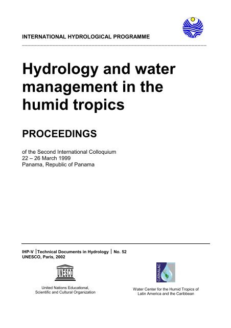
<strong>Hydrology</strong> <strong>and</strong> <strong>water</strong><br />
<strong>management</strong> <strong>in</strong> <strong>the</strong><br />
<strong>humid</strong> <strong>tropics</strong><br />
PROCEEDINGS<br />
of <strong>the</strong> Second International Colloquium<br />
22 – 26 March 1999<br />
Panama, Republic of Panama<br />
IHP-V ⏐Technical Documents <strong>in</strong> <strong>Hydrology</strong> ⏐ No. 52<br />
UNESCO, Paris, 2002<br />
United Nations Educational,<br />
Scientific <strong>and</strong> Cultural Organization<br />
Water Center for <strong>the</strong> Humid Tropics of<br />
Lat<strong>in</strong> America <strong>and</strong> <strong>the</strong> Caribbean
The designations employed <strong>and</strong> <strong>the</strong> presentation of material<br />
throughout <strong>the</strong> publication do not imply <strong>the</strong> expression of any<br />
op<strong>in</strong>ion whatsoever on <strong>the</strong> part of UNESCO concern<strong>in</strong>g <strong>the</strong> legal<br />
status of any country, territory, city or of its authorities, or<br />
concern<strong>in</strong>g <strong>the</strong> delimitation of its frontiers or boundaries.
A "Success Story"<br />
of <strong>the</strong> Humid Tropics Programme<br />
of UNESCO’s<br />
International Hydrological Programme<br />
For many years <strong>the</strong> International Hydrological Programme (IHP) has studied<br />
hydrological <strong>and</strong> <strong>water</strong> resources <strong>management</strong> problems of <strong>the</strong> world. Included on a<br />
more-or-less regular basis had been specific problems of <strong>the</strong> <strong>humid</strong> <strong>tropics</strong>. But <strong>the</strong><br />
projects had an unconnected aspect s<strong>in</strong>ce <strong>the</strong>re always loomed <strong>in</strong> <strong>the</strong> background <strong>the</strong><br />
feel<strong>in</strong>g that "...why should we study <strong>the</strong> <strong>humid</strong> <strong>tropics</strong>; don't <strong>the</strong>y have all <strong>the</strong> <strong>water</strong> <strong>the</strong>y<br />
need?" Yet, <strong>in</strong> spite of that <strong>the</strong>re was a strong feel<strong>in</strong>g (based on <strong>the</strong> results of those<br />
studies) that everyth<strong>in</strong>g concern<strong>in</strong>g <strong>the</strong> hydrology <strong>and</strong> <strong>water</strong> resources of <strong>the</strong> <strong>humid</strong><br />
<strong>tropics</strong> was not okay.<br />
Then two projects that ended <strong>in</strong> <strong>the</strong> mid-1980s concluded <strong>in</strong> dependently that<br />
<strong>the</strong>re was a good reason to look at <strong>the</strong> region <strong>in</strong> a comprehensive way. Both suggested<br />
that an <strong>in</strong>ternational conference would be a worthwhile activity. The first reaction at<br />
UNESCO headquarters to <strong>the</strong> suggestion of a conference was one of great reluctance<br />
because all too often one of <strong>the</strong> results of a research project or study is simply to suggest<br />
more of <strong>the</strong> same -- <strong>and</strong> so often, a symposium is considered "essential.” However, <strong>the</strong>re<br />
were factors that caused UNESCO to realize that this subject needed careful<br />
consideration. One was <strong>the</strong> list of special problems that <strong>the</strong>se two projects had<br />
identified. A second was <strong>the</strong> large population that lived <strong>in</strong> <strong>the</strong> region -- almost 100% of<br />
which was <strong>in</strong> develop<strong>in</strong>g countries. A third, <strong>and</strong> a strong <strong>in</strong>fluence, was that because of<br />
<strong>the</strong> natural reaction that <strong>the</strong> <strong>humid</strong> <strong>tropics</strong> had all <strong>the</strong> <strong>water</strong> <strong>the</strong>y needed, <strong>the</strong> result had<br />
been that those efforts that did exist were not extensive <strong>and</strong> extremely poorly<br />
coord<strong>in</strong>ated <strong>in</strong>ternationally.<br />
An <strong>in</strong>formal <strong>in</strong>ternational steer<strong>in</strong>g committee was established. At <strong>the</strong> same time<br />
Professor Michael Bonell, of <strong>the</strong> James Cook University of North Queensl<strong>and</strong>, was asked<br />
to meet with <strong>the</strong> Project Officer to assist him <strong>in</strong> scop<strong>in</strong>g out a first move. After some<br />
discussion <strong>the</strong>y concluded that an <strong>in</strong>ternational meet<strong>in</strong>g was desirable -- but not simply<br />
ano<strong>the</strong>r symposium. The thoughts were that:<br />
• The participants <strong>in</strong> <strong>the</strong> meet<strong>in</strong>g should be carefully selected.<br />
• That roughly half of <strong>the</strong> participants would be established scientists <strong>in</strong> <strong>the</strong> area of<br />
<strong>the</strong> <strong>humid</strong> <strong>tropics</strong> ("grey hairs"), <strong>and</strong> that <strong>the</strong> rema<strong>in</strong>der would be up-<strong>and</strong>-com<strong>in</strong>g<br />
scientists ("young Turks").<br />
• That organizations o<strong>the</strong>r than UNESCO should be encouraged to participate,<br />
personally <strong>and</strong> f<strong>in</strong>ancially, <strong>in</strong> <strong>the</strong> event.<br />
• That <strong>the</strong> expenses of <strong>the</strong> <strong>in</strong>vited participants should be subsidized to <strong>the</strong><br />
maximum extent possible.<br />
• That <strong>the</strong> meet<strong>in</strong>g consist of <strong>in</strong>vited papers <strong>and</strong> workshops, with ample time for<br />
discussions <strong>and</strong> resolution of conclusions. And,<br />
• That <strong>the</strong> participants should make concrete suggestions for high priority future<br />
work of <strong>the</strong> IHP.<br />
i
In order to dist<strong>in</strong>guish <strong>the</strong> meet<strong>in</strong>g from <strong>the</strong> typical <strong>in</strong>ternational symposia, it was<br />
to be called <strong>the</strong> International Colloquium on <strong>the</strong> Development of Hydrologic <strong>and</strong> Water<br />
Management Strategies <strong>in</strong> <strong>the</strong> Humid Tropics. The participants would be encouraged to<br />
have, to <strong>the</strong> maximum extent possible, a free flow of dialogue throughout <strong>the</strong> event.<br />
The importance of <strong>the</strong> topic of <strong>the</strong> Colloquium was recognized not only by <strong>the</strong><br />
<strong>in</strong>formal <strong>in</strong>ternational steer<strong>in</strong>g committee but also by UNEP (which agreed to jo<strong>in</strong> with<br />
UNESCO <strong>in</strong> its presentation) <strong>and</strong> <strong>the</strong> 22 organizations that agreed to co-sponsor <strong>and</strong><br />
cooperate <strong>in</strong> <strong>the</strong> support of <strong>the</strong> seven-day event. The Colloquium was held <strong>in</strong> July 1989<br />
<strong>in</strong> Townsville, Australia.<br />
Dur<strong>in</strong>g <strong>the</strong> Colloquium <strong>the</strong> participants developed strong evidence that not only<br />
was <strong>the</strong> present situation <strong>in</strong> <strong>the</strong> <strong>humid</strong> <strong>tropics</strong> <strong>in</strong> need of serious consideration, but that<br />
<strong>the</strong> potential for vastly <strong>in</strong>creased negative human impacts would be quite significant if<br />
<strong>the</strong>y were not adequately considered immediately. They concluded <strong>in</strong> general that many<br />
of <strong>the</strong> <strong>water</strong>-related issues <strong>and</strong> problems <strong>in</strong> <strong>the</strong> <strong>humid</strong> <strong>tropics</strong> <strong>and</strong> <strong>the</strong> o<strong>the</strong>r warm <strong>humid</strong><br />
regions are similar to those fac<strong>in</strong>g planners, adm<strong>in</strong>istrators <strong>and</strong> governments of <strong>the</strong><br />
temperate climate regions -- but that while <strong>the</strong>re are resemblances, <strong>the</strong>re are also many<br />
dissimilarities. Both <strong>the</strong> tropical <strong>and</strong> temperate regions can be afflicted with lack of<br />
coord<strong>in</strong>ation between organizations <strong>and</strong> agencies, failures to achieve what had seemed<br />
to be reasonable goals, <strong>in</strong>effective <strong>in</strong>stitutional arrangements, economic <strong>in</strong>feasibilities,<br />
severe environmental <strong>and</strong> social impacts, <strong>in</strong>equitable outcomes, <strong>and</strong> similar fail<strong>in</strong>gs.<br />
However, <strong>the</strong> impacts of such shortcom<strong>in</strong>gs seem to fall heavier on <strong>the</strong> region of <strong>the</strong><br />
<strong>humid</strong> <strong>tropics</strong>. The impact is partially caused by <strong>the</strong> <strong>in</strong>creased severity of <strong>the</strong><br />
hydrological events <strong>in</strong> <strong>the</strong> <strong>tropics</strong> <strong>and</strong> o<strong>the</strong>r warm <strong>humid</strong> regions – <strong>the</strong> heavier ra<strong>in</strong>, <strong>the</strong><br />
repetitive occurrence of damag<strong>in</strong>g cyclonic wea<strong>the</strong>r, <strong>the</strong> higher temperatures, <strong>and</strong> <strong>the</strong><br />
non-stationarity of <strong>the</strong> climates.<br />
In <strong>the</strong>se regions <strong>the</strong>re often are large numbers of residents crammed <strong>in</strong>to small<br />
areas, magnify<strong>in</strong>g <strong>the</strong>ir vulnerability to severe wea<strong>the</strong>r <strong>and</strong> creat<strong>in</strong>g major problems of<br />
<strong>water</strong> quality degradation. A related factor is <strong>the</strong> relative stage of economic<br />
development among <strong>the</strong> region' s governments <strong>and</strong> <strong>the</strong>ir abilities to cope with <strong>the</strong>se<br />
extreme hydrological <strong>and</strong> <strong>water</strong> <strong>management</strong> problems. Many of <strong>the</strong>se develop<strong>in</strong>g<br />
nations still do not have <strong>in</strong> place <strong>the</strong> necessary mechanisms <strong>and</strong> tra<strong>in</strong>ed people to<br />
ameliorate what <strong>the</strong>ir wea<strong>the</strong>r may br<strong>in</strong>g <strong>the</strong>m.<br />
It was also evident that one of <strong>the</strong> major problems <strong>in</strong> <strong>water</strong> <strong>management</strong> <strong>in</strong> <strong>the</strong>se<br />
regions was <strong>the</strong> failure or apparent <strong>in</strong>ability to consider <strong>water</strong> resource development<br />
with<strong>in</strong> <strong>the</strong> context of overall development plans. Fragmentation of responsibility is <strong>the</strong><br />
case <strong>in</strong> most of <strong>the</strong>se countries. Attempts to alleviate <strong>water</strong>-related problems <strong>in</strong> <strong>the</strong><br />
<strong>tropics</strong> <strong>and</strong> o<strong>the</strong>r warm <strong>humid</strong> regions can be fur<strong>the</strong>r complicated by <strong>the</strong> entrance of<br />
non-governmental organizations <strong>in</strong>to <strong>the</strong> picture. While <strong>the</strong> motivation of such<br />
<strong>in</strong>ternational agencies may be excellent, <strong>the</strong>y often have <strong>the</strong>ir own methods <strong>and</strong><br />
technologies that may not mesh with those of <strong>the</strong> host country or with those of o<strong>the</strong>r<br />
specialized agencies.<br />
Although no one region <strong>in</strong> <strong>the</strong> <strong>tropics</strong> may suffer from all of <strong>the</strong>se <strong>water</strong> resource<br />
<strong>management</strong> difficulties, <strong>the</strong>re are a number of commonalities. There is <strong>in</strong>adequate data<br />
-- both physical <strong>and</strong> biological -- from which to make <strong>in</strong>formed judgments. There was<br />
<strong>the</strong> narrow scope of <strong>the</strong> plann<strong>in</strong>g be<strong>in</strong>g done, along with <strong>in</strong>adequately tra<strong>in</strong>ed<br />
professionals <strong>and</strong> staff. In addition, <strong>the</strong>re were <strong>the</strong> fragmented adm<strong>in</strong>istrative<br />
arrangements <strong>and</strong> responsibilities that fur<strong>the</strong>r hampered sound <strong>management</strong>. It was also<br />
believed that an overemphasis on project development <strong>and</strong> construction <strong>in</strong> comparison<br />
to post-construction project operation <strong>and</strong> ma<strong>in</strong>tenance <strong>and</strong> <strong>the</strong> pursuit of some national<br />
economic goals could overstress <strong>and</strong> seriously damage <strong>the</strong> exist<strong>in</strong>g <strong>water</strong> resources.<br />
Clearly, better <strong>in</strong>teraction among <strong>water</strong> planners, policy makers <strong>and</strong> knowledge<br />
ii
developers would help meet <strong>the</strong> goals of economic development <strong>and</strong> <strong>water</strong> resource<br />
protection.<br />
It was def<strong>in</strong>itely felt by <strong>the</strong> participants of <strong>the</strong> Colloquium that a mutual<br />
recognition of <strong>the</strong> problems faced <strong>and</strong> an improved <strong>in</strong>teraction of planners <strong>and</strong> policy<br />
makers would aid <strong>in</strong> better utilization of <strong>the</strong> valuable <strong>water</strong> resources of <strong>the</strong> <strong>humid</strong><br />
<strong>tropics</strong>. Toward this goal it was believed that <strong>the</strong> establishment of special centers of<br />
tra<strong>in</strong><strong>in</strong>g for technology <strong>in</strong>terchange <strong>and</strong> implementation <strong>and</strong> coord<strong>in</strong>ation of research<br />
<strong>in</strong>to <strong>the</strong> unique problems of tropical isl<strong>and</strong>s <strong>and</strong> o<strong>the</strong>r warm <strong>humid</strong> regions would aid <strong>in</strong><br />
reduc<strong>in</strong>g <strong>the</strong>se critical knowledge gaps.<br />
Toward this end, <strong>in</strong> order to accomplish <strong>the</strong> various activities foreseen as be<strong>in</strong>g<br />
needed, networks of <strong>water</strong> <strong>and</strong> <strong>water</strong>-related experts <strong>and</strong> research organizations<br />
<strong>in</strong>volved <strong>in</strong> warm <strong>humid</strong> region hydrology <strong>and</strong> <strong>water</strong> <strong>management</strong> studies were proposed<br />
– <strong>in</strong> Africa, Lat<strong>in</strong> America <strong>and</strong> <strong>the</strong> Caribbean, Asia <strong>and</strong> a fourth on <strong>the</strong> special problems<br />
of <strong>the</strong> small isl<strong>and</strong>s.<br />
However, <strong>the</strong> est ablishment of a regional center requires many efforts, not <strong>the</strong><br />
least of which is <strong>the</strong> agreement by a country to be <strong>the</strong> host. It also must settle a basic<br />
philosophical test: is a regional center to be established to manage an exist<strong>in</strong>g package<br />
of work – or is it to be established <strong>in</strong> order to develop <strong>the</strong> package. In o<strong>the</strong>r words, does<br />
<strong>the</strong> activity fund<strong>in</strong>g come before or after <strong>the</strong> center is established. The chicken/egg<br />
problem. And, while it would have been well received had funds simply been wait<strong>in</strong>g for<br />
<strong>the</strong> development of <strong>the</strong> centers, such was not <strong>the</strong> case. The fund<strong>in</strong>g agencies, <strong>in</strong> general,<br />
wanted to know what <strong>the</strong> proposed programmes were to be <strong>and</strong> who would be<br />
adm<strong>in</strong>ister<strong>in</strong>g <strong>the</strong>m before <strong>the</strong>y would become <strong>in</strong>volved. Fur<strong>the</strong>rmore, many have not<br />
been too happy with "centers" because <strong>the</strong>y too often appear to become obligated to<br />
cont<strong>in</strong>ued support.<br />
It was decided that <strong>the</strong> center for Lat<strong>in</strong> America <strong>and</strong> <strong>the</strong> Caribbean would<br />
def<strong>in</strong>itely be established on <strong>the</strong> basis that it would <strong>the</strong>n f<strong>in</strong>d fund<strong>in</strong>g for <strong>the</strong> various<br />
activities. It <strong>the</strong>n became necessary to f<strong>in</strong>d <strong>the</strong> right location <strong>and</strong> <strong>the</strong>n, after agreement<br />
with that country, to f<strong>in</strong>d <strong>the</strong> director who could lead <strong>the</strong> center to a successful<br />
programme. It obviously meant, however, that sufficient f<strong>in</strong>ancial support had to be<br />
found so that <strong>the</strong> center would be able to manage <strong>the</strong> basic adm<strong>in</strong>istrative activities until<br />
such time as <strong>the</strong> externally funded projects could do so.<br />
After some discussions with <strong>the</strong> UNESCO regional office <strong>in</strong> Montevideo, <strong>in</strong><br />
particular Carlos Fern<strong>and</strong>ez-Jauregui (<strong>the</strong> Regional Hydrologist), <strong>and</strong> <strong>in</strong>dividuals <strong>in</strong> <strong>the</strong><br />
Lat<strong>in</strong> America <strong>and</strong> Caribbean region it was decided to approach <strong>the</strong> Republic of<br />
Panama. The reasons beh<strong>in</strong>d this decision <strong>in</strong>cluded <strong>the</strong> follow<strong>in</strong>g:<br />
• Panama is centrally located with<strong>in</strong> <strong>the</strong> <strong>humid</strong> tropical region of LAC,<br />
• While Spanish is <strong>the</strong> official language, at least <strong>in</strong> <strong>the</strong> area of <strong>the</strong> capital city of<br />
Panama, English is quite commonly understood <strong>and</strong> spoken,<br />
• Access to Panama is possible through an excellent network of airl<strong>in</strong>es, by sea,<br />
<strong>and</strong> even by road.<br />
• Electronic communication -- telephone, telex, cable <strong>and</strong> fax -- was available.<br />
• The geography, <strong>in</strong>dustry, urbanization <strong>and</strong> agriculture of Panama is quite varied,<br />
<strong>and</strong> thus offered a wide variety of examples for field trips <strong>and</strong> for research. And,<br />
• The capital city of Panama, while ma<strong>in</strong>ta<strong>in</strong><strong>in</strong>g <strong>the</strong> appearance of a tropical city,<br />
is <strong>in</strong> fact a highly bus<strong>in</strong>ess-oriented one, with all manner of technological back-up<br />
available for communication, equipment, computers, etc.<br />
Early <strong>in</strong> 1991 <strong>the</strong> Vice President of Panama, The Honorable Guillermo Ford<br />
Boyd, was contacted concern<strong>in</strong>g <strong>the</strong> possible <strong>in</strong>terest of <strong>the</strong> Republic of Panama. His<br />
iii
esponse was an immediate <strong>and</strong> positive encouragement to UNESCO to develop <strong>the</strong><br />
concept fur<strong>the</strong>r. This was followed up by visitations of UNESCO personnel to <strong>the</strong><br />
Republic of Panama, <strong>in</strong> which <strong>the</strong> Republic confirmed that it <strong>in</strong>tended to support<br />
f<strong>in</strong>ancially <strong>and</strong> with physical facilities <strong>the</strong> site of <strong>the</strong> regional center. In June 1991 a<br />
formal letter of <strong>in</strong>tent was signed sett<strong>in</strong>g out <strong>the</strong> underst<strong>and</strong><strong>in</strong>g concern<strong>in</strong>g <strong>the</strong> center's<br />
establishment. UNESCO <strong>the</strong>n began deal<strong>in</strong>g directly with <strong>the</strong> Permanent Delegate to<br />
UNESCO of <strong>the</strong> Republic of Panama (The Honorable Arturo de la Guardia) <strong>in</strong><br />
development of <strong>the</strong> formal Agreement. In great part because of his dedicated<br />
assistance, <strong>in</strong> June 1992 representatives of <strong>the</strong> Government of Panama presented <strong>the</strong><br />
details of <strong>the</strong> proposed Center to <strong>the</strong> UNCED (United Nations Conference on<br />
Environmental Development) for <strong>the</strong> <strong>in</strong>formation <strong>and</strong> support of <strong>the</strong> delegates. In <strong>the</strong><br />
meantime, <strong>the</strong> process of selection among <strong>the</strong> c<strong>and</strong>idates for <strong>the</strong> position of Director<br />
began.<br />
On 13 November 1992 <strong>the</strong> Agreement between UNESCO <strong>and</strong> <strong>the</strong> Republic of<br />
Panama to establish CATHALAC (Centro del Agua del Trópico Húmedo para América<br />
Lat<strong>in</strong>a y El Caribe) was signed by <strong>the</strong> two entities. In January 1993 UNESCO assigned<br />
an Associate Expert (with <strong>the</strong> generous contribution of The Ne<strong>the</strong>rl<strong>and</strong>s) to Panama to<br />
assist <strong>in</strong> <strong>the</strong> prelim<strong>in</strong>ary organization of <strong>the</strong> Center. As a result of a change <strong>in</strong><br />
government <strong>in</strong> <strong>the</strong> Republic of Panama, <strong>the</strong>re was a brief period of <strong>in</strong>activity, dur<strong>in</strong>g<br />
which new pr<strong>in</strong>cipal directors of governmental agencies relative to CATHALAC were<br />
appo<strong>in</strong>ted. Dur<strong>in</strong>g this time, a contract was signed with <strong>the</strong> new CATHALAC Director,<br />
Sra. María Concepción Donoso. In October 1994 Ing. Rol<strong>and</strong>o Guillén, Director of<br />
Panama's Institute of Renewable Resources (INRENARE), was appo<strong>in</strong>ted by <strong>the</strong><br />
government to be <strong>the</strong> first Chairman of <strong>the</strong> CATHALAC Board of Governors. It was<br />
evident that Panama <strong>in</strong>tended that CATHALAC was to be a success.<br />
In November 1994 <strong>the</strong> first session of <strong>the</strong> Board of Governors of CATHALAC<br />
was held <strong>in</strong> Panama. The task before <strong>the</strong> Board at this meet<strong>in</strong>g was to establish <strong>the</strong><br />
work<strong>in</strong>g rules for future sessions of <strong>the</strong> Board, <strong>in</strong>clud<strong>in</strong>g <strong>the</strong> proposed program of work<br />
for CATHALAC. The Board members were also taken to <strong>the</strong> new offices of CATHALAC,<br />
<strong>the</strong>y be<strong>in</strong>g located idyllically on <strong>the</strong> premises of <strong>the</strong> former Fort Amador, at <strong>the</strong> Pacific<br />
entrance to <strong>the</strong> Panama Canal. The build<strong>in</strong>g was half of a duplex (formerly US Army<br />
officer hous<strong>in</strong>g), <strong>and</strong> was located at <strong>the</strong> entrance of <strong>the</strong> causeway lead<strong>in</strong>g out to <strong>the</strong><br />
former "Fortified Isl<strong>and</strong>s" that guarded <strong>the</strong> entrance to <strong>the</strong> canal. The causeway is<br />
narrow at this po<strong>in</strong>t, <strong>and</strong> <strong>the</strong> view from <strong>the</strong> office on its front side was <strong>the</strong> canal<br />
entrance. The view from <strong>the</strong> back was that of Panama Bay <strong>and</strong> <strong>the</strong> city of Panama. The<br />
facilities were more than adequate for <strong>the</strong> bus<strong>in</strong>ess of CATHALAC at that time. The<br />
Board was also pleased to note that <strong>the</strong> Republic of Panama had expressed <strong>the</strong> <strong>in</strong>tention<br />
to cont<strong>in</strong>ue <strong>the</strong> f<strong>in</strong>ancial support to <strong>the</strong> Center.<br />
On 22 March 1995 a formal dedication of <strong>the</strong> CATHALAC headquarters <strong>and</strong> <strong>the</strong><br />
programme were held. As a show of <strong>the</strong> strong back<strong>in</strong>g of <strong>the</strong> Government of <strong>the</strong><br />
Republic of Panama, His Excellency Licenciado Felipe Alej<strong>and</strong>ro Virzi, Senior Vice-<br />
President of <strong>the</strong> Republic cut <strong>the</strong> ribbon.<br />
S<strong>in</strong>ce that time, CATHALAC, as it has grown <strong>in</strong> its activities, has shifted its<br />
office location twice: first to <strong>the</strong> former Albrook AFB, <strong>and</strong> now (most appropriately) to<br />
<strong>the</strong> newly established Ciudad del Saber (City of Knowledge) that was established by <strong>the</strong><br />
Republic of Panama as an educational, scientific <strong>and</strong> high technology site us<strong>in</strong>g <strong>the</strong><br />
facilities of <strong>the</strong> former Fort Clayton. Its physical facilities have now exp<strong>and</strong>ed greatly to<br />
match its <strong>in</strong>creased activities. The Republic of Panama has cont<strong>in</strong>ued to support<br />
CATHALAC f<strong>in</strong>ancially <strong>and</strong> politically.<br />
CATHALAC's primary objective is to serve as an adm<strong>in</strong>istrative focal po<strong>in</strong>t for<br />
scientific <strong>and</strong> technical activities <strong>in</strong> <strong>the</strong> <strong>humid</strong> tropic regions of Lat<strong>in</strong> America <strong>and</strong> <strong>the</strong><br />
iv
Caribbean <strong>in</strong> <strong>the</strong> area of tra<strong>in</strong><strong>in</strong>g, research <strong>and</strong> transfer of knowledge <strong>and</strong> technology <strong>in</strong><br />
<strong>the</strong> field of <strong>water</strong> resources <strong>and</strong> <strong>the</strong> environment. The ma<strong>in</strong> scientific goal is to improve<br />
<strong>the</strong> underst<strong>and</strong><strong>in</strong>g of <strong>in</strong>teractions between <strong>the</strong> l<strong>and</strong>, vegetation, ocean, atmosphere <strong>and</strong><br />
human actions. It coord<strong>in</strong>ates activities of technical assistance, tra<strong>in</strong><strong>in</strong>g, research <strong>and</strong><br />
<strong>in</strong>formation transfer <strong>and</strong> focuses on <strong>the</strong> follow<strong>in</strong>g areas:<br />
• Air-sea-l<strong>and</strong> <strong>in</strong>teractions<br />
• Small isl<strong>and</strong>s<br />
• Hydrological processes<br />
• Integrated urban <strong>water</strong> <strong>management</strong><br />
• Water quality control<br />
• Water resources assessment, <strong>management</strong> <strong>and</strong> control<br />
• Water <strong>and</strong> health<br />
• Knowledge, <strong>in</strong>formation <strong>and</strong> technology transfer<br />
CATHALAC organizes (<strong>and</strong> participates <strong>in</strong> <strong>the</strong> organization of) courses, workshops,<br />
sem<strong>in</strong>ars <strong>and</strong> symposia, <strong>and</strong> offers scientists of <strong>the</strong> region <strong>the</strong> opportunity to exchange<br />
ideas <strong>and</strong> experiences. As a means of better serv<strong>in</strong>g <strong>the</strong> region two sub-regional offices<br />
have been established: one <strong>in</strong> Miami, Florida, concentrat<strong>in</strong>g on <strong>the</strong> Caribbean subregion;<br />
<strong>and</strong> ano<strong>the</strong>r <strong>in</strong> Sao Paulo, Brazil, concentrat<strong>in</strong>g on urban hydrology <strong>and</strong> <strong>water</strong><br />
resource <strong>management</strong>.<br />
S<strong>in</strong>ce its formal <strong>in</strong>auguration <strong>in</strong> March 1995 <strong>the</strong> Director of CATHALAC has set<br />
about, quite successfully, to establish <strong>the</strong> presence of <strong>the</strong> center as a major factor <strong>in</strong> <strong>the</strong><br />
<strong>humid</strong> <strong>tropics</strong> of Lat<strong>in</strong> America <strong>and</strong> <strong>the</strong> Caribbean. It is now well recognized for its<br />
coord<strong>in</strong>at<strong>in</strong>g activities, <strong>and</strong> is beg<strong>in</strong>n<strong>in</strong>g to play a very important role as a scientific arm<br />
of political organizations such as <strong>the</strong> Organization of American States. Moreover, while<br />
CATHALAC is yet a young organization, its rapid <strong>in</strong>volvement <strong>in</strong> <strong>the</strong> <strong>in</strong>ternational<br />
activities of <strong>the</strong> region <strong>in</strong>dicates that it is fill<strong>in</strong>g a very important niche <strong>in</strong> <strong>the</strong> <strong>humid</strong><br />
tropic region of Lat<strong>in</strong> America <strong>and</strong> <strong>the</strong> Caribbean.<br />
[This <strong>in</strong>troduction was prepared by Dr. John S. Gladwell of Hydro Tech International, Vancouver, BC, Canada – <strong>and</strong><br />
former Senior Programme Specialist <strong>in</strong> <strong>the</strong> International Hydrological Programme, UNESCO SC/HYD, Paris,<br />
France]<br />
v
Preface<br />
Dur<strong>in</strong>g <strong>the</strong> Week of March 21-26, 1999 a series of parallel meet<strong>in</strong>gs took place <strong>in</strong><br />
Panama City, Republic of Panama, which collectively was referred to as Water Week <strong>in</strong><br />
Panama. The Second International Colloquium on <strong>Hydrology</strong> <strong>and</strong> Water Management<br />
<strong>in</strong> <strong>the</strong> Humid Tropics, as one of <strong>the</strong>se events, brought toge<strong>the</strong>r a group of lead<strong>in</strong>g<br />
researchers <strong>and</strong> <strong>water</strong> managers from around <strong>the</strong> world who work <strong>in</strong> <strong>the</strong> <strong>humid</strong> <strong>tropics</strong><br />
region or execute research programs related to <strong>the</strong> hydrology of <strong>the</strong>se regions. The<br />
participants discussed <strong>the</strong>ir research <strong>and</strong> how it relates to <strong>the</strong> need of <strong>water</strong> managers for<br />
hydrologic underst<strong>and</strong><strong>in</strong>g upon which to base sound <strong>management</strong> decisions. Dur<strong>in</strong>g this<br />
Water Week <strong>in</strong> Panama <strong>the</strong> <strong>in</strong>augural <strong>and</strong> clos<strong>in</strong>g sessions of <strong>the</strong> Colloquium, <strong>the</strong><br />
lunches, a field trip through <strong>the</strong> Panama Canal, <strong>and</strong> o<strong>the</strong>r social events were comb<strong>in</strong>ed<br />
with <strong>the</strong> o<strong>the</strong>r events that formed part of <strong>the</strong> Water Week. In this manner, <strong>the</strong> organizers<br />
stimulated a lively dialogue between practic<strong>in</strong>g <strong>water</strong> managers <strong>and</strong> researchers on<br />
current <strong>water</strong> issues.<br />
The Colloquium consisted of presentations of technical papers <strong>and</strong> discussions on<br />
<strong>the</strong> follow<strong>in</strong>g <strong>the</strong>mes:<br />
• Multi-dimensional Approach to Water Management<br />
• Climate Variability <strong>and</strong> <strong>the</strong> Impacts on <strong>Hydrology</strong> <strong>and</strong> Water Resources<br />
• Surface, Sub-surface <strong>and</strong> Ground Water Quality<br />
• Urban <strong>Hydrology</strong><br />
• Tropical Isl<strong>and</strong> <strong>Hydrology</strong><br />
• An Ecohydrological Perspective of Montane Cloud Forests<br />
Because of <strong>the</strong> great importance of ground <strong>water</strong> as source of <strong>water</strong> resources , a<br />
special paper on ground<strong>water</strong> quality <strong>in</strong> <strong>the</strong> Humid Tropics, by Foster, et al, was<br />
presented.. Because of <strong>the</strong> importance of <strong>the</strong> subject, <strong>the</strong> paper has been placed <strong>in</strong> <strong>the</strong>se<br />
Proceed<strong>in</strong>gs next to <strong>the</strong> Clos<strong>in</strong>g Remarks.<br />
In parallel with <strong>the</strong> Colloquium, <strong>the</strong> Organization of American States (OAS), <strong>the</strong><br />
National Environmental Authority (ANAM) of Panama, <strong>the</strong> Inter -American Water<br />
Resources Network (IWRN), <strong>and</strong> <strong>the</strong> Water Center for <strong>the</strong> Humid Tropics of Lat<strong>in</strong><br />
America <strong>and</strong> <strong>the</strong> Caribbean (CATHALAC) held <strong>the</strong> Third Inter-American Dialogue on<br />
Water Management on March 21-25, 1999. The meet<strong>in</strong>g of more than two hundred<br />
senior <strong>water</strong> managers <strong>and</strong> decision makers of stakeholder groups identified actions for<br />
<strong>in</strong>tegrated <strong>water</strong> resources <strong>management</strong> <strong>in</strong> a <strong>the</strong> follow<strong>in</strong>g five general areas:<br />
• Water <strong>and</strong> health<br />
• Transboundary <strong>water</strong> <strong>management</strong><br />
• Economic valuation of <strong>water</strong><br />
• Public participation<br />
• Responses to impacts of global change<br />
Us<strong>in</strong>g case studies <strong>and</strong> round table discussions, <strong>the</strong> Dialogue sought to assign<br />
priorities to <strong>the</strong> identified <strong>in</strong>itiatives to encourage <strong>water</strong> managers to take action at local<br />
levels <strong>in</strong> <strong>the</strong>ir countries. The Dialogue also aimed at foster<strong>in</strong>g political support for <strong>the</strong>se<br />
<strong>in</strong>itiatives with<strong>in</strong> <strong>the</strong> governments of <strong>the</strong> Americas <strong>and</strong> with<strong>in</strong> multilateral fund<strong>in</strong>g<br />
vii
agencies at <strong>the</strong> hemispheric level.<br />
Early dur<strong>in</strong>g <strong>the</strong> week, 50 members of <strong>the</strong> Inter-American Water Resources<br />
Network (IWRN) Advisory Committee met to elaborate future activities of <strong>the</strong> IWRN<br />
<strong>in</strong>clud<strong>in</strong>g <strong>the</strong> support <strong>the</strong> World Water Vision <strong>in</strong> a series of regional workshops dur<strong>in</strong>g<br />
1999, <strong>the</strong> <strong>water</strong> <strong>in</strong>formation summit <strong>in</strong> <strong>the</strong> fall of 1999, <strong>and</strong> a meet<strong>in</strong>g of experts on <strong>water</strong><br />
<strong>and</strong> health.<br />
Participants of all parallel meet<strong>in</strong>gs visited <strong>the</strong> Children <strong>and</strong> Water Festival to<br />
receive <strong>the</strong> Children’s Declaration on Water <strong>and</strong> to witness <strong>the</strong> dedication by <strong>the</strong> children<br />
of <strong>the</strong> “Water is Life” founta<strong>in</strong> <strong>in</strong> <strong>the</strong> Parque Omar, Panama City, Panama. The festival,<br />
organized by <strong>the</strong> Office of <strong>the</strong> First Lady of Panama, with assistance from ANAM,<br />
CATHALAC, <strong>and</strong> many o<strong>the</strong>r organizations, served as a rem<strong>in</strong>der to <strong>the</strong> <strong>water</strong><br />
professionals of <strong>the</strong> importance of educat<strong>in</strong>g <strong>the</strong> future generations on <strong>the</strong> importance of<br />
clean <strong>water</strong> for a healthy environment, a productive economy, <strong>and</strong> good public health.<br />
An exhibition, AQUA ’99, was also held dur<strong>in</strong>g <strong>the</strong> meet<strong>in</strong>g. Consultants, <strong>water</strong>related<br />
<strong>in</strong>dustrial firms, professional organizations, <strong>and</strong> NGOs presented <strong>the</strong>ir products,<br />
services, <strong>and</strong> programs.<br />
F<strong>in</strong>ally, <strong>the</strong> Committee for <strong>the</strong> Water Vision of <strong>the</strong> Americas (CWVA), a<br />
committee formed to facilitate <strong>and</strong> coord<strong>in</strong>ate <strong>the</strong> World Water Council’s Water Vision<br />
activity <strong>in</strong> <strong>the</strong> Americas, held <strong>the</strong> first Water Vision <strong>in</strong> <strong>the</strong> Americas Workshop dur<strong>in</strong>g<br />
<strong>the</strong> last two days of <strong>the</strong> Water Week. A group of 70 <strong>water</strong> policy-makers met to develop<br />
a general underst<strong>and</strong><strong>in</strong>g of <strong>the</strong> purpose of <strong>the</strong> vision effort <strong>and</strong> to develop a process <strong>and</strong><br />
framework for conduct<strong>in</strong>g <strong>the</strong> Water Vision exercise <strong>in</strong> a series of meet<strong>in</strong>gs to be held<br />
dur<strong>in</strong>g 1999 <strong>in</strong> various regions of <strong>the</strong> Americas. The Committee exam<strong>in</strong>ed <strong>the</strong><br />
recommendations <strong>and</strong> priorities developed dur<strong>in</strong>g <strong>the</strong> Second Colloquium, <strong>the</strong> Third<br />
Dialogue <strong>and</strong> o<strong>the</strong>r recent meet<strong>in</strong>gs, to ga<strong>in</strong> a sense of how <strong>water</strong> <strong>management</strong> <strong>in</strong> <strong>the</strong><br />
Americas will develop over <strong>the</strong> next several decades <strong>and</strong> consecutively develop a general<br />
consensus on <strong>the</strong> shape of <strong>the</strong> future of <strong>water</strong> resources under several proposed scenarios.<br />
The elaborated regional visions will be presented at <strong>the</strong> World Water Forum <strong>in</strong> March<br />
2000 <strong>in</strong> <strong>the</strong> Ne<strong>the</strong>rl<strong>and</strong>s.<br />
Apart from this <strong>in</strong>tensive agenda, <strong>the</strong>re were numerous social events, of which<br />
especially <strong>the</strong> boat trip through <strong>the</strong> Panama Canal made an unforgettable impression on<br />
<strong>the</strong> 300 participants of <strong>the</strong> Water Week. Many professional <strong>and</strong> personal relationships<br />
were established, renewed or streng<strong>the</strong>ned dur<strong>in</strong>g <strong>the</strong>se social events.<br />
This book conta<strong>in</strong>s speeches, conclusions, recommendations, f<strong>in</strong>al statements <strong>and</strong><br />
technical papers that were presented at <strong>the</strong> Colloquium.<br />
The organizers wish to express <strong>the</strong>ir gratitude to <strong>the</strong> Government of <strong>the</strong> Republic<br />
of Panama for <strong>the</strong> generous offer to host <strong>the</strong>se events <strong>and</strong> to contribute actively to <strong>the</strong>ir<br />
organization. Dr. John S. Gladwell, President of Hydro Tech International, was<br />
responsible for <strong>the</strong> edit<strong>in</strong>g <strong>and</strong> preparation of <strong>the</strong> manuscript of this book for publication<br />
by UNESCO.<br />
viii
Organiz<strong>in</strong>g Committee – Second International Colloquium on<br />
<strong>Hydrology</strong> <strong>and</strong> Water Management <strong>in</strong> <strong>the</strong> Humid Tropics<br />
CATHALAC<br />
Water Center f or <strong>the</strong> Humid Tropics of Lat<strong>in</strong> America <strong>and</strong> <strong>the</strong> Caribbean<br />
Republic of Panama<br />
ANAM<br />
National Environmental Authority<br />
Republic of Panama<br />
UNESCO – IHP<br />
United Nations Educational, Scientific <strong>and</strong> Cultural Organisation,<br />
International Hydrological Programme<br />
With <strong>the</strong> F<strong>in</strong>ancial Support of<br />
AUSAID-ISSS<br />
Australian AID, International Sem<strong>in</strong>ar Support Scheme<br />
USNC-SH<br />
United States National Committee for Scientific <strong>Hydrology</strong><br />
ix
Pr<strong>in</strong>cipal Advisors -- Second International Colloquium on<br />
<strong>Hydrology</strong> <strong>and</strong> Water Management <strong>in</strong> <strong>the</strong> Humid<br />
Tropics<br />
John S. Gladwell<br />
President, Hydro Tech<br />
International<br />
3477 Beach Avenue<br />
Roberts Creek, BC<br />
V0N 2W2<br />
CANADA<br />
Tel. (+1) 604-885-0188<br />
johngladwell@dccnet.com<br />
Jochen Bundschuh<br />
Darmstadt Technical<br />
University<br />
Institute of Geology<br />
Schnittspahnstrasse 9<br />
64287 Darmstadt<br />
GERMANY<br />
Fax: (+49) 7366-919-167<br />
jbundsch@hrz2.hrz.tudarmstadt.de<br />
Norman J. Peters<br />
U.S. Geological Survey<br />
3039 Amwiler Rd., Suite<br />
130<br />
Atlanta, GA 30360-2824.<br />
USA<br />
Tel. (+1) 770-903-9145<br />
Fax: (+1) 770-903-9199<br />
nepeters@usgs.gov<br />
John Fischer<br />
Consultant<br />
Water Resources <strong>and</strong><br />
Environmental Consult<strong>in</strong>g<br />
11422 Waples Mill Road,<br />
Oakton, Virg<strong>in</strong>ia 22124<br />
Virg<strong>in</strong>ia, U.S.A.<br />
Tel. (+1) 703-620-0825<br />
jnfischer@aol.com<br />
Keynote Speakers<br />
Pilar Cornejo<br />
FIMCM-ESPOL<br />
Guayaquil<br />
ECUADOR<br />
Tel. (+593) 4-269478<br />
Fax: (+593) 4-854587<br />
pcornejo@goliat.espol.edu.ec<br />
Tony Falkl<strong>and</strong><br />
ECOWISE Environmental<br />
7224 ACTEW Corporation<br />
PO Box: 1834, Fyshwick,<br />
Canberra, ACT 2609<br />
AUSTRALIA<br />
Tel. (+612) 6285-7221<br />
tonyf@ecowise.com.au<br />
x<br />
Ramon Vargas<br />
Vocal del Directorio<br />
Adm<strong>in</strong>istracion Prov<strong>in</strong>cial<br />
del Agua<br />
Sta María de Oro 1266<br />
(3500) Resistencia, Chaco,<br />
ARGENTINA<br />
Tel. (+54) 03-722-432904<br />
ravargas@s<strong>in</strong>fovia.com.ar<br />
Janusz Niemczynowicz<br />
Department of Water<br />
Resources Eng<strong>in</strong>eer<strong>in</strong>g,<br />
University of Lund<br />
Box 118, S-221 00 Lund,<br />
SWEDEN<br />
Tel. (+46) 46-222-8981,<br />
Fax: (+46) 46-222-4435<br />
janusz.n@tvrl.lth.se<br />
Sampurno Bruijnzeel<br />
Tropical Environmental<br />
<strong>Hydrology</strong> Programme<br />
(TRENDY)<br />
Faculty of Earth Sciences<br />
Vrije Universiteit<br />
De Boelelaan 1085<br />
1081 HV Amsterdam<br />
THE NETHERLANDS<br />
Tel. (+31) 20-444-7294<br />
Fax: (+31) 20-646-2457<br />
brul@geo.vu.nl
Second International Colloquium on<br />
<strong>Hydrology</strong> <strong>and</strong> Water Management <strong>in</strong> <strong>the</strong> Humid Tropics<br />
Table of Contents<br />
CATHALAC – A ‘Success Story’ of <strong>the</strong> Humid Tropics Programmeof <strong>the</strong> Humid<br />
Tropics Programme<br />
of UNESCO’s International Hydrological Programme i<br />
Preface vii<br />
Organiz<strong>in</strong>g Committee – Second International Colloquium on <strong>Hydrology</strong><br />
<strong>and</strong> Water Management <strong>in</strong> <strong>the</strong> Humid Tropics ix<br />
Pr<strong>in</strong>cipal Advisors -- Second International Colloquium on <strong>Hydrology</strong> <strong>and</strong><br />
Water Management <strong>in</strong> <strong>the</strong> Humid Tropics x<br />
Keynote Speakers -- Second International Colloquium on <strong>Hydrology</strong> <strong>and</strong> Water<br />
Management <strong>in</strong> <strong>the</strong> Humid Tropics x<br />
SECTION I: INTRODUCTORY SPEECHES: WATER WEEK<br />
IN PANAMA<br />
La Primera Dama de la Republica de Panama [<strong>the</strong> First Lady of <strong>the</strong> Republic<br />
of Panama] la Honorable Dora Boyd de Perez-Balladares 3<br />
Profesor Federico Mayor, Director General de la Organización de las Naciones<br />
Unidas para la Educación, la Ciencia y la Cultura (UNESCO) 5<br />
Richard A. Meganck, PhD, Director, Unit for Susta<strong>in</strong>able Development <strong>and</strong> Environment<br />
General Secretariat, Organization of American States 11<br />
Licenciada Mirei Endara, Adm<strong>in</strong>istradora General de la Autoridad Nacional<br />
del Ambiente, Presidenta del Comité Organizador, Presidenta de<br />
CATHALAC 14<br />
SECTION II – INTRODUCTION TO THE COLLOQUIUM<br />
Some Introductory Comments to <strong>the</strong> Second Colloquium –<br />
UNESCO <strong>and</strong> <strong>the</strong> Humid Tropics Programme of <strong>the</strong> IHP,<br />
Michael Bonell, Chief of Section: Hydrological Processes<br />
<strong>and</strong> Climate, Division of Water Sciences, UNESCO<br />
InternationalHydrological Programme 19<br />
Presentation on <strong>the</strong> “Water Plan for <strong>the</strong> Americas,” Richard<br />
Meganck, Director of <strong>the</strong> Unit of Susta<strong>in</strong>able Development<br />
<strong>and</strong> Environment of <strong>the</strong> Organization of American States 26<br />
xi
Second International Colloquium on<br />
<strong>Hydrology</strong> <strong>and</strong> Water Management <strong>in</strong> <strong>the</strong> Humid Tropics<br />
Water Problems of <strong>the</strong> Humid Tropics: A susta<strong>in</strong>able program of<br />
Research to Underst<strong>and</strong> Them is Required, John S. Gladwell,<br />
President, Hydro Tech International 32<br />
SECTION III: PRESENTATION OF TECHNICAL PAPERS<br />
Introduction, Dr. Jack Fischer, Pr<strong>in</strong>cipal Advisor for <strong>the</strong> Second International<br />
Colloquium on <strong>Hydrology</strong> <strong>and</strong> Water Management <strong>in</strong> <strong>the</strong> Humid Tropics 41<br />
Theme 1: Multi-dimensional Approach to Water Management<br />
Women <strong>and</strong> Water Resources Management <strong>in</strong> West Africa, O.O Sodeko 47<br />
Conclusions <strong>and</strong> Recommendations , Jochen Bundschuh 58<br />
Theme 2: Climate Variability <strong>and</strong> <strong>the</strong> Impacts on <strong>Hydrology</strong> <strong>and</strong> Water<br />
Resources<br />
El Niño/Sou<strong>the</strong>rn Oscillation <strong>and</strong> La Niña Impacts on Water Resources<br />
<strong>in</strong> <strong>the</strong> Humid Tropics: The Role of TC3NET Human Dimension Group,<br />
M. Pilar Cornejo R. de Grunauer 65<br />
The Climatic Variability, Climatic Change <strong>and</strong> Hydrological Stage,<br />
Eduardo O. Planos Gutiérrez 72<br />
The 1997-98 El Niño <strong>and</strong> Drought <strong>in</strong> <strong>the</strong> Fiji Isl<strong>and</strong>s, James P. Terry,<br />
Rishi Raja 80<br />
Interpretation of Spatial <strong>and</strong> Temporal Properties of annual <strong>and</strong> monthly<br />
Ra<strong>in</strong>fall <strong>in</strong> Selangor, Malaysia, Desa M., M.N, Daud M., Z 94<br />
Hydrologic Variability of some equatorial river bas<strong>in</strong>s of Sou<strong>the</strong>rn<br />
Cameroon – Central Africa, Luc Sigha-Nkamdjou, Daniel Sighomnou,<br />
Gregory Tanyileke, Michel Mol<strong>in</strong>ier, Emmanuel Naah 106<br />
Conclusions <strong>and</strong> Recommendations, Michael E. McCla<strong>in</strong> 115<br />
Theme 3: Surface, Sub-surface <strong>and</strong> Ground Water Quality<br />
Technical <strong>and</strong> Economic Evaluation to Recover <strong>and</strong> Reuse Waste<br />
Water From Metal Coat<strong>in</strong>g Proceses, M.C. Granados, B. Cuartas,<br />
D. Acevedo, C.E. Urrea 119<br />
Issues Related to Ground<strong>water</strong> Quantity <strong>and</strong> Quality <strong>in</strong> <strong>the</strong> Conventional<br />
Lake Chad Bas<strong>in</strong>, J.A. Oguntola, M. Bonell 131<br />
xii
Second International Colloquium on<br />
<strong>Hydrology</strong> <strong>and</strong> Water Management <strong>in</strong> <strong>the</strong> Humid Tropics<br />
Simulation of Karstic Spr<strong>in</strong>g Discharges <strong>in</strong> <strong>the</strong> Itx<strong>in</strong>a Aquifer System<br />
(Basque Country, Spa<strong>in</strong>),J. Gárfias, H. Llanos, D. Rudolph 145<br />
Analysis of <strong>the</strong> Propagation of Possible Polluants <strong>in</strong> <strong>the</strong> Karstic Unit of<br />
Aitzgorri (Basque Country, Spanish State), H. Llanos,<br />
J. Garfias, P. Bezares <strong>and</strong> R. Alonso 160<br />
Model<strong>in</strong>g Transport Phenomena Across The Hydrologic Cycle: The<br />
Special Case of Turbulent Dispersion <strong>in</strong> Subsurface Solute Transport,<br />
Miguel A. Med<strong>in</strong>a, Jr. 175<br />
Conclusions <strong>and</strong> Recommendations, Norman Jake Peters 189<br />
Theme 4: Urban <strong>Hydrology</strong><br />
Urban <strong>Hydrology</strong> - Present <strong>and</strong> Future Challenges, J. Niemczynowicz 193<br />
Biogeochemistry of an Urban Stream <strong>in</strong> Sou<strong>the</strong>rn Brazil, J.P.H.B. Ometto,<br />
M.C. Bernardes, T.F. Dom<strong>in</strong>gues, A.V. Krusche, L.A. Mart<strong>in</strong>elli,<br />
M.V.Ballester 218<br />
Conclusions <strong>and</strong> Recommendations, Janusz Niemczynowicz 232<br />
Theme 5: Tropical Isl<strong>and</strong> <strong>Hydrology</strong><br />
Tropical Isl<strong>and</strong> <strong>Hydrology</strong> <strong>and</strong> Water Resources - Current Knowledge<br />
<strong>and</strong> Future Needs, A. Falkl<strong>and</strong> 237<br />
Recharge of Fresh Ground<strong>water</strong> Lenses: Field Study, Tarawa Atoll,<br />
Kiribati, I. White, A. Falkl<strong>and</strong>, B. Etuati, E. Metai, T. Metutera 299<br />
Ecohydrology <strong>and</strong> Tecto-Genesis of Small Isl<strong>and</strong>s <strong>in</strong> Indonesia,<br />
P.E. Hehanussa 333<br />
A Note on <strong>the</strong> <strong>Hydrology</strong> of Small Volcanic Isl<strong>and</strong>s, Mohammad Farook<br />
Mowlabucus 341<br />
Conclusions <strong>and</strong> Recommendations, Tony Falkl<strong>and</strong> 345<br />
Theme 6: An Ecohydrological Perspective of Mounta<strong>in</strong> Cloud Forests<br />
<strong>Hydrology</strong> of Tropical Montane Cloud Forests: A Reassessment,<br />
L.A. Bruijnzeel 353<br />
Water Fluxes <strong>in</strong> a Cloud Forest of <strong>the</strong> Venezuelan Andes,<br />
Michele Ataroff 384<br />
Net Precipitation Patterns <strong>in</strong> Undisturbed <strong>and</strong> Fragmented Costa Rican<br />
Cloud Forest, J. Fallas 389<br />
xiii
Second International Colloquium on<br />
<strong>Hydrology</strong> <strong>and</strong> Water Management <strong>in</strong> <strong>the</strong> Humid Tropics<br />
Water Budgets of Two Upper Montane Ra<strong>in</strong> Forests of Contrast<strong>in</strong>g<br />
Stature <strong>in</strong> <strong>the</strong> Blue Mounta<strong>in</strong>s, Jamaica, R. L. L. J. Hafkenscheid,<br />
L. A. Bruijnzeel, R. A. M. de Jeu, N. J. B<strong>in</strong>k 399<br />
Ra<strong>in</strong>fall <strong>and</strong> Runoff Characteristics <strong>in</strong> Three Tropical Forested<br />
Head<strong>water</strong> Bas<strong>in</strong>s of Sou<strong>the</strong>ast Asia, Kuraji Koichiro 425<br />
Conclusions <strong>and</strong> Recommendations, L.A. (Sampurno) Bruijnzeel 439<br />
A REMARK ON GROUND WATER IN THE HUMID TROPICS --<br />
Ground<strong>water</strong> quality <strong>in</strong> <strong>the</strong> Humid Tropics: An overview, S. Foster,<br />
P. Smedley, L. C<strong>and</strong>ela 441<br />
CLOSING REMARKS, UNESCO/IHP – CATHALAC, Second<br />
International Colloquium on <strong>Hydrology</strong> <strong>and</strong> Water Management <strong>in</strong><br />
<strong>the</strong> Humid Tropics, Panama City, Panama, March 21-25 1999,<br />
Dr. John Fischer 469<br />
Appendix A: DECLARATIONS: WATER WEEK IN PANAMA 475<br />
D E C L A R A T I O N of <strong>the</strong> Third Inter-American Dialogue on<br />
Water Management, Panama City, Panama, March 25th, 1999 477<br />
Declaración del Agua, Primer Festival del Agua y la Niñez<br />
22 y 23 de Marzo de 1999, Panama 480<br />
Jo<strong>in</strong>t Statement of Water Week <strong>in</strong> Panama 481<br />
Appendix B: LISTS OF PARTICIPANTS IN THE COLLOQUIUM 483<br />
xiv
SECTION I:<br />
INAUGURAL SPEECHES<br />
WATER WEEK IN PANAMA
Second International Colloquium on<br />
<strong>Hydrology</strong> <strong>and</strong> Water Management <strong>in</strong> <strong>the</strong> Humid Tropics<br />
Palabras de la Primera Dama<br />
de la Republica de Panamá<br />
la Honorable Dora Boyd de Perez-Balladares<br />
Inauguracion de la Semana Interamericana<br />
del Agua<br />
Doctor Federico Mayor Zaragoza, Director General de UNESCO<br />
Ingeniero John Hast<strong>in</strong>g, Representante del BID en Panamá<br />
Sr. Richard Megank Director de Desarrollo Sostenible Medio Ambiente de la O.E.A.<br />
Licenciada Mirei Endara, Adm<strong>in</strong>istradora General de la Autoridad Nacional del Ambiente<br />
Presidenta de CATHALAC.<br />
Invitados Especiales<br />
Señoras y Señores:<br />
Me siento muy honrada en presidir la Semana Interamericana del Agua, que celebramos en el<br />
año de la Reversión del Canal de Panamá, el acontecimiento de mayor transcendencia<br />
histórica para nuestro país y con importantes proyecciones para la <strong>in</strong>tercomunicación<br />
mundial.<br />
Reciban a nombre del Excelentísimo Señor Presidente de la República la más cordial<br />
bienvenida a este pequeño istmo centroamericano, que se ha preparado, durante un año para<br />
recibirlos, como los mejores huéspedes del f<strong>in</strong> del milenio.<br />
Como Presidenta del Pacto por La Niñez Panameña, puedo decirles, que Panamá ha<br />
desarrollado una amplia estrategia de educación ambiental de la niñez y la juventud, con<br />
significativos avances en la formación de las nuevas generaciones para preservar una vida<br />
saludable. Los eventos que hoy <strong>in</strong>auguramos, son una importante contribución a esta misión.<br />
Durante una semana. compartiremos tres jornadas de alto nivel científico, v<strong>in</strong>culadas con el<br />
manejo de los recursos hídricos y su efecto en el desarrollo y la vida humana, estas son: El<br />
III Diálogo Interamericano Sobre Adm<strong>in</strong>istración de Aguas: el Segundo Coloquio<br />
Internacional sobre Hidro1ogía y Manejo de los Recursos Hídricos en los Trópicos<br />
Húmedos y el Primer Festival Internacional del Agua y la Niñez.<br />
Este último, con la asistencia de 120 niños y niñas de 21 países del cont<strong>in</strong>ente, reunidos<br />
bajo el Lema "El Agua es Vida" y quienes preparan una declaración sobre sus aspiraciones<br />
proteccionistas en materia de agua.<br />
A lo largo de los años 1998 y 1999 muchas voluntades en el cont<strong>in</strong>ente se unieron torno a<br />
estos eventos. Al <strong>in</strong>icio parecía una meta <strong>in</strong>alcanzable, pero vencimos mitos y miedos. No<br />
fue sencillo <strong>in</strong>ternalizar esquemas nuevos donde niños y niñas trabajan junto a científicos,<br />
técnicos y políticos en una agenda común. La experiencia ha sido extraord<strong>in</strong>aria y esperamos<br />
que ustedes puedan disfrutarla en toda su magnitud.<br />
Comprender la importancia del agua en la vida de los países, es entender las perspectivas de<br />
la vida sobre el planeta y la verdadera <strong>in</strong>tegración de la humanidad. Ello es así porque más de<br />
200 sistemas fluviales atraviesan fronteras nacionales y casi 100 países se <strong>in</strong>tercomunican al<br />
compartir 13 ríos y lagos importantes.<br />
3
Second International Colloquium on<br />
<strong>Hydrology</strong> <strong>and</strong> Water Management <strong>in</strong> <strong>the</strong> Humid Tropics<br />
Para Panamá, servir como sede para la celebración de los eventos de esta semana, es una<br />
ganancia mayúscula. El agua no es solo un recurso económico social para nuestro país, es el<br />
más importante recurso de desarrollo.<br />
El aporte que ustedes ofrecen a la ampliación del conocimiento técnico y la evaluación de las<br />
políticas hídricas, son un <strong>in</strong>sumo vital para un país como el nuestro, bañado por el Atlántico<br />
y el Pacífico, que ha dedicado toda su historia republicana, a recuperar el tránsito marítimo<br />
por su territorio, a través del Canal de Panamá.<br />
Del agua depende el funcionamiento del Canal de Panamá y cada barco que lo atraviesa<br />
diariamente, consume una cuarta parte del consume humano total del área metropolitana. Por<br />
eso, mejorar la eficiencia del canal y racionalizar su consume de agua, es cuidar la<br />
sobrevivencia de la familia panameña.<br />
El Gobierno de Panamá asume con gran responsabilidad las medidas proteccionistas<br />
de agua. La creación de la Autoridad Nacional del Ambiente, con una macrovisión de los<br />
recursos naturales y una política de reformulación de las relaciones entre la persona humana<br />
y su medio, es la pr<strong>in</strong>cipal garantía de los acuerdos de estos eventos, encontrarán en el<br />
Gobierno Nacional, su pr<strong>in</strong>cipal aliado.<br />
La Autoridad Nacional del Ambiente- ANAM-, el Centro del Agua del Trópico Húmedo<br />
para América Lat<strong>in</strong>a y el Caribe -CATHALAC y mi Despacho hemos compartido un año de<br />
trabajo conjunto para garantizar que durante las sesiones de todos los eventos de la semana,<br />
ustedes dispongan del apoyo necesario para trabajar en un ambiente de alta productividad y<br />
amena convivencia, no reparen en comunicarnos cualquier <strong>in</strong>conveniente.<br />
Panamá tiene tradición de hospitalidad y belleza; disfrutarán momentos de esparcimiento en<br />
medio de las más corta travesía entre nuestros dos océanos, respir<strong>and</strong>o un ambiente sano y<br />
flora. Gracias por permitirnos ser sus anfitriones y que disfruten de una grata estadía en<br />
este, "su país"<br />
Muchas Gracias<br />
4
Señoras y señores:<br />
Second International Colloquium on<br />
<strong>Hydrology</strong> <strong>and</strong> Water Management <strong>in</strong> <strong>the</strong> Humid Tropics<br />
Discurso para la Inauguración<br />
de la Semana del Agua en Panamá<br />
Segundo Coloquio Internacional sobre<br />
Hidrología y Manejo de los Recursos Hídricos<br />
en los Trópicos Húmedos<br />
Profesor Federico Mayor, Director General<br />
de la Organización de las Naciones Unidas<br />
para la Educación, la Ciencia y la Cultura<br />
(UNESCO)<br />
Permítanme comenzar agradeciendo a las autoridades de la República de Panamá la acogida<br />
que han br<strong>in</strong>dado a esta reunión y el apoyo resuelto y generoso que otorgan al Centro del<br />
Agua del Trópico Húmedo para América Lat<strong>in</strong>a y el Caribe (CATHALAC). En varias<br />
ocasiones he tenido el privilegio de disfrutar de la proverbial hospitalidad panameña y<br />
siempre he recibido el trato alegre y cálido que caracteriza a este pueblo.<br />
El Canal de Panamá, esa maravilla de la moderna <strong>in</strong>geniería hidr áulica, crea<br />
<strong>in</strong>evitablemente en el resto del mundo la imagen de que ésta es una tierra de paso. Nada más<br />
alejado de la realidad. Ésta es una tierra para quedarse, un país donde nadie se siente<br />
extranjero, muchísimo menos un español como yo.<br />
Por diversas razones, la problemática medioambiental se ha dirigido<br />
preferentemente hacia los asuntos relativos al aire y la tierra. El agua, ese tercer elemento<br />
absolutamente fundamental para la supervivencia de la especie, había quedado un tanto<br />
relegada, quizá porque el ciclo de las lluvias y la vastedad de los océanos nos tranquilizaban<br />
con la ilusión de su <strong>in</strong>f<strong>in</strong>ita disponibilidad. Pero la evolución de los recursos hídricos en los<br />
últimos años ha puesto de relieve la urgencia de elaborar y aplicar una estrategia orientada a<br />
prevenir las crisis que el uso <strong>in</strong>discrim<strong>in</strong>ado del agua podría causar en un futuro no muy<br />
lejano. Al respecto, conviene recordar que el 62 % de la población mundial vive en la<br />
<strong>in</strong>terfase agua/tierra y que ya en estos momentos f<strong>in</strong>ales del siglo, la mitad de esas personas -<br />
o sea, la tercera parte de la humanidad- reside en las zonas tropicales húmedas. Hace ya más<br />
de ve<strong>in</strong>te años, en previsión de estas tendencias, la UNESCO creó el Programa Hidrológico<br />
Internacional (PHI), con miras a otorgar a los recursos hídricos la prioridad que les<br />
corresponde. Hoy, este Programa cuenta con una amplia red de colaboradores, en más de<br />
ciento c<strong>in</strong>cuenta países.<br />
El agua subterránea es una fuente pr<strong>in</strong>cipal de sum<strong>in</strong>istro, tanto en el campo como<br />
en la ciudad. El PHI ha lanzado como actividad de alta prioridad la formulación de<br />
metodologías para el seguimiento y la evaluación del deterioro de los mantos fréaticos y los<br />
procesos v<strong>in</strong>culados a este fenómeno. Además de los medios educativos formales, el<br />
Programa Hidrológico abarca aspectos de mentalización de la ciudadanía con respecto al<br />
agua, que <strong>in</strong>cluyen la preparación de publicaciones didácticas para la juventud, los maestros<br />
y el público en general, así como talleres sobre política del desarrollo y el perfeccionamiento<br />
de las técnicas de sensibilización de la población.<br />
5
Second International Colloquium on<br />
<strong>Hydrology</strong> <strong>and</strong> Water Management <strong>in</strong> <strong>the</strong> Humid Tropics<br />
En el marco de estas <strong>in</strong>iciativas, se estableció aquí, en 1992 el Centro del Agua del<br />
Trópico Húmedo para América Lat<strong>in</strong>a y el Caribe (CATHALAC), bajo los auspicios de la<br />
UNESCO y con el apoyo del gobierno panameño. Como ustedes saben, hay centros análogos<br />
en Asia y África.<br />
Debo señalar además que el sistema de las Naciones Unidas había manifestado<br />
desde mucho antes su preocupación por lograr que la sociedad moderna gestione de modo<br />
racional los recursos naturales del planeta. En lo que respecta al agua, esta línea de<br />
pensamiento, orientada a la acción ecológica, alcanzó una de sus cumbres en la Conferencia<br />
sobre el Medio Ambiente Humano, celebrada en Estocolmo en 1972.<br />
Las conclusiones y recomendaciones de esta reunión se vieron refrendadas<br />
posteriormente en diversos foros, como la Conferencia sobre el Agua y el Medio Ambiente,<br />
efectuada en Dublín (1992), la Conferencia de Río de Janeiro sobre Medio Ambiente y<br />
Desarrollo del mismo año, la Conferencia M<strong>in</strong>isterial sobre Agua Potable y Saneamiento<br />
Ambiental, que se llevó a cabo en Noordwijk, Hol<strong>and</strong>a (1994) y el Primer Foro Mundial del<br />
Agua, celebrado en Marruecos, en 1997.<br />
Los pr<strong>in</strong>cipios relativos al aprovechamiento del agua, que estableció la Conferencia<br />
de Dublín, constituyen ahora un componente fundamental de la estrategia que la UNESCO<br />
propugna para la formulación de las políticas hidrológicas. Estos pr<strong>in</strong>cipios ponen de relieve<br />
la limitada disponibilidad y la gran vulnerabilidad de este recurso, su carácter de bien<br />
económico, la necesidad de adoptar procedimientos de participación en su gestión y<br />
aprovechamiento, así como el papel central que desempeña la mujer en todo lo relativo a su<br />
uso y adm<strong>in</strong>istración a escala global.<br />
En fecha reciente, la ONU, con la activa participación de la UNESCO, publicó una<br />
“Evaluación amplia de los recursos de agua dulce del mundo”. Este estudio resume el estado<br />
de los conocimientos sobre el tema y analiza las implicaciones de la situación. Una de las<br />
conclusiones del documento es que “el pronóstico es sombrío, pero la crisis no es <strong>in</strong>evitable”.<br />
Debo añadir que es nuestro <strong>in</strong>soslayable deber impedir esta crisis, asegur<strong>and</strong>o así el bienestar<br />
de las generaciones venideras.<br />
Señoras y señores:<br />
El agua, ya sea dulce o del mar, es un recurso absolutamente fundamental. Esta verdad es<br />
obvia y sería superfluo recordarla, si no fuera porque en nuestros países la mayoría de la<br />
población sigue comportándose como si las reservas acuíferas del planeta fueran ilimitadas y<br />
su uso irresponsable no entrañase un grave peligro para el porvenir de la civilización. Sólo<br />
cu<strong>and</strong>o saltan a la primera plana de los periódicos las situaciones extremas -como la sequía<br />
del Sahel, la cuasi desaparición del Mar de Aral o las <strong>in</strong>undaciones provocadas por el ciclón<br />
Mitch en América Central- caemos en la cuenta de que no sólo ese elemento, <strong>in</strong>dispensable<br />
para la supervivencia de la vida, está también amenazado por diversas tendencias<br />
económicas y sociales que ensombrecen el futuro, s<strong>in</strong>o que hay muchísimos seres humanos<br />
que aún no pueden disfrutar de algo tan simple como el agua corriente. El último Informe<br />
sobre el Desarrollo Humano de las Naciones Unidas señala que todavía hay más de 1.000<br />
millones de personas que carecen de acceso al agua potable. Es fácil imag<strong>in</strong>ar cuánto<br />
empeoran las condiciones sanitarias y cómo se dificulta la vida cotidiana -sobre todo para las<br />
mujeres- con estas privaciones.<br />
Estoy convencido de que el tiempo y el esfuerzo que millones de niñas y mujeres<br />
tienen que dedicar cada día a buscar agua para las familias <strong>in</strong>fluyen muy negativamente en<br />
sus posibilidades de obtener una educación adecuada. La escasez de agua se transforma así<br />
en un freno al desarrollo -educativo, sanitario, social e <strong>in</strong>cluso físico-, que impide a estas<br />
personas alcanzar la plenitud de su potencial <strong>in</strong>dividual y de la dignidad humana.<br />
6
Second International Colloquium on<br />
<strong>Hydrology</strong> <strong>and</strong> Water Management <strong>in</strong> <strong>the</strong> Humid Tropics<br />
La ilusión de que se podía disponer de agua dulce en cantidades ilimitadas si<br />
nosotros, los dueños y señores del planeta, así lo decretábamos y colocábamos la<br />
correspondiente <strong>in</strong>fraestructura, se ha hecho añicos contra la dura realidad en los últimos<br />
ve<strong>in</strong>te años. La disponibilidad efectiva de agua para uso humano es un m<strong>in</strong>úsculo porcentaje<br />
del total existente en el planeta, como puede apreciarse en el hecho que el 97,5% de toda el<br />
agua es salada y que la mayor parte de la restante se encuentra en los casquetes polares, en el<br />
suelo, en forma de humedad, o en profundas bolsas subterráneas, de donde es muy difícil<br />
extraerla. En realidad, el agua fácilmente accesible y renovada con regularidad equivale a<br />
menos del 0,1% del total con que cuenta la Tierra.<br />
Aunque la cantidad de agua dulce disponible permanece aproximadamente<br />
constante, la dem<strong>and</strong>a supera con mucho a la disponibilidad en casi todas partes. Los<br />
síntomas de una crisis <strong>in</strong>m<strong>in</strong>ente son claros: la aguda escasez de agua en muchas regiones del<br />
mundo, la dism<strong>in</strong>ución de los mantos freáticos, ríos y lagos, la contam<strong>in</strong>ación generalizada y<br />
la desertización progresiva. A esto debemos añadir el costo humano de la carestía de este<br />
líquido -malnutrición, enfermedades, éxodo rural y hac<strong>in</strong>amiento urbano. En el transcurso<br />
del siglo -desde 1900 a esta fecha- la dem<strong>and</strong>a total de agua se ha multiplicado siete veces,<br />
mientras que la población se ha triplicado, que ya es mucho, lo que <strong>in</strong>dica que la dem<strong>and</strong>a<br />
per capita se ha duplicado con creces. La subida del nivel de vida y la creciente dependencia<br />
del regadío, explican este aumento.<br />
El mayor peligro actual es que este crecimiento de la dem<strong>and</strong>a cont<strong>in</strong>úe s<strong>in</strong> control,<br />
hasta alcanzar su límite natural y económico, poniendo al descubierto lo <strong>in</strong>sostenible de los<br />
patrones vigentes en el uso del agua y caus<strong>and</strong>o serios perjuicios a las sociedades que lleguen<br />
a esta situación. En muchos sitios, particularmente en Oriente Medio, ya se están<br />
enc ontr<strong>and</strong>o los límites físicos y la costosa tecnología de la desal<strong>in</strong>ización del agua mar<strong>in</strong>a se<br />
considera cada vez más una solución viable. Pero la UNESCO sostiene que existe un amplio<br />
margen de ahorro de agua mediante la modificación de las prioridades, las políticas y las<br />
estrategias de la sociedad moderna, s<strong>in</strong> tener que recurrir a métodos onerosos y nocivas para<br />
el medio ambiente.<br />
En este sentido, quiero destacar el trabajo que el sistema de las Naciones Unidas -y<br />
en particular, la UNESCO- ha llevado a cabo para asegurar la gestión de los recursos hídricos<br />
en las islas tropicales, que -como ustedes saben- son especialmente vulnerables a los efectos<br />
del crecimiento demográfico y el desarrollo económico. Como resultado de la Conferencia<br />
celebrada en junio de 1994 en las Islas Salomón y de las recomendaciones de la ONU sobre<br />
el desarrollo de los pequeños estados <strong>in</strong>sulares, la UNESCO f<strong>in</strong>anció sendos proyectos de<br />
<strong>in</strong>vestigación en Tonga y Kiribati, orientados a exam<strong>in</strong>ar la renovación del manto freático y<br />
las consecuencias de la contam<strong>in</strong>ación de las aguas subterráneas en las islas.<br />
Señoras y señores:<br />
En el marco de su estrategia para los próximos años, la Organización ha planteado tres<br />
gr<strong>and</strong>es objetivos que deben orientar la acción común en materia de recursos hídricos:<br />
primero, evitar la contam<strong>in</strong>ación ulterior de las aguas del planeta; luego, promover la<br />
purificación de las aguas ya contam<strong>in</strong>adas; y por último, favorecer el acceso de todos los<br />
seres humanos a este precioso líquido.<br />
¿Cómo lograrlo? Hace unos años, asistí a una reunión en la que, con gran ironía, Sir<br />
John Daniel, el Rector de la Open University del Re<strong>in</strong>o Unido, dijo: “Señoras y señores, la<br />
tecnología es la respuesta. ¿Cuál era la pregunta?”. S<strong>in</strong> duda, la tecnología sólo es una<br />
fracción, un ele mento de la respuesta. Del mismo modo, la crisis del agua es un aspecto<br />
particular, pero importantísimo, de la crisis más generalizada, causada por la adopción de un<br />
modelo de desarrollo que, en su obsesión macroeconómica, hace caso omiso de los aspectos<br />
7
Second International Colloquium on<br />
<strong>Hydrology</strong> <strong>and</strong> Water Management <strong>in</strong> <strong>the</strong> Humid Tropics<br />
sociales, humanos y medioambientales. No es razonable esperar que el problema vaya a<br />
resolverse mediante la aplicación de más tecnología. La <strong>in</strong>satisfacción con la situación actual<br />
y la <strong>in</strong>capacidad de controlarla conducen cada vez más a la búsqueda de una respuesta que<br />
necesariamente debe ser ética y cultural.<br />
Al considerar las gr<strong>and</strong>es <strong>in</strong>versiones <strong>in</strong>dispensables para prevenir una crisis de<br />
agua a escala global, lo primero que viene a la mente es el volumen de recursos que se<br />
necesitarían. ¿Dónde pueden obtenerse los medios para construir represas, conducciones,<br />
canalizaciones y cisternas, que permitan no sólo aliviar la sed de millones de seres humanos,<br />
s<strong>in</strong>o también cultivar vastas extensiones de suelo árido? ¿Cómo f<strong>in</strong>anciar los “ecojobs” que<br />
se necesitan para aplicar los criterios científicos a la agricultura y la protección del medio<br />
ambiente? ¿Con qué contamos para imprimir libros, difundir programas de radio y televisión,<br />
y organizar los cursos que permitan, poco a poco, modificar las actitudes de la población<br />
hacia el consumo y el ahorro de agua?<br />
Este problema ilustra el dilema que afronta la sociedad contemporánea y que<br />
cualquier texto de economía resume en la alternativa clásica: “Cañones o mantequilla”. Los<br />
bienes económicos son limitados y su escasez nos obliga a elegir entre los diversos usos<br />
posibles. Dicho de otro modo: no podemos seguir dest<strong>in</strong><strong>and</strong>o 900.000 millones de dólares a<br />
la compra de armamentos y, al mismo tiempo, lamentarnos que no disponemos de recursos<br />
suficientes para <strong>in</strong>vertir en obras dest<strong>in</strong>adas a la paz y el desarrollo. No es posible pagar al<br />
mismo tiempo el precio de la guerra y el precio de la paz.<br />
Pero raras veces se plantea el problema desde este ángulo fundamental. En vez de<br />
esto, se proponen “soluciones fantásticas” como el transporte de icebergs desde los casquetes<br />
polares o la construcción de nuevas plantas desal<strong>in</strong>adoras, que consumen aun más<br />
combustibles. Yo creo que es preciso oponerse con firmeza a este proceder, que se limita a<br />
considerar el costo económico y los beneficios a corto plazo, s<strong>in</strong> tener en cuenta los <strong>in</strong>tereses<br />
de la humanidad en su conjunto y el bienestar de las generaciones venideras. No sigamos en<br />
la miopía y en la <strong>in</strong>ercia. ¡Bastante hemos hecho ya contra el medio ambiente y la salud de<br />
nuestros hijos! Es absolutamente <strong>in</strong>dispensable impedir que se afecten los Polos, que se sigan<br />
destruyendo los bosques o que cont<strong>in</strong>úe creciendo el uso <strong>in</strong>discrim<strong>in</strong>ado de combustibles<br />
fósiles.<br />
Con este enfoque, es preciso alentar el estudio de nuevas modalidades de gestió n del<br />
agua, tales como la regulación de la dem<strong>and</strong>a, aplic<strong>and</strong>o precios más altos para el agua de<br />
mayor calidad; el saneamiento seco como alternativa al saneamiento tradicional; el agua de<br />
lluvia como recurso potencial, guard<strong>and</strong>o opciones para su reutilización o para la recarga del<br />
manto freático; el tratamiento local del agua de lluvia us<strong>and</strong>o sistemas biológicos de drenaje;<br />
y el desarrollo de tecnología para el reciclaje de nutrientes de las aguas residuales para la<br />
agricultura.<br />
Señoras y señores:<br />
El agua y la civilización son <strong>in</strong>separables: las más tempranas culturas surgieron en los valles<br />
de los gr<strong>and</strong>es ríos Eúfrates, Nilo, Indo y Yangtzé, y hoy en día, el futuro de la civilización<br />
depende del uso racional de este recurso f<strong>in</strong>ito y vulnerable. En Occidente, del b<strong>in</strong>omio<br />
urbanístico que Roma nos dejó en herencia, formado por viaductos y acueductos, sólo hemos<br />
desarrollado el primero, el viaducto. Hemos construido millones de kilómetros de carreteras,<br />
que facilitan el transporte terrestre al precio de un elevado consumo de petróleo y altos<br />
índices de contam<strong>in</strong>ación ambiental. Ahora, además de sanear y descontam<strong>in</strong>ar nuestros<br />
medios de transporte, tenemos que desarrollar el segundo térm<strong>in</strong>o de la ecuación romana:<br />
hay que transportar agua mediante <strong>in</strong>fraestructuras tan eficaces como las que se han<br />
construido para transportar el gas y el petróleo. Y además de las conducciones, hay que<br />
8
Second International Colloquium on<br />
<strong>Hydrology</strong> <strong>and</strong> Water Management <strong>in</strong> <strong>the</strong> Humid Tropics<br />
establecer reservas hidrológicas a gran escala que permitan evitar o atenuar las<br />
consecuencias, tanto de las sequías como de las <strong>in</strong>undac iones.<br />
Ahora, una de las metas más relevantes en el ámbito local consiste en lograr que<br />
todos comprendan el valor del agua y que ésta se recoja, conduzca y almacene, mediante<br />
sistemas capilares que alcancen a cada pueblo y a cada familia. Con una tecnología mucho<br />
más rudimentaria que la actual, los alarifes y alam<strong>in</strong>es árabes lograron crear en la Edad<br />
Media una red de aljibes, acequias, albercas y cisternas que facilitó la distribución de agua,<br />
tanto para uso agrícola como para consumo urbano, <strong>in</strong>cluso en zonas particularmente áridas<br />
de la Península Ibérica y el Norte de África. Es el “agua culta” de Andalucía que cantaba<br />
Juan Ramón Jiménez; es la “sonora copla borbollante” que surca la poesía de Antonio<br />
Machado.<br />
Toda obra humana es una respuesta a cie rtos desafíos y, en el proceso de<br />
civilización, la escasez de agua puede ser fuente de conflicto entre los usuarios que compiten<br />
por ella, en particular si <strong>in</strong>tervienen también rivalidades políticas, culturales o religiosas.<br />
Pero el agua puede ser igualmente un aliciente para la cooperación, como lo demuestra el<br />
número cada vez mayor de convenios de aprovechamiento conjunto de cuencas fluviales que<br />
se firman y aplican, aun en regiones donde la tensión política es aguda. Yo creo firmemente<br />
que la civilización humana puede encontrar los recursos para responder exitosamente al<br />
desafío global del agua y que puede hacer de ésta un factor de cooperación y armonía, un<br />
elemento s<strong>in</strong>e qua non de la cultura de paz que la UNESCO propugna.<br />
Creo que la tecnología debe desempeñar un papel clave en este esfuerzo, pero,<br />
como decía antes, deberá subord<strong>in</strong>arse a los valores éticos. Y una parte esencial de estos<br />
valores es el cumplimiento de las promesas, de las declaraciones, de las convenciones que<br />
firmamos; valores que exig en reformar las relaciones de los grupos humanos entre sí y con<br />
respecto a la naturaleza. En muchas regiones del mundo, la búsqueda de soluciones a los<br />
problemas del agua debe orientar la formulación de los objetivos del desarrollo<br />
socioeconómico. La planificación y la gestión <strong>in</strong>tegral de las cuencas, desde el ámbito local<br />
al <strong>in</strong>ternacional, son elementos importantes de dicha estrategia. La gestión del consumo, o<br />
sea, la aplicación de políticas que, en particular, reconozcan el valor económico del agua a<br />
f<strong>in</strong> de reducir la dem<strong>and</strong>a, se puede considerar como la piedra angular de la misma.<br />
Para lograr estos objetivos, la gestión, el desarrollo y la protección de los recursos<br />
hídricos deben recibir la adecuada prioridad en la formulación de la política nacional e<br />
<strong>in</strong>ternacional. Los parlamentos y los medios de comunicación, cre<strong>and</strong>o la conciencia pública<br />
e <strong>in</strong>corpor<strong>and</strong>o estas pautas al marco jurídico nacional, son piezas claves para lograrlo.<br />
Señoras y señores:<br />
En 1997, dicté en Marrakesh y Madrid sendas conferencias, en las que expuse la necesidad<br />
de promover una nueva actitud hacia el agua, una nueva “ética del agua”. Las políticas<br />
tarifarias y los mecanismos de mercado, aunque imponen difíciles problemas de equidad<br />
social y de responsabilidad pública, tienen un importante papel que desempeñar en la<br />
revalorización del agua y en la reducción de la dem<strong>and</strong>a. Pero también lo tiene la educación,<br />
en su sentido más lato como un proceso a lo largo de toda la vida. Una reacción civilizada a<br />
la crisis global del agua requiere una mejor comprensión de la <strong>in</strong>terconexión que existe entre<br />
los recursos hídricos y el comportamiento humano, así como políticas adecuadas de alcance<br />
nacional y transnacional.<br />
Una de las características esenciales de nuestra época es que no podemos dar<br />
respuestas exclusivamente nacionales a las tendencias y los problemas que transcienden el<br />
ámbito del Estado-Nación. Al igual que la contam<strong>in</strong>ación ambiental, el narcotráfico o el<br />
comercio ilegal de armamentos plantean retos que exigen respuestas de la comunidad<br />
9
Second International Colloquium on<br />
<strong>Hydrology</strong> <strong>and</strong> Water Management <strong>in</strong> <strong>the</strong> Humid Tropics<br />
<strong>in</strong>ternacional en su conjunto, el desafío del agua requiere la cooperación de todos los países<br />
en la búsqueda de soluciones.<br />
Los expertos del P.H.I. exam<strong>in</strong>an actualmente con las autoridades españolas la<br />
posibilidad de crear un Centro Internacional para el Adiestramiento e Investigación en<br />
Materia de Resolución de Conflictos Relativos al Agua. En noviembre próximo, someteré a<br />
la Conferencia General de la UNESCO un proyecto al respecto con el f<strong>in</strong> de establecer a<br />
escala <strong>in</strong>ternacional los pr<strong>in</strong>cipios que regulan las transferencias de agua y el<br />
aprovechamiento de las cuencas fluviales. Esta <strong>in</strong>iciativa se <strong>in</strong>spira en una prestigiosa<br />
<strong>in</strong>stitución: el Tribunal de Aguas que funciona en la ciudad de Valencia desde la Edad<br />
Media.<br />
S<strong>in</strong> duda, nuestro conocimiento del ciclo hidrológico y nuestra percepción de las<br />
necesidades futuras de agua y de los parámetros socioeconómicos del próximo siglo son<br />
imperfectos, pero debemos afrontar la <strong>in</strong>certidumbre y el riesgo como parte de la existencia.<br />
Me gusta repetir que si el riesgo s<strong>in</strong> conocimiento es peligroso, el conocimiento s<strong>in</strong> riesgo es<br />
<strong>in</strong>útil. La audacia, la consideración hacia el prójimo y la capacidad de compartir -esa terna<br />
que en <strong>in</strong>glés compone el verso “dar<strong>in</strong>g, car<strong>in</strong>g, shar<strong>in</strong>g”- están entre las cualidades<br />
humanas <strong>in</strong>dispensables para hacer frente a los retos del porvenir. Ese porvenir que es, hoy<br />
más que nunca, un por-hacer.<br />
El diagnóstico certero y la acción oportuna y radical son las claves de<br />
toda empresa humana. Saber para prever, prever para prevenir y actuar convencidos de que la<br />
prevención es la única victoria que está a la altura de<br />
las facultades dist<strong>in</strong>tivas de la especie humana.<br />
Señoras y señores:<br />
Para la Organización que me honra dirigir, este Coloquio constituye una excelente<br />
oportunidad de reforzar nuestras relaciones de trabajo con las <strong>in</strong>stituciones y asociaciones<br />
científicas especializadas en este importante tema. Desde hace medio siglo -y con renovado<br />
ahínco desde 1989- nos esforzamos por cumplir el cometido fundacional de la UNESCO:<br />
“construir los baluartes de la paz en la mente de los seres humanos”; por hacer realidad el<br />
ideal que proclama la Carta de las Naciones Unidas: evitar a las generaciones futuras el<br />
horror de la violencia y de la guerra.<br />
Ustedes saben, igual que yo, que el agua es un recurso absolutamente fundamental<br />
para ese mundo más pacífico y más justo al que aspiramos. Por eso, me complace felicitar a<br />
cuantos han hecho posible este Coloquio y desearles a todos mucho éxito en las actividades<br />
que llevarán a cabo a partir de hoy.<br />
10
Second International Colloquium on<br />
<strong>Hydrology</strong> <strong>and</strong> Water Management <strong>in</strong> <strong>the</strong> Humid Tropics<br />
Welcom<strong>in</strong>g Comments: Water Week <strong>in</strong> Panama<br />
Richard A. Meganck, PhD, Director<br />
Unit for Susta<strong>in</strong>able Development <strong>and</strong> Environment<br />
General Secretariat, Organization of American States<br />
César Gaviria Trujillo, Secretary General<br />
Organization of American States<br />
• Your Excellency, Sra. Dora Boyd de Peréz-Balladares, First Lady of Panamá <strong>and</strong><br />
President of <strong>the</strong> Honorary Committee of Water Week <strong>in</strong> Panamá<br />
• Excellency, Dr. Federico Mayor, Director-General of UNESCO<br />
• M<strong>in</strong>ister Mirei Endara, Adm<strong>in</strong>istrator National Environmental Authority of Panama<br />
• First Ladies of <strong>the</strong> Americas<br />
• Excellencies, Colleagues, Ladies <strong>and</strong> Gentlemen<br />
It is a dist<strong>in</strong>ct honor to be here this morn<strong>in</strong>g with you <strong>and</strong> particularly <strong>in</strong> be<strong>in</strong>g charged with<br />
represent<strong>in</strong>g <strong>the</strong> Secretary General of <strong>the</strong> Organization of American States, Dr. César<br />
Gaviria. He sends his s<strong>in</strong>cerest apologies for not be<strong>in</strong>g able to be here personally today.<br />
Madame President, as a first order of bus<strong>in</strong>ess, on behalf of <strong>the</strong> Member States of <strong>the</strong><br />
OAS, I am pleased to note our gratitude for <strong>the</strong> generous offer of your Country to host this<br />
important ga<strong>the</strong>r<strong>in</strong>g, <strong>and</strong> for <strong>the</strong> unmatched dedication-to-task which has characterized all of<br />
our deal<strong>in</strong>gs lead<strong>in</strong>g up to this unique week.<br />
Among <strong>the</strong> many activities that you <strong>and</strong> <strong>the</strong> Honorary Committee have spear-headed<br />
is what I hope will become a regular part of all future Dialogue’s – I refer to your <strong>in</strong>spiration<br />
<strong>in</strong> conven<strong>in</strong>g <strong>the</strong> first Inter-American Children’s Water Festival. If <strong>the</strong> <strong>the</strong>me of <strong>the</strong> Festival<br />
“<strong>water</strong> is life” means anyth<strong>in</strong>g, <strong>the</strong>n deeds must follow words. I, for one, anxiously await <strong>the</strong><br />
delivery of <strong>the</strong> Children’s Declaration on Water. It should be considered by each of <strong>the</strong><br />
meet<strong>in</strong>gs tak<strong>in</strong>g place this week as a guide for <strong>the</strong> future, <strong>and</strong> particularly <strong>the</strong> World Water<br />
Vision<strong>in</strong>g process.<br />
The Secretary General specifically asked me to convey his thanks for <strong>the</strong> many organizations<br />
that were <strong>in</strong>volved <strong>in</strong> organiz<strong>in</strong>g <strong>water</strong> week. In that regard, I wish to note <strong>the</strong> members of<br />
<strong>the</strong> office of <strong>the</strong> First Lady of Panama <strong>and</strong> <strong>the</strong> National Environmental Authority who were<br />
<strong>in</strong>volved <strong>in</strong> virtually all aspects of <strong>the</strong> five events occurr<strong>in</strong>g this week. I wish to note<br />
UNESCO for its efforts <strong>in</strong> organiz<strong>in</strong>g <strong>the</strong> Second International Colloquium on <strong>Hydrology</strong><br />
11
Second International Colloquium on<br />
<strong>Hydrology</strong> <strong>and</strong> Water Management <strong>in</strong> <strong>the</strong> Humid Tropics<br />
<strong>and</strong> Water Management <strong>in</strong> <strong>the</strong> Humid Tropics <strong>and</strong>, <strong>in</strong> fact, provid<strong>in</strong>g a unique opportunity<br />
for scientists, policy makers, <strong>and</strong> managers to exchange ideas. Also <strong>the</strong> World Water<br />
Council for its work <strong>in</strong> catalyz<strong>in</strong>g <strong>the</strong> World Water Vision meet<strong>in</strong>g which will take place<br />
later <strong>in</strong> <strong>the</strong> week. I must also give special note to <strong>the</strong> staff of t he Water Center for <strong>the</strong> Humid<br />
Tropics <strong>in</strong> Lat<strong>in</strong> America <strong>and</strong> <strong>the</strong> Caribbean (CATHALAC), <strong>the</strong> Inter-American Water<br />
Resources Network, <strong>and</strong> my own staff for a near non-stop effort over <strong>the</strong> last several months<br />
to organize <strong>the</strong> Third Inter-American Dialogue on Water Management.<br />
It is somewhat prophetic that Panama is <strong>the</strong> venue for this meet<strong>in</strong>g. The commerce of <strong>the</strong><br />
world depends on <strong>the</strong> availability of fresh<strong>water</strong> to <strong>the</strong> Panama Canal. But even <strong>in</strong> a country<br />
with 52 major <strong>water</strong>sheds, problems occur as happened last year when portions of this <strong>water</strong>rich<br />
country suffered <strong>the</strong> effects of an El Niño related drought. The po<strong>in</strong>t is that good <strong>water</strong><br />
<strong>management</strong> is <strong>in</strong>cumbent on all governments especially <strong>in</strong> <strong>the</strong>se days of climate<br />
vulnerability.<br />
Madame President, we are at a critic al juncture <strong>in</strong> <strong>the</strong> plann<strong>in</strong>g <strong>and</strong> <strong>management</strong> of <strong>water</strong><br />
resources <strong>in</strong> <strong>the</strong> Americas. The OAS is fully committed to work<strong>in</strong>g with all sectors of<br />
society to ensure that future generations have both <strong>the</strong> quantity <strong>and</strong> quality of fresh <strong>and</strong> nearshore<br />
mar<strong>in</strong>e <strong>water</strong> to ensure that this precious resource will not be a limit<strong>in</strong>g factor to<br />
cont<strong>in</strong>ued economic growth throughout <strong>the</strong> hemisphere.<br />
Today we are faced with unprecedented challenges to our skills as <strong>water</strong> policy makers,<br />
managers, <strong>and</strong> scientists. Most of you are familiar with <strong>the</strong> problems: population growth,<br />
access to safe dr<strong>in</strong>k<strong>in</strong>g <strong>water</strong>, <strong>the</strong> rapid urbanization of many regions, <strong>in</strong>creas<strong>in</strong>g <strong>water</strong><br />
dem<strong>and</strong>s by all sectors, <strong>and</strong> <strong>the</strong> possible impacts of global change on <strong>the</strong> adequacy <strong>and</strong><br />
distribution of <strong>water</strong> supplies <strong>and</strong> <strong>the</strong> frequency <strong>and</strong> distribution of extreme events such as<br />
floods which may drastically damage <strong>water</strong> resources <strong>in</strong>frastructure or droughts which take<br />
<strong>the</strong>ir toll <strong>in</strong> production losses <strong>and</strong> hardships for people liv<strong>in</strong>g on <strong>the</strong> l<strong>and</strong> are but a few of<br />
examples.<br />
Over arch<strong>in</strong>g <strong>the</strong>se sector -related problems are a number of issues I would like to<br />
highlight just two.<br />
The need to improve communications with <strong>the</strong> public on <strong>the</strong>se important issues so that<br />
<strong>in</strong>dividuals become stewards of <strong>the</strong> <strong>water</strong> resources <strong>in</strong> which <strong>the</strong>y live. Often, many <strong>water</strong><br />
problems can be solved at <strong>the</strong> local level if <strong>the</strong> public works toge<strong>the</strong>r at <strong>the</strong> local level to<br />
protect <strong>water</strong> resources, <strong>and</strong> if government gives <strong>the</strong>m <strong>the</strong> chance to work toge<strong>the</strong>r.<br />
The o<strong>the</strong>r issue I would like to highlight is that of <strong>in</strong>formation <strong>and</strong> technology transfer via<br />
networks. We are liv<strong>in</strong>g <strong>in</strong> an age based <strong>in</strong> large part on <strong>the</strong> analysis <strong>and</strong> exchange of<br />
<strong>in</strong>formation of all types. Information <strong>and</strong> knowledge, generated by good science <strong>and</strong><br />
research, empowers people to act, to solve problems, <strong>and</strong> to execute programs efficiently. It<br />
allows organizations to establish priorities based on real needs <strong>and</strong> to cooperate with one<br />
ano<strong>the</strong>r to achieve regional objectives. Information allows us to evaluate how well we have<br />
done so that we can make mid-course corrections <strong>in</strong> our journey to shape <strong>and</strong> meet <strong>the</strong> needs<br />
of a productive society. Networks are <strong>the</strong> glue that helps hold <strong>the</strong> system toge<strong>the</strong>r.<br />
12
Second International Colloquium on<br />
<strong>Hydrology</strong> <strong>and</strong> Water Management <strong>in</strong> <strong>the</strong> Humid Tropics<br />
Water Week <strong>in</strong> Panama br<strong>in</strong>gs toge<strong>the</strong>r scientists, policy makers, managers,<br />
academics, NGOs <strong>and</strong> children to see new <strong>in</strong>sights as to how we may work better toge<strong>the</strong>r <strong>in</strong><br />
<strong>the</strong> future. Collectively, we hope to achieve a collective vision of what we need to do now <strong>in</strong><br />
order to preserve options for <strong>the</strong> future.<br />
Through <strong>the</strong> work of OAS on transboundary river bas<strong>in</strong>s, provid<strong>in</strong>g <strong>the</strong> secretariat for<br />
<strong>the</strong> Inter-American Water Resources Network, operat<strong>in</strong>g <strong>the</strong> Inter-American Environmental<br />
Law Network, <strong>and</strong> <strong>the</strong> Inter-American Strategy for Public Participation we are demonstrat<strong>in</strong>g<br />
our commitment to meet<strong>in</strong>g <strong>the</strong>se <strong>water</strong> challenges.<br />
It is our hope that meet<strong>in</strong>gs will encourage you to go back to your respective countries <strong>and</strong><br />
<strong>water</strong>shed <strong>and</strong> try to implement some of <strong>the</strong> ideas that will be raised <strong>in</strong> <strong>the</strong> is forum over <strong>the</strong><br />
next few days. At <strong>the</strong> o<strong>the</strong>r end of <strong>the</strong> spectrum, we hope that governments will be able to<br />
act on many of <strong>the</strong> recommendations made at this meet<strong>in</strong>g.<br />
We seek your active participation <strong>and</strong> substantive contributions to this very full <strong>and</strong><br />
busy week <strong>in</strong> Panama.<br />
Your Excellency <strong>and</strong> M<strong>in</strong>ister Endara. The OAS complements you <strong>and</strong> <strong>the</strong><br />
Government of Panama for <strong>the</strong> leadership <strong>and</strong> support <strong>in</strong> organiz<strong>in</strong>g this unique set of events.<br />
Thank you.<br />
13
Second International Colloquium on<br />
<strong>Hydrology</strong> <strong>and</strong> Water Management <strong>in</strong> <strong>the</strong> Humid Tropics<br />
Palabras de Bienvenida<br />
a la Semana del Agua en Panamá 22 de Marzo,<br />
Día Mundial del Agua<br />
Licenciada Mirei Endara<br />
Adm<strong>in</strong>istradora General de la<br />
Autoridad Nacional del Ambiente<br />
Presidenta del Comité Organizador<br />
Presidenta de CATHALAC<br />
Muy buenos días, Honorable Señora Dora Boyd de Pérez-Balladares, Primera Dama de la<br />
República de Panamá, Señor Federico Mayor, Director General de la Organización de las<br />
Naciones Unidas para la Educación, la Ciencia y la Cultura (UNESCO), Señor Richard A.<br />
Meganck, representante del Secretario General de la Organización de Estados Americanos<br />
(OEA), Ingeniero John Hast<strong>in</strong>g, Representante del Banco Interamericano de Desarrollo en<br />
Panamá, sus Excelencias M<strong>in</strong>istros de Estados, Señoras y Señores Directores de Entidades<br />
Autónomas, Señoras y Señores del Cuerpo Diplomático Acreditado en Panamá, Señoras y<br />
Señores Representantes de Organismos Internacionales, Señoras y Señores Rectores de<br />
Universidades, Señores y Señoras Panelistas y Presidentes de Mesas de Trabajo, Señoras y<br />
Señores Invitados.<br />
Para mí es un gran honor Presidir el Tercer Diálogo Interamericano sobre Adm<strong>in</strong>istración de<br />
Aguas y el Segundo Coloquio Internacional sobre Hidrología y Manejo de los Recursos<br />
Hídricos en los Trópicos Húmedos y ser la anfitriona de la Visión del Agua para las<br />
Américas.<br />
En esta fecha, en la cual las naciones del mundo, celebramos el Día Mundial del Agua, con el<br />
firme propósito de recordarnos cada <strong>in</strong>stante la importancia que para la vida del planeta tiene<br />
este recurso natural y especialmente para nosotros los panameños, para quienes el agua<br />
representa una de nuestras pr<strong>in</strong>cipales riquezas naturales ya que de ella obtenemos el 70% de<br />
la energía eléctrica que mueve la <strong>in</strong>dustria y el comercio nacional, nuestra producción de<br />
alimentos y el futuro promisorio, que en los albores del siglo XXI, representa la reversión del<br />
canal de Panamá.<br />
Dada la importancia que el agua dulce tiene para el país y lo que significa para nuestro<br />
futuro, decidimos conmemorar este año el Día Mundial del Agua, con la Semana del Agua<br />
en Panamá y organizar eventos regionales y mundiales que nos permitieran compartir<br />
<strong>in</strong>formación, discutir problemas comunes e <strong>in</strong>tercambiar experiencias en la gestión <strong>in</strong>tegrada<br />
del recurso hídrico. En esta tarea, fuimos ayudados por el Centro del Agua de los Trópicos<br />
Húmedos para América Lat<strong>in</strong>a y el Caribe (CATHALAC).<br />
14
Second International Colloquium on<br />
<strong>Hydrology</strong> <strong>and</strong> Water Management <strong>in</strong> <strong>the</strong> Humid Tropics<br />
El Tercer Dialogo Interamericano sobre Adm<strong>in</strong>istración de Aguas representa la culm<strong>in</strong>ación<br />
de un proceso que se <strong>in</strong>ició en Miami en octubre de 1993 en el cual se dispuso el<br />
establecimiento de una Red Interamericana de Recursos Hídricos y se solicitó a la OEA<br />
fungir como Secretaría Técnica de la Red; cont<strong>in</strong>uó con la Cumbre de las Américas<br />
celebrada en Miami en octubre de 1994, con la aprobación por parte de los Jefes de Estados<br />
de las Américas del "Plan de Acción"; posteriormente en septiembre de 1996, en Buenos<br />
Aires, Argent<strong>in</strong>a se celebra el Segundo Diálogo Interamericano sobre Adm<strong>in</strong>istración de<br />
Aguas.<br />
En Buenos Aires se exhorto a los gobiernos, <strong>in</strong>stituciones f<strong>in</strong>ancieras <strong>in</strong>ternacionales, al<br />
sector público y privado, a comprometerse en elaborar y ejecutar planes de acció n<br />
coord<strong>in</strong>ados que aborden los problemas de los recursos hídricos.<br />
D-3, como logísticamente hemos llamado al evento dará un marco detallado para el que en<br />
los albores del siglo XXI los gobiernos y la sociedad civil del cont<strong>in</strong>ente juntos una vez más,<br />
desarrollemos las acciones que f<strong>in</strong>almente nos conducirán a la adecuada gestión de los<br />
recursos hídricos, pr<strong>in</strong>cipalmente el agua dulce.<br />
Las recientes evaluaciones de los recursos de agua dulce en el ámbito global hacen temer una<br />
crisis del agua en los siglos venideros, si no modificamos nuestras formas de actuar sobre el<br />
agua.<br />
Se ha percibido que el manejo del agua dulce ya no puede seguir bajo la visión de un recurso<br />
natural renovable, que este tiene un valor económico que debe ser tomado en cuenta al<br />
momento de discutir las políticas sobre su gestión y uso, a f<strong>in</strong> de asegurar su calidad y<br />
cantidad a corto, mediano y largo plazo.<br />
Por lo que en el ámbito global, el Segundo Coloquio Internacional sobre Hidrología y<br />
Manejo de los Recursos Hídricos en los Trópicos Húmedos es la oportunidad para que<br />
<strong>in</strong>vestigadores y adm<strong>in</strong>istradores de los Recursos Hídricos de los trópicos húmedos evalúen,<br />
después de casi diez años, el estado del recurso en la región, en el marco de las<br />
recomendaciones que surgieron en el Prime r Coloquio celebrado en Townsville, Australia en<br />
julio de 1989. Así mismo tendrán la oportunidad de desarrollar los mecanismos apropiados<br />
para promover la <strong>in</strong>tegración de esfuerzos entre científicos y planificadores de la región.<br />
El Comité para la Visión de las Américas sobre el Agua, miembro del Consejo Mundial del<br />
Agua, quienes a través de su proyecto Visión, def<strong>in</strong>irán la "Visión Global de Largo Plazo del<br />
Agua, la Vida y el Medio Ambiente para el Siglo 21", estará desarroll<strong>and</strong>o durante los dos<br />
últimos días de esta semana, el proceso que permitirá conducir el ejercicio de esta <strong>in</strong>iciativa<br />
en las Américas; exam<strong>in</strong><strong>and</strong>o las recomendaciones y prioridades def<strong>in</strong>idas en D-3, así<br />
como en el Coloquio y otras reuniones celebradas recientemente en la región sobre el tema.<br />
Esto conllevará f<strong>in</strong>almente al desarrollo de un consenso del futuro de los recursos hídricos<br />
del cont<strong>in</strong>ente, bajo algunos escenarios propuestos, para el siglo XXI.<br />
Crear conciencia en las nuevas generaciones, sobre la importancia de cuidar y valorar el<br />
agua, como un recurso esencial para la vida, es uno de los objetivos pr<strong>in</strong>cipales del Festival<br />
del Agua y la Niñez, que el Despacho de la Primera Dama de la República, Señora Dora<br />
Boyd de Peréz-Balladares ha organizado y que junto a los otros eventos ya mencionados<br />
conforman la Semana del Agua en Panamá, reflej<strong>and</strong>o el firme compromiso de todos los<br />
panameños de tener siempre presente que la vida del planeta depende de este recurso natural<br />
15
Second International Colloquium on<br />
<strong>Hydrology</strong> <strong>and</strong> Water Management <strong>in</strong> <strong>the</strong> Humid Tropics<br />
y que hoy 22 de marzo día mundial del agua y durante toda esta semana, estaremos<br />
compartiendo <strong>in</strong>formación, discutiendo problemas comunes e <strong>in</strong>tercambi<strong>and</strong>o experiencias<br />
en la gestión <strong>in</strong>tegrada del recurso hídrico a f<strong>in</strong> de enfrentar la creciente crisis del agua en el<br />
siglo XXI.<br />
F<strong>in</strong>almente deseo expresarle nuestra más cordial bienvenida, a Panamá, deseándoles una<br />
placentera estadía y una fructífera jornada de trabajo.<br />
Muchas Gracias.<br />
16
SECTION II:<br />
INTRODUCTION<br />
TO THE COLLOQUIUM
Second International Colloquium on<br />
<strong>Hydrology</strong> <strong>and</strong> Water Management <strong>in</strong> <strong>the</strong> Humid Tropics<br />
Some Introductory Comments<br />
to <strong>the</strong><br />
Second Colloquium<br />
UNESCO <strong>and</strong> <strong>the</strong> Humid Tropics<br />
Programme of <strong>the</strong> IHP<br />
Michael Bonell<br />
Chief of Section: Hydrological Processes <strong>and</strong> Climate<br />
Division of Water Sciences UNESCO<br />
1 rue Miollis, 75015 Paris, France<br />
m.bonell@unesco.org<br />
One of my first tasks when I took up my position <strong>in</strong> June 1992 as Programme<br />
Specialist responsible for <strong>the</strong> global co-ord<strong>in</strong>ation of <strong>the</strong> Humid Tropics Programme<br />
<strong>in</strong> UNESCO Headquarters was to oversee <strong>the</strong> protracted passage of <strong>the</strong> Agreement for<br />
<strong>the</strong> establishment of CATHALAC between UNESCO <strong>and</strong> <strong>the</strong> Republic of Panama <strong>in</strong><br />
November 1992. I recall that this was no straightforward task because as with all<br />
legal matters, attention to even m<strong>in</strong>or details was crucial, compounded by <strong>the</strong> need for<br />
precision <strong>in</strong> translation between English <strong>and</strong> Spanish. Despite such an early <strong>in</strong>itiation,<br />
I was never able to make a visit to CATHALAC until now. Consequently it gives me<br />
great pleasure to be here <strong>and</strong> see at first h<strong>and</strong> <strong>the</strong> result of <strong>the</strong> f<strong>in</strong>ancial <strong>and</strong><br />
<strong>in</strong>frastructure support of <strong>the</strong> Government of <strong>the</strong> Republic of Panama <strong>and</strong> <strong>the</strong><br />
cont<strong>in</strong>ued support from <strong>the</strong> United States <strong>and</strong> <strong>the</strong> Ne<strong>the</strong>rl<strong>and</strong>s to CATHALAC that<br />
has provided <strong>the</strong> basis for <strong>the</strong> organization of <strong>the</strong>se jo<strong>in</strong>t meet<strong>in</strong>gs.<br />
The Director-General of UNESCO briefly made reference to some of <strong>the</strong><br />
major achievements <strong>in</strong> <strong>the</strong> Humid Tropics Programme over <strong>the</strong> last ten (10) years.<br />
These achievements – which I will fur<strong>the</strong>r elaborate - are eve n more remarkable when<br />
one considers <strong>the</strong> dramatic changes that have taken place <strong>in</strong> <strong>the</strong> UN system s<strong>in</strong>ce <strong>the</strong><br />
First Colloquium <strong>in</strong> Townsville, Australia. One of <strong>the</strong> issues my colleague <strong>and</strong> friend<br />
Jack Gladwell has raised, is why several of <strong>the</strong> recommendations from <strong>the</strong> First<br />
Colloquium still need attention. One explanation is that <strong>the</strong> earlier Colloquium<br />
determ<strong>in</strong>ed a programme of research gaps that would require more than 20 years to<br />
address (a wish list). Ano<strong>the</strong>r is that subsequent to 1989, new directions <strong>in</strong><br />
<strong>in</strong>ternational development co-operation emerged which emphasized more of an<br />
“upstream” emphasis <strong>and</strong> role <strong>in</strong> <strong>the</strong> UN system, whilst lett<strong>in</strong>g “downstream”<br />
activities (e.g. country projects) be <strong>in</strong>creas<strong>in</strong>gly taken care of by <strong>the</strong> develop<strong>in</strong>g<br />
countries <strong>the</strong>mselves. Fur<strong>the</strong>rmore, <strong>the</strong> policy of UNDP fund<strong>in</strong>g (or backstopp<strong>in</strong>g) to<br />
<strong>the</strong> specialized UN agencies such as UNESCO, WMO, FAO, decl<strong>in</strong>ed from 1990<br />
with <strong>the</strong> establishment of UNDP/OPS for <strong>the</strong> provision of equipment <strong>and</strong> expertise.<br />
The latter was particularly critical because it forestalled <strong>the</strong> cont<strong>in</strong>ued <strong>in</strong>tense use of<br />
<strong>the</strong> IHP scientific network <strong>in</strong> <strong>the</strong> field through UNESCO. Of particular importance to<br />
this Colloquium is <strong>the</strong> fact that <strong>the</strong>re was also a significant change <strong>in</strong> <strong>the</strong> policies of<br />
donors that placed greater reliance on <strong>the</strong> social content <strong>and</strong> benefits of activities that<br />
<strong>the</strong>y support. In o<strong>the</strong>r words, not just a scientific or technological response per se. I<br />
would like to revisit this issue shortly.<br />
19
Second International Colloquium on<br />
<strong>Hydrology</strong> <strong>and</strong> Water Management <strong>in</strong> <strong>the</strong> Humid Tropics<br />
It was aga<strong>in</strong>st this background that one had to dramatically reassess one’s<br />
strategy on <strong>the</strong> best means of implement<strong>in</strong>g <strong>the</strong> Humid Tropics Programme at <strong>the</strong><br />
global level.<br />
I still hold <strong>the</strong> view that scientists want to do th<strong>in</strong>gs <strong>and</strong> not just be sponsored<br />
to go to workshops <strong>and</strong> symposia, although <strong>the</strong> latter will always be one of <strong>the</strong><br />
m<strong>and</strong>ates as part of develop<strong>in</strong>g networks. Fur<strong>the</strong>rmore, it is my observation that, at a<br />
national level, communities want to see th<strong>in</strong>gs done <strong>in</strong> <strong>the</strong> field – visible evidence of a<br />
response to critical l<strong>and</strong>-<strong>water</strong> <strong>management</strong> needs. Moreover, it was felt that it was<br />
important to attract a new generation of younger scientists <strong>in</strong>to <strong>the</strong> IHP. Thus a key to<br />
<strong>the</strong> successful implementation of this programme was to still use a significant<br />
percentage of <strong>the</strong> IHP Regular Programme budget (approved on a biennial basis by<br />
<strong>the</strong> IHP-IGC) towards <strong>the</strong> <strong>in</strong>itiation of field-orientated activities, but modest <strong>in</strong> size;<br />
hav<strong>in</strong>g achievable objectives <strong>and</strong> which used good science to address practical<br />
people-<strong>water</strong> issues. Fur<strong>the</strong>r, <strong>the</strong>re was a need to encourage <strong>the</strong> <strong>in</strong>terfac<strong>in</strong>g<br />
hydrology with social science <strong>and</strong> social anthropology (<strong>in</strong>clud<strong>in</strong>g <strong>the</strong> role of women),<br />
as part of <strong>the</strong> l<strong>in</strong>kage with community <strong>water</strong> <strong>management</strong>. I believe that until <strong>the</strong><br />
recent spread of western technology <strong>and</strong> western values (with <strong>the</strong> consequent<br />
disruption to tradit ional <strong>and</strong> more susta<strong>in</strong>able, environmental <strong>management</strong>) most<br />
<strong>in</strong>digenous communities knew from traditional knowledge exactly how to manage<br />
<strong>the</strong>ir <strong>water</strong> resources. In that sense one was <strong>in</strong>corporat<strong>in</strong>g ideas from <strong>the</strong> discipl<strong>in</strong>e<br />
forestry, where social forestry is now an accepted discipl<strong>in</strong>e <strong>in</strong> forestry university<br />
curricula. People need trees <strong>and</strong> <strong>the</strong>y need high quality <strong>water</strong>, <strong>and</strong> to ensure <strong>the</strong><br />
protection of both <strong>and</strong> for <strong>the</strong> success of any field programme, <strong>the</strong> <strong>in</strong>volvement of <strong>the</strong><br />
local people needs to be an <strong>in</strong>tegral part of <strong>the</strong> project. What we are talk<strong>in</strong>g about<br />
here is social hydrology (although I would not wish to be requested for a precise<br />
def<strong>in</strong>ition here).<br />
Thus <strong>in</strong> 1993, aga<strong>in</strong>st a period of f<strong>in</strong>ancial austerity, one took a gamble <strong>and</strong><br />
tested <strong>the</strong> above strategy <strong>in</strong> <strong>the</strong> South Pacific where previously <strong>the</strong> IHP had no<br />
presence. The outcome was a successful workshop (Pacific Water Sector Plann<strong>in</strong>g,<br />
Research <strong>and</strong> Tra<strong>in</strong><strong>in</strong>g) hosted by <strong>the</strong> Solomon Isl<strong>and</strong>s <strong>in</strong> June 1994 which was<br />
attended by more than 70 participants, <strong>in</strong>volved several regional <strong>and</strong> UN agencies <strong>and</strong><br />
which developed a strategy for applied research to address practical people -fresh<strong>water</strong><br />
issues. Ano<strong>the</strong>r product was <strong>the</strong> more recent sign<strong>in</strong>g of a formal collaborative<br />
Agreement between <strong>the</strong> South Pacific Geoscience Commission (SOPAC) <strong>and</strong><br />
UNESCO. It was never our <strong>in</strong>tention to compete or duplicate exist<strong>in</strong>g regional<br />
agencies’ m<strong>and</strong>ates, but ra<strong>the</strong>r co-operate with <strong>the</strong>m to <strong>the</strong> mutual benefit of all<br />
concerned.<br />
You will hear more detail on <strong>the</strong> South Pacific projects <strong>in</strong> a later technical<br />
presentation. But I believe <strong>the</strong> South Pacific model, which has proved a success,<br />
provides a third way between multi-million dollar mega projects at one extreme <strong>and</strong><br />
conf<strong>in</strong><strong>in</strong>g one’s attention to solely f<strong>in</strong>ancially underp<strong>in</strong>n<strong>in</strong>g workshops <strong>and</strong><br />
symposiums at <strong>the</strong> o<strong>the</strong>r. If one can encourage <strong>the</strong> br<strong>in</strong>g<strong>in</strong>g toge<strong>the</strong>r of a small team<br />
of both enthusiastic, local as well as overseas, scientists to work on a <strong>water</strong> issue,<br />
<strong>the</strong>n <strong>the</strong> achievements are a multiplier over <strong>the</strong> relatively modest fund<strong>in</strong>g <strong>in</strong>vested.<br />
Fur<strong>the</strong>rmore, <strong>the</strong> South Pacific model encouraged <strong>the</strong> isl<strong>and</strong>s’ delegates <strong>the</strong>mselves at<br />
<strong>the</strong> Solomons Isl<strong>and</strong>s workshop to decide on which isl<strong>and</strong>s would host <strong>the</strong> projects.<br />
Then, through our partners, <strong>the</strong> South Pacific Geoscience Commission <strong>and</strong> <strong>the</strong><br />
Commonwealth Science Council (London) tra<strong>in</strong><strong>in</strong>g fellowships were secured for <strong>the</strong><br />
participation of o<strong>the</strong>r small isl<strong>and</strong> states’ scientists <strong>in</strong> <strong>the</strong> projects (i.e. no-one was left<br />
20
Second International Colloquium on<br />
<strong>Hydrology</strong> <strong>and</strong> Water Management <strong>in</strong> <strong>the</strong> Humid Tropics<br />
out). The fund<strong>in</strong>g was from several sources: UNESCO, SOPAC, CSC <strong>and</strong> at a<br />
national level.<br />
In a similar manner, I am acutely aware that this region is occupied by some of<br />
<strong>the</strong> best remnants of montane cloud forests. Such forests on a global scale are one of<br />
<strong>the</strong> last sources of potable surface <strong>water</strong> <strong>in</strong> <strong>the</strong> <strong>humid</strong> <strong>tropics</strong>. They also have high<br />
conservation value for <strong>the</strong>ir biodiversity. Yet, we know comparatively little of <strong>the</strong>ir<br />
<strong>water</strong> balance <strong>and</strong> process hydrology, biological processes <strong>and</strong> biodiversity, <strong>in</strong><br />
comparison with lowl<strong>and</strong> tropical moist forests.<br />
I hope that one of <strong>the</strong> achievements of this Colloquium is to encourage at least<br />
one field project devoted to Cloud Forest <strong>Hydrology</strong> <strong>and</strong> I would like to propose<br />
CATHALAC be<strong>in</strong>g a focal po<strong>in</strong>t to assist <strong>in</strong> its coord<strong>in</strong>ation. In fact I have been<br />
try<strong>in</strong>g to encourage such developments with my Ne<strong>the</strong>rl<strong>and</strong>s’ colleagues <strong>and</strong><br />
CATHALAC s<strong>in</strong>ce 1997, with <strong>the</strong> South Pacific model as a possible framework. The<br />
United States is already operat<strong>in</strong>g a project <strong>in</strong> Puerto Rico <strong>in</strong> <strong>the</strong> Luquillo<br />
experimental bas<strong>in</strong>s <strong>and</strong> scientists from <strong>the</strong> Ne<strong>the</strong>rl<strong>and</strong>s have participated <strong>in</strong> this<br />
project, as well as <strong>in</strong> a separate one <strong>in</strong> <strong>the</strong> Blue Mounta<strong>in</strong>s of Jamaica. I am also<br />
aware of excellent expertise <strong>in</strong> Colombia, Panama <strong>and</strong> Costa Rica, for example, as<br />
evidenced by recent publications <strong>in</strong> <strong>in</strong>ternational journals. So I see <strong>the</strong>re is a good<br />
basis for regional <strong>and</strong> <strong>in</strong>ternational co-operation <strong>in</strong> <strong>the</strong> Lat<strong>in</strong> America <strong>and</strong> Caribbean<br />
region.<br />
Support<strong>in</strong>g field projects requires field technical skills. Significantly, at a<br />
recent meet<strong>in</strong>g of <strong>the</strong> International Steer<strong>in</strong>g Committee on Humid Tropics for SE Asia<br />
<strong>and</strong> <strong>the</strong> Pacific Region <strong>in</strong> Kuala Lumpur, November 1997, this issue was raised <strong>in</strong> <strong>the</strong><br />
context of data logger failure <strong>in</strong> a Swedish Government supported, Department of<br />
Irrigation <strong>and</strong> Dra<strong>in</strong>age, urban hydrology project <strong>in</strong> Kuala Lumpur, Malaysia.<br />
I am aware of similar problems <strong>in</strong> <strong>the</strong> University of Sao Paulo urban<br />
hydrology project. The urban hydrology issue is one of <strong>the</strong> most critical <strong>in</strong> <strong>the</strong> <strong>humid</strong><br />
<strong>tropics</strong> <strong>and</strong> <strong>the</strong> least researched. It has been foreseen, <strong>the</strong>refore, that Australia will<br />
host a data base/data <strong>management</strong> workshop, <strong>in</strong>clud<strong>in</strong>g data logger ma<strong>in</strong>tenance for<br />
two participants from, respectively, SE Asia <strong>and</strong> <strong>the</strong> South Pacific who are currently<br />
active <strong>in</strong> field projects. If successful, <strong>the</strong>n this may be extended to o<strong>the</strong>r <strong>humid</strong><br />
tropical regions us<strong>in</strong>g exist<strong>in</strong>g field projects l<strong>in</strong>ked with <strong>the</strong> IHP where possible.<br />
We are now <strong>in</strong> a period where at a national level, support for scientific<br />
research is commonly locked <strong>in</strong>to short-term economic cycles of only one to three<br />
years. There is a paradox here that whilst <strong>the</strong> Global Change issues (<strong>in</strong>clud<strong>in</strong>g those<br />
for <strong>water</strong>) are based on long-term questions, <strong>the</strong> fund<strong>in</strong>g response at a national level is<br />
mostly short-term. In that regard, UNESCO has an advantage <strong>and</strong> I see it as our<br />
responsibility to prepare for <strong>the</strong> longer-term environmental issues. Accord<strong>in</strong>g to<br />
CIFOR (Centre for International Forestry Research), with<strong>in</strong> <strong>the</strong> next 20-30 years<br />
current deforestation rates will mean much reduced accessibility for forest products.<br />
Thus whilst global attention is be<strong>in</strong>g devoted to deforestation, we must now turn our<br />
focus towards support<strong>in</strong>g <strong>in</strong>ter-discipl<strong>in</strong>ary efforts at reforestation of degraded l<strong>and</strong>s,<br />
<strong>in</strong>clud<strong>in</strong>g <strong>the</strong> use of native species. I am pleased to report that at <strong>the</strong> <strong>in</strong>vitation of <strong>the</strong><br />
Karnataka Forest Department, India, UNESCO <strong>in</strong> collaboration with <strong>the</strong> National<br />
Institute of <strong>Hydrology</strong>, Belgium, has commenced a project that assesses <strong>the</strong><br />
hydrological impact of various reforestation strategies of degraded l<strong>and</strong> on <strong>the</strong> <strong>water</strong><br />
cycle. This project also addresses <strong>the</strong> controversial issue (<strong>and</strong> yet with m<strong>in</strong>imal<br />
scientific evidence) that deforestation <strong>in</strong>creases floods <strong>and</strong> conversely decreases dry<br />
wea<strong>the</strong>r flow. It is <strong>the</strong> dry wea<strong>the</strong>r flow that is a major <strong>water</strong> supply at <strong>the</strong> village<br />
level dur<strong>in</strong>g periods of drought. People need both <strong>the</strong> products from forests <strong>and</strong> <strong>water</strong><br />
21
Second International Colloquium on<br />
<strong>Hydrology</strong> <strong>and</strong> Water Management <strong>in</strong> <strong>the</strong> Humid Tropics<br />
for <strong>the</strong>ir survival, <strong>and</strong> we must <strong>in</strong>itiate long-term studies to improve <strong>the</strong> technology as<br />
well as underst<strong>and</strong> <strong>the</strong> impacts of reforestation on <strong>water</strong> resources.<br />
Elsewhere, <strong>the</strong> recent Second International Conference on Climate <strong>and</strong> Water<br />
held <strong>in</strong> Espoo, F<strong>in</strong>l<strong>and</strong>, August 1998, highlighted <strong>the</strong> need for long-term hydrological<br />
data sets to study <strong>the</strong> impacts of climate variability such as ENSO on <strong>water</strong> resources.<br />
The current generation of GCMs (General Circulation Models) are too unstable <strong>in</strong><br />
terms of predict<strong>in</strong>g changes <strong>in</strong> precipitation based on various scenarios (<strong>in</strong>clud<strong>in</strong>g <strong>the</strong><br />
impacts of ‘greenhouse’ gases). Thus <strong>the</strong> Espos Conference emphasized <strong>the</strong><br />
important role of <strong>the</strong> UNESCO-IHP-FRIEND programme (Flow Régimes from<br />
International Experimental <strong>and</strong> Network Data sets) <strong>in</strong> encourag<strong>in</strong>g <strong>the</strong> shar<strong>in</strong>g of such<br />
data sets on a regional basis. FRIEND is <strong>in</strong>timately l<strong>in</strong>ked with <strong>the</strong> Humid Tropics<br />
Programme <strong>in</strong> terms of <strong>the</strong> major challenge <strong>in</strong> separat<strong>in</strong>g <strong>the</strong> impacts of climate<br />
variability from those of l<strong>and</strong> use change (such as forest conversion) on <strong>the</strong> <strong>water</strong><br />
balance <strong>and</strong> <strong>water</strong> resources <strong>management</strong>. We have seen <strong>the</strong> detrimental effects of<br />
<strong>the</strong> recent severe ENSO of 1997-1998 right across <strong>the</strong> <strong>humid</strong> <strong>tropics</strong> with severe<br />
drought <strong>in</strong> one region contrast<strong>in</strong>g with severe floods <strong>in</strong> ano<strong>the</strong>r. I would like to<br />
encourage FRIEND projects <strong>in</strong> Central America <strong>and</strong> <strong>the</strong> Caribbean as well as South<br />
America <strong>and</strong> <strong>the</strong> use of CATHALAC as a focal po<strong>in</strong>t would be a very positive step.<br />
It is important now to outl<strong>in</strong>e briefly new developments that will, hopefully,<br />
have a bear<strong>in</strong>g on <strong>the</strong> future strategy of <strong>the</strong> Humid Tropics programme <strong>and</strong> <strong>the</strong> IHP <strong>in</strong><br />
general. One of <strong>the</strong> most <strong>in</strong>novative aspects of this Second International Colloquium<br />
is to parallel it with <strong>the</strong> Third Inter-American Dialogue on Water Management as well<br />
as <strong>in</strong>troduc<strong>in</strong>g <strong>the</strong> topic Multi-Dimensional Approach of Water Management <strong>in</strong> <strong>the</strong><br />
Colloquium programme. The local organiz<strong>in</strong>g committee <strong>and</strong> CATHALAC need to<br />
be congratulated for <strong>in</strong>troduc<strong>in</strong>g this framework.<br />
S<strong>in</strong>ce late 1996 we <strong>in</strong> <strong>the</strong> IHP Secretariat have been deliberat<strong>in</strong>g on how to<br />
implement an experimental hydrology programme. This is <strong>in</strong> recognition that <strong>the</strong>re is<br />
strong justification on scientific grounds alone for such a programme from several<br />
st<strong>and</strong>po<strong>in</strong>ts, viz.:<br />
• Our lack of process underst<strong>and</strong><strong>in</strong>g <strong>in</strong> <strong>the</strong> critical area of <strong>water</strong> quality. In fact<br />
I believe when we talk about <strong>water</strong> scarcity, often we are talk<strong>in</strong>g about<br />
scarcity of potable <strong>water</strong> <strong>and</strong> not just lack of <strong>water</strong> quantity.<br />
• In October 1996 <strong>the</strong> 17 th Session of <strong>the</strong> ACC-SWR (UN Adm<strong>in</strong>istrative Coord<strong>in</strong>ation<br />
Committee, Sub-Committee on Water Resources) called for<br />
UNESCO to take <strong>the</strong> lead <strong>in</strong> a comprehensive, field-orientated global <strong>water</strong><br />
quality programme <strong>in</strong> recognition that <strong>the</strong> much-publicized <strong>in</strong>creas<strong>in</strong>g scarcity<br />
of fresh<strong>water</strong> is not just quantity but decl<strong>in</strong><strong>in</strong>g supplies of potable <strong>water</strong> <strong>in</strong> <strong>the</strong><br />
face of enhanced pollution which affect<strong>in</strong>g both human health <strong>and</strong><br />
environmental health. Currently we are f<strong>in</strong>aliz<strong>in</strong>g a jo<strong>in</strong>t proposal for<br />
presentation to donors with <strong>the</strong> Global Water Partnership (GWP). Even <strong>the</strong><br />
<strong>humid</strong> <strong>tropics</strong> is not devoid of <strong>the</strong> scarcity of fresh<strong>water</strong> quantity as this<br />
colloquium will testify, due to <strong>the</strong> impacts of drought aris<strong>in</strong>g from climate<br />
variability such as <strong>the</strong> El-N<strong>in</strong>o-Sou<strong>the</strong>rn Oscillation (ENSO). However, <strong>the</strong><br />
escalation <strong>in</strong> socio-economic pressures is caus<strong>in</strong>g a rapid degradation <strong>in</strong><br />
<strong>water</strong> quality across this region. It is <strong>the</strong>refore fitt<strong>in</strong>g that a session of this<br />
Colloquium will be devoted to this topic of particular importance.<br />
• The <strong>in</strong>ability of <strong>the</strong> present generation of so-called physically-based process<br />
hydrology models ‘to capture’ with sufficient precision <strong>water</strong> transfer through<br />
catchments.<br />
22
Second International Colloquium on<br />
<strong>Hydrology</strong> <strong>and</strong> Water Management <strong>in</strong> <strong>the</strong> Humid Tropics<br />
• Exist<strong>in</strong>g experimental hydrology be<strong>in</strong>g undertaken at <strong>the</strong> microscale, < 10<br />
Km 2 , too small to be of practical use for <strong>in</strong>tegrated <strong>water</strong> resource<br />
<strong>management</strong> (usually up to <strong>the</strong> meso-scale of 10,000 km 2 or even larger). One<br />
should acknowledge here, however, that <strong>the</strong> micro-scale work has made<br />
considerable contributions to <strong>the</strong> improvement of on-site <strong>management</strong><br />
practices. But it is also important that research is upscaled from <strong>the</strong> traditional<br />
small cathchment to <strong>the</strong> larger dra<strong>in</strong>age bas<strong>in</strong> scales which are of more <strong>in</strong>terest<br />
to <strong>water</strong> planners who need urgent <strong>management</strong> solutions now.<br />
• The development of models has far surpassed field test<strong>in</strong>g <strong>and</strong> field<br />
parameterisation at <strong>the</strong> appropriate scale.<br />
• The need for greater attention be<strong>in</strong>g given to surface-ground<strong>water</strong> <strong>in</strong>teractions,<br />
ra<strong>the</strong>r than traditionally keep<strong>in</strong>g <strong>the</strong> subject areas separate. The escalation <strong>in</strong><br />
socio-economic pressures is caus<strong>in</strong>g a rapid degradation <strong>in</strong> <strong>water</strong> quality<br />
across this region. It is <strong>the</strong>refore fitt<strong>in</strong>g that a session of this Colloquium will<br />
be devoted to this topic of particular importance. Fur<strong>the</strong>rmore, <strong>in</strong>creas<strong>in</strong>g our<br />
efforts at provid<strong>in</strong>g a more comprehensive assessment of ground<strong>water</strong><br />
resources is also critical because many surface <strong>water</strong> resources are already<br />
contam<strong>in</strong>ated. In that regard, I am pleased to note that through <strong>the</strong> IHP Humid<br />
Tropics Programme, UNESCO has been charged by <strong>the</strong> German BMZ with a<br />
project entitled Management of Ground<strong>water</strong> Resources for Susta<strong>in</strong>able<br />
Development of <strong>the</strong> Sou<strong>the</strong>rn (more <strong>humid</strong>) Lake Chad Bas<strong>in</strong>.<br />
• The need for long-term data sets to address <strong>the</strong> climate variability issue <strong>and</strong> its<br />
impacts on <strong>the</strong> <strong>water</strong> balance, <strong>water</strong> policy <strong>and</strong> legal <strong>and</strong> <strong>in</strong>stitutional<br />
arrangements. What we need <strong>the</strong>n is <strong>the</strong> development of new experimental<br />
designs across <strong>and</strong> up to larger scales to assess both <strong>the</strong> lateral as well as <strong>the</strong><br />
vertical fluxes. I give an example from <strong>the</strong> Large Scale Biosphere-<br />
Atmosphere experiment <strong>in</strong> <strong>the</strong> Amazonas (<strong>the</strong> LBA).<br />
At <strong>the</strong> o<strong>the</strong>r end of <strong>the</strong> spectrum, is <strong>the</strong> broad field of l<strong>and</strong> <strong>and</strong> <strong>water</strong> policy<br />
<strong>and</strong> <strong>management</strong>. This encompasses issues such as <strong>in</strong>stitutional, legal, development,<br />
social-cultural, food <strong>and</strong> <strong>water</strong> security <strong>and</strong> so on. It is my observation that as<br />
scientists we are not very good at <strong>in</strong>terfac<strong>in</strong>g with <strong>the</strong> broad policy community except<br />
to pay lip service to selected policy issues dur<strong>in</strong>g our writ<strong>in</strong>g of research proposals.<br />
Equally, I observe that amongst <strong>the</strong> donor community <strong>the</strong>re is an element of mistrust<br />
that <strong>the</strong> scientific research agenda is too open-ended – science for science sake – <strong>and</strong> I<br />
th<strong>in</strong>k that from my own personal observations that unfortunately <strong>the</strong>re is some<br />
justification for such concerns. Even of greater concern is <strong>the</strong> more extreme view that<br />
I have met from with<strong>in</strong> a m<strong>in</strong>ority of <strong>the</strong> policy group, that we know enough science<br />
now for immediate implementation without <strong>the</strong> need for anymore research – a view I<br />
frankly oppose because it is not valid. On <strong>the</strong> o<strong>the</strong>r h<strong>and</strong>, as scientists we are perhaps<br />
over-cautious <strong>in</strong> releas<strong>in</strong>g as well as publiciz<strong>in</strong>g our results because of uncerta<strong>in</strong>ty to<br />
protect <strong>the</strong> <strong>in</strong>tegrity of our science <strong>and</strong> so are misunderstood by many policy makers.<br />
Hence <strong>the</strong> new field of research enquiry: uncerta<strong>in</strong>ty analysis which encourages <strong>the</strong><br />
provision of quantitative limits of uncerta<strong>in</strong>ty to research results.<br />
It is now clear that <strong>water</strong> will be <strong>the</strong> environmental issue of <strong>the</strong> 21 st Century.<br />
In consequence, one has witnessed a series of high profile Symposia <strong>and</strong> Workshops<br />
(especially from <strong>the</strong> <strong>water</strong> policy perspectives), all say<strong>in</strong>g this with recommendations<br />
not too dissimilar from each o<strong>the</strong>r. What was miss<strong>in</strong>g was an <strong>in</strong>ternational agency<br />
say<strong>in</strong>g that if <strong>water</strong> is go<strong>in</strong>g to be <strong>the</strong> issue, what are we go<strong>in</strong>g to do about it <strong>in</strong> <strong>the</strong><br />
field? Fur<strong>the</strong>r, how are we go<strong>in</strong>g to <strong>in</strong>tegrate <strong>the</strong> scientific networks with well-<br />
23
Second International Colloquium on<br />
<strong>Hydrology</strong> <strong>and</strong> Water Management <strong>in</strong> <strong>the</strong> Humid Tropics<br />
targetted policy <strong>and</strong> development needs? How are we go<strong>in</strong>g to get <strong>the</strong> confidence of<br />
donors <strong>and</strong> governments to support long-term questions (such as climate variability<br />
impacts on <strong>water</strong> resources) with <strong>the</strong> necessary long term f<strong>in</strong>ancial underp<strong>in</strong>n<strong>in</strong>g<br />
ra<strong>the</strong>r than be<strong>in</strong>g based on <strong>the</strong> short-term economic cycle?<br />
In December 1998, UNESCO IHP sponsored an <strong>in</strong>formal expert group of both<br />
scientists <strong>and</strong> policy makers to meet at <strong>the</strong> Institute of <strong>Hydrology</strong>, UK, to address<br />
<strong>the</strong>se questions. They came up with an autonomous, st<strong>and</strong>-alone concept for<br />
implementation with<strong>in</strong> <strong>the</strong> IHP entitled WHIPD, World <strong>Hydrology</strong> Initiative for<br />
Policy <strong>and</strong> Development. This concept was unanimously supported at <strong>the</strong> recent Fifth<br />
Jo<strong>in</strong>t WMO/UNESCO Water Conference <strong>in</strong> Geneva, February 1999, <strong>and</strong> UNESCO<br />
was requested to establish a Task Force (composed of both scientists <strong>and</strong> policy<br />
makers) to fur<strong>the</strong>r develop <strong>the</strong> concept <strong>in</strong>to a programme. One recalls <strong>the</strong> many<br />
positive statements of which one government delegate stated, “Here is an opportunity<br />
to get <strong>the</strong> scientists out of <strong>the</strong>ir ivory towers <strong>and</strong> undertake good science (i.e.<br />
hydrology) to <strong>the</strong> benefit of society.” By <strong>the</strong> end of 1999 it is hoped that an advanced<br />
draft will be available for submission to <strong>the</strong> Second World Water Forum, The Hague,<br />
March 2000, along with <strong>the</strong> results of Vision 2000. Indeed, it is expected that <strong>the</strong>re<br />
will be close liaison between <strong>the</strong> WHIPD <strong>and</strong> Vision 2000 processes. I should<br />
mention that <strong>the</strong> only negative criticism <strong>in</strong> Geneva was of <strong>the</strong> title WHIPD (it was<br />
well <strong>and</strong> truly W HIPD!) <strong>and</strong> a new title will be requested from <strong>the</strong> Task Force.<br />
I hope that this occasion meets its objective of encourag<strong>in</strong>g closer <strong>in</strong>teraction<br />
between <strong>the</strong> parallel meet<strong>in</strong>gs (i.e. this Colloquium with <strong>the</strong> Third Inter-American<br />
Dialogue on Water Management) to help overcome some of <strong>the</strong> barriers, as<br />
mentioned above, between <strong>the</strong> scientific <strong>and</strong> <strong>water</strong> policy communities, <strong>and</strong> that<br />
some useful recommendations will emerge, <strong>in</strong>clud<strong>in</strong>g to <strong>the</strong> benefit of WHIPD’s<br />
successor.<br />
Ladies <strong>and</strong> Gentlemen, <strong>the</strong> UNESCO International <strong>Hydrology</strong> Decade, 1965-<br />
74 (<strong>the</strong> predecessor of <strong>the</strong> IHP) was a very visionary programme <strong>in</strong> help<strong>in</strong>g to<br />
establish hydrological science to meet <strong>the</strong> needs of <strong>water</strong> resources <strong>management</strong> <strong>in</strong><br />
terms of <strong>water</strong> quantity. For example, many of <strong>the</strong> longer term data sets acquired<br />
from <strong>the</strong> IHD are now contribut<strong>in</strong>g to <strong>the</strong> detection of trends <strong>in</strong> river régimes l<strong>in</strong>ked<br />
with climate variability as evidenced <strong>in</strong> <strong>the</strong> FRIEND programme. Similarly, we must<br />
now use <strong>the</strong> same vision towards develop<strong>in</strong>g new field-orientated activities to meet<br />
<strong>the</strong> needs of society <strong>and</strong> provide a concrete response to all <strong>the</strong> recommendations from<br />
<strong>the</strong> recent series of <strong>in</strong>ternational meet<strong>in</strong>gs that highlight <strong>water</strong> as an issue. UNESCO<br />
is already mobilis<strong>in</strong>g its resources to develop that ‘new vision’.<br />
F<strong>in</strong>ally, I would like to conclude on a more personal note. I would like to<br />
express my s<strong>in</strong>cere appreciation to our hosts, <strong>the</strong> Republic of Panama <strong>and</strong><br />
CATHALAC for all <strong>the</strong>ir hard work <strong>and</strong> efforts <strong>in</strong> organiz<strong>in</strong>g this meet<strong>in</strong>g. I know at<br />
first h<strong>and</strong> what is <strong>in</strong>volved from my own experiences be<strong>in</strong>g right <strong>in</strong> <strong>the</strong> middle of <strong>the</strong><br />
organization of <strong>the</strong> Townsville Colloquium, July 1989.<br />
One recalls that it was <strong>in</strong> October 1987 that Jack Gladwell <strong>in</strong>vited me to Paris<br />
to work with him <strong>in</strong> gett<strong>in</strong>g <strong>the</strong> First Colloquium plann<strong>in</strong>g started. I was<br />
‘transplanted’ <strong>in</strong>to an empty office except for more than 70 references with clear<br />
tasks:<br />
• Summarize <strong>the</strong> most critical policy issues of <strong>the</strong> <strong>humid</strong> <strong>tropics</strong>.<br />
• Develop a scientific programme response to <strong>the</strong> policy issues.<br />
• Suggest a plan for <strong>the</strong> colloquium sessions.<br />
• Commence putt<strong>in</strong>g toge<strong>the</strong>r a prelim<strong>in</strong>ary list<strong>in</strong>g of <strong>in</strong>vited participants.<br />
24
Second International Colloquium on<br />
<strong>Hydrology</strong> <strong>and</strong> Water Management <strong>in</strong> <strong>the</strong> Humid Tropics<br />
With<strong>in</strong> two work<strong>in</strong>g weeks, we had accomplished <strong>the</strong> above objectives, <strong>and</strong><br />
surpris<strong>in</strong>gly were little changed <strong>the</strong>reafter. Dur<strong>in</strong>g <strong>the</strong> course of <strong>the</strong>se preparations,<br />
one could sense that this was go<strong>in</strong>g to be an historic occasion (i.e. more than just a<br />
meet<strong>in</strong>g) – <strong>the</strong> launch<strong>in</strong>g of someth<strong>in</strong>g new. Twelve years later when one witnesses<br />
an occasion like this <strong>and</strong> takes stock of recent achievements, it is very gratify<strong>in</strong>g to<br />
witness some of <strong>the</strong> aspirations that Jack <strong>and</strong> I had, of br<strong>in</strong>g<strong>in</strong>g toge<strong>the</strong>r scientists<br />
from across <strong>the</strong> <strong>humid</strong> <strong>tropics</strong>. I am expect<strong>in</strong>g, even more progress will be realized <strong>in</strong><br />
<strong>the</strong> next ten years. I see <strong>the</strong> regional centres such as CATHALAC, <strong>the</strong> pend<strong>in</strong>g <strong>humid</strong><br />
<strong>tropics</strong> regional centre <strong>in</strong> Kuala Lumpur (The Humid Tropics <strong>Hydrology</strong> <strong>and</strong> Water<br />
Resources Centre for S.E. Asia <strong>and</strong> <strong>the</strong> Pacific) <strong>and</strong> later possibly a third for <strong>the</strong><br />
African region as be<strong>in</strong>g <strong>in</strong>strumental <strong>in</strong> atta<strong>in</strong><strong>in</strong>g our goals. Your cont<strong>in</strong>ued support<br />
<strong>and</strong> <strong>in</strong>volvement <strong>in</strong> such <strong>in</strong>stitutions <strong>and</strong> <strong>the</strong> IHP <strong>in</strong> general, however, will cont<strong>in</strong>ue to<br />
be necessary to achieve such aspirations.<br />
25
Second International Colloquium on<br />
<strong>Hydrology</strong> <strong>and</strong> Water Management <strong>in</strong> <strong>the</strong> Humid Tropics<br />
Presentation on <strong>the</strong> “Water Plan for <strong>the</strong><br />
Americas”<br />
Richard Meganck (represented by Jorge Rucks),<br />
Director of <strong>the</strong> Unit of Susta<strong>in</strong>able Development <strong>and</strong> Environment<br />
Of <strong>the</strong> Organization of American States<br />
SALUDOS<br />
Buenos días, dist<strong>in</strong>guidos delegados, colegas, señoras y señores.<br />
Es un honor, no previsto para mi, estar esta mañana con ustedes en este encuentro de<br />
especialistas en recursos hídricos que participan en el Segundo Coloquio Internacional<br />
sobre Hidrología y Manejo de Recursos Hídricos en los Trópicos Húmedos, organizado<br />
por CATALHAC, en coord<strong>in</strong>ación con el Programa Hidrológico Internacional de la<br />
UNESCO. No es casual que este evento se realice junto con el III Diálogo<br />
Interamericano sobre Adm<strong>in</strong>istración de Recursos Hídricos dado el <strong>in</strong>terés de sus<br />
organizadores de hacer converger eventos con el objeto de optimizar recursos y a la ves<br />
enriquecer el <strong>in</strong>tercambio de ideas y experiencias, en este caso, entre especialistas de<br />
todo el mundo v<strong>in</strong>culados a temas del agua en los trópicos húmedos y especialistas de<br />
una región, como las Américas, que se esfuerza por encontrar rumbos comunes y<br />
compartidos para utilizar sostenidamente un factor tan esencial y cotidiano como es el<br />
agua.<br />
Como <strong>in</strong>formó la organización de la Semana del Agua, durante el día de ayer,<br />
Richard Meganck, Director de la Unidad de Desarrollo Sostenible y Medio Ambiente de<br />
la Organización de Estados Americanos (OEA), no pudo participar con ustedes en la<br />
sesión programada a causa de haber perdido su voz, y - por mi buena voz - me ha<br />
solicitado que lo reemplace leyendo su presentación.<br />
Dado que he estado <strong>in</strong>volucrado desde la Secretaría General de la Organización<br />
de los Estados Americanos (OEA) en el proceso del Diálogo Interamericano para la<br />
Adm<strong>in</strong>istración de los Recursos Hídricos y con la Red Interamericana de Recursos<br />
Hídricos, estoy a disposición de ustedes para atender a sus preguntas o para aclarar<br />
aspectos que ustedes consideren necesarios.<br />
En su presentación Richard Meganck quiso dirigirse a ustedes para explicar que está<br />
sucediendo en las Américas en relación con:<br />
• Los esfuerzos por avanzar en la adm<strong>in</strong>istración de los recursos hídricos y<br />
• Los desafíos que nos ponemos los americanos por delante, en esfuerzos que<br />
reunen voluntades públicas, del sector privado, de las <strong>in</strong>stituciones académicas y<br />
de las organizaciones de la sociedad civil en general, para establecer un diálogo<br />
amplio y constructivo, orientador de las estrategias y de una visión de futuro<br />
sobre el agua.<br />
Paso a leer las ideas que Meganck quería compartir con ustedes ayer.<br />
26
Second International Colloquium on<br />
<strong>Hydrology</strong> <strong>and</strong> Water Management <strong>in</strong> <strong>the</strong> Humid Tropics<br />
En la actualidad las organizaciones y personas que participamos en el IIIer.<br />
Diálogo estamos llev<strong>and</strong>o a cabo un proceso que tendrá repercusiones directas en la<br />
habilidad de los países para:<br />
1. Cumplir con los acuerdos y m<strong>and</strong>atos de la Cumbre de las Américas y la<br />
conferencia de Río de 1992.<br />
2. Contribuir en el proceso de Visión para el Agua, del Consejo Mundial del Agua.<br />
3. Atraer y manejar <strong>in</strong>versiones para el sector hídrico, y<br />
4. Asegurar que la ciencia sea un factor que lidere el manejo y soporte las políticas<br />
del agua<br />
No tenemos más opción que tener éxito para resolver los conflictos que las<br />
diferentes formas de uso del agua genera. Estas exigencias de éxito, nos las van a<br />
plantear hoy seguramente los niños de este hemisferio, cu<strong>and</strong>o nos presenten la<br />
declaración sobre el agua que están prepar<strong>and</strong>o y están en todo su derecho de hacerlo.<br />
Los científicos tienen la responsabilidad de generar los conocimientos , pero la<br />
generación de conocimientos no debe cerrar los ojos a los procesos que se desarrollan en<br />
su entorno. Se debe ser sensitivo a las necesidades y deseos que expresan quienes toman<br />
decisiones, los políticos - lo que quiere decir- realizar mayores esfuerzos para entende la<br />
importancia de alcanzar resultados y beneficios, mejor<strong>and</strong>o la relación con quienes<br />
toman decisiones y con la población en general. El uso de la <strong>in</strong>formación científica debe<br />
ayudar a quién toma decisiones a ser más conscientes de la importancia de la ciencia<br />
para su éxito.<br />
En un esfuerzo plural en las Américas nos hemos propuesto alcanzar una meta de<br />
ir def<strong>in</strong>iendo una Estrategia para el Manejo Sostenible de los Recursos Hídricos, pero no<br />
es una tarea sencilla. Su importancia no puede ser desestimada. Para muchos la calidad<br />
del agua es el aspecto crítico y el factor limitante de su disponibilidad futura. La calidad<br />
del agua es un componente básico para la salud pública y para el mantenimiento de los<br />
sistemas acuáticos, sus <strong>in</strong>cidencia sobre los ecosistemas terrestres es determ<strong>in</strong>ante de su<br />
comportamiento y salud. En las Américas los Presidentes reunidos en la Cumbre de<br />
Desarrollo Sostenible en Bolivia, en diciembre de 1996, han pririzado el tema de la<br />
relación que el agua tiene con la salud humana<br />
Permítanme antes de seguir adelante realizar un breve resumen del proceso que se<br />
ha seguido en las discusiones hemisféricas hasta el momento:<br />
• Después de la Conferencia de Río, una de las primeras acciones relacionadas con el<br />
manejo del agua fue el Primer Diálogo Interamericano sobre Adm<strong>in</strong>istración de<br />
Recursos Hídricos, llevado a cabo en Miami, en octubr e de 1993.<br />
La Declaración de Miami propuso la creación de la Red Interamericano de<br />
Recursos Hídricos (RIRH), a f<strong>in</strong> de facilitar la comunicación y cooperación entre grupos<br />
que comparten la responsabilidades de un buen manejo de los recursos hídricos en las<br />
Américas. Asimismo, se solicitó a la OEA que sirviera como Secretaría Técnica de la<br />
Red, lo que, aprovech<strong>and</strong>o su poder de convocatoria, br<strong>in</strong>dó la oportunidad para solicitar<br />
a los Gobiernos del Hemisferio designar oficialmente puntos focales mediante los cuales<br />
presentar sus puntos de vista y políticas en sus reuniones técnicas. Hasta la fecha, 27<br />
países de las Américas han designado sus puntos focales para la Red. Simultáneamente,<br />
la Red se planteó aumentar su alcance y número de miembros con agencias<br />
<strong>in</strong>ternacionales, sociedades profesionales, universidades y representantes del sector<br />
privado. Las Américas se constituyeron así en la primera de región en dar este paso, y por<br />
27
Second International Colloquium on<br />
<strong>Hydrology</strong> <strong>and</strong> Water Management <strong>in</strong> <strong>the</strong> Humid Tropics<br />
ende cuenta con un poderoso <strong>in</strong>strumento de relación así como de <strong>in</strong>tercambio de ideas,<br />
experiencias y conocimientos.<br />
• En la Primera Cumbre de las Américas, realizada en Miami, en octubre de 1994, los<br />
Jefes de Estado aprobaron un Plan de Acción para favorecer acuerdos y mecanismos<br />
para facilitar la cooperación técnica, capacitar, y favorecer la participación pública en<br />
la toma de decisiones sobre el medio ambiente. Asimismo solicitaron nuevamente a<br />
la OEA para servir como Secretaría Técnica.<br />
• Como resultado, hemos trabajado en esfuerzos amplios de participación para<br />
establecer un Conse jo Consultivo y un Comité Ejecutivo de la Red así como una<br />
Fundación relacionada, s<strong>in</strong> f<strong>in</strong>es de lucro, que permita ir capt<strong>and</strong>o fondos y asegurar<br />
la sostenibilidad f<strong>in</strong>anciera de la Red. Todo esto fue <strong>in</strong>tensamente discutido durante<br />
la Reunión Técnica Interamericana sobre Recursos Hídricos, en julio de 1996.<br />
• Inmediatamente después, en septiembre de 1995, en Buenos Aires , Argent<strong>in</strong>a, se<br />
realizó el Segundo Diálogo Interamericano sobre Adm<strong>in</strong>istración de Aguas. Durante<br />
ésta reunión se elaboraron propuestas para llevar a las <strong>in</strong>stancias preparatorias de la<br />
Cumbre de las Américas sobre Desarrollo Sostenible, propuestas que fueron<br />
f<strong>in</strong>almente la base de las <strong>in</strong>iciativas que sobre recursos hídricos y zonas mar<strong>in</strong>ocosteras<br />
adoptó el Plan de Acción aprobado por los Presidentes de las Américas. La<br />
Declaración de Buenos Aires planteó nuevos compromisos a los Gobiernos, a las<br />
<strong>in</strong>stituciones f<strong>in</strong>ancieras y a los sectores público y privado para formular y llevar<br />
adelante planes de acción para el manejo <strong>in</strong>tegrado de los recursos hídricos y prestó<br />
particular atención a la situación de las cuencas transfronterizas y de otros cuerpos de<br />
agua compartidos.<br />
• En ese momento fue claro el consenso de la prioridad emergente de los temas del<br />
agua. A este respecto, la Cumbre sobre Desarrollo Sostenible realizada en Santa<br />
Cruz de la Sierra, Bolivia, en diciembre de 1996, fue seguramente la reunión más<br />
importante que se haya realizado hasta la fecha en el Hemisferio en respuesta a los<br />
compromisos asumidos en la Cumbre de Río. El Plan de Acción de Santa Cruz,<br />
como se le llamó, <strong>in</strong>cluyó 65 <strong>in</strong>iciativas, 12 de ellas relativas al manejo de aguas y<br />
zonas costeras, y sobretodo fue determ<strong>in</strong>ante al proporcionar una decisión política<br />
compartida para resolver problemas relativos al manejo de los recursos hídricos.<br />
Para el largo plazo los m<strong>and</strong>atos contenido en el Capítulo III del Plan de Acción<br />
de Santa Cruz se constituyen en una def<strong>in</strong>ición de actividades prioritarias a ser llevadas<br />
adelante por los Gobiernos Americanos, a través de <strong>in</strong>iciativas específicas. Pero el Plan<br />
de Acción va más allá al resaltar la importancia que para el desarrollo sostenible tiene la<br />
participación de la sociedad civil en la toma de decisiones, el desarrollo y la transferencia<br />
de la ciencia y la tecnología y el fortalecimiento de un adecuado marco jurídico.<br />
• Inmediatamente después de la Cumbre de Santa Cruz, la Secretaría General de la<br />
OEA, responsabilizada para realizar el seguimiento de la implementación del Plan de<br />
Acción, creó un Grupo Interagencial <strong>in</strong>tegrado por los pr<strong>in</strong>cipales organismos del<br />
Sistema de las Naciones Unidas y del Sistema Interamericano, para coord<strong>in</strong>ar el<br />
<strong>in</strong>icio y la ejecución de las <strong>in</strong>iciativas. Los miembros de dicho Grupo y<br />
organizaciones que representan a diferentes sectores de la sociedad civil se ha<br />
mantenido reuniendo y present<strong>and</strong>o <strong>in</strong>formes sobre el avance en la ejecución de las<br />
<strong>in</strong>iciativas.<br />
• Durante la II Reunión del Consejo Interamericano para el Desarrollo Integral,<br />
realizado en el seno de la OEA, en marzo del año pasado, y en oportunidad de la<br />
28
Second International Colloquium on<br />
<strong>Hydrology</strong> <strong>and</strong> Water Management <strong>in</strong> <strong>the</strong> Humid Tropics<br />
Segunda Cumbre de las Américas, llevada a cabo en Santiago de Chile, en abril de<br />
1998, el Secretario General de la OEA, sobre la base de <strong>in</strong>formación sum<strong>in</strong>istrada en<br />
grán parte por los Estados miembros de la Organización a través de los puntos<br />
focales de la Red Interamericana, presentó un <strong>in</strong>forme s<strong>in</strong>tetiz<strong>and</strong>o los esfuerzos<br />
realizados por los países y por las agencias en la ejecución de las <strong>in</strong>iciativas.<br />
El hecho de que se creara un mecanismo para generar un diálogo cont<strong>in</strong>uo y<br />
constructivo sobre desarrollo sostenible es seguramente uno de los resultados más<br />
destacados del proceso generado por la Cumbre de Bolivia.<br />
• Tanto el trabajo del Grupo Interagencial como el de la Red Interamericana sobre<br />
Adm<strong>in</strong>istración de Recursos Hídricos trajeron como resultado la necesidad de<br />
diálogos regionales, que permitieran profundizar sobre las particularidades del tema<br />
en cada subregión y avanzar hacia mayores def<strong>in</strong>iciones para el cumplimiento de las<br />
<strong>in</strong>iciativas prouestas por el plan de Acción de santa Cruz . Estos diálogos se llevaron<br />
a cabo en 1997 en el Caribe y 1998 en Mesoamérica y luego en América del Sur, en<br />
ellos participaron los tanto los puntos focales gubernamentales como los<br />
representantes de muchos organizaciones aquí presentes durante esta Semana del<br />
Agua.<br />
• En diciembre del año pasado, se llevó a cabo, en Wash<strong>in</strong>gton, D.C., la reunión f<strong>in</strong>al<br />
de preparación para el Tercer Diálogo. Esta reunión técnica, de expertos de alto nivel<br />
en el manejo de recursos hídricos. Durante la Reunión se revisó la <strong>in</strong>formación de los<br />
tres talleres regionales. Este <strong>in</strong>forme ha sido repartido durante el Dialogo III aquí en<br />
Panamá y se encuentra a su disposición a la salida del salón.<br />
Se trata de un documento para orientar las acciones consideradas prioritarias,<br />
propuestas por quienes <strong>in</strong>teractuan en los diferentes ambitos de acción del sector. Para<br />
quienes <strong>in</strong>vestigan y desarrollan el conocimento, es importante reconocer qué es lo que<br />
están pens<strong>and</strong>o quienes manejan los recursos hídricos - esas personas que tienen la<br />
responsabilidad utilizar los conocimientos científicos y modelos que ustedes producen.<br />
• También quiero hacer énfasis que este proceso de reuniones no es un proceso<br />
cerrado, se han realizado otras reuniones importantes paralelamente a este proceso y<br />
en ellas han participado dist<strong>in</strong>tas organizaciones e <strong>in</strong>stituciones que abordan el tema<br />
del manejo de recursos hídricos. Por ejemplo, el IICA, ha coord<strong>in</strong>ado una serie de<br />
reuniones sobre el manejo <strong>in</strong>tegrado de recursos hídricos en la agricultura; el Consejo<br />
Mundial del Agua lleva adelante un proceso visionario con sus propias reuniones que<br />
<strong>in</strong>cluye no sólo a la comunidad científica s<strong>in</strong>o también a miembros de las otras<br />
esferas de actuación que están presentes en este Coloquio y durante esta Semana del<br />
Agua que se realiza en panamá. El Fondo Mundial para el Medio Ambiente<br />
(FMMA), ha <strong>in</strong>crementado la cartera de f<strong>in</strong>anciamiento en los programas de aguas<br />
<strong>in</strong>ternacionales, este comportamiento de constata también en otros organismos de<br />
f<strong>in</strong>anciamiento como el Banco Interamericano de Desarrollo o la Corporación<br />
And<strong>in</strong>a de Fomento y el Banco Mundial. El Programa de las Naciones Unidas para<br />
el Medio Ambiente, desarrolló una asociación proactiva con organizaciones<br />
regionales como la que represento para las Américas, con el f<strong>in</strong> de llevar a cabo<br />
mundialment e su papel catalítico.<br />
Por lo tanto, qué se requiere de nosotros como organización de las Américas para<br />
cont<strong>in</strong>uar con el diálogo y realmente desarrollar esfuerzos convergentes para el mejor<br />
29
Second International Colloquium on<br />
<strong>Hydrology</strong> <strong>and</strong> Water Management <strong>in</strong> <strong>the</strong> Humid Tropics<br />
manejo de recursos mar<strong>in</strong>os, costeros y de agua dulce a nivel hemisférico, y cooperar así<br />
en los esfuerzos globales? Hemos buscado durante el <strong>in</strong>icio del Diálogo III que se lleva<br />
adelante en paralelo a este Coloquio ser específicos y no dejar n<strong>in</strong>gunas dudas.<br />
Primero, hemos buscado <strong>in</strong>centivar el diálogo constructivo entre los<br />
participantes en las sesiones técnicas de la reunión, de forma de encarar seriamente lo<br />
que esta ocurriendo - en térm<strong>in</strong>os de m<strong>and</strong>atos políticos y de la <strong>in</strong>formación científica y<br />
técnica disponible. Esto <strong>in</strong>cluye darle una seria consideración a los doc umentos<br />
hemanados de las Cumbres y demás reuniones <strong>in</strong>teramericanas a los cuales me he<br />
referido. Ello se reune en el documento mencionado sobre el Estatus y Acciones<br />
Propuestas para Cont<strong>in</strong>uar la Implementación de las Iniciativas sobre Gestión de<br />
Recursos Hídricos y Zonas Costeras del Plan de Acción para Desarrollo Sostenible de<br />
las Américas. El trabajo representa un grán aporte de profesionales y especialístas con<br />
mucha experiencia en la adm<strong>in</strong>istración de los recursos hídricos en las Américas y no se<br />
debe m<strong>in</strong>imizar. Por ello ha sido tomado como el Documento de base para este Diálogo<br />
III, s<strong>in</strong> embargo se pretende en esta oportuniad recibir nuevos aportes de un esfuerzo que<br />
<strong>in</strong>cluye nuevos participantes Necesitamos sus ideas como prioridad a nivel hemisférico<br />
en los grupos de esta conferencia.<br />
Segundo, hemos sugerido tomar en consideración con la seridedad que<br />
corresponde los mecanismos propuestos por el Secretario General de la OEA en la última<br />
reunión de la Comisión Interamericana para el Desarrollo Integral. Alguno de los<br />
desafíos más importantes para la implementación de las <strong>in</strong>iciativas sobre desarrollo<br />
sostenible aprobadas en Santa Cruz ocurren en la <strong>in</strong>terface entre los diferentes sectores.<br />
Los temas <strong>in</strong>tersectoriales son complejos de resolver ya que ellos requieren acciones<br />
coord<strong>in</strong>adas de las <strong>in</strong>stituciones gubernamentales acostumbradas y estructuradas para<br />
trabajar sectorialmente. Un ejemplo a destacar es la estrecha <strong>in</strong>terrelación que se plantea<br />
entre la adm<strong>in</strong>istración del agua y el impacto que tiene sobre el sector salud. El <strong>in</strong>forme<br />
del Secretario General de la OEA sobre la Implementación de la Cumbre de Bolivia,<br />
reconociendo las prioridades que el Plan de Acción de Santa Cruz presenta, recomendó<br />
realizar una reunión sobre Agua y Salud, en el marco del Consejo Interamericano para el<br />
Desarrollo Integral, durante el presente año de 1999. Un diálogo en la <strong>in</strong>terface de los<br />
dos sectores tendrá el efecto de comprometer autoridades de los gobiernos a alto nivel,<br />
que son necesarias para abordar problemas y conflictos que no pueden resolverse dentro<br />
de cada sector <strong>in</strong>dividual. Esta <strong>in</strong>terface entre agua y salud es es uno de los asuntos<br />
<strong>in</strong>tersectoriales, hay tantos otros importantes, tales como el agua y la agricultura<br />
sostenible , el agua y biodiversidad, el agua y la energía, el transporte, el desarrollo<br />
turístico, así como son también importantes los diferentes temas de estas reuniones tales<br />
como cambio climático, calidad de las aguas subterráneas, zonas mar<strong>in</strong>o-costeras, para<br />
nombrar solamente algunas. Esta es la dirección a la que se orienta el debate sobre el<br />
desarrollo sostenible y debemos aprovecharlo en beneficio de un mayor bienestar<br />
planetario y una mayor seguridad ambiental.<br />
Tercero, además del diálogo formal <strong>in</strong>tersectorial en las esferas técnica y<br />
política, nos parece importante el mantenimiento y la expansión de la Red<br />
Interamericana de Recursos Hídricos (RIRH) como mecanismo de <strong>in</strong>terrelación y<br />
vínculo. La dem<strong>and</strong>a para sus servicios es evidente en las conclusiones de los tres<br />
talleres regionales y la Reunión Técnica Interamericana sobre Agua. Posiblemente<br />
n<strong>in</strong>gún otro mecanismo esta citado con mas frecuencia como herramienta para la<br />
implementacion de las recomendaciones propuestas por los participantes en esta<br />
secuencia de reuniones sobre recursos hídric os. La Red es un mecanismo relativamente<br />
económico tanto para mantener el diálogo como para la transferencia de conocimientos y<br />
30
Second International Colloquium on<br />
<strong>Hydrology</strong> <strong>and</strong> Water Management <strong>in</strong> <strong>the</strong> Humid Tropics<br />
tecnología. Es flexible y altamente eficiente. Además tiene muy buenas relaciones de<br />
trabajo con <strong>in</strong>stituciones y grupos como CATHALAC, el Centro para Estudios<br />
Ambientales de la Florida Atlantic University, UNESCO, IICA, y PNUMA, entre otras.<br />
Cuarto, esto puede parecer un poco grosero, pero yo estoy fuertemente<br />
convencido que nosotros debemos trabajar todos juntos, para destruir obstáculos y celos<br />
<strong>in</strong>stitucionales. Este resultaría en una colaboración poderosa que nos permitirá alcanzar<br />
los objetivos que nos hemos propuesto. Al momento en que se realice el Cuarto Dialogo<br />
Interamericano sobre Adm<strong>in</strong>istración de Agua, en el año 2002, la primera Visión del<br />
Agua ya habrá sido presentada en la Haya y se habrán realizado muchas otras reuniones<br />
sobre recursos hídricos. Si en las Américas pudiéramos v<strong>in</strong>cular todas estas reuniones<br />
regionales y conjuntamente planificar sobre la base del trabajo ya <strong>in</strong>iciado a partir de la<br />
Cumbre de Desarrollo Sostenible y del que se ha llevado adelante durante esta semana,<br />
se habrá creado un mecanismo sumamente poderoso para avanzar en el manejo de los<br />
recursos hídricos en el hemisferio americano, y este srá su aporte al mundo. Nosotros<br />
creemos que el proyecto de la Visión del Agua, que será llevado adelante este año, nos<br />
da una oportunidad para poner en práctica este mecanismo. Se trata de un proceso muy<br />
amplio de planificación estratégica y la planificación estratégica es un proceso cont<strong>in</strong>uo,<br />
con diferentes reuniones, en dist<strong>in</strong>tas esferas, que se llevarán a cabo en el ámbito<br />
nacional, regional y hemisférico.Los diálogos amplios permitirán trabajos conjuntos para<br />
hacer realidad el proceso cont<strong>in</strong>uo de la Visión.<br />
En las Américas, nosotros estamos avanz<strong>and</strong>o tanto en un buen entendimiento como en<br />
la def<strong>in</strong>ición de las prioridades relacionadas con <strong>in</strong>versiones en el manejo <strong>in</strong>tegrado y<br />
sostenible de los recursos hídricos. Las Américas quisiéramos ser un modelo para el<br />
proceso de la Visión en el cam<strong>in</strong>o hacia la Haya en el año 2000. Trabajar en el manejo<br />
<strong>in</strong>tegrado de los recursos hídricos es la mejor oportunidad que tenemos para ayudarnos a<br />
orientar el proceso de desarrollo sostenible y, el papel de la ciencia es determ<strong>in</strong>ante para<br />
un futuro para que dispongamos de agua en cantidad y cualidad suficiente. No debemos<br />
perder la oportunidad que representa la Semana del Agua en Panamá para ayudarnos<br />
alcanzar esa meta.<br />
31
Second International Colloquium on<br />
<strong>Hydrology</strong> <strong>and</strong> Water Management <strong>in</strong> <strong>the</strong> Humid Tropics<br />
Water Problems of <strong>the</strong> Humid Tropics:<br />
A Susta<strong>in</strong>able Program Of Research To<br />
Underst<strong>and</strong> Them Is Required<br />
1 INTRODUCTION<br />
John S. Gladwell, President<br />
Hydro Tech International<br />
Vancouver, B.C., CANADA<br />
It has been said that science should be considered a cultural contribution <strong>and</strong>, as a result,<br />
supported simply because it is a means of streng<strong>the</strong>n<strong>in</strong>g a countries culture. This thought<br />
can’t be ruled out completely, for scientific research is one of <strong>the</strong> few activities that can<br />
be discussed (with some hope of reach<strong>in</strong>g an accord) by <strong>in</strong>dividuals from entirely<br />
different cultures. However, support for science at high levels for this reason alone is<br />
seldom seriously considered. Science <strong>and</strong> technology are commonly supported as a<br />
pragmatic means to accomplish improvements <strong>in</strong> human existence – with <strong>the</strong> cultural<br />
aspect as an acceptable by-product.<br />
An equally valid <strong>and</strong> important goal is <strong>the</strong> use of research <strong>in</strong> <strong>the</strong> support of<br />
education. It is clear, however, that <strong>the</strong>re is a need to cont<strong>in</strong>ually exam<strong>in</strong>e <strong>the</strong> effect of<br />
<strong>the</strong> patterns of support on <strong>the</strong> educational systems. For while political leaders call for<br />
eng<strong>in</strong>eers <strong>and</strong> scientists to turn <strong>the</strong>ir attention to specific <strong>water</strong> problems, educational<br />
adm<strong>in</strong>istrators have often been hard pressed to f<strong>in</strong>d <strong>the</strong> funds to support those ventures.<br />
While those two goals of research (cultural <strong>and</strong> educational) are important,<br />
realistically it must be admitted that <strong>the</strong>y will not by <strong>the</strong>mselves justify <strong>the</strong> provision of<br />
significant <strong>and</strong> susta<strong>in</strong>ed amounts of f<strong>in</strong>ancial support. The major objective must, <strong>in</strong> <strong>the</strong><br />
long run, be to enhance <strong>the</strong> well-be<strong>in</strong>g of <strong>the</strong> people. If <strong>the</strong> support for science is to be<br />
developed <strong>and</strong> ma<strong>in</strong>ta<strong>in</strong>ed, a different approach must be used.<br />
2 A SUSTAINABLE APPROACH<br />
Until recently <strong>the</strong> <strong>water</strong> plann<strong>in</strong>g <strong>and</strong> <strong>management</strong> procedures used <strong>in</strong> most parts of <strong>the</strong><br />
world were reasonably appropriate. But no longer is this completely true or sufficient.<br />
The <strong>in</strong>creas<strong>in</strong>g competition for <strong>water</strong> <strong>and</strong> <strong>the</strong> consequences of its development (even <strong>in</strong><br />
tropical areas of supposedly abundant <strong>water</strong> resources) has made most project-by-project<br />
plann<strong>in</strong>g methods <strong>in</strong>adequate. If <strong>the</strong> planners <strong>in</strong> countries of <strong>the</strong> <strong>humid</strong> <strong>tropics</strong> are go<strong>in</strong>g<br />
to solve <strong>the</strong> problems that loom on <strong>the</strong> horizon, <strong>the</strong>n new approaches will be required.<br />
One contradiction that must be faced (<strong>and</strong> it is by no means a new one) is <strong>the</strong> common<br />
misconception that “<strong>water</strong> is different” – that somehow <strong>water</strong> is a public good that<br />
belongs to everyone at <strong>the</strong> same time. And while <strong>the</strong> concept of <strong>water</strong> as a human right<br />
may be assumed (somewhat casually), no longer should it be possible for people to<br />
expect that it is <strong>the</strong>ir right to take (<strong>and</strong> more specifically to waste or pollute) as much<br />
<strong>water</strong> as <strong>the</strong>y want. And, more specifically, no longer is it acceptable to discuss <strong>water</strong><br />
32
Second International Colloquium on<br />
<strong>Hydrology</strong> <strong>and</strong> Water Management <strong>in</strong> <strong>the</strong> Humid Tropics<br />
problems as though <strong>the</strong>y were concerned only with <strong>the</strong> supply of dr<strong>in</strong>k<strong>in</strong>g <strong>water</strong>. No, we<br />
must start to th<strong>in</strong>k <strong>in</strong> terms of susta<strong>in</strong>ability. A major strength <strong>in</strong> <strong>the</strong> concept of<br />
susta<strong>in</strong>ability is that it requires <strong>the</strong> enforcement of wider responsibilities for <strong>the</strong> impacts<br />
of decisions. And this <strong>in</strong>cludes scientists.<br />
Among <strong>the</strong> many important current issues that must be considered, perhaps <strong>the</strong><br />
most important one is that of urban growth <strong>and</strong> its many implications. Of <strong>the</strong> projected<br />
huge metropolitan complexes expected to exist <strong>in</strong> 2025, most by far will be <strong>in</strong><br />
develop<strong>in</strong>g countries – <strong>in</strong> <strong>the</strong> tropical countries. Many more of somewhat smaller size,<br />
<strong>and</strong> yet extremely large never<strong>the</strong>less, will also exist <strong>in</strong> <strong>the</strong> region. And it will get worse.<br />
So <strong>the</strong>re will be many, many more people to house, feed, provide with dr<strong>in</strong>k<strong>in</strong>g <strong>water</strong><br />
<strong>and</strong> waste disposal facilities, <strong>and</strong> to keep healthy. And if that forecast seems bad, th<strong>in</strong>k<br />
of this -- it is estimated that <strong>in</strong> <strong>the</strong> <strong>humid</strong> <strong>tropics</strong> more than 50 percent of <strong>the</strong> urban<br />
populations even now do not have access to <strong>water</strong> that is reasonably adequate <strong>and</strong> could<br />
be considered safe accord<strong>in</strong>g to <strong>the</strong> World Health Organization st<strong>and</strong>ards.<br />
Although sewage, if adequately treated <strong>and</strong> disposed of, poses m<strong>in</strong>imal pollution<br />
or health problems, its treatment can require heavy f<strong>in</strong>ancial <strong>in</strong>vestment. Many of <strong>the</strong><br />
cities of <strong>the</strong> <strong>tropics</strong> would clearly ra<strong>the</strong>r spend <strong>the</strong>ir limited funds on someth<strong>in</strong>g yield<strong>in</strong>g<br />
more immediate benefit, as <strong>the</strong>ir rivers <strong>and</strong> streams give ample testimony. As a result, <strong>in</strong><br />
<strong>the</strong> urban areas of Malaysia, for example, much of <strong>the</strong> population (particularly squatters<br />
<strong>and</strong> <strong>the</strong> like) has no sewer facilities at all. Panama also has a lot of improvement to do.<br />
Global warm<strong>in</strong>g, if it occurs, will cause changes <strong>in</strong> regional temperatures <strong>and</strong><br />
ra<strong>in</strong>falls, a rise <strong>in</strong> sea level, <strong>and</strong> an <strong>in</strong>crease <strong>in</strong> <strong>the</strong> severity of wea<strong>the</strong>r events. The impact<br />
of climatic change <strong>in</strong> <strong>the</strong> <strong>humid</strong> <strong>tropics</strong> could be substantial because <strong>the</strong> economies tend<br />
to be highly dependent on natural resources, which <strong>the</strong>mselves can be very sensitive to<br />
fairly moderate changes <strong>in</strong> climate.<br />
Susta<strong>in</strong>able <strong>water</strong> resource systems must be designed <strong>and</strong> operated <strong>in</strong> ways that<br />
make <strong>the</strong>m more adaptive, robust, <strong>and</strong> resilient to those uncerta<strong>in</strong> changes. The <strong>water</strong><br />
resource systems must be capable of effectively function<strong>in</strong>g under conditions of<br />
chang<strong>in</strong>g supplies, <strong>management</strong> objectives, <strong>and</strong> dem<strong>and</strong>s. And while susta<strong>in</strong>able<br />
systems, like any o<strong>the</strong>rs, may fail, if <strong>the</strong>y fail <strong>the</strong>y must be capable of recover<strong>in</strong>g <strong>and</strong><br />
operat<strong>in</strong>g properly without undue costs. New approaches, <strong>the</strong> results of scientific<br />
<strong>in</strong>quiry, become necessary.<br />
In general <strong>the</strong> concept of environmental <strong>and</strong> ecological susta<strong>in</strong>ability has resulted<br />
largely from a grow<strong>in</strong>g concern about <strong>the</strong> long-run health of our planet. But it is<br />
becom<strong>in</strong>g <strong>in</strong>creas<strong>in</strong>gly evident that <strong>the</strong> present resource use <strong>and</strong> <strong>management</strong> activities<br />
<strong>and</strong> actions, logg<strong>in</strong>g of <strong>the</strong> forests for example, will significantly affect <strong>the</strong> welfare of<br />
those liv<strong>in</strong>g with<strong>in</strong> much larger regions <strong>in</strong> <strong>the</strong> future, <strong>and</strong> particularly <strong>in</strong> those countries<br />
of <strong>the</strong> <strong>humid</strong> <strong>tropics</strong>.<br />
As a result, <strong>water</strong> resource <strong>management</strong> problems can no longer be viewed as<br />
purely technical <strong>and</strong> of <strong>in</strong>terest only to those liv<strong>in</strong>g with<strong>in</strong> <strong>the</strong> <strong>in</strong>dividual <strong>water</strong>sheds<br />
where those problems exist. Ra<strong>the</strong>r <strong>the</strong>y must be seen as be<strong>in</strong>g closely related to broader<br />
societal structures, dem<strong>and</strong>s <strong>and</strong> issues. Many so-called local <strong>water</strong> resources<br />
development <strong>and</strong> <strong>management</strong> projects will need to be viewed much more from a multidiscipl<strong>in</strong>ary<br />
<strong>and</strong> <strong>in</strong>ter-regional perspective.<br />
It is evident that if a country’s major goal is to be <strong>the</strong> <strong>in</strong>creas<strong>in</strong>g of <strong>the</strong> quality of<br />
life of its people, it <strong>the</strong>n becomes essential that <strong>the</strong>re be cont<strong>in</strong>ued scientific <strong>and</strong><br />
technological development. And this depends to a large degree on <strong>the</strong> extent of general<br />
scientific development <strong>and</strong> on <strong>the</strong> scale on which <strong>the</strong> results of research are used.<br />
While much of <strong>water</strong> resources research does not deal with technology per se– ra<strong>the</strong>r,<br />
33
Second International Colloquium on<br />
<strong>Hydrology</strong> <strong>and</strong> Water Management <strong>in</strong> <strong>the</strong> Humid Tropics<br />
typically with <strong>water</strong> <strong>management</strong> – it can have major social implications. Its health can<br />
have a direct <strong>in</strong>fluence on society.<br />
And, while it is almost certa<strong>in</strong> that <strong>the</strong> ultimate decisions on <strong>the</strong> environment<br />
(with <strong>water</strong> as a major component) will be made by <strong>the</strong> political leaders, if those<br />
decisions are to have a solid foundation upon which to be made, <strong>the</strong>y must consist of<br />
more than mere <strong>in</strong>tuition. For while it is generally accepted that policy decisions by <strong>the</strong><br />
political leaders are typically made on <strong>the</strong> basis of <strong>in</strong>complete <strong>in</strong>formation, more<br />
complete <strong>in</strong>formation <strong>in</strong> <strong>the</strong>ir h<strong>and</strong>s should result <strong>in</strong> better decisions. Science is an<br />
important route for gett<strong>in</strong>g that <strong>in</strong>formation <strong>in</strong>to <strong>the</strong>ir h<strong>and</strong>s.<br />
But <strong>the</strong>re is <strong>the</strong> problem that while most would agree that <strong>the</strong> identified needed<br />
research should reflect social purposes, <strong>the</strong> connection between those who may sense a<br />
problem, those who can identify <strong>the</strong> need, <strong>and</strong> those who can go about solv<strong>in</strong>g it is<br />
imperfect. They should all <strong>in</strong>teract – <strong>and</strong> <strong>the</strong>n get <strong>the</strong> work done.<br />
Most of <strong>the</strong> problems associated with our <strong>water</strong> resources are closely l<strong>in</strong>ked <strong>in</strong><br />
one way or ano<strong>the</strong>r with our use of <strong>the</strong> environment. Certa<strong>in</strong>ly, cont<strong>in</strong>ued efforts are<br />
needed if <strong>the</strong> solutions are to be found to <strong>the</strong> problems relat<strong>in</strong>g to rapidly <strong>in</strong>creas<strong>in</strong>g<br />
dem<strong>and</strong>s for m<strong>in</strong>erals, fuels, <strong>water</strong>, food <strong>and</strong> fiber; to pollution, recreation, preservation<br />
of scenic values, <strong>and</strong> public works; to <strong>the</strong> effects of natural hazards; to control of many<br />
diseases; as well as many o<strong>the</strong>r environmental problems. And while science <strong>and</strong><br />
technology can provide <strong>the</strong> leverage required to br<strong>in</strong>g many of those problems under<br />
control, that can be done effectively <strong>and</strong> safely only if <strong>the</strong>re is an underst<strong>and</strong><strong>in</strong>g of<br />
natural systems <strong>and</strong> <strong>the</strong> consequences of disturb<strong>in</strong>g <strong>the</strong>m.<br />
But scientists need to be cautious as to how <strong>the</strong>y try to ‘sell’ science. Too often<br />
scientist tend to over-simplify complex R&D programs <strong>in</strong> order to try to make <strong>the</strong>m<br />
underst<strong>and</strong>able to laymen (i.e., political leaders <strong>and</strong> very much as important, <strong>the</strong>ir staffs).<br />
In so do<strong>in</strong>g we tend to re<strong>in</strong>force <strong>the</strong> simplification that basic research regularly uncovers<br />
new ideas that <strong>the</strong>n feed directly <strong>in</strong>to <strong>the</strong> h<strong>and</strong>s of development eng<strong>in</strong>eers, who <strong>the</strong>n<br />
neatly establish <strong>the</strong> technical <strong>and</strong> economical feasibility of new ‘gadgets’ of technology<br />
which <strong>the</strong>n are <strong>in</strong>troduced smoothly <strong>in</strong>to production. The research-to-problem-solution<br />
trail, thus is shown to flow effortlessly <strong>and</strong> will always solve some problem or meet<br />
some national need. It is not so. But given repeated statements of <strong>the</strong> sequential <strong>the</strong>ory<br />
of R&D, is <strong>the</strong>re any wonder that <strong>the</strong> fund<strong>in</strong>g organizations can f<strong>in</strong>d it hard to<br />
underst<strong>and</strong> why research can sometimes take so many years before it pays off, if at all.<br />
And so, while <strong>the</strong>re is a felt need to plan our research programs, it is often (it<br />
would seem) far exceeded by our underst<strong>and</strong><strong>in</strong>g of how <strong>the</strong> system of science <strong>and</strong><br />
technology research programs really works. As a result, we should be look<strong>in</strong>g to those<br />
whose successes <strong>in</strong>dicate that perhaps <strong>the</strong>y do <strong>in</strong>deed have a grasp on <strong>the</strong> subject. But<br />
we should be wary of <strong>the</strong> tendency to equate a science policy or plann<strong>in</strong>g effort too<br />
narrowly as simply organiz<strong>in</strong>g <strong>in</strong> order to f<strong>in</strong>d f<strong>in</strong>ancial support. And while as a former<br />
director of research I would never say that look<strong>in</strong>g for fund<strong>in</strong>g is ei<strong>the</strong>r <strong>in</strong>cidental or<br />
unimportant, it <strong>in</strong> no way should be considered s<strong>in</strong>gularly important for a country. For <strong>in</strong><br />
spite of <strong>the</strong> fact that funds are often central to <strong>the</strong> problems of science, it is clear that a<br />
policy on research programs cannot be simply equated to <strong>the</strong> need for more money.<br />
Quite <strong>the</strong> contrary, because it is quite evident that fund<strong>in</strong>g is limited for all worthwhile<br />
efforts.<br />
I suggest, <strong>the</strong>refore, that <strong>the</strong>re are several major (<strong>and</strong> broad) pr<strong>in</strong>ciples that should<br />
be considered <strong>in</strong> form<strong>in</strong>g <strong>and</strong> ma<strong>in</strong>ta<strong>in</strong><strong>in</strong>g a basis for <strong>the</strong> formulation by a country (or<br />
even an <strong>in</strong>ternational organization such as UNESCO) of a sound <strong>and</strong> susta<strong>in</strong>able policy<br />
toward scientific research:<br />
34
Second International Colloquium on<br />
<strong>Hydrology</strong> <strong>and</strong> Water Management <strong>in</strong> <strong>the</strong> Humid Tropics<br />
• It should provide for flexibility <strong>in</strong> objectives <strong>in</strong> both <strong>the</strong> conduct of research <strong>and</strong><br />
<strong>in</strong> <strong>the</strong> ability to implement mean<strong>in</strong>gful redirection to meet new needs.<br />
• It should assure cont<strong>in</strong>uity, stability, <strong>and</strong> long-term support <strong>in</strong> <strong>the</strong> pursuit of<br />
scientific goals <strong>and</strong> objectives.<br />
• It should <strong>in</strong>fluence <strong>the</strong> direction of research <strong>in</strong> such a way that universities may<br />
contribute to various national <strong>and</strong> <strong>in</strong>ternational programs.<br />
• It should encourage <strong>the</strong> development of strong <strong>in</strong>tellectual centers that can<br />
provide <strong>the</strong> focus <strong>and</strong> <strong>the</strong> manpower for modern scientific endeavors.<br />
• It should encourage open access to <strong>the</strong> <strong>in</strong>ternational scientific community.<br />
• It should provide for <strong>in</strong>tellectual <strong>in</strong>tegrity through <strong>the</strong> encouragement of free <strong>and</strong><br />
open discussion <strong>and</strong> criticism of scientific issues. And,<br />
• It should provide for a viable program of knowledge <strong>and</strong> technology transfer to<br />
be a strong part of <strong>the</strong> comprehensive research effort.<br />
And so, I must conclude by suggest<strong>in</strong>g to you that <strong>in</strong> ma<strong>in</strong>ta<strong>in</strong><strong>in</strong>g a program of<br />
research for <strong>the</strong> <strong>humid</strong> <strong>tropics</strong> <strong>and</strong> o<strong>the</strong>r warm tropical regions we must th<strong>in</strong>k beyond<br />
simply a list of ‘research projects’. The key word to be remembered is program.<br />
3 WHY ARE WE HERE?<br />
Why have we met this week? To discuss <strong>the</strong> <strong>water</strong> problems of <strong>the</strong> Humid Tropics? Are<br />
<strong>the</strong>y serious problems? Has it not been done before? Do we need better identification<br />
<strong>and</strong> plann<strong>in</strong>g of a program of research on <strong>the</strong>se subjects? And f<strong>in</strong>ally: Can we expect<br />
that anyth<strong>in</strong>g will be done about <strong>the</strong> needs that we identify this week? In o<strong>the</strong>r words,<br />
does all of this really mean anyth<strong>in</strong>g, or is it just ano<strong>the</strong>r case of scientists talk<strong>in</strong>g to<br />
scientists?<br />
Let me beg<strong>in</strong> with a bit of history to set <strong>the</strong> stage. UNESCO had for years,<br />
beg<strong>in</strong>n<strong>in</strong>g with <strong>the</strong> International Hydrological Decade (IHD), been <strong>in</strong>terested <strong>in</strong> <strong>the</strong><br />
problems of <strong>the</strong> <strong>tropics</strong>. As is normal, at first it was a series of <strong>in</strong>dividual projects, not a<br />
coord<strong>in</strong>ated effort. This went on for some time, until <strong>in</strong> <strong>the</strong> mid-1980s it was realized<br />
that <strong>the</strong>se projects were <strong>in</strong>dicat<strong>in</strong>g a need for a program to be developed. What was<br />
thought to be needed was a more comprehensive look at <strong>the</strong> special problems of <strong>the</strong><br />
<strong>tropics</strong>. And so, it was decided to br<strong>in</strong>g toge<strong>the</strong>r a group of experts on various subjects<br />
to discuss <strong>and</strong> layout a program that UNESCO might use as <strong>the</strong> basis for <strong>in</strong>creased<br />
activity <strong>and</strong> to encourage o<strong>the</strong>rs to become more <strong>in</strong>volved.<br />
That was ten years ago, <strong>in</strong> Townsville, Australia. And one of <strong>the</strong> major outcomes<br />
of <strong>the</strong> first Colloquium was <strong>the</strong> establishment of <strong>the</strong> Humid Tropics Programme with<strong>in</strong><br />
<strong>the</strong> International Hydrological Programme of UNESCO. Among <strong>the</strong> many<br />
recommendations was one that regional centers be established to focus on those<br />
problems of a more regional nature. One of <strong>the</strong> sponsors of <strong>the</strong> present Colloquium,<br />
CATHALAC (which st<strong>and</strong>s for – <strong>in</strong> Spanish – <strong>the</strong> Center for <strong>the</strong> Waters of <strong>the</strong> Humid<br />
Tropics of Lat<strong>in</strong> America <strong>and</strong> <strong>the</strong> Caribbean) was one result. A comb<strong>in</strong>ation of some<br />
<strong>in</strong>creased UNESCO fund<strong>in</strong>g (<strong>and</strong> I should say that <strong>in</strong> this effort <strong>the</strong> regional office of<br />
UNESCO <strong>in</strong> Montevideo is owed most of <strong>the</strong> praise), a generous <strong>and</strong> cont<strong>in</strong>u<strong>in</strong>g support<br />
by <strong>the</strong> Republic of Panama, <strong>and</strong> <strong>the</strong> hard work by a dedicated group <strong>in</strong> that Center has<br />
shown that a center such as this can be a success – not only <strong>in</strong> rais<strong>in</strong>g external funds to<br />
work on projects of special significance, but to serve as a focal po<strong>in</strong>t around which<br />
scientists <strong>and</strong> technicians – <strong>and</strong> even more important, decision-makers – can come<br />
toge<strong>the</strong>r to discuss <strong>the</strong> special problems of <strong>the</strong> region.<br />
35
Second International Colloquium on<br />
<strong>Hydrology</strong> <strong>and</strong> Water Management <strong>in</strong> <strong>the</strong> Humid Tropics<br />
I would like to po<strong>in</strong>t out that when <strong>the</strong> proposition of establish<strong>in</strong>g CATHALAC<br />
<strong>in</strong> Panama was laid before <strong>the</strong> government of Panama, <strong>the</strong>y might well have asked,<br />
“What <strong>water</strong> problems are you go<strong>in</strong>g to study?” Instead, <strong>the</strong>y simply told us that <strong>the</strong>y<br />
thought it was a great idea, <strong>and</strong> that <strong>the</strong>y backed it wholeheartedly. That was<br />
statesmanship.<br />
I should also mention briefly, that as a result of <strong>the</strong> Townsville effort, a book<br />
entitled, <strong>Hydrology</strong> <strong>and</strong> Water Management <strong>in</strong> <strong>the</strong> Humid Tropics, Hydrological<br />
Research Issues for Water Management 1 , was produced <strong>and</strong> published by Cambridge<br />
University Press <strong>in</strong> cooperation with UNESCO/IHP. If you have not seen this book, I<br />
recommend strongly that you get a copy. It is, without doubt, <strong>the</strong> most comprehensive<br />
book on <strong>the</strong> subject of <strong>the</strong> many problems of <strong>the</strong> <strong>humid</strong> <strong>tropics</strong> available today. It’s not<br />
cheap, but it is a necessary addition to your library.<br />
UNESCO also established a publication series on some of <strong>the</strong> special problems of<br />
<strong>the</strong> <strong>tropics</strong>. These publications were <strong>in</strong>tended to enlighten an educated public – not<br />
scientists. It was thus hoped that <strong>the</strong> public, which all too often is not given <strong>the</strong><br />
consideration it should have, would benefit by <strong>the</strong>se non-technical dissertations on<br />
various subjects. It was felt also that <strong>the</strong>y might serve well as <strong>in</strong>formation sources for<br />
teachers – it be<strong>in</strong>g thought that <strong>in</strong> <strong>the</strong> long run we need to ensure that <strong>the</strong> youngsters that<br />
will one day become <strong>the</strong> leaders of <strong>the</strong> various countries will underst<strong>and</strong> better not only<br />
<strong>the</strong> problems, but, perhaps as well, some of <strong>the</strong> possible solutions.<br />
So, if <strong>the</strong> Townsville Colloquium was so important <strong>and</strong> so well done, why are we<br />
here today? It’s simple – because it was felt that after ten years it would be good to take<br />
stock of what had happened dur <strong>in</strong>g that period, <strong>and</strong> perhaps adjust <strong>the</strong> aim of <strong>the</strong><br />
programme. So let’s take stock quickly.<br />
It has been said that one of <strong>the</strong> results of <strong>the</strong> Townsville Colloquium was a<br />
shopp<strong>in</strong>g list of ‘research needs’, most of which have never been followed up on. That is<br />
probably quite true. In fact, I have no doubt that it is true. And one reason is that<br />
whenever you ask scientists to establish a list of ‘critical’ research problems, <strong>the</strong><br />
selection of <strong>the</strong> scientists almost predeterm<strong>in</strong>es <strong>the</strong> outcome. Never<strong>the</strong>less, I be lieve that<br />
<strong>the</strong> Townsville Colloquium did establish a very good basel<strong>in</strong>e. And, while it may very<br />
well be true that not all, perhaps even not too many, of <strong>the</strong> list of research needs have<br />
been attacked – I don’t th<strong>in</strong>k it is <strong>the</strong> failure of <strong>the</strong> list. I th<strong>in</strong>k it is probably more a<br />
failure of <strong>the</strong> energy needed to conv<strong>in</strong>ce o<strong>the</strong>rs that <strong>the</strong>re was a real need to give<br />
emphasis to <strong>the</strong> program. I wish <strong>the</strong>re had been a serious follow-up to see exactly where<br />
we are now, <strong>and</strong> if <strong>the</strong>re is a problem, where it is <strong>and</strong> what we should be do<strong>in</strong>g about it.<br />
Is this a failure of UNESCO? I don’t th<strong>in</strong>k so. Ra<strong>the</strong>r it is a failure to underst<strong>and</strong><br />
<strong>the</strong> process by which research is planned <strong>and</strong> adm<strong>in</strong>istered. First of all, UNESCO can<br />
never be a major fund<strong>in</strong>g source. And those that believe o<strong>the</strong>rwise are dest<strong>in</strong>ed to be<br />
very disappo<strong>in</strong>ted. What UNESCO <strong>and</strong> o<strong>the</strong>rs can <strong>and</strong> should be do<strong>in</strong>g is to encourage<br />
<strong>the</strong> appropriate entities to do what has to be done. I would po<strong>in</strong>t aga<strong>in</strong> to<br />
UNESCO/ROSTLAC. With very limited fund<strong>in</strong>g from UNESCO Headquarters,<br />
ROSTLAC has managed to create a real team spirit with<strong>in</strong> <strong>the</strong> Lat<strong>in</strong> America <strong>and</strong><br />
Caribbean region. Then, with m<strong>in</strong>or amounts of seed money, <strong>and</strong> a great amount of<br />
perspiration, <strong>the</strong>y have put toge<strong>the</strong>r efforts that st<strong>and</strong> out with<strong>in</strong> <strong>the</strong> IHP. And as a result,<br />
<strong>the</strong>y have managed to f<strong>in</strong>d significant amounts of external fund<strong>in</strong>g to supplement <strong>the</strong><br />
seed money provided by UNESCO. The problems that are be<strong>in</strong>g attacked are those that<br />
are of importance to <strong>the</strong> region – not just ‘pet’ projects of <strong>in</strong>dividual researchers.<br />
1 UNESCO International <strong>Hydrology</strong> Series, <strong>Hydrology</strong> <strong>and</strong> Water Management <strong>in</strong> <strong>the</strong> Humid Tropics,<br />
Hydrological Research Issues for Water Management . Bonell, M., Hufschmit, M.M. <strong>and</strong> J.S.<br />
Gladwell (eds). Cambridge University Press. 1993, 590 pp. ISBN 0-521-452686<br />
36
Second International Colloquium on<br />
<strong>Hydrology</strong> <strong>and</strong> Water Management <strong>in</strong> <strong>the</strong> Humid Tropics<br />
Certa<strong>in</strong>ly UNESCO, at <strong>the</strong> <strong>in</strong>ternational level, must cont<strong>in</strong>ue to assist. The<br />
present Colloquium is an aspect of that contribution. The opportunity afforded here for<br />
extensive discussion of some major issues of <strong>humid</strong> tropic countries hopefully ensures<br />
aga<strong>in</strong>st mistakes that might be caused by <strong>the</strong> dom<strong>in</strong>ance of a s<strong>in</strong>gle po<strong>in</strong>t of view. The<br />
results of your deliberations can also help to establish a pattern of consistency for a<br />
research program, <strong>and</strong> to keep <strong>the</strong> overall objectives of a <strong>water</strong> resources research<br />
program <strong>in</strong> view.<br />
I rem<strong>in</strong>d you, however, that <strong>the</strong> subjects of this Colloquium have been preassigned,<br />
<strong>and</strong> as experts <strong>in</strong> <strong>the</strong>se areas you will no doubt be concentrat<strong>in</strong>g on those<br />
subjects. But it is quite possible that you will also see <strong>the</strong> need for o<strong>the</strong>r areas of<br />
research – don’t let <strong>the</strong>m slip by.<br />
One of <strong>the</strong> questions you should keep <strong>in</strong> m<strong>in</strong>d as you discuss what specific<br />
research is needed is why <strong>the</strong>se efforts should be supported. While <strong>the</strong>re is no doubt that<br />
this is a difficult question to answer, it is clear that you must all cont<strong>in</strong>ue to sell <strong>the</strong> value<br />
of <strong>the</strong> research rationally. It is a particularly difficult task for scientists because too<br />
often <strong>the</strong> most popular research areas (as viewed by decision-makers <strong>in</strong> <strong>the</strong> political<br />
arena or <strong>in</strong> <strong>the</strong> fund<strong>in</strong>g agencies) are not <strong>the</strong> ones that <strong>in</strong>dividual researchers would<br />
necessarily view as <strong>the</strong> most important. Fur<strong>the</strong>rmore, <strong>the</strong>re are problems that are ‘ripe’<br />
for solv<strong>in</strong>g at a given time. In th<strong>in</strong>k<strong>in</strong>g of this <strong>in</strong> your discussion, give some thought as<br />
to <strong>the</strong> possibility that real progress can be made, <strong>and</strong> where it might be needed most.<br />
And while it is certa<strong>in</strong>ly not possible for you at this time to be specific, it would be of<br />
great <strong>in</strong>terest to know your thoughts concern<strong>in</strong>g <strong>the</strong> level of fund<strong>in</strong>g that would be<br />
required.<br />
And now let me add a brief comment on a subject that should never be left out of<br />
a rational program of research if it is to be susta<strong>in</strong>able. An extremely important part<br />
of any scientific research program should always be <strong>the</strong> consideration of knowledge<br />
transfer – gett<strong>in</strong>g <strong>the</strong> results out to those who need <strong>the</strong>m <strong>and</strong> will hopefully be able to<br />
use <strong>the</strong>m <strong>and</strong> actually solve <strong>the</strong> problems. It must be an <strong>in</strong>tegral part of any valid<br />
research program, <strong>and</strong> should certa<strong>in</strong>ly be considered <strong>in</strong> your discussions. Notice that I<br />
said knowledge transfer <strong>and</strong> not simply <strong>in</strong>formation dissem<strong>in</strong>ation, or projects. No, a<br />
basic prerequisite for success is to determ<strong>in</strong>e what is needed, <strong>and</strong> <strong>the</strong>n <strong>the</strong> careful<br />
selection of packages of measures for gett<strong>in</strong>g <strong>the</strong> right <strong>in</strong>formation to <strong>the</strong> right people or<br />
agencies <strong>in</strong> <strong>the</strong> right form such that will use it. And, because a good knowledge transfer<br />
program is circular, those people should also be <strong>in</strong>volved <strong>in</strong> establish<strong>in</strong>g what <strong>the</strong> real<br />
problems are.<br />
In 1991 I discussed <strong>the</strong> problems <strong>in</strong>volved <strong>in</strong> establish<strong>in</strong>g a program of<br />
knowledge transfer as it perta<strong>in</strong>ed to <strong>the</strong> Humid Tropics Programme of UNESCO. I will<br />
repeat <strong>the</strong>m here, <strong>and</strong> suggest that you discuss <strong>the</strong>m:<br />
“The concept knowledge <strong>and</strong> technology transfer requires three major directions<br />
for establish<strong>in</strong>g <strong>the</strong> programme’s effectiveness <strong>in</strong> its <strong>in</strong>teraction with its potential<br />
users:<br />
First, it calls for a systematic identification <strong>and</strong> regular updat<strong>in</strong>g of <strong>in</strong>formation<br />
on <strong>the</strong> audience.<br />
Second, it calls for an assurance that potential audiences <strong>and</strong> appropriate<br />
transfer <strong>and</strong> communication mechanisms are systematically considered at<br />
project plann<strong>in</strong>g stage, with<strong>in</strong> an overall conceptual framework.<br />
And third, it requires <strong>the</strong> regularization of a number of mechanisms, some of<br />
which are new, for a more effective <strong>and</strong> efficient effort.<br />
37
Second International Colloquium on<br />
<strong>Hydrology</strong> <strong>and</strong> Water Management <strong>in</strong> <strong>the</strong> Humid Tropics<br />
“These efforts will be adm<strong>in</strong>istered primarily through <strong>the</strong> regional centers, <strong>and</strong><br />
coord<strong>in</strong>ated at IHP headquarters to permit <strong>in</strong>ter-regional cooperative activities<br />
where <strong>the</strong>y are viewed to be essential.”<br />
Unfortunately, an effective program of knowledge transfer is not <strong>in</strong>expensive. If<br />
done correctly, however, it will ensure that <strong>the</strong> new knowledge be<strong>in</strong>g developed by <strong>the</strong><br />
researchers will have a greater chance of be<strong>in</strong>g used <strong>in</strong> <strong>the</strong> solution of <strong>the</strong> problems.<br />
Because it costs money, however, researchers too often view it as <strong>the</strong> first th<strong>in</strong>g that<br />
ought to go when fund<strong>in</strong>g gets tight. This is truly unfortunate. Whe<strong>the</strong>r or not you agree<br />
with my approach, I believe it would be especially significant for you to discuss this<br />
matter as well. If we are serious about develop<strong>in</strong>g <strong>and</strong> manag<strong>in</strong>g a research program –<br />
<strong>and</strong> not just <strong>the</strong> development of research projects – <strong>the</strong> importance of this aspect should<br />
never be m<strong>in</strong>imized. Of what value are <strong>the</strong> good works of qualified researchers if <strong>the</strong><br />
chances that <strong>the</strong> results will be used are m<strong>in</strong>imal? Should we as reseachers do our job,<br />
<strong>and</strong> let someone else worry about gett<strong>in</strong>g <strong>the</strong> results used? I th<strong>in</strong>k not.<br />
4 A VERY BRIEF CONCLUSION<br />
Yes, I perhaps have preached too much. But I ask that you consider my thoughts when<br />
you discuss your <strong>in</strong>dividual <strong>the</strong>mes. For while I am fully conv<strong>in</strong>ced of <strong>the</strong> importance of<br />
<strong>the</strong> UNESCO/IHP Humid Tropics Programme, if it is to cont<strong>in</strong>ue to be a success it needs<br />
much more than UNESCO’s <strong>in</strong>put. It needs your serious consideration as well. It needs<br />
to be developed so that it is susta<strong>in</strong>able.<br />
38
SECTION III:<br />
PRESENTATION OF<br />
TECHNICAL PAPERS
Second International Colloquium on<br />
<strong>Hydrology</strong> <strong>and</strong> Water Management <strong>in</strong> <strong>the</strong> Humid Tropics<br />
Introduction to <strong>the</strong> Colloquium<br />
Dr. Jack Fischer, Pr<strong>in</strong>cipal Advisor<br />
for <strong>the</strong> Second International Colloquium<br />
on <strong>Hydrology</strong> <strong>and</strong> Water Management <strong>in</strong> <strong>the</strong> Humid Tropics<br />
Good morn<strong>in</strong>g, ladies <strong>and</strong> gentlemen. And welcome to <strong>the</strong> Second International<br />
Colloquium on <strong>Hydrology</strong> <strong>and</strong> Water Management <strong>in</strong> <strong>the</strong> Humid Tropics. This promises<br />
to be an extraord<strong>in</strong>ary week for those of us work<strong>in</strong>g <strong>in</strong> <strong>water</strong> resources. We are very<br />
fortunate to be here.<br />
As you most certa<strong>in</strong>ly are aware, our colloquium is only one part of a very special<br />
week here <strong>in</strong> Panama City. Three o<strong>the</strong>r related events of major significance are tak<strong>in</strong>g<br />
place. First, <strong>the</strong> Third Inter-American Dialogue on Water Management <strong>in</strong> <strong>the</strong> Humid<br />
Tropics will be held with a focus on <strong>in</strong>creas<strong>in</strong>g <strong>the</strong> effectiveness of <strong>water</strong> <strong>management</strong> <strong>in</strong><br />
<strong>the</strong> region. Next, <strong>the</strong> First Festival of Water <strong>and</strong> Children will provide opportunities to<br />
discuss <strong>the</strong> importance of <strong>water</strong> with our young people. F<strong>in</strong>ally, provid<strong>in</strong>g a background<br />
for <strong>the</strong> o<strong>the</strong>r three events will be <strong>the</strong> Exhibition of Water ’99. The exhibition will<br />
provide a sett<strong>in</strong>g for private <strong>and</strong> public agencies <strong>and</strong> <strong>in</strong>dustry to demonstrate <strong>the</strong>ir roles<br />
<strong>in</strong> <strong>water</strong> <strong>management</strong> <strong>and</strong> science. Each event is full of opportunity <strong>and</strong> promise. But it<br />
is up to each of us <strong>in</strong>dividually <strong>and</strong> toge<strong>the</strong>r to seek out those opportunities <strong>and</strong> to fulfill<br />
that promise. Then, on Friday, <strong>and</strong> draw<strong>in</strong>g on <strong>the</strong> results of <strong>the</strong> sessions above, senior<br />
participants of Water Week will meet to develop a vision for <strong>water</strong> resources<br />
<strong>management</strong> dur<strong>in</strong>g <strong>the</strong> com<strong>in</strong>g quarter century.<br />
The role of our colloquium is to provide <strong>the</strong> sett<strong>in</strong>g for scientific discussion of<br />
<strong>water</strong> resource issues. We have four objectives. They are:<br />
• To discuss new developments <strong>in</strong> our science with an eye to evaluat<strong>in</strong>g our<br />
progress <strong>and</strong>, <strong>in</strong> do<strong>in</strong>g so, to identify those areas <strong>in</strong> which additional research is<br />
needed.<br />
• To develop priorities for <strong>water</strong> resources research based on <strong>the</strong> needs of <strong>the</strong><br />
people <strong>and</strong> of <strong>water</strong> resource managers.<br />
• To build stronger relationships between scientists <strong>and</strong> policy makers <strong>in</strong> order to<br />
br<strong>in</strong>g greater utility to our <strong>in</strong>formation.<br />
• To establish better communication among scientists <strong>in</strong> order to facilitate our work<br />
<strong>and</strong> <strong>in</strong> order to communicate our f<strong>in</strong>d<strong>in</strong>gs more effectively from nation to nation<br />
throughout <strong>humid</strong> regions of <strong>the</strong> world.<br />
To achieve <strong>the</strong>se objectives, papers for <strong>the</strong> colloquium were solicited with<strong>in</strong> six<br />
support<strong>in</strong>g <strong>the</strong>mes around which <strong>the</strong> colloquium is organized. The <strong>the</strong>mes are:<br />
• Multidimensional approaches to <strong>water</strong> <strong>management</strong><br />
• Climate variability <strong>and</strong> its impact on hydrology <strong>and</strong> <strong>water</strong> resources<br />
• Surface- <strong>and</strong> ground-<strong>water</strong> quality<br />
• Urban hydrology<br />
• Tropical isl<strong>and</strong> hydrology<br />
• Ecological <strong>and</strong> hydrological perspectives of mounta<strong>in</strong> cloud forests<br />
41
Second International Colloquium on<br />
<strong>Hydrology</strong> <strong>and</strong> Water Management <strong>in</strong> <strong>the</strong> Humid Tropics<br />
The keynote speakers for each <strong>the</strong>me will present an overview of what we will<br />
hear with<strong>in</strong> <strong>the</strong> <strong>the</strong>me for which <strong>the</strong>y are responsible. Let me just say that <strong>the</strong> abstract for<br />
each paper was carefully reviewed prior to its acceptance <strong>and</strong> <strong>in</strong>clusion <strong>in</strong> <strong>the</strong><br />
colloquium. Some very excit<strong>in</strong>g f<strong>in</strong>d<strong>in</strong>gs will be presented to us. I hope, expect <strong>and</strong><br />
believe that we are <strong>in</strong> for a most stimulat<strong>in</strong>g week toge<strong>the</strong>r.<br />
We have made great progress dur<strong>in</strong>g <strong>the</strong> past twenty years <strong>in</strong> improv<strong>in</strong>g scientific<br />
knowledge necessary for <strong>the</strong> effective <strong>management</strong> of <strong>water</strong> resources. Just as one<br />
example, a wide variety of <strong>in</strong>novative simulation models has been developed to<br />
accurately characterize surface <strong>and</strong> ground<strong>water</strong> flow <strong>in</strong> differ<strong>in</strong>g environments. Their<br />
utility, of course, depends on sound basic data, an area <strong>in</strong> which we have a lot of work to<br />
do. More recently codes have been developed to <strong>in</strong>corporate <strong>water</strong> quality parameters<br />
<strong>in</strong>to those models. This enhancement has substantially improved our ability to describe<br />
<strong>water</strong> contam<strong>in</strong>ation issues, facilitat<strong>in</strong>g remedial action decisions to real problems faced<br />
by <strong>water</strong> managers.<br />
We have greatly improved <strong>in</strong>strumentation, sampl<strong>in</strong>g techniques <strong>and</strong> laboratory<br />
methods for measur<strong>in</strong>g <strong>water</strong> quality <strong>in</strong> both surface <strong>and</strong> ground <strong>water</strong>s. We are now able<br />
to collect more accurate measurements <strong>in</strong> <strong>the</strong> field <strong>and</strong>, <strong>in</strong> <strong>the</strong> laboratory, detect <strong>water</strong><br />
quality constituents <strong>in</strong> <strong>water</strong> <strong>and</strong> vapor samples at much smaller concentrations than was<br />
possible previously. Because some contam<strong>in</strong>ants present a threat to human health even<br />
<strong>in</strong> very small concentrations, <strong>the</strong>se new <strong>in</strong>struments, sampl<strong>in</strong>g techniques <strong>and</strong> laboratory<br />
methods represent very valuable contributions to our science. And we cont<strong>in</strong>ue to work<br />
to improve geophysical <strong>and</strong> o<strong>the</strong>r remote sens<strong>in</strong>g techniques that will allow scientific<br />
measurements to be taken with less disturbance of <strong>the</strong> surround<strong>in</strong>g environment.<br />
Although <strong>the</strong>se advances <strong>and</strong> <strong>the</strong> many, many o<strong>the</strong>rs that complement <strong>the</strong>m are<br />
impressive, we still have a long way to go <strong>in</strong> underst<strong>and</strong><strong>in</strong>g <strong>the</strong> complexities of our<br />
science <strong>and</strong> <strong>in</strong> provid<strong>in</strong>g <strong>the</strong> vital support that <strong>water</strong> managers need. For example, we<br />
have only scratched <strong>the</strong> surface <strong>in</strong> underst<strong>and</strong><strong>in</strong>g <strong>the</strong> fate <strong>and</strong> transport of contam<strong>in</strong>ants<br />
<strong>in</strong> <strong>water</strong> <strong>and</strong> soil vapor. This is especially true of some of <strong>the</strong> more exotic organics <strong>and</strong><br />
dense non-aqueous phase liquids. Our underst<strong>and</strong><strong>in</strong>g of <strong>water</strong> <strong>and</strong> vapor flow <strong>in</strong> <strong>the</strong><br />
unsaturated zone is particularly rudimentary. That zone is especially important <strong>in</strong><br />
underst<strong>and</strong><strong>in</strong>g <strong>the</strong> fate <strong>and</strong> transport of contam<strong>in</strong>ants from <strong>the</strong> l<strong>and</strong> surface <strong>and</strong> from<br />
buried waste disposal sites <strong>in</strong>to <strong>the</strong> ground <strong>water</strong> system.<br />
The challenges of underst<strong>and</strong><strong>in</strong>g climate variability <strong>and</strong> <strong>the</strong> consequent impacts<br />
on <strong>water</strong> resources are <strong>in</strong> <strong>the</strong>ir <strong>in</strong>fancy. The most recent El N<strong>in</strong>o phenomenon was<br />
accompanied by a decrease <strong>in</strong> precipitation <strong>in</strong> many of our countries that severely<br />
stressed available fresh <strong>water</strong> supplies. Interest<strong>in</strong>g <strong>and</strong> provocative new f<strong>in</strong>d<strong>in</strong>gs will be<br />
presented dur<strong>in</strong>g this colloquium that I th<strong>in</strong>k will advance our underst<strong>and</strong><strong>in</strong>g of <strong>the</strong> El<br />
N<strong>in</strong>o/La N<strong>in</strong>a cycles <strong>and</strong> <strong>the</strong>ir impacts on our fresh <strong>water</strong> supplies.<br />
Many isl<strong>and</strong> nations are struggl<strong>in</strong>g to provide adequate supplies of good quality<br />
fresh <strong>water</strong> to <strong>the</strong>ir citizens even without disruptions from climate variability. And <strong>in</strong><br />
many countries, most reservoir sites already have been utilized. To resolve <strong>the</strong>se issues<br />
<strong>and</strong> o<strong>the</strong>rs, <strong>water</strong> managers will require solid hydrologic data <strong>and</strong> descriptions of <strong>the</strong><br />
hydrologic systems, particularly aquifers that we as <strong>water</strong> scientists must provide.<br />
Water pric<strong>in</strong>g policies are of fundamental importance to many isl<strong>and</strong><br />
governments as <strong>the</strong>y deal with <strong>water</strong> use conflicts between, for example, agriculture <strong>and</strong><br />
a grow<strong>in</strong>g tourist <strong>in</strong>dustry. Shift<strong>in</strong>g <strong>water</strong> use from one sector to ano<strong>the</strong>r can be<br />
achieved most effectively by <strong>in</strong>novative <strong>water</strong> pric<strong>in</strong>g policies that, once aga<strong>in</strong>, will rely<br />
on a thorough underst<strong>and</strong><strong>in</strong>g of <strong>the</strong> <strong>water</strong> resource, an underst<strong>and</strong><strong>in</strong>g that <strong>in</strong> too may<br />
areas is only cursory.<br />
42
Second International Colloquium on<br />
<strong>Hydrology</strong> <strong>and</strong> Water Management <strong>in</strong> <strong>the</strong> Humid Tropics<br />
Our large urban centers present special <strong>water</strong> resource concerns both <strong>in</strong> f<strong>in</strong>d<strong>in</strong>g<br />
sufficient quantities of <strong>water</strong> <strong>and</strong> assur<strong>in</strong>g its quality. This issue is complicated <strong>in</strong> some<br />
cases by ag<strong>in</strong>g fresh <strong>water</strong> distribution systems from which <strong>water</strong> losses can reach as<br />
much as fifty percent. F<strong>in</strong>ally, <strong>the</strong> unique ecology of our forests is threatened <strong>in</strong> many<br />
areas. In that regard, we have an important role <strong>in</strong> describ<strong>in</strong>g to l<strong>and</strong> managers <strong>the</strong><br />
fundamental relationship between a healthy forest <strong>and</strong> clean <strong>water</strong>. As such, our<br />
discussions here of tropical montane cloud forests will be particularly pert<strong>in</strong>ent.<br />
A lack of technical underst<strong>and</strong><strong>in</strong>g <strong>and</strong> <strong>in</strong>formation <strong>in</strong> any of <strong>the</strong>se areas can leave<br />
<strong>water</strong> managers <strong>in</strong> <strong>the</strong> uncomfortable position of hav<strong>in</strong>g to make significant resource<br />
decisions with <strong>in</strong>complete or worse, a faulty recognition of <strong>the</strong> consequences. Our<br />
responsibility, through careful scientific scholarship, is to seek <strong>the</strong> data <strong>and</strong> conclusions<br />
that will facilitate <strong>the</strong>ir efforts, make <strong>the</strong>ir jobs easier. Then we must communicate our<br />
f<strong>in</strong>d<strong>in</strong>gs to <strong>the</strong>m <strong>in</strong> ways that <strong>the</strong>y can underst<strong>and</strong>. We hope <strong>and</strong> expect that <strong>the</strong> shar<strong>in</strong>g<br />
of study results at this colloquium will provide professional <strong>in</strong>sights that will help us to<br />
meet those important responsibilities.<br />
The papers of our colleagues will address each <strong>the</strong>me of <strong>the</strong> colloquium. I won’t<br />
steal <strong>the</strong> thunder from <strong>the</strong> keynote speakers but <strong>the</strong> research <strong>the</strong>y will describe is very<br />
excit<strong>in</strong>g <strong>and</strong> will touch on most of <strong>the</strong> issues I just discussed.<br />
One of our primary responsibilities as members of this colloquium is to identify<br />
<strong>the</strong> scientific <strong>and</strong> technical gaps <strong>in</strong> our knowledge <strong>and</strong> beg<strong>in</strong> to formulate research<br />
objectives to address those gaps. This week’s workshops will provide opportunities for<br />
such analyses. The workshops also will be forums <strong>in</strong> which we can discuss <strong>and</strong> identify<br />
ways to make <strong>the</strong> results of our research known to <strong>water</strong> managers <strong>and</strong> thus more<br />
directly useful <strong>in</strong> <strong>the</strong> resolution of real <strong>water</strong> resource problems.<br />
We also will use workshop time to explore ideas for new directions for our<br />
scientific research. I hope you will let your imag<strong>in</strong>ations loose dur<strong>in</strong>g <strong>the</strong>se sessions to<br />
expose <strong>and</strong> explore new technical ideas <strong>and</strong> concepts with your colleagues. Of course,<br />
we imag<strong>in</strong>e that you will make <strong>the</strong> acqua<strong>in</strong>tance of scientists who are conduct<strong>in</strong>g<br />
research that will be beneficial to your own work <strong>and</strong> that new scientific partnerships<br />
will be formed that will benefit science <strong>and</strong> our citizens.<br />
F<strong>in</strong>ally, when attend<strong>in</strong>g professional meet<strong>in</strong>gs such as this one, even when <strong>the</strong><br />
meet<strong>in</strong>g itself is outst<strong>and</strong><strong>in</strong>g, <strong>the</strong> most benefit commonly comes from <strong>in</strong>formal<br />
conversations with colleagues, old <strong>and</strong> new. Through <strong>the</strong>se conversations <strong>and</strong> resultant<br />
friendships, professional partnerships can develop that streng<strong>the</strong>n both science <strong>and</strong><br />
scientists. I encourage you to take full advantage of break times <strong>in</strong> <strong>the</strong> corridors, meal<br />
times, even<strong>in</strong>gs <strong>and</strong> <strong>the</strong> field trip to renew old friendships <strong>and</strong> to establish new ones.<br />
Such conversations <strong>and</strong> friendships will enrich our colloquium, our science <strong>and</strong> our week<br />
here toge<strong>the</strong>r <strong>in</strong> Panama.<br />
It should be a great week. I’m anxious to be part of it!<br />
Thank you.<br />
43
Theme 1: Multi-dimensional Approach to Water<br />
Management<br />
45
Second International Colloquium on<br />
<strong>Hydrology</strong> <strong>and</strong> Water Management <strong>in</strong> <strong>the</strong> Humid Tropics<br />
Women <strong>and</strong> Water Resources<br />
Management <strong>in</strong> West Africa<br />
O.O Sodeko, Department of Water Supply <strong>and</strong> Quality Control, Federal M<strong>in</strong>istry of<br />
Water Resources <strong>and</strong> Rural Development, Nigeria.<br />
1 INTRODUCTION<br />
Water is very vital for <strong>the</strong> sustenance of life on earth. Water resources occupy a special place<br />
among o<strong>the</strong>r natural resources. They are available <strong>in</strong> different amounts everywhere <strong>and</strong> play a vital<br />
role <strong>in</strong> both <strong>the</strong> environment <strong>and</strong> human life (UNESCO, 1998). In all civilizations, <strong>water</strong> has been<br />
considered as basic to life. One can survive on as little as two litres of <strong>water</strong> a day <strong>in</strong> dire<br />
circumstances but <strong>the</strong> m<strong>in</strong>imum amount of <strong>water</strong> required for cook<strong>in</strong>g <strong>and</strong> personal hygiene has<br />
been estimated to be 20 litres per person per day (UNESCO, 1993).<br />
The United Nations Conference on <strong>the</strong> Human Environment <strong>in</strong> 1972 focussed worldwide<br />
attention on <strong>the</strong> environmental hazards that threaten human be<strong>in</strong>gs. This has generated many<br />
discussions on health <strong>and</strong> environmental issues to be centered on better protection, <strong>management</strong><br />
<strong>and</strong> distribution of <strong>water</strong> resources. Similarly, <strong>the</strong> Dubl<strong>in</strong> Statement noted that “women play a<br />
central part <strong>in</strong> <strong>the</strong> provision, <strong>management</strong> <strong>and</strong> safeguard<strong>in</strong>g of <strong>water</strong>” (ICWE, 1992). Women <strong>in</strong><br />
develop<strong>in</strong>g countries are often referred to as <strong>water</strong> suppliers <strong>and</strong> <strong>water</strong> managers. In both rural <strong>and</strong><br />
urban areas <strong>in</strong> <strong>the</strong> <strong>humid</strong> <strong>tropics</strong>, women are central to <strong>the</strong> conservation <strong>and</strong> protection of <strong>water</strong><br />
resources (Fong, Wakeman & Bhushan, 1996). The women are not only responsible for <strong>the</strong> daily<br />
collection of <strong>water</strong>. They are also <strong>the</strong> ma<strong>in</strong> users. Women allocate <strong>water</strong> for its different use with<strong>in</strong><br />
<strong>the</strong> household such as cook<strong>in</strong>g, wash<strong>in</strong>g, family hygiene, sanitation <strong>and</strong> garden<strong>in</strong>g, etc. The role of<br />
women <strong>in</strong> <strong>the</strong> <strong>humid</strong> <strong>tropics</strong> <strong>in</strong> <strong>water</strong> resources <strong>management</strong> cannot <strong>the</strong>refore be over emphasized.<br />
1.1 Sources of Water<br />
The most common sources of <strong>water</strong> <strong>in</strong> <strong>the</strong> rural areas are ponds, streams, spr<strong>in</strong>gs, lakes, rivers,<br />
ra<strong>in</strong><strong>water</strong>, h<strong>and</strong>-dug wells <strong>and</strong> boreholes with h<strong>and</strong> pumps. O<strong>the</strong>r sources are pools <strong>and</strong> canals<br />
(UNICEF, FMH&SS & GLOBAL 2000, 1995). In most urban sett<strong>in</strong>gs <strong>the</strong>re is access to piped<br />
borne <strong>water</strong> ei<strong>the</strong>r from dams or boreholes.<br />
A case study conducted on women <strong>in</strong> Sub-Saharan Africa <strong>in</strong>volv<strong>in</strong>g three regions <strong>in</strong> Ghana<br />
revealed that sixty-two percent of women <strong>in</strong> <strong>the</strong> survey area depended on stream, river, spr<strong>in</strong>g <strong>and</strong><br />
borehole <strong>water</strong>, while 25% had access to a dam for domestic <strong>water</strong> supply. A study carried out <strong>in</strong><br />
four villages <strong>in</strong> two states – Ogun <strong>and</strong> Osun – <strong>in</strong> Nigeria showed that women responded to climatic<br />
changes by depend<strong>in</strong>g on different sources of <strong>water</strong>. The study revealed that about 35% of <strong>the</strong><br />
respondents rely on rivers as <strong>the</strong>ir best source of dr<strong>in</strong>k<strong>in</strong>g <strong>water</strong> supply dur<strong>in</strong>g <strong>the</strong> dry season.<br />
O<strong>the</strong>r sources of <strong>water</strong> <strong>in</strong>clude h<strong>and</strong>-dug wells (19%), ponds (17%), spr<strong>in</strong>gs (7%), piped borne<br />
<strong>water</strong> (10%), etc. However, dur<strong>in</strong>g <strong>the</strong> ra<strong>in</strong>y season, a majority of <strong>the</strong> sampled population (about<br />
67%) rely on stored ra<strong>in</strong><strong>water</strong> (UNICEF, 1995).<br />
1.2 Water collection<br />
47
Second International Colloquium on<br />
<strong>Hydrology</strong> <strong>and</strong> Water Management <strong>in</strong> <strong>the</strong> Humid Tropics<br />
The task of collect<strong>in</strong>g <strong>water</strong> is central to community life <strong>in</strong> develop<strong>in</strong>g countries. The traditional way<br />
of collect<strong>in</strong>g <strong>water</strong> from <strong>the</strong> different sources is by direct fetch<strong>in</strong>g of <strong>water</strong> by <strong>in</strong>dividuals. However,<br />
modern methods have <strong>in</strong>troduced h<strong>and</strong> pumps especially <strong>in</strong> <strong>the</strong> h<strong>and</strong> dug wells <strong>and</strong> boreholes.<br />
Water Collectors<br />
Women have <strong>the</strong> primary responsibility of provid<strong>in</strong>g <strong>the</strong> community with <strong>water</strong>. In many develop<strong>in</strong>g<br />
countries, it is customary for girls to be kept home from school to help, among o<strong>the</strong>r th<strong>in</strong>gs with<br />
carry<strong>in</strong>g <strong>water</strong> (Cleaver & Schreiber, 1994; Women <strong>and</strong> Water, 1990). In many communities, <strong>the</strong><br />
tradition of women fetch<strong>in</strong>g <strong>water</strong> beg<strong>in</strong>s at an early age when girls accompany <strong>the</strong>ir mo<strong>the</strong>rs on <strong>the</strong><br />
daily rout<strong>in</strong>e walk to <strong>the</strong> <strong>water</strong> source (UNESCO, 1993). In <strong>the</strong> urban areas too, women are<br />
largely responsible for collect<strong>in</strong>g <strong>water</strong>. In areas where <strong>the</strong>re is no <strong>water</strong> connection to <strong>the</strong> house,<br />
women need to walk to where <strong>the</strong>re are public <strong>water</strong> po<strong>in</strong>ts.<br />
The cited survey <strong>in</strong> Ghana reveals <strong>the</strong> gender participation <strong>in</strong> <strong>water</strong> collection as 67% adult<br />
females <strong>and</strong> 5% adult males, with <strong>the</strong> rema<strong>in</strong><strong>in</strong>g 28% children. The study carried out <strong>in</strong> four villages<br />
<strong>in</strong> two states <strong>in</strong> Nigeria also shows that most of <strong>the</strong> <strong>water</strong> collectors are females while <strong>in</strong> some<br />
communities both males <strong>and</strong> females perform this task. The age distributions of <strong>the</strong>se <strong>water</strong><br />
collectors were found to be 17% for 40 years. In towns where <strong>the</strong>re is generally an absence of public <strong>water</strong> supply po<strong>in</strong>ts,<br />
women tend to rely on <strong>water</strong> vendors who are men hence <strong>the</strong> participation of males <strong>in</strong> <strong>water</strong><br />
collection experienced <strong>in</strong> <strong>the</strong> surveys. These male <strong>water</strong> collectors usually carry two suspended t<strong>in</strong>s<br />
of <strong>water</strong> on <strong>the</strong>ir shoulders with <strong>the</strong> aid of ropes while o<strong>the</strong>rs use wheelbarrows with four to twelve<br />
Jerry cans of <strong>water</strong> to deliver <strong>water</strong> to <strong>the</strong> homes where <strong>the</strong>y are needed.<br />
Travel patterns of <strong>water</strong> collectors<br />
Transport of <strong>water</strong> by women <strong>in</strong> <strong>the</strong> <strong>humid</strong> <strong>tropics</strong> is a daily activity. Head load<strong>in</strong>g is <strong>the</strong><br />
predom<strong>in</strong>ant means of transport<strong>in</strong>g <strong>water</strong>. Typically, an average of 16-20 litres is collected per trip<br />
per person. The frequency of trips is related to <strong>the</strong> size of household, accessibility, availability,<br />
quality, time, use <strong>and</strong> (to a certa<strong>in</strong> extent) to <strong>the</strong> distance to <strong>the</strong> <strong>water</strong> source. The trip frequency<br />
for <strong>water</strong> collection <strong>in</strong> <strong>the</strong> case study conducted on women <strong>in</strong> Sub-Saharan Africa was by <strong>and</strong><br />
large constant throughout <strong>the</strong> year. This suggests that <strong>the</strong> amount of <strong>water</strong> collected per household<br />
does not change with <strong>the</strong> seasons although <strong>the</strong> <strong>water</strong> source may differ. In o<strong>the</strong>r words, <strong>the</strong><br />
households are accustomed to consum<strong>in</strong>g a certa<strong>in</strong> amount of <strong>water</strong> <strong>and</strong> <strong>in</strong> <strong>the</strong> dry season, ra<strong>the</strong>r<br />
than reduc<strong>in</strong>g <strong>the</strong>ir consumption, <strong>the</strong>y will <strong>in</strong>crease <strong>the</strong> time <strong>and</strong> effort for <strong>the</strong> task (Calvo, 1994).<br />
On <strong>the</strong> o<strong>the</strong>r h<strong>and</strong>, <strong>in</strong> <strong>the</strong> study <strong>in</strong> Nigeria, more trips were made dur<strong>in</strong>g <strong>the</strong> dry season compared<br />
with <strong>the</strong> wet season as majority of <strong>the</strong> respondents rely on stored ra<strong>in</strong> <strong>water</strong> dur<strong>in</strong>g this period<br />
(UNICEF, 1995).<br />
Sixty-two percent of <strong>the</strong> villages <strong>in</strong> <strong>the</strong> cited survey carried out <strong>in</strong> Ghana had on an average<br />
two work<strong>in</strong>g boreholes per village with an average trip to <strong>the</strong> borehole tak<strong>in</strong>g fifteen m<strong>in</strong>utes<br />
(Calvo, 1994). Dur<strong>in</strong>g <strong>the</strong> dry season, <strong>water</strong> collectors make between 1-20 trips daily depend<strong>in</strong>g<br />
on <strong>the</strong> household <strong>water</strong> consumption but <strong>the</strong> most frequent number of trips <strong>in</strong> <strong>the</strong> study area <strong>in</strong><br />
Nigeria was between three <strong>and</strong> four with a range of
Second International Colloquium on<br />
<strong>Hydrology</strong> <strong>and</strong> Water Management <strong>in</strong> <strong>the</strong> Humid Tropics<br />
Ano<strong>the</strong>r study showed that a Sierra Leonean woman tpically makes at least four trips daily for<br />
<strong>water</strong> collection (FAO/SIDA, 1987).<br />
Time sav<strong>in</strong>gs from <strong>water</strong> collection<br />
Generally, a typical rural woman spends between 22-93 m<strong>in</strong>utes per day for <strong>water</strong> collection over<br />
a distance of 0.6-3.4 km per day (Calvo, 1994). There is limited data on time sav<strong>in</strong>g from <strong>the</strong><br />
improved <strong>water</strong> supply sources. A study conducted <strong>in</strong> different countries of Sub- Saharan Africa<br />
shows a range of 1-120 m<strong>in</strong>utes per day - Table 1. Chad had <strong>the</strong> highest record of 120 m<strong>in</strong>utes<br />
saved per household per day (Carr & S<strong>and</strong>hu, 1987). The limitation of <strong>the</strong> time estimates by <strong>the</strong><br />
use of new improved <strong>water</strong> supply is that <strong>the</strong> study did not <strong>in</strong>dicate <strong>the</strong> season (dry or wet) <strong>and</strong> if<br />
<strong>the</strong> time saved was for <strong>the</strong> journey made, queu<strong>in</strong>g or fill<strong>in</strong>g <strong>the</strong> conta<strong>in</strong>ers. The time saved from a<br />
closer <strong>water</strong> source through improved access to <strong>water</strong> or new improved <strong>water</strong> supply will be<br />
reallocated to o<strong>the</strong>r domestic chores, projects, <strong>in</strong>come-generat<strong>in</strong>g craft work, attend literacy<br />
classes <strong>and</strong> spend more time with <strong>the</strong>ir children etc. Time sav<strong>in</strong>g <strong>in</strong> Cameroun <strong>and</strong> Gu<strong>in</strong>ea have<br />
also been used on <strong>in</strong>come generat<strong>in</strong>g craft work (Calvo, 1994).<br />
Table 1. Time saved by use of a<br />
new <strong>water</strong> supply<br />
Countries M<strong>in</strong>utes Saved per<br />
household per day<br />
Malawi<br />
Kenya 17-86<br />
Lesotho 60<br />
Zaire 100<br />
Mozambique 106<br />
Chad 120<br />
Source: Carr & S<strong>and</strong>hu,1987.<br />
Women <strong>and</strong> children spend <strong>in</strong>ord<strong>in</strong>ate amounts of time look<strong>in</strong>g for potable <strong>water</strong> when<br />
<strong>the</strong>y could be ga<strong>in</strong>fully employed elsewhere <strong>and</strong> <strong>the</strong>reby help to reduce poverty (World Bank,<br />
FOS & NPC, undated). When a large proportion of women’s use of time goes unrecorded, <strong>the</strong><br />
design of project <strong>and</strong> policies can yield false evaluations of costs <strong>and</strong> benefits. Project benefits such<br />
as <strong>the</strong> time saved by locat<strong>in</strong>g piped <strong>water</strong> close to homes or exp<strong>and</strong><strong>in</strong>g may also be undervalued<br />
(World Bank, 1995).<br />
2 WATER USE<br />
The <strong>water</strong> use data of different countries <strong>in</strong> West Africa is shown <strong>in</strong> Table 2. The data refer to any<br />
year from 1970 - 1994 <strong>and</strong> covers domestic, <strong>in</strong>dustrial <strong>and</strong> agricultural use. A country's annual<br />
<strong>water</strong> use is expressed as a percentage of its <strong>in</strong>ternal renewable <strong>water</strong> resources. The annual use<br />
49
Second International Colloquium on<br />
<strong>Hydrology</strong> <strong>and</strong> Water Management <strong>in</strong> <strong>the</strong> Humid Tropics<br />
per capita is a country's annual <strong>water</strong> use divided by <strong>the</strong> population of <strong>the</strong> same year <strong>and</strong><br />
expressed <strong>in</strong> cubic metres (World Bank, 1996a).<br />
Women as <strong>water</strong> managers are <strong>in</strong> charge of its use <strong>in</strong> <strong>the</strong> household <strong>and</strong> sometimes with<strong>in</strong><br />
<strong>the</strong> village community. Water is needed for dr<strong>in</strong>k<strong>in</strong>g, cook<strong>in</strong>g, wash<strong>in</strong>g clo<strong>the</strong>s, bath<strong>in</strong>g (personal<br />
hygiene), clean<strong>in</strong>g, <strong>in</strong> sanitation <strong>and</strong> waste disposal. Many women also use <strong>water</strong> <strong>in</strong> food<br />
process<strong>in</strong>g <strong>and</strong> craft mak<strong>in</strong>g as well as for vegetable gardens <strong>and</strong> domestic animals, etc.<br />
(UNESCO, 1993).<br />
2.1 Water consumption<br />
The <strong>water</strong> consumption of <strong>the</strong> communities varies with <strong>the</strong> pattern of use. Some uses require much<br />
<strong>water</strong>. These <strong>in</strong>clude food process<strong>in</strong>g, personal hygiene especially bath<strong>in</strong>g twice a day due to <strong>the</strong><br />
<strong>humid</strong> climate as well as flush<strong>in</strong>g of toilets, etc. Water consumption <strong>the</strong>refore depends on <strong>the</strong><br />
number of people per household, types of food process<strong>in</strong>g, personal hygiene, sanitation <strong>and</strong> waste<br />
disposal, etc. The case study conducted on women <strong>in</strong> Sub-Saharan Africa reveals that <strong>the</strong> <strong>water</strong><br />
consumption requirement of women <strong>in</strong> <strong>the</strong> Sub-Sahara Africa range between 7.7-10.4 litres per<br />
household member per day, <strong>and</strong> 44-118 litres per household per day (Calvo, 1994; UNICEF,<br />
1995).<br />
2.2 Water storage<br />
In <strong>the</strong> <strong>humid</strong> <strong>tropics</strong>, <strong>the</strong> tradition is for women to fetch<strong>water</strong>. The methods of carry<strong>in</strong>g <strong>water</strong> vary<br />
<strong>and</strong> conta<strong>in</strong>ers are mostly carried on <strong>the</strong> head. Some women also carry <strong>water</strong> on <strong>the</strong> back of <strong>the</strong>ir<br />
shoulders while some have been reported to carry conta<strong>in</strong>ers on <strong>the</strong> back with <strong>the</strong> aid of a strong<br />
strap (Dufaut, 1988). Traditionally, calabashes, clay pots were <strong>the</strong> usual conta<strong>in</strong>ers but now<br />
buckets (plastics <strong>and</strong> metal), <strong>and</strong> Jerry cans are widely used to carry <strong>water</strong> from <strong>the</strong> source to <strong>the</strong><br />
households. Clay pots were solely <strong>the</strong> traditional <strong>water</strong> storage facility. Modern storage facilities<br />
are clay pots with or without covers <strong>and</strong> with or without taps, t<strong>in</strong>s, drums, plastic conta<strong>in</strong>ers <strong>and</strong><br />
buckets with or without taps.<br />
3 HEALTH HAZARDS OF POSTURES OF WATER COLLECTORS<br />
The daily task of draw<strong>in</strong>g <strong>and</strong> carry<strong>in</strong>g heavy loads of <strong>water</strong> of an average of 20 kg per trip up to<br />
10 km often over difficult terra<strong>in</strong> (Cleaver & Schreiber, 1994) is arduous for women <strong>and</strong> girls who<br />
are charged with this responsibility. It also exposes <strong>the</strong>m to health hazards such as skeletal<br />
problems that can lead to deformity <strong>and</strong> disability. Ano<strong>the</strong>r problem is malnutrition, as <strong>the</strong> carry<strong>in</strong>g<br />
of heavy loads over long distances requires a large amount of energy <strong>and</strong> an adequate supply of<br />
food (Dufaut, 1988). Typically, on any trip, 16 to 20 litres of <strong>water</strong> are carried.<br />
3.1 Head load<strong>in</strong>g<br />
Head load<strong>in</strong>g is <strong>the</strong> predom<strong>in</strong>ant means of transport<strong>in</strong>g <strong>water</strong> <strong>in</strong> <strong>the</strong> <strong>humid</strong> <strong>tropics</strong>. Modern<br />
conta<strong>in</strong>ers such as plastic buckets weigh very little but a clay pot can weigh up to 4 - 5 kg 2 . These<br />
heavy jars balanced on <strong>the</strong> heads may eventually cause damages to <strong>the</strong> sp<strong>in</strong>e, difficulties,<br />
complications <strong>and</strong> pelvic disorders at childbirth (Cleaver & Schreiber, 1994; Women <strong>and</strong> Water,<br />
1990). The symmetric position of carriage may not have a specific deformity yet <strong>the</strong>re is <strong>the</strong><br />
50
Second International Colloquium on<br />
<strong>Hydrology</strong> <strong>and</strong> Water Management <strong>in</strong> <strong>the</strong> Humid Tropics<br />
limitation of flexibility. Pa<strong>in</strong>s <strong>in</strong> cervical, thoracic <strong>and</strong> <strong>the</strong> lumbar region can cause arthrosis (Dufaut,<br />
1988).<br />
Table 2. Water use data for West Africa.<br />
COUNTRY POPULATIO<br />
N (000) 1994<br />
Ben<strong>in</strong><br />
Burk<strong>in</strong>a Faso<br />
Cameroon<br />
Chad<br />
Congo<br />
Côte d’Ivoire<br />
Gambia<br />
Ghana<br />
Gu<strong>in</strong>ea<br />
Gu<strong>in</strong>ea-Bissau<br />
Mali<br />
Niger<br />
Nigeria<br />
Sierra Leone<br />
Togo<br />
5,246<br />
10,046<br />
12,871<br />
6,183<br />
2,516<br />
13,780<br />
1,081<br />
16,944<br />
6,501<br />
1,050<br />
9,524<br />
8,846<br />
107,900<br />
4,587<br />
4,010<br />
WATER USE / a,c FOREST COVER / b FEMALE INFANT<br />
LABOUR MORTALITY (PER<br />
FORCE (% OF 1000 LIVE BIRTHS<br />
TOTAL 1994) 1993)<br />
AS % OF PER<br />
WATER CAPIT<br />
RESOURCE A(M<br />
S / Cap.<br />
1970-94<br />
3 )<br />
1970-<br />
1994<br />
0.4d<br />
0.5<br />
0.1<br />
0.4d<br />
0.0d<br />
0.9<br />
0.3d<br />
0.6d<br />
0.3<br />
0.0d<br />
1.4d<br />
0.9d<br />
1.3d<br />
0.2<br />
0.8d<br />
26<br />
18<br />
38<br />
34<br />
20<br />
66<br />
30<br />
35<br />
140<br />
11<br />
162<br />
41<br />
41<br />
99<br />
28<br />
TOTAL<br />
AREA<br />
(000 Sq<br />
KM)<br />
1990<br />
49<br />
44<br />
204<br />
114<br />
199<br />
109<br />
1<br />
96<br />
67<br />
20<br />
121<br />
24<br />
156<br />
19<br />
14<br />
51<br />
AS %<br />
OF<br />
TOTA<br />
L<br />
LAND<br />
AREA<br />
1990<br />
45<br />
16<br />
44<br />
9<br />
58<br />
34<br />
10<br />
42<br />
27<br />
72<br />
10<br />
2<br />
17<br />
26<br />
25<br />
Source: The World Bank Atlas, 1996 (World Bank, 1996b)<br />
ANNUAL<br />
AVERAGE<br />
CHANGE<br />
(%) 1981-<br />
1990<br />
a. Water Use data refer to any year from 1970 <strong>and</strong> cover domestic, <strong>in</strong>dustrial <strong>and</strong> agricultural<br />
use. It expresses a country’s annual <strong>water</strong> use as a percentage of its <strong>in</strong>ternal renewable<br />
<strong>water</strong> resources.<br />
b. Forest coverage data reflect <strong>the</strong> 1990 FAO assessment for tropical countries.<br />
It is <strong>the</strong> percentage of total l<strong>and</strong> area that is covered by forest <strong>and</strong> woodl<strong>and</strong>.<br />
c. Refers to <strong>in</strong>ternal renewable <strong>water</strong> resources, unless o<strong>the</strong>rwise specified.<br />
d. Total <strong>water</strong> resources, <strong>in</strong>clud<strong>in</strong>g river flows from o<strong>the</strong>r countries.<br />
-1.3<br />
-0.7<br />
-0.6<br />
-0.7<br />
-0.2<br />
-1.0<br />
-.08<br />
-1.3<br />
-1.2<br />
-0.8<br />
-0.8<br />
-0.4<br />
-0.7<br />
-0.7<br />
-0.6<br />
Data on <strong>water</strong> are based on estimate from <strong>the</strong> World Resources Institute.<br />
Water use <strong>in</strong>cludes non-renewable <strong>water</strong> from aquifers <strong>and</strong> desal<strong>in</strong>ization plants <strong>and</strong> can<br />
<strong>the</strong>refore exceed total <strong>in</strong>ternal renewable resources.<br />
3.2 Back load<strong>in</strong>g<br />
Back load<strong>in</strong>g is <strong>the</strong> tradition of some women <strong>in</strong> <strong>the</strong> <strong>humid</strong> <strong>tropics</strong>. The conta<strong>in</strong>ers are usually<br />
carried on <strong>the</strong> back of <strong>the</strong>ir shoulders without straps while some use straps (Dufaut, 1988). Though<br />
<strong>the</strong> carriers may assume a symmetric position, <strong>the</strong>y will experience pa<strong>in</strong>s <strong>in</strong> a stoop posture, which<br />
can lead to cyphosis <strong>and</strong> arthrosis of cervical column, thoracic columns, <strong>and</strong> lumbar columns. It can<br />
also cause hip <strong>and</strong> knee arthrosis (Dufaut. 1988).<br />
47<br />
45<br />
33<br />
21<br />
39<br />
34<br />
40<br />
39<br />
39<br />
40<br />
16<br />
46<br />
34<br />
32<br />
36<br />
85<br />
129<br />
61<br />
120<br />
84<br />
91<br />
130<br />
79<br />
132<br />
138<br />
157<br />
122<br />
83<br />
164<br />
83
Second International Colloquium on<br />
<strong>Hydrology</strong> <strong>and</strong> Water Management <strong>in</strong> <strong>the</strong> Humid Tropics<br />
3.3 Hip carriage<br />
The carrier walks <strong>in</strong> an asymmetric position that may lead to a scoliosis attitude. Ano<strong>the</strong>r side effect<br />
is deformation of pelvis bone to children <strong>and</strong> arthrosis of both thoracic <strong>and</strong> lumbar columns <strong>in</strong><br />
carriers (Dufaut, 1988).<br />
3.4 Shoulder carriage<br />
The carrier is <strong>in</strong> an asymmetric position that may lead to scoliosis attitude <strong>in</strong> children. In addition,<br />
<strong>the</strong> carriers can have arthrosis of both thoracic <strong>and</strong> lumbar columns<br />
3.5 Wheelbarrow carriage<br />
Four to twelve Jerry cans of <strong>water</strong> are usually pushed on wheelbarrows by male vendors to deliver<br />
<strong>water</strong> to <strong>the</strong> homes where <strong>the</strong>y are needed. The carriers assume a symmetric position but will<br />
experience pa<strong>in</strong>s <strong>in</strong> a stoop posture, which can lead to cyphosis <strong>and</strong> arthrosis of cervical, thoracic<br />
<strong>and</strong> lumber columns. It can also cause hip <strong>and</strong> knee arthrosis (Dufaut, 1988). The carriers also<br />
experience pa<strong>in</strong>s <strong>in</strong> <strong>the</strong>ir h<strong>and</strong>s.<br />
Table 3: Access to Safe Dr<strong>in</strong>k<strong>in</strong>g Water 1993<br />
Country Access to<br />
Safe<br />
Dr<strong>in</strong>k<strong>in</strong>g<br />
Water -<br />
1993<br />
Nigeria *<br />
52<br />
Urban<br />
Water<br />
Supply<br />
49 58 39<br />
Côte d’Ivoire 83 100 75<br />
Ghana 56 93 39<br />
Zambia 59 76 43<br />
Kenya 49 61 21<br />
* 1998<br />
Source: World Bank, Federal Office Statistics <strong>and</strong> National Plann<strong>in</strong>g<br />
Commission (undated)<br />
4 WATER QUALITY PERCEPTION<br />
Rural Water<br />
Supply<br />
Water is vital for dr<strong>in</strong>k<strong>in</strong>g, <strong>and</strong> human health is dependent on wholesome <strong>and</strong> reliable supply of<br />
<strong>water</strong> <strong>and</strong> safe sanitation. It is estimated that presently about half <strong>the</strong> people liv<strong>in</strong>g <strong>in</strong> develop<strong>in</strong>g
Second International Colloquium on<br />
<strong>Hydrology</strong> <strong>and</strong> Water Management <strong>in</strong> <strong>the</strong> Humid Tropics<br />
countries are suffer<strong>in</strong>g from <strong>water</strong>-related diseases caused directly by <strong>in</strong>fection or <strong>in</strong>directly by<br />
disease-carry<strong>in</strong>g organisms that breed <strong>in</strong> <strong>water</strong> such as mosquitoes (WMO/UNESCO, 1997).<br />
Women acquire an excellent knowledge of local <strong>water</strong> sources <strong>and</strong> studies show that <strong>the</strong>y<br />
select <strong>water</strong> accord<strong>in</strong>g to criteria such as accessibility, availability, distance, quality such as colour,<br />
odour <strong>and</strong> taste (FAO/SIDA, 1987; UNESCO, 1993; UNESCO, 1997). The data on some<br />
countries’ access to safe <strong>water</strong> is given <strong>in</strong> Table 3. The <strong>water</strong> quality perception of women <strong>in</strong> <strong>the</strong><br />
rural communities is equally reveal<strong>in</strong>g as 93% of <strong>the</strong> <strong>in</strong>terviewees believed that dirty <strong>water</strong> could<br />
cause sickness, list<strong>in</strong>g <strong>the</strong> commonest diseases. The people also mentioned w<strong>in</strong>d, erosion, bath<strong>in</strong>g,<br />
animals, wash<strong>in</strong>g of materials, dirty conta<strong>in</strong>ers <strong>and</strong> refuse disposal as sources of ‘dirt <strong>and</strong> germs’–<br />
<strong>water</strong> pollution. A study <strong>in</strong> Gu<strong>in</strong>ea Bissau described how two-thirds of <strong>the</strong> women <strong>in</strong> one village<br />
gave high priority to good dr<strong>in</strong>k<strong>in</strong>g <strong>water</strong>. These women use <strong>water</strong> from a nearby well only for<br />
clo<strong>the</strong>s wash<strong>in</strong>g <strong>and</strong> kitchen purposes while travell<strong>in</strong>g a far distance of up to 880 metres to a pond<br />
for dr<strong>in</strong>k<strong>in</strong>g purposes. They by-pass ano<strong>the</strong>r closer source because of <strong>the</strong> high iron content <strong>in</strong> <strong>the</strong><br />
<strong>water</strong> (Van Wijk, 1995).<br />
In <strong>the</strong> study conducted <strong>in</strong> four local government areas <strong>in</strong> two states of Nigeria, <strong>the</strong><br />
respondents gave four options as <strong>the</strong>ir perception on different attributes of potable <strong>water</strong>. They<br />
were:<br />
• Water that is visually clear from any suspended matters,<br />
• Water that has sweet taste, <strong>and</strong><br />
• Water that is odourless <strong>and</strong> <strong>the</strong> <strong>water</strong> that is free from germs.<br />
Forty- n<strong>in</strong>e percent chose <strong>the</strong> first option while on <strong>the</strong> o<strong>the</strong>r h<strong>and</strong>, <strong>the</strong> most widely voiced op<strong>in</strong>ion<br />
among <strong>the</strong> sampled population for bad <strong>water</strong> was muddy <strong>and</strong> unclear, <strong>and</strong> 52% chose this option<br />
Three o<strong>the</strong>r attributes (UNICEF, 1995) of bad <strong>water</strong> gave:<br />
• Waters that are salty <strong>and</strong> have a bad taste,<br />
• Water that have visible germs, <strong>and</strong><br />
• Waters that are used by animals<br />
5 WATER TREATMENT METHODS<br />
A rapid assessment study shows that few women <strong>in</strong> <strong>the</strong> rural areas treat <strong>the</strong>ir dr<strong>in</strong>k<strong>in</strong>g <strong>water</strong>. The<br />
<strong>in</strong>vestigation carried out <strong>in</strong> twelve states of Nigeria revealed that 12.5% use <strong>the</strong> boil<strong>in</strong>g method,<br />
10.5% use <strong>the</strong> filtration method <strong>and</strong> 71.9% did not use any treatment method (Adelaja, 1995).<br />
Ano<strong>the</strong>r study done <strong>in</strong> Nigeria on <strong>water</strong> quality perception of rural communities shows that only<br />
20.7% actually boil <strong>the</strong>ir <strong>water</strong> before dr<strong>in</strong>k<strong>in</strong>g (Faniran, 1982). O<strong>the</strong>r different methods of <strong>water</strong><br />
treatment used <strong>in</strong> <strong>the</strong> <strong>humid</strong> <strong>tropics</strong> are <strong>the</strong> addition of chemical such as alum which helps <strong>in</strong> <strong>the</strong><br />
clarification of <strong>water</strong>.<br />
5.1 Boil<strong>in</strong>g<br />
This helps to destroy all pathogens <strong>in</strong> <strong>water</strong> <strong>and</strong> makes it potable but <strong>the</strong> majority of rural women<br />
do not use this method because of scarce fuel <strong>and</strong> <strong>the</strong> time required for boil<strong>in</strong>g (Cleaver &<br />
Schreiber, 1994; Dankelman & Davidson, 1988; World Bank, 1996a). The failure of piped<br />
schemes often forces women back to unhygienic or over-exploited traditional sources. Many<br />
53
Second International Colloquium on<br />
<strong>Hydrology</strong> <strong>and</strong> Water Management <strong>in</strong> <strong>the</strong> Humid Tropics<br />
women are aware of <strong>the</strong> benefits ga<strong>in</strong>ed for boil<strong>in</strong>g <strong>water</strong> for dr<strong>in</strong>k<strong>in</strong>g, but most do not practice it<br />
because fuel wood is a valuable commodity (World Bank, 1996a). In 1980 eleven countries –<br />
Burk<strong>in</strong>a Faso, Chad, The Gambia, Niger, Burundi, Kenya, Malawi, Rw<strong>and</strong>a, Swazil<strong>and</strong>, Tanzania<br />
<strong>and</strong> Ug<strong>and</strong>a – were reported to have faced negative fuel wood supply-dem<strong>and</strong> balances (Cleaver<br />
& Schreiber, 1994). In some cities spend<strong>in</strong>g on fuel wood now claims up to 20% of <strong>the</strong> <strong>in</strong>come of<br />
poor households. Fuel shortages also <strong>in</strong>duce shifts to foods that require less energy to cook but<br />
may be nutritionally <strong>in</strong>ferior (Hosk<strong>in</strong>s, 1979). Eventually, women have little choice but to switch to<br />
o<strong>the</strong>r fuels that are less efficient (Cleaver & Schreiber, 1994).<br />
5.2 Filtration<br />
This is usually done by plac<strong>in</strong>g white f<strong>in</strong>ely woven l<strong>in</strong>en cloth or nylon gauze at <strong>the</strong> mouth of clay<br />
pots or conta<strong>in</strong>ers to sieve <strong>the</strong> <strong>water</strong> collected from <strong>the</strong> different sources.<br />
5.3 Chemical<br />
Chemical such as Alum (Alum<strong>in</strong>ium Sulphate) is used to coagulate turbid <strong>water</strong> <strong>in</strong> order to clarify it,<br />
but <strong>the</strong> alum does not elim<strong>in</strong>ate <strong>the</strong> bacteriological contam<strong>in</strong>ants.<br />
5.4 O<strong>the</strong>r methods<br />
O<strong>the</strong>r methods found <strong>in</strong> literature <strong>in</strong>clude:<br />
• The Two-jars System - This is ano<strong>the</strong>r filtration pr<strong>in</strong>ciple <strong>and</strong> <strong>the</strong> traditional ear<strong>the</strong>nware<br />
is used. Two jars are used with <strong>the</strong> smaller porous unglazed fitted <strong>in</strong>to <strong>the</strong> neck of a<br />
second bottom-glazed jar. A 20 cm long, <strong>and</strong> flexible <strong>water</strong><strong>in</strong>g pipe will be fixed to <strong>the</strong><br />
hole at about 5 - 10 cm above <strong>the</strong> base of <strong>the</strong> second bottom jar. Collected <strong>water</strong> from<br />
<strong>the</strong> source is poured <strong>in</strong>to <strong>the</strong> upper jar while <strong>water</strong> gradually seeps through <strong>the</strong> upper jar’s<br />
porous bottom <strong>in</strong>to <strong>the</strong> lower jar. The filtered <strong>water</strong> can <strong>the</strong>n be used for clean<strong>in</strong>g <strong>and</strong><br />
wash<strong>in</strong>g ra<strong>the</strong>r than for dr<strong>in</strong>k<strong>in</strong>g (UNESCO, 1997).<br />
• The Two-pot Method - This uses <strong>the</strong> sedimentation pr<strong>in</strong>ciple <strong>and</strong> requires two jars.<br />
Cloudy <strong>water</strong> is poured <strong>in</strong>to a clay pot or conta<strong>in</strong>er with a cover <strong>and</strong> left for three days.<br />
On <strong>the</strong> fourth day <strong>the</strong> clean <strong>water</strong> at <strong>the</strong> top of <strong>the</strong> pot is carefully poured <strong>in</strong>to <strong>the</strong> empty<br />
one (UNESCO, 1997).<br />
• Sunlight dis<strong>in</strong>fection Method - This is <strong>the</strong> small-scale dis<strong>in</strong>fection of <strong>water</strong> for home use<br />
<strong>in</strong> which sunlight destroy <strong>the</strong> bacteria <strong>in</strong>clud<strong>in</strong>g coliform pathogens as studied by <strong>the</strong><br />
Department of Environmental Health, American University of Beirut, Lebanon <strong>in</strong> 1980.<br />
Clean bottles or conta<strong>in</strong>ers are filled with <strong>water</strong> collected from a source such as <strong>and</strong> well<br />
or pump. The collected <strong>water</strong> is <strong>the</strong>n exposed to sunlight for about five hours with<br />
maximum solar radiation at noon. It was noted that <strong>the</strong> <strong>water</strong> cleaned by <strong>the</strong> sun should be<br />
used immediately to avoid be<strong>in</strong>g re contam<strong>in</strong>ated (UNESCO, 1997; Women <strong>and</strong> Water,<br />
1990).<br />
6 PARTICIPATION OF WOMEN IN WATER RESOURCES DEVELOPMENT<br />
AND MANAGEMENT<br />
54
Second International Colloquium on<br />
<strong>Hydrology</strong> <strong>and</strong> Water Management <strong>in</strong> <strong>the</strong> Humid Tropics<br />
There has been a general absence of women <strong>in</strong> projects at all stages, from <strong>the</strong> <strong>in</strong>itial plann<strong>in</strong>g <strong>and</strong><br />
design of <strong>water</strong> pumps to tra<strong>in</strong><strong>in</strong>g <strong>in</strong> ma<strong>in</strong>tenance. In view of women’s key role <strong>in</strong> <strong>water</strong> supply,<br />
women’s knowledge <strong>and</strong> experience <strong>in</strong> <strong>the</strong> supply <strong>and</strong> use of <strong>water</strong> can be <strong>in</strong>valuable. Problems<br />
could <strong>the</strong>refore be avoided by consult<strong>in</strong>g women on such items as local sources of <strong>water</strong>, <strong>the</strong><br />
location of <strong>the</strong> wells, design<strong>in</strong>g of pumps etc. (Calvo, 1994; UNESCO, 1993). It can even be<br />
argued that some projects have had some negative impact on women particularly where <strong>the</strong>re has<br />
been no positive health effect (Hannan Anderson, 1985).<br />
The <strong>water</strong> supply technology should also be with<strong>in</strong> <strong>the</strong> technical <strong>and</strong> f<strong>in</strong>ancial means of <strong>the</strong><br />
community. The community should be able to susta<strong>in</strong>, operate <strong>and</strong> ma<strong>in</strong>ta<strong>in</strong> <strong>the</strong> <strong>water</strong> system. A<br />
few villagers (<strong>in</strong>clud<strong>in</strong>g women) should be tra<strong>in</strong>ed <strong>and</strong> made responsible for reports <strong>and</strong><br />
ma<strong>in</strong>tenance (Calvo, 1994).<br />
The study <strong>in</strong> Nigeria showed that 93% of <strong>the</strong> respondents were will<strong>in</strong>g to contribute<br />
various amounts of money for <strong>the</strong> purpose of ma<strong>in</strong>tenance <strong>and</strong> improvement of both household <strong>and</strong><br />
community <strong>water</strong> supply (UNICEF, 1995). Research <strong>in</strong>to will<strong>in</strong>gness to pay conducted <strong>in</strong> thirtyseven<br />
small towns <strong>in</strong> Nigeria clearly <strong>in</strong>dicates that people are will<strong>in</strong>g to contribute cash for<br />
improved <strong>water</strong> supply. The <strong>in</strong>vestigation shows that 90% of all 3,700 households <strong>in</strong>terviewed are<br />
will<strong>in</strong>g to pay one hundred Naira or more per household per month (FMWRRD, 1997).<br />
Will<strong>in</strong>gness to pay, cost recovery <strong>and</strong> hence susta<strong>in</strong>ability, are closely related to <strong>the</strong> efficiency,<br />
quality <strong>and</strong> value of <strong>the</strong> service provided. It is also related to <strong>the</strong> level of community responsibility<br />
<strong>and</strong> control (WSSCC, 1997).<br />
7 CURRENT STATUS OF WATER SUPPLY AND SANITATION POLICY<br />
The Water Supply <strong>and</strong> Sanitation Collaborative Council through its Work<strong>in</strong>g Group on Water<br />
Supply <strong>and</strong> Sanitation Development <strong>in</strong> Africa made a review of <strong>the</strong> Africa Sector by send<strong>in</strong>g<br />
questionnaires to 44 countries (of which it received only 28 responses). Most of <strong>the</strong> countries have<br />
strategic plans cover<strong>in</strong>g various periods, many of which <strong>in</strong>clude processes of <strong>in</strong>stitutional<br />
adjustment <strong>and</strong> elements of policy (WSSCC, 1997). A few of <strong>the</strong> countries that responded that<br />
<strong>the</strong>y have developed policy statements for <strong>water</strong> supply <strong>and</strong> sanitation are: Namibia, Nigeria<br />
(Draft), Ug<strong>and</strong>a (Proposed), South Africa, Burk<strong>in</strong>a Faso, Malawi <strong>and</strong> Gu<strong>in</strong>ea Bissau (Water<br />
Code).<br />
In <strong>the</strong> absence of clear <strong>and</strong> adequate <strong>water</strong> supply <strong>and</strong> sanitation policies, it is observed<br />
that governments do not provide leadership to <strong>the</strong> sector result<strong>in</strong>g <strong>in</strong> a wide variety of different<br />
approaches be<strong>in</strong>g adopted with<strong>in</strong> <strong>the</strong> same country by aid agencies <strong>and</strong> NGOs, <strong>and</strong> by different<br />
government authorities. This results <strong>in</strong> conflict<strong>in</strong>g <strong>and</strong> sometimes compet<strong>in</strong>g messages be<strong>in</strong>g sent to<br />
communities, <strong>and</strong> retards development generally (WSSCC, 1997). If a clear policy were adopted<br />
for each country at political level, this would provide a guidel<strong>in</strong>e to both politicians <strong>and</strong> officials. It<br />
would also help to coord<strong>in</strong>ate all activities with<strong>in</strong> <strong>the</strong> sector, <strong>the</strong>reby giv<strong>in</strong>g full impact on <strong>the</strong><br />
communities <strong>and</strong> alleviat<strong>in</strong>g <strong>the</strong> problems of women who are <strong>the</strong> ma<strong>in</strong> <strong>water</strong> managers.<br />
8 CONCLUSIONS<br />
In view of <strong>the</strong> key role played by women <strong>in</strong> <strong>the</strong> traditional <strong>water</strong> resources <strong>management</strong> vis-à-vis<br />
women’s knowledge <strong>and</strong> experience <strong>in</strong> <strong>the</strong> supply <strong>and</strong> use of <strong>water</strong> coupled with <strong>the</strong> knowledge of<br />
preferred local <strong>water</strong> sources <strong>and</strong> <strong>the</strong> ideal distribution of supply po<strong>in</strong>ts <strong>and</strong> exist<strong>in</strong>g usage patterns<br />
55
Second International Colloquium on<br />
<strong>Hydrology</strong> <strong>and</strong> Water Management <strong>in</strong> <strong>the</strong> Humid Tropics<br />
(which can be <strong>in</strong>valuable), women should be <strong>in</strong>volved <strong>in</strong> all stages of decision-mak<strong>in</strong>g, plann<strong>in</strong>g,<br />
<strong>management</strong> <strong>and</strong> ma<strong>in</strong>tenance of <strong>the</strong> improved <strong>water</strong> supply system.<br />
There should be more research <strong>in</strong>to <strong>the</strong> various ways of <strong>water</strong> treatment that can be cheap<br />
<strong>and</strong> affordable to <strong>the</strong> rural communities to alleviate <strong>the</strong> problem <strong>in</strong> which more than five million<br />
people are estimated to die each year from diseases related to <strong>in</strong>adequate sanitation, personal<br />
hygiene <strong>and</strong> <strong>the</strong> dr<strong>in</strong>k<strong>in</strong>g of polluted <strong>water</strong>.<br />
Innovative approaches to women’s participation <strong>in</strong> <strong>water</strong> projects should be applied <strong>in</strong> <strong>the</strong><br />
<strong>humid</strong> <strong>tropics</strong>.<br />
9 REFERENCES<br />
Adelaja, O.A., 1995. Sanitation <strong>in</strong> Nigeria: Health Implication. Paper presented at <strong>the</strong> National<br />
Sanitation Workshop organized by <strong>the</strong> Federal M<strong>in</strong>istry of Water Resources <strong>and</strong> Rural<br />
Development, Federal M<strong>in</strong>istry of Health <strong>and</strong> UNICEF.<br />
Calvo, C.M., 1994. Case Study on <strong>the</strong> Role of Women <strong>in</strong> Rural Transport: Access of<br />
Women to Domestic Facilities. Sub-Saharan African Transport Policy Program, The<br />
World Bank <strong>and</strong> Economic Commission for Africa SSATP Work<strong>in</strong>g Paper No. 11.<br />
Carr, Marilyn <strong>and</strong> Ruby S<strong>and</strong>hu, 1987. Women, Technology <strong>and</strong> Rural Productivity - An analysis<br />
of <strong>the</strong> Impact of Time <strong>and</strong> Energy -Sav<strong>in</strong>g Technology on Women. U. K. Intermediate<br />
Technology Consultants. Cited <strong>in</strong> Calvo, 1994.<br />
Cleaver, K.M. <strong>and</strong> A.G. Schreiber,1994. Directions <strong>in</strong> Development: Revers<strong>in</strong>g <strong>the</strong> Spiral -<br />
The Population, Agriculture <strong>and</strong> Environment Nexus <strong>in</strong> Sub - Saharan Africa. The<br />
World Bank, Wash<strong>in</strong>gton D. C. Pages 25, 61- 63<br />
Dankelman,I. And J. Davidson, 1988. Women <strong>and</strong> Environment <strong>in</strong> <strong>the</strong> Third World : Alliance for<br />
<strong>the</strong> Future. Earthscan Publication. International Union for Conservation of Nature,<br />
London, pp 71 -72. Cited <strong>in</strong> Cleaver, K . M, Schreiber, A. G, 1994.<br />
Dufaut, A., 1988. Women Carry<strong>in</strong>g Water. How it affects <strong>the</strong>ir Health. Waterl<strong>in</strong>es, January<br />
1988. Cited <strong>in</strong> UNESCO - IHP Humid Tropics Programme Series No 6.<br />
Faniran, A., 1982. The Perception of Water Quality Among Rural Communities <strong>in</strong> South<br />
Western Nigeria. Proceed<strong>in</strong>gs of <strong>the</strong> Third National Conference on Water Pollution.<br />
ISSN 0189 3289. pp 89 - 99.<br />
FAO/SIDA, 1987. Restor<strong>in</strong>g <strong>the</strong> Balance. Food <strong>and</strong> Agriculture Organization of <strong>the</strong> United<br />
Nations, Rome. Cited <strong>in</strong> UNESCO - IHP Humid Tropics Programme Series No 6.<br />
FMWRRD (Federal M<strong>in</strong>istry Water Resources <strong>and</strong> Rural Development), 1997. A Brief<br />
Presentation on The Proposed Small Towns Water Supply <strong>and</strong> Sanitation Programme.<br />
Mimeograph of 12 November, 1997.<br />
Fong, M.S., Wakeman, W. <strong>and</strong> A. Bhushan, A., 1996. Toolkit on Gender <strong>in</strong> Water <strong>and</strong><br />
Sanitation. Gender Toolkit Series No. 2. Gender Analysis <strong>and</strong> Policy, Poverty <strong>and</strong> Social<br />
Policy Department. UNDP/World Bank Water <strong>and</strong> Sanitation Program, TWUWS<br />
(Transportation, Water <strong>and</strong> Urban Development Department). The World Bank,<br />
Wash<strong>in</strong>gton, D. C.<br />
Hannan Andersson, Carolyn, 1985. Domestic Water Supply Improvements <strong>in</strong> Tanzania, Impact<br />
on Rural Women - Dar-es-Salaam: SIDA. Cited <strong>in</strong> Calvo, 1994.<br />
Hosk<strong>in</strong>s, M., 1979. Women <strong>in</strong> Forestry for Local Communities Development: A<br />
Programm<strong>in</strong>g Guide. Office of Women <strong>in</strong> Development, USAID, Wash<strong>in</strong>gton, D. C. pp<br />
61 - 64. Cited <strong>in</strong> Cleaver, K . M, Schreiber, A. G, 1994.<br />
56
Second International Colloquium on<br />
<strong>Hydrology</strong> <strong>and</strong> Water Management <strong>in</strong> <strong>the</strong> Humid Tropics<br />
ICWE, 1992. The Dubl<strong>in</strong> Statement <strong>and</strong> Report of <strong>the</strong> Conference International Conference<br />
on Water <strong>and</strong> <strong>the</strong> Environment (ICWE). 1992.. World Meteorological Organization,<br />
Geneva. Cited <strong>in</strong> IHP Humid Tropics Programme Series No. 6.<br />
UNESCO, 1992. Water <strong>and</strong> Health. Water-Related Issues <strong>and</strong> Problems of <strong>the</strong> Humid Tropics<br />
<strong>and</strong> O<strong>the</strong>r Warm Humid Regions. IHP Humid Tropics Programme Series No. 3, May.<br />
UNESCO, 1993. Women <strong>in</strong> <strong>the</strong> Humid Tropics. Water-Related Issues <strong>and</strong> Problems of <strong>the</strong><br />
Humid Tropics <strong>and</strong> O<strong>the</strong>r Warm Humid Regions. IHP Humid Tropics Programme Series<br />
No. 6.<br />
UNESCO, 1997. Help<strong>in</strong>g Children <strong>in</strong> <strong>the</strong> Humid Tropics: Water Education. IHP Humid<br />
Tropics Programme Series No. 11. p 18.<br />
UNESCO, 1998. World Water Resources at <strong>the</strong> Beg<strong>in</strong>n<strong>in</strong>g of <strong>the</strong> 21 st Century. Proceed<strong>in</strong>gs<br />
of <strong>the</strong> International Conference on Water: A Loom<strong>in</strong>g Crisis?. UNESCO Technical<br />
Documents <strong>in</strong> <strong>Hydrology</strong>. SC.98/WS/21, 536 pp.<br />
UNICEF, 1995. Report on Traditional Latr<strong>in</strong>es <strong>and</strong> Beliefs. Prepared by Zolabod Limited,<br />
Consult<strong>in</strong>g Eng<strong>in</strong>eers, Lagos State.<br />
UNICEF/FMH&SS/GLOBAL 2000, 1995. (UNICEF/Federal M<strong>in</strong>istry of Health <strong>and</strong> Social<br />
Services/GLOBAL 2000). Nigeria Gu<strong>in</strong>ea Worm Eradication Programme. Statistical<br />
Summary January - December. Page 23.<br />
Van Wijk-Sijbesma, C., 1985. Participation of Women <strong>in</strong> Water Supply <strong>and</strong> Sanitation; Roles<br />
<strong>and</strong> Community Water Supply & Sanitation. The Hague. Cited <strong>in</strong> UNESCO - IHP Humid<br />
Tropics Programme Series No. 6.<br />
WMO/UNESCO, 1997. The World’s Water: Is <strong>the</strong>re enough? WMO/UNESCO. WMO-No.<br />
857. ISBN 92-63-10857-9. pp 1,16-18.<br />
Women <strong>and</strong> Water, 1990. International Women’s Tribune Centre. New York, USA. pp 3-5.<br />
World Bank, 1995. Development <strong>in</strong> Practice. Toward Gender Equality. The Role of<br />
Public Policy. The World Bank, Wash<strong>in</strong>gton, D.C. pp 29-30.<br />
World Bank, 1996a. World Bank Atlas, 1996. The World Bank, Wash<strong>in</strong>gton, D. C.<br />
World Bank, 1996b. Nigeria: Poverty <strong>in</strong> <strong>the</strong> midst of Plenty. The Challenge of growth with<br />
Inclusion. A World Bank Poverty Assessment, May, 1996. The World Bank,<br />
Wash<strong>in</strong>gton, D. C.<br />
World Bank/FOS/NPC, undated. Poverty. World Bank / Federal Office of Statistics / National<br />
Plann<strong>in</strong>g Commission. The World Bank, Wash<strong>in</strong>gton, D. C.<br />
WSSCC (Water Supply <strong>and</strong> Sanitation Collaborative Council), 1997. Africa Sector Review<br />
Report. Work<strong>in</strong>g Group on Water Supply <strong>and</strong> Sanitation Development <strong>in</strong> Africa. ISBN:<br />
92-806-3328-7<br />
57
Second International Colloquium on<br />
<strong>Hydrology</strong> <strong>and</strong> Water Management <strong>in</strong> <strong>the</strong> Humid Tropics<br />
Conclusions <strong>and</strong> Recommendations 1<br />
Jochen Bundschuh, Darmstadt University of Technology, Institute of Geology,<br />
Schnittspahnstraße 9, 64287 Darmstadt, Germany<br />
1 INTRODUCTION<br />
A susta<strong>in</strong>able <strong>water</strong> resources <strong>management</strong> process requires an <strong>in</strong>tegrated, <strong>in</strong>terdiscipl<strong>in</strong>ary,<br />
<strong>in</strong>ter<strong>in</strong>stitutional, multi-level approach, where all types of available <strong>water</strong> resources <strong>and</strong> all <strong>water</strong>related<br />
socio-economic, f<strong>in</strong>ancial, political-<strong>in</strong>stitutional, environmental <strong>and</strong> scientific-technical<br />
aspects are considered <strong>in</strong> a well-balanced form.<br />
Involved <strong>in</strong> <strong>the</strong> complex of <strong>water</strong> resources development <strong>and</strong> <strong>management</strong> are four<br />
pr<strong>in</strong>cipal groups, each of which have different <strong>in</strong>terests <strong>and</strong> priorities that must all be considered <strong>in</strong><br />
a balanced form: society, political leaders, private sector/ <strong>in</strong>dustry <strong>and</strong> scientists <strong>and</strong> technicians.<br />
This results <strong>in</strong> gaps between <strong>the</strong> different groups that must be closed by develop<strong>in</strong>g <strong>and</strong> apply<strong>in</strong>g<br />
correspond<strong>in</strong>g strategies.<br />
Scientists <strong>and</strong> Technicians<br />
Polítical Leaders<br />
Society Private<br />
Sector/Industry<br />
1<br />
Some of <strong>the</strong> follow<strong>in</strong>g po<strong>in</strong>ts are already conta<strong>in</strong>ed <strong>in</strong> former declarations, such as <strong>the</strong> recommendations from <strong>the</strong> UNESCO/WMO Meet<strong>in</strong>g <strong>in</strong><br />
Geneva (February 1999) <strong>and</strong> <strong>the</strong> recommendations of <strong>the</strong> Inter-American Technical Meet<strong>in</strong>g on Water that was held <strong>in</strong> Wash<strong>in</strong>gton, D.C.<br />
(December 1998).<br />
58
Second International Colloquium on<br />
<strong>Hydrology</strong> <strong>and</strong> Water Management <strong>in</strong> <strong>the</strong> Humid Tropics<br />
Preconditions for a multidimensional <strong>in</strong>tegrated <strong>water</strong> resources <strong>management</strong> are:<br />
• Highly qualified, <strong>in</strong>terdiscipl<strong>in</strong>ary th<strong>in</strong>k<strong>in</strong>g scientists: Capacity build<strong>in</strong>g consider<strong>in</strong>g <strong>the</strong> local<br />
<strong>and</strong> regional needs of <strong>the</strong> population (<strong>in</strong>stitutional streng<strong>the</strong>n<strong>in</strong>g) by tra<strong>in</strong><strong>in</strong>g courses,<br />
delivery of masters <strong>and</strong> o<strong>the</strong>r postgraduate programmes, professional short courses,<br />
distance education, etc.<br />
• The development of data collection mechanisms, <strong>in</strong>clud<strong>in</strong>g <strong>the</strong> establishment of new or <strong>the</strong><br />
extension of exist<strong>in</strong>g data correlation networks.<br />
• Hydrogeological st<strong>and</strong>ards <strong>and</strong> st<strong>and</strong>ard guidel<strong>in</strong>es should be developed, or exist<strong>in</strong>g ones<br />
applied. Examples are <strong>the</strong> WHO <strong>water</strong> quality st<strong>and</strong>ards <strong>and</strong> <strong>the</strong> UNESCO guidel<strong>in</strong>es for<br />
surface <strong>water</strong> balances <strong>and</strong> for hydrogeological maps to analyse <strong>water</strong> availability.<br />
• Networks between academic <strong>in</strong>stitutions, communities, <strong>the</strong> private sector <strong>and</strong> <strong>the</strong><br />
politicians are required.<br />
2 THE GAP BETWEEN SCIENTISTS AND POLITICIANS<br />
A. Scientists need to learn <strong>and</strong> appreciate <strong>the</strong> methods politicians. Scientists must learn to speak <strong>in</strong><br />
a language that <strong>the</strong> politicians underst<strong>and</strong>, for example:<br />
• In terms of money<br />
• In terms of risks<br />
• In terms of benefits for <strong>the</strong> politicians.<br />
B. Scientists must be able to conv<strong>in</strong>ce <strong>the</strong> politicians of <strong>the</strong> importance of:<br />
• Us<strong>in</strong>g <strong>water</strong> topics to improve <strong>the</strong>ir popularity with<strong>in</strong> <strong>the</strong> population.<br />
• Us<strong>in</strong>g <strong>water</strong> topics for election campaigns.<br />
• Underst<strong>and</strong><strong>in</strong>g that <strong>the</strong> proper <strong>management</strong> of <strong>water</strong> resources will result <strong>in</strong> an<br />
improvement of social conditions <strong>and</strong> economic development of <strong>the</strong>ir region <strong>and</strong> hence be<br />
a benefit to <strong>the</strong>m.<br />
• That <strong>the</strong>y may obta<strong>in</strong> additional <strong>in</strong>ternational support, fund<strong>in</strong>g <strong>and</strong> credits for projects that<br />
improve <strong>the</strong> susta<strong>in</strong>ability of <strong>water</strong> resources <strong>management</strong>.<br />
C. International co-operation to advise politicians is go<strong>in</strong>g to be required if <strong>in</strong>terest <strong>in</strong> <strong>the</strong><br />
application of exist<strong>in</strong>g or <strong>the</strong> development new <strong>water</strong> laws is to be <strong>in</strong>creased.<br />
D. Scientists must <strong>in</strong>crease <strong>the</strong> knowledge of political leaders by, for example, offer<strong>in</strong>g <strong>the</strong>m<br />
workshops <strong>and</strong> tra<strong>in</strong><strong>in</strong>g courses, <strong>water</strong> briefs, guidel<strong>in</strong>es that describe why <strong>and</strong> how to apply<br />
an <strong>in</strong>tegrated multidimensional <strong>water</strong> resources <strong>management</strong>. Communication strategies must<br />
be correspond<strong>in</strong>gly developed.<br />
E. Scientists should present <strong>the</strong> political leaders with case studies, to show <strong>the</strong>m that <strong>the</strong>ir<br />
suggestions really work <strong>and</strong> that <strong>the</strong>y lead to benefits<br />
F. The politicians must be made to underst<strong>and</strong> that <strong>water</strong>sheds <strong>and</strong> river bas<strong>in</strong>s are not bound by<br />
political frontiers, <strong>and</strong> that as a result <strong>the</strong>y require cooperation among different political<br />
jurisdictions <strong>and</strong> (sometimes) <strong>in</strong>ternational agencies <strong>in</strong> order that <strong>the</strong>y be managed effectively.<br />
G. Scientists should work toge<strong>the</strong>r with NGO’s to <strong>in</strong>crease <strong>the</strong>ir <strong>in</strong>fluence with <strong>the</strong> political<br />
leaders.<br />
H. Internationalisation of science <strong>and</strong> technology (transfer of knowledge <strong>and</strong> experiences, e.g.<br />
from <strong>in</strong>dustrialised to develop<strong>in</strong>g countries consider<strong>in</strong>g necessary adaptation to local situations,<br />
59
Second International Colloquium on<br />
<strong>Hydrology</strong> <strong>and</strong> Water Management <strong>in</strong> <strong>the</strong> Humid Tropics<br />
needs <strong>and</strong> possibilities) should be <strong>in</strong>creased.<br />
3 THE GAP BETWEEN SCIENTISTS AND SOCIETY<br />
A. Scientists should contribute to mak<strong>in</strong>g society better underst<strong>and</strong> <strong>the</strong>ir local <strong>water</strong> situations by,<br />
for example, show<strong>in</strong>g what <strong>water</strong> contam<strong>in</strong>ation really is <strong>and</strong> how dr<strong>in</strong>k<strong>in</strong>g of contam<strong>in</strong>ated<br />
<strong>water</strong> can affect <strong>the</strong>ir health <strong>and</strong> can decrease <strong>the</strong>ir <strong>and</strong> <strong>the</strong>ir children’s quality of life.<br />
B. Scientist should try to show society what scientists do. Society should underst<strong>and</strong> that <strong>the</strong> work<br />
of <strong>the</strong> scientists is for everyone’s benefit.<br />
C. Scientists should try to f<strong>in</strong>d community-based solutions. Correspond<strong>in</strong>gly, community-based<br />
field research is required (participatory development strategies could be used, adapted to <strong>the</strong><br />
<strong>water</strong> sector, or new ones may be developed).<br />
D. Public awareness programmes for <strong>the</strong> whole society, start<strong>in</strong>g from <strong>the</strong> schools <strong>and</strong> end<strong>in</strong>g with<br />
<strong>the</strong> adults, are required. Correspond<strong>in</strong>g communication strategies must be developed.<br />
E. Scientists should work toge<strong>the</strong>r with NGO´s <strong>in</strong> <strong>the</strong> development of public awareness<br />
programmes.<br />
F. Scientists must (<strong>in</strong> <strong>the</strong>ir suggestions to society) consider <strong>the</strong> hydrologic culture <strong>and</strong> traditions of<br />
regional <strong>water</strong> uses.<br />
G. Scientists should consider <strong>and</strong> use exist<strong>in</strong>g local knowledge.<br />
H. Internationalisation of science <strong>and</strong> technology (transfer of knowledge <strong>and</strong> experiences, e.g.<br />
from <strong>in</strong>dustrialised to develop<strong>in</strong>g countries consider<strong>in</strong>g necessary adaptation to local situations,<br />
needs <strong>and</strong> possibilities) should be <strong>in</strong>creased.<br />
4 THE GAP BETWEEN POLITICAL LEADERS AND THE PRIVATE<br />
SECTOR/INDUSTRIES<br />
A. Many <strong>in</strong>dustries have very strong lobbies. They argue correctly that <strong>the</strong>y create work<strong>in</strong>g<br />
places, employment, taxable <strong>in</strong>come <strong>and</strong>, as a result, economic development of a region.<br />
However, <strong>the</strong>y like to consider <strong>water</strong> as free good (externalisation of costs for <strong>water</strong><br />
consumption <strong>and</strong> of environmental costs), <strong>and</strong> changes <strong>in</strong> <strong>the</strong> <strong>water</strong> sector are not always of<br />
<strong>in</strong>terest. The <strong>in</strong>dustries do not appreciate <strong>the</strong> <strong>in</strong>tervention of politicians; <strong>the</strong>y often argue that<br />
given political <strong>in</strong>terventions <strong>in</strong> <strong>the</strong>ir bus<strong>in</strong>ess, <strong>the</strong>y may move to o<strong>the</strong>r localities or countries or<br />
close <strong>the</strong>ir factories<br />
B. Politicians should develop <strong>and</strong> offer <strong>in</strong>centives for cost-effective protection of <strong>water</strong> resources<br />
(e.g. reduction of contam<strong>in</strong>ation, reduction of <strong>water</strong> consumption). Penalty mechanisms should<br />
be developed which consider <strong>the</strong> total value of <strong>the</strong> correspond<strong>in</strong>g environmental impact.<br />
C. Internationalisation of science <strong>and</strong> technology (transfer of knowledge <strong>and</strong> experiences, e.g.<br />
from <strong>in</strong>dustrialised to develop<strong>in</strong>g countries consider<strong>in</strong>g necessary adaptation to local situations,<br />
needs <strong>and</strong> possibilities) should be <strong>in</strong>creased.<br />
5 THE GAP BETWEEN POLITICAL LEADERS AND SOCIETY<br />
A. Politicians should consider <strong>in</strong> <strong>the</strong>ir suggestions <strong>and</strong> decisions <strong>the</strong> hydrologic culture <strong>and</strong><br />
traditions of <strong>the</strong> regional <strong>water</strong> use.<br />
B. Politicians must take advantage of local knowledge.<br />
C. Politicians must consider <strong>the</strong> real needs of <strong>the</strong> people <strong>in</strong> <strong>the</strong> different regions.<br />
60
Second International Colloquium on<br />
<strong>Hydrology</strong> <strong>and</strong> Water Management <strong>in</strong> <strong>the</strong> Humid Tropics<br />
Correspond<strong>in</strong>g tools must be developed to work <strong>in</strong> <strong>the</strong> different levels of municipalities,<br />
prov<strong>in</strong>ces <strong>and</strong> nations. Up- <strong>and</strong> downward mobility must be considered to guarantee that local<br />
<strong>in</strong>terests are really <strong>in</strong>cluded <strong>in</strong> national decisions <strong>and</strong> actions.<br />
D. Politicians should take advantage of <strong>the</strong> experiences of NGOs.<br />
E. Community based solutions should be developed.<br />
F. Internationalisation of science <strong>and</strong> technology (transfer of knowledge <strong>and</strong> experiences, e.g.<br />
from <strong>in</strong>dustrialised to develop<strong>in</strong>g countries consider<strong>in</strong>g necessary adaptation to local situations,<br />
needs <strong>and</strong> possibilities) should be <strong>in</strong>creased.<br />
6 THE GAP BETWEEN SCIENTISTS AND PRIVATE SECTOR/INDUSTRIES<br />
A. Scientists should be prepared to work with <strong>the</strong> private sector <strong>in</strong> f<strong>in</strong>d<strong>in</strong>g solutions for low cost<br />
measures to reduce contam<strong>in</strong>ation <strong>and</strong> to reduce <strong>water</strong> consumption through <strong>the</strong> <strong>in</strong>troduction of<br />
<strong>water</strong> spar<strong>in</strong>g production processes or technologies.<br />
B. There should be closer cooperation between scientists <strong>and</strong> <strong>the</strong> private sector.<br />
C. Scientists should provide capacity tra<strong>in</strong><strong>in</strong>g for <strong>the</strong> private sector, for example, by short<br />
courses, distance courses, journals, etc.<br />
D. Internationalisation of science <strong>and</strong> technology (transfer of knowledge <strong>and</strong> experiences, e.g. from<br />
<strong>in</strong>dustrialised to develop<strong>in</strong>g countries consider<strong>in</strong>g necessary adaptation to local situations, needs<br />
<strong>and</strong> possibilities) should be <strong>in</strong>creased, for example, by Universities as enterprises, technological<br />
centres, with common projects between universities <strong>and</strong> <strong>the</strong> private sector.<br />
7 CONCLUSIONS<br />
There is obviously no s<strong>in</strong>gle direction <strong>in</strong> whic h <strong>the</strong> scientists should go to assist <strong>in</strong> <strong>the</strong> implement<br />
<strong>in</strong>tegrated <strong>water</strong> resources <strong>management</strong>. But by develop<strong>in</strong>g <strong>and</strong> apply<strong>in</strong>g a variety of strategies,<br />
<strong>the</strong>y should work toge<strong>the</strong>r <strong>in</strong> parallel not only with <strong>the</strong> policy makers but also with society, <strong>the</strong><br />
<strong>in</strong>dustrie s <strong>and</strong> <strong>the</strong> private sector, <strong>and</strong> <strong>the</strong>y should also corporate with NGOs as additional l<strong>in</strong>ks to<br />
<strong>the</strong>se sectors. This <strong>in</strong>creased <strong>in</strong>volvement will aid <strong>in</strong> <strong>the</strong> possibility of susta<strong>in</strong>ability manag<strong>in</strong>g our<br />
<strong>water</strong> resources.<br />
61
Theme 2: Climate Variability <strong>and</strong> <strong>the</strong> Impacts<br />
on <strong>Hydrology</strong> <strong>and</strong> Water Resources
Second International Colloquium on<br />
<strong>Hydrology</strong> <strong>and</strong> Water Management <strong>in</strong> <strong>the</strong> Humid Tropics<br />
El Niño/Sou<strong>the</strong>rn Oscillation <strong>and</strong> La Niña<br />
Impacts on Water Resources <strong>in</strong> <strong>the</strong> Humid<br />
Tropics: The Role of TC3NET Human Dimension<br />
Group<br />
M.Pilar Cornejo R. de Grunauer, TC3 Human Dimension Coord<strong>in</strong>ator, Facultad de<br />
Ing. Marítima y Ciencias del Mar-ESPOL, tel. 593-4-269478, fax 593-4-269468,<br />
pcornejo@goliat.espol.edu.ec<br />
ABSTRACT<br />
TC3NET is a research network for <strong>the</strong> <strong>humid</strong> <strong>tropics</strong> of <strong>the</strong> Americas conduct<strong>in</strong>g basic<br />
<strong>and</strong> applied climate research on seasonal to <strong>in</strong>terannual scales of variability. TC3NET<br />
human dimension group has been provid<strong>in</strong>g <strong>in</strong>formation about climate variability<br />
impacts on important socioeconomic sectors of <strong>the</strong> region. Special climate reports were<br />
produced dur<strong>in</strong>g <strong>the</strong> 1997-98 El Niño/ Sou<strong>the</strong>rn Oscillation event with <strong>in</strong>formation<br />
tailored for <strong>the</strong> socioeconomic sectors previously identified as priority for <strong>the</strong> region.<br />
Responses to <strong>the</strong> <strong>in</strong>formation varied, depend<strong>in</strong>g on access to <strong>in</strong>formation, on whe<strong>the</strong>r <strong>the</strong><br />
sector impacted was organized, or <strong>the</strong> thrust of TC3NET. When <strong>the</strong> <strong>in</strong>formation<br />
provided was used negative impact mitigation was achieved <strong>and</strong> <strong>the</strong> positive impact<br />
effects were used to improve production of goods.<br />
1 INTRODUCTION<br />
TC3 is a regional Research Network (see TC3NET, http://www.cathalac.org). Its<br />
geographic doma<strong>in</strong> (Figure 1) extends from South Florida (US) <strong>and</strong> Sou<strong>the</strong>rn Mexico<br />
through Central America <strong>and</strong> <strong>the</strong> Caribbean to <strong>the</strong> nor<strong>the</strong>rn portion of South America<br />
from <strong>the</strong> Guyanas to nor<strong>the</strong>rn Ecuador.<br />
TC3NET conducts applied climate research for a region l<strong>in</strong>ked by shared<br />
climate processes <strong>and</strong> impacts. TC3NET already <strong>in</strong>volves a broad range of scientists<br />
from <strong>the</strong> physical <strong>and</strong> social sciences as well as people <strong>in</strong>volved <strong>in</strong> policy- <strong>and</strong><br />
decision-mak<strong>in</strong>g processes.<br />
TC3NET research goals are <strong>the</strong> result of prioritization achieved through several<br />
workshops <strong>and</strong> meet<strong>in</strong>gs among TC3NET physical <strong>and</strong> social sciences communities<br />
that have taken place s<strong>in</strong>ce 1994 under <strong>the</strong> aegis of <strong>the</strong> Inter American Institute for<br />
Climate Change (IAI) Startup Grant <strong>and</strong> Initial Science Programs, <strong>and</strong> o<strong>the</strong>r<br />
<strong>in</strong>ternational <strong>and</strong> local agencies. These have facilitated <strong>the</strong> development of<br />
<strong>in</strong>ternational <strong>and</strong> <strong>in</strong>tradiscipl<strong>in</strong>ary teams with<strong>in</strong> <strong>the</strong> TC3NET region who have already<br />
achieved relevant results through <strong>in</strong>itial research programs. Two ma<strong>in</strong> research<br />
components have been established: Physical Processes (PP) <strong>and</strong> Human Dimensions<br />
(HD). With<strong>in</strong> <strong>the</strong> PP component <strong>the</strong> most important goals are:<br />
65
Second International Colloquium on<br />
<strong>Hydrology</strong> <strong>and</strong> Water Management <strong>in</strong> <strong>the</strong> Humid Tropics<br />
• To underst<strong>and</strong> <strong>the</strong> annual cycle, with emphasis on ra<strong>in</strong>fall;<br />
• To know how ra<strong>in</strong>fall is affected by <strong>in</strong>terannual variability <strong>in</strong> <strong>the</strong> oceanatmosphere<br />
system of <strong>the</strong> Atlantic <strong>and</strong> Pacific; <strong>and</strong>,<br />
• To know how <strong>in</strong>traseasonal signals <strong>in</strong> <strong>the</strong> ocean <strong>and</strong> atmosphere affect ra<strong>in</strong>fall.<br />
As pilot <strong>in</strong>itiatives we have already identified empirical relationships between<br />
<strong>the</strong> signals under study <strong>and</strong> regional <strong>and</strong> global <strong>in</strong>dices produced by forecast models<br />
that will provide <strong>the</strong> basis for probabilistic forecasts of regional ra<strong>in</strong>fall. With<strong>in</strong> <strong>the</strong> HD<br />
component four key socioeconomic sectors have been identified with<strong>in</strong> <strong>the</strong> TC3NET<br />
region as <strong>the</strong> most affected by climate variability:<br />
• Human health.<br />
• Agriculture.<br />
• Aquaculture <strong>and</strong> fisheries. And,<br />
• Energy/<strong>water</strong> resources.<br />
The ma<strong>in</strong> goal of <strong>the</strong> HD component is to assess <strong>the</strong> impact of climate<br />
variability <strong>in</strong> each sector <strong>and</strong>, to develop mechanisms of <strong>in</strong>teraction <strong>and</strong> <strong>in</strong>formation<br />
transfer that will translate <strong>in</strong>to useful tools for decision-makers <strong>in</strong> each sector.<br />
CATHALAC<br />
USA<br />
COSTA RICA<br />
PANAMA<br />
ECUADOR<br />
COLOMBIA<br />
30N<br />
20N<br />
10N<br />
0<br />
10S<br />
120W 110W 100W 90 W 80 W 70 W 60 W 50W<br />
Figure 1. Cluster of countries/<strong>in</strong>stitutions participat<strong>in</strong>g <strong>in</strong> <strong>the</strong> Trade Convergence<br />
Climate Complex Project (Coord<strong>in</strong>at<strong>in</strong>g Committee is <strong>in</strong> bold face)<br />
2 EL NIÑO/ SOUTHERN OSCILLATION (ENSO) AND LA NIÑA (LN)<br />
EVENTS: TC3NET HD ROLE<br />
ENSO <strong>and</strong> La Niña (LN) events <strong>in</strong> <strong>the</strong> 1990s (warm <strong>and</strong> cold events) have once aga<strong>in</strong><br />
underscored <strong>the</strong> vulnerability of societies <strong>in</strong> <strong>the</strong> American Tropics <strong>and</strong> surround<strong>in</strong>g<br />
region to climate variability. The regional economies (such as agriculture, aquaculture<br />
<strong>and</strong> fisheries, tourism, energy/<strong>water</strong> resources, among o<strong>the</strong>rs) are heavily dependent on<br />
66<br />
EL SALVADOR<br />
CANADA<br />
MEXICO<br />
GUATEMALA<br />
CUBA<br />
HONDURAS<br />
REPUBLICA<br />
DOMINICANA<br />
VIRGIN ISLANDS<br />
JAMAICA<br />
VENEZUELA<br />
CHILE
Second International Colloquium on<br />
<strong>Hydrology</strong> <strong>and</strong> Water Management <strong>in</strong> <strong>the</strong> Humid Tropics<br />
activities that are largely <strong>in</strong>fluenced by climate variability, <strong>and</strong> <strong>the</strong>refore are easily<br />
affected by climate events. The need for susta<strong>in</strong>ed climate research <strong>and</strong> improved<br />
forecast<strong>in</strong>g is accompanied by <strong>the</strong> necessity of develop<strong>in</strong>g adequate methodologies <strong>and</strong><br />
mechanisms to asses <strong>and</strong> mitigate <strong>the</strong> effect of climate variability <strong>in</strong> climate-sensitive<br />
economic sectors.<br />
At <strong>the</strong> end of March 1997 anomalous conditions were present <strong>in</strong> both <strong>the</strong><br />
tropical Pacific ocean <strong>and</strong> atmosphere, <strong>and</strong> dur<strong>in</strong>g May <strong>the</strong>se anomalies <strong>and</strong> <strong>the</strong>ir<br />
pattern confirmed <strong>the</strong> development of an ENSO event that lasted till June 1998. Its<br />
evolution was similar to o<strong>the</strong>r events but its tim<strong>in</strong>g was different. Regard<strong>in</strong>g its<br />
magnitude <strong>the</strong>re is not a general consensus yet about whe<strong>the</strong>r <strong>the</strong> 1997-98 ENSO event<br />
could be catalogued as <strong>the</strong> strongest of <strong>the</strong> century, surpass<strong>in</strong>g <strong>the</strong> anomalies <strong>and</strong><br />
impacts of <strong>the</strong> 1982-83 event. After June 1998, <strong>the</strong> ocean-atmosphere conditions<br />
reverted to <strong>the</strong> opposite situation with moderated LN conditions (by November 1999<br />
LN was still moderated to strong one).<br />
TC3NET provided <strong>in</strong>formation on <strong>the</strong> evolution of <strong>the</strong> 1997-98 ENSO <strong>and</strong> <strong>the</strong><br />
1998-1999 LN events <strong>and</strong> <strong>the</strong>ir probable impacts through different pathways: web sites,<br />
local, regional <strong>and</strong> <strong>in</strong>ternational workshops, press conferences, <strong>and</strong> some cartoon type<br />
literature. The <strong>in</strong>formation <strong>in</strong>cluded both <strong>the</strong> physical aspects of <strong>the</strong> event <strong>and</strong> <strong>the</strong>ir<br />
impacts on <strong>the</strong> socioeconomic sectors. This was possible because <strong>the</strong> positive <strong>and</strong><br />
negative impacts of previous ENSO <strong>and</strong> LN events had been identified prior to <strong>the</strong>ir last<br />
occurrence <strong>and</strong> <strong>the</strong> <strong>in</strong>formation provided by various ENSO Physical Processes web<br />
servers was enough to produce ENSO <strong>and</strong> LN scenarios tailored for each impacted<br />
sector.<br />
3 RESPONSES<br />
The responses to <strong>the</strong> <strong>in</strong>formation provided with<strong>in</strong> <strong>the</strong> TC3 region, i.e. actions for impact<br />
mitigation dur<strong>in</strong>g <strong>the</strong> last ENSO event, varied depend<strong>in</strong>g on <strong>the</strong> socioeconomic sector<br />
affected, on whe<strong>the</strong>r <strong>the</strong> sector was under <strong>the</strong> umbrella of a government agency or not,<br />
<strong>and</strong> also on <strong>the</strong> country affected. We thought <strong>the</strong> lesson from <strong>the</strong> 1982-83 ENSO event<br />
was clear: <strong>the</strong> lack of prevention resulted <strong>in</strong> losses of US$13 billion (Ecuador, Peru y<br />
Bolivia). However, for <strong>the</strong> 1997-98 ENSO <strong>the</strong> estimated losses for Lat<strong>in</strong> America <strong>and</strong><br />
<strong>the</strong> Caribbean (ma<strong>in</strong>ly <strong>in</strong> Colombia, Venezuela, Ecuador, Peru, <strong>and</strong> Bolivia) were over<br />
<strong>the</strong> US$15 billion, almost double <strong>the</strong> losses dur<strong>in</strong>g <strong>the</strong> 1982-83 event (US$8.1 billion) as<br />
estimated by CEPAL (http://www.eclac.cl/) without even tak<strong>in</strong>g <strong>in</strong> account hurricane<br />
damages.<br />
The TC3NET HD group worked along with <strong>the</strong> private sector <strong>in</strong> <strong>the</strong><br />
dissem<strong>in</strong>ation of <strong>the</strong> events’ <strong>in</strong>formation tailored as best as possible for each end user,<br />
i.e., <strong>in</strong>formation provided to agriculture sector was different from that provided to <strong>the</strong><br />
aquaculture sector or to <strong>the</strong> human health sector. The <strong>in</strong>formation used was based on<br />
that of previous ENSO events (especially on impacts dur<strong>in</strong>g <strong>the</strong> 1982-83 event),<br />
develop<strong>in</strong>g impact scenarios. Because of that, <strong>in</strong> <strong>the</strong> case of Ecuadorian aquaculture,<br />
<strong>the</strong>re were m<strong>in</strong>or losses dur<strong>in</strong>g <strong>the</strong> 1997-98 ENSO event. These were mostly related to<br />
flood<strong>in</strong>g on low l<strong>and</strong> areas <strong>and</strong> to damage of basic <strong>in</strong>frastructure (ma<strong>in</strong>ly highways <strong>and</strong><br />
bridges) <strong>and</strong> <strong>the</strong>re was a 40% <strong>in</strong>crease <strong>in</strong> shrimp exports over <strong>the</strong> 1996-1997 period. To<br />
cope with potential La Niña effects (a decrease <strong>in</strong> <strong>the</strong> abundance of <strong>the</strong> wild shrimp<br />
larvae used as seed for <strong>the</strong> culture) <strong>the</strong> aquaculture sector took adaptation measures such<br />
as <strong>the</strong> re-open<strong>in</strong>g <strong>and</strong> <strong>the</strong> remodel<strong>in</strong>g of shrimp hatcheries (where shrimp larvae are<br />
produced) <strong>and</strong> imports from o<strong>the</strong>r countries. In Ecuador, <strong>the</strong> governmental response was<br />
slow <strong>and</strong> <strong>the</strong> mitigation actions did not cover <strong>the</strong> region impacted.<br />
67
Second International Colloquium on<br />
<strong>Hydrology</strong> <strong>and</strong> Water Management <strong>in</strong> <strong>the</strong> Humid Tropics<br />
In o<strong>the</strong>r countries, e.g. Panama, <strong>the</strong>re was a close relationship between <strong>the</strong><br />
government <strong>and</strong> TC3NET, especially with<strong>in</strong> <strong>the</strong> agriculture, energy <strong>and</strong> health sectors,<br />
through <strong>the</strong> National Authority of <strong>the</strong> Environment (ANAM, former INRENARE) <strong>and</strong><br />
through <strong>the</strong> different M<strong>in</strong>istries <strong>in</strong> charge of each sector. The <strong>in</strong>formation provided by<br />
TC3NET was tailored to each sector <strong>and</strong> fund<strong>in</strong>g <strong>and</strong> <strong>in</strong>surance policies for different<br />
crops were based on El Niño/La Niña scenarios. There was a major campaign <strong>in</strong> <strong>the</strong><br />
health sector for vector control, especially for <strong>water</strong>-borne diseases, that enabled <strong>the</strong><br />
Panama government to avoid cholera <strong>and</strong> dengue epidemics. Some problems with rabies<br />
were present because due to extreme dry conditions bat bites <strong>in</strong>creased. This had not<br />
been foreseen from previous events <strong>and</strong> <strong>the</strong>refore could not be prevented<br />
4 PROBLEMS<br />
In general we found problems <strong>in</strong> us<strong>in</strong>g <strong>and</strong> misus<strong>in</strong>g <strong>the</strong> <strong>in</strong>formation. An analysis of <strong>the</strong><br />
impacts of ENSO <strong>in</strong> <strong>the</strong> region reveals that <strong>the</strong>se problems are due to:<br />
• Difficulty <strong>in</strong> forecast<strong>in</strong>g <strong>the</strong> duration <strong>and</strong> magnitude of <strong>the</strong> event: we could only<br />
provide a regional impacts map that was available on <strong>the</strong> <strong>in</strong>ternet (see Figure 2,<br />
9/1997 at http://www2.usma.ac.pa/~cathalac/enos.htm) <strong>and</strong> some local scenarios<br />
of <strong>the</strong> 1982-83 ENSO event with its effects on some resources such as shrimp<br />
larvae, pelagic fish, crops, human health <strong>and</strong> its damages on coastal areas.<br />
• Lack of credibility: only on those sectors with who <strong>the</strong> TC3 HD group had been<br />
work<strong>in</strong>g directly trusted <strong>the</strong> <strong>in</strong>formation provided. This may be due to <strong>the</strong> lack of<br />
a ‘culture’ on forecast<strong>in</strong>g with<strong>in</strong> <strong>the</strong> region <strong>and</strong> to mis<strong>in</strong>formation provided by<br />
<strong>in</strong>stitutions that were not sure about an ENSO development. To solve this<br />
problem TC3NET members participated <strong>in</strong> <strong>and</strong> co-sponsored several activities<br />
(for example, such as <strong>the</strong> Climate Outlook Forum, refer to:<br />
http://iri.ucsd.edu/forecast/sup/text/may98/meso.html), where scientists from<br />
several discipl<strong>in</strong>es ga<strong>the</strong>red to give a regional perspective of this climate event,<br />
its evolution <strong>and</strong> impacts.<br />
• Lack of organization: a stronger organizational structure with<strong>in</strong> <strong>the</strong> weakest<br />
socioeconomic sectors would have enabled <strong>the</strong>m to react as a group result<strong>in</strong>g <strong>in</strong><br />
better mitigation actions than <strong>the</strong> ones that were implemented. Where <strong>the</strong>re was<br />
a good organization <strong>in</strong> <strong>the</strong> private sector, <strong>the</strong> response was adequate <strong>and</strong> timely.<br />
• Lack of funds: <strong>in</strong> some cases local authorities had mitigation plans developed but<br />
had no funds to implement <strong>the</strong>m.<br />
• Political problems: <strong>the</strong> political <strong>and</strong> socioeconomic conditions such as poverty<br />
<strong>and</strong> conflicts that occur <strong>in</strong> some countries did not allow <strong>the</strong>m to face an event of<br />
<strong>the</strong> magnitude of <strong>the</strong> 1997-98 ENSO.<br />
• Information did not reach all: not everybody received <strong>in</strong>formation about ENSO <strong>in</strong><br />
a suitable <strong>and</strong> underst<strong>and</strong>able way. We overlooked <strong>the</strong> fact that <strong>the</strong> people that<br />
would be most affected were those who could only listen to <strong>the</strong> radio, <strong>and</strong> this<br />
medium was only used when requested by <strong>the</strong> radio owners <strong>the</strong>mselves.<br />
Exceptions were some efforts directed by local <strong>and</strong> regional organizations to<br />
dissem<strong>in</strong>ate <strong>in</strong>formation at <strong>the</strong> community level <strong>in</strong> places that were difficult to<br />
reach.<br />
• Fund<strong>in</strong>g agency boundaries: even though we are <strong>in</strong> a ‘global’ world, <strong>the</strong> fund<strong>in</strong>g<br />
agencies, especially those oriented to impact mitigation or to <strong>the</strong> enhancement of<br />
<strong>the</strong> socioeconomic sectors affected by natural disasters still th<strong>in</strong>k <strong>in</strong> terms of<br />
68
Second International Colloquium on<br />
<strong>Hydrology</strong> <strong>and</strong> Water Management <strong>in</strong> <strong>the</strong> Humid Tropics<br />
‘political boundaries’ <strong>and</strong> specific qualification requirements, <strong>and</strong> not <strong>in</strong> terms of<br />
climate boundaries <strong>and</strong> climate variability impacts. Therefore <strong>the</strong> efforts for <strong>the</strong><br />
same problem or impact are divided <strong>and</strong> sometimes benefit<strong>in</strong>g only one country,<br />
or one sector <strong>and</strong> not a region. For example, climate related health problems <strong>in</strong><br />
Ecuador are more similar to those found <strong>in</strong> Panama than those found <strong>in</strong> Chile, but<br />
only <strong>the</strong> ‘Andean’ countries met dur<strong>in</strong>g <strong>the</strong> last ENSO under <strong>the</strong> umbrella of<br />
PAHO. One sector is Central America, ano<strong>the</strong>r is South America, etc. Some<br />
agencies can only act after an impact or disaster occurs, <strong>and</strong> not to prevent <strong>the</strong>m.<br />
• O<strong>the</strong>rs: exaggeration <strong>in</strong> media coverage or <strong>in</strong>formation was tiresome for <strong>the</strong><br />
public; errors <strong>in</strong> publications misled common people; loss of ancient customs<br />
prevented impact mitigation.<br />
5 DISCUSSION AND RECOMMENDATIONS<br />
Dur<strong>in</strong>g <strong>the</strong> last strong El Niño, <strong>the</strong> 1997-98 <strong>and</strong> <strong>the</strong> 1998-99 La Niña, TC3NET HD<br />
group provided climate <strong>in</strong>formation to each of <strong>the</strong> socioeconomic sector’s end users of<br />
potential impact of both events <strong>and</strong> to encourage <strong>the</strong> adoption of mitigation schemes to<br />
prevent human <strong>and</strong> socioeconomic losses. The positive <strong>and</strong> negative impacts of ENSO<br />
<strong>and</strong> La Niña, prior to <strong>the</strong> occurrence of <strong>the</strong> <strong>in</strong>itial <strong>and</strong> transition (when anomalies<br />
<strong>in</strong>crease) phases of El Niño <strong>and</strong> at <strong>the</strong> beg<strong>in</strong>n<strong>in</strong>g of La Niña, have been identified with<strong>in</strong><br />
<strong>the</strong> <strong>humid</strong> <strong>tropics</strong>. TC3NET HD group, along with <strong>the</strong> private sector, has been work<strong>in</strong>g<br />
on <strong>the</strong> dissem<strong>in</strong>ation of this <strong>in</strong>formation tailored as best as possible to each end user.<br />
We feel that we have to tune up our work<strong>in</strong>g scheme as summarize <strong>in</strong> Figure 2.<br />
A climate variable, e.g. sea surface temperature (SST), is chosen for forecast<strong>in</strong>g <strong>and</strong> it is<br />
studied under <strong>the</strong> PP component. Its effects on a specific socioeconomic sector are<br />
determ<strong>in</strong>ed by <strong>the</strong> HD component <strong>and</strong> this <strong>in</strong>formation is tailored for each end-user. The<br />
PP team, works along with <strong>the</strong> HD one <strong>and</strong> <strong>the</strong> end-users to make sure that all speak <strong>the</strong><br />
same ‘language’ <strong>and</strong> underst<strong>and</strong> each o<strong>the</strong>r needs. In o<strong>the</strong>r words <strong>the</strong> HD component<br />
<strong>in</strong>tegrates exist<strong>in</strong>g knowledge of climate variability <strong>and</strong> <strong>the</strong> results of <strong>the</strong> PP component<br />
<strong>in</strong> order to develop applications that enable users of climate <strong>in</strong>formation <strong>and</strong> decisionmakers<br />
to effectively use scientific results. Until now we are work<strong>in</strong>g with four key<br />
socioeconomic sectors vulnerable to <strong>and</strong> dependent on climate variability <strong>in</strong> <strong>the</strong><br />
TC3NET region which have been identified as <strong>the</strong> priority targets for applications of<br />
climate variability <strong>in</strong>formation with<strong>in</strong> <strong>the</strong> region: agriculture, aquaculture <strong>and</strong> fisheries,<br />
human health, <strong>and</strong> energy <strong>and</strong> <strong>water</strong> resources. This regional perspective has been<br />
possible s<strong>in</strong>ce common <strong>in</strong>terests have been identified through different processes (e.g.,<br />
workshops, questionnaires, etc.) s<strong>in</strong>ce <strong>the</strong> beg<strong>in</strong>n<strong>in</strong>g of TC3NET <strong>in</strong> 1994, <strong>and</strong> also<br />
because <strong>the</strong>re are more social <strong>and</strong> cultural similarities than differences with<strong>in</strong> <strong>the</strong> region.<br />
Through this component <strong>the</strong> participat<strong>in</strong>g nations obta<strong>in</strong> direct benefits <strong>and</strong> <strong>the</strong><br />
characteristics of a particular climate process can be taken <strong>in</strong>to account <strong>in</strong> <strong>management</strong><br />
practices. Also <strong>the</strong> HD component serves as an <strong>in</strong>tegrat<strong>in</strong>g forum or platform, where <strong>the</strong><br />
different <strong>in</strong>terested groups (<strong>the</strong> private sector, research <strong>in</strong>stitutions, non-governmental<br />
organizations <strong>and</strong> governmental agencies), can establish a dialogue to shape jo<strong>in</strong>t<br />
policies, where commitments can be made, <strong>and</strong> implementation agreements can be<br />
reached. Experience has shown that success can be obta<strong>in</strong>ed where <strong>the</strong>re are major user<br />
<strong>in</strong>terests <strong>in</strong>volved <strong>and</strong> where <strong>the</strong> activities are user-driven.<br />
69
SST<br />
forecast<br />
black box<br />
SST => Climate<br />
Empirical Studies:<br />
Physics<br />
Second International Colloquium on<br />
<strong>Hydrology</strong> <strong>and</strong> Water Management <strong>in</strong> <strong>the</strong> Humid Tropics<br />
verification verification<br />
feedback<br />
conferences/workshops<br />
tra<strong>in</strong><strong>in</strong>g<br />
Regional Data Bases<br />
70<br />
black box<br />
Climate => human dimension<br />
USERS<br />
Empirical Studies:<br />
Human dimension<br />
Figure 2. Methodology for <strong>the</strong> application of climate <strong>in</strong>formation to different<br />
socioeconomic sectors.<br />
The strategy applied by TC3NET can be summarized as follows:<br />
• Identification of an important socioeconomic sector for a region that is impacted<br />
by climate variability.<br />
• Identification of <strong>the</strong> end users.<br />
• Workshops <strong>and</strong> meet<strong>in</strong>gs held with<strong>in</strong> <strong>the</strong> regions with <strong>the</strong> participation of all<br />
actors: climate researchers, end-users, regional government, <strong>and</strong> <strong>the</strong> private sector<br />
to identify end-user needs of <strong>in</strong>formation <strong>and</strong> <strong>the</strong> desired format.<br />
• A partnership is developed among climate researchers <strong>and</strong> end-users; empirical<br />
relationships tailored for <strong>the</strong> uses of climatic <strong>in</strong>formation are sought between<br />
climate variables (mostly precipitation). Once <strong>the</strong> relationship is established an<br />
‘operational’ scheme is set up.<br />
• The end users who have <strong>the</strong> economical <strong>and</strong> social power promote policy-mak<strong>in</strong>g<br />
<strong>and</strong> its enforcement.<br />
Based on our analysis of responses for <strong>the</strong> sectors <strong>in</strong>volved (private <strong>and</strong> public),<br />
we recommend <strong>the</strong> follow<strong>in</strong>g:
Second International Colloquium on<br />
<strong>Hydrology</strong> <strong>and</strong> Water Management <strong>in</strong> <strong>the</strong> Humid Tropics<br />
• Promotion of <strong>the</strong> development of <strong>in</strong>tradiscipl<strong>in</strong>ary, mult<strong>in</strong>ational <strong>and</strong> multi-sector<br />
research groups that enable us to establish a strong l<strong>in</strong>k between <strong>the</strong> users <strong>and</strong><br />
providers of climate <strong>in</strong>formation.<br />
• The better underst<strong>and</strong><strong>in</strong>g of <strong>the</strong> relationships between climate variables <strong>and</strong><br />
climate events at scales required by socioeconomic sectors.<br />
• The establishment of <strong>the</strong> relationships between climate variability <strong>and</strong> economic<br />
variables that def<strong>in</strong>e a sector <strong>and</strong> that are relevant for each region <strong>and</strong> each sector,<br />
giv<strong>in</strong>g an economic value to climate change.<br />
• Education of <strong>the</strong> press.<br />
• And, what is most important, to conv<strong>in</strong>ce <strong>the</strong> people that we have to learn how to<br />
deal with <strong>the</strong> climate variability – because it is part of our lives<br />
It is also important to stress out that ENSO <strong>and</strong> LN events are important not only<br />
because <strong>the</strong>y are extremes of climate variability but because <strong>the</strong>ir scenarios are similar to<br />
climate change scenarios under global warm<strong>in</strong>g, <strong>and</strong> <strong>the</strong>refore useful to depict what <strong>the</strong><br />
future might br<strong>in</strong>g.<br />
6 ACKNOWLEDGEMENTS<br />
The author wants to give special credit to CATHALAC for support on <strong>the</strong> web<br />
publication of reports <strong>and</strong> dissem<strong>in</strong>ation of <strong>in</strong>formation about ENSO <strong>and</strong> to Escuela<br />
Superior Politecnica del Litoral (ESPOL) for <strong>the</strong> cont<strong>in</strong>uous support of climate<br />
variability studies through <strong>the</strong> Applied Climate Studies (ECLIMA, <strong>in</strong> Spanish) program.<br />
71
Second International Colloquium on<br />
<strong>Hydrology</strong> <strong>and</strong> Water Management <strong>in</strong> <strong>the</strong> Humid Tropics<br />
The Climatic Variability, Climatic Change<br />
<strong>and</strong> Hydrological Stage<br />
Eduardo O. Planos Gutiérrez, Instituto de Meteorología, Loma de Casablanca,<br />
Municipio Regla, Cuba. planos@met.<strong>in</strong>f.cu<br />
ABSTRACT<br />
We are witness<strong>in</strong>g periods where hydrometeorological extremes seem to be alternat<strong>in</strong>g<br />
uncerta<strong>in</strong>ties: large ra<strong>in</strong>falls followed by extended periods of droughts, or untimely<br />
<strong>in</strong>tensive ra<strong>in</strong>s occur, to cite some examples. The ENSO (El Niño/Sou<strong>the</strong>rn Oscillation)<br />
is govern<strong>in</strong>g <strong>the</strong> hydrometeorological <strong>in</strong>cidents <strong>in</strong> <strong>the</strong> last years, <strong>and</strong> to this scenario can<br />
be added changes <strong>in</strong>duced by <strong>the</strong> human activities.<br />
This paper is based on <strong>the</strong> analysis of <strong>the</strong> genetic composition of <strong>the</strong><br />
chronological series of hydrological data <strong>and</strong> on <strong>the</strong> model<strong>in</strong>g of large-scale climatic<br />
events for <strong>the</strong> next decades. It presents some reflections about <strong>the</strong> criterion of <strong>the</strong><br />
hydrological representative period <strong>and</strong> on <strong>the</strong> use of <strong>the</strong> hydrologic/climatic scenarios for<br />
medium to long-term projections <strong>in</strong> <strong>water</strong> sector.<br />
1 INTRODUCTION<br />
Representativeness is a concept used <strong>in</strong> hydrology to express that a hydrological series or<br />
<strong>the</strong> value of a given probability conta<strong>in</strong>s sufficient <strong>in</strong>formation to characterize <strong>the</strong><br />
behavior of a variable or hydrological process, <strong>in</strong> space <strong>and</strong> time, that <strong>the</strong> series or<br />
magnitude represents.<br />
However, <strong>the</strong> representative period (RP) is def<strong>in</strong>ed by <strong>the</strong> hydrologist as a<br />
chronological sequence of hydrological data that <strong>in</strong>cludes cycles of wet, medium <strong>and</strong> dry<br />
seasons. The values of <strong>the</strong> statistics of <strong>the</strong> series selected as an RP are similar to those<br />
of a more wide historical record (statistical population), with <strong>the</strong> same cyclical<br />
characteristics … (Planos, 1996), however, <strong>in</strong> practice, <strong>the</strong> RP is analyzed with a strictly<br />
statistical approach, which manner of <strong>in</strong>terpretation is <strong>in</strong>sufficient for some applications,<br />
due to:<br />
• It does not permit an adequate <strong>in</strong>terpretation of <strong>the</strong> climatic <strong>and</strong> hydrologic<br />
scenarios. It does not consider, for example, if <strong>the</strong> quantity <strong>and</strong> <strong>the</strong> spatial <strong>and</strong><br />
temporal distribution of <strong>the</strong> phenomenon that produces <strong>the</strong> hydrological variables<br />
are operat<strong>in</strong>g accord<strong>in</strong>g to <strong>the</strong> historical climatic regime, or if <strong>the</strong>y are anomalies<br />
that have produced <strong>the</strong> persistence of a specific pattern.<br />
• It does not consider that, to def<strong>in</strong>e <strong>the</strong> concept of RP, it is extremely important to<br />
have clearly <strong>in</strong> m<strong>in</strong>d which hydrological condition best represents <strong>the</strong> series. The<br />
representativeness of a series varies accord<strong>in</strong>g to <strong>the</strong> objective of <strong>the</strong> work <strong>and</strong> to<br />
<strong>the</strong> useful life that <strong>the</strong> accomplished calculations will have.<br />
• F<strong>in</strong>ally, it is a concept that refers to <strong>the</strong> past. The analytical methods used to<br />
process <strong>the</strong> hydrological series usually do not have <strong>the</strong> capacity to anticipate<br />
72
Second International Colloquium on<br />
<strong>Hydrology</strong> <strong>and</strong> Water Management <strong>in</strong> <strong>the</strong> Humid Tropics<br />
some of <strong>the</strong> irregularities caused by climate variability <strong>and</strong> do not have any<br />
possibility to determ<strong>in</strong>e <strong>the</strong> modifications that would be required as consequence<br />
of changes <strong>in</strong> <strong>the</strong> climatic <strong>and</strong> hydrological regime.<br />
To select a chronological series or one value of a given probability as be<strong>in</strong>g<br />
representative of <strong>the</strong> behavior of a phenomenon, is not sufficient to use conventional<br />
statistical analyses such as are used to test a series’ statistical components: trend,<br />
cyclicity, periodicity <strong>and</strong> stochastic character. It is <strong>in</strong>dispensable to analyze <strong>the</strong> climatic<br />
conditions that cause <strong>the</strong> hydrological processes. Before form<strong>in</strong>g <strong>and</strong> process<strong>in</strong>g <strong>the</strong><br />
chronological series, it is necessary to know how <strong>the</strong> genetic mechanisms of <strong>the</strong><br />
hydrological variables are work<strong>in</strong>g, also <strong>the</strong>ir trends. This is an <strong>in</strong>dispensable procedure<br />
<strong>in</strong> <strong>the</strong> <strong>in</strong>sular regions of <strong>the</strong> <strong>humid</strong> tropic, where <strong>the</strong> hydrological processes depend<br />
exclusively on ra<strong>in</strong>. In <strong>the</strong>se regions <strong>the</strong> hydrology is at <strong>the</strong> mercy of <strong>the</strong> climatic<br />
variability.<br />
Follow<strong>in</strong>g are discussions on a set of topics related to <strong>the</strong> <strong>in</strong>fluence of <strong>the</strong><br />
variability <strong>and</strong> change of climate on <strong>the</strong> hydrology. A conceptualization on <strong>the</strong><br />
representativeness <strong>and</strong> composition of <strong>the</strong> hydrological series is also discussed.<br />
2 HYDROLOGIC ANALYSIS<br />
Hydrologic analysis is related to well-established pr<strong>in</strong>ciples of hydrodynamics,<br />
<strong>the</strong>rmodynamics <strong>and</strong> statistics. However, <strong>the</strong> central problem with hydrologic analysis<br />
is <strong>the</strong> application of <strong>the</strong>se pr<strong>in</strong>ciples <strong>in</strong> a natural environment that it is not<br />
homogeneous, where <strong>the</strong> samples are disperse <strong>and</strong> are only partially understood. The<br />
hydrologic events are, as a rule, unforeseen <strong>and</strong> uncontrolled. The analyses are done<br />
to obta<strong>in</strong> spatial <strong>and</strong> temporal <strong>in</strong>formation about selected variables, regional<br />
generalizations <strong>and</strong> relationships between variables. The relevant components,<br />
frequently, are not measured directly. The analysis can be carried out through different<br />
approaches: determ<strong>in</strong>istic, parametric, probabilistic <strong>and</strong> stochastic (OMM, 1994).<br />
3 HYDROLOGIC REGIME<br />
Practice has established that a data series of 30 years is adequate to study <strong>the</strong> climatic or<br />
hydrologic regime of a region. Specific periods of years are often recommended for <strong>the</strong><br />
study of climatic change. Hydrologists can accept <strong>the</strong> period annotations made for <strong>the</strong><br />
analysis of <strong>the</strong> climatic regime, but it is more common to determ<strong>in</strong>e an RP accord<strong>in</strong>g to<br />
<strong>the</strong> concept given <strong>in</strong> <strong>the</strong> <strong>in</strong>troduction of this work.<br />
The concept of an RP has <strong>the</strong> advantage of not be<strong>in</strong>g flexible <strong>in</strong> that it is not<br />
restricted to a hydrologic series of a given length or for a hydrologic series of a specific<br />
period of years. It also allows <strong>the</strong> possibility of select<strong>in</strong>g <strong>the</strong> specific behavior of <strong>the</strong><br />
hydrologic variable that is desired to be represented. However, customarily, when a<br />
hydrologic data series is selected, <strong>the</strong> specialist tends to pre-describe <strong>the</strong> historical<br />
regime of <strong>the</strong> hydrological variables without tak<strong>in</strong>g <strong>in</strong>to account <strong>the</strong> end <strong>in</strong> which <strong>the</strong><br />
representativeness is <strong>in</strong>tended. As an example, <strong>the</strong> representativeness of a selected<br />
period would be different if it were to be used, say, for calculat<strong>in</strong>g <strong>the</strong> reservoir capacity<br />
of a dam, or to decide on <strong>the</strong> regulation rules for a hydraulic structure. In <strong>the</strong> first case it<br />
would be more appropriate for an RP to be selected strictly follow<strong>in</strong>g <strong>the</strong> concept already<br />
described <strong>in</strong> this document, while for <strong>the</strong> second case <strong>the</strong> series must clearly reflect <strong>the</strong><br />
current time trends.<br />
73
Second International Colloquium on<br />
<strong>Hydrology</strong> <strong>and</strong> Water Management <strong>in</strong> <strong>the</strong> Humid Tropics<br />
4 CLIMATIC SCENARIOS: VARIABILITY AND CLIMATE CHANGE<br />
Because of <strong>the</strong> dependence of <strong>water</strong> resources on climate, hydrologic studies cannot<br />
overlook climate; less so on tropical isl<strong>and</strong>s where this relationship is absolute. Not<br />
consider<strong>in</strong>g <strong>the</strong> trends <strong>and</strong> anomalies that are observed <strong>in</strong> <strong>the</strong> climate behavior would be<br />
a deadly mistake for hydraulic <strong>management</strong>.<br />
science is capable of describ<strong>in</strong>g with some certa<strong>in</strong>ly <strong>the</strong> present climatic stage<br />
<strong>and</strong> can make reasonably accurate short, medium <strong>and</strong> long term forecasts of <strong>the</strong> climate’s<br />
state. The forecast<strong>in</strong>g methods are acceptable <strong>and</strong> are an additional guarantee for <strong>the</strong><br />
protection <strong>and</strong> <strong>the</strong> <strong>management</strong> of <strong>water</strong>. Regrettably, it is not always taken <strong>in</strong>to<br />
account. For example, if a forecast of a decrease of ra<strong>in</strong> for a com<strong>in</strong>g wet season is not<br />
taken <strong>in</strong>to account, <strong>the</strong>re is a risk of suffer<strong>in</strong>g a never wished for hydraulic drought crisis<br />
that can only be left with a rapidly with a situation <strong>in</strong> which a torrential calamity occurs.<br />
When <strong>the</strong> WMO states that <strong>the</strong> ... hydrological analysis is related to wellestablished<br />
pr<strong>in</strong>ciples of hydrodynamics <strong>and</strong> <strong>the</strong>rmodynamics ... one must also th<strong>in</strong>k<br />
about climate. It is useful, <strong>the</strong>n, to th<strong>in</strong>k of <strong>the</strong> advantages that would be provided by a<br />
climatic analysis as a basis for hydrologic analyses, <strong>in</strong> <strong>the</strong> follow<strong>in</strong>g manner:<br />
• In determ<strong>in</strong><strong>in</strong>g <strong>the</strong> hydrologic regime it is <strong>in</strong>dispensable to make a detailed<br />
climatic characterization of <strong>the</strong> variables l<strong>in</strong>ked to <strong>the</strong> runoff or any o<strong>the</strong>r<br />
hydrologic process. The ra<strong>in</strong> or runoff does not have <strong>the</strong> same hydrologic<br />
mean<strong>in</strong>g when <strong>the</strong> prevail<strong>in</strong>g ra<strong>in</strong>s <strong>in</strong> a year have been generated by different<br />
meteorological mechanisms – for example, Non-Tropical Mechanisms or<br />
Tropical Mechanisms.<br />
• For short-term plann<strong>in</strong>g of <strong>water</strong> use, undoubtedly, climatic consideration should<br />
reflect <strong>the</strong> trends <strong>and</strong> anomalies of <strong>the</strong> current time. Plann<strong>in</strong>g of a hydraulic<br />
development based only on <strong>the</strong> historical hydrological regime could maximize or<br />
m<strong>in</strong>imize <strong>the</strong> availability of <strong>water</strong>, with all <strong>the</strong> dangers that this entails. One of<br />
<strong>the</strong> aspects that should rema<strong>in</strong> clear <strong>in</strong> <strong>the</strong> climatic characterization, to cite only<br />
one case, is <strong>the</strong> frequency <strong>and</strong> distribution of <strong>the</strong> ra<strong>in</strong>fall phenomena, depend<strong>in</strong>g<br />
upon <strong>the</strong>ir genesis, <strong>in</strong> order that estimates be made of <strong>the</strong> weight that each ra<strong>in</strong>fall<br />
event has <strong>in</strong> <strong>the</strong> value of <strong>the</strong> central tendency of <strong>the</strong> representative period or <strong>the</strong><br />
area.<br />
• If a hydrologic analysis is be<strong>in</strong>g prepared for a short-term <strong>water</strong> use plan,<br />
undoubtedly <strong>the</strong> climatic considerations should reflect <strong>the</strong> trends <strong>and</strong> anomalies<br />
of <strong>the</strong> present time. A plann<strong>in</strong>g effort of a hydraulic development based only on<br />
historic hydrologic regimes could maximize or m<strong>in</strong>imize <strong>the</strong> availability of <strong>water</strong>,<br />
with dangerous results.<br />
• For long-term plann<strong>in</strong>g for potential use of <strong>water</strong> it is necessary also to have a<br />
long- term climatic forecast. In this sense, some climatic models are be<strong>in</strong>g used<br />
for design<strong>in</strong>g alternative scenarios for <strong>the</strong> next 100 years. It is someth<strong>in</strong>g that<br />
hydrologists should not fail to take advantage of. Long-term hydrologic<br />
estimates must take <strong>in</strong>to consideration future climate changes, even more so as<br />
we now know with great scientific certa<strong>in</strong>ty, that climatic change is be<strong>in</strong>g<br />
<strong>in</strong>duced by man activities.<br />
• The previous considerations are also valid for <strong>the</strong> study of <strong>the</strong> extreme events, but<br />
with <strong>the</strong> underst<strong>and</strong><strong>in</strong>g that <strong>the</strong>re would be need for more detailed<br />
characterization of <strong>the</strong> climate elements. For example, some aspects of <strong>the</strong><br />
analysis of extreme phenomena are <strong>the</strong> genetic composition of <strong>the</strong> series, <strong>the</strong><br />
74
Second International Colloquium on<br />
<strong>Hydrology</strong> <strong>and</strong> Water Management <strong>in</strong> <strong>the</strong> Humid Tropics<br />
<strong>in</strong>terannual distribution of <strong>the</strong> generat<strong>in</strong>g mechanisms of <strong>the</strong> hydrologic processes<br />
<strong>and</strong> <strong>the</strong> trends <strong>and</strong> anomalies that are observed <strong>in</strong> <strong>the</strong>se mechanisms.<br />
5 COMPOSITION OF HYDROLOGIC SERIES<br />
In <strong>the</strong> analysis of <strong>the</strong> genetic composition of a hydrologic series, or more precisely, <strong>in</strong> <strong>the</strong><br />
identification of <strong>the</strong> weight of <strong>the</strong> generat<strong>in</strong>g mechanisms <strong>in</strong> <strong>the</strong> values that are under<br />
consideration, it is <strong>in</strong>dispensable to know if <strong>the</strong> sample is representative of <strong>the</strong> climatic<br />
<strong>and</strong> hydrological conditions that is to be characterized. A series of maximum values are<br />
a typical case (Table 1) because it conta<strong>in</strong> ra<strong>in</strong> of different orig<strong>in</strong> <strong>and</strong> can produce a<br />
significant bias <strong>in</strong> <strong>the</strong> distribution of probabilities values.<br />
Table 1. Distribution of depth of ra<strong>in</strong> (mm) accord<strong>in</strong>g <strong>the</strong> genetic<br />
meteorological mechanism. 24 hours, Series 1961-1990.<br />
No torrential<br />
component<br />
Torrential component<br />
Area Area<br />
1 2 3 4<br />
Ra<strong>in</strong> (%) Ra<strong>in</strong> (%)<br />
400 7 1 0<br />
NOTE:<br />
• No torrential component: distribution of maximum depth of ra<strong>in</strong><br />
from non-cyclonic mechanism<br />
• Torrential component: distribution of maximum epth of ra<strong>in</strong> from<br />
cyclonic mechanism<br />
• SW Sierra de los Organos, P<strong>in</strong>ar del Río, area of frequent heavy<br />
ra<strong>in</strong><br />
• SW Sierra de los Organos, P<strong>in</strong>ar del Río, area of frequent heavy<br />
ra<strong>in</strong><br />
• Pla<strong>in</strong> of P<strong>in</strong>ar del Río, area with low probability of heavy ra<strong>in</strong><br />
• North of Villa Clara, area with rare occurrence of heavy ra<strong>in</strong><br />
In terms of <strong>the</strong> means values, before declar<strong>in</strong>g a year or season as dry, average or<br />
wet, <strong>the</strong> analysis should be directed to discover<strong>in</strong>g if <strong>the</strong> distribution, magnitude <strong>and</strong><br />
trends of <strong>the</strong> phenomena that cause <strong>the</strong> hydrologic variables are <strong>the</strong> expected<br />
characterizations that correspond to <strong>the</strong> year for <strong>the</strong> value of <strong>the</strong> variable <strong>in</strong> question.<br />
Table 2 shows <strong>the</strong> statistical weight of <strong>the</strong> ra<strong>in</strong>s provoked by tropical storms on an<br />
annual basis, <strong>and</strong> for ra<strong>in</strong> for <strong>in</strong>dependent years <strong>and</strong> for an average of 20-year periods.<br />
Figure 1 shows <strong>the</strong> variability of annual ra<strong>in</strong> over 120-year period for <strong>the</strong> Western<br />
Region of Cuba.<br />
75
Second International Colloquium on<br />
<strong>Hydrology</strong> <strong>and</strong> Water Management <strong>in</strong> <strong>the</strong> Humid Tropics<br />
Figure 1. Ra<strong>in</strong> variability. Cuba Western Region<br />
6 CLIMATIC AND HYDROLOGIC SCENARIOS<br />
The possibility of model<strong>in</strong>g a set of climatic scenarios for <strong>the</strong> next 100 years, offers to<br />
<strong>the</strong> hydrologist a tool of exceptional value to estimate <strong>the</strong> potential <strong>water</strong> resources. In<br />
<strong>the</strong> conventional practice <strong>the</strong> calculations are made on <strong>the</strong> basis of <strong>the</strong> historical records,<br />
us<strong>in</strong>g representative series of <strong>the</strong> hydrological regime of an area. In this sense, it is<br />
worth cit<strong>in</strong>g Klemes (1989), when he expresses that,<br />
...<strong>the</strong> weak po<strong>in</strong>t of <strong>the</strong> conventional procedures is that it does not take <strong>in</strong>to<br />
account <strong>the</strong> peculiarities of <strong>the</strong> hydrological events <strong>and</strong> it is based on<br />
probabilistic postulates <strong>in</strong>capable of reflect<strong>in</strong>g precisely what happens <strong>in</strong> <strong>the</strong><br />
nature … <strong>and</strong> … <strong>the</strong> constant dynamic exchanges (<strong>in</strong> time) of <strong>the</strong> climatic<br />
phenomena ... On <strong>the</strong> o<strong>the</strong>r h<strong>and</strong>, ... as is <strong>in</strong>dicated <strong>in</strong> almost all <strong>the</strong> classic<br />
hydrology texts, <strong>the</strong> probability of <strong>the</strong> design value obta<strong>in</strong>ed with <strong>the</strong> adjustment<br />
of any ma<strong>the</strong>matical distribution of probabilities is only representative of <strong>the</strong><br />
behavior of <strong>the</strong> event <strong>in</strong> <strong>the</strong> times past ...<br />
Climatic scenarios are understood by utiliz<strong>in</strong>g complex ma<strong>the</strong>matical models that<br />
simulate operation of this <strong>the</strong>rmodynamic system. In Cuba, Gutiérrez <strong>and</strong> his<br />
collaborators (Gutiérrez et al., 1997) are, already with satisfactory results, model<strong>in</strong>g <strong>the</strong><br />
climate of <strong>the</strong> future. The models used by that researchers are three: HADCM2, UKTR<br />
<strong>and</strong> OSU. The results obta<strong>in</strong>ed with <strong>the</strong> first model are more consistent, because it has<br />
sufficient resolution to represent <strong>the</strong> <strong>in</strong>teractions among relief-ocean-atmosphere <strong>in</strong><br />
<strong>in</strong>sular regions with <strong>the</strong> dimensions of <strong>the</strong> Caribbean. With <strong>the</strong> o<strong>the</strong>r models <strong>the</strong><br />
Caribbean Region is considered as a sea without l<strong>and</strong>. Independently of <strong>the</strong> resolution of<br />
UKTR <strong>and</strong> OSU, <strong>the</strong>ir application also is valid, because <strong>the</strong>ir results, different to <strong>the</strong><br />
HADCM2, give alternative scenarios to <strong>the</strong> more probable ones.<br />
76
Second International Colloquium on<br />
<strong>Hydrology</strong> <strong>and</strong> Water Management <strong>in</strong> <strong>the</strong> Humid Tropics<br />
With <strong>the</strong> available tools, <strong>the</strong> evaluation of <strong>the</strong> potential <strong>water</strong> resources, can be<br />
configured <strong>in</strong>to <strong>the</strong> follow<strong>in</strong>g cases:<br />
• Historical hydrologic scenarios, based on <strong>the</strong> analysis of representative series of<br />
<strong>the</strong> past.<br />
• Future hydrological scenarios, based on hydrologic models that have as <strong>in</strong>put <strong>the</strong><br />
ra<strong>in</strong>fall, temperatures, level of <strong>the</strong> sea or o<strong>the</strong>r necessary variables, result<strong>in</strong>g from<br />
<strong>the</strong> long term climatic forecasts.<br />
The forego<strong>in</strong>g offers great flexibility to plann<strong>in</strong>g, from <strong>the</strong> po<strong>in</strong>t of view that one<br />
could count on different estimations, each with its level of certa<strong>in</strong>ty, <strong>and</strong> thus mak<strong>in</strong>g <strong>the</strong><br />
process of decision-mak<strong>in</strong>g better. Logically, this approach would require an <strong>in</strong>crease <strong>in</strong><br />
<strong>the</strong> monitor<strong>in</strong>g <strong>and</strong> prevention role of <strong>the</strong> hydrologic networks, <strong>and</strong> make <strong>in</strong>dispensable<br />
<strong>the</strong> ma<strong>the</strong>matical model<strong>in</strong>g of <strong>the</strong> hydrologic processes.<br />
0,2<br />
0,1<br />
0<br />
-0,1<br />
%<br />
-0,2<br />
-0,3<br />
-0,4<br />
-0,5<br />
Effect on Runoff %<br />
MY J J AG S O N D E F M A<br />
Months<br />
Figure 2. Possible effect of climate change <strong>in</strong> runoff component. Bas<strong>in</strong> of Cauto River<br />
Table 3 (Planos & Barros, 1998) presents of <strong>the</strong> results of <strong>the</strong> model<strong>in</strong>g of <strong>the</strong><br />
<strong>water</strong> balance for <strong>the</strong> Eastern Region of Cuba for some alternative scenarios. Figure 2<br />
shows <strong>the</strong> possible effect of climate change <strong>in</strong> <strong>the</strong> runoff component <strong>in</strong> <strong>the</strong> Cuba Eastern<br />
Region.<br />
Table 2. Statistical weight of tropical storm ra<strong>in</strong> on <strong>the</strong> annual depth of ra<strong>in</strong>: Isla<br />
de la Juventud.<br />
77
Second International Colloquium on<br />
<strong>Hydrology</strong> <strong>and</strong> Water Management <strong>in</strong> <strong>the</strong> Humid Tropics<br />
Tropical storm ra<strong>in</strong>, mm % of annual ra<strong>in</strong><br />
Year Annual ra<strong>in</strong>, Maximum Total Maximum Total<br />
mm<br />
ra<strong>in</strong><br />
ra<strong>in</strong><br />
1964 1697 279 345 16 20<br />
1966 1509 119 286 8 19<br />
1968 1699 615 887 36 52<br />
1969 2277 85 90 4 4<br />
1970 1225 100 162 8 13<br />
1971 1612 590 590 34 34<br />
1972 1865 213 400 11 21<br />
1979 1799 85 343 5 19<br />
1980 1667 145 373 8 19<br />
1983 1795 161 421 9 23<br />
Period<br />
1963-<br />
84<br />
1500 225 423 15 28<br />
Table 3. Hydrological Scenarios. Cuba Eastern<br />
Region. Year 2050<br />
Variables Historical<br />
Scenario<br />
1960-1990<br />
78<br />
Scenario<br />
Model<br />
HADCM2<br />
Scenario<br />
Model<br />
UKTR<br />
P 1397 1317 1422<br />
ETP 1084 1079 1126<br />
E 1719 1881 1843<br />
Q 313 238 296<br />
P: Precipitation, mm<br />
ETP: Actual evapotranspiration, Turc Methods (Sokolov & Chapman, 1981).<br />
E: Potential evapotranspiration (Sokolov & Chapman, 1981)<br />
Q: Runoff, mm<br />
7 REFERENCES<br />
Gutiérrez, T., Centelles, A., Limia, M. <strong>and</strong> R. Rivero, 1997. Proyecto Impacto del<br />
Cambio Climático y Medidas de Adaptación en Cuba. Instituto de Meteorología,<br />
M<strong>in</strong>isterio de Ciencia, Tecnología y Medio Ambiente (por publicar)<br />
Klemes, V., 1989. The improbable probabilities of extreme floods <strong>and</strong> droughts.<br />
<strong>Hydrology</strong> of disasters. Proceed<strong>in</strong>gs of technical conference <strong>in</strong> Geneva.<br />
OMM, Organización Meteorológica Mundial, 1994. Guía de Practicas<br />
Hidrológicas.OMM No 168. Qu<strong>in</strong>ta edición.<br />
Planos, E., 1996. Análisis Regional de las lluvias causadas por huracanes y su <strong>in</strong>fluencia<br />
sobre el régimen hidrológico. Conferencia Evaluación y estrategias de gestión de<br />
recursos hídricos en América Lat<strong>in</strong>a y el Caribe. Organización Meteorológica<br />
Mundial-Banco Interamericano para el Desarrollo. San José Costa Rica. (pag.<br />
239-247).
Second International Colloquium on<br />
<strong>Hydrology</strong> <strong>and</strong> Water Management <strong>in</strong> <strong>the</strong> Humid Tropics<br />
Planos, E. <strong>and</strong> O. Barros, 1998. Impacto del Cambio Climático y Medidas de<br />
Adaptación en el Sector de los Recursos Hídricos. Proyecto Impacto del Cambio<br />
Climático y Medidas de Adaptación en Cuba. Instituto de Meteorología,<br />
M<strong>in</strong>isterio de Ciencia, Tecnología y Medio Ambiente (por publicar)<br />
Sokolov, A.A. <strong>and</strong> T.C. Chapman, 1981. Métodos de cálculo del balance hídrico. Guía<br />
<strong>in</strong>ternacional de métodos de <strong>in</strong>vestigación (versión en Español). Instituto de<br />
Hidrología de España-UNESCO<br />
79
Second International Colloquium on<br />
<strong>Hydrology</strong> <strong>and</strong> Water Management <strong>in</strong> <strong>the</strong> Humid Tropics<br />
The 1997-98 El Niño <strong>and</strong> Drought <strong>in</strong> <strong>the</strong> Fiji Isl<strong>and</strong>s<br />
James P. Terry, Department of Geography, University of <strong>the</strong> South Pacific, Suva, Fiji,<br />
terry_j@usp.ac.fj<br />
Rishi Raj, <strong>Hydrology</strong> Section, Public Works Department, PO Box 3740, Samabula, Fiji<br />
ABSTRACT<br />
Mounta<strong>in</strong>ous volcanic isl<strong>and</strong>s <strong>in</strong> <strong>the</strong> <strong>humid</strong> <strong>tropics</strong> are not commonly thought of as environments<br />
fac<strong>in</strong>g a significant drought hazard. Yet <strong>in</strong> <strong>the</strong> last three decades, <strong>the</strong> Fiji Isl<strong>and</strong>s located <strong>in</strong> <strong>the</strong><br />
tropical South Pacific have experienced several <strong>water</strong> crises, associated with <strong>the</strong> effects of <strong>the</strong><br />
El Niño Sou<strong>the</strong>rn Oscillation. These droughts (1978, 1983, 1987, 1992 <strong>and</strong> 1997-98) have<br />
caused much human suffer<strong>in</strong>g, extensive damage to agriculture, <strong>and</strong> economic hardship for <strong>the</strong><br />
nation. On Fiji's ma<strong>in</strong> isl<strong>and</strong> of Viti Levu, <strong>the</strong> distribution of ra<strong>in</strong>fall is <strong>in</strong>fluenced by <strong>the</strong><br />
prevail<strong>in</strong>g Sou<strong>the</strong>ast trade w<strong>in</strong>ds <strong>and</strong> orographic effects of <strong>the</strong> central volcanic highl<strong>and</strong>s. This<br />
gives relatively low annual ra<strong>in</strong>fall <strong>and</strong> more pronounced seasonality for <strong>the</strong> western leeward<br />
side of <strong>the</strong> isl<strong>and</strong>. In <strong>the</strong> west, particularly dry years are characterized by very low stream<br />
baseflows. This represents a severe depletion of available <strong>water</strong> resources s<strong>in</strong>ce <strong>the</strong> rural<br />
population depends on streams <strong>and</strong> shallow boreholes to meet <strong>the</strong>ir domestic <strong>water</strong> needs.<br />
This study focuses on <strong>the</strong> 1997-98 El Niño event, <strong>and</strong> its impact on ra<strong>in</strong>fall failure <strong>and</strong><br />
hydrological drought <strong>in</strong> Fiji. Analysis of hydrometeorological data for two stream catchments on<br />
Viti Levu isl<strong>and</strong> shows how persistent negative ENSO conditions caused failure of two<br />
successive dry season ra<strong>in</strong>falls, <strong>and</strong> more significantly, failure of <strong>the</strong> normally reliable wet season<br />
ra<strong>in</strong>fall <strong>in</strong> <strong>the</strong> <strong>in</strong>terim. This produced <strong>the</strong> lowest stream baseflows on record <strong>and</strong> led to serious<br />
<strong>water</strong> shortages for rural areas. Surplus ra<strong>in</strong>fall brought by tropical cyclones <strong>in</strong> early 1997 did<br />
little to offset <strong>the</strong> drought, because this moisture was lost from <strong>the</strong> hydrological system as rapid<br />
runoff <strong>and</strong> failed to susta<strong>in</strong> streamflows later on. Overall, <strong>the</strong> evidence suggests that <strong>water</strong><br />
resources on high isl<strong>and</strong>s <strong>in</strong> <strong>the</strong> <strong>humid</strong> <strong>tropics</strong> are <strong>in</strong>fluenced both by climatic parameters <strong>and</strong><br />
stream hydrological responses to <strong>the</strong> pattern of ra<strong>in</strong>fall through <strong>the</strong> year.<br />
1 CLIMATE AND DROUGHT IN FIJI<br />
The ma<strong>in</strong> isl<strong>and</strong> of Fiji, Viti Levu (Figure 1), is a mounta<strong>in</strong>ous volcanic isl<strong>and</strong> ly<strong>in</strong>g 17.5 south<br />
of <strong>the</strong> Equator <strong>in</strong> <strong>the</strong> southwest Pacific. By virtue of its tropical latitude, <strong>and</strong> <strong>the</strong> <strong>in</strong>fluence of <strong>the</strong><br />
nearby warm sou<strong>the</strong>rn equatorial ocean current, Viti Levu has a <strong>humid</strong> tropical climate,<br />
classified as Af accord<strong>in</strong>g to <strong>the</strong> Köppen system. This climate classification might suggest that<br />
ra<strong>in</strong>fall is abundant, sufficient to feed <strong>water</strong>courses dra<strong>in</strong><strong>in</strong>g <strong>the</strong> highl<strong>and</strong>s, <strong>and</strong> <strong>the</strong>reby supply a<br />
reliable source of fresh <strong>water</strong> to <strong>the</strong> isl<strong>and</strong>'s population throughout <strong>the</strong> year. In reality,<br />
however, this climatic <strong>and</strong> hydrological scenario is far from guaranteed. Over recent decades<br />
Fiji has suffered several droughts, caus<strong>in</strong>g much human suffer<strong>in</strong>g <strong>and</strong> economic hardship for <strong>the</strong><br />
nation<br />
In <strong>the</strong> last three decades, bad droughts occurred <strong>in</strong> 1978, 1983, 1987, 1992 <strong>and</strong><br />
1997-98. The most recent of <strong>the</strong>se, from which Fiji has not yet fully recovered, is thought to<br />
be <strong>the</strong> worst drought this century. S<strong>in</strong>ce many rural communities are reliant on ra<strong>in</strong><strong>water</strong>,<br />
80
Second International Colloquium on<br />
<strong>Hydrology</strong> <strong>and</strong> Water Management <strong>in</strong> <strong>the</strong> Humid Tropics<br />
streams <strong>and</strong> shallow ground-<strong>water</strong> wells for domestic use <strong>and</strong> <strong>water</strong><strong>in</strong>g crop gardens <strong>and</strong><br />
cattle, <strong>the</strong>se people have been especially vulnerable to periods of drought when streamflow<br />
ceases <strong>and</strong> wells run dry.<br />
There are several climatic <strong>and</strong> topographic characteristics of Viti Levu that are factors<br />
<strong>in</strong> a significant drought hazard, particularly for <strong>the</strong> north <strong>and</strong> west of <strong>the</strong> isl<strong>and</strong>. The<br />
comb<strong>in</strong>ation of a mounta<strong>in</strong>ous l<strong>and</strong>scape <strong>and</strong> <strong>the</strong> predom<strong>in</strong>ance of <strong>the</strong> Sou<strong>the</strong>ast trade w<strong>in</strong>ds<br />
means that <strong>the</strong> north <strong>and</strong> west are <strong>in</strong> <strong>the</strong> ra<strong>in</strong> shadow of volcanic ranges that reach elevations up<br />
to 1323 m, <strong>and</strong> <strong>the</strong>se areas <strong>the</strong>refore do not benefit from orographic effects. Lautoka on <strong>the</strong><br />
north-west coast, for example, receives only half <strong>the</strong> ra<strong>in</strong>fall of <strong>the</strong> capital Suva on <strong>the</strong><br />
Sou<strong>the</strong>ast pen<strong>in</strong>sula (Figure 2).<br />
In addition, Fiji's climate has a dist<strong>in</strong>ct wet-dry seasonality, with a wet season last<strong>in</strong>g<br />
from November to April <strong>and</strong> a dry season from May to October. Moreover, <strong>the</strong> leeward side<br />
receives only 20% of <strong>the</strong> annual total <strong>in</strong> <strong>the</strong> dry season, compared to 33% for <strong>the</strong> w<strong>in</strong>dward<br />
side. Ra<strong>in</strong>fall seasonality is thus more pronounced for <strong>the</strong> dry side of <strong>the</strong> isl<strong>and</strong>, mak<strong>in</strong>g this<br />
zone more vulnerable to an uneven distribution of ra<strong>in</strong> days <strong>and</strong> prolonged lack of moisture <strong>in</strong><br />
<strong>the</strong> dry months.<br />
Ano<strong>the</strong>r factor <strong>in</strong> Fiji's drought hazard is <strong>the</strong> <strong>in</strong>fluence of <strong>the</strong> El Niño Sou<strong>the</strong>rn<br />
Oscillation (ENSO) <strong>in</strong> <strong>the</strong> wider South Pacific region. ENSO is an <strong>in</strong>ter-annual cycle of<br />
disturbance to <strong>the</strong> Walker atmospheric circulation <strong>and</strong> an associated shift <strong>in</strong> <strong>the</strong> location of<br />
warm ocean <strong>water</strong> across <strong>the</strong> equatorial Pacific (Congb<strong>in</strong>, Diaz & Fletcher, 1986). The<br />
strength of ENSO conditions is estimated by <strong>the</strong> Sou<strong>the</strong>rn Oscillation Index (SOI), which is a<br />
measure of monthly atmospheric pressure differences between Tahiti <strong>in</strong> French Polynesia <strong>and</strong><br />
Darw<strong>in</strong> <strong>in</strong> north Australia (see Ropelewski & Jones, 1987, Allan et al., 1991). ENSO is<br />
known to affect climatic variability <strong>in</strong> <strong>the</strong> Pacific, <strong>and</strong> is clearly <strong>in</strong>ked to <strong>the</strong> occurrence of<br />
extreme wea<strong>the</strong>r such as tropical cyclones <strong>and</strong> drought (Hilton, 1998). Under normal<br />
circumstances, or non-ENSO conditions, Fiji tends to receive average ra<strong>in</strong>fall or above. This is<br />
produced by convection along <strong>the</strong> low pressure South Pacific Convergence Zone (SPCZ),<br />
which extends diagonally from near <strong>the</strong> Solomon Isl<strong>and</strong>s, across to Samoa, <strong>the</strong> Cook Isl<strong>and</strong>s<br />
<strong>and</strong> beyond (Sal<strong>in</strong>ger et al., 1995). By contrast, strongly negative ENSO events, called El<br />
Niños, are associated with an equatorward shift <strong>in</strong> <strong>the</strong> SPCZ (Hay et al., 1993), caus<strong>in</strong>g<br />
ra<strong>in</strong>fall failure <strong>and</strong> drought <strong>in</strong> Fiji.<br />
Recent work by <strong>the</strong> authors (Terry & Raj, 1998) suggests that a fur<strong>the</strong>r <strong>in</strong>fluence <strong>in</strong><br />
hydrological drought 1 is <strong>the</strong> occurrence of tropical cyclones <strong>in</strong> <strong>the</strong> wet season at <strong>the</strong> beg<strong>in</strong>n<strong>in</strong>g<br />
of o<strong>the</strong>rwise dry years. Because tropical cyclones usually br<strong>in</strong>g ra<strong>in</strong>fall at torrential <strong>in</strong>tensities 2 ,<br />
especially on high isl<strong>and</strong>s like Viti Levu which force orographic lift<strong>in</strong>g of <strong>the</strong> spiral<strong>in</strong>g ra<strong>in</strong> b<strong>and</strong>s,<br />
<strong>the</strong>se extreme storm events do not produce 'useful ra<strong>in</strong>fall' that <strong>in</strong>filtrates <strong>the</strong> soil <strong>and</strong> replenishes<br />
<strong>the</strong> ground-<strong>water</strong> system to susta<strong>in</strong> stream baseflows later <strong>in</strong> <strong>the</strong> season. Instead, tropical<br />
cyclone ra<strong>in</strong>falls cause widespread soil saturation, <strong>and</strong> rapid surface <strong>and</strong> sub-surface runoff.<br />
This causes a high degree of hydrological short-circuit<strong>in</strong>g <strong>and</strong> loss of moisture from <strong>the</strong><br />
terrestrial system as a very large but short-lived stream flood event. In dry years, <strong>the</strong>refore,<br />
both ra<strong>in</strong>fall amount <strong>and</strong> <strong>in</strong>tensity are meteorological parameters controll<strong>in</strong>g <strong>the</strong> depletion of<br />
environmental <strong>water</strong> resources <strong>in</strong> Fiji.<br />
1 Water shortage problems result<strong>in</strong>g from low stream baseflows <strong>and</strong> ground<strong>water</strong> levels <strong>in</strong> <strong>the</strong> dry season, ra<strong>the</strong>r than<br />
from a lack of ra<strong>in</strong>fall alone.<br />
2 The highest elevation wea<strong>the</strong>r station on Viti Levu Isl<strong>and</strong> is at Monasavu Dam (760 m) <strong>in</strong> <strong>the</strong> central highl<strong>and</strong>s. On 7<br />
March 1998 dur<strong>in</strong>g Tropical Cyclone Gav<strong>in</strong>, this station recorded 600 mm of ra<strong>in</strong>fall <strong>in</strong> 24 hours, with a maximum<br />
<strong>in</strong>tensity of at least 150 mm/hr susta<strong>in</strong>ed over 15 m<strong>in</strong>utes.<br />
81
Second International Colloquium on<br />
<strong>Hydrology</strong> <strong>and</strong> Water Management <strong>in</strong> <strong>the</strong> Humid Tropics<br />
2 CHARACTERISTICS OF THE 1997-98 DROUGHT IN FIJI<br />
2.1 ENSO-related wea<strong>the</strong>r patterns<br />
The climatic conditions that led to <strong>the</strong> 1997-98 drought <strong>in</strong> Fiji developed <strong>in</strong> early to mid-1997.<br />
Tropical cyclones Freda <strong>and</strong> Gav<strong>in</strong> produced very large ra<strong>in</strong>falls over much of Fiji <strong>in</strong> January<br />
<strong>and</strong> March 1997, <strong>and</strong> were consequently <strong>the</strong> focus of meteorological attention. However, by<br />
April <strong>the</strong> Fiji Meteorological Service was aware of a decl<strong>in</strong><strong>in</strong>g Sou<strong>the</strong>rn Oscillation <strong>in</strong>dex <strong>and</strong><br />
warned of a develop<strong>in</strong>g El Niño event, with prospects of below average ra<strong>in</strong>fall for Fiji later <strong>in</strong><br />
<strong>the</strong> year (Fiji Met. Serv., 1997). By June 1997 <strong>the</strong> situation had worsened, with <strong>the</strong> wea<strong>the</strong>r<br />
summary for that month describ<strong>in</strong>g a streng<strong>the</strong>n<strong>in</strong>g El Niño, monthly ra<strong>in</strong>falls of less than half <strong>the</strong><br />
average for <strong>the</strong> majority of Fiji's climate stations, <strong>and</strong> <strong>the</strong> possibility of a 'significant drought'<br />
(Fiji Met. Serv., 1997). The SOI recovered slightly dur<strong>in</strong>g <strong>the</strong> latter part of <strong>the</strong> 1997 dry<br />
season, but fell aga<strong>in</strong> at <strong>the</strong> start of <strong>the</strong> 1997-98 wet season. The South Pacific Convergence<br />
Zone is normally <strong>the</strong> ma<strong>in</strong> ra<strong>in</strong>-produc<strong>in</strong>g wea<strong>the</strong>r system <strong>in</strong> <strong>the</strong> early part of <strong>the</strong> wet season,<br />
but was notably absent for November <strong>and</strong> December. Instead, sub-tropical anticyclones <strong>and</strong><br />
persistent high-pressure ridges dom<strong>in</strong>ated <strong>the</strong> wea<strong>the</strong>r pattern, giv<strong>in</strong>g record sunsh<strong>in</strong>e hours <strong>in</strong><br />
many places, but very little moisture.<br />
Early 1998 cont<strong>in</strong>ued badly. By this time, <strong>the</strong> smaller outer isl<strong>and</strong>s <strong>and</strong> <strong>the</strong> western<br />
division of Viti Levu were severely drought stricken by <strong>the</strong> failure of <strong>the</strong> wet season ra<strong>in</strong>fall<br />
(Figure 3), <strong>and</strong> were supplied with emergency <strong>water</strong> by tanker by <strong>the</strong> Public Works<br />
Department. Many sites across Fiji recorded <strong>the</strong>ir driest 10 months on record between<br />
September 1997 <strong>and</strong> June 1998. In June 1998 <strong>the</strong> value of <strong>the</strong> SOI <strong>in</strong>creased above zero for<br />
<strong>the</strong> first time <strong>in</strong> 15 months, <strong>in</strong>dicat<strong>in</strong>g an eas<strong>in</strong>g of <strong>the</strong> Fl Niño conditions. However, <strong>the</strong> effects<br />
of <strong>the</strong> El Niño cont<strong>in</strong>ued <strong>in</strong>to July <strong>and</strong> August, with only a few weak frontal systems br<strong>in</strong>g<strong>in</strong>g<br />
scattered shower activity to <strong>the</strong> w<strong>in</strong>dward Sou<strong>the</strong>ast of <strong>the</strong> larger isl<strong>and</strong>s. The end of <strong>the</strong> 1998<br />
dry season saw <strong>the</strong> SPCZ beg<strong>in</strong> to drift southwards, closer to <strong>the</strong> ma<strong>in</strong> Fiji group. Associated<br />
frontal ra<strong>in</strong>fall, delivered by weak troughs of low pressure travers<strong>in</strong>g <strong>the</strong> country, f<strong>in</strong>ally brought<br />
some welcome drought relief to <strong>the</strong> west. Conditions improved significantly <strong>in</strong> November with<br />
widespread heavy ra<strong>in</strong> at <strong>the</strong> beg<strong>in</strong>n<strong>in</strong>g of <strong>the</strong> 1998-99 wet season.<br />
2.2 Annual ra<strong>in</strong>falls<br />
Yearly ra<strong>in</strong>falls 3 from 1970 to 1998 for <strong>the</strong> coastal climate stations at Lautoka <strong>and</strong><br />
Rakiraki (Figure 1), situated at <strong>and</strong> operated by Lautoka <strong>and</strong> Penang sugar mills, are<br />
shown <strong>in</strong> Figure 4b. These climate stations are chosen because <strong>the</strong>y <strong>in</strong>dicate <strong>the</strong> temporal<br />
ra<strong>in</strong>fall pattern for western <strong>and</strong> nor<strong>the</strong>rn Viti Levu, which are <strong>the</strong> parts of <strong>the</strong> isl<strong>and</strong> most<br />
vulnerable to drought, <strong>and</strong> because <strong>the</strong> ra<strong>in</strong>fall records can be compared with streamflow data<br />
for two nearby catchments (see next section, 2.3). Also, daily ra<strong>in</strong>fall data have been<br />
cont<strong>in</strong>uously recorded at both <strong>the</strong>se sites over a long period, allow<strong>in</strong>g long-term annual ra<strong>in</strong>falls<br />
to be calculated.<br />
Some care needs to be taken if ‘average’ ra<strong>in</strong>fall at an <strong>in</strong>dividual location is used to<br />
represent <strong>the</strong> ‘expected’ annual ra<strong>in</strong>fall for comparison with <strong>in</strong>dividual years. This is because<br />
yearly ra<strong>in</strong>fall data tend to exhibit positively skewed distributions ra<strong>the</strong>r than normal<br />
3 These are '<strong>water</strong> year' ra<strong>in</strong>falls, i.e. <strong>the</strong> 12 months November to October, show<strong>in</strong>g ra<strong>in</strong>fall over one wet <strong>and</strong> dry<br />
season cycle<br />
82
Second International Colloquium on<br />
<strong>Hydrology</strong> <strong>and</strong> Water Management <strong>in</strong> <strong>the</strong> Humid Tropics<br />
distributions. For this reason, median ra<strong>in</strong>fall is calculated as <strong>the</strong> average figure <strong>in</strong> preference to<br />
<strong>the</strong> mean. Median yearly ra<strong>in</strong>falls for Lautoka <strong>and</strong> Rakiraki are 1852 mm <strong>and</strong> 2332 mm<br />
respectively. Rakiraki receives generally more ra<strong>in</strong>fall than Lautoka because occasions when<br />
<strong>the</strong> Sou<strong>the</strong>ast trade w<strong>in</strong>ds turn more easterly reduces <strong>the</strong> ra<strong>in</strong> shadow effect of <strong>the</strong> central Viti<br />
Levu Mounta<strong>in</strong>s for <strong>the</strong> north east coast.<br />
Figure 4b shows that Fiji experienced low ra<strong>in</strong>fall <strong>in</strong> 1978, 1983, 1987, 1992 <strong>and</strong><br />
1998. Each of <strong>the</strong>se years corresponds with a strongly negative ENSO event (an El Niño),<br />
<strong>in</strong>dicated by persistent negative values of <strong>the</strong> Sou<strong>the</strong>rn Oscillation Index. Although <strong>the</strong> previous<br />
section (2.1) described dry wea<strong>the</strong>r for <strong>the</strong> latter half of 1997, caused by <strong>the</strong> early phase of <strong>the</strong><br />
1997-98 El Niño, <strong>the</strong> occurrence of tropical cyclones Freda <strong>in</strong> January <strong>and</strong> Gav<strong>in</strong> <strong>in</strong> March,<br />
prior to El Niño conditions fully develop<strong>in</strong>g, gave wet wea<strong>the</strong>r over much of Fiji. This accounts<br />
for <strong>the</strong> above average annual ra<strong>in</strong>fall for 1997, despite <strong>the</strong> onset of <strong>the</strong> drought that year. The<br />
annual ra<strong>in</strong>fall (November to October) for 1998 is clearly <strong>the</strong> lowest for all <strong>the</strong> drought years.<br />
Compared to <strong>the</strong> long term average, only 33% of annual ra<strong>in</strong>fall was received at Lautoka <strong>and</strong><br />
42% at Rakiraki, which <strong>in</strong>dicates <strong>the</strong> severity of <strong>the</strong> ra<strong>in</strong>fall failure.<br />
Past deficiencies <strong>in</strong> ra<strong>in</strong>fall <strong>in</strong> Fiji were generally short lived. Even <strong>in</strong> <strong>the</strong> exceptional<br />
climatic conditions of <strong>the</strong> El Niños of 1982-83 <strong>and</strong> 1987, ra<strong>in</strong>fall deficiencies did not extend<br />
across a full wet season. The 1998 drought associated with <strong>the</strong> very strong 1997-98 ENSO<br />
episode surpasses <strong>the</strong> severity of <strong>the</strong> 1983 event, which was previously considered to be <strong>the</strong><br />
most severe on record.<br />
Dur<strong>in</strong>g <strong>the</strong> 12 month period of September 1997 to August 1998, <strong>the</strong> western part of<br />
Viti Levu recorded <strong>the</strong> lowest ra<strong>in</strong>fall s<strong>in</strong>ce records began around a hundred years ago, <strong>and</strong><br />
ra<strong>in</strong>fall failure for <strong>the</strong> complete 1997-98 wet season is <strong>the</strong> first such occurrence. This has led<br />
some commentators to describe <strong>the</strong> 1997-98 drought as a 1-<strong>in</strong>-100 year event.<br />
2.3 Streamflow<br />
When exam<strong>in</strong><strong>in</strong>g <strong>the</strong> severity of drought <strong>in</strong> Fiji, <strong>the</strong> flow behavior of streams, measured at<br />
hydrological gaug<strong>in</strong>g stations, is an extremely useful - but often overlooked - source of<br />
<strong>in</strong>formation to supplement ra<strong>in</strong>fall data from synoptic climate stations. Probably <strong>the</strong> greatest<br />
drawback with ra<strong>in</strong>fall data is that <strong>the</strong>y only show <strong>the</strong> receipt of moisture at s<strong>in</strong>gle po<strong>in</strong>t <strong>in</strong> <strong>the</strong><br />
l<strong>and</strong>scape. Even with a network of climate stations, accurate spatial extrapolation of this<br />
<strong>in</strong>formation is difficult, especially because ra<strong>in</strong>fall events <strong>in</strong> <strong>the</strong> <strong>humid</strong> <strong>tropics</strong> can be extremely<br />
localized <strong>in</strong> nature. By contrast, stream discharge, even on a small stream, reflects (antecedent)<br />
precipitation over a relatively wide area - i.e. <strong>the</strong> whole of <strong>the</strong> catchment. Streamflow is<br />
<strong>the</strong>refore a form of ra<strong>in</strong>fall that has been ‘naturally <strong>in</strong>tegrated’ by <strong>the</strong> physiographic, geological<br />
<strong>and</strong> hydrometeorological characteristics of <strong>the</strong> catchment. This makes streamflow a much<br />
better <strong>in</strong>dication of <strong>the</strong> availability of <strong>water</strong> resources, especially consider<strong>in</strong>g that <strong>in</strong> rural parts<br />
of Fiji any ra<strong>in</strong>fall collected by roof catchments lasts only for <strong>the</strong> first few weeks of a dry spell,<br />
<strong>and</strong> <strong>the</strong>reafter <strong>the</strong> population relies on streams <strong>and</strong> shallow ground<strong>water</strong> bores for <strong>the</strong>ir <strong>water</strong><br />
supply.<br />
The Nakauvadra Creek <strong>and</strong> <strong>the</strong> Teidamu Creek (Figure 1) are two typical<br />
<strong>water</strong>courses dra<strong>in</strong><strong>in</strong>g highl<strong>and</strong> catchments <strong>in</strong> <strong>the</strong> drought-prone leeward zone of Viti Levu.<br />
The Nakauvadra Creek dra<strong>in</strong>s 38 km 2 of volcanic steepl<strong>and</strong>s north of <strong>the</strong> Nakauvadra<br />
mounta<strong>in</strong> range (maximum elevation 866 m) <strong>in</strong> nor<strong>the</strong>rn Viti Levu. The Teidamu Creek dra<strong>in</strong>s a<br />
56 km 2 <strong>water</strong>shed which rises to 480 m <strong>in</strong> <strong>the</strong> north western part of Viti Levu. Both streams<br />
have been monitored by <strong>the</strong> <strong>Hydrology</strong> Section of <strong>the</strong> Fiji Public Works Department with<br />
automatic <strong>water</strong> level recorders s<strong>in</strong>ce <strong>the</strong> early 1980s, <strong>and</strong> good stream stage-to-discharge<br />
83
Second International Colloquium on<br />
<strong>Hydrology</strong> <strong>and</strong> Water Management <strong>in</strong> <strong>the</strong> Humid Tropics<br />
relationships have been empirically derived by current meter<strong>in</strong>g at medium <strong>and</strong> low flows.<br />
These streams are <strong>the</strong>refore suitable for der6onstrat<strong>in</strong>g <strong>the</strong> effects of <strong>the</strong> 1997-98 drought on<br />
streamflow <strong>and</strong> <strong>water</strong> resource availability compared to earlier droughts.<br />
Figure 4c shows <strong>the</strong> m<strong>in</strong>imum 10-day runn<strong>in</strong>g means of streamflow for each monitored<br />
year between 1980 <strong>and</strong> 1998. This is a useful measure for <strong>in</strong>dicat<strong>in</strong>g both 1) <strong>the</strong> lowest<br />
prolonged baseflow observed dur<strong>in</strong>g each dry season, <strong>and</strong> 2) <strong>the</strong> deterioration of <strong>the</strong> <strong>water</strong><br />
table, s<strong>in</strong>ce ground <strong>water</strong> is <strong>the</strong> ma<strong>in</strong> <strong>in</strong>put to stream channels after a long dry spell when<br />
surface runoff is not available <strong>and</strong> a soil moisture deficit produces m<strong>in</strong>imal soil throughflow<br />
(Ward & Rob<strong>in</strong>son, 1990)<br />
Because of <strong>the</strong> larger <strong>and</strong> less mounta<strong>in</strong>ous catchment of <strong>the</strong> Teidamu Creek, <strong>the</strong><br />
discharge for this stream is normally higher than <strong>the</strong> Nakauvadra Creek, but <strong>the</strong> pattern of<br />
changes <strong>in</strong> m<strong>in</strong>imum baseflows from year to year is similar for <strong>the</strong> two streams. Years with <strong>the</strong><br />
lowest stream baseflows generally match <strong>the</strong> years of strongly negative SOI <strong>and</strong> low ra<strong>in</strong>fall<br />
described earlier, i.e. 1978, 1983, 1987, 1992 <strong>and</strong> 1997-98. The only <strong>in</strong>consistency is <strong>the</strong><br />
occurrence of <strong>the</strong> 1997 hydrological drought <strong>in</strong> a year of above average ra<strong>in</strong>fall. As previously<br />
expla<strong>in</strong>ed, however, much of <strong>the</strong> 1997 ra<strong>in</strong>fall total was provided by tropical cyclones <strong>in</strong><br />
January <strong>and</strong> March. The high <strong>in</strong>tensity nature of <strong>the</strong>se storms encouraged rapid runoff <strong>and</strong><br />
hydrological short circuit<strong>in</strong>g, giv<strong>in</strong>g less <strong>in</strong>filtration for soil moisture <strong>and</strong> ground-<strong>water</strong> recharge.<br />
Consequently, stream baseflows still responded to <strong>the</strong> prolonged ra<strong>in</strong>fall shortage <strong>in</strong> <strong>the</strong> 1997<br />
dry season, despite a surplus of moisture <strong>in</strong> prior months<br />
In 1997, <strong>the</strong> m<strong>in</strong>imum 10-day mean discharge for <strong>the</strong> Teidamu Creek fell to 120 L/s<br />
dur<strong>in</strong>g July. This low discharge is comparable to o<strong>the</strong>r drought years. The 1998 baseflow<br />
decreased to 108 L/s, also <strong>in</strong> July, <strong>and</strong> this is <strong>the</strong> lowest baseflow on record for this stream.<br />
For <strong>the</strong> Nakauvadra Creek, June 1997 <strong>and</strong> August 1998 recorded baseflows of just 30 L/s<br />
<strong>and</strong> 71 L/s respectively. From Figure 4c, <strong>the</strong>se flows are seen to be notably less than any o<strong>the</strong>r<br />
year s<strong>in</strong>ce stream gaug<strong>in</strong>g began. In addition, <strong>the</strong> severity of 1997-98 streamflow failure can be<br />
recognized by 1) <strong>the</strong> occurrence of <strong>the</strong>se very low baseflows for two years <strong>in</strong> succession, <strong>and</strong><br />
2) <strong>the</strong> weak streamflow recovery (not shown) dur<strong>in</strong>g <strong>the</strong> <strong>in</strong>terim months, because of <strong>the</strong> failure<br />
of <strong>the</strong> wet season ra<strong>in</strong>fall. It was this cont<strong>in</strong>uous shortage of <strong>water</strong> <strong>in</strong> streams <strong>and</strong> shallow<br />
bores, over such an extended period dur<strong>in</strong>g <strong>the</strong> 1997-98 El Niño, that makes this drought<br />
historically one of <strong>the</strong> worst ever to affect western Fiji.<br />
3 EFFECTS OF THE 1997-98 DROUGHT IN FIJI<br />
3.1 Agriculture<br />
In Fiji farmers grow food crops, ma<strong>in</strong>ta<strong>in</strong> small market gardens for cash <strong>in</strong>come, <strong>and</strong> raise<br />
animals for milk, meat <strong>and</strong> farm work. In most cases, subsistence crops take priority dur<strong>in</strong>g <strong>the</strong><br />
generally reliable wet season. However, <strong>the</strong> 1997-98 seasonal ra<strong>in</strong>fall failure has highlighted<br />
<strong>the</strong> unreliability of wea<strong>the</strong>r conditions dur<strong>in</strong>g an El Niño event. Lack of ra<strong>in</strong>fall dur<strong>in</strong>g <strong>the</strong> latter<br />
months of 1997, which would usually have been <strong>the</strong> beg<strong>in</strong>n<strong>in</strong>g of <strong>the</strong> wet season, delayed <strong>the</strong><br />
plant<strong>in</strong>g of seasonal crops, <strong>and</strong> <strong>the</strong> lack of moisture <strong>the</strong>reafter extensively damaged or<br />
destroyed those crops that had been planted.<br />
Staple crops such as tare, cassava <strong>and</strong> yams were badly affected, <strong>and</strong> as <strong>the</strong> food<br />
supply from plantations was exhausted, <strong>the</strong> government had to make provision for emergency<br />
food rations <strong>in</strong> many western areas. Rations for drought victims <strong>in</strong>creased from 27,137<br />
84
Second International Colloquium on<br />
<strong>Hydrology</strong> <strong>and</strong> Water Management <strong>in</strong> <strong>the</strong> Humid Tropics<br />
households <strong>in</strong> June 1998 to well over 30,000 households by August. Some 158,431 adults<br />
<strong>and</strong> 82,000 children needed food. In total, over 200,000 persons, or approximately one third<br />
of <strong>the</strong> population of Fiji, needed basic food for survival. Table 1 shows <strong>the</strong> distribution of<br />
emergency <strong>water</strong> <strong>and</strong> food by area for 1998.<br />
Table 1. Emergency <strong>water</strong> <strong>and</strong> food ration distribution <strong>in</strong> Fiji dur<strong>in</strong>g <strong>the</strong> 1998 drought.<br />
Western Nor<strong>the</strong>rn Eastern Central<br />
Division Division Division Division<br />
Emergency <strong>water</strong> supply<br />
Persons 288,850 52,540 32,583 3,641<br />
Schools 56 35 ------ -----<br />
Food rations<br />
Households 30,162 367 ------ -----<br />
Sugar cane, <strong>the</strong> dom<strong>in</strong>ant commercial crop of <strong>the</strong> dry zone <strong>in</strong> Fiji suffered major losses,<br />
especially <strong>in</strong> areas with shallow marg<strong>in</strong>al soils <strong>and</strong> steeper slopes. In 1997, 347,000 tons of<br />
sugar were produced. This was <strong>the</strong> lowest production s<strong>in</strong>ce 1985. Sugar production <strong>in</strong> 1998<br />
<strong>the</strong>n fell to around 150,000 tons, which is <strong>the</strong> lowest output s<strong>in</strong>ce WW II.<br />
Seasonal commercial crops of <strong>the</strong> wet zone, such as ra<strong>in</strong>-fed rice that requires an<br />
abundance of <strong>water</strong>, failed altoge<strong>the</strong>r. On Fiji's nor<strong>the</strong>rn isl<strong>and</strong> of Vanua Levu, <strong>the</strong> vanilla crop<br />
was destroyed. Accord<strong>in</strong>g to <strong>the</strong> Department of Agriculture, coconuts trees will take several<br />
years to recover. Although coconuts are resistant to drought, defoliation of <strong>the</strong> palms <strong>in</strong> western<br />
coastal areas <strong>and</strong> <strong>the</strong> outly<strong>in</strong>g isl<strong>and</strong>s was reported. Kava, ano<strong>the</strong>r emerg<strong>in</strong>g specialty export<br />
crop, also suffered badly from <strong>the</strong> drought. Plant<strong>in</strong>g was suspended for 1997-98 because of<br />
low soil moisture conditions, <strong>and</strong> <strong>the</strong> kava <strong>in</strong>dustry will take at least three years to recover.<br />
The seriousness of <strong>the</strong> drought prompted <strong>the</strong> Fiji government to declare a natural<br />
disaster for <strong>the</strong> affected areas on September 22, 1998. The United Nations office for <strong>the</strong> coord<strong>in</strong>ation<br />
of humanitarian assistance was requested to undertake, <strong>in</strong> consultation with <strong>the</strong> Fiji<br />
government, a comprehensive multi-sector survey to consider short, medium <strong>and</strong> long-term<br />
drought mitigation strategies. Farm rehabilitation, especially of food gardens, is a priority<br />
programme, but has been impeded because of <strong>the</strong> poor condition or deaths of work<strong>in</strong>g farm<br />
animals, lack of cash <strong>and</strong> poor health of affected communities.<br />
3.2 Income <strong>and</strong> employment<br />
The Fiji sugar <strong>in</strong>dustry provides employment for a substantial number of people <strong>in</strong> <strong>the</strong> cane<br />
grow<strong>in</strong>g districts <strong>in</strong> western Fiji. At Fiji's four sugar mills, <strong>the</strong> average crush<strong>in</strong>g season has been<br />
approximately 30 weeks over <strong>the</strong> last 20 years. The sugar mills operate 24 hours a day, with a<br />
large labour force work<strong>in</strong>g <strong>in</strong> shifts. Service <strong>in</strong>dustries associated with <strong>the</strong> mills employ many<br />
people as cane cutters, truck drivers, railway h<strong>and</strong>s <strong>and</strong> for o<strong>the</strong>r manual labour. The largely<br />
unskilled rural labour force is totally dependent on <strong>in</strong>come derived from cane harvest<strong>in</strong>g dur<strong>in</strong>g<br />
<strong>the</strong> crush<strong>in</strong>g season.<br />
85
Second International Colloquium on<br />
<strong>Hydrology</strong> <strong>and</strong> Water Management <strong>in</strong> <strong>the</strong> Humid Tropics<br />
Ow<strong>in</strong>g to <strong>the</strong> effects of <strong>the</strong> 1997-98 drought on sugar cane production, employment<br />
opportunities on cane farms, at <strong>the</strong> sugar mills <strong>and</strong> <strong>in</strong> <strong>the</strong>ir support<strong>in</strong>g service <strong>in</strong>dustries have<br />
been severely limited. The sugar mills operated well below capacity <strong>and</strong> <strong>the</strong> duration of <strong>the</strong><br />
crush<strong>in</strong>g season was significantly shortened, even compared to past drought years (Figure 5).<br />
Dur<strong>in</strong>g <strong>the</strong> 1983 drought, for example, <strong>the</strong> Karawai sugar mill <strong>in</strong> <strong>the</strong> nor<strong>the</strong>rn Viti Levu town of<br />
Ba had a 15.5 weeks crush<strong>in</strong>g season. In <strong>the</strong> 1997-98 crush<strong>in</strong>g season this mill operated for<br />
only 11.4 weeks. Reduction of <strong>in</strong>come from o<strong>the</strong>r drought affected crops such as kava, vanilla<br />
<strong>and</strong> copra added to an already limited circulation of cash.<br />
3.3 Health <strong>and</strong> education<br />
Drought is l<strong>in</strong>ked to health, both directly, <strong>and</strong> <strong>in</strong>directly through <strong>in</strong>come <strong>and</strong> employment. Sk<strong>in</strong><br />
diseases, respiratory <strong>in</strong>fections, asthma attacks, gastro-<strong>in</strong>test<strong>in</strong>al problems, dengue fever,<br />
allergies <strong>and</strong> exhaustion are some of <strong>the</strong> known health risks associated with drought. Some of<br />
<strong>the</strong>se ailments develop gradually <strong>and</strong> may not become apparent until after <strong>the</strong> drought event.<br />
Experience from previous ENSO events <strong>in</strong> Fiji suggests an <strong>in</strong>crease <strong>in</strong> <strong>the</strong> number of cases of<br />
dengue fever to possibly epidemic levels, which will place a heavy burden on hospitals <strong>and</strong><br />
health facilities.<br />
In many rural schools, failure of ra<strong>in</strong><strong>water</strong> supply at <strong>the</strong> school build<strong>in</strong>gs meant that<br />
children had to br<strong>in</strong>g bottled <strong>water</strong> for dr<strong>in</strong>k<strong>in</strong>g, <strong>and</strong> poor sanitation posed grave health risks to<br />
<strong>the</strong> pupils. An important lesson of <strong>the</strong> drought has been <strong>the</strong> value of traditional dry pit toilets<br />
over <strong>the</strong> much favored modern, highly <strong>water</strong> consum<strong>in</strong>g flush toilets.<br />
A survey carried out by <strong>the</strong> Save <strong>the</strong> Children Fund <strong>in</strong> September 1998 identified<br />
absentee rates among school children of 18% <strong>in</strong> primary <strong>and</strong> 10% <strong>in</strong> secondary schools <strong>in</strong> <strong>the</strong><br />
drought afflicted region. The reasons <strong>in</strong>cluded <strong>in</strong>adequate <strong>water</strong> supplies at <strong>the</strong> school<br />
build<strong>in</strong>gs, shortage of funds for bus fares <strong>and</strong> daily meals, <strong>and</strong> poor health of <strong>the</strong> children.<br />
These causes of absenteeism are clearly l<strong>in</strong>ked to lost family <strong>in</strong>come <strong>and</strong> failure of <strong>the</strong> staple<br />
food crops <strong>in</strong> <strong>the</strong> drought area.<br />
3.4 Impact on <strong>the</strong> national economy<br />
One of <strong>the</strong> immediate <strong>and</strong> significant expenses associated with drought <strong>in</strong> Fiji is <strong>the</strong> cart<strong>in</strong>g of<br />
emergency <strong>water</strong> supplies to rural districts <strong>and</strong> outly<strong>in</strong>g isl<strong>and</strong>s <strong>in</strong> <strong>the</strong> west (Table 1). Until<br />
August 1998, government had spent around F$573,000 dollars <strong>in</strong> emergency <strong>water</strong> supplies.<br />
Estimated additional provisions of F$377,540 were required to meet <strong>water</strong> supply needs for<br />
<strong>the</strong> months of September <strong>and</strong> October 1998.<br />
Sugar export is <strong>the</strong> pr<strong>in</strong>cipal foreign exchange earner for Fiji, <strong>and</strong> any reduction through<br />
reduced sugar exports has a negative impact on <strong>the</strong> national economy. Serious loss of revenue<br />
for <strong>the</strong> government has occurred through reduced tax collection from sugar export, farmers <strong>and</strong><br />
farm workers, sugar mills, <strong>the</strong> <strong>in</strong>dustries <strong>and</strong> services associated with cane transport, <strong>and</strong><br />
ma<strong>in</strong>tenance <strong>and</strong> operations of <strong>the</strong> sugar <strong>in</strong>dustry. The GDP growth forecast for 1998 is -3.7%<br />
due to <strong>the</strong> slump <strong>in</strong> sugar production alone. Loss of <strong>in</strong>come from export earn<strong>in</strong>gs from o<strong>the</strong>r<br />
specialty export crops such as vanilla <strong>and</strong> kava will also probably occur for several years to<br />
come.<br />
While <strong>the</strong> immediate damage by <strong>the</strong> 1997-98 drought to Fiji's agricultural base can be<br />
measured, <strong>the</strong> true long term loss to <strong>the</strong> country's economy is far greater, more difficult to<br />
assess, <strong>and</strong> will be felt well beyond 1999. The cost of rehabilitation of <strong>the</strong> drought is expected<br />
to run <strong>in</strong>to millions of dollars <strong>and</strong> will be a substantial f<strong>in</strong>ancial burden for <strong>the</strong> government.<br />
86
Second International Colloquium on<br />
<strong>Hydrology</strong> <strong>and</strong> Water Management <strong>in</strong> <strong>the</strong> Humid Tropics<br />
Rehabilitation of <strong>the</strong> sugar cane crop alone is estimated at around F$30 million, with o<strong>the</strong>r<br />
commercial <strong>and</strong> food crop replant<strong>in</strong>g programmes add<strong>in</strong>g to this cost.<br />
4 CONCLUSIONS<br />
In spite of <strong>the</strong>ir location <strong>in</strong> <strong>the</strong> <strong>humid</strong> tropical South Pacific, <strong>the</strong> Fiji isl<strong>and</strong>s can face a significant<br />
drought hazard, especially dur<strong>in</strong>g strong negative ENSO conditions when <strong>the</strong> ra<strong>in</strong>-bear<strong>in</strong>g<br />
South Pacific Convergence Zone migrates equatorward away from <strong>the</strong> isl<strong>and</strong> group. The north<br />
<strong>and</strong> west of <strong>the</strong> ma<strong>in</strong> isl<strong>and</strong> Viti Levu is most vulnerable, because <strong>the</strong> high central volcanic<br />
mounta<strong>in</strong>s act as a topographic barrier to <strong>the</strong> moist trade w<strong>in</strong>ds prevail<strong>in</strong>g from <strong>the</strong> Sou<strong>the</strong>ast.<br />
The recent 1997-98 El Niño produced one of <strong>the</strong> worst droughts to affect Fiji this century.<br />
Ra<strong>in</strong>fall failure occurred across two successive dry seasons, <strong>and</strong> more significantly dur<strong>in</strong>g <strong>the</strong><br />
<strong>in</strong>terven<strong>in</strong>g wet season when precipitation is normally reliable. The prolonged lack of moisture<br />
had severe effects on Fiji's subsistence <strong>and</strong> commercial agriculture. Staple food crops <strong>and</strong> <strong>the</strong><br />
sugar cane <strong>in</strong>dustry suffered widespread damage, with serious consequences for employment,<br />
<strong>in</strong>come <strong>and</strong> health of <strong>the</strong> rural population. Loss of agricultural export earn<strong>in</strong>gs for <strong>the</strong> country<br />
as a whole cont<strong>in</strong>ue for at least <strong>the</strong> next three years.<br />
From a hydrological perspective, <strong>the</strong> 1997-98 El Niño is notable for hav<strong>in</strong>g produced<br />
<strong>the</strong> lowest stream baseflows on record. In rural areas of Fiji, <strong>the</strong> population depends on<br />
streams <strong>and</strong> shallow ground-<strong>water</strong> wells to meet domestic <strong>water</strong> needs <strong>and</strong> for <strong>water</strong><strong>in</strong>g farm<br />
animals. Streamflow is <strong>the</strong>refore a better <strong>in</strong>dicator than ra<strong>in</strong>fall amount on <strong>the</strong> availability of<br />
<strong>water</strong> resources <strong>in</strong> periods of drought. Of particular <strong>in</strong>terest is evidence from two monitored<br />
streams <strong>in</strong> <strong>the</strong> leeward north <strong>and</strong> west of Viti Levu Isl<strong>and</strong>. These streams show that severe<br />
hydrological drought occurred even after tropical cyclones brought large ra<strong>in</strong>falls before 1997-<br />
98 El Niño conditions had fully developed. This <strong>in</strong>dicates that surplus moisture <strong>in</strong> <strong>the</strong> wet<br />
season, prior to <strong>the</strong> onset of drought, cannot be relied on to susta<strong>in</strong> stream <strong>water</strong> resources<br />
later on. It is <strong>the</strong>refore important that future <strong>management</strong> of <strong>water</strong> resources on high isl<strong>and</strong>s <strong>in</strong><br />
<strong>the</strong> <strong>humid</strong> <strong>tropics</strong> should consider <strong>the</strong> effects of stream hydrological behavior, <strong>in</strong> addition to any<br />
climatic <strong>in</strong>fluences on ra<strong>in</strong>fall.<br />
5 ACKNOWLEDGEMENTS<br />
The authors thank Mr. Kafoa Mani of <strong>the</strong> Fiji Meteorological Service for provid<strong>in</strong>g <strong>the</strong> ra<strong>in</strong>fall<br />
data. Maps were produced by Savitri Karunairetnam, Turenga Christopher <strong>and</strong> Rashmi Rita of<br />
<strong>the</strong> Geography Department GIS Unit, <strong>the</strong> University of <strong>the</strong> South Pacific. J.P.Terry k<strong>in</strong>dly<br />
acknowledges <strong>the</strong> f<strong>in</strong>ancial support of <strong>the</strong> University of <strong>the</strong> South Pacific for this research.<br />
87
Second International Colloquium on<br />
<strong>Hydrology</strong> <strong>and</strong> Water Management <strong>in</strong> <strong>the</strong> Humid Tropics<br />
Figure 1. Location of Viti Levu Isl<strong>and</strong> <strong>in</strong> Fiji, <strong>and</strong> <strong>the</strong> climate <strong>and</strong> hydrological stations<br />
discussed <strong>in</strong> <strong>the</strong> text.<br />
88
Second International Colloquium on<br />
<strong>Hydrology</strong> <strong>and</strong> Water Management <strong>in</strong> <strong>the</strong> Humid Tropics<br />
Figure 2. Mean annual ra<strong>in</strong>fall on <strong>the</strong> ma<strong>in</strong> Fiji isl<strong>and</strong> of Viti Levu, <strong>in</strong> millimeters (after<br />
Thompson, 1986)<br />
89
Second International Colloquium on<br />
<strong>Hydrology</strong> <strong>and</strong> Water Management <strong>in</strong> <strong>the</strong> Humid Tropics<br />
Figure 3. Monthly ra<strong>in</strong>falls for Lautoka climate station: averages <strong>and</strong> 1997-98 El Niño<br />
90
Second International Colloquium on<br />
<strong>Hydrology</strong> <strong>and</strong> Water Management <strong>in</strong> <strong>the</strong> Humid Tropics<br />
Figure 4. Relationship between <strong>the</strong> Sou<strong>the</strong>rn Oscillation Index, yearly ra<strong>in</strong>fall <strong>and</strong> stream<br />
baseflows <strong>in</strong> <strong>the</strong> drought-prone north <strong>and</strong> west of Viti Levu.<br />
91
Second International Colloquium on<br />
<strong>Hydrology</strong> <strong>and</strong> Water Management <strong>in</strong> <strong>the</strong> Humid Tropics<br />
Figure 5. Karawai sugar mill operations <strong>in</strong> nor<strong>the</strong>rn Viti Levu, 1978-1998<br />
6 REFERENCES<br />
Allan, R.J, Nicholls, N., Jones, P.D. <strong>and</strong> I.J. Buttenvorth, 1991. A fur<strong>the</strong>r extension of <strong>the</strong> Tahiti-<br />
Darw<strong>in</strong> SOI, early ENSO events <strong>and</strong> Darw<strong>in</strong> pressure. Journal of Climate 4, 743-749.<br />
Congb<strong>in</strong> Fu, Diaz, H.F. <strong>and</strong> J.O. Fletcher, 1986. Characteristics of <strong>the</strong> response of <strong>the</strong> sea<br />
surface temperature <strong>in</strong> <strong>the</strong> central Pacific associated with warm episodes of <strong>the</strong><br />
Sou<strong>the</strong>rn Oscillation. Monthly Wea<strong>the</strong>r Review 114, 1716-1738.<br />
Fiji Meteorological Service, 1997. Monthly wea<strong>the</strong>r summaries for Fiji January 1997 to<br />
December, No. 55/2.<br />
Fiji Meteorological Service, 1998. Monthly wea<strong>the</strong>r summaries for fiji, January to December,<br />
No. 55/2.<br />
Hay, J., Sal<strong>in</strong>ger, J., Fitzharris, B. <strong>and</strong> R. Basher, 1993. Climatological seesaws <strong>in</strong> <strong>the</strong><br />
southwest Pacific. Wea<strong>the</strong>r <strong>and</strong> Climate 13, 9-21<br />
Hilton, A.C., 1998. The <strong>in</strong>fluence of El Niño-Sou<strong>the</strong>rn Oscillation (ENSO) on frequency <strong>and</strong><br />
distribution of wea<strong>the</strong>r-related disasters <strong>in</strong> <strong>the</strong> Pacific isl<strong>and</strong>s region. In Climate <strong>and</strong><br />
Environmental Change <strong>in</strong> <strong>the</strong> Pacific, J.P. Terry (ed), <strong>the</strong> University of <strong>the</strong> South<br />
Pacific, 57-71.<br />
Ropelewski, C.F. <strong>and</strong> P.D. Jones, 1987. An extension of <strong>the</strong> Tahiti-Darw<strong>in</strong> Sou<strong>the</strong>rn<br />
Oscillation Index. Monthly Wea<strong>the</strong>r Review 115, 2161-2165.<br />
Sal<strong>in</strong>ger, M.J., Basher, R.E., Fitzharris, B.B., Hay, J.E., Jones, P.D., MacVeigh, J/P. <strong>and</strong> L.<br />
Schmidely-Leleu, 1995. Climate trends <strong>in</strong> <strong>the</strong> south-west Pacific. International<br />
Journal of Climatology, W 15, 285-302.<br />
Terry, JP <strong>and</strong> R. Raj, 1998. Hydrological drought <strong>in</strong> western Fiji <strong>and</strong> <strong>the</strong> contribution of<br />
tropical cyclones. In Climate <strong>and</strong> Envrronmental Change <strong>in</strong> <strong>the</strong> Pacific, J.P.Terry<br />
(ed), <strong>the</strong> University of <strong>the</strong> South Pacific, 73-85.<br />
Thompson, R.D. 1986 Hurricanes <strong>in</strong> <strong>the</strong> Fiji area: causes <strong>and</strong> consequences. New Zeal<strong>and</strong><br />
Journal of Geography, 7-12.<br />
92
Second International Colloquium on<br />
<strong>Hydrology</strong> <strong>and</strong> Water Management <strong>in</strong> <strong>the</strong> Humid Tropics<br />
Ward, R.C. <strong>and</strong> M. Rob<strong>in</strong>son, 1990. Pr<strong>in</strong>ciples of <strong>Hydrology</strong>. 3rd Ed., McGraw-Hill, UK,<br />
365 pp.<br />
93
Second International Colloquium on<br />
<strong>Hydrology</strong> <strong>and</strong> Water Management <strong>in</strong> <strong>the</strong> Humid Tropics<br />
Interpretation of Spatial <strong>and</strong> Temporal<br />
Properties of annual <strong>and</strong> monthly<br />
Ra<strong>in</strong>fall <strong>in</strong> Selangor, Malaysia<br />
Desa M., M.N., The Humid Tropics <strong>Hydrology</strong> <strong>and</strong> Water Resources Centre for<br />
Sou<strong>the</strong>ast Asia <strong>and</strong> <strong>the</strong> Pacific. Department of Irrigation <strong>and</strong> Dra<strong>in</strong>age Malaysia.<br />
dirhtc@pop.moa.my<br />
Km. 7, Jalan Ampang, 68000 Ampang, Kuala Lumpur, Malaysia.<br />
Daud M., Z., Faculty of Civil Eng<strong>in</strong>eer<strong>in</strong>g, University Technology Malaysia, 81310 UTM<br />
SKUDAI, Johor, Malaysia.<br />
ABSTRACT<br />
The maritime climate of Pen<strong>in</strong>sular Malaysia is very much <strong>in</strong>fluenced by <strong>the</strong> presence of two<br />
monsoons, i.e. Nor<strong>the</strong>ast <strong>and</strong> Southwest monsoons that toge<strong>the</strong>r produce profound ra<strong>in</strong>fall.<br />
Hence scientific knowledge about ra<strong>in</strong>fall characteristics is of paramount importance. Attempt is<br />
made to dist<strong>in</strong>guish features of spatial <strong>and</strong> temporal characteristics of ra<strong>in</strong>fall occurr<strong>in</strong>g dur<strong>in</strong>g<br />
<strong>the</strong>se monsoons by us<strong>in</strong>g thirty-four ra<strong>in</strong> gauges with data rang<strong>in</strong>g from forty to eighty years.<br />
Annual <strong>and</strong> monthly ra<strong>in</strong>fall trends were also studied. It was evident that even on a long-term<br />
basis <strong>the</strong> ra<strong>in</strong>fall distribution is heterogeneous throughout <strong>the</strong> catchment.<br />
1 INTRODUCTION<br />
The word monsoon orig<strong>in</strong>ates from <strong>the</strong> Arabian mausim, mean<strong>in</strong>g seasons. A monsoon w<strong>in</strong>d<br />
system is one that changes direction seasonally, i.e. from Nor<strong>the</strong>ast to Southwest, both<br />
beg<strong>in</strong>n<strong>in</strong>g to appear around November to late March <strong>and</strong> May to late September respectively.<br />
The time gaps <strong>in</strong> between are occupied by <strong>the</strong> brief transitional period. The primary cause of<br />
<strong>the</strong> annual cycle of <strong>the</strong> monsoon circulation was <strong>the</strong> differential heat<strong>in</strong>g between ocean <strong>and</strong> l<strong>and</strong><br />
caused by <strong>the</strong> seasonal march of <strong>the</strong> sun as hypo<strong>the</strong>sised by Halley (Webster, 1987).<br />
In hydrologic applications, for example flash flood forecast<strong>in</strong>g, <strong>the</strong> spatial scales of<br />
<strong>in</strong>terest range from few to several thous<strong>and</strong> square kilometres, whereas <strong>the</strong> temporal scales of<br />
prediction vary between a few m<strong>in</strong>utes to several hours (Islam, Bras & Emanuel, 1993). Aust<strong>in</strong><br />
& Houze (1972) provided a specific <strong>and</strong> quantitative description of <strong>the</strong> precipitation pattern<br />
quantitatively observed from radar <strong>and</strong> ra<strong>in</strong>gauge records (see e.g. Niemczynowicz &<br />
Dahlblom, 1984; <strong>and</strong> Desa, 1997).<br />
A more practical visualization <strong>and</strong> <strong>in</strong>terpretation of ra<strong>in</strong>fall fields can be obta<strong>in</strong>ed by<br />
carry<strong>in</strong>g out cross-correlation study on storm <strong>and</strong> seasonal ra<strong>in</strong>fall. The application of crosscorrelation<br />
technique to study cellular storm structures had been made by Zawadzki (1973);<br />
Felgate & Read (1975); Marshall (1980); Shaw (1983); <strong>and</strong> Berndtsson et al. (1994). On <strong>the</strong><br />
o<strong>the</strong>r h<strong>and</strong>, analysis of <strong>the</strong> distribution of spatial ra<strong>in</strong>fall becomes much simpler as <strong>the</strong> time scale<br />
<strong>in</strong>creases (Bacchi & Kottegoda, 1995) which reduces <strong>the</strong> problems of non-stationarity <strong>and</strong><br />
non-homogeneity of ra<strong>in</strong>fall processes. Berndtsson (1987, 1988); Schaefer (1990); Dalezious<br />
94
Second International Colloquium on<br />
<strong>Hydrology</strong> <strong>and</strong> Water Management <strong>in</strong> <strong>the</strong> Humid Tropics<br />
& Bartzokas (1995); <strong>and</strong> o<strong>the</strong>rs applied <strong>the</strong> technique on a long duration ra<strong>in</strong>fall with seasonal<br />
trend.<br />
Realis<strong>in</strong>g <strong>the</strong> usefulness of such technique, a study was conducted with <strong>the</strong> aim to<br />
del<strong>in</strong>eate spatial ra<strong>in</strong>fall properties <strong>in</strong> Selangor, Malaysia. This paper presents some of<br />
prelim<strong>in</strong>ary f<strong>in</strong>d<strong>in</strong>gs based on <strong>the</strong> historical ra<strong>in</strong>fall data. Variability <strong>in</strong> terms of coefficient of<br />
variation is given followed by <strong>the</strong> spatial variability. The relationship between correlation<br />
coefficients <strong>and</strong> <strong>the</strong> distance between ra<strong>in</strong> gauges is summarised next. To fur<strong>the</strong>r <strong>in</strong>terpret <strong>the</strong><br />
ra<strong>in</strong>fall characteristics, a correlation structure diagram <strong>and</strong> cross-correlation pattern diagrams<br />
are constructed. Trend of annual <strong>and</strong> monthly ra<strong>in</strong>fall is <strong>in</strong>vestigated by fitt<strong>in</strong>g a regression l<strong>in</strong>e<br />
through <strong>the</strong> time series. Statistical tests of significance were employed.<br />
2 STUDY AREA - SELANGOR<br />
With a total area of 8,200 km 2 (see Figure 1), Selangor is located on <strong>the</strong> western part of<br />
Pen<strong>in</strong>sular Malaysia <strong>and</strong> is one of <strong>the</strong> most dynamic states <strong>in</strong> Malaysia. It is bordered on <strong>the</strong><br />
north by Perak, <strong>and</strong> to <strong>the</strong> south by Negeri Sembilan. The sou<strong>the</strong>rn end of <strong>the</strong> Ma<strong>in</strong> Range<br />
forms <strong>the</strong> boundary between Selangor <strong>and</strong> Pahang. On <strong>the</strong> west, it is bounded by <strong>the</strong> Straits of<br />
Malacca. The climate is equatorial <strong>and</strong> it is much <strong>in</strong>fluenced by monsoons (see Figure 2). Its<br />
average yearly temperature is about 27 o C with a relative <strong>humid</strong>ity of 80 per cent. It receives<br />
2,285 mm of mean annual ra<strong>in</strong>fall <strong>and</strong> mean monthly ra<strong>in</strong>fall varies between 133 to 259 mm.<br />
The convergence of airflow is <strong>the</strong> key factor toward <strong>the</strong> formation of storms observed<br />
<strong>in</strong> <strong>the</strong> <strong>tropics</strong>. The ma<strong>in</strong> generat<strong>in</strong>g mechanism is convection. Convection occurs through a<br />
variety of mesoscale processes, <strong>in</strong>clud<strong>in</strong>g propagat<strong>in</strong>g squall l<strong>in</strong>es, <strong>and</strong> oceanic cloud clusters.<br />
Intense local heat<strong>in</strong>g <strong>in</strong> a warm, moist, unstable atmosphere, causes most thunderstorms.<br />
The life span of <strong>the</strong>se storms are ra<strong>the</strong>r short because of <strong>the</strong> storm's own precipitation<br />
which enhances <strong>the</strong> down drafts that cut off <strong>the</strong> storm’s ‘fuel’ supply by destroy<strong>in</strong>g <strong>the</strong> <strong>humid</strong><br />
up drafts (Ahrens, 1991). Thunderstorms of this nature go through a cycle of development: <strong>the</strong><br />
cumulus stage, <strong>the</strong> mature stage <strong>and</strong> <strong>the</strong> dissipat<strong>in</strong>g stage – all happen<strong>in</strong>g with<strong>in</strong> one hour or<br />
less.<br />
3 DATA BASE<br />
Annual <strong>and</strong> monthly ra<strong>in</strong>fall data were supplied by <strong>the</strong> Department of Irrigation <strong>and</strong> Dra<strong>in</strong>age<br />
Malaysia, an agency responsible for national hydrological data collection <strong>and</strong> archiv<strong>in</strong>g. It was<br />
desired to have as long a record as possible with m<strong>in</strong>imum amount of data loss <strong>and</strong> reasonable<br />
accuracy. As a result, thirty-four ra<strong>in</strong> gauges fulfilled <strong>the</strong> requirement with <strong>the</strong> majority of <strong>the</strong>m<br />
still <strong>in</strong> operation. Basically, <strong>the</strong>y are manually <strong>in</strong>strumented ra<strong>in</strong> gauges. The archived data is<br />
available from 1903 until 1995 although <strong>the</strong>re is a significant break <strong>in</strong> between attributed to <strong>the</strong><br />
second world war <strong>in</strong> <strong>the</strong> early years of 1940’s.<br />
95
Selangor<br />
Second International Colloquium on<br />
<strong>Hydrology</strong> <strong>and</strong> Water Management <strong>in</strong> <strong>the</strong> Humid Tropics<br />
Figure 1. Location map of Selangor <strong>and</strong> distribution of ra<strong>in</strong> gauges used <strong>in</strong> <strong>the</strong><br />
study. Numbered ra<strong>in</strong> gauges are used for cross-correlation study<br />
(refer to Table 1).<br />
Speed (m/s)<br />
Direction (deg)<br />
Speed (m/s)<br />
Direction (deg)<br />
8.00<br />
4.00<br />
0.00<br />
400<br />
200<br />
0<br />
8.00<br />
4.00<br />
0.00<br />
400<br />
200<br />
0<br />
0 5 10 d 15 20 25<br />
Time (hr)<br />
Figure 2. Hourly mean surface w<strong>in</strong>d direction <strong>and</strong> speed on 24.12.95 (a <strong>and</strong> b;<br />
Nor<strong>the</strong>ast monsoon) <strong>and</strong> 8.8.95 (c <strong>and</strong> d; Southwest monsoon)<br />
recorded at Meteorological Station, Subang, Kuala Lumpur, Malaysia.<br />
a<br />
b<br />
c<br />
96<br />
Pen<strong>in</strong>sular Malaysia
4 METHODOLOGY<br />
Second International Colloquium on<br />
<strong>Hydrology</strong> <strong>and</strong> Water Management <strong>in</strong> <strong>the</strong> Humid Tropics<br />
The study used a cross-correlation technique to <strong>in</strong>vestigate <strong>the</strong> homogeneity of spatial ra<strong>in</strong>fall.<br />
For an opposite pair of ra<strong>in</strong> gauges x <strong>and</strong> y, a measure of association lag τ is governed by<br />
where:<br />
1<br />
⎡<br />
2<br />
2 2<br />
⎛ −⎞⎤<br />
⎡<br />
⎤<br />
r<br />
/<br />
⎢<br />
⎛ −⎞<br />
⎛ −⎞<br />
⎢<br />
⎥<br />
∑ ⎜ − ⎟⎥<br />
xy<br />
⎢ ∑ ⎜ − ⎟ ∑ ⎜ − ⎟<br />
⎢<br />
⎥<br />
1<br />
⎜ + ⎟⎥<br />
⎢ = 1<br />
⎜ ⎟<br />
= 1<br />
⎜ ⎟<br />
⎣<br />
⎝ ⎠⎦<br />
⎝ ⎠ ⎝ ⎠<br />
⎣<br />
⎥<br />
⎦<br />
− N τ ⎛ −⎞<br />
N<br />
N<br />
= ⎜ x − x ⎟ y y x x y y<br />
τ<br />
=<br />
⎜ t ⎟ t τ<br />
t<br />
t<br />
t ⎝ ⎠<br />
t<br />
t<br />
−<br />
x = 1<br />
N<br />
N ∑ xt<br />
t = 1<br />
,<br />
−<br />
y = 1<br />
N<br />
N ∑ yt<br />
t=<br />
1<br />
97<br />
(N = Number of months or years per station)<br />
Cross-correlation coefficients, N * ( N −1)<br />
po<strong>in</strong>ts, where N = 23 were plotted <strong>and</strong><br />
correlation diagram was drawn to give quantitative measure of <strong>the</strong> ra<strong>in</strong>fall <strong>in</strong> <strong>the</strong> <strong>in</strong>vestigated<br />
area. Ra<strong>in</strong>fall trends were studied by fitt<strong>in</strong>g regression equation to <strong>the</strong> annual <strong>and</strong> monthly data.<br />
Spearman statistical significant test was employed.<br />
5 RESULTS OF SPATIAL AND TEMPORAL VARIABILITY ANALYSIS<br />
5.1 Spatial variability<br />
Heterogeneity of ra<strong>in</strong>fall throughout <strong>the</strong> study area dur<strong>in</strong>g both <strong>the</strong> Nor<strong>the</strong>ast <strong>and</strong> Southwest<br />
monsoons were evident from <strong>the</strong> coefficient of variations obta<strong>in</strong>ed as listed <strong>in</strong> Table 1.<br />
However, spatial variability <strong>in</strong> annual <strong>and</strong> monthly ra<strong>in</strong>fall can also be seen from Figure 3a <strong>and</strong><br />
3b, which show that <strong>the</strong> <strong>in</strong>terior parts of <strong>the</strong> study areas receive higher ra<strong>in</strong>fall compared to <strong>the</strong><br />
coastal areas.<br />
The results also show that <strong>the</strong>re is a mild decrease <strong>in</strong> cross-correlation with respect to<br />
distance between ra<strong>in</strong> gauges for <strong>the</strong> case of annual ra<strong>in</strong>fall. However, no particular relationship<br />
can be seen for <strong>the</strong> case of monthly ra<strong>in</strong>fall as shown <strong>in</strong> Figure 4. A strict <strong>in</strong>terpretation of <strong>the</strong><br />
physical mean<strong>in</strong>g of <strong>the</strong> magnitude of cross-correlation coefficient is difficult because of <strong>the</strong><br />
wide scatter obta<strong>in</strong>ed. For storm ra<strong>in</strong>fall, some of this variability can be caused by <strong>the</strong> fact that<br />
w<strong>in</strong>d directions are somewhat vary<strong>in</strong>g dur<strong>in</strong>g <strong>in</strong>dividual storm events (see, for example,<br />
Schaefer, 1990) that might be reflected over a log period. In <strong>the</strong> <strong>tropics</strong> especially, ra<strong>in</strong>fallgenerat<strong>in</strong>g<br />
mechanism such as convection <strong>and</strong> w<strong>in</strong>d system generally contribute towards such a<br />
wide scatter.<br />
Cross-correlation diagram produced us<strong>in</strong>g twenty three ra<strong>in</strong> gauges (see Figure 5)<br />
shows patches of small areas hav<strong>in</strong>g correlation coefficients higher that 0.6 with axis oriented <strong>in</strong><br />
<strong>the</strong> Northwest-Sou<strong>the</strong>ast direction (see Figure 6). A previous study by Desa (1997) showed<br />
similar orientation of cross-correlation diagram. A substantial portion of <strong>the</strong> area is covered by<br />
a correlation coefficient of less than 0.4.<br />
We <strong>in</strong>vestigated fur<strong>the</strong>r by carry<strong>in</strong>g out cross-correlation analyses between ra<strong>in</strong> gauges<br />
<strong>and</strong> lagg<strong>in</strong>g <strong>the</strong> monthly ra<strong>in</strong>fall values <strong>in</strong> both direction by a maximum of eleven months (see ,<br />
for example, Hershfield, 1975). Ten years of monthly data (1981 to 1990) were employed.<br />
(1)
Second International Colloquium on<br />
<strong>Hydrology</strong> <strong>and</strong> Water Management <strong>in</strong> <strong>the</strong> Humid Tropics<br />
Most of <strong>the</strong> ra<strong>in</strong> gauges located on <strong>the</strong> eastern part of <strong>the</strong> state show an almost symmetrical<br />
pattern of correlation coefficients around <strong>the</strong> zero-lag-l<strong>in</strong>e (see <strong>the</strong> top two diagrams of Figure<br />
7). This evidence <strong>in</strong>dicates <strong>the</strong> fact that <strong>the</strong> region has about <strong>the</strong> same ra<strong>in</strong>fall experience. It<br />
fur<strong>the</strong>r substantiates <strong>the</strong> observation made earlier that <strong>the</strong> <strong>in</strong>terior parts receive more ra<strong>in</strong>falls<br />
probably more widespread compare to <strong>the</strong> coastal areas(western). However, a nonsymmetrical-shaped<br />
cross-correlation produced by <strong>the</strong> ra<strong>in</strong> gauges located on <strong>the</strong> western<br />
parts simply illustrates that different ra<strong>in</strong>fall experience exists with<strong>in</strong> this particular area (see <strong>the</strong><br />
bottom two diagrams of Figure 7) .<br />
Table 1. Coefficients of variations (cv) <strong>and</strong> st<strong>and</strong>ard deviations (sd) for <strong>the</strong><br />
Nor<strong>the</strong>ast (NE) <strong>and</strong> Southwest (SW) monsoons respectively.<br />
Statistics cv sd cv sd Statistics cv sd cv sd<br />
Ra<strong>in</strong> NE NE SW SW Ra<strong>in</strong> NE NE SW SW<br />
gauge gauge<br />
2814118 0.554 104.475 0.494 83.502 3216062 0.540 110.517 0.507 91.979<br />
2815115 0.501 106.919 0.536 74.594 3217064 0.667 109.599 0.542 92.434<br />
2914120 0.481 97.980 0.515 73.093 3217065 0.524 114.740 0.480 94.384<br />
2917106 0.476 103.312 0.538 84.563 3312042 0.523 100.959 0.582 70.430<br />
2918108 0.498 114.932 0.596 105.161 3313040 0.554 105.955 0.630 82.980<br />
3014084 0.534 112.807 0.578 78.979 3313043 0.558 97.229 0.570 70.648<br />
3014089 0.467 99.681 0.526 77.090 3313060 0.535 98.387 0.553 70.972<br />
3015074 0.422 98.866 0.582 82.915 3314037 0.457 109.412 0.550 87.025<br />
3015080 0.419 96.660 0.546 77.593 3315032 0.491 124.569 0.550 105.613<br />
3018107 0.603 130.953 0.516 92.630 3412041 0.510 97.838 0.551 67.159<br />
3113087 0.525 98.501 0.520 70.601 3416025 0.526 121.214 0.508 101.271<br />
3116072 0.477 101.367 0.544 87.555 3516023 0.614 130.053 0.484 102.000<br />
3117066 0.494 99.193 0.507 84.367 3609012 0.586 93.415 0.638 75.262<br />
3117071 0.496 103.200 0.527 88.729 3610014 0.733 108.486 0.647 66.587<br />
3213057 0.562 109.167 0.576 81.581 3615001 0.517 129.77 0.493 114.425<br />
3214054 0.491 103.272 0.554 81.681 3710011 0.595 93.918 0.569 62.895<br />
3215035 0.454 104.037 0.600 97.854 3809009 0.556 97.847 0.552 65.791<br />
Average 0.497 105.019 0.544 83.676 Average 0.558 108.465 0.553 83.639<br />
98
Second International Colloquium on<br />
<strong>Hydrology</strong> <strong>and</strong> Water Management <strong>in</strong> <strong>the</strong> Humid Tropics<br />
Figure 3a. Spatial distribution of mean annual ra<strong>in</strong>fall (left) <strong>and</strong> mean November<br />
ra<strong>in</strong>fall (right).<br />
A B<br />
C D<br />
Figure 3b. Surface plot of spatial distribution of ra<strong>in</strong>fall: A) Annual; B)<br />
April; C) September <strong>and</strong> D) November.<br />
99<br />
360<br />
340<br />
320<br />
300<br />
280<br />
260<br />
240
Cross-corr. Coef.<br />
Cross-corr. Coef<br />
1.00<br />
0.50<br />
0.00<br />
Second International Colloquium on<br />
<strong>Hydrology</strong> <strong>and</strong> Water Management <strong>in</strong> <strong>the</strong> Humid Tropics<br />
0 50 100 150<br />
1.00<br />
Distance (km)<br />
A<br />
0.50<br />
0.00<br />
0 50 100 150<br />
Distance (km)<br />
C<br />
Figure 4. Cross-correlation versus distance: A) annual; B) April; C) August, <strong>and</strong> D)<br />
November.<br />
Figure 5. Ra<strong>in</strong> gauges used for <strong>the</strong> construction of cross-correlation<br />
diagram.<br />
100<br />
1.00<br />
0.50<br />
0.00<br />
1.00<br />
0.50<br />
0.00<br />
0 50 100 150<br />
Distance (km)<br />
B<br />
0 50 100 150<br />
Distance (km)<br />
D
5.2 Temporal variability<br />
Second International Colloquium on<br />
<strong>Hydrology</strong> <strong>and</strong> Water Management <strong>in</strong> <strong>the</strong> Humid Tropics<br />
Typical hyetographs of mean monthly ra<strong>in</strong>fall (see Figure 8) of two ra<strong>in</strong> gauges display a<br />
bimodal ra<strong>in</strong>fall pattern. Typically, <strong>the</strong> months of November (Nor<strong>the</strong>ast monsoon) <strong>and</strong> April<br />
(<strong>in</strong>termonsoon period) receive <strong>the</strong> highest ra<strong>in</strong>fall amounts. The most significant heavy ra<strong>in</strong>fall as<br />
recorded dur<strong>in</strong>g <strong>the</strong> Nor<strong>the</strong>ast monsoon months of October to December had also been<br />
observed by Desa & Niemczynowicz (1996). As such, it can be said that <strong>the</strong> study area is<br />
affected most by <strong>the</strong> Nor<strong>the</strong>ast <strong>and</strong> <strong>the</strong> <strong>in</strong>termonsoon periods, March to May, compared to <strong>the</strong><br />
Southwest monsoon.<br />
Of <strong>the</strong> twenty-three stations <strong>in</strong>vestigated, apparently seventeen showed a downward trend<br />
as shown <strong>in</strong> Figure 9. The top two diagrams of Figure 9 also show <strong>the</strong> l<strong>in</strong>ear regression equations<br />
fitted for <strong>the</strong> case of annual ra<strong>in</strong>fall. Spearman test for trend <strong>in</strong>dicated that <strong>the</strong>y are significant at <strong>the</strong><br />
5% <strong>and</strong> 1% levels. Despite this observation, some of <strong>the</strong> ra<strong>in</strong> gauges receive above-average ra<strong>in</strong>fall<br />
(2,285 mm) <strong>in</strong> some years <strong>and</strong> below average for <strong>the</strong> rest of <strong>the</strong> years. Ra<strong>in</strong> gauges depict<strong>in</strong>g <strong>the</strong><br />
existence of a downward trend seemed to be clustered <strong>in</strong> <strong>the</strong> Northwest <strong>and</strong> Nor<strong>the</strong>ast-Southwest<br />
regions of <strong>the</strong> state.<br />
Relative distance from arbitrary orig<strong>in</strong><br />
80<br />
70<br />
60<br />
50<br />
40<br />
30<br />
20<br />
10 20 30 40 50 60<br />
Relative distance from arbitrary orig<strong>in</strong><br />
Figure 6. Cross-correlation structure diagram show<strong>in</strong>g spatial variability<br />
of <strong>the</strong> mean November ra<strong>in</strong>fall.<br />
101<br />
0.70<br />
0.60<br />
0.50<br />
0.40
Second International Colloquium on<br />
<strong>Hydrology</strong> <strong>and</strong> Water Management <strong>in</strong> <strong>the</strong> Humid Tropics<br />
Cross-Correlation Function<br />
Cross-Correlation Function<br />
First : S3315032<br />
First : S3113087<br />
Lagged: S2917106<br />
Lagged: S3412041<br />
Lag Corr. S.E.<br />
Lag<br />
-11 -11<br />
Corr.<br />
.0641 .0407<br />
S.E.<br />
.0958 .0958<br />
-10 -10 -.109 -.013 .0953 .0953<br />
-9 -.117 -9 -.103 .0949 .0949<br />
-8 -.152 -8 -.043 .0945 .0945<br />
-7 -.201 -7 .0188 .0941 .0941<br />
-6 -.113 -6 .1796 .0937 .0937<br />
-5 -.016 -5 -.089 .0933 .0933<br />
-4 -.014 -4 -.127 .0928 .0928<br />
-3 -.076 -3 -.170 .0925 .0925<br />
-2 .0340 .0921<br />
-1 .2534 -2 .0854 .0917 .0921<br />
0 .5041 -1 .2282 .0913 .0917<br />
1 .1253 0 .6046 .0917 .0913<br />
2 .0353 1 .0663 .0921 .0917<br />
3 -.249 2 -.026 .0925 .0921<br />
4 -.230 3 -.136 .0928 .0925<br />
5 -.032 4 -.020 .0933 .0928<br />
6 .0540 5 .0634 .0937 .0933<br />
7 .0208 6 .1081 .0941 .0937<br />
8 .0389 7 -.074 .0945 .0941<br />
9 -.010 .0949<br />
10 .0258 8 -.091 .0953 .0945<br />
11 .0920 9 -.132 .0958 .0949<br />
10 -.011 .0953<br />
11 .1814 .0958 -1.0 -0.5 0.0 0.5 1.0<br />
Cross-Correlation Function<br />
Cross-Correlation Function<br />
First : S2917106<br />
First : S2815115<br />
Lagged: S3615001<br />
Lagged: S3710011<br />
Lag Lag Corr. Corr. S.E. S.E.<br />
-11 .0800 .1663 .0958<br />
-10 -.031 .1377 .0953<br />
-9 -.183 -.006 .0949<br />
-8 -.076 .1275 .0945<br />
-7 .0808 .0197 .0941<br />
-6 .2801 .0416 .0937<br />
-5 -.143 .0933<br />
-4 .1612 -.039 .0928 .0933<br />
-4 -3 -.154 -.058 .0925 .0928<br />
-3 -2 -.262 .2449 .0921 .0925<br />
-2 -1 -.139 .2857 .0917 .0921<br />
-1 0 .0379 .6165 .0913 .0917<br />
0 1 .5098 .2687 .0917 .0913<br />
1 2 .2134 -.013 .0921 .0917<br />
2<br />
3 -.092 .0925<br />
4 -.025 -.071 .0928 .0921<br />
35 -.132 -.116 .0933 .0925<br />
46 -.164 -.148 .0937 .0928<br />
5 7 .1158 -.020 .0941 .0933<br />
6 8 .2244 -.082 .0945 .0937<br />
7 9 .0689 -.067 .0949 .0941<br />
10 8 -.182 .0055 .0953 .0945<br />
11<br />
9 -.252<br />
.0731 .0958<br />
.0949<br />
10 -.123 .0953<br />
11 .0181 .0958-1.0<br />
-0.5 0.0 0.5 1.0<br />
Figure 7. Cross-correlation coefficient pattern for monthly ra<strong>in</strong>fall: top two <strong>and</strong> bottom two<br />
diagrams are for ra<strong>in</strong> gauges located on <strong>the</strong> eastern <strong>and</strong> western parts<br />
respectively.<br />
Mean Monthly ra<strong>in</strong>fall (mm)<br />
-1.0 -0.5 0.0 0.5 1.0<br />
350<br />
300<br />
250<br />
200<br />
150<br />
100<br />
50<br />
0<br />
Ra<strong>in</strong> gauge 2814118<br />
J a n Mar M a y July<br />
Month<br />
Sept Nov<br />
Figure 8. Typical hyetographs of mean monthly ra<strong>in</strong>fall of two ra<strong>in</strong> gauges.<br />
Mean Monthly ra<strong>in</strong>fall (mm)<br />
102<br />
350<br />
300<br />
250<br />
200<br />
150<br />
100<br />
50<br />
0<br />
-1.0 -0.5 0.0 0.5 1.0<br />
Ra<strong>in</strong> gauge 3018107<br />
Jan Mar May July Sept Nov<br />
Month
Annual Ra<strong>in</strong>fall (mm)<br />
Second International Colloquium on<br />
<strong>Hydrology</strong> <strong>and</strong> Water Management <strong>in</strong> <strong>the</strong> Humid Tropics<br />
Ra<strong>in</strong> gauge 2814118<br />
4000<br />
3500<br />
y = -8.831x + 2539.4<br />
3000<br />
2500<br />
2000<br />
1500<br />
1000<br />
500<br />
0<br />
1914 1922 1930 1938 1946 1954 1962 1970 1978<br />
Monthly Ra<strong>in</strong>fall (mm<br />
800<br />
700<br />
600<br />
500<br />
400<br />
300<br />
200<br />
100<br />
0<br />
Year<br />
Ra<strong>in</strong> gauge 2814118<br />
1<br />
61<br />
122<br />
183<br />
245<br />
306<br />
367<br />
426<br />
487<br />
548<br />
610<br />
671<br />
732<br />
No. of Months<br />
Figure 9. Typical plots of annual <strong>and</strong> monthly ra<strong>in</strong>fall series from two ra<strong>in</strong> gauges<br />
located near <strong>the</strong> coast (left) <strong>and</strong> <strong>in</strong>terior part (right) show<strong>in</strong>g <strong>the</strong><br />
existence of a downward trend.<br />
6 CONCLUSIONS AND RECOMMENDATIONS<br />
This study leads to a general conclusion that spatial <strong>and</strong> temporal variations of ra<strong>in</strong>fall <strong>in</strong> <strong>the</strong><br />
study area are quite pronounced as can be described partly by <strong>the</strong> coefficient of variation that<br />
provides a useful measure of hydrological variability. It may be observed that <strong>the</strong> average<br />
coefficient of variations for <strong>the</strong> Nor<strong>the</strong>ast <strong>and</strong> Southwest monsoons are almost identical, 0.528<br />
<strong>and</strong> 0.549 respectively, <strong>in</strong>dicat<strong>in</strong>g ra<strong>the</strong>r high ra<strong>in</strong>fall variability.<br />
It was found that <strong>the</strong> <strong>in</strong>terior parts apparently receive higher amount of ra<strong>in</strong>fall <strong>in</strong><br />
comparison with <strong>the</strong> coastal areas. The shape of cross-correlation structure diagram gives a<br />
quantitative measure of ra<strong>in</strong>fall variability <strong>in</strong> <strong>the</strong> study area. It also depicts <strong>the</strong> <strong>in</strong>fluence of <strong>the</strong><br />
sea <strong>and</strong> presence of monsoons <strong>in</strong> which tropical storms are <strong>the</strong> major ra<strong>in</strong>-produc<strong>in</strong>g wea<strong>the</strong>r<br />
systems.<br />
The <strong>in</strong>terior areas seem to receive <strong>the</strong> same experience <strong>in</strong> terms of ra<strong>in</strong>fall distribution<br />
as was <strong>in</strong>terpreted by <strong>the</strong> cross-correlation pattern diagrams. Cross-correlation by lagg<strong>in</strong>g <strong>the</strong><br />
values of monthly ra<strong>in</strong>fall gives a normalized measure of <strong>the</strong> l<strong>in</strong>ear dependence among<br />
successive values.<br />
A decreas<strong>in</strong>g trend of ra<strong>in</strong>fall was apparent <strong>and</strong> it was statistically proven to be<br />
significant. This phenomenon may <strong>in</strong>dicate a strong connection to <strong>the</strong> climate change that<br />
requires detailed meteorological <strong>in</strong>vestigation.<br />
The above-mentioned ra<strong>in</strong>fall characteristics are of paramount importance <strong>in</strong> help<strong>in</strong>g to<br />
underst<strong>and</strong> <strong>water</strong>-related problems <strong>in</strong> <strong>the</strong> study area that can lead to future rationalization<br />
103<br />
Annual Ra<strong>in</strong>fall (mm)<br />
Monthly Ra<strong>in</strong>fall (mm<br />
4000<br />
3500<br />
3000<br />
2500<br />
2000<br />
1500<br />
1000<br />
500<br />
0<br />
800<br />
700<br />
600<br />
500<br />
400<br />
300<br />
200<br />
100<br />
0<br />
1<br />
Ra<strong>in</strong> gauge 2815115<br />
y = -8.937x + 2465.7<br />
1914 1924 1934 1944 1954 1964 1974 1984 1994<br />
Year<br />
92<br />
183<br />
Ra<strong>in</strong> gauge 2815115<br />
275<br />
367<br />
457<br />
548<br />
No. of Months<br />
640<br />
732<br />
822<br />
913
Second International Colloquium on<br />
<strong>Hydrology</strong> <strong>and</strong> Water Management <strong>in</strong> <strong>the</strong> Humid Tropics<br />
works <strong>and</strong> <strong>the</strong> formulation of catchment models. O<strong>the</strong>r statistical means of rationalization such<br />
as <strong>the</strong> homogeneity tests are required to support <strong>the</strong> f<strong>in</strong>d<strong>in</strong>gs of this study.<br />
7 ACKNOWLEDGEMENT<br />
The <strong>in</strong>valuable support given by <strong>the</strong> Director General of <strong>the</strong> Department of Irrigation <strong>and</strong><br />
Dra<strong>in</strong>age Malaysia is very much appreciated. The authors also wish to thank <strong>the</strong> Department of<br />
Irrigation <strong>and</strong> Dra<strong>in</strong>age Malaysia for supply<strong>in</strong>g <strong>the</strong> <strong>in</strong>valuable data without which this study<br />
would not have been made possible.<br />
8 REFERENCES<br />
Ahrens, C.D., 1991. Meteorology Today: An Introduction to Wea<strong>the</strong>r, Climate <strong>and</strong> <strong>the</strong><br />
Environment. West Publish<strong>in</strong>g Company, fourth edition.<br />
Aust<strong>in</strong>, P.M. <strong>and</strong> R.A. Houze, 1972. Analysis of <strong>the</strong> Structure of Precipitation Pattern <strong>in</strong> New<br />
Engl<strong>and</strong>. J. Appl. Meteorol. Vol. 11, pp. 926-935.<br />
Bacchi, B. <strong>and</strong> N.T. Kottegoda, 1995. Identification <strong>and</strong> calibration of spatial correlation<br />
patterns of ra<strong>in</strong>fall. J. Hydrol., 95, pp. 311-348.<br />
Berndtsson, R., 1987. On <strong>the</strong> use of cross-correlation analysis <strong>in</strong> studies of patterns of ra<strong>in</strong>fall<br />
variability. J. Hydrol., 93, pp. 113-134.<br />
Berndtsson, R., 1988. Temporal variability <strong>in</strong> spatial correlation of daily ra<strong>in</strong>fall. Water<br />
Resour. Res., 24(9), pp. 1511-1517.<br />
Berndtsson, R., J<strong>in</strong>no, K., Kawamura, A., Larson, M. <strong>and</strong> J. Niemczynowicz, 1994. Some<br />
Eulerian <strong>and</strong> Lagrangian statistical properties of ra<strong>in</strong>fall at small space-time scales. J.<br />
Hydrol., 153, pp. 339-355.<br />
Dalezios, N.R. <strong>and</strong> A. Bartzokas, 1995. Daily precipitation variability <strong>in</strong> semiarid agricultural<br />
regions <strong>in</strong> Macedonia, Greece. J. Hydrol., 40, 5, pp. 569-585.<br />
Desa, M.N. <strong>and</strong> J. Niemczynowicz, 1996. Temporal <strong>and</strong> spatial characteristics of ra<strong>in</strong>fall <strong>in</strong><br />
Kuala Lumpur, Malaysia. Atm. Res., 42, pp. 263-277.<br />
Desa M., M.N., 1997. Characteristics of Urban Ra<strong>in</strong>fall <strong>in</strong> Kuala Lumpur, Malaysia.<br />
Department of Water Resources Eng<strong>in</strong>eer<strong>in</strong>g, Lund Institutue of Technology, Lund<br />
University, P.O. Box 118, S-22100, Lund Sweden. Report No 1017, Lund, Sweden.<br />
Felgate, D.G. <strong>and</strong> D.G. Read, 1975. Correlation analysis of <strong>the</strong> cellular structure of storms<br />
observed by ra<strong>in</strong>gauges. J. Hydrol., 24, pp. 191-200.<br />
Hershfield, D.M., 1975. Some small-scale characteristics of extreme storm ra<strong>in</strong>falls <strong>in</strong> small<br />
bas<strong>in</strong>s. Hydrological Sciences - Bullet<strong>in</strong> - des Sciences Hydrologiques, XX, 1<br />
3./1975, pp. 77-85.<br />
Islam, S., Bras, R.L. <strong>and</strong> K.A. Emanuel, 1993. Predictability of Mesoscale Ra<strong>in</strong>fall <strong>in</strong> <strong>the</strong><br />
Tropics. J. Appl. Metreol. Vol. 32, pp. 297-310.<br />
Marshall, R.J., 1980. The estimation <strong>and</strong> distribution of storm movement <strong>and</strong> storm structure,<br />
us<strong>in</strong>g a correlation analysis technique <strong>and</strong> ra<strong>in</strong>-gauge data. J. Hydrol, 48, pp. 19-39.<br />
Niemczynowicz, J. <strong>and</strong> P. Dahblom, 1984. Dynamic Properties of Ra<strong>in</strong>fall <strong>in</strong> Lund. Nordic<br />
<strong>Hydrology</strong>, 15, pp. 9-24.<br />
Schaefer, M.G., (1990). Regional analyses of Precipitation Annual Maxima <strong>in</strong> Wash<strong>in</strong>gton<br />
State. Water Res. Research, Vol. 26, No. 1, pp. 119-131.<br />
Shaw, S.R., 1983. An <strong>in</strong>vestigation of <strong>the</strong> cellular structure of storms us<strong>in</strong>g correlation<br />
techniques. J. Hydrol., 62, pp. 63-79.<br />
104
Second International Colloquium on<br />
<strong>Hydrology</strong> <strong>and</strong> Water Management <strong>in</strong> <strong>the</strong> Humid Tropics<br />
Webster, P.J., 1987. Part1: The Elementary Monsoon. In: Monsoons, Fien, J.S. <strong>and</strong> P.L.<br />
Stephens (eds). A Wiley-International Publication, John Wiley & Sons, New York.<br />
Zawadzki, I.I., 1973. Statistical Properties of Precipitation Patterns. J. Appl. Meteorol., 12,<br />
pp. 459-472.<br />
105
Second International Colloquium on<br />
<strong>Hydrology</strong> <strong>and</strong> Water Management <strong>in</strong> <strong>the</strong> Humid Tropics<br />
HYDROLOGIC VARIABILITY OF SOME<br />
EQUATORIAL RIVER BASINS OF<br />
SOUTHERN CAMEROON – CENTRAL<br />
AFRICA<br />
Luc Sigha-Nkamdjou, Daniel Sighomnou<br />
Gregory Tanyileke. Centre de Recherches Hydrologiques (CRH) BP 4110 Yaoundé,<br />
Cameroon. sighomno@camnet<br />
Michel Mol<strong>in</strong>ier. IRD, B. P. 1857 Yaoundé, Cameroon<br />
Emmanuel Naah. Hydrologue Régional, UNESCO, B.P. 30592 Nairobi, Kenya<br />
ABSTRACT<br />
The Sou<strong>the</strong>rn Cameroon Plateau lies between latitudes 01° - 05° N <strong>and</strong> longitudes 09° - 16°<br />
E. It is covered by a dense forest <strong>and</strong> <strong>the</strong> climate is equatorial. This plateau is dra<strong>in</strong>ed by <strong>the</strong><br />
rivers Nyong <strong>and</strong> Ntem <strong>in</strong> <strong>the</strong> West, <strong>and</strong> Dja <strong>and</strong> Boumba (tributaries of <strong>the</strong> Congo river) <strong>in</strong><br />
<strong>the</strong> East. The analysis of <strong>the</strong> variability of <strong>the</strong>ir hydrological regimes, based on ra<strong>in</strong>fall <strong>and</strong> flow<br />
data through 1992, shows a mean ra<strong>in</strong>fall of 1530 mm (1950-1992) on <strong>the</strong> Nyong dra<strong>in</strong>age<br />
bas<strong>in</strong> at Mbalmayo (13,555 km 2 ) <strong>and</strong> 1675 mm on <strong>the</strong> Ntem at Ngoazik (18,000 km 2 ). The<br />
mean ra<strong>in</strong>fall of <strong>the</strong> two sub-bas<strong>in</strong>s of <strong>the</strong> Congo is practically identical: 1660 mm on <strong>the</strong> Dja at<br />
Somalomo (5473 km 2 ) <strong>and</strong> 1,640 mm on <strong>the</strong> Boumba at Biwala (10,310 km 2 ). Observed flow<br />
rates of <strong>the</strong> Nyong at Mbalmayo <strong>and</strong> Ntem at Ngoazik over <strong>the</strong> same period fall below<br />
average before 1960, followed by a wet sequence <strong>in</strong>terrupted by <strong>the</strong> drought of 1972. This<br />
drought, visible until 1985, <strong>in</strong>tensified <strong>in</strong> 1983/84 when streamflow dropped by about 40%.<br />
The same pattern is observed on <strong>the</strong> two sub-bas<strong>in</strong>s of <strong>the</strong> Congo, with <strong>the</strong> exception that <strong>the</strong><br />
drought of 1983/84 was less dramatic, with <strong>the</strong> drop <strong>in</strong> streamflow vary<strong>in</strong>g between 10-25 %.<br />
S<strong>in</strong>ce 1985, a return of trend toward normality is observed on all <strong>the</strong>se catchments. The results<br />
<strong>in</strong>dicate that <strong>the</strong> drought observed <strong>in</strong> most of West Africa over <strong>the</strong> last three decades was less<br />
marked <strong>in</strong> <strong>the</strong> equatorial forest zone, most probably due to <strong>the</strong> regulatory role of <strong>the</strong> forest.<br />
Key words: Equatorial Africa; Sou<strong>the</strong>rn Cameroon; <strong>water</strong> resources ; hydrological regimes ;<br />
drought.<br />
1 INTRODUCTION<br />
Cameroon is situated <strong>in</strong> two ma<strong>in</strong> climatic zones - <strong>the</strong> <strong>humid</strong> tropical climate <strong>in</strong> <strong>the</strong> south <strong>and</strong><br />
<strong>the</strong> Sudano-Sahel <strong>in</strong> <strong>the</strong> north. These are separated by an <strong>in</strong>termediary climate predom<strong>in</strong>ant <strong>in</strong><br />
<strong>the</strong> Adamaoua Plateau. Recent work <strong>in</strong> <strong>the</strong> Sudano-Sahel by Mahé & Olivry (1991), Olivry et<br />
al. (1993), Bricquet et al. (1996) <strong>and</strong> Sighomnou et al. (1997) highlight changes <strong>in</strong> <strong>the</strong><br />
hydrologic regimes characterised by a slight modification of <strong>the</strong>ir ‘hydraulicité’ (ratio of mean<br />
annual flow <strong>and</strong> mean <strong>in</strong>ter-annual flow), but few such studies have been made <strong>in</strong> <strong>the</strong> forested<br />
106
Second International Colloquium on<br />
<strong>Hydrology</strong> <strong>and</strong> Water Management <strong>in</strong> <strong>the</strong> Humid Tropics<br />
regions of <strong>the</strong> equator (Sigha-Nkamdjou, 1994; Bricquet et al., 1997). Yet <strong>the</strong> <strong>water</strong> resources<br />
<strong>in</strong> this zone have also dw<strong>in</strong>dled; especially dur<strong>in</strong>g 1983-1984. This paper concerns four<br />
equatorial forest river bas<strong>in</strong>s (Nyong at Mbalmayo: 13,555 km 2 ; Ntem at Ngoazik: 18,100<br />
km 2 ; Boumba at Biwala: 10,310 km 2 <strong>and</strong> Dja at Somalomo: 5,473 km 2 ) all located with<strong>in</strong> <strong>the</strong><br />
central Cameroon Plateau. It falls with<strong>in</strong> <strong>the</strong> <strong>the</strong>me “variability of <strong>water</strong> resources <strong>in</strong> <strong>in</strong>tertropical<br />
Africa” which is one of <strong>the</strong> components of <strong>the</strong> FRIEND AOC project.<br />
Gaug<strong>in</strong>g stations on <strong>the</strong>se rivers, <strong>in</strong> place s<strong>in</strong>ce <strong>the</strong> fifties (with <strong>the</strong> exception of Biwala<br />
on <strong>the</strong> Boumba river), were cont<strong>in</strong>uously monitored, <strong>in</strong>itially by ORSTOM, <strong>and</strong> <strong>the</strong>n by <strong>the</strong><br />
hydrologic centre <strong>in</strong> Yaoundé-Cameroon until 1987 when observations were <strong>in</strong>terrupted due to<br />
economic constra<strong>in</strong>ts. However, observations were made from 1989-1992 with<strong>in</strong> <strong>the</strong><br />
framework of <strong>the</strong> ORSTOM-INSU-CNRS research programme entitled “Programme d’Etude<br />
de l’Environnement de la Géosphère Intertropicale (PEEGI). This paper summarizes <strong>the</strong><br />
characteristics of <strong>the</strong>se dra<strong>in</strong>age bas<strong>in</strong>s, presents <strong>the</strong> discharge data, <strong>and</strong> <strong>the</strong>n undertakes a<br />
study of <strong>the</strong> variability of <strong>the</strong>ir <strong>water</strong> resources based on analyses of <strong>the</strong> low <strong>and</strong> average flows.<br />
2 THE DRAINAGE BASINS AND PHYTO-GEOGRAPHIC ENVIRONMENT<br />
Cameroon, located <strong>in</strong> central Africa, extends from <strong>the</strong> equator to Lake Chad <strong>and</strong> has a<br />
coastl<strong>in</strong>e of about 400 km on <strong>the</strong> Atlantic side. The study area, which is part of <strong>the</strong> sou<strong>the</strong>rn<br />
Cameroon Plateau, falls with<strong>in</strong> latitudes 01°30' <strong>and</strong> 05° N <strong>and</strong> longitudes 08°30' <strong>and</strong> 16°10' E<br />
<strong>and</strong> constitutes <strong>the</strong> dense <strong>humid</strong> or moist equatorial forest of Cameroon. It is essentially dra<strong>in</strong>ed<br />
on <strong>the</strong> west by two coastal rivers, <strong>the</strong> Nyong <strong>and</strong> <strong>the</strong> Ntem <strong>and</strong> on <strong>the</strong> east by <strong>the</strong> Boumba <strong>and</strong><br />
<strong>the</strong> Dja that merge at Moloundou as <strong>the</strong> Ngoko, a tributary of <strong>the</strong> Sangha, itself a major dra<strong>in</strong><br />
of <strong>the</strong> Congo (Figure 1).<br />
S<strong>in</strong>ce <strong>the</strong> four bas<strong>in</strong>s fall with<strong>in</strong> <strong>the</strong> same geographic zone, a global analysis of <strong>the</strong><br />
factors condition<strong>in</strong>g <strong>the</strong>ir hydrologic regimes is made (Table 1). The Dja, Boumba <strong>and</strong> Nyong<br />
rise near Abong-Mbang, altitude 700 m while <strong>the</strong> Ntem rises at Gabon at an altitude of 1,100<br />
m. The mean slope is less than 1‰ for <strong>the</strong> first three bas<strong>in</strong>s but slightly higher (2.69 ‰) for <strong>the</strong><br />
Ntem at Ngoazik. The geology is essentially made up of Precambrian basement rocks, notably<br />
calco-magnesium granites, gneisses <strong>and</strong> micaschists. These give rise to various forms of<br />
ferralitic soils which are reddish or yellowish on <strong>the</strong> slopes <strong>and</strong> hydromorphic <strong>in</strong> <strong>the</strong> low ly<strong>in</strong>g<br />
areas where <strong>the</strong> <strong>water</strong> table is high almost all year round. The vegetation which is generally<br />
green is part of <strong>the</strong> Congo Forest <strong>and</strong> has been altered little with<strong>in</strong> <strong>the</strong> Boumba <strong>and</strong> Dja bas<strong>in</strong>s<br />
(Letouzey, 1986), with periodically flooded ombrophilic forests <strong>in</strong> <strong>the</strong> low ly<strong>in</strong>g areas. With<strong>in</strong><br />
<strong>the</strong> Nyong <strong>and</strong> Ntem on <strong>the</strong> o<strong>the</strong>r h<strong>and</strong>, it is <strong>in</strong> an advanced state of degradation with no clear<br />
cut boundary with <strong>the</strong> Atlantic or ra<strong>in</strong> forest, itself highly degraded due to <strong>in</strong>tense logg<strong>in</strong>g or<br />
clear-cutt<strong>in</strong>g for palm, cocoa <strong>and</strong> rubber plantations<br />
3 CLIMATE<br />
The central part of <strong>the</strong> sou<strong>the</strong>rn Cameroon Plateau has a transitional equatorial climate with<br />
seasonal distribution conditioned by <strong>the</strong> atmospheric circulation of air masses, <strong>the</strong> monsoon <strong>and</strong><br />
harmattan, generated from <strong>the</strong> equator towards <strong>the</strong> poles <strong>and</strong> vice versa. Four seasons are<br />
dist<strong>in</strong>guishable:<br />
• The ma<strong>in</strong> dry season which runs from November through March is characterised by a<br />
dust charged atmosphere result<strong>in</strong>g from <strong>the</strong> harmattan,<br />
• The short ra<strong>in</strong>y season (March to July),<br />
107
Second International Colloquium on<br />
<strong>Hydrology</strong> <strong>and</strong> Water Management <strong>in</strong> <strong>the</strong> Humid Tropics<br />
• The short dry season (July-September), <strong>and</strong><br />
• The ma<strong>in</strong> ra<strong>in</strong>y season from September to November.<br />
The ra<strong>in</strong>fall (see <strong>in</strong>ter-annual isohyets of Figure 1) decreases rapidly from <strong>the</strong> Atlantic<br />
facade of <strong>the</strong> slopes of Mount Cameroon with 10,000 mm at Debuncha to 1,380 mm at<br />
Moloundou, <strong>and</strong> with 4,000 mm at Douala <strong>and</strong> 3,000 mm at Kribi. It also decreases ra<strong>the</strong>r<br />
regularly northwards from <strong>the</strong> equator with 1,700 mm at Ambam/Ngoazik to 600 mm at<br />
Kousseri <strong>in</strong> <strong>the</strong> north.<br />
The presence of <strong>the</strong> forest plays an important role on <strong>the</strong> movement of <strong>the</strong> air masses.<br />
The mean temperature is 25°C. Due to canopy cover, <strong>the</strong> forest serves as an obstacle to dry<br />
air from <strong>the</strong> Sahara <strong>and</strong> thus takes part <strong>in</strong> elaborat<strong>in</strong>g <strong>the</strong> so-called equatorial air mass whose<br />
permanent <strong>humid</strong>ity facilitates air rise <strong>and</strong> subsequent ra<strong>in</strong>fall throughout, regardless of <strong>the</strong><br />
distance from <strong>the</strong> sea (Suchel, 1987 cit<strong>in</strong>g Leroux, 1983). Accord<strong>in</strong>g to Suchel (1987), air <strong>in</strong><br />
this region is almost always near saturation, thus limit<strong>in</strong>g evaporation to a maximum of 750 mm<br />
a year <strong>and</strong> potential evapotranspiration to about 1,200 mm.<br />
Table 1. Characteristics of dra<strong>in</strong>age bas<strong>in</strong>s<br />
River Station Latitude Longitude Altitude Area<br />
N<br />
E (m) (km 2 Mean slope observation<br />
) (m/km) period<br />
Nyong Mbalmayo 03° 31' 11°30' 690 13,555 0.16 1951-1992<br />
Ntem Ngoazik 02° 18' 11° 18' 1 100<br />
2.69 1954-1992<br />
Dja Somalomo 03° 22' 42" 12° 43' 47" 760<br />
18,1<br />
00<br />
5,473 0.75 1955-1992<br />
Boumba Biwala 03° 12' 58" 14° 55' 24" 780 10,310 0.9 1965-1992<br />
4 VARIABILITY OF HYDROLOGIC AND RAINFALL REGIMES<br />
4.1 Seasonal Regimes<br />
For <strong>the</strong> entire period of study, mean monthly ra<strong>in</strong>fall <strong>and</strong> runoff (Figure 2) have been normalised<br />
for each bas<strong>in</strong> consider<strong>in</strong>g <strong>the</strong>ir respective <strong>in</strong>ter-annual values over <strong>the</strong> hydrologic year (April<br />
01 to March 31).<br />
Over <strong>the</strong> entire zone, <strong>the</strong> September-October ra<strong>in</strong>fall is most <strong>in</strong>tense <strong>and</strong> contributes 30<br />
% of <strong>the</strong> total ra<strong>in</strong>fall, but it is not until October-November that maximum runoff (35 %) is<br />
recorded. Thus <strong>the</strong> ra<strong>in</strong>fall conditions seasonal variations of discharge with a one month time lag<br />
for high flows. Low stream flows, which occur from February through March except at<br />
Ngoazik on <strong>the</strong> Ntem where <strong>the</strong> August low flow is most severe (2.9 % aga<strong>in</strong>st 3.07 %),<br />
contribute 6 % of <strong>the</strong> total annual runoff. This unique behaviour of <strong>the</strong> Ngoazik station is<br />
probably due to <strong>the</strong> fact that it is more equatorial.<br />
4.2 Water Balance<br />
108
Second International Colloquium on<br />
<strong>Hydrology</strong> <strong>and</strong> Water Management <strong>in</strong> <strong>the</strong> Humid Tropics<br />
Over <strong>the</strong> reference period (1950-1991), miss<strong>in</strong>g flow data was calculated by correlation<br />
between <strong>the</strong> different stations. Homogenised ra<strong>in</strong>fall data for 1951-1989 was taken from<br />
MAHE (1993) <strong>and</strong> completed with our observations. Mean bas<strong>in</strong> ra<strong>in</strong>fall was calculated us<strong>in</strong>g<br />
<strong>the</strong> Thiessen method. The <strong>water</strong> balance for each decade, shown <strong>in</strong> Table 2, was <strong>the</strong>n<br />
determ<strong>in</strong>ed. In general, a ra<strong>in</strong>fall of about 1,600 mm generates a runoff of 350 mm over <strong>the</strong><br />
entire bas<strong>in</strong> (a runoff deficit of 1,250 mm which is similar to potential evapotranspiration).<br />
Over <strong>the</strong> four decades, <strong>the</strong> <strong>water</strong> balance of <strong>the</strong> 50s <strong>and</strong> 80s trends towards normal,<br />
except for <strong>the</strong> Ngoazik which shows a deficit of -6 <strong>and</strong> -5 %. At Mbalmayo a deficit of -4 % <strong>in</strong><br />
<strong>the</strong> 80s is also deduced. The 60s are <strong>humid</strong> <strong>and</strong> <strong>the</strong> 70s dry.<br />
%<br />
%<br />
20<br />
15<br />
10<br />
5<br />
0<br />
20<br />
15<br />
10<br />
5<br />
0<br />
Ntem à Ngoazik<br />
avri mai ju<strong>in</strong> juil août sept octo nove dece janv févr mars<br />
Boumba à Biwala<br />
avri mai ju<strong>in</strong> juil août sept octo nove dece janv févr mars<br />
Le : runoff depth ; Lp :ra<strong>in</strong>fall depth<br />
Figure 2. Seasonal regimes of ra<strong>in</strong>fall <strong>and</strong> runoff<br />
4.3 Inter-annual evolution of ra<strong>in</strong>fall <strong>and</strong> runoff<br />
Le<br />
Lp<br />
Le<br />
Lp<br />
109<br />
%<br />
%<br />
20<br />
15<br />
10<br />
5<br />
0<br />
20<br />
15<br />
10<br />
5<br />
0<br />
Nyong à Mbalmayo<br />
avri mai ju<strong>in</strong> juil août sept octo nove dece janv févr mars<br />
Dja à Somalomo<br />
avri mai ju<strong>in</strong> juil août sept octo nove dece janv févr mars<br />
Le<br />
Lp<br />
Le<br />
Lp
Second International Colloquium on<br />
<strong>Hydrology</strong> <strong>and</strong> Water Management <strong>in</strong> <strong>the</strong> Humid Tropics<br />
An analysis of <strong>the</strong> evolution of ra<strong>in</strong>fall amounts based on <strong>the</strong>ir reduced central variate (ratio of<br />
mean deviation to <strong>the</strong> st<strong>and</strong>ard deviation) calculated over <strong>the</strong> entire period of study <strong>and</strong> for<br />
each bas<strong>in</strong> is shown <strong>in</strong> Figure 3.<br />
4<br />
3<br />
2<br />
1<br />
0<br />
-1<br />
-2<br />
-3<br />
-4<br />
Table 2. Water balance<br />
Dra<strong>in</strong>age<br />
Bas<strong>in</strong><br />
Nyong at<br />
Mbalmayo<br />
Ntem at<br />
Ngoazik<br />
Dja at<br />
Somalomo<br />
Boumba at<br />
Biwala<br />
Parameters decade<br />
50<br />
Lp (mm) 1616<br />
Le (mm) 333<br />
De (mm) 1283<br />
K (%) 20.6<br />
Lp (mm) 1743<br />
Le (mm) 416<br />
De (mm) 1327<br />
K (%) 23.9<br />
Lp (mm) 1651<br />
Le (mm) 361<br />
De (mm) 1290<br />
K (%) 21.9<br />
Lp (mm) 1723<br />
Le (mm) 313<br />
De (mm) 1410<br />
K (%) 18.2<br />
decade<br />
60<br />
1680<br />
381<br />
1299<br />
22.7<br />
1727<br />
529<br />
1198<br />
30.6<br />
1662<br />
446<br />
1216<br />
26.8<br />
1711<br />
345<br />
1366<br />
20.2<br />
110<br />
decade<br />
70<br />
1598<br />
311<br />
1287<br />
19.5<br />
1625<br />
397<br />
1228<br />
24.4<br />
1609<br />
327<br />
1282<br />
20.3<br />
1572<br />
303<br />
1269<br />
19.3<br />
decade<br />
80<br />
1651<br />
324<br />
1327<br />
19.6<br />
1644<br />
422<br />
1222<br />
25.7<br />
1644<br />
375<br />
1269<br />
22.8<br />
1605<br />
321<br />
1284<br />
20.0<br />
Legend : Lp : Ra<strong>in</strong>fall depth; Le : Runoff depth = Lp - Le : Runoff deficit ;<br />
K = Le/Lp : Runoff coefficient<br />
Inter-annual<br />
mean<br />
1630<br />
338<br />
1292<br />
20.7<br />
1681<br />
443<br />
1238<br />
26.4<br />
1637<br />
379<br />
1258<br />
23.2<br />
1652<br />
322<br />
1330<br />
19.5<br />
Somalomo Ngoazik<br />
Biwala Mbalmayo<br />
1950 1955 1960 1965 1970 1975 1980 1985 1990<br />
Figure 3. Evolution of mean annual ra<strong>in</strong>fall on each dra<strong>in</strong>age bas<strong>in</strong> 1950 to 1991 (reduced<br />
central variate)<br />
Ra<strong>in</strong>fall <strong>in</strong> <strong>the</strong> coastal areas fluctuated around <strong>the</strong> mean until <strong>the</strong> 80s when four dry<br />
years (1980-1983) <strong>in</strong>terrupted this tendency with an absolute m<strong>in</strong>imum <strong>in</strong> 1983. S<strong>in</strong>ce <strong>the</strong>n, <strong>the</strong><br />
ra<strong>in</strong>fall has varied from normal to <strong>humid</strong>. In <strong>the</strong> central areas, <strong>the</strong> ra<strong>in</strong>fall pattern is similar to that
Second International Colloquium on<br />
<strong>Hydrology</strong> <strong>and</strong> Water Management <strong>in</strong> <strong>the</strong> Humid Tropics<br />
along <strong>the</strong> coast, but <strong>the</strong> dry spell began earlier (1977). Eastwards, <strong>the</strong> evolution followed <strong>the</strong><br />
pattern <strong>in</strong> <strong>the</strong> centre except for Ouesso where a marked deficit is observed <strong>in</strong> 1983 <strong>and</strong> 1984.<br />
At <strong>the</strong> various measur<strong>in</strong>g po<strong>in</strong>ts, <strong>the</strong> ra<strong>in</strong>fall evolution reveals a short dry sequence from 1977<br />
to 1984 with a certa<strong>in</strong> paroxysm <strong>in</strong> 1983-1984 <strong>and</strong> <strong>the</strong>n a return to normality by 1985.<br />
In order to better underst<strong>and</strong> this evolution of ra<strong>in</strong>fall over time, a detailed study of <strong>the</strong><br />
mean runoff generated <strong>in</strong> each bas<strong>in</strong> was carried out for each hydrologic year based on <strong>the</strong><br />
calculated reduced variates for all four bas<strong>in</strong>s. The results shown <strong>in</strong> Figure 4 <strong>in</strong>dicate three<br />
sequences:<br />
3<br />
2<br />
1<br />
0<br />
-1<br />
-2<br />
-3<br />
• Alternate dry <strong>and</strong> wet years from 1950 to 1962, followed by<br />
• A wet trend from 1963 to 1971, <strong>and</strong><br />
• A dry spell from 1972 through 1984.<br />
51/52 56/57 61/62 66/67 71/72 76/77 81/82 86/87 91/92<br />
111<br />
Mbalmayo Somalomo Biwala Ngoazik<br />
Figure 4. Evolution of annual streamflow on each dra<strong>in</strong>age bas<strong>in</strong> 1951/52 to 1991/92<br />
(reduced central variate)<br />
The absolute m<strong>in</strong>imum runoff occurred <strong>in</strong> 1983-84, but s<strong>in</strong>ce <strong>the</strong>n <strong>the</strong> trend has been<br />
normal to <strong>humid</strong>. This runoff trend follows that of <strong>the</strong> ra<strong>in</strong>fall, but is more marked <strong>and</strong> enables<br />
us to better appreciate <strong>the</strong> drought that has affected Africa s<strong>in</strong>ce <strong>the</strong> 70s. The decrease <strong>in</strong> <strong>the</strong><br />
ra<strong>in</strong>fall s<strong>in</strong>ce 1972 also affected <strong>the</strong> runoff <strong>and</strong> persisted until 1985 <strong>in</strong> spite of <strong>the</strong> two years of<br />
excess ra<strong>in</strong>fall. However, <strong>the</strong> decrease is much less marked <strong>in</strong> this zone compared to regions<br />
subjected to <strong>the</strong> dry tropical climate. It is only 5 to 10 % compared to <strong>the</strong> 15 to 25 % <strong>in</strong> <strong>the</strong><br />
Sudano-Sahel region (Bricquet et al., 1977). The dense vegetation cover coupled with <strong>the</strong><br />
regular ra<strong>in</strong>fall characteristic of this region greatly contributed to attenuat<strong>in</strong>g <strong>the</strong> effects of this<br />
drop on <strong>the</strong> flow regimes as well as susta<strong>in</strong><strong>in</strong>g <strong>the</strong> base flow.<br />
4.4 Evolution of Low Stream Flows <strong>and</strong> Depletion of <strong>the</strong> Reserves<br />
The two dry seasons <strong>in</strong> our study area give rise to two periods of low stream flow, each with<br />
different characteristics for each dra<strong>in</strong>age bas<strong>in</strong>. An analysis of <strong>the</strong> tim<strong>in</strong>g of <strong>the</strong> absolute low
Second International Colloquium on<br />
<strong>Hydrology</strong> <strong>and</strong> Water Management <strong>in</strong> <strong>the</strong> Humid Tropics<br />
flows (Figure 5) shows that 75 to 95 % occur <strong>in</strong> February <strong>and</strong> March on <strong>the</strong> Nyong at<br />
Mbalmayo <strong>and</strong> Dja at Somalomo aga<strong>in</strong>st 61 % between March 21 <strong>and</strong> April 30 on <strong>the</strong><br />
Boumba at Biwala. Unlike <strong>the</strong>se two bas<strong>in</strong>s, 52 % of <strong>the</strong> absolute low stream flows on <strong>the</strong><br />
Ntem at Ngoazik are observed <strong>in</strong> August. This is <strong>in</strong> accordance with <strong>the</strong> low ra<strong>in</strong>fall amounts of<br />
<strong>the</strong> short dry season that is more pronounced on this bas<strong>in</strong>, due to its more equatorial location.<br />
Consider<strong>in</strong>g <strong>the</strong> unique behaviour of <strong>the</strong> Ntem at Ngoazik highlighted above, <strong>the</strong><br />
analysis of <strong>the</strong> low stream flows is limited to <strong>the</strong> o<strong>the</strong>r three bas<strong>in</strong>s, Nyong at Mbalmayo, Dja at<br />
Somalomo <strong>and</strong> Boumba at Biwala (Figure 6). Apart from <strong>the</strong> high values observed from 1962<br />
through 1964, as well as <strong>the</strong> extreme m<strong>in</strong>imum of 1983, <strong>the</strong> low stream flows of <strong>the</strong>se three<br />
rivers vary little, imply<strong>in</strong>g that <strong>the</strong> ra<strong>in</strong>fall deficits had a negligible effect on <strong>the</strong> ground<strong>water</strong><br />
reserves <strong>in</strong> <strong>the</strong> forest region of sou<strong>the</strong>rn Cameroon.<br />
The steady time decay of <strong>the</strong> discharge result<strong>in</strong>g from <strong>the</strong> progressive dry<strong>in</strong>g up of <strong>the</strong><br />
ground<strong>water</strong> reserves follows an exponential law formulated by Maillet s<strong>in</strong>ce 1902. Under<br />
normal flow, it corresponds to <strong>the</strong> low flow curve whose simplified form is shown below:<br />
(1)<br />
- α(t-t0)<br />
Qt = Q0 e<br />
where Qt <strong>and</strong> Q0 represent flow rates at times t <strong>and</strong> t0 respectively <strong>and</strong> α is <strong>the</strong> decay<br />
coefficient with units 1/t <strong>in</strong> days -1 . The decay coefficient for each bas<strong>in</strong> (Figure 7) was<br />
determ<strong>in</strong>ed from start of observations to 1992 (with gaps from 1987–1990). The decay<br />
coefficients for <strong>the</strong> Nyong at Mbalmayo <strong>and</strong> Ntem at Ngoazik, which are under degraded<br />
forest conditions, evolve <strong>in</strong> identical fashion. In general, <strong>the</strong>se coefficients are constant until<br />
1976 but <strong>in</strong>crease from 1977 to a maximum of 0.07 d -1 <strong>in</strong> 1987/88 after which <strong>the</strong> trend<br />
decreases. On <strong>the</strong> contrary <strong>the</strong> Dja <strong>and</strong> Boumba bas<strong>in</strong>s, under dense forest conditions, have<br />
coefficients which are virtually constant (0.01 d -1 ) dur<strong>in</strong>g <strong>the</strong> entire observation period. The high<br />
α values for <strong>the</strong> Nyong <strong>and</strong> Ntem rivers as well as <strong>the</strong> <strong>in</strong>crease of 1977-1988 are not only<br />
related to <strong>the</strong> decrease <strong>in</strong> ra<strong>in</strong>fall but also to <strong>the</strong> high anthropogenic pressure on <strong>the</strong> dra<strong>in</strong>age<br />
bas<strong>in</strong>s.<br />
5 CONCLUSIONS<br />
Dur<strong>in</strong>g <strong>the</strong> period of study <strong>the</strong> forest zone of sou<strong>the</strong>rn Cameroon experienced a ra<strong>in</strong>fall deficit<br />
of <strong>the</strong> order of 5 % between 1975 <strong>and</strong> 1984. Over <strong>the</strong> same period, <strong>the</strong> runoff dropped by<br />
about 10 %. However by 1985, ra<strong>in</strong>fall as well as runoff, returned to normal. Thus, <strong>the</strong> memory<br />
effect observed by Olivry et al. (1995) <strong>in</strong> <strong>the</strong> Sudano-Sahel dra<strong>in</strong>age bas<strong>in</strong>s is not felt <strong>in</strong> bas<strong>in</strong>s<br />
with<strong>in</strong> equatorial Africa. Depletion of <strong>the</strong> reserves as well as <strong>the</strong> low stream flows varied little <strong>in</strong><br />
<strong>the</strong> Dja <strong>and</strong> Boumba dra<strong>in</strong>age bas<strong>in</strong>s of <strong>the</strong> dense equatorial forest. The high decay coefficient<br />
of <strong>the</strong> Nyong at Mbalmayo observable from 1983 could simply be attributed to anthropogenic<br />
activities. The results of this work clearly show that <strong>the</strong> dra<strong>in</strong>age bas<strong>in</strong>s with<strong>in</strong> <strong>the</strong> forest region<br />
of sou<strong>the</strong>rn Cameroon unlike those of <strong>the</strong> Sudano-Sahel, were little affected by <strong>the</strong> recurrent<br />
droughts observed <strong>in</strong> many parts of Africa over <strong>the</strong> last three decades.<br />
112
Tim<strong>in</strong>g (% )<br />
Qm<strong>in</strong> (m 3 /s)<br />
Days -1<br />
60<br />
50<br />
40<br />
30<br />
20<br />
10<br />
0<br />
80<br />
60<br />
40<br />
20<br />
0<br />
0.07<br />
0.06<br />
0.05<br />
0.04<br />
0.03<br />
0.02<br />
0.01<br />
Second International Colloquium on<br />
<strong>Hydrology</strong> <strong>and</strong> Water Management <strong>in</strong> <strong>the</strong> Humid Tropics<br />
Mbyo Biwa Soma Ngoa<br />
1_10 11 _ 20 21 _ 28 1 _ 10 11 _ 20 21 _ 31 April August<br />
Figure 5. Tim<strong>in</strong>g of low flows on <strong>the</strong> sou<strong>the</strong>rn Cameroon plateau<br />
1950 1955 1960 1965 1970 1975 1980 1985 1990<br />
Figure 6. Evolution of low stream flows<br />
Mbyo Ngoa<br />
Soma Biwa<br />
0<br />
51/52 54/55 57/58 60/61 63/64 66/67 69/70 72/73 75/76 78/79 81/82 84/85 87/88 90/91<br />
Figure 7. Evolution of decay coefficients<br />
5 REFERENCES<br />
113<br />
Mbalmayo somalomo<br />
biwala
Second International Colloquium on<br />
<strong>Hydrology</strong> <strong>and</strong> Water Management <strong>in</strong> <strong>the</strong> Humid Tropics<br />
Briquet, J.P., Bamba, F, Mahé, G., Touré, M <strong>and</strong> J.C. Olivry, 1997. Evolution récente en eau<br />
de l’Afrique Atlantique. Rev. Sc. Eau, n° 3, vol. 10, 321-337.<br />
Bricquet, J. P., Mahé, G., Bamba, F. <strong>and</strong> J.C. Olivry, 1996. Changements climatiques<br />
récents et modification du régime hydrologique du fleuve Niger à Koulikoro (Mali). In:<br />
L’hydrologie Tropicale: Géoscience et outil pour le development, Chevallier, P.<br />
<strong>and</strong> B. Pouyard (eds). Melanges à la mém. J. Rodier, IAHS Publ. n° 238, 157-166.<br />
Letouzey, R., 1986. Etude phytogéographique du Cameroun. Ed. Lechevallier, Paris, 511<br />
P.<br />
Mahé, G., 1993. Les écoulements fluviaux de la façade atlantique de l’Afrique. Etude<br />
des élements du bilan hydrique et variabilité <strong>in</strong>terannuelle. Analyse des situations<br />
hydroclimatiques moyennes et extrêmes. Coll. Etudes et Thèse. ORSTOM Paris,<br />
438 pp.<br />
Mahé, G. <strong>and</strong> J.C. Olivry, 1991. Changements climatiques et variations des écoulements en<br />
Afrique Occidentale et Centrale du mensuel à l'<strong>in</strong>terannuel. In: <strong>Hydrology</strong> for <strong>the</strong><br />
<strong>water</strong> <strong>management</strong> of large riversbas<strong>in</strong>s, (ed. by V<strong>and</strong> De Ven, F.H.M., Gutnecht,<br />
D., Lovels, P. <strong>and</strong> K.A. Salewitz (eds). IAHS Publ. n° 201, 163-172.<br />
Olivry, J.C., Briquet., J.P <strong>and</strong> G. Mahé, 1993. Vers un appauvrissement durable des<br />
ressources en eau de l’Afrique <strong>humid</strong>e?. In: <strong>Hydrology</strong> <strong>in</strong> Warm Humid Regions,<br />
J.S. Gladwell (ed). Proc. Yokohama Symp. IAHS Publ. n° 216, 67-68.<br />
Olivry, J.C., Briquet., J.P. <strong>and</strong> G. Mahé, 1995. Les études de PEGIsur le bas<strong>in</strong> du Congo-<br />
Zairedans le contexte déficitaire des ressources en eau de l’Afrique <strong>humid</strong>e. Acts du<br />
colloque PEGI, INSU-CNRS-ORSTOM, Paris. 3-12.<br />
Sigha-Nkamdjou, L., 1994. Fonctionnement hydrochimique d’un écosystème forestiere de<br />
l’Afrique Centrale: La Ngako à Moloundou (sud-est du Cameroun). Th. Doc. Uni. XI<br />
(Orsay), Coll. TDM n° 111, Ed. ORSTOM Paris 380 pp.<br />
Sighomnou, D., Sigha-Nkamdjou, L. <strong>and</strong> M. Mol<strong>in</strong>ier, 1997. Pertubaço no meio natural do<br />
Yaere no Nore dos Camaroes: mundaças climaticas ou açao antopica? Proceed<strong>in</strong>gs,<br />
XII simposio Brasileiro de recursos hidricos, pp 399-406.<br />
Suchel, J.B., 1987. Les climats du Cameroun. Th. Doc. D’Etat, Uni. Bordeaux III. 4 vol.,<br />
1186 pp.<br />
Conclusions <strong>and</strong> Recommendations<br />
114
Second International Colloquium on<br />
<strong>Hydrology</strong> <strong>and</strong> Water Management <strong>in</strong> <strong>the</strong> Humid Tropics<br />
Michael E. McCla<strong>in</strong>, Assistant Professor<br />
Department of Environmental Studies<br />
Florida International University<br />
1 SUMMARY OF RECENT ADVANCES<br />
• Climate/ground<strong>water</strong>/runoff relationships <strong>in</strong> Equatorial Africa<br />
• ORSTOM research <strong>in</strong> Ivory Coast <strong>and</strong> Congo rivers<br />
• Importance of ra<strong>in</strong> <strong>in</strong>tensity vs. total ra<strong>in</strong>fall <strong>in</strong> South Pacific isl<strong>and</strong>s<br />
• Significant advances l<strong>in</strong>ked to <strong>the</strong> use of satellite data<br />
• Significant advances l<strong>in</strong>ked to <strong>the</strong> use determ<strong>in</strong>istic <strong>and</strong> stochastic models<br />
• New availability of global gridded data sets of precipitation, temp, <strong>and</strong> certa<strong>in</strong> o<strong>the</strong>r<br />
Hydrometeorological data<br />
• New techniques of <strong>in</strong>terpolation to improve temporal <strong>and</strong> spatial resolution of historical<br />
climate <strong>and</strong> runoff records<br />
• Better awareness <strong>and</strong> underst<strong>and</strong><strong>in</strong>g of ENSO impacts<br />
2 SUMMARY OF FUTURE PRIORITIES<br />
• Elucidation of l<strong>in</strong>ks between deforestation/climate/hydrological processes<br />
• Elucidation of l<strong>in</strong>ks between ENSO <strong>and</strong> cyclone frequencies/<strong>in</strong>tensities <strong>in</strong> <strong>the</strong> South<br />
Pacific<br />
• Greater attention to extreme events overall<br />
• Greater attention to meso-scale (>10,000 km 2 ) studies <strong>in</strong> cont<strong>in</strong>ental sett<strong>in</strong>gs<br />
• Cont<strong>in</strong>ued due attention to scales <strong>and</strong> <strong>the</strong> selection of appropriate scales<br />
• Cont<strong>in</strong>ued focus on ENSO impacts<br />
• Urbanization effects on microclimates<br />
• Elucidation of l<strong>in</strong>ks between air pollution/climate/<strong>water</strong> pollution<br />
• Encouragement of great <strong>in</strong>teraction between <strong>the</strong> discipl<strong>in</strong>es<br />
• Better ma<strong>in</strong>tenance of current hydromet stations<br />
• Addition of new stations<br />
115
Theme 3: Surface, Sub-surface <strong>and</strong><br />
Ground<strong>water</strong> Quality
Second International Colloquium on<br />
<strong>Hydrology</strong> <strong>and</strong> Water Management <strong>in</strong> <strong>the</strong> Humid Tropics<br />
Technical <strong>and</strong> Economic Evaluation to Recover<br />
<strong>and</strong> Reuse Waste Water From Metal Coat<strong>in</strong>g<br />
Processes<br />
M.C. Granados, B. Cuartas, D. Acevedo, C.E. Urrea Environmental Research<br />
Center, Research Center for Integral Development, Universidad Pontificia Bolivariana,<br />
A.A. 56006, Medell<strong>in</strong>, Colombia, Phone Number: (94) 415-9194, Fax: (94) 411 -2372<br />
mariag@logos.upb.edu.co<br />
ABSTRACT<br />
Waste<strong>water</strong> from metal f<strong>in</strong>ish<strong>in</strong>g processes is considered a waste <strong>and</strong>, due to <strong>the</strong> lack of a<br />
technical evaluation of waste<strong>water</strong> recovery technologies exist<strong>in</strong>g <strong>in</strong> o<strong>the</strong>r countries, has<br />
not been used as a source of raw material. Comply<strong>in</strong>g with regulations, <strong>the</strong> metal<br />
f<strong>in</strong>ish<strong>in</strong>g <strong>in</strong>dustry will m<strong>in</strong>imize discharges, recover raw material <strong>and</strong> treat its wastes.<br />
This will reduce waste generation <strong>and</strong> raw material consumption.<br />
The Universidad Pontificia Bolivariana <strong>and</strong> twelve metal f<strong>in</strong>ish<strong>in</strong>g companies <strong>in</strong><br />
Medell<strong>in</strong>, supported by Colciencias, are work<strong>in</strong>g to f<strong>in</strong>d <strong>the</strong> best m<strong>in</strong>imization<br />
techniques, <strong>and</strong> <strong>the</strong> technology to recover <strong>the</strong>se companies' waste<strong>water</strong>, consider<strong>in</strong>g <strong>the</strong><br />
technical, commercial, environmental <strong>and</strong> social aspects of Colombia.<br />
The results demonstrate that technically <strong>and</strong> economically it is possible to (1)<br />
reduce <strong>water</strong> consumption more than 50% <strong>and</strong> of chemicals us<strong>in</strong>g m<strong>in</strong>imization<br />
techniques by 20%, (2) reduce waste<strong>water</strong> generation by 50%, (3) implement gradually<br />
advanced technologies to recover <strong>water</strong> <strong>and</strong> chemicals, <strong>and</strong> (4) comply with regulations.<br />
1 INTRODUCTION<br />
The Research Center for Integral Development (CIDI <strong>in</strong> Spanish) of <strong>the</strong> Universidad<br />
Pontificia Bolivariana (UPB) has been work<strong>in</strong>g on several projects <strong>in</strong> order to improve<br />
productive sectors <strong>in</strong> Colombia. At present, one of <strong>the</strong> CIDI pillars is <strong>the</strong> research l<strong>in</strong>e<br />
on recovery <strong>and</strong> reuse of <strong>in</strong>dustrial wastes, one that has been active s<strong>in</strong>ce 1994, based on<br />
<strong>the</strong> technical problems <strong>in</strong>ventory done <strong>in</strong> 1992 <strong>and</strong> cosponsored by Colciencias.<br />
One of <strong>the</strong> projects of this l<strong>in</strong>e is a “Technical <strong>and</strong> economic evaluation for <strong>the</strong><br />
recovery <strong>and</strong> reuse of <strong>the</strong> waste <strong>water</strong> from metal coat<strong>in</strong>g processes (galvanoplasty)”. It<br />
has been has been taken up by twelve sector enterprises (Algmar, Arbar, Electrocontrol,<br />
Gameco, Herrajes Gaher, Ideace, Incametal, Indurrajes, Industrias Vera, Multiherraje s,<br />
Simesa, <strong>and</strong> Torres Colombianas) <strong>and</strong> <strong>the</strong> Chemical Studies Area of <strong>the</strong> Research Center<br />
for Integral Development attached to <strong>the</strong> Universidad Pontificia Bolivariana. It is<br />
cof<strong>in</strong>anced also by Colciencias, under <strong>the</strong> sub-direction of Industrial Technological<br />
Development <strong>and</strong> Quality, <strong>and</strong> <strong>the</strong> UPB General Board of Research.<br />
In addition to many o<strong>the</strong>r enterprises work<strong>in</strong>g on <strong>the</strong> galvanoplasty branch <strong>in</strong><br />
Colombia, <strong>the</strong>se twelve present a great backwardness regard<strong>in</strong>g <strong>the</strong> latest advances <strong>in</strong><br />
clean technologies <strong>and</strong> pollution control that already exist <strong>in</strong> o<strong>the</strong>r countries. This causes<br />
119
Second International Colloquium on<br />
<strong>Hydrology</strong> <strong>and</strong> Water Management <strong>in</strong> <strong>the</strong> Humid Tropics<br />
<strong>the</strong>m to be <strong>in</strong>efficient (high production expenses) <strong>and</strong> contam<strong>in</strong>ants producers (negative<br />
environmental impacts).<br />
Waste <strong>water</strong> <strong>and</strong> elements <strong>in</strong> it com<strong>in</strong>g from galvanoplasty processes are<br />
considered by <strong>the</strong>ses enterprises as wastes, <strong>and</strong> due to <strong>the</strong> lack of technological<br />
evaluation of <strong>the</strong> exist<strong>in</strong>g systems, <strong>the</strong>y have not yet been recovered as an important part<br />
of a reusable raw material.<br />
It was found necessary, <strong>the</strong>n, to underst<strong>and</strong> <strong>the</strong> importance of <strong>the</strong> quality of <strong>the</strong>ir<br />
waste <strong>water</strong>s <strong>and</strong> of updat<strong>in</strong>g <strong>the</strong> galvanoplasty processes with optimization techniques<br />
<strong>and</strong> <strong>water</strong> <strong>and</strong> chemicals recovery techniques. Optimization techniques are easy<br />
implementation <strong>and</strong> quick recovery (< 1 year) tools. Technologies, that are more<br />
complex systems, can be technically <strong>and</strong> economically evaluated, consider<strong>in</strong>g <strong>the</strong><br />
<strong>in</strong>vestment capacity <strong>and</strong> availability of technologies on <strong>the</strong> Colombian market. One is<br />
look<strong>in</strong>g, above all, for cheap, simple, <strong>and</strong> easy <strong>in</strong>vestment-recovery (
Second International Colloquium on<br />
<strong>Hydrology</strong> <strong>and</strong> Water Management <strong>in</strong> <strong>the</strong> Humid Tropics<br />
3.1 Literature revision<br />
Follow<strong>in</strong>g is a list of <strong>the</strong> technical <strong>in</strong>formation obta<strong>in</strong>ed from <strong>the</strong> literature review:<br />
• Summary on optimization <strong>and</strong> a partial report to an enterprise<br />
• Summary of <strong>the</strong> characterization reports of <strong>the</strong> twelve enterprises<br />
• Technical summary on experimentation (neutralization <strong>and</strong> destruction of<br />
cyanides compounds with hypochlorites)<br />
• Summary of chemical compound recovery techniques: Ionic exchange, Reverse<br />
osmosis, Atmospheric Evaporation.<br />
3.2 Enterprises Report<br />
Table 1 shows general <strong>in</strong>formation on <strong>the</strong> twelve enterprises. The twelve enterprises<br />
began operation between 1983 <strong>and</strong> 1995 (1963 mean, 1965 average). Work<strong>in</strong>g on <strong>the</strong><br />
galvanoplasty processes of <strong>the</strong>se enterprises are 4 to 138 people (25 mean, 34 average),<br />
<strong>and</strong> <strong>the</strong>y use between 1,441.44 <strong>and</strong> 164,028.00 cubic meters of <strong>water</strong> each year (13,608<br />
mean, 24,300 average).<br />
The relationship between tons produced <strong>and</strong> <strong>water</strong> used <strong>in</strong> <strong>the</strong> process is an<br />
environmental <strong>in</strong>dex, called <strong>the</strong> <strong>water</strong> use <strong>in</strong>dex. For <strong>the</strong>se enterprises <strong>the</strong> use <strong>in</strong>dex is<br />
between 1.02 <strong>and</strong> 213.3 cubic meters per ton (48.31 mean, 31.02 average).<br />
Table 1. General description of <strong>the</strong> twelve enterprises<br />
Enterprise Inicio People on Production<br />
Use<br />
(year) galvanoplasty (ton/year) (m 3 Use Index<br />
/year)<br />
(m 3 /Ton)<br />
A 1969 23 769 164,028.0 213.30<br />
B 1967 17 - 7,005.8 -<br />
C 1965 40 249 16,128.7 64.77<br />
D 1949 27 732 16,133.8 22.04<br />
E 1995 4 300 1,441.4 4.80<br />
F 1953 40 912 13,688.5 15.01<br />
G 1955 19 417 13,528.2 32.44<br />
H 1957 39 427 13,960.8 32.70<br />
I 1961 19 120 13,528.2 112.73<br />
J* 1989 8 168 5,211.6 31.02<br />
K* 1938 138 16,000 24,500.0 1.53<br />
L* 1972 32 2,400 2,444.6 1.02<br />
Total - 406 21,725 291,599.6 -<br />
Maximun 1995 138 16,000 164,028.0 213.30<br />
Average 1964 33.83 2,044.91 24,300.0 48.31<br />
Mean 1963 25 427 13,608.0 31.02<br />
M<strong>in</strong>imun 1938 4 120 1,441.4 1.02<br />
In conclusion, <strong>the</strong> galvaoplasty processes of <strong>the</strong>se enterprises are classified as<br />
small, medium, <strong>and</strong> large. It is important to po<strong>in</strong>t out that (1) some of <strong>the</strong> enterprises<br />
give service, which causes <strong>the</strong> reported production to be less than <strong>the</strong> actual one, (2)<br />
three of <strong>the</strong> enterprises use warm galvanoplasty (look for * <strong>in</strong> table 1), <strong>and</strong> eleven use<br />
121
Second International Colloquium on<br />
<strong>Hydrology</strong> <strong>and</strong> Water Management <strong>in</strong> <strong>the</strong> Humid Tropics<br />
electrolitic coat<strong>in</strong>g, <strong>and</strong> (3) <strong>water</strong> uptake <strong>in</strong> warm galvanoplasty processes is a lot smaller<br />
than <strong>the</strong> <strong>water</strong> use <strong>in</strong> electrolitic processes, which reduces <strong>the</strong> <strong>water</strong> use <strong>in</strong>dex value.<br />
3.3 Optimization<br />
From <strong>the</strong> literature revision, a list of optimization techniques for galvanoplasty was<br />
obta<strong>in</strong>ed. an explanation of each one, along with <strong>the</strong>ir implementation order, costs, <strong>and</strong><br />
benefits was <strong>the</strong>n carried out. Table 2 presents a complete list of <strong>the</strong> optimization<br />
techniques, divided on <strong>the</strong> basis of raw material <strong>management</strong>, process redistribution,<br />
process coats, <strong>and</strong> r<strong>in</strong>se systems. It is important to note that (1) some of <strong>the</strong>se techniques<br />
allow <strong>water</strong> sav<strong>in</strong>g of 90% of <strong>the</strong> <strong>water</strong> uptake, achiev<strong>in</strong>g an almost immediate<br />
<strong>in</strong>vestment return, <strong>and</strong> (2) <strong>the</strong> implementation potential of each technique depends on <strong>the</strong><br />
<strong>in</strong>itial cost <strong>and</strong> on <strong>the</strong> cost/benefit relationship. Most of <strong>the</strong> optimization techniques are<br />
simple, of low <strong>in</strong>itial cost, <strong>and</strong> consequently, of high implementation potential. Some<br />
techniques are hard to use: e.g., lack of technical developments or special chemicals<br />
market<strong>in</strong>g.<br />
3.4 Characterization<br />
After <strong>the</strong> optimization, <strong>the</strong> characterization of <strong>the</strong> waste<strong>water</strong> <strong>and</strong> of <strong>the</strong> process was<br />
carried out. In Tables 3 <strong>and</strong> 4 are presented <strong>the</strong> results of <strong>the</strong> measurements. One can<br />
conclude that <strong>the</strong>re are high contam<strong>in</strong>ation levels of dangerous compounds, such as<br />
chromium (VI), cyanide, <strong>and</strong> heavy metals. They are all beyond <strong>the</strong> regulatory limits.<br />
High contam<strong>in</strong>ation levels are equally important when look<strong>in</strong>g for sav<strong>in</strong>g potentials,<br />
s<strong>in</strong>ce <strong>the</strong> higher <strong>the</strong> concentrations of toxic compounds, <strong>the</strong> greater <strong>the</strong> possibility of<br />
implement<strong>in</strong>g optimization techniques <strong>and</strong> <strong>water</strong> <strong>and</strong> chemicals recovery techniques.<br />
3.5 Optimization techniques implementation<br />
Us<strong>in</strong>g <strong>the</strong> characterization results <strong>and</strong> <strong>the</strong> raw materials prices, <strong>the</strong> amount of raw<br />
materials was obta<strong>in</strong>ed (presented as money, that goes to <strong>the</strong> dra<strong>in</strong> because of <strong>the</strong> lack of<br />
optimization techniques <strong>and</strong> recovery technologies.) Some of <strong>the</strong> enterprises have<br />
already noticed this <strong>and</strong> have implemented many of <strong>the</strong> optimization techniques, two of<br />
<strong>the</strong>m have obta<strong>in</strong>ed measurable results. Table 5 presents potential sav<strong>in</strong>g of chemical<br />
compounds by year, implementation cost, <strong>and</strong> what was saved by <strong>the</strong> two enterprises.<br />
Water sav<strong>in</strong>g was not determ<strong>in</strong>ed s<strong>in</strong>ce almost all <strong>the</strong> enterprises use well <strong>water</strong> for r<strong>in</strong>se<br />
activities. Well <strong>water</strong> costs have not been determ<strong>in</strong>ed by any of <strong>the</strong> twelve enterprises.<br />
The enterprises have a high sav<strong>in</strong>g potential (around between a million <strong>and</strong> 3<br />
million pesos). Although it is technically impossible to totally recover <strong>the</strong> wasted<br />
compounds <strong>in</strong> waste <strong>water</strong>, even a 90% <strong>water</strong> sav<strong>in</strong>g <strong>and</strong> a 50% chemical sav<strong>in</strong>g can be<br />
achieved, which means more than 62 million pesos on raw material sav<strong>in</strong>g for this<br />
enterprises, without consider<strong>in</strong>g <strong>the</strong> <strong>water</strong> sav<strong>in</strong>g.<br />
3.6 Experimental assays<br />
After obta<strong>in</strong><strong>in</strong>g <strong>the</strong> characterization <strong>and</strong> enterprises-sav<strong>in</strong>g potential results, experimental<br />
assays for chromium reduction, cyanide destruction <strong>and</strong> neutralization were carried out.<br />
In <strong>the</strong>ses assays it was attempted to obta<strong>in</strong> results about each technique regard<strong>in</strong>g<br />
removal efficiency of discharge, reactive volume, <strong>and</strong> end concentrations. Tables 6, 7, 8,<br />
122
Second International Colloquium on<br />
<strong>Hydrology</strong> <strong>and</strong> Water Management <strong>in</strong> <strong>the</strong> Humid Tropics<br />
<strong>and</strong> 9 present <strong>the</strong> results of <strong>the</strong> experimental assays, <strong>and</strong> Figures 1 <strong>and</strong> 2 present<br />
neutralization graphs.<br />
Table 2. List of optimization techniques of galvanoplasty processes.<br />
Optimization Technique Implementation Potential<br />
High Medium low none<br />
Management of raw materials<br />
Non used assay samples x<br />
Assay samples exam<strong>in</strong>ed on <strong>the</strong> scale of <strong>the</strong> work<strong>in</strong>g table x<br />
Return of samples <strong>and</strong> conta<strong>in</strong>ers to <strong>the</strong> provider x<br />
Triple r<strong>in</strong>se of conta<strong>in</strong>ers x<br />
Used r<strong>in</strong>se for <strong>the</strong> solution mixture x<br />
Spill cont<strong>in</strong>gency plan x<br />
Check- outs x<br />
Stor<strong>in</strong>g check- out x<br />
Stable check out record x<br />
Process redistribution x<br />
Process coats<br />
R<strong>in</strong>se by aspersion over <strong>the</strong> process tanks x<br />
Recover<strong>in</strong>g tanks x<br />
Coats regular monitor<strong>in</strong>g x<br />
Parts fix<strong>in</strong>g check - outs x<br />
Larger parts dra<strong>in</strong>age x<br />
Dra<strong>in</strong>age tables <strong>and</strong> mud bars x<br />
Coat processes adjustment x<br />
Reduction of washout <strong>in</strong> equipment x<br />
Relations, anode-cathode x<br />
Timer, flux control case, flux counter x<br />
Coat process Treatment x<br />
Non-cyanide chemicals <strong>in</strong> process x<br />
Blow air around <strong>the</strong> parts x<br />
Low Concentrations on coat processes x<br />
Impulse bomb of recuperate x<br />
Metallic mesh of rest x<br />
Re-use of <strong>the</strong> dengrease x<br />
Recyclable or treatable process chemicals x<br />
Higher temperature on coat process x<br />
Chemicals of non chelatant processes x<br />
Use of moisten<strong>in</strong>g agents x<br />
More slow rates of parts discharge x<br />
Control of variable by computer x<br />
R<strong>in</strong>se system<br />
Flux restrictors x<br />
Multiple r<strong>in</strong>se tanqs x<br />
Flux rates of r<strong>in</strong>se <strong>water</strong> reduced x<br />
System of r<strong>in</strong>se by aspersion x<br />
Parts case stir x<br />
pH <strong>and</strong> conductivity controlers x<br />
Turbulent stirr<strong>in</strong>g x<br />
123
Second International Colloquium on<br />
<strong>Hydrology</strong> <strong>and</strong> Water Management <strong>in</strong> <strong>the</strong> Humid Tropics<br />
Table 3. Sampl<strong>in</strong>g of waste <strong>water</strong>s (maximum values)<br />
Ente Flux p H DQO DBO G&A ST SS SSed CN- Cu Pb Cr Zn Ni<br />
prise Gpm Max M<strong>in</strong> mg/l mg/l mg/l mg/l mg/l ml/l mg/l mg/l mg/l mg/l mg/l mg/l<br />
A 1,3 120 49 4.85 538 99 0 1.73 0.88 0.15 0.32 0.74 2.74<br />
B 16 11.52 2.86 338 148 67.4 788 139 2.0 16.9 74.46 31.02 11.84<br />
C 16 9.23 6.18 248 219 2.0 495 145 145 2.6 < < 6.22 0.011 0.056<br />
D 21.1 10.57 5.09 375 48 21.4 1047 324 90 42.5 25.55 0.004 0.13 9.92 25.21<br />
E 0.07 12.24 1.65 1047 175.5 2014 7615 1564 90 40.73 48.1 11.53 40.49 4846 202.5<br />
F 60 9.89 2.73 112 75.9 8.44 807 292 20 14.79 0.25
Second International Colloquium on<br />
<strong>Hydrology</strong> <strong>and</strong> Water Management <strong>in</strong> <strong>the</strong> Humid Tropics<br />
I 28,601,557<br />
J 35,901,355<br />
K 1,101,304<br />
L 14,447,528<br />
Total (100%) 125,013,637 3,980,000 11,750,000<br />
Total (50%) 62,506,818<br />
The waste chromium on treated <strong>water</strong> is less than 0.002 ppm for a 40% SO3<br />
concentration <strong>and</strong> 5 m<strong>in</strong>utes reaction; for 30% SO3 concentrations, values under 0.002<br />
ppm were obta<strong>in</strong>ed when reaction time was 10 m<strong>in</strong>utes; <strong>and</strong> for a 20% SO3<br />
concentration, 30 m<strong>in</strong>utes to get a 0.02 ppm are required. For concentrations under 20%,<br />
that is to say 10 <strong>and</strong> 5%, values under 0.02 ppm were not obta<strong>in</strong>ed.<br />
Cyanides destruction effectively occurs. Cyanide end values are under white<br />
concentration, <strong>and</strong> up to 96.72% of chromium <strong>and</strong> 95.2% of z<strong>in</strong>c is removed.<br />
Unfortunately, through <strong>the</strong> cyanide destruction method, metals concentrations are not<br />
reduced below that required by <strong>the</strong> law.<br />
Table 6. Chromium (VI) to chromium (III) reduction: Initial Cr (VI): 38.34 ppm<br />
Test (No) PH Type of rxn<br />
(m<strong>in</strong>)<br />
SO3 (mg/l) Cr+6 f<strong>in</strong>al (mg/l) Observations<br />
First run: 5% y 10 % of SO3<br />
1 2 5 139.2 11.23 yellow<br />
2 3 5 139.2<br />
3 2 30 139.2 11.17 Yellow<br />
4 3 30 139.2<br />
5 2 5 153 8.96 Greenish<br />
6 3 5 153 11.78 yellow<br />
7 2 30 153 6.89 Greenish<br />
8 3 30 153 9.37 Greenish<br />
Second run: 20% y 30% of SO3<br />
1 2 5 167 4.25<br />
2 3 5 167<br />
3 2 30 167 4.1<br />
4 3 30 167<br />
5 2 5 181 0.13<br />
6 3 5 181<br />
7 2 30 181
Second International Colloquium on<br />
<strong>Hydrology</strong> <strong>and</strong> Water Management <strong>in</strong> <strong>the</strong> Humid Tropics<br />
Solution Addition of CN (mg/l) Cu (mg/l) Cu Zn (mg/l) Zn<br />
Ca(OCl)2 <strong>in</strong>itial f<strong>in</strong>al Inicial f<strong>in</strong>al removal <strong>in</strong>itial f<strong>in</strong>al removal<br />
(mg/l)<br />
(%)<br />
(%)<br />
Brass 10.082 15.08 2.57 - 604.25* - - 67.5 -<br />
Brass 10.082 15.08 < white - 498.53* - - 70.88 -<br />
Brass <strong>and</strong><br />
copper<br />
50.000 95 8.67 124.75 32.55 74 9.5 0.455 95.2<br />
Brass <strong>and</strong><br />
copper<br />
50.000 95 0.69 124.75 9.8 92.14 9.5 2.16 77.26<br />
Brass <strong>and</strong><br />
copper<br />
75.437 127.83 < white 181.3 5.94 96.72 20.42 2.97 85.46<br />
Brass <strong>and</strong><br />
copper<br />
75.437 127.8 < white 181.3 13.255 92.7 20.42 8.575 58.01<br />
Table 8. Neutralization of r<strong>in</strong>ses decapade with r<strong>in</strong>ses of disengrease<br />
Enter<br />
prise<br />
R<strong>in</strong>se p<br />
<strong>in</strong>itial<br />
H<br />
f<strong>in</strong>al<br />
Treated<br />
Volume<br />
(ml)<br />
126<br />
Fe<br />
Initial<br />
(mg/l)<br />
f<strong>in</strong>al<br />
Initial<br />
alcal<strong>in</strong>ity<br />
(mg/l)<br />
Initial acidity<br />
(mg/l)<br />
A Decapade 2.11 - 52 16.26 0.026 - 297.75<br />
Disengrease 10.32 5.03 100 - - 73.9 -<br />
B Decapade 1.33 - 59 984 - - 5161<br />
Disengrease 12.02 4.85 100 - - 1450 -<br />
Table 9. End neutralization with lime <strong>and</strong> NaOH<br />
R<strong>in</strong>se Reactive Conc. pH<br />
f<strong>in</strong>e<br />
Optimal dose<br />
(mg/l)<br />
Optimal Time<br />
(m<strong>in</strong>)<br />
Optimal<br />
stirr<strong>in</strong>g<br />
(rpm)<br />
Generated<br />
muds %<br />
Decapade Cal 5% 6.78 1.930 7’39” 100 30<br />
Decapade NaOH 1 N 7.00 2.000 7’35” 100 42<br />
From Figures 1 <strong>and</strong> 2 one can determ<strong>in</strong>e <strong>the</strong> necessary reactive volume <strong>and</strong><br />
contact time for field neutralization. The m<strong>in</strong>imum reactive volume for <strong>the</strong> treated<br />
waste<strong>water</strong> volume is 20 ml NaOH (1N) with a 14 m<strong>in</strong>utes m<strong>in</strong>imum contact. With 15<br />
ml lime <strong>and</strong> 43 m<strong>in</strong>utes contact, neutralization is achieved.<br />
Although all of <strong>the</strong>se experimental assays were carried out <strong>in</strong> <strong>the</strong> laboratory with<br />
enterprises’ <strong>water</strong>, it is expected that <strong>the</strong> results will be <strong>the</strong> same on pilot plants.<br />
The follow<strong>in</strong>g are <strong>the</strong> results rema<strong>in</strong><strong>in</strong>g to be obta<strong>in</strong>ed:<br />
1. All <strong>the</strong> enterprises will be <strong>in</strong>duced to implement at least <strong>the</strong> optimization<br />
techniques that give immediate benefits <strong>and</strong> not require <strong>in</strong>itial <strong>in</strong>vestments.<br />
2. The different options to recover <strong>and</strong> re-use waste <strong>water</strong> will be evaluated,<br />
<strong>in</strong>clud<strong>in</strong>g application ranges <strong>and</strong> <strong>in</strong>itial <strong>and</strong> operation costs.<br />
4 OPTIONS<br />
The galvanoplasty sector enterprises have general <strong>and</strong> specific options.<br />
4.1 General options
Second International Colloquium on<br />
<strong>Hydrology</strong> <strong>and</strong> Water Management <strong>in</strong> <strong>the</strong> Humid Tropics<br />
To update <strong>the</strong>ir processes, it is preferable that <strong>the</strong> twelve enterprises reduce at most <strong>the</strong><br />
waste generation at <strong>the</strong> source, before recover<strong>in</strong>g <strong>and</strong> treat<strong>in</strong>g <strong>the</strong>m toge<strong>the</strong>r with <strong>the</strong> use<br />
of raw materials, s<strong>in</strong>ce <strong>in</strong> that way equipment <strong>in</strong>vestment expenses will be reduced<br />
through cheap <strong>and</strong> simple techniques. Consider<strong>in</strong>g <strong>the</strong> contam<strong>in</strong>ation levels found, it is<br />
possible that <strong>the</strong> twelve enterprises will also have to implement <strong>water</strong> <strong>and</strong> chemical<br />
product recovery systems, if that is economically possible, <strong>and</strong> also waste<strong>water</strong> treatment<br />
systems.<br />
NaOH (ml)<br />
Figure 1. Neutralization with NaOH: ml NaOH vs pH (a) y pH vs time (b)<br />
pH<br />
45<br />
40<br />
35<br />
30<br />
25<br />
20<br />
15<br />
10<br />
5<br />
0<br />
NaOH (0.1N) vs pH<br />
DECAPADO<br />
0 2 4 6<br />
pH<br />
8 10 12<br />
pH vs Tiempo<br />
Decapado (Cal)<br />
10<br />
9<br />
8<br />
7<br />
6<br />
5<br />
4<br />
3<br />
2<br />
1<br />
0<br />
00:00 14:24 28:48<br />
Tiempo (m<strong>in</strong>)<br />
43:12 57:36<br />
Figure 2. Neutralization with lime: ml lime vs pH (a) y pH vs time (b)<br />
4.2 Specific options<br />
The galvanoplasty sector enterprises, besides hav<strong>in</strong>g <strong>the</strong> option to implement <strong>the</strong><br />
optimization recommendations, recovery <strong>and</strong> treatment systems, have options with<strong>in</strong><br />
each of <strong>the</strong>m. Table 2 presents options for optimization.<br />
Water <strong>and</strong> compounds recovery can be achieved through atmospheric<br />
evaporation, reverse osmosis or ionic exchange, processes that have been evaluated <strong>in</strong><br />
127<br />
pH<br />
Cal (mil)<br />
12<br />
10<br />
8<br />
6<br />
4<br />
2<br />
0<br />
pH vs Tiempo<br />
DECAPADO(NaOH)<br />
00:00 07:12 14:24 21:36<br />
Tiempo (m<strong>in</strong>)<br />
Cal vs pH<br />
Decapado<br />
40<br />
35<br />
30<br />
25<br />
20<br />
15<br />
10<br />
5<br />
0<br />
1,4 3,4 5,4 7,4 9,4 11,4<br />
pH
Second International Colloquium on<br />
<strong>Hydrology</strong> <strong>and</strong> Water Management <strong>in</strong> <strong>the</strong> Humid Tropics<br />
pilot plants. These processes were selected because <strong>the</strong>y have a wider range of<br />
application <strong>and</strong> are widely used <strong>in</strong> o<strong>the</strong>r countries.<br />
The most used options <strong>in</strong>clude cyanide destruction, chromium reduction, <strong>and</strong><br />
chemical precipitation, among o<strong>the</strong>rs. These options are be<strong>in</strong>g evaluated <strong>in</strong> pilot plants.<br />
5 CONCLUSIONS<br />
The galvanoplasty processes of <strong>the</strong> twelve enterprises can be classified as small,<br />
medium, <strong>and</strong> large. So, <strong>the</strong> results of this study can be used <strong>in</strong> o<strong>the</strong>r enterprises <strong>in</strong> <strong>the</strong><br />
sector <strong>in</strong> o<strong>the</strong>r regions of <strong>the</strong> country.<br />
The twelve enterprises present a great lack of implementation of <strong>the</strong> latest<br />
developments on clean technologies <strong>and</strong> on contam<strong>in</strong>ation prevention that are used <strong>in</strong><br />
o<strong>the</strong>r countries. This causes <strong>the</strong>m to be comparatively <strong>in</strong>efficient <strong>and</strong> to generate larger<br />
amounts of contam<strong>in</strong>ants.<br />
Methodologies have been verified throughout <strong>the</strong> process, <strong>and</strong> can be classified<br />
as excellent. First, reduction of <strong>the</strong> contam<strong>in</strong>ation at <strong>the</strong> source us<strong>in</strong>g very simple <strong>and</strong><br />
cheap techniques (see table 2) is attempted. Second, measurements of contam<strong>in</strong>ation<br />
levels to establish potential sav<strong>in</strong>g <strong>and</strong> economic viability to implement more expensive<br />
technologies (see tables 3, 4, <strong>and</strong> 5) are made. Third, experimental assays to verify <strong>the</strong><br />
ma<strong>in</strong> parameters on recovery (see tables 6, 7, 8, <strong>and</strong> 9) are carried out. F<strong>in</strong>ally, recovery<br />
<strong>and</strong> treatment technologies are technically <strong>and</strong> economically evaluated.<br />
Most optimization techniques are simple, have low <strong>in</strong>itial cost, <strong>and</strong> have high<br />
implementation potential. Some of <strong>the</strong>se techniques allow great sav<strong>in</strong>gs, achiev<strong>in</strong>g an<br />
almost immediate <strong>in</strong>vestment recovery.<br />
The high degree of metal concentration <strong>in</strong> <strong>the</strong> end galvanoplasty process shows<br />
that <strong>the</strong>re are high contam<strong>in</strong>ation levels of dangerous compounds (chromium VI,<br />
cyanide, <strong>and</strong> heavy metals) not allowed by <strong>the</strong> law. The higher <strong>the</strong> concentrations of<br />
toxic compounds, <strong>the</strong> higher <strong>the</strong> possibility of implement<strong>in</strong>g optimization techniques,<br />
<strong>and</strong> <strong>water</strong> <strong>and</strong> chemicals recovery technologies.<br />
Although recover<strong>in</strong>g all <strong>the</strong> wasted compounds on waste<strong>water</strong> is technically<br />
impossible, enterprises can save 90% on <strong>water</strong> use <strong>and</strong> 50% on chemicals. It has been<br />
found that <strong>the</strong> <strong>in</strong>vestment is recovered <strong>in</strong> less than a year.<br />
It was determ<strong>in</strong>ed, through experimental assays, that allowed concentrations with<br />
<strong>the</strong> assayed systems can be obta<strong>in</strong>ed. Neutralization depends on contact time,<br />
concentration, <strong>and</strong> reactive volume. Cyanide destruction <strong>and</strong> chromium reduction will<br />
decrease <strong>the</strong>se compounds up to ‘no-detection’ levels. Cyanide destruction also reduces<br />
more than 90% of o<strong>the</strong>r compounds (copper <strong>and</strong> z<strong>in</strong>c). F<strong>in</strong>ally, neutralization curves that<br />
will be used on pilot plant assays were obta<strong>in</strong>ed.<br />
The galvanoplasty sector enterprises have general <strong>and</strong> specific options. Each of<br />
<strong>the</strong>m should evaluate <strong>the</strong>ir options, consider<strong>in</strong>g <strong>the</strong>ir own characteristics <strong>and</strong> <strong>the</strong><br />
project’s results.<br />
6 RECOMMENDATIONS<br />
The follow<strong>in</strong>g are <strong>the</strong> recommendations to carry out an optimization program:<br />
• All <strong>the</strong> personnel of <strong>the</strong> participat<strong>in</strong>g enterprises should be <strong>in</strong>volved <strong>in</strong> order to be<br />
active <strong>in</strong> <strong>the</strong> process.<br />
128
Second International Colloquium on<br />
<strong>Hydrology</strong> <strong>and</strong> Water Management <strong>in</strong> <strong>the</strong> Humid Tropics<br />
• Enterprises should commit <strong>the</strong>mselves economically at <strong>the</strong> beg<strong>in</strong>n<strong>in</strong>g of <strong>the</strong><br />
process <strong>and</strong> dur<strong>in</strong>g <strong>the</strong> implementation of <strong>the</strong> recommendations.<br />
• It is important to conv<strong>in</strong>ce <strong>management</strong> <strong>and</strong> technicians with economic data on<br />
<strong>the</strong> benefits of <strong>the</strong> optimization processes, so that <strong>the</strong>y will implement <strong>the</strong><br />
recommendations.<br />
• Time <strong>and</strong> resources have to be allotted for <strong>the</strong> <strong>in</strong>itial <strong>and</strong> end measurement of <strong>the</strong><br />
most important <strong>in</strong>dicators <strong>in</strong> order to be able to compare <strong>the</strong>m.<br />
• A moderate time should be <strong>in</strong>cluded so that <strong>the</strong> enterprises can implement <strong>the</strong><br />
recommendations, s<strong>in</strong>ce some enterprises prefer <strong>the</strong> o<strong>the</strong>rs to show <strong>the</strong>ir results<br />
first.<br />
The follow<strong>in</strong>g are <strong>the</strong> recommendations for <strong>the</strong> program’s enterprises:<br />
• The enterprise should evaluate its own opportunities us<strong>in</strong>g <strong>the</strong> options proposed<br />
<strong>in</strong> this study.<br />
• They should implement, <strong>in</strong> <strong>the</strong> follow<strong>in</strong>g order, <strong>the</strong> recommendations: 1)<br />
reduction techniques at <strong>the</strong> source, 2) recovery techniques, <strong>and</strong> 3) treatment<br />
technologies.<br />
• Management <strong>and</strong> employees should th<strong>in</strong>k of <strong>the</strong> waste reduction processes as<br />
cont<strong>in</strong>uous, flexible, dynamic, <strong>and</strong> an <strong>in</strong>tegral processes, <strong>and</strong> not as isolated,<br />
rigid, static, <strong>and</strong> <strong>in</strong>dependent activities.<br />
7 BIBLIOGRAPHY<br />
Aust<strong>in</strong>, G. T. , 1988. .Manual de procesos químicos en la <strong>in</strong>dustria. México: McGraw<br />
Hill. Interamericana.<br />
Centro Mexicano de la Produccion más Limpia, 1997. Producción más limpia en el sector<br />
de la galvanplastia, Ed. Centro Mexicano de la Producción más Limpia,<br />
Colciencias y otros, 1993. Inventario de problemas tecnológicos de las <strong>in</strong>dustrias<br />
manufactureras de los valles de Aburrá y Rio Negro - Sector Metalmecánico -.<br />
Medellín, Febrero.<br />
Cheremis<strong>in</strong>off P. <strong>and</strong> R. Young, 1976. Pollution eng<strong>in</strong>eer<strong>in</strong>g practice h<strong>and</strong>book, Ed. Ann<br />
Arbor Science Publisher Inc. Second Edition, Michigan,<br />
Graham A.K. y P<strong>in</strong>kerton H.L., Manual de <strong>in</strong>genieria de los revestimientos<br />
electroquímicos. Compania Editorial Cont<strong>in</strong>ental S.A. Segunda Edición.<br />
Hart<strong>in</strong>ger L., 1994. H<strong>and</strong>book of effluent treatment <strong>and</strong> recycl<strong>in</strong>g for metal f<strong>in</strong>ish<strong>in</strong>g<br />
<strong>in</strong>dustry ASM International f<strong>in</strong>ish<strong>in</strong>g publication LTD. USA, Second Edition,<br />
790pp.<br />
Hazardous waste reduction <strong>in</strong> metal f<strong>in</strong>ish<strong>in</strong>g <strong>in</strong>dustry, 1989. PRC Environmental<br />
Management, Inc. Ed. NOYES Data Corporation. San Francisco, Calif.,<br />
Lund, H. F., 1975. Manual para el control de la contam<strong>in</strong>ación <strong>in</strong>dustrial. Cap 10.<br />
Instituto de Estudios de Adm<strong>in</strong>istración. España, p. 385 - 406.<br />
Metcalf y Eddy, Ingenieria sanitaria, tratamiento, evacuación y reutilización de aguas<br />
residuales. Cap 6 - 10.<br />
Moriñigo Y. Javier., 1988. Tratamiento fisico-quimico de aguas residuales <strong>in</strong>dustriales,<br />
aplicado a las <strong>in</strong>dustrias de tratamiento de superficies. Centro de Investigaciones<br />
del Agua, Consejo Superior de Investigaciones Cientificas. Fundac ión MAPFRE.<br />
Curso T.F.Q. España, Octubre.<br />
129
Second International Colloquium on<br />
<strong>Hydrology</strong> <strong>and</strong> Water Management <strong>in</strong> <strong>the</strong> Humid Tropics<br />
Urrea C. E., 1997. Pollution prevention <strong>in</strong> <strong>the</strong> metal f<strong>in</strong>ish<strong>in</strong>g <strong>in</strong>dustry – A comparison<br />
between Colombia <strong>and</strong> United States, Master Thesis presented at <strong>the</strong> George<br />
Wash<strong>in</strong>gton University, Wash<strong>in</strong>gton, DC, 209pp.<br />
130
Second International Colloquium on<br />
<strong>Hydrology</strong> <strong>and</strong> Water Management <strong>in</strong> <strong>the</strong> Humid Tropics<br />
Issues Related to Ground<strong>water</strong> Quantity <strong>and</strong><br />
Quality <strong>in</strong> <strong>the</strong> Conventional Lake Chad Bas<strong>in</strong><br />
J.A. Oguntola, Lake Chad Bas<strong>in</strong> Commission, B.P.727, N'Djamena, Republic of Chad<br />
M. Bonell, UNESCO, Division of Water Sciences, 1 Rue Miollis, 75732 Paris CEDEX 15,<br />
France. m.bonell@unesco.org<br />
ABSTRACT<br />
The paper highlights <strong>the</strong> conventional lake Chad bas<strong>in</strong> <strong>in</strong> terms of physical context, ra<strong>in</strong>fall deficit,<br />
high evapotranspiration <strong>and</strong> exfiltration, low ground<strong>water</strong> recharge from ra<strong>in</strong>fall <strong>and</strong> exceptionally<br />
low flows of major rivers. Ground<strong>water</strong> recharge is shown to be derived ma<strong>in</strong>ly from <strong>in</strong>filtrations<br />
from <strong>the</strong> lake bottom, river courses <strong>and</strong> floodpla<strong>in</strong>s with little from ra<strong>in</strong>fall. Information is also<br />
provided on <strong>the</strong> cont<strong>in</strong>ued degradation of <strong>the</strong> hydrological regime of <strong>the</strong> rivers despite return of wet<br />
years.<br />
The lack of accurate forecast of drought is attributed to <strong>in</strong>sufficiency of knowledge of <strong>the</strong><br />
relationships among drought, sea surface temperatures, greenhouse effect <strong>and</strong> global warm<strong>in</strong>g.<br />
Issues relat<strong>in</strong>g to <strong>water</strong> resources quantity <strong>and</strong> quality <strong>in</strong> <strong>the</strong> Chari-Logone bas<strong>in</strong>, such as<br />
lack of <strong>water</strong> or environmental conservation laws, deplet<strong>in</strong>g low flows of rivers, upstream <strong>water</strong><br />
abstraction for irrigation <strong>and</strong> domestic <strong>water</strong> supplies, use of fertilizer <strong>and</strong> agro-chemicals, planned<br />
petroleum exploitation <strong>and</strong> ref<strong>in</strong><strong>in</strong>g, etc are discussed.<br />
The paper <strong>the</strong>refore recommends <strong>in</strong>stallation of a good system of surface <strong>and</strong> ground<strong>water</strong><br />
monitor<strong>in</strong>g network as well as appropriate legislation based on <strong>in</strong>tegrated approach for susta<strong>in</strong>able<br />
<strong>management</strong> of <strong>water</strong> resources <strong>in</strong> <strong>the</strong> bas<strong>in</strong>.<br />
1 INTRODUCTION<br />
The lake Chad bas<strong>in</strong> is an <strong>in</strong>l<strong>and</strong> dra<strong>in</strong>age system extend<strong>in</strong>g over an area of about 2,355,000 km 2 .<br />
The Lake Chad Bas<strong>in</strong> Commission (LCBC) was created by <strong>the</strong> Fort Lamy (now N'Djamena)<br />
Convention signed on 22 May, 1964, by <strong>the</strong> Heads of State of <strong>the</strong> four countries which share <strong>the</strong><br />
Lake Chad, namely Cameroon, Niger, Nigeria <strong>and</strong> Chad (LCBC, 1990). The m<strong>and</strong>ate of <strong>the</strong><br />
Commission was to manage <strong>the</strong> Conventional Bas<strong>in</strong> that presently covers about 967,000 km 2 with<br />
<strong>the</strong> admission <strong>in</strong> 1994 of Central African Republic as <strong>the</strong> fifth member.<br />
The seasonal movements of <strong>the</strong> Inter-tropical Convergence Zone (ITCZ) govern <strong>the</strong><br />
climate. Ra<strong>in</strong>fall is <strong>the</strong>refore strongly seasonal with <strong>the</strong> wet season occurr<strong>in</strong>g between June <strong>and</strong><br />
September over <strong>the</strong> more nor<strong>the</strong>rly latitudes <strong>and</strong> leng<strong>the</strong>n<strong>in</strong>g to May to October fur<strong>the</strong>r south.<br />
Isohyets for average ra<strong>in</strong>fall between 1930 <strong>and</strong> 1970 before <strong>the</strong> years of <strong>the</strong> great droughts vary<br />
between 1,400 mm to less than 100mm north of lake Chad. Annual potential evapotranspiration is<br />
estimated at 2,000 mm <strong>in</strong> <strong>the</strong> south of <strong>the</strong> bas<strong>in</strong> <strong>and</strong> 3,000 mm <strong>in</strong> <strong>the</strong> Saharan zone. Evaporation of<br />
open <strong>water</strong> <strong>in</strong> <strong>the</strong> lake Chad was estimated by ORSTOM at 2,150 mm/yr (Roche, 1980).<br />
Average annual temperatures are around 27°C <strong>in</strong> <strong>the</strong> south <strong>and</strong> up to 29°C at <strong>the</strong> 15th<br />
parallel north. The lake Chad bas<strong>in</strong> can be divided <strong>in</strong>to three large climatic zones: <strong>the</strong> <strong>humid</strong><br />
tropical zone, <strong>the</strong> semi-arid Sahelian zone <strong>and</strong> <strong>the</strong> arid Saharan zone.<br />
131
Second International Colloquium on<br />
<strong>Hydrology</strong> <strong>and</strong> Water Management <strong>in</strong> <strong>the</strong> Humid Tropics<br />
One of <strong>the</strong> characteristics of <strong>the</strong> Sahelian zone is <strong>the</strong> presence of numerous closed hydraulic<br />
bas<strong>in</strong>s with large piezometric depressions that have <strong>the</strong> particularity of be<strong>in</strong>g connected to aquifers<br />
of fluvio-lacustr<strong>in</strong>e orig<strong>in</strong>. Fur<strong>the</strong>rmore, us<strong>in</strong>g numerous methods available for a direct estimation of<br />
<strong>the</strong> effective <strong>in</strong>filtration - tritium trac<strong>in</strong>g, chloride budget, <strong>water</strong> budget, global model, hydrodynamic<br />
model - <strong>the</strong> order of magnitude of <strong>the</strong> recharge <strong>in</strong> <strong>the</strong> Sahelian zone is found to be generally lower<br />
than 5% of <strong>the</strong> annual ra<strong>in</strong>fall (Eberschweiler, 1993).<br />
In arid <strong>and</strong> semi-arid regions, because of <strong>the</strong> very low air <strong>and</strong> soil <strong>humid</strong>ity prevail<strong>in</strong>g dur<strong>in</strong>g<br />
most months of <strong>the</strong> year, evaporation phenomena are not limited to surface evaporation <strong>and</strong><br />
evapotranspiration. A sharp drop <strong>in</strong> <strong>humid</strong>ity has been noted to trigger an evaporation flow from<br />
relatively great depths through <strong>the</strong> unsaturated zone (Eberschweiler, 1993). This phenomenon<br />
known as exfiltration is one of <strong>the</strong> possible explanations for <strong>the</strong> presence of large piezometric<br />
depressions <strong>in</strong> <strong>the</strong> Sahelian zone. Models us<strong>in</strong>g oxygen 18 <strong>and</strong> deuterium isotope budgets <strong>in</strong> <strong>the</strong><br />
unsaturated zone have shown that this exfiltration is very real <strong>and</strong> can be quantified.<br />
Lake Chad is <strong>the</strong> ma<strong>in</strong> body of <strong>water</strong> <strong>in</strong> <strong>the</strong> bas<strong>in</strong>. The present day lake Chad is only <strong>the</strong><br />
remnant of an ancient ‘Mega-Lake’ that covered about 350,000 km 2 dur<strong>in</strong>g medieval <strong>humid</strong><br />
periods (Tilho, 1928). This was reduced to about 25,000 km 2 <strong>in</strong> <strong>the</strong> 1960s. Presently, it has been<br />
reduced to about 2,000 km 2 (Jauro, 1998). The ma<strong>in</strong> rivers that supply <strong>water</strong> to <strong>the</strong> lake are five,<br />
namely <strong>the</strong> Chari/Logone system, <strong>the</strong> Komadougou-Yobe, <strong>the</strong> El Beid <strong>and</strong> <strong>the</strong> Yedseram.<br />
The Chari-Logone system is <strong>the</strong> most important of <strong>the</strong>se feeder rivers given that it supplies<br />
over 92% of <strong>the</strong> <strong>in</strong>flow <strong>in</strong>to lake Chad. It covers a catchment area of approximately 570,000 km 2 .<br />
The pr<strong>in</strong>cipal head<strong>water</strong>s rise <strong>in</strong> <strong>the</strong> Central African Republic <strong>and</strong> Cameroon on <strong>the</strong> Adamawa<br />
Plateau where annual ra<strong>in</strong>falls exceed 1,400 mm. The average annual discharge over 59 years<br />
cover<strong>in</strong>g <strong>the</strong> period 1932-1992 is estimated at 1,063 m 3 /s or 33.5x10 9 m 3 (Beauvila<strong>in</strong>, 1996). The<br />
highest discharge was 54x10 9 m 3 <strong>in</strong> 1955-1956 <strong>and</strong> <strong>the</strong> least 6.7x10 9 m 3 <strong>in</strong> 1984-1985. The<br />
hydrology of <strong>the</strong> bas<strong>in</strong> is complicated by <strong>the</strong> presence of vast areas subject to seasonal <strong>in</strong>undation,<br />
referred to as Yaérés. The <strong>in</strong>undations are due to heavy ra<strong>in</strong>s <strong>and</strong> over-bank flood<strong>in</strong>g. In <strong>the</strong> south<br />
where ra<strong>in</strong>fall is higher, ra<strong>in</strong> provides a major contribution whereas <strong>in</strong> <strong>the</strong> north, over-bank flood<strong>in</strong>g<br />
predom<strong>in</strong>ates. Ra<strong>in</strong>fall <strong>in</strong>duced flood<strong>in</strong>g precedes river flood<strong>in</strong>g <strong>and</strong> beg<strong>in</strong>s with <strong>the</strong> onset of ra<strong>in</strong>s <strong>in</strong><br />
July. The overspill from <strong>the</strong> rivers follows from September to October.<br />
The Komadougou-Yobe River dra<strong>in</strong>s a bas<strong>in</strong> area of about 150,000 km 2 , 95% of which<br />
lies <strong>in</strong> Nigeria while 5% lies <strong>in</strong> Niger. Runoff from <strong>the</strong> upstream parts ly<strong>in</strong>g on <strong>the</strong> basement complex<br />
represent<strong>in</strong>g about 32% of <strong>the</strong> bas<strong>in</strong> area is estimated at 4,552x10 6 m 3 annually at a ratio of 55:45<br />
at Foggo <strong>and</strong> Wudil on Jama'are <strong>and</strong> Hadejia rivers respectively (Diyam Consultants, 1996). The<br />
mean annual runoff of <strong>the</strong> middle <strong>and</strong> lower parts of <strong>the</strong> bas<strong>in</strong> ly<strong>in</strong>g on <strong>the</strong> sedimentary rocks of <strong>the</strong><br />
Chad formation for <strong>the</strong> period 1963-1996 was estimated at 1,147x10 6 m 3 at Gashua (confluence of<br />
both rivers).<br />
2 GEOLOGICAL AND HYDROGEOLOGICAL CONTEXTS<br />
The Lake Chad bas<strong>in</strong> is a Mesozoic sedimentary bas<strong>in</strong>. The various Precambrian formations<br />
occurr<strong>in</strong>g <strong>in</strong> <strong>the</strong> bas<strong>in</strong> show evidence of <strong>the</strong> Pan-African orogeny that took place between 700 <strong>and</strong><br />
600 million years ago (Table 1). These outcrop at <strong>the</strong> bas<strong>in</strong> marg<strong>in</strong>s as <strong>the</strong> Tibesti <strong>and</strong> <strong>the</strong> Ouaddai<br />
<strong>in</strong> Chad, <strong>the</strong> Central African <strong>and</strong> Cameroon mounta<strong>in</strong>s, <strong>the</strong> Bauchi younger granites <strong>in</strong> Nigeria <strong>and</strong><br />
<strong>the</strong> Aï r massif of Niger. They also occur <strong>in</strong> <strong>the</strong> centre of <strong>the</strong> bas<strong>in</strong> as Guéra <strong>and</strong> Salamat massifs<br />
<strong>and</strong> <strong>the</strong> Chari-Baguirmi granitic <strong>and</strong> rhyolitic knolls (Eberschweiler, 1993).<br />
Palaeozoic deposits are located for <strong>the</strong> most part north of latitude 16° <strong>in</strong> <strong>the</strong> Erdis bas<strong>in</strong> of<br />
Chad <strong>and</strong> <strong>the</strong> Djado bas<strong>in</strong> of Niger <strong>and</strong> are detritic with a lower Cambrian to Devonian s<strong>and</strong>stone<br />
132
Second International Colloquium on<br />
<strong>Hydrology</strong> <strong>and</strong> Water Management <strong>in</strong> <strong>the</strong> Humid Tropics<br />
succession separated by clayey formations from an upper s<strong>and</strong>stone succession deposited as from<br />
middle carboniferous (post d<strong>in</strong>antian).<br />
The pr<strong>in</strong>cipal tectonic movement that affected <strong>the</strong> place occurred dur<strong>in</strong>g <strong>the</strong> late Jurassic to<br />
early cretaceous with <strong>the</strong> open<strong>in</strong>g of large troughs along <strong>the</strong> pan-African trends. These troughs<br />
atta<strong>in</strong>ed depths of several thous<strong>and</strong>s of meters (e.g., Doba <strong>and</strong> Bousso troughs <strong>in</strong> Chad). The<br />
regional structures trend NE <strong>and</strong> NW. At <strong>the</strong> end of <strong>the</strong> early cretaceous (albian-cenomanian) <strong>the</strong><br />
cont<strong>in</strong>ental deposition ended. This period called <strong>the</strong> ‘Cont<strong>in</strong>ental Intercalaire’ witnessed flood<strong>in</strong>g<br />
<strong>and</strong> deposition of carbonate rocks. The term<strong>in</strong>al sequence shows a return to coarse-gra<strong>in</strong>ed detrital<br />
cont<strong>in</strong>ental sedimentation (deltaic: Gombe s<strong>and</strong>stone <strong>and</strong> <strong>the</strong> Cont<strong>in</strong>ental Hamadien of Niger, etc.).<br />
Uplift of <strong>the</strong> Tibesti along with cont<strong>in</strong>ued collapse at <strong>the</strong> bas<strong>in</strong> center took place dur<strong>in</strong>g <strong>the</strong><br />
tertiary. The cycle began with deltaic -type detritic deposition with particle sizes less than those<br />
deposited dur<strong>in</strong>g <strong>the</strong> cretaceous <strong>and</strong> <strong>in</strong> <strong>the</strong> early Pliocene. From <strong>the</strong> middle Pliocene, <strong>the</strong> sediments<br />
became f<strong>in</strong>er gra<strong>in</strong>ed fluviatile, deltaic, lacustr<strong>in</strong>e <strong>and</strong> aeolian deposits with abrupt lateral facies<br />
changes.<br />
The quaternary is characterized by significant volcanic activity <strong>in</strong> <strong>the</strong> Tibesti <strong>and</strong> by<br />
alternat<strong>in</strong>g <strong>humid</strong> <strong>and</strong> arid depositional conditions. Several transgression-regression cycles of <strong>the</strong><br />
lake Chad can be observed while aeolian <strong>and</strong> alluvial deposits form an extensive rim <strong>in</strong> <strong>the</strong> present<br />
day lake Chad depression.<br />
With<strong>in</strong> <strong>the</strong> lake Chad bas<strong>in</strong> ground<strong>water</strong> resources of regional importance are<br />
represented by two aquifer systems (Olivry et al, 1996):<br />
The phreatic aquifer conta<strong>in</strong>ed with<strong>in</strong> <strong>the</strong> quaternary s<strong>and</strong> or clayey-s<strong>and</strong> deposits.<br />
Depend<strong>in</strong>g on <strong>the</strong> location, <strong>the</strong> aquifer can be found at depths rang<strong>in</strong>g from a few<br />
meters to about fifty meters. It could be considered as be<strong>in</strong>g present over <strong>the</strong> entire<br />
bas<strong>in</strong>. It generally conta<strong>in</strong>s low m<strong>in</strong>eral content but given <strong>the</strong> large bas<strong>in</strong> extent <strong>and</strong><br />
geological diversity particularly <strong>the</strong> cont<strong>in</strong>ental nature of <strong>the</strong> deposits, <strong>the</strong> aquifer may<br />
have variable characteristics: for example electrical conductivity varies between 50<br />
<strong>and</strong> 5000 ìS.cm -1 .<br />
133
Second International Colloquium on<br />
<strong>Hydrology</strong> <strong>and</strong> Water Management <strong>in</strong> <strong>the</strong> Humid Tropics<br />
134
Second International Colloquium on<br />
<strong>Hydrology</strong> <strong>and</strong> Water Management <strong>in</strong> <strong>the</strong> Humid Tropics<br />
The conf<strong>in</strong>ed <strong>and</strong> often artesian Pliocene aquifer, sometimes called <strong>the</strong> middle aquifer of <strong>the</strong><br />
Chad formation, has been recognized only <strong>in</strong> <strong>the</strong> central part of <strong>the</strong> bas<strong>in</strong>. It is encountered at a<br />
greater depth (sometimes between 250 <strong>and</strong> 400 m.). It is well exploited <strong>in</strong> Nigeria <strong>and</strong> <strong>the</strong> extreme<br />
north of Cameroon where many boreholes constructed <strong>in</strong> <strong>the</strong> sixties <strong>and</strong> presently <strong>in</strong> poor states<br />
constitute permanent dra<strong>in</strong>s of this aquifer. The aquifer has a lesser geographic extent compared to<br />
<strong>the</strong> <strong>water</strong> table aquifer <strong>and</strong> its <strong>water</strong> is older <strong>and</strong> more m<strong>in</strong>eralized (700 to 4000 ì S.cm -1 ).<br />
In <strong>the</strong> <strong>in</strong>habited parts of <strong>the</strong> Lake Chad bas<strong>in</strong>, early Pliocene clays separat<strong>in</strong>g <strong>the</strong> two<br />
aquifers have a thickness vary<strong>in</strong>g between 100 <strong>and</strong> 250 m. These represent a monotonous<br />
lacustr<strong>in</strong>e sedimentation rarely cut by th<strong>in</strong> s<strong>and</strong>y layers. Naturally <strong>the</strong>refore, <strong>the</strong> chances of a<br />
hydraulic cont<strong>in</strong>uity between <strong>the</strong> two aquifers are remote.<br />
In addition to <strong>the</strong> two aquifers mentioned above, <strong>the</strong>re are o<strong>the</strong>r artesian layers at great<br />
depths whose extent <strong>and</strong> capacities are not well known (Cont<strong>in</strong>ental Term<strong>in</strong>al, Cont<strong>in</strong>ental<br />
Hamadien <strong>and</strong> Cont<strong>in</strong>ental Intercalaire) (Table 2). Except for <strong>the</strong> cont<strong>in</strong>ental term<strong>in</strong>al aquifer that<br />
outcrops south of Chad, <strong>the</strong>se are probably fossil <strong>water</strong>s highly m<strong>in</strong>eralized, used for limited<br />
purposes. It appears that <strong>the</strong>se horizons have <strong>the</strong> same hydraulic head as <strong>the</strong> Pliocene aquifer but<br />
exchange with <strong>the</strong> latter is presumed to be non-existent or extremely small.<br />
3 RAINFALL DEFICITS, DROUGHT, DESERTIFICATION AND<br />
DIMINISHING BASE FLOW<br />
Ra<strong>in</strong>fall deficits first noticed <strong>in</strong> 1972 <strong>and</strong> 1973 <strong>in</strong> <strong>the</strong> bas<strong>in</strong> have cont<strong>in</strong>ued to date although <strong>the</strong><br />
severity does vary from year to year. Some authors <strong>in</strong>troduced <strong>the</strong> concept of abrupt climatic<br />
change located at around 1968 (Demarée, 1990). A susta<strong>in</strong>ed degradation of <strong>the</strong> hydrological<br />
regime of <strong>the</strong> rivers persisted despite returns of some relatively better ra<strong>in</strong>fall conditions.<br />
Table 2. Summary of <strong>in</strong>formation on various aquifers of <strong>the</strong> Lake Chad bas<strong>in</strong>.<br />
Aquifer Type Volume (x10 9<br />
Quaternary<br />
Phreatic<br />
Lower<br />
Pliocene<br />
Cont<strong>in</strong>ental<br />
Term<strong>in</strong>al<br />
Cont<strong>in</strong>ental<br />
Hamadien<br />
Cont<strong>in</strong>ental<br />
Intercalaire<br />
m 3 )<br />
Depth (m) Thickness<br />
(m)<br />
135<br />
Exploitation<br />
(x10 6 m 3 )<br />
Potential Use<br />
150 ? ? ? Domestic,<br />
livestock<br />
? 250 60-275 3 Unsuitable<br />
for<br />
irrigation<br />
? ? 250<br />
(100-460)<br />
? Domestic,<br />
livestock,<br />
irrigation(?)<br />
? 1600-2000 400(?) ? ?<br />
? 458 -<br />
>1000<br />
350-600 ? ?
Second International Colloquium on<br />
<strong>Hydrology</strong> <strong>and</strong> Water Management <strong>in</strong> <strong>the</strong> Humid Tropics<br />
From 1973 with <strong>the</strong> exception of some occasional overflows of short duration towards <strong>the</strong><br />
nor<strong>the</strong>rn pool, <strong>the</strong> lake Chad can be considered to have been reduced <strong>and</strong> conf<strong>in</strong>ed only to <strong>the</strong><br />
sou<strong>the</strong>rn pool. In 1983-84, <strong>in</strong>flow from Chari/Logone fell to less than 17 km 3 while <strong>in</strong> 1984-85<br />
which was a very dry year, maximum discharge was below 800 m 3 /s at Chagoua along Chari River.<br />
The annual <strong>in</strong>flow was only about 6.7 km 3 . Similarly, <strong>in</strong>flow from <strong>the</strong> Chari/Logone Rivers <strong>in</strong>to<br />
Lake Chad <strong>in</strong> 1987-88 was estimated at less than 10 km 3 . The cumulative effect of <strong>the</strong>se drought<br />
years resulted <strong>in</strong> <strong>the</strong> dry<strong>in</strong>g up of <strong>the</strong> lake <strong>in</strong> early 1988 (Olivry, et al.,1996).<br />
Research efforts to forecast drought at <strong>the</strong> Hadley Centre for Climate Prediction <strong>and</strong><br />
Research, part of Brita<strong>in</strong>'s Meteorological Office, were reported to have commenced with two<br />
approaches (Pearce, 1991). First, <strong>the</strong> research team plugged <strong>in</strong> <strong>the</strong> summer temperatures of <strong>the</strong><br />
surface of <strong>the</strong> sea <strong>in</strong>to <strong>the</strong> Met Office's General Circulation Model (GCM) of <strong>the</strong> atmosphere. So<br />
primed, <strong>the</strong> model generated figures for annual ra<strong>in</strong>fall <strong>in</strong> <strong>the</strong> Sahel that came close to those<br />
observed on <strong>the</strong> ground. Second <strong>and</strong> even more successful was to look for correlations between<br />
Sahel ra<strong>in</strong>fall <strong>and</strong> anomalies <strong>in</strong> sea-surface temperatures. This approach revealed a startl<strong>in</strong>g<br />
correlation between Sahel ra<strong>in</strong>fall <strong>and</strong> <strong>the</strong> difference between average ocean temperatures <strong>in</strong> <strong>the</strong><br />
nor<strong>the</strong>rn <strong>and</strong> sou<strong>the</strong>rn hemispheres. Thus, trac<strong>in</strong>g records back to <strong>the</strong> beg<strong>in</strong>n<strong>in</strong>g of <strong>the</strong> century, it<br />
was noticed that whenever <strong>the</strong> sou<strong>the</strong>rn hemisphere's oceans were warmer relative to those <strong>in</strong> <strong>the</strong><br />
north, <strong>the</strong> Sahel had a drought.<br />
The statistical f<strong>in</strong>d<strong>in</strong>g was later reproduced <strong>in</strong> <strong>the</strong> GCM. It was found that <strong>in</strong> <strong>the</strong> model,<br />
warm sou<strong>the</strong>rn seas reduced <strong>the</strong> strength of convergence of air over <strong>the</strong> ITCZ <strong>in</strong> Africa. Less<br />
converg<strong>in</strong>g air over <strong>the</strong> Sahel <strong>in</strong> summer meant less upward air motion, fewer clouds <strong>and</strong> less ra<strong>in</strong>.<br />
It was, however, still unclear if warm sou<strong>the</strong>rn seas were directly l<strong>in</strong>ked to global warm<strong>in</strong>g. Ra<strong>the</strong>r,<br />
as <strong>the</strong> world warmed dur<strong>in</strong>g <strong>the</strong> early <strong>and</strong> mid-1980's, it was <strong>the</strong> sou<strong>the</strong>rn oceans that warmed first<br />
<strong>and</strong> fastest.<br />
To be able to forecast drought accurately with <strong>the</strong> GCM, <strong>the</strong>refore, it became necessary for<br />
<strong>the</strong> Met Office to forecast sea-surface temperatures two months ahead. For <strong>in</strong>stance <strong>in</strong> 1988,<br />
contrary to <strong>the</strong>ir forecast of an exceptionally dry year with ra<strong>in</strong>fall at 60% of normal, that year saw<br />
<strong>the</strong> highest ra<strong>in</strong>fall <strong>in</strong> <strong>the</strong> Sahel for two decades lead<strong>in</strong>g to widespread flood <strong>and</strong> even dam breaks <strong>in</strong><br />
Nigeria. Abrupt changes <strong>in</strong> sea-surface temperatures, such as those that confounded <strong>the</strong> 1988<br />
forecast, were attributed to El Niño events <strong>in</strong> <strong>the</strong> Pacific Ocean.<br />
El Niño is an occasional warm tropical ocean current that starts around <strong>the</strong> East Indies <strong>and</strong><br />
surges <strong>in</strong> a few dramatic weeks all <strong>the</strong> way to <strong>the</strong> South American coast, before dissipat<strong>in</strong>g. Along<br />
<strong>the</strong> way, it turns off <strong>the</strong> westerly trade w<strong>in</strong>ds, br<strong>in</strong>g<strong>in</strong>g torrential ra<strong>in</strong> to <strong>the</strong> deserts of Chile <strong>and</strong><br />
Ecuador <strong>and</strong> drought to Australia. El Niño also has an opposite known as La Niña, a current of<br />
cold <strong>water</strong> that heads back westerly along <strong>the</strong> equator. La Niña was believed to be responsible for<br />
<strong>the</strong> upsett<strong>in</strong>g of <strong>the</strong> 1988 drought forecasts.<br />
Each event happens roughly every three to four years, but <strong>the</strong>y vary greatly <strong>in</strong> <strong>in</strong>tensity <strong>and</strong><br />
sometimes fail to happen at all. It was believed that <strong>the</strong> precise tim<strong>in</strong>g of an El Niño or La Niña<br />
might be crucial to its <strong>in</strong>fluence on global events. The exceptions were <strong>the</strong> abnormally late El Niño<br />
of 1983 <strong>and</strong> <strong>the</strong> La Niña of 1988 that brought, respectively, exceptionally dry <strong>and</strong> wet conditions<br />
to Africa. Therefore, more still rema<strong>in</strong>s to be done to underst<strong>and</strong> <strong>the</strong> relationship between <strong>the</strong><br />
prevail<strong>in</strong>g global pattern of sea-surface temperatures <strong>and</strong> what happens when an El Niño is<br />
superimposed.<br />
136
Second International Colloquium on<br />
<strong>Hydrology</strong> <strong>and</strong> Water Management <strong>in</strong> <strong>the</strong> Humid Tropics<br />
Next would be to tie models of changes <strong>in</strong> sea surface temperatures to simulations of <strong>the</strong> responses<br />
of <strong>the</strong> global climate system to <strong>the</strong> greenhouse effect. Then it could be seen whe<strong>the</strong>r changes <strong>in</strong><br />
global sea-surface temperatures, <strong>the</strong> apparent cause of more than three decades of Sahelian<br />
droughts, are <strong>in</strong>deed <strong>the</strong> consequence of global warm<strong>in</strong>g. Accurate forecasts could <strong>the</strong>n be made.<br />
The natural regime of <strong>the</strong> low flow of <strong>the</strong> Chari/Logone river system, like any o<strong>the</strong>r river<br />
system <strong>in</strong> <strong>the</strong> soudano-sahelian belt, has also been reported to be seriously affected by <strong>the</strong> recent<br />
persistent drought. The absolute low flows dur<strong>in</strong>g <strong>the</strong> last two decades have turned out to be <strong>the</strong><br />
lowest <strong>in</strong> <strong>the</strong> records. The changes <strong>in</strong> <strong>the</strong> base flow constitute <strong>the</strong> ma<strong>in</strong> causes for depletion.<br />
Accord<strong>in</strong>g to Olivry et al. (1996), <strong>the</strong> considerable <strong>in</strong>crease <strong>in</strong> <strong>the</strong> ground<strong>water</strong> recession<br />
coefficient dur<strong>in</strong>g <strong>the</strong> drought years essentially corresponds to a reduction <strong>in</strong> <strong>the</strong> extent of <strong>the</strong><br />
aquifers, <strong>in</strong>sufficient recharge, <strong>and</strong> hence, <strong>the</strong> thickness of <strong>the</strong> bas<strong>in</strong> aquifers. These natural causes<br />
along with man-made causes such as upstream dam construction, l<strong>and</strong> degradation, deforestation<br />
<strong>and</strong> bush burn<strong>in</strong>g created very serious environmental degradation.<br />
Desertification can also be expla<strong>in</strong>ed by <strong>the</strong> sou<strong>the</strong>rn movement of <strong>the</strong> isohyets that are<br />
demonstrated (Olivry et al., 1996) obta<strong>in</strong>ed from annual data observed <strong>and</strong> reconstituted for <strong>the</strong><br />
periods 1971-1979 (a deficit period) <strong>and</strong> 1951-1970 (a wet period). These reveal a clear<br />
southward shift by about 187 km. <strong>in</strong> <strong>the</strong> isohyetal contours shift<strong>in</strong>g from 550-220 mm to 400-150<br />
mm.<br />
4 GROUNDWATER RECHARGE IN THE LAKE CHAD BASIN<br />
5<br />
In <strong>the</strong> Sahelian zone, direct <strong>in</strong>filtration from ra<strong>in</strong>fall through <strong>the</strong> non-saturated zone is usually very<br />
small. This is <strong>the</strong> case <strong>in</strong> <strong>the</strong> lake Chad bas<strong>in</strong> where recharge <strong>in</strong>to <strong>the</strong> phreatic aquifer is ma<strong>in</strong>ly due<br />
to <strong>in</strong>filtration from <strong>the</strong> <strong>water</strong>courses, <strong>in</strong>undation pla<strong>in</strong>s <strong>and</strong> from <strong>the</strong> edges of lake Chad. The<br />
follow<strong>in</strong>g evidences support this claim (Olivry et al., 1996):<br />
• The piezometric level is usually very high close to river courses <strong>and</strong> falls with distance from<br />
rivers,<br />
• There is a correlation <strong>in</strong> <strong>the</strong> times of occurrences of <strong>the</strong> high <strong>water</strong> levels <strong>in</strong> <strong>the</strong> river <strong>and</strong> <strong>the</strong><br />
adjacent aquifer,<br />
• There is a low sal<strong>in</strong>ity of <strong>the</strong> aquifer close to rivers,<br />
• There is a lower<strong>in</strong>g of <strong>the</strong> ground<strong>water</strong> table close to <strong>the</strong> lake s<strong>in</strong>ce <strong>the</strong> dry<strong>in</strong>g up of <strong>the</strong><br />
nor<strong>the</strong>rn pool,<br />
• There is little fluctuation of <strong>the</strong> aquifer <strong>water</strong> level for <strong>the</strong> past thirty years despite <strong>the</strong><br />
important ra<strong>in</strong>fall deficits recorded.<br />
The surface <strong>and</strong> ground<strong>water</strong> resources are <strong>the</strong>refore related <strong>and</strong> any activities that affect<br />
<strong>the</strong> surface <strong>water</strong> sources would affect <strong>the</strong> phreatic aquifer. On <strong>the</strong> contrary, <strong>the</strong> artesian Pliocene<br />
aquifer appears to be <strong>in</strong>dependent of prevail<strong>in</strong>g hydrological conditions. From direct seepage<br />
measurements from <strong>the</strong> lake Chad, Isiorho & Matisoff (1990) estimated <strong>the</strong> median seepage<br />
velocity at 1.15x10 -3 m/d. The seepage rates <strong>and</strong> chemical data permitted calculations of <strong>the</strong><br />
amount of <strong>water</strong> <strong>and</strong> solutes removed from <strong>the</strong> lake by <strong>in</strong>filtration <strong>in</strong>to <strong>the</strong> ground<strong>water</strong> system.<br />
137
Second International Colloquium on<br />
<strong>Hydrology</strong> <strong>and</strong> Water Management <strong>in</strong> <strong>the</strong> Humid Tropics<br />
Thus, multiply<strong>in</strong>g <strong>the</strong> measured seepage rate by <strong>the</strong> area of <strong>the</strong> normal lake (280 m. altitude), <strong>the</strong><br />
authors estimated <strong>the</strong> amount of <strong>water</strong> removed annually from <strong>the</strong> lake by seepage at 8.8x10 9 m 3 ,<br />
i.e. 18% of <strong>the</strong> mean annual <strong>in</strong>flow <strong>in</strong>to <strong>the</strong> lake. In <strong>the</strong> same way, from <strong>the</strong> 120-320 mg/l range<br />
obta<strong>in</strong>ed, <strong>the</strong> authors estimated <strong>the</strong> total dissolved solutes lost through seepage to be 1.1-2.8x10 9<br />
kg/yr., i.e. 40-160% of <strong>the</strong> annual salt <strong>in</strong>put by <strong>the</strong> rivers.<br />
4.1 Management of ground<strong>water</strong> resources for susta<strong>in</strong>able development of <strong>the</strong><br />
Lake Chad Bas<strong>in</strong><br />
With<strong>in</strong> <strong>the</strong> framework of UNESCO International Hydrological Programme (IHP) particularly its<br />
Zones Humid Tropics Programme <strong>and</strong> <strong>the</strong> implementation of LCBC's Master Plan for <strong>the</strong><br />
Development <strong>and</strong> Environmentally Sound Management of <strong>the</strong> Conventional Lake Chad Bas<strong>in</strong>,<br />
implementation of <strong>the</strong> above project commenced <strong>in</strong> 1997. UNESCO implements <strong>the</strong> project that is<br />
funded by <strong>the</strong> German BMZ. It has <strong>the</strong> follow<strong>in</strong>g objectives (Oguntola, C<strong>and</strong>ela & Bonell, 1997):<br />
• Knowledge <strong>and</strong> quantification of <strong>the</strong> recharge <strong>and</strong> reserve of <strong>the</strong> underly<strong>in</strong>g aquifers under<br />
three different climatic scenarios of <strong>humid</strong>, medium <strong>and</strong> dry years,<br />
• Evaluation of aquifer recharge from floodpla<strong>in</strong>s <strong>and</strong> surface <strong>water</strong>,<br />
• Proposal of regulatory issues for aquifer protection,<br />
• Proposal of <strong>management</strong> systems for <strong>the</strong> Quaternary <strong>and</strong> Cont<strong>in</strong>ental Term<strong>in</strong>al aquifers<br />
through <strong>the</strong> development of a flow simulation model for <strong>the</strong> three different climatic<br />
scenarios,<br />
• Improvement of <strong>the</strong> efficiency of national agencies for co-ord<strong>in</strong>at<strong>in</strong>g <strong>the</strong> development<br />
actions through purchased equipment, tra<strong>in</strong>ed staff, data base <strong>and</strong> computer simulation,<br />
• Contribution to <strong>the</strong> implementation of <strong>the</strong> LCBC Master Plan.<br />
The study area is <strong>the</strong> Chari-Logone catchment, an important sector of <strong>the</strong> lake Chad bas<strong>in</strong><br />
from hydrologic po<strong>in</strong>t of view given that <strong>the</strong> <strong>in</strong>flow <strong>in</strong>to lake Chad (more than 92%) is derived from<br />
<strong>the</strong> catchment. The focal area for this stage of study is 50,000 km 2 .<br />
The project prepared a hydrogeological syn<strong>the</strong>sis report at <strong>the</strong> end of 1997 that highlighted<br />
data gaps <strong>and</strong> <strong>in</strong>formation that would need to be updated dur<strong>in</strong>g <strong>the</strong> project execution. The project<br />
has s<strong>in</strong>ce carried out an <strong>in</strong>ventory of about 200 exist<strong>in</strong>g boreholes <strong>and</strong> wells from which piezometric<br />
levels are measured before <strong>and</strong> after <strong>the</strong> end of <strong>the</strong> ra<strong>in</strong>y season. Before <strong>the</strong> onset of <strong>the</strong> last ra<strong>in</strong>y<br />
season, <strong>water</strong> samples were taken from 100 sites from <strong>the</strong> earlier <strong>in</strong>ventory made, where <strong>in</strong>-situ<br />
measurements were made for temperature, conductivity, pH, alkal<strong>in</strong>ity, nitrate <strong>and</strong> nitrite.<br />
The project is try<strong>in</strong>g to <strong>in</strong>clude measurement of dissolved oxygen dur<strong>in</strong>g <strong>the</strong> next sampl<strong>in</strong>g<br />
campaign. Water samples collected from <strong>the</strong>se sites were also sent to <strong>the</strong> laboratory (University of<br />
N'Djamena) for detailed analysis (conductivity, pH, total hardness as CaCO 3, SiO 2, HCO 3 - , Cl - ,<br />
NO 2 - , NO3 - , SO4 - , Ca ++ , Mg ++ , Iron, Na + , K + <strong>and</strong> TDS).<br />
Forty samples taken from ra<strong>in</strong>, surface <strong>and</strong> ground<strong>water</strong> sources were also sent to <strong>the</strong><br />
International Atomic Energy Agency (IAEA) <strong>in</strong> Vienna, Austria, 30 of which were analysed for<br />
tritium (H 3+ ) <strong>and</strong> 40 for O 18+ <strong>and</strong> deuterium (H 2+ ). UNESCO has also arranged with <strong>the</strong> same<br />
agency to have CFC (chlorofluorocarbon) analyses done on samples from <strong>the</strong> same sites where<br />
samples were taken for O 18+ <strong>and</strong> deuterium analysis.<br />
138
Second International Colloquium on<br />
<strong>Hydrology</strong> <strong>and</strong> Water Management <strong>in</strong> <strong>the</strong> Humid Tropics<br />
The <strong>in</strong>terpretation of <strong>the</strong> results of <strong>the</strong>se analyses is still on-go<strong>in</strong>g while <strong>the</strong> second phase of<br />
field data collection has also commenced. Fur<strong>the</strong>rmore, <strong>in</strong>stallation of seven new piezometers <strong>and</strong><br />
rehabilitation of ano<strong>the</strong>r seven exist<strong>in</strong>g ones <strong>in</strong> <strong>the</strong> study area is also <strong>in</strong> progress. New equipment<br />
such as data logger, solar panel, automatic <strong>water</strong> level recorder, tensiometers, <strong>the</strong>ta probe <strong>and</strong><br />
conductivity meter have just been purchased by <strong>the</strong> project for <strong>in</strong>stallation <strong>and</strong> utilization.<br />
4.2 Exist<strong>in</strong>g HYDRO_CHAD Model<br />
Between 1990 <strong>and</strong> 1993 <strong>the</strong> Lake Chad Bas<strong>in</strong> Commission received technical assistance from <strong>the</strong><br />
UNDP through a project entitled "Plann<strong>in</strong>g <strong>and</strong> Management of <strong>the</strong> Lake Chad Bas<strong>in</strong>”. One of <strong>the</strong><br />
objectives of <strong>the</strong> project was <strong>the</strong> development of a model of <strong>the</strong> Lake Chad system to <strong>in</strong>vestigate<br />
alternative <strong>water</strong> resources plann<strong>in</strong>g scenarios. Mott-MacDonald later translated this objective <strong>in</strong>to<br />
<strong>the</strong> HYDRO_CHAD Model.<br />
The HYDRO_CHAD model of Lake Chad <strong>and</strong> its feeder rivers is a tailored version of a<br />
computational hydraulic model, HYDRO, which had been applied <strong>in</strong> well over 80 schemes <strong>in</strong> more<br />
than 15 countries prior to 1993. It's application range from feasibility studies, design work to realtime<br />
flood forecast<strong>in</strong>g (Mott-MacDonald, 1993).<br />
The model is a dynamic one based on <strong>the</strong> St. Venant equations. The basic process of<br />
calibration <strong>in</strong>volves <strong>the</strong> systematic selection of values for <strong>the</strong> coefficients conta<strong>in</strong>ed with<strong>in</strong> <strong>the</strong><br />
ma<strong>the</strong>matical representation of a physical process. In general, <strong>the</strong> less well understood <strong>the</strong> physical<br />
process, <strong>the</strong> wider <strong>the</strong> range of possible values that may be assigned to <strong>the</strong> coefficients. In <strong>the</strong> case<br />
of HYDRO_CHAD, this <strong>in</strong>volved def<strong>in</strong><strong>in</strong>g a suitable Mann<strong>in</strong>g's roughness coefficient to calibrate<br />
<strong>the</strong> model for <strong>in</strong>-bank flow.<br />
The HYDRO_CHAD model as presently built consists essentially of syn<strong>the</strong>tic cross<br />
sections derived from stage <strong>and</strong> discharge measurements at hydrometric stations <strong>and</strong> which<br />
preserve measured stage discharge relationships. The pr<strong>in</strong>cipal disadvantage of this approach is <strong>the</strong><br />
loss of physical significance <strong>in</strong> <strong>the</strong> model <strong>and</strong> <strong>the</strong> fact that <strong>in</strong> comput<strong>in</strong>g cross section areas an<br />
average river slope has been assumed. Although this slope is derived from an observed profile,<br />
hysteresis <strong>in</strong> rat<strong>in</strong>g curves <strong>and</strong> back<strong>water</strong> <strong>in</strong>fluences are ignored. Fur<strong>the</strong>rmore <strong>the</strong> method places<br />
considerable reliance on <strong>the</strong> relia bility of <strong>the</strong> rat<strong>in</strong>g <strong>in</strong>formation <strong>and</strong> <strong>in</strong> particular <strong>the</strong> accuracy of<br />
gauge datum records.<br />
The hydraulic model <strong>in</strong>corporates some 2,100 km. length of river channel, <strong>in</strong>clud<strong>in</strong>g 450<br />
km. length of <strong>the</strong> river Logone, 750 km. length of <strong>the</strong> river Chari, 10 km. length of <strong>the</strong> Bahr Sara<br />
<strong>and</strong> 920 km length of <strong>the</strong> Komadougou-Yobe/Komadougou-Gana River system, <strong>the</strong> north <strong>and</strong><br />
south pools of Lake Chad <strong>and</strong> approximately 15,000 km 2 of floodpla<strong>in</strong>. The upstream boundaries<br />
of <strong>the</strong> model are Lai on <strong>the</strong> Logone, Sahr on <strong>the</strong> Chari, M<strong>and</strong>a on <strong>the</strong> Bahr Sara, Gashua on <strong>the</strong><br />
Komadougou-Yobe <strong>and</strong> Kari on <strong>the</strong> Komadougou-Gana. The north pool of <strong>the</strong> Lake Chad forms<br />
<strong>the</strong> downstream boundary.<br />
The ma<strong>in</strong> model (exclud<strong>in</strong>g <strong>the</strong> Komadougou-Yobe system) comprises 183 reaches <strong>and</strong><br />
123 nodes, of which 54 are storage cell nodes that have been used to model <strong>the</strong> floodpla<strong>in</strong>s <strong>and</strong><br />
Lake Chad. The Komadougou-Yobe system comprises an additional 18 storage cell nodes <strong>and</strong> 28<br />
reaches. On <strong>the</strong> two ma<strong>in</strong> rivers - Chari <strong>and</strong> Logone - nodes are spaced at approximately 20 km.<br />
<strong>in</strong>tervals, with <strong>the</strong> occasional additional node at <strong>the</strong> location of hydrometric stations. The 20 km.<br />
spac<strong>in</strong>g was selected for simplicity <strong>and</strong> effectiveness.<br />
Lake Chad is modelled as two large storage areas (nodes 1000 <strong>and</strong> 2000), which<br />
represent <strong>the</strong> south <strong>and</strong> north pools respectively. The shapes of <strong>the</strong> cells are characterized by<br />
stage/area relationships. Flow from <strong>the</strong> south pool to <strong>the</strong> north pool is modelled us<strong>in</strong>g two notional<br />
weirs between <strong>the</strong> two cells, which effectively represent <strong>the</strong> flow across <strong>the</strong> Gr<strong>and</strong>e Barrière.<br />
The construction of <strong>the</strong> over-bank flow section of <strong>the</strong> model was far more complex <strong>and</strong><br />
<strong>in</strong>volved <strong>the</strong> identification of over-bank flow paths, paths of return flow <strong>and</strong> <strong>the</strong> sub-division of<br />
139
Second International Colloquium on<br />
<strong>Hydrology</strong> <strong>and</strong> Water Management <strong>in</strong> <strong>the</strong> Humid Tropics<br />
flood pla<strong>in</strong>s. The flood pla<strong>in</strong>s are represented as an assembly of storage cells <strong>in</strong>terconnected <strong>and</strong><br />
connected to <strong>the</strong> adjacent rivers by notional weirs.<br />
5 RISK ASSESSMENT AND ISSUES ON THE CHARI-LOGONE CATCHMENT<br />
Risk assessment is a stepwise process through which scientific <strong>and</strong> environmental <strong>in</strong>formation from<br />
many sources are <strong>in</strong>tegrated <strong>in</strong> order to ascerta<strong>in</strong> possible harmful effects of contam<strong>in</strong>ation <strong>and</strong><br />
o<strong>the</strong>r types of perturbations. It is a tool used for identify<strong>in</strong>g problems, establish<strong>in</strong>g priorities <strong>and</strong><br />
provid<strong>in</strong>g basis for regulatory actions. Ground<strong>water</strong> quantity problems could arise from any or all<br />
of <strong>the</strong> follow<strong>in</strong>g:<br />
• Insufficient recharge due to drought <strong>and</strong> non protection of <strong>the</strong> recharge;<br />
• Over-exploitation of <strong>the</strong> resource due to urbanization <strong>and</strong> lack of regulation;<br />
• Pollution of <strong>the</strong> resource.<br />
On <strong>the</strong> o<strong>the</strong>r h<strong>and</strong>, ground<strong>water</strong> quality problems arise from four very dist<strong>in</strong>ct causes:<br />
• Naturally occurr<strong>in</strong>g problems related to ground<strong>water</strong> chemistry <strong>and</strong> <strong>the</strong> dissolution of<br />
m<strong>in</strong>erals,<br />
• Problems related to <strong>in</strong>adequately controlled abstraction <strong>in</strong>clud<strong>in</strong>g <strong>in</strong>trusion of sal<strong>in</strong>e or<br />
polluted <strong>water</strong>,<br />
• Human activities generat<strong>in</strong>g pollution discharges <strong>and</strong> leachates from urban <strong>in</strong>dustrial <strong>and</strong><br />
agricultural activities, <strong>and</strong><br />
• Inadequate well construction that is widely responsible for allow<strong>in</strong>g pollution to penetrate to<br />
deeper ground<strong>water</strong> layers than should be <strong>the</strong> case for natural vertical transport.<br />
In discuss<strong>in</strong>g issues related to ground<strong>water</strong> quantity <strong>and</strong> quality, <strong>the</strong>refore, <strong>the</strong> current existence or<br />
possibility of future occurrence of <strong>the</strong>se problems are <strong>in</strong>structive.<br />
At present <strong>the</strong>re are no known impoundments on <strong>the</strong> Chari river upstream of N'Djamena<br />
except for <strong>the</strong> planned hydro-electric dam on <strong>the</strong> Ouham, one of its major tributaries. Thus from<br />
hydrologic po<strong>in</strong>t of view, <strong>the</strong> only factors which can affect <strong>the</strong> quantity <strong>and</strong> quality of <strong>the</strong> surface <strong>and</strong><br />
ground<strong>water</strong> resources are:<br />
• The effects of diamond prospect<strong>in</strong>g on <strong>the</strong> Aouk with <strong>the</strong> movement of population <strong>and</strong> <strong>the</strong><br />
impact on <strong>the</strong> sediment discharge of <strong>the</strong> river,<br />
• The problem of overgraz<strong>in</strong>g due to livestock pressure <strong>and</strong> <strong>the</strong> ensu<strong>in</strong>g risk of <strong>in</strong>creased soil<br />
erosion, <strong>and</strong><br />
• The impact of urbanizations, <strong>in</strong>dustries (effluent discharge), sugarcane <strong>and</strong> cotton farm<strong>in</strong>g<br />
(due to use of fertilizers <strong>and</strong> agro-chemicals) on <strong>the</strong> <strong>water</strong> resources due to low level of<br />
effluent dilutions dur<strong>in</strong>g low flow periods.<br />
These risks can, however, be m<strong>in</strong>imized <strong>in</strong> <strong>the</strong> long-term if <strong>the</strong> Commission's project on a regional<br />
<strong>in</strong>ter-bas<strong>in</strong> <strong>water</strong> transfer (Bonifica, 1988) from <strong>the</strong> Oubangui bas<strong>in</strong> to <strong>the</strong> lake Chad bas<strong>in</strong><br />
eventually sees <strong>the</strong> light of <strong>the</strong> day. The project, whose ma<strong>in</strong> objective is to stop <strong>the</strong> lake from<br />
dry<strong>in</strong>g <strong>and</strong> to gradually restore it to its normal level, would transfer an average of 900 m 3 /s by<br />
gravity.<br />
On <strong>the</strong> river Logone upstream of Bongor, <strong>the</strong>re are plans to <strong>in</strong>stall hydroelectric power<br />
plants on <strong>the</strong> Lim <strong>and</strong> Mbere rivers, tributaries to <strong>the</strong> Logone. Fur<strong>the</strong>rmore, this part of <strong>the</strong> bas<strong>in</strong><br />
will be <strong>the</strong> site of <strong>the</strong> Komé petroleum term<strong>in</strong>al from where productions from three oil fields (Komé,<br />
Mi<strong>and</strong>oum <strong>and</strong> Bolobo) would eventually be piped towards Cameroon.<br />
140
Second International Colloquium on<br />
<strong>Hydrology</strong> <strong>and</strong> Water Management <strong>in</strong> <strong>the</strong> Humid Tropics<br />
The field is located 40 km southwest of Doba on rivers Nya <strong>and</strong> Loulé (eastern <strong>and</strong><br />
western Logone) consist<strong>in</strong>g of 300 wells <strong>and</strong> a gas powered <strong>the</strong>rmal plant to power various<br />
activities, petroleum transport <strong>and</strong> re-<strong>in</strong>jection of production <strong>water</strong> <strong>in</strong>to <strong>the</strong> deposits. Dur<strong>in</strong>g<br />
petroleum production, petroleum extraction would be achieved with <strong>water</strong> estimated at about<br />
143,000 m 3 /day. Even though it is envisaged that most of this <strong>water</strong> would be re-<strong>in</strong>jected <strong>in</strong>to <strong>the</strong><br />
ground, about 10% loss considered pert<strong>in</strong>ent to such operations would give 5x10 6 m 3 per year.<br />
Fur<strong>the</strong>rmore, <strong>the</strong> re-<strong>in</strong>jection <strong>in</strong>to <strong>the</strong> ground leads to a risk of pollution of <strong>the</strong> aquifers particularly<br />
<strong>the</strong> phreatic aquifer used for domestic consumption. The ma<strong>in</strong> areas of concern are (i) salt <strong>water</strong><br />
contam<strong>in</strong>ation of ground<strong>water</strong> through poor cas<strong>in</strong>g, (ii) well ab<strong>and</strong>onment procedures, (iii) releases<br />
of oil <strong>and</strong> (iv) improper disposal of sal<strong>in</strong>e <strong>water</strong> produced with <strong>the</strong> oil.<br />
Ano<strong>the</strong>r impact of this planned project on <strong>water</strong> resources is that <strong>water</strong> estimated at<br />
100,000 m 3 /year would be consumed dur<strong>in</strong>g <strong>the</strong> <strong>in</strong>itial three years of <strong>the</strong> project <strong>in</strong>stallation<br />
estimated to attract about 4,000 workers. Domestic liquid waste to be discharged <strong>in</strong>to surface<br />
<strong>water</strong> sources is estimated at about 125 m 3 /day. Even though <strong>the</strong>re are plans for <strong>the</strong> treatment of<br />
this waste, a risk of pollution cannot be completely overlooked.<br />
In <strong>the</strong> section of river Logone between Bongor <strong>and</strong> N'Djamena, a dam was constructed <strong>in</strong><br />
1979 between Guirvidig <strong>and</strong> Pouss - <strong>the</strong> Maga dam - to create a reservoir for <strong>the</strong> SEMRY rice<br />
irrigation scheme. A 100 km long dyke was also built along <strong>the</strong> left bank of <strong>the</strong> Logone river<br />
between Yagoua <strong>and</strong> Tékélé 1 to 2 meters above <strong>the</strong> orig<strong>in</strong>al bank levels. The comb<strong>in</strong>ed effect of<br />
<strong>the</strong>se structures is a reduction of <strong>the</strong> extent of <strong>the</strong> annual flood, which has led to serious ecological<br />
degradation of <strong>the</strong> floodpla<strong>in</strong> <strong>and</strong> a decl<strong>in</strong>e <strong>in</strong> biodiversity. The situation has been worsened fur<strong>the</strong>r<br />
by <strong>the</strong> reduction of ra<strong>in</strong>fall <strong>in</strong> <strong>the</strong> bas<strong>in</strong> s<strong>in</strong>ce <strong>the</strong> early 70s compared to ra<strong>in</strong>fall levels <strong>in</strong> previous<br />
years.<br />
There are three formal irrigation schemes - SEMRY I-III - which derive <strong>water</strong> supply from<br />
pumps located along <strong>the</strong> Logone river <strong>and</strong> from <strong>the</strong> Maga dam. The follow<strong>in</strong>g are some of <strong>the</strong><br />
salient characteristics of Semry III which is located downstream from <strong>the</strong> o<strong>the</strong>r two projects:<br />
Total Area under Irrigation: 1,842 hm.<br />
Total Pump<strong>in</strong>g Capacity: 3500 l/s (average condition)<br />
Average Farm size: 0.5 ha.<br />
Average Yield (Rice) 2 T/ha<br />
Average Yield (Maize) 1.3 T/ha<br />
Fertilizer Use, 300 kg/ha. (Nitrogen <strong>and</strong> Urea)<br />
Rice Cropp<strong>in</strong>g Seasons: June-October (Ra<strong>in</strong>fed + Irrigation)<br />
Nov-May (Irrigation only)<br />
Apart from <strong>the</strong> <strong>water</strong> abstraction, ano<strong>the</strong>r potential source of problems is <strong>the</strong> nutrient<br />
enrichment of <strong>water</strong> sources due to excess application of fertilizers. Enrichment of <strong>the</strong> <strong>water</strong> with<br />
nutrients gives rise to eutrophication with excessive growth of aquatic plants (algae <strong>in</strong> particular).<br />
This can result <strong>in</strong> fish kills, filter clogg<strong>in</strong>g <strong>and</strong> offensive odor <strong>and</strong> taste of <strong>the</strong> normally potable <strong>water</strong>.<br />
Fur<strong>the</strong>rmore, excessive amount of nitrate <strong>in</strong> <strong>water</strong> is a health hazard to both human <strong>and</strong> livestock.<br />
An agreement - <strong>the</strong> Moundou Accord - signed by both Cameroon <strong>and</strong> Chad presently<br />
regulates <strong>water</strong> abstraction from this part of <strong>the</strong> lake Chad bas<strong>in</strong>. The accord requires contract<strong>in</strong>g<br />
parties to stop any fur<strong>the</strong>r abstraction if flow <strong>in</strong> <strong>the</strong> river is less than 5 m 3 /s. Except for this,<br />
however, <strong>the</strong>re is no <strong>water</strong> or environmental legislation <strong>in</strong> any of <strong>the</strong> Commission member states<br />
shar<strong>in</strong>g <strong>the</strong> Chari-Logone bas<strong>in</strong>.<br />
141
Second International Colloquium on<br />
<strong>Hydrology</strong> <strong>and</strong> Water Management <strong>in</strong> <strong>the</strong> Humid Tropics<br />
The ma<strong>in</strong> issues of <strong>water</strong> quality <strong>and</strong> quantity are <strong>the</strong>refore:<br />
• A better underst<strong>and</strong><strong>in</strong>g of <strong>the</strong> ground<strong>water</strong> recharge function of <strong>the</strong> Logone floodpla<strong>in</strong>s <strong>and</strong><br />
determ<strong>in</strong>ation of optimum level of flood<strong>in</strong>g based on <strong>the</strong> three climatic scenarios of wet,<br />
average or dry year,<br />
• A re-evaluation of <strong>the</strong> abstractions <strong>and</strong> low flow discharge <strong>in</strong> <strong>the</strong> river bed to prevent<br />
serious degradation of <strong>the</strong> <strong>water</strong> sources particularly <strong>in</strong> view of planned petroleum<br />
production activities,<br />
• A need for <strong>water</strong> legislation to protect <strong>water</strong> quantity <strong>and</strong> quality.<br />
The lower Chari river <strong>in</strong>clud<strong>in</strong>g Serbeouel is located downstream of two large cities,<br />
N'Djamena <strong>and</strong> Kousseri <strong>and</strong> <strong>the</strong>refore receives effluent discharges from <strong>the</strong> two cities. S<strong>in</strong>ce <strong>the</strong>re<br />
are no <strong>in</strong>dustrial or urban effluent treatment efforts presently <strong>in</strong> <strong>the</strong> bas<strong>in</strong> as a whole, <strong>the</strong> risk of<br />
pollution of surface <strong>and</strong> ground<strong>water</strong> sources are very high,<br />
particularly dur<strong>in</strong>g low flow periods when effluent dilution is very limited. There is also risk of<br />
eutrophication of <strong>the</strong> river.<br />
There are new plans to construct a ref<strong>in</strong>ery at N'Djamena for <strong>the</strong> <strong>in</strong>ternal consumption of<br />
Chad. The environmental precautions are planned to conform to <strong>the</strong> norms of <strong>the</strong> World Bank.<br />
The liquid wastes from <strong>the</strong> ref<strong>in</strong>ery were evaluated at 2 m 3 /hr. conta<strong>in</strong><strong>in</strong>g less than 10 ppm<br />
hydrocarbons. The low flows of <strong>the</strong> dry season make <strong>the</strong> river prone to pollution.<br />
The issue of ground<strong>water</strong> wastage through constantly flow<strong>in</strong>g artesian boreholes needs to<br />
be addressed through <strong>in</strong>stallation of valves <strong>and</strong> appropriate capp<strong>in</strong>g. The follow<strong>in</strong>g issues are<br />
<strong>the</strong>refore pert<strong>in</strong>ent to this part of <strong>the</strong> bas<strong>in</strong>:<br />
• Pollution of surface <strong>water</strong> from urban waste <strong>water</strong> <strong>and</strong> <strong>in</strong>dustrial effluents,<br />
• Impact on <strong>the</strong> aquifer of abstraction of ground<strong>water</strong> for domestic <strong>water</strong> supply,<br />
• Unknown but probable impact of unconta<strong>in</strong>ed l<strong>and</strong>fill sites <strong>and</strong> domestic wastes on <strong>the</strong><br />
chemical <strong>and</strong> biological state of <strong>the</strong> phreatic aquifer as well as <strong>the</strong> Chari River,<br />
• Impact of <strong>the</strong> ref<strong>in</strong>ery <strong>and</strong> exist<strong>in</strong>g or future <strong>the</strong>rmal plants at N'Djamena on <strong>the</strong> river, <strong>and</strong><br />
• Installation of valves on runn<strong>in</strong>g artesian boreholes to reduce wastage of this resource.<br />
Lake Chad is <strong>the</strong> f<strong>in</strong>al receptacle of all <strong>the</strong> potential <strong>and</strong> exist<strong>in</strong>g impacts of abstraction <strong>and</strong><br />
pollution sources discussed up to here. The lake has shrunk to about one-tenth of its size s<strong>in</strong>ce <strong>the</strong><br />
1960s due ma<strong>in</strong>ly to drought. S<strong>in</strong>ce <strong>the</strong> lake represents a very important source of ground<strong>water</strong><br />
recharge, this means that ground<strong>water</strong> recharge has gone down, particularly <strong>in</strong> <strong>the</strong> nor<strong>the</strong>rn pool<br />
that has rema<strong>in</strong>ed dry most of <strong>the</strong> time. S<strong>in</strong>ce <strong>the</strong> lake has no outlet, any serious pollution such as<br />
that from <strong>the</strong> planned petroleum activities would spell <strong>the</strong> death knell for <strong>the</strong> fisheries activities <strong>and</strong><br />
floodpla<strong>in</strong> vegetation that are already endangered. This scenario would be catastrophic not only for<br />
<strong>the</strong> ecological life of <strong>the</strong> area but also for <strong>the</strong> population of about four million people that directly<br />
ga<strong>in</strong> <strong>the</strong>ir livelihood from it.<br />
142
Second International Colloquium on<br />
<strong>Hydrology</strong> <strong>and</strong> Water Management <strong>in</strong> <strong>the</strong> Humid Tropics<br />
6 CONCLUSIONS AND RECOMMENDATIONS<br />
The above paragraphs have attempted to identify issues related to <strong>water</strong> quantity <strong>and</strong> quality <strong>in</strong> <strong>the</strong><br />
Chari-Logone sub-bas<strong>in</strong> with<strong>in</strong> <strong>the</strong> conventional Lake Chad Bas<strong>in</strong>. These issues <strong>in</strong>clude drought,<br />
ra<strong>in</strong>fall deficit <strong>and</strong> dim<strong>in</strong>ution of river base flow, pollution from natural sources (i.e. m<strong>in</strong>eral orig<strong>in</strong>)<br />
<strong>and</strong> from human activities (i.e. po<strong>in</strong>t or direct discharge from <strong>in</strong>dustries, agriculture, etc.), <strong>and</strong><br />
ground<strong>water</strong> depletion due to uncontrolled artesian discharges.<br />
The ma<strong>in</strong> shortcom<strong>in</strong>g of <strong>the</strong> exist<strong>in</strong>g hydrodynamic model of <strong>the</strong> lake Chad is its <strong>in</strong>ability to<br />
plot impact of upstream <strong>water</strong> abstraction on <strong>the</strong> Lake Chad as area shr<strong>in</strong>kage, due ma<strong>in</strong>ly to lack<br />
of accurate data on <strong>the</strong> depth/area/volume characteristics of <strong>the</strong> lake. On <strong>the</strong> o<strong>the</strong>r h<strong>and</strong>, <strong>the</strong> ongo<strong>in</strong>g<br />
UNESCO/LCBC ground<strong>water</strong> study, by design, is a basel<strong>in</strong>e study aimed at underst<strong>and</strong><strong>in</strong>g<br />
<strong>the</strong> natural ambient <strong>water</strong> quality with<strong>in</strong> <strong>the</strong> bas<strong>in</strong>. Therefore,<br />
<strong>the</strong>re might be need to widen <strong>the</strong> scope of <strong>the</strong> project <strong>in</strong> <strong>the</strong> future to <strong>in</strong>clude organic, biological <strong>and</strong><br />
micro-pollutants. To predict <strong>the</strong> fate of chemicals dur<strong>in</strong>g <strong>the</strong>ir transport <strong>in</strong> ground<strong>water</strong>, <strong>the</strong><br />
problem <strong>in</strong>volves <strong>the</strong> def<strong>in</strong>ition of:<br />
• The flow l<strong>in</strong>es of ground<strong>water</strong> <strong>in</strong> <strong>the</strong> aquifer;<br />
• The travel times of <strong>water</strong> along <strong>the</strong> flow l<strong>in</strong>es; <strong>and</strong><br />
• Chemical reactions that alter concentrations dur<strong>in</strong>g transport (Appelo & Postma, 1996).<br />
Uncerta<strong>in</strong>ties about <strong>the</strong> attenuation mechanisms (i.e. dilution <strong>and</strong> oxidation <strong>in</strong> fissured rocks,<br />
cation exchange <strong>and</strong> adsorption <strong>in</strong> pore spaces or <strong>in</strong>terstices, etc.) preclude accurate prediction of<br />
<strong>the</strong> pollution risks. Fur<strong>the</strong>rmore, it is extremely difficult to take remedial action that will allow a<br />
polluted ground<strong>water</strong> abstraction source or a surface <strong>water</strong> source (like Lake Chad without any<br />
outlet yet fresh <strong>and</strong> used for many purposes such as dr<strong>in</strong>k<strong>in</strong>g, fish<strong>in</strong>g, wildlife <strong>and</strong> bird preservation<br />
as well as ground<strong>water</strong> recharge) to rema<strong>in</strong> <strong>in</strong> operation.<br />
Therefore, reliance is usually placed on <strong>the</strong> dilution process <strong>in</strong> rivers or natural physicochemical<br />
processes with<strong>in</strong> <strong>the</strong> underground aquifer for purification, <strong>and</strong> this could take several<br />
years.<br />
If <strong>the</strong> Lake Chad bas<strong>in</strong> is not go<strong>in</strong>g to be destroyed <strong>in</strong> <strong>the</strong> next millennium, now is <strong>the</strong> time<br />
to adopt a susta<strong>in</strong>able <strong>in</strong>tegrated <strong>water</strong> resources <strong>management</strong> strategy. This would commence from<br />
a good knowledge of <strong>the</strong> resource acquired through rout<strong>in</strong>e monitor<strong>in</strong>g of <strong>the</strong> quantity <strong>and</strong> quality<br />
from network <strong>in</strong>stallations, data acquisition, analysis <strong>and</strong> archiv<strong>in</strong>g. Management policies <strong>and</strong><br />
legislation which would articulate <strong>water</strong> quality <strong>and</strong> effluent st<strong>and</strong>ards, protection zones, necessary<br />
buffer capacity, approved method of waste treatment <strong>and</strong> discharge, etc. need to be developed <strong>and</strong><br />
enforced at national <strong>and</strong> regional levels to forestall pollution with<strong>in</strong> <strong>the</strong> bas<strong>in</strong> <strong>in</strong> <strong>the</strong> future.<br />
7 REFERENCES<br />
Appelo, C.A.J., <strong>and</strong> D. Postma, 1996. Geochemistry, Ground<strong>water</strong> <strong>and</strong> Pollution. A.A.<br />
Balkema Publishers, P.O. Box 1675, 3000 BR Rotterdam, Ne<strong>the</strong>rl<strong>and</strong>s. 1996.<br />
Beauvila<strong>in</strong>, Ala<strong>in</strong>, 1996. La pluviometrie dans le Bass<strong>in</strong> du Lac Tchad. Atlas d'Elevage du Bass<strong>in</strong><br />
du Lac Tchad. CIRAD/CTA. 1996.<br />
BONIFICA IRI ITALSTAT GROUP, 1988. "TRANSAQUA", A North-South Idea for South-<br />
South Cooperation. Proposal submitted to Lake Chad Bas<strong>in</strong> Commission.<br />
143
Second International Colloquium on<br />
<strong>Hydrology</strong> <strong>and</strong> Water Management <strong>in</strong> <strong>the</strong> Humid Tropics<br />
Demarée, G.R., 1990. Evidence of Abrupt Climate Change from <strong>the</strong> Ra<strong>in</strong>fall Data of a Mauritanian<br />
Station. In: Contributions à lo'étude des changements de climat, edité par l'Institut Royal<br />
Météorologique de Belgique, av. Circulaire 3, 1180-Bruxelles.<br />
Diyam Consultants, 1996. Proposed Re-Instatement of <strong>the</strong> River Hadejia Flow<br />
Contribution to <strong>the</strong> Yobe River. Report of Consultancy to FEPA<br />
Eberschweiler, C., 1993. Suivi et gestion des ressources en eau souterra<strong>in</strong>e dans le bass<strong>in</strong> du lac<br />
Tchad. Prémodelisation des systèmes aquifères; évaluation des ressources et simulations<br />
d'exploitation. Rapport BRGM pour la CBLT.<br />
Isiorho, S.A. <strong>and</strong> G. Matisoff, 1990. Ground<strong>water</strong> Recharge from Lake Chad. Limnol.<br />
Oceanogr., 35(4), 1990, 931-938.<br />
Jauro, A.B,, 1998. The Dw<strong>in</strong>dl<strong>in</strong>g Water Resources of <strong>the</strong> Lake Chad Bas<strong>in</strong>: An Alarm<strong>in</strong>g Trend<br />
for <strong>the</strong> 21st Century. Proceed<strong>in</strong>gs, UNESCO Conference on Water: A Loom<strong>in</strong>g Crisis,<br />
June.<br />
LCBC, 1990. Basic Documents (Revised) - Convention <strong>and</strong> Statute, Rules <strong>and</strong><br />
Procedures.<br />
Mott-MacDonald, 1993. Ma<strong>the</strong>matical Model of <strong>the</strong> Hydrological Behaviour of Lake Chad <strong>and</strong><br />
its Feeder Rivers. Ma<strong>in</strong> Report to <strong>the</strong> United Nations Department for Technical Cooperation<br />
for Development, UNDP <strong>and</strong> LCBC. January.<br />
Olivry, J-C, Vuillaume, Gabriel, Lemoalle, Jacques et Jean-Pierre Bricquet, 1996. Hydrologie du<br />
lac Tchad. ORSTOM éditions, Paris, 266 pp.<br />
Oguntola, J.A., C<strong>and</strong>ela, L, <strong>and</strong> M. Bonell, 1997. Hydrogeological Syn<strong>the</strong>sis for Project<br />
507/RAF/45 - Management of Water Resources for Susta<strong>in</strong>able Development, Lake Chad<br />
Bas<strong>in</strong>. UNESCO project report.<br />
Pearce, Fred, 1991. A Sea Change <strong>in</strong> <strong>the</strong> Sahel. New Scientist, 2 February.<br />
Roche, M.A., 1980. Traçage naturel sal<strong>in</strong> et isotopique des eaux du système hydrologique du lac<br />
Tchad. Orstom, série travaux et ducuments n° 117, Paris.<br />
Tilho, J., 1928. Variations et disparition possible du lac Tchad. Annales de Géographie, Tome<br />
37, 238-260, Paris.<br />
144
Second International Colloquium on<br />
<strong>Hydrology</strong> <strong>and</strong> Water Management <strong>in</strong> <strong>the</strong> Humid Tropics<br />
Simulation of Karstic Spr<strong>in</strong>g Discharges <strong>in</strong> <strong>the</strong><br />
Itx<strong>in</strong>a Aquifer System (Basque Country, Spa<strong>in</strong>)<br />
J. Gárfias, Hydrogeology Professor, Autonomous University of <strong>the</strong> Mexico State, Toluca,<br />
Mexico, e-mail: jgarfias@coatepec.uaemex.mx<br />
H. Llanos, Geology Professor, University of <strong>the</strong> Basque Country,Vitoria -Gasteiz, Basque Country,<br />
Spanish State, e-mail: gppllach@vc.ehu.es<br />
ABSTRACT<br />
The aim of this study was to <strong>in</strong>vestigate various model<strong>in</strong>g approaches applicable to <strong>the</strong> simulation of<br />
karstic spr<strong>in</strong>g discharges <strong>in</strong> <strong>the</strong> Itx<strong>in</strong>a aquifer. Predictions based on classical hydrogeological<br />
<strong>in</strong>vestigation methods seem to fail quite frequently; similarly most attempts to employ st<strong>and</strong>ard<br />
ma<strong>the</strong>matical models have not prove satisfactory so far. This paper describes <strong>the</strong> hydrologic<br />
system associated with <strong>the</strong> Ixt<strong>in</strong>a karstic aquifer <strong>and</strong> a lumped parameter model capable of<br />
reproduc<strong>in</strong>g discharge at Aldabide spr<strong>in</strong>g. The aquifer was divided <strong>in</strong>to four cells correspond<strong>in</strong>g to<br />
<strong>the</strong> supply recharge. Each cell was treated as a tank to characterize <strong>the</strong> conditions <strong>in</strong> that cell. The<br />
results demonstrated that <strong>the</strong> hydraulic conductivity <strong>in</strong>creases downstream with<strong>in</strong> <strong>the</strong> aquifer. The<br />
hydraulic conductivities obta<strong>in</strong>ed by calibration varied between 4.2 x 10 -3 m/s upstream of <strong>the</strong> Itx<strong>in</strong>a<br />
aquifer, 6.0 x 10 -2 m/s <strong>in</strong> <strong>the</strong> central region, <strong>and</strong> 9.5 x 10 -1 m/s <strong>in</strong> <strong>the</strong> lower region of <strong>the</strong> aquifer.<br />
The good agreement between predicted <strong>and</strong> measured discharges demonstrates <strong>the</strong> ability of <strong>the</strong><br />
model to simulate <strong>the</strong> spr<strong>in</strong>g discharges <strong>in</strong> <strong>the</strong> Itx<strong>in</strong>a aquifer. The results provide a quantitative tool<br />
to assess spr<strong>in</strong>g <strong>and</strong> well hydrographs, <strong>and</strong> illustrate mechanisms that can generate observed<br />
responses, which have previously been qualitatively <strong>in</strong>terpreted.<br />
1 INTRODUCTION<br />
For many years karst was treated as a scientific oddity, outside of <strong>the</strong> ma<strong>in</strong>stream, <strong>and</strong> possibly not<br />
even subject to <strong>the</strong> “normal” laws of, hydrology, hydrogeology <strong>and</strong> geomorphology. This was<br />
unfortunate, because it seriously limited underst<strong>and</strong><strong>in</strong>g of an extremely important resource <strong>and</strong> result<br />
<strong>in</strong> many environmental problems <strong>and</strong> unwise developments. Carbonate rocks occupy some 10% of<br />
<strong>the</strong> earth’s surface, but around 25% of <strong>the</strong> earth’s population is largely or entirely dependent upon<br />
karst aquifers for <strong>the</strong>ir dr<strong>in</strong>k<strong>in</strong>g <strong>water</strong> <strong>and</strong> <strong>water</strong> for agricultural <strong>and</strong> <strong>in</strong>dustrial use. In <strong>the</strong> <strong>humid</strong><br />
<strong>tropics</strong>, karst aquifers are used for public dr<strong>in</strong>k<strong>in</strong>g <strong>water</strong> supply, irrigation <strong>water</strong> supply <strong>and</strong> for<br />
disposal of municipal waste<strong>water</strong> treatment plant effluent.<br />
For example, <strong>the</strong> isl<strong>and</strong> of Cuba is approximately 114,000 km 2 of which 65 % is karstic. Up to 90<br />
% of <strong>the</strong> ground<strong>water</strong> reserves lie with<strong>in</strong> karstic regions <strong>and</strong> 70 % of <strong>the</strong> total <strong>water</strong> supply is<br />
derived from karstic aquifers. At <strong>the</strong> regional scale, <strong>in</strong> many countries <strong>in</strong> <strong>the</strong> Humid Tropics, karst<br />
<strong>water</strong> is often <strong>the</strong> only <strong>water</strong> resource. Many techniques have been used to underst<strong>and</strong> <strong>the</strong> storm<br />
response of spr<strong>in</strong>g discharges, but few workers have attempted <strong>the</strong> quantitative model<strong>in</strong>g of <strong>the</strong>se<br />
systems.<br />
145
Second International Colloquium on<br />
<strong>Hydrology</strong> <strong>and</strong> Water Management <strong>in</strong> <strong>the</strong> Humid Tropics<br />
Direct verification of <strong>in</strong>terpretations based on global methods is obviously very difficult<br />
because of <strong>the</strong> scarcity of empirical observations <strong>in</strong> real karstic aquifers. On <strong>the</strong> o<strong>the</strong>r h<strong>and</strong>,<br />
conventional ground<strong>water</strong> models are overly difficult for this task given <strong>the</strong> uncerta<strong>in</strong>ties <strong>in</strong><br />
parameterization <strong>and</strong> <strong>the</strong> difficulties associated with estimat<strong>in</strong>g changes <strong>in</strong> recharge characteristics.<br />
In particular, when consider<strong>in</strong>g karstic aquifers, three levels of porosity <strong>and</strong> permeability exist:<br />
• Primary porosity related to <strong>the</strong> matrix,<br />
• Secondary porosity related to <strong>the</strong> fracture network where lam<strong>in</strong>ar flow <strong>the</strong>ory is assumed,<br />
<strong>and</strong><br />
• Tertiary porosity where turbulent flow <strong>and</strong> open channel hydraulics processes are prevalent.<br />
In addition, most of <strong>the</strong> studies are ideal simulations, which frequently do not represent <strong>the</strong><br />
natural system accurately. Consequently, <strong>the</strong> ma<strong>in</strong> goal of this paper is to apply a parsimonious<br />
hydrologic model for <strong>the</strong> Itx<strong>in</strong>a karstic aquifer, capable of predict<strong>in</strong>g changes <strong>in</strong> discharge result<strong>in</strong>g<br />
from changes <strong>in</strong> <strong>the</strong> <strong>in</strong>puts (recharge). This model<strong>in</strong>g effort is to demonstrate <strong>the</strong> applicability <strong>and</strong><br />
practical use of <strong>the</strong> model<strong>in</strong>g concepts for <strong>the</strong> simulation of ground<strong>water</strong> flow, while reta<strong>in</strong><strong>in</strong>g <strong>the</strong><br />
simplicity result<strong>in</strong>g from us<strong>in</strong>g lumped regional scale parameters.<br />
Previous work <strong>in</strong> <strong>the</strong> numerical model<strong>in</strong>g of karst aquifers has concentrated on three<br />
fundamental approaches. One technique is to ignore <strong>the</strong> complexity of <strong>the</strong> aquifer geometry n a<br />
‘black-box’ approach <strong>and</strong> <strong>in</strong>terpret <strong>the</strong> response with ma<strong>the</strong>matical techniques or empirical<br />
assumptions. Dreiss (1982) used l<strong>in</strong>ear systems analysis comb<strong>in</strong>ed with a <strong>water</strong> budget approach<br />
to <strong>in</strong>terpret <strong>the</strong> response of spr<strong>in</strong>gs <strong>in</strong> sou<strong>the</strong>rn Missouri. This work led to an underst<strong>and</strong><strong>in</strong>g of <strong>the</strong><br />
response times <strong>and</strong> quantities of ground <strong>water</strong> mov<strong>in</strong>g through <strong>the</strong> systems. Padilla & Pulido-Bosch<br />
(1995) used time series analysis to enable an exam<strong>in</strong>ation of ra<strong>in</strong>fall <strong>and</strong> discharge duration. Estrela<br />
& Sahuquillo (1997) used an eigenvalue method to reproduce <strong>the</strong> spr<strong>in</strong>g response at <strong>the</strong> Areta<br />
aquifer <strong>in</strong> Spa<strong>in</strong>.<br />
Ano<strong>the</strong>r method uses an empirical assumption, first established by Maillet (1905), that <strong>the</strong><br />
exponential recessional response of a well or spr<strong>in</strong>g hydrograph is due to dra<strong>in</strong><strong>in</strong>g regions of an<br />
aquifer. This assumption was extended to <strong>in</strong>clude multiple elements represent<strong>in</strong>g <strong>the</strong> dra<strong>in</strong><strong>in</strong>g of<br />
conduits, fractures, <strong>and</strong> aquifer matrices (Milanovic, 1976). Nutbrown & Down<strong>in</strong>g (1976) <strong>in</strong>dicate<br />
that multiple recession elements may not be due to regions with vary<strong>in</strong>g properties. Some studies<br />
have tested <strong>the</strong>se exponential models, with good results <strong>in</strong> many bas<strong>in</strong>s (Padilla, Pulido-Bosch &<br />
Mang<strong>in</strong> (1994). The <strong>in</strong>adequacies of <strong>the</strong> black box models become apparent when one attempts to<br />
model spatially variable output phenomena, like characteristic <strong>water</strong>-level fluctuations, that have a<br />
def<strong>in</strong>ite physical basis. Frequently, geological <strong>in</strong>formation that could expla<strong>in</strong> observed differences,<br />
which <strong>in</strong> many cases is of a spatial nature, has to be ignored <strong>in</strong> such models.<br />
A second approach (gray model) is commonly employed to <strong>in</strong>vestigate physical<br />
mechanisms, which generate various observed storm responses for <strong>the</strong> karstic aquifers. Many<br />
researchers have qualitatively discussed <strong>the</strong> role that constrictions with<strong>in</strong> cave passages have on<br />
flow <strong>in</strong> karst systems. Bögli (1956) observed a passage that becomes completely <strong>water</strong> filled<br />
dur<strong>in</strong>g wet periods <strong>and</strong> causes upstream portions of <strong>the</strong> cave system to flood <strong>in</strong> <strong>the</strong> Muota Valley<br />
Hell Hole cave system. V<strong>in</strong>eyard (1958) proposed a reservoir <strong>the</strong>ory <strong>in</strong> which portions of <strong>the</strong><br />
conduit systems are small enough to cause <strong>water</strong>s to be held for some period of time <strong>in</strong> <strong>the</strong><br />
epiphreatic areas (<strong>in</strong>termittently saturated areas), expla<strong>in</strong><strong>in</strong>g many features of spr<strong>in</strong>g flow.<br />
Palmer (1972) discussed <strong>the</strong> effects of a constriction <strong>in</strong> Onesquethaw cave. Smart (1983)<br />
illustrated <strong>the</strong> orig<strong>in</strong> of <strong>the</strong> flat-topped hydrograph from <strong>the</strong> Castleguard system as a constricted<br />
146
Second International Colloquium on<br />
<strong>Hydrology</strong> <strong>and</strong> Water Management <strong>in</strong> <strong>the</strong> Humid Tropics<br />
passage that overflowed at high discharge to feed a second spr<strong>in</strong>g. Veni & Crawford (1986) used<br />
boulder choked constricted passages to expla<strong>in</strong> <strong>the</strong> orig<strong>in</strong> of <strong>water</strong> spouts <strong>in</strong> karst areas. Bonacci<br />
& Bojanic (1991) reproduced <strong>the</strong> discharge response of rhythmic spr<strong>in</strong>gs. In <strong>the</strong> Edwards aquifer<br />
of central Texas, this type of model has been used successfully to reproduce well <strong>and</strong> spr<strong>in</strong>g<br />
hydrograph data (Barret & Charbenau 1997). In central Missouri, this approach was used with<br />
physically measured parameters to reproduce <strong>the</strong> storm response at a spr<strong>in</strong>g (Halihan, Wicks &<br />
Engeln 1998). These previous studies yield an underst<strong>and</strong><strong>in</strong>g of some features observed <strong>in</strong> karst<br />
systems, <strong>and</strong> require <strong>the</strong> presence of a constriction or a reservoir (gray model) <strong>in</strong> <strong>the</strong> flow path.<br />
A third alternative is <strong>the</strong> distributed parameter model<strong>in</strong>g approach. In this case, three major<br />
methods have been used to describe <strong>the</strong> flow <strong>and</strong> transport through fractured porous media: i)<br />
equivalent porous media, ii) dual porosity approach, <strong>and</strong> iii) <strong>the</strong> discrete fracture. When <strong>the</strong><br />
fractures are narrow, <strong>and</strong> evenly distributed with a high degree of connectivity, an equivalent porous<br />
medium model can be applied (Pankow et al., 1986). Thrailkill (1986) provides an overview of<br />
different (s<strong>in</strong>gle “porosity”) model<strong>in</strong>g concepts <strong>and</strong> <strong>the</strong>ir applicability to karstified aquifers. He<br />
dist<strong>in</strong>guishes between a granular (porous) aquifer type <strong>and</strong> three karst aquifer types with flow<br />
conditions rang<strong>in</strong>g from lam<strong>in</strong>ar Darcy to turbulent pipe-flow. Schwartz & Smith (1988), among<br />
o<strong>the</strong>rs, have studied <strong>the</strong> applicability of this approach <strong>in</strong> <strong>the</strong> context of ground<strong>water</strong> flow <strong>and</strong><br />
dissolved solute transport <strong>in</strong> fractured geologic materials under saturated conditions. It is evident<br />
that this ‘averag<strong>in</strong>g procedure’ of <strong>the</strong> aquifer properties on a volume of aquifer (sometimes very<br />
large), is less accurate where <strong>the</strong> studied problem is strictly a local situation treated with large REV.<br />
However, <strong>the</strong> ‘local scale’ or ‘regional scale’ are relative def<strong>in</strong>itions.<br />
The model<strong>in</strong>g of flow <strong>and</strong> transport <strong>in</strong> fractured rocks could benefit greatly from studies<br />
carried out by petroleum eng<strong>in</strong>eers <strong>in</strong> <strong>the</strong> field of reservoir eng<strong>in</strong>eer<strong>in</strong>g <strong>and</strong> from <strong>the</strong> research efforts<br />
<strong>in</strong> <strong>the</strong> search for safe repositories for radioactive wastes. The preferred approach <strong>in</strong> <strong>the</strong>se areas of<br />
research has been <strong>the</strong> dual porosity approach (Teutsch & Sauter 1992). The fracturated medium<br />
<strong>and</strong> <strong>the</strong> porous matrix bocks are modeled as two separate overlapp<strong>in</strong>g cont<strong>in</strong>ua, each with its own<br />
flow equation. The coupl<strong>in</strong>g of <strong>the</strong> two media is h<strong>and</strong>led with a source/s<strong>in</strong>k term <strong>in</strong> each equation.<br />
The exchange of flow is controlled by <strong>the</strong> local difference <strong>in</strong> potentials. They have <strong>the</strong> advantage of<br />
be<strong>in</strong>g able to represent <strong>the</strong> fast transit <strong>and</strong> slow depletion often exhibited by karst aquifers, but at<br />
<strong>the</strong> cost of more than doubl<strong>in</strong>g <strong>the</strong> number of parameters required for calibration.<br />
In <strong>the</strong> discrete fracture approach <strong>the</strong> location <strong>and</strong> <strong>the</strong> geometry of <strong>the</strong> fractures is assumed<br />
to be exactly known. Consider<strong>in</strong>g that it is very difficult, if not often impossible to obta<strong>in</strong> <strong>the</strong><br />
required <strong>in</strong>formation, <strong>the</strong> fracture networks are often statistically simulated (Long, Gilmour &<br />
Wi<strong>the</strong>rspoon, 1985). Several analytical <strong>and</strong> numerical studies have been conducted employ<strong>in</strong>g <strong>the</strong><br />
discrete fracture approach, <strong>in</strong>clud<strong>in</strong>g laboratory <strong>and</strong> <strong>the</strong>oretical works by Grisak & Pickens (1980),<br />
Smith & Schwartz (1984). Most of <strong>the</strong>se studies dealt with crystall<strong>in</strong>e rocks or some o<strong>the</strong>r lowpermeability<br />
system. It was <strong>the</strong>refore, <strong>in</strong> general, assumed that ground<strong>water</strong> flow occurs <strong>in</strong> <strong>the</strong><br />
fracture system only, <strong>the</strong> advective flow with<strong>in</strong> <strong>the</strong> porous matrix be<strong>in</strong>g negligible. Several authors<br />
also assumed a specific geometry of <strong>the</strong> macropores or fractures for <strong>water</strong> flow (Pruess, Wang &<br />
Tsang, 1990) or solute transport (van Genuchten & Dalton, 1986).<br />
The major drawback of <strong>the</strong> discrete fracture approach is <strong>the</strong> necessity to describe <strong>the</strong><br />
geometric <strong>and</strong> hydraulic properties of all <strong>in</strong>dividual fractures with<strong>in</strong> <strong>the</strong> flow doma<strong>in</strong>. For most<br />
regional aquifer systems this is not feasible <strong>in</strong> practice. So far, only a few very <strong>in</strong>tensively<br />
<strong>in</strong>vestigated radioactive waste disposal sites of very limited areal extent have been characterized<br />
us<strong>in</strong>g <strong>the</strong> discrete fracture model<strong>in</strong>g approach.<br />
147
Second International Colloquium on<br />
<strong>Hydrology</strong> <strong>and</strong> Water Management <strong>in</strong> <strong>the</strong> Humid Tropics<br />
This review of karst aquifer models demonstrates <strong>the</strong> evolution <strong>in</strong> model complexity<br />
associated with attempts to <strong>in</strong>crease <strong>the</strong> accuracy of predictions. The general tendency has been to<br />
<strong>in</strong>crease discretization <strong>in</strong> <strong>the</strong> x-y plane while ignor<strong>in</strong>g improvement, which might be achieved by<br />
<strong>in</strong>corporat<strong>in</strong>g variation <strong>in</strong> <strong>the</strong> vertical direction. This approach has not been consistently successful.<br />
The more spatially detailed models have been difficult to calibrate <strong>and</strong> verify. In addition, <strong>in</strong>put<br />
data must be developed for each discrete element; consequently, <strong>the</strong>se models are not used to any<br />
great extent by regulatory agencies or o<strong>the</strong>r groups.<br />
On <strong>the</strong> o<strong>the</strong>r h<strong>and</strong>, <strong>the</strong> equivalent porous media approach alone would not show <strong>the</strong> effect<br />
of <strong>the</strong> regional fault zones or <strong>the</strong> regionally developed karst networks on <strong>the</strong> ground<strong>water</strong> flow<br />
systems. It may be reasonable to model <strong>the</strong> regional faults or treat aquifers as sets of reservoirs<br />
(gray model) for many practical karst aquifer studies where data is usually scarce but detailed<br />
enough to show that a black box model cannot be applied. The gray models are useful because<br />
<strong>the</strong>y can accommodate non-l<strong>in</strong>ear to fully turbulent flow through <strong>the</strong> aquifer systems. In a physically<br />
based approach, epiphreatic passages or flooded s<strong>in</strong>kholes are required which allow <strong>water</strong> to be<br />
“stored” for some period of time. These models provide a good reproduction of <strong>the</strong> response of<br />
conduit systems <strong>in</strong> field sett<strong>in</strong>gs, but a problem with gray models is underst<strong>and</strong><strong>in</strong>g what <strong>the</strong><br />
parameters <strong>in</strong>dicate about <strong>the</strong> aquifer structure.<br />
2 DESCRIPTION OF THE KARSTIC AQUIFER STUDIED<br />
The aquifer of Itx<strong>in</strong>a, located <strong>in</strong> <strong>the</strong> Basque prov<strong>in</strong>ce of Vizcaya, is represented by a flat area of<br />
triangular geometry <strong>and</strong> rough relief, known as Mounta<strong>in</strong>s of Itx<strong>in</strong>a, whose highest po<strong>in</strong>ts are <strong>the</strong><br />
peaks of Aitzkorrigane (1090 a.m.s.l.), Lek<strong>and</strong>a (1308 a.m.s.l.) <strong>and</strong> Ipergorta (1225 m.a.s.l.), see<br />
Figure 1. Sideways it shows a divergent hydrographical network, structured <strong>in</strong> two <strong>water</strong>sheds.<br />
That way, while to <strong>the</strong> north, <strong>the</strong> superficial flows are piped by <strong>the</strong> Nervion <strong>and</strong> Ibaizabal rivers, to<br />
<strong>the</strong> south <strong>the</strong> dra<strong>in</strong><strong>in</strong>g is done towards <strong>the</strong> Zadorra River, through <strong>the</strong> Bayas River. In <strong>the</strong> same<br />
way we could emphasize <strong>the</strong> existence of <strong>the</strong> depression known as Campas of Arraba, which is<br />
characterized for hav<strong>in</strong>g its own <strong>in</strong>ternal dra<strong>in</strong><strong>in</strong>g net which comes to an end at <strong>the</strong> feet of <strong>the</strong> Itx<strong>in</strong>a<br />
Mounta<strong>in</strong>s (Ramirez del Pozo, 1972; IGME, 1978; EVE, 1992).<br />
The aquifer of Itx<strong>in</strong>a is represented by a 6.15 km 2 outcrop of reef limestone which can be<br />
over 300 meters wide. It shows a free aquifer k<strong>in</strong>d of typology, with a pend<strong>in</strong>g structure, <strong>and</strong> is<br />
characterized by high permeability levels as a result of karstification <strong>and</strong> fracturation. With annual<br />
ra<strong>in</strong>fall of about 1300 mm <strong>and</strong> almost full <strong>in</strong>filtration, its underground resources can be estimated at<br />
about 7.7x10 6 m 3 /year, which is discharged by spr<strong>in</strong>gs. In general, such spr<strong>in</strong>gs show low volume<br />
<strong>and</strong> a great irregularity that can be associated with <strong>the</strong> dra<strong>in</strong><strong>in</strong>g of low structures <strong>and</strong> near<br />
depressions.<br />
The most important spr<strong>in</strong>g of <strong>the</strong> unit is that of Aldabide, located <strong>in</strong> <strong>the</strong> north end of <strong>the</strong><br />
massive at an elevation of 725 a.m.s.l.. Through this po<strong>in</strong>t <strong>the</strong> ma<strong>in</strong> discharge of <strong>the</strong> massive of<br />
Itx<strong>in</strong>a (85% of <strong>the</strong> resources) is passed, with an average annual volume of approximately 250 l/s. It<br />
is a spr<strong>in</strong>g characterized by important volume oscillations, with response times of a few hours, which<br />
show <strong>the</strong> low regulation capacity of <strong>the</strong> aquifer shown <strong>in</strong> o<strong>the</strong>r studies (Antigüedad, 1986; EVE,<br />
1992; Llanos & Garfias, 1996). It can also be said that <strong>the</strong> <strong>water</strong> <strong>in</strong> <strong>the</strong> aquifer is taken through<br />
wide conduits accord<strong>in</strong>g to a general circulation scheme, <strong>in</strong> a north-north-west direction, from its<br />
south-eastern extremity, <strong>in</strong> <strong>the</strong> s<strong>in</strong>ks exist<strong>in</strong>g <strong>in</strong> <strong>the</strong> Campas of Arraba, to <strong>the</strong> source of Aldabide,<br />
ma<strong>in</strong> collector of <strong>the</strong> aquifer.<br />
148
Study<br />
area<br />
Creek<br />
Arnauri<br />
Basque country<br />
Aldam<strong>in</strong><br />
Unit<br />
Urigoiti<br />
Lapurtzulo<br />
River<br />
Ubegui<br />
0<br />
(IGM 1978)<br />
km 4<br />
Aldabide<br />
Gorbea<br />
Second International Colloquium on<br />
<strong>Hydrology</strong> <strong>and</strong> Water Management <strong>in</strong> <strong>the</strong> Humid Tropics<br />
Europe<br />
Itx<strong>in</strong>a unit<br />
Spr<strong>in</strong>g<br />
N<br />
Undurraga<br />
Arralde unit<br />
BayasRiver<br />
Arrati a<br />
Zubialde<br />
Unit<br />
Artzegui<br />
Ubidea<br />
Zuibalde river<br />
Aldabide<br />
Altziturri<br />
Aitzkorrigane<br />
Supelegor<br />
Gran Grieta<br />
Central<br />
Otxabide<br />
Ipergorta<br />
149<br />
ITX.80<br />
UNDERGROUND FEATURES OF THE<br />
PRINCIPAL CAVES<br />
Otxabide<br />
Atxular<br />
Lez<strong>and</strong>i<br />
Urrikobaso<br />
Lek<strong>and</strong>a<br />
Arteta<br />
Swallow hole<br />
of Arraba<br />
Legend<br />
Limestone <strong>and</strong> s<strong>and</strong>stone<br />
Lutitas <strong>and</strong> calcarenitas<br />
Pr<strong>in</strong>cipal spr<strong>in</strong>g<br />
Flow direction<br />
Non karstifiable<br />
rocks<br />
Karst system<br />
Dra<strong>in</strong>age divide<br />
Vertical walls<br />
0 km 1<br />
Figure 1. Geological description of <strong>the</strong> study area <strong>and</strong> simplified plans of <strong>the</strong> morphology<br />
of <strong>the</strong> karst aquifer.<br />
As it has been said, <strong>the</strong> reef limestone shows a high karstic model<strong>in</strong>g that <strong>in</strong>cludes outer <strong>and</strong><br />
<strong>in</strong>ner forms. Between <strong>the</strong> first ones we could cite <strong>the</strong> dol<strong>in</strong>es that contribute decisively to <strong>the</strong><br />
<strong>in</strong>filtration of atmospheric <strong>water</strong>. They are grouped around <strong>the</strong> ma<strong>in</strong> tectonic accidents <strong>and</strong>, <strong>in</strong><br />
general, <strong>the</strong>y clearly show funnel-like morphologies. It is possible to recognize dissolution dol<strong>in</strong>es,<br />
associated to <strong>the</strong> snow fusion processes, <strong>and</strong> collapse dol<strong>in</strong>e. In <strong>the</strong> first case <strong>the</strong>y are shown as<br />
vertical ells that sometimes create deep chasms, like <strong>the</strong> one <strong>in</strong> Lez<strong>and</strong>i, <strong>and</strong> <strong>in</strong> <strong>the</strong> second one as a<br />
surface collapse forms over previously developed conduits on <strong>the</strong> limestone. The access to <strong>the</strong><br />
cavities such as Supelegor <strong>and</strong> <strong>the</strong> Gran Grieta central, are part of this last k<strong>in</strong>d of morphologies<br />
(Figure 1). In this way, we could outl<strong>in</strong>e <strong>the</strong> presence of ‘poljes’ or bl<strong>in</strong>d valleys of <strong>the</strong> unit,<br />
orig<strong>in</strong>ated by <strong>the</strong> evolution <strong>and</strong> union of near dol<strong>in</strong>es, characterized by <strong>water</strong> circulation along <strong>the</strong><br />
<strong>in</strong>ternal dra<strong>in</strong>age. Between <strong>the</strong>m we could cite <strong>the</strong> ones exist<strong>in</strong>g <strong>in</strong> Arko-Axpe <strong>and</strong> <strong>the</strong> chasm of<br />
Urrikobaso, as <strong>the</strong> one <strong>in</strong> <strong>the</strong> end of Itx<strong>in</strong>gote, located <strong>in</strong> <strong>the</strong> south-western side of <strong>the</strong> unit (Figure<br />
1).<br />
In addition <strong>the</strong>re are many endokarstic forms outst<strong>and</strong><strong>in</strong>g for <strong>the</strong>ir size <strong>and</strong> for <strong>the</strong>ir<br />
development <strong>in</strong> <strong>the</strong> complexes of Otxabide-ITX.80 <strong>and</strong> Lez<strong>and</strong>i-Urrikobaso (Figure 1). The<br />
existence of <strong>the</strong>se conduits is of major importance because <strong>the</strong>y condition <strong>the</strong> directions of dra<strong>in</strong><strong>in</strong>g<br />
<strong>and</strong> <strong>the</strong> transit modality of <strong>the</strong> ground <strong>water</strong> <strong>in</strong> <strong>the</strong> aquifer. Without describ<strong>in</strong>g <strong>the</strong> different<br />
development phases of this system which have become a complex net of conduits <strong>and</strong> cavities, we<br />
could <strong>in</strong>dicate that almost <strong>in</strong> all of it, has been re-established under a strict structural control, to <strong>the</strong><br />
po<strong>in</strong>t that some of <strong>the</strong> cavities show a high spatial relation with <strong>the</strong> existence of large tectonic<br />
accidents which <strong>in</strong>tersect <strong>the</strong> unit. The simplified model of <strong>the</strong> pr<strong>in</strong>cipal caves is composed of three<br />
zones (Figure 1): i) <strong>the</strong> high zone composed of Urrikobaso <strong>and</strong> ITX.80 caves; ii) <strong>the</strong> central zone<br />
composed of two big complexes, Lez<strong>and</strong>i <strong>and</strong> Gran Grieta Central, <strong>and</strong> iii) <strong>the</strong> caves of <strong>the</strong> deep<br />
zone that <strong>in</strong>clude <strong>the</strong> systems of Oxtabide <strong>and</strong> Supelegor.
Second International Colloquium on<br />
<strong>Hydrology</strong> <strong>and</strong> Water Management <strong>in</strong> <strong>the</strong> Humid Tropics<br />
Based on prelim<strong>in</strong>ary data regard<strong>in</strong>g <strong>the</strong> modeled aquifer, a schematic representation has<br />
been established (see Figure 2), which outl<strong>in</strong>es a simplified version of <strong>the</strong> complex karstic network<br />
of conduits <strong>in</strong> <strong>the</strong> subject system. The hydrodynamics of <strong>the</strong> system can be described us<strong>in</strong>g four<br />
ma<strong>in</strong> regions (Figure 2). The first consists of a shallow hole of <strong>the</strong> Arraba system, where <strong>the</strong><br />
boundary <strong>in</strong> <strong>the</strong> downstream direction is <strong>the</strong> shallow hole of Arraba; <strong>the</strong> second represented by <strong>the</strong><br />
conduits of Urricobaso <strong>and</strong> ITX.80 systems, where <strong>the</strong> boundary is <strong>the</strong> Shipon ITX.80; <strong>the</strong> third by<br />
<strong>the</strong> Lez<strong>and</strong>i <strong>and</strong> Gran Grieta Central conduit systems, where <strong>the</strong> boundary is <strong>the</strong> Shipon of<br />
Otxabide; <strong>and</strong> <strong>the</strong> last by <strong>the</strong> Otxabide <strong>and</strong> Supelegor systems, where <strong>the</strong> boundary is <strong>the</strong> Aldabide<br />
station. Each system can play a fundamental role by enhanc<strong>in</strong>g exchanges with <strong>the</strong> biosphere <strong>and</strong><br />
controll<strong>in</strong>g highly non-uniform recharge to <strong>the</strong> saturated zone.<br />
Gorbea<br />
Swallow hole<br />
of Arraba<br />
(1030 m)<br />
Campas de Arraba<br />
Underground<br />
<strong>water</strong><br />
karstifiable rocks<br />
Zastegi valley<br />
Argillite <strong>and</strong> limestone<br />
Itx<strong>in</strong>erdikoatxa<br />
Itx<strong>in</strong>gote<br />
Siphon ITX.80<br />
(820 m)<br />
Uburuntrokea<br />
150<br />
Sarria<br />
Conduits<br />
saturated zone<br />
Boundary of <strong>the</strong> cell<br />
Lexardi<br />
Axlaor<br />
Siphon Otxabide<br />
(797 m)<br />
Uzotegieta<br />
Ayo. Arnauri<br />
Aitzkorrigane<br />
Underground<br />
<strong>water</strong><br />
Auztigarb<strong>in</strong><br />
Spr<strong>in</strong>g Aldabide<br />
(725 m)<br />
Figure 2. Conceptual cross section model of <strong>the</strong> karstic network <strong>and</strong> hydrodynamics of<br />
<strong>the</strong> Itx<strong>in</strong>a aquifer.<br />
3 MODEL STRUCTURE<br />
In order to underst<strong>and</strong> <strong>the</strong> movement of storm pulses <strong>in</strong> <strong>the</strong> basic model, <strong>the</strong> aquifer prototype is<br />
translated <strong>in</strong>to four zones of different type <strong>and</strong> complexity (Figure 2). Upstream of <strong>the</strong> Itx<strong>in</strong>a aquifer<br />
(Campas de Arraba), this <strong>water</strong>course dra<strong>in</strong>s entirely <strong>in</strong> <strong>the</strong> swallow hole (Arraba). Cave studies<br />
<strong>and</strong> underground flow show that preferential flow directions between <strong>the</strong> Campas de Arraba <strong>and</strong><br />
<strong>the</strong> Aldabide spr<strong>in</strong>g are related to <strong>the</strong> high permeability zones <strong>and</strong> <strong>the</strong> existence of rapid flow<br />
channels runn<strong>in</strong>g <strong>in</strong> <strong>the</strong> direction of <strong>the</strong> two siphons (Figure 2). The first siphon is located at ITX.80<br />
(820 a.m.s.l), <strong>and</strong> <strong>the</strong> second is located at Otxabide (797 a.m.s.l.). Therefore, <strong>the</strong> geometrical<br />
model of <strong>the</strong> structure of <strong>the</strong> karst can be used to show that <strong>the</strong> Aldabide spr<strong>in</strong>g is supplied by four<br />
reservoirs: <strong>the</strong> first <strong>in</strong> <strong>the</strong> shallow hole at Arraba, <strong>the</strong> second <strong>in</strong> <strong>the</strong> siphon ITX.80, <strong>the</strong> third <strong>in</strong> <strong>the</strong><br />
siphon Otxabide, <strong>and</strong> <strong>the</strong> last <strong>in</strong> <strong>the</strong> Aldabide spr<strong>in</strong>g. The <strong>water</strong>s of <strong>the</strong>se four reservoirs m<strong>in</strong>gle<br />
downstream to form <strong>the</strong> <strong>water</strong>s at <strong>the</strong> Aldabide spr<strong>in</strong>g.<br />
The selection of <strong>the</strong> appropriate model to achieve <strong>the</strong> goals of estimat<strong>in</strong>g <strong>the</strong> <strong>water</strong> levels
Second International Colloquium on<br />
<strong>Hydrology</strong> <strong>and</strong> Water Management <strong>in</strong> <strong>the</strong> Humid Tropics<br />
<strong>and</strong> spr<strong>in</strong>g discharge from karst aquifers is a major task. An appropriate conceptual model should<br />
be sufficiently simple so as to be amenable to ma<strong>the</strong>matical treatment, but it should not be too<br />
simple so as to exclude those features that are of <strong>in</strong>terest to <strong>the</strong> <strong>in</strong>vestigation at h<strong>and</strong>. The model<br />
developed <strong>in</strong> this study is similar to that developed by Barrett & Charbeneau (1997), <strong>in</strong> that<br />
relatively few cells are used to describe <strong>the</strong> aquifer – which simplified calibration of <strong>the</strong> model.<br />
These reservoirs are fairly evenly spaced which suggested <strong>the</strong> use of a four-cell model to predict <strong>the</strong><br />
behavior of <strong>the</strong> aquifer.<br />
Each cell is treated as a tank, which is assigned an effective area (equivalent to <strong>the</strong> product<br />
of specific yield <strong>and</strong> surface area). At <strong>the</strong> present time, piezometric data <strong>and</strong> hydraulic conductivity<br />
measurements are not available ow<strong>in</strong>g to <strong>the</strong> topographical difficulties <strong>and</strong> <strong>the</strong> cost of drill<strong>in</strong>g wells <strong>in</strong><br />
mounta<strong>in</strong>ous areas with difficult access. The only hydrological <strong>in</strong>formation available for a sufficient<br />
period of time is <strong>the</strong> daily spr<strong>in</strong>g discharges. Data for <strong>the</strong> period that ranges between January 1982<br />
<strong>and</strong> June 1984, as well as <strong>the</strong> daily ra<strong>in</strong>fall data from <strong>the</strong> precipitation station at Gorbea (Zastegui<br />
Valley) for <strong>the</strong> same period, have been used. The locations of <strong>the</strong> cells <strong>and</strong> key siphons used <strong>in</strong> <strong>the</strong><br />
study are shown <strong>in</strong> Figure 2.<br />
There are a number of significant differences between this model <strong>and</strong> previous karst models.<br />
Ra<strong>the</strong>r than <strong>in</strong>creas<strong>in</strong>g <strong>the</strong> number of cells to obta<strong>in</strong> better-simulated results, model predictions<br />
were improved by allow<strong>in</strong>g a vertical variation of aquifer properties with<strong>in</strong> cells. In particular,<br />
specific yield of <strong>the</strong> cells are functions of elevation. A short daily time step was used <strong>in</strong> <strong>the</strong> model,<br />
which facilitated <strong>the</strong> calculation of recharge, <strong>in</strong>creased <strong>the</strong> accuracy of <strong>the</strong> model <strong>and</strong> allowed <strong>the</strong><br />
govern<strong>in</strong>g equations to be solved explicitly. A schematic diagram of <strong>the</strong> model is shown <strong>in</strong> Figure 3.<br />
The model describes flow between <strong>the</strong> cells us<strong>in</strong>g Darcy’s Law. The hydraulic conductivity<br />
was assigned to <strong>the</strong> boundaries between cells which was <strong>the</strong> method employed by Prickett &<br />
Lonnquist (1971), <strong>and</strong> <strong>the</strong> saturated thickness of <strong>the</strong> upstream cell was used to calculate <strong>the</strong><br />
transmissivity. All external model boundaries were treated as no-flow boundaries, so <strong>the</strong>re are only<br />
three boundaries where flow occurs. Flow rate across each <strong>in</strong>ternal boundary was calculated as:<br />
⎛ ∆h<br />
⎞<br />
QG = Kwb⎜<br />
⎟,<br />
⎝ l ⎠<br />
(1)<br />
where QG is <strong>the</strong> ground<strong>water</strong> flow rate across <strong>the</strong> boundary, w is <strong>the</strong> width of <strong>the</strong> boundary, ∆h is<br />
<strong>the</strong> head difference across <strong>the</strong> boundary, b is <strong>the</strong> saturated thickness of <strong>the</strong> upstream cell, <strong>and</strong> l is<br />
<strong>the</strong> distance between <strong>the</strong> key wells <strong>in</strong> each cell. This was simplified <strong>in</strong> <strong>the</strong> model to:<br />
where<br />
Q G<br />
= K 'b∆h, Kw<br />
K ' = .<br />
l<br />
where K’ is <strong>the</strong> resistance coefficient. S<strong>in</strong>ce each aquifer cell is treated as a tank, a parameter is<br />
required to relate fluctuations <strong>in</strong> <strong>water</strong> surface elevation to changes <strong>in</strong> <strong>the</strong> amount of <strong>water</strong> <strong>in</strong> <strong>the</strong><br />
cell. This parameter is described as <strong>the</strong> effective area of <strong>the</strong> tank <strong>and</strong> is physically equivalent to <strong>the</strong><br />
product of <strong>the</strong> average specific yield <strong>and</strong> surface area of <strong>the</strong> tank. The effective area of each cell<br />
was chosen to reproduce <strong>the</strong> spr<strong>in</strong>g flow recession <strong>and</strong> associated drop <strong>in</strong> aquifer <strong>water</strong> levels that<br />
occurred between January 1982 <strong>and</strong> June 1984.<br />
151<br />
(2)<br />
(3)
Second International Colloquium on<br />
<strong>Hydrology</strong> <strong>and</strong> Water Management <strong>in</strong> <strong>the</strong> Humid Tropics<br />
Cell Arraba<br />
Cell ITX-80<br />
152<br />
Cell Otxabide<br />
Specific yield<br />
varies with elevation<br />
Cell Aldabide<br />
Aldabide spr<strong>in</strong>g<br />
Figure 3. Schematic diagram of <strong>the</strong> aquifer model.<br />
The relationship between <strong>water</strong> level at <strong>the</strong> beg<strong>in</strong>n<strong>in</strong>g of each time step <strong>and</strong> <strong>water</strong> volume is<br />
described by:<br />
V<br />
h = + ξ<br />
A<br />
where h is <strong>the</strong> <strong>water</strong> surface elevation of <strong>the</strong> cell, V is <strong>the</strong> volume of <strong>water</strong> <strong>in</strong> <strong>the</strong> cell, A is <strong>the</strong><br />
effective area of <strong>the</strong> cell, <strong>and</strong> ξ is <strong>the</strong> elevation of <strong>the</strong> base of <strong>the</strong> cell above mean sea level. S<strong>in</strong>ce<br />
<strong>the</strong> volume <strong>in</strong> <strong>the</strong> cell is known, <strong>the</strong> layer conta<strong>in</strong><strong>in</strong>g <strong>the</strong> <strong>water</strong> surface is also known <strong>and</strong> <strong>the</strong><br />
elevation can be calculated as:<br />
V<br />
t<br />
−<br />
j<br />
∑<br />
j<br />
−1<br />
= 1<br />
h = + ξ i<br />
A<br />
i<br />
V<br />
j<br />
where h is <strong>the</strong> <strong>water</strong> surface elevation <strong>in</strong> <strong>the</strong> Aldabide cell, V t is <strong>the</strong> total <strong>water</strong> volume <strong>in</strong> <strong>the</strong> cell, V i<br />
-1 is <strong>the</strong> total volume of all layers below <strong>the</strong> layer conta<strong>in</strong><strong>in</strong>g <strong>the</strong> <strong>water</strong> surface elevation, Ai is <strong>the</strong><br />
effective area of <strong>the</strong> cell layer conta<strong>in</strong><strong>in</strong>g <strong>the</strong> <strong>water</strong> surface, <strong>and</strong> ξ i is <strong>the</strong> elevation of <strong>the</strong> base of <strong>the</strong><br />
cell layer conta<strong>in</strong><strong>in</strong>g <strong>the</strong> <strong>water</strong> surface. In <strong>the</strong> model, no baseflow was assumed to occur <strong>in</strong> view of<br />
<strong>the</strong>ir poor rate of discharge.<br />
The model calculates aquifer state based on a daily mass balance for each cell. For <strong>the</strong><br />
purposes of calculat<strong>in</strong>g diffuse recharge volumes, <strong>the</strong> surface area of each cell is assumed to<br />
conform to <strong>the</strong> boundaries of <strong>the</strong> surface <strong>water</strong>shed supply<strong>in</strong>g recharge to that portion of <strong>the</strong><br />
aquifer. Because of <strong>the</strong> relatively short time step, <strong>the</strong> <strong>in</strong>tegration is done explicitly us<strong>in</strong>g Euler’s<br />
method. The volume of each cell at <strong>the</strong> end of each time step except for Aldabide cell is calculated<br />
by <strong>the</strong> follow<strong>in</strong>g formula:<br />
( qi<br />
) ∆t<br />
+ ∆t(<br />
∑QG<br />
) t+<br />
t<br />
Vt+ ∆t<br />
= Vt<br />
+ S<br />
∆<br />
where V t+ t is <strong>the</strong> volume of <strong>water</strong> <strong>in</strong> <strong>the</strong> cell at <strong>the</strong> end of <strong>the</strong> next time step, Vt is <strong>the</strong> volume at <strong>the</strong><br />
end of <strong>the</strong> preced<strong>in</strong>g time step, t is <strong>the</strong> length of <strong>the</strong> time step, Q G is <strong>the</strong> net ground<strong>water</strong> flow<br />
rate <strong>in</strong>to <strong>the</strong> cell from adjacent cells, S(q i) is <strong>the</strong> surface area of <strong>the</strong> cell times <strong>the</strong> ra<strong>in</strong>fall <strong>in</strong>filtration<br />
rate dur<strong>in</strong>g <strong>the</strong> time step.<br />
The mass balance for <strong>the</strong> Aldabide cell is calculated <strong>in</strong> a similar manner to that of <strong>the</strong> o<strong>the</strong>r<br />
cells except that terms express<strong>in</strong>g <strong>the</strong> volume of discharge at Aldabide spr<strong>in</strong>g are <strong>in</strong>cluded. The<br />
(4)<br />
(5)<br />
(6)
Second International Colloquium on<br />
<strong>Hydrology</strong> <strong>and</strong> Water Management <strong>in</strong> <strong>the</strong> Humid Tropics<br />
follow<strong>in</strong>g equation is solved at every time step:<br />
( Q − Q ) + S(<br />
q ) ∆t,<br />
Vt ∆t<br />
Vt<br />
+ ∆t<br />
w s<br />
i<br />
+ = t + ∆t<br />
(7)<br />
where QW is <strong>the</strong> flow from <strong>the</strong> Oxtabide cell, <strong>and</strong> QS is <strong>the</strong> rate of Aldabide spr<strong>in</strong>g discharge.<br />
4 MODEL CALIBRATION<br />
To determ<strong>in</strong>ate aquifer properties dur<strong>in</strong>g <strong>the</strong> study period, data from five events were used for<br />
model calibration. These events occurred between January 1982 <strong>and</strong> June 1984. Ra<strong>in</strong>fall data,<br />
which was also available at this time, was also collected. The average discharge for <strong>the</strong> five events<br />
was 0.336 m 3 s -1 , with a maximum recorded discharge of 4.7 m 3 s -1 <strong>and</strong> a m<strong>in</strong>imum of 0.009 m 3 s -1 .<br />
For most ground<strong>water</strong> model<strong>in</strong>g efforts, a model with a fixed structure is selected <strong>and</strong><br />
parameters are chosen through <strong>the</strong> calibration process to achieve <strong>the</strong> best fit with measured field<br />
data. In this case, a number of different model structures were evaluated <strong>and</strong> with<strong>in</strong> each case,<br />
parameters were selected to achieve optimum calibration. Variations <strong>in</strong> model structure <strong>in</strong>cluded<br />
us<strong>in</strong>g equations describ<strong>in</strong>g turbulent flow <strong>in</strong> conduits (as an alternative to Darcy’s law), chang<strong>in</strong>g <strong>the</strong><br />
number of layers <strong>in</strong> <strong>in</strong>dividual cells, <strong>in</strong>creas<strong>in</strong>g <strong>the</strong> number of cells, allow<strong>in</strong>g discharge to occur<br />
across <strong>the</strong> sou<strong>the</strong>rn boundary of <strong>the</strong> model, <strong>and</strong> lett<strong>in</strong>g hydraulic conductivity vary with elevation. In<br />
each case, analyses were carried out for three situations to determ<strong>in</strong>e which model more accurately<br />
fitted <strong>the</strong> data. For that purpose, different simulations were made us<strong>in</strong>g three options that can<br />
modify a storm pulse mov<strong>in</strong>g through <strong>the</strong> model. The first situation (Run 1) is a model with two<br />
reservoirs represent<strong>in</strong>g flow mov<strong>in</strong>g from a karst system. The second (Run 2) is a system with four<br />
reservoirs that allow for overflow <strong>in</strong> <strong>the</strong> system. F<strong>in</strong>ally, <strong>the</strong> third (Run 3) is a system with four<br />
reservoirs plus vertical variations <strong>in</strong> aquifer properties <strong>in</strong> <strong>the</strong> last reservoir. These simulations were<br />
used to underst<strong>and</strong> effect of variations due to <strong>in</strong>put, <strong>and</strong> variations <strong>in</strong> <strong>the</strong> number of reservoirs.<br />
Input to <strong>the</strong> reservoirs from a spr<strong>in</strong>g was assumed to consist entirely of runoff from <strong>the</strong><br />
bas<strong>in</strong>. Consider<strong>in</strong>g <strong>the</strong> <strong>in</strong>itial conditions, selections were made on <strong>the</strong> basis of visually compar<strong>in</strong>g<br />
<strong>the</strong> observed <strong>and</strong> calculated hydrograph data to obta<strong>in</strong> values of hydraulic conductivity. This<br />
parameter was adjusted with<strong>in</strong> reasonable ranges until a satisfactory match was obta<strong>in</strong>ed between<br />
observed <strong>and</strong> modeled spr<strong>in</strong>g hydrographs.<br />
If each of <strong>the</strong> cells had a specific yield <strong>in</strong>dependent of elevation, one would expect that <strong>the</strong><br />
spr<strong>in</strong>g flow recession would be more rapid at <strong>the</strong> beg<strong>in</strong>n<strong>in</strong>g. However, <strong>the</strong> data clearly<br />
demonstrated that <strong>the</strong> recession is not rapid <strong>in</strong> <strong>the</strong> Aldabide spr<strong>in</strong>g. Several configurations were<br />
tested to reproduce this behavior. The most successful was <strong>the</strong> division of <strong>the</strong> Aldabide cell <strong>in</strong>to<br />
three zones. The effective area was assumed to take <strong>the</strong> form of a step function, assum<strong>in</strong>g three<br />
discrete values. The elevations where <strong>the</strong>se values changed were estimated dur<strong>in</strong>g <strong>the</strong> calibration<br />
process. A schematic diagram of <strong>the</strong> f<strong>in</strong>al model is shown <strong>in</strong> Figure 3. It was found that when<br />
vertic al variations <strong>in</strong> <strong>the</strong> aquifer properties with<strong>in</strong> cells were performed, <strong>the</strong> best predictions were<br />
obta<strong>in</strong>ed. S<strong>in</strong>ce <strong>the</strong> variation occurs with<strong>in</strong> cells, each cell may have a unique number of ‘layers’.<br />
The best fit was determ<strong>in</strong>ed by compar<strong>in</strong>g <strong>the</strong> sum of <strong>the</strong> squared error between observed <strong>and</strong><br />
simulated daily discharges. After analyz<strong>in</strong>g this curve match<strong>in</strong>g technique, <strong>and</strong> tak<strong>in</strong>g <strong>in</strong>to account<br />
<strong>the</strong> value of <strong>the</strong> squared error with each parameter set, <strong>the</strong> effective prediction was made – <strong>and</strong> is<br />
presented <strong>in</strong> Table 1.<br />
5 SIMULATION RESULTS<br />
In order to study <strong>the</strong> applicability of <strong>the</strong> model, three events were analyzed for goodness of fit. The<br />
first was a storm event of short duration, <strong>the</strong> second was a storm event with large duration with<br />
153
Second International Colloquium on<br />
<strong>Hydrology</strong> <strong>and</strong> Water Management <strong>in</strong> <strong>the</strong> Humid Tropics<br />
three <strong>in</strong>termittent pulses of precipitation, <strong>and</strong> <strong>the</strong> third was a storm event of large duration with a<br />
cont<strong>in</strong>uum of pulses. Figures 4, 5 <strong>and</strong> 6, present examples of daily fitt<strong>in</strong>g for <strong>the</strong> respective periods.<br />
These figures demonstrate that <strong>the</strong> flow <strong>and</strong> <strong>the</strong> hydrogeologic characteristics could be reproduced<br />
very well, consider<strong>in</strong>g <strong>the</strong> assumptions <strong>in</strong> recharge <strong>in</strong>put <strong>and</strong> <strong>the</strong>ir respective distributions with time<br />
<strong>and</strong> space.<br />
Figure 4 presents <strong>the</strong> first condition. For <strong>the</strong> short storm of January 1 to February 15,<br />
1982, <strong>the</strong> spr<strong>in</strong>g response was erratic, with <strong>the</strong> major response occurr<strong>in</strong>g over <strong>the</strong> period of three<br />
days followed by a period of slow dra<strong>in</strong>age, which lasted a number of days before <strong>the</strong> stream<br />
returned to baseflow conditions. This flash response could be expected for a stream located <strong>in</strong><br />
karst areas with a well-developed conduit system (Ford & Williams, 1984). The model was also<br />
sensitive to <strong>in</strong>put data, as is <strong>in</strong>ferred by <strong>the</strong> existence of more than one peak <strong>in</strong> <strong>the</strong> hydrograph<br />
recession period. It should be noted that <strong>in</strong> <strong>the</strong> observed hydrograph recession period, <strong>the</strong> fissuresystem<br />
flow percentage <strong>in</strong>creased dur<strong>in</strong>g low flow conditions, as <strong>the</strong> fracture-system was dra<strong>in</strong>ed<br />
by <strong>the</strong> fissures (Teutsch, 1990). Therefore, <strong>the</strong> observed recession of <strong>the</strong> hydrograph does not<br />
have any peaks.<br />
Figure 5 shows three runs of <strong>the</strong> calibration process for October 1 to November 20, 1982.<br />
The first simulation <strong>in</strong>volves two reservoirs, <strong>the</strong> second simulation four, <strong>and</strong> <strong>the</strong> last simulation uses<br />
four reservoirs plus <strong>the</strong> vertical variation of <strong>the</strong> aquifer properties of <strong>the</strong> last reservoir. For <strong>the</strong> first<br />
simulation, <strong>the</strong> response is erratic <strong>and</strong> overestimates <strong>the</strong> peak for <strong>the</strong> f<strong>in</strong>al pulse <strong>in</strong> <strong>the</strong> series. In<br />
addition, it was found that a lag period exists between <strong>the</strong> peak observed time <strong>and</strong> <strong>the</strong> peak<br />
simulated time. This is likely due to <strong>the</strong> lack of regulation with two reservoirs. For <strong>the</strong> second<br />
simulation, <strong>the</strong> regulation <strong>and</strong> <strong>the</strong> lag are improved. However, <strong>the</strong> sensitivity of <strong>the</strong> model with<br />
variations of <strong>in</strong>put <strong>in</strong>tensity was not found to be considerable. It is <strong>in</strong>terest<strong>in</strong>g to note <strong>the</strong> difference<br />
between run one <strong>and</strong> <strong>the</strong> run three, where <strong>the</strong> last fit <strong>in</strong>troduces <strong>the</strong> vertical variation of <strong>the</strong> aquifer<br />
properties. The ability of <strong>the</strong> last scheme to perform is strongly supported by <strong>the</strong> hypo<strong>the</strong>sis that <strong>the</strong><br />
siphons were <strong>the</strong> controll<strong>in</strong>g mechanism <strong>in</strong> <strong>the</strong> system dur<strong>in</strong>g storm events. These results are <strong>the</strong><br />
similar to f<strong>in</strong>d<strong>in</strong>gs of Halihan & Wicks (1998), who used a system <strong>the</strong>orized as three reservoirs to<br />
obta<strong>in</strong> <strong>the</strong> same suggestions. In <strong>the</strong> Halihan case, <strong>the</strong> series system acts as a feedback mechanism<br />
<strong>in</strong> <strong>the</strong> conduit system. In his configuration, <strong>the</strong> smallest section controls <strong>the</strong> response with a s<strong>in</strong>gle<br />
configuration of four reservoirs with <strong>the</strong> aquifer characteristics chang<strong>in</strong>g <strong>in</strong> <strong>the</strong> last reservoir. The<br />
signal simulated is also sensitive to <strong>in</strong>put pulses of <strong>the</strong> ra<strong>in</strong>fall. A key to underst<strong>and</strong><strong>in</strong>g <strong>the</strong> variability<br />
of <strong>the</strong> response of karst systems is observ<strong>in</strong>g <strong>the</strong> variations possible <strong>in</strong> <strong>the</strong> response of <strong>the</strong> model<br />
with variations of <strong>in</strong>put <strong>in</strong>tensity.<br />
Discharge (m 3 /s)<br />
4.0<br />
3.0<br />
2.0<br />
1.0<br />
Observed<br />
Simulated<br />
0.0<br />
0 15<br />
Time (days)<br />
30 45<br />
154<br />
20<br />
40<br />
60<br />
80<br />
P (mm)<br />
Figure 4. Observed <strong>and</strong> model-simulated daily discharge<br />
at Aldabide spr<strong>in</strong>g between January 1 <strong>and</strong><br />
February 15, 1982.
Second International Colloquium on<br />
<strong>Hydrology</strong> <strong>and</strong> Water Management <strong>in</strong> <strong>the</strong> Humid Tropics<br />
Figure 6 shows <strong>the</strong> calibration for <strong>the</strong> period May 8 to June 17, 1984. In this case,<br />
(opposite to <strong>the</strong> fit <strong>in</strong> Figure 5), <strong>the</strong> output is modified due to several cont<strong>in</strong>uous recharge events.<br />
Unfortunately, <strong>the</strong> non-l<strong>in</strong>earity of <strong>the</strong> system has a strong <strong>in</strong>fluence on <strong>the</strong> output of <strong>the</strong> model.<br />
Observed differences can be expla<strong>in</strong>ed by <strong>the</strong> absolute depth of recharge, that does not consider<br />
losses produced by evaporation <strong>and</strong> also by <strong>the</strong> fact that <strong>the</strong> hydraulic parameters vary with depth.<br />
In general terms, <strong>the</strong> fitt<strong>in</strong>g can be considered satisfactory. The f<strong>in</strong>al calibration parameters for each<br />
cell are shown <strong>in</strong> Table 1. The properties of <strong>the</strong> boundaries between cells are shown <strong>in</strong> Table 2.<br />
The parameter labelled ‘resistance coefficient’ is used to calculate <strong>the</strong> hydraulic conductivity<br />
between cells. The hydraulic conductivities varied between 4.2x 10 -3 m/s upstream of <strong>the</strong> Itx<strong>in</strong>a<br />
aquifer, 6.0 x 10 -2 m/s <strong>in</strong> <strong>the</strong> central region, <strong>and</strong> 9.5 x 10 -1 m/s <strong>in</strong> <strong>the</strong> lower region of <strong>the</strong> aquifer.<br />
These f<strong>in</strong>d<strong>in</strong>gs have been used as representative values of <strong>the</strong> hydraulic conductivity, which<br />
demonstrates its usefulness <strong>in</strong> problems concern<strong>in</strong>g ground<strong>water</strong> resource evaluation. The hydraulic<br />
conductivities obta<strong>in</strong>ed are a result of <strong>the</strong> vary<strong>in</strong>g contributions of fractures (conduits) <strong>and</strong> regional<br />
matrix (fissure) <strong>in</strong> <strong>the</strong> system.<br />
Discharge (m 3 /s)<br />
4.0<br />
3.0<br />
2.0<br />
1.0<br />
0.0<br />
0 10 20<br />
Time (days)<br />
30 40 50<br />
155<br />
25<br />
50<br />
75<br />
100<br />
P (mm)<br />
Observed<br />
Simulated run 1<br />
Simulated run 2<br />
Simulated run 3<br />
Figure 5. Observed <strong>and</strong> model-simulated daily discharge at<br />
Aldabide spr<strong>in</strong>g between October 1 <strong>and</strong> November<br />
20, 1982.<br />
3/s)<br />
Discharge (m<br />
2.0<br />
1.6<br />
1.2<br />
0.8<br />
0.4<br />
Observed<br />
Simulated<br />
20<br />
40<br />
60<br />
80<br />
P (mm)<br />
0.0<br />
0 10 20<br />
Time (days)<br />
30<br />
40<br />
Figure 6. Observed <strong>and</strong> model-simulated daily discharge at<br />
Aldabide spr<strong>in</strong>g between May 8 <strong>and</strong> June 17, 1984.
6 CONCLUSIONS<br />
Second International Colloquium on<br />
<strong>Hydrology</strong> <strong>and</strong> Water Management <strong>in</strong> <strong>the</strong> Humid Tropics<br />
The results presented demonstrate that even a karst aquifer can be successfully modeled with a<br />
parsimonious model, which has <strong>the</strong> ability to accurately predict <strong>water</strong> movement <strong>in</strong> this complex<br />
karst aquifer. The study developed a lumped parameter model for <strong>the</strong> Itx<strong>in</strong>a aquifer. When faced<br />
with <strong>the</strong> task of model<strong>in</strong>g an extremely complex flow system, <strong>the</strong> natural tendency is to develop a<br />
more complex model. However, this research shows that a very simple model can provide useful<br />
<strong>in</strong>formation about <strong>the</strong> behavior of such a system. The results provide a quantitative tool to assess<br />
spr<strong>in</strong>g hydrographs, <strong>and</strong> illustrate mechanisms that can generate observed responses, which have<br />
previously been qualitatively <strong>in</strong>terpreted.<br />
The aquifer was divided <strong>in</strong>to four cells, each of which is treated as a tank. This model<br />
differs from previous models <strong>in</strong> that it allows properties with<strong>in</strong> <strong>the</strong> cell to vary with <strong>water</strong> elevation.<br />
A comparison of model predictions with historical data for five events for <strong>the</strong> period January 1982<br />
to June 1984 demonstrates its accuracy. The results obta<strong>in</strong>ed by calibration of <strong>the</strong> model <strong>in</strong>dicate<br />
that hydraulic conductivity <strong>in</strong>creases downstream with<strong>in</strong> <strong>the</strong> aquifer. This seems reasonable because<br />
<strong>the</strong> density of caves at <strong>the</strong> Itx<strong>in</strong>a aquifer <strong>in</strong>creases downstream of <strong>the</strong> cave system.<br />
This simple representation of <strong>the</strong> hydrological system produced accurate results with fewer<br />
data requirements <strong>and</strong> calibration parameters than traditional ground<strong>water</strong> models. Because of <strong>the</strong><br />
horizontal stratification of <strong>the</strong> formation, vertical changes <strong>in</strong> aquifer properties have a greater<br />
<strong>in</strong>fluence on aquifer behavior than does horizontal variation. As <strong>water</strong> levels rise caves, conduits,<br />
<strong>and</strong> o<strong>the</strong>r stratigraphic features, that are submerged will strongly affect flow <strong>and</strong> storage <strong>in</strong> <strong>the</strong><br />
aquifer. In fact, when <strong>the</strong> reservoir boundary co<strong>in</strong>cides with <strong>the</strong> position of <strong>the</strong> siphons, <strong>the</strong> signal<br />
simulated is sensitive to <strong>in</strong>put pulses of <strong>the</strong> ra<strong>in</strong>fall. Numerical model<strong>in</strong>g of this system supports <strong>the</strong><br />
observed behavior.<br />
Table 1. Properties of <strong>the</strong> boundaries between cells.<br />
Cell boundary<br />
Arraba-ITX-80<br />
ITX-80-Otxabide<br />
Otxabide-<br />
Aldabide<br />
Resistance<br />
coefficient<br />
0.0032<br />
0.0600<br />
0.7000<br />
Table 2. Characteristics of four aquifer cells.<br />
Cell Effective<br />
area<br />
(m 2 )<br />
Arraba<br />
ITX-80<br />
Otxabide<br />
Aldabide<br />
400000<br />
1865000<br />
2955000<br />
945000<br />
156<br />
Hydraulic<br />
conductivity<br />
(m s -1 )<br />
4.2 10 -3<br />
6.0 10 -2<br />
9.5 10 -1<br />
Elevation of base<br />
of tank<br />
a.m.s.l. (m)<br />
1030<br />
820<br />
797<br />
725
Second International Colloquium on<br />
<strong>Hydrology</strong> <strong>and</strong> Water Management <strong>in</strong> <strong>the</strong> Humid Tropics<br />
We th<strong>in</strong>k that this approach is important <strong>in</strong> achiev<strong>in</strong>g a better flow prediction <strong>and</strong> ga<strong>in</strong><strong>in</strong>g<br />
<strong>in</strong>sight <strong>in</strong>to <strong>the</strong> flow transfer mechanism, both of which are essential for <strong>the</strong> <strong>management</strong> of karstic<br />
aquifers. S<strong>in</strong>ce <strong>the</strong> model is sensitive to recharge, more complex recharge models or reservoir with<br />
different shapes need to be <strong>in</strong>corporated to improve <strong>the</strong> underst<strong>and</strong><strong>in</strong>g of <strong>the</strong> hydrogeology of <strong>the</strong><br />
cave system.<br />
7 ACKNOWLEDGEMENTS<br />
The authors express <strong>the</strong>ir gratefulness to <strong>the</strong> National Council for Science <strong>and</strong> Technology<br />
(CONACyT) <strong>and</strong> to <strong>the</strong> University of <strong>the</strong> Basque Country (UPV) for <strong>the</strong> f<strong>in</strong>ancial assistance<br />
conceded to <strong>the</strong> research projects 3642P-A (f<strong>in</strong>anced by CONACyT) <strong>and</strong> to <strong>the</strong> project UPV-<br />
EHU 001.154EA061-95 (f<strong>in</strong>anced by <strong>the</strong> University of <strong>the</strong> Basque Country). The authors wish to<br />
thank M. E. Barrett at <strong>the</strong> University of Texas at Aust<strong>in</strong> for his valuable comments.<br />
8 REFERENCES<br />
Antigüedad I., 1986. Estudio Hidrogeológico de la Cuenca Nervión-Ibaizábal. Tésis Doctoral<br />
Universidad del País Vasco–Euskal Herriko Unibertsitatea, 320 pp. Leioa, Bizkaia.<br />
Barret E. <strong>and</strong> R.J. Charbeneau, 1997. A parsimonious model for simulat<strong>in</strong>g flow <strong>in</strong> a karst aquifer.<br />
J. Hydrol. 196, pp. 47-65.<br />
Bögli, A.W.H., 1956. The Hell Hole <strong>in</strong> <strong>the</strong> Muota Valley. NSS Bullet<strong>in</strong>, 18: 2-8.<br />
Bonacci, O. <strong>and</strong> D. Bojanic, 1991. Rhythmic karst spr<strong>in</strong>gs. Hydrol. Sci. J., 36(1), 35-47.<br />
Dreiss, S.J., 1982. L<strong>in</strong>ear kernels for karst aquifers. Water Resour. Res., 18(4): 865-876.<br />
Estrela, T. <strong>and</strong> A. Sahuquillo, 1997. Model<strong>in</strong>g <strong>the</strong> response of a karstic spr<strong>in</strong>g at Arteta<br />
aquifer <strong>in</strong> Spa<strong>in</strong>. Ground Water, 35(1), 18-24.<br />
EVE, 1992. Investigación Hidrogeológica del Area de Itx<strong>in</strong>a. Ente Vasco de la Energía, Eusko<br />
Jaurlaritza-Gobierno Vasco, Bilbao-Bilbo (<strong>in</strong>forme <strong>in</strong>édito).<br />
Ford , D.C. <strong>and</strong> P.W. Williams, 1989. Karst Geomorphology <strong>and</strong> <strong>Hydrology</strong>. Urw<strong>in</strong> Hyman,<br />
London.<br />
Halihan, T. <strong>and</strong> C.M. Wicks, 1998. Model<strong>in</strong>g of storm responses <strong>in</strong> conduit flow aquifers with<br />
reservoirs. J. Hydrol. 208, pp. 82-91.<br />
Halihan, T., Wicks, C.M. <strong>and</strong> J.F. Engeln, 1998. Physical response of a karst dra<strong>in</strong>age bas<strong>in</strong> to<br />
flood pulses: example of <strong>the</strong> Devil’s Icebox cave system (Missouri, USA). J. Hydrol. 204,<br />
pp. 26-36.<br />
IGME, 1978. Mapa Geológico de España a Escala 1:50.000 (serie MAGNA), Hoja nº: 87<br />
(Elorrio). Edit. Instituto Geológico y M<strong>in</strong>ero de España. Madrid, España.<br />
157
Second International Colloquium on<br />
<strong>Hydrology</strong> <strong>and</strong> Water Management <strong>in</strong> <strong>the</strong> Humid Tropics<br />
Llanos H. <strong>and</strong> J. Garfias, 1996. Reconstitución de Hidrogramas de Manantiales de la Unidad<br />
Hidrogeológica del Macizo del Gorbea (País Vasco). En: Contribuciones a la<br />
Investigación y Gestión del Agua Subterránea,. Morell, I. y J.R. Fagundo (eds).<br />
Universitat Jaume I. Castellón, España , pp. 115-130.<br />
Long, J.C.S., Gilmour, P. <strong>and</strong> P.A. Wi<strong>the</strong>rspoon, 1985. A model for steady fluid flow <strong>in</strong> r<strong>and</strong>om<br />
three-dimensional networks of disc-shaped fractures. Water Resour. Res., 21, 645-658.<br />
Maillet, E., 1905. Essais d’Hydraulique Souterra<strong>in</strong>e et Fluviale. Hermann, Paris<br />
Milanovic, P., 1976. Water regime <strong>in</strong> deep karst: case study of <strong>the</strong> Ombla Spr<strong>in</strong>g dra<strong>in</strong>age area.<br />
In: Karst <strong>Hydrology</strong> <strong>and</strong> Water Resources: Proceed<strong>in</strong>gs of <strong>the</strong> U.S.-Yugoslavian<br />
Symposium, Yevjevich, V. (ed), Dubrovnik, June 2-7, 1975, Vol. 1. Water Resources<br />
Publications, pp. 165-191.<br />
Nutbrown, D.A. <strong>and</strong> R.A. Down<strong>in</strong>g, 1976. Normal-mode analysis of <strong>the</strong> structure of baseflowrecession<br />
curves. J. Hydrol.., 30, 327-340.<br />
Padilla, A. <strong>and</strong> A. Pulido-Bosch, 1995. Study of hydrographs of karstic aquifers by means of<br />
correlation <strong>and</strong> cross-spectral analysis. J. Hydrol., 168, 73-89.<br />
Padilla, A., Pulido-Bosch, A. <strong>and</strong> A. Mang<strong>in</strong>, 1994. Relative importance of baseflow <strong>and</strong><br />
quickflow from hydrographs of karst spr<strong>in</strong>g. Ground Water. 32(2): 267-277.<br />
Palmer, A.N., 1972. Dynamics of a s<strong>in</strong>k<strong>in</strong>g stream system: Onesquethaw cave. New York. NSS<br />
Bull., 34(3), 89-110.<br />
Pankow, J.F., Johnson, R.L., Hewetson, J.P. <strong>and</strong> J.A. Cherry, 1986. An evaluation of<br />
contam<strong>in</strong>ant migration patterns at two waste disposal sites on fractured porous media <strong>in</strong><br />
terms of <strong>the</strong> equivalent porous medium (EMP) model. J. Contam. Hydrol., 1(1), 65-76.<br />
Prickett, T.A. <strong>and</strong> C.G. Lonnquist, 1971. Selected digital computer techniques for ground<strong>water</strong><br />
resource evaluation. Ill<strong>in</strong>ois State <strong>water</strong> Surv. Bull., 55: 1-62.<br />
Pruess, K., Wang, J.S.Y <strong>and</strong> Y.W. Tsang, 1990. On <strong>the</strong>rmohydrologic conditions near high-level<br />
nuclear wastes emplaced <strong>in</strong> partially saturated fractured tuff, 1, Simulation studies with<br />
explicit consideration of fracture effects. Water Resour. Res., 26, 1235-1248.<br />
Ramirez del Pozo J., 1973. Síntesis Geológica de la Prov<strong>in</strong>cia de Alava. Edit. Dpto. de Obras<br />
Sociales de la Caja Municipal de Ahorros de Alava, 90 pp. Vitoria-Gasteiz<br />
Smart, C.C., 1983. <strong>Hydrology</strong> of a glacierised alp<strong>in</strong>e karst. Ph. D. Thesis, MacMaster University.<br />
Schwartz, F.W. <strong>and</strong> L. Smith, 1988. A cont<strong>in</strong>uum approach for model<strong>in</strong>g mass transport <strong>in</strong><br />
fractured media. Water Resour. Res., 24(8): 1360-1372.<br />
Smith, L. <strong>and</strong> F. Schwartz, 1984. An analysis of <strong>the</strong> <strong>in</strong>fluence of fracture geometry on mass<br />
transport <strong>in</strong> fractured media. Water Resour. Res., 20 (9), 1241-1252.<br />
Teutsch, G., 1990. An extended double-porosity concept as a practical model<strong>in</strong>g approach for<br />
karstified terranes. Int. Symp. Field Sem<strong>in</strong>ar on Hydrogeological Processes <strong>in</strong> karst<br />
Terranes, 7 – 17 Oct. 1990, Antalya, Turkey.<br />
158
Second International Colloquium on<br />
<strong>Hydrology</strong> <strong>and</strong> Water Management <strong>in</strong> <strong>the</strong> Humid Tropics<br />
Teutsch, G. <strong>and</strong> M. Sauter, 1992. Ground<strong>water</strong> model<strong>in</strong>g <strong>in</strong> karst terranes, scale effects, data<br />
acquisition <strong>and</strong> field validation. Proc. 3 rd Conf. on <strong>Hydrology</strong>, Ecology, Monitor<strong>in</strong>g <strong>and</strong><br />
Management of Ground Water <strong>in</strong> Karst Terranes, Nashville, TN, December 4-6, 1991,<br />
U.S. Environmental Protection Agency <strong>and</strong> National Ground Water Association, pp. 17-<br />
35.<br />
Thrailkill, J., 1986. Models <strong>and</strong> methods for shallow conduit-flow carbonate aquifers.<br />
Proceed<strong>in</strong>gs, Environmental Problems <strong>in</strong> karst Terranes <strong>and</strong> <strong>the</strong>ir Solutions Conference.<br />
National Water Well Association, Bowl<strong>in</strong>g Green, Kentucky.<br />
van Genuchten, M. T. <strong>and</strong> F.N. Dalton, 1986. Models for simulat<strong>in</strong>g salt movement <strong>in</strong> aggregated<br />
field soils. Geoderma, 38, 165-183.<br />
Veni, G. <strong>and</strong> N.C. Crawford, 1986. Orig<strong>in</strong>s of <strong>water</strong>-spouts <strong>in</strong> karst regions. NSS Bull., 48, 43-<br />
53.<br />
V<strong>in</strong>eyard, J., 1958. The reservoir <strong>the</strong>ory of spr<strong>in</strong>g flow. NSS Bull., 20, 46-50.<br />
159
Second International Colloquium on<br />
<strong>Hydrology</strong> <strong>and</strong> Water Management <strong>in</strong> <strong>the</strong> Humid Tropics<br />
Analysis of <strong>the</strong> Propagation of Possible Polluants<br />
<strong>in</strong> <strong>the</strong> Karstic Unit of Aitzgorri (Basque Country,<br />
Spanish State)<br />
H. Llanos, Geology Professor, University of <strong>the</strong> Basque Country, Vitoria-Gasteiz,<br />
Basque Country, Spanish State, e-mail: gppllach@vc.ehu.es<br />
J. Garfias, Hydrogeology Professor, Autonomous University of <strong>the</strong> Mexico State,Toluca,<br />
Mexico, e-mail: jgarfias@coatepec.uaemex.mx<br />
P. Bezares <strong>and</strong> R. Alonso, Analytical Chemistry Professors, University of <strong>the</strong> Basque<br />
Country, Leioa (Bizkaia), Basque Country, Spanish State, e-mail: qapalror@lg.ehu.es<br />
ABSTRACT<br />
The hydrogeological unit of Aitzgorri, which st<strong>and</strong>s, between <strong>the</strong> Basque prov<strong>in</strong>ces of<br />
Alava <strong>and</strong> Guipuzcoa, occupies a surface of near 70 km 2 . Its ma<strong>in</strong> characteristic is its<br />
abrupt relieves, which determ<strong>in</strong>e <strong>the</strong> surface <strong>water</strong>shed between <strong>the</strong> Mediterranean <strong>and</strong><br />
Cantabric bas<strong>in</strong>s, exist<strong>in</strong>g <strong>in</strong> <strong>the</strong> Basque Country. Its resources are dra<strong>in</strong>ed <strong>in</strong> an accurate<br />
way through <strong>the</strong> few exist<strong>in</strong>g spr<strong>in</strong>gs, which use has been relatively scarce up till now.<br />
However, <strong>the</strong> present situation <strong>in</strong> which <strong>the</strong>re is a higher dem<strong>and</strong> of <strong>water</strong> has motivated<br />
<strong>the</strong> partial collection of its resources, specially those dra<strong>in</strong>ed by <strong>the</strong> Iturriotz spr<strong>in</strong>g (ma<strong>in</strong><br />
po<strong>in</strong>t of unit discharge) which are used to supply <strong>water</strong> to <strong>the</strong> municipalities of Agura<strong>in</strong><br />
<strong>and</strong> Asparrena <strong>and</strong> which are exceptionally used as an additional supply to <strong>the</strong> cities of<br />
Bilbao <strong>and</strong> Vitoria-Gasteiz. This way, <strong>the</strong> use of one -dimensional models of transport<br />
has shown <strong>the</strong> high risk of pollution of <strong>the</strong> resources of this unit. The application of <strong>the</strong>se<br />
models has been possible thanks to <strong>the</strong> result obta<strong>in</strong>ed by trac<strong>in</strong>g tests.<br />
1 INTRODUCTION<br />
Actually <strong>the</strong>re exists a notable social <strong>in</strong>tention to sensitize oneself to underground <strong>water</strong><br />
protection accord<strong>in</strong>g to its possible degradation, as well as ano<strong>the</strong>r, but no less important,<br />
preoccupation as is <strong>the</strong> one which could constitute an alternative source to palliate <strong>the</strong><br />
grow<strong>in</strong>g supply problems due to a greater <strong>water</strong> dem<strong>and</strong>. However, <strong>and</strong> not like<br />
superficial <strong>water</strong>s, <strong>the</strong> degradation of <strong>the</strong> underground resources is not as evident <strong>and</strong>, <strong>in</strong><br />
fact, it can show after <strong>the</strong> pollutant focus is produced, alter<strong>in</strong>g a large region of <strong>the</strong><br />
aquifer formations, whose solution, as long as it is possible, needs a prolonged<br />
application of very specific techniques, which also gives ris e to high economic<br />
disbursements.<br />
These facts, among o<strong>the</strong>rs, have conditioned a whole legislative development for<br />
<strong>the</strong> protection <strong>and</strong> control of underground <strong>water</strong>s, specially <strong>in</strong> those countries where <strong>the</strong>y<br />
are given an <strong>in</strong>tense use, a situation that does not correspond to that of <strong>the</strong> Basque<br />
Country, where superficial <strong>water</strong> resources have been ma<strong>in</strong>ly used, be<strong>in</strong>g directed<br />
towards ma<strong>in</strong> population areas. Despite all this, <strong>the</strong>re are localities us<strong>in</strong>g <strong>water</strong> spr<strong>in</strong>gs to<br />
supply <strong>the</strong> <strong>water</strong> requirements, <strong>in</strong> many cases associated to <strong>the</strong> karstic dra<strong>in</strong>age systems<br />
such as this. In <strong>the</strong>se cases <strong>and</strong> try<strong>in</strong>g to guarantee at least m<strong>in</strong>imal quality <strong>in</strong> <strong>the</strong> supply,<br />
160
Second International Colloquium on<br />
<strong>Hydrology</strong> <strong>and</strong> Water Management <strong>in</strong> <strong>the</strong> Humid Tropics<br />
m<strong>in</strong>imal preventive actions are usually taken, such as <strong>the</strong> requir<strong>in</strong>g of small factory <strong>and</strong><br />
fence works to isolate <strong>the</strong> spr<strong>in</strong>g tapp<strong>in</strong>g from <strong>the</strong> nearest environment, <strong>and</strong> <strong>in</strong> <strong>the</strong> best of<br />
<strong>the</strong> cases <strong>the</strong>se are carried out toge<strong>the</strong>r with <strong>water</strong> sampl<strong>in</strong>g programs to ma<strong>in</strong>ta<strong>in</strong> <strong>water</strong><br />
quality vigilance.<br />
Due to <strong>the</strong> heterogeneous character of <strong>the</strong> karstic systems <strong>the</strong>se performances are<br />
generally <strong>in</strong>sufficient. To obta<strong>in</strong> an effective protection it must be based on knowledge<br />
of <strong>the</strong> processes that regulate <strong>the</strong> pollutants spread <strong>in</strong> <strong>the</strong> subsoil, identify<strong>in</strong>g recharge<br />
zones <strong>and</strong> various mechanisms by which this substances could be <strong>in</strong>corporated <strong>in</strong>to<br />
underground flow. Only <strong>in</strong> this way will <strong>the</strong> different aspects that establish <strong>the</strong><br />
vulnerability of <strong>the</strong> aquifer units to <strong>the</strong> pollution be strictly established. In this sense, this<br />
study is based on <strong>the</strong> accomplishment <strong>and</strong> <strong>in</strong>terpretation of trac<strong>in</strong>g tests, <strong>and</strong> tries to<br />
expla<strong>in</strong> some of this aspects, provid<strong>in</strong>g valuable <strong>in</strong>formation on <strong>the</strong> structure of <strong>the</strong><br />
analyzed karstic system <strong>and</strong> on how <strong>the</strong> pollutants are transferred.<br />
2 GEOGRAPHICAL DESCRIPTION<br />
From <strong>the</strong> geographical po<strong>in</strong>t of view <strong>the</strong> unit of Aitzgorri, of <strong>the</strong> hydrogeological system<br />
of Aitzgorri-Amboto (EVE, 1996), is located <strong>in</strong> <strong>the</strong> central part of <strong>the</strong> Autonomous<br />
Community of <strong>the</strong> Basque Country among <strong>the</strong> prov<strong>in</strong>ces of Alava <strong>and</strong> Guipuzcoa. Its<br />
area is about 70 km 2 <strong>and</strong> <strong>the</strong> surface is characterized as hav<strong>in</strong>g an arched shape which<br />
co<strong>in</strong>cides with <strong>the</strong> dorsal shaft of <strong>the</strong> mounta<strong>in</strong>ous alignment, known as Basque<br />
Mounta<strong>in</strong>s that goes from <strong>the</strong> Cantabric sea <strong>in</strong> a northwest-sou<strong>the</strong>ast direction end<strong>in</strong>g <strong>in</strong><br />
<strong>the</strong> mounta<strong>in</strong> range of Aralar. It occupies <strong>the</strong> highest territory of this important tectonicgeographical<br />
alignment, with important contours <strong>and</strong> maximum heights between <strong>the</strong><br />
1541 m of Aitzgorri <strong>and</strong> <strong>the</strong> 1443 m of <strong>the</strong> Aratz Mounta<strong>in</strong>. This determ<strong>in</strong>es <strong>the</strong><br />
superficial <strong>water</strong> divide between <strong>the</strong> Cantabric <strong>and</strong> <strong>the</strong> Mediterranean bas<strong>in</strong> exist<strong>in</strong>g <strong>in</strong><br />
<strong>the</strong> Basque Country.<br />
The region is divided <strong>in</strong>to two well-differentiated sectors by <strong>the</strong> valley of Araotz<br />
<strong>in</strong> a north-south direction (Arrizabalaga et al., 1997). The western sector corresponds to<br />
<strong>the</strong> jo<strong>in</strong>t of mounta<strong>in</strong>s of <strong>the</strong> Degurixa-Gurutzeberri karstic sub-unit (Llanos & Eguiluz,<br />
1987) whose highest peaks are Andarto (1076 m), Gurutzeberri (1164 m) <strong>and</strong><br />
Orkatzategi (874 m). The eastern sector is located <strong>in</strong> <strong>the</strong> limy mounta<strong>in</strong> range of Alona<br />
<strong>and</strong> Aitzgorri which is prolonged until <strong>the</strong> limits of <strong>the</strong> Um<strong>and</strong>ia mounta<strong>in</strong> (Figure 1).<br />
Geomorphologycaly it is characterized by its structural acclivity presence, particularly<br />
abrupt <strong>in</strong> its eastern sector, which develops reduced valleys that descend <strong>in</strong> a fast way to<br />
<strong>the</strong> south until its confluence with <strong>the</strong> new mounta<strong>in</strong>ous range of Urkilla, located beh<strong>in</strong>d<br />
<strong>the</strong> unit of Aitzgorri parallel to it which has <strong>the</strong> particularity of <strong>the</strong> fact that <strong>in</strong> spite of<br />
not form<strong>in</strong>g part of this, it contributes never<strong>the</strong>less, to <strong>the</strong> hydric recharges of <strong>the</strong><br />
carbonated levels.<br />
This particular orography determ<strong>in</strong>es <strong>the</strong> abundant bas<strong>in</strong> appearances that<br />
establish <strong>the</strong>ir natural dra<strong>in</strong>age, accord<strong>in</strong>g to a general divergent character plan<br />
developed from <strong>the</strong> pr<strong>in</strong>cipal hydrographic boundaries described <strong>in</strong> Figure 1. In this<br />
way, <strong>the</strong> flows are channeled <strong>in</strong> <strong>the</strong> north towards <strong>the</strong> Cantabric <strong>water</strong>shed sub-bas<strong>in</strong>s<br />
through <strong>the</strong> courses of <strong>the</strong> Deba, Urola <strong>and</strong> Oria rivers, which after a short route end <strong>in</strong><br />
<strong>the</strong> Cantabric Sea. In <strong>the</strong> south, <strong>the</strong> dra<strong>in</strong><strong>in</strong>g is towards <strong>the</strong> upper bas<strong>in</strong>s of <strong>the</strong> Barrundia<br />
<strong>and</strong> Araquil Rivers of <strong>the</strong> Mediterranean Watershed, that later <strong>in</strong> <strong>the</strong>ir ways until jo<strong>in</strong><strong>in</strong>g<br />
<strong>the</strong> Ebro river, elapse by what is known as <strong>the</strong> Llanada Alavesa, <strong>and</strong> its eastern<br />
prolongation, <strong>the</strong> Burunda, which all toge<strong>the</strong>r create a natural valley with an east to west<br />
direction located between <strong>the</strong> already commented Basque Mounta<strong>in</strong>s <strong>and</strong> <strong>the</strong> Entzia <strong>and</strong><br />
Urbasa mounta<strong>in</strong> ranges just to <strong>the</strong> south of <strong>the</strong> analyzed area.<br />
161
Second International Colloquium on<br />
<strong>Hydrology</strong> <strong>and</strong> Water Management <strong>in</strong> <strong>the</strong> Humid Tropics<br />
As its average height is about 1000 m <strong>the</strong> climatology is quite cold. In fact <strong>the</strong><br />
annual temperature varies between 7 ºC to 11 ºC, hav<strong>in</strong>g an <strong>in</strong>termediate value of 10 ºC.<br />
Consider<strong>in</strong>g <strong>the</strong> months, <strong>the</strong> coolest one is January <strong>and</strong> warmest one July with<br />
temperatures go<strong>in</strong>g from 3 ºC to 16 ºC respectively. On <strong>the</strong> o<strong>the</strong>r h<strong>and</strong> <strong>the</strong> precipitation<br />
is also high correspond<strong>in</strong>g to an annual isohyet of 1800 mm. Part of that, proceeds from<br />
snows that occur dur<strong>in</strong>g <strong>the</strong> w<strong>in</strong>tertime. This adverse climatology toge<strong>the</strong>r with <strong>the</strong><br />
country relief that characterizes this mounta<strong>in</strong> karst, conditions its almost total lack of<br />
communication from <strong>the</strong> population areas <strong>in</strong> <strong>the</strong> nearest valleys. That is why nowadays<br />
<strong>the</strong> unit does not have any <strong>in</strong>dustrial activity but <strong>the</strong> ones com<strong>in</strong>g from shepherd<strong>in</strong>g, that<br />
has been developed for ages, <strong>and</strong> from <strong>the</strong> recreational uses related, <strong>in</strong> recent times, to a<br />
spectacular <strong>in</strong>crease of <strong>the</strong> practice of trekk<strong>in</strong>g <strong>in</strong> <strong>the</strong>se mounta<strong>in</strong>s, that focus on <strong>the</strong><br />
karstic depressions of Oltza <strong>and</strong> Urbia (Villasante, 1974).<br />
These circumstances <strong>and</strong>, especially <strong>the</strong> ones related to touristic purposes, have<br />
motivated <strong>the</strong> present study, especially because such activities are basically developed <strong>in</strong><br />
recharge areas, which can produce serious harms to <strong>the</strong> chemical <strong>and</strong> bacteriological<br />
quality of <strong>the</strong> carbonated aquifer hydric resources (Iribar et al., 1987). In this sense <strong>and</strong><br />
<strong>in</strong> order to preserve this s<strong>in</strong>gular natural space, <strong>the</strong>re have been suggested <strong>in</strong>itiatives<br />
from <strong>the</strong> government to turn <strong>the</strong> region <strong>in</strong>to a natural park, or at least a protected natural<br />
space, endowed with <strong>the</strong> consequent conservationist regulation which will guarantee <strong>and</strong><br />
legislate <strong>the</strong> different uses <strong>in</strong> <strong>the</strong> future.<br />
3 GEOLOGICAL AND HYDROGEOLOGICAL CHARACTERISTICS<br />
From <strong>the</strong> geological po<strong>in</strong>t of view <strong>the</strong> studied area is associated with a structural unit of<br />
greater order regionally known as “Anticl<strong>in</strong>orio Vizca<strong>in</strong>o” (Ramírez del Pozo, 1973;<br />
IGME, 1978). It consists of a nor<strong>the</strong>ast-sou<strong>the</strong>ast directed structure formed by a great<br />
diversity of different lithology formations aged between <strong>the</strong> Barremiense <strong>and</strong> <strong>the</strong><br />
Albense, both belong<strong>in</strong>g to <strong>the</strong> lower Cretaceous. Those formations are a part of <strong>the</strong><br />
three different sedimentary episodes that took place <strong>in</strong> <strong>the</strong> Basque -Cantabric Bas<strong>in</strong>. The<br />
first episode, of detritus characteristics (Weald facies), is located under a complex<br />
carbonated unit characterized by an important development of constructions com<strong>in</strong>g<br />
from reefs (Urgonian Complex), that later were buried by cont<strong>in</strong>ent orig<strong>in</strong> dirt<br />
(Supraurgonian Complex). Some disparately distributed Quaternary deposits also exist<br />
<strong>in</strong> <strong>the</strong> studied area <strong>and</strong> some small remnants, possibly attributed to <strong>the</strong> Trias-Keuper, are<br />
also possibly recognized <strong>in</strong> certa<strong>in</strong> po<strong>in</strong>ts. These small remnants represented by clayey<br />
levels, with clear plastic characteristics, appear <strong>in</strong> <strong>the</strong> fault of Aitzgorri that <strong>in</strong> most parts<br />
of its course limits on <strong>the</strong> north <strong>the</strong> hydrogeological unit of <strong>the</strong> same name.<br />
The Weald facies correspond<strong>in</strong>g outcrops are located basically <strong>in</strong> <strong>the</strong> north-west<br />
extreme of <strong>the</strong> unit, <strong>and</strong> <strong>in</strong> <strong>the</strong> center of <strong>the</strong> anticl<strong>in</strong>al of <strong>the</strong> Aitzgorri (EGME,EVE &<br />
DFG, 1987). In this last po<strong>in</strong>t <strong>and</strong> until <strong>the</strong> anticl<strong>in</strong>al clos<strong>in</strong>g of <strong>the</strong> structure <strong>the</strong> outcrops<br />
are characterized by <strong>the</strong> different level presence of claystone <strong>and</strong> mudstone that alternate<br />
with th<strong>in</strong> gra<strong>in</strong> s<strong>and</strong>stone <strong>in</strong>tercalation (Figure 1). On <strong>the</strong> o<strong>the</strong>r h<strong>and</strong> <strong>in</strong> <strong>the</strong> Eskoriatza<br />
area, below <strong>the</strong> Gurutzeberri elevations, <strong>the</strong> materials show a more slate-like aspect when<br />
<strong>the</strong>y are located near <strong>the</strong> calcareous <strong>and</strong> dark color siltstone levels, reason why this group<br />
can be mixed up with siliciclastic facies of <strong>the</strong> upper Albense (DFG & INYPSA, 1984).<br />
The Urgonian complex is formed by a wide range of siliciclastic <strong>and</strong> carbonated<br />
materials, among which important <strong>and</strong> frequent facies changes can be recognized. Its<br />
basis is represented by a reduced clay <strong>and</strong> mudstone sequence, that alternate with<br />
calcareous s<strong>and</strong>stone levels, be<strong>in</strong>g above it a hard carbonated formation deposited <strong>in</strong><br />
162
Second International Colloquium on<br />
<strong>Hydrology</strong> <strong>and</strong> Water Management <strong>in</strong> <strong>the</strong> Humid Tropics<br />
platform conditions, whose thickness can reach 2000 m <strong>in</strong> <strong>the</strong> central zone (Llanos &<br />
Eguiluz, 1987; CADEM, 1984; Fernández de Mendiola & Garcia -Mondéjar, 1986).<br />
Aretxabaleta<br />
Eskoriatza<br />
50<br />
Elgea<br />
25<br />
Alabita<br />
Arrasate<br />
Otzaeta<br />
Gurutzeberri<br />
Degurixa<br />
Mugariluze<br />
Closed depression<br />
S<strong>in</strong>k Hole<br />
8<br />
Direction <strong>and</strong> slope<br />
Tectonic contact<br />
Deba river<br />
35<br />
78<br />
Araotz<br />
Gari bai<br />
29<br />
Larrea<br />
Reef limestones. Upper permeab.<br />
Claystones-mudstones. Lower perm.<br />
7<br />
Garagalza<br />
5<br />
6<br />
San Prudencio<br />
Basauri river<br />
38<br />
Aitznabartza<br />
Barrundia river<br />
Oñati<br />
Figure 1. Location <strong>and</strong> hydrogeological sketch of <strong>the</strong> Aitzgorri unit<br />
The dom<strong>in</strong>ant lithology is composed of massive reef limestone, developed dur<strong>in</strong>g<br />
<strong>the</strong> given period between <strong>the</strong> upper aptense <strong>and</strong> <strong>the</strong> lower albense. As it has already been<br />
said, <strong>the</strong> limestones are <strong>in</strong>tercalated with o<strong>the</strong>r materials, exist<strong>in</strong>g different lithologic<br />
k<strong>in</strong>d that vary from mudstone <strong>and</strong> f<strong>in</strong>e gra<strong>in</strong> s<strong>and</strong>stone <strong>and</strong> clayey limestone, to marl <strong>and</strong><br />
clayey limestone levels, this last ones prevail<strong>in</strong>g towards <strong>the</strong> high part of <strong>the</strong> Urgonian<br />
formation.<br />
The Supraurgonian complex (middle-upper Albense) flourishes on both sides of<br />
<strong>the</strong> unit <strong>and</strong> <strong>in</strong>cludes different siliciclastic facies, depend<strong>in</strong>g on its orig<strong>in</strong>al<br />
paleogeography positions. To <strong>the</strong> south, it is represented by a sequence of f<strong>in</strong>e to<br />
163<br />
Legazpia<br />
0 Km 5<br />
Gorgomendi<br />
85<br />
Arantzazu<br />
48<br />
Malkorra<br />
Underground flow<br />
Overturned anticl<strong>in</strong>al<br />
Thrust<br />
Trac<strong>in</strong>g test Dra<strong>in</strong>age divide<br />
4<br />
3<br />
Corte A-B<br />
Urbia<br />
40<br />
Urola river<br />
Set siliciclastic. Var. permeab.<br />
Marly limestones. Var. permeab.<br />
Aitzgorri<br />
Br<strong>in</strong>kola<br />
50<br />
Ol tza<br />
Araia<br />
Zalduondo<br />
BASQUE COUNTRY<br />
Study area<br />
2<br />
Zegama<br />
Aratz<br />
60<br />
1<br />
Mutiloa<br />
Oria river<br />
60<br />
Um<strong>and</strong>ia<br />
EUROPE<br />
Segura<br />
N<br />
Araquil river<br />
1. Iturriotz Spr<strong>in</strong>g 2. Anarri Spr<strong>in</strong>g 3. Iritegi Spr<strong>in</strong>g<br />
4. Ubao Spr<strong>in</strong>g<br />
5. Jaturabe Spr<strong>in</strong>g 6. Arantzazu Spr<strong>in</strong>g 7. Saratxo Spr<strong>in</strong>g<br />
8. Urbaltza Spr<strong>in</strong>g<br />
75
Second International Colloquium on<br />
<strong>Hydrology</strong> <strong>and</strong> Water Management <strong>in</strong> <strong>the</strong> Humid Tropics<br />
medium gra<strong>in</strong> s<strong>and</strong>stone <strong>and</strong> microconglomeratic s<strong>and</strong>stone, whose mechanic<br />
characteristics condition <strong>the</strong> height of <strong>the</strong> Elgea <strong>and</strong> Urkilla mounta<strong>in</strong> ranges, between<br />
Mugariluze <strong>and</strong> Malkorra, which def<strong>in</strong>e <strong>the</strong> natural limit between <strong>the</strong> prov<strong>in</strong>ces of Alava<br />
<strong>and</strong> Guipuzcoa. The conglomeratic levels create high reliefs, <strong>and</strong> usually, <strong>the</strong>y are<br />
characterized for show<strong>in</strong>g a porosity of moderated <strong>in</strong>terest. On <strong>the</strong> o<strong>the</strong>r h<strong>and</strong>, <strong>the</strong> levels<br />
located to <strong>the</strong> north of <strong>the</strong> unit create a great <strong>and</strong> monotonous flysch succession of f<strong>in</strong>e<br />
gra<strong>in</strong> <strong>and</strong> dark colors, <strong>the</strong> same as <strong>in</strong> <strong>the</strong> far supraurgonian facies, characterized by a<br />
sequence of claystone, calcareous s<strong>and</strong>stone <strong>and</strong> mudstone, all of which are <strong>water</strong>proof.<br />
In <strong>the</strong> studied area <strong>the</strong>re are different types of Quaternary deposits not<br />
represented <strong>in</strong> <strong>the</strong> attached cartography. From all of <strong>the</strong>m, <strong>the</strong> colluvional deposits <strong>and</strong><br />
those with residual character will be briefly described, s<strong>in</strong>ce <strong>the</strong>y could be related to <strong>the</strong><br />
new tectonic activity <strong>and</strong> <strong>the</strong> karstification processes developed <strong>in</strong> <strong>the</strong> unit. The first<br />
ones are represented by <strong>the</strong> accumulation of carbonated fragments of variable<br />
dimensions located below <strong>the</strong> ma<strong>in</strong> relief. All <strong>the</strong> outcrops show a variable development<br />
<strong>and</strong>, especially those located to <strong>the</strong> north of <strong>the</strong> unit seem to be related to <strong>the</strong> reactivation<br />
of <strong>the</strong> exist<strong>in</strong>g fractures <strong>in</strong> <strong>the</strong> edge of <strong>the</strong> structure. The second ones are decalcification<br />
secondary products associated to dissolution mechanisms of reef limestone. As a rule,<br />
<strong>the</strong>y have fundamentally a clayey constitution <strong>and</strong>, usually, <strong>the</strong>y are located fill<strong>in</strong>g <strong>the</strong><br />
numerous karstic bas<strong>in</strong>s exist<strong>in</strong>g <strong>in</strong>side <strong>the</strong> unit.<br />
Level (m)<br />
Aitztontor-altua<br />
Aitzgorri<br />
A Aitzgorri<br />
th ru st<br />
B<br />
Pimp il<br />
1500 Arlamb re<br />
Oltza<br />
500<br />
Reef limestones<br />
Claystones <strong>and</strong> mudstones<br />
S<strong>and</strong>stones <strong>and</strong> siltstones<br />
Marly limestones <strong>and</strong> mudstones<br />
Figure 2. Geological cross-section of <strong>the</strong> unit along <strong>the</strong> Aitzgorri transverse.<br />
From <strong>the</strong> tectonic po<strong>in</strong>t of view it is fully <strong>in</strong>tegrated <strong>in</strong> <strong>the</strong> “Aitzgorri-<br />
Hirumugarrieta” anticl<strong>in</strong>al whose structuration agrees with a coat<strong>in</strong>g tectonic <strong>in</strong> which<br />
<strong>the</strong> deformations of <strong>the</strong> Cretaceous developments are conditioned by <strong>the</strong> deformation of<br />
<strong>the</strong> socle, <strong>and</strong> <strong>in</strong> some ways by <strong>the</strong> changes of facies happened dur<strong>in</strong>g <strong>the</strong> aptense. It is a<br />
great thrust fold, of northwest direction, with a thrust <strong>in</strong>tensity that seems to go down<br />
towards <strong>the</strong> sou<strong>the</strong>ast limit (IGME, EVE & DFG, 1987; Equiluz & Llanos, 1983). Its<br />
orig<strong>in</strong>al structure appears <strong>in</strong>complete for be<strong>in</strong>g cut on its north side by <strong>the</strong> Aitzgorri<br />
fault. In fact, such an accident constitutes <strong>the</strong> <strong>in</strong>verse fault <strong>in</strong> which, as a result, was<br />
produced <strong>the</strong> displacement of <strong>the</strong> unit over <strong>the</strong> supraurgonian materials of <strong>the</strong> Zegama -<br />
Arrasate depression, that conditioned <strong>the</strong> lam<strong>in</strong>ation <strong>and</strong> disappearance of <strong>the</strong> biggest<br />
part of <strong>the</strong> north side, be<strong>in</strong>g preserved just <strong>the</strong> nor<strong>the</strong>rn side.<br />
On <strong>the</strong> scale of <strong>the</strong> outcrop, <strong>the</strong> materials show a variable deformation, depend<strong>in</strong>g<br />
on <strong>the</strong>ir lithology, which is revealed by <strong>the</strong> presence of m<strong>in</strong>or structural elements, such<br />
as normal faults of reduced displacement <strong>and</strong> different k<strong>in</strong>ds of fractures. The<br />
164<br />
Zegama<br />
0 km 1
Second International Colloquium on<br />
<strong>Hydrology</strong> <strong>and</strong> Water Management <strong>in</strong> <strong>the</strong> Humid Tropics<br />
carbonated levels show an <strong>in</strong>tense fragile deformation, of irregular sort, which is evident<br />
near <strong>the</strong> pr<strong>in</strong>cipal fractures, def<strong>in</strong><strong>in</strong>g a highly heterogeneous <strong>and</strong> anisotropic<br />
environment. All <strong>the</strong>se elements have later conditioned <strong>the</strong> development of an <strong>in</strong>tense<br />
karstification, shown by <strong>the</strong> great variety of external <strong>and</strong> <strong>in</strong>ternal karstic forms, which<br />
determ<strong>in</strong>ate <strong>the</strong> fast <strong>in</strong>filtration <strong>and</strong> movement of <strong>the</strong> atmospheric <strong>water</strong>. Between <strong>the</strong><br />
external forms, we could mention <strong>the</strong> existence of important dol<strong>in</strong>a fields, apart from <strong>the</strong><br />
vast surfaces occupied by lapiaces, particularly developed <strong>in</strong> <strong>the</strong> unit's pr<strong>in</strong>cipal heights<br />
of <strong>the</strong> sou<strong>the</strong>rn hillsides. At this po<strong>in</strong>t, <strong>the</strong> karstification is extremely <strong>in</strong>tense <strong>and</strong> is<br />
manifested by lots of canals <strong>and</strong> deep furrows of complex geometry which <strong>in</strong>dividualize<br />
large rock blocks, on whose creation <strong>the</strong> action of <strong>the</strong> snow has without any doubt taken<br />
a preponderant role.<br />
From <strong>the</strong> different exist<strong>in</strong>g k<strong>in</strong>d of dol<strong>in</strong>as it seem necessary to emphasize <strong>the</strong><br />
ones def<strong>in</strong>ed <strong>in</strong> <strong>the</strong> karstological language as contact dol<strong>in</strong>as, which has been described<br />
<strong>in</strong> <strong>the</strong> western sector of this unit (Arrizabalaga et al., 1997). Such structures, located on<br />
<strong>the</strong> contact l<strong>in</strong>e among <strong>the</strong> Urgonian limestone <strong>and</strong> <strong>the</strong> detritic formation of <strong>the</strong> north<br />
<strong>water</strong>shed of <strong>the</strong> mounta<strong>in</strong> ranges of Elgea <strong>and</strong> Urkilla, were created by <strong>the</strong> comb<strong>in</strong>ed<br />
action of <strong>the</strong> progressive erosion of <strong>the</strong> siliciclastic elements <strong>and</strong> <strong>the</strong> dissolution of <strong>the</strong><br />
carbonated materials disposed <strong>in</strong> a lower stratigraphic position (Figure 3).<br />
Surface<br />
runoff<br />
prevail<strong>in</strong>g<br />
Marlstone<br />
<strong>and</strong> siltstone<br />
sequence<br />
Ponor<br />
Figure 3. Proposed sedimentary sketch for <strong>the</strong> orig<strong>in</strong> of <strong>the</strong> contact dol<strong>in</strong>es.<br />
Nowadays, most of <strong>the</strong>se k<strong>in</strong>ds of dol<strong>in</strong>as are active <strong>and</strong> <strong>the</strong>ir dimensions are<br />
variable depend<strong>in</strong>g on <strong>the</strong> captivation area of <strong>the</strong> surface bas<strong>in</strong> to which <strong>the</strong>y are<br />
associated. In this sense, <strong>the</strong> dol<strong>in</strong>as located on <strong>the</strong> sector of Alabita <strong>and</strong> <strong>the</strong> ones<br />
located along <strong>the</strong> imag<strong>in</strong>ary l<strong>in</strong>e that jo<strong>in</strong> <strong>the</strong> locality of Araotz <strong>and</strong> <strong>the</strong> lower po<strong>in</strong>t of <strong>the</strong><br />
north-eastern hillside of <strong>the</strong> Malkorra Mounta<strong>in</strong>, show special relevancy, s<strong>in</strong>ce, as<br />
advanced <strong>in</strong> precedent summaries, <strong>the</strong>y contribute additionally <strong>and</strong> more than effectively<br />
to <strong>the</strong> recharges of <strong>the</strong> underly<strong>in</strong>g karst.<br />
165<br />
Karstic<br />
limestones
Second International Colloquium on<br />
<strong>Hydrology</strong> <strong>and</strong> Water Management <strong>in</strong> <strong>the</strong> Humid Tropics<br />
In <strong>the</strong> same way we could mention <strong>the</strong> existence, <strong>in</strong>side <strong>the</strong> carbonated formation,<br />
of various closed depressions, of variable extension, characterized by an <strong>in</strong>ternal type<br />
dra<strong>in</strong>age trough well located s<strong>in</strong>ks or o<strong>the</strong>r k<strong>in</strong>ds of admission. In fact, <strong>the</strong>y are shut<br />
valleys or poljes, formed by <strong>the</strong> evolution <strong>and</strong> subsequent union of near dol<strong>in</strong>as, which,<br />
<strong>in</strong> some cases, appear partially full of detritic sediments or residual deposits. From all of<br />
<strong>the</strong>m we must mention those of Degurixa <strong>and</strong> Alabita, located <strong>in</strong> <strong>the</strong> western sector, for<br />
<strong>the</strong>ir great extension, <strong>and</strong> <strong>the</strong> one of Urbia-Oltza, located under <strong>the</strong> mounta<strong>in</strong> range of<br />
Aitzgorri, for its importance.<br />
Concern<strong>in</strong>g <strong>the</strong> endokarstic forms exist<strong>in</strong>g <strong>in</strong> <strong>the</strong> Urgonian limestones, we must<br />
remark on <strong>the</strong>ir high number, despite <strong>the</strong>ir unequal distribution by sectors. More than a<br />
third part from <strong>the</strong> 300 known cavities <strong>in</strong> <strong>the</strong> unit are located <strong>in</strong> <strong>the</strong> western sector. This<br />
zone shows a higher karstification level <strong>and</strong>, generally, <strong>the</strong> cavities have great vertical<br />
<strong>and</strong> horizontal development. Gaztelu Urzuloa I (-520) <strong>and</strong> Gaztelu Arroko III (-444)<br />
correspond to <strong>the</strong> first k<strong>in</strong>d <strong>and</strong> to <strong>the</strong> second one Gesaltza-Arrikrutz-Jaturabe with more<br />
than 12 km of galleries. In <strong>the</strong> eastern sector, <strong>the</strong> cavities, yet of analogous k<strong>in</strong>ds, show,<br />
none<strong>the</strong>less, a comparatively lower development. Most of <strong>the</strong>m (except <strong>the</strong> famous “San<br />
Adriango Tunela”, an old karstic conduit <strong>and</strong> natural mounta<strong>in</strong> pass between Alava <strong>and</strong><br />
Gipuzcoa) have vertical characteristics, emphasiz<strong>in</strong>g those of Zubi Ondoko III (-262),<br />
Katabera I (-220) <strong>and</strong> Urdabide I (-200), located <strong>in</strong>ner <strong>the</strong> Urbia-Oltza depression, <strong>and</strong><br />
those of Urkilla Ondoko (-210) <strong>and</strong> Um<strong>and</strong>ia I (-185) present <strong>in</strong> <strong>the</strong> south-western<br />
extreme of <strong>the</strong> unit (Arrizabalaga et al., 1997; Aloña, 1974; Maeztu, 1996). All of <strong>the</strong>se<br />
cavities, that all toge<strong>the</strong>r suggest <strong>the</strong> existence of a complex net of underground conduits,<br />
condition <strong>the</strong> dra<strong>in</strong><strong>in</strong>g direction <strong>and</strong> <strong>the</strong> flow modalities <strong>in</strong>side <strong>the</strong> carbonated aquifer.<br />
The massif of Aitzgorri constitutes a hydrogeological unit <strong>in</strong>tegrated on <strong>the</strong><br />
recently def<strong>in</strong>ed as “Dom<strong>in</strong>io Hidrogeológico del Anticl<strong>in</strong>orio Sur” (EVE, 1996) at <strong>the</strong><br />
Basque Autonomous Community level. It is def<strong>in</strong>ed by a carbonated material outcrop of<br />
about 50 km 2 where <strong>the</strong> ma<strong>in</strong> aquifer level is represented by reef Urgonian limestone,<br />
which show a maximum thickness <strong>in</strong> <strong>the</strong> Aitzgorri anticl<strong>in</strong>al, lower<strong>in</strong>g laterally towards<br />
its eastern <strong>and</strong> western outermost. It is a sensu stricto k<strong>in</strong>d karstic aquifer, hydraulically<br />
limited by <strong>the</strong> lower Cretaceous siliciclastic series, which show free aquifer<br />
characteristics on its whole extension, while on <strong>the</strong> south, it has conf<strong>in</strong>ement conditions<br />
because of <strong>the</strong> whole structure's collapse.<br />
The ra<strong>in</strong>falls <strong>and</strong> snows that take place over its outcrops, are <strong>the</strong> ma<strong>in</strong> way of<br />
surcharg<strong>in</strong>g. The high permeability, orig<strong>in</strong>ated by <strong>the</strong> fracturation <strong>and</strong> <strong>the</strong> karstification,<br />
which is shown by <strong>the</strong> surface limestones, makes it easier, <strong>and</strong> with <strong>the</strong> existence of large<br />
endorheic areas helps an extremely fast <strong>in</strong>filtration through <strong>the</strong> non-soggy zone, with<br />
small losses because of <strong>the</strong> evapotranspiration. It is due too, to <strong>the</strong> surface runoff<br />
generated on <strong>the</strong> sou<strong>the</strong>rn <strong>water</strong>shed bas<strong>in</strong>s, structured over <strong>water</strong>proof materials, which<br />
are transferred to <strong>the</strong> unit by <strong>the</strong> s<strong>in</strong>k zone located contact l<strong>in</strong>e with <strong>the</strong> Urgonian<br />
limestone.<br />
The discharge is ma<strong>in</strong>ly accomplished by some well-known s<strong>in</strong>ks <strong>and</strong>, sometimes<br />
<strong>in</strong> a diffuse way, directly to <strong>the</strong> Deba <strong>and</strong> Araotz River’s riverbeds. Between <strong>the</strong> different<br />
exist<strong>in</strong>g spr<strong>in</strong>gs, <strong>the</strong> most important ones are those of Iturriotz, Iritegi, Saratxo, Ubao,<br />
Jaturabe, Urbaltza, Arantzazu, <strong>and</strong> Anarri, <strong>and</strong>, except <strong>the</strong> ones of Saratxo <strong>and</strong> Anarri,<br />
<strong>the</strong>ir locations are related to <strong>the</strong> <strong>water</strong>proof base levels, located on <strong>the</strong> topographically<br />
lowest heights of <strong>the</strong> unit. This way, while <strong>the</strong> Saratxo spr<strong>in</strong>g is related to an important<br />
fracture zone which carries <strong>the</strong> biggest part of <strong>the</strong> western sector resources trough <strong>the</strong><br />
reduced permeability levels, <strong>the</strong> one of Anarri can be considered as a border “trop-ple<strong>in</strong>”<br />
whose operation, of a stationery k<strong>in</strong>d, must be associated with <strong>the</strong> outcrop's frontal zone<br />
located tectonic scale's dra<strong>in</strong>age.<br />
166
Second International Colloquium on<br />
<strong>Hydrology</strong> <strong>and</strong> Water Management <strong>in</strong> <strong>the</strong> Humid Tropics<br />
Table 1. Results of some trac<strong>in</strong>g tests accomplished <strong>in</strong> <strong>the</strong> Basque Country<br />
Hydrogeological unit Apodaka I Apodaka II Aitzgorri Itx<strong>in</strong>a<br />
Injection po<strong>in</strong>t Zambol<strong>in</strong>os Larr<strong>in</strong>oa Urbia Arraba<br />
Observation po<strong>in</strong>t Lendia Lendia Iturriotz Aldabide<br />
Trac<strong>in</strong>g date march-90 june-91 april-95 sept-96<br />
Distance X (km) 2,200 5,250 6,500 3,200<br />
Fastest partic. speed (km/day) 0,303 0,887 0,365 0,231<br />
Travel average speed (km/day) 0,261 0,728 0,312 0,205<br />
Slowest partic. speed (km/day) 0,181 0,180 0,266 0,187<br />
Fluor restitution (%) 87,59 95,58<br />
Litio restitution (%) 97,73<br />
Average stay time (day) 22,13 16,38<br />
Average travel speed (m/day) 293,8 195,4<br />
Fluor long. disp. Coef. (m 2 /s) 0,0095 0,1728 0,0865 0,0119<br />
Litio long. disp. coef. (m 2 /s) 0,0095 0,0129<br />
Fluor effec. <strong>in</strong>it. conc. (gr/m 2 ) 22,100 51,800 75,000 2,900<br />
Litio effec. <strong>in</strong>it. conc. (gr/m 2 ) 36,400 2,150<br />
Fluor mix<strong>in</strong>g length 6,26 41,00 47,89 9,97<br />
Litio mix<strong>in</strong>g length 6,26 10,88<br />
All <strong>the</strong>se spr<strong>in</strong>gs def<strong>in</strong>e <strong>the</strong> same number of sectors or subunits, of complex<br />
compartmentation <strong>and</strong> own dra<strong>in</strong><strong>in</strong>g, whose hydrogeological divide has been established<br />
by geological criterion, contribution measures <strong>and</strong> direct gaug<strong>in</strong>gs, as well as by <strong>the</strong><br />
evidences com<strong>in</strong>g from <strong>the</strong> trac<strong>in</strong>g tests. They also show a gr eat <strong>in</strong>terannual irregularity<br />
<strong>and</strong> is characterized by high discharge oscillations related to fast responses to <strong>the</strong><br />
ra<strong>in</strong>falls <strong>and</strong> recession, which beg<strong>in</strong> just after <strong>the</strong> end of <strong>the</strong> recharges, hav<strong>in</strong>g<br />
consequently high or moderated exhaustion periods. This shows <strong>the</strong> small regulation<br />
capacity of <strong>the</strong> resources, characteristic of <strong>the</strong> karstic environment, which for <strong>the</strong> unit set,<br />
has been ciphered on about 70 hm 3 /year (EVE, 1996).<br />
4 TRACING TESTS<br />
Several trac<strong>in</strong>g tests have recently been made <strong>in</strong> <strong>the</strong> unit (Llanos & Eguiluz, 1987;<br />
IGME, EVE & DFG, 1987; DFG & INYPSA, 1984; Aloña, 1974), all of which have <strong>the</strong><br />
purpose of establish<strong>in</strong>g <strong>the</strong> ma<strong>in</strong> flow directions <strong>and</strong> <strong>the</strong> possible <strong>in</strong>fluence areas of <strong>the</strong><br />
ma<strong>in</strong> <strong>water</strong> source (Figure 1). This has allowed us to know <strong>the</strong> aquifer better. However,<br />
all <strong>the</strong>se tests are of qualitative characteristics <strong>and</strong>, apart from corroborat<strong>in</strong>g <strong>the</strong><br />
evidential relationships between a s<strong>in</strong>k <strong>and</strong> <strong>the</strong> correspond<strong>in</strong>g <strong>water</strong> spr<strong>in</strong>g, <strong>the</strong>y give<br />
<strong>in</strong>formation about <strong>the</strong> transit speeds, which show a great variability, between 25 <strong>and</strong> 120<br />
meters per hour. In every case <strong>the</strong>se depend on <strong>the</strong> crossed environment characteristics<br />
<strong>and</strong>, above all on <strong>the</strong> age when <strong>the</strong> test was developed. In this sense, with <strong>the</strong> present<br />
study, besides verify<strong>in</strong>g possible hydraulic connections analogically between an <strong>in</strong>side<br />
unit located po<strong>in</strong>t <strong>and</strong> various edge located spr<strong>in</strong>gs, certa<strong>in</strong> dispersed parameters that<br />
could be of <strong>in</strong>terest for <strong>the</strong> characterization <strong>and</strong> analysis of <strong>the</strong> movement of potentially<br />
pollutant substances were tried to def<strong>in</strong>e (Lepiller & Monda<strong>in</strong>, 1986), which could also<br />
<strong>in</strong>corporate to <strong>the</strong> karstic system.<br />
167
Second International Colloquium on<br />
<strong>Hydrology</strong> <strong>and</strong> Water Management <strong>in</strong> <strong>the</strong> Humid Tropics<br />
The study was circumscribed to <strong>the</strong> eastern unit sector <strong>and</strong> <strong>the</strong> lowest po<strong>in</strong>t,<br />
located <strong>in</strong>side <strong>the</strong> Urbia depression <strong>and</strong> next to <strong>the</strong> shepherd<strong>in</strong>g hut was chosen as place<br />
for <strong>the</strong> <strong>in</strong>jection. There, depend<strong>in</strong>g on <strong>the</strong> season it is common to observe how <strong>the</strong> slow<br />
<strong>and</strong> spread dra<strong>in</strong>age <strong>water</strong>s of <strong>the</strong> detritus levels, <strong>in</strong>tercalated <strong>in</strong> <strong>the</strong> Urgonian limestone<br />
<strong>and</strong> situated <strong>in</strong> <strong>the</strong> western head-board of <strong>the</strong> depression, after a short way on <strong>the</strong> surface,<br />
<strong>the</strong>y embody <strong>the</strong> carbonated aquifer, which underlies through reduced collectors <strong>and</strong><br />
s<strong>in</strong>ks. For this April 2, 1995 at 12:30 an alcoholic solution of 3890 kg of fluoresce<strong>in</strong> was<br />
<strong>in</strong>stantaneously <strong>in</strong>jected, at that moment a flow of 4 liters/sec was circulat<strong>in</strong>g by <strong>the</strong><br />
superficial riverbed. Right after that <strong>the</strong> first samples were taken, s<strong>in</strong>ce <strong>the</strong> 4th at<br />
10 :00 o'clock with a variable cadence of between 1 to 2 hours <strong>in</strong> <strong>the</strong> Iturriotz spr<strong>in</strong>g <strong>and</strong><br />
of 4 to 8 hours <strong>in</strong> <strong>the</strong> Iritegi, Anarri, Ubao <strong>and</strong> Jaturabe spr<strong>in</strong>gs more samples were<br />
taken, which was extended without <strong>in</strong>terruption for 24 days from <strong>the</strong> beg<strong>in</strong>n<strong>in</strong>g of <strong>the</strong><br />
test.<br />
It proceeded simultaneously with a record of <strong>the</strong> wealth evolution <strong>in</strong> <strong>the</strong><br />
limnographic station of <strong>the</strong> Iturriotz spr<strong>in</strong>g <strong>and</strong> of <strong>the</strong> <strong>water</strong> electrical conductivity. At<br />
o<strong>the</strong>r places <strong>the</strong> same determ<strong>in</strong>ations were done but with a prompt character. Respect<strong>in</strong>g<br />
<strong>the</strong> hydric situation of <strong>the</strong> test mak<strong>in</strong>g, its beg<strong>in</strong>n<strong>in</strong>g co<strong>in</strong>cided with an exhaustion period<br />
<strong>in</strong> <strong>the</strong> aquifer, which was momentarily affected by small downpours among <strong>the</strong> days 17<br />
<strong>and</strong> 19. From 0 to 10 hours on day 21, moderate snowfalls took place, registered <strong>in</strong> <strong>the</strong><br />
Arantzazu Monastery (Zabala, 1997). After those, between 6 <strong>and</strong> 23 hours on day 24 an<br />
<strong>in</strong>tensive downpour took place, which caused a top wealth of 1500 liters/sec, on <strong>the</strong> 27 th<br />
of April <strong>in</strong> <strong>the</strong> Iturriotz spr<strong>in</strong>g, at that moment, <strong>the</strong> test was concluded (Figure 4).<br />
The samples were protected from solar light <strong>and</strong> <strong>the</strong> fluoresce<strong>in</strong> concentrations<br />
were established at <strong>the</strong> Analytical Chemistry Department of <strong>the</strong> University of <strong>the</strong> Basque<br />
Country. The tracer cloud was only seen <strong>in</strong> <strong>the</strong> Iturriotz spr<strong>in</strong>g after 418 hours from <strong>the</strong><br />
beg<strong>in</strong>n<strong>in</strong>g of <strong>the</strong> test (April 19 at 23:30), with an exit wealth of 265 liter/sec. The<br />
obta<strong>in</strong>ed results are graphically shown <strong>in</strong> Figure 4, <strong>in</strong> which, among o<strong>the</strong>rs, <strong>the</strong> tracer<br />
exit cloud (concentration curve) is <strong>in</strong>cluded. In general, it has a notable almost<br />
symmetrical unimodal tendency that goes down abruptly as clear aquifer <strong>in</strong>fluenced<br />
conditions can be seen by <strong>the</strong> end of <strong>the</strong> test, which are related to a extremely important<br />
recharge. If <strong>the</strong> flow curve (bulk curve) is analyzed, this aspect is more notorious.<br />
Some small but mean<strong>in</strong>gful variations <strong>in</strong> a small cyclical way can be seen <strong>in</strong> <strong>the</strong><br />
<strong>in</strong>flection tracer curve zone <strong>and</strong> <strong>in</strong> its correspond<strong>in</strong>g upp<strong>in</strong>g branch-l<strong>in</strong>e can also be seen,<br />
which could be expla<strong>in</strong>ed through an aquifer conceptual model characterized by an<br />
<strong>in</strong>tense fracturation <strong>and</strong> karstification, <strong>in</strong>tensely canalized <strong>and</strong> of small lateral dispersion,<br />
<strong>in</strong> which, from <strong>the</strong> <strong>in</strong>jection area. It exists only on an emission zone (Iturriotz spr<strong>in</strong>g) to<br />
which non-traced contributions moved through secondary dra<strong>in</strong>s which are associated<br />
withcapable units of <strong>the</strong> pr<strong>in</strong>cipal conduit.<br />
Consequently, <strong>the</strong> restitution tracer rate, obta<strong>in</strong>ed through <strong>the</strong> <strong>in</strong>tegration of <strong>the</strong><br />
massive flow curve , is relatively high. It shows a value of 87.59% (see Table 1) <strong>in</strong><br />
which, <strong>in</strong> <strong>the</strong> same way different <strong>in</strong>terest parameters are consigned. They can be<br />
compared to <strong>the</strong> results of o<strong>the</strong>r completed tests <strong>in</strong> near karstic systems, such as <strong>the</strong><br />
Apodaka karst (Arrate, 1993; Arrate et al., 1994) <strong>and</strong> <strong>the</strong> Itx<strong>in</strong>a unit (Llanos et al., 1998).<br />
Among <strong>the</strong>se perhaps those that st<strong>and</strong> out are <strong>the</strong> average transit speed <strong>and</strong> <strong>the</strong> residence<br />
time of <strong>the</strong> tracers <strong>in</strong>side <strong>the</strong> aquifer<br />
168
Second International Colloquium on<br />
<strong>Hydrology</strong> <strong>and</strong> Water Management <strong>in</strong> <strong>the</strong> Humid Tropics<br />
0<br />
1<br />
2<br />
3<br />
4<br />
P(mm)<br />
mgr/l<br />
0,03<br />
0,02<br />
0,01<br />
0,00<br />
Precipitation Station<br />
Arantzazu Monastery<br />
100<br />
l/seg<br />
1400<br />
1100<br />
800<br />
500<br />
200<br />
V: 0.312 km/day<br />
D: 0.0865 m2 /sec<br />
E: 75.000 gr/m2<br />
Tracer: fluoresce<strong>in</strong><br />
bulk (mgr/s)<br />
observ. conc. (mgr/l)<br />
simulat. conc. (mgr/l)<br />
Monitor<strong>in</strong>g Station<br />
Iturriotz Spr<strong>in</strong>g<br />
200<br />
240 µS/cm<br />
220<br />
200<br />
180<br />
160<br />
300 400<br />
Time (hours)<br />
Figure 4. Restitution tracer curves.<br />
.<br />
In this sense, <strong>the</strong>re are antecedents relat<strong>in</strong>g to a qualitative sort of test effected <strong>in</strong><br />
<strong>the</strong> past <strong>in</strong> this unit (Aloña, 1974) that, apart from verify<strong>in</strong>g <strong>the</strong> hydraulic connection<br />
between <strong>the</strong> Urbia depression <strong>and</strong> <strong>the</strong> Iturriotz spr<strong>in</strong>g, it supplied a transit time of 4 days<br />
for <strong>the</strong> fastest particles compared to <strong>the</strong> 18 days that were taken <strong>in</strong> this study. This<br />
could be expla<strong>in</strong>ed by <strong>the</strong> unequal hydraulic conditions exist<strong>in</strong>g <strong>in</strong> <strong>the</strong> aquifer at <strong>the</strong><br />
beg<strong>in</strong>n<strong>in</strong>g of <strong>the</strong> tests. Thus, <strong>the</strong> previously reported cases were effected dur<strong>in</strong>g a clear<br />
recharge period (December 1971) contradict<strong>in</strong>g <strong>the</strong> situation, <strong>in</strong> depletion phase, exist<strong>in</strong>g<br />
<strong>in</strong> <strong>the</strong> present test which would give place to an important slow<strong>in</strong>g of <strong>the</strong> underground<br />
flow common <strong>in</strong> this media.<br />
5 ONE-DIMENSIONAL MODELING<br />
As <strong>the</strong> application model allows us to foresee <strong>the</strong> movement of a potential pollutant<br />
substance (Arrate, 1993; Arrate et al., 1994) <strong>the</strong> model application for analyz<strong>in</strong>g <strong>the</strong><br />
pollution <strong>in</strong> karstic environment can be very <strong>in</strong>terest<strong>in</strong>g. A one-dimensional model based<br />
on <strong>the</strong> convection-diffusion equation has been used to do <strong>in</strong> this study, <strong>the</strong> <strong>in</strong>itial<br />
conditions for an <strong>in</strong>stant <strong>in</strong>jection are given by:<br />
169<br />
Conductivity<br />
outflow<br />
500<br />
600<br />
mgr/s<br />
16<br />
12<br />
8<br />
4<br />
0<br />
700
where<br />
Second International Colloquium on<br />
<strong>Hydrology</strong> <strong>and</strong> Water Management <strong>in</strong> <strong>the</strong> Humid Tropics<br />
2<br />
( ) ( ) δ C ( x,t)<br />
δ C x,t<br />
δ t<br />
δ Cx,t<br />
= D ⋅ 2 − V ⋅<br />
δ x<br />
( ) ( )<br />
C x,0<br />
M<br />
= ⋅ δ x−0 PS<br />
170<br />
δ x<br />
(1)<br />
<strong>and</strong> C ( ∞ ,t) = 0<br />
(2)<br />
be<strong>in</strong>g C(x, t), <strong>the</strong> tracer concentration to <strong>the</strong> distance x <strong>and</strong> time t from <strong>the</strong> <strong>in</strong>jection, D<br />
<strong>the</strong> longitud<strong>in</strong>al dispersion coefficient, V <strong>the</strong> average l<strong>in</strong>eal speed of flow, M <strong>the</strong> <strong>in</strong>jected<br />
tracer bulk, P <strong>the</strong> aquifer porosity <strong>and</strong> S <strong>the</strong> flow section area.<br />
The alternative solution given by Evans (1983) to this problem is:<br />
2<br />
M 1 ⎡ ( x−Vt) ⎤<br />
C( x,t)<br />
= ⋅ ⋅ exp ⎢−<br />
⎥<br />
PS 4π Dt ⎣ 4Dt ⎦<br />
(3)<br />
Such a solution is not easily applied <strong>in</strong> practice, s<strong>in</strong>ce <strong>the</strong> <strong>in</strong>itial tracer concentration<br />
(M/PS) <strong>in</strong> many cases, cannot be established wit h accuracy for part of <strong>the</strong> tracer can be<br />
lost by decomposition, adsorption <strong>and</strong>/or storage <strong>in</strong> <strong>the</strong> system <strong>and</strong> <strong>the</strong> accurate value of<br />
P <strong>and</strong> S is not always known. As a result, Huang's alternative proposal (Huang, 1991) of<br />
substitut<strong>in</strong>g <strong>the</strong> effective <strong>in</strong>itial tracer concentration (E), constitut<strong>in</strong>g fur<strong>the</strong>rmore <strong>the</strong><br />
tracer fund (Co), turns out to be more realistic <strong>and</strong> can be shown as:<br />
2<br />
1 ⎡ ( x−Vt) ⎤<br />
C( x,t) = E ⋅ ⋅ exp ⎢−<br />
⎥ + Co<br />
4π Dt ⎣ 4Dt ⎦<br />
(4)<br />
whose unknown quantities are calculated arrang<strong>in</strong>g <strong>the</strong> follow<strong>in</strong>g equations:<br />
V =<br />
D =<br />
U<br />
U<br />
2<br />
3<br />
=<br />
=<br />
t<br />
1<br />
U<br />
−U<br />
( ) x<br />
2 3 ⋅<br />
U ⋅ t −U<br />
⋅t<br />
2<br />
3<br />
3<br />
2 ( 1 2 )<br />
2<br />
x − t ⋅t ⋅V<br />
4 U<br />
t1⋅t2 ⋅<br />
t − t<br />
1 2<br />
t1⋅t3 ⋅<br />
t − t<br />
1 3<br />
2<br />
Ln<br />
Ln<br />
2<br />
( − )<br />
( )<br />
C1 Co t1<br />
C2 − Co t2<br />
(7)<br />
( − )<br />
( − )<br />
C C t<br />
C C t<br />
1 o 1<br />
3 o 3<br />
⎡<br />
E = 2 ( C1 −C o) ⋅ π Dt1 ⋅ exp ⎢<br />
⎢<br />
⎣<br />
( x−Vt )<br />
4Dt<br />
1<br />
1<br />
2<br />
⎤<br />
⎥<br />
⎥<br />
⎦<br />
(5)<br />
(6)<br />
(8)<br />
(9)
Second International Colloquium on<br />
<strong>Hydrology</strong> <strong>and</strong> Water Management <strong>in</strong> <strong>the</strong> Humid Tropics<br />
where C1, t1, C2, t2, C3, t3 are arbitrary po<strong>in</strong>ts of <strong>the</strong> ris<strong>in</strong>g branch-l<strong>in</strong>e of <strong>the</strong> tracer<br />
concentration curve.<br />
The model application has, as a result <strong>the</strong> disperse parameters (V <strong>and</strong> E) obta<strong>in</strong>ed,<br />
are expressed <strong>in</strong> Table 1. In <strong>the</strong> same way, <strong>the</strong> <strong>the</strong>oretical curve calculated by <strong>the</strong> model<br />
is shown <strong>in</strong> Figure 4, superposed to <strong>the</strong> real concentration curve obta<strong>in</strong>ed dur<strong>in</strong>g <strong>the</strong> test.<br />
Usually a notable adjustment is shown except for <strong>the</strong> descend<strong>in</strong>g branch-l<strong>in</strong>e because <strong>in</strong><br />
<strong>the</strong> application of <strong>the</strong> model, <strong>the</strong> flow speed is considered constant, which did not happen<br />
<strong>in</strong> <strong>the</strong> test, specially <strong>in</strong> this one's end.<br />
1000<br />
100<br />
10<br />
1<br />
,1<br />
,01<br />
,001<br />
,1<br />
D(m 2 /h)<br />
O<strong>the</strong>r syste ms<br />
Apoda ka I Ka rst<br />
Apoda ka II K arst<br />
Itx<strong>in</strong>a Karst<br />
Aitzgorri K arst<br />
1<br />
10<br />
100<br />
Based on <strong>the</strong> parameters obta<strong>in</strong>ed from <strong>the</strong> trac<strong>in</strong>g tests it is possible to characterize <strong>the</strong><br />
karstic systems. The classifications of Jamier (1976) <strong>and</strong> Leibundgut (1986) have been<br />
followed <strong>in</strong> this study. The first one is based on <strong>the</strong> exist<strong>in</strong>g relation between <strong>the</strong> average<br />
particle speed <strong>and</strong> <strong>the</strong> longitud<strong>in</strong>al dispersion coefficient (D), tak<strong>in</strong>g <strong>in</strong>to account<br />
fur<strong>the</strong>rmore, what is called <strong>the</strong> mixture length (L= 2 D/V), which gives an idea of <strong>the</strong><br />
<strong>the</strong>oretical open<strong>in</strong>g of <strong>the</strong> karstic system conducts. The second one permits a qualitative<br />
Figure 5. Classification of <strong>the</strong> Aitzgorri system accord<strong>in</strong>g to Jamier (A)<br />
<strong>and</strong> Leibundgut (B)<br />
approximation to <strong>the</strong> knowledge of <strong>the</strong> conduct diameters bas<strong>in</strong>g on <strong>the</strong> relationship<br />
between <strong>the</strong> fastest particle speeds (V), <strong>and</strong> <strong>the</strong> average transit speed. For <strong>the</strong> middleeastern<br />
sector of <strong>the</strong> Aitzgorri unit those classifications are shown <strong>in</strong> Figure 5, where <strong>the</strong><br />
ones of o<strong>the</strong>r karstic systems are also <strong>in</strong>cluded so as to be compared. In Aitzgorri's<br />
certa<strong>in</strong> case it can be observed that <strong>the</strong> ir positions are of notable karstification<br />
implantation situations, characterized <strong>in</strong> both cases by <strong>the</strong> presence of a variety of<br />
conducts, occasionally well developed.<br />
6 CONCLUSIONS<br />
Mix <strong>in</strong>g Length (L)<br />
5000<br />
2000<br />
1000<br />
500<br />
200<br />
100<br />
50<br />
15<br />
5<br />
2<br />
0,5<br />
0,1<br />
10<br />
A<br />
Ot he r systems<br />
Gl ac ie rs<br />
B<br />
1<br />
Apodaka I Karst<br />
Apodaka II Karst<br />
Well developed<br />
conduit doma<strong>in</strong><br />
10 00<br />
10000<br />
0,01<br />
0,003<br />
V(m/h)<br />
100000<br />
The methodology used <strong>in</strong> this study, based on <strong>the</strong> results obta<strong>in</strong>ed by <strong>the</strong> trac<strong>in</strong>g test <strong>and</strong><br />
<strong>the</strong> own geological <strong>and</strong> hydrogeological characteristics of <strong>the</strong> unit, has let us have a more<br />
detailed knowledge of <strong>the</strong> aquifer's operation. In this sense, apart from show<strong>in</strong>g <strong>the</strong><br />
hydraulic connection between <strong>the</strong> Urbia-Oltza depression <strong>and</strong> <strong>the</strong> Iturriotz spr<strong>in</strong>g, <strong>the</strong><br />
study has given us <strong>in</strong>formation about <strong>the</strong> used tracer's behavior, deduc<strong>in</strong>g its restitution<br />
rate <strong>and</strong> <strong>the</strong> residence time <strong>in</strong> <strong>the</strong> aquifer. In <strong>the</strong> same way, <strong>the</strong>re have been estimated <strong>the</strong><br />
171<br />
,1<br />
,01<br />
,001<br />
,0001<br />
,00001<br />
,00001<br />
Vr (m/s)<br />
Itx<strong>in</strong>a Karst<br />
Ait zgorri Ka rst<br />
Fissures<br />
,0001<br />
Great conduits<br />
,001<br />
,01<br />
,1<br />
1<br />
V(m/s)<br />
10
Second International Colloquium on<br />
<strong>Hydrology</strong> <strong>and</strong> Water Management <strong>in</strong> <strong>the</strong> Humid Tropics<br />
values of <strong>the</strong> sparsive parameters which allow to go <strong>in</strong>to <strong>the</strong> study of future pollution<br />
problems <strong>in</strong> <strong>the</strong> unit.<br />
Never<strong>the</strong>less, we must say that such parameters are just valid for <strong>the</strong> aquifer's<br />
lead<strong>in</strong>g hydrodynamic conditions dur<strong>in</strong>g <strong>the</strong> test <strong>and</strong>, <strong>in</strong> fact, <strong>the</strong>y must show a<br />
mean<strong>in</strong>gful variability depend<strong>in</strong>g on <strong>the</strong> unequal gradient which change throughout a<br />
complete hydrological cycle. That is why this study should be complemented by <strong>the</strong><br />
accomplishment of new trac<strong>in</strong>g tests, so as to obta<strong>in</strong> new values, specially those of <strong>the</strong><br />
longitud<strong>in</strong>al dispersion coefficient <strong>and</strong> <strong>the</strong> average traffic l<strong>in</strong>eal speed, which would be<br />
representative of different hydraulic situations <strong>in</strong> <strong>the</strong> unit.<br />
Referr<strong>in</strong>g to <strong>the</strong> particular operation of <strong>the</strong> unit, it must be <strong>in</strong>dicated that this one<br />
is of a sensu stricto karstic aquifer k<strong>in</strong>d, with a high hierarchy <strong>and</strong> characterized by high<br />
permeability values conditioned by <strong>the</strong> development of an <strong>in</strong>tense karstification, highly<br />
favored by <strong>the</strong> fragile deformation that shows <strong>the</strong> carbonated levels. These special<br />
circumstances make possible some optimum absorption conditions of <strong>the</strong> precipitable<br />
<strong>water</strong> give to <strong>the</strong> unit a great importance <strong>and</strong> mean<strong>in</strong>g concern<strong>in</strong>g some extremely fast<br />
absorption <strong>and</strong> traffic.<br />
The recharge towards <strong>the</strong> <strong>in</strong>side of <strong>the</strong> massif occurs at well located areas, with<br />
<strong>the</strong> vertical permeability predom<strong>in</strong>at<strong>in</strong>g, until reach<strong>in</strong>g <strong>the</strong> saturated zone possibly<br />
characterized by an <strong>in</strong>crease of <strong>the</strong> horizontal permeability <strong>and</strong> by important variations of<br />
<strong>the</strong> dynamic level which determ<strong>in</strong>e flow towards <strong>the</strong> pr<strong>in</strong>cipal spr<strong>in</strong>gs. Consequently,<br />
<strong>the</strong> hydrogeological unit of Aitzgorri is highly vulnerable to pollution <strong>and</strong>, <strong>in</strong> this sense,<br />
<strong>the</strong> accomplishment of trac<strong>in</strong>g tests <strong>and</strong> <strong>the</strong> application of one-dimensional transport<br />
models are essential elements for <strong>the</strong> analysis <strong>and</strong> simulation of possible pollutant<br />
residues, while <strong>the</strong>y allow a more accurate knowledge of <strong>the</strong> hydrodynamic<br />
characteristics of <strong>the</strong>se s<strong>in</strong>gular aquifers.<br />
7 ACKNOWLEDGEMENTS<br />
This work has been developed with <strong>the</strong> help of Investigation Project: 001.154 EA 061-95<br />
f<strong>in</strong>anced by <strong>the</strong> University of <strong>the</strong> Basque Country, <strong>and</strong> <strong>the</strong> Project: 3642P-A subsidized<br />
by <strong>the</strong> National Science <strong>and</strong> Technology Council (CONACYT). The authors wish to<br />
thank Araia's City Hall <strong>and</strong> <strong>the</strong> “Parzoneria General” of Alava <strong>and</strong> Guipuzcoa for <strong>the</strong><br />
facilities that were given for this study's development; <strong>the</strong> Murgia <strong>and</strong> Azpiazu families<br />
of Araia; <strong>the</strong> “Frantziskotar Komunitatea” of <strong>the</strong> Arantzazu Monastery; Mr. Juan Urcelai<br />
from <strong>the</strong> “Sorantieta Baserria”; <strong>the</strong> Territorial Center of <strong>the</strong> Basque Country of <strong>the</strong><br />
National Meteorology Institute; <strong>the</strong> Basque Meteorology Service; <strong>and</strong> <strong>the</strong> Basque Be<strong>in</strong>g<br />
of Energy (EVE).<br />
8 REFERENCES<br />
Aloña Mendi, 1974. Trabajos sobre el karst del suroeste de Guipuzcoa. Cuad. Grupo<br />
Espeleológíco Aloña Mendi, 102 pp. (G. Maiztegi, P. Rigault, L.F. Ugarte, F.M.<br />
Ugarte y M.J. Urrutia (eds). Biblioteca Municipal de Oñate, Vitoria-Gasteiz.<br />
Arrate, I., 1993. Estudio hidrogeológico del acuífero cuaternario de Vitoria-Gasteiz<br />
(Araba-País Vasco). Tésis Doctoral Universidad del País Vasco, 320 p.+anexos.<br />
Leioa, Bizkaia.<br />
172
Second International Colloquium on<br />
<strong>Hydrology</strong> <strong>and</strong> Water Management <strong>in</strong> <strong>the</strong> Humid Tropics<br />
Arrate, I., Antigüedad, I., Llanos, H., Laresgoiti, M.F., Alonso, R. <strong>and</strong> B. Gallo, 1994.<br />
Aporte metodológico de trazados en sistemas kársticos del País Vasco. I Taller<br />
Internacional sobre Cuencas Experimentales en el Karst, Matanzas-Cuba, 1992,<br />
115-130. (H. Llanos, I. Antigüedad, I. Morell, A. Eraso (eds). Serv. Pub.<br />
Universitat Jaume I. Castellón, España.<br />
Arrizabalaga, I., Arrue, K., Azkarate, X., Azkoaga, X., Eraña, C., Eraña, R., Olalde, A.,<br />
Ugarte, S., Ugarte, J <strong>and</strong> D. Dulanto, 1997. El karst de Andarto-Kurtzeberri-<br />
Orkatzategi. Karraitza, 6: 21-33. Ed. Unión de Espeleólogos Vascos-Euskal<br />
Espeleologoen Elkargoa. Donostia-San Sebastián.<br />
CADEM, 1984. Estudio hidrogeológico de la unidad Aitzgorri-Amboto. Iber<strong>the</strong>knika,<br />
Madrid (<strong>in</strong>forme <strong>in</strong>édito).<br />
DFG <strong>and</strong> INYPSA, 1984. Estudio hidrogeológico del área de expansión del embalse de<br />
Urkulu. Diputación Foral de Guipuzcoa, San Sebastián-Donostia (<strong>in</strong>forme<br />
<strong>in</strong>édito).<br />
Eguiluz, L. <strong>and</strong> H. Llanos, 1983. Estudio geológico y geomorfológico de la sierra de<br />
Altzania. Estudios del Grupo Espeleológico Alavés, V: 35-53. Vitoria-Gasteiz.<br />
Evans, A.V., 1983. Tracer techniques <strong>in</strong> hydrology. Int. J. A. Rad, 34: 451-475.<br />
EVE, 1996. Mapa Hidrogeológico del País Vasco-Euskal Herriko Mapa<br />
Hidrogeologikoa. (J. Aguayo, I. Antigüedad, I. Arrate, I. Arrizabalaga, A.<br />
Cimadevilla, A. Eraso, A. García de Cortázar, V. Iribar, H. Llanos, T. Morales y<br />
P. Tames, auts.). 350 p. Ed. Eusko Jaurlaritza -Gobierno Vasco. Vitoria-Gasteiz.<br />
Fernández de Mendiola, P.A. <strong>and</strong> J. Garcia -Mondéjar, 1986. Rasgos generales<br />
estratigráficos y evolución sedimentaria del Urgoniano de Aitzgorri (Guipuzcoa,<br />
Región Vasco-Cantábrica Oriental). Kobie, XV: 7-14. Ed. Diputación Foral de<br />
Vizcaya-Bizkaiko Foru Aldundia. Bilbao-Bilbo.<br />
Huang, H., 1991. On a one-dimensional tracer model. Ground<strong>water</strong>, 29-1: 18-20.<br />
IGME, 1978. Mapa geológico nacional a escala 1:50.000. Hoja y memoria explicativa:<br />
113-Salvatierra. Ed. Servicio de Publicaciones del M<strong>in</strong>isterio de Industria<br />
(IGME). Madrid, España.<br />
IGME, EVE <strong>and</strong> DFG 1987. Estudio hidrogeológico de las unidades Udala -Aitzgorri.<br />
Compañía General de Sondeos (CGS). Madrid (<strong>in</strong>forme <strong>in</strong>édito).<br />
Iribar, V., Eraso, A., Del Pozo, M. <strong>and</strong> S. Niñerola, 1987. Estudio de la calidad<br />
bacteriológica de los manantiales de los acuíferos kársticos de Udala y Aitzgorri<br />
(Guipuzcoa, Alava, Vizcaya). Hidrogeología y Recursos Hidráulicos, XII: 53-67.<br />
Madrid, España<br />
Jamier, D., 1976. Interpretation des essais de traçage des eaux karstiques. Deuxième<br />
Colloque d'Hidrogeologie en Pays Calcaire, fasc. 25, 3ème série: 229-240.<br />
Besançon, Francia.<br />
Llanos, H. <strong>and</strong> L. Eguiluz, 1987. Características hidrogeológicas de las formaciones<br />
carbonatadas de la cuenca alta del río Deva, Guipuzcoa. Hidrogeología y<br />
Recursos Hidráulicos, XI: 3-17. Madrid, España.<br />
Llanos, H., Garfias, J., Arrate, I., Bezares, P. <strong>and</strong> R. Alonso, 1998. Contribución al<br />
conocimiento hidrod<strong>in</strong>ámico de la unidad hidrogeológica de Itx<strong>in</strong>a (Macizo del<br />
Gorbea, País Vasco) a partir de ensayos de trazado. XII Sem<strong>in</strong>ario Internacional<br />
del CIRA y III Taller Internacional sobre Gestión y Tecnologías de Agua<br />
PoTable y Saneamiento Ambiental, 231-242. Ed. Centro de Investigaciones<br />
Hidráulicas, La Habana, Cuba.<br />
Leibundgut, C., 1986. Characteristics of flow path conditions by evaluat<strong>in</strong>g artificial<br />
tracer techniques. V International Symposium on Underground Water Trac<strong>in</strong>g, I:<br />
311-319 (A. Morfis y P. Paraskeropoulou, eds.). Atenas, Grecia.<br />
173
Second International Colloquium on<br />
<strong>Hydrology</strong> <strong>and</strong> Water Management <strong>in</strong> <strong>the</strong> Humid Tropics<br />
Lepiller, M. <strong>and</strong> P.H. Monda<strong>in</strong>, 1986. Les traçages artificiels en hidrogéologie karstique.<br />
Mise en oeuvre et <strong>in</strong>terprétation. Hydrogeologie, 1: 33-52.<br />
Maeztu, J.J., 1996. El Karst en Alava, distribución, tipología y diversidad. Tesis<br />
Doctoral Univ. País Vasco (Fac. de Geografía e Historia), 430 pp. Vitoria-<br />
Gasteiz.<br />
Ramírez del Pozo, J., 1973. Síntesis geológica de la Prov<strong>in</strong>cia de Alava. Ed. Institución<br />
Sancho El Sabio-Caja de Ahorros Municipal de Vitoria, 66 pp. Vitoria -Gasteiz.<br />
Villasante, L., 1974. Urbiako urak nora ote?. Arantzazu, 9: 44-45. Ed. Arantzazuko<br />
Monastegiko Frantziskotar Komunitatea Oñati, Gipuzkoa.<br />
Zabala, P., 1997. Estados numéricos de la estación meteorológica del Monasterio de<br />
Arantzazu. Oñati, Gipuzkoa (<strong>in</strong>forme <strong>in</strong>édito).<br />
174
Second International Colloquium on<br />
<strong>Hydrology</strong> <strong>and</strong> Water Management <strong>in</strong> <strong>the</strong> Humid Tropics<br />
Model<strong>in</strong>g Transport Phenomena Across The<br />
Hydrologic Cycle: The Special Case of<br />
Turbulent Dispersion <strong>in</strong> Subsurface Solute<br />
Transport<br />
Miguel A. Med<strong>in</strong>a, Jr., Professor, Department of Civil <strong>and</strong> Environmental Eng<strong>in</strong>eer<strong>in</strong>g,<br />
Box 90287, Duke University, Durham, North Carol<strong>in</strong>a 27708-0287<br />
ABSTRACT<br />
An overview of model<strong>in</strong>g transport phenomena across <strong>the</strong> hydrologic cycle is presented,<br />
<strong>in</strong>clud<strong>in</strong>g coupled surface <strong>and</strong> subsurface models. The special case of model<strong>in</strong>g turbulent<br />
dispersion <strong>in</strong> subsurface solute transport is discussed <strong>in</strong> greater detail. Mass dispersion <strong>in</strong> a<br />
turbulent fluid has not been widely studied <strong>in</strong> <strong>the</strong> subsurface because most ground<strong>water</strong> flow<br />
through porous media is lam<strong>in</strong>ar. Theoretically, <strong>the</strong> transport of particles can be fully<br />
understood by solv<strong>in</strong>g <strong>the</strong> govern<strong>in</strong>g differential equations if <strong>the</strong> turbulent velocity field is<br />
completely known (generally impossible). A semi-empirical velocity distribution equation,<br />
based on flow through parallel plates, has been developed to predict <strong>the</strong> advective transport<br />
component of <strong>the</strong> mass transport equation. Both flow <strong>and</strong> mass transport are simulated us<strong>in</strong>g a<br />
cyl<strong>in</strong>drical coord<strong>in</strong>ate system. Chemical tracer measurements conducted by <strong>the</strong> U.S.<br />
Geological Survey <strong>in</strong> <strong>the</strong> Lower Floridan aquifer were used <strong>in</strong> <strong>the</strong> calibration process.<br />
1 INTRODUCTION TO MODELING TRANSPORT PHENOMENA ACROSS<br />
THE HYDROLOGIC CYCLE<br />
Before solv<strong>in</strong>g <strong>the</strong> govern<strong>in</strong>g mass transport equations, <strong>the</strong> appropriate flow models must be<br />
applied. In <strong>the</strong> case of a river or channel, <strong>the</strong> cont<strong>in</strong>uity <strong>and</strong> momentum equations for dynamic<br />
waves are given by:<br />
∂A<br />
∂A<br />
V A<br />
∂t<br />
∂x<br />
V ∂<br />
+ + = q L<br />
(1)<br />
∂ x<br />
∂V<br />
∂V<br />
g<br />
+ V +<br />
∂t<br />
∂x<br />
A<br />
Q Vq<br />
x A gS S ∂<br />
+ = ( − f ) (2)<br />
∂<br />
where V is flow velocity, A is cross-sectional area of flow, Q is discharge, q is lateral <strong>in</strong>flow, S<br />
<strong>and</strong> S f are <strong>the</strong> bed <strong>and</strong> friction slopes, respectively. The depth of flow may be computed<br />
from a stage-discharge relationship, a nonl<strong>in</strong>ear function of Q. The mass transport is<br />
represented by:<br />
175<br />
(3)
Second International Colloquium on<br />
<strong>Hydrology</strong> <strong>and</strong> Water Management <strong>in</strong> <strong>the</strong> Humid Tropics<br />
where C is concentration, k is a decay rate, s is a source or s<strong>in</strong>k <strong>and</strong> D x , D y , <strong>and</strong> D z are<br />
dispersion coefficients <strong>in</strong> <strong>the</strong> x, y <strong>and</strong> z directions. This surface system may represent turbulent<br />
flow. For <strong>the</strong> case of an unconf<strong>in</strong>ed aquifer (see Figure 1), <strong>the</strong> Bouss<strong>in</strong>esq equation <strong>and</strong><br />
Darcy's Law are coupled with <strong>the</strong> mass transport equation:<br />
where,<br />
<strong>and</strong> n is <strong>the</strong> porosity (or specific yield), K is saturated hydraulic conductivity, h is hydraulic<br />
head, è(z, t) is <strong>water</strong> (moisture) content <strong>in</strong> <strong>the</strong> unsaturated zone, <strong>and</strong> <strong>the</strong> q's are, respectively,<br />
<strong>in</strong>filtration, pump<strong>in</strong>g, evaporation <strong>and</strong> root extraction rates (see Figure 1). Although unsteady,<br />
<strong>the</strong> flow is usually assumed lam<strong>in</strong>ar <strong>and</strong> thus Darcy's Law (equation 6) applies,<br />
v<br />
i<br />
K<br />
=−<br />
n<br />
ij<br />
∂h<br />
∂ x<br />
j<br />
which supplies <strong>the</strong> magnitude of advection to <strong>the</strong> mass transport equation:<br />
where ∆ b is bulk density, K d is a distribution coefficient, 8 is a decay rate <strong>and</strong> <strong>the</strong> variables<br />
subscripted with s represent source/s<strong>in</strong>k terms. All of <strong>the</strong> above equations, subject to<br />
appropriate boundary <strong>and</strong> <strong>in</strong>itial conditions, must be coupled <strong>and</strong> solved. Fur<strong>the</strong>rmore, <strong>the</strong><br />
large time-scale differences between surface <strong>and</strong> subsurface processes must be taken <strong>in</strong>to<br />
account.<br />
2 INTRODUCTION TO TURBULENT TRANSPORT PROCESSES IN FLUID<br />
DYNAMICS<br />
Mass dispersion <strong>in</strong> a turbulent fluid has not been studied <strong>in</strong> depth <strong>in</strong> porous media (with a few<br />
exceptions; (e.g., ª en, 1990)), because most ground<strong>water</strong> flow is assumed lam<strong>in</strong>ar.<br />
Theoretically, <strong>the</strong> transport of a particle (particles) can be fully understood by solv<strong>in</strong>g certa<strong>in</strong><br />
govern<strong>in</strong>g equations if <strong>the</strong> turbulent velocity field is completely known. However, a complete<br />
description of <strong>the</strong> velocity field is generally impossible, <strong>and</strong> so is <strong>the</strong> study of transport<br />
processes on a microscopic level. In fluid dynamics, a statistical approach that employs<br />
temporal mean properties is applied to solve this problem. In this approach, each field<br />
variable (velocity, concentration, etc.) is split <strong>in</strong>to two parts: a temporal mean <strong>and</strong> a fluctuation.<br />
A turbulent mass flux is <strong>the</strong>n def<strong>in</strong>ed by<br />
176<br />
(4)<br />
(5)<br />
(6)<br />
(7)
Second International Colloquium on<br />
<strong>Hydrology</strong> <strong>and</strong> Water Management <strong>in</strong> <strong>the</strong> Humid Tropics<br />
r t () ' '<br />
r<br />
J = CV<br />
(8)<br />
where r <strong>in</strong>dicates <strong>the</strong> direction, <strong>the</strong> superscript ′ denotes <strong>the</strong> deviation of a quantity from its<br />
temporal mean, <strong>and</strong> <strong>the</strong> overhead bar <strong>in</strong>dicates time averag<strong>in</strong>g. The turbulent mass diffusivity<br />
is <strong>in</strong>troduced to relate <strong>the</strong> turbulent mass flux to <strong>the</strong> mean concentration gradient:<br />
J<br />
( t)<br />
r<br />
= −D<br />
( t)<br />
∂C<br />
∂ r<br />
where D (t) is usually calculated us<strong>in</strong>g an eddy viscosity µ (t) <strong>and</strong> an empirical turbulent Schmidt<br />
Number S c, as follows<br />
t<br />
µ ) (<br />
( t)<br />
D = (10)<br />
ρS<br />
c<br />
A value of S c ≈ 0.7 is usually adopted (Daily & Harleman, 1966; Hassid, 1983), <strong>and</strong> µ (t) can be<br />
calculated us<strong>in</strong>g a number of models (e.g., a zero-equation model or a two-equation model<br />
(Launder & Spald<strong>in</strong>g, 1972, 1974). Solute concentration at a given po<strong>in</strong>t <strong>and</strong> at a given time is<br />
<strong>the</strong>n obta<strong>in</strong>ed by solv<strong>in</strong>g <strong>the</strong> coupled flow <strong>and</strong> mass-transport equations. The Schmidt number<br />
for lam<strong>in</strong>ar flows is actually <strong>the</strong> ratio of k<strong>in</strong>ematic viscosity to molecular diffusivity D m ,<br />
important <strong>in</strong> iso<strong>the</strong>rmal fluid systems where both momentum <strong>and</strong> mass transfer occur.<br />
However, <strong>in</strong> <strong>the</strong> presence of turbulence, molecular diffusion is negligible.<br />
3 MODELING BOUNDARY LAYERS<br />
To model <strong>the</strong> friction factor of <strong>the</strong> flow aga<strong>in</strong>st its boundaries, <strong>the</strong> follow<strong>in</strong>g relationship may be<br />
used (Knudsen & Katz, 1958), derived from experimental data on commercial pipes made of<br />
various materials:<br />
1<br />
f<br />
= 3.<br />
2log<br />
10 ( Re<br />
f ) + 1.<br />
2<br />
(11)<br />
where R e is <strong>the</strong> Reynolds number <strong>and</strong> ƒ <strong>the</strong> friction factor. It was selected for this study to<br />
approximate <strong>the</strong> friction factor of <strong>the</strong> flow aga<strong>in</strong>st <strong>the</strong> upper <strong>and</strong> lower boundaries of a highly<br />
permeable zone <strong>in</strong> an aquifer. The real case might be quite different from <strong>the</strong> above model, but<br />
it is certa<strong>in</strong>ly a better choice than models for smooth-surfaces.<br />
The follow<strong>in</strong>g equation is used to describe <strong>the</strong> near-wall velocity distribution for<br />
turbulent flow between two parallel planes:<br />
u<br />
= 6.<br />
2<br />
u *<br />
log<br />
10<br />
⎛ y u * ⎞<br />
⎜ ⎟ + 3.<br />
6<br />
⎝ υ ⎠<br />
177<br />
(9)<br />
(12)
Second International Colloquium on<br />
<strong>Hydrology</strong> <strong>and</strong> Water Management <strong>in</strong> <strong>the</strong> Humid Tropics<br />
where u* is friction velocity, υ is k<strong>in</strong>ematic viscosity, y is <strong>the</strong> normal distance from <strong>the</strong> wall, <strong>and</strong><br />
u is <strong>the</strong> velocity at y. This equation is obta<strong>in</strong>ed based on Donch's <strong>and</strong> Nikuradse's experimental<br />
data (Knudsen <strong>and</strong> Katz, 1958). To relate <strong>the</strong> velocity-boundary layer thickness with average<br />
flow velocity, <strong>the</strong> follow<strong>in</strong>g universal relationship (for both smooth <strong>and</strong> rough walls (e.g., Daily<br />
<strong>and</strong> Harleman, 1966) is also used:<br />
U − u<br />
=− 56 . log 10 ( y / δ ) + 25 . (for y / δ < 0.15) (13)<br />
u *<br />
where U is <strong>the</strong> average flow velocity.<br />
The friction velocity u* is obta<strong>in</strong>ed through ƒ, determ<strong>in</strong>ed by equation (11), <strong>and</strong> <strong>the</strong> velocityboundary<br />
layer thickness δ is obta<strong>in</strong>ed from comb<strong>in</strong><strong>in</strong>g equations (12) <strong>and</strong> (13):<br />
( t )<br />
( t ) ∂ C<br />
J r = − D<br />
(14)<br />
∂ r<br />
υ<br />
U<br />
δ = −<br />
u * u<br />
exp( . 0 368 2. 07 )<br />
(15)<br />
*<br />
4 MODELING A TURBULENT FLOW FIELD<br />
For fully developed turbulent flow between two parallel plates or planes, Pai (1953) used<br />
Reynolds’s momentum equation to derive <strong>the</strong> follow<strong>in</strong>g semi-empirical velocity distribution<br />
relation:<br />
u<br />
2<br />
u ⎛ yc<br />
⎞ ⎛ yc<br />
max<br />
⎞<br />
= 1− 0.<br />
3293⎜<br />
⎟ − 0.<br />
6707 ⎜ ⎟<br />
⎝ b/<br />
2 ⎠ ⎝ b/<br />
2 ⎠<br />
where y c is <strong>the</strong> distance from <strong>the</strong> centerl<strong>in</strong>e <strong>and</strong> b is <strong>the</strong> distance between <strong>the</strong> planes. By<br />
<strong>in</strong>tegration of <strong>the</strong> above equation, it can be shown that <strong>the</strong> average of u is u = 0.87 u max. But, it<br />
has been observed through experiments that <strong>the</strong> ratio of average to maximum velocity changes<br />
with Reynolds number, summarized <strong>in</strong> Table 1 below.<br />
Table 1: Reynolds Number Versus Ratio of Average to Maximum Velocity<br />
Re = 2×10 6<br />
u /u max 0.5 0.75 0.791 0.806 0.817 0.853 0.865<br />
The first two columns of data are obta<strong>in</strong>ed from Knudsen & Katz (1958, p. 149), <strong>and</strong> <strong>the</strong> rest<br />
are from Daily & Harleman (1966, p. 271). Based on <strong>the</strong> above f<strong>in</strong>d<strong>in</strong>gs, it is desirable to<br />
modify Pai’s velocity distribution relation. A general equation is proposed, as follows:<br />
α<br />
β<br />
u ⎛ yc<br />
⎞ ⎛ yc<br />
⎞<br />
= 1−<br />
0.<br />
3293⎜<br />
⎟ − 0.<br />
6707⎜<br />
⎟<br />
(17)<br />
u<br />
⎝ b / 2 ⎠ ⎝ b / 2 ⎠<br />
max<br />
178<br />
32<br />
(16)
Second International Colloquium on<br />
<strong>Hydrology</strong> <strong>and</strong> Water Management <strong>in</strong> <strong>the</strong> Humid Tropics<br />
where <strong>the</strong> two exponents α <strong>and</strong> β are functions of <strong>the</strong> Reynolds number. By <strong>in</strong>tegration of <strong>the</strong><br />
above equation, <strong>the</strong> follow<strong>in</strong>g relation is obta<strong>in</strong>ed:<br />
⎡ 0. 3293 0. 6707 ⎤<br />
u = umax<br />
⎢1<br />
− −<br />
⎣ α + 1 β + 1<br />
⎥<br />
⎦<br />
Pai’s equation is a particular case of <strong>the</strong> above equation with α = 2 <strong>and</strong> β = 32. If we choose<br />
α = 2, <strong>the</strong>n β can be calculated as follows:<br />
γ 0(<br />
Re<br />
) − 0. 2195<br />
β ( Re<br />
) =<br />
0. 8903−<br />
γ 0(<br />
Re<br />
)<br />
(19)<br />
where γ0(Re) = u/ umax<br />
is a function of <strong>the</strong> Reynolds number as described <strong>in</strong> <strong>the</strong> above table.<br />
Now it is possible to model <strong>the</strong> velocity-distribution relation to conform to <strong>the</strong> experimental<br />
f<strong>in</strong>d<strong>in</strong>gs: let β <strong>in</strong> equation (17) vary with <strong>the</strong> Reynolds number as determ<strong>in</strong>ed by equation (19).<br />
To make sure that β is positive, <strong>and</strong> be consistent with <strong>the</strong> data <strong>in</strong> Table 1, γ0 must be <strong>in</strong> <strong>the</strong><br />
range 0.2195 < γ0 < 0.8903.<br />
In order to apply <strong>the</strong> velocity-distribution equation to <strong>the</strong> model<strong>in</strong>g of solute dispersion<br />
<strong>in</strong> a cavernous-type aquifer, it is desirable to <strong>in</strong>troduce an extra parameter that we can<br />
calibrate, because <strong>the</strong> flow <strong>and</strong> dispersion processes are different <strong>in</strong> cont<strong>in</strong>uum situations from<br />
what <strong>the</strong>y are <strong>in</strong> an aquifer. The ratio of average-to-maximum velocity <strong>in</strong> model<strong>in</strong>g solute<br />
dispersion <strong>in</strong> an aquifer may be represented by<br />
179<br />
(18)<br />
γ 0 ( Re)<br />
γ(<br />
R e,<br />
ω)<br />
= (20)<br />
ω<br />
where ω is <strong>the</strong> parameter to be calibrated to observations. It is <strong>the</strong> “convex factor”: a greaterthan-unity<br />
ω leads to a more convex velocity distribution profile, <strong>and</strong> vice versa. For example, β<br />
<strong>in</strong> equation (19) can <strong>the</strong>n be determ<strong>in</strong>ed from:<br />
γ(<br />
R , ω)<br />
− 0.<br />
2195<br />
e<br />
β(<br />
Re,<br />
ω)<br />
= (21)<br />
0.<br />
8903 −γ<br />
( R , ω)<br />
e<br />
where ω must be <strong>in</strong> such a range that 0.2195 < {γ 0 (Re) / ω } < 0.8903.<br />
For <strong>in</strong>jection/recovery tests conducted <strong>in</strong> <strong>the</strong> Lower Floridan aquifer, <strong>the</strong> flow <strong>and</strong><br />
mass transport are conveniently modeled us<strong>in</strong>g an r-θ-z cyl<strong>in</strong>drical coord<strong>in</strong>ate system. For Zaxis-symmetric<br />
steady flow <strong>in</strong> such a system, it is easily shown by <strong>the</strong> mass-conservation<br />
pr<strong>in</strong>ciple that <strong>the</strong> average of <strong>the</strong> horizontal velocity component is <strong>in</strong>versely proportional to <strong>the</strong> rord<strong>in</strong>ate:
Second International Colloquium on<br />
<strong>Hydrology</strong> <strong>and</strong> Water Management <strong>in</strong> <strong>the</strong> Humid Tropics<br />
u r)<br />
= u ( r / r)<br />
(22)<br />
( 0 0<br />
where u 0 is <strong>the</strong> average velocity at r = r 0 . Comb<strong>in</strong><strong>in</strong>g equations (17) <strong>and</strong> (22), <strong>the</strong> turbulent<br />
flow field may be modeled as follows:<br />
⎧<br />
α<br />
β(<br />
R , ω)<br />
( r<br />
⎫<br />
0 / r)<br />
u0<br />
⎪ ⎛ yc<br />
⎞ ⎛ yc<br />
⎞ e ⎪<br />
u(<br />
r,<br />
z)<br />
= ⎨1−<br />
0.<br />
3293 ⎜ ⎟ −0.<br />
6707<br />
⎜ ⎟ ⎬<br />
γ ( Re,<br />
ω)<br />
⎪⎩<br />
⎝ b / 2 ⎠ ⎝ b / 2 ⎠ ⎪⎭<br />
where y c = | z - b/2 |, α = 2 , <strong>and</strong> γ(Re, ω) <strong>and</strong> β(Re, ω) are calculated from equations (20) <strong>and</strong><br />
(21), respectively.<br />
5 MODELING EDDY VISCOSITY AND MASS DIFFUSIVITY<br />
The follow<strong>in</strong>g zero-equation models are used to compute <strong>the</strong> eddy viscosity:<br />
180<br />
(23)<br />
( t ) 2<br />
T 1 / 2<br />
µ = ρ l ( ∇u<br />
: ( ∇u<br />
+ ∇u<br />
))<br />
(24)<br />
*<br />
l = m<strong>in</strong>{<br />
0.<br />
41⋅<br />
d(<br />
1−<br />
exp( −y<br />
/ 26))<br />
, 0.<br />
089⋅δ<br />
}<br />
(25)<br />
where µ (t) is <strong>the</strong> eddy (or turbulent) viscosity, l is <strong>the</strong> mix<strong>in</strong>g length, d is <strong>the</strong> normal distance<br />
from <strong>the</strong> wall, <strong>and</strong> y * = d |u*| / ν. The “:” <strong>in</strong> equation (24) st<strong>and</strong>s for <strong>the</strong> scalar product of two<br />
second-order tensors. In a cyl<strong>in</strong>drical system, <strong>the</strong> elements of ∇u are as follows (Brodkey,<br />
1967):<br />
The zero-equation model treats <strong>the</strong> turbulent viscosity as a scalar. There are o<strong>the</strong>r models,<br />
such as <strong>the</strong> k-ε two-equation model, which is more complicated than <strong>the</strong> zero-equation model.<br />
The k-ε model is essentially a k<strong>in</strong>etic energy-turbulence dissipation transport model. Anderson<br />
et al. (1984) (9) provide a brief discussion of <strong>the</strong> models. It is not necessarily true that <strong>the</strong><br />
complicated k-ε model is better than <strong>the</strong> simple zero-equation model for turbulent flow <strong>in</strong> a<br />
highly permeable zone <strong>in</strong> an aquifer: aquifer materials <strong>in</strong>terrupt flow, <strong>and</strong> <strong>the</strong> turbulence is much<br />
more localized than <strong>in</strong> cont<strong>in</strong>uous flow situations. Therefore, <strong>the</strong> simple zero-equation model<br />
was chosen here as a rough approximation to <strong>the</strong> real case. The mass diffusivity D (t) is <strong>the</strong>n<br />
obta<strong>in</strong>ed from equation (10) with a turbulent Schmidt Number (S c) of 0.7.<br />
(26)
Second International Colloquium on<br />
<strong>Hydrology</strong> <strong>and</strong> Water Management <strong>in</strong> <strong>the</strong> Humid Tropics<br />
6 THE SOLUTE MASS TRANSPORT EQUATION AND ITS NUMERICAL<br />
SOLUTION<br />
Solute mass transport for z-axis-symmetric tracer transport <strong>in</strong> a cyl<strong>in</strong>drical system may be<br />
represented as<br />
∂ C ∂ C ∂ C ∂ ⎛ ∂ C ⎞ 1 ⎛ ∂ C ⎞ ∂ ⎛ ∂ C ⎞<br />
+ u + u = ⎜ D ⎟ + ⎜ D ⎟+<br />
⎜D<br />
⎟ (27)<br />
r<br />
Z<br />
r<br />
r<br />
Z<br />
∂ t ∂ r ∂ z ∂ r ⎝ ∂ r ⎠ r ⎝ ∂ r ⎠ ∂ z ⎝ ∂ z ⎠<br />
where Dr <strong>and</strong> Dz are mass diffusivities <strong>in</strong> <strong>the</strong> r <strong>and</strong> z directions, <strong>and</strong> ∂/∂θ = 0. It can be derived<br />
us<strong>in</strong>g <strong>the</strong> method described by Fahien (1983). In our model<strong>in</strong>g of solute dispersion <strong>in</strong> an<br />
aquifer, it is assumed that uz = 0 <strong>and</strong> Dr = Dz = D (t) .<br />
Equally spaced r-grid l<strong>in</strong>es <strong>and</strong> unequally spaced z-grid l<strong>in</strong>es are used <strong>in</strong> discretiz<strong>in</strong>g <strong>the</strong> solution<br />
doma<strong>in</strong>. The velocity gradient is very sharp <strong>in</strong> <strong>the</strong> z-direction with<strong>in</strong> <strong>the</strong> boundary layer, <strong>and</strong> a<br />
f<strong>in</strong>er discretization is desirable <strong>the</strong>re. The follow<strong>in</strong>g f<strong>in</strong>ite difference approximations are applied:<br />
j j<br />
∂ C Ci+<br />
1 − Ci−1<br />
≈<br />
∂ r 2∆r<br />
∂ C<br />
j +<br />
≈ β j [ Ci<br />
∂ z<br />
2<br />
+ ( α j −1)<br />
Ci<br />
−α<br />
C<br />
j<br />
∂ ∂ C Di+<br />
1 / 2C<br />
[ D ] ≈<br />
∂ r ∂ r<br />
∂ ∂ C<br />
j 1/<br />
[ D ] ≈ c1<br />
j Di<br />
∂ z ∂ z<br />
1 j 2 j−1<br />
j i<br />
j<br />
i+<br />
1<br />
− ( D<br />
j<br />
i −1/<br />
2<br />
]<br />
+ D<br />
( ∆r)<br />
j<br />
i + 1/<br />
2<br />
2<br />
181<br />
) C<br />
j<br />
i<br />
+ D<br />
j<br />
i−1/<br />
2<br />
+ 2 j+<br />
1<br />
j+<br />
1 / 2 j−1<br />
/ 2 j<br />
Ci<br />
−(<br />
c1<br />
jDi<br />
+ c j Di<br />
) Ci<br />
+<br />
C<br />
j<br />
i−1<br />
c<br />
j<br />
D<br />
j−1/<br />
2<br />
i<br />
where α j = ∆z j+1 / ∆z j , β j = 1 / (α j (α j +1) ∆z j ), c j = 1 / (∆z j ∆w j ), c 1j = 1 / (∆z j+1 ∆w j ), <strong>and</strong> ∆w j<br />
= (∆z j+∆z j+1) / 2 .<br />
The f<strong>in</strong>ite-difference approximation for unequally spaced grid-l<strong>in</strong>es is that given by<br />
Anderson et al., (1984). The govern<strong>in</strong>g equation is discretized us<strong>in</strong>g a fully-implicit f<strong>in</strong>ite<br />
difference scheme. The result<strong>in</strong>g system of equations is solved with <strong>the</strong> Successive Over<br />
Relaxation (SOR) technique.<br />
Eddy viscosity <strong>in</strong> <strong>the</strong> boundary layer is treated as follows: A lam<strong>in</strong>ar sub-layer of<br />
thickness (5υ/u*) near <strong>the</strong> wall is assumed to exist, which is a convention <strong>in</strong> fluid dynamics.<br />
The eddy viscosity with<strong>in</strong> this sub-layer is zero. In calculat<strong>in</strong>g <strong>the</strong> eddy viscosity µ (t) outside <strong>the</strong><br />
lam<strong>in</strong>ar sub-layer, ∂u r/∂z is obta<strong>in</strong>ed through <strong>the</strong> universal velocity-distribution equations ra<strong>the</strong>r<br />
than us<strong>in</strong>g <strong>the</strong> f<strong>in</strong>ite difference approximation:<br />
where d is <strong>the</strong> normal distance from <strong>the</strong> wall.<br />
C<br />
j−1<br />
i<br />
(28)<br />
(29)<br />
(30)<br />
(31)<br />
(32)<br />
(33)
Second International Colloquium on<br />
<strong>Hydrology</strong> <strong>and</strong> Water Management <strong>in</strong> <strong>the</strong> Humid Tropics<br />
7 MODEL CALIBRATION<br />
Subsurface <strong>in</strong>jection, storage, <strong>and</strong> recovery cycles were conducted at <strong>the</strong> Lake Okeechobee<br />
<strong>in</strong>jection-well site <strong>in</strong> <strong>the</strong> Lower Floridan aquifer (Quiñones-Aponte et al., 1996), illustrated <strong>in</strong><br />
Figure 2. The hydraulic properties of <strong>the</strong> aquifer are characterized by four high permeability<br />
zones, reproduced from Quiñones-Aponte et al. (1996), provides <strong>the</strong> details:<br />
Table 2: Hydraulic Properties of <strong>the</strong> Lower Floridan Aquifer<br />
Zone Depth Interval (m-m) Flow Percent Chloride Conc. (mg/L)<br />
1<br />
2<br />
3<br />
4<br />
389-398<br />
419-424<br />
456-462<br />
472-476<br />
60<br />
11<br />
22<br />
7<br />
182<br />
1,800<br />
2,500<br />
2,900<br />
2,900<br />
The <strong>in</strong>jection process for two <strong>in</strong>jection/recovery rate ratios is presented <strong>in</strong> Figure 3, for<br />
ratios greater than or equal to one (A) <strong>and</strong> less than one (B), respectively. A generalized<br />
conceptual model of <strong>the</strong> Lower Floridan aquifer at <strong>the</strong> Lake Okeechobee <strong>in</strong>jection-well site is<br />
illustrated <strong>in</strong> Figure 4. Accord<strong>in</strong>g to Quiñones-Aponte et al. (1996), dur<strong>in</strong>g <strong>the</strong> <strong>in</strong>jection phase<br />
of cycle 1, <strong>water</strong> with chloride concentration of 150 mg/l was <strong>in</strong>jected <strong>in</strong>to <strong>the</strong> aquifer at an<br />
averaged rate of 20,186 m 3 /day; <strong>the</strong> chloride concentration was observed at a deep monitor<strong>in</strong>g<br />
well which penetrates all <strong>the</strong> four zones <strong>and</strong> is 171 m away from <strong>the</strong> <strong>in</strong>jection well; <strong>the</strong> radius of<br />
<strong>the</strong> <strong>in</strong>jection well is r w = 30.48 cm. The observed chloride break-through curve for <strong>the</strong><br />
<strong>in</strong>jection phase of cycle 1 is used to calibrate <strong>the</strong> developed model. The calibration consists of<br />
<strong>the</strong> follow<strong>in</strong>g steps:<br />
(1) Specify a porosity n, <strong>and</strong> a convex factor ω.<br />
(2) Calculate <strong>the</strong> volumetric flow rate through each zone, Q i (i=1,2,3,4), with <strong>the</strong> total<br />
average rate of 20,186 m 3 /day <strong>and</strong> <strong>the</strong> estimated flow percentages listed <strong>in</strong> Table 2.<br />
(3) Assume that <strong>the</strong> <strong>in</strong>jected <strong>water</strong> flows radially, <strong>and</strong> calculate <strong>the</strong> l<strong>in</strong>ear velocity at <strong>the</strong><br />
<strong>in</strong>jection well circumference: u i0 = Q i / (2π r w h i n), where h i is <strong>the</strong> thickness of <strong>the</strong> ith<br />
zone.<br />
(4) Set <strong>the</strong> follow<strong>in</strong>g boundary conditions: c = 150 mg/l at r = r w; ∂c/∂r = 0 at r = r 2, where<br />
r 2 is a distance selected greater than <strong>the</strong> distance between <strong>the</strong> <strong>in</strong>jection <strong>and</strong> monitor<strong>in</strong>g<br />
wells; r 2 = 300 m for zone 1, <strong>and</strong> r 2 = 250 m for <strong>the</strong> o<strong>the</strong>r three zones.<br />
(5) Set <strong>the</strong> <strong>in</strong>itial chloride concentration equal to <strong>the</strong> observed chloride concentration <strong>in</strong> <strong>the</strong><br />
native <strong>water</strong> (see Table 2) for each zone.<br />
(6) Execute <strong>the</strong> turbulent dispersion model separately for each zone, <strong>and</strong> calculate <strong>the</strong> fluxaveraged<br />
concentration at <strong>the</strong> monitor<strong>in</strong>g well.<br />
After several trials, <strong>the</strong> two parameters, convex factor ω <strong>and</strong> porosity n, were<br />
calibrated as follows: ω = 1.4 <strong>and</strong> n = 7.5%. Figure 5 compares <strong>the</strong> observed <strong>and</strong> <strong>the</strong> model-
Second International Colloquium on<br />
<strong>Hydrology</strong> <strong>and</strong> Water Management <strong>in</strong> <strong>the</strong> Humid Tropics<br />
predicted chloride break-through curves for <strong>the</strong> <strong>in</strong>jection phase of Cycle 1, which are fairly<br />
close to each o<strong>the</strong>r.<br />
8 ACKNOWLEDGEMENTS<br />
The author wishes to acknowledge <strong>the</strong> sponsorship of this research by <strong>the</strong> U.S. Geological<br />
Survey, under contract 1434-HQ-96-G-2653, a sub-project of a study of <strong>the</strong> characteristics<br />
of transport processes <strong>in</strong> <strong>the</strong> cavernous <strong>and</strong> conduit-type aquifers of sou<strong>the</strong>rn Florida. Mr.<br />
Vicente Quiñones-Aponte, of <strong>the</strong> Water Resources Division, U.S. Geological Survey, Miami,<br />
Florida provided <strong>in</strong>valuable data <strong>and</strong> technical advice.<br />
Figure 1: Stream/Aquifer Interactions for Unconf<strong>in</strong>ed Case<br />
183
Second International Colloquium on<br />
<strong>Hydrology</strong> <strong>and</strong> Water Management <strong>in</strong> <strong>the</strong> Humid Tropics<br />
Figure 2: Location of Study Site (Quiñones-Aponte et al., 1996)<br />
184
Second International Colloquium on<br />
<strong>Hydrology</strong> <strong>and</strong> Water Management <strong>in</strong> <strong>the</strong> Humid Tropics<br />
Figure 3: The <strong>in</strong>jection process for two <strong>in</strong>jection / recovery ratios<br />
(Quiñones-Aponte et al., 1996)<br />
185
293 meters below<br />
sea level<br />
60 percent of<br />
flow<br />
11 percent of<br />
flow<br />
22 percent of<br />
flow<br />
7 percent of<br />
flow<br />
510 meters below<br />
sea level<br />
Second International Colloquium on<br />
<strong>Hydrology</strong> <strong>and</strong> Water Management <strong>in</strong> <strong>the</strong> Humid Tropics<br />
INJECTION WELL<br />
r = 6,288 meters<br />
Figure 4: Generalized conceptual model of <strong>the</strong> Lower Floridan aquifer at<br />
Lake Okeechobee <strong>in</strong>jection-well site (Quiñones-Aponte et al., 1996)<br />
186<br />
Model boundary<br />
Chloride concentration = 131 mg / L<br />
<strong>in</strong> semiconf<strong>in</strong><strong>in</strong>g unit<br />
(359 to 365 meters below sea level)<br />
HIGH-PERMEABILITY ZONE 1<br />
(389 to 398 meters below sea level)<br />
chloride concentration =1,800 mg / L<br />
HIGH-PERMEABILITY ZONE 2<br />
(419 to 424 meters below sea level)<br />
chloride concentration =2,500 mg / L<br />
HIGH-PERMEABILITY ZONE 3<br />
(456 to 462 meters below sea level)<br />
chloride concentration =2,900 mg / L<br />
HIGH-PERMEABILITY ZONE 4<br />
(472 to 476 meters below sea level)<br />
chloride concentration =2,900 mg / L
Chloride Concentration , mg/l<br />
2500<br />
2000<br />
1500<br />
1000<br />
500<br />
0<br />
Second International Colloquium on<br />
<strong>Hydrology</strong> <strong>and</strong> Water Management <strong>in</strong> <strong>the</strong> Humid Tropics<br />
Figure 5: Observed Versus Predicted Chloride BTC for Injection Phase of Cycle 1<br />
REFERENCES<br />
Calibration of Dispersion Model to Cycle 1 Injection Data<br />
0 5 10 15 20 25 30 35<br />
Time <strong>in</strong> days<br />
Anderson, D.A, Tannehill, J.C. <strong>and</strong> R.H. Pletcher, 1984. Computational Fluid Mechanics<br />
<strong>and</strong> Heat Transfer. Hemisphere Publish<strong>in</strong>g Corporation, p. 599.<br />
Brodkey, R.S., 1967. The Phenomena of Fluid Motions. Addison-Wesley Publish<strong>in</strong>g<br />
Company, Inc., p. 737.<br />
Daily, J.W. <strong>and</strong> D.R.F. Harleman, 1966. Fluid Dynamics. Addison-Wesley Publish<strong>in</strong>g<br />
Company, Inc., p. 454.<br />
Fahien, R.W., 1983. Fundamentals of Transport Phenomena. McGraw-Hill Book<br />
Company, p. 614.<br />
Hassid, S., 1983. Turbulent Schmidt Number for Diffusion Models <strong>in</strong> <strong>the</strong> Neutral Boundary<br />
Layer. Atmospheric Environment, 17:3 pp. 523-527.<br />
Knudsen, J.G. <strong>and</strong> D.L. Katz, 1958. Fluid Dynamics <strong>and</strong> Heat Transfer. McGraw-Hill<br />
Book Company, Inc. p. 576.<br />
Launder, B.E. <strong>and</strong> D.B. Spald<strong>in</strong>g, 1972. Lectures on ma<strong>the</strong>matical models of turbulence.<br />
187<br />
Computed<br />
Measured
Second International Colloquium on<br />
<strong>Hydrology</strong> <strong>and</strong> Water Management <strong>in</strong> <strong>the</strong> Humid Tropics<br />
Academic Press, London.<br />
Launder, B.E. <strong>and</strong> D.B. Spald<strong>in</strong>g, 1974. The numerical computation of turbulent flows.<br />
Comp.<br />
Methods Appl. Mech. Eng., 3:269-289.<br />
Pai, S.I., 1953. On Turbulent Flow Between Parallel Plates. J. Applied Mechanics, Vol. 20,<br />
No. 1, Mar 1953, pp. 109-114.<br />
Quiñones-Aponte, V., Kotun, K. <strong>and</strong> J.F. Whitley, 1996. Analysis of tests of subsurface<br />
<strong>in</strong>jection, storage, <strong>and</strong> recovery of fresh<strong>water</strong> <strong>in</strong> <strong>the</strong> Lower Floridan aquifer,<br />
Okeechobee County, Florida. U.S. Geological Survey, Open-File Report 95-765.<br />
Sen, Z., 1990. Nonl<strong>in</strong>ear Radial Flow <strong>in</strong> Conf<strong>in</strong>ed Aquifers Toward Large-Diameter Wells.<br />
Water Resources Research, 25:5, pp. 1103-1109.<br />
188
Second International Colloquium on<br />
<strong>Hydrology</strong> <strong>and</strong> Water Management <strong>in</strong> <strong>the</strong> Humid Tropics<br />
Conclusions <strong>and</strong> Recommendations<br />
Norman Jake Peters, U.S. Geological Survey<br />
Water quality has not been adequately addressed <strong>and</strong> is undervalued <strong>in</strong> <strong>the</strong> <strong>humid</strong> <strong>tropics</strong>. A<br />
primary concern is <strong>the</strong> general lack of data collection <strong>and</strong> monitor<strong>in</strong>g programs for adequate<br />
assessment of <strong>the</strong> spatial <strong>and</strong> temporal extent of <strong>water</strong>-quality degradation, <strong>and</strong> underst<strong>and</strong><strong>in</strong>g<br />
of processes caus<strong>in</strong>g <strong>the</strong> degradation. Systematic <strong>and</strong> cont<strong>in</strong>uous monitor<strong>in</strong>g of basel<strong>in</strong>e<br />
conditions of all components of <strong>the</strong> <strong>water</strong> cycle for both quantity <strong>and</strong> quality should be made a<br />
high priority regionally, but particularly <strong>in</strong> vulnerable geographical areas. The monitor<strong>in</strong>g<br />
programs require a data analysis component. Also, attempts should be made to provide<br />
education at <strong>the</strong> local community scale (public awareness) <strong>and</strong> curriculum for students,<br />
particularly <strong>in</strong> K through 12.<br />
Many <strong>water</strong>-quality issues have been identified as important <strong>in</strong> <strong>the</strong> <strong>humid</strong> <strong>tropics</strong><br />
<strong>in</strong>clud<strong>in</strong>g but not limited to microbiological contam<strong>in</strong>ation (<strong>water</strong>-borne diseases – viruses <strong>and</strong><br />
bacteria), eutrophication, nitrate pollution, erosion <strong>and</strong> sediment transport (<strong>and</strong> associated<br />
transport of sediment bound contam<strong>in</strong>ants), heavy metals pollution from m<strong>in</strong><strong>in</strong>g, organic<br />
pollution, pesticides <strong>and</strong> herbicides, hydrocarbons, salt<strong>water</strong> <strong>in</strong>trusion, <strong>water</strong>-quality model<br />
development <strong>and</strong> <strong>water</strong> use.<br />
Although scientific research should address <strong>water</strong>-quality transport <strong>and</strong> transformation,<br />
practical solutions <strong>and</strong> remedial measures, which have a low cost <strong>and</strong> require low technological<br />
development, to provide potable <strong>water</strong> are needed <strong>and</strong> should focus on <strong>water</strong> treatment. In<br />
addition, some research should be conducted to evaluate <strong>the</strong> use of natural processes for<br />
pollutant attenuation.<br />
In areas where little or no data <strong>and</strong> assessment are available, rapid <strong>and</strong> rudimentary risk<br />
assessments should be conducted to determ<strong>in</strong>e human health risks to potable <strong>water</strong> supplies<br />
focus<strong>in</strong>g on microbiology <strong>and</strong> some chemical threats. The risk assessments should be used to<br />
develop monitor<strong>in</strong>g strategies.<br />
189
Theme 4: Urban <strong>Hydrology</strong>
Second International Colloquium on<br />
<strong>Hydrology</strong> <strong>and</strong> Water Management <strong>in</strong> <strong>the</strong> Humid Tropics<br />
Urban <strong>Hydrology</strong> - Present <strong>and</strong> Future Challenges<br />
J. Niemczynowicz, Dr. Department of Water Resources Eng<strong>in</strong>eer<strong>in</strong>g, University of Lund,<br />
Sweden, Janusz.N@tvrl.lth.se<br />
ABSTRACT<br />
Urban hydrology is an applied science that has an <strong>in</strong>creas<strong>in</strong>g role to play on <strong>the</strong> way to<br />
susta<strong>in</strong>ability of human societies. Urban populations are grow<strong>in</strong>g at an accelerat<strong>in</strong>g pace <strong>and</strong>,<br />
simultaneously, sources of <strong>water</strong> supply are decreas<strong>in</strong>g or, at best, rema<strong>in</strong> constant <strong>in</strong> quantity but<br />
decreas<strong>in</strong>g <strong>in</strong> quality. Growth of urban areas br<strong>in</strong>gs significant changes <strong>in</strong> physical properties of<br />
l<strong>and</strong> surface. Perform<strong>in</strong>g basic urban hydrological studies based on <strong>the</strong> collection of urban<br />
hydrological data, calculations <strong>and</strong> model<strong>in</strong>g is a necessary precondition for mean<strong>in</strong>gful <strong>water</strong><br />
<strong>management</strong> <strong>in</strong> cities. Urban hydrology should constitute a solid fundamental of <strong>water</strong> <strong>management</strong><br />
not only <strong>in</strong> urban areas but also <strong>in</strong> entire river bas<strong>in</strong>s.<br />
F<strong>in</strong>d<strong>in</strong>g technical solutions to be used <strong>in</strong> <strong>the</strong> design of <strong>water</strong> related structures <strong>in</strong> a city<br />
depends on climate as well as on social, economical <strong>and</strong> cultural conditions. Some solutions <strong>and</strong><br />
technology may be mean<strong>in</strong>gful <strong>and</strong> function well <strong>in</strong> some countries, but when applied <strong>in</strong> different<br />
conditions can result <strong>in</strong> total failure. Thus, <strong>the</strong> f<strong>in</strong>d<strong>in</strong>gs <strong>and</strong> conclusions from urban hydrological<br />
studies with its <strong>the</strong>ory, data collection, calculation methods <strong>and</strong> model<strong>in</strong>g techniques may be valid<br />
only for a certa<strong>in</strong> climatic regions <strong>and</strong> socio -economic conditions. Still, <strong>the</strong>se f<strong>in</strong>d<strong>in</strong>gs constitute a<br />
necessary fundamental for mean<strong>in</strong>gful <strong>water</strong> <strong>management</strong> <strong>in</strong> all urban areas. S<strong>in</strong>ce urban hydrology<br />
should be based on a solid ground of natural sciences, an urban hydrologist must apply basic<br />
knowledge from several scientific discipl<strong>in</strong>es.<br />
The history of <strong>water</strong> <strong>in</strong>frastructures <strong>in</strong> cities teaches us that “errre humanum est” because<br />
from <strong>the</strong> very beg<strong>in</strong>n<strong>in</strong>g of human civilization technological development brought conflicts with <strong>the</strong><br />
natural environment. Technology-related storm<strong>water</strong> problems had already begun when Romans<br />
paved <strong>the</strong>ir roads with flat stones. Fur<strong>the</strong>r steps <strong>in</strong> development <strong>and</strong> <strong>in</strong>creas<strong>in</strong>g urban population<br />
brought more <strong>and</strong> more disturbance to natural environment. However, centuries ago old hydrology<br />
teachers had developed basic equations that told us that, <strong>in</strong> spite of <strong>the</strong> fact that <strong>the</strong>re are only a<br />
limited number of parameters <strong>in</strong> govern<strong>in</strong>g equations to play on, <strong>the</strong>re is an <strong>in</strong>f<strong>in</strong>ite number of<br />
possible solutions on how to manipulate <strong>water</strong> <strong>and</strong> material flows for <strong>the</strong> benefit of man <strong>and</strong> how to<br />
avoid disasters when <strong>the</strong> Nature gives us too little or too much <strong>water</strong>.<br />
The last section of <strong>the</strong> paper discusses future challenges <strong>in</strong> necessary development with<strong>in</strong><br />
urban hydrological profession <strong>and</strong>, <strong>in</strong> general, <strong>in</strong> <strong>water</strong> <strong>management</strong>. These new activity areas to be<br />
addressed by urban hydrologists <strong>in</strong>clude emerg<strong>in</strong>g technical solutions as well as logistic <strong>and</strong><br />
organizational methods how to turn present problems to opportunities. Follow<strong>in</strong>g current <strong>and</strong><br />
emerg<strong>in</strong>g problems with delivery of <strong>water</strong> to satisfy old <strong>and</strong> new needs are discussed <strong>in</strong> <strong>the</strong> last<br />
section: delivery of dr<strong>in</strong>k<strong>in</strong>g <strong>water</strong> supply for grow<strong>in</strong>g cities, <strong>water</strong> for sanitation, recycl<strong>in</strong>g of<br />
waste<strong>water</strong> nutrients, waste<strong>water</strong> irrigation, urban agriculture, <strong>water</strong> to feed depleted aquifers,<br />
thoughts about possible future new system solutions, social equity <strong>and</strong> transfer of knowledge <strong>and</strong><br />
new technology.<br />
193
1 INTRODUCTION<br />
Second International Colloquium on<br />
<strong>Hydrology</strong> <strong>and</strong> Water Management <strong>in</strong> <strong>the</strong> Humid Tropics<br />
<strong>Hydrology</strong> is an applied earth science concern<strong>in</strong>g <strong>water</strong> movement <strong>in</strong> <strong>the</strong> environment. It is<br />
composed of <strong>the</strong> basic sciences of physics, ma<strong>the</strong>matics, <strong>and</strong> chemistry. <strong>Hydrology</strong> is closely<br />
related to hydraulics, climatology, meteorology, oceanography <strong>and</strong> geology. Hydrological<br />
processes are characterized by strong spatial <strong>and</strong> temporal variability with high component of<br />
r<strong>and</strong>omness. Statistical methods are <strong>the</strong>refore often used to express general patterns of variation <strong>in</strong><br />
hydrological processes.<br />
Urban hydrology is a special case of hydrology applied to cities, i.e. areas with very high<br />
level of human <strong>in</strong>terference with natural processes. There are several good reasons for <strong>the</strong><br />
dist<strong>in</strong>ction of urban hydrology as a separate branch of hydrology. All hydrological sub-processes<br />
<strong>in</strong> urban areas must be considered <strong>in</strong> much smaller temporal <strong>and</strong> spatial scales than those <strong>in</strong> rural<br />
areas. This br<strong>in</strong>gs essential differences with respect to <strong>the</strong>ory, data collection <strong>and</strong> calculation<br />
methods. Data collected by <strong>the</strong> national meteorological services are seldom adequate for urban<br />
hydrological applications <strong>and</strong>, as a result, urban hydrologists usually must <strong>in</strong>stall <strong>the</strong>ir own data<br />
collection systems with small spatial scale <strong>and</strong> short time resolution. These data are site specific,<br />
i.e., <strong>the</strong>y must be collected locally. Data collection is costly <strong>and</strong> it takes long time before <strong>the</strong><br />
amount of data collected is sufficient for mean<strong>in</strong>gful application. Hydrological data are necessary to<br />
make prediction of expected flows possible, <strong>and</strong> to deliver <strong>in</strong>put to hydrological models.<br />
Hydrological ma<strong>the</strong>matical models are becom<strong>in</strong>g <strong>in</strong>creas<strong>in</strong>gly important tools for urban <strong>water</strong><br />
resource <strong>management</strong> <strong>and</strong> impact assessment analysis.<br />
The qualitative aspects of runoff from urban areas <strong>and</strong> its impacts on <strong>the</strong> receiv<strong>in</strong>g <strong>water</strong>s<br />
are receiv<strong>in</strong>g <strong>in</strong>creased attention by urban hydrologists, often requir<strong>in</strong>g extensive <strong>and</strong> costly <strong>water</strong><br />
quality sampl<strong>in</strong>g. The chemical composition <strong>and</strong> physical properties of <strong>the</strong> many different types of<br />
<strong>water</strong> <strong>in</strong> urban areas are substantially different from those found <strong>in</strong> rural areas. On top of that,<br />
urban hydrologist must cope with complicated hydraulic systems on <strong>the</strong> city surfaces <strong>and</strong> <strong>in</strong> <strong>the</strong><br />
conduit systems, fur<strong>the</strong>r complicated by heterogeneous, heavily disturbed soils. S<strong>in</strong>ce <strong>the</strong> extent of<br />
a <strong>water</strong> related <strong>in</strong>frastructure <strong>in</strong> a grow<strong>in</strong>g city is constantly complemented with new elements, <strong>the</strong><br />
hydraulic load <strong>and</strong> function of <strong>the</strong> system is also chang<strong>in</strong>g. In order to predict <strong>the</strong> hydraulic function<br />
of <strong>the</strong> whole system it becomes necessary to use advanced calculation methods <strong>and</strong> model<strong>in</strong>g<br />
techniques.<br />
The <strong>water</strong>-related <strong>in</strong>frastructures <strong>in</strong> urban areas represent a very large economic value.<br />
They require constant economic <strong>in</strong>put for ma<strong>in</strong>tenance <strong>in</strong> order to ma<strong>in</strong>ta<strong>in</strong> its functionality.<br />
Simultaneously, urban hydrology <strong>and</strong> <strong>the</strong> results of its practical applications expressed <strong>in</strong> urban<br />
<strong>water</strong>-related <strong>in</strong>frastructures <strong>in</strong> a city, have an enormous impact on <strong>the</strong> hydraulic, environmental,<br />
economic <strong>and</strong> social function of any city <strong>and</strong> <strong>the</strong> surround<strong>in</strong>g region with<strong>in</strong> a river bas<strong>in</strong>. Technical<br />
structures <strong>in</strong> a city generate <strong>water</strong> <strong>and</strong> material flows between <strong>the</strong> city <strong>and</strong> <strong>the</strong> surround<strong>in</strong>g rural<br />
areas. These flows, that are essential elements for all type of life with<strong>in</strong> a river bas<strong>in</strong>, are heavily<br />
disturbed <strong>in</strong> a quantitative <strong>and</strong> qualitative sense by <strong>the</strong> human activities <strong>in</strong> cities. The role of urban<br />
hydrologist is to quantify those flows <strong>and</strong> manage <strong>the</strong>m <strong>in</strong> a desired direction. Model<strong>in</strong>g for<br />
prediction of environmental impacts of urban areas on a river bas<strong>in</strong> scale, <strong>and</strong> f<strong>in</strong>d<strong>in</strong>g optimal<br />
means for mitigation, is a new <strong>and</strong> challeng<strong>in</strong>g area of activities with<strong>in</strong> modern urban hydrology.<br />
It should be po<strong>in</strong>ted out that <strong>the</strong> performance of technical solutions used <strong>in</strong> <strong>the</strong> design of<br />
<strong>water</strong>-related structures <strong>in</strong> a city depends on climate as well as on social, economic <strong>and</strong> cultural<br />
194
Second International Colloquium on<br />
<strong>Hydrology</strong> <strong>and</strong> Water Management <strong>in</strong> <strong>the</strong> Humid Tropics<br />
conditions. Some solutions <strong>and</strong> technology may be mean<strong>in</strong>gful <strong>and</strong> function well <strong>in</strong> one country, but<br />
if applied under different conditions can become a total failure.<br />
Urban hydrology will have an <strong>in</strong>creas<strong>in</strong>g role to play <strong>in</strong> atta<strong>in</strong><strong>in</strong>g <strong>the</strong> susta<strong>in</strong>ability of human<br />
societies. Urban population is grow<strong>in</strong>g at an accelerat<strong>in</strong>g pace <strong>and</strong>, simultaneously, sources of<br />
<strong>water</strong> supply are decreas<strong>in</strong>g or, at <strong>the</strong> best, rema<strong>in</strong><strong>in</strong>g constant <strong>in</strong> quantity but decreas<strong>in</strong>g <strong>in</strong> quality.<br />
The growth of urban areas br<strong>in</strong>gs significant changes <strong>in</strong> <strong>the</strong> physical properties of l<strong>and</strong> surfaces.<br />
As a result of <strong>the</strong> <strong>in</strong>creas<strong>in</strong>g area of paved surfaces, <strong>the</strong> permeability of soil <strong>and</strong> <strong>in</strong>filtration<br />
decreases <strong>and</strong> surface runoff accelerates. Channel<strong>in</strong>g of natural streams results <strong>in</strong> fast runoff with<br />
high peak flows. Such changes of natural regime on a comparatively small area of a city br<strong>in</strong>g<br />
significant <strong>and</strong> often disastrous effects on <strong>the</strong> whole river bas<strong>in</strong> downstream from <strong>the</strong> city.<br />
Thus, urban hydrology with its <strong>the</strong>ory, calculation methods <strong>and</strong> model<strong>in</strong>g techniques is a<br />
necessary fundament for mean<strong>in</strong>gful <strong>water</strong> <strong>management</strong> <strong>in</strong> urban areas. S<strong>in</strong>ce urban hydrology<br />
should be based on a solid ground of natural sciences, an urban hydrologist must apply basic<br />
knowledge from several scientific discipl<strong>in</strong>es.<br />
2 HISTORY OF WATER INFRASTRUCTURE – A ‘TRIAL AND ERROR’<br />
PROCESS<br />
As with all history of technical developments, <strong>the</strong> history of <strong>water</strong> <strong>in</strong>frastructure <strong>in</strong> cities is a story of<br />
‘trial <strong>and</strong> error’. From <strong>the</strong> very beg<strong>in</strong>n<strong>in</strong>g of human civilization, technological development has<br />
brought conflicts with <strong>the</strong> natural environment. Technology-related storm<strong>water</strong> problems had<br />
already begun when old Romans paved <strong>the</strong>ir roads with flat stones. Road runoff resulted <strong>in</strong><br />
flood<strong>in</strong>g of road surfaces <strong>and</strong> surround<strong>in</strong>g areas dur<strong>in</strong>g storms. The solution of this problem was<br />
simple; it seemed only necessary to leave some space below <strong>the</strong> stones to allow fast conveyance of<br />
<strong>water</strong> from <strong>the</strong> road. Later, <strong>in</strong>stead of stones pipes were used. This was <strong>the</strong> beg<strong>in</strong>n<strong>in</strong>g of <strong>the</strong><br />
development process end<strong>in</strong>g with present complex storm<strong>water</strong> systems. The necessity to transport<br />
stones <strong>and</strong>, later on, materials to construct pipes, as well as human labor was <strong>the</strong> price to pay for<br />
<strong>the</strong>se solutions. Parallel with <strong>in</strong>creas<strong>in</strong>g area of roads <strong>and</strong> o<strong>the</strong>r paved surfaces <strong>the</strong> next problem of<br />
higher dignity had emerged. The accelerated runoff brought pollution to surround<strong>in</strong>g soils <strong>and</strong><br />
receiv<strong>in</strong>g <strong>water</strong> bodies. When <strong>in</strong> <strong>the</strong> beg<strong>in</strong>n<strong>in</strong>g of 19 th century <strong>water</strong>-borne sanitation was <strong>in</strong>vented,<br />
storm<strong>water</strong> runoff mixed with waste<strong>water</strong> brought pathogen pollution caus<strong>in</strong>g epidemiological<br />
outbreaks of <strong>water</strong>-borne diseases. The only logical step at <strong>the</strong> end of this trial-<strong>and</strong>-error story<br />
was to construct second pipe system, i.e. waste<strong>water</strong> systems <strong>and</strong> waste<strong>water</strong> treatment plants.<br />
And here we are today, one can wonder if this is really a happy end<strong>in</strong>g story because <strong>the</strong> cost of<br />
such complete <strong>water</strong> <strong>in</strong>frastructure is so high that <strong>the</strong> majority of <strong>the</strong> world’s human population<br />
today is nei<strong>the</strong>r served with <strong>water</strong>-borne sanitation nor has waste<strong>water</strong> treatment. It is also worth<br />
notic<strong>in</strong>g that somewhere along this story <strong>the</strong> role of storm<strong>water</strong> as an important source of dr<strong>in</strong>k<strong>in</strong>g<br />
<strong>water</strong>, <strong>and</strong> <strong>the</strong> role of waste<strong>water</strong> as an important resource for agricultural production, has been<br />
somewhat forgotten.<br />
3 LESSONS FROM OLD TEACHERS<br />
One of <strong>the</strong> most common problems fac<strong>in</strong>g any hydrologist, <strong>in</strong>clud<strong>in</strong>g urban hydrologists, is <strong>the</strong><br />
necessity to calculate variations of <strong>the</strong> flow <strong>in</strong> a river, channel, conduit or on <strong>the</strong> street dur<strong>in</strong>g <strong>and</strong><br />
after an observed or assumed ra<strong>in</strong>fall event. This necessity is of course based on <strong>the</strong> wish to<br />
construct our residential areas so that frequent flood<strong>in</strong>g is avoided. This problem has been solved<br />
195
Second International Colloquium on<br />
<strong>Hydrology</strong> <strong>and</strong> Water Management <strong>in</strong> <strong>the</strong> Humid Tropics<br />
by development of so-called flood-rout<strong>in</strong>g techniques based on basic equations of <strong>water</strong> movement<br />
applied with different levels of assumed simplifications. It is not <strong>in</strong>tended to describe <strong>the</strong>se<br />
techniques <strong>in</strong> details here; <strong>the</strong> reader may consult any hydrological textbook. It is however<br />
mean<strong>in</strong>gful to be rem<strong>in</strong>ded what basic equations of channel flow <strong>and</strong> overl<strong>and</strong> flow tell us. These<br />
equations were developed more than two hundred years ago by Chézy (1765) <strong>and</strong> later on by<br />
Mann<strong>in</strong>g (1889), <strong>and</strong> still tell us what can be changed on a surface <strong>and</strong> <strong>in</strong> <strong>the</strong> channel if we want to<br />
change flow <strong>in</strong> a desired direction. These equations say simply that <strong>the</strong> flow <strong>in</strong> a channel depends<br />
on physical properties of a catchment <strong>and</strong> a channel, i.e. area, slope, surface roughness, hydraulic<br />
radius <strong>and</strong> possible losses from <strong>the</strong> area <strong>and</strong> <strong>the</strong> channel due to detention <strong>and</strong> retention, <strong>in</strong>filtration,<br />
evaporation <strong>and</strong> temporal storage. Thus, any human <strong>in</strong>tervention of natural flow conditions <strong>in</strong> a<br />
catchment area <strong>and</strong> <strong>in</strong> a channel will change <strong>the</strong> values of <strong>the</strong> coefficients <strong>in</strong> <strong>the</strong> equations (<strong>and</strong> br<strong>in</strong>g<br />
changes <strong>in</strong> <strong>the</strong> flow regime). Thus, human <strong>in</strong>duced changes, be<strong>in</strong>g a result of any <strong>water</strong> system<br />
<strong>management</strong> activity, may be positive or negative <strong>and</strong> sometimes catastrophic. The conclusion from<br />
analysis of <strong>the</strong>se basic equations gives us many important messages on how to design channels or<br />
surfaces <strong>in</strong> order to achieve desired effects, i.e. to avoid excessive flood<strong>in</strong>g, erosion <strong>and</strong> sediment<br />
transport. Obviously, if <strong>the</strong> natural stream <strong>in</strong> a city will be channelized <strong>in</strong> straight reaches covered<br />
with smooth concrete, <strong>the</strong> flow will be accelerated with detrimental effects downstream – flood<strong>in</strong>g,<br />
river bank erosion <strong>and</strong> sediment transport. The same effect will occur if we construct huge<br />
impermeable smooth asphalt surfaces <strong>and</strong> evacuate storm<strong>water</strong> via concrete pipes - <strong>the</strong> runoff will<br />
<strong>in</strong>crease both <strong>in</strong> velocity <strong>and</strong> volume.<br />
4 URBAN HYDROLOGICAL DATA.<br />
All plann<strong>in</strong>g <strong>and</strong> development of urban areas, design of man-made structures <strong>and</strong> all <strong>water</strong><br />
<strong>management</strong> activities <strong>in</strong> cities should take <strong>in</strong>to account local climatological <strong>and</strong> hydrological<br />
conditions <strong>and</strong> possible <strong>in</strong>teractions with rural areas around <strong>the</strong> city. Hydrological conditions, i.e.<br />
size of a river bas<strong>in</strong>, location of areas <strong>in</strong> question with<strong>in</strong> a river bas<strong>in</strong>, proximity to <strong>the</strong> <strong>water</strong> divide,<br />
size <strong>and</strong> character of surface <strong>water</strong> bodies, characteristics of ground-<strong>water</strong> table, etc. often<br />
constitute determ<strong>in</strong><strong>in</strong>g <strong>and</strong> limit<strong>in</strong>g factors for possible development <strong>and</strong> growth of <strong>the</strong> city. These<br />
natural, local prerequisites for wise location <strong>and</strong> development of cities must be taken <strong>in</strong>to account <strong>in</strong><br />
any plann<strong>in</strong>g <strong>in</strong> cities <strong>and</strong> <strong>in</strong> a river bas<strong>in</strong>. Such plann<strong>in</strong>g must be based on local data. Thus<br />
ga<strong>the</strong>r<strong>in</strong>g of reliable <strong>and</strong> adequate hydrological data is an important task of urban hydrologists. In<br />
<strong>the</strong> follow<strong>in</strong>g text only some chosen topics related to collection of basic hydrological data, i.e.<br />
ra<strong>in</strong>fall <strong>and</strong> runoff data, will be briefly described. For fur<strong>the</strong>r <strong>in</strong>formation on this topic <strong>the</strong> reader<br />
will be directed to relevant literature.<br />
4.1 Ra<strong>in</strong>fall data<br />
Ra<strong>in</strong>fall is <strong>the</strong> driv<strong>in</strong>g force of all hydrological processes. Methods of urban hydrological<br />
calculations <strong>and</strong> <strong>the</strong> runoff model<strong>in</strong>g techniques are under dynamic development. The purpose of<br />
<strong>the</strong>se efforts is to achieve better underst<strong>and</strong><strong>in</strong>g of natural processes go<strong>in</strong>g on <strong>in</strong> an urban catchment.<br />
However, one important part of <strong>the</strong> model<strong>in</strong>g procedure, <strong>the</strong> generation of <strong>the</strong> ra<strong>in</strong>fall <strong>in</strong>put is still a<br />
weak po<strong>in</strong>t. This is, of course, because of <strong>the</strong> lack of ra<strong>in</strong>fall data depict<strong>in</strong>g <strong>the</strong> temporal <strong>and</strong><br />
spatial variations of <strong>the</strong> natural ra<strong>in</strong>fall process well.<br />
Ra<strong>in</strong>fall data with very f<strong>in</strong>e time <strong>and</strong> space resolution adequate for urban hydrological<br />
applications are barely available from national wea<strong>the</strong>r services. Computerized runoff model<strong>in</strong>g has<br />
196
Second International Colloquium on<br />
<strong>Hydrology</strong> <strong>and</strong> Water Management <strong>in</strong> <strong>the</strong> Humid Tropics<br />
become a st<strong>and</strong>ard method for plann<strong>in</strong>g, design <strong>and</strong> analysis of storm<strong>water</strong> systems <strong>in</strong> many cities.<br />
However, both manual <strong>and</strong> computerized methods of ra<strong>in</strong>fall-runoff calculations require adequate<br />
data; ra<strong>in</strong>fall data are of <strong>the</strong> greatest importance to ensure <strong>the</strong> accuracy of such calculations. Time<br />
synchronization between different <strong>in</strong>struments is crucial. The reasonable time <strong>in</strong>crement of data<br />
collection for runoff model<strong>in</strong>g, us<strong>in</strong>g s<strong>in</strong>gle ra<strong>in</strong>fall events as an <strong>in</strong>put is, on relatively small<br />
catchments up to 20 km 2, of <strong>the</strong> order of 1 m<strong>in</strong>ute. A good ra<strong>in</strong>fall network density is one gauge<br />
per km 2 , <strong>the</strong> volume resolution needed to obta<strong>in</strong> mean<strong>in</strong>gful data for 1 m<strong>in</strong>ute durations is about 0.1<br />
mm. Time synchronization between different ra<strong>in</strong> gauges is crucial to reveal spatial <strong>and</strong> dynamic<br />
ra<strong>in</strong>fall properties. S<strong>in</strong>ce <strong>the</strong> above stated requirements are seldom met <strong>in</strong> reality, o<strong>the</strong>r methods of<br />
exp<strong>and</strong><strong>in</strong>g one-po<strong>in</strong>t data to areal values may be used. One of <strong>the</strong> promis<strong>in</strong>g methods uses <strong>in</strong>formation<br />
about ra<strong>in</strong>fall movement (Olsson, 1996, Niemczynowicz, 1988).<br />
Different ra<strong>in</strong>fall data are needed for different applications. Requirements depend on<br />
several factors such as:<br />
• Type of application (plann<strong>in</strong>g, design, analysis, operation)<br />
• Size of <strong>the</strong> catchment<br />
• Type of model<strong>in</strong>g (calibration, simulation, real time control operations)<br />
Choos<strong>in</strong>g <strong>the</strong> ra<strong>in</strong>fall data necessary for runoff calculation on urban catchments, two<br />
dist<strong>in</strong>ctly different cases should be considered:<br />
• Model calibration <strong>and</strong> simple event simulation runs without frequency considerations, <strong>and</strong><br />
• Simulation runs aim<strong>in</strong>g at assessment of <strong>the</strong> return period of different runoff characteristics<br />
such as <strong>the</strong> peak flow, runoff volume or pollution wash-off.<br />
In <strong>the</strong> case of calibration runs, observed s<strong>in</strong>gle events, one-by-one or <strong>in</strong> <strong>the</strong> sequence, are<br />
used. The availability of data well represent<strong>in</strong>g temporal <strong>and</strong> spatial variation of <strong>the</strong> ra<strong>in</strong>fall pattern<br />
is crucial for proper calibration of <strong>the</strong> model. However, for model calibration, it is not necessary to<br />
have very long time series of ra<strong>in</strong>fall data, it may be enough to register several large ra<strong>in</strong>fall events<br />
dur<strong>in</strong>g one or two ra<strong>in</strong> seasons <strong>and</strong>, simultaneously, to measure runoff with <strong>the</strong> same temporal<br />
resolution. In <strong>the</strong> case of simulations for prediction of runoff frequencies, it is of great importance<br />
that <strong>the</strong> ra<strong>in</strong>fall data have sufficient length, cover<strong>in</strong>g, at lest three times <strong>the</strong> length of return periods<br />
of <strong>in</strong>terest. In this case <strong>the</strong> temporal resolution of measurements do not need to be very high, <strong>and</strong><br />
data ga<strong>the</strong>red by meteorological services may be successfully used. To read more about ra<strong>in</strong>fall<br />
data collection <strong>and</strong> process<strong>in</strong>g reader is directed to read WMO publication No 741(WMO,<br />
1996d), Chapter II -Precipitation Networks <strong>in</strong> Urban Areas (Niemczynowicz, 1996).<br />
. So-called design storms derived from Intensity-Duration-Frequency relationships have<br />
found widespread application <strong>in</strong> practical problems ma<strong>in</strong>ly connected with <strong>the</strong> plann<strong>in</strong>g <strong>and</strong> design<br />
of conduits <strong>and</strong> detention facilities. These design storms serve <strong>the</strong>se simple applications well.<br />
There is no reason to reject application of design storms for such simple applications. However,<br />
one major problem <strong>in</strong> this context occurs: <strong>the</strong> basic assumption about <strong>the</strong> equality of ra<strong>in</strong>fall <strong>and</strong><br />
runoff frequencies, which is ma<strong>in</strong> pr<strong>in</strong>ciple for <strong>the</strong> idea of design storms, holds only as a rough<br />
approximation. In several o<strong>the</strong>r applications <strong>the</strong> use of design storms is not justified <strong>and</strong> cont<strong>in</strong>uous<br />
series of measured ra<strong>in</strong>fall data should be used. There is no doubt that for more detailed<br />
calculations, better ra<strong>in</strong>fall <strong>in</strong>put should be chosen. In order to derive <strong>the</strong> maximum value of<br />
<strong>in</strong>formation present <strong>in</strong> available ra<strong>in</strong>fall data all <strong>the</strong>se data may be used as an <strong>in</strong>put to runoff<br />
197
Second International Colloquium on<br />
<strong>Hydrology</strong> <strong>and</strong> Water Management <strong>in</strong> <strong>the</strong> Humid Tropics<br />
calculations. Historical ra<strong>in</strong> series run <strong>in</strong> a cont<strong>in</strong>uous mode, chosen events with magnitudes above<br />
some threshold value or extreme events, may be run <strong>in</strong> event mode. This gives <strong>the</strong> possibility to<br />
shift <strong>the</strong> stage of frequency calculations from ra<strong>in</strong>fall to runoff. Thus, different frequencies may be<br />
assigned to different runoff elements as peak flow, volume, pollution wash-off, etc.<br />
The available ra<strong>in</strong>fall data are usually scarce <strong>and</strong> <strong>in</strong>sufficient to resolve spatial <strong>and</strong> temporal<br />
distributions of real ra<strong>in</strong>falls. In order to deliver ra<strong>in</strong>fall data adequate for urban applications, new<br />
data collection networks must often be <strong>in</strong>stalled. Special calculation techniques must be used <strong>in</strong><br />
order to use <strong>the</strong> scarce exist<strong>in</strong>g data <strong>in</strong> <strong>the</strong> best manner.<br />
4.2 Collection of ra<strong>in</strong>fall data<br />
Pr<strong>in</strong>ciples for establish<strong>in</strong>g gauge networks, data record<strong>in</strong>g, dissem<strong>in</strong>ation <strong>and</strong> correction of data<br />
have been described <strong>in</strong> several publications, see for example WMO Guide to meteorological<br />
<strong>in</strong>struments <strong>and</strong> methods of observation, (WMO, 1983a), WMO Guide to hydrological practices<br />
(WMO, 1983b), WMO Methods of correction of systematic error <strong>in</strong> po<strong>in</strong>t precipitation<br />
measurement for operational use, WMO publication No 589 (Sevruk, 1982). In <strong>the</strong> follow<strong>in</strong>g<br />
sections, only basic <strong>in</strong>formation on <strong>the</strong> function, error sources <strong>and</strong> applicability of different types of<br />
ra<strong>in</strong> gauges <strong>in</strong> urban hydrology will be given.<br />
Non-record<strong>in</strong>g ra<strong>in</strong> gauges<br />
Most of <strong>the</strong> ra<strong>in</strong>fall gauges used by governmental meteorological <strong>and</strong> hydrological services are of<br />
non-record<strong>in</strong>g type. The basic pr<strong>in</strong>ciple of non- record<strong>in</strong>g devices is to collect <strong>and</strong> store ra<strong>in</strong>fall<br />
from a well-def<strong>in</strong>ed area of <strong>the</strong> gauge orifice dur<strong>in</strong>g known period of time. Stored ra<strong>in</strong>fall is <strong>the</strong>n<br />
poured out from <strong>the</strong> gauge <strong>and</strong> <strong>the</strong> volume is manually measured. The result of <strong>the</strong> measurement is<br />
a volume per time period. Division of <strong>the</strong> volume by <strong>the</strong> area of <strong>the</strong> funnel <strong>the</strong>n obta<strong>in</strong>s <strong>the</strong> average<br />
<strong>in</strong>tensity dur<strong>in</strong>g <strong>the</strong> time period. Thus, this type of gauge gives only <strong>the</strong> averaged <strong>in</strong>tensity; all<br />
<strong>in</strong>tensity fluctuations are smoo<strong>the</strong>d out over <strong>the</strong> time between empty<strong>in</strong>gs of <strong>the</strong> gauge. Typical time<br />
periods of record are rang<strong>in</strong>g from one day to 6 hours. S<strong>in</strong>ce urban hydrological applications deal<br />
usually with much smaller time <strong>in</strong>crements than 6 hours, <strong>the</strong> data from non-record<strong>in</strong>g gauges are of<br />
limited value for such applications. Fur<strong>the</strong>r details can be found for example <strong>in</strong> (WMO, 1982,<br />
1983a, 1983b; Geiger et al., 1987). The data from non-record<strong>in</strong>g ra<strong>in</strong> gauges have limited<br />
application <strong>in</strong> urban hydrology. However <strong>in</strong> conjunction with <strong>the</strong> data from record<strong>in</strong>g gauges <strong>the</strong><br />
follow<strong>in</strong>g areas of application can be mentioned:<br />
• Regionalization of ra<strong>in</strong>fall regime. Development of regional relationships between<br />
ra<strong>in</strong>fall volume <strong>and</strong> ra<strong>in</strong>fall <strong>in</strong>tensity. Example of such applications is development of<br />
regional maps relat<strong>in</strong>g monthly ra<strong>in</strong>fall to frequency of convective ra<strong>in</strong>fall occurrences<br />
(Dahlström, 1979).<br />
• Evaluation of pollution loads to <strong>the</strong> receiv<strong>in</strong>g <strong>water</strong>s. Know<strong>in</strong>g <strong>the</strong> average pollution<br />
concentration <strong>in</strong> urban effluents, <strong>the</strong> total pollution load may be calculated multiply<strong>in</strong>g<br />
average concentrations by ra<strong>in</strong>fall volume for different time periods.<br />
• Rough estimation of necessary volumes of large detention ponds.<br />
Record<strong>in</strong>g ra<strong>in</strong> gauges<br />
198
Second International Colloquium on<br />
<strong>Hydrology</strong> <strong>and</strong> Water Management <strong>in</strong> <strong>the</strong> Humid Tropics<br />
Float-type gauges collect <strong>the</strong> ra<strong>in</strong>fall <strong>in</strong> a closed conta<strong>in</strong>er with a float that moves vertically toge<strong>the</strong>r<br />
with <strong>water</strong> surface. A pen is connected to <strong>the</strong> float <strong>in</strong> such a manner that <strong>the</strong> movement of <strong>the</strong> float<br />
is recorded cont<strong>in</strong>uously, usually <strong>in</strong> a graphical form on a paper chart. Cont<strong>in</strong>uous operation of <strong>the</strong><br />
gauge is ma<strong>in</strong>ta<strong>in</strong>ed by periodical empty<strong>in</strong>gs of <strong>the</strong> conta<strong>in</strong>er obta<strong>in</strong>ed by a siphon<strong>in</strong>g pipe placed <strong>in</strong><br />
upper part of <strong>the</strong> conta<strong>in</strong>er. The paper chart is placed on a revolv<strong>in</strong>g drum usually driven by a<br />
clock mechanism. The record from float-type gauges consists of horizontal straight l<strong>in</strong>es mark<strong>in</strong>g<br />
periods without ra<strong>in</strong>fall, upward slop<strong>in</strong>g l<strong>in</strong>es mark<strong>in</strong>g ra<strong>in</strong>fall periods <strong>and</strong> vertical l<strong>in</strong>es mark<strong>in</strong>g<br />
empty<strong>in</strong>gs of <strong>the</strong> conta<strong>in</strong>er by siphon action. The slope of <strong>the</strong> part of <strong>the</strong> curve obta<strong>in</strong>ed dur<strong>in</strong>g <strong>the</strong><br />
ra<strong>in</strong> is proportional to ra<strong>in</strong>fall <strong>in</strong>tensity. The ra<strong>in</strong>fall volume is obta<strong>in</strong>ed by <strong>in</strong>tegration of <strong>the</strong> surface<br />
under <strong>the</strong> curve dur<strong>in</strong>g <strong>the</strong> given time <strong>in</strong>crement.<br />
Interpretation of paper charts from float-type gauges is usually made manually by averag<strong>in</strong>g<br />
ra<strong>in</strong>fall <strong>in</strong>tensity dur<strong>in</strong>g some time <strong>in</strong>crements. The paper charts may be also digitized <strong>in</strong> order to<br />
calculate ra<strong>in</strong>fall <strong>in</strong>tensities <strong>and</strong> ra<strong>in</strong>fall volumes for different time <strong>in</strong>crements us<strong>in</strong>g computers.<br />
Modern record<strong>in</strong>g ra<strong>in</strong> gauges are usually of ‘tipp<strong>in</strong>g bucket’ type, i.e. a certa<strong>in</strong> welldef<strong>in</strong>ed<br />
ra<strong>in</strong> volume is collected <strong>in</strong> a small bucket with two compartments. When <strong>the</strong> first<br />
compartment is filled <strong>the</strong> bucket tips over <strong>and</strong> empties while next bucket is beg<strong>in</strong>n<strong>in</strong>g to collect ra<strong>in</strong>.<br />
The time of each tip is recorded <strong>in</strong> real time us<strong>in</strong>g data loggers. Ra<strong>in</strong>fall <strong>in</strong>tensity can <strong>the</strong>n be<br />
derived by summ<strong>in</strong>g up ra<strong>in</strong> volumes of several tipp<strong>in</strong>gs dur<strong>in</strong>g certa<strong>in</strong> chosen time <strong>in</strong>terval. In urban<br />
hydrological applications, good tipp<strong>in</strong>g bucket <strong>in</strong>strument should have volume resolution of about<br />
0.1- 0.5 mm/tip <strong>and</strong> time resolution of registration should be of <strong>the</strong> order of one m<strong>in</strong>ute.<br />
In order to get necessary ra<strong>in</strong>fall data for urban applications, ra<strong>in</strong> gauge networks<br />
capable of measur<strong>in</strong>g time <strong>and</strong> spatial variations of short-term ra<strong>in</strong>fall should be<br />
established <strong>in</strong> any city under strong development. The <strong>in</strong>vestment <strong>in</strong> such a network<br />
<strong>and</strong>, <strong>in</strong> general, <strong>in</strong> <strong>the</strong> establishment of experimental urban hydrological catchments will<br />
manifoldly pay off <strong>in</strong> a form of sav<strong>in</strong>gs through more exact <strong>and</strong> safe design of <strong>water</strong>related<br />
<strong>in</strong>frastructure.<br />
4.3 Flow measurement<br />
The reasons for perform<strong>in</strong>g discharge measurements have shifted dur<strong>in</strong>g <strong>the</strong> process of human<br />
development. From ancient times river <strong>and</strong> its <strong>water</strong> was used for dr<strong>in</strong>k<strong>in</strong>g, transportation <strong>and</strong><br />
perhaps for <strong>the</strong> most important use <strong>in</strong> history important, for crop irrigation. People wanted to<br />
know what variations <strong>in</strong> <strong>water</strong> availability could be expected, what magnitude <strong>and</strong> tim<strong>in</strong>g of flood<br />
<strong>and</strong> draft events may be expected. To achieve <strong>the</strong>se goals it is necessary to measure flow <strong>and</strong> its<br />
variations <strong>in</strong> time. Such reasons for monitor<strong>in</strong>g of river flow are still valid. However, <strong>the</strong><br />
development of cities with <strong>the</strong>ir <strong>in</strong>frastructures brought new needs <strong>and</strong> reasons for flow<br />
monitor<strong>in</strong>g. In modern times, as cities grow, not only are <strong>the</strong> hydrological regime of river through<br />
<strong>the</strong> city of human <strong>in</strong>terest, but so are <strong>the</strong> magnitudes <strong>and</strong> variations of smaller flows <strong>in</strong> man-made<br />
<strong>water</strong>-related <strong>in</strong>frastructure <strong>and</strong> on paved surfaces. Moreover, it must be possible to predict those<br />
flows a priori, before <strong>the</strong> new construction is built. As a matter of fact, any construction of urban<br />
<strong>water</strong>-related <strong>in</strong>frastructure, channels, pipes, conduits <strong>and</strong> even shap<strong>in</strong>g of streets must be based<br />
on good knowledge of what <strong>the</strong> effect of <strong>the</strong>se structures will be on <strong>water</strong> flows <strong>in</strong> <strong>the</strong> city <strong>and</strong><br />
what is necessary to avoid damage on man-made constructions. Even more: <strong>the</strong> <strong>in</strong>creas<strong>in</strong>g<br />
imperviousness of <strong>the</strong> city area with <strong>the</strong> generation of storm<strong>water</strong> flows may significantly <strong>in</strong>fluence<br />
<strong>the</strong> flow regime <strong>in</strong> <strong>the</strong> entire river downstream. All <strong>the</strong>se <strong>in</strong>fluences must be quantified by<br />
199
Second International Colloquium on<br />
<strong>Hydrology</strong> <strong>and</strong> Water Management <strong>in</strong> <strong>the</strong> Humid Tropics<br />
calculations before any construction is built. Recently, <strong>the</strong> model<strong>in</strong>g of storm<strong>water</strong> flows <strong>in</strong> a city<br />
has become a st<strong>and</strong>ard rout<strong>in</strong>e performed so that possible damages to <strong>the</strong> city itself <strong>and</strong> to <strong>the</strong><br />
entire river bas<strong>in</strong> downstream are m<strong>in</strong>imized. An additional target of ra<strong>in</strong>fall-runoff model<strong>in</strong>g is to<br />
m<strong>in</strong>imize <strong>the</strong> costs of construct<strong>in</strong>g storm<strong>water</strong>-related <strong>in</strong>frastructure. Measured local flow data<br />
constitute necessary base for mean<strong>in</strong>gful urban hydrological calculations <strong>and</strong> model<strong>in</strong>g.<br />
Simultaneously measured ra<strong>in</strong>fall <strong>and</strong> runoff data are necessary for calibration of ma<strong>the</strong>matical<br />
models.<br />
4.4 Water quality measurements<br />
S<strong>in</strong>ce any city generates pollution that propagates downstream from <strong>the</strong> city, <strong>in</strong>fluenc<strong>in</strong>g not only<br />
<strong>the</strong> quality of <strong>water</strong> <strong>in</strong> a river itself but also <strong>the</strong> flooded l<strong>and</strong> <strong>and</strong> receiv<strong>in</strong>g <strong>water</strong> body, it is<br />
necessary to know what k<strong>in</strong>ds of pollution <strong>and</strong> where <strong>in</strong> an urban system <strong>the</strong>y are generated. In<br />
order to plan measures aga<strong>in</strong>st pollution <strong>water</strong> quality measurements constitute a necessary element<br />
that should be <strong>in</strong>cluded <strong>in</strong> a measurement program of any urban experimental bas<strong>in</strong>.<br />
The collection of urban <strong>water</strong> quality data is costly <strong>and</strong> requires sizable <strong>in</strong>vestments <strong>in</strong><br />
<strong>in</strong>strumentation, data process<strong>in</strong>g, <strong>and</strong> chemical <strong>and</strong> bacteriological analyses. Therefore a lot of<br />
plann<strong>in</strong>g effort is necessary <strong>in</strong> order to maximize <strong>the</strong> generalization <strong>and</strong> applicability of such data,<br />
(Geiger & Becker, 1997; Geiger & Dreiseitl, 1995). Consequently, <strong>the</strong> set of <strong>water</strong> quality data to<br />
be collected should be chosen <strong>in</strong> relation to <strong>the</strong> type of receiv<strong>in</strong>g <strong>water</strong> <strong>and</strong> <strong>water</strong> quality related<br />
problems downstream <strong>the</strong> city. Such data should concentrate on <strong>the</strong> quality <strong>and</strong> <strong>the</strong> environmental<br />
status of a river or o<strong>the</strong>r <strong>water</strong> body to be protected aga<strong>in</strong>st pollution. Choice of <strong>the</strong> parameters to<br />
be measured depends also on type <strong>and</strong> size of a city <strong>and</strong> human activities br<strong>in</strong>g<strong>in</strong>g potential<br />
pollution. For example, if sewerage without treatment is released to <strong>the</strong> river, conduct<strong>in</strong>g<br />
bacteriological studies may be required. If <strong>the</strong> city is highly <strong>in</strong>dustrialized, pollution with heavy<br />
metals <strong>and</strong> o<strong>the</strong>r <strong>in</strong>dustrial pollution should be monitored. Duration of <strong>the</strong> <strong>water</strong> quality sampl<strong>in</strong>g<br />
can often be limited to one year <strong>in</strong> order to reveal seasonal <strong>water</strong> quality changes. For fur<strong>the</strong>r<br />
<strong>in</strong>formation see for example Marsalek (1996).<br />
Recent progress observed <strong>in</strong> development of Geographic Information Systems (GIS)<br />
br<strong>in</strong>gs possibility to use hydrological data more efficiently.<br />
5 PRESENT PROBLEMS AND CHALLENGES<br />
5.1 Storm<strong>water</strong> <strong>management</strong>.<br />
Historical development<br />
Storm<strong>water</strong>, i.e. ra<strong>in</strong>fall runoff from urban areas, was <strong>in</strong> early societies considered to be an<br />
important resource. In cities of ancient Persia for example, surface <strong>water</strong> was considered sacred,<br />
<strong>and</strong> was guarded aga<strong>in</strong>st pollution by law. It was a s<strong>in</strong> to pollute <strong>water</strong>. Water <strong>in</strong> urban cisterns<br />
<strong>and</strong> streams was clean enough to be used as potable <strong>water</strong>. In <strong>the</strong> ancient city of Samark<strong>and</strong>, a<br />
paid guardian was assigned to each of several streams pass<strong>in</strong>g <strong>the</strong> city to protect <strong>the</strong> <strong>water</strong> aga<strong>in</strong>st<br />
pollution. The guardian also had an important social function with<strong>in</strong> public education. By talk<strong>in</strong>g to<br />
<strong>the</strong> people on <strong>the</strong> street he raised public awareness on <strong>water</strong> <strong>and</strong> expla<strong>in</strong>ed <strong>the</strong> importance of clean<br />
<strong>water</strong> streams <strong>in</strong> <strong>the</strong> city. Storm<strong>water</strong> from open yards of large public build<strong>in</strong>gs, mosques <strong>and</strong> from<br />
<strong>the</strong> streets was <strong>in</strong>jected directly to <strong>the</strong> underly<strong>in</strong>g aquifer via deep wels. Inlets to <strong>the</strong>se wells were<br />
200
Second International Colloquium on<br />
<strong>Hydrology</strong> <strong>and</strong> Water Management <strong>in</strong> <strong>the</strong> Humid Tropics<br />
carved from large stones <strong>and</strong> beautifully ornamented. It may be concluded that a long time ago,<br />
before <strong>the</strong> word ‘susta<strong>in</strong>ability’ was even thought of, storm<strong>water</strong> was h<strong>and</strong>led with care <strong>and</strong> with a<br />
great deal of knowledge <strong>and</strong> eng<strong>in</strong>eer<strong>in</strong>g skill – <strong>and</strong> susta<strong>in</strong>able technology. In ancient Roman<br />
cities <strong>in</strong> arid regions ra<strong>in</strong><strong>water</strong> was collected <strong>and</strong> preserved <strong>in</strong> large, often beautifully ornamented<br />
underground cisterns often located <strong>in</strong> a central place of a city. Ga<strong>the</strong>r<strong>in</strong>g of people around <strong>water</strong><br />
cisterns played an important social <strong>and</strong> educational function. People realized fully <strong>the</strong> value of clean<br />
<strong>water</strong>. Later on, changes <strong>in</strong> human behavior <strong>and</strong> <strong>in</strong>tensity of life brought <strong>water</strong> pollution <strong>and</strong><br />
degradation of <strong>the</strong>se ancient <strong>water</strong> cultures.<br />
Modern times<br />
In <strong>the</strong> beg<strong>in</strong>n<strong>in</strong>g of 19th century when <strong>the</strong> modern urban <strong>water</strong> <strong>management</strong> paradigm was<br />
established, ancient wisdom about <strong>the</strong> importance of clean <strong>water</strong>, not only <strong>in</strong> houses but also <strong>in</strong> <strong>the</strong><br />
nature, had been lost. Storm<strong>water</strong> came to be considered a nuisance <strong>in</strong> urban life. A conveyance<br />
approach that was established meant that storm<strong>water</strong> should be evacuated from urban areas as<br />
soon as possible. This was achieved by construction of storm<strong>water</strong> pipe systems <strong>and</strong>, <strong>in</strong> some<br />
locations, opens channels convey<strong>in</strong>g runoff downstream from <strong>the</strong> city. Problems with <strong>management</strong><br />
of urban ra<strong>in</strong>fall have <strong>the</strong>ir roots <strong>in</strong> concentration of populations on relatively small areas.<br />
In order to make liv<strong>in</strong>g <strong>and</strong> transportation possible large impervious areas are constructed.<br />
This results <strong>in</strong> a change of hydrological cycle. Infiltration <strong>and</strong> ground-<strong>water</strong> recharge decreases,<br />
<strong>the</strong> pattern of surface <strong>and</strong> river runoff is changed, impos<strong>in</strong>g high peak flows large runoff volumes<br />
<strong>and</strong> accelerated transport of pollutants <strong>and</strong> sediment from <strong>the</strong> urban areas. Thus a city <strong>in</strong>fluences<br />
<strong>the</strong> runoff pattern <strong>and</strong> <strong>the</strong> state of <strong>the</strong> ecological systems not only with<strong>in</strong> <strong>the</strong> city area but also <strong>in</strong> <strong>and</strong><br />
around a whole river system downstream. In a similar way <strong>the</strong> rural areas have changed<br />
significantly by deforestation, <strong>the</strong> use of mechanical equipment <strong>and</strong>, generally, by <strong>in</strong>troduction of<br />
efficient fertilizer driven agriculture. The runoff patterns both <strong>in</strong> urban <strong>and</strong> rural areas have changed<br />
br<strong>in</strong>g<strong>in</strong>g several negative effects on <strong>the</strong> people <strong>and</strong> <strong>the</strong> environment.<br />
Realization of <strong>the</strong>se facts caused <strong>the</strong> traditional conveyance approach to storm<strong>water</strong><br />
<strong>management</strong> to shift dur<strong>in</strong>g <strong>the</strong> 1970's to a storage approach with a focus on detention, retention<br />
<strong>and</strong> recharge. Later, dur<strong>in</strong>g 1980's <strong>and</strong> 1990's storm<strong>water</strong> came to be recognized as a significant<br />
source of pollution, <strong>and</strong> <strong>the</strong> ma<strong>in</strong> goals of storm<strong>water</strong> <strong>management</strong> shifted to <strong>the</strong> protection of <strong>the</strong><br />
natural <strong>water</strong> cycle <strong>and</strong> ecological systems through <strong>the</strong> <strong>in</strong>troduction of local source control, flow<br />
attenuation <strong>and</strong> treatment <strong>in</strong> natural or constructed ponds, wetl<strong>and</strong>s <strong>and</strong> root-zone treatment<br />
facilities. S<strong>in</strong>ce <strong>the</strong>n, a variety of new storm<strong>water</strong> h<strong>and</strong>l<strong>in</strong>g <strong>and</strong> treatment methods have been<br />
developed. It is generally accepted that storm<strong>water</strong> should be attenuated <strong>and</strong> treated locally. The<br />
new methods are based on small-scale technologies that <strong>in</strong>volve natural or constructed biological<br />
systems. To such methods belong: several k<strong>in</strong>ds of ponds, plant filters, surface flow through natural<br />
or constructed ecosystems, wetl<strong>and</strong>s, root-zone systems, percolation facilities, soil <strong>in</strong>filtration,<br />
permeable asphalt, <strong>and</strong> many comb<strong>in</strong>ations of those. It is becom<strong>in</strong>g understood that important<br />
benefits can be achieved by <strong>the</strong> use of open storm<strong>water</strong> dra<strong>in</strong>age, i.e. systems <strong>in</strong> which part of<br />
storm<strong>water</strong>, especially from new residential areas, is kept on <strong>the</strong> surface where it can be<br />
attenuated, treated <strong>and</strong> possibly re-used. Dur<strong>in</strong>g <strong>the</strong> last 10 years, hundreds of storm<strong>water</strong><br />
conveyance <strong>and</strong> treatment facilities based on those pr<strong>in</strong>ciples have been constructed <strong>in</strong> <strong>the</strong> world.<br />
There is a lot of experience about operation of <strong>the</strong>se facilities. We are beg<strong>in</strong>n<strong>in</strong>g to underst<strong>and</strong><br />
treatment performance, weak po<strong>in</strong>ts, problems <strong>and</strong> ways of solv<strong>in</strong>g <strong>the</strong>m (Wiesner, 1994, Roesner<br />
201
Second International Colloquium on<br />
<strong>Hydrology</strong> <strong>and</strong> Water Management <strong>in</strong> <strong>the</strong> Humid Tropics<br />
et al., 1997; Urbonas, 1997, Geiger & Becker, 1997). Some Swedish communities already<br />
rout<strong>in</strong>ely build local systems for retrieval <strong>and</strong> reuse of storm<strong>water</strong> <strong>in</strong> new hous<strong>in</strong>g areas.<br />
Consequent application of local treatment <strong>and</strong> disposal of storm<strong>water</strong> will <strong>in</strong>fluence <strong>the</strong><br />
whole <strong>in</strong>frastructure of cities. In future optimistic scenarios some people claim that if <strong>the</strong> new <strong>water</strong><br />
<strong>management</strong> methods would be generally used, <strong>the</strong> development of cities would be <strong>in</strong>dependent of<br />
exist<strong>in</strong>g storm<strong>water</strong> <strong>and</strong> waste<strong>water</strong> <strong>in</strong>frastructure <strong>and</strong> distance to treatment plant (Mouritz, 1996).<br />
Instead of ever grow<strong>in</strong>g cities, new urban-agro-<strong>in</strong>dustrial areas <strong>in</strong> which small urban units <strong>in</strong><br />
balance with <strong>the</strong> surround<strong>in</strong>g agricultural l<strong>and</strong> could be developed (Newman, 1993, Newman &<br />
Moritz, 1992; WSDRG, 1990). Storm<strong>water</strong> constitutes an important resource that has<br />
possibilities for reuse separately or toge<strong>the</strong>r with ‘grey <strong>water</strong>’ for toilet flush<strong>in</strong>g, irrigation <strong>in</strong> urban<br />
small scale urban agriculture or even for production of dr<strong>in</strong>k<strong>in</strong>g <strong>water</strong>. Ra<strong>in</strong><strong>water</strong> that is captured<br />
on <strong>the</strong> roofs should be considered as an especially valuable resource <strong>and</strong> not mixed with various<br />
o<strong>the</strong>r residuals. Some of <strong>the</strong>se ideas are already realized <strong>in</strong> so called ecological villages <strong>in</strong> many<br />
countries.<br />
The role of urban hydrologists is to deliver <strong>the</strong> scientific base for <strong>the</strong> realization of new<br />
goals <strong>in</strong> urban <strong>water</strong> <strong>management</strong>. Conditions for this work are now, after Agenda 21 pr<strong>in</strong>ciples<br />
have been formulated, different than those dur<strong>in</strong>g previous decades. The goals of such<br />
<strong>management</strong> are no longer limited to <strong>the</strong> local environment but also encompass global environment<br />
<strong>and</strong> susta<strong>in</strong>able resource <strong>management</strong>. This requires that <strong>the</strong> work of present urban hydrologists<br />
be closely <strong>in</strong>tegrated with l<strong>and</strong>-use policy, city <strong>and</strong> l<strong>and</strong>scape plann<strong>in</strong>g, development control,<br />
build<strong>in</strong>g construction, economy, legislation, education <strong>and</strong> social acceptance issues <strong>and</strong> local<br />
community <strong>in</strong>volvement. This new approach to urban storm<strong>water</strong> <strong>management</strong> requires <strong>in</strong>tegrated<br />
plann<strong>in</strong>g with<strong>in</strong> <strong>the</strong> river bas<strong>in</strong>, <strong>the</strong> use of storage <strong>and</strong> treatment <strong>in</strong>stead of conveyance, reuse of<br />
storm<strong>water</strong>, protection of ra<strong>in</strong><strong>water</strong> aga<strong>in</strong>st pollution, protection of terrestrial <strong>and</strong> aquatic habitats,<br />
a shift from centralized to decentralized systems <strong>and</strong> <strong>the</strong> application of resource conservation<br />
pr<strong>in</strong>ciples.<br />
Such an approach is or should be applied not only to urban storm<strong>water</strong> but to all surface<br />
<strong>water</strong>s with<strong>in</strong> river bas<strong>in</strong>s. Besides non-structural measures such as limitations <strong>in</strong> <strong>the</strong> use of manure,<br />
fertilizers <strong>and</strong> pesticides, additional structural measures may be necessary. Similarly as <strong>in</strong> urban<br />
areas, source control options should be applied. They encompass restoration of stream courses,<br />
construction of protective grass- <strong>and</strong> bush-covered l<strong>and</strong> strips along streams <strong>and</strong> rivers, ponds <strong>and</strong><br />
wetl<strong>and</strong>s along larger highways <strong>and</strong> along streams <strong>and</strong> rivers. Such measures are usually designed<br />
ma<strong>in</strong>ly <strong>in</strong> order to reduce pollution loads, but actually, <strong>the</strong>y work as well as runoff attenuation<br />
facilities. This new approach to <strong>in</strong>tegration <strong>in</strong>volves actions with<strong>in</strong>: l<strong>and</strong>-use policy, city <strong>and</strong><br />
l<strong>and</strong>scape plann<strong>in</strong>g, build<strong>in</strong>g construction, development control, strategic environmental assessment,<br />
economy, legislation, education <strong>and</strong> social acceptance issues, <strong>and</strong> especially important, local<br />
community <strong>in</strong>volvement.<br />
The development of susta<strong>in</strong>able storm<strong>water</strong> <strong>management</strong> <strong>in</strong> city must be a cont<strong>in</strong>uous<br />
process. Parallel with <strong>the</strong> growth of <strong>the</strong> city new facilities must be constantly added.<br />
Simultaneously, <strong>the</strong> function of exist<strong>in</strong>g facilities must be thoroughly monitored <strong>and</strong> results<br />
evaluated. It is worth notic<strong>in</strong>g that artificially created ponds <strong>and</strong> wetl<strong>and</strong>s are, basically,<br />
storm<strong>water</strong> treatment facilities. They ga<strong>the</strong>r <strong>and</strong> accumulate pollution. In order to ma<strong>in</strong>ta<strong>in</strong><br />
treatment ability, after some years, sediment must be removed <strong>and</strong> safely stored. Safe storage of<br />
conservative pollutants such as heavy metals is a better alternative than spread<strong>in</strong>g <strong>the</strong>m <strong>in</strong> nature<br />
without know<strong>in</strong>g where <strong>the</strong>y really go. Future generation may need <strong>the</strong>m as a resource to extract<br />
<strong>the</strong> metals.<br />
202
Second International Colloquium on<br />
<strong>Hydrology</strong> <strong>and</strong> Water Management <strong>in</strong> <strong>the</strong> Humid Tropics<br />
It has been shown <strong>in</strong> several <strong>in</strong>vestigations that <strong>the</strong> <strong>water</strong>, <strong>and</strong> especially <strong>the</strong> sediment can<br />
be contam<strong>in</strong>ated with heavy metals <strong>and</strong> toxic organic elements. Urban storm<strong>water</strong> runoff is<br />
identified as a major source of this pollution. The most effective method to reduce storm<strong>water</strong><br />
pollution is to act on pollution sources. Only real source control, i.e. radical <strong>and</strong> directed change of<br />
construction materials used <strong>in</strong> <strong>the</strong> city <strong>and</strong> products used by people can br<strong>in</strong>g real long-term<br />
improvement. O<strong>the</strong>rwise all our measures <strong>and</strong> technologies only move pollutants from one place to<br />
ano<strong>the</strong>r. Over <strong>the</strong> long term, it will be necessary to also change our habits <strong>and</strong> life styles.<br />
Research need with<strong>in</strong> storm<strong>water</strong> <strong>management</strong><br />
With<strong>in</strong> <strong>the</strong> <strong>water</strong> profession develop<strong>in</strong>g <strong>the</strong> new pr<strong>in</strong>ciples of storm<strong>water</strong> <strong>management</strong>, a common<br />
underst<strong>and</strong><strong>in</strong>g is be<strong>in</strong>g achieved: New solutions should be source oriented, small scale <strong>and</strong> that<br />
local solutions modify<strong>in</strong>g storm<strong>water</strong> runoff <strong>and</strong> pollution should be applied. However, <strong>the</strong>re is still<br />
not enough knowledge about what <strong>the</strong> environmental, economic <strong>and</strong> social effects of <strong>the</strong> more<br />
general use of <strong>the</strong>se new methods will be. This has po<strong>in</strong>ted to several questions/suggestions:<br />
• Should such methods be used only <strong>in</strong> new develop<strong>in</strong>g hous<strong>in</strong>g areas or should all systems<br />
be gradually replaced?<br />
• How will <strong>the</strong> general use of source control options <strong>and</strong> open storm<strong>water</strong> dra<strong>in</strong>age <strong>in</strong>fluence<br />
<strong>the</strong> total river bas<strong>in</strong> by, for example, chang<strong>in</strong>g conditions for ground-<strong>water</strong> recharge <strong>and</strong><br />
release of nutrients?<br />
• It is not clear how <strong>the</strong> problem of polluted sludge sedimentation <strong>in</strong> open systems such as<br />
treatment dams <strong>and</strong> constructed wetl<strong>and</strong>s should be solved.<br />
• There is a need to summarize <strong>the</strong> experiences from a grow<strong>in</strong>g number of storm<strong>water</strong><br />
treatment facilities <strong>in</strong> use now <strong>in</strong> many countries for several years, <strong>and</strong> gradually arrive at<br />
general guidel<strong>in</strong>es, design manuals <strong>and</strong> model<strong>in</strong>g pr<strong>in</strong>ciples.<br />
It is understood that <strong>in</strong> spite of all <strong>in</strong>vestments <strong>and</strong> technologies used noth<strong>in</strong>g disappears <strong>in</strong><br />
nature, especially non-biodegradable materials are not easily assimilated <strong>and</strong> will only accumulate.<br />
Thus, while design<strong>in</strong>g storm<strong>water</strong> systems, it is wiser <strong>and</strong> more effective to f<strong>in</strong>d h<strong>and</strong>l<strong>in</strong>g rout<strong>in</strong>es <strong>in</strong><br />
which pollutants are not mixed with <strong>the</strong> orig<strong>in</strong>ally clean ra<strong>in</strong><strong>water</strong>. Such underst<strong>and</strong><strong>in</strong>g leads us to<br />
actions on small-scale solutions <strong>and</strong>, thus, new storm<strong>water</strong> <strong>management</strong> beg<strong>in</strong>s with small-scale<br />
options. Such storm<strong>water</strong> systems will be more complex <strong>and</strong> this is lead<strong>in</strong>g to more questions:<br />
• Are we able to deal with grow<strong>in</strong>g complexity?<br />
• Are <strong>the</strong>re limits to our ability to h<strong>and</strong>le complexity?<br />
• What scale of solutions is optimal?<br />
A result of <strong>in</strong>tegrated plann<strong>in</strong>g, which makes provisions for susta<strong>in</strong>ability, should benefit <strong>the</strong><br />
local <strong>and</strong> global environments as well as <strong>the</strong> physical <strong>and</strong> mental health of <strong>the</strong> population. The legal<br />
<strong>and</strong> social aspects of <strong>the</strong> <strong>in</strong>troduction of such methods <strong>and</strong> technologies have to be given thorough<br />
attention. It is important that applied methods <strong>and</strong> technologies are understood <strong>and</strong> accepted by<br />
<strong>the</strong> people <strong>and</strong> do not violate exist<strong>in</strong>g laws <strong>and</strong> regulations, however, some changes <strong>in</strong> present<br />
legislation <strong>and</strong> organizational structures as well as <strong>in</strong> behavior <strong>and</strong> lifestyle might be required. The<br />
economic dimensions of <strong>the</strong> solutions, for households as well as economic entities, are equally<br />
important to consider.<br />
203
Second International Colloquium on<br />
<strong>Hydrology</strong> <strong>and</strong> Water Management <strong>in</strong> <strong>the</strong> Humid Tropics<br />
5.2 Storm<strong>water</strong> - an important resource<br />
Consider <strong>the</strong> volume of <strong>water</strong> that is delivered to <strong>the</strong> urban areas by <strong>the</strong> nature <strong>in</strong> a form of ra<strong>in</strong>fall:<br />
100 mm ra<strong>in</strong> on 1 km 2 impermeable area gives 100 000 m 3 <strong>water</strong>, i.e. enough for 1830 people for<br />
one year assum<strong>in</strong>g a <strong>water</strong> use of 150 L/day. If dry toilets are used, <strong>water</strong> consumption of<br />
households can be reduced by 70 %, mean<strong>in</strong>g that 5500 people could ga<strong>in</strong> all necessary <strong>water</strong><br />
from 1 km 2 <strong>and</strong> ra<strong>in</strong>fall 100 mm/year. In o<strong>the</strong>r words, <strong>the</strong>oretically, 182 m 2 of impermeable area<br />
could deliver all <strong>the</strong> <strong>water</strong> that 1 person needs. Utilization of this <strong>water</strong> will require a basic change<br />
<strong>in</strong> <strong>the</strong> technology applied to storm<strong>water</strong> <strong>management</strong>. Traditional technology, i.e. semi-arid <strong>and</strong><br />
arid countries should not make <strong>the</strong> mistake of copy<strong>in</strong>g <strong>the</strong> technology of us<strong>in</strong>g pipes for fast<br />
removal of storm<strong>water</strong> from urban areas that was developed for wet climate conditions.<br />
Urban hydrologists should work to develop new technical methods to harvest this<br />
important resource <strong>and</strong> make it available for less dem<strong>and</strong><strong>in</strong>g <strong>water</strong> uses or after<br />
purification, even for dr<strong>in</strong>k<strong>in</strong>g purposes.<br />
It is important to realize that ra<strong>in</strong><strong>water</strong> pollution beg<strong>in</strong>s <strong>in</strong> <strong>the</strong> atmosphere <strong>and</strong> cont<strong>in</strong>ues on<br />
urban surfaces such as streets, yards, lawns, roofs, etc where storm<strong>water</strong> is mixed with<br />
accumulated pollution from dry period, atmospheric fall-out, surface wash-off <strong>and</strong> from pollution<br />
result<strong>in</strong>g from chemical reactions from build<strong>in</strong>g materials. Acidification of ra<strong>in</strong>, orig<strong>in</strong>at<strong>in</strong>g from air<br />
pollution, accelerates chemical contam<strong>in</strong>ation of storm<strong>water</strong>. However, majority of <strong>the</strong> pollutants<br />
are washed out <strong>and</strong> transported dur<strong>in</strong>g <strong>the</strong> first m<strong>in</strong>utes of <strong>the</strong> ra<strong>in</strong>. Thus, significant reduction of<br />
total storm<strong>water</strong> pollution could be achieved by remov<strong>in</strong>g runoff from first m<strong>in</strong>utes of <strong>the</strong> ra<strong>in</strong>fall<br />
us<strong>in</strong>g special devices.<br />
5.3 Aes<strong>the</strong>tic value of <strong>water</strong> <strong>in</strong> <strong>the</strong> city<br />
Modern storm<strong>water</strong> <strong>management</strong> can, <strong>in</strong> addition to pollution prevention, contribute by add<strong>in</strong>g<br />
aes<strong>the</strong>tic <strong>and</strong> recreational values to <strong>the</strong> city. One hydrologist described <strong>the</strong>se aspects <strong>in</strong> <strong>the</strong><br />
follow<strong>in</strong>g words: “Contrast between so liv<strong>in</strong>g, soft <strong>and</strong> organic <strong>water</strong> <strong>and</strong> so strict <strong>and</strong> rigid<br />
environment of a city gives fasc<strong>in</strong>at<strong>in</strong>g comb<strong>in</strong>ation that giv es additional dimension to <strong>the</strong><br />
city. If <strong>the</strong> <strong>water</strong> that comes to <strong>the</strong> city could be made to st<strong>and</strong> still for a moment, or to be<br />
visible on <strong>the</strong> surface, <strong>the</strong> city environment would be enriched <strong>and</strong> br<strong>in</strong>g pleasure to all our<br />
senses.” (Göransson, 1993). It is enough to walk around any pond or wetl<strong>and</strong> constructed to<br />
attenuate <strong>and</strong> purify storm<strong>water</strong> to see that all what he said is true. It means that urban hydrologist<br />
should work not only <strong>in</strong> cooperation with city planners, urbanists <strong>and</strong> architects, but with artists as<br />
well.<br />
5.4 Dr<strong>in</strong>k<strong>in</strong>g <strong>water</strong> supply <strong>and</strong> consumption<br />
Between 1900 <strong>and</strong> 1995 <strong>water</strong> use <strong>in</strong> <strong>the</strong> world <strong>in</strong>creased by a factor of six, that is more than<br />
double <strong>the</strong> rate of population growth (WMO, 1998). Irrigation is by far <strong>the</strong> largest <strong>water</strong><br />
consumer us<strong>in</strong>g about 69 % of <strong>water</strong> available for human uses <strong>in</strong> <strong>the</strong> world, followed by <strong>in</strong>dustry<br />
us<strong>in</strong>g 23 % of available <strong>water</strong>. Thus only 8%, i.e. about 220 L/person per day rema<strong>in</strong>s on<br />
average for all o<strong>the</strong>r domestic uses. Parallel with <strong>the</strong> grow<strong>in</strong>g urban population, dr<strong>in</strong>k<strong>in</strong>g <strong>water</strong><br />
dem<strong>and</strong> <strong>in</strong> urban areas <strong>and</strong>, especially <strong>in</strong> megacities <strong>in</strong> <strong>the</strong> develop<strong>in</strong>g countries, is grow<strong>in</strong>g quickly<br />
<strong>and</strong> takes an <strong>in</strong>creas<strong>in</strong>g part of <strong>the</strong> total <strong>water</strong> resources of <strong>the</strong> world. In spite of <strong>the</strong> fact that<br />
204
Second International Colloquium on<br />
<strong>Hydrology</strong> <strong>and</strong> Water Management <strong>in</strong> <strong>the</strong> Humid Tropics<br />
urban population uses only a small amount of <strong>the</strong> available <strong>water</strong> for consumption, delivery of a<br />
sufficient <strong>water</strong> volume constitutes a difficult logistic <strong>and</strong> economic problem. In spite of great<br />
efforts made over several decades, about 1.2 billion people <strong>in</strong> <strong>the</strong> develop<strong>in</strong>g countries still lack<br />
access to safe dr<strong>in</strong>k<strong>in</strong>g <strong>water</strong> supply. By <strong>the</strong> year 2050 an estimated 65% of <strong>the</strong> world’s<br />
population will live <strong>in</strong> areas of <strong>water</strong> shortage (Milburn, 1996). More recent sources (Knight,<br />
1998) suggest that <strong>the</strong> pace of population growth is slow<strong>in</strong>g down <strong>and</strong> that if that trend cont<strong>in</strong>ues,<br />
only 25 - 40 % of population will face shortages of fresh <strong>water</strong>.<br />
Never<strong>the</strong>less, an <strong>in</strong>crease of urban population <strong>and</strong> fur<strong>the</strong>r growth of urban agglomerations<br />
is to be expected <strong>in</strong> <strong>the</strong> world. By <strong>the</strong> year 2010 more than 50 percent of <strong>the</strong> world population<br />
will live <strong>in</strong> urban areas. While overall global population growth may be slow<strong>in</strong>g, <strong>the</strong> number of<br />
people liv<strong>in</strong>g under <strong>water</strong>-stress condition is expected to <strong>in</strong>crease four-fold, to nearly two billion<br />
people by <strong>the</strong> middle of next century (Knight, 1998). Many of <strong>the</strong>se people will live <strong>in</strong> peri-urban<br />
slum areas <strong>in</strong> <strong>the</strong> vic<strong>in</strong>ity of megacities. Thus <strong>the</strong> problem of f<strong>in</strong>d<strong>in</strong>g sufficient <strong>and</strong> acceptable <strong>water</strong><br />
sources, especially to urban agglomerations, appears to have become <strong>the</strong> number one problem <strong>in</strong><br />
<strong>the</strong> world. Solutions of this problem should be sought by a comb<strong>in</strong>ation of technical, behavioral<br />
<strong>and</strong> legislative means. Urban hydrologists should become actively <strong>in</strong>volved <strong>in</strong> this task.<br />
Storm<strong>water</strong>, from impermeable surfaces <strong>in</strong> a city should be considered a valuable resource<br />
<strong>and</strong> used after treatment for less dem<strong>and</strong><strong>in</strong>g uses. In general, new methods for multiple <strong>water</strong><br />
reuse, harvest<strong>in</strong>g <strong>and</strong> safe storage of ra<strong>in</strong><strong>water</strong>, dew <strong>and</strong> fog are important research <strong>and</strong><br />
development topics. Methods of local treatment of storm<strong>water</strong> us<strong>in</strong>g biological systems such as<br />
wetl<strong>and</strong>s should be dissem<strong>in</strong>ated <strong>and</strong> fur<strong>the</strong>r developed. Methods of utilization of urban<br />
storm<strong>water</strong> <strong>and</strong> waste<strong>water</strong> for irrigation <strong>and</strong>/or recharge of aquifers should be developed. In such<br />
development caution is necessary to avoid ground<strong>water</strong> pollution. Methods of soil filtration or soilaquifer<br />
filtration may be utilized after thorough evaluation of <strong>in</strong>volved risks.<br />
In many cities <strong>in</strong> a near future <strong>the</strong> notion of diversified <strong>water</strong> quality dem<strong>and</strong><br />
<strong>management</strong> should be <strong>in</strong>troduced. Water price should become dependent on <strong>water</strong> quality.<br />
Methods of collection <strong>and</strong> re-use of <strong>water</strong> after less pollut<strong>in</strong>g uses should be developed.<br />
S<strong>in</strong>ce <strong>water</strong> dem<strong>and</strong> <strong>management</strong> should built with an underst<strong>and</strong><strong>in</strong>g by <strong>the</strong> public, it should<br />
be based on <strong>in</strong>formation <strong>and</strong> education programs <strong>and</strong> executed by us<strong>in</strong>g technical, legal <strong>and</strong><br />
economic mechanisms. Meter<strong>in</strong>g of <strong>water</strong> consumption on different <strong>water</strong> quality levels <strong>and</strong><br />
<strong>in</strong>troduction of progressive pric<strong>in</strong>g, or o<strong>the</strong>r compensat<strong>in</strong>g mechanisms constitute, besides<br />
<strong>in</strong>formation, useful tools <strong>in</strong> <strong>water</strong> dem<strong>and</strong> <strong>management</strong>. The means <strong>and</strong> <strong>in</strong>centives <strong>in</strong> <strong>water</strong> dem<strong>and</strong><br />
<strong>in</strong> urban versus rural uses should be created so that rural population is not subsidiz<strong>in</strong>g <strong>the</strong> needs of<br />
urban uses. Subsidies on <strong>water</strong> delivered to urban population have to be changed <strong>in</strong> order to avoid<br />
<strong>in</strong>appropriate subsidy <strong>and</strong> tax flow.<br />
In projects aim<strong>in</strong>g at <strong>in</strong>creas<strong>in</strong>g use of ground <strong>water</strong>, adequate analysis of <strong>the</strong> potential of<br />
exist<strong>in</strong>g aquifers must be conducted <strong>and</strong> no withdrawal above <strong>the</strong> mean annual recharge rate should<br />
be allowed. Methods of sparse <strong>and</strong> effective irrigation <strong>and</strong> reduction of <strong>water</strong> losses <strong>in</strong> irrigation<br />
systems should be fur<strong>the</strong>r developed. It is necessary to reduce <strong>water</strong> consumption <strong>in</strong> <strong>the</strong><br />
developed countries <strong>and</strong> f<strong>in</strong>d methods of transferr<strong>in</strong>g <strong>the</strong> use of <strong>water</strong> from agriculture to less<br />
consumptive uses. Chang<strong>in</strong>g <strong>the</strong> basic approach to sanitation <strong>and</strong> dra<strong>in</strong>age issues <strong>in</strong> urban areas<br />
may relieve problems of compet<strong>in</strong>g <strong>water</strong> needs of urban <strong>and</strong> rural areas. In <strong>the</strong> provision of<br />
sanitation, dry sanitation solutions should be considered <strong>in</strong> <strong>the</strong> first place. All such projects should<br />
be sensitive to <strong>the</strong> local physical, social, <strong>and</strong> cultural conditions.<br />
5.5 Water for sanitation<br />
205
Second International Colloquium on<br />
<strong>Hydrology</strong> <strong>and</strong> Water Management <strong>in</strong> <strong>the</strong> Humid Tropics<br />
While <strong>the</strong> shortage of clean <strong>water</strong> is <strong>in</strong>creas<strong>in</strong>g, large volumes are still be<strong>in</strong>g used for <strong>water</strong>-borne<br />
sanitation. Consumptive uses such as dr<strong>in</strong>k<strong>in</strong>g <strong>and</strong> cook<strong>in</strong>g constitutes only a very small fraction of<br />
<strong>the</strong> total ‘<strong>water</strong> consumption’. Highest <strong>water</strong> quality is only needed for consumption, but all<br />
delivered <strong>water</strong> <strong>in</strong> urban areas has <strong>the</strong> same <strong>water</strong> quality because <strong>the</strong>re is usually only one <strong>water</strong><br />
network. Apart from <strong>water</strong> losses through leakage from pipes, which can vary from 30% to an<br />
<strong>in</strong>credible 70 %, all <strong>the</strong> delivered <strong>water</strong> will eventually be contam<strong>in</strong>ated by <strong>the</strong> use of ‘<strong>water</strong><br />
closets’. The whole volume of delivered dr<strong>in</strong>k<strong>in</strong>g <strong>water</strong> <strong>the</strong>n becomes waste<strong>water</strong>, requir<strong>in</strong>g<br />
treatment before it can be released to <strong>the</strong> environment.<br />
An important conclusion to be drawn is that what is perceived as a <strong>water</strong> scarcity<br />
problem may sometimes be <strong>in</strong> reality a <strong>water</strong> quality problem. Most human <strong>water</strong> uses, with<br />
<strong>the</strong> exception of irrigation, don't ‘destroy’ <strong>water</strong> <strong>in</strong> terms of <strong>water</strong> quantity – <strong>the</strong>y only pollute it.<br />
One of <strong>the</strong> important reasons for shortage of clean dr<strong>in</strong>k<strong>in</strong>g <strong>water</strong> is <strong>the</strong> <strong>in</strong>correct assumption that<br />
<strong>water</strong> produced for consumption must conta<strong>in</strong> volumes necessary for <strong>water</strong>-borne sanitation. The<br />
decreas<strong>in</strong>g availability of clean <strong>water</strong> <strong>in</strong> <strong>the</strong> world should suggest that <strong>water</strong>-borne sanitation is not<br />
a feasible solution for any country not equipped with effective waste<strong>water</strong> treatment, <strong>and</strong> especially<br />
not so for countries <strong>in</strong> dry climate conditions. Thus, sanitation becomes a fundamental part of<br />
<strong>the</strong> <strong>water</strong> <strong>management</strong> challenge.<br />
Two important tasks to be addressed by an urban hydrologists can be listed <strong>in</strong> connection<br />
to sanitation issue: first of all, urban hydrologist should cooperate with sanitary eng<strong>in</strong>eers <strong>in</strong> <strong>the</strong><br />
development of safe, cost-effective <strong>and</strong> socially acceptable <strong>water</strong>-sav<strong>in</strong>g sanitation alternatives or<br />
dry-sanitation technologies. And, second, urban hydrologist should participate <strong>in</strong> f<strong>in</strong>d<strong>in</strong>g technical<br />
solutions for <strong>the</strong> facilitation of a smooth, long-term transition <strong>in</strong> which <strong>water</strong>-borne <strong>and</strong> dry<br />
sanitation solutions exist parallel <strong>in</strong> <strong>the</strong> same city. S<strong>in</strong>ce sanitation is mostly lack<strong>in</strong>g not so much <strong>in</strong><br />
<strong>the</strong> central parts of cities but ra<strong>the</strong>r <strong>in</strong> suburban areas, <strong>the</strong> <strong>in</strong>troduction of dry sanitation may br<strong>in</strong>g a<br />
rapid <strong>and</strong> low-cost alternative to satisfy <strong>the</strong> needs of <strong>the</strong> less wealthy. A wider <strong>in</strong>troduction of dry<br />
or separation sanitation solutions will require <strong>in</strong>creased research efforts. Educational <strong>and</strong> research<br />
<strong>in</strong>stitutions should complement <strong>the</strong>ir curricula towards fur<strong>the</strong>r development of sanitation not<br />
requir<strong>in</strong>g <strong>water</strong>. Research on socially based obstacles aga<strong>in</strong>st wider application of already exist<strong>in</strong>g<br />
simplified dry sanitation solutions should be launched.<br />
5.6 Recycl<strong>in</strong>g of waste<strong>water</strong> nutrients.<br />
World Bank predictions (Megali, 1992) <strong>in</strong>dicate that over <strong>the</strong> next 40 years production of food<br />
must <strong>in</strong>crease at least three-fold. And yet, from present statistics it is known that total gra<strong>in</strong><br />
production per capita <strong>in</strong> <strong>the</strong> world is decreas<strong>in</strong>g (USDA, 1994). In order to reverse this trend,<br />
huge amounts of <strong>water</strong> <strong>and</strong> nutrients will be required to <strong>in</strong>crease food production. This would<br />
ei<strong>the</strong>r require expansion of agriculture with <strong>the</strong> necessity to fur<strong>the</strong>r <strong>in</strong>crease <strong>the</strong> volumes of <strong>water</strong><br />
for irrigation, extended use of fossil fertilizers <strong>and</strong> pesticides, all br<strong>in</strong>g<strong>in</strong>g economic burden <strong>and</strong><br />
environmental pollution as a consequence or, alternatively, waste<strong>water</strong> will have to be used for<br />
irrigation <strong>and</strong> <strong>the</strong> nutrients present <strong>in</strong> waste<strong>water</strong> (phosphorous, nitrogen, potassium <strong>and</strong> carbon)<br />
used <strong>in</strong> agriculture <strong>in</strong>stead of fossil fertilizers. Thus, urban hydrology, be<strong>in</strong>g a base of urban<br />
<strong>water</strong> <strong>management</strong>, must deliver technology that makes re-use of urban <strong>water</strong> <strong>in</strong> agriculture<br />
possible.<br />
The necessity to <strong>in</strong>crease food production br<strong>in</strong>gs challenges not only to agricultural sciences<br />
but also to urban hydrologists <strong>and</strong> sanitary eng<strong>in</strong>eers. The first challenge <strong>in</strong> this context is <strong>the</strong><br />
206
Second International Colloquium on<br />
<strong>Hydrology</strong> <strong>and</strong> Water Management <strong>in</strong> <strong>the</strong> Humid Tropics<br />
development of <strong>water</strong> sav<strong>in</strong>g methods <strong>in</strong> agricultural irrigation. The second challenge is necessity to<br />
develop new sanitation systems not requir<strong>in</strong>g <strong>water</strong> <strong>and</strong> capable of deliver<strong>in</strong>g such nutrient-rich<br />
products that could be safely used as fertilizers <strong>in</strong> agricultural production. The third challenge is <strong>the</strong><br />
necessity to f<strong>in</strong>d safe methods of us<strong>in</strong>g waste<strong>water</strong> for crop irrigation. The content of nutrients <strong>in</strong><br />
<strong>the</strong> excreta of one person is sufficient to produce gra<strong>in</strong> with all <strong>the</strong> nutrition necessary to ma<strong>in</strong>ta<strong>in</strong><br />
<strong>the</strong> life of just one person. So, <strong>the</strong>oreticaly, <strong>the</strong>re is no reason for hunger for anybody. Thus, it<br />
can be concluded that <strong>the</strong> need of <strong>in</strong>creased agricultural production requires development of<br />
sanitation technology capable of recycl<strong>in</strong>g nutrients from households to agriculture. This<br />
underst<strong>and</strong><strong>in</strong>g creates a fundamental <strong>in</strong>terface between two important aspects of susta<strong>in</strong>able<br />
development: provision of sanitary systems <strong>and</strong> food production.<br />
In cities equipped with <strong>water</strong>-borne sanitation <strong>and</strong> where waste<strong>water</strong> is treated to high<br />
st<strong>and</strong>ards, environmental waste<strong>water</strong> pollution is m<strong>in</strong>imized – but <strong>the</strong> nutrients are more often<br />
contam<strong>in</strong>ated <strong>and</strong> lost <strong>in</strong> sludge. Here, only huge <strong>in</strong>vestments <strong>in</strong> sludge process<strong>in</strong>g <strong>and</strong> treatment<br />
facilities could make waste<strong>water</strong> nutrients available for agricultural production. Few countries can<br />
effort such <strong>in</strong>vestments. Ano<strong>the</strong>r possibility that is tested <strong>in</strong> many countries is a gradual change of<br />
sanitation type to dry- or separation sanitation.<br />
In cities that are equipped with <strong>water</strong>-borne sanitation <strong>and</strong> waste<strong>water</strong> conduits, but where<br />
rivers or sea out-falls are used to dispose waste<strong>water</strong>, nutrients <strong>in</strong> waste<strong>water</strong> are lost, <strong>and</strong> can<br />
br<strong>in</strong>g environmental pollution to fragile coastal sea areas which constitute a nursery of all life <strong>in</strong> <strong>the</strong><br />
world’s seas <strong>and</strong> oceans. Here it is still possible to capture waste<strong>water</strong> <strong>and</strong> use its nutrients <strong>in</strong><br />
agriculture on coastal l<strong>and</strong> areas, possibly <strong>in</strong> sea<strong>water</strong> fed agriculture to grow for example<br />
Silicornia, or o<strong>the</strong>r similar plants. Ano<strong>the</strong>r possibility is to <strong>in</strong>crease strictly controlled <strong>and</strong> safe<br />
sea<strong>water</strong> aquaculture. In cities where only a fraction of sanitation <strong>and</strong> waste<strong>water</strong> treatment needs<br />
are satisfied, all <strong>the</strong> above options are open.<br />
Waste<strong>water</strong> irrigation<br />
Water pollution is responsible for <strong>the</strong> death of some 25 million people each year. Half of <strong>the</strong><br />
world’s diseases are transmitted by or through <strong>water</strong>. It is estimated that 20% of world’s<br />
population lacks safe dr<strong>in</strong>k<strong>in</strong>g <strong>water</strong> <strong>and</strong> 50 % lacks access to adequate sanitation. Thus, <strong>the</strong><br />
provision of proper sanitation should be coupled with development of methods <strong>and</strong> technologies<br />
capable of recycl<strong>in</strong>g nutrients from waste<strong>water</strong> to agriculture. Methods of safe <strong>and</strong> hygienic<br />
utilization waste<strong>water</strong> should be fur<strong>the</strong>r developed. This issue has been discussed for a long time,<br />
but <strong>the</strong>re is still no generally accepted way for <strong>the</strong> utilization of waste<strong>water</strong> <strong>in</strong> agriculture. The<br />
problem may be addressed from two start<strong>in</strong>g po<strong>in</strong>ts: <strong>the</strong> first one is to change <strong>water</strong> supply to dual<br />
systems, one for less pollut<strong>in</strong>g uses <strong>and</strong> second for heavily polluted uses such as sanitation. Due to<br />
<strong>the</strong> high costs of such a solution, a second approach that is discussed would be <strong>the</strong> manipulation of<br />
agricultural uses. In agricultural production of non-consumption crops waste<strong>water</strong> could be used<br />
without or simply after primary treatment, while for consumption crops waste<strong>water</strong> would be<br />
treated to carefully calculated st<strong>and</strong>ards depend<strong>in</strong>g on <strong>the</strong> risks of crop uptake of <strong>the</strong> chemical <strong>and</strong><br />
bacterial pollution.<br />
Whatever technologies will be f<strong>in</strong>ally used, <strong>the</strong> importance <strong>and</strong> urgency of f<strong>in</strong>d<strong>in</strong>g safe<br />
methods of us<strong>in</strong>g waste<strong>water</strong> for crop irrigation call for <strong>in</strong>tensified research <strong>and</strong> development <strong>in</strong> this<br />
area. Solution options, which are available, <strong>in</strong>clude <strong>in</strong>creased <strong>water</strong> reuse for irrigation,<br />
ground<strong>water</strong> recharge <strong>and</strong> consumption <strong>and</strong> <strong>in</strong>dustrial activity. Municipal waste<strong>water</strong> is a resource<br />
that must be utilized with health safeguards. But reuse of waste<strong>water</strong> is preferable <strong>and</strong> should be<br />
207
Second International Colloquium on<br />
<strong>Hydrology</strong> <strong>and</strong> Water Management <strong>in</strong> <strong>the</strong> Humid Tropics<br />
<strong>in</strong>cluded <strong>in</strong> <strong>water</strong> resources plann<strong>in</strong>g. Governments should establish st<strong>and</strong>ards <strong>and</strong> guidel<strong>in</strong>es.<br />
Stabilization ponds, plant filters <strong>and</strong> wetl<strong>and</strong>s are, <strong>in</strong> some cases, preferable to conventional<br />
treatment systems. Health protection must be evaluated <strong>and</strong> monitored.<br />
Water for urban agriculture<br />
Urban agriculture is as old as human settlements <strong>and</strong> cities. People have always tried to improve<br />
<strong>the</strong>ir liv<strong>in</strong>g conditions by cultivation of crops <strong>in</strong> <strong>the</strong> vic<strong>in</strong>ity of <strong>the</strong>ir houses. But urban population of<br />
<strong>the</strong> world has <strong>in</strong>creased 2.5 times dur<strong>in</strong>g <strong>the</strong> last 30 years. The number of megacities have dur<strong>in</strong>g<br />
that same period <strong>in</strong>creased to 23. Of <strong>the</strong>se, 80% are situated <strong>in</strong> develop<strong>in</strong>g countries. Cities <strong>in</strong><br />
Africa are grow<strong>in</strong>g <strong>the</strong> fastest (at more than 10% per year). That growth is go<strong>in</strong>g on without any<br />
control, mostly <strong>in</strong> slum <strong>and</strong> squatter areas without access to safe potable <strong>water</strong> <strong>and</strong> sanitation<br />
facilities – <strong>the</strong> people all too often without work <strong>and</strong> <strong>the</strong> possibility of gett<strong>in</strong>g enough food. Urban<br />
agriculture could deliver an option for those people.<br />
Parallel with <strong>the</strong> growth of cities, urban agriculture has been grow<strong>in</strong>g (for better or for<br />
worse) <strong>in</strong> many cities without research, approval or control by central organizations. Waste<strong>water</strong><br />
is often used without adequate evaluation of <strong>the</strong> risks <strong>in</strong>volved. However, <strong>in</strong> several places urban<br />
agriculture has a long tradition <strong>and</strong> no adverse effects on health of population have been noted.<br />
For example <strong>in</strong> Calcutta, wetl<strong>and</strong>s are traditionally used for low-cost waste-<strong>water</strong> treatment.<br />
Simultaneously <strong>the</strong>se wetl<strong>and</strong>s constitute highly productive multilevel aquaculture system used for<br />
solid waste recycl<strong>in</strong>g <strong>and</strong> food production with vegetables, fruit trees <strong>and</strong> fish as outputs. In 1992<br />
central authorities first recognized this system as an ecological treatment <strong>and</strong> bio-mass production<br />
plant, i.e. an objective worthy of protection <strong>and</strong> fur<strong>the</strong>r development. After that, new wetl<strong>and</strong>s<br />
developments <strong>in</strong> Calcutta were <strong>in</strong>itiated for <strong>the</strong> same purpose. Recently aid agencies (UNDP for<br />
example) <strong>and</strong> governments have begun to realize <strong>the</strong> potential of urban agriculture. Developments<br />
with<strong>in</strong> ‘permaculture’, an expression co<strong>in</strong>ed <strong>in</strong> Australia dur<strong>in</strong>g late 80s (Mollison, 1988), go<br />
beyond <strong>the</strong> development of new technology. Permaculture aims at <strong>the</strong> creation of susta<strong>in</strong>able social<br />
structures based on <strong>the</strong> development of ‘self-ma<strong>in</strong>ta<strong>in</strong><strong>in</strong>g’ ecological systems <strong>in</strong> hous<strong>in</strong>g <strong>and</strong><br />
agriculture. This pr<strong>in</strong>ciple is <strong>in</strong> use by city planners <strong>in</strong> some parts of Australia (Newman & Mouritz,<br />
1992; Mouritz, 1996), Germany (Geiger & Diestel, 1995) <strong>and</strong> Engl<strong>and</strong>. These formulations give us<br />
an idea of how <strong>water</strong> scarcity problems can be addressed <strong>and</strong> how complicated <strong>and</strong> multi-faceted<br />
<strong>the</strong> duties of urban hydrologists will be <strong>in</strong> <strong>the</strong> future.<br />
New development towards small-scale urban agriculture, possible to arrange on very<br />
limited areas of a densely populated city, began <strong>in</strong> Botswana where <strong>the</strong> so called ‘Sanitas wall’ has<br />
been developed. The <strong>in</strong>vention is based on application of gray <strong>water</strong> from households for grow<strong>in</strong>g<br />
crops for consumption. In conditions of limited space <strong>in</strong> urban environment, a wall made of<br />
concrete (or sun-burned clay) two-compartment stones is constructed. One compartment is filled<br />
with s<strong>and</strong> <strong>and</strong> <strong>the</strong> o<strong>the</strong>r with compost where plants can grow. The bricks are put on each o<strong>the</strong>r to<br />
a height of about three meters. Plants are irrigated with a household’s gray <strong>water</strong>. Three meters<br />
high <strong>and</strong> about 13 meters long wall is enough to absorb <strong>the</strong> average volume of gray <strong>water</strong> from one<br />
household. Figure 1 shows construction of a Sanitas wall (Gun<strong>the</strong>r, 1998; W<strong>in</strong>blad, 1997).<br />
208
Second International Colloquium on<br />
<strong>Hydrology</strong> <strong>and</strong> Water Management <strong>in</strong> <strong>the</strong> Humid Tropics<br />
Figure 1. Sanitas wall for small-scale urban agriculture.<br />
Ano<strong>the</strong>r new solution to apply <strong>in</strong> small-scale agriculture is a so-called permanent grow<strong>in</strong>g<br />
strips (Jarlöv, 1998). Instead of plow<strong>in</strong>g, <strong>the</strong> soil is ripped <strong>in</strong> permanent strips to which ra<strong>in</strong><strong>water</strong> is<br />
concentrated to take <strong>the</strong> crops through drought periods. The amount of <strong>water</strong> for irrigation is<br />
significantly lower than <strong>in</strong> normal agriculture. The method can give 10 to 25 times more gra<strong>in</strong> per<br />
hectare than that from traditional agriculture. Construction of permanent strips is shown <strong>in</strong> Figure<br />
2. Yet ano<strong>the</strong>r solution is to grow vegetables <strong>in</strong> concrete Bow Benches, i.e. concrete pots with<br />
bow shaped bottom.<br />
Figure 2. Schematic construction of permanent grow<strong>in</strong>g strips.<br />
Tak<strong>in</strong>g <strong>in</strong>to account <strong>the</strong> current development of urban agriculture <strong>in</strong> its traditional form,<br />
<strong>in</strong>clud<strong>in</strong>g aquaculture, pond systems, irrigation with waste<strong>water</strong>, <strong>and</strong> newer types of small-scale<br />
gray <strong>water</strong>-feed agriculture <strong>in</strong> peri-urban areas, urban hydrology has an important role to play. The<br />
209
Second International Colloquium on<br />
<strong>Hydrology</strong> <strong>and</strong> Water Management <strong>in</strong> <strong>the</strong> Humid Tropics<br />
urban hydrologist should see <strong>the</strong> benefits of such developments <strong>and</strong> contribute with his knowledge<br />
<strong>in</strong> order to f<strong>in</strong>d safe technical solutions. It is important to make local studies lead<strong>in</strong>g to <strong>the</strong><br />
establishment of safety rules with respect to construction, <strong>water</strong> quality st<strong>and</strong>ards <strong>and</strong> consumption<br />
restrictions.<br />
5.7 Water to feed depleted aquifers<br />
In many locations ground-<strong>water</strong> resources are endangered due to overexploitation. Just to give<br />
some examples, overdraft of ground <strong>water</strong> <strong>in</strong> Bangkok lowered <strong>the</strong> <strong>water</strong> table several meters<br />
below <strong>the</strong> sea level. This caused l<strong>and</strong> subsidence, <strong>and</strong> sections of <strong>the</strong> city are now below sea level<br />
<strong>and</strong> experience serious flood<strong>in</strong>g problems. Several cities <strong>in</strong> Ch<strong>in</strong>a with <strong>the</strong> regions of Beij<strong>in</strong>g,<br />
Tianj<strong>in</strong> <strong>and</strong> Shanxi experienc<strong>in</strong>g overexploitation of local aquifers <strong>and</strong> creat<strong>in</strong>g dr<strong>in</strong>k<strong>in</strong>g <strong>water</strong><br />
supply problems. In Beij<strong>in</strong>g 15,000 motor powered <strong>water</strong> wells became useless. Mexico city <strong>and</strong><br />
Jakarta are o<strong>the</strong>r examples of cities hav<strong>in</strong>g serious <strong>water</strong> delivery problems due to overexploitation<br />
of local ground <strong>water</strong>, <strong>the</strong> effects <strong>and</strong> remediation methods are very costly because distance<br />
sources must be exploited with high <strong>in</strong>vestments <strong>and</strong> runn<strong>in</strong>g costs (L<strong>in</strong>dh, 1983). It is thus an<br />
important task for urban hydrologists to act for <strong>in</strong>tegrated <strong>and</strong> last<strong>in</strong>g solutions to ground-<strong>water</strong><br />
depletion problems not only to satisfy runn<strong>in</strong>g municipal <strong>water</strong> needs but also to restore depleted<br />
ground-<strong>water</strong> levels. In large cities storm<strong>water</strong> is usually an ‘untapped’ resource conveyed to <strong>the</strong><br />
nearest surface <strong>water</strong> body. Instead, it can be used for restoration of ground-<strong>water</strong> levels.<br />
Waste<strong>water</strong> can be, after adequate treatment, also used to this purpose.<br />
5.8 ‘Science fiction’ - thoughts about possible future new system solutions<br />
Regard<strong>in</strong>g future sanitation systems, recommendations of Habitat II state: "Governments at <strong>the</strong><br />
appropriate levels <strong>in</strong> partnership with o<strong>the</strong>r actors should: ... Promote <strong>the</strong> development <strong>and</strong><br />
use of efficient <strong>and</strong> safe sanitary systems such as dry toilets for <strong>the</strong> recycl<strong>in</strong>g of sewage <strong>and</strong><br />
organic components of domestic waste <strong>in</strong>to useful products such as fertilizers <strong>and</strong> bio-gas"<br />
(Habitat, 1996). This statement can be considered as a major step forward <strong>in</strong> an attempt to<br />
connect several issues that have never been connected before. Even energy production is related<br />
to <strong>water</strong>, sanitation <strong>and</strong> waste <strong>management</strong>.<br />
Thus, for <strong>the</strong> future, it is obvious that clean <strong>water</strong> should not be used for <strong>the</strong> transportation<br />
of contam<strong>in</strong>ated materials such as feces from toilets <strong>and</strong> organic parts of household wastes. Water<br />
requirements could be reduced drastically if not used <strong>in</strong> sanitation facilities. This requires<br />
development of new <strong>water</strong> system solutions. Domestic waste<strong>water</strong> <strong>and</strong>, <strong>in</strong> general, all organic<br />
material that is produced <strong>in</strong> a household should <strong>in</strong> <strong>the</strong> future be recycled by employ<strong>in</strong>g<br />
microorganisms to produce bio-gas <strong>and</strong> fertilizers. This can be realized <strong>in</strong> bioreactors that optimize<br />
physical <strong>and</strong> chemical conditions for microbiological digestion. Figure 14 shows presently used,<br />
<strong>and</strong> one reasonable comb<strong>in</strong>ation how different residuals from households could be connected,<br />
treated <strong>and</strong> recycled. Without any detailed calculations it can be stated that human residuals conta<strong>in</strong><br />
nutrients <strong>and</strong> energy that can be used by <strong>the</strong> residents. Present solutions require centralized<br />
disposal <strong>and</strong> treatment. As is <strong>in</strong>dicated <strong>in</strong> Figure 3, different solution can be arranged <strong>and</strong> used on<br />
different scales rang<strong>in</strong>g from a scale of one household, multifamily houses, residential areas or a<br />
city, <strong>in</strong>clud<strong>in</strong>g megacities.<br />
However, <strong>in</strong> central parts of cities exist<strong>in</strong>g <strong>in</strong>frastructure <strong>and</strong> traditional treatment plants will<br />
probably be <strong>in</strong> use for a long time. Fur<strong>the</strong>r improvements of environmental performance may be<br />
210
Second International Colloquium on<br />
<strong>Hydrology</strong> <strong>and</strong> Water Management <strong>in</strong> <strong>the</strong> Humid Tropics<br />
achieved by source control actions <strong>and</strong> complementary treatment. Thus, <strong>the</strong> optimal scale of<br />
solution will balance between benefits of act<strong>in</strong>g on sources <strong>and</strong> costs of transport<strong>in</strong>g residuals to <strong>the</strong><br />
place of reuse, i.e. solutions <strong>and</strong> <strong>the</strong>ir scale will be site specific.<br />
We know that <strong>the</strong> future <strong>water</strong> problems will not be so simple to solve as <strong>the</strong>y were <strong>in</strong> <strong>the</strong><br />
past: not only pipes <strong>and</strong> treatment plants, but a great variety of technologies possibly composed of<br />
all <strong>the</strong> <strong>in</strong>gredients we know of now <strong>and</strong> talk about now plus o<strong>the</strong>rs we haven’t even dreamed about<br />
yet, will be necessary to achieve present goals. At <strong>the</strong> moment, some new pr<strong>in</strong>ciples have possibly<br />
been formulated; <strong>the</strong> rest is a menu, like <strong>in</strong> a restaurant, from which we must compose a particular<br />
‘d<strong>in</strong>ner-solution’ for different places with different traditions, cultures, climates, religions, etc.<br />
Thus, <strong>the</strong> design of future <strong>water</strong> <strong>and</strong> waste<strong>water</strong> <strong>in</strong>frastructures is no longer a task for a<br />
<strong>water</strong> eng<strong>in</strong>eer alone, but more a question of <strong>in</strong>tegrated plann<strong>in</strong>g <strong>and</strong> <strong>management</strong> of l<strong>and</strong>, <strong>water</strong><br />
<strong>and</strong> o<strong>the</strong>r resources under a new set of goals (Mouritz, 1996). The result of such <strong>management</strong> will<br />
<strong>in</strong>evitably <strong>in</strong>fluence <strong>the</strong> possibility of achiev<strong>in</strong>g a more susta<strong>in</strong>able society.<br />
Such <strong>in</strong>tegrated <strong>management</strong> must <strong>in</strong>evitably also deal with <strong>the</strong> problem of solid ‘wastes’.<br />
In <strong>the</strong> same way as <strong>water</strong> is wasted <strong>in</strong> present <strong>water</strong> <strong>in</strong>frastructures, <strong>the</strong> majority of solid wastes<br />
are wasted, caus<strong>in</strong>g enormous environmental impacts, ra<strong>the</strong>r than be<strong>in</strong>g reused. The present<br />
production <strong>and</strong> methods of disposal of solid wastes are a waste of natural resources. Susta<strong>in</strong>able<br />
solutions require that all residuals from human activities should be recycled. The real goal <strong>the</strong>n is<br />
not only to recycle <strong>water</strong> <strong>and</strong> nutrients but also all o<strong>the</strong>r matter, especially, organic matter that<br />
constitutes approximately 85 % of all ‘wastes’ produced <strong>in</strong> human settlements.<br />
Figure 3. Upper part: present system comb<strong>in</strong>es clean <strong>water</strong>, ur<strong>in</strong>e <strong>and</strong> feces. Centralized<br />
solutions are used to deal with result<strong>in</strong>g flows. Lower part: possible future<br />
solutions comb<strong>in</strong><strong>in</strong>g organic wastes with ur<strong>in</strong>e <strong>and</strong> feces result<strong>in</strong>g <strong>in</strong><br />
bioconversion.<br />
As it is now, only about 5 % of solid wastes that households generate <strong>in</strong> <strong>the</strong> <strong>in</strong>dustrialized<br />
world is biologically digested to recover nutrients. For example, <strong>in</strong> Sweden about 50 % of solid<br />
wastes are deposited <strong>and</strong> 45 % <strong>in</strong>c<strong>in</strong>erated. Theoretically it is possible to use up to 85% of solid<br />
wastes as recyclable resource (Gajdos, 1995). That means that we must th<strong>in</strong>k much beyond<br />
compost<strong>in</strong>g of solids or ur<strong>in</strong>e separat<strong>in</strong>g toilets. We must beg<strong>in</strong> to talk about bio -reactors that are<br />
211
Second International Colloquium on<br />
<strong>Hydrology</strong> <strong>and</strong> Water Management <strong>in</strong> <strong>the</strong> Humid Tropics<br />
able to decompose not only household wastes but also all o<strong>the</strong>r organic refuses from human<br />
activities. Microbiological processes <strong>in</strong> specially designed bio-reactors that optimize physical <strong>and</strong><br />
microbiological conditions can digest solid <strong>and</strong> fluid residuals not only from households but also<br />
from offices, shops, small <strong>in</strong>dustries, etc. to generate biogas <strong>and</strong> bio-fertilizers. Instead, <strong>in</strong> <strong>the</strong> same<br />
way as for waste<strong>water</strong>, <strong>the</strong> task of ‘solid waste <strong>management</strong>’ is no longer limited to treatment <strong>and</strong><br />
safe disposal but more a question how to organize <strong>the</strong> collection, transportation <strong>and</strong> recycl<strong>in</strong>g.<br />
Instead of caus<strong>in</strong>g problems <strong>and</strong> pollution, <strong>the</strong> end products may feed <strong>the</strong> grow<strong>in</strong>g population <strong>and</strong><br />
constitute a source of really clean energy. Thus, we are beg<strong>in</strong>n<strong>in</strong>g to talk not only about some new<br />
isolated technologies but <strong>in</strong>stead about new total system solutions. Such futuristic solutions would<br />
<strong>in</strong>tegrate urban <strong>and</strong> rural <strong>water</strong> <strong>management</strong> encompass<strong>in</strong>g <strong>and</strong> chang<strong>in</strong>g traditional technology <strong>in</strong><br />
<strong>water</strong> supply, sanitation <strong>and</strong> <strong>management</strong> of all human organic residuals <strong>in</strong>clud<strong>in</strong>g what we call now<br />
‘waste<strong>water</strong>’.<br />
New <strong>in</strong>tegrated system solutions, based on susta<strong>in</strong>ability criteria must be <strong>in</strong>troduced at <strong>the</strong><br />
level of long-term regional physical plann<strong>in</strong>g <strong>and</strong> guide all subsequent detailed plann<strong>in</strong>g <strong>and</strong><br />
implementation. Such susta<strong>in</strong>able solutions should be put <strong>in</strong>to practice <strong>in</strong> <strong>the</strong> construction of urban<br />
areas <strong>and</strong> <strong>the</strong>ir <strong>in</strong>frastructure.<br />
We may imag<strong>in</strong>e future <strong>water</strong>-sensitive <strong>and</strong> ecologically sound cities where storm<strong>water</strong>,<br />
after multiple reuses, flows <strong>in</strong>to streams <strong>and</strong> lakes with high recreational value, <strong>and</strong> leav<strong>in</strong>g both <strong>the</strong><br />
cities <strong>and</strong> <strong>water</strong> bodies clean. The city is <strong>in</strong> perfect balance with <strong>the</strong> rural areas around it.<br />
Waste<strong>water</strong> treatment is performed <strong>in</strong> small highly specialized bio-systems where all solids are<br />
selectively taken out for reuse. Waste<strong>water</strong> enters <strong>the</strong> system, clean <strong>water</strong> leaves <strong>the</strong> system, plus<br />
we have reusable resources such as wood (energy), paper, cattle food, chemicals, food, etc. All<br />
nutrients present <strong>in</strong> waste<strong>water</strong> are recovered <strong>and</strong> used <strong>in</strong> <strong>the</strong> production of new biomass. Such<br />
total systems have yet to be developed, but parts of <strong>the</strong>m have, <strong>and</strong> can be used today.<br />
5.9. Social equity<br />
Future urban <strong>water</strong> <strong>management</strong> must give <strong>the</strong> equity aspect <strong>the</strong> highest priority, both with respect<br />
to equity <strong>in</strong> opportunities with<strong>in</strong> <strong>the</strong> city <strong>and</strong> between <strong>the</strong> city <strong>and</strong> its surround<strong>in</strong>g areas. For urban<br />
areas this implies that <strong>water</strong> <strong>management</strong> has to be undertaken with due respect to environmental<br />
<strong>and</strong> social aspects – to satisfy basic needs of all. Susta<strong>in</strong>able development <strong>and</strong>, consequently,<br />
susta<strong>in</strong>ability of applied <strong>water</strong>-related solutions is not an option – it is an imperative (L<strong>in</strong>dh, 1983;<br />
Hjorth, 1998).<br />
6 TRANSFER OF KNOWLEDGE AND TECHNOLOGY<br />
The so-called developed world, <strong>in</strong>clud<strong>in</strong>g only a small part of world’s population, still possesses<br />
<strong>the</strong> majority of research capabilities, ma<strong>in</strong>ly due to economic reasons. In developed countries<br />
technical elements of new system solutions, <strong>and</strong> practical implementation of <strong>the</strong>se solutions is most<br />
advanced as manifested <strong>in</strong> <strong>the</strong> grow<strong>in</strong>g number of unconventional hous<strong>in</strong>g units <strong>and</strong> residential areas<br />
called ‘ecological villages’ that are already operat<strong>in</strong>g.<br />
Open<strong>in</strong>g of new l<strong>in</strong>es for cooperation, transfer <strong>and</strong> dissem<strong>in</strong>ation of experiences <strong>and</strong> new<br />
knowledge ga<strong>in</strong>ed dur<strong>in</strong>g full-scale experiments are, for <strong>the</strong> develop<strong>in</strong>g world, of paramount<br />
importance. Such transfer should be less concentrated on traditional solutions, <strong>and</strong> it should<br />
conta<strong>in</strong> <strong>the</strong> message that our <strong>water</strong>-related systems <strong>in</strong> cities are chang<strong>in</strong>g <strong>in</strong> compliance with<br />
modern goals <strong>and</strong> conditions of susta<strong>in</strong>able development. Such transfer should promote <strong>the</strong> new<br />
212
Second International Colloquium on<br />
<strong>Hydrology</strong> <strong>and</strong> Water Management <strong>in</strong> <strong>the</strong> Humid Tropics<br />
system solutions, built on local traditions <strong>and</strong> affordable to <strong>the</strong> less developed countries, i.e. based<br />
on equal opportunities <strong>and</strong> a stronger ecological po<strong>in</strong>t of view – <strong>in</strong> o<strong>the</strong>r words, more susta<strong>in</strong>able.<br />
The World Health Organization’s, Collaborative Council Work<strong>in</strong>g Group on Water <strong>and</strong><br />
Sanitation (WHO, 1996) says: "Aid agencies are encouraged to support research <strong>in</strong>to<br />
sanitation systems without <strong>water</strong>", <strong>and</strong> "Educational <strong>and</strong> tra<strong>in</strong><strong>in</strong>g <strong>in</strong>stitutions need to adjust<br />
<strong>the</strong>ir curricula AWAY from sewerage <strong>and</strong> o<strong>the</strong>r <strong>water</strong>-related sanitation systems <strong>and</strong> focus<br />
on <strong>the</strong> realities of <strong>the</strong> world with scarce <strong>water</strong> resources, grow<strong>in</strong>g populations <strong>and</strong><br />
<strong>in</strong>creas<strong>in</strong>g urbanization".<br />
Urban hydrologists should fully use <strong>the</strong> benefits of modern <strong>in</strong>formation technology <strong>in</strong><br />
efficient <strong>water</strong> <strong>management</strong> <strong>in</strong>clud<strong>in</strong>g data collection <strong>and</strong> process<strong>in</strong>g, remote education, tra<strong>in</strong><strong>in</strong>g <strong>and</strong><br />
<strong>in</strong>formation as well as <strong>in</strong>creased communication between peoples.<br />
7 CONCLUSIONS<br />
The challenge for an urban hydrologist dur<strong>in</strong>g <strong>the</strong> com<strong>in</strong>g decades will be to cooperate with o<strong>the</strong>r<br />
actors <strong>in</strong> order to <strong>in</strong>troduce <strong>in</strong>novative <strong>water</strong> technologies, <strong>management</strong> systems <strong>and</strong> <strong>in</strong>stitutional<br />
arrangements that are able to meet <strong>the</strong> multiple objectives of equity, environmental <strong>in</strong>tegrity <strong>and</strong><br />
economic efficiency, while simultaneously ma<strong>in</strong>ta<strong>in</strong><strong>in</strong>g <strong>and</strong> provid<strong>in</strong>g a high level of <strong>water</strong> services<br />
for <strong>the</strong> urban residents.<br />
Basic changes are required not only <strong>in</strong> applied technologies but also <strong>in</strong> education systems,<br />
aid programs, social habits, policies, structure <strong>and</strong> <strong>management</strong> of <strong>the</strong> societies. To change all this<br />
is an immense task that will take decades. But formulation of <strong>the</strong> goals of this change, <strong>and</strong> a consensus<br />
about its spirit, are necessary <strong>in</strong> order to state <strong>the</strong> direction of future actions.<br />
Water pollution is responsible for <strong>the</strong> deaths of some 25 million people each year. Half of<br />
<strong>the</strong> world’s diseases are transmitted by or through <strong>water</strong>. It is estimated that 20% of world’s<br />
population lacks safe dr<strong>in</strong>k<strong>in</strong>g <strong>water</strong> <strong>and</strong> 50 % lacks access to adequate sanitation. In order to<br />
make progress <strong>in</strong> sanitation coverage on <strong>the</strong> equal terms for all, <strong>the</strong> development of new<br />
technologies <strong>and</strong> new <strong>water</strong> system solutions for urban areas is needed. These system solutions<br />
should encompass <strong>water</strong> supply, quality-dependent <strong>water</strong> consumption, non-<strong>water</strong>-borne<br />
sanitation <strong>and</strong> new methods of waste<strong>water</strong> re-use <strong>in</strong> agriculture.<br />
The lead<strong>in</strong>g ideas beh<strong>in</strong>d new storm<strong>water</strong> <strong>management</strong> are based on a new holistic <strong>and</strong><br />
<strong>in</strong>tegrated approach, <strong>and</strong> on new technical system conditions <strong>in</strong> spirit of Agenda 21. Susta<strong>in</strong>ability<br />
criteria must be <strong>in</strong>troduced at <strong>the</strong> level of long-term regional physical plann<strong>in</strong>g <strong>in</strong>clud<strong>in</strong>g <strong>the</strong> revision<br />
of already exist<strong>in</strong>g storm<strong>water</strong> <strong>and</strong> o<strong>the</strong>r facilities, <strong>and</strong> <strong>the</strong> guidance of subsequent detailed plann<strong>in</strong>g<br />
<strong>and</strong> implementation of new storm<strong>water</strong> systems. Such susta<strong>in</strong>able solutions should be put <strong>in</strong>to<br />
practice <strong>in</strong> <strong>the</strong> construction of new urban areas <strong>and</strong> <strong>the</strong>ir <strong>in</strong>frastructure. The orig<strong>in</strong>al target of such<br />
actions be<strong>in</strong>g storm<strong>water</strong> flow mitigation, this should exp<strong>and</strong> to <strong>the</strong> mitigation of floods <strong>and</strong> <strong>the</strong><br />
decrease of pollution releases <strong>in</strong> entire river bas<strong>in</strong>.<br />
The new pr<strong>in</strong>ciples of storm<strong>water</strong> <strong>management</strong> require that <strong>water</strong> eng<strong>in</strong>eers communicate<br />
with local planners <strong>and</strong> actively participate <strong>in</strong> <strong>the</strong> current plann<strong>in</strong>g processes conducted by <strong>the</strong><br />
municipalities. S<strong>in</strong>ce adm<strong>in</strong>istrative borders are not observed by <strong>water</strong>, <strong>the</strong> areal delimitation<br />
chosen for evaluation of <strong>the</strong> physical effects of <strong>the</strong> plann<strong>in</strong>g is <strong>the</strong> river bas<strong>in</strong>. A grow<strong>in</strong>g<br />
implementation of local solutions <strong>in</strong> storm<strong>water</strong> <strong>management</strong> will change <strong>the</strong> city. Thus, <strong>in</strong>tegration<br />
of storm<strong>water</strong> <strong>management</strong> is required at all spatial <strong>and</strong> temporal scales of urban <strong>and</strong> rural plann<strong>in</strong>g<br />
with<strong>in</strong> a river bas<strong>in</strong>. The new challenge is to develop methods for recycl<strong>in</strong>g <strong>and</strong> <strong>the</strong> use of<br />
213
Second International Colloquium on<br />
<strong>Hydrology</strong> <strong>and</strong> Water Management <strong>in</strong> <strong>the</strong> Humid Tropics<br />
storm<strong>water</strong> <strong>in</strong> less quality-dem<strong>and</strong><strong>in</strong>g uses such as toilet flush<strong>in</strong>g or irrigation of parks <strong>and</strong> local<br />
agriculture.<br />
The consequence of <strong>the</strong> application of all source control options <strong>in</strong> storm<strong>water</strong><br />
<strong>management</strong> will be <strong>the</strong> improvement of <strong>the</strong> ecological <strong>in</strong>tegrity of rivers <strong>and</strong> streams, <strong>the</strong> reduction<br />
of flood<strong>in</strong>g <strong>in</strong> <strong>the</strong> city <strong>and</strong> <strong>in</strong> downstream areas, <strong>the</strong> reduction of sediment transport <strong>and</strong> <strong>the</strong><br />
mitigation of erosion. Urban storm<strong>water</strong> as well as ra<strong>in</strong>fall runoff from rural areas could become a<br />
true resource <strong>in</strong>stead of a nuisance.<br />
There is a fundamental connection between agricultural development, actions to be taken <strong>in</strong><br />
<strong>the</strong> sanitation sector <strong>and</strong> organic waste <strong>management</strong> – especially <strong>in</strong> urban areas. Nutrients from<br />
households should be used <strong>in</strong> rural <strong>and</strong> urban agriculture for production of food. This requires<br />
development of new <strong>water</strong> <strong>and</strong> sanitation system solutions. In many cities <strong>the</strong>re is, practically, no<br />
waste<strong>water</strong> treatment, <strong>and</strong> that results <strong>in</strong> a loss-loss situation: l<strong>and</strong> area, rivers <strong>and</strong> coastal sea<br />
zones are severely polluted <strong>and</strong>, simultaneously, nutrients are lost. But it is now feasible to switch<br />
to w<strong>in</strong>-w<strong>in</strong> situations. Instead of pollution, waste<strong>water</strong> may become an almost <strong>in</strong>f<strong>in</strong>ite source of<br />
nutrients to boost agricultural production. But <strong>the</strong> present lack of waste<strong>water</strong> treatment <strong>in</strong> <strong>the</strong><br />
world suggests that it is unrealistic to hope that traditional waste<strong>water</strong> <strong>management</strong> solutions can be<br />
applied <strong>in</strong> all countries. For <strong>the</strong> same reason it is also reasonable to conclude that <strong>water</strong>-borne<br />
sanitations will play a decreas<strong>in</strong>g role <strong>in</strong> future solutions. New system solutions will be<br />
decentralized. They will be built on non-<strong>water</strong>-borne sanitation <strong>and</strong> on bio-digestion of organic<br />
wastes on a local scale by methods adjusted to local climatic <strong>and</strong> o<strong>the</strong>r conditions.<br />
Urban hydrologists, <strong>in</strong>stead of be<strong>in</strong>g builders of <strong>in</strong>lets, pipes <strong>and</strong> ponds, should see<br />
<strong>the</strong>mselves as central members of a team responsible for <strong>in</strong>tegrated efforts to achieve susta<strong>in</strong>able<br />
<strong>water</strong> <strong>management</strong> – not only <strong>in</strong> cities, but also <strong>in</strong> river bas<strong>in</strong>s. Vital connections exist<strong>in</strong>g between<br />
urban <strong>water</strong> <strong>management</strong> <strong>and</strong> <strong>the</strong> environmental <strong>and</strong> economical future of many regions <strong>in</strong> <strong>the</strong><br />
developed <strong>and</strong> develop<strong>in</strong>g world entails <strong>the</strong> need for <strong>in</strong>tensified efforts to tra<strong>in</strong> <strong>in</strong>creas<strong>in</strong>g numbers<br />
of hydrologists specializ<strong>in</strong>g <strong>in</strong> urban hydrology <strong>and</strong> <strong>in</strong>tegrated <strong>water</strong> <strong>management</strong>. Universities all<br />
over <strong>the</strong> world should adjust <strong>the</strong>ir curricula accord<strong>in</strong>gly. Technical matters cannot be seen <strong>in</strong><br />
isolation from social, political <strong>and</strong> economical factors.<br />
8 REFERENCES<br />
Dahlström. B., 1979. Nederbörds<strong>in</strong>tensitetens variation över Sverige uttryckt i form of en regional<br />
parameter (Ra<strong>in</strong>fall <strong>in</strong>tensity <strong>in</strong> Sweden - based on a regional parameter). In Swedish. In:<br />
Regn i tätort BFR.<br />
Fujita,S, 1993. Infiltration <strong>in</strong> Condensed Urban Areas of Tokyo. Proc. International Conference<br />
on.Urban Storm Dra<strong>in</strong>age, Niagara Falls, Ontario, Canada, September 12-17,<br />
pp 993-998.<br />
Gajdos, R., 1995. Compost<strong>in</strong>g <strong>in</strong> static bioreactors <strong>in</strong> laboratory. 1. Effects of Insulation on<br />
Temperature <strong>and</strong> PH. In: Recovery, Recycl<strong>in</strong>g, Re-<strong>in</strong>tegration, Vol.IV, published by<br />
EMPA, Dubendorf, Switzerl<strong>and</strong>. Editors Anis Barrage & Xaver Edelmann, pp. IV,<br />
209-214.<br />
Gatukonturet Malmö, VA-verket Malmö <strong>and</strong> P. Stahre, 1997. Vattenmiljöer i Malmö.<br />
In Swedish. Malmö City edition.<br />
Geiger, W., <strong>and</strong> H. Dreiseitl, 1995. Neue Wege fur das Regenwasser.<br />
Emschergenossenschaft, Oldenburg Verlag, Munschen, ISBN 3-486-26259-9.<br />
214
Second International Colloquium on<br />
<strong>Hydrology</strong> <strong>and</strong> Water Management <strong>in</strong> <strong>the</strong> Humid Tropics<br />
Geiger, W. <strong>and</strong> D. Becker, 1997. Revers<strong>in</strong>g <strong>the</strong> Past? - New Approaches to Urban Dra<strong>in</strong>age <strong>in</strong><br />
<strong>the</strong> Emscher Area. In: Proceed<strong>in</strong>gs of Eng<strong>in</strong>eer<strong>in</strong>g Foundation Conference on<br />
Susta<strong>in</strong>able Urban Water Resources Management, Rowney, P., (ed). Malmö 7-12<br />
September.<br />
Geiger, W.F., Marsalek, I., Rawls, W.J., <strong>and</strong> F.C. Zuidema, 1987. Manual on Dra<strong>in</strong>age <strong>in</strong><br />
Urbanized Areas. Vol. 1. Plann<strong>in</strong>g <strong>and</strong> Design of Dra<strong>in</strong>age Syhstems. Studies <strong>and</strong><br />
Report <strong>in</strong> <strong>Hydrology</strong>, UNESCO, Paris.<br />
Göransson, C., 1993. Dagvatten i Urbann Miljö. (Storm<strong>water</strong> <strong>in</strong> Urban Environment) In<br />
Swedish :, SLU, To order contact: Christer Göransson, l<strong>and</strong>skapsarkitekt LAR,<br />
Ådalsvägen 16, 277 36 Vitaby. Göransson, B. (1993).<br />
Gun<strong>the</strong>r, F., 1998. Innovative technology. Kimberly, Report. Hifab <strong>in</strong>ternational AB, Swedplan<br />
- Swedsurvey Inregia.<br />
Habitat, 1996. Report on UNCHS Conference on Human Settlements, Habitat II, Istanbul,<br />
Chapter IV, item 141j.<br />
Järlöv,L., 1998. Productive Homestade <strong>in</strong> Green Development Belts. Urban plann<strong>in</strong>g <strong>and</strong><br />
Environmental Projects Kimberley <strong>and</strong> Port Elizabeth. Stencil (Personal communication).<br />
L<strong>in</strong>dh, G. (1983): Water <strong>and</strong> <strong>the</strong> City. UNESCO publication, ISBN 92-3-102194-x.<br />
Liv<strong>in</strong>gston, E., 1994. The storm<strong>water</strong> regulatory Environment <strong>in</strong> USA- particularly Florida, <strong>in</strong>:<br />
Proceed<strong>in</strong>gs- How do you do it? Water Sensitive Urban Design. Sem<strong>in</strong>ar, Inst. of<br />
Eng<strong>in</strong>eers, 12 Sept., Perth, Australia.<br />
Malmquist, P.,A., 1993. Alternativ va-teknik, exempelsaml<strong>in</strong>g (Alternative technology -<br />
examples). In Swedish. VAV edition.<br />
Malmquist, P.A., <strong>and</strong> K. Bennerstedt, 1997. Future Storm<strong>water</strong> Management <strong>in</strong> Stockholm.<br />
Case Study Hamarby Str<strong>and</strong>. Proceed<strong>in</strong>gs ,. Stockholm Water Symposium, August<br />
1997, Stockholm, Sweden.<br />
Marsalek, J., 1996. Urban runoff Quality Measurement. In: WMO (1996) Publication No 741<br />
Ra<strong>in</strong> <strong>and</strong> floods <strong>in</strong> Our Cities.<br />
Megali, N., 1992. Hunger versus <strong>the</strong> environment: a recipe for global suicide. Our Planet,<br />
UNEP, Vol.4, No 6, pp 4-11.<br />
Milburn, A., 1996. A Global Fresh<strong>water</strong> Convention - <strong>the</strong> Best Means Towards Susta<strong>in</strong>able<br />
Fresh<strong>water</strong> Management. Proceed<strong>in</strong>gs, Stockholm Water Symposium, 4-9 August, pp.<br />
9-11.<br />
Mouritz, M., 1996. Susta<strong>in</strong>able Urban Water Systems: Policy <strong>and</strong> Professional Practice.<br />
Murdoch University, Australia, Doctor of Philosophy Thesis.<br />
Newman, P., <strong>and</strong> M. Mouritz, 1992. Manag<strong>in</strong>g Storm<strong>water</strong>: <strong>the</strong> Untapped Resource. Conference<br />
Manag<strong>in</strong>g Storm<strong>water</strong>, DITAC, 23 October, Adelaide, Australia.<br />
Newman, P., 1993. Towards an Urban Bruntl<strong>and</strong>. Proceed<strong>in</strong>gs, Internat. Conf. :London <strong>in</strong>to <strong>the</strong><br />
Next Century: an Agenda for Responsible City, October 27-29, London, UK.<br />
Niemczynowicz J., 1988. The ra<strong>in</strong>fall movement - a valuable, complement to short-term<br />
ra<strong>in</strong>fall data. Journal of <strong>Hydrology</strong>, No 104, pp 311-326<br />
Niemczynowicz, J.,1996. Precipitation Networks <strong>in</strong> Urban Areas. In: WMO publication No<br />
741, Chapter II, Ra<strong>in</strong> <strong>and</strong> floods <strong>in</strong> Our Cities, Maksimovic, C., (ed).<br />
Niemczynowicz, J., 1997a. State of <strong>the</strong> Art <strong>in</strong> Urban Storm<strong>water</strong> Design <strong>and</strong> Research.<br />
Paper presented at a Workshop <strong>and</strong> Inaugural Meet<strong>in</strong>g of UNESCO Center for<br />
Humid Tropics, Kuala Lumpur, Malaysia 12-14 November 1997.<br />
215
Second International Colloquium on<br />
<strong>Hydrology</strong> <strong>and</strong> Water Management <strong>in</strong> <strong>the</strong> Humid Tropics<br />
Niemczynowicz, J., 1997b. Recent Trends <strong>in</strong> Urban Water Management Towards Susta<strong>in</strong>able<br />
Solutions. Peper presented at a Workshop <strong>and</strong> Inaugural Meet<strong>in</strong>g of UNESCO<br />
Center for Humid Tropics, Kuala Lumpur, Malaysia 12-14 November 1997.<br />
Olsson, J., 1996. Validity <strong>and</strong> Applicability of Scale -Independent, Multifractal<br />
Relationships for Ra<strong>in</strong>fall. Atmospheric Research, Volume 42, nos. 1-4, pp 53-65.<br />
Ontario MNRE, 1987. Urban Dra<strong>in</strong>age Design Guidel<strong>in</strong>es, M<strong>in</strong>istries of Natural Resources,<br />
Environment, Municipal Affairs <strong>and</strong> Transportation <strong>and</strong> Communication, Association of<br />
Conservation Authorities of Ontario, Municipal Eng<strong>in</strong>eer<strong>in</strong>g Association, Urban Development<br />
Institute, Ontario, February 1987.<br />
Raimbault, G., 1997. French Developments <strong>in</strong> Reservoir Structures. In: Proceed<strong>in</strong>gs of<br />
Eng<strong>in</strong>eer<strong>in</strong>g Foundation Conference on Susta<strong>in</strong>able Urban Water Resources<br />
Management, Malmö 7-12 September, Rowney, P., Stahre, P. <strong>and</strong> P. Roesner (eds).<br />
Roesner, L.,A., Howard, P.,E., Mack, P.,E. <strong>and</strong> C.A.R. Ramdett, 1997. Integrat<strong>in</strong>g Storm<strong>water</strong><br />
Management <strong>in</strong>to Urban Plann<strong>in</strong>g <strong>in</strong> Orl<strong>and</strong>o, Florida. In: Proceed<strong>in</strong>gs of Eng<strong>in</strong>eer<strong>in</strong>g<br />
Foundation Conference on Susta<strong>in</strong>able Urban Water Resources Management,<br />
Malmö 7-12 September, Ed.: Rowney, P., Stahre, P. <strong>and</strong> P. Roesner (eds).<br />
Sevruk, B., 1982. Methods of correction for systematic errors <strong>in</strong> po<strong>in</strong>t precipitation<br />
measurement for operational use. WMO Operational <strong>Hydrology</strong> Rep. No 21 (WMO<br />
No 589), 91 pp.<br />
Sevruk, B., 1985. Correction of monthly precipitation for wett<strong>in</strong>g losses. Proc. TECIMO III,<br />
July 8-12, Ottawa, Canada. WMO, Instruments <strong>and</strong> Observation Methods Rep. No<br />
22, pp. 7-12.<br />
Sevruk B., 1987. Correction of Precipitation Measurements. Proceed<strong>in</strong>gs of ETH/ IAHS/<br />
WMO Workshop on <strong>the</strong> Correction of Precipitation Measurements, Zurich 1-3 April<br />
1985.<br />
Stahre, P., 1993. Assessment of BMP's be<strong>in</strong>g used <strong>in</strong> Sc<strong>and</strong><strong>in</strong>avia. Proceed<strong>in</strong>gs, Sixth<br />
International Conf. Urban Storm Dra<strong>in</strong>age. Niagara Falls, Vol I, pp 939-944.<br />
Stahre, P., Roesner. P., <strong>and</strong> D. Knight, 1998. Environment-Population: Outlook Bleak on Water<br />
Resources. World News <strong>in</strong>terpress Service, Wash<strong>in</strong>gton, Dec.17, IPS.<br />
Urbonas, B., 1997. Design & Selection Guidance för Structural BMP´s. In: Proceed<strong>in</strong>gs of<br />
Eng<strong>in</strong>eer<strong>in</strong>g Foundation Conference on Susta<strong>in</strong>able Urban Water Resources Management,<br />
Malmö 7-12 September, Ed.: Rowney, P., Stahre, P. <strong>and</strong> P. Roesner (eds).<br />
WMO, 1982. Report of <strong>the</strong> meet<strong>in</strong>g of experts on urban <strong>and</strong> build<strong>in</strong>g climatiology. Report<br />
WCP-37, Geneva.<br />
WMO, 1983a. Guide to meteorological <strong>in</strong>struments <strong>and</strong> methods of observation. WMO<br />
No 8, 5th edition, Geneva<br />
WMO,(1983b. Guide to h ydrological practices. WMO No 168, 4th edition, 2 Vol., Geneva.<br />
WHO, 1996a. Water Supply <strong>and</strong> Sanitation Sector Monitor<strong>in</strong>g. Report 1996: Sector Status as<br />
of 31 December 1994. WHO/EOS/96.15. Geneva, Switzerl<strong>and</strong>.<br />
WHO, 1996b. The Problem of Sanitation. Report of WHO Collaborative Council Work<strong>in</strong>g<br />
Group on Promotion of Sanitation. Fifth Draft, Geneva, December 1996.<br />
WHO, 1996c: Report of <strong>the</strong> Meet<strong>in</strong>g held <strong>in</strong> San Salvador. WHO Collaborative Council<br />
Work<strong>in</strong>g Group on Sanitation, El Salvador 25-29 March 1996.<br />
WMO, 1996d. ) Ra<strong>in</strong> <strong>and</strong> floods <strong>in</strong> Our Cities. Maksimovic, C. (ed), Publication No 741,<br />
1996, 168pp.<br />
WMO, 1998. http:/www.wmo.ch (World Water Day 1997).<br />
216
Second International Colloquium on<br />
<strong>Hydrology</strong> <strong>and</strong> Water Management <strong>in</strong> <strong>the</strong> Humid Tropics<br />
Wiesner, P., 1994. Personal communication.<br />
W<strong>in</strong>blad, U., 1997. Personal communication.<br />
WSDRG, 1990. Water Sensitive Residential Design. Water Sensitive Urban Design Research<br />
Group WAWRC, Perth, Australia.<br />
217
Second International Colloquium on<br />
<strong>Hydrology</strong> <strong>and</strong> Water Management <strong>in</strong> <strong>the</strong> Humid Tropics<br />
Biogeochemistry of an Urban Stream<br />
<strong>in</strong> Sou<strong>the</strong>rn Brazil<br />
J.P.H.B. Ometto, M.C. Bernardes, T.F. Dom<strong>in</strong>gues, A.V. Krusche, L.A. Mart<strong>in</strong>elli,<br />
M.V.Ballester, Centro de Energia Nuclear na Agricultura-Universidade de São<br />
Paulo<br />
Laboratório de Ecologia Isotópica. Av. Centenário, 303, 13416-000, Piracicaba, SP,<br />
Brazil.<br />
ABSTRACT<br />
Located at <strong>the</strong> Piracicaba County, São Paulo State, Brazil, <strong>the</strong> Piracicamirim bas<strong>in</strong> (about 130<br />
km 2 ) is characterized by great disturbance due to anthropogenic actions. About two thirds of <strong>the</strong><br />
bas<strong>in</strong> is under <strong>the</strong> <strong>in</strong>fluence of rural activities. The o<strong>the</strong>r part embodies a population of about<br />
45.000 <strong>in</strong>habitants <strong>in</strong> a highly urbanized region. Five sampl<strong>in</strong>g stations were monitored from<br />
February 1997 to July 1998. The parameters analyzed were biogenic gases, dissolved organic <strong>and</strong><br />
<strong>in</strong>organic carbon (DOC <strong>and</strong> DIC), major ions, respiration rates (RR) <strong>and</strong> benthic macro<br />
<strong>in</strong>vertebrate communities. Biogenic gases showed a trend towards anaerobic conditions as <strong>the</strong><br />
stream moves through <strong>and</strong> <strong>in</strong>to <strong>the</strong> more urbanized reaches of <strong>the</strong> bas<strong>in</strong>. DOC, DIC, RR, <strong>and</strong><br />
major ions <strong>in</strong>creased significantly <strong>and</strong> <strong>the</strong> diversity of macro <strong>in</strong>vertebrate communities dropped<br />
substantially downstream.<br />
Key words: O2, CO2, biogenic gases, sewage, tributary, l<strong>and</strong> use, respiration rate,<br />
Piracicaba<br />
1 INTRODUCTION<br />
Bas<strong>in</strong>s can be def<strong>in</strong>ed as functional geographic units where river responds to natural <strong>and</strong>/or<br />
anthropogenic processes with<strong>in</strong> its limits. Us<strong>in</strong>g this paradigm <strong>the</strong> biogeochemical studies of bas<strong>in</strong>s<br />
partially or totally, occupied by urban areas, are fundamental tools to establish disturbance levels<br />
caused by human actions <strong>and</strong> also to support <strong>water</strong> <strong>and</strong> environmental monitor<strong>in</strong>g. This approach<br />
is more commonly found <strong>in</strong> temperate regions, <strong>in</strong> comparison with <strong>the</strong> <strong>tropics</strong>, <strong>and</strong> studies on global<br />
<strong>and</strong> regional scales surmount on studies concern<strong>in</strong>g small bas<strong>in</strong>s (1000 km 2 ). The biogeochemical<br />
transformations of <strong>the</strong> dissolved <strong>and</strong> particulate phases transported by rivers are important on <strong>the</strong>ir<br />
own, due to <strong>the</strong>ir role <strong>in</strong> <strong>the</strong> biogeochemical cycles of elements. The <strong>in</strong>formation about <strong>the</strong><br />
chemical characteristics of runn<strong>in</strong>g <strong>water</strong>s is essential for <strong>the</strong> estimation of erosion rates studies,<br />
nutrient losses by <strong>the</strong> surround<strong>in</strong>g ecosystems, anthropogenic impacts <strong>in</strong> <strong>the</strong> <strong>water</strong>shed <strong>and</strong> to<br />
establish <strong>management</strong> policy for <strong>water</strong> resources.<br />
Fur<strong>the</strong>rmore, <strong>the</strong> biological issue adds to <strong>the</strong> biogeochemical approach of stream ecology<br />
complementary <strong>in</strong>formation about <strong>the</strong> system response to actions <strong>in</strong>side <strong>and</strong> beyond its edges. The<br />
biota occupy specific reaches of rivers as a function of <strong>water</strong> chemistry <strong>and</strong> life resources. Habitats<br />
are <strong>in</strong>fluenced by several factors at both spatial <strong>and</strong> temporal scales. At regional scales,<br />
218
Second International Colloquium on<br />
<strong>Hydrology</strong> <strong>and</strong> Water Management <strong>in</strong> <strong>the</strong> Humid Tropics<br />
geomorphology <strong>and</strong> climate affect stream hydrology, sedimentation, nutrient <strong>in</strong>puts <strong>and</strong> channel<br />
morphology <strong>and</strong>, at local scales, changes <strong>in</strong> l<strong>and</strong> use act as a strong factor <strong>in</strong> chang<strong>in</strong>g stream<br />
habitats (Richards, Johnson & Host, 1996). L<strong>and</strong> uses changes (<strong>and</strong> how <strong>the</strong>y changed through<br />
time) play an important role <strong>in</strong> <strong>water</strong> availability. Hunsaker & Lev<strong>in</strong>e (1995) consider l<strong>and</strong>-use<br />
change as <strong>the</strong> s<strong>in</strong>gle greatest factor affect<strong>in</strong>g ecological resources.<br />
The Piracicaba River Bas<strong>in</strong> is a meso scale bas<strong>in</strong> (12 400 km 2 ) located <strong>in</strong> sub-tropical<br />
Brazil, characterized by concentrated human population, <strong>in</strong>creas<strong>in</strong>g <strong>in</strong>dustrial activities <strong>and</strong> energy<br />
consumption <strong>and</strong> well established agricultural areas, dom<strong>in</strong>ated by sugar cane <strong>and</strong> citrus crops<br />
(Mart<strong>in</strong>elli et al., 1999). At <strong>the</strong> Piracicaba region, basically all human <strong>and</strong> <strong>in</strong>dustrial waste<strong>water</strong><br />
dra<strong>in</strong>s through small streams <strong>in</strong>to <strong>the</strong> Piracicaba River, <strong>the</strong> ma<strong>in</strong> bas<strong>in</strong> <strong>water</strong> body. Krusche et al.<br />
(1997) have demonstrated that <strong>the</strong> decrease of <strong>water</strong> quality <strong>in</strong> <strong>the</strong> Piracicaba River from<br />
head<strong>water</strong>s to Piracicaba county region (central part of <strong>the</strong> bas<strong>in</strong>) is due to a high concentration of<br />
untreated domestic sewage loaded <strong>in</strong>to <strong>the</strong> system. The ma<strong>in</strong> paths for <strong>the</strong> sewage <strong>and</strong> <strong>in</strong>dustrial<br />
waste<strong>water</strong> to reach <strong>the</strong> ma<strong>in</strong> river channel are <strong>the</strong> small tributaries that dra<strong>in</strong> <strong>the</strong> urban regions.<br />
The Piracicamirim stream is a typical example of this pattern. From its head<strong>water</strong>s <strong>in</strong> <strong>the</strong> rural area<br />
of Piracicaba County, <strong>the</strong> stream flows <strong>in</strong>to a dense urban concentration at <strong>the</strong> end of its<br />
<strong>water</strong>shed, receiv<strong>in</strong>g all <strong>the</strong> waste<strong>water</strong> produced <strong>in</strong> this region. The response of small bas<strong>in</strong>s such<br />
as this to specific processes is faster, <strong>and</strong> thus <strong>the</strong> identification of disturbances can be more<br />
complex.<br />
Ano<strong>the</strong>r important aspect of <strong>the</strong> Piracicaba region is its history of sugar cane production<br />
<strong>and</strong> <strong>the</strong> <strong>in</strong>dustrial sugar process<strong>in</strong>g. The Piracicamirim bas<strong>in</strong> does not skip <strong>the</strong> rule. With its sugar<br />
<strong>and</strong> alcohol <strong>in</strong>dustrial emphasis, <strong>the</strong> agricultural soils have been covered with sugar cane for<br />
decades. This has brought to <strong>the</strong> system constant <strong>and</strong> systematic soil movement <strong>and</strong> a replacement<br />
of <strong>the</strong> orig<strong>in</strong>al forest patches with agriculture crops. The underst<strong>and</strong><strong>in</strong>g of l<strong>and</strong> use evolution is an<br />
important issue on <strong>water</strong>shed studies.<br />
The objectives of this work were:<br />
1. Analyze <strong>the</strong> l<strong>and</strong> use evolution between 1963 <strong>and</strong> 1995 for <strong>the</strong> Piracicamirim bas<strong>in</strong>,<br />
2. Quantify <strong>the</strong> transport of organic <strong>and</strong> <strong>in</strong>organic elements <strong>in</strong> <strong>the</strong> Piracicamirim stream,<br />
3. Characterize <strong>the</strong> biogenic gases distribution <strong>and</strong> <strong>the</strong> respiration rates along <strong>the</strong> longitud<strong>in</strong>al<br />
stream axis, <strong>and</strong><br />
4. Relate <strong>the</strong> biogeochemistry <strong>and</strong> benthic macro <strong>in</strong>vertebrate communities with l<strong>and</strong> use <strong>in</strong><br />
<strong>the</strong> bas<strong>in</strong>.<br />
2 STUDY AREA<br />
This study was conducted at <strong>the</strong> Piracicamirim stream (Figure 1), located with<strong>in</strong> <strong>the</strong> Piracicaba<br />
County, São Paulo State, Brazil (S22 o 48'05" <strong>and</strong> W47 o 40'29"), <strong>and</strong> characterized by great<br />
disturbances due to anthropogenic actions. The area has been occupied for several decades with<br />
agricultural activities, seriously chang<strong>in</strong>g <strong>the</strong> character of <strong>the</strong> stream from its orig<strong>in</strong>al conditions<br />
dur<strong>in</strong>g this period – which makes it difficult to establish reference conditions for biochemical <strong>and</strong><br />
biological patterns. The Piracicamirim bas<strong>in</strong> area is approximately 130 km 2 , with <strong>the</strong> upper reach<br />
located <strong>in</strong> <strong>the</strong> rural zone, about 2/3 of <strong>the</strong> total area. Sugar cane crops <strong>and</strong> pasture dom<strong>in</strong>ate <strong>the</strong><br />
l<strong>and</strong> use, with a high-density urban area at <strong>the</strong> lowest reach of <strong>water</strong>shed. There are almost no<br />
riparian forests, except for small areas close to <strong>the</strong> first sampl<strong>in</strong>g po<strong>in</strong>t.<br />
219
3 METHODS<br />
Second International Colloquium on<br />
<strong>Hydrology</strong> <strong>and</strong> Water Management <strong>in</strong> <strong>the</strong> Humid Tropics<br />
Samples were collected bi-weekly at five po<strong>in</strong>ts along <strong>the</strong> Piracicamirim stream with a total of 28<br />
samples. The sampl<strong>in</strong>g sites, distributed throughout <strong>the</strong> bas<strong>in</strong> <strong>and</strong> plotted on <strong>the</strong> figures, were<br />
def<strong>in</strong>ed as follow:<br />
P1 - This first order stream, located <strong>in</strong> <strong>the</strong> rural area of Piracicaba County, is one of <strong>the</strong><br />
Piracicamirim tributaries. A small riparian zone covers <strong>the</strong> area around <strong>the</strong> sampl<strong>in</strong>g<br />
po<strong>in</strong>t. The bottom substrate is silt-s<strong>and</strong>, with stems <strong>and</strong> leaves <strong>in</strong> different<br />
decomposition stages <strong>in</strong> <strong>the</strong> depositional areas. No gravel or larger rocks are found.<br />
P2 - Site located close to <strong>the</strong> first sampl<strong>in</strong>g po<strong>in</strong>t <strong>and</strong> just beside a sugar cane <strong>in</strong>dustry,<br />
so that we could monitor any strong hazards caused by <strong>the</strong> <strong>in</strong>dustry. The stream<br />
bottom is dom<strong>in</strong>ated by silt-s<strong>and</strong> substrata.<br />
P3 - This is basically <strong>the</strong> limit between <strong>the</strong> rural <strong>and</strong> <strong>the</strong> urban areas of Piracicaba County.<br />
Below this po<strong>in</strong>t, sewage <strong>and</strong> <strong>in</strong>dustrial waste<strong>water</strong>s are dumped directly <strong>in</strong>to <strong>the</strong><br />
stream.<br />
220
Second International Colloquium on<br />
<strong>Hydrology</strong> <strong>and</strong> Water Management <strong>in</strong> <strong>the</strong> Humid Tropics<br />
P4 - Located not far from <strong>the</strong> last sampl<strong>in</strong>g site, <strong>and</strong> it is <strong>the</strong> beg<strong>in</strong>n<strong>in</strong>g of <strong>the</strong> heavy<br />
urbanization area.<br />
P5 - Located closest to <strong>the</strong> stream mouth, this site has already received all <strong>the</strong> sewage<br />
<strong>and</strong> waste<strong>water</strong> produced <strong>in</strong> <strong>the</strong> bas<strong>in</strong>, it is considered <strong>the</strong> edge po<strong>in</strong>t of <strong>the</strong> urban<br />
area. Contrast<strong>in</strong>g with <strong>the</strong> <strong>water</strong> quality, <strong>the</strong> surround<strong>in</strong>g is covered with a wellestablished<br />
riparian zone. The bottom substrata are dom<strong>in</strong>ated by silt <strong>and</strong> s<strong>and</strong>;<br />
gravel cobbles <strong>and</strong> larger sizes less than 10%.<br />
Water samples were collected from <strong>the</strong> subsurface us<strong>in</strong>g a Nisk<strong>in</strong> bottle. In <strong>the</strong> field,<br />
besides <strong>water</strong> <strong>and</strong> air temperature, dissolved oxygen concentrations were determ<strong>in</strong>ed with a YSI<br />
model 58. pH measurements were made with an Orion model 250A <strong>and</strong> <strong>the</strong> electric conductivity<br />
with an Amber Science meter model 2052.<br />
3.1 L<strong>and</strong> use<br />
Aerial photography from 1963 <strong>and</strong> 1995, <strong>and</strong> satellite images from 1993 were processed <strong>in</strong>to a<br />
geographical <strong>in</strong>formation system (GIS) <strong>and</strong> different l<strong>and</strong>-use categories had <strong>the</strong>ir area determ<strong>in</strong>ed.<br />
3.2 Chemical analysis<br />
In <strong>the</strong> laboratory <strong>the</strong> samples were filtered through pre-combusted GF/F filters for dissolved<br />
organic carbon <strong>and</strong> cellulose acetate membranes (0.45 µm nom<strong>in</strong>al pore size) for <strong>in</strong>organic<br />
analysis. Sodium, potassium, calcium, magnesium <strong>and</strong> iron were analyzed us<strong>in</strong>g Inductively<br />
Coupled Plasma-Atomic Emission Spectrometry (ICP-AES). Nitrate, nitrite, sulfate <strong>and</strong> chloride<br />
were determ<strong>in</strong>ed us<strong>in</strong>g ion chromatography (Shimatzu CDD 6A detector). The dissolved organic<br />
carbon (DOC) <strong>and</strong> dissolved <strong>in</strong>organic carbon (DIC) were determ<strong>in</strong>ed with a TOC-5000A from<br />
Shimadzu (Skirrow, 1975).<br />
3.3 Suspended sediments<br />
The <strong>water</strong> samples for total suspended sediments were collected <strong>in</strong> <strong>the</strong> middle of <strong>the</strong> stream <strong>and</strong><br />
homogenized with a US Geological Survey splitter. After this <strong>the</strong> samples were filtered through a<br />
63µM net for coarse suspended sediments (CSS) <strong>and</strong> <strong>the</strong>n passed through a pre-weighted filter<br />
for f<strong>in</strong>e suspended sediment (FSS) determ<strong>in</strong>ations.<br />
3.3 Respiration rates<br />
The respiration rates (expresses as µM.h -1 ) were determ<strong>in</strong>ed by fill<strong>in</strong>g 60ml glass-stoppered DBO<br />
bottles with stream <strong>water</strong> taken from <strong>the</strong> Nisk<strong>in</strong> bottle. For each determ<strong>in</strong>ation six 60ml flasks, of<br />
which three were controls preserved <strong>in</strong> <strong>the</strong> field, were <strong>in</strong>cubated <strong>in</strong> <strong>the</strong> dark at <strong>in</strong> situ temperature.<br />
After some hours of <strong>in</strong>cubation, <strong>the</strong> oxygen concentration was determ<strong>in</strong>ed by W<strong>in</strong>kler (Wetzel &<br />
Likens, 1991) titration <strong>and</strong> <strong>the</strong> respiration rate was calculated from <strong>the</strong> average oxygen difference<br />
between sample <strong>and</strong> controls.<br />
3.4 Biogenic gases<br />
221
Second International Colloquium on<br />
<strong>Hydrology</strong> <strong>and</strong> Water Management <strong>in</strong> <strong>the</strong> Humid Tropics<br />
The O 2 concentration is expressed <strong>in</strong> µM <strong>and</strong> compared to values <strong>in</strong> <strong>the</strong> equilibrium with <strong>the</strong><br />
atmosphere (Apparent Oxygen Utilization), def<strong>in</strong>ed as:<br />
AOU=[O 2] eq - [O 2] (1)<br />
The equilibrium value for <strong>the</strong> atmosphere is ~250 µM. Therefore, O 2 concentrations higher<br />
than this value result <strong>in</strong> negative values of AOU. On <strong>the</strong> contrary, <strong>the</strong> higher <strong>the</strong> AOU is, <strong>the</strong> more<br />
depleted is <strong>the</strong> <strong>water</strong> <strong>in</strong> O 2 (Richey et al., 1988).<br />
Free dissolved CO 2 , was calculated from pH <strong>and</strong> total dissolved <strong>in</strong>organic carbon. The O 2<br />
is expressed <strong>in</strong> µM <strong>and</strong> its departure from <strong>the</strong> value of equilibrium with <strong>the</strong> atmosphere (Excess-<br />
CO 2 ) is def<strong>in</strong>ed as (Devol et al., 1995):<br />
Excess-CO 2 =[CO 2 ]-[CO 2 ] eq (2)<br />
The equilibrium value with <strong>the</strong> atmosphere is ~10.5 µM. In this case, <strong>the</strong> higher <strong>the</strong> CO 2<br />
concentration <strong>in</strong> <strong>the</strong> <strong>water</strong>, <strong>the</strong> higher is <strong>the</strong> Excess-CO 2 value.<br />
3.5 Benthic macro <strong>in</strong>vertebrates<br />
The macro <strong>in</strong>vertebrates were collected us<strong>in</strong>g a D-frame (Merrit & Cumm<strong>in</strong>s, 1984) aquatic net<br />
(250 µM), to sample approximately one square meter area from three depositional habitats <strong>in</strong> each<br />
sampl<strong>in</strong>g site. The samples were washed on <strong>the</strong> field <strong>and</strong> taken to <strong>the</strong> lab for f<strong>in</strong>al sort<strong>in</strong>g<br />
procedures. All <strong>the</strong> <strong>in</strong>dividuals collected were identified <strong>and</strong> counted.<br />
4 RESULTS AND DISCUSSION<br />
4.1 L<strong>and</strong> use<br />
S<strong>in</strong>ce <strong>the</strong> earlier 60's sugar cane crops have dom<strong>in</strong>ated <strong>the</strong> l<strong>and</strong> use <strong>in</strong> <strong>the</strong> Piracicamirim stream<br />
bas<strong>in</strong>. From 1963 to 1995, <strong>the</strong> bas<strong>in</strong> area covered with this crop <strong>in</strong>creased from 58% to 62%.<br />
The sugar cane culture causes soil movement due to agricultural practices, expos<strong>in</strong>g areas to ra<strong>in</strong><br />
<strong>and</strong> eventually <strong>water</strong> erosion. Pasture is <strong>the</strong> second most important agricultural l<strong>and</strong>-use category,<br />
<strong>in</strong>tegrat<strong>in</strong>g more than 20% of <strong>the</strong> total area. From 1963 to 1995, a small reduction, from 23.45%<br />
to 22.13% was noted <strong>in</strong> <strong>the</strong> bas<strong>in</strong> area covered by pasturel<strong>and</strong>s. O<strong>the</strong>r agricultural practices have<br />
also decreased <strong>the</strong>ir proportions <strong>in</strong> <strong>the</strong> last thirty years, although silviculture <strong>and</strong> secondary forest<br />
<strong>in</strong>creased, but still occupy<strong>in</strong>g a very small bas<strong>in</strong> area (see Table 1). On <strong>the</strong> o<strong>the</strong>r h<strong>and</strong>, <strong>the</strong> urban<br />
area has tripled dur<strong>in</strong>g <strong>the</strong> same period<br />
4.2 Biogenic gases<br />
A decrease from 90% to 14% of saturation <strong>in</strong> values of dissolved oxygen were detected from P1<br />
to P5 dur<strong>in</strong>g <strong>the</strong> dry season. Dissolved <strong>in</strong>organic carbon concentrations <strong>in</strong>creased from 629 to<br />
1933 µM at <strong>the</strong> same sampl<strong>in</strong>g stations dur<strong>in</strong>g <strong>the</strong> same period for stations P1 <strong>and</strong> P5 respectively.<br />
Changes <strong>in</strong> <strong>the</strong>se concentrations from dry to wet season are quite different among polluted <strong>and</strong><br />
non-polluted reaches (Table 2). The difference <strong>in</strong> behavior between dry <strong>and</strong> wet seasons results<br />
from <strong>the</strong> strong <strong>in</strong>fluence of po<strong>in</strong>t source pollution, ma<strong>in</strong>ly domestic sewage, added to <strong>the</strong> system.<br />
222
Second International Colloquium on<br />
<strong>Hydrology</strong> <strong>and</strong> Water Management <strong>in</strong> <strong>the</strong> Humid Tropics<br />
This is illustrated by <strong>the</strong> <strong>in</strong>crease of dissolved organic carbon from <strong>the</strong> less polluted (P1) to <strong>the</strong><br />
most polluted (P5) sampl<strong>in</strong>g stations (Table 2).<br />
Table 1: Piracicamirim <strong>water</strong>shed l<strong>and</strong> use categories <strong>and</strong> its relative area for <strong>the</strong> years of 1962<br />
<strong>and</strong> 1995.<br />
Categories 1962 (km 2 ) % of Total 1995 (km2) % of Total<br />
Sugar Cane 77.78 58.55 77.87 58.62<br />
Pasture 31.15 23.45 28.15 21.19<br />
Riparian Forest 1.94 1.46 2.54 1.92<br />
Forest 0.95 0.71 2.66 2.01<br />
Silviculture 5.92 4.46 1.86 1.40<br />
Citrus 0.40 0.30 0.11 0.08<br />
Annual Crops 4.42 3.33 0.54 0.40<br />
Perennial Crops 1.57 1.18 0.27 0.21<br />
Naked Soil 3.46 2.61 0.09 0.06<br />
Roads 0.56 0.42 1.03 0.78<br />
Floodpla<strong>in</strong> 0.15 0.11 0.07 0.05<br />
Ponds 0.08 0.06 0.46 0.34<br />
Urbanization 4.41 3.32 17.19 12.94<br />
Total 132.84 132.84<br />
Table 2: Dry <strong>and</strong> wet season mean values for Dissolved Oxygen (DO), Dissolved Inorganic<br />
Carbon (DIC), Dissolved Organic Carbon (DOC) <strong>and</strong> Respiration Rate (RRµM.h -1 ) <strong>in</strong> stream<br />
<strong>water</strong> sampled at five stations with<strong>in</strong> Piracicamirim bas<strong>in</strong> between February 1997 <strong>and</strong> July 1998.<br />
The sampl<strong>in</strong>g stations are shown <strong>in</strong> Figure 1.<br />
DO (%) DIC (µM) DOC (µM) RR (µMO 2.h -1 )<br />
Dry Wet Dry Wet Dry Wet Dry Wet<br />
P1 90 83 629 681 250 381 0.19 0.24<br />
P2 79 76 917 1059 361 320 - -<br />
P3 85 77 983 1110 278 444 0.42 0.36<br />
P4 58 52 1127 1249 332 507 - -<br />
223
Second International Colloquium on<br />
<strong>Hydrology</strong> <strong>and</strong> Water Management <strong>in</strong> <strong>the</strong> Humid Tropics<br />
P5 14 32 1933 1455 987 783 42.98 10.19<br />
4.2 Apparent Oxygen Utilization <strong>and</strong> Excess CO2 production<br />
The gas balance represented by a plot of Apparent Oxygen Utilization (AOU) aga<strong>in</strong>st CO 2 -Excess<br />
describes <strong>the</strong> aerobic or anaerobic paths for organic matter m<strong>in</strong>eralization. Figure 2 presents <strong>the</strong>se<br />
pathway changes <strong>in</strong> <strong>the</strong> Piracicamirim stream. As <strong>the</strong> stream moves <strong>in</strong>to <strong>the</strong> urban area <strong>and</strong> an<br />
<strong>in</strong>creas<strong>in</strong>g load of untreated sewage is added to <strong>the</strong> system, a clear change of organic matter<br />
process<strong>in</strong>g is detected. The anaerobic path that drives <strong>the</strong> organic matter decomposition at <strong>the</strong><br />
f<strong>in</strong>al reach of Piracicamirim stream suggests that <strong>the</strong> system capacity to assimilate organic matter<br />
<strong>in</strong>puts was overloaded by urban sewage, compromis<strong>in</strong>g <strong>the</strong> biological community diversity <strong>in</strong> this<br />
region. Figure 3 presents <strong>the</strong> drastic lost of benthic macro <strong>in</strong>vertebrate community diversity as<br />
<strong>water</strong> conditions decrease at <strong>the</strong> Piracicamirim stream, compared to a more prist<strong>in</strong>e, Cabras<br />
stream (Ometto, personal communication), located <strong>in</strong> <strong>the</strong> same region (see Figure 1). The strong<br />
drop <strong>in</strong> oxygen concentration caused by organic sewage determ<strong>in</strong>es a strong selection, favor<strong>in</strong>g <strong>the</strong><br />
more resistant species of benthic fauna to anoxic conditions.<br />
4.3 Respiration rates<br />
The respiration rate (RR) values <strong>in</strong>crease substantially from head<strong>water</strong>s to <strong>the</strong> last reach before <strong>the</strong><br />
stream gets <strong>in</strong>to <strong>the</strong> Piracicaba River. The values, expressed as µMO 2 .h -1 , at P1 are 0.19 <strong>and</strong><br />
0.24 for dry <strong>and</strong> wet seasons, respectively, <strong>in</strong> contrast to <strong>the</strong> values found at P5, 42.9 <strong>and</strong> 10.2,<br />
respectively. At <strong>the</strong> sampl<strong>in</strong>g station located immediately before <strong>the</strong> urbanization, <strong>the</strong> values found<br />
are 0.42 for <strong>the</strong> dry season <strong>and</strong> 0.36 for <strong>the</strong> wet season (Table 2). The RR values at P5 result<br />
from <strong>the</strong> mix<strong>in</strong>g of a constant flow of sewage <strong>and</strong> a variable stream flow determ<strong>in</strong>ed by higher<br />
precipitation dur<strong>in</strong>g wet season <strong>and</strong> ma<strong>in</strong>ly by base flow dur<strong>in</strong>g <strong>the</strong> dry season.<br />
4.4 Changes <strong>in</strong> <strong>the</strong> <strong>water</strong> composition caused by agricultural runoff <strong>and</strong> sewage<br />
<strong>in</strong>puts<br />
The organic matter load<strong>in</strong>g from urban waste<strong>water</strong>s is characterized by <strong>the</strong> presence of o<strong>the</strong>r<br />
contam<strong>in</strong>ants such as salts, detergents <strong>and</strong> fats, which are also reflected <strong>in</strong> <strong>the</strong> electrical<br />
conductivity of <strong>the</strong>se <strong>water</strong>s (Figure 4a).<br />
At <strong>the</strong> Piracicamirim stream, <strong>the</strong> head<strong>water</strong>s, which are less polluted <strong>and</strong> represented by<br />
sampl<strong>in</strong>g station P1, have a significantly different concentration of majors ions from all of <strong>the</strong> o<strong>the</strong>r<br />
sampl<strong>in</strong>g stations monitored, especially after <strong>the</strong> stream has received <strong>the</strong> urban waste <strong>water</strong>s, as<br />
shown by sampl<strong>in</strong>g station P5. The <strong>in</strong>creas<strong>in</strong>g <strong>water</strong> conductivity values, from P1 to P5 (Figure<br />
4b) can be associated with bulk values for major ion concentrations (Allan, 1995), which are<br />
shown <strong>in</strong> Table 3.<br />
As a general mean value for <strong>the</strong> whole sampl<strong>in</strong>g period, <strong>the</strong> relative concentration for<br />
anions <strong>and</strong> cations show how <strong>the</strong>ir distributions change as we move from <strong>the</strong> country side of <strong>the</strong><br />
<strong>water</strong>shed to <strong>the</strong> urban area.<br />
The sampl<strong>in</strong>g station P3 is located immediately before <strong>the</strong> urbanization, <strong>and</strong> <strong>the</strong> <strong>in</strong>crease <strong>in</strong><br />
ion concentrations, e.g., SO 4 -2 , Cl - , Na + , NH4 + , which can be related to human activities, is very<br />
224
Second International Colloquium on<br />
<strong>Hydrology</strong> <strong>and</strong> Water Management <strong>in</strong> <strong>the</strong> Humid Tropics<br />
high from this region to <strong>the</strong> urban reach of <strong>the</strong> stream. Increas<strong>in</strong>g concentrations factors of 2.3 to<br />
2.6 for sulfate, chloride <strong>and</strong> sodium, <strong>and</strong> 8 for ammonium, are found (see Table 3). All ion<br />
concentrations get diluted dur<strong>in</strong>g high streamflows, except for ammonium. Mart<strong>in</strong>elli et al. (1999)<br />
have demonstrated <strong>the</strong> importance of sewage load, fertilizer application <strong>and</strong> atmospheric deposition<br />
as different sources of nitrogen for <strong>the</strong> Piracicaba River. The same pattern could be expected at<br />
<strong>the</strong> Piracicamirim stream.<br />
Consider<strong>in</strong>g <strong>the</strong> proportion of ions at sampl<strong>in</strong>g station P1, alkal<strong>in</strong>ity represents about 83%<br />
of <strong>the</strong> total sum of anions (TZ-), ma<strong>in</strong>ly as bicarbonate (HCO 3 - ); chloride contributes 9% <strong>and</strong><br />
sulfate 3.5%. Nitrate <strong>and</strong> nitrite compose 1.0 <strong>and</strong> 0.25% of TZ-, respectively. These proportions<br />
changes significantly at sampl<strong>in</strong>g station P5 as a result of an <strong>in</strong>crease <strong>in</strong> chloride concentrations,<br />
which comprise nearly 20% of TZ-.<br />
In <strong>the</strong> less polluted part of <strong>the</strong> region, <strong>the</strong> relative composition of major cations (TZ+) is<br />
basically composed of calcium (46%) <strong>and</strong> magnesium (32%), with sodium <strong>and</strong> potassium<br />
account<strong>in</strong>g for 7 <strong>and</strong> 15%, respectively. The sodium component of TZ+ rises to 31% at P5 <strong>in</strong> <strong>the</strong><br />
dry season <strong>and</strong> is diluted to about 25% <strong>in</strong> <strong>the</strong> wet season, suggest<strong>in</strong>g its anthropogenic orig<strong>in</strong>. At<br />
this po<strong>in</strong>t, almost all nitrogen is <strong>in</strong> <strong>the</strong> form of ammonium (NH 4 + ), while <strong>the</strong> oxide species of N are<br />
to be found <strong>in</strong> very low concentrations.<br />
The ma<strong>in</strong> source of <strong>water</strong> for human consumption <strong>in</strong> <strong>the</strong> Piracicaba region comes from<br />
surface <strong>water</strong>s, represented by <strong>the</strong> Piracicaba River <strong>and</strong> its tributaries. The decrease <strong>in</strong> <strong>water</strong><br />
quality <strong>in</strong> this region is a chronic problem (Mart<strong>in</strong>elli et al., 1999; Krusche et al., 1997; Ballester<br />
et al., 1999) <strong>and</strong> has become a very important issue <strong>in</strong> environmental policy <strong>and</strong> community<br />
dem<strong>and</strong>. The ion concentration results from Piracicamirim stream compared with Piracicaba River<br />
<strong>in</strong>dicate <strong>the</strong> importance of urban streams <strong>and</strong> small tributaries for <strong>the</strong> major rivers pollution, <strong>and</strong><br />
how a strong uncontrolled anthropogenic disturbance can alter <strong>the</strong> river system. Table 4 presents<br />
some selected parameters determ<strong>in</strong>ed from <strong>water</strong> sampl<strong>in</strong>g at polluted <strong>and</strong> non-polluted sites <strong>in</strong><br />
Piracicamirim stream with similar conditions sites <strong>in</strong> <strong>the</strong> Piracicaba River.<br />
4.6 Suspended sediments<br />
The concentration of suspended sediments has a direct correlation with discharge (Figure 5 <strong>and</strong><br />
Figure 6), <strong>in</strong>dicat<strong>in</strong>g erosion problems <strong>and</strong> non-conservative agricultural practices at rural zone of<br />
<strong>the</strong> <strong>water</strong>shed. The f<strong>in</strong>e suspended sediments (FSS, < 63µm), constitutes <strong>the</strong> major part of total<br />
suspended sediments (TSS) <strong>in</strong> all sampl<strong>in</strong>g stations. At P1 <strong>the</strong>re is a 20% difference between low<br />
<strong>and</strong> high streamflows, with FSS:TSS ratio of 0.89 at high <strong>water</strong> <strong>and</strong> 0.74 at low <strong>water</strong>. For <strong>the</strong><br />
sampl<strong>in</strong>g station on <strong>the</strong> edge of rural area (P3) this ratio changes to 0.92 <strong>and</strong> 0.83, respectively.<br />
After urbanization, <strong>the</strong> soil impermeability causes <strong>the</strong> ratio to rema<strong>in</strong> relatively constant dur<strong>in</strong>g all<br />
sampl<strong>in</strong>g periods (at a value of 0.85) <strong>in</strong>dicat<strong>in</strong>g a constant contribution from upstream <strong>and</strong> lateral<br />
sites.<br />
5 CONCLUSIONS<br />
The anthropogenic activities <strong>in</strong> <strong>the</strong> Piracicamirim bas<strong>in</strong> have been act<strong>in</strong>g upon natural<br />
biogeochemical processes <strong>and</strong> have affected <strong>the</strong> aquatic metabolism for several decades. The<br />
ma<strong>in</strong> causes are related to sugar-cane crops <strong>in</strong> <strong>the</strong> upstream area <strong>and</strong> to urban sewage<br />
downstream. The sugar cane crop requires a very <strong>in</strong>tense agricultural practice, caus<strong>in</strong>g soil<br />
movement with a complete renewal of <strong>the</strong> area each 5-7 years. High values of suspended solids<br />
225
Second International Colloquium on<br />
<strong>Hydrology</strong> <strong>and</strong> Water Management <strong>in</strong> <strong>the</strong> Humid Tropics<br />
dur<strong>in</strong>g <strong>the</strong> beg<strong>in</strong>n<strong>in</strong>g of <strong>the</strong> ra<strong>in</strong>y season po<strong>in</strong>t to <strong>the</strong> erosion problems that are derived from <strong>the</strong><br />
non-conservative use of <strong>the</strong> l<strong>and</strong>.<br />
Compar<strong>in</strong>g values obta<strong>in</strong>ed for <strong>the</strong> Piracicamirim stream <strong>and</strong> <strong>the</strong> ma<strong>in</strong> river channel of <strong>the</strong><br />
Piracicaba <strong>water</strong>shed (Piracicaba River), we can conclude that <strong>the</strong> small tributaries that dra<strong>in</strong> urban<br />
regions are <strong>the</strong> ma<strong>in</strong> source for pollutants of major rivers <strong>in</strong> Sao Paulo State. A policy of treatment<br />
<strong>and</strong> education over <strong>the</strong> use of stream <strong>water</strong> resources is crucial for chang<strong>in</strong>g behaviors <strong>in</strong> <strong>the</strong> use<br />
<strong>and</strong> conservation of <strong>the</strong> available <strong>water</strong> sources <strong>in</strong> future years.<br />
Table 3: Average values for alkal<strong>in</strong>ity <strong>and</strong> major ions expressed <strong>in</strong> µM for <strong>the</strong> five sampl<strong>in</strong>g<br />
stations <strong>in</strong> Piracicamirim stream between February 1997 <strong>and</strong> July 1998.<br />
P1 P2 P3 P4 P5<br />
Dry Wet Dry Wet Dry Wet Dry Wet Dry Wet<br />
Alkal<strong>in</strong>ity 628.9 680.8 916.8 1059.3 983.7 1110.6 1126.9 1249.4 1932.4 1454.6<br />
-<br />
NO3 NO2 -<br />
SO4 -2<br />
Cl -<br />
+<br />
NH4 K +<br />
Na +<br />
Ca +2<br />
Mg +2<br />
Fe +3<br />
1.7 8.6 13.5 6.8 30.2 23.1 46.4 24.6 2.7 27.2<br />
0.01 7.9 0.01 13.5 0 4.1
Second International Colloquium on<br />
<strong>Hydrology</strong> <strong>and</strong> Water Management <strong>in</strong> <strong>the</strong> Humid Tropics<br />
Table 4. Average values of selected variables for non-polluted <strong>and</strong> polluted po<strong>in</strong>ts for<br />
Piracicamirim stream <strong>and</strong> Piracicaba River (Mart<strong>in</strong>elli et al., 1999). Values are expressed <strong>in</strong> µM,<br />
except for RR (µMO 2.h -1 ) <strong>and</strong> DOC (mg/L)<br />
Piracicamirim stream Piracicaba river<br />
DOC 3.9 10.3 2.5 3.9<br />
O 2 243 66 269 147<br />
RR 0.21 18.5 0.61 1.70<br />
DIC 658 165 398 719<br />
PH 6.7 6.8 7.2 7.0<br />
NO3 5.5 17.5 48 54<br />
NH4 0 331 0 40<br />
227
Second International Colloquium on<br />
<strong>Hydrology</strong> <strong>and</strong> Water Management <strong>in</strong> <strong>the</strong> Humid Tropics<br />
228
Second International Colloquium on<br />
<strong>Hydrology</strong> <strong>and</strong> Water Management <strong>in</strong> <strong>the</strong> Humid Tropics<br />
229
Second International Colloquium on<br />
<strong>Hydrology</strong> <strong>and</strong> Water Management <strong>in</strong> <strong>the</strong> Humid Tropics<br />
The urban occupation determ<strong>in</strong>es several sources of pollutants, such as sewage, which<br />
br<strong>in</strong>gs an overload of organic matter pollutants to <strong>the</strong> system. From <strong>the</strong> middle to <strong>the</strong> end of <strong>the</strong><br />
bas<strong>in</strong>, O 2 was consumed <strong>in</strong> <strong>the</strong> decomposition of organic -rich sewage, <strong>in</strong>creas<strong>in</strong>g <strong>the</strong> CO 2<br />
concentration <strong>and</strong> generat<strong>in</strong>g an anaerobic environment. The decrease of <strong>water</strong> quality has a direct<br />
230
Second International Colloquium on<br />
<strong>Hydrology</strong> <strong>and</strong> Water Management <strong>in</strong> <strong>the</strong> Humid Tropics<br />
effect on benthic community diversity, reduc<strong>in</strong>g its components to a high density of a few resistant<br />
species. The <strong>in</strong>crease of organic carbon is also followed by a large amount of cations <strong>and</strong> anions,<br />
demonstrat<strong>in</strong>g that domestic sewage also affects <strong>the</strong> chemical composition of Piracicamirim stream.<br />
Under <strong>the</strong>se conditions, precipitation acts as a quality-improv<strong>in</strong>g factor, dilut<strong>in</strong>g <strong>the</strong> effects of<br />
sewage loads.<br />
This study demonstrates <strong>the</strong> <strong>in</strong>terplay of natural <strong>and</strong> human factors to determ<strong>in</strong>e <strong>the</strong> f<strong>in</strong>al<br />
conditions observed <strong>in</strong> a stream under strong anthropogenic <strong>in</strong>fluence. The underst<strong>and</strong><strong>in</strong>g of <strong>the</strong><br />
ecology <strong>in</strong> such systems must consider <strong>the</strong> biotic <strong>in</strong>tegrity <strong>and</strong> how it relates to <strong>the</strong> abiotic <strong>and</strong><br />
surround<strong>in</strong>g ecosystems, <strong>in</strong>tegrat<strong>in</strong>g <strong>the</strong> components <strong>in</strong> a holistic way. This idea can be used to<br />
coord<strong>in</strong>ate actions for stream restoration, <strong>the</strong> re-establishment of <strong>water</strong> <strong>and</strong> ecosystem quality <strong>and</strong><br />
<strong>the</strong> improvement of human life conditions <strong>in</strong> tropical regions.<br />
6 ACKNOWLEDGEMENTS<br />
This research was partially funded by FAPESP - Projeto Tematico 94.0529-9; 96.009/03, by<br />
CNPq/PADCT - 62.0363/92.4 <strong>and</strong> by Esso Brasileira de Petroleo.<br />
7 REFERENCES<br />
Allan, J. D., 1995. Stream Ecology – Structure <strong>and</strong> function of runn<strong>in</strong>g <strong>water</strong>s. Chapman<br />
& Hall Ed. 388p.<br />
Ballester M.V., Mart<strong>in</strong>elli, L.A., Drusche, A.W., Victoria, R.L., Bernardes, M.C. <strong>and</strong> P.B. de<br />
Camargo, 1999. Effects of <strong>in</strong>creas<strong>in</strong>g organic matter load<strong>in</strong>g on <strong>the</strong> dissolved O 2 , free<br />
dissolved CO 2 <strong>and</strong> respiration rates <strong>in</strong> <strong>the</strong> Piracicaba river bas<strong>in</strong>, sou<strong>the</strong>ast Brazil.<br />
Water Research (<strong>in</strong> press).<br />
Devol, A., Forsberg, B.R., Richey, J.E. <strong>and</strong> T.P. Pimentel, 1995. Seasonal variation <strong>in</strong><br />
chemical distributions <strong>in</strong> <strong>the</strong> Amazon (Solimões) River: a multiyear time series. Global<br />
Biogeochemistry Cycles 9, 307-328.<br />
Hunsaker, C.T. <strong>and</strong> D.A. Lev<strong>in</strong>e, 1995. Hierarchical approaches to <strong>the</strong> study of <strong>water</strong> quality<br />
<strong>in</strong> rivers. BioScience. 45(3), 193-203.<br />
Krusche, A.V., Carvalho, F.P., Moraes, J.M., de Camargo, P.B., Ballester, M.V.R., Horn<strong>in</strong>k, S.,<br />
Mart<strong>in</strong>elli, L.A. <strong>and</strong> R.L. Victoria, 1997. Spatial <strong>and</strong> temporal <strong>water</strong> quality variability <strong>in</strong><br />
<strong>the</strong> Piracicaba river bas<strong>in</strong>, Brazil Water Resources Bullet<strong>in</strong>. 33(5): 1117-1123.<br />
Mart<strong>in</strong>elli, L.A., Krusche, A.V., Victoria, R.L., de Camargo, P.B., Ferraz, E.S., Moraes, J.M.<br />
<strong>and</strong> M.V. Baluster, 1999. Effects of <strong>the</strong> sewage on <strong>the</strong> chemical composition of<br />
Piracicaba river, Brazil. Water, Air <strong>and</strong> Soil Pollution. 110: 67-79<br />
Merrit, R.W. <strong>and</strong> K.W. Cumm<strong>in</strong>s, 1984. An Introduction to <strong>the</strong> Aquatic Insets of North<br />
America. Kendall/Hunt Publish<strong>in</strong>g Company, 722pp.<br />
Richards, C., Johnson, L.B., <strong>and</strong> G.E. Host, 1996. L<strong>and</strong>scape-scale <strong>in</strong>fluences on stream<br />
habitats <strong>and</strong> biota. Can. J. Aquat. Sci. 53(1): 295-311.<br />
Richey, J.E., Devol, A.H., Wofsy, S.C., Victoria, R.L. <strong>and</strong> M.N.G. Ribeiro, 1988. Biogenic<br />
gases <strong>and</strong> <strong>the</strong> oxidation <strong>and</strong> redution of carbon <strong>in</strong> Amazon River <strong>and</strong> floodpla<strong>in</strong> <strong>water</strong>s.<br />
Limnology <strong>and</strong> Oceanography. V.33(4,part1), p.551-561.<br />
Skirrow, G., 1975. The dissolved gases-carbon dioxide, p. 1-192. In J. P. Riley <strong>and</strong> G.<br />
Skirrow (eds.), Chemical Oceanography, 2 nd ed. V. 2. Academic.<br />
231
Second International Colloquium on<br />
<strong>Hydrology</strong> <strong>and</strong> Water Management <strong>in</strong> <strong>the</strong> Humid Tropics<br />
Wetzel, R.G. <strong>and</strong> G.E. Likens, 1991. Limnological Analyses. Spr<strong>in</strong>ger-Verlag New York,<br />
Inc., 391p.<br />
Conclusions <strong>and</strong> Recommendations<br />
Janusz Niemczynowicz, University of Lund, Sweden<br />
1 URBAN HYDROLOGISTS SHOULD WORK TOGETHER WITH OTHER<br />
ACTORS<br />
The objectives should be:<br />
• Use <strong>the</strong>ir knowledge <strong>and</strong> skills <strong>in</strong> act<strong>in</strong>g for improvement of dr<strong>in</strong>k<strong>in</strong>g <strong>water</strong> supply to all<br />
people liv<strong>in</strong>g <strong>in</strong> urban areas.<br />
• Act for achievement of full coverage with safe <strong>and</strong> resource sav<strong>in</strong>g sanitation facilities to all<br />
people liv<strong>in</strong>g <strong>in</strong> urban areas.<br />
• Act for protection of surface <strong>water</strong> <strong>and</strong> ground<strong>water</strong> sources.<br />
• Act for prevention frequent flood<strong>in</strong>g <strong>and</strong> pollution of city area <strong>and</strong> river bas<strong>in</strong> downstream.<br />
2 THE FOLLOWING ACTIONS WERE PROPOSED<br />
Encourage establishment of experimental urban bas<strong>in</strong>s <strong>in</strong> order to obta<strong>in</strong> site-specific data<br />
describ<strong>in</strong>g local hydrological conditions <strong>in</strong> urban areas <strong>in</strong> different climates. Such data should<br />
characterize ra<strong>in</strong>fall on small spatial <strong>and</strong> temporal scales of measurements.<br />
• Appropriate time resolution for measurement of ra<strong>in</strong>fall <strong>and</strong> runoff <strong>in</strong> urban experimental<br />
bas<strong>in</strong>s should be <strong>in</strong> <strong>the</strong> range between one <strong>and</strong> five m<strong>in</strong>utes between record<strong>in</strong>gs.<br />
• Appropriate spatial resolution for measurement of ra<strong>in</strong>fall <strong>and</strong> runoff <strong>in</strong> urban experimental<br />
bas<strong>in</strong>s is one ra<strong>in</strong>gauge per one km 2 or 1 km between gauges.<br />
• Appropriate time scale of runoff quality measurements <strong>in</strong> urban experimental catchments is<br />
<strong>in</strong> <strong>the</strong> range between one <strong>and</strong> 5 m<strong>in</strong>utes between sampl<strong>in</strong>gs. Such data are necessary to<br />
facilitate any calculations or model<strong>in</strong>g of ra<strong>in</strong>fall-runoff processes on <strong>the</strong> urban scale.<br />
These calculations <strong>and</strong> model<strong>in</strong>g is, <strong>in</strong> turn, necessary to facilitate choice <strong>and</strong> design of<br />
optimal remediation measures.<br />
It is necessary to dissem<strong>in</strong>ate exist<strong>in</strong>g knowledge about recent developments <strong>in</strong> urban<br />
storm<strong>water</strong> <strong>management</strong>. Such new approach is based on source control pr<strong>in</strong>ciples <strong>and</strong> it is called<br />
differently <strong>in</strong> different countries: “Integrated Storm<strong>water</strong> Management” (USA, Canada),<br />
“Ecological Storm<strong>water</strong> Management” (Sc<strong>and</strong><strong>in</strong>avia), “Water Sensitive Design” (Australia). All<br />
<strong>the</strong>se names mean <strong>the</strong> same: act<strong>in</strong>g on <strong>the</strong> sources of <strong>water</strong> <strong>and</strong> material flows upstream from <strong>the</strong><br />
232
Second International Colloquium on<br />
<strong>Hydrology</strong> <strong>and</strong> Water Management <strong>in</strong> <strong>the</strong> Humid Tropics<br />
place where detrimental effects occur.<br />
3 IMPROVE THE SUPPLY OF CLEAN DRINKING WATER TO ALL PEOPLE<br />
LIVING IN URBAN AREAS<br />
In order to supply a secure source of <strong>water</strong> to all people:<br />
• Look for new <strong>water</strong> sources for consumptive uses <strong>and</strong>/or for recharge of aquifers.<br />
• Encourage multiple use of <strong>water</strong>. After consumptive uses <strong>water</strong> should be used <strong>in</strong> nonconsumptive<br />
<strong>water</strong> uses such as sanitation, urban small-scale agriculture, garden<strong>in</strong>g, etc.<br />
• In order to facilitate reuse of <strong>water</strong>, temporal <strong>water</strong> / storm<strong>water</strong> storage facilities should<br />
be arranged.<br />
• Discourage fur<strong>the</strong>r migration to cities by improv<strong>in</strong>g <strong>water</strong> supply to rural areas <strong>and</strong> by<br />
o<strong>the</strong>r means such as economic <strong>in</strong>centives, adm<strong>in</strong>istrative regulatory acts <strong>and</strong> by relocation<br />
of <strong>water</strong> from agriculture to urban consumption (one percent reduction of irrigation losses<br />
can deliver all of <strong>the</strong> <strong>water</strong> needed <strong>in</strong> urban areas).<br />
• Avoid <strong>the</strong> use of <strong>water</strong>-borne sanitation solutions. Dissem<strong>in</strong>ate exist<strong>in</strong>g knowledge about<br />
dry sanitation solutions. If necessary, use ‘gray <strong>water</strong>’ (all domestic <strong>water</strong> exclud<strong>in</strong>g <strong>water</strong><br />
used <strong>in</strong> sanitary systems) <strong>in</strong> sanitation.<br />
• Water supply for <strong>the</strong> poor has had low priority on <strong>the</strong> decision- makers agenda, <strong>and</strong> <strong>the</strong><br />
<strong>water</strong> needs of <strong>the</strong> poor are not be<strong>in</strong>g satisfied. This fact calls for <strong>in</strong>tensified efforts <strong>in</strong><br />
delivery of dr<strong>in</strong>k<strong>in</strong>g <strong>water</strong> for <strong>the</strong> poor by, for example, relocation of f<strong>in</strong>ancial means from<br />
rich to <strong>the</strong> poor <strong>and</strong> by <strong>the</strong> <strong>in</strong>troduction of ‘progressive pric<strong>in</strong>g’ dependent on <strong>the</strong> volume<br />
of <strong>water</strong> used.<br />
4 DELIVER SAFE AND RESOURCE-SAVING SANITATION FACILITIES TO<br />
ALL PEOPLE LIVING IN URBAN AREAS<br />
• Look for new <strong>water</strong> sources for sanitation.<br />
• Prevent use of dr<strong>in</strong>k<strong>in</strong>g <strong>water</strong> <strong>in</strong> sanitation.<br />
• Develop methods of <strong>in</strong>-house reuse of gray <strong>water</strong>.<br />
• Dissem<strong>in</strong>ate exist<strong>in</strong>g knowledge about dry sanitation solutions, develop o<strong>the</strong>r non-<strong>water</strong>borne<br />
sanitation solutions based on local culture <strong>and</strong> traditions.<br />
• In <strong>management</strong> of sanitation facilities women are more skilled than man.<br />
5 PREVENT POLLUTION OF SOURCES OF SURFACE WATERS AND<br />
GROUND WATER<br />
• Apply pollution prevention at all pollution sources. This requires actions high upstream of<br />
exist<strong>in</strong>g material flows created by <strong>in</strong>dustries, domestic <strong>water</strong> uses <strong>and</strong> ra<strong>in</strong>fall runoff.<br />
• Adjust upstream pollution levels to <strong>the</strong> level that river can biologically assimilate. Introduce<br />
simple <strong>in</strong>dicators to def<strong>in</strong>e <strong>the</strong>se levels.<br />
• Establish riparian protective buffer zones along rivers <strong>and</strong> streams.<br />
• Construct facilities for local treatment of polluted river <strong>and</strong> storm<strong>water</strong>. To such facilities<br />
233
Second International Colloquium on<br />
<strong>Hydrology</strong> <strong>and</strong> Water Management <strong>in</strong> <strong>the</strong> Humid Tropics<br />
belong constructed wetl<strong>and</strong>s, s<strong>and</strong> bed <strong>in</strong>filtration <strong>and</strong> different types of artificial lakes, <strong>and</strong><br />
ponds.<br />
• In cities protect storm<strong>water</strong> <strong>in</strong>lets aga<strong>in</strong>st pollution. Apply sta<strong>in</strong>less steel nets for<br />
protection aga<strong>in</strong>st <strong>in</strong>let blockage by leaves <strong>and</strong> garbage. Such nets should be cleaned after<br />
every ra<strong>in</strong>fall. Retired or unemployed persons can do this work for a symbolic payment.<br />
6 PREVENT FREQUENT FLOODING AND POLLUTION OF CITY AREA AND<br />
OF THE RIVER BASIN DOWNSTREAM<br />
• In order to protect urban areas <strong>and</strong> downstream river reaches aga<strong>in</strong>st flood<strong>in</strong>g look at<br />
floods from upstream perspective. Make an <strong>in</strong>ventory of all <strong>in</strong>flows <strong>and</strong> <strong>in</strong>troduce<br />
protective facilities high upstream. To such facilities can be off-site detention bas<strong>in</strong>s <strong>and</strong><br />
ponds, <strong>in</strong>-stream lakes, wetl<strong>and</strong>s, etc. Look at, <strong>and</strong> <strong>in</strong>troduce preventive measures on<br />
agricultural l<strong>and</strong> upstream.<br />
• Encourage use of flood-preventive measures <strong>in</strong> cities. Use technical developments such as<br />
permeable asphalt, open dra<strong>in</strong>age connected to open areas that can be periodically<br />
flooded. Use knowledge ga<strong>in</strong>ed <strong>in</strong> experimental bas<strong>in</strong>s to plan <strong>and</strong> design flood protection<br />
facilities.<br />
• All measures presented <strong>in</strong> this report will function better if <strong>the</strong>y are presented to <strong>the</strong> public<br />
before implementation. Public <strong>in</strong>formation <strong>and</strong> education should be undertaken on <strong>the</strong><br />
reasons for application of such measures. Ensure that <strong>the</strong> flood protective, pollution<br />
preventive <strong>and</strong> <strong>water</strong> sav<strong>in</strong>g technologies <strong>and</strong> facilities that are to be used are understood<br />
<strong>and</strong> protected by general public.<br />
• Organize citizen groups for dissem<strong>in</strong>ation of <strong>in</strong>formation on <strong>the</strong> value of <strong>the</strong> proposed<br />
<strong>and</strong>/or applied technical measures <strong>and</strong> constructions.<br />
234
Theme 5: Tropical Isl<strong>and</strong> <strong>Hydrology</strong><br />
235
Second International Colloquium on<br />
<strong>Hydrology</strong> <strong>and</strong> Water Management <strong>in</strong> <strong>the</strong> Humid Tropics<br />
Tropical Isl<strong>and</strong> <strong>Hydrology</strong> <strong>and</strong> Water Resources<br />
Current Knowledge <strong>and</strong> Future Needs<br />
A. Falkl<strong>and</strong>, Senior Eng<strong>in</strong>eer – <strong>Hydrology</strong>, Ecowise Environmental, ACTEW<br />
Corporation, Canberra, ACT, Australia, tonyf@ecowise.com.au<br />
ABSTRACT<br />
Isl<strong>and</strong>s are prevalent <strong>in</strong> <strong>the</strong> <strong>humid</strong> tropical regions of <strong>the</strong> world. Most are part of develop<strong>in</strong>g<br />
countries <strong>and</strong> have scarce natural l<strong>and</strong>-based resources. In particular, <strong>the</strong> <strong>water</strong> resources of<br />
isl<strong>and</strong>s are often very limited. Many have no surface <strong>water</strong> resources <strong>and</strong> rely on limited<br />
ground<strong>water</strong> resources <strong>in</strong> <strong>the</strong> form of th<strong>in</strong> fresh<strong>water</strong> lenses. The exposure of isl<strong>and</strong>s makes<br />
<strong>the</strong>m particularly vulnerable to natural disasters such as cyclones, floods <strong>and</strong> droughts.<br />
Pollution from population centres <strong>and</strong> from agricultural <strong>and</strong> o<strong>the</strong>r activities is an <strong>in</strong>creas<strong>in</strong>g<br />
problem.<br />
Limited research data is available on isl<strong>and</strong> hydrology <strong>and</strong> greater efforts are required<br />
to better underst<strong>and</strong> <strong>the</strong> hydrologic cycle <strong>and</strong> how human activities impact upon <strong>the</strong> fragile<br />
<strong>water</strong> resources of isl<strong>and</strong>s, particularly small <strong>and</strong> very small isl<strong>and</strong>s. While some hydrological<br />
studies undertaken on larger l<strong>and</strong>masses are applicable to isl<strong>and</strong>s, <strong>the</strong>re are some areas of<br />
research that are essentially only applicable to <strong>the</strong> small spatial scale of isl<strong>and</strong>s <strong>and</strong> <strong>the</strong> relatively<br />
rapid turnover times of hydrologic systems on such isl<strong>and</strong>s. This is particularly relevant to<br />
ground<strong>water</strong> resources.<br />
Likewise, while <strong>the</strong> results of research on some isl<strong>and</strong>s has relevance to o<strong>the</strong>r similar<br />
isl<strong>and</strong>s, <strong>the</strong>re are often unique characteristics of particular isl<strong>and</strong>s which mean that local data is<br />
required to at least demonstrate <strong>the</strong> suitability of methods which have been developed with a<br />
regional focus.<br />
UNESCO <strong>and</strong> o<strong>the</strong>r agencies have been active recently <strong>in</strong> provid<strong>in</strong>g <strong>in</strong>itial <strong>and</strong> valuable<br />
contributions to selected research activities <strong>in</strong> some Pacific isl<strong>and</strong>s. In addition, a number of<br />
countries with small tropical isl<strong>and</strong>s are pursu<strong>in</strong>g <strong>the</strong>ir own applie d research directed at <strong>water</strong><br />
resources plann<strong>in</strong>g <strong>and</strong> <strong>management</strong>. A summary of some of this recent research, which should<br />
be useful for o<strong>the</strong>r similar isl<strong>and</strong>s, is presented. In addition to research, appropriate methods of<br />
data collection are considered.<br />
A summary of research, tra<strong>in</strong><strong>in</strong>g <strong>and</strong> education needs for small isl<strong>and</strong> hydrology <strong>and</strong><br />
<strong>water</strong> resources <strong>management</strong> <strong>in</strong> <strong>the</strong> <strong>humid</strong> <strong>tropics</strong> is also provided.<br />
1 INTRODUCTION<br />
Tropical isl<strong>and</strong>s abound <strong>in</strong> <strong>the</strong> major oceans (Pacific, Indian <strong>and</strong> Atlantic) <strong>and</strong> smaller adjacent<br />
seas. In <strong>the</strong> Pacific Ocean alone <strong>the</strong>re are over 30,000 small isl<strong>and</strong>s most of which are <strong>in</strong><br />
tropical regions. The number of populated isl<strong>and</strong>s is <strong>in</strong> <strong>the</strong> order of 1000. Several thous<strong>and</strong><br />
small isl<strong>and</strong>s are found <strong>in</strong> <strong>the</strong> Indian Ocean (e.g. about 1,300 isl<strong>and</strong>s <strong>in</strong> <strong>the</strong> Maldives, of which<br />
237
Second International Colloquium on<br />
<strong>Hydrology</strong> <strong>and</strong> Water Management <strong>in</strong> <strong>the</strong> Humid Tropics<br />
about 200 are <strong>in</strong>habited). There are several thous<strong>and</strong> small isl<strong>and</strong>s <strong>in</strong> <strong>the</strong> Caribbean Sea of<br />
which about 100 are <strong>in</strong>habited.<br />
The region of Indonesia, Papua New Gu<strong>in</strong>ea, Philipp<strong>in</strong>es, Malaysia, Vietnam <strong>and</strong><br />
south-eastern Ch<strong>in</strong>a comprises many thous<strong>and</strong>s of isl<strong>and</strong>s. In Indonesia alone, <strong>the</strong>re are over<br />
17,000 isl<strong>and</strong>s, most of <strong>the</strong>m small <strong>in</strong> size, of which about 6,000 are <strong>in</strong>habited (Hehanussa,<br />
1993; see also Hehanussa <strong>in</strong> this document).<br />
Isl<strong>and</strong>s can be classified as ei<strong>the</strong>r small or large. Isl<strong>and</strong>s with areas less than 2,000 km 2<br />
or widths less than 10km have been classified as small by UNESCO (1991). This paper<br />
primarily considers small isl<strong>and</strong>s, where special attention is required to susta<strong>in</strong>ably develop <strong>and</strong><br />
manage <strong>the</strong> limited <strong>water</strong> resources.<br />
Most small isl<strong>and</strong>s are less than 200km 2 <strong>in</strong> area <strong>and</strong> many fit <strong>in</strong>to a category of "very<br />
small isl<strong>and</strong>s" which are less than 100 km 2 or have a maximum width of 3 km (Dijon, 1984).<br />
Examples of very small isl<strong>and</strong>s are <strong>the</strong> s<strong>and</strong> cays, coral atolls <strong>and</strong> small limestone isl<strong>and</strong>s where<br />
surface <strong>water</strong> resources are non-existent <strong>and</strong> fresh ground<strong>water</strong> resources are very limited. On<br />
<strong>the</strong>se isl<strong>and</strong>s, conventional options for fresh<strong>water</strong> supplies are limited to ground<strong>water</strong><br />
development <strong>and</strong> ra<strong>in</strong><strong>water</strong> collection. O<strong>the</strong>r examples are very small volcanic isl<strong>and</strong>s where<br />
fresh ground <strong>water</strong> is very limited or non-existent, <strong>and</strong> geological conditions are not favorable<br />
to surface <strong>water</strong> storages. On many very small isl<strong>and</strong>s, <strong>the</strong> only conventional fresh<strong>water</strong> option<br />
is ra<strong>in</strong><strong>water</strong> collection, which often needs to be supplemented <strong>in</strong> droughts by, for example,<br />
<strong>water</strong> imported by boats or barges. In some special cases, desal<strong>in</strong>ation units have been<br />
<strong>in</strong>stalled for regular use (e.g. Maldives) or for drought emergencies (e.g. Marshall Isl<strong>and</strong>s).<br />
This paper considers current hydrological knowledge <strong>and</strong> future needs for fur<strong>the</strong>r<br />
applied research <strong>and</strong> tra<strong>in</strong><strong>in</strong>g. The paper is organized <strong>in</strong>to a number of major sections as<br />
follows:<br />
• Fresh<strong>water</strong> resources on small isl<strong>and</strong>s,<br />
• Water issues <strong>and</strong> problems,<br />
• Factors affect<strong>in</strong>g fresh<strong>water</strong> resources,<br />
• Water balance <strong>and</strong> hydrological processes,<br />
• Ground<strong>water</strong> resource assessment,<br />
• Water resources development,<br />
• Water resources plann<strong>in</strong>g <strong>and</strong> <strong>management</strong>, <strong>and</strong><br />
• Research, tra<strong>in</strong><strong>in</strong>g <strong>and</strong> education.<br />
2 FRESHWATER RESOURCES ON SMALL ISLANDS<br />
The <strong>water</strong> resources on small isl<strong>and</strong>s can be classified as ei<strong>the</strong>r ‘conventional’ or ‘nonconventional’.<br />
The ‘conventional’ <strong>water</strong> resources <strong>in</strong>clude surface <strong>water</strong>, ground <strong>water</strong>, <strong>and</strong><br />
ra<strong>in</strong><strong>water</strong> collected from artificial or natural surfaces. The ‘non-conventional’ <strong>water</strong> resources<br />
<strong>in</strong>clude desal<strong>in</strong>ation of sea<strong>water</strong> or brackish ground <strong>water</strong>, importation, treated waste<strong>water</strong>,<br />
<strong>and</strong> substitution (e.g. use of coconuts dur<strong>in</strong>g droughts).<br />
A brief description of <strong>the</strong> ‘conventional’ <strong>water</strong> resources is provided <strong>in</strong> this section. Fur<strong>the</strong>r<br />
description of all methods is provided <strong>in</strong> a later section on <strong>water</strong> resources development.<br />
2.1 Ra<strong>in</strong><strong>water</strong><br />
238
Second International Colloquium on<br />
<strong>Hydrology</strong> <strong>and</strong> Water Management <strong>in</strong> <strong>the</strong> Humid Tropics<br />
Ra<strong>in</strong><strong>water</strong> collection systems are common on many isl<strong>and</strong>s. In some small isl<strong>and</strong> nations (e.g.<br />
Tuvalu), ra<strong>in</strong><strong>water</strong> catchments us<strong>in</strong>g <strong>the</strong> roofs of <strong>in</strong>dividual houses <strong>and</strong> some community<br />
build<strong>in</strong>gs are <strong>the</strong> sole source of fresh<strong>water</strong>. Ra<strong>in</strong><strong>water</strong> collection is particularly useful on isl<strong>and</strong>s<br />
such as those <strong>in</strong> Tuvalu where <strong>the</strong> ra<strong>in</strong>fall is higher <strong>and</strong> more regular than on many o<strong>the</strong>r small<br />
isl<strong>and</strong> nations.<br />
In o<strong>the</strong>r small isl<strong>and</strong> nations, ra<strong>in</strong><strong>water</strong> is used as a supplementary source of <strong>water</strong>,<br />
often to ground <strong>water</strong>, for <strong>the</strong> more essential <strong>water</strong> needs (e.g. dr<strong>in</strong>k<strong>in</strong>g <strong>and</strong> cook<strong>in</strong>g). In<br />
drought periods, when ra<strong>in</strong>fall can be very little or zero for many months, household ra<strong>in</strong><strong>water</strong><br />
storages (typically 500-10,000 litres) are susceptible to be<strong>in</strong>g severely depleted unless very<br />
strict ration<strong>in</strong>g is imposed.<br />
In addition to roof catchments, ra<strong>in</strong>fall is sometimes collected from specially prepared<br />
surfaces. Examples are paved runways (e.g. <strong>the</strong> isl<strong>and</strong> of Majuro <strong>in</strong> <strong>the</strong> Marshall Isl<strong>and</strong>s) <strong>and</strong><br />
specially prepared surfaces with adjacent storage tanks or artificially l<strong>in</strong>ed reservoirs (e.g.<br />
Coconut Isl<strong>and</strong>, Torres Strait – between Australia <strong>and</strong> Papua New Gu<strong>in</strong>ea).<br />
Common materials for ra<strong>in</strong><strong>water</strong> tanks are ferrocement, fibreglass <strong>and</strong> poly<strong>the</strong>ne. Steel tanks<br />
are generally not used ow<strong>in</strong>g to corrosion problems unless <strong>the</strong>y are well pa<strong>in</strong>ted. Ferrocement<br />
tanks are commonly used <strong>in</strong> some Pacific isl<strong>and</strong>s (e.g. Tonga, Tuvalu, Kiribati, Federated<br />
States of Micronesia) as local contractors <strong>and</strong> community groups can construct <strong>the</strong>m.<br />
2.2 Surface <strong>water</strong><br />
Where conditions are favorable, surface <strong>water</strong> can occur on small high isl<strong>and</strong>s <strong>in</strong> <strong>the</strong> form of<br />
ephemeral <strong>and</strong> perennial streams <strong>and</strong> spr<strong>in</strong>gs, <strong>and</strong> as fresh<strong>water</strong> lagoons, lakes <strong>and</strong> swamps.<br />
• Perennial streams <strong>and</strong> spr<strong>in</strong>gs occur ma<strong>in</strong>ly <strong>in</strong> high volcanic isl<strong>and</strong>s where <strong>the</strong><br />
permeability of <strong>the</strong> rock is low. Low ly<strong>in</strong>g isl<strong>and</strong>s rarely have surface <strong>water</strong>. Many<br />
high isl<strong>and</strong>s, particularly where volcanic rocks underlie limestone, have perennial<br />
spr<strong>in</strong>gs. These often occur around <strong>the</strong> base of <strong>the</strong> isl<strong>and</strong> ei<strong>the</strong>r slightly above or<br />
sometimes below sea level.<br />
• Fresh<strong>water</strong> lagoons <strong>and</strong> small lakes are not common but are found on some small<br />
isl<strong>and</strong>s. These can occur <strong>in</strong> <strong>the</strong> craters of ext<strong>in</strong>ct volcanoes or depressions <strong>in</strong> <strong>the</strong><br />
topography, or even on small coral isl<strong>and</strong>s where ra<strong>in</strong>fall is abundant (e.g. Wash<strong>in</strong>gton<br />
Isl<strong>and</strong> (Tera<strong>in</strong>a) <strong>in</strong> Kiribati). Most small isl<strong>and</strong> lakes, lagoons <strong>and</strong> swamps, particularly<br />
those at or close to sea level, are brackish.<br />
2.3 Ground <strong>water</strong><br />
Ground <strong>water</strong> occurs on small isl<strong>and</strong>s as ei<strong>the</strong>r perched (high level) or basal (low level)<br />
aquifers:<br />
• Perched aquifers commonly occur over horizontal conf<strong>in</strong><strong>in</strong>g layers (aquicludes). Dykeconf<strong>in</strong>ed<br />
aquifers are a less common form of perched aquifer <strong>and</strong> are formed when<br />
vertical volcanic dykes trap <strong>water</strong> <strong>in</strong> <strong>the</strong> <strong>in</strong>terven<strong>in</strong>g compartments (e.g. some of <strong>the</strong><br />
isl<strong>and</strong>s of Hawaii <strong>and</strong> French Polynesia).<br />
• Basal aquifers consist of unconf<strong>in</strong>ed, partially conf<strong>in</strong>ed or conf<strong>in</strong>ed fresh<strong>water</strong> bodies<br />
which form at or below sea level. Except where permeabilities are very low, as on<br />
239
Second International Colloquium on<br />
<strong>Hydrology</strong> <strong>and</strong> Water Management <strong>in</strong> <strong>the</strong> Humid Tropics<br />
some volcanic <strong>and</strong> bedrock isl<strong>and</strong>s, most isl<strong>and</strong>s would have some form of basal<br />
aquifer <strong>in</strong> which <strong>the</strong> fresh<strong>water</strong> body comes <strong>in</strong>to contact with sea<strong>water</strong>. On many small<br />
coral <strong>and</strong> limestone isl<strong>and</strong>s, <strong>the</strong> basal aquifer takes <strong>the</strong> form of a ‘fresh<strong>water</strong> lens’ (or<br />
‘ground<strong>water</strong> lens’) which underlies <strong>the</strong> whole isl<strong>and</strong>.<br />
Basal aquifers tend to be more important than perched aquifers because not all isl<strong>and</strong>s<br />
have <strong>the</strong> latter, <strong>and</strong> where both types occur, basal aquifers normally have greater storage<br />
volume. Basal aquifers are, however, vulnerable to sal<strong>in</strong>e <strong>in</strong>trusion ow<strong>in</strong>g to <strong>the</strong> fresh<strong>water</strong>sea<strong>water</strong><br />
<strong>in</strong>teraction <strong>and</strong> must be carefully managed to avoid over-exploitation <strong>and</strong> consequent<br />
sea<strong>water</strong> <strong>in</strong>trusion.<br />
The term ‘fresh<strong>water</strong> lens’ can be mislead<strong>in</strong>g as it implies a dist<strong>in</strong>ct fresh<strong>water</strong> aquifer.<br />
In reality, <strong>the</strong>re is no dist<strong>in</strong>ct boundary between fresh<strong>water</strong> <strong>and</strong> sea<strong>water</strong> but ra<strong>the</strong>r a transition<br />
zone (refer to Figure 1). The base of <strong>the</strong> fresh<strong>water</strong> zone can be def<strong>in</strong>ed on <strong>the</strong> basis of a<br />
sal<strong>in</strong>ity criterion such as chloride ion concentration or electrical conductivity.<br />
Figure 1. Cross section through a small coral isl<strong>and</strong> show<strong>in</strong>g ma<strong>in</strong> features<br />
of a fresh<strong>water</strong> lens (exaggerated vertical scale) <strong>and</strong> location of an<br />
<strong>in</strong>filtration gallery.<br />
The lens often has an asymmetric shape with <strong>the</strong> deepest portion displaced towards <strong>the</strong><br />
lagoon side of <strong>the</strong> isl<strong>and</strong>, as shown <strong>in</strong> Figure 1. Typically, <strong>the</strong> fresh<strong>water</strong> zone of a thick<br />
fresh<strong>water</strong> lens on a small coral isl<strong>and</strong> is about 10-20 m thick, with a transition zone of a similar<br />
thickness. Where <strong>the</strong> fresh<strong>water</strong> zone is less than about 5 m thick, <strong>the</strong> transition zone is often<br />
thicker than <strong>the</strong> fresh<strong>water</strong> zone. The fresh<strong>water</strong> <strong>and</strong> transition zone thicknesses are not static<br />
but vary accord<strong>in</strong>g to fluctuations <strong>in</strong> recharge <strong>and</strong> possibly abstraction of ground <strong>water</strong>.<br />
240
Second International Colloquium on<br />
<strong>Hydrology</strong> <strong>and</strong> Water Management <strong>in</strong> <strong>the</strong> Humid Tropics<br />
3 WATER ISSUES AND PROBLEMS<br />
3.1 Overview<br />
Underly<strong>in</strong>g <strong>the</strong> <strong>water</strong> issues <strong>and</strong> problems of small isl<strong>and</strong>s is <strong>the</strong> fact that fresh<strong>water</strong> resources<br />
are very limited <strong>and</strong> highly susceptible to normal climate variability, natural disasters <strong>and</strong><br />
contam<strong>in</strong>ation from human settlements, over-pump<strong>in</strong>g of ground <strong>water</strong>, <strong>and</strong> agricultural (<strong>and</strong> <strong>in</strong><br />
some cases <strong>in</strong>dustrial/m<strong>in</strong><strong>in</strong>g) activities.<br />
Despite <strong>the</strong>ir small area, many small isl<strong>and</strong>s have very high population densities that<br />
place great stress on <strong>water</strong> resources. Population densities of over 10,000 persons per km 2<br />
occur on some isl<strong>and</strong>s. An extreme example is <strong>the</strong> coral isl<strong>and</strong> of Malé <strong>in</strong> <strong>the</strong> Republic of<br />
Maldives, Indian Ocean, where <strong>the</strong> population on <strong>the</strong> 1.3 km 2 isl<strong>and</strong> is over 60,000. Very high<br />
population densities also exist on isl<strong>and</strong>s <strong>in</strong> <strong>the</strong> Pacific region (e.g. parts of Tarawa, Republic of<br />
Kiribati <strong>and</strong> Majuro, Republic of Marshall Isl<strong>and</strong>s). High population densities not only create<br />
high dem<strong>and</strong>s for <strong>water</strong> but also <strong>in</strong>crease <strong>the</strong> risk of pollution of <strong>the</strong> limited <strong>water</strong> resources.<br />
3.2 Water quantity <strong>and</strong> supply issues<br />
Dur<strong>in</strong>g moderate to severe droughts, ra<strong>in</strong><strong>water</strong> storages risk becom<strong>in</strong>g very low or empty, even<br />
when <strong>the</strong>y are used only for <strong>the</strong> most basic of needs (e.g. dr<strong>in</strong>k<strong>in</strong>g <strong>and</strong> cook<strong>in</strong>g).<br />
Surface <strong>water</strong> resources (e.g. streams, lakes) occurr<strong>in</strong>g on high isl<strong>and</strong>s with favorable<br />
topographical <strong>and</strong> geological conditions, are often severely depleted <strong>and</strong> sometimes exhausted<br />
dur<strong>in</strong>g extended droughts. Few high isl<strong>and</strong>s have conditions suited to <strong>the</strong> construction of<br />
significant surface <strong>water</strong> storages.<br />
The residence (or turnover) time of fresh ground<strong>water</strong> resources on most small isl<strong>and</strong>s<br />
tends to be short, generally rang<strong>in</strong>g from several months to a few years at most. These<br />
ground<strong>water</strong> resources may become severely depleted dur<strong>in</strong>g extended droughts even under<br />
natural (no pump<strong>in</strong>g) conditions due to evaporation <strong>and</strong> ground<strong>water</strong> outflows. The additional<br />
stress of pump<strong>in</strong>g can easily <strong>in</strong>duce salt<strong>water</strong> <strong>in</strong>trusion if care is not taken <strong>in</strong> <strong>the</strong> design <strong>and</strong><br />
operation of pump<strong>in</strong>g systems.<br />
Very small isl<strong>and</strong>s with highly permeable geological conditions (e.g. small limestone<br />
isl<strong>and</strong>s) are particularly vulnerable to droughts. These isl<strong>and</strong>s have no potential for surface<br />
<strong>water</strong> <strong>and</strong> very little if any potential for fresh ground <strong>water</strong>. Populations on such isl<strong>and</strong>s, for<br />
example <strong>in</strong> Tonga <strong>and</strong> Fiji (see <strong>the</strong> paper by Terry & Raj <strong>in</strong> this document), are reliant solely on<br />
ra<strong>in</strong><strong>water</strong> catchments except dur<strong>in</strong>g droughts, when <strong>water</strong> is imported by barge or boat.<br />
Due to <strong>the</strong>ir exposure, small isl<strong>and</strong>s are highly vulnerable to natural disasters such as<br />
cyclones (also hurricanes, typhoons), earthquakes, volcanic eruptions, tsunamis <strong>and</strong> storm<br />
driven waves. There have been <strong>in</strong>stances of small isl<strong>and</strong>s be<strong>in</strong>g damaged <strong>and</strong> even overtopped<br />
by storm-generated waves (e.g. Tuvalu, Tokelau <strong>and</strong> <strong>the</strong> Marshall Isl<strong>and</strong>s). Overtopp<strong>in</strong>g has<br />
caused sea<strong>water</strong> to contam<strong>in</strong>ate fragile ground<strong>water</strong> resources on low ly<strong>in</strong>g isl<strong>and</strong>s <strong>and</strong> <strong>the</strong><br />
coastal parts of higher isl<strong>and</strong>s, requir<strong>in</strong>g several months of ra<strong>in</strong>fall to reverse <strong>the</strong> problem. In<br />
<strong>the</strong> Marshall Isl<strong>and</strong>s, it has led to damage to ra<strong>in</strong>fall collection systems at <strong>the</strong> airport runway.<br />
These extreme conditions may be exacerbated under possible sea level rise conditions <strong>in</strong> <strong>the</strong><br />
future.<br />
241
Second International Colloquium on<br />
<strong>Hydrology</strong> <strong>and</strong> Water Management <strong>in</strong> <strong>the</strong> Humid Tropics<br />
Compaction <strong>and</strong> seal<strong>in</strong>g of surfaces has led to <strong>in</strong>creased surface runoff which can cause<br />
flood<strong>in</strong>g, especially <strong>in</strong> parts of some high isl<strong>and</strong>s, <strong>and</strong> loss of potential recharge (e.g. where<br />
runoff flows directly to <strong>the</strong> sea). This problem can occur also on coral isl<strong>and</strong>s with s<strong>and</strong>y soils<br />
(e.g. flood<strong>in</strong>g of villages adjacent to compacted or sealed airstrips after heavy ra<strong>in</strong>fall). On<br />
some isl<strong>and</strong>s, alteration of coastl<strong>in</strong>es <strong>in</strong>clud<strong>in</strong>g <strong>the</strong> removal of protective vegetation such as<br />
mangroves, <strong>and</strong> construction of canals <strong>in</strong> coastal zones (e.g. Gr<strong>and</strong> Bahama Isl<strong>and</strong>: Whitaker &<br />
Smart, 1997), has led to sea<strong>water</strong> <strong>in</strong>trusion <strong>and</strong> loss of valuable fresh ground<strong>water</strong> storage.<br />
Major losses from <strong>water</strong> supply distribution pipel<strong>in</strong>es are common on small isl<strong>and</strong>s.<br />
These losses are significant <strong>in</strong> terms of wastage of valuable fresh<strong>water</strong> resources <strong>and</strong> <strong>in</strong><br />
economic terms. Unaccounted-for <strong>water</strong> losses (losses between supply source <strong>and</strong> consumer<br />
meters) have been measured at 50% <strong>and</strong> higher <strong>in</strong> urban areas of Tonga (e.g. Nuku’alofa), Fiji<br />
(e.g. parts of Suva) <strong>and</strong> Kiribati (e.g. South Tarawa). The causes of <strong>the</strong>se losses <strong>in</strong>clude leaks<br />
from ma<strong>in</strong> pipel<strong>in</strong>es due to <strong>the</strong> old age of pipes, <strong>in</strong>adequate jo<strong>in</strong>ts, lack of ma<strong>in</strong>tenance <strong>and</strong><br />
illegal connections. In some isl<strong>and</strong>s, especially where no charges for <strong>water</strong> supply are applied,<br />
wastage <strong>and</strong> over-use of <strong>water</strong> is a problem. Under such conditions, <strong>the</strong>re are no economic<br />
<strong>in</strong>centives to fix leaks or conserve <strong>water</strong>, lead<strong>in</strong>g to high per capita <strong>water</strong> usage. Water supply<br />
systems that operate on an <strong>in</strong>termittent basis also lead to <strong>water</strong> wastage because taps are often<br />
left open <strong>in</strong> order to maximize delivery of <strong>the</strong> small quantities of <strong>water</strong> available while <strong>the</strong> system<br />
is operat<strong>in</strong>g.<br />
3.3 Water quality issues<br />
Biological pollution of <strong>water</strong> resources due to overcrowded urban centres, coupled with<br />
<strong>in</strong>adequate sanitation systems is a major problem on some small isl<strong>and</strong>s. The high <strong>in</strong>cidence of<br />
diarrhoeal diseases <strong>and</strong> o<strong>the</strong>r <strong>in</strong>fectious diseases on some small isl<strong>and</strong>s is often caused by poor<br />
<strong>water</strong> supply <strong>and</strong> sanitation <strong>in</strong> such areas. Often, poor design, sit<strong>in</strong>g <strong>and</strong> condition of pit latr<strong>in</strong>es<br />
<strong>and</strong> septic tanks, <strong>and</strong> <strong>in</strong>adequate solid waste disposal have contam<strong>in</strong>ated ground <strong>water</strong> located<br />
nearby to houses, which should be <strong>in</strong> reasonable condition. Sit<strong>in</strong>g of sanitation facilities is often<br />
done with no concern for <strong>the</strong> direction of ground<strong>water</strong> flow, <strong>and</strong> is often done accord<strong>in</strong>g to<br />
guidel<strong>in</strong>es which are not applicable to isl<strong>and</strong> hydrogeological environments. In many cases,<br />
certa<strong>in</strong> types of sanitation systems (e.g. pit latr<strong>in</strong>es <strong>and</strong> even septic tanks, which are often<br />
poorly ma<strong>in</strong>ta<strong>in</strong>ed) are <strong>in</strong>compatible with ma<strong>in</strong>tenance of good ground<strong>water</strong> quality. Resultant<br />
problems are very high bacterial <strong>and</strong> high nitrate levels. This <strong>water</strong> is sometimes used for<br />
potable purposes (after some but often <strong>in</strong>sufficient boil<strong>in</strong>g) contribut<strong>in</strong>g to endemic sickness <strong>in</strong><br />
<strong>the</strong> local population.<br />
Inadequate solid waste disposal methods often add to <strong>the</strong> pollution problem on small<br />
isl<strong>and</strong>s. This is especially serious where solid waste, which often conta<strong>in</strong>s toxic chemicals <strong>and</strong><br />
hydrocarbon residues, is dumped over or close to fresh<strong>water</strong> areas. L<strong>and</strong>fill sites on <strong>the</strong> edges<br />
of <strong>the</strong> isl<strong>and</strong>, which keep pollution away from fresh<strong>water</strong> resources, can have a major impact<br />
on near-shore <strong>and</strong> mar<strong>in</strong>e resources.<br />
Actual <strong>and</strong> potential chemical contam<strong>in</strong>ation of <strong>water</strong> resources is also a major problem<br />
on some small isl<strong>and</strong>s caused by uncontrolled use of agricultural chemicals (<strong>in</strong>secticides <strong>and</strong><br />
pesticides), some of which have been banned <strong>in</strong> o<strong>the</strong>r countries. Often <strong>the</strong> extent of <strong>the</strong><br />
problem is not well known ow<strong>in</strong>g to little or no monitor<strong>in</strong>g. O<strong>the</strong>r sources of chemical pollution<br />
for surface <strong>and</strong> ground<strong>water</strong> resources are leakage of hydrocarbons (e.g. from poorly<br />
242
Second International Colloquium on<br />
<strong>Hydrology</strong> <strong>and</strong> Water Management <strong>in</strong> <strong>the</strong> Humid Tropics<br />
ma<strong>in</strong>ta<strong>in</strong>ed fuel storages, power stations <strong>and</strong> pump<strong>in</strong>g stations), untreated <strong>in</strong>dustrial effluent<br />
discharges <strong>and</strong>, on some isl<strong>and</strong>s, releases of toxic m<strong>in</strong><strong>in</strong>g wastes.<br />
Sea<strong>water</strong> <strong>in</strong>trusion due to over-pump<strong>in</strong>g from fragile ground<strong>water</strong> resources has led to<br />
<strong>the</strong> depletion of ground<strong>water</strong> resources on a number of small isl<strong>and</strong>s. An extreme example is<br />
Malé <strong>in</strong> <strong>the</strong> Republic of Maldives where over-pump<strong>in</strong>g has led to <strong>the</strong> total loss of <strong>the</strong> isl<strong>and</strong>’s<br />
fresh ground <strong>water</strong>. In such cases, more expensive <strong>water</strong> supply options <strong>in</strong>clud<strong>in</strong>g desal<strong>in</strong>ation<br />
<strong>and</strong> importation of <strong>water</strong> have been implemented to meet <strong>the</strong> dem<strong>and</strong> for <strong>water</strong>.<br />
L<strong>and</strong> use changes <strong>in</strong>volv<strong>in</strong>g <strong>the</strong> removal of trees <strong>and</strong> o<strong>the</strong>r vegetation (e.g. for<br />
agriculture, forestry or m<strong>in</strong><strong>in</strong>g) has often led to <strong>in</strong>creased problems of erosion <strong>and</strong> sedimentation<br />
on high isl<strong>and</strong>s with moderate to steep slopes. High turbidity <strong>and</strong> sediment loads after heavy<br />
ra<strong>in</strong>fall on cleared catchments are major problems for <strong>water</strong> supplies on some isl<strong>and</strong>s. In <strong>the</strong><br />
worst cases, <strong>the</strong>se impacts have caused <strong>water</strong> to become non-potable for days after heavy<br />
ra<strong>in</strong>fall or, where treatment plants are used, have severely impaired <strong>the</strong> treatment processes.<br />
High turbidity <strong>and</strong> sediment loads caused by l<strong>and</strong> use changes have often adversely impacted<br />
on <strong>the</strong> near sea ecology of small isl<strong>and</strong>s.<br />
3.4 Policy, plann<strong>in</strong>g <strong>and</strong> <strong>management</strong><br />
In many small isl<strong>and</strong> nations, <strong>the</strong>re is <strong>in</strong>adequate emphasis placed on <strong>water</strong> <strong>and</strong> sanitation sector<br />
issues. Commonly, <strong>the</strong>re is no clear policy for <strong>water</strong> resources development <strong>and</strong> <strong>management</strong><br />
<strong>and</strong> <strong>in</strong>adequate or no legislation to protect <strong>and</strong> conserve <strong>water</strong> resources. In o<strong>the</strong>r isl<strong>and</strong>s,<br />
legislation exists but is not effectively enforced. For <strong>in</strong>stance, illegal habitation on areas<br />
designated as ‘<strong>water</strong> reserves’ cont<strong>in</strong>ues to occur on some isl<strong>and</strong>s. Ano<strong>the</strong>r example is <strong>the</strong><br />
common occurrence of illegal connections <strong>in</strong>to public <strong>water</strong> supply facilities, tamper<strong>in</strong>g with<br />
<strong>water</strong> meters <strong>and</strong> outright wastage of <strong>water</strong> (e.g. by leav<strong>in</strong>g taps on).<br />
In some small isl<strong>and</strong>s, <strong>the</strong>re is a lack of clear dist<strong>in</strong>ction between agencies <strong>in</strong>volved <strong>in</strong><br />
<strong>the</strong> provision of <strong>water</strong> supply <strong>and</strong> <strong>the</strong> regulation <strong>and</strong> protection of <strong>water</strong> resources. Coord<strong>in</strong>ation<br />
problems are evident where a multiplicity of agencies is <strong>in</strong>volved, at least to some<br />
degree, <strong>in</strong> <strong>the</strong> <strong>water</strong> sector, often without clearly def<strong>in</strong>ed roles <strong>and</strong> responsibilities. Interdepartmental<br />
<strong>water</strong> committees established to improve co-ord<strong>in</strong>ation <strong>in</strong> <strong>the</strong> sector <strong>in</strong> some<br />
isl<strong>and</strong>s are sometimes <strong>in</strong>effective ow<strong>in</strong>g to <strong>the</strong> often-large groups <strong>in</strong>volved, compet<strong>in</strong>g priorities<br />
<strong>and</strong> sometimes-irregular meet<strong>in</strong>gs. A more serious issue <strong>in</strong> some cases is <strong>the</strong> conflict between<br />
traditional private l<strong>and</strong> ownership <strong>and</strong> government imposed l<strong>and</strong> use, which may have been<br />
implemented without formal agreement between <strong>the</strong> affected parties. These issues can lead to<br />
conflicts of <strong>in</strong>terest <strong>and</strong> uncerta<strong>in</strong>ty, <strong>and</strong> protracted delays <strong>in</strong> achiev<strong>in</strong>g effective l<strong>and</strong> <strong>and</strong> <strong>water</strong><br />
<strong>management</strong>.<br />
Short-term decision-mak<strong>in</strong>g, often at a time of greater stress (e.g. dur<strong>in</strong>g severe<br />
droughts), can result <strong>in</strong> <strong>in</strong>appropriate <strong>and</strong> expensive solutions be<strong>in</strong>g implemented where more<br />
appropriate solutions are available. An example is <strong>the</strong> perceived need for desal<strong>in</strong>ation plants to<br />
overcome <strong>water</strong> shortages dur<strong>in</strong>g droughts when o<strong>the</strong>r naturally occurr<strong>in</strong>g <strong>water</strong> resources are<br />
available at a much cheaper cost of development but are not fully utilised due to <strong>in</strong>adequate<br />
monitor<strong>in</strong>g <strong>in</strong>formation or o<strong>the</strong>r issues (e.g. distribution systems with large leakage <strong>and</strong> wastage<br />
rates).<br />
243
Second International Colloquium on<br />
<strong>Hydrology</strong> <strong>and</strong> Water Management <strong>in</strong> <strong>the</strong> Humid Tropics<br />
3.5 Assessment <strong>and</strong> monitor<strong>in</strong>g<br />
On some isl<strong>and</strong>s, <strong>the</strong>re appears to be a decl<strong>in</strong>e <strong>in</strong> recent years <strong>in</strong> <strong>the</strong> quality of data collection<br />
from long-term ra<strong>in</strong>fall gauges <strong>and</strong> climate stations. Recent gaps <strong>in</strong> data <strong>in</strong> o<strong>the</strong>rwise cont<strong>in</strong>uous<br />
records are a symptom of <strong>the</strong> problem. The causes are multiple but <strong>in</strong>clude <strong>in</strong>adequate <strong>and</strong><br />
often decl<strong>in</strong><strong>in</strong>g fund<strong>in</strong>g from government, reductions <strong>in</strong> external assistance from traditional aid<br />
donors, faulty equipment <strong>and</strong> <strong>in</strong>sufficiently tra<strong>in</strong>ed staff.<br />
In some situations <strong>the</strong>re has been <strong>in</strong>adequate attention to obta<strong>in</strong><strong>in</strong>g critical data for<br />
<strong>water</strong> resources monitor<strong>in</strong>g (e.g. on ra<strong>in</strong>fall, surface flows, ground<strong>water</strong> levels, <strong>water</strong> quality).<br />
Many <strong>water</strong> supplies are designed <strong>and</strong> implemented without resources <strong>and</strong> tra<strong>in</strong><strong>in</strong>g be<strong>in</strong>g<br />
provided to cover basic monitor<strong>in</strong>g. It is of fundamental importance <strong>in</strong> <strong>the</strong> case of small isl<strong>and</strong>s<br />
that appropriate monitor<strong>in</strong>g of ra<strong>in</strong>fall, streamflow, <strong>water</strong> sal<strong>in</strong>ity, <strong>water</strong> levels <strong>and</strong> pump rates<br />
be undertaken <strong>and</strong> seen as a long-term, basic operational requirement ra<strong>the</strong>r than a short-term<br />
project requirement.<br />
Inadequate assessment of <strong>water</strong> resources, <strong>and</strong> plann<strong>in</strong>g <strong>and</strong> <strong>management</strong> of <strong>water</strong><br />
resources development has contributed to <strong>in</strong>appropriate decisions be<strong>in</strong>g made. This <strong>in</strong>cludes<br />
allow<strong>in</strong>g settlement on areas that once had good potential for fresh<strong>water</strong> resource development<br />
but where <strong>the</strong>se resources now have become polluted to such an extent that <strong>the</strong>y are unusable<br />
or require expensive treatment.<br />
Inadequate attention is often given to <strong>the</strong> assessment of simple <strong>and</strong> practical alternatives<br />
for supplementary <strong>water</strong> (e.g. ra<strong>in</strong><strong>water</strong> systems). There is also generally <strong>in</strong>adequate emphasis<br />
placed on appropriate, simple <strong>and</strong> non-pollut<strong>in</strong>g sanitation systems (e.g. compost<strong>in</strong>g toilets)<br />
<strong>in</strong>stead of systems that are known to pollute vulnerable ground<strong>water</strong> resources (e.g. pit latr<strong>in</strong>es<br />
<strong>and</strong> poorly ma<strong>in</strong>ta<strong>in</strong>ed septic tanks).<br />
Small isl<strong>and</strong> nations are concerned about <strong>the</strong> possibility of sea-level rise <strong>and</strong> <strong>the</strong><br />
impacts this would have on <strong>the</strong>ir isl<strong>and</strong>s <strong>and</strong> communities. Long-term climatic change caused<br />
ei<strong>the</strong>r by natural or anthropogenic phenomena can <strong>in</strong>fluence <strong>the</strong> <strong>water</strong> resources on small<br />
isl<strong>and</strong>s <strong>and</strong>, <strong>in</strong> fact, <strong>the</strong>ir very existence. The current focus on <strong>the</strong> impact of sea level rise on<br />
small isl<strong>and</strong> nations is useful <strong>in</strong> rais<strong>in</strong>g awareness of <strong>the</strong> issue of climate change. It can,<br />
however, have <strong>the</strong> effect of detract<strong>in</strong>g from more immediate problems <strong>and</strong> ones that are likely<br />
to have a greater impact on many small isl<strong>and</strong>s over <strong>the</strong> next 20-50 years than potential rises<br />
due to sea level. The impacts of <strong>in</strong>adequate <strong>water</strong> supply <strong>and</strong> sanitation are be<strong>in</strong>g felt now, <strong>and</strong><br />
<strong>in</strong> a manner probably far greater than <strong>the</strong> potential problems of sea level rise. This is not to<br />
suggest that monitor<strong>in</strong>g programs of climate change <strong>and</strong> sea level rise should be curtailed, but<br />
ra<strong>the</strong>r that <strong>the</strong>re is a need to focus attention on <strong>the</strong> current major <strong>water</strong> <strong>and</strong> sanitation issues.<br />
3.6 Community consultation, education <strong>and</strong> <strong>in</strong>volvement<br />
Inadequate community education, consultation <strong>and</strong> <strong>in</strong>volvement <strong>in</strong> decisions affect<strong>in</strong>g <strong>water</strong><br />
resource development, <strong>management</strong> <strong>and</strong> protection are problems <strong>in</strong> a number of isl<strong>and</strong> nations.<br />
As a result, communities may become suspicious <strong>and</strong> even hostile to government agencies<br />
<strong>in</strong>volved with <strong>water</strong> supply provision. Sometimes villages are adversely impacted by <strong>water</strong><br />
resource development projects <strong>and</strong> may have had little if any <strong>in</strong>volvement <strong>in</strong> <strong>the</strong> decisionmak<strong>in</strong>g<br />
process, leav<strong>in</strong>g <strong>the</strong>m feel<strong>in</strong>g resentful <strong>and</strong> alienated. V<strong>and</strong>alism aga<strong>in</strong>st <strong>water</strong> supply<br />
<strong>in</strong>frastructure <strong>and</strong> monitor<strong>in</strong>g equipment is not uncommon.<br />
244
Second International Colloquium on<br />
<strong>Hydrology</strong> <strong>and</strong> Water Management <strong>in</strong> <strong>the</strong> Humid Tropics<br />
3.7 Research <strong>and</strong> tra<strong>in</strong><strong>in</strong>g<br />
The results of hydrological research <strong>and</strong> <strong>in</strong>vestigations from large isl<strong>and</strong>s or cont<strong>in</strong>ents are often<br />
difficult to apply or <strong>in</strong>appropriate for small isl<strong>and</strong>s. Sometimes, though, hydrological studies<br />
undertaken on larger l<strong>and</strong>masses (large isl<strong>and</strong>s <strong>and</strong> cont<strong>in</strong>ents) do apply to small isl<strong>and</strong>s.<br />
However, <strong>the</strong>re are some areas of research that are essentially only applicable to <strong>the</strong> small<br />
spatial scale of isl<strong>and</strong>s <strong>and</strong> <strong>the</strong> relatively rapid turnover of hydrologic systems on such isl<strong>and</strong>s.<br />
Isl<strong>and</strong>-specific or, <strong>in</strong> favorable cases, regional studies are required for <strong>water</strong> resources<br />
assessment, development <strong>and</strong> <strong>management</strong> issues to be resolved.<br />
While <strong>the</strong>re has, <strong>in</strong> recent times, been a commitment to isl<strong>and</strong> hydrological research<br />
from <strong>in</strong>ternational <strong>and</strong> regional agencies (e.g. <strong>the</strong> UNESCO-IHP/SOPAC sponsored projects<br />
on selected Pacific Isl<strong>and</strong>s with additional <strong>and</strong> ongo<strong>in</strong>g assistance provided by o<strong>the</strong>r<br />
<strong>in</strong>stitutions/agencies: White et al., 1999a; Crennan, Fatai & Fakatava, 1998), <strong>the</strong>re is a need<br />
for fur<strong>the</strong>r commitment <strong>in</strong> this area. Such commitment to applied research, tra<strong>in</strong><strong>in</strong>g <strong>and</strong><br />
technical transfer can provide great benefit to small isl<strong>and</strong>s <strong>in</strong> offer<strong>in</strong>g solutions to some of <strong>the</strong><br />
fundamental hydrological issues (e.g. susta<strong>in</strong>ability of extraction rates, <strong>and</strong> vulnerability of <strong>water</strong><br />
resources to natural <strong>and</strong> human-<strong>in</strong>duced stresses: droughts, pollution, etc.).<br />
In recent years, significant ga<strong>in</strong>s have been made <strong>in</strong> <strong>the</strong> development of <strong>water</strong> resources<br />
professional <strong>and</strong> technical staff from isl<strong>and</strong> nations <strong>in</strong> <strong>the</strong> Pacific region. However, many isl<strong>and</strong><br />
countries rema<strong>in</strong> understaffed <strong>in</strong> <strong>the</strong> <strong>water</strong> supply <strong>and</strong> sanitation sector. In particular, <strong>the</strong>re is a<br />
shortage of well-tra<strong>in</strong>ed <strong>and</strong> experienced local professionals to undertake <strong>the</strong> necessary <strong>and</strong><br />
important medium <strong>and</strong> long term plann<strong>in</strong>g required for appropriate development <strong>and</strong><br />
<strong>management</strong> of <strong>water</strong> resources.<br />
4 FACTORS AFFECTING WATER RESOURCES<br />
It is useful to consider <strong>the</strong> ma<strong>in</strong> factors <strong>in</strong>fluenc<strong>in</strong>g hydrological processes <strong>and</strong> <strong>the</strong> nature of<br />
surface <strong>and</strong> ground<strong>water</strong> resources on small tropical isl<strong>and</strong>s. The ma<strong>in</strong> factors are:<br />
• Physiography,<br />
• Climate <strong>and</strong> hydrology,<br />
• Geology <strong>and</strong> hydrogeology,<br />
• Soils <strong>and</strong> vegetation, <strong>and</strong><br />
• Human impacts, <strong>in</strong>clud<strong>in</strong>g abstraction (pump<strong>in</strong>g or withdrawal of <strong>water</strong>) <strong>and</strong> pollution<br />
from a variety of sources.<br />
For low isl<strong>and</strong>s <strong>and</strong> low ly<strong>in</strong>g areas of high isl<strong>and</strong>s, sea level movements due to tides,<br />
pressure changes <strong>and</strong> longer-term <strong>in</strong>fluences are also important factors. Each of <strong>the</strong>se factors is<br />
briefly considered below.<br />
4.1 Physiography<br />
Size, shape <strong>and</strong> topography of a small isl<strong>and</strong> are major <strong>in</strong>fluences on <strong>the</strong> occurrence of both<br />
surface <strong>and</strong> ground<strong>water</strong> resources. Larger <strong>and</strong> wider isl<strong>and</strong>s are more likely to have ei<strong>the</strong>r or<br />
both types of <strong>water</strong> resources <strong>in</strong> greater quantities than smaller <strong>and</strong> narrower isl<strong>and</strong>s. The<br />
245
Second International Colloquium on<br />
<strong>Hydrology</strong> <strong>and</strong> Water Management <strong>in</strong> <strong>the</strong> Humid Tropics<br />
width of a small isl<strong>and</strong> is a particularly important <strong>in</strong>fluence on <strong>the</strong> occurrence of basal aquifers<br />
(e.g. “fresh<strong>water</strong> lenses” on coral isl<strong>and</strong>s)<br />
Small isl<strong>and</strong>s are often classified accord<strong>in</strong>g to topography as ei<strong>the</strong>r "high" or "low.”<br />
Depend<strong>in</strong>g on geological conditions, high isl<strong>and</strong>s have <strong>the</strong> potential for surface <strong>water</strong> resources<br />
as well as ground<strong>water</strong> resources, while low isl<strong>and</strong>s generally only have <strong>the</strong> potential for<br />
exploitable ground <strong>water</strong>. On low isl<strong>and</strong>s, surface <strong>water</strong>, if it occurs at all, is likely to be <strong>in</strong> <strong>the</strong><br />
form of shallow <strong>and</strong> often brackish lakes. Volcanic isl<strong>and</strong>s are typically high isl<strong>and</strong>s <strong>and</strong> coral<br />
atolls are typically low isl<strong>and</strong>s. Raised coral limestone isl<strong>and</strong>s are topographically high but<br />
generally have no surface <strong>water</strong> ow<strong>in</strong>g to high permeability of <strong>the</strong> rock.<br />
High volcanic isl<strong>and</strong>s with low permeability surfaces may have small perennial streams,<br />
except dur<strong>in</strong>g extended droughts. On most small isl<strong>and</strong>s, surface runoff occurs rapidly after<br />
ra<strong>in</strong>fall <strong>and</strong> recedes to little or no flow with<strong>in</strong> hours. If high isl<strong>and</strong>s consist of predom<strong>in</strong>antly low<br />
permeability rocks, surface runoff can be an important component of <strong>the</strong> <strong>water</strong> balance.<br />
4.2 Climate<br />
The climate of small isl<strong>and</strong>s with<strong>in</strong> tropical regions is variable with time <strong>and</strong> location. The<br />
controll<strong>in</strong>g mechanisms of tropical climate are summarised by Manton & Bonell (1993). These<br />
can <strong>in</strong>clude, at <strong>in</strong>creas<strong>in</strong>g time scales, diurnal convection, easterly waves, tropical cyclones,<br />
thirty-sixty day oscillations, monsoons, quasi-biennial oscillations, El Niño/La Niña episodes<br />
<strong>and</strong> long-term climatic change. Regional climatic <strong>in</strong>fluences on small isl<strong>and</strong>s are presented <strong>in</strong><br />
UNESCO (1991).<br />
4.3 <strong>Hydrology</strong><br />
A small isl<strong>and</strong>’s hydrological regime is largely determ<strong>in</strong>ed by local geology <strong>and</strong> topography, <strong>the</strong><br />
prevail<strong>in</strong>g climate, toge<strong>the</strong>r with soil <strong>and</strong> vegetation conditions. These factors affect <strong>the</strong> quantity<br />
<strong>and</strong> distribution of recharge to ground <strong>water</strong> <strong>and</strong>, on high isl<strong>and</strong>s, <strong>the</strong> nature of surface runoff.<br />
The most important hydrological processes are precipitation <strong>and</strong> evapotranspiration, <strong>the</strong><br />
magnitude <strong>and</strong> variability of which have a major <strong>in</strong>fluence on an isl<strong>and</strong>’s <strong>water</strong> resources.<br />
These <strong>and</strong> o<strong>the</strong>r hydrological processes are considered <strong>in</strong> more detail <strong>in</strong> <strong>the</strong> next section.<br />
4.4 Geology<br />
Small isl<strong>and</strong>s can be classified accord<strong>in</strong>g to geology <strong>in</strong> a number of ways. A convenient<br />
classification, outl<strong>in</strong>ed <strong>in</strong> UNESCO (1991) is as follows:<br />
• Volcanic,<br />
• Coral atoll,<br />
• Limestone,<br />
• Bedrock,<br />
• Unconsolidated, <strong>and</strong><br />
• Mixed.<br />
246
Second International Colloquium on<br />
<strong>Hydrology</strong> <strong>and</strong> Water Management <strong>in</strong> <strong>the</strong> Humid Tropics<br />
O<strong>the</strong>r classifications are equally valid. For <strong>in</strong>stance, Hehanussa (1993; see also<br />
Hehanussa <strong>in</strong> this document) presents a classification of isl<strong>and</strong>s based on both geological <strong>and</strong><br />
topographical (low <strong>and</strong> high) characteristics.<br />
Volcanic isl<strong>and</strong>s are common <strong>in</strong> tropical regions of <strong>the</strong> Pacific Ocean (e.g. Hawaiian<br />
Isl<strong>and</strong>s, many isl<strong>and</strong>s <strong>in</strong> Micronesia <strong>and</strong> French Polynesia) <strong>and</strong> <strong>in</strong> <strong>the</strong> Caribbean Sea. They<br />
also occur <strong>in</strong> <strong>the</strong> Atlantic Ocean (e.g. Ascension Isl<strong>and</strong>) <strong>and</strong> <strong>the</strong> Indian Ocean (e.g. Mauritius).<br />
There are at least two sub-types of <strong>the</strong> volcanic type: <strong>the</strong> <strong>and</strong>esitic sub-type which normally<br />
forms as isl<strong>and</strong> arcs on <strong>the</strong> cont<strong>in</strong>ental sides of deep trenches, <strong>and</strong> <strong>the</strong> basaltic or oceanic subtype<br />
which rises from <strong>the</strong> ocean floor <strong>in</strong> <strong>the</strong> middle of tectonic plates.<br />
The coral atoll type of isl<strong>and</strong> is common <strong>in</strong> <strong>the</strong> Pacific Ocean (e.g. <strong>the</strong> isl<strong>and</strong>s of<br />
Kiribati, Tuvalu <strong>and</strong> <strong>the</strong> Marshall Isl<strong>and</strong>s) <strong>and</strong> <strong>in</strong> <strong>the</strong> Indian Ocean (e.g. <strong>the</strong> Maldives, some of<br />
<strong>the</strong> isl<strong>and</strong>s <strong>in</strong> Seychelles <strong>and</strong> <strong>the</strong> Cocos (Keel<strong>in</strong>g) Isl<strong>and</strong>s). There are many variants of <strong>the</strong><br />
coral atoll type of isl<strong>and</strong> but typically <strong>the</strong>y consist of a cha<strong>in</strong> of low coral isl<strong>and</strong>s surround<strong>in</strong>g a<br />
shallow lagoon.<br />
Small limestone isl<strong>and</strong>s are also common <strong>in</strong> <strong>the</strong> oceans <strong>and</strong> seas with<strong>in</strong> <strong>the</strong> <strong>humid</strong> <strong>tropics</strong>.<br />
Examples <strong>in</strong>clude old carbonate isl<strong>and</strong>s such as Bermuda <strong>in</strong> <strong>the</strong> Atlantic Ocean, <strong>the</strong> Bahamas<br />
<strong>in</strong> <strong>the</strong> Caribbean Sea <strong>and</strong> raised coral atolls such as Nauru, Niue <strong>and</strong> many of <strong>the</strong> isl<strong>and</strong>s <strong>in</strong><br />
Tonga <strong>in</strong> <strong>the</strong> Pacific Ocean. Raised atolls are uplifted coral atolls that have undergone<br />
subsequent erosion <strong>and</strong> karstification. Some limestone isl<strong>and</strong>s <strong>and</strong> coral atolls have been<br />
subsequently tilted <strong>and</strong> may also be covered <strong>in</strong> o<strong>the</strong>r deposits (e.g. volcanic ash layers on<br />
limestone isl<strong>and</strong>s <strong>in</strong> Tonga, phosphate deposits on Nauru <strong>and</strong> Christmas Isl<strong>and</strong>, Indian Ocean).<br />
Many isl<strong>and</strong>s show stages of evolution between volcanic <strong>and</strong> limestone, as shown <strong>in</strong><br />
Figure 2.<br />
Bedrock isl<strong>and</strong>s are those formed by igneous or metamorphic rocks such as granite,<br />
diorite, gneiss <strong>and</strong> schists. They are ma<strong>in</strong>ly found on cont<strong>in</strong>ental shelves or adjacent to large<br />
isl<strong>and</strong>s of similar geology.<br />
Unconsolidated isl<strong>and</strong>s typically consist of s<strong>and</strong>, silt <strong>and</strong>/or mud <strong>and</strong> are generally found<br />
<strong>in</strong> <strong>the</strong> deltas of major rivers. These isl<strong>and</strong>s are often very susceptible to flood<strong>in</strong>g from rivers<br />
<strong>and</strong> sometimes from overtopp<strong>in</strong>g due to storm driven waves (e.g. <strong>in</strong> <strong>the</strong> Bay of Bengal).<br />
Isl<strong>and</strong>s of mixed geology are common. Amongst <strong>the</strong> oceanic isl<strong>and</strong>s those with a<br />
mixture of volcanic <strong>and</strong> limestone rocks occur frequently. O<strong>the</strong>r examples are limestone or<br />
volcanic isl<strong>and</strong>s with unconsolidated s<strong>and</strong> deposits on part or all of <strong>the</strong> perimeter.<br />
Over long periods of time <strong>the</strong> geological nature of isl<strong>and</strong>s can change. For <strong>in</strong>stance,<br />
volcanic isl<strong>and</strong>s can subside form<strong>in</strong>g fr<strong>in</strong>g<strong>in</strong>g reefs <strong>and</strong> eventually all traces of volcanic rock s<strong>in</strong>k<br />
below <strong>the</strong> surface leav<strong>in</strong>g coral limestone as <strong>the</strong> only rock type above sea level. This process is<br />
shown <strong>in</strong> Figure 2 <strong>and</strong> more explicitly <strong>in</strong> Figure 3.<br />
4.5 Hydrogeology<br />
Hydrogeological factors have a major <strong>in</strong>fluence on <strong>the</strong> distribution of ground <strong>water</strong> on an isl<strong>and</strong>.<br />
These factors <strong>in</strong>clude <strong>the</strong> permeability <strong>and</strong> porosity of <strong>the</strong> rocks <strong>and</strong> sediments, <strong>and</strong> <strong>the</strong><br />
presence <strong>and</strong> distribution of karstic features such as small cave systems <strong>and</strong> solution cavities.<br />
Surface <strong>water</strong> resources prevail only on isl<strong>and</strong>s with relatively low permeability.<br />
Ground<strong>water</strong> resources are most abundant on small isl<strong>and</strong>s with moderate to high<br />
permeabilities <strong>and</strong> porosities. Where <strong>the</strong> permeability or porosity is very low, exploitable<br />
ground <strong>water</strong> is generally low. Conversely, where permeabilities are very high, mix<strong>in</strong>g of<br />
247
Second International Colloquium on<br />
<strong>Hydrology</strong> <strong>and</strong> Water Management <strong>in</strong> <strong>the</strong> Humid Tropics<br />
fresh<strong>water</strong> <strong>and</strong> sea<strong>water</strong> are enabled <strong>and</strong> fresh ground<strong>water</strong> resources are limited. The isl<strong>and</strong>s<br />
with <strong>the</strong> greatest potential for ground<strong>water</strong> resources are those with moderate permeabilities<br />
<strong>and</strong> porosities.<br />
Figure 2. Some volcanic & atoll isl<strong>and</strong> types (after Scott & Rotondo, 1983; Woodroffe,<br />
1989)<br />
Volcanic isl<strong>and</strong>s of <strong>the</strong> <strong>and</strong>esitic type generally have low permeability <strong>and</strong> <strong>water</strong>bear<strong>in</strong>g<br />
properties <strong>and</strong> ground<strong>water</strong> yields are generally low. The basaltic types of volcanic<br />
isl<strong>and</strong>s, where lava ra<strong>the</strong>r than pyroclastic rock predom<strong>in</strong>ates, vary <strong>in</strong> permeability <strong>and</strong> hence <strong>in</strong><br />
exploitable ground <strong>water</strong>. Where <strong>the</strong> lava flows are young such as found <strong>in</strong> <strong>the</strong> Hawaiian<br />
Isl<strong>and</strong>s, Western Samoa <strong>and</strong> French Polynesia, permeability <strong>and</strong> ground<strong>water</strong> potential are<br />
high. In older basaltic isl<strong>and</strong>s with a higher degree of pyroclastic material, <strong>the</strong> volcanic rock has<br />
low permeability <strong>and</strong> limited exploitable ground <strong>water</strong>.<br />
Limestone isl<strong>and</strong>s are generally karstic <strong>and</strong> wea<strong>the</strong>red from alternate periods of<br />
submergence <strong>and</strong> exposure due to fluctuat<strong>in</strong>g sea levels. Caves <strong>and</strong> solution cavities are often<br />
found along <strong>the</strong> shorel<strong>in</strong>e <strong>and</strong> with<strong>in</strong> <strong>the</strong> isl<strong>and</strong>. The permeability of <strong>the</strong> limestone is often very<br />
high (generally greater than 1,000 m/d) <strong>and</strong>, consequently, fresh<strong>water</strong> lenses are generally no<br />
more than about 10-20 m thick, even though <strong>the</strong> isl<strong>and</strong>s may be quite wide.<br />
248
Second International Colloquium on<br />
<strong>Hydrology</strong> <strong>and</strong> Water Management <strong>in</strong> <strong>the</strong> Humid Tropics<br />
Figure 3. Stages <strong>in</strong> <strong>the</strong> evolution of an atoll isl<strong>and</strong> show<strong>in</strong>g (a) active<br />
volcanic isl<strong>and</strong>, (b) volcanic core subsid<strong>in</strong>g after vulcanism<br />
ceases, (c) f<strong>in</strong>al stages of volcanic rock above sea level <strong>and</strong><br />
(d) <strong>the</strong> r<strong>in</strong>g-like structure of most atolls (modified from<br />
Ayers, 1984).<br />
Coral atolls generally consist of a layer of recent (Holocene) sediments, ma<strong>in</strong>ly coral<br />
s<strong>and</strong>s <strong>and</strong> fragments of coral, on top of older (Pleistocene) limestone. An unconformity,<br />
separat<strong>in</strong>g <strong>the</strong>se two layers at typical depths of 10-15 m below mean sea level, is one of <strong>the</strong><br />
ma<strong>in</strong> controls to fresh<strong>water</strong> lens thickness (refer Figure 1). The fresh<strong>water</strong> zone is ma<strong>in</strong>ly or<br />
solely conta<strong>in</strong>ed <strong>in</strong> <strong>the</strong> relatively low permeability (typically 5-10 m/day) coral sediments as<br />
mix<strong>in</strong>g of fresh<strong>water</strong> <strong>and</strong> sea<strong>water</strong> is readily facilitated <strong>in</strong> relatively high permeability limestone<br />
(typically 50-1,000 m/day).<br />
On small isl<strong>and</strong>s fluctuations <strong>in</strong> sea level, primarily due to tides, cause movement of <strong>the</strong><br />
fresh<strong>water</strong> lens. The tidal lag <strong>and</strong> efficiency is dependent largely on permeability of <strong>the</strong><br />
sediments. In karstic limestone, <strong>the</strong> tidal efficiency at <strong>the</strong> <strong>water</strong> table can be more than 90% at<br />
relatively large distances from <strong>the</strong> coastl<strong>in</strong>e (e.g. 300 m on Christmas Isl<strong>and</strong>, Indian Ocean). In<br />
coral sediments on atolls <strong>the</strong> tidal efficiency at <strong>the</strong> <strong>water</strong> table is often 5-15% <strong>and</strong> is<br />
<strong>in</strong>dependent of distance from <strong>the</strong> coastl<strong>in</strong>e, <strong>in</strong>dicat<strong>in</strong>g predom<strong>in</strong>ance of vertical <strong>and</strong> not<br />
horizontal tidal signal propagation. Fur<strong>the</strong>r evidence is <strong>the</strong> <strong>in</strong>crease <strong>in</strong> tidal efficiency with depth<br />
(to 70-90% near <strong>the</strong> base of <strong>the</strong> Holocene sediments).<br />
249
Second International Colloquium on<br />
<strong>Hydrology</strong> <strong>and</strong> Water Management <strong>in</strong> <strong>the</strong> Humid Tropics<br />
4.6 Soils <strong>and</strong> vegetation<br />
Soils play an important role <strong>in</strong> <strong>the</strong> hydrological cycle through <strong>the</strong>ir <strong>in</strong>fluence on<br />
evapotranspiration, surface runoff <strong>and</strong> ground<strong>water</strong> recharge.<br />
Limestone <strong>and</strong> coral isl<strong>and</strong>s have s<strong>and</strong>y soils with high <strong>in</strong>filtration capacity result<strong>in</strong>g <strong>in</strong><br />
little or no surface runoff except where <strong>the</strong> surface has become compacted. Recharge from<br />
heavy ra<strong>in</strong>fall quickly <strong>in</strong>filtrates below <strong>the</strong> root zone, thus decreas<strong>in</strong>g evaporative losses <strong>and</strong><br />
<strong>in</strong>creas<strong>in</strong>g recharge.<br />
Clay soils produced by wea<strong>the</strong>r<strong>in</strong>g are generally evident on volcanic <strong>and</strong> bedrock<br />
isl<strong>and</strong>s. The thicknesses of <strong>the</strong>se soils depend largely on <strong>the</strong> history of deposition <strong>and</strong> erosion,<br />
<strong>and</strong> on <strong>the</strong> topography <strong>and</strong> vegetative cover. These may have a lower <strong>in</strong>filtration capacity than<br />
s<strong>and</strong>y soils caus<strong>in</strong>g surface runoff to occur more readily after ra<strong>in</strong>fall.<br />
Thick, high <strong>water</strong>-retention soils can be an effective agent <strong>in</strong> prevent<strong>in</strong>g or m<strong>in</strong>imis<strong>in</strong>g<br />
ground<strong>water</strong> pollution <strong>and</strong>, hence, <strong>in</strong> <strong>the</strong> protection of aquifers. Th<strong>in</strong>, low <strong>water</strong>-retention soil<br />
layers such as <strong>the</strong> s<strong>and</strong>y soils found on coral isl<strong>and</strong>s offer very little protection to underly<strong>in</strong>g<br />
fresh<strong>water</strong> lenses.<br />
The type <strong>and</strong> density of vegetation also has important effects on <strong>the</strong> hydrological cycle<br />
<strong>and</strong> available <strong>water</strong> resources. Vegetation <strong>in</strong>tercepts a portion of ra<strong>in</strong>fall, causes transpiration<br />
to occur <strong>and</strong>, on high isl<strong>and</strong>s, may slow surface runoff <strong>and</strong> reduce erosion. Interception <strong>and</strong><br />
transpiration by vegetation decrease recharge. On many small isl<strong>and</strong>s, <strong>the</strong> native vegetation has<br />
been partially or largely cleared for development, <strong>and</strong> significant erosion of <strong>the</strong> l<strong>and</strong>scape has<br />
occurred. Depend<strong>in</strong>g on <strong>the</strong> depth to <strong>the</strong> <strong>water</strong> table <strong>and</strong> type of vegetation, direct<br />
transpiration losses from a fresh<strong>water</strong> lens may be promoted. For example, coconut trees on<br />
low coral isl<strong>and</strong>s act as phreatophytes (i.e. <strong>the</strong>y draw <strong>water</strong> directly from <strong>the</strong> <strong>water</strong> table) <strong>and</strong><br />
can lead to a reduction <strong>in</strong> ground<strong>water</strong> resources <strong>in</strong> relatively dry periods.<br />
4.7 Human impacts<br />
The impacts of human activities on both quantity <strong>and</strong> quality of surface <strong>and</strong><br />
ground<strong>water</strong> resources are presented <strong>in</strong> some detail <strong>in</strong> <strong>the</strong> section on <strong>water</strong> issues <strong>and</strong><br />
problems.<br />
5 WATER BALANCE AND HYDROLOGICAL PROCESSES<br />
5.1 Overview<br />
The hydrological cycle is a comb<strong>in</strong>ation of a number of atmospheric, l<strong>and</strong> surface, sub-surface<br />
<strong>and</strong> mar<strong>in</strong>e components which <strong>in</strong>volve <strong>the</strong> transfer of <strong>water</strong> <strong>in</strong> its various phases (vapour, liquid<br />
<strong>and</strong> solid). These components are often described as hydrological processes. Small isl<strong>and</strong>s<br />
provide a unique opportunity to study <strong>the</strong> full hydrological cycle <strong>and</strong> processes with<strong>in</strong> a limited<br />
doma<strong>in</strong>.<br />
Significant hydrological processes <strong>in</strong>clude:<br />
• precipitation,<br />
• surface retention,<br />
• <strong>in</strong>filtration <strong>and</strong> soil <strong>water</strong> dynamics,<br />
250
Second International Colloquium on<br />
<strong>Hydrology</strong> <strong>and</strong> Water Management <strong>in</strong> <strong>the</strong> Humid Tropics<br />
• evapotranspiration,<br />
• surface runoff,<br />
• ground<strong>water</strong> recharge, <strong>and</strong><br />
• ground<strong>water</strong> flow.<br />
This section presents some of <strong>the</strong> ma<strong>in</strong> features of, <strong>and</strong> relationships between, <strong>the</strong>se<br />
hydrological processes as <strong>the</strong>y apply to small isl<strong>and</strong>s. First, <strong>water</strong> balance pr<strong>in</strong>ciples are<br />
reviewed <strong>in</strong> <strong>the</strong> context of small isl<strong>and</strong> hydrology.<br />
5.2 Water balance<br />
The ma<strong>in</strong> hydrological processes are often related <strong>and</strong> analyzed by means of a <strong>water</strong> balance<br />
(or <strong>water</strong> budget). A <strong>water</strong> balance equates <strong>in</strong>puts to outputs, storage terms <strong>and</strong> a possible<br />
error term to account for both errors <strong>in</strong> measurement <strong>and</strong> unknown or unquantified terms<br />
(UNESCO, 1991).<br />
All <strong>water</strong> balances are relative to a def<strong>in</strong>ed doma<strong>in</strong>. For a small isl<strong>and</strong>, <strong>the</strong> <strong>water</strong><br />
balance can be considered at an isl<strong>and</strong> wide scale, or at <strong>the</strong> sub-area or catchment (bas<strong>in</strong>)<br />
scale. The doma<strong>in</strong> selected for a <strong>water</strong> balance study is dependent on <strong>the</strong> size of <strong>the</strong> isl<strong>and</strong> <strong>and</strong><br />
<strong>the</strong> problem be<strong>in</strong>g studied. For a very small low-ly<strong>in</strong>g coral isl<strong>and</strong>, normally <strong>the</strong> whole isl<strong>and</strong><br />
would be considered. For high isl<strong>and</strong>s with multiple catchments, it may be more appropriate to<br />
analyze <strong>the</strong> balance on a catchment basis, particularly if surface runoff characteristics differ<br />
between catchments. In some cases, larger areas than an <strong>in</strong>dividual surface catchment may<br />
need to be considered, as ground<strong>water</strong> prov<strong>in</strong>ces can extend over several catchments.<br />
Once <strong>the</strong> doma<strong>in</strong> is def<strong>in</strong>ed, <strong>the</strong> <strong>water</strong> balance can be conveniently considered with<strong>in</strong><br />
two reference zones (Chapman, 1985). The first reference zone is at <strong>the</strong> isl<strong>and</strong>'s surface <strong>and</strong><br />
comprises atmospheric processes, vegetation, soils <strong>and</strong> <strong>the</strong> unsaturated zone. The second zone<br />
is <strong>the</strong> ground<strong>water</strong> system. The <strong>water</strong> table provides a convenient <strong>in</strong>terface between <strong>the</strong> two<br />
zones.<br />
Water balances are time-dependent. The selected time <strong>in</strong>terval must be suited to <strong>the</strong><br />
natural fluctuations of <strong>the</strong> hydrological processes be<strong>in</strong>g considered. In particular, <strong>the</strong> time<br />
<strong>in</strong>terval should be based on knowledge of turnover time (Chapman, 1985; Falkenmark &<br />
Chapman, 1989) of <strong>the</strong> hydrological system (i.e. time required for <strong>the</strong> system to replace itself).<br />
Water balance at <strong>the</strong> surface.<br />
At <strong>the</strong> surface of an isl<strong>and</strong>, ra<strong>in</strong>fall is <strong>the</strong> <strong>in</strong>put. Evapotranspiration, surface runoff (if it occurs)<br />
<strong>and</strong> recharge to ground <strong>water</strong> are outputs. Surface retention (<strong>in</strong>terception <strong>and</strong> depression<br />
storage) <strong>and</strong> <strong>water</strong> held <strong>in</strong> <strong>the</strong> soil <strong>and</strong> <strong>the</strong> unsaturated zone are <strong>the</strong> storage terms.<br />
A general <strong>water</strong> balance equation for <strong>the</strong> surface of a small isl<strong>and</strong> is:<br />
P = Et a + SR + R + ∆V (1)<br />
where P is precipitation (most commonly ra<strong>in</strong>fall), Et a is actual evapotranspiration, SR is surface<br />
runoff, R is recharge to ground <strong>water</strong>, <strong>and</strong> ∆V is <strong>the</strong> change <strong>in</strong> soil moisture. Interception by<br />
vegetation <strong>and</strong> o<strong>the</strong>r surfaces can be treated as a separate term <strong>in</strong> <strong>the</strong> <strong>water</strong> balance, but here it<br />
has been <strong>in</strong>cluded with Et a s<strong>in</strong>ce <strong>the</strong> <strong>in</strong>tercepted <strong>water</strong> is evaporated.<br />
251
Second International Colloquium on<br />
<strong>Hydrology</strong> <strong>and</strong> Water Management <strong>in</strong> <strong>the</strong> Humid Tropics<br />
On many low isl<strong>and</strong>s with permeable soils <strong>and</strong> subsurface geology (typically, coral atolls<br />
<strong>and</strong> small limestone isl<strong>and</strong>s), <strong>the</strong>re is negligible surface runoff <strong>and</strong> <strong>the</strong> <strong>water</strong> balance equation<br />
can be reduced to:<br />
R = P - Et a + ∆V (2)<br />
Figure 4 shows a <strong>water</strong> balance model used for estimat<strong>in</strong>g net recharge on a typical low<br />
coral isl<strong>and</strong> with a shallow <strong>water</strong> table. In this model, Et a is assumed to be comprised of three<br />
terms, namely, <strong>in</strong>terception (E I ), evaporation <strong>and</strong> transpiration from <strong>the</strong> soil zone (E S ), <strong>and</strong><br />
transpiration of deep-rooted vegetation directly from ground <strong>water</strong> (T L ).<br />
The time step for <strong>the</strong> surface <strong>water</strong> balance on a coral isl<strong>and</strong> should not exceed one<br />
day because <strong>the</strong> turnover time <strong>in</strong> <strong>the</strong> soil zone is measurable on this time scale (Chapman,<br />
1985). The use of ei<strong>the</strong>r mean or actual monthly ra<strong>in</strong>fall data ra<strong>the</strong>r than actual daily ra<strong>in</strong>fall<br />
data will underestimate recharge (e.g. by 6-10% for two coral atoll studies: Kwajale<strong>in</strong>: Hunt &<br />
Peterson, 1980; Cocos (Keel<strong>in</strong>g) Isl<strong>and</strong>s: Falkl<strong>and</strong>, 1994a). The latter study found that <strong>the</strong> use<br />
of mean monthly evaporation estimates ra<strong>the</strong>r than daily evaporation data was acceptable.<br />
The <strong>water</strong> balance procedure is more complex for raised atolls <strong>and</strong> limestone isl<strong>and</strong>s.<br />
Typical depths to <strong>water</strong> table are 10-100 m <strong>and</strong> extensive karstic formations often occur.<br />
These isl<strong>and</strong>s may have soil layers of variable thickness unlike low coral isl<strong>and</strong>s, <strong>and</strong> may have<br />
<strong>in</strong>terbedded ash layers from previous volcanic activity. Roots of trees may penetrate through<br />
fissures <strong>and</strong> reach pockets of <strong>water</strong> at different levels. Flow paths from <strong>the</strong> surface to <strong>the</strong><br />
<strong>water</strong> table may have major horizontal components due to karstic formations (solution<br />
channels) unlike <strong>the</strong> essentially vertical flow paths with low coral isl<strong>and</strong>s.<br />
For volcanic <strong>and</strong> bedrock isl<strong>and</strong>s, <strong>the</strong> <strong>water</strong> balance is also complex <strong>and</strong> it is essential<br />
that <strong>the</strong> major components are adequately quantified. Water balance equation (1) was used to<br />
estimate recharge to ground <strong>water</strong> for Norfolk Isl<strong>and</strong> (Abell & Falkl<strong>and</strong>, 1991) <strong>and</strong> Pohnpei,<br />
Federated States of Micronesia (Spengler et al., 1992).<br />
The <strong>water</strong> balance for isl<strong>and</strong>s of mixed geology is even more complex. The <strong>water</strong> table<br />
may vary considerably <strong>in</strong> elevation due to a number of perched aquifers <strong>and</strong> an underly<strong>in</strong>g basal<br />
aquifer. On some isl<strong>and</strong>s, <strong>the</strong> time scale taken for ra<strong>in</strong>fall to percolate <strong>and</strong> become subsurface<br />
flow is quite long. For example, on Christmas Isl<strong>and</strong>, Indian Ocean, <strong>the</strong> response of a major<br />
subterranean stream occurr<strong>in</strong>g at <strong>the</strong> <strong>in</strong>terface between volcanic rock <strong>and</strong> overly<strong>in</strong>g limestone at<br />
a depth of about 50 m below <strong>the</strong> ground surface is about 3months (Falkl<strong>and</strong> & Usback,<br />
1999).<br />
Water balance with<strong>in</strong> <strong>the</strong> ground<strong>water</strong> system<br />
For <strong>the</strong> ground<strong>water</strong> system, recharge (from <strong>the</strong> surface zone) is <strong>the</strong> <strong>in</strong>put with <strong>the</strong> outputs<br />
be<strong>in</strong>g losses to sea<strong>water</strong> (due to outflows at <strong>the</strong> isl<strong>and</strong> perimeter <strong>and</strong> dispersion at <strong>the</strong> base of<br />
<strong>the</strong> ground<strong>water</strong> system) <strong>and</strong> abstraction.<br />
252
Second International Colloquium on<br />
<strong>Hydrology</strong> <strong>and</strong> Water Management <strong>in</strong> <strong>the</strong> Humid Tropics<br />
Figure 4. Water balance model to estimate recharge for a coral isl<strong>and</strong> (from<br />
Falkl<strong>and</strong> & Woodroffe, 1997)<br />
The <strong>water</strong> balance with<strong>in</strong> a small isl<strong>and</strong> ground<strong>water</strong> system can be expressed <strong>in</strong> its<br />
simplest form as:<br />
R = GF + D + Q + ∆S (3)<br />
where R is net recharge, GF is ground<strong>water</strong> outflow (to <strong>the</strong> sea), D is dispersion at <strong>the</strong> base of<br />
<strong>the</strong> ground <strong>water</strong>, Q is abstraction (normally by pump<strong>in</strong>g), <strong>and</strong> ∆S is change <strong>in</strong> fresh<strong>water</strong> zone<br />
storage.<br />
The value of R <strong>in</strong> equation (3) is usually estimated from <strong>the</strong> surface <strong>water</strong> balance<br />
(equation 1) but can also be estimated from o<strong>the</strong>r methods as described later.<br />
Due to a longer turnover time with<strong>in</strong> <strong>the</strong> ground<strong>water</strong> system than <strong>in</strong> <strong>the</strong> surface zone, a<br />
monthly time step for <strong>the</strong> ground<strong>water</strong> balance is appropriate. Commonly, <strong>the</strong> turnover time of<br />
<strong>the</strong> fresh ground <strong>water</strong> on a small isl<strong>and</strong> is between one <strong>and</strong> ten years, with <strong>the</strong> duration<br />
depend<strong>in</strong>g on <strong>the</strong> relative magnitudes of average fresh<strong>water</strong> zone thickness <strong>and</strong> average<br />
recharge.<br />
The ground<strong>water</strong> balance is complicated if <strong>the</strong>re are perched or dyke-conf<strong>in</strong>ed aquifers<br />
present on <strong>the</strong> isl<strong>and</strong>, as <strong>in</strong> <strong>the</strong> case of some volcanic isl<strong>and</strong>s. In mixed geology isl<strong>and</strong>s, <strong>the</strong><br />
ground<strong>water</strong> flow pattern may <strong>in</strong>clude subterranean streams (e.g., Christmas Isl<strong>and</strong>, Indian<br />
Ocean). These streams may emanate as spr<strong>in</strong>gs ei<strong>the</strong>r above or below sea level, or become<br />
more diffuse flows near <strong>the</strong> edge of <strong>the</strong> isl<strong>and</strong>.<br />
253
Second International Colloquium on<br />
<strong>Hydrology</strong> <strong>and</strong> Water Management <strong>in</strong> <strong>the</strong> Humid Tropics<br />
Figure 5. Ground<strong>water</strong> balance for a typical coral isl<strong>and</strong> fresh<strong>water</strong> lens.<br />
5.3 Precipitation<br />
In tropical regions, precipitation on small isl<strong>and</strong>s occurs predom<strong>in</strong>antly as ra<strong>in</strong>. O<strong>the</strong>r forms of<br />
precipitation, particularly dew condensation <strong>and</strong> fog <strong>in</strong>terception, may occur <strong>in</strong> highl<strong>and</strong> areas<br />
of small high tropical isl<strong>and</strong>s. As <strong>the</strong>se are relatively m<strong>in</strong>or forms of precipitation <strong>in</strong> comparison<br />
with ra<strong>in</strong>fall <strong>in</strong> tropical isl<strong>and</strong>s, emphasis is placed on ra<strong>in</strong>fall. The important characteristics of<br />
ra<strong>in</strong>fall from a <strong>water</strong> resources viewpo<strong>in</strong>t for a particular isl<strong>and</strong> are its spatial <strong>and</strong> temporal<br />
distribution.<br />
Spatial variations<br />
Spatial variations <strong>in</strong> ra<strong>in</strong>fall for isl<strong>and</strong>s are largely governed by <strong>the</strong> prevail<strong>in</strong>g regional climate<br />
that is a function of <strong>the</strong> isl<strong>and</strong>'s latitude, longitude <strong>and</strong> proximity to o<strong>the</strong>r l<strong>and</strong>masses. In<br />
general, small isl<strong>and</strong>s share <strong>the</strong> climate of <strong>the</strong> ocean region <strong>in</strong> which <strong>the</strong>y are located.<br />
Exceptions are isl<strong>and</strong>s situated close to cont<strong>in</strong>ents where <strong>the</strong> coastal cont<strong>in</strong>ental climate may<br />
have a strong <strong>in</strong>fluence on <strong>the</strong> prevail<strong>in</strong>g climate <strong>in</strong>clud<strong>in</strong>g ra<strong>in</strong>fall patterns on <strong>the</strong> nearby isl<strong>and</strong>s.<br />
Ra<strong>in</strong>fall varies considerably between small isl<strong>and</strong>s <strong>and</strong> can vary with<strong>in</strong> a given isl<strong>and</strong>.<br />
As an example of <strong>in</strong>ter-isl<strong>and</strong> variation, <strong>the</strong> distribution of mean annual ra<strong>in</strong>fall at sea level <strong>in</strong> <strong>the</strong><br />
tropical <strong>and</strong> sub-tropical regions of <strong>the</strong> Pacific Ocean varies from approximately 500 mm to<br />
more than 4,000 mm.<br />
The spatial ra<strong>in</strong>fall variation on high isl<strong>and</strong>s is often very significant ow<strong>in</strong>g to orographic<br />
effects. Under <strong>the</strong> <strong>in</strong>fluence of moist w<strong>in</strong>ds, ra<strong>in</strong>fall on <strong>the</strong> w<strong>in</strong>dward side is considerably higher<br />
than on <strong>the</strong> leeward side as <strong>the</strong> moist air currents are forced to rise over elevated terra<strong>in</strong>. On<br />
<strong>the</strong> leeward side, dry <strong>and</strong> possibly arid conditions can prevail due to a ‘ra<strong>in</strong>-shadow’ effect.<br />
On Pohnpei <strong>in</strong> <strong>the</strong> Federated States of Micronesia (area 338 km 2 <strong>and</strong> maximum elevation<br />
760 m), <strong>the</strong> ra<strong>in</strong>fall at sea level is approximately 3,500 mm compared with over 10,000 mm at<br />
254
Second International Colloquium on<br />
<strong>Hydrology</strong> <strong>and</strong> Water Management <strong>in</strong> <strong>the</strong> Humid Tropics<br />
altitude (Spengler et al., 1992). On Kauai <strong>in</strong> <strong>the</strong> Hawaiian Isl<strong>and</strong>s (area 1,420 km 2 <strong>and</strong><br />
maximum elevation 1,600m), nearly 12,000 mm of ra<strong>in</strong>fall falls annually at <strong>the</strong> high altitude<br />
compared with 500 mm less than 30 km away on <strong>the</strong> leeward side of <strong>the</strong> mounta<strong>in</strong>s (Peterson,<br />
1991).<br />
Ra<strong>in</strong>fall gradients on small high isl<strong>and</strong>s are often very steep on small isl<strong>and</strong>s. Examples<br />
are Pohnpei (800 mm/km), Kauai (850 mm/km) <strong>and</strong> Rarotonga, Cook Isl<strong>and</strong>s (area 67 km 2<br />
<strong>and</strong> maximum elevation 650 m) where <strong>the</strong> gradient reaches 1,000 mm/km (Waterhouse &<br />
Petty, 1986).<br />
Orographic effects are also found on isl<strong>and</strong>s with moderate terra<strong>in</strong>. For example,<br />
Christmas Isl<strong>and</strong>, Indian Ocean (area 135km 2 <strong>and</strong> maximum elevation 361 m), receives higher<br />
ra<strong>in</strong>fall (2,400 mm) at an elevation of 250 m compared with 1,900 mm on <strong>the</strong> coastal marg<strong>in</strong>, a<br />
difference of about 25% over a distance of 5km (Falkl<strong>and</strong>, 1986). O<strong>the</strong>r examples are<br />
provided <strong>in</strong> UNESCO (1991).<br />
On low flat isl<strong>and</strong>s, orographic effects are negligible <strong>and</strong> <strong>the</strong>re are no significant longterm<br />
spatial ra<strong>in</strong>fall variations. M<strong>in</strong>or variations, typically 10-20%, <strong>in</strong> mean annual ra<strong>in</strong>fall have<br />
been observed (e.g. New Providence, Bahamas: area 208 km 2 <strong>and</strong> maximum elevation 3 m:<br />
Swann & Peach, 1992); South Keel<strong>in</strong>g atoll, Cocos (Keel<strong>in</strong>g) Isl<strong>and</strong>s: area 14 km 2 <strong>and</strong><br />
maximum elevation 9m: Falkl<strong>and</strong>, 1994b). Ra<strong>in</strong>fall variations of <strong>the</strong>se magnitudes are not<br />
considered significant given that measurement accuracy of <strong>in</strong>dividual ra<strong>in</strong> gauges is of this order.<br />
As orographic <strong>in</strong>fluences are significant, it is important for high isl<strong>and</strong>s to measure<br />
ra<strong>in</strong>fall at a number of locations, <strong>in</strong>clud<strong>in</strong>g low <strong>and</strong> elevated terra<strong>in</strong> <strong>and</strong> w<strong>in</strong>dward <strong>and</strong> leeward<br />
parts of <strong>the</strong> isl<strong>and</strong>. For high isl<strong>and</strong>s, significant under-estimation will occur if records are used<br />
solely from ra<strong>in</strong> gauges <strong>in</strong> <strong>the</strong> coastal areas. On many high isl<strong>and</strong>s, <strong>the</strong>re is <strong>in</strong>sufficient data to<br />
accurately estimate spatial ra<strong>in</strong>fall patterns, particularly where <strong>the</strong> elevated terra<strong>in</strong> is steep <strong>and</strong><br />
<strong>in</strong>accessible. Even with access to remotely sensed data, <strong>the</strong>re is a need to obta<strong>in</strong> accurate<br />
ground level ra<strong>in</strong>fall data. If ra<strong>in</strong>fall data is not available from <strong>the</strong> elevated parts of <strong>the</strong> isl<strong>and</strong>,<br />
approximate estimates based on measured differences between sea level <strong>and</strong> elevated terra<strong>in</strong><br />
on similar <strong>and</strong> preferably nearby isl<strong>and</strong>s can be made.<br />
Temporal variations<br />
Knowledge of temporal variations <strong>in</strong> ra<strong>in</strong>fall (<strong>in</strong>ter-annual, annual, seasonal, monthly <strong>and</strong> daily<br />
ra<strong>in</strong>fall patterns) is required <strong>in</strong> order to carry out comprehensive hydrological studies. Shorter<br />
time scale data from pluviographs are also useful for analyz<strong>in</strong>g <strong>the</strong> effects of <strong>in</strong>dividual storms.<br />
Inter-annual variability of ra<strong>in</strong>fall may be high on small isl<strong>and</strong>s due to significant climatic<br />
cycles such as <strong>the</strong> cycle of El Niño (often referred to as El Niño Sou<strong>the</strong>rn Oscillation or ENSO<br />
<strong>in</strong> <strong>the</strong> Pacific) <strong>and</strong> La Niña (or ‘anti-ENSO’) episodes. An example is <strong>the</strong> mid -Pacific Ocean<br />
atoll of Kiritimati (Christmas Isl<strong>and</strong>), Republic of Kiribati, where annual maximum, mean <strong>and</strong><br />
m<strong>in</strong>imum ra<strong>in</strong>falls for <strong>the</strong> period 1951-1998 are 3,686 mm (<strong>in</strong> 1997), 890 mm <strong>and</strong> 177 mm (<strong>in</strong><br />
1954). The coefficient of variation of annual ra<strong>in</strong>fall is 0.77, considerably higher than values of<br />
0.2 - 0.4 on many o<strong>the</strong>r tropical isl<strong>and</strong>s (UNESCO, 1991).<br />
On many tropical isl<strong>and</strong>s, particularly <strong>in</strong> <strong>the</strong> Pacific Ocean <strong>and</strong> parts of South East<br />
Asia, <strong>the</strong>re is a strong relationship between low ra<strong>in</strong>fall <strong>and</strong> El Niño episodes. The opposite<br />
effect is experienced <strong>in</strong> some parts of <strong>the</strong> central <strong>and</strong> eastern Pacific Ocean, where high ra<strong>in</strong>fall<br />
is associated with El Niño episodes. On <strong>the</strong> atoll of Tarawa, Kiribati, <strong>in</strong> <strong>the</strong> central Pacific<br />
255
Second International Colloquium on<br />
<strong>Hydrology</strong> <strong>and</strong> Water Management <strong>in</strong> <strong>the</strong> Humid Tropics<br />
Ocean, for example, <strong>the</strong>re is a high correlation (r 2 = -0.67) between annual ra<strong>in</strong>fall <strong>and</strong> <strong>the</strong><br />
Sou<strong>the</strong>rn Oscillation Index (SOI).<br />
Many small isl<strong>and</strong>s are also <strong>in</strong>fluenced by r<strong>and</strong>om cyclonic events. Cyclones are a<br />
major problem for small isl<strong>and</strong> communities, often caus<strong>in</strong>g major w<strong>in</strong>d damage, floods, hillside<br />
erosion with consequent downstream damage <strong>and</strong> sedimentation. The highest ra<strong>in</strong>fall <strong>in</strong>tensities<br />
<strong>and</strong> maximum daily ra<strong>in</strong>falls on small isl<strong>and</strong>s are normally associated with tropical cyclones<br />
(hurricanes) <strong>and</strong> tropical depressions. This can have beneficial effects on ground<strong>water</strong><br />
resources. However, fresh<strong>water</strong> lenses can suffer due to partial <strong>in</strong>undation with sea<strong>water</strong> as a<br />
result of cyclonic storms. This phenomena has occurred on a number of Pacific Ocean atolls<br />
(e.g. <strong>in</strong> <strong>the</strong> Marshall Isl<strong>and</strong>s, Tuvalu, Tokelau <strong>and</strong> <strong>the</strong> Cook Isl<strong>and</strong>s) <strong>and</strong> many months may be<br />
required to naturally ‘flush’ <strong>the</strong> salt<strong>water</strong> from fresh<strong>water</strong> lenses <strong>and</strong> restore <strong>the</strong>m to a potable<br />
condition.<br />
Seasonal variations are most obvious <strong>in</strong> areas with dist<strong>in</strong>ct wet <strong>and</strong> dry seasons, often<br />
associated with monsoonal climate. On some isl<strong>and</strong>s <strong>in</strong> <strong>the</strong> Torres Strait between Australia <strong>and</strong><br />
Papua New Gu<strong>in</strong>ea, for <strong>in</strong>stance, about 90% of <strong>the</strong> mean annual ra<strong>in</strong>fall occurs <strong>in</strong> <strong>the</strong> 6 month<br />
'wet season' from December to May. The highly skewed seasonal pattern of ra<strong>in</strong>fall has major<br />
effects on available ground <strong>water</strong> <strong>and</strong> o<strong>the</strong>r <strong>water</strong> resources.<br />
While mean monthly ra<strong>in</strong>fall patterns can provide an <strong>in</strong>sight <strong>in</strong>to average variations <strong>in</strong><br />
ra<strong>in</strong>fall, <strong>the</strong>y are most often not a good guide to <strong>the</strong> actual time series of monthly ra<strong>in</strong>fall. In<br />
<strong>water</strong> balance studies it is normally essential to use <strong>the</strong> actual time series of monthly ra<strong>in</strong>fall.<br />
At time scales of less than a month, variation <strong>in</strong> ra<strong>in</strong>fall between ra<strong>in</strong>fall record<strong>in</strong>g sites<br />
becomes evident. Due to <strong>the</strong> localized impact of thunderstorms, daily ra<strong>in</strong>fall records from<br />
closely spaced sites can show considerable variation.<br />
Ra<strong>in</strong>fall mechanisms <strong>and</strong> orig<strong>in</strong>s<br />
Stable <strong>water</strong> isotopes (deuterium <strong>and</strong> oxygen-18) have been used on high isl<strong>and</strong>s to<br />
determ<strong>in</strong>e <strong>the</strong> mechanisms of ra<strong>in</strong>fall <strong>in</strong> different areas. Studies <strong>in</strong> <strong>the</strong> Hawaiian Isl<strong>and</strong>s, for<br />
<strong>in</strong>stance Scholl et al. (1996), show areal differences <strong>in</strong> isotopic content of ra<strong>in</strong>fall that are<br />
strongly correlated with general climatological patterns. High ra<strong>in</strong>fall areas associated with<br />
orographic lift<strong>in</strong>g of moist trade w<strong>in</strong>d air have isotope contents similar to <strong>the</strong> first stage<br />
condensation of atmospheric vapor above <strong>the</strong> ocean. The isotopic content becomes more<br />
depleted with <strong>in</strong>creas<strong>in</strong>g elevation <strong>and</strong> distance <strong>in</strong>l<strong>and</strong>, as a result of <strong>the</strong> decreas<strong>in</strong>g temperature<br />
<strong>and</strong> ‘ra<strong>in</strong> out’ effects. In low ra<strong>in</strong>fall areas, associated with ra<strong>in</strong> shadow effects, where ra<strong>in</strong>fall<br />
primarily occurs as storms, <strong>the</strong> isotopic content is more depleted than <strong>in</strong> orographic ra<strong>in</strong>fall<br />
areas, but also depletes at about <strong>the</strong> same rate with elevation <strong>and</strong> distance <strong>in</strong>l<strong>and</strong>. A third<br />
category of ra<strong>in</strong>fall occurs <strong>in</strong> high elevation areas above <strong>the</strong> <strong>in</strong>fluence of orographic ra<strong>in</strong>fall,<br />
where <strong>the</strong> isotopic content also varies with elevation but <strong>the</strong> depletion rate is higher than <strong>in</strong> <strong>the</strong><br />
orographic ra<strong>in</strong>fall areas. In <strong>the</strong>se areas, <strong>the</strong> ra<strong>in</strong>fall is considered to be all of storm orig<strong>in</strong>.<br />
Scholl et al. (1996) consider that similar relations between ra<strong>in</strong>fall isotope content <strong>and</strong> elevation<br />
may have application to o<strong>the</strong>r high isl<strong>and</strong>s.<br />
5.4 Surface retention<br />
Surface retention is <strong>the</strong> part of precipitation that does not <strong>in</strong>filtrate <strong>the</strong> surface <strong>and</strong> which is<br />
subsequently evaporated. Surface retention consists of <strong>in</strong>terception <strong>and</strong> depression storage that<br />
256
Second International Colloquium on<br />
<strong>Hydrology</strong> <strong>and</strong> Water Management <strong>in</strong> <strong>the</strong> Humid Tropics<br />
are, respectively, <strong>the</strong> <strong>water</strong> held on <strong>the</strong> surfaces of vegetation <strong>and</strong> <strong>the</strong> <strong>water</strong> stored <strong>in</strong> ground<br />
surface depressions after ra<strong>in</strong>fall.<br />
Interception by vegetation can represent a significant component of total evaporation to<br />
<strong>the</strong> atmosphere. The magnitude of <strong>in</strong>terception is dependent on <strong>the</strong> type <strong>and</strong> density of<br />
vegetation. There is limited data available about <strong>in</strong>terception on small isl<strong>and</strong>s.<br />
Dur<strong>in</strong>g a recent research project of recharge on <strong>the</strong> isl<strong>and</strong> of Bonriki, Tarawa atoll,<br />
Republic of Kiribati, <strong>in</strong>terception by <strong>in</strong>dividual coconut trees dur<strong>in</strong>g low ra<strong>in</strong>fall was measured<br />
at about 0.7 mm (White et al., 1999a). Over <strong>the</strong> study period from August 1996 to February<br />
1997, <strong>the</strong> <strong>in</strong>terception by trees was estimated to be approximately 7% of ra<strong>in</strong>fall. Ra<strong>in</strong> gauges<br />
placed <strong>in</strong> <strong>the</strong> open, under <strong>the</strong> fronds <strong>and</strong> under <strong>the</strong> crown showed that less ra<strong>in</strong>fall fell under <strong>the</strong><br />
crown (approx. 70% of open ra<strong>in</strong>fall) but under <strong>the</strong> crown <strong>the</strong> throughfall was concentrated (up<br />
to 270% of open ra<strong>in</strong>fall). The crown also contributed to significant stemflow on vertical trees.<br />
In <strong>the</strong> absence of data, simple <strong>water</strong> balance models for low isl<strong>and</strong>s (Figure 4) have<br />
used estimates of <strong>in</strong>terception store capacities (ISMAX) of 1mm (per day) for fully grassed<br />
areas <strong>and</strong> up to 3mm for areas which are thickly covered by coconut trees (e.g. Cocos<br />
(Keel<strong>in</strong>g) Isl<strong>and</strong>s (Falkl<strong>and</strong>, 1994b). It is assumed that <strong>the</strong> <strong>in</strong>terception storage must be filled<br />
by ra<strong>in</strong>fall before <strong>water</strong> is made available to <strong>the</strong> soil moisture storage <strong>and</strong> evaporation from <strong>the</strong><br />
<strong>in</strong>terception storage is assumed to occur at <strong>the</strong> potential rate. Water balance simulations us<strong>in</strong>g<br />
daily ra<strong>in</strong>fall data for <strong>the</strong> period 1953-1991, showed that average <strong>in</strong>terception losses were 8%<br />
<strong>and</strong> 20% of ra<strong>in</strong>fall for, respectively, ISMAX values of 1<strong>and</strong> 3 mm. Based on recently<br />
measured values for Tarawa, <strong>the</strong>se values may be over-estimates <strong>and</strong> fur<strong>the</strong>r work is warranted<br />
to ref<strong>in</strong>e <strong>the</strong>se estimates. This should cover a range of typical vegetation types <strong>and</strong> densities on<br />
small isl<strong>and</strong>s.<br />
Depression storage is difficult to estimate <strong>and</strong> depends on soil types, depths <strong>and</strong><br />
<strong>in</strong>filtration capacities, topography <strong>and</strong> <strong>the</strong> <strong>in</strong>fluence of man (for example, agricultural practices<br />
<strong>and</strong> urbanization). Depression storage decreases with <strong>in</strong>creas<strong>in</strong>g slope, <strong>in</strong>creas<strong>in</strong>g soil<br />
<strong>in</strong>filtration capacity <strong>and</strong> decreas<strong>in</strong>g ra<strong>in</strong>fall <strong>in</strong>tensity. Where freely dra<strong>in</strong><strong>in</strong>g soils occur (high<br />
<strong>in</strong>filtration capacity), depression storage is low or negligible <strong>and</strong> can be neglected except where<br />
urban areas are significant. In many small isl<strong>and</strong> situations, it is of m<strong>in</strong>or importance <strong>and</strong> can<br />
probably be ignored, except where large areas are taken up by surface <strong>water</strong> storages. In<br />
<strong>the</strong>se limited cases, site-specific studies are required.<br />
5.5 Infiltration <strong>and</strong> soil <strong>water</strong> dynamics<br />
Infiltration is <strong>the</strong> movement of <strong>water</strong> through <strong>the</strong> soil surface <strong>and</strong> <strong>in</strong>to <strong>the</strong> soil. Water <strong>in</strong>filtrates<br />
<strong>the</strong> soil surface under <strong>the</strong> effect of gravity <strong>in</strong> <strong>the</strong> larger soil open<strong>in</strong>gs (macropores) <strong>and</strong> by<br />
capillary action through smaller pores. Infiltration <strong>in</strong> tropical soil conditions, especially hillslope<br />
conditions, is extensively covered <strong>in</strong> Bonell <strong>and</strong> Balek (1993). These authors note that <strong>the</strong>re is<br />
limited knowledge of field soil hydraulic properties (e.g. sorptivity <strong>and</strong> hydraulic conductivity) <strong>in</strong><br />
tropical regions <strong>and</strong> this is also <strong>the</strong> case on small tropical isl<strong>and</strong>s. Field <strong>in</strong>struments <strong>and</strong><br />
techniques are outl<strong>in</strong>ed by <strong>the</strong>se authors <strong>and</strong> an extensive list of o<strong>the</strong>r reviews <strong>and</strong> references is<br />
provided.<br />
It is not <strong>in</strong>tended to reiterate <strong>the</strong> extensive work of Bonell <strong>and</strong> Balek (1993) <strong>and</strong> o<strong>the</strong>r<br />
work covered by o<strong>the</strong>r authors <strong>in</strong> Bonell, Hufschmidt & Gladwell, (1993). An example of a<br />
recent study on a coral isl<strong>and</strong> (Bonriki, Tarawa: White et al., 1997, 1999a) will be briefly<br />
considered.<br />
257
Second International Colloquium on<br />
<strong>Hydrology</strong> <strong>and</strong> Water Management <strong>in</strong> <strong>the</strong> Humid Tropics<br />
As part of <strong>the</strong> Bonriki recharge project, moisture read<strong>in</strong>gs of <strong>the</strong> s<strong>and</strong>y soil/unsaturated<br />
zone, were made at depths of 0.15, 0.3, 0.5 <strong>and</strong> 0.7 m at 2 sites (one open site, <strong>the</strong> o<strong>the</strong>r<br />
under trees) us<strong>in</strong>g buried time doma<strong>in</strong> reflectometry (TDR) probes l<strong>in</strong>ked to a data logger. The<br />
TDR equipment was found to be particularly useful as it could be left for long unattended<br />
periods, <strong>and</strong> avoids <strong>the</strong> regular visit requirements for some o<strong>the</strong>r methods.<br />
Results from <strong>the</strong> Bonriki study show rapid response of soil <strong>water</strong> to ra<strong>in</strong>fall. Soil dry<strong>in</strong>g<br />
occurred over several weeks follow<strong>in</strong>g high recharge <strong>and</strong> followed <strong>the</strong> square root of time<br />
dependence expected for soil evaporation. Fur<strong>the</strong>r details are conta<strong>in</strong>ed <strong>in</strong> White et al.<br />
(1999a).<br />
Fur<strong>the</strong>r useful extension to this study would be to measure <strong>the</strong> soil <strong>water</strong> dynamics <strong>in</strong><br />
<strong>the</strong> upper 0.15 m, where <strong>the</strong> limited organic matter with<strong>in</strong> <strong>the</strong> unsaturated zone is ma<strong>in</strong>ly<br />
concentrated.<br />
Bonell & Balek (1993) emphasize <strong>the</strong> need for fur<strong>the</strong>r field data to be obta<strong>in</strong>ed for<br />
<strong>humid</strong> tropical sites <strong>and</strong> this is certa<strong>in</strong>ly applicable to small isl<strong>and</strong>s.<br />
5.6 Evapotranspiration<br />
The comb<strong>in</strong>ed processes of evaporation <strong>and</strong> transpiration are referred to as evapotranspiration.<br />
On small tropical isl<strong>and</strong>s, evapotranspiration is a very important part of <strong>the</strong> hydrological cycle<br />
<strong>and</strong> can account for more than half of <strong>the</strong> ra<strong>in</strong>fall on an annual basis. It often exceeds <strong>the</strong><br />
ra<strong>in</strong>fall for <strong>in</strong>dividual months or consecutive months dur<strong>in</strong>g dry seasons or drought periods.<br />
Despite its importance, evapotranspiration is probably <strong>the</strong> least quantified component of <strong>the</strong><br />
<strong>water</strong> balance on small isl<strong>and</strong>s (Falkl<strong>and</strong> & Brunel, 1993; White, 1996).<br />
Direct measurements of actual evapotranspiration (ET a) on small isl<strong>and</strong>s, especially<br />
over long periods, are sparse <strong>and</strong> difficult to obta<strong>in</strong>. Where <strong>the</strong>y have been used, <strong>the</strong>y tend to<br />
be short-term studies. Brunel (1989) outl<strong>in</strong>es short-term studies at two sites <strong>in</strong> New Caledonia<br />
where weigh<strong>in</strong>g lysimeters <strong>and</strong> <strong>the</strong> Bowen ratio method were used. White (1996) outl<strong>in</strong>es<br />
possible methods for direct measurement <strong>in</strong>clud<strong>in</strong>g weigh<strong>in</strong>g lysimeters, micrometeorological<br />
techniques (e.g. Bowen ratio, eddy correlation), heat pulse (sap flow) measurements, tracers,<br />
ventilated chambers, aircraft measurements with meteorological platforms, atmospheric mass<br />
balance, microwave <strong>and</strong> optical sc<strong>in</strong>tillometry. All methods have problems, <strong>in</strong>clud<strong>in</strong>g measur<strong>in</strong>g<br />
only part of <strong>the</strong> total evaporation, logistics <strong>and</strong> costs.<br />
Transpiration by trees, for example coconut trees, can be a significant part of total<br />
evapotranspiration, especially on low ly<strong>in</strong>g isl<strong>and</strong>s <strong>and</strong> low ly<strong>in</strong>g parts of high isl<strong>and</strong>s where<br />
<strong>water</strong> tables are shallow <strong>and</strong> coconut trees are often prolific. Their roots are capable of<br />
penetrat<strong>in</strong>g 5m below <strong>the</strong> surface <strong>and</strong> hence are able to reach <strong>the</strong> <strong>water</strong> table <strong>in</strong> many isl<strong>and</strong><br />
situations. The roots can access <strong>water</strong> even dur<strong>in</strong>g drought periods, as long as <strong>the</strong> <strong>water</strong> table<br />
does not drop substantially. On atolls <strong>and</strong> some coastal areas, <strong>water</strong> tables do not vary more<br />
than about 0.3-0.5 m <strong>and</strong> hence coconut trees can survive extended droughts unlike shallow<br />
rooted vegetation that can wilt <strong>and</strong> die.<br />
Direct measurement of tree transpiration has been undertaken on two atolls us<strong>in</strong>g heat<br />
pulse velocity meters (or ‘sapflow sensors’). The first, on Cocos (Keel<strong>in</strong>g) Isl<strong>and</strong>s dur<strong>in</strong>g a<br />
one-week study (Bartle, 1987; Falkl<strong>and</strong>, 1994a) measured rates of 70-130 L/day, equivalent<br />
to about 400-750 mm/year <strong>in</strong> areas with 100% tree cover <strong>and</strong> tree spac<strong>in</strong>g of about 8 m. On<br />
Tarawa, <strong>the</strong> Bonriki recharge project (White et al., 1997) measured typical daily transpiration<br />
rates of 100-150 L/day over a 6month period. For a coconut tree with a 30 m 2 leaf area,<br />
258
Second International Colloquium on<br />
<strong>Hydrology</strong> <strong>and</strong> Water Management <strong>in</strong> <strong>the</strong> Humid Tropics<br />
<strong>the</strong>se rates are equivalent to <strong>water</strong> loss of about 4 mm/day (White et al., 1999a). Based on an<br />
estimated tree cover over Bonriki over 20%, <strong>the</strong> average transpiration rate for coconut trees is<br />
0.8 mm/day (290 mm/year). This is equivalent to a <strong>water</strong> loss from <strong>the</strong> Bonriki fresh<strong>water</strong> lens<br />
(approx. 71 ha <strong>in</strong> area) of about 570 m 3 /day.<br />
Potential evapotranspiration estimation<br />
In <strong>the</strong> absence of direct measurements, actual evapotranspiration (ET a) is often estimated for<br />
some small isl<strong>and</strong>s us<strong>in</strong>g a two-stage process. Firstly, potential evapotranspiration (ET p ) is<br />
normally estimated from measurements of climatic parameters <strong>and</strong>/or pan evaporation.<br />
Secondly, Et a is calculated from ET p us<strong>in</strong>g a <strong>water</strong> balance procedure to take account of soil<br />
<strong>water</strong> deficit <strong>in</strong> dry periods <strong>and</strong> o<strong>the</strong>r factors.<br />
Us<strong>in</strong>g climatic data, ET p can be estimated, for <strong>in</strong>stance, by <strong>the</strong> Penman equation<br />
(Penman, 1948, 1956). When us<strong>in</strong>g daily pan evaporation data, appropriate pan coefficients<br />
are required to estimate ET p , normally on an aggregated monthly basis. Doorenbos & Pruitt<br />
(1977) <strong>and</strong> UNESCO (1991) outl<strong>in</strong>e a number of methods.<br />
The Penman equation has often been used as an estimator of ET p <strong>in</strong> <strong>the</strong> <strong>tropics</strong> (Chang,<br />
1993). For small isl<strong>and</strong>s, this equation has been used to estimate ET p on a number of small<br />
low-ly<strong>in</strong>g tropical isl<strong>and</strong>s (e.g. Tarawa, Kiribati: Flem<strong>in</strong>g, 1987; Cocos (Keel<strong>in</strong>g) Isl<strong>and</strong>s:<br />
Falkl<strong>and</strong>, 1994a).<br />
Both <strong>the</strong> Penman <strong>and</strong> pan methods were used for <strong>water</strong> resources studies of <strong>the</strong> Cocos<br />
(Keel<strong>in</strong>g) Isl<strong>and</strong>s (Falkl<strong>and</strong>, 1994b). Us<strong>in</strong>g data from 1982-1987, mean monthly climatic data<br />
was used to estimate ET p by <strong>the</strong> Penman method, after comparisons with daily <strong>and</strong> monthly<br />
data <strong>in</strong>dicated that <strong>the</strong>re was little difference <strong>in</strong> ET p estimates. Daily pan data <strong>and</strong> a pan<br />
coefficient of 0.8 were used to estimate ET p by <strong>the</strong> pan method. Mean annual ET p estimates<br />
were 2,048 mm (Penman method) <strong>and</strong> 1,983 mm (pan method), <strong>in</strong>dicat<strong>in</strong>g a small difference<br />
(3%) between <strong>the</strong> two methods. As nei<strong>the</strong>r method is calibrated aga<strong>in</strong>st direct measurements<br />
of evapotranspiration, <strong>the</strong> results are not validated.<br />
The Bonriki recharge project (White et al.; 1997, 1999a) estimated ET p as<br />
3.9 mm/day over a 6-month period from August 1996 to February 1997. ET p was aga<strong>in</strong><br />
based on <strong>the</strong> Penman equation <strong>and</strong> used climate station measurements at a site <strong>in</strong> <strong>the</strong> centre of<br />
Bonriki of solar radiation, air temperature, relative <strong>humid</strong>ity, w<strong>in</strong>d speed <strong>and</strong> atmospheric<br />
pressure. This estimated daily rate is equivalent to an annual evaporation rate of 1,420 mm,<br />
<strong>and</strong> compares with an average pan evaporation rate of 6.1 mm/day obta<strong>in</strong>ed from daily<br />
measurements of a US Class A pan at a more exposed part of <strong>the</strong> atoll <strong>in</strong> <strong>the</strong> period 1981-<br />
1991. While co<strong>in</strong>cident <strong>and</strong> concurrent data was not available, <strong>the</strong> recent measurements on<br />
Tarawa <strong>in</strong> late 1996/early 1997 suggest an average pan coefficient of about 0.65.<br />
In <strong>the</strong> <strong>tropics</strong>, <strong>the</strong> net radiation energy term dom<strong>in</strong>ates <strong>the</strong> aerodynamic term <strong>in</strong> <strong>the</strong><br />
Penman equation. The Priestley-Taylor method, which simply equates ET p to 1.26 times <strong>the</strong><br />
energy term from <strong>the</strong> Penman equation (Priestley & Taylor, 1972), has been found appropriate<br />
<strong>in</strong> wet months, apart from mounta<strong>in</strong>ous areas (Chang, 1993). This method was used by Nullet<br />
(1987) <strong>and</strong> Giambelluca, Nullet & Nullet (1988) to estimate ET p on a number of tropical<br />
Pacific isl<strong>and</strong>s. Nullet produced a map with isol<strong>in</strong>es of annual potential evaporation, show<strong>in</strong>g<br />
typical values of 1,600-1,800 mm.<br />
White (1996) suggests that equilibrium evaporation (equivalent to <strong>the</strong> radiation term of<br />
<strong>the</strong> Penman equation) is a more appropriate upper limit for ET p than <strong>the</strong> full Penman equation.<br />
259
Second International Colloquium on<br />
<strong>Hydrology</strong> <strong>and</strong> Water Management <strong>in</strong> <strong>the</strong> Humid Tropics<br />
Data from <strong>the</strong> Bonriki recharge project suggests that this is <strong>in</strong>deed <strong>the</strong> case for <strong>the</strong> location of<br />
<strong>the</strong> climate station, which is <strong>in</strong> <strong>the</strong> centre of <strong>the</strong> Bonriki Isl<strong>and</strong> <strong>and</strong> is sheltered to some degree<br />
by adjacent vegetation (White et al., 1999a). Hence, advection is low (w<strong>in</strong>d speeds less than<br />
2 m/s) <strong>and</strong> <strong>the</strong> aerodynamic term of <strong>the</strong> Penman equation is <strong>in</strong>significant compared with <strong>the</strong><br />
radiation term. By comparison <strong>the</strong> meteorological site on <strong>the</strong> Cocos (Keel<strong>in</strong>g) Isl<strong>and</strong>s is<br />
exposed <strong>and</strong> mean w<strong>in</strong>d speeds are higher (over 6m/s) <strong>and</strong> hence <strong>the</strong> advection term is<br />
comparatively more important than at Tarawa.<br />
It has been found that <strong>the</strong> Thornthwaite method (Thornthwaite, 1948) which expresses<br />
ET p <strong>in</strong> terms of temperature <strong>and</strong> day length tends to underestimate ET p <strong>and</strong> is less accurate than<br />
<strong>the</strong> Penman method (Chang, 1993).<br />
Estimation of actual evapotranspiration<br />
A <strong>water</strong> balance procedure to estimate Et a from ET p <strong>and</strong> appropriate soil <strong>and</strong> vegetation<br />
parameters has been used on a number of low-ly<strong>in</strong>g small isl<strong>and</strong> studies (e.g. Cocos (Keel<strong>in</strong>g)<br />
Isl<strong>and</strong>s: Falkl<strong>and</strong>, 1994a). This is summarised <strong>in</strong> Figure 4, <strong>and</strong> fur<strong>the</strong>r explanations <strong>and</strong> typical<br />
parameter values for this simple model are given <strong>in</strong> UNESCO (1991) <strong>and</strong> Falkl<strong>and</strong> (1993).<br />
This <strong>water</strong> balance model for <strong>the</strong> surface zone of small isl<strong>and</strong>s is be<strong>in</strong>g validated aga<strong>in</strong>st data<br />
obta<strong>in</strong>ed from <strong>the</strong> Bonriki recharge study.<br />
From <strong>the</strong> Bonriki study, White et al. (1997, 1999a) estimated Et a at 0.67*ET p, or<br />
approx. 2.6 mm/day, based on observed ra<strong>in</strong>fall, soil moisture <strong>and</strong> <strong>water</strong> level measurements.<br />
Dur<strong>in</strong>g a six month period (August 1966-mid February 1997), no recharge to ground <strong>water</strong><br />
was evident from <strong>the</strong> soil moisture probe at depth 0.7 m <strong>and</strong> <strong>water</strong> table measurements (at<br />
depth 2m). Hence, all ra<strong>in</strong>fall was assumed to be lost to evapotranspiration. As <strong>the</strong> measured<br />
tree transpiration, mostly from ground <strong>water</strong>, was about 1mm (approx. 40% of ET a ) <strong>the</strong><br />
rema<strong>in</strong><strong>in</strong>g amount (1.6 mm/day) comprises both <strong>in</strong>terception <strong>and</strong> soil moisture zone losses.<br />
Conclusions <strong>and</strong> future directions<br />
Despite isolated studies <strong>and</strong> <strong>the</strong> recent <strong>in</strong>itiative by UNESCO <strong>and</strong> o<strong>the</strong>r agencies on a lowly<strong>in</strong>g<br />
atoll <strong>in</strong> <strong>the</strong> Pacific, it is evident that small isl<strong>and</strong> hydrology suffers from both direct<br />
measurements <strong>and</strong> <strong>in</strong>direct estimates of evapotranspiration.<br />
Fur<strong>the</strong>r work on selected small low <strong>and</strong> high isl<strong>and</strong>s is required to ascerta<strong>in</strong> <strong>the</strong><br />
appropriateness of various methods of estimat<strong>in</strong>g potential evaporation. To do this, climate<br />
stations with appropriate sens<strong>in</strong>g <strong>and</strong> record<strong>in</strong>g equipment are required. M<strong>in</strong>imum parameters<br />
are radiation, air temperature, relative <strong>humid</strong>ity, w<strong>in</strong>d speed <strong>and</strong> atmospheric pressure.<br />
For <strong>the</strong> direct measurement of evaporation, <strong>the</strong>re is considerable promise for measur<strong>in</strong>g<br />
evaporation fluxes from small tropical isl<strong>and</strong>s us<strong>in</strong>g optical sc<strong>in</strong>tillometry (White, 1996). In this<br />
method, a collimated <strong>in</strong>frared or microwave beam is transmitted to a receiver above <strong>the</strong> surface<br />
under <strong>in</strong>vestigation. Intensity fluctuations from <strong>the</strong> sc<strong>in</strong>tillometer toge<strong>the</strong>r with measured w<strong>in</strong>d<br />
speed <strong>and</strong> estimated surface roughness can provide estimates of heat, momentum <strong>and</strong> moisture<br />
fluxes. The usable range for large aperture sc<strong>in</strong>tillometers is about 1.7 km. Direct<br />
measurement of evaporative flux is possible us<strong>in</strong>g recently developed microwave sc<strong>in</strong>tillometers<br />
but fur<strong>the</strong>r test<strong>in</strong>g rema<strong>in</strong>s to be made. This technique appears to be <strong>the</strong> most promis<strong>in</strong>g for<br />
small coral isl<strong>and</strong>s (White, 1996).<br />
260
Second International Colloquium on<br />
<strong>Hydrology</strong> <strong>and</strong> Water Management <strong>in</strong> <strong>the</strong> Humid Tropics<br />
There is considerable potential for fur<strong>the</strong>r detailed studies of tree transpiration on a<br />
number of small isl<strong>and</strong>s, low <strong>and</strong> high. The sapflow measur<strong>in</strong>g equipment now available is very<br />
easy to operate <strong>and</strong> ma<strong>in</strong>ta<strong>in</strong> <strong>and</strong> <strong>the</strong>re is potential for greater use of this equipment comb<strong>in</strong>ed<br />
with o<strong>the</strong>r techniques. As shown for <strong>the</strong> Bonriki recharge study (White et al., 1997, 1999a),<br />
this technique allows <strong>the</strong> components of evapotranspiration to be more accurately quantified.<br />
5.7 Surface <strong>water</strong> runoff<br />
Surface runoff only occurs on high isl<strong>and</strong>s with favorable topographical, soil <strong>and</strong> geological<br />
conditions. Such isl<strong>and</strong>s are generally characterized by many small sized catchments with steep<br />
slopes <strong>in</strong> which runoff occurs very rapidly.<br />
Due to <strong>the</strong> erosive power of <strong>the</strong> streams, erosion <strong>and</strong> sedimentation problems are also<br />
prevalent. Soil <strong>and</strong> vegetation loss, high turbidity problems <strong>in</strong> streams <strong>and</strong> damage to <strong>water</strong><br />
<strong>in</strong>take <strong>and</strong> o<strong>the</strong>r on-stream structures have occurred on a number of isl<strong>and</strong>s. These problems<br />
are particularly evident where high ra<strong>in</strong>fall <strong>in</strong>tensities occur (e.g. cyclonic ra<strong>in</strong>) or where<br />
extensive l<strong>and</strong> clear<strong>in</strong>g has occurred <strong>and</strong> where <strong>in</strong>adequate attention is paid to sediment control.<br />
Less attention is paid <strong>in</strong> this paper to surface runoff processes than to those of ground<br />
<strong>water</strong> for two reasons. Firstly, surface runoff processes are well covered <strong>in</strong> o<strong>the</strong>r publications<br />
on <strong>the</strong> <strong>humid</strong> <strong>tropics</strong> (for example, Bonell <strong>and</strong> Balek, 1993). O<strong>the</strong>r papers <strong>in</strong> Bonell,<br />
Hufschmidt & Gladwell (1993) also address this topic. Secondly, <strong>the</strong> surface runoff processes<br />
on small tropical isl<strong>and</strong>s are not dissimilar to those occurr<strong>in</strong>g on larger isl<strong>and</strong>s <strong>and</strong> on cont<strong>in</strong>ental<br />
areas where similar climatic, topographical <strong>and</strong> geological conditions apply. As such, <strong>the</strong><br />
results of research <strong>in</strong> o<strong>the</strong>r tropical environments, especially nearby large isl<strong>and</strong>s or possibly<br />
ma<strong>in</strong>l<strong>and</strong> areas, can assist greatly with knowledge of surface <strong>water</strong> processes on small isl<strong>and</strong>s.<br />
This is particularly applicable where catchments with similar physical conditions (slopes, soils<br />
<strong>and</strong> vegetation) are found.<br />
Data collection <strong>and</strong> process<strong>in</strong>g<br />
A necessary part of research <strong>in</strong>to surface <strong>water</strong> processes is <strong>the</strong> need for surface <strong>water</strong><br />
resource assessment. The collection of runoff data on many isl<strong>and</strong>s, especially remote locations<br />
(‘outer isl<strong>and</strong>s’) is extremely difficult. The physical environment is harsh on equipment <strong>and</strong><br />
structures. Stream gaug<strong>in</strong>g stations need to be robust <strong>and</strong> <strong>the</strong> equipment needs to be well<br />
tested <strong>in</strong> tropical environments. Problems <strong>in</strong> obta<strong>in</strong><strong>in</strong>g surface runoff measurements on small<br />
isl<strong>and</strong>s <strong>in</strong> <strong>the</strong> <strong>humid</strong> <strong>tropics</strong> are well covered <strong>in</strong> WMO (1983; 1987) <strong>and</strong> Manley & Askew<br />
(1993).<br />
The use of properly tested electronic <strong>water</strong> level sensors (e.g. <strong>in</strong>-stream pressure<br />
transducers, above-stream ultrasonic sensors) <strong>and</strong> data logg<strong>in</strong>g systems is encouraged. This<br />
equipment is generally more reliable than older mechanical devices (e.g. chart recorders). All<br />
systems have <strong>the</strong>ir problems, especially <strong>in</strong> warm tropical environments <strong>and</strong> it is necessary to<br />
select <strong>the</strong> most appropriate technology based on experience. The acquisition of data from<br />
remote sites via radio or satellite telemetry is also encouraged, especially for flood warn<strong>in</strong>g or<br />
forecast<strong>in</strong>g.<br />
As small high isl<strong>and</strong>s are characterized by rapidly vary<strong>in</strong>g topography, multiple steep<br />
bas<strong>in</strong>s <strong>and</strong> difficult access, it is often not feasible to establish extensive <strong>water</strong> resources<br />
monitor<strong>in</strong>g sites. In particular, it is not practical or economic to gauge all streamflows.<br />
261
Second International Colloquium on<br />
<strong>Hydrology</strong> <strong>and</strong> Water Management <strong>in</strong> <strong>the</strong> Humid Tropics<br />
Decisions need to be made about optimum networks to provide representative <strong>in</strong>formation.<br />
Hall (1983) outl<strong>in</strong>es m<strong>in</strong>imum networks for small tropical isl<strong>and</strong>s densities as follows:<br />
streamflow (1 per 140-300 km 2 ), ra<strong>in</strong>fall (1 per 25 km 2 ) <strong>and</strong> evaporation (1 per 50,000 km 2 ).<br />
These are guides only <strong>and</strong> <strong>in</strong>dividual isl<strong>and</strong> size, topography, access <strong>and</strong> resources need to be<br />
taken <strong>in</strong>to account <strong>in</strong> apply<strong>in</strong>g <strong>the</strong>m. Some high isl<strong>and</strong>s are very much less than 140 km 2 <strong>and</strong><br />
may require more than one streamflow station to characterise <strong>the</strong> runoff of <strong>the</strong> isl<strong>and</strong>. This is<br />
particularly relevant on isl<strong>and</strong>s that have multiple small bas<strong>in</strong>s with vary<strong>in</strong>g geological, soil <strong>and</strong><br />
vegetation characteristics. As with many o<strong>the</strong>r aspects of hydrology <strong>in</strong> small isl<strong>and</strong>s,<br />
generalizations are not possible <strong>and</strong> each isl<strong>and</strong> or, at least group of similar isl<strong>and</strong>s should be<br />
assessed on its own merits. For <strong>in</strong>stance on Norfolk Isl<strong>and</strong> (area 35 km 2 <strong>and</strong> maximum<br />
elevation 319 m), 8 stream gaug<strong>in</strong>g stations (one record<strong>in</strong>g, 7 daily read) were <strong>in</strong>stalled to<br />
quantify surface runoff from 54% of <strong>the</strong> isl<strong>and</strong>'s area (Abell & Falkl<strong>and</strong>, 1991).<br />
Water quality data is even more difficult to obta<strong>in</strong> ow<strong>in</strong>g to often long travel times to<br />
laboratories. Where possible, <strong>in</strong>-situ tests should be conducted.<br />
Data process<strong>in</strong>g, archiv<strong>in</strong>g, analysis <strong>and</strong> report<strong>in</strong>g of hydrological (ra<strong>in</strong>fall, climatic,<br />
streamflow, <strong>water</strong> quality <strong>and</strong> ground<strong>water</strong>) data is an <strong>in</strong>tegral part of surface <strong>water</strong> resources<br />
assessment. A number of appropriate hydrological data process<strong>in</strong>g software packages have<br />
been developed <strong>and</strong> are regularly updated for <strong>the</strong>se purposes.<br />
Remote sens<strong>in</strong>g<br />
Remote sens<strong>in</strong>g has not been widely used <strong>in</strong> small isl<strong>and</strong> hydrology studies. It has, however,<br />
been used <strong>in</strong> a number of specific applications. Aerial photography is often used as a means of<br />
mapp<strong>in</strong>g surface <strong>and</strong> hydrogeological features. Aerial photography was studied (Canoy, 1983)<br />
<strong>in</strong> <strong>the</strong> U.S. Virg<strong>in</strong> Isl<strong>and</strong>s to assess <strong>the</strong> suitability of remotely sensed plant pigment as an<br />
<strong>in</strong>dicator of soil moisture status <strong>and</strong> possible aquifers. It was concluded that this method was<br />
not suitable.<br />
Satellite imagery (LANDSAT MSS) was studied for its usefulness <strong>in</strong> <strong>water</strong> resources<br />
assessment of <strong>the</strong> Belau isl<strong>and</strong>s (Contractor, 1982). Although surface <strong>water</strong> bodies larger than<br />
about 1-2 ha were easily identified, it was not possible to identify <strong>water</strong> bodies with lesser<br />
areas. Identification of coastal spr<strong>in</strong>gs was found not to be accurate.<br />
Satellite imagery (LANDSAT TM) was used to <strong>in</strong>vestigate coastal spr<strong>in</strong>gs on<br />
Christmas Isl<strong>and</strong>, Indian Ocean. The limitations of pixel size (120 m square) <strong>and</strong> <strong>the</strong> small<br />
temperature differences between sea<strong>water</strong> <strong>and</strong> submar<strong>in</strong>e <strong>and</strong> coastal fresh<strong>water</strong> spr<strong>in</strong>gs meant<br />
that this technique was not successful at identify<strong>in</strong>g spr<strong>in</strong>gs.<br />
Remote sens<strong>in</strong>g has some practical applications <strong>and</strong> offers some useful opportunities for<br />
isl<strong>and</strong> hydrological studies. It will not replace but ra<strong>the</strong>r supplement ground-based surveys <strong>and</strong><br />
studies. In-situ measurements of hydrological parameters are a necessary part of any remote<br />
sens<strong>in</strong>g study to provide "ground-truth" for <strong>the</strong> remotely sensed data. Undoubtedly, remote<br />
sens<strong>in</strong>g applications <strong>in</strong> small isl<strong>and</strong> studies will become more important, especially as sensor<br />
resolution is improved.<br />
Data analysis<br />
One of <strong>the</strong> parameters of primary concern to <strong>the</strong> <strong>water</strong> balance of high isl<strong>and</strong>s is <strong>the</strong> proportion<br />
of ra<strong>in</strong>fall that becomes runoff. This is important, for <strong>in</strong>stance, when estimat<strong>in</strong>g <strong>the</strong> relative<br />
262
Second International Colloquium on<br />
<strong>Hydrology</strong> <strong>and</strong> Water Management <strong>in</strong> <strong>the</strong> Humid Tropics<br />
significance of surface <strong>and</strong> ground<strong>water</strong> resources. To obta<strong>in</strong> such data, good quality data<br />
from a representative number of catchments is required. Runoff coefficients vary considerably<br />
between isl<strong>and</strong>s <strong>and</strong> may vary between catchments on isl<strong>and</strong>s. Runoff coefficients between<br />
0.22 <strong>and</strong> 0.6 have been obta<strong>in</strong>ed for <strong>the</strong> Hawaiian Isl<strong>and</strong>s (Wright, 1989). An average value<br />
of 0.67 was obta<strong>in</strong>ed from gaug<strong>in</strong>g stations on Pohnpei, Federated States of Micronesia<br />
(Spengler, Peterson & M<strong>in</strong>k, 1992), <strong>in</strong>dicat<strong>in</strong>g <strong>the</strong> low permeability of <strong>the</strong> volcanic rocks. On<br />
Mahe, a granitic isl<strong>and</strong> <strong>in</strong> Seychelles, <strong>the</strong> runoff coefficient for one bas<strong>in</strong> was measured as 0.12<br />
(Cetoupe, 1992). Runoff coefficients on Norfolk Isl<strong>and</strong> varied between 0.05 <strong>and</strong> 0.23 (Abell<br />
& Falkl<strong>and</strong>, 1991), with <strong>the</strong> differences be<strong>in</strong>g due to differences <strong>in</strong> catchment conditions<br />
(cleared v. forested). Fur<strong>the</strong>r <strong>in</strong>formation on runoff coefficients for different isl<strong>and</strong> conditions<br />
are conta<strong>in</strong>ed <strong>in</strong> UNESCO (1991).<br />
To determ<strong>in</strong>e <strong>the</strong> susta<strong>in</strong>ability of runoff dur<strong>in</strong>g dry periods, it is necessary to review<br />
baseflow conditions. On isl<strong>and</strong>s affected by floods, it is also desirable to gauge high flows <strong>and</strong><br />
use this <strong>in</strong>formation with cont<strong>in</strong>uous stage hydrographs to develop flood hydrographs for fur<strong>the</strong>r<br />
analysis. This is particularly important <strong>in</strong> urbanized areas where <strong>the</strong> risks <strong>and</strong> consequences of<br />
flood<strong>in</strong>g are higher. The issue of flood hydrology is beyond <strong>the</strong> scope of this paper <strong>and</strong> is well<br />
covered <strong>in</strong> <strong>the</strong> literature. A case example of an urban catchment <strong>in</strong> S<strong>in</strong>gapore is provided by<br />
Chui Peng Cheong & Tay Joo Hwa (1993).<br />
Geographical <strong>in</strong>formation systems (GIS) are effective tools <strong>in</strong> <strong>the</strong> study <strong>and</strong> research of<br />
surface <strong>water</strong> catchments. They are most useful for <strong>the</strong>ir ability to overlay spatially available<br />
<strong>in</strong>formation <strong>in</strong>clud<strong>in</strong>g catchment boundaries, topography, soils, l<strong>and</strong> use <strong>and</strong> of <strong>the</strong> <strong>in</strong>formation.<br />
They also can be used to plot ra<strong>in</strong>fall hyetographs from ra<strong>in</strong>fall networks <strong>and</strong> to store attribute<br />
data related to <strong>water</strong> resources monitor<strong>in</strong>g stations.<br />
5.8 Recharge to ground <strong>water</strong><br />
Reliable estimates of recharge are required as <strong>in</strong>put to ground<strong>water</strong> systems. Estimates of<br />
recharge can be made by a <strong>water</strong> balance, where it is treated as <strong>the</strong> output of <strong>the</strong> surface <strong>water</strong><br />
balance, or it can be estimated by o<strong>the</strong>r methods. Some of <strong>the</strong> methods are given below while<br />
o<strong>the</strong>rs are presented <strong>in</strong> more detail <strong>in</strong> UNESCO (1991).<br />
Water balance procedure<br />
Recharge is difficult to estimate because <strong>the</strong> amounts of <strong>water</strong> <strong>in</strong>tercepted by tropical<br />
vegetation, lost by evapotranspiration, removed from ground <strong>water</strong> by trees <strong>and</strong> stored <strong>in</strong> <strong>the</strong><br />
soil are known only approximately. However, estimates for small coral isl<strong>and</strong>s have been made<br />
us<strong>in</strong>g <strong>the</strong> simple <strong>water</strong> balance model shown <strong>in</strong> Figure 4 <strong>and</strong> described earlier <strong>in</strong> this section.<br />
Large variations <strong>in</strong> annual recharge can occur as shown <strong>in</strong> Figure 6 for Tarawa, Kiribati atoll<br />
us<strong>in</strong>g daily ra<strong>in</strong>fall records for 43 years (1954-1996). In general, years with high annual ra<strong>in</strong>fall<br />
result <strong>in</strong> high annual recharge <strong>and</strong> vice versa. The relationship is not l<strong>in</strong>ear as recharge is<br />
dependent not only on total ra<strong>in</strong>fall but on <strong>the</strong> distribution of daily ra<strong>in</strong>fall. Recharge <strong>in</strong> some<br />
years can be very low <strong>and</strong> even negative (i.e. <strong>the</strong>re is a net loss of <strong>water</strong> from <strong>the</strong> fresh<strong>water</strong><br />
lens). This occurs due to transpiration directly from <strong>the</strong> lens by roots of coconut trees (<strong>in</strong> this<br />
case estimated to cover an average of 40% of <strong>the</strong> isl<strong>and</strong>’s surface over <strong>the</strong> full time period).<br />
The most critical times for fresh<strong>water</strong> lenses towards <strong>the</strong> end of a succession of low recharge<br />
years. Recharge <strong>in</strong> some years can be very low <strong>and</strong> even negative (i.e. <strong>the</strong>re is a net loss of<br />
263
Second International Colloquium on<br />
<strong>Hydrology</strong> <strong>and</strong> Water Management <strong>in</strong> <strong>the</strong> Humid Tropics<br />
<strong>water</strong> from <strong>the</strong> fresh<strong>water</strong> lens due to evaporation <strong>and</strong> transpiration). This is evident for some<br />
years at Bonriki - 1955, 1971, 1974 <strong>and</strong> 1985 (refer Figure 6). Recharge is even more<br />
variable at a monthly scale than at an annual scale.<br />
A range of soil <strong>and</strong> vegetation parameters affects recharge estimates. For <strong>in</strong>stance, <strong>the</strong><br />
proportion of tree cover over a small coral isl<strong>and</strong> has a significant impact on recharge. The<br />
results of a series of <strong>water</strong> balance analyses for <strong>the</strong> period 1954-1996 us<strong>in</strong>g different<br />
percentages of tree cover on Tarawa yielded <strong>the</strong> follow<strong>in</strong>g results:<br />
• Average annual recharge of 1,023mm (50% of average ra<strong>in</strong>fall) for 20% tree cover<br />
• Average annual recharge of 960 mm (47% of average ra<strong>in</strong>fall) for 40% tree cover<br />
• Average annual recharge of 868 mm (43% of average ra<strong>in</strong>fall) for 80% tree cover<br />
Fur<strong>the</strong>r details are presented <strong>in</strong> Falkl<strong>and</strong> & Woodroffe (1997).<br />
While <strong>the</strong> results of this model need to be verified aga<strong>in</strong>st actual measurements,<br />
observations of ground<strong>water</strong> volume underly<strong>in</strong>g open <strong>and</strong> forested areas <strong>in</strong> <strong>the</strong> Cocos (Keel<strong>in</strong>g)<br />
Isl<strong>and</strong>s suggest that <strong>the</strong>se estimates are reasonable.<br />
An alternative <strong>water</strong> balance model to that described above is provided <strong>in</strong> White et al.<br />
(1999a) based on data collected dur<strong>in</strong>g <strong>the</strong> Bonriki recharge project.<br />
O<strong>the</strong>r methods of recharge estimation<br />
If data for detailed <strong>water</strong> balance studies is not available, prelim<strong>in</strong>ary estimates can be made by<br />
o<strong>the</strong>r methods.<br />
The first of <strong>the</strong>se is an empirical relationship between mean annual ra<strong>in</strong>fall <strong>and</strong> mean<br />
annual recharge shown <strong>in</strong> Figure 7. Us<strong>in</strong>g <strong>the</strong> results of a number of studies of recharge on<br />
small low ly<strong>in</strong>g isl<strong>and</strong>s, Chapman (1985) developed this non-l<strong>in</strong>ear graph. The graph was<br />
fur<strong>the</strong>r extended (UNESCO, 1991) us<strong>in</strong>g <strong>the</strong> results of o<strong>the</strong>r isl<strong>and</strong> studies.<br />
The data suggests that as <strong>the</strong> mean annual ra<strong>in</strong>fall <strong>in</strong>creases, <strong>the</strong> percentage recharge<br />
<strong>in</strong>creases. The <strong>in</strong>fluence of vegetation can clearly be seen for <strong>the</strong> Cocos (Keel<strong>in</strong>g) Isl<strong>and</strong>s <strong>and</strong><br />
Christmas Isl<strong>and</strong> (Kiritimati), Republic of Kiribati. Results for three fresh<strong>water</strong> lenses with<br />
different vegetation densities <strong>in</strong> <strong>the</strong> Cocos (Keel<strong>in</strong>g) Isl<strong>and</strong>s show that recharge can nearly be<br />
doubled by reduc<strong>in</strong>g <strong>the</strong> tree cover from 100% to zero.<br />
A similar type of annual ra<strong>in</strong>fall-annual recharge curve was developed for high isl<strong>and</strong>s,<br />
based on data from <strong>the</strong> Hawaiian Isl<strong>and</strong>s (UNESCO, 1991). It is evident that a lower<br />
recharge proportion occurs on high isl<strong>and</strong>s than on low isl<strong>and</strong>s which is due to <strong>the</strong> surface<br />
runoff component.<br />
For <strong>the</strong> Pacific Ocean region, Nullet (1987) produced contours of recharge over low<br />
ly<strong>in</strong>g isl<strong>and</strong>s us<strong>in</strong>g <strong>the</strong> Priestley-Taylor method of determ<strong>in</strong><strong>in</strong>g ET p <strong>and</strong> a <strong>water</strong> balance<br />
procedure. Nullet's analysis assumed vegetated areas on atolls with a root<strong>in</strong>g depth for<br />
coconut trees of 1m. It is not known whe<strong>the</strong>r a similar analysis has been done for o<strong>the</strong>r isl<strong>and</strong>s<br />
for o<strong>the</strong>r regions.<br />
264
Annual ra<strong>in</strong>all & recharge (mm<br />
5,000<br />
4,000<br />
3,000<br />
2,000<br />
1,000<br />
0<br />
-1,000<br />
Second International Colloquium on<br />
<strong>Hydrology</strong> <strong>and</strong> Water Management <strong>in</strong> <strong>the</strong> Humid Tropics<br />
Annual Ra<strong>in</strong>fall at Betio & Estimated Recharge at Bonriki, 1954-1996<br />
(assum<strong>in</strong>g 40% tree coverage, pan factor = 0.7)<br />
Average annual values: Ra<strong>in</strong>fall=2,040 mm, Recharge=960 mm (47% of Ra<strong>in</strong>fall)<br />
1954<br />
1959<br />
1964<br />
1969<br />
Figure 6. Annual ra<strong>in</strong>fall <strong>and</strong> recharge for Tarawa, Kiribati, 1954-1996<br />
1974<br />
Year<br />
Annual ra<strong>in</strong>fall Estimated annual recharge at Bonriki<br />
Prelim<strong>in</strong>ary estimates of recharge can also be made us<strong>in</strong>g a solute balance approach (e.g.<br />
chloride ion). Recharge from ra<strong>in</strong>fall has a small concentration of chloride due to airborne<br />
sprays from <strong>the</strong> ocean. Evapotranspiration subsequently removes some of <strong>the</strong> <strong>water</strong> leav<strong>in</strong>g <strong>the</strong><br />
chlorides beh<strong>in</strong>d <strong>in</strong> <strong>the</strong> ground <strong>water</strong>. The ratio of chloride ion <strong>in</strong> ra<strong>in</strong><strong>water</strong> <strong>and</strong> <strong>in</strong> shallow<br />
ground <strong>water</strong> gives an approximate value of <strong>the</strong> ratio of recharge to ra<strong>in</strong>fall. This approach has<br />
been used for estimat<strong>in</strong>g recharge on Guam (Ayers, 1981) <strong>and</strong> Norfolk Isl<strong>and</strong> (Abell &<br />
Falkl<strong>and</strong>, 1991). Due to <strong>the</strong> many assumptions <strong>in</strong>volved <strong>and</strong> <strong>the</strong> difficulty of obta<strong>in</strong><strong>in</strong>g<br />
representative values, this method is approximate. In small isl<strong>and</strong>s sea spray may affect<br />
samples of ra<strong>in</strong><strong>water</strong> used for chloride balances. The ground <strong>water</strong> may also be more sal<strong>in</strong>e<br />
than <strong>the</strong> recharg<strong>in</strong>g <strong>water</strong> due to salt-<strong>water</strong> contam<strong>in</strong>ation where <strong>the</strong>re is a thick transition zone,<br />
<strong>and</strong> this may <strong>in</strong>validate calculations. Chapman (1985) suggests that samples for chloride ion<br />
balances should be obta<strong>in</strong>ed from just below <strong>the</strong> ground surface <strong>and</strong> just above <strong>the</strong> <strong>water</strong> table.<br />
A fur<strong>the</strong>r problem of this method is that <strong>in</strong> low ly<strong>in</strong>g areas <strong>the</strong> top phreatic <strong>water</strong>, which can<br />
more easily be sampled than <strong>water</strong> from <strong>the</strong> unsaturated zone, may not have orig<strong>in</strong>ated locally<br />
but ra<strong>the</strong>r have come dom<strong>in</strong>antly from <strong>the</strong> isl<strong>and</strong>'s <strong>in</strong>terior, where <strong>the</strong>re is generally a lower<br />
sal<strong>in</strong>ity than <strong>the</strong> local recharged <strong>water</strong>.<br />
265<br />
1979<br />
1984<br />
1989<br />
1994
Second International Colloquium on<br />
<strong>Hydrology</strong> <strong>and</strong> Water Management <strong>in</strong> <strong>the</strong> Humid Tropics<br />
Figure 7. Relationship between mean annual ra<strong>in</strong>fall <strong>and</strong> mean annual<br />
recharge for a number of low ly<strong>in</strong>g isl<strong>and</strong>s (from Falkl<strong>and</strong> &<br />
Brunel, 1993)<br />
Cont<strong>in</strong>uous <strong>water</strong> level records can be analysed <strong>in</strong> conjunction with tidal <strong>and</strong><br />
barometric records to estimate recharge. This method was used for <strong>the</strong> isl<strong>and</strong> of Tongatapu <strong>in</strong><br />
Tonga (Furness & G<strong>in</strong>gerich, 1993). If <strong>the</strong> effects of sea level <strong>and</strong> pressure changes are<br />
removed from <strong>the</strong> <strong>water</strong> level hydrograph, recharge can be estimated from <strong>the</strong> residual trace<br />
<strong>and</strong> knowledge of <strong>the</strong> aquifer specific yield. The uncerta<strong>in</strong>ty of this method is associated with<br />
estimat<strong>in</strong>g a representative value of specific yield.<br />
Monitor<strong>in</strong>g of <strong>water</strong> table elevation at Bonriki, Tarawa has shown that major recharge<br />
events can raise <strong>the</strong> ground<strong>water</strong> elevation over 600mm <strong>in</strong> approx. 3 hours (after 200 mm<br />
ra<strong>in</strong>fall <strong>in</strong> <strong>the</strong> same period). Increases <strong>in</strong> elevation take at least 7 days to decay due to<br />
discharge from <strong>the</strong> edge of <strong>the</strong> lens. The response to recharge is significantly more than to<br />
o<strong>the</strong>r effects. Drawdown dur<strong>in</strong>g pump<strong>in</strong>g (from <strong>in</strong>filtration galleries) is only about 20 mm <strong>and</strong><br />
<strong>the</strong> diurnal <strong>water</strong> table fluctuation due to tides is approximately 60-100 mm. Water level<br />
measurements coupled with soil <strong>water</strong> measurements can clearly <strong>in</strong>dicate <strong>the</strong> movement of<br />
<strong>water</strong> through <strong>the</strong> soil <strong>and</strong> unsaturated zone <strong>and</strong> subsequent effect at <strong>the</strong> <strong>water</strong> table.<br />
266
Second International Colloquium on<br />
<strong>Hydrology</strong> <strong>and</strong> Water Management <strong>in</strong> <strong>the</strong> Humid Tropics<br />
5.9 Ground<strong>water</strong> flow<br />
The ground<strong>water</strong> dynamics of small isl<strong>and</strong>s can be conveniently separated accord<strong>in</strong>g to <strong>the</strong> two<br />
basic types of isl<strong>and</strong> aquifers: perched aquifers <strong>and</strong> basal aquifers. Basal aquifers or<br />
‘fresh<strong>water</strong> lenses’ are those <strong>in</strong> hydraulic connection with <strong>the</strong> sea while perched aquifers are<br />
those above sea level <strong>and</strong> are similar, <strong>in</strong> many respects, apart from <strong>the</strong>ir limited volume, to<br />
aquifers found on large isl<strong>and</strong>s <strong>and</strong> cont<strong>in</strong>ents.<br />
Water balance aspects for ground <strong>water</strong> were <strong>in</strong>troduced earlier, particularly for<br />
fresh<strong>water</strong> lenses that occur on many small coral <strong>and</strong> some volcanic isl<strong>and</strong>s. In many situations,<br />
<strong>the</strong> <strong>water</strong> balance is required to assess <strong>the</strong> susta<strong>in</strong>able yield of <strong>the</strong> fresh<strong>water</strong> lens (Q <strong>in</strong><br />
Figure 5).<br />
Model<strong>in</strong>g<br />
To solve <strong>the</strong> ground<strong>water</strong> system <strong>water</strong> balance, a ground<strong>water</strong> model is normally used. Many<br />
models of vary<strong>in</strong>g accuracy, complexity <strong>and</strong> resource requirements are available.<br />
Early conceptual models <strong>and</strong> solution techniques for fresh<strong>water</strong> lens flow assumed a<br />
sharp <strong>in</strong>terface between fresh<strong>water</strong> <strong>and</strong> sea<strong>water</strong> based on <strong>the</strong> ‘Ghyben-Herzberg’ <strong>the</strong>ory <strong>and</strong><br />
<strong>the</strong> Dupuit assumptions of horizontal flow (refer Figure 8).<br />
Observations have shown that this is not <strong>the</strong> case on atolls <strong>and</strong> that wide transition<br />
zones are <strong>the</strong> norm <strong>and</strong> vertical flow occurs. Sharp <strong>in</strong>terface models can at best only provide<br />
an estimate of <strong>the</strong> depth to <strong>the</strong> mid-po<strong>in</strong>t of <strong>the</strong> transition zone, yield<strong>in</strong>g no <strong>in</strong>formation about<br />
transition zone width. Such models also assume horizontal flow with<strong>in</strong> <strong>the</strong> lens with fresh<strong>water</strong><br />
outflow occurr<strong>in</strong>g around <strong>the</strong> perimeter of <strong>the</strong> isl<strong>and</strong> <strong>and</strong> do not account for tidal movements.<br />
They can at least provide qualitative <strong>in</strong>formation about <strong>the</strong> response of a fresh<strong>water</strong> lens <strong>and</strong> an<br />
<strong>in</strong>dication of <strong>the</strong> most important aspects to be modeled <strong>in</strong> more detail by a more realistic model.<br />
A more realistic conceptual fresh<strong>water</strong> lens flow model has evolved (Buddemeier &<br />
Holladay, 1977; Wheatcraft & Buddemeier, 1981; Oberdorfer et al., 1990; Peterson, 1991;<br />
Underwood et al.., 1992) based on detailed observations on atolls. The conceptual model<br />
accounts for vertical <strong>and</strong> horizontal tidal propagation through a dual aquifer system<br />
consist<strong>in</strong>g of <strong>the</strong> upper (Holocene) coral sediments <strong>and</strong> lower (Pleistocene) limestone layer<br />
(Figure 9). This conceptual model is supported by observations on a number of atolls <strong>in</strong> <strong>the</strong><br />
Pacific (Buddemeier & Holladay, 1977; Hunt & Peterson, 1980; Wheatcraft & Buddemeier,<br />
1981; Ayers & Vacher, 1986; Anthony et al., 1989; White et al., 1999a) <strong>and</strong> <strong>in</strong> <strong>the</strong> Cocos<br />
(Keel<strong>in</strong>g) Isl<strong>and</strong>s (Falkl<strong>and</strong>, 1994b). These studies have shown that tidal lags <strong>and</strong> efficiencies<br />
at <strong>water</strong> level monitor<strong>in</strong>g locations with<strong>in</strong> atolls are largely <strong>in</strong>dependent of horizontal distance<br />
from <strong>the</strong> shore. Tidal lag <strong>and</strong> efficiency (or <strong>the</strong> time difference between, <strong>and</strong> amplitude ratio of,<br />
<strong>water</strong> table movement to tidal movement) are, <strong>in</strong> fact, greatly <strong>in</strong>fluenced by <strong>the</strong> depth of <strong>the</strong><br />
holes used for <strong>water</strong> level monitor<strong>in</strong>g. Vertical propagation of tidal signals tends to be dom<strong>in</strong>ant<br />
<strong>in</strong> <strong>the</strong> middle of <strong>the</strong> isl<strong>and</strong> whereas both horizontal <strong>and</strong> vertical propagation are significant near<br />
<strong>the</strong> edges.<br />
Us<strong>in</strong>g this conceptual model, <strong>the</strong> numerical solution of fresh<strong>water</strong> lens flow problems<br />
can more realistically be made with available "dispersion" models ra<strong>the</strong>r than sharp <strong>in</strong>terface<br />
models. Dispersion models are available which account for a two layered hydrogeologic<br />
system, flow of variable density <strong>water</strong> <strong>and</strong> <strong>the</strong> mix<strong>in</strong>g of fresh<strong>water</strong> <strong>and</strong> sea<strong>water</strong>. Dispersion<br />
models are <strong>in</strong>herently more complex, requir<strong>in</strong>g additional parameters to be evaluated or<br />
267
Second International Colloquium on<br />
<strong>Hydrology</strong> <strong>and</strong> Water Management <strong>in</strong> <strong>the</strong> Humid Tropics<br />
estimated, than sharp <strong>in</strong>terface models. Both types of models can be used on microcomputers,<br />
but dispersion models take much longer to run.<br />
Figure 8. Ghyben-Herzberg model of ground<strong>water</strong> flow <strong>in</strong> a fresh<strong>water</strong> lens. The model<br />
<strong>in</strong>corporates <strong>the</strong> Dupuit assumption of horizontal flow (after Buddemeier,<br />
1991)<br />
One dispersion model is <strong>the</strong> two-dimensional (2D) SUTRA model, developed by <strong>the</strong><br />
United States Geological Survey (Voss, 1984; Voss, Boldt & Sharpiro, 1997). This has been<br />
applied to <strong>the</strong> study of fresh<strong>water</strong> lenses <strong>and</strong> coastal aquifers on a number of isl<strong>and</strong>s. This<br />
model uses f<strong>in</strong>ite elements to solve <strong>the</strong> equations ra<strong>the</strong>r than <strong>the</strong> f<strong>in</strong>ite difference method used <strong>in</strong><br />
<strong>the</strong> sharp <strong>in</strong>terface models. Case studies us<strong>in</strong>g <strong>the</strong> SUTRA model <strong>in</strong>clude Enewetak atoll,<br />
Marshall Isl<strong>and</strong>s (Oberdorfer & Buddemeier, 1988; Oberdorfer, Hogan & Buddemeier,<br />
1990), Majuro atoll, Marshall Isl<strong>and</strong>s (Griggs & Peterson; 1989, 1993) <strong>and</strong> a ‘generic’ atoll<br />
(Underwood, Peterson & Voss, 1992).<br />
Griggs & Peterson (1989, 1993) modeled <strong>the</strong> fresh<strong>water</strong> lens on Laura, an isl<strong>and</strong> of<br />
<strong>the</strong> Majuro atoll <strong>in</strong> <strong>the</strong> Marshall Isl<strong>and</strong>s, Pacific Ocean, us<strong>in</strong>g <strong>the</strong> SUTRA model. They<br />
showed that <strong>the</strong> effects of pump<strong>in</strong>g at 20% of mean annual recharge was m<strong>in</strong>or while pump<strong>in</strong>g<br />
at 40% <strong>and</strong> 60% of mean annual recharge caused, respectively, major upcon<strong>in</strong>g <strong>and</strong><br />
destruction of <strong>the</strong> lens.<br />
Recently <strong>the</strong> SUTRA model has been applied to fresh<strong>water</strong> lenses at Home Isl<strong>and</strong>,<br />
Cocos (Keel<strong>in</strong>g) Isl<strong>and</strong>s (unpublished as yet) <strong>and</strong> Bonriki, Tarawa (Alam & Falkl<strong>and</strong>, 1997).<br />
In both cases, <strong>the</strong> model was calibrated aga<strong>in</strong>st observed sal<strong>in</strong>ity profiles <strong>and</strong> permeability <strong>and</strong><br />
specific yield data obta<strong>in</strong>ed dur<strong>in</strong>g drill<strong>in</strong>g <strong>in</strong>vestigations. Dispersivity values were assumed<br />
from published data, as with o<strong>the</strong>r atoll studies (Underwood, Peterson & Voss, 1992).<br />
The SUTRA model can be run <strong>in</strong> ei<strong>the</strong>r a tidal or non-tidal mode. For realistic results,<br />
<strong>the</strong> tidal model is required to adequately account for <strong>the</strong> short term fluctuations which causes<br />
mix<strong>in</strong>g with<strong>in</strong> <strong>the</strong> transition zone (Underwood, Peterson & Voss, 1992).<br />
268
Second International Colloquium on<br />
<strong>Hydrology</strong> <strong>and</strong> Water Management <strong>in</strong> <strong>the</strong> Humid Tropics<br />
Figure 9. Conceptual flow model of an atoll isl<strong>and</strong> allow<strong>in</strong>g for a<br />
transition zone between fresh<strong>water</strong> <strong>and</strong> sea<strong>water</strong> (after<br />
Peterson, 1991).<br />
The SUTRA model has also been used to analyze fresh<strong>water</strong> lenses on volcanic isl<strong>and</strong>s<br />
(e.g. Oahu <strong>in</strong> <strong>the</strong> Hawaiian Isl<strong>and</strong>s: Voss & Souza, 1987). Generalized ground<strong>water</strong> flow<br />
models are, however, not practical for volcanic, bedrock <strong>and</strong> mixed geology because of <strong>the</strong><br />
often unique characteristics of such isl<strong>and</strong>s. Some transfer of <strong>in</strong>formation may be possible on<br />
<strong>the</strong> ground<strong>water</strong> flow processes for isl<strong>and</strong>s of similar orig<strong>in</strong> (e.g. with<strong>in</strong> a geologically similar<br />
archipelago). In general, each isl<strong>and</strong> needs to be considered on a site-specific basis.<br />
3-D dispersion type models are available <strong>and</strong> have been applied to some small isl<strong>and</strong>s<br />
(e.g. Nauru: Ghassemi, Jakeman & Jacobson, 1993; Jacobson, Hill & Ghassemi, 1997);<br />
Cocos (Keel<strong>in</strong>g) Isl<strong>and</strong>s: Ghassemi et al., 1999). They require large computers, large data<br />
requirements <strong>and</strong> significant resources <strong>in</strong> terms of time <strong>and</strong> expertise to run <strong>the</strong>m. 2-D models<br />
are easier to use <strong>and</strong> are often applicable as fresh<strong>water</strong> lenses on small isl<strong>and</strong>s are often<br />
elongated.<br />
O<strong>the</strong>r approaches to model<strong>in</strong>g transition zone behavior have been made. Volker,<br />
Mariño & Rolston (1984), for <strong>in</strong>stance, used an analytical model that treated <strong>the</strong> transition zone<br />
as a mix<strong>in</strong>g layer similar to a lam<strong>in</strong>ar boundary layer between fluids mov<strong>in</strong>g at different<br />
velocities. The model was tested with <strong>the</strong> fresh<strong>water</strong> lens on Tarawa, Kiribati. Analytical<br />
solutions at two cross sections <strong>in</strong>dicated that <strong>the</strong> method could reasonably describe <strong>the</strong><br />
transition zone behavior <strong>and</strong> <strong>the</strong> effects of different pump<strong>in</strong>g strategies.<br />
In general, ground<strong>water</strong> flow models have developed to a po<strong>in</strong>t where <strong>the</strong>y are suitable<br />
for many applications on small isl<strong>and</strong>s. While some field data has been obta<strong>in</strong>ed dur<strong>in</strong>g <strong>water</strong><br />
resources <strong>in</strong>vestigations, <strong>the</strong>re is a need for fur<strong>the</strong>r research data to be obta<strong>in</strong>ed <strong>in</strong> isl<strong>and</strong><br />
situations on some of <strong>the</strong> primary hydrogeological parameters, particularly dispersivity.<br />
With improved data, it may well be possible to use simpler ra<strong>the</strong>r than more complex<br />
models for many of <strong>the</strong> <strong>water</strong> resources issues. Work is cont<strong>in</strong>u<strong>in</strong>g on data collected from a<br />
number of atolls to ascerta<strong>in</strong> <strong>the</strong> effectiveness of simpler approaches.<br />
Isotopes <strong>and</strong> tracers<br />
269
Second International Colloquium on<br />
<strong>Hydrology</strong> <strong>and</strong> Water Management <strong>in</strong> <strong>the</strong> Humid Tropics<br />
Environmental isotopes can be effective means of determ<strong>in</strong><strong>in</strong>g orig<strong>in</strong>s of <strong>water</strong>. Stable<br />
environmental <strong>water</strong> isotopes (deuterium <strong>and</strong> oxygen-18) have been used to assess<br />
ground<strong>water</strong> orig<strong>in</strong>s (recharge source areas) <strong>and</strong> processes. Examples are provided <strong>in</strong> some of<br />
<strong>the</strong> case studies <strong>in</strong> Vacher & Qu<strong>in</strong>n (1997) <strong>and</strong> <strong>in</strong> White et al. (1999a).<br />
Tracers also can be useful for underst<strong>and</strong><strong>in</strong>g flow paths, particularly <strong>in</strong> ground<strong>water</strong><br />
systems. For <strong>in</strong>stance, bromide <strong>and</strong> chloride ions can be a useful means of estimat<strong>in</strong>g recharge<br />
<strong>and</strong> nitrate <strong>and</strong> sodium are useful for assess<strong>in</strong>g pollution from sanitation systems. Bromide ion<br />
was used for a recent UNESCO sponsored ground<strong>water</strong> pollution study on <strong>the</strong> isl<strong>and</strong> of Lifuka<br />
<strong>in</strong> <strong>the</strong> K<strong>in</strong>gdom of Tonga (Crennan, Fatai & Fakatava, 1998).<br />
Fur<strong>the</strong>r <strong>in</strong>formation on <strong>the</strong> use isotope <strong>and</strong> tracer methods can be found, for <strong>in</strong>stance, <strong>in</strong><br />
UNESCO (1991).<br />
6 GROUNDWATER RESOURCES ASSESSMENT<br />
There is a basic need on all isl<strong>and</strong>s to adequately assess <strong>the</strong> available <strong>water</strong> resources on small<br />
isl<strong>and</strong>s. The level of assessment is largely dependent on <strong>the</strong> degree to which <strong>water</strong> resources<br />
need to be developed.<br />
As ground <strong>water</strong> is a very important resource on many small isl<strong>and</strong>s <strong>and</strong> <strong>in</strong>deed often<br />
<strong>the</strong> only naturally occurr<strong>in</strong>g fresh<strong>water</strong> resource, it is considered appropriate to provide a<br />
special section deal<strong>in</strong>g with ground<strong>water</strong> resources assessment.<br />
Some aspects of surface <strong>water</strong> assessment are described <strong>in</strong> <strong>the</strong> earlier section on <strong>water</strong><br />
balance <strong>and</strong> hydrological processes.<br />
6.1 Fresh<strong>water</strong> lenses<br />
On small isl<strong>and</strong>s <strong>the</strong> most common form of ground <strong>water</strong> occurs <strong>in</strong> <strong>the</strong> form of<br />
‘fresh<strong>water</strong> lenses’ (refer to Figures 1 <strong>and</strong> 5).<br />
There are a number of techniques that can be used to assess <strong>the</strong> location <strong>and</strong> size of<br />
fresh<strong>water</strong> lenses. Some are relatively cheap methods <strong>and</strong> can be used for prelim<strong>in</strong>ary<br />
reconnaissance while o<strong>the</strong>r more expensive methods are suited to detailed <strong>in</strong>vestigations for<br />
ongo<strong>in</strong>g monitor<strong>in</strong>g. Fur<strong>the</strong>r <strong>in</strong>formation <strong>and</strong> references are provided <strong>in</strong> Dale et al. (1986),<br />
UNESCO (1991), SOPAC/UNEP (1996) <strong>and</strong> IETC (1998).<br />
Prelim<strong>in</strong>ary assessment<br />
The sal<strong>in</strong>ity of <strong>the</strong> upper surface of a fresh<strong>water</strong> lens can be obta<strong>in</strong>ed by measurements at<br />
exposed <strong>water</strong> surfaces such as exist<strong>in</strong>g wells <strong>and</strong> pump<strong>in</strong>g galleries or additional dug or drilled<br />
holes. This, however, does not provide <strong>in</strong>formation on <strong>the</strong> thickness of <strong>the</strong> lens. The lower<br />
surface of <strong>the</strong> fresh<strong>water</strong> zone can only be accurately determ<strong>in</strong>ed by establish<strong>in</strong>g a recognizable<br />
sal<strong>in</strong>ity limit for fresh<strong>water</strong> <strong>and</strong> drill<strong>in</strong>g through <strong>the</strong> lens to f<strong>in</strong>d where <strong>the</strong> limit occurs.<br />
Discussion with local agencies <strong>and</strong> residents can provide valuable qualitative data on<br />
<strong>the</strong> location of fresh<strong>water</strong>. The pattern of human settlement is often a guide to fresh<strong>water</strong><br />
location especially where domestic wells are used. Sal<strong>in</strong>ity measurements with a portable<br />
sal<strong>in</strong>ity (electrical conductivity) meter at wells <strong>and</strong> o<strong>the</strong>r exposed <strong>water</strong> surfaces can provide an<br />
<strong>in</strong>itial quantitative assessment of fresh<strong>water</strong> locations, although this does not <strong>in</strong>dicate thickness<br />
of fresh<strong>water</strong>.<br />
270
Second International Colloquium on<br />
<strong>Hydrology</strong> <strong>and</strong> Water Management <strong>in</strong> <strong>the</strong> Humid Tropics<br />
In <strong>the</strong> absence of o<strong>the</strong>r data, <strong>the</strong> depth of <strong>water</strong> from <strong>water</strong> table to transition zone<br />
mid-po<strong>in</strong>t can be roughly estimated by empirical formulae. These empirical approaches do not<br />
give <strong>the</strong> thickness of <strong>the</strong> fresh<strong>water</strong> zone that might be much less than <strong>the</strong> depth thus estimated.<br />
The first empirical formula is <strong>the</strong> Ghyben-Herzberg relationship (approx 1:40 based on<br />
<strong>the</strong> density differences between fresh <strong>and</strong> sea <strong>water</strong>) that requires <strong>the</strong> mean height of <strong>the</strong> <strong>water</strong><br />
table above sea level to be known (by survey <strong>and</strong> <strong>water</strong> level observations). Multiplication of<br />
this mean height by about 40 gives <strong>the</strong> approximate mid-po<strong>in</strong>t of <strong>the</strong> transition zone.<br />
The second is a relationship between easily obta<strong>in</strong>ed data such as isl<strong>and</strong> width <strong>and</strong><br />
ra<strong>in</strong>fall. Oberdorfer & Buddemeier (1988) developed a relationship between lens thickness to<br />
<strong>the</strong> mid-po<strong>in</strong>t of <strong>the</strong> transition zone (H), annual ra<strong>in</strong>fall (P) <strong>and</strong> isl<strong>and</strong> width (W), as follows (all<br />
units <strong>in</strong> metres):<br />
H/P = 6.94 log W - 14.38 (4)<br />
This relationship is based on a l<strong>in</strong>ear regression fit (r 2 =0.52) to data from n<strong>in</strong>e coral<br />
isl<strong>and</strong>s (atolls <strong>and</strong> limestone isl<strong>and</strong>s) <strong>and</strong> <strong>in</strong>dicates that no permanent fresh<strong>water</strong> lens can occur<br />
regardless of ra<strong>in</strong>fall where <strong>the</strong> isl<strong>and</strong> width is less than about 120 m. O<strong>the</strong>r factors not<br />
accounted for <strong>in</strong> <strong>the</strong> above relationship have an effect on <strong>the</strong> occurrence of fresh<strong>water</strong> lenses<br />
(e.g. permeability of <strong>the</strong> coral sediments <strong>and</strong> <strong>the</strong> density of vegetation). Empirical<br />
relationships do not necessarily provide accurate results <strong>and</strong> caution is required <strong>in</strong> us<strong>in</strong>g<br />
<strong>the</strong>m.<br />
Sal<strong>in</strong>ity monitor<strong>in</strong>g work <strong>in</strong> <strong>the</strong> Cocos (Keel<strong>in</strong>g) Isl<strong>and</strong>s (Falkl<strong>and</strong>, 1994a) has shown<br />
that a fresh<strong>water</strong> lens with a thickness of 11 m to <strong>the</strong> mid-po<strong>in</strong>t of <strong>the</strong> transition zone (<strong>and</strong> 7 m<br />
to <strong>the</strong> base of <strong>the</strong> fresh<strong>water</strong> zone) occurs <strong>in</strong> a location where <strong>the</strong> isl<strong>and</strong> is only 270 m wide.<br />
This <strong>in</strong>dicates that <strong>the</strong> empirical relationship (4) does not always give an accurate guide to lens<br />
thickness.<br />
A recently conducted review (unpublished) of data from a number of atoll isl<strong>and</strong>s has<br />
provided a different equation to <strong>the</strong> one above:<br />
H/P = 27.7 log W - 66.5 (5)<br />
In an attempt to st<strong>and</strong>ardize <strong>and</strong> improve <strong>the</strong> data quality, equation (5) was based<br />
entirely on measurements of average fresh<strong>water</strong> thickness from sal<strong>in</strong>ity monitor<strong>in</strong>g boreholes,<br />
ra<strong>the</strong>r than from a mixture of methods <strong>in</strong>clud<strong>in</strong>g geophysics, <strong>water</strong> table elevation <strong>and</strong> drill<strong>in</strong>g as<br />
<strong>in</strong> (4). The l<strong>in</strong>ear regression fit for (5) marg<strong>in</strong>ally improved (r 2 =0.58) but still <strong>in</strong>dicates that<br />
o<strong>the</strong>r factors account for fresh<strong>water</strong> lens thickness. Us<strong>in</strong>g equation (5), <strong>the</strong> m<strong>in</strong>imum width is<br />
250 m to support a permanent fresh<strong>water</strong> lens.<br />
As a comparison between equation (4) <strong>and</strong> (5), <strong>the</strong> example of Bonriki, Tarawa was<br />
used (P = 2m, W = 800 m). The estimated thickness to <strong>the</strong> mid-po<strong>in</strong>t of <strong>the</strong> transition zone<br />
us<strong>in</strong>g both equations is 11.5 m <strong>and</strong> 27.8 m, respectively, compared with observed mean<br />
thickness of about 23.5 m.<br />
Apart from <strong>the</strong> fact that <strong>the</strong> l<strong>in</strong>ear regression fits are not particularly good, this type of<br />
formula provides <strong>in</strong>formation only about maximum thickness of <strong>water</strong> to <strong>the</strong> transition zone midpo<strong>in</strong>t.<br />
O<strong>the</strong>r <strong>in</strong>formation is required to enable <strong>the</strong> base of <strong>the</strong> fresh<strong>water</strong> lens to be determ<strong>in</strong>ed.<br />
It is fur<strong>the</strong>r noted that <strong>the</strong> observed thickness to <strong>the</strong> base of <strong>the</strong> fresh<strong>water</strong> zone is actually<br />
271
Second International Colloquium on<br />
<strong>Hydrology</strong> <strong>and</strong> Water Management <strong>in</strong> <strong>the</strong> Humid Tropics<br />
about 15-20 m at Bonriki, thus nei<strong>the</strong>r method described above provides a good <strong>in</strong>dication of<br />
this thickness.<br />
Detailed studies<br />
The thickness of fresh<strong>water</strong> <strong>and</strong> transition zones can be accurately determ<strong>in</strong>ed by drill<strong>in</strong>g<br />
through <strong>the</strong> lens <strong>and</strong> establish<strong>in</strong>g vertical sal<strong>in</strong>ity profiles from tests at different depths.<br />
Geophysical sound<strong>in</strong>gs (electrical resistivity, ER, <strong>and</strong> electromagnetics, EM) can also provide<br />
reasonably accurate data about <strong>the</strong> base of <strong>the</strong> fresh<strong>water</strong> lens. ER <strong>and</strong> EM survey results are<br />
subject to differ<strong>in</strong>g <strong>in</strong>terpretations <strong>and</strong> require <strong>in</strong>dependent calibration (e.g. by vertical sal<strong>in</strong>ity<br />
profiles obta<strong>in</strong>ed from appropriately constructed boreholes) to be confidently used. In general,<br />
EM surveys are more rapid than ER surveys but give less <strong>in</strong>formation. The choice of method is<br />
dependent on availability of time <strong>and</strong> funds <strong>and</strong> <strong>the</strong> degree of accuracy required. Comb<strong>in</strong>ed<br />
with a drill<strong>in</strong>g program, geophysical techniques offer a particularly suitable means of assess<strong>in</strong>g<br />
fresh<strong>water</strong> lenses. Many examples of geophysical surveys <strong>in</strong> coral isl<strong>and</strong>s are provided <strong>in</strong><br />
Falkl<strong>and</strong> (1993).<br />
A drill<strong>in</strong>g <strong>and</strong> test<strong>in</strong>g programme can provide control for geophysical sound<strong>in</strong>gs,<br />
provide <strong>in</strong>formation about permeability, porosity <strong>and</strong> depth to major hydrogeological features<br />
such as solution channels <strong>and</strong> unconformities, <strong>and</strong> enable permanent monitor<strong>in</strong>g systems to be<br />
<strong>in</strong>stalled. Drill<strong>in</strong>g of monitor<strong>in</strong>g holes up to 30m below ground surface has been successfully<br />
undertaken with rotary rigs <strong>and</strong> drill<strong>in</strong>g muds on a number of small coral <strong>and</strong> limestone isl<strong>and</strong>s<br />
<strong>in</strong>clud<strong>in</strong>g Tarawa <strong>and</strong> Kiritimati <strong>in</strong> <strong>the</strong> Republic of Kiribati (Falkl<strong>and</strong> & Woodroffe, 1997); <strong>the</strong><br />
Cocos (Keel<strong>in</strong>g) Isl<strong>and</strong>s (Woodroffe & Falkl<strong>and</strong>, 1997); <strong>the</strong> Cook Isl<strong>and</strong>s (Turner &<br />
Falkl<strong>and</strong>, 1996) <strong>and</strong> Tonga (Turner, 1997). An alternative to drill<strong>in</strong>g holes on such isl<strong>and</strong>s is<br />
<strong>the</strong> driv<strong>in</strong>g of suitable pipes. Steel pipes have been successfully driven to 15 m below ground<br />
surface on coral atolls (e.g. Kwajale<strong>in</strong>: Hunt & Peterson, 1980; Majuro: Haml<strong>in</strong> & Anthony,<br />
1987).<br />
Deeper monitor<strong>in</strong>g boreholes to depths of 200 m have been drilled on Christmas Isl<strong>and</strong><br />
(Indian Ocean us<strong>in</strong>g a percussion rig <strong>and</strong> drill<strong>in</strong>g foam to <strong>in</strong>vestigate ground<strong>water</strong> resources<br />
near <strong>the</strong> marg<strong>in</strong> of <strong>the</strong> isl<strong>and</strong> (Falkl<strong>and</strong> & Usback, 1999).<br />
Sal<strong>in</strong>ity monitor<strong>in</strong>g systems enable long-term data to be collected about <strong>the</strong> behavior of<br />
fresh<strong>water</strong> lenses <strong>and</strong> for <strong>the</strong> calibration of ground<strong>water</strong> flow models. Suitable sal<strong>in</strong>ity<br />
monitor<strong>in</strong>g systems for small isl<strong>and</strong>s are ei<strong>the</strong>r multiple holes term<strong>in</strong>ated at different depths with<br />
<strong>the</strong> base of each hole left open or s<strong>in</strong>gle boreholes with multiple tubes or pipes term<strong>in</strong>ated at a<br />
number of pre-determ<strong>in</strong>ed depths, between which bentonite (seal<strong>in</strong>g) layers are <strong>in</strong>serted. The<br />
former type of system has been used on Kwajale<strong>in</strong> (Hunt & Peterson, 1980), Majuro (Haml<strong>in</strong><br />
& Anthony, 1987) <strong>and</strong> recently <strong>in</strong> Tonga. Samples can be obta<strong>in</strong>ed by bail<strong>in</strong>g or pump<strong>in</strong>g from<br />
<strong>the</strong> base of each hole or a sal<strong>in</strong>ity probe can be lowered to <strong>the</strong> base of each hole to obta<strong>in</strong><br />
measurements. An example of <strong>the</strong> multiple tube method, designed for use with a small portable<br />
electric pump (to obta<strong>in</strong> samples) is shown <strong>in</strong> Figure 10. This type of system or very similar<br />
systems have been <strong>in</strong>stalled on Tarawa <strong>and</strong> Kiritimati <strong>in</strong> <strong>the</strong> Republic of Kiribati, <strong>the</strong> Cocos<br />
(Keel<strong>in</strong>g) Isl<strong>and</strong>s, Lifuka <strong>in</strong> Tonga <strong>and</strong> Aitutaki <strong>in</strong> <strong>the</strong> Cook isl<strong>and</strong>s (Figure10). The shallow<br />
PVC pipe with<strong>in</strong> <strong>the</strong> borehole enables <strong>water</strong> level measurements to be made <strong>and</strong> surface<br />
samples collected.<br />
Very useful monitor<strong>in</strong>g data from some of <strong>the</strong>se systems has been collected s<strong>in</strong>ce <strong>the</strong><br />
early 1980’s. Vertical sal<strong>in</strong>ity profiles (sal<strong>in</strong>ity versus depth) can be plotted from <strong>the</strong> data <strong>and</strong><br />
272
Second International Colloquium on<br />
<strong>Hydrology</strong> <strong>and</strong> Water Management <strong>in</strong> <strong>the</strong> Humid Tropics<br />
fluctuations <strong>in</strong> <strong>the</strong> base of <strong>the</strong> fresh<strong>water</strong> lens <strong>and</strong> transition zone mid-po<strong>in</strong>t can be observed<br />
over time. Normally, <strong>the</strong> boreholes should be sampled <strong>and</strong> data analysed on a 3 monthly basis.<br />
On small isl<strong>and</strong>s, open holes or cont<strong>in</strong>uously perforated cas<strong>in</strong>gs <strong>in</strong> holes are not suitable<br />
for accurate determ<strong>in</strong>ation of sal<strong>in</strong>ity profiles s<strong>in</strong>ce tidally forced mix<strong>in</strong>g of fresh<strong>water</strong> <strong>and</strong><br />
sea<strong>water</strong> can easily occur <strong>in</strong> <strong>the</strong> hole. This problem is known <strong>in</strong> ma<strong>in</strong>l<strong>and</strong> aquifers (Rushton,<br />
1980; Kohout, 1980) <strong>and</strong> has been demonstrated <strong>in</strong> coral atolls (e.g. Enewetak; Buddemeier<br />
& Holladay, 1977). Also, contam<strong>in</strong>ation of <strong>the</strong> fresh<strong>water</strong> zone by underly<strong>in</strong>g sal<strong>in</strong>e <strong>water</strong> can<br />
be <strong>in</strong>duced if this approach is used. Open wells will underestimate <strong>the</strong> fresh<strong>water</strong> zone<br />
thickness <strong>and</strong> overestimate <strong>the</strong> transition zone thickness.<br />
Measurements of <strong>water</strong> table movements can be useful for determ<strong>in</strong><strong>in</strong>g height above<br />
mean sea level <strong>and</strong> <strong>the</strong> effects of tides, pump<strong>in</strong>g <strong>and</strong> climate variation. This data is useful for<br />
sett<strong>in</strong>g levels for, <strong>and</strong> analyz<strong>in</strong>g impacts of, abstraction facilities. It cannot be used, however, to<br />
determ<strong>in</strong>e <strong>the</strong> thickness of <strong>the</strong> fresh<strong>water</strong> lens us<strong>in</strong>g <strong>the</strong> Ghyben-Herzberg ratio (approx. 40:1)<br />
because <strong>the</strong> sharp <strong>in</strong>terface assumption is not correct. Ra<strong>the</strong>r, this approach would predict <strong>the</strong><br />
mid-depth of <strong>the</strong> transition zone. Measurements on some atolls <strong>in</strong>dicate that large errors can<br />
result if mean <strong>water</strong> table height above mean sea level is used to estimate fresh<strong>water</strong> zone<br />
thicknesses. Water level measurements can also be used to determ<strong>in</strong>e tidal efficiencies <strong>and</strong> la gs<br />
with<strong>in</strong> <strong>the</strong> fresh<strong>water</strong> lenses, which provide an <strong>in</strong>dication of <strong>the</strong> relative ‘hydraulic connection’<br />
with <strong>the</strong> sea.<br />
6.2 O<strong>the</strong>r ground<strong>water</strong> sources<br />
On volcanic isl<strong>and</strong>s, perched <strong>water</strong> aquifers may occur. These may be formed above<br />
horizontal conf<strong>in</strong><strong>in</strong>g beds or <strong>in</strong>, special cases, conf<strong>in</strong>ed <strong>in</strong> vertical compartments beh<strong>in</strong>d volcanic<br />
dykes (e.g. <strong>in</strong> <strong>the</strong> Hawaiian Isl<strong>and</strong>s: Takasaki & M<strong>in</strong>k, 1985).<br />
The methods of ground<strong>water</strong> evaluation on volcanic isl<strong>and</strong>s are not dissimilar to those<br />
used on larger isl<strong>and</strong>s or even cont<strong>in</strong>ents. Conventional drill<strong>in</strong>g techniques <strong>and</strong> pump test<strong>in</strong>g<br />
have been carried out on many small isl<strong>and</strong>s to assess ground<strong>water</strong> potential. Geophysical<br />
methods are also used. Spr<strong>in</strong>g sources are often used to locate perched <strong>and</strong> dyke-conf<strong>in</strong>ed<br />
aquifers (Peterson, 1984). A study of <strong>the</strong> small volcanic isl<strong>and</strong> of Pohnpei, Federated States of<br />
Micronesia outl<strong>in</strong>es many of <strong>the</strong> available techniques (Spengler, Peterson & M<strong>in</strong>k, 1992).<br />
Fur<strong>the</strong>r <strong>in</strong>formation <strong>and</strong> references are provided <strong>in</strong> M<strong>in</strong>k (1986) <strong>and</strong> UNESCO (1991).<br />
High <strong>and</strong> low level spr<strong>in</strong>gs also occur on limestone-capped isl<strong>and</strong>s, flow<strong>in</strong>g at <strong>the</strong><br />
<strong>in</strong>terface between <strong>the</strong> limestones <strong>and</strong> underly<strong>in</strong>g basalt. Submar<strong>in</strong>e spr<strong>in</strong>gs have been observed<br />
discharg<strong>in</strong>g on <strong>the</strong> marg<strong>in</strong>s of many small isl<strong>and</strong>s, <strong>in</strong>dicat<strong>in</strong>g large fresh<strong>water</strong> outflows at specific<br />
locations.<br />
On some small isl<strong>and</strong>s, where subterranean streams occur dye trac<strong>in</strong>g studies have<br />
been useful at trac<strong>in</strong>g flows through isl<strong>and</strong> cave systems (e.g. Christmas isl<strong>and</strong>, Indian Ocean).<br />
7 WATER RESOURCES DEVELOPMENT<br />
Apart from <strong>the</strong> naturally occurr<strong>in</strong>g <strong>water</strong> resources on small isl<strong>and</strong> (surface <strong>water</strong> <strong>and</strong><br />
ground <strong>water</strong>), possible alternative sources of fresh<strong>water</strong> on small isl<strong>and</strong>s are ra<strong>in</strong><strong>water</strong><br />
collected from artificial or natural surfaces, desal<strong>in</strong>ation of sea<strong>water</strong> or brackish ground<strong>water</strong>,<br />
importation, treated waste<strong>water</strong>, <strong>and</strong> substitution. O<strong>the</strong>r than from ra<strong>in</strong><strong>water</strong> collection, <strong>the</strong>se<br />
273
Second International Colloquium on<br />
<strong>Hydrology</strong> <strong>and</strong> Water Management <strong>in</strong> <strong>the</strong> Humid Tropics<br />
alternative <strong>water</strong> sources are often referred to as ‘non-conventional’. Ra<strong>in</strong><strong>water</strong>, surface <strong>water</strong><br />
<strong>and</strong> ground <strong>water</strong> are considered to be ‘conventional’ <strong>water</strong> sources.<br />
Figure 10. Example of permanent monitor<strong>in</strong>g system for<br />
measur<strong>in</strong>g <strong>water</strong> sal<strong>in</strong>ity<br />
This section considers briefly some of <strong>the</strong> development approaches to <strong>water</strong> resources<br />
on small isl<strong>and</strong>s. More detailed <strong>in</strong>formation is available <strong>in</strong> UNESCO (1991), SOPAC/UNEP<br />
(1996) <strong>and</strong> IETC (1998).<br />
7.1 Surface <strong>water</strong> resources<br />
Development of surface <strong>water</strong> resources on small isl<strong>and</strong>s are generally stream <strong>in</strong>take structures,<br />
dams <strong>and</strong> o<strong>the</strong>r storages, or spr<strong>in</strong>g capp<strong>in</strong>gs.<br />
Stream <strong>in</strong>take structures consist of ei<strong>the</strong>r <strong>in</strong>-stream weirs or buried collector pipe<br />
systems laid <strong>in</strong> or near <strong>the</strong> streambed. In-stream weirs are used <strong>in</strong> some of <strong>the</strong> high isl<strong>and</strong>s <strong>in</strong><br />
<strong>the</strong> Indian Ocean (e.g. Seychelles), <strong>the</strong> Pacific Ocean (e.g. Tonga) <strong>and</strong> <strong>in</strong> most of <strong>the</strong> high<br />
isl<strong>and</strong>s <strong>in</strong> <strong>the</strong> Caribbean. Buried collector pipes <strong>in</strong> streams have also been used on some<br />
isl<strong>and</strong>s (e.g. <strong>the</strong> Cook isl<strong>and</strong>s: Waterhouse & Petty, 1986).<br />
Water reta<strong>in</strong><strong>in</strong>g structures can be constructed as dams with<strong>in</strong> <strong>the</strong> stream or as offchannel<br />
storages. Nei<strong>the</strong>r is very common on small isl<strong>and</strong>s due to unsuitable topography or<br />
geology <strong>and</strong> high costs.<br />
274
Second International Colloquium on<br />
<strong>Hydrology</strong> <strong>and</strong> Water Management <strong>in</strong> <strong>the</strong> Humid Tropics<br />
Spr<strong>in</strong>g capp<strong>in</strong>gs, common <strong>in</strong> many small high isl<strong>and</strong>s, typically consist of an open or<br />
covered conta<strong>in</strong>ment structure, generally constructed from concrete or masonry. Spr<strong>in</strong>g flows<br />
are conta<strong>in</strong>ed by <strong>the</strong> structure <strong>and</strong> diverted to an <strong>in</strong>take pipe.<br />
Examples of <strong>the</strong> application of <strong>the</strong>se methods are provided <strong>in</strong> UNESCO (1991),<br />
SOPAC/UNEP (1996) <strong>and</strong> IETC (1998).<br />
7.2 Ground<strong>water</strong> resources<br />
Ground<strong>water</strong> abstraction methods on small isl<strong>and</strong>s are generally of <strong>the</strong> follow<strong>in</strong>g types: dug<br />
wells, boreholes (or drilled wells), <strong>in</strong>filtration galleries <strong>and</strong> tunnels.<br />
Dug wells<br />
Dug wells are common on many small isl<strong>and</strong>s, particularly on low isl<strong>and</strong>s. Fresh<strong>water</strong> is<br />
generally available <strong>in</strong> small quantities. Dug wells also provide a source of fresh<strong>water</strong> <strong>in</strong> <strong>the</strong><br />
coastal areas of high isl<strong>and</strong>s. Shallow dug holes on beaches are sometimes used as a source of<br />
fresh<strong>water</strong> dur<strong>in</strong>g low tide. Deep wells have been excavated on some isl<strong>and</strong>s (e.g. on <strong>the</strong><br />
volcanic isl<strong>and</strong>s of Upolu <strong>and</strong> Savai'i <strong>in</strong> Samoa <strong>and</strong> on high limestone isl<strong>and</strong>s <strong>in</strong> Tonga).<br />
Boreholes (drilled wells)<br />
Boreholes are a common means of develop<strong>in</strong>g ground<strong>water</strong> resources on isl<strong>and</strong>s. These are<br />
particularly useful <strong>in</strong> high isl<strong>and</strong>s where depths to <strong>water</strong> table are excessive or rocks are too<br />
hard for surface excavation. Increases <strong>in</strong> sal<strong>in</strong>ity due to over pump<strong>in</strong>g from boreholes have<br />
been experienced on a number of isl<strong>and</strong>s, especially where fresh<strong>water</strong> lenses are th<strong>in</strong>. S<strong>in</strong>gle<br />
boreholes <strong>and</strong> arrays of boreholes have been used to extract <strong>water</strong> from relatively th<strong>in</strong><br />
fresh<strong>water</strong> lenses on <strong>the</strong> isl<strong>and</strong> of New Providence <strong>in</strong> <strong>the</strong> Bahamas but <strong>the</strong>se are gradually<br />
be<strong>in</strong>g replaced by horizontal collection systems because <strong>the</strong> latter have less risk of <strong>in</strong>duc<strong>in</strong>g<br />
local sea<strong>water</strong> upcon<strong>in</strong>g (Swann & Peach, 1992). Where fresh<strong>water</strong> lenses are relatively thick,<br />
borehole abstraction systems have been used successfully.<br />
On high isl<strong>and</strong>s, boreholes have been used to develop high-level or perched aquifers.<br />
For <strong>in</strong>stance <strong>in</strong> Tahiti, French Polynesia <strong>and</strong> <strong>in</strong> <strong>the</strong> Hawaiian Isl<strong>and</strong>s, vertical <strong>and</strong> horizontal<br />
boreholes have been used to obta<strong>in</strong> <strong>water</strong> from dyke-conf<strong>in</strong>ed aquifers conta<strong>in</strong>ed beh<strong>in</strong>d<br />
impermeable volcanic rock formations called dykes.<br />
On some limestone isl<strong>and</strong>s, fresh<strong>water</strong> found <strong>in</strong> natural s<strong>in</strong>kholes or cave systems have<br />
been used for <strong>water</strong> supply by pump<strong>in</strong>g to <strong>the</strong> surface. These natural features provide a more<br />
convenient means of ga<strong>in</strong><strong>in</strong>g access to <strong>the</strong> ground <strong>water</strong> than boreholes. Examples <strong>in</strong>clude<br />
Christmas Isl<strong>and</strong>, Indian Ocean <strong>and</strong> <strong>the</strong> isl<strong>and</strong>s of Gr<strong>and</strong> Bahamas <strong>and</strong> Eleu<strong>the</strong>ra <strong>in</strong> <strong>the</strong><br />
Bahamas.<br />
Infiltration galleries<br />
In fresh<strong>water</strong> lenses on small low isl<strong>and</strong>s, large-scale extraction systems have been successfully<br />
implemented us<strong>in</strong>g <strong>in</strong>filtration galleries or ‘skimm<strong>in</strong>g wells’ (Figures 1 <strong>and</strong> 11). These avoid <strong>the</strong><br />
problems of excessive drawdown <strong>and</strong> consequent upcon<strong>in</strong>g of sal<strong>in</strong>e <strong>water</strong> caused by localized<br />
275
Second International Colloquium on<br />
<strong>Hydrology</strong> <strong>and</strong> Water Management <strong>in</strong> <strong>the</strong> Humid Tropics<br />
pump<strong>in</strong>g from <strong>in</strong>dividual boreholes. Infiltration galleries skim <strong>water</strong> off <strong>the</strong> surface of <strong>the</strong> lens,<br />
thus distribut<strong>in</strong>g <strong>the</strong> pump<strong>in</strong>g over a wide area.<br />
Infiltration galleries generally consist of horizontal conduit systems which are permeable<br />
to <strong>water</strong> (e.g. PVC slotted pipes), laid <strong>in</strong> trenches dug at or close to mean sea level thus<br />
allow<strong>in</strong>g <strong>water</strong> to be drawn towards a central pump pit. Buried conduit systems have been<br />
<strong>in</strong>stalled <strong>and</strong> are successfully operat<strong>in</strong>g on a number of atolls <strong>in</strong>clud<strong>in</strong>g Kwajale<strong>in</strong> <strong>in</strong> <strong>the</strong><br />
Marshall Isl<strong>and</strong>s (Hunt & Peterson, 1980), Tarawa, Republic of Kiribati (Falkl<strong>and</strong> &<br />
Woodroffe, 1997) <strong>and</strong> <strong>the</strong> Cocos (Keel<strong>in</strong>g) Isl<strong>and</strong>s (Woodroffe & Falkl<strong>and</strong>, 1997). Open<br />
trenches are not recommended as <strong>the</strong>se are subject to surface pollution <strong>and</strong> can enhance<br />
evaporation. On <strong>the</strong> isl<strong>and</strong> of Bonriki, Tarawa, a yield of about 1,000 m 3 /day is obta<strong>in</strong>ed from<br />
17 galleries, each 300 m long. On Home Isl<strong>and</strong> <strong>in</strong> <strong>the</strong> Cocos (Keel<strong>in</strong>g) Isl<strong>and</strong>s, seven galleries<br />
have been laid between exist<strong>in</strong>g houses as <strong>the</strong>se were built over <strong>the</strong> only fresh<strong>water</strong> lens on <strong>the</strong><br />
isl<strong>and</strong> (Figure 11). These galleries, each about 300 m long, produce a total yield of about<br />
150 m 3 /day. Due to <strong>the</strong>ir skimm<strong>in</strong>g nature, <strong>the</strong> sal<strong>in</strong>ity of abstracted ground <strong>water</strong> has been<br />
lowered (Home Isl<strong>and</strong>) or ma<strong>in</strong>ta<strong>in</strong>ed at pre-pump<strong>in</strong>g conditions (Tarawa).<br />
Figure 12 demonstrates <strong>the</strong> reduction of sal<strong>in</strong>ity <strong>in</strong> <strong>the</strong> <strong>water</strong> pumped from <strong>the</strong><br />
fresh<strong>water</strong> lens on Home Isl<strong>and</strong> <strong>in</strong> recent years. In early 1983, <strong>water</strong> was pumped from three<br />
pump wells fitted with very short lateral pipes. In early 1984 <strong>and</strong> 1987, fourth <strong>and</strong> fifth pump<br />
wells of similar construction were commissioned. Dur<strong>in</strong>g this period <strong>and</strong> shortly after it, <strong>the</strong><br />
highest chloride read<strong>in</strong>gs were obta<strong>in</strong>ed. Between March <strong>and</strong> October 1991, five 300 m long<br />
galleries were constructed at <strong>the</strong> sites of <strong>the</strong> former pump wells. A sixth gallery was<br />
commissioned <strong>in</strong> mid 1992 <strong>and</strong> a seventh gallery <strong>in</strong> May 1997. Based on <strong>the</strong> chloride read<strong>in</strong>gs<br />
obta<strong>in</strong>ed dur<strong>in</strong>g dry periods between 1985 <strong>and</strong> 1988, it would be expected that <strong>the</strong> driest<br />
period on record (1991) would have resulted <strong>in</strong> higher chloride read<strong>in</strong>gs than were obta<strong>in</strong>ed.<br />
The fact that <strong>the</strong>y were significantly lower at <strong>the</strong> end of 1991 than <strong>in</strong> <strong>the</strong> period 1985-1988 is<br />
evidence that <strong>the</strong> new galleries are an effective means of extract<strong>in</strong>g ground <strong>water</strong> from a<br />
fresh<strong>water</strong> lens, particularly a fragile one such as that on Home Isl<strong>and</strong>. Guidel<strong>in</strong>es for <strong>the</strong><br />
design, sit<strong>in</strong>g <strong>and</strong> construction of <strong>the</strong> type of <strong>in</strong>filtration galleries <strong>in</strong> <strong>the</strong> Cocos (Keel<strong>in</strong>g) Isl<strong>and</strong>s<br />
are provided <strong>in</strong> Falkl<strong>and</strong> (1995).<br />
In <strong>the</strong> Bahamas, <strong>in</strong>filtration trenches have been connected to <strong>in</strong>cl<strong>in</strong>ed pipes allow<strong>in</strong>g fresh<strong>water</strong><br />
to flow under gravity to a deep sump towards <strong>the</strong> edge of <strong>the</strong> lens (UNDTCD, 1988). A s<strong>in</strong>gle<br />
pump is used to deliver <strong>the</strong> <strong>water</strong> to supply centres. This method avoids <strong>the</strong> need for multiple<br />
pump<strong>in</strong>g systems, typically one per gallery or trench. Weirs at each trench must be carefully set<br />
to avoid excessive dra<strong>in</strong><strong>in</strong>g of fresh<strong>water</strong> from <strong>the</strong> upper surface of <strong>the</strong> lens, which could cause<br />
upcon<strong>in</strong>g of sea<strong>water</strong><br />
The most technically difficult <strong>and</strong> least common method of ground<strong>water</strong> development on<br />
isl<strong>and</strong>s is by tunnel<strong>in</strong>g. Tunnels have been used <strong>in</strong> <strong>the</strong> past to develop both high-level <strong>and</strong> basal<br />
ground<strong>water</strong> bodies on high isl<strong>and</strong>s. In <strong>the</strong> Hawaiian Isl<strong>and</strong>s, tunnels or ‘Maui-type wells’ have<br />
been constructed to develop basal ground<strong>water</strong> bodies <strong>in</strong> coastal areas. These tunnels were<br />
constructed by s<strong>in</strong>k<strong>in</strong>g a vertical or <strong>in</strong>cl<strong>in</strong>ed shaft from ground level to a pump room just below<br />
<strong>the</strong> <strong>water</strong> table. A series of horizontal collection tunnels radiat<strong>in</strong>g from <strong>the</strong> pump room, allow<br />
<strong>water</strong> from a relatively large area to be abstracted. The yields from Maui-type wells are<br />
generally very good (e.g. 200,000 m 3 /day from a 500 m gallery <strong>in</strong> sou<strong>the</strong>rn Oahu <strong>and</strong><br />
175,000 m 3 /day from a 200 m gallery on Maui: Peterson, 1984). Due to cheaper alternatives<br />
(boreholes), no new major Maui-type wells have been constructed s<strong>in</strong>ce <strong>the</strong> early 1950's.<br />
.<br />
276
Second International Colloquium on<br />
<strong>Hydrology</strong> <strong>and</strong> Water Management <strong>in</strong> <strong>the</strong> Humid Tropics<br />
Figure 11. Upper diagram (after Falkl<strong>and</strong> & Brunel, 1993) shows cross section<br />
through an <strong>in</strong>filtration gallery constructed from horizontal slotted PVC<br />
pipes <strong>and</strong> vertical cyl<strong>in</strong>drical concrete pump well <strong>and</strong> access manholes.<br />
This design was used for seven galleries on Home Isl<strong>and</strong>, Cocos<br />
(Keel<strong>in</strong>g) Isl<strong>and</strong>s. The galleries were located with<strong>in</strong> <strong>the</strong> boundaries of<br />
<strong>the</strong> fresh<strong>water</strong> lens as shown <strong>in</strong> <strong>the</strong> lower diagram (modified from<br />
Woodroffe & Falkl<strong>and</strong>, 1997).<br />
277
Chloride ion (mg/L)<br />
600<br />
500<br />
400<br />
300<br />
200<br />
100<br />
0<br />
Second International Colloquium on<br />
<strong>Hydrology</strong> <strong>and</strong> Water Management <strong>in</strong> <strong>the</strong> Humid Tropics<br />
Figure 12. Reduction of sal<strong>in</strong>ity (chloride ion) <strong>in</strong> <strong>water</strong> reticulated to Home Isl<strong>and</strong><br />
Tunnels<br />
To <strong>in</strong>crease well yields <strong>in</strong> <strong>the</strong> past, tunnels have been constructed at <strong>the</strong> base of large<br />
diameter wells or shafts at sea level. On <strong>the</strong> isl<strong>and</strong> of Barbados, Caribbean Sea, 60m long<br />
tunnels have been excavated from <strong>the</strong> base of vertical shafts at a depth of about 40 m. A yield<br />
of about 95,000 m 3 /day from 14 such wells is reported (Goodw<strong>in</strong>, 1984).<br />
Ra<strong>in</strong><strong>water</strong> collection<br />
Guidel<strong>in</strong>es for <strong>the</strong> design, construction <strong>and</strong> operation of ra<strong>in</strong><strong>water</strong> catchment systems<br />
<strong>and</strong> fur<strong>the</strong>r useful references are provided <strong>in</strong> UNESCO (1991) <strong>and</strong> Gould (1991). A useful<br />
approach to design<strong>in</strong>g ra<strong>in</strong><strong>water</strong> catchment <strong>and</strong> storage systems is provided by Heitz & W<strong>in</strong>ter<br />
(1996). Computer programs are available for simulat<strong>in</strong>g <strong>the</strong> operation of ra<strong>in</strong><strong>water</strong> systems for<br />
given daily ra<strong>in</strong>fall patterns, roof sizes, storage volumes <strong>and</strong> <strong>water</strong> usage rates. Some take <strong>in</strong>to<br />
account ration<strong>in</strong>g scenarios once <strong>the</strong> storage falls to def<strong>in</strong>ed levels.<br />
7.3 Desal<strong>in</strong>ation<br />
Sal<strong>in</strong>ity Variations, Home Isl<strong>and</strong> Galleries (average), 1983-1998<br />
Jan-83 Jan-85 Jan-87 Jan-89 Jan-91 Jan-93 Jan-95 Jan-97 Jan-99<br />
Month & Year<br />
While desal<strong>in</strong>ation plants are used on some isl<strong>and</strong>s for specific requirements (e.g. at tourist<br />
resorts <strong>and</strong> military <strong>in</strong>stallations <strong>and</strong> as a temporary measure after natural disasters or dur<strong>in</strong>g<br />
droughts), <strong>the</strong>re are only a few small isl<strong>and</strong>s where desal<strong>in</strong>ation is used as <strong>the</strong> ma<strong>in</strong> source of<br />
<strong>water</strong>. Examples of those that primarily use desal<strong>in</strong>ation are Malé <strong>in</strong> <strong>the</strong> Maldives <strong>and</strong> some<br />
isl<strong>and</strong>s <strong>in</strong> <strong>the</strong> Caribbean Sea. Approximately 60% of <strong>the</strong> <strong>water</strong> requirements on <strong>the</strong> isl<strong>and</strong> of<br />
Nauru are produced from desal<strong>in</strong>ation (Jacobson, Hill & Ghassemi, 1997).<br />
Desal<strong>in</strong>ation systems are based on a distillation or a membrane process. Distillation<br />
processes <strong>in</strong>clude multi-stage flash (MSF), multiple effect (ME) <strong>and</strong> vapor compression (VC)<br />
while <strong>the</strong> membrane processes <strong>in</strong>clude reverse osmosis (RO) <strong>and</strong> electrodialysis (ED).<br />
Descriptions of <strong>the</strong>se processes are provided toge<strong>the</strong>r with approximate costs <strong>and</strong> a<br />
278
Second International Colloquium on<br />
<strong>Hydrology</strong> <strong>and</strong> Water Management <strong>in</strong> <strong>the</strong> Humid Tropics<br />
comprehensive reference list <strong>in</strong> IETC (1998). Fur<strong>the</strong>r <strong>in</strong>formation is provided <strong>in</strong> UNESCO<br />
(1991) <strong>and</strong> SOPAC (1998).<br />
All types have been used on isl<strong>and</strong>s with vary<strong>in</strong>g success. MSF plants operate on <strong>the</strong><br />
isl<strong>and</strong> of Aruba, Ne<strong>the</strong>rl<strong>and</strong>s Antilles <strong>in</strong> <strong>the</strong> Caribbean Sea <strong>and</strong> <strong>in</strong> <strong>the</strong> U.S. Virg<strong>in</strong> Isl<strong>and</strong>s <strong>the</strong>re<br />
are a number of ME plants. VC plants operate <strong>in</strong> <strong>the</strong> Cayman Isl<strong>and</strong>s. A number of sea<strong>water</strong><br />
RO plants operate <strong>in</strong> <strong>the</strong> U.S. Virg<strong>in</strong> Isl<strong>and</strong>s, Bermuda, on some tourists isl<strong>and</strong>s <strong>in</strong> Fiji <strong>and</strong> off<br />
<strong>the</strong> coast of Australia <strong>and</strong> on Malé <strong>in</strong> <strong>the</strong> Maldives. RO units have been <strong>in</strong>stalled for<br />
emergency use <strong>in</strong> <strong>the</strong> Marshall Isl<strong>and</strong>s <strong>in</strong> 1998 <strong>and</strong> are currently be<strong>in</strong>g considered for some<br />
isl<strong>and</strong>s <strong>in</strong> Kiribati. Fur<strong>the</strong>r examples of use are provided <strong>in</strong> UNESCO (1991) <strong>and</strong> IETC<br />
(1998).<br />
On some isl<strong>and</strong>s, however, this technology has not been successful (e.g. Diego Garcia,<br />
Funafuti <strong>in</strong> Tuvalu <strong>and</strong> Nomuka <strong>in</strong> Tonga) <strong>and</strong> desal<strong>in</strong>ation plants have been removed or lie<br />
idle. Common problems have been <strong>in</strong>sufficient filter<strong>in</strong>g of feed <strong>water</strong>, <strong>in</strong>termittent power<br />
supplies <strong>and</strong> <strong>in</strong>sufficiently tra<strong>in</strong>ed operators.<br />
Desal<strong>in</strong>ation is a relatively expensive <strong>and</strong> complex method of obta<strong>in</strong><strong>in</strong>g fresh<strong>water</strong> for<br />
small isl<strong>and</strong>s (UNESCO, 1991). The cost of produc<strong>in</strong>g desal<strong>in</strong>ated <strong>water</strong> is almost <strong>in</strong>variably<br />
higher than ‘conventional’ options (e.g. pump<strong>in</strong>g of ground <strong>water</strong>) due to <strong>the</strong> high-energy costs<br />
<strong>and</strong> o<strong>the</strong>r operat<strong>in</strong>g costs. In extreme cases where o<strong>the</strong>r <strong>water</strong> resources are exhausted it may<br />
be a necessary source of fresh<strong>water</strong> (e.g. Malé <strong>in</strong> <strong>the</strong> Maldives).<br />
In general, desal<strong>in</strong>ation should only be considered when more conventional <strong>water</strong><br />
sources are non-existent, fully utilised or more expensive to develop. Tra<strong>in</strong>ed operators <strong>and</strong> a<br />
reliable source of supply for chemicals <strong>and</strong> replacement parts are essential for reliable<br />
operation.<br />
Solar stills offer a ‘low technology’ solution <strong>in</strong> certa<strong>in</strong> cases. They have been used,<br />
generally on a temporary or research basis, for <strong>the</strong> production of small quantities of fresh <strong>water</strong><br />
from sea <strong>water</strong>. With typical daily solar radiation values <strong>in</strong> <strong>the</strong> <strong>humid</strong> <strong>tropics</strong>, fresh<strong>water</strong> yields<br />
of about 3L/ m 2 /day can be produced. While solar stills have some major advantages such as<br />
us<strong>in</strong>g readily available energy <strong>and</strong> <strong>the</strong> high quality of <strong>the</strong> <strong>water</strong> produced, <strong>the</strong>re are some<br />
significant problems for large-scale production of fresh <strong>water</strong> by this method. They can,<br />
however, be used for emergency purposes. Fur<strong>the</strong>r <strong>in</strong>formation <strong>and</strong> references are provided <strong>in</strong><br />
UNESCO (1991) <strong>and</strong> IETC (1998).<br />
7.5 Importation<br />
Water importation is used on a number of isl<strong>and</strong>s as an emergency measure dur<strong>in</strong>g severe<br />
drought situations <strong>and</strong> <strong>in</strong> o<strong>the</strong>rs as a supplementary source on a regular basis. Water can be<br />
imported by submar<strong>in</strong>e pipel<strong>in</strong>e, for isl<strong>and</strong>s close to large l<strong>and</strong>masses, or by sea transport<br />
(tankers or barges).<br />
Water is imported by pipel<strong>in</strong>e from adjacent ma<strong>in</strong>l<strong>and</strong>s to Hong Kong, S<strong>in</strong>gapore <strong>and</strong><br />
Penang, Malaysia. Approximately 30% of <strong>the</strong> <strong>water</strong> for New Providence <strong>in</strong> <strong>the</strong> Bahamas is<br />
imported by barge from a nearby <strong>and</strong> larger isl<strong>and</strong>, Andros (Whitaker & Smart, 1997). The<br />
isl<strong>and</strong> of Nauru <strong>in</strong> <strong>the</strong> Pacific Ocean received most of its <strong>water</strong> as return cargo <strong>in</strong> ships used for<br />
export<strong>in</strong>g phosphate until it <strong>in</strong>stalled a desal<strong>in</strong>ation plant. Some of <strong>the</strong> small isl<strong>and</strong>s of Fiji <strong>and</strong><br />
Tonga receive <strong>water</strong> from nearby isl<strong>and</strong>s by barge or boat, especially dur<strong>in</strong>g drought periods.<br />
7.6 O<strong>the</strong>r methods<br />
279
Waste<strong>water</strong> reuse<br />
Second International Colloquium on<br />
<strong>Hydrology</strong> <strong>and</strong> Water Management <strong>in</strong> <strong>the</strong> Humid Tropics<br />
Waste<strong>water</strong> reuse for potable <strong>water</strong> is rare on small isl<strong>and</strong>s. One exception is S<strong>in</strong>gapore,<br />
where treated storm<strong>water</strong> is used to supplement dr<strong>in</strong>k<strong>in</strong>g <strong>water</strong> supplies.<br />
Substitution<br />
Dur<strong>in</strong>g severe drought conditions or after natural disasters, substitutes for fresh dr<strong>in</strong>k<strong>in</strong>g <strong>water</strong><br />
have been used. The most notable is <strong>the</strong> <strong>water</strong> from coconuts. People on some of <strong>the</strong> smaller<br />
outer isl<strong>and</strong>s <strong>in</strong> Fiji, Kiribati <strong>and</strong> <strong>the</strong> Marshall Isl<strong>and</strong>s, for <strong>in</strong>stance, have survived on coconuts<br />
dur<strong>in</strong>g drought periods. The coconut tree is very salt tolerant <strong>and</strong> can cont<strong>in</strong>ue to produce<br />
coconuts once ground <strong>water</strong> has turned brackish.<br />
Non-potable <strong>water</strong> systems<br />
Non-potable <strong>water</strong> sources <strong>in</strong>clude sea<strong>water</strong>, brackish ground <strong>water</strong> <strong>and</strong> waste<strong>water</strong>. There<br />
are many examples of <strong>the</strong> use of <strong>the</strong>se <strong>water</strong>s <strong>in</strong> order to conserve valuable fresh<strong>water</strong> reserves<br />
on isl<strong>and</strong>s. For example, sea<strong>water</strong> is used for both toilet flush<strong>in</strong>g <strong>and</strong> fire-fight<strong>in</strong>g on a number<br />
of isl<strong>and</strong>s (e.g. St. Thomas <strong>and</strong> St. Croix <strong>in</strong> <strong>the</strong> U.S. Virg<strong>in</strong> Isl<strong>and</strong>s, Tarawa <strong>in</strong> Kiribati <strong>and</strong><br />
Majuro <strong>in</strong> <strong>the</strong> Marshall Isl<strong>and</strong>s). Sea<strong>water</strong> or brackish well <strong>water</strong> is often used for bath<strong>in</strong>g <strong>and</strong><br />
some wash<strong>in</strong>g purposes on small isl<strong>and</strong>s. Sea<strong>water</strong> is also used on some isl<strong>and</strong>s for cool<strong>in</strong>g of<br />
electric power generation plants, for ice mak<strong>in</strong>g, <strong>in</strong> air condition<strong>in</strong>g plants, <strong>and</strong> <strong>in</strong> swimm<strong>in</strong>g<br />
pools.<br />
Potable <strong>water</strong> enhancement techniques<br />
There are a number of methods that are aimed at, or happen to cause, an <strong>in</strong>crease <strong>in</strong> <strong>the</strong><br />
available fresh<strong>water</strong> storage <strong>in</strong> <strong>the</strong> ground. These methods <strong>in</strong>clude artificial recharge, sea<strong>water</strong><br />
<strong>in</strong>trusion barriers, ground<strong>water</strong> dams <strong>and</strong> wea<strong>the</strong>r modification. Most are ei<strong>the</strong>r experimental,<br />
expensive or have not been used <strong>in</strong> <strong>humid</strong> tropical isl<strong>and</strong>s. Fur<strong>the</strong>r <strong>in</strong>formation is provided <strong>in</strong><br />
UNESCO (1991).<br />
8 WATER RESOURCES PLANNING AND MANAGEMENT<br />
Water resources policy, plann<strong>in</strong>g <strong>and</strong> <strong>management</strong> issues on small isl<strong>and</strong>s, <strong>in</strong>clud<strong>in</strong>g those <strong>in</strong><br />
tropical regions, are considered <strong>in</strong> detail <strong>in</strong> UNESCO (1991). Selected aspects are considered<br />
below.<br />
8.1 Policy <strong>and</strong> legislation<br />
As <strong>water</strong> resources on small isl<strong>and</strong>s are often under great stress, <strong>the</strong>re is an <strong>in</strong>creas<strong>in</strong>g need for<br />
<strong>the</strong> governments of isl<strong>and</strong> nations <strong>and</strong>, where applicable, donor agencies, to recognize <strong>the</strong><br />
importance of <strong>the</strong> <strong>water</strong> sector to <strong>the</strong> long term susta<strong>in</strong>ability of small isl<strong>and</strong> nations. While<br />
much has been done to address problems <strong>in</strong> this area on certa<strong>in</strong> isl<strong>and</strong>s, much rema<strong>in</strong>s to be<br />
done.<br />
280
Second International Colloquium on<br />
<strong>Hydrology</strong> <strong>and</strong> Water Management <strong>in</strong> <strong>the</strong> Humid Tropics<br />
Appropriate policy <strong>and</strong> support<strong>in</strong>g legislation are essential for effective <strong>water</strong> resource<br />
<strong>management</strong> <strong>and</strong> protection. In particular, such measures should cover controls on <strong>water</strong><br />
abstraction <strong>and</strong> measures for <strong>the</strong> protection of areas reserved for <strong>water</strong> resources conservation.<br />
Guidel<strong>in</strong>es <strong>and</strong> case studies are provided <strong>in</strong> UNESCO (1991).<br />
On some small isl<strong>and</strong>s <strong>the</strong>re is a need to streaml<strong>in</strong>e <strong>the</strong> many separate agencies<br />
<strong>in</strong>volved <strong>in</strong> <strong>the</strong> <strong>water</strong> <strong>and</strong> sanitation sector to improve co-ord<strong>in</strong>ation <strong>and</strong> m<strong>in</strong>imize duplication of<br />
effort, especially where human resources are so scarce. This can be done effectively by<br />
ensur<strong>in</strong>g that <strong>the</strong>re are clear def<strong>in</strong>itions of roles <strong>and</strong> responsibilities. In some cases it is<br />
necessary to re-structure agencies to manage <strong>the</strong> <strong>water</strong> sector issues more effectively. In isl<strong>and</strong>s<br />
with public <strong>water</strong> supply systems, clear dist<strong>in</strong>ctions between supplier(s) <strong>and</strong> regulator(s) are<br />
most important, especially <strong>in</strong> view of recent moves to privatize <strong>water</strong> supply agencies <strong>in</strong> some<br />
countries. Water supply regulations need to take <strong>in</strong>to account community <strong>in</strong>terests at <strong>the</strong> village<br />
level as well as traditional l<strong>and</strong>owners. Community <strong>in</strong>put <strong>in</strong>to <strong>the</strong> development <strong>and</strong><br />
implementation of regulations to protect <strong>and</strong> conserve limited <strong>water</strong> resources is a crucial step.<br />
8.2 Water resources assessment <strong>and</strong> monitor<strong>in</strong>g<br />
There is a basic need on all isl<strong>and</strong>s to assess available <strong>water</strong> resources adequately <strong>and</strong> to<br />
monitor <strong>the</strong>ir performance under natural stresses (e.g. droughts) <strong>and</strong> additional stresses <strong>in</strong>duced<br />
by human activities (e.g. surface <strong>water</strong> diversions <strong>and</strong> ground<strong>water</strong> pump<strong>in</strong>g). On high isl<strong>and</strong>s,<br />
it is important to assess both surface <strong>and</strong> ground<strong>water</strong> resources. Knowledge of <strong>the</strong> relative<br />
quantities of both types of <strong>water</strong> resource based on adequate <strong>in</strong>vestigations <strong>and</strong> monitor<strong>in</strong>g, is<br />
essential for plann<strong>in</strong>g purposes.<br />
Ground<strong>water</strong> <strong>in</strong>vestigations are most important <strong>in</strong> order to assess <strong>the</strong> quantity <strong>and</strong><br />
quality for plann<strong>in</strong>g purposes, especially on low isl<strong>and</strong>s, where ground <strong>water</strong> <strong>and</strong> ra<strong>in</strong><strong>water</strong> are<br />
often <strong>the</strong> only potential natural sources. On certa<strong>in</strong> small isl<strong>and</strong>s, ground<strong>water</strong> resources may<br />
be so limited that it is necessary to resort to ra<strong>in</strong><strong>water</strong> collection as <strong>the</strong> primary source of<br />
fresh<strong>water</strong>. In <strong>the</strong>se latter cases, it is essential that ra<strong>in</strong><strong>water</strong> systems be adequately designed to<br />
cater for droughts.<br />
A susta<strong>in</strong>ed effort is required to obta<strong>in</strong> good quality data. Regular monitor<strong>in</strong>g<br />
programmes by well-tra<strong>in</strong>ed staff are <strong>the</strong> ideal approach. National <strong>water</strong> agencies should be<br />
encouraged to ma<strong>in</strong>ta<strong>in</strong> <strong>and</strong>, <strong>in</strong> many cases, exp<strong>and</strong> <strong>water</strong> resources monitor<strong>in</strong>g networks.<br />
Assistance from external aid donors may be necessary where local fund<strong>in</strong>g is <strong>in</strong>adequate to<br />
cover this important aspect.<br />
Fur<strong>the</strong>r details on <strong>water</strong> resources monitor<strong>in</strong>g <strong>and</strong> assessment techniques for small<br />
isl<strong>and</strong>s can be found <strong>in</strong> UNESCO (1991), Falkl<strong>and</strong> & Brunel (1993), Vacher & Qu<strong>in</strong>n (1997),<br />
IETC (1998). Examples of techniques used for specific research studies are provided <strong>in</strong> White<br />
(1996) <strong>and</strong> White et al. (1999a).<br />
The use of electronic data logg<strong>in</strong>g equipment should be encouraged for data collection<br />
programmes. In addition, <strong>the</strong> acquisition of data from remote sites via telemetry can provide<br />
significant advantages.<br />
Data process<strong>in</strong>g, archiv<strong>in</strong>g, analysis <strong>and</strong> report<strong>in</strong>g of hydrological (ra<strong>in</strong>fall, climatic,<br />
streamflow, <strong>water</strong> quality <strong>and</strong> ground<strong>water</strong>) data are an <strong>in</strong>tegral part of <strong>water</strong> resources<br />
assessment. A number of appropriate hydrological data process<strong>in</strong>g software packages have<br />
been developed <strong>and</strong> are regularly updated for <strong>the</strong>se purposes. Regular analysis <strong>and</strong> report<strong>in</strong>g<br />
281
Second International Colloquium on<br />
<strong>Hydrology</strong> <strong>and</strong> Water Management <strong>in</strong> <strong>the</strong> Humid Tropics<br />
on <strong>the</strong> results of <strong>water</strong> resources monitor<strong>in</strong>g programmes is an essential part of <strong>the</strong> <strong>water</strong><br />
monitor<strong>in</strong>g <strong>and</strong> <strong>management</strong> process.<br />
8.3 Impact of climate change <strong>and</strong> sea level rise<br />
Ten years ago, global mean sea level was expected to rise between 0.5 <strong>and</strong> 1.5 m with<strong>in</strong> <strong>the</strong><br />
com<strong>in</strong>g century, as a result of global warm<strong>in</strong>g (Oberdorfer & Buddemeier, 1988). A more<br />
recent review of sea level rise by Houghton et al. (1996) <strong>in</strong>dicates that sea level is expected to<br />
rise by about 0.5 m by <strong>the</strong> year 2100, with a range of uncerta<strong>in</strong>ty of about 0.2-0.9 m. Ris<strong>in</strong>g<br />
sea level <strong>and</strong> changes <strong>in</strong> <strong>the</strong> precipitation may have major impacts on <strong>the</strong> fresh<strong>water</strong> lenses of<br />
small low ly<strong>in</strong>g isl<strong>and</strong>s such as <strong>the</strong> atolls of Kiribati. Ris<strong>in</strong>g sea level can lead to a reduction of<br />
isl<strong>and</strong> width with a consequent reduction <strong>in</strong> fresh<strong>water</strong> lens extent <strong>and</strong> thickness.<br />
Based on observed data, current global sea level shows an <strong>in</strong>creas<strong>in</strong>g trend of<br />
18 mm/decade or 0.18 m per century. The trend varies accord<strong>in</strong>g to location with most tide<br />
recorders show<strong>in</strong>g an <strong>in</strong>creas<strong>in</strong>g level while some show a decrease. Data collected over <strong>the</strong><br />
last 20 years at <strong>the</strong> Betio tide recorder on Tarawa by <strong>the</strong> University of Hawaii shows an<br />
<strong>in</strong>creas<strong>in</strong>g trend of 45 mm per decade or 0.45 m per century. If <strong>the</strong> trend for Tarawa were to<br />
cont<strong>in</strong>ue, <strong>the</strong> sea level rise <strong>the</strong>re <strong>in</strong> <strong>the</strong> next century would be very close to <strong>the</strong> predictions <strong>in</strong><br />
Houghton et al. (1996).<br />
The impact of a small rise <strong>in</strong> sea level (up to about 0.5 m) on fresh<strong>water</strong> resources is<br />
likely to be relatively m<strong>in</strong>or, compared with o<strong>the</strong>r <strong>in</strong>fluences (e.g. current natural variability with<br />
ENSO cycles, storms, human impacts). On small coral atolls, <strong>the</strong> fresh<strong>water</strong> <strong>in</strong>ventory can<br />
actually <strong>in</strong>crease with such a rise, ow<strong>in</strong>g to <strong>the</strong> lens be<strong>in</strong>g raised fur<strong>the</strong>r <strong>in</strong>to lower permeability<br />
Holocene sediments. This was found <strong>in</strong> two studies of atolls (a generic atoll study by<br />
Oberdorfer & Buddemeier, 1988 <strong>and</strong> a study of <strong>the</strong> Bonriki fresh<strong>water</strong> lens on Tarawa atoll by<br />
Alam & Falkl<strong>and</strong>, 1997). If moderate sea level rises were to occur <strong>and</strong> loss of l<strong>and</strong> was<br />
experienced, fresh<strong>water</strong> resources would <strong>in</strong>evitably dim<strong>in</strong>ish as <strong>the</strong> area of l<strong>and</strong> decreased. It is<br />
important that present sea level monitor<strong>in</strong>g programmes for small isl<strong>and</strong>s be cont<strong>in</strong>ued to enable<br />
fur<strong>the</strong>r data to be collected <strong>and</strong> analysed. This should be comb<strong>in</strong>ed with data monitor<strong>in</strong>g <strong>and</strong><br />
analysis of climate <strong>and</strong> ground<strong>water</strong> systems <strong>in</strong> order to assess relative impacts of changes <strong>in</strong><br />
recharge, pump<strong>in</strong>g <strong>and</strong> sea level changes.<br />
It is imperative that present sea-level monitor<strong>in</strong>g programmes for small isl<strong>and</strong>s be<br />
cont<strong>in</strong>ued to enable fur<strong>the</strong>r data to be collected <strong>and</strong> analysed. This should be comb<strong>in</strong>ed with<br />
data monitor<strong>in</strong>g <strong>and</strong> analysis of climate <strong>and</strong> ground<strong>water</strong> systems <strong>in</strong> order to assess relative<br />
impacts of changes <strong>in</strong> recharge, pump<strong>in</strong>g <strong>and</strong> sea level changes.<br />
8.4 Plann<strong>in</strong>g <strong>and</strong> design<br />
A crucial step <strong>in</strong> <strong>the</strong> plann<strong>in</strong>g of <strong>water</strong> resource developments on isl<strong>and</strong>s is <strong>the</strong> assessment of<br />
<strong>water</strong> resource potential <strong>and</strong> use. Initially, ‘conventional’ resources (ground <strong>water</strong> <strong>and</strong><br />
ra<strong>in</strong><strong>water</strong>, <strong>and</strong> if present, surface <strong>water</strong>) need to be adequately assessed <strong>and</strong> susta<strong>in</strong>able yields<br />
estimated. ‘Non-conventional’ options, <strong>in</strong>clud<strong>in</strong>g desal<strong>in</strong>ation, importation <strong>and</strong> waste<strong>water</strong><br />
reuse, may be required if conventional sources are very limited, polluted or over-utilised or<br />
where <strong>the</strong> isl<strong>and</strong> economy can afford <strong>the</strong>m. An example of <strong>the</strong> latter is <strong>the</strong> use of desal<strong>in</strong>ation<br />
units for <strong>water</strong> supply on isl<strong>and</strong>s that have a significant tourist <strong>in</strong>dustry to support <strong>the</strong> additional<br />
costs of this technology (e.g. Mana Isl<strong>and</strong> <strong>in</strong> Fiji <strong>and</strong> a number of Caribbean isl<strong>and</strong>s).<br />
282
Second International Colloquium on<br />
<strong>Hydrology</strong> <strong>and</strong> Water Management <strong>in</strong> <strong>the</strong> Humid Tropics<br />
The conjunctive use of different classes of <strong>water</strong> is a very useful option where<br />
fresh<strong>water</strong> resources are very limited, <strong>and</strong> should be given high priority. Even <strong>the</strong> smallest of<br />
isl<strong>and</strong>s usually have access to ra<strong>in</strong><strong>water</strong> catchments <strong>and</strong> shallow ground<strong>water</strong> sources, ei<strong>the</strong>r<br />
fresh or brackish. Ra<strong>in</strong><strong>water</strong> may be a suitable option for <strong>the</strong> most basic of needs, such as<br />
dr<strong>in</strong>k<strong>in</strong>g <strong>and</strong> cook<strong>in</strong>g, leav<strong>in</strong>g higher sal<strong>in</strong>ity ground <strong>water</strong> for o<strong>the</strong>r uses such as bath<strong>in</strong>g <strong>and</strong><br />
wash<strong>in</strong>g. Where exist<strong>in</strong>g or potential <strong>water</strong> supplies are scarce, <strong>the</strong> use of dual quality supplies<br />
should be seriously considered. This is currently undertaken, as mentioned earlier, on some<br />
coral isl<strong>and</strong>s by us<strong>in</strong>g sea<strong>water</strong> for flush<strong>in</strong>g <strong>water</strong> <strong>in</strong> toilets. In some isl<strong>and</strong>s, available <strong>water</strong><br />
resources are classified <strong>in</strong>to three levels, used for different purposes: ra<strong>in</strong><strong>water</strong>; ground <strong>water</strong><br />
from private wells; <strong>and</strong> <strong>water</strong> provided by public piped <strong>water</strong> supply systems. It is important to<br />
make use of all available <strong>water</strong> sources, as long as <strong>the</strong>y are safe (i.e. non-polluted) <strong>and</strong><br />
economic.<br />
Governments need to <strong>in</strong>dicate appropriate <strong>water</strong> quality criteria for dr<strong>in</strong>k<strong>in</strong>g (potable)<br />
<strong>water</strong> supplies. Guidel<strong>in</strong>es (e.g. WHO, 1993) may need to be adapted to local conditions.<br />
For <strong>in</strong>stance, isl<strong>and</strong> <strong>water</strong> agencies need to consider sal<strong>in</strong>ity <strong>and</strong> hardness criteria that are<br />
appropriate to local circumstances. People liv<strong>in</strong>g on Isl<strong>and</strong>s are often accustomed to higher<br />
levels of <strong>water</strong> sal<strong>in</strong>ity than specified <strong>in</strong> most guidel<strong>in</strong>es. Provided <strong>the</strong>re are no adverse health<br />
effects, adapt<strong>in</strong>g guidel<strong>in</strong>es to suit local conditions is often appropriate.<br />
For <strong>water</strong> resource project plann<strong>in</strong>g <strong>and</strong> design, simple designs, proven <strong>in</strong> similar<br />
conditions should be used. Technical criteria from o<strong>the</strong>r regions can be used as guides but<br />
should be adapted to local conditions. Locally available materials should be used where<br />
possible to m<strong>in</strong>imize import costs. Where possible, materials <strong>and</strong> equipment should be simple<br />
<strong>and</strong> st<strong>and</strong>ardized to m<strong>in</strong>imize ongo<strong>in</strong>g operation, ma<strong>in</strong>tenance <strong>and</strong> tra<strong>in</strong><strong>in</strong>g requirements.<br />
Corrosion resistant materials should be used due to proximity to <strong>the</strong> ocean environment.<br />
Renewable energy sources (e.g. solar pumps) should be considered so as to reduce operat<strong>in</strong>g<br />
costs.<br />
8.5 L<strong>and</strong> use plann<strong>in</strong>g <strong>and</strong> catchment <strong>management</strong><br />
Effective l<strong>and</strong> use plann<strong>in</strong>g <strong>and</strong> <strong>management</strong> are most important for <strong>the</strong> protection of <strong>water</strong><br />
resources from contam<strong>in</strong>ation. This is particularly important on coral isl<strong>and</strong>s with highly<br />
permeable soils <strong>and</strong> shallow <strong>water</strong> tables where ground <strong>water</strong> is very susceptible to pollution.<br />
Water reserves or ground<strong>water</strong> protection zones should be established <strong>and</strong> l<strong>and</strong> use regulated<br />
wherever possible. On atolls, it may be possible to reserve whole isl<strong>and</strong>s for <strong>water</strong> supply<br />
purposes. Alternatively, it may be possible to locate urban development on isl<strong>and</strong> edges,<br />
allow<strong>in</strong>g <strong>the</strong> centre to be used for <strong>water</strong> resources development without <strong>the</strong> threat of pollution.<br />
A relevant case study of <strong>the</strong> issues <strong>and</strong> some recommended solutions regard<strong>in</strong>g conflicts over<br />
l<strong>and</strong> use for <strong>water</strong> reserves are conta<strong>in</strong>ed <strong>in</strong> White et al. (1999b).<br />
In areas already settled <strong>and</strong> where <strong>the</strong> ground <strong>water</strong> is ei<strong>the</strong>r already contam<strong>in</strong>ated or<br />
under threat of becom<strong>in</strong>g so, o<strong>the</strong>r measures such as <strong>the</strong> use of appropriate, non-pollut<strong>in</strong>g<br />
sanitation systems should be considered. This is particularly relevant to urban areas on small<br />
coral isl<strong>and</strong>s, such as <strong>the</strong> isl<strong>and</strong> of Lifuka <strong>in</strong> <strong>the</strong> K<strong>in</strong>gdom of Tonga where dry compost<strong>in</strong>g<br />
toilets have been given trials <strong>and</strong> partially <strong>in</strong>troduced <strong>in</strong> recent years.<br />
Where possible, ground<strong>water</strong> supply extraction facilities should be located towards <strong>the</strong><br />
centre of an isl<strong>and</strong> while sanitation <strong>and</strong> solid waste disposal facilities should be planned near <strong>the</strong><br />
edge. Where this is not possible, large open spaces (e.g. play<strong>in</strong>g fields) provide reasonable<br />
283
Second International Colloquium on<br />
<strong>Hydrology</strong> <strong>and</strong> Water Management <strong>in</strong> <strong>the</strong> Humid Tropics<br />
areas for <strong>the</strong> development of ground <strong>water</strong>. A project is currently be<strong>in</strong>g implemented on <strong>the</strong><br />
isl<strong>and</strong> of Lifuka <strong>in</strong> Tonga to <strong>in</strong>stall <strong>in</strong>filtration galleries on sports fields with<strong>in</strong> <strong>the</strong> urban area (<strong>the</strong><br />
only area which has a fresh<strong>water</strong> lens under it). The galleries are sited as far from human<br />
habitations <strong>and</strong> pollution sources as possible <strong>in</strong> order to m<strong>in</strong>imize <strong>the</strong> threat of biological<br />
contam<strong>in</strong>ation.<br />
To maximize ground<strong>water</strong> availability, it may be prudent to selectively clear vegetation,<br />
particularly coconut trees, <strong>in</strong> designated areas, to reduce transpiration. Coconut trees on low<br />
coral isl<strong>and</strong>s act as phreatophytes (i.e. draw <strong>water</strong> directly from <strong>the</strong> <strong>water</strong> table) <strong>and</strong> may<br />
cause a reduction <strong>in</strong> available ground<strong>water</strong> resources, especially dur<strong>in</strong>g relatively dry periods.<br />
However, this suggestion should be treated very cautiously, as coconut trees are often a source<br />
of food <strong>and</strong> dr<strong>in</strong>k, shade <strong>and</strong> materials for build<strong>in</strong>g <strong>and</strong> o<strong>the</strong>r purposes. On some isl<strong>and</strong>s, areas<br />
that have been already cleared for o<strong>the</strong>r l<strong>and</strong> uses, such as airfields, offer good opportunities<br />
for ground<strong>water</strong> development, especially on low ly<strong>in</strong>g coral isl<strong>and</strong>s (e.g. Tarawa <strong>in</strong> Kiribati,<br />
Aitutaki <strong>in</strong> <strong>the</strong> Cook Isl<strong>and</strong>s, Kwajale<strong>in</strong> <strong>in</strong> <strong>the</strong> Marshall isl<strong>and</strong>s <strong>and</strong> West Isl<strong>and</strong> <strong>in</strong> <strong>the</strong> Cocos<br />
(Keel<strong>in</strong>g) Isl<strong>and</strong>s).<br />
Small streams <strong>and</strong> spr<strong>in</strong>gs on high isl<strong>and</strong>s are susceptible to surface pollution, <strong>and</strong><br />
controls need to be placed on l<strong>and</strong> use activities <strong>in</strong> contribut<strong>in</strong>g catchments. Major potential<br />
sources of pollution such as fuel storages, rubbish disposal areas, agricultural activities<br />
particularly <strong>in</strong>volv<strong>in</strong>g <strong>the</strong> use of agricultural chemicals need to be positioned well away from<br />
<strong>water</strong> sources. Often <strong>the</strong> catchments are not well def<strong>in</strong>ed s<strong>in</strong>ce <strong>the</strong> directions of ground<strong>water</strong><br />
flow may not be obvious, particularly where karstic limestone formations occur. In such<br />
locations, additional precautions are often necessary, <strong>in</strong>clud<strong>in</strong>g proper bund<strong>in</strong>g around fuel <strong>and</strong><br />
o<strong>the</strong>r storage tanks, impermeable membranes <strong>and</strong> effective leachate control <strong>and</strong> disposal<br />
systems at l<strong>and</strong>fill sites <strong>and</strong> pollution monitor<strong>in</strong>g boreholes. The same precautions should be<br />
applied to ground<strong>water</strong> resources under or near such pollution sources.<br />
Restrictions on areas for keep<strong>in</strong>g animals such as pigs <strong>and</strong> poultry should be enforced<br />
to reduce pollution, particularly on <strong>the</strong> very susceptible small coral isl<strong>and</strong>s with very th<strong>in</strong> soils<br />
<strong>and</strong> shallow ground <strong>water</strong>.<br />
On larger high isl<strong>and</strong>s, catchment <strong>management</strong> should <strong>in</strong>clude controls on erosion <strong>and</strong><br />
sedimentation <strong>and</strong>, where possible, allowance for environmental flows. Creation of <strong>water</strong><br />
reserves upstream of surface <strong>water</strong> storages where certa<strong>in</strong> activities are restricted will assist <strong>in</strong><br />
ma<strong>in</strong>ta<strong>in</strong><strong>in</strong>g both <strong>water</strong> quality <strong>and</strong> sedimentation of reservoirs.<br />
Pollution control for sanitation systems<br />
As discussed above, adequate spac<strong>in</strong>g must be ma<strong>in</strong>ta<strong>in</strong>ed between sanitation <strong>and</strong> ground<strong>water</strong><br />
extraction facilities. To m<strong>in</strong>imize pollution from sanitation systems, special measures may<br />
be required. The direction of ground<strong>water</strong> flow is also very important. Safe distances are not<br />
easy to assess <strong>and</strong> were <strong>the</strong> subject of a research project, sponsored by UNESCO with<br />
assistance from SOPAC on <strong>the</strong> isl<strong>and</strong> of Lifuka, Tonga (Crennan, Fatai & Fakatava, 1998).<br />
In <strong>the</strong> Lifuka study, <strong>the</strong> m<strong>in</strong>imum horizontal movement of a bromide tracer was found to be at<br />
least 5 m <strong>in</strong> 2weeks. Because of <strong>the</strong> density of sanitation facilities <strong>and</strong> wells <strong>in</strong> <strong>the</strong> study site it<br />
was concluded that no safe distance could be specified. The study fur<strong>the</strong>r concluded that<br />
alternative strategies such as source control of pollutants (e.g. use of non-pollut<strong>in</strong>g compost<strong>in</strong>g<br />
toilets) <strong>and</strong> <strong>water</strong> treatment are required to reduce <strong>the</strong> negative impacts of pollution (Crennan,<br />
Fatai & Fakatava, 1998).<br />
284
Second International Colloquium on<br />
<strong>Hydrology</strong> <strong>and</strong> Water Management <strong>in</strong> <strong>the</strong> Humid Tropics<br />
A literature review of <strong>the</strong> issues of ground<strong>water</strong> pollution <strong>and</strong> recommended<br />
approaches to <strong>in</strong>vestigat<strong>in</strong>g pollution problems are provided by Dillon (1997). This study<br />
concluded that organic dyes are poor tracers of pollution. Nitrate <strong>and</strong> sodium can be effective<br />
for determ<strong>in</strong><strong>in</strong>g ground<strong>water</strong> contam<strong>in</strong>ation due to sanitation systems. Bromide is an effective<br />
tracer to measure travel times.<br />
Compost<strong>in</strong>g toilets can act to protect fresh ground <strong>water</strong>, <strong>and</strong> have been <strong>the</strong> subject of<br />
trials <strong>in</strong> recent years on a number of Pacific isl<strong>and</strong>s, <strong>in</strong>clud<strong>in</strong>g Kiritimati <strong>in</strong> Kiribati (Crennan,<br />
1998) <strong>and</strong> Lifuka <strong>in</strong> Tonga (Crennan, 1999). These trials were conducted to assess <strong>the</strong><br />
physical, biological <strong>and</strong> cultural acceptability of this relatively simple technology. The<br />
advantages of appropriately designed compost<strong>in</strong>g toilets are: simple construction; protection of<br />
ground <strong>water</strong> (under <strong>the</strong> village areas); <strong>water</strong> conservation (as no flush<strong>in</strong>g <strong>water</strong> is required);<br />
<strong>and</strong> production of a useful agricultural fertilizer.<br />
In heavily populated areas, sea<strong>water</strong>-flushed sewerage systems with ocean outfalls may<br />
be appropriate, as long as due consideration is given to appropriate sewage treatment. These<br />
are <strong>in</strong>stalled on crowded urban areas of Tarawa <strong>and</strong> Majuro. A recent review of options for<br />
sanitation options for Tarawa supported <strong>the</strong> cont<strong>in</strong>ued use <strong>and</strong> refurbishment of <strong>the</strong> present<br />
sewerage systems which have been operat<strong>in</strong>g for nearly 20 years, <strong>and</strong> proposed <strong>the</strong><br />
<strong>in</strong>troduction of compost<strong>in</strong>g toilets <strong>in</strong> <strong>the</strong> less crowded areas of South Tarawa (ADB, 1996).<br />
There are a number of different types of compost<strong>in</strong>g toilets available <strong>and</strong> it is important to select<br />
<strong>the</strong> right design for <strong>the</strong> context.<br />
Fur<strong>the</strong>r <strong>in</strong>formation <strong>and</strong> guidel<strong>in</strong>es for selection of appropriate sanitation systems for<br />
small isl<strong>and</strong>s are provided <strong>in</strong> Depledge (1997).<br />
Restrictions on location of animals such as pigs <strong>and</strong> poultry may be appropriate to<br />
reduce pollution. Potential sources of harmful chemicals <strong>and</strong> o<strong>the</strong>r substances (e.g. fuel depots,<br />
chemical stores) should be sited away from <strong>water</strong> supply sources.<br />
Dem<strong>and</strong> <strong>management</strong> <strong>and</strong> leakage control<br />
This aspect of <strong>water</strong> resources <strong>management</strong> is particularly important on small isl<strong>and</strong>s where<br />
public piped <strong>water</strong> supply systems are used. Dem<strong>and</strong> <strong>management</strong> measures <strong>in</strong>clude<br />
community education to conserve <strong>water</strong> <strong>and</strong> reduce wastage, <strong>in</strong>troduction of appropriate<br />
pric<strong>in</strong>g policies coupled with meter<strong>in</strong>g of consumer connections, pressure reduction <strong>and</strong> use of<br />
<strong>water</strong> conserv<strong>in</strong>g devices.<br />
Many small isl<strong>and</strong>s need to place <strong>in</strong>creased emphasis on community education<br />
programmes.<br />
Meter<strong>in</strong>g of <strong>water</strong> usage at consumer connections <strong>and</strong> pric<strong>in</strong>g of <strong>water</strong> at rates which<br />
enable basic usage at low cost while penaliz<strong>in</strong>g high <strong>water</strong> usage, have <strong>the</strong> advantages of rais<strong>in</strong>g<br />
revenue for <strong>water</strong> supply authorities <strong>and</strong> enabl<strong>in</strong>g a <strong>water</strong> conservation message to be given to<br />
<strong>water</strong> consumers.<br />
Piped <strong>water</strong> supply systems often have substantial leaks <strong>and</strong> an active leak detection<br />
<strong>and</strong> repair programme is required as part of ongo<strong>in</strong>g <strong>water</strong> supply system <strong>management</strong>. The<br />
sav<strong>in</strong>gs <strong>in</strong> <strong>water</strong> can often have positive benefits <strong>in</strong> delay<strong>in</strong>g <strong>the</strong> need for development of new<br />
sources. It is generally far more cost-effective <strong>and</strong> it is certa<strong>in</strong>ly more environmentally<br />
susta<strong>in</strong>able to place emphasis <strong>and</strong> provide fund<strong>in</strong>g for leakage control of exist<strong>in</strong>g piped systems<br />
than to fund additional <strong>water</strong> supply <strong>in</strong>frastructure development.<br />
285
Second International Colloquium on<br />
<strong>Hydrology</strong> <strong>and</strong> Water Management <strong>in</strong> <strong>the</strong> Humid Tropics<br />
9 RESEARCH, TRAINING AND EDUCATION<br />
9.1 Recent Meet<strong>in</strong>gs <strong>and</strong> Publications<br />
In response to <strong>the</strong> hydrological <strong>and</strong> <strong>water</strong> resource <strong>management</strong> needs of small isl<strong>and</strong>s, <strong>the</strong>re<br />
have been a number of important <strong>in</strong>ternational <strong>and</strong> regional meet<strong>in</strong>gs held <strong>in</strong> recent years. The<br />
summary below tends to concentrate on <strong>the</strong> isl<strong>and</strong>s of <strong>the</strong> Pacific Ocean <strong>and</strong> South East Asian<br />
region, as this is where <strong>the</strong> author has been primarily <strong>in</strong>volved.<br />
Conferences <strong>and</strong> meet<strong>in</strong>gs lead<strong>in</strong>g up to <strong>the</strong> (First) Colloquium on <strong>the</strong> Development of<br />
Hydrologic <strong>and</strong> Water <strong>management</strong> Strategies <strong>in</strong> <strong>the</strong> Humid Tropics held <strong>in</strong> Townsville <strong>in</strong> 1989<br />
are outl<strong>in</strong>ed <strong>in</strong> Chapter 10 (refer Falkl<strong>and</strong> & Brunel, 1993) of <strong>the</strong> publication which followed<br />
<strong>the</strong> colloquium (Bonell, Hufschmidt & Gladwell, 1993).<br />
S<strong>in</strong>ce 1989, some key workshops <strong>and</strong> conferences <strong>in</strong> <strong>the</strong> Pacific <strong>and</strong> South East Asian<br />
region were:<br />
• Workshop on Small Isl<strong>and</strong> <strong>Hydrology</strong>, Batam Isl<strong>and</strong>, Indonesia, sponsored by<br />
UNESCO, Research Institute for Water Resources Development <strong>and</strong> <strong>the</strong> Indonesian<br />
Institute of Sciences <strong>and</strong> supported by Batam Development Authority. Batam Isl<strong>and</strong>,<br />
1993.<br />
• Workshop on Water Sector Plann<strong>in</strong>g, Research <strong>and</strong> Tra<strong>in</strong><strong>in</strong>g, organised by UNESCO,<br />
SOPAC <strong>and</strong> UNDDSMS, Honiara, Solomon Isl<strong>and</strong>s, 1994.<br />
• Tra<strong>in</strong><strong>in</strong>g Workshop on Water Resources Assessment <strong>and</strong> Development <strong>in</strong> Small<br />
Isl<strong>and</strong>s <strong>and</strong> <strong>the</strong> Coastal Zone, Pari Isl<strong>and</strong> <strong>and</strong> B<strong>and</strong>ung, Indonesia, 1995.<br />
• Workshop on Technologies for maximis<strong>in</strong>g <strong>and</strong> Augment<strong>in</strong>g Fresh<strong>water</strong> resources <strong>in</strong><br />
Small Isl<strong>and</strong>s (for South Pacific, Indian Ocean <strong>and</strong> South Ch<strong>in</strong>a Sea Regions), Suva,<br />
Fiji, February 1996.<br />
• Small Isl<strong>and</strong>s Water Information Network (SIWIN) Workshop, SOPAC, Suva, Fiji,<br />
February 1997.<br />
• Small isl<strong>and</strong>s Develop<strong>in</strong>g States Work<strong>in</strong>g Group Meet<strong>in</strong>g on Water, SOPAC, Suva,<br />
Fiji, February 1997.<br />
• UNESCO Water Resources Workshop, University of <strong>the</strong> South Pacific, Suva, Fiji,<br />
July 1997.<br />
• Workshop on Local Scale Hydrological Processes <strong>in</strong> Isl<strong>and</strong>s, Highl<strong>and</strong>s <strong>and</strong> Urban<br />
Environments <strong>in</strong> Malaysia: Need for Future Directions. Kuala Lumpur, Malaysia,<br />
November 1997.<br />
• Science, Technology <strong>and</strong> Resources Sessions at SOPAC Annual Conferences,<br />
September 1997 <strong>and</strong> September 1998, Fiji.<br />
In addition, <strong>the</strong>re have been some useful publications that exp<strong>and</strong> on aspects of isl<strong>and</strong><br />
hydrology <strong>and</strong> <strong>water</strong> resources <strong>management</strong>, <strong>in</strong>clud<strong>in</strong>g <strong>the</strong> follow<strong>in</strong>g:<br />
• UNESCO (1991). <strong>Hydrology</strong> <strong>and</strong> <strong>water</strong> resources of small isl<strong>and</strong>s, a practical guide.<br />
Studies <strong>and</strong> reports on hydrology No 49, pepared by A. Falkl<strong>and</strong> (ed.) <strong>and</strong> E.<br />
Custodio with contributions from A. Diaz Arenas & L. Simler <strong>and</strong> case studies<br />
submitted by o<strong>the</strong>rs. Paris, France, 435pp.<br />
286
Second International Colloquium on<br />
<strong>Hydrology</strong> <strong>and</strong> Water Management <strong>in</strong> <strong>the</strong> Humid Tropics<br />
• UNESCO (1992). Small Tropical Isl<strong>and</strong>s, <strong>water</strong> resources of paradises lost. IHP<br />
Humid Tropics Programme Series No. 2. UNESCO, Paris.<br />
• SOPAC/UNEP (1996). Technologies for augment<strong>in</strong>g fresh<strong>water</strong> resources <strong>in</strong> Small<br />
Isl<strong>and</strong> Develop<strong>in</strong>g States. Compiled by U. Morgensen, SOPAC Jo<strong>in</strong>t Contribution<br />
Report 112, UNEP, Nairobi, Kenya.<br />
• Vacher & Qu<strong>in</strong>n, (1997). Geology <strong>and</strong> Hydrogeology of Carbonate Isl<strong>and</strong>s,<br />
Developments <strong>in</strong> Sedimentology No. 54, Elsevier, Amsterdam, 948 pp.<br />
• IETC (1998). Source book of alternative technologies for fresh<strong>water</strong> augmentation <strong>in</strong><br />
small isl<strong>and</strong> develop<strong>in</strong>g states. International Environmental Technology Centre <strong>in</strong><br />
collaboration with South Pacific Applied Geoscience Commission <strong>and</strong> <strong>the</strong> Water<br />
Branch of UNEP, Technical Publication Series No. 8.<br />
9.2 Recent applied research <strong>and</strong> tra<strong>in</strong><strong>in</strong>g projects for Pacific Isl<strong>and</strong>s<br />
Two important applied research projects, which were selected by an <strong>in</strong>ternational meet<strong>in</strong>g of<br />
agencies <strong>and</strong> Pacific isl<strong>and</strong> countries (UNESCO/SOPAC/UNDDSMS, 1994), have been<br />
conducted on small isl<strong>and</strong>s <strong>in</strong> <strong>the</strong> Pacific regions. The projects were a study of ground<strong>water</strong><br />
recharge on a small coral atoll isl<strong>and</strong> (Bonriki isl<strong>and</strong>, Tarawa atoll, Republic of Kiribati) <strong>and</strong> a<br />
ground<strong>water</strong> pollution study on a small coral s<strong>and</strong> <strong>and</strong> limestone isl<strong>and</strong> (Lifuka isl<strong>and</strong>, K<strong>in</strong>gdom<br />
of Tonga). UNESCO provided a pivotal role <strong>and</strong> <strong>the</strong> <strong>in</strong>itial fund<strong>in</strong>g to support <strong>the</strong> two projects<br />
with additional fund<strong>in</strong>g <strong>and</strong> logistical support provided by SOPAC, <strong>the</strong> Commonwealth<br />
Science Council <strong>and</strong> a number of <strong>in</strong>stitutions <strong>in</strong> Australia. Literature surveys were completed <strong>in</strong><br />
<strong>the</strong> early stages of both projects (White, 1996; Dillon, 1997). Progress on <strong>the</strong> first project is<br />
summarised <strong>in</strong> White et al. (1999a). A f<strong>in</strong>al report has been completed for <strong>the</strong> second project<br />
(Crennan, Fatai & Fakatava, 1998).<br />
The focus on ground <strong>water</strong> is <strong>in</strong>dicative of <strong>the</strong> importance of ground <strong>water</strong> as a<br />
fresh<strong>water</strong> resource on many small isl<strong>and</strong>s. Both projects <strong>in</strong>cluded physical <strong>and</strong> social science<br />
components. In <strong>the</strong> early stages of <strong>the</strong> two projects, <strong>the</strong> tra<strong>in</strong><strong>in</strong>g effort was not only directed at<br />
local counterparts but also appropriate <strong>water</strong> resources personnel from o<strong>the</strong>r selected isl<strong>and</strong>s<br />
who were brought to <strong>the</strong> study sites dur<strong>in</strong>g <strong>the</strong> <strong>in</strong>itial field work. Community education about<br />
<strong>the</strong> reason for <strong>and</strong> f<strong>in</strong>d<strong>in</strong>gs from <strong>the</strong> projects was also an important component.<br />
Ano<strong>the</strong>r proposed project is a study of catchments <strong>and</strong> affected communities on a small<br />
‘high’ isl<strong>and</strong>, where l<strong>and</strong> use change due to deforestation <strong>and</strong> or m<strong>in</strong><strong>in</strong>g activities has had a<br />
significant impact. In 1997 it was ‘re-packaged’ to <strong>in</strong>clude a smaller amount of physical<br />
science with greater community <strong>in</strong>volvement aspects. This project is designed for a ‘high’<br />
isl<strong>and</strong> <strong>in</strong> Melanesia.<br />
At <strong>the</strong> 1997 UNESCO Water Resources Workshop, progress was noted on <strong>the</strong><br />
projects <strong>in</strong> Kiribati <strong>and</strong> Tonga. Fur<strong>the</strong>r work on <strong>the</strong>se projects <strong>and</strong> commencement of work<br />
on o<strong>the</strong>r projects was recommended. In order of priority, <strong>the</strong> projects for which additional<br />
fund<strong>in</strong>g was recommended were as follows:<br />
• Catchment <strong>and</strong> communities project (completion of plann<strong>in</strong>g phase, commencement of<br />
project)<br />
• Ground<strong>water</strong> recharge <strong>and</strong> model<strong>in</strong>g (completion of stage 1, <strong>and</strong> commencement of<br />
stage 2 <strong>in</strong>volv<strong>in</strong>g ground<strong>water</strong> model<strong>in</strong>g <strong>and</strong> susta<strong>in</strong>able yield estimation for Bonriki,<br />
Tarawa, Kiribati)<br />
287
Second International Colloquium on<br />
<strong>Hydrology</strong> <strong>and</strong> Water Management <strong>in</strong> <strong>the</strong> Humid Tropics<br />
• Ground<strong>water</strong> pollution due to sanitation systems (completion of project for Lifuka,<br />
Tonga)<br />
• Integrated isl<strong>and</strong> <strong>water</strong> resources study<br />
• Ground<strong>water</strong> <strong>and</strong> surface pollution due to chemicals<br />
• Appropriate ground<strong>water</strong> extraction systems<br />
• Ra<strong>in</strong><strong>water</strong> catchment study<br />
The ground<strong>water</strong> pollution project <strong>in</strong> Tonga <strong>and</strong> stage 1 of <strong>the</strong> recharge project <strong>in</strong><br />
Kiribati have been completed.<br />
Overview<br />
9.3 Research needs<br />
There is a need for a cont<strong>in</strong>ued research effort to address <strong>the</strong> major components of <strong>the</strong><br />
hydrological cycle on small typical isl<strong>and</strong>s.<br />
Very few studies have been undertaken to develop procedures applicable to o<strong>the</strong>r<br />
isl<strong>and</strong>s. It is noted that some hydrological studies undertaken on larger l<strong>and</strong>masses (large<br />
isl<strong>and</strong>s <strong>and</strong> cont<strong>in</strong>ents) are applicable to isl<strong>and</strong>s, <strong>in</strong>clud<strong>in</strong>g small isl<strong>and</strong>s. However, <strong>the</strong>re are<br />
some areas of research that are essentially only applicable to <strong>the</strong> small spatial scale of isl<strong>and</strong>s<br />
<strong>and</strong> <strong>the</strong> relatively rapid turnover times of hydrologic systems on such isl<strong>and</strong>s.<br />
The list of research needs presented <strong>in</strong> this section is based on previous<br />
recommendations (e.g. Falkl<strong>and</strong> & Brunel, 1993) <strong>and</strong> identified cont<strong>in</strong>u<strong>in</strong>g gaps <strong>in</strong> knowledge.<br />
Surface <strong>water</strong> hydrology<br />
Some examples of fur<strong>the</strong>r research needs are:<br />
• The impacts of catchment change on <strong>water</strong> resources quantity <strong>and</strong> quality, affected<br />
communities <strong>and</strong> downstream <strong>and</strong> near-shore environments. In particular, <strong>water</strong> quality<br />
studies <strong>in</strong> surface <strong>water</strong> systems (streams, lakes, reservoirs) are required to assess <strong>the</strong><br />
impacts of man’s activities (e.g. from deforestation, m<strong>in</strong><strong>in</strong>g, agricultural chemicals);<br />
• Interception of dense areas of isl<strong>and</strong> vegetation, predom<strong>in</strong>antly coconut trees; tree<br />
transpiration of a tropical trees <strong>in</strong> both shallow <strong>and</strong> deep <strong>water</strong> table areas us<strong>in</strong>g<br />
sapflow sensors;<br />
• Actual evapotranspiration us<strong>in</strong>g sc<strong>in</strong>tillometry methods over typical isl<strong>and</strong> vegetation<br />
<strong>and</strong> open areas, as this technique, yet to be used for such applications, offers<br />
considerable potential;<br />
• Infiltration <strong>and</strong> soil <strong>water</strong> dynamics us<strong>in</strong>g <strong>in</strong> situ TDR soil moisture probes over <strong>the</strong> full<br />
depth range from surface to <strong>water</strong> table, <strong>in</strong> a number of isl<strong>and</strong> environments (coral<br />
s<strong>and</strong>s, volcanic soils <strong>in</strong> open <strong>and</strong> shaded areas <strong>and</strong> <strong>in</strong> flat <strong>and</strong> slop<strong>in</strong>g areas);<br />
• Ref<strong>in</strong>ement of current <strong>water</strong> balance models to provide improved estimates, for<br />
example of recharge, us<strong>in</strong>g <strong>the</strong> results of field research <strong>in</strong> a number of different isl<strong>and</strong><br />
environments. A start has been made on a coral atoll environment. This should be<br />
extended <strong>and</strong> broadened to o<strong>the</strong>r environments <strong>in</strong>clud<strong>in</strong>g raised atoll (deeper <strong>water</strong><br />
table), volcanic isl<strong>and</strong> (slop<strong>in</strong>g terra<strong>in</strong>) <strong>and</strong> possibly o<strong>the</strong>rs;<br />
288
Second International Colloquium on<br />
<strong>Hydrology</strong> <strong>and</strong> Water Management <strong>in</strong> <strong>the</strong> Humid Tropics<br />
• The use of remote sens<strong>in</strong>g applications to small isl<strong>and</strong> hydrology is encouraged.<br />
Developments <strong>in</strong> this rapidly exp<strong>and</strong><strong>in</strong>g field should be monitored to ensure that<br />
appropriate technology <strong>and</strong> methods are <strong>in</strong>troduced to <strong>the</strong> study of small isl<strong>and</strong><br />
hydrology; <strong>and</strong><br />
• The impacts of climate variability on surface <strong>water</strong> catchments.<br />
Ground<strong>water</strong> hydrology<br />
Fur<strong>the</strong>r research needs are:<br />
• Improved methods of ground<strong>water</strong> assessment are required for both high <strong>and</strong> low<br />
isl<strong>and</strong>s. Emphasis has to be put on simple methods s<strong>in</strong>ce small isl<strong>and</strong> <strong>water</strong> resources<br />
personnel are few, <strong>and</strong> many issues have to be solved at <strong>the</strong> local level;<br />
• The study of ground<strong>water</strong> recharge on Tarawa, Kiribati could be supplemented with<br />
fur<strong>the</strong>r research <strong>in</strong>to <strong>the</strong> behavior of fresh<strong>water</strong> lenses <strong>and</strong> <strong>the</strong> susta<strong>in</strong>ability of pump<strong>in</strong>g<br />
systems. This would be a great benefit not only locally but also to o<strong>the</strong>r similar low<br />
ly<strong>in</strong>g coral isl<strong>and</strong>s;<br />
• Fur<strong>the</strong>r relevant field data <strong>in</strong> a number of typical isl<strong>and</strong> environments is required. This<br />
<strong>in</strong>cludes permeability <strong>and</strong> dispersivity for use <strong>in</strong> model<strong>in</strong>g studies;<br />
• <strong>in</strong> general, ground<strong>water</strong> flow models have developed to a po<strong>in</strong>t where <strong>the</strong>y are<br />
sufficient for many applications on small isl<strong>and</strong>s. In some cases, simpler models need to<br />
be developed so that isl<strong>and</strong> personnel can use <strong>the</strong>m. This may be possible for<br />
fresh<strong>water</strong> lenses, for <strong>in</strong>stance, on small isl<strong>and</strong>s;<br />
• Chemical <strong>and</strong> environmental isotope methods are generally powerful tools for<br />
identify<strong>in</strong>g <strong>the</strong> orig<strong>in</strong> of <strong>water</strong>, particularly <strong>in</strong> small high isl<strong>and</strong>s, but research is needed<br />
to develop improved methods;<br />
• Fur<strong>the</strong>r research <strong>in</strong>to ground<strong>water</strong> pollution from sanitation systems is required. While<br />
a start has been made with <strong>the</strong> ground<strong>water</strong> pollution study on Lifuka <strong>in</strong> Tonga, <strong>the</strong>re is<br />
a need for fur<strong>the</strong>r on o<strong>the</strong>r isl<strong>and</strong>s to determ<strong>in</strong>e <strong>the</strong> extent of <strong>the</strong> problem <strong>and</strong> to assess<br />
strategies for deal<strong>in</strong>g with it. Guidel<strong>in</strong>es for m<strong>in</strong>imum distances between sanitation <strong>and</strong><br />
<strong>water</strong> supply facilities need to be re-evaluated for isl<strong>and</strong> conditions with due<br />
consideration given to ground<strong>water</strong> flow direction, <strong>the</strong> permeability of soils <strong>and</strong><br />
underly<strong>in</strong>g geological layer(s), <strong>the</strong> rate of extraction <strong>and</strong> <strong>the</strong> type(s) of sanitation<br />
disposal;<br />
• Monitor<strong>in</strong>g <strong>and</strong> research <strong>in</strong>to <strong>the</strong> movement <strong>and</strong> fate of agricultural chemicals on small<br />
isl<strong>and</strong>s is also required;<br />
• Pesticide behavior <strong>and</strong> transport especially <strong>in</strong> terra<strong>in</strong> devoid of soil cover or with small<br />
adsorption capacity;<br />
• Fur<strong>the</strong>r research is required <strong>in</strong>to <strong>the</strong> optimal length of <strong>in</strong>filtration galleries <strong>and</strong> slott<strong>in</strong>g<br />
patterns. Presently l<strong>in</strong>ear slot patterns are used <strong>and</strong> <strong>the</strong>se seem to work effectively.<br />
However, it may be best to use a different slott<strong>in</strong>g pattern to more adequately distribute<br />
<strong>the</strong> pump<strong>in</strong>g over <strong>the</strong> full length of <strong>the</strong> gallery;<br />
• Impact of conjunctive l<strong>and</strong> uses on <strong>water</strong> quality of ground<strong>water</strong> systems (fresh<strong>water</strong><br />
lenses) on small coral isl<strong>and</strong>s <strong>and</strong> identification of practices which are compatible with<br />
ground<strong>water</strong> protection; <strong>and</strong><br />
• The impacts of climate variability on ground<strong>water</strong> catchments.<br />
289
Second International Colloquium on<br />
<strong>Hydrology</strong> <strong>and</strong> Water Management <strong>in</strong> <strong>the</strong> Humid Tropics<br />
9.4 Monitor<strong>in</strong>g <strong>and</strong> analysis<br />
In conjunction with research efforts, <strong>the</strong>re needs to be considerable effort placed on obta<strong>in</strong><strong>in</strong>g<br />
good quality data. Regular monitor<strong>in</strong>g programmes by well-tra<strong>in</strong>ed staff are <strong>the</strong> ideal approach.<br />
National <strong>water</strong> agencies should be encouraged to ma<strong>in</strong>ta<strong>in</strong> <strong>and</strong>, <strong>in</strong> many cases, exp<strong>and</strong> <strong>water</strong><br />
resources monitor<strong>in</strong>g networks. Assistance from external aid donors may be necessary where<br />
local fund<strong>in</strong>g is <strong>in</strong>adequate to cover this important aspect; <strong>and</strong> <strong>the</strong>re is a need for data to be not<br />
only collected but processed <strong>and</strong> archived <strong>in</strong> a readily accessible form. Regular analysis <strong>and</strong><br />
report<strong>in</strong>g on <strong>the</strong> results of <strong>water</strong> resources monitor<strong>in</strong>g programs is an essential part of <strong>the</strong><br />
overall process.<br />
9.5 Tra<strong>in</strong><strong>in</strong>g, education <strong>and</strong> knowledge transfer<br />
There is an ongo<strong>in</strong>g need for appropriate tra<strong>in</strong><strong>in</strong>g of professionals <strong>and</strong> technical staff <strong>in</strong> <strong>the</strong><br />
<strong>water</strong> sector. This can best be done by a comb<strong>in</strong>ation of:<br />
• Formal education, often <strong>in</strong> academic <strong>in</strong>stitutions of o<strong>the</strong>r countries;<br />
• In-country tra<strong>in</strong><strong>in</strong>g workshops, courses <strong>and</strong> sem<strong>in</strong>ars;<br />
• Regional tra<strong>in</strong><strong>in</strong>g sessions <strong>and</strong> workshops where isl<strong>and</strong> personnel can share expertise<br />
<strong>and</strong> experience are also useful. Relevant agencies (e.g. SOPAC) have greatly assisted<br />
with appropriate tra<strong>in</strong><strong>in</strong>g <strong>and</strong> technology transfer <strong>in</strong> <strong>the</strong> Pacific isl<strong>and</strong>s <strong>water</strong> section;<br />
• Interchange of professional <strong>and</strong> technical staff between different isl<strong>and</strong>s; <strong>and</strong><br />
• Active <strong>in</strong>volvement of isl<strong>and</strong> personnel <strong>in</strong> appropriate research <strong>and</strong> implementation<br />
projects undertaken <strong>in</strong>-country or <strong>in</strong> similar isl<strong>and</strong> environments.<br />
There is also a need for ongo<strong>in</strong>g commitment to <strong>in</strong>formation dissem<strong>in</strong>ation <strong>and</strong><br />
knowledge transfer <strong>in</strong> <strong>the</strong> <strong>water</strong> sector. There have been a number of major improvements <strong>in</strong><br />
this area <strong>in</strong> recent years but <strong>the</strong>re always scope for fur<strong>the</strong>r improvements. Some of <strong>the</strong> ma<strong>in</strong><br />
achievements <strong>and</strong> areas for fur<strong>the</strong>r improvement are:<br />
• Sem<strong>in</strong>ars <strong>and</strong> workshops (<strong>in</strong>ternational, <strong>in</strong>ter-regional <strong>and</strong> regional) on <strong>the</strong> topic of<br />
hydrology <strong>and</strong> <strong>water</strong> resources <strong>management</strong> of small isl<strong>and</strong>s have assisted participants<br />
from many isl<strong>and</strong>s <strong>in</strong> <strong>the</strong> past <strong>and</strong> <strong>the</strong>se should cont<strong>in</strong>ue on a periodic basis;<br />
• Specific meet<strong>in</strong>gs of professional <strong>and</strong> technical personnel may also help to resolve<br />
ongo<strong>in</strong>g practical <strong>and</strong> <strong>the</strong>oretical issues (for example, workshops on appropriate<br />
ground<strong>water</strong> development methods, ra<strong>in</strong><strong>water</strong> catchment systems); <strong>and</strong><br />
• Specific publications on small isl<strong>and</strong> <strong>water</strong> resource <strong>and</strong> <strong>water</strong> supply issues (e.g.<br />
UNESCO, 1991; UNEP/SOPAC, 1996; IETC, 1998) have provided valuable<br />
<strong>in</strong>formation, <strong>and</strong> will cont<strong>in</strong>ue to do so <strong>in</strong> support of fur<strong>the</strong>r appropriate technology <strong>and</strong><br />
research advances. Newsletters on current <strong>and</strong> forthcom<strong>in</strong>g activities can also be a<br />
useful means of transferr<strong>in</strong>g <strong>in</strong>formation (e.g. SOPAC <strong>and</strong> UNESCO newsletters).<br />
• The results of studies <strong>and</strong> research <strong>in</strong>to <strong>water</strong> resources issues should be effectively<br />
communicated by <strong>the</strong> researchers <strong>and</strong> fund<strong>in</strong>g agencies to isl<strong>and</strong> governments, relevant<br />
agencies <strong>and</strong> local communities <strong>in</strong> order that <strong>the</strong> potential benefits of research work is<br />
290
Second International Colloquium on<br />
<strong>Hydrology</strong> <strong>and</strong> Water Management <strong>in</strong> <strong>the</strong> Humid Tropics<br />
realized. Where research results have a wider regional application, this <strong>in</strong>formation<br />
should be dissem<strong>in</strong>ated through regional agencies <strong>and</strong> appropriate <strong>in</strong>stitutions. The<br />
results of research which is published only through scientific or technical journals is of<br />
limited practical value <strong>and</strong> may not reach <strong>the</strong> wider community.<br />
• There is a need for dissem<strong>in</strong>ation of hydrological data <strong>and</strong> <strong>in</strong>formation on a regional<br />
basis. Production <strong>and</strong> dissem<strong>in</strong>ation of written reports are one means of achiev<strong>in</strong>g this.<br />
Often a more valuable method of dissem<strong>in</strong>ation of <strong>in</strong>formation <strong>and</strong> knowledge transfer<br />
is through regional workshops on specific topics.<br />
• Inter-regional network<strong>in</strong>g between relevant agencies with an <strong>in</strong>terest <strong>in</strong> small isl<strong>and</strong><br />
hydrology <strong>and</strong> <strong>water</strong> resources <strong>management</strong> such as those mentioned above <strong>and</strong><br />
o<strong>the</strong>rs, for <strong>in</strong>stance, <strong>in</strong> <strong>the</strong> Caribbean <strong>and</strong> Lat<strong>in</strong> America region <strong>and</strong> <strong>in</strong> <strong>the</strong> Indian Ocean<br />
can assist with this important process. A recommendation from <strong>the</strong> small isl<strong>and</strong>s<br />
work<strong>in</strong>g group at <strong>the</strong> Second International Colloquium on <strong>Hydrology</strong> <strong>and</strong> Water<br />
Management <strong>in</strong> <strong>the</strong> Humid Tropics (Panama City, March 1999 – of which this book is<br />
a result) was that regional focal po<strong>in</strong>ts should assist small isl<strong>and</strong> nations <strong>in</strong> <strong>the</strong> coord<strong>in</strong>ation<br />
of applied hydrological research, tra<strong>in</strong><strong>in</strong>g <strong>and</strong> <strong>in</strong>formation dissem<strong>in</strong>ation. In<br />
<strong>the</strong> Pacific Ocean region, for <strong>in</strong>stance, SOPAC acts <strong>in</strong> this capacity to a large degree<br />
<strong>and</strong> provides an archive <strong>and</strong> clear<strong>in</strong>ghouse of <strong>water</strong> resources <strong>in</strong>formation for <strong>the</strong><br />
Pacific Isl<strong>and</strong>s. The establishment of a ‘virtual library’ of technical reports <strong>and</strong> access<br />
to this <strong>in</strong>formation through <strong>the</strong> Internet is a welcome addition.<br />
9.6 Community education <strong>and</strong> <strong>in</strong>volvement<br />
There is an <strong>in</strong>creas<strong>in</strong>g need for effective community education <strong>and</strong> awareness about <strong>water</strong><br />
resource issues. This is especially evident <strong>in</strong> some of <strong>the</strong> smaller isl<strong>and</strong>s (e.g. coral atolls such<br />
as Tarawa, Kiribati <strong>and</strong> Majuro, Marshall Isl<strong>and</strong>s) where populations are <strong>in</strong>creas<strong>in</strong>g <strong>and</strong><br />
plac<strong>in</strong>g severe pressures on limited <strong>water</strong> supply systems <strong>and</strong> <strong>the</strong>re is additional pressure to<br />
settle on l<strong>and</strong> that is reserved for <strong>water</strong> resource protection (refer White et al., 1999b). It is<br />
important that <strong>the</strong> communities on small isl<strong>and</strong>s, especially <strong>the</strong> more populated ones, are<br />
encouraged to become more <strong>in</strong>volved <strong>in</strong> <strong>water</strong> supply plann<strong>in</strong>g <strong>and</strong> <strong>management</strong> issues.<br />
With public <strong>water</strong> supply systems under severe stress on some isl<strong>and</strong>s to provide even<br />
basic needs, <strong>the</strong>re is a need for a re-evaluation of <strong>the</strong> need for effective conjunctive use systems<br />
which optimize <strong>the</strong> use of household systems (e.g. ra<strong>in</strong><strong>water</strong> catchments <strong>and</strong> private wells) as<br />
well as public <strong>water</strong> supply systems. This process should be one that actively <strong>in</strong>volves<br />
communities <strong>in</strong> <strong>the</strong> issues <strong>and</strong> decisions over appropriate methods. This can generally be done<br />
most effectively at <strong>the</strong> village level.<br />
The need for <strong>water</strong> conservation is above all a community issue. Only with <strong>the</strong> support<br />
<strong>and</strong> participation of <strong>the</strong> community at large, especially women <strong>and</strong> children, will <strong>the</strong> small<br />
isl<strong>and</strong>s be able to reduce wastage <strong>and</strong> move towards susta<strong>in</strong>able development of <strong>the</strong>ir<br />
fresh<strong>water</strong> resources. Appropriate community <strong>in</strong>formation <strong>and</strong> education <strong>in</strong> this regard are most<br />
important <strong>and</strong> can be provided through public meet<strong>in</strong>gs, school presentations <strong>and</strong> radio<br />
broadcasts. It is essential that governments <strong>and</strong> <strong>water</strong> agencies recognize <strong>the</strong> need for<br />
community participation <strong>in</strong> <strong>water</strong> resources conservation, plann<strong>in</strong>g <strong>and</strong> <strong>management</strong> <strong>in</strong> order to<br />
preserve fresh<strong>water</strong> resources for future generations on small isl<strong>and</strong>s.<br />
291
10 REFERENCES<br />
Second International Colloquium on<br />
<strong>Hydrology</strong> <strong>and</strong> Water Management <strong>in</strong> <strong>the</strong> Humid Tropics<br />
ADB, 1996. Sanitation <strong>and</strong> Public Health Project, Republic of Kiribati. Asian<br />
Development Bank TA2497-KIR. Prepared by Royds Consult<strong>in</strong>g Ltd <strong>in</strong> association<br />
with KPMG & Kab Beriki <strong>and</strong> Associates, December.<br />
Abell, R.S. <strong>and</strong> A.C. Falkl<strong>and</strong>, 1991. The hydrogeology of Norfolk Isl<strong>and</strong>, South Pacific<br />
Ocean. Bureau of M<strong>in</strong>eral Resources Bull. 234, Canberra, Australia.<br />
Alam, K. <strong>and</strong> A.C. Falkl<strong>and</strong>, 1997. Vulnerability to Climate Change of <strong>the</strong> Bonriki<br />
Fresh<strong>water</strong> Lens, Tarawa. Report No HWR97/11, ECOWISE Environmental,<br />
ACTEW Corporation, prepared for M<strong>in</strong>istry of Environment <strong>and</strong> Social Development,<br />
Republic of Kiribati, April 1997.<br />
Anthony, S.S., Peterson, F.L., MacKenzie, F.T. <strong>and</strong> S.N. Haml<strong>in</strong>, 1989. Geohydrology of <strong>the</strong><br />
Laura fresh-<strong>water</strong> lens, Majuro atoll, a hydrogeochemical approach. Geol. Soc. Am.<br />
Bull. 101, 1066-1075.<br />
Ayers, J.F., 1981. Estimate of recharge to <strong>the</strong> fresh<strong>water</strong> lens of nor<strong>the</strong>rn Guam. Tech. Rpt.<br />
No. 21, Water Resources Research Center, University of Guam, 20pp.<br />
Ayers, J.F., 1984. Geologic construction of atolls. Proceed<strong>in</strong>gs, Regional Workshop on<br />
Water Resources of Small Isl<strong>and</strong>s, Suva, Fiji. Commonwealth Science Council Tech.<br />
Publ. No. 154, Part 2, 69-78.<br />
Ayers, J.F. amd H.L. Vacher, 1986. Hydrogeology of an atoll isl<strong>and</strong>, a conceptual model from<br />
a detailed study of a Micronesian example. Ground<strong>water</strong> 24(2), 185-198.<br />
Bartle, G.A., 1987. Report on <strong>the</strong> evaluation of <strong>the</strong> "Aokautere Thermoelectric Heat Pulse" for<br />
measur<strong>in</strong>g transpiration <strong>in</strong> coconut palms. Division of Water Resources, CSIRO,<br />
Australian Government.<br />
Bonell, M. <strong>and</strong> J. Balek, 1993. Recent scientific developments <strong>and</strong> research needs <strong>in</strong><br />
hydrological processes of <strong>the</strong> <strong>humid</strong> <strong>tropics</strong>. In: <strong>Hydrology</strong> <strong>and</strong> Water Management<br />
<strong>in</strong> <strong>the</strong> Humid Tropics, Bonell, M., Hufschmidt, M.M.<strong>and</strong> J.S.Gladwell (eds).<br />
UNESCO International <strong>Hydrology</strong> Series, Cambridge University Press, 167-260.<br />
Bonell, M., Hufschmidt M.M. <strong>and</strong> J.S. Gladwell (eds), 1993. <strong>Hydrology</strong> <strong>and</strong> Water<br />
Management <strong>in</strong> <strong>the</strong> Humid Tropics, UNESCO International <strong>Hydrology</strong> Series,<br />
Cambridge University Press, 590pp.<br />
Brunel, J.P., 1989. Evapotranspiration <strong>in</strong> South Pacific tropical isl<strong>and</strong>s, how important?<br />
Internat. Colloquium on <strong>the</strong> Development of Hydrologic <strong>and</strong> Water Management<br />
Strategies <strong>in</strong> <strong>the</strong> Humid Tropics. UNESCO-IHP. James Cook Univ., Townsville,<br />
Australia, 12pp.<br />
Buddemeier, R.W., 1991. Climate <strong>and</strong> ground<strong>water</strong> resource <strong>in</strong>teractions on atolls <strong>and</strong> small<br />
isl<strong>and</strong>s. In: South Pacific environments: <strong>in</strong>teractions with wea<strong>the</strong>r <strong>and</strong> climate, J.<br />
Hay (ed), Environmental Science, University of Auckl<strong>and</strong>, 57-62.<br />
Buddemeier, R.W. <strong>and</strong> G.L. Holladay, 1977. Atoll hydrology, isl<strong>and</strong> ground<strong>water</strong><br />
characteristics <strong>and</strong> <strong>the</strong>ir relationship to diagenesis. Proceed<strong>in</strong>gs. 3rd Internat. Coral<br />
Reef Symposium, Miami, 2, 167-174.<br />
Canoy M.J., 1983. Remote sens<strong>in</strong>g of subsurface <strong>water</strong> resources <strong>in</strong> <strong>the</strong> U.S. Virg<strong>in</strong> Isl<strong>and</strong>s.<br />
Tech. Rpt. No. 14, Caribbean Research Institute, College of <strong>the</strong> Virg<strong>in</strong> Isl<strong>and</strong>s,<br />
St. Thomas, U.S. Virg<strong>in</strong> Isl<strong>and</strong>s.<br />
292
Second International Colloquium on<br />
<strong>Hydrology</strong> <strong>and</strong> Water Management <strong>in</strong> <strong>the</strong> Humid Tropics<br />
Cetoupe, R., 1992. Seychelles <strong>water</strong> resources. Water Resources Management Techniques<br />
for Small Isl<strong>and</strong>s. UN Department of Economic <strong>and</strong> Social Development. INT-88-<br />
R41, 172-185.<br />
Chang, J.H., 1993. <strong>Hydrology</strong> <strong>in</strong> <strong>humid</strong> tropical Asia. <strong>Hydrology</strong> <strong>and</strong> <strong>water</strong> <strong>management</strong> <strong>in</strong> <strong>the</strong><br />
<strong>humid</strong> <strong>tropics</strong>. In: <strong>Hydrology</strong> <strong>and</strong> Water Management <strong>in</strong> <strong>the</strong> Humid Tropics,<br />
Bonell, M., Hufschmidt, M.M. <strong>and</strong> J.S.Gladwell (eds). UNESCO International<br />
<strong>Hydrology</strong> Series, Cambridge University, 55-66.<br />
Chapman, T.G., 1985. The use of <strong>water</strong> balances for <strong>water</strong> resource estimation with special<br />
reference to small isl<strong>and</strong>s. Bull. 4, Pacific Regional Team, Australian Development<br />
Assistance Bureau.<br />
Chui Peng Cheong <strong>and</strong> Tay Joo Hwa, 1993. A study on storm<strong>water</strong> runoff characteristics of<br />
<strong>the</strong> urbanised Stamford canal <strong>water</strong>shed. Proceed<strong>in</strong>gs. Regional Workshop on Small<br />
Isl<strong>and</strong> <strong>Hydrology</strong>, Batam Isl<strong>and</strong>, Indonesia.<br />
Contractor, D.N., 1982. Remote sens<strong>in</strong>g of <strong>water</strong> resources on Pacific isl<strong>and</strong>s. Water <strong>and</strong><br />
Energy Research Institute, University of Guam, OWRT Proj. No. A-023-Guam, 15pp.<br />
Crennan, L., 1998. Compost<strong>in</strong>g Toilet Trial on Kiritimati, Kiribati. In: Source book of<br />
alternative technologies for fresh<strong>water</strong> augmentation <strong>in</strong> Small Isl<strong>and</strong> Develop<strong>in</strong>g<br />
States. International Environmental Technology Centre <strong>in</strong> collaboration with South<br />
Pacific Applied Geoscience Commission <strong>and</strong> <strong>the</strong> Water Branch of UNEP, Technical<br />
Publication Series No. 8.<br />
Crennan, L., 1999. F<strong>in</strong>al report, Compost<strong>in</strong>g toilet trial. Tonga Water Board Institutional<br />
Development Project. Prepared for Australian International Development Assistance<br />
Bureau, April.<br />
Crennan, L., Fatai T. <strong>and</strong> T. Fakatava, 1998. Report on Completion of Phase Two, August-<br />
December 1998. UNESCO-IHP/SOPAC Ground<strong>water</strong> Pollution Study, Pangai-<br />
Hihifo, Lifuka, K<strong>in</strong>gdom of Tonga, report submitted to UNESCO Office of Pacific<br />
States, Apia, Samoa, December 1998.<br />
Dale, W.R., Waterhouse B.C., Risk G.F. <strong>and</strong> D.R. Petty, 1986. Coral isl<strong>and</strong> hydrology, a<br />
tra<strong>in</strong><strong>in</strong>g guide for field practice. Commonwealth Science Council, Technical<br />
Publication Series, No. 214.<br />
Depledge, D., 1997. Sanitation for small isl<strong>and</strong>s. Guidel<strong>in</strong>es for selection <strong>and</strong><br />
development. published by SOPAC <strong>in</strong> conjunction with UNDP <strong>and</strong> WHO.<br />
Dillon, P., 1997. Ground<strong>water</strong> pollution by sanitation on tropical isl<strong>and</strong>s. UNESCO,<br />
International Hydrological Programme, IHP-V, Technical Documents <strong>in</strong> <strong>Hydrology</strong><br />
No. 6.<br />
Dijon, R., 1984. General review of <strong>water</strong> resources development <strong>in</strong> <strong>the</strong> region with emphasis<br />
on small isl<strong>and</strong>s. Proceed<strong>in</strong>gs. Regional Workshop on Water Resources of Small<br />
Isl<strong>and</strong>s. Suva, Fiji. Commonwealth Science Council. Tech. Publ. No. 154, Part 2,<br />
25-44.<br />
Doorenbos, J. <strong>and</strong> W.O. Pruitt, 1977. Guidel<strong>in</strong>es for Predict<strong>in</strong>g Crop Water<br />
Requirements. Irrigation <strong>and</strong> Dra<strong>in</strong>age Paper, No 24, Food <strong>and</strong> Agriculture<br />
Organisation, United Nations, Rome.<br />
Falkenmark, M. <strong>and</strong> T. Chapman, T. (eds), 1989. Comparative hydrology: an ecological<br />
approach to l<strong>and</strong> <strong>and</strong> <strong>water</strong> resources. Unesco, Paris, 479pp.<br />
Falkl<strong>and</strong>, A.C., 1986. Christmas Isl<strong>and</strong> (Indian Ocean) <strong>water</strong> resources study. Rpt. No.<br />
86/19, <strong>Hydrology</strong> <strong>and</strong> Water Resources Unit, Australian Department of Territories.<br />
293
Second International Colloquium on<br />
<strong>Hydrology</strong> <strong>and</strong> Water Management <strong>in</strong> <strong>the</strong> Humid Tropics<br />
Falkl<strong>and</strong>, A.C., 1993. <strong>Hydrology</strong> <strong>and</strong> <strong>water</strong> <strong>management</strong> on small tropical isl<strong>and</strong>s.<br />
Proceed<strong>in</strong>gs, Symp. <strong>Hydrology</strong> of Warm Humid Regions, J.S. Gladwell (ed).<br />
International Association of Hydrological Sciences Publ. No. 216, 263-303.<br />
Falkl<strong>and</strong>, A.C., 1994a. Management of fresh<strong>water</strong> lenses on small coral isl<strong>and</strong>s.<br />
Proceed<strong>in</strong>gs, Water Down Under '94 Conference, Adelaide, Australia, November,<br />
No. 1, 417-422.<br />
Falkl<strong>and</strong>, A.C., 1994b. Climate, <strong>Hydrology</strong> <strong>and</strong> Water Resources of <strong>the</strong> Cocos (Keel<strong>in</strong>g)<br />
Isl<strong>and</strong>s. Atoll Research Bullet<strong>in</strong>, No. 400.<br />
Falkl<strong>and</strong>, A., 1995. Cocos (Keel<strong>in</strong>g) Isl<strong>and</strong>s. Guidel<strong>in</strong>es for Water Supply Galleries. Report<br />
No HWR94/09. <strong>Hydrology</strong> <strong>and</strong> Water Resources Branch, ACT Electricity <strong>and</strong> Water.<br />
prepared for Asset Services, Cocos (Keel<strong>in</strong>g) Isl<strong>and</strong>s.<br />
Falkl<strong>and</strong>, A.C. <strong>and</strong> J.P. Brunel, 1993. Review of hydrology <strong>and</strong> <strong>water</strong> resources of <strong>humid</strong><br />
tropical isl<strong>and</strong>s. In: <strong>Hydrology</strong> <strong>and</strong> <strong>water</strong> <strong>management</strong> <strong>in</strong> <strong>the</strong> <strong>humid</strong> <strong>tropics</strong>,.Bonell,<br />
M., Hufschmidt, M.M. <strong>and</strong> J.S.Gladwell (eds). UNESCO, International <strong>Hydrology</strong><br />
Series, Cambridge University Press, 135-166.<br />
Falkl<strong>and</strong>, A.C. <strong>and</strong> Usback R., 1999. Water Management Plan, Christmas Isl<strong>and</strong>, Indian<br />
Ocean, prepared for Australian Government Department of Transport <strong>and</strong> Regional<br />
Services.<br />
Falkl<strong>and</strong>, A.C. <strong>and</strong> C.D. Woodroffe, 1997. Geology <strong>and</strong> hydrogeology of Tarawa <strong>and</strong><br />
Christmas Isl<strong>and</strong>, Kiribati, Chapter 19, <strong>in</strong>: Geology <strong>and</strong> Hydrogeology of Carbonate<br />
Isl<strong>and</strong>s, Developments <strong>in</strong> Sedimentology 54, Vacher, H.L. <strong>and</strong> T.M. Qu<strong>in</strong>n (eds).<br />
Elsevier, Amsterdam, 577-610.<br />
Flem<strong>in</strong>g, P.M., 1987. The role of radiation estimation <strong>in</strong> <strong>the</strong> areal <strong>water</strong> balance <strong>in</strong> tropical<br />
regions, a review. Arch. Hydrobiol. Beih., 28, 19-27.<br />
Furness, L.J. <strong>and</strong> S. G<strong>in</strong>gerich, 1993. Estimation of recharge to <strong>the</strong> fresh <strong>water</strong> lens of<br />
Tongatapu, K<strong>in</strong>gdom of Tonga. In: <strong>Hydrology</strong> of Warm Humid Regions, IAHS<br />
Publication 216, 317-322.<br />
Ghassemi, F., Jakeman, A.J. <strong>and</strong> G.J. Jacobson, 1993. Ma<strong>the</strong>matical modell<strong>in</strong>g of sea <strong>water</strong><br />
<strong>in</strong>trusion, Nauru isl<strong>and</strong>. Hydrological Processes. 4, 269-281.<br />
Ghassemi, F., Molson, J.W., Falkl<strong>and</strong>, A. <strong>and</strong> K. Alam, 1999. Three-dimensional model<strong>in</strong>g of<br />
<strong>the</strong> Home Isl<strong>and</strong> fresh<strong>water</strong> lens: prelim<strong>in</strong>ary results. Environmental Model<strong>in</strong>g &<br />
Software, Elsevier, 14, 181-190.<br />
Giambelluca, T.W., Nullet, D. <strong>and</strong> M.A. Nullet, 1988. Agricultural drought on south-central<br />
Pacific isl<strong>and</strong>s. Professional Geographer. 40(4), 404-415.<br />
Goodw<strong>in</strong>, R.S., 1984. Water resources development <strong>in</strong> small isl<strong>and</strong>s, perspectives <strong>and</strong> needs.<br />
Natural Resources Forum, United Nations. 8(1), 63-68.<br />
Gould, J.E., 1991. Ra<strong>in</strong><strong>water</strong> catchment systems for household <strong>water</strong> supply. Environmental<br />
Sanitation Information Center, Asian Institute of Technology. No. 32.<br />
Griggs, J.E. <strong>and</strong> F.L. Peterson, 1989. Ground<strong>water</strong> flow <strong>and</strong> development alternatives, a<br />
numerical simulation of Laura, Majuro atoll, Marshall Isl<strong>and</strong>s. Tech. Rpt. No.183,<br />
Water Resources Research Centre, University of Hawaii.<br />
Griggs, J.E. <strong>and</strong> F.L. Peterson, 1993. Ground Water Flow Dynamics <strong>and</strong> Development<br />
Strategies at <strong>the</strong> Atoll Scale. Ground Water, 31(2), 209-220.<br />
Hall, A.J., 1983. Surface <strong>water</strong> <strong>in</strong>formation network design for tropical isl<strong>and</strong>s. Proceed<strong>in</strong>gs,<br />
Meet<strong>in</strong>g on Water Resources Development <strong>in</strong> <strong>the</strong> South Pacific. United Nations Water<br />
Resources Series No.57, 83-95.<br />
294
Second International Colloquium on<br />
<strong>Hydrology</strong> <strong>and</strong> Water Management <strong>in</strong> <strong>the</strong> Humid Tropics<br />
Haml<strong>in</strong>, S.N. <strong>and</strong> S.S. Anthony, 1987. Ground<strong>water</strong> resources of <strong>the</strong> Laura area, Majuro<br />
Atoll, Marshall Isl<strong>and</strong>s, U.S. Geol Survey Wat. Resour.Invest. Report 87-4047,<br />
Hawaii, U.S.A, 69pp.<br />
Hehanussa, P.E., 1993. Morphogenetic classification of small isl<strong>and</strong>s as a basis for <strong>water</strong><br />
resources plann<strong>in</strong>g <strong>in</strong> Indonesia. Proceed<strong>in</strong>gs, Regional Workshop on Small Isl<strong>and</strong><br />
<strong>Hydrology</strong>, Batam Isl<strong>and</strong>, Indonesia, sponsored by UNESCO, Research Institute for<br />
Water Resources Development <strong>and</strong> <strong>the</strong> Indonesian Institute of Sciences <strong>and</strong> supported<br />
by Batam Development Authority.<br />
Heitz, L.F. <strong>and</strong> S.J. W<strong>in</strong>ter, 1996. Design<strong>in</strong>g your ra<strong>in</strong><strong>water</strong> catchment <strong>and</strong> storage system.<br />
Water Information Bullet<strong>in</strong> No. 1, Water <strong>and</strong> Energy Research Institute of <strong>the</strong> Western<br />
Pacific, University of Guam, Guam.<br />
Houghton, J.T., Meira Filho, L.G., Call<strong>and</strong>er, B.A., Harris, N., Kattenberg, A. <strong>and</strong> K. Maskell<br />
(eds), 1996. Climate Change 1995. The Science of Climate Change, published for<br />
<strong>the</strong> Intergovernmental Panel on Climate Change, Cambridge University.<br />
Hunt, C.D. <strong>and</strong> F.L. Peterson, 1980. Ground<strong>water</strong> resources of Kwajale<strong>in</strong> isl<strong>and</strong>, Marshall<br />
Isl<strong>and</strong>s. Tech. Rpt. 126, Water Resources Research Centre, Univ. of Hawaii, 91pp.<br />
IETC, 1998. Source book of alternative technologies for fresh<strong>water</strong> augmentation <strong>in</strong> Small<br />
Isl<strong>and</strong> Develop<strong>in</strong>g States. International Environmental Technology Centre <strong>in</strong><br />
collaboration with South Pacific Applied Geoscience Commission <strong>and</strong> <strong>the</strong> Water<br />
Branch of UNEP, Technical Publication Series No. 8.<br />
Jacobson, G., Hill, P.J. <strong>and</strong> F. Ghassemi, 1997. Geology <strong>and</strong> Hydrogeology of Nauru Isl<strong>and</strong>.<br />
Chapter 24. In: Geology <strong>and</strong> Hydrogeology of Carbonate Isl<strong>and</strong>s, Developments<br />
<strong>in</strong> Sedimentology 54, Vacher, H.L. <strong>and</strong> T.M. Qu<strong>in</strong>n (eds). Elsevier, Amsterdam,<br />
707-742.<br />
Kohout, F.A., 1980. Differ<strong>in</strong>g positions of sal<strong>in</strong>e <strong>in</strong>terfaces <strong>in</strong> aquifers <strong>and</strong> observation<br />
boreholes - comments. J. Hydrol. 48, 191-195.<br />
Manley, R.E. & Askew A.J. (1993). Operational hydrology problems. In: <strong>Hydrology</strong> <strong>and</strong><br />
<strong>water</strong> <strong>management</strong> <strong>in</strong> <strong>the</strong> <strong>humid</strong> <strong>tropics</strong>, Bonell, M., Hufschmidt, M.M. <strong>and</strong><br />
J.S.Gladwell (eds). UNESCO, International <strong>Hydrology</strong> Series, Cambridge University<br />
Press, 34-44.<br />
Manton, M.J. <strong>and</strong> M. Bonell, 1993. Climate <strong>and</strong> ra<strong>in</strong>fall variability <strong>in</strong> <strong>the</strong> <strong>humid</strong> <strong>tropics</strong>. In:<br />
<strong>Hydrology</strong> <strong>and</strong> <strong>water</strong> <strong>management</strong> <strong>in</strong> <strong>the</strong> <strong>humid</strong> <strong>tropics</strong>, Bonell, M., Hufschmidt,<br />
M.M. <strong>and</strong> J.S.Gladwell (eds). UNESCO, International <strong>Hydrology</strong> Series, Cambridge<br />
University Press, 13-33.<br />
M<strong>in</strong>k, J.F., 1986. Ground<strong>water</strong> resources <strong>and</strong> development, Trust Territory of <strong>the</strong> Pacific<br />
Isl<strong>and</strong>s. U.S. Environment Protection Agency, Region 9.<br />
Nullet, D., 1987. Water balance of Pacific atolls. Water Resources Bullet<strong>in</strong> , 23(6), 1125-<br />
1132.<br />
Oberdorfer, J.A. <strong>and</strong> R.W. Buddemeier, 1988. Climate change, effects on reef isl<strong>and</strong><br />
resources. Sixth Internat. Coral Reef Symp., Townsville, Australia. 3, 523-527.<br />
Oberdorfer, J.A., Hogan, P.J. <strong>and</strong> R.W. Buddemeier, 1990. Atoll isl<strong>and</strong> hydrogeology, flow<br />
<strong>and</strong> fresh <strong>water</strong> occurrence <strong>in</strong> a tidally dom<strong>in</strong>ated system. J. Hydrol. 120, 327-340.<br />
Penman, H.L., 1948. Natural evaporation from open <strong>water</strong>, bare soil <strong>and</strong> grass. Proc. Royal<br />
Soc. London, Series A, 193, 120-145.<br />
295
Second International Colloquium on<br />
<strong>Hydrology</strong> <strong>and</strong> Water Management <strong>in</strong> <strong>the</strong> Humid Tropics<br />
Penman, H.L., 1956. Estimat<strong>in</strong>g evapotranspiration. Trans. Am. Geophys. Union. 37, 43-<br />
46.<br />
Peterson, F.L., 1984. Hydrogeology of high oceanic isl<strong>and</strong>s. Proceed<strong>in</strong>gs. Regional<br />
Workshop on Water Resources of Small Isl<strong>and</strong>s, Suva, Fiji. Commonwealth Science<br />
Council Tech. Publ. Series No. 154, Part 2, 431-435.<br />
Peterson, F.L., 1991. Hawaiian Isl<strong>and</strong>s. Case study 6. In: <strong>Hydrology</strong> <strong>and</strong> <strong>water</strong> resources<br />
of small isl<strong>and</strong>s, a practical guide. Studies <strong>and</strong> reports on hydrology No 49 (ed. A.<br />
Falkl<strong>and</strong>), UNESCO, Paris, 362-367.<br />
Priestley, C.H.P. <strong>and</strong> R.J. Taylor, 1972. On <strong>the</strong> assessment of surface heat flux <strong>and</strong><br />
evaporation us<strong>in</strong>g large-scale parameters. Mon. Weath. Rev. 100, 81-92.<br />
Rushton, K.R., 1980. Differ<strong>in</strong>g positions of sal<strong>in</strong>e <strong>in</strong>terfaces <strong>in</strong> aquifers <strong>and</strong> observation<br />
boreholes. J. Hydrol. 48, 185-189.<br />
Scholl, M.A., Ingebritsen, S.E., Janik, C.J. <strong>and</strong> J.P. Kauahiaua, 1996. Use of precipitation<br />
<strong>and</strong> ground<strong>water</strong> isotopes to <strong>in</strong>terpret regional hydrology on a tropical volcanic isl<strong>and</strong>:<br />
Kilauea volcano area, Hawaii. Water Resources Research 32 (12), 3525-3537.<br />
Scott, G.A. <strong>and</strong> G.M. Rotondo, 1983. A model to expla<strong>in</strong> <strong>the</strong> differences between Pacific<br />
plate isl<strong>and</strong>-atoll types. Coral Reefs. 1:139-150.<br />
SOPAC, 1998. Water supply for Majuro, Republic of Marshall isl<strong>and</strong>s, A technical appraisal<br />
for feasible options, edited <strong>and</strong> compiled by H. Scholzel.<br />
SOPAC/UNEP, 1996. Technologies for augment<strong>in</strong>g fresh<strong>water</strong> resources <strong>in</strong> Small Isl<strong>and</strong><br />
Develop<strong>in</strong>g States. Compiled by U. Morgensen, SOPAC Jo<strong>in</strong>t Contribution Report<br />
112, UNEP, Nairobi, Kenya.<br />
Spengler, S.R., Peterson, F.L. <strong>and</strong> J.F. M<strong>in</strong>k, 1992. Geology <strong>and</strong> hydrogeology of <strong>the</strong> isl<strong>and</strong><br />
of Pohnpei, Federated States of Micronesia. Tech. Rpt. 189, Water Resources<br />
Research Centre, Univ. of Hawaii, 79pp.<br />
Swann, M.S. <strong>and</strong> D.W. Peach, 1992. Status of ground<strong>water</strong> resources development for<br />
New Providence, Bahamas. Water Resources Management Techniques for Small<br />
Isl<strong>and</strong>s. UN Department of Economic <strong>and</strong> Social Development. INT-88-R41, 114-<br />
123.<br />
Takasaki, K.J. <strong>and</strong> J.F. M<strong>in</strong>k, 1985. Evaluation of major dike-impounded ground<strong>water</strong><br />
reservoirs, isl<strong>and</strong> of Oahu: U.S. Geol. Survey, Water-Supply Paper 2217.<br />
Wash<strong>in</strong>gton D.C., 77pp.<br />
Thornthwaite, C.W., 1948. An approach toward a rational classification of climate. Geogr.<br />
Rev. 38, 55-94.<br />
Turner, B. <strong>and</strong> A.C. Falkl<strong>and</strong>, 1996. Drill<strong>in</strong>g report, Vaipeka <strong>water</strong> gallery extension project,<br />
Aitutaki, Cook Isl<strong>and</strong>s, report prepared for Australian Agency for International<br />
Development.<br />
Turner, B. 1997. Report on <strong>water</strong> monitor<strong>in</strong>g borehole <strong>in</strong>stallation, Lifuka, Tonga. Prepared<br />
for Tonga Water Board Institutional Development Project, January.<br />
Underwood, M.R., Peterson, F.L. <strong>and</strong> C.I. Voss, 1992. Ground<strong>water</strong> lens dynamics of atoll<br />
isl<strong>and</strong>s. Water Resources Research 28(11), 2889-2902.<br />
UNDTCD, 1988. Bahamas: Water resources development (Phase I), Water resources<br />
development <strong>and</strong> <strong>management</strong> (Phase II) <strong>and</strong> Water abstraction, transportation<br />
<strong>and</strong> supply (Phase III). New York, 58pp.<br />
UNESCO, 1991. <strong>Hydrology</strong> <strong>and</strong> <strong>water</strong> resources of small isl<strong>and</strong>s, a practical guide.<br />
Studies <strong>and</strong> reports on hydrology No 49. Prepared by A. Falkl<strong>and</strong> (ed.) <strong>and</strong> E.<br />
296
Second International Colloquium on<br />
<strong>Hydrology</strong> <strong>and</strong> Water Management <strong>in</strong> <strong>the</strong> Humid Tropics<br />
Custodio with contributions from A. Diaz Arenas <strong>and</strong> L. Simler <strong>and</strong> case studies<br />
submitted by o<strong>the</strong>rs. Paris, France, 435pp.<br />
UNESCO, 1992. Small Tropical Isl<strong>and</strong>s, <strong>water</strong> resources of paradises lost . IHP Humid<br />
Tropics Programme Series No. 2. Paris, France.<br />
UNESCO/SOPAC/UNDDSMS, 1994. Pacific <strong>water</strong> sector plann<strong>in</strong>g, research <strong>and</strong> tra<strong>in</strong><strong>in</strong>g.<br />
Proceed<strong>in</strong>gs of UNESCO/SOPAC/UNDDSMS Workshop, Pacific Water sector<br />
Plann<strong>in</strong>g, Research <strong>and</strong> Tra<strong>in</strong><strong>in</strong>g, June 1994, Honiara, Solomon Isl<strong>and</strong>s.<br />
Vacher, H.L. <strong>and</strong> T.M. Qu<strong>in</strong>n, (eds), 1997. Geology <strong>and</strong> Hydrogeology of Carbonate<br />
Isl<strong>and</strong>s, Developments <strong>in</strong> Sedimentology No. 54, Elsevier, Amsterdam, 948 pp.<br />
Volker, R.E., Mariño, M.A <strong>and</strong> D.E. Rolston, 1984. Transition zone width <strong>in</strong> ground <strong>water</strong> on<br />
ocean atolls. Am. Soc. Civil Eng., J. Hyd. Eng. 111(4), 659-676.<br />
Voss, C.I., 1984. SUTRA, A f<strong>in</strong>ite-element simulation model for saturated-unsaturated, fluiddensity-dependent<br />
ground<strong>water</strong> flow with energy transport or chemically-reactive<br />
s<strong>in</strong>gle - species solute transport. U.S. Geol. Survey Water-Resour. Invest. Report<br />
84-4389, 409 pp.<br />
Voss, C.I., Boldt, D. <strong>and</strong> A.M. Sharpiro, 1997. A Graphical-User Interface for <strong>the</strong> U.S.<br />
Geological Survey’s SUTRA Code us<strong>in</strong>g Argus ONE (for Simulation of Variable –<br />
Density Saturated-Unsaturated Ground Water Flow with Solute or Energy Transport),<br />
U.S. Geol. Survey, Open-File Report 97-421, Reston, Virg<strong>in</strong>ia.<br />
Voss, C.I. <strong>and</strong> W.R. Souza, 1987. Variable density flow <strong>and</strong> solute transport simulation of<br />
regional aquifers conta<strong>in</strong><strong>in</strong>g a narrow fresh<strong>water</strong>-salt<strong>water</strong> transition zone. Water<br />
Resour. Res. 23(10): 1851-1866.<br />
Waterhouse, B.C. <strong>and</strong> D.R. Petty, 1986. Hydrogeology of <strong>the</strong> Sou<strong>the</strong>rn Cook Isl<strong>and</strong>s, South<br />
Pacific. New Zeal<strong>and</strong> Geol. Survey Bull. 98. Department of Scientific <strong>and</strong> Industrial<br />
Research. 93pp.<br />
Wheatcraft, S.W. <strong>and</strong> R.W. Buddemeier, 1981. Atoll isl<strong>and</strong> hydrology. Ground<strong>water</strong>.<br />
19(3), 311-320.<br />
Whitaker, F.F. <strong>and</strong> P.L. Smart, 1997. Hydrogeology of <strong>the</strong> Bahamian Archipelago. ,<br />
Chapter 4, <strong>in</strong> Geology <strong>and</strong> Hydrogeology of Carbonate Isl<strong>and</strong>s, Developments <strong>in</strong><br />
Sedimentology 54, Vacher, H.L. <strong>and</strong> T.M. Qu<strong>in</strong>n (eds), 1997. Elsevier, Amsterdam,<br />
83-216.<br />
White, I., 1996. Fresh ground<strong>water</strong> lens recharge, Bonriki, Kiribati. Prelim<strong>in</strong>ary report.<br />
UNESCO, International Hydrological Programme, IHP-V, Technical Documents <strong>in</strong><br />
<strong>Hydrology</strong> No. 5.<br />
White, I., Falkl<strong>and</strong>, A., Kamaie, B., Metai, E., Metutera, T. <strong>and</strong> L. Crennan, 1997. Recharge<br />
of fresh ground<strong>water</strong> lenses: field study, Tarawa atoll, Kiribati. VIII Pacific Science<br />
Inter-Congress, Suva, Fiji, 13-19 July.<br />
White, I., Falkl<strong>and</strong>, A., Etuati, B., Metai, E. <strong>and</strong> T. Metutera, 1999a. Recharge of Fresh<br />
Ground<strong>water</strong> Lenses: Field Study, Tarawa Atoll, Kiribati. (paper <strong>in</strong> this document)<br />
White I, Falkl<strong>and</strong>, A., Crennan, L., Jones, P., Metutera, T., Etuati, B. & Metai, E. (1999b).<br />
Ground<strong>water</strong> recharge <strong>in</strong> low coral isl<strong>and</strong>s Bonriki, South Tarawa, Kiribati.<br />
Issues, traditions <strong>and</strong> conflicts <strong>in</strong> ground<strong>water</strong> use <strong>and</strong> <strong>management</strong>. UNESCO<br />
IHP-V, Technical Documents <strong>in</strong> <strong>Hydrology</strong>, No. 25, UNESCO, Paris, 37 pp.<br />
297
Second International Colloquium on<br />
<strong>Hydrology</strong> <strong>and</strong> Water Management <strong>in</strong> <strong>the</strong> Humid Tropics<br />
WHO, 1993. Guidel<strong>in</strong>es for dr<strong>in</strong>k<strong>in</strong>g-<strong>water</strong> quality. Volume 1, Recommendations.<br />
World Health Organisation, Geneva.<br />
WMO, 1983. Operational hydrology <strong>in</strong> <strong>humid</strong> tropical regions. <strong>Hydrology</strong> of Humid Tropical<br />
Regions, R. Keller (ed). IAHS Publication 140, 3-26.<br />
WMO, 1987. Tropical hydrology. Operational hydrology Report . No. 25, WMO No.<br />
655, World Meteorological Organisation, Geneva, Switzerl<strong>and</strong>, 66pp.<br />
Woodroffe, C.D., 1989. Salt <strong>water</strong> <strong>in</strong>trusion <strong>in</strong>to ground<strong>water</strong>; an assessment of effects on<br />
small isl<strong>and</strong> states due to ris<strong>in</strong>g sea level. Small States Conference on Sea Level Rise,<br />
14-18 November, Republic of Maldives, 33pp.<br />
Woodroffe, C.D. <strong>and</strong> A.C. Falkl<strong>and</strong>, 1997. Geology <strong>and</strong> hydrogeology of <strong>the</strong> Cocos<br />
(Keel<strong>in</strong>g) Isl<strong>and</strong>s, Chapter 31. In: Geology <strong>and</strong> Hydrogeology of Carbonate Isl<strong>and</strong>s,<br />
Developments <strong>in</strong> Sedimentology 54, Vacher, H.L. <strong>and</strong> T.M. Qu<strong>in</strong>n (eds). T.M.,<br />
Elsevier, Amsterdam, 885-908.<br />
Wright, E.P., 1989. Small high isl<strong>and</strong>s. In: Comparative hydrology, an ecological approach<br />
to l<strong>and</strong> <strong>and</strong> <strong>water</strong> resources, Falkenmark, M. <strong>and</strong> T.Chapman (eds). UNESCO,<br />
Paris, 295-322.<br />
298
Second International Colloquium on<br />
<strong>Hydrology</strong> <strong>and</strong> Water Management <strong>in</strong> <strong>the</strong> Humid Tropics<br />
Recharge of Fresh Ground<strong>water</strong> Lenses:<br />
Field Study, Tarawa Atoll, Kiribati<br />
I. White Jack Beale Professor of Water Resources, Water Research Foundation of<br />
Australia, Centre for Resource <strong>and</strong> Environmental Studies, Institute of Advanced<br />
Studies, Australian National University, Canberra, ACT 0200, Australia<br />
A. Falkl<strong>and</strong> Senior Eng<strong>in</strong>eer, Ecowise Environmental, ACTEW Corporation,<br />
Canberra, ACT 2601, Australia<br />
B. Etuati Hydrogeologist, M<strong>in</strong>istry of Environment <strong>and</strong> Social Development,<br />
Bikenibeu, Tarawa, Republic of Kiribati.<br />
E. Metai Officer <strong>in</strong> Charge, Water Eng<strong>in</strong>eer<strong>in</strong>g Section, Public Works Division,<br />
M<strong>in</strong>istry of Works <strong>and</strong> Energy, PO Box 498, Betio, Tarawa, Republic of Kiribati<br />
T. Metutera Manager Water Supply <strong>and</strong> Sewerage, Public Utilities Board, M<strong>in</strong>istry of<br />
Works <strong>and</strong> Energy, PO Box 498, Betio, Tarawa, Republic of Kiribati<br />
ABSTRACT<br />
Fresh<strong>water</strong> is limited <strong>in</strong> small, low, coral isl<strong>and</strong>s, where shallow, ground<strong>water</strong> lenses are <strong>the</strong><br />
pr<strong>in</strong>cipal source of potable <strong>water</strong> <strong>in</strong> dry periods. Susta<strong>in</strong>able extraction from fresh<strong>water</strong> lenses<br />
is governed by <strong>the</strong> fraction of ra<strong>in</strong>fall recharg<strong>in</strong>g <strong>the</strong> ground <strong>water</strong>. Recharge is difficult to<br />
estimate accurately because <strong>the</strong> amount of ra<strong>in</strong>fall <strong>in</strong>tercepted by tropical vegetation, lost by<br />
evapotranspiration from <strong>the</strong> soil <strong>and</strong> from shallow ground <strong>water</strong> have not been measured on<br />
low coral atolls. This UNESCO-SOPAC -<strong>in</strong>itiated study aimed to quantify <strong>the</strong>se recharge <strong>and</strong><br />
loss processes. Bonriki Isl<strong>and</strong>, Tarawa atoll, Republic of Kiribati was chosen for <strong>the</strong> study. The<br />
Bonriki ground<strong>water</strong> reserve supplies <strong>water</strong> to about 30,000 residents <strong>in</strong> South Tarawa, over<br />
one third of <strong>the</strong> population of Kiribati.<br />
Novel features of this work were <strong>the</strong> measurement of throughfall, stemflow <strong>and</strong> <strong>the</strong><br />
estimation of <strong>in</strong>terception losses of coconut trees, <strong>the</strong> direct measurement of both transpiration<br />
by coconut trees <strong>and</strong> changes <strong>in</strong> <strong>the</strong> soil <strong>water</strong> store <strong>in</strong> <strong>the</strong> top 0.7 m of <strong>the</strong> profile. These were<br />
coupled with measurements of <strong>the</strong> climatic drivers of evapotranspiration, <strong>the</strong> <strong>water</strong> table height<br />
<strong>and</strong> <strong>the</strong> thickness of <strong>the</strong> fresh<strong>water</strong> lens. To estimate potential evapotranspiration, w<strong>in</strong>d speed,<br />
air temperature <strong>and</strong> <strong>humid</strong>ity, atmospheric pressure, solar radiation, soil moisture to 0.7m,<br />
ground<strong>water</strong> elevation <strong>and</strong> sap flow velocity <strong>in</strong> coconut trees were recorded at 15 m<strong>in</strong>ute<br />
<strong>in</strong>tervals for <strong>the</strong> duration of <strong>the</strong> study. Sal<strong>in</strong>ity monitor<strong>in</strong>g boreholes were used to monitor <strong>the</strong><br />
fresh<strong>water</strong> lens thickness. Analyses of ground<strong>water</strong> chemistry were also conducted <strong>and</strong> profiles<br />
of <strong>the</strong> heavy isotopes 2 H <strong>and</strong> 18 O were measured.<br />
It was found that throughfall varies dramatically beneath <strong>the</strong> coconut trees both spatially<br />
<strong>and</strong> temporally. Close to <strong>the</strong> crown of coconut trees, throughfall is, on average, 68% of daily<br />
precipitation. Dur<strong>in</strong>g heavy ra<strong>in</strong>s, <strong>the</strong> tree crowns concentrate throughfall up to 2.7 times<br />
<strong>in</strong>cident ra<strong>in</strong>fall on <strong>the</strong> tree <strong>and</strong>, <strong>in</strong> straight trees, stemflow is equivalent to 31% of <strong>the</strong> daily<br />
precipitation. On average, <strong>the</strong> <strong>in</strong>terception store of <strong>the</strong> crown is 5 mm <strong>and</strong> fronds have a 0.7<br />
299
Second International Colloquium on<br />
<strong>Hydrology</strong> <strong>and</strong> Water Management <strong>in</strong> <strong>the</strong> Humid Tropics<br />
mm store. Interception losses by <strong>the</strong> crown of coconut trees are, on average, 1% of daily<br />
precipitation. S<strong>in</strong>ce <strong>the</strong> Bonriki reserve has only 20% tree coverage, <strong>the</strong> average total<br />
<strong>in</strong>terception losses are as low as 7% of annual ra<strong>in</strong>fall.<br />
The mean daily potential evapotranspiration rate was 3.9 mm/d. Sapflow measurements<br />
showed coconut trees transpired on average 4 mm/d, close to potential evaporation,<br />
<strong>in</strong>dependent of soil<strong>water</strong> <strong>and</strong> driven by solar radiation. For <strong>the</strong> estimated 20 % tree coverage,<br />
this amounts to 0.8 mm/d losses <strong>and</strong> seems to be supplied directly from <strong>the</strong> fresh ground <strong>water</strong>.<br />
This rate is comparable with <strong>the</strong> extraction due to pump<strong>in</strong>g of 1.4 mm/d.<br />
Soil moisture monitor<strong>in</strong>g showed very rapid responses to ra<strong>in</strong>fall <strong>and</strong> dra<strong>in</strong>age <strong>and</strong><br />
revealed that soil evaporation took place from <strong>the</strong> top 0.5 m of <strong>the</strong> profile. Soil moisture probes<br />
at 0.7 m depth identified recharge events dur<strong>in</strong>g <strong>in</strong>tense ra<strong>in</strong>s that were confirmed with <strong>water</strong><br />
table height measurements. Water tables show rapid responses to ra<strong>in</strong>falls <strong>in</strong> excess of 50<br />
mm/d. Isolated ra<strong>in</strong>fall events of less than 20 mm/d did not recharge <strong>the</strong> fresh<strong>water</strong> lens <strong>in</strong> dry<br />
periods <strong>and</strong> <strong>the</strong> non-dra<strong>in</strong>able daily soil <strong>water</strong> store to 1.0 m was estimated to be 130 mm.<br />
The soil probe data showed that soil evaporation decreased as <strong>the</strong> square-root of time<br />
follow<strong>in</strong>g ra<strong>in</strong>fall. Estimates of soil evaporation from ra<strong>in</strong>fall not caus<strong>in</strong>g recharge gave average<br />
soil <strong>and</strong> <strong>in</strong>terception losses of 1.7mm/d. These estimates of soil evaporation, toge<strong>the</strong>r with <strong>the</strong><br />
<strong>in</strong>terception <strong>and</strong> coconut tree evapotranspiration losses, suggest that <strong>the</strong> mean daily total<br />
evaporative losses are about 2.5 mm/d, about 2/3 of potential evapotranspiration.<br />
Water table levels showed tidally forced fluctuations, <strong>in</strong>dependent of position <strong>and</strong> with<br />
a mean tidal efficiency of 5%. The <strong>water</strong> table response demonstrated that <strong>the</strong> maximum<br />
drawdown due to ground<strong>water</strong> pump<strong>in</strong>g from <strong>in</strong>filtration galleries was less than 20 mm. This is<br />
1/5 <strong>the</strong> diurnal, tidally forced <strong>water</strong> table fluctuation of approximately 100 mm. A simple<br />
analysis of <strong>water</strong> table elevation at <strong>the</strong> centre of <strong>the</strong> fresh<strong>water</strong> lens suggests a mean annual<br />
recharge rate of 860 mm/y. Chloride tracer estimates gave an average annual recharge of about<br />
690 mm/y. Heavy <strong>water</strong> isotope 2 H <strong>and</strong> 18 O concentrations <strong>in</strong> <strong>the</strong> upper portion of <strong>the</strong><br />
fresh<strong>water</strong> lens were close to <strong>the</strong> tropical meteoric l<strong>in</strong>e. This <strong>in</strong>dicates no significant direct<br />
evaporation losses from ground <strong>water</strong>. The maximum thickness of <strong>the</strong> fresh<strong>water</strong> lens<br />
decreased by 1.0 m dur<strong>in</strong>g <strong>the</strong> study. This is equivalent to average losses of 2.4 mm/d. When<br />
fresh<strong>water</strong> abstraction is accounted for, this suggests ground<strong>water</strong> losses of 1.0 mm/d, close to<br />
that found for coconut tree ground<strong>water</strong> use.<br />
Based on <strong>the</strong>se results, a simple daily <strong>water</strong> balance model was constructed which<br />
estimated <strong>in</strong>terception, soil evaporation <strong>and</strong> ground<strong>water</strong> transpiration losses <strong>and</strong> changes <strong>in</strong><br />
soil moisture storage. Dur<strong>in</strong>g <strong>the</strong> study period, <strong>the</strong> estimated total evapotranspiration losses<br />
were 2/3 of potential evaporation. This implies that equilibrium evaporation may be a more<br />
appropriate upper bound for small, low isl<strong>and</strong>s. Recharge of <strong>the</strong> fresh<strong>water</strong> lens was estimated<br />
to be 102 mm, only 17% of <strong>the</strong> total ra<strong>in</strong>fall of 603 mm, <strong>and</strong> only occurred after <strong>in</strong>tense<br />
ra<strong>in</strong>falls <strong>in</strong> excess of 50 mm/d at <strong>the</strong> end of <strong>the</strong> study period. The model can be used to<br />
estimate mean annual recharge rates <strong>and</strong> <strong>the</strong> effects of <strong>management</strong> strategies.<br />
1 INTRODUCTION<br />
Exp<strong>and</strong><strong>in</strong>g populations, l<strong>and</strong> use change <strong>and</strong> urbanisation, toge<strong>the</strong>r with limited l<strong>and</strong> area <strong>and</strong><br />
conflicts over resource ownership, use <strong>and</strong> <strong>management</strong> are impos<strong>in</strong>g <strong>in</strong>creas<strong>in</strong>g pressures on<br />
fresh<strong>water</strong> <strong>in</strong> many small isl<strong>and</strong> nations. These problems are exacerbated <strong>in</strong> low-coral-atolls,<br />
where <strong>the</strong> pr<strong>in</strong>cipal source of fresh<strong>water</strong>, particularly <strong>in</strong> prolonged dry periods, is shallow<br />
300
Second International Colloquium on<br />
<strong>Hydrology</strong> <strong>and</strong> Water Management <strong>in</strong> <strong>the</strong> Humid Tropics<br />
ground <strong>water</strong>. This ground <strong>water</strong> exists as a shallow fresh<strong>water</strong> lens <strong>in</strong> coral s<strong>and</strong>s “float<strong>in</strong>g”<br />
over sea<strong>water</strong> <strong>in</strong> highly permeable karstic limestone (Wheatcraft & Buddemeier, 1981;<br />
Falkl<strong>and</strong> & Brunel, 1993; Falkl<strong>and</strong> & Woodroffe, 1997). Ground<strong>water</strong> fluctuations, due to<br />
tidal forc<strong>in</strong>g, mix fresh<strong>water</strong> <strong>and</strong> sea<strong>water</strong> at <strong>the</strong> base of <strong>the</strong> fresh<strong>water</strong> lens, so that a<br />
substantial, brackish, transition zone is produced (Underwood, Peterson & Voss, 1992)<br />
mak<strong>in</strong>g <strong>the</strong> fresh<strong>water</strong> lens th<strong>in</strong>ner than expected from <strong>the</strong> classical fresh<strong>water</strong> lens model<br />
(Badon Ghijben, 1889; Herzberg, 1901 ).<br />
Shallow, fresh<strong>water</strong> lenses <strong>in</strong> highly permeable coral s<strong>and</strong>s are very vulnerable to<br />
contam<strong>in</strong>ation from surface sources, especially from animal or human wastes (Dillon, 1997).<br />
Residence times for pollutants <strong>in</strong> <strong>the</strong> unsaturated zone above <strong>the</strong> ground <strong>water</strong> are of <strong>the</strong> order<br />
of one day. As well, <strong>in</strong>undations by <strong>the</strong> sea dur<strong>in</strong>g storm surges can also sal<strong>in</strong>ise fresh<strong>water</strong><br />
lenses. In addition to contam<strong>in</strong>ation, many small isl<strong>and</strong>s <strong>in</strong> <strong>the</strong> Pacific have highly variable annual<br />
ra<strong>in</strong>falls, with large coefficients of variation, strongly <strong>in</strong>fluenced by El Niño Sou<strong>the</strong>rn Oscillation<br />
events (Falkl<strong>and</strong> & Brunel, 1993; Cole, Fairbanks & Shen, 1993). F<strong>in</strong>ally, but importantly,<br />
excessive or <strong>in</strong>appropriate methods of extraction of fresh<strong>water</strong> from lenses can cause sea<strong>water</strong><br />
<strong>in</strong>trusion, <strong>and</strong> <strong>the</strong> sal<strong>in</strong>isation of <strong>the</strong> potable <strong>water</strong> supply (Falkl<strong>and</strong> & Brunel, 1993; Whitaker<br />
& Smart, 1997).<br />
1.1 Knowledge gaps<br />
The identification of susta<strong>in</strong>able rates of ground<strong>water</strong> extraction is essential for <strong>the</strong> well-be<strong>in</strong>g of<br />
many small isl<strong>and</strong> nations <strong>in</strong> <strong>the</strong> <strong>humid</strong> <strong>tropics</strong>. Past estimates of <strong>the</strong>se rates have been based on<br />
approximations of <strong>the</strong> hydrology of small isl<strong>and</strong>s. Some have used entirely empirically based<br />
rules-of-thumb, some <strong>the</strong>oretical, while o<strong>the</strong>rs a mixture of both (see below 1 ).<br />
The amount of <strong>in</strong>formation required to use purely <strong>the</strong>oretical approaches is a major<br />
problem. On <strong>the</strong> o<strong>the</strong>r h<strong>and</strong>, predictions from rules-of-thumb, which are much less datahungry,<br />
may be suboptimal because of <strong>the</strong>ir unknown generality <strong>and</strong> because <strong>the</strong>y tend to err<br />
on <strong>the</strong> overly conservative side so that predicted <strong>water</strong> abstraction rates are less than <strong>the</strong><br />
susta<strong>in</strong>able rates. In order to determ<strong>in</strong>e susta<strong>in</strong>able extraction rates, it is necessary to know <strong>the</strong><br />
rate at which fresh<strong>water</strong> is supplied to <strong>the</strong> lens by ra<strong>in</strong>fall that is <strong>the</strong> ground<strong>water</strong> recharge rate.<br />
Recent reviews (Falkl<strong>and</strong> & Brunel, 1993; Falkl<strong>and</strong> & Woodroffe, 1997; Whitaker &<br />
Smart, 1997; Falkl<strong>and</strong>, 1999; White, 1996) have identified knowledge gaps <strong>in</strong> recharge<br />
estimation for small isl<strong>and</strong>s. These have highlighted <strong>the</strong> need for more data on climatic variables,<br />
especially ra<strong>in</strong>fall <strong>and</strong> solar radiation, as well as <strong>in</strong>formation on ground<strong>water</strong> dynamics <strong>and</strong><br />
sal<strong>in</strong>ity profiles <strong>and</strong> sea level <strong>in</strong>fluences. The reviews have po<strong>in</strong>ted out that evapotranspiration, a<br />
major component of <strong>the</strong> <strong>water</strong> balance of fresh<strong>water</strong> lenses is poorly known for small, coral<br />
atolls (White, 1996). This means that estimates of ground<strong>water</strong> recharge are also uncerta<strong>in</strong>.<br />
1.1 Aims of this work<br />
1 Wheatcraft & Buddemeier, 1981; Ma<strong>the</strong>r, 1973; Hunt & Peterson, 1980; Ayers & Vacher, 1983; Chapman,<br />
1985; Falkl<strong>and</strong>, 1983,1988, 1990, 1992a, 1992b, 1999; Griggs & Peterson, 1989; Anthony, 1992; Ghassemi,<br />
Jakemann & Jacobsen, 1990; Oberdorfer & Buddemeier, 1988; Oberdorfer, Hogan & Buddemeier, 1990; Voss<br />
& Souza, 1987; Peterson, 1991<br />
301
Second International Colloquium on<br />
<strong>Hydrology</strong> <strong>and</strong> Water Management <strong>in</strong> <strong>the</strong> Humid Tropics<br />
The <strong>in</strong>formation gaps <strong>in</strong> our underst<strong>and</strong><strong>in</strong>g of <strong>the</strong> <strong>water</strong> balance of fresh<strong>water</strong> lenses <strong>in</strong> low,<br />
small coral isl<strong>and</strong>s caused UNESCO <strong>and</strong> SOPAC to <strong>in</strong>itiate a staged project to <strong>in</strong>vestigate<br />
fresh<strong>water</strong> lens recharge <strong>and</strong> ground<strong>water</strong> extraction. This paper summarises stage 2 of a project to<br />
measure components of <strong>the</strong> <strong>water</strong> balance of a fresh<strong>water</strong> lens <strong>in</strong> Bonriki Isl<strong>and</strong>, Tarawa Atoll <strong>and</strong> Republic<br />
of Kirabati. Gr ound <strong>water</strong> pumped from <strong>the</strong> fresh<strong>water</strong> lens supplies <strong>water</strong> to about 30,000 residents of<br />
South Tarawa, over a third of <strong>the</strong> Republic’s population. The aim of this component of <strong>the</strong> project was to<br />
provide techniques for <strong>the</strong> estimation of recharge <strong>in</strong> low coral isl<strong>and</strong>s. This paper describes results of this<br />
component..<br />
2 GROUNDWATER USE AND THE WATER BALANCE OF LOW CORAL<br />
ATOLLS<br />
The ground<strong>water</strong> supply <strong>and</strong> its susta<strong>in</strong>able use <strong>in</strong> coral atolls is dictated by <strong>the</strong> atoll’s<br />
fresh<strong>water</strong> balance. Figure 1 shows a schematic diagram of <strong>the</strong> <strong>water</strong> balance at <strong>the</strong> surface of<br />
a fresh<strong>water</strong> lens. It has been usual practice for low coral isl<strong>and</strong>s (Falkl<strong>and</strong> & Brunel, 1993;<br />
Chapman, 1985) to consider <strong>the</strong> <strong>water</strong> balance of <strong>the</strong> unsaturated <strong>and</strong> saturated zones<br />
separately. As shown <strong>in</strong> Figure 1, we can also consider <strong>the</strong> vegetation as a third, important<br />
zone. In <strong>the</strong> vegetative <strong>and</strong> unsaturated zone, <strong>the</strong> flux of <strong>water</strong> is predom<strong>in</strong>antly vertical. In <strong>the</strong><br />
saturated fresh<strong>water</strong> zone, which has a typical aspect ratio (depth over characteristic horizontal<br />
length) of less than 0.05, mean flow is assumed to be ma<strong>in</strong>ly horizontal (Chapman, 1985).<br />
2.1 Interception, throughfall <strong>and</strong> stemflow<br />
Evaporative <strong>in</strong>terception losses from atoll vegetation, Ei, do not appear to have been measured.<br />
The <strong>water</strong> balance over a time period t at <strong>the</strong> <strong>in</strong>tercept<strong>in</strong>g surface relates <strong>the</strong> <strong>in</strong>terception losses<br />
on vegetation, Ei, to precipitation, P (Bonell, 1993; Bonell & Balak, 1993; Blake, 1975 ):<br />
− Ei<br />
= P + F + ∆V<br />
(1)<br />
P t<br />
where Pt is <strong>the</strong> throughfall, that portion of <strong>the</strong> ra<strong>in</strong> fall<strong>in</strong>g below <strong>the</strong> vegetation, <strong>and</strong> F is<br />
stemflow <strong>in</strong> which <strong>water</strong> channels down <strong>the</strong> stem of <strong>the</strong> plants, <strong>and</strong> ∆V is <strong>the</strong> <strong>in</strong>terception store<br />
which has a maximum storage capacity of Si . All components of <strong>the</strong> <strong>water</strong> balance <strong>in</strong><br />
Equation 1 <strong>and</strong> <strong>the</strong> follow<strong>in</strong>g <strong>water</strong> balances have units of volume per area, normally expressed<br />
as a length (mm). It is only when i S P > that stemflow <strong>and</strong> throughfall occur. Under prolonged<br />
or heavy ra<strong>in</strong>falls, ∆V is negligible.<br />
Interception losses are a function of <strong>the</strong> precipitation rate, <strong>the</strong> cumulative precipitation<br />
or duration <strong>and</strong> <strong>the</strong> architecture of <strong>the</strong> vegetation. Simple, l<strong>in</strong>ear correlations have been used to<br />
relate throughfall <strong>and</strong> stemflow to daily precipitation (Blake, 1975):<br />
Pt = A1.(<br />
P − Si<br />
) l<br />
(2a)<br />
F = A2.(<br />
P − Si<br />
) c<br />
(2b)<br />
where A1 <strong>and</strong> A2 are approximate constants <strong>and</strong> Sil <strong>and</strong> Sic are <strong>the</strong> maximum <strong>in</strong>terception<br />
stores of leaves <strong>and</strong> crowns. If we take <strong>the</strong>se stores to be equal, <strong>the</strong> simple relations <strong>in</strong><br />
302
Second International Colloquium on<br />
<strong>Hydrology</strong> <strong>and</strong> Water Management <strong>in</strong> <strong>the</strong> Humid Tropics<br />
Equations 2, toge<strong>the</strong>r with Equation 1, to a first approximation give, for daily ra<strong>in</strong>falls when<br />
P > Si<br />
:<br />
Ei i<br />
= P.(<br />
1−<br />
A1<br />
− A2<br />
) + S ( A1<br />
− A2<br />
)<br />
(3)<br />
Under short duration, low <strong>in</strong>tensity ra<strong>in</strong>falls with no stemflow, <strong>the</strong> <strong>in</strong>terception store can<br />
be found from <strong>the</strong> ra<strong>in</strong>fall when throughfall first commences. It is important to recognise that<br />
<strong>in</strong>terception losses should be treated on a per storm or daily basis, not as a percentage of total<br />
cumulative ra<strong>in</strong>fall (Flem<strong>in</strong>g, 1993).<br />
Fresh<strong>water</strong> Lens<br />
Figure 1: Conceptual <strong>water</strong> balance model of recharge of a fresh<strong>water</strong> lens (Falkl<strong>and</strong> &<br />
Brunel, 1993).<br />
2.2 Recharge <strong>and</strong> <strong>the</strong> soil <strong>water</strong> store<br />
Coral s<strong>and</strong>s <strong>in</strong> low coral atolls have large hydraulic conductivities (typically > 4 m/d). Surface<br />
runoff <strong>and</strong> unsaturated lateral flow <strong>the</strong>refore are usually negligible <strong>and</strong> <strong>the</strong> <strong>water</strong> balance for <strong>the</strong><br />
303
Second International Colloquium on<br />
<strong>Hydrology</strong> <strong>and</strong> Water Management <strong>in</strong> <strong>the</strong> Humid Tropics<br />
unsaturated, soil <strong>water</strong> zone above <strong>the</strong> <strong>water</strong> table can be simplified to (Falkl<strong>and</strong> & Brunel,<br />
1993; Flem<strong>in</strong>g, 1993):<br />
− Ei<br />
− E = ∆U<br />
+ R<br />
(4)<br />
P s<br />
where Es is <strong>the</strong> soil evaporation losses <strong>in</strong>corporat<strong>in</strong>g both direct soil evaporation <strong>and</strong> plant<br />
extraction for transpiration, ∆U is <strong>the</strong> change <strong>in</strong> soil<strong>water</strong> store (volume per unit area,<br />
positive[<strong>in</strong>crease <strong>in</strong> <strong>water</strong> stored] or negative[decrease <strong>in</strong> <strong>water</strong> stored]) <strong>and</strong> R is <strong>the</strong> recharge<br />
flux leav<strong>in</strong>g <strong>the</strong> bottom of <strong>the</strong> unsaturated zone <strong>and</strong> enter<strong>in</strong>g <strong>the</strong> ground <strong>water</strong>. Equation 4<br />
ignores capillary rise from <strong>the</strong> <strong>water</strong> table <strong>in</strong>to <strong>the</strong> unsaturated zone to supply soil evaporation.<br />
This is probably negligible <strong>in</strong> coarse-textured coral s<strong>and</strong>s. We take <strong>the</strong> total evapotranspiration<br />
losses as <strong>the</strong> sum of <strong>in</strong>terception losses, soil evaporation <strong>and</strong> evapotranspiration supplied by <strong>the</strong><br />
ground<strong>water</strong> store, Eg:<br />
E = E + E + E<br />
i<br />
s<br />
g<br />
Eg <strong>in</strong>cludes transpiration losses by phreatophytes, plants able to use ground <strong>water</strong> directly, <strong>and</strong><br />
any evaporation from ground <strong>water</strong> direct <strong>in</strong>to <strong>the</strong> atmosphere. Direct evaporation from ground<br />
<strong>water</strong> <strong>in</strong> coarse coral s<strong>and</strong>s with depths to <strong>the</strong> <strong>water</strong> table greater than about 1 mis negligible.<br />
Soil evapotranspiration loss, Es, <strong>in</strong> Equations 4 <strong>and</strong> 5 has not been measured separately <strong>in</strong><br />
atolls nor is <strong>the</strong>re <strong>in</strong>formation about <strong>the</strong> daily dynamics of soil moisture storage, ∆U, <strong>in</strong> <strong>the</strong><br />
unsaturated zone. Us<strong>in</strong>g Equation 5, Equation 4 can be rewritten as:<br />
P −<br />
− E = ∆U<br />
+ R Eg<br />
(6)<br />
<strong>and</strong> R - Eg is <strong>the</strong> net ground<strong>water</strong> recharge that can be positive or negative. For low coral<br />
isl<strong>and</strong>s, <strong>the</strong> unsaturated zone store is normally small, with <strong>the</strong> maximum ∆U typically less than<br />
100 mm. This means that for long–term <strong>water</strong> balances (t ~ 1 year), ∆U is small relative to P<br />
(typically 700 to 3,000 mm) <strong>and</strong> E (700 to 1500 mm) <strong>and</strong> can often be ignored (Brutsaert,<br />
1982; Dun<strong>in</strong>, White & Denmead, 1999). Over long time periods, Equation 6 becomes simply:<br />
R − Eg<br />
= P − E<br />
(7)<br />
In order to estimate R-Eg <strong>in</strong> <strong>the</strong> long term P <strong>and</strong> E must be known or estimated. It has been<br />
assumed <strong>in</strong> <strong>the</strong> <strong>humid</strong> <strong>tropics</strong> that E is just potential evaporation (Chang, 1993).<br />
2.3 The ground<strong>water</strong> store: recharge, losses <strong>and</strong> abstraction<br />
Recharge from <strong>the</strong> unsaturated zone is related to <strong>the</strong> change <strong>in</strong> ground<strong>water</strong> store, ∆G, <strong>water</strong><br />
abstraction by pump<strong>in</strong>g, Q, peripheral losses of fresh <strong>water</strong> <strong>in</strong>to surround<strong>in</strong>g sea<strong>water</strong>, Lp, <strong>and</strong><br />
direct evapotranspiration losses from <strong>the</strong> ground <strong>water</strong>, Eg :<br />
− Eg<br />
= L + Q + ∆G<br />
(8)<br />
R p<br />
304<br />
(5)
Second International Colloquium on<br />
<strong>Hydrology</strong> <strong>and</strong> Water Management <strong>in</strong> <strong>the</strong> Humid Tropics<br />
Peripheral losses <strong>in</strong>clude lateral outflow at <strong>the</strong> edge of <strong>the</strong> lens <strong>and</strong> <strong>the</strong> flux of <strong>water</strong> at<br />
<strong>the</strong> base of <strong>the</strong> lens lost by dispersion <strong>and</strong> mix<strong>in</strong>g <strong>in</strong>to <strong>the</strong> underly<strong>in</strong>g salt ground <strong>water</strong>. The<br />
magnitude of direct evapotranspiration losses from <strong>the</strong> ground <strong>water</strong> for small coral atolls due<br />
to abstraction by plants also has not been measured, but appears to be substantial (Falkl<strong>and</strong> &<br />
Woodroffe, 1997; Falkl<strong>and</strong>, 1999). There are few estimates of total peripheral losses, Lp, for<br />
coral atolls, particularly losses due to dispersion at <strong>the</strong> base of <strong>the</strong> lens. They may be best<br />
estimated by numerical models (Ghassemi, Jakemann & Jacobsen, 1990; Peterson, 1991).<br />
Dur<strong>in</strong>g prolonged dry periods, with no ra<strong>in</strong>fall, <strong>the</strong> decrease <strong>in</strong> stored ground <strong>water</strong> is:<br />
∆ G = −E<br />
g − Lp<br />
− Q<br />
(9)<br />
In <strong>the</strong> long term (about 10 years), changes <strong>in</strong> ground<strong>water</strong> storage (typically no more<br />
than 1 m) can be ignored <strong>and</strong> <strong>the</strong> steady state approximation is appropriate (Chapman, 1985).<br />
Therefore, through Equations 7 <strong>and</strong> 8, we have:<br />
P p<br />
− E = R − Eg<br />
= L + Q<br />
(10)<br />
Abstraction by pump<strong>in</strong>g, Q, <strong>and</strong> precipitation, P, are <strong>the</strong> only two terms we know with any<br />
certa<strong>in</strong>ty <strong>in</strong> Equations 7 through 10 for low coral atolls.<br />
2.4 Time period for <strong>water</strong> balance estimation<br />
The time period over which <strong>water</strong> balances should be estimated depends on <strong>the</strong> storage<br />
capacity of <strong>the</strong> compartment, S, (volume per area) <strong>and</strong> <strong>the</strong> flux of <strong>water</strong>, f, (volume/area/time)<br />
<strong>in</strong>to or out of <strong>the</strong> compartment (Chapman, 1985). These toge<strong>the</strong>r determ<strong>in</strong>e <strong>the</strong> residence time<br />
or turnover time, tr, for <strong>water</strong> <strong>in</strong> <strong>the</strong> compartment:<br />
tr = S f<br />
(11)<br />
Typically for vegetated canopies, S is around 2 mm. With ra<strong>in</strong>fall rates of 30 mm/d,<br />
common <strong>in</strong> many tropical isl<strong>and</strong>s, Equation 11 suggests that balances for <strong>the</strong> canopy need to be<br />
followed over an event. For <strong>the</strong> unsaturated zone, S is of order 50 mm <strong>and</strong>, with typical ra<strong>in</strong>fall<br />
30 mm/d, Equation 11 suggests that for <strong>the</strong> unsaturated zone <strong>water</strong> balances should be<br />
estimated over daily periods. For <strong>the</strong> ground<strong>water</strong> store <strong>in</strong> coral atolls, S may be of order 10 m<br />
<strong>and</strong> recharge rates are of order 0.5 to 1 m/y. These suggest that <strong>the</strong> average residence time of<br />
fresh<strong>water</strong> <strong>in</strong> lenses is about 5 to 10 years. This period is of order or even longer than <strong>the</strong><br />
period of ENSO correlated droughts (Falkl<strong>and</strong>, 1992a). With such a long residence time, it is<br />
clear that monthly time steps are adequate for estimat<strong>in</strong>g <strong>the</strong> <strong>water</strong> balance for fresh<strong>water</strong><br />
lenses.<br />
2.5 Evapotranspiration losses from coral atolls<br />
In this study, our concern is with daily or longer estimates of evapotranspiration. For <strong>the</strong>se time<br />
scales, <strong>the</strong> energy balance for <strong>the</strong> partition of radiant energy at <strong>the</strong> earth’s surface can be<br />
written as:<br />
305
R n<br />
Second International Colloquium on<br />
<strong>Hydrology</strong> <strong>and</strong> Water Management <strong>in</strong> <strong>the</strong> Humid Tropics<br />
= λ E + A+<br />
∆H<br />
(12)<br />
with Rn <strong>the</strong> net radiation, λE is <strong>the</strong> latent heat flux due to <strong>the</strong> evaporation of <strong>water</strong> with λ <strong>the</strong><br />
latent heat of vaporisation of <strong>water</strong> at <strong>the</strong> temperature of <strong>in</strong>terest <strong>and</strong> E <strong>the</strong> actual total<br />
evaporation, A <strong>the</strong> sensible heat lost to <strong>the</strong> air <strong>and</strong> ∆H <strong>the</strong> ground heat flux (positive or<br />
negative). Terms <strong>in</strong> <strong>the</strong> energy balance Equation 12, have units of watts/m 2 . In <strong>the</strong> <strong>humid</strong><br />
<strong>tropics</strong>, ground heat flux is probably negligible for periods of a day or longer so that <strong>in</strong>com<strong>in</strong>g<br />
radiation is split between evaporation <strong>and</strong> heat<strong>in</strong>g <strong>the</strong> air. Also, <strong>the</strong> generally small differences <strong>in</strong><br />
air <strong>and</strong> wet bulb temperatures <strong>and</strong> temperatures close to 32 °C <strong>in</strong> equatorial areas, <strong>in</strong>dicate<br />
about 90% of <strong>the</strong> absorbed radiant energy is used to evaporate <strong>water</strong> (Flem<strong>in</strong>g, 1993).<br />
The most frequently used estimate of evaporation is potential evaporation (Brutsaert,<br />
1982) given by Penman’s (Penman, 1948) estimate of <strong>the</strong> potential evaporation rate, Ep, over<br />
extensive moist surfaces (Bonell & Balek, 1993):<br />
λ Ep<br />
= λ Eq<br />
+ λ Eaγ<br />
/( γ + ∆)<br />
(13)<br />
where Eq is <strong>the</strong> equilibrium evaporation rate due to radiant energy; Ea is <strong>the</strong> so-called “dry<strong>in</strong>g<br />
power of <strong>the</strong> air”, due to both <strong>the</strong> <strong>humid</strong>ity <strong>and</strong> w<strong>in</strong>d speed of <strong>the</strong> air (Dun<strong>in</strong>, White &<br />
Denmead, 1999); γ is <strong>the</strong> psychrometric constant (γ = pCp /[0.662λ], with Cp <strong>the</strong> specific heat<br />
of <strong>the</strong> air at pressure p; <strong>and</strong> ∆ is <strong>the</strong> slope of <strong>the</strong> saturation vapour pressure versus temperature<br />
curve. Potential evaporation <strong>in</strong> Equation 13 is driven by net solar radiation <strong>and</strong> by drier air<br />
flow<strong>in</strong>g over <strong>the</strong> evaporat<strong>in</strong>g surface. In <strong>humid</strong> <strong>tropics</strong>, <strong>the</strong> second term is only about 26% of<br />
<strong>the</strong> first.<br />
It has been suggested that <strong>the</strong> Penman Equation 13 (Chang, 1993) provides good<br />
estimates of actual daily evapotranspiration for <strong>the</strong> <strong>tropics</strong> (Flem<strong>in</strong>g, 1993; Chang, 1993) <strong>and</strong> it<br />
has been used to estimate potential evaporation from atolls (Falkl<strong>and</strong>, 1988, 1993, 1999;<br />
Flem<strong>in</strong>g, 1987). However, this suggestion has not been tested. Actual measurements of<br />
evapotranspiration on small low isl<strong>and</strong>s are by no means straightforward because of <strong>the</strong> strong<br />
<strong>in</strong>fluence of <strong>the</strong> surround<strong>in</strong>g oceans <strong>and</strong> <strong>the</strong> limited fetch of small isl<strong>and</strong>s (White, 1996).<br />
In order to use Equation 13 to estimate long–term evaporation, measurements of net<br />
radiation, wet <strong>and</strong> dry bulb temperatures, <strong>and</strong> w<strong>in</strong>d speed are required. These are usually not<br />
available for small coral isl<strong>and</strong>s. Because of this, it has been suggested that <strong>the</strong> empirical<br />
Priestley <strong>and</strong> Taylor Equation (Priestley & Taylor, 1972) is more useful for tropical situations,<br />
with Ep given by:<br />
E α<br />
p = Eq<br />
(14)<br />
The proportionality constant, α, <strong>in</strong> Equation 14 is traditionally taken as α = 1.26 which<br />
applies to moist conditions. The simpler Equation 14 has been employed to estimate potential<br />
evaporation for tropical Pacific Isl<strong>and</strong>s (Nullet, 1987; Giambelluca, Nullet & Nullet, 1988).<br />
However, <strong>the</strong> choice of <strong>the</strong> constant term by Priestley <strong>and</strong> Taylor (Priestley & Taylor, 1972)<br />
was <strong>in</strong>fluenced by <strong>the</strong>ir experience of advective situations <strong>in</strong> drier, temperate areas.<br />
306
Second International Colloquium on<br />
<strong>Hydrology</strong> <strong>and</strong> Water Management <strong>in</strong> <strong>the</strong> Humid Tropics<br />
It has been <strong>the</strong> usual practice to model <strong>the</strong> impact of soil <strong>water</strong> content on evaporation<br />
by <strong>in</strong>troduc<strong>in</strong>g a soil <strong>water</strong> content-dependent α <strong>in</strong> Equation 14 (Davies & Allen, 1973). This<br />
can take <strong>the</strong> form of an exponential relationship (Davies & Allen, 1973), or a more simple<br />
l<strong>in</strong>ear relationship on soil moisture (Falkl<strong>and</strong>, 1983). It is not known how <strong>the</strong> depth of <strong>the</strong><br />
vegetation’s root zone, or <strong>the</strong> distribution of soil moisture with<strong>in</strong> that zone, <strong>in</strong>fluence <strong>the</strong><br />
perceived value of α. It is also not known how phreatophytes, such as coconut trees <strong>and</strong><br />
understorey vegetation, tapp<strong>in</strong>g <strong>in</strong>to shallow <strong>water</strong> tables, <strong>in</strong>fluence <strong>the</strong> value of α. Falkl<strong>and</strong><br />
(1988) partitioned evaporation between soil <strong>and</strong> ground <strong>water</strong> by estimat<strong>in</strong>g <strong>the</strong> percentage of<br />
roots reach<strong>in</strong>g <strong>the</strong> ground <strong>water</strong> <strong>and</strong> assumed that <strong>the</strong> crop factor (a factor used to multiply<br />
potential evaporation) for grasses on tropical atolls was 1.0 while that for coconut trees was<br />
0.8. Mixed st<strong>and</strong>s were h<strong>and</strong>led by estimat<strong>in</strong>g <strong>the</strong> percentage of ground cover taken by that<br />
crop. In <strong>the</strong> absence of detailed crop <strong>and</strong> soil <strong>in</strong>formation, <strong>the</strong> assumption of α = 1 for coral<br />
atolls seems reasonable for long term evapotranspiration estimates.<br />
The first term <strong>in</strong> Equation 13 represents equilibrium evaporation, <strong>the</strong> steady state loss of<br />
<strong>water</strong> from a large expanse of uniform vegetation <strong>in</strong>to a closed atmosphere. It <strong>in</strong>corporates only<br />
<strong>the</strong> contributions of net radiation to evaporation. Equilibrium evaporation from wet surfaces<br />
over very long fetches is given by (Priestley, 1959; Slatyer & McIlroy, 1961):<br />
E n<br />
q = ( R − ∆H<br />
) ∆ /( λ [ γ + ∆])<br />
(15)<br />
with ∆H <strong>the</strong> ground heat flux. Equation 15 is simply Equation 14 with α = 1. The only factors<br />
govern<strong>in</strong>g Eq are net radiation, ground heat flux (of order 5 to 10% of Rn if daytime values are<br />
used) <strong>and</strong>, more weakly, air temperature <strong>and</strong>, very weakly, pressure (through ∆/[∆+γ]). If<br />
direct radiation measurements are not available, methods for estimat<strong>in</strong>g net radiation, based on<br />
latitude, time of year <strong>and</strong> ra<strong>in</strong> days are available (Flem<strong>in</strong>g, 1987).<br />
True equilibrium conditions are rare over short–time scales. However it has been<br />
proposed that Equation 15 represents an <strong>in</strong>stantaneous balanc<strong>in</strong>g act between advection, which<br />
tends to <strong>in</strong>crease E above Eq, <strong>and</strong> soil <strong>water</strong> deficit which decreases E below Eq. Equation 15<br />
may <strong>the</strong>refor be an appropriate upper bound for evapotranspiration, even <strong>in</strong> drier, temperate<br />
regions, (Denmead & McIlroy, 1970; Dun<strong>in</strong>, White & Denmead, 1999).<br />
Measurements from Amazonian ra<strong>in</strong>forests (Viswanadham, Filho & André, 1991) <strong>and</strong><br />
from temperate forests (McNaughton & Jarvis, 1983), under moderate evaporation <strong>in</strong><br />
situations where <strong>the</strong> differences between atmospheric <strong>and</strong> plant canopy vapour pressure are<br />
small, show that α = 1. This may also be so <strong>in</strong> small coral atolls surrounded by <strong>the</strong> sea. It has<br />
been argued (Denmead & McIlroy, 1970) that, except <strong>in</strong> oasis or desert-type situations,<br />
departures of actual evaporation from equilibrium evaporation would rarely be extreme.<br />
Brutsaert & Stricker, 1949, observed that <strong>the</strong> average daily E was almost identical to Eq over a<br />
74–day dry period <strong>in</strong> Gelderl<strong>and</strong>. For coastal regions, substantially <strong>in</strong>fluenced by evaporation<br />
from <strong>the</strong> sea, it seems plausible to suggest that α = 1, that is, equilibrium evaporation, appears<br />
a reasonable upper bound (Penman, 1948).<br />
3 THE STUDY SITE<br />
307
Second International Colloquium on<br />
<strong>Hydrology</strong> <strong>and</strong> Water Management <strong>in</strong> <strong>the</strong> Humid Tropics<br />
The recharge study was undertaken on Bonriki isl<strong>and</strong> (1°23′ N, 173°09′ E) Tarawa atoll,<br />
Republic of Kiribati (see Figures 2, 3 <strong>and</strong> 4). The site was chosen because of: <strong>the</strong> support of<br />
<strong>the</strong> Government of <strong>the</strong> Republic of Kiribati for <strong>the</strong> project; <strong>the</strong> presence of tra<strong>in</strong>ed personnel;<br />
<strong>the</strong> existence of long term data on ra<strong>in</strong>fall <strong>and</strong> <strong>the</strong> size of Bonriki fresh<strong>water</strong> lens; <strong>the</strong> large<br />
coefficient of variability of annual ra<strong>in</strong>fall (0.48); <strong>and</strong> <strong>the</strong> pressures on <strong>water</strong> supplies due to <strong>the</strong><br />
exp<strong>and</strong><strong>in</strong>g population of South Tarawa (currently ca 35,000).<br />
The average annual ra<strong>in</strong>fall for Betio <strong>in</strong> South Tarawa (30 km west of Bonriki) is 2027<br />
mm with a range of 398 to 4333 <strong>and</strong> a mean monthly coefficient of variation of 0.83 (Falkl<strong>and</strong><br />
& Brunel, 1993). The mean monthly ra<strong>in</strong>fall for Betio is shown <strong>in</strong> Figure 5. The portion of <strong>the</strong><br />
Bonriki fresh<strong>water</strong> reserve used for <strong>water</strong> abstraction has an area of about 71 ha. The <strong>water</strong><br />
table lies approximately 2 m below <strong>the</strong> ground surface (about 1.0 m above mean sea level) <strong>and</strong><br />
has an average thickness of about 15 m. Assum<strong>in</strong>g a specific yield of 0.3, <strong>the</strong> lens holds<br />
approximately 3.6x10 6 m 3 of fresh<strong>water</strong>.<br />
Figure 2: Location of <strong>the</strong> study site, Tarawa Atoll, Republic of Kiribati. The total E-W<br />
width of <strong>the</strong> Republic is about 3,500 km.<br />
Fresh<strong>water</strong> for South Tarawa is pumped from <strong>water</strong> reserves at Bonriki (1000<br />
m 3 /d) <strong>and</strong> neighbour<strong>in</strong>g Buota (300 m 3 /d). There are are 17 horizontal, 300 m-long <strong>in</strong>filtration<br />
galleries plus one earlier cruciform gallery with 15 m long arms distributed across <strong>the</strong> Bonriki<br />
reserve (see Figure 4) extract<strong>in</strong>g a total of 1000 m 3 /d of fresh<strong>water</strong> with an average electrical<br />
conductivity (EC) of about 700 µS/cm <strong>water</strong> but vary<strong>in</strong>g between about 400 µS/cm, after<br />
heavy ra<strong>in</strong>s, to over 900 µS/cm dur<strong>in</strong>g dry times. The <strong>water</strong> supply system was designed to<br />
308
Second International Colloquium on<br />
<strong>Hydrology</strong> <strong>and</strong> Water Management <strong>in</strong> <strong>the</strong> Humid Tropics<br />
provide about 40 L/head/d of potable <strong>water</strong> (Falkl<strong>and</strong> & Brunel, 1993). This design<br />
specification, however, is threatened by <strong>the</strong> population growth rate on South Tarawa, due to<br />
both births <strong>and</strong> migration of outer isl<strong>and</strong>ers, of 2.4%. The extraction rate appears conservative.<br />
In a prolonged dry period, <strong>the</strong> current pump<strong>in</strong>g regime, on its own, would take about 10 years<br />
to deplete <strong>the</strong> lens.<br />
Senile coconut trees cover about 20% of <strong>the</strong> <strong>water</strong> reserve with scattered p<strong>and</strong>anus<br />
palms <strong>and</strong> understorey vegetation that is frequently burnt. There are also ab<strong>and</strong>oned babai<br />
(swamp taro) pits scattered across <strong>the</strong> <strong>water</strong> reserve that are sources of organic matter <strong>in</strong>puts<br />
to <strong>the</strong> fresh<strong>water</strong> lens. Current l<strong>and</strong> use on <strong>the</strong> <strong>water</strong> reserve, beside ground<strong>water</strong> abstraction,<br />
<strong>in</strong>cludes harvest<strong>in</strong>g of coconuts, logg<strong>in</strong>g of coconut trees, harvest<strong>in</strong>g of coconut <strong>and</strong> p<strong>and</strong>anus<br />
fronds, two cemeteries, illegal hous<strong>in</strong>g <strong>and</strong> vegetable gardens.<br />
A wea<strong>the</strong>r station (Campbell Scientific Instruments) was established <strong>in</strong> a cleared site <strong>in</strong><br />
<strong>the</strong> middle of <strong>the</strong> <strong>water</strong> reserve (see Figure 4). The location chosen was secure from v<strong>and</strong>alism.<br />
The chlor<strong>in</strong>ation plant with its locked, fenced <strong>in</strong>clusion was chosen for security reasons,<br />
although <strong>the</strong> fetch for w<strong>in</strong>d speed measurements was not ideal. The wea<strong>the</strong>r station measured<br />
solar radiation, w<strong>in</strong>d speed, air temperature <strong>and</strong> relative <strong>humid</strong>ity, <strong>and</strong> barometric pressure<br />
(Vaisala PTB 101B, <strong>in</strong>stalled 8 Nov 1996). Measurements were made at 1-m<strong>in</strong>ute <strong>in</strong>tervals<br />
<strong>and</strong> averaged over 15 m<strong>in</strong>utes. The data were stored on a data logger (Campbell Scientific)<br />
<strong>and</strong> down loaded at approximately monthly <strong>in</strong>tervals. Solar radiation, air temperature, vapour<br />
pressure deficit, calculated from <strong>the</strong> relative <strong>humid</strong>ity <strong>and</strong> w<strong>in</strong>d speed were used to calculate <strong>the</strong><br />
potential evaporation us<strong>in</strong>g Equations 13, <strong>and</strong> 15.<br />
4 MEASUREMENT TECHNIQUES<br />
4.1 Climate parameters<br />
Ra<strong>in</strong>fall was measured us<strong>in</strong>g two 200 mm tipp<strong>in</strong>g bucket ra<strong>in</strong> gauges, one placed <strong>in</strong> <strong>the</strong><br />
open, <strong>the</strong> o<strong>the</strong>r under <strong>the</strong> maximum leaf cover of a coconut tree. These were about 30 m apart.<br />
Ra<strong>in</strong> gauges were positioned <strong>in</strong> order to estimate <strong>the</strong> contributions of crown flow <strong>and</strong> crown<br />
<strong>in</strong>terception to throughfall (see Equations 1 through 3). Data from all <strong>in</strong>struments were stored <strong>in</strong><br />
a datalogger that was downloaded approximately every month. In addition, two 200 mm<br />
manual ra<strong>in</strong> gauges were placed alongside <strong>the</strong> tipp<strong>in</strong>g bucket ra<strong>in</strong> gauges as backups. Manual<br />
ra<strong>in</strong> gauges were read daily. Calibration of <strong>the</strong> tipp<strong>in</strong>g bucket ra<strong>in</strong> gauges showed <strong>the</strong>y<br />
recorded 94% of <strong>in</strong>cident <strong>water</strong>. The measurement period was from 20 August 1996 to 28<br />
February 1997.<br />
4.2 Interception, stemflow <strong>and</strong> tree <strong>water</strong> use<br />
In addition to <strong>the</strong> paired 200 mm tipp<strong>in</strong>g bucket ra<strong>in</strong> gauges <strong>and</strong> <strong>the</strong> 200 mm manual ra<strong>in</strong><br />
gauges <strong>in</strong> <strong>the</strong> open <strong>and</strong> under a coconut tree crown, ten 100 mm ra<strong>in</strong> gauges were distributed <strong>in</strong><br />
<strong>the</strong> open <strong>and</strong> underneath o<strong>the</strong>r coconut trees <strong>in</strong> order to assess <strong>in</strong>terception losses by palm<br />
fronds. A stemflow gauge was attached to <strong>the</strong> only vertical coconut tree at <strong>the</strong> site <strong>in</strong> order to<br />
assess <strong>the</strong> flow of <strong>water</strong> down <strong>the</strong> stem of <strong>the</strong> tree. The stemflow gauge consisted of a Ushaped<br />
rubber channel that was wound two <strong>and</strong> a half times around <strong>the</strong> tree <strong>and</strong> attached with<br />
staples <strong>and</strong> sealed with a silicone sealant. The rubber channel was led <strong>in</strong>to a 25 mm tube that<br />
309
Second International Colloquium on<br />
<strong>Hydrology</strong> <strong>and</strong> Water Management <strong>in</strong> <strong>the</strong> Humid Tropics<br />
delivered <strong>the</strong> stemflow to sealed 20 L conta<strong>in</strong>er. Ra<strong>in</strong> gauges <strong>and</strong> <strong>the</strong> stemflow gauge were<br />
read daily.<br />
Coconut tree transpiration was determ<strong>in</strong>ed us<strong>in</strong>g two heat-pulse sap flow sensors<br />
<strong>in</strong>serted to a depth of 20 mm <strong>in</strong> <strong>the</strong> tree. The volume fraction of <strong>water</strong> <strong>in</strong> <strong>the</strong> tree trunk, (0.72)<br />
was determ<strong>in</strong>ed by sampl<strong>in</strong>g <strong>the</strong> tree <strong>and</strong> oven dry<strong>in</strong>g samples at 60°C for two days. Coconut<br />
trees are C4 plants <strong>and</strong> <strong>the</strong> entire cross section of <strong>the</strong> trunk conducts <strong>water</strong>. The heat pulse<br />
sensors were used to obta<strong>in</strong> <strong>the</strong> sapflow velocity at 10-m<strong>in</strong>ute <strong>in</strong>tervals throughout <strong>the</strong> day. This<br />
data was stored <strong>in</strong> a data logger <strong>and</strong> down loaded at about monthly <strong>in</strong>tervals. Sapflow data<br />
was converted <strong>in</strong>to transpiration rates us<strong>in</strong>g <strong>the</strong> cross sectional area of <strong>the</strong> conductive tissue <strong>and</strong><br />
<strong>the</strong> volume fraction <strong>water</strong> <strong>in</strong> that tissue. The coconut palm showed no wound response to <strong>the</strong><br />
<strong>in</strong>sertion of heat pulse probes over an extended period.<br />
310
Second International Colloquium on<br />
<strong>Hydrology</strong> <strong>and</strong> Water Management <strong>in</strong> <strong>the</strong> Humid Tropics<br />
Figure 3: Tarawa Atoll, Bonriki Isl<strong>and</strong> is on <strong>the</strong> lower right of <strong>the</strong> atoll. Fresh<strong>water</strong><br />
from <strong>the</strong> lens at Bonriki is distriibuted along South Tarawa to Betio on <strong>the</strong><br />
lower left of <strong>the</strong> atoll (Falkl<strong>and</strong> & Brunel, 1993).<br />
Figure 4: Bonriki <strong>water</strong> reserve, show<strong>in</strong>g pump<strong>in</strong>g galleries (�), sal<strong>in</strong>ity<br />
monitor<strong>in</strong>g boreholes (▲) <strong>and</strong> <strong>the</strong> climate monitor<strong>in</strong>g site (■). The airport<br />
runway is 2.1 km long (Falkl<strong>and</strong> & Woodroffe, 1997).<br />
4.3 Soil <strong>water</strong> content<br />
The soil <strong>water</strong> content was determ<strong>in</strong>ed by gravimetric sampl<strong>in</strong>g to a depth of 0.55 m. In<br />
addition, a frequency doma<strong>in</strong> variant of time doma<strong>in</strong> reflectometry, FDR, (Topp, Davis &<br />
Annan, 1980; White & Zegel<strong>in</strong>, 1995) was used to monitor soil <strong>water</strong> content at 1 m<strong>in</strong>ute<br />
<strong>in</strong>tervals that were averaged over 15 m<strong>in</strong>ute <strong>in</strong>tervals. Data were stored <strong>in</strong> <strong>the</strong> wea<strong>the</strong>r station<br />
data logger. The FDR probes used (Campbell Scientific) were 0.6m long <strong>and</strong> were placed <strong>in</strong><br />
two pits, one close to trees, <strong>the</strong> o<strong>the</strong>r <strong>in</strong> <strong>the</strong> open near <strong>the</strong> wea<strong>the</strong>r station. Probes were<br />
<strong>in</strong>stalled at soil depths of 0.15, 0.3. 0.5 <strong>and</strong> 0.7 m <strong>in</strong> <strong>the</strong> soil profile <strong>in</strong> <strong>the</strong> tree pit, <strong>and</strong> two<br />
deeper probes were at depths of 0.45 <strong>and</strong> 0.6 m <strong>in</strong> <strong>the</strong> open pit.<br />
4.4 Water table elevation<br />
Water table elevation was measured us<strong>in</strong>g two temperature-compensated pressure transducers<br />
that were sensitive to changes <strong>in</strong> <strong>water</strong> level of 1 mm. Pressure transducers were positioned at<br />
<strong>the</strong> bottom of <strong>the</strong> pump<strong>in</strong>g well <strong>in</strong> <strong>the</strong> <strong>in</strong>filtration galleries. The maximum drawdown of pump<strong>in</strong>g<br />
was determ<strong>in</strong>ed by not<strong>in</strong>g <strong>the</strong> change <strong>in</strong> ground<strong>water</strong> level when <strong>the</strong> pump was switched off for<br />
311
Second International Colloquium on<br />
<strong>Hydrology</strong> <strong>and</strong> Water Management <strong>in</strong> <strong>the</strong> Humid Tropics<br />
at least 24 hours. The two transducers were moved to different pump<strong>in</strong>g wells <strong>in</strong> galleries<br />
across <strong>the</strong> <strong>water</strong> reserve over <strong>the</strong> period of measurement. Pump<strong>in</strong>g stations chosen for<br />
monitor<strong>in</strong>g were PS 1, 7, 12, 16 <strong>and</strong> 18 (at <strong>the</strong> chlor<strong>in</strong>ation plant). The tidal record for Betio,<br />
South Tarawa, 30 km from <strong>the</strong> site, was also obta<strong>in</strong>ed. Tidally forced ground<strong>water</strong> fluctuations<br />
were found <strong>in</strong> all wells.<br />
Figure 5: Mean monthly ra<strong>in</strong>fall for Betio, South Tarawa, for 50 years from<br />
1948. Shaded area shows +/- one st<strong>and</strong>ard deviation.<br />
4.5 Sal<strong>in</strong>ity monitor<strong>in</strong>g <strong>and</strong> thickness of <strong>the</strong> fresh<strong>water</strong> lens<br />
The thickness of <strong>the</strong> fresh<strong>water</strong> lens was measured us<strong>in</strong>g sal<strong>in</strong>ity monitor<strong>in</strong>g boreholes (Falkl<strong>and</strong><br />
& Woodroffe, 1997). Sal<strong>in</strong>ity profiles through <strong>the</strong> fresh<strong>water</strong> lens were measured at at two<br />
sites, one close to <strong>the</strong> centre of <strong>the</strong> fresh<strong>water</strong> lens (BN 16 <strong>in</strong> Figure 4), <strong>the</strong> o<strong>the</strong>r close to <strong>the</strong><br />
nor<strong>the</strong>rn, ocean-side edge of <strong>the</strong> fresh<strong>water</strong> lens (BN 1). Sal<strong>in</strong>ity records for <strong>the</strong>se sites are<br />
available s<strong>in</strong>ce 1987. The <strong>in</strong> situ EC of <strong>water</strong> sampled at 3 m depth <strong>in</strong>tervals from 6 m to 30 m<br />
at BN 16 <strong>and</strong> from 6 to 21 m at BN 1 was measured by pump<strong>in</strong>g ground<strong>water</strong> from <strong>the</strong>se<br />
depths <strong>and</strong> us<strong>in</strong>g a calibrated field EC probe. Profiles were taken at approximately 3 month<br />
<strong>in</strong>tervals. The EC of <strong>water</strong>s produced from <strong>the</strong> shallow <strong>in</strong>filtration galleries close to <strong>the</strong> <strong>water</strong><br />
table were also monitored.<br />
4.5 Chemistry of <strong>the</strong> Fresh<strong>water</strong> Lens<br />
312
Second International Colloquium on<br />
<strong>Hydrology</strong> <strong>and</strong> Water Management <strong>in</strong> <strong>the</strong> Humid Tropics<br />
Water samples for chemical analysis were taken from <strong>the</strong> same sal<strong>in</strong>ity monitor<strong>in</strong>g boreholes.<br />
Samples were stored at 5°C <strong>and</strong> analysed for Na, K, Mg, Ca, Sr, Cl, SO 4 , dissolved organic<br />
C, total dissolved N <strong>and</strong> H 2S. Field tests for H 2S were carried out us<strong>in</strong>g a Scrage field test kit.<br />
Samples for H 2 S analysis were also taken by immediately fix<strong>in</strong>g samples with z<strong>in</strong>c acetate at <strong>the</strong><br />
time of collection <strong>and</strong> analys<strong>in</strong>g <strong>in</strong> <strong>the</strong> laboratory. Samples were also taken for 2 H <strong>and</strong> 18 O<br />
analyses. Sal<strong>in</strong>e isotope samples were azeotropically distilled.<br />
5 RESULTS<br />
5.1 Climate<br />
The mean daily climate variables for <strong>the</strong> study period (20 August 1996 to 28 February 1997)<br />
are shown <strong>in</strong> Table 1. The pr<strong>in</strong>cipal drivers of <strong>the</strong> long-term <strong>water</strong> balance are ra<strong>in</strong>fall <strong>and</strong> solar<br />
radiation. Mean daily ra<strong>in</strong>fall, over <strong>the</strong> study period is shown <strong>in</strong> Figure 6. It can be seen from<br />
Figure 6 that significant ra<strong>in</strong>s did not commence until <strong>the</strong> end of January 1997. Over <strong>the</strong> study<br />
period 603 mm of ra<strong>in</strong> fell compared with <strong>the</strong> long term average expected for that period of<br />
1124 mm.<br />
Table 1: Summary of daily climate variables over <strong>the</strong> period 20 August 1996 to 28 February<br />
1997.<br />
Variable Mean St<strong>and</strong>ard<br />
Deviation<br />
313<br />
Maximum M<strong>in</strong>imum<br />
Air Temperature (° C) 28.95 0.74 34.18 21.91<br />
Vapour Pressure Deficit<br />
(kPa)<br />
2.95 0.16 3.28 2.50<br />
Sol ar Radiation (kW/m 2 ) 6.31 1.07 7.65 1.12<br />
W<strong>in</strong>d Speed (m/s) 0.97 0.32 1.94 0.22<br />
Atmospheric Pressure (kPa) 100.96 0.05 101.04 100.87<br />
Potential ET (mm/d) 3.89 0.82 5.12 0.75<br />
Ra<strong>in</strong>fall (mm/d) 3.77 6.59 105 0<br />
The daily potential evaporation calculated from Equation 13 is given <strong>in</strong> Figure 7 <strong>and</strong> was closely<br />
correlated to daily solar radiation. The m<strong>in</strong>imum daily potential evapotranspiration, shown <strong>in</strong><br />
Table 1, corresponded to cloudy conditions dur<strong>in</strong>g <strong>in</strong>tense ra<strong>in</strong>fall. Dur<strong>in</strong>g <strong>the</strong> latter part of <strong>the</strong><br />
study period, <strong>in</strong>creas<strong>in</strong>g cloud<strong>in</strong>ess <strong>and</strong> ra<strong>in</strong>, as shown <strong>in</strong> Figure 6, appear to have decreased<br />
<strong>the</strong> potential evaporation.<br />
The cumulative ra<strong>in</strong>fall <strong>and</strong> potential evaporation for <strong>the</strong> study period is shown <strong>in</strong> Figure<br />
8. It is clear from this Figure that potential evaporation exceeds ra<strong>in</strong>fall for <strong>the</strong> study period. If<br />
potential evaporation were an appropriate estimate of actual evaporation, as has been
Second International Colloquium on<br />
<strong>Hydrology</strong> <strong>and</strong> Water Management <strong>in</strong> <strong>the</strong> Humid Tropics<br />
suggested (Chang, 1993), Figure 8 <strong>in</strong>dicates that no recharge would have occurred dur<strong>in</strong>g <strong>the</strong><br />
study period. As we shall show below, this is far from <strong>the</strong> case.<br />
5.2 Interception of ra<strong>in</strong>fall by coconut trees<br />
Ra<strong>in</strong> totals from <strong>the</strong> ra<strong>in</strong> gauges distributed around <strong>the</strong> coconut trees (estimated canopy area<br />
30 m 2 ) were compared with <strong>the</strong> reference 200 mm ra<strong>in</strong> gauge <strong>in</strong> <strong>the</strong> open. The results had a<br />
wide range of variation <strong>in</strong> space <strong>and</strong> time. Some positions located directly below <strong>the</strong> crown of<br />
<strong>the</strong> tree <strong>in</strong>dicated up to 270% <strong>in</strong>crease <strong>in</strong> cumulative ra<strong>in</strong>fall over that <strong>in</strong> <strong>the</strong> open, o<strong>the</strong>rs <strong>in</strong> <strong>the</strong><br />
open or at <strong>the</strong> edge of <strong>the</strong> canopy showed no change, while one beneath <strong>the</strong> central fronds<br />
collected 65% of cumulative open ra<strong>in</strong>fall. The impact of <strong>the</strong> coconut tree vegetation on <strong>the</strong><br />
cumulative ra<strong>in</strong>fall is shown, <strong>in</strong> Figure 9, where <strong>the</strong> mean ratio of cumulative ra<strong>in</strong>fall at a location<br />
to <strong>the</strong> cumulative ra<strong>in</strong>fall <strong>in</strong> <strong>the</strong> open is plotted aga<strong>in</strong>st distance of <strong>the</strong> gauge from <strong>the</strong> tree<br />
trunks.<br />
Ra<strong>in</strong> (mm/d)<br />
120<br />
100<br />
80<br />
60<br />
40<br />
20<br />
0<br />
Daily Ra<strong>in</strong>fall Bonriki, Kiribati<br />
8-Aug-96 5-Sep-96 3-Oct-96 31-Oct-96 28-Nov-96 26-Dec-96 23-Jan-97 20-Feb-97<br />
Date<br />
Figure 6: Daily ra<strong>in</strong>fall at <strong>the</strong> Bonriki site over <strong>the</strong> study period.<br />
314
Daily Potential Evapotranspiration (mm/d)<br />
6<br />
5<br />
4<br />
3<br />
2<br />
1<br />
Second International Colloquium on<br />
<strong>Hydrology</strong> <strong>and</strong> Water Management <strong>in</strong> <strong>the</strong> Humid Tropics<br />
0<br />
8-Aug-96 5-Sep-96 3-Oct-96 31-Oct-96 28-Nov-96 26-Dec-96 23-Jan-97 20-Feb-97 20-Mar-97<br />
Date<br />
315<br />
Potential Evapotranspiration<br />
Figure 7: Calculated daily potential evaporation for <strong>the</strong> study period us<strong>in</strong>g Equation 13.<br />
Cumulative Ra<strong>in</strong>fall, Potential Evaporation<br />
or Interception (mm)<br />
800<br />
700<br />
600<br />
500<br />
400<br />
300<br />
200<br />
100<br />
0<br />
Cumulative Ra<strong>in</strong>fall, Potential Evaporation <strong>and</strong> Interception<br />
ΣEp<br />
10-Aug-96 9-Sep-96 9-Oct-96 8-Nov-96 8-Dec-96 7-Jan-97 6-Feb-97 8-Mar-97<br />
Date<br />
Figure 8: Cumulative daily ra<strong>in</strong>fall, ΣP, potential evaporation, ΣE p , <strong>and</strong> <strong>in</strong>terception<br />
ΣE i, for <strong>the</strong> study period.<br />
It is obvious from Figure 9 that considerable concentration of ra<strong>in</strong>fall can occur beneath<br />
<strong>the</strong> fronds close to <strong>the</strong> stem of coconut trees. Ra<strong>in</strong>fall on <strong>the</strong> <strong>in</strong>ner fronds is <strong>in</strong>tercepted to feed<br />
ΣP<br />
ΣE I
Second International Colloquium on<br />
<strong>Hydrology</strong> <strong>and</strong> Water Management <strong>in</strong> <strong>the</strong> Humid Tropics<br />
this crown flow, as evident <strong>in</strong> Figure 9. Close to <strong>the</strong> outer fronds, ra<strong>in</strong>fall at <strong>the</strong> ground is ei<strong>the</strong>r<br />
enhanced or depleted depend<strong>in</strong>g on drips from <strong>the</strong> near-vertical fronds, ra<strong>in</strong>fall <strong>in</strong>tensity <strong>and</strong><br />
w<strong>in</strong>d direction. The considerable enhancement of ra<strong>in</strong>fall close to <strong>the</strong> tree trunk funnels <strong>water</strong><br />
preferentially <strong>in</strong>to <strong>the</strong> root zone of <strong>the</strong> coconut trees. This seems to be a survival strategy for<br />
coconut trees s<strong>in</strong>ce it <strong>in</strong>creases <strong>the</strong> local <strong>water</strong> flux close to <strong>the</strong> trees roots. Because <strong>the</strong> coral<br />
s<strong>and</strong>s are highly permeable, this <strong>in</strong>creased flux is essentially vertical <strong>and</strong> may allow recharg<strong>in</strong>g of<br />
<strong>the</strong> <strong>water</strong> table under ra<strong>in</strong>falls that would normally be re-evaporated from <strong>the</strong> soil or transpired<br />
by shallow-rooted under storey. The I-Kiribati people are well aware of crown flow <strong>and</strong> use it<br />
as a shower dur<strong>in</strong>g heavier ra<strong>in</strong>falls.<br />
At low daily ra<strong>in</strong>falls, <strong>in</strong>itial <strong>in</strong>terception of ra<strong>in</strong> was observed at all locations beneath<br />
<strong>the</strong> canopy relative to those <strong>in</strong> <strong>the</strong> open. This loss is due to <strong>the</strong> wett<strong>in</strong>g of fronds. Ra<strong>in</strong>fall data<br />
was sorted on <strong>in</strong>creas<strong>in</strong>g daily ra<strong>in</strong>fall <strong>and</strong> cumulative mass plots were constructed for small<br />
ra<strong>in</strong>falls. Ra<strong>in</strong>fall data for all gauges beneath <strong>the</strong> canopy showed <strong>in</strong>itial storage losses of<br />
between 0.4 to 1.2 mm of ra<strong>in</strong>fall. We conclude that <strong>the</strong>re is an <strong>in</strong>itial storage loss of about 0.7<br />
mm from ra<strong>in</strong>fall beneath palm fronds due to wett<strong>in</strong>g of fronds. Table 2 summarises <strong>the</strong><br />
throughfall, stemflow <strong>and</strong> <strong>in</strong>terception losses for <strong>the</strong> coconut trees for <strong>in</strong>dividual daily ra<strong>in</strong>falls.<br />
These values are much lower than those found for temperate forests. They were used to<br />
estimate <strong>in</strong>terception losses shown <strong>in</strong> Figure 8 <strong>and</strong> amount to only 7.2% of total ra<strong>in</strong>fall.<br />
Cumulative Ra<strong>in</strong>fall Ratio<br />
3.0<br />
2.5<br />
2.0<br />
1.5<br />
1.0<br />
0.5<br />
Crown Flow<br />
Outer Fronds<br />
Inner Fronds<br />
Ratio of Cumulative Ra<strong>in</strong>fall under Canopy<br />
to Ra<strong>in</strong>fall <strong>in</strong> Open<br />
0 5 10<br />
Distance from Trunks (m)<br />
15 20<br />
316<br />
Open<br />
Figure 9: Ratio of cumulative ra<strong>in</strong>fall at locations under <strong>the</strong> coconut palm<br />
canopy to cumulative ra<strong>in</strong>fall <strong>in</strong> <strong>the</strong> open as a function of distance<br />
from <strong>the</strong> tree trunks. The canopy extended to 3.1 m.<br />
Table 2: Summary of <strong>in</strong>terception stores, stemflow, throughfall, <strong>and</strong> <strong>in</strong>terception found for<br />
coconut trees, P is daily ra<strong>in</strong>fall.
Second International Colloquium on<br />
<strong>Hydrology</strong> <strong>and</strong> Water Management <strong>in</strong> <strong>the</strong> Humid Tropics<br />
Property Value<br />
Area of fronds (m 2 ) 30<br />
Palm frond <strong>in</strong>terception storage (mm) 0.7 ±0.3<br />
Area of crown (m 2 ) 0.8<br />
Total <strong>in</strong>terception store (20% trees) (mm) 0.713<br />
Palm crown <strong>in</strong>terception storage (mm) 5.0<br />
Stemflow (mm) 0.311(P-5)<br />
Throughfall near crown (mm) 0.682(P-0.43)<br />
Daily Interception losses from crown (mm) 0.01P + 1.85<br />
From Table 2, we estimate that <strong>the</strong> <strong>in</strong>terception losses from <strong>the</strong> crown of coconut trees<br />
are only 1% of daily precipitation plus 1.85 mm. The sparse plant<strong>in</strong>g of coconuts at <strong>the</strong> Bonriki<br />
reserve, cover<strong>in</strong>g about 20% of <strong>the</strong> area <strong>and</strong> <strong>the</strong> crown area of 0.8 m 2 (only about 2.7% of <strong>the</strong><br />
total canopy area) contribute to <strong>the</strong>se low losses. In more densely planted areas, with over<br />
lapp<strong>in</strong>g canopies, both crown flow <strong>and</strong> losses will be more significant. Apart from <strong>the</strong> crown<br />
<strong>and</strong> <strong>the</strong> frond <strong>in</strong>terception store of 0.7 mm, o<strong>the</strong>r canopy <strong>in</strong>terception losses appear negligible.<br />
Given <strong>the</strong> upright architecture of coconut fronds, <strong>the</strong>se results are expected (Flem<strong>in</strong>g, 1993).<br />
These measurements should be repeated under more densely planted situations.<br />
5.3 Transpiration losses from coconut trees<br />
The sapflow sensors showed consistent results throughout <strong>the</strong> study period. No evidence of<br />
wound build up was observed ei<strong>the</strong>r <strong>in</strong> <strong>the</strong> results or <strong>the</strong> trees <strong>the</strong>mselves. Typical sap flows are<br />
shown <strong>in</strong> Figure 10 <strong>and</strong> <strong>the</strong> correspond<strong>in</strong>g solar radiation is shown <strong>in</strong> Figure 11. The close<br />
correlation between sapflow <strong>and</strong> solar radiation is obvious. Days with small sapflow velocities<br />
<strong>and</strong> lower radiation corresponded to ra<strong>in</strong> days. The results show an apparent, discernible<br />
sapflow over <strong>the</strong> nighttime period of about 4.5 L/h. This appears to be <strong>the</strong> limit of<br />
discrim<strong>in</strong>ation of <strong>the</strong> system used. The total volume of daily <strong>water</strong> transpired was estimated<br />
from <strong>the</strong> sapflow data <strong>in</strong> Figure 10. The daily <strong>water</strong> use per coconut tree was found to lie <strong>in</strong> <strong>the</strong><br />
range 60 to 155 L/d with a mean close to 120 L/d. The effective canopy area of <strong>the</strong> tree was<br />
approximately 30 m 2 . These losses <strong>the</strong>refore correspond to an average transpiration of 4 mm/d<br />
per tree.<br />
The transpiration rate of 4 mm/d is close to <strong>the</strong> mean potential evaporation found for<br />
<strong>the</strong> study period (Table 1). This transpiration rate was noted to be <strong>in</strong>dependent of soil moisture<br />
status with a constant transpiration rate throughout <strong>the</strong> study period, even dur<strong>in</strong>g <strong>the</strong> dry period.<br />
From this we conclude that <strong>the</strong> coconut trees were extract<strong>in</strong>g <strong>water</strong> directly from <strong>the</strong> fresh<strong>water</strong><br />
lens. It is estimated that <strong>the</strong> coverage of coconut trees on <strong>the</strong> fresh<strong>water</strong> lens is about 20% <strong>and</strong><br />
<strong>the</strong> mean transpiration loss from <strong>the</strong> lens is about 0.8 mm/d. This corresponds to a withdrawal<br />
rate of 570 m 3 /d over <strong>the</strong> entire 71 ha of <strong>the</strong> fresh<strong>water</strong> lens, similar to <strong>the</strong> daily abstraction rate<br />
by pump<strong>in</strong>g.<br />
317
Second International Colloquium on<br />
<strong>Hydrology</strong> <strong>and</strong> Water Management <strong>in</strong> <strong>the</strong> Humid Tropics<br />
5.4 Soil Water Dynamics<br />
The dynamics of soil <strong>water</strong> content to a soil depth of 0.7 m is given <strong>in</strong> Figure 12 for<br />
daily averaged <strong>water</strong> content. The m<strong>in</strong>imum soil <strong>water</strong> store was 68.7 mm <strong>and</strong> <strong>the</strong> maximum<br />
daily soil <strong>water</strong> store to 0.7 m was 133 mm dur<strong>in</strong>g this period. It can be seen that <strong>the</strong> profile<br />
responds rapidly to ra<strong>in</strong>fall <strong>and</strong> dra<strong>in</strong>age but <strong>the</strong>re is a slower dry<strong>in</strong>g period. It was found that<br />
<strong>the</strong> maximum average change <strong>in</strong> soil <strong>water</strong> store depends strongly on averag<strong>in</strong>g time, due to <strong>the</strong><br />
large hydraulic conductivity of <strong>the</strong> soil (see Table 3). We estimate from <strong>the</strong>se results that <strong>the</strong><br />
mean non-dra<strong>in</strong>able <strong>water</strong> content of <strong>the</strong> soil is 0.098 (m 3 /m 3 ) <strong>and</strong> <strong>the</strong> maximum mean daily<br />
<strong>water</strong> content is 0.190 (m 3 /m 3 ), while <strong>the</strong> maximum mean 15 m<strong>in</strong>ute <strong>water</strong> content is 0.276<br />
(m 3 /m 3 ). It appears that about 30 mm of ra<strong>in</strong> are required <strong>in</strong> dry times, or an average <strong>water</strong><br />
content of 0.13 (m 3 /m 3 ) over <strong>the</strong> top 1 m of <strong>the</strong> soil before significant dra<strong>in</strong>age commences.<br />
Coconut tree crown flow concentration of ra<strong>in</strong>fall lowers this critical ra<strong>in</strong>fall locally to about 11<br />
mm.<br />
Direct measurements of <strong>water</strong> content of <strong>the</strong> top 0.53 m of <strong>the</strong> soil gave volumetric<br />
<strong>water</strong> contents between 0.08 <strong>and</strong> 0.15 (m 3 /m 3 ) <strong>and</strong> total porosities between 0.5 <strong>and</strong><br />
0.7 (m 3 /m 3 ). The maximum soil <strong>water</strong> content measured us<strong>in</strong>g <strong>the</strong> probes was 0.568 (m 3 /m 3 )<br />
when <strong>the</strong> <strong>water</strong> table rose to engulf <strong>the</strong> lower probes. This seems to <strong>in</strong>dicate a porosity close to<br />
<strong>the</strong> measured porosity <strong>and</strong> a specific yield of about 0.47 (m 3 /m 3 ).<br />
The soil <strong>water</strong> probes revealed rapid wett<strong>in</strong>g <strong>and</strong> dra<strong>in</strong><strong>in</strong>g of <strong>the</strong> profile dur<strong>in</strong>g <strong>in</strong>tense<br />
ra<strong>in</strong>falls. Rapid dra<strong>in</strong>age occurred with<strong>in</strong> 8 hours. This suggests that a simple bucket model may<br />
be appropriate for <strong>the</strong> soil <strong>water</strong> balance.<br />
Solar Radiation (kW/m2)<br />
1.4<br />
1.2<br />
1<br />
0.8<br />
0.6<br />
0.4<br />
0.2<br />
0<br />
-0.2<br />
30-Jan-97 4-Feb-97 9-Feb-97 14-Feb-97<br />
Date<br />
19-Feb-97 24-Feb-97 1-Mar-97<br />
Figure 10: Sapflow <strong>in</strong> a coconut tree dur<strong>in</strong>g February 1997.<br />
318
Sapflow (L/h)<br />
20<br />
15<br />
10<br />
5<br />
0<br />
Second International Colloquium on<br />
<strong>Hydrology</strong> <strong>and</strong> Water Management <strong>in</strong> <strong>the</strong> Humid Tropics<br />
Coconut Tree Sapflow<br />
0 5 10 15 20 25 30<br />
Figure 11:<br />
Days s<strong>in</strong>ce start time (1010 on 30/1/97)<br />
Correspond<strong>in</strong>g solar radiation for <strong>the</strong> sap flow results shown <strong>in</strong> Figure 10.<br />
Soil Water Store or<br />
Daily Ra<strong>in</strong>fall (mm)<br />
140<br />
120<br />
100<br />
80<br />
60<br />
40<br />
20<br />
Daily Soil Water Store to 0.7 m<br />
Daily Ra<strong>in</strong>fall<br />
0<br />
11-Nov-96 1-Dec-96 21-Dec-96 10-Jan-97<br />
Date<br />
30-Jan-97 19-Feb-97<br />
Figure 12: Change <strong>in</strong> amount of <strong>water</strong> stored <strong>in</strong> <strong>the</strong> soil to depth 0.7 m <strong>in</strong> response<br />
to ra<strong>in</strong>fall for daily averaged data.<br />
319
Second International Colloquium on<br />
<strong>Hydrology</strong> <strong>and</strong> Water Management <strong>in</strong> <strong>the</strong> Humid Tropics<br />
Soil <strong>water</strong> profiles revealed that evaporation from <strong>the</strong> profile appeared to occur from<br />
<strong>the</strong> upper 0.5 m of <strong>the</strong> profile. The measured <strong>water</strong> loss due to soil evaporation from <strong>the</strong> soil<br />
above 0.5 m depth follow<strong>in</strong>g a 22.4 mm ra<strong>in</strong>fall is presented <strong>in</strong> Figure 13 toge<strong>the</strong>r with <strong>the</strong><br />
evaporation rate calculated from <strong>the</strong> smoo<strong>the</strong>d data. The evaporation rate calculated from <strong>the</strong><br />
soil <strong>water</strong> loss decreased from 1.2 to 0.4 mm/d. The results showed a square root time<br />
dependence of soil <strong>water</strong> loss, typical of direct soil evaporation. It was found that <strong>water</strong> loss via<br />
soil evaporation proceeded at about <strong>the</strong> potential rate for <strong>the</strong> ra<strong>in</strong> day (t =0), followed by a<br />
decreas<strong>in</strong>g rate which could be described by:<br />
E s<br />
= 1.<br />
58 / t<br />
(16)<br />
where t is <strong>the</strong> time (days) s<strong>in</strong>ce ra<strong>in</strong>.<br />
The daily soil <strong>water</strong> measurements provide valuable <strong>in</strong>formation on <strong>the</strong> recharge<br />
process. Daily results for <strong>the</strong> deepest probe at 0.7 m are given <strong>in</strong> Figure 14. Soil <strong>water</strong> content<br />
at this depth rema<strong>in</strong>ed essentially constant throughout <strong>the</strong> period of measurement except for <strong>the</strong><br />
ra<strong>in</strong>fall event on 15 February that caused <strong>the</strong> profile to wet up <strong>and</strong> dra<strong>in</strong> at this depth. From this<br />
we conclude that all ra<strong>in</strong>fall that fell dur<strong>in</strong>g <strong>the</strong> period before 15 February was re-evaporated or<br />
transpired from <strong>the</strong> soil giv<strong>in</strong>g an average ra<strong>in</strong>fall loss (<strong>in</strong>terception plus soil evaporation) of<br />
1.66 mm/d. When this is added to <strong>the</strong> mean transpiration from trees, assumed sourced from <strong>the</strong><br />
ground <strong>water</strong>, averaged daily evaporation losses of 2.5 mm/d are estimated, about 2/3 of <strong>the</strong><br />
potential losses <strong>in</strong> Table 1.<br />
Table 3: Effect of averag<strong>in</strong>g time on <strong>the</strong> average maximum change <strong>in</strong> soil <strong>water</strong> store<br />
to 0.7 m<br />
Averag<strong>in</strong>g Time (hours) Average Maximum Change <strong>in</strong> Soil Water Store (mm)<br />
0.25 139<br />
6.0 100<br />
24.0 64<br />
320
Soil Water Loss (mm)<br />
10<br />
8<br />
6<br />
4<br />
2<br />
0<br />
Second International Colloquium on<br />
<strong>Hydrology</strong> <strong>and</strong> Water Management <strong>in</strong> <strong>the</strong> Humid Tropics<br />
0 2 4 6 8 10 12 14<br />
Days S<strong>in</strong>ce 19/12/96<br />
321<br />
Cumulative Soil Water Loss<br />
Evaporation Rate<br />
Figure 13: Cumulative loss of <strong>water</strong> from <strong>the</strong> soil to a depth of 0.5 m over a dry<strong>in</strong>g<br />
period <strong>in</strong> late December 1996, <strong>and</strong> <strong>the</strong> calculated evaporation rate from <strong>the</strong><br />
smoo<strong>the</strong>d data.<br />
5.5 Ground<strong>water</strong> dynamics<br />
The <strong>water</strong> table dynamics were measured at several widely separated pump stations across<br />
Bonriki Isl<strong>and</strong>. All wells monitored showed significant diurnal fluctuations due to tidal forc<strong>in</strong>g of<br />
<strong>the</strong> fresh<strong>water</strong> lens. Figure 15 shows <strong>the</strong> impact of <strong>in</strong>tense ra<strong>in</strong>s on <strong>the</strong> elevation of <strong>the</strong> <strong>water</strong><br />
table. It is evident that almost <strong>in</strong>stantaneous recharge occurs <strong>in</strong> <strong>the</strong>se large events because of<br />
<strong>the</strong> limited storage capacity of <strong>the</strong> soil <strong>and</strong> its large hydraulic conductivity. The rapid decay <strong>in</strong><br />
<strong>the</strong> peak of <strong>the</strong> ground<strong>water</strong> elevation can be used to estimate <strong>the</strong> mean hydraulic conductivity<br />
of <strong>the</strong> aquifer (Chapman, 1985). From <strong>the</strong> data <strong>in</strong> Figure 15 we estimate <strong>the</strong> hydraulic<br />
conductivity to be about 5 m/d.<br />
1.4<br />
1.2<br />
1<br />
0.8<br />
0.6<br />
0.4<br />
0.2<br />
0<br />
Evaporation Rate (mm/d)
Daily Ra<strong>in</strong>fall (mm)<br />
Watertable Height (m, arbit datum<br />
120<br />
100<br />
80<br />
60<br />
40<br />
20<br />
0<br />
Second International Colloquium on<br />
<strong>Hydrology</strong> <strong>and</strong> Water Management <strong>in</strong> <strong>the</strong> Humid Tropics<br />
Impact of Ra<strong>in</strong>fall on Soil Water Content at Depth 0.7 m<br />
Soil Water Content at 0.7 m<br />
11-Nov-96 1-Dec-96 21-Dec-96 10-Jan-97<br />
Date<br />
30-Jan-97 19-Feb-97<br />
Figure 14: Impact of ra<strong>in</strong> on <strong>the</strong> mean daily soil <strong>water</strong> content at a depth of 0.7 m.<br />
The profile at this depth only wets up <strong>and</strong> dra<strong>in</strong>s after 15 February 1997.<br />
2.3<br />
2<br />
1.7<br />
1.4<br />
1.1<br />
0.8<br />
0<br />
2-Apr-97 7-Apr-97 12-Apr-97 17-Apr-97<br />
Date<br />
22-Apr-97 27-Apr-97 2-May-97<br />
322<br />
Watetable<br />
Cumulative Ra<strong>in</strong><br />
Pump Station 16<br />
Figure 15: Change <strong>in</strong> ground<strong>water</strong> height due to recharge events <strong>and</strong> tidal forc<strong>in</strong>g.<br />
0.2<br />
0.18<br />
0.16<br />
0.14<br />
0.12<br />
0.1<br />
0.08<br />
300<br />
200<br />
100<br />
Soil Water Content (m 3 /m 3 )<br />
Cumulative Ra<strong>in</strong> (mm)
Second International Colloquium on<br />
<strong>Hydrology</strong> <strong>and</strong> Water Management <strong>in</strong> <strong>the</strong> Humid Tropics<br />
Comparison of <strong>the</strong> ground<strong>water</strong> tidal signal with <strong>the</strong> oceanic tidal signal at Betio<br />
(National Tidal Facility, Adelaide, Australia) provided <strong>in</strong>formation on <strong>the</strong> tidal efficiency (ratio<br />
of ground<strong>water</strong> amplitude to tidal amplitude) <strong>and</strong> <strong>the</strong> tidal lag at each location. The results are<br />
given <strong>in</strong> Table 4.<br />
Table 4: Tidal lags <strong>and</strong> efficiencies for <strong>the</strong> <strong>water</strong> table at different locations across Bonriki.<br />
Pump Station Distance from ocean (m) Tidal Lag<br />
(h)<br />
PS 1 150 2.75 4<br />
PS 16 280 2-2.25 6.6<br />
PS 18 320 2.5 5<br />
PS 7 420 2.5-3 4<br />
323<br />
Tidal Efficiency<br />
(%)<br />
It is clear from Table 4 that <strong>the</strong> tidal response of <strong>the</strong> fresh<strong>water</strong> lens is not governed by<br />
distance from <strong>the</strong> sea. The usual explanation for <strong>the</strong> <strong>in</strong>dependence of tidal lag or efficiency on<br />
distance from <strong>the</strong> ocean <strong>in</strong> coral atolls is due to <strong>the</strong> vertical propagation of tidal signal from <strong>the</strong><br />
extremely permeable, underly<strong>in</strong>g karstic limestone on which <strong>the</strong> coral s<strong>and</strong> aquifer is deposited<br />
(Wheatcraft & Buddemeier; Falkl<strong>and</strong> & Woodroffe, 1997). It seems that this is certa<strong>in</strong>ly <strong>the</strong><br />
case at Bonriki.<br />
Water table drawdown due to ground<strong>water</strong> pump<strong>in</strong>g was a key concern to <strong>the</strong><br />
traditional owners of <strong>the</strong> fresh<strong>water</strong> reserve. Measurements of <strong>the</strong> response of <strong>the</strong> <strong>water</strong> table<br />
to turn<strong>in</strong>g <strong>the</strong> pumps on <strong>and</strong> off revealed a maximum drawdown of less than 20 mm much less<br />
than <strong>the</strong> average diurnal fluctuations.<br />
5.5 Thickness of <strong>the</strong> fresh<strong>water</strong> lens<br />
Electrical conductivity (EC) profiles <strong>in</strong> two sal<strong>in</strong>ity monitor<strong>in</strong>g boreholes, one near <strong>the</strong> oceanedge<br />
of <strong>the</strong> fresh<strong>water</strong> lens (BN1), <strong>the</strong> o<strong>the</strong>r near <strong>the</strong> centre of <strong>the</strong> fresh<strong>water</strong> lens (BN 16)<br />
were used to monitor <strong>the</strong> thickness of <strong>the</strong> fresh<strong>water</strong> lens (fresh<strong>water</strong> limit def<strong>in</strong>ed as EC =<br />
2,500 µS/cm). The results of <strong>the</strong>se measurements are shown <strong>in</strong> Figure 16. It is clear that <strong>the</strong><br />
edge of <strong>the</strong> lens is more sensitive to recharge or <strong>water</strong> loss than <strong>the</strong> centre of <strong>the</strong> lens.<br />
If we assume <strong>the</strong> decrease is approximately one dimensional at <strong>the</strong> centre of <strong>the</strong> lens,<br />
<strong>the</strong> data on <strong>the</strong> decrease <strong>in</strong> fresh<strong>water</strong> lens thickness at <strong>the</strong> centre of <strong>the</strong> lens <strong>in</strong> Figure 16,<br />
toge<strong>the</strong>r with <strong>the</strong> specific yield, 0.47, can be used to estimate <strong>the</strong> mean loss rate from <strong>the</strong> lens.<br />
The decrease <strong>in</strong> fresh<strong>water</strong> lens thickness at <strong>the</strong> centre over <strong>the</strong> 194 day study period, 20<br />
August 1996 to 28 February 1997 was 1.0 m <strong>and</strong> this corresponds to an average daily loss<br />
rate of about 2.4 mm/d. In this period, ground<strong>water</strong> pump<strong>in</strong>g accounted for about 1.4 mm/d<br />
<strong>and</strong> our estimates here are that extraction by phreatophytes amounts to about 1.0 mm/d. Given
Second International Colloquium on<br />
<strong>Hydrology</strong> <strong>and</strong> Water Management <strong>in</strong> <strong>the</strong> Humid Tropics<br />
<strong>the</strong> crudity of this estimate <strong>the</strong> agreement is satisfactory <strong>and</strong> suggests that outflow <strong>and</strong><br />
dispersion losses may be relatively m<strong>in</strong>or dur<strong>in</strong>g dry times.<br />
5.6 Ground<strong>water</strong> elevation <strong>and</strong> mean recharge<br />
Approximate estimates of mean annual net recharge can be found from <strong>the</strong> Dupuit-Forchheimer<br />
approximation for <strong>the</strong> elevation of <strong>the</strong> middle of <strong>the</strong> fresh<strong>water</strong> lens, hm, above mean sea level<br />
for circular isl<strong>and</strong>s (Chapman, 1985):<br />
2<br />
⎛ hm<br />
⎞<br />
R − Eg<br />
= 8( 1+<br />
α)<br />
K ⎜ ⎟<br />
⎝ W ⎠<br />
(17)<br />
where α , a dimensionless quantity, is related to <strong>the</strong> density contrast between fresh <strong>and</strong><br />
sea<strong>water</strong> (≈ 37.1 for <strong>the</strong> South Pacific [Chapman, 1985]), K is <strong>the</strong> mean hydraulic conductivity<br />
of <strong>the</strong> fresh<strong>water</strong> lens <strong>in</strong> <strong>the</strong> horizontal direction, <strong>and</strong> W is <strong>the</strong> mean diameter of <strong>the</strong> isl<strong>and</strong>. For<br />
Bonriki, K ≈ 1,820 m/y, hm ≈ 1.0 m, W ≈ 800 m so that <strong>the</strong> mean net annual recharge rate is<br />
approximately 870 mm/y, close to <strong>the</strong> current estimate for recharge, 700 mm (Falkl<strong>and</strong> &<br />
Brunel, 1993). This approximation must be considered, at best, a first order estimate of<br />
recharge. It assumes that <strong>the</strong> isl<strong>and</strong> is circular <strong>and</strong> <strong>the</strong> fresh<strong>water</strong> aquifer has uniform hydraulic<br />
properties over <strong>the</strong> isl<strong>and</strong>.<br />
Lens Depth (m)<br />
5<br />
10<br />
15<br />
20<br />
25<br />
Edge of Lens - BN1<br />
Centre of Lens - BN16<br />
Change of Lens Fresh<strong>water</strong> Depth<br />
30<br />
11-Apr-95 28-Oct-95 15-May-96 1-Dec-96 19-Jun-97 5-Jan-98<br />
Date<br />
Figure 16: Change <strong>in</strong> <strong>the</strong> depth to <strong>the</strong> fresh<strong>water</strong>/sal<strong>in</strong>e <strong>water</strong> transition<br />
324
Second International Colloquium on<br />
<strong>Hydrology</strong> <strong>and</strong> Water Management <strong>in</strong> <strong>the</strong> Humid Tropics<br />
<strong>in</strong> <strong>the</strong> fresh<strong>water</strong> lens due to evaporation <strong>and</strong> pump<strong>in</strong>g.<br />
5.7 Ground<strong>water</strong> chemistry <strong>and</strong> recharge<br />
Chloride has been used as a conservative tracer to estimate <strong>the</strong> mean recharge rate of small<br />
isl<strong>and</strong> ground <strong>water</strong>s (Ayers & Vacher. 1983). Care has to be taken, however, <strong>in</strong> <strong>the</strong> use of<br />
this technique because of dry deposition of salt from sea spray (Chapman, 1985). In Table 5,<br />
we compare <strong>the</strong> concentration of chloride <strong>in</strong> surface soil <strong>water</strong> with that at <strong>the</strong> top of <strong>the</strong> ground<br />
<strong>water</strong> dur<strong>in</strong>g heavy ra<strong>in</strong>s (P>100 mm/d) to estimate <strong>the</strong> ratio of ground<strong>water</strong> evaporation to<br />
recharge.<br />
Table 5: Estimation of long-term mean net ground<strong>water</strong> recharge from chloride<br />
concentrations us<strong>in</strong>g a mean annual ra<strong>in</strong>fall of 2027 mm.<br />
Attribute Mean Value Error Estimate<br />
Chloride conc. <strong>in</strong> soil <strong>water</strong> (mg/L) 4.3 - (n=1) †<br />
Chloride conc. <strong>in</strong> fresh surface ground <strong>water</strong> (mg/L) 12.6 2.1 (n=5) †<br />
Ratio recharge to precipitation, (R-Eg)/P 0.34 0.06<br />
Estimated Mean Annual Recharge, R-Eg (mm) 690 115<br />
† n = number of measurements.<br />
The net annual recharge estimated here is close to <strong>the</strong> estimate of 700 mm of Falkl<strong>and</strong><br />
(Falkl<strong>and</strong> & Brunel, 1993), however it is emphasised that <strong>the</strong> estimate <strong>in</strong> Table 5 is based on<br />
only one estimate of soil <strong>water</strong> chloride concentration. It is emphasised here that <strong>the</strong> chloride<br />
balance technique assumes a long term steady state relation between ra<strong>in</strong>fall <strong>and</strong> evaporation<br />
<strong>and</strong> <strong>the</strong> sal<strong>in</strong>ity <strong>in</strong> <strong>the</strong> ground<strong>water</strong> is due to evaporation of <strong>in</strong>filtrated <strong>water</strong>, not mix<strong>in</strong>g with<br />
underly<strong>in</strong>g sea<strong>water</strong>. The extremely short residence time for <strong>water</strong> <strong>in</strong> <strong>the</strong> unsaturated soil zone,<br />
toge<strong>the</strong>r with variable accumulation of salt spray from <strong>the</strong> sea mean that this technique is<br />
questionable <strong>in</strong> low coral isl<strong>and</strong>s.<br />
5.8 Isotopic concentration <strong>and</strong> ground<strong>water</strong> evaporation<br />
The heavy, naturally occurr<strong>in</strong>g isotopes of <strong>water</strong>, 18 O <strong>and</strong> 2 H, concentrations found <strong>in</strong> 7<br />
samples from <strong>the</strong> upper, fresh<strong>water</strong> portion of <strong>the</strong> centre of <strong>the</strong> lens (6 to 15 m) are shown <strong>in</strong><br />
Figure 17, where <strong>the</strong>y are compared with results from <strong>the</strong> mean tropical isl<strong>and</strong> meteoric<br />
relationship (Scholl, et al., 1996):<br />
2<br />
18<br />
δ H = 6.<br />
17δ<br />
O + 3.<br />
97<br />
(18)<br />
325
Second International Colloquium on<br />
<strong>Hydrology</strong> <strong>and</strong> Water Management <strong>in</strong> <strong>the</strong> Humid Tropics<br />
The data <strong>in</strong> Figure 17 have similar slope but fall slightly below this l<strong>in</strong>e <strong>and</strong> fitted <strong>the</strong><br />
relationship:<br />
2<br />
18<br />
δ H = 5.<br />
93δ<br />
O −1.<br />
31<br />
(19)<br />
Direct evaporation from <strong>the</strong> fresh<strong>water</strong> lens should result <strong>in</strong> significant concentration of<br />
heavy isotopes that would result <strong>in</strong> values above <strong>the</strong> mean tropical isl<strong>and</strong> l<strong>in</strong>e. In Figure 17, <strong>the</strong><br />
data fall slightly below <strong>the</strong> tropical meteoric l<strong>in</strong>e <strong>and</strong> show that <strong>the</strong>re is no significant direct<br />
evaporation from <strong>the</strong> shallow <strong>water</strong> table <strong>in</strong> <strong>the</strong> fresh<strong>water</strong> lens.<br />
2 H (%o)<br />
0.0<br />
10<br />
0<br />
-10<br />
-20<br />
-30<br />
-40<br />
-50<br />
-2.0<br />
δ 18 O(%o)<br />
326<br />
-4.0<br />
Tropical Meteoric<br />
L<strong>in</strong>e<br />
-6.0<br />
-8.0<br />
Figure 17: The relation between 2 H <strong>and</strong> 18 O concentrations <strong>in</strong> <strong>the</strong><br />
fresh<strong>water</strong> lens, compared with <strong>the</strong> tropical isl<strong>and</strong> meteoric<br />
l<strong>in</strong>e.<br />
6 GROUNDWATER RECHARGE ESTIMATION<br />
The results <strong>in</strong> this work can be used to construct a simple, daily <strong>water</strong> balance model to<br />
estimate recharge. The elements of this model, for daily ra<strong>in</strong>falls, are: appropriate rules for<br />
<strong>in</strong>terception losses from vegetation so that daily ra<strong>in</strong>s of 0.7 mm or less never reach <strong>the</strong> soil<br />
store; appropriate rules for <strong>the</strong> <strong>in</strong>terception losses from coconut trees tak<strong>in</strong>g account of <strong>the</strong><br />
fractional area covered by crowns (see Table 2); a non dra<strong>in</strong>able soil <strong>water</strong> store of 130 mm<br />
for <strong>the</strong> top 1 m of <strong>the</strong> coral s<strong>and</strong>s; soil evaporation proceed<strong>in</strong>g at <strong>the</strong> potential rate for <strong>the</strong> day
Second International Colloquium on<br />
<strong>Hydrology</strong> <strong>and</strong> Water Management <strong>in</strong> <strong>the</strong> Humid Tropics<br />
of ra<strong>in</strong> followed by a decreas<strong>in</strong>g, square-root time relation for follow<strong>in</strong>g days (Equation 16);<br />
<strong>and</strong> coconut trees evaporat<strong>in</strong>g ground <strong>water</strong> at <strong>the</strong> potential rate irrespective of <strong>the</strong> soil <strong>water</strong><br />
status, tak<strong>in</strong>g account <strong>the</strong> fractional area covered by trees. Us<strong>in</strong>g <strong>the</strong>se <strong>the</strong> daily <strong>water</strong> balance<br />
for <strong>the</strong> study period, exclud<strong>in</strong>g ground<strong>water</strong> pump<strong>in</strong>g, is shown <strong>in</strong> Figure 18.<br />
Cumulative Ra<strong>in</strong>fall, ET,<br />
<strong>and</strong> Net Recharge(mm)<br />
600<br />
400<br />
200<br />
0<br />
-200<br />
∆ S<br />
10-Aug-96 14-Sep-96 19-Oct-96 23-Nov-96<br />
Date<br />
28-Dec-96 1-Feb-97 8-Mar-97<br />
327<br />
Σ ET<br />
Σ P<br />
Σ (R-Eg)<br />
Figure 18: Daily <strong>water</strong> balance components (exclud<strong>in</strong>g ground<strong>water</strong> pump<strong>in</strong>g)<br />
for <strong>the</strong> study period show<strong>in</strong>g measured cumulative ra<strong>in</strong>fall, ΣP,<br />
change <strong>in</strong> <strong>the</strong> soil <strong>water</strong> store to 1 m, ∆S, evapotranspiration losses,<br />
ΣET (=Σ[E i + E s + E g ] ), <strong>and</strong> net recharge, Σ(R-E g ).<br />
It can be seen <strong>in</strong> Figure 18 that significant net recharge did not occur until <strong>the</strong> end of <strong>the</strong><br />
study period clearly <strong>in</strong>dicat<strong>in</strong>g that this was a dry period. The role that soil <strong>water</strong> store plays <strong>in</strong><br />
moderat<strong>in</strong>g recharge can be seen for <strong>the</strong> 64 mm ra<strong>in</strong>fall event on 24 October 1996. While<br />
some 15 mm of recharge occurred <strong>in</strong> this event, 48 mm went to fill<strong>in</strong>g <strong>the</strong> depleted soil store.<br />
The estimated total evapotranspiration loss for <strong>the</strong> study period was 513 mm, only<br />
66.8% of <strong>the</strong> potential evaporation, 767 mm. This suggests that equilibrium evaporation may be<br />
a better estimate of total evaporative losses than potential evaporation. The total recharge to <strong>the</strong><br />
ground <strong>water</strong> was estimated to be 255 mm, 42% of total ra<strong>in</strong>fall. However, <strong>the</strong> persistent<br />
ground<strong>water</strong> evapotranspiration losses reduced this to a net recharge of 102 mm, some 17% of<br />
total ra<strong>in</strong>fall. With a larger coverage of coconut trees, net recharge would be even smaller.<br />
7 CONCLUSIONS<br />
140<br />
120<br />
100<br />
80<br />
60<br />
40<br />
20<br />
0<br />
-20<br />
Soil Water Store(mm)
Second International Colloquium on<br />
<strong>Hydrology</strong> <strong>and</strong> Water Management <strong>in</strong> <strong>the</strong> Humid Tropics<br />
This study has sought to quantify <strong>the</strong> ground<strong>water</strong> recharge of fresh<strong>water</strong> lenses <strong>in</strong> small, low,<br />
coral isl<strong>and</strong>s by measur<strong>in</strong>g or estimat<strong>in</strong>g components of <strong>the</strong> <strong>water</strong> balance at Bonriki Isl<strong>and</strong>,<br />
Tarawa atoll, <strong>the</strong> Republic of Kiribati. The novel features of this work were <strong>the</strong> measurement of<br />
throughfall, stemflow <strong>and</strong> <strong>the</strong> estimation of <strong>in</strong>terception losses of coconut trees, <strong>the</strong> direct<br />
measurement of transpiration by coconut trees <strong>and</strong> changes <strong>in</strong> <strong>the</strong> soil <strong>water</strong> store <strong>in</strong> <strong>the</strong> top<br />
0.7 m of <strong>the</strong> profile. These were coupled with measurements of <strong>the</strong> climatic drivers of<br />
evapotranspiration, <strong>the</strong> <strong>water</strong> table height <strong>and</strong> <strong>the</strong> thickness of <strong>the</strong> fresh<strong>water</strong> lens.<br />
It was found that <strong>the</strong> <strong>in</strong>terception storage <strong>and</strong> <strong>in</strong>terception losses from coconut trees are<br />
quite small <strong>in</strong> <strong>the</strong> sparsely treed situation at Bonriki, with losses about 7% of total ra<strong>in</strong>fall. This<br />
is <strong>in</strong> sharp contrast to sometimes 50% losses found <strong>in</strong> temperate areas with lower ra<strong>in</strong>fall<br />
<strong>in</strong>tensities, but is consistent with f<strong>in</strong>d<strong>in</strong>gs <strong>in</strong> o<strong>the</strong>r tropical forests (Bonell & Balek, 1993;<br />
Flem<strong>in</strong>g, 1993). Preferential flow from <strong>the</strong> crown of <strong>the</strong> coconut palm was substantial, aga<strong>in</strong><br />
consistent with f<strong>in</strong>d<strong>in</strong>gs from tropical forests (Flem<strong>in</strong>g, 1993). Crown flow <strong>in</strong>creased cumulative<br />
throughfall by up to 270% of <strong>the</strong> above canopy precipitation. Because of <strong>the</strong> high permeability<br />
of coral s<strong>and</strong>s, this crown flow appears to be a strategy for funnell<strong>in</strong>g modest ra<strong>in</strong>falls, which<br />
would o<strong>the</strong>rwise be re-evaporated from <strong>the</strong> unsaturated zone, to <strong>the</strong> <strong>water</strong> table. It is suggested<br />
that <strong>in</strong> coral atolls, low <strong>in</strong>terception losses <strong>and</strong> crown flow may be a survival strategy for<br />
coconut trees <strong>in</strong> dry periods. It is only when <strong>the</strong> trunks of trees are vertical, that stemflow is<br />
important. It is recommended that measurements of throughfall, crown flow <strong>and</strong> stemflow<br />
should be repeated for higher density plant<strong>in</strong>gs where <strong>in</strong>terception losses may be more<br />
substantial.<br />
Direct measurement of sapflow <strong>in</strong> coconut trees revealed that solar radiation is <strong>the</strong> key<br />
determ<strong>in</strong>ant of transpiration. This transpiration proceeded at a rate close to <strong>the</strong> potential rate<br />
<strong>and</strong> <strong>in</strong>dependent of <strong>the</strong> soil <strong>water</strong> content. From this we conclude that <strong>the</strong> coconut palm was<br />
extract<strong>in</strong>g <strong>water</strong> from, or close to, <strong>the</strong> <strong>water</strong> table. This makes coconut trees key users of<br />
ground<strong>water</strong> from fresh<strong>water</strong> lenses. Their density of plant<strong>in</strong>g <strong>the</strong>refore is an important<br />
determ<strong>in</strong>ate of susta<strong>in</strong>able pump<strong>in</strong>g rate for ground<strong>water</strong> extraction from fresh<strong>water</strong> lenses<br />
(Falkl<strong>and</strong> & Brunel, 1993). For <strong>the</strong> estimated 20% coverage of trees at Bonriki, direct<br />
transpiration losses accounted for about 0.8 mm/d.<br />
Measurements of <strong>the</strong> changes <strong>in</strong> soil <strong>water</strong> storage revealed <strong>the</strong> rapid wett<strong>in</strong>g <strong>and</strong><br />
dra<strong>in</strong><strong>in</strong>g of coral s<strong>and</strong>s. Estimates of <strong>the</strong> maximum soil <strong>water</strong> storage available are <strong>the</strong>refore<br />
strongly dependent on <strong>the</strong> averag<strong>in</strong>g time. The maximum storage for 15 m<strong>in</strong>ute averag<strong>in</strong>g was<br />
more than twice that for a 24 hour average. On a daily basis, <strong>the</strong> maximum nondra<strong>in</strong>able soil<br />
<strong>water</strong> store to 1.0 m before dra<strong>in</strong>age occurred was 130 mm <strong>and</strong> <strong>the</strong> m<strong>in</strong>imum soil <strong>water</strong> store<br />
found dur<strong>in</strong>g <strong>the</strong> measurement period was 98 mm. In dry times, daily ra<strong>in</strong>falls exceed<strong>in</strong>g 20 mm<br />
are required before recharge commences. Soil probes at 0.7 m provided direct evidence of<br />
recharge. Measurements of <strong>the</strong> dry<strong>in</strong>g of <strong>the</strong> soil follow<strong>in</strong>g non-recharge-produc<strong>in</strong>g ra<strong>in</strong>fall gave<br />
valuable data on <strong>the</strong> soil evaporation process. Soil evaporation proceeded at about <strong>the</strong><br />
potential rate for <strong>the</strong> day on which ra<strong>in</strong> fell, followed by an evaporation rate which decreased as<br />
<strong>the</strong> square root of time s<strong>in</strong>ce ra<strong>in</strong> fell. Mean, direct soil <strong>water</strong> evaporation for periods with nonrecharge-produc<strong>in</strong>g<br />
ra<strong>in</strong>falls was estimated to be about 1.7 mm/d.<br />
Measured ground<strong>water</strong> table elevations also showed rapid response to recharge dur<strong>in</strong>g<br />
significant ra<strong>in</strong>fall events. In addition, tidal fluctuations <strong>in</strong> <strong>water</strong>tabe elevation, showed little<br />
dependence on distance from <strong>the</strong> edge of <strong>the</strong> isl<strong>and</strong> <strong>and</strong> had a mean tidal efficiency of 0.05.<br />
This is consistent with <strong>the</strong> long-established model that tidal signals are propagated vertically<br />
from <strong>the</strong> karstic limestone beneath <strong>the</strong> coral s<strong>and</strong> aquifer ra<strong>the</strong>r than horizontally through <strong>the</strong><br />
328
Second International Colloquium on<br />
<strong>Hydrology</strong> <strong>and</strong> Water Management <strong>in</strong> <strong>the</strong> Humid Tropics<br />
aquifer from <strong>the</strong> edge of <strong>the</strong> isl<strong>and</strong>. The maximum drawdown due to pump<strong>in</strong>g from <strong>the</strong><br />
horizontal <strong>in</strong>filtration galleries was found to be less than 20 mm, five times less than <strong>the</strong> average<br />
daily tidal-forced ground<strong>water</strong> fluctuation. A first order estimate of recharge from <strong>the</strong> mean<br />
ground<strong>water</strong> elevation at <strong>the</strong> centre of <strong>the</strong> lens suggests a mean annual net recharge rate of<br />
approximately 870 mm/y.<br />
The fresh<strong>water</strong> lens decreased <strong>in</strong> thickness over <strong>the</strong> study period. The decrease <strong>in</strong> <strong>the</strong><br />
centre of <strong>the</strong> lens was 1.0 m which, when pump<strong>in</strong>g losses were taken <strong>in</strong>to account, suggested<br />
direct transpiration losses of about 1 mm/d, consistent with <strong>the</strong> direct transpiration<br />
measurements. Chloride concentrations <strong>in</strong> <strong>the</strong> upper soil <strong>water</strong> <strong>and</strong> at <strong>the</strong> <strong>water</strong> table surface<br />
were also used to estimate mean annual recharge. Assum<strong>in</strong>g chloride is a conservative tracer, it<br />
was estimated that mean annual net recharge was 34% of net precipitation, about 690 mm/y.<br />
This is consistent with exist<strong>in</strong>g estimates (Falkl<strong>and</strong> & Brunel, 1993). Ground<strong>water</strong><br />
concentrations of <strong>the</strong> heavy <strong>water</strong> isotopes 2 H <strong>and</strong> 18 O <strong>in</strong> <strong>the</strong> upper fresh<strong>water</strong> part of <strong>the</strong> lens<br />
were close to <strong>and</strong> slightly below <strong>the</strong> tropical meteoric l<strong>in</strong>e, <strong>in</strong>dicat<strong>in</strong>g that <strong>the</strong>re is no significant,<br />
direct evaporation from <strong>the</strong> fresh<strong>water</strong> lens.<br />
Us<strong>in</strong>g <strong>the</strong> above f<strong>in</strong>d<strong>in</strong>gs a simple <strong>water</strong> balance model was constructed which took<br />
<strong>in</strong>to account <strong>in</strong>terception losses, soil evaporation, transpiration from ground <strong>water</strong> <strong>and</strong> changes<br />
<strong>in</strong> soil <strong>water</strong> storage. From <strong>the</strong> model, <strong>the</strong> total evapotranspiration losses over <strong>the</strong> study period<br />
were about 2/3 of <strong>the</strong> potential evaporation. This suggests that equilibrium evaporation may be<br />
a more appropriate estimate for evapotranspiration from small coral isl<strong>and</strong>s, a f<strong>in</strong>d<strong>in</strong>g consistent<br />
with results <strong>in</strong> o<strong>the</strong>r tropical areas (Viswanadham, Filho & André, 1991). Significant decrease<br />
<strong>in</strong> soil <strong>water</strong> content occurred dur<strong>in</strong>g <strong>the</strong> measurement period <strong>and</strong> recharge did not occur until<br />
<strong>the</strong> end of <strong>the</strong> study. In total, 102 mm of net recharge was estimated due to ra<strong>in</strong> fall<strong>in</strong>g at <strong>the</strong><br />
end of <strong>the</strong> period. This was only 17% of ra<strong>in</strong>fall <strong>and</strong> was consistent with <strong>the</strong> soil <strong>water</strong><br />
measurements dur<strong>in</strong>g this dry period. The model may be used to determ<strong>in</strong>e <strong>the</strong> average<br />
recharge rate, to assist <strong>in</strong> estimat<strong>in</strong>g <strong>the</strong> susta<strong>in</strong>able ground<strong>water</strong> abstraction rate <strong>and</strong> to help<br />
identify reserve <strong>management</strong> strategies.<br />
8 ACKNOWLEDGMENTS<br />
This work was <strong>in</strong>itiated as part of <strong>the</strong> UNESCO-IHP Humid Tropics Programme <strong>and</strong><br />
adm<strong>in</strong>istered through <strong>the</strong> UNESCO Office for <strong>the</strong> Pacific States, Apia, Samoa, <strong>and</strong> <strong>the</strong> South<br />
Pacific Applied Geoscience Council (SOPAC), Suva, Fiji. The support of UNESCO-IHP,<br />
SOPAC, <strong>the</strong> Government of <strong>the</strong> Republic of Kiribati Public Works Department <strong>and</strong> Public<br />
Utilities Board, <strong>the</strong> Water Research Foundation of Australia, <strong>the</strong> Centre for Resource <strong>and</strong><br />
Environmental Studies (CRES), Institute of Advanced Studies, Australian National University<br />
(ANU), <strong>and</strong> ACTEW Corporation are gratefully acknowledged. The authors thank Tekena<br />
Teitiba, Deputy Director, Meteorology Division, Republic of Kiribati for provision of data, Dr<br />
Fred Ghassemi, CRES, ANU, <strong>and</strong> Mr David Scott, SOPAC, for helpful comments on this<br />
manuscript.<br />
9 REFERENCES<br />
Anthony, S.S., 1992. Electromagnetic methods for mapp<strong>in</strong>g fresh<strong>water</strong> lenses on Micronesian<br />
atoll isl<strong>and</strong>s. J. of Hydrol., 137, 99–111.<br />
329
Second International Colloquium on<br />
<strong>Hydrology</strong> <strong>and</strong> Water Management <strong>in</strong> <strong>the</strong> Humid Tropics<br />
Ayers, J.F. <strong>and</strong> H.L. Vacher, 1983. A numerical model describ<strong>in</strong>g unsteady flow <strong>in</strong> a fresh<br />
<strong>water</strong> lens. Water Res. Bull., 19, 785–792.<br />
Badon Ghijben (Ghyben), W., 1889. Nota <strong>in</strong> verb<strong>and</strong> met de voorgenomen putbor<strong>in</strong>g nabij<br />
Amsterdam. Tijdschrift het Kon<strong>in</strong>kliijk Instituut voor Ingenieurs, <strong>the</strong> Hague, 8–22<br />
Blake, G.J., 1975. The <strong>in</strong>terception process. In: T.G. Chapman <strong>and</strong> F.X. Dun<strong>in</strong> (eds.).<br />
Prediction <strong>in</strong> Catchment Hydrolgy. Australian Academy of Science, Canberra, pp<br />
59-81.<br />
Bonell, M., 1993. Progress <strong>in</strong> underst<strong>and</strong><strong>in</strong>g runoff generation dynamics <strong>in</strong> forests. J. Hydrol.,<br />
150, 217–275.<br />
Bonell, M. <strong>and</strong> J. Balek, 1993. Recent scientific developments <strong>and</strong> research needs <strong>in</strong><br />
hydrological processes of <strong>the</strong> <strong>humid</strong> <strong>tropics</strong>. In: <strong>Hydrology</strong> <strong>and</strong> Water Management<br />
<strong>in</strong> <strong>the</strong> Humid Tropics, M. Bonell, M.M. Hufschmidt <strong>and</strong> J.S. Gladwell (eds).<br />
Cambridge Univ. Press–IAHS, Cambridge, Engl<strong>and</strong>, pp 167-260.<br />
Brutsaert, W.H., 1982. Evaporation <strong>in</strong>to <strong>the</strong> Atmosphere. Theory, History <strong>and</strong><br />
Applications. D. Reidel Publish<strong>in</strong>g Co., Doredecht, Holl<strong>and</strong>, 299 pp.<br />
Brutsaert, W.H., <strong>and</strong> H. Stricker, 1979. An advection–aridity approach to estimate actual<br />
regional evapotranspiration. Water Resour. Res., 15, 443–450.<br />
Chang, J.H., 1993. <strong>Hydrology</strong> <strong>in</strong> <strong>the</strong> <strong>humid</strong> tropical Asia.In: <strong>Hydrology</strong> <strong>and</strong> Water<br />
Management <strong>in</strong> <strong>the</strong> Humid Tropics, M. Bonnel, M.M. Hufschmidt, <strong>and</strong> J.S. Gladwell<br />
(eds). Cambridge Univ. Press–IAHS, Cambridge, Engl<strong>and</strong>.<br />
Chapman, T.G., 1985. The use of <strong>water</strong> balances for <strong>water</strong> resource estimation with special<br />
reference to small isl<strong>and</strong>s. Bullet<strong>in</strong> No. 4. Pacific Regional Team. Australian<br />
Development Assistance Bureau, Canberra, Australia., pp 34.<br />
Cole, J.E., Fairbanks, R.G., <strong>and</strong> G.T. Shen, 1993. Recent variability <strong>in</strong> <strong>the</strong> Sou<strong>the</strong>rn<br />
Oscillation: Results from a Tarawa Atoll Coral. Science, 260, 1790-1793.<br />
Davies, J.A., <strong>and</strong> C.D. Allen, 1973. Equilibrium, potential <strong>and</strong> actual evaporation from<br />
cropped surfaces <strong>in</strong> sou<strong>the</strong>rn Ontario. J. Appl. Meteorol. 12, 649–657.<br />
Denmead, O.T., <strong>and</strong> I.C. McIroy, 1970. Measurements of non–potential evaporation from<br />
wheat. Agric. Meteorol., 7, 285–302.<br />
Dillon, P., 1997. Ground<strong>water</strong> pollution by sanitation <strong>in</strong> tropical isl<strong>and</strong>s. UNESCO IHP-V,<br />
Project 6-1, Technical Documents <strong>in</strong> <strong>Hydrology</strong>, No. 6, UNESCO, Paris, 34 pp<br />
Dun<strong>in</strong>, F.X., White, I., <strong>and</strong> O.T. Denmead, 1999. Conservative <strong>water</strong> use by eucalypts. J.<br />
Hydrol. (submitted). Cambridge Univ. Press–IAHS, Cambridge, Engl<strong>and</strong>, pp 55-66.<br />
Falkl<strong>and</strong>, A.C., 1983. Christmas Isl<strong>and</strong> (Kiritimati) <strong>water</strong> resources study. <strong>Hydrology</strong> <strong>and</strong><br />
Water Resources Unit Report No. HWR 83/03, Department of Hous<strong>in</strong>g <strong>and</strong><br />
Construction, prepared for Australian Development Assistance Bureau.<br />
Falkl<strong>and</strong>, A.C., 1988. Water resource <strong>and</strong> <strong>management</strong> study, Cocos (Keel<strong>in</strong>g) Isl<strong>and</strong>s.<br />
Report No. 88/12. <strong>Hydrology</strong> <strong>and</strong> Water Resources Section, ACT Electricity <strong>and</strong><br />
Water, Canberra, Australia.<br />
Falkl<strong>and</strong>, A.C., 1990. Ground<strong>water</strong> resources study, Warraber <strong>and</strong> Yorke Isl<strong>and</strong>s, Torres<br />
Strait. Report No. 90/1. <strong>Hydrology</strong> <strong>and</strong> Water Resources Section, ACT Electricity<br />
<strong>and</strong> Water, Canberra, Australia.<br />
Falkl<strong>and</strong>, A.C., 1992. Review of Tarawa Fresh<strong>water</strong> Lenses, Republic of Kirabati. Australian<br />
International Development Assistance Bureau. Report No. HWR 92/682. Canberra<br />
Australia, 73 pp.<br />
330
Second International Colloquium on<br />
<strong>Hydrology</strong> <strong>and</strong> Water Management <strong>in</strong> <strong>the</strong> Humid Tropics<br />
Falkl<strong>and</strong>, A.C., 1992. Review of ground<strong>water</strong> resources on Home <strong>and</strong> West Isl<strong>and</strong>, Cocos<br />
(Keel<strong>in</strong>g) Isl<strong>and</strong>s. Report No. 92/1, <strong>Hydrology</strong> <strong>and</strong> Water Resources Section, ACT<br />
Electricity <strong>and</strong> Water, Canberra, Australia.<br />
Falkl<strong>and</strong>, A.C., 1993. Water resources assessment, development <strong>and</strong> <strong>management</strong> of small<br />
coral isl<strong>and</strong>s. Regional Workshop on Small Isl<strong>and</strong> <strong>Hydrology</strong>. Batam Isl<strong>and</strong>, Indonesia.<br />
16–19 February 1995, 26 pp.<br />
Falkl<strong>and</strong>, A.C., 1999. Tropical Isl<strong>and</strong> <strong>Hydrology</strong> <strong>and</strong> Water Resources: Current Knowledge<br />
<strong>and</strong> Future Needs. Second International Colloquium on <strong>Hydrology</strong> <strong>and</strong> Water<br />
Management <strong>in</strong> <strong>the</strong> Humid Tropics. Panama, 22-25 March, 1999. UNESCO-IHP <strong>and</strong><br />
CATHALAC, Panama City.<br />
Falkl<strong>and</strong>, A.C., <strong>and</strong> J.P. Brunel, 1993. Review of hydrology <strong>and</strong> <strong>water</strong> resources of <strong>the</strong><br />
<strong>humid</strong> tropical isl<strong>and</strong>s. In: <strong>Hydrology</strong> <strong>and</strong> Water Management <strong>in</strong> <strong>the</strong> Humid Tropics,<br />
M. Bonell, M.M. Hufschmidt <strong>and</strong> J.S. Gladwell (eds). Cambridge Univ. Press–IAHS,<br />
Cambridge, Engl<strong>and</strong>, pp 135-163.<br />
Falkl<strong>and</strong>, A.C., <strong>and</strong> C.D. Woodroffe, 1997. Geology <strong>and</strong> hydrogeology of Tarawa <strong>and</strong><br />
Christmas Isl<strong>and</strong>, Kiribati. In: H.L..) Geology <strong>and</strong> Hydrogeology of Carbonate<br />
Isl<strong>and</strong>s, Vacher <strong>and</strong> T. Qu<strong>in</strong>n (eds ), Chapter 19. Elsevier Science BV, Ne<strong>the</strong>rl<strong>and</strong>s,<br />
pp 577-610.<br />
Flem<strong>in</strong>g, P.M., 1987. The role of radiation estimation <strong>in</strong> <strong>the</strong> areal <strong>water</strong> balance <strong>in</strong> tropical<br />
regions, a review. Arch. Hydrobiol. Beih., 28, 19–27.<br />
Flem<strong>in</strong>g, P.M., 1993. The impact of l<strong>and</strong>-use change on <strong>water</strong> resources <strong>in</strong> <strong>the</strong> <strong>tropics</strong>: An<br />
Australian view of <strong>the</strong> scientific issues. In: <strong>Hydrology</strong> <strong>and</strong> Water Management <strong>in</strong> <strong>the</strong><br />
Humid Tropics, M. Bonell, M.M. Hufschmidt <strong>and</strong> J.S. Gladwell (eds). Cambridge<br />
Univ. Press–IAHS, Cambridge, Engl<strong>and</strong>, pp 405-413.<br />
Ghassemi, F., Jakemann, A.J., <strong>and</strong> G.J. Jacobsen, 1990. Ma<strong>the</strong>matical modell<strong>in</strong>g of sea<br />
<strong>water</strong> <strong>in</strong>trusion, Nauru Isl<strong>and</strong>. Hydrol. Processes, 4, 260–281.<br />
Giambelluca, T.W., Nullet, D., <strong>and</strong> M.A. Nullet, 1988. Agricultural drought on South–<br />
Central Pacific isl<strong>and</strong>s. Prof. Geog., 40, 404–415.<br />
Griggs, J.E., <strong>and</strong> F.L. Peterson, 1989. Ground<strong>water</strong> flow <strong>and</strong> development alternatives: a<br />
numerical simulation of Laura, Majuro atoll, Marshall Isl<strong>and</strong>s. Tech. Report No. 183.<br />
Water Resources Research Centre, University of Hawaii.<br />
Herzberg, A., 1901. Die Wasserversorung e<strong>in</strong>iger Nordseebäder. Jour. für Gaseleuchtung<br />
und Wasserversorung, München, 44, 815–819; 45, 842–844.<br />
Hunt, C.D. <strong>and</strong> Peterson, F.L. (1980). Ground<strong>water</strong> resources of Kwajale<strong>in</strong> Isl<strong>and</strong>, Marshall<br />
Isl<strong>and</strong>s. Tech. Report No. 126. Water Resources Research Centre, University of<br />
Hawaii., 91 pp.<br />
McNaughton, K.G., <strong>and</strong> P.G. Jarvis, 1983. Water Deficits <strong>and</strong> Plant Growth, Vol VII.<br />
Academic Press, London, pp 1–47.<br />
Ma<strong>the</strong>r, J.D., 1973. The ground<strong>water</strong> resources of Sou<strong>the</strong>rn Tarawa, Gilbert <strong>and</strong> Ellice<br />
Isl<strong>and</strong>s. Hydrogeological Department, Institute of Geological Sciences, U.K., 54 pp.<br />
Nullet, D., 1987. Water balance of Pacific atolls. Water Resour. Bull., 23, 1125–1132.<br />
Oberdorfer, J.A., <strong>and</strong> R.W. Buddemeier, 1988. Climate change: effects on reef isl<strong>and</strong><br />
resources. Sixth International Coral Reef Symposium, Townsville, Australia, 3, 523–<br />
527.<br />
Oberdorfer, J.A., Hogan, P.J., <strong>and</strong> R.W. Buddemeier, 1990. Atoll isl<strong>and</strong> hydrogeology: Flow<br />
<strong>and</strong> fresh<strong>water</strong> occurrence <strong>in</strong> a tidally dom<strong>in</strong>ated system. J. Hydrol., 120, 327–340.<br />
331
Second International Colloquium on<br />
<strong>Hydrology</strong> <strong>and</strong> Water Management <strong>in</strong> <strong>the</strong> Humid Tropics<br />
Penman, H.L., 1948. Natural evaporation from open <strong>water</strong>, bare soil <strong>and</strong> grass. Proc. Roy.<br />
Soc. London A193, 120–146.<br />
Peterson, F.L., 1991. Recent advances <strong>in</strong> atoll hydrology. In: Ground<strong>water</strong> <strong>in</strong> <strong>the</strong> Pacific<br />
Rim Countries. H.J. Peters (ed). Amer. Soc. Civil Engng. pp. 2–8.<br />
Priestley, C.H.B., 1959. Turbulent Transfer <strong>in</strong>to <strong>the</strong> Lower Atmosphere. University of<br />
Chicago Press, Chicago, Ill., 130 pp.<br />
Priestley, C.H.B., <strong>and</strong> R.J. Taylor 1972. On <strong>the</strong> assessment of surface heat flux <strong>and</strong><br />
evaporation us<strong>in</strong>g large–scale parameters. Monthly Weath. Rev., 100, 81–92.<br />
Scholl, M.A., Ingebrutsen, S.E., Janik, C.J., <strong>and</strong> J.P. Kauahikaua, 1996. Use of precipitation<br />
<strong>and</strong> ground<strong>water</strong> isotopes to <strong>in</strong>terpret regional hydrology on a tropical volcanic isl<strong>and</strong>:<br />
Kilauea volcano area, Hawaii. Water Resources Res. 32, 3525-3537.<br />
Slatyer, R.O., <strong>and</strong> I.C. McIlroy, 1961. Practical Micrometeorology. CSIRO, Melbourne,<br />
Australia, 310 pp.<br />
Topp, G.C., Davis, J.L., <strong>and</strong> A..P. Annan, 1980. Electromagnetic determ<strong>in</strong>ation of soil–<strong>water</strong><br />
content <strong>in</strong> coaxial transmission l<strong>in</strong>es. Water Resour. Res., 16, 574–582.<br />
Underwood, M.R., Peterson, F.L., <strong>and</strong> C.I. Voss, 1992. Ground<strong>water</strong> lens dynamics of coral<br />
atolls. Water Resour. Res., 28, 2889-2902.<br />
UNESCO, 1991. <strong>Hydrology</strong> <strong>and</strong> <strong>water</strong> resources of small isl<strong>and</strong>s, a practical guide. Studies<br />
<strong>and</strong> Reports on <strong>Hydrology</strong> No. 49, A.C. Falkl<strong>and</strong> <strong>and</strong> E. Custodio (eds) UNESCO<br />
Paris, France. 435 pp.<br />
Viswanadham, Y., Silva Filho, V.P., <strong>and</strong> R.G.B. André, 1991. The Priestly-Taylor parameter,<br />
α, for <strong>the</strong> Amazon forest. Forest Ecol. <strong>and</strong> Manag., 38, 211-225<br />
Voss, C.I., <strong>and</strong> W.R. Souza, 1987. Variable density flow <strong>and</strong> solute transport simulation of<br />
regional aquifers conta<strong>in</strong><strong>in</strong>g a narrow fresh–<strong>water</strong>–salt<strong>water</strong> transition zone. Water<br />
Resour. Res, 23, 1851–1866.<br />
Wheatcraft, S.W. <strong>and</strong> R.W. Buddemeier, 1981. Atoll isl<strong>and</strong> hydrology. Ground Water, 19,<br />
311–320.<br />
Whitaker, F.F., <strong>and</strong> P.L. Smart, 1997. Water resources assessment, development <strong>and</strong><br />
<strong>management</strong> <strong>in</strong> <strong>the</strong> Bahamas. In: Geology <strong>and</strong> Hydrogeology of Carbonate Isl<strong>and</strong>s,<br />
H.L. Vacher <strong>and</strong> T. Qu<strong>in</strong>n (eds.), Chapter 4. Elsevier Science BV, Ne<strong>the</strong>rl<strong>and</strong>s, pp<br />
163-216.<br />
White, I., 1996. Fresh ground<strong>water</strong> lens recharge, Bonriki, Kiribati: Prelim<strong>in</strong>ary report.<br />
UNESCO IHP-V, Project 6-1, Technical Documents <strong>in</strong> <strong>Hydrology</strong>, No. 5,<br />
UNESCO, Paris, 34<br />
White, I., <strong>and</strong> S.J. Zegel<strong>in</strong>, 1995. Electric <strong>and</strong> dielectric methods for monitor<strong>in</strong>g soil–<strong>water</strong><br />
content. In: H<strong>and</strong>book of Vadose Zone Characterisation <strong>and</strong> Monitor<strong>in</strong>g, Wilson,<br />
L.G. Everett, L.G. <strong>and</strong> S.J. Cullen (eds). Lewis Publishers, Ann Arbor, MI, pp. 343–<br />
385.<br />
332
Second International Colloquium on<br />
<strong>Hydrology</strong> <strong>and</strong> Water Management <strong>in</strong> <strong>the</strong> Humid Tropics<br />
Ecohydrology <strong>and</strong> Tecto-Genesis of<br />
Small Isl<strong>and</strong>s <strong>in</strong> Indonesia<br />
P.E. Hehanussa Indonesian Institute of Sciences (LIPI), Kompleks LIPI, Cib<strong>in</strong>ong,<br />
16911 Indonesia<br />
ABSTRACT<br />
Indonesia is an archipelagic nation comprised of some 60% of <strong>the</strong> 17,508 isl<strong>and</strong>s of <strong>the</strong><br />
Indonesian Archipelago. The <strong>water</strong> resource potentials are relatively high <strong>in</strong> this <strong>humid</strong> tropic<br />
region but several overpopulated isl<strong>and</strong>s have suffered from <strong>water</strong> scarcity. The tectonically<br />
complex history of <strong>the</strong> isl<strong>and</strong>s creates large differerences between one row <strong>and</strong> ano<strong>the</strong>r row of<br />
isl<strong>and</strong>s. Studies on <strong>the</strong>se rows of isl<strong>and</strong>s reveal that <strong>the</strong> tecto-genesis left a clear signature on<br />
<strong>the</strong> geohydrological characteristics of each isl<strong>and</strong>. This paper discusses results of several<br />
ecohydrological studies <strong>in</strong> <strong>the</strong> small isl<strong>and</strong>s of Indonesia <strong>and</strong> <strong>the</strong>ir relevant <strong>water</strong> resource<br />
potentials. Based on <strong>the</strong> studies it is proposed that besides <strong>the</strong> conventional concept of ‘one<br />
river bas<strong>in</strong> one <strong>management</strong> plan’, each isl<strong>and</strong> with<strong>in</strong> a size range of 200 – 2,000 km 2 should<br />
become <strong>the</strong> basis for a susta<strong>in</strong>able <strong>water</strong> resource development plan, <strong>and</strong> become a ‘one isl<strong>and</strong><br />
one <strong>management</strong> plan’.<br />
1 INTRODUCTION<br />
The Indonesian archipelago consists of 17,508 large, small, <strong>and</strong> very small isl<strong>and</strong>s spread<strong>in</strong>g<br />
between 95 to 138 o, E <strong>and</strong> 6 o N to 11 o S along <strong>the</strong> tropical equator. The Indonesian nation<br />
comprises some 60% of <strong>the</strong>se isl<strong>and</strong>s. Many o<strong>the</strong>r nations <strong>in</strong> <strong>the</strong> Circum-Pacific region, such<br />
as <strong>the</strong> Philipp<strong>in</strong>es, Papua New Gu<strong>in</strong>ea, Japan, New Zeal<strong>and</strong>, S<strong>in</strong>gapore <strong>and</strong> Fiji are also<br />
comprised of isl<strong>and</strong>s. Water resources of <strong>the</strong>se small isl<strong>and</strong>s are naturally restricted when<br />
compared to <strong>the</strong> larger cont<strong>in</strong>ental areas. This forum is an important media for <strong>the</strong> exchange of<br />
experiences <strong>in</strong> <strong>the</strong> identification, plann<strong>in</strong>g, <strong>management</strong>, <strong>and</strong> evaluation of <strong>the</strong> fragile fresh <strong>water</strong><br />
resources of small isl<strong>and</strong>s, as well as for <strong>the</strong> proposal to promote small isl<strong>and</strong>s or a s<strong>in</strong>gle isl<strong>and</strong><br />
as a unit system for <strong>water</strong> resources <strong>management</strong>.<br />
Fresh <strong>water</strong> resources on small isl<strong>and</strong>s are certa<strong>in</strong>ly restricted, <strong>the</strong>re may be some<br />
surface <strong>water</strong> <strong>in</strong> small bas<strong>in</strong>s that can greatly fluctuate with <strong>the</strong> season, or <strong>the</strong>re may exist rich<br />
ground <strong>water</strong> for <strong>in</strong>stance <strong>in</strong> old <strong>and</strong> ext<strong>in</strong>ct volcanic isl<strong>and</strong>s or <strong>in</strong> multiple uplifted coral terraces<br />
isl<strong>and</strong>s. O<strong>the</strong>r sterile isl<strong>and</strong>s may have no fresh <strong>water</strong> sources except for that from ra<strong>in</strong><strong>water</strong><br />
harvest<strong>in</strong>g. In general <strong>water</strong> resources on small isl<strong>and</strong>s differ from <strong>the</strong> large cont<strong>in</strong>ental areas<br />
where <strong>the</strong> <strong>water</strong> cycle has a longer replenishment time as well as a longer path for <strong>the</strong> quality to<br />
be altered by surface <strong>and</strong> underground actions. Besides <strong>the</strong> conventional <strong>and</strong> already popular<br />
concept of ‘one river one <strong>management</strong> plan’, <strong>the</strong>se small isl<strong>and</strong> units have been proposed<br />
(Hehanussa, 1988, 1993) for consideration as ‘one isl<strong>and</strong> one <strong>management</strong> plan’.<br />
Small isl<strong>and</strong>s have recently been def<strong>in</strong>ed by IHP-UNESCO as isl<strong>and</strong>s with an area of<br />
less than 2000 km 2 or isl<strong>and</strong>s with a width of less than 10 km. This shows an evolution <strong>in</strong> <strong>the</strong><br />
two decades of <strong>in</strong>tensive isl<strong>and</strong> studies where <strong>the</strong> size limit was first put at 10,000 km 2 <strong>the</strong>n<br />
333
Second International Colloquium on<br />
<strong>Hydrology</strong> <strong>and</strong> Water Management <strong>in</strong> <strong>the</strong> Humid Tropics<br />
went down to 5,000 km 2 fur<strong>the</strong>r down to 1,000 km 2 . Later studies show that based on field<br />
experience isl<strong>and</strong>s with an area of 2,000 km 2 do not differ substantionally from those of 1,000<br />
km 2 (Falkl<strong>and</strong>, 1991). In <strong>the</strong> Pacific region <strong>the</strong>re are thous<strong>and</strong>s of politically <strong>and</strong> economically<br />
important smaller isl<strong>and</strong>s. For those <strong>the</strong> classification for very small isl<strong>and</strong>s was def<strong>in</strong>ed as<br />
those isl<strong>and</strong>s with an area of less than 100 km 2 or a width not greater than 3 km (Dijon, 1984).<br />
O<strong>the</strong>r bases of approach have been proposed <strong>in</strong>clud<strong>in</strong>g demographic aspects such as isl<strong>and</strong>s<br />
with more than 500,000 population, but for ecohydrologic perspectives described <strong>in</strong> this paper,<br />
<strong>the</strong>se criteria are not taken <strong>in</strong>to consideration.<br />
Of <strong>the</strong> 17,000 isl<strong>and</strong>s of <strong>the</strong> Indonesian archipelago, only 116 isl<strong>and</strong>s are considered<br />
large by def<strong>in</strong>ition, e,g., Kalimantan (747,000 km2), Sumatera (474,413 km 2 ), Sulawesi<br />
(187,078 km 2 ), Java (133,018 km 2 ), Ceram (18,000 km 2 ), or Bali (5,655 km 2 ). Most are<br />
small isl<strong>and</strong>s <strong>and</strong> very small isl<strong>and</strong>s, some of which are of great importance because <strong>the</strong>y have<br />
been developed <strong>in</strong>to <strong>in</strong>dustrial, petroleum, petrochemical, agriculture, urban, for touristic<br />
attraction, as well as because of <strong>the</strong>ir strategic positions. With <strong>the</strong> exception of many barren<br />
isl<strong>and</strong>s, <strong>the</strong> <strong>water</strong> resource potentials on most of <strong>the</strong>se small <strong>and</strong> very small isl<strong>and</strong>s are limited,<br />
determ<strong>in</strong>ed basically by <strong>the</strong>ir position <strong>in</strong> <strong>the</strong> climatic prov<strong>in</strong>ce, <strong>the</strong> geohydrology, <strong>the</strong>ir ecology,<br />
<strong>and</strong> <strong>the</strong>ir tecto-genetic or geologic structure. Natural <strong>water</strong> sources may be directly from<br />
precipitation <strong>water</strong>, surface <strong>water</strong>, or ground <strong>water</strong>. In many cases, surface <strong>water</strong>, <strong>in</strong>clud<strong>in</strong>g<br />
spr<strong>in</strong>gs <strong>and</strong> seepages, are <strong>the</strong> most important <strong>water</strong> sources on small isl<strong>and</strong>s. Desal<strong>in</strong>ation <strong>and</strong><br />
<strong>water</strong> imports are rare <strong>and</strong> ma<strong>in</strong>ly restricted to commercialized isl<strong>and</strong>s. Water availability on<br />
<strong>the</strong>se isl<strong>and</strong>s are sensitive to anthropogenic changes such as a sudden change <strong>in</strong> l<strong>and</strong> cover,<br />
l<strong>and</strong> use, socio-demographic structure, pollution, pump<strong>in</strong>g exceed<strong>in</strong>g extraction limits, <strong>and</strong><br />
probably to global changes especially those related to sea level rise.<br />
Because of <strong>the</strong>ir limited size, ground<strong>water</strong> reservoirs of <strong>the</strong> isl<strong>and</strong>s are naturally small,<br />
<strong>the</strong>y are surrounded <strong>and</strong> underla<strong>in</strong> by a salt <strong>water</strong> zone. The Ghyben Herzberg equation that<br />
governs <strong>the</strong> balance between salt <strong>and</strong> fresh <strong>water</strong> provides an underst<strong>and</strong><strong>in</strong>g of <strong>the</strong>ir<br />
<strong>in</strong>teractions. The composition of this generally unstable system is a potential for salt <strong>water</strong><br />
encroached that can be triggered by uncontrolled pump<strong>in</strong>g. Traditional uses <strong>and</strong> practices of<br />
<strong>water</strong> exploitation on several isl<strong>and</strong>s has had to evolve due to great pressures of rapid<br />
population growth <strong>and</strong> <strong>in</strong> several cases by <strong>in</strong>dustrial, agricultural, <strong>and</strong> touristic developments.<br />
Based on <strong>the</strong> <strong>in</strong>herent physical limitations, it is essential that each populated small isl<strong>and</strong> make<br />
<strong>and</strong> have <strong>the</strong>ir <strong>water</strong> resource <strong>management</strong> plan <strong>in</strong>clude a clear measure of its (<strong>water</strong>) carry<strong>in</strong>g<br />
capacity.<br />
2 TECTO-GENESIS OF SMALL ISLANDS<br />
The geography <strong>and</strong> <strong>the</strong> tectonic regime of <strong>the</strong> Indonesian archipelago is unique. It is formed by<br />
<strong>the</strong> conjunction of three major tectonic plates: <strong>the</strong> Pacific, Indian-Australian, <strong>and</strong> Eurasian<br />
plates. Perpendicular <strong>and</strong> oblique <strong>in</strong>ter-plate conjunctions as well as strike slip faults complicate<br />
<strong>the</strong> junctions, simultaneous with <strong>the</strong> existence of m<strong>in</strong>or plates, creat<strong>in</strong>g specific rows of isl<strong>and</strong>s.<br />
It is part of <strong>the</strong> larger ‘Pacific R<strong>in</strong>g of Fire’, distributed throughout Indonesia, <strong>the</strong> Philipp<strong>in</strong>es,<br />
Japan <strong>in</strong> <strong>the</strong> north, to Kamchatka, to <strong>the</strong> west coast of American cont<strong>in</strong>ent, <strong>and</strong> New Zeal<strong>and</strong><br />
<strong>in</strong> <strong>the</strong> south. These mounta<strong>in</strong> arcs <strong>and</strong> <strong>the</strong>ir volcanic cha<strong>in</strong>s are important l<strong>and</strong> barriers that<br />
modify <strong>the</strong> flow of air, <strong>and</strong> have left <strong>the</strong>ir impacts on <strong>the</strong> local hydrologic cycles.<br />
This tectonic orogenesis <strong>and</strong> <strong>the</strong> result<strong>in</strong>g evolution of <strong>the</strong> lithosphere have <strong>the</strong>ir marks<br />
on <strong>the</strong> isl<strong>and</strong> types, <strong>the</strong> soil, morphology, geology, <strong>and</strong> <strong>the</strong> <strong>water</strong> availability for human life.<br />
334
Second International Colloquium on<br />
<strong>Hydrology</strong> <strong>and</strong> Water Management <strong>in</strong> <strong>the</strong> Humid Tropics<br />
Nearly all of <strong>the</strong> major Indonesian isl<strong>and</strong>s Quaternary history, sediments <strong>and</strong> volcanics are<br />
those where most of <strong>the</strong> people are liv<strong>in</strong>g. It is this tecto-genesis f<strong>in</strong>gerpr<strong>in</strong>t that greatly<br />
determ<strong>in</strong>es <strong>the</strong> <strong>water</strong> availability of an area. Based on this background it was determ<strong>in</strong>ed that<br />
<strong>the</strong> tecto-genesis is an important criterion, <strong>and</strong> was chosen as <strong>the</strong> prelim<strong>in</strong>ary basis upon which<br />
to evaluate <strong>water</strong> potentials of an isl<strong>and</strong>. The Indonesian isl<strong>and</strong>s were <strong>the</strong>n first classified by<br />
two morphological feature <strong>and</strong> <strong>the</strong>n, secondly, on <strong>the</strong>ir geohydrological characteristics such as<br />
flat isl<strong>and</strong>s comprised of:<br />
• Alluvial isl<strong>and</strong>s,<br />
• Coral isl<strong>and</strong>s,<br />
• Atoll isl<strong>and</strong>s.<br />
or mounta<strong>in</strong>ous isl<strong>and</strong>s comprised of :<br />
• Volcanic isl<strong>and</strong>s,<br />
• Tectonized isl<strong>and</strong>s,<br />
• Uplifted terraces isl<strong>and</strong>s,<br />
• Monadnocks,<br />
• Comb<strong>in</strong>ations of <strong>the</strong> above<br />
Flat isl<strong>and</strong>s have, <strong>in</strong> most cases, ra<strong>the</strong>r limited <strong>water</strong> resources. But <strong>the</strong>y can be rich <strong>in</strong><br />
brackish <strong>and</strong> salt-<strong>water</strong> biodiversity. Many of <strong>the</strong> isl<strong>and</strong>s that developed <strong>in</strong> <strong>the</strong> broad <strong>and</strong> flat<br />
coastal pla<strong>in</strong> of Sumatra, Kalimantan, <strong>and</strong> Irian Jaya Isl<strong>and</strong>s <strong>and</strong> <strong>in</strong> <strong>the</strong> shallow sea fac<strong>in</strong>g deep<br />
<strong>water</strong>s <strong>in</strong> eastern Indonesia are comprised of <strong>the</strong>se types of isl<strong>and</strong>s. Mounta<strong>in</strong>ous isl<strong>and</strong>s are<br />
more variable, <strong>the</strong>y may be remnants of older rock structure, <strong>the</strong>y can be <strong>the</strong> result of<br />
Quaternary tectonic movements which is not only uplift<strong>in</strong>g but also shear <strong>and</strong> high angle fault<strong>in</strong>g,<br />
as well as new <strong>and</strong> old volcanoes developed <strong>in</strong> <strong>the</strong> mar<strong>in</strong>e environment.<br />
Alluvial isl<strong>and</strong>s are usually located <strong>in</strong> <strong>the</strong> estuaries of large rivers <strong>and</strong> may be partially<br />
comprised of mangrove forests. The shape of <strong>the</strong> estuary toge<strong>the</strong>r with <strong>the</strong> relative position of<br />
<strong>the</strong> river bed are key factors for <strong>water</strong> resources exploitation. The isl<strong>and</strong> lithologies are<br />
composed of well sorted mouth bar s<strong>and</strong>s <strong>and</strong> silts at <strong>the</strong> <strong>in</strong>terchannel deposits. Examples are<br />
Rupat, Musi, Barito, <strong>and</strong> Kolepom isl<strong>and</strong>s. Coral isl<strong>and</strong>s are formed by clastic <strong>and</strong> bioclastic<br />
sediments. The permeabilities <strong>in</strong> most cases are high <strong>and</strong> ra<strong>in</strong><strong>water</strong> will often disappear <strong>and</strong> mix<br />
with <strong>the</strong> underly<strong>in</strong>g sal<strong>in</strong>e <strong>water</strong>. With a uniform, low permeability <strong>and</strong> impervious underly<strong>in</strong>g<br />
bedrock <strong>the</strong>y may create ground<strong>water</strong> reservoirs. Examples are Pari, Sepermonde, <strong>and</strong><br />
Tukangbesi isl<strong>and</strong>s. Atoll isl<strong>and</strong> are composed of bioclastic overly<strong>in</strong>g corals <strong>in</strong> liv<strong>in</strong>g position,<br />
<strong>and</strong> <strong>in</strong> most cases have very limited <strong>water</strong> resources. The elevations of <strong>the</strong>se k<strong>in</strong>ds of isl<strong>and</strong>s<br />
seldom exceed ten meters above <strong>the</strong> high tide. Examples are Owi <strong>and</strong> Takabonerate isl<strong>and</strong>s.<br />
Mounta<strong>in</strong>ous isl<strong>and</strong>s have more variation <strong>in</strong> <strong>the</strong>ir genesis. They may be <strong>the</strong> product of<br />
volcanic activities result<strong>in</strong>g from tectonic movements, uplift<strong>in</strong>g or emerg<strong>in</strong>g coral terraces, or<br />
<strong>the</strong>y may be remnants of submerged morphologies. Volcanic isl<strong>and</strong> are numerous <strong>in</strong> Indonesia,<br />
some of <strong>the</strong>m build from <strong>the</strong> very deep-sea bottom of <strong>the</strong> 6,000 m B<strong>and</strong>a Sea, or <strong>the</strong>y may<br />
emerge from deep under<strong>water</strong> calderas such as Krakatau Isl<strong>and</strong>. These types of isl<strong>and</strong>s are<br />
located <strong>in</strong> <strong>the</strong> row of <strong>the</strong> volcanic cha<strong>in</strong> of Indonesia. Volcanoes that are ‘young’ have less<br />
ground<strong>water</strong> <strong>water</strong> potentials compared to <strong>the</strong> ‘older’ ones where soil <strong>and</strong> forest formation has<br />
affected <strong>the</strong> hydrologic cycle components. Examples are Krakatau, Togian, Manuk, Api, Siau,<br />
335
Second International Colloquium on<br />
<strong>Hydrology</strong> <strong>and</strong> Water Management <strong>in</strong> <strong>the</strong> Humid Tropics<br />
<strong>and</strong> Ternate isl<strong>and</strong>s. Tectonized isl<strong>and</strong>s are located outside of <strong>the</strong> volcanic cha<strong>in</strong> of isl<strong>and</strong>s.<br />
Many of <strong>the</strong>m have an elongated shape along <strong>the</strong>ir tectonic sutures, have steep slopes <strong>and</strong> are<br />
easily eroded along <strong>the</strong> highly faulted formations. Examples are Nias, Siberut, Moa, Babar,<br />
<strong>and</strong> Salebabu isl<strong>and</strong>s. Uplifted terrace isl<strong>and</strong>s are made up of a set of step-like morphologies<br />
that may conta<strong>in</strong> ground<strong>water</strong> pockets <strong>and</strong> reservoirs overly<strong>in</strong>g impermeable basement rocks.<br />
Based on <strong>the</strong>ir <strong>water</strong> availability, many of <strong>the</strong>m are populated <strong>and</strong> have developed agricultural<br />
<strong>and</strong> urban centers. Several examples are Ambon, Biak, Tual, <strong>and</strong> Rote isl<strong>and</strong>s. The rows of<br />
monadnock isl<strong>and</strong>s are located <strong>in</strong>side <strong>the</strong> volcanic cha<strong>in</strong> along <strong>the</strong> more ‘stable’ tectonic region.<br />
They are made up of older sedimentary, metamorphic, <strong>and</strong> batholitic rocks <strong>and</strong> have shorel<strong>in</strong>es<br />
that resemble emerged type coastal pla<strong>in</strong>. Water resources are ma<strong>in</strong>ly surface <strong>water</strong> that has to<br />
be collected <strong>in</strong> man-made reservoirs dur<strong>in</strong>g <strong>the</strong> ra<strong>in</strong>y seasons. Ground <strong>water</strong> is limited to <strong>the</strong><br />
shallow type <strong>and</strong> is easily polluted. The row of S<strong>in</strong>gapore, Batam, B<strong>in</strong>tan, Bangka <strong>and</strong> Sanana<br />
isl<strong>and</strong>s are examples of <strong>the</strong>se types of isl<strong>and</strong>s. The last group of isl<strong>and</strong>s is a mixture of abovementioned<br />
types. They may be a mixture between basement, volcanic, <strong>and</strong> uplifted terraces<br />
such as Nusalaut Isl<strong>and</strong>, or <strong>the</strong>y may be mixture between tectonized <strong>and</strong> uplifted terraces such<br />
as Moa Isl<strong>and</strong>.<br />
3 NOVEL ECOHYDROLOGICAL NOTES<br />
Ecohydrology is def<strong>in</strong>ed as <strong>the</strong> study of hydrological processes <strong>in</strong> relation to <strong>the</strong> biological<br />
dynamics <strong>in</strong> spatial <strong>and</strong> time dimensions. The tropical climate of Indonesia with its high ra<strong>in</strong>fall is<br />
<strong>the</strong> ma<strong>in</strong> source of <strong>the</strong> rich biodiversity. This type of ecosystem composition very much<br />
determ<strong>in</strong>es <strong>the</strong> hydrologic cycle components related to <strong>the</strong> <strong>water</strong> balance of <strong>the</strong> isl<strong>and</strong>. Due to<br />
abundant <strong>water</strong> availability on several types of isl<strong>and</strong>s <strong>the</strong>se isl<strong>and</strong>s become places of <strong>in</strong>terest<br />
for plantation <strong>and</strong> urbanization. But <strong>the</strong> natural dynamics of <strong>the</strong> ecosystem have <strong>in</strong>creas<strong>in</strong>gly<br />
been disturbed over <strong>the</strong> last hundred years or so with <strong>in</strong>creas<strong>in</strong>g anthropogenic changes such as<br />
forest clear<strong>in</strong>g, transformation to agricultural l<strong>and</strong>, new urban coverage, plantation areas, open<br />
pit m<strong>in</strong><strong>in</strong>g, fisheries, as well as o<strong>the</strong>r civil structures. These anthropogenic changes alter <strong>the</strong><br />
<strong>water</strong> cycle path, its components <strong>and</strong> its availability, affect<strong>in</strong>g <strong>the</strong> yearly pattern of <strong>the</strong> whole<br />
cycle. Some of <strong>the</strong>se changes have been wisely ‘controlled’ by local traditional wisdom<br />
followed by <strong>the</strong> local people <strong>in</strong> <strong>the</strong> past, that have sets of restrictions <strong>and</strong> prohibitions as well as<br />
taboos.<br />
Field studies on small isl<strong>and</strong>s consist of activities such as collection of local climatic data<br />
observations, geohydrological mapp<strong>in</strong>g, surveys on urban <strong>and</strong> village distribution, geo-bio -<br />
physical observations, <strong>and</strong> several detailed field measurement <strong>and</strong> sampl<strong>in</strong>gs. Geohydrological<br />
mapp<strong>in</strong>g is done by field surveys, measurements, <strong>and</strong> mapp<strong>in</strong>g. General geo-bio-physical<br />
observations are done on <strong>the</strong> morphology <strong>and</strong> composition of <strong>the</strong>ir l<strong>and</strong> cover <strong>and</strong> whe<strong>the</strong>r <strong>the</strong>y<br />
are still covered by primary forest, plantations areas, types of l<strong>and</strong> use changes, quantity <strong>and</strong><br />
quality fluctuations of ground <strong>water</strong> <strong>and</strong> spr<strong>in</strong>gs, type of plant cover <strong>in</strong> valleys <strong>and</strong> lowl<strong>and</strong><br />
areas which usually conta<strong>in</strong> shallow ground <strong>water</strong>, <strong>and</strong> <strong>water</strong> availability <strong>and</strong> distribution<br />
systems <strong>in</strong> villages. Field observations may consist of physical <strong>and</strong> chemical measurements on<br />
<strong>the</strong> spr<strong>in</strong>g <strong>water</strong>, ground <strong>water</strong>, <strong>and</strong> surface <strong>water</strong> if <strong>the</strong>y exist. Several auger bor<strong>in</strong>g <strong>and</strong> geoelectric<br />
measurements have been executed to explore ground<strong>water</strong> reservoir parameters,<br />
bedrock depths, <strong>and</strong> <strong>the</strong> lateral morphological trends of <strong>the</strong> underly<strong>in</strong>g basement rocks.<br />
336
Second International Colloquium on<br />
<strong>Hydrology</strong> <strong>and</strong> Water Management <strong>in</strong> <strong>the</strong> Humid Tropics<br />
Table 1: Isl<strong>and</strong> types <strong>and</strong> <strong>water</strong> potentials of small isl<strong>and</strong>s <strong>in</strong> Indonesia.<br />
Isl<strong>and</strong> type Surface <strong>water</strong> Ground <strong>water</strong> Example(isl<strong>and</strong>)<br />
[1] Alluvial isl<strong>and</strong>s medium low – medium Musi,<br />
Kolepom<br />
[2] Coral isl<strong>and</strong> very low – low low Pari,Sepermonde<br />
[3] atoll isl<strong>and</strong> very low – low very low Owi,Takabonerate<br />
[4] Volcanic isl<strong>and</strong> very low – high medium – high Krakatau, Api<br />
[5] Tectonized isl<strong>and</strong> medium low – medium Nias, Mentawai<br />
[6] Uplifted terraces isl<strong>and</strong> medium – high medium – high Kei, Biak<br />
[7] Monadnocks low – medium low – medium Batam,<br />
Sanana<br />
[8] Comb<strong>in</strong>ations medium – high medium Nusalaut, Ambon<br />
Field surveys on many small isl<strong>and</strong>s dur<strong>in</strong>g 1973 – 1998 were concluded with isl<strong>and</strong><br />
typ<strong>in</strong>g that was grouped based on <strong>the</strong> <strong>water</strong> availability potentials as presented <strong>in</strong> Table 1.<br />
Alluvial isl<strong>and</strong>s are low-ly<strong>in</strong>g, many of <strong>the</strong>m are covered by mangrove forests, <strong>the</strong>y may consist<br />
of seasonal wetl<strong>and</strong>, <strong>and</strong> don’t have great attraction for permanent urban dwell<strong>in</strong>gs except a<br />
few who are <strong>the</strong> ‘sea people’ who build <strong>the</strong>ir houses on long poles near deep estuaries. Fish<strong>in</strong>g<br />
communities only temporarily use many of <strong>the</strong> atoll <strong>and</strong> coral isl<strong>and</strong>s. Young volcanic isl<strong>and</strong>s<br />
such as Krakatau volcano seldom have any permanent population because <strong>in</strong> most cases <strong>the</strong><br />
slopes are barren, with rocks made up of coarse volcanic boulders <strong>and</strong> s<strong>and</strong> that is so highly<br />
pervious that ra<strong>in</strong> <strong>water</strong> will directly disappear <strong>in</strong>to <strong>the</strong> depth. Older volcanic isl<strong>and</strong>s such as<br />
Ternate Isl<strong>and</strong> have developed erosional valleys <strong>and</strong> gulleys <strong>and</strong> have transported some<br />
sediments <strong>in</strong>to <strong>the</strong> lower foothills so that with soil development pioneer forest areas exist.<br />
Spr<strong>in</strong>gs <strong>and</strong> <strong>water</strong> resources are abundant. This has great attraction for people to live on.<br />
Tectonized isl<strong>and</strong>s, or as known popularly as <strong>the</strong> ‘outer isl<strong>and</strong>s’, face <strong>the</strong> open sea <strong>and</strong> are<br />
<strong>in</strong>habited by those who ma<strong>in</strong>ly live <strong>in</strong> or depend on <strong>the</strong> forest ecosystem. Primary forests cover<br />
most of <strong>the</strong>m, <strong>and</strong> slope stability is low. Thus, forest clear<strong>in</strong>g carries a high risk of caus<strong>in</strong>g<br />
l<strong>and</strong>slides. The ‘<strong>in</strong>ner isl<strong>and</strong>s’ are monadnock isl<strong>and</strong>s that are made up of steep <strong>and</strong> highly<br />
s<strong>in</strong>uous shorel<strong>in</strong>es. Many of <strong>the</strong>se isl<strong>and</strong>s composed of metamorphic, batholitic rocks, or highly<br />
folded sedimentary rocks. Surface <strong>water</strong> availability is more predom<strong>in</strong>ant than ground <strong>water</strong>.<br />
Because of <strong>the</strong>ir geographic positions, several of <strong>the</strong>se isl<strong>and</strong>s such as Batam <strong>and</strong> B<strong>in</strong>tan have<br />
developed <strong>in</strong>to important <strong>in</strong>dustrial, touristic, <strong>and</strong> o<strong>the</strong>r economic centers.<br />
Ecohydrological observations on several small isl<strong>and</strong>s will be expla<strong>in</strong>ed shortly. Alluvial<br />
isl<strong>and</strong>s are usually located at <strong>the</strong> estuaries of large rivers along flat coastal pla<strong>in</strong>s. In most cases<br />
<strong>the</strong>y comprise of mangrove ecosystems. The geometry of <strong>the</strong> estuaries range between a wide<br />
to narrow ‘V’ shape, which toge<strong>the</strong>r with <strong>the</strong> tidal range determ<strong>in</strong>e <strong>the</strong> salt <strong>and</strong> brackish <strong>water</strong><br />
dynamics of <strong>the</strong> area. The low <strong>and</strong> wetl<strong>and</strong>s between <strong>the</strong> (often braided) river channels <strong>and</strong> <strong>the</strong><br />
distribution of plant types <strong>and</strong> cover are governed by <strong>the</strong> <strong>water</strong> dynamics of <strong>the</strong> area.<br />
Examples are Rupat, Delta Musi <strong>and</strong> Kolepom isl<strong>and</strong>s. Coral <strong>and</strong> atoll isl<strong>and</strong>s are important<br />
traditional fisherman temporal ports. The mangrove composition is more uniform <strong>and</strong> usually<br />
dom<strong>in</strong>ated by salt <strong>water</strong> types. Water availability is restricted <strong>and</strong> ra<strong>in</strong><strong>water</strong> harvest<strong>in</strong>g is an<br />
337
Second International Colloquium on<br />
<strong>Hydrology</strong> <strong>and</strong> Water Management <strong>in</strong> <strong>the</strong> Humid Tropics<br />
important <strong>water</strong> source. Coconut trees <strong>and</strong> plantations are often alternative <strong>water</strong> sources. On<br />
several plantation isl<strong>and</strong>s <strong>water</strong> has to be imported from adjo<strong>in</strong><strong>in</strong>g isl<strong>and</strong>s.<br />
Volcanic isl<strong>and</strong>s are an <strong>in</strong>terest<strong>in</strong>g isl<strong>and</strong> type for ecohydrological studies. They<br />
represent a wide variety, determ<strong>in</strong>ed by <strong>the</strong> age of <strong>the</strong> volcano. Krakatau Isl<strong>and</strong> <strong>in</strong> <strong>the</strong> Sunda<br />
Strait, which now st<strong>and</strong>s 290 m above sea level, has emerged as <strong>the</strong> result of repeated<br />
pyroclastic explosions from an old caldera 300 m below sea level that was <strong>the</strong> result of a giant<br />
explosion <strong>in</strong> 1883. It is considered to be a ‘new’ volcanic isl<strong>and</strong>. Pioneer plant occupation of<br />
<strong>the</strong> isl<strong>and</strong> has been studied, differ<strong>in</strong>g substantionally from pioneer plant succession <strong>in</strong> deltaic or<br />
coastal areas on <strong>the</strong> ma<strong>in</strong>l<strong>and</strong>. There are no <strong>in</strong>l<strong>and</strong> plant sources, so all <strong>the</strong> seed sources are<br />
ei<strong>the</strong>r from <strong>the</strong> sea or airborne, or accidentally brought <strong>in</strong> by people. The rock type is<br />
composed of lava flows <strong>and</strong> pyroclastics; <strong>the</strong>re is no surface <strong>water</strong> or ground <strong>water</strong> <strong>in</strong> <strong>the</strong> area.<br />
An example of ano<strong>the</strong>r type of ‘older’ volcanic isl<strong>and</strong> is Api Isl<strong>and</strong> <strong>in</strong> <strong>the</strong> B<strong>and</strong>a Sea <strong>in</strong> eastern<br />
Indonesia. This is a high-rise volcano that st<strong>and</strong>s only about 400 m above sea level but actually<br />
has grown up from <strong>the</strong> bottom of <strong>the</strong> 6,000 m deep B<strong>and</strong>a Sea. The isl<strong>and</strong> has developed a<br />
variety of biodiversity, fauna <strong>and</strong> flora, but still has no sign of surface or ground <strong>water</strong>. Older<br />
volcanic isl<strong>and</strong>s such as Ternate Isl<strong>and</strong> <strong>in</strong> <strong>the</strong> Moluccas have developed gulleys <strong>and</strong> erosion<br />
valleys along <strong>the</strong>ir slopes where surface <strong>water</strong> <strong>and</strong> ground <strong>water</strong> is observed <strong>and</strong> supported <strong>the</strong><br />
live of this old k<strong>in</strong>gdom town.<br />
Uplifted terrace isl<strong>and</strong>s are of <strong>in</strong>terest because many of <strong>the</strong>m have no surface <strong>water</strong> but<br />
rich <strong>in</strong> ground <strong>water</strong>. Ambon, Nusalaut, <strong>and</strong> Biak Isl<strong>and</strong>s <strong>in</strong> eastern Indonesia are examples.<br />
Biak Isl<strong>and</strong>, which faces <strong>the</strong> Pacific Ocean, is made up of an impervious <strong>water</strong> basement<br />
covered by sets of uplifted coral terraces. It is narrow <strong>in</strong> <strong>the</strong> north but broader <strong>in</strong> <strong>the</strong> sou<strong>the</strong>rn<br />
part of <strong>the</strong> isl<strong>and</strong>. Dur<strong>in</strong>g World War II this isl<strong>and</strong> was a strategic site for both sides, based on<br />
<strong>the</strong> fact that it is surrounded by deep sea <strong>and</strong> is r<strong>in</strong>ged by coral reefs. It has many broad flat<br />
areas <strong>and</strong> many cliffs <strong>and</strong> caves. Most important, it conta<strong>in</strong>s a source of rich <strong>and</strong> good quality<br />
fresh <strong>water</strong>.<br />
4 WATER RESOURCES AND PEOPLE<br />
The traditional <strong>water</strong> sources <strong>in</strong> small isl<strong>and</strong>s are:<br />
• Ra<strong>in</strong><strong>water</strong> harvest<strong>in</strong>g,<br />
• Surface <strong>water</strong> from rivers <strong>and</strong> lakes,<br />
• Spr<strong>in</strong>gs,<br />
• Tidal spr<strong>in</strong>gs along <strong>the</strong> low tidal shore,<br />
• Dug well <strong>in</strong> loose clastic <strong>and</strong> bioclastic sediments,<br />
• Drilled artesian wells,<br />
• Limestone caves,<br />
• On several mounta<strong>in</strong>ous isl<strong>and</strong>s galleries has been dug to tap <strong>water</strong> from a fractured<br />
zones,<br />
• Or <strong>in</strong> uplifted coral reef isl<strong>and</strong> from tunnels build at <strong>the</strong> end of a sea notch <strong>in</strong>to <strong>the</strong><br />
<strong>in</strong>l<strong>and</strong> ground<strong>water</strong> aquifers,<br />
• On some plantation isl<strong>and</strong>s <strong>water</strong> is transported from <strong>the</strong> ma<strong>in</strong>l<strong>and</strong> or from nearby<br />
isl<strong>and</strong>s,<br />
• On several small isl<strong>and</strong>s, small scale desal<strong>in</strong>ation plants from brackish or sal<strong>in</strong>e <strong>water</strong><br />
has been constructed for fisheries <strong>and</strong> petroleum <strong>in</strong>dustries,<br />
338
Second International Colloquium on<br />
<strong>Hydrology</strong> <strong>and</strong> Water Management <strong>in</strong> <strong>the</strong> Humid Tropics<br />
• On isl<strong>and</strong>s developed for coconut plantation, it is not uncommon to dr<strong>in</strong>k biosources<br />
directly from <strong>the</strong> coconuts or o<strong>the</strong>r organic sources.<br />
Ra<strong>in</strong><strong>water</strong> harvest<strong>in</strong>g is simple <strong>and</strong> <strong>the</strong> most common <strong>water</strong> source <strong>in</strong> <strong>the</strong> <strong>humid</strong> tropic<br />
coastal areas <strong>and</strong> flat undeveloped isl<strong>and</strong>s. A wide variety of materials are used to collect<br />
<strong>water</strong>, from t<strong>in</strong> to plastic cans, ferrocement canisters, small earth dams, plastered reservoirs,<br />
direct tapp<strong>in</strong>g from roof build<strong>in</strong>gs or impermeable surfaces. Small bas<strong>in</strong>s dug <strong>in</strong>to <strong>the</strong> soil are<br />
commonly used to collect ra<strong>in</strong><strong>water</strong>. Water is <strong>the</strong>n used directly, or <strong>in</strong> several areas mixed with<br />
brackish <strong>water</strong> to reduce its hardness. Reuse of <strong>water</strong> is common, <strong>and</strong> <strong>water</strong> borne diseases<br />
can be communicated through this k<strong>in</strong>d of <strong>water</strong>-use practice.<br />
Surface <strong>water</strong> can be abundant <strong>in</strong> some mounta<strong>in</strong>ous isl<strong>and</strong>s <strong>and</strong> be absent <strong>in</strong> flat<br />
isl<strong>and</strong>s <strong>and</strong> <strong>in</strong> fractured or active volcanic isl<strong>and</strong>s. The abundance of surface <strong>water</strong> is related to<br />
<strong>the</strong> geology <strong>and</strong> ecology of <strong>the</strong> higher-ly<strong>in</strong>g areas. Those covered by ra<strong>in</strong> forests <strong>and</strong> underla<strong>in</strong><br />
by impermeable basement rocks will have surface <strong>water</strong> systems, especially dur<strong>in</strong>g <strong>the</strong> ra<strong>in</strong>y<br />
season (Batam <strong>and</strong> B<strong>in</strong>tan Isl<strong>and</strong>). On volcanic isl<strong>and</strong>s, <strong>the</strong> breaks <strong>in</strong> slope areas around <strong>the</strong><br />
central cone are potential areas for spr<strong>in</strong>gs <strong>and</strong> act as heads of river <strong>and</strong> surface <strong>water</strong>s<br />
(Nusalaut Isl<strong>and</strong>). Surface <strong>water</strong> may be absent <strong>in</strong> fractured isl<strong>and</strong>s such as <strong>the</strong> tectonized<br />
isl<strong>and</strong>s (Kisar Isl<strong>and</strong>) as well as <strong>in</strong> very permeable uplifted coral reef isl<strong>and</strong>s (Biak Isl<strong>and</strong>), <strong>and</strong><br />
active volcanic isl<strong>and</strong>s with freshly laid coarse clastic material <strong>and</strong> no plant cover (Krakatau,<br />
<strong>and</strong> Gunungapi Isl<strong>and</strong>). Flat isl<strong>and</strong>s <strong>in</strong> most cases have no surface <strong>water</strong> system (Pari Isl<strong>and</strong>)<br />
except for <strong>the</strong> alluvial isl<strong>and</strong>s where large rivers wash <strong>the</strong> shores of <strong>the</strong> isl<strong>and</strong>s (Kolepom<br />
Isl<strong>and</strong>).<br />
Ground<strong>water</strong> aquifers may be formed of coarse clastic sediments (Sanana Isl<strong>and</strong>),<br />
bioclastic (Kei Isl<strong>and</strong>), fractured rocks (Moa Isl<strong>and</strong>), volcanics (Ternate Isl<strong>and</strong>), <strong>and</strong> <strong>in</strong> isl<strong>and</strong>s<br />
with limestone layers (Saparua Isl<strong>and</strong>). It is common that bay areas on mounta<strong>in</strong>ous isl<strong>and</strong>s or<br />
along straight shore where coastal pla<strong>in</strong>s have been formed by coarse clastic material will<br />
conta<strong>in</strong> fresh ground <strong>water</strong>. This k<strong>in</strong>d of ground <strong>water</strong> is easily subjected to salt <strong>water</strong><br />
encroachment when <strong>the</strong> balance between fresh <strong>water</strong> supply from <strong>in</strong>l<strong>and</strong> <strong>and</strong> <strong>the</strong> susta<strong>in</strong>able<br />
rate of exploitation has been exceeded. On many isl<strong>and</strong>s of Indonesia <strong>the</strong>re is ‘traditional<br />
wisdom’ to conserve <strong>water</strong>, ei<strong>the</strong>r that <strong>the</strong> number of dug wells is restricted or that <strong>water</strong> may<br />
be exploited (Nusalaut Isl<strong>and</strong>) only under supervision by an elder. In o<strong>the</strong>r villages (e.g.,<br />
B<strong>and</strong>a Isl<strong>and</strong>) exploitation is limited to from just after high tide until half-time to low tide. Deep<br />
drill<strong>in</strong>g for fresh artesian <strong>water</strong> is not common, <strong>and</strong> is usually restricted to less than 120 m<br />
(Batam, Sanana, <strong>and</strong> Ambon Isl<strong>and</strong>). Fresh <strong>water</strong> from caves are important <strong>water</strong> sources.<br />
Large limestone caves are be<strong>in</strong>g exploited (Saparua Isl<strong>and</strong>) as well as o<strong>the</strong>r large <strong>and</strong> small<br />
caves. These were used dur<strong>in</strong>g World War II by Japanese as well as US troops (Biak Isl<strong>and</strong>).<br />
Galleries are low angle tunnels dug on a cliff toward a ground<strong>water</strong> source <strong>in</strong> fractured rocks of<br />
<strong>the</strong> higher elevations. This practice is not common on many isl<strong>and</strong>s but can be an important<br />
<strong>water</strong> source especially <strong>in</strong> hard rock isl<strong>and</strong>. In <strong>the</strong> Moluccas prov<strong>in</strong>ce, it is common practice to<br />
use sea notches <strong>in</strong> <strong>the</strong> uplifted terraces isl<strong>and</strong>s for digg<strong>in</strong>g galleries <strong>in</strong>to ground<strong>water</strong> aquifers.<br />
5 CONCLUDING REMARKS<br />
Based on <strong>the</strong> <strong>in</strong>creas<strong>in</strong>g number of isl<strong>and</strong>s occupied by people <strong>in</strong> <strong>the</strong> Indonesian archipelago, it<br />
is proposed that <strong>the</strong> popular cont<strong>in</strong>ental concept of <strong>water</strong> resources <strong>management</strong> of ‘one river<br />
bas<strong>in</strong> one <strong>management</strong> plan’ be applied to specific archipelagic nations as ‘one isl<strong>and</strong> one<br />
339
Second International Colloquium on<br />
<strong>Hydrology</strong> <strong>and</strong> Water Management <strong>in</strong> <strong>the</strong> Humid Tropics<br />
<strong>management</strong> plan’. To help quicken <strong>the</strong> surveys of this program <strong>in</strong> Indonesia, studies of small<br />
isl<strong>and</strong>s have come up with eight different isl<strong>and</strong>s types based on <strong>the</strong>ir <strong>water</strong> availability<br />
potentials. The climatic prov<strong>in</strong>ce, its position <strong>in</strong> <strong>the</strong> regional tectonic sett<strong>in</strong>g, geology, <strong>and</strong> <strong>the</strong><br />
ecohydrology of <strong>the</strong> isl<strong>and</strong>, determ<strong>in</strong>es <strong>water</strong> potentials <strong>in</strong> small isl<strong>and</strong>s. Although surface <strong>water</strong><br />
<strong>and</strong> ra<strong>in</strong><strong>water</strong> harvest<strong>in</strong>g are <strong>the</strong> most common sources on many isl<strong>and</strong>s, uplifted terraces<br />
isl<strong>and</strong>s underla<strong>in</strong> by impervious basement may conta<strong>in</strong> large <strong>and</strong> good quality ground<strong>water</strong><br />
resources (Biak, Ambon, <strong>and</strong> Nusalaut isl<strong>and</strong>s). Volcanic isl<strong>and</strong>s <strong>in</strong> Indonesia have a wide<br />
variety of <strong>water</strong> availability, determ<strong>in</strong>ed by <strong>the</strong>ir ‘age’, young volcanoes such as Krakatau<br />
isl<strong>and</strong> is barren of plants <strong>and</strong> has no <strong>water</strong> sources, while <strong>the</strong> older Ternate Isl<strong>and</strong> is capped<br />
with a wide variety of plants <strong>and</strong> an abundance of <strong>water</strong>.<br />
6 REFERENCES<br />
Dijon, R., 1984. General Review of Water Resources Development <strong>in</strong> <strong>the</strong> Region with<br />
Emphases on Small Isl<strong>and</strong>s. Proc.Regional Workshop on Water Resources of Small<br />
Isl<strong>and</strong>s, Suva, Fiji, Commonwealth Science Council, Techn. Publ. No.154, part 2: 25-<br />
44.<br />
Falkl<strong>and</strong>, A., 1991. <strong>Hydrology</strong> <strong>and</strong> Water Resources of Small Isl<strong>and</strong>s: A Practical Guide, <strong>in</strong><br />
Studies <strong>and</strong> Reports <strong>in</strong> <strong>Hydrology</strong> 49, a contribution to <strong>the</strong> International Hydrological<br />
Programme, IHP-III, Project 4.6, UNESCO publ., Paris.<br />
Hehanussa, P.E., 1988. Geohydrology of Uplifted Isl<strong>and</strong> Arcs with Special Reference to<br />
Ambon, Nusalaut, <strong>and</strong> Kei Isl<strong>and</strong>s, Workshop on <strong>Hydrology</strong> <strong>and</strong> Water Balance of<br />
Small Isl<strong>and</strong>s, Nat.Com. IHP-UNESCO, Nanj<strong>in</strong>g, Ch<strong>in</strong>a.<br />
Hehanussa, P.E., 1993. Basic Concepts for Water Resources Management <strong>in</strong> Small Isl<strong>and</strong>s,<br />
Proceed<strong>in</strong>gs of <strong>the</strong> 25 Years Hydrological Developments <strong>in</strong> Indonesia ,<br />
Nat.Com.IHP-UNESCO Indonesia, p. 73-84.<br />
340
Second International Colloquium on<br />
<strong>Hydrology</strong> <strong>and</strong> Water Management <strong>in</strong> <strong>the</strong> Humid Tropics<br />
A NOTE ON THE HYDROLOGY OF SMALL<br />
VOLCANIC ISLANDS<br />
Mohammad Farook Mowlabucus, M<strong>in</strong>istry of Public Utilities,Mauritius. wru@<strong>in</strong>tnet.mu<br />
1 INTRODUCTION<br />
<strong>Hydrology</strong> deals with <strong>the</strong> assessment of <strong>water</strong> resources, <strong>the</strong>ir distribution <strong>and</strong> evolution <strong>in</strong><br />
space <strong>and</strong> time. Assessment of <strong>water</strong> resources implies address<strong>in</strong>g both <strong>the</strong> <strong>water</strong> quality <strong>and</strong><br />
quantity aspects. However, this paper will limit itself to <strong>the</strong> quantity aspect only.<br />
The Hydrological Cycle is <strong>the</strong> same whe<strong>the</strong>r it is for a small isl<strong>and</strong> or for a cont<strong>in</strong>ent.<br />
The same runoff generation factors apply for ei<strong>the</strong>r a very small or a very big river bas<strong>in</strong>.<br />
However, <strong>the</strong> very topic “<strong>Hydrology</strong> of Small Isl<strong>and</strong>s” dictates that such <strong>Hydrology</strong> has<br />
specificities that merit our close attention.<br />
The aim of this paper is to highlight various specificities of Small Isl<strong>and</strong> <strong>Hydrology</strong>, <strong>and</strong>,<br />
<strong>in</strong> no way, pretends to present an exhaustive list.<br />
2 SMALL ISLANDS<br />
What is a small isl<strong>and</strong> <strong>in</strong> our context? It is assumed that an isl<strong>and</strong> is small if:<br />
• The time of response of <strong>the</strong> biggest river bas<strong>in</strong> of <strong>the</strong> isl<strong>and</strong> to ra<strong>in</strong>fall storms is usually<br />
<strong>in</strong> terms of hours <strong>and</strong> at <strong>the</strong> most days - depend<strong>in</strong>g upon which hydrological component<br />
is be<strong>in</strong>g considered, <strong>and</strong><br />
• Each <strong>and</strong> every part of <strong>the</strong> country enjoys a maritime climate.<br />
Us<strong>in</strong>g <strong>the</strong> above def<strong>in</strong>ition, <strong>the</strong> isl<strong>and</strong>s of Hawaii, Reunion <strong>and</strong> Mauritius, for example,<br />
are considered small isl<strong>and</strong>s. Smaller ones, de facto, belong to <strong>the</strong> same category.<br />
Such isl<strong>and</strong>s vary <strong>in</strong> size, have different geological formations, topography, climate <strong>and</strong><br />
vegetation cover. Hawaii, Reunion, Mauritius <strong>and</strong> Rodriguez are of volcanic orig<strong>in</strong>, whereas<br />
Agalega to <strong>the</strong> North of Mauritius <strong>and</strong> many o<strong>the</strong>r small isl<strong>and</strong>s are coral atolls.<br />
This Paper deals with <strong>the</strong> hydrology of small isl<strong>and</strong>s of volcanic orig<strong>in</strong>.<br />
2.1 General<br />
In general, a volcanic isl<strong>and</strong> consists of a Central Plateau (<strong>the</strong> wettest part) with all of its sides<br />
dropp<strong>in</strong>g to <strong>the</strong> sea as undulat<strong>in</strong>g pla<strong>in</strong>s or end<strong>in</strong>g as cliffs, (lowest precipitation). Rivers<br />
orig<strong>in</strong>ate from <strong>the</strong> Central Plateau <strong>and</strong> flow down to <strong>the</strong> sea through wide-end<strong>in</strong>g or deeply<br />
gorged valleys. The morphometric characteristics of adjacent river bas<strong>in</strong>s can be very different<br />
from one ano<strong>the</strong>r.<br />
The topography can be ei<strong>the</strong>r ‘smooth’ or very rugged, depend<strong>in</strong>g upon both <strong>the</strong> size<br />
<strong>and</strong> age of <strong>the</strong> latest lava flows. The geology is <strong>the</strong> result of <strong>the</strong> number of major volcanic<br />
341
Second International Colloquium on<br />
<strong>Hydrology</strong> <strong>and</strong> Water Management <strong>in</strong> <strong>the</strong> Humid Tropics<br />
activities <strong>and</strong> of <strong>the</strong> duration of periods of quiescence <strong>in</strong> between such activities. The length of<br />
a period of quiescence dictates <strong>the</strong> stage of wea<strong>the</strong>r<strong>in</strong>g of <strong>the</strong> different aged strata.<br />
Pedological, geological <strong>and</strong> hydrogeological characteristics vary a lot over very short distances.<br />
Ground<strong>water</strong> flow is usually through lava tunnels, fissures <strong>and</strong> faults (fractures), <strong>and</strong> is<br />
seldom artesian.<br />
The size of such isl<strong>and</strong> countries often results <strong>in</strong> <strong>the</strong> destruction of forests for ei<strong>the</strong>r<br />
firewood or more especially for cultivation.<br />
2.2 Hydrogeology<br />
The geological characteristics described above result <strong>in</strong> aquifers with very heterogeneous<br />
hydrogeological characteristics. Transmissivities <strong>and</strong> borehole yields, for example, may vary<br />
considerably over very short distances. Aquifers are better regarded as buffer reservoirs ra<strong>the</strong>r<br />
than storage ones.<br />
2.3 <strong>Hydrology</strong><br />
The isl<strong>and</strong> of Mauritius, with an area of 1865 km 2 , has 25 major river bas<strong>in</strong>s. Most rivers<br />
usually spr<strong>in</strong>g from <strong>the</strong> wet Central Plateau <strong>and</strong> flow radially to <strong>the</strong> sea through ei<strong>the</strong>r relatively<br />
wide undulat<strong>in</strong>g valleys or through deeply cut, steep-sided valleys. The number of river bas<strong>in</strong>s is<br />
quite impressive. The relief, size <strong>and</strong> shape of <strong>the</strong> <strong>water</strong>sheds are such that heavy ra<strong>in</strong>fall results<br />
<strong>in</strong> flashy floods with very sharp peaks. The time of concentration is of <strong>the</strong> order of less than one<br />
hour to three hours, <strong>and</strong> floods subside <strong>in</strong> a matter of hours. Flows <strong>in</strong> surface streams/rivers<br />
range from a few liters per second on non-ra<strong>in</strong>y days <strong>and</strong> dur<strong>in</strong>g <strong>the</strong> dry season, to more than<br />
500 m 3 /s dur<strong>in</strong>g floods. This applies to all river bas<strong>in</strong>s although <strong>the</strong>se bas<strong>in</strong>s may have very<br />
different morphometric characteristics.<br />
On volcanic isl<strong>and</strong>s that have a very rugged topography, like Reunion <strong>and</strong> Rodriguez,<br />
bedloads consist<strong>in</strong>g of pebbles <strong>and</strong> boulders are usually washed down <strong>water</strong>courses <strong>and</strong> cause<br />
changes of control at flow gaug<strong>in</strong>g stations. Consequently head-discharge relationships at such<br />
stations have to be checked <strong>and</strong> amended frequently.<br />
In most cases, precipitation, temperature <strong>and</strong> <strong>humid</strong>ity vary over short distances.<br />
3 OPERATIONAL HYDROLOGY OF SMALL, TROPICAL, VOLCANIC<br />
ISLANDS<br />
Operational <strong>Hydrology</strong> of small, tropical, volcanic isl<strong>and</strong>s has certa<strong>in</strong> specificities that are<br />
reflected <strong>in</strong> <strong>the</strong>:<br />
• Density of <strong>the</strong> hydrometric network<br />
• Flow measurement/observation methods<br />
• Frequency of observations<br />
• Generation of flow data upstream <strong>and</strong> downstream of an exist<strong>in</strong>g flow-gaug<strong>in</strong>g station<br />
• Generation of flow data for ungauged bas<strong>in</strong>s<br />
3.1 Density of hydrometric networks<br />
342
Second International Colloquium on<br />
<strong>Hydrology</strong> <strong>and</strong> Water Management <strong>in</strong> <strong>the</strong> Humid Tropics<br />
The number <strong>and</strong> locations of ra<strong>in</strong>fall observation <strong>and</strong> of flow-gaug<strong>in</strong>g stations shall be such as to<br />
permit <strong>the</strong> PRIMARY network to provide adequate coverage of variability <strong>in</strong> space <strong>and</strong> time,<br />
<strong>and</strong> of different river bas<strong>in</strong> characteristics. Secondary or project-oriented stations must<br />
necessarily supplement this primary network with:<br />
• Flow measurement/observation methods<br />
• Flow measurement/observation carried out <strong>in</strong> such a way as to lead to:<br />
• Proper assessment of <strong>water</strong> resources availability<br />
• Proper design of <strong>water</strong> retention <strong>in</strong>frastructure (e.g., dams)<br />
• Databases suitable for hydrological studies/analysis<br />
• Data accurate enough to allow small flows to be shared among several users, wherever<br />
applicable<br />
For low to medium flow measurements, <strong>the</strong> stations should (as often as possible) be of<br />
natural control that may be calibrated us<strong>in</strong>g a current-meter, wherever available. Stations that<br />
are established to provide data related to low, medium <strong>and</strong> high flows are usually equipped with<br />
flow-measur<strong>in</strong>g structures (weirs <strong>and</strong> flumes). In general, <strong>the</strong> use of flow meters for <strong>the</strong><br />
measurement of, say, abstracted flow should be avoided because of frequent breakdowns due<br />
to heavy loads of suspended solids dur<strong>in</strong>g floods. Fur<strong>the</strong>rmore, depend<strong>in</strong>g upon <strong>the</strong> use to<br />
which data from a particular station (ra<strong>in</strong>fall or flow) will be put, <strong>the</strong> station should be equipped<br />
with a cont<strong>in</strong>uous record<strong>in</strong>g <strong>in</strong>strument.<br />
3.2 Frequency of observations<br />
The frequency at which measurements/observations need to be carried out at a station<br />
depends, ma<strong>in</strong>ly, upon <strong>the</strong> use of <strong>the</strong> data obta<strong>in</strong>ed from <strong>the</strong> station. The follow<strong>in</strong>g provides<br />
guidel<strong>in</strong>es that def<strong>in</strong>e <strong>the</strong> overall policy <strong>in</strong> data collection <strong>and</strong> is to be taken as <strong>in</strong>dicative:<br />
Hydrological Studies<br />
• Primary network …………………. cont<strong>in</strong>uous record<strong>in</strong>g<br />
• Secondary network ………………. two observations daily<br />
Project-oriented<br />
• Domestic <strong>water</strong> supply …………… one observation daily<br />
• Construction of dams/<br />
impound<strong>in</strong>g reservoirs ……………. cont<strong>in</strong>uous record<strong>in</strong>g<br />
3.3 Generation of flow data upstream <strong>and</strong> downstream of an exist<strong>in</strong>g flowgaug<strong>in</strong>g<br />
station, <strong>and</strong> for ungauged bas<strong>in</strong>s<br />
343
Second International Colloquium on<br />
<strong>Hydrology</strong> <strong>and</strong> Water Management <strong>in</strong> <strong>the</strong> Humid Tropics<br />
Geological <strong>and</strong> hydrogeological characteristics result <strong>in</strong> flows at different po<strong>in</strong>ts along a stream,<br />
not necessarily be<strong>in</strong>g proportional to <strong>the</strong> respective catchment areas. The follow<strong>in</strong>g example<br />
from <strong>the</strong> Isl<strong>and</strong> of Mauritius illustrates <strong>the</strong> previous statement:<br />
Catchment Area Peak Flow<br />
(km 2 ) (m 3 /s)<br />
0.6 4<br />
24 6<br />
Fur<strong>the</strong>rmore, run-off generation factors vary <strong>in</strong> magnitude from one river bas<strong>in</strong> to<br />
ano<strong>the</strong>r, especially if river-bas<strong>in</strong> characteristics are very different. This implies that generation<br />
of flow data, be it through <strong>the</strong> use of simple ma<strong>the</strong>matical relationships or through model<strong>in</strong>g,<br />
should be carried out with care <strong>and</strong> based on on-site <strong>in</strong>formation <strong>and</strong> knowledge.<br />
4 WATER BALANCE<br />
One of <strong>the</strong> aims of hydrology is <strong>the</strong> computation of a <strong>water</strong> balance for a river bas<strong>in</strong> or for a<br />
country as a whole. A <strong>water</strong> balance provides a global picture of <strong>the</strong> distribution of <strong>the</strong> <strong>in</strong>put<br />
(precipitation) <strong>in</strong>to various components such as surface runoff <strong>and</strong> evapotranspiration. The<br />
evolution of such a distribution may <strong>in</strong>dicate, as a result, changes <strong>in</strong> run-off generation factors<br />
due to l<strong>and</strong>-use changes, for example. However, for a <strong>water</strong> balance exercise to provide a<br />
realistic picture, it is essential to carry out such an exercise on an area that represents a global<br />
entity <strong>in</strong> as far as <strong>in</strong>put from ra<strong>in</strong>fall <strong>and</strong> ground<strong>water</strong> are concerned.<br />
On an isl<strong>and</strong> of volcanic formation, one ma<strong>in</strong> ground<strong>water</strong> system (aquifer) may be<br />
contribut<strong>in</strong>g surface runoff (base flow) to more than one river bas<strong>in</strong>. In such cases, us<strong>in</strong>g a river<br />
bas<strong>in</strong> as <strong>the</strong> entity for a <strong>water</strong> balance exercise may result <strong>in</strong> serious errors <strong>in</strong> <strong>the</strong> estimation of<br />
<strong>the</strong> various components of <strong>the</strong> <strong>water</strong> balance equation.<br />
It is recommended that for isl<strong>and</strong>s of volcanic formations, <strong>water</strong> balance studies be<br />
carried out us<strong>in</strong>g a ma<strong>in</strong> aquifer system as <strong>the</strong> hydrological entity.<br />
Conclusions <strong>and</strong> Recommendations<br />
344
Second International Colloquium on<br />
<strong>Hydrology</strong> <strong>and</strong> Water Management <strong>in</strong> <strong>the</strong> Humid Tropics<br />
Tony Falkl<strong>and</strong>, Senior Eng<strong>in</strong>eer, Ecowise Environmental, ACTEW Corporation, Canberra,<br />
ACT 2601, Australia. tonyf@ecowise.com.au<br />
1 THE PROBLEMS AND ISSUES<br />
The special needs of small isl<strong>and</strong>s, particularly <strong>the</strong> Small Isl<strong>and</strong> Develop<strong>in</strong>g States (SIDS), have<br />
been recognized as requir<strong>in</strong>g priority action by a number of <strong>in</strong>ternational meet<strong>in</strong>gs <strong>and</strong><br />
conferences <strong>in</strong>clud<strong>in</strong>g:<br />
• The United Nations Conference on Environment <strong>and</strong> Development, Rio de Janeiro,<br />
Brazil <strong>in</strong> 1992<br />
• The United Nations Global Conference on Susta<strong>in</strong>able Development of Small<br />
Isl<strong>and</strong> Develop<strong>in</strong>g States, Barbados, 1994.<br />
• The United Nations Global Commission on Susta<strong>in</strong>able Development (UNCSD) <strong>in</strong><br />
April 1998.<br />
In terms of <strong>water</strong> resources, a number of <strong>in</strong>ternational agencies <strong>in</strong>clud<strong>in</strong>g UNESCO<br />
have highlighted <strong>the</strong> special needs of small isl<strong>and</strong>s <strong>in</strong> <strong>the</strong> fields of applied hydrological research<br />
of direct relevance to small isl<strong>and</strong>s, tra<strong>in</strong><strong>in</strong>g <strong>and</strong> education.<br />
Communities on small tropical isl<strong>and</strong>s share many of <strong>the</strong> same problems experienced by<br />
communities elsewhere, but have additional ones caused by:<br />
• Limited <strong>water</strong> availability (often sufficient fresh<strong>water</strong> only for basic human needs –<br />
50 L/person/day)<br />
• Limited l<strong>and</strong> <strong>and</strong> <strong>in</strong>creas<strong>in</strong>g populations putt<strong>in</strong>g extreme pressure on <strong>water</strong><br />
produc<strong>in</strong>g areas/protection zones<br />
• High vulnerability to natural hazards (droughts, cyclones/hurricanes, earthquakes,<br />
storm surges, tsunamis)<br />
• Vulnerability to climate variability <strong>and</strong> change (e.g. sea level rise)<br />
• Vulnerability to over-extraction of ground<strong>water</strong><br />
• Vulnerability of surface <strong>water</strong> catchments to l<strong>and</strong> use changes<br />
• Very high vulnerability of <strong>water</strong> resources to biological <strong>and</strong> chemical contam<strong>in</strong>ation<br />
(soil residence times of one day) from human settlement (sanitation systems <strong>and</strong><br />
solid waste disposal)<br />
• Develop<strong>in</strong>g status of most small isl<strong>and</strong> nations<br />
• Importance of small isl<strong>and</strong>s for economic development (e.g. tourism) <strong>in</strong> many<br />
countries/isl<strong>and</strong> groups <strong>and</strong> <strong>the</strong> well be<strong>in</strong>g of <strong>the</strong>ir peoples (e.g. Indonesia, Fiji,<br />
Hawaii)<br />
• Difficulties of conduct<strong>in</strong>g <strong>water</strong> resources assessment programmes due to often<br />
difficult access <strong>and</strong> rapid response of surface <strong>water</strong> catchments to ra<strong>in</strong>fall events<br />
• Inadequate dem<strong>and</strong> <strong>management</strong> measures <strong>and</strong> community education programmes<br />
to reduce <strong>the</strong> high level of <strong>water</strong> leakage <strong>and</strong> wastage from current <strong>water</strong> supply<br />
systems.<br />
345
Second International Colloquium on<br />
<strong>Hydrology</strong> <strong>and</strong> Water Management <strong>in</strong> <strong>the</strong> Humid Tropics<br />
Many small isl<strong>and</strong>s are so small that <strong>the</strong> only naturally occurr<strong>in</strong>g fresh<strong>water</strong> is limited<br />
ground <strong>water</strong>. Changes <strong>in</strong> l<strong>and</strong> use or <strong>in</strong>appropriate waste disposal can be manifested as<br />
impacts <strong>in</strong> <strong>water</strong> quality often with<strong>in</strong> less than a day.<br />
Isl<strong>and</strong>s are surely one of <strong>the</strong> most hydrologically dynamic <strong>and</strong> vulnerable physical<br />
environments <strong>in</strong> <strong>the</strong> <strong>humid</strong> <strong>tropics</strong>, <strong>and</strong> as such deserve special recognition <strong>and</strong> focus, regard<strong>in</strong>g<br />
research <strong>and</strong> tra<strong>in</strong><strong>in</strong>g.<br />
2 CURRENT STATE OF THE ART<br />
There have been many a number of important <strong>and</strong> relevant meet<strong>in</strong>gs <strong>and</strong> publications<br />
concern<strong>in</strong>g small isl<strong>and</strong> hydrology <strong>and</strong> <strong>water</strong> resources <strong>management</strong> s<strong>in</strong>ce <strong>the</strong> First International<br />
Colloquium <strong>in</strong> Townsville, Australia <strong>in</strong> 1989.<br />
S<strong>in</strong>ce 1989, some key workshops <strong>and</strong> conferences <strong>in</strong> <strong>the</strong> Pacific <strong>and</strong> South East Asian<br />
region were:<br />
• Workshop on Small Isl<strong>and</strong> <strong>Hydrology</strong>, Batam Isl<strong>and</strong>, Indonesia, sponsored by<br />
UNESCO, Research Institute for Water Resources Development <strong>and</strong> <strong>the</strong> Indonesian<br />
Institute of Sciences <strong>and</strong> supported by Batam Development Authority, 1993.<br />
• Workshop on Water Sector Plann<strong>in</strong>g, Research <strong>and</strong> Tra<strong>in</strong><strong>in</strong>g, organised by UNESCO,<br />
SOPAC <strong>and</strong> UNDDSMS, Honiara, Solomon Isl<strong>and</strong>s, 1994.<br />
• Tra<strong>in</strong><strong>in</strong>g Workshop on Water Resources Assessment <strong>and</strong> Development <strong>in</strong> Small<br />
Isl<strong>and</strong>s <strong>and</strong> <strong>the</strong> Coastal Zone, Pari Isl<strong>and</strong> <strong>and</strong> B<strong>and</strong>ung, Indonesia, 1995.<br />
• UNESCO Water Resources Workshop, University of <strong>the</strong> South Pacific, Suva, Fiji,<br />
July 1997.<br />
• Workshop on Local Scale Hydrologic al Processes <strong>in</strong> Isl<strong>and</strong>s, Highl<strong>and</strong>s <strong>and</strong> Urban<br />
Environments <strong>in</strong> Malaysia: Need for Future Directions Kuala Lumpur, Malaysia,<br />
November 1997.<br />
• Science, Technology <strong>and</strong> Resources Sessions at SOPAC Annual Conferences,<br />
September 1997 <strong>and</strong> September 1998, Fiji. In addition, <strong>the</strong>re have been some useful<br />
publications which exp<strong>and</strong> on aspects of isl<strong>and</strong> hydrology <strong>and</strong> <strong>water</strong> resources<br />
<strong>management</strong>, <strong>in</strong>clud<strong>in</strong>g:<br />
• UNESCO (1991). <strong>Hydrology</strong> <strong>and</strong> <strong>water</strong> resources of small isl<strong>and</strong>s, a practical guide.<br />
Studies <strong>and</strong> reports on hydrology No 49, prepared by A. Falkl<strong>and</strong> (ed.) <strong>and</strong> E.<br />
Custodio with contributions from A. Diaz Arenas & L. Simler <strong>and</strong> case studies<br />
submitted by o<strong>the</strong>rs. Paris, France, 435pp.<br />
• UNESCO (1992). Small Tropical Isl<strong>and</strong>s, <strong>water</strong> resources of paradises lost. IHP<br />
Humid Tropics Programme Series No. 2. UNESCO, Paris.<br />
• Vacher H.L. <strong>and</strong> Qu<strong>in</strong>n T.M., eds. (1997). Geology <strong>and</strong> Hydrogeology of<br />
Carbonate Isl<strong>and</strong>s, Developments <strong>in</strong> Sedimentology No. 54, Elsevier, Amsterdam,<br />
948 pp.<br />
• IETC (1998). Source book of alternative technologies for fresh<strong>water</strong> augmentation <strong>in</strong><br />
small isl<strong>and</strong> develop<strong>in</strong>g states. International Environmental Technology Centre <strong>in</strong><br />
collaboration with South Pacific Applied Geoscience Commission <strong>and</strong> <strong>the</strong> Water<br />
Branch of UNEP, Technical Publication Series No. 8.<br />
346
Second International Colloquium on<br />
<strong>Hydrology</strong> <strong>and</strong> Water Management <strong>in</strong> <strong>the</strong> Humid Tropics<br />
In collaboration with o<strong>the</strong>r agencies, <strong>in</strong>clud<strong>in</strong>g SOPAC <strong>and</strong> <strong>the</strong> Commonwealth<br />
Science Council, UNESCO has <strong>in</strong>itiated two, much-needed, applied research projects on<br />
Pacific Isl<strong>and</strong> nations, <strong>and</strong> assisted with <strong>the</strong> plann<strong>in</strong>g of a third project. The two projects,<br />
which have now been completed or are about to be completed, are:<br />
• Ground<strong>water</strong> recharge on a coral isl<strong>and</strong> – conducted on <strong>the</strong> isl<strong>and</strong> of Bonriki,<br />
Tarawa atoll, Republic of Kiribati, <strong>and</strong><br />
• Ground<strong>water</strong> pollution on a small limestone <strong>and</strong> coral s<strong>and</strong> isl<strong>and</strong> – conducted on<br />
<strong>the</strong> isl<strong>and</strong> of Lifuka, K<strong>in</strong>gdom of Tonga.<br />
• The third project, yet to be implemented, is a study of catchments <strong>and</strong> affected<br />
communities on a small ‘high’ isl<strong>and</strong>, where l<strong>and</strong> use change due to deforestation<br />
<strong>and</strong> or m<strong>in</strong><strong>in</strong>g activities has had a significant impact.<br />
The focus on ground <strong>water</strong> is <strong>in</strong>dicative of <strong>the</strong> importance of ground <strong>water</strong> as a<br />
fresh<strong>water</strong> resource on many small isl<strong>and</strong>s. The above-mentioned projects are a welcome<br />
start, but <strong>the</strong>re is a need for fur<strong>the</strong>r research, <strong>in</strong>clud<strong>in</strong>g fur<strong>the</strong>r consideration of <strong>the</strong> topics for <strong>the</strong><br />
two implemented projects <strong>in</strong> different isl<strong>and</strong> environments.<br />
Recogniz<strong>in</strong>g SOPAC’s key role as a regional focal po<strong>in</strong>t for applied research <strong>and</strong><br />
tra<strong>in</strong><strong>in</strong>g <strong>in</strong> <strong>the</strong> Pacific Ocean region, a memor<strong>and</strong>um of underst<strong>and</strong><strong>in</strong>g has been signed between<br />
SOPAC <strong>and</strong> UNESCO for future co-operation. The streng<strong>the</strong>n<strong>in</strong>g of o<strong>the</strong>r focal po<strong>in</strong>ts (e.g. <strong>in</strong><br />
<strong>the</strong> Indian Ocean) is also considered an important strategic <strong>in</strong>itiative.<br />
3 RESEARCH NEEDS<br />
The follow<strong>in</strong>g applied research projects are recommended:<br />
• Catchment <strong>and</strong> communities project (impacts of l<strong>and</strong> use change such as<br />
deforestation or m<strong>in</strong><strong>in</strong>g on isl<strong>and</strong> catchments <strong>and</strong> affected communities. So far a<br />
plann<strong>in</strong>g phase has been completed but a project is yet to be commenced),<br />
• Ground<strong>water</strong> recharge <strong>and</strong> modell<strong>in</strong>g (completion of stage 1, <strong>and</strong> commencement<br />
of stage 2 <strong>in</strong>volv<strong>in</strong>g ground<strong>water</strong> modell<strong>in</strong>g <strong>and</strong> susta<strong>in</strong>able yield estimation for<br />
Bonriki, Tarawa, Kiribati),<br />
• Ground<strong>water</strong> pollution due to sanitation systems (completion of project for Lifuka,<br />
Tonga),<br />
• Ground<strong>water</strong> <strong>and</strong> surface pollution due to agricultural chemicals,<br />
• Water resources pollution due to <strong>in</strong>dustrial discharges <strong>and</strong> spillages <strong>and</strong> solid waste<br />
disposal (e.g. leaks from fuel tanks),<br />
• Conjunctive use of <strong>water</strong> (e.g. ra<strong>in</strong><strong>water</strong> <strong>and</strong> ground<strong>water</strong>, second class <strong>water</strong><br />
systems, etc.),<br />
• Response of surface <strong>water</strong> catchments to both climate variability (e.g. El Niño/La<br />
Niña cycles) <strong>and</strong> l<strong>and</strong> use changes,<br />
• Appropriate ground<strong>water</strong> extraction systems,<br />
• Ra<strong>in</strong><strong>water</strong> catchment study,<br />
• Study of potential for creation/construction of storage to cope with <strong>in</strong>ter-seasonal<br />
climate variability,<br />
• Treatment, re-use <strong>and</strong> storage of waste<strong>water</strong>s,<br />
347
Second International Colloquium on<br />
<strong>Hydrology</strong> <strong>and</strong> Water Management <strong>in</strong> <strong>the</strong> Humid Tropics<br />
• Assessment of effects <strong>the</strong> mitigation measures for potential sea level rise,<br />
• Study of <strong>water</strong> balance with ground<strong>water</strong> aquifers extend<strong>in</strong>g under more than one<br />
river bas<strong>in</strong>,<br />
• Integrated isl<strong>and</strong> <strong>water</strong> resources study (look<strong>in</strong>g at whole hydrological cycle <strong>and</strong><br />
<strong>water</strong> <strong>management</strong> systems).<br />
Project proposals with details have been prepared for some of <strong>the</strong> above projects.<br />
4 APPROPRIATE MECHANISMS AND TOOLS TO ENHANCE<br />
INTEGRATION OF EFFORTS BETWEEN SCIENTISTS AND POLICY<br />
MAKERS<br />
There is a need for scientists to advise <strong>and</strong> encourage <strong>water</strong> managers <strong>and</strong> policy makers <strong>in</strong><br />
relation to important <strong>water</strong> sector issues. In particular, <strong>the</strong>re is a need for:<br />
• Cont<strong>in</strong>ual rais<strong>in</strong>g of <strong>the</strong> awareness of <strong>the</strong> <strong>water</strong> resources problems of small isl<strong>and</strong>s<br />
with policy makers at national <strong>and</strong> <strong>in</strong>ternational level <strong>and</strong> <strong>the</strong> need for appropriate<br />
applied research projects to solve <strong>the</strong>se problems. As part of this, advice on<br />
priorities is essential.<br />
• Provision of advice on <strong>the</strong> implementation of research f<strong>in</strong>d<strong>in</strong>gs to resolve practical<br />
problems (i.e. dissem<strong>in</strong>ate <strong>in</strong>formation about research f<strong>in</strong>d<strong>in</strong>gs to <strong>water</strong> managers<br />
<strong>and</strong> policy makers followed by appropriate action)<br />
• Exam<strong>in</strong>ation of <strong>in</strong>stitutional impediments to <strong>in</strong>tegrated <strong>water</strong> <strong>and</strong> l<strong>and</strong> <strong>management</strong>,<br />
<strong>and</strong> provision of advice concern<strong>in</strong>g rationalization of, <strong>and</strong> enhanced co-operation<br />
between, <strong>the</strong> agencies <strong>in</strong>volved <strong>in</strong> <strong>the</strong> <strong>water</strong> sector so as duplication of effort is<br />
avoided, especially where human resources are so scarce.<br />
5 TRAINING AND REGIONAL FOCAL POINTS<br />
There is an ongo<strong>in</strong>g need for appropriate tra<strong>in</strong><strong>in</strong>g of professionals <strong>and</strong> technical staff <strong>in</strong> <strong>the</strong><br />
<strong>water</strong> sector. This can best be done by a comb<strong>in</strong>ation of:<br />
• Formal education, often <strong>in</strong> academic <strong>in</strong>stitutions of o<strong>the</strong>r countries,<br />
• Revival of <strong>in</strong>-country hydrology technician courses by UNESCO,<br />
• Interchange of professional <strong>and</strong> technical staff between different isl<strong>and</strong>s,<br />
• In-country tra<strong>in</strong><strong>in</strong>g workshops, courses <strong>and</strong> sem<strong>in</strong>ars,<br />
• Geographical <strong>in</strong>formation systems,<br />
• Active <strong>in</strong>volvement <strong>in</strong> appropriate research <strong>and</strong> implementation projects<br />
undertaken <strong>in</strong> <strong>the</strong> person’s own country or <strong>in</strong> similar environments.<br />
Regional focal po<strong>in</strong>ts exist <strong>in</strong> some regions for co-ord<strong>in</strong>ation of applied hydrological<br />
research, tra<strong>in</strong><strong>in</strong>g, <strong>in</strong>formation dissem<strong>in</strong>ation <strong>and</strong> provision of critical <strong>in</strong>formation to isl<strong>and</strong><br />
nations. Examples of <strong>the</strong>se are:<br />
• South Pacific SOPAC (Fiji), University of <strong>the</strong> South Pacific<br />
348
Second International Colloquium on<br />
<strong>Hydrology</strong> <strong>and</strong> Water Management <strong>in</strong> <strong>the</strong> Humid Tropics<br />
• North Pacific University of Hawaii, University of Guam (Water <strong>and</strong> Energy<br />
Research Institute)<br />
• Sou<strong>the</strong>ast Asia UNESCO ROSTSEA Office (Jakarta, Indonesia) <strong>and</strong> <strong>the</strong><br />
Regional Humid Tropics <strong>Hydrology</strong> <strong>and</strong> Water Resources Centre for Sou<strong>the</strong>ast<br />
Asia <strong>and</strong> <strong>the</strong> Pacific (Malaysia<br />
• Lat<strong>in</strong> America <strong>and</strong> <strong>the</strong> Caribbean CATHALAC <strong>and</strong> Easter Caribbean<br />
Centre <strong>and</strong> Water Resources Research Institute, University of <strong>the</strong> Virg<strong>in</strong> Isl<strong>and</strong>s<br />
• Indian Ocean no agency at present but co-ord<strong>in</strong>ation could be done through <strong>the</strong><br />
University of Mauritius<br />
Based on <strong>the</strong> above observations, <strong>the</strong>re is a need for:<br />
• Nom<strong>in</strong>ation of a focal po<strong>in</strong>t <strong>in</strong> <strong>the</strong> Indian Ocean region<br />
• Encouragement of <strong>in</strong>ter-regional network<strong>in</strong>g <strong>and</strong> co-operation <strong>in</strong> <strong>the</strong> process of<br />
knowledge transfer. Inter-regional workshops <strong>and</strong> sem<strong>in</strong>ars are a useful means of<br />
achiev<strong>in</strong>g this objective. O<strong>the</strong>r mechanisms are shar<strong>in</strong>g of relevant reports <strong>and</strong><br />
data, comb<strong>in</strong>ed tra<strong>in</strong><strong>in</strong>g workshops <strong>and</strong> sem<strong>in</strong>ars.<br />
6 OTHER<br />
• Cont<strong>in</strong>ued donor support is essential<br />
• Data availability – data should be freely available<br />
349
Theme 6: An Ecohydrological Perspective of Mounta<strong>in</strong><br />
Cloud Forests
Second International Colloquium on<br />
<strong>Hydrology</strong> <strong>and</strong> Water Management <strong>in</strong> <strong>the</strong> Humid Tropics<br />
<strong>Hydrology</strong> of Tropical Montane Cloud<br />
Forests: A Reassessment 1<br />
L.A. Bruijnzeel, Co-ord<strong>in</strong>ator, Tropical Environmental Hydrolog y Programme (TRENDY),<br />
Faculty of Earth Sciences, Vrije Universiteit, Amsterdam, The Ne<strong>the</strong>rl<strong>and</strong>s.<br />
Tel. +31 20 444 7294, Fax +31 20 646 2457; e-mail: brul@geo.vu.nl;<br />
[Extend<strong>in</strong>g an earlier review of <strong>the</strong> literature (Bruijnzeel & Proctor, 1995), this paper<br />
<strong>in</strong>corporates <strong>the</strong> results obta<strong>in</strong>ed by post-1993 hydrological <strong>and</strong> hydrometeorological<br />
studies <strong>in</strong> tropical montane cloud forests (TMCF) situated mostly <strong>in</strong> Lat<strong>in</strong> America <strong>and</strong> <strong>the</strong><br />
Caribbean. Based on <strong>the</strong> presently available <strong>in</strong>formation on <strong>the</strong> hydrological function<strong>in</strong>g of<br />
TMCF, <strong>the</strong> most press<strong>in</strong>g gaps <strong>in</strong> our underst<strong>and</strong><strong>in</strong>g are highlighted <strong>and</strong> suggestions offered<br />
as to where <strong>and</strong> how <strong>the</strong>se could be addressed.]<br />
1 INTRODUCTION<br />
Although <strong>the</strong> importance of fog deposition on vegetation surfaces as an extra source of<br />
moisture has been acknowledged for a long time (see Kerfoot, 1968, for a review of early<br />
literature), <strong>the</strong> paper by F. Zadroga (1981) on <strong>the</strong> hydrological significance of tropical<br />
montane cloud forests (TMCF) <strong>in</strong> nor<strong>the</strong>rn Costa Rica probably marks <strong>the</strong> start of <strong>the</strong><br />
enhanced <strong>in</strong>terest <strong>in</strong> <strong>the</strong>se remarkable forests <strong>in</strong> <strong>the</strong> last two decades. Arguably, this<br />
<strong>in</strong>creased <strong>in</strong>terest is <strong>in</strong> no small measure due to <strong>the</strong> unst<strong>in</strong>t<strong>in</strong>g efforts of one man, Professor<br />
Lawrence S. Hamilton, who recognized <strong>the</strong> far-reach<strong>in</strong>g implications of Zadroga’s<br />
prelim<strong>in</strong>ary work <strong>and</strong> who kept stress<strong>in</strong>g <strong>the</strong> hydrological <strong>and</strong> ecological importance of<br />
TMCF on numerous occasions. Hamilton’s efforts culm<strong>in</strong>ated <strong>in</strong> <strong>the</strong> organization of <strong>the</strong><br />
First International Symposium on Tropical Montane Cloud Forests, held <strong>in</strong> San Juan, Puerto<br />
Rico, from 31 May until 5 June 1993 (<strong>the</strong> proceed<strong>in</strong>gs of which were published as Hamilton,<br />
Juvik & Scatena, 1995), <strong>and</strong> <strong>the</strong> launch<strong>in</strong>g of ‘A Campaign for Cloud Forests’ by <strong>the</strong><br />
International Union for <strong>the</strong> Conservation of Nature (IUCN) <strong>in</strong> 1995 (Hamilton, 1995a). The<br />
hydrological <strong>and</strong> biogeo-chemical evidence on TMCF were reviewed <strong>in</strong> detail at <strong>the</strong> Puerto<br />
Rico Symposium by Bruijnzeel <strong>and</strong> Proctor (1995). These authors stressed, <strong>in</strong>ter alia, how<br />
little is actually known about <strong>the</strong> hydrological function<strong>in</strong>g of different types of montane<br />
forests exposed to vary<strong>in</strong>g degrees of cloud impaction; <strong>the</strong> role of epiphytes with respect to<br />
cloud <strong>water</strong> <strong>in</strong>terception <strong>and</strong> retention; cloud forest carbon dynamics <strong>and</strong> <strong>the</strong> factors limit<strong>in</strong>g<br />
<strong>the</strong>ir growth; <strong>and</strong>, above all, <strong>the</strong> uncerta<strong>in</strong>ty surround<strong>in</strong>g <strong>the</strong> <strong>water</strong> use of different types of<br />
TMCF <strong>and</strong> <strong>the</strong> effect of TMCF conversion to pasture or temperate vegetable cropp<strong>in</strong>g on<br />
down-stream <strong>water</strong> yield. Bruijnzeel <strong>and</strong> Proctor (1995) also called for <strong>the</strong> establishment of<br />
a pan-tropical network l<strong>in</strong>k<strong>in</strong>g carefully selected data-rich TMCF research sites where <strong>the</strong>se<br />
important questions could be addressed <strong>in</strong> an <strong>in</strong>tegrated manner.<br />
The nomenclature of montane forests, <strong>in</strong>clud<strong>in</strong>g TMCF, is confus<strong>in</strong>g. Stadtmüller (1987) has<br />
listed at least 35 different names that have been used to typify cloud forests. Therefore,<br />
before review<strong>in</strong>g <strong>the</strong> results of hydrological research <strong>in</strong> TMCF (with emphasis on post-1993<br />
work, i.e. published or <strong>in</strong>itiated after <strong>the</strong> Puerto Rico Symposium), a simple classification of<br />
1 This paper is dedicated to Professor Lawrence S. Hamilton for his cont<strong>in</strong>ued <strong>in</strong>spiration <strong>and</strong> enthusiasm for<br />
<strong>the</strong> case of tropical montane cloud forest conservation.<br />
353
Second International Colloquium on<br />
<strong>Hydrology</strong> <strong>and</strong> Water Management <strong>in</strong> <strong>the</strong> Humid Tropics<br />
TMCF types is proposed that allows hydrological dist<strong>in</strong>ctions to be made between <strong>the</strong><br />
different forest types. In addition, background <strong>in</strong>formation is provided on <strong>the</strong> chief controls<br />
govern<strong>in</strong>g TMCF occurrences. F<strong>in</strong>ally, <strong>the</strong> paper identifies <strong>the</strong> chief rema<strong>in</strong><strong>in</strong>g research<br />
questions <strong>and</strong> offers suggestions as to where <strong>and</strong> how <strong>the</strong>se questions might be addressed.<br />
2 TROPICAL MONTANE CLOUD FORESTS: DEFINITIONS AND<br />
OCCURRENCE<br />
With <strong>in</strong>creas<strong>in</strong>g elevation on wet tropical mounta<strong>in</strong>s, dist<strong>in</strong>ct changes <strong>in</strong> forest appearance<br />
<strong>and</strong> structure occur. At first, <strong>the</strong>se changes are gradual. The tall <strong>and</strong> often buttressed trees of<br />
<strong>the</strong> multi-storied lowl<strong>and</strong> ra<strong>in</strong> forest (ma<strong>in</strong> canopy height 25 - 45 m, with emergents up to 60<br />
m), gradually give way to lower montane forest. With a mean canopy height of up to 35 m <strong>in</strong><br />
<strong>the</strong> lower part of <strong>the</strong> montane zone <strong>and</strong> emergent trees as high as 45 m, lower montane forest<br />
can still be quite impressive. Yet, with two ra<strong>the</strong>r than three ma<strong>in</strong> canopy layers, <strong>the</strong><br />
structure of lower montane forest is simpler than that of lowl<strong>and</strong> forest. Also, <strong>the</strong> large<br />
buttresses <strong>and</strong> climbers that were so abundant <strong>in</strong> <strong>the</strong> lowl<strong>and</strong> forest have all but disappeared<br />
<strong>and</strong> on <strong>the</strong> branches <strong>and</strong> stems epiphytes (orchids, ferns, bromeliads) become more<br />
numerous with <strong>in</strong>creas<strong>in</strong>g elevation (Whitmore, 1998). The change from lowl<strong>and</strong> to lower<br />
montane forest seems largely controlled by temperature as it is normally observed at <strong>the</strong><br />
elevation where <strong>the</strong> average m<strong>in</strong>imum temperature drops below 18 0 C. At this threshold<br />
many lowl<strong>and</strong> tree species are displaced by a floristically different assemblage of montane<br />
species (Kitayama, 1992). On large equatorial <strong>in</strong>l<strong>and</strong> mounta<strong>in</strong>s this transition usually<br />
occurs at an altitude of 1200 - 1500 m but it may occur at much lower elevations on small<br />
outly<strong>in</strong>g isl<strong>and</strong> mounta<strong>in</strong>s <strong>and</strong> away from <strong>the</strong> equator (see also below). As <strong>the</strong> elevation<br />
<strong>in</strong>creases, <strong>the</strong> trees not only become gradually smaller but also more ‘mossy’ (chang<strong>in</strong>g<br />
from ca. 10% to 25-50% moss cover on <strong>the</strong> stems). There is usually a very clear change<br />
from relatively tall (15-35 m) lower montane forest to dist<strong>in</strong>ctly shorter-statured (2-20 m)<br />
<strong>and</strong> much more mossy (70-80% bryophytic cover) upper montane forest (Frahm &<br />
Gradste<strong>in</strong>, 1991). Although at this po<strong>in</strong>t <strong>the</strong> two forest types are not separated by a dist<strong>in</strong>ct<br />
<strong>the</strong>rmal threshold, <strong>the</strong>re can be little doubt that <strong>the</strong> transition from lower to upper montane<br />
forest co<strong>in</strong>cides with <strong>the</strong> level where cloud condensation becomes most persistent (Grubb &<br />
Whitmore, 1966). On large mounta<strong>in</strong>s <strong>in</strong> equatorial regions away from <strong>the</strong> ocean this<br />
typically occurs at elevations of 2000 - 3000 m but <strong>in</strong>cipient <strong>and</strong> <strong>in</strong>termittent cloud<br />
formation is often observed already from ca. 1200 m upwards, i.e. roughly at <strong>the</strong> bottom end<br />
of <strong>the</strong> lower montane zone. On small oceanic isl<strong>and</strong> mounta<strong>in</strong>s, however, <strong>the</strong> change from<br />
lower to upper montane-look<strong>in</strong>g forest may occur at much lower altitudes (down to less than<br />
500 m above sea level) (Van Steenis, 1972). Mosses also start to cover rocks <strong>and</strong> fallen<br />
trunks on <strong>the</strong> soil surface <strong>in</strong> <strong>the</strong> upper montane forest zone. With <strong>in</strong>creas<strong>in</strong>g elevation <strong>and</strong><br />
exposure to w<strong>in</strong>d-driven fog, <strong>the</strong> tree stems become <strong>in</strong>creas<strong>in</strong>gly crooked <strong>and</strong> gnarled, <strong>and</strong><br />
bamboos often replace palms as dom<strong>in</strong>ant undergrowth species (Kappelle, 1995). The eerie<br />
impression of this tangled mass, wet with fog <strong>and</strong> glisten<strong>in</strong>g <strong>in</strong> <strong>the</strong> morn<strong>in</strong>g sun, has given<br />
rise to names like ‘elf<strong>in</strong>’ forest or ‘fairy’ forest to <strong>the</strong> more dwarfed forms of <strong>the</strong>se upper<br />
montane forests (Stadtmüller, 1987).<br />
A third major change <strong>in</strong> vegetation composition <strong>and</strong> structure typically occurs at <strong>the</strong><br />
elevation where <strong>the</strong> average maximum temperature falls below 10 0 C. Here <strong>the</strong> upper<br />
montane forest gives way to still smaller-statured (1.5 - 9 m) <strong>and</strong> more species-poor<br />
subalp<strong>in</strong>e forest (or scrub) (Kitayama, 1992). This forest type is characterized not only by its<br />
low stature <strong>and</strong> gnarled appearance but also by even t<strong>in</strong>ier leaves, <strong>and</strong> a comparative<br />
absence of epiphytes. Mosses usually rema<strong>in</strong> abundant, however, confirm<strong>in</strong>g that cloud<br />
<strong>in</strong>cidence is still a paramount feature (Frahm & Gradste<strong>in</strong>, 1991). On large equatorial<br />
354
Second International Colloquium on<br />
<strong>Hydrology</strong> <strong>and</strong> Water Management <strong>in</strong> <strong>the</strong> Humid Tropics<br />
mounta<strong>in</strong>s <strong>the</strong> transition to subalp<strong>in</strong>e forest is generally observed at elevations between 2800<br />
<strong>and</strong> 3200 m. As such, this type of forest is encountered only on <strong>the</strong> highest mounta<strong>in</strong>s,<br />
mostly <strong>in</strong> Lat<strong>in</strong> America <strong>and</strong> Papua New Gu<strong>in</strong>ea, where it may extend to ca. 3900 m<br />
(Whitmore, 1998).<br />
It follows from <strong>the</strong> preced<strong>in</strong>g descriptions that most lower montane, <strong>and</strong> all upper montane<br />
<strong>and</strong> subalp<strong>in</strong>e forests, are subject to various degrees of cloud <strong>in</strong>cidence. As <strong>in</strong>dicated earlier,<br />
def<strong>in</strong>itions, names <strong>and</strong> classification of <strong>the</strong> respective vegetation complexes are myriad, as<br />
well as overlapp<strong>in</strong>g <strong>and</strong>, at times, contradictory (Stadtmüller, 1987). Bruijnzeel & Hamilton<br />
(2000) proposed to dist<strong>in</strong>guish <strong>the</strong> follow<strong>in</strong>g forest types that become <strong>in</strong>creas<strong>in</strong>gly mossy<br />
with elevation: (i) lower montane forest (tall forest little affected by low cloud but rich <strong>in</strong><br />
epiphytes); (ii) lower montane cloud forest; (iii) upper montane cloud forest; <strong>and</strong> (iv)<br />
subalp<strong>in</strong>e cloud forest. In do<strong>in</strong>g so, <strong>the</strong> widely adopted broad def<strong>in</strong>ition of cloud forests as<br />
‘forests that are frequently covered <strong>in</strong> cloud or mist’ (Stadtmüller, 1987; Hamilton, Juvik &<br />
Scatena, 1995) is <strong>in</strong>cluded whilst at <strong>the</strong> same time recogniz<strong>in</strong>g <strong>the</strong> important <strong>in</strong>fluence of<br />
temperature <strong>and</strong> <strong>humid</strong>ity on montane forest zonation. However, a more or less ‘a-zonal’<br />
cloud forest type should be added: (v) low-elevation dwarf (or ‘elf<strong>in</strong>’) cloud forest (see<br />
below).<br />
The large variation <strong>in</strong> elevation at which one forest formation may replace ano<strong>the</strong>r is<br />
caused by several factors. For example, <strong>the</strong> transition from lower to upper montane forest is<br />
ma<strong>in</strong>ly governed by <strong>the</strong> level of persistent cloud condensation (Grubb & Whitmore, 1966).<br />
Cloud formation, <strong>in</strong> turn, is determ<strong>in</strong>ed by <strong>the</strong> moisture content <strong>and</strong> temperature of <strong>the</strong><br />
atmosphere. Naturally, <strong>the</strong> more <strong>humid</strong> <strong>the</strong> air, <strong>the</strong> sooner it will condense upon be<strong>in</strong>g<br />
cooled dur<strong>in</strong>g uplift. With <strong>in</strong>creas<strong>in</strong>g distance to <strong>the</strong> ocean <strong>the</strong> air tends to be drier. As<br />
such, it will take longer to cool to its condensation po<strong>in</strong>t <strong>and</strong> <strong>the</strong> associated cloud base will<br />
be higher. Likewise, for a given moisture content, <strong>the</strong> condensation po<strong>in</strong>t is reached more<br />
rapidly for cool air than for warm air. Thus, at greater distance from <strong>the</strong> equator, <strong>the</strong><br />
average temperature, <strong>and</strong> thus <strong>the</strong> altitude at which condensation occurs, will be lower<br />
(Nullet & Juvik, 1994). Superimposed on <strong>the</strong>se global atmospheric moisture <strong>and</strong><br />
temperature gradients are <strong>the</strong> more local effects of sea surface temperatures <strong>and</strong> currents, <strong>the</strong><br />
size of a mounta<strong>in</strong> <strong>and</strong> its orientation <strong>and</strong> exposure to <strong>the</strong> prevail<strong>in</strong>g w<strong>in</strong>ds, as well as local<br />
topographic factors (Stadtmüller, 1987). It goe s almost without say<strong>in</strong>g that sea surface<br />
temperatures <strong>in</strong>fluence <strong>the</strong> temperature of <strong>the</strong> air overhead <strong>and</strong> thus <strong>the</strong> ‘start<strong>in</strong>g po<strong>in</strong>t’ for<br />
cool<strong>in</strong>g. Also, where warm, <strong>humid</strong> ocean air is blown over a comparatively cold sea<br />
surface, a low-ly<strong>in</strong>g layer of persistent coastal fog tends to develop. Well-known examples<br />
are <strong>the</strong> fog-ridden west coast of California where tall coniferous forests thrive <strong>in</strong> an<br />
o<strong>the</strong>rwise sub-<strong>humid</strong> climate (Dawson, 1998), <strong>and</strong> <strong>the</strong> coastal hills of Chile <strong>and</strong> Perú, where,<br />
under conditions approac h<strong>in</strong>g zero ra<strong>in</strong>fall, forest groves are able to survive solely on <strong>water</strong><br />
stripped from <strong>the</strong> fog by <strong>the</strong> trees <strong>the</strong>mselves (Aravena, Suzuki & Pollastri, 1989).<br />
The occurrence of low-statured mossy, upper montane-look<strong>in</strong>g forest at low<br />
elevations on small, isolated coastal mounta<strong>in</strong>s have puzzled scientists for a long time. This<br />
phenomenon is commonly referred to as <strong>the</strong> ‘mass elevation’ or ‘telescop<strong>in</strong>g’ effect (Van<br />
Steenis, 1972; Whitmore, 1998). The sheer mass of large mounta<strong>in</strong>s exposed to <strong>in</strong>tense<br />
radiation dur<strong>in</strong>g cloudless periods is believed to raise <strong>the</strong> temperature of <strong>the</strong> overly<strong>in</strong>g air,<br />
thus enabl<strong>in</strong>g plants to extend <strong>the</strong>ir altitud<strong>in</strong>al range. Whilst this may be true for <strong>the</strong> largest<br />
mounta<strong>in</strong> ranges it is not a probable explanation for mounta<strong>in</strong>s of <strong>in</strong>termediate size on which<br />
<strong>the</strong> effect is also observed. Instead, <strong>the</strong> contraction of vegetation zones on many small<br />
coastal mounta<strong>in</strong>s must be ascribed to <strong>the</strong> high <strong>humid</strong>ity of <strong>the</strong> oceanic air promot<strong>in</strong>g cloud<br />
formation at (very) low elevations ra<strong>the</strong>r than to a steeper temperature lapse rate with<br />
elevation associated with small mounta<strong>in</strong>s. Fur<strong>the</strong>r support for this comes from <strong>the</strong><br />
observation that <strong>the</strong> effect is most pronounced <strong>in</strong> areas with high ra<strong>in</strong>fall <strong>and</strong> thus high<br />
355
Second International Colloquium on<br />
<strong>Hydrology</strong> <strong>and</strong> Water Management <strong>in</strong> <strong>the</strong> Humid Tropics<br />
atmospheric <strong>humid</strong>ity (Van Steenis, 1972; Bruijnzeel et al., 1993). Whilst <strong>the</strong> cloud base on<br />
small isl<strong>and</strong>s is often observed at an elevation of 600 – 800 m, dwarf cloud forests reach<br />
<strong>the</strong>ir lowermost occurrence on coastal slopes exposed to both high ra<strong>in</strong>fall <strong>and</strong> persistent<br />
w<strong>in</strong>d-driven cloud. Examples from <strong>the</strong> equatorial zone <strong>in</strong>clude Mount Payung near <strong>the</strong><br />
western tip of Java <strong>and</strong> Mount F<strong>in</strong>kol on Kosrae isl<strong>and</strong> (Micronesia) where dwarf forests are<br />
found as low as 400 - 500 m (Hommel, 1987; Merl<strong>in</strong> & Juvik, 1995). An even more extreme<br />
case comes from <strong>the</strong> isl<strong>and</strong> of Gau <strong>in</strong> <strong>the</strong> Fiji archipelago where <strong>the</strong> comb<strong>in</strong>ation of high<br />
precipitation <strong>and</strong> strong w<strong>in</strong>ds has led to <strong>the</strong> occurrence of a w<strong>in</strong>d-pruned dwarf cloud forest<br />
at an altitude of only 300 – 600 m above sea level (Watl<strong>in</strong>g & Gillison, 1995).<br />
The previous examples illustrate <strong>the</strong> importance of site exposure. Generally, <strong>the</strong><br />
lower limits of mossy forest of any k<strong>in</strong>d (upper montane, subalp<strong>in</strong>e, or dwarf cloud forest at<br />
low elevation) on drier <strong>and</strong> more protected leeward slopes lie well above those on w<strong>in</strong>dward<br />
slopes. In extreme cases, such as <strong>in</strong> <strong>the</strong> Colombian Andes, <strong>the</strong> difference <strong>in</strong> elevation may be<br />
as much as 600 m (Stadtmüller, 1987). Also, leeward forests tend to be better developed<br />
than <strong>the</strong>ir more exposed w<strong>in</strong>dward counterparts. In <strong>the</strong> Monteverde Cloud Forest Preserve,<br />
nor<strong>the</strong>rn Costa Rica, <strong>the</strong> trees of ‘leeward cloud forest’ are 25 - 30 m tall vs. 15 – 20 m <strong>in</strong><br />
nearby floristically similar ‘w<strong>in</strong>dward cloud forest’. Moreover, towards <strong>the</strong> exposed crests<br />
of <strong>the</strong> w<strong>in</strong>dward slopes <strong>the</strong> height of <strong>the</strong> vegetation decreases fur<strong>the</strong>r to 3 - 10 m along an<br />
altitud<strong>in</strong>al gradient of only 30 – 50 m (Lawton & Dryer, 1980).<br />
Although <strong>the</strong> stunted appearance of low-elevation dwarf cloud forests resemble that<br />
of <strong>the</strong> transition from high-elevation upper montane to subalp<strong>in</strong>e cloud forests at first sight,<br />
<strong>the</strong> two differ <strong>in</strong> several important respects. At low elevations, <strong>the</strong> leaves are much larger<br />
<strong>and</strong> <strong>the</strong> floristic composition is very different (Grubb, 1974). Also, <strong>the</strong> degree of moss cover<br />
on <strong>the</strong> ground (but not <strong>the</strong> vegetation) is generally much less pronounced at lower altitudes<br />
(Frahm & Gradste<strong>in</strong>, 1991). Lastly, <strong>the</strong> temperatures <strong>and</strong> thus overall evaporative dem<strong>and</strong> to<br />
which <strong>the</strong> forests are exposed are much higher at lower elevations (Nullet & Juvik, 1994).<br />
The soils of upper montane <strong>and</strong> dwarf cloud forests (regar dless of elevation) are typically<br />
very wet <strong>and</strong>, <strong>in</strong> extreme cases, persistently close to saturation. As a result, decomposition of<br />
organic matter is slow <strong>and</strong> topsoils become peaty <strong>and</strong> acid (Bruijnzeel & Proctor, 1995.<br />
Recent work <strong>in</strong> <strong>the</strong> Blue Mounta<strong>in</strong>s of Jamaica suggests that <strong>the</strong> most stunted upper montane<br />
cloud forests suffer from toxic levels of alum<strong>in</strong>ium <strong>in</strong> <strong>the</strong>ir soils which, <strong>in</strong> turn, affect<br />
nutrient uptake by <strong>the</strong> trees <strong>and</strong> a host of o<strong>the</strong>r forest ecological processes (see<br />
Hafkenscheid, 2000, for details). At <strong>the</strong> o<strong>the</strong>r end of <strong>the</strong> scale, <strong>the</strong> very tall (up to 50 m)<br />
montane oak forests found at high elevations (up to 3000 m) on <strong>the</strong> large <strong>in</strong>l<strong>and</strong> mounta<strong>in</strong><br />
massifs of Lat<strong>in</strong> America (Kappelle, 1995) <strong>and</strong> Papua New Gu<strong>in</strong>ea (Hyndman & Menzies,<br />
1990) more than likely reflect a fortunate comb<strong>in</strong>ation of slightly warmer <strong>and</strong> drier air (due<br />
to <strong>the</strong> ‘mass elevation’ effect, distance to <strong>the</strong> sea <strong>and</strong> topographic protection) <strong>and</strong> <strong>the</strong><br />
presence of well-dra<strong>in</strong>ed soils <strong>in</strong> which <strong>the</strong> toxic conditions described by Hafkenscheid<br />
(2000) for <strong>the</strong> wettest localities do not easily develop.<br />
Thus far, <strong>the</strong> focus has been on <strong>the</strong> climatic gradients <strong>and</strong> o<strong>the</strong>r factors govern<strong>in</strong>g <strong>the</strong><br />
elevation of <strong>the</strong> cloud base. Ano<strong>the</strong>r climatological phenomenon, which <strong>in</strong>fluences <strong>the</strong><br />
vertical temperature profile of <strong>the</strong> air <strong>and</strong> <strong>the</strong> top level of cloud formation, is <strong>the</strong> so-called<br />
‘trade w<strong>in</strong>d <strong>in</strong>version’. As part of a large-scale atmospheric circulation pattern (<strong>the</strong> Hadley<br />
cell), heated air rises to great elevation <strong>in</strong> <strong>the</strong> equatorial zone, flow<strong>in</strong>g poleward <strong>and</strong><br />
eastward at upper atmospheric levels <strong>and</strong> descend<strong>in</strong>g <strong>in</strong> a broad belt <strong>in</strong> <strong>the</strong> outer <strong>tropics</strong> <strong>and</strong><br />
sub<strong>tropics</strong> from where it returns to <strong>the</strong> equator. This subsidence reaches its maximum<br />
expression at <strong>the</strong> oceanic subtropical high-pressure centres <strong>and</strong> along <strong>the</strong> eastern marg<strong>in</strong>s of<br />
<strong>the</strong> oceanic bas<strong>in</strong>s. As <strong>the</strong> air descends <strong>and</strong> warms up aga<strong>in</strong>, it forms a temperature <strong>in</strong>version<br />
that separates <strong>the</strong> moist layer of surface air (that is be<strong>in</strong>g cooled while ris<strong>in</strong>g) from <strong>the</strong> drier<br />
descend<strong>in</strong>g air above. The <strong>in</strong>version forms a tilted three-dimensional surface, generally<br />
356
Second International Colloquium on<br />
<strong>Hydrology</strong> <strong>and</strong> Water Management <strong>in</strong> <strong>the</strong> Humid Tropics<br />
ris<strong>in</strong>g towards <strong>the</strong> equator <strong>and</strong> from East to West across <strong>the</strong> oceans. Over <strong>the</strong> Pacific Ocean,<br />
<strong>the</strong> <strong>in</strong>version is found at only a few hundred metres above sea level, e.g. off <strong>the</strong> coast of<br />
sou<strong>the</strong>rn California, ris<strong>in</strong>g to about 2000 m near Hawai’i <strong>and</strong> dissipat<strong>in</strong>g <strong>in</strong> <strong>the</strong> equatorial<br />
western Pacific (Nullet & Juvik, 1994). The low elevations at which <strong>the</strong> <strong>in</strong>version occurs on<br />
mounta<strong>in</strong>s situated away from <strong>the</strong> equator may well be ano<strong>the</strong>r reason why <strong>the</strong> vegetation<br />
zonation tends to become compressed on smaller mounta<strong>in</strong>s (Stadtmüller, 1987). The<br />
consequences of <strong>the</strong> trade w<strong>in</strong>d <strong>in</strong>version for <strong>the</strong> occurrence of <strong>the</strong> upper boundary of<br />
montane cloud forest are profound. For <strong>in</strong>stance, at 1900 - 2000 m on <strong>the</strong> extremely wet<br />
w<strong>in</strong>dward slopes on isl<strong>and</strong>s <strong>in</strong> <strong>the</strong> Hawai’ian archipelago, <strong>the</strong> montane cloud forest suddenly<br />
gives way to dry sub alp<strong>in</strong>e scrub because <strong>the</strong> clouds (which generally deliver more than<br />
6,000 mm of ra<strong>in</strong> per year below <strong>the</strong> <strong>in</strong>version layer) are prevented from mov<strong>in</strong>g upward by<br />
<strong>the</strong> presence of <strong>the</strong> temperature <strong>in</strong>version (Kitayama & Müller-Dombois, 1992). One of <strong>the</strong><br />
best-known examples of <strong>the</strong> trade w<strong>in</strong>d <strong>in</strong>version <strong>and</strong> its effect on vegetation zonation<br />
comes from <strong>the</strong> Canary Isl<strong>and</strong>s. Situated between 27 <strong>and</strong> 29 degrees North, a daily ‘sea of<br />
clouds’ develops between 750 m <strong>and</strong> 1500 m which susta<strong>in</strong>s evergreen Canarian laurel<br />
forests <strong>in</strong> an o<strong>the</strong>rwise ra<strong>the</strong>r arid environment (Ohsawa, Wildpret & del Arco, 1999).<br />
As a result of <strong>the</strong> various climatic <strong>and</strong> topographic gradients described <strong>in</strong> <strong>the</strong><br />
previous paragraphs, concentrations of montane cloud forests <strong>in</strong> <strong>the</strong> tropical <strong>and</strong> subtropical<br />
parts of <strong>the</strong> world occur approximately as shown on <strong>the</strong> generalized map below. Fur<strong>the</strong>r<br />
details on TMCF distribution can be found <strong>in</strong> Hamilton, Juvik & Scatena (1995) whereas a<br />
draft directory of TMCF sites has been published by Aldrich et al. (WCMC, 1997).<br />
Figure 1: Generalized occurrence of tropical montane cloud forests (adapted from<br />
Hamilton, Juvik & Scatena, 1995).<br />
3 HYDROLOGICAL PROCESSES IN TROPICAL MONTANE CLOUD<br />
FORESTS<br />
3.1 Ra<strong>in</strong>fall <strong>and</strong> cloud <strong>in</strong>terception<br />
One of <strong>the</strong> most important aspects <strong>in</strong> which cloud forests differ from montane forests that<br />
are not affected much by fog <strong>and</strong> low cloud concerns <strong>the</strong> deposition of cloud <strong>water</strong> onto <strong>the</strong><br />
vegetation. Whilst <strong>the</strong> hydrological <strong>and</strong> ecological importance of this extra <strong>in</strong>put of moisture<br />
is widely recognized, its quantification is notoriously difficult (Kerfoot, 1968). Two<br />
approaches are usually followed: (i) <strong>the</strong> use of ‘fog’ gauges, of which <strong>the</strong>re are many types,<br />
357
Second International Colloquium on<br />
<strong>Hydrology</strong> <strong>and</strong> Water Management <strong>in</strong> <strong>the</strong> Humid Tropics<br />
<strong>and</strong> (ii) a comparison of amounts of canopy drip as measured <strong>in</strong>side <strong>the</strong> forest with amounts<br />
of ra<strong>in</strong>fall measured <strong>in</strong> <strong>the</strong> open. Both methods are fraught with difficulties of measurement<br />
<strong>and</strong> <strong>in</strong>terpretation of <strong>the</strong> results. Therefore, before present<strong>in</strong>g recent research results<br />
obta<strong>in</strong>ed with ei<strong>the</strong>r method, <strong>the</strong> chief limitations of <strong>the</strong> two approaches are discussed<br />
below.<br />
Fog gauges<br />
The <strong>in</strong>herent problem of fog gauges is that no gauge, whe<strong>the</strong>r of <strong>the</strong> ‘wire mesh cyl<strong>in</strong>der’<br />
(Grünow) type (Russell, 1984), <strong>the</strong> ‘wire harp’ type (Goodman, 1985), <strong>the</strong> ‘louvered-screen’<br />
type (Juvik & Ekern, 1978), or <strong>the</strong> more recently proposed poly-propylene ‘st<strong>and</strong>ard’ fog<br />
collector of Schemenauer & Cereceda (1994), can mimic <strong>the</strong> complexities of a live forest<br />
canopy. Also, each forest represents a more or less unique situation that defies<br />
st<strong>and</strong>ardization. Therefore, fog gauges can only be used as comparative <strong>in</strong>struments (e.g. for<br />
site characterization) <strong>and</strong>, provided <strong>the</strong>y are protected aga<strong>in</strong>st direct ra<strong>in</strong>fall <strong>and</strong> equipped<br />
with a record<strong>in</strong>g mechanism, for <strong>the</strong> evaluation of <strong>the</strong> tim<strong>in</strong>g <strong>and</strong> frequency of occurrence of<br />
fog. Where concurrent <strong>in</strong>formation on w<strong>in</strong>d speed is available as well, <strong>the</strong> liquid <strong>water</strong><br />
content of <strong>the</strong> fog may also be evaluated (Padilla et al., 1996). However, <strong>the</strong> catch of a fog<br />
gauge is highly dependent on its position with respect to <strong>the</strong> ground <strong>and</strong> nearby obstacles. It<br />
has been recommended, <strong>the</strong>refore, to <strong>in</strong>stall gauges at a ‘st<strong>and</strong>ard’ height of 2 m<br />
(Schemenauer & Cereceda, 1994) or 3 m (Juvik & Ekern, 1978). Often, however, studies<br />
us<strong>in</strong>g fog gauges <strong>in</strong> <strong>the</strong> <strong>tropics</strong> have not specified gauge height or position, render<strong>in</strong>g<br />
<strong>in</strong>terpretation of <strong>the</strong> results more difficult (Bruijnzeel & Proctor, 1995).<br />
A major problem of <strong>in</strong>terpretation associated with wire mesh cyl<strong>in</strong>drical or large<br />
screen collectors concerns <strong>the</strong> dist<strong>in</strong>ction between cloud <strong>water</strong> <strong>and</strong> w<strong>in</strong>d-driven ra<strong>in</strong>.<br />
Hafkenscheid (2000) obta<strong>in</strong>ed a large discrepancy <strong>in</strong> apparent fog <strong>in</strong>terception totals (365<br />
vs. 670 mm/year) us<strong>in</strong>g Grünow-type gauges above two montane forest canopies <strong>in</strong> Jamaica<br />
spaced only 150 m apart (see also <strong>the</strong> discus sion of recent results below). Add<strong>in</strong>g a<br />
protective cover may elim<strong>in</strong>ate some but not all w<strong>in</strong>d-driven ra<strong>in</strong> <strong>in</strong> particularly exposed<br />
situations (Juvik & Nullet, 1995a). For such conditions Daube et al. (1987) proposed <strong>the</strong> use<br />
of a wire harp collector enclosed <strong>in</strong> an opaque ra<strong>in</strong>-proof fibreglass box <strong>in</strong> which air flow is<br />
restricted by two baffles. The front baffle causes <strong>the</strong> pass<strong>in</strong>g air to accelerate <strong>and</strong> project<br />
heavy ra<strong>in</strong>drops aga<strong>in</strong>st <strong>the</strong> rear baffle where <strong>the</strong>y are dra<strong>in</strong>ed away. The lighter fog<br />
particles cont<strong>in</strong>ue on <strong>and</strong> impact aga<strong>in</strong>st <strong>the</strong> collect<strong>in</strong>g harp. This type of fog collector has<br />
been used successfully above a fog-ridden lower montane forest <strong>in</strong> sou<strong>the</strong>rn Queensl<strong>and</strong>,<br />
Australia by Hutley et al. (1997).<br />
There has been considerable debate as to what is <strong>the</strong> most suitable type of fog gauge<br />
under <strong>the</strong> w<strong>in</strong>dy <strong>and</strong> ra<strong>in</strong>y conditions that prevail on many tropical mounta<strong>in</strong>s (Juvik &<br />
Nullet, 1995a; Schemenauer & Cereceda, 1995). Metal louvered screen collectors have been<br />
shown to dra<strong>in</strong> <strong>the</strong>ir catch (both ra<strong>in</strong> <strong>and</strong> cloud <strong>water</strong>) more efficiently than wire mesh<br />
screens (Juvik & Ekern, 1978), whereas cyl<strong>in</strong>drical designs are considered superior to twodimensional<br />
screens <strong>in</strong> terms of present<strong>in</strong>g <strong>the</strong> same silhouette <strong>and</strong> catchment surface<br />
configuration regardless of w<strong>in</strong>d direction (Juvik & Nullet, 1995a). On <strong>the</strong> o<strong>the</strong>r h<strong>and</strong>, <strong>the</strong><br />
catch<strong>in</strong>g surface of cyl<strong>in</strong>drical gauges is generally much smaller than that of a large screen<br />
such as that proposed by Schemenauer & Cereceda (1994). The latter may thus generate<br />
measurable deposition rates when fog liquid <strong>water</strong> contents are low or w<strong>in</strong>ds are light<br />
(Schemenauer & Cereceda, 1995). There is a need to test <strong>the</strong> relative performance of <strong>the</strong><br />
various gauge types under typical cloud forest conditions. One such experiment, which is to<br />
<strong>in</strong>volve all of <strong>the</strong> gauge types listed above, will be <strong>in</strong>itiated later this year on an exposed<br />
ridge carry<strong>in</strong>g low-elevation dwarf cloud forest <strong>in</strong> <strong>the</strong> Luquillo Mounta<strong>in</strong>s, eastern Puerto<br />
358
Second International Colloquium on<br />
<strong>Hydrology</strong> <strong>and</strong> Water Management <strong>in</strong> <strong>the</strong> Humid Tropics<br />
Rico (18 0 N, i.e. <strong>in</strong> <strong>the</strong> maritime trade w<strong>in</strong>d belt; Vugts & Bruijnzeel, 1999). Similar tests<br />
are needed under equatorial <strong>and</strong> more <strong>in</strong>l<strong>and</strong> conditions where w<strong>in</strong>d speeds are generally<br />
lighter <strong>and</strong> fog liquid <strong>water</strong> contents are likely to differ from those at coastal locations.<br />
Measurement of net precipitation<br />
Subtract<strong>in</strong>g amounts of throughfall plus stemflow (net ra<strong>in</strong>fall) as measured below <strong>the</strong> forest<br />
canopy from gross ra<strong>in</strong>fall measured above <strong>the</strong> forest or <strong>in</strong> a nearby clear<strong>in</strong>g gives <strong>the</strong><br />
amount of precipitation <strong>in</strong>tercepted by <strong>the</strong> canopy <strong>and</strong> evaporated back to <strong>the</strong> atmosphere<br />
dur<strong>in</strong>g <strong>and</strong> shortly after <strong>the</strong> event. This process is usually referred to as ra<strong>in</strong>fall <strong>in</strong>terception<br />
(Ei) or wet canopy evaporation <strong>and</strong> implies a net loss of <strong>water</strong> to <strong>the</strong> forest. Where fog or<br />
cloud only is present, a similar process of cloud <strong>in</strong>terception may be def<strong>in</strong>ed. However,<br />
because nei<strong>the</strong>r <strong>the</strong> actual amounts of cloud impaction nor those evaporated from <strong>the</strong> wetted<br />
vegetation are easily quantifiable, a more practical approach is to measure net precipitation<br />
<strong>and</strong> equate <strong>the</strong> amount to net cloud impaction. As such, <strong>the</strong> term ‘cloud <strong>in</strong>terception’ implies<br />
a net ga<strong>in</strong> of <strong>water</strong> to <strong>the</strong> ecosystem. In <strong>the</strong> more complex case of ra<strong>in</strong>fall plus cloud<br />
<strong>in</strong>cidence it is aga<strong>in</strong> most practical to follow <strong>the</strong> same approach <strong>and</strong> quantify <strong>the</strong> net overall<br />
effect of <strong>the</strong> various processes by simply measur<strong>in</strong>g net precipitation. For a proper<br />
quantification of net precipitation amounts large numbers of gauges are needed to account<br />
for <strong>the</strong> high spatial variability of ra<strong>in</strong> forest canopies. In addition, it is advisable to apply a<br />
‘rov<strong>in</strong>g’ gauge technique that <strong>in</strong>cludes so-called ‘drip’ po<strong>in</strong>ts (where ra<strong>in</strong> or fog drip<br />
becomes concentrated because of peculiarities <strong>in</strong> <strong>the</strong> configuration of <strong>the</strong> trees) <strong>in</strong> a<br />
representative manner. Although amounts of throughfall sampled <strong>in</strong> this way <strong>in</strong> lowl<strong>and</strong> ra<strong>in</strong><br />
forest have been shown to be significantly higher than when a fixed gauge network is used<br />
(Lloyd & Marques, 1988), <strong>the</strong> rov<strong>in</strong>g gauge technique has been little used so far <strong>in</strong> TMCF<br />
(Bruijnzeel & Proctor, 1995) <strong>and</strong> published results may <strong>the</strong>refore represent underestimates<br />
(cf. Hafkenscheid et al. , this volume).<br />
The classic approach to evaluate contributions by cloud <strong>water</strong> to forests has been to<br />
compare amounts of net <strong>and</strong> gross precipitation for events with <strong>and</strong> without fog (Kashiyama,<br />
1956; Harr, 1982). However, given <strong>the</strong> high spatial variability <strong>in</strong> net precipitation already<br />
referred to, this method only works well if cloud <strong>water</strong> contributions are substantial or if <strong>the</strong><br />
confidence <strong>in</strong>tervals for net precipitation estimates are narrow. For example, both Hafkenscheid<br />
(2000) <strong>and</strong> Schellekens et al. (1998) reported that regression equations l<strong>in</strong>k<strong>in</strong>g gross<br />
<strong>and</strong> net precipitation <strong>in</strong> TMCF <strong>in</strong> Jamaica <strong>and</strong> Puerto Rico, respectively, did not differ<br />
significantly for events with <strong>and</strong> without fog, thus render<strong>in</strong>g <strong>the</strong> approach mean<strong>in</strong>gless from<br />
<strong>the</strong> statistical po<strong>in</strong>t of view <strong>in</strong> <strong>the</strong> se particular cases.<br />
Alternative approaches<br />
In view of <strong>the</strong> above-mentioned difficulties with <strong>the</strong> more traditional approaches alternative<br />
methods have been advanced but <strong>the</strong>se too have met with variable success. Exploit<strong>in</strong>g <strong>the</strong><br />
fact that concentrations of sodium <strong>and</strong> chloride <strong>in</strong> cloud <strong>water</strong> are generally much higher<br />
than <strong>in</strong> ra<strong>in</strong>fall (Asbury et al., 1994; Clark et al., 1998), Hafkenscheid, Bruijnzeel & De Jeu<br />
(1998) attempted to evaluate <strong>the</strong> contribution of cloud <strong>water</strong> to net precipitation <strong>in</strong> two upper<br />
montane cloud forests <strong>in</strong> Jamaica of vary<strong>in</strong>g exposure us<strong>in</strong>g a sodium mass balance<br />
approach. Whilst a reasonable estimate was obta<strong>in</strong>ed for <strong>the</strong> most exposed forest, an<br />
unexpectedly high cloud <strong>water</strong> <strong>in</strong>put was derived for <strong>the</strong> less exposed forest, suggest<strong>in</strong>g that<br />
application of <strong>the</strong> chemical mass balance approach may be less than straightforward <strong>in</strong><br />
complex mounta<strong>in</strong>ous terra<strong>in</strong>. A similar approach makes use of <strong>the</strong> difference <strong>in</strong> isotopic<br />
composition of ra<strong>in</strong> <strong>and</strong> fog <strong>water</strong> (fog be<strong>in</strong>g enriched <strong>in</strong> <strong>the</strong> heavier isotopes 2 H <strong>and</strong> 18 O<br />
359
Second International Colloquium on<br />
<strong>Hydrology</strong> <strong>and</strong> Water Management <strong>in</strong> <strong>the</strong> Humid Tropics<br />
relative to ra<strong>in</strong>fall <strong>in</strong> <strong>the</strong> same region; Ingraham & Mat<strong>the</strong>ws, 1988, 1990). Dawson (1998)<br />
applied this isotope mass balance technique successfully to establish <strong>the</strong> contribution of fog<br />
<strong>water</strong> to a redwood forest <strong>in</strong> California. Contrasts <strong>in</strong> isotopic composition of ra<strong>in</strong> <strong>and</strong> fog <strong>in</strong><br />
eastern Puerto Rico, however, were with<strong>in</strong> <strong>the</strong> analytical error range (Bruijnzeel & Scatena,<br />
unpublished data). A more experimental process-based approach has been followed recently<br />
by Mulligan & Jarvis (personal communication, February 2000) who monitored <strong>the</strong> changes<br />
<strong>in</strong> weight of a known mass of liv<strong>in</strong>g mossy epiphytes suspended below <strong>the</strong> canopy of a<br />
TMCF <strong>in</strong> Colombia. Their alternative ‘cloud trap’ was protected aga<strong>in</strong>st ra<strong>in</strong>fall <strong>and</strong><br />
extended over <strong>the</strong> first 5 m above <strong>the</strong> forest floor <strong>in</strong> near-stagnant air. No fog drip was<br />
recorded from this device, suggest<strong>in</strong>g that most of <strong>the</strong> <strong>in</strong>tercepted cloud <strong>water</strong> was<br />
evaporated aga<strong>in</strong>. A different result might have been obta<strong>in</strong>ed if <strong>the</strong> <strong>in</strong>terceptor had been<br />
allowed to be wetted by throughfall or if it had been placed at a more exposed location.<br />
F<strong>in</strong>ally, considerable progress has been made dur<strong>in</strong>g <strong>the</strong> last decade <strong>in</strong> <strong>the</strong> estimation of<br />
cloud <strong>water</strong> deposition <strong>in</strong> complex terra<strong>in</strong> us<strong>in</strong>g physically -based models (Josl<strong>in</strong>, Mueller &<br />
Wolfe, 1990; Mueller, 1991; Mueller, Josl<strong>in</strong> & Wolfe, 1991; Walmsley, Schemenauer &<br />
Bridgman, 1996; Walmsley, Burrows & Schemenauer, 1999). Such models <strong>in</strong>clude<br />
assumptions about <strong>the</strong> shape <strong>and</strong> spac<strong>in</strong>g of <strong>the</strong> trees, <strong>the</strong>ir fog <strong>water</strong> collection efficiency,<br />
<strong>the</strong> frequency of fog, <strong>and</strong> <strong>the</strong> vertical rate of change of <strong>the</strong> liquid <strong>water</strong> content with<strong>in</strong><br />
ground-based clouds. Topographical data are used as a forc<strong>in</strong>g function <strong>in</strong> w<strong>in</strong>d flow models<br />
to derive a spatially explicit representation of <strong>the</strong> w<strong>in</strong>d field. Although <strong>the</strong> application of<br />
such advanced models has given promis<strong>in</strong>g results for <strong>the</strong> estimation of cloud <strong>water</strong><br />
deposition onto montane coniferous forest <strong>in</strong> Canada (Walmsley, Schemenauer & Bridgman,<br />
1996), virtually none of <strong>the</strong> required <strong>in</strong>put data is presently available for TMCF<br />
environments. Clearly, <strong>the</strong> application of physically-based models to remote tropical<br />
mounta<strong>in</strong>s rema<strong>in</strong>s a major challenge for some years to come. Therefore, a ‘hybrid’<br />
approach <strong>in</strong> which (some) physical modell<strong>in</strong>g is comb<strong>in</strong>ed with empirically derived<br />
estimates of fog characteristics, such as employed successfully to evaluate fog <strong>water</strong><br />
contributions to catchment <strong>water</strong> budgets <strong>in</strong> <strong>the</strong> Maritime Prov<strong>in</strong>ces of Canada by Y<strong>in</strong> &<br />
Arp (1994), may constitute a suitable alternative that is worth explor<strong>in</strong>g <strong>in</strong> a tropical<br />
montane context.<br />
Results of post-1993 ra<strong>in</strong>fall <strong>and</strong> cloud <strong>in</strong>terception studies <strong>in</strong> TMCF<br />
Measurements made with various types of fog gauges <strong>in</strong> areas with TMCF as reviewed by<br />
Bruijnzeel & Proctor (1995) suggested typical cloud <strong>water</strong> deposition rates of 1 - 2 mm/day<br />
(range 0.2 – 4.0 mm/day), with a tendency towards lower values dur<strong>in</strong>g <strong>the</strong> dry season <strong>and</strong><br />
with <strong>in</strong>creas<strong>in</strong>g distance to <strong>the</strong> ocean. Several studies employ<strong>in</strong>g fog gauges or measur<strong>in</strong>g<br />
net precipitation <strong>in</strong> TMCF environments have been published s<strong>in</strong>ce 1993, <strong>the</strong> results of<br />
which are summarized <strong>in</strong> Tables 1 (cloud <strong>in</strong>terception data) <strong>and</strong> Table 2 (overall<br />
<strong>in</strong>terception data).<br />
The new results for cloud <strong>water</strong> deposition largely fall with<strong>in</strong> <strong>the</strong> previously<br />
established range. A m<strong>in</strong>imum of 0.27 mm/day has been reported for <strong>the</strong> montane zone on<br />
Hawai’i above <strong>the</strong> temperature <strong>in</strong>version (Juvik & Nullet, 1995b) whereas a maximum of<br />
6.3 mm/day (or 2300 mm/year!) has been claimed for an exposed site at 1100 m on <strong>the</strong><br />
Pacific-Caribbean <strong>water</strong> divide as part of a transect study <strong>in</strong> western Panama (Cavelier, Solis<br />
& Jaramillo, 1996). However, <strong>the</strong>re are strong <strong>in</strong>dications that <strong>the</strong> latter figure is<br />
unrealistically high. First, it is based on measurements with uncovered Grünow-type fog<br />
gauges, <strong>the</strong> poor performance of which has been discussed already. Secondly, <strong>the</strong> ra<strong>in</strong>fall at<br />
this w<strong>in</strong>dy site is reported as only 1495 mm/year whereas annual totals at similar elevations<br />
on ei<strong>the</strong>r side of <strong>the</strong> ma<strong>in</strong> divide were consistently above 3600 mm (Cavelier, Solis &<br />
360
Second International Colloquium on<br />
<strong>Hydrology</strong> <strong>and</strong> Water Management <strong>in</strong> <strong>the</strong> Humid Tropics<br />
Jaramillo, 1996), suggest<strong>in</strong>g severe underestimation of <strong>the</strong> ra<strong>in</strong>fall <strong>and</strong> thus overestimation<br />
of <strong>the</strong> fog <strong>in</strong>put at this site. F<strong>in</strong>ally, Cavelier et al. (1997) obta<strong>in</strong>ed a very low throughfall<br />
fraction (63% or ca. 2200 mm/year) for lower montane forest at a similar elevation (1200 m)<br />
<strong>in</strong> <strong>the</strong> same area (cf. Table 2). Add<strong>in</strong>g <strong>the</strong> 2300 mm of allegedly <strong>in</strong>tercepted cloud <strong>water</strong> to<br />
<strong>the</strong> 3500 mm of ra<strong>in</strong> received annually by this forest would suggest a total precipitation<br />
<strong>in</strong>put of ca. 5800 mm/year, of which ca. 3600 mm (5800 m<strong>in</strong>us 2200 mm of throughfall)<br />
would <strong>the</strong>n be required to have been lost through evaporation from <strong>the</strong> wet canopy (‘ra<strong>in</strong>fall<br />
<strong>in</strong>terception’).<br />
As will be shown below, reported total evaporative losses (i.e. both wet <strong>and</strong> dry<br />
canopy evaporation) from lower montane ra<strong>in</strong> forests do not exceed 1380 mm/year.<br />
Never<strong>the</strong>less, although <strong>the</strong> claim of excessively large cloud <strong>water</strong> <strong>in</strong>puts <strong>in</strong> western Panama<br />
by Cavelier, Solis & Jaramillo, (1996) must thus be ascribed to <strong>in</strong>strumental error <strong>and</strong><br />
mis<strong>in</strong>terpretation of <strong>the</strong> data, similarly large (but short-term) additions of cloud <strong>water</strong> (up to<br />
5 mm/day) have been observed occasionally on ra<strong>in</strong>less days at <strong>the</strong> highest elevations <strong>in</strong> <strong>the</strong><br />
Sierra de las M<strong>in</strong>as, Guatemala (Brown et al. , 1996; Holder, 1998), see Figure 2c.<br />
Typical ranges of net precipitation determ<strong>in</strong>ed for <strong>the</strong> respective types of montane<br />
forests as reviewed by Bruijnzeel & Proctor (1995) were: (i) 67 – 81% (average 75%; n = 9)<br />
for lower montane forest not affected much by cloud; (ii) 80 – 101% (average 88%; n =4)<br />
for lower montane cloud forest; <strong>and</strong> (iii) 81 – 179% (average 112%; n = 10) for upper<br />
montane <strong>and</strong> low-elevation dwarf cloud forests 2 .<br />
The cited averages for <strong>the</strong> respective forest types do not change very much after<br />
<strong>in</strong>corporat<strong>in</strong>g <strong>the</strong> results of post-1993 studies (Table 2). The extent of <strong>the</strong> change, however,<br />
depends on <strong>the</strong> forest type to which each ‘new’ study is assigned <strong>and</strong> this presents<br />
difficulties <strong>in</strong> several cases. For example, throughfall fractions obta<strong>in</strong>ed for ‘leeward’ lower<br />
montane cloud forests <strong>in</strong> Costa Rica <strong>and</strong>, especially, Venezuela are so low (65% <strong>and</strong> 54%,<br />
respectively; Table 2) that <strong>the</strong>se forests effectively behave like LMRF not affected by cloud.<br />
This is partly a result of <strong>the</strong> protected location of <strong>the</strong> two sites but possibly also reflects <strong>the</strong>ir<br />
high epiphyte load<strong>in</strong>g (Clark et al., 1998; Ataroff, 1998; cf. Cavelier et al., 1997).<br />
Epiphytes, especially ‘tank’ bromeliads <strong>and</strong> moss ‘balls’, are known to have very high <strong>water</strong><br />
storage capacities <strong>and</strong> to release <strong>the</strong>ir <strong>water</strong> slowly (Pócs, 1980; Nadkarni, 1984; Veneklaas<br />
et al., 1990; Richardson et al., 2000; Mulligan & Jarvis, 2000). The rema<strong>in</strong><strong>in</strong>g new studies<br />
<strong>in</strong> (undisturbed) lower montane cloud forests listed <strong>in</strong> Table 2 (n = 4; i.e. leav<strong>in</strong>g <strong>the</strong> two<br />
transitional Guatemalan forests at 2200 <strong>and</strong> 2400 m aside as <strong>the</strong>y ra<strong>the</strong>r resemble LMRF <strong>and</strong><br />
UMCF, respectively) produced results that are <strong>in</strong> agreement with previously established<br />
values for this type of forest. Add<strong>in</strong>g <strong>the</strong>se new results to <strong>the</strong> exist<strong>in</strong>g dataset for<br />
LMCF raised <strong>the</strong> average net precipitation fraction from 88% to 92% (n = 8). Incorporat<strong>in</strong>g<br />
<strong>the</strong> ‘anomalous’ results for Monteverde (study no. 2) <strong>and</strong> Venezuela (study no. 10) as well<br />
would not only lower <strong>the</strong> ‘old’ average value from 88% to 85% but particularly extend <strong>the</strong><br />
bottom end of <strong>the</strong> reported range (from 80% to 55%). Alternatively, assign<strong>in</strong>g <strong>the</strong>se two<br />
studies plus <strong>the</strong> Guatemalan forest at 2200 m (study no. 4) to <strong>the</strong> class of LMRF not affected<br />
much by low cloud would br<strong>in</strong>g <strong>the</strong> associated average value down from 75% to 72%.<br />
Add<strong>in</strong>g <strong>the</strong> new results obta<strong>in</strong>ed for upper montane <strong>and</strong> elf<strong>in</strong> cloud forests (Guatemala,<br />
Jamaica, Puerto Ric o) also lowers <strong>the</strong> associated average value of net precipitation slightly<br />
(from 112% to 109%). However, this is entirely due to <strong>the</strong> <strong>in</strong>clusion of <strong>the</strong> very low figure<br />
obta<strong>in</strong>ed for a forest at 1810 m <strong>in</strong> Jamaica (study no. 7 <strong>in</strong> Table 2; <strong>the</strong> results for a nearby<br />
forest at 1825 m were excluded because <strong>the</strong>y were considered underestimates). The very<br />
2 It should be noted that <strong>the</strong> examples from Honduras <strong>and</strong> <strong>the</strong> Philipp<strong>in</strong>es listed as LMF/MCF <strong>in</strong> Table 2 of<br />
Bruijnzeel & Proctor (1995) have been classified as upper montane cloud forests <strong>in</strong> <strong>the</strong> presently adopted<br />
system.<br />
361
Second International Colloquium on<br />
<strong>Hydrology</strong> <strong>and</strong> Water Management <strong>in</strong> <strong>the</strong> Humid Tropics<br />
high stemflow fractions obta<strong>in</strong>ed for <strong>the</strong> two Jamaican forests are noteworthy <strong>and</strong> ascribed<br />
to <strong>the</strong> presence of multiple-stemmed <strong>and</strong> crooked trees (Hafkenscheid et al., this volume).<br />
Given <strong>the</strong> rapid conversion of TMCF to o<strong>the</strong>r l<strong>and</strong> uses (mostly pasture; Bruijnzeel<br />
& Hamilton, 2000), <strong>the</strong> f<strong>in</strong>d<strong>in</strong>g of enhanced net precipitation <strong>in</strong> small primary <strong>and</strong><br />
secondary forest fragments compared to nearby tall undisturbed forest <strong>in</strong> Costa Rica (Fallas,<br />
this volume; study no. 3 <strong>in</strong> Table 2) is of great <strong>in</strong>terest. More work is urgently needed to<br />
confirm <strong>the</strong>se prelim<strong>in</strong>ary (because <strong>the</strong>y are based on very few, fixed gauges) results.<br />
Summariz<strong>in</strong>g, <strong>the</strong> extended dataset suggests a steady <strong>in</strong>crease <strong>in</strong> average net<br />
precipitation fractions from lower montane forest, through lower montane cloud forest to<br />
upper montane <strong>and</strong> low-elevation dwarf cloud forests (Table 2). However, more work is<br />
needed to elucidate <strong>the</strong> precise role of epiphytes <strong>in</strong> <strong>the</strong> <strong>in</strong>terception pr ocess, both for ra<strong>in</strong>fall<br />
<strong>and</strong> cloud <strong>water</strong>, as evidenced by <strong>the</strong> very low throughfall fractions obta<strong>in</strong>ed for some cloud<br />
forests despite considerable <strong>in</strong>puts of cloud <strong>water</strong> (e.g. nos. 2 <strong>and</strong> 10 <strong>in</strong> Tables 1 <strong>and</strong> 2).<br />
Future work could profitably comb<strong>in</strong>e several of <strong>the</strong> approaches outl<strong>in</strong>ed <strong>in</strong> <strong>the</strong> previous<br />
sections, notably <strong>the</strong> use of isotopes, electronic field monitor<strong>in</strong>g of epiphytic <strong>water</strong> content,<br />
<strong>and</strong> modell<strong>in</strong>g.<br />
362
Second International Colloquium on<br />
<strong>Hydrology</strong> <strong>and</strong> Water Management <strong>in</strong> <strong>the</strong> Humid Tropics<br />
Table 1. Post-1993 studies of cloud <strong>water</strong> <strong>in</strong>terception (CW) <strong>in</strong> tropical montane<br />
environments. Figures represent annual averages unless <strong>in</strong>dicated o<strong>the</strong>rwise.<br />
Location Elevation Forest MAP CW Remarks<br />
(m) Type (mm) (mm/d) (%) +<br />
Australia1 1000 LMCF 1350 0.94 35 CW equal to ‘excess’ TF<br />
Costa Rica 2 1500 LMCF 2520 2.43 28 Artificial foliage Collector<br />
1410 cm 2 at 17 m height<br />
Costa Rica 3<br />
1500 LMCF 3300 0.53 6 CW equal to ‘excess’ TF<br />
fragment LMCF 1.25 14<br />
secondary LMCF 0.70 8<br />
Guatemala 4<br />
2400 UMCF 2500 0.72 13 Idem<br />
2750 UMCF 1.65d 281d Dry season (Jan-March)<br />
Guatemala 5<br />
2550 UMCF 2500 0.64 8 Idem<br />
1.30d 53d Dry season (Nov-March)<br />
Hawai’i 6 2600 SA(C)F 3600 ♦<br />
6.30 ♦ 154 Grunow fog gauges<br />
1250 LMF 5700 1.23 8<br />
Puerto Rico 9 1015<br />
method*<br />
ECF 4500 1.33 7 Net precipitation<br />
Venezuela 10 2300<br />
(5m);<br />
LMCF 3000 0.29 7 ‘St<strong>and</strong>ard’ collector<br />
7 months (ra<strong>the</strong>r dry)<br />
1 2 3 4 5<br />
Hutley et al. (1997) ; Clark et al. (1998); Fallas (1996, this volume); Brown et al. (1996); Holder (1998);<br />
6 7 8 9<br />
Juvik & Nullet (1995b); Hafkenscheid (2000); Cavelier, Solis & Jaramillo (1996); Schellekens et al.<br />
(1998); 10 Ataroff (1998).<br />
MAP = mean annual precipitation; LM(C)F = lower montane (cloud) forest; UMCF = upper montane cloud<br />
forest; SA(C)F = (dry) subalp<strong>in</strong>e (cloud) forest; ECF = low-elevation dwarf cloud forest; TF =<br />
throughfall; + expressed as percentage of associated ra<strong>in</strong>fall;<br />
363<br />
# add<strong>in</strong>g <strong>the</strong> 320 mm/year of ra<strong>in</strong>fall<br />
<strong>in</strong>tercepted by a nearby LMF that is only seasonally affected by cloud (Fallas, this volume), would raise<br />
<strong>the</strong>se values to: 1.40, 2.13 <strong>and</strong> 1.58 mm/day, <strong>and</strong> 15%, 23% <strong>and</strong> 17%, respectively; • expressed as<br />
mm/event (0.27 mm/calendar day); *m<strong>in</strong>imum value due to exclusion of fog deposition dur<strong>in</strong>g <strong>and</strong><br />
shortly after ra<strong>in</strong>fall (cf. Hafkenscheid et al., this volume); ♦ see text for explanation.
Second International Colloquium on<br />
<strong>Hydrology</strong> <strong>and</strong> Water Management <strong>in</strong> <strong>the</strong> Humid Tropics<br />
Table 2: Post-1993 studies of throughfall (TF), stemflow (SF) <strong>and</strong> apparent ra<strong>in</strong>fall<br />
<strong>in</strong>terception (Ei) fractions <strong>in</strong> tropical montane environments.<br />
Location Elevation Forest TF SF Ei Remarks<br />
(m) Type (% of P)<br />
Australia 1 1000 LMCF 90 2 8 25 fixed troughs; 10-21<br />
day sampl<strong>in</strong>g <strong>in</strong>terval<br />
Costa Rica 2<br />
1500 LMCF 65 - 35 20 fixed st<strong>and</strong>ard gauges;<br />
1-3 day sampl<strong>in</strong>g <strong>in</strong>terval<br />
Costa Rica 3 1500 LM(C)F 90/131d* - 10 10 fixed troughs; daily<br />
LMCF 106/175d - -6<br />
remnant LMCF 114/174d - -14 4 fixed troughs, daily<br />
secondary LMCF 108/135d - -8<br />
Guatemala 4<br />
2200 LM(C)F 81
Second International Colloquium on<br />
<strong>Hydrology</strong> <strong>and</strong> Water Management <strong>in</strong> <strong>the</strong> Humid Tropics<br />
Most of <strong>the</strong> data collated <strong>in</strong> Tables 1 <strong>and</strong> 2 perta<strong>in</strong> to annual averages. However, <strong>in</strong><br />
many areas (e.g. Central America) cloud <strong>in</strong>terception is a highly seasonal process that<br />
assumes its greatest importance dur<strong>in</strong>g <strong>the</strong> dry season. As such, a cloud forest with an<br />
overall net precipitation figure well below 100% may still experience a much higher value<br />
dur<strong>in</strong>g particular times of <strong>the</strong> year. A case <strong>in</strong> po<strong>in</strong>t is <strong>the</strong> Sierra de las M<strong>in</strong>as, Guatemala,<br />
where <strong>in</strong> <strong>the</strong> lower montane cloud forest zone at 2200 m average throughfall is 81% (study<br />
no. 4 <strong>in</strong> Table 2). At <strong>the</strong> he ight of <strong>the</strong> ra<strong>in</strong>y season (August, September) relative throughfall<br />
drops to about 65% but dur<strong>in</strong>g <strong>the</strong> dry season (January – March) it exceeds <strong>in</strong>cident ra<strong>in</strong>fall<br />
(Figure 2a). At 2400 m (transition zone to upper montane cloud forest), cloud <strong>in</strong>terception is<br />
important year-round but aga<strong>in</strong> reaches its peak dur<strong>in</strong>g <strong>the</strong> dry season (Figure 2b; cf. <strong>the</strong><br />
seasonal contrast observed by study no. 5 <strong>in</strong> <strong>the</strong> same area; Tables 1 <strong>and</strong> 2). Cloud<br />
<strong>in</strong>terception is still more pronounced at 2750 m (upper montane cloud forest zone). In <strong>the</strong><br />
period January – March 1996, throughfall exceeded ra<strong>in</strong>fall by 147 mm (181%; study no. 4<br />
<strong>in</strong> Table 2), with <strong>the</strong> excess reach<strong>in</strong>g maximum values of as much as 40-50 mm over 3-4 day<br />
periods (Figure 2c). Such f<strong>in</strong>d<strong>in</strong>gs contradict <strong>the</strong> suggestion by Vogelmann (1973) that fog<br />
<strong>in</strong>cidence <strong>in</strong> eastern Mexico decreased with elevation <strong>in</strong> <strong>the</strong> cloud belt <strong>and</strong> dur<strong>in</strong>g <strong>the</strong> dry<br />
season compared to <strong>the</strong> ra<strong>in</strong>y season. However, Vogelmann’s contention was based on<br />
measurements made with cyl<strong>in</strong>drical wire-mesh fog gauges, <strong>the</strong> limitations of which have<br />
been stressed already. It is more than likely <strong>the</strong>refore that <strong>the</strong>se early measurements largely<br />
reflect effects of w<strong>in</strong>d-driven ra<strong>in</strong>, notably dur<strong>in</strong>g <strong>the</strong> ra<strong>in</strong>y season (cf. Cavelier, Solis &<br />
Jaramillo, 1996). More importantly, <strong>the</strong> f<strong>in</strong>d<strong>in</strong>gs from Guatemala underl<strong>in</strong>e <strong>the</strong> importance<br />
of TMCF for susta<strong>in</strong>ed dry season flows (cf. Zadroga, 1981). We will come back to this<br />
important po<strong>in</strong>t <strong>in</strong> <strong>the</strong> section on TMCF <strong>and</strong> <strong>water</strong> yield.<br />
There is a need for additional studies like that of Brown et al. (1996) to document <strong>the</strong><br />
changes <strong>in</strong> net precipitation with elevation, slope aspect <strong>and</strong> season <strong>in</strong> different regions.<br />
Figure 2a: Seasonal ra<strong>in</strong>fall <strong>and</strong> throughfall patterns at 2200 m elevation <strong>in</strong> <strong>the</strong> lower<br />
montane cloud forest zone, Sierra de las M<strong>in</strong>as, Guatemala (ada pted from<br />
Brown et al. , 1996).<br />
365
Second International Colloquium on<br />
<strong>Hydrology</strong> <strong>and</strong> Water Management <strong>in</strong> <strong>the</strong> Humid Tropics<br />
Figure 2b: Seasonal ra<strong>in</strong>fall <strong>and</strong> throughfall patterns at 2400 m elevation <strong>in</strong> <strong>the</strong> transition<br />
zone from lower to upper montane cloud forest, Sierra de las M<strong>in</strong>as,<br />
Guatemala (adapted from Brown et al. , 1996).<br />
Figure 2c: Ra<strong>in</strong>fall <strong>and</strong> throughfall patterns dur<strong>in</strong>g <strong>the</strong> dry season at 2750 m elevation <strong>in</strong><br />
<strong>the</strong> upper montane cloud forest zone, Sierra de las M<strong>in</strong>as, Guatemala<br />
(adapted from Brown et al. , 1996).<br />
3.2 Transpiration <strong>and</strong> total <strong>water</strong> use<br />
In <strong>the</strong>ir review of pre-1993 work on TMCF <strong>water</strong> use (both total evapotranspiration, ET <strong>and</strong><br />
transpiration, Et), Bruijnzeel & Proctor (1995) had to draw mostly on catchment <strong>and</strong> site<br />
<strong>water</strong> balance studies. In addition, <strong>in</strong> <strong>the</strong> absence of direct estimates of Et, only approximate<br />
values - obta<strong>in</strong>ed by subtract<strong>in</strong>g apparent <strong>in</strong>terception totals Ei from ET - could be<br />
presented. Apart from <strong>the</strong> general limitations of <strong>the</strong> <strong>water</strong> budget technique for <strong>the</strong><br />
evaluation of ET (see Bruijnzeel (1990) for a detailed discussion <strong>in</strong> a tropical context) <strong>the</strong>re<br />
is <strong>the</strong> added complication <strong>in</strong> <strong>the</strong> case of TMCF that unmeasured <strong>in</strong>puts by cloud <strong>in</strong>terception<br />
lead to correspond<strong>in</strong>gly lower values of ET. As such, <strong>the</strong> estimates of ET for cloud-affected<br />
forests cited below represent apparent values only.<br />
The pre-1993 dataset on ET for tropical montane forests (Bruijnzeel, 1990;<br />
Bruijnzeel <strong>and</strong> Proctor, 1995) can be summarized as follows: (i) equatorial lower montane<br />
366
Second International Colloquium on<br />
<strong>Hydrology</strong> <strong>and</strong> Water Management <strong>in</strong> <strong>the</strong> Humid Tropics<br />
forest with negligible fog <strong>in</strong>cidence: 1155 - 1380 mm/year (average 1265 mm/year; n = 7);<br />
(ii) lower montane cloud fore st with moderate fog <strong>in</strong>cidence: 980 mm/year (n = 1); upper<br />
montane cloud forest with high fog <strong>in</strong>cidence: 310 – 390 mm/year (n = 3). Correspond<strong>in</strong>g<br />
‘guess-timates’ for Et are: (i) 510 – 830 mm/year; (ii) 675 mm/year; <strong>and</strong> (iii) 250 – 285<br />
mm/year, respectively (see Bruijnzeel <strong>and</strong> Proctor (1995) for details). Whilst <strong>in</strong>formation on<br />
total <strong>water</strong> use (ET) of cloud forests of any type is scarce, <strong>the</strong>refore, <strong>the</strong> data for upper<br />
montane cloud forest are at least consistent. Conversely, <strong>the</strong>re is considerable uncerta<strong>in</strong>ty<br />
about <strong>the</strong> <strong>water</strong> use of lower montane cloud forest. The only estimate available (<strong>the</strong> cited<br />
980 mm/year) concerns a tall forest at 2300 m elevation <strong>in</strong> Venezuela that is based on<br />
energy budget calculations that <strong>in</strong>cluded numerous assumptions (Ste<strong>in</strong>hardt, 1979).<br />
Bruijnzeel et al. (1993) derived an ET of 695 mm/year for a ‘stunted lower montane forest’<br />
at 870 m on a coastal mounta<strong>in</strong> <strong>in</strong> East Malaysia which <strong>in</strong> reality may ra<strong>the</strong>r represent a<br />
transition to (low-elevation) upper montane cloud forest on <strong>the</strong> basis of its moss<strong>in</strong>ess <strong>and</strong><br />
low stature. However, <strong>the</strong> latter estimate was based on short-term site <strong>water</strong> budget<br />
measurements conducted dur<strong>in</strong>g a particularly dry period. Assum<strong>in</strong>g cloud <strong>in</strong>cidence, <strong>and</strong><br />
thus <strong>the</strong> duration of canopy wett<strong>in</strong>g <strong>and</strong> halted transpiration (Rutter, 1967) dur<strong>in</strong>g this period<br />
were all less than normal, <strong>the</strong> extrapolated annual figure for Et may well be too high<br />
(Bruijnzeel et al. , 1993).<br />
Despite <strong>the</strong> need for additional <strong>in</strong>formation on TMCF <strong>water</strong> use signalled by<br />
Bruijnzeel <strong>and</strong> Proctor (1995), comparative ly little new evidence has become available s<strong>in</strong>ce<br />
1993. The results of four recent studies <strong>in</strong> three different types of cloud forest are<br />
summarized <strong>in</strong> Table 3. Inspection of Table 3 shows that all new estimates are considerably<br />
higher than <strong>the</strong> ones derived previously for <strong>the</strong> respective forest types. At 1260 mm/year, ET<br />
of a tall lower montane forest subject to ‘frequent, low <strong>in</strong>tensity ra<strong>in</strong>fall associated with low<br />
cloud’ <strong>in</strong> Queensl<strong>and</strong>, Australia is very close to <strong>the</strong> average value of ET for lower montane<br />
forests not affected by fog <strong>and</strong> low cloud cited earlier (1265 mm/year). Similarly, Et for this<br />
forest (845 mm/year) approximates <strong>the</strong> maximum values <strong>in</strong>ferred by Bruijnzeel (1990) for<br />
non-cloud forests. However, <strong>the</strong> <strong>in</strong>vestigators stressed that <strong>the</strong>ir evaporation estimates<br />
should be seen as maximum values because <strong>the</strong> observations concerned a small forest plot<br />
dom<strong>in</strong>ated by a s<strong>in</strong>gle emergent tree. If a larger plot had been monitored, which <strong>in</strong>cluded<br />
different species, open<strong>in</strong>gs <strong>in</strong> <strong>the</strong> canopy or <strong>in</strong>dividuals with less exposed crowns, <strong>the</strong> result<br />
might well have been lower (Hutley et al., 1997). Likewise, at 1050 <strong>and</strong> 890 mm/year, <strong>the</strong><br />
estimates of ET for two upper montane cloud forests of contrast<strong>in</strong>g stature <strong>in</strong> <strong>the</strong> Blue<br />
Mounta<strong>in</strong>s of Jamaica (Hafkenscheid et al. , this volume) are much closer to <strong>the</strong> s<strong>in</strong>gle value<br />
reported earlier for tall lower montane cloud forest (980 mm/year; Ste<strong>in</strong>hardt, 1979) than for<br />
upper montane cloud forests proper (310 – 390 mm/year). Although <strong>the</strong> Et values derived<br />
for <strong>the</strong> Jamaican forests may represent overestimates because of <strong>the</strong> shortcom<strong>in</strong>gs of <strong>the</strong><br />
micro-meteorological technique used by this particular study, <strong>the</strong>y were confirmed by soil<br />
<strong>water</strong> depletion patterns (see Hafkenscheid et al. (this volume) for details). Also, <strong>the</strong> taller of<br />
<strong>the</strong> two forests was relatively sheltered from fog <strong>in</strong>cidence <strong>and</strong> this may have caused <strong>the</strong><br />
forest to behave more like lower montane cloud forest. However, this would not expla<strong>in</strong> <strong>the</strong><br />
similarly high value <strong>in</strong>ferred for <strong>the</strong> adjacent, more exposed ridgetop forest. Fur<strong>the</strong>r work is<br />
needed. F<strong>in</strong>ally, two very contrast<strong>in</strong>g estimates (1145 vs. 435 mm/year) have been reported<br />
for <strong>the</strong> ET of low-elevation dwarf cloud forest <strong>in</strong> Puerto Rico (Garcia -Mart<strong>in</strong>o et al., 1996;<br />
Holwerda, 1997; Schellekens et al., 1998). The highest of <strong>the</strong>se estimates must be<br />
considered suspect for two reasons. First, it is based on <strong>the</strong> subtraction of an average runoff<br />
figure from an average ra<strong>in</strong>fall figure (though corrected for cloud <strong>water</strong> <strong>in</strong>put), both of<br />
which were estimated from regressions l<strong>in</strong>k<strong>in</strong>g ra<strong>in</strong>fall/runoff to elevation (Garcia -Mart<strong>in</strong>o<br />
et al., 1996). Secondly, it is much higher than <strong>the</strong> value established by Holwerda (1997) for<br />
<strong>the</strong> reference open-<strong>water</strong> evaporation total for <strong>the</strong> dwarf forest zone (670 mm/year). It is<br />
367
Second International Colloquium on<br />
<strong>Hydrology</strong> <strong>and</strong> Water Management <strong>in</strong> <strong>the</strong> Humid Tropics<br />
probable, <strong>the</strong>refore, that this overestimation of ET reflects catchment leakage problems (cf.<br />
Bruijnzeel, 1990), or unjustified extrapolation of <strong>the</strong> regression equations. On <strong>the</strong> o<strong>the</strong>r<br />
h<strong>and</strong>, <strong>the</strong> lower of <strong>the</strong> two estimates is also problematic (aga<strong>in</strong> overestimated) for <strong>the</strong> same<br />
reasons as <strong>in</strong>dicated for <strong>the</strong> Jamaican study (cf. Hafkenscheid et al. , this volume).<br />
Despite <strong>the</strong>se recent additions to <strong>the</strong> literature on TMCF <strong>water</strong> use it must be<br />
concluded that our knowledge rema<strong>in</strong>s fragmentary <strong>and</strong> at times contradictory. Fur<strong>the</strong>r work<br />
is urgently needed (see also <strong>the</strong> next section). In <strong>the</strong>ory, future studies could make use of a<br />
variety of plant physiological techniques (cf. Dawson, 1998; Smith & Allen, 1996;<br />
Wulschleger, Me<strong>in</strong>zer & Vertessy, 1998). A recent study that employed sapflow gauges to<br />
study transpiration <strong>in</strong> montane cloud forest <strong>in</strong> Hawai’í is that reported by Santiago et al.<br />
(2000). Their measurements demonstrated a clear dependence of (maximum) <strong>in</strong>stantaneous<br />
transpiration rates on tree leaf surface areas that, <strong>in</strong> turn, were governed by site dra<strong>in</strong>age<br />
conditions. St<strong>and</strong> LAI (leaf area <strong>in</strong>dex), <strong>and</strong> <strong>the</strong>refore Et, was much lower on <strong>water</strong>logged,<br />
level sites compared to better dra<strong>in</strong>ed, slop<strong>in</strong>g sites (Figure 3). However, transpiration rates<br />
were often too low for monitor<strong>in</strong>g by <strong>the</strong> sapflow method. Similar problems were<br />
enc ountered <strong>in</strong> Jamaican cloud forest by Hafkenscheid et al. (this volume). It would seem,<br />
<strong>the</strong>refore, that <strong>the</strong>re may be scope for alternative approaches, such as <strong>the</strong> use of stable<br />
isotopes (Dawson, 1998).<br />
4 TROPICAL MONTANE CLOUD FORESTS AND WATER YIELD<br />
Due to <strong>the</strong> comb<strong>in</strong>ation of added moisture <strong>in</strong>puts from cloud <strong>water</strong> <strong>in</strong>terception (Tables 1<br />
<strong>and</strong> 2) <strong>and</strong> relatively low <strong>water</strong> use (Table 3), <strong>water</strong> yields for a given amount of ra<strong>in</strong>fall<br />
from cloud forested head<strong>water</strong> areas tend to be higher than streamflow volumes emanat<strong>in</strong>g<br />
from montane forests not affected by fog <strong>and</strong> low cloud. Similarly, flows from cloud forest<br />
areas tend to be more stable dur<strong>in</strong>g extended periods of low ra<strong>in</strong>fall. Therefore, fears have<br />
been expressed that <strong>the</strong> conversion of TMCF to o<strong>the</strong>r l<strong>and</strong> uses could result <strong>in</strong> significant<br />
decl<strong>in</strong>es <strong>in</strong> overall <strong>and</strong> dry season flows (Zadroga, 1981; Brown et al. , 1996).<br />
The orig<strong>in</strong>al extent of TMCF worldwide was given as about 50 million ha (Persson, 1974).<br />
Although this estimate was probably somewhat higher than reality (Hamilton, 1995b) <strong>and</strong><br />
no accurate <strong>in</strong>formation is available as to how much might now rema<strong>in</strong>, <strong>the</strong>re can be little<br />
doubt that cloud forests are disappear<strong>in</strong>g rapidly. In Central America <strong>and</strong> <strong>the</strong> Caribbean,<br />
LaBastille & Pool (1978) considered as early as <strong>the</strong> 1970s that cloud forests were decl<strong>in</strong><strong>in</strong>g<br />
faster than any o<strong>the</strong>r forest type. Similarly, it has been estimated that some 90% of <strong>the</strong> cloud<br />
forests of <strong>the</strong> nor<strong>the</strong>rn Andes of Colombia has been lost, mostly to pastures <strong>and</strong> agricultural<br />
fields (Doumenge et al., 1995). On a pan-tropical scale, data compiled by FAO for <strong>the</strong><br />
period 1981 – 1990 <strong>in</strong>dicate that annual forest loss <strong>in</strong> tropical highl<strong>and</strong>s <strong>and</strong> mounta<strong>in</strong>s was<br />
1.1%, which is higher than for any o<strong>the</strong>r tropical forest biome, <strong>in</strong>clud<strong>in</strong>g <strong>the</strong> much more<br />
publicized decl<strong>in</strong>e of lowl<strong>and</strong> ra<strong>in</strong> forests (S<strong>in</strong>gh, 1994). The causes of cloud forest<br />
disappearance <strong>and</strong> degradation are myriad but worldwide <strong>the</strong> greatest loss comes from<br />
its conversion to graz<strong>in</strong>g l<strong>and</strong>, especially <strong>in</strong> seasonally dry climates. O<strong>the</strong>r, regionally<br />
important causes <strong>in</strong>clude conversion to temperate vegetable cropp<strong>in</strong>g <strong>and</strong> harvest<strong>in</strong>g of<br />
wood for charcoal production. Timber harvest<strong>in</strong>g, m<strong>in</strong><strong>in</strong>g, unsusta<strong>in</strong>able harvest<strong>in</strong>g levels of<br />
non-wood products (e.g. orchids <strong>and</strong> bromeliads), recreation <strong>and</strong> eco-tourism, <strong>in</strong>troduction<br />
of alien species, <strong>and</strong> <strong>the</strong> establishment of an ever <strong>in</strong>creas<strong>in</strong>g number of telecommunication<br />
<strong>in</strong>stallations on cloud forested mounta<strong>in</strong> tops (Doumenge et al., 1995; Hamilton, 1995b;<br />
Bruijnzeel & Hamilton, 2000). F<strong>in</strong>ally, as discussed more fully below, <strong>the</strong>re is <strong>in</strong>creas<strong>in</strong>g<br />
evidence that TMCFs are also threatened by global warm<strong>in</strong>g.<br />
368
Second International Colloquium on<br />
<strong>Hydrology</strong> <strong>and</strong> Water Management <strong>in</strong> <strong>the</strong> Humid Tropics<br />
Table 3: Post-1993 <strong>water</strong> budget studies <strong>in</strong> tropical montane cloud forest<br />
environments.<br />
___________________________________________________________________<br />
Location Elevation Forest MAP ET Et<br />
(m) type (mm/year)<br />
_______________________________________________________________________<br />
Australia 1a 1000 LM(C)F 1350 1260 845<br />
Jamaica 2b<br />
Puerto Rico 3c<br />
1810 UMCF +<br />
1825 UMCF *<br />
369<br />
2850 1050 620<br />
890 #<br />
510<br />
1000 ECF 4450 1145 -<br />
Puerto Rico 4,5d 1015 ECF 4450 435 170<br />
_______________________________________________________________________<br />
1 Hutley et al. (1997); 2 Hafkenscheid et al., this volume; 3 Garcia-Mart<strong>in</strong>o et al. (1996); 4 Holwerda<br />
(1997); 5 Schellekens et al. (1998); MAP = mean annual precipitation; LMCF = lower montane cloud<br />
forest; UMCF = upper montane cloud forest; ECF = low-elevation dwarf cloud forest;<br />
a Et evaluated from soil <strong>water</strong> budget (net precipitation vs. change <strong>in</strong> soil <strong>water</strong> storage); ET = Ei + Et;<br />
b Et evaluated from micro-meteorological measurements above nearby secondary forest; scal<strong>in</strong>g up to forest<br />
plots accord<strong>in</strong>g to relative values of leaf area <strong>in</strong>dex; values must be considered approximate; ET = Et + Ei;<br />
c ET evaluated as difference between average ra<strong>in</strong>fall (with 10% cloud <strong>water</strong> added) <strong>and</strong> runoff, both of which<br />
<strong>in</strong><br />
turn estimated from regression equations aga<strong>in</strong>st elevation;<br />
d Et via micro-meteorological technique <strong>and</strong> probably overestimated; ET = Et + Ei, with Ei = 6%;<br />
+ relatively tall-statured forest;<br />
* stunted ridge top forest;<br />
# value lowered by 300 mm by <strong>the</strong> present writer to account for underestimation of throughfall <strong>and</strong> correspond<strong>in</strong>g<br />
overestimation of Ei (see Hafkenscheid et al. (this volume) for details);<br />
Where tropical forests of any k<strong>in</strong>d are replaced by annual cropp<strong>in</strong>g or graz<strong>in</strong>g <strong>the</strong>re<br />
are bound to be profound changes <strong>in</strong> <strong>the</strong> area’s hydrology (Bruijnzeel, 1990). The beneficial<br />
effects on soil aggregate stability <strong>and</strong> <strong>water</strong> <strong>in</strong>take capacity afforded by <strong>the</strong> high organic<br />
matter content <strong>and</strong> abundant faunal activity of forest soils may l<strong>in</strong>ger for a year or two after<br />
clear<strong>in</strong>g. However, exposure of <strong>the</strong> soil surface to <strong>the</strong> elements generally leads to a rapid<br />
decl<strong>in</strong>e <strong>the</strong>reafter, particularly if fire was used dur<strong>in</strong>g <strong>the</strong> clear<strong>in</strong>g operation (Lal, 1987). An<br />
additional aspect <strong>in</strong> densely populated agricultural steep l<strong>and</strong>s is that considerable are as<br />
may become permanently occupied by compacted surfaces, such as houses, yards, trails<br />
<strong>and</strong> roads (Ziegler & Giambelluca, 1997). In areas with heavy graz<strong>in</strong>g pressure, soil<br />
<strong>in</strong>filtration capacities suffer fur<strong>the</strong>r from compaction by trampl<strong>in</strong>g cattle (Gilmour, Bonell &<br />
Cassells, 1987). As a result, conversion of forest to annual cropp<strong>in</strong>g or graz<strong>in</strong>g is almost<br />
<strong>in</strong>evitably followed by <strong>in</strong>creases <strong>in</strong> amounts of surface runoff (Bruijnzeel, 1990).
Second International Colloquium on<br />
<strong>Hydrology</strong> <strong>and</strong> Water Management <strong>in</strong> <strong>the</strong> Humid Tropics<br />
Figure 3: Relationship between maximum sapflow rate <strong>and</strong> total leaf area from level,<br />
<strong>water</strong>logged sites (closed circles) <strong>and</strong> from sloped, better dra<strong>in</strong>ed sites (open<br />
circles) <strong>in</strong> TMCF <strong>in</strong> Hawai’i (after Santiago et al., 2000) (reproduced with<br />
permission).<br />
A second consequence of forest clear<strong>in</strong>g relates to <strong>the</strong> associated changes <strong>in</strong> net<br />
ra<strong>in</strong>fall – no longer are <strong>the</strong>re trees to <strong>in</strong>tercept ra<strong>in</strong>fall or fog. Nei<strong>the</strong>r, of course, are levels of<br />
forest <strong>water</strong> use (transpiration) ma<strong>in</strong>ta<strong>in</strong>ed. Whilst annual crops <strong>and</strong> grass also <strong>in</strong>tercept<br />
ra<strong>in</strong>fall <strong>and</strong> cloud <strong>water</strong>, <strong>and</strong> take up <strong>water</strong> from <strong>the</strong> soil, <strong>the</strong> associated amounts are (much)<br />
smaller than for forest due to <strong>the</strong> generally larger total leaf surface area <strong>and</strong> deeper root<br />
systems of forests compared to crops or grass (Calder, 1998). Thus, <strong>the</strong> clear<strong>in</strong>g of a<br />
montane forest that does not experience appreciable <strong>in</strong>puts of cloud <strong>water</strong> (i.e. LMRF) will<br />
result <strong>in</strong> an <strong>in</strong>crease <strong>in</strong> <strong>the</strong> total volume of streamflow, typically by 100 – 400 mm/year<br />
(depend<strong>in</strong>g on ra<strong>in</strong>fall; Bruijnzeel, 1990). In <strong>the</strong>ory, <strong>the</strong> extra amount of moisture available<br />
<strong>in</strong> <strong>the</strong> soil due to <strong>the</strong> reduction <strong>in</strong> Ei <strong>and</strong> Et after convert<strong>in</strong>g (non-cloud) forest should permit<br />
an <strong>in</strong>crease <strong>in</strong> baseflow levels – given good soil <strong>management</strong>. In practice, however, <strong>the</strong><br />
degeneration of <strong>the</strong> soil’s <strong>in</strong>filtration capacity after forest removal is often such that this<br />
potential ga<strong>in</strong> <strong>in</strong> soil <strong>water</strong> is more than offset by <strong>the</strong> <strong>in</strong>crease <strong>in</strong> overl<strong>and</strong> flow <strong>and</strong> peak<br />
runoff dur<strong>in</strong>g <strong>the</strong> wet season, with dim<strong>in</strong>ished streamflow dur<strong>in</strong>g <strong>the</strong> dry season as <strong>the</strong> result<br />
(Bruijnzeel, 1989, 2000a).<br />
The risk of reduced dry season flows follow<strong>in</strong>g forest clearance becomes even more<br />
serious <strong>in</strong> <strong>the</strong> case of clear<strong>in</strong>g TMCF. The extra <strong>in</strong>puts of <strong>water</strong> to <strong>the</strong> forest ecosystem<br />
afforded by cloud <strong>in</strong>terception can be substantial, particularly <strong>in</strong> cloud forests at exposed<br />
locations (Tables 1 <strong>and</strong> 2). Also, such extra additions assume particular importance dur<strong>in</strong>g<br />
periods of low ra<strong>in</strong>fall (cf. Figure 2c). Whilst <strong>the</strong> cloud stripp<strong>in</strong>g ability of any trees that<br />
have been left st<strong>and</strong><strong>in</strong>g rema<strong>in</strong>s more or less <strong>in</strong>tact <strong>and</strong> could even be enhanced due to<br />
greater exposure to pass<strong>in</strong>g fog as long as only small patches of forest are cut (cf. study no. 3<br />
<strong>in</strong> Table 2), it would surely disappear altoge<strong>the</strong>r <strong>in</strong> <strong>the</strong> case of a wholesale conversion to<br />
370
Second International Colloquium on<br />
<strong>Hydrology</strong> <strong>and</strong> Water Management <strong>in</strong> <strong>the</strong> Humid Tropics<br />
vegetable cropp<strong>in</strong>g or graz<strong>in</strong>g (Zadroga, 1981). The eventual effect on streamflow will<br />
depend on <strong>the</strong> relative proportions of <strong>the</strong> catchment that were occupied by <strong>the</strong> respective<br />
types of cloud forest. For example, exposed ridge top forests may <strong>in</strong>tercept large amounts of<br />
cloud <strong>water</strong> but <strong>the</strong>ir spatial extent is limited (Brown et al. , 1996).<br />
In recent years, dim<strong>in</strong>ished dry season flows have been reported for various parts of<br />
<strong>the</strong> <strong>tropics</strong> that experienced a considerable reduction <strong>in</strong> montane forest cover, <strong>in</strong>clud<strong>in</strong>g<br />
Costa Rica’s Monteverde area (Pounds, Fogden & Campbell, 1999), Honduras’ Cusuco<br />
National Park <strong>and</strong> Guatemala’s Sierra de las M<strong>in</strong>as (Brown et al., 1996), <strong>and</strong> (possibly)<br />
Flores, eastern Indonesia (Patthanayak & Kramer, 2000). However, it is not clear to what<br />
extent <strong>the</strong>se reductions <strong>in</strong> flow are primarily <strong>the</strong> result of <strong>the</strong> loss of <strong>the</strong> fog stripp<strong>in</strong>g<br />
capacity of <strong>the</strong> former forest, or of dim<strong>in</strong>ished ra<strong>in</strong>fall, reduced <strong>in</strong>filtration <strong>and</strong> <strong>water</strong><br />
retention capacities of <strong>the</strong> soil due to erosion after forest clearance, or, <strong>in</strong> some cases,<br />
<strong>in</strong>creased diversions for irrigation. For <strong>in</strong>stance, <strong>the</strong> two catchment pairs <strong>in</strong> Honduras <strong>and</strong><br />
Guatemala for which Brown et al. (1996) derived a 50% reduction <strong>in</strong> dry season flow after<br />
conversion to vegetable cropp<strong>in</strong>g, were ra<strong>the</strong>r different <strong>in</strong> size <strong>and</strong> elevational range, <strong>and</strong><br />
<strong>the</strong>refore <strong>in</strong> <strong>the</strong>ir exposure to fog <strong>and</strong> ra<strong>in</strong>fall. A more conv<strong>in</strong>c<strong>in</strong>g, albeit non-tropical, case<br />
was provided by Ingwersen (1985) who observed a (modest) decl<strong>in</strong>e <strong>in</strong> summer flows after a<br />
25% patch clearcut operation <strong>in</strong> <strong>the</strong> same catchment <strong>in</strong> <strong>the</strong> Pacific Northwest region of <strong>the</strong><br />
U.S. for which Harr (1982) had <strong>in</strong>ferred an annual contribution by fog of c. 880 mm. The<br />
effect disappeared after 5-6 years. Because forest cutt<strong>in</strong>g <strong>in</strong> <strong>the</strong> Pacific Northwest is<br />
normally associated with strong <strong>in</strong>creases <strong>in</strong> <strong>water</strong> yield (Harr, 1983), this anomalous result<br />
was ascribed to an <strong>in</strong>itial loss of fog stripp<strong>in</strong>g upon timber harvest<strong>in</strong>g, followed by a gradual<br />
recovery dur<strong>in</strong>g regrowth. Interest<strong>in</strong>gly, <strong>the</strong> effect was less pronounced <strong>in</strong> an adjacent (but<br />
more sheltered) catchment <strong>and</strong> it could not be excluded that some of <strong>the</strong> condensation not<br />
realized <strong>in</strong> <strong>the</strong> more exposed catchment was ‘passed on’ to <strong>the</strong> o<strong>the</strong>r catchment (Ingwersen,<br />
1985; cf. Fallas, 1996). Identify<strong>in</strong>g <strong>the</strong> precise cause(s) of <strong>the</strong> observed decreases <strong>in</strong> dry<br />
season flows <strong>and</strong> f<strong>in</strong>d<strong>in</strong>g ways of restor<strong>in</strong>g <strong>the</strong>m should be given very high research priority<br />
<strong>in</strong> <strong>the</strong> years to come.<br />
On a related note, <strong>the</strong>re is <strong>in</strong>creas<strong>in</strong>g evidence that TMCFs are also threatened by<br />
regional <strong>and</strong> global warm<strong>in</strong>g of <strong>the</strong> atmosphere. The latter tends to raise <strong>the</strong> average level of<br />
<strong>the</strong> cloud condensation level (Scatena 1998; Still, Foster & Schneider, 1999; Nair et al.,<br />
2000). Apart from any adverse hydrological consequences (such as dim<strong>in</strong>ished opportunities<br />
for cloud <strong>water</strong> <strong>in</strong>terception), a lift<strong>in</strong>g of <strong>the</strong> cloud base is bound to produce important<br />
ecological changes as well. The organisms liv<strong>in</strong>g <strong>in</strong> TMCFs are f<strong>in</strong>ely attuned to <strong>the</strong> ra<strong>the</strong>r<br />
extreme climatic <strong>and</strong> soil conditions prevail<strong>in</strong>g <strong>in</strong> <strong>the</strong>se already stressed ecosystems<br />
(Benz<strong>in</strong>g, 1998; Pounds, Fogden & Campbell, 1999; Hafkenscheid, 2000). One of <strong>the</strong> bestdocumented<br />
cases <strong>in</strong> this respect is provided by <strong>the</strong> Monteverde Cloud Forest Preserve <strong>in</strong><br />
Nor<strong>the</strong>rn Costa Rica (Pounds, Fogden & Campbell, 1999). Here, a decrease <strong>in</strong> fog frequency<br />
s<strong>in</strong>ce <strong>the</strong> mid 1970s has been <strong>in</strong>ferred us<strong>in</strong>g <strong>the</strong> number of days with no measurable<br />
precipitation as an <strong>in</strong>dex of fog frequency. The most extreme decreases with<strong>in</strong> an overall<br />
downward trend occurred <strong>in</strong> 1983, 1987, 1994 <strong>and</strong> 1998, which appeared to be correlated<br />
with higher sea surface temperatures (Figure 4a). Anol<strong>in</strong>e lizard populations <strong>in</strong> <strong>the</strong> area have<br />
decl<strong>in</strong>ed <strong>in</strong> association with this pattern, with major population crashes <strong>in</strong> 1987, 1994 <strong>and</strong><br />
1998. Currently, 20 out of 50 species of frogs <strong>and</strong> toads, <strong>in</strong>clud<strong>in</strong>g <strong>the</strong> spectacular <strong>and</strong><br />
locally endemic golden toad, have disappeared. At <strong>the</strong> same time, species from drier, lower<br />
elevations are <strong>in</strong>vad<strong>in</strong>g <strong>and</strong> becom<strong>in</strong>g residents (Pounds, Fogden & Campbell, 1999).<br />
371
Second International Colloquium on<br />
<strong>Hydrology</strong> <strong>and</strong> Water Management <strong>in</strong> <strong>the</strong> Humid Tropics<br />
Figure 4: Trends for (a) sea surface temperature anomalies <strong>and</strong> number of ra<strong>in</strong>less<br />
days, <strong>and</strong> (b) m<strong>in</strong>imum streamflows <strong>in</strong> nor<strong>the</strong>rn Costa Rica s<strong>in</strong>ce <strong>the</strong> 1970s<br />
(adapted from Pounds et al. , 1999).<br />
The evidence presented <strong>in</strong> Figure 4 does suggest a worry<strong>in</strong>g relationship between<br />
global warm<strong>in</strong>g <strong>and</strong> dry<strong>in</strong>g of <strong>the</strong> air on <strong>the</strong> one h<strong>and</strong>, <strong>and</strong> reduced streamflows on <strong>the</strong> o<strong>the</strong>r<br />
<strong>in</strong> <strong>the</strong> case of nor<strong>the</strong>rn Costa Rica (cf. Flem<strong>in</strong>g, 1986). It could be argued that <strong>the</strong>se data<br />
perta<strong>in</strong> to an area that is ra<strong>the</strong>r protected from <strong>the</strong> moisture-bear<strong>in</strong>g trade w<strong>in</strong>ds com<strong>in</strong>g from<br />
<strong>the</strong> Caribbean <strong>and</strong> that one should <strong>the</strong>refore be careful to generalize such f<strong>in</strong>d<strong>in</strong>gs to ‘all’<br />
cloud forest situations. For example, simulation studies of <strong>the</strong> effects of global warm<strong>in</strong>g on<br />
ra<strong>in</strong>fall patterns predict a dist<strong>in</strong>ct rise <strong>in</strong> some cloud forest areas, such as <strong>the</strong> Pacific slopes<br />
of <strong>the</strong> Andes <strong>in</strong> southwest Colombia (Mulligan, 2000). Never<strong>the</strong>less, recent model studies<br />
by Nair et al. (2000) suggest that widespread deforestation <strong>in</strong> <strong>the</strong> Atlantic lowl<strong>and</strong>s of<br />
nor<strong>the</strong>rn Costa Rica does <strong>in</strong>deed raise <strong>the</strong> average cloud base dur<strong>in</strong>g <strong>the</strong> dry season, <strong>and</strong><br />
much more so than small changes <strong>in</strong> sea surface temperatures would (cf. Still, Foster &<br />
Schneider, 1999). Fur<strong>the</strong>r evidence of <strong>the</strong> importance of l<strong>and</strong> cover <strong>in</strong> <strong>the</strong> lowl<strong>and</strong>s on <strong>the</strong><br />
height of <strong>the</strong> cloud base comes from Puerto Rico. Here, <strong>the</strong> average cloud condensation<br />
level was lifted temporarily by several hundred metres after Hurricane Hugo had effectively<br />
defoliated <strong>the</strong> forests on <strong>the</strong> lower slopes of <strong>the</strong> Luquillo Mounta<strong>in</strong>s <strong>in</strong> September 1989. The<br />
result<strong>in</strong>g drop <strong>in</strong> forest <strong>water</strong> use caused a significant rise <strong>in</strong> <strong>the</strong> temperature of <strong>the</strong> overly<strong>in</strong>g<br />
air <strong>and</strong> thus <strong>in</strong> <strong>the</strong> average position of <strong>the</strong> cloud base. Interest<strong>in</strong>gly, <strong>the</strong> effect disappeared <strong>in</strong><br />
a few months after <strong>the</strong> leaves had grown back aga<strong>in</strong> (Scatena & Larsen, 1991; see also<br />
photographs <strong>in</strong> Bruijnzeel & Hamilton, 2000). In <strong>the</strong> same area, Scatena (1998) <strong>in</strong>terpreted<br />
<strong>the</strong> presence of isolated st<strong>and</strong>s of large <strong>and</strong> very old (> 600 years) Colorado trees (Cyrilla<br />
racemiflora) at elevations well below <strong>the</strong> current cloud base that experience relatively low<br />
ra<strong>in</strong>fall (< 3000 mm/year) as evidence of a gradual upward shift <strong>in</strong> vegetation zonation over<br />
<strong>the</strong> past several centuries. Cyrilla is currently a dom<strong>in</strong>ant tree <strong>in</strong> areas above <strong>the</strong> cloud base<br />
(> 600 m) <strong>and</strong> is most common where mean annual ra<strong>in</strong>fall exceeds 4000 mm. Similarly,<br />
Brown et al. (1996) reported <strong>the</strong> occurrence of pockets of mossy cloud forest below <strong>the</strong><br />
current average cloud base <strong>in</strong> Honduras. There is a need for more systematic research<br />
l<strong>in</strong>k<strong>in</strong>g such empirical evidence to records of current <strong>and</strong> sub-recent climatic change (cf.<br />
Scatena, 1998).<br />
On s<strong>in</strong>gle mounta<strong>in</strong>s, a lift<strong>in</strong>g of <strong>the</strong> average cloud condensation level will result <strong>in</strong><br />
<strong>the</strong> gradual shr<strong>in</strong>k<strong>in</strong>g of <strong>the</strong> cloud-affected zone (Figure 5a). On multiple -peaked mounta<strong>in</strong>s,<br />
however, <strong>the</strong> effect may be not only that, but one of <strong>in</strong>creased habitat fragmentation as well<br />
(Figure 5b), add<strong>in</strong>g a fur<strong>the</strong>r difficulty to <strong>the</strong> chances of survival of <strong>the</strong> rema<strong>in</strong><strong>in</strong>g species<br />
(Sperl<strong>in</strong>g, 2000). Much more research is needed to confirm <strong>and</strong> extend <strong>the</strong> results obta<strong>in</strong>ed<br />
so far at Monteverde (Pounds, Fogden & Campbell, 1999) <strong>and</strong>, to a lesser extent, Puerto<br />
372
Second International Colloquium on<br />
<strong>Hydrology</strong> <strong>and</strong> Water Management <strong>in</strong> <strong>the</strong> Humid Tropics<br />
Rico (Scatena, 1998). Apart from amphibians (Pounds, Fogden & Campbell, 1999), <strong>the</strong><br />
epiphyte communities liv<strong>in</strong>g <strong>in</strong> <strong>the</strong> more exposed parts of TMCF canopies might prove to be<br />
equally suited to detect<strong>in</strong>g changes <strong>in</strong> climatic conditions, ra<strong>in</strong>fall <strong>and</strong> cloud <strong>water</strong><br />
chemistry, <strong>and</strong> possibly enhanced ozone <strong>and</strong> UV-B levels as well (Lugo & Scatena, 1992;<br />
Benz<strong>in</strong>g, 1998; cf. Gordon, Herrera & Hutch<strong>in</strong>son, 1994).<br />
4 PUTTING CLOUD FORESTS ON THE HYDROLOGICAL RESEARCH<br />
AGENDA<br />
Hav<strong>in</strong>g reviewed <strong>the</strong> post-1993 evidence on <strong>the</strong> hydrological function<strong>in</strong>g of TMCF, what<br />
are <strong>the</strong> primary rema<strong>in</strong><strong>in</strong>g gaps <strong>in</strong> knowledge? Arguably, <strong>the</strong> most urgent research questions<br />
<strong>in</strong> relation to <strong>the</strong> perceived ‘added’ hydrological value of TMCF over o<strong>the</strong>r montane forests<br />
are:<br />
• Does conversion of TMCF to vegetable cropp<strong>in</strong>g or pasture <strong>in</strong>deed lead to<br />
reductions <strong>in</strong> dry season flows, or even total <strong>water</strong> yield? And if so, is this ma<strong>in</strong>ly<br />
because of <strong>the</strong> loss of <strong>the</strong> cloud <strong>in</strong>terception function, or does <strong>the</strong> reduction <strong>in</strong> dry<br />
season flow ra<strong>the</strong>r reflect a deterioration <strong>in</strong> <strong>in</strong>filtration opportunities after<br />
deforestation?<br />
• Do changes <strong>in</strong> (dry season) flow after forest clearance differ for <strong>the</strong> respective types<br />
of montane forest (i.e. LMRF, LMCF, <strong>and</strong> UMCF) <strong>and</strong> thus local climatology (e.g.<br />
distance to <strong>the</strong> ocean, exposure)?<br />
• To what extent does global warm<strong>in</strong>g or <strong>the</strong> clear<strong>in</strong>g of forests below <strong>the</strong> cloud belts<br />
affect <strong>the</strong> regional hydrological function of TMCF through a rais<strong>in</strong>g of <strong>the</strong> average<br />
level of cloud condensation? What are <strong>the</strong> associated changes <strong>in</strong> fog stripp<strong>in</strong>g<br />
opportunities, forest <strong>water</strong> use <strong>and</strong>, ultimately, streamflow?<br />
Fur<strong>the</strong>rmore, most hydrological studies <strong>in</strong> TMCF have concentrated on quantify<strong>in</strong>g<br />
net precipitation (crown drip). Whilst <strong>the</strong>se have <strong>in</strong>dicated important differences between<br />
contrast<strong>in</strong>g forest types <strong>and</strong> topographic situations, published results differ widely <strong>in</strong> <strong>the</strong>ir<br />
reliability <strong>and</strong> comparisons between sites <strong>and</strong> forests are, <strong>the</strong>refore, ra<strong>the</strong>r difficult to make<br />
(Bruijnzeel & Proctor, 1995) (cf. Tables 1 <strong>and</strong> 2). There is a real need for more systematic<br />
observations of cloud <strong>water</strong> <strong>in</strong>terception <strong>and</strong> net precipitation along elevational gradients<br />
accord<strong>in</strong>g to an <strong>in</strong>ternationally accepted (st<strong>and</strong>ard) measur<strong>in</strong>g protocol. This would require<br />
<strong>the</strong> adoption of a robust st<strong>and</strong>ard cloud <strong>water</strong> collection device that may be used for<br />
comparative purposes (site characterization; cf. Schemenauer & Cereceda, 1994, 1995;<br />
Juvik & Nullet, 1995a; Daube et al., 1987). Net precipitation measurements should <strong>in</strong>volve<br />
<strong>the</strong> use of a sufficient number of rov<strong>in</strong>g throughfall gauges to allow for an adequate<br />
representation of ‘drip po<strong>in</strong>ts’ (cf. Lloyd <strong>and</strong> Marques, 1988; Hafkenscheid et al., this<br />
volume). In addition, <strong>the</strong> potential contrast <strong>in</strong> concentrations of stable isotopes <strong>in</strong> ra<strong>in</strong> <strong>and</strong><br />
cloud <strong>water</strong> to evaluate cloud <strong>water</strong> contributions to overall net precipitation totals (cf.<br />
Dawson, 1998) deserves fur<strong>the</strong>r exploration <strong>in</strong> a TMCF context. The same holds for <strong>the</strong><br />
fur<strong>the</strong>r development <strong>and</strong> test<strong>in</strong>g of physically-based cloud <strong>water</strong> deposition models on<br />
tropical mounta<strong>in</strong>s (cf. Josl<strong>in</strong>, Mueller & Wolfe, 1990; Mueller, 1991; Y<strong>in</strong> & Arp, 1994;<br />
Walmsley, Schemenauer & Bridgman, 1996).<br />
F<strong>in</strong>ally, before a sound underst<strong>and</strong><strong>in</strong>g can be obta<strong>in</strong>ed of <strong>the</strong> <strong>in</strong>fluence of TMCF on<br />
streamflow amounts, reliable <strong>in</strong>formation is urgently needed on <strong>the</strong> <strong>water</strong> uptake rates<br />
(transpiration) of <strong>the</strong>se forests. Such <strong>in</strong>formation is lack<strong>in</strong>g almost entirely at present (Table<br />
3; Bruijnzeel & Proctor, 1995). There are no published studies that have comb<strong>in</strong>ed<br />
hydrological process work (ra<strong>in</strong>fall <strong>and</strong> cloud <strong>in</strong>terception, <strong>water</strong> uptake) <strong>and</strong> streamflow<br />
373
Second International Colloquium on<br />
<strong>Hydrology</strong> <strong>and</strong> Water Management <strong>in</strong> <strong>the</strong> Humid Tropics<br />
dynamics <strong>in</strong> any TMCF environment, although such work was recently <strong>in</strong>itiated <strong>in</strong><br />
southwestern Colombia (M. Mulligan, personal communication).<br />
Hav<strong>in</strong>g def<strong>in</strong>ed <strong>the</strong> chief hydrological research needs <strong>in</strong> TMCF <strong>in</strong> <strong>the</strong> previous<br />
sections, where could <strong>the</strong>se be best addressed? Arguably, <strong>the</strong> most cost-effective approach<br />
would be to identify sites with ongo<strong>in</strong>g work (hydrological <strong>and</strong>/or ecological) <strong>and</strong> plan<br />
additional observations <strong>and</strong> experiments as required as part of a network that covers <strong>the</strong><br />
range of environmental conditions encountered <strong>in</strong> <strong>the</strong> pan-tropical cloud forest belt (cf.<br />
Figure 1). A prelim<strong>in</strong>ary <strong>in</strong>ventory of current climatological <strong>and</strong> hydrological research<br />
efforts <strong>in</strong> TMCF (Bruijnzeel, 2000b) established: (i) A notable lack of work <strong>in</strong> African<br />
TMCF; <strong>and</strong> (ii): An almost total absence of studies l<strong>in</strong>k<strong>in</strong>g streamflow dynamics with<br />
hydrological process work or l<strong>and</strong> use change.<br />
On <strong>the</strong> basis of previously executed or ongo<strong>in</strong>g work, representativity of site geology<br />
<strong>and</strong> climate, <strong>and</strong> logistical considerations, <strong>the</strong> sites listed <strong>in</strong> Table 4 may be considered to be<br />
<strong>the</strong> most promis<strong>in</strong>g for <strong>in</strong>clusion <strong>in</strong> such a pan-tropical TMCF research network (see<br />
Bruijnzeel (2000b) <strong>and</strong> key references <strong>in</strong> Table 4 for details).<br />
Figure 5: Possible changes <strong>in</strong> spatial cloud forest distribution <strong>in</strong> response to a rise <strong>in</strong><br />
<strong>the</strong> cloud condensation level on (a) a s<strong>in</strong>gle peak <strong>and</strong> (b) a mounta<strong>in</strong> with<br />
several peaks (after Sperl<strong>in</strong>g (2000), reproduced with permission).<br />
To answer <strong>the</strong> questions raised earlier with respect to <strong>the</strong> effect on <strong>water</strong> yield of<br />
convert<strong>in</strong>g TMCF to o<strong>the</strong>r l<strong>and</strong> uses would ideally require sett<strong>in</strong>g up a paired catchment<br />
experiment <strong>in</strong> which flows from a forested control catchment are compared aga<strong>in</strong>st flows<br />
from a cleared catchment after <strong>in</strong>itial <strong>in</strong>tercalibration of <strong>the</strong> two areas <strong>in</strong> <strong>the</strong> undisturbed<br />
state (Hewlett & Fortson, 1983). ‘Direct’ comparisons of streamflow emanat<strong>in</strong>g from<br />
forested <strong>and</strong> cleared catchments may easily give biased results due to potential differences <strong>in</strong><br />
ungauged, subterranean <strong>water</strong> transfers <strong>in</strong>to or out of <strong>the</strong> catchments, especially <strong>in</strong> <strong>the</strong> k<strong>in</strong>d<br />
of volcanic terra<strong>in</strong> prevail<strong>in</strong>g at almost all of <strong>the</strong> sites listed <strong>in</strong> Table 4 (cf. Bruijnzeel, 1990;<br />
Brown et al., 1996). However, because most of <strong>the</strong> rema<strong>in</strong><strong>in</strong>g forest <strong>in</strong> <strong>the</strong>se areas is<br />
officially protected, <strong>the</strong> paired catchment approach is almost certa<strong>in</strong>ly not a feasible<br />
374
Second International Colloquium on<br />
<strong>Hydrology</strong> <strong>and</strong> Water Management <strong>in</strong> <strong>the</strong> Humid Tropics<br />
approach. The o<strong>the</strong>r option would be to compare streamflows from catchments with<br />
contrast<strong>in</strong>g l<strong>and</strong> uses whilst account<strong>in</strong>g for differences <strong>in</strong> deep leakage <strong>and</strong> with<strong>in</strong>-bas<strong>in</strong><br />
processes (<strong>in</strong>terception of ra<strong>in</strong>fall <strong>and</strong> cloud, transpiration, soil <strong>water</strong> depletion, deep<br />
dra<strong>in</strong>age). Some of <strong>the</strong> more suitable sites for such an experiment <strong>in</strong>clude Mt K<strong>in</strong>abalu,<br />
Malaysia <strong>and</strong> Sierra de las M<strong>in</strong>as, Guatemala (forest clearance for vegetable cropp<strong>in</strong>g); <strong>and</strong><br />
Monteverde, Costa Rica <strong>and</strong> <strong>the</strong> Cauca area, Colombia (conversion to pasture). The effects<br />
of timber harvest<strong>in</strong>g (oaks <strong>and</strong> Podocarpus) <strong>and</strong> forest clear<strong>in</strong>g for orchards or grassl<strong>and</strong><br />
under somewhat drier climatic conditions may be studied <strong>in</strong> <strong>the</strong> Talamanca area, Costa Rica<br />
(Kappelle, 1995) or <strong>in</strong> <strong>the</strong> Merida area, Venezuela (cf. Ataroff, this volume).<br />
In view of <strong>the</strong> ongo<strong>in</strong>g monitor<strong>in</strong>g of amphibian <strong>and</strong> bird populations (Pounds,<br />
Fogden & Campbell, 1999), bryophyte communities (cf. Nadkarni, 1984), <strong>and</strong> climate<br />
change modell<strong>in</strong>g efforts (Still, Foster & Schneider, 1999; Nair et al., 2000) at <strong>the</strong><br />
Monteverde cloud forest preserve, this site must rank as <strong>the</strong> prime location for cont<strong>in</strong>ued<br />
long-term observations of ecological changes due to climate change. However, for an<br />
evaluation of <strong>the</strong> associated hydrological impacts, additional process studies will be needed<br />
as well. Ideally, <strong>the</strong>se should <strong>in</strong>clude observations <strong>in</strong> <strong>the</strong> various cloud forest types<br />
dist<strong>in</strong>guished <strong>in</strong> <strong>the</strong> area by Lawton & Dryer (1980). In addition, pasture areas with<br />
differently sized forest remnants may be <strong>in</strong>cluded (cf. Fallas, this volume). After<br />
quantification of <strong>the</strong> hydrological fluxes associated with <strong>the</strong> respective l<strong>and</strong> cover types has<br />
been achieved, <strong>the</strong> <strong>in</strong>formation could be fed <strong>in</strong>to a spatially distributed model as part of an<br />
upscal<strong>in</strong>g exercise 3 . Predictions of changes <strong>in</strong> streamflow for various TMCF clear<strong>in</strong>g<br />
scenarios may <strong>the</strong>n be validated aga<strong>in</strong>st exist<strong>in</strong>g streamflow records for catchments with<br />
known l<strong>and</strong> use history (cf. Watson, Vertessy & Grayson, 1999).<br />
At several of <strong>the</strong> sites listed <strong>in</strong> Table 4 (e.g. Malaysia, Hawai’i, Puerto Rico),<br />
observations of climatic variables along <strong>the</strong> elevational gradient have been made whereas <strong>in</strong><br />
o<strong>the</strong>rs (e.g. Guatemala, Puerto Rico) prelim<strong>in</strong>ary estimates of net precipitation vs. elevation<br />
are available as well. It would be of great <strong>in</strong>terest to both regional <strong>water</strong> resource plann<strong>in</strong>g<br />
<strong>and</strong> TMCF conservation efforts to also <strong>in</strong>itiate gradient studies of forest <strong>water</strong> <strong>and</strong> energy<br />
budgets (<strong>in</strong>clud<strong>in</strong>g transpiration) at key sites (cf. Vugts <strong>and</strong> Bruijnzeel, 1999). We seem to<br />
have reached a crucial po<strong>in</strong>t where additional hydrological <strong>in</strong>formation is required if true<br />
progress <strong>in</strong> <strong>the</strong> promotion of <strong>the</strong> <strong>water</strong> values of TMCF – <strong>and</strong> <strong>the</strong>refore <strong>the</strong>ir chances of<br />
be<strong>in</strong>g afforded adequate protection - is to be made (Bruijnzeel, 2000b). This, toge<strong>the</strong>r with<br />
<strong>the</strong> rapid disappearance of TMCF <strong>in</strong> many areas (Doumenge et al., 1995) is why it is<br />
‘decision time’ for cloud forests.<br />
It is encourag<strong>in</strong>g to note, <strong>the</strong>refore, that <strong>in</strong> 1999 IUCN, WWF International, <strong>the</strong><br />
World Conservation Monitor<strong>in</strong>g Centre (Cambridge, U.K.) <strong>and</strong> UNESCO -IHP jo<strong>in</strong>edh<strong>and</strong>s<br />
to form <strong>the</strong> ‘Tropical Montane Cloud Forest Initiative’. The objectives of <strong>the</strong> Initiative<br />
<strong>in</strong>clude: ‘<strong>the</strong> build<strong>in</strong>g <strong>and</strong> streng<strong>the</strong>n<strong>in</strong>g of networks of TMCF conservation <strong>and</strong> research<br />
organisations around <strong>the</strong> globe’ <strong>and</strong> ‘to <strong>in</strong>crease recognition <strong>and</strong> resources for cloud forest<br />
conservation around <strong>the</strong> world, emphasiz<strong>in</strong>g <strong>the</strong>ir role <strong>in</strong> ma<strong>in</strong>ta<strong>in</strong><strong>in</strong>g <strong>water</strong> catchments <strong>and</strong><br />
biodiversity’ (for fur<strong>the</strong>r details, see:<br />
http://www.unep-wcmc.org/forest/cloudforest/english/homepage.htm)<br />
3 Prelim<strong>in</strong>ary discussions to this end were <strong>in</strong>itiated between <strong>the</strong> Tropical Science Center, Costa Rica, <strong>the</strong> Vrije<br />
Universiteit, Amsterdam, The University of Alabama, Huntsville, <strong>and</strong> various European partners <strong>in</strong> spr<strong>in</strong>g<br />
2000.6<br />
375
Second International Colloquium on<br />
<strong>Hydrology</strong> <strong>and</strong> Water Management <strong>in</strong> <strong>the</strong> Humid Tropics<br />
Table 4: Selected key research sites <strong>in</strong> tropical montane cloud forests.<br />
_______________________________________________________________________<br />
Site Elevation MAP Forest types<br />
range (m) (mm/yr)<br />
_______________________________________________________________________<br />
‘Maritime’ <strong>tropics</strong>:<br />
Mt K<strong>in</strong>abalu, Sabah, Malaysia 1-3<br />
Hawai’i isl<strong>and</strong>s 4-8<br />
Luquillo Mnts, Puerto Rico 9-16<br />
600-3400 2600-4100 LRF – SACF<br />
500-3200
Second International Colloquium on<br />
<strong>Hydrology</strong> <strong>and</strong> Water Management <strong>in</strong> <strong>the</strong> Humid Tropics<br />
5 ACKNOWLEDGEMENTS<br />
I thank <strong>the</strong> organizers of <strong>the</strong> Colloquium for <strong>the</strong> <strong>in</strong>vitation to compile this review. Special<br />
thanks are due to Dr Mike Bonell (UNESCO Headquarters, Paris) for arrang<strong>in</strong>g f<strong>in</strong>ancial<br />
support to enable my participation <strong>in</strong> <strong>the</strong> Panama Colloquium <strong>and</strong> to Dr John Gladwell (as<br />
editor of <strong>the</strong> Proceed<strong>in</strong>gs) for his considerable patience. Last but not least, I am most<br />
grateful to <strong>the</strong> follow<strong>in</strong>g friends <strong>and</strong> colleagues for supply<strong>in</strong>g me with papers, reports or<br />
<strong>in</strong>formation that would have been difficult or impossible to obta<strong>in</strong> o<strong>the</strong>rwise: Michele<br />
Ataroff (Venezuela), Marcia Brown (Guatemala), Jorge Fallas (Costa Rica), Tom<br />
Giambelluca (Hawai’i), Raimond Hafkenscheid (Amsterdam), Larry Hamilton (Vermont),<br />
L<strong>in</strong>dsay Hutley (Australia), Bob Lawton (Alabama), Mark Mulligan (London), Fred Scatena<br />
(Puerto Rico), Frank Sperl<strong>in</strong>g (Oxford), <strong>and</strong> Jan Wolf (Amsterdam).<br />
6 REFERENCES<br />
Aravena, R., Suzuki, O., <strong>and</strong> A. Pollastri, A., 1989. Coastal fog <strong>and</strong> its relation to ground<strong>water</strong><br />
<strong>in</strong> <strong>the</strong> IV region of nor<strong>the</strong>rn Chile. Chemical Geology 79: 83-91.<br />
Asbury, C.E., McDowell, W.H., Tr<strong>in</strong>idad-Pizarro, R. <strong>and</strong> R. Berrios, 1994. Solute deposition<br />
from cloud <strong>water</strong> to <strong>the</strong> canopy of a Puerto Rican montane forest. Atmospheric<br />
Environment 28: 1773-1780.<br />
Ataroff, M., 1998. Importance of cloud <strong>water</strong> <strong>in</strong> Venezuelan Andean cloud forest <strong>water</strong><br />
dynamics. In: First International Conference on Fog <strong>and</strong> Fog Collection,<br />
Schemenauer, R.S. <strong>and</strong> H.A. Bridgman (eds). ICRC, Ottawa, pp. 25-28.<br />
Baynton, H.W., 1968. The ecology of an elf<strong>in</strong> forest <strong>in</strong> Puerto Rico, 2. The microclimate of<br />
Pico del Oeste. Journal of <strong>the</strong> Arnold Arboretum 49: 419-430.<br />
Baynton, H.W., 1969. The ecology of an elf<strong>in</strong> forest <strong>in</strong> Puerto Rico, 3. Hillt op <strong>and</strong> forest<br />
<strong>in</strong>fluences on <strong>the</strong> microclimate of Pico del Oeste. Journal of <strong>the</strong> Arnold Arboretum 50:<br />
80-92.<br />
Benz<strong>in</strong>g, D.H., 1998. Vulnerabilities of tropical forests to climate change: <strong>the</strong> significance of<br />
resident epiphytes. Climatic Change 39: 519-540.<br />
Brown, M.B., de la Roca, I., Vallejo, A., Ford, G., Casey, J., Aguilar, B. <strong>and</strong> R. Haacker, 1996.<br />
A Valuation analysis of <strong>the</strong> Role of Cloud Forests <strong>in</strong> Watershed Protection. Sierra de<br />
las M<strong>in</strong>as Biosphere Reserve, Guatemala <strong>and</strong> Cusuco N.P., Honduras. RARE Center<br />
for Tropical Conservation, Philadelphia, U.S.A.<br />
Bruijnzeel, L.A., 1989. (De)forestation <strong>and</strong> dry season flow <strong>in</strong> <strong>the</strong> <strong>humid</strong> <strong>tropics</strong>: a closer<br />
look. Journal of Tropical Forest Science 1: 229-243.<br />
Bruijnzeel, L.A., 1990. <strong>Hydrology</strong> of Moist Tropical Forests <strong>and</strong> Effects of Conversion: a<br />
State of Knowledge Review. IHP-UNESCO Humid Tropical Programme, Paris, 224 pp.<br />
Bruijnzeel, L.A., 2000a. Tropical forests <strong>and</strong> environmental services: not see<strong>in</strong>g <strong>the</strong> soil for<br />
<strong>the</strong> trees? Agriculture, Ecosystems <strong>and</strong> Environment (<strong>in</strong> press).<br />
Bruijnzeel, L.A., 2000b. Enhanc<strong>in</strong>g <strong>the</strong> hydrological contribution to cloud forest conservation.<br />
Discussion paper for <strong>the</strong> 24-25 January 2000 meet<strong>in</strong>g of <strong>the</strong> International Steer<strong>in</strong>g<br />
Committee of <strong>the</strong> Tropical Montane Cloud Forest Initiative, Gl<strong>and</strong>, Switzerl<strong>and</strong>, 6 pp.<br />
Bruijnzeel, L.A. <strong>and</strong> L.S. Hamilton, 2000. Decision Time for Cloud Forests. IHP Humid<br />
Tropics Programme Series no. 13, IHP-UNESCO, Paris, IUCN-NL, Amsterdam <strong>and</strong><br />
WWF International, Gl<strong>and</strong>, 44 pp.<br />
377
Second International Colloquium on<br />
<strong>Hydrology</strong> <strong>and</strong> Water Management <strong>in</strong> <strong>the</strong> Humid Tropics<br />
Bruijnzeel. L.A. <strong>and</strong> J. Proctor, 1995. <strong>Hydrology</strong> <strong>and</strong> biogeochemistry of tropical montane<br />
cloud forests: what do we really know? In: Tropical Montane Cloud Forests.<br />
Ecological Studies 110, Hamilton, L.S., Juvik, J.O. <strong>and</strong> F.N. Scatena (eds). Spr<strong>in</strong>ger<br />
Verlag, New York, pp. 38-78.<br />
Bruijnzeel, L.A., Waterloo, M.J., Proctor, J., Kuiters, A.T. <strong>and</strong> B. Kotter<strong>in</strong>k, 1993.<br />
Hydrological observations <strong>in</strong> montane ra<strong>in</strong> forests on Gunung Silam, Sabah, Malaysia,<br />
with special reference to <strong>the</strong> 'Massenerhebung' effect. Journal of Ecology 81:145-167.<br />
Calder, I.R., 1998. Water use by forests: limits <strong>and</strong> controls. Tree Physiology 18: 625-631.<br />
Calvo, J.C., 1986. An evaluation of Thornthwaite’s <strong>water</strong> balance technique <strong>in</strong> predict<strong>in</strong>g<br />
stream runoff <strong>in</strong> Costa Rica. Hydrological Sciences Journal 31: 51-60.<br />
Cavelier, J., Jaramillo, M., Solis, D. <strong>and</strong> D. De Leon, 1997. Water balance <strong>and</strong> nutrient <strong>in</strong>puts<br />
<strong>in</strong> bulk precipitation <strong>in</strong> tropical montane cloud forest <strong>in</strong> Panama. Journal of <strong>Hydrology</strong><br />
193: 83-96.<br />
Cavelier, J., Solis, D. <strong>and</strong> M.A. Jaramillo, 1996. Fog <strong>in</strong>terception <strong>in</strong> montane forests across<br />
<strong>the</strong> Central Cordillera of Panama. Journal of Tropical Ecology 12: 357-369.<br />
Clark, K.L., Nadkarni, N.M., Schaeffer, D. <strong>and</strong> H.L. Gholz, 1998. Atmospheric deposition<br />
<strong>and</strong> net retention of ions by <strong>the</strong> canopy <strong>in</strong> a tropical montane forest, Monteverde, Costa<br />
Rica. Journal of Tropical Ecology 14: 27-45.<br />
Daube, B., Kimball, K.D., Lamar, P.A. <strong>and</strong> K.C. Wea<strong>the</strong>rs, 1987. Two new ground-level<br />
cloud <strong>water</strong> sampler designs which reduce ra<strong>in</strong> contam<strong>in</strong>ation. Atmospheric<br />
Environment 21: 893-900.<br />
Dawson, T.E., 1998. Fog <strong>in</strong> <strong>the</strong> California redwood forest: ecosystem <strong>in</strong>puts <strong>and</strong> use by plants.<br />
Oecologia 117: 476-485.<br />
Dohrenwend, R.E., 1979. Hydrologic behavior at <strong>the</strong> top of a tropical mounta<strong>in</strong>. Michigan<br />
Technological University Forestry Center Research Note no. 29, 14 pp.<br />
Doumenge, C., Gilmour, D.A., Ruiz Perez, M. <strong>and</strong> J. Blockhus, 1995. Tropical montane cloud<br />
forests: conservation status <strong>and</strong> <strong>management</strong> issues. In:. Tropical Montane Cloud<br />
Forests. Ecological Studies 110, L.S. Hamilton, J.O. Juvik, J.O. <strong>and</strong> F.N. Scatena (eds).<br />
Spr<strong>in</strong>ger Verlag, New York, pp. 24-37.<br />
Fallas, J., 1996. Cuantificacion de la <strong>in</strong>tercepcion en un bosque nuboso, Mte. de los Olivos,<br />
Cuenca del Rio Chiquito, Guanacaste, Costa rica. CREED Technical Note no. 6,<br />
CREED Costa Rica, Tropical Science Center, San José, Costa Rica, 37 pp.<br />
Flem<strong>in</strong>g, T.H., 1986. Secular changes <strong>in</strong> Costa Rican ra<strong>in</strong>fall: correlation with elevation.<br />
Journal of Tropical Ecology 2: 87-91.<br />
Frahm, J.P., 1990a. The ecology of epiphytic bryophytes on M. K<strong>in</strong>abalu, Sabah (Malaysia).<br />
Nova Hedwigia 51: 121-132.<br />
Frahm, J.P., 1990b. The altitud<strong>in</strong>al zonation of bryophytes on M. K<strong>in</strong>abalu. Nova Hedwigia<br />
51: 133-149.<br />
Frahm, J.P. <strong>and</strong> S.R. Gradste<strong>in</strong>, 1991. An altitud<strong>in</strong>al zonation of tropical ra<strong>in</strong> forests us<strong>in</strong>g<br />
bryophytes. Journal of Biogeography 18: 669-676.<br />
Garcia-Mart<strong>in</strong>o, A.R., Warner, G.S., Scatena, F.N. <strong>and</strong> D.L. Civco, 1996. Ra<strong>in</strong>fall, runoff <strong>and</strong><br />
elevation relationships <strong>in</strong> <strong>the</strong> Luquillo Mounta<strong>in</strong>s of Puerto Rico. Caribbean Journal of<br />
Science 32: 413-424.<br />
Gilmour, D.A., Bonell, M. <strong>and</strong> D.S. Cassells, 1987. The effects of forestation on soil hydraulic<br />
properties <strong>in</strong> <strong>the</strong> Middle Hills of Nepal: A prelim<strong>in</strong>ary assessment. Mounta<strong>in</strong> Research<br />
<strong>and</strong> Development 7: 239-249.<br />
Goodman, J., 1985. The collection of fog drip. Water Resources Research 21: 392-394.<br />
Gordon, C.A., Herrera, R. <strong>and</strong> T.C. Hutch<strong>in</strong>son, 1994. Studies of fog events at two cloud<br />
forests near Caracas, Venezuela - II. Chemistry of fog. Atmospheric Environment 28:<br />
323-337.<br />
378
Second International Colloquium on<br />
<strong>Hydrology</strong> <strong>and</strong> Water Management <strong>in</strong> <strong>the</strong> Humid Tropics<br />
Grubb, P.J., 1974. Factors controll<strong>in</strong>g <strong>the</strong> distribution of forest types on tropical mounta<strong>in</strong>s;<br />
new facts <strong>and</strong> a new perspective. In:. Altitud<strong>in</strong>al Zonation <strong>in</strong> Malesia, J.R. Flenley (ed).<br />
University of Hull, Department of Geography Miscelaneous Series no. 16, 1-25.<br />
Grubb, P.J. <strong>and</strong> T.C. Whitmore, 1966. A comparison of montane <strong>and</strong> lowl<strong>and</strong> ra<strong>in</strong> forest <strong>in</strong><br />
Ecuador. II. The climate <strong>and</strong> its effects on <strong>the</strong> distribution <strong>and</strong> physiognomy of <strong>the</strong><br />
forests. Journal of Ecology 54: 303-333.<br />
Hafkenscheid, R.L.L.J., 2000. <strong>Hydrology</strong> <strong>and</strong> Biogeochemistry of Montane Ra<strong>in</strong> Forests of<br />
Contrast<strong>in</strong>g Stature <strong>in</strong> <strong>the</strong> Blue Mounta<strong>in</strong>s of Jamaica. PhD <strong>the</strong>sis, Vrije Universiteit,<br />
Amsterdam.<br />
Hafkenscheid, R.L.L.J., Bruijnzeel, L.A. <strong>and</strong> R.A.M. De Jeu, 1998. Estimates of fog<br />
<strong>in</strong>terception by montane ra<strong>in</strong> forest <strong>in</strong> <strong>the</strong> Blue mounta<strong>in</strong>s of Jamaica. In: First<br />
International Conference on Fog <strong>and</strong> Fog Collection, Schemenauer, R.S. <strong>and</strong> H.A.<br />
Bridgman (eds). ICRC, Ottawa, pp. 33-36.<br />
Hewlett, J.D. <strong>and</strong> J.C. Fortson, 1983. The paired catchment experiment. In: Forest Water<br />
Quality, J.D. Hewlett (ed). University of Georgia, School of Forest Resources, A<strong>the</strong>ns,<br />
Ga., pp. 11-14 (77)<br />
Hommel, P.F.M., 1987. L<strong>and</strong>scape Ecology of Ujung Kulon (West Java, Indonesia). PhD<br />
Thesis, Wagen<strong>in</strong>gen Agricultural University, Wagen<strong>in</strong>gen, The Ne<strong>the</strong>rl<strong>and</strong>s.<br />
Hamilton, L.S., 1995a. A Campaign for Cloud Forests. International Union for <strong>the</strong><br />
Conservation of Nature, Gl<strong>and</strong>, Switzerl<strong>and</strong>.<br />
Hamilton, L.S., 1995b. Montane cloud forest conservation <strong>and</strong> research: a synopsis.<br />
Mounta<strong>in</strong> Research <strong>and</strong> Development 15: 259-266.<br />
Hamilton, L.S., Juvik, J.O. <strong>and</strong> F.N. Scatena (eds), 1995. Tropical Montane Cloud Forests.<br />
Ecological Studies 110, Spr<strong>in</strong>ger Verlag, New York, 407 pp.<br />
Harr, R.D., 1982. Fog drip <strong>in</strong> <strong>the</strong> Bull Run municipal <strong>water</strong>shed, Oregon. Water Resources<br />
Bullet<strong>in</strong> 18: 785-789.<br />
Harr, R.D., 1983. Potential for augment<strong>in</strong>g <strong>water</strong> yield through forest practices <strong>in</strong> western<br />
Wash<strong>in</strong>gton <strong>and</strong> western Oregon. Water Resources Bullet<strong>in</strong> 19: 383-393.<br />
Holder, C.D., 1998. Fog precipitation <strong>in</strong> <strong>the</strong> Sierra de las M<strong>in</strong>as Biosphere Reserve,<br />
Guatemala. In: First International Con-ference on Fog <strong>and</strong> Fog Collection,<br />
Schemenauer, R.S. <strong>and</strong> H.A. Bridgman (eds). ICRC, Ottawa, pp. 101-103.<br />
Holwerda, F., 1997. A Study of Evaporation from Lowl<strong>and</strong> <strong>and</strong> Montane Tropical Ra<strong>in</strong> Forest<br />
<strong>in</strong> <strong>the</strong> Luquillo Mounta<strong>in</strong>s, Puerto Rico. MSc Thesis, Vrije Universiteit, Amsterdam.<br />
Hutley, L.B., Doley, D., Yates, D.J. <strong>and</strong> A. Boonsaner, 1997. Water balance of an Australian<br />
subtropical ra<strong>in</strong>forest at altitude: <strong>the</strong> ecological <strong>and</strong> physiological significance of<br />
<strong>in</strong>tercepted cloud <strong>and</strong> fog. Australian Journal of Botany 45: 311-329.<br />
Hyndman, D.C. <strong>and</strong> J.I. Menzies, 1990. Ra<strong>in</strong> forests of <strong>the</strong> Ok Tedi head<strong>water</strong>s, New Gu<strong>in</strong>ea:<br />
an ecological analysis. Journal of Biogeography 17: 241-273.<br />
Ingraham, N.L. <strong>and</strong> R.A. Mat<strong>the</strong>ws, 1988. Fog drip as a source of ground<strong>water</strong> recharge <strong>in</strong><br />
nor<strong>the</strong>rn Kenya. Water Resources Research 24: 1406-1410.<br />
Ingraham, N.L. <strong>and</strong> R.A. Mat<strong>the</strong>ws, 1990. A stable isotopic study of fog: <strong>the</strong> Po<strong>in</strong>t Reyes<br />
Pen<strong>in</strong>sula, California, U.S.A. Chemical Geology 80: 281-290.<br />
Ingwersen, J.B., 1985. Fog drip, <strong>water</strong> yield, <strong>and</strong> timber harvest<strong>in</strong>g <strong>in</strong> <strong>the</strong> Bull Run<br />
municipal <strong>water</strong>shed, Oregon. Water Resources Bullet<strong>in</strong> 21: 469-473.<br />
Josl<strong>in</strong>, J.D., Mueller, S.F. <strong>and</strong> M.H. Wolfe, 1990. Tests of models of cloud<strong>water</strong> deposition to<br />
forest canopies us<strong>in</strong>g artificial <strong>and</strong> liv<strong>in</strong>g collectors. Atmospheric Environment 24A:<br />
3007-3019.<br />
Juvik, J.O. <strong>and</strong> P.C. Ekern, 1978. A Climatology of Mounta<strong>in</strong> Fog on Mauna Loa, Hawai’i<br />
Isl<strong>and</strong>. Technical Report no. 118, Water Resources Research Center, Honolulu,<br />
Hawai’i, 63 pp.<br />
379
Second International Colloquium on<br />
<strong>Hydrology</strong> <strong>and</strong> Water Management <strong>in</strong> <strong>the</strong> Humid Tropics<br />
Juvik, J.O. <strong>and</strong> D. Nullet, 1995a. Comments on ‘a proposed st<strong>and</strong>ard fog collector for use <strong>in</strong><br />
high elevation regions’. Journal of Applied Meteorology 34: 2108-2110.<br />
Juvik, J.O. <strong>and</strong> D. Nullet, 1995b. Relationships between ra<strong>in</strong>fall, cloud-<strong>water</strong> <strong>in</strong>terception <strong>and</strong><br />
canopy throughfall <strong>in</strong> a Hawaiian montane forest. In: Tropical Montane Cloud Forests.<br />
Ecological Studies 110, Hamilton, L.S., Juvik, J.O. <strong>and</strong> F.N. Scatena (eds). Spr<strong>in</strong>ger<br />
Verlag, New York, pp. 165-182.<br />
Kapos, V. And E.V.J. Tanner, 1985. Water relations of Jamaican upper montane ra<strong>in</strong> forest<br />
trees. Ecology 66: 241-250.<br />
Kappelle, M., 1995. Ecology of Mature <strong>and</strong> Recover<strong>in</strong>g Talamancan Montane Quercus<br />
Forests, Costa Rica. PhD <strong>the</strong>sis, University of Amsterdam, Amsterdam.<br />
Kashiyama, T., 1956. Decrease of sea-fog density by a model shelterbelt. Proceed<strong>in</strong>gs of <strong>the</strong><br />
12th Congress of <strong>the</strong> International Union of Forestry Research Organizations Oxford,<br />
November 1956.<br />
Kerfoot, O., 1968. Mist precipitation on vege tation. Forestry Abstracts 29:8-20.<br />
Kitayama, K., 1992. An altitud<strong>in</strong>al transect study of <strong>the</strong> vegetation on Mount K<strong>in</strong>abalu,<br />
Borneo. Vegetatio 102: 149-171.<br />
Kitayama, K. <strong>and</strong> D. Müller-Dombois, 1992. Vegetation of <strong>the</strong> wet w<strong>in</strong>dward slope of<br />
Haleakala, Maui, Hawai’i. Pacific Science 46: 197-220.<br />
La Bastille, A. <strong>and</strong> D.J. Pool, 1978. On <strong>the</strong> need for a sytem of cloud-forest parks <strong>in</strong> Middle<br />
America <strong>and</strong> <strong>the</strong> Caribbean. Environmental Conservation 5:183-190.<br />
Lal R., 1987. Tropical Ecology <strong>and</strong> Physical Edaphology. Wiley & Sons, New York.<br />
Lawton, R. <strong>and</strong> V. Dryer, 1980. The vegetation of <strong>the</strong> Monteverde cloud forest reserve.<br />
Brenesia 18: 101-116.<br />
Lloyd, C.R. <strong>and</strong> A. de O.F. Marques, 1988. Spatial variability of throughfall <strong>and</strong> stemflow<br />
measurements <strong>in</strong> Amazonian ra<strong>in</strong> forest. Forest <strong>and</strong> Agricultural Meteo-rology 42: 63-<br />
73.<br />
Lugo, A.E. <strong>and</strong> F.N. Scatena, 1992. Epiphytes <strong>and</strong> climate change research <strong>in</strong> <strong>the</strong> Caribbean: a<br />
proposal. Selbyana 13: 123-130.<br />
Merl<strong>in</strong>, M.D. <strong>and</strong> J.O. Juvik, 1995. Montane cloud forests <strong>in</strong> <strong>the</strong> tropical Pacific: Some<br />
aspects of <strong>the</strong>ir floristics, biogeography, ecology <strong>and</strong> conservation. In: Tropical Montane<br />
Cloud Forests. Ecological Studies 110, Hamilton, L.S., Juvik, J.O. <strong>and</strong> F.N.<br />
Scatena (eds). Spr<strong>in</strong>ger Verlag, New York, pp. 234-253.<br />
Mueller, S.F., 1991. Estimat<strong>in</strong>g cloud <strong>water</strong> deposition to subalp<strong>in</strong>e spr uce-fir forests. I.<br />
Modifications to an exist<strong>in</strong>g model. Atmospheric Environment 25A: 1093-104.<br />
Mueller, S.F., Josl<strong>in</strong>, J.D. <strong>and</strong> M.H. Wolfe, 1991. Estimat<strong>in</strong>g cloud <strong>water</strong> deposition to<br />
subalp<strong>in</strong>e spruce-fir forests. II. Model test<strong>in</strong>g. Atmospheric Environment 25A: 1105-<br />
1122.<br />
Mulligan, M., 2000. Downscaled climate cyhange scenaria for Colombia <strong>and</strong> <strong>the</strong>ir<br />
hydrological consequences Advances <strong>in</strong> Environmental Monitor<strong>in</strong>g <strong>and</strong> Modell<strong>in</strong>g 1, 3-<br />
40.<br />
Mulligan, M. And A. Jarvis, 2000. Laboratory simulation of cloud <strong>in</strong>terception by epiphytes<br />
<strong>and</strong> implications for <strong>the</strong> hydrology of <strong>the</strong> Tambito Experimental Cloud Forest,<br />
Colombia. Journal of <strong>Hydrology</strong> (<strong>in</strong> press).<br />
Nadkarni, N.M., 1984. Epiphyte biomass <strong>and</strong> nutrient capital of a neotropical elf<strong>in</strong> forest. Biotropica<br />
16: 249-256.<br />
Nair, U.S., Welch, R.M., Lawton, R.O. <strong>and</strong> R.A. Pielke Sr., 2000. Impact of l<strong>and</strong> use on Costa<br />
Rican regional climate. Paper presented at <strong>the</strong> IEEE IGARSS2000 meet<strong>in</strong>g, July 2000,<br />
4 pp.<br />
Nullet, D.A. <strong>and</strong> J.O. Juvik, 1994. Generalised mounta<strong>in</strong> evaporation profiles for tropical <strong>and</strong><br />
subtropical latitudes. S<strong>in</strong>gapore Journal of Tropical Geography 15: 17-24.<br />
380
Second International Colloquium on<br />
<strong>Hydrology</strong> <strong>and</strong> Water Management <strong>in</strong> <strong>the</strong> Humid Tropics<br />
Nullet, D. And J.O. Juvik, 1997. Measured altitud<strong>in</strong>al profiles of UV-B irradiance <strong>in</strong> Hawai’i.<br />
Physical Geography 18: 335-345.<br />
Ohsawa, M., Wildpret, W. <strong>and</strong> M. del Arco, 1999. Anaga Cloud Forest: A Com-parative<br />
Study on Evergreen Broad-leaved Forests <strong>and</strong> Trees of <strong>the</strong> Canary Isl<strong>and</strong>s <strong>and</strong> Japan.<br />
Laboratory of Ecology, Chiba University, Chiba, Japan.<br />
Padilla, H., Belmont, R., Torres, M.C., Garcia, R. And A. Baez, 1996. A field comparison of<br />
cloud <strong>water</strong> collectors <strong>in</strong> a mounta<strong>in</strong>ous region under low w<strong>in</strong>d speed conditions <strong>in</strong><br />
eastern Mexico. Atmosfera 9: 189-199.<br />
Pattanayak, S. And R. Kramer, 2000. Valu<strong>in</strong>g <strong>water</strong>shed services: concepts <strong>and</strong> empirics from<br />
South-east Asia. Agriculture, Ecosystems <strong>and</strong> Environment (<strong>in</strong> press).<br />
Persson, R., 1974. World Forest Resources. Royal College of Forestry, Stockholm, Sweden.<br />
Pócs, T., 1980. The epiphytic biomass <strong>and</strong> its effect on <strong>the</strong> <strong>water</strong> balance of two ra<strong>in</strong> forest<br />
types <strong>in</strong> <strong>the</strong> uluguru Mounta<strong>in</strong>s (Tanzania, East Africa). Acta Botanica Academia<br />
Scientifica Hungarica 26: 143-167.<br />
Pounds, J.A., Fogden, M.P.A. <strong>and</strong> J.H. Campbell, 1999. Biological response to climate change<br />
on a tropical mounta<strong>in</strong>. Nature 398: 611-615.<br />
Richardson, B.A., Richardson, M.J., Scatena, F.N. <strong>and</strong> W.H. McDowell, 2000. Effects of<br />
nutrient availability <strong>and</strong> o<strong>the</strong>r elevational changes on bromeliad populations <strong>and</strong> <strong>the</strong>ir<br />
<strong>in</strong>vertebrate communities <strong>in</strong> a <strong>humid</strong> tropical forest <strong>in</strong> Puerto Rico. Journal of Tropical<br />
Ecology 16: 167-188.<br />
Russell, S., 1984. Measurement of mist precipitation. Techniques Notebook, The Bryological<br />
Times 25: 4.<br />
Rutter, A.J., 1967. An analysis of evaporation from a st<strong>and</strong> of Scots p<strong>in</strong>e. In:. International<br />
Symposium on Forest <strong>Hydrology</strong>, Sopper, W.E. <strong>and</strong> H.W. Lull, (eds).. Pergamon<br />
Press, Oxford, U.K., pp. 403-416<br />
Santiago, L.S., Goldste<strong>in</strong>, G., Me<strong>in</strong>zer, F.C., Fownes, J.H. <strong>and</strong> D. Müller-Dombois, 2000.<br />
Transpiration <strong>and</strong> forest structure <strong>in</strong> relation to soil <strong>water</strong>logg<strong>in</strong>g <strong>in</strong> a Hawaiian<br />
montane cloud forest. Tree Physiology 20: 673-681.<br />
Scatena, F.N., 1998. An assessment of climatic change <strong>in</strong> <strong>the</strong> Luquillo Mounta<strong>in</strong>s of Puerto<br />
Rico. In: Third International Symposium on Water Resources, American Water<br />
Resources Association, pp. 193-198.<br />
Scatena, F.N. <strong>and</strong> M. Larsen, 1991. Physical aspects of hurricane Hugo <strong>in</strong> Puerto Rico.<br />
Biotropica 23: 317-323.<br />
Schellekens, J., Bruijnzeel, L.A., Wickel, A.J., Scatena, F.N. <strong>and</strong> W.L. Silver, 1998.<br />
Interception of horizontal precipitation by elf<strong>in</strong> cloud forest <strong>in</strong> <strong>the</strong> Luquillo Mounta<strong>in</strong>s,<br />
eastern Puerto Rico. In: R.S. Schemenauer & H.A. Bridgman, eds., First International<br />
Conference on Fog <strong>and</strong> Fog Collection, ICRC, Ottawa, pp. 29-32.<br />
Schemenauer, R.S. <strong>and</strong> P. Cereceda, 1994. A proposed st<strong>and</strong>ard fog collector for use <strong>in</strong> high<br />
elevation regions. Journal of Applied Meteorology 33: 1313-1322.<br />
Schemenauer, R.S. <strong>and</strong> P. Cereceda, 1995. Reply to comments by Juvik <strong>and</strong> Nullet (1995).<br />
Journal of Applied Meteorology 34: 2111-2112.<br />
S<strong>in</strong>gh, K.D., 1994. Tropical forest resources: an analysis of <strong>the</strong> 1990 assessment. Journal of<br />
Forestry 92: 27-31.<br />
Smith, D.M. <strong>and</strong> S.J. Allen, 1996. Measurement of sap flow <strong>in</strong> plant stems. Journal of<br />
Experimental Botany 47: 183-1844.<br />
Sperl<strong>in</strong>g, F., 2000. Tropical montane cloud forests – Ecosystems under <strong>the</strong> threat of climate<br />
change. Unpublished report, World Conservation Monitor<strong>in</strong>g Centre, Cambridge, U.K.,<br />
10 pp.<br />
381
Second International Colloquium on<br />
<strong>Hydrology</strong> <strong>and</strong> Water Management <strong>in</strong> <strong>the</strong> Humid Tropics<br />
Stadtmüller, T., 1987. Cloud Forests <strong>in</strong> <strong>the</strong> Humid Tropics. A Biblio graphic Review. The<br />
United Nations University, Tokyo <strong>and</strong> Centro Agronomico Tropical de Investigacion y<br />
Ensenanza, Turrialba, Costa Rica, 81 pp.<br />
Ste<strong>in</strong>hardt, U., 1979. Untersuchungen über den Wasser- und Nährstoffhaushalt e<strong>in</strong>es <strong>and</strong><strong>in</strong>en<br />
Wolkenwaldes <strong>in</strong> Venezuela. Gött<strong>in</strong>ger Bodenkundliche Berichte 56:1-185.<br />
Still, C.J., Foster, P.N. <strong>and</strong> S.H. Schneider, 1999. Simulat<strong>in</strong>g <strong>the</strong> effects of climate change on<br />
tropical montane cloud forests. Nature 398: 608-610.<br />
Tanner, E.V.J., 1977. Four montane ra<strong>in</strong> forests of Jamaica: a quantitative characterization of<br />
<strong>the</strong> floristics, <strong>the</strong> soils <strong>and</strong> <strong>the</strong> foliar m<strong>in</strong>eral levels, <strong>and</strong> a discussion of <strong>the</strong><br />
<strong>in</strong>terrelations. Journal of Ecology 65: 883-918.<br />
Van Steenis, C.G.G.J. , 1972. The Mounta<strong>in</strong> Flora of Java. E.J. Brill, Leiden, The Ne<strong>the</strong>rl<strong>and</strong>s.<br />
Veneklaas, E.J., Zagt, R.J., Van Leerdam, A., Van Ek, R., Broekhoven, A.J. <strong>and</strong> M. Van<br />
Genderen, 1990. Hydrological properties of <strong>the</strong> epiphyte mass of a montane tropical<br />
ra<strong>in</strong> forest. Vegetatio 89: 183-192.<br />
Vogelmann, H.W., 1973. Fog precipitation <strong>in</strong> <strong>the</strong> cloud forests of Eastern Mexico. BioScience<br />
23: 96-100.<br />
Vugts, H.F. <strong>and</strong> L.A. Bruijnzeel, 1999. Forest <strong>water</strong> <strong>and</strong> energy balances along an elevational<br />
gradient <strong>in</strong> eastern Puerto Rico. Research proposal to <strong>the</strong> Ne<strong>the</strong>rl<strong>and</strong>s Foundation for<br />
<strong>the</strong> Advancement of Tropical Research (WOTRO), Vrije Universiteit, Amsterdam.<br />
Walmsley, J.L., Burrows, W.R. <strong>and</strong> R.S. Schemenauer, 1999. The use of rout<strong>in</strong>e observations<br />
to calculate liquid <strong>water</strong> content <strong>in</strong> summertime high-elevation fog. Journal of Applied<br />
Meteorology, 38: 369-384.<br />
Walmsley, J.L., Schemenauer, R.S. <strong>and</strong> H.A. Bridgman, 1996. A method for Estimat<strong>in</strong>g<br />
<strong>the</strong> hydrologic <strong>in</strong>put from fog <strong>in</strong> mounta<strong>in</strong>ous terra<strong>in</strong>. Journal of Applied<br />
Meteorology 35: 2237-2249.<br />
Watl<strong>in</strong>g, D. <strong>and</strong> A.N. Gillison, 1995. Endangered species <strong>in</strong> low elevation cloud forest on<br />
Gau isl<strong>and</strong>, Fiji. In: Tropical Montane Cloud Forests. Ecological Studies 110 ,<br />
Hamilton, L.S., Juvik, J.O. <strong>and</strong> F.N. Scatena (eds). Spr<strong>in</strong>ger Verlag, New York, pp.<br />
333-342.<br />
Watson, F.G., Vertessy, R.A. <strong>and</strong> R.B. Grayson, 1999. Large -scale modell<strong>in</strong>g of forest ecohydrological<br />
processes <strong>and</strong> <strong>the</strong>ir long term effect on <strong>water</strong> yield. Hydrological<br />
Processes 13: 689-700.<br />
Weaver, P.L., 1972. Cloud moisture <strong>in</strong>terception <strong>in</strong> <strong>the</strong> Luquillo Mounta<strong>in</strong>s of Puerto Rico.<br />
Caribbean Journal of Science 12: 129-144.<br />
Weaver, P.L., 1995. The Colorado <strong>and</strong> dwarf forests of Puerto Rico's Luquillo Mounta<strong>in</strong>s. In:<br />
Tropical Forests: Management <strong>and</strong> Ecology, Lugo, A.E. & C. Lowe (eds). Spr<strong>in</strong>ger<br />
Ecological Studies 112, pp. 109-141.<br />
Whitmore, T.C., 1998. An Introduction to Tropical Ra<strong>in</strong> Forests (2 nd Edition). Clarendon<br />
Press, Oxford.<br />
(WCMC) World Conservation Monitor<strong>in</strong>g Centre, 1997. A Global Directory of Tropical<br />
Montane Cloud Forests (draft). M. Aldrich et al. (eds). WCMC, Cambridge, U.K.<br />
Wullschleger, S.D., Me<strong>in</strong>zer, F.C. <strong>and</strong> R.A. Vertessy, 1998. A review of whole -plant <strong>water</strong><br />
studies <strong>in</strong> trees. Tree Physiology 18: 499-512.<br />
Y<strong>in</strong>, X.W. <strong>and</strong> P.A. Arp, 1994. Fog contributions to <strong>the</strong> <strong>water</strong> budget of forested <strong>water</strong>sheds <strong>in</strong><br />
<strong>the</strong> Canadian Maritime Prov<strong>in</strong>ces: a generalized algorithm for low elevations.<br />
Atmosphere-Ocean 32: 553-566.<br />
Zadroga, F., 1981. The hydrological importance of a montane cloud forest area of Costa Rica.<br />
In: Tropical Agricultural <strong>Hydrology</strong>, Lal, R. <strong>and</strong> E.W. Russell (eds). J. Wiley, New<br />
York, pp. 59-73.<br />
382
Second International Colloquium on<br />
<strong>Hydrology</strong> <strong>and</strong> Water Management <strong>in</strong> <strong>the</strong> Humid Tropics<br />
Ziegler, A.D. <strong>and</strong> T.W. Giambelluca, 1997. Importance of rural roads as source areas for<br />
runoff <strong>in</strong> mounta<strong>in</strong>ous areas of nor<strong>the</strong>rn Thail<strong>and</strong>. Journal of <strong>Hydrology</strong> 196: 204-<br />
229.<br />
383
Second International Colloquium on<br />
<strong>Hydrology</strong> <strong>and</strong> Water Management <strong>in</strong> <strong>the</strong> Humid Tropics<br />
Water Fluxes <strong>in</strong> a Cloud Forest<br />
of <strong>the</strong> Venezuelan Andes<br />
Michele Ataroff Centro de Investigaciones Ecológicas de Los Andes Tropicales<br />
(CIELAT), Facultad de Ciencias, Universidad de Los Andes, Mérida 5101, Venezuela,<br />
e-mail:ataroff@ciens.ula.ve<br />
ABSTRACT<br />
The Andean cloud forests have an important role <strong>in</strong> <strong>water</strong>shed hydrology <strong>and</strong> <strong>in</strong> <strong>the</strong><br />
protection aga<strong>in</strong>st erosion. Currently, those forests are be<strong>in</strong>g replaced by pastures for<br />
graz<strong>in</strong>g cattle, <strong>the</strong> most important l<strong>and</strong> use <strong>in</strong> Venezuelan cloud forest environments. The<br />
<strong>water</strong> dynamics of <strong>the</strong> natural forest as well as <strong>the</strong> impacts of <strong>the</strong>ir replacement by<br />
pastures are poorly understood. To study <strong>the</strong> <strong>water</strong> fluxes of <strong>the</strong> forest <strong>and</strong> to evaluate<br />
<strong>the</strong> hydrological impact of replacement by pasture, a research project has been conducted<br />
over <strong>the</strong> last three years. The study site is located at La Mucuy (2300 m, 3124 mm of<br />
ra<strong>in</strong>fall), Merida State, <strong>in</strong> <strong>the</strong> Venezuelan Andes. The results show that <strong>in</strong> <strong>the</strong> forest 91%<br />
of total <strong>in</strong>com<strong>in</strong>g <strong>water</strong> was from ra<strong>in</strong>fall <strong>and</strong> 9% was from cloud-<strong>water</strong>. Total foliage<br />
<strong>in</strong>terception was 49%, a high value for a tropical montane forest. About 51% of total<br />
<strong>water</strong> reaches <strong>the</strong> ground as throughfall. Runoff <strong>water</strong> was 1.4%. In a pasturel<strong>and</strong> near<br />
<strong>the</strong> cloud forest under study, measured runoff values was 2.0%. These results suggest<br />
that <strong>in</strong> both systems, <strong>the</strong> ma<strong>in</strong> <strong>water</strong> outputs are <strong>the</strong> throughflow <strong>water</strong> <strong>and</strong> <strong>the</strong><br />
evapotranspiration. Prelim<strong>in</strong>ary results on soil <strong>water</strong> status show that forest soil always<br />
has a significantly higher percentage of <strong>humid</strong>ity than does pasture soil.<br />
1 INTRODUCTION<br />
Cloud forests play a basic role on <strong>the</strong> Andean <strong>water</strong>sheds, particularly on sediment<br />
transport control. Never<strong>the</strong>less, <strong>the</strong>se ecosystems are be<strong>in</strong>g cut off <strong>and</strong> replaced by<br />
pasturel<strong>and</strong>s for milk cattle rais<strong>in</strong>g, caus<strong>in</strong>g important changes on <strong>the</strong> <strong>water</strong> fluxes<br />
hav<strong>in</strong>g consequences on <strong>the</strong> downstream rivers dynamics.<br />
The policies for agricultural development on <strong>the</strong> upper part of <strong>the</strong> Andean cha<strong>in</strong><br />
of mounta<strong>in</strong>s should take <strong>in</strong> account <strong>the</strong> ecological impact of <strong>the</strong> l<strong>and</strong> use, but for that <strong>the</strong><br />
decision makers need to have <strong>the</strong> <strong>in</strong>formation on how <strong>and</strong> how much <strong>the</strong> <strong>water</strong> fluxes<br />
change under different <strong>management</strong> system, <strong>in</strong> contrast to <strong>the</strong> ones of <strong>the</strong> natural forest.<br />
Nowadays, <strong>the</strong>re is not enough <strong>in</strong>formation to quantify <strong>the</strong> <strong>water</strong> dynamics of <strong>the</strong> cloud<br />
forests <strong>and</strong> evaluate <strong>the</strong>ir changes when turned <strong>in</strong>to pasturel<strong>and</strong>, studies are few <strong>and</strong> tend<br />
to consider only <strong>the</strong> air fluxes (Ste<strong>in</strong>hardt, 1979; Bruijnzeel & Proctor, 1993; Cavelier &<br />
Goldste<strong>in</strong>, 1989).<br />
In 1996, a study program was <strong>in</strong>itiated on <strong>the</strong> <strong>water</strong> dynamics on <strong>the</strong> cloud forests<br />
of <strong>the</strong> Venezuelan Andes, <strong>and</strong> through it a progressive quantification of <strong>the</strong> ma<strong>in</strong> <strong>water</strong><br />
fluxes. At this time are presented <strong>the</strong> precipitation, fog <strong>in</strong>terception, timber fluxes,<br />
effective precipitation, surface dra<strong>in</strong>age <strong>and</strong> soil <strong>humid</strong>ity results measured on <strong>the</strong> natural<br />
cloud forest <strong>and</strong> at a cattle pasturel<strong>and</strong>, both at La Mucuy, Merida, Venezuela.<br />
384
Second International Colloquium on<br />
<strong>Hydrology</strong> <strong>and</strong> Water Management <strong>in</strong> <strong>the</strong> Humid Tropics<br />
2 METHODOLOGY<br />
2.1 Study area<br />
The study area is located <strong>in</strong> La Mucy (08°38'N 71°02'W), only a few kilometers away<br />
from Merida State, <strong>in</strong> <strong>the</strong> middle of <strong>the</strong> Venezuelan Andes, between 2300 <strong>and</strong> 2400 m<br />
elevation amsl. The parcels with native forest are located on l<strong>and</strong>s belong<strong>in</strong>g to <strong>the</strong><br />
Sierra Nevada National Park, while <strong>the</strong> pasturel<strong>and</strong> parcels are located on <strong>the</strong><br />
neighbor<strong>in</strong>g Agropecuaria La Isla farm.<br />
The natural vegetation corresponds to <strong>the</strong> upper mounta<strong>in</strong> cloud forest of <strong>the</strong><br />
Venezuelan Andes, one that is found on a very <strong>humid</strong> <strong>and</strong> deep cloud cover environment<br />
all year long. It is distributed between 2200 <strong>and</strong> 3000 m elevation on <strong>the</strong> <strong>humid</strong> slopes.<br />
The vegetation presents a very complex structure, with an irregular canopy that varies<br />
from 20 to 30 m <strong>in</strong> height. It has a large biodiveristy, present<strong>in</strong>g more than 50 tree<br />
species per ha, 20 species of climb<strong>in</strong>g plants, 40 species of vascular plants on <strong>the</strong><br />
undergrowth, hold<strong>in</strong>g more than 120 species of vascular epiphytes <strong>and</strong> a not determ<strong>in</strong>ed<br />
number of non-vascular epiphytes (Lamprecht, 1954; Sarmiento et al., 1971; Kelly et al.,<br />
1994; Ataroff, 1999). The pasture that replaces <strong>the</strong> forest for milk cattle development is<br />
ma<strong>in</strong>ly Pennisteum cl<strong>and</strong>est<strong>in</strong>um Hochst. Ex Chiov. (Kikyo grass).<br />
The mean annual temperature <strong>in</strong> <strong>the</strong> study area is 14°C; precipitation is very<br />
variable, with annual values between 1700 <strong>and</strong> 3500 mm, without climatically dry<br />
months. There is a four-season precipitation regime, with a maximum peak between<br />
April <strong>and</strong> May, <strong>and</strong> ano<strong>the</strong>r peak between October <strong>and</strong> November. One of <strong>the</strong> factors of<br />
larger climatic importance is daily cloud cover, which happens almost all year long, with<br />
clouds that start to form at <strong>the</strong> beg<strong>in</strong>n<strong>in</strong>g of <strong>the</strong> afternoon <strong>and</strong> last until midnight.<br />
2.2 Methods<br />
The <strong>water</strong> enter<strong>in</strong>g due to precipitation was measured with a st<strong>and</strong>ard ra<strong>in</strong> gauge plugged<br />
to a Data Logger LI-COR 1000; this <strong>in</strong>formation was complemented by <strong>the</strong> data taken by<br />
researchers from <strong>the</strong> Truchicola Experimental Field (FONAIAP), located at La Mucuy.<br />
The daily data covers three years (1996-98).<br />
Fog <strong>in</strong>terception was measured weekly for a year with two St<strong>and</strong>ard Fog<br />
Collectors (1m -2 double Raschel net, Schemenauer & Cereceda (1994)), one <strong>in</strong> <strong>the</strong><br />
middle of <strong>the</strong> valley <strong>and</strong> <strong>the</strong> o<strong>the</strong>r on a hillside.<br />
The timber <strong>water</strong> flux was measured weekly for two years on <strong>the</strong> natural cloud<br />
forest, on all <strong>the</strong> timbers with a diameter larger than 2.5 cm on a 20x15 m parcel, us<strong>in</strong>g<br />
funnel shape r<strong>in</strong>gs around <strong>the</strong> 2.5 cm through 10 cm diameter timbers, <strong>and</strong> canal<br />
collectors giv<strong>in</strong>g a two-round spiral turns around <strong>the</strong> timbers with diameter larger than<br />
10 cm.<br />
Effective precipitation was measured weekly for three years on <strong>the</strong> forest us<strong>in</strong>g<br />
three canal type ra<strong>in</strong> gauges of 3x0.2 m.<br />
Surface runoff was measured at three runoff <strong>and</strong> erosion rectangular parcels<br />
(three <strong>in</strong> each environment) of 10x3 m with <strong>the</strong> major axes po<strong>in</strong>t<strong>in</strong>g <strong>in</strong> <strong>the</strong> direction of<br />
<strong>the</strong> slope. The data was taken weekly for three years at <strong>the</strong> forest <strong>and</strong> for one <strong>and</strong> a half<br />
years at <strong>the</strong> pasturel<strong>and</strong>.<br />
The first approach to <strong>the</strong> analysis of <strong>the</strong> soil <strong>water</strong> content was made by<br />
measur<strong>in</strong>g weekly with a gravimetric method <strong>the</strong> <strong>water</strong> content at three depths: 0 to 10<br />
cm, 10 to 20 cm, <strong>and</strong> 20 to 30 cm.<br />
385
Second International Colloquium on<br />
<strong>Hydrology</strong> <strong>and</strong> Water Management <strong>in</strong> <strong>the</strong> Humid Tropics<br />
3 RESULTS AND DISCUSSION<br />
The precipitation <strong>in</strong> <strong>the</strong> area has a high annual variability. The three years of data<br />
ga<strong>the</strong>r<strong>in</strong>g show a 3124 mm median, rang<strong>in</strong>g from 2800 mm to 3445 mm (<strong>in</strong> 1997 <strong>and</strong><br />
1998, respectively). Accord<strong>in</strong>g to <strong>the</strong> results, this precipitation represents 91% of <strong>the</strong><br />
total <strong>in</strong>cident <strong>water</strong> on <strong>the</strong> natural forest, while <strong>the</strong> rema<strong>in</strong><strong>in</strong>g 9% corresponds to fog<br />
<strong>water</strong> <strong>in</strong>terception, for a general average of 3433 mm of total <strong>in</strong>cident <strong>water</strong> on this<br />
system (Table 1). On <strong>the</strong> o<strong>the</strong>r h<strong>and</strong>, on <strong>the</strong> pasturel<strong>and</strong>, precipitation represents 100%<br />
of <strong>in</strong>com<strong>in</strong>g <strong>water</strong>.<br />
Table 1. Precipitation (pp), fog <strong>in</strong>terception, global foliage <strong>in</strong>terception, effective<br />
precipitation (Ep), timber flux, surface runoff (runoff) <strong>and</strong> <strong>humid</strong>ity <strong>in</strong> percentage of <strong>the</strong><br />
soil at three depths: 0-10 cm, 10–20 cm, 20-30 cm, at La Mucuy, Merida State,<br />
Venezuelan Andes.<br />
system pp Fog<br />
Intercep.<br />
Cloud<br />
forest<br />
Pasturel<strong>and</strong><br />
3124<br />
mm<br />
91%<br />
3124<br />
mm<br />
100%<br />
309 mm<br />
9%<br />
foliage<br />
Intercep.<br />
1751mm<br />
51%<br />
- 625 mm<br />
20%*<br />
* Estimated by Ataroff & Sánchez (2000)<br />
Ep Timber<br />
flux<br />
1682 mm<br />
49%<br />
2499 mm<br />
80%*<br />
386<br />
7 mm<br />
0.2%<br />
Runoff<br />
48 mm<br />
1.4%<br />
- 63 mm<br />
2%<br />
0-10<br />
cm<br />
% <strong>humid</strong>ity<br />
soil<br />
10-<br />
20<br />
cm<br />
20-<br />
30<br />
cm<br />
24 22 22<br />
15 13 13<br />
Water retention at <strong>the</strong> canopy is high <strong>in</strong> comparison to that measured <strong>in</strong> o<strong>the</strong>r<br />
tropical forests (51% <strong>in</strong>clud<strong>in</strong>g fog <strong>in</strong>terception, 54% only precipitation) (Bruijnzeel,<br />
1990; Bruijnzeel & Proctor, 1993). Given <strong>the</strong> large precipitation data, <strong>the</strong> estimated fog<br />
<strong>in</strong>terception percentage is not too large, only 9%; but <strong>in</strong> absolute value it equals an<br />
equivalent of an extra month of ra<strong>in</strong>.<br />
Effective precipitation <strong>in</strong> <strong>the</strong> forest has a value of 49% of <strong>the</strong> <strong>in</strong>com<strong>in</strong>g <strong>water</strong>.<br />
The <strong>water</strong> amount that reaches soil surface because of timber flux is very low, 0.2%, so<br />
that its contribution to <strong>the</strong> annual balance can be neglected. The air part of <strong>the</strong><br />
vegetation <strong>in</strong> <strong>the</strong> forest thus holds 51% of <strong>the</strong> <strong>in</strong>cident <strong>water</strong> (Table 1).<br />
The effective precipitation at <strong>the</strong> pasturel<strong>and</strong> be<strong>in</strong>g studied has not been<br />
measured, but <strong>the</strong> registered values at a pasturel<strong>and</strong> of <strong>the</strong> same species on a location<br />
near <strong>the</strong> Venezuelan Andes <strong>in</strong>dicate a 20% <strong>in</strong>terception (El Cobre, Tachira, at 2250 m of<br />
altitude <strong>and</strong> 1160 mm of precipitation (Ataroff & Sanchez, 2000). Assum<strong>in</strong>g that at La<br />
Mucuy an equivalent proportion could be assigned, <strong>the</strong> effective precipitation would be<br />
80% of <strong>the</strong> <strong>in</strong>cident <strong>water</strong> (Table 1).<br />
Surface runoff is low even though <strong>the</strong> slope is high. Results for <strong>the</strong> forest<br />
<strong>in</strong>dicate an escape of 1.4% of <strong>in</strong>cident <strong>water</strong>. At <strong>the</strong> pasturel<strong>and</strong>, runoff is larger, but not
Second International Colloquium on<br />
<strong>Hydrology</strong> <strong>and</strong> Water Management <strong>in</strong> <strong>the</strong> Humid Tropics<br />
by much, 2% (Table 1). Similar values have been reported at o<strong>the</strong>r Andean pasturel<strong>and</strong>s<br />
(1.5%, Ataroff & Sanchez (2000); 2.3 %, Salm (1997).<br />
The <strong>water</strong> <strong>in</strong> <strong>the</strong> soil has larger values for <strong>the</strong> natural forest than for <strong>the</strong><br />
pasturel<strong>and</strong> (Table 1). Dur<strong>in</strong>g <strong>the</strong> six months of measurements (three ra<strong>in</strong>y months <strong>and</strong><br />
three less ra<strong>in</strong>y), <strong>the</strong> <strong>humid</strong>ity percentages <strong>in</strong> <strong>the</strong> forest <strong>and</strong> at <strong>the</strong> pasturel<strong>and</strong> show<br />
significant differences <strong>in</strong> all measurements, be<strong>in</strong>g always larger for <strong>the</strong> forest at <strong>the</strong> three<br />
analyzed depths, <strong>in</strong>dicat<strong>in</strong>g that <strong>the</strong> soil is more <strong>humid</strong> <strong>in</strong> <strong>the</strong> forest (9% more, on<br />
average).<br />
4 CONCLUSIONS<br />
Results show <strong>the</strong> important role that air biomass of <strong>the</strong> cloud forest plays on <strong>the</strong> <strong>water</strong><br />
dynamics of this system. First because of its high <strong>in</strong>com<strong>in</strong>g <strong>water</strong> retention (91%, <strong>the</strong><br />
part that does not reach <strong>the</strong> soil), <strong>and</strong> second because it permits fog <strong>in</strong>terception, caus<strong>in</strong>g<br />
an extra <strong>water</strong> <strong>in</strong>come of 9%, which is <strong>the</strong> equivalent of one extra month of precipitation<br />
<strong>in</strong> <strong>the</strong> system.<br />
There are no signs of an extra fog <strong>water</strong> <strong>in</strong>put <strong>in</strong> <strong>the</strong> case of <strong>the</strong> P. cl<strong>and</strong>est<strong>in</strong>um<br />
pasture, it be<strong>in</strong>g considered that <strong>the</strong> ra<strong>in</strong>fall <strong>in</strong> <strong>the</strong> system is <strong>the</strong> only <strong>in</strong>cident source.<br />
O<strong>the</strong>r studies on pasturel<strong>and</strong>s of <strong>the</strong> same species have shown that <strong>the</strong> <strong>water</strong> <strong>in</strong>terception<br />
<strong>in</strong> <strong>the</strong> system by this plant can reach as much as 20%, allow<strong>in</strong>g an effective precipitation<br />
larger than <strong>the</strong> natural forest one.<br />
In <strong>the</strong>ory, <strong>the</strong>re are usually better <strong>in</strong>filtration conditions <strong>in</strong> forest environments,<br />
for which reason more runoff could be expected from pasturel<strong>and</strong>s. Effectively, this<br />
happens, although <strong>the</strong> difference is not that large. Never<strong>the</strong>less, <strong>the</strong> <strong>in</strong>terpretation of<br />
<strong>the</strong>se amounts cannot be done until analyses are conducted of <strong>the</strong> edaphic characteristics<br />
<strong>and</strong> <strong>the</strong> role that <strong>the</strong> wi<strong>the</strong>red leaves play <strong>in</strong> <strong>the</strong> flux <strong>and</strong> also on <strong>the</strong> role of <strong>the</strong> pasture<br />
species <strong>in</strong> <strong>the</strong> first surface centimeters.<br />
Water outputs from <strong>the</strong> system by dra<strong>in</strong>age through soil <strong>and</strong> by<br />
evapotranspiration are now be<strong>in</strong>g studied. Soil <strong>water</strong> content is a result of a balance<br />
between <strong>the</strong>se outputs, <strong>in</strong>clud<strong>in</strong>g soil <strong>water</strong> retention capacity. In that way, a soil <strong>water</strong><br />
retention capacity, as occurs <strong>in</strong> <strong>the</strong> forest, implies a larger potential of subsurface flux<br />
dur<strong>in</strong>g a larger period of time, than under pasturel<strong>and</strong> conditions.<br />
5 ACKNOWLEDGMENTS<br />
This research has been <strong>in</strong> part sponsored by CDCHT-ULA (project C-703-95). We<br />
acknowledge INAPARQUES for allow<strong>in</strong>g us to work at <strong>the</strong> Sierra Nevada National<br />
Park, <strong>and</strong> also Mr. Edgardo <strong>and</strong> Erasmo Rodriguez, owners of <strong>the</strong> Agropecuaria La Isla<br />
farm. We acknowledge Hely Saul Rangel for <strong>the</strong> help on field work <strong>and</strong> Hilda Bastardo<br />
<strong>and</strong> Sara Sofia from Truchicola La Mucuy Experimental Field (FONAIAP) for provid<strong>in</strong>g<br />
us with climatic data <strong>and</strong> allow<strong>in</strong>g us to <strong>in</strong>stall equipment on <strong>the</strong>ir terra<strong>in</strong>.<br />
6 REFERENCES<br />
Ataroff, M., 1999. Selvas y bosques de montaña. In M. Aguilera, A. Azócar, E. González-<br />
Jiménez (Eds.): Biodiversidad en Venezuela. CONICIT, Caracas, en prensa.<br />
Ataroff, M., <strong>and</strong> L.A. Sánchez, 2000. Precipitación, <strong>in</strong>tercepción y escorrentía en cuatro<br />
ambientes de la cuenca media del río El Valle, estado Táchira, Venezuela., Revista<br />
Geográfica Venezolana 41(1), <strong>in</strong> press.<br />
387
Second International Colloquium on<br />
<strong>Hydrology</strong> <strong>and</strong> Water Management <strong>in</strong> <strong>the</strong> Humid Tropics<br />
Bru<strong>in</strong>jzeel, L.A., 1990. <strong>Hydrology</strong> of moist tropical forests <strong>and</strong> effects of conversion: a state<br />
of knowledge review. IHP-UNESCO Humid Tropical Programe, Paris.<br />
Bruijnzeel, L.A., <strong>and</strong> J. Proctor, 1993. <strong>Hydrology</strong> <strong>and</strong> biogeoquemistry of tropical<br />
montane cloud forests: what do we really know?. In: Tropical montane cloud<br />
forests. Proceed<strong>in</strong>gs of an International Symposium, Hamilton, L.S., Juvik, J.O.,<br />
<strong>and</strong> F.N. Scatena (eds). East-West Center/UNESCO/USDA, Río Piedras, Puerto<br />
Rico, pp 25-46.<br />
Cavelier, J., <strong>and</strong> G. Goldste<strong>in</strong>, 1989. Mist <strong>and</strong> fog <strong>in</strong>terception <strong>in</strong> elf<strong>in</strong> cloud forest <strong>in</strong><br />
Colombia <strong>and</strong> Venezuela. J. Tropical Ecology 5: 309-322.<br />
Kelly, D.L., Tanner, E.V., NicLughadha, E.M , <strong>and</strong> V. Kapos, 1994. Floristics <strong>and</strong><br />
biogeography of a ra<strong>in</strong> forest <strong>in</strong> <strong>the</strong> Venezuelan Andes. J. Biogeography 21 : 421-<br />
440.<br />
Lamprecht, H., 1954. Estudios salviculturales en los bosques del valle de La Mucuy, cerca<br />
de Mérida. Ediciones Fac. Ingeniería Forestal, Univ. Los Andes, Mérida,<br />
Venezuela.<br />
Salm, H., 1997. Erosión de suelos bajo diferentes tipos de uso de la tierra en el valle del río<br />
Camacho, Departamento de Tarija-Bolivia. In: Desarrollo sostenible de ecosistemas<br />
de montañas: manejo de áreas frágiles en Los Andes, Liberman, M. <strong>and</strong> C. Baied<br />
(eds). UNU- PL-480, La Paz, pp. 159-167.<br />
Sarmiento, G., Monasterio, M., Azocar, A., Castellanos E., <strong>and</strong> J. Silva, 1971.<br />
Vegetación natural. Estudio <strong>in</strong>tegral de la cuenca de los ríos Chama y Capazón.<br />
Ediciones Fac. Ciencias Forestales, Univ. Los Andes, Mérida, Venezuela.<br />
Schemenauer, R.S., <strong>and</strong> P. Cereceda, 1994. A proposed St<strong>and</strong>ard Fog Collector for use <strong>in</strong><br />
high-elevation regions. J. Applied Meteorology 33 (11):1313-1322.<br />
Ste<strong>in</strong>hardt, U., 1979. Undersuchugen über den Wasser- und Nährstoffhaushalt e<strong>in</strong>es<br />
<strong>and</strong><strong>in</strong>en Wolkenwaldes <strong>in</strong> Venezuela. Gött<strong>in</strong>ger Bodenkundliche Berichte 56:1-185.<br />
388
Second International Colloquium on<br />
<strong>Hydrology</strong> <strong>and</strong> Water Management <strong>in</strong> <strong>the</strong> Humid Tropics<br />
Net Precipitation Patterns <strong>in</strong> Undisturbed <strong>and</strong><br />
Fragmented Costa Rican Cloud Forest<br />
J. Fallas, Professor, Environmental Sciences School, National University, Heredia,Costa<br />
Rica. 277-3546 (office), email: jfallas@racsa.co.cr<br />
ABSTRACT<br />
This paper reports both horizontal <strong>and</strong> vertical <strong>in</strong>terception measured between March 1995 (El<br />
Niño year) <strong>and</strong> February 1996 (La Niña year) <strong>in</strong> a Lower Montane Wet Forest <strong>in</strong> Costa Rica The<br />
study site was located <strong>in</strong> <strong>the</strong> upper <strong>water</strong>shed of Chiquito river, a sub bas<strong>in</strong> of <strong>the</strong> Arenal<br />
Watershed, Atlantic side of Costa Rica. Two forest types (low canopy <strong>and</strong> high canopy) <strong>and</strong> one<br />
fragment of forest (partially primary forest <strong>and</strong> partially secondary forest) were selected <strong>and</strong><br />
<strong>in</strong>strumented with PVC pipes cut <strong>in</strong> half (surface area, 1m x 0.1m). These improvised ra<strong>in</strong> gages<br />
were set up both <strong>in</strong>side <strong>the</strong> forest <strong>and</strong> <strong>in</strong> near by pasture area (open). No measurements are<br />
reported for stemflow. Interception was measured as <strong>the</strong> difference between throughfall m<strong>in</strong>us<br />
precipitation <strong>in</strong> <strong>the</strong> open. A forest <strong>in</strong>ventory was also carried out <strong>in</strong> each plot. The primary forest<br />
fragment, <strong>the</strong> secondary forest fragment <strong>and</strong> <strong>the</strong> low canopy forest recorded a positive <strong>in</strong>terception<br />
amount (horizontal <strong>in</strong>terception was present). The ga<strong>in</strong> due to <strong>the</strong> presence of <strong>the</strong> forest ranged<br />
from 194mm (5.9% of total annual ra<strong>in</strong>fall) for <strong>the</strong> low primary forest to 460mm (13,6% of total<br />
annual ra<strong>in</strong>fall) for <strong>the</strong> fragment of primary forest. A net <strong>in</strong>terception loss of 318mm (9.7% of<br />
annual ra<strong>in</strong>fall) was due to <strong>the</strong> presence of <strong>the</strong> high canopy forest. However, <strong>the</strong> primary forest<br />
made a positive contribution to <strong>the</strong> <strong>water</strong> yield of <strong>the</strong> <strong>water</strong>shed dur<strong>in</strong>g <strong>the</strong> dry season<br />
(January-March); period <strong>in</strong> which <strong>the</strong> I recorded a net ga<strong>in</strong> between 18% <strong>and</strong> 81% of <strong>the</strong> monthly<br />
precipitation measured <strong>in</strong> <strong>the</strong> open.<br />
1 INTRODUCTION<br />
The hydrology of Tropical Lower <strong>and</strong> Upper Montane forest is not well known or researched<br />
(Pereira, 1981). Several authors have stressed <strong>the</strong> importance of <strong>the</strong>se ecosystems as A<strong>water</strong><br />
producers@ due to <strong>the</strong> presence of fog <strong>and</strong> low-ly<strong>in</strong>g cloud cover (Kittredge, 1945; Campanella<br />
et. al., 1982). Areas exposed to <strong>the</strong>se conditions tend to add an extra amount of precipitation to<br />
<strong>the</strong> <strong>water</strong> budget of <strong>the</strong> <strong>water</strong>shed. The effect is especially important under <strong>the</strong> presence of forest<br />
or tall woody vegetation. Bruij<strong>in</strong>zeel (1990) <strong>and</strong> Bruij<strong>in</strong>zeel & Proctor (1993) report that canopy<br />
<strong>in</strong>terception may range between 10 <strong>and</strong> 24% for Tropical Montane Forests <strong>and</strong> between 10% to<br />
negative values for Cloud Forests. Negative values <strong>in</strong>dicate <strong>the</strong> presence of mist or horizontal<br />
precipitation. Stem flow may account for 1 to 10% of net precipitation <strong>in</strong> Lower Montane Forests.<br />
In general, horizontal precipitation could add between 4 <strong>and</strong> 18% of <strong>water</strong> to <strong>the</strong> <strong>water</strong>shed,<br />
reach<strong>in</strong>g, under special climatological <strong>and</strong> cover conditions over 100% (Ceballos & Ortuño,1942;<br />
Oberl<strong>and</strong>er,1953; Ekern,1964; Vogelman, 1973; Vogelman, et al., 1968 ). Studies carried out <strong>in</strong><br />
Costa Rica (Cáceres, 1981; Fallas, 1987; McColl, 1970; Zambrana, 1975) <strong>in</strong>dicate that canopy<br />
<strong>in</strong>terception could reach between 6 <strong>and</strong> 39% of <strong>the</strong> total precipitation measured <strong>in</strong> <strong>the</strong> open. On<br />
389
Second International Colloquium on<br />
<strong>Hydrology</strong> <strong>and</strong> Water Management <strong>in</strong> <strong>the</strong> Humid Tropics<br />
<strong>the</strong> o<strong>the</strong>r h<strong>and</strong>, <strong>the</strong>re are only two studies about horizontal precipitation (Cáceres, 1981 <strong>and</strong><br />
Dohrenwend, 1970) <strong>and</strong> <strong>the</strong>y <strong>in</strong>dicate that it may account for an extra 15 to 20% of <strong>water</strong> <strong>in</strong> <strong>the</strong><br />
ecosystem. Figure 1 summarizes <strong>the</strong> relationship between horizontal precipitation <strong>and</strong> gross<br />
precipitation for several studies carried out <strong>in</strong> Hawaii, Mexico, <strong>and</strong> Costa Rica.<br />
The ma<strong>in</strong> objective of <strong>the</strong> research reported here was to estimate <strong>and</strong> compare throughfall<br />
<strong>and</strong> canopy <strong>in</strong>terception <strong>in</strong> four forest types: a primary forest with a low canopy (maximum high<br />
25m), a primary forest with a high canopy (maximum high 40m) <strong>and</strong> a fragment of primary forest<br />
<strong>and</strong> a fragment of secondary forest.<br />
2 MATERIALS AND METHODS<br />
The study site was located <strong>in</strong> Monte de los Olivos (10 0 21´ 1´´; -84 0 50´ 7´´), at an elevation of<br />
1475 m <strong>in</strong> <strong>the</strong> upper <strong>water</strong>shed section of Chiquito river <strong>water</strong>shed, Guanacaste Prov<strong>in</strong>ce, Costa<br />
Rica. Dom<strong>in</strong>ant local w<strong>in</strong>ds come from <strong>the</strong> nor<strong>the</strong>ast dur<strong>in</strong>g December-May <strong>and</strong> from <strong>the</strong><br />
southwest dur<strong>in</strong>g <strong>the</strong> rest of <strong>the</strong> year; low clouds <strong>and</strong> fog are frequent year around. Accord<strong>in</strong>g to<br />
<strong>the</strong> Holdridge World Life Zone System (Bolaños & Watson, 1993) <strong>the</strong> area is classified as Wet<br />
Lower Montane Forest (tall to middle size trees-20 to 35m, rich <strong>in</strong> epiphytes <strong>and</strong> frequently<br />
affected by low clouds <strong>and</strong> fog). Mean annual ra<strong>in</strong>fall is about 3050mm; <strong>the</strong> driest month is March<br />
with less than 100mm <strong>and</strong> <strong>the</strong> wettest month October with 400 to 500mm.<br />
Figure 1: Summary of mist precipitation studies for Montane forests. Based on<br />
Stadtmuller, 1987; Bayton, 1969 <strong>and</strong> data from present study.<br />
390
Second International Colloquium on<br />
<strong>Hydrology</strong> <strong>and</strong> Water Management <strong>in</strong> <strong>the</strong> Humid Tropics<br />
Due to <strong>the</strong> lack of a cont<strong>in</strong>uous large track of forest two areas were selected that were<br />
located with<strong>in</strong> 2 km from each o<strong>the</strong>r. The selected areas represent a primary forest with a low<br />
canopy (maximum high 25m), a primary forest with a high canopy (maximum high 40m) <strong>and</strong> a<br />
fragment of forest (15-32m wide <strong>and</strong> 150m long). The forest fragment housed a segment of<br />
primary forest <strong>and</strong> ano<strong>the</strong>r of secondary forest (about 20 years old). In each forest type I<br />
established two plots (25*40m). The plots were <strong>in</strong>strumented with 10 improvised ra<strong>in</strong> gages made<br />
of PVC pipe cut <strong>in</strong> half (1m long by 0.1m wide). In <strong>the</strong> forest fragment were also established <strong>and</strong><br />
<strong>in</strong>strumented two plots (about 500m 2 each <strong>and</strong> 4 gages per plot). In addition, two collectors with<br />
<strong>the</strong> same dimensions were <strong>in</strong>stalled <strong>in</strong> a nearby pasture area (control). Data was recorded on a<br />
daily basis from March 1995 (El Niño year) to February 1996 (La Niña year). The data was<br />
analyzed on a daily, weekly <strong>and</strong> monthly basis. A Mann-Whitney analysis of variance was used to<br />
test for significant differences (P< 0.05) <strong>in</strong> through fall <strong>and</strong> canopy <strong>in</strong>terception among <strong>the</strong> different<br />
forest types. Simple <strong>and</strong> quadratic equations were fitted to <strong>the</strong> through fall data.. In addition, d.b.h.<br />
(diameter at breast high), total high <strong>and</strong> species composition for each plot were recorded.<br />
3 RESULTS AND DISCUSSION<br />
3.1 The Forest<br />
The high canopy forest had 1170 trees per hectare, <strong>the</strong> low canopy forest 1435, <strong>the</strong> primary forest<br />
with<strong>in</strong> <strong>the</strong> forest fragment 1936 <strong>and</strong> <strong>the</strong> secondary forest 3111. The diameter distribution at breast<br />
high (d.b.h) for <strong>the</strong> low <strong>and</strong> high canopy forests <strong>and</strong> <strong>the</strong> forest fragment is shown <strong>in</strong> Figure 2. Both,<br />
<strong>the</strong> low <strong>and</strong> <strong>the</strong> high canopy forest concentrated about 65% of <strong>the</strong> trees <strong>in</strong> <strong>the</strong> 5 to10 cm d.b.h<br />
class. For <strong>the</strong> secondary forest this value <strong>in</strong>creased to 69% <strong>and</strong> for <strong>the</strong> primary forest with<strong>in</strong> <strong>the</strong><br />
forest fragment it dropped to 56%. If one looks at <strong>the</strong> high end of <strong>the</strong> diameter distribution (trees<br />
larger than 55 cm) it is evident that <strong>the</strong> high canopy forest had larger trees than <strong>the</strong> low canopy<br />
forest (6.1% compare to 2% for <strong>the</strong> low canopy forest). The primary forest with<strong>in</strong> <strong>the</strong> forest<br />
fragment also had 8.1% of <strong>the</strong> trees <strong>in</strong> +50 cm class <strong>and</strong> <strong>in</strong> this regard, it is more similar to <strong>the</strong> high<br />
canopy forest than to <strong>the</strong> low canopy forest.<br />
The high distribution for trees above 5 cm d.b.h is shown <strong>in</strong> Figure 3. From Figure 3 it is<br />
evident that <strong>the</strong> high canopy forest <strong>and</strong> <strong>the</strong> primary forest with<strong>in</strong> <strong>the</strong> forest fragment are similar <strong>and</strong><br />
have taller trees than <strong>the</strong> low canopy forest <strong>and</strong> <strong>the</strong> secondary forest. Percentage-wise, <strong>the</strong> low <strong>and</strong><br />
high canopy forest as well as <strong>the</strong> primary forest <strong>in</strong> <strong>the</strong> forest fragment had between 71 <strong>and</strong> 76% of<br />
<strong>the</strong> trees <strong>in</strong> <strong>the</strong> 1 to 10 m class. For <strong>the</strong> secondary forest <strong>the</strong> value was 66%. With respect to <strong>the</strong><br />
taller trees (+25m), <strong>the</strong> high canopy forest <strong>and</strong> <strong>the</strong> primary forest had 5.5% <strong>and</strong> 6.6%;<br />
respectively, of <strong>the</strong> trees <strong>in</strong> this class. The low canopy forest had cero trees <strong>in</strong> this class <strong>and</strong> <strong>the</strong><br />
secondary forest only 1%. From <strong>the</strong> forest structure data it is possible to see that <strong>the</strong>re will be<br />
probably differences <strong>in</strong> <strong>the</strong> behavior of <strong>the</strong> ra<strong>in</strong>fall with<strong>in</strong> <strong>the</strong> forest. In addition, if <strong>the</strong>re is a<br />
relationship between tree high, crown diameter <strong>and</strong> biomass or leave area <strong>in</strong>dex it is expected that<br />
<strong>the</strong> high canopy forest will <strong>in</strong>tercept <strong>and</strong> evaporate more <strong>water</strong> than <strong>the</strong> low or secondary forest.<br />
3.2 Throughfall <strong>and</strong> canopy <strong>in</strong>terception<br />
Total monthly ra<strong>in</strong>fall <strong>and</strong> throughfall values measured <strong>in</strong> <strong>the</strong> two forest types <strong>and</strong> <strong>in</strong> <strong>the</strong> forest<br />
fragment are presented <strong>in</strong> Table 1 <strong>and</strong> Figure 4. The Mann-Witney test reported statistical<br />
391
Second International Colloquium on<br />
<strong>Hydrology</strong> <strong>and</strong> Water Management <strong>in</strong> <strong>the</strong> Humid Tropics<br />
differences (P
Second International Colloquium on<br />
<strong>Hydrology</strong> <strong>and</strong> Water Management <strong>in</strong> <strong>the</strong> Humid Tropics<br />
<strong>the</strong> high canopy forest made a positive contribution to <strong>the</strong> <strong>water</strong> budget of <strong>the</strong> <strong>water</strong>shed dur<strong>in</strong>g<br />
December, January, February <strong>and</strong> March (dry season). Dur<strong>in</strong>g this period I registered a net ga<strong>in</strong> <strong>in</strong><br />
precipitation with<strong>in</strong> <strong>the</strong> forest that ranged from18% to 81% of <strong>the</strong> precipitation measured <strong>in</strong> <strong>the</strong><br />
open.<br />
Figure 3: Tree high distribution (trees/ha) by forest type for trees above 5cm dbh. Lcanopy:<br />
Low canopy forest; Hcanopy: High canopy forest; Pforest: Primary forest with<strong>in</strong><br />
forest fragment. Sec. Forest: Secondary forest with<strong>in</strong> forest fragment.<br />
3.3 Throughfall prediction<br />
Table 3 shows <strong>the</strong> 12 monthly equations fitted to daily values of throughfall <strong>and</strong> ra<strong>in</strong> fall measured<br />
<strong>in</strong> <strong>the</strong> open. The equations were not fitted by forest type (low V.s. high canopy) because no<br />
significant differences were found (P>0.10) <strong>in</strong> <strong>the</strong> daily values of throughfall between forest types<br />
when analyzed on a monthly basis. Data from <strong>the</strong> forest fragment was excluded from this analysis.<br />
Highly significant relationships were found between <strong>the</strong> amount of ra<strong>in</strong> measured <strong>in</strong> <strong>the</strong> open <strong>and</strong><br />
throughfall under <strong>the</strong> forest, regardless of forest type. For 11 out of <strong>the</strong> 12 months <strong>the</strong> coefficient of<br />
determ<strong>in</strong>ation adjusted by <strong>the</strong> number of parameters <strong>in</strong> <strong>the</strong> equation was greater than 0.81. For<br />
May, June <strong>and</strong> September <strong>the</strong> value of <strong>the</strong> <strong>in</strong>tercept is negative this means that a certa<strong>in</strong> amount of<br />
precipitation must fall before throughfal is measurable. This value (X ´ = a/b) can be computed as<br />
<strong>the</strong> ratio between <strong>the</strong> <strong>in</strong>tercept <strong>and</strong> <strong>the</strong> slope of <strong>the</strong> equation when Y = 0 (Table 4). For <strong>the</strong> o<strong>the</strong>r<br />
months this value is positive, a probable <strong>in</strong>dication of <strong>the</strong> effect of <strong>the</strong> horizontal precipitation dur<strong>in</strong>g<br />
393
Second International Colloquium on<br />
<strong>Hydrology</strong> <strong>and</strong> Water Management <strong>in</strong> <strong>the</strong> Humid Tropics<br />
<strong>the</strong>se months. The amount of throughfall reach<strong>in</strong>g <strong>the</strong> forest floor is related to both <strong>the</strong> forest<br />
structure <strong>and</strong> <strong>the</strong> value of ra<strong>in</strong>fall. When <strong>the</strong> ra<strong>in</strong> is about 2.5 mm <strong>in</strong> <strong>the</strong> open throughfall may reach<br />
<strong>the</strong> forest floor <strong>in</strong> all <strong>the</strong> months, except <strong>in</strong> January. A confound<strong>in</strong>g factor is <strong>the</strong> presence of<br />
horizontal precipitation <strong>in</strong> at least a couple of days <strong>in</strong> every month.<br />
Table 1: Monthly ra<strong>in</strong>fall (mm) <strong>and</strong> throughfall (mm) per forest type.<br />
Month Open ra<strong>in</strong>fall (mm) Throughfall (mm)<br />
PF SG LC HC<br />
March 68 144 95 125 83<br />
April 82 90 82 78 59<br />
May 187 170 165 136 115<br />
June 436 379 418 405 353<br />
July 446 404 412 414 329<br />
August 455 345 425 346 364<br />
September 384 319 393 273 313<br />
October 436 497 446 333 340<br />
November 249 416 346 352 241<br />
December 116 202 157 181 124<br />
January 216 321 246 387 255<br />
February 226 472 373 466 410<br />
Total 3301 3759 3558 3496 2986<br />
PF: Primary forest <strong>in</strong> forest Fragment SG: Secondary forest <strong>in</strong> forest fragment<br />
LC: Low canopy forest HC: high canopy forest<br />
3.4 Forest <strong>management</strong> implications<br />
The practical implications of <strong>the</strong> study are <strong>the</strong> follow<strong>in</strong>g. Throughfall seems to behave <strong>in</strong> a different<br />
way depend<strong>in</strong>g on <strong>the</strong> structural characteristics of <strong>the</strong> cloud forest. Forest fragments, a common<br />
<strong>management</strong> practice <strong>in</strong> <strong>the</strong> Chiquito river <strong>water</strong>shed, could play an important role as natural<br />
collectors of atmospheric moisture <strong>and</strong> fog. Also, <strong>the</strong> low canopy forest seems to be a more<br />
efficient collector than <strong>the</strong> high canopy forest. If <strong>the</strong> <strong>water</strong>shed were to be managed for <strong>water</strong><br />
production, <strong>the</strong> vertical complexity of <strong>the</strong> high canopy forest need to be reduced <strong>in</strong> order to<br />
decrease its evaporation rate. However, <strong>the</strong> area is highly sensible to any level of forest disturbance<br />
<strong>and</strong> <strong>the</strong>refore extremely care must be taken before such a decision is implemented <strong>in</strong> <strong>the</strong><br />
<strong>water</strong>shed.<br />
4 CONCLUSIONS<br />
The results of this research <strong>in</strong>dicate that forest structure played an important role <strong>in</strong> <strong>the</strong> hydrology<br />
of <strong>the</strong> Lower Montane Wet Forest <strong>in</strong> <strong>the</strong> Arenal Watershed. The number of trees per hectare <strong>and</strong><br />
specially <strong>the</strong> total high of <strong>the</strong> trees are two ma<strong>in</strong> factors that expla<strong>in</strong> <strong>the</strong> differences <strong>in</strong> canopy<br />
394
Second International Colloquium on<br />
<strong>Hydrology</strong> <strong>and</strong> Water Management <strong>in</strong> <strong>the</strong> Humid Tropics<br />
<strong>in</strong>terception (both horizontal <strong>and</strong> vertical). As <strong>the</strong> biomass <strong>and</strong> leave area <strong>in</strong>dex <strong>in</strong>crease also<br />
<strong>in</strong>crease <strong>the</strong> surface available for evaporation. This is specially critical <strong>in</strong> <strong>the</strong> area because 69% of<br />
daily ra<strong>in</strong>fall events are equal or less than 10mm. There is no doubt that changes <strong>in</strong> <strong>the</strong> l<strong>and</strong> use<br />
pattern with<strong>in</strong> <strong>the</strong> <strong>water</strong>shed must also produce changes <strong>in</strong> <strong>water</strong> yield. However, <strong>the</strong> study also<br />
showed that <strong>the</strong> effect would depend on <strong>the</strong> extent of <strong>the</strong> different forest types. Before any<br />
<strong>management</strong> practice may be applied to <strong>the</strong> area more research is needed <strong>in</strong> order to validate <strong>the</strong><br />
f<strong>in</strong>d<strong>in</strong>gs of <strong>the</strong> present study.<br />
Figure 4: Monthly throughfall values (mm) by forest type.<br />
395
Second International Colloquium on<br />
<strong>Hydrology</strong> <strong>and</strong> Water Management <strong>in</strong> <strong>the</strong> Humid Tropics<br />
Table 2: Monthly ra<strong>in</strong>fall (mm) <strong>and</strong> canopy <strong>in</strong>terception (mm) per forest type.<br />
Month Open ra<strong>in</strong>fall (mm) Canopy Interception (mm)<br />
PF SG LC HC<br />
March 68 76 27 56 15<br />
April 82 8 0 -4 -23<br />
May 187 -16 -21 -51 -72<br />
June 436 -56 -17 -30 -82<br />
July 446 -42 -34 -32 -117<br />
August 455 -110 -30 -110 -93<br />
September 384 -65 8 -112 -71<br />
October 436 62 10 -102 -96<br />
November 249 167 97 103 -9<br />
December 116 86 41 65 8<br />
January 216 105 30 171 39<br />
February 226 245 147 240 183<br />
Total 3301 460 258 194 -318<br />
% 13.9 7.8 5.9 -9.6<br />
PF: Primary forest <strong>in</strong> forest Fragment SG: Secondary forest <strong>in</strong> forest fragment<br />
LC: Low canopy forest HC: high canopy forest<br />
Positive values <strong>in</strong>dicates horizontal <strong>in</strong>terception<br />
Table 3: Monthly equations for predict<strong>in</strong>g daily throughfall (T) from daily gross<br />
precipitation (P)<br />
Month Equation Adjusted R 2<br />
396<br />
RMS (mm)<br />
March T = 0.3465 + 1.00038P + 0.04427T 2 0.81 3.08<br />
April T = 0.1346 + 0.69210P + 0.006602T 2 0.92 1.44<br />
May T = -0.0669 + 0.67936P 0.96 1.36<br />
June T = -0.2875 + 0.89049P 0.96 3.60<br />
July T = 0.3017 + 0.81155P 0.92 4.59<br />
August T = 0.3217 + 0.75840P 0.93 3.17<br />
September T = -1.3099 + 0.8644P 0.82 4.54<br />
October T = 0.6970 + 0.7226P 0.90 3.54<br />
November T = 0.7293 + 1.23619P - 0.00774P2 0.83 4.38<br />
December T = 0.0861 + 0.7946P + 0.0399P 2<br />
0.84 4.04<br />
January T = 2.0273 + 0.7127P + 0.0538P 2<br />
0.76 6.22<br />
February T = 1.0290 + 2.7594P - 0.0207P 2 0.89 8.32
Second International Colloquium on<br />
<strong>Hydrology</strong> <strong>and</strong> Water Management <strong>in</strong> <strong>the</strong> Humid Tropics<br />
Table 4: Values estimated from regression equations to represent <strong>the</strong> m<strong>in</strong>imum<br />
daily ra<strong>in</strong>fall (P) required before throughfall (T) be measured. Values <strong>in</strong> mm.<br />
Month a b a/b Interception<br />
March 0.3465 1.0004 0.34 +<br />
April 0.1346 0.6921 0.19 -<br />
May -0.0669 0.6794 0.09 -<br />
June -0.2875 0.8905 0.32 -<br />
July 0.3017 0.8115 0.37 -<br />
August 0.3217 0.7584 0.42 -<br />
September -1.3099 0.8644 1.51 -<br />
October 0.6970 0.7226 0.96 -<br />
November 0.7293 1.2362 0.92 +<br />
December 0.0861 0.7946 0.10 +<br />
January 2.0273 0.7127 2.84 +<br />
February 1.0290 2.7594 0.37 +<br />
+: Presence of horizontal <strong>in</strong>terception -: Presence of vertical <strong>in</strong>terception<br />
5 ACKNOWLEDGMENTS<br />
The author wishes to give special thanks to Bruce Aylward head of <strong>the</strong> project AEconomic<br />
Incentives for Watershed Protection: A Case Study of Lake Arenal, Costa Rica@ who provided<br />
<strong>the</strong> funds needed to carried out <strong>the</strong> project. In addition, <strong>the</strong> author wishes to thank <strong>the</strong> National<br />
University for provid<strong>in</strong>g <strong>the</strong> time needed for <strong>the</strong> project. Special thanks to Isabel Venegas <strong>and</strong><br />
Marco Otárola for carry<strong>in</strong>g out <strong>the</strong> forest <strong>in</strong>ventory <strong>and</strong> to <strong>the</strong> forest owner for lett<strong>in</strong>g me use his<br />
property for <strong>the</strong> research.<br />
6 REFERENCES<br />
Bayton, H. W. 1969. The ecology of an elf<strong>in</strong> forest <strong>in</strong> Puerto Rico. Journal of <strong>the</strong> Arnold<br />
Arboretun 50:81-92.<br />
Bolaños, R. <strong>and</strong> R. Watson, 1993. Mapa ecológico de Costa Rica. Ecala 1:200.000. Centro<br />
Científico Tropial. Costa Rica.<br />
Bruijnzeel, L.A. 1990. <strong>Hydrology</strong> of Moist Tropical Forests <strong>and</strong> Effects of Conversion: A State<br />
of Knowledge Review. Paris. UNESCO International Hydrological Programme.<br />
Bruijnzeel, L.A. <strong>and</strong> J. Proctor, 1993. <strong>Hydrology</strong> <strong>and</strong> biogeochemistry of Tropical Montane<br />
Cloud Forest: What do we really know? In Tropical Montane Cloud Forests:<br />
Proceed<strong>in</strong>gs of an International Symposium. Hamilton, L.S. Juvik, J. O. <strong>and</strong> F. N.<br />
Scatena (eds). Hawaii: East Wes Center. pp-25-46.<br />
Cáceres, G., 1981. Importancia hidrológica de la <strong>in</strong>tercepción horizontal en un Bosque muy<br />
Húmedo Premotano en Balalaica, Turrialba, Costa Rica. Tesis M.Sc. CATIE, Turrialba,<br />
Costa Rica. 98p.<br />
397
Second International Colloquium on<br />
<strong>Hydrology</strong> <strong>and</strong> Water Management <strong>in</strong> <strong>the</strong> Humid Tropics<br />
Campanella, et. al., 1982. Honduras-Perfil Ambiental del País. JRB Associates, Virg<strong>in</strong>ia, USA.<br />
201pp.<br />
Ceballos, L <strong>and</strong> F. Ortuño, 1942. El bosque y el agua en Canarias. Montes 8(48):418-423.<br />
Dohrenwed, R. E. 1979. Hydrologic behavior at <strong>the</strong> top of a tropical mounta<strong>in</strong>. Research Note.<br />
No. 29. Michigan Technological University, Ford Forestry Center. Michigan, USA. 14p.<br />
Ekern, P.C.1964. Direct <strong>in</strong>terception of cloud <strong>water</strong> at Lanaihale, Hawaii. Proc. Soil Sci. Amer.<br />
28: 419-421.<br />
Fallas, J., 1987. Intercepción de copas en un bosque natural y en un rodal de ciprés (Cupressus<br />
lusitanica Mill.) en San José de la Montaña, Heredia. En: Memoria:II Congreso Nacional<br />
de Ingeniería de los Recursos Hidraúlicos. San José, Costa Rica. Octubre, 1987.<br />
pp.205-218.<br />
Kittredge, J., 1948. Forest <strong>in</strong>fluences. New York, McGraw-Hill. 394p.<br />
McColl, J., 1970. Properties of some natural <strong>water</strong>s <strong>in</strong> a Tropical Wet Forest of Costa Rica.<br />
BioScience 19:697-700.<br />
Oberl<strong>and</strong>er, G. T., 1953. Summer fog precipitation on San Francisco Pen<strong>in</strong>sula. Ecology<br />
37(4):851-853.<br />
Pereira, C., 1981. Future trends <strong>in</strong> <strong>water</strong>shed <strong>management</strong> <strong>and</strong> l<strong>and</strong> development research. In.<br />
Lal R. <strong>and</strong> E. W. (eds). Tropical Agricultural <strong>Hydrology</strong>. John Wiley & Sons, Ltd.<br />
pp.465-467<br />
Stadtmuller. T., 1987. Los bosques nublados en el trópico húmedo. Una revisión bibliográfica.<br />
Universidad de las Naciones Unidas y Centro Agronómico Tropical de Investigación y<br />
Enseñanza. Costa Rica. Pp. 42.<br />
Vogelman, et. al. 1968. Precipitation from fog moisture <strong>in</strong> <strong>the</strong> Green Mounta<strong>in</strong>s of Vermont.<br />
Ecology 49(6): 1205-1209.<br />
Vogelman, H. W. 1973. Fog precipitation <strong>in</strong> <strong>the</strong> cloud forest of Eastern Mexico. BioScience<br />
23(2): 96-100.<br />
Zambrana, H. A. 1975. Comparación de la <strong>in</strong>tercepción de lluvia en dos tipos de bosques<br />
tropicales. Tesis Mag. Sc.UCR/CATIE. Turrialba, Costa Rica. 61p.<br />
398
Second International Colloquium on<br />
<strong>Hydrology</strong> <strong>and</strong> Water Management <strong>in</strong> <strong>the</strong> Humid Tropics<br />
Water Budgets of Two Upper Montane<br />
Ra<strong>in</strong> Forests of Contrast<strong>in</strong>g Stature<br />
<strong>in</strong> <strong>the</strong> Blue Mounta<strong>in</strong>s, Jamaica<br />
R. L. L. J. Hafkenscheid, Faculty of Earth Sciences, Vrije Universiteit Amsterdam, De<br />
Boelelaan 1085, 1081 HV, Amsterdam, The Ne<strong>the</strong>rl<strong>and</strong>s<br />
L. A. Bruijnzeel, Faculty of Earth Sciences, Vrije Universiteit Amsterdam, De<br />
Boelelaan 1085, 1081 HV, Amsterdam, The Ne<strong>the</strong>rl<strong>and</strong>s<br />
R. A. M. de Jeu, Hydrological Sciences Branch, NASA Goddard Space Flight Center,<br />
Greenbelt, Maryl<strong>and</strong><br />
N. J. B<strong>in</strong>k, Faculty of Earth Sciences, Vrije Universiteit Amsterdam, De Boelelaan<br />
1085, 1081 HV, Amsterdam, The Ne<strong>the</strong>rl<strong>and</strong>s<br />
ABSTRACT<br />
The <strong>water</strong> budgets of a relatively tall (7-12 m, PMull) <strong>and</strong> a stunted tropical montane<br />
forest (5-8 m, MMor) spaced
Second International Colloquium on<br />
<strong>Hydrology</strong> <strong>and</strong> Water Management <strong>in</strong> <strong>the</strong> Humid Tropics<br />
small amounts of cloud <strong>water</strong> <strong>in</strong>tercepted by <strong>the</strong> two forests; (iii) The stunted forest<br />
appears to be slightly more sensitive to drought than <strong>the</strong> taller forest but <strong>the</strong> long dry<br />
periods required to cause significant soil <strong>water</strong> stress are unlikely to happen under <strong>the</strong><br />
prevail<strong>in</strong>g ra<strong>in</strong>fall regime.<br />
1 INTRODUCTION<br />
Tropical montane forests are under <strong>in</strong>creas<strong>in</strong>g anthropogenic pressure (Doumenge et al.,<br />
1995) <strong>and</strong> fears have been expressed that <strong>the</strong> loss of head<strong>water</strong> forests subject to frequent<br />
cloud <strong>in</strong>cidence (so-called tropical montane cloud forests (TMCF) (Stadtmüller, 1987)<br />
may adversely affect <strong>the</strong> <strong>water</strong> supply to densely populated lowl<strong>and</strong>s, particularly dur<strong>in</strong>g<br />
ra<strong>in</strong>less periods (Stadtmüller, 1987; Zadroga, 1981; Brown et al., 1966). However,<br />
although TMCFs are known to receive additional <strong>in</strong>puts of <strong>water</strong> via <strong>in</strong>tercepted cloud<br />
<strong>water</strong>, <strong>the</strong>se amounts of `horizontal precipitation' are extremely variable, both <strong>in</strong> time<br />
<strong>and</strong> space (Brown et al., 1996; Bruijnzeel & Proctor, 1995; Bruijnzeel, 1999). Similarly,<br />
whilst <strong>water</strong> use by TMCF is allegedly low, reliable <strong>in</strong>formation on <strong>the</strong> subject is<br />
extremely scarce. Estimates of transpiration Et are mostly based on catchment <strong>water</strong><br />
budgets <strong>in</strong> which forest <strong>water</strong> uptake is evaluated by subtract<strong>in</strong>g amounts of ra<strong>in</strong>fall<br />
<strong>in</strong>terception from total evapotranspiration ET (Bruijnzeel & Proctor, 1995).<br />
Also, montane cloud forests may show considerable differences <strong>in</strong> stature,<br />
rang<strong>in</strong>g from tall (up to 30 m; (Ste<strong>in</strong>hardt, 1979)) to stunted (down to 2-3 m (Howard,<br />
1968)). A host of hypo<strong>the</strong>ses have been advanced to expla<strong>in</strong> such differences <strong>in</strong> stature<br />
<strong>and</strong> many of <strong>the</strong>se <strong>in</strong>volve a hydrological element. Persistent <strong>water</strong>logg<strong>in</strong>g, occasional<br />
drought on shallow soils, climatically reduced <strong>water</strong> uptake, <strong>and</strong> severe leach<strong>in</strong>g of <strong>the</strong><br />
substrate have all been suggested as a potential cause of forest stunt<strong>in</strong>g on wet tropical<br />
mounta<strong>in</strong>s (Bruijnzeel & Proctor 1995).<br />
With<strong>in</strong> <strong>the</strong> framework of a comparative study of <strong>the</strong> causes of forest stunt<strong>in</strong>g <strong>the</strong><br />
components of <strong>the</strong> <strong>water</strong> budgets of two nearly adjacent upper montane ra<strong>in</strong> forests of<br />
contrast<strong>in</strong>g stature <strong>in</strong> <strong>the</strong> Blue Mounta<strong>in</strong>s of Jamaica were studied between 1 January<br />
1995 <strong>and</strong> April 1996. The shorter-statured forest (ma<strong>in</strong> canopy height 5-8 m) of <strong>the</strong> two<br />
was situated at 1824 m a.s.l. on an exposed ridge top <strong>and</strong> was classified as a ‘moderatelydeveloped’<br />
Mor forest. The taller-statured forest (7-12 m) was located 30 m away on an<br />
almost level section of <strong>the</strong> NW slope of <strong>the</strong> same ridge at an elevation of 1809<br />
m a.s.l. <strong>and</strong> was classified as a ‘poorly-developed’ Mull forest (PMull). The adjectives<br />
‘poorly-’ <strong>and</strong> ‘moderately-developed’ refer to <strong>the</strong> relative position of <strong>the</strong> sites with<strong>in</strong> a<br />
sequence of montane forest types previously recognized by Grubb & Tanner (1976),<br />
Tanner (1977) <strong>and</strong> Hafkenscheid (2000).<br />
The present paper reports on <strong>the</strong> <strong>water</strong> budgets of <strong>the</strong> two forests over <strong>the</strong> year<br />
1995. A detailed discussion of <strong>the</strong> climatic conditions <strong>in</strong> 1995 as measured at 1849<br />
m a.s.l. on nearby (< 150 m) Bellevue Peak has been given by Hafkenscheid et al.<br />
(2000).<br />
2 STUDY AREA<br />
A detailed description of <strong>the</strong> structural, floristic <strong>and</strong> soil characteristics of <strong>the</strong> two study<br />
forests (PMull <strong>and</strong> MMor) has been given by Hafkenscheid (2000). Summariz<strong>in</strong>g, <strong>the</strong><br />
PMull forest plot (area 300 m 2 ) has a ma<strong>in</strong> canopy height of 7-12 m <strong>and</strong> an estimated<br />
LAI of 5.0 m 2 m -2 . Tree density of this forest type is 4400 trees per ha of which 570 trees<br />
per ha have multiple trunks. For <strong>the</strong> MMor forest (area 240 m 2 ) <strong>the</strong> correspond<strong>in</strong>g values<br />
are 5-8 m, 4.1 m 2 m -2 , 6040 trees ha -1 , <strong>and</strong> 1040 trees ha -1 with multiple trunks,<br />
400
Second International Colloquium on<br />
<strong>Hydrology</strong> <strong>and</strong> Water Management <strong>in</strong> <strong>the</strong> Humid Tropics<br />
respectively. Despite <strong>the</strong>se structural differences, <strong>the</strong> two forests exhibit a large overlap<br />
<strong>in</strong> species.<br />
The soils of <strong>the</strong> MMor forest (Folic histosol) <strong>and</strong> <strong>the</strong> PMull forest (Dystric<br />
cambisol) differ markedly. In <strong>the</strong> PMull, a discont<strong>in</strong>uous ectorganic horizon (< 4 cm)<br />
overlies a leached clayey m<strong>in</strong>eral soil, with <strong>in</strong>creas<strong>in</strong>g amounts of wea<strong>the</strong>red <strong>and</strong>esitic<br />
parent material with depth <strong>and</strong> <strong>the</strong> mass of f<strong>in</strong>e roots gradually decreas<strong>in</strong>g with depth.<br />
Key soil physical parameters are listed <strong>in</strong> Table 1. Topsoil porosity (ca. 80 % <strong>in</strong> <strong>the</strong> Ah<br />
horizon) decreases to ca. 60 % <strong>in</strong> <strong>the</strong> subsoil. Median values of saturated hydraulic<br />
conductivity (Ksat ) range from 10.1 md -1 <strong>in</strong> <strong>the</strong> Ah-horizon to 0.24 md -1 <strong>in</strong> <strong>the</strong> Bh-Bw1<br />
to < 1 cmd -1 <strong>in</strong> <strong>the</strong> Bw2 horizon.<br />
The soil <strong>in</strong> <strong>the</strong> MMor is characterized by a thick high-surface root mat <strong>and</strong><br />
accumulation of slowly decompos<strong>in</strong>g acid mor humus (thickness ≤ 50 cm) above a<br />
shallow soil profile (≅ 70 cm). The MMor soil is also highly leached but more acid<br />
(pHCaCl2 < 4.0) <strong>and</strong> less clayey than <strong>the</strong> PMull soil, with <strong>and</strong>esitic parent material<br />
occurr<strong>in</strong>g <strong>in</strong> <strong>the</strong> subsoil. Porosity of <strong>the</strong> MMor subsoil is slightly higher than <strong>in</strong> <strong>the</strong><br />
PMull. Ksat decreases aga<strong>in</strong> with depth. Media n values Ksat range from ca. 18.5 md -1<br />
<strong>in</strong> <strong>the</strong> Ah-Bh to ca. 1 md -1 <strong>in</strong> <strong>the</strong> BC horizon.<br />
Table 1: Variations with depth of soil texture (clay
Second International Colloquium on<br />
<strong>Hydrology</strong> <strong>and</strong> Water Management <strong>in</strong> <strong>the</strong> Humid Tropics<br />
3 METHODOLOGY<br />
3.1 General<br />
For a vegetated surface subject to mist or low cloud, <strong>the</strong> equation for <strong>the</strong> <strong>water</strong> balance<br />
over a given period of time reads:<br />
P + CW = Ei<br />
+ Et<br />
+ Es<br />
+ R + D + ÄS<br />
where P is <strong>in</strong>cident ra<strong>in</strong>fall, CW cloud <strong>water</strong> <strong>in</strong>terception, R surface runoff (overl<strong>and</strong><br />
flow), D dra<strong>in</strong>age, <strong>and</strong> ÄS <strong>the</strong> change <strong>in</strong> soil moisture storage. The evaporation terms Ei,<br />
Et, <strong>and</strong> Es represent <strong>the</strong> losses via <strong>in</strong>tercepted precipitation (evaporation from a wet<br />
canopy), transpiration (evaporation from a dry canopy) <strong>and</strong> evaporation from <strong>the</strong> soil <strong>and</strong><br />
litter complex, respectively. Their sum equals total evapotranspiration (ET). All<br />
components of <strong>the</strong> <strong>water</strong> budget are expressed <strong>in</strong> mm of <strong>water</strong> for <strong>the</strong> chosen time<br />
<strong>in</strong>terval. Es is generally very small <strong>in</strong> tropical ra<strong>in</strong> forests (Jordan & Heuveldop, 1981;<br />
Roche, 1982) <strong>and</strong> can be neglected <strong>the</strong>refore. Here Es is <strong>in</strong>cluded <strong>in</strong> <strong>the</strong> estimate of<br />
Et (see below). Surface runoff was never observed (which is expected given <strong>the</strong> high<br />
permeability of <strong>the</strong> soils). As such, Equation 1 reduces to:<br />
P t<br />
+ CW = Ei<br />
+ E + D + ÄS<br />
(2)<br />
The different forest types of <strong>the</strong> study area occur <strong>in</strong> small patches along <strong>and</strong> around<br />
narrow ridge tops (Grubb & Tanner, 1976; Hafkenscheid, 2000). This precluded <strong>the</strong> use<br />
of <strong>the</strong> catchment <strong>water</strong> balance approach <strong>in</strong> which streamflow (equall<strong>in</strong>g R+D <strong>in</strong><br />
Equation 1) is monitored <strong>and</strong> ET evaluated by subtract<strong>in</strong>g streamflow from P+CW (Ward<br />
& Rob<strong>in</strong>son, 1990). Although Equation 1 can be solved <strong>in</strong> pr<strong>in</strong>ciple on a plot basis as<br />
well, <strong>the</strong> estimation of <strong>the</strong> dra<strong>in</strong>age component is notoriously difficult because of <strong>the</strong><br />
large spatial variability of <strong>the</strong> hydraulic conductivity of forest soils (Cooper, 1979; Davis<br />
et al., 1996). Therefore, use is often made of alternative techniques to determ<strong>in</strong>e Et, such<br />
as micro-meteorological (Shuttleworth, 1988) or plant physiological methods (Roberts,<br />
Hopk<strong>in</strong>s & Morecroft, 1999). The mosaical character of <strong>the</strong> vegetation <strong>in</strong> <strong>the</strong> study area<br />
precluded <strong>the</strong> application of micro-meteorological techniques to evaluate Et separately<br />
per forest type because <strong>the</strong> fetch requirements of such techniques could not be met<br />
(Thom, 1975). Therefore, a comb<strong>in</strong>ation of hydrometeorological <strong>and</strong> plant physiological<br />
methods was envisaged <strong>in</strong>itially for <strong>the</strong> determ<strong>in</strong>ation of Ei <strong>and</strong> Et, respectively, per plot.<br />
Unfortunately, <strong>the</strong> Greenspan sapflow gauges that were used on a series of n<strong>in</strong>e<br />
sample trees of variable diameters <strong>in</strong> each plot could not cope with <strong>the</strong> <strong>humid</strong>ity of <strong>the</strong><br />
prevail<strong>in</strong>g climate <strong>and</strong> failed to give any useful results <strong>and</strong> an alternative strategy had to<br />
be followed. Along with <strong>the</strong> cont<strong>in</strong>uous measurement of basic climatic variables<br />
(temperature, <strong>humid</strong>ity, global <strong>and</strong> net radiation, w<strong>in</strong>d speed <strong>and</strong> direction) above <strong>the</strong><br />
freely exposed short (ca. 3 m) regenerat<strong>in</strong>g forest vegetation of similar floristic<br />
composition on Bellevue Peak (1849 m a.s.l.; lateral distance to <strong>the</strong> two for est plots <<br />
150 m towards <strong>the</strong> NE), a set of th<strong>in</strong>-wire <strong>the</strong>rmocouples was used to measure rapid<br />
fluctuations <strong>in</strong> temperature. From <strong>the</strong> latter, an estimate of Et can be derived (Vugts et<br />
al., 1993; Waterloo et al., 1999). It was recognized from <strong>the</strong> outset that <strong>the</strong>re would be<br />
differences <strong>in</strong> aerodynamic roughness <strong>and</strong>, especially, surface resistance between <strong>the</strong><br />
vegetation at Bellevue Peak <strong>and</strong> each of <strong>the</strong> two study plots. As such, <strong>the</strong> estimates of<br />
Et presented <strong>in</strong> <strong>the</strong> follow<strong>in</strong>g for <strong>the</strong> regenerat<strong>in</strong>g forest at Bellevue Peak must be<br />
402<br />
(1)
Second International Colloquium on<br />
<strong>Hydrology</strong> <strong>and</strong> Water Management <strong>in</strong> <strong>the</strong> Humid Tropics<br />
considered a first approximation of <strong>the</strong> <strong>water</strong> uptake of <strong>the</strong> mature forests of <strong>the</strong> plots. In<br />
<strong>the</strong> follow<strong>in</strong>g <strong>the</strong> methodology used to quantify Ei, Et, D <strong>and</strong> ∆S will be described<br />
whereas details of <strong>the</strong> <strong>in</strong>strumentation are given <strong>in</strong> part 4 (‘RESULTS’).<br />
3.2 Interception loss<br />
Ra<strong>in</strong>fall <strong>in</strong>terception (Ei) was evaluated as <strong>the</strong> difference between <strong>in</strong>cident ra<strong>in</strong>fall <strong>and</strong><br />
<strong>the</strong> sum of throughfall (Tf) <strong>and</strong> stemflow (Sf). Because <strong>the</strong> latter was measured on a 3-4<br />
day basis, <strong>the</strong> analytical model of ra<strong>in</strong>fall <strong>in</strong>terception developed by Gash (1979) <strong>and</strong><br />
modified later by Gash, Lloyd & Lachaud (1995) was used to generate a daily record of<br />
both Tf <strong>and</strong> Sf of <strong>the</strong> forest structural parameters required by <strong>the</strong> analytical model. <strong>the</strong><br />
canopy saturation value S, stemflow coefficient pt <strong>and</strong> trunk capacity St were derived<br />
us<strong>in</strong>g <strong>the</strong> methods of Jackson (1975) <strong>and</strong> Gash & Morton (1978), respectively. The free<br />
throughfall coefficient p, i.e. <strong>the</strong> ga p fraction of <strong>the</strong> forest canopy, was derived us<strong>in</strong>g<br />
ceptometer measurements of photosyn<strong>the</strong>tic active radiation above <strong>and</strong> below <strong>the</strong><br />
respective canopies.<br />
3.3 Transpiration<br />
Daily values of Et were evaluated us<strong>in</strong>g <strong>the</strong> Penman-Monteith equation (Monteith,<br />
1965):<br />
∆A<br />
+ ρCp.<br />
VPD / r<br />
λE<br />
=<br />
∆ + γ ( 1+<br />
rs<br />
/ ra)<br />
a<br />
where λE is <strong>the</strong> latent heat flux (Wm -2 ), A <strong>the</strong> amount of available energy (Wm -2 ), ∆ <strong>the</strong><br />
slope of <strong>the</strong> saturation vapour pressure curve at air temperature T (Pa K -1 ), γ <strong>the</strong><br />
psychrometric constant (Pa K -1 ), Cp <strong>the</strong> specific heat of air (Jkg -1 K -1 ), ρ <strong>the</strong> density of<br />
air (kg m -2 ), VPD <strong>the</strong> vapour pressure deficit (Pa), ra <strong>the</strong> aerodynamic resistance (s m -1 )<br />
<strong>and</strong> rs <strong>the</strong> surface resistance. For wet canopy conditions <strong>the</strong> surface resistance rs reduces<br />
to zero, which allows Equation 3 to be simplified to:<br />
∆A<br />
+ ρCp.<br />
VPD / r<br />
λE<br />
=<br />
∆ + γ<br />
a<br />
The aerodynamic resistance ra was calculated from w<strong>in</strong>d speed observations<br />
above <strong>the</strong> regenerat<strong>in</strong>g forest at Bellevue Peak assum<strong>in</strong>g a logarithmic w<strong>in</strong>d profile <strong>and</strong><br />
neutral stability conditions accord<strong>in</strong>g to Thom (1975):<br />
⎛ ⎡ z − d ⎤ ⎞<br />
⎜ ln<br />
⎢ ⎟<br />
z ⎥<br />
0<br />
r<br />
⎝ ⎣ ⎦<br />
=<br />
⎠<br />
a<br />
2<br />
k . u<br />
2<br />
where z is <strong>the</strong> observation height above <strong>the</strong> ground surface (m), d <strong>the</strong> zero-plane<br />
displacement height (m), z0 <strong>the</strong> roughness length (m), k is <strong>the</strong> dimensionless von<br />
Kármán's constant (0.41) <strong>and</strong> u <strong>the</strong> w<strong>in</strong>d speed as measured at height z (ms -1 ).<br />
Consider<strong>in</strong>g <strong>the</strong> short stature of <strong>the</strong> vegetation at Bellevue <strong>and</strong> <strong>the</strong> dissected nature of <strong>the</strong><br />
terra<strong>in</strong>, d was set at 0.6 times <strong>the</strong> canopy height h (3.0 m) or 1.8 m. W<strong>in</strong>d profile data<br />
403<br />
(3)<br />
(4)<br />
(5)
Second International Colloquium on<br />
<strong>Hydrology</strong> <strong>and</strong> Water Management <strong>in</strong> <strong>the</strong> Humid Tropics<br />
used <strong>in</strong> <strong>the</strong> analysis were restricted to w<strong>in</strong>d speeds <strong>in</strong> excess of 3 ms -1 at <strong>the</strong> lowest level<br />
(5.9 m) <strong>and</strong> to w<strong>in</strong>d directions between 40 o <strong>and</strong> 160 o to avoid non-neutral atmospheric<br />
conditions <strong>and</strong> fetch limitations. F<strong>in</strong>ally, w<strong>in</strong>d speeds as measured at 5.9 m were<br />
converted to those expected at 3.5 m level (where most o<strong>the</strong>r climate parameters were<br />
measured) us<strong>in</strong>g a logarithmic w<strong>in</strong>d profile (Thom, 1975). Values of z0+d were derived<br />
for 3742 half-hourly periods with (near) neutral atmospheric stability <strong>and</strong> adequate fetch<br />
us<strong>in</strong>g <strong>the</strong> graphical method proposed by Thom (1975). An average value of 2.25 m was<br />
obta<strong>in</strong>ed, giv<strong>in</strong>g a value of z0 of 0.45 m (0.15 times <strong>the</strong> vegetation height at Bellevue<br />
Peak). Convert<strong>in</strong>g w<strong>in</strong>d speeds measured at 5.9 m to those predicted by <strong>the</strong> logarithmic<br />
w<strong>in</strong>d profile for 3.5 m reduces Equation 5 to:<br />
10.<br />
51<br />
ra =<br />
u<br />
3.<br />
5<br />
The resistance parameter rs was evaluated by an <strong>in</strong>verse application of <strong>the</strong><br />
Penman-Monteith equation, a method that requires <strong>in</strong>dependent estimates of λE<br />
(Monteith, 1965). These were obta<strong>in</strong>ed by solv<strong>in</strong>g a simplified energy budget equation.<br />
Assum<strong>in</strong>g that (i) amounts of advected energy <strong>and</strong> various small physical <strong>and</strong><br />
biochemical storage terms are small (<strong>and</strong> <strong>the</strong>refore negligible); <strong>and</strong> (ii) <strong>the</strong> result<strong>in</strong>g<br />
available energy (Rn-G) is used ei<strong>the</strong>r for warm<strong>in</strong>g up <strong>the</strong> ambient air or for<br />
evapotranspiration (Brutsaert, 1982) we can write:<br />
R n<br />
− G = H + λE<br />
(7)<br />
where Rn is <strong>the</strong> net radiation flux density (Wm -2 ), G <strong>the</strong> soil heat flux density (Wm -2 ),<br />
H <strong>the</strong> sensible heat flux density (Wm -2 ), λE <strong>the</strong> latent heat flux of vaporization (Wm -2 )<br />
<strong>and</strong> λ <strong>the</strong> latent heat of vaporization (J kg -1 ). Rn <strong>and</strong> G were measured directly as part of<br />
<strong>the</strong> meteorological observations at Bellevue Peak (Hafkenscheid et al., 2000). The<br />
sensible heat flux H was obta<strong>in</strong>ed us <strong>in</strong>g <strong>the</strong> temperature variance method (Tillman, 1972;<br />
De Bru<strong>in</strong>, 1982). Under dry unstable atmospheric conditions, H is related to near-surface<br />
turbulent fluctuations <strong>in</strong> air temperature, <strong>the</strong> <strong>in</strong>tensity of which is described by <strong>the</strong><br />
st<strong>and</strong>ard deviations (σT) of high-frequency measurements of <strong>the</strong> air temperature T (K).<br />
As this procedure is restricted to periods dur<strong>in</strong>g which <strong>the</strong> forest canopy is dry,<br />
λE refers to transpiration Et as well as to evaporation from <strong>the</strong> litter surface Es. Next, <strong>the</strong><br />
values for λE = Et+Es obta<strong>in</strong>ed us<strong>in</strong>g <strong>the</strong> temperature variance method were employed<br />
<strong>in</strong> an <strong>in</strong>verse application of <strong>the</strong> Penman-Monteith equation <strong>and</strong> <strong>in</strong>sert<strong>in</strong>g measured<br />
climatic conditions:<br />
( R − G)<br />
ρCp<br />
VPD ⎛ ∆ n ∆ ⎞<br />
r = + ⎜ − −1⎟<br />
s<br />
ra<br />
γ λE<br />
⎝ γλE<br />
γ ⎠<br />
The result<strong>in</strong>g half-hourly values of rs were subjected to a multiple-regression<br />
analysis <strong>and</strong> related to correspond<strong>in</strong>g ambient climatic variables to permit solv<strong>in</strong>g of <strong>the</strong><br />
Penman-Monteith equation dur<strong>in</strong>g periods for which <strong>the</strong>rmo-couple data were not<br />
available.<br />
404<br />
(6)<br />
(8)
Second International Colloquium on<br />
<strong>Hydrology</strong> <strong>and</strong> Water Management <strong>in</strong> <strong>the</strong> Humid Tropics<br />
3.4 Dra<strong>in</strong>age <strong>and</strong> soil moisture storage<br />
Because soil <strong>water</strong> tension profiles were only measured at 3-4 day <strong>in</strong>tervals, <strong>the</strong> onedimensional<br />
Soil-Vegetation-Atmosphere-Transfer (SVAT) model VAMPS<br />
(Schellekens, 1996) was used for <strong>the</strong> computation of daily values of D <strong>and</strong> ∆S. The soil<br />
<strong>water</strong> module of VAMPS was adapted from <strong>the</strong> soil <strong>water</strong> simulation model SWATR<br />
(Feddes, Kowalik & Zarasny, 1978). Water fluxes <strong>in</strong> <strong>the</strong> unsaturated zone are calculated<br />
by solv<strong>in</strong>g an adapted ψm-based form of <strong>the</strong> numerical solution of <strong>the</strong> basic Richards<br />
equation for unsteady unsaturated flow (Richards, 1931) as described by Feddes,<br />
Kowalik & Zarasny (1978) <strong>and</strong> Belmans, Wessel<strong>in</strong>g & Feddes (1983).<br />
Soil moisture retention curves (ψm - θ relationships) needed to solve <strong>the</strong> basic<br />
equation for unsaturated flow (Richards, 1931) as used <strong>in</strong> VAMPS were derived us<strong>in</strong>g<br />
undisturbed soil cores (100 cm 3 ; typically 5-8 per horizon). The ψm - θ relationships<br />
were established us<strong>in</strong>g <strong>the</strong> porous medium cum pressure-membrane technique (Black et<br />
al., 1965; Stakman, 1973) Saturated hydraulic conductivities (Ksat) were measured with<br />
an ICW permeameter, us<strong>in</strong>g fall<strong>in</strong>g- <strong>and</strong> constant-head approaches for samples of low<br />
<strong>and</strong> high permeability, respectively (Kessler & Oosterbaan, 1973). Unsaturated<br />
conductivity K(ψm) was derived from measured saturated conductivity <strong>and</strong> <strong>the</strong> relations<br />
between soil <strong>water</strong> content, suction head <strong>and</strong> K(ψm) us<strong>in</strong>g <strong>the</strong> so-called Van Genuchten<br />
equations (Genuchten, 1980).<br />
The upper 80 cm of <strong>the</strong> m<strong>in</strong>eral soil profiles of <strong>the</strong> PMull <strong>and</strong> MMor forest plots<br />
were subdivided <strong>in</strong>to 80 sub-layers of 1 cmeach to enable <strong>the</strong> adequate simulation of <strong>the</strong><br />
rapid fluctuations <strong>in</strong> top soil <strong>water</strong> tension ψm that are known to occur <strong>in</strong> <strong>the</strong> study area<br />
(Kapos & Tanner, 1985). Active root<strong>in</strong>g depths of 60 <strong>and</strong> 30 cm were assigned to <strong>the</strong><br />
PMull <strong>and</strong> MMor soils, respectively (Elbers, 1996). Free dra<strong>in</strong>age at <strong>the</strong> profile bottom<br />
was assumed <strong>in</strong> this study. The net precipitation record generated with <strong>the</strong> analytical<br />
model of ra<strong>in</strong>fall <strong>in</strong>terception <strong>and</strong> <strong>the</strong> estimates of Et as computed with Equation 3 were<br />
taken to represent <strong>the</strong> amounts of <strong>water</strong> added to or extracted from <strong>the</strong> soil <strong>water</strong> reserve<br />
on a daily time step. Water uptake by <strong>the</strong> roots would start to deviate l<strong>in</strong>early from <strong>the</strong><br />
potential rate <strong>in</strong>dicated by Equation 3 whenever ψm
Second International Colloquium on<br />
<strong>Hydrology</strong> <strong>and</strong> Water Management <strong>in</strong> <strong>the</strong> Humid Tropics<br />
m<strong>in</strong> <strong>in</strong>tervals; manual gauges were read every 3-4 days. From 21 July 1995 onwards, a<br />
manual ra<strong>in</strong> gauge was also operated above <strong>the</strong> canopy of <strong>the</strong> MMor forest.<br />
Amounts of cloud <strong>water</strong> <strong>in</strong>tercepted by a forest are bound to differ from those<br />
estimated with a simple st<strong>and</strong>ard fog gauge (Schemenauer & Cereceda, 1994;<br />
Hafkenscheid, Bruijnzeel & de Jeu, 1998). Therefore, although Grünow -type fog gauges<br />
(Russell, 1984) were <strong>in</strong>stalled above <strong>the</strong> vegetation at Bellevue Peak <strong>and</strong> <strong>the</strong><br />
MMor forest, cloud <strong>water</strong> <strong>in</strong>tercepted by <strong>the</strong> two forest plots was estimated as all<br />
throughfall that did not orig<strong>in</strong>ate from ra<strong>in</strong>fall. The underly<strong>in</strong>g assumption is that all<br />
Tf recorded after <strong>the</strong> last registration of P had to be generated by CW after apply<strong>in</strong>g a<br />
threshold of 2 h to elim<strong>in</strong>ate contributions by residual ra<strong>in</strong>fall-<strong>in</strong>duced crown drip. It is<br />
recognized that amounts of CW obta<strong>in</strong>ed <strong>in</strong> this way will represent m<strong>in</strong>imum estimates.<br />
Throughfall (Tf) was measured <strong>in</strong> <strong>the</strong> MMor <strong>and</strong> PMull forests with tilted (30 o )<br />
sta<strong>in</strong>less steel gutters (400 times 4 cm) equipped with a tipp<strong>in</strong>g bucket cum logger device<br />
(0.3 mm per tip) <strong>in</strong> comb<strong>in</strong>ation with twelve manual gauges (100 cm 2 orifice; 3-4 day<br />
sampl<strong>in</strong>g <strong>in</strong>tervals) that were r<strong>and</strong>omly relocated after each sampl<strong>in</strong>g (Lloyd & Marques-<br />
Filho, 1988). An areal average Tf volume was obta<strong>in</strong>ed by a weight<strong>in</strong>g procedure that<br />
took <strong>the</strong> relative areas of <strong>the</strong> two types of gauges <strong>in</strong>to account. The gutters were cleaned<br />
every 3-4 days <strong>and</strong> regularly treated with a Teflon ® solution to prevent blockage by<br />
organic debris <strong>and</strong> to m<strong>in</strong>imize wett<strong>in</strong>g losses. In each plot, twelve trees, represent<strong>in</strong>g a<br />
range <strong>in</strong> species <strong>and</strong> diame ter classes, were fitted with rubber collars connected to 22.5<br />
litre conta<strong>in</strong>ers to measure stemflow (Sf). Gauges were emptied simultaneously with<br />
those for Tf while divid<strong>in</strong>g <strong>the</strong> Sf volumes by <strong>the</strong> projected area of <strong>the</strong> correspond<strong>in</strong>g tree<br />
crowns enabled <strong>the</strong>ir expression <strong>in</strong> mm of <strong>water</strong>.<br />
The meteorological mast at Bellevue Peak was <strong>in</strong> operation from 1 January 1995<br />
until 4 April 1996, with <strong>the</strong> exception of 28 July-21 October 1995, 16 November-15<br />
December 1995 <strong>and</strong> 30 December 1995-16 January 1996 when parts of <strong>the</strong> equipment<br />
were damaged by excessive moisture (1996) or lightn<strong>in</strong>g strikes (1995). To improve <strong>the</strong><br />
seasonal representativity of <strong>the</strong> data, <strong>the</strong> present chapter is restricted to <strong>the</strong> observations<br />
made <strong>in</strong> 1995.<br />
Net radiation (Rn, Wm -2 ) was measured with a net radiometer (Radiation <strong>and</strong><br />
Energy Balance Systems Inc.) placed at 5.9 m on an arm extend<strong>in</strong>g 1.5 m from <strong>the</strong> mast<br />
<strong>in</strong> such a way as to avoid shad<strong>in</strong>g of <strong>the</strong> <strong>in</strong>struments. Net soil heat fluxes (Gs, Wm -2 )<br />
were determ<strong>in</strong>ed with a soil heat flux plate (Middleton & Co.) placed underneath a ca. 5<br />
cmthick litter layer. Care was taken to avoid disturbance of <strong>the</strong> litter layer dur<strong>in</strong>g<br />
<strong>in</strong>stallation. Air temperature (T, o C) <strong>and</strong> relative <strong>humid</strong>ity (RH, percentage of saturation)<br />
were measured at 3.5 m with a precision <strong>the</strong>rmometer (Campbell Sci. HMP 35AC) <strong>and</strong><br />
Vaisala capacitative <strong>humid</strong>ity sensor after 60 s of forced ventilation at approximately 2<br />
ms -1 . Both sensors were placed <strong>in</strong> a Gill-type radiation shield to protect <strong>the</strong>m aga<strong>in</strong>st<br />
direct <strong>in</strong>solation <strong>and</strong> ra<strong>in</strong>fall. The <strong>the</strong>rmometer had an accuracy of 0.1 o C. The accuracy<br />
of <strong>the</strong> RH sensor was typically better than 2 % whereas a long-term stable precision of<br />
less than 1 % was stated by <strong>the</strong> manufacturer. Relative <strong>humid</strong>ity read<strong>in</strong>gs <strong>in</strong> excess of<br />
100 %, as were recorded sometimes dur<strong>in</strong>g periods of prolonged wetness, were set at 100<br />
%. Both T <strong>and</strong> RH sensors were calibrated regularly aga<strong>in</strong>st read<strong>in</strong>gs made with an<br />
Assmann psychrometer. W<strong>in</strong>d direction was measured us<strong>in</strong>g a potentiometer w<strong>in</strong>dvane<br />
(Vector Instruments, W200P) placed at 12.5 m. W<strong>in</strong>d speeds were determ<strong>in</strong>ed at three<br />
heights (5.94, 7.65, <strong>and</strong> 10.1 m) us<strong>in</strong>g three-cup anemometers (Vector Instruments,<br />
A101M/L), supported by arms (0.5 m) orientated towards <strong>the</strong> prevalent w<strong>in</strong>d direction<br />
(ESE). The sensors had a stall<strong>in</strong>g speed of 0.15 ms -1 <strong>and</strong> an accuracy of 1-2 %. All<br />
<strong>in</strong>struments were sampled at 30-second <strong>in</strong>tervals except for <strong>the</strong> T <strong>and</strong> RH probes (every 5<br />
m<strong>in</strong>). A fast-respond<strong>in</strong>g dry-bulb <strong>the</strong>rmo-couple (chromel-constantane wire type; 12.7<br />
406
Second International Colloquium on<br />
<strong>Hydrology</strong> <strong>and</strong> Water Management <strong>in</strong> <strong>the</strong> Humid Tropics<br />
µm wire thickness; Tillman, 1972) was used for <strong>the</strong> registration (0.5 Hz) of rapid<br />
fluctuations <strong>in</strong> air temperature at 5.9 m (2.9 m above <strong>the</strong> forest canopy) to derive <strong>the</strong><br />
sensible heat flux H. Thermocouple data were pre-processed over 5-m<strong>in</strong> <strong>in</strong>tervals to<br />
avoid trends <strong>in</strong> st<strong>and</strong>ard deviation values. All data were processed by a Campbell 21X<br />
data logger system. Averages <strong>and</strong> st<strong>and</strong>ard deviations were calculated over 30m<strong>in</strong><br />
periods <strong>and</strong> stored us<strong>in</strong>g a solid-state memory.<br />
Soil <strong>water</strong> tensions ψm were determ<strong>in</strong>ed at three sites with<strong>in</strong> each forest, with a<br />
total of 14 tensiometers per plot distributed over <strong>the</strong> pr<strong>in</strong>cipal soil horizons (8 <strong>in</strong> <strong>the</strong> top<br />
horizons, 6 <strong>in</strong> <strong>the</strong> subsoil horizons) <strong>and</strong> read at 3-4 day <strong>in</strong>tervals (i.e. <strong>the</strong> same as for <strong>the</strong><br />
measurements of throughfall <strong>and</strong> stemflow). A needle cum pressure transducer system<br />
was used that was accurate to <strong>the</strong> nearest centimeter, up to tension values of ca. -0.9<br />
MPa (pF; air entry value).<br />
4 RESULTS<br />
4.1 Ra<strong>in</strong>fall <strong>and</strong> cloud <strong>water</strong> deposition<br />
Ra<strong>in</strong>fall <strong>in</strong>put over <strong>the</strong> year 1995 at Bellevue Peak amounted to 3060 mm, i.e. about 7 %<br />
above <strong>the</strong> estimated average annual ra<strong>in</strong>fall for <strong>the</strong> research area (2850 mm;<br />
Hafkenscheid, 2000) <strong>and</strong> ca. 25% above <strong>the</strong> long-term mean annual ra<strong>in</strong>fall record for<br />
nearby C<strong>in</strong>chona (2277 mm yr -1 ; 1901 - 1990; J. R. Healey, personal communication).<br />
Amounts observed at Bellevue Peak <strong>and</strong> above <strong>the</strong> MMor forest did not differ<br />
significantly <strong>and</strong> <strong>the</strong> latter will not be considered fur<strong>the</strong>r. Ra<strong>in</strong>fall was unevenly<br />
distributed over <strong>the</strong> year: October <strong>and</strong> November were wetter than normal (> 450 mm<br />
each); a secondary peak that normally occurs <strong>in</strong> May <strong>and</strong> June was absent. The generally<br />
dry February - March period, on <strong>the</strong> o<strong>the</strong>r h<strong>and</strong>, was dist<strong>in</strong>ctly wetter than usual (Figure<br />
1). Over 1995, <strong>the</strong> automated equipment identified 327 separate events distributed over<br />
205 days with ra<strong>in</strong> <strong>in</strong> excess of 0.44 mm, with an average of 14.9 mm per ra<strong>in</strong> day. A<br />
total of 71 dry periods of 24 hours or more were recorded (mean duration: 2.3 days; 160<br />
days <strong>in</strong> total) of which 51 (72 %) were of less than 48 hours duration. The longest<br />
cont<strong>in</strong>uously dry period lasted 11 days (27 March to 6 April). Average values for storm<br />
size, duration <strong>and</strong> <strong>in</strong>tensity were 9.41 mm, 02:13 h, <strong>and</strong> 5.12 mm h -1 (weighted mean 4.2<br />
mm h -1 ), respectively. The highly skewed frequency distributions of <strong>the</strong>se parameters<br />
however requires <strong>the</strong> use of median ra<strong>the</strong>r than mean values: 1.78 mm , 0:40 h, <strong>and</strong> 2.36<br />
mm h -1 .<br />
Net cloud <strong>water</strong> deposition (CW) at <strong>the</strong> MMor plot <strong>in</strong> <strong>the</strong> form of Tf dur<strong>in</strong>g ra<strong>in</strong>free<br />
periods totalled 93 mm. This amount equalled 3.4 % of <strong>the</strong> ra<strong>in</strong>fall associated with<br />
<strong>the</strong> preced<strong>in</strong>g storms. For <strong>the</strong> PMull plot <strong>the</strong> correspond<strong>in</strong>g values read 31 mm <strong>and</strong> 1.4 %<br />
of P, respectively. Extrapolat<strong>in</strong>g <strong>the</strong>se percentages to a one-year period, gives amounts<br />
of 43 mm yr -1 for <strong>the</strong> shorter-statured but more exposed MMor. Both estimates must be<br />
considered conservative because <strong>the</strong> forest <strong>in</strong>tercepts an unknown amount of fog dur<strong>in</strong>g<br />
ra<strong>in</strong>fall.<br />
4.2 Throughfall, stemflow <strong>and</strong> derived estimates of ra<strong>in</strong>fall <strong>in</strong>terception.<br />
Total throughfall (Tf) amounted to 2233 mm <strong>in</strong> <strong>the</strong> taller-statured PMull forest <strong>and</strong> was<br />
1821 mm <strong>in</strong> <strong>the</strong> stunted MMor forest. These values correspond to ca. 73 % <strong>and</strong> 60 % of<br />
<strong>the</strong> associated ra<strong>in</strong>fall. The correspond<strong>in</strong>g amounts of stemflow (Sf) were 399 <strong>and</strong> 559<br />
mm yr -1 , respectively, or 12 % <strong>and</strong> 18 % of P. Automatically recorded Tf data were<br />
available for 257 <strong>and</strong> 307 days <strong>in</strong> <strong>the</strong> PMull <strong>and</strong> MMor forest, respectively. The<br />
407
Second International Colloquium on<br />
<strong>Hydrology</strong> <strong>and</strong> Water Management <strong>in</strong> <strong>the</strong> Humid Tropics<br />
correlation between <strong>the</strong> cont<strong>in</strong>uously recorded <strong>and</strong> <strong>the</strong> spatially averaged manual Tf data<br />
(3-4 day periods) was modest (r 2 ≤ 0.75), largely as a result of high spatial variability <strong>in</strong><br />
Tf, presumably because of frequently occurr<strong>in</strong>g drip po<strong>in</strong>ts .<br />
Measured <strong>in</strong>terception losses (Ei) amounted to 428 mm (14.0 %of P) <strong>in</strong> <strong>the</strong><br />
PMull vs. 680 mm (22.2 % of P) <strong>in</strong> <strong>the</strong> MMor forest. The high <strong>in</strong>terception estimated for<br />
<strong>the</strong> stunted MMor forest is surpris<strong>in</strong>g <strong>and</strong> largely due to its low Tf fraction because <strong>the</strong><br />
Sf fraction is very high.<br />
Figure 1: Long-term (1901-1990) average monthly ra<strong>in</strong>fall (bars) at C<strong>in</strong>chona (1500<br />
m a.s.l.; J. R. Healey, personal communication) <strong>and</strong> monthly totals at<br />
Bellevue Peak (1849 m a.s.l.) <strong>in</strong> 1995 (dots). Vertical l<strong>in</strong>es represent one<br />
st<strong>and</strong>ard deviation from <strong>the</strong> mean.<br />
Figure 2: Observed (circles) <strong>and</strong> modelled (solid l<strong>in</strong>e) cumulative totals of net<br />
precipitation (Tf+Sf) over 365 days compris<strong>in</strong>g 94 periods of manual<br />
sampl<strong>in</strong>g <strong>in</strong> <strong>the</strong> PMull (A) <strong>and</strong> MMor (B) forest, respectively. Gross<br />
precipitation (dotted l<strong>in</strong>e) has been added for comparison.<br />
Table 2 lists <strong>the</strong> values of <strong>the</strong> four forest structural parameters (p, S, pt, <strong>and</strong> St)<br />
that were used <strong>in</strong> <strong>the</strong> analytical model of ra<strong>in</strong>fall <strong>in</strong>terception, along with <strong>the</strong> average <strong>and</strong><br />
408
Second International Colloquium on<br />
<strong>Hydrology</strong> <strong>and</strong> Water Management <strong>in</strong> <strong>the</strong> Humid Tropics<br />
median ra<strong>in</strong>fall <strong>in</strong>tensities <strong>and</strong> <strong>the</strong> rate of evaporation from a wet canopy (Equation 4).<br />
The larger stature <strong>and</strong> LAI of <strong>the</strong> PMull forest are reflected <strong>in</strong> <strong>the</strong> higher values of <strong>the</strong><br />
canopy <strong>and</strong> trunk storage capacities whereas <strong>the</strong> MMor forest has a higher gap fraction<br />
(p) <strong>and</strong> a higher stemflow coefficient (pt). Figure 2 shows <strong>the</strong> measured amounts <strong>and</strong><br />
optimised model predictions of net precipitation (Tf+Sf) over 1995 for <strong>the</strong> PMull <strong>and</strong><br />
MMor forests. Us<strong>in</strong>g <strong>the</strong> average value of 0.15 mm h -1 for Ewet as calculated with<br />
Equation 4 <strong>in</strong> <strong>the</strong> analytical model overestimated <strong>the</strong> measured Ei by 52 mm (1.7 % of P)<br />
<strong>in</strong> <strong>the</strong> PMull forest but gave an underestimation of 247 mm (-8.1 % of P) <strong>in</strong> <strong>the</strong><br />
MMor forest. Optimis<strong>in</strong>g <strong>the</strong> value of Ewet to match measured <strong>and</strong> modelled net<br />
precipitation totals gave a value of 0.11 mm h -1 for <strong>the</strong> PMull forest (i.e. 40 % lower than<br />
<strong>the</strong> previous estimate of 0.15 mm h -1 ) but required a 230 % <strong>in</strong>crease to 0.36 mm h -1 for<br />
<strong>the</strong> MMor forest. We will return to this discrepancy <strong>in</strong> <strong>the</strong> discussion.<br />
4.3 Transpiration<br />
Calculations of Et us<strong>in</strong>g <strong>the</strong> Penman-Monteith equation (Equation 3) require knowledge<br />
of <strong>the</strong> diurnal patterns of <strong>the</strong> aerodynamic- (ra) <strong>and</strong> surface-resistance (rs) parameters.<br />
The average diurnal pattern of ra at Bellevue Peak (based on 253 days of w<strong>in</strong>d speed<br />
observations) mirrors <strong>the</strong> pattern of lower w<strong>in</strong>d speeds dur<strong>in</strong>g <strong>the</strong> day <strong>and</strong> maximum<br />
w<strong>in</strong>d speeds at night (Hafkenscheid et al., 2000). Values for ra <strong>in</strong>crease dur<strong>in</strong>g <strong>the</strong> day to<br />
a mid-afternoon maximum of ca. 39 ± 22 sm -1 followed by a rapid decrease <strong>in</strong> <strong>the</strong> late<br />
afternoon to a m<strong>in</strong>imum <strong>and</strong> ra<strong>the</strong>r constant nocturnal value of 19 ± 15 sm -1 (Figure 3).<br />
Inverse application of <strong>the</strong> Penman-Monteith equation to derive values of rs<br />
(Equation 8) requires <strong>in</strong>dependent observations of <strong>the</strong> latent heat flux<br />
(evapotranspiration) λE. Us<strong>in</strong>g <strong>the</strong> temperature variance method <strong>in</strong> comb<strong>in</strong>ation with <strong>the</strong><br />
energy budget (Equation 7), λE of <strong>the</strong> forest at Bellevue Peak was derived for 411 halfhourly<br />
periods with dry canopy conditions <strong>and</strong> Rn > 100 Wm -2 . The correspond<strong>in</strong>g totals<br />
of net radiation (Rn), soil heat flux (G), <strong>and</strong> sensible heat flux (H) amounted to 264.7, 3.6<br />
<strong>and</strong> 128.5 MJ m -2 , respectively, giv<strong>in</strong>g a total λE of 132.6 MJ m -2 (equivalent to 54.0<br />
mm of <strong>water</strong> given a mean value for λ of 2.46 MJ kg -1 ). The average hourly rate of<br />
λE was 0.26 ± 0.16 mm h -1 (maximum 0.72 mm h -1 ). The average diurnal pattern of<br />
rs derived from <strong>the</strong>se 411 half-hourly values of λE by solv<strong>in</strong>g Equation 8 is shown <strong>in</strong><br />
Figure 4. Values of rs are lowest <strong>in</strong> <strong>the</strong> early morn<strong>in</strong>g (09:00 AM) <strong>and</strong> <strong>in</strong>crease steadily<br />
dur<strong>in</strong>g <strong>the</strong> rema<strong>in</strong>der of <strong>the</strong> day to reach values ≥ 100 sm -1 <strong>in</strong> <strong>the</strong> night.<br />
Table 2: Forest structural <strong>and</strong> climatic parameters used <strong>in</strong> an<br />
application of <strong>the</strong> analytical ra<strong>in</strong>fall <strong>in</strong>terception model for <strong>the</strong><br />
MMor <strong>and</strong> PMull forests: <strong>the</strong> mean (Ri) <strong>and</strong> median <strong>in</strong>tensities of<br />
precipitation, <strong>the</strong> mean evaporation rate from a saturated canopy<br />
(Ewet), <strong>the</strong> storage capacities of <strong>the</strong> canopy (S) <strong>and</strong> trunks (St), <strong>the</strong><br />
coefficients of free throughfall (p) <strong>and</strong> stemflow (pt), <strong>and</strong> <strong>the</strong><br />
amounts of P necessary to saturate <strong>the</strong> canopy (Ps).<br />
Forest Ri R median<br />
mm h<br />
Ewet p S pt St Ps<br />
-1<br />
- mm - mm<br />
PMull 5.12 2.36 0.154 0.05 1.57 0.15 0.39 2.0<br />
MMor 5.12 2.36 0.154 0.13 1.30 0.20 0.20 2.2<br />
409
Second International Colloquium on<br />
<strong>Hydrology</strong> <strong>and</strong> Water Management <strong>in</strong> <strong>the</strong> Humid Tropics<br />
Figure 3: Average diurnal pattern of <strong>the</strong> aerodynamic resistance ra for <strong>the</strong> vegetation<br />
on Bellevue Peak based on 253 days of w<strong>in</strong>d speed observations between 1<br />
January <strong>and</strong> 31 December 1995. Vertical bars represent ± one st<strong>and</strong>ard<br />
deviation.<br />
Figure 4: Average diurnal patterns of <strong>the</strong> surface resistance rs for <strong>the</strong> regenerat<strong>in</strong>g<br />
vegetation at Bellevue Peak based on (A) solv<strong>in</strong>g Equation 8 for 411 halfhourly<br />
records; (B) solv<strong>in</strong>g Equation 9 for <strong>the</strong> same data set <strong>and</strong> (C)<br />
solv<strong>in</strong>g Equation 9 for all 3587 half-hourly periods between 1 Januar y <strong>and</strong><br />
31 December 1995 with a dry canopy, Rn > 100 Wm -2 , <strong>and</strong> functional<br />
<strong>in</strong>strumentation. Vertical bars represent ± one st<strong>and</strong>ard deviation<br />
To enable <strong>the</strong> extension of <strong>the</strong> above values of rs to periods for which no<br />
<strong>the</strong>rmocouple data were available, <strong>the</strong>y were subjected to a multiple-regression analysis<br />
410
Second International Colloquium on<br />
<strong>Hydrology</strong> <strong>and</strong> Water Management <strong>in</strong> <strong>the</strong> Humid Tropics<br />
with ambient climatic variables, notably net radiation ( Rn, Wm -2 ), vapour pressure deficit<br />
(VPD, kPa ), temperature (T, K) <strong>and</strong> w<strong>in</strong>d speed at 3.5 m(u3.5m, ms -1 ) . The result<strong>in</strong>g<br />
empirical relationship (n = 411, r 2 = 0.67) reads:<br />
r<br />
−5.<br />
853−<br />
0.<br />
004.<br />
Rn<br />
−0.<br />
018.<br />
VPD + 0.<br />
635 . T −0<br />
. 198 . u 3.<br />
5 m<br />
s = e<br />
(9)<br />
Equation 9 was applied to all 3587 half-hourly records dur<strong>in</strong>g which <strong>the</strong> canopy<br />
could be assumed to be dry <strong>and</strong> Rn > 100 Wm -2 . Dur<strong>in</strong>g much of <strong>the</strong> day <strong>the</strong> result<strong>in</strong>g<br />
average pattern for rs (shown <strong>in</strong> Figure 4B) corresponds reasonably well with that<br />
derived us<strong>in</strong>g Equation 8 (Figure 4A) but large deviations occur <strong>in</strong> <strong>the</strong> early morn<strong>in</strong>g <strong>and</strong><br />
<strong>in</strong> <strong>the</strong> late afternoon, when <strong>the</strong> TVAR-based estimates of rs are higher. The associated<br />
st<strong>and</strong>ard deviations are so large that <strong>the</strong> differences are non-significant. The predicted<br />
average diurnal pattern of rs for all 3587 dry half-hourly periods of above-canopy<br />
climatic observations to which Equation 9 could be applied (i.e. not dur<strong>in</strong>g ra<strong>in</strong>storms or<br />
with<strong>in</strong> 2 hours after storms > 1 mm; see section on ra<strong>in</strong>fall) is displayed <strong>in</strong> Figure 4C.<br />
Although <strong>the</strong> mean daytime values for rs are generally higher compared to <strong>the</strong> previous<br />
predictions, <strong>the</strong> result<strong>in</strong>g pattern is very similar <strong>and</strong> was used <strong>in</strong> <strong>the</strong> rema<strong>in</strong>der of <strong>the</strong><br />
computations of ëE.<br />
Next, daily totals of Et were calculated us<strong>in</strong>g Equations 3 <strong>and</strong> 9 for <strong>the</strong> same dry<br />
daytime hours. For periods characterized by a fully wetted canopy, rs was set to zero <strong>and</strong><br />
transpiration was assumed to have ceased (Monteith, 1965; Rutter, 1975). It is<br />
recognized that <strong>the</strong> use of a 2-hour threshold period for <strong>the</strong> canopy to dry up is arbitrary<br />
<strong>and</strong> may be conservative given <strong>the</strong> estimates of S <strong>and</strong> Ewet <strong>in</strong> Table 2. The computations<br />
were <strong>the</strong>refore repeated us<strong>in</strong>g a stop/go pr<strong>in</strong>ciple, with rs for wet conditions us<strong>in</strong>g values<br />
of rs as predicted by Equation 9 immediately after ra<strong>in</strong>fall had stopped. The effect of<br />
apply<strong>in</strong>g a threshold proved to be small (see below).<br />
Equations 3 <strong>and</strong> 9 could be used on 233 days (n = 3587 half-hourly periods) for<br />
which <strong>the</strong>re was a complete climatic record to compute daytime ëE, <strong>the</strong> sum of which<br />
represents <strong>the</strong> evaporation from a dry canopy or transpiration (Et). The total transpiration<br />
for this 233 day-period amounted to 354 mm or 1.52 ± 0.73 mm d -1 (maximum 4.36<br />
mm d -1 ; median 1.48 mm d -1 ). Extrapolated to a period of 365 days would give an<br />
approximate annual Et of 555 mm. Apply<strong>in</strong>g <strong>the</strong> stop/go pr<strong>in</strong>ciple without <strong>the</strong> use of a<br />
threshold period to allow <strong>the</strong> canopy to dry up, gave a total Et for <strong>the</strong> 233 days of 363<br />
mm (1.56 ± 0.70 mm d -1 ), suggest<strong>in</strong>g that <strong>the</strong> effect of apply<strong>in</strong>g a threshold period of 2<br />
h is <strong>in</strong>deed small (c. 2.5 %).<br />
For 71 days <strong>in</strong> 1995 w<strong>in</strong>d speed data were unavailable. Daily Et values (<strong>in</strong> mm d -<br />
1 ) were related to <strong>the</strong> rema<strong>in</strong><strong>in</strong>g climatic variables (mean daytime Rn (Wm -2 ), T ( o C), <strong>and</strong><br />
RH (%)) us<strong>in</strong>g a multiple-regression analysis:<br />
Et n<br />
= 8. 90 + 0.<br />
005.<br />
R − 0.<br />
213.<br />
T − 0.<br />
058.<br />
RH<br />
(10)<br />
Us<strong>in</strong>g daytime (06:00-18:00 h) means of VPD ra<strong>the</strong>r mean values of RH did not<br />
improve on <strong>the</strong> coefficient of correlation. Total Et over <strong>the</strong> 304 days for which<br />
estimations could be made with reasonable reliability (by solv<strong>in</strong>g Equation 3 <strong>and</strong><br />
Equation 10 for 233 <strong>and</strong> 71 days, respectively) amounted to 430 mm (equivalent to 516<br />
mm yr -1 ), or 1.41 ± 0.72 mm d -1 (median: 1.35 mm d -1 ). For <strong>the</strong> rema<strong>in</strong><strong>in</strong>g 61-day gap<br />
(Figure 5), average values of 1.85 mm d -1 <strong>and</strong> 1.03 mm d -1 were adopted for <strong>the</strong> Et of <strong>the</strong><br />
20 rema<strong>in</strong><strong>in</strong>g dry- <strong>and</strong> 41 ra<strong>in</strong>y days ( P > 0.44 mm), respectively.<br />
411
Second International Colloquium on<br />
<strong>Hydrology</strong> <strong>and</strong> Water Management <strong>in</strong> <strong>the</strong> Humid Tropics<br />
The averages for dry <strong>and</strong> wet days were based on values obta<strong>in</strong>ed for 141 wet <strong>and</strong><br />
163 dry days dur<strong>in</strong>g 1995. In <strong>the</strong> absence of climatic data collected at o<strong>the</strong>r locations <strong>in</strong><br />
<strong>the</strong> vic<strong>in</strong>ity of <strong>the</strong> study area that could have been used to help fill <strong>the</strong> rema<strong>in</strong><strong>in</strong>g 61day<br />
gap <strong>in</strong> <strong>the</strong> meteorological records, average values of 1.85 mm d -1 <strong>and</strong> 1.03 mm d -<br />
1 were adopted for <strong>the</strong> Et of <strong>the</strong> 20 rema<strong>in</strong><strong>in</strong>g dry days <strong>and</strong> 41 days with ra<strong>in</strong> (P > 0.44<br />
mm), respectively. These latter averages for dry <strong>and</strong> we t days were based on values<br />
obta<strong>in</strong>ed for 141 wet <strong>and</strong> 163 dry days dur<strong>in</strong>g 1995. Follow<strong>in</strong>g this procedure an annual<br />
Et of 509 mm (1.39 ± 0.67 mm d -1 ) was estimated for 1995.<br />
The average reference open-<strong>water</strong> evaporation total accord<strong>in</strong>g to Penman (1956)<br />
for <strong>the</strong> 365-day period was 3.0 ± 1.2 mm d -1 (Hafkenscheid et al. , 2000). Divid<strong>in</strong>g <strong>the</strong> 1.4<br />
mm d -1 obta<strong>in</strong>ed for Et (304 days) by <strong>the</strong> 3.0 mm d -1 open-<strong>water</strong> evaporation E0 (n = 318<br />
days) gives an Et:E0 ratio of 0.47. This value is typical for montane forests that<br />
experience little or no cloud (Bruijnzeel <strong>and</strong> Proctor, 1995). Us<strong>in</strong>g <strong>the</strong> stop/go pr<strong>in</strong>ciple<br />
referred to earlier, total Et for <strong>the</strong> 365 days amounted to 526 mm. This represents an<br />
<strong>in</strong>crease of 3.3 % compared to <strong>the</strong> computations <strong>in</strong> which a 2-h threshold period was<br />
applied to storms > 1 mm. Not surpris<strong>in</strong>gly, <strong>the</strong> effect was most pronounced on wet days<br />
for which average Et of 1.11 mm d -1 was obta<strong>in</strong>ed when no threshold was applied<br />
vs. 1.03 mm d -1 for <strong>the</strong> computations us<strong>in</strong>g a 2-hour threshold period.<br />
In <strong>the</strong> absence of direct estimates of Et for <strong>the</strong> PMull <strong>and</strong> MMor forests<br />
<strong>the</strong>mselves, <strong>the</strong> value obta<strong>in</strong>ed for <strong>the</strong> regenerat<strong>in</strong>g forest at Bellevue Peak (509 mm yr -1 )<br />
may be used as a start<strong>in</strong>g po<strong>in</strong>t. Although it is recognized that extrapolat<strong>in</strong>g <strong>the</strong> Bellevue<br />
Peak results to <strong>the</strong> two older forests has its limitations, no statistically significant<br />
differences were found <strong>in</strong> <strong>the</strong> weighted mean δ 13 C concentrations <strong>in</strong> leaves collected <strong>in</strong> a<br />
series of mature sun leaves from four forests of gradually <strong>in</strong>creas<strong>in</strong>g stature <strong>in</strong> <strong>the</strong> study<br />
area, <strong>in</strong>clud<strong>in</strong>g <strong>the</strong> PMull <strong>and</strong> MMor forests (Hafkenscheid, 2000). This suggests a<br />
comparable gas exchange capacity (<strong>in</strong>clud<strong>in</strong>g <strong>water</strong> vapour) at <strong>the</strong> leaf level for <strong>the</strong>se<br />
forests (Ehler<strong>in</strong>ger, 1993). In addition, no significant differences were found <strong>in</strong> terms of<br />
stomatal size <strong>and</strong> density <strong>and</strong> photosyn<strong>the</strong>tic capacity (Hafkenscheid, 2000; Tanner &<br />
Kapos, 1982; Aylett, 1985). Such f<strong>in</strong>d<strong>in</strong>gs suggest that differences <strong>in</strong> transpiration rates,<br />
at least per unit of leaf area, between forests of contrast<strong>in</strong>g stature <strong>in</strong> <strong>the</strong> study area may<br />
well be limited <strong>and</strong> <strong>the</strong>refore will be determ<strong>in</strong>ed ma<strong>in</strong>ly by differences <strong>in</strong> leaf area <strong>in</strong>dex<br />
(LAI). Although <strong>the</strong> LAI of <strong>the</strong> regenerat<strong>in</strong>g forest at Bellevue Peak is unknown, visual<br />
evidence suggests that it is similar to <strong>the</strong> LAI of <strong>the</strong> MMor (c. 4m 2 m -2 ) but smaller than<br />
that of <strong>the</strong> PMull. The LAI of <strong>the</strong> MMor <strong>and</strong> PMull forests were estimated at 4.1 <strong>and</strong> 5.0<br />
m 2 m -2 (Hafkenscheid, 2000). Tak<strong>in</strong>g <strong>the</strong> Et value derived for <strong>the</strong> forest at Bellevue Peak<br />
(509 mm yr -1 ) to represent that of <strong>the</strong> MMor forest, <strong>and</strong> add<strong>in</strong>g <strong>the</strong> amount of <strong>in</strong>tercepted<br />
ra<strong>in</strong>fall Ei (680 mm), gives an estimated annual total evaporation (ET) of 1189<br />
mm (Table 3). Tak<strong>in</strong>g <strong>the</strong> difference <strong>in</strong> LAI <strong>in</strong>to account, <strong>the</strong> Et for <strong>the</strong> PMull becomes<br />
about 620 mm yr -1 (1.7 mm d -1 ) <strong>and</strong> <strong>the</strong> ET about 1050 mm yr -1 (Table 3). The values<br />
derived for <strong>the</strong> PMull forest <strong>in</strong> particular must <strong>the</strong>refore be considered as approximations<br />
only.<br />
412
Second International Colloquium on<br />
<strong>Hydrology</strong> <strong>and</strong> Water Management <strong>in</strong> <strong>the</strong> Humid Tropics<br />
Figure 5: Daily transpiration totals for 1995 above regenerat<strong>in</strong>g forest<br />
vegetation at Bellevue Peak as determ<strong>in</strong>ed with <strong>the</strong> Penman-<br />
Monteith evaporation model (233 days) <strong>and</strong> a multiple -regression<br />
equation (Equation 10) between daily transpiration totals <strong>and</strong><br />
pert<strong>in</strong>ent climatic variables (71 days). Mean values for ra<strong>in</strong>y <strong>and</strong><br />
dry days (41 <strong>and</strong> 20 days; 1.02 vs. 1.85 mm d -1 ) were used to<br />
estimate rates for <strong>the</strong> rema<strong>in</strong><strong>in</strong>g gaps <strong>in</strong> <strong>the</strong> data (61 days).<br />
4.4 Soil <strong>water</strong> dynamics<br />
The soil <strong>water</strong> tension values (øm) predicted by <strong>the</strong> VAMPS model are compared with<br />
actually measured values <strong>in</strong> <strong>the</strong> four ma<strong>in</strong> horizons of <strong>the</strong> PMull <strong>and</strong> MMor soils <strong>in</strong><br />
Figure 6 <strong>and</strong> Figure 7, respectively. Apart from a consistent underestimation of moisture<br />
depletion from <strong>the</strong> th<strong>in</strong> uppermost soil horizon (Ah), <strong>the</strong> predicted patterns of<br />
ø m generally resemble those observed <strong>in</strong> <strong>the</strong> field. As <strong>in</strong>dicated by Figures 6 <strong>and</strong> 7, <strong>the</strong><br />
soil underly<strong>in</strong>g <strong>the</strong> MMor forest plot showed a higher sensitivity to drought than that of<br />
<strong>the</strong> PMull forest plot. Predicted values of ø m <strong>in</strong> <strong>the</strong> PMull soil never fell below -40<br />
kPa at any depth but got below -60 kPa <strong>in</strong> <strong>the</strong> Ah <strong>and</strong> Bh horizons of <strong>the</strong> MMor soil<br />
dur<strong>in</strong>g six days <strong>in</strong> April 1995 (<strong>in</strong>clud<strong>in</strong>g a predicted m<strong>in</strong>imum øm of -80 kPa <strong>in</strong> <strong>the</strong> Ahhorizon<br />
on 28 April. The lowest value of ø m observed <strong>in</strong> <strong>the</strong> field was -76<br />
kPa (MMor Ah-horizon, 11 June 1995; Figure 6).<br />
Table 3: Annual amounts of ra<strong>in</strong>fall (P), cloud <strong>water</strong> (CW), net precipitation (Pnet ),<br />
ra<strong>in</strong>fall <strong>in</strong>terception (Ei), transpiration (Et), total evapotranspiration (ET), changes <strong>in</strong> soil<br />
<strong>water</strong> storage (∆S), <strong>and</strong> dra<strong>in</strong>age (D) beyond a 80 cm soil column <strong>in</strong> <strong>the</strong> PMull <strong>and</strong><br />
MMor forests. Percentages of gross precipitation are given <strong>in</strong> paren<strong>the</strong>ses.<br />
Forest P CW Pnet Ei Et ET<br />
PMull 3060 43 (1.4) 2632 (86) 428 (14) 620 (20.3) 1048 (34.2)<br />
MMor 3060 104 (3.4) 2380 (78) 680 (22) 509 (16.6) 1189 (38.8)<br />
Forest ∆S D<br />
PMull -20 (0.7) 2032 (66.4)<br />
MMor 14 (0.5) 1857 (60.7)<br />
413
Second International Colloquium on<br />
<strong>Hydrology</strong> <strong>and</strong> Water Management <strong>in</strong> <strong>the</strong> Humid Tropics<br />
The total amount of <strong>water</strong> dra<strong>in</strong><strong>in</strong>g beyond a depth of 80 cm was calculated at<br />
2032 mm yr -1 (66.4 % of P or 5.6 mm d -1 on average) for <strong>the</strong> PMull plot vs. 1857 (60.7 %<br />
of P or 5.1 mm d -1 on average) for <strong>the</strong> MMor plot. Overall <strong>the</strong> changes <strong>in</strong> soil <strong>water</strong><br />
storage (∆S) <strong>in</strong> <strong>the</strong> two soil profiles were small: -20 mm (< 0.7 % of P) for <strong>the</strong> PMull soil<br />
column <strong>and</strong> +14 mm ( < 0.5 % of P) for <strong>the</strong> MMor soil column (Table 3). It should be<br />
noted that <strong>the</strong> estimated contributions by CW were not taken <strong>in</strong>to account <strong>in</strong> <strong>the</strong> model<br />
computations because <strong>the</strong> observed net precipitation totals already <strong>in</strong>cluded net amounts<br />
of CW. As such, <strong>the</strong> computed soil <strong>water</strong> tensions <strong>and</strong> dra<strong>in</strong>age amounts can hardly have<br />
been affected. Although <strong>the</strong> soil <strong>water</strong> dynamics <strong>in</strong> <strong>the</strong> two forest sites can be modelled<br />
reasonably well with VAMPS, it is difficult to assess <strong>the</strong> uncerta<strong>in</strong>ty associated with <strong>the</strong><br />
outcome. However, consider<strong>in</strong>g <strong>the</strong> moderately successful simulation of soil <strong>water</strong><br />
depletion patterns <strong>in</strong> <strong>the</strong> two forest plots <strong>in</strong> 1995, VAMPS was used to predict <strong>the</strong><br />
number of days without precipitation that would be required to reach øm values of -100<br />
kPa (pF, ‘limit<strong>in</strong>g po<strong>in</strong>t’ where soil <strong>water</strong> stress starts to affect transpiration; (L<strong>and</strong>sberg,<br />
1986) <strong>and</strong> -1.58 MPa (pF, ‘permanent wilt<strong>in</strong>g po<strong>in</strong>t’ where <strong>the</strong> vegetation starts to die) <strong>in</strong><br />
an attempt to assess <strong>the</strong> relative sensitivity of <strong>the</strong> two forests to drought. The model was<br />
run with zero precipitation <strong>in</strong>put <strong>and</strong> a constant transpiration rate of 1.83 mm d -1 for <strong>the</strong><br />
MMor forest <strong>and</strong> 2.23 mm d-1 for <strong>the</strong> PMull as observed dur<strong>in</strong>g dry days <strong>in</strong> <strong>the</strong> dry<br />
season (April-July) until a value of ø m=-100 kPa was reached. The simulations started<br />
with an average ø m profile as typically observed dur<strong>in</strong>g <strong>the</strong> dry season (April-July). In<br />
<strong>the</strong> PMull profile a value of -100 kPa was reached after 37, 43, <strong>and</strong> 56 days for,<br />
successively, <strong>the</strong> Ah/Bh, Bw1 <strong>and</strong> Bw2 horizons, whereas 117, 134, <strong>and</strong> 248 days were<br />
required to reach <strong>the</strong> permanent wilt<strong>in</strong>g po<strong>in</strong>t <strong>in</strong> <strong>the</strong> Ah, Bh, <strong>and</strong> Bw1 horizons (0-65<br />
cm). Conversely, <strong>in</strong> <strong>the</strong> MMor soil profile, a value of pF was already reached after only<br />
13, 16, <strong>and</strong> 58 ra<strong>in</strong>less days throughout <strong>the</strong> Ah-Bh-Bw horizons (0-35 cm) while<br />
permanent wilt<strong>in</strong>g po<strong>in</strong>t would be reached after approximately 40, 80, <strong>and</strong> 220 ra<strong>in</strong>less<br />
days, respectively. The shallow root<strong>in</strong>g depth <strong>in</strong> <strong>the</strong> MMor profile (Elbers, 1996)<br />
prevented <strong>the</strong> BC-horizon (35-80 cm) from atta<strong>in</strong><strong>in</strong>g values of øm -120 kPa with<strong>in</strong> a<br />
one-year dry period.<br />
5 DISCUSSION<br />
5.1 Net ra<strong>in</strong>fall <strong>and</strong> ra<strong>in</strong>fall <strong>in</strong>terception<br />
At 73 % <strong>and</strong> 60 % of <strong>in</strong>cident ra<strong>in</strong>fall, <strong>the</strong> relative amounts of throughfall (Tf) observed<br />
<strong>in</strong> <strong>the</strong> PMull <strong>and</strong> MMor forests dur<strong>in</strong>g 1995 are ra<strong>the</strong>r different <strong>and</strong>, at first sight,<br />
contrary to expectations on <strong>the</strong> basis of <strong>the</strong> observed contrasts <strong>in</strong> gap fraction (0.37<br />
vs. 0.24; Table 2) between measurements of below-canopy PAR levels (5 % vs. 13 % of<br />
<strong>in</strong>com<strong>in</strong>g PAR; (Hafkenscheid et al., 2000)) <strong>and</strong> LAI. However, <strong>the</strong> very low Tf value<br />
obta<strong>in</strong>ed for <strong>the</strong> MMor forest is partly expla<strong>in</strong>ed by <strong>the</strong> very high stemflow (Sf)<br />
percentage (18.3 % vs. 13.0 % for <strong>the</strong> PMull site), br<strong>in</strong>g<strong>in</strong>g <strong>the</strong> sum of Tf <strong>and</strong> Sf to 86 %<br />
<strong>and</strong> 78 % for <strong>the</strong> PMull <strong>and</strong> MMor forest, respectively.<br />
In a recent assessment of <strong>the</strong> hydrological characteristics of tropical montane<br />
forests (Bruijnzeel, 1999) three classes were dist<strong>in</strong>guished: (i) tall forest that is little<br />
affected by fog or low cloud (Tf typically 65-80 %; Sf < 1 %); (ii) mossy forest of<br />
<strong>in</strong>termediate stature <strong>and</strong> variable cloud <strong>in</strong>cidence (Tf 55-130 %; Sf usually < 1 % but<br />
occasionally up to 10 %); <strong>and</strong> (iii) stunted ridge-top upper montane forest subject to<br />
frequent cloud (Tf 90-125 %; Sf 5-10 %). Comparison of <strong>the</strong> Jamaican results with <strong>the</strong><br />
ranges reported for <strong>the</strong> respective forest types highlights a unique comb<strong>in</strong>ation of high<br />
414
Second International Colloquium on<br />
<strong>Hydrology</strong> <strong>and</strong> Water Management <strong>in</strong> <strong>the</strong> Humid Tropics<br />
stemflow (typical for short-statured cloud-ridden forest) <strong>and</strong> low throughfall (typical for<br />
tall forest or epiphyte-laden forest of <strong>in</strong>termediate stature (Bruijnzeel, 1999). Such<br />
f<strong>in</strong>d<strong>in</strong>gs once more suggest that adverse edaphic ra<strong>the</strong>r than adverse climatic conditions<br />
must be held responsible for <strong>the</strong> occurrence of short-statured forest <strong>in</strong> <strong>the</strong> study area<br />
(Hafkenscheid, 2000). Interest<strong>in</strong>gly, a high stemflow percentage has also been reported<br />
for so-called lowl<strong>and</strong> heath forest on <strong>in</strong>fertile white s<strong>and</strong>s <strong>in</strong> Amazonia (Jordan, 1978),<br />
which has a number of physiognomic conditions <strong>in</strong> common with low-statured montane<br />
forests (Whitmore, 1998). However, our stemflow data should be <strong>in</strong>terpreted with care<br />
because of <strong>the</strong>ir high spatial <strong>and</strong> temporal variability. Although variations <strong>in</strong> tree<br />
diameter <strong>and</strong> species were taken <strong>in</strong>to account, errors are <strong>in</strong>evitably <strong>in</strong>troduced when<br />
convert<strong>in</strong>g measured volumetric data to mm of <strong>water</strong> because of <strong>the</strong> difficulties<br />
associated with estimat<strong>in</strong>g <strong>the</strong> projected areas of <strong>the</strong> crowns of sample trees. A<br />
comparison of patterns of measured amounts of Sf with those predicted by <strong>the</strong> analytical<br />
model of <strong>in</strong>terception over 1995 revealed that deviations did occur dur<strong>in</strong>g a few storms<br />
(> 50 mm) when several <strong>in</strong>dividual trees carried extreme volumes of Sf (R. L. L. J.<br />
Hafkenscheid, unpublished).<br />
The lack of agreement between measured ra<strong>in</strong>fall <strong>in</strong>terception values <strong>and</strong><br />
differences <strong>in</strong> forest physiognomy (<strong>the</strong> stunted MMor forest has both <strong>the</strong> lowest LAI <strong>and</strong><br />
<strong>the</strong> highest Ei) <strong>in</strong>creases even fur<strong>the</strong>r if contributions via cloud <strong>water</strong> <strong>in</strong>terception are<br />
taken <strong>in</strong>to account: from ca. 250 mm (ra<strong>in</strong>fall only) to ca. 315 mm (ra<strong>in</strong>fall plus cloud<br />
<strong>water</strong>; Table 3). This unexpected result, plus <strong>the</strong> discrepancy <strong>in</strong> optimised values for<br />
evaporation from a wet canopy between <strong>the</strong> two forest plots may well be related to errors<br />
<strong>in</strong> <strong>the</strong> measurements of net ra<strong>in</strong>fall. Tak<strong>in</strong>g <strong>the</strong> total annual amounts of Tf caught by each<br />
of <strong>the</strong> 12 mov<strong>in</strong>g gauges per forest as an <strong>in</strong>dividual sample gave coefficients of variation<br />
of 5.8 % for <strong>the</strong> PMull forest <strong>and</strong> 10.3 % for <strong>the</strong> MMor.<br />
The required number of gauges (RNG) for accurate estimates of throughfall<br />
volumes (e.g. a 95 % confidence <strong>in</strong>terval) can be calculated follow<strong>in</strong>g (Kimm<strong>in</strong>s, 1973):<br />
t<br />
RNG =<br />
2<br />
× CoV<br />
2<br />
c<br />
2<br />
where t is <strong>the</strong> student's-t value for a desired confidence <strong>in</strong>terval, c, expressed as a<br />
percentage of <strong>the</strong> mean. Solv<strong>in</strong>g Equation 11 for <strong>the</strong> observed CoV's (5.8 % for <strong>the</strong><br />
PMull, 10.3 %for <strong>the</strong> MMor) <strong>and</strong> t = 2.18 (95 % confidence <strong>in</strong>terval (Spiegel, 1972))<br />
suggests that 7 <strong>and</strong> 20 gauges would be required to obta<strong>in</strong> reliable Tf measurements for<br />
<strong>the</strong> PMull <strong>and</strong> MMor forest, respectively. It can be concluded <strong>the</strong>refore that 12 gauges<br />
were sufficient to sample Tf adequately <strong>in</strong> <strong>the</strong> PMull forest but quite <strong>in</strong>sufficient <strong>in</strong> <strong>the</strong><br />
MMor forest. These computations do not take <strong>in</strong>to account any error <strong>in</strong> <strong>the</strong><br />
measurements of <strong>the</strong> stemflow component. Because <strong>the</strong> read<strong>in</strong>gs of <strong>in</strong>dividual stemflow<br />
gauges depend on species, size <strong>and</strong> shape of <strong>the</strong> trees to which <strong>the</strong>y are attached it is not<br />
possible to assess <strong>the</strong> error associated with <strong>the</strong> stemflow measurements.<br />
5.2 Transpiration<br />
Quantitative <strong>in</strong>formation on <strong>water</strong> uptake (Et) <strong>in</strong> tropical montane forests is scarce <strong>and</strong><br />
mostly based on catchment <strong>water</strong> budgets, i.e. obta<strong>in</strong>ed by subtract<strong>in</strong>g amounts of<br />
<strong>in</strong>tercepted ra<strong>in</strong>fall from total evapotranspiration ET. In view of <strong>the</strong> potentially large<br />
cumulative errors associated with such estimates <strong>the</strong> absence of any trends <strong>in</strong> <strong>the</strong> values<br />
of Et or ET with elevation is not surpr is<strong>in</strong>g (Bruijnzeel, 1990; Bruijnzeel & Proctor,<br />
415<br />
(11)
Second International Colloquium on<br />
<strong>Hydrology</strong> <strong>and</strong> Water Management <strong>in</strong> <strong>the</strong> Humid Tropics<br />
1995). Bruijnzeel & Proctor (1995) suggested <strong>water</strong>-balance based values for Et of 510-<br />
830 mm yr -1 for tall montane ra<strong>in</strong> forests that are little affected by fog <strong>and</strong> low cloud<br />
vs. 250-310 mm yr -1 for (shorter -statured) mossy forests subject to frequent fog<br />
<strong>in</strong>cidence. Therefore, at 509 mm yr -1 (Table 3) <strong>the</strong> annual transpiration total derived for<br />
<strong>the</strong> regenerat<strong>in</strong>g forest at Bellevue Peak falls <strong>in</strong> <strong>the</strong> lower part of <strong>the</strong> reported range for<br />
(tall) montane forests below <strong>the</strong> ma<strong>in</strong> cloud belt <strong>and</strong> greatly exceeds values observed for<br />
‘true’ cloud forest. This observation agrees with <strong>the</strong> small amounts of cloud <strong>water</strong><br />
<strong>in</strong>terception (1.4-3.4 % of annual P) that were derived for <strong>the</strong> PMull <strong>and</strong> MMor forests,<br />
respectively.<br />
Compared to ‘true’ upper montane cloud forests, <strong>the</strong> high transpiration figure<br />
found <strong>in</strong> <strong>the</strong> present study becomes more pronounced when expressed as <strong>the</strong> ratio to <strong>the</strong><br />
reference open-<strong>water</strong> evaporation (E0) accord<strong>in</strong>g to Penman (1956). The Et:E0 ratio<br />
reported for several tall montane forests experienc<strong>in</strong>g little to no cloud ranges from 0.47-<br />
0.56 (Bruijnzeel & Proctor, 1995) <strong>and</strong> exactly span <strong>the</strong> presently obta<strong>in</strong>ed value of 0.47<br />
(Et mm d -1 , E0 mm d -1 for <strong>the</strong> regenerat<strong>in</strong>g forest at Bellevue Peak (<strong>and</strong> probably <strong>the</strong><br />
MMor) <strong>and</strong> <strong>the</strong> 0.57 (Et) for <strong>the</strong> PMull forest.<br />
Much lower Et:E0 ratios (0.22-0.25) have been reported for short-statured summit<br />
forests on cloud-affected coastal mounta<strong>in</strong>s of comparatively low elevation (700-1015<br />
m) <strong>in</strong> South-east Asia (Bruijnzeel et al., 1993; Hafkenscheid, 1994) <strong>and</strong> Puerto Rico<br />
(Holwerda, 1997). Interest<strong>in</strong>gly, <strong>the</strong>se seem<strong>in</strong>gly consistent ratios were obta<strong>in</strong>ed under<br />
quite contrast<strong>in</strong>g evaporative conditions <strong>and</strong> ra<strong>in</strong>fall regimes. Correspond<strong>in</strong>g values of<br />
E0 varied between 1.9 mm d -1 at <strong>the</strong> Puerto Rican site <strong>and</strong> 3.6-4.9 mm d -1 at <strong>the</strong> Sou<strong>the</strong>ast<br />
Asian sites. Also, ra<strong>in</strong>fall <strong>and</strong> cloud <strong>in</strong>cidence at <strong>the</strong> latter locations occur ma<strong>in</strong>ly <strong>in</strong> <strong>the</strong><br />
afternoon (Hafkenscheid et al., 2000) but falls largely at night <strong>and</strong> <strong>in</strong> <strong>the</strong> early morn<strong>in</strong>g<br />
<strong>in</strong> Puerto Rico (Schellekens et al. , 1998).<br />
Such contrasts fur<strong>the</strong>r support <strong>the</strong> contention that <strong>the</strong> forests of <strong>the</strong> present study<br />
cannot be regarded as ‘true’ cloud forests, i.e. characterized by high cloud <strong>water</strong><br />
<strong>in</strong>terception <strong>and</strong> low transpiration (Stadtmüller, 1987). It rema<strong>in</strong>s to be seen, however,<br />
whe<strong>the</strong>r <strong>the</strong> rates of Et derived above <strong>the</strong> regenerat<strong>in</strong>g vegetation at Bellevue Peak apply<br />
equally to <strong>the</strong> older-growth forests. On <strong>the</strong> o<strong>the</strong>r h<strong>and</strong>, as <strong>in</strong>dicated earlier, no systematic<br />
differences were found <strong>in</strong> <strong>the</strong> δ 13 C values for <strong>the</strong> leaves of seven pr<strong>in</strong>cipal tree species<br />
<strong>in</strong> four forest plots of gradually decreas<strong>in</strong>g stature on <strong>in</strong>creas<strong>in</strong>gly acid soils <strong>in</strong> <strong>the</strong> study<br />
area, <strong>in</strong>clud<strong>in</strong>g <strong>the</strong> PMull <strong>and</strong> MMor sites (Hafkenscheid, 2000). Given <strong>the</strong> fact that<br />
δ 13 C values are determ<strong>in</strong>ed by <strong>the</strong> ratio of <strong>in</strong>tercellular <strong>and</strong> atmospheric partial<br />
CO2 pressures, <strong>the</strong> observed similarity <strong>in</strong> values for tall <strong>and</strong> stunted forest could imply a<br />
comparable gas exchange capacity, <strong>in</strong>clud<strong>in</strong>g for <strong>water</strong> vapour. This, toge<strong>the</strong>r with <strong>the</strong><br />
close correlation between atmospheric saturation deficits <strong>and</strong> foliar δ 13 C concentrations<br />
(Kitayama et al. , 1998), <strong>the</strong> presumably identical ambient climatic conditions <strong>and</strong> partial<br />
CO2 pressures experienced by <strong>the</strong> nearly adjacent PMull <strong>and</strong> MMor forests, <strong>and</strong> <strong>the</strong><br />
absence of significant <strong>in</strong>ter-site differences <strong>in</strong> stomatal density <strong>and</strong> size (Hafkenscheid,<br />
2000) all suggest that contrasts <strong>in</strong> transpiration rates per unit leaf area between <strong>the</strong><br />
different forest types <strong>in</strong> <strong>the</strong> study area are probably limited. Additional studies of <strong>water</strong><br />
uptake <strong>in</strong> <strong>the</strong> PMull <strong>and</strong> MMor forests are required to confirm to what extent<br />
extrapolation of <strong>the</strong> results obta<strong>in</strong>ed at Bellevue Peak to <strong>the</strong> two forests was justified. In<br />
view of <strong>the</strong> difficulties encountered with operat<strong>in</strong>g heat pulse velocity equipment at <strong>the</strong><br />
study sites due to <strong>the</strong> prevail<strong>in</strong>g high <strong>humid</strong>ity levels, future studies could consider<br />
employ<strong>in</strong>g isotope <strong>in</strong>jection techniques (Calder, 1992; Dye, Olbrich & Calder, 1992) as<br />
an alternative. F<strong>in</strong>ally, <strong>the</strong> LAI of <strong>the</strong> forest at Bellevue Peak will need to be known as<br />
well to fur<strong>the</strong>r assess <strong>the</strong> degree of discrepancy <strong>in</strong> Et between young <strong>and</strong> old-growth<br />
forests <strong>in</strong> <strong>the</strong> area.<br />
416
Second International Colloquium on<br />
<strong>Hydrology</strong> <strong>and</strong> Water Management <strong>in</strong> <strong>the</strong> Humid Tropics<br />
5.3 Evapotranspiration<br />
The annual estimates of evaporation (ET) for <strong>the</strong> PMull <strong>and</strong> MMor forests listed <strong>in</strong><br />
Table 3 (1050 <strong>and</strong> 1190 mm yr -1 , respectively) must be considered prelim<strong>in</strong>ary <strong>in</strong> view of<br />
<strong>the</strong> extrapolation of <strong>the</strong> transpiration results for <strong>the</strong> regenerat<strong>in</strong>g forest at Bellevue Peak<br />
to <strong>the</strong> forest plots. Not surpris<strong>in</strong>gly <strong>in</strong> view of <strong>the</strong> ra<strong>the</strong>r high values obta<strong>in</strong>ed for Et (510-<br />
620 mm yr -1 ), <strong>the</strong> presently derived annual totals for ET fall <strong>in</strong> <strong>the</strong> range reported for tall<br />
montane forest not affected by cloud (Bruijnzeel, 1999). It is of <strong>in</strong>terest to note that<br />
elsewhere <strong>in</strong> Jamaica, Richardson (1982) established a value of 2000 mm yr -1 for <strong>the</strong><br />
ET of a ra<strong>in</strong>-forested catchment at 775-1265 ma.s.l. us<strong>in</strong>g <strong>the</strong> wa ter balance technique.<br />
Although this value may have been <strong>in</strong>fluenced by deep leakage (J. H. Richardson,<br />
personal communication to L. A. Bruijnzeel) <strong>the</strong>re are several recent studies of forest<br />
evaporation at mostly wet maritime tropical locations that have also reported much<br />
higher values of ET (1770-2400; (Malmer, 1993; Waterloo et al., 1999; Schellekens et<br />
al., 2000) than <strong>the</strong> 1300-1500 mm normally found for lowl<strong>and</strong> ra<strong>in</strong> forest (Bruijnzeel,<br />
1990). However, it cannot be concluded from such observations that <strong>the</strong> presently<br />
derived high evaporation totals could also have been obta<strong>in</strong>ed because of <strong>the</strong> specific<br />
climatic conditions prevail<strong>in</strong>g at <strong>the</strong> study site. The high Et totals reported for o<strong>the</strong>r wet<br />
maritime locations (Puerto Rico, East Malaysia) were largely caused by high ra<strong>in</strong>fall<br />
<strong>in</strong>terception (Malmer, 1993; Schellekens et al., 2000) whereas <strong>in</strong> <strong>the</strong> present case Et is<br />
equally important (Table 3).<br />
5.4 Soil <strong>water</strong> regime<br />
As shown <strong>in</strong> Figure 6 <strong>and</strong> Figure 7, <strong>the</strong> soils of <strong>the</strong> study sites were never <strong>water</strong>logged<br />
<strong>and</strong> only occasionally experienced high, but not critical, soil <strong>water</strong> tensions. Although<br />
montane forest on shallow soils has been reported to be dy<strong>in</strong>g follow<strong>in</strong>g severe drought<br />
(Lowry, Lee & Stone, 1973; Werner, 1988), Bruijnzeel et al. (1993) demonstrated that<br />
an extreme drought <strong>in</strong> East Malaysia did not cause <strong>in</strong>creased leaf shedd<strong>in</strong>g <strong>in</strong> forests<br />
frequently enveloped <strong>in</strong> clouds, whereas forests below <strong>the</strong> cloud zone were significantly<br />
affected. Similarly, a severe drought occurr<strong>in</strong>g <strong>in</strong> 1993-1994 <strong>in</strong> Puerto Rico did not<br />
affect soil moisture levels <strong>in</strong> stunted 'elf<strong>in</strong>' cloud forest (F. N. Scatena, personal<br />
communication). The rejection by Bruijnzeel et al. (1993) of regular soil <strong>water</strong><br />
deficiency as a major factor govern<strong>in</strong>g <strong>the</strong> distribution of low-statured montane forest is<br />
also supported by <strong>the</strong> work of Kapos & Tanner (1985) <strong>in</strong> <strong>the</strong> study area where, dur<strong>in</strong>g<br />
1.5 years of soil <strong>water</strong> observations <strong>in</strong> Mor <strong>and</strong> Mull forests, topsoil <strong>water</strong> tensions<br />
always rema<strong>in</strong>ed above –1.50 MPa, <strong>and</strong> <strong>the</strong>refore did not reach <strong>the</strong> permanent wilt<strong>in</strong>g<br />
po<strong>in</strong>t. More importantly, soil <strong>water</strong> tensions <strong>in</strong> Mull forest soil were consistently higher<br />
than <strong>in</strong> Mor soils.<br />
The simulations with <strong>the</strong> VAMPS model <strong>in</strong>dicated that <strong>in</strong> <strong>the</strong> more shallow<br />
MMor soil tensions below –100 kPa (pF = 3) may be expected down to a depth of 25 cm<br />
after 58 ra<strong>in</strong>less days (16 days for <strong>the</strong> top 10 cm) whereas <strong>the</strong> permanent wilt<strong>in</strong>g po<strong>in</strong>t<br />
would be reached after approximately 220 dry days (80 days for <strong>the</strong> top 10 cm).<br />
Conversely, <strong>in</strong> <strong>the</strong> deeper PMull soil it would take 37-56 ra<strong>in</strong>-free days to reach ψm ≤ -<br />
100 kPa <strong>in</strong> <strong>the</strong> top 15 to 40 cm<strong>and</strong> 117-134 dry days to reach <strong>the</strong> wilt<strong>in</strong>g po<strong>in</strong>t<br />
(depend<strong>in</strong>g on soil horizon depth). Naturally, <strong>the</strong>se results depend strongly on <strong>the</strong><br />
adopted rates of <strong>water</strong> extraction (2.23 mm d -1 for <strong>the</strong> PMull; 1.83 mm d -1 for <strong>the</strong> MMor)<br />
which were based on <strong>the</strong> observations made for young forest on Bellevue Peak.<br />
417
Second International Colloquium on<br />
<strong>Hydrology</strong> <strong>and</strong> Water Management <strong>in</strong> <strong>the</strong> Humid Tropics<br />
Exam<strong>in</strong>ation of <strong>the</strong> historic ra<strong>in</strong>fall data at nearby C<strong>in</strong>chona (1500 ma.s.l.)<br />
<strong>in</strong>dicates that long dry spells are rare, but possible. Between 1901 <strong>and</strong> 1990, 16 months<br />
with ra<strong>in</strong>fall < 10 mm have been identified whereas two long dry periods occurred,<br />
e.g. 30 days <strong>in</strong> 1986 <strong>and</strong> 39 days <strong>in</strong> 1987 (J. R. Healey, personal communication).<br />
However, ra<strong>in</strong>fall at C<strong>in</strong>chona, which is situated <strong>in</strong> a more leeward position <strong>and</strong> at a<br />
lower elevation than <strong>the</strong> study plots, is probably lower than that at Bellevue Peak. Dur<strong>in</strong>g<br />
ord<strong>in</strong>ary years severe soil <strong>water</strong> stress is probably absent <strong>and</strong>, as such, not important <strong>in</strong><br />
determ<strong>in</strong><strong>in</strong>g stature <strong>and</strong> physiognomy of <strong>the</strong> forests <strong>in</strong> <strong>the</strong> study area. However, rare<br />
occasional droughts will primarily affect <strong>the</strong> forest grow<strong>in</strong>g on shallow Mor soils.<br />
Adverse effects of such long dry spells on <strong>the</strong> growth of <strong>the</strong> Mor type forest can<br />
<strong>the</strong>refore not be ruled out entirely<br />
Figure 6: Observed (o) <strong>and</strong> predicted (solid l<strong>in</strong>e) values of soil moisture tensions<br />
(kPa) <strong>in</strong> <strong>the</strong> Ah (0-14 cm), Bh (14-38 cm), Bw1 (38-65 cm), <strong>and</strong> Bw2 (65-<br />
82 cm ) horizons of <strong>the</strong> PMull forest soil <strong>in</strong> 1995.<br />
.<br />
As most observations of soil <strong>water</strong> dynamics <strong>and</strong> leaf <strong>water</strong> potential <strong>in</strong> upper<br />
montane forests <strong>in</strong>dicate wet to very wet conditions, with little chance that <strong>the</strong> trees will<br />
ever experience severe soil <strong>water</strong> deficits (Lyford, 1969; Herrmann, 1971; Hetsch &<br />
Hoheisel, 1976; Dohrenwend, 1979; Bruijnzeel et al., 1993), <strong>water</strong>logg<strong>in</strong>g <strong>and</strong><br />
subsequent root anoxia have been advanced as contribut<strong>in</strong>g to <strong>the</strong> development of<br />
forests that are limited <strong>in</strong> growth. Dohrenwend (1979) <strong>in</strong> Venezuela <strong>and</strong> Santiago et al.<br />
(1999) <strong>in</strong> Hawaii reported clear negative relationships between montane forest stature,<br />
leaf area <strong>and</strong> <strong>the</strong> degree of soil saturation. However, persistent <strong>water</strong>logg<strong>in</strong>g is not<br />
necessarily a characteristic of all stunted tropical montane forests (Kapos & Tanner,<br />
1985; Hafkenscheid, 1994). Despite <strong>the</strong> occasional occurrence of exceptional amounts of<br />
ra<strong>in</strong>fall (e.g. more than 1200 mm <strong>in</strong> 5 days <strong>in</strong> February 1996), <strong>the</strong> soils <strong>in</strong> <strong>the</strong> study<br />
forests never became <strong>water</strong>logged because <strong>the</strong> high permeability of <strong>the</strong> soils prevented<br />
fully saturated conditions. In conclusion, <strong>water</strong>logg<strong>in</strong>g is not an important factor<br />
govern<strong>in</strong>g forest stature <strong>in</strong> <strong>the</strong> study area.<br />
418
Second International Colloquium on<br />
<strong>Hydrology</strong> <strong>and</strong> Water Management <strong>in</strong> <strong>the</strong> Humid Tropics<br />
Figure 7: Observed (o) <strong>and</strong> predicted (solid l<strong>in</strong>e) values of soil moisture tensions<br />
(kPa) for <strong>the</strong> Ah (0-5 cm), Bh (5-10 cm), Bw (10-35 cm), <strong>and</strong> BC (35- ≅ 70<br />
cm) horizons of <strong>the</strong> MMor forest soil <strong>in</strong> over 1995.<br />
6 CONCLUSIONS<br />
Amounts of cloud <strong>water</strong> <strong>in</strong>terception by <strong>the</strong> MMor <strong>and</strong> PMull forest are low <strong>and</strong><br />
<strong>in</strong>sufficient to play an important role <strong>in</strong> <strong>the</strong> overall forest <strong>water</strong> balance or expla<strong>in</strong><br />
differences <strong>in</strong> stature. The full implications of cloud <strong>water</strong> <strong>in</strong>terception on leaf<br />
physiological behaviour, notably a reduction of transpiration <strong>and</strong> photosyn<strong>the</strong>tic activity,<br />
are as yet unknown but <strong>the</strong>re are <strong>in</strong>dications that such effects are small, or at least not<br />
more pronounced <strong>in</strong> <strong>the</strong> stunted MMor forest than <strong>in</strong> <strong>the</strong> taller -statured PMull forest<br />
(Hafkenscheid, 2000). The relative magnitude of net precipitation (throughfall +<br />
stemflow) <strong>in</strong> <strong>the</strong> PMull <strong>and</strong> MMor forests (250 mm higher <strong>in</strong> <strong>the</strong> PMull) suggest that <strong>the</strong><br />
depth of net precipitation <strong>in</strong> <strong>the</strong> low-statured MMor forest is likely to have been<br />
underestimated. However, <strong>the</strong> error associated with <strong>the</strong> measurements of Tf alone (± 6%<br />
<strong>and</strong> 10 % of <strong>the</strong> mean <strong>in</strong> <strong>the</strong> PMull <strong>and</strong> MMor, respectively) cannot expla<strong>in</strong> <strong>the</strong><br />
discrepancy, imply<strong>in</strong>g that errors <strong>in</strong> <strong>the</strong> measurements of stemflow (notably <strong>in</strong> <strong>the</strong><br />
MMor forest) are important as well. The specific physiognomy of Mor -type forest<br />
(numerous trees with multiple stems, gnarled appearance of trunks <strong>and</strong> branches<br />
festooned with mosses <strong>and</strong> epiphytes, etc.) probably dem<strong>and</strong> a much higher number of<br />
Tf (<strong>and</strong> Sf) gauges than used <strong>in</strong> <strong>the</strong> present study (cf. Equation 11)<br />
The estimated rates of transpiration (Et) <strong>in</strong> <strong>the</strong> two forests are not particularly low<br />
<strong>and</strong>, judged aga<strong>in</strong>st <strong>the</strong> overall atmospheric conditions, comparable to values reported for<br />
tall montane forests that experience little or no cloud. The current assumption that <strong>the</strong><br />
Et determ<strong>in</strong>ed for <strong>the</strong> regenerat<strong>in</strong>g forest at Bellevue Peak represents transpiration <strong>in</strong> <strong>the</strong><br />
MMor forest as well requires validation, for example by a rerun of <strong>the</strong> sapflow<br />
419
Second International Colloquium on<br />
<strong>Hydrology</strong> <strong>and</strong> Water Management <strong>in</strong> <strong>the</strong> Humid Tropics<br />
measurements (after redesign<strong>in</strong>g <strong>the</strong> equipment) or by employ<strong>in</strong>g isotope <strong>in</strong>jection<br />
techniques.<br />
Soil characteristics prevent prolonged soil saturation <strong>in</strong> both <strong>the</strong> PMull <strong>and</strong> MMor<br />
forest; persistent <strong>water</strong> logg<strong>in</strong>g or root anoxia <strong>the</strong>refore cannot be an important factor<br />
govern<strong>in</strong>g <strong>the</strong> stature <strong>and</strong> physiognomy of <strong>the</strong>se forests. Contrasts <strong>in</strong> soil <strong>water</strong> hold<strong>in</strong>g<br />
capacity <strong>and</strong> root<strong>in</strong>g depth (both less <strong>in</strong> <strong>the</strong> MMor) suggest that <strong>the</strong> MMor forest may be<br />
more sensitive to <strong>the</strong> effects of occasional drought (which are rare but do occur <strong>in</strong> <strong>the</strong><br />
area) than <strong>the</strong> forests grow<strong>in</strong>g on <strong>the</strong> deeper Mull soils. However, simulation of <strong>the</strong><br />
effects of prolonged dry spells on soil <strong>water</strong> levels <strong>and</strong> thus <strong>the</strong> long-term function<strong>in</strong>g of<br />
<strong>the</strong> forests suggested drought to have a m<strong>in</strong>imal effect. Longer-term monitor<strong>in</strong>g of soil<br />
<strong>water</strong> status <strong>in</strong> comb<strong>in</strong>ation with weekly litterfall observations would be desirable to test<br />
this contention.<br />
In conclusion: <strong>the</strong> present hydrological results <strong>and</strong> o<strong>the</strong>r data presented by<br />
Hafkenscheid (2000) suggest that unfavourable (non-physical) edaphic conditions (such<br />
as high acidity, excess alum<strong>in</strong>ium, <strong>and</strong> low key nutrients) may be held responsible for<br />
<strong>the</strong> low above-ground productivity <strong>and</strong> stature observed <strong>in</strong> <strong>the</strong> more stunted forest types<br />
<strong>in</strong> <strong>the</strong> study area.<br />
7 REFERENCES<br />
Aylett, G.P., 1985. Irradiance <strong>in</strong>terception, leaf conductance <strong>and</strong> photosyn<strong>the</strong>sis <strong>in</strong><br />
Jamaican upper montane ra<strong>in</strong> forest trees. Photosyn<strong>the</strong>tica, 19:323-337.<br />
Belmans, C., Wessel<strong>in</strong>g, J.G. <strong>and</strong> R. A. Feddes, 1983. Simulation model of <strong>the</strong> <strong>water</strong><br />
balance of a cropped soil: SWATRE. Journal of <strong>Hydrology</strong>, 63:271-286.<br />
Black, C.A., Evans, D.D., White, J.L., Ensm<strong>in</strong>ger, L.E. <strong>and</strong> F. E. Clark, 1965.<br />
Automated ascorbic acid reduction method. In: Methods of Soil Analyses Part 2:<br />
Chemical <strong>and</strong> Microbiological Properties. American Society of Agronomy,<br />
Madison, Wiscons<strong>in</strong>, U.S. , pp. 1043-1044<br />
Brown, M. B., de la Roca, I., Vallejo, A., Ford, G., Casey, J., Aguilar, B. <strong>and</strong><br />
R. Haacker, 1996. A valuation analysis of <strong>the</strong> role of cloud forests <strong>in</strong> <strong>water</strong>shed<br />
protection. Sierra de las M<strong>in</strong>as Biosphere Reserve, Guatamala <strong>and</strong> Cusuco<br />
National Park, Honduras. project report, RARE Center for Tropical Conservation,<br />
U. S.<br />
Bruijnzeel, L.A., 1990. <strong>Hydrology</strong> of moist tropical forests <strong>and</strong> effects of conversion: a<br />
state of knowledge review. Unesco International Hydrological Programme, Paris,<br />
France.<br />
Bruijnzeel, L.A., 1999. <strong>Hydrology</strong> of tropical montane cloud forests: a reassessment. In<br />
Paper presented at <strong>the</strong> Second International Colloquium on hydrology <strong>and</strong> <strong>water</strong><br />
<strong>management</strong> <strong>in</strong> <strong>the</strong> <strong>humid</strong> <strong>tropics</strong>, Panama City, 1999. UNESCI -IHP.<br />
Bruijnzeel, L.A. <strong>and</strong> J. Proctor, 1995. <strong>Hydrology</strong> <strong>and</strong> biogeochemistry of tropical<br />
montane cloud forest: what do we really know? In: Tropical montane cloud<br />
forests, volume 110 of Ecological Studies, Hamilton, L.S., Juvik, J.O. <strong>and</strong> F. N.<br />
Scatena (eds). Spr<strong>in</strong>ger Verlag, New York, pp. 38-78.<br />
Bruijnzeel, L.A., Waterloo, M.J., Proctor, J., Kuiters, A.T. <strong>and</strong> B. Kotter<strong>in</strong>k, 1993.<br />
Hydrological observations <strong>in</strong> montane ra<strong>in</strong> forests on Gunung Silam, Sabah,<br />
Mala ysia, with special reference to <strong>the</strong> `Massenerhebung' effect. Journal of<br />
Ecology, 81:145-167.<br />
Brutsaert, W.H., 1982. Evaporation <strong>in</strong>to <strong>the</strong> atmosphere. D. Reidel Publish<strong>in</strong>g<br />
Company, Dordrecht, The Ne<strong>the</strong>rl<strong>and</strong>s.<br />
420
Second International Colloquium on<br />
<strong>Hydrology</strong> <strong>and</strong> Water Management <strong>in</strong> <strong>the</strong> Humid Tropics<br />
Calder, I.R., 1992. Deuterium trac<strong>in</strong>g for <strong>the</strong> estimation of transpiration from trees. Part<br />
2. Estimation of transpiration rates <strong>and</strong> transpiration parameters us<strong>in</strong>g a timeaveraged<br />
deuterium trac<strong>in</strong>g method. Journal of <strong>Hydrology</strong>, 130:27-35.<br />
Cooper, J.D., 1979. Water use of a tea estate from soil moist ure measurements. East<br />
African Agricultural <strong>and</strong> Forestry Journal, Special issue, pp. 102-121.<br />
Davis, S. H., Vertessy, R. A., Dunkerley, D. L. <strong>and</strong> R. G Ma<strong>in</strong>, 1996. The <strong>in</strong>fluence of<br />
scale on <strong>the</strong> measurement of saturated conductivity <strong>in</strong> a forest soil. In: 23rd<br />
<strong>Hydrology</strong> <strong>and</strong> Water Resources Symposium, Hobart Australia, May 1996, pp.<br />
103-108.<br />
De Bru<strong>in</strong>, H.A.R., 1982. The energy balance of <strong>the</strong> earth's surface: a practical<br />
approach. PhD <strong>the</strong>sis, Wagen<strong>in</strong>gen Agricultural University, Wagen<strong>in</strong>gen, The<br />
Ne<strong>the</strong>rl<strong>and</strong>s.<br />
Dohrenwend, R.E., 1979. Hydrologic behavior at <strong>the</strong> top of a tropical mounta<strong>in</strong>.<br />
Research Note 29, Michigan Technological University, Michigan.<br />
Doumenge, C., Gilmour, D.A., Ruiz Perez, M. <strong>and</strong> J. Blockhus, 1995. Tropical montane<br />
cloud forests: conservation status <strong>and</strong> <strong>management</strong> issues. In:. Tropical Montane<br />
Cloud Forests. Ecological Studies 110, Hamilton, L.S., Juvik, J.O. <strong>and</strong> F.N. Scatena<br />
(eds). Spr<strong>in</strong>ger Verlag, New York.<br />
Dye, P.J., Olbrich, B.W. <strong>and</strong> I. R. Calder, 1992. A comparison of <strong>the</strong> heat pulse method<br />
<strong>and</strong> deuterium trac<strong>in</strong>g methods for measur<strong>in</strong>g transpiration from Eucalyptus<br />
gr<strong>and</strong>is trees. Journal of Experimental Botany, 43:337-343.<br />
Ehler<strong>in</strong>ger, J.R., 1993. Carbon <strong>and</strong> <strong>water</strong> relations <strong>in</strong> desert plants: an isotopic<br />
perspective. In: Stable isotopes <strong>and</strong> plant carbon-<strong>water</strong> relations , Ehler<strong>in</strong>ger,<br />
J.R., Hall, A.E. <strong>and</strong> G. D. Farquhar (eds). Academic Press, San Diego, pp. 155-<br />
172.<br />
Elbers, D., 1996. Microbial activity <strong>and</strong> biomass <strong>in</strong> relation to litter decomposition <strong>in</strong><br />
two forest ecosystems <strong>in</strong> <strong>the</strong> Blue Mounta<strong>in</strong>s of Jamaica. Msc. <strong>the</strong>sis, Vrije<br />
Universiteit, Amsterdam, <strong>the</strong> Ne<strong>the</strong>rl<strong>and</strong>s.<br />
Feddes, R.A., Kowalik, P.J. <strong>and</strong> H. Zarasny, 1978. Simulation of field <strong>water</strong> use <strong>and</strong><br />
crop yield. John Wiley & Sons.<br />
Gash, J.H.C., 1979. An analytical model of ra<strong>in</strong>fall <strong>in</strong>terception by forests. Quarterly<br />
Journal of <strong>the</strong> Royal Meteorological Society, 105:43-55.<br />
Gash, J.H.C., Lloyd, C.R. <strong>and</strong> G. Lachaud, 1995. Estimat<strong>in</strong>g sparse forest ra<strong>in</strong>fall<br />
<strong>in</strong>terception with an analytical model. Journal of <strong>Hydrology</strong>, 170:79-86.<br />
Gash, J.H.C. <strong>and</strong> A. J. Morton, 1978. An application of <strong>the</strong> Rutter model to <strong>the</strong><br />
estimation of <strong>the</strong> <strong>in</strong>terception loss from Thetford Forest. Journal of <strong>Hydrology</strong>,<br />
38:49-58.<br />
Gash, J.H.C., Wright, I.R. <strong>and</strong> C. R. Lloyd, 1980. Comparative estimates of<br />
<strong>in</strong>terception loss from three coniferous forests <strong>in</strong> Great Brita<strong>in</strong>. Journal of<br />
<strong>Hydrology</strong>, 48:89-105.<br />
Grubb, P.J. <strong>and</strong> E. V. J. Tanner, 1976. The montane forests <strong>and</strong> soils of Jamaica: a reassessment.<br />
Journal of <strong>the</strong> Arnold Arboretum, 57:313-368.<br />
Hafkenscheid, R.L.L.J., 1994. Hydrological observations <strong>in</strong> ra<strong>in</strong> forests of contrast<strong>in</strong>g<br />
stature on Gunung Rakata (Krakatau), Indonesia, with special reference to <strong>the</strong><br />
‘Massenerhebung’ effect. Msc. <strong>the</strong>sis, Vrije Universiteit, Amsterdam, <strong>the</strong><br />
Ne<strong>the</strong>rl<strong>and</strong>s.<br />
Hafkenscheid, R.L.L.J., 2000. <strong>Hydrology</strong> <strong>and</strong> biogeochemistry of tropical montane ra<strong>in</strong><br />
forests of contrast<strong>in</strong>g stature <strong>in</strong> <strong>the</strong> Blue Mounta<strong>in</strong>s, Jamaica. PhD <strong>the</strong>sis, Vrije<br />
Universiteit, Amsterdam, <strong>the</strong> Ne<strong>the</strong>rl<strong>and</strong>s.<br />
421
Second International Colloquium on<br />
<strong>Hydrology</strong> <strong>and</strong> Water Management <strong>in</strong> <strong>the</strong> Humid Tropics<br />
Hafkenscheid, R.L.L.J., Bruijnzeel, L.A. <strong>and</strong> R. A. M. de Jeu, 1998. Estimates of fog<br />
<strong>in</strong>terception by montane ra<strong>in</strong> forest <strong>in</strong> <strong>the</strong> Blue Mounta<strong>in</strong>s of Jamaica. In: First<br />
International Conference on Fog <strong>and</strong> Fog Collection, Schemenauer, R.S. <strong>and</strong><br />
H. Bridgman (eds). Vancouver, pp. 33-36,<br />
Hafkenscheid, R.L.L.J., Bruijnzeel, L.A., de Jeu, R.A.M. <strong>and</strong> N. J. B<strong>in</strong>k, 2000.<br />
Hydrometeorological observations <strong>in</strong> <strong>the</strong> Blue Mounta<strong>in</strong>s, Jamaica, <strong>in</strong> relation to<br />
forest stature. Caribbean Journal of Science, (Submitted).<br />
Herrmann, R., 1971. Die Zeitliche Anderung der Wasserb<strong>in</strong>dung im Boden unter<br />
verschiedenen Vegetationsformationen der Höhenstufen e<strong>in</strong>es tropischen<br />
Hochgebirges (Sierra Nevada de Santa Marta, Kolumbien). Erdkunde, 25:90-102.<br />
Hetsch W. <strong>and</strong> H. Hoheisel, 1976. St<strong>and</strong>orts- und Vegetations -gliederung <strong>in</strong> e<strong>in</strong>em<br />
tropischen Nebelwald. Allgeme<strong>in</strong>e Forst- und Jagd Zeitung , 147:200-209.<br />
Holwerda, F., 1997. A study of evaporation from lowl<strong>and</strong> <strong>and</strong> montane tropical ra<strong>in</strong><br />
forest <strong>in</strong> <strong>the</strong> Luquillo Mounta<strong>in</strong>s, Puerto Rico. Master's <strong>the</strong>sis, Vrije Universiteit,<br />
Amsterdam, <strong>the</strong> Ne<strong>the</strong>rl<strong>and</strong>s.<br />
Howard, R.A., 1968. The ecology of an elf<strong>in</strong> forest <strong>in</strong> Puerto Rico. 1. Introduction <strong>and</strong><br />
composition species. Journal of <strong>the</strong> Arnold Arboretum, 49:381-418.<br />
Jackson, I.J., 1975. Relationships between ra<strong>in</strong>fall parameters <strong>and</strong> <strong>in</strong>terception by<br />
tropical ra<strong>in</strong>forest. Journal of <strong>Hydrology</strong>, 24:215-238.<br />
Jordan, C.F., 1978. Stemflow <strong>and</strong> nutrient transfer <strong>in</strong> a tropical ra<strong>in</strong> forest. Oikos,<br />
31:257-263.<br />
Jordan, C.F. <strong>and</strong> J. Heuveldop, 1981. The <strong>water</strong> budget of an Amazonian ra<strong>in</strong>forest.<br />
Acta Amazonica, 11:87-92.<br />
Kapos, V. <strong>and</strong> E. V. J. Tanner, 1985. Water relations of Jamaican upper montane ra<strong>in</strong><br />
forest trees. Ecology, 66:241-250.<br />
Kessler, J. <strong>and</strong> R. J. Oosterbaan, 1973. Determ<strong>in</strong><strong>in</strong>g hydraulic conductivity of soils. In<br />
I.L.R.I. Publication no. 16. Volume III. International Institute for L<strong>and</strong><br />
Reclamation <strong>and</strong> Improvement, Wagen<strong>in</strong>gen, The Ne<strong>the</strong>rl<strong>and</strong>s, pp. 253-296.<br />
Kimm<strong>in</strong>s, J.P., 1973. Some statistical aspects of sampl<strong>in</strong>g throughfall precipitation <strong>in</strong><br />
nutrient cycl<strong>in</strong>g studies <strong>in</strong> British Colombian coastal forests. Ecology: 1008-<br />
1019.<br />
Kitayama, K., Taitio, H., Mueller-Dombois, D. <strong>and</strong> E. A. G. Schuur, 1998. Wood<br />
volume, foliar chemical composition, <strong>and</strong> soil nitrogen turn over of Metrosideros<br />
polymorpha (Myrthaceae) st<strong>and</strong>s on a slope of Mount Haleakala, Hawaii.<br />
Biotropica, 30(3):330-338.<br />
L<strong>and</strong>sberg, J.J., 1986. Physiological ecology of forest productivity. Academic Press,<br />
London.<br />
Lee, R., 1970. Theoretical estimates versus forest <strong>water</strong> yield. Water Resources<br />
Research 6:1327-1334.<br />
Lloyd, C.R. <strong>and</strong> A. de O. Marques-Filho, 1988. Spatial variability of throughfall <strong>and</strong><br />
stemflow measurements <strong>in</strong> Amazonian ra<strong>in</strong> forest. Agricultural <strong>and</strong> Forest<br />
Meteorology, 42:63-73.<br />
Lowry, J.B., Lee, D.W. <strong>and</strong> B.C. Stone, 1973. Effects of drought on Mount K<strong>in</strong>abalu.<br />
Malayan Nature Journal, 26:178-179.<br />
Lyford, W.H., 1969. The ecology of an elf<strong>in</strong> forest <strong>in</strong> Puerto Rico. 7. Soil, root, <strong>and</strong><br />
earthworm relationships. Journal of <strong>the</strong> Arnold Arboretum, 50:210-224.<br />
Malmer, A., 1993. Dynamics of <strong>Hydrology</strong> <strong>and</strong> Nutrient Losses as Response to<br />
Establishment of Forest Plantation: A Case Study on Tropical Ra<strong>in</strong>forest L<strong>and</strong> <strong>in</strong><br />
Sabah, Malaysia. PhD <strong>the</strong>sis, Swedish University of Agricultural Sciences,<br />
Faculty of Forestry, S-901 83 Umeå , Sweden.<br />
422
Second International Colloquium on<br />
<strong>Hydrology</strong> <strong>and</strong> Water Management <strong>in</strong> <strong>the</strong> Humid Tropics<br />
Monteith, J.L., 1965. Evaporation <strong>and</strong> <strong>the</strong> environment. In: Symposium of <strong>the</strong> Society of<br />
Experimental Biology no. 19, pp. 245-269.<br />
Monteith, J.L. <strong>and</strong> M. H. Unsworth, 1990. Pr<strong>in</strong>ciples of environmental physics.<br />
Chapman <strong>and</strong> Hall, New York, 2 edition.<br />
Penman, H.L., 1956. Evaporation: An <strong>in</strong>troductory survey. Ne<strong>the</strong>rl<strong>and</strong>s Journal of<br />
Agricultural Sciences, 4:9-29.<br />
Richards, L.A., 1931. Capillary conduction of liquids through porous mediums. Physics,<br />
1:318-333.<br />
Richardson, J.H., 1982. Some implications of tropical forest replacement <strong>in</strong> Jamaica. Z.<br />
Geomorph. N.F., 44:107-118.<br />
Roberts, J.M., Hopk<strong>in</strong>s, R. <strong>and</strong> M. Morecroft, 1999. Towards a predictive description of<br />
forest canopies from litter properties. Functional Ecology, 13:265-272.<br />
Roche, M.A., 1982. Evapotranspiration réelle de la forêt amazonienne en Guyane.<br />
Cahiers de l`ORSTOM, Séries Hydrologie, 19:37-44.<br />
Russell, S., 1984. Measurement of mist precipitation. Techniques notebook, The<br />
Bryological Times,<br />
Rutter, A.J., 1975. The hydrological cycle <strong>in</strong> vegetation. In: Vegetation <strong>and</strong> <strong>the</strong><br />
atmosphere. Vol. 1. Pr<strong>in</strong>ciples, chapter 4 , Monteith, J.L. (ed). Academic Press,<br />
London, pp. 111-154.<br />
Santiago, L.S., Goldste<strong>in</strong>, G., Me<strong>in</strong>zer, F.C., Fownes, J.H. <strong>and</strong> D. Mueller -Dombois,<br />
1999. Transpiration <strong>and</strong> forest structure <strong>in</strong> relation to soil <strong>water</strong>logg<strong>in</strong>g <strong>in</strong> a<br />
Hawaiian montane cloud forest. Tree Physiology.<br />
Schellekens, J., 1996. VAMPS, a Vegetation-Atmospheric -Plant-Soil <strong>water</strong> flow model.<br />
Internal report, Vrije Universiteit, Amsterdam, <strong>the</strong> Ne<strong>the</strong>rl<strong>and</strong>s.<br />
Schellekens, J., Bruijnzeel, L.A., Scatena, F.N., Holwerda, F. <strong>and</strong> N. J. B<strong>in</strong>k, 2000.<br />
Evaporation from a tropical ra<strong>in</strong> forest, Luquillo Experimental Forest, eastern<br />
Puerto Rico. Water Resources Research, In press.<br />
Schellekens, J., Bruijnzeel, L.A., Wickel, A.J., Scatena, F.N. <strong>and</strong> W. L. Silver, 1998.<br />
Interception of horizontal precipitation by elf<strong>in</strong> cloud forest <strong>in</strong> <strong>the</strong> Luquillo<br />
Mounta<strong>in</strong>s, Eastern Puerto Rico. In R. S. Schemenauer <strong>and</strong> H. Bridgman, editors,<br />
First International Conference on Fog <strong>and</strong> Fog Collection. Vancouver, pp. 29-<br />
32.<br />
Schemenauer, R.S. <strong>and</strong> P. Cereceda, 1994. A proposed st<strong>and</strong>ard fog collector for use <strong>in</strong><br />
high-elevation regions. Journal of Applied Meteorology, 33:1313-1322.<br />
Shuttleworth, W.J., 1988. Evaporation from Amazonian ra<strong>in</strong>forest. Philosophical<br />
Transactions of <strong>the</strong> Royal Society, B233:321-346.<br />
Spiegel, M.R., 1972. Theory <strong>and</strong> Problems of Statistics. Schaum's Outl<strong>in</strong>e Series.<br />
McGraw-Hill Book Company, London, UK.<br />
Stadtmüller, T., 1987. Cloud forests <strong>in</strong> <strong>the</strong> <strong>humid</strong> <strong>tropics</strong>: a bibliographic review. The<br />
United Nations University, Tokyo <strong>and</strong> Centro Agronómico Tropical de<br />
Investigación y Enseñanza, Turrialba, Costa Rica.<br />
Stakman, W.P., 1973. Measur<strong>in</strong>g soil moisture. I.L.R.I. Publication 16, International<br />
<strong>in</strong>stitute for L<strong>and</strong> Reclamation <strong>and</strong> Improvement, Wagen<strong>in</strong>gen, The Ne<strong>the</strong>rl<strong>and</strong>s.<br />
Ste<strong>in</strong>hardt, U., 1979. Untersuchungen über den Wasser- und Nährstoffhaushalt e<strong>in</strong>es<br />
And<strong>in</strong>en Wolkenwaldes <strong>in</strong> Venezuela. Gött<strong>in</strong>ger Bodenkundliche Berichte 56,<br />
Institut für Bodenkunde und Waldernährung, Gött<strong>in</strong>gen, Germany.<br />
Tanner, E.V.J., 1977. Four montane ra<strong>in</strong> forests of Jamaica: a quantitative<br />
characterization of <strong>the</strong> floristics, <strong>the</strong> soils <strong>and</strong> <strong>the</strong> foliar m<strong>in</strong>eral levels, <strong>and</strong> a<br />
discussion of <strong>the</strong> <strong>in</strong>terrelations. Journal of Ecology, 65:883-918.<br />
423
Second International Colloquium on<br />
<strong>Hydrology</strong> <strong>and</strong> Water Management <strong>in</strong> <strong>the</strong> Humid Tropics<br />
Tanner, E.V.J., 1980. Litterfall <strong>in</strong> montane ra<strong>in</strong> forests <strong>in</strong> Jamaica <strong>and</strong> its relation to<br />
climate. Journal of Ecology, 68:883-848.<br />
Tanner, E.V.J. <strong>and</strong> V. Kapos, 1982. Leaf structure of Jamaican upper montane ra<strong>in</strong><br />
forest trees. Biotropica, 14:16-24.<br />
Thom, A.S., 1975. Momentum, mass <strong>and</strong> heat exchange of plant communities. In:<br />
Vegetation <strong>and</strong> <strong>the</strong> atmosphere. Vol. 1. Pr<strong>in</strong>ciples, Monteith, J.L. (ed). Academic<br />
Press, London, pp. 57-109.<br />
Tillman, J.E., 1972. The <strong>in</strong>direct determ<strong>in</strong>ation of stability, heat <strong>and</strong> momentum fluxes<br />
<strong>in</strong> <strong>the</strong> atmosphere boundary layer from simple scalar variables dur<strong>in</strong>g dry<br />
unstable conditions. Journal of Applied Meteorology, 11:783-792.<br />
Van Genuchten, M.T., 1980. A closed form equation for predict<strong>in</strong>g <strong>the</strong> hydraulic<br />
conductivity of unsaturated soils. Soil Science Society of America Journal,<br />
44:892-898.<br />
Vugts, H.F., Waterloo, M.J., Beekman, F.J., Frumau, K.F.A. <strong>and</strong> L. A. Bruijnzeel, 1993.<br />
The temperature variance method: a powerful tool <strong>in</strong> <strong>the</strong> estimation of actual<br />
evaporation rates. In: <strong>Hydrology</strong> of Warm Humid Regions , Gladwell, J.S. (ed).<br />
IAHS Publication no. 261, July 1993, pp. 251-260.<br />
Ward, R.C. <strong>and</strong> M. Rob<strong>in</strong>son, 1990. Pr<strong>in</strong>ciples of <strong>Hydrology</strong>. McGraw-Hill,<br />
Maidenhead, UK.<br />
Waterloo, M.J., Bruijnzeel, L.A., Vugts, H..F. <strong>and</strong> T. T. Rawaqa, 1999. Evaporation<br />
from P<strong>in</strong>us caribaea plantations on former grassl<strong>and</strong> soils under maritime<br />
tropical conditions. Water Resources Research, 35:2133-2144.<br />
Werner, W.L., 1988. Canopy dieback <strong>in</strong> <strong>the</strong> upper montane ra<strong>in</strong> forests of Sri Lanka.<br />
GeoJournal, 17:245-248.<br />
Whitmore, T.C., 1998. An <strong>in</strong>troduction to tropical ra<strong>in</strong> forest. Clarendon Press, Oxford,<br />
2 edition<br />
Williams, D.G. <strong>and</strong> J. R. Ehler<strong>in</strong>ger, 1996. Carbon isotope discrim<strong>in</strong>ation <strong>in</strong> three semiarid<br />
woodl<strong>and</strong> species along a monsoon gradient. Oecologia, 106:455-460.<br />
Zadroga, F., 1981. The hydrological importance of a montane cloud forest area of Costa<br />
Rica. In: Tropical agricultural hydrology, Lal, R. <strong>and</strong> E. W. Russell (eds). John<br />
Wiley & Sons, New York, pp. 59-73.<br />
424
Second International Colloquium on<br />
<strong>Hydrology</strong> <strong>and</strong> Water Management <strong>in</strong> <strong>the</strong> Humid Tropics<br />
Ra<strong>in</strong>fall <strong>and</strong> Runoff Characteristics<br />
<strong>in</strong> Three Tropical Forested Head<strong>water</strong><br />
Bas<strong>in</strong>s of Sou<strong>the</strong>ast Asia<br />
Kuraji Koichiro, Interdiscipl<strong>in</strong>ary Graduate School of Science <strong>and</strong> Eng<strong>in</strong>eer<strong>in</strong>g, Tokyo<br />
Institute of Technology, 4259 Nagatsuta, Midori-ku, Yokohama 226-8502 JAPAN,<br />
kuraji@depe.titech.ac.jp<br />
ABSTRACT<br />
Observations of ra<strong>in</strong>fall <strong>and</strong> runoff were made at <strong>the</strong> three experimental catchments <strong>in</strong><br />
Malaysia <strong>and</strong> Indonesia to exam<strong>in</strong>e ra<strong>in</strong>fall <strong>and</strong> runoff characteristics <strong>in</strong> <strong>the</strong> tropical<br />
forested head<strong>water</strong> bas<strong>in</strong> <strong>in</strong> <strong>the</strong> Sou<strong>the</strong>ast Asia. The runoff from <strong>the</strong> catchment covered<br />
by a natural tropical ra<strong>in</strong> forest has sometimes ceased whereas a cont<strong>in</strong>uous plentiful<br />
discharge was observed <strong>in</strong> <strong>the</strong> small stream from <strong>the</strong> catchment covered by a fast<br />
grow<strong>in</strong>g tree species after clear fell<strong>in</strong>g. Ra<strong>in</strong>fall, Evapotranspiration (ET) <strong>and</strong> bedrock<br />
were considered to be <strong>the</strong> three ma<strong>in</strong> factors for determ<strong>in</strong><strong>in</strong>g ra<strong>in</strong>fall-runoff<br />
characteristics <strong>in</strong> <strong>the</strong> <strong>tropics</strong>. Recent progresses <strong>and</strong> problems of tropical forest<br />
hydrological experiments <strong>and</strong> fur<strong>the</strong>r research needs <strong>in</strong> <strong>the</strong> 21st Century were discussed.<br />
Key words: ra<strong>in</strong>fall <strong>and</strong> runoff characteristics, tropical forests, experimental catchments,<br />
Sou<strong>the</strong>ast Asia.<br />
1 INTRODUCTION<br />
In <strong>the</strong> Sou<strong>the</strong>ast Asian <strong>humid</strong> <strong>tropics</strong>, deforestation <strong>and</strong> conversion of forest to<br />
agricultural crops such as oil palm is occurr<strong>in</strong>g very rapidly <strong>in</strong> <strong>the</strong> 1990s. Such l<strong>and</strong> use<br />
change has occurred even <strong>in</strong> head<strong>water</strong> regions, <strong>and</strong> <strong>the</strong> effects on river flow regime <strong>and</strong><br />
<strong>the</strong> quality of <strong>water</strong> are recognizable as a result. To solve this problem <strong>the</strong> hydrological<br />
characteristics of head<strong>water</strong> catchments belong<strong>in</strong>g to various k<strong>in</strong>ds of climate, geography<br />
<strong>and</strong> geology must be known. Japan International Cooperation Agency (JICA) has<br />
supported such activities <strong>in</strong> <strong>the</strong> Sou<strong>the</strong>ast Asia to establish experimental catchments for<br />
long-term monitor<strong>in</strong>g <strong>in</strong> Malaysia <strong>and</strong> Indonesia <strong>in</strong> collaboration with <strong>the</strong> Forestry<br />
Departments <strong>in</strong> <strong>the</strong>se countries. The observations have cont<strong>in</strong>ued by <strong>the</strong> local<br />
governments by <strong>the</strong>mselves, aga<strong>in</strong>st many difficulties after <strong>the</strong> term<strong>in</strong>ation of <strong>the</strong><br />
assistance from JICA. In this paper, <strong>the</strong> author presents some results obta<strong>in</strong>ed from <strong>the</strong>se<br />
observations <strong>and</strong> discusses fur<strong>the</strong>r research needs <strong>and</strong> problems to ma<strong>in</strong>ta<strong>in</strong> such<br />
observations <strong>in</strong> <strong>the</strong> <strong>tropics</strong>.<br />
2 SITE DESCRIPTION<br />
Three experimental <strong>water</strong>sheds are discussed <strong>in</strong> this paper. Two of <strong>the</strong>m are located <strong>in</strong><br />
North Borneo, <strong>and</strong> <strong>the</strong> o<strong>the</strong>r one is <strong>in</strong> South Sulawesi. Locations, topography <strong>and</strong><br />
characteristics of <strong>the</strong>se <strong>water</strong>sheds are shown <strong>in</strong> Figure 1, Figure 2 <strong>and</strong> Table 1 respectively.<br />
425
Second International Colloquium on<br />
<strong>Hydrology</strong> <strong>and</strong> Water Management <strong>in</strong> <strong>the</strong> Humid Tropics<br />
The Sapulut experimental catchment is located <strong>in</strong> <strong>the</strong> Sapulut Forest Reserve,<br />
Pensiangan District, Sabah, Malaysia. The lithology consists of Middle Tertiary<br />
sedimentary rocks, predom<strong>in</strong>antly s<strong>and</strong>stone <strong>and</strong> shale. Vegetation is a mixed<br />
dipterocarp forest dom<strong>in</strong>ated by Vatica albiramis, Shorea fallax <strong>and</strong> Parashorea<br />
tomentella. Selective logg<strong>in</strong>g was carried out <strong>in</strong> 1988 <strong>in</strong> <strong>the</strong> catchment. An enumeration<br />
of trees equal to or above 10 cm diameter at breast height (DBH) <strong>in</strong> two adjacent 1 ha<br />
quadrates was made <strong>in</strong> 1989. The survey found 513 trees of 132 species <strong>in</strong> one quadrate,<br />
<strong>and</strong> 606 trees of 142 species <strong>in</strong> <strong>the</strong> o<strong>the</strong>r. The mean height of emergent trees <strong>in</strong> <strong>the</strong> ridge<br />
is about 60m, higher than that of trees grow<strong>in</strong>g <strong>in</strong> <strong>the</strong> middle hillslopes <strong>and</strong> along <strong>the</strong><br />
streams.<br />
The Ulu Kalumpang experimental <strong>water</strong>shed is located <strong>in</strong> <strong>the</strong> Ulu Kalumpang<br />
Forest Reserve, Kunak District, Sabah, Malaysia. Underly<strong>in</strong>g <strong>the</strong> site are Lower Tertiary<br />
fragmental rocks <strong>and</strong> new age volcanic deposits. The ma<strong>in</strong> vegetation type of <strong>the</strong> site is<br />
a secondary forest dom<strong>in</strong>ated by fast grow<strong>in</strong>g Macaranga trees, which have naturally<br />
colonized after <strong>the</strong> clearcutt<strong>in</strong>g <strong>and</strong> burn<strong>in</strong>g of <strong>the</strong> primary forest <strong>in</strong> 1988. Forty-seven<br />
per cent of <strong>the</strong> 12,917 trees per hectare are Macaranga species <strong>in</strong> this catchment <strong>and</strong> <strong>the</strong><br />
mean height <strong>and</strong> mean DBH of Macaranga trees is 10.7 m <strong>and</strong> 6.2 cm respectively.<br />
The Jaleko experimental catchment is located <strong>in</strong> <strong>the</strong> Mal<strong>in</strong>o District, South<br />
Sulawesi Prov<strong>in</strong>ce, Indonesia. It is located at <strong>the</strong> upper part of <strong>the</strong> Jeneberang<br />
<strong>water</strong>shed. At <strong>the</strong> middle part of <strong>the</strong> Jeneberang river, <strong>the</strong> Bili-Bili dam has been<br />
constructed as a national project to supply <strong>water</strong> <strong>and</strong> electricity to Ujung P<strong>and</strong>ang which<br />
is <strong>the</strong> largest city <strong>in</strong> eastern Indonesia, with a population of 1.3 million. The Jaleko<br />
catchment is underla<strong>in</strong> by new age volcanic rocks <strong>and</strong> vegetated ma<strong>in</strong>ly by degraded<br />
forests (Agnes, Gunardjo & Ikbal, 1996). The upper Jeneberang <strong>water</strong>shed is considered<br />
to be one of <strong>the</strong> areas with <strong>the</strong> highest ra<strong>in</strong>fall <strong>in</strong> Sulawesi. The Mal<strong>in</strong>o ra<strong>in</strong>fall<br />
measurement station, which is located 4.5 km east of <strong>the</strong> Jaleko catchment, has <strong>the</strong> longterm<br />
mean annual ra<strong>in</strong>fall record of 4,230 mm.<br />
426
3 METHODS<br />
Second International Colloquium on<br />
<strong>Hydrology</strong> <strong>and</strong> Water Management <strong>in</strong> <strong>the</strong> Humid Tropics<br />
Ra<strong>in</strong>fall has been recorded by tipp<strong>in</strong>g bucket ra<strong>in</strong> gauges <strong>in</strong> <strong>the</strong> three catchments.<br />
The number of ra<strong>in</strong> gauges available to estimate catchment areal ra<strong>in</strong>fall is 1, 1, <strong>and</strong> 4 for<br />
<strong>the</strong> Sapulut, Ulu Kalumpang <strong>and</strong> Jaleko catchment, respectively. The locations of <strong>the</strong> four<br />
ra<strong>in</strong> gauges <strong>in</strong> <strong>the</strong> Jaleko catchment are shown <strong>in</strong> Figure 2 as R 1 – R 4.<br />
Runoff (Discharge) from <strong>the</strong>se catchments was measured us<strong>in</strong>g a V-notch weir<br />
recorded by a <strong>water</strong> level recorder. The walls of <strong>the</strong> weir penetrated to <strong>the</strong> stream<br />
bedrock to avoid deep leakage <strong>and</strong> <strong>the</strong> V-notch was made of sta<strong>in</strong>less steel to ensure<br />
accurate measurement. The relationship between <strong>water</strong> level <strong>and</strong> runoff has been<br />
formulated volumetrically <strong>and</strong> detailed methods of measurements have been reported<br />
(Paul & Kuraji, 1993; M<strong>in</strong>istry of Forestry & JICA, 1995).<br />
These observations have cont<strong>in</strong>ued until now <strong>in</strong> <strong>the</strong> Sapulut <strong>and</strong> <strong>the</strong> Jaleko<br />
catchment but were stopped <strong>in</strong> <strong>the</strong> Ulu Kalumpang catchment <strong>in</strong> 1996, because of <strong>the</strong><br />
terrible access road condition. The access road to <strong>the</strong> Jaleko catchment is also gett<strong>in</strong>g<br />
worse <strong>and</strong> worse but <strong>the</strong> local government office have no fund to repair <strong>and</strong> ma<strong>in</strong>ta<strong>in</strong> it.<br />
427
4 RESULTS<br />
Second International Colloquium on<br />
<strong>Hydrology</strong> <strong>and</strong> Water Management <strong>in</strong> <strong>the</strong> Humid Tropics<br />
4.1 Ra<strong>in</strong>fall<br />
Figure 3 shows seasonal <strong>and</strong> diurnal variations of observed ra<strong>in</strong>fall <strong>in</strong> <strong>the</strong> Sapulut <strong>and</strong> <strong>the</strong><br />
Jaleko catchments us<strong>in</strong>g a graphic method proposed by Oki & Musiake (1994). Figure 3<br />
also shows results of observations <strong>in</strong> a Japanese experimental catchment (University<br />
Forest <strong>in</strong> Chiba, <strong>the</strong> annual ra<strong>in</strong>fall <strong>in</strong> this period is 2495.5 mm) for comparison. The<br />
ra<strong>in</strong>fall variations <strong>in</strong> <strong>the</strong> Ulu Kalumpang catchment are similar to those of <strong>the</strong> Sapulut<br />
catchment, so <strong>the</strong>y are not shown <strong>in</strong> Figure 3. The monthly ra<strong>in</strong>fall (on <strong>the</strong> right) shows<br />
that <strong>in</strong> <strong>the</strong> Jaleko catchment <strong>in</strong> <strong>the</strong> ra<strong>in</strong>y season (from December to April) it is very high<br />
compared to <strong>the</strong> o<strong>the</strong>r catchments. Over 4,000 mm annual ra<strong>in</strong>fall was concentrated <strong>in</strong><br />
<strong>the</strong> ra<strong>in</strong>y season <strong>in</strong> <strong>the</strong> Jaleko catchments. The diurnal variation of annual ra<strong>in</strong>fall (upper<br />
left) shows that <strong>in</strong> <strong>the</strong> Sapulut <strong>and</strong> <strong>the</strong> Jaleko catchment, <strong>the</strong> diurnal variations are<br />
dist<strong>in</strong>ct <strong>and</strong> ra<strong>in</strong>fall occurs ma<strong>in</strong>ly <strong>in</strong> <strong>the</strong> afternoon. The peak time of <strong>the</strong> ra<strong>in</strong>fall is 17-<br />
18 LST <strong>and</strong> 13-15 LST <strong>in</strong> <strong>the</strong> Sapulut <strong>and</strong> <strong>the</strong> Jaleko catchment respectively. Ra<strong>in</strong>fall <strong>in</strong><br />
<strong>the</strong> Japanese catchment has no such clear diurnal variation. Ra<strong>in</strong>fall before noon <strong>in</strong> <strong>the</strong><br />
Jaleko catchment is larger than that <strong>in</strong> <strong>the</strong> Sapulut catchment <strong>and</strong> comparable with that <strong>in</strong><br />
<strong>the</strong> Japanese catchment. The diurnal variation of ra<strong>in</strong>fall <strong>in</strong> each month (lower left)<br />
shows that <strong>the</strong> variation of some months has a different pattern from that of annual<br />
ra<strong>in</strong>fall (for example, <strong>in</strong> July <strong>in</strong> <strong>the</strong> Sapulut catchment <strong>and</strong> <strong>in</strong> February <strong>in</strong> <strong>the</strong> Jaleko<br />
catchment). This phenomenon would relate to some meteorological effects of monsoon.<br />
428
Second International Colloquium on<br />
<strong>Hydrology</strong> <strong>and</strong> Water Management <strong>in</strong> <strong>the</strong> Humid Tropics<br />
Long-term hourly ra<strong>in</strong>fall data accumulation is needed to analyze this relationship <strong>in</strong><br />
detail.<br />
4.2 Discharge<br />
The annual <strong>water</strong> balance <strong>in</strong> <strong>the</strong> three catchments is shown <strong>in</strong> Table 2 <strong>and</strong> <strong>the</strong><br />
hydrographs of 5 days ra<strong>in</strong>fall <strong>and</strong> daily runoff are shown <strong>in</strong> Figure 4. Figure 4 also<br />
shows <strong>the</strong> hydrographs of <strong>the</strong> two Japanese catchments, University Forest <strong>in</strong> Chiba<br />
(hereafter UFC, 2.1 ha, Tertiary S<strong>and</strong>stone <strong>and</strong> Shale) <strong>and</strong> University Forest <strong>in</strong> Aichi<br />
(hereafter UFA, 88.5 ha, Wea<strong>the</strong>red Granite) for comparison. It is clearly shown <strong>in</strong><br />
Figure 4 that <strong>the</strong> runoff characteristics of <strong>the</strong> three tropical catchments were very<br />
different from <strong>the</strong> o<strong>the</strong>rs. The maximum daily discharge <strong>in</strong> <strong>the</strong> Jaleko catchment is <strong>the</strong><br />
largest of over 100mm/day caused by <strong>the</strong> large ra<strong>in</strong>fall amount. The recession curve of<br />
discharge <strong>in</strong> <strong>the</strong> dry spell is characterized by a rapid decrease <strong>in</strong> <strong>the</strong> Sapulut <strong>and</strong> a slow<br />
decrease <strong>in</strong> <strong>the</strong> Ulu Kalumpang catchment. In <strong>the</strong> Sapulut catchment, <strong>the</strong> discharge was<br />
decreased from 50 mm/day to 0.1 mm/day for a 10-day period of no ra<strong>in</strong> <strong>and</strong> ceased four<br />
times <strong>in</strong> <strong>the</strong> year 1991 as shown <strong>in</strong> Figure 4. On <strong>the</strong> contrary, <strong>the</strong> discharge <strong>in</strong> <strong>the</strong> Ulu<br />
Kalumpang catchment was over 0.5 mm/day throughout <strong>the</strong> year 1991 even though <strong>the</strong><br />
annual ra<strong>in</strong>fall was smaller than that of <strong>the</strong> Sapulut catchment. This result showed that<br />
<strong>the</strong> runoff from <strong>the</strong> catchment is affected by <strong>the</strong> natural tropical ra<strong>in</strong> forest (Sapulut) <strong>and</strong><br />
has sometimes ceased altoge<strong>the</strong>r, whereas a cont<strong>in</strong>uous discharge was observed <strong>in</strong> <strong>the</strong><br />
small stream from <strong>the</strong> catchment covered by a fast grow<strong>in</strong>g tree species after clearcutt<strong>in</strong>g<br />
(Ulu Kalumpang).<br />
The hydrograph of <strong>the</strong> Jaleko catchment clearly shows <strong>the</strong> effects of wet <strong>and</strong><br />
dry seasons on streamflow. In <strong>the</strong> ra<strong>in</strong>y season, <strong>the</strong> discharge is above 1 mm/day <strong>and</strong><br />
stable <strong>water</strong> can be used. In <strong>the</strong> downstream of <strong>the</strong> Jaleko catchment, one of <strong>the</strong><br />
common l<strong>and</strong>scape components is paddy terraces irrigated by an abundance of <strong>water</strong>. In<br />
<strong>the</strong> dry season, (<strong>in</strong> May <strong>and</strong> June) <strong>the</strong> discharge is decreased <strong>and</strong> is stopped altoge<strong>the</strong>r <strong>in</strong><br />
July or October.<br />
The hydrograph of <strong>the</strong> two Japanese catchments are also different from each<br />
o<strong>the</strong>r. It is important to po<strong>in</strong>t out that similar shapes of hydrograph appeared between<br />
<strong>the</strong> Sapulut <strong>and</strong> <strong>the</strong> UFC catchment <strong>and</strong> <strong>the</strong> Ulu Kalumpang <strong>and</strong> <strong>the</strong> UFA catchment.<br />
The type of bedrock <strong>in</strong> <strong>the</strong> Sapulut <strong>and</strong> <strong>the</strong> UFC catchment is similar <strong>in</strong> geological<br />
conditions. Resent studies <strong>in</strong> many Japanese catchments showed that <strong>the</strong> wea<strong>the</strong>red<br />
granite catchment also has similar runoff characteristics to that of volcanic deposit<br />
catchments. The hydrograph similarities between <strong>the</strong> Ulu Kalumpang <strong>and</strong> <strong>the</strong> UFA<br />
catchment suggest that <strong>the</strong> same <strong>the</strong>ory might apply to tropical catchments.<br />
5 DISCUSSION<br />
The annual runoff <strong>and</strong> <strong>the</strong> runoff variation <strong>in</strong> <strong>the</strong> tropical forested head<strong>water</strong> catchments<br />
are characterized ma<strong>in</strong>ly by three factors: ra<strong>in</strong>fall, ET <strong>and</strong> bedrock. The amount,<br />
variation <strong>and</strong> type of <strong>the</strong>se three factors may affect <strong>the</strong> runoff characteristics as shown <strong>in</strong><br />
<strong>the</strong> follow<strong>in</strong>g discussion.<br />
429
Second International Colloquium on<br />
<strong>Hydrology</strong> <strong>and</strong> Water Management <strong>in</strong> <strong>the</strong> Humid Tropics<br />
5.1 Ra<strong>in</strong>fall<br />
Mean annual ra<strong>in</strong>fall, seasonal variation <strong>and</strong> diurnal fluctuation will affect <strong>the</strong><br />
characteristics of discharge. In <strong>the</strong> <strong>tropics</strong>, mean annual ra<strong>in</strong>fall vary even <strong>in</strong> a small<br />
scale. For example, <strong>the</strong> mean annual po<strong>in</strong>t ra<strong>in</strong>falls at <strong>the</strong> 53 stations throughout Sabah<br />
vary from 1,329 mm (Ken<strong>in</strong>gau) to 5,847 mm (Ulu Moyog) (D.I.D., 1991). Kuraji<br />
(1996) shows <strong>the</strong> relationship between mean annual precipitation (R) <strong>and</strong> discharge (D)<br />
<strong>in</strong> <strong>the</strong> catchments <strong>in</strong> Asia-Pacific, Africa <strong>and</strong> Lat<strong>in</strong> America. Figure 5 shows <strong>the</strong><br />
relationship between R <strong>and</strong> D <strong>in</strong> Asia -Pacific region only. The straight l<strong>in</strong>e represents an<br />
R = D relationship. The relationship between R <strong>and</strong> D <strong>in</strong> <strong>the</strong> catchments is on a l<strong>in</strong>e<br />
parallel to <strong>the</strong> R = D l<strong>in</strong>e. This means that <strong>the</strong> range of mean annual ET is relatively<br />
small although <strong>the</strong> range of mean annual ra<strong>in</strong>fall is large. In this case ma<strong>in</strong>ly <strong>the</strong> annual<br />
ra<strong>in</strong>fall would determ<strong>in</strong>e <strong>the</strong> annual discharge. For catchments with mean annual ra<strong>in</strong>fall<br />
of about 2,000 mm, however, <strong>the</strong> distribution of mean annual discharge varies widely<br />
from about 250 mm to 1,300 mm. In this case both <strong>the</strong> annual ra<strong>in</strong>fall <strong>and</strong> ET would<br />
determ<strong>in</strong>e <strong>the</strong> annual discharge.<br />
The term “seasonal” <strong>in</strong> <strong>the</strong> <strong>tropics</strong> does not mean <strong>the</strong> four seasons of temperate<br />
regions but, ra<strong>the</strong>r, <strong>the</strong> wet <strong>and</strong> dry seasons. In <strong>the</strong> UNESCO International<br />
Hydrological<br />
Programme (IHP), def<strong>in</strong>itions of <strong>the</strong> <strong>tropics</strong> were studied <strong>and</strong> <strong>the</strong> follow<strong>in</strong>g def<strong>in</strong>itions of<br />
<strong>the</strong> <strong>tropics</strong> <strong>and</strong> <strong>the</strong>ir subdivisions were adopted (Chang & Lau, 1993): The <strong>tropics</strong> are<br />
regions where <strong>the</strong> mean temperature of <strong>the</strong> coldest month is above 18 C, <strong>in</strong>clud<strong>in</strong>g<br />
adjacent highl<strong>and</strong>s. The subdivisions of <strong>the</strong> <strong>tropics</strong> are: Humid <strong>tropics</strong>, with 9-1/2 to 12<br />
wet months; Sub-<strong>humid</strong> <strong>tropics</strong>, with 7 to 9-1/2 wet months; Wet-dry <strong>tropics</strong>, with 4-1/2<br />
to 7 months; <strong>and</strong> Dry-<strong>tropics</strong>, with less than 4-1/2 wet months. Wet months are those<br />
with one hav<strong>in</strong>g more than 100 mm of ra<strong>in</strong>fall. When a month’s ra<strong>in</strong>fall is between 60<br />
<strong>and</strong> 100 mm, it is considered a half wet-month. The subdivisions of <strong>the</strong> three<br />
experimental catchments were shown <strong>in</strong> Table 1. The Jaleko catchment is categorized as<br />
wet-dry <strong>tropics</strong>. The difference <strong>in</strong> streamflow regime was clear.<br />
The diurnal variation of ra<strong>in</strong>fall is one of <strong>the</strong> typical properties of tropical<br />
ra<strong>in</strong>fall. The variation, toge<strong>the</strong>r with <strong>the</strong> diurnal variation of temperature, <strong>humid</strong>ity <strong>and</strong><br />
solar radiation, may affect <strong>the</strong> diurnal fluctuations of catchment <strong>water</strong> storage, <strong>and</strong> also,<br />
runoff. Many studies have been carried out to know <strong>the</strong> diurnal fluctuations <strong>in</strong> <strong>the</strong><br />
<strong>tropics</strong> such as that of Oki & Musiake (1994). This k<strong>in</strong>d of study is scarce <strong>in</strong><br />
mounta<strong>in</strong>ous areas, <strong>and</strong> <strong>the</strong> effects of diurnal fluctuation on discharge have not been<br />
studied yet. Fur<strong>the</strong>r research will be needed from this po<strong>in</strong>t of view.<br />
430
Second International Colloquium on<br />
<strong>Hydrology</strong> <strong>and</strong> Water Management <strong>in</strong> <strong>the</strong> Humid Tropics<br />
431
Second International Colloquium on<br />
<strong>Hydrology</strong> <strong>and</strong> Water Management <strong>in</strong> <strong>the</strong> Humid Tropics<br />
5.2 Evapotranspiration (ET)<br />
Kuraji (1996) analyzed <strong>the</strong> relationship between mean annual precipitation <strong>and</strong> ET <strong>in</strong><br />
more than 60 catchments at 35 site s <strong>in</strong> <strong>the</strong> <strong>tropics</strong> with an area of less <strong>the</strong>n 100 km 2 that<br />
have cont<strong>in</strong>uous <strong>water</strong> balance records of at least one year. It was found that <strong>the</strong><br />
subdivision of <strong>the</strong> <strong>tropics</strong> <strong>and</strong> <strong>the</strong> vegetation type are <strong>the</strong> two ma<strong>in</strong> factors to determ<strong>in</strong>e<br />
<strong>the</strong> annual ET from a catchment <strong>in</strong> <strong>the</strong> <strong>tropics</strong>.<br />
Figure 6 shows <strong>the</strong> relationship between mean annual precipitation <strong>and</strong> ET of<br />
natural vegetation catchments <strong>in</strong> Asia-Pacific, Africa <strong>and</strong> Lat<strong>in</strong> America (Kuraji, 1996).<br />
To know <strong>the</strong> characteristics of annual <strong>water</strong> balance <strong>in</strong> <strong>the</strong> <strong>humid</strong>, sub-<strong>humid</strong> <strong>and</strong> wetdry<br />
<strong>tropics</strong>, only natural vegetation catchments are used here. The annual ET of <strong>the</strong><br />
catchments <strong>in</strong> <strong>the</strong> <strong>humid</strong> <strong>tropics</strong> is quite dist<strong>in</strong>ct from those of <strong>the</strong> catchments <strong>in</strong> <strong>the</strong> sub<strong>humid</strong><br />
<strong>and</strong> wet-dry <strong>tropics</strong>. The former ranged from about 1,450 mm to 1,750 mm<br />
whereas <strong>the</strong> latter ranged from about 1,150 mm to 1,400 mm, exclud<strong>in</strong>g three<br />
exceptional catchments. For catchments <strong>in</strong> <strong>the</strong> <strong>humid</strong> <strong>tropics</strong> shown <strong>in</strong> Figure 6, <strong>the</strong><br />
annual ET decreases as <strong>the</strong> annual ra<strong>in</strong>fall <strong>in</strong>creases. One reason for this trend may be a<br />
decrease <strong>in</strong> net radiation caused by an <strong>in</strong>crease <strong>in</strong> annual ra<strong>in</strong>fall <strong>and</strong> a decrease <strong>in</strong> <strong>the</strong><br />
duration of bright sunsh<strong>in</strong>e. From <strong>the</strong> results of long-term <strong>water</strong> balance measurements<br />
<strong>in</strong> a catchment, however, it is generally agreed that <strong>the</strong> annual ET <strong>in</strong>creases as <strong>the</strong> annual<br />
ra<strong>in</strong>fall <strong>in</strong>creases due to <strong>the</strong> effects of ra<strong>in</strong>fall <strong>in</strong>terception <strong>and</strong> ET reduction <strong>in</strong> dry spells<br />
caused by soil <strong>water</strong> deficit. These oppos<strong>in</strong>g effects might have affected <strong>the</strong> results<br />
shown <strong>in</strong> Figure 6.<br />
432
Second International Colloquium on<br />
<strong>Hydrology</strong> <strong>and</strong> Water Management <strong>in</strong> <strong>the</strong> Humid Tropics<br />
433
Second International Colloquium on<br />
<strong>Hydrology</strong> <strong>and</strong> Water Management <strong>in</strong> <strong>the</strong> Humid Tropics<br />
Figure 7 shows <strong>the</strong> relationship between mean annual precipitation <strong>and</strong> ET of <strong>humid</strong><br />
tropical catchments for comparison between <strong>the</strong> natural <strong>and</strong> converted vegetation. To know<br />
<strong>the</strong> effects of vegetation on catchment <strong>water</strong> balances, catchments <strong>in</strong> <strong>the</strong> <strong>humid</strong> <strong>tropics</strong><br />
were used. Only four catchments are categorized as <strong>humid</strong> tropical converted vegetation<br />
catchments, but <strong>the</strong> values of ET are smaller than those of <strong>the</strong> natural vegetation<br />
catchments, <strong>and</strong> as small as those of <strong>the</strong> sub-<strong>humid</strong> <strong>and</strong> wet-dry <strong>tropics</strong>. This shows that<br />
<strong>the</strong> conversion of natural vegetation <strong>in</strong> <strong>the</strong> <strong>humid</strong> <strong>tropics</strong> causes a decrease of annual ET<br />
of about 200 mm to 300 mm. This decrease is equal to <strong>the</strong> amount of ET reduction<br />
dur<strong>in</strong>g a two or three month dry period.<br />
The range of variations <strong>in</strong> ET discussed above is smaller than <strong>the</strong> variation <strong>in</strong><br />
ra<strong>in</strong>fall but <strong>the</strong> effects of ET on runoff would be relatively larger than that of ra<strong>in</strong>fall for<br />
<strong>the</strong> catchments with a mean annual ra<strong>in</strong>fall rang<strong>in</strong>g from 1,800 to 2,200 mm. The<br />
vegetation types of <strong>the</strong> three experimental catchments are shown <strong>in</strong> Table 1. The annual<br />
ET value <strong>in</strong> <strong>the</strong> Sapulut <strong>and</strong> <strong>the</strong> Ulu Kalumpang catchment calculated by <strong>the</strong> <strong>water</strong><br />
balance <strong>in</strong> Table 2 is <strong>in</strong> <strong>the</strong> range of each vegetation type.<br />
5.3 Bedrock<br />
434
Second International Colloquium on<br />
<strong>Hydrology</strong> <strong>and</strong> Water Management <strong>in</strong> <strong>the</strong> Humid Tropics<br />
In general, <strong>the</strong> decomposition rate of organic material <strong>and</strong> <strong>the</strong> wea<strong>the</strong>r<strong>in</strong>g rate of<br />
bedrocks are both very fast <strong>in</strong> <strong>the</strong> tropical forests. As a result, <strong>the</strong> profile of forest soil<br />
generally consists of a very th<strong>in</strong> organic layer <strong>and</strong> thick deeply-wea<strong>the</strong>red poor-organic<br />
soil layer. In this situation, <strong>the</strong> runoff characteristics will be strongly affected by <strong>the</strong><br />
bedrock type. The bedrock type of tropical Sou<strong>the</strong>ast Asia can be divided <strong>in</strong>to two<br />
types: volcanic <strong>and</strong> non-volcanic. The volcanic rocks <strong>and</strong> deposits are distributed from<br />
Sumatra, Java, Lesser Sunda archipelago, Sulawesi, Nor<strong>the</strong>ast Borneo <strong>and</strong> <strong>the</strong><br />
Philipp<strong>in</strong>es, whereas <strong>the</strong> non-volcanic rocks are found <strong>in</strong> Indoch<strong>in</strong>a, Malay Pen<strong>in</strong>sula<br />
<strong>and</strong> Borneo. The bedrock types of <strong>the</strong> three catchments are shown <strong>in</strong> Table 1.<br />
From <strong>the</strong> comparison of hydrographs among three tropical <strong>and</strong> two Japanese<br />
catchments it is seen that <strong>the</strong> bedrock types seems to play a significant role <strong>in</strong><br />
determ<strong>in</strong><strong>in</strong>g runoff characteristics <strong>in</strong> both tropical Sou<strong>the</strong>ast Asia <strong>and</strong> Japan.<br />
435
Second International Colloquium on<br />
<strong>Hydrology</strong> <strong>and</strong> Water Management <strong>in</strong> <strong>the</strong> Humid Tropics<br />
6 CONCLUDING REMARKS<br />
This paper has shown <strong>the</strong> results of a comparison of ra<strong>in</strong>fall <strong>and</strong> runoff characteristics <strong>in</strong><br />
three experimental catchments <strong>in</strong> tropical Sou<strong>the</strong>ast Asia. The characteristics of ra<strong>in</strong>fall<br />
<strong>and</strong> runoff <strong>in</strong> <strong>the</strong> tropical forested head<strong>water</strong> catchment <strong>in</strong> this region vary greatly, but<br />
cab generally be categorized by three factors: <strong>the</strong> ra<strong>in</strong>fall amount <strong>and</strong> variation, <strong>the</strong><br />
amount of ET <strong>and</strong> <strong>the</strong> bedrock type.<br />
The local government offices that ma<strong>in</strong>ta<strong>in</strong> <strong>the</strong> observations (such as <strong>the</strong> Forest<br />
Research Center of <strong>the</strong> Sabah Forestry Department (Malaysia) <strong>and</strong> <strong>the</strong> Ujung P<strong>and</strong>ang<br />
Watershed Management Technology Center of <strong>the</strong> M<strong>in</strong>istry of Forestry (Indonesia)) have<br />
cont<strong>in</strong>ued good hydrological observations <strong>in</strong> collaboration with JICA <strong>and</strong> o<strong>the</strong>r<br />
cooperat<strong>in</strong>g agencies. After f<strong>in</strong>ish<strong>in</strong>g <strong>the</strong> cooperation projects, however, <strong>and</strong> <strong>the</strong> experts<br />
went back to <strong>the</strong>ir home countries, many technical <strong>and</strong> f<strong>in</strong>ancial difficulties have existed<br />
for <strong>the</strong> local organizations to cont<strong>in</strong>ue <strong>the</strong> observations. To underst<strong>and</strong> <strong>the</strong> changes <strong>in</strong><br />
runoff characteristics that follow a forest re-growth after conversion or to know <strong>the</strong><br />
effects of an El Niño situation (such as that of 1997-98) on ra<strong>in</strong>fall <strong>and</strong> discharge, longterm<br />
(of at least ten years) cont<strong>in</strong>uous data is needed. Cooperat<strong>in</strong>g agency must consider<br />
<strong>the</strong> importance of long-term hydrological monitor<strong>in</strong>g <strong>and</strong> should adopt an adequate<br />
strategy for technical <strong>and</strong> f<strong>in</strong>ancial support, technology transfer <strong>and</strong> educational<br />
program.<br />
All of <strong>the</strong> three catchments <strong>in</strong> this paper were located on isl<strong>and</strong>s. S<strong>in</strong>ce <strong>the</strong><br />
Sou<strong>the</strong>ast Asia consists of isl<strong>and</strong>s <strong>and</strong> pen<strong>in</strong>sulas, experimental catchments <strong>in</strong> <strong>the</strong><br />
436
Second International Colloquium on<br />
<strong>Hydrology</strong> <strong>and</strong> Water Management <strong>in</strong> <strong>the</strong> Humid Tropics<br />
pen<strong>in</strong>sular region should be <strong>in</strong>cluded <strong>in</strong> this comparative research. One of <strong>the</strong> c<strong>and</strong>idate<br />
catchment is <strong>the</strong> Kog-Ma experimental catchment <strong>in</strong> Chiang Mai, Thail<strong>and</strong>, which was<br />
established by Kasetsart University <strong>in</strong> <strong>the</strong> 1960s. It was recently selected as a<br />
representative catchment for GEWEX (Global Energy <strong>and</strong> Water Cycle Experiment)<br />
Asian Monsoon Experiment (GAME-T) (Suzuki, et al., 1998). The o<strong>the</strong>r is <strong>the</strong> Bukit<br />
Tarek catchment <strong>in</strong> Pen<strong>in</strong>sular Malaysia operated by Forest Research Institute Malaysia<br />
(FRIM) (Abdul Rahim, Saifudd<strong>in</strong> & Zulkifli, 1995). Because <strong>the</strong> data <strong>management</strong><br />
policies are different from site to site, difficulties also exist <strong>in</strong> establish<strong>in</strong>g <strong>the</strong> data sets<br />
from <strong>the</strong>se catchments. Recently, an IHP Regional Steer<strong>in</strong>g Committee <strong>in</strong>itiated <strong>the</strong><br />
Asia-Pacific Flow Regime from International Experimental <strong>and</strong> Network Data (AP-<br />
FRIEND) project. The k<strong>in</strong>d of comparative hydrological research presented <strong>in</strong> this paper<br />
should be <strong>in</strong>cluded <strong>in</strong> <strong>the</strong> AP-FRIEND framework to encourage more researchers to<br />
collect data from many o<strong>the</strong>r experimental catchments of this region.<br />
7 ACKNOWLEDGEMENTS<br />
The author expresses appreciation to <strong>the</strong> follow<strong>in</strong>g persons for <strong>the</strong>ir s<strong>in</strong>cere cooperation<br />
<strong>and</strong> support for my work <strong>in</strong> Malaysia, Indonesia <strong>and</strong> Japan: Mr. Paul Leo Lohuji (Sabah<br />
Forestry Department), Ir. Rumpoko Dewodaru (Ujung P<strong>and</strong>ang Watershed Management<br />
Technology Center), Dr. Agnes D. Rampisela (Hasanudd<strong>in</strong> University) <strong>and</strong> Prof. Dr.<br />
Takehiko Ohta (The University of Tokyo).<br />
8 REFERENCES<br />
Abdul Rahim, Saifudd<strong>in</strong>, S., <strong>and</strong> Y. Zulkifli, 1995. Water balance <strong>and</strong> hydrological<br />
characteristics of forested <strong>water</strong>sheds <strong>in</strong> Pen<strong>in</strong>sular Malaysia. Proceed<strong>in</strong>gs, Sec.<br />
Inter. Study Conference on GEWEX <strong>in</strong> Asia <strong>and</strong> GAME, Pattaya, Thail<strong>and</strong>: 303-<br />
306.<br />
Agnes, D.R., Gunardjo, T., <strong>and</strong> M. Ikbal P.B., 1996. Peranan sub DAS uji coba dalam<br />
rangka kajian tata air daerah aliran sungai Jeneberang. Paper presented at <strong>the</strong><br />
Expose hasil-hasil Penelitian <strong>and</strong> Pengembangan Kehutanan Kawasan Timur<br />
Indonesia, Ujung P<strong>and</strong>ang, 20pp. (In Indonesia)<br />
Chang, J-H. <strong>and</strong> L.S. Lau, 1993. Def<strong>in</strong>ition of <strong>the</strong> <strong>humid</strong> <strong>tropics</strong>. In <strong>Hydrology</strong> <strong>and</strong><br />
<strong>water</strong> <strong>management</strong> <strong>in</strong> <strong>the</strong> <strong>humid</strong> <strong>tropics</strong>, Bonell, M., Hufschmidt, M.M. <strong>and</strong> J.S.<br />
Gladwell (eds.),. Cambridge, Cambridge University Press, ©1993 UNESCO.<br />
pp.571-574<br />
(D.I.D.) Dra<strong>in</strong>age <strong>and</strong> Irrigation Department, 1991. Hydrological data, ra<strong>in</strong>fall <strong>and</strong><br />
evaporation records for Malaysia 1986-1990. M<strong>in</strong>istry of Agriculture, Malaysia,<br />
548pp.<br />
Kuraji, K., 1996. Water balance studies on moist tropical forested catchments.<br />
Proceed<strong>in</strong>gs of The FORTROP’96 International Conference on Tropical Forestry<br />
<strong>in</strong> <strong>the</strong> 21st Century, Kasetsart University, Bangkok, Thail<strong>and</strong>, Vol.6 (Watershed<br />
Management of <strong>the</strong> Future), pp.32-47<br />
M<strong>in</strong>istry of Forestry <strong>and</strong> JICA, 1995. Technical Manual <strong>Hydrology</strong>. Ujung P<strong>and</strong>ang<br />
Watershed Management Technology Center, M<strong>in</strong>istry of Forestry, Indonesia,<br />
44pp.<br />
Oki, T. <strong>and</strong> K. Musiake, K., 1994. Seasonal change of <strong>the</strong> diurnal cycle of precipitation<br />
over Japan <strong>and</strong> Malaysia. Journal of Applied Meteorology , 33, pp.1445-1463<br />
437
Second International Colloquium on<br />
<strong>Hydrology</strong> <strong>and</strong> Water Management <strong>in</strong> <strong>the</strong> Humid Tropics<br />
Paul, L.L. <strong>and</strong> K. Kuraji, 1993. Transition Report of Hydrological Study on Forested<br />
Catchments <strong>in</strong> Sabah, 1990-1992. Research <strong>and</strong> Development Division, Sabah<br />
Forestry Department, S<strong>and</strong>akan, Sabah, Malaysia, 59pp.<br />
Suzuki, M., Nipon T., Takizawa, H. <strong>and</strong> T. Chatchai, 1998. Experimental study on <strong>water</strong><br />
balance <strong>in</strong> Kog-Ma bas<strong>in</strong>. Proceed<strong>in</strong>gs, ’98 Workshop on GAME-Tropics <strong>in</strong><br />
Thail<strong>and</strong>, Bangkok, Thail<strong>and</strong>, GAME Publication No.7: pp.30<br />
Conclusions <strong>and</strong> Recommendations<br />
438
Second International Colloquium on<br />
<strong>Hydrology</strong> <strong>and</strong> Water Management <strong>in</strong> <strong>the</strong> Humid Tropics<br />
L.A. (Sampurno) Bruijnzeel, F a c u l t y o f E a r t h<br />
Sciences,<br />
V r i j e U n i v e r s i t e i t , A m s t e r d a m , T h e<br />
Ne<strong>the</strong>rl<strong>and</strong>s<br />
1 STATE OF KNOWLEDGE<br />
The hydrology <strong>and</strong> climatology of TMCF are under-researched compared to those of<br />
lowl<strong>and</strong> ra<strong>in</strong> forests <strong>and</strong> montane forest not affected by low cloud. The evidence<br />
available to date suggests that:<br />
Tall TMCF typically uses 250-500 mm less <strong>water</strong> per year than 'ord<strong>in</strong>ary'<br />
montane ra<strong>in</strong> forests.<br />
Short-statured TMCF typically uses 800-900 mm less <strong>water</strong> per year than<br />
'ord<strong>in</strong>ary' montane ra<strong>in</strong> forests.<br />
Considerable reductions <strong>in</strong> dry season flows may occur after clear<strong>in</strong>g certa<strong>in</strong><br />
types of TMCF for pasture or vegetable cropp<strong>in</strong>g (up to 50-75 mm/month?).<br />
(Applied) research priorities<br />
Address <strong>the</strong> dry season flow issue (<strong>in</strong>creased or decreased flows after conversion<br />
of TMCF) through process-based research ra<strong>the</strong>r than via 'direct' comparison of<br />
catchments with <strong>and</strong> without TMCF.<br />
Elucidate <strong>the</strong> l<strong>in</strong>kages between hydrometeorological processes along <strong>the</strong><br />
elevational gradient (notably cloud condensation levels, cloud <strong>water</strong><br />
<strong>in</strong>terception,forest <strong>water</strong> use) us<strong>in</strong>g a set of recommended 'st<strong>and</strong>ard' measur<strong>in</strong>g<br />
techniques.<br />
2 ENHANCING INTEGRATION BETWEEN SCIENTISTS AND POLICY<br />
MAKERS<br />
The chief requirement for enhanced <strong>in</strong>tegration is considered an <strong>in</strong>crease <strong>in</strong> <strong>the</strong><br />
awareness of <strong>the</strong> hydrological (<strong>and</strong> ecological) importance of TMCF through:<br />
WWF/IUCN publicity campaign (with biodiversity <strong>and</strong> <strong>water</strong> values as <strong>the</strong> ma<strong>in</strong><br />
'sell<strong>in</strong>g po<strong>in</strong>ts') to be launched <strong>in</strong> 1999/2000 (<strong>in</strong>clud<strong>in</strong>g audio-visuals?).<br />
'Pop-docs' (e.g. Volume 13 <strong>in</strong> <strong>the</strong> IHP-Humid Tropics Programme Series; to<br />
appear <strong>in</strong> <strong>the</strong> summer of 1999 <strong>in</strong> both English <strong>and</strong> Spanish.<br />
Information booth / presentation at <strong>the</strong> World Water Forum, March 2000, The<br />
Hague, The Ne<strong>the</strong>rl<strong>and</strong>s (as part of (a)?).<br />
3 STRENGTHENING HUMAN SCIENTIFIC RESOURCES ACROSS THE<br />
HUMID TROPICS<br />
439
Second International Colloquium on<br />
<strong>Hydrology</strong> <strong>and</strong> Water Management <strong>in</strong> <strong>the</strong> Humid Tropics<br />
Streng<strong>the</strong>n <strong>the</strong> network of TMCF managers (<strong>in</strong>clud<strong>in</strong>g NGO's) <strong>and</strong> researchers<br />
which is currently be<strong>in</strong>g set up by IUCN <strong>and</strong> coord<strong>in</strong>ated by <strong>the</strong> World<br />
Conservation Monitor<strong>in</strong>g Centre, Cambridge, UK (IHP-UNESCO is represented<br />
<strong>in</strong> <strong>the</strong> recently formed Steer<strong>in</strong>g Committee for <strong>the</strong> TMCF Conservation Initiative<br />
related to <strong>the</strong> network).<br />
Prepare a (multi-l<strong>in</strong>gual) manual of recommended 'st<strong>and</strong>ard' techniques for <strong>the</strong><br />
measurement of cloud <strong>water</strong> <strong>in</strong>puts, crown drip, soil <strong>water</strong>, etc. for use by<br />
nonspecialists to both enhance <strong>the</strong> data base for TMCF <strong>and</strong> <strong>in</strong>crease awareness of<br />
<strong>the</strong>ir importance (late 1999/early 2000). Funds for this will be sought from IHP-<br />
UNESCO <strong>and</strong> IUCN (ca. US$ 25,000).<br />
Establish a network of key TMCF research sites for long-term process studies<br />
along <strong>the</strong> elevational gradient; this network may <strong>in</strong>clude (but is not limited to):<br />
Costa Rica (Monteverde, Volcan Barva)<br />
Guatemala (Sierra de las M<strong>in</strong>as)<br />
Venezuela (Merida region)<br />
Colombia (Western Cordillera)<br />
Puerto Rico (Luquillo Mounta<strong>in</strong>s)<br />
Cameroon (Mt Cameroon)<br />
Malaysia (Mt K<strong>in</strong>abalu)<br />
Hawai'i (NE slopes on <strong>the</strong> big isl<strong>and</strong>)<br />
Note: The focal po<strong>in</strong>t for <strong>the</strong> coord<strong>in</strong>ation of such a network is still to be<br />
decided. The above sites were put forward because of ongo<strong>in</strong>g work at <strong>the</strong>se<br />
sites could form a base for fur<strong>the</strong>r work. Seed fund<strong>in</strong>g will be needed to<br />
enhance comparability of methods used at <strong>the</strong> respective sites, etc.<br />
The Second International Conference on TMCF hydrology, climatology <strong>and</strong><br />
ecology will be organized dur<strong>in</strong>g <strong>the</strong> summer of 2003 <strong>in</strong> Hawai'i.<br />
440
A FINAL REMARK ON GROUND WATER IN THE<br />
HUMID TROPICS
Second International Colloquium on<br />
<strong>Hydrology</strong> <strong>and</strong> Water Management <strong>in</strong> <strong>the</strong> Humid Tropics<br />
GROUNDWATER QUALITY IN THE HUMID<br />
TROPICS: AN OVERVIEW<br />
Prof. Stephen Foster <strong>and</strong> Dr Paul<strong>in</strong>e Smedley, British Geological Survey, Nott<strong>in</strong>gham<br />
NG12 5GG; <strong>and</strong> Wall<strong>in</strong>gford OX10 8BB, Great Brita<strong>in</strong><br />
Prof Lucila C<strong>and</strong>ela, Technical University of Cataluña (UPC), 08034 Barcelona, Spa<strong>in</strong><br />
ABSTRACT<br />
Aquifers underlie large areas of <strong>the</strong> <strong>humid</strong> <strong>tropics</strong> at shallow depth. The associated<br />
ground<strong>water</strong> systems are <strong>in</strong>fluenced directly by l<strong>and</strong>-use changes, but simultaneously exert a<br />
major <strong>in</strong>fluence over surface vegetation <strong>and</strong> ecosystems. Thus a sound underst<strong>and</strong><strong>in</strong>g of <strong>the</strong>se<br />
systems is required for susta<strong>in</strong>able l<strong>and</strong> <strong>and</strong> <strong>water</strong> <strong>management</strong>. In many nations <strong>the</strong>y have also<br />
become of major importance as an economical source of high-quality <strong>water</strong> supply for both <strong>the</strong><br />
urban <strong>and</strong> rural population, <strong>and</strong> for supplementary agricultural irrigation. This paper focuses on<br />
ground<strong>water</strong> quality <strong>and</strong>, <strong>in</strong> particular, threats to potability. Diagnostic field data are still sparse<br />
but an attempt is made to identify <strong>the</strong> key factors determ<strong>in</strong><strong>in</strong>g <strong>the</strong> <strong>in</strong>cidence of natural quality<br />
problems, <strong>the</strong> vulnerability of aquifers to pollution from <strong>the</strong> l<strong>and</strong> surface <strong>and</strong> <strong>the</strong>ir susceptibility<br />
to sal<strong>in</strong>e <strong>in</strong>trusion dur<strong>in</strong>g <strong>in</strong>discrim<strong>in</strong>ate <strong>and</strong>/or excessive exploitation. An <strong>in</strong>dication is given of<br />
how <strong>the</strong>se parameters vary with <strong>the</strong> ma<strong>in</strong> types of hydrogeological environment <strong>and</strong><br />
development situation.<br />
1 INTRODUCTION<br />
1.1 Socio-economic <strong>and</strong> environmental significance of ground <strong>water</strong><br />
Despite a historical tendency <strong>in</strong> <strong>humid</strong> tropical regions to favour exploitation of surface <strong>water</strong><br />
for <strong>water</strong>-supply, <strong>the</strong> generally wide availability of ground <strong>water</strong>, its low capital development<br />
cost <strong>and</strong> normally excellent natural quality are lead<strong>in</strong>g to rapid development of ground<strong>water</strong><br />
resources (Foster & Chilton, 1993). The comparative quality advantage is often especially<br />
large, s<strong>in</strong>ce to obta<strong>in</strong> an equivalent supply from surface <strong>water</strong> normally requires extensive<br />
treatment because of coloration <strong>and</strong> o<strong>the</strong>r problems associated with high natural organic<br />
content <strong>and</strong>/or <strong>in</strong>termittently heavy suspended sediment load. There are thus now an <strong>in</strong>creas<strong>in</strong>g<br />
number of countries <strong>in</strong> which an important proportion of potable urban <strong>water</strong> supplies are<br />
obta<strong>in</strong>ed from aquifers, as well as ground <strong>water</strong> be<strong>in</strong>g widely developed for rural <strong>water</strong>-supply.<br />
Many <strong>humid</strong> tropical areas have high temporal <strong>and</strong> spatial variability of ra<strong>in</strong>fall <strong>and</strong> a<br />
significant dry season of up to six months duration. They also can experience complete, <strong>and</strong><br />
even repeated, failure of wet season ra<strong>in</strong>s (Foster & Chilton, 1993). There is thus also grow<strong>in</strong>g<br />
<strong>in</strong>terest <strong>in</strong> ground <strong>water</strong> as a reliable source of supplementary agricultural irrigation to act as<br />
drought <strong>in</strong>surance, especially for more valuable crops.<br />
443
Second International Colloquium on<br />
<strong>Hydrology</strong> <strong>and</strong> Water Management <strong>in</strong> <strong>the</strong> Humid Tropics<br />
In addition to <strong>the</strong>ir importance <strong>in</strong> <strong>water</strong> supply, ground<strong>water</strong> systems are an <strong>in</strong>tegral<br />
element of <strong>the</strong> <strong>humid</strong> tropical ecosystem (animal-plant-soil-<strong>water</strong>), because of <strong>the</strong> <strong>in</strong>timate<br />
relationship between surface <strong>and</strong> ground <strong>water</strong> <strong>and</strong> <strong>the</strong> frequently shallow <strong>water</strong>-table with<br />
abundant phreatophytic vegetation <strong>in</strong> such environments (Foster, 1995). Thus lower<strong>in</strong>g <strong>the</strong><br />
<strong>water</strong>-table through abstraction or by dra<strong>in</strong>age will often directly impact natural tropical<br />
vegetation. Clear<strong>in</strong>g natural vegetation for agricultural cultivation will also affect <strong>the</strong><br />
ground<strong>water</strong> recharge <strong>and</strong> flow regime.<br />
1.2 Geological constra<strong>in</strong>ts on ground<strong>water</strong> occurrence <strong>and</strong> resources<br />
The l<strong>and</strong> area of <strong>the</strong> <strong>humid</strong> <strong>tropics</strong> <strong>in</strong>cludes a wide range of geological build, which <strong>in</strong>teract with<br />
<strong>the</strong> prevail<strong>in</strong>g climate to produce dist<strong>in</strong>ctive geomorphological features <strong>and</strong> hydrological<br />
regimes. The ground<strong>water</strong> systems developed <strong>in</strong> <strong>the</strong> <strong>humid</strong> <strong>tropics</strong> tend to fall <strong>in</strong>to a number of<br />
dist<strong>in</strong>ctive types (Table 1). Such a sub-division is useful for a general discussion but it must be<br />
recognised that it is more difficult to generalise about ground<strong>water</strong> systems than about <strong>the</strong><br />
climate <strong>and</strong> vegetation of <strong>the</strong>se regions.<br />
The pr<strong>in</strong>cipal types of hydrogeologic system have very different scales of ground<strong>water</strong><br />
flow <strong>and</strong> aquifer storage (Table 2), which determ<strong>in</strong>e <strong>the</strong>ir hydrological <strong>in</strong>fluence <strong>and</strong> <strong>water</strong>supply<br />
potential (Foster, 1995). The major alluvial formations <strong>and</strong> <strong>the</strong> crystall<strong>in</strong>e basement<br />
(with its deeply-wea<strong>the</strong>red mantle) occupy very extensive l<strong>and</strong> areas of <strong>the</strong> <strong>humid</strong> <strong>tropics</strong> <strong>and</strong><br />
are <strong>the</strong> most characteristic of <strong>the</strong>se regions. Ground<strong>water</strong> systems developed <strong>in</strong> <strong>in</strong>termontane<br />
valley-fill (also known as piedmont or mounta<strong>in</strong>-front deposits), karstic limestone <strong>and</strong> recent<br />
volcanic deposits are of more limited geographical distribution, but are of major importance <strong>in</strong><br />
some areas support<strong>in</strong>g large wellfields of high-yield<strong>in</strong>g production boreholes. Geologicallyolder<br />
sedimentary bas<strong>in</strong> aquifers, with major sequences of s<strong>and</strong>stone of cont<strong>in</strong>ental orig<strong>in</strong> also<br />
extend <strong>in</strong>to <strong>the</strong> <strong>humid</strong> <strong>tropics</strong>. The hydrogeology of small tropical isl<strong>and</strong>s is not dealt with here;<br />
<strong>the</strong>y are normally atolls of microkarstic limestone <strong>and</strong> sometimes have eruptive cones of recent<br />
volcanic material, <strong>and</strong> thus show aff<strong>in</strong>ities with both <strong>the</strong>se groups (for discussions of small isl<strong>and</strong><br />
hydrology see Section III, Theme 5).<br />
1.3 Ground<strong>water</strong> recharge <strong>and</strong> discharge mechanisms<br />
The <strong>humid</strong> <strong>tropics</strong> are generally def<strong>in</strong>ed as compris<strong>in</strong>g all <strong>the</strong> l<strong>and</strong> area of tropical latitude which<br />
has an average precipitation to potential evaporation ratio <strong>in</strong> excess of 0.50. In such regions<br />
ground<strong>water</strong> recharge <strong>and</strong> discharge are often more closely <strong>in</strong>terrelated than <strong>in</strong> temperate or<br />
arid regions, <strong>and</strong> this is manifest <strong>in</strong> terms of <strong>the</strong> ra<strong>in</strong>fall-runoff response of catchments. The<br />
subject has been reviewed <strong>in</strong> some detail for natural forest vegetation by Bruijnzeel (1990) <strong>and</strong><br />
is a consequence of <strong>the</strong> shallow <strong>water</strong>-table developed over large areas of most (although not<br />
all) geological builds.<br />
Given <strong>the</strong> frequent occurrence of high-<strong>in</strong>tensity precipitation, <strong>and</strong> <strong>the</strong> widespread<br />
presence of residual soils <strong>and</strong> deep wea<strong>the</strong>r<strong>in</strong>g with some horizons of low vertical permeability<br />
(for example rich <strong>in</strong> kaol<strong>in</strong>itic clays, or hardened by iron oxides), excess ra<strong>in</strong>fall often exceeds<br />
soil profile <strong>in</strong>filtration capacity (Foster, 1995). In consequence a variable (<strong>and</strong> often high)<br />
proportion of <strong>the</strong> excess ra<strong>in</strong>fall generates shallow soil <strong>in</strong>terflow or overl<strong>and</strong> sheetflow to l<strong>and</strong><br />
surface depressions. Most ground<strong>water</strong> systems are characterised by shallow <strong>water</strong>-tables.<br />
Table 1 : Classification of pr<strong>in</strong>cipal ground<strong>water</strong> systems of <strong>the</strong> <strong>humid</strong> <strong>tropics</strong> by<br />
444
Second International Colloquium on<br />
<strong>Hydrology</strong> <strong>and</strong> Water Management <strong>in</strong> <strong>the</strong> Humid Tropics<br />
geological build (Foster & Chilton, 1993).<br />
GROUNDWATER<br />
SYSTEM<br />
GEOGRAPHICAL<br />
DISTRIBUTION<br />
AQUIFER TYPE<br />
(T=transmissivity)<br />
SURFACE<br />
INFILTRATION<br />
CAPACITY<br />
DEPTH TO<br />
WATER -TABLE<br />
AQUIFER<br />
HYDRAULIC<br />
GRADIENTS<br />
NATURAL<br />
GROUNDWATER<br />
CHEMISTRY<br />
AQUIFER<br />
POLLUTION<br />
VULNERABILITY<br />
WEATHERED<br />
CRYSTALLINE<br />
BASEMENT<br />
extremely extensive<br />
<strong>in</strong>l<strong>and</strong> areas<br />
relatively th<strong>in</strong><br />
aquifers of low T<br />
(normally 50 m) on<br />
higher ground<br />
always steep <strong>and</strong><br />
can be very steep<br />
(>1%)<br />
good with low TDS<br />
but high Si0 2;<br />
locally toxic ions<br />
(As, F, B, Se)<br />
present<br />
extremely variable,<br />
<strong>and</strong> high where<br />
lavas outcrop<br />
445<br />
INTERMONTA<br />
NE VALLEY -<br />
FILL<br />
elongated<br />
tectonic valleys of<br />
limited<br />
distribution<br />
comparable to<br />
'major alluvial<br />
formations' but<br />
higher T<br />
developed along<br />
mounta<strong>in</strong> fronts<br />
variable,<br />
becom<strong>in</strong>g high<br />
along lateral<br />
marg<strong>in</strong>s<br />
varies<br />
considerably<br />
from shallow (50 m)<br />
along marg<strong>in</strong>s<br />
moderate-tosteep<br />
with flow<br />
perpendicular to<br />
valley sides<br />
comparable to<br />
'major alluvial<br />
formations'<br />
very variable,<br />
generally higher<br />
along valley<br />
marg<strong>in</strong>s despite<br />
deeper <strong>water</strong>table<br />
Table 2: Relative size of aquifer flow <strong>and</strong> storage components<br />
COASTAL<br />
KARSTIC<br />
LIMESTONES<br />
ma<strong>in</strong>ly coastal<br />
regions of limited<br />
distribution<br />
highly<br />
heterogeneous,<br />
overall very high T<br />
(sometimes<br />
>10,000 m 2<br />
/d) but<br />
limited storage<br />
extremely high, no<br />
surface <strong>water</strong><br />
o<strong>the</strong>r than phreatic<br />
ponds<br />
shallow (
Second International Colloquium on<br />
<strong>Hydrology</strong> <strong>and</strong> Water Management <strong>in</strong> <strong>the</strong> Humid Tropics<br />
for pr<strong>in</strong>cipal types of ground<strong>water</strong> system.<br />
QUIFER STORAGE REGIONAL GROUNDWATER FLOW<br />
m<strong>in</strong>or moderate major<br />
small WCB CKL RVD<br />
medium SBA/IVF RVD<br />
large MAF MAF SBA/IVF MAF RVD<br />
WCB … wea<strong>the</strong>red crystall<strong>in</strong>e basement; MAF … major alluvial formations;<br />
RVD … recent volcanic deposits ; IVF… <strong>in</strong>termontane valley-fill; CKL … coastal<br />
karstic limestones ; SBA … sedimentary bas<strong>in</strong> aquifers<br />
Aquifers tend to fill-up rapidly <strong>in</strong> <strong>the</strong> wet season with <strong>the</strong> <strong>water</strong>-table virtually reach<strong>in</strong>g<br />
<strong>the</strong> l<strong>and</strong> surface (Foster, 1995). Fur<strong>the</strong>r ra<strong>in</strong>fall is <strong>the</strong>n rejected <strong>and</strong> will lead to overl<strong>and</strong><br />
sheetflow. In <strong>the</strong> upper parts of some catchments <strong>and</strong> towards <strong>the</strong> lateral marg<strong>in</strong>s of<br />
ground<strong>water</strong> systems tributary streams will often be perched above regional <strong>water</strong>-table, <strong>and</strong><br />
streambed recharge of <strong>the</strong> underly<strong>in</strong>g aquifers will be a frequent <strong>and</strong> significant process.<br />
The natural vegetation of <strong>the</strong> <strong>humid</strong> <strong>tropics</strong> is equatorial or tropical ra<strong>in</strong> forest, or <strong>the</strong><br />
more richly-vegetated type of savannah grassl<strong>and</strong>. In <strong>the</strong>se vegetation groups phreatophytic<br />
evapotranspiration is a very common process throughout areas with <strong>water</strong>-table at less than 5<br />
m depth <strong>and</strong> can cont<strong>in</strong>ue where it is deeper. The important conclusion is that (while soil<br />
<strong>in</strong>filtration <strong>and</strong> vadose-zone percolation rates may be relatively high) at any one site <strong>the</strong> profile<br />
may be both recharg<strong>in</strong>g <strong>and</strong> discharg<strong>in</strong>g to different degrees at different times (Foster, 1995).<br />
The net recharge rate at <strong>the</strong> <strong>water</strong>-table is always likely to be much less than <strong>the</strong> ra<strong>in</strong>fall, even <strong>in</strong><br />
highly permeable soil profiles. Aquifers also discharge <strong>in</strong> large volumes by seepage <strong>in</strong> riparian<br />
areas <strong>and</strong> o<strong>the</strong>r surface depressions such as swamps <strong>and</strong> lagoons. In <strong>the</strong> case of areas of<br />
significant relief underla<strong>in</strong> by recent volcanic lavas <strong>and</strong> karstic limestones, ground<strong>water</strong><br />
discharge also occurs by spr<strong>in</strong>gflow, sometimes of prodigious volume.<br />
If natural forest vegetation is cleared for agricultural cultivation, ra<strong>in</strong>fall will, <strong>in</strong> general,<br />
<strong>in</strong>crease as a result of reductions <strong>in</strong> evapotranspiration <strong>and</strong> excess dry-season irrigation.<br />
Whe<strong>the</strong>r this will, <strong>in</strong> turn, result <strong>in</strong> <strong>in</strong>creased ground<strong>water</strong> recharge will depend on <strong>the</strong> overall<br />
soil-profile <strong>in</strong>filtration capacity <strong>and</strong> on <strong>the</strong> depth to <strong>water</strong>-table. A recent review by Bruijnzeel<br />
(1990) suggests that diverse responses may occur. In some cases <strong>the</strong>re is evidence of ris<strong>in</strong>g<br />
<strong>water</strong>-tables <strong>and</strong> potential soil <strong>water</strong>logg<strong>in</strong>g problems, but more commonly compaction of <strong>the</strong><br />
superficial soil layers dur<strong>in</strong>g deforestation decreases <strong>in</strong>filtration capacity.<br />
2 GROUNDWATER QUALITY: PROCESSES AND PROBLEMS<br />
2.1 Natural hydrogeochemical controls<br />
446
Second International Colloquium on<br />
<strong>Hydrology</strong> <strong>and</strong> Water Management <strong>in</strong> <strong>the</strong> Humid Tropics<br />
The natural chemistry of ground <strong>water</strong> <strong>in</strong> <strong>the</strong> <strong>humid</strong> <strong>tropics</strong> is determ<strong>in</strong>ed by one or more of <strong>the</strong><br />
follow<strong>in</strong>g prom<strong>in</strong>ent processes:<br />
Generally very little evaporative concentration of salts (such as NaCl <strong>and</strong> Ca S0 4)<br />
<strong>in</strong> <strong>the</strong> soil, as a result of high ra<strong>in</strong>fall <strong>and</strong> <strong>in</strong>filtration rates.<br />
Only partial flush<strong>in</strong>g of potentially-soluble m<strong>in</strong>eral species from various<br />
geologically-recent aquifer formations, especially <strong>in</strong> coastal regions.<br />
Relatively rapid wea<strong>the</strong>r<strong>in</strong>g <strong>and</strong> dissolution of m<strong>in</strong>eral species, associated with high<br />
temperature <strong>and</strong> rapid circulation of <strong>in</strong>filtrat<strong>in</strong>g meteoric <strong>water</strong>, lead<strong>in</strong>g widely to<br />
high dissolved Si0 2 concentrations, <strong>in</strong> more elevated areas.<br />
Important aspects of <strong>the</strong> natural ground<strong>water</strong> chemistry are often <strong>in</strong>adequately<br />
characterised, notably <strong>the</strong> spatial <strong>and</strong> depth controls on Eh, <strong>and</strong> on pH <strong>in</strong> non-carbonate<br />
systems. In relation to <strong>the</strong> former <strong>the</strong> consumption of dissolved oxygen <strong>in</strong> tropical soil profiles<br />
appears generally to be rapid, as a result of <strong>the</strong> oxidation of organic material <strong>and</strong>/or <strong>in</strong>organic<br />
m<strong>in</strong>erals. Thus anaerobic conditions <strong>in</strong> ground <strong>water</strong>s may be relatively widespread.<br />
Elevated dissolved organic carbon concentrations <strong>and</strong> total coliform counts have been<br />
recorded <strong>in</strong> rout<strong>in</strong>e monitor<strong>in</strong>g of ground <strong>water</strong>s <strong>in</strong> <strong>the</strong> <strong>humid</strong> <strong>tropics</strong> <strong>in</strong> areas that appear to be<br />
free from surface contam<strong>in</strong>ation. This suggests that <strong>the</strong>se may arise naturally <strong>and</strong> be related to<br />
unusually deep biologically-active soil profiles <strong>and</strong>/or rapid rates of sediment deposition<br />
(Foster, 1995).<br />
Use of ground <strong>water</strong> for potable supply <strong>in</strong> <strong>humid</strong> tropical countries has <strong>in</strong>creased<br />
greatly over <strong>the</strong> last 20 years or so. This shift from traditional surface <strong>water</strong> sources has<br />
produced improvements <strong>in</strong> human health because of <strong>the</strong> generally much lower risk of<br />
microbiological contam<strong>in</strong>ation. None<strong>the</strong>less, <strong>the</strong> quality of ground <strong>water</strong> can be impaired<br />
through <strong>the</strong> natural build-up of potentially-toxic trace elements derived by long-term reaction<br />
with m<strong>in</strong>erals <strong>in</strong> host aquifers (Table 3) (Edmunds & Smedley, 1996). The most serious of<br />
<strong>the</strong>se hazardous trace elements are arsenic <strong>and</strong> fluoride, although problems may also arise from<br />
high concentrations of soluble iron <strong>and</strong> manganese. While such constituents are not a universal<br />
occurrence, <strong>the</strong>y are sufficiently common to require careful assessment.<br />
But deterioration of ground<strong>water</strong> quality may also arise from a number of o<strong>the</strong>r causes<br />
(Table 3). Thus it is important to diagnose <strong>the</strong> class of quality problem reliably before<br />
embark<strong>in</strong>g on <strong>management</strong> measures. Given <strong>the</strong> access constra<strong>in</strong>ts <strong>and</strong> technical problems of<br />
ground<strong>water</strong> sampl<strong>in</strong>g, such diagnosis is often not straightforward.<br />
2.2 Aquifer vulnerability to anthropogenic pollution<br />
The ability of natural subsoil profiles to attenuate many <strong>water</strong> pollutants has long been implicitly<br />
recognised by <strong>the</strong> widespread use of <strong>the</strong> subsurface as a potentially safe system for <strong>the</strong> disposal<br />
of human excreta <strong>and</strong> domestic waste<strong>water</strong>. However, not all soil profiles <strong>and</strong> underly<strong>in</strong>g<br />
hydrogeological environments are equally effective <strong>in</strong> pollutant attenuation (Table 3). Concerns<br />
about deterioration of ground<strong>water</strong> quality relate pr<strong>in</strong>cipally to unconf<strong>in</strong>ed or phreatic aquifers,<br />
especially where <strong>the</strong>ir vadose zone is th<strong>in</strong> <strong>and</strong> <strong>the</strong>ir <strong>water</strong>-table is shallow, but significant<br />
pollution risk may also be present even if aquifers are semi-conf<strong>in</strong>ed <strong>and</strong> <strong>the</strong> overly<strong>in</strong>g aquitards<br />
are relatively th<strong>in</strong> <strong>and</strong>/or permeable.<br />
447
Second International Colloquium on<br />
<strong>Hydrology</strong> <strong>and</strong> Water Management <strong>in</strong> <strong>the</strong> Humid Tropics<br />
Aquifer pollution vulnerability is a helpful concept widely used to <strong>in</strong>dicate <strong>the</strong> extent to<br />
which an aquifer can be adversely affected by an imposed contam<strong>in</strong>ant load (Foster & Hirata,<br />
1988). This is a function of <strong>the</strong> <strong>in</strong>tr<strong>in</strong>sic characteristics of <strong>the</strong> vadose zone or <strong>the</strong> conf<strong>in</strong><strong>in</strong>g beds<br />
that separate <strong>the</strong> saturated aquifer from <strong>the</strong> immediately-overly<strong>in</strong>g l<strong>and</strong> surface. Some<br />
hydrogeological environments are <strong>in</strong>herently more vulnerable than o<strong>the</strong>rs (Table 4). Areas of<br />
<strong>the</strong> same aquifer system may have different vulnerability due to spatial variations <strong>in</strong> vadose zone<br />
thickness or <strong>the</strong> character of conf<strong>in</strong><strong>in</strong>g strata. The <strong>in</strong>teraction of <strong>the</strong> subsurface contam<strong>in</strong>ant<br />
load applied at <strong>the</strong> l<strong>and</strong> surface with aquifer pollution vulnerability determ<strong>in</strong>es <strong>the</strong> ground<strong>water</strong><br />
pollution hazard. In this context <strong>the</strong> hydraulic surcharge associated with <strong>the</strong> contam<strong>in</strong>ant load is<br />
a key factor.<br />
2.3 Exploitation-related deterioration<br />
If ground<strong>water</strong> abstraction is heavy <strong>and</strong> concentrated (such that it exceeds local recharge), <strong>the</strong><br />
<strong>water</strong> level may cont<strong>in</strong>ue to decl<strong>in</strong>e over many years <strong>the</strong>reby produc<strong>in</strong>g major changes <strong>in</strong><br />
hydraulic head distribution with<strong>in</strong> <strong>the</strong> aquifer system. This can have a series of side-effects, <strong>the</strong><br />
severity <strong>and</strong> frequency of which depends on <strong>the</strong> hydrogeological sett<strong>in</strong>g (Foster, 1992) (Table<br />
5). The most common quality impact, particularly <strong>in</strong> coastal areas, is <strong>the</strong> <strong>in</strong>trusion of sal<strong>in</strong>e<br />
<strong>water</strong>. As ground<strong>water</strong> levels fall, reversal of flow direction occurs, caus<strong>in</strong>g <strong>the</strong> aquifer/sal<strong>in</strong>e<br />
<strong>in</strong>terface to advance l<strong>and</strong>ward (e.g., Torres-Gonzalez, 1991).<br />
For th<strong>in</strong> aquifers this takes <strong>the</strong> classical wedge-shaped form; but <strong>in</strong> <strong>the</strong> thicker multiaquifer<br />
sequences, characteristic of most major alluvial formations, sal<strong>in</strong>ity <strong>in</strong>versions often<br />
occur with <strong>in</strong>trusion of modern sea <strong>water</strong> (or retention of palaeo-sal<strong>in</strong>e <strong>water</strong>) <strong>in</strong> near-surface<br />
aquifer horizons <strong>and</strong> fresh ground <strong>water</strong> <strong>in</strong> deeper horizons (Foster & Lawrence, 1995; Costa-<br />
Filho, et al, 1998). The effect of sal<strong>in</strong>e <strong>in</strong>trusion <strong>in</strong> most aquifer types is quasi-irreversible.<br />
Once sal<strong>in</strong>ity has diffused <strong>in</strong>to <strong>the</strong> pore <strong>water</strong> of <strong>the</strong> f<strong>in</strong>e-gra<strong>in</strong>ed aquifer matrix, its elution will<br />
take decades or centuries, even when a flow of fresh ground <strong>water</strong> is re-established.<br />
Contam<strong>in</strong>ation of deeper (semi-conf<strong>in</strong>ed) aquifers that underlie a shallow, phreatic<br />
aquifer of poor quality (due to anthropogenic pollution <strong>and</strong>/or sal<strong>in</strong>e <strong>in</strong>trusion) is a frequent<br />
consequence of uncontrolled exploitation. Induced pollution can result from <strong>in</strong>adequate well<br />
construction that can lead to direct leakage down wells. It can <strong>the</strong>n l<strong>in</strong>k one or more aquifer<br />
horizons, act<strong>in</strong>g as a vertical conduit. The <strong>in</strong>duced pollution can also results from pump<strong>in</strong>g<strong>in</strong>duced<br />
vertical leakage caused by head differences as <strong>the</strong> <strong>water</strong> level of <strong>the</strong> lower aquifer<br />
decl<strong>in</strong>es below <strong>the</strong> <strong>water</strong>-table of <strong>the</strong> phreatic aquifer (Foster & Lawrence, 1995).<br />
3 CHARACTERISTIC GROUNDWATER SYSTEMS AND QUALITY<br />
REGIMES<br />
In this section a more detailed description of some of <strong>the</strong> ma<strong>in</strong> ground<strong>water</strong> systems <strong>and</strong> quality<br />
regimes characteristic of <strong>the</strong> <strong>humid</strong> <strong>tropics</strong> is given through specific examples. Of <strong>the</strong> <strong>in</strong>itial list<br />
of hydrogeological environments (Table 1), <strong>the</strong> coastal karstic limestones <strong>and</strong> <strong>in</strong>termontane<br />
valley-fill are not dealt with fur<strong>the</strong>r because no comprehensive ground<strong>water</strong> quality data set are<br />
available to <strong>the</strong> authors, although <strong>the</strong> ground<strong>water</strong> flow regimes of <strong>the</strong> Yucatan Pen<strong>in</strong>sula,<br />
Mexico, <strong>and</strong> <strong>the</strong> Upper Cauca Valley, Colombia, respectively have been described elsewhere<br />
(Foster & Chilton, 1993).<br />
3.1 Major alluvial formations<br />
448
Second International Colloquium on<br />
<strong>Hydrology</strong> <strong>and</strong> Water Management <strong>in</strong> <strong>the</strong> Humid Tropics<br />
The <strong>humid</strong> <strong>tropics</strong> <strong>in</strong>clude some of <strong>the</strong> world's largest rivers <strong>and</strong> associated alluvial deposits.<br />
The river-bas<strong>in</strong> alluvial formations, toge<strong>the</strong>r with extensive deposits developed along<br />
some tropical coasts normally form complex thick multi-aquifer systems. They exhibit<br />
important vertical <strong>and</strong> lateral variations <strong>in</strong> lithology, from horizons of coarse s<strong>and</strong> to thick<br />
deposits of silty clay. The latter act as aquitards <strong>and</strong> often become predom<strong>in</strong>ant downstream <strong>in</strong><br />
estuar<strong>in</strong>e, deltaic <strong>and</strong> coastal situations. The associated aquifer systems are characterised by<br />
very large ground<strong>water</strong> storage, shallow <strong>water</strong>-table, low hydraulic gradient, slow ground<strong>water</strong><br />
flow <strong>and</strong> <strong>in</strong>complete flush<strong>in</strong>g by meteoric <strong>water</strong>s <strong>in</strong> some situations (Foster & Chilton, 1993).<br />
The occurrence of ground <strong>water</strong>s of low Eh <strong>and</strong> high soluble Fe <strong>in</strong> some alluvial<br />
sequences can result <strong>in</strong> rapid biofoul<strong>in</strong>g <strong>and</strong> encrustation of wells with associated deterioration<br />
<strong>in</strong> hydraulic performance <strong>and</strong> useful life. Appropriate construction materials <strong>and</strong> regular<br />
ma<strong>in</strong>tenance will be necessary to avoid much more costly rehabilitation problems later or even<br />
loss of production boreholes.<br />
The shallowest aquifer unit <strong>in</strong> <strong>the</strong> multi-aquifer sequence can, <strong>in</strong> some situations, be<br />
ra<strong>the</strong>r vulnerable to pollution from human activities at <strong>the</strong> l<strong>and</strong> surface, given its shallow <strong>water</strong>table<br />
(Foster, 1995). In some areas surface <strong>in</strong>undation of flood-pla<strong>in</strong> areas can also result <strong>in</strong><br />
direct wellhead pollution. Where a cont<strong>in</strong>uous surficial cover of some metres of recent alluvial<br />
silt is present <strong>the</strong> uppermost aquifer becomes semi-conf<strong>in</strong>ed <strong>and</strong> such vulnerability substantially<br />
decreases.<br />
The stratigraphical <strong>and</strong> hydrogeological complexity of major alluvial formations is well<br />
illustrated by <strong>the</strong> Ganges-Brahmaputra-Meghna flood pla<strong>in</strong> <strong>in</strong> Bangladesh (Davies, 1994).<br />
Alluvial <strong>and</strong> deltaic deposition <strong>in</strong> this area has been <strong>in</strong>fluenced markedly by tectonic <strong>and</strong> climatic<br />
controls over l<strong>and</strong> <strong>and</strong> sea level that determ<strong>in</strong>ed <strong>the</strong> river gradients, <strong>the</strong> erosion-sedimentation<br />
balance <strong>and</strong> <strong>the</strong> sedimentary conditions. However, <strong>the</strong> detailed three-dimensional distribution<br />
of sediments, <strong>and</strong> its hydrostratigraphic <strong>in</strong>terpretation, rema<strong>in</strong>s tentative <strong>in</strong> many areas.<br />
Table 3 : Classification of ground<strong>water</strong> quality problems.<br />
CLASS OF PROBLEM CAUSES TYPES OF CONTAMINANT<br />
Naturally-Occurr<strong>in</strong>g<br />
Contam<strong>in</strong>ation<br />
related to pH <strong>and</strong> Eh, residence time of<br />
ground <strong>water</strong> <strong>and</strong> dissolution of<br />
m<strong>in</strong>erals (aggravated by<br />
anthropogenic pollution <strong>and</strong>/or<br />
uncontrolled exploitation)<br />
Anthropogenic Pollution <strong>in</strong>adequate protection of vulnerable<br />
aquifers aga<strong>in</strong>st manmade discharges<br />
<strong>and</strong> leachates from:<br />
urban <strong>and</strong> <strong>in</strong>dustrial activities<br />
<strong>in</strong>tensification of agricultural<br />
cultivation<br />
449<br />
ma<strong>in</strong>ly Fe, F <strong>and</strong> sometimes As,<br />
Mn, Al, Mg, S0 4,<br />
pathogens, N03, NH4, Cl, S04, B,<br />
heavy metals, DOC, aromatic <strong>and</strong><br />
halogenated hydrocarbons, <strong>and</strong><br />
pesticides
Uncontrolled <strong>and</strong>/or<br />
Excessive Exploitation<br />
Second International Colloquium on<br />
<strong>Hydrology</strong> <strong>and</strong> Water Management <strong>in</strong> <strong>the</strong> Humid Tropics<br />
<strong>in</strong>adequately controlled ground<strong>water</strong><br />
abstraction lead<strong>in</strong>g to <strong>in</strong>trusion of<br />
sal<strong>in</strong>e <strong>and</strong>/or polluted <strong>water</strong> from<br />
adjacent or overly<strong>in</strong>g <strong>water</strong> bodies, or<br />
to oxidation by de<strong>water</strong><strong>in</strong>g<br />
Wellhead Contam<strong>in</strong>ation <strong>in</strong>adequate well-design <strong>and</strong><br />
construction allow<strong>in</strong>g direct <strong>in</strong>gress of<br />
polluted surface <strong>water</strong>, or shallow<br />
ground <strong>water</strong><br />
450<br />
ma<strong>in</strong>ly NaCl (but anthropogenic<br />
contam<strong>in</strong>ants may be <strong>in</strong>duced to<br />
enter system), potentially Si0 4,<br />
low pH <strong>and</strong> trace metals<br />
ma<strong>in</strong>ly pathogens<br />
Table 4 : Hydrogeological environments <strong>and</strong> <strong>the</strong>ir associated ground<strong>water</strong> pollution<br />
vulnerability.<br />
HYDROGEOLOGICAL<br />
ENVIRONMENT<br />
Major Alluvial Formations<br />
unconf<strong>in</strong>ed<br />
semi-conf<strong>in</strong>ed<br />
Intermontane Valley Fill<br />
unconf<strong>in</strong>ed<br />
semi-conf<strong>in</strong>ed<br />
Sedimentary Bas<strong>in</strong> Aquifers<br />
unconf<strong>in</strong>ed<br />
conf<strong>in</strong>ed<br />
TYPICAL TRAVEL<br />
TIMES TO<br />
SATURATED<br />
AQUIFER<br />
months-years<br />
years-decades<br />
months-years<br />
years-decades<br />
weeks -years<br />
years-decades<br />
VADOSE/<br />
CONFINING ZONE<br />
ATTENUATION<br />
POTENTIAL<br />
High to-moderate<br />
high<br />
Moderate to-high<br />
moderate<br />
moderate<br />
high<br />
AQUIFER<br />
POLLUTION<br />
VULNERABILITY<br />
moderate<br />
low<br />
moderate<br />
moderate to-low<br />
Moderate to-high<br />
extreme<br />
Coastal Karstic Limestones<br />
unconf<strong>in</strong>ed days-weeks low-to moderate high-to extreme<br />
Wea<strong>the</strong>red Crystall<strong>in</strong>e<br />
Basement<br />
unconf<strong>in</strong>ed/semi-conf<strong>in</strong>ed<br />
days-weeks low-to moderate high-to moderate<br />
Table 5 : Susceptibility of hydrogeological environments to adverse side-effects dur<strong>in</strong>g<br />
uncontrolled <strong>and</strong>/or excessive exploitation.
Second International Colloquium on<br />
<strong>Hydrology</strong> <strong>and</strong> Water Management <strong>in</strong> <strong>the</strong> Humid Tropics<br />
* occurrences known ** major effects not applicable or rare<br />
Ground <strong>water</strong> is abstracted ma<strong>in</strong>ly over two dist<strong>in</strong>ct depth ranges: from <strong>the</strong> shallow<br />
aquifer (150 m) aquifers of probable Lower-Pleistocene age (<strong>in</strong>clud<strong>in</strong>g red-brown grey s<strong>and</strong>y<br />
HYDROGEOLOGICAL<br />
ENVIRONMENT<br />
Major Alluvial<br />
Formations<br />
coastal<br />
<strong>in</strong>l<strong>and</strong><br />
Intermontane Valley Fill<br />
with lacustr<strong>in</strong>e deposits<br />
without lacustr<strong>in</strong>e<br />
deposits<br />
Karstic Coastal<br />
Limestones<br />
Wea<strong>the</strong>red Crystall<strong>in</strong>e<br />
Basement<br />
Sedimentary Bas<strong>in</strong><br />
Aquifers<br />
deposits, such as <strong>the</strong> Dupi Tila <strong>and</strong> Tipam S<strong>and</strong>stone formations). The bulk of rural domestic<br />
<strong>water</strong>-supply is derived from <strong>the</strong> shallow aquifer. The shallower <strong>and</strong> deeper aquifer systems<br />
are separated by a variable thickness of Quaternary clay <strong>and</strong> silt. F<strong>in</strong>e-gra<strong>in</strong>ed alluvium covers<br />
much of <strong>the</strong> surface, act<strong>in</strong>g at least <strong>in</strong> part as a semi-conf<strong>in</strong><strong>in</strong>g bed for <strong>the</strong> shallower aquifer thus<br />
restrict<strong>in</strong>g ra<strong>in</strong>fall recharge <strong>and</strong> <strong>the</strong> <strong>in</strong>gress of atmospheric oxygen.<br />
Ground <strong>water</strong>s from <strong>the</strong>se aquifers are almost entirely reduc<strong>in</strong>g <strong>and</strong> this is a key factor<br />
<strong>in</strong> <strong>the</strong> mobilisation of toxic concentrations of soluble arsenic. A recent survey of more than<br />
2,000 samples <strong>in</strong> sou<strong>the</strong>rn Bangladesh (Figure 1) has revealed that 35% exceeded 0.05 mg/l,<br />
while 50% exceeded 0.01 mg/l (<strong>the</strong> WHO recommended limit <strong>in</strong> dr<strong>in</strong>k<strong>in</strong>g <strong>water</strong>) (BGS-MMD,<br />
1998). Concentrations <strong>in</strong> ground <strong>water</strong> of more than 0.1 mg/l have been encountered, but<br />
<strong>the</strong>se are exceptional. The arsenic is present <strong>in</strong> solution as both As(III) <strong>and</strong> As(V). However,<br />
ground <strong>water</strong> from <strong>the</strong> deeper aquifers generally has lower arsenic concentrations (Table 6) <strong>and</strong><br />
is be<strong>in</strong>g <strong>in</strong>vestigated as one alternative option for public <strong>water</strong>-supply. Chronic exposure to<br />
high concentrations of arsenic <strong>in</strong> <strong>water</strong> supplies gives rise to a number of severe health<br />
problems, <strong>in</strong>clud<strong>in</strong>g sk<strong>in</strong> disorders (keratosis), as well as <strong>in</strong>ternal cancers, cardio-vascular <strong>and</strong><br />
respiratory problems. The number of people <strong>in</strong> Bangladesh potentially exposed to dr<strong>in</strong>k<strong>in</strong>g<br />
<strong>water</strong> exceed<strong>in</strong>g 0.05 mg/l exceeds 20 million.<br />
The alluvial <strong>and</strong> deltaic sediments have a relatively high content of recent organic matter<br />
451<br />
TYPE OF SIDE EFFECT<br />
Sal<strong>in</strong>e Intrusion Induced Pollution L<strong>and</strong> Subsidence<br />
**<br />
(few areas) *<br />
(some areas) **<br />
(few areas) *<br />
**<br />
**<br />
** *<br />
(some areas) ** (few cases) *<br />
*<br />
*<br />
*<br />
(some cases) **<br />
(few cases) *<br />
(most cases) **<br />
(few cases) *
Second International Colloquium on<br />
<strong>Hydrology</strong> <strong>and</strong> Water Management <strong>in</strong> <strong>the</strong> Humid Tropics<br />
<strong>and</strong> <strong>the</strong> reduc<strong>in</strong>g condition of <strong>the</strong> aquifers is generally ma<strong>in</strong>ta<strong>in</strong>ed by its oxidation <strong>in</strong> <strong>the</strong><br />
presence of a limited supply of dissolved oxygen. This process also results <strong>in</strong> <strong>the</strong> reduction of<br />
most nitrates <strong>and</strong> sulphates, <strong>and</strong> <strong>the</strong> generation of high alkal<strong>in</strong>ity follow<strong>in</strong>g <strong>the</strong> generation of<br />
carbon dioxide (Table 6). The Bangladesh ground <strong>water</strong>s also have relatively high<br />
concentrations of phosphorus <strong>and</strong> some exceed <strong>the</strong> WHO dr<strong>in</strong>k<strong>in</strong>g <strong>water</strong> guidel<strong>in</strong>e for boron.<br />
The detailed mechanisms that give rise to <strong>the</strong> high arsenic ground <strong>water</strong>s are not yet<br />
fully understood. However, <strong>the</strong> comb<strong>in</strong>ation of geochemical <strong>and</strong> hydrogeological factors<br />
ma<strong>in</strong>ta<strong>in</strong><strong>in</strong>g anaerobic conditions is undoubtedly a key control. Under such conditions,<br />
reductive dissolution of iron oxides with release of bound arsenic is likely to be <strong>the</strong> dom<strong>in</strong>ant<br />
process. Lack of opportunity for flush<strong>in</strong>g <strong>and</strong> oxidation of <strong>the</strong> shallow alluvial sediments <strong>in</strong> <strong>the</strong><br />
current floodpla<strong>in</strong>, as a result of <strong>the</strong>ir young age, <strong>the</strong> low hydraulic gradients <strong>and</strong> <strong>the</strong> sluggish<br />
ground<strong>water</strong> flow are also significant contribut<strong>in</strong>g factors, <strong>and</strong> may help to expla<strong>in</strong> why <strong>the</strong><br />
ground <strong>water</strong>s from <strong>the</strong> shallow (late Quaternary-Recent) aquifers have much higher arsenic<br />
concentrations than those <strong>in</strong> older (Lower-Pleistocene) aquifers at greater depth. There are<br />
also <strong>in</strong>dications that <strong>the</strong> shallow ground <strong>water</strong>s <strong>in</strong> areas of geologically-older alluvial terraces<br />
have lower concentrations of soluble arsenic, which is consistent with this <strong>in</strong>terpretation. Such<br />
areas are likely to have been subject to significant flush<strong>in</strong>g by meteoric <strong>water</strong> dur<strong>in</strong>g periods of<br />
low-st<strong>and</strong> of Quaternary sea level to 100m or more belo w modern levels. In contrast <strong>the</strong><br />
heavy abstraction of deeper ground <strong>water</strong> for agricultural irrigation over <strong>the</strong> last 20 years or so<br />
is likely to have had only much more localised effects.<br />
3.2 Wea<strong>the</strong>red crystall<strong>in</strong>e basement<br />
Extensive regions of Africa, <strong>and</strong> to a lesser extent of South America <strong>and</strong> Asia, are directly<br />
underla<strong>in</strong> by a crystall<strong>in</strong>e basement formed ma<strong>in</strong>ly by major suites of Pre-Cambrian rocks. The<br />
ancient cont<strong>in</strong>ental l<strong>and</strong> surface has been exposed to protracted wea<strong>the</strong>r<strong>in</strong>g with <strong>the</strong> formation<br />
of an alteration mantle, normally more than 10 m thick, known as <strong>the</strong> regolith. The transition<br />
from regolith to bedrock is normally gradual, with remnants of unwea<strong>the</strong>red bedrock <strong>in</strong> an<br />
altered matrix (known as saprock) <strong>and</strong> a basal brecciated zone.<br />
A conceptual model of <strong>the</strong> associated ground<strong>water</strong> system was presented by Foster<br />
(1984). Attention was drawn to potentially important differences <strong>in</strong> maximum well yield,<br />
susta<strong>in</strong>ability <strong>and</strong> quality of supply with <strong>the</strong> relative position of <strong>the</strong> <strong>water</strong>-table <strong>in</strong> <strong>the</strong> wea<strong>the</strong>r<strong>in</strong>g<br />
profile; a factor which was expected to vary with both geomorphology <strong>and</strong> climate. It also<br />
identified <strong>the</strong> basal part of <strong>the</strong> regolith toge<strong>the</strong>r with <strong>the</strong> saprock as normally provid<strong>in</strong>g most of<br />
<strong>the</strong> yield to successful boreholes, with <strong>the</strong> presence of a relatively thick saturated regolith of<br />
critical significance <strong>in</strong> terms of overall aquifer storage <strong>and</strong> available well drawdown. Variable<br />
connectivity of bedrock fractures <strong>and</strong> low permeability of parts of <strong>the</strong> saturated regolith expla<strong>in</strong><br />
<strong>the</strong> sometimes abrupt vertical <strong>and</strong> lateral variations <strong>in</strong> ground<strong>water</strong> chemistry.<br />
Table 6 : Summary of ground<strong>water</strong> chemistry <strong>in</strong> <strong>the</strong> alluvial <strong>and</strong> deltaic aquifers of<br />
sou<strong>the</strong>rn Bangladesh.<br />
DETERMINAND* SHALLOW AQUIFER (150 m)<br />
pH<br />
Eh (mv)<br />
SEC (ì5/cm)<br />
6.7<br />
-3<br />
425<br />
---- Range** ----- Median ** --- Range ** --- Median **<br />
7.4<br />
160<br />
1534<br />
7.0<br />
77<br />
733<br />
452<br />
6.5<br />
32<br />
412<br />
7.2<br />
145<br />
1624<br />
6.9<br />
98<br />
633
Na<br />
K<br />
Ca<br />
Mg<br />
Cl<br />
S04 HCO3<br />
N03 NH4 P<br />
Si<br />
B<br />
Sr<br />
Ba<br />
Mn<br />
Fe<br />
As T<br />
Zn<br />
Second International Colloquium on<br />
<strong>Hydrology</strong> <strong>and</strong> Water Management <strong>in</strong> <strong>the</strong> Humid Tropics<br />
9.2<br />
1.0<br />
6.5<br />
2.9<br />
3.0<br />
Second International Colloquium on<br />
<strong>Hydrology</strong> <strong>and</strong> Water Management <strong>in</strong> <strong>the</strong> Humid Tropics<br />
FFigure 1 : Distribution of hazardous arsenic <strong>in</strong> shallow ground <strong>water</strong>s of<br />
alluvial aquifers <strong>in</strong> Bangladesh (expressed as percentage of<br />
ground<strong>water</strong> samples from shallow aquifer exceed<strong>in</strong>g 0.05 mg/l<br />
<strong>in</strong> 1998 survey).<br />
454
Second International Colloquium on<br />
<strong>Hydrology</strong> <strong>and</strong> Water Management <strong>in</strong> <strong>the</strong> Humid Tropics<br />
Figure 2 : Generalised section of ground<strong>water</strong> flow system <strong>in</strong> <strong>the</strong> wea<strong>the</strong>red<br />
crystall<strong>in</strong>e basement aquifer <strong>in</strong> Malawi.<br />
A widespread characteristic of basement areas is high iron concentration <strong>in</strong> abstracted<br />
ground <strong>water</strong>. While not itself damag<strong>in</strong>g to health, this high concentration may lead to public<br />
unacceptability of ground<strong>water</strong> supplies because of bitter taste <strong>and</strong> food discolouration. A<br />
detailed survey suggested that <strong>the</strong> use of plastic materials <strong>in</strong> borehole completion <strong>and</strong> pump<br />
manufacture could significantly reduce this problem (Chilton & Foster, 1995).<br />
Concentrations of fluoride may be high <strong>in</strong> crystall<strong>in</strong>e basement rocks, particularly <strong>in</strong><br />
acidic igneous <strong>and</strong> metamorphic terra<strong>in</strong>s, as a result of <strong>the</strong> prevalence of F-bear<strong>in</strong>g m<strong>in</strong>erals<br />
such as apatite, mica <strong>and</strong> fluorite. Despite this, concentrations <strong>in</strong> ground <strong>water</strong> <strong>in</strong> <strong>humid</strong><br />
tropical regions are typically low (generally less than 1.5 mg/l), s<strong>in</strong>ce <strong>the</strong> k<strong>in</strong>etics of dissolution<br />
of <strong>the</strong>se m<strong>in</strong>erals is slow <strong>and</strong> high ground<strong>water</strong>-flush<strong>in</strong>g rates prevent long-term <strong>water</strong>-rock<br />
reaction <strong>and</strong> significant evaporative concentration. Concentrations may be higher <strong>in</strong> drier areas,<br />
particularly where Ca concentrations are low, s<strong>in</strong>ce such ground <strong>water</strong>s are less likely to reach<br />
saturation with respect to fluorite.<br />
The wea<strong>the</strong>red crystall<strong>in</strong>e basement is also vulnerable to ground<strong>water</strong>-quality<br />
degradation <strong>in</strong> areas affected by metalliferous m<strong>in</strong>eralisation. Oxidation of pyrite <strong>and</strong> o<strong>the</strong>r<br />
sulphide m<strong>in</strong>erals has <strong>the</strong> potential to release sulphate <strong>and</strong> toxic trace elements (such as As, Ni,<br />
Cu, Cd, Pb, Mn <strong>and</strong> Sb) <strong>in</strong>to solution, as well as for generation of acidity. The process is<br />
particularly problematic <strong>in</strong> m<strong>in</strong><strong>in</strong>g areas where <strong>the</strong> potential for oxidation is enhanced greatly<br />
(Smedley, et al, 1996).<br />
Basement aquifers may be more vulnerable to pollution from anthropogenic activities<br />
than <strong>the</strong>ir generally low permeability suggests. This vulnerability is because <strong>the</strong> vadose zone is<br />
often th<strong>in</strong>, <strong>and</strong> preferential flow through regolith crack<strong>in</strong>g <strong>and</strong> macropores can occur. Fecal<br />
contam<strong>in</strong>ation of shallow wells <strong>and</strong> boreholes <strong>in</strong> <strong>the</strong> wea<strong>the</strong>red basement aquifer of Malawi is<br />
widespread (Chilton & Foster, 1995). Sound sanitary completion <strong>and</strong> careful sit<strong>in</strong>g <strong>in</strong> relation<br />
to potential pollution sources can provide a useful degree of protection for ground<strong>water</strong><br />
supplies <strong>in</strong> basement aquifers.<br />
Table 7: Chemical analyses of ground<strong>water</strong> samples obta<strong>in</strong>ed at <strong>the</strong> marg<strong>in</strong>s of<br />
<strong>the</strong> L<strong>in</strong><strong>the</strong>mbwe surface depression (dambo), Malawi.<br />
455
nd … no data<br />
Second International Colloquium on<br />
<strong>Hydrology</strong> <strong>and</strong> Water Management <strong>in</strong> <strong>the</strong> Humid Tropics<br />
3.3 Recent volcanic deposits<br />
DETERMINAND<br />
pH<br />
Sodium (Na)<br />
Calcium (Ca)<br />
Magnesium (Mg)<br />
Chloride (Cl)<br />
Silica (Si0 2)<br />
Sulphate (S0 4)<br />
6.0-6.3<br />
4-17<br />
1-14<br />
1-7<br />
nd<br />
7-14<br />
2-21<br />
SOURCE/CONCENTRATION (mg/l)<br />
Shallow Wells Seepage Zones Crescent Spr<strong>in</strong>gs<br />
Many important active volcanic arcs lie with<strong>in</strong> <strong>the</strong> <strong>humid</strong> <strong>tropics</strong>. Their eruptive episodes have<br />
led to <strong>the</strong> deposition of large quantities of orig<strong>in</strong>ally-viscous lava, <strong>in</strong>terbedded with pyroclastic<br />
deposits (known as tuffs or ignimbrites) of <strong>and</strong>esitic-to-rhyolitic composition. The complex<br />
<strong>in</strong>terbedd<strong>in</strong>g of brecciated or fractured lava, porous tuffs, <strong>and</strong> th<strong>in</strong>, more welded, volcanic<br />
deposits of low-permeability leads to <strong>the</strong> development of frequent perched aquifers <strong>in</strong> addition<br />
to some more extensive aquifers of high yield <strong>and</strong> drought reliability (Foster & Chilton, 1993).<br />
The Valle Central of Costa Rica is a good example of a volcanic ground<strong>water</strong> system<br />
<strong>and</strong> has been <strong>in</strong>vestigated <strong>in</strong> considerable detail (Foster, et al, 1985; Parker, Foster & Gomez-<br />
Cruz, 1988). The nor<strong>the</strong>rn flank of <strong>the</strong> valley is a Quaternary volcanic complex formed by<br />
emissions ma<strong>in</strong>ly from Volcan Barba. Ground<strong>water</strong> levels throughout this multi-aquifer<br />
sequence are complex <strong>and</strong> correlation between boreholes can be difficult. The most prom<strong>in</strong>ent<br />
<strong>and</strong> extensive of <strong>the</strong> shallow lavas (known as <strong>the</strong> Barba) forms a persistent perched aquifer.<br />
The lavas of <strong>the</strong> deeper prolific Colima aquifers have very limited outcrop <strong>and</strong> must be<br />
recharged by large-scale natural leakage from overly<strong>in</strong>g perched aquifers. The area has high,<br />
altitude-dependent, ra<strong>in</strong>fall (1800-3500 mm/a) <strong>and</strong> is dra<strong>in</strong>ed by both <strong>in</strong>filtration to ground<br />
<strong>water</strong> <strong>and</strong> by a large number of small rivers, which exhibit complex <strong>in</strong>fluent-effluent relationships<br />
with underly<strong>in</strong>g aquifers. The deeper aquifers exhibit little or no temporal variation <strong>in</strong> <strong>water</strong><br />
level, but aquifer hydraulic gradients are both very steep (exceed<strong>in</strong>g 2%) <strong>and</strong> essentially<br />
constant, imply<strong>in</strong>g steady recharge rates from downward leakage (Foster, et al, 1985).<br />
While <strong>the</strong> natural quality of ground <strong>water</strong> <strong>in</strong> volcanic terra<strong>in</strong>s is normally excellent, <strong>the</strong><br />
presence of potentially-toxic ions (such as F, As, B) <strong>and</strong> gases (such as H 2S) associated with<br />
<strong>the</strong> volcanicity itself, may occur locally (Foster & Chilton, 1993). The vulnerability of volcanic<br />
aquifers to pollution is extremely variable. Where brecciated or fractured lavas outcrop at <strong>the</strong><br />
l<strong>and</strong> surface <strong>and</strong> <strong>in</strong> <strong>the</strong> beds of <strong>in</strong>fluent surface <strong>water</strong>courses, <strong>the</strong> risk of ground<strong>water</strong> pollution<br />
could be high if adequate measures to avoid soil <strong>and</strong> surface-<strong>water</strong> pollution are not taken.<br />
Where <strong>the</strong> surface cover is of porous pyroclastic deposits or a well-developed soil mantle is<br />
present, vulnerability of ground <strong>water</strong> to pollution will be substantially reduced <strong>and</strong> associated<br />
only with highly mobile <strong>and</strong> persistent contam<strong>in</strong>ants.<br />
456<br />
5.9-6.6<br />
64-71<br />
95-114<br />
57-104<br />
4-16<br />
10-23<br />
368-639<br />
6.7-7.0<br />
67-163<br />
143-555<br />
78-343<br />
5-19<br />
24-41<br />
528-2,490
Second International Colloquium on<br />
<strong>Hydrology</strong> <strong>and</strong> Water Management <strong>in</strong> <strong>the</strong> Humid Tropics<br />
Figure 3 : Correlation of nitrate (N0 3) <strong>and</strong> chloride (Cl)<br />
concentrations for ground <strong>water</strong>s <strong>in</strong> <strong>the</strong> shallower<br />
aquifers of <strong>the</strong> Valle Central of Costa Rica (<strong>the</strong><br />
Valencia wellfield abstracts primarily from <strong>the</strong><br />
deepest Colima Inferior aquifer).<br />
In <strong>the</strong> Valle Central of Costa Rica all ground <strong>water</strong>s are remarkably low <strong>in</strong> dissolved<br />
constituents (Table 8), with <strong>the</strong> exception of high Si0 2 <strong>and</strong> moderate Ca/Mg-HC0 3, <strong>and</strong> exhibit<br />
surpris<strong>in</strong>g spatial uniformity <strong>and</strong> (with<strong>in</strong> <strong>the</strong> limited historical data) only m<strong>in</strong>or temporal change.<br />
The shallowest lava aquifers (Barba <strong>and</strong> most notably Los Angeles at higher altitude) have <strong>the</strong><br />
lowest concentrations of most constituents, but <strong>the</strong>re are modest <strong>in</strong>creases of N03 <strong>and</strong> Cl<br />
downstream of <strong>the</strong> (ma<strong>in</strong>) San Jose metropolitan area (Figure 3), <strong>in</strong>dicative of <strong>in</strong>cipient<br />
contam<strong>in</strong>ation. The reason for <strong>the</strong> low sal<strong>in</strong>ity appears to be <strong>the</strong> absence of soluble chloride<br />
<strong>and</strong> sulphate m<strong>in</strong>erals, coupled with very high <strong>in</strong>filtration rates. A wide range of trace elements<br />
was also analysed, but most were found to be <strong>in</strong> very small concentrations or below current<br />
detection limits, with <strong>the</strong> exception of one sample for Al <strong>and</strong> two for Ba (Table 8).<br />
Table 8: Major-ion chemistry of ground <strong>water</strong>s <strong>in</strong> recent volcanic aquifers of <strong>the</strong> Valle<br />
Central of Costa Rica.<br />
AQUIFER<br />
CONCENTRATION RANGE (mg/l)*<br />
457
Los Angeles<br />
Barba<br />
Colima Superior<br />
Second International Colloquium on<br />
<strong>Hydrology</strong> <strong>and</strong> Water Management <strong>in</strong> <strong>the</strong> Humid Tropics<br />
Ca Mg HC0 3 S0 4 Cl** Si0 2 Ba F<br />
5-10<br />
15-25<br />
10-20<br />
Second International Colloquium on<br />
<strong>Hydrology</strong> <strong>and</strong> Water Management <strong>in</strong> <strong>the</strong> Humid Tropics<br />
Figure 4 : Suitability of ground <strong>water</strong> for agricultural irrigation <strong>in</strong> <strong>the</strong> sedimentary bas<strong>in</strong><br />
aquifers of sou<strong>the</strong>rn Chad.<br />
4 IMPACTS OF DEVELOPMENT ON GROUNDWATER QUALITY<br />
4.1 Effect of urbanisation<br />
In addition to <strong>the</strong>ir major <strong>in</strong>fluence on rates of subsurface <strong>in</strong>filtration, some urbanisation<br />
processes also cause radical changes <strong>in</strong> <strong>the</strong> quality of this recharge (Foster, Morris &<br />
Lawrence, 1994). This is widely <strong>the</strong> cause of marked, but essentially diffuse, pollution of<br />
ground <strong>water</strong> by nitrogen compounds, <strong>in</strong>creas<strong>in</strong>g sal<strong>in</strong>ity, elevated dissolved organic carbon<br />
concentrations (which on oxidation can lead to enhanced mobilisation of Fe <strong>and</strong>/or Mn) <strong>and</strong>, on<br />
a more localised basis, contam<strong>in</strong>ation by fecal pathogens (Foster, Lawrence & Morris, 1997;<br />
Lawrence, Morris & Foster, 1998). The <strong>in</strong>tensity of impact on ground<strong>water</strong> quality varies<br />
widely with <strong>the</strong> pollution vulnerability of underly<strong>in</strong>g aquifers <strong>and</strong> with <strong>the</strong> type <strong>and</strong> stage of<br />
urban development, with <strong>the</strong> widespread dependence on <strong>in</strong>-situ sanitation units (<strong>and</strong> generally<br />
very limited coverage of ma<strong>in</strong> sewage) as a major factor.<br />
In some hydrogeological conditions, notably those with fractured aquifers near surface<br />
<strong>and</strong>/or with very shallow <strong>water</strong>-table, most <strong>in</strong>-situ sanitation units result <strong>in</strong> high risk of<br />
penetration of pathogenic bacteria <strong>and</strong> viruses to aquifers. This has been a proven vector of<br />
pathogen transmission <strong>in</strong> disease outbreaks. The karstic limestone aquifer beneath Merida,<br />
Mexico is especially vulnerable <strong>in</strong> this respect <strong>and</strong> heavy, widespread, bacteriological<br />
contam<strong>in</strong>ation (1000+ FC/100 ml) of shallow wells was observed (Lawrence, et al, 1998).<br />
Fecal contam<strong>in</strong>ation of shallow urban wells occurs quite widely <strong>in</strong> a range of hydrogeological<br />
environments, but migration of pathogens to deeper <strong>water</strong>-supply boreholes <strong>in</strong> unconsolidated<br />
aquifers is unlikely <strong>and</strong> any contam<strong>in</strong>ation almost certa<strong>in</strong>ly reflects poor well design <strong>and</strong>/or<br />
construction.<br />
459
Second International Colloquium on<br />
<strong>Hydrology</strong> <strong>and</strong> Water Management <strong>in</strong> <strong>the</strong> Humid Tropics<br />
Figure 5 : Incidence of fecal bacterial contam<strong>in</strong>ation of <strong>the</strong> coastal karstic limestone<br />
aquifer beneath Merida, Mexico.<br />
The use of <strong>in</strong>-situ sanitation units to serve urban areas of higher population density will<br />
often result <strong>in</strong> an excessive nitrogen load to <strong>the</strong> subsurface. The nitrogen compounds <strong>in</strong> excreta<br />
do not represent an immediate health hazard, but cause much more widespread <strong>and</strong> persistent<br />
ground<strong>water</strong> pollution problems. The ma<strong>in</strong> factors determ<strong>in</strong><strong>in</strong>g <strong>the</strong> severity of nitrate pollution<br />
are population density, non-consumptive per-capita <strong>water</strong> use, natural ra<strong>in</strong>fall <strong>in</strong>filtration rates<br />
<strong>and</strong> <strong>the</strong> proportion of <strong>the</strong> nitrogen load oxidised <strong>in</strong> sanitation units <strong>and</strong> leached to ground <strong>water</strong>.<br />
The latter is very variable with type <strong>and</strong> operation of <strong>in</strong>-situ sanitation unit <strong>and</strong> local soil<br />
conditions, but <strong>in</strong> some documented cases exceeds 50%. Although nitrate reduction can occur<br />
naturally <strong>in</strong> ground<strong>water</strong> systems <strong>in</strong> <strong>the</strong> absence of dissolved oxygen, this does not appear to<br />
occur generally <strong>in</strong> urban areas, despite <strong>the</strong> relatively high subsurface load<strong>in</strong>g of organic carbon.<br />
In Merida, Mexico, a high percentage of excreted nitrogen is leached to <strong>the</strong> <strong>water</strong>table,<br />
but <strong>the</strong> resultant mean concentration <strong>in</strong> ground <strong>water</strong> is about 65 mg N0 3/l, as a result of<br />
considerable dilution by aquifer throughflow <strong>and</strong> high urban per-capita <strong>water</strong> use (Foster, et al,<br />
1997; Lawrence, et al, 1998). In Santa Cruz-Bolivia (which has only limited ma<strong>in</strong>s sewer<br />
coverage <strong>and</strong> is dependent upon an alluvial outwash aquifer downstream of a major mounta<strong>in</strong><br />
front), a lower proportion (25%) of <strong>the</strong> nitrogen discharged to <strong>in</strong>-situ sanitation units is leached<br />
to underly<strong>in</strong>g alluvial aquifers, but higher population density <strong>and</strong> lower dilution factors result <strong>in</strong><br />
concentrations of 45-180 mgN03/l <strong>in</strong> <strong>the</strong> shallow aquifer. Ground<strong>water</strong> abstraction from <strong>the</strong><br />
deeper parts of <strong>the</strong> alluvial aquifer system have <strong>in</strong>duced downward movement of shallow<br />
ground <strong>water</strong>s <strong>and</strong> <strong>in</strong>cipient contam<strong>in</strong>ation is now observed to depths approach<strong>in</strong>g 100m.<br />
460
Second International Colloquium on<br />
<strong>Hydrology</strong> <strong>and</strong> Water Management <strong>in</strong> <strong>the</strong> Humid Tropics<br />
Figure 6 : Impact of urbanisation on ground<strong>water</strong> quality of an alluvial outwash aquifer<br />
beneath Santa Cruz, Bolivia.<br />
In Hat Yai, Thail<strong>and</strong>, <strong>the</strong> least vulnerable of <strong>the</strong> three urban aquifers considered here,<br />
effluent disposal to <strong>the</strong> ground from on-site sanitation units is not always possible because of <strong>the</strong><br />
low permeability of <strong>the</strong> surface layers of <strong>the</strong> coastal alluvial aquifer, <strong>and</strong> it is often discharged to<br />
surface canals (Foster & Lawrence, 1995; Lawrence, Morris & Foster, 1998). Elevated<br />
ground<strong>water</strong>-nitrogen concentrations (mostly <strong>in</strong> ammoniacal form) occur close to (<strong>and</strong> as a<br />
result of leakage from) <strong>the</strong>se canals. The presence of ammonium (as opposed to nitrate)<br />
reflects <strong>the</strong> stability of that species <strong>in</strong> an aquifer system of low dissolved-oxygen status.<br />
The disposal of sullage <strong>water</strong>s via on-site sanitation <strong>in</strong>creases <strong>the</strong> risk of shallow<br />
ground<strong>water</strong> contam<strong>in</strong>ation, because of <strong>the</strong> presence of various household chemicals. In<br />
addition to elevated nitrogen concentrations, <strong>in</strong>creased concentrations of chloride (mostly from<br />
excreta), sulphate <strong>and</strong> borate (from detergents) <strong>and</strong> bicarbonate (from oxidation of organic<br />
matter) are frequently observed.<br />
In many develop<strong>in</strong>g cities an <strong>in</strong>creas<strong>in</strong>g number of <strong>in</strong>dustries, such as textile mills,<br />
tanneries, metal process<strong>in</strong>g, vehicle ma<strong>in</strong>tenance, laundry <strong>and</strong> dry clean<strong>in</strong>g establishments,<br />
pr<strong>in</strong>t<strong>in</strong>g <strong>and</strong> photoprocess<strong>in</strong>g, are located <strong>in</strong> <strong>the</strong> extensive fr<strong>in</strong>ge urban areas without sewerage<br />
systems. Most of <strong>the</strong>se <strong>in</strong>dustries generate liquid effluents, such as spent lubricants, solvents<br />
<strong>and</strong> dis<strong>in</strong>fectants, which are often discharged directly to <strong>the</strong> ground <strong>and</strong> can represent a serious<br />
long-term threat to ground<strong>water</strong> quality. In Merida, Mexico, a survey of shallow wells <strong>in</strong> <strong>the</strong><br />
highly-vulnerable karstic limestone aquifer revealed widespread contam<strong>in</strong>ation by chlor<strong>in</strong>ated<br />
<strong>in</strong>dustrial solvents at low levels (generally less than 10 ì g/l) (Lawrence, et al, 1998). Bigger<br />
<strong>in</strong>dustrial plants often use large volumes of process <strong>water</strong> <strong>and</strong> commonly have lagoons for<br />
h<strong>and</strong>l<strong>in</strong>g <strong>and</strong> concentration of liquid effluents. These lagoons are often unl<strong>in</strong>ed with high rates of<br />
seepage loss <strong>and</strong> have considerable impact on local ground<strong>water</strong> quality. A fur<strong>the</strong>r,<br />
<strong>in</strong>creas<strong>in</strong>gly frequent, cause of shallow ground<strong>water</strong> contam<strong>in</strong>ation <strong>in</strong> residential areas of<br />
rapidly-develop<strong>in</strong>g cities is hydrocarbon fuel leakage from underground storage tanks at<br />
461
Second International Colloquium on<br />
<strong>Hydrology</strong> <strong>and</strong> Water Management <strong>in</strong> <strong>the</strong> Humid Tropics<br />
gasol<strong>in</strong>e stations.<br />
Ground<strong>water</strong> quality issues cannot be divorced from those of resource exploitation.<br />
Evidence has been accumulat<strong>in</strong>g s<strong>in</strong>ce <strong>the</strong> 1980s of widespread drawdown of <strong>the</strong> piezometric<br />
surface by 20-50 m or more <strong>in</strong> various Asian megacities, as a result of heavy exploitation of<br />
alluvial aquifers. A recent Asian Development Bank technical cooperation programme on<br />
<strong>water</strong> resources <strong>management</strong> <strong>in</strong> megacities <strong>in</strong>cluded case histories of four Asian cities <strong>in</strong> <strong>the</strong><br />
<strong>humid</strong> <strong>tropics</strong>, which possessed major alluvial ground<strong>water</strong> resources. The results of <strong>the</strong>se<br />
studies have been reviewed, <strong>and</strong> amplified by fur<strong>the</strong>r direct data collection <strong>and</strong> o<strong>the</strong>r references<br />
(Ahmed, Woobaidullah & Hasan, 1995; Ramnarong & Buapeng, 1991; Schmidt, Soefner &<br />
Soekardi, 1990), with <strong>the</strong> aim of draw<strong>in</strong>g generic conclusions (Foster & Lawrence, 1995).<br />
Among <strong>the</strong> cities surveyed, ground <strong>water</strong> rema<strong>in</strong>s <strong>the</strong> major component of municipal (public)<br />
<strong>water</strong>-supply only <strong>in</strong> Dhaka-Bangladesh, hav<strong>in</strong>g been substituted <strong>in</strong> o<strong>the</strong>r cases by longdistance<br />
imports of surface <strong>water</strong>. This was often due to quality deterioration through sal<strong>in</strong>e<br />
<strong>in</strong>trusion <strong>and</strong>/or anthropogenic pollution, but sometimes it was <strong>the</strong> result of reduction of<br />
<strong>in</strong>dividual borehole yields, due to fall<strong>in</strong>g <strong>water</strong>-table or poor well construction <strong>and</strong> ma<strong>in</strong>tenance.<br />
The situation is not as simple as it might at first appear, however, s<strong>in</strong>ce <strong>in</strong> <strong>the</strong> o<strong>the</strong>r<br />
cases (Bangkok, Jakarta <strong>and</strong> Manila) <strong>the</strong> resultant shortage <strong>and</strong> <strong>in</strong>creas<strong>in</strong>g cost of <strong>water</strong><br />
supplies led to a major growth <strong>in</strong> private well drill<strong>in</strong>g, such that <strong>the</strong> overall exploitation of<br />
ground <strong>water</strong> <strong>in</strong>creased, despite attempts to <strong>in</strong>itiate control, as a result of fears about fur<strong>the</strong>r<br />
sal<strong>in</strong>e <strong>in</strong>trusion <strong>and</strong>/or l<strong>and</strong> subsidence. There is little po<strong>in</strong>t <strong>in</strong> controll<strong>in</strong>g municipal abstraction if<br />
private ground<strong>water</strong> exploitation is not similarly managed. In effect, what has occurred <strong>in</strong> <strong>the</strong>se<br />
cities is <strong>the</strong> replacement of a moderate number of municipal ground<strong>water</strong> supplies, which were<br />
at least capable of be<strong>in</strong>g systematically controlled, monitored, protected <strong>and</strong> treated, by a very<br />
large number of shallower, largely uncontroled, unmonitored <strong>and</strong> untreated sources (Foster,<br />
Lawrence & Morris, 1997).<br />
4.2 Impact of agricultural cultivation<br />
There has been little detailed <strong>in</strong>vestigation of nutrient leach<strong>in</strong>g to ground <strong>water</strong> under cultivation<br />
practices typical of <strong>the</strong> <strong>humid</strong> <strong>tropics</strong>, which may be ra<strong>in</strong>fed or require supplementary dryseason<br />
irrigation. In general it is believed that greater moisture availability <strong>and</strong> higher soil<br />
temperatures result <strong>in</strong> good N uptake by plants <strong>and</strong> modest nitrate leach<strong>in</strong>g, at least by<br />
traditional crops. High clay-m<strong>in</strong>eral <strong>and</strong> organic-matter content <strong>in</strong> deeply-wea<strong>the</strong>red tropical<br />
soil profiles may also favour denitrification (Foster & Chilton, 1998).<br />
Barbados has a long history of sugarcane cultivation on large plantations. Even though<br />
<strong>the</strong>re are policy moves away from dependence on sugarcane, <strong>in</strong> 1990 about 80% of <strong>the</strong><br />
cultivated area still rema<strong>in</strong>ed under sugar. Sugarcane receives about 550 kg/ha/a of 24N-OP-<br />
18K fertiliser, amount<strong>in</strong>g to about 130 kg N/ha/a, some of which may be subject to direct<br />
leach<strong>in</strong>g, <strong>in</strong> view of <strong>the</strong> likelihood of excess ra<strong>in</strong>fall when it is applied. In well-aerated soils <strong>in</strong><br />
<strong>humid</strong> tropical climates, natural nitrification rates are also high, but sugarcane is a relatively<br />
efficient user of nutrients because of <strong>the</strong> practically cont<strong>in</strong>uous crop-cover with strong root<br />
development. Currently, nitrate concentrations <strong>in</strong> wells <strong>in</strong> <strong>the</strong> highly-vulnerable limestone<br />
aquifer of <strong>the</strong> sugarcane cultivation area are ma<strong>in</strong>ly <strong>in</strong> <strong>the</strong> range 25-35 mg/l, consistent with<br />
leach<strong>in</strong>g losses of 40-60 kg N/ha/a (Chilton & Lawrence, 1995).<br />
In Queensl<strong>and</strong>, Australia, <strong>the</strong> fate of N fertilizers applied to sugarcane, bananas <strong>and</strong><br />
pasture l<strong>and</strong> <strong>in</strong> <strong>the</strong> Johnstone River valley, which has a high mean ra<strong>in</strong>fall of 3200 mm/a, has<br />
been <strong>in</strong>vestigated recently (Prove, et al, 1994). Application rates to sugarcane are 160-180<br />
kg N/ha/a, to bananas 400-500 kg N/ha/a split between 10-12 applications, <strong>and</strong> to pasture<br />
462
Second International Colloquium on<br />
<strong>Hydrology</strong> <strong>and</strong> Water Management <strong>in</strong> <strong>the</strong> Humid Tropics<br />
l<strong>and</strong> from 0-500 kg n/ha/a <strong>in</strong> 100 kg N/ha splits. The soils of <strong>the</strong> area are freely dra<strong>in</strong><strong>in</strong>g <strong>and</strong><br />
wet-season <strong>in</strong>filtration on <strong>the</strong> experimental plots ranged from 710-1260 mm; depend<strong>in</strong>g on<br />
crop <strong>and</strong> soil type, less than 10% of which was derived from excess irrigation. Nutrient<br />
leach<strong>in</strong>g losses <strong>in</strong> <strong>the</strong> same period averaged about 60 kgN/ha for sugarcane <strong>and</strong> 110 kgN/ha<br />
for bananas, but were <strong>in</strong>significant under pasturel<strong>and</strong>. At all sites most of <strong>the</strong> nitrogen leached<br />
moved as nitrate <strong>in</strong> a rapid pulse follow<strong>in</strong>g <strong>in</strong>itial <strong>and</strong> subsequent heavy ra<strong>in</strong>fall events, with<br />
ammonium represent<strong>in</strong>g less than 5% of <strong>the</strong> total N leach<strong>in</strong>g. The resultant average<br />
concentrations are, however, not excessive due to <strong>the</strong> dilut<strong>in</strong>g effect of very high <strong>in</strong>filtration<br />
rates. Low nitrate concentrations <strong>in</strong> <strong>in</strong>filtration (of 700-800 mm/a) have also been recorded<br />
from experimental plots under maize <strong>and</strong> grass fodder cultivation at Bar<strong>in</strong>ás, Venezuela, dur<strong>in</strong>g<br />
1986-91 (Hetier, et al, 1995). The average concentrations of 10 <strong>and</strong> 2 mgN0 3/l respectively<br />
correspond to leach<strong>in</strong>g losses of 30-40 kgN/ha/a <strong>and</strong> 5 kgN/ha/a.<br />
In view of its very widespread distribution <strong>in</strong> sou<strong>the</strong>rn <strong>and</strong> eastern Asia, <strong>the</strong> subject of<br />
nutrient leach<strong>in</strong>g from paddy cultivation warrants special consideration. An alluvial aquifer <strong>in</strong><br />
<strong>the</strong> Madras area of India has been studied <strong>in</strong> this context (Chilton, Lawrence & Stuart, 1995;<br />
Foster & Lawrence, 1995). This alluvial aquifer is a two-layered system; a shallow, lesspermeable<br />
deposit, some 10-15 m thick, overly<strong>in</strong>g a highly-permeable gravel aquifer. Typical<br />
annual cultivation cycles <strong>in</strong> <strong>the</strong> area consist of two rice <strong>and</strong> one groundnut crop, each receiv<strong>in</strong>g<br />
at least 60 kg N/ha/a. Monitor<strong>in</strong>g of ground<strong>water</strong> quality from piezometers constructed <strong>in</strong> <strong>the</strong><br />
upper aquifer immediately beneath rice fields enabled <strong>the</strong> quality of <strong>the</strong> recharge from cultivated<br />
soils to be assessed. Nitrate concentrations were low to moderate (10-20 mg N0 3/l). One<br />
possible explanation for <strong>the</strong>se low concentrations is active denitrification under <strong>the</strong> anaerobic<br />
conditions of <strong>the</strong> flooded soil, <strong>and</strong> <strong>the</strong> ma<strong>in</strong> losses of nitrogen from <strong>the</strong> soil appear to be<br />
volatilisation, denitrification with<strong>in</strong> <strong>the</strong> soil <strong>and</strong> crop uptake.<br />
In contrast, on <strong>the</strong> Kalpitiya Pen<strong>in</strong>sula <strong>in</strong> northwest Sri Lanka, <strong>in</strong>tensive horticulture is<br />
be<strong>in</strong>g carried out on well-dra<strong>in</strong>ed s<strong>and</strong>y soils overly<strong>in</strong>g a shallow limestone aquifer. This type<br />
of cultivation has been progressively <strong>in</strong>troduced, dur<strong>in</strong>g <strong>the</strong> past 20-30 years, <strong>in</strong>to an area<br />
where coconut plantations (with low nutrient <strong>in</strong>puts) were <strong>the</strong> traditional crop. Double <strong>and</strong><br />
triple cropp<strong>in</strong>g of onion <strong>and</strong> chillies, with heavy applications of nitrogen fertilisers, is produc<strong>in</strong>g<br />
significant losses of nitrogen <strong>and</strong> high nitrate concentrations to ground <strong>water</strong> (90-200 mgN0 3/l),<br />
<strong>the</strong> only source of dr<strong>in</strong>k<strong>in</strong>g <strong>water</strong> (Chilton, Lawrence & Stuart, 1995; Foster & Lawrence,<br />
1995). A close correlation was observed between l<strong>and</strong>-use <strong>and</strong> ground<strong>water</strong>-nitrate<br />
concentration (Figure 7).<br />
Data on pesticide residues from agricultural cultivation <strong>in</strong> ground <strong>water</strong> are even more<br />
limited. Wood & Chilton (1995) have <strong>in</strong>vestigated <strong>the</strong>ir occurrence <strong>in</strong> <strong>the</strong> vulnerable limestone<br />
aquifer of Barbados, where <strong>the</strong> herbicides atraz<strong>in</strong>e <strong>and</strong> ametryn are applied widely to<br />
sugarcane at rates of around 4 kg (ai)/ha/a. Atraz<strong>in</strong>e <strong>and</strong> its metabolite deethylated-atraz<strong>in</strong>e<br />
were regularly detected <strong>in</strong> ground <strong>water</strong> at concentrations <strong>in</strong> <strong>the</strong> range 0.5-3.0 ì g/l <strong>and</strong> 0.2-2.0<br />
ì g/l respectively.<br />
Research has been undertaken on <strong>the</strong> northwest coast of Sri Lanka on <strong>the</strong> fate of<br />
carbofuran, which was applied 6 kg (ai)/ha/a to a horticultural crop (see Figure 8). The parent<br />
compound is highly mobile <strong>and</strong> was rapidly leached from <strong>the</strong> soil with concentrations of 200-<br />
2000 ì g/l <strong>in</strong> <strong>the</strong> soil dra<strong>in</strong>age of a lysimeter. Peak concentrations greater than 50 ì g/l <strong>in</strong> <strong>the</strong><br />
underly<strong>in</strong>g shallow ground <strong>water</strong> were found with<strong>in</strong> 20 days of application (Chilton, Lawrence<br />
& Stuart, 1995; Foster & Lawrence, 1995). However, carbofuran was subject to rapid<br />
degradation <strong>and</strong> <strong>in</strong> part transformed to its more persistent, but less mobile, metabolite<br />
carbofuran-phenol. This rema<strong>in</strong>ed <strong>in</strong> <strong>the</strong> soil <strong>and</strong> shallow ground <strong>water</strong> for more than 50 days.<br />
463
Second International Colloquium on<br />
<strong>Hydrology</strong> <strong>and</strong> Water Management <strong>in</strong> <strong>the</strong> Humid Tropics<br />
Figure 7 : Correlation between agricultural l<strong>and</strong>-use <strong>and</strong> ground<strong>water</strong><br />
quality <strong>in</strong> <strong>the</strong> northwest coastal limestone aquifer <strong>in</strong> Sri Lanka.<br />
5 CONCLUDING REMARKS<br />
Because ground<strong>water</strong> resources are widely <strong>and</strong> favourably distributed <strong>in</strong> <strong>the</strong> <strong>humid</strong> <strong>tropics</strong> <strong>the</strong>y<br />
are likely to be subjected to <strong>in</strong>creas<strong>in</strong>g exploitation for <strong>water</strong> supply. Ground <strong>water</strong> should be<br />
regarded as a valuable, but potentially fragile, resource. Its quality <strong>in</strong> some cases is vulnerable<br />
to anthropogenic pollution <strong>and</strong> resource mis<strong>management</strong>. Moreover, while natural ground<strong>water</strong><br />
quality for <strong>the</strong> most part is good, <strong>in</strong> some hydrogeological environments significant problems<br />
can arise. There possible existence needs to be taken <strong>in</strong>to consideration more systematically.<br />
The characterisation of ground<strong>water</strong> flow regimes <strong>and</strong> quality controls <strong>in</strong> <strong>the</strong> ma<strong>in</strong><br />
hydrogeological systems of <strong>the</strong> <strong>humid</strong> <strong>tropics</strong> is still at <strong>the</strong> prelim<strong>in</strong>ary reconnaissance level,<br />
reliable quality data <strong>in</strong> particular be<strong>in</strong>g sparse.<br />
464
Second International Colloquium on<br />
<strong>Hydrology</strong> <strong>and</strong> Water Management <strong>in</strong> <strong>the</strong> Humid Tropics<br />
Figure 8 : Leach<strong>in</strong>g <strong>and</strong> persistence of <strong>the</strong> <strong>in</strong>secticide carbofuran <strong>in</strong> <strong>the</strong> northwest<br />
coastal limestone aquifer <strong>in</strong> Sri Lanka.<br />
6 ACKNOWLEDGEMENTS<br />
This paper is published with permission of <strong>the</strong> Director of <strong>the</strong> British Geological Survey (BGS),<br />
a component <strong>in</strong>stitute of <strong>the</strong> Natural Environment Research Council. The authors are <strong>in</strong>debted<br />
to various present <strong>and</strong> past BGS staff - John Chilton, Adrian Lawrence, Brian Morris, David<br />
K<strong>in</strong>niburgh, Jeffrey Davies <strong>and</strong> Judy Parker - for valuable discussion <strong>and</strong>/or detailed<br />
<strong>in</strong>formation on <strong>the</strong> field <strong>in</strong>vestigation areas <strong>in</strong> Malawi, Bangladesh <strong>and</strong> Costa Rica. The<br />
hydrogeological <strong>in</strong>vestigations <strong>in</strong> <strong>the</strong>se countries were carried out under fund<strong>in</strong>g variously from<br />
<strong>the</strong> (British) Department for International Development, World Health Organisation, World<br />
Bank <strong>and</strong> UNESCO. The authors are <strong>in</strong>debted to numerous staff <strong>in</strong> <strong>the</strong> follow<strong>in</strong>g organisations<br />
who have carried out <strong>the</strong> essential field <strong>and</strong> laboratory work <strong>in</strong> <strong>the</strong> respective countries:<br />
Bangladesh Department of Public Health Eng<strong>in</strong>eer<strong>in</strong>g, Malawi M<strong>in</strong>istry of Works-Water<br />
Department, Costa Rican Institution for Water Supply <strong>and</strong> Sewerage (ICAyA), Lake Chad<br />
Bas<strong>in</strong> Commission, Mexican National Water Commission (CNA), Public Water Services<br />
Cooperative of Santa Cruz, Bolivia, (SAGUAPAC), Thai M<strong>in</strong>istry of Health – Environmental<br />
Health Division, Barbados M<strong>in</strong>istry of Agriculture – Analytical Services Department, Ceylon<br />
Institute for Scientific <strong>and</strong> Industrial Research-Sri Lanka.<br />
7 REFERENCES<br />
Ahmed, K.M., Woobaidullah, A.S.M. <strong>and</strong> M.A. Hasan, 1995. Hydrogeology of <strong>the</strong> Dupi Tila<br />
Aquifer of Dhaka City, Bangladesh. Acta Univ Carol<strong>in</strong>a Geol 39 : 113-121.<br />
BGS <strong>and</strong> MMD, 1998. Ground<strong>water</strong> studies <strong>in</strong> arsenic contam<strong>in</strong>ation <strong>in</strong> Bangladesh : rapid<br />
<strong>in</strong>vestigation phase. British Geological Survey <strong>and</strong> Mott Macdonald Ltd Special<br />
Report (5 vols).<br />
465
Second International Colloquium on<br />
<strong>Hydrology</strong> <strong>and</strong> Water Management <strong>in</strong> <strong>the</strong> Humid Tropics<br />
Bruijnzeel, L.A., 1990. <strong>Hydrology</strong> of moist tropical forests <strong>and</strong> effects of conversion - a<br />
state-of-knowledge review . UNESCO-IHP Humid Tropics Programme Publication<br />
(Paris).<br />
Chilton, P.J., Lawrence, A.R. <strong>and</strong> M.E. Stuart, 1995. Impact of tropical agriculture on<br />
ground<strong>water</strong> quality. Ground<strong>water</strong> Quality (Chapman & Hall, London) 113-122.<br />
Chilton, P.J. <strong>and</strong> S.S.D. Foster, 1995. Hydrogeological characterisation <strong>and</strong> <strong>water</strong>-supply<br />
potential of basement aquifers <strong>in</strong> tropical Africa. IAH Hydrogeol J 3: 36-49.<br />
Costa-Filho, W.D., Freitas-Santiago, M. M., Duarte-Costa, W. <strong>and</strong> J. Mendes-Filho, 1998.<br />
Caracterizacáo quimico e isotopica das aguas subterraneas na plánicie do Recife (PE),<br />
Brasil. Mem ALHSUD IV Congreso (Montivideo-Nov 1998) : 1053-1067.<br />
Davies, J., 1994. The hydrogeochemistry of alluvial aquifers <strong>in</strong> central Bangledesh.<br />
Ground<strong>water</strong> Quality (Chapman & Hall-London) : 9-18.<br />
Edmunds, W.M. <strong>and</strong> P.L. Smedley, 1996. Ground<strong>water</strong>, geochemistry <strong>and</strong> health: trace<br />
element deficiency <strong>and</strong> excess <strong>in</strong> dr<strong>in</strong>k<strong>in</strong>g <strong>water</strong>. British Geological Survey Pamphlet<br />
(BGS-ODA-NERC, Wall<strong>in</strong>gford-UK).<br />
Foster, S.S.D., 1984. African ground<strong>water</strong> development - <strong>the</strong> challenges for<br />
hydrogeological sciences. IAHS Publication 144: 3-14.<br />
Foster, S.S.D., 1992. Unsusta<strong>in</strong>able development <strong>and</strong> irrational exploitation of ground<strong>water</strong><br />
resources <strong>in</strong> develop<strong>in</strong>g nations - an overview. IAH Hydrogeol Selected Papers 3<br />
:321-336.<br />
Foster, S.S.D., 1995. Ground<strong>water</strong> conditions <strong>and</strong> problems characteristic of <strong>the</strong> <strong>humid</strong><br />
<strong>tropics</strong>. IAHS Publn 216 : 433-449.<br />
Foster, S.S.D. <strong>and</strong> P.J. Chilton, 1993. Ground<strong>water</strong> systems <strong>in</strong> <strong>the</strong> <strong>humid</strong> <strong>tropics</strong>.<br />
UNESCO-IHP <strong>Hydrology</strong> <strong>and</strong> Water Management <strong>in</strong> <strong>the</strong> Humid Tropics (Bonell,<br />
M., Hufschmidt, M.M. <strong>and</strong> J.S. Gladwell, eds.), Cambridge University Press <strong>and</strong><br />
UNESCO, ©UNESCO. pp 261-272.<br />
Foster, S.S.D. <strong>and</strong> P.J. Chilton, 1998. As <strong>the</strong> l<strong>and</strong>, so <strong>the</strong> <strong>water</strong> - <strong>the</strong> effects of agricultural<br />
cultivation on ground<strong>water</strong>. UNESCO-CIHEAM-UPC Agricultural Threats to<br />
Ground<strong>water</strong> Quality (Zaragoza-Spa<strong>in</strong>) : 15-43.<br />
Foster, S.S.D., Ellis, A.T., Losilla -Penon, M. <strong>and</strong> H.V. Rodriguez-Estrada, 1985. Role of<br />
volcanic tuffs <strong>in</strong> <strong>the</strong> ground<strong>water</strong> regime of <strong>the</strong> Valle Central, Costa Rica. Ground<br />
Water 23: 795-802.<br />
Foster, S.S.D. <strong>and</strong> R.C.A. Hirata, 1998. Ground<strong>water</strong> pollution risk assessment : a<br />
methodology us<strong>in</strong>g available data (also <strong>in</strong> Spanish <strong>and</strong> Portugues). WHO-PAHO-<br />
CEPIS Publ<strong>in</strong>: 1-79.<br />
Foster, S.S.D. <strong>and</strong> A.R. Lawrence, 1995. Ground<strong>water</strong> quality <strong>in</strong> Asia: an overview of trends<br />
<strong>and</strong> concerns. UN-ESCAP Water Res J Series C : 184: 97-110.<br />
Foster, S.S.D., Lawrence, A.R. <strong>and</strong> B.L. Morris, 1997. Ground<strong>water</strong> <strong>in</strong> urban development:<br />
assess<strong>in</strong>g <strong>management</strong> needs <strong>and</strong> formulat<strong>in</strong>g policy strategies. World Bank Technical<br />
Paper 390.<br />
Foster, S.S.D., Morris, B.L. <strong>and</strong> A.R. Lawrence, 1994. Effects of urbanisation on<br />
ground<strong>water</strong> recharge. Proceed<strong>in</strong>gs ICE Intl Conference 'Ground<strong>water</strong> Problems <strong>in</strong><br />
Urban Areas' (London-June 1993) : 43-63.<br />
Hetier, J.M., Silva, B., Perez, J., Araque, Y. <strong>and</strong> I. Lopez, 1995. Nitrate derived from tropical<br />
agricultural activities <strong>and</strong> <strong>the</strong> contam<strong>in</strong>ation of ground<strong>water</strong>. BGS Technical Report<br />
WD/95/26 : 85-92.<br />
Ketchemen, B., 1993. Etude hydrogeologique du Gr<strong>and</strong> Yaere (Extreme Nord dur<br />
466
Second International Colloquium on<br />
<strong>Hydrology</strong> <strong>and</strong> Water Management <strong>in</strong> <strong>the</strong> Humid Tropics<br />
Cameroun). BRGM/LCBC. Suivi et Gestion des Resources en Eaux Souterra<strong>in</strong>es<br />
dans le Bass<strong>in</strong> du Lac Tchad. Rapport Intermediare 2.<br />
Lawrence, A.R., Morris, B.L. <strong>and</strong> S.S.D. Foster, 1998. Hazards <strong>in</strong>duced by ground<strong>water</strong><br />
recharge under rapid urbanisation. Geol Soc Spec Publn 15 : 319-328.<br />
McFarlane, M.J., 1992. Ground<strong>water</strong> movement <strong>and</strong> <strong>water</strong> chemistry associated with<br />
wea<strong>the</strong>r<strong>in</strong>g profiles of <strong>the</strong> African subsurface <strong>in</strong> parts of Malawi. Geol Soc Spec<br />
Publn 66: 101-130.<br />
Parker, J.M., Foster, S.S.D. <strong>and</strong> A. Gomez-Cruz, 1988. Key hydrogeological features of a<br />
recent <strong>and</strong>estic volcanic complex <strong>in</strong> Central America. Geolis 2: 13-23.<br />
Prove, B.G., McShane, T.J., Reghenzani, J.R., Armour, J.D., Sen, S. <strong>and</strong> P.W. Moody, 1994.<br />
Nutrient loss via dra<strong>in</strong>age from <strong>the</strong> major agricultural <strong>in</strong>dustries on <strong>the</strong> wet tropical<br />
coast of Queensl<strong>and</strong>. Proceed<strong>in</strong>gs IAH Congress 'Water Down Under' (Adelaide-<br />
Australia): 439-443.<br />
Ramnarong, V. <strong>and</strong> S. Buapeng, 1991. Mitigation of ground<strong>water</strong> crisis <strong>and</strong> l<strong>and</strong> subsidence <strong>in</strong><br />
Bangkok. J Thai Geosci 2 : 125-137.<br />
Schmidt, G., Soefner, B. <strong>and</strong> P. Soekardi, 1990. Possibilities for ground<strong>water</strong> development<br />
for <strong>the</strong> city of Jakarta, Indonesia. IAHS Publn 198 : 233-242.<br />
Smedley, P.L., Edmunds, W.M. <strong>and</strong> K.B. Pelig-Ba, 1996. Mobility of arsenic <strong>in</strong> ground<strong>water</strong><br />
<strong>in</strong> <strong>the</strong> Obuasi gold-m<strong>in</strong><strong>in</strong>g area of Ghana : some implications for human health. Geol<br />
Soc Spec Publn 113 : 163-181.<br />
Torres-Gonzalez, S., 1991. Effect of aquifer overdevelopment with<strong>in</strong> <strong>the</strong> Rio Coamo alluvial<br />
pla<strong>in</strong> - Santa Isabel-Puerto Rico. Proceed<strong>in</strong>gs IAH XXIII Congress (Tenerife-Apr<br />
1991) : 483-487.<br />
Wood, B.P. <strong>and</strong> P.J. Chilton, 1995. Occurrence <strong>and</strong> distribution of ametryne, atraz<strong>in</strong>e <strong>and</strong> its<br />
deethylated metabolite <strong>in</strong> Barbados ground<strong>water</strong>. BGS Technical Report WD/95/26:<br />
123-129.<br />
Wright, E.P., 1992. The hydrogeology of crystall<strong>in</strong>e basement aquifers <strong>in</strong> Africa. Geol Soc<br />
Spec Publn 66: 1-28.<br />
467
COLLOQUIUM CLOSING REMARKS
Second International Colloquium on<br />
<strong>Hydrology</strong> <strong>and</strong> Water Management <strong>in</strong> <strong>the</strong> Humid Tropics<br />
UNESCO/IHP - CATHALAC<br />
Second International Colloquium on<br />
<strong>Hydrology</strong> <strong>and</strong> Water Management<br />
<strong>in</strong> <strong>the</strong> Humid Tropics<br />
Panama City, Panama, March 21-25 1999<br />
CLOSING REMARKS<br />
Dr. John Fischer, Water Resources <strong>and</strong> Environmental Consultant,<br />
jnfischer@aol.com<br />
It is an honor for me to represent my colleagues from <strong>the</strong> Second International<br />
Colloquium on <strong>Hydrology</strong> <strong>and</strong> Water Management <strong>in</strong> <strong>the</strong> Humid Tropics to report to you<br />
this afternoon on <strong>the</strong> results of our discussions toge<strong>the</strong>r.<br />
Colloquium scientists discussed <strong>the</strong> status of <strong>the</strong> science of hydrology <strong>in</strong> <strong>the</strong><br />
<strong>humid</strong> <strong>tropics</strong> under six <strong>the</strong>mes. Those <strong>the</strong>mes were:<br />
• Multi-dimensional approaches to <strong>water</strong> <strong>management</strong><br />
• Surface <strong>and</strong> ground<strong>water</strong> quality,<br />
• Tropical isl<strong>and</strong> hydrology,<br />
• Climate variability,<br />
• Urban hydrology,<br />
• The hydrology of tropical montane cloud forests, <strong>and</strong><br />
My job is to condense <strong>the</strong> sometimes strongly held op<strong>in</strong>ions of fifty scientists<br />
expressed over a period of four days <strong>in</strong> fifteen m<strong>in</strong>utes. This restriction certa<strong>in</strong>ly will<br />
prevent me from represent<strong>in</strong>g <strong>the</strong> fullness of our discussions. I hope my colleagues will<br />
forgive me. I will beg<strong>in</strong> with <strong>the</strong> <strong>the</strong>me of surface <strong>and</strong> ground<strong>water</strong> quality. The overall<br />
conclusion from that <strong>the</strong>me was that, <strong>in</strong> <strong>the</strong> <strong>humid</strong> <strong>tropics</strong>, <strong>the</strong> subject of <strong>water</strong> quality<br />
has not been adequately addressed <strong>and</strong> its importance is generally undervalued. As a<br />
result <strong>the</strong>re is a severe lack of data collection <strong>and</strong> long-term monitor<strong>in</strong>g programs,<br />
without which mean<strong>in</strong>gful analyses are most difficult to accomplish.<br />
In terms of research needs under this <strong>the</strong>me, microbiological contam<strong>in</strong>ation<br />
lead<strong>in</strong>g to <strong>water</strong>borne diseases is <strong>the</strong> major <strong>water</strong> quality issue <strong>in</strong> most areas of <strong>the</strong><br />
<strong>humid</strong> <strong>tropics</strong>. And <strong>the</strong>re is a resultant need for research <strong>in</strong>to <strong>the</strong> development of low<br />
cost, low technology methods of <strong>water</strong> treatment. F<strong>in</strong>ally, <strong>the</strong>re was an extensive<br />
discussion of <strong>the</strong> need for education, a topic that appeared with<strong>in</strong> several of <strong>the</strong> <strong>the</strong>mes.<br />
With<strong>in</strong> <strong>the</strong> <strong>the</strong>me of tropical isl<strong>and</strong> hydrology, <strong>the</strong> primary <strong>water</strong> resource issue is<br />
<strong>the</strong> limited supply of fresh<strong>water</strong>. The limitations are not necessarily <strong>the</strong> result of low<br />
precipitation but, more commonly, <strong>in</strong>adequate storage capacity, ei<strong>the</strong>r <strong>in</strong> reservoirs or<br />
aquifers. Moreover, <strong>the</strong> fresh<strong>water</strong> resources of tropical isl<strong>and</strong>s are highly vulnerable to<br />
471
Second International Colloquium on<br />
<strong>Hydrology</strong> <strong>and</strong> Water Management <strong>in</strong> <strong>the</strong> Humid Tropics<br />
natural hazards such as cyclones <strong>and</strong> drought. Those hazards have been particularly<br />
apparent dur<strong>in</strong>g <strong>the</strong> recent <strong>in</strong>tensive El Niño/La Niña cycles. Many tropical isl<strong>and</strong>s<br />
experienced deviations of <strong>the</strong> normal hurricane/cyclone events; that deviation <strong>and</strong> <strong>the</strong><br />
correspond<strong>in</strong>g decrease <strong>in</strong> total annual precipitation resulted <strong>in</strong> drought. Tropical isl<strong>and</strong><br />
ground<strong>water</strong> resources are also vulnerable to l<strong>and</strong> surface contam<strong>in</strong>ation because <strong>the</strong><br />
pathways from <strong>the</strong> surface to <strong>the</strong> aquifers are so short.<br />
Research needs under this <strong>the</strong>me <strong>in</strong>clude <strong>the</strong> impact of l<strong>and</strong> use change such as<br />
deforestation <strong>and</strong> m<strong>in</strong><strong>in</strong>g <strong>and</strong> <strong>water</strong> resources. Scientists also discussed <strong>the</strong> need for<br />
<strong>water</strong> reuse for purposes such as irrigation <strong>and</strong> sanitation. Ano<strong>the</strong>r subject with<strong>in</strong> <strong>the</strong><br />
<strong>the</strong>me of tropical isl<strong>and</strong> hydrology that received attention was <strong>the</strong> need for research to<br />
develop <strong>in</strong>novative ground<strong>water</strong> extraction systems such as galleries that can effectively<br />
skim <strong>water</strong> from th<strong>in</strong> fresh<strong>water</strong> lenses. F<strong>in</strong>ally, with<strong>in</strong> this <strong>the</strong>me <strong>the</strong>re was recognition<br />
of <strong>the</strong> value of streng<strong>the</strong>n<strong>in</strong>g regional focal po<strong>in</strong>ts for <strong>the</strong> purpose of facilitat<strong>in</strong>g<br />
communication <strong>and</strong> enhanc<strong>in</strong>g education.<br />
Natural variability was <strong>the</strong> primary discussion po<strong>in</strong>t with<strong>in</strong> <strong>the</strong> <strong>the</strong>me of climate<br />
variability. The effects of <strong>the</strong> El Niño/La Niña cycle were thoroughly discussed,<br />
culm<strong>in</strong>at<strong>in</strong>g <strong>in</strong> recognition of <strong>the</strong> lack of underst<strong>and</strong><strong>in</strong>g of extreme event cycles.<br />
Ano<strong>the</strong>r major issue discussed by participants was <strong>the</strong> alarm<strong>in</strong>g decrease <strong>in</strong> <strong>the</strong> number<br />
of hydrometeorological stations worldwide.<br />
In discuss<strong>in</strong>g research needs scientists returned to <strong>the</strong> need for a better<br />
underst<strong>and</strong><strong>in</strong>g of extreme events, <strong>the</strong>ir occurrence <strong>and</strong> impact. Several participants<br />
believed that <strong>the</strong> effects of urbanization <strong>and</strong> microclimates deserved special attention.<br />
The impact of airborne contam<strong>in</strong>ants on <strong>water</strong> quality was po<strong>in</strong>ted out as an issue with<strong>in</strong><br />
<strong>the</strong> <strong>humid</strong> <strong>tropics</strong>. Recognition of <strong>the</strong> impact <strong>the</strong>se contam<strong>in</strong>ants have had on <strong>water</strong><br />
quality <strong>in</strong> o<strong>the</strong>r environments led scientists to question whe<strong>the</strong>r or not research <strong>in</strong> this<br />
phenomenon should be conducted with<strong>in</strong> <strong>the</strong> <strong>humid</strong> <strong>tropics</strong>. Extensive discussions also<br />
were held on <strong>the</strong> need for research to def<strong>in</strong>e <strong>the</strong> l<strong>in</strong>ks between deforestation <strong>and</strong> climate<br />
variability.<br />
Scientists discuss<strong>in</strong>g <strong>the</strong> <strong>the</strong>me of urban hydrology def<strong>in</strong>ed <strong>the</strong> need to improve<br />
supply as one of <strong>the</strong> major issues fac<strong>in</strong>g <strong>water</strong> managers. The multiple uses of <strong>water</strong> <strong>and</strong><br />
<strong>the</strong> possible need for multiple <strong>water</strong> systems to deliver <strong>water</strong> of differ<strong>in</strong>g qualities were<br />
discussed. The need to reuse gray <strong>water</strong> was thoroughly discussed as a way to decrease<br />
fresh<strong>water</strong> use for sanitation purposes. Scientists discussed pollution prevention at<br />
length, recommend<strong>in</strong>g that urban buffer zones similar to those established <strong>in</strong> agricultural<br />
areas be established <strong>in</strong> urban areas to reduce <strong>the</strong> negative effects of contam<strong>in</strong>ants <strong>in</strong><br />
surface <strong>water</strong> runoff. The f<strong>in</strong>al issue discussed under this <strong>the</strong>me was flood protection,<br />
with scientists suggest<strong>in</strong>g that urban vulnerability can best be addressed by measures<br />
taken upstream such as <strong>the</strong> establishment of reservoirs <strong>and</strong> diversions.<br />
Research recommended with<strong>in</strong> <strong>the</strong> urban hydrology <strong>the</strong>me focused on <strong>the</strong><br />
development of conjunctive use techniques. An <strong>in</strong>terest<strong>in</strong>g element of <strong>the</strong> research<br />
discussion was <strong>the</strong> recognition by scientists of <strong>the</strong> importance of local citizen<br />
<strong>in</strong>volvement <strong>in</strong> <strong>the</strong> development of solutions to <strong>water</strong> resource problems. Scientists<br />
stated <strong>the</strong>ir belief that technical solutions to <strong>water</strong> resource problems are most effectively<br />
implemented with <strong>the</strong> direct participation of those most affected by <strong>the</strong> problem.<br />
Moreover, remedial measures are more likely to be susta<strong>in</strong>ed if local citizens underst<strong>and</strong><br />
<strong>and</strong> have participated <strong>in</strong> <strong>the</strong>ir development.<br />
Scientists concluded that tropical montane cloud forests are under-researched <strong>and</strong><br />
under-appreciated as a fresh<strong>water</strong> source. Condensation from clouds <strong>and</strong> resultant fallthrough<br />
<strong>and</strong> stemflow is very difficult to quantify, <strong>and</strong> <strong>water</strong> balance methods to make<br />
such determ<strong>in</strong>ations are notoriously suspect. In order to rectify this shortcom<strong>in</strong>g <strong>the</strong>re is<br />
472
Second International Colloquium on<br />
<strong>Hydrology</strong> <strong>and</strong> Water Management <strong>in</strong> <strong>the</strong> Humid Tropics<br />
a need for a network of research sites on which long-term process-based studies may be<br />
accomplished. Examples of such sites <strong>in</strong>clude Monteverde <strong>in</strong> Costa Rica, Mt.<br />
Cameroon, Mt. K<strong>in</strong>abalu <strong>in</strong> Malaysia, <strong>the</strong> Mérida region <strong>in</strong> Venezuela, <strong>and</strong> o<strong>the</strong>rs. A<br />
primary research issue identified under this <strong>the</strong>me was <strong>the</strong> need to address <strong>the</strong> issue of<br />
dry season flow before <strong>and</strong> after deforestation, once aga<strong>in</strong> through process-based<br />
research. The second was <strong>the</strong> need to elucidate <strong>the</strong> l<strong>in</strong>kage between hydrometeorological<br />
processes along <strong>the</strong> elevational gradient. Changes with elevation are believed to be<br />
substantial but are largely undocumented.<br />
The f<strong>in</strong>al <strong>the</strong>me was multidimensional approaches to <strong>water</strong> <strong>management</strong>. The<br />
primary issue identified by scientists was <strong>the</strong> need to improve communication <strong>and</strong><br />
underst<strong>and</strong><strong>in</strong>g between scientists <strong>and</strong> managers. There is a perception that<br />
multidimensional approaches are costly, <strong>and</strong> <strong>the</strong>refore it is sometimes difficult for such<br />
projects to be implemented. In addition, <strong>management</strong> complexities are greater than <strong>in</strong><br />
conventional projects. The discussion of research needs centered on <strong>the</strong> need to<br />
demonstrate that <strong>the</strong> value of multidimensional approaches to solv<strong>in</strong>g <strong>water</strong> resource<br />
problems justifies <strong>the</strong> potential higher cost <strong>and</strong> more complex <strong>management</strong> requirements.<br />
Our discussions on form<strong>in</strong>g better l<strong>in</strong>kages between managers <strong>and</strong> scientists took<br />
some <strong>in</strong>terest<strong>in</strong>g turns. The flavor of those discussions was that our science, <strong>and</strong><br />
technical solutions result<strong>in</strong>g from that science, is most effectively applied at very local<br />
levels. In this way, <strong>the</strong> culture <strong>and</strong> knowledge of <strong>the</strong> local community can be <strong>in</strong>tegrated<br />
<strong>in</strong>to <strong>the</strong> plan of action. They can be active participants, stakeholders. Words along <strong>the</strong>se<br />
l<strong>in</strong>es are often spoken but too often are not followed by consequent actions. The reality<br />
is that large-scale plans by ‘experts from afar’ too often do not succeed <strong>in</strong> <strong>the</strong> long term.<br />
They are not susta<strong>in</strong>able because, as may occur <strong>in</strong> any central plann<strong>in</strong>g exercise, <strong>the</strong>y<br />
may fail to take <strong>in</strong>to account local culture.<br />
The debates produced a sense that <strong>the</strong> most effective way to <strong>in</strong>troduce science<br />
<strong>and</strong> technology <strong>in</strong>to local <strong>water</strong> resource issues is through <strong>the</strong> local community. Of<br />
course, this is much more easily said than done. At least two major changes are<br />
required: first, <strong>the</strong> establishment of local citizen groups, most probably organized along<br />
<strong>water</strong>shed boundaries, would have to be encouraged. Such citizen groups would best<br />
underst<strong>and</strong> <strong>the</strong>ir <strong>water</strong> resource problems, would have local knowledge to apply to <strong>the</strong><br />
implementation of technical solutions <strong>and</strong> would have a strong <strong>in</strong>terest <strong>in</strong> susta<strong>in</strong><strong>in</strong>g<br />
remedial measures. I should add that governments should have an <strong>in</strong>terest <strong>in</strong> support<strong>in</strong>g<br />
such citizen groups because <strong>the</strong>y can be build<strong>in</strong>g blocks for a susta<strong>in</strong>able, low-cost,<br />
volunteer <strong>water</strong> data <strong>and</strong> <strong>in</strong>formation network.<br />
The second requirement is <strong>water</strong> resource education to facilitate communication<br />
<strong>and</strong> <strong>in</strong>formation transfer. Here, we scientists would have new <strong>and</strong> major responsibilities.<br />
First, we would need to publish more <strong>in</strong> non-technical language so that our <strong>in</strong>formation<br />
can be more widely appreciated. Currently <strong>the</strong>re are major <strong>in</strong>stitutional obstacles to<br />
publish<strong>in</strong>g <strong>in</strong> this form, as many of you realize. Second, we would have to become more<br />
personally <strong>in</strong>volved with <strong>the</strong> aforementioned local <strong>water</strong>shed organizations. Both of<br />
<strong>the</strong>se actions, <strong>the</strong> encouragement of local <strong>water</strong>shed councils <strong>and</strong> broaden<strong>in</strong>g <strong>the</strong><br />
audience for our science, will require change – <strong>and</strong> change requires champions.<br />
Fortunately <strong>the</strong>re are people <strong>and</strong> organizations here that could fill those roles.<br />
I would like to make just one more comment on education. This week’s festival<br />
on Water <strong>and</strong> Children is an <strong>in</strong>spired idea of fundamental value. We certa<strong>in</strong>ly hope that<br />
it will be susta<strong>in</strong>ed.<br />
I have only had time to briefly sketch <strong>the</strong> concept of local citizen-based<br />
<strong>water</strong>shed organizations, but we believe <strong>the</strong>re is substance beh<strong>in</strong>d <strong>the</strong> thought <strong>and</strong> that<br />
473
Second International Colloquium on<br />
<strong>Hydrology</strong> <strong>and</strong> Water Management <strong>in</strong> <strong>the</strong> Humid Tropics<br />
communications with such groups is <strong>the</strong> key to l<strong>in</strong>k<strong>in</strong>g our science to <strong>the</strong> solution of<br />
<strong>water</strong> resource problems.<br />
In summary of our meet<strong>in</strong>g, we identified important gaps, prioritized research to fill<br />
those gaps, <strong>and</strong> concluded that our technology can be most effectively applied through<br />
<strong>the</strong> direct participation of local citizen groups.<br />
I am greatly <strong>in</strong>debted to <strong>the</strong> six chairs of our work<strong>in</strong>g groups who put <strong>in</strong> many<br />
extra hours to make this Colloquium a success. I thank each of <strong>the</strong>m for <strong>the</strong>ir <strong>in</strong>tellect<br />
<strong>and</strong> energy. And on behalf of Colloquium scientists I would like to thank <strong>the</strong> several<br />
people who facilitated our meet<strong>in</strong>gs, specifically Angélica Lussich, Tom Bakkum <strong>and</strong><br />
Nicolaas de Groot. These people <strong>and</strong> many o<strong>the</strong>rs have done a wonderful job under<br />
frequently try<strong>in</strong>g circumstances, <strong>and</strong> always with a smile.<br />
And now, s<strong>in</strong>ce we will be part<strong>in</strong>g from one ano<strong>the</strong>r shortly <strong>and</strong> go<strong>in</strong>g our<br />
separate ways, I will take speakers license <strong>and</strong> leave you with <strong>the</strong>se words from a<br />
familiar Irish bless<strong>in</strong>g: May <strong>the</strong> road rise up to meet you, may <strong>the</strong> w<strong>in</strong>d be always at your<br />
back, may <strong>the</strong> sun sh<strong>in</strong>e gently on your face <strong>and</strong> until we meet aga<strong>in</strong>, may God hold you<br />
<strong>in</strong> <strong>the</strong> palm of his h<strong>and</strong>.<br />
On behalf of my Colloquium colleagues, thanks to all of <strong>the</strong> organizers for <strong>the</strong>ir<br />
attention <strong>and</strong> for <strong>in</strong>clud<strong>in</strong>g us <strong>in</strong> <strong>the</strong> Water Week <strong>in</strong> Panama.<br />
474
Appendix A:<br />
DECLARATIONS OF THE<br />
WATER WEEK IN PANAMA
Second International Colloquium on<br />
<strong>Hydrology</strong> <strong>and</strong> Water Management <strong>in</strong> <strong>the</strong> Humid Tropics<br />
D E C L A R A T I O N<br />
of <strong>the</strong><br />
Third Inter-American Dialogue on Water Management<br />
Panama City, Panama<br />
March 25th, 1999<br />
PREAMBLE<br />
The Third Inter-American Dialogue on Water Management, Fac<strong>in</strong>g <strong>the</strong> Emerg<strong>in</strong>g Water<br />
Crisis <strong>in</strong> <strong>the</strong> 21 st Century, cont<strong>in</strong>ues <strong>and</strong> streng<strong>the</strong>ns <strong>the</strong> hemispheric <strong>in</strong>formation<br />
exchange begun by Dialogues I (October, 1993, Miami, Florida, USA) <strong>and</strong> II<br />
(September, 1996, Buenos Aires, Argent<strong>in</strong>a). Dia logue III's goal was to lay <strong>the</strong><br />
foundation of an action plan to significantly benefit society, protect <strong>the</strong> environment, <strong>and</strong><br />
promote susta<strong>in</strong>able development. It cont<strong>in</strong>ues <strong>the</strong> spirit of <strong>the</strong> Inter-American Water<br />
Resources Network (IWRN) – to share experience s <strong>and</strong> <strong>in</strong>formation across <strong>the</strong> Americas<br />
<strong>and</strong> to promote new partnerships <strong>and</strong> collaboration.<br />
Dialogue III is <strong>the</strong> culm<strong>in</strong>ation of seven years of ideas, action plans, <strong>and</strong> specific<br />
<strong>in</strong>itiatives on <strong>water</strong> resources <strong>in</strong> <strong>the</strong> Americas, build<strong>in</strong>g on <strong>the</strong> momentum generated by<br />
<strong>the</strong> United Nations Conference on <strong>the</strong> Environment <strong>and</strong> Development (Rio de Janeiro,<br />
Brazil, 1992), <strong>the</strong> United Nations Conference on Small Isl<strong>and</strong> Develop<strong>in</strong>g States<br />
(Barbados, 1994), <strong>and</strong> <strong>the</strong> recommendations of Agenda 21. Dialogue III benefited from:<br />
<strong>the</strong> first two dialogues; <strong>the</strong> Hemispheric Summit on Susta<strong>in</strong>able Development<br />
(December, 1996, Santa Cruz de la Sierra, Bolivia); various regional meet<strong>in</strong>gs (Tr<strong>in</strong>idad,<br />
Panama, <strong>and</strong> Brazil, 1997-98); <strong>the</strong> Inter-American Technical Meet<strong>in</strong>g on Water<br />
(December, 1998, Wash<strong>in</strong>gton, DC, USA); <strong>and</strong> o<strong>the</strong>r important local, regional, national,<br />
<strong>and</strong> <strong>in</strong>ternational meet<strong>in</strong>gs. The IWRN cont<strong>in</strong>ues to be <strong>the</strong> pr<strong>in</strong>cipal mechanism for<br />
communication among all groups <strong>in</strong>volved <strong>in</strong> <strong>in</strong>tegrated <strong>water</strong> resource <strong>management</strong>,<br />
<strong>and</strong> is an important source of technical <strong>in</strong>formation. Active, timely, <strong>and</strong> appropriate<br />
participation of all members is necessary to make a stronger network,<br />
Dialogue III emphasized case studies <strong>and</strong> roundtable discussions of five topic<br />
areas: (1) <strong>water</strong> <strong>and</strong> health; (2) <strong>in</strong>tegrated <strong>water</strong> resources <strong>management</strong>; (3) social,<br />
environmental, <strong>and</strong> economic valuation of <strong>water</strong>; (4) public participation <strong>in</strong> <strong>water</strong><br />
resources decision mak<strong>in</strong>g; <strong>and</strong> (5) global change <strong>and</strong> <strong>water</strong> resources.<br />
In consideration of roundtable outcomes from <strong>the</strong> five major topic areas, f<strong>in</strong>d<strong>in</strong>gs<br />
of cross-cutt<strong>in</strong>g <strong>the</strong>mes <strong>and</strong> new issues <strong>in</strong>troduced <strong>in</strong> Dialogue III are summarized here.<br />
These f<strong>in</strong>d<strong>in</strong>gs represent new, <strong>in</strong>novative, <strong>and</strong> creative <strong>water</strong> <strong>management</strong> ideas that<br />
build on previous meet<strong>in</strong>g outcomes.<br />
FINDINGS<br />
Crosscutt<strong>in</strong>g <strong>the</strong>mes<br />
Information exchange: Web-based <strong>and</strong> o<strong>the</strong>r computer technology, as well as on-go<strong>in</strong>g<br />
<strong>in</strong>formation exchanges not reliant on computers, are necessary to share <strong>in</strong>formation<br />
throughout <strong>the</strong> hemisphere. Resources are needed to <strong>in</strong>crease <strong>in</strong>ternet access,<br />
477
Second International Colloquium on<br />
<strong>Hydrology</strong> <strong>and</strong> Water Management <strong>in</strong> <strong>the</strong> Humid Tropics<br />
particularly for <strong>water</strong> <strong>management</strong> experts, to make <strong>the</strong> <strong>in</strong>ternet more user-friendly,<br />
<strong>and</strong> to tra<strong>in</strong> those with <strong>in</strong>ternet access on how to better use it.<br />
F<strong>in</strong>anc<strong>in</strong>g: Recommendations hav<strong>in</strong>g f<strong>in</strong>ancial implications should be passed on to <strong>the</strong><br />
appropriate political bodies to engage <strong>the</strong>ir support <strong>and</strong> approval. New <strong>and</strong> nontraditional<br />
sources of f<strong>in</strong>anc<strong>in</strong>g <strong>and</strong> build<strong>in</strong>g of partnerships among governments,<br />
universities, non-governmental organizations, small <strong>and</strong> medium-sized companies,<br />
<strong>and</strong> o<strong>the</strong>r <strong>water</strong> organizations are needed to implement <strong>the</strong> recommendations.<br />
Education/public participation: Education <strong>and</strong> public participation are essential for a<br />
susta<strong>in</strong>able environment <strong>and</strong> economy. Non-traditional <strong>and</strong> enjoyable educational<br />
approaches that are sensitive to national cultures can <strong>in</strong>crease education outreach<br />
effectiveness.<br />
Integrated <strong>management</strong>: The fundamental unit of <strong>water</strong> resource plann<strong>in</strong>g should be <strong>the</strong><br />
<strong>water</strong>shed. Trans -boundary <strong>water</strong> resources <strong>management</strong> (surface <strong>and</strong> sub-surface<br />
<strong>water</strong>s) with<strong>in</strong> <strong>and</strong> between countries is necessary for susta<strong>in</strong>able <strong>water</strong> resources<br />
development. Pilot projects offer one good mechanism to implement this holistic<br />
approach that encourages <strong>the</strong> participation of decision makers, <strong>the</strong> private sector,<br />
local communities, <strong>and</strong> o<strong>the</strong>rs.<br />
Appropriate technology: Locally <strong>and</strong> regionally appropriate comb<strong>in</strong>ations of<br />
technologies (both state-of-<strong>the</strong>-art <strong>and</strong> low-tech) should be brought to bear on <strong>water</strong><br />
<strong>management</strong> issues to ensure <strong>the</strong> most positive outcomes.<br />
New issues <strong>in</strong>troduced <strong>in</strong> Dialogue III<br />
Regional meet<strong>in</strong>gs to address specific problems: The promotion of local <strong>and</strong> regional<br />
dialogues can improve <strong>the</strong> <strong>management</strong> of <strong>water</strong> resources <strong>in</strong> <strong>the</strong> context of<br />
susta<strong>in</strong>able development. International meet<strong>in</strong>gs foster hemispheric coord<strong>in</strong>ation <strong>and</strong><br />
<strong>in</strong>formation exchange. Regional <strong>and</strong> local meet<strong>in</strong>gs with wide public participation<br />
often create opportunities for concrete actions that address local problems.<br />
Streng<strong>the</strong>n <strong>the</strong> science/<strong>management</strong> connection: High-quality research <strong>and</strong> data<br />
collection that address <strong>water</strong> <strong>management</strong> issues have <strong>in</strong>creased over <strong>the</strong> last decade.<br />
Water Week <strong>in</strong> Panama succeeded <strong>in</strong> improv<strong>in</strong>g <strong>the</strong> <strong>in</strong>teraction between scientists<br />
<strong>and</strong> managers, <strong>and</strong> future dialogues can benefit from this cont<strong>in</strong>ued <strong>in</strong>teraction.<br />
Privatization: Privatization is a very complex process, <strong>and</strong> each situation should be<br />
thoroughly analyzed to ensure that <strong>the</strong> process is equitable to civil society as well as<br />
private <strong>and</strong> public sectors.<br />
Social, environmental, <strong>and</strong> economic valuation of <strong>water</strong>: The valuation of <strong>water</strong> must<br />
take <strong>in</strong>to consideration <strong>the</strong> need for conservation <strong>and</strong> susta<strong>in</strong>able <strong>management</strong> of<br />
ecosystems <strong>and</strong> <strong>water</strong>sheds, <strong>the</strong> health of which are critical to ma<strong>in</strong>ta<strong>in</strong><strong>in</strong>g adequate<br />
<strong>water</strong> supplies. Water <strong>management</strong> authorities would benefit from <strong>the</strong> <strong>in</strong>corporation<br />
of ecosystem service valuation <strong>in</strong>to <strong>the</strong>ir valuation <strong>and</strong> pric<strong>in</strong>g systems.<br />
Public participation: Public participation cuts strongly across all <strong>the</strong>mes considered <strong>in</strong><br />
this dialogue. The Inter-American Strategy on Public Participation offers <strong>the</strong><br />
opportunity to <strong>in</strong>volve <strong>water</strong> managers <strong>and</strong> scientists <strong>in</strong> <strong>in</strong>terchanges with all sector s<br />
of civil society. National, regional, <strong>and</strong> local governments can develop public<br />
participation policies <strong>and</strong> strategies to guarantee <strong>the</strong> susta<strong>in</strong>able use <strong>and</strong> <strong>management</strong><br />
of hydrobiological resources through <strong>in</strong>volvement of stakeholders <strong>in</strong> all levels of<br />
decision-mak<strong>in</strong>g.<br />
Conflict prevention: The resolution of <strong>water</strong>-related conflicts is a many-sided <strong>and</strong> crossdiscipl<strong>in</strong>ary<br />
process that calls for cont<strong>in</strong>uous attention through <strong>in</strong>stitutional<br />
mechanisms, <strong>and</strong> consensus among all parties <strong>in</strong>volved. However, when <strong>the</strong> <strong>water</strong><br />
478
Second International Colloquium on<br />
<strong>Hydrology</strong> <strong>and</strong> Water Management <strong>in</strong> <strong>the</strong> Humid Tropics<br />
conflicts reach <strong>the</strong> crisis stage, damage to <strong>the</strong> ecosystems may already be severe.<br />
Much greater effort should be made toward <strong>the</strong> prevention of conflicts, us<strong>in</strong>g<br />
mechanisms such as preventative diplomacy at <strong>the</strong> <strong>in</strong>ternational level, <strong>and</strong><br />
development of early public awareness <strong>and</strong> participation at all levels.<br />
Impacts of global change : Assessment of <strong>the</strong> economic, environmental, <strong>and</strong> social<br />
impacts of climate variability on social <strong>and</strong> ecological systems should be<br />
streng<strong>the</strong>ned <strong>in</strong> order to encourage government suppor t for research, education,<br />
prevention, <strong>and</strong> rehabilitation activities. The comb<strong>in</strong>ation of <strong>in</strong>creased variability <strong>in</strong><br />
climatic conditions <strong>and</strong> widespread changes <strong>in</strong> l<strong>and</strong> use <strong>and</strong> cover could mean that<br />
historical meteorological <strong>and</strong> hydrological data on which we have relied may not be<br />
valid. F<strong>in</strong>ally, climate issues transcend political borders, <strong>the</strong>reby offer<strong>in</strong>g a<br />
framework for trans -boundary collaboration.<br />
Cross-sectoral fora concern<strong>in</strong>g <strong>water</strong> resources : There are complex policy, technical,<br />
<strong>in</strong>stitutional, <strong>and</strong> legal issues that should be resolved to achieve significant progress<br />
<strong>in</strong> <strong>water</strong> quality <strong>and</strong> quantity <strong>management</strong>, <strong>in</strong>clud<strong>in</strong>g <strong>water</strong> <strong>and</strong> health, <strong>water</strong> <strong>and</strong><br />
agriculture, <strong>water</strong> <strong>and</strong> biodiversity, <strong>and</strong> o<strong>the</strong>rs. Cross-sectoral fora, expert meet<strong>in</strong>gs,<br />
<strong>and</strong> research <strong>in</strong>itiatives provide opportunities to advance debates on susta<strong>in</strong>able<br />
development. The OAS Secretary General proposed <strong>the</strong> first high-level meet<strong>in</strong>g of<br />
<strong>water</strong> <strong>and</strong> health experts for 1999.<br />
Network<strong>in</strong>g/coord<strong>in</strong>ation among organizations: The new policies of globalization<br />
require an <strong>in</strong>crease <strong>in</strong> exchanges <strong>and</strong> collaboration among organizations at <strong>the</strong><br />
hemispheric, national, <strong>and</strong> regional level. The efficient use of available f<strong>in</strong>ancial <strong>and</strong><br />
human resources only can be reached if each organization streng<strong>the</strong>ns <strong>and</strong><br />
implements particular areas with<strong>in</strong> <strong>the</strong> susta<strong>in</strong>able development equation.<br />
In summary, <strong>the</strong>se considerations <strong>and</strong> f<strong>in</strong>d<strong>in</strong>gs provide a foundation for improved<br />
<strong>water</strong> resource <strong>management</strong> across <strong>the</strong> Americas. We encourage all Dialogue III<br />
participants to build on this foundation, <strong>and</strong> to cont<strong>in</strong>ue this momentum toward Dialogue<br />
IV <strong>in</strong> 2002.<br />
479
Second International Colloquium on<br />
<strong>Hydrology</strong> <strong>and</strong> Water Management <strong>in</strong> <strong>the</strong> Humid Tropics<br />
Declaración del Agua<br />
Primer Festival del Agua y la Niñez<br />
22 y 23 de Marzo de 1999<br />
Panama<br />
Nosotros, los niños y niñas de todos los piases de América, reunidos en la Casa Club del<br />
Parque Recreativo Y Cultural Omar, de la ciudad de Panamá, en el marco del ler Festival<br />
del Agua y la Niñez, consideramos que :<br />
- El Agua es el recurso mas importante para la vida en nuestro planeta.<br />
- El agua es esencial para todo y todos: para la agric ultura, 9eneración de energía<br />
eléctrica, recreaci6n, consumo humano, entre otros.<br />
- S<strong>in</strong> el agua muchos proyectos no funcionan por ejemplo, es fuente vital pera el<br />
manejo del Canal de Panamá<br />
- El agua es vida, pero a su vez puede ser causante de enfermedades y muerte.<br />
- Los seres humanos somos los pr<strong>in</strong>cipales causantes de la contam<strong>in</strong>ación del agua y<br />
los más afectados por ésta.<br />
De cont<strong>in</strong>uar utiliz<strong>and</strong>o el recurso agua de manera <strong>in</strong>adecuada y excesiva, corremos el<br />
riesgo de que las futuras generaciones no tengan cantidad y calidad de agua para<br />
abastecerse.<br />
En consideraci6n a los puntos anteriores los niños y niñas nos comprometemos a:<br />
1. Primero: Realizar campañas de <strong>in</strong>formací6n para la poblaci6n, relacionada con el<br />
manejo, conservación y aprovechamiento del recurso hídrico.<br />
2. Segundo: Prestar atención durante las actividades que realizamos con agua.<br />
3. Tercero: Desarrollar jornadas de limpieza de ríos, quebradas, lagos y playas en cada<br />
uno de nuestros piases.<br />
4. Cuarto: Solicitar a las autoridades y empresarios los espacios requeridos para<br />
difundir programas <strong>in</strong>fantiles que promuevan la conservación del agua.<br />
5. Qu<strong>in</strong>to: Solicitar a las autoridades de nuestros países que legislen y hagan cumplir<br />
las leyes para la conservaci6n del agua.<br />
6. Sexto: Solicitar a nuestros gobernantes programas para el tratamiento adecuado de<br />
las aguas residuales.<br />
7. Séptimo: Solicitar a las autoridades mayor control de1 paso de naves con<br />
cargamento radiactivo y sustancias t6xicas que puedan alterar el medio ambiente .<br />
8. Octavo : Promover la participación de niños y niñas en los proyectos de reforestación<br />
en las cuencas hidrográficas .<br />
9. Noveno: trabajar en familia y comunidad para lograr los compromisos propuestos en<br />
esta Declaración.<br />
Dada en la ciudad de Panamá a los 23 días del mes de marzo de 1999<br />
480
Second International Colloquium on<br />
<strong>Hydrology</strong> <strong>and</strong> Water Management <strong>in</strong> <strong>the</strong> Humid Tropics<br />
Jo<strong>in</strong>t Statement of Water Week <strong>in</strong> Panama<br />
Water Week <strong>in</strong> Panama brought toge<strong>the</strong>r children, scientists, academics, managers,<br />
policy makers, civil society representatives <strong>and</strong> <strong>the</strong> private sector to exchange<br />
<strong>in</strong>formation <strong>and</strong> experiences concern<strong>in</strong>g one of <strong>the</strong> world’s most precious resources,<br />
<strong>water</strong>. The <strong>in</strong>volvement of this mix of people provided a synergism which has led to<br />
new challenges <strong>and</strong> opportunities which should be built <strong>in</strong>to future Inter-American<br />
Dialogues on Water Management.<br />
The Children of <strong>the</strong> Americas have taught us that “Water is Life.” They have<br />
expressed <strong>the</strong>ir concerns that future generations will not have access to adequate supplies<br />
of good quality <strong>water</strong> unless current patterns of <strong>water</strong> use are changed. The children<br />
committed to tak<strong>in</strong>g a number of actions to improve public education about <strong>water</strong> issues.<br />
They called for more attention to <strong>the</strong> needs for <strong>water</strong> conservation, <strong>water</strong> <strong>and</strong> waste<strong>water</strong><br />
treatment, pollution prevention <strong>and</strong> reforestation. The children challenged participants <strong>in</strong><br />
“Water Week <strong>in</strong> Panama” to nurture a strong stewardship ethic for <strong>water</strong> resources <strong>in</strong> all<br />
parts of society, <strong>water</strong>shed by <strong>water</strong>shed.<br />
There has been a long tradition of separation between scientific research <strong>and</strong><br />
<strong>water</strong> policy communities. Cont<strong>in</strong>ued efforts are needed <strong>in</strong> order to bridge <strong>the</strong> gap<br />
between <strong>the</strong> two communities, with <strong>the</strong> goal of achiev<strong>in</strong>g <strong>in</strong>tegrated <strong>water</strong> resources<br />
<strong>management</strong> <strong>in</strong> <strong>the</strong> Americas. The Colloquium stressed <strong>the</strong> need for fur<strong>the</strong>r develop<strong>in</strong>g<br />
field-oriented research programs focused on hydrological processes up to <strong>the</strong> bas<strong>in</strong> scale,<br />
address<strong>in</strong>g policy <strong>and</strong> development issues, <strong>and</strong> streng<strong>the</strong>n<strong>in</strong>g hydrometric <strong>and</strong> <strong>water</strong><br />
quality monitor<strong>in</strong>g networks. Such programs will streng<strong>the</strong>n <strong>the</strong> <strong>in</strong>formation <strong>and</strong><br />
underst<strong>and</strong><strong>in</strong>g needed by <strong>water</strong> managers <strong>and</strong> will <strong>in</strong>crease communication between<br />
policy makers, managers, <strong>and</strong> scientists as to <strong>the</strong> scientific <strong>and</strong> <strong>management</strong> questions<br />
that need to be answered.<br />
The Third Dialogue reaffirmed <strong>the</strong> need for <strong>water</strong> managers to renew <strong>the</strong>ir efforts<br />
to educate <strong>the</strong> electorate <strong>and</strong> government, <strong>in</strong> order to develop <strong>the</strong> political will to<br />
implement <strong>the</strong> elements of <strong>in</strong>tegrated <strong>water</strong> resources <strong>management</strong>. Above all, a clear<br />
vision is needed for <strong>water</strong> <strong>in</strong> <strong>the</strong> Americas that will serve each region <strong>and</strong> each country<br />
as a basis for strategic plann<strong>in</strong>g <strong>in</strong> order to avert a <strong>water</strong> crisis <strong>in</strong> <strong>the</strong> 21 st century.<br />
An active participation of regional stakeholders <strong>in</strong> <strong>the</strong> formulation of a “Vision<br />
on Water, Life <strong>and</strong> <strong>the</strong> Environment <strong>in</strong> 2025” is expected. This will permit a sound basis<br />
for future implementation of realistic programs of action for <strong>water</strong> issues.<br />
The organizers <strong>and</strong> participants <strong>in</strong> Water Week <strong>in</strong> Panama are committed to<br />
forg<strong>in</strong>g new partnerships <strong>and</strong> to develop<strong>in</strong>g a new spirit of cooperation between<br />
organizations, <strong>in</strong>dividuals, <strong>and</strong> civil society that will lead us with confidence <strong>in</strong>to <strong>the</strong> 21 st<br />
century.<br />
481
Appendix B:<br />
PARTICIPANTS<br />
IN THE SECOND COLLOQUIUM
Name<br />
Ataroff, Michele<br />
Baranika, Etuati<br />
Second International Colloquium on<br />
<strong>Hydrology</strong> <strong>and</strong> Water Management <strong>in</strong> <strong>the</strong> Humid Tropics<br />
Institute<br />
Universidad de los<br />
Andes, Merida, 5101<br />
M<strong>in</strong>istry of<br />
Enviroment<br />
S.D, K<br />
Country<br />
Venezuela<br />
Republic of<br />
Kiribati<br />
485<br />
E-mail<br />
ataroff@cienns.ula.ve<br />
mesd2@tskl.net.ki<br />
Fax<br />
(+58) 74 401 286<br />
(+686) 28334<br />
Bonell, Michael UNESCO France m.bonell@unesco.org (+33) 1 45685811<br />
Bruijnzeel,<br />
Sampurno<br />
Bundschuh,<br />
Jochen<br />
Vrije Universiteit The<br />
Ne<strong>the</strong>rl<strong>and</strong>s<br />
Technical University<br />
of Darmstadt<br />
brul@geo.vu.nl (+31) 20 6462457<br />
Germany gbunds@rzws.fh.aalen.de (+49) 73 66 919 167<br />
Collado, Jaime IMTA Mexico jcollado@tlaloc.imta.mx (+52) 73 19 4341<br />
Cornejo, Maria<br />
del Pilar<br />
Agencia Espol Ecuador pcornejo@goliat.espol.edu.ec (+593) 4 854587<br />
Falkl<strong>and</strong>, Tony Ecowise<br />
Environmental<br />
Australia tonyf@ecowise.con.au (+61) 2 6285 7224<br />
Fallas, Jorge Universidad Nacional Costa Rica jfallas@sol.racsa.co.cr<br />
Fatai, Tevita M<strong>in</strong>istry of L<strong>and</strong><br />
Survey <strong>and</strong> Natural<br />
Resources<br />
Fischer, John N. PhD, Water Resources<br />
<strong>and</strong> Environmental<br />
Consult<strong>in</strong>g<br />
Foster, Stephen British Geological<br />
Survey<br />
Tonga (+676)23216<br />
U.S.A. jnfischer@aol.com<br />
Engl<strong>and</strong> s.foster@bgs.ac.uk (+44) 1159 363546<br />
Garfías, Jaime Universidad<br />
Autonoma del Edo.<br />
De Mexico<br />
Mexico jgarfias@coatepec.uaemex.mx (+52) 72 154512<br />
Gladwell, John Hydro Tech Intl. Canada johngladwell@dccnet.com<br />
Granados, Maria<br />
C.<br />
Hafkenscheid,<br />
Raimond<br />
Universidad Pontificia<br />
Bolivariana<br />
Faculty of Earth<br />
Sciences<br />
Hardware, M<strong>in</strong>istry of Water<br />
Thorant<br />
LIPI<br />
Hehanussa, Peter<br />
Jauregui-<br />
Fernández,<br />
Carlos<br />
Colombia mariag@logos.upb.ed.co (+574) 411 2372<br />
Ne<strong>the</strong>rl<strong>and</strong>s hafrg@geo.vu.nl (+31) 20 646 2457<br />
Jamaica<br />
Indonesia<br />
Thardware@cwjamaica.com<br />
phnussa@<strong>in</strong>dosat.net.ia<br />
(+1876) 754 0973<br />
(+62) 21 875 7076<br />
UNESCO-ORCYT Uruguay uhcfj@unesco.org.uy (+5982) 707 2140<br />
Juvik, James University of Hawaii-<br />
Hiio<br />
U.S.A. jjuvik@hawaii.edu (+1) 808 974 7737
Second International Colloquium on<br />
<strong>Hydrology</strong> <strong>and</strong> Water Management <strong>in</strong> <strong>the</strong> Humid Tropics<br />
Koichiro, Kuraji Interdiscipl<strong>in</strong>ary<br />
Graduate School of<br />
science <strong>and</strong><br />
Eng<strong>in</strong>eer<strong>in</strong>g, Tokyo,<br />
Institute of<br />
Technology<br />
McCla<strong>in</strong>,<br />
Michael E.<br />
M ed<strong>in</strong>a, Miguel<br />
Mohd. Hj. Nor.<br />
Hj. Mohd. Desa<br />
Florida International<br />
University, Dept. of<br />
Enviromental Studies<br />
Duke University<br />
Japan kuraji@depe.titech.ac.jp (+81) 45 924 5549<br />
U.S.A<br />
U.S.A<br />
486<br />
mccla<strong>in</strong>m@fiu.edu<br />
miguel.med<strong>in</strong>a@duke.edu<br />
(+1) 305-348-6137<br />
(+1919) 660 5219<br />
The regional <strong>humid</strong><br />
<strong>tropics</strong> <strong>Hydrology</strong> <strong>and</strong><br />
Water Resources<br />
centre for sou<strong>the</strong>st<br />
Asia <strong>and</strong> <strong>the</strong> pacific<br />
Malaysia jpss33.@pop.moa.my (+603) 4561894<br />
Mol<strong>in</strong>a, Jorge CONAPHI Bolivia ihh@megal<strong>in</strong>k.com (+5912) 795725<br />
Mowlabucus,<br />
Farook<br />
Niemczynowicz,<br />
Janusz<br />
Nkamdjou,<br />
Sigha<br />
Nowbuth, Manta<br />
Devi<br />
Ntonga, Jean<br />
Claude<br />
Oguntola,<br />
Johnson<br />
Ometto, Jean<br />
Pierre<br />
Peters, Norman<br />
J.<br />
M<strong>in</strong>istery of Public<br />
Utilities Mauritius<br />
Mauritius wru@<strong>in</strong>tnet.mu (+230) 465-7177<br />
University of Lund Sweden janusz.nutvrl.lth.se (+46) 46 2224435<br />
Hydrological<br />
Research Center<br />
University of<br />
Mauritius<br />
Institute for<br />
Geological <strong>and</strong><br />
M<strong>in</strong><strong>in</strong>g Research<br />
Lake Chad, Bas<strong>in</strong><br />
Commission<br />
Universidad de Sao<br />
Paulo<br />
camerun sighomno@camnet.cm<br />
Engl<strong>and</strong> mnowbuth@dove.uom.ac.mu<br />
Camerun irgm@iccnet.cm<br />
Chad cnaruser@sdntcd.undp.org /<br />
lobo@<strong>in</strong>tnet.td<br />
Brasil jpometto@cena.usp.br<br />
U.S Gelogical Survey U.S.A. nepeters@usgs.gov<br />
Planos, Eduardo Inst. Metereología Cuba planos@met.<strong>in</strong>f.cu<br />
Qu<strong>in</strong>tanilla,<br />
Jorge<br />
Universidad Mayor de<br />
San Andrés<br />
Raj, Rishi M<strong>in</strong>istry of<br />
Infrastructure &<br />
Public Utilities<br />
Reboucas, Aldo University of Sao<br />
Paulo<br />
Rutashobya, The Centre for<br />
Datius J. hous<strong>in</strong>g Studies<br />
ARDHI Institute<br />
Bolivia hidroqui@ceibo.entelnet.bo<br />
Fiji<br />
Brazil aldocr@m<strong>and</strong>ic.com.br<br />
Tanzania rutashobya.d@raha.com
Smith, Henry H.<br />
Sodeko, O.O<br />
Second International Colloquium on<br />
<strong>Hydrology</strong> <strong>and</strong> Water Management <strong>in</strong> <strong>the</strong> Humid Tropics<br />
University of The<br />
Virg<strong>in</strong> Isl<strong>and</strong>s, Water<br />
Resources Research<br />
Institute<br />
Dept. of Water Supply<br />
<strong>and</strong> Quality Control<br />
Federal M<strong>in</strong>istry of<br />
Water Resources <strong>and</strong><br />
Rural Dev. PMB old<br />
Secretariat<br />
Terry, James P. University of South<br />
Pacific, Geography<br />
Department<br />
Webber, Scott R. University of<br />
Delaware, Dep. of<br />
Geography<br />
White, Ian The Australian<br />
National University<br />
U.S.A<br />
Nigeria<br />
487<br />
hsmith@uvi.edu<br />
Fiji terry_j@usp.ac.fj<br />
U.S.A. webber@udel.edu<br />
Australia ian. white@cres.anu.edu.au