Scythian Culture - Preservation of The Frozen Tombs of The Altai Mountains (UNESCO)

Create successful ePaper yourself
Turn your PDF publications into a flip-book with our unique Google optimized e-Paper software.
CHAPTER II • <strong>UNESCO</strong> PROJECT PRESERVATION OF FROZEN TOMBS OF THE ALTAI MOUNTAINS<br />
occurrence (periglacial phenomena such as<br />
pingos and solifluxion, etc.), was recorded. All<br />
the sites were then added to the Altari Database<br />
(the <strong>Altai</strong> Archaeological Inventory), which<br />
is linked to the cartographic material produced<br />
through a GIS (Geographic Information System).<br />
<strong>The</strong> first fieldwork season took place in July<br />
and August 2005 and was carried out jointly by<br />
the University <strong>of</strong> Ghent and the Gorno-<strong>Altai</strong>sk<br />
State University. <strong>The</strong> team consisted <strong>of</strong> 20<br />
Russian, Belgian, Dutch and French archaeologists<br />
and geographers, among them six students<br />
and volunteers. <strong>The</strong> chosen area was the<br />
Dzhazator High Valley in the southern part <strong>of</strong> the<br />
Russian <strong>Altai</strong>, just north <strong>of</strong> the famous Ukok<br />
Plateau. Over a six-week period, more than<br />
50 km <strong>of</strong> the Valley was mapped and over 1,600<br />
archaeological structures documented. <strong>The</strong> main<br />
focus <strong>of</strong> the campaign was the higher parts <strong>of</strong> the<br />
Valley at an altitude <strong>of</strong> about 2,000 to 2,600 m.<br />
Aside from the archaeological research and the<br />
necessary GPS measurements, several soundings<br />
were made in search <strong>of</strong> permafrost. <strong>The</strong>se soundings<br />
were taken in order to make temperature<br />
measurements <strong>of</strong> the subsoil, allowing an idea<br />
<strong>of</strong> the spread <strong>of</strong> frozen ground in Dzhazator to<br />
be gained. A map was then made showing areas<br />
where permafrost was most likely to be situated<br />
(Fig. 3).<br />
<strong>The</strong> oldest structures recorded date back to<br />
the 3 rd millennium bce, 12 sites possibly dating to<br />
this very early period. <strong>The</strong>se are all burial monuments,<br />
consisting <strong>of</strong> a round or oval setting <strong>of</strong><br />
large stones with a central grave. <strong>The</strong>y are mostly<br />
rectangular and are generally dated to the<br />
Afanassievo period. Only nine other structures<br />
were attributed to the Bronze Age (3 rd -2 nd millennium<br />
bce): two kereksurs – large structures that<br />
consist <strong>of</strong> a large-ish high central mound enclosed<br />
by a circular or quadrangular bank – and seven<br />
large stelae, or isolated standing stones. More<br />
than a thousand structures dating to the Iron Age<br />
(roughly 1 st millennium bce) were recorded,<br />
including burial mounds, balbals, or small standing<br />
stones, stone circles and small stone platforms.<br />
<strong>The</strong> <strong>Scythian</strong> kurgans varied from between<br />
five and 15 m in diameter, and are characterized<br />
by a central depression due to the collapse <strong>of</strong> the<br />
burial chamber and/or robbing. In almost all<br />
cases, the sites are surrounded by balbals and<br />
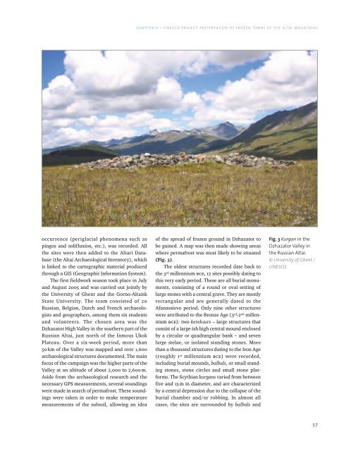
Fig. 3 Kurgan in the<br />
Dzhazator Valley in<br />
the Russian <strong>Altai</strong>.<br />
© University <strong>of</strong> Ghent /<br />
<strong>UNESCO</strong>.<br />
57