Currituck County Planning Board Case Analysis PB 11-19 R. Shaun ...
Currituck County Planning Board Case Analysis PB 11-19 R. Shaun ...
Currituck County Planning Board Case Analysis PB 11-19 R. Shaun ...

Create successful ePaper yourself
Turn your PDF publications into a flip-book with our unique Google optimized e-Paper software.
CASE ANALYSIS FOR THE<br />
<strong>Planning</strong> <strong>Board</strong><br />
DATE: December 13, 20<strong>11</strong><br />
<strong>PB</strong> <strong>11</strong>-<strong>19</strong> R. <strong>Shaun</strong> Moore<br />
ITEM: <strong>PB</strong> <strong>11</strong>-<strong>19</strong> R. <strong>Shaun</strong> Moore requests a zoning map amendment to rezone<br />
20.12 acres from A (Agricultural) to CD-R (Conditional District-<br />
Residential).<br />
LOCATION: Moyock, located at the terminus of Thayne Drive, Moyock Township.<br />
TAX ID: 0022-000-063R-0000<br />
0022-000-063S-0000<br />
OWNER: R. <strong>Shaun</strong> Moore<br />
1253 Tulls Creek Road<br />
Moyock, NC 27958<br />
APPLICANT: Eddie Hyman<br />
PO Box 339<br />
Camden, NC 27921<br />
LAND USE/ZONING OF SURROUNDING PROPERTY:<br />
Land Use Zoning<br />
NORTH: Active Farmland A/R-PUD Overlay<br />
SOUTH Low Density Residential A<br />
EAST: Low Density Residential A<br />
WEST: Low Density Residential/Farmland R-PUD Overlay<br />
LAND USE PLAN<br />
CLASSIFICATION: The 2006 Land Use Plan classifies the site as Full Service within the<br />
Moyock subarea.<br />
CURRENT ZONING: Agricultural (A)<br />
PROPOSED ZONING: Conditional District – Residential (CD-R)<br />
CURRENT USE: Low Density Residential/Undeveloped<br />
SIZE OF SITE: 20.12 acres<br />
ZONING HISTORY: <strong>19</strong>89: A (Agricultural District)<br />
UTILITIES: <strong>County</strong> water does not service this property. An individual on-site<br />
septic system is located the property.<br />
TRANSPORTATION: The proposed development is accessed by Thayne Drive, an<br />
unpaved, privately maintained road.<br />
<strong>PB</strong> <strong>11</strong>-<strong>19</strong> R. <strong>Shaun</strong> Moore<br />
Conditional Rezoning<br />
Page 1 of 6
FLOOD ZONE: The property is located within the 100-year floodplain; AE with a<br />
base flood elevation of 5.4 feet.<br />
WETLANDS: According to NC Division of Coastal Management maps, wetland<br />
characteristics do not exist on this property.<br />
SOILS: According to the Soil Survey for <strong>Currituck</strong> <strong>County</strong>, the soils are<br />
considered unsuitable for on-site septic systems due to soil<br />
wetness and slow percolation.<br />
PROPOSED ZONING CONDITIONS:<br />
The applicant is proposing the following uses and zoning conditions:<br />
o 13-lot residential subdivision<br />
o Minimum lot size shall be 40,000 square feet.<br />
o 60 foot buffer provided along the eastern boundary.<br />
o Street interconnection will be provided to adjacent properties to the north and west.<br />
o Stick built single family dwellings will be constructed on the lots.<br />
COMMUNITY MEETING:<br />
The community meeting was held on November 29, 20<strong>11</strong>, and the community meeting<br />
report is provided in the packet.<br />
TECHNICAL STAFF RECOMMENDATION:<br />
The technical review committee reviewed the plan on November 16, 20<strong>11</strong> and<br />
recommended approval of the rezoning request.<br />
PLANNING STAFF RECOMMENDATION:<br />
The planning staff recommends approval of the proposed conditional zoning request based<br />
on the following Land Use Plan policies:<br />
POLICY HN1: <strong>Currituck</strong> <strong>County</strong> shall encourage development to occur at densities<br />
appropriate for the location.<br />
POLICY AG3: <strong>County</strong> ACTIONS CONCERNING INFRASTRUCTURE (e.g.<br />
schools, parks, and utilities) and regulations shall serve to direct new development<br />
first to targeted growth areas near existing settlements indicated as Full Service<br />
Areas on the Future Land Use Map, rather than “leapfrogging” to locations in the<br />
midst of farmland and greenspace identified as Rural and Conservation areas on<br />
the Future land Use Map.<br />
<strong>PB</strong> <strong>11</strong>-<strong>19</strong> R. <strong>Shaun</strong> Moore<br />
Conditional Rezoning<br />
Page 2 of 6
<strong>PB</strong> <strong>11</strong>-<strong>19</strong> R. <strong>Shaun</strong> Moore<br />
Conditional Rezoning<br />
Page 3 of 6
<strong>PB</strong> <strong>11</strong>-<strong>19</strong> R. <strong>Shaun</strong> Moore<br />
Conditional Rezoning<br />
Page 4 of 6
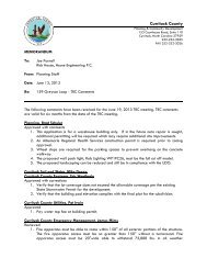
MEMORANDUM<br />
To: Eddie Hyman<br />
R. <strong>Shaun</strong> Moore<br />
From: <strong>Planning</strong> Staff<br />
Date: November 16, 20<strong>11</strong><br />
Re: R. <strong>Shaun</strong> Moore Conditional Rezoning<br />
The following comments have been received for the November 16, 20<strong>11</strong> TRC meeting. In order<br />
to be scheduled for the December 13, 20<strong>11</strong> <strong>Planning</strong> <strong>Board</strong> meeting, please address all<br />
comments by 3:00 p.m. on November 21, 20<strong>11</strong>. TRC comments are valid for six months from the<br />
date of the TRC meeting.<br />
<strong>Planning</strong>, Donna Voliva 252-232-6032<br />
1. Property owner must sign the application and provide email address if available.<br />
2. Please clarify the intended use of 1.5 acres indicated as “not included in the subdivision”.<br />
By default a lot will be created less than 10 acres and subject to subdivision regulations.<br />
3. The proposed recreational improvements for the 13-lot subdivision include a trail system.<br />
The staff would like to discuss reasonable recreational improvements for this development.<br />
4. The applicant did not propose conditions for the conditional rezoning request. Discussions<br />
regarding open space improvements and utilization, allowable land uses, interconnection,<br />
and development density are recommended.<br />
5. ORDINANCE REQUIREMENT: Based on the number of parcel splits from the parent parcel<br />
(since <strong>19</strong>89) the total required open space will be 20% of the total development area.<br />
The current plan provides open space for 18.62 acres; however, the total development<br />
area includes 1.50 acres.<br />
6. ORDINANCE REQUIREMENT: The developer shall be responsible for upgrading the<br />
existing street, Thayne Drive, to the minimum street standards of the Unified Development<br />
Ordinance.<br />
<strong>Currituck</strong> Soil and Water, Mike Doxey<br />
Approved<br />
<strong>Currituck</strong> <strong>County</strong> Engineer, Eric Weatherly<br />
Approved<br />
<strong>Currituck</strong> <strong>County</strong> Utilities, Pat Irwin<br />
Reviewed<br />
1. There are no waterlines on Thayne Drive.<br />
<strong>Currituck</strong> <strong>County</strong> Local Volunteer Fire Department<br />
Approved<br />
<strong>PB</strong> <strong>11</strong>-<strong>19</strong> R. <strong>Shaun</strong> Moore<br />
Conditional Rezoning<br />
Page 5 of 6
1. Only reviewed in regards to rezoning.<br />
<strong>Currituck</strong> <strong>County</strong> GIS, Harry Lee<br />
Reviewed<br />
1. Addresses will be assigned by GIS during preliminary plat review phase. Please propose<br />
a name for the unnamed proposed street.<br />
<strong>Currituck</strong> <strong>County</strong> Building Inspections, Spence Castello<br />
Approved<br />
NC Division of Coastal Management, Charlan Owens<br />
No comment<br />
NC State Archaeology, Lawrence Abbot<br />
No comment<br />
1. No archaeological site recorded within the project area. An archaeological survey is not<br />
recommended.<br />
Albemarle Regional Health Services, Joe Hobbs<br />
Reviewed<br />
1. Each lot which make up this proposed subdivision will need to be evaluated to determine<br />
soil suitability approval for sewage treatment and disposal. Contact Kevin Carver, RS at<br />
252-232-6603.<br />
The following departments and agencies did not provide comments at this time:<br />
<strong>Currituck</strong> <strong>County</strong> Emergency Management, James Mims<br />
<strong>Currituck</strong> <strong>County</strong> Schools, Dr. Megan Doyle<br />
<strong>Currituck</strong> <strong>County</strong> Parks and Recreation, Jason Weeks<br />
<strong>Currituck</strong> <strong>County</strong> Economic Development, Peter Bishop<br />
<strong>Currituck</strong> <strong>County</strong> Sheriff, Susan Johnson<br />
Navel Facilities Engineering Command, Community Plans Liaison Officer William DuFault<br />
NCDOT, Gretchen Byrum<br />
NCDENR Aquifer Protection, David May<br />
NCDENR, Land Quality, Pat MCClain<br />
NCDENR Environmental Health/Onsite Wastewater, Bob Uebler<br />
NCDENR, Environmental Management, Roger Thorpe<br />
NCDENR, Marine Fisheries, Kevin Hart<br />
NCDENR, Public Water, Siraj Chohan<br />
NCDENR Water Quality, Kim Colson<br />
NCDENR Water Quality/Surface Water Protection, Al Hodge<br />
NC Wildlife, Maria Dunn<br />
Centurylink, Kimberly Hoevenair<br />
Charter Communications, Sam Scilabba<br />
Dominion Power, Troy Lindsey<br />
Embarq, Hester Jones<br />
US Army Corps of Engineers, Kyle Barnes<br />
<strong>PB</strong> <strong>11</strong>-<strong>19</strong> R. <strong>Shaun</strong> Moore<br />
Conditional Rezoning<br />
Page 6 of 6