#ticinomoments 2019

Create successful ePaper yourself
Turn your PDF publications into a flip-book with our unique Google optimized e-Paper software.
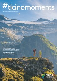
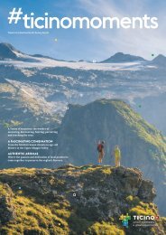
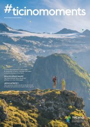
24 <strong>#ticinomoments</strong><br />
Up and down the<br />
mountains<br />
In Ticino you will find miles of footpaths of<br />
varying difficulty and you can discover<br />
many cozy huts. Discover them with us.<br />
Trails<br />
4,366 km<br />
Total official Ticino network<br />
Mountain trails<br />
80 % 17 % 3 % 76 %<br />
Unpaved roads<br />
10 %<br />
Hiking trails<br />
Paved roads<br />
14 %<br />
Alpine tracks<br />
Signage (signposts)<br />
Natural terrain<br />
4,584<br />
Total<br />
signposts<br />
1.05<br />
Signposts<br />
per km<br />
of footpath<br />
391<br />
CHF<br />
per position<br />
1.79<br />
Total cost<br />
(million CHF)<br />
Above 1,500 metres<br />
31 % #hikeTicino<br />
In the woods<br />
In populated areas<br />
10 %<br />
45 %<br />
Historical routes<br />
2,000<br />
Stretches<br />
in Ticino<br />
worthy of<br />
inclusion in the<br />
inventory<br />
of historical<br />
routes<br />
300<br />
Of national<br />
importance<br />
An app with over 200 routes for all<br />
tastes and 32 selected Premium<br />
itineraries. Find them on ticino.ch/hike<br />
Routes tracked<br />
200+<br />
300+<br />
Km tracked with Google View Trekker<br />
32<br />
Premium itineraries (with video)<br />
60'000+<br />
Apps downloaded on iOS and Android<br />
Georeferenced images<br />
5,000<br />
Malcantone 198<br />
Bellinzona 292<br />
Mendrisio 298<br />
Verzasca 340<br />
Riviera 190<br />
Blenio 427<br />
Gambarogno 142<br />
486 Locarno<br />
712 Vallemaggia<br />
709 Leventina<br />
571 Lugano<br />
Km of official<br />
trails in<br />
the sectors