CU Mar-Apr 2020

You also want an ePaper? Increase the reach of your titles
YUMPU automatically turns print PDFs into web optimized ePapers that Google loves.
CAD User<br />
MARCH/APRIL <strong>2020</strong><br />
VOL 33 NO 02<br />
WWW.CADUSER.COM<br />
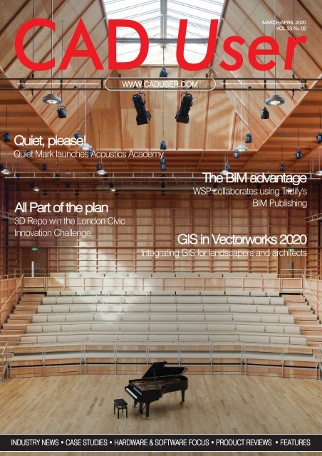
Quiet, please!<br />
Quiet <strong>Mar</strong>k launches Acoustics Academy<br />
All Part of the plan<br />
3D Repo win the London Civic<br />
Innovation Challenge<br />
The BIM advantage<br />
WSP collaborates using Tridify's<br />
BIM Publishing<br />
GIS in Vectorworks <strong>2020</strong><br />
Integrating GIS for landscapers and architects<br />
INDUSTRY NEWS • CASE STUDIES • HARDWARE & SOFTWARE FO<strong>CU</strong>S • PRODUCT REVIEWS • FEATURES
MODEL<br />
CHECKING<br />
FOR<br />
QUALITY.<br />
Use Solibri Model Checker to guarantee the quality<br />
on your construction projects. As the industry moves<br />
on from clash detection and geometry checks our<br />
solution offers:<br />
• Second Generation Clash Detection<br />
• Model version comparison and reporting<br />
• COBie validation and export<br />
• Instant and visual BIM data mining<br />
• Customisable and user defined rulesets<br />
• Supports collaborative workflows<br />
• And much more...<br />
TRIAL<br />
DOWNLOAD THE FREE TRIAL AT SOLIBRI.COM<br />
AND START SAVING TIME & MONEY RIGHT AWAY.
CONTENTS<br />
MARCH/APRIL <strong>2020</strong><br />
CONTENTS<br />
GIS IN VECTORWORKS <strong>2020</strong> 12<br />
Incorporating GIS workflows into your<br />
landscaping and architectural projects can<br />
bring a new dimension to your work, writes<br />
David Chadwick<br />
ALL PART OF THE PLAN 16<br />
3D Repo have won the Mayor of London's Civic<br />
Innovation Challenge for their innovative 3D<br />
solution, PlanBase, which makes the planning<br />
system more accessible<br />
KEEPING BIM IN-HOUSE 20<br />
Scenario Architecture discover that the<br />
benefits of using Graphisoft's ARCHICAD and<br />
its BIM capabilities can be applied to a single<br />
house project<br />
ACOUSTIC ACADEMY 28<br />
Noise pollution is second only to air pollution as<br />
a threat to public health, according to the World<br />
Health Organisation. Quiet <strong>Mar</strong>k has set up the<br />
Acoustics Academy to help us understand why<br />
NEWS................................................INDUSTRY NEWS....................................................................................................6<br />
• DIGITAL INNOVATION HOLDS THE KEY FOR HS2 • NEW SMART MFP FROM OKI EUROPE<br />
INDUSTRY FO<strong>CU</strong>S...........................BENEATH THE SURFACE OF DRAINING DESIGN.............................................14<br />
• ROB BUTCHER AT ACO WATER MANAGEMENT SHARES HIS TOP TIPS ON INTEGRATED DRAINAGE DESIGN<br />
CASE STUDY....................................CONCRETE RESULTS..........................................................................................18<br />
• TRIMBLE TEKLA'S ISMAIL MAKDA EXPLORES FIVE COMMON ISSUES ENCOUNTERED BY CONCRETE CONTRACTORS<br />
TECHNOLOGY FO<strong>CU</strong>S....................CITY SCALE DIGITAL TWINS FOR FLOOD RELIEF............................................22<br />
• BY ROBERT MANKOWSKI, VICE PRESIDENT, DIGITAL CITIES AT BENTLEY SYSTEMS<br />
TECHNOLOGY FO<strong>CU</strong>S.....................MAKING AN ASSET OF BIM ...............................................................................24<br />
• DAVID CHADWICK AND EXCITECH'S DARYN FITZ DIS<strong>CU</strong>SS HOW BIM CAN BENEFIT ASSET OWNERS<br />
CASE STUDY....................................THE BIM ADVANTAGE.........................................................................................26<br />
• WSP FINLAND IMPROVES COLLABORATION WITH ONLINE BIMS WITH TRIDIFY<br />
SOFTWARE RREVIEW......................BUILDING THE CONSTRUCTION CLOUD...........................................................30<br />
• AUTODESK CONSTRUCTION CLOUD ACCELERATES CONSTRUCTION MANAGEMENT FOR ENTIRE PROJECT TEAMS<br />
TRAINING MAP.................................AUTODESK TRAINING..........................................................................................32<br />
• YOUR GUIDE TO AUTODESK TRAINING<br />
TECHNOLOGY FO<strong>CU</strong>S....................DIGITISING PAPERWORK...................................................................................34<br />
• INTEGRITY SOFTWARE'S MOBILE FORMS GIVES ALL CONTRACTORS THE ABILITY TO SWITCH TO DIGITAL FORMS<br />
<strong>Mar</strong>ch/<strong>Apr</strong>il <strong>2020</strong> 3
COMMENT<br />
Editor:<br />
David Chadwick<br />
(cad.user@btc.co.uk)<br />
News Editor:<br />
<strong>Mar</strong>k Lyward<br />
(mark.lyward@btc.co.uk)<br />
Advertising Sales:<br />
Josh Boulton<br />
(josh.boulton@btc.co.uk)<br />
Production Manager:<br />
Abby Penn<br />
(abby.penn@btc.co.uk)<br />
Design/Layout:<br />
Ian Collis<br />
ian.collis@btc.co.uk<br />
Circulation/Subscriptions:<br />
Christina Willis<br />
(christina.willis@btc.co.uk)<br />
Publisher:<br />
John Jageurs<br />
john.jageurs@btc.co.uk<br />
Published by Barrow &<br />
Thompkins Connexion Ltd.<br />
35 Station Square, Petts Wood,<br />
Kent BR5 1LZ<br />
Tel: +44 (0) 1689 616 000<br />
Fax: +44 (0) 1689 82 66 22<br />
SUBSCRIPTIONS:<br />
UK £35/year, £60/two years,<br />
£80/three years;<br />
Europe:<br />
£48/year, £85 two years,<br />
£127/three years;<br />
R.O.W. £62/year<br />
£115/two years, £168/three years.<br />
Single copies can be bought for £8.50<br />
(includes postage & packaging).<br />
Published 6 times a year.<br />
© <strong>2020</strong> Barrow & Thompkins<br />
Connexion Ltd.<br />
All rights reserved.<br />
No part of the magazine may be<br />
reproduced, without prior consent<br />
in writing, from the publisher<br />
For more magazines from BTC, please visit:<br />
www.btc.co.uk<br />
Articles published reflect the opinions of<br />
the authors and are not necessarily those<br />
of the publisher or his employees. While<br />
every reasonable effort is made to ensure<br />
that the contents of editorial and advertising<br />
are accurate, no responsibility can be<br />
accepted by the publisher for errors, misrepresentations<br />
or any resulting effects<br />
Comment<br />
Water, water everywhere...<br />
by David Chadwick<br />
February saw the wettest month on<br />
record - much of it, it seems, dumped<br />
on the hills feeding into the River<br />
Severn, with the consequent floods<br />
drowning communities along its length. The<br />
catastrophes that persistent rainfall has<br />
produced this year, though, have affected<br />
many other areas both in the UK and<br />
overseas, including Australia, after months<br />
of forest fires, South America and some US<br />
States. Whether attributed to global<br />
warming or other factors, the frequency and<br />
intensity of such storms appears to be<br />
increasing, and they likely to get worse.<br />
The anguish of those caught in the floods<br />
is heart-rending, and we can only concur<br />
with the emotional plea that the flood<br />
defences put in place are not adequate, and<br />
that we must throw more money at the<br />
problem. The problem is 'how much', 'where'<br />
and 'how we should use it'?<br />
Putative solutions are being proposed by<br />
many bodies from, the UK Government to<br />
developers, explaining how their adherence<br />
to current flood mitigation requirements<br />
allow them to contemplate building new<br />
houses on flood plains.<br />
The biggest question of all, though, is the<br />
first one - how much will it cost to protect all<br />
of those communities that are being hit time<br />
and time again, both now and in the future,<br />
when the problem is projected to get much<br />
worse? The answer, I am afraid, is that the<br />
amount will be staggeringly large, and that<br />
any plans to protect one community have to<br />
be linked in with plans to protect the next<br />
one downstream, which will be swamped by<br />
flood waters hitting them faster and fuller.<br />
The money required to protect every<br />
community will surpass what can be<br />
achieved by emotional or social appeals,<br />
and will need to be submitted to cold<br />
financial fact. Decisions about what can,<br />
should, or cannot be protected will need to<br />
be backed by considerations of the costs<br />
involved. If you want to protect towns like<br />
Shrewsbury, which is flooded regularly by<br />
the River Severn, then you may have to<br />
sacrifice some of the adjoining land.<br />
I have nothing against Shrewsbury and use<br />
this merely as an example to illustrate the<br />
situation we are rapidly finding ourselves in,<br />
and to highlight the article in this issue by<br />
Robert Mankowski, VP, Digital Cities of<br />
Bentley Systems, who argues that we have<br />
the resources to quantify the effects of<br />
extreme weather events, and thus make the<br />
necessary financial decisions to support<br />
flood defence schemes, or to discard them<br />
as hopelessly extravagant. Keep in mind<br />
that the cost of rebuilding the levees after<br />
Hurricane Katrina in New Orleans has been<br />
estimated at $20 billion.<br />
It's another example of the benefits of<br />
creating a digital twin of a town, city or even<br />
country, which brings together all of the<br />
various quantifiable elements of any given<br />
area, and allows analyses and assumptions<br />
to be made about it, including, as you will<br />
see, its hydrological status and the cost of<br />
installing flood relief schemes.<br />
London is perhaps in a more precarious<br />
situation than Shrewsbury. It already suffers<br />
from isostatic rebound - an ongoing natural<br />
occurrence since the shrinking of the Ice<br />
Age ice caps which is causing the UK<br />
tectonic plate to tilt, sinking in the South and<br />
rising in the North. This is exacerbated by<br />
water extraction and bad planning over the<br />
last couple of hundred years, and now by<br />
rising sea levels caused by global warming.<br />
How soon before the Thames starts cresting<br />
the embankment?<br />
The floods knocked Brexit off the front page<br />
- and now since first writing this comment<br />
COVID19 has overtaken everything. It’s far<br />
too early to make assumptions about the<br />
future of infrastructure and the construction<br />
industry - or indeed anything else - as the<br />
state of the pandemic is still too fluid. We will<br />
no doubt have much more to discuss in<br />
future issues.<br />
4 <strong>Mar</strong>ch/<strong>Apr</strong>il <strong>2020</strong>
THE ULTIMATE<br />
SOFTWARE FROM<br />
SKETCH TO BIM<br />
Vectorworks Architect is the versatile solution<br />
that will save you time and allow you to sketch,<br />
draw, and model in a fully integrated BIM workflow.<br />
TO LEARN MORE, VISIT VECTORWORKS.NET/UK/ARCHITECT<br />
COURTYARD 33 | DESIGN BY 5468796 ARCHITECTURE
INDUSTRY news<br />
VISUAL INTEGRITY LAUNCH PDF2CAD V12<br />
pdf2cad, the best-selling<br />
PDF to DWG converter, is<br />
now at version 12. The new<br />
version includes additional<br />
options for separating and<br />
working with CAD layers as<br />
well as merging pages into a<br />
single drawing. The inclusion<br />
of an automatic font-mapping<br />
engine improves text handling,<br />
and a new option to convert<br />
password-protected PDF files<br />
has also been introduced.<br />
"pdf2cad has been saving<br />
the day for engineers, architects,<br />
and scientists for more<br />
than 20 years.", said Jean<br />
Haney, co-founder and CEO<br />
of Visual Integrity. "These new<br />
features offer advanced<br />
capabilities and resolve<br />
incompatibilities between<br />
PDF and CAD formats."<br />
www.visual-integrity.com<br />
NEW SMART MFP FROM OKI EUROPE<br />
OKI Europe has launched<br />
the MC883, a versatile A3<br />
colour smart multifunction printer<br />
(MFP) that's fully equipped<br />
to support construction businesses,<br />
where the ability to<br />
print and scan documents and<br />
plans to a professional quality<br />
at any time is key to keeping<br />
projects on track and customers<br />
satisfied.<br />
The MC883's easy user maintenance<br />
eliminates the need for<br />
engineer callouts, ensuring<br />
documents can be scanned,<br />
stored, copied or printed at all<br />
times, including site badges,<br />
contractor information, delivery<br />
orders, and health and safety<br />
certificates.<br />
Built on the same pprint<br />
engine as OKI's C800 Series,<br />
the world's smallest digital A3<br />
colour printer, the MC883 can<br />
fit into busy environments<br />
including construction sites<br />
where office space can be<br />
limited. Its media flexibility<br />
provides the ability to print<br />
banner paper up to 1.3m long<br />
in 1200 x 1200 dpi resolution,<br />
as well as the fine details of<br />
drawings, plans, blueprints,<br />
and instructions, and signage<br />
on-site, without the need for<br />
outsourcing, saving time,<br />
money and space.<br />
The MC883 features<br />
advanced smart document<br />
management including OKI's<br />
exclusive SENDYS Explorer, an<br />
all-in-one software that boosts<br />
efficiency by digitising, sharing<br />
and organising all documents<br />
in a flexible and secure way.<br />
The software is embedded in<br />
OKI's printers and can be<br />
accessed via a web browser,<br />
enabling partners involved in<br />
delivering projects to quickly<br />
access and action plans and<br />
instructions.<br />
In addition, off-site, mobile<br />
printing applications enable<br />
remote printing directly to OKI's<br />
MC883 from mobile devices<br />
over a wireless network, with<br />
built-in security features including<br />
IPsec, Encrypted Secure<br />
Print, and authentications to<br />
protect confidential data.<br />
"With its small footprint and<br />
super-sharp print resolution, the<br />
new MC883 is ideal for construction<br />
businesses that need<br />
to print fine line drawings and<br />
supporting instructions, as well<br />
having the requirement for sharing<br />
plans and information quickly<br />
with project partners and key<br />
stakeholders," says Javier<br />
Lopez, General Manager Vertical<br />
Solutions, OKI Europe Ltd.<br />
www.oki.com/eu<br />
CREATING A SPACE FOR LASER SCANNING<br />
Pointfuse has launched a<br />
new toolkit specifically<br />
designed to make it easier to<br />
adopt laser scanning within<br />
space management, planning<br />
and utilisation workflows. Pointfuse<br />
Space Creator automates<br />
the conversion of features such<br />
as walls, doors and windows to<br />
BIM LOD 200, and is compatible<br />
with the latest mobile mapping<br />
systems that are increasingly<br />
being used for as-built<br />
and as-used surveys within the<br />
facilities management sector.<br />
Pointfuse software converts<br />
the millions of individual measurements<br />
captured by laser<br />
scanning and photogrammetry<br />
into useable 3D models. The<br />
unique ability to classify objects<br />
within Pointfuse, both automatically<br />
and manually, has already<br />
had a huge impact on how asbuilt<br />
data is used within design<br />
and construction. With the<br />
launch of Space Creator, Pointfuse<br />
can now realise real time<br />
records for space utilisation<br />
and optimisation projects by<br />
deskilling and streamlining<br />
workflows, thus reducing project<br />
costs.<br />
Pointfuse Space Creator<br />
leverages the core functionality<br />
of Pointfuse - the segmented<br />
mesh model; automatically<br />
converting classified mesh<br />
models into 'family' groups,<br />
such as walls, floors, doors,<br />
windows, etc. for use with<br />
popular downstream BIM and<br />
FM software.<br />
Pointfuse Space Creator data<br />
can then be exported as IFC<br />
(Industry Foundation Class)<br />
parametrised objects while also<br />
automatically calculating quantities,<br />
areas and dimensions in<br />
an easy to read PDF building<br />
information report.<br />
www.pointfuse.com<br />
6<br />
<strong>Mar</strong>ch/<strong>Apr</strong>il <strong>2020</strong>
Project Information Management.<br />
For Architects,<br />
Engineers,<br />
Contractors<br />
& Owners<br />
Smarter, Flexible Project Delivery:<br />
• Online, collaborative workshare<br />
• Office 365 SharePoint platform<br />
• Standardised document control<br />
• ISO 19650 naming compliance out-of-the-box<br />
• Workflow productivity with design authoring,<br />
collaboration and ERP systems<br />
Atvero ® increases process efficiency, improves quality, reduces risk and time administering<br />
construction projects. Because it's built on the Office 365 SharePoint in the Cloud, it helps<br />
organisations efficiently manage and access project contacts, email, document and<br />
drawing content—wherever and whenever needed.<br />
Smarter, Flexible Project Delivery at £16 per user per month<br />
Find out more at www.atvero.com<br />
Terms and conditions apply
INDUSTRY news<br />
DIGITAL INNOVATION HOLDS THE KEY TO HS2<br />
Shareplant is urging the<br />
industry to tap into efficiency<br />
gains brought by digital technology,<br />
to help make ambitious<br />
infrastructure projects like HS2<br />
feasible. <strong>Mar</strong>k Watters, founder<br />
and MD of Shareplant, said:<br />
"The viability of major projects<br />
like High Speed 2 hinges on our<br />
sector's ability to catch up and<br />
make the same gains in efficiency<br />
other industries have enjoyed<br />
by embracing digital technology.<br />
"Our industry should be hungry<br />
for every opportunity to<br />
make savings and deliver more<br />
cost-effective, leaner schemes.<br />
If we can deliver these kinds of<br />
ambitious projects on time and<br />
on budget, it makes a difference<br />
not just for us but for the<br />
whole of the UK that will benefit<br />
from the new infrastructure."<br />
Shareplant is a UK-first online<br />
construction equipment sharing<br />
& rental marketplace and<br />
construction management<br />
software suite for site managers<br />
and equipment owners,<br />
bringing the efficiency of the<br />
sharing economy (services like<br />
Uber or Airbnb) to construction<br />
plant and tool hire while<br />
helping to modernise the management<br />
and administration of<br />
construction projects by using<br />
paperless, cloud-based construction<br />
software.<br />
The software and app unlock<br />
new revenue streams for construction<br />
firms, making it easier<br />
to offset depreciation while plant<br />
is idle during a project and easier<br />
to cheaply rent plant - leading<br />
to more efficient and frictionless<br />
allocation of resources, smart<br />
use of data and generating savings<br />
that flow through every<br />
stage of a project.<br />
www.shareplant.com<br />
NEW SUPPORT FOR OASYS MASSMOTION<br />
Oasys MassMotion has<br />
received multi-language<br />
support with a simple Chinese<br />
interface and user support,<br />
along with new features and<br />
capabilities. These include new<br />
elevator analysis options, conditional<br />
wait spaces in process<br />
chains and a range of usability<br />
enhancements.<br />
Initially developed for Arup<br />
engineers to help understand<br />
the impact of crowding on<br />
major infrastructure projects,<br />
Oasys MassMotion is now the<br />
most flexible, commerciallyavailable<br />
crowd simulation software<br />
in the world. It offers<br />
robust geometry editing and<br />
BIM import capabilities, flexible<br />
operations and logic modelling,<br />
and a wide variety of analysis<br />
options, including easily implemented<br />
analysis of vertical circulation.<br />
It enables the smartest<br />
agents to react dynamically to<br />
emerging situations.<br />
www.oasys-software.com<br />
BENTLEY SYSTEMS ACQUIRES GROUPBC<br />
Bentley Systems has<br />
acquired GroupBC, a<br />
leading UK SaaS software<br />
innovator. For over twenty<br />
years, GroupBC’s and Bentley’s<br />
software solutions have<br />
been deployed for complementary<br />
purposes to improve<br />
project and asset information<br />
management.<br />
Keith Bentley, CTO for Bentley<br />
Systems, said, "Our iTwin cloud<br />
services, taking advantage of<br />
iModel-based solutions for<br />
interoperability, are ideal for federating<br />
CDEs. This enables us<br />
Virtual Surveyor has released<br />
Version 7.1 of its popular<br />
drone surveying software, introducing<br />
functionality to efficiently<br />
calculate volumetrics in quarries,<br />
mine pits, retention ponds,<br />
and other basins that fill with<br />
water. This new functionality<br />
complements advanced cutand-fill<br />
mapping capabilities<br />
unveiled in late 2019.<br />
"Virtual Surveyor is now the<br />
go-to package for managers<br />
of mines, drainage pits, and<br />
stormwater retention basins,"<br />
said Tom Op 't Eyndt, CEO of<br />
Virtual Surveyor nv in Belgium.<br />
"Volumetric calculations involving<br />
water bodies can be performed<br />
much faster and more<br />
accurately."<br />
Virtual Surveyor is popular<br />
among surveyors because it<br />
bridges the gap between UAV<br />
photogrammetric processing<br />
applications and engineering<br />
to assure that the users of our<br />
BC SaaS services will benefit<br />
from further extending the value<br />
of their project and asset information<br />
through digital twins.<br />
"With the help of our new<br />
GroupBC colleagues, we will<br />
now be able to better serve<br />
engineers, contractors, and<br />
owners by bringing together<br />
their collective IT (information<br />
management), OT (operational<br />
technologies including<br />
reality modeling), and ET<br />
(engineering models)."<br />
www.bentley.com<br />
VIRTUAL SURVEYOR SOFTWARE FOR DRONES<br />
design packages. The software<br />
generates an interactive<br />
onscreen environment with<br />
UAV orthophotos/DSMs<br />
and/or LiDAR point clouds<br />
where the surveyor selects<br />
survey points and breaklines<br />
to define the topography, creating<br />
highly accurate products<br />
up to five times faster than<br />
otherwise possible.<br />
In Version 7.1, the user can<br />
apply two new functions called<br />
Extract Level and Create Water<br />
to delineate an entire water<br />
body and represent its surface<br />
as a single elevation. Delineating<br />
the water feature can be<br />
accomplished with a single<br />
click on a point where the<br />
water meets the edge of a<br />
basin, pond or quarry. This<br />
creates a perfectly flat elevation<br />
for the water surface in the<br />
generated surface model.<br />
www.virtual-surveyor.com<br />
8<br />
<strong>Mar</strong>ch/<strong>Apr</strong>il <strong>2020</strong>
MARKET focus<br />
ERP for house builders<br />
EasyBuild's house building module provides complete marketing and sales progress functionality to<br />
handle the full range of house purchasing schemes<br />
In our EasyBuild ERP primer in the<br />
last issue of the magazine we<br />
pointed out that Enterprise<br />
Resource Planning requires different<br />
solutions within different sectors of the<br />
industry. One of the areas that<br />
EasyBuild specialises in is house<br />
building, or to be more specific,<br />
supplying software to contractors<br />
engaged in house building.<br />
One of the most interesting aspects<br />
of this is that a typical housing project<br />
comes with a large number of<br />
customers rather than just one primary<br />
client. To make it more complicated,<br />
there are numerous ways in which<br />
customers are able to pay for their<br />
purchase - from outright cash<br />
purchase to shared ownership,<br />
government subsidies like 'Help to Buy'<br />
or schemes such as the ongoing 'Buy<br />
to Let' program.<br />
Different schemes have been<br />
introduced over the last couple of<br />
years to stimulate different sections of<br />
the market, some with more success<br />
than others, in a bid to tackle the<br />
underlying shortage of suitable houses<br />
in some areas, and the difficulties that<br />
younger people now have in acquiring<br />
their own home.<br />
EasyBuild's ERP solution therefore<br />
not only needs the flexibility to be able<br />
to accommodate each and every<br />
house purchase scheme but also must<br />
be able to provide contractors with the<br />
information they need to calculate the<br />
risks associated with each of them.<br />
The essence of ERP is, of course, the<br />
ability to integrate the construction and<br />
operational elements of a building<br />
project with the financial.<br />
You might think that getting involved<br />
in the financial side of house<br />
purchasing would be better left entirely<br />
to the solicitors and mortgage brokers<br />
working for each of the clients, who<br />
should be able to guarantee payment<br />
of the agreed price once contracts<br />
have been exchanged, but with more<br />
and more contractors offering one<br />
scheme or another and advertising<br />
such on the building site, the<br />
mechanics of each needs to be<br />
factored into the project costs. You also<br />
have to consider the ratio of affordable<br />
properties that need to be included in<br />
large house building projects.<br />
10<br />
<strong>Mar</strong>ch/<strong>Apr</strong>il <strong>2020</strong>
MARKET focus<br />
FUNDING YOUR HOUSE PURCHASE<br />
I thought it would be useful, then, to<br />
look at the different options available<br />
to house builders, consider the pros<br />
and cons of each, and attempt to<br />
gainsay the UK Government's<br />
intentions in each area, showing how<br />
EasyBuild can assist by analysing<br />
costs against projected income.<br />
The government is an important<br />
factor in this equation. Faced with a<br />
shortage of accommodation and a<br />
need to stimulate house building, 'Buyto-Let'<br />
was introduced a couple of<br />
years ago. Even with deposits of 25%<br />
and higher rate mortgages, the<br />
expected return of around 8-9% which<br />
most were achieving proved popular -<br />
perhaps a bit too popular, as the<br />
government's generosity was scaled<br />
back, cancelling the tax relief available<br />
to landlords. The demand for such<br />
properties is still strong though,<br />
despite it being considered a high-risk<br />
investment by lenders.<br />
It was a quick fix which has proved<br />
very profitable for some builders but<br />
not so popular for young people, who<br />
aren't able to buy their own homes<br />
because of the inflated prices and high<br />
deposits required. Another government<br />
initiative was required, Help to Buy,<br />
which offered first time house buyers<br />
20% towards the cost of the property,<br />
which would be returned when the<br />
property was subsequently resold or<br />
after a fixed period.<br />
Variations on multiple tenancy<br />
purchases have also sprung up. This<br />
enables two or more people to share<br />
the cost of purchasing the property,<br />
subject to a couple of minor<br />
conditions. A beneficial joint tenancy -<br />
the term is used whether the joint<br />
owners are in a freehold or leasehold<br />
property - means that tenants can't<br />
resell their share of the property and<br />
must leave it to be shared amongst the<br />
other tenants if they leave the property<br />
for any reason. Tenants in common,<br />
however, can sell on their share of the<br />
property to whoever they want.<br />
To compound the complexity of the<br />
situation even further, the government<br />
has stipulated that building projects<br />
above a certain size must have a<br />
sizeable proportion of 'affordable'<br />
homes of lower quality but within the<br />
price range of local people, who might<br />
otherwise have to move away from the<br />
area. It is even being said that blocks<br />
of houses within some housing<br />
developments are being bought by city<br />
councils to rehouse problem tenants or<br />
Middle Eastern refugees.<br />
GOVERNMENT STRATEGIES<br />
The common factor throughout all of<br />
this is the UK Government which,<br />
depending on whoever is in power, has<br />
numerous strategies to motivate house<br />
builders to construct more houses to<br />
meet a constantly increasing demand.<br />
The evidence is the encouragement of<br />
the Buy-to-Let market, followed soon<br />
after by Help to Buy. The problem is<br />
that house builders with finite<br />
resources and numerous parcels of<br />
land for development, not to mention<br />
low margins, must decide which end of<br />
the market to aim at. Focusing on<br />
individual target markets influences the<br />
type, density and kitting out of each<br />
property - expensive options that<br />
govern the amount of profit that the<br />
project could generate.<br />
Whilst government strategies are<br />
bound to change on a regular basis,<br />
each of the house purchase schemes<br />
currently in place involve different<br />
levels of risk. Buy-to-Let financing<br />
takes this into account by requesting<br />
higher deposits and interest rates, for<br />
instance, to balance bad tenancies<br />
and periods of non-occupancy, whilst<br />
shared purchases probably take into<br />
account the possibility of earlier<br />
closure of the arrangement when joint<br />
tenancies split up.<br />
EASYBUILD FOR HOUSE<br />
BUILDERS<br />
So you can see why EasyBuild has<br />
included a complete module for house<br />
builders in its construction<br />
management software, which includes<br />
an integrated house sales section that<br />
provides financial and project<br />
accounting from setting up a plot to<br />
post completion. House builders are<br />
more closely involved in the sales<br />
process for each property, including<br />
setting marketing strategies that<br />
outline the financial schemes available<br />
to prospective customers, or the scale<br />
of rent that Buy-to-Let landlords can<br />
expect on completion.<br />
The module is also used to track<br />
progress on each property, assess<br />
probable completion dates, and<br />
ascertain expected income and<br />
expenditure throughout the life of the<br />
whole project, which is absolutely vital<br />
in order to balance cashflows, pay for<br />
supplies and subcontract resources -<br />
and to fine-tune the projects profitability.<br />
House builders are as keen to satisfy<br />
the public demand for houses as much<br />
as the government, but are reliant on a<br />
certain amount of stability in the<br />
markets they should be addressing.<br />
While this can't be guaranteed, they<br />
need the resources of a<br />
comprehensive software tool that is<br />
flexible enough to handle any of the<br />
house purchase schemes described<br />
here, or even future schemes, and<br />
deliver the operating information to run<br />
successful house building projects on<br />
a daily basis.<br />
www.easybuilduk.com<br />
<strong>Mar</strong>ch/<strong>Apr</strong>il <strong>2020</strong> 11
SOFTWARE review<br />
GIS in Vectorworks <strong>2020</strong><br />
GIS alignment with a CAD data file<br />
GIS in Vectorworks <strong>2020</strong><br />
Incorporating GIS workflows into your landscaping and architectural projects can bring a new<br />
dimension to your work, writes David Chadwick<br />
If you can integrate your building plans<br />
or landscape designs with one of the<br />
main GIS solutions then you have<br />
access to a wealth of additional tools that<br />
will add veracity and realism to your<br />
project. Vectorworks Architect <strong>2020</strong>,<br />
already a comprehensive set of modules<br />
that allows users to design from terrain<br />
data through to a finished product, has<br />
enabled full integration with Esri - a global<br />
leader in GIS software - to bring its wealth<br />
of location information to its users. It<br />
allows project managers to consider many<br />
other factors when making design<br />
decisions, such as online mapping, terrain<br />
characteristics, prevailing weather<br />
conditions, existing infrastructure, aerial<br />
imagery, visual aesthetics and much more.<br />
Esri brings its ArcGIS Online services to<br />
the partnership with Vectorworks, providing<br />
quick access to its GIS imagery, data and<br />
geometry, to the benefit of all modules of<br />
Vectorworks <strong>2020</strong> software: Vectorworks<br />
Architect, Landmark and Designer.<br />
"The process of integrating GIS<br />
information with a BIM model became<br />
tremendously easier with the ability to<br />
incorporate data from Esri ArcGIS Online<br />
services early in the design process.<br />
Further, the resulting georeferenced files<br />
make it easy to collaborate," said<br />
Vectorworks Landscape Product<br />
<strong>Mar</strong>keting Manager Eric Gilbey, PLA,<br />
ASLA. "A broad range of AEC and<br />
landscape professionals will benefit from<br />
the new integration including those<br />
planning with architecture firms or<br />
delivering government, master planning or<br />
campus planning projects. They'll notice a<br />
much more seamless and direct GIS<br />
workflow that is a huge time saver."<br />
A couple of new Vectorworks tools have<br />
been added to provide access to online<br />
mapping and aerial images, namely<br />
Geoimage and Geolocate. Geolocate<br />
uses geographic coordinates and<br />
projection in a Vectorworks file to<br />
accurately geolocate properties simply by<br />
entering an address. If you subscribe to<br />
the ArcGIS Online services plan you will<br />
then be able to download more maps and<br />
other imagery directly into Vectorworks.<br />
One Vectorworks user who has been<br />
trying out the software was much<br />
impressed. "I love how Vectorworks often<br />
takes a user request to the next level,<br />
digging deep into the nature of the<br />
request and planning far ahead to meet<br />
user needs into the future," said Anna<br />
Arbetter, licensed landscape architect at<br />
Futurity, Inc. "As an Esri user, the similarity<br />
to the ArcGIS environment makes<br />
Vectorworks even more of an asset for us.<br />
We use GIS extensively and incorporate it<br />
into every project. The streaming imagery<br />
service allows us to instantly assess<br />
whether our project data has shown up in<br />
the right location."<br />
GIS WORKFLOWS IN<br />
VECTORWORKS <strong>2020</strong><br />
The GIS features in Vectorworks <strong>2020</strong> -<br />
Geolocate, Geoimage, GIS Stake, Graticule<br />
and Great circle - are accessed through a<br />
new tool, and are all georeferenced. I'll<br />
explain what the first three of these do<br />
shortly, but first you need to understand the<br />
processes that go into ensuring that, when<br />
you place your building on a piece of the<br />
Earth, everybody else knows exactly where<br />
it is. For this you need to know about<br />
georeferencing and its role in the process.<br />
Pinpointing a spot on the sphere of the<br />
Earth and then showing it on the 2D flat<br />
surface of a map has always been a<br />
challenge with maps. It encouraged early<br />
navigators to devise a number of ways of<br />
achieving this, the most popular 'projection'<br />
being Gerardus Mercator's, developed in<br />
1569. To picture this, imagine a cylinder<br />
wrapped around the earth with a light<br />
source at the centre of the Earth, etching<br />
the coastlines of all land areas onto to the<br />
cylinder, and then unrolling the cylinder and<br />
laying it out flat. Obviously the extreme or<br />
polar areas will be much larger than land<br />
masses near the equator, which is why<br />
Greenland and Russia appear much larger<br />
than they really are.<br />
To produce workable maps, some<br />
modification was permitted to allow<br />
individual countries to develop their own<br />
internal grid systems, based on the<br />
12<br />
<strong>Mar</strong>ch/<strong>Apr</strong>il <strong>2020</strong>
SOFTWAREreview<br />
Importing a georeferenced shape file<br />
IFC file placed in georeferenced location<br />
Universal Transverse Mercator - which<br />
basically utilises a cylinder on its side<br />
instead of vertical. The Earth is then divided<br />
into 60 UTM longitudinal zones, each 6<br />
degrees apart, from which individual<br />
countries have developed their internal<br />
mapping grid systems. In the UK we use<br />
the British National Grid, and in Australia it's<br />
the MGA or Mapping Grid of Australia,<br />
which incidentally has UTM zones 1000km<br />
apart instead of 670km - overlapping zones<br />
in the 45-56 UTM zone region in which<br />
Australia lies.<br />
THE GEOLOCATE TOOL<br />
Clicking on the Geolocate tool in the GIS<br />
toolset brings up a warning dialogue which<br />
states that the tool will change the<br />
geographical location that corresponds<br />
with the document's - your map's - internal<br />
origin. If you are happy with that, you can<br />
then select the coordinate system that you<br />
want to work in. You have a number of<br />
options, but the one you should probably<br />
use is 'Use a common coordinate system<br />
or enter Well Known Text (WKT)'. If you click<br />
this it will lead you to the British National<br />
Grid / OSGB 1936 system, whose default<br />
location is usually London. As<br />
georeferencing needs to be set for each<br />
individual layer of your document, you need<br />
to go through the Navigation-Design<br />
toolbox to make sure it has the correct<br />
georeferencing system and setup. For<br />
convenience sake, you can also change<br />
the layer name to Geoimage.<br />
You have now got to find out where you<br />
are in the world, and to do this you click<br />
on 'search for location'. Entering a town or<br />
place name allows Vectorworks to<br />
connect to the ESRI server and bring up a<br />
list of matches. Select the one you want<br />
and an image of the location is displayed<br />
and an internal origin is set in your<br />
document. If your selection is accurate<br />
then your building site will be near to the<br />
internal origin.<br />
GEOIMAGE<br />
You can then add the location image to<br />
your document, either in Satellite or Map<br />
mode, by drawing a rectangular polygon<br />
which fixes an interactive image within the<br />
document - becoming, in effect, a window<br />
into the surface of the Earth. This image<br />
only displays when you have Vectorworks<br />
open and you will need to click the 'update'<br />
button each time you reload Vectorworks.<br />
GIS STAKE TOOL<br />
This allows you to place a modified Stake<br />
object, like a temporary aerial image or<br />
map, which depicts exactly where you are -<br />
and as it is interactive, it's coordinates<br />
reflect those in the georeferenced<br />
document. You can also then import a<br />
georeferenced DWG or Shape files file,<br />
confirming, again, whether they use the<br />
correct georeferenced settings, and under<br />
Advanced check its location, scale,<br />
whether it is 2D or 3D, and whether it is<br />
aligned with the internal origin. If everything<br />
is done correctly you will find the new<br />
images coincide with the rest of the<br />
information in the working document<br />
exactly. Adding georeferenced Shape Files<br />
adds a lot more information to the working<br />
document, and are used extensively by<br />
local authorities to check site data: blocks,<br />
zones, streets, perimeter's etc.<br />
Typically, adding DWG files is done using<br />
a shuttle file - creating a secondary file and<br />
confirming all settings as usual, and<br />
referencing that from the working<br />
document, placing a Viewpoint to upload<br />
when required.<br />
IMPORTING AN IFC FILE<br />
You can see the extent to which the GIS<br />
tools have had to focus on establishing<br />
precise locations, exact longitude, latitude<br />
and orientation settings, correct layer<br />
usage and matching settings throughout,<br />
until you come to the reason why you have<br />
done all this - placing your building<br />
precisely where it should be.<br />
With a few more tweaks (and there is<br />
somewhat more behind that laid out<br />
above) having set your 'user origin' in your<br />
document and selecting another layer and<br />
locking it so it can't be moved, you can<br />
import your IFC file with a few simple<br />
commands (Building - IFC ) whereupon it<br />
is imported as a georeferenced model.<br />
You can then render it in OPenGL, change<br />
the viewport and view your building<br />
precisely located where you would like it to<br />
be. Job done!<br />
Echoing Anna's earlier comments, once<br />
you start integrating GIS with your<br />
Landscape and Architectural documents<br />
you will get so much more satisfaction<br />
about the entire process and enjoy<br />
dropping your designs exactly where you<br />
want them to be. Impress your clients even<br />
more than you usually do!<br />
www.vectorworks.net<br />
<strong>Mar</strong>ch/<strong>Apr</strong>il <strong>2020</strong> 13
INDUSTRYfocus<br />
Beneath the surface of drainage design<br />
Rob Butcher, Design Services Manager at ACO Water Management, shares his top tips for finding the<br />
right software for an integrated design approach to drainage<br />
Surface water management is a critical<br />
consideration in any development,<br />
and recent flooding events highlight<br />
the importance of preventing further<br />
pressure being placed onto existing<br />
infrastructure. For those tasked with<br />
designing systems that mitigate the<br />
damaging effects of flooding, there are<br />
some key factors to look out for when<br />
opting for design software.<br />
1. Usability<br />
First and foremost, hydraulic design<br />
software has to be straightforward to use.<br />
One of the biggest obstacles that many<br />
face at the design stage is an overcomplicated<br />
platform that prohibits access<br />
to some of the most important features.<br />
Software should be as simple as possible to<br />
use, seeking to overcome the<br />
misconception that drainage design is too<br />
complicated.<br />
It is equally important that software can be<br />
used across a range of IT platforms, as this<br />
will help to reduce the time it takes to design<br />
surface water management solutions. If the<br />
construction industry is to tackle the issues<br />
associated with heavy rainfall and flood<br />
events, design software needs to be as<br />
accessible and intuitive as possible.<br />
2. Application specific<br />
Design work requires its exponents to be<br />
detail orientated, and because of this, it<br />
can be easy to lose sight of the overall<br />
project. Opting for software which positions<br />
the end-application front and centre can<br />
help to overcome this issue, and ensures<br />
that drainage solutions are matched to the<br />
specific requirements of the project.<br />
Pedestrianised surface water<br />
management projects will require a<br />
different approach to highways, just as<br />
industrial drainage will vary depending on<br />
the focus of the business. Design software<br />
needs to offer the capability to select<br />
project type and size at the start of the<br />
process, in order to produce the most<br />
accurate results.<br />
3. Location specific<br />
Alongside ensuring that design software<br />
can cater to specific applications, the<br />
geographical location of a project has<br />
obvious implications for surface water<br />
management. Everything from rainfall<br />
density to topography impacts the way that<br />
drainage is designed, and it is crucial that<br />
this is considered at the very earliest stage<br />
of a construction project.<br />
The most precise and straightforward way<br />
to ensure drainage is equipped to deal with<br />
location specific considerations is to use<br />
readily available data. ACO QuAD - a freeto-use<br />
hydraulic design software - is able to<br />
integrate with Google Maps, meaning<br />
users can input their exact location and<br />
automatically receive rainfall intensity for<br />
that area.<br />
When coupled with the ability to calculate<br />
run-off coefficient, based on the<br />
permeability of the chosen surface and<br />
surface storage calculation options,<br />
designers will be able to plan a highly<br />
accurate hydraulic drainage system in a<br />
matter of minutes. This should also include<br />
the ability to factor in angled surfaces,<br />
which is a crucial part of drainage design.<br />
4. Integrity<br />
Surface water management is something<br />
that requires a collaborative approach,<br />
and design software's primary purpose<br />
should be to ensure correct planning of a<br />
project. It needs to be a design-first<br />
programme, rather than simply a<br />
marketing or sales tool, in order to<br />
produce the best possible outcome.<br />
FINAL THOUGHTS<br />
There are a number of different tools<br />
available for drainage design, but it is<br />
important that accuracy and usability takes<br />
precedent over commercial<br />
considerations. Opting for a platform that<br />
offers location and application specific<br />
capabilities will ensure that surface water<br />
management improves, ultimately helping<br />
to protect against storm and flood level<br />
events in the future.<br />
ACO's QuAD software exemplifies the<br />
above, serving as purely a surface water<br />
design tool, with designs only being shared<br />
with ACO if the user makes a conscious<br />
decision to do so. It has been built on the<br />
four cornerstones outlined above,<br />
combining usability and integrity with<br />
application and location specific<br />
functionality. It has been created to be<br />
intuitive to both architects and engineers<br />
alike, and can be used with ACO's<br />
Visualiser platform to provide an insight as<br />
to the look of the finished installation.<br />
www.aco.co.uk/home.php<br />
14<br />
<strong>Mar</strong>ch/<strong>Apr</strong>il <strong>2020</strong>
Automated, not Antiquated.<br />
Away with antiquated software or manual ways of working.<br />
Structural engineering calculations are automated with extreme speed and accuracy<br />
using Tekla Tedds. Over 15,000 unique users rely on Tedds software every month<br />
to quickly and easily perform structural calculations and produce professionally<br />
documented workings and results. It’s time to Automate. It’s time for Tedds.<br />
Don’t just take our word for it. Try Tekla Tedds for yourself today with our 45 day<br />
FREE trial at: http://bit.ly/Tekla-Tedds-<strong>CU</strong>0719<br />
www.tekla.com/uk/products/tekla-tedds<br />
TRANSFORMING THE WAY THE WORLD WORKS
CASE study<br />
3D Repo PlanBase - Planning response (above and right)<br />
All part of the plan<br />
3D Repo have won the Mayor of London's Civic Innovation Challenge for their innovative 3D solution,<br />
PlanBase, which makes the planning system more accessible<br />
You might think that 3D Repo's<br />
success in winning the Mayor of<br />
London's Civic Innovation<br />
Challenge has been trumped by the<br />
Government's announcement about the<br />
suspension of the need to seek planning<br />
permission for home extensions and<br />
improvements - but you would be wrong.<br />
The introduction of 3D Repo's<br />
innovative 3D solution is still a critically<br />
important improvement in the way that<br />
individuals and building owners address<br />
planning requirements for listed<br />
properties and adhere to building<br />
regulations. The somewhat archaic<br />
processes currently in place are being<br />
brought into the 21st century and,<br />
probably more to the point, planning<br />
issues can be dealt with in real time with<br />
direct access to planning officers who<br />
tend to be in short supply and rather<br />
overstretched, anyway.<br />
The competition attracted over 125<br />
entrants offering a variety of solutions to<br />
address London's most pressing<br />
problems - an exciting opportunity for any<br />
young tech company trying to make a<br />
name for itself in the market.<br />
3D Repo's winning solution is an opensource<br />
3D planning portal, PlanBase,<br />
which is based on their award-winning<br />
digital construction platform. PlanBase<br />
operates as a standalone website but can<br />
also be embedded into existing planning<br />
portals where residents and planners<br />
alike can review proposals in 3D and<br />
comment on them where it matters most.<br />
The people of London will be able to<br />
access PlanBase via a web browser and<br />
drop 'pins' based on a specific topic and<br />
provide feedback directly in 3D.<br />
Dr Jozef Doboš, Founder & CEO of 3D<br />
Repo confirmed the problems with<br />
current planning applications described<br />
above, explaining that current planning<br />
processes struggle to communicate<br />
properly with the public, and are bogged<br />
down with applications and Information<br />
overload with over-reliance on 2D<br />
architectural diagrams that most people<br />
cannot comprehend. PlanBase makes it<br />
easier to digest that information in 3D,<br />
and the online platform will make it more<br />
accessible for everyone to have their say.<br />
A recent survey by Talk London, which<br />
received over 1,000 respondents,<br />
overwhelmingly revealed that 87% of<br />
Londoners care strongly about new<br />
developments and would want to engage<br />
with planning if it was easier to do so,<br />
with 70% of those people surveyed<br />
suggesting it would ideally be done in 3D.<br />
As a tech start-up 3D Repo employs<br />
just 11 people but is already transforming<br />
how construction projects are designed<br />
and delivered by democratising data,<br />
mitigating risk, and reducing complexity<br />
for architects, engineers, and<br />
contractors. 3D Repo's collaborative<br />
online platform has already been used on<br />
some of the most challenging<br />
construction projects in the UK, including<br />
King's Cross station remodelling, Hinkley<br />
Point C nuclear power station, and<br />
London's Wood Wharf District.<br />
THE BASICS OF PLANBASE<br />
Through its work with GLA, the CIC<br />
partners and its own research with<br />
residents and multiple planning<br />
professionals, 3D Repo has become well<br />
aware of the issues involved in widening<br />
informed access to planning processes.<br />
This points to a lack of understanding of<br />
proposals presented in 2D formats,<br />
unreadable textual submissions and a<br />
lack of opportunity to post comments and<br />
suggestions. 75% of respondents to the<br />
Talk London survey expressed their<br />
dissatisfaction that what comments they<br />
did make were not acknowledged nor<br />
considered during planning. From the<br />
planners' point of view, despite placing<br />
planning portals online, very few<br />
comments were being submitted.<br />
To address the problems, and to provide<br />
the 'wow factor' and visual narrative that<br />
were needed to engage with the public,<br />
3D Repo designed PlanBase, a 3D Repo<br />
16<br />
<strong>Mar</strong>ch/<strong>Apr</strong>il <strong>2020</strong>
CASE study<br />
3D Repo PlanBase - Planning overview<br />
3D Repo PlanBase - Power dashboard<br />
Digital Construction Platform in the cloud:<br />
https://3drepo.com. This gives residents<br />
and planners the ability to review<br />
proposals in 3D and comment on them.<br />
Using the interactive 2D Geographical<br />
Information System (GIS) interfaces in<br />
PlanBase, users can also drop pins<br />
based on a specific topic and provide<br />
feedback directly in 3D. This is a far cry<br />
from current practices, which require<br />
residents and objectors to provide written<br />
submissions or email relevant<br />
information, for planners to collate,<br />
analyse and respond to manually - with<br />
scant discussion with the correspondents<br />
and extending planning processes by<br />
weeks or even months.<br />
Users are instead provided with a<br />
friendly and accessible solution which<br />
has been tested by thousands of<br />
construction workers (not always the<br />
most tech savvy of users) over the years.<br />
And, being open-sourced, PlanBase is<br />
totally free - a business model that 3D<br />
Repo has been using successfully for the<br />
past 5 years. Although it operates as a<br />
standalone website it can also be<br />
embedded into existing planning portals,<br />
making it unique amongst the<br />
competition. It's also AEC ready, with a<br />
BIM background rather than being built<br />
on top of a GIS solution, unlike its rivals,<br />
and can therefore become part of the<br />
whole lifecycle of a building project.<br />
PlanBase goes much further, though.<br />
Developers of large projects can place<br />
their 3D models in fully rendered<br />
augmented reality and immersive VR<br />
environments, where all associated<br />
issues can be factored into the planning<br />
process - design, environment, property,<br />
transport, education, health, community<br />
and leisure - and make suggestions and<br />
revise plans, with all changes being<br />
recorded and subsequently available<br />
through 3D repo's patent pending 3D Diff<br />
software, which is able to highlight<br />
changes between revisions.<br />
PlanBase will also become the basis of<br />
a London Digital Twin. Storing all the<br />
submissions, GLA, 33 London Boroughs<br />
and British Land will over time build a<br />
complete, BIM enriched model of the<br />
whole of London. To support the<br />
development of such a model, existing<br />
3D Repo APIs will provide additional<br />
business intelligence and feedback<br />
aggregation without any human bias or<br />
tampering, improving on transparency<br />
and accountability.<br />
The involvement of the public does not<br />
need to stop when the planning<br />
application is approved. Site managers<br />
can continue to make the project<br />
available online, providing an opportunity<br />
for continuing public involvement<br />
throughout the construction lifecycle -<br />
and potentially beyond.<br />
THE AIM OF PLANBASE<br />
PlanBase is designed to deliver a better<br />
understanding of planning proposals and<br />
the impact of both the finished buildings<br />
and their construction while also<br />
providing the ability to comment on<br />
specific areas and topics throughout the<br />
entire project lifecycle. It will promote<br />
better understanding of the wider<br />
narrative within the context of the whole<br />
city including public transport, GLA and<br />
Local Councils, and provide better<br />
analysis and data mining capabilities<br />
including the ability to preview 4D<br />
construction schedules. It also fulfils the<br />
aims of the National Digital Twin<br />
Programme required by the Treasury and<br />
the Centre for Digital Built Britain.<br />
Developers will also have an improved<br />
means of promoting their projects to the<br />
public and other stakeholders.<br />
THE PILOT METHODOLOGY<br />
It has to be stressed that PlanBase is<br />
aimed at promoting a pilot project which<br />
will test the validity of a full-scale<br />
application. It has been developed to<br />
look at user interaction, preview relevant<br />
project information and collect feedback<br />
by dropping 'pins' based on specific<br />
topics of interest. 3D Repo's key<br />
objective was to increase engagement<br />
and interactivity while reducing<br />
unnecessary clutter.<br />
During the pilot, 3D Repo aims to deploy<br />
PlanBase on a test scheme with a local<br />
council so that the interactive user<br />
interface can be tested with residents en<br />
masse, evaluating initial input<br />
requirements gathered with a select<br />
group of planning professionals from GLA<br />
and local councils. The entire interface will<br />
then be evaluated, including user<br />
journeys for planners, the admin interface<br />
and integrations for actual deployment,<br />
and live workshops with willing<br />
participants will be set up to get early<br />
design feedback from residents.<br />
The observation of system interaction<br />
and usability will help 3D Repo to tweak<br />
and improve the design even further.<br />
Finally, a live scheme will be run in parallel<br />
with the existing planning portal for<br />
consultation purposes to compare and<br />
contrast KPIs, and prove the advantages<br />
of PlanBase.<br />
https://3drepo.com<br />
<strong>Mar</strong>ch/<strong>Apr</strong>il <strong>2020</strong> 17
INDUSTRY focus<br />
Concrete results<br />
One of the most commonly used man-made materials on earth, concrete is a vital part of the<br />
construction industry. However, the practicalities of working with structural concrete, whether precast<br />
or poured, can prove highly complex, especially on large projects with tight deadlines or where<br />
complex design geometry is required. Here, Ismail Makda, Business Development Manager -<br />
Concrete at Trimble Tekla UK explores five of the common issues encountered by concrete<br />
contractors and discusses how incorporating digital technology, including BIM, within their workflow<br />
could help provide a solution.<br />
Q: Between the tender process and a<br />
contract being awarded,<br />
information such as drawings,<br />
material take-offs and cost estimates, can<br />
be lost. How can contractors ensure that<br />
this information is maintained and<br />
controlled, avoiding the need for repetition<br />
or valuable time being wasted?<br />
A<br />
: Even at the initial tender stage of a<br />
project, valuable time, labour and<br />
resources are dedicated to creating and<br />
presenting a clear bid and concept. During<br />
this preliminary phase, concrete estimators<br />
will often be presented with initial 2D<br />
drawings in a PDF format, from which they<br />
will then have to generate accurate material<br />
quantities and take-offs for project time and<br />
cost estimations - overall, a very long and<br />
time-consuming process.<br />
However, once the contract is awarded<br />
and the project moves to the Technical<br />
Design stage, all of the previous data,<br />
documentation and work can often be lost<br />
during the transition, essentially meaning<br />
that the design team will have to start from<br />
scratch. Incorporating BIM tools, such as<br />
Tekla Structures, or an information<br />
management platform within a company's<br />
processes can help to eliminate the need<br />
for such repetition and time wasting,<br />
helping to manage the movement of data<br />
further down the DPoW and ensuring only<br />
the relevant data is transferred.<br />
Q<br />
: Following on from the subject of data<br />
sharing, how can concrete<br />
contractors effectively communicate with<br />
other project parties?<br />
A<br />
: With such a large number of trades<br />
and contractors working on any project,<br />
it is a challenge to ensure that all parties<br />
work together effectively. Indeed,<br />
collaboration and communication are vital<br />
in order to ensure that all building elements,<br />
whether precast and cast-in-situ concrete or<br />
steel rebar, frames and beams, are not<br />
designed in isolation but are instead<br />
considered as a whole.<br />
The consequences of failing to consider<br />
the bigger picture and communicate with<br />
other subcontractors are widely evident,<br />
with design clashes between structural<br />
components being a common occurrence<br />
on construction projects. Discovering such<br />
issues on site can be hugely detrimental to<br />
the overall project delivery, resulting in<br />
additional costs and time delays due to<br />
rework being required - something that can<br />
be especially time-consuming when it<br />
comes to precast concrete or rebar cutting<br />
and bending.<br />
So, how can digital technology help?<br />
Since the launch of Trimble Connect, it's<br />
great to see that people within the concrete<br />
industry are still getting excited about the<br />
benefits a cloud-based platform can<br />
provide. Enabling teams to view, share and<br />
reference up-to-date project data, drawings<br />
and documentation is incredibly valuable,<br />
encouraging greater communication and<br />
providing visibility of the project as a whole.<br />
Such a data-sharing platform also opens<br />
18<br />
<strong>Mar</strong>ch/<strong>Apr</strong>il <strong>2020</strong>
INDUSTRY focus<br />
up enhanced communication channels<br />
between project parties, providing a<br />
streamlined approach as opposed to<br />
lengthy email chains. In turn, this will also<br />
aid problem-solving on a project, as<br />
concrete contractors can easily discuss any<br />
potential problems with other contractors,<br />
being able to pinpoint exactly where on the<br />
model the issue is, add comments and<br />
even assign a task to a specific person on<br />
the project.<br />
Q<br />
: Temporary works, including formwork,<br />
can often be overlooked during the<br />
design process. How can contractors more<br />
quickly and efficiently plan, design and<br />
manage formwork operations?<br />
A<br />
: This is a real issue within the<br />
industry. Indeed, we often hear from<br />
formwork contractors and suppliers who<br />
report being brought onto a project last<br />
minute and provided with limited notice<br />
and/or information to deliver the formwork<br />
design drawings.<br />
It is for this reason that we have been<br />
working hard over the last few years to<br />
develop tools within Tekla Structures<br />
specifically for formwork contractors and<br />
suppliers, providing them with the ability to<br />
design formwork in a quick, efficient and<br />
largely automated manner. From a library of<br />
ready-made common formwork<br />
components and the flexible insertion of<br />
different formwork panels, corners, shoring<br />
and pouring platforms to the ability to<br />
automate repetitive tasks, such as the<br />
placing of formwork ties and clamps, with<br />
digital processes formwork contractors can<br />
benefit from intelligent, automatic tools.<br />
Despite often being overlooked due to its<br />
temporary nature, formwork can in fact be<br />
the most time-consuming part of any castin-situ<br />
concrete construction project.<br />
Therefore, the ability to design and model<br />
the required formwork in a way that is both<br />
quick and highly accurate not only prevents<br />
project delays due to design errors being<br />
discovered on site, but also allows for a<br />
more streamlined process, with the site able<br />
to be efficiently and successfully prepared<br />
ready for the concrete to be poured.<br />
Q<br />
: Whether coming from the architect's<br />
office, client or elsewhere within a<br />
project, last minute design changes are<br />
extremely common on any construction<br />
project. However, how a contractor deals<br />
with such changes can have a significant<br />
effect on the overall project delivery…<br />
A<br />
: Yes, last minute design changes can,<br />
understandably, result in significant<br />
consequences for the delivery of a project,<br />
especially if contractors have not digitised<br />
their processes or are still working in 2D<br />
only. Regardless of the building material,<br />
change management can be a hugely<br />
stressful challenge, with considerable time<br />
needed to redesign the component or<br />
section in question, ensure the new design<br />
is constructible within the wider context and<br />
then update all associated precast or rebar<br />
fabrication drawings.<br />
Kilnbridge, the concrete contractor,<br />
experienced exactly this on the Water Street<br />
Bridge project in Canary Wharf, but as a<br />
result of its BIM processes the company<br />
was able to efficiently resolve the last minute<br />
changes. Two weeks prior to a key concrete<br />
element being constructed, the permanent<br />
works engineer noted that the design<br />
calculations hadn't correctly accounted for<br />
the loading from a ship impact, meaning<br />
substantial changes in the concrete<br />
reinforcement were required. Fortunately,<br />
Kilnbridge was able to promptly incorporate<br />
the changes within Tekla Structures and<br />
confirm that the new design was<br />
constructible, enabling the corresponding<br />
fabrication drawings and schedules to be<br />
generated quickly and efficiently.<br />
What's more, by linking BIM software to<br />
Rhino and Grasshopper, concrete<br />
contractors can even further improve their<br />
ability to react efficiently to last minute<br />
changes, as incorporating parametric and<br />
data driven design within the digital<br />
workflow makes it even easier to adapt the<br />
model. Design teams would be able to<br />
update the parameters of the particular<br />
concrete component or rebar section with<br />
the new required figures/data in Rhino, with<br />
the associated model, along with all<br />
documentation and drawings, in<br />
Grasshopper and Tekla Structures<br />
automatically updating.<br />
Q<br />
: Inefficient information transfer,<br />
incorrect documentation and human<br />
error at the concrete design, fabrication<br />
and pouring stage can all prove hugely<br />
detrimental to a project's delivery. How can<br />
concrete contractors work to minimise<br />
such risks?<br />
A<br />
: The amount of information and<br />
documentation contained on any<br />
construction project will be significant,<br />
making it difficult to ensure that the correct<br />
data has been transferred to the correct<br />
stage or department at the correct time,<br />
especially if a contractor has not digitised its<br />
workflow. What's more, with a human<br />
workforce, the potential for human error has<br />
to be an expected risk for contractors to<br />
consider, whether at the formwork design,<br />
pouring or precast or rebar fabrication<br />
drawing stage.<br />
By moving to a digital workflow, this human<br />
element of risk is, for the most part,<br />
removed, with features such as clash<br />
detection, smart information management<br />
and automation all stepping in. A<br />
completed Building Information Model will<br />
contain an immense amount of informationrich<br />
data, from which all pour, precast<br />
fabrication and rebar bending drawings and<br />
schedules can then be generated. This<br />
provides concrete contractors with the<br />
assurance that all resulting data and<br />
documentation will be accurate as it is<br />
recycled throughout the workflow.<br />
Q<br />
: What does the future hold for<br />
concrete contractors?<br />
A<br />
: With technologies moving ahead at a<br />
rapid pace, many contractors risk<br />
getting left behind should they not avail<br />
themselves of all the different efficiencies<br />
embedded within such technology. Indeed,<br />
in the current climate, we are seeing an<br />
increasing number of contractors going<br />
under due to the growing pressures within<br />
the construction industry.<br />
With the emergence of technology such as<br />
point cloud scanning, augmented reality, 3D<br />
printing and machine learning, it represents<br />
a marked change in how contractors can<br />
obtain, transfer and communicate<br />
information. Slowly but surely, we are seeing<br />
the 3D BIM way of working becoming the<br />
norm, with those who have embraced and<br />
positively adopted it already reaping the<br />
project cost savings and the enhanced<br />
efficiency and profitability.<br />
For more information, please visit:<br />
www.tekla.com/uk<br />
<strong>Mar</strong>ch/<strong>Apr</strong>il <strong>2020</strong> 19
CASE study<br />
Keeping BIM in-house<br />
Scenario Architecture discover that the benefits of using Graphisoft's ARCHICAD and its BIM<br />
capabilities can be applied to a single house project<br />
We tend to think of BIM being a<br />
requirement for large scale<br />
projects as a collaboration tool<br />
between multiple and diverse disciplines,<br />
but the process is just as valid in single<br />
property developments. Small project<br />
team members can even be inspired to<br />
share processes and data using<br />
dedicated software applications like<br />
Graphisoft's Teamwork - as demonstrated<br />
effectively by Scenario Architecture, a<br />
London based practice who tested out<br />
the hypothesis on a renovation and<br />
expansion project for their own Victorian<br />
terraced house.<br />
Scenario Architecture specialises in<br />
the high-end residential sector, creating<br />
homes that are beautiful, functional and<br />
ideally suited to each client. Since the<br />
introduction of BIM, and being early<br />
practitioners of Graphisoft's<br />
ARCHICAD, the practice has adopted<br />
and optimised BIM processes for its<br />
typical residential projects.<br />
The partners, Maya Carni and Ran<br />
Ankory, purchased the house to<br />
completely renovate, expand and adapt<br />
for their own lifestyle, providing an<br />
opportunity to fully utilise ARCHICAD<br />
and test the extent to which BIM<br />
collaboration can be effective when<br />
applied to a single residential renovation<br />
and expansion project.<br />
Scenario believes the term 'BIM' is often<br />
used simply as a buzzword to show that a<br />
company is "not behind on current<br />
trends," or to describe an ideal, futuristic,<br />
completely unified - and possibly<br />
unattainable - construction process. |<br />
Scenario Architecture distanced<br />
themselves from both definitions, finding<br />
them irrelevant for a practice on<br />
Scenario's scale. They believe, instead,<br />
that a successful BIM collaboration<br />
simply means that the entire project team<br />
works from a single, coordinated and<br />
frequently updated 3D model from which<br />
all project data, drawings and<br />
specifications are obtained.<br />
They begin each project by<br />
commissioning an accurate laser scan<br />
survey, and build a 3D BIM model of the<br />
existing situation from scratch within<br />
ARCHICAD using the point cloud data as<br />
a reference, overlaying it onto their model<br />
to make sure that it is accurate.<br />
To make the setup for each project quick<br />
and easy and to minimise unnecessary<br />
work, they developed a rather<br />
sophisticated ARCHICAD template with<br />
presets, model views, layer combinations<br />
and graphic overrides optimised in terms<br />
of project size and complexity. They also<br />
tested the best translators to export and<br />
import IFC models, the main format they<br />
use to communicate with other<br />
consultants who are not using<br />
ARCHICAD. The model is used from the<br />
initial existing building elements, through<br />
planning tender and construction, all the<br />
way to "as-built drawings".<br />
The ability built into ARCHICAD to<br />
examine the model by cutting through it<br />
top to bottom and side to side means<br />
that the model can be more detailed,<br />
resulting in greater clarity and accuracy in<br />
the 2D output produced from it. Quantity<br />
surveyors, contractors and<br />
subcontractors often commented on this<br />
to Scenario Architecture, unaware that the<br />
architects used BIM and ARCHICAD to<br />
produce the packages.<br />
A DOWN TO EARTH APPROACH<br />
Scenario's down-to-earth approach works<br />
well in practice, using BIM as an everevolving<br />
process. If a consultant sends<br />
SketchUp models to the architects for<br />
coordination it is not considered a<br />
problem, nor will it hamper BIM<br />
collaboration. Ideally all parties will use the<br />
open IFC file format but the main model is<br />
developed in BIM and issues are<br />
communicated and resolved in 3D. They<br />
also create all projects using ARCHICAD<br />
Teamwork, so that team members can<br />
work on the same design project<br />
simultaneously.<br />
From project to project, Scenario continue<br />
to improve and refine their template. Their<br />
in-house BIM knowledge improves as each<br />
project presents new challenges and calls<br />
for creative solutions. They also find that<br />
new consultants joining them need at least<br />
two projects to truly understand and enjoy<br />
the benefits of using BIM - it's a continuous<br />
learning process for everyone involved.<br />
Early stage discussions are very easy and<br />
clear when exploring the model together; it<br />
helps clients, planners, engineers,<br />
surveyors, sustainability consultants and<br />
other stakeholders to understand the<br />
design intent, challenges and the test<br />
solutions easily through workshop-style<br />
meetings. Using quick renders, 3D cutouts<br />
and the 3D document function in<br />
ARCHICAD, and especially Twinmotion<br />
and ARCHICAD, they can quickly produce<br />
high-quality real-time visualisations that<br />
help everyone involved understand the<br />
design intent.<br />
The software's scheduling tools also help<br />
them to maintain coordinated and up-todate<br />
information about sanitaryware,<br />
20<br />
<strong>Mar</strong>ch/<strong>Apr</strong>il <strong>2020</strong>
CASEstudy<br />
lighting, electrical, windows, doors and<br />
finishes with less room for mistakes and<br />
misunderstandings, and their tender and<br />
construction documents are clearer,<br />
resolving as many of the technical details<br />
as possible in 3D.<br />
DESIGN CHALLENGES<br />
The main design challenge presented by<br />
the Scenario House project was to<br />
physically and visually connect the front<br />
part of the house with the basement below,<br />
while producing an open plan<br />
encompassing living, dining and kitchen.<br />
An accurate BIM model of the existing<br />
building was created showing local context<br />
and correct orientation. It was then solved<br />
fully within the 3D environment by creating<br />
a split-level double reception connected to<br />
the kitchen and garden beyond via an<br />
angled and glazed rooflight and a 'floating'<br />
library feature that leads up to the<br />
bedroom floors.<br />
The original internal spaces were cramped<br />
and the living areas had low ceiling heights;<br />
the only direct connection to the garden,<br />
the conservatory, was used mainly as a<br />
storage space. All public activities were<br />
disconnected from each other and from the<br />
outdoors and isolated into separate rooms.<br />
Not much light entered the spaces that<br />
were used the most, all located on the<br />
lower ground floor.<br />
RESOLVING THE BRIEF USING<br />
ARCHICAD<br />
Working within a virtual environment helped<br />
Scenario increase the level of complexity in<br />
the design geometry, and they came up<br />
with and designed a split-level, open,<br />
double reception, connected to the kitchen<br />
and garden level by an angled, glazed roof<br />
extension and a 'floating' library feature<br />
leading up to the bedroom floors.<br />
Optional solutions were tested to utilise<br />
every square inch of the house and fulfil the<br />
brief. These included, for example, the use<br />
of 'leftover' spaces under the stairs, under<br />
the eaves, in hallways and limited height<br />
areas. These spaces are often overlooked<br />
in traditional 2D design and are much<br />
easier to spot and resolve in the realistic 3D<br />
environment ARCHICAD provides.<br />
Lowering the reception area also presented<br />
an opportunity for a fun and practical kids'<br />
area under the stairs, complete with a<br />
pullout table and bench inviting the kids to<br />
spend time playing and doing their<br />
homework and artwork in a connected part<br />
of the home.<br />
BIM COLLABORATION<br />
Early concept models were exchanged with<br />
the project's structural engineers. Scenario<br />
Architecture normally use IFC format for file<br />
exchange, and sometimes FBX, OBJ or<br />
DWG, depending on what others use. In<br />
this project, the structural engineers used<br />
SketchUp, but they created a great level of<br />
detail, showing everything down to the nuts<br />
and bolts. Exchanging files using IFC they<br />
found workshops assisted collaboration,<br />
supported by emails with quick<br />
screenshots and annotations.<br />
As a result of the relatively simple systems<br />
implemented it was not necessary to<br />
appoint M&E engineers, and Scenario's<br />
technical team produced all the information<br />
needed in-house using ARCHICAD's MEP<br />
Modeller, which proved very useful in<br />
plotting a mechanical and electrical design<br />
and resolving clashes with the architectural<br />
and structural designs. It also helped them<br />
refine the design and communicate the<br />
intentions to the contractor and his<br />
plumbers and electricians.<br />
REAL-TIME VISUALISATIONS &<br />
VIRTUAL REALITY<br />
Scenario tries to make full use of the latest<br />
technologies to help them show their<br />
designs to clients, planners and<br />
contractors. Two such technologies that<br />
they believe have the potential to<br />
completely revolutionise their design<br />
process are real-time realistic visualisations<br />
using Twinmotion and Virtual Reality.<br />
Twinmotion allows them to produce decent<br />
quality rendered model in which they can<br />
navigate in real-time. As a design tool it<br />
also helps them quickly consider the look,<br />
feel and light conditions of different layouts<br />
in the initial design stage and compare<br />
various material finishes during the detail<br />
design stage.<br />
Virtual Reality takes visualisations to<br />
another level. Normally used to create<br />
expensive and highly polished<br />
presentations, Scenario previously thought<br />
it had limited value, but now, even at<br />
relatively low resolutions, a real-time VR<br />
experience that does not require an<br />
expensive setup process can be an<br />
amazing way to explore early design<br />
concepts throughout the project design<br />
stages. In fact it prompted Scenario to offer<br />
their clients a complementary copy of<br />
Graphisoft BIMx with stereoscopic view<br />
mode using Google Cardboard.<br />
www.scenarioarchitecture.com<br />
<strong>Mar</strong>ch/<strong>Apr</strong>il <strong>2020</strong> 21
TECHNOLOGY focus<br />
City scale digital twins for flood resilience<br />
By Robert Mankowski, Vice President, Digital Cities at Bentley Systems<br />
Extreme weather events and rising<br />
populations are straining existing<br />
(and often inadequate) drainage<br />
infrastructure in cities around the world,<br />
leading to flooding that damages<br />
property and infrastructure, impacts<br />
human safety, and weakens economies.<br />
In 2015, the United Nations reported<br />
that over the previous decade, floods<br />
accounted for 43 percent of all<br />
documented natural disasters around<br />
the world, affecting 2.3 billion people<br />
and causing US$662 billion in<br />
damages. And this number is getting<br />
worse. The Organisation for Economic<br />
Cooperation and Development<br />
(OECD) reports that the number of<br />
flooding disasters worldwide almost<br />
doubled from 2000-2009 relative to the<br />
previous decade.<br />
Climate change, due to its role in<br />
extreme weather events and rising seas,<br />
is exacerbating flood risks, especially in<br />
coastal and low-lying areas. At the<br />
same time, populations in flood zones<br />
and the coastal regions continue to<br />
increase - worsening an already deadly<br />
and costly situation. There are<br />
projections that by 2030, around half<br />
the people in the world will be living<br />
within 100 kilometers of a coastline.<br />
In response to these threats, cities are<br />
striving to improve their flood resilience<br />
with data-driven planning,<br />
development, and operations. Some<br />
cities are accomplishing this through<br />
the use of digital twins to improve the<br />
resilience of current infrastructure and<br />
to support ongoing development and<br />
future planning.<br />
DIGITAL TWINS<br />
A digital twin is a virtual representation<br />
of a physical asset, process, or system.<br />
Digital twins of cities provide accurate<br />
and reliable data to city agencies<br />
involved in flood risk assessment,<br />
preparedness, response, recovery, and<br />
mitigation. They contain information<br />
that enables users to perform analysis<br />
and make informed decisions for a<br />
range of activities, from long-term<br />
urban planning to time-critical<br />
emergency response.<br />
Digital twins are created from (and<br />
continuously updated with) data from<br />
multiple sources, which is what<br />
differentiates them from static, 3D<br />
models. Also, cities are now taking<br />
advantage of cloud services, the IoT,<br />
sensors, RFIDs, and smartphones to<br />
update digital twins to almost real-time<br />
status of city conditions. These updates<br />
enable cities to use digital twins to<br />
better manage and optimise<br />
infrastructure assets.<br />
CREATING FLOOD<br />
RESILIENCE MODELS<br />
Creating a digital twin to enable flood<br />
resilience entails integrating city-scale<br />
reality modeling, 3D mapping, and<br />
flood modeling. The resulting flood<br />
resilience model can be used for<br />
analysis, simulation, visualisation, and<br />
communication.<br />
To start, reality modeling and 3D<br />
mapping software are used to generate<br />
a high-resolution, city-scale 3D reality<br />
mesh by using overlapping photos from<br />
drones and ground-level imagery,<br />
supplemented by laser scans where<br />
needed. The reality model/mesh is<br />
spatially classified, meaning that the<br />
individual buildings, parcels, and other<br />
elements of the meshed cityscape are<br />
tied to underlying, applicable GIS data.<br />
The reality model is also natively<br />
engineering-ready, with sufficient<br />
resolution and scalability to zoom into<br />
an area and perform engineering work<br />
directly off the mesh. And, crucially, the<br />
reality model includes digital terrain<br />
data, which is fundamental for any<br />
hydrological simulation.<br />
Next, a flood resilience model is<br />
created by setting up a computational<br />
mesh for the area of interest, be it the<br />
whole city or just a fraction of it. This<br />
computational mesh is then populated with<br />
22<br />
<strong>Mar</strong>ch/<strong>Apr</strong>il <strong>2020</strong>
TECHNOLOGY focus<br />
data used for flood simulations. Digital<br />
terrain data can be taken directly from the<br />
reality model to provide accurate surface<br />
data for the flood modeling software as<br />
well as a visually realistic context for<br />
viewing flood simulations.<br />
The reality model can also be used to<br />
identify streets, pavements, green<br />
spaces, trees, and other information<br />
required by the flood resilience model.<br />
The flooding software uses numerical<br />
models to simulate a range of hydraulic<br />
and hydrological processes, including<br />
rainfall, infiltration, surface runoff, channel<br />
flow, and groundwater flow. This flood<br />
resilience model can be integrated with<br />
sewer and stormwater network models to<br />
dynamically simulate urban stormwater<br />
flow and drainage, as well as flooding in<br />
coastal areas due to storm surges.<br />
It can also incorporate real-time feeds<br />
relating to new meteorological data,<br />
current hydrological conditions, and<br />
operational statuses from existing<br />
infrastructure assets, for example. These<br />
feeds might include recent rainfall<br />
amounts, current river flow rates, working<br />
status of pumps, and so on. And, given<br />
the ubiquitous nature of mobile phones<br />
and social media, there could even be live<br />
feeds documenting localised street and<br />
tidal flooding to support flood-related<br />
crisis management. The model is<br />
continuously refreshed from multiple<br />
sources, such as sensors, continuous<br />
surveying, or GIS updates-to represent<br />
current conditions.<br />
USING FLOOD RESILIENCE MODELS<br />
Flood resilience models support a wide<br />
variety of activities related to the<br />
evaluation, prevention, and response to<br />
floods. The models can be used to<br />
assess the extent of river or coastal<br />
flooding, calculate river conveyance<br />
capacity, test infrastructure resilience, or<br />
assess current land-use strategies in<br />
flood zones.<br />
One of the primary uses of flood models<br />
is the simulation of what-if scenarios that<br />
show the impact of flooding on homes,<br />
properties, streets, and infrastructure.<br />
These simulations can be used to<br />
determine flooding risks for existing<br />
conditions and to evaluate proposed<br />
mitigation strategies.<br />
For example, cities can simulate river<br />
flow during a flood event and analyse<br />
losses based on extent of flooding<br />
compared to building data such as<br />
property value. With this feedback,<br />
planners can use the software's built-in<br />
modeling tools to develop mitigation<br />
measures (such as higher levees,<br />
increased capacity of a stormwater<br />
system, or greater use of green roofs and<br />
permeable paving) and rerun the<br />
simulation to test the effectiveness of their<br />
proposed mitigation measures.<br />
For ongoing operations and emergency<br />
response, agencies can use operational<br />
flood models that run continuously to<br />
anticipate and mitigate the impact of<br />
floods. These operational models are<br />
updated with the latest information from<br />
observed and forecasted weather<br />
conditions, water levels in reservoirs, data<br />
from hydrological stations, and radar and<br />
satellite images.<br />
Bundling this information into a single<br />
system and using the flood resilience<br />
models allows cities to estimate with<br />
accuracy the conditions in the upcoming<br />
hours or days. Flood risk mitigation can<br />
then be achieved using the information<br />
produced by these operational systems to:<br />
Take proactive actions such as<br />
increasing the storage capacity in<br />
reservoirs by draining them before the<br />
flood wave arrives<br />
Take preventive measures such as<br />
installing temporary flood protection<br />
devices<br />
Transmit early warning messages.<br />
Flood resilience models that show<br />
simulations in the context of city<br />
surroundings also help better convey<br />
information. Communicating and visually<br />
presenting this information in an easily<br />
understandable way can help<br />
stakeholders make decisions regarding<br />
city planning and infrastructure proposals,<br />
and also engage citizens for public<br />
outreach efforts.<br />
CONCLUSION<br />
Digital twins represent a comprehensive<br />
environment that supports flood resilience<br />
planning, as well as ongoing management<br />
and operations of the city infrastructure.<br />
Visually communicating actionable<br />
information also helps stakeholders make<br />
more informed decisions prior to costly<br />
design or construction efforts. Digital twins<br />
represent a golden opportunity for cities to<br />
optimise the performance of municipal<br />
infrastructure assets and take proactive<br />
steps for flood resilience planning.<br />
For more information regarding Bentley<br />
solutions for implementing digital twins<br />
and developing flood resilience, visit:<br />
www.bentley.com/en/campaigns/digitalcities/flood-resilience-digital-twin<br />
<strong>Mar</strong>ch/<strong>Apr</strong>il <strong>2020</strong> 23
TECHNOLOGY focus<br />
Making an asset of BIM<br />
David Chadwick and Excitech's Daryn Fitz discuss how BIM can benefit asset owners<br />
David Chadwick: How are<br />
building and infrastructure asset<br />
owners benefitting from Building<br />
Information Modelling (BIM)?<br />
Daryn Fitz: In the long run, BIM is<br />
predicted to reduce overall project<br />
costs and risks, and the UK<br />
Government has proposed savings of<br />
up to 20%. So for client/employer<br />
organisations this is a compelling<br />
reason to support the transition with an<br />
understanding that, as the construction<br />
sector transitions to digital working,<br />
efficiencies will be delivered that could<br />
reduce costs for the client/employer.<br />
Many client/employer organisations<br />
today may now be embarking on their<br />
third or fourth BIM enabled project and<br />
using that overused description that<br />
they are "on a journey."<br />
Their first exposure to BIM may have<br />
been via designers such as architects<br />
presenting 3D digital models, real-time<br />
walkthroughs of their proposed new<br />
building, or photorealistic imagery. On<br />
a following project, they may have<br />
been presented with a federated model<br />
showing all the design consultant's<br />
designs and references to clash<br />
detection processes, which also may<br />
have been experienced both from<br />
designers and main contractors. They<br />
possibly may have also been<br />
presented with a 4D planning<br />
sequence so they could visualise the<br />
construction sequence in 3D and<br />
understand each phase of works.<br />
These are all good initiatives and will<br />
of course allow for improved<br />
communication, understanding and<br />
better decision making, but for most<br />
asset owners, the advantage BIM<br />
offers is an opportunity to improve the<br />
operational phase and receive useful<br />
information and data from the project<br />
team at completion.<br />
DC: So how is this achieved?<br />
DF: It starts with the client/employer<br />
defining what they want from the<br />
project as an output. This should be<br />
aligned to the organisation's<br />
information requirements and is often<br />
defined in two documents: an Asset<br />
Information Requirements document<br />
and an Employer's Information<br />
Requirements document, which is<br />
supplied to the project delivery team in<br />
the early stages of a project. This could<br />
include the design consultants and<br />
perhaps later the main contractor when<br />
employed. These documents will<br />
typically state what information and<br />
data is required and when, and how it<br />
24<br />
<strong>Mar</strong>ch/<strong>Apr</strong>il <strong>2020</strong>
TECHNOLOGY focus<br />
must be formatted, presented and<br />
shared across the project team.<br />
So to summarise, on a BIM enabled<br />
project, the client/employer sets the<br />
standards and culture of the project.<br />
My day-to-day work is often spent<br />
supporting these types of organisations<br />
in developing their requirements,<br />
documentation and providing a point of<br />
contact during project delivery. When<br />
we consider the information traditionally<br />
received at the end of a project, this is<br />
typically provided in hundreds or<br />
thousands of PDF files in the form of<br />
maintenance information, operation<br />
manuals, drawings, etc, and is often<br />
incomplete or inaccurate. That is a lot<br />
of information, and it can be very<br />
difficult to search or locate what is<br />
required within it. This is certainly not a<br />
data driven approach.<br />
DC: Isn't Building Information Modelling<br />
focused around data?<br />
DF: Yes, exactly and there is a process<br />
clients/employers can request in their<br />
Information Requirements documents<br />
which is known as COBie which stands<br />
for Construction Operations Building<br />
Information Exchange (COBie). It is a<br />
non-proprietary data format for the<br />
publication of a subset of BIM, and very<br />
much focused on delivering asset data.<br />
If a main contractor at the end of a<br />
project provides COBie (which is<br />
typically in an Excel spreadsheet<br />
format), this can be migrated into a<br />
client's/employer's Computerised<br />
Facility Management System (CAFM),<br />
e.g. Archibus. With a system like<br />
Archibus, no longer is everything lost<br />
within PDF's. All the really useful data<br />
associated with a water pump for<br />
example is captured, e.g. the<br />
manufacturer, life expectancy,<br />
replacement cost, serial number,<br />
spares, what maintenance tasks are<br />
required, what tools might be needed<br />
etc. This data can be migrated into any<br />
system as required, often supporting<br />
planned and preventative maintenance<br />
activities and ensuring statutory<br />
compliance such as legionella water<br />
testing or managing spares lists.<br />
DC: How is the information and data<br />
generated?<br />
DF: Designers using BIM authoring<br />
systems such as Autodesk's Revit can<br />
include COBie parameters in their<br />
objects. For instance, with a 3D object<br />
representing the water pump the<br />
parameter for the flow rate would be<br />
inputted. As the project progresses<br />
once the water pump has been<br />
purchased, the manufacturer's details<br />
can be added. Once it is installed, the<br />
date of installation and warranty<br />
information can be inputted.<br />
For systems such as Revit there is a<br />
free COBie plugin which will allow for<br />
the automated export of COBie into an<br />
Excel spreadsheet format, ready for<br />
migration to a CAFM system or other<br />
systems as required.<br />
DC: Is Excel the only way of exporting<br />
or sharing COBie information?<br />
DF: No, but this is the easiest format<br />
and lowest denominator for now<br />
allowing any organisation, regardless<br />
of size, to provide the required data.<br />
Using Excel or CSV files as a<br />
'connector' is common practice, but we<br />
are seeing lots of new tools and<br />
applications supporting the COBie<br />
process, so this is an area where if you<br />
came back to see me in five years'<br />
time, the technology and process I am<br />
sure would have evolved and become<br />
increasingly seamless.<br />
DC: Is COBie widely requested by<br />
clients/employers and are they getting<br />
the benefit today?<br />
DF: For those organisations who are<br />
perhaps on their third or fourth BIM<br />
enabled project or have complex<br />
assets to manage, such as airports,<br />
hospitals, and process plants, the<br />
answer is yes with regards to adoption<br />
rates. However as a percentage of the<br />
industry as a whole, I suspect it<br />
remains low but exponentially<br />
increasing. As an unquantified answer,<br />
I would estimate that maybe 10% of<br />
projects are requesting asset data in a<br />
COBie format at this time.<br />
Often the requirements can be vague<br />
and open to misinterpretation, so<br />
better definition and clearer<br />
communication of the asset<br />
requirements including COBie is<br />
required. On projects where asset data<br />
in a COBie format is requested, I often<br />
see an incomplete set of information at<br />
handover. The data that is there is<br />
useable but the full advantages that<br />
BIM and COBie offers to asset owners<br />
is not being fully realised.<br />
I must of course point out that I have<br />
also seen the opposite where excellent<br />
data at handover has been used to<br />
support facility management, but these<br />
are less common.<br />
DC: So, what advice would you provide<br />
to asset owner organisations today?<br />
DF: Firstly, if you believe we are moving<br />
increasingly to a digitally led economy<br />
and ways of working then on your next<br />
project you should request BIM<br />
workflows from your supply chain.<br />
Secondly, if you are an asset owner<br />
who has to maintain a portfolio then<br />
consider requesting COBie from your<br />
suppliers, and if you already have an<br />
existing CAFM system or are thinking<br />
of investing in one, definitely request<br />
COBie, so your supply chain is<br />
capturing data now ready to populate<br />
it. And finally, you utilise third party<br />
expertise within your team or employ<br />
someone to be your Information<br />
Manager and ensure they are in place<br />
from the start to the end of the project.<br />
The last item is very important. Many<br />
projects start off with the best<br />
intentions, but unless there is<br />
ownership and someone monitoring the<br />
process on a regular basis at the end<br />
of the project, the information, data and<br />
outputs expected may not delivered.<br />
There is a fantastic opportunity for the<br />
construction sector to reinvent itself via<br />
digitisation and it all starts with the<br />
client/employer organisations leading<br />
the change.<br />
You can discover more about<br />
Excitech's complete range of solutions<br />
at the website below.<br />
www.excitech.co.uk<br />
<strong>Mar</strong>ch/<strong>Apr</strong>il <strong>2020</strong> 25
CASE study<br />
The BIM Advantage<br />
WSP Finland improves collaboration with online BIMs with Tridify's BIM Publishing cloud service<br />
As one of the world's largest<br />
professional services firms with<br />
around 50,000 employees, WSP<br />
provides engineering, architect and design<br />
services to clients in various industries,<br />
including Transportation, Infrastructure,<br />
Buildings, Environment and Energy. From<br />
the tallest towers to the deepest stations,<br />
WSP's experts plan, design and deliver<br />
complex projects, drawing on over 130<br />
years of technical excellence.<br />
BARRIERS TO SHARING BIMS<br />
WSP Finland always takes advantage of<br />
the latest technologies and applies its<br />
culture of innovation when tackling<br />
projects. The firm wanted to find new ways<br />
to share BIM models in the early design<br />
phase of architecture, transportation and<br />
infrastructure schemes, often with clients<br />
or colleagues who<br />
didn't have any BIM knowledge and who<br />
could be anywhere in the world.<br />
Working in disparate teams and trying to<br />
collaborate using BIMs is often a problem<br />
for anyone involved with BIM. This is<br />
mostly due to traditional methods requiring<br />
all stakeholders to download a specialist<br />
application and become familiar with how<br />
to use it, before they can receive and view<br />
a BIM file.<br />
Roope Syvälahti, construction consultant<br />
and project manager at WSP Finland,<br />
explained: "To show clients or colleagues a<br />
BIM model, previously we might have a<br />
Skype or physical meeting but often this is<br />
simply not practical and not very effective.<br />
And unless all those involved are BIM<br />
experts, the software needed is too<br />
complex to use."<br />
26<br />
<strong>Mar</strong>ch/<strong>Apr</strong>il <strong>2020</strong>
CASEstudy<br />
NEW WAYS OF WORKING<br />
WSP Finland decided to use Tridify's<br />
BIM Publishing cloud service and soon<br />
realised it was a perfect fit. By simply<br />
uploading BIMs into Tridify as IFC files,<br />
BIM models are now published to the<br />
web in just a few clicks. WSP simply<br />
chooses which 3D models to publish,<br />
either one type of model on its own, or<br />
a combination of models such as<br />
structural, HVAC and electrical, all<br />
combined in the same view.<br />
"As soon as we saw the Tridify service<br />
we knew it was what we'd been waiting<br />
for," commented Syvälahti. "Being able<br />
to rapidly publish BIM models to the<br />
web opens up new ways of working.<br />
This ease of use is impressive, with no<br />
barriers to adoption. Clients or<br />
colleagues can easily view models<br />
when they want, on any device and it<br />
also solves the problem of involving<br />
stakeholders who are not accustomed<br />
to specialist design software."<br />
"Clicking on a URL or QR code allows<br />
them to interact with 3D models and<br />
intuitively wander around. Another<br />
bonus is the very low cost of the Tridify<br />
service so there's no risk of investing<br />
heavily in an expensive new solution. It<br />
only costs us $90 per month which<br />
provides enough capacity for<br />
several projects."<br />
BETTER COLLABORATION<br />
One of the main success factors of the<br />
Tridify service has been how it<br />
improves the way teams work in the<br />
early design phases. Now anyone<br />
involved in a project can engage with<br />
a 3D model, as Karoliina Lehtonen,<br />
BIM Coordinator at WSP Finland,<br />
highlighted: "Now all parties can easily<br />
visualise a space, see how it looks<br />
and understand how everything is<br />
going to function. 3D models are<br />
obviously far superior to 2D plans<br />
when communicating in the early<br />
phases of any project, helping people<br />
to understand what something is<br />
going to look like. Now we share more<br />
models but without having to use<br />
specialist design software, so users<br />
can be from Finance, <strong>Mar</strong>keting or<br />
Contracts."<br />
WSP has also found that users who<br />
are not familiar with BIM models aren't<br />
scared of using them anymore, as<br />
they simply open the URL and drag,<br />
zoom and pinch the visualisations on<br />
their phone - an interface that<br />
everyone is comfortable with.<br />
"Clients now have the opportunity to<br />
understand a design better as, using<br />
Tridify, 3D models are more readily<br />
available and meetings are more<br />
efficient. Overall, everyone has the<br />
opportunity to be more engaged and<br />
involved, from project managers to<br />
building users, as they have the same<br />
3D information as the designers. Client<br />
teams can also see the changes in a<br />
design faster and they can see the real<br />
impact of changes in the model,"<br />
Lehtonen continued.<br />
To date, WSP has used the Tridify<br />
service on commercial buildings and<br />
transportation projects, including<br />
underground stations, but will soon be<br />
adding healthcare to this growing list.<br />
A clear benefit here will be allowing<br />
medical staff such as doctors and<br />
nurses to see how a new hospital will<br />
function. "It's invaluable to be able to<br />
give 3D models to anyone who is<br />
involved in the use of a building so<br />
they can give vital, initial feedback,"<br />
commented Syvälahti.<br />
BENEFITS TO CLIENTS<br />
WSP is always exploring how<br />
digitalisation can improve its<br />
productivity by updating existing<br />
processes. By removing the barriers to<br />
using BIM models more often and with<br />
a wider audience, workflows are<br />
becoming more efficient.<br />
"Tridify allows us to share the benefits<br />
of 3D models with more people,<br />
earlier, which improves collaboration<br />
and accelerates the understanding of<br />
what a project looks like and how it will<br />
function. Streamlining this part of the<br />
process saves time, reduces the<br />
chance of any miscommunication and<br />
delivers valuable benefits to clients,"<br />
concluded Lehtonen.<br />
www.wsp.com<br />
<strong>Mar</strong>ch/<strong>Apr</strong>il <strong>2020</strong> 27
CASE study<br />
Quiet, please!<br />
Noise pollution is second only to air pollution as a threat to public health according to the World<br />
Health Organisation. Quiet <strong>Mar</strong>k has set up the Acoustics Academy to help us understand why<br />
It may not have quite the same impact<br />
on the environment and people's lives<br />
as global warming, CO2 emissions or<br />
air pollution, but noise pollution can be an<br />
aggravating intrusion which can seriously<br />
impact one's mental health. It is not a new<br />
phenomenon, either, as the Noise<br />
Abatement Society has been an active<br />
campaigning charity bringing the<br />
damaging effect of noise pollution to the<br />
fore since 1959. On the other hand,<br />
properly controlled sounds can add to the<br />
enjoyment of musical or theatrical<br />
performances. With all of the other<br />
disturbances we are currently<br />
experiencing it might seem perverse to<br />
add yet another, but an understanding of<br />
the effect of noise on our lives will pay<br />
benefits for us all in the long run.<br />
One organisation that understands noise<br />
and its effects is Quiet <strong>Mar</strong>k, associated<br />
with the Noise Abatement Society. They<br />
have been engaging with the construction<br />
and manufacturing industries, consumers,<br />
retailers and influencers over the last eight<br />
years, encouraging them to establish<br />
noise reduction and acoustics as a key<br />
element in product design, which has led<br />
to them becoming an internationally<br />
recognised champion of noise reducing<br />
technology and processes. Quiet <strong>Mar</strong>k's<br />
purple 'Q' symbol is now used by global<br />
brands to demonstrate products that are<br />
the 'quietest' in their class.<br />
To further its aims, Quiet <strong>Mar</strong>k launched<br />
the Acoustics Academy at the Surface<br />
Design Show in London in February to<br />
showcase expertly verified acoustics<br />
solutions for building sector materials for<br />
architects, designers, contractors, tradebuyers<br />
and the wider building sector, and<br />
to educate the industry on the complex<br />
technical details of acoustic design<br />
solutions, making them more accessible,<br />
better understood and of higher quality -<br />
and to encourage design responsibility for<br />
health and wellbeing.<br />
Acoustics Academy has been developed<br />
in partnership with Quiet <strong>Mar</strong>k's expert<br />
acoustic teams, which includes worldrenowned<br />
acoustic consultants; Anderson<br />
Acoustics, Head Acoustics and Intertek,<br />
using leading sound measurement<br />
expertise to review products and sort out<br />
the complex data to be able to compare<br />
products. It looks at specialist products,<br />
materials and technologies, covering<br />
every type of acoustic solution for all<br />
building application scenarios. These<br />
include acoustic glazing; sound barriers;<br />
panels; pumps; acoustic doors;<br />
insulation; commercial ventilation;<br />
acoustic plasters and surfaces and much<br />
more. Building application areas include<br />
residential, commercial, industrial,<br />
schools, offices, healthcare, hospitals,<br />
restaurants and public spaces.<br />
NOISE IN THE BUILDING SECTOR<br />
Sound measurement is complicated. It's<br />
almost impossible to know how building<br />
or interior designs will sound with so many<br />
foundational material elements involved,<br />
and building professionals typically don't<br />
know enough about which acoustic<br />
products are best to meet their needs or<br />
to suit their project budgets. As a result,<br />
sound design can often be low on the list<br />
of priorities. Products and materials are<br />
selected without understanding their<br />
acoustic performance. This leads to poor<br />
acoustics in buildings, which are<br />
detrimental to human health.<br />
Noise in our built environment can cause<br />
short and long-term health problems,<br />
including stress, sleep disturbance,<br />
increased risk of hypertension and<br />
cardiovascular disease, as well as hearing<br />
impairment. Our bodies are not designed<br />
to cope with these constant aggravations<br />
and they take their toll. The World Health<br />
Organisation defines noise pollution as<br />
the biggest threat to public health after air<br />
pollution. This is especially true for those<br />
with autism, dementia and people of any<br />
age with sensitive hearing, who need help<br />
to find solutions to protect hearing and<br />
prevent hearing loss.<br />
The importance of acoustic design<br />
cannot be underestimated, then,<br />
especially when open plan living means<br />
sound bounces around and quickly<br />
amplifies in the absence of absorbing<br />
surfaces.<br />
Poppy Szkiler, Founder and Managing<br />
Director, Quiet <strong>Mar</strong>k comments:<br />
"Acoustics Academy is our new online<br />
platform to serve the Building sector by<br />
further equipping and empowering<br />
architects, designers and industry with<br />
expert-approved acoustic materials,<br />
products and solutions. Our buildings<br />
must evolve to embrace responsible<br />
sound design to transform living spaces<br />
into harmonious soundscapes that deliver<br />
excellence in acoustic design and support<br />
our desire for quieter living."<br />
28<br />
<strong>Mar</strong>ch/<strong>Apr</strong>il <strong>2020</strong>
CASE study<br />
COLYER-FERGUSSON HALL<br />
A proper understanding of acoustics is not<br />
only about sound supression. It can also be<br />
used to enhance the quality of sound in<br />
concert halls and similar venues. It's a<br />
complex situation, as optimum sound<br />
levels and quality must be achieved in all<br />
corners of the hall for a range of<br />
performances, from a single musician to a<br />
full orchestra. This was demonstrated with<br />
the Colyer-Fergusson Hall in the University<br />
of Kent in Canterbury.<br />
The Colyer-Fergusson music building,<br />
situated in the Kent University campus in<br />
Canterbury, is a unique and charming<br />
venue for musical performances or<br />
academic conferences. It consists of one<br />
large hall with adjustable and retractable<br />
seating, plus a foyer area on the ground<br />
floor. On the first floor there are two more<br />
rooms holding twenty five people which are<br />
ideal for small breakout sessions from the<br />
main event in the hall. Colyer-Fergusson is<br />
next to the Gulbenkian Theatre and Cinema<br />
where there is a second larger foyer area,<br />
which makes a great location for<br />
registration desks and attendees to mingle<br />
during lunch and other breaks.<br />
Thanks to a generous donation from Sir<br />
James Colyer-Fergusson and The Colyer-<br />
Fergusson Charitable Trust, the new centre<br />
for Music Performance opened in<br />
December 2012, creating an Arts complex,<br />
and housing a wide range of music-making<br />
at the university. More than any other<br />
discipline, acoustics figure here to prevent<br />
a complete cacophony of sound<br />
emanating from rehearsals, breakout<br />
sessions and the performances in the main<br />
hall itself. To achieve the results they<br />
required, all of the doors of the mainly<br />
wooden hall were provided by Enfield<br />
Doors, who are Quiet <strong>Mar</strong>k awarded and<br />
are members of the Acoustic Academy.<br />
Proof that the acoustics work was<br />
provided by one well-known British group,<br />
the Brodsky Quartet, who said ''The feeling<br />
on stage is close to perfect, with that<br />
beautiful warm wood all around and the<br />
dimensions are just right: spacious but still<br />
intimate. The acoustics are just fantastic:<br />
one can hear a pin drop and comfortably<br />
explore the extremes of dynamics.''<br />
The hall was designed by Tim Ronalds<br />
Architects, along with a team of<br />
consultants including Arup Acoustics and<br />
Carr & Angier. With adjustable acoustics<br />
and retractable seating able to<br />
accommodate everything from intimate<br />
chamber recitals to large-scale choral and<br />
orchestral concerts, the hall is able to<br />
offer, when functioning at full concert<br />
capacity, seating for 400, a 200-strong<br />
chorus, and (up to) an 80-piece orchestra.<br />
As a flat-floor space, the hall can<br />
accommodate up to six hundred audience<br />
and performers combined.<br />
CONCERT HALL<br />
Two large, first-floor practice rooms house<br />
25 and 40 people respectively, ideal for<br />
chamber ensemble or orchestral sectional<br />
rehearsals; there are also two smaller<br />
ground-floor practice rooms for individual<br />
practice and music lessons, as well as a<br />
soundproofed room for band rehearsals.<br />
With the foyer space affording a<br />
dedicated rehearsal and performance<br />
space on the Canterbury campus, the<br />
building will also be available to hire as a<br />
venue for rehearsals and performances,<br />
workshops and music courses and<br />
conferences, which will appeal to a range<br />
of local, national and international music<br />
organisations.<br />
SOUND MEASUREMENT IS AN ART<br />
Sound measurement is undeniably<br />
complicated. It's almost impossible to know<br />
how building/interior designs will sound if<br />
acoustics are not carefully considered with<br />
many foundational material elements<br />
involved, and architects don't know enough<br />
about which acoustics products are best to<br />
meet the bespoke needs that each building<br />
project requires, leading to bulidings with<br />
poor acoustics which can be detrimental to<br />
the human health.<br />
Acoustics Academy simplifies the<br />
complex world of sound design, helping<br />
the construction industry understand and<br />
compare the most reliable and best<br />
performing products on the market for<br />
specific projects or developments. The<br />
information that they have assembled,<br />
collated, analysed and categorised has<br />
been organised into a master directory for<br />
their performance, design, sustainability,<br />
suitability and cost-effectiveness.<br />
And here's a simple test you can perform<br />
yourselves. The next time you venture into a<br />
large office space, or a public venue like a<br />
concert hall, pause for a few minutes to<br />
savour the sound ambience and consider<br />
whether it has achieved its aims, or if it is<br />
detrimental to the enjoyment of its function.<br />
www.quietmark.com<br />
<strong>Mar</strong>ch/<strong>Apr</strong>il <strong>2020</strong> 29
SOFTWARE review<br />
Building the Construction Cloud<br />
Autodesk Construction Cloud brings integrated construction management for entire project teams<br />
several steps forward, towards a totally unified software solution<br />
The trend in all industries has<br />
always been towards greater<br />
integration of processes, data and<br />
resources, governed mainly by the rate<br />
of technology required to support it.<br />
Nowhere is this more evident than the<br />
latest releases from the main players in<br />
the construction industry, bringing<br />
together all elements involved in a<br />
project from its design, right through to<br />
operation, and throwing in an element of<br />
AI to finesses the result.<br />
The latest release from Autodesk<br />
introduces the Autodesk Construction<br />
Cloud, which combines advanced<br />
technology, a unique builder's network<br />
to connect people and data throughout<br />
a building's lifecycle, bringing together<br />
Autodesk's construction solutions<br />
Assemble, BuildingConnected, BIM 360<br />
and PlanGrid. Collaboration and<br />
productivity is increased by connecting<br />
head and site offices and field teams<br />
through the cloud.<br />
Besides greater integration of products<br />
providing access to critical data by all<br />
project members, Autodesk has also<br />
included 50 new product<br />
enhancements, and introduced artificial<br />
intelligence functionality aimed at<br />
identifying and mitigating design risks<br />
earlier in the construction process,<br />
which will reduce delays and reworks,<br />
as well as costs.<br />
TECHNOLOGY, NETWORK, INSIGHTS<br />
Focusing on three core elements -<br />
Technology, Network and Insights -<br />
Autodesk believes that Autodesk<br />
Construction Cloud will give its users a<br />
competitive advantage in the industry.<br />
With the quality of the software and the<br />
latest collaboration tools as a given, I<br />
would prefer to use this article to<br />
highlight Construction Cloud's builder's<br />
network and predictive tools as the most<br />
important elements of the release. The<br />
former brings the industry's largest<br />
network of owners, designers, builders<br />
and trades into a data and process<br />
sharing environment - that's one million<br />
subcontractors using BuildingConnect -<br />
while predictive insights are being used<br />
by AI to analyse current and previous<br />
projects to predict outcomes, establish<br />
causes and reduce risks.<br />
The challenge within the industry has<br />
been to handle the massive increase in<br />
information that BIM and collaborative<br />
data sharing has unleashed. The<br />
problem is exacerbated by attempting to<br />
provide access to that data by widening<br />
its availability to all project members<br />
without complicating working processes<br />
and overloading teams with<br />
unnecessary information. Autodesk<br />
believes it has now addressed that<br />
particular problem.<br />
"Despite the tremendous challenges<br />
construction companies face to connect<br />
huge volumes of data and people, no<br />
one has delivered on the promise of<br />
unified construction from design to<br />
operations - until now," said Jim Lynch,<br />
vice president and general manager,<br />
Autodesk Construction Solutions. "With<br />
Autodesk Construction Cloud, we're<br />
introducing a new era of connected<br />
construction and offering unrivaled<br />
integration between headquarters, office<br />
and field teams. We've never been more<br />
dedicated nor clearer in our mission to<br />
empower designers, contractors and<br />
owners to meet the world's rapidly<br />
expanding construction needs, while<br />
helping to make building more<br />
predictable, safe and sustainable."<br />
Predictive insights are also seen by<br />
Autodesk users as a critical element of<br />
the new release. The current global<br />
situation provides a stark reminder of a<br />
failure to learn from previous mistakes.<br />
The containment of the SARS virus<br />
outbreak some years ago within the<br />
Asian continent should have<br />
encouraged the rest of the world to ask<br />
a few 'what ifs' and planned accordingly.<br />
I take no pleasure in mentioning the<br />
current crisis in this article, but I live<br />
within the Hinckley Point catchment<br />
area, and have noticed that their bus<br />
service is still picking up locally housed<br />
contractors - the construction industry is<br />
still working despite the lockdown.<br />
Emphasising that point, Jenny<br />
Moshea, head of technology at Sellen<br />
Construcion in America, said, "We need<br />
to be able to measure ourselves, look to<br />
the future and anticipate project risk.<br />
This insight is what's missing today, and<br />
is a key driver in moving the industry<br />
forward." Jenny continued, "Autodesk<br />
Construction Cloud brings together<br />
advanced technology, underpinned by<br />
30<br />
<strong>Mar</strong>ch/<strong>Apr</strong>il <strong>2020</strong>
SOFTWARE review<br />
predictive insights. This is the next<br />
evolution, the connected tissue that<br />
brings it all together so the construction<br />
lifecycle is no longer disjointed."<br />
AUTODESK ENAHNCEMENTS<br />
As part of the launch of Autodesk<br />
Construction Cloud, the company is<br />
unveiling more than 50 new product<br />
enhancements that span the entire<br />
building lifecycle from design through<br />
operations. Some of these are already<br />
available, but the rest will be rolled out<br />
over the next few months.<br />
They include an extension of the<br />
support within Assemble for the latest<br />
versions of Autodesk design tools<br />
AutoCAD, Revit and Navisworks.<br />
Assemble is, as the name suggests, a<br />
tool for bringing together BIM data and<br />
assigning it to workflows - design<br />
reviews, take-offs, change management,<br />
estimating etc. It's a web based 3D<br />
application that allows users to extract<br />
metadata, or to add their own coding to<br />
enhance the information they are getting,<br />
improve decision making and forward<br />
planning. It empowers subcontractors to<br />
immediately quantify 2D views in<br />
BuildingConnected Bid Board Pro, the<br />
automated online tool for responding to<br />
bid invites, saving hours a week for<br />
estimators. It also enables bids to be<br />
grouped together for easy tracking.<br />
Enabling greater collaboration, field<br />
teams can now take videos directly<br />
within PlanGrid, construction<br />
productivity software that enables<br />
contractors and project managers to<br />
collaborate on civil engineering,<br />
infrastructure and other projects more<br />
effectively. Along with improved photo<br />
management, teams are able to provide<br />
richer commentary from the jobsite.<br />
Autodesk has also enhanced all BIM<br />
360 modules, along with deeper feature<br />
integrations, such as between<br />
Construction IQ and BIM 360's design<br />
review capabilities - Design Risk<br />
Management - which helps reduce the<br />
likelihood of RFIs and change orders<br />
originating from design issues.<br />
Construction IQ is a set of machine<br />
learning algorithms that take data from<br />
Classic BIM 360 Field and the Next<br />
Generation Field Management and<br />
Account Admin modules, and applies<br />
analytical techniques and machine<br />
learning to transform that data into<br />
simple and actionable insights. It<br />
already has a wealth of data behind it,<br />
having been trained with data from<br />
30,000 building projects. Construction<br />
IQ uses its algorithms to prioritise the<br />
highest risk projects, subcontractors<br />
and issues that need attention during<br />
the build phase, and gives teams the<br />
insight and confidence to make<br />
informed decisions and build right the<br />
first time.<br />
For example, according to Autodesk's<br />
data science team, more than 70<br />
percent of RFIs in construction are<br />
attributed to design issues or<br />
documentation errors, which often<br />
escalate into costly change orders and<br />
even larger litigation disputes. Design<br />
Risk Management applies Construction<br />
IQ's machine learning capabilities to the<br />
design review process within BIM 360's<br />
Document Management module,<br />
enabling GCs to easily identify and<br />
predict the design and constructability<br />
issues that may turn into costly RFI's.<br />
Further AI enhancements, helping<br />
construction teams identify and mitigate<br />
risks before problems occur, are<br />
provided by TradeTapp, which arms<br />
general contractors with subcontractor<br />
risk analysis during the planning phase.<br />
It's a SaaS platform that assists general<br />
contractors in collecting, analyaing, and<br />
vetting the companies they hire to do<br />
the actual building.<br />
Autodesk Construction Cloud and its<br />
comprehensive range of integrations<br />
empowers construction teams to work<br />
together in a totally collaborative<br />
environment that provides the entire<br />
construction team with access to crucial<br />
data whenever it's needed.<br />
The final word is provided by Michael<br />
Murphy, digital construction operations<br />
manager at BAM Ireland. "Autodesk's<br />
end-to-end system for the entire building<br />
lifecycle - from design through to longterm<br />
maintenance - is giving us a<br />
competitive advantage. Using the<br />
advanced technology and predictive<br />
insights of Autodesk Construction<br />
Cloud, we achieved a 20 percent gain in<br />
quality and safety on a high profile<br />
project. Autodesk Construction Cloud is<br />
bringing us one step closer to a unified<br />
solution with all our data in the same<br />
platform, so that information is no longer<br />
in a silo or lost. We're strongly aligned<br />
with Autodesk in pursuit of better<br />
construction across the globe."<br />
www.autodesk.co.uk<br />
<strong>Mar</strong>ch/<strong>Apr</strong>il <strong>2020</strong> 31
YOUR GUIDE TO<br />
4<br />
5<br />
8<br />
6/10 9 7 1<br />
14<br />
15<br />
16<br />
17 11/13 18 20<br />
33<br />
2/12<br />
35/41<br />
40 32<br />
23/42<br />
21<br />
25 26/19<br />
30<br />
3<br />
42<br />
31<br />
22<br />
29<br />
24/27<br />
28<br />
*Location guide<br />
not 100% accurate<br />
SCOTLAND<br />
GLASGOW 6<br />
CADASSIST<br />
Contact:<br />
Gordon McGlathery<br />
Tel: 0141 354 8993<br />
Fax: 0141 353 9315<br />
training@cadassist.co.uk<br />
www.cadassist.co.uk<br />
ACDEGHIJKLMNOPQTX<br />
FIFE 7<br />
GlenCo Development<br />
Solutions<br />
Contact: Jack Meldrum<br />
Tel: 01592 223330<br />
Fax: 01592 223301<br />
jackm@glenco.org<br />
www.glenco.org<br />
ACMK<br />
ABERDEENSHIRE 8<br />
symetri<br />
Contact: Craig Snell<br />
Tel: 01467 629900<br />
training@symetri.co.uk<br />
www.symetri.co.uk<br />
ABDHIJKMNOPSX<br />
ABERDEEN 1<br />
TMS CADcentre<br />
Contact: Craig Hamilton<br />
Tel: 01224 223321<br />
info@thom-micro.com<br />
www.tmscadcentre.com<br />
ACELHO<br />
LARBERT 9<br />
TMS CADcentre<br />
Contact: Craig Hamilton<br />
Tel: 01324-550760<br />
info@thom-micro.com<br />
www.tmscadcentre.com<br />
ACELHO<br />
GLASGOW 10<br />
Excitech Ltd<br />
Contact: Alan Skipp<br />
Tel: 01992 807500<br />
Fax: 01922 807574<br />
info@excitech.co.uk<br />
www.excitech.co.uk/cut2015<br />
ABCDEHKLMNQSX<br />
IRELAND<br />
DUBLIN 4<br />
Paradigm Technology Ltd<br />
Contact: Des McGrane<br />
Tel: +353-1-2960155<br />
Fax: +353-1-2960080<br />
dmcgrane@paradigm.ie<br />
www.paradign.it<br />
ACMGKL<br />
SOUTHWEST<br />
BRISTOL 2<br />
Excitech Ltd<br />
Contact: Alan Skipp<br />
Tel: 01992 807500<br />
Fax: 01992 807574<br />
info@excitech.co.uk<br />
www.excitech.co.uk/cut2015<br />
A B C D E H K L M N Q S X<br />
NEWBURY 3<br />
RWTC Ltd<br />
Contact: Richard Willis<br />
Tel: 01488 689005<br />
Fax: 01635 32718<br />
richard@rwtc.co.uk<br />
www.rwtc.co.uk<br />
A M<br />
BRISTOL 12<br />
Micro Concepts Ltd<br />
Contact: Peter Hurst<br />
Tel: +44 (0) 8432 898162<br />
training@microconcepts.co.uk<br />
www.microconcepts.co.uk<br />
A B D I J K M N O P S T X<br />
N.I<br />
BELFAST 5<br />
Pentagon Solutions Ltd<br />
Contact: Tony Dalton - Training<br />
Services Manager<br />
Tel: +44 (0) 2890 455 355<br />
Fax: +44 (0) 2890 456 355<br />
tony@pentagonsolutions.com<br />
www.pentagonsolutions.com<br />
ACDEGKL<br />
TRAINING COURSES OFFERED KEY:<br />
AUTOCAD AND LT:<br />
AUTOCAD P&ID TRAINING:<br />
AEC/BUILDING SOLUTIONS:<br />
3D MODELLING $ ANIMATION<br />
AUTOCAD ARCHITECTURE:<br />
FM DESKTOP:<br />
GIS/MAPPING:<br />
REVIT:<br />
VAULT FUNDAMENTALS<br />
AUTODESK VAULT FOR INVENTOR USERS<br />
A<br />
B<br />
C<br />
D<br />
E<br />
F<br />
G<br />
H<br />
I<br />
J<br />
VISUALISATION:<br />
AUTIDESK CIVIL:<br />
INVENTOR SERIES/MECHANICAL:<br />
NAVISWORKS TRAINING:<br />
PRODUCT UPDATE COURSES:<br />
INVENTOR PUBLISHER:<br />
GOOGLE SKETCHUP:<br />
CHARACTER ANIMATION:<br />
AUTODESK SIMULATION:<br />
FACTORY DESIGN SUITE:<br />
AUTOCAD ELECTRICAL:<br />
K<br />
L<br />
M<br />
N<br />
O<br />
P<br />
Q<br />
R<br />
S<br />
T<br />
X<br />
For further information about authorised CAD training or to advertise on these pages please contact:<br />
Josh Boulton on 01689 616 000 or email: josh.boulton@btc.co.uk
SOUTH/EAST<br />
GUILDFORD 22<br />
Blue Graphics Ltd<br />
Contact: Matt Allen<br />
Tel: 01483 467 200<br />
Fax: 01483 467 201<br />
matta@bluegfx.com<br />
www.bluegfx.com<br />
ADRK<br />
HERTFORDSHIRE 23<br />
Computer Aided<br />
Business Systems Ltd<br />
Contact: Gillian Haynes<br />
Tel: 01707 258 338<br />
Fax: 01707 258 339<br />
training@cabs-cad.com<br />
A C D E K H<br />
BUCKINGHAMSHIRE 42<br />
Causeway<br />
Technologies Ltd<br />
Contact: Sue Farnfield<br />
Tel: +44 (0)1628 552134<br />
Sue.Farnfield@causeway.com<br />
www.causeway.com<br />
A C D E K<br />
LONDON 24<br />
CADASSIST<br />
Contact: Gordon McGlathery<br />
Tel: +44 (0)208 622 3027<br />
Fax: +44 (0)208 622 3200<br />
training@cadassist.co.uk<br />
www.cadassist.co.uk<br />
ACDEGHIJKLMNOPQTX<br />
BERKSHIRE 26<br />
Cadpoint<br />
Contact: Clare Keston<br />
Tel: 01344 751300<br />
Fax: 01344 779700<br />
sales@cadpoint.co.uk<br />
www.cadpoint.co.uk<br />
A C D E K<br />
CENTRAL LONDON 27<br />
Excitech Ltd<br />
Contact: Alan Skipp<br />
Tel: 01992 807500<br />
Fax: 01992 807574<br />
info@excitech.co.uk<br />
www.excitech.co.uk/cut2015<br />
A B C D E H K L M N Q S X<br />
TRAINING<br />
NORTH LONDON 28<br />
Excitech Ltd<br />
Contact: Alan Skipp<br />
Tel: 01992 807500<br />
Fax: 01922 807574<br />
info@excitech.co.uk<br />
www.excitech.co.uk/cut2015<br />
ABCDEHKLMNQSX<br />
OXFORDSHIRE 25<br />
Man and Machine<br />
Contact: Robert Kenny<br />
Tel: 01844 263700<br />
Fax: 01844 216761<br />
training@manandmachine.co.uk<br />
www.manandmachine.co.uk<br />
A D I J M N O P Q X<br />
BERKSHIRE 30<br />
Mass Systems Ltd<br />
Contact: Luke Bolt<br />
Tel: 01344 304 000<br />
Fax: 01344 304 010<br />
info@mass-plc.com<br />
www.mass-plc.com<br />
A E F<br />
HAMPSHIRE 31<br />
Universal CAD Ltd<br />
Contact: Nick Lambden<br />
Tel: [44] 01256 352700<br />
Fax: [44] 01256 352927<br />
sales@universalcad.co.uk<br />
www.universalcad.co.uk<br />
A C M E K H<br />
MILTON KEYNES 21<br />
Graitec - Milton Keynes<br />
Contact: David Huke<br />
Tel: 01908 410026<br />
david.huke@graitec.co.uk<br />
www.graitec.co.uk<br />
ABCDEGHIJKLMNOPQSTX<br />
HIGH WYCOMBE 19<br />
Micro Concepts Ltd<br />
Contact: Kerrie Braybrook<br />
Tel: +44 (0) 8432 898162<br />
training@microconcepts.co.uk<br />
www.microconcepts.co.uk<br />
A B D I J K M N O P S T X<br />
THE NORTH<br />
MIDLANDS<br />
MANCHESTER 11<br />
CADASSIST<br />
Contact:<br />
Gordon McGlathery<br />
Tel: 0161 440 8122<br />
Fax: 0161 439 9635<br />
training@cadassist.co.uk<br />
www.cadassist.co.uk<br />
ACDEGHIJKLMNOPQTX<br />
MANCHESTER 13<br />
Excitech Ltd<br />
Contact: Alan Skipp<br />
Tel: 01992 807500<br />
Fax: 01922 807574<br />
info@excitech.co.uk<br />
www.excitech.co.uk/cut2015<br />
ABCDEHKLMNQSX<br />
NORTH EAST 14<br />
symetri<br />
Contact: Craig Snell<br />
Tel: 0191 213 5555<br />
training@symetri.co.uk<br />
www.symetri.co.uk<br />
ABDHIJKMNOPSX<br />
YORKSHIRE 15<br />
Graitec Bradford<br />
Contact: Isobel Gillon<br />
Tel: 01274 532919<br />
training@graitec.co.uk<br />
www.graitec.co.uk<br />
ABCDEGHIJKLMNOPQSTX<br />
NOTTINGHAM 33<br />
MicroCAD - Nottingham<br />
Contact: Isobel Gillon<br />
Tel: 0115 969 1114<br />
training@graitec.co.uk<br />
www.graitec.co.uk<br />
ABCDEGHIJKLMNOPQSTX<br />
NORTHAMPTONSHIRE 32<br />
AIT Spatial Ltd<br />
Contact: Philip Madeley<br />
Tel: 01933 303034<br />
Fax: 01933 303001<br />
training@aitspatial.co.uk<br />
www.aitspatial.co.uk<br />
A C D E F G K L<br />
BIRMINGHAM 35<br />
NORTH EAST 16<br />
Graitec - Durham<br />
Contact: Isobel Gillon<br />
Tel: 0191 374 <strong>2020</strong><br />
training@graitec.co.uk<br />
www.graitec.co.uk<br />
ABCDEGHIJKLMNOPQSTX<br />
LANCASHIRE 17<br />
QUADRA SOLUTIONS<br />
Contact: Simon Dobson<br />
Tel: 01254 301 888<br />
Fax: 01254 301 323<br />
training@quadrasol.co.uk<br />
www.quadrasol.co.uk<br />
A C M K<br />
YORKSHIRE 18<br />
symetri<br />
Contact: Craig Snell<br />
Tel: 01924 266 262<br />
training@symetri.co.uk<br />
www.symetri.co.uk<br />
ABDHIJKMNOPSX<br />
SOUTH YORKSHIRE 20<br />
THE JUICE GROUP LTD<br />
Contact: Sarah Thorpe<br />
Tel: 0800 018 1501<br />
Fax: 0114 275 5888<br />
training@thejuice.co.uk<br />
www.thejuicetraining.com<br />
A C D E K R<br />
CHESHIRE 41<br />
Excelat CAD Ltd<br />
Contact: Vaughn <strong>Mar</strong>key<br />
Tel: 0161 926 3609<br />
Fax: 0870 051 1537<br />
Vaughn.markey@ExcelatCAD.com<br />
www.ExcelatCAD.com<br />
B N<br />
CHESHIRE 41<br />
Excitech Ltd<br />
Contact: Alan Skipp<br />
Tel: 01992 807500<br />
Fax: 01992 807574<br />
info@excitech.co.uk<br />
www.excitech.co.uk/cut2015<br />
A B C D E H K L M N Q S X<br />
SOUTHHAMPTON 42<br />
CAMBRIDGE 29<br />
Riverside House, Brunel Road<br />
Southampton, Hants. SO40 3WX<br />
Contact: Isobel Gillon<br />
Tel: 02380 868 947<br />
training@graitec.co.uk<br />
www.graitec.co.uk<br />
ABCDEGHIJKLMNOPQSTX<br />
Micro Concepts Ltd<br />
Contact: Emily Howe<br />
Tel: +44 (0) 1223 716200<br />
training@microconcepts.co.uk<br />
www.microconcepts.co.uk<br />
A B D I J K M N O P S T X<br />
Armada Autodesk<br />
Training Centre<br />
Contact: Steven Smith<br />
Tel: 01527 834783<br />
Fax: 01527 834785<br />
training@armadaonline.co.uk<br />
www.armadaonline.co.uk<br />
A D E M K H
TECHNOLOGYfocus<br />
Digitising paperwork<br />
Integrity Software's Mobile Forms module gives all contractors the ability to switch to digital forms,<br />
thereby eradicating error-prone paperwork, writes David Chadwick<br />
Which human skills are going to<br />
become redundant with the<br />
growth of digital technology? I<br />
ask that having jotted down a list of the<br />
benefits of upgrading handwritten<br />
forms and documents and making<br />
them available on mobile devices, in a<br />
notebook adjacent to my laptop,<br />
finding that on subsequent reference to<br />
the document I couldn't even read<br />
some of my own words!<br />
Small chance then that a quickly<br />
written statement on a Health & Safety<br />
related incident, compiled in foul<br />
weather on a building site and stuck in<br />
a pocket to be unearthed at the end of<br />
the shift and attached to the rest of the<br />
day's dockets and stuff, will be legible<br />
to the appropriate office staff when it<br />
gets there.<br />
It seems incredible, therefore, that<br />
many organisations - and the<br />
construction industry is not alone in<br />
this, although some claim that it is<br />
actually falling behind - have not taken<br />
advantage of the capability of today's<br />
mobile technologies to record critical<br />
information as it occurs or becomes<br />
available, and to update a project's<br />
centrally located model where it is<br />
immediately available for analysis or to<br />
support management decisions.<br />
It gets worse! Paperwork is often<br />
produced in response to H&S or site<br />
rules and regulations, and the<br />
information subsequently filed. It is<br />
then typically only unearthed from the<br />
filing cabinet when it needs to be<br />
scrutinised by legal staff for use at<br />
medical tribunals.<br />
If the information is available in real<br />
time it can be analysed immediately,<br />
trends spotted, and risk assessments<br />
made sooner. If two similar accidents<br />
are reported as separate incidents they<br />
are filed separately and may not be<br />
linked until it reaches the courts, with<br />
devastating consequences for the<br />
contractor's defence, resulting in a<br />
hefty fine. Preventative measures can<br />
be put in place and breaches to Health<br />
and Safety regulations and practices<br />
eliminated.<br />
Why are digital forms not more widely<br />
used? I would suggest it stems from<br />
the apparent effort needed to transfer<br />
the forms into a digital format, making<br />
them smartphone capable. The task is<br />
actually quite straightforward when you<br />
use Integrity Software's Mobile Forms<br />
module. Users can simply digitise the<br />
paper forms that they are already using<br />
on-site and overlay different field types<br />
on the PDF or Word Doc of their<br />
existing form using the software's form<br />
designer. This converts the physical<br />
form to a digital one, ready to be<br />
completed on-site.<br />
As soon as a form is digitised it is<br />
entered on the system and the form is<br />
available for all members of a project,<br />
either at home, on-site or in the office,<br />
and the data is available for<br />
subsequent analysis. Forms can be<br />
completed on smart devices even<br />
when not online, and then uploaded<br />
when devices are again connected to<br />
the network.<br />
STORE RELEVANT FORMS WITH<br />
CONTRACTS<br />
Furthermore, on completion forms can<br />
be attributed to particular contracts or<br />
jobs, and time isn't wasted with<br />
contract managers looking for lost<br />
paperwork. Forms can also be<br />
enhanced with supporting information,<br />
such as photos and witness statements<br />
to identify risks on a risk assessment<br />
form, or to record H&S related<br />
incidents. On even the most carefully<br />
run building sites accidents will still<br />
happen. It is even more important then<br />
to demonstrate that all rules and<br />
regulations have been adhered to, and<br />
that the contractor maintains a secure<br />
and comprehensive system.<br />
DIGITAL FORMS IN PRACTICE<br />
Digitising forms on-site can actually<br />
help Contract Managers to spend less<br />
time completing paperwork. It is<br />
quicker and easier to complete a digital<br />
form, with suitably laid out digital forms<br />
prompting for the answers required,<br />
and uploading requiring no more than<br />
a few clicks, rather than filing it for<br />
submission to the office at the end of a<br />
shift. Physical forms also need printing,<br />
replenishing, storing and transporting<br />
back to the office. The less time it takes<br />
to complete paperwork, the more likely<br />
it is that it will be completed every time.<br />
Furthermore, there is little to no<br />
maintenance when it comes to digital<br />
forms, aside from ensuring your smart<br />
device is charged up.<br />
Confirming the Mobile Form modules<br />
benefits, Sam Creasey, Professional<br />
Services Manager at Integrity Software,<br />
said: "Using our Mobile Forms module,<br />
customers are now getting real time<br />
information of risk assessments, site<br />
incidents and daily checklists. Any<br />
issues that arise on these documents<br />
can now be quickly identified and<br />
resolved, keeping their businesses up<br />
to date with ISO standards."<br />
www.integrity-software.net<br />
34<br />
<strong>Mar</strong>ch/<strong>Apr</strong>il <strong>2020</strong>
SAVE THE DATE<br />
12TH NOVEMBER <strong>2020</strong><br />
THE GRAND CONNAUGHT ROOMS, COVENT GARDEN, LONDON<br />
www.constructioncomputingawards.co.uk<br />
@CCMagAndAwards<br />
Sponsored by:<br />
Champagne Reception Sponsors:
BIM Product of the Year<br />
ARCHICAD 2322 delivers delivers a quantum design leap tool in<br />
BIM improvements performance by and speeding also up introduces everyday<br />
design enhanced and editing design processes workflow and processes. ensures<br />
uninterrupted These represent workflows significant for performance<br />
the most<br />
frequently improvements used tasks. With well brand-new as productivity tools to<br />
increase enhancements modelling to accuracy, its core enable design fast processes editing<br />
and as well streamline as to multidisciplinary error-free, interdisciplinary<br />
collaborative<br />
design workflows. coordination.<br />
For further information on ARCHICAD 22<br />
To see the new ARCHICAD 23 contact<br />
contact GRAPHISOFT at graphisoft.com or call<br />
GRAPHISOFT at graphisoft.com or call<br />
01895 527590.<br />
University Library Freiburg, Germany, DEGELO ARCHITEKTEN, www.degelo.net, Photo © Barbara Bühler<br />
Irina Viner-Usmanova Rhythmic Gymnastics Center in the Luzhniki Complex, Moscow, Russia - CPU PRIDE www.prideproject.pro