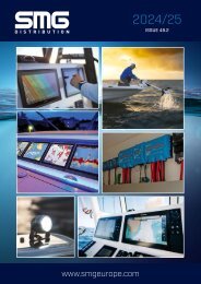
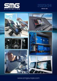
SMG Catalogue Issue 45 26.01.20
The current Marine Electronics catalogue from SMG
The current Marine Electronics catalogue from SMG

You also want an ePaper? Increase the reach of your titles
YUMPU automatically turns print PDFs into web optimized ePapers that Google loves.
DO MORE WITH NAVIONICS ADVANCED FEATURES
Access advanced features that give you the power to do more with your compatible chartplotter and mobile device. Navionics’ advanced features are available on a growing number of devices
from Raymarine®, Lowrance®, Simrad and B&G. An active subscription is required.
Drop Off d
DOCK-TO-DOCK AUTOROUTING
Head to the next destination with Dock-to-dock Autorouting*, which quickly calculates a
personalized detailed route, even through narrow passages and channels, based on chart
data and vessel settings.
SONARCHART LIVE
Users can create their own maps on the fly. Watch new 1 ft/0.5 m HD bathymetry maps
develop in real time as their boat moves along the water.
d
Fishing Range
ADVANCED MAP OPTIONS
Users can focus on the details that matter most to them by configuring Navionics charts to
highlight shallow areas, adjust contour density or select a fishing range.
PLOTTER SYNC
Transfer routes and markers, update charts and more between plotter card and mobile app
— wirelessly. Users can even activate or renew their card’s subscription and upload sonar
logs.
● Designed specifically for Navionics Charts
● Save charts to the hard drive on your PC
● Create a route with a few mouse clicks
● Uses chart tidal data to steer and optimize departure time
● Save routes/waypoints in libraries and transfer them to and
from your plotter
● Download weather and view forecast conditions
● View SonarChart – mark and save your favourite fishing and
diving spots
● Access tide and current, sun and moonrise data – show tidal
flow direction and velocity on chart
Chart comparison table
Navionics+
Navionics+
Updates
Platinum+
Coverage Small / XL9 XL / XL3
Satellite overlay+SonartChart Shading -
3D view -
Panoramic photos -
Geo-referenced coastal pilot books -
Daily Updates for one year
SonarChart
Community Edits
Selectable safety depth contours
Wrecks and obstructions
Maximum zoom level up to 1/32 nm
Navaids with description feature
Tide and current database
Coastal POIs with tel. no.
Detailed port services info
Dock-to-dock Autorouting, SonarChart Live, Advanced
Map Options and Plotter Sync (on compatible Raymarine, Lowrance, Simrad
and B&G models)
NAVIONICS
*Autorouting is for planning purposes only and does not replace safe navigation operations.
All prices SRP inc VAT. For trade prices and stock availability visit www.smgeurope.com
87