Continuity of Earth Observation Data for Australia: Research ... - csiro
Continuity of Earth Observation Data for Australia: Research ... - csiro
Continuity of Earth Observation Data for Australia: Research ... - csiro

Create successful ePaper yourself
Turn your PDF publications into a flip-book with our unique Google optimized e-Paper software.
<strong>Continuity</strong> <strong>of</strong> <strong>Earth</strong> <strong>Observation</strong> <strong>Data</strong> <strong>for</strong> <strong>Australia</strong>:<br />
<strong>Research</strong> and Development Dependencies to 2020<br />
Annex<br />
January 2012
Enquiries<br />
Enquiries should be addressed to:<br />
Dr Kimberley Clayfield<br />
Executive Manager | Space Sciences and Technology<br />
CSIRO Astronomy and Space Science<br />
Email Kimberley.Clayfield@<strong>csiro</strong>.au<br />
Study Team<br />
Dr A. Alexander Held and Dr Kimberley C. Clayfield, CSIRO<br />
Stephen Ward and George Dyke, Symbios Communications Pty Ltd<br />
Barbara Harrison<br />
Acknowledgments<br />
CSIRO acknowledges the support provided by the Space Policy Unit, Department <strong>of</strong> Industry, Innovation,<br />
Science, <strong>Research</strong> and Tertiary Education, in carrying out this study.<br />
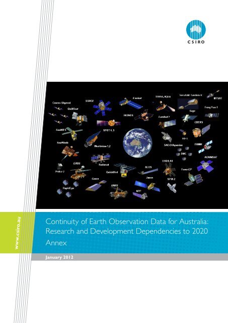
Cover Image<br />
Depiction <strong>of</strong> the various active geostationary and low <strong>Earth</strong> orbit <strong>Earth</strong> observation satellites operating<br />
over <strong>Australia</strong>. Source: Adapted with permission from a graphic by the secretariat <strong>of</strong> the Group on <strong>Earth</strong><br />
<strong>Observation</strong>s (GEO) and from various member agencies <strong>of</strong> the Committee on <strong>Earth</strong> <strong>Observation</strong> Satellites<br />
(CEOS).<br />
Copyright and Disclaimer<br />
© Commonwealth Scientific and Industrial <strong>Research</strong> Organisation 2012<br />
To the extent permitted by law, all rights are reserved and no part <strong>of</strong> this publication covered by copyright<br />
may be reproduced or copied in any <strong>for</strong>m or by any means except with the written permission <strong>of</strong> CSIRO.<br />
Print Annex ISBN 978 0 643 10798 4<br />
PDF Annex ISBN 978 0 643 10799 1<br />
Published by CSIRO Astronomy and Space Science, Canberra, <strong>Australia</strong>, 2012.<br />
Important Disclaimer<br />
CSIRO advises that the in<strong>for</strong>mation contained in this publication comprises general statements based on<br />
scientific research. The reader is advised and needs to be aware that such in<strong>for</strong>mation may be incomplete<br />
or unable to be used in any specific situation. No reliance or actions must there<strong>for</strong>e be made on that<br />
in<strong>for</strong>mation without seeking prior expert pr<strong>of</strong>essional, scientific and technical advice. To the extent<br />
permitted by law, CSIRO (including its employees and consultants) excludes all liability to any person <strong>for</strong> any<br />
consequences, including but not limited to all losses, damages, costs, expenses and any other compensation,<br />
arising directly or indirectly from using this publication (in part or in whole) and any in<strong>for</strong>mation or material<br />
contained in it.
Contents<br />
Preface .................................................................................................................................................................................1<br />
A R&D Projects included in Survey .....................................................................................................................3<br />
B <strong>Australia</strong>n EO-dependent Programs ................................................................................................................7<br />
C Survey Questions .............................................................................................................................................. 15<br />
C.1 Survey Overview and Instructions ............................................................................................................................. 15<br />
C.2 Survey Table 1: Department, Program ...................................................................................................................... 16<br />
C.3 Survey Table 2: Key Project Listing .............................................................................................................................. 17<br />
C.3.1 Key Project Listing: Part 1 (preliminary survey) projects .......................................................... 17<br />
C.3.2 Key Project Listing: Part 2 (detailed survey) projects ................................................................. 17<br />
C.4 Survey Table 3: Project Overview ............................................................................................................................... 18<br />
C.5 Survey Table 4: EO <strong>Data</strong> Requirements ................................................................................................................... 19<br />
C.6 Survey Table 5: EO <strong>Data</strong> Supply ................................................................................................................................... 20<br />
C.7 Survey Table 6: <strong>Continuity</strong> and Future Trends ...................................................................................................... 21<br />
D Instrument Details <strong>for</strong> Priority <strong>Data</strong> Types ................................................................................................. 23<br />
E Priority <strong>Data</strong> Types – <strong>Continuity</strong> Outlook .................................................................................................. 33<br />
E.1 Priority <strong>Data</strong> Type Scenarios .......................................................................................................................................... 33<br />
E.1.1 Low Resolution Optical (>80m) ............................................................................................................ 33<br />
E.1.2 Medium Resolution Optical (10-80m) .............................................................................................. 34<br />
E.1.3 High Resolution Optical (
List <strong>of</strong> Figures<br />
Figure E-1 Low Resolution Optical <strong>Data</strong> <strong>Continuity</strong> Options .................................................................................................... 33<br />
Figure E-2 Medium Resolution Optical <strong>Data</strong> <strong>Continuity</strong> Options ........................................................................................... 35<br />
Figure E-3 C-Band SAR <strong>Data</strong> <strong>Continuity</strong> Options ............................................................................................................................ 36<br />
Figure E-4 L-Band SAR <strong>Data</strong> <strong>Continuity</strong> Options ............................................................................................................................. 37<br />
Figure E-5 X-Band SAR <strong>Data</strong> <strong>Continuity</strong> Options ............................................................................................................................ 38<br />
Figure E-6 Passive Microwave <strong>Data</strong> <strong>Continuity</strong> Options ............................................................................................................... 40<br />
Figure E-7 Passive Microwave <strong>Data</strong> <strong>Continuity</strong> Options ............................................................................................................... 41<br />
Figure E-8 Hyperspectral <strong>Data</strong> <strong>Continuity</strong> Options ......................................................................................................................... 42<br />
Figure E-9 Lidar <strong>Data</strong> <strong>Continuity</strong> Options ............................................................................................................................................. 43<br />
Figure E-10 Ocean Colour <strong>Data</strong> <strong>Continuity</strong> Options ..................................................................................................................... 44<br />
List <strong>of</strong> Tables<br />
Table A-1 CEODA-R&D Projects ..................................................................................................................................................................3<br />
Table A-2 All Organisations Contacted during CEODA-R&D Survey .....................................................................................6<br />
Table B-1 <strong>Australia</strong>n Programs Dependent on EOS <strong>Data</strong> ...............................................................................................................8<br />
Table D-1 Low Resolution Optical Instrument Details .................................................................................................................. 23<br />
Table D-2 Medium Resolution Optical Instrument Details .......................................................................................................... 24<br />
Table D-3 SAR Instrument Details ............................................................................................................................................................. 25<br />
Table D-4 Passive Microwave Instrument Details .............................................................................................................................. 26<br />
Table D-5 Radar Altimeter Instrument Details .................................................................................................................................... 27<br />
Table D-6 Hyperspectral Instrument Details ........................................................................................................................................ 28<br />
Table D-7 Lidar Instrument Details ............................................................................................................................................................ 29<br />
Table D-8 Ocean Colour Instrument Details ....................................................................................................................................... 30<br />
Table D-9 Agencies and Countries <strong>of</strong> Origin ....................................................................................................................................... 31<br />
ii <strong>Continuity</strong> <strong>of</strong> <strong>Earth</strong> <strong>Observation</strong> <strong>Data</strong> <strong>for</strong> <strong>Australia</strong>: R&D – Annex • January 2012
PREFACE<br />
PREFACE<br />
This document is an Annex to the main report: <strong>Continuity</strong> <strong>of</strong> <strong>Earth</strong> <strong>Observation</strong> <strong>Data</strong> <strong>for</strong> <strong>Australia</strong>: <strong>Research</strong><br />
and Development Dependencies to 2020. It contains the following appendices that provide more detail and<br />
data in support <strong>of</strong> the sections in the main report:<br />
Appendix A – R&D Projects Included the Study: with details <strong>of</strong> organisations, contacts, project<br />
objectives, etc.<br />
Appendix B – <strong>Australia</strong>n EO-dependent Operational Programs: details the 91 current EOS data<br />
programs being undertaken by Federal and State agencies in <strong>Australia</strong>, which were discussed in<br />
terms <strong>of</strong> project linkages in Section 2.<br />
Appendix C – Survey Questions.<br />
Appendix D – Instrument Details <strong>for</strong> Priority <strong>Data</strong> Types: provides technical characteristics <strong>for</strong> all the<br />
instruments discussed in the continuity outlook discussions.<br />
Appendix E – Priority <strong>Data</strong> Types – <strong>Continuity</strong> Outlook: details and timelines in addition to the<br />
discussion in Section 5.<br />
<strong>Continuity</strong> <strong>of</strong> <strong>Earth</strong> <strong>Observation</strong> <strong>Data</strong> <strong>for</strong> <strong>Australia</strong>: R&D – Annex • January 2012 1
2 <strong>Continuity</strong> <strong>of</strong> <strong>Earth</strong> <strong>Observation</strong> <strong>Data</strong> <strong>for</strong> <strong>Australia</strong>: R&D – Annex • January 2012
R&D PROJECts inCluDED in suRvEy<br />
A R&D PROJECTS INCLUDED IN SURVEY<br />
The R&D projects sampled in Part 2 (Detailed Survey) <strong>of</strong> the CEODA-R&D Survey are listed in Table A-1.<br />
Table A-1 CEODA-R&D Projects<br />
Organisation Contact Project<br />
Antarctic Climate & Ecosystems<br />
CRC<br />
Jan l lieser Cryosat-2 Calibration and validation in the East Antarctic<br />
<strong>Australia</strong>n Antarctic Division Rob Massom Mapping and Monitoring <strong>of</strong> Antarctic Fast Ice Using SAR<br />
<strong>Australia</strong>n Bureau <strong>of</strong> Agricultural and<br />
Resource Economics and Sciences/<br />
CSIRO Land and Water<br />
lucy Randall/ Juan<br />
Pablo Guerschmann<br />
Monitoring and reporting on groundcover in rangelands<br />
<strong>Australia</strong>n Institute <strong>of</strong> Marine Science Craig Steinberg Development <strong>of</strong> a Great Barrier Reef 1km SST Hot Spot and<br />
Degree Heating Week Product<br />
<strong>Australia</strong>n National University Paul Tregoning Interpretation <strong>of</strong> GRACE temporal gravity <strong>for</strong> hydrological and<br />
mass balance studies<br />
Bureau <strong>of</strong> Meteorology/CAWCR John<br />
Le Marshall<br />
Bureau <strong>of</strong> Meteorology/CAWCR John<br />
Le Marshall<br />
Satellite <strong>Data</strong> Assimilation (NWP, Weather, Climate Monitoring<br />
and Prediction)<br />
Satellite <strong>Data</strong> Application (Non NWP)<br />
Charles Darwin University Stefan Maier Savanna Burning - Development <strong>of</strong> Remote Sensing<br />
Methodologies <strong>for</strong> Estimation <strong>of</strong> Bushfire Emissions<br />
Charles Sturt University Remy Dehaan Developing techniques to detect weeds in crops using high<br />
resolution remote sensing data from uAvs<br />
CRC <strong>for</strong> Spatial In<strong>for</strong>mation Clive Fraser Feature Extraction from Multi-source Airborne and Space-borne<br />
Imaging and Ranging <strong>Data</strong><br />
CSIRO Ecosystems Sciences Darius Culvenor Monitoring and measuring <strong>for</strong>est plantation health and condition<br />
from satellite data.<br />
CSIRO Exploration and Mining /<br />
WA Centre <strong>of</strong> Excellence <strong>for</strong> 3D<br />
Mineral Mapping<br />
Tom Cudahy Building remote and drill core spectral technologies that deliver a<br />
public, web-accessible, digital 3D mineral map <strong>of</strong> <strong>Australia</strong><br />
CSIRO Cindy Ong Greenhouse gas mapping: Evaluation <strong>of</strong> mid infrared spectropy<br />
<strong>for</strong> detection and quantification <strong>of</strong> methane<br />
CSIRO Cindy Ong ERSDAC Soil Mapping: Use <strong>of</strong> hyperspectral sensing technology<br />
<strong>for</strong> soil mapping and precision agriculture<br />
CSIRO Land and Water Arnold Dekker Coastal Water Quality Monitoring <strong>for</strong> <strong>Australia</strong> using <strong>Earth</strong><br />
<strong>Observation</strong><br />
CSIRO Land and Water Arnold Dekker Feasibility study <strong>for</strong> operationalising earth observation <strong>of</strong> inland<br />
water quality<br />
CSIRO Land and Water Arnold Dekker Coastal habitat mapping using high spatial resolution satellite and<br />
airborne data<br />
CSIRO Land and Water tim Mcvicar Eco-hydrological changes <strong>of</strong> high water yielding catchments<br />
CSIRO Land and Water Alex Held TERN AusCover: Production and delivery <strong>of</strong> nationally consistent<br />
long-time series <strong>of</strong> satellite-/airborne-based land-surface<br />
biophysical map products and next generation remote sensing<br />
research data that is validated <strong>for</strong> <strong>Australia</strong>n conditions.<br />
<strong>Continuity</strong> <strong>of</strong> <strong>Earth</strong> <strong>Observation</strong> <strong>Data</strong> <strong>for</strong> <strong>Australia</strong>: R&D – Annex • January 2012 3
Organisation Contact Project<br />
CSIRO Marine & Atmospheric<br />
<strong>Research</strong><br />
CSIRO Marine & Atmospheric<br />
<strong>Research</strong><br />
CSIRO Marine & Atmospheric<br />
<strong>Research</strong><br />
CSIRO Marine & Atmospheric<br />
<strong>Research</strong><br />
CSIRO Marine & Atmospheric<br />
<strong>Research</strong><br />
David Griffin BLUELink: Ocean observation assimilation and modelling<br />
stuart young Assess, validate and improve models <strong>for</strong> global 3-D distribution<br />
<strong>of</strong> clouds and aerosols<br />
Ross Mitchell <strong>Australia</strong>n Climate Change Science Program: Characterization <strong>of</strong><br />
<strong>Australia</strong>n Continental Aerosol to determine their role in climate<br />
Edward King IMOS Satellite Remote Sensing Facility<br />
Edward King WIRADA - Gridded Foundation <strong>Data</strong> Services: mapping<br />
precipitation, evapotranspiration, and open water (with flood<br />
volume estimation)<br />
Curtin University Merv Lynch NCRIS TERN: Delivery and validation <strong>of</strong> satellite products on<br />
atmospheric and biophysical variables<br />
Department <strong>of</strong> Sustainability and<br />
Environment<br />
Andrew Mellor Forests and Parks Monitoring and Reporting System: mapping<br />
<strong>for</strong>est extent and disturbance<br />
Department <strong>of</strong> Defence, DSTO vittala shettigara Hyperspectral Imaging (Future capabilities <strong>for</strong> Defence)<br />
Department <strong>of</strong> Defence, DSTO Mark Preiss Imaging Radar Applications <strong>for</strong> Defence<br />
Department <strong>of</strong> Employment,<br />
Economic Development and<br />
Innovation<br />
Department <strong>of</strong> Environment and<br />
Resources<br />
Department <strong>of</strong> Environment and<br />
Resources<br />
Department <strong>of</strong> Primary Industries Elizabeth<br />
Morse-McNabb<br />
Andrew Robson Remote Sensing- based Precision Agriculture Tools <strong>for</strong> the Sugar<br />
Industry<br />
Peter Scarth National fractional cover product (photosynthetic, nonphotosynthetic<br />
and bare ground fractions) <strong>for</strong> improved woody<br />
cover and groundcover estimates<br />
John Armston Improved mapping <strong>of</strong> regrowth and biomass prediction using the<br />
landsat time-series and radar imagery from the Japanese AlOs<br />
satellite<br />
4 <strong>Continuity</strong> <strong>of</strong> <strong>Earth</strong> <strong>Observation</strong> <strong>Data</strong> <strong>for</strong> <strong>Australia</strong>: R&D – Annex • January 2012<br />
victorian land use in<strong>for</strong>mation system (vluis): integrates land<br />
tenure, land use and land cover (MODIS) data <strong>for</strong> the state at<br />
the cadastral parcel, annually<br />
Department <strong>of</strong> Primary Industries Des Whitfield Satellite based in<strong>for</strong>mation systems <strong>for</strong> improved irrigation<br />
management<br />
Department <strong>of</strong> Primary Industries David Ball Port Phillip Bay Baywide Seagrass Monitoring Program<br />
Geoscience <strong>Australia</strong> Simon Oliver Unlocking the Landsat Archive<br />
Geoscience <strong>Australia</strong> Norman Mueller Emergency Response: floods and fire scars<br />
Geoscience <strong>Australia</strong> Leo Lymburner Dynamic Land Cover Mapping: MODIS time series analysis<br />
Geoscience <strong>Australia</strong> Mike Craig Continental Resource & Energy Systems: continent-scale<br />
geoscience in<strong>for</strong>mation and interpretive products <strong>for</strong> future<br />
resource and energy discoveries under cover<br />
Geoscience <strong>Australia</strong> Laura Gow Paleovalleys Project: mapping palaeochannels and groundwater<br />
Landgate Andrew Buchanan FloodMap: mapping daily surface water and soil moisture across<br />
<strong>Australia</strong><br />
Landgate Brendon McAtee Extending Firewatch products<br />
Landgate Brendon McAtee CarbonWatch: planning, monitoring and quantification <strong>of</strong><br />
biosequestration projects<br />
Monash University Jeffrey Walker Active/Passive Microwave Soil Moisture Remote Sensing<br />
Monash University Jeffrey Walker MoistureMap: A Soil Moisture Monitoring, Prediction and<br />
Reporting System <strong>for</strong> Sustainable Land and Water Management
Organisation Contact Project<br />
R&D PROJECts inCluDED in suRvEy<br />
Office <strong>of</strong> Environment and Heritage Rachael Thomas Flood regime monitoring <strong>of</strong> semi-arid region floodplain wetlands<br />
Parks victoria Steve Shelley Mapping <strong>of</strong> salix spp. in the Bogong Region <strong>of</strong> victoria<br />
University <strong>of</strong> Adelaide Ken Clarke Spatial and temporal monitoring <strong>of</strong> soil erosion risk<br />
University <strong>of</strong> Adelaide Megan Lewis Allocating water and maintaining springs in the Great Artesian<br />
Basin<br />
University <strong>of</strong> New South Wales Anthony Milne Using Multi-temporal SAR to Investigate Flood Dynamics in<br />
Semi-Arid Wetland<br />
University <strong>of</strong> New South Wales Tony Milne International Forest Carbon Initiative (IFCI)<br />
University <strong>of</strong> Queensland Stuart Phinn Joint Remote sensing <strong>Research</strong> Program<br />
University <strong>of</strong> Sydney Thomas Landgrebe virGO - virtual Geological Observatory: plate-tectonic Gis<br />
University <strong>of</strong> Tasmania Arko Lucieer terraluma - uAvs <strong>for</strong> environmental remote sensing<br />
University <strong>of</strong> Tasmania Christopher Watson IMOS Sub-Facility 11e: Satellite Altimetry Calibration and<br />
validation<br />
University <strong>of</strong> Technology Sydney Alfredo Huete validation and <strong>Continuity</strong> Assessments <strong>of</strong> viiRs<br />
University <strong>of</strong> Wollongong Laurie Chisholm Examining the spatio-temporal dynamics <strong>of</strong> live fuel moisture<br />
patterns and their influence on fire activity in SE <strong>Australia</strong><br />
<strong>Continuity</strong> <strong>of</strong> <strong>Earth</strong> <strong>Observation</strong> <strong>Data</strong> <strong>for</strong> <strong>Australia</strong>: R&D – Annex • January 2012 5
Table A-2 All Organisations Contacted during CEODA-R&D Survey<br />
Organisation Survey Response<br />
6 <strong>Continuity</strong> <strong>of</strong> <strong>Earth</strong> <strong>Observation</strong> <strong>Data</strong> <strong>for</strong> <strong>Australia</strong>: R&D – Annex • January 2012<br />
Projects in<br />
Initial Survey<br />
Projects in<br />
Detailed Survey<br />
Antarctic Climate & Ecosystems CRC yes 2 1<br />
<strong>Australia</strong>n Antarctic Division yes 7 1<br />
<strong>Australia</strong>n Bureau <strong>of</strong> Agricultural and Resource Economics<br />
and Sciences<br />
yes 4 1<br />
<strong>Australia</strong>n Institute <strong>of</strong> Marine Science yes 3 1<br />
<strong>Australia</strong>n National University yes 3 1<br />
Centre <strong>for</strong> <strong>Australia</strong>n Weather and Climate <strong>Research</strong> yes 4 2<br />
Charles Darwin University yes 2 1<br />
Charles Sturt University yes 4 1<br />
CRC <strong>for</strong> Spatial In<strong>for</strong>mation yes 1 1<br />
CSIRO <strong>Earth</strong> Science and Resource Engineering yes 9 3<br />
CSIRO Ecosystems Sciences yes 8 1<br />
CSIRO Land and Water yes 6 5<br />
CSIRO Livestock Industry No N/A N/A<br />
CSIRO Marine & Atmospheric <strong>Research</strong> yes 11 5<br />
CSIRO Mathematics, In<strong>for</strong>matics and Statistics No N/A N/A<br />
CSIRO Plant Industry No N/A N/A<br />
Curtin University yes 8 1<br />
Defence Science and Technology Organisation yes 5 2<br />
Department <strong>of</strong> Employment, Economic Development and<br />
Innovation<br />
yes 2 1<br />
Department <strong>of</strong> Environment and Resource Management yes 16 2<br />
Department <strong>of</strong> Primary Industries yes 6 3<br />
Department <strong>of</strong> Sustainability and Environment yes 9 1<br />
Flinders University No N/A N/A<br />
Geoscience <strong>Australia</strong> yes 10 5<br />
Landgate yes 12 3<br />
Monash University yes 10 2<br />
Murdoch University No N/A N/A<br />
Office <strong>of</strong> Environment and Heritage yes 4 1<br />
Parks victoria yes 1 1<br />
RMIT University No N/A N/A<br />
University <strong>of</strong> Adelaide yes 7 2<br />
University <strong>of</strong> Melbourne No N/A N/A<br />
University <strong>of</strong> New England No N/A N/A<br />
University <strong>of</strong> New South Wales yes 4 2<br />
University <strong>of</strong> Queensland yes 5 1<br />
University <strong>of</strong> South <strong>Australia</strong> No N/A N/A<br />
University <strong>of</strong> Southern Queensland No N/A N/A<br />
University <strong>of</strong> Sydney yes 5 1<br />
University <strong>of</strong> Tasmania yes 6 2<br />
University <strong>of</strong> Technology Sydney yes 8 1<br />
University <strong>of</strong> Wollongong yes 5 1<br />
UNSW@ADFA No N/A N/A
AUSTRALIAN EO-DEPENDENT PROGRAMS<br />
B AUSTRALIAN EO-DEPENDENT PROGRAMS<br />
The following table details the 91 current EOS data programs being undertaken by Federal and State<br />
agencies in <strong>Australia</strong>, which were discussed in terms <strong>of</strong> project linkages in Section 2.3.3. This in<strong>for</strong>mation<br />
is derived from the set <strong>of</strong> 92 programs documented by Geoscience <strong>Australia</strong> in the CEODA-Ops report<br />
(2011) 1 .<br />
Nine Societal Benefit Areas (SBA) deemed to have global significance have been defined by the Global<br />
<strong>Earth</strong> <strong>Observation</strong> System <strong>of</strong> Systems (GEOSS; CEOS, 2010). As detailed in Section 2.3.1, these nine<br />
areas are:<br />
• Disasters;<br />
• Health;<br />
• Energy;<br />
• Climate;<br />
• Agriculture;<br />
• Ecosystems;<br />
• Biodiversity;<br />
• Water; and<br />
• Weather.<br />
To emphasise common objectives and outcomes, each <strong>of</strong> the 91 <strong>Australia</strong>n EOS programs in Table B-1 has<br />
been associated with one or more <strong>of</strong> the GEOSS SBA. A description <strong>of</strong> each program is available in the<br />
CEODA-Ops report (Geoscience <strong>Australia</strong>, 2011).<br />
Survey respondents mentioned an additional ten operational programs with linkages to their R&D<br />
projects, namely:<br />
93 AuScope;<br />
94 BLUELink;<br />
95 Carbon Farming Initiative (CFI);<br />
96 Coastal vulnerability;<br />
97 Coral Reef Watch;<br />
98 National Plan <strong>for</strong> Environmental In<strong>for</strong>mation (NPEI);<br />
99 National State <strong>of</strong> the Forests Report (ABARES);<br />
100 National Water Commission (NWC);<br />
101 North <strong>Australia</strong> Fire In<strong>for</strong>mation (NAFI); and<br />
102 Reef Rescue.<br />
1 The original numbering <strong>of</strong> programs (from 1 to 92) that was used in Geoscience <strong>Australia</strong> (2010) has been retained in Table B-1,<br />
although program 26 is not included due to insufficient EOS usage. Accordingly, the total number <strong>of</strong> sample programs being considered<br />
was reduced to 91.<br />
<strong>Continuity</strong> <strong>of</strong> <strong>Earth</strong> <strong>Observation</strong> <strong>Data</strong> <strong>for</strong> <strong>Australia</strong>: R&D – Annex • January 2012 7
Prog<br />
ID<br />
Jurisdiction Lead Portfolio<br />
1 AGD EMA<br />
2 DAFF<br />
Table B-1 <strong>Australia</strong>n Programs Dependent on EOS <strong>Data</strong><br />
Source: CEODA-Ops Report (Geoscience <strong>Australia</strong>, 2011)<br />
BRS, DAFF,<br />
CLWRA,<br />
MDBA, DCCEE,<br />
DEWHA, NT<br />
DIPE, QLD<br />
DNRM, SA<br />
DWlBC, viC<br />
DPI, TAS DPIWE<br />
3 DAFF DAFF<br />
4 DAFF<br />
DAFF,<br />
AFMA<br />
5 DAFF DAFF<br />
6 DAFF DAFF<br />
7 DCCEE<br />
DFAT, DCCEE,<br />
CSIRO, AusAID,<br />
GA<br />
8 DCCEE DCCEE, CSIRO<br />
9 DEWHA DEWHA<br />
10 DEWHA<br />
DEWHA<br />
(<strong>Australia</strong>n<br />
Antarctic<br />
Division)<br />
11 DEWHA MDBA<br />
12 DEWHA DEWHA, DAFF<br />
Program/<br />
Product Name<br />
Emergency<br />
Management<br />
<strong>Australia</strong><br />
<strong>Australia</strong>n<br />
Collaborative<br />
Land Use<br />
Mapping Program<br />
(ACLUMP)<br />
Caring For Our<br />
Country<br />
National Fisheries<br />
Production<br />
<strong>Data</strong>base,<br />
<strong>Australia</strong>n Fish<br />
Distributions and<br />
Fishing Areas<br />
National Forest<br />
Inventory<br />
National Land and<br />
Water Resources<br />
Audit<br />
International Forest<br />
Carbon Initiative<br />
(IFCI)<br />
National Carbon<br />
Accounting System<br />
(NCAS)<br />
Approvals and<br />
Wildlife<br />
<strong>Australia</strong>n Antarctic<br />
Division, <strong>Australia</strong>n<br />
Antarctic <strong>Data</strong><br />
Centre<br />
Murray Darling<br />
Basin Plan<br />
national vegetation<br />
In<strong>for</strong>mation System<br />
(nvis)<br />
Optical<br />
Low Med High<br />
8 <strong>Continuity</strong> <strong>of</strong> <strong>Earth</strong> <strong>Observation</strong> <strong>Data</strong> <strong>for</strong> <strong>Australia</strong>: R&D – Annex • January 2012<br />
Sensor <strong>Data</strong> Type<br />
SAR<br />
Passive<br />
M/wave<br />
GEO Societal<br />
Benefits Area<br />
� � � � � Disasters<br />
� � �<br />
� �<br />
�<br />
�<br />
� �<br />
� � � �<br />
� �<br />
�<br />
� � � � �<br />
� � � �<br />
�<br />
Agriculture,<br />
Ecosystems,<br />
Biodiversity<br />
Agriculture,<br />
Ecosystems,<br />
Biodiversity<br />
Ecosystems,<br />
Water<br />
Climate,<br />
Ecosystems,<br />
Biodiversity<br />
Climate,<br />
Agriculture,<br />
Ecosystems,<br />
Biodiversity<br />
Energy,<br />
Agriculture,<br />
Ecosystems<br />
Energy, Climate,<br />
Ecosystems<br />
Ecosystems,<br />
Biodiversity<br />
Climate,<br />
Ecosystems,<br />
Biodiversity,<br />
Water<br />
Climate,<br />
Agriculture,<br />
Water<br />
Agriculture,<br />
Ecosystems,<br />
Biodiversity
Prog<br />
ID<br />
Jurisdiction Lead Portfolio<br />
13 DEWHA DEWHA, BoM<br />
Program/<br />
Product Name<br />
National Weather<br />
and Climate<br />
AUSTRALIAN EO-DEPENDENT PROGRAMS<br />
Optical<br />
Low Med High<br />
14 DEWHA DEWHA Parks <strong>Australia</strong> �<br />
15 DEWHA GBRMPA<br />
16 DEWHA<br />
AAD, GA,<br />
DCCEE, BoM<br />
17 DEWHA DEWHA, States<br />
18 DEWHA DEWHA<br />
19 DEWHA DEWHA (ERIN)<br />
20 DEWHA<br />
CSIRO,<br />
BoM<br />
Predictive Ocean<br />
Atmosphere<br />
Model <strong>for</strong> <strong>Australia</strong><br />
(POAMA),<br />
ReefTEMP<br />
Satellite Altimetry �<br />
State <strong>of</strong><br />
Environment (SOE)<br />
Supervising<br />
Scientist Division<br />
Sustainable<br />
Environment and<br />
Water Use<br />
Water In<strong>for</strong>mation<br />
<strong>Research</strong> and<br />
Development<br />
Alliance<br />
(WIRADA)<br />
Sensor <strong>Data</strong> Type<br />
GEO Societal<br />
Benefits Area<br />
<strong>Continuity</strong> <strong>of</strong> <strong>Earth</strong> <strong>Observation</strong> <strong>Data</strong> <strong>for</strong> <strong>Australia</strong>: R&D – Annex • January 2012 9<br />
SAR<br />
Passive<br />
M/wave<br />
� �<br />
� � �<br />
� � �<br />
� � �<br />
� � �<br />
� � � �<br />
Disasters,<br />
Climate,<br />
Weather<br />
Ecosystems,<br />
Biodiversity,<br />
Water<br />
Ecosystems,<br />
Biodiversity,<br />
Water<br />
Disasters, Water,<br />
Weather<br />
Ecosystems,<br />
Biodiversity,<br />
Water<br />
Climate,<br />
Ecosystems,<br />
Biodiversity<br />
Health,<br />
Biodiversity,<br />
Water<br />
Climate,<br />
Agriculture,<br />
Water<br />
21 DIAC ACBPS Border Protection � Disasters<br />
22 DIISR<br />
CSIRO,<br />
TERN, DEWHA<br />
AusCover TERN � � �<br />
Energy, Climate,<br />
Ecosystems,<br />
Biodiversity,<br />
Water<br />
23 DIISR CSIRO, GRDC Biomass Monitoring � � Agriculture<br />
24 DIISR<br />
25 DIISR<br />
27 DIISR<br />
28 DIISR<br />
CSIRO,<br />
BoM, DEWHA,<br />
DIISR<br />
CSIRO,<br />
State geological<br />
surveys,<br />
GA<br />
CSIRO, IMOS,<br />
AIMS, DEWHA<br />
CSIRO, Landgate<br />
(WA).<br />
AGRIC (WA)<br />
Centre <strong>for</strong><br />
Weather and<br />
Climate <strong>Research</strong><br />
(CAWCR)<br />
International<br />
Hyperspectral<br />
Imaging Satellite<br />
Programs<br />
Ocean Colour<br />
Monitoring<br />
Pastures from<br />
Space<br />
� � �<br />
� �<br />
� �<br />
Climate,<br />
Weather<br />
Ecosystems,<br />
Water, Weather<br />
Ecosystems,<br />
Biodiversity,<br />
Water<br />
� Agriculture
Prog<br />
ID<br />
29 DIISR<br />
30 RET<br />
Jurisdiction Lead Portfolio<br />
CSIRO, GSWA,<br />
GSQ, Ausscope,<br />
UWA,<br />
Curtin University,<br />
Industry,<br />
GA<br />
GA,<br />
CSIRO<br />
Program/<br />
Product Name<br />
WA Centre <strong>of</strong><br />
Excellence (CoE)<br />
<strong>for</strong> 3D Mineral<br />
Mapping (C3DMM)<br />
Optical<br />
Low Med High<br />
Coastal Monitoring � �<br />
10 <strong>Continuity</strong> <strong>of</strong> <strong>Earth</strong> <strong>Observation</strong> <strong>Data</strong> <strong>for</strong> <strong>Australia</strong>: R&D – Annex • January 2012<br />
Sensor <strong>Data</strong> Type<br />
SAR<br />
Passive<br />
M/wave<br />
GEO Societal<br />
Benefits Area<br />
� � Energy<br />
Ecosystems,<br />
Biodiversity,<br />
31 RET GA, DFAT LoSaMBA � � Disasters, Water<br />
32 RET GA, BRS<br />
33 RET GA, States<br />
34 RET GA<br />
35 RET GA, CSIRO<br />
National Land<br />
Cover Mapping<br />
National<br />
Topographic<br />
Mapping<br />
Petroleum Acreage<br />
and Release<br />
Pre-competitive<br />
Mineral Prospecting<br />
<strong>Research</strong><br />
36 RET GA Sentinel Hotspots �<br />
� �<br />
Water<br />
Disasters,<br />
Agriculture,<br />
Ecosystems,<br />
Biodiversity<br />
� � Disasters, Water<br />
� � � �<br />
Energy,<br />
Water<br />
� � Energy<br />
Disasters,<br />
Weather<br />
37 PM&C AEC Electoral Mapping � Health<br />
38 ACT ACTPLA<br />
39 ANZLIC ANZLIC<br />
ACT Planning and<br />
Land Authority<br />
DEM and Surface<br />
Modelling<br />
40 NSW DECCW DustWatch �<br />
41 NSW<br />
Department <strong>of</strong><br />
Planning & Local<br />
Government<br />
& Shires<br />
Associations<br />
42 NSW DECCW<br />
43 NSW DECCW<br />
Electronic Housing<br />
Code Pilot (EHC)<br />
Elevation and<br />
vegetation<br />
structural mapping<br />
Groundwater<br />
Dependent<br />
Ecosystems (GDE)<br />
Water Balance<br />
�<br />
�<br />
�<br />
Disaster,<br />
Ecosystems,<br />
Biodiversity<br />
Disasters,<br />
Energy,<br />
Ecosystems,<br />
Water<br />
Disasters,<br />
Health,<br />
Agriculture,<br />
Weather<br />
� Health<br />
�<br />
Disasters,<br />
Ecosystems,<br />
Water<br />
Agriculture,<br />
Ecosystems,<br />
Water
Prog<br />
ID<br />
Jurisdiction Lead Portfolio<br />
44 NSW DECCW<br />
45 NSW DECCW<br />
46 NSW DECCW<br />
47 NSW DECCW<br />
48 NSW OOW<br />
49 NSW DECCW<br />
50 NSW DECCW<br />
51 NSW DECCW<br />
52 NSW<br />
DECCW<br />
/Industry<br />
53 NSW LPMA<br />
54 NSW LPMA<br />
55 NSW DECCW<br />
56 NSW LPMA<br />
57 nsW / viC BF CRC<br />
58<br />
nsW, vic, Qld,<br />
SA<br />
CRCSI /<br />
LPMA / UNSW<br />
Program/<br />
Product Name<br />
Groundwater<br />
Quality and Coastal<br />
GDE Mapping<br />
Inland wetland<br />
inventory and<br />
monitoring<br />
Mapping Wetland<br />
Inundation<br />
Histories <strong>for</strong> Iconic<br />
NSW Wetlands<br />
Marine Monitoring<br />
Reporting and<br />
Evaluation<br />
Monitoring: State <strong>of</strong><br />
the Catchments<br />
NSW High-<br />
Resolution<br />
vegetation<br />
Monitoring<br />
Program<br />
NSW Woody<br />
vegetation<br />
Monitoring<br />
Program (NSW<br />
SLATS)<br />
Rural Floodplain<br />
Management<br />
Sea Surface<br />
Temperature and<br />
Height Anomaly<br />
Topographic<br />
Mapping Program<br />
valuation <strong>for</strong><br />
Taxation Purposes<br />
vegetation<br />
Monitoring –<br />
Grassland<br />
Western Lands<br />
Monitoring and<br />
Compliance<br />
Grasslands curing<br />
assessment<br />
AUSTRALIAN EO-DEPENDENT PROGRAMS<br />
Optical<br />
Low Med High<br />
�<br />
� � �<br />
�<br />
�<br />
�<br />
Sensor <strong>Data</strong> Type<br />
� �<br />
�<br />
� � �<br />
GEO Societal<br />
Benefits Area<br />
<strong>Continuity</strong> <strong>of</strong> <strong>Earth</strong> <strong>Observation</strong> <strong>Data</strong> <strong>for</strong> <strong>Australia</strong>: R&D – Annex • January 2012 11<br />
SAR<br />
� �<br />
� �<br />
Passive<br />
M/wave<br />
Health,<br />
Ecosystems,<br />
Water<br />
Ecosystems,<br />
Biodiversity,<br />
Water<br />
Ecosystems,<br />
Biodiversity,<br />
Water<br />
Ecosystems,<br />
Biodiversity,<br />
Water<br />
Health,<br />
Ecosystems,<br />
Biodiversity,<br />
Water<br />
Disasters,<br />
Agriculture,<br />
Ecosystems,<br />
Biodiversity<br />
Climate,<br />
Agriculture,<br />
Ecosystems<br />
Disasters,<br />
Agriculture,<br />
Water<br />
Disasters,<br />
Climate, Water,<br />
Weather<br />
Agriculture,<br />
Water<br />
� Agriculture<br />
� � �<br />
�<br />
Agriculture,<br />
Ecosystems<br />
� Agriculture<br />
Disasters,<br />
Climate,<br />
Agriculture<br />
Radar Watch � � Disasters, Water
Prog<br />
ID<br />
59 NT<br />
Jurisdiction Lead Portfolio<br />
NTLIS,<br />
NREA<br />
60 NT Bushfires NT<br />
Program/<br />
Product Name<br />
Rangeland<br />
monitoring<br />
Fire mapping:<br />
National Parks and<br />
Arnhem Land Fire<br />
Management Area<br />
Optical<br />
Low Med High<br />
12 <strong>Continuity</strong> <strong>of</strong> <strong>Earth</strong> <strong>Observation</strong> <strong>Data</strong> <strong>for</strong> <strong>Australia</strong>: R&D – Annex • January 2012<br />
�<br />
Sensor <strong>Data</strong> Type<br />
61 QLD DERM Biomass monitoring �<br />
62 QLD DERM<br />
63 QLD DERM<br />
64 QLD DERM<br />
65 QLD DERM<br />
66 QLD DERM<br />
67 QLD DERM<br />
68 QLD DERM<br />
69 SA DWLBC<br />
70 SA DWLBC<br />
Groundcover<br />
monitoring<br />
QLUMP land-use<br />
program<br />
Queensland<br />
Wetland mapping<br />
and Classification<br />
Reef Catchment<br />
Monitoring (RCM)<br />
Regional ecosystem<br />
mapping<br />
Soil exposure<br />
assessment<br />
Statewide<br />
Landcover and Tree<br />
Study (SLATS)<br />
Imagery Baseline<br />
<strong>Data</strong> Project<br />
Statewide Native<br />
vegetation<br />
Detection<br />
SAR<br />
Passive<br />
M/wave<br />
GEO Societal<br />
Benefits Area<br />
Agriculture,<br />
Ecosystems,<br />
Biodiversity<br />
� � Disasters<br />
Disasters,<br />
Agriculture,<br />
Ecosystems<br />
� Agriculture<br />
�<br />
�<br />
�<br />
�<br />
�<br />
�<br />
� �<br />
� �<br />
71 TAS DPIW tAsvEG �<br />
72 viC DSE<br />
73 viC DPI<br />
74 viC<br />
DPI,<br />
DSE<br />
Bushfire areas and<br />
tree cover<br />
Evapo-transpiration<br />
modelling<br />
� � �<br />
�<br />
Land use � � �<br />
Agriculture,<br />
Ecosystems,<br />
Biodiversity<br />
Ecosystems,<br />
Biodiversity,<br />
Water<br />
Ecosystems,<br />
Biodiversity,<br />
Water<br />
Agriculture,<br />
Ecosystems,<br />
Biodiversity<br />
Agriculture,<br />
Biodiversity,<br />
Water<br />
Agriculture,<br />
Ecosystems,<br />
Biodiversity<br />
Agriculture,<br />
Biodiversity,<br />
Water<br />
Agriculture,<br />
Ecosystems,<br />
Biodiversity<br />
Agriculture,<br />
Ecosystems,<br />
Biodiversity<br />
Disaster,<br />
Ecosystems,<br />
Biodiversity<br />
Agriculture,<br />
Water<br />
Agriculture,<br />
Ecosystems
Prog<br />
ID<br />
Jurisdiction Lead Portfolio<br />
75 viC DSE<br />
76 WA Landgate<br />
Program/<br />
Product Name<br />
Native vegetation<br />
extent and<br />
condition<br />
Agimage - SW <strong>of</strong><br />
WA<br />
AUSTRALIAN EO-DEPENDENT PROGRAMS<br />
Optical<br />
Low Med High<br />
� �<br />
�<br />
Sensor <strong>Data</strong> Type<br />
GEO Societal<br />
Benefits Area<br />
<strong>Continuity</strong> <strong>of</strong> <strong>Earth</strong> <strong>Observation</strong> <strong>Data</strong> <strong>for</strong> <strong>Australia</strong>: R&D – Annex • January 2012 13<br />
SAR<br />
Passive<br />
M/wave<br />
Ecosystems,<br />
Biodiversity<br />
Agriculture,<br />
77 WA Landgate Carbon Watch � � � Energy, Climate<br />
78 WA Landgate, FESA<br />
79 WA DEC<br />
Emergency<br />
management<br />
Fire Mapping and<br />
Modelling<br />
� � �<br />
� �<br />
80 WA Landgate FireWatch Program � � �<br />
Water<br />
Disasters,<br />
Ecosystems,<br />
Weather<br />
Disasters,<br />
Weather<br />
Disasters,<br />
Climate,<br />
Ecosystems,<br />
Weather<br />
81 WA Landgate FloodMap Program � � � Disasters, Water<br />
82 WA DEC<br />
83 WA<br />
Landgate, CSIRO,<br />
DEC, DAFWA,<br />
DoW,<br />
DPI<br />
84 WA DEC<br />
85 WA DOW<br />
86 WA Landgate<br />
87 WA<br />
88 WA<br />
89 WA<br />
Water<br />
Corporation<br />
Water<br />
Corporation<br />
Water<br />
Corporation<br />
90 WA DEC<br />
91 WA Landgate<br />
Land Audit and<br />
Compliance<br />
Land Monitor<br />
Project - SW <strong>of</strong><br />
WA<br />
Marine Mapping<br />
and Monitoring<br />
Monitoring<br />
Groundwater<br />
Decline<br />
OceanWatch<br />
Program<br />
� �<br />
� � �<br />
�<br />
� �<br />
� � �<br />
Agriculture,<br />
Ecosystems<br />
Agriculture,<br />
Water<br />
Climate,<br />
Ecosystems,<br />
Water<br />
Agriculture,<br />
Water<br />
Ecosystems,<br />
Water<br />
Urban Monitor � Water<br />
vegetation<br />
Monitoring<br />
vegetation<br />
Monitoring and<br />
cover estimates<br />
vegetation<br />
Monitoring.<br />
vegetation Watch<br />
Program<br />
�<br />
�<br />
� �<br />
� � �<br />
92 WA Landgate WALIS � � �<br />
Ecosystems,<br />
Biodiversity,<br />
Water<br />
Disasters,<br />
Ecosystems,<br />
Biodiversity,<br />
Water<br />
Ecosystems,<br />
Biodiversity<br />
Disasters,<br />
Ecosystems,<br />
Biodiversity<br />
Health, Climate,<br />
Ecosystems,<br />
Biodiversity
14 <strong>Continuity</strong> <strong>of</strong> <strong>Earth</strong> <strong>Observation</strong> <strong>Data</strong> <strong>for</strong> <strong>Australia</strong>: R&D – Annex • January 2012
C SURVEY QUESTIONS<br />
suRvEy QuEstiOns<br />
The survey comprised six worksheets requesting input, prefaced with an instruction worksheet. The content<br />
<strong>of</strong> these worksheets is detailed below.<br />
C.1 Survey Overview and Instructions<br />
This survey intends to provide as complete a picture as possible <strong>of</strong> the <strong>Australia</strong>n <strong>Earth</strong> observation R&D<br />
community, identifying issues that are key in ensuring continuity <strong>of</strong> data supply <strong>for</strong> future development and<br />
innovation. For this reason it is comprehensive, and we ask <strong>for</strong> your patience and thoroughness through the<br />
survey completion, interview, and follow-up stages <strong>of</strong> the process. Sufficient time should be allowed to ensure a<br />
good quality outcome.<br />
Survey fields to be completed are marked in orange. Responses to those fields marked in darker orange should<br />
be selected from the drop down list presented.<br />
The survey is to be completed in two parts.<br />
PART 1: Questions <strong>for</strong> Department or <strong>Research</strong> Theme/Program Leaders which oversee multiple EO R&D Teams.<br />
This part captures theme/program level in<strong>for</strong>mation within a given organisation. Respondents are asked<br />
to complete, to the extent possible, Tables 1 and the first half <strong>of</strong> 2 and return to the survey team ahead <strong>of</strong><br />
a 15-20 minute phone interview with a member <strong>of</strong> the survey team. This phone interview will review the<br />
responses provided, and identify which specific individual projects and points <strong>of</strong> contact should be surveyed in<br />
more detail.<br />
Table 1. <strong>Research</strong> Program/Theme/Department In<strong>for</strong>mation<br />
High level details <strong>of</strong> the organisation/agency responding to the survey.<br />
Table 2. [First Half] Listing <strong>of</strong> <strong>Research</strong> Projects/Teams and Activities within the Program/Division/Department<br />
Listing <strong>of</strong> projects relevant to the survey within the research program, with points <strong>of</strong> contact.<br />
Identification <strong>of</strong> the projects to be included in PART 2 <strong>of</strong> the survey.<br />
PART 2: Questions <strong>for</strong> Individual Project/Team Activity Leaders.<br />
This part captures more detailed project in<strong>for</strong>mation. There may be multiple projects <strong>for</strong> each organisation<br />
and/or team leader. Respondents are asked to complete, to the extent possible, the second half <strong>of</strong> Table 2, and<br />
Tables 3-9 and return to the survey team ahead <strong>of</strong> an extended interview (1-2 hours, by phone or face-to-face<br />
where possible) with a member <strong>of</strong> the survey team. This interview will review the responses provided, clarify<br />
where required, and identify any follow-up inquiries.<br />
Table 2. [Second Half] Listing <strong>of</strong> <strong>Research</strong> Projects/Teams and Activities within the Program/Division/<br />
Department<br />
Listing <strong>of</strong> projects outcomes, societal and operational benefits, resources and EO importance.<br />
Table 3. Project Overview<br />
Objectives, collaboration, and reference materials <strong>for</strong> the project.<br />
Table 4. EO <strong>Data</strong> Requirements<br />
Current EO data requirements, supply, and future requirements by instrument type.<br />
Table 5. EO <strong>Data</strong> Supply<br />
Current EO data supply overview, agreements, calibration and validation, volumes and costs by instrument.<br />
Make one copy <strong>of</strong> this table <strong>for</strong> each instrument that is a part <strong>of</strong> the project’s data supply.<br />
Table 6. <strong>Continuity</strong> and Future Trends<br />
Project continuity, emerging technology, sensor types, and potential new applications.<br />
<strong>Continuity</strong> <strong>of</strong> <strong>Earth</strong> <strong>Observation</strong> <strong>Data</strong> <strong>for</strong> <strong>Australia</strong>: R&D – Annex • January 2012 15
C.2 Survey Table 1: Department, Program<br />
High-level details <strong>of</strong> the organisation/agency responding to the survey.<br />
Please provide inputs in the highlighted cells:<br />
1.1 Organisation Details Notes<br />
1.1.1 Full Name<br />
1.1.2 Abbreviation/Acronym<br />
1.1.3 Street Address<br />
1.1.4 Postal Address<br />
1.1.5 Agency/Group Website<br />
1.2 Organisation Contact Details Notes<br />
1.2.1 Organisational Point <strong>of</strong> Contact Name<br />
1.2.2 Agency Role/Title<br />
1.2.3 Telephone<br />
1.2.4 Email<br />
1.2.5<br />
Suggest top three best dates/times <strong>for</strong> the<br />
survey team to contact you.<br />
Initial call to review pre-populated survey<br />
table 2, Activity Listing. Approximate time<br />
15 minutes.<br />
16 <strong>Continuity</strong> <strong>of</strong> <strong>Earth</strong> <strong>Observation</strong> <strong>Data</strong> <strong>for</strong> <strong>Australia</strong>: R&D – Annex • January 2012
C.3 Survey Table 2: Key Project Listing<br />
suRvEy QuEstiOns<br />
Listing <strong>of</strong> projects relevant to the survey within the research program, theme, or department. Identification<br />
<strong>of</strong> the projects to be included in PART 2 <strong>of</strong> the survey.<br />
Please provide inputs in the highlighted cells.<br />
C.3.1 Key Project Listing: Part 1 (preliminary survey) projects<br />
Please include all activities that are relevant to the survey.<br />
Please suggest up to five to be surveyed.<br />
Project Name Full Name and Abbreviation<br />
Survey Yes/No<br />
Project Point <strong>of</strong> Contact<br />
Name<br />
Title<br />
Phone<br />
Email<br />
Brief Activity Description
C.4 Survey Table 3: Project Overview<br />
3.1 Objectives, Main Activities, and Outcomes Notes<br />
3.1.1 Project Project Name and Number<br />
from Table 2. Key Projects<br />
Listing<br />
3.1.2 Describe the objectives and main activities.<br />
3.1.3 Examples that demonstrate the outcomes <strong>of</strong> the project<br />
highlighting tangible benefits and/or the role <strong>of</strong> EO data.<br />
3.2 Please provide up to five activity background references<br />
3.2.1 Reference 1<br />
3.2.2 Reference 2<br />
3.2.3 Reference 3<br />
3.2.4 Reference 4<br />
3.2.5 Reference 5<br />
18 <strong>Continuity</strong> <strong>of</strong> <strong>Earth</strong> <strong>Observation</strong> <strong>Data</strong> <strong>for</strong> <strong>Australia</strong>: R&D – Annex • January 2012<br />
List links and/or attachments<br />
provided. May include, but<br />
not limited to, scientific<br />
papers, websites, promotional<br />
materials, and brochures.<br />
3.3 Collaboration Notes<br />
3.3.1 Is the activity part <strong>of</strong> a larger internal and/or external program?<br />
3.3.2 Describe any domestic collaboration. Where possible, include<br />
specific names <strong>of</strong> missions,<br />
3.3.3 Describe any international collaboration. instruments, countries, groups<br />
and/or scientists involved.<br />
Example activities <strong>of</strong> interest<br />
include, but are not limited to,<br />
calibration and validation, and<br />
applications development.<br />
3.4 Access to <strong>Research</strong> <strong>Data</strong> Sets<br />
3.4.1 Does this project have access to restricted EO data? Restricted in the sense that<br />
3.4.2 If yes, can you describe those data sets, their currency, and their<br />
conditions <strong>of</strong> use?<br />
they are available only to<br />
certain activities <strong>for</strong> a period<br />
(i.e. PI exclusive). Does not<br />
indicate classified, i.e. <strong>for</strong><br />
defence purposes.
C.5 Survey Table 4: EO <strong>Data</strong> Requirements<br />
suRvEy QuEstiOns<br />
For each Instrument <strong>Data</strong> Type (see Table 4.1) being used, respondents were asked to supply the<br />
following in<strong>for</strong>mation:<br />
Supply Requirement Select from Dropdown See Note 1<br />
Supply Source(s) Instrument(s), Specify if Airborne<br />
Substitute Available Select from Dropdown Yes/Partial/No<br />
Substitute(s)<br />
Specify Options, indicate if Supply is<br />
Airborne<br />
Technical Requirements Spatial Resolution Min, Max, Typical in m 2<br />
Maximum Extent <strong>of</strong> Coverage Select from dropdown list See Note 2<br />
Coverage Area Km 2<br />
Coverages Required #/year<br />
Specific Regions <strong>of</strong> Interest i.e. coastal, QLD, troposphere, etc<br />
Temporal Coverage Select from dropdown list See Note 3<br />
Latency Select from dropdown list See Note 4<br />
<strong>Continuity</strong> and Coordination<br />
Requirements<br />
i.e. seasonal, coordinated with other<br />
observations, etc.<br />
Other Technical Requirements Spectral resolution, wavebands, others<br />
Future Requirements 2 year Requirement See Note 1<br />
Notes <strong>for</strong> Survey Table 4:<br />
Expected to be met Yes/No/Partially<br />
5 year Requirement See Note 1<br />
Expected to be met Yes/No/Partially<br />
10 year Requirement See Note 1<br />
Expected to be met Yes/No/Partially<br />
(1) Essential – primary input in support <strong>of</strong> the project’s outcomes;<br />
Advantageous – secondary input but is not necessary to achieve the project’s outcomes; or<br />
Opportunistic – used on an ad hoc basis.<br />
Promising – not currently used but could be useful.<br />
(2) Global;<br />
Asia-Pacific;<br />
National;<br />
State;<br />
Regional;<br />
<strong>Research</strong> Site(s); or<br />
Other.<br />
(3) Daily;<br />
Monthly;<br />
Quarterly;<br />
Annually;<br />
Triennially; or<br />
Other (specify in ‘other tech. requirements’)<br />
(4) Hours;<br />
Days;<br />
Weeks; or<br />
Other (specify in ‘other tech. requirements’)<br />
<strong>Continuity</strong> <strong>of</strong> <strong>Earth</strong> <strong>Observation</strong> <strong>Data</strong> <strong>for</strong> <strong>Australia</strong>: R&D – Annex • January 2012 19
C.6 Survey Table 5: EO <strong>Data</strong> Supply<br />
5.1 Supply Instrument Details<br />
Overview<br />
5.1.1 Instrument Name<br />
5.1.2 Instrument Agency<br />
5.1.3 Instrument Mission<br />
5.1.4 Instrument Type Select from dropdown list. See Table 4.1<br />
5.1.5 Requirement Select from dropdown list. See Section 4.3.1<br />
5.1.6 Supply Start Year<br />
5.1.7 Expected Supply End Year<br />
Supply Details<br />
5.1.8 Agreement Type Select from dropdown list. See Note 1<br />
20 <strong>Continuity</strong> <strong>of</strong> <strong>Earth</strong> <strong>Observation</strong> <strong>Data</strong> <strong>for</strong> <strong>Australia</strong>: R&D – Annex • January 2012<br />
5.1.8 Other<br />
5.1.9 Unique Agreement Terms and Conditions Any terms and conditions uniquely applicable<br />
to your supply arrangement? For example,<br />
restricted usage, restricted redistribution,<br />
specific acquisition requests allowed, etc.<br />
5.1.10 Agreement Duration Specify agreement start and/or end dates (if<br />
applicable).<br />
5.1.11 Physical Supply Route Select from dropdown list. See Note 2<br />
5.1.11 Other<br />
5.1.12 Current Infrastructure Obstacles Any infrastructure issues specific to this<br />
instrument, i.e. downlink or acquisition<br />
coverage, timeliness, storage, processing.<br />
5.1.13 Anticipated Future <strong>Data</strong> Supply Is the data supply from this instrument<br />
expected to continue? Are there any know risks<br />
to continuity <strong>of</strong> supply? If so, briefly describe.<br />
Supply <strong>Data</strong> Quality<br />
5.1.14 Quality Control Procedures Describe the quality control procedures or your<br />
sources <strong>of</strong> ground calibration data used <strong>for</strong> this<br />
supply source.<br />
<strong>Data</strong> Volumes<br />
5.1.15 <strong>Data</strong> Volume Specify approx. data volumes in terabytes [TB],<br />
[TB/year].<br />
5.1.16 Scenes Specify approx. number <strong>of</strong> scenes [#], [#/year].<br />
<strong>Data</strong> Costs<br />
See Note 3<br />
5.1.17 <strong>Data</strong> Cost Specify approx. data cost in AUD. See Note 4<br />
Notes <strong>for</strong> Survey Table 5:<br />
(1) Public Good (No Agreement) – data supplied without a substantive agreement in place (i.e. create a free web account).<br />
Public Good (<strong>Research</strong> Agreement) – data supplied <strong>for</strong> free with a research agreement outlining access terms. This may or may<br />
not include rights to request new acquisitions.<br />
Public Good (Third Party) – data provided <strong>for</strong> free through a third party (e.g. Geoscience <strong>Australia</strong>).<br />
<strong>Data</strong> Reception Agreement – data supplied as a part <strong>of</strong> a ground station data reception agreement.<br />
Cost Recovery – data supplied on a cost recovery basis specified in a research agreement.<br />
Commercial – data supplied on commercial terms and at market prices.<br />
Other – data exchange <strong>for</strong> value adding (e.g. Cal/Val), other as specified in the survey responses.<br />
(2) Satellite Downlink<br />
Physical Media Delivery<br />
ftp/Internet Download<br />
Other (specify)<br />
(3) For Historical and New Annual Acquisitions<br />
(4) For Acquisitions, Storage and Processing <strong>of</strong> both Total Lifetime Cost and Average Annual Total Cost
C.7 Survey Table 6: <strong>Continuity</strong> and Future Trends<br />
6.1 Project <strong>Continuity</strong> Notes<br />
6.1.1 Expected Project <strong>Continuity</strong> Current plans <strong>for</strong> the continuity <strong>of</strong> the project,<br />
including funding cycle and status if available.<br />
6.1.2 Planned Project Termination Date If applicable.<br />
6.2 Future Technical Trends Notes<br />
6.2.1 Additional Sensor Types Do you <strong>for</strong>esee additional sensor types in<br />
particular become more relevant to your project<br />
activity. (i.e. emergence <strong>of</strong> SAR, Hyperspectral,<br />
others)<br />
6.2.2 New Sensor Types and Technology Do you <strong>for</strong>esee the emergence <strong>of</strong> any new sensor<br />
types or technologies <strong>of</strong> particular relevance to<br />
your project activity?<br />
6.2.3 Detailed Technical Requirements In the course <strong>of</strong> the research, what improvements<br />
do you <strong>for</strong>esee in detailed technical requirements<br />
which will limit or drive advancement? For<br />
example improved spatial or spectral resolution,<br />
wider spectral range, improved frequency or<br />
latency <strong>of</strong> observations, others?<br />
6.2.4 Future <strong>Data</strong> Volumes Do you expect significant changes in future data<br />
volumes? For example, due to a change in sensor<br />
type, coverage area, or frequency. If so, please<br />
indicate a timeframe and a rough estimate <strong>of</strong> the<br />
increase.<br />
6.2.5 Potential Infrastructure Impacts What infrastructure impact would you <strong>for</strong>esee<br />
with the emergence <strong>of</strong> additional or new sensor<br />
types? For example to support additional<br />
acquisition, storage or processing.<br />
6.2.6 Who do you think should be responsible <strong>for</strong><br />
EOS data quality in <strong>Australia</strong>n research?<br />
6.3 New Application Areas Notes<br />
6.3.1 Future Pre-Operational Applications Are there any examples <strong>of</strong> applications that will<br />
emerge from the basic remote sensing research<br />
being conducted?<br />
6.3.2 Future Operational Applications Are there any examples <strong>of</strong> pre-operational<br />
applications that could progress to operational in<br />
the project?<br />
Future Collaboration<br />
6.4.1 Domestic Collaboration Are there any particular domestic or international<br />
groups that you would like to collaborate with in<br />
6.4.2 International Collaboration<br />
the future? Be as specific as possible, including<br />
specific researchers, programs, facilities,<br />
institutes, countries, and/or sensors. Also indicate<br />
how this would enable the potential <strong>for</strong> future<br />
development <strong>of</strong> research or applications.<br />
suRvEy QuEstiOns<br />
<strong>Continuity</strong> <strong>of</strong> <strong>Earth</strong> <strong>Observation</strong> <strong>Data</strong> <strong>for</strong> <strong>Australia</strong>: R&D – Annex • January 2012 21
22 <strong>Continuity</strong> <strong>of</strong> <strong>Earth</strong> <strong>Observation</strong> <strong>Data</strong> <strong>for</strong> <strong>Australia</strong>: R&D – Annex • January 2012
instRuMEnt DEtAils fOR PRiORity DAtA tyPEs<br />
D INSTRUMENT DETAILS FOR PRIORITY<br />
DATA TYPES<br />
Current Sensor<br />
Status and<br />
Agency*<br />
AVHRR<br />
NOAA<br />
Operational<br />
MODIS<br />
NASA<br />
Operational<br />
MERIS<br />
ESA<br />
Operational<br />
VIIRS<br />
NOAA/NASA/<br />
EUMETSAT<br />
Operational<br />
OLCI<br />
EC/ESA/<br />
EUMETSAT<br />
Approved<br />
SGLI<br />
JAXA<br />
Approved<br />
SLSTR<br />
EC/ESA/<br />
EUMETSAT<br />
Approved<br />
Mission(s)<br />
and Duration<br />
NOAA-15: 1998-2011<br />
NOAA-16: 2000-2012<br />
NOAA-17: 2002-2014<br />
NOAA-18: 2005-2015<br />
NOAA-19: 2009-2016<br />
MetOp-A: 2006-2013<br />
MetOp-B: 2012-2017<br />
MetOp-C: 2016-2021<br />
1998-2021<br />
Terra: 1999-2013<br />
Aqua: 2002-2013<br />
1999 - 2013<br />
Table D-1 Low Resolution Optical Instrument Details<br />
Spectral<br />
Bands<br />
6 bands vis-<br />
TIR<br />
36 bands vis-<br />
TIR<br />
Envisat: 2002-2013 15 bands vis-<br />
NIR<br />
NPP: 2011-2016<br />
JPss-1: 2017-2023<br />
JPss-2: 2023-2029<br />
2011-2029<br />
Sentinel-3 A:<br />
2013-2020<br />
Sentinel-3 B:<br />
2014-2022<br />
Sentinel-3 C:<br />
2020-2027<br />
2013-2027<br />
GCOM-C1:<br />
2014-2019<br />
GCOM-C2:<br />
2018-2023<br />
GCOM-C3:<br />
2022-2027<br />
2014-2027<br />
Sentinel-3 A:<br />
2013-2020<br />
Sentinel-3 B:<br />
2014-2022<br />
Sentinel-3 C:<br />
2020-2027<br />
2013-2027<br />
* Operating agency listed first.<br />
22 bands vis-<br />
TIR<br />
21 bands<br />
vniR-sWiR<br />
19 bands vis-<br />
TIR<br />
9 bands vniR-<br />
SWIR-TIR<br />
Spatial Resolution Swath<br />
Width<br />
Repeat<br />
Cycle<br />
1.1 km 3000 km Twice<br />
daily<br />
250 m (bands 1-2)<br />
500 m (bands 3-7)<br />
1000 m (bands 8-36)<br />
Ocean: 1040 x 1200<br />
m, Land & coast: 260<br />
x 300 m<br />
<strong>Data</strong> Access<br />
WIS (WMO)<br />
2330 km 16 days Open Access<br />
1150 km 3 days Open Access<br />
400 m - 1.6 km 3000 km 16 days Open Access<br />
300 m 1270 km 27 days Open Access<br />
250 m, 500 m, 1000<br />
m<br />
500 m<br />
(1000m TIR)<br />
vnR: 1150<br />
km, IRS:<br />
1400 km<br />
3 days Constrained<br />
Access<br />
1675 km 27 days Open Access<br />
<strong>Continuity</strong> <strong>of</strong> <strong>Earth</strong> <strong>Observation</strong> <strong>Data</strong> <strong>for</strong> <strong>Australia</strong>: R&D – Annex • January 2012 23
Current Sensor<br />
Status and<br />
Agency*<br />
MSS, TM, ETM+<br />
USGS/NASA<br />
Operational<br />
OLI, TIRS<br />
USGS/NASA<br />
Approved<br />
HRVIR, HRG<br />
CNES<br />
Operational<br />
ASTER<br />
METI/NASA<br />
Operational<br />
SLIM-6, SLIM-6-22<br />
UKSA<br />
Operational<br />
AWiFS, LISS-III<br />
ISRO<br />
Operational<br />
IRS, MUX, WFI-2<br />
INPE/CAST<br />
Approved<br />
MSI<br />
EC/ESA<br />
Approved<br />
Mission(s)<br />
and Duration<br />
Landsat-5: 1984-2012<br />
Landsat-7: 1999-2012<br />
1984-2012<br />
Table D-2 Medium Resolution Optical Instrument Details<br />
Spectral Bands Spatial Resolution Swath<br />
Width<br />
TM: 7 bands<br />
vis-tiR<br />
ETM+: 8 bands<br />
vis-tiR<br />
MSS: 4 bands<br />
vis-niR<br />
LDCM: 2012-2017 OLI: 9 bands<br />
vis-sWiR<br />
TIRS: 2 bands<br />
TIR<br />
SPOT-4: 1998-2013<br />
SPOT-5: 2002-2014<br />
1998-2014<br />
HRviR: 4 bands<br />
vis-sWiR<br />
HRG: 4 bands<br />
vis-sWiR<br />
Terra: 1999-2013 3 bands vis-niR;<br />
3 bands SWIR; 5<br />
bands TIR<br />
UK-DMC: 2003-2011<br />
UK-DMC-2:<br />
2009-2014<br />
2003-2014<br />
RESOURCESAT-2:<br />
2011-2016<br />
RESOURCESAT-2A:<br />
2013-2018<br />
2011-2018<br />
CBERS-3: 2012-2015<br />
CBERS-4: 2014-2017<br />
2012-2017<br />
Sentinel-2 A:<br />
2013-2020<br />
Sentinel-2 B:<br />
2014-2022<br />
Sentinel-2 C:<br />
2020-2027<br />
2013-2027<br />
* Operating agency listed first.<br />
TM: 30 m MS, 120<br />
m TIR<br />
ETM+: 15 m PAN,<br />
30 m MS, 60 m TIR<br />
MSS: 80 m<br />
OLI: 15 m PAN, 30<br />
m MS<br />
TIRS: 100m<br />
HRviR: 10 m PAn<br />
or 20 m MS<br />
HRG: 5 m PAN, 10<br />
m MS<br />
15 m vniR, 15 m<br />
horizontal stereo,<br />
25m vertical stereo,<br />
30 m SWIR, 90<br />
m TIR<br />
3 bands vis-niR SLIM-6: 32 m<br />
AWiFS: 4 bands<br />
vis-sWiR<br />
LISS-III: 5 bands<br />
vis-sWiR<br />
IRS: 4 bands<br />
vis-tiR<br />
MUX: 4 bands<br />
vis<br />
WFI-2: 4 bands<br />
vis-niR<br />
13 bands vniR-<br />
SWIR<br />
SLIM-6-22: 22 m<br />
AWiFS: 55 m<br />
LISS-III: 23.5 m<br />
IRS: 40 m PAN,<br />
SWIR, 80 m TIR<br />
MUX: 20 m<br />
WFI-2: 64 m<br />
10m <strong>for</strong> 4 bands<br />
in vniR, 60 m<br />
<strong>for</strong> 3 dedicated<br />
atmospheric<br />
correction bands,<br />
20 m <strong>for</strong> remaining<br />
bands<br />
24 <strong>Continuity</strong> <strong>of</strong> <strong>Earth</strong> <strong>Observation</strong> <strong>Data</strong> <strong>for</strong> <strong>Australia</strong>: R&D – Annex • January 2012<br />
Repeat<br />
Cycle<br />
<strong>Data</strong> Access<br />
185 km 16 days Open Access<br />
185 km 16 days Open Access<br />
117km 26 days Commercial<br />
60 km 16 days Open Access<br />
SLIM-6:<br />
648 km<br />
SLIM-6-22:<br />
638 km<br />
AWiFS:<br />
730 km<br />
LISS-III:<br />
141 km<br />
IRS: 120<br />
km<br />
MUX: 120<br />
km<br />
WFI-2:<br />
866 km<br />
5 days Constrained<br />
Access<br />
26 days Access By<br />
Request<br />
26 days Open Access<br />
290 km 10 days Open Access
Current Sensor<br />
Status and<br />
Agency*<br />
C-Band<br />
SAR<br />
CSA<br />
Operational<br />
ASAR<br />
ESA<br />
Operational<br />
C-Band SAR<br />
EC/ESA<br />
Approved<br />
Mission(s)<br />
and Duration<br />
Radarsat: 1995-2012<br />
Radarsat-2: 2007-2015<br />
RCM-1: 2014-2021<br />
RCM-2: 2015-2022<br />
RCM-3: 2015-2022<br />
1995-2022<br />
instRuMEnt DEtAils fOR PRiORity DAtA tyPEs<br />
Table D-3 SAR Instrument Details<br />
Spectral<br />
Bands<br />
C-band,<br />
up to 4<br />
polarisation<br />
modes (HH,<br />
vv, Hv, vH)<br />
Envisat: 2002-2013 C-band, 5<br />
polarisation<br />
modes (vv,<br />
HH, vv/HH,<br />
Hv/HH, or<br />
vH/vv)<br />
Sentinel-1 A: 2013-2020<br />
Sentinel-1 B: 2014-2022<br />
Sentinel-1 C: 2019-2026<br />
2013-2026<br />
L-Band (Future Options Only - No Current Supply)<br />
L-Band SAR<br />
JAXA<br />
Approved<br />
SAR-L<br />
CONAE/ASI<br />
X-Band<br />
Approved<br />
X-Band SAR<br />
DLR<br />
Operational<br />
SAR-2000<br />
ASI<br />
Operational<br />
PazSAR-X<br />
CDTI<br />
Approved<br />
WSAR<br />
NSOAS/CAST<br />
Proposed<br />
C-band, 4<br />
polarisation<br />
modes (HH,<br />
vv, HH+Hv,<br />
vv+vH)<br />
Spatial<br />
Resolution<br />
1 – 100 m<br />
depending on<br />
mode<br />
30 m, 150<br />
m, or 950 m<br />
depending on<br />
mode<br />
9 – 50 m<br />
depending on<br />
mode<br />
ALOS-2: 2013-2017 L-band 1 – 10 m<br />
depending on<br />
mode<br />
SAOCOM 1A: 2014-2019<br />
SAOCOM-2A: 2015-2020<br />
SAOCOM 1B: 2016-2021<br />
SAOCOM-2B: 2016-2021<br />
2014-2021<br />
TerraSAR-X: 2007-2013<br />
TanDEM-X: 2012-2015<br />
TerraSAR-X2: 2015-2022<br />
2007-2022<br />
COSMO-SkyMed 1:<br />
2007-2014<br />
COSMO-SkyMed 2:<br />
2007-2014<br />
COSMO-SkyMed 3:<br />
2008-2015<br />
COSMO-SkyMed 4:<br />
2010-2017<br />
2007-2017<br />
Swath<br />
Width<br />
20 – 500 km<br />
depending<br />
on mode<br />
5 km, 100<br />
km, 400 km<br />
depending<br />
on mode<br />
20 – 400 km<br />
depending<br />
on mode<br />
30 – 360 km<br />
depending<br />
on mode<br />
Repeat<br />
Cycle<br />
Radarsat: 24<br />
days<br />
RCM: 12<br />
days<br />
<strong>Data</strong> Access<br />
Radarsat:<br />
Commercial<br />
RCM: Under<br />
Discussion<br />
35 days Open Access<br />
12 days Open Access<br />
14 days Under<br />
Discussion<br />
L-band 10 – 100 m 20 – 350 km 16 days Under<br />
Discussion<br />
X-band, 4<br />
polarisation<br />
modes<br />
X-band, 5<br />
polarisation<br />
modes (vv,<br />
HH, Hv, vH,<br />
HH/Hv +<br />
vv/vH)<br />
1 -16 m<br />
depending on<br />
mode<br />
1 – 100 m<br />
depending on<br />
mode<br />
PAZ: 2012-2017 X-band 1 – 18m<br />
depending on<br />
mode<br />
Hy-3A: 2012-2017<br />
Hy-3B: 2017-2022<br />
Hy-3C: 2022-2027<br />
2012-2027<br />
* Operating agency listed first.<br />
X-band 1 – 10 m<br />
depending on<br />
mode<br />
5 – 100 km<br />
depending<br />
on mode<br />
10 – 200 km<br />
depending<br />
on mode<br />
5 – 100 km<br />
depending<br />
on mode<br />
40 – 150 km<br />
depending<br />
on mode<br />
11 days Commercial<br />
16 days Commercial/<br />
Military<br />
11 days Constrained<br />
Access<br />
<strong>Continuity</strong> <strong>of</strong> <strong>Earth</strong> <strong>Observation</strong> <strong>Data</strong> <strong>for</strong> <strong>Australia</strong>: R&D – Annex • January 2012 25
Current Sensor<br />
Status and<br />
Agency*<br />
TMI<br />
NASA<br />
Operational<br />
SSM/I and SSM/IS<br />
NOAA/US DoD<br />
Operational<br />
MWRI<br />
NRSCC, CAST,<br />
NSMC-CMA<br />
Operational<br />
MIRAS<br />
ESA<br />
Operational<br />
MADRAS<br />
ISRO/CNES<br />
Operational<br />
Aquarius<br />
CONAE<br />
Operational<br />
AMSR-2<br />
JAXA<br />
Approved<br />
GMI<br />
NASA<br />
Approved<br />
L-band<br />
Radiometer<br />
NASA<br />
Approved<br />
SAR-L<br />
ISRO<br />
Considered<br />
Mission(s)<br />
and Duration<br />
Table D-4 Passive Microwave Instrument Details<br />
TRMM: 1997-2013 5 frequencies,<br />
microwave<br />
SSM/I:<br />
DMSP F-14: 1997-2011<br />
DMSP F-15: 1999-2013<br />
SSM/IS:<br />
DMSP F-16: 2003-2012<br />
DMSP F-17: 2006-2013<br />
DMSP F-18: 2009-2014<br />
DMSP F-19: 2012-2017<br />
DMSP F-20: 2014-2019<br />
1997-2019<br />
fy-3A: 2008-2011<br />
fy-3B: 2010-2013<br />
fy-3C: 2013-2016<br />
fy-3D: 2015-2018<br />
fy-3f: 2019-2022<br />
2008-2022<br />
Spectral Bands Spatial<br />
Resolution<br />
24 frequencies,<br />
microwave<br />
12 channels,<br />
6 frequencies,<br />
microwave<br />
2.5 km<br />
vertical, 18 km<br />
horizontal<br />
17 – 70 km<br />
depending on<br />
frequency<br />
26 <strong>Continuity</strong> <strong>of</strong> <strong>Earth</strong> <strong>Observation</strong> <strong>Data</strong> <strong>for</strong> <strong>Australia</strong>: R&D – Annex • January 2012<br />
Swath<br />
Width<br />
Repeat<br />
Cycle<br />
<strong>Data</strong> Access<br />
790 km Open Access<br />
SSM/I: 1400<br />
km<br />
SSM/IS:<br />
1700 km<br />
WIS (WMO)<br />
7.5 – 51 km 1400 km Constrained<br />
Access<br />
SMOS: 2009-2012 L-band 33 – 50 km 1050 km<br />
hexagonal<br />
Megha-Tropiques: 2011-<br />
2015<br />
5 frequencies,<br />
microwave<br />
23 days Open Access<br />
40 km 1700 km Constrained<br />
Access<br />
SAC-D: 2011-2017 L-band 100 km 300 km 7 days Open Access<br />
GCOM-W1: 2012-2017<br />
GCOM-W2: 2016-2021<br />
GCOM-W3: 2020-2025<br />
2012-2025<br />
* Operating agency listed first.<br />
7 frequencies,<br />
microwave<br />
GPM Core: 2013-2018 5 frequencies,<br />
microwave<br />
5 – 50 km<br />
depending on<br />
frequency<br />
10 km along<br />
track and cross<br />
track<br />
1450 km Constrained<br />
Access<br />
800 km Open Access<br />
SMAP: 2014-2017 L-band 40 km Open Access<br />
RISAT-3: 2016-2021 L-band 1.5 – 35 m 10 – 120<br />
km<br />
12 days Constrained<br />
Access
Current Sensor<br />
Status and Agency*<br />
POSEIDON-2, -3,<br />
and -3B<br />
CNES/NASA/<br />
NOAA/EUMETSAT<br />
Operational<br />
RA-2<br />
ESA<br />
Operational<br />
SIRAL<br />
ESA<br />
Operational<br />
ALT<br />
NSOAS, CAST<br />
Operational<br />
AltiKa<br />
CNES<br />
Approved<br />
SRAL<br />
EC/ESA<br />
Approved<br />
Mission(s)<br />
and Duration<br />
Jason-1: 2001-2013<br />
Jason-2: 2008-2013<br />
Jason-3: 2014-2017<br />
2001-2017<br />
instRuMEnt DEtAils fOR PRiORity DAtA tyPEs<br />
Table D-5 Radar Altimeter Instrument Details<br />
Spectral Bands Spatial<br />
Resolution<br />
Ku-band,<br />
C-band<br />
Envisat: 2002-2013 Ku-band,<br />
S-band<br />
CryoSat-2:<br />
2010-2013<br />
Hy-2A: 2011-2012 2 frequencies,<br />
microwave<br />
SARAL: 2012-2014 K-band, Kaband<br />
Sentinel-3 A:<br />
2013-2021<br />
Sentinel-3 B:<br />
2014-2022<br />
Sentinel-3 C:<br />
2020-2027<br />
2013-2027<br />
* Operating agency listed first.<br />
Basic<br />
measurement: 1/<br />
sec (6 km along<br />
track), Raw<br />
measurement: 20/<br />
sec (300 m along<br />
track)<br />
Ku-band 45 cm range, 250<br />
m along track<br />
Dual freq radar<br />
altimeter, Kuband,<br />
C-band<br />
Swath<br />
Width<br />
10 day<br />
cycle,<br />
300 km<br />
between<br />
tracks at<br />
equator<br />
Footprint<br />
15 km<br />
Repeat<br />
Cycle<br />
<strong>Data</strong> Access<br />
10 days Open Access<br />
35 days Open Access<br />
369 days Open Access<br />
16 km 16 km 14 days Constrained<br />
Access<br />
Constrained<br />
Access<br />
300 m Pr<strong>of</strong>iling 27 days Open Access<br />
<strong>Continuity</strong> <strong>of</strong> <strong>Earth</strong> <strong>Observation</strong> <strong>Data</strong> <strong>for</strong> <strong>Australia</strong>: R&D – Annex • January 2012 27
Current Sensor<br />
Status and<br />
Agency*<br />
Hyperion<br />
NASA<br />
Operational<br />
HYC<br />
ASI<br />
Approved<br />
HSI<br />
DLR<br />
Approved<br />
* Operating agency listed first.<br />
Mission(s)<br />
and Duration<br />
Table D-6 Hyperspectral Instrument Details<br />
EO-1: 2000-2013 10 nm spectral<br />
resolution <strong>for</strong><br />
220 bands, vis-<br />
SWIR<br />
Spectral Bands Spatial Resolution Swath<br />
Width<br />
28 <strong>Continuity</strong> <strong>of</strong> <strong>Earth</strong> <strong>Observation</strong> <strong>Data</strong> <strong>for</strong> <strong>Australia</strong>: R&D – Annex • January 2012<br />
Repeat<br />
Cycle<br />
<strong>Data</strong> Access<br />
30 m 7.5 km 16 days Open Access<br />
PRISMA: 2013-2018 vis-sWiR 30 m 30 km Constrained<br />
Access<br />
EnMAP: 2015-2020 vis-sWiR 30 m 30 km 21 days Open Access
Current Sensor<br />
Status and<br />
Agency*<br />
CALIOP<br />
NASA<br />
Operational<br />
ALADIN<br />
ESA<br />
Approved<br />
ATLID<br />
ESA<br />
Approved<br />
ATLAS<br />
NASA<br />
Considered<br />
CO2 Lidar<br />
NASA<br />
Considered<br />
HSRL<br />
NASA<br />
Considered<br />
HDWL<br />
NASA<br />
Considered<br />
Laser Altimeter<br />
NASA<br />
Considered<br />
Mission(s)<br />
and Duration<br />
CALIPSO:<br />
2006-2013<br />
ADM-Aeolus:<br />
2013-2017<br />
<strong>Earth</strong>CARE:<br />
2013-2016<br />
ICESat-II:<br />
2016-2018<br />
ASCENDS:<br />
2020-2023<br />
instRuMEnt DEtAils fOR PRiORity DAtA tyPEs<br />
Table D-7 Lidar Instrument Details<br />
Spectral Bands Spatial<br />
Resolution<br />
532 nm<br />
(polarizationsensitive),<br />
1064<br />
nm, vis and niR<br />
vertical<br />
sampling:<br />
30 m,<br />
0 – 40 km<br />
uv: 355 nm One wind<br />
pr<strong>of</strong>ile every<br />
200 km along<br />
track, averaged<br />
over 50 km<br />
Laser at 355 nm 300 m<br />
horizontal<br />
ACE: 2020-2023 532 nm<br />
(polarizationsensitive),<br />
1064<br />
nm, 355 nm<br />
3D Winds:<br />
2030-2033<br />
* Operating agency listed first.<br />
vis-niR laser 66 m spots<br />
separated by<br />
170 m<br />
Swath Width Repeat<br />
Cycle<br />
<strong>Data</strong> Access<br />
333 m along-track Open Access<br />
Along line 285 km<br />
parallel to satellite<br />
ground track<br />
7 days Open Access<br />
25 days Open Access<br />
183 days Open Access<br />
1.57 μm, SWIR 200 m Open Access<br />
2.051 μm and<br />
0.355 μm<br />
vertical<br />
sampling: 30-<br />
60 m,<br />
2 to 40 km<br />
300 km<br />
along track<br />
horizontal<br />
resolution<br />
333 m along-track Open Access<br />
view 45 degrees<br />
<strong>of</strong> nadir at four<br />
azimuth angles: 45,<br />
135, 225, 315 deg.<br />
12 days Open Access<br />
LIST: 2030-2033 365 days Open Access<br />
<strong>Continuity</strong> <strong>of</strong> <strong>Earth</strong> <strong>Observation</strong> <strong>Data</strong> <strong>for</strong> <strong>Australia</strong>: R&D – Annex • January 2012 29
Current Sensor<br />
Status and<br />
Agency*<br />
MODIS<br />
NASA<br />
Operational<br />
OCM<br />
ISRO<br />
Operational<br />
VIIRS<br />
NOAA/NASA/<br />
EUMETSAT<br />
Operational<br />
SGLI<br />
JAXA<br />
Approved<br />
MERIS<br />
ESA<br />
Operational<br />
OLCI<br />
EC/ESA/<br />
EUMETSAT<br />
Approved<br />
Mission(s)<br />
and Duration<br />
Terra: 1999-2013<br />
Aqua: 2002-2013<br />
1999 - 2013<br />
OCEANSAT-2: 2009-<br />
2014<br />
NPP: 2011-2016<br />
JPss-1: 2017-2023<br />
JPss-2: 2023-2029<br />
2011-2029<br />
GCOM-C1:<br />
2014-2019<br />
GCOM-C2:<br />
2018-2023<br />
GCOM-C3:<br />
2022-2027<br />
2014-2027<br />
Table D-8 Ocean Colour Instrument Details<br />
Spectral Bands Spatial Resolution Swath<br />
Width<br />
36 bands vis-<br />
TIR<br />
8 channels, vis-<br />
NIR<br />
22 bands vis-<br />
TIR<br />
19 bands vis-<br />
TIR<br />
Envisat: 2002-2013 15 bands vis-<br />
NIR<br />
Sentinel-3 A:<br />
2013-2020<br />
Sentinel-3 B:<br />
2014-2022<br />
Sentinel-3 C:<br />
2020-2027<br />
2013-2027<br />
* Operating agency listed first.<br />
21 bands<br />
vniR-sWiR<br />
250 m (bands 1-2)<br />
500 m (bands 3-7)<br />
1000 m (bands<br />
8-36)<br />
30 <strong>Continuity</strong> <strong>of</strong> <strong>Earth</strong> <strong>Observation</strong> <strong>Data</strong> <strong>for</strong> <strong>Australia</strong>: R&D – Annex • January 2012<br />
Repeat<br />
Cycle<br />
<strong>Data</strong> Access<br />
2330 km 16 days Open Access<br />
236 m x 360 m 1400 km 2 days Open Access<br />
400 m - 1.6 km 3000 km 16 days Open Access<br />
250 m, 500 m,<br />
1000 m<br />
Ocean: 1040 x<br />
1200 m<br />
Land & coast: 260 x<br />
300 m<br />
vnR:<br />
1150 km,<br />
IRS:<br />
1400 km<br />
3 days Constrained<br />
Access<br />
1150 km 3 days Open Access<br />
300 m 1270 km 27 days Open Access
instRuMEnt DEtAils fOR PRiORity DAtA tyPEs<br />
Table D-9 Agencies and Countries <strong>of</strong> Origin<br />
Agency Country Agency Country<br />
ASI Italy ISRO India<br />
CAST China JAXA Japan<br />
CDTI Spain METI Japan<br />
CNES France NASA USA<br />
CONAE Argentina NOAA USA<br />
CSA Canada NRSCC China<br />
DLR Germany NSMC-CMA China<br />
EC Europe NSOAS China<br />
ESA Europe UKSA UK<br />
EUMETSAT Europe US DoD USA<br />
INPE Brazil USGS USA<br />
<strong>Continuity</strong> <strong>of</strong> <strong>Earth</strong> <strong>Observation</strong> <strong>Data</strong> <strong>for</strong> <strong>Australia</strong>: R&D – Annex • January 2012 31
32 <strong>Continuity</strong> <strong>of</strong> <strong>Earth</strong> <strong>Observation</strong> <strong>Data</strong> <strong>for</strong> <strong>Australia</strong>: R&D – Annex • January 2012
E PRIORITY DATA TYPES –<br />
CONTINUITY OUTLOOK<br />
E.1 Priority <strong>Data</strong> Type Scenarios<br />
PRiORity DAtA tyPEs – COntinuity OutlOOk<br />
Section 5 in the main report provides an overview <strong>of</strong> EO data availability and summarises the future data<br />
supply scenario <strong>for</strong> each <strong>of</strong> the Priority <strong>Data</strong> Types. This appendix presents some additional in<strong>for</strong>mation <strong>for</strong><br />
each <strong>of</strong> the Priority <strong>Data</strong> Types.<br />
The supply scenarios in this report are derived primarily from the CEOS Missions, Instruments and<br />
Measurements (MIM) database, recently updated by ESA (CEOS, 2011).<br />
Appendix D presents in<strong>for</strong>mation tables <strong>for</strong> those instruments cited in the supply outlook <strong>for</strong> each <strong>of</strong> the<br />
Priority <strong>Data</strong> Types identified.<br />
E.1.1 Low Resolution Optical (>80m)<br />
Low Resolution Optical Sensors are the most common instrument type featured in the CEOS database<br />
and are operated and planned by a very large number <strong>of</strong> agencies, both large and small. According to the<br />
MIM there are currently 31 Low Resolution Optical Sensors in operation, and a further 24 are now in<br />
development or being considered.<br />
The Low Resolution Optical instrument continuity options are reflected in Figure E-1.<br />
Figure E-1 Low Resolution Optical <strong>Data</strong> <strong>Continuity</strong> Options<br />
<strong>Continuity</strong> <strong>of</strong> <strong>Earth</strong> <strong>Observation</strong> <strong>Data</strong> <strong>for</strong> <strong>Australia</strong>: R&D – Annex • January 2012 33
Continued free access to viiRs data is highly likely <strong>for</strong> <strong>Australia</strong>n researchers, both via the DAAC system and<br />
by direct HRPT broadcast to users with suitable reception facilities.<br />
Most <strong>of</strong> the MERIS use by <strong>Australia</strong>n researchers recorded by the survey is actually in support <strong>of</strong> water<br />
quality studies, suggesting that requirements might also be met by the Ocean Colour class <strong>of</strong> instruments,<br />
<strong>of</strong> which a number are in planning or operation. viiRs is indicated in the CEOs database as also being an<br />
Ocean Colour instrument.<br />
As the EO data type most used by <strong>Australia</strong>n researchers, Low Resolution Optical <strong>Data</strong> is being acquired<br />
concurrently by several R&D centres, predominantly from the on-line archives <strong>of</strong> MODis and AvHRRR, and<br />
via the <strong>Australia</strong>n national facilities <strong>for</strong> direct broadcast reception and redistribution. The national satellite<br />
processing facility <strong>for</strong> MODis/AvHRR/viiRs data ensures efficiency in infrastructure and usage.<br />
<strong>Data</strong> access policy is not seen as a major risk <strong>for</strong> this data class, particularly given its importance to<br />
operational meteorology and the prevalence <strong>of</strong> the arrangements under the WMO framework <strong>of</strong> which<br />
<strong>Australia</strong> makes good use. While there are uncertainties related to all <strong>of</strong> <strong>Australia</strong>’s major suppliers (notably<br />
Europe), these are considered to be relatively small.<br />
Many researchers use rolling composites <strong>of</strong> this data type—like the 16-day MODIS dataset—and do not<br />
have urgent data delivery requirements. For inland, coastal and ocean colour, near real time delivery is<br />
needed. The assumption is that similar Internet-delivery or direct-broadcast distribution systems would be in<br />
place <strong>for</strong> JPss and sentinel-3, and that these would satisfy researcher needs.<br />
E.1.2 Medium Resolution Optical (10-80m)<br />
There are many instruments planned in this class, by many agencies. Medium Resolution Optical sensors are<br />
a very common instrument type featured in the CEOS database. According to the MIM, there are currently<br />
22 Medium Resolution Optical sensors in operation, and a further 15 in development or being considered.<br />
SPOT: SPOT data is not widely used by the surveyed researchers, presumably because the commercial<br />
data policy makes it unaf<strong>for</strong>dable <strong>for</strong> most R&D projects. SPOT series continuity is guaranteed through the<br />
commercial venture by EADS to launch SPOT-6 (2012) and SPOT-7 (2014). These data, however, will have<br />
a higher spatial resolution <strong>of</strong> 8m, and are there<strong>for</strong>e classified as High Resolution Optical <strong>for</strong> the purposes <strong>of</strong><br />
this study.<br />
ASTER: There is no known replacement planned <strong>for</strong> the ASTER payload, a cooperative arrangement<br />
between MEti (Japan) and nAsA. AstER is not widely used in <strong>Australia</strong>n R&D—three projects cited it as<br />
essential, mostly <strong>for</strong> resource exploration related research. The multi-band IR capabilities <strong>of</strong> ASTER are not<br />
repeated on planned sensors, other than perhaps Hyperspectral missions such as EnMAP (2015). Sentinel-2<br />
<strong>of</strong>fers nine bands in the vniR and sWiR, and this may <strong>of</strong>fer a satisfactory alternative, depending on the<br />
specific requirements <strong>of</strong> individual projects <strong>for</strong> IR data.<br />
The Medium Resolution Optical instrument continuity options are reflected in Figure E-2.<br />
34 <strong>Continuity</strong> <strong>of</strong> <strong>Earth</strong> <strong>Observation</strong> <strong>Data</strong> <strong>for</strong> <strong>Australia</strong>: R&D – Annex • January 2012
E.1.3 High Resolution Optical (
E.1.4 Synthetic Aperture Radars (SAR)<br />
This data type covers the three different bands <strong>of</strong> SAR (C-, L-, and X-band) needed by <strong>Australia</strong>n<br />
researchers. The major sources <strong>of</strong> EO data in each <strong>of</strong> these bands are somewhat varied.<br />
C-Band SAR<br />
The C-Band SAR instrument continuity options are reflected in Figure E-3.<br />
Figure E-3 C-Band SAR <strong>Data</strong> <strong>Continuity</strong> Options<br />
Currently, data from the ASAR instrument on ESA’s Envisat is provided to a few R&D projects under the<br />
terms <strong>of</strong> a research agreement with ESA. Without this agreement, under current ESA data access policy, the<br />
ASAR data would only be provided on a commercial basis through one <strong>of</strong> the two commercial consortia<br />
engaged <strong>for</strong> this purpose. Envisat is operating beyond its design life. Operations are scheduled to complete<br />
as the Sentinels come on-line from 2013.<br />
<strong>Data</strong> from Radarsat-1 & 2 is sourced by the IFCI project by special agreement with CSA. Once again,<br />
without such an agreement, the data would have to be purchased. Radarsat-1 is expected to operate into<br />
2012, with Radarsat-2 operating until 2015; data is distributed commercially by Canadian company MDA.<br />
The Sentinel-1 series (ESA) aims to provide free and open access to C-band SAR data <strong>for</strong> all users from<br />
mid-2013, with operational continuity <strong>for</strong> two decades. This would likely represent the favoured SAR data <strong>of</strong><br />
choice <strong>for</strong> <strong>Australia</strong>n researchers and dominate future usage. Sentinel-1 is designed to ensure continuity <strong>of</strong><br />
C-band data from the successful ERS-1/2/Envisat series and the dataset would have similar characteristics.<br />
The impact <strong>of</strong> the Sentinel series on the business model adopted <strong>for</strong> the Radarsat follow-on series (RCM)<br />
is unclear. Canada’s investment is known to be related to sovereign claims on Arctic resources and to the<br />
control and monitoring <strong>of</strong> shipping lanes. The data access policy that will apply to RCM is unclear, and the<br />
36 <strong>Continuity</strong> <strong>of</strong> <strong>Earth</strong> <strong>Observation</strong> <strong>Data</strong> <strong>for</strong> <strong>Australia</strong>: R&D – Annex • January 2012
presence <strong>of</strong> Sentinel-1 data may encourage a public good policy.<br />
PRiORity DAtA tyPEs – COntinuity OutlOOk<br />
The European and Canadian series <strong>of</strong>fer substantial capacity and high quality data and would continue to<br />
satisfy <strong>Australia</strong>n research needs.<br />
L-Band SAR<br />
The L-Band SAR instrument continuity options are reflected in Figure E-4.<br />
Figure E-4 L-Band SAR <strong>Data</strong> <strong>Continuity</strong> Options<br />
The termination <strong>of</strong> ALOS in April 2011 concluded the only operational source <strong>of</strong> space-borne L-band SAR<br />
data (the PALSAR instrument), having been distributed in <strong>Australia</strong> by Geoscience <strong>Australia</strong>. <strong>Data</strong> was free<br />
<strong>of</strong> charge <strong>for</strong> public good purposes and charged commercially <strong>for</strong> other uses.<br />
L-band data is highly prized <strong>for</strong> its value in vegetation and <strong>for</strong>estry studies, and the termination <strong>of</strong> ALOS<br />
was a significant loss to research in support <strong>of</strong> programs such as the International Forest Carbon Initiative.<br />
The best prospect <strong>for</strong> recommencement <strong>of</strong> the supply <strong>of</strong> appropriate data is the SAOCOM 1A mission<br />
being planned by CONAE (Argentina) in 2013. CONAE have a partnership with ASI (Italy) <strong>for</strong> commercial<br />
distribution <strong>of</strong> the data in Europe. The data access policy and system capacity are not yet clear, but ef<strong>for</strong>ts<br />
are being made to secure the data <strong>for</strong> <strong>for</strong>est carbon applications on a public good basis. Beyond this, the<br />
terms <strong>for</strong> access to the SAOCOM SAR data remain uncertain.<br />
ALOS-2 PALSAR data will also be available from 2013, but it is anticipated that the data policy may still<br />
emphasise commercial distribution.<br />
<strong>Continuity</strong> <strong>of</strong> <strong>Earth</strong> <strong>Observation</strong> <strong>Data</strong> <strong>for</strong> <strong>Australia</strong>: R&D – Annex • January 2012 37
X-Band SAR<br />
The X-Band SAR instrument continuity options are reflected in Figure E-5.<br />
Figure E-5 X-Band SAR <strong>Data</strong> <strong>Continuity</strong> Options<br />
European government PPP missions provide the only available source <strong>of</strong> space-borne X-band SAR data.<br />
Germany’s TerraSAR-X/TanDEM-X missions (DLR) are anticipated to operate through to 2013 and 2015<br />
respectively. <strong>Data</strong> is provided commercially to <strong>Australia</strong>n researchers, or through government channels <strong>for</strong><br />
DSTO use. The four-satellite COSMO-SkyMed series from Italy (ASI) supplies data commercially and is<br />
anticipated to do so through to 2017, with satellites launched earlier in the series expiring progressively<br />
from 2014. the CEOs <strong>Data</strong>base indicates that EsA, DlR, Asi, CsA and JAXA all plan follow-on missions to<br />
those identified above.<br />
KOMPSAT-5 is the latest in the series <strong>of</strong> polar orbiting missions developed by KARI (Korea), and this<br />
is scheduled <strong>for</strong> launch in late 2011. Little is known <strong>of</strong> this mission, the associated data access policy or<br />
prospective distribution arrangements.<br />
the Chinese Hy-3 series (also from 2012) is <strong>of</strong> some interest in that it plans continuity <strong>of</strong> X-band<br />
observations over a number <strong>of</strong> years, through the launch <strong>of</strong> 3 successive satellites, and thus warrants further<br />
consideration.<br />
Other-bands—China’s HJ series <strong>of</strong> satellites will include s-band sAR from 2012. EsA’s BiOMAss mission<br />
(launch date to be determined) will <strong>of</strong>fer P-band SAR.<br />
38 <strong>Continuity</strong> <strong>of</strong> <strong>Earth</strong> <strong>Observation</strong> <strong>Data</strong> <strong>for</strong> <strong>Australia</strong>: R&D – Annex • January 2012
Opportunities and Risks<br />
PRiORity DAtA tyPEs – COntinuity OutlOOk<br />
The MIM <strong>Data</strong>base identifies around eight confirmed planned missions (or mission series). A larger number<br />
<strong>of</strong> SAR missions are indicated in the MIM database as ‘planned or considered’. Of these, three are C-band,<br />
two are L-band, and eight are X-band.<br />
C-band—The open data access policy and continuity <strong>of</strong> supply <strong>of</strong>fered by the Sentinel series represents a<br />
significant opportunity <strong>for</strong> <strong>Australia</strong>n R&D users <strong>of</strong> SAR data, given that hitherto, other than through limited<br />
research agreements, SAR data has usually been supplied on a commercial basis. However, data access<br />
policy and funding issues are yet to be resolved.<br />
L-band— The prospects <strong>for</strong> access to L-band SAR to support initiatives such as vegetation monitoring and<br />
<strong>for</strong>est carbon assessments in <strong>Australia</strong> are limited. Supply is predicated on the willingness <strong>of</strong> CONAE to<br />
adopt an open data policy, and also on the deployment <strong>of</strong> a data system being with sufficient capacity and<br />
sophistication to support global users. ALOS-2 will also provide an alternative source <strong>of</strong> supply, although<br />
it may only be available at commercial rates. Opportunities <strong>for</strong> access to ALOS-2 data may present<br />
themselves through research agreements associated with, <strong>for</strong> example, GEO activities such as the Forest<br />
Carbon Tracking task or the Global Forest <strong>Observation</strong>s Initiative.<br />
X-band—There will be multiple operational channels <strong>for</strong> the commercial supply <strong>of</strong> X-band SAR data, as<br />
there are at present. Commercial prices may limit the research uptake, but the data will be available. The<br />
Chinese Hy-3 series may warrant consideration as an alternate source, particularly if the associated data<br />
access policy is favourable to researchers.<br />
E.1.5 Passive Microwave Radiometry<br />
The CEOS database identifies 11 satellite-based Passive Microwave Radiometers currently in operation,<br />
and 13 instruments being planned or developed. They can be broadly categorised as either multi-purpose<br />
microwave radiometers, specialist soil moisture and ocean salinity instruments, rainfall study instruments, or<br />
altimetry correction instruments.<br />
The Passive Microwave instrument continuity options are reflected in Figure E-6.<br />
Space agency interest in water cycle measurements is increasing world-wide, with their coordination bodies<br />
(CEOS and GEO) known to be considering major new initiatives to improve coordination and continuity<br />
<strong>of</strong> key measurements. The sudden loss <strong>of</strong> AMSR-E has encouraged the research community to place<br />
greater emphasis on readiness <strong>for</strong> the GCOM-W series. Having noted the impact <strong>of</strong> the loss <strong>of</strong> AMSR-E on<br />
operational capabilities, this may also have encouraged Japan to develop stronger guarantees <strong>for</strong> GCOM-W<br />
series continuity. <strong>Australia</strong>n researchers will presumably have the same opportunity to access the AMSR<br />
data in future, noting ef<strong>for</strong>ts by nOAA and JAXA to distribute this material via WMO systems like the Gts.<br />
A contingency source could be the MWRi instruments on board the Chinese fy-3 series plat<strong>for</strong>ms. these<br />
options may merit further investigation.<br />
It is presumed that <strong>Australia</strong> will continue to enjoy privileged access to the SSM/I data from the DMSP series.<br />
The GPM mission may provide significant opportunities by way <strong>of</strong> rainfall measurement capabilities<br />
at unprecedented frequency over <strong>Australia</strong>n territory, surpassing existing capabilities and filling in gaps<br />
between rain gauges and radars. This mission is much anticipated by many operational and research groups<br />
in <strong>Australia</strong>, and it is presumed that access arrangements will be such that they satisfy the strict latency<br />
requirements <strong>of</strong>ten associated with weather <strong>for</strong>ecasting.<br />
The recently launched Megha-Tropiques mission represents a new source <strong>of</strong> data from a new partnership<br />
(France-India), and presents an opportunity <strong>for</strong> <strong>Australia</strong>n researchers. The risk is that the data system will<br />
not support <strong>Australia</strong>n requirements and this requires further investigation.<br />
<strong>Continuity</strong> <strong>of</strong> <strong>Earth</strong> <strong>Observation</strong> <strong>Data</strong> <strong>for</strong> <strong>Australia</strong>: R&D – Annex • January 2012 39
Figure E-6 Passive Microwave <strong>Data</strong> <strong>Continuity</strong> Options<br />
40 <strong>Continuity</strong> <strong>of</strong> <strong>Earth</strong> <strong>Observation</strong> <strong>Data</strong> <strong>for</strong> <strong>Australia</strong>: R&D – Annex • January 2012
E.1.6 Radar Altimetry<br />
PRiORity DAtA tyPEs – COntinuity OutlOOk<br />
There are a limited number <strong>of</strong> instruments in this class recorded in the CEOS <strong>Data</strong>base, which identifies<br />
ten different instruments, although some feature on several different satellites in a series. Six <strong>of</strong> these are<br />
currently in operation, with the POSEIDON instrument being the main source <strong>of</strong> continuity. The recent<br />
launch <strong>of</strong> the Chinese Hy-2A mission (featuring the Alt instrument), and the coming launch <strong>of</strong> the joint<br />
French-Indian SARAL mission (with the AltiKa instrument) in April 2012 are <strong>of</strong> potential interest.<br />
the POsEiDOn (Jason) series has been the main vehicle <strong>for</strong> international coordination between nAsA,<br />
NOAA, CNES and EUMETSAT. Space agency coordination, and to some extent the user community<br />
interface, is managed in part through the CEOs Ocean surface topography virtual Constellation (Ost-vC).<br />
This coordination is generally effective, though is highly dependant on adequate funding to the participating<br />
organisations. The ongoing challenge is to maintain continuity <strong>of</strong> the three to four altimeters required to<br />
enable operational applications.<br />
The Radar Altimeter instrument continuity options are reflected in Figure E-7.<br />
Figure E-7 Passive Microwave <strong>Data</strong> <strong>Continuity</strong> Options<br />
RA-2 (Envisat) —The Envisat mission was launched in March 2002, and is now deep into its extended<br />
operations period. In October 2010, as a part a fuel saving strategy associated with its transition into its<br />
end <strong>of</strong> life operations phase, the Envisat orbit was adjusted, making it non-repeating and imposing some<br />
limitations on global coverage. However, the mission and RA-2 instrument remain operational, and funded<br />
<strong>for</strong> extended operations through to December 2013.<br />
<strong>Continuity</strong> <strong>of</strong> <strong>Earth</strong> <strong>Observation</strong> <strong>Data</strong> <strong>for</strong> <strong>Australia</strong>: R&D – Annex • January 2012 41
While still only a mission concept, NASA’s KaRIN instrument (SWOT, 2020 launch) is envisioned to be a<br />
swath mapping Radar Altimeter. Most current altimeters provide just one point measurement, directly below<br />
the spacecraft. KaRIN would provide a swath <strong>of</strong> point measurements across the orbit path. Coverage <strong>of</strong><br />
inland water areas, such as rivers and lakes, also appears in the mission requirements, and this may open up<br />
new application areas.<br />
E.1.7 Hyperspectral Imagery<br />
While the CEOS <strong>Data</strong>base does not yet recognise Hyperspectral imagers as a category, only four or five<br />
missions could be considered to be carrying Hyperspectral imagers.<br />
The Hyperion data from EO-1 is currently provided by USGS at no cost, with a policy similar to that which<br />
applies to their Landsat data. This mission, however, is assumed to be very near to its end <strong>of</strong> life.<br />
The Hyperspectral instrument continuity options are reflected in Figure E-8.<br />
Figure E-8 Hyperspectral <strong>Data</strong> <strong>Continuity</strong> Options<br />
42 <strong>Continuity</strong> <strong>of</strong> <strong>Earth</strong> <strong>Observation</strong> <strong>Data</strong> <strong>for</strong> <strong>Australia</strong>: R&D – Annex • January 2012
E.1.8 Lidar<br />
PRiORity DAtA tyPEs – COntinuity OutlOOk<br />
The CALIOP Lidar on CALIPSO is the only current satellite Lidar instrument. There are currently two<br />
satellite Lidar instruments being developed by CEOS agencies, with five others being considered <strong>for</strong> future<br />
development. The operational instrument (CALIOP), both instruments being developed, and three <strong>of</strong> the<br />
five being considered are focused on atmospheric measurements. The remaining two being considered are<br />
focused on land surface measurements with the earliest <strong>of</strong> the two not considered <strong>for</strong> launch be<strong>for</strong>e 2016.<br />
Lidar data will continue to be available only on an experimental or ‘one-<strong>of</strong>f’ mission basis, rather than in any<br />
sustained fashion.<br />
The Lidar instrument continuity options are reflected in Figure E-9.<br />
Figure E-9 Lidar <strong>Data</strong> <strong>Continuity</strong> Options<br />
For Lidar land measurements, airborne plat<strong>for</strong>ms will continue to be the most important supply source. The<br />
supply <strong>of</strong> airborne Lidar instruments from commercial, and in-house sources appears to be sufficient, based<br />
on current needs. However, airborne instruments are naturally limited by their rate <strong>of</strong> coverage, and can<br />
incur significant direct costs to the researchers. R&D projects will naturally be limited to sectors <strong>for</strong> which<br />
airborne Lidar characteristics and costs can be accommodated.<br />
<strong>Continuity</strong> <strong>of</strong> <strong>Earth</strong> <strong>Observation</strong> <strong>Data</strong> <strong>for</strong> <strong>Australia</strong>: R&D – Annex • January 2012 43
E.1.9 Ocean Colour<br />
There are only a few dedicated Ocean Colour instruments expected in the near future. The most promising<br />
are the EsA OlCi (sentinel-3) and JAXA sGli (GCOM-C) sensors. isRO has proposed re-flying OCM on<br />
an OCEANSAT-3 mission in 2014, and NASA is considering flying the OES instrument on PACE in 2019.<br />
However, neither <strong>of</strong> these missions are currently approved. NASA is also considering flying a multi-band<br />
spectrometer on its ACE mission, but this mission is only at the study stage, scheduled <strong>for</strong> launch in 2020.<br />
the joint nOAA/nAsA viiRs instrument is on the nPP spacecraft that launched in October 2011, with<br />
follow-on flights planned on nOAA’s JPss-1 (2017–2023) and JPss-2 (2023-2029) missions. there is<br />
concern amongst some <strong>of</strong> the surveyed users, however, that viiRs may not fully satisfy the needs <strong>of</strong> the<br />
Ocean Colour community.<br />
The MIM database lists three Ocean Colour instruments in operation, a further two being developed and<br />
four more being considered. There are two Ocean Colour instruments (OCS and SZS) under development<br />
by Russia’s meteorological service ROsHyDROMEt, but are not considered to be open, in practical terms,<br />
to data sharing.<br />
Korea is considering flying a follow-on mission to GOCI in 2018, which may be <strong>of</strong> potential interest, in<br />
particular if <strong>Australia</strong>n coverage could be negotiated.<br />
The Ocean Colour instrument continuity options are reflected in Figure E-10. The current, near, and mid<br />
term continuity <strong>of</strong> Ocean Colour observations appears to be good. In the short-term there may be risks <strong>of</strong><br />
failure <strong>of</strong> the ageing MODis and MERis sensors, but OCM and viiRs provide contingency.<br />
Figure E-10 Ocean Colour <strong>Data</strong> <strong>Continuity</strong> Options<br />
44 <strong>Continuity</strong> <strong>of</strong> <strong>Earth</strong> <strong>Observation</strong> <strong>Data</strong> <strong>for</strong> <strong>Australia</strong>: R&D – Annex • January 2012
REFERENCES<br />
PRiORity DAtA tyPEs – COntinuity OutlOOk<br />
ACIL Tasman (2010). Report on Economic Value <strong>of</strong> <strong>Earth</strong> <strong>Observation</strong> from Space – A Review <strong>of</strong> the Value to<br />
<strong>Australia</strong> <strong>of</strong> <strong>Earth</strong> <strong>Observation</strong> from Space. ACIL Tasman.<br />
ATSE (2009). An <strong>Australia</strong>n Strategic Plan <strong>for</strong> <strong>Earth</strong> <strong>Observation</strong> from Space. Prepared <strong>for</strong> the <strong>Australia</strong>n<br />
Academy <strong>of</strong> Science and <strong>Australia</strong>n Academy <strong>of</strong> Technological Sciences and Engineering. <strong>Australia</strong>n<br />
Academy <strong>of</strong> Science<br />
<strong>Australia</strong>n Government (2011). <strong>Earth</strong> <strong>Observation</strong>s from Space (EOS) National Infrastructure: Priorities <strong>for</strong><br />
<strong>Australia</strong>’s Space Policy. Draft v2.4, June 2011.<br />
CEOS (2011). <strong>Earth</strong> <strong>Observation</strong> Handbook. ESA, Nov 2011. http://database.eohandbook.com/<br />
Department <strong>of</strong> Defence (2009a). Defending <strong>Australia</strong> in the Asia Pacific Century:<br />
Force 2030 – Defence White Paper 2009. Department <strong>of</strong> Defence.<br />
http://www.defence.gov.au/whitepaper/<br />
Department <strong>of</strong> Defence (2009b). Defence Capability Plan: Public version. Department <strong>of</strong> Defence.<br />
http://www.defence.gov.au/dmo/id/dcp/dcp.cfm<br />
DIISR (2011). 2011 Strategic Roadmap <strong>for</strong> <strong>Australia</strong>n <strong>Research</strong> Infrastructure. Department <strong>of</strong> Innovation,<br />
Industry Science and <strong>Research</strong>.<br />
Dyce, P., Woolner, J., and Marks, A. (2005) Technical Implementation <strong>of</strong> the Sentinel Hotspots Web-Based Pilot<br />
Wildfire Mapping System in <strong>Australia</strong>. CSIRO Land and Water unpublished report.<br />
http://www.aprsaf.org/data/malaysia_tecshop_data/Part1_Sentinel_Implement.pdf<br />
http://www.aprsaf.org/data/malaysia_tecshop_data/Part2_Sentinel_Implement.pdf<br />
Euroconsult (2008). World Prospects <strong>for</strong> Government Space Markets, 2008 Edition.<br />
Geoscience <strong>Australia</strong> (2010). A National Space Policy: Views from the <strong>Earth</strong> <strong>Observation</strong> Community. National<br />
<strong>Earth</strong> <strong>Observation</strong> Group, Geoscience <strong>Australia</strong>.<br />
Geoscience <strong>Australia</strong> (2011). <strong>Continuity</strong> <strong>of</strong> <strong>Earth</strong> <strong>Observation</strong> <strong>Data</strong> <strong>for</strong> <strong>Australia</strong>: Operational Requirements to<br />
2015 <strong>for</strong> Lands, Coasts and Oceans. Commonwealth <strong>of</strong> <strong>Australia</strong> (Geoscience <strong>Australia</strong>).<br />
http://www.ga.gov.au/image_cache/GA19990.pdf<br />
Held, A., and Kaku, K. (2007) Sentinel Asia: An outline delivery system <strong>for</strong> satellite imagery and disaster<br />
support in the Asia-Pacific region. Proc. International Symposium <strong>of</strong> Remote Sensing <strong>of</strong> Environment,<br />
Costa Rica.<br />
National <strong>Research</strong> Council <strong>of</strong> the National Academies (2007). <strong>Earth</strong> Science and Applications from Space:<br />
National Imperatives <strong>for</strong> the Next Decade and Beyond. Committee on <strong>Earth</strong> Science and Applications<br />
from Space: A Community Assessment and Strategy <strong>for</strong> the Future. National <strong>Research</strong> Council, USA.<br />
National <strong>Research</strong> Council <strong>of</strong> the National Academies (2011). Assessing requirements <strong>for</strong> Sustained Ocean<br />
Color <strong>Research</strong> and Operations. National Academies Press. ISBN 978-0-309-21044-7<br />
http://www.nap.edu/catalog.php?record_id=13127<br />
Northern Sky <strong>Research</strong> (2009). Global Satellite-Based <strong>Earth</strong> <strong>Observation</strong>, 2nd Edition.<br />
Space Foundation (2011). The Space Report, 2011 Edition.<br />
Space Policy Unit (2010). Analysis <strong>of</strong> <strong>Australia</strong>n Government Space Activities. Department <strong>of</strong> Innovation,<br />
Industry, Science and <strong>Research</strong>, <strong>Australia</strong>.<br />
<strong>Continuity</strong> <strong>of</strong> <strong>Earth</strong> <strong>Observation</strong> <strong>Data</strong> <strong>for</strong> <strong>Australia</strong>: R&D – Annex • January 2012 45
46 <strong>Continuity</strong> <strong>of</strong> <strong>Earth</strong> <strong>Observation</strong> <strong>Data</strong> <strong>for</strong> <strong>Australia</strong>: R&D – Annex • January 2012
GLOSSARY<br />
AAD <strong>Australia</strong>n Antarctic Division<br />
AARNet <strong>Australia</strong>n Academic and <strong>Research</strong> Network<br />
AATSR Advanced Along-Track Scanning Radiometer<br />
GlOssARy<br />
ABARES <strong>Australia</strong>n Bureau <strong>of</strong> Agricultural and Resource Economics and Sciences<br />
ABI Advanced Baseline Imager<br />
ACBPS <strong>Australia</strong>n Customs and Border Protection Service<br />
ACCESS <strong>Australia</strong>n Community Climate and <strong>Earth</strong> System Simulator<br />
ACLUMP <strong>Australia</strong>n Collaborative Land Use Mapping Program<br />
ACT <strong>Australia</strong>n Capital Territory (territory <strong>of</strong> <strong>Australia</strong>)<br />
ACTPLA ACT Planning and Land Authority (<strong>Australia</strong>)<br />
AEB Agência Espacial Brasileira (Brazilian Space Agency)<br />
AEC <strong>Australia</strong>n Electoral Commission<br />
AEISS Advanced Electronic Image Scanning System<br />
AERONET Aerosol Robotic Network (NASA)<br />
AFMA <strong>Australia</strong>n Fisheries Management Authority<br />
AGD Attorney-General’s Department<br />
AGRIC WA Department <strong>of</strong> Agriculture and Food (<strong>Australia</strong>)<br />
AGSNET Aerosol Ground Stations Network (CSIRO)<br />
AIMS <strong>Australia</strong>n Institute <strong>for</strong> Marine Science<br />
AIRS Atmospheric Infra-Red Sounder<br />
ALI Advanced Land Imager<br />
ALISEO Aerospace Leap-frog Imaging Stationary interferometer <strong>for</strong> <strong>Earth</strong><br />
<strong>Observation</strong><br />
ALOS Advanced land Observing satellite (JAXA, Japan)<br />
AltiKa Ka-band Altimeter (CNES)<br />
ALUM <strong>Australia</strong>n Land Use and Management System<br />
AMAZÔNIA-1 Brazilian satellite named <strong>for</strong> the region in Brazil<br />
AMI/SAR/Image Active Microwave Instrumentation/Synthetic Aperture Radar/Image Mode<br />
AMSR-2 Advanced Microwave Scanning Radiometer-2<br />
AMSR-E Advanced Microwave Scanning Radiometer – EOS<br />
ANU <strong>Australia</strong>n National University<br />
ANZLIC <strong>Australia</strong>n and New Zealand Land In<strong>for</strong>mation Council<br />
Aqua NASA mission collecting data on <strong>Earth</strong>'s water cycle (USA)<br />
<strong>Continuity</strong> <strong>of</strong> <strong>Earth</strong> <strong>Observation</strong> <strong>Data</strong> <strong>for</strong> <strong>Australia</strong>: R&D – Annex • January 2012 47
Aquarius NASA Instrument comprising three L-Band radiometers and a<br />
scatterometer<br />
ASAR Advanced Synthetic Aperture Radar<br />
ASI Agenzia Spaziale Italiana (Italian Space Agency)<br />
ASTER Advanced Spaceborne Thermal Emission and Reflection Radiometer<br />
Astrium SPOT Image parent company, a subsidiary <strong>of</strong> EADS<br />
ATSR Along Track Scanning Radiometer<br />
AusAID <strong>Australia</strong>n Government overseas aid program<br />
AvHRR Advanced very High Resolution Radiometer (nOAA)<br />
AWFI Advanced Wide Field Imager<br />
AWiFS Advanced Wide Field Sensor<br />
AWiFSSAT Advanced Wide Field Sensor Satellite<br />
Beijing-1 China DMC+4 microsatellite<br />
BFCRC Bushfire Cooperative <strong>Research</strong> Centre (<strong>Australia</strong>)<br />
BJ-1 See Beijing-1<br />
BNSC British National Space Centre<br />
BoM Bureau <strong>of</strong> Meteorology (<strong>Australia</strong>)<br />
BRLK ROsHyDROMEt synthetic Aperture Radar<br />
BRS Bureau <strong>of</strong> Rural Science (<strong>Australia</strong>)<br />
BSRN Baseline Surface Radiation Network<br />
Bushfires NT Team responsible <strong>for</strong> Bushfire Act in NT Department <strong>of</strong> Natural<br />
Resources, Environment, the Arts and Sport (<strong>Australia</strong>)<br />
C3DMM WA Centre <strong>of</strong> Excellence <strong>for</strong> 3D Mineral Mapping (<strong>Australia</strong>)<br />
CALIPSO Cloud-Aerosol Lidar and Infrared Pathfinder Satellite <strong>Observation</strong>s<br />
Cal/val Calibration and validation <strong>of</strong> EO data<br />
Cartosat Series <strong>of</strong> satellites maintained by ISRO <strong>for</strong> cartographic applications (India)<br />
CAST China Academy <strong>of</strong> Space Technology<br />
CAWCR Centre <strong>for</strong> Weather and Climate <strong>Research</strong> (<strong>Australia</strong>)<br />
CBERS China-Brazil Environmental Remote Sensing satellite<br />
CCD Charged Coupled Device<br />
CDTI Centro para el Desarrollo Tecnológico Industrial<br />
(Center <strong>for</strong> Development <strong>of</strong> Industrial Technology, Spain)<br />
CEODA-Ops <strong>Continuity</strong> <strong>of</strong> <strong>Earth</strong> <strong>Observation</strong> <strong>Data</strong> <strong>for</strong> <strong>Australia</strong>: Operational<br />
Requirements to 2015 <strong>for</strong> Lands, Coasts and Oceans (Geoscience<br />
<strong>Australia</strong>, 2011)<br />
CEOS Committee on <strong>Earth</strong> <strong>Observation</strong> Satellites: established in 1984 to<br />
coordinate <strong>Earth</strong> <strong>Observation</strong> provided by satellite missions; members and<br />
associates from civil agencies responsible <strong>for</strong> developing international <strong>Earth</strong><br />
<strong>Observation</strong> programs and/or managing related ground facilities.<br />
48 <strong>Continuity</strong> <strong>of</strong> <strong>Earth</strong> <strong>Observation</strong> <strong>Data</strong> <strong>for</strong> <strong>Australia</strong>: R&D – Annex • January 2012
CEOS MIM CEOS Missions, Instruments and Measurements database<br />
CEOs WGCv CEOs Working Group on Cal/val<br />
CGMS Coordination Group <strong>for</strong> Meteorological Satellites<br />
CHRIS Compact High Resolution Imaging Spectrometer<br />
CNES Centre National d'Etudes Spatiales (French Space Agency)<br />
COCTS China Ocean Colour and Temperature Scanner<br />
COMDISPLAN Commonwealth Disaster Plan (<strong>Australia</strong>)<br />
COMS Communications, Oceanography and Meteorology Satellite (Korea)<br />
CONAE COmision Nacional de Actividades Espaciales (Argentina)<br />
COSI COrea SAR Instrument (KOMPSAT-5, Korea)<br />
GlOssARy<br />
COSMIC Constellation Observing System <strong>for</strong> Meteorology, Ionosphere and Climate<br />
COSMO COnstellation <strong>of</strong> small Satellites <strong>for</strong> the Mediterranean basin <strong>Observation</strong><br />
COSMO-SkyMed COSMO satellite series<br />
CPR Cloud Pr<strong>of</strong>iling Radar<br />
CRC Cooperative <strong>Research</strong> Centre (<strong>Australia</strong>)<br />
CRCSI Cooperative <strong>Research</strong> Centre <strong>for</strong> Spatial In<strong>for</strong>mation (<strong>Australia</strong>)<br />
CRESDA Centre <strong>for</strong> Resources, Satellite <strong>Data</strong> and Application (China)<br />
CSA Canadian Space Agency<br />
CSG COSMO-SkyMed Second Generation<br />
CSIRO Commonwealth Scientific and Industrial <strong>Research</strong> Organisation (<strong>Australia</strong>)<br />
CSST CSIRO Space Sciences and Technology (<strong>Australia</strong>)<br />
CZI Coastal Zone Imager<br />
DAFF Department <strong>of</strong> Agriculture, Fisheries and Forestry (<strong>Australia</strong>)<br />
DAFWA WA Department <strong>of</strong> Agriculture and Food (<strong>Australia</strong>)<br />
DCCEE Department <strong>of</strong> Climate Change and Energy Efficiency (<strong>Australia</strong>)<br />
DEC WA Department <strong>of</strong> Environment and Conservation (<strong>Australia</strong>)<br />
DECCW NSW Department <strong>of</strong> Environment, Climate Change and Water (<strong>Australia</strong>)<br />
DEH Department <strong>of</strong> Environment and Heritage (<strong>Australia</strong>)<br />
DEM Digital Elevation Model<br />
DERM Queensland Department <strong>of</strong> Environment and Resource Management<br />
(<strong>Australia</strong>)<br />
DEWHA Department <strong>of</strong> the Environment, Water, Heritage and the Arts (<strong>Australia</strong>)<br />
Deimos-1 DMI satellite, part <strong>of</strong> the DMC (Spain)<br />
DFAT Department <strong>of</strong> Foreign Affairs and Trade (<strong>Australia</strong>)<br />
DigitalGlobe Private USA satellite system operator and digital image product provider<br />
(<strong>for</strong>merly <strong>Earth</strong>Watch, and Worldview imaging Corporation)<br />
DIGO Defence Imagery and Geospatial Organisation (<strong>Australia</strong>)<br />
<strong>Continuity</strong> <strong>of</strong> <strong>Earth</strong> <strong>Observation</strong> <strong>Data</strong> <strong>for</strong> <strong>Australia</strong>: R&D – Annex • January 2012 49
DIISR Former Department <strong>of</strong> Innovation, Industry, Science and <strong>Research</strong><br />
(<strong>Australia</strong>)<br />
DIISRTE Department <strong>of</strong> Industry, Innovation, Science, <strong>Research</strong> and Tertiary<br />
Education (<strong>Australia</strong>) – <strong>for</strong>merly DIISR<br />
DIPE NT Department <strong>of</strong> Infrastructure, Planning and Environment (<strong>Australia</strong>)<br />
DLR Deutsche Zentrum für Luft- und Raumfahrt (German Space Agency)<br />
DMAC DubaiSat-1 Medium Aperture Camera<br />
DMC Disaster Monitoring Constellation<br />
(Consortium <strong>of</strong> European and African countries)<br />
DMCii DMC International Imaging (UK)<br />
DMI Deimos Imaging, part <strong>of</strong> the Deimos Space Group (Spain)<br />
DMSP Defense Meteorological Satellite Program (USA)<br />
DNRM Queensland Department <strong>of</strong> Natural Resource Management (<strong>Australia</strong>)<br />
DPi (vic) victorian Department <strong>of</strong> Primary industry (<strong>Australia</strong>)<br />
DPI (WA) WA Department <strong>of</strong> Primary Industry (<strong>Australia</strong>)<br />
DPIWE Tasmanian Department <strong>of</strong> Primary Industry, Water and Environment<br />
(<strong>Australia</strong>)<br />
DoD Department <strong>of</strong> Defense (USA)<br />
DOW WA Department <strong>of</strong> Water (<strong>Australia</strong>)<br />
DSE victorian Department <strong>of</strong> sustainability and Environment (<strong>Australia</strong>)<br />
DubaiSat EIAST satellite, with receiving station in Dubai<br />
(United Arab Emirates)<br />
DWLBC SA Department <strong>of</strong> Water, Land, Biodiversity and Conservation (<strong>Australia</strong>)<br />
EADS European Aeronautic Defence and Space Company<br />
<strong>Earth</strong>CARE ESA cloud and aerosol mission (Europe)<br />
EC<br />
ECv<br />
European Commission<br />
Essential Climate variable<br />
ECMWF European Centre <strong>for</strong> Medium-Range Weather Forecasts<br />
EHC Electronic Housing Code (<strong>Australia</strong>)<br />
EIAST Emirates Institution <strong>for</strong> Advanced Science and Technology (United Arab<br />
Emirates)<br />
EMA Emergency Management <strong>Australia</strong><br />
EnMAP Environmental Mapping and Analysis Program (Germany)<br />
Envisat Environmental Satellite (ESA)<br />
EO <strong>Earth</strong> <strong>Observation</strong><br />
EOS <strong>Earth</strong> <strong>Observation</strong>s from Space<br />
ERIN Environmental Resources In<strong>for</strong>mation Network (<strong>Australia</strong>)<br />
EROS <strong>Earth</strong> Resources <strong>Observation</strong> and Science<br />
50 <strong>Continuity</strong> <strong>of</strong> <strong>Earth</strong> <strong>Observation</strong> <strong>Data</strong> <strong>for</strong> <strong>Australia</strong>: R&D – Annex • January 2012
ERS European Remote Sensing satellite (ESA)<br />
ERSDAC <strong>Earth</strong> Remote sensing <strong>Data</strong> Analysis Centre (Japan)<br />
ERTS <strong>Earth</strong> Resource Technology Satellite (renamed to Landsat)<br />
ESA European Space Agency<br />
ETM+ Enhanced Thematic Mapper Plus<br />
GlOssARy<br />
EUMETSAT European Organisation <strong>for</strong> the Exploitation <strong>of</strong> Meteorological Satellites<br />
FAPAR Fraction <strong>of</strong> Absorbed Photosynthetically Active Radiation<br />
FCI Flexible Combined Imager<br />
FMCW Frequency Modulated Continuous Wave (Radar)<br />
FORMOSAT Series <strong>of</strong> satellites managed by NSPO (Taiwan)<br />
fy fengyun (wind and cloud) polar orbiting meteorological satellite series<br />
(China)<br />
GA Geoscience <strong>Australia</strong><br />
GAC Global Area Coverage<br />
GB Gigabyte (10 6 KB)<br />
GCOS Global Climate Observing System<br />
GCOM-C1 Global Change <strong>Observation</strong> Mission – Climate series (Japan)<br />
GCOM-W1 Global Change <strong>Observation</strong> Mission – Water series (Japan)<br />
GDE Groundwater Dependent Ecosystems<br />
GEO Group on <strong>Earth</strong> <strong>Observation</strong>s: Intergovernmental body established in<br />
2002 that encourages members to coordinate projects, strategies and<br />
investments <strong>for</strong> <strong>Earth</strong> observation.<br />
GeoEye Private USA company providing satellite and aerial imagery and services<br />
GEOSS Global <strong>Earth</strong> <strong>Observation</strong> System <strong>of</strong> Systems: Being developed by GEO<br />
based on 10 year plan from 2005 to advance and demonstrate societal<br />
benefits <strong>of</strong> <strong>Earth</strong> observation in nine specific areas: Disasters, Health,<br />
Energy, Climate, Agriculture, Ecosystems, Biodiversity, Water and Weather.<br />
Geoton-L1 ROskOsMOs high resolution imaging vis/iP radiometer<br />
GFOI Global Forest <strong>Observation</strong> Initiative<br />
GFZ GeoForschungZentrum Potsdam<br />
(National German <strong>Research</strong> Centre <strong>for</strong> <strong>Earth</strong> Science)<br />
GIS MS GeoEye Imager System – Multispectral<br />
GIS PAN GeoEye Imager System – Panchromatic<br />
GISTDA Geo-In<strong>for</strong>matics and Space Technology Development Agency (Thailand)<br />
GLAS Geoscience Laser Altimeter System<br />
GMES Global Monitoring <strong>for</strong> Environment and Security (ESA)<br />
GOCI Geostationary Ocean Colour Imager (Korea)<br />
GOES-R Geostationary Operational Environmental Satellite R-Series (NOAA)<br />
<strong>Continuity</strong> <strong>of</strong> <strong>Earth</strong> <strong>Observation</strong> <strong>Data</strong> <strong>for</strong> <strong>Australia</strong>: R&D – Annex • January 2012 51
GOES-S Geostationary Operational Environmental Satellite S-Series (NOAA)<br />
GPM Global Precipitation Measurement mission<br />
GPS Global Positioning System (USA)<br />
GRACE Gravity Recovery and Climate Experiment (NASA)<br />
GRDC Grain <strong>Research</strong> and Development Corporation (<strong>Australia</strong>)<br />
GSD Ground Sampling Distance<br />
GSQ Geological Survey <strong>of</strong> Queensland (<strong>Australia</strong>)<br />
GSWA Geological Survey <strong>of</strong> WA (<strong>Australia</strong>)<br />
GTS Global Telecommunication System (WMO)<br />
HHI Hyperion Hyperspectral Imager<br />
HICO Hyperspectral Imager <strong>for</strong> the Coastal Ocean<br />
HiRI High Resolution Imager<br />
HISUI Hyperspectral imager suite, AlOs-3 (Japan)<br />
HJ Huan Jing (environment) satellite series (China)<br />
HPC High Per<strong>for</strong>mance Computing<br />
HPCCC High Per<strong>for</strong>mance Computing and Communications Centre<br />
HPSC High Per<strong>for</strong>mance Scientific Computing facility (CSIRO)<br />
HRG High Resolution Geometrical<br />
HRPIC High Resolution Panchromatic Imaging Camera<br />
HRS High Resolution Stereoscope<br />
HRTC High Resolution Technological Camera (Panchromatic)<br />
HRviR High Resolution visible and infra-Red<br />
HSC High Sensitivity Camera<br />
HSI Hyperspectral Imager<br />
HSTC High Sensitivity Technological Camera<br />
Hy Haiyang (ocean) satellite series (China)<br />
HyC Hyperspectral Camera<br />
HySI Hyperspectral Imager<br />
HyspIRI Hyperspectral Infrared Imager<br />
IASI Infrared Atmospheric Sounding Interferometer<br />
IFCI International Forest Carbon Initiative<br />
IKONOS Lockheed Martin / GeoEye commercial satellite—after the Greek word<br />
eikon, -<br />
meaning ‘image’<br />
Imager (INSAT) very High Resolution Radiometer (isRO)<br />
IMCRA Integrated Marine and Coastal Regionalisation <strong>of</strong> <strong>Australia</strong><br />
IMOS Integrated Marine Observing System (<strong>Australia</strong>)<br />
IMS-1 Indian MicroSatellite – 1<br />
52 <strong>Continuity</strong> <strong>of</strong> <strong>Earth</strong> <strong>Observation</strong> <strong>Data</strong> <strong>for</strong> <strong>Australia</strong>: R&D – Annex • January 2012
INCAS Indonesian National Carbon Accounting System (Indonesia)<br />
Ingenio Also knowns as SEOSAT, Satélite Español de Observación de la Tierra<br />
(Spanish System <strong>for</strong> <strong>Earth</strong> <strong>Observation</strong> Satellite)<br />
(CDTI, ESA)<br />
INPE Instituto Nacional de Pesquisas Espaciais<br />
(Institute <strong>of</strong> Spatial <strong>Research</strong>, Brazil)<br />
INSAT Indian National Satellite System<br />
IR Infrared<br />
IRS Infrared Sounding instrument<br />
IRS-P6 Indian Remote Sensing satellite, also known as RESOURCESAT-1<br />
ISA International Space Agency<br />
ISRO Indian Space <strong>Research</strong> Organisation<br />
ITT International Telephone & Telegraph (corporation, USA)<br />
ivEC WA collaborative supercomputing, storage and visualisation centre<br />
JAXA Japan Aerospace Exploration Agency<br />
JMA Japan Meteorological Agency<br />
JMR Jason-1 Microwave Radiometer (successor to tMR)<br />
JPss Joint Polar satellite system (nAsA)<br />
GlOssARy<br />
KALPANA-1 Meteorological satellite named <strong>for</strong> the Indian-born American Astronaut Dr<br />
Kalpana Chawla (India)<br />
KARI Korea Aerospace <strong>Research</strong> Institute<br />
KaRIN Ka-band Radar INterferometer<br />
KB Kilobyte (2 10 bytes)<br />
KMSS ROsHyDROMEt Multispectral imager (vis)<br />
KOMPSAT KOrea Multi-Purpose SATellite<br />
Landgate WA Statutory Authority responsible <strong>for</strong> Land In<strong>for</strong>mation and Geographic<br />
<strong>Data</strong> (<strong>Australia</strong>)<br />
Landsat Originally known as the <strong>Earth</strong> Resource Technology Satellite, renamed in<br />
1975 (USA)<br />
LDCM Landsat <strong>Data</strong> <strong>Continuity</strong> Mission, also Landsat-8 (USA)<br />
LISS-III Linear Imaging Self Scanner - III<br />
liss-iv linear imaging self scanner - iv<br />
LoSaMBA Law <strong>of</strong> the Sea and Maritime Boundaries Advice (<strong>Australia</strong>)<br />
LPDAAC Land Products Distributed Active Archive Centre, USGS<br />
LPMA NSW Land and Property Management Authority (<strong>Australia</strong>)<br />
MB Megabyte (10 3 KB)<br />
MBEI Multi-Band <strong>Earth</strong> Imager<br />
MCSI Multiple Channel Scanning Imager<br />
<strong>Continuity</strong> <strong>of</strong> <strong>Earth</strong> <strong>Observation</strong> <strong>Data</strong> <strong>for</strong> <strong>Australia</strong>: R&D – Annex • January 2012 53
MDA MacDonald Dettwiler and Associates (Canada)<br />
MDBA Murray-Darling Basin Authority (<strong>Australia</strong>)<br />
MERCI MERIS Catalogue and Inventory<br />
MERIS Medium-Resolution Imaging Spectrometer<br />
MERSI Medium-Resolution Spectral Imager<br />
Meteor-M Series <strong>of</strong> Russian meteorological satellites<br />
METI Ministry <strong>of</strong> Economy, trade and industry (Japan)<br />
Metop Meteorological Operational—Series <strong>of</strong> polar-orbiting meteorological<br />
satellites (EUMETSAT/NOAA)<br />
MIOSAT MIssione Ottica su microSATellite (Italy)<br />
MIR Mid-infrared<br />
MIRAS Microwave Imaging Radiometer using Aperture Synthesis<br />
MIREI Mid-InfraRed <strong>Earth</strong> Imager<br />
MMRS Multispectral Medium Resolution Scanner<br />
MODIS MODerate-Resolution Imaging Spectroradiometer (NASA)<br />
Monitor-E Monitor Experimental (Russia)<br />
MoU Memorandum <strong>of</strong> Understanding<br />
MS Multispectral (Camera or Imager)<br />
MSC MultiSpectral Camera<br />
MSI MultiSpectral Imager<br />
MSMR Multifrequency Scanning Microwave Radiometer<br />
MSS MultiSpectral Scanner<br />
MSU-MR Multispectral Scanning Imager–Radiometer (visible/IR)<br />
MTG-I1 Meteosat Third Generation – Imager Mission 1<br />
MTSAT series <strong>of</strong> Japanese meteorological satellites (JMA)<br />
MUX Multispectral Camera<br />
MviRs Moderate Resolution visible and infra-Red imaging spectroradiometer<br />
MvisR Multispectral visible and infra-Red scan Radiometer<br />
MWR Microwave Radiometer<br />
MWRI Microwave Radiation Imager<br />
MxT Multi-spectral CCD Camera<br />
NASA National Aeronautics and Space Administration (USA)<br />
NASRDA National Space <strong>Research</strong> and Development Agency (Nigeria)<br />
NCAS National Carbon Accounting System (<strong>Australia</strong>)<br />
NCI National Computing Infrastructure<br />
nDvi normalised Difference vegetation index<br />
NEDF National Elevation <strong>Data</strong> Framework (<strong>Australia</strong>)<br />
54 <strong>Continuity</strong> <strong>of</strong> <strong>Earth</strong> <strong>Observation</strong> <strong>Data</strong> <strong>for</strong> <strong>Australia</strong>: R&D – Annex • January 2012
GlOssARy<br />
NEO National <strong>Earth</strong> <strong>Observation</strong> group within Geoscience <strong>Australia</strong> (<strong>for</strong>merly<br />
the <strong>Australia</strong>n Centre <strong>for</strong> Remote Sensing, ACRES)<br />
NEON National Ecological Observatory Network<br />
NigeriaSat Nigeria Satellite series<br />
NIR Near Infrared (electromagnetic radiation with wavelength near the red end<br />
<strong>of</strong> the visible spectrum)<br />
NIRST New Infrared Sensor Technology<br />
NLWRA National Land and Water Resources Audit (<strong>Australia</strong>)<br />
NMP EO-1 New Millennium Program <strong>Earth</strong> Observing mission 1<br />
NOAA National Oceanic and Atmospheric Administration (USA)<br />
NPOESS National Polar-orbiting Operational Environmental Satellite System (USA)<br />
NPEI National Plan <strong>for</strong> Environmental In<strong>for</strong>mation<br />
NPP NPOESS Preparatory Project (USA)<br />
NRSCC National Remote Sensing Center <strong>of</strong> China<br />
NRSTRG National Remote Sensing Technical Reference Group (<strong>Australia</strong>)<br />
NSAU National Space Agency <strong>of</strong> Ukraine<br />
NSPO National Space Program Office (Taiwan)<br />
NSW New South Wales (state <strong>of</strong> <strong>Australia</strong>)<br />
NT Northern Territory (territory <strong>of</strong> <strong>Australia</strong>)<br />
NT DNREAS Northern Territory Department <strong>of</strong> Natural Resources, Environment, the<br />
Arts and Sport<br />
NTLIS NT Land In<strong>for</strong>mation System (<strong>Australia</strong>)<br />
nvis national vegetation in<strong>for</strong>mation system (<strong>Australia</strong>)<br />
NWP National Weather Program (BoM, <strong>Australia</strong>)<br />
OCEANSAT OCEAN SATellite series (India)<br />
OCM Ocean Colour Monitor<br />
OCS Ocean Colour Scanner<br />
OLCI Ocean and Land Colour Imager<br />
OLI Operational Land Imager<br />
OOW NSW Office <strong>of</strong> Water (<strong>Australia</strong>)<br />
ORBIMAGE Orbital Imaging Corporation, now GeoEye (USA)<br />
Orbview OrbImage/GeoEye satellite series (also known as SeaStar)<br />
ORFEO Optical and Radar Federated <strong>Earth</strong> <strong>Observation</strong> (France & Italy)<br />
PAN Panchromatic (Camera or Imager)<br />
PAZ Also known as SEOSAR, Satélite Español de Observación SAR<br />
(SAR <strong>Observation</strong> Spanish Satellite) (CDTI)<br />
PB Petabyte (10 12 KB)<br />
PM&C Department <strong>of</strong> the Prime Minister and Cabinet (<strong>Australia</strong>)<br />
<strong>Continuity</strong> <strong>of</strong> <strong>Earth</strong> <strong>Observation</strong> <strong>Data</strong> <strong>for</strong> <strong>Australia</strong>: R&D – Annex • January 2012 55
PMR Passive Microwave Radiometer<br />
POAMA Predictive Ocean Atmosphere Model <strong>for</strong> <strong>Australia</strong><br />
PPP Public-Private Partnership<br />
PRISMA Precursore IperSpettrale della Missione Operativa (Italy)<br />
PROBA PRoject <strong>for</strong> OnBoard Autonomy (ESA)<br />
PSA A panchromatic imager (aka Gamma-L) (Russia)<br />
QLUMP Queensland Land Use Monitoring Program (<strong>Australia</strong>)<br />
QuickBird High resolution satellite owned and operated by DigitalGlobe (USA)<br />
R&D <strong>Research</strong> and Development<br />
RADAR RAdio Detection And Ranging<br />
RADARSAT RADAR SATellite (Canada)<br />
RADARSAT C RADAR SATellite Constellation (Canada)<br />
RapidEye German geospatial in<strong>for</strong>mation provider (now Canadian-owned)<br />
RASAT Microsatellite imaging mission <strong>of</strong> Tubitak-Uzay;<br />
After the Turkish word meaning ‘observation’ (Turkey)<br />
RCM Radarsat Constellation Mission (Canada)<br />
RCM DERM Reef Catchment Monitoring (<strong>Australia</strong>)<br />
RDSA A multispectral imager (aka Gamma-C) (Russia)<br />
REDD Reducing Emissions from De<strong>for</strong>estation and Forest Degradation<br />
RESOURCESAT RESOURCE SATellite (India)<br />
Resurs DK1 Resurs – High Resolution 1 (Russia)<br />
Resurs P Resurs P Environmental Satellite (Russia)<br />
RET Department <strong>of</strong> Resources, Energy and Tourism (<strong>Australia</strong>)<br />
RGB Red Green Blue (generally refers to visible light)<br />
RISAT Radar Imaging SATellite (India)<br />
ROsHyDROMEt Russian Federal Service <strong>for</strong> Hydrometeorology and<br />
Environmental Monitoring<br />
ROSKOSMOS Russian Federal Space Agency<br />
RSI Remote Sensing Instrument (Taiwan)<br />
S-Band SAR S-Band Synthetic Aperture Radar<br />
SA South <strong>Australia</strong> (state <strong>of</strong> <strong>Australia</strong>)<br />
SAC-C Satelite de Aplicaciones Cientificas – C<br />
(Satellite <strong>for</strong> Scientific Applications – C, Argentina)<br />
SAC-D Satelite de Aplicaciones Cientificas – D<br />
(Satellite <strong>for</strong> Scientific Applications – D, Argentina)<br />
SAGNAC For French physicist George Sagnac (cf. Sagnac interference)<br />
SANSA South African National Space Agency<br />
56 <strong>Continuity</strong> <strong>of</strong> <strong>Earth</strong> <strong>Observation</strong> <strong>Data</strong> <strong>for</strong> <strong>Australia</strong>: R&D – Annex • January 2012
SAOCOM SAtélite Argentino de Observación COn Microondas<br />
(Argentine Microwaves <strong>Observation</strong> Satellite)<br />
SAR Synthetic Aperture Radar<br />
SAR 2000 Synthetic Aperture Radar – 2000<br />
SAR-2000 S.G. SAR–2000 Second Generation<br />
SAR-L L-Band Synthetic Aperture Radiometer<br />
SAR-X X-Band Synthetic Aperture Radiometer<br />
SARAL Satellite with ARgos and ALtiKa<br />
SBA Societal Benefit Area, defined by GEOSS<br />
SeaWiFS Sea-viewing Wide Field-<strong>of</strong>-view Sensor<br />
Sentinel Radar imaging satellite missions supporting GMES<br />
Severjanin X-band Synthetic Aperature Radar (Russia)<br />
SGLI second generation Global imager (Japan)<br />
Sich-2 Small ocean observation satellite (Ukraine)<br />
SIRAL SAR Interferometer Radar Altimeter<br />
SLATS Statewide Landcover and Tree Study (Queensland, <strong>Australia</strong>)<br />
SLIM-6 Surrey Linear IMager – 6 channel<br />
GlOssARy<br />
SLIP-EM WA Shared Land In<strong>for</strong>mation Plat<strong>for</strong>m Emergency Management (<strong>Australia</strong>)<br />
SLSTR Sea and Land Surface Temperature Radiometer<br />
SMAP Soil Moisture Active Passive (NASA)<br />
SMOS Soil Moisture and Ocean Salinity (ESA)<br />
SNSB Swedish National Space Board<br />
SOE State <strong>of</strong> Environment (<strong>Australia</strong>)<br />
SPOT Système Probatoire d'<strong>Observation</strong> de la Terre (France)<br />
SPU Space Policy Unit (<strong>Australia</strong>)<br />
SRAL SAR Radar Altimeter<br />
SSM/I Special Sensor Microwave Imager<br />
SST Sea Surface Temperature<br />
SumbandilaSat sumbandila satellite (from a venda word, chosen by school children,<br />
meaning ‘lead the way’) (South Africa)<br />
SumbandilaSat Imager A 6 spectral band (visible range) line scanner<br />
SWIR Short-wave Infrared<br />
SZS Shore Zone Scanner<br />
TanDEM-X TerraSAR-X add-on <strong>for</strong> Digital Elevation Measurement (Germany)<br />
TB Terabyte (10 9 KB)<br />
TERN Terrestrial Ecosystem <strong>Research</strong> Network (<strong>Australia</strong>)<br />
<strong>Continuity</strong> <strong>of</strong> <strong>Earth</strong> <strong>Observation</strong> <strong>Data</strong> <strong>for</strong> <strong>Australia</strong>: R&D – Annex • January 2012 57
Terra A multi-national NASA scientific research satellite, from the Latin word<br />
<strong>for</strong> "earth"<br />
TerraSAR-X Satellite acquiring X-band SAR data (Germany)<br />
TERSS Tasmanian <strong>Earth</strong> Resource Satellite Station (<strong>Australia</strong>)<br />
TES Technology Experiment Satellite (India)<br />
tEs-Hys TES Hyperspectral Imager<br />
THEOS THailand <strong>Earth</strong> <strong>Observation</strong> Satellite (Thailand)<br />
TIR Thermal Infrared Radiometer<br />
TIRS Thermal InfraRed Sensor<br />
TM Thematic Mapper<br />
TMI TRMM Microwave Imager<br />
TMPA TRMM Multi-satellite Precipitation Analysis<br />
TMR tOPEX Microwave Radiometer (predecessor to JMR)<br />
TopSat Tactical Optical Satellite (UK)<br />
TPM Topex-Poseidon Mission<br />
TRMM tropical Rainfall Measuring Mission (usA & Japan)<br />
TSX-SAR TerraSAR-X SAR<br />
Tubitak Space Technologies <strong>Research</strong> Institute /<br />
The Scientific and Technological <strong>Research</strong> Council <strong>of</strong> Turkey<br />
tvMMP tasmanian vegetation Mapping and Monitoring Program (<strong>Australia</strong>)<br />
UAdel University <strong>of</strong> Adelaide (<strong>Australia</strong>)<br />
uAv unmanned Aerial vehicles<br />
UK-DMC UK Disaster Monitoring Constellation (UK)<br />
ULTRAPAN (Cartosat-3) Panchromatic sensor<br />
UNCLOS United Nations Convention on the Law <strong>of</strong> the Sea<br />
UNSW University <strong>of</strong> NSW (<strong>Australia</strong>)<br />
USGS USA Geological Survey (USA)<br />
UTS University <strong>of</strong> Technology Sydney (<strong>Australia</strong>)<br />
UWA University <strong>of</strong> Western <strong>Australia</strong> (<strong>Australia</strong>)<br />
vEnμs vegetation and Environment monitoring on a new<br />
micro-Satellite (France & Israel)<br />
vHRR very High Resolution Radiometer<br />
viiRs visible/infrared imager Radiometer suite<br />
viRR Multispectral visible and infra-Red scan Radiometer<br />
vsC venus superspectral Camera<br />
WA Western <strong>Australia</strong> (state <strong>of</strong> <strong>Australia</strong>)<br />
WALIS Western <strong>Australia</strong>n Land In<strong>for</strong>mation System (<strong>Australia</strong>)<br />
58 <strong>Continuity</strong> <strong>of</strong> <strong>Earth</strong> <strong>Observation</strong> <strong>Data</strong> <strong>for</strong> <strong>Australia</strong>: R&D – Annex • January 2012
WASTAC Western <strong>Australia</strong>n Satellite Technology and Applications Consortium<br />
(<strong>Australia</strong>)<br />
WFC Wide Field Camera<br />
WFI Wide Field Imager<br />
WIRADA Water In<strong>for</strong>mation <strong>Research</strong> and Development Alliance (<strong>Australia</strong>)<br />
WMO World Meteorological Organisation<br />
GlOssARy<br />
Worldview Commercial satellite (cf. QuickBird) owned and operated by DigitalGlobe<br />
(USA)<br />
Wv110 Worldview-110 camera (combined panchromatic and 8-band<br />
multispectral scanners)<br />
Wv60 Worldview-60 camera (panchromatic imager only)<br />
X-Band SAR X-Band Synthetic Aperture Radar<br />
<strong>Continuity</strong> <strong>of</strong> <strong>Earth</strong> <strong>Observation</strong> <strong>Data</strong> <strong>for</strong> <strong>Australia</strong>: R&D – Annex • January 2012 59