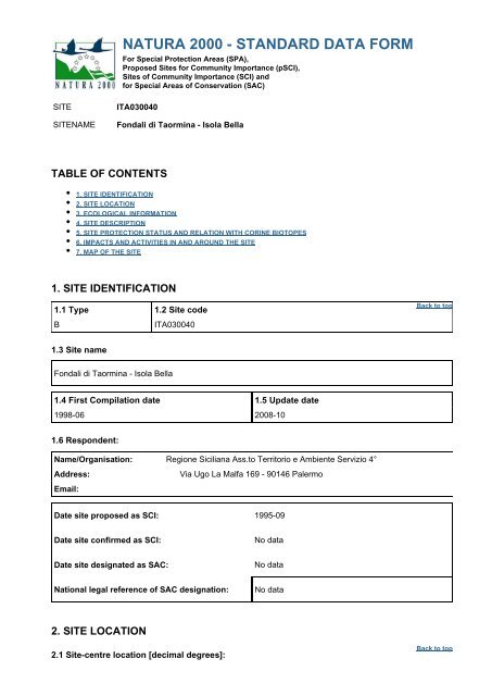
NATURA 2000 - STANDARD DATA FORM
NATURA 2000 - STANDARD DATA FORM
NATURA 2000 - STANDARD DATA FORM
Create successful ePaper yourself
Turn your PDF publications into a flip-book with our unique Google optimized e-Paper software.
SITE ITA030040<br />
<strong>NATURA</strong> <strong>2000</strong> - <strong>STANDARD</strong> <strong>DATA</strong> <strong>FORM</strong><br />
For Special Protection Areas (SPA),<br />
Proposed Sites for Community Importance (pSCI),<br />
Sites of Community Importance (SCI) and<br />
for Special Areas of Conservation (SAC)<br />
SITENAME Fondali di Taormina - Isola Bella<br />
TABLE OF CONTENTS<br />
1. SITE IDENTIFICATION<br />
2. SITE LOCATION<br />
3. ECOLOGICAL IN<strong>FORM</strong>ATION<br />
4. SITE DESCRIPTION<br />
5. SITE PROTECTION STATUS AND RELATION WITH CORINE BIOTOPES<br />
6. IMPACTS AND ACTIVITIES IN AND AROUND THE SITE<br />
7. MAP OF THE SITE<br />
1. SITE IDENTIFICATION<br />
1.1 Type 1.2 Site code<br />
B ITA030040<br />
1.3 Site name<br />
Fondali di Taormina - Isola Bella<br />
1.4 First Compilation date 1.5 Update date<br />
1998-06 2008-10<br />
1.6 Respondent:<br />
Name/Organisation: Regione Siciliana Ass.to Territorio e Ambiente Servizio 4°<br />
Address: Via Ugo La Malfa 169 - 90146 Palermo<br />
Email:<br />
Date site proposed as SCI: 1995-09<br />
Date site confirmed as SCI: No data<br />
Date site designated as SAC: No data<br />
National legal reference of SAC designation: No data<br />
2. SITE LOCATION<br />
2.1 Site-centre location [decimal degrees]:<br />
Back to top<br />
Back to top
Longitude<br />
15.38972222<br />
Latitude<br />
37.98277778<br />
2.2 Area [ha]: 2.3 Marine area [%]<br />
140.27 100.0<br />
2.4 Sitelength [km]:<br />
0.0<br />
2.5 Administrative region code and name<br />
NUTS level 2 code Region Name<br />
ITZZ Extra-Regio<br />
2.6 Biogeographical Region(s)<br />
Mediterranean (100.0<br />
%)<br />
3. ECOLOGICAL IN<strong>FORM</strong>ATION<br />
3.1 Habitat types present on the site and assessment for them<br />
Annex I Habitat types Site assessment<br />
Code PF NP Cover<br />
[ha]<br />
1120<br />
1170<br />
Cave<br />
[number]<br />
Data<br />
quality<br />
A|B|C|D A|B|C<br />
Representativity Relative<br />
Surface<br />
Back to top<br />
Conservation Global<br />
0.92 A C A A<br />
106.5 A C B B<br />
PF: for the habitat types that can have a non-priority as well as a priority form (6210, 7130, 9430) enter<br />
"X" in the column PF to indicate the priority form.<br />
NP: in case that a habitat type no longer exists in the site enter: x (optional)<br />
Cover: decimal values can be entered<br />
Caves: for habitat types 8310, 8330 (caves) enter the number of caves if estimated surface is not<br />
available.<br />
Data quality: G = 'Good' (e.g. based on surveys); M = 'Moderate' (e.g. based on partial data with<br />
some extrapolation); P = 'Poor' (e.g. rough estimation)<br />
3.2 Species referred to in Article 4 of Directive 2009/147/EC and listed in Annex II of Directive<br />
92/43/EEC and site evaluation for them<br />
Species Population in the site Site assessment<br />
G Code Scientific<br />
Name<br />
S NP T Size Unit Cat. D.qual. A|B|C|D A|B|C
Min Max Pop. Con. Iso. Glo.<br />
Group: A = Amphibians, B = Birds, F = Fish, I = Invertebrates, M = Mammals, P = Plants, R = Reptiles<br />
S: in case that the data on species are sensitive and therefore have to be blocked for any public<br />
access enter: yes<br />
NP: in case that a species is no longer present in the site enter: x (optional)<br />
Type: p = permanent, r = reproducing, c = concentration, w = wintering (for plant and non-migratory<br />
species use permanent)<br />
Unit: i = individuals, p = pairs or other units according to the Standard list of population units and<br />
codes in accordance with Article 12 and 17 reporting (see reference portal)<br />
Abundance categories (Cat.): C = common, R = rare, V = very rare, P = present - to fill if data are<br />
deficient (DD) or in addition to population size information<br />
Data quality: G = 'Good' (e.g. based on surveys); M = 'Moderate' (e.g. based on partial data with<br />
some extrapolation); P = 'Poor' (e.g. rough estimation); VP = 'Very poor' (use this category only, if not<br />
even a rough estimation of the population size can be made, in this case the fields for population size<br />
can remain empty, but the field "Abundance categories" has to be filled in)<br />
3.3 Other important species of flora and fauna (optional)<br />
Species Population in the site Motivation<br />
Group CODE Scientific<br />
Name<br />
P<br />
P<br />
P<br />
I 1027<br />
P 1377<br />
Cymodocea<br />
nodosa<br />
Cystoseira<br />
amentacea<br />
Cystoseira<br />
brachycarpa<br />
Lithophaga<br />
lithophaga<br />
Phymatolithon<br />
calcareum<br />
S NP Size Unit Cat.<br />
Species<br />
Annex<br />
Other<br />
categories<br />
Min Max C|R|V|P IV V A B C D<br />
R X<br />
C X<br />
C X<br />
P X<br />
V X<br />
I 1028 Pinna nobilis P X<br />
P<br />
Posidonia<br />
oceanica<br />
R X<br />
Group: A = Amphibians, B = Birds, F = Fish, Fu = Fungi, I = Invertebrates, L = Lichens, M =<br />
Mammals, P = Plants, R = Reptiles<br />
CODE: for Birds, Annex IV and V species the code as provided in the reference portal should be used<br />
in addition to the scientific name<br />
S: in case that the data on species are sensitive and therefore have to be blocked for any public<br />
access enter: yes<br />
NP: in case that a species is no longer present in the site enter: x (optional)<br />
Unit: i = individuals, p = pairs or other units according to the standard list of population units and codes<br />
in accordance with Article 12 and 17 reporting, (see reference portal)<br />
Cat.: Abundance categories: C = common, R = rare, V = very rare, P = present<br />
Motivation categories: IV, V: Annex Species (Habitats Directive), A: National Red List data; B:<br />
Endemics; C: International Conventions; D: other reasons<br />
4. SITE DESCRIPTION<br />
4.1 General site character<br />
Back to top
Habitat class % Cover<br />
N05 15.0<br />
N01 85.0<br />
Total Habitat Cover 100<br />
Other Site Characteristics<br />
I fondali di Taormina sono caratterizzati da una notevole varietà di morfologie. Infatti coesistono le falesie<br />
dell'isola Bella, di Capo Taormina e di Capo S. Andrea con le franate di grandi massi che da pochi metri<br />
digradano fino ai sessanta metri di profondità nella parte centrale dell'insenatura. Tra l'isola e i due<br />
promontori che delimitano la baia sono presenti due piccole spiagge di ghiaia mista a sabbie grossolane che<br />
proseguono sott'acqua con ampie spianate di sabbie fini. In un'area di pochi chilometri quadrati la tipologia<br />
della vegetazione marina bentonica si diversifica notevolmente a causa della diversità dei substrati. Infatti su<br />
substrato mobile è presente Posidonia oceanica che forma prati ben strutturati mentre su substrato roccioso<br />
la copertura vegetale è caratterizzata da popolamenti fotofili, in particolare sono ben rappresentati quelli a<br />
Cystoseira amentacea e Cystoseira brachycarpa e più in profondità da popolamenti a Dictyotaceae e<br />
Sphacelariacea<br />
4.2 Quality and importance<br />
I popolamenti vegetali di substrato duro dell'infralitorale, pur non rispecchiando la zonazione tipica del<br />
Mediterraneo per tutta la sua estensione, sono comunque ben strutturati e mantengono una elevata<br />
biodiversità. Significativa è la presenza di prati a Posidonia oceanica.<br />
5. SITE PROTECTION STATUS (optional)<br />
5.1 Designation types at national and regional level:<br />
Code Cover [%] Code Cover [%] Code Cover [%]<br />
IT05 3.0<br />
5.2 Relation of the described site with other sites:<br />
designated at national or regional level:<br />
X<br />
Back to top<br />
Type code Site name Type Cover [%]<br />
IT05 RNO Isola Bella + 3.0<br />
6. SITE MANAGEMENT<br />
6.2 Management Plan(s):<br />
An actual management plan does exist:<br />
Yes<br />
No, but in preparation<br />
No<br />
7. MAP OF THE SITES<br />
INSPIRE ID:<br />
Back to top<br />
Back to top
Map delivered as PDF in electronic format (optional)<br />
Yes X No<br />
Reference(s) to the original map used for the digitalisation of the electronic boundaries (optional).<br />
128010 106130 105160 105120 1:10000 Gauss-Boaga Ovest


