Palo Alto Economic Development Strategies

Create successful ePaper yourself
Turn your PDF publications into a flip-book with our unique Google optimized e-Paper software.
RECOMMENDATIONS<br />
05 and<br />
ACTIONS<br />
Fix broken pedestrian and cycling<br />
links to increase accessibility to, from,<br />
within commercial districts.<br />
1. Include more signage, wayfinding and bicycle<br />
lane markings along critical bike routes to aid safe<br />
and easy travel to/from shopping districts by<br />
biking and walking.<br />
2. Include mid-block pedestrian crossings and/or<br />
raised traffic tables where desire paths lack safe<br />
crossings and deemed safe to do so.<br />
3. Consider removing free rights at major<br />
intersections to aid in safe intersections for all<br />
modes of transport.<br />
CHAMPION<br />
Office of<br />
Transportation<br />
DISTRICTS<br />
Downtown<br />
<strong>Palo</strong> <strong>Alto</strong><br />
SUPPORT<br />
Public Works<br />
Office of <strong>Economic</strong> <strong>Development</strong><br />
California<br />
Avenue<br />
Neighborhood<br />
Centers<br />
ESTIMATED TIME + COST<br />
Short (5 years)<br />
High (>$100k)<br />
WHY THIS MATTERS<br />
Equitable accessibility by many modes of travel to and from <strong>Palo</strong> <strong>Alto</strong>’s retail<br />
districts is critical to capturing local and regional spending. Complete streets, those<br />
that adequately and safely accommodate many modes of travel, often see positive<br />
economic returns. Brooklyn’s Vanderbilt Avenue, for example, saw a doubling in<br />
retail sales in the three years following installation of bicycle lanes and a tree-lined<br />
median, which significantly outperformed borough-wide and city-wide trends,<br />
according to the New York City Department of Transportation’s 2018 study on the<br />
<strong>Economic</strong> Benefits of Sustainable Streets.<br />
<strong>Palo</strong> <strong>Alto</strong>’s bicycle and pedestrian network plays a crucial role within the overall<br />
transportation network in business and district success through its offering as a<br />
reliable alternative in what is a relatively well-knit environment. However, several<br />
areas within the pedestrian and bicycle network are challenged by a lack of<br />
informative and directional signage, markings, and safe crossings. While the bicycle<br />
network is rich with paths that parallel busy streets, some abruptly stop with little or<br />
no signage leading the user to the next protected path. Other times, markings have<br />
faded, or routes are overwhelmed with other infrastructure like on-street parking<br />
and bus lanes making it confusing and potentially unsafe all around. Considerations<br />
for highly visible and separated bicycle lanes/paths as well as appropriately placed<br />
and safe mid-block pedestrian crossings where people intuitively want to cross<br />
along highly traversed roadways are also recommended to be studied and<br />
implemented where deemed safe to do so. In some instances, it may be<br />
advantageous to consider intersection modifications like the removal free-right turns<br />
to increase pedestrian and bicycle safety and desirability as a means of travel.<br />
RESOURCES and HOW IT’S DONE<br />
The Office of Transportation should champion this effort in coordination with the<br />
pending Bicycle and Pedestrian Transportation Plan Update, which will involve a<br />
robust study of the existing network to comprehensively identify all gaps across the<br />
system and viable and timely solutions. The Plan will invite stakeholders to be a<br />
part of the project prioritization process, which will include community-validated<br />
criteria such as safety, connectivity, and level of pedestrian or bicyclist stress.<br />
Regular Plan updates would benefit from the input of the recommended Interagency<br />
<strong>Economic</strong> <strong>Development</strong> Committee led by the Office of <strong>Economic</strong> <strong>Development</strong>.<br />
<strong>Palo</strong> <strong>Alto</strong>’s retail districts should result in more visitation and patronage, overall. A<br />
survey performed a year from implementation of improvements could be<br />
undertaken by either the Office of Transportation or the Office of <strong>Economic</strong><br />
<strong>Development</strong> and shared through the recommended Interagency <strong>Development</strong><br />
Committee and disseminated publicly with other performance outcome measures.<br />
BEST PRACTICE: RECLAIMED FREE RIGHT TURNS, SAN<br />
DIEGO, CA<br />
Per San Diego’s Vision Zero goals, shorter walking distances at intersections were<br />
implemented through tighter turn radii and reclaimed free right turns, reducing<br />
pedestrian crossing distances by 65% at some intersections. “In 2019, there was a<br />
modest decrease for combined serious injuries and fatalities compared to 2018, and<br />
2020 showed a further decline, compared to 2019.” (San Diego Vision Zero).<br />
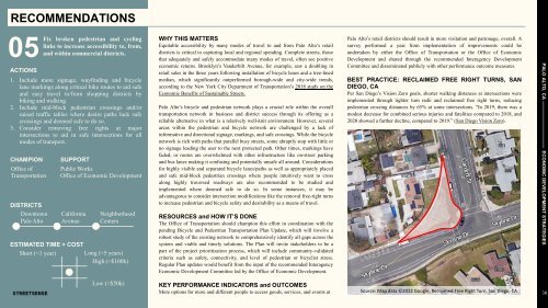
PALO ALTO, CA —————————— ECONOMIC DEVELOPMENT STRATEGIES<br />
Low (