

Carta - Insert Layout - 2 per page.indd - Caris
Carta - Insert Layout - 2 per page.indd - Caris
Carta - Insert Layout - 2 per page.indd - Caris

You also want an ePaper? Increase the reach of your titles
YUMPU automatically turns print PDFs into web optimized ePapers that Google loves.
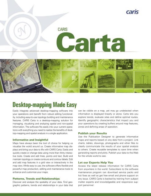
Desktop-mapping Made Easy can be visible on a map, yet may go undetected when<br />
Easily integrate advanced desktop-mapping software into<br />
your o<strong>per</strong>ations and benefit from robust editing functionality,<br />
including easy-to-use topology building and maintenance<br />
features. CARIS <strong>Carta</strong> is a desktop-mapping solution for<br />
managing, visualizing and analyzing spatial and non-spatial<br />
information. The software fits easily into your current o<strong>per</strong>ations<br />
with everything you need to realize the benefits of desktop-mapping<br />
and spatial analysis in a single application.<br />
Informative and Insightful<br />
Maps have always been the tool of choice for helping us<br />
visualize the world around us. Create informative map displays<br />
and bring your data to life with CARIS <strong>Carta</strong>. Easily and<br />
quickly create or change data using more than thirty interactive<br />
tools. Create and edit lines, points and text. Build and<br />
maintain topology or create contours and contour labels. Edit<br />
and add map features in a grid view or interactively in the<br />
map view. While easy to use, the software offers flexible and<br />
powerful map production, editing and maintenance tools to<br />
enhance and customize your maps.<br />
Patterns, Trends and Relationships<br />
Discover and analyze the spatiality of your data. Find geographic<br />
patterns, trends and relationships in your data that<br />
information is displayed linearly or alone. <strong>Carta</strong> lets you<br />
explore trends, evaluate sites and define optimal routes.<br />
Identify geographic characteristics that impact you and<br />
your o<strong>per</strong>ations by creating buffers around map features,<br />
zones and defining areas of o<strong>per</strong>ation.<br />
Publish your Results<br />
Use the Publication Designer to generate informative<br />
maps and reports based on any data from a project. Link<br />
charts, tables, drawings, photographs and other files to<br />
clearly communicate the results of your spatial analysis<br />
to others. Create reusable templates to save time when<br />
generating reports and plots. Publish your data to the Web<br />
for the whole world to see.<br />
Let our Ex<strong>per</strong>ts Help You<br />
Access the latest release information for CARIS <strong>Carta</strong><br />
from anywhere in the world. Subscribers to the software<br />
maintenance program can download service packs and<br />
hot fixes as well as get free email and phone support on<br />
any issue. CARIS <strong>Carta</strong> is backed by training from subject<br />
matter ex<strong>per</strong>ts and knowledgeable and responsive support<br />
<strong>per</strong>sonnel.
CARIS <strong>Carta</strong> Features<br />
Data Maintenance<br />
and Creation<br />
• Edit<br />
• Maintain/Build topology<br />
• Contouring<br />
• Symbol Editor<br />
• Tablet<br />
• Raster line follow<br />
• Copy and paste<br />
• Geometric transformations<br />
CARIS<br />
115 Waggoners Lane<br />
Fredericton, New Brunswick<br />
E3B 2L4 Canada<br />
Tel +1.506.458.8533<br />
Fax +1.506.459.3849<br />
info@caris.com<br />
CARIS BV<br />
Mgr. van Oorschotstraat 13<br />
PO Box 47 5473 ZG<br />
Heeswijk The Netherlands<br />
Tel +31.413.296010<br />
Fax +31.413.296012<br />
info@caris.nl<br />
Query and Selection<br />
• Database view<br />
• Information about features<br />
• Select features<br />
• Hy<strong>per</strong>links<br />
Plug-ins for <strong>Carta</strong><br />
Using optional plug-ins with <strong>Carta</strong> allows users to enhance the<br />
functionality of the software.<br />
Geology Plug-in<br />
The Geology plug-in extends this functionality and customizes<br />
the interface of CARIS <strong>Carta</strong> with menus and tools for all of your<br />
geological mapping needs. Designed by Geologists, this plug–in<br />
extends the <strong>Carta</strong> tools for managing, visualizing and analyzing<br />
spatial and non-spatial information with the specific needs of the<br />
professional geologist in mind.<br />
MrSID Plug-in<br />
The MrSID ® plug-in installs onto an existing installation of your<br />
CARIS product and allows users to add MrSID ® imagery created<br />
using LizardTech’s GeoExpress with MrSID ® software directly into<br />
their local CARIS application. Use this plug-in to manage, access,<br />
and share massive amounts of imagery including aerial photos<br />
and satellite images across an organization with minimal use of<br />
system resources.<br />
CARIS USA<br />
503 2 nd Street NE<br />
Washington, DC<br />
20002 USA<br />
Tel +1.985.788.4124<br />
carisusa@caris.com<br />
CARIS software and the CARIS logo are registered trademarks of CARIS. Other brands and product names are registered<br />
trademarks or trademarks of their respective holders. ©2006 CARIS. All rights reserved.<br />
Tools and Analysis<br />
• Project Editor<br />
• Project Wizard<br />
• Classification<br />
• Annotation<br />
• Buffer analysis<br />
• Projected grids<br />
• Publication<br />
• Import/Export<br />
Viewing<br />
• Multiple views<br />
• Overview<br />
• Projection<br />
• Data sources<br />
• Navigation<br />
• Views<br />
• Grids and scalebars<br />
• Transparency<br />
• Image registration<br />
For more information visit our website www.caris.com


