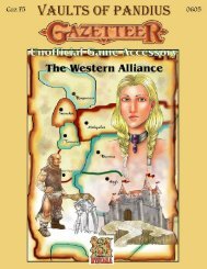
The Kingdom of Littonia - Vaults of Pandius
The Kingdom of Littonia - Vaults of Pandius
The Kingdom of Littonia - Vaults of Pandius

You also want an ePaper? Increase the reach of your titles
YUMPU automatically turns print PDFs into web optimized ePapers that Google loves.
GEOGRAPHY<br />
<strong>The</strong> Land<br />
To most residents, “<strong>Littonia</strong>” refers to<br />
the modern kingdom, while “Greater<br />
<strong>Littonia</strong>” includes a broad swath <strong>of</strong> land<br />
northeast <strong>of</strong> the Great Bay as well as<br />
portions <strong>of</strong> the Norwold littoral to the<br />
south. This larger region is held to be the<br />
<strong>Littonia</strong>n homeland, to which its people<br />
have a claim.<br />
<strong>Littonia</strong> is located just north <strong>of</strong> the<br />
Arctic Circle and would be a wholly<br />
frigid land were it not for the protection<br />
<strong>of</strong>fered by a series <strong>of</strong> hills that marks the<br />
land’s natural frontiers and the peculiar<br />
effects <strong>of</strong> the Saampo <strong>of</strong> nearby Kaarjala.<br />
<strong>Littonia</strong> is comprised <strong>of</strong> two valleys<br />
rapidly carved out by glaciers during the<br />
post-Rain ice migrations. <strong>The</strong> valleys<br />
join in a broad-based “V” that brackets a<br />
curving line <strong>of</strong> steep hills to the interior.<br />
Even within the valleys, the terrain is<br />
quite hilly, and much <strong>of</strong> the land is<br />
covered with coniferous forests. <strong>The</strong><br />
entire kingdom slopes gradually towards<br />
the ocean, with the westernmost<br />
settlement <strong>of</strong> Valmiera being 400 feet<br />
above sea level.<br />
Natural resources consist <strong>of</strong> clay, wood,<br />
peat, iron ore, limestone, silver, and,<br />
most critically, amber.<br />
Mountains and Hills<br />
<strong>The</strong> only true mountains <strong>of</strong> <strong>Littonia</strong>,<br />
Pērkons’ Throne, technically lie outside<br />
its borders. <strong>The</strong>se peaks, framed by the<br />
Vētra (“tempest”) Hills, witness a great<br />
number <strong>of</strong> thunderstorms throughout the<br />
summer months. <strong>The</strong> tallest peaks rise<br />
almost 11,000 feet above sea level, and<br />
the mountains are rich in untapped<br />
mineral resources.<br />
<strong>Littonia</strong> is cut <strong>of</strong>f from the rest <strong>of</strong><br />
Norwold by Namejs’ Line, a range <strong>of</strong> tall<br />
hills running from the Sarkans (“red”)<br />
Plain in the southwest to its junction with<br />
the northern Lietuvan Hills. <strong>The</strong><br />
southern slopes <strong>of</strong> the Line are very<br />
steep, rising to their maximum height <strong>of</strong><br />
1,100 feet above the <strong>Littonia</strong>n baseline<br />
very quickly. Numerous hidden valleys<br />
and lakes are found within the Line. <strong>The</strong><br />
northern slopes are not quite as steep, and<br />
descend 800 feet to the Noskumis<br />
(“sorrowful”) Plain. Silver and iron ore<br />
deposits are common in the west.<br />
<strong>The</strong> Lietuvan Hills are very similar to<br />
Namejs’ Line but rise only 700 feet<br />
above the <strong>Littonia</strong>n baseline. <strong>The</strong> range<br />
is not as broad, and it is largely unbroken<br />
by valleys. <strong>The</strong> Lietuvan Hills continue<br />
northward west <strong>of</strong> the Teici Bog. This<br />
extension only reaches 650 feet above<br />
sea level. <strong>The</strong> continuing post glacial<br />
uplift is slightly faster in the Lietuvan<br />
Hills than at points further south, and this<br />
has opened a number <strong>of</strong> channels where<br />
water comes into contact with high heat,<br />
producing a number <strong>of</strong> hot springs.<br />
<strong>The</strong> stately, yet storm-ridden Vētra Hills<br />
borders the Sarkans Plains from the<br />
south, topping out at 500 feet above the<br />
<strong>Littonia</strong>n baseline. <strong>The</strong>ir eastern fringes<br />
are blanketed by the forest known as the<br />
Draudīgs Wood. Traces <strong>of</strong> silver have<br />
been found in some regions, but the<br />
resident goblins have yet to mine them.<br />
Forests<br />
A mixture <strong>of</strong> old world and glacial<br />
factors deposited thick, rich soils east <strong>of</strong><br />
Namejs’ Line that are now covered with<br />
dense forest. <strong>The</strong> majority <strong>of</strong> trees are<br />
coniferous, with spruce and pine<br />
predominating, but stands <strong>of</strong> birch, and<br />
even rare oak, can be found along the<br />
lower Gaudava and Aiviekste Rivers and<br />
the southern coastal regions. <strong>The</strong><br />
occasionally abrupt transition from<br />
deciduous to coniferous vegetation – and<br />
sometimes back again – in a space <strong>of</strong> a<br />
few hundred feet is one feature unique to<br />
<strong>Littonia</strong>. In most areas, the soil is quite<br />
acidic due to falling needles and sports<br />
little or no underbrush. Mushrooms,<br />
bilberry bushes, cranberries, and shadeloving<br />
herbs do manage to thrive,<br />
however.<br />
<strong>The</strong> largest forest is the Veči (“old”)<br />
Forest, which is sandwiched between the<br />
Gaudava and Aiviekste Rivers. It is<br />
predominantly spruce, but the northern<br />
and eastern fringes have large numbers <strong>of</strong><br />
birch, oak, and linden trees. Beyond the<br />
Gaudava River the forest continues as the<br />
coniferous Zalš (“green”) Forest. <strong>The</strong><br />
Zalš is very thick and ascends Namejs’<br />
7<br />
Line to the northwest.<br />
South <strong>of</strong> the Aiviekste River is the<br />
rugged Draudīgs (“sinister”) Wood. It<br />
has large stands <strong>of</strong> birch along the coast,<br />
but quickly becomes coniferous inland.<br />
A part <strong>of</strong> Greater <strong>Littonia</strong>, the region is<br />
largely unsettled wilderness. Folktales<br />
hold that the Draudīgs Wood is the<br />
location <strong>of</strong> Saldus, one <strong>of</strong> the petty<br />
kingdoms that refused to submit to Karlis<br />
the Unifier and was destroyed.<br />
<strong>The</strong> Mindaugas’ Forest covers the low<br />
hills north <strong>of</strong> the Gaudava’s last segment.<br />
Named after a courageous Lietuvan lord,<br />
it is exclusively pine and spruce trees,<br />
save for a few oak and linden groves<br />
around the village <strong>of</strong> Dundaga. It is also<br />
the densest <strong>of</strong> <strong>Littonia</strong>’s forests and is<br />
reputed to be inhabited by spirits who<br />
play merciless tricks on intruders.<br />
Although the fringes are thinly settled,<br />
druids are the only humans likely to be<br />
found deep within.<br />
Plains<br />
Further inland, where the cold<br />
continental climate asserts itself, forests<br />
yield to juniper thickets and long grasses.<br />
<strong>The</strong> latter eventually predominate.<br />
<strong>The</strong> transition is particularly abrupt on<br />
the Noskumis Plain. <strong>The</strong>re wildflowers<br />
and tall grasses blanket the fields during<br />
the brief summer. So named because <strong>of</strong><br />
its harsh climate and the many ruins that<br />
dot its expanse, the Noskumis Plain is<br />
largely flat and extends for many miles to<br />
the west and north. It averages 400-500<br />
feet above sea level in the east, rising<br />
gradually towards the mountain foothills<br />
in the distant west.<br />
<strong>The</strong> Sarkans Plain – named after the<br />
blood spilled in conflicts with the native<br />
goblins – is relatively lush around the<br />
banks <strong>of</strong> its rivers with cattails, small<br />
bushes, and the occasional pine tree. It<br />
averages 400 feet above sea level and<br />
grows hilly towards the south and west.<br />
<strong>The</strong> local climate is harsher than that in<br />
<strong>Littonia</strong>, but it does not have quite as<br />
extreme a fluctuation.