Dynamics and Vulnerability of Delta Systems - loicz
Dynamics and Vulnerability of Delta Systems - loicz
Dynamics and Vulnerability of Delta Systems - loicz

Create successful ePaper yourself
Turn your PDF publications into a flip-book with our unique Google optimized e-Paper software.
LAND-OCEAN INTERACTIONS IN THE COASTAL ZONE (LOICZ)<br />
Core Project <strong>of</strong> the International Geosphere-Biosphere Programme (IGBP) <strong>and</strong><br />
the International Human Dimensions Programme on Global Environmental Change (IHDP)<br />
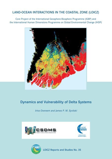
<strong>Dynamics</strong> <strong>and</strong> <strong>Vulnerability</strong> <strong>of</strong> <strong>Delta</strong> <strong>Systems</strong><br />
Irina Overeem <strong>and</strong> James P. M. Syvitski<br />
LOICZ Reports <strong>and</strong> Studies No. 35
<strong>Dynamics</strong> <strong>and</strong> <strong>Vulnerability</strong><br />
<strong>of</strong> <strong>Delta</strong> <strong>Systems</strong><br />
Edited by<br />
Irina Overeem <strong>and</strong> James P.M. Syvitski<br />
Contributing Authors<br />
Robert G. Brakenridge, John W. Day Jr., Liviu Giosan, Mark T. Hannon, Philip R. Hill,<br />
W. Gregory Hood, Ilan Kelman, Albert J. Kettner, Hartwig H. Kremer, Robert Nicholls,<br />
Chris Paola, Juan D. Restrepo, Yoshiki Saito, Alex de Sherbinin, Charles Simenstad,<br />
Charles J. Vörösmarty, Juergen Weichselgartner
Published in Germany, 2009 by:<br />
GKSS Research Center<br />
LOICZ International Project Office<br />
Institute for Coastal Research<br />
Max-Planck-Strasse 1<br />
D-21502 Geesthacht, Germany<br />
The L<strong>and</strong>-Ocean Interactions in the Coastal Zone Project is a Core Project <strong>of</strong> the “International<br />
Geosphere-Biosphere Programme” (IGBP) <strong>and</strong> the “International Human Dimensions Programme<br />
on Global Environmental Change” (IHDP) <strong>of</strong> the International Council <strong>of</strong> Scientific Unions.<br />
The LOICZ IPO is hosted <strong>and</strong> financially supported by the Institute for Coastal Research, GKSS<br />
Research Center in Geesthacht, Germany. GKSS is a member <strong>of</strong> the Helmholtz Association <strong>of</strong><br />
National Research Centers.<br />
COPYRIGHT © 2009, L<strong>and</strong>-Ocean Interactions in the Coastal Zone, IGBP/IHDP Core Project.<br />
Reproduction <strong>of</strong> this publication for educational or other, non-commercial purposes is authorized<br />
without prior permission from the copyright holder.<br />
Reproduction for resale or other purposes is prohibited without the prior, written permission <strong>of</strong><br />
the copyright holder.<br />
Citation: Overeem, I. & Syvitski, J.P.M. (2009): <strong>Dynamics</strong> <strong>and</strong> <strong>Vulnerability</strong> <strong>of</strong> <strong>Delta</strong><br />
<strong>Systems</strong>. LOICZ Reports & Studies No. 35. GKSS Research Center, Geesthacht,<br />
54 pages.<br />
ISSN: 1383 4304<br />
Cover: The cover photograph shows a Shuttle Radar Topography Mission (SRTM) data for<br />
the Irrawaddy delta overlain with the flood extend at time <strong>of</strong> Cyclone Nargis in<br />
April 2008 (in red), mapped by the Darthmouth Flood Observatory (courtesy<br />
CSDMS).<br />
Disclaimer: The designations employed <strong>and</strong> the presentation <strong>of</strong> the material contained in this<br />
report do not imply the expression <strong>of</strong> any opinion whatsoever on the part <strong>of</strong> LOICZ,<br />
IGBP or the IHDP concerning the legal status <strong>of</strong> any state, territory, city or area,<br />
or concerning the delimitation ’s <strong>of</strong> their frontiers or boundaries. This report<br />
contains the views expressed by the authors <strong>and</strong> may not necessarily reflect the<br />
views <strong>of</strong> the IGBP or IHDP.<br />
The LOICZ Reports <strong>and</strong> Studies Series is published <strong>and</strong> distributed free <strong>of</strong> charge to scientists<br />
involved in global change research in coastal areas.
Table <strong>of</strong> Contents<br />
Executive Summary …………………………………………………………..…………................ v<br />
Acknowledgements …………………………………………………………….…………….……. vi<br />
Prolog ……………………………………………………………..….………….………….……... vii<br />
1 Introduction ……………………………………………………………..….……….…………. 9<br />
2 Change in <strong>and</strong> <strong>Vulnerability</strong> <strong>of</strong> <strong>Delta</strong>s ……………………………..……...…………………. 11<br />
2.1 Upstream changes <strong>of</strong> freshwater <strong>and</strong> sediment loads …….....………………………………... 12<br />
Case Study 1: Largest irrigation system in the world reduces flow to the Indus delta ..……... 12<br />
2.2 Anthropogenic impacts to delta structure <strong>and</strong> processes ……………………………………... 13<br />
Case Study 2: Engineering distributary channels in the Yellow River delta ………..…………. 14<br />
Case Study 3: Subsidence <strong>of</strong> the Po River delta …………..……………………….………………. 17<br />
2.3 Sea-level change ……………………………………………………………………………… 18<br />
Case Study 4: Rapid Caspian sea level change <strong>and</strong> the Volga delta ……......………………….. 19<br />
2.4 Increased frequency <strong>of</strong> extreme climate events? ………………………..…….……………… 20<br />
3 Conceptual Framework <strong>of</strong> Scale <strong>and</strong> Function <strong>of</strong> <strong>Delta</strong>s ……..………………..………..….. 22<br />
3.1 Concepts <strong>of</strong> time <strong>and</strong> scale in delta systems …………………………………………………. 22<br />
Case study 5: Infrastructural development in the Danube delta …………..…….………………. 24<br />
3.2 Feeding river basins: pulse-subsidized sustainability ………………………………………... 26<br />
Case study 6: The Magdalena River delta: deforestation <strong>and</strong> coastal erosion ….……..……… 29<br />
3.3 Pulsed energy from the ocean <strong>and</strong> its trends over time ………………………………………. 30<br />
Case Study 7: Puget Sound deltas: habitat loss for Chinook Salmon ….………….……………. 32<br />
3.4 The importance <strong>of</strong> extreme events …………………………………………………………… 33<br />
4 Strategies for Underst<strong>and</strong>ing <strong>and</strong> Managing Change <strong>and</strong> <strong>Vulnerability</strong> <strong>of</strong> <strong>Delta</strong>s …..…… 34<br />
4.1 Multidisciplinary research linked to practice ………………………………………………… 35<br />
4.2 Assessing natural delta dynamics …………………………………………………………….. 36<br />
4.3 Assessment <strong>of</strong> human influence on delta dynamics ………………………………………….. 37<br />
Case Study 8: Different population patterns in tropical Asian deltas ……..…………………… 38<br />
4.4 Coupling morphodynamic models with Geographic Information <strong>Systems</strong> ………………….. 39<br />
4.5 <strong>Vulnerability</strong> <strong>and</strong> risk mapping ………………………………………………………………. 40<br />
Case Study 9: Tsunami risk on the Fraser River delta ……..…………………………………….. 41<br />
4.6 Towards sustainable management <strong>of</strong> deltas ………………………………………………….. 42<br />
5 Conclusions …………………………………………...……………….……………….………. 44<br />
6 References …………………………………………………….……….……………….………. 47<br />
7 Workshop Participants ……………………………………………….……………….………. 54<br />
iii
Executive Summary<br />
<strong>Delta</strong>s form where rivers meet the ocean. They are then naturally shaped by the forces <strong>of</strong> rivers,<br />
waves <strong>and</strong> tides. Intricate mazes <strong>of</strong> river channels, wetl<strong>and</strong>s <strong>and</strong> coastal features, that ever-change<br />
host a wide variety <strong>of</strong> unique ecosystems. <strong>Delta</strong>s are recognized as critically important habitats<br />
for threatened terrestrial <strong>and</strong> marine species. <strong>Delta</strong>s act as filters, repositories, <strong>and</strong> reactors for a<br />
suite <strong>of</strong> continental materials, including carbon, on their way to the coastal ocean.<br />
Due to their low topography, high productivity, rich biodiversity, <strong>and</strong> easy transport along<br />
abundant waterways, deltas are preferred locales <strong>of</strong> human habitation as well. <strong>Delta</strong>s may only<br />
comprise 5% <strong>of</strong> the l<strong>and</strong> area, but over 500 million people live on them, including many heavily<br />
populated megadeltas in Asia. The Ganges-Brahmaputra, Yangtze <strong>and</strong> Nile deltas alone are<br />
extremely densely populated with 230 million people in 2000. It is expected that there will be a<br />
35% increase <strong>of</strong> population in the major world deltas by 2015.<br />
<strong>Delta</strong>s are unfortunately also fragile geomorphic features, <strong>and</strong> can change dramatically with<br />
modest modifications in the controlling environmental conditions. Already, thirty-three major<br />
deltas collectively include significant area (~26,000 km 2 ) below local mean sea level <strong>and</strong> another<br />
~70,000 km 2 <strong>of</strong> vulnerable area below 2 m. This vulnerable area may increase by 50% under<br />
projected 21 st century eustatic sea level rise. Intensive human development, population growth, as<br />
well as recent human-induced global changes are degrading deltas <strong>and</strong> <strong>of</strong>ten transforming them<br />
into increasingly hazardous coastal regions. Given current trends including shifts in climate,<br />
upstream changes in water quantity <strong>and</strong> quality, <strong>and</strong> population pressure, many deltas are in<br />
danger <strong>of</strong> collapse within the 21 st century.<br />
What would a collapse look like? A collapse may include complete loss <strong>of</strong> wetl<strong>and</strong>s <strong>and</strong><br />
concomitant biodiversity, cities <strong>and</strong> villages <strong>and</strong> the associated infrastructure flooded, permanent<br />
loss <strong>of</strong> fishing areas, farming l<strong>and</strong>s, <strong>and</strong> valuable forests, <strong>and</strong> rapid shoreline retreat. Future<br />
preservation <strong>of</strong> deltas will become increasingly difficult <strong>and</strong> costly. Restoration or maintenance<br />
will require developing integrated management strategies that incorporate extensive monitoring,<br />
focused research <strong>and</strong> complex numerical modeling as well as detailed consultation with people<br />
affecting <strong>and</strong> affected by deltas.<br />
To assess the state-<strong>of</strong>-the-art underst<strong>and</strong>ing <strong>of</strong> the changes in <strong>and</strong> vulnerability <strong>of</strong> delta systems,<br />
the following report was commissioned jointly by: 1) LOICZ, the joint IGBP (International<br />
Geosphere-Biosphere Programme) <strong>and</strong> IHDP (International Human Dimensions Programme on<br />
Global Environmental Change) Core Project entitled L<strong>and</strong>-Ocean Interactions in the Coastal<br />
Zone, 2) GWSP, an Earth System Science Partnership project <strong>of</strong> DIVERSITAS, IGBP, IHDP<br />
<strong>and</strong> WCRP (World Climate Research Program), entitled Global Water <strong>Systems</strong> Project, <strong>and</strong> 3)<br />
CSDMS, the Community Surface <strong>Dynamics</strong> Modeling System.<br />
The report discusses the changes <strong>and</strong> vulnerabilities <strong>of</strong> world deltas resulting from anthropogenic<br />
alteration <strong>of</strong> upstream freshwater <strong>and</strong> sediment inflows, anthropogenic alteration <strong>of</strong> sediment<br />
<strong>and</strong> water routing through deltas, hydrocarbon <strong>and</strong> groundwater extraction from deltas, sea-level<br />
change, <strong>and</strong> the increased frequency <strong>of</strong> extreme climate events. A conceptual framework highlights<br />
the importance <strong>of</strong> temporal <strong>and</strong> spatial scaling in deltas, <strong>and</strong> the complex interlinkages<br />
between constructive <strong>and</strong> destructive forces <strong>of</strong> pulsed energy coming from the feeding rivers <strong>and</strong><br />
the attacking ocean, <strong>and</strong> the role <strong>of</strong> extreme climate events.<br />
v
These concepts lead the authors to target their research strategies <strong>and</strong> questions to enhance<br />
underst<strong>and</strong>ing <strong>of</strong> change <strong>and</strong> vulnerability <strong>of</strong> world deltas, <strong>and</strong> include research agendas for a<br />
linked technology for socio-economical, ecological, <strong>and</strong> morphological process modeling. Along<br />
with thoughts on implementation strategies, a series <strong>of</strong> case study vignettes are included to<br />
document the uniqueness <strong>of</strong> world deltas <strong>and</strong> the challenges before us. A multidisciplinary<br />
community effort is sought to bring intellectual resources to address the urgent challenge <strong>of</strong><br />
stewardship <strong>and</strong> sustainable management <strong>of</strong> delta systems.<br />
Acknowledgements<br />
We acknowledge the scoping meeting sponsored by LOICZ, GWSP <strong>and</strong> CSDMS entitled<br />
“<strong>Dynamics</strong> <strong>and</strong> <strong>Vulnerability</strong> <strong>of</strong> River <strong>Delta</strong> <strong>Systems</strong>”, details <strong>of</strong> which can be found at<br />
http://csdms.colorado.edu/wiki/index.php/<strong>Delta</strong>s_2007. The list <strong>of</strong> authors <strong>and</strong> workshop<br />
participants <strong>and</strong> their contact information can be found at the end <strong>of</strong> the report.<br />
vi
Prolog<br />
<strong>Delta</strong>s all over the world are identified to be among the most important sources <strong>of</strong> ecosystem<br />
goods <strong>and</strong> services. They are a reflection <strong>of</strong> past <strong>and</strong> current global change phenomena along our<br />
coasts as well as the societal dimensions associated with these changes. In terms <strong>of</strong> spatial <strong>and</strong><br />
temporal scales, deltas are an expression <strong>of</strong> the complex geomorphic interplay between natural<br />
<strong>and</strong> human forcing, <strong>and</strong> thus provide a mirror <strong>of</strong> the multiple feedbacks between man <strong>and</strong> the<br />
environment. The relevant spatial extension <strong>of</strong> deltas <strong>and</strong> the processes that govern their<br />
geomorphologic dynamics <strong>and</strong> shape encompass the water continuum from source areas in the<br />
river catchments down onto our continental shelves. Along this continuum, anthropogenic<br />
pressures exact their toll, involving changes <strong>and</strong> responses.<br />
Many transboundary rivers meet the sea in large deltas, thus next to natural processes <strong>and</strong> flow<br />
regimes deltas may reflect also the upstream sociopolitical condition. Since historical times, deltas<br />
have been society’s edge, supporting social, cultural <strong>and</strong> economic development <strong>and</strong> welfare.<br />
Today they are subject to the impacts <strong>of</strong> climate change <strong>and</strong> increasingly prone to natural hazards<br />
st<strong>and</strong>ing in opposition to accelerating l<strong>and</strong> <strong>and</strong> coastal use for urbanization, transport business<br />
<strong>and</strong> exploitation <strong>of</strong> natural resources. Upstream <strong>and</strong> in the densely urbanized delta regions,<br />
hydrological management including groundwater abstraction <strong>and</strong> other human induced soil<br />
compaction have led to the increasingly global phenomena <strong>of</strong> subsiding deltas <strong>and</strong> their cities,<br />
exacerbating their vulnerability to storms <strong>and</strong> erosion. <strong>Delta</strong>s therefore deserve priority attention<br />
by a truly holistic scientific community. Three institutions in the wider Earth System science<br />
context therefore have joined forces in late 2007 to review our current state <strong>of</strong> the art<br />
underst<strong>and</strong>ing <strong>of</strong> deltas their physical, biological <strong>and</strong> socio-ecological features <strong>and</strong> to identify key<br />
deltaic research questions.<br />
The CSDMS, Community Surface <strong>Dynamics</strong> Modeling System, Integration Facility based in Boulder,<br />
Colorado, is a virtual home for a diverse community <strong>of</strong> experts, presently from 22 countries <strong>and</strong><br />
135 institutions, who foster <strong>and</strong> promote the modeling <strong>of</strong> earth surface processes, with emphasis<br />
on fluids, sediments <strong>and</strong> solutes in l<strong>and</strong>scapes, seascapes <strong>and</strong> sedimentary basins. CSDMS<br />
<strong>of</strong>ferings to the public include a library <strong>of</strong> useful, vetted models, “middleware” to couple models<br />
<strong>and</strong> data systems, <strong>and</strong> educational products related to its mission <strong>of</strong> better underst<strong>and</strong>ing our<br />
planet’s surface environment. One <strong>of</strong> CSDMS’s Working Groups is charged with coordinating<br />
the development <strong>of</strong> morphodynamic <strong>and</strong> biogeochemical models that specifically relate to how<br />
deltas respond to both upstream watershed perturbations, <strong>and</strong> <strong>of</strong>fshore marine climate.<br />
LOICZ, L<strong>and</strong> Ocean Interactions in the Coastal Zone, is a Core Project <strong>of</strong> the International Geosphere-Biosphere<br />
Programme, IGBP, <strong>and</strong> the International Human Dimensions Programme on<br />
Global Environmental Change, IHDP. With a growing network <strong>of</strong> scientists working on global<br />
scale it has been analyzing coastal change <strong>and</strong> underlying processes <strong>and</strong> feedbacks since the early<br />
1990s. During the recent past LOICZ evolved, however, from its originally biogeochemical focus<br />
global into a truly interdisciplinary Earth System Science experiment, which looks into the<br />
multiple features <strong>of</strong> coastal change in a holistic manner. The key objective is to inform sustainable<br />
development <strong>and</strong> use <strong>of</strong> coastal zones by applying a socio ecological systems perspective<br />
along the whole water cascade. It aims to provide the knowledge, underst<strong>and</strong>ing <strong>and</strong> prediction<br />
needed to allow coastal communities to assess, anticipate <strong>and</strong> respond to the interaction <strong>of</strong> global<br />
<strong>and</strong> local pressures which precipitate coastal change. For LOICZ, deltas are one <strong>of</strong> the top<br />
vii
priority coastal areas where global change, regional <strong>and</strong> local drivers <strong>and</strong> governance response<br />
lead to complex feedbacks <strong>and</strong> changes<br />
The GWSP, Global Water System Project, a joint project <strong>of</strong> the Earth System Science Partnership is<br />
committed to analyze global change effects on the planet’s water system, i.e. to the freshwater<br />
components <strong>of</strong> the hydrological cycle. GWSP has since its early stages focused not just on<br />
modeling these effects <strong>and</strong> consequences such a water dem<strong>and</strong> <strong>and</strong> supply now <strong>and</strong> in future in<br />
different climate change scenarios; it has also applied a human dimensions perspective to<br />
showcase what the feedbacks are humanity needs to face in future water use <strong>and</strong> management.<br />
<strong>Delta</strong>s are not only human habitats, they also the link between aquatic <strong>and</strong> marine ecosystems.<br />
<strong>Delta</strong>s reflect both wise resource use <strong>and</strong> unsustainable practices in the river basin. Diagnosing<br />
deltas reveal much <strong>of</strong> the upstream problems <strong>of</strong> mighty river basins.<br />
The collaboration between CSDMS, the GWSP <strong>and</strong> LOICZ underlines that the joined thinking<br />
in terms <strong>of</strong> scales, processes <strong>and</strong> tools that is needed to adequately address global change issues<br />
<strong>and</strong> human dimensions in deltas cannot be h<strong>and</strong>led as well by one actor alone as it can be done<br />
collectively in a such a strategic partnership.<br />
In conclusion <strong>and</strong> even after this concerted effort <strong>of</strong> multidisciplinary experts we have to<br />
recognize that deltas still remain a priority to be studied. As this report states, the scope <strong>of</strong> the<br />
challenge is large. All three organizations, CSDMS, LOICZ <strong>and</strong> the GWSP are collaborating here<br />
to highlight the vulnerability <strong>of</strong> deltas. We are developing plans to marshal our respective<br />
scientific communities to work together <strong>and</strong> better underst<strong>and</strong> the scale <strong>and</strong> function <strong>of</strong> deltas.<br />
This report <strong>of</strong>fers important strategies for underst<strong>and</strong>ing <strong>and</strong> managing change in deltas. On<br />
behalf <strong>of</strong> our respective communities, we hope this new spotlight will illuminate the constellation<br />
<strong>of</strong> issues, <strong>and</strong> document what we know <strong>and</strong> list what we do not know on this important topic.<br />
We also hope that this report will be able to communicate the key findings <strong>and</strong> issues in current<br />
<strong>and</strong> future delta research to multiple audiences <strong>and</strong> assist to open new avenues for advanced<br />
interdisciplinary research to be implemented by the leading environmental <strong>and</strong> research<br />
institutions world wide.<br />
James P.M. Syvitski<br />
CSDMS Executive Director<br />
Hartwig H. Kremer<br />
LOICZ Executive Officer<br />
viii<br />
Janos J. Bogardi<br />
GWSP Executive Officer
1 Introduction<br />
<strong>Delta</strong>s are the l<strong>and</strong>forms formed where rivers drain into a lake or ocean basin. River processes<br />
dynamically interact with ocean processes (mainly waves <strong>and</strong> tides) to control a delta’s form.<br />
Every delta is a unique result <strong>of</strong> the precise balance <strong>of</strong> these controlling processes over time<br />
(Galloway 1975, Postma 1995, Giosan & Bhattacharya 2005). It is difficult to define exactly what<br />
area <strong>of</strong> coastal lowl<strong>and</strong>s is incorporated by a delta (Syvitski 2008). World deltas formed when<br />
global sea level stabilized within a few meters <strong>of</strong> the present level, around 6000 years ago. As the<br />
deltas developed, their main stem channel split into a series <strong>of</strong> distributary channels that swept<br />
flow across incredibly flat terrain.<br />
<strong>Delta</strong>s have been a preferred human habitat due to their high productivity, rich biodiversity, <strong>and</strong><br />
easy transport along abundant waterways. It has been argued that deltas fostered the development<br />
<strong>of</strong> civilizations (Day et al. 2007). Today, more than 500 million people reside in deltaic<br />
regions (Ericson et al. 2006, Syvitski & Saito 2007). Average population density in deltas is<br />
estimated to be ~500/km 2 , as a comparison the world population density is 45/km 2 <strong>and</strong> the US<br />
population density is 31/km 2 (UN 2005). Many <strong>of</strong> the Asian megacities are located in deltas.<br />
<strong>Delta</strong>s are important ecologically <strong>and</strong> economically – their wetl<strong>and</strong>s <strong>of</strong>fer the potential for water<br />
quality improvement <strong>and</strong> freshwater storage, fish production, agriculture, forestry, salt<br />
production, <strong>and</strong> recreation. Most <strong>of</strong> the world's coastal wetl<strong>and</strong>s are located in deltas. Most<br />
coastal fisheries are associated with deltas (Vörösmarty et al. 2009), <strong>and</strong> in some countries the<br />
majority <strong>of</strong> agricultural production comes from deltas.<br />
As termini <strong>of</strong> large drainage basins, deltas act as filters, repositories, <strong>and</strong> reactors for a suite <strong>of</strong><br />
continental materials on their way to the coastal ocean, including freshwater, sediment, carbon,<br />
nutrients, <strong>and</strong> pollutants, significantly affecting both the regional environment at the l<strong>and</strong>-ocean<br />
boundary <strong>and</strong> global biogeochemical cycles (Meybeck et al. 2006, Fig. 1.1). High river flows<br />
supply materials that stimulate biologic production <strong>and</strong> control a series <strong>of</strong> high-diversity deltaic<br />
habitats. Wetl<strong>and</strong>s create organic soil that in turn process pollutants contributing to the maintenance<br />
<strong>of</strong> water quality in coastal regions. A large part <strong>of</strong> the organic carbon reaching or being<br />
produced in deltas is buried <strong>and</strong> stored with their sediments.<br />
<strong>Delta</strong>ic wetl<strong>and</strong>s <strong>and</strong> forests act as natural buffers that reduce storm impacts to l<strong>and</strong>ward<br />
settlements. However, deltas are fragile geomorphic features that can change dramatically with<br />
modest modifications in the controlling environmental conditions. Energy expended at the coast<br />
through storm surges or wave action, coastal currents <strong>and</strong> tides, all limit the retention <strong>of</strong> the<br />
delivered fluvial sediment, even under natural conditions.<br />
A common morphological trait <strong>of</strong> deltas is their low relief, with gradients smaller than decimeters<br />
per km. Formation <strong>and</strong> maintenance <strong>of</strong> deltaic plains is highly dependent on water, sediment <strong>and</strong><br />
nutrient delivery from drainage basins that are several orders <strong>of</strong> magnitude larger than the deltas<br />
themselves. The gentle topography <strong>of</strong> the subaerial delta plain is strongly influenced by peat<br />
formation in wetl<strong>and</strong>s, <strong>and</strong> by isostasy, i.e. the response <strong>of</strong> the Earths crust to loading by water<br />
on deposited sediment, as well as sediment compaction due to loading or oxidation. <strong>Delta</strong><br />
channels naturally switch locations over the decades, in response to subtle changes in topography.<br />
These channel switches may involve gradually ab<strong>and</strong>oning a major channel <strong>and</strong> favoring<br />
a previously small channel, or they may be triggered by catastrophic events.<br />
9
Controlling processes <strong>of</strong>fer a delicate balance to maintain a delta’s morphology, given how a<br />
delta’s low relief is so easily modified <strong>and</strong> inherently vulnerable to disturbance. <strong>Delta</strong>s are susceptible<br />
to degradation or damage from adverse factors or influences. A delta self-organizes the<br />
position <strong>of</strong> its channels <strong>and</strong> river mouth <strong>and</strong> thus responds dynamically to controlling processes.<br />
This self-organizing capacity <strong>of</strong> a system makes it resilient to adapt to hazards, by resisting or<br />
changing in order to reach <strong>and</strong> maintain an acceptable level <strong>of</strong> functioning <strong>and</strong> structure.<br />
Fig. 1.1: Location map <strong>of</strong> the world’s better-known or studied deltas. 1) Yukon, 2) Mackenzie, 3) Copper, 4)<br />
Fraser, 5) Sacramento, 6) Colorado, 7) Mississippi, 8) Magdalena, 9) Orinoco, 10) Amazon, 11) Sao Francisco,<br />
13) Parana, 14) Niger, 15) Nile, 16) Po, 17) Rhone, 18) Ebro, 19) Rhine/Meuse, 20) Vistula, 21) Danube, 22)<br />
Volga, 23) Shatt el Arab (Tigris-Euphrates), 24) Indus, 25) Krishna <strong>and</strong> Godavari, 26) Mahanadi <strong>and</strong> Brahmani,<br />
27) Ganges <strong>and</strong> Brahmaputra, 28) Irrawaddy, 29) Chao Phraya, 30) Mekong, 31) Pearl, 32) Yangtze, 33) Yellow,<br />
34) Han, 35) Mahakam, 36) Fly, 37) Tone, 38) Amur, 39) Kolyma, <strong>and</strong> 40) Lena.<br />
Intensive human development, population growth, <strong>and</strong> recent human-induced global changes are<br />
transforming deltas into highly vulnerable coastal regions. Various human impacts have led to<br />
deterioration in deltas. Dams, impoundments, dikes, <strong>and</strong> canal construction have led to decreased<br />
sediment supply to the delta <strong>and</strong> problems such as enhanced subsidence <strong>and</strong> reduced accretion.<br />
Local water <strong>and</strong> mineral extraction further aggravates more natural rates <strong>of</strong> subsidence <strong>and</strong><br />
increases the chance <strong>of</strong> salt water intruding into wetl<strong>and</strong>s. Destruction <strong>of</strong> wetl<strong>and</strong> habitats has<br />
diminished water quality, decreased biological production, <strong>and</strong> reduced biodiversity.<br />
In response to rising sea levels <strong>and</strong>/or diminishing fluvial sediment discharge, most deltas would<br />
naturally reduce their size under wave <strong>and</strong> current interaction <strong>and</strong> migrate to shallow parts <strong>of</strong> the<br />
10
asin by switching <strong>and</strong>/or inundation. Many deltas are so populated nowadays that l<strong>and</strong>ward<br />
migration <strong>of</strong> coastal wetl<strong>and</strong> zones is not possible anymore. The deltaic fringe (i.e., subaerial <strong>and</strong><br />
subaqueous parts <strong>of</strong> the deltaic coast interacting with <strong>and</strong> being modified by waves, tides, <strong>and</strong><br />
currents) responds by barrier <strong>and</strong> dune buildup <strong>and</strong> sediment redistribution. Negative feedbacks<br />
or engineering efforts may delay but are unlikely to prevent the destruction <strong>of</strong> deltas.<br />
In this report, we argue <strong>and</strong> demonstrate that given current trends (shifts in climate, upstream<br />
changes in water quantity <strong>and</strong> quality, population pressure), many deltas are in danger <strong>of</strong> collapse<br />
within the 21 st Century. Future preservation <strong>of</strong> deltas will become increasingly difficult <strong>and</strong> costly.<br />
Restoration or maintenance will require developing integrated management strategies that<br />
incorporate extensive monitoring <strong>and</strong> complex numerical modeling as well as detailed consultation<br />
with people affecting <strong>and</strong> affected by deltas.<br />
This report provides a preliminary assessment <strong>of</strong> the impacts to coastal ecosystems <strong>of</strong> environmental<br />
change, associated with climate change <strong>and</strong> with human activities in coastal watersheds,<br />
<strong>and</strong> the response <strong>of</strong> coastal <strong>and</strong> shelf ecosystems to these changes. The report <strong>of</strong>fers an Implementation<br />
Plan for a joint assessment <strong>and</strong> synthesis research project on the vulnerability <strong>of</strong><br />
deltas, based on input from representatives <strong>of</strong> earth system scientists, engineers, physical<br />
scientists, ecologists, economists, geographers, <strong>and</strong> demographers.<br />
This assessment was commissioned jointly by: 1) LOICZ, a joint IGBP / IHDP core project<br />
entitled L<strong>and</strong>-Ocean Interactions in the Coastal Zone (http://www.<strong>loicz</strong>.org), 2) GWSP, a<br />
project <strong>of</strong> the Earth System Science Partnership (DIVERSITAS, IGBP, IHDP <strong>and</strong> WCRP)<br />
entitled Global Water <strong>Systems</strong> Project (http://www.gwsp.org), <strong>and</strong> 3) CSDMS, the National<br />
Science Foundation effort entitled Community Surface <strong>Dynamics</strong> Modeling System<br />
(http://csdms.colorado.edu).<br />
2 Change in <strong>and</strong> <strong>Vulnerability</strong> <strong>of</strong> <strong>Delta</strong>s<br />
Modern deltas developed during the Holocene, during dynamic, but relatively gradual changes in<br />
relative sea level, freshwater <strong>and</strong> sediment input regimes, <strong>and</strong> other environmental characteristics.<br />
Human modification <strong>of</strong> this dynamic balance begins with far-field upstream measures causing<br />
changes in freshwater <strong>and</strong> sediment fluxes downstream. Fluxes are observed to change in both<br />
directions; damming <strong>and</strong> irrigation strongly reduces sediment delivery, whereas deforestation <strong>and</strong><br />
other l<strong>and</strong>-use changes can increase upstream erosion <strong>and</strong> thus sediment delivery to deltas.<br />
The habitat <strong>of</strong> modern deltas appears as a contradiction, sensitive <strong>and</strong> dynamic in nature, yet host<br />
to hundreds <strong>of</strong> millions <strong>of</strong> people. Occupation is made possible by embanking <strong>of</strong> distributary<br />
channels <strong>and</strong> building coastal flood protection. This is <strong>of</strong>ten accompanied by groundwater <strong>and</strong><br />
petroleum extraction, which promotes accelerated subsidence. As a consequence <strong>of</strong> direct human<br />
occupation <strong>and</strong> infrastructure development, natural delta dynamics are reduced, as is the area <strong>of</strong><br />
wetl<strong>and</strong> areas.<br />
The global ocean volume is now rising at �1.8 to 3 mm/y (Bind<strong>of</strong>f et al. 2007), making the<br />
protective coastal wetl<strong>and</strong>s vulnerable to storm surge <strong>and</strong> wave erosion. Predicted climate change<br />
is expected to affect the frequency <strong>of</strong> extreme events such as fluvial floods <strong>and</strong> coastal storms,<br />
including the destructive nature <strong>of</strong> hurricanes.<br />
11
2.1 Upstream Changes <strong>of</strong> Freshwater <strong>and</strong> Sediments Loads<br />
Humans presently regulate most river systems. Vörösmarty et al. (2003) have estimated that<br />
>40% <strong>of</strong> global river discharge is currently intercepted by large (�0.5 km 3 ) reservoirs in a process<br />
they have described as ‘Neo-Castorization’, emphasizing dramatically the manner in which river<br />
managers have emulated the behavior <strong>of</strong> beaver, Castor spp., <strong>and</strong> built dams to regulate flow.<br />
Syvitski et al. (2005a) estimated that on a global scale 26% <strong>of</strong> the sediment that would flow to the<br />
coast <strong>and</strong> deltas has been intercepted by retention in reservoirs. While there are a number <strong>of</strong><br />
immediate <strong>and</strong> beneficial consequences <strong>of</strong> this activity, some <strong>of</strong> the implications <strong>of</strong> this process<br />
for downstream systems have been identified only recently. Inevitably, dam construction <strong>and</strong><br />
regulation has been associated with immediate changes in the flow regime downstream, including<br />
the attenuation <strong>of</strong> high flows, a modified seasonal distribution <strong>of</strong> flow, <strong>and</strong> reductions in<br />
sediment transfer. These effects have been compounded, in many catchments, by downstream<br />
flow withdrawal for irrigation or domestic <strong>and</strong> industrial water supply.<br />
CS1: Largest irrigation system in the world reduces flow to the Indus <strong>Delta</strong><br />
James Syvitski, Liviu Giosan, Mark Hannon, <strong>and</strong> Albert Kettner<br />
The Indus delta provides a classic example <strong>of</strong> how through the 19 th Century, <strong>and</strong> earlier (Homes<br />
1968), river distributary channels migrated across the delta surface (Fig. CS1). SRTM topographic<br />
data reveal the fan-like sediment deposits from the ancient crevasse splay <strong>and</strong> paleo-river channels<br />
(Fig. CS1a). Distributary channels were numerous, <strong>and</strong> successive surveys show channels to have<br />
been mobile (Fig. CS1b). To better use precious water resources on the Indus floodplain, an<br />
elaborate 20 th Century irrigation system was put in place (Fig. CS1c) that captured much <strong>of</strong> the<br />
water, sediment <strong>and</strong> nutrients. Upstream barrages <strong>and</strong> diversions redirect river water across the<br />
floodplain along canals (Syvitski & Saito 2007). Today very little water <strong>and</strong> sediment makes it to the<br />
delta plain through its remaining connection to the ocean (Giosan et al. 2006).<br />
Figure CS1: A) The Indus floodplain <strong>and</strong> <strong>Delta</strong> (Pakistan) displayed with SRTM altimetry, binned at 1 m vertical<br />
intervals, starting at sea level (light blue), then 1 color per 1 m interval, with colors cycled every 10 m, to a height<br />
<strong>of</strong> 100 m, then black. Topography below mean sea level is in shades <strong>of</strong> pink. B) 1) Historical location <strong>of</strong><br />
distributary channels (cartographer, color, year <strong>and</strong> registration error): Weil<strong>and</strong>, blue, 1847, ±3.8 km; Johnston,<br />
green, 1861, ±3.8 km; R<strong>and</strong> McNally, red, 1897, ±3.7 km; <strong>and</strong> Bartholomew, black, 1922, ±3.1 km. C) Irrigation<br />
channel system with main water distribution stations. (Syvitski et al., in review, Holmes 1968).<br />
12
The Indus River in Pakistan is one <strong>of</strong> the most dramatic examples <strong>of</strong> irrigation promoting a loss<br />
<strong>of</strong> water <strong>and</strong> sediment transported to the coast (Case Study 1). Recent analysis <strong>of</strong> data from the<br />
catchments <strong>of</strong> 40 globally significant deltas indicates that >75% are threatened by upstream loss<br />
<strong>of</strong> sediment <strong>and</strong> consequently nearly 10 million delta residents are vulnerable to coastal flooding<br />
(Ericson et al. 2006).<br />
Many other variables have a significant effect on downstream water <strong>and</strong> sediment transfer <strong>and</strong> it<br />
is important not to draw too simplistic an association between dam construction <strong>and</strong> changes in<br />
water <strong>and</strong> sediment flux. Globally, catchment sediment fluxes have responded continually to<br />
changes in l<strong>and</strong> use, deforestation, <strong>and</strong> l<strong>and</strong> clearance (Walling & Fang 2003, Walling 2006).<br />
Historic anthropogenic activities still have an impact on sediment supply to certain deltas, such as<br />
the Yellow River, where almost 90% <strong>of</strong> the sediment supplied to the delta is derived from the<br />
river’s middle reaches where it crosses the Loess Plateau (Ren & Walker 1998). Sediment fluxes<br />
are also affected by the extent <strong>of</strong> alluvial / floodplain sediment storage which may buffer downstream<br />
sediment supply contributing to temporal variations in the relationship between sediment<br />
supply <strong>and</strong> deposition at any point in the catchment (Phillips & Slattery 2006). The buffering is<br />
likely to be more significant in large heterogeneous basins <strong>of</strong> continental rivers such as the<br />
Mississippi, Nile, Yellow <strong>and</strong> Yangtze. In contrast smaller rivers such as the Ebro are likely to be<br />
considerably more responsive to changing material fluxes given a more limited potential for<br />
floodplain water <strong>and</strong> sediment storage.<br />
2.2 Anthropogenic Interference in the <strong>Delta</strong><br />
<strong>Delta</strong>s have been a preferred place to settle for humans, <strong>and</strong> channel stabilization <strong>and</strong> water<br />
diversion have taken place since the earliest occupation until today (Vörösmarty & Sahagian<br />
2000). The Yellow River in China was first diverted in the 7 th Century BC (Case Study 2). Analysis<br />
<strong>of</strong> ancient maps <strong>of</strong> deltas shows that most deltas presently have fewer active distributary<br />
channels than they did in a less engineered condition a few centuries ago. This creates a disequilibrium<br />
situation <strong>of</strong> super-elevated channels that are more prone to levee breaches <strong>and</strong> flooding.<br />
For example, in the Yellow River a number <strong>of</strong> channel diversions were undertaken after 1855,<br />
but sediment builds up rapidly in the constrained channel belts, creating a channel belt superelevated<br />
over the adjacent floodplain. This makes flooding in the delta area difficult to manage.<br />
Withdrawals <strong>of</strong> water, oil, <strong>and</strong> gas cause sinking <strong>of</strong> the l<strong>and</strong> surface at rates more rapid than<br />
geological subsidence. Natural gas withdrawal led to high subsidence rates in the Po delta <strong>and</strong><br />
large areas <strong>of</strong> the delta are now more than two meters below sea level (Case Study 3). Likewise,<br />
oil <strong>and</strong> gas withdrawal in the Mississippi delta in some cases has increased subsidence by a factor<br />
<strong>of</strong> 2-3 (Morton et al. 2003, 2005).<br />
Draining wetl<strong>and</strong>s can cause soil organic matter oxidation <strong>and</strong> increase subsidence rates far above<br />
geologic subsidence rates. There have been enhanced rates <strong>of</strong> subsidence in the Rhine <strong>and</strong><br />
Sacramento deltas because <strong>of</strong> soil oxidation. In the Sacramento delta, for example, over 100,000<br />
ha <strong>of</strong> reed swamp have been drained <strong>and</strong> are now under pump <strong>and</strong> cropped (Weir 1950,<br />
Newmarch 1981). Initial subsidence rates were greater than 20 cm/yr <strong>and</strong> it is predicted that after<br />
100 years the rate will be 3.2 cm/yr. In the Mississippi delta, initial rates <strong>of</strong> subsidence in drained<br />
wetl<strong>and</strong>s were on the order <strong>of</strong> 10 cm/yr (Okey 1918).<br />
13
<strong>Delta</strong> plains contain valuable ecosystems, which are lost at astonishing rates due to humaninduced<br />
changes (Richards 1990, Coleman et al. 2008). On the North-American continent the<br />
rates <strong>of</strong> l<strong>and</strong> loss in the Mississippi delta area, which contains about 40% <strong>of</strong> the wetl<strong>and</strong>s in the<br />
USA, are the most striking. Louisiana lost 3,460 km 2 <strong>of</strong> coastal wetl<strong>and</strong>s to open water between<br />
1956-1990, <strong>and</strong> continues to lose between 65-91 km 2 every year (Bourne 2000). USGS scientists<br />
reported that Hurricane Katrina alone caused l<strong>and</strong>loss <strong>of</strong> 388 km 2 (Barras 2006). Because the<br />
major Mississippi channels are constrained between high levees <strong>and</strong> do not bring in fresh<br />
sediments into the deltaic floodplain anymore natural subsidence in the delta is compounded by<br />
reduced sediment supply. In addition, navigation channels have increased saltwater intrusion into<br />
the marshes causing massive ‘brown-outs’ <strong>of</strong> dying freshwater vegetation.<br />
In other deltas worldwide, major infrastructural changes are still underway, like e.g. the<br />
construction <strong>of</strong> a shipping channel in the Ukraine part <strong>of</strong> the Danube delta, which will likely<br />
affect fish <strong>and</strong> wetl<strong>and</strong> bird habitats (Schiermeier 2004). The two major causes <strong>of</strong> global deltaic<br />
wetl<strong>and</strong> loss are expansion <strong>of</strong> open water in the delta plain <strong>and</strong> expansion <strong>of</strong> agricultural <strong>and</strong><br />
industrial l<strong>and</strong>-use. Satellite images <strong>of</strong> 14 major world deltas show all experienced net wetl<strong>and</strong><br />
loss over the last 15-20 years (Coleman et al. 2008). Conversion to agricultural or industrial l<strong>and</strong><br />
was predominant in the developing world, e.g. the Ganges-Brahmaputra <strong>and</strong> Indus deltas saw the<br />
most wetl<strong>and</strong> loss due to human development. Drowning l<strong>and</strong>s <strong>and</strong> increase in open water was<br />
predominant in Arctic deltas as well as some tropical systems, but those estimates are severely<br />
hampered by natural inter- <strong>and</strong> intra-annual variability in st<strong>and</strong>ing water in the delta plain.<br />
CS2: Engineering distributary channels in the Yellow River delta<br />
James Syvitski <strong>and</strong> Yoshiki Saito<br />
Humans have influenced the evolution <strong>of</strong> the Yellow River delta for over 2,500 years. The Yellow<br />
River is known for carrying large amounts <strong>of</strong> sediment from the Loess Plateau that allow rapid<br />
aggradation in floodplain <strong>and</strong> delta. Frequent devastating flooding, largely due to the elevated<br />
riverbed in the delta, has earned the Yellow River the unenviable name “China's Sorrow”. The<br />
sediment load <strong>of</strong> the Yellow River has changed dramatically over time. The pristine sediment load <strong>of</strong><br />
the Yellow River was ~0.1 BT/y prior to 2000 years BP. Due to accelerated soil erosion on the Loess<br />
Plateau, the load increased to ~1 BT/y about 1000 years BP, reaching a maximum level <strong>of</strong> ~1.8 BT/y<br />
in the 1950’s. Since then the load has steadily decreased back to its pristine level <strong>of</strong> ~0.1 BT/y,<br />
largely related to interception <strong>of</strong> the sediment load by upstream dams, <strong>and</strong> reduction in the water<br />
discharge to the delta (Wang et al. 2007).<br />
The Yellow River is one <strong>of</strong> the most dramatic examples <strong>of</strong> humans directing the river course to mitigate<br />
floods <strong>and</strong> claim l<strong>and</strong> for infrastructure. In 1855, a breach in the Tongwaxiang dike, Henan<br />
province, changed the course <strong>of</strong> the Huanghe artificially, from discharging into the Yellow Sea to discharging<br />
into the Bohai Sea. Once rerouted, the main-stem distributary channel avulsed <strong>and</strong> formed<br />
a fan shape from its apex near the town <strong>of</strong> Ninghai <strong>and</strong> later Yuwa in the delta area at a rate <strong>of</strong> ca.<br />
22 km 2 /yr. From January 1964 to May 1976, the river discharged through the Diaokou distributary<br />
(Fig. CS2a). In May 1976, the Diaokou branch was artificially cut <strong>of</strong>f <strong>and</strong> the mainstream distributary<br />
was moved to the Qinshuigou channel, to reduce the river-bed elevation for flood disaster prevention,<br />
<strong>and</strong> to obtain new l<strong>and</strong> to support drilling for oil production <strong>and</strong> for a new port (Fig. CS2b). The<br />
Gudong oil field was subsequently protected from coastal erosion by dikes, <strong>and</strong> the river course was<br />
shifted southward (Fig. CS2c). In just 10 years, the delta prograded seaward at a rate <strong>of</strong> 4 km/yr. In<br />
May 1996, an artificial bifurcation channel, Chahe distributary was opened for new l<strong>and</strong> formation for<br />
new oil production, with concerns <strong>of</strong> safety <strong>and</strong> stability <strong>of</strong> the Qinshuigou distributary, <strong>and</strong> potential<br />
risk <strong>of</strong> flooding (Fig. CS2d). The operation reduced the length <strong>of</strong> the river channel by 16 km <strong>and</strong><br />
steepened the riverbed gradient by 2.9 times, resulting in upstream scouring (Fan & Huang 2008).<br />
The Yellow River delta is unique in that the huge sediment loads are directly used to build new l<strong>and</strong>.<br />
14
Fig. CS2: The evolution <strong>of</strong> the distributary channels <strong>of</strong> the Huanghe or Yellow River delta seen by LANDSAT.<br />
Human population settlements <strong>and</strong> growth has been one among a number <strong>of</strong> anthropogenic<br />
drivers that has resulted in transformations to delta ecosystems. Table 2.1 below shows<br />
population in the year 2000 <strong>and</strong> projected to 2015, projected growth, <strong>and</strong> mean population<br />
density for 31 major deltas. One delta, the Ganges-Brahmaputra delta, with close to 150 million<br />
people, accounts for virtually half the population <strong>of</strong> all the deltas listed. Another heavily<br />
populated <strong>and</strong> subsiding delta is the Yangtze delta, with 44 million people <strong>and</strong> a major city,<br />
Shanghai (de Sherbinin et al. 2007). Population densities are well over a thous<strong>and</strong> persons per<br />
square kilometer for three Asian deltas (the Ganges, Pearl, <strong>and</strong> Yangzte deltas) <strong>and</strong> for the Nile<br />
delta. Growth rates are projected to be highest in the Han (where Seoul is located) <strong>and</strong> the<br />
Yellow deltas, where several medium-sized cities are located. Several deltas are projected to see<br />
greater than 50% population growth over the 15-year period, including the Amazon, Congo,<br />
Limpopo, <strong>and</strong> Pearl River deltas. While populations affect l<strong>and</strong> cover <strong>and</strong> l<strong>and</strong> use in delta areas,<br />
the low lying nature <strong>of</strong> deltas <strong>and</strong> the large urban areas <strong>and</strong> associated infrastructure in some (e.g.,<br />
15
Shanghai, Dhaka, Lagos, New Orleans) makes them particularly vulnerable to storm surges <strong>and</strong><br />
sea-level rise (see Table 2.1).<br />
Table 2.1: Population in 2000, <strong>and</strong> projected population growth to 2015 for thirty-one major deltas, both in<br />
developing <strong>and</strong> developed countries. (A. de Sherbinin calculations based on the following data sources: CIESIN<br />
et al. 2005a, 2005b, 2005c, <strong>and</strong> Kettner (unpublished delta delineations from SRTM DEM data).<br />
16
CS3: Subsidence <strong>of</strong> the Po River <strong>Delta</strong><br />
Albert Kettner<br />
<strong>Delta</strong>s are almost always prone to subsidence <strong>and</strong> the Po delta is no exception. Tectonics, sediment<br />
loading <strong>and</strong> sediment compaction are the main components driving natural subsidence rates for the<br />
Po <strong>Delta</strong>, which is only partly compensated by post-glacial rebound (Carminati & Martinelli 2002).<br />
The net natural subsidence rate for the Po <strong>Delta</strong> is estimated to be ~ 2-4mm/y (Simeoni et al. 2007).<br />
However, observed subsidence rates have been significantly higher since the 1950s. Anthropogenic<br />
factors like groundwater extraction accelerated as the area became more populated, but natural gas<br />
mining was central to increasing subsidence rates to 40-60 mm/y on average in the late 1950s, early<br />
1960s (Fig. CS3.1a). Gas extraction in the Po <strong>Delta</strong> stopped at the end <strong>of</strong> the 1970s, which almost<br />
instantly decreased the subsidence rate to 10-20mm/yr (Fig. CS3.1b). It took till the 1990s to slow<br />
subsidence to its natural rate (Bondesan et al. 1995).<br />
Fig. CS3.1: Decreasing subsidence rates (A-C) <strong>of</strong> the Po <strong>Delta</strong>. A) Subsidence rates during active mining <strong>of</strong><br />
methane rich water (after Caputo et al. 1970), B) Recovered subsidence rates when most mining activity<br />
stopped (after Bondesan & Simeoni 1983), <strong>and</strong> C) Simulated natural subsidence rates (after Simeoni et al.<br />
2007).<br />
Over the same time, the dem<strong>and</strong> for sediment for building material increased with the rapidly growing<br />
population. Between 1958 <strong>and</strong> 1981, 90-95 x 10 6 m 3 <strong>of</strong> sediment was mined in the lower course <strong>of</strong><br />
the river (Simeoni et al. 2007). In addition there was significant sediment trapping in the upper drainage<br />
basin by dams <strong>and</strong> reservoirs. Elevated subsidence rates, decreasing sediment supply due to<br />
dam <strong>and</strong> reservoir interception, <strong>and</strong> sediment mining (Fig. CS3.2) caused major delta erosion after<br />
the 1950s.<br />
Fig. CS3.2: Sediment load decreased by a factor 2.9 in less than 60 years (after Syvitski & Kettner 2007).<br />
17
2.3 Sea-Level Change<br />
For a given deltaic coast, changes in its elevation relative to sea level depends on three factors<br />
(Syvitski et al., in review): (1) Changes to the volume <strong>of</strong> the global ocean (Eustasy), as influenced<br />
by fluctuations in the storage <strong>of</strong> terrestrial water (e.g. glaciers, ice sheets, groundwater, lakes, <strong>and</strong><br />
reservoirs), <strong>and</strong> fluctuations in temperature <strong>of</strong> the ocean’s surface waters (Warrick & Oerlemans<br />
1990, Bind<strong>of</strong>f et al. 2007). Sea level is presently increasing at a rate <strong>of</strong> 1.8 to 3 mm/y under the<br />
anthropogenic influence <strong>of</strong> global warming. (2) Vertical movements <strong>of</strong> the l<strong>and</strong> surface, as influenced<br />
by hydro-isostasy related to sea level fluctuation, loading due to the weight <strong>of</strong> delta deposits,<br />
glacio-isostasy related to the growth or shrinkage <strong>of</strong> nearby ice masses, tectonics, <strong>and</strong> deepseated<br />
thermal subsidence (Syvitski 2008). Isostatic changes can cause deltas to subside at rates <strong>of</strong><br />
1-5 mm/y. (3) Changes to the sedimentary volume <strong>of</strong> the delta, through natural compaction (�3<br />
mm/y), accelerated compaction (�150 mm/y), <strong>and</strong> aggradation or sediment deposition onto the<br />
delta’s surface (�50 mm/y). Aggradation depends on both the rate sediment is delivered to a<br />
delta, <strong>and</strong> the amount <strong>of</strong> sediment retained on the delta during its transport across the delta surface.<br />
Climate<br />
Scenarios<br />
Temperature<br />
Change in °C<br />
Sea Level Rise<br />
in m<br />
B1 1.8 0.18 - 0.38<br />
A1T 2.4 0.20 - 0.45<br />
B2 2.4 0.20 - 0.43<br />
A1B 2.8 0.21 - 0.48<br />
A2 3.4 0.23 - 0.51<br />
A1F1 4.0 0.26 - 0.59<br />
Fig. 2.1: IPCC comparison <strong>of</strong> observed continental changes in temperature over the last century; blue envelop is<br />
model predictions using only natural forces, pink envelop are model predictions including anthropogenic forces.<br />
Lower panel shows the projected emissions <strong>and</strong> tabelizes the projected associated temperature changes <strong>and</strong> sea<br />
level rise for 2090-2099 as compared to 1980-1999 (Bind<strong>of</strong>f et al. 2007).<br />
18
CS4: Rapid Caspian sea level change <strong>and</strong> the Volga <strong>Delta</strong><br />
Irina Overeem<br />
The Volga delta is a prime example <strong>of</strong> a delta that has been subjected to rapid sea-level change.<br />
IPCC reports alarming rates <strong>of</strong> worldwide sea-level rise over the last four decades, 1,8 mm/yr over<br />
1961-2003. Model projections <strong>of</strong> sea-level rise for the next century may amount to 6mm/yr. However,<br />
the Caspian Sea changes much more rapidly than the global oceans (100 mm/yr). Over the last<br />
century the Caspian Sea went through an entire 3 m sea level cycle.<br />
70% <strong>of</strong> the fresh water influx to the Caspian Sea is derived from the Volga River. As a result Caspian<br />
sea-level changes show a statistically significant correlation with changes in the discharge <strong>of</strong> the<br />
Volga River. These in turn have been shown to record variations in precipitation over the Volga<br />
drainage basin, related to variations in the amount <strong>of</strong> Atlantic depressions that reach the Russian<br />
mainl<strong>and</strong>. Arpe et al. (2000) showed the correlation <strong>of</strong> Caspian Sea level change with ENSO. This<br />
implies that at times <strong>of</strong> sea-level fall, water <strong>and</strong> sediment flux towards the coast is low, whereas at<br />
times <strong>of</strong> sea-level rise fluxes towards the coast are relatively high.<br />
Consequently, the Volga delta experiences extremely rapid progradation <strong>of</strong> the coastline during sealevel<br />
fall, i.e. the system shoots out into its shallow basin. This was observed in the delta between<br />
1935 <strong>and</strong> 1951. However, during sea-level rise the delta only drowns relatively slowly because sediment<br />
input helps to keep up with the rising water levels, as can be seen from the period 1981-1989.<br />
The coastline is stable then <strong>and</strong> levees were found to aggrade despite 1,5m sea level rise (Overeem<br />
et al. 2003a, 2003b). The Volga serves as an example <strong>of</strong> a delta system in which water <strong>and</strong> sediment<br />
inputs are correlated with sea-level change, making the response to change highly asymmetric.<br />
Fig. CS4.1: Vegetation mapping in the Astrakhan Nature Reserve area <strong>of</strong> the Volga delta records the rapid<br />
shoreline changes during sea level fall <strong>and</strong> more moderate infill during sea level rise over the last century<br />
(Overeem et al. 2003a, 2003b).<br />
Sea-level change related to global warming increases delta instability. The Volga delta forms a<br />
dramatic example <strong>of</strong> a delta w<strong>and</strong>ering across its delta plain under influence <strong>of</strong> the rapid sea level<br />
changes <strong>of</strong> the Caspian Sea (Case Study 4). Other deltas will be influenced in the coming century;<br />
the IPCC projected sea level will likely rise by 18-71 cm by the year 2070 with a best estimate <strong>of</strong><br />
19
44 cm (Bind<strong>of</strong>f et al. 2007). There is ongoing discussion on the dynamic response <strong>of</strong> the major<br />
ice sheets that could potentially contribute even more water over this period (Vaughan & Spouge<br />
2002, Rahmstorf 2007). Most <strong>of</strong> this rise will be due to an intensification <strong>of</strong> factors causing<br />
present sea level rise; thermal expansion <strong>of</strong> ocean water <strong>and</strong> melting <strong>of</strong> l<strong>and</strong>-based ice masses.<br />
Thirty-three deltas have a combined area <strong>of</strong> 33,036 km 2 below sea level at present already,<br />
whereas a suite <strong>of</strong> analyzed major deltas show a combined vulnerable area <strong>of</strong> 96,000 km 2 near<br />
local sea level. This area would increase to ~143,000 km 2 over the 21 st Century if global sea level<br />
continues to rise rapidly <strong>and</strong> we consider vulnerable delta lowl<strong>and</strong>s to be
<strong>Delta</strong>s are probably as susceptible to coastal storms as to the previously discussed river floods.<br />
Hurricanes can produce storm surges over 10m, <strong>and</strong> that does not include the waves carried by<br />
the surges. It is the storm surge that allows breaking waves to move inl<strong>and</strong> <strong>and</strong> which is<br />
responsible for most deaths in deltaic regions. Figure 2.3 provides an example <strong>of</strong> the storm tracks<br />
<strong>of</strong> historical hurricanes.<br />
Type Category Winds (knts) Surge (m)<br />
Depression TD < 34 -<br />
Tropical Storm TS 34-39 -<br />
Hurricane 1 64-82 1.2-1.5<br />
Hurricane 2 83-95 1.8-2.4<br />
Hurricane 3 96-113 2.7-3.7<br />
Hurricane 4 114-135 4.0-5.5<br />
Hurricane 5 >135 > 5.5<br />
Fig. 2.3: The Saffir-Simpson Scale <strong>of</strong> hurricane intensity <strong>and</strong> expected surge height (from Unisys Weather<br />
Service http://weather.unisys.com/hurricane/index.html), <strong>and</strong> better- known deltas (red stars) superimposed on<br />
storm track map.<br />
There is little question that the number <strong>of</strong> North Atlantic hurricanes increased significantly since<br />
the 1850’s <strong>and</strong> even more markedly since 1980 (Webster et al. 2005, Holl<strong>and</strong> & Webster 2007)<br />
along with observed increasing sea surface temperature. Importantly, the destructive potential <strong>of</strong><br />
these storms has increased as well. Data <strong>of</strong> the other main oceans is more ambiguous.<br />
21
Modeling hurricanes is notoriously difficult, <strong>and</strong> model predictions for the coming century<br />
remain intensely debated. Some models project increasing frequency <strong>of</strong> storms (Vecchi & Soden<br />
2007). Recent models reproduce trends observed over the last century <strong>and</strong> have thus gained in<br />
confidence, but these models predict a decrease in the Atlantic hurricane <strong>and</strong> tropical storm<br />
frequency for the late twenty-first century under global warming scenarios (Knutson et al. 2008).<br />
This cautions us not to over-interpret the correlation between hurricane frequency <strong>and</strong> sea<br />
surface temperature. However it has to be noted that while weaker storms appear to be reduced,<br />
all model simulations do predict a larger number <strong>of</strong> severe storm events <strong>and</strong> associated high<br />
rainfall intensity.<br />
3 Conceptual framework <strong>of</strong> scale <strong>and</strong> function <strong>of</strong> deltas<br />
In order to underst<strong>and</strong> how humans have affected deltas <strong>and</strong> to design sustainable management<br />
approaches, there is a need for a conceptual framework both <strong>of</strong> deltaic functioning <strong>and</strong> for<br />
integrated delta management. Most rivers <strong>and</strong> deltas <strong>of</strong> the world have been purposefully altered<br />
to replace a dynamic natural infrastructure with a static human infrastructure to meet human<br />
socioeconomic needs <strong>and</strong> increase human safety. Loss <strong>of</strong> natural delta disturbance regimes has<br />
resulted in stabilization <strong>and</strong> reduction in delta l<strong>and</strong>scape complexity, with many consequences to<br />
ecosystem functions, goods <strong>and</strong> services.<br />
Within an integrated framework, a central idea is that system functioning should form the basis<br />
for sustainable management. The framework should revolve around the underst<strong>and</strong>ing <strong>of</strong> the<br />
delicate balance that every delta forms is <strong>of</strong> critical importance, <strong>and</strong> even more so that the<br />
balance is dynamic over time <strong>and</strong> heterogeneous in space.<br />
Elements <strong>of</strong> an integrated delta framework include the ideas <strong>of</strong> dynamical systems over time <strong>and</strong><br />
space; the flood pulse concept <strong>of</strong> the feeding rivers, the changes in ocean energy delivered to the<br />
coast, the changes in human use <strong>and</strong> management <strong>of</strong> deltaic regions <strong>and</strong> the self-organization or<br />
scaling <strong>of</strong> deltas <strong>and</strong> delta wetl<strong>and</strong>s in response to these changing boundary conditions.<br />
3.1 Concepts <strong>of</strong> Time <strong>and</strong> Scale in <strong>Delta</strong> <strong>Systems</strong><br />
Present day deltas, <strong>and</strong> other coastal systems, are geologically relatively young. At the height <strong>of</strong><br />
the last glaciation (LGM), circa 22,000 years ago, sea level was � 115 m lower than it is today<br />
(Milne & Mitrovica 2008). <strong>Delta</strong>s, in their current form, did not exist because the LGM shoreline<br />
was near the edge <strong>of</strong> the continental shelf. Figure 3.1 provides results from a numerical model<br />
that demonstrates the separation <strong>of</strong> the LGM delta from its the modern delta (Kubo et al. 2006).<br />
In their lower courses, rivers generally flowed to the sea in incised valleys. With the melting <strong>of</strong><br />
the glaciers, sea level rose reaching near its present level about 6000 years ago. Since that time<br />
global sea level has fluctuated within a few meters <strong>of</strong> its present level. Consequently, deltas<br />
developed within a relatively stable dynamic range <strong>of</strong> sea level change, with relatively stable<br />
dynamic range <strong>of</strong> freshwater <strong>and</strong> sediment input regimes <strong>and</strong> relatively stable dynamic range <strong>of</strong><br />
22
climatic characteristics resulting in dynamic, open systems, which never or rarely cross a collapse<br />
threshold.<br />
The evolution <strong>of</strong> deltas over the last few thous<strong>and</strong> years implies that each individual delta has a<br />
memory, i.e. its stratal record <strong>and</strong> morphology. Future development <strong>of</strong> the delta is thus a<br />
function <strong>of</strong> both past <strong>and</strong> present forcing. Underst<strong>and</strong>ing the deltaic response in terms <strong>of</strong><br />
changing morphology, response time <strong>and</strong> lag time to these forcing functions is imperative,<br />
especially since they are likely to have a pr<strong>of</strong>ound impact at the decadal scale <strong>and</strong> therefore<br />
interact to human timescales.<br />
Fig. 3.1: Numerical simulation <strong>of</strong> the early Po <strong>Delta</strong> formed during the Late Glacial Maximum when sea level was<br />
much lower (bottom right), <strong>and</strong> when sea level was stabilized during the late Holocene when sea level was at<br />
modern levels (bottom left).<br />
Global-scale analyses currently treat individual deltas as if they are homogeneous systems even<br />
though some deltas are enormous <strong>and</strong> we know that even relatively small deltas can be heterogeneous<br />
with some areas in an individual delta being river-dominated, while other areas are wave<br />
23
or tide-dominated. Furthermore, various types <strong>of</strong> risks <strong>and</strong> vulnerabilities are also likely to be<br />
spatially heterogeneous, particularly in large deltas. It is essential that the resolution increase for<br />
future analysis to be able to distinguish delta-scale heterogeneity – at least for the enormous<br />
deltas. If data resolution is adequate to include relatively small deltas in a global-scale analysis,<br />
surely deltas that are orders <strong>of</strong> magnitude larger could be broken into large sub-units.<br />
<strong>Delta</strong> heterogeneity is extremely important to ecological function. The life histories <strong>of</strong> many<br />
species are keyed to active movement among different habitats in the delta (Sostoa & Sostoa<br />
1985, Ibañez et al. 2000). Examples <strong>of</strong> these species are estuarine fishes like the fartet (Aphanius<br />
iberus), which is endemic to the western Mediterranean coast (Elvira 1995), or coastal birds like<br />
Audouin’s Gull (Larus audouinii) (Oro et al. 1997). Sustainable management must be based on<br />
this complex ecosystem functioning.<br />
Viewed from space, deltas exhibit marvelous spatial complexity, <strong>and</strong> it is immediately evident that<br />
the patterns are repetitive over different scales. Many aspects <strong>of</strong> l<strong>and</strong>forms <strong>and</strong> l<strong>and</strong>formdependent<br />
processes <strong>and</strong> patterns scale, <strong>and</strong> this scaling may be a useful interpolation tool to<br />
address deltas that might otherwise be omitted from consideration due to data constraints or<br />
other constraints.<br />
Scaling patterns might also be used to categorize groups <strong>of</strong> deltas, which may differ in<br />
functionality, i.e., different scaling relationships might exist for different categories <strong>of</strong> bio-geopolitical<br />
systems. Possibly scaling relationships extend beyond the geological <strong>and</strong> ecological realm<br />
to the social realm. For example, it seems likely that large deltas will include a larger number <strong>of</strong><br />
governments (national, regional, local) <strong>and</strong> stakeholders than small deltas. A species-area scaling<br />
relationship, which is well known in ecology, may be applicable to a similar “species richness” <strong>of</strong><br />
governments <strong>and</strong> stakeholders. The difficulty <strong>of</strong> reaching consensus or making rational<br />
management decisions will likely be related to government <strong>and</strong> stakeholder species richness.<br />
Planned infrastructural works in the Danube delta form an example <strong>of</strong> these cross-boundary<br />
disputes (Case Study 5). Likewise, the physical, ecological, <strong>and</strong> socioeconomic heterogeneity <strong>of</strong><br />
deltas may scale with delta size. This would likely include spatial heterogeneity <strong>of</strong> various types <strong>of</strong><br />
risk <strong>and</strong> the diversity <strong>of</strong> risks <strong>and</strong> vulnerabilities.<br />
CS5: Infrastructural development in the Danube <strong>Delta</strong><br />
Liviu Giosan<br />
The Danube delta, located in the Black Sea <strong>and</strong> shared between Romania <strong>and</strong> Ukraine, is the largest<br />
delta in Eastern Europe. It is a sparsely populated rural territory <strong>and</strong> the main economic activities<br />
are tourism <strong>and</strong> fishing. The Danube’s importance as a shipping route to central <strong>and</strong> Western Europe<br />
was recognized early, <strong>and</strong> after the Crimean War in the 1850s, the European Danube Commission<br />
(EDC) was charged with maintaining navigation routes open at the river mouths <strong>and</strong> through the<br />
delta. Since the second half <strong>of</strong> the 19 th Century, the EDC has built <strong>and</strong> continuously extended protective<br />
jetties at the Sulina mouth, <strong>and</strong> shortened the Sulina arm to maintain it as a shipping channel<br />
(Fig. CS5). Before 1940, several canals were dug in the delta to aid fishing in its lakes <strong>and</strong> to bring<br />
freshwater to the brackish lagoons south <strong>of</strong> the delta. After World War II, Communist authorities dramatically<br />
increased the number <strong>of</strong> canals primarily for industrial scale fishing, fish-farming <strong>and</strong> reed<br />
harvesting, <strong>and</strong> started to transform large tracts <strong>of</strong> the delta into agricultural l<strong>and</strong> (Schmidt 2001, Fig.<br />
CS5). Fortunately, the Danube delta escaped this “development” fate <strong>and</strong> remains one <strong>of</strong> the bestpreserved<br />
temperate deltaic ecosystems <strong>and</strong> l<strong>and</strong>scapes. Incorporating the largest reedbed in the<br />
world, numerous lakes <strong>and</strong> extensive lagoons, the Danube delta is home to over 300 species <strong>of</strong> birds<br />
<strong>and</strong> 45 species <strong>of</strong> freshwater fish, some globally threatened. The Danube delta was internationally<br />
recognized as a UNESCO Biosphere Reserve in 1992.<br />
24
A 70% decrease in the Danube’s sediment discharge following construction <strong>of</strong> Iron Gate dams in the<br />
1970s <strong>and</strong> 1980s, coupled with eustatic sea level rise <strong>and</strong> engineering projects that redistribute<br />
sediments, is affecting the delta especially at its coastal fringe. Rates <strong>of</strong> vertical change in the nearshore<br />
zone radically changed from natural accumulation at active river mouths to a dominantly<br />
erosional pattern along most <strong>of</strong> the coast. Intensive canalization in the latter half <strong>of</strong> 20 th Century lead<br />
to dramatically increased sediment deposition on the delta plain <strong>and</strong> within lakes that compensates<br />
decreasing sediment discharge linked to damming. However, shoaling <strong>and</strong> increased turbidity in<br />
lakes could have a negative impact in the long run, even if the high connectivity between the lakes<br />
provided by canalization may be currently favorable for the aquatic ecosystem (Coops et al. 2008).<br />
Planned new development related to shipping <strong>and</strong> tourism is one <strong>of</strong> the key threats for the delta. A<br />
much contested deep-water shipping canal along the Chilia arm <strong>of</strong> the Danube to the Bastroe mouth<br />
in the Black Sea was planned <strong>and</strong> partially executed by the Ukraine, despite concerns regarding its<br />
potential for ecosystem damage <strong>and</strong> pollution (Schiermeier 2004, Wong et al. 2007). Access by boat<br />
only, which traditionally provided a certain degree <strong>of</strong> inaccessibility <strong>and</strong> helped preserve the delta, is<br />
currently threatened by construction <strong>of</strong> access roads <strong>and</strong> an increase in tourism-related boating <strong>and</strong><br />
residences in the Romanian part <strong>of</strong> the delta. While pollution in the delta decreased considerably<br />
after the collapse <strong>of</strong> Communist economies, the Danube River collects waters from 19 European<br />
countries <strong>and</strong> continues to be the largest polluter <strong>of</strong> the Black Sea basin (Kideys 2002).<br />
Fig. CS5: A synthetic look at large-scale human intervention in the Danube delta (Giosan et al., unpublished<br />
data). Canals dug within the delta are shown for two different phases <strong>of</strong> canalization. The course for the planned<br />
Chilia-Bastroe Canal is shown. Principal areas reclaimed for agriculture at the end <strong>of</strong> 20 th Century are indicated<br />
by a red mask. On the coastal fringe <strong>of</strong> the delta the shoreline retreated for most <strong>of</strong> the region relative to the<br />
1856 coast (in black), except for the active Chilia lobe. Based on analysis <strong>of</strong> historic surveys, rates <strong>of</strong> vertical<br />
change in the nearshore zone radically changed from a natural pattern <strong>of</strong> accumulation at active river mouths<br />
<strong>and</strong> erosion in between (from 1856 to 1898 as shown in the figure) to a dominantly erosional pattern at present<br />
(not shown). Note the wave-influence indicative <strong>of</strong> erosional regime suggested by the straightening <strong>of</strong> the Chilia<br />
coast (A) <strong>and</strong> development <strong>of</strong> barrier isl<strong>and</strong>s <strong>and</strong> spits in areas A, B, <strong>and</strong> C.<br />
25
3.2 Feeding River Basins: Pulse-Subsidized Sustainability<br />
<strong>Delta</strong>s are inherently coupled to their feeding river basins <strong>and</strong> must be considered as part <strong>of</strong> the<br />
overall drainage basin. Within the basin, changes in freshwater, sediment <strong>and</strong> nutrient input are<br />
critical to delta sustainability. Human activities have changed all <strong>of</strong> these inputs.<br />
Management <strong>of</strong> river basins <strong>and</strong> deltas should reflect interactions between different parts <strong>of</strong> the<br />
basin-delta system. There are several conceptual scientific frameworks concerning river basin <strong>and</strong><br />
delta functioning. These include the concepts <strong>of</strong> the river continuum (Vannote et al. 1980), the<br />
flood pulse hypothesis <strong>of</strong> lower rivers (Junk et al. 1989), <strong>and</strong> the pulsing hypothesis <strong>of</strong> deltas<br />
(Day et al. 1995, 1997, 2000). These concepts describe how upstream-downstream interactions in<br />
rivers, interactions between rivers <strong>and</strong> their flood plains, <strong>and</strong> the diverse interactions among river,<br />
delta <strong>and</strong> sea serve to structure <strong>and</strong> regulate functioning, including productivity <strong>and</strong> biodiversity,<br />
<strong>of</strong> river basin ecosystems.<br />
Overall deltaic form <strong>and</strong> functioning is related to pulsed energetic inputs <strong>of</strong> matter <strong>and</strong> energy.<br />
Each year, the river flood supplies a pulse <strong>of</strong> fresh water, mineral sediments, inorganic nutrients,<br />
<strong>and</strong> organic materials. This input varies from year to year from drought conditions to major river<br />
floods. These inputs stimulate primary <strong>and</strong> secondary productivity in the delta plain <strong>and</strong><br />
wetl<strong>and</strong>s. Increased plant production leads to higher rates <strong>of</strong> food production for consumers.<br />
Sediments <strong>and</strong> nutrients fertilize wetl<strong>and</strong> plants <strong>and</strong> leads to increased organic soil formation.<br />
Freshwater input also maintains a salinity gradient from fresh to saline that creates estuarine<br />
conditions <strong>and</strong> supports a high diversity <strong>of</strong> wetl<strong>and</strong> <strong>and</strong> aquatic habitats that are optimal for<br />
estuarine species. The increased area <strong>and</strong> productivity <strong>of</strong> wetl<strong>and</strong>s resulting from river input leads<br />
to higher secondary production <strong>of</strong> fisheries <strong>and</strong> wildlife. Wetl<strong>and</strong>s <strong>and</strong> shallow water bodies take<br />
up <strong>and</strong> process nutrients <strong>and</strong> other materials. This leads to higher wetl<strong>and</strong> productivity <strong>and</strong><br />
lessens water quality problems. The relationship between river input <strong>and</strong> the productivity <strong>of</strong><br />
estuaries has been demonstrated by a number <strong>of</strong> authors (Boynton et al. 1982, Nixon 1982).<br />
There is a component in the variation <strong>of</strong> pulses <strong>of</strong> water discharge over the year that is predictable.<br />
Seasonal river discharge to deltas varies by latitude <strong>and</strong> is affected by physiographic, climatic,<br />
<strong>and</strong> human influences. The intertropical convergence zone (ITCZ) controls river discharge<br />
in the tropics (Osborne 2000). During the year, the ITCZ moves from the Tropic <strong>of</strong> Cancer to<br />
the Tropic <strong>of</strong> Capricorn carrying with it a b<strong>and</strong> <strong>of</strong> heavy rain. This rain b<strong>and</strong> crosses the inner<br />
tropics twice but the outer tropics only once. Because <strong>of</strong> the dynamics <strong>of</strong> the ITCZ, river<br />
discharge is <strong>of</strong>ten bimodal near the equator with high discharge most <strong>of</strong> the year, while being<br />
highly seasonal in the outer tropics. The seasonality <strong>of</strong> discharge in higher latitudes is a function<br />
<strong>of</strong> temperate weather forcing with the highest discharge generally occurring in the spring.<br />
The spring discharge peak has a large snowmelt contribution <strong>and</strong> generally occurs later with<br />
increasing latitude, but the location <strong>of</strong> the drainage basin is a complicating factor. The location <strong>of</strong><br />
the drainage basin relative to the delta determines seasonality <strong>and</strong> quantity <strong>of</strong> rainfall. For<br />
example, the Mississippi, Nile, <strong>and</strong> Yangtze all discharge near 30°N into the Gulf <strong>of</strong> Mexico,<br />
Mediterranean, <strong>and</strong> South China Sea, respectively. However patterns <strong>of</strong> river discharge are<br />
different for the three rivers. The Mississippi drainage basin is north <strong>of</strong> the delta <strong>and</strong> over 90%<br />
<strong>of</strong> discharge is generated in the upper basin, which is affected by temperate weather. Water input<br />
to the Nile is generated far south <strong>of</strong> the delta in the equatorial zone <strong>of</strong> central Africa <strong>and</strong> the river<br />
flows through a large desert zone before discharging to the Mediterranean. The Yangtze’s<br />
drainage basin is west <strong>of</strong> the delta <strong>and</strong> water input is generated mainly from the monsoons.<br />
26
Fig. 3.2: Villagers are building a drainage channel <strong>and</strong> dykes to regulate yearly recurring monsoonal floods in the<br />
lower parts <strong>of</strong> the Ganges delta, West-Bengal (Photo: Irina Overeem).<br />
Other aspects <strong>of</strong> variability are less predictable. For many catchments, the ‘natural’, or ‘predisturbance’<br />
water <strong>and</strong> sediment regime has still to be determined, although analysis <strong>of</strong><br />
sedimentary data from deltas has the potential to identify historic rates <strong>of</strong> sediment transfer from<br />
catchment to coast (Walling 2006) <strong>and</strong> associated delta evolution. The natural regime <strong>of</strong> most<br />
rivers is characterized by stream flow variability reflecting precipitation dynamics across the<br />
catchment, the extent <strong>of</strong> seasonal snow <strong>and</strong> ice-melt, <strong>and</strong> the various pathways taken by water in<br />
passing through the drainage basin. Underst<strong>and</strong>ing <strong>and</strong> quantifying this natural flow regime helps<br />
us determine whether there are critical flow criteria that are fundamental to the functioning <strong>of</strong> a<br />
delta downstream. These flow statistics may relate to the regular occurrence <strong>of</strong> high flows <strong>of</strong> a<br />
given magnitude <strong>and</strong> duration, perhaps because such flows account for most <strong>of</strong> the sediment<br />
transfer, or affect the functioning <strong>of</strong> the deltaic ecosystem in some other way (ensuring, for<br />
example, continued avulsion in the delta). Conversely, statistics relating to low flows may be<br />
important in determining aspects <strong>of</strong> local ecosystem functioning, <strong>and</strong> affect local vegetation<br />
distribution. To quantify natural regimes <strong>and</strong> their variability we need to take advantage <strong>of</strong> the<br />
revolution in paleoclimate studies that are concerned with millennial to centennial abrupt climate<br />
changes. These high resolution studies hold great potential for underst<strong>and</strong>ing <strong>and</strong> managing<br />
deltas <strong>and</strong> underline the need to collect <strong>and</strong> reconstruct high-resolution delta evolution data that<br />
can take advantage <strong>of</strong> advances in climate studies, <strong>and</strong> at the same time, be more relevant for<br />
immediate societal concerns.<br />
Floods control the occurrence <strong>of</strong> crevasses, which transport river water out <strong>of</strong> channel into the<br />
deltaic floodplain. Crevasses function at high water via temporary channels through low points in<br />
the natural levee. These discharges form crevasse splays with areas on the order <strong>of</strong> tens <strong>of</strong> km 2<br />
compared to hundreds to thous<strong>and</strong>s <strong>of</strong> km 2 for full deltaic lobes. In the Mississippi delta,<br />
27
hundreds <strong>of</strong> crevasses have been identified along distributary channels (Wells & Coleman 1987).<br />
These overlap to form a continuous b<strong>and</strong> <strong>of</strong> crevasses that were essential both to formation <strong>and</strong><br />
maintaining the natural levee <strong>and</strong> to river input into interdistributary basins. During the historical<br />
period, more than 200 crevasses were documented to occur in a single year (Davis 2000). During<br />
the 1927 flood, an artificial crevasse was formed, by dynamiting the levee downstream <strong>of</strong> New<br />
Orleans. A blanket <strong>of</strong> river sediments up to 60 cm thick was deposited over an area <strong>of</strong> 150 km 2 .<br />
Regularity <strong>of</strong> flooding results in an annual <strong>and</strong> predictable reduction in salinity, <strong>and</strong> input <strong>of</strong><br />
nutrients throughout the delta. Biota within the deltaic systems have adapted to this seasonality,<br />
<strong>and</strong> are therefore dependent upon their regular occurrence (Day & Templet 1989). Recent work<br />
in river ecology now recognizes that ‘natural’ or ‘normative’ flows are desirable to support river<br />
function <strong>and</strong> geomorphology (e.g. P<strong>of</strong>f et al. 2006a, 2006b), <strong>and</strong> that effective river management<br />
depends upon representing the different component elements <strong>of</strong> hydrologic variability. To a<br />
certain extent these are scale dependent, <strong>and</strong> large rivers are affected by the spatial averaging <strong>of</strong><br />
spatially distributed flows, but globally ‘natural’ flow variability is a reflection <strong>of</strong> climate, coupled<br />
with geology <strong>and</strong> vegetation cover. Local quantification <strong>of</strong> the significance <strong>of</strong> key flow characteristics,<br />
i.e. in relation to an individual delta, would enable relationships to be established between<br />
geomorphological processes <strong>and</strong> the hydrological regime, <strong>and</strong> identify critical timescales beyond<br />
which the clear <strong>and</strong> discernible impacts on the delta will be apparent. In effect this would enable<br />
the definition <strong>of</strong> ‘environmentally acceptable flows’ for coastal deltas, although a number <strong>of</strong><br />
problems would need to be considered, not least how to balance the allocation <strong>of</strong> flow resources<br />
to these environments with the need to sustain downstream ecosystems ensuring appropriate<br />
hydrological connectivity through the catchment.<br />
Although further work is needed in this area, it highlights an important shortcoming in current<br />
catchment management practices. In most cases catchment, river <strong>and</strong> floodplain management<br />
historically has focused almost exclusively on the resolution <strong>of</strong> pressing local problems, or on<br />
changing the local situation in order to support views <strong>of</strong> a wider regional or national interest (e.g.<br />
supporting the development <strong>of</strong> a port which becomes a country’s leading shipping locale) such as<br />
flooding, navigation, ensuring water availability, <strong>and</strong> has failed to consider sufficiently the<br />
implications for coastal ecosystems downstream. It follows that to a certain extent, the current<br />
‘health’ <strong>of</strong> downstream coastal environments provides a measure <strong>of</strong> the sustainability <strong>of</strong> recent<br />
catchment <strong>and</strong> river management, highlighting the importance <strong>of</strong> adopting an holistic, or whole<br />
catchment, approach to managing river deltas.<br />
There are a number <strong>of</strong> difficulties in following this approach. First, many large catchments transcend<br />
political boundaries <strong>and</strong> water resources may disregard downstream impacts entirely, or be<br />
allocated on the basis <strong>of</strong> an out-dated or incomplete underst<strong>and</strong>ing <strong>of</strong> the environmental implications<br />
<strong>of</strong> management activities. Secondly, holistic catchment management requires the effective<br />
integration <strong>of</strong> a number <strong>of</strong> scientific disciplines across the physical, biological <strong>and</strong> social sciences,<br />
<strong>and</strong> the geographical interests (headwater, floodplain, river, delta, coastal) <strong>of</strong> individual bodies.<br />
However, in many respects this is an opportune time to explore the possibilities <strong>of</strong> integrated<br />
catchment management: the engineering facilities constructed to regulate river flows have a finite<br />
working life <strong>and</strong> in the United States it is estimated that by the year 2020 >85% <strong>of</strong> the dams will<br />
be approaching the end <strong>of</strong> their operational life, with the result that removal <strong>of</strong> selected individual<br />
dams may be feasible (Doyle et al. 2003a, 2003b). There also appears to be increasing recognition<br />
that fluvial ecosystems are legitimate users <strong>of</strong> water which can be conserved if certain basic<br />
principles are followed, although there are considerable problems in forecasting the ecological<br />
28
consequences <strong>of</strong> changing water regimes, <strong>and</strong> in quantifying the cumulative effects <strong>of</strong> environmental<br />
change (Naiman et al. 2002).<br />
CS 6: The Magdalena River <strong>Delta</strong>: deforestation <strong>and</strong> coastal erosion<br />
Juan D. Restrepo<br />
Throughout the Magdalena basin in Colombia, deforestation has led to severe soil erosion. The only<br />
remaining rainforest area is located in the lower Magdalena valley, whereas most <strong>of</strong> the l<strong>and</strong> on the<br />
lower <strong>and</strong> middle slopes is under cultivation. Forest cover in the basin declined from 46% in 1970 to<br />
27% in 1990, with an annual deforestation rate <strong>of</strong> 1.9% (Restrepo & Syvitski 2006). A recent estimate<br />
presented by IDEAM, the National Environmental Institute <strong>of</strong> Colombia, indicates that between<br />
1990 <strong>and</strong> 1996, total forest cover declined by 15%, an annual average loss <strong>of</strong> 2.4%. This deforestation<br />
rate in the Magdalena River is considered to be among the highest in the world (Sayer &<br />
Whitmore 1991, Cairns et al. 1995). Analysis <strong>of</strong> the percentage change in area under each l<strong>and</strong><br />
cover category shows that agricultural l<strong>and</strong>s doubled during the 20-year period (1970-1990), meaning<br />
that most deforested l<strong>and</strong> area between 1970 <strong>and</strong> 1990 was transformed for agricultural<br />
practices (Restrepo & Syvitski 2006). The area <strong>of</strong> forest cover in the upper basin was estimated to<br />
have declined by ~ 4,000 km 2 , representing an area <strong>of</strong> 23% <strong>of</strong> the upper Magdalena catchment<br />
(Restrepo 2008). The Magdalena River discharges into the southwestern Caribbean <strong>and</strong> forms a<br />
1690 km 2 triangular delta. The delta plain consists <strong>of</strong> alluvial plains, a marginal lagoon systems, <strong>and</strong><br />
beach ridges (Fig. CS6). The construction <strong>of</strong> the Barranquilla port has seriously affected the erosion/accretion<br />
equilibrium along the delta front. Due to engineering structures such as jetties <strong>and</strong><br />
dikes, which were constructed during early 1900’s to facilitate navigation <strong>and</strong> create an open channel<br />
into the Caribbean (Alvarado 2005) (Fig. CS6b), the present delta mouth empties into an <strong>of</strong>fshore<br />
canyon with a steep slope (40 o ). So even when soil erosion in the Magdalena basin increased, sediments<br />
are lost to the deep sea. In addition, strong littoral currents flowing predominantly toward the<br />
west, create beach accretion <strong>and</strong> erosion on the eastern <strong>and</strong> western sides <strong>of</strong> the navigation channel,<br />
respectively. The net estimate <strong>of</strong> beach erosion on the western part <strong>of</strong> the delta for the 1936-<br />
2002 year period is ~ 3.5 km (Alvarado 2005) (Figs. CS6b/c). Further analysis <strong>of</strong> satellite images<br />
indicates coastal retreat rates up to 600 m in the western part <strong>of</strong> the delta for 1989-2000.<br />
Fig. CS6: (A) LANDSAT Satellite image <strong>of</strong> the Magdalena delta, showing the locations <strong>of</strong> alluvial plains (Ap),<br />
lagoon systems (La) <strong>and</strong> beach ridges (Bchr), <strong>and</strong> shoreline changes between 1989 (dashed) <strong>and</strong> 2000 (bold).<br />
(B) Aerial photograph <strong>of</strong> the Magdalena River mouth from 1936, showing the location <strong>of</strong> coastal engineering<br />
structures <strong>and</strong> common points (4,5) also shown in C; <strong>and</strong> (C) 2002 satellite image <strong>of</strong> the Magdalena River delta,<br />
showing the coastal retreat between 1936 <strong>and</strong> 2002 (after Restrepo et al. 2002, Restrepo 2008).<br />
29
3.3 Pulsed Energy from the Ocean <strong>and</strong> its Trends over Time<br />
Coastal deltas are systems that are transitional between the catchment <strong>and</strong> marine environments.<br />
In the lower river basin, bi-directional flows <strong>of</strong> energy, organisms <strong>and</strong> material, between the river<br />
<strong>and</strong> flood plain, become important in the ecological functioning <strong>of</strong> the river (Junk et al. 1989). In<br />
deltas, strong interactions among river, wetl<strong>and</strong>s <strong>and</strong> shallow water bodies <strong>and</strong> the sea that occur<br />
over a range <strong>of</strong> temporal <strong>and</strong> spatial scales are essential to maintenance <strong>of</strong> hydrology, biogeochemical<br />
cycling, productivity, <strong>and</strong> biodiversity (Day et al. 1995, 1997, 2000).<br />
Functioning <strong>of</strong> deltas is the result <strong>of</strong> external <strong>and</strong> internal inputs <strong>of</strong> energy <strong>and</strong> materials. These<br />
inputs are not constant over time, but occur as pulses, which occur over different spatial <strong>and</strong><br />
temporal scales (Day et al. 1995, Day et al. 2007). Pulsing events are hierarchical <strong>and</strong> produce<br />
benefits over different temporal <strong>and</strong> spatial scales. These energetic events range from daily tides<br />
to frontal passages <strong>and</strong> infrequent strong storm events, <strong>and</strong> are important in maintaining salinity<br />
gradients, delivering nutrients <strong>and</strong> regulating biological processes.<br />
At a daily timescale tides are an important pulse <strong>of</strong> the deltaic system. The daily rise <strong>and</strong> fall <strong>of</strong><br />
tides leads to higher biological production <strong>and</strong> enhanced interaction between wetl<strong>and</strong>s <strong>and</strong> adjacent<br />
water bodies (Case Study 6). The rise <strong>and</strong> fall <strong>of</strong> the tide allows drainage <strong>of</strong> wetl<strong>and</strong> sediments<br />
<strong>and</strong> permits fish to use the surface <strong>of</strong> the marsh for feeding during periods <strong>of</strong> high tide.<br />
Similar to seasonal patterns in the river discharge, frontal passages <strong>and</strong> storms operate variably<br />
over different seasons. Annual storm seasons have been shown to be important in causing sedimentation<br />
in deltaic areas <strong>of</strong> low tidal range (Baumann et al. 1984, Cahoon et al. 1995, Day et al.<br />
1995, Roberts 1997). Currents generated by frontal passages are also important in transporting<br />
organisms <strong>and</strong> organic matter into <strong>and</strong> out <strong>of</strong> estuaries.<br />
Large storms such as hurricanes <strong>and</strong> typhoons, occurring every 10 to 20 years, are another pulsing<br />
mechanism that supplies deltaic wetl<strong>and</strong>s with sediments. Baumann et al. (1984) reported that<br />
two tropical storms were responsible for 40% <strong>of</strong> total accretion over a five-year period in salt<br />
marshes in the Mississippi delta. Cahoon et al. (1995) reported that during the passage <strong>of</strong> Hurricane<br />
Andrew in 1992, short-term sedimentation rates in Mississippi delta marshes were between<br />
3-8 g/m 2 /day as compared to rates generally less than 0.5 g/m 2 /day during non-storm periods.<br />
Strong storms breach barrier isl<strong>and</strong>s but they also mobilize large volumes <strong>of</strong> s<strong>and</strong> from <strong>of</strong>fshore<br />
<strong>and</strong> move it in front <strong>of</strong> beaches where transported to barrier isl<strong>and</strong>s by normal waves <strong>and</strong> winds.<br />
Because <strong>of</strong> their very low gradient deltas are particularly sensitive to sea level rise. Subsidence in<br />
deltaic regions <strong>of</strong>ten leads to a Relative Sea Level Rise (RSLR) rate, which is much greater than<br />
eustatic rise. For example, while the 20th Century rate <strong>of</strong> eustatic rise was between 1-2 mm/yr<br />
(Gornitz et al. 1982), RSLR in the Mississippi delta was in excess <strong>of</strong> 10 mm/yr, thus eustatic sea<br />
level increase accounted for only 10-15% <strong>of</strong> total RSLR in these deltas. RSLR in the Nile is as<br />
high as 5 mm/yr, <strong>and</strong> RSLR is between 2 <strong>and</strong> 6 mm/yr for the Rhone <strong>and</strong> Ebro deltas (L'Homer<br />
et al. 1981, Baumann et al. 1984, Ibañez et al. 1996). Subsidence in deltas results naturally from<br />
compaction, consolidation <strong>and</strong> dewatering <strong>of</strong> sediments.<br />
If wetl<strong>and</strong>s in deltas do not accrete vertically at a rate equal to the rate <strong>of</strong> RSLR, they will become<br />
stressed due to water logging <strong>and</strong> salt stress, <strong>and</strong> ultimately disappear. Current evidence indicates<br />
that sea level rise (due both to eustatic rise <strong>and</strong> subsidence) is leading to wetl<strong>and</strong> loss, coastal<br />
erosion, <strong>and</strong> salt water intrusion in a number <strong>of</strong> coastal areas (Clark 1986, Hackney & Cleary<br />
1987, Kana et al. 1986, Stevenson et al. 1985, Salinas et al. 1986, Sestini 1992, Stanley 1988,<br />
30
Ibanez et al. 1996, Day et al. 2007). The relative elevation <strong>of</strong> the l<strong>and</strong> with respect to sea level is a<br />
function <strong>of</strong> the balance between RSLR <strong>and</strong> accretion leading to vertical growth (Cahoon et al.<br />
2005). The rate <strong>of</strong> accretion is a function <strong>of</strong> the combination <strong>of</strong> the inputs <strong>of</strong> both inorganic <strong>and</strong><br />
organic material to the soil. Inorganic sediments can come from either the sea or from terrestrial<br />
sources. Organic material is usually from in situ plant production. The higher the inputs <strong>of</strong> both<br />
organic <strong>and</strong> inorganic material to the soil, the higher is the rate <strong>of</strong> RSLR that can be tolerated<br />
without loss <strong>of</strong> wetl<strong>and</strong> surface elevation. Therefore, management should attempt to increase<br />
both organic soil formation <strong>and</strong> the input <strong>of</strong> inorganic sediments. Using river water to bring in<br />
sediments also brings nutrients, which enhances organic soil formation. Thus, management to<br />
increase the ability <strong>of</strong> deltas to survive rising water levels will also enhance deltaic functioning in<br />
terms <strong>of</strong> higher productivity.<br />
Fig. 3.3: Women in the Ganges-Brahmaputra delta harvest fish trapped at low tide in small ponds on the outer<br />
tidal flats (Photo: Irina Overeem).<br />
Sea level rise also affects the delta fringe, i.e. the coastal sector <strong>of</strong> a delta, both subaerial <strong>and</strong><br />
subaqueous, that is affected in a significant degree by marine processes. The fringe usually acts as<br />
a defense line for the delta plain via negative feedback loops such as barrier-dune buildup or<br />
shoaling <strong>of</strong> the near shore leading to lower wave activity at shoreline. If the marine processes<br />
become more important, for example due to increase <strong>of</strong> wave-dominance, the delta fringe<br />
exp<strong>and</strong>s relative to delta plain. Tide-dominated deltas are even more vulnerable to sea level rise,<br />
due to their inability to sustain protective barriers. Deep penetration <strong>of</strong> saline waters in the delta<br />
plain leads to rapid delta fringe expansion in those cases.<br />
31
CS7: Puget Sound <strong>Delta</strong>s: habitat loss for Chinook salmon<br />
W. Gregory Hood<br />
Throughout the world, loss <strong>of</strong> native ecosystems through agricultural <strong>and</strong> industrial development has<br />
impacted fisheries, migratory waterfowl, shorebirds, <strong>and</strong> other wildlife associated with river deltas.<br />
Many impacts have occurred over the past 2000 years, with accelerated conversions <strong>of</strong> fish <strong>and</strong><br />
wildlife habitat in the last three hundred years. In Puget Sound, agricultural <strong>and</strong> industrial development<br />
occurred only in the past 150 years, so habitat losses are relatively well documented by historical<br />
surveys (1850-1870), maps (1870-1890), <strong>and</strong> aerial photographs (since 1931). Large river deltas<br />
historically accounted for 90% <strong>of</strong> tidal wetl<strong>and</strong> area in Puget Sound, with the greater Skagit <strong>Delta</strong><br />
alone accounting for 53% <strong>of</strong> the total (Collins & Sheikh 2005). Agricultural <strong>and</strong> industrial development<br />
destroyed 80% <strong>of</strong> the historical tidal wetl<strong>and</strong>s, with greater losses in river deltas <strong>and</strong> for certain<br />
habitats. For example, estuarine emergent wetl<strong>and</strong>s declined by 63%, but tidal shrub-shrub <strong>and</strong> tidal<br />
forested wetl<strong>and</strong>s declined by 98% <strong>and</strong> 92%, respectively (Collins & Sheikh 2005). Consequently,<br />
the ecology <strong>of</strong> tidal shrub-shrub <strong>and</strong> forested wetl<strong>and</strong>s is poorly known, as is the ecological consequence<br />
<strong>of</strong> their disproportionate loss. We can speculate that because the dominant shrub-shrub species<br />
was a nitrogen-fixing plant it likely contributed to high secondary production through herbivore<br />
<strong>and</strong> detritivore food chains. Current research also suggests that the tidal shrub-shrub ecosystem may<br />
have high value as rearing <strong>and</strong> refuge habitat by juvenile Chinook salmon, a threatened species.<br />
In addition to direct ecosystem <strong>and</strong> fish <strong>and</strong> wildlife habitat impacts there have also been less<br />
obvious indirect impacts. When tidel<strong>and</strong>s are enclosed <strong>and</strong> drained, tidal prism is removed from<br />
channels outside the dikes. Decreased tidal flushing causes increased sediment accretion in the<br />
remaining channels (Fig. CS7). Because dikes cause seaward reduction in channels as well as<br />
l<strong>and</strong>ward channel loss, there has likely been disproportionately higher loss <strong>of</strong> tidal channels than<br />
marshes (Hood 2004). In spite <strong>of</strong> the relatively recent history <strong>of</strong> ecosystem changes in Puget Sound<br />
river deltas, ecological amnesia afflicts almost all Puget Sound residents, even scientists researching<br />
delta ecology <strong>and</strong> geomorphology. We have generally forgotten how intact Puget Sound ecosystems<br />
appeared, <strong>and</strong> we have never known how they functioned. How much more complete is our amnesia<br />
in systems with longer histories <strong>of</strong> human manipulation? How do we sustainably restore ecosystems<br />
<strong>and</strong> the associated habitats upon which fisheries <strong>and</strong> wildlife depend if we cannot remember them?<br />
Fig. CS7: Remnant blind tidal channels in Skagit <strong>Delta</strong> marshes seaward (left-pointing arrows) <strong>and</strong> farml<strong>and</strong><br />
l<strong>and</strong>ward (right-pointing arrows) <strong>of</strong> dikes constructed between 1870 <strong>and</strong> 1889. Blind tidal channels disappeared<br />
l<strong>and</strong>ward <strong>of</strong> dikes due to fill placement <strong>and</strong> rerouting drainage to ditches along property boundaries. Seaward <strong>of</strong><br />
dikes they filled with resuspended bay sediments due to lost tidal prism. Only one shallow channel remains<br />
seaward <strong>of</strong> the dikes. The lower right corner <strong>of</strong> each photo shows a distributary, disconnected from the river by<br />
dikes in the 1950s. Much lower volumes <strong>of</strong> tide gate-mediated farm drainage, causing the remnant distributary<br />
to fill <strong>and</strong> narrow with resuspended bay sediments, replaced river discharge. The 1937 photo is courtesy <strong>of</strong> the<br />
Puget Sound River History Project. Both photos are at the same scale.<br />
32
3.4 The Importance <strong>of</strong> Extreme Events<br />
The primary importance <strong>of</strong> the infrequent events such as channel switching, great river floods<br />
<strong>and</strong> very strong storms such as hurricanes is in sediment delivery to the delta <strong>and</strong> in major spatial<br />
changes in geomorphology. These infrequent events difficult to manage <strong>and</strong> are generally not<br />
tolerated by people.<br />
Major growth cycles <strong>of</strong> deltas take place through the formation <strong>of</strong> new delta lobes. Overlapping<br />
deltaic lobes are an efficient way to self organize, distribute sediments, <strong>and</strong> continually build l<strong>and</strong><br />
over the entire coastal plain. Evidence <strong>of</strong> major changes in the route to the sea, which occur<br />
approximately every 500 to 1000 years <strong>and</strong> affect 1000’s <strong>of</strong> square kilometers, has been documented<br />
for many deltaic systems (Coleman & Wright 1975, Wells & Coleman 1987, Ibañez et al.<br />
1996, 2000, Törnqvist et al. 1996, Stanley & Warne 1993, Day et al. 2007). Channel switching<br />
occurs as the existing channel lengthens so that its slope decreases <strong>and</strong> the channel becomes less<br />
efficient. Eventually, the height <strong>of</strong> the riverbed is raised <strong>and</strong> the upstream levee is breached<br />
permanently in favor <strong>of</strong> a more hydraulically efficient, shorter route to the sea. This process is<br />
pulse dependent as the breaching <strong>of</strong> the levee most <strong>of</strong>ten takes place during large flood events.<br />
River flow is never confined to one channel, but generally the primary channel receives more<br />
than 50% <strong>of</strong> total discharge with the remainder divided among older distributaries, thus insuring<br />
efficient sediment dispersal over the entire deltaic plain. <strong>Delta</strong> development forms a skeletal<br />
framework <strong>of</strong> distributary ridges <strong>and</strong> barrier isl<strong>and</strong>s (Kesel 1989) that protect interior freshwater<br />
wetl<strong>and</strong>s from marine forces <strong>and</strong> saltwater intrusion.<br />
Fig. 3.4: Dams on the Oosterschelde protect the southern part <strong>of</strong> the Rhine-Meuse <strong>and</strong> Scheldt <strong>Delta</strong>s in the<br />
Netherl<strong>and</strong>s against flooding. These dams were built in response to a major storm <strong>and</strong> flood event in 1953 in<br />
which over 2300 people were killed across the North Sea region. The dams have sluices through which tidal<br />
water freely move in <strong>and</strong> out to preserve the marine-estuarine ecosystem, but during major storms sluices are<br />
lowered. (Photo: James Syvitski).<br />
33
Major river floods occur once or twice a century. When conditions are right for channel<br />
switching, the major shift in flow between channels normally occurs during great river floods. In<br />
addition, these floods are important in delivering major sediment pulses to the delta plain. Both<br />
<strong>of</strong> these processes are exemplified for the Atchafalaya delta in the great flood <strong>of</strong> 1973 on the<br />
Mississippi River. For several decades prior to the 1973 flood, Atchafalaya Bay filled with fine<br />
sediment. In 1973, large amounts <strong>of</strong> coarse sediments were mobilized <strong>and</strong> the Atchafalaya delta<br />
became sub-aerial for the first time (van Heerden & Roberts 1980). It is mainly during floods<br />
such as 1973 that current velocities are large enough for coarse-grained material to reach to the<br />
new delta lobe <strong>and</strong> provide a foundation upon which to build l<strong>and</strong> (Roberts 1997, 1998). The<br />
flood almost undermined the control structure at Old River that prevents the Atchafalaya from<br />
capturing the Mississippi. If the control structure were not in place, the major portion <strong>of</strong> the<br />
Mississippi would probably have been captured by the Atchafalaya. While every major river flood<br />
does not result in delta switching, levees are breached <strong>and</strong> large amounts <strong>of</strong> sediments contribute<br />
to the delta plain via overbank flooding at crevasses (Kesel 1989). In the Ebro delta in Spain, the<br />
last major switch in the position <strong>of</strong> the river mouth occurred during the large flood in 1937<br />
(Ibañez et al. 1996). The effect <strong>of</strong> such events is clearly evident in areas affected by floodwaters.<br />
In 1993-94, there were two “100-year” floods on the Rhone River. Massive flooding <strong>of</strong> the upper<br />
delta occurred as the levee along the Petit Rhône broke in separate locations during each flood.<br />
In sites affected by the floods, there was accretion up to 24 mm (Hensel et al. 1999). Accretion in<br />
impounded habitats not impacted by the river was very low showing that these habitats were<br />
largely uncoupled from riverine processes.<br />
4 Strategies for underst<strong>and</strong>ing <strong>and</strong> managing change<br />
<strong>and</strong> vulnerability <strong>of</strong> deltas<br />
The fact that delta systems are dynamical by nature <strong>and</strong> are controlled by a complex <strong>of</strong> everchanging<br />
factors makes it difficult to develop a comprehensive framework for research <strong>and</strong><br />
management. <strong>Delta</strong>s may be intricate in their natural state, but human influences on delta systems<br />
add on to the complexity, <strong>and</strong> go beyond population numbers to a whole range <strong>of</strong> issues such as<br />
infrastructure development, institutional arrangements, <strong>and</strong> equity concerns. Any effort to<br />
underst<strong>and</strong> <strong>and</strong> manage these systems will need to take into account these complexities, <strong>and</strong> also<br />
the interlinkage with upstream regions.<br />
Many deltas are now out <strong>of</strong> equilibrium as a result <strong>of</strong> human-induced changes in the controlling<br />
factors; historical increases in sediment discharge following deforestation <strong>and</strong> agriculture. Large<br />
dams, however, continue to reduce the delivery <strong>of</strong> sediment <strong>and</strong> water to deltas, <strong>of</strong>ten reaching<br />
levels that once again shift deltas out their natural equilibrium, but in the opposite direction.<br />
Relative sea level will continue to rise in the foreseeable future, more rapidly in subsiding deltas.<br />
Climate change <strong>and</strong> sea level rise will have significant ramifications for these low-lying areas,<br />
creating even greater human vulnerability. Present deterioration <strong>of</strong> river deltas could put 100’s <strong>of</strong><br />
millions <strong>of</strong> people at imminent risk (Vörösmarty et al. 2009). Management strategies should have<br />
realistic expectations on how much <strong>of</strong> the area <strong>of</strong> a delta can be morphologically, ecologically <strong>and</strong><br />
34
economically sustained based on an underst<strong>and</strong>ing <strong>of</strong> the delta dynamics, <strong>and</strong> changes in<br />
controls.<br />
A 21 st Century framework for integrated, multidisciplinary delta management must be developed<br />
to tackle the p<strong>and</strong>emic nature <strong>of</strong> these problems. Organizations such as the Earth System Science<br />
Partnership <strong>and</strong> its Global Water System Project (GWSP), the L<strong>and</strong>-Ocean Interactions in the<br />
Coastal Zone (LOICZ) component <strong>of</strong> the IGBP, the Community Surface <strong>Dynamics</strong> Modeling<br />
System CSDMS, <strong>and</strong> the National Center for Earth-surface <strong>Dynamics</strong> (NCED) advocate here for<br />
a truly multidisciplinary research project to assess dynamics <strong>and</strong> vulnerability <strong>of</strong> deltas, based on<br />
input from different experts, scientists, <strong>and</strong> decision-makers.<br />
We envision development <strong>of</strong> a management strategy towards underst<strong>and</strong>ing <strong>of</strong> human vulnerability<br />
on a global scale consisting <strong>of</strong> two main components:<br />
1. A prototype global database <strong>of</strong> river-delta systems featuring status, scenarios <strong>of</strong> change <strong>and</strong><br />
options for adaptation.<br />
2. A coupled modeling system <strong>of</strong> morphological-ecological process models linked to GIS tools,<br />
which can be applied to scenario modeling.<br />
Key aspects <strong>of</strong> the multidisciplinary approach, research questions for the assessment <strong>of</strong> delta<br />
dynamics <strong>and</strong> vulnerability, <strong>and</strong> challenges for sustainable development, to which the integrated<br />
database <strong>and</strong> subsequent analysis <strong>and</strong> modeling could be applied by geoscientists, environmental<br />
engineers, ecologists, social scientists <strong>and</strong> policymakers alike, are presented in the following<br />
discussion.<br />
4.1 Multidisciplinary Research linked to Practice<br />
For monitoring <strong>and</strong> underst<strong>and</strong>ing change <strong>and</strong> vulnerability in deltas, we suggest a scientific<br />
approach involving both problem-driven research <strong>and</strong> action research. Problem-driven research<br />
means that rather than choosing a disciplinary-based method or a disciplinary perspective for<br />
research, a practical problem is identified <strong>and</strong> research is used for tackling that problem,<br />
irrespective <strong>of</strong> the academic origins <strong>of</strong> the approaches selected. Action research means that the<br />
research helps to catalyze action rather than being for science only, <strong>and</strong> as such have relevance<br />
for the people living on deltas (Chambers 2002).<br />
For example, warning systems for extreme events such as tsunamis or storm surges are <strong>of</strong>ten<br />
seen as a telecommunications engineering concern. Research <strong>and</strong> practice illustrate that they are<br />
more effective for appropriate <strong>and</strong> timely decision-making when they are viewed as a social<br />
process which is part <strong>of</strong> day-to-day living, using telecommunications as one possible approach<br />
amongst many (Glantz 2003, 2004, Gruntfest et al. 1978, Kelman 2006).<br />
Problem-driven action research ensures that the research approach <strong>and</strong> the scientific results are<br />
directly linked to policy <strong>and</strong> practice. Another aspect <strong>of</strong> the method is that for a focused study on<br />
deltas, specific, rather than comprehensive, questions will be addressed across disciplines. Rather<br />
than trying to monitor all data for a specific delta or trying to monitor one parameter for all<br />
deltas, specific questions to address might be for example: “How have different protected area<br />
statuses supported <strong>and</strong> inhibited delta ecosystems?” Such a specific question would assist in<br />
formulating a baseline method for more comprehensive monitoring <strong>and</strong> underst<strong>and</strong>ing change in<br />
deltas.<br />
35
Engagement <strong>of</strong> policy-relevant bodies, such as the Intergovernmental Panel Climate Change<br />
(IPCC), <strong>and</strong> the Millennium Development Goals <strong>and</strong> the Millennium Ecosystem Assessment, to<br />
elevate the underst<strong>and</strong>ing <strong>of</strong> this additional element <strong>of</strong> the global environmental change question<br />
is urgently needed. IPCC so far focused fundamentally on eustatic <strong>and</strong> steric sea-level rise <strong>and</strong> a<br />
broader discussion <strong>of</strong> deltas at risk is just beginning. We envision a policy structure designed to<br />
help establish a legal framework <strong>and</strong> monitor research, modeling, <strong>and</strong> management practices. The<br />
structure should be used to strengthen cooperation among jurisdictions <strong>and</strong> cultures to tackle<br />
problems affecting deltas irrespective <strong>of</strong> human-imposed borders <strong>and</strong> boundaries.<br />
4.2 Assessing Natural <strong>Delta</strong> <strong>Dynamics</strong><br />
More <strong>and</strong> more deltas are moving away from their pre-Anthropocene morphology (Syvitski &<br />
Saito 2007), <strong>and</strong> few systems can be studied under their natural settings (Ericson et al. 2006).<br />
Arctic delta systems are among the rare examples <strong>of</strong> systems relatively undisturbed by humans<br />
<strong>and</strong> they may provide an opportunity to study how rapid changes in climate per se affect the<br />
deltaic system (Overeem & Syvitski 2008, Figure 4.1). Reconstructions <strong>of</strong> paleo-deltas will help to<br />
recover historical changes so as to underst<strong>and</strong> how deltas function without human interference,<br />
<strong>and</strong> thus establish the pre-human state <strong>of</strong> a delta. It remains imperative to underst<strong>and</strong> natural<br />
dynamics <strong>of</strong> deltas prior to human intervention, just as it was imperative to underst<strong>and</strong> Holocene<br />
climate before the recent Anthropocene.<br />
This fundamental underst<strong>and</strong>ing should lead us in the further enhancement <strong>of</strong> process-based<br />
numerical delta models (Paola 2000, Overeem et al. 2005). We envision that there will be a<br />
merged approach between existing detailed ‘fluid dynamics models’ <strong>and</strong> more geological<br />
‘stratigraphic’ or ‘morphodynamic’ models.<br />
• How are deltas formed where natural forcing processes are dominant? How are these<br />
processes best modeled? How dynamic are deltas in a natural environment? Does the<br />
dominance <strong>of</strong> forcing processes change over time?<br />
• What are the basic mass balances <strong>of</strong> water, nutrients <strong>and</strong> sediment in specific delta systems?<br />
• Can we resolve sources <strong>and</strong> pathways <strong>of</strong> delta food webs at various scales?<br />
• How do upstream processes impact delta form <strong>and</strong> function? When <strong>and</strong> where do delta river<br />
channels switch or bifurcate?<br />
• <strong>Delta</strong>s developed within a relatively stable range <strong>of</strong> sea level change. What is the dynamic<br />
range <strong>of</strong> sea-level rates for stability <strong>of</strong> deltas, based on freshwater <strong>and</strong> sediment input regimes<br />
<strong>and</strong> climatic characteristics?<br />
• How are geomorphology <strong>and</strong> ecology linked? What are ecological consequences <strong>of</strong> natural<br />
changes in l<strong>and</strong>forms? How do we numerically model this interaction?<br />
• What is the role <strong>of</strong> delta fringe processes as protective buffers to the inl<strong>and</strong> deltas?<br />
• What is the role <strong>of</strong> extreme events, e.g. river floods <strong>and</strong> hurricanes, in creating <strong>and</strong> shaping<br />
deltas? What is the coherence (or incoherence) between river flood events <strong>and</strong> ocean storms<br />
<strong>and</strong> is this systematic <strong>and</strong> forced by regional climate patterns?<br />
36
• Beyond scale, do small deltas function differently from large deltas, particularly in their<br />
hydrological-biogeochemical-ecological dynamics? How best to combine sediment transport<br />
system functions across different timescales? Can the models mimic delta self-organization?<br />
• Can we quantify the role <strong>of</strong> deltas as carbon sinks? What role will Arctic deltas play in<br />
buffering old carbon from permafrost to be transported to the ocean?<br />
• How can baseline conditions for deltas serve as a reference for measuring human impact?<br />
Fig. 4.1: High Arctic Colville River close to the apex <strong>of</strong> the Colville delta, water <strong>and</strong> sediment load <strong>of</strong> this river is<br />
changing under influence <strong>of</strong> Arctic warming. (Photo: Irina Overeem).<br />
4.3 Assessment <strong>of</strong> Human Influence on <strong>Delta</strong> <strong>Dynamics</strong><br />
Human impacts are now overwhelming natural processes, <strong>and</strong> assessment <strong>of</strong> modern delta<br />
dynamics can not be done without quantifying where humans live, how they behave <strong>and</strong> how<br />
they change delta controls <strong>and</strong> delta state. Humans desire stability for management <strong>and</strong> have<br />
devised strategies to tame the dynamical behavior <strong>of</strong> deltas by hydraulic <strong>and</strong> coastal engineering.<br />
However, humans now simultaneously accelerate <strong>and</strong> decelerate fluxes <strong>of</strong> water <strong>and</strong> particles on<br />
a scale that exceeds natural fluxes (Syvitski et al. 2005b). Unintentionally, human actions are<br />
deteriorating delta systems. Quantitative mapping the human influences on deltas <strong>and</strong> enhancing<br />
our underst<strong>and</strong>ing <strong>of</strong> human dimensions is a critical piece <strong>of</strong> an integrated delta research <strong>and</strong><br />
management framework.<br />
• Where on deltas do people live, how do they live there, <strong>and</strong> why do they live in those locations<br />
in those ways? What are the different livelihood systems in the poorest deltas? How do<br />
humans <strong>and</strong> societies shape, <strong>and</strong> how are they shaped by, their delta environment?<br />
• How do different cultures, value systems, <strong>and</strong> interests govern decisions to live in delta<br />
regions <strong>and</strong> how do they govern behavior within those regions?<br />
37
• How can different knowledge bases, such as traditional <strong>and</strong> scientific knowledge bases, be<br />
combined complementarily?<br />
Have humans brought on fundamental trends that cause changes from background conditions in<br />
delta morphology <strong>and</strong> ecology due to:<br />
• Changes in the amounts <strong>and</strong> timing <strong>of</strong> the pulses <strong>of</strong> river water <strong>and</strong> sediment discharge <strong>and</strong><br />
associated organic <strong>and</strong> organic solutes?<br />
• Changes in l<strong>and</strong> use within the drainage basins, <strong>and</strong> on the delta <strong>and</strong> its ecosystems itself, due<br />
to deforestation, conversion to agriculture, urbanization <strong>and</strong> aquaculture industry.<br />
• Changes in channelization: humans are reducing the number <strong>of</strong> distributary channels <strong>and</strong><br />
stabilizing their position; irrigation channels are replacing distributary channels. How does this<br />
affect areas in the delta sinking under sea level?<br />
• Changes in relative sea level: eustatic, sea-level rise is a minor component <strong>of</strong> most <strong>of</strong> the<br />
factors affecting a deltas drowning, isostasy, natural <strong>and</strong> accelerated compaction, <strong>and</strong> the<br />
elimination <strong>of</strong> floodplain aggradation further enhances the sinking <strong>of</strong> deltas. Is a delta subject<br />
to accelerated compaction due to gas, petroleum or groundwater extractions?<br />
• Changes in hurricanes: storm surges are a hurricane’s most destructive force. Hurricane<br />
intensity <strong>and</strong> rainfall are increasing with global warming so the question remains <strong>of</strong> the<br />
significance <strong>of</strong> this increase on the vulnerability <strong>of</strong> a delta.<br />
CS8 Different population patterns in tropical Asian deltas<br />
Alex de Sherbinin<br />
The human factor in two contrasting deltas: the Ganges-Brahmaputra (left column) <strong>and</strong> the Indus<br />
(right column). While similarly controlled by tropical monsoonal discharge <strong>and</strong> affected by strong<br />
tides <strong>and</strong> cyclones, the Indus delta in Pakistan is far more arid compared to the Ganges-Brahma–<br />
putra delta in Bangladesh <strong>and</strong> India.<br />
The population is significantly higher <strong>and</strong> more uniformly distributed in the Ganges-Brahmaputra<br />
delta compared to the Indus, where urban agglomerations are located at the periphery <strong>of</strong> the delta.<br />
Both deltas are cultivated to great extent, but extensive deterioration is noticeable in the l<strong>and</strong> cover<br />
type <strong>of</strong> the lower Indus delta plain. Water reaching the delta is reduced to a trickle <strong>and</strong> extreme<br />
salinization prevails while irrigation agriculture is pursued in the upper delta plain. In contrast, a large<br />
sector <strong>of</strong> mangroves is still preserved in the Ganges-Brahmaputra delta. This area forms the<br />
Sunderbans National Park, a UNESCO World Heritage Site, <strong>and</strong> is home to ~250 threatened Bengal<br />
Tigers. Management solutions are likely to be very different for these two deltas (Gopal & Chauhan<br />
2006, de Sherbinin et al. 2007).<br />
38
CS 10: Figure based on unpublished data <strong>of</strong> A. de Sherbinin & A.J. Kettner. Data sources: CIESIN et al. 2004,<br />
2005a, Bartholomé & Belward 2005, <strong>and</strong> Ramankutty et al. 2008.<br />
4.4 Coupling Morphodynamic Models with Geographic Information <strong>Systems</strong><br />
Prototype datasets <strong>of</strong> delta systems must involve a variety <strong>of</strong> locations to ensure that a balance <strong>of</strong><br />
similarities <strong>and</strong> differences exist for comparability. One approach to better underst<strong>and</strong>ing the<br />
types <strong>of</strong> issues confronting deltas is to use Geographic Information <strong>Systems</strong> (GIS) to overlay<br />
delta “masks” with socioeconomic <strong>and</strong> infrastructure data sets to identify a typology <strong>of</strong> “densely<br />
populated deltas”, “agricultural deltas”, “deltas with extensive flood control <strong>and</strong> water<br />
management infrastructure”, or “pristine deltas” (for example see Case Study 8).<br />
Datasets to be used in such classifications would encompass physical parameters, like topography,<br />
climate, local sea-level changes, occurrence <strong>of</strong> extreme events as well as population<br />
density, Gross Domestic Product (GDP), but also l<strong>and</strong>-use type, infrastructure, <strong>and</strong> urbanization.<br />
Many <strong>of</strong> these parameters would be generated from analysis <strong>of</strong> remotely-sensed data, like the<br />
detailed SRTM (Shuttle Radar Topography Mission) data.<br />
Socioeconomic data like GDP, infant mortality rates, could potentially be used as quantitative<br />
correlates <strong>of</strong> human behavior, since wealthy socioeconomic systems presumably behave differently<br />
from poor ones. Wealthy socioeconomic systems may be more likely to have expensive <strong>and</strong><br />
39
extensive engineering structures affecting delta morphodynamics, or more likely to have significant<br />
economic vulnerabilities. They may have predictably different decision-making systems or<br />
conflict resolution systems, or different attitudes to ecosystem dynamics. The relationship<br />
between GDP or other correlates with behavior are probably not linear. An important task under<br />
this approach would be to determine the form <strong>of</strong> the relationships between various quantitative<br />
indices <strong>of</strong> various types <strong>of</strong> human behavior. Hopefully, socioeconomic systems can be classified<br />
into relatively few categories so that relatively few models would be required. If all socioeconomic<br />
systems are unique, this approach will be challenging because it will require customized<br />
models for each delta system. That might nonetheless be the most scientifically accurate way <strong>of</strong><br />
approaching the problem.<br />
It will also be important to start gathering baseline data for deltas with limited underst<strong>and</strong>ing<br />
currently, to develop <strong>and</strong> test new methods for data collection, <strong>and</strong> ensure the transferability <strong>of</strong><br />
techniques <strong>and</strong> approaches from well studied case studies to less studied locations.<br />
To predict or evaluate the effects <strong>of</strong> local <strong>and</strong> regional socioeconomic measures on deltas it is <strong>of</strong><br />
prime importance to simulate the physical <strong>and</strong> ecological formation <strong>and</strong> functioning <strong>of</strong> deltas.<br />
However, we also need GIS tools to forecast temporally <strong>and</strong> spatially varying effects <strong>of</strong> socioeconomic<br />
<strong>and</strong> restoration measures on deltas. This can be achieved by linking process-based<br />
models to a GIS-based modeling tool to evaluate scenarios <strong>of</strong> management measures (c.f. a<br />
“SimCity” for deltas) to calculate the morphodynamic <strong>and</strong> ecological effects <strong>of</strong> such scenarios.<br />
The coupling <strong>of</strong> these model systems would highlight the ‘human poking’ <strong>of</strong> the natural system.<br />
It is known that human poking affects changes in deposition <strong>and</strong> flow patterns. Applying the<br />
coupled model approach will shed light on the sustainability <strong>of</strong> the nearshore parts <strong>of</strong> the delta.<br />
This will also provide a framework to evaluate potential changes in ecosystem sustainability <strong>and</strong><br />
potential changes in pollution pathways.<br />
• Which global deltas are prograding, in equilibrium, receding or disintegrating?<br />
• Can we engineer deltas to achieve higher elevation, as an alternative mitigation strategy to<br />
solve l<strong>and</strong> surface loss?<br />
• Is there a place for simple models to be distributed to decision makers? Can we provide<br />
scenario simulations to inform behavioral change?<br />
• Is there a model requirement for st<strong>and</strong>ardizing the data collection, either for model<br />
initializations or boundary conditions, or for model validation?<br />
• How best to employ scenario simulations to deal with uncertainty questions? How do we deal<br />
with <strong>and</strong> communicate <strong>and</strong> differentiate aliatory (not knowable) <strong>and</strong> epistemic (not known)<br />
uncertainty?<br />
4.5 <strong>Vulnerability</strong> <strong>and</strong> Risk Mapping<br />
As a first step, combined process modeling <strong>and</strong> GIS database analysis should help to construct <strong>of</strong><br />
global-scale risk or vulnerability maps for deltas, such as those based on the well-established<br />
flood plain mapping or volcanic hazard mapping (Hayes et al. 2007). The US FEMA, the Federal<br />
Emergency Management Agency, provides river flood maps that show the spatial extent <strong>and</strong><br />
40
depth <strong>of</strong> flooding for 10yr, 20yr, 50yr, 100yr, <strong>and</strong> 500yr flood events. FEMA maps are available<br />
for all deltas in the USA <strong>and</strong> similar maps exist for many other industrialized countries.<br />
Other types <strong>of</strong> risk that might be mapped analogously could include subsidence risk, erosion risk,<br />
distributary channel avulsion risk, tsunami risk (Case Study 9), <strong>and</strong> sensitive ecosystems or<br />
species. The choice <strong>of</strong> risks to be mapped would focus our attention on what necessary data is<br />
available <strong>and</strong> what data requires development, <strong>and</strong> what types <strong>of</strong> models may be needed to<br />
develop a mapping methodology analogous to that used for floodplain mapping. The various<br />
maps <strong>of</strong> different types <strong>of</strong> risk/vulnerability could then be overlain to see if there are hotspots <strong>of</strong><br />
risk/vulnerability, either on a global scale or a local scale.<br />
CS9 Tsunami risk on the Fraser River <strong>Delta</strong><br />
Philip R. Hill<br />
The Fraser River <strong>Delta</strong>, located on the Pacific coast <strong>of</strong> Canada, is the site <strong>of</strong> several suburban<br />
centers <strong>of</strong> Metro Vancouver <strong>and</strong> <strong>of</strong> major transportation infrastructure. The international airport <strong>and</strong><br />
residential areas <strong>of</strong> the delta lie below high tide level <strong>and</strong> are protected against flooding by earthwork<br />
dykes. Recent research indicates that the delta plain is subsiding by an average <strong>of</strong> 1 to 2 mm yr-1<br />
(Lambert et al. 2008). In this seismically active area, the risk <strong>of</strong> a tsunami causing sudden <strong>and</strong><br />
extensive flooding is significant. There are three possible mechanisms for generating tsunamis in the<br />
area: 1) displacement on active faults in the Strait <strong>of</strong> Georgia, 2) movement related to subduction<br />
zone mega-thrust earthquakes in the <strong>of</strong>fshore, <strong>and</strong> 3) submarine l<strong>and</strong>slides.<br />
Faults showing Holocene displacement <strong>of</strong> the seabed have been mapped in the Strait <strong>of</strong> Georgia<br />
(Barrie & Hill 2004), <strong>and</strong> Puget Sound (Atwater & Moore 1992). The return period <strong>of</strong> movement on<br />
these faults is long (>1000 years), but the potential displacement <strong>and</strong> resulting tsunami would be<br />
large. A tsunami generated by a mega-thrust earthquake on the <strong>of</strong>fshore Cascadia subduction zone<br />
has a higher return period (500 -700 yrs) <strong>and</strong> would propagate into the Strait <strong>of</strong> Georgia. However,<br />
model simulations suggest that the tsunami waves would be dissipated by passage into the strait <strong>and</strong><br />
would be unlikely to exceed 1 m in height on the Fraser <strong>Delta</strong> (Cherniawsky et al. 2007).<br />
<strong>Delta</strong>s are well known as the sites <strong>of</strong> submarine l<strong>and</strong>slides. Main Channel <strong>of</strong> the Fraser River has<br />
been fixed in place by training jetties since the 1930s (Luternauer & Finn 1983), which has resulted<br />
in local progradation <strong>and</strong> over-steepening <strong>of</strong> the delta slope. Sedimentation rates at the river mouth<br />
exceed 1 m yr-1 <strong>and</strong> small slope failures have occurred several times over the last 30 years (Hill, in<br />
press). There is also geological evidence on the delta slope for older slope failures <strong>of</strong> possibly larger<br />
scale (Mosher & Hamilton 1998). Numerical simulation <strong>of</strong> tsunami waves generated by delta slope<br />
l<strong>and</strong>slides indicate that for the extreme case <strong>of</strong> a major collapse <strong>of</strong> the delta slope, waves up to 18 m<br />
high would propagate away from the delta front (Rabinovich et al. 2003). On the delta itself, wave<br />
heights would be attenuated by the extensive tidal flats, but would potentially be high enough to overtop<br />
the dikes.<br />
The prospect <strong>of</strong> tsunamigenic slope failures is one <strong>of</strong> the motivations for incorporating sediment<br />
transport <strong>and</strong> slope stability instrumentation into the VENUS Submarine Observatory<br />
(http://www.venus.uvic.ca). A benthic l<strong>and</strong>er instrumented with ADCP current meters, pencil lasers<br />
<strong>and</strong> scanning sonar has been deployed near the river mouth <strong>and</strong> will be on-line in March 2008.<br />
Acoustic piezometers capable <strong>of</strong> measuring in situ pore pressures <strong>and</strong> seismic wave loading will be<br />
deployed in September 2008.<br />
One could also compare vulnerability maps for different scenarios <strong>of</strong> climate change, economic<br />
growth, or management (including management options to reduce risk). The advantage <strong>of</strong><br />
pursuing the risk mapping approach is that the FEMA floodplain map example is well understood<br />
by governmental agencies <strong>and</strong> insurance companies so that analogs are likely to be quickly<br />
accepted <strong>and</strong> adopted (Wisner et al. 2004). While the practicality <strong>of</strong> this task will appeal to<br />
41
governments <strong>and</strong> business, development <strong>of</strong> the methodology for creating these maps will require<br />
development <strong>and</strong> synthesis <strong>of</strong> basic science.<br />
• What delta areas in the world are vulnerable in the near future (50 - 200 years)? By running<br />
different scenarios (e.g. climate, sea-level change, subsidence, extreme events), can we unravel<br />
what makes deltas vulnerable <strong>and</strong> communicate that to development planners, managers, <strong>and</strong><br />
politicians?<br />
• Can a collapse threshold be established for each delta? How do multiple stresses combine to<br />
influence a collapse?<br />
• What are the management strategies for deltas that cannot be returned to a “natural” state<br />
(such as the deltas hosting megacities) <strong>and</strong> those that can be protected from over-development?<br />
4.6 Towards Sustainable Management <strong>of</strong> <strong>Delta</strong>s<br />
Sustainable development has been defined as “development that meets the needs <strong>of</strong> the present<br />
without compromising the ability <strong>of</strong> future generations to meet their own needs” (Chambers &<br />
Conway 1992, WCED 1987, UNDP 1998). But in practice, what does this mean for a delta<br />
system? Day et al. (1997) define sustainability for deltas from three different points <strong>of</strong> view,<br />
geomorphic, ecological, <strong>and</strong> economic.<br />
A deltaic l<strong>and</strong>scape is geomorphically sustainable in the vertical dimension if the long-term net<br />
change in wetl<strong>and</strong> surface elevation balances sea level change. From a horizontal perspective, a<br />
delta is sustainable if the total area does not decrease significantly. <strong>Delta</strong>s can be managed to<br />
withst<strong>and</strong> a moderate acceleration <strong>of</strong> sea level rise by increasing accretion. Accretion can be<br />
measured using marker horizons or Cs 137 or Pb 210 <strong>and</strong> elevation change can be measured with a<br />
sediment elevation table (Cahoon et al. 1995). Repeated detailed topographic surveying, such as<br />
LIDAR surveys, is another critical tool for assessment <strong>of</strong> accretion. The accretion rates are then<br />
compared to RSLR to determine if the area is sustainable.<br />
A delta is ecologically sustainable if change in total net primary productivity over the decadal time<br />
scale is stable. Under natural conditions, deltaic productivity is maintained within an equilibrium<br />
range based on the total area <strong>of</strong> the delta <strong>and</strong> the relative proportions <strong>and</strong> productivities <strong>of</strong><br />
different habitat types. Conversion <strong>of</strong> deltaic wetl<strong>and</strong>s to open water or upl<strong>and</strong>s will generally<br />
result in lower production because <strong>of</strong> the high productivity <strong>of</strong> wetl<strong>and</strong>s. Many deltas have<br />
probably experienced decreasing NPP over time due to human activities. Estimates <strong>of</strong> total<br />
deltaic productivity can be determined from mapping temporal changes in the area <strong>and</strong><br />
productivity <strong>of</strong> different habitat types. In the Mississippi delta, about 25% <strong>of</strong> the wetl<strong>and</strong>s were<br />
lost in the 20 th Century, mainly due to conversion to open water (Day et al. 2007). Clearly, much<br />
<strong>of</strong> the Mississippi delta is not ecologically sustainable at present. <strong>Delta</strong>s are one <strong>of</strong> the most<br />
complex ecosystem mosaics that are structured <strong>and</strong> maintained by discrete hydrogeomorphical<br />
processes. As a result, restoration <strong>of</strong> lost <strong>and</strong> degraded delta ecosystems dem<strong>and</strong>s a much more<br />
comprehensive, strategic approach than the “opportunistic” approaches that are typically applied<br />
to other ecosystems. Given the important role <strong>of</strong> naturally dynamic processes in structuring delta<br />
ecosystems, restoration planning needs to be organized around the spatially explicit nature <strong>of</strong><br />
ecosystem processes. Selection <strong>and</strong> positioning restoration actions should consider physico-<br />
42
chemical gradients <strong>and</strong> other non-linear distributions that influence how particular restoration<br />
actions will contribute to the overall delta system integrity <strong>and</strong> function. <strong>Delta</strong> restoration will not<br />
be effective if approached from a less systematic deployment <strong>of</strong> ecosystem creation, remediation<br />
or other attempts to ‘engineer’ delta processes <strong>and</strong> ecosystems.<br />
A delta system is economically sustainable if the output <strong>of</strong> goods <strong>and</strong> services is greater than the<br />
economic inputs or subsidies required for production. Analysis <strong>of</strong> economic sustainability is<br />
complicated because economic activities supported by deltas, like shipping <strong>and</strong> fisheries, are<br />
<strong>of</strong>ten counted elsewhere <strong>and</strong> human populations dependent on deltas <strong>of</strong>ten do not live in deltas.<br />
Humans have lived in <strong>and</strong> around delta for millennia because <strong>of</strong> the benefits provided by deltas.<br />
In fact, it seems likely that most early civilizations arose in deltas <strong>and</strong> lower river valleys because<br />
<strong>of</strong> the rich food resources (Day et al. 2007). Major rivers brought transport <strong>and</strong> trade <strong>and</strong> thus<br />
economic wealth to populations living in <strong>and</strong> around deltas. <strong>Delta</strong>s <strong>and</strong> lower river valleys also<br />
provide rich resources <strong>of</strong> food <strong>and</strong> fiber <strong>and</strong> were places <strong>of</strong> productive agriculture. The costs <strong>of</strong><br />
development in deltas were more than <strong>of</strong>fset by the economic gains. Thus deltas were<br />
economically sustainable because <strong>of</strong> the subsidy provided by the physical <strong>and</strong> ecological energies<br />
<strong>of</strong> deltas. Many deltas, however, have degraded due to human impacts such as levees <strong>and</strong><br />
impoundments <strong>and</strong> their net economic yield has decreased or is projected to decrease (e.g.<br />
Milliman et al. 1989). This has resulted in the substitution <strong>of</strong> human capital for natural capital<br />
with the benefits resulting from the use <strong>of</strong> human capital being more easily directed to certain<br />
groups or individuals. For example, bounding rivers by levees improved navigation <strong>and</strong> flood<br />
control thus subsidizing <strong>and</strong> benefiting those involved in these activities. However, a severe cost<br />
was incurred in that natural capital, i.e. the sediments in the river were no longer used to maintain<br />
the delta leading to loss <strong>of</strong> wetl<strong>and</strong>s <strong>and</strong> the services they provide. Thus, the costs were<br />
externalized to those benefiting from the wetl<strong>and</strong>s, i.e. fishermen, <strong>and</strong> the public commons.<br />
Templet (1998) showed that increasing human subsidies, which result from externalities, leads to<br />
poorer environmental <strong>and</strong> socioeconomic conditions <strong>and</strong> less sustainability. If, instead <strong>of</strong><br />
substituting industrial energies for natural capital energy, we were to use the natural capital <strong>and</strong><br />
industrial energies in reaching economic goals, then we would expend less to achieve more <strong>and</strong><br />
be more sustainable. Practically, this means using man-made energies to engineer the system to<br />
allow the river's water <strong>and</strong> sediment <strong>and</strong> other energy pulses to sustain <strong>and</strong> build wetl<strong>and</strong>s that<br />
then produce goods <strong>and</strong> services at lower cost.<br />
Increasingly, more economists are incorporating goods <strong>and</strong> services with the environmental<br />
conditions <strong>and</strong> costs incurred with uses (Costanza et al. 2002, Daly 1994). Central to this thesis is<br />
the idea that economic estimates that incorporate environmental degradation reveal true costs <strong>of</strong><br />
operating in those environments. This could ultimately result in better environmental management<br />
as a result <strong>of</strong> long-term economic incentives. In the case <strong>of</strong> deltas, determining economic<br />
stability is intimately tied to the existence <strong>of</strong> the delta itself, thus depending on geomorphic <strong>and</strong><br />
ecological sustainability which are, in turn, <strong>of</strong>ten dependent on economic decisions.<br />
• What are the human vulnerabilities in delta systems? How could the concepts from the best<br />
<strong>and</strong> most comprehensive vulnerability literature outlining theory <strong>and</strong> practice (Hewitt 1983,<br />
Lewis 1999, Oliver-Smith 1986, Wisner et al. 2004) be applied for deltas in general <strong>and</strong> for<br />
specific delta case studies?<br />
• How could delta health be defined, described, <strong>and</strong> improved? How do ecosystem <strong>and</strong> human<br />
health interact in delta regions <strong>and</strong> how could that be influenced for mutual benefit?<br />
43
• Where <strong>and</strong> when do social stresses overpower physical stresses, magnify physical stresses, <strong>and</strong><br />
alleviate physical stresses on deltas?<br />
• How are decision-making processes selected <strong>and</strong> enacted? How could all scales be addressed<br />
<strong>and</strong> connected for decisions, such as transboundary differences <strong>and</strong> upstream/downstream<br />
linkages?<br />
• Can we assess delta restoration measures <strong>and</strong> ecological sustainability by evaluating delta food<br />
webs?<br />
• Can we do cost analyses to determine the economical impact <strong>of</strong> potential vulnerability in<br />
delta areas?<br />
• Can we develop ‘sustainable development practices’ to reduce human impacts to a minimum<br />
such that we are still able to live on deltas <strong>and</strong> are able to use the various resources that are<br />
available in deltas?<br />
5 Conclusions<br />
<strong>Delta</strong>s connect river drainage basins <strong>and</strong> the world oceans, <strong>and</strong> are inherently influenced by both<br />
physical domains. Both the river <strong>and</strong> the ocean nourish the delta system with fluxes <strong>of</strong> water,<br />
sediment <strong>and</strong> nutrients. Consequently, deltas are highly productive, ecologically rich systems <strong>and</strong><br />
have been attractive areas for settlement <strong>of</strong> humans from the earliest civilizations. <strong>Delta</strong>s are<br />
immensely important for food production <strong>and</strong> aquaculture.<br />
Today, an estimated 500 million people live in deltas. Many <strong>of</strong> the most densely populated areas<br />
are located in deltas; the Nile delta in Egypt, the Ganges-Brahmaputra delta in Bangladesh, the<br />
Yangtze <strong>and</strong> Pearl deltas in China, all have population densities exceeding 1000 people/km 2 , as<br />
compared to a global average <strong>of</strong> 45 people/km 2 .<br />
<strong>Delta</strong>s are coastal lowl<strong>and</strong>s <strong>and</strong> incorporate in their natural state extensive wetl<strong>and</strong>s <strong>and</strong> large<br />
areas <strong>of</strong> low-relief river floodplain. This makes them highly susceptible to changes <strong>of</strong> sea level<br />
<strong>and</strong> prominent examples <strong>of</strong> areas at risk due to greenhouse warming. The International Panel <strong>of</strong><br />
Climate Change first recognized this vulnerability in the latest 2007 report. Already, thirty-three<br />
major deltas collectively include ~26,000 km 2 <strong>of</strong> area below local mean sea level <strong>and</strong> ~96,000 km 2<br />
<strong>of</strong> vulnerable area below 2 m. This vulnerable area may increase 50% under the mean projected<br />
21 st Century eustatic sea level rise <strong>of</strong> 0.44 m. Thus, accelerated sea-level rise poses an immediate<br />
<strong>and</strong> serious threat to delta natural habitats <strong>and</strong> to the people living in these low-lying areas.<br />
But deltas are not solely threatened by eustatic or steric sea-level rise. <strong>Delta</strong>s are extremely<br />
dynamic <strong>and</strong> variable, based on the constructive feeding river <strong>and</strong> destructive ocean forces. If the<br />
balance <strong>of</strong> the constructive <strong>and</strong> destructive processes only modestly changes, irreversible collapse<br />
may occur.<br />
Human influences on the feeding river system are complex <strong>and</strong> unique to different regions. Even<br />
the directionality <strong>of</strong> the impact may be different from region to region. In dry drainage basins,<br />
large irrigation projects take away water that traditionally nourished the delta region, like the<br />
44
Indus delta or the Nile delta. Global scale reservoir construction induces tremendous sediment<br />
storage <strong>and</strong> deprives deltas from a feeding pulse <strong>of</strong> sediment. Recent modeling studies suggest<br />
that nearly one-third <strong>of</strong> all sediment that would have reached the coast under pristine conditions,<br />
is now being trapped on l<strong>and</strong>. However, humans increase sediment supply by rivers as well, by<br />
intense agricultural practices, deforestation <strong>and</strong> mining. A dramatic example <strong>of</strong> such increase is<br />
the farming on the erodible loess plateau in the Yellow River drainage basin, which increased<br />
sediment loads to the river tenfold. Globally, reductions <strong>of</strong> water <strong>and</strong> sediment load appear<br />
prevalent; a study <strong>of</strong> observed time-series <strong>of</strong> 150 systems indicates that 68 basins show reduction<br />
<strong>of</strong> water <strong>and</strong> sediment loads, whereas only 4 showed increase over time.<br />
In the delta area itself, humans have stabilized channels with levees, <strong>and</strong> tried to harness the<br />
dynamical delta system itself with adverse effects. Similarly, coastal protection engineering has<br />
stabilized the coastline locally <strong>and</strong> <strong>of</strong>ten inhibits natural dynamics <strong>of</strong> the delta fringe. Such<br />
measures <strong>of</strong>ten cause a loss <strong>of</strong> natural habitat for fish <strong>and</strong> wildlife. The Mississippi river delta<br />
experiences large wetl<strong>and</strong> losses due to subsidence <strong>and</strong> reduced flooding <strong>and</strong> sediment<br />
aggradation as a result <strong>of</strong> hydraulic engineering. Changes to the natural delta channel dimensions<br />
may have been a critical factor in the amount <strong>of</strong> flooding that New Orleans suffered as a result <strong>of</strong><br />
Hurricane Katrina in 2005 (Day & Boesch 2007).<br />
The topography <strong>of</strong> low-lying areas <strong>of</strong> deltas is influenced by natural compaction <strong>and</strong> tectonics. In<br />
addition, groundwater or hydrocarbon extraction can cause accelerated subsidence <strong>and</strong> thus<br />
increase the relative sea-level rise. The Po <strong>Delta</strong> has subsided 3.7 m in the 20 th Century, <strong>of</strong> which<br />
81% is attributed to methane mining. After the cessation <strong>of</strong> methane extraction, the rate slowed<br />
to
help make management decisions that invoke all different aspects <strong>of</strong> sustainability <strong>of</strong> delta<br />
regions.<br />
A large, integrated community effort is sought to bring intellectual resources to address the<br />
urgent issues raised in this document. Organizations such as the Global Water <strong>Systems</strong> Project,<br />
the Community Surface Dynamic Modeling System, <strong>and</strong> the L<strong>and</strong>-Ocean Interactions in the<br />
Coastal Zone Project have begun to gather these intellectual resources. Other partners are being<br />
sought to address the urgent needs <strong>of</strong> our world deltas <strong>and</strong> their vulnerabilities, resilience <strong>and</strong><br />
risks.<br />
46
6 References<br />
Alvarado, M. (2005): Cartagena y el plan de restauración ambiental del Canal del Dique, y Barranquiilla y<br />
las obras de pr<strong>of</strong>undización del canal navegable de acceso a la zona portuaria: Visión general. In:<br />
Restrepo, J.D. (eds.): Los Sedimentos del Río Magdalena: Reflejo de la Crisis Ambiental. EAFIT<br />
University Press, Medellín, pp. 217-254.<br />
Arpe, K.; Bengtsson, L.; Golitsyn, G.S.; Mokhov, I.I.; Semenov, V.A. & Sporyshev, P.V. (2000): Connection<br />
between Caspian sea level variability <strong>and</strong> ENSO. Geophysical Research Letters 27 (17): 2693-2696.<br />
Atwater, B.F. & Moore, A.L. (1992): A Tsunami about 1000 years ago in Puget Sound, Washington. Science<br />
258 (5088): 1614-1617.<br />
Barras, J.A. (2006): L<strong>and</strong> area change in coastal Louisiana after the 2005 hurricanes: a series <strong>of</strong> three maps.<br />
USGS Open file Report 2006-1274.<br />
Barrie, J.V. & Hill, P.R. (2004): Holocene faulting on a tectonic margin: Georgia Basin, British Columbia,<br />
Canada. Geo-Marine Letters 24 (2): 86-96.<br />
Bartholomé, E. & Belward, A.S. (2005): GLC2000: a new approach to global l<strong>and</strong> cover mapping from<br />
earth observation data. International Journal <strong>of</strong> Remote Sensing (26): 1959-1977.<br />
Baumann, R.H.; Day, J.W. Jr. & Miller, C.A. (1984): Mississippi deltaic wetl<strong>and</strong> survival: sedimentation<br />
versus coastal submergence. Science 224 (4653): 1093-1095.<br />
Bind<strong>of</strong>f, N.L.; Willebr<strong>and</strong>, J.; Artale, V.; Cazenave, A.; Gregory, J.; Gulev, S.; Hanawa, K.; Le Quéré, C.;<br />
Levitus, S.; Nojiri, Y.; Shum, C.K.; Talley, L.D. & Unnikrishnan, A. (2007): Observations: oceanic<br />
climate change <strong>and</strong> sea level. In: Solomon, S.; Qin, D.; Manning, M.; Chen, Z.; Marquis, M.; Averyt,<br />
K.B.; Tignor, M. & Miller, H.L. (eds.): Climate Change 2007: The Physical Science Basis. Contribution<br />
<strong>of</strong> Working Group I to the Fourth Assessment Report <strong>of</strong> the Intergovernmental Panel on Climate<br />
Change. Cambridge University Press, Cambridge, pp. 385-432.<br />
Bondesan, M.; Favero, V. & Vinals, M.J. (1995): New evidence on the evolution <strong>of</strong> the Po-delta coastal<br />
plain during the Holocene. Quaternary International (29-30): 105-110.<br />
Bondesan, M. & Simeoni, U. (1983): Dinamica e analisi morfologica statistica dei litorali del delta del Po e<br />
alle foci dell'Adige e del Brenta. Memorie di Scienze Geologiche, Padova (36): 1-48.<br />
Bourne, J. (2000): Louisiana's vanishing wetl<strong>and</strong>s: going, going ... Science 289 (5486): 1860-1863.<br />
Boynton, W.R.; Kemp, W.M. & Keefe, C.W. (1982): A comparative analysis <strong>of</strong> nutrients <strong>and</strong> other factors<br />
influencing estuarine phytoplankton production. In: Kennedy, V.S. (ed.): Estuarine comparisons.<br />
Academic Press, New York, pp. 69-90.<br />
Cahoon, D.; Reed, D. & Day, J. (1995): Estimating shallow subsidence in microtidal salt marshes <strong>of</strong> the<br />
southeastern United States: Kaye <strong>and</strong> Barghoorn revisited. Marine Geology (128): 1-9.<br />
Cairns, M.A.; Dirzo, R. & Zadroga, F. (1995): Forests <strong>of</strong> Mexico: a diminishing resource? Journal <strong>of</strong> Forestry<br />
(93): 21-24.<br />
Caputo, M.; Pieri, L. & Unguendoli, M. (1970): Geometric investigation <strong>of</strong> the subsidence in the Po <strong>Delta</strong>.<br />
Bollettino di Ge<strong>of</strong>isica Teorica ed Applicata 13 (47): 187-207.<br />
Carminati, E. & Martinelli, G. (2002): Subsidence rates in the Po Plain, northern Italy: the relative impact<br />
<strong>of</strong> natural <strong>and</strong> anthropogenic causation. Engineering Geology (66): 241-255.<br />
Center for International Earth Science Information Network (CIESIN), Columbia University; International<br />
Food Policy Research Institute (IFPRI); The World Bank; <strong>and</strong> Centro Internacional de<br />
Agricultura Tropical (CIAT) (2004): Global Rural-Urban Mapping Project (GRUMP), Alpha Version:<br />
Urban Extents. Palisades, NY: Socioeconomic Data <strong>and</strong> Applications Center (SEDAC), Columbia<br />
University. Available at http://sedac.ciesin.columbia.edu/gpw. (downloaded 07-07).<br />
Center for International Earth Science Information Network (CIESIN), Columbia University; <strong>and</strong> Centro<br />
Internacional de Agricultura Tropical (CIAT) (2005a): Gridded Population <strong>of</strong> the World Version 3<br />
(GPWv3): Population Grids. Palisades, NY: Socioeconomic Data <strong>and</strong> Applications Center (SEDAC),<br />
Columbia University. Available at http://sedac.ciesin.columbia.edu/gpw. (downloaded 07-07).<br />
Center for International Earth Science Information Network (CIESIN), Columbia University; <strong>and</strong> Centro<br />
Internacional de Agricultura Tropical (CIAT) (2005b): Gridded Population <strong>of</strong> the World Version 3<br />
(GPWv3): Population Density Grids. Palisades, NY: Socioeconomic Data <strong>and</strong> Applications Center<br />
(SEDAC), Columbia University. Available at http://sedac.ciesin.columbia.edu/gpw. (downloaded 07-07).<br />
47
Center for International Earth Science Information Network (CIESIN), Columbia University; United<br />
Nations Food <strong>and</strong> Agriculture Programme (FAO); <strong>and</strong> Centro Internacional de Agricultura Tropical<br />
(CIAT) (2005c): Gridded Population <strong>of</strong> the World: Future Estimates, 2015 (GPW2015): Population<br />
Grids. Palisades, NY: Socioeconomic Data <strong>and</strong> Applications Center (SEDAC), Columbia University.<br />
Available at http://sedac.ciesin.columbia.edu/gpw. (downloaded 07-07).<br />
Chambers, R. (2002): Participatory workshops: a sourcebook <strong>of</strong> 21 sets <strong>of</strong> ideas <strong>and</strong> activities. Institute <strong>of</strong><br />
Development Studies, University <strong>of</strong> Sussex, Brighton, UK.<br />
Chambers, R. & Conway, G.R. (1992): Sustainable rural livelihoods: practical concepts for the 21 st<br />
Century. Discussion Paper 296, Institute <strong>of</strong> Development Studies, University <strong>of</strong> Sussex, Brighton, UK.<br />
Cherniawsky, J.Y.; Titov, V.V.; Wang, K. & Li., J.-Y. (2007): Numerical simulations <strong>of</strong> tsunami waves <strong>and</strong><br />
currents for southern Vancouver Isl<strong>and</strong> from a Cascadia megathrust earthquake. Pure <strong>and</strong> Applied<br />
Geophysics 164 (2-3): 465-492.<br />
Clark, J.S. (1986): Coastal forest tree populations in a changing environment, southeastern Long Isl<strong>and</strong>,<br />
New York. Ecological Monographs (56): 259-277.<br />
Coleman, J.M. & Wright, L.D. (1975): Modern river deltas: variability <strong>of</strong> processes <strong>and</strong> s<strong>and</strong> bodies. In:<br />
Broussard, M. (ed.): <strong>Delta</strong>s: models for exploration. Houston Geological Society, pp. 99-149.<br />
Coleman, J.M.; Huh, O.K. & Braud, D. (2008): Wetl<strong>and</strong> loss in world deltas. Journal <strong>of</strong> Coastal Research 24<br />
(1a): 1-14.<br />
Collins B.D. & Sheikh, A.J. (2005): Historical reconstruction, classification <strong>and</strong> change analysis <strong>of</strong> Puget<br />
Sound tidal marshes. Final project report to Washington Department <strong>of</strong> Natural Resources Aquatic<br />
Resources Division, Olympia, WA.<br />
Coops, H.; Buijse, L.L.; Buijse, A.D.; Constantinescu, A.; Covallov, S.; Hanganu, J.; Ibelings, B.W.;<br />
Menting, G.; Navodaru, I.; Oosterberg, W.; Staras, M. & Török, L. (2008): Trophic gradients in a largeriver<br />
delta: ecological structure determined by connectivity gradients in the Danube <strong>Delta</strong> (Romania).<br />
River Research <strong>and</strong> Applications 24 (5): 698-709.<br />
Costanza, R.; Farley, J. & Templet, P. (2002): Quality <strong>of</strong> life <strong>and</strong> the distribution <strong>of</strong> wealth <strong>and</strong> resources,<br />
In: Costanza, R. & Jorgensen, S.E. (eds.): Underst<strong>and</strong>ing <strong>and</strong> solving environmental problems in the<br />
21st Century. Elsevier, Amsterdam, pp. 221-258.<br />
Daly, H.E. (1994): Fostering environmentally sustainable development: four parting suggestions for the<br />
World Bank. Ecological Economics 10 (3): 183-187.<br />
Davis, D.W. (2000): Historical perspective on crevasses, levees, <strong>and</strong> the Mississippi River. In: Colten, C.E.<br />
(ed.): Transforming New Orleans <strong>and</strong> its environs: centuries <strong>of</strong> changes. University <strong>of</strong> Pittsburgh<br />
Press, Pittsburgh, pp. 84-106.<br />
Day, J.W. & Templet, P. (1989): Consequences <strong>of</strong> sea level rise: implications from the Mississippi delta.<br />
Coastal Management (17): 241-257.<br />
Day, J.W. & Boesch, D.F. (2007): Restoration <strong>of</strong> the Mississippi delta: lessons from hurricanes Katrina<br />
<strong>and</strong> Rita. Science 315 (5819): 1679-1684.<br />
Day, J.W.; Pont, D.; Hensel, P. & Ibanez, C. (1995): Impacts <strong>of</strong> sea level rise on deltas in the Gulf <strong>of</strong><br />
Mexico <strong>and</strong> the Mediterranean: the importance <strong>of</strong> pulsing events to sustainability. Estuaries (18): 636-<br />
647.<br />
Day, J.W.; Martin, J.F.; Cardoch, L. & Templet, P.H. (1997): System functioning as a basis for sustainable<br />
management <strong>of</strong> deltaic ecosystems. Coastal Management (25): 115-153.<br />
Day, J.W.; Britsch, L.D.; Hawes, S.R.; Shaffer, G.P.; Reed, D.J. & Cahoon, D. (2000): Pattern <strong>and</strong> process<br />
<strong>of</strong> l<strong>and</strong> loss in the Mississippi <strong>Delta</strong>: A Spatial <strong>and</strong> temporal analysis <strong>of</strong> wetl<strong>and</strong> habitat change.<br />
Estuaries <strong>and</strong> Coasts (23): 425-438.<br />
Day, J.W.; Gunn, J.D.; Folan, W.J.; Yanez-Arancibia, A. & Horton, B.P. (2007): Emergence <strong>of</strong> complex<br />
societies after sea level stabilized. EOS-AGU Transactions 88 (15): 169-170.<br />
de Sherbinin, A.; Schiller, A. & Pulsipher, A. (2007): The vulnerability <strong>of</strong> global cities to climate hazards.<br />
Environment <strong>and</strong> Urbanization 19 (1): 39-64.<br />
Doyle, M.W.; Harbor, J.M. & Stanley E.H. (2003a): Toward policies <strong>and</strong> decision-making for dam<br />
removal. Environmental Management 31 (4): 453-465.<br />
Doyle, M.W.; Stanley, E.H. & Harbor, J.M. (2003b): Channel adjustments following two dam removals in<br />
Wisconsin. Water Resources Research 39 (1): 1011.<br />
48
Elvira, B. (1995): Conservation status <strong>of</strong> endemic freshwater fish in Spain. Biological Conservation 72 (2):<br />
129-136.<br />
Ericson, J.P.; Vörösmarty, C.J.; Dingman, S.L.; Ward, L.G. & Meybeck, M. (2006): Effective sea-level rise<br />
<strong>and</strong> deltas: causes <strong>of</strong> change <strong>and</strong> human dimension implications. Global <strong>and</strong> Planetary Change (50): 63-82.<br />
Fan, H. & Huang, H. (2008): Response <strong>of</strong> coastal marine eco-environment to river fluxes into the sea: A<br />
case study <strong>of</strong> the Huanghe (Yellow) River mouth <strong>and</strong> adjacent waters. Marine Environmental Research 65<br />
(5): 378-387.<br />
Galloway, W.E. (1975): Process framework for describing the morphologic <strong>and</strong> stratigraphic evolution <strong>of</strong><br />
deltaic depositional systems. In: Broussard, M.L. (ed.): <strong>Delta</strong>s, Models <strong>of</strong> exploration. Houston<br />
Geological Society, Houston, pp. 87-98.<br />
Giosan, L. & Bhattacharya, J.P. (eds.), (2005): River deltas: concepts, models, <strong>and</strong> examples, SEPM<br />
(Society for Sedimentary Geology) Special Publication 83, 502 p.<br />
Giosan, L.; Constantinescu, S.; Clift, P.D.; Tabrez, A.R.; Danish, M. & Inam, A. (2006): Recent morphodynamics<br />
<strong>of</strong> the Indus delta shore <strong>and</strong> shelf. Continental Shelf Research (26): 1668-1684.<br />
Glantz, M.H. (2003): Usable science 8: early warning systems: do’s <strong>and</strong> don’ts. Report <strong>of</strong> workshop, 20-23<br />
October 2003, Shanghai, China. Boulder, CO: National Center for Atmospheric Research.<br />
(http://www.ccb.ucar.edu/warning/report.html)<br />
Glantz, M.H. (2004): Usable Science 9: El Niño early warning for sustainable development in Pacific rim<br />
countries <strong>and</strong> isl<strong>and</strong>s, report <strong>of</strong> workshop, 13-16 September 2004, the Galapagos Isl<strong>and</strong>s, Ecuador.<br />
Boulder, CO: National Center for Atmospheric Research.<br />
(http://www.ccb.ucar.edu/galapagos/report)<br />
Gopal, B. & Chauhan. M. (2006): Biodiversity <strong>and</strong> its conservation in the Sundarban mangrove ecosystem.<br />
Aquatic Sciences (68) 338-354.<br />
Gornitz, V.; Lebedeff, S. & Hansen, J. (1982): Global sea level trend in the past century. Science 215 (4540):<br />
1611.<br />
Gruntfest, E.C.; Downing, T.E. & White, G.F. (1978): Big Thompson flood exposes need for better flood<br />
reaction system to save lives. Civil Engineering (48): 72-73.<br />
Hackney, C.T. & Cleary W.J. (1987): Saltmarsh loss in southeastern North Carolina lagoons: importance<br />
<strong>of</strong> sea level rise <strong>and</strong> inlet dredging. Journal <strong>of</strong> Coastal Research (3): 93-97.<br />
Haynes, K.; Barclay, J. & Pidgeon, N. (2007): Volcanic hazard communication using maps: an evaluation<br />
<strong>of</strong> their effectiveness. Bulletin <strong>of</strong> Volcanology 70 (2): 123-138.<br />
Hensel P.F.; Day J.W. & Pont D. (1999): Wetl<strong>and</strong> vertical accretion <strong>and</strong> soil elevation change in the<br />
Rhône River delta, France: the importance <strong>of</strong> riverine flooding. Journal <strong>of</strong> Coastal Research 15 (3): 668-<br />
681.<br />
Hewitt K. (1983): Interpretations <strong>of</strong> calamity from the viewpoint <strong>of</strong> human ecology. Allen <strong>and</strong> Unwin,<br />
London.<br />
Hill, P.R. (in press): Changes in submarine channel morphology <strong>and</strong> strata development from repeat<br />
multibeam surveys in the Fraser River delta, western Canada. In: Li, M.; Hill, P.R. & Sherwood, C.<br />
(eds.): International Association <strong>of</strong> Sedimentologists, Special Publication.<br />
Holl<strong>and</strong>, G.J. & Webster, P.J. (2007): Heightened tropical cyclone activity in the North Atlantic: natural<br />
variability or climate trend. Philosophical Transactions <strong>of</strong> the Royal Society <strong>of</strong> London - A: Mathematical,<br />
Physical, <strong>and</strong> Engineering Sciences 365 (1860): 2695-2716.<br />
Holmes, D.A. (1968): The recent history <strong>of</strong> the Indus. Geographical Journal (134): 367-382.<br />
Hood W.G. (2004): Indirect environmental effects <strong>of</strong> dikes on estuarine tidal channels: thinking outside <strong>of</strong><br />
the dike for habitat restoration <strong>and</strong> monitoring. Estuaries (27): 273-282.<br />
Ibáñez, C.; Prat, N. & Canicio, N. (1996): Changes in the hydrology <strong>and</strong> sediment transport produced by<br />
large dams on the lower Ebro River <strong>and</strong> its estuary. Regular Rivers: Research & Management 12 (1): 51-62.<br />
Ibáñez, C.; Curcó, A.; Day, J.W. & Prat, N. (2000): Structure <strong>and</strong> productivity <strong>of</strong> microtidal Mediterranean<br />
coastal marshes. In: Weinstein, M.P. & Kreeger, D.A. (eds.): Concepts <strong>and</strong> controversies in tidal marsh<br />
ecology. Dordrecht, Kluwer.<br />
Junk, W.J.; Bayley, P.B. & Sparks, R.E. (1989): The flood pulse concept in river-floodplain systems. In:<br />
Dodge, D.P. (ed.): Proceedings <strong>of</strong> the International Large River Symposium. Canadian Special<br />
Publications <strong>of</strong> Fisheries <strong>and</strong> Aquatic Sciences (106): 110-127.<br />
49
Kana, T.W.; Baca, B.J. & Williams, M.L. (1986): Potential impacts <strong>of</strong> sea level rise on wetl<strong>and</strong>s around<br />
Charleston, South Carolina. U. S. Environmental Protection Agency, EPA 230-10-85-014. 65 pp.<br />
Kelman, I. (2006): Warning for the 26 December 2004 Tsunamis. Disaster Prevention <strong>and</strong> Management (15):<br />
178-189.<br />
Kesel, R.H. (1989): The role <strong>of</strong> the Mississippi River in wetl<strong>and</strong> loss in Southeastern Louisiana, USA.<br />
Environmental Geology <strong>and</strong> Water Sciences (133): 183-193.<br />
Kideys, A.E. (2002): Fall <strong>and</strong> rise <strong>of</strong> the Black Sea ecosystem. Science 297 (5586): 1482-1484.<br />
Knutson, T.R.; Sirutis, J.J.; Garner, S.T.; Vecchi, G.A. & Held, I.M. (2008): Simulated reduction in<br />
Atlantic hurricane frequency under twenty-first-century warming conditions. Nature Geoscience (1): 359-<br />
364.<br />
Kubo, Y.; Syvitski, J.P.M.; Hutton, E.W.H. & Kettner, A.J. (2006): Inverse modeling <strong>of</strong> post last glacial<br />
maximum transgressive sedimentation using 2D-SedFlux: application to the northern Adriatic Sea.<br />
Marine Geology (234): 233-243.<br />
L'Homer, A.; Bazile, F.; Thommeret, J. & Thommeret, Y. (1981): Principales étapes de l'édification du<br />
delta du Rhône de 7000 BP à nos jours; variations du niveau marin. Oceanis 7 (4): 389-408.<br />
Lambert, A.; Mazzotti, S.; van der Kooij, M. & Mainville, A. (2008): Subsidence <strong>and</strong> relative sea level rise<br />
in the Fraser River <strong>Delta</strong>, Greater Vancouver, British Columbia, from combined geodetic data,<br />
Geological Survey <strong>of</strong> Canada, Open File 5698, 44p.<br />
Lewis, J. (1999): Development in disaster-prone places: studies <strong>of</strong> vulnerability. Intermediate Technology<br />
Publications, London.<br />
Luternauer, J.L. & Finn, W.D.L. (1983): Stability <strong>of</strong> the Fraser River delta front. Canadian Geotechnical<br />
Journal (20): 603-616.<br />
Meybeck, M.; Dürr, H.H. & Vörösmarty, C.J. (2006): Global coastal segregation <strong>and</strong> its river catchment<br />
contributors: a new look at l<strong>and</strong>-ocean linkage. Global Biogeochemical Cycles (20): GB1S90,<br />
doi:10.1029/2005GB002540.<br />
Milliman, J.D.; Broadus, J.M. & Gable, F. (1989): Environmental <strong>and</strong> economic implications <strong>of</strong> rising sea<br />
level <strong>and</strong> subsidence deltas: The Nile <strong>and</strong> Bengal examples. AMBIO (18): 340-345.<br />
Milne, G.A. & Mitrovica, J.X. (2008): Searching for eustasy in deglacial sea-level histories. Quaternary Science<br />
Reviews 27 (25-26): 2292-2302.<br />
Morton, R.A.; Tiling, G. & Ferina, N.F. (2003): Causes <strong>of</strong> hotspot wetl<strong>and</strong> loss in the Mississippi delta<br />
plain. Environmental Geosciences 10 (2): 71-80.<br />
Morton, R.A.; Bernier, J.C.; Barras, J.A. & Ferina, N.F. (2005): Rapid subsidence <strong>and</strong> historical wetl<strong>and</strong><br />
loss in the Mississippi <strong>Delta</strong> Plain: likely causes <strong>and</strong> future implications. USGS Open-File Report,<br />
2005-1216.<br />
Mosher, D.C. & Hamilton, T.S. (1998): Morphology, structure, <strong>and</strong> stratigraphy <strong>of</strong> the <strong>of</strong>fshore Fraser<br />
delta <strong>and</strong> adjacent Strait <strong>of</strong> Georgia. In: Clague, J.J.; Luternauer, J.L. & Moosher, D.C. (eds.): Geology<br />
<strong>and</strong> natural hazards <strong>of</strong> the Fraser River delta, B.C. Geological Survey <strong>of</strong> Canada, Bulletin 525: 147-160.<br />
Naiman, R.J.; Bunn, S.E.; Nilsson, C.; Petts, G.E.; Pinay, G. & Thompson, L.C. (2002): Legitimizing<br />
fluvial ecosystems as users <strong>of</strong> water: an overview. Environmental Management 30 (4): 455-467.<br />
Newmarch, G. (1981): Subsidence <strong>of</strong> organic soils. California Geology 34 (7): 135-138.<br />
Nicholls, R.J.; Wong, P.P.; Burkett, V.R.; Codignotto, J.O.; Hay, J.E.; McLean, R.F.; Ragoonaden, S. &<br />
Woodr<strong>of</strong>fe, C.D. (2007): Coastal systems <strong>and</strong> low-lying areas, Climate Change 2007: impacts,<br />
adaptation <strong>and</strong> vulnerability. In: Parry, M.L.; Canziani, O.F.; Palulutik<strong>of</strong>, J.P.; van der Linden, P.J. &<br />
Hanson, C.E. (eds.): Contribution <strong>of</strong> Working Group II to the Fourth Assessment Report <strong>of</strong> the<br />
Intergovernmental Panel on Climate Change. Cambridge University Press, Cambridge, pp.315-356.<br />
Nixon, S.W. (1982): Nutrient dynamics, primary production <strong>and</strong> fisheries yields <strong>of</strong> lagoons. Oceanologica<br />
Acta (4): 357-371.<br />
Okey, C. (1918): The subsidence <strong>of</strong> muck <strong>and</strong> peat soils in southern Louisiana <strong>and</strong> Florida. Transactions <strong>of</strong><br />
the American Society <strong>of</strong> Civil Engineers (82): 396-422.<br />
Oliver-Smith, A. (1986): The martyred city: death <strong>and</strong> rebirth in the Andes. University <strong>of</strong> New Mexico<br />
Press, Albuquerque.<br />
Oro, D.; Ruiz, X.; Jover, L.; Pedrocchi, V. & González-Solís, J. (1997): Diet <strong>and</strong> adult time budgets <strong>of</strong><br />
audouin's gull Larus audouinii in response to changes in commercial fisheries. Ibis 139 (4): 631-637.<br />
50
Osborne, P.L. (2000): Tropical ecosystems <strong>and</strong> ecological concepts. Cambridge University Press,<br />
Cambridge.<br />
Overeem, I. & Syvitski, J.P.M. (2008): Changing sediment supply in Arctic rivers. In: Schmidt, J.;<br />
Cochrane, T.; Phillips, C.; Elliott, S.; Davies, T. & Basher, L. (eds.): Sediment dynamics in changing<br />
environments. IAHS Publication 325: 391-397.<br />
Overeem, I., Kroonenberg, S.B., Veldkamp, A., Groenesteijn, K., Rusakov, G.V.† & Svitoch, A.A.<br />
(2003a). Small-scale stratigraphy in a large ramp delta:recent <strong>and</strong> Holocene sedimentation in the Volga<br />
delta, Caspian Sea. Sedimentary Geology, 159, 133-157.<br />
Overeem, I.; Veldkamp, A.; Tebbens, L. & Kroonenberg, S.B. (2003b): Modelling Holocene stratigraphy<br />
<strong>and</strong> depocentre migration <strong>of</strong> the Volga delta due to Caspian Sea-level change. Sedimentary Geology (159):<br />
159-175.<br />
Overeem, I.; Syvitski, J.P.M. & Hutton, E.W.H. (2005): Three-dimensional numerical modeling <strong>of</strong> deltas.<br />
In: Giosan, L. & Bhattacharya, J.P. (eds.): River deltas: concepts, models, <strong>and</strong> examples. SEPM Special<br />
Publication (83): 13-30.<br />
Paola, C. (2000): Quantitative models <strong>of</strong> sedimentary basin filling. Sedimentology (47): 121-178.<br />
Phillips, J.D. & Slattery, M.C. (2006): Sediment storage, sea level, <strong>and</strong> sediment delivery to the ocean by<br />
coastal plain rivers. Progress in Physical Geography 30 (4): 513-530.<br />
P<strong>of</strong>f, N.L.; Bledsoe, B.P. & Cuhaclyan, C.O. (2006a): Hydrologic variation with l<strong>and</strong> use across the contiguous<br />
United States: geomorphic <strong>and</strong> ecological consequences for stream ecosystems. Geomorphology<br />
(79): 264-285.<br />
P<strong>of</strong>f, N.L.; Olden J.D.; Pepin, D.M. & Bledsoe, B.P. (2006b): Placing global stream flow variability in<br />
geographic <strong>and</strong> geomorphic contexts. River Research <strong>and</strong> Applications (22): 149-166.<br />
Postma, G. (1995): Causes <strong>of</strong> architectural variations in deltas. In: Oti, M.N. & Postma, G. (eds.): Geology<br />
<strong>of</strong> deltas. Balkema, Rotterdam, pp. 3-16.<br />
Rabinovich, A.B.; Thomson, R.E.; Bornhold, B.D.; Fine, I.V. & Kulikov, E.A. (2003): Numerical<br />
modelling <strong>of</strong> Tsunamis generated by hypothetical l<strong>and</strong>slides in the Strait <strong>of</strong> Georgia, British Columbia.<br />
Pure applied Geophysics 160 (7): 1273-1313.<br />
Rahmstorf, S. (2007): A semi-empirical approach to projecting future sea-level rise. Science 315 (5846): 368-<br />
370.<br />
Ramankutty, N.; Evan, A.T.; Monfreda, C. & Foley, J.A. (2008): Farming the planet: 1. Geographic<br />
distribution <strong>of</strong> global agricultural l<strong>and</strong>s in the year 2000. Global Biogeochemical Cycles (22), GB1003,<br />
doi:10.1029/2007GB002952<br />
Ren, M. & Walker, H.J. (1998): Environmental consequences <strong>of</strong> human activity on the Yellow River <strong>and</strong><br />
its delta, China. Physical Geography 19 (5): 421-478.<br />
Restrepo, J.D. (2008): Applicability <strong>of</strong> LOICZ catchment-coast continuum in a major Caribbean basin:<br />
the Magdalena River, Colombia. Estuarine, Coastal <strong>and</strong> Shelf Science (77): 214-229.<br />
Restrepo, J.D.; Kjerfve, B.; Correa, I.D. & González, J.L. (2002): Morphodynamics <strong>of</strong> a high discharge<br />
tropical delta, San Juan River, Pacific coast <strong>of</strong> Colombia. Marine Geology (192): 355-381.<br />
Restrepo, J.D. & Syvitski, J.P.M. (2006): Assessing the effect <strong>of</strong> natural controls <strong>and</strong> l<strong>and</strong> use change on<br />
sediment yield in a major Andean river: the Magdalena drainage basin, Colombia. Ambio (35): 44-53.<br />
Richards, J.F. (1990): Agricultural impacts in tropical wetl<strong>and</strong>s: rice paddies for mangroves in South <strong>and</strong><br />
Southeast Asia. In: Williams, M. (ed.): Wetl<strong>and</strong>s: a threatened l<strong>and</strong>scape. IBG Special Publication 26,<br />
pp. 217-233.<br />
Roberts, H.H. (1997): Dynamic changes <strong>of</strong> the Holocene Mississippi river delta plain: the delta cycle.<br />
Journal <strong>of</strong> Coastal Research (13): 605-627.<br />
Roberts, H.H. (1998): <strong>Delta</strong> switching: early responses to the Atchafalaya river diversion. Journal <strong>of</strong> Coastal<br />
Research (14): 882-899.<br />
Salinas, L.M.; DeLaune, R.D. & Patrick W.H. Jr. (1986): Changes occurring along a rapidly subsiding<br />
coastal area: Louisiana, USA. Journal <strong>of</strong> Coastal Research (2): 269-284.<br />
Sayer, J.A. & Whitmore, T.C. (1991): Tropical moist forests destruction <strong>and</strong> species extinction. Biological<br />
Conservation (55): 199-213.<br />
Schiermeier, Q. (2004): Ukraine deluged by protests over plans for the Danube delta. Nature (431):<br />
doi:10.1038/431727a.<br />
51
Schmidt, K.F. (2001): A true-blue vision for the Danube. Science (294): 1444-1447.<br />
Sestini, G. (1992): Implications <strong>of</strong> climatic changes for the Nile delta. In: Jeftic, L.; Milliman, J.D. &<br />
Sestini, G. (eds.): Climatic change <strong>and</strong> the Mediterranean. Edward Arnold, London, pp. 535-601.<br />
Simeoni, U.; Fontolan, G.; Tessari, U. & Corbau, C. (2007): Domains <strong>of</strong> spit evolution in the Goro area,<br />
Po <strong>Delta</strong>, Italy. Geomorphology (86): 332-348.<br />
Sostoa, A. & Sostoa, F.J. (1985): The fish communities <strong>of</strong> the Ebro <strong>Delta</strong> (Northeast Spain): a model <strong>of</strong><br />
Mediterranean estuarine ecosystem. In: Yáñez-Arancibia, A. (ed.): Fish community ecology in estuaries<br />
<strong>and</strong> coastal lagoons: towards an ecosystem integration. UNAM Press, México, pp 79-126.<br />
Stanley, D.J. (1988): Subsidence in the northeastern Nile delta: rapid rates, possible causes, <strong>and</strong><br />
consequences. Science (240): 497-500.<br />
Stanley, D.J. & Warne, A. (1993): Nile delta: recent geological evolution <strong>and</strong> human impacts. Science (260):<br />
628-634.<br />
Stevenson, J.C.; Kearney, M.S. & Pendleton, E.C. (1985): Sedimentation <strong>and</strong> erosion in a Chesapeake bay<br />
brackish marsh system. Marine Geology (67): 213-235.<br />
Syvitski, J.P.M. (2008): <strong>Delta</strong>s at Risk. Sustainability Science (3): 23-32.<br />
Syvitski, J.P.M. & Kettner, A.J. (2007): On the flux <strong>of</strong> water <strong>and</strong> sediment into the Northern Adriatic.<br />
Continental Shelf Research (27): 296-308.<br />
Syvitski, J.P.M. & Saito, Y. (2007): Morphodynamics <strong>of</strong> deltas under the influence <strong>of</strong> humans. Global <strong>and</strong><br />
Planetary Changes (57): 261-282.<br />
Syvitski, J.P.M.; Kettner, A.J.; Hannon, M. T.; Hutton, E.W.H.; Overeem, I.; Brakenridge, G.R.; Day, J.;<br />
Vörösmarty, C.; Saito, Y.; Giosan, L. & Nicholls, R.J. (submitted): Sinking deltas. Nature Geoscience.<br />
Syvitski, J.P.M.; Vörösmarty, C.J.; Kettner, A.J. & Green, P. (2005a): Impacts <strong>of</strong> humans on the flux <strong>of</strong><br />
terrestrial sediment to the global coastal ocean. Science (308): 376-380.<br />
Syvitski, J.P.M.; Harvey, N.; Wolanski, E.; Burnett, W.C.; Perillo, G.M.E. & Gornitz, V. (2005b):<br />
<strong>Dynamics</strong> <strong>of</strong> the coastal zone. In: Crossl<strong>and</strong>, C. J.; Kremer, H.H.; Lindeboom, H.J.; Marshall, J.I. & Le<br />
Tissier, M.D.A. (eds.): Global fluxes in the Anthropocene. Springer, Berlin, pp. 39-94.<br />
Templet, P.H. (1998): The neglected benefits <strong>of</strong> protecting ecological services: a commentary provided to<br />
the ecological economics forum. Ecological Economics 25 (1): 53-55.<br />
Törnqvist, T.E.; Kidder, T.R.; Autin, W.H.; van der Borg, K.; de Jong, A.F.M.; Klerks, C.J.W.; Snijders,<br />
M.A.; Storms, J.E.A.; van Dam, R. & Wiemann, M.C. (1996): A revised chronology for Mississippi<br />
River subdeltas. Science (273): 1693-1696.<br />
UN (2005): Population Division <strong>of</strong> the Department <strong>of</strong> Economic <strong>and</strong> Social Affairs <strong>of</strong> the United<br />
Nations Secretariat, World Population Prospects: The 2006 Revision <strong>and</strong> World Urbanization<br />
Prospects: The 2005 Revision.<br />
UNDP (1998): Integrating human rights with sustainable human development: A UNDP policy<br />
document. United Nations Development Programme, New York.<br />
van Heerden, I. Ll. & Roberts, H.H. (1980): The Atchafalaya delta: rapid progradation along a traditionally<br />
retreating coast (south central Louisiana). Zeitschrift für Geomorphologie (34): 188-201.<br />
Vannote, R.L.; Minshall, G.W.; Cummins, K.W.; Sedell, J.R. & Cushing, C.E. (1980): The river continuum<br />
concept. Canadian Journal <strong>of</strong> Fisheries <strong>and</strong> Aquatic Sciences (37): 130-137.<br />
Vaughan, D.G. & Spouge, J.R. (2002): Risk estimation <strong>of</strong> collapse <strong>of</strong> the West Antarctic ice sheet. Climatic<br />
Change (52): 65-91.<br />
Vecchi G.A. & Soden, B.J. (2007): Increased tropical Atlantic wind shear in model projections <strong>of</strong> global<br />
warming. Geophysical Research Letters (34): L08702, doi:10.1029/2006GL028905.<br />
Vörösmarty, C.J. & Sahagian, D. (2000): Anthropogenic disturbance <strong>of</strong> the terrestrial water cycle. Bioscience<br />
50 (9): 753-765.<br />
Vörösmarty, C.J.; Meybeck, M.; Fekete, B.; Sharma, K.; Green, P. & Syvitski, J.P.M. (2003): Anthropogenic<br />
sediment retention: major global-scale impact from the population <strong>of</strong> registered impoundments.<br />
Global <strong>and</strong> Planetary Change 39 (1-2): 169-190.<br />
Vörösmarty, C.J.; Syvitski, J.P.M.; Day, J., de Sherbinin, A.; Giosan, L. & Paola, C. (2009): Battling to save<br />
the world’s river deltas. Bulletin <strong>of</strong> the Atomic Scientists (65): 31-43.<br />
Walling, D.E. & Fang, D. (2003): Recent trends in the suspended sediment loads <strong>of</strong> the world’s rivers.<br />
52
Global Planetary Change (39): 111-126.<br />
Walling, D.E. (2006): Human impact on l<strong>and</strong>-ocean sediment transfer by the world’s rivers. Geomorphology<br />
(79): 192-216.<br />
Wang, H.; Yang, Z.; Saito, Y.; Liu, J.P. & Sun X. (2007): Stepwise decreases <strong>of</strong> the Huanghe (Yellow<br />
River) sediment load (1950–2004): impacts from climate changes <strong>and</strong> human activities. Global Planetary<br />
Change (57): 331-354.<br />
Warrick, R.A. & Oerlemans, J. (1990): Sea level rise. Cambridge University Press, Cambridge.<br />
WCED (1987): Our common future. Oxford University Press, Oxford.<br />
Webster, P.J.; Holl<strong>and</strong>, G.J.; Curry, J.A. & Chang, H.-R. (2005): Changes in tropical cyclone number,<br />
duration, <strong>and</strong> intensity in a warming environment. Science 309 (5742): 1844-1846.<br />
Weir, W.W. (1950): Subsidence <strong>of</strong> peat l<strong>and</strong>s <strong>of</strong> the Sacramento-San Joaquin <strong>Delta</strong>, California. Hilgardia<br />
(20): 37-56.<br />
Wells, J.T. & Coleman, J.M. (1987): Wetl<strong>and</strong> loss <strong>and</strong> the subdelta life cycle. Estuarine, Coastal <strong>and</strong> Shelf<br />
Science (25): 111-125.<br />
Wisner, B.; Blaikie, P.; Cannon, T. & Davis, I. (2004): At risk: natural hazards, people’s vulnerability <strong>and</strong><br />
disasters. 2nd ed., Routledge, London.<br />
Wong, C.M.; Williams, C.E.; Pittock, J.; Collier, U. & Schelle, P. (2007): World’s top 10 rivers at risk.<br />
WWF International. Gl<strong>and</strong>, Switzerl<strong>and</strong>.<br />
53
7 Workshop Participants <strong>and</strong>/or Authors<br />
1. John Day, Department <strong>of</strong> Oceanography <strong>and</strong> Coastal Sciences, Louisiana State University, Baton<br />
Rouge, USA<br />
2. Marcel Endejan, Global Water System Project, International Project Office, Bonn, Germany<br />
3. Julia Ericsson, ConocoPhilips, Houston, USA<br />
4. Liviu Giosan, Woods Hole Oceanographic Institution, USA<br />
5. Greg Holl<strong>and</strong>, University Corporation for Atmospheric Research, Boulder, USA<br />
6. W. Gregory Hood, Skagit River System Cooperative, LaConnor, USA<br />
7. Mark Hannon, CSDMS, University <strong>of</strong> Colorado, Boulder, USA<br />
8. Eric Hutton, CSDMS, University <strong>of</strong> Colorado, Boulder, USA<br />
9. Phill Hill, Geological Survey <strong>of</strong> Canada, Sidney, Canada<br />
10. Ilan Kelman, Center for International Climate <strong>and</strong> Environmental Research, Oslo, Norway<br />
11. Albert Kettner, CSDMS, University <strong>of</strong> Colorado, Boulder, USA<br />
12. Hartwig Kremer, LOICZ, GKSS Research Center, Institute for Coastal Research Geesthacht,<br />
Germany<br />
13. Wonsuck Kim, Department <strong>of</strong> Civil <strong>and</strong> Environmental Engineering, University <strong>of</strong> Illinois at<br />
Urbana-Champaign, USA<br />
14. Bob Meade, U.S. Geological Survey, Denver, USA.<br />
15. John Milliman, Virginia Institute <strong>of</strong> Marine Science, College <strong>of</strong> William <strong>and</strong> Mary, Gloucester Point,<br />
USA<br />
16. Robert J. Nicholls, School <strong>of</strong> Civil Engineering, Environment <strong>and</strong> Tyndall Centre for Climate Change<br />
Research, University <strong>of</strong> Southampton, UK<br />
17. Irina Overeem, CSDMS, University <strong>of</strong> Colorado, Boulder, USA<br />
18. Chris Paola, National Center for Earth-Surface <strong>Dynamics</strong>, University <strong>of</strong> Minnesota, Minneapolis,<br />
USA<br />
19. Scott Peckham, CSDMS, University <strong>of</strong> Colorado, Boulder, USA<br />
20. Juan Dario Restrepo, Department <strong>of</strong> Geological Sciences, EAFIT University, Medellin, Colombia<br />
21. Yoshi Saito, Coastal <strong>and</strong> Urban Geology Research Group, Geological Survey <strong>of</strong> Japan, Ibaraki, Japan<br />
22. Christoph Sebald, LOICZ, GKSS Research Center, Institute for Coastal Research Geesthacht,<br />
Germany<br />
23. Alex De Sherbinin, Center for International Earth Science Information Network, Columbia<br />
University, Palisades, USA<br />
24. Charles Simenstad, University <strong>of</strong> Washington, School <strong>of</strong> Aquatic <strong>and</strong> Fishery Sciences, University <strong>of</strong><br />
Washington, Seattle, USA<br />
25. Joep Storms, Department <strong>of</strong> Civil Engineering <strong>and</strong> Applied Geosciences, Technical University <strong>of</strong><br />
Delft, Delft, The Netherl<strong>and</strong>s<br />
26. Dennis Swaney, Department <strong>of</strong> Ecology <strong>and</strong> Evolutionary Biology, Cornell University, Ithaca, USA<br />
27. James Syvitski, CSDMS, University <strong>of</strong> Colorado, Boulder, USA<br />
28. Charles Vörösmarty, GWSP, University <strong>of</strong> New Hampshire, USA<br />
29. Juergen Weichselgartner, LOICZ, GKSS Research Center, Institute for Coastal Research Geesthacht,<br />
Germany.<br />
54