Catalog PDF - Mapmedia
Catalog PDF - Mapmedia
Catalog PDF - Mapmedia
- TAGS
- catalog
- mapmedia
- mapmedia.com

Create successful ePaper yourself
Turn your PDF publications into a flip-book with our unique Google optimized e-Paper software.
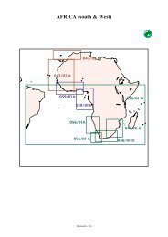
CD 017/02 Caribbean Sea<br />
Origin: SHOM / British Hydrographic Office = UKHO<br />
Geodesy: WGS84 - N.M.= Not Mentioned<br />
Creation: 09/1999<br />
CD 017/02 Petites Antilles(Area Access):<br />
Zone A (From Virgin Islands to Montserrat): 19 Charts<br />
Chart Plan Scale Title Ed Date Rev Date Geod Hydro<br />
130 282600 Anguilla to Puerto Rico 1/02/74 31/01/99 NM UKHO<br />
485 60000 Saint Croix 16/12/94 31/01/99 WGS84 UKHO<br />
A 5000 Frederiksted Pier 16/12/94 31/01/99 WGS84 UKHO<br />
B 20000 Krause Lagoon Channel and Limetree Bay 16/12/94 31/01/99 WGS84 UKHO<br />
C 10000 Christiansted Harbor 16/12/94 31/01/99 WGS84 UKHO<br />
1003 418000 Petites Antilles De la Martinique a Saint Christopher 1/01/87 26/07/99 NM SHOM<br />
2005 35000 Road Harbour to Capella Islands 27/09/96 31/01/99 WGS84 UKHO<br />
2008 75000 Anegada to Virgin Gorda 22/03/85 31/01/99 WGS84 UKHO<br />
2019 35000 North Sound to Road Harbour 27/09/96 31/01/99 WGS84 UKHO<br />
2020 A 12500 North Sound and Approaches 3/11/95 31/01/99 WGS84 UKHO<br />
B 12500 Road Harbour and Approaches 3/11/95 31/01/99 WGS84 UKHO<br />
2183 12500 Saint Thomas Harbour 1/01/96 31/09/98 WGS84 UKHO<br />
2452 69300 Tortola to Culebra Including Saint Thomas 30/07/93 31/01/99 NM UKHO<br />
6332 1203000 De Porto Rico au Golfe de Paria 1/01/87 26/07/99 NM SHOM<br />
7470 148000 Petites Antilles - D'Anguilla a Nevis 1/01/94 26/07/99 WGS84 SHOM<br />
7471 60000 Petites Antilles - D'Anguilla A Saint-Barthélémy 1/01/97 26/07/99 WGS84 SHOM<br />
7472 A 15000 Saint Martin - Baie de Marigot 1/01/96 26/07/99 WGS84 SHOM<br />
B 15000 Saint-Martin - Baie de Grand-Case et Anse Marcel 1/01/96 26/07/99 WGS84 SHOM<br />
C 10000 Saint-Martin - Oyter Pond (Etang aux Huitres) 1/01/96 26/07/99 WGS84 SHOM<br />
D 15000 Sint Maarten - Groot Baai 1/01/96 26/07/99 WGS84 SHOM<br />
E 15000 Saint-Barthélémy - Port de Gustavia 1/01/96 26/07/99 WGS84 SHOM<br />
7617 A 50000 Petites Antilles - Montserrat 1/01/98 26/07/99 WGS84 SHOM<br />
B 60000 Petites Antilles - Barbuda 1/01/98 26/07/99 WGS84 SHOM<br />
C 15000 Petites Antilles - Rade de Plymouth 1/01/94 26/07/99 WGS84 SHOM<br />
7618 60000 Petites Antilles - Antigua 1/01/98 26/07/99 WGS84 SHOM<br />
A 20000 Petites Antilles - Falmouth Harbour et English Harbour 1/01/98 26/07/99 WGS84 SHOM<br />
B 10000 Petites Antilles - Mamora Bay 1/01/98 26/07/99 WGS84 SHOM<br />
7619 50000 Petites Antilles - Approches de Nevis 1/01/99 26/07/99 WGS84 SHOM<br />
7620 50000 Approches d'Anguilla 1/01/98 26/07/99 WGS84 SHOM<br />
A 15000 Sombrero Island 1/01/98 26/07/99 WGS84 SHOM<br />
7624 25000 Côte Nord d'Antigua 1/01/98 26/07/99 WGS84 SHOM<br />
A 12500 St John's Harbour 1/01/98 26/07/99 WGS84 SHOM<br />
7626 50000 De Sint Eustatius à St Christopher 1/01/99 26/07/99 WGS84 SHOM<br />
A 2500 Fort Baai 1/01/99 26/07/99 WGS84 SHOM<br />
B 50000 Saba 1/01/99 26/07/99 WGS84 SHOM<br />
C 15000 Sint Eustatius - Oranje Baai 1/01/99 26/07/99 WGS84 SHOM<br />
D 25000 Basseterre Bay 1/01/99 26/07/99 WGS84 SHOM<br />
<strong>Mapmedia</strong> - 222