PECES DE LOS ANDES DE COLOMBIA - Instituto de Investigación ...
PECES DE LOS ANDES DE COLOMBIA - Instituto de Investigación ...
PECES DE LOS ANDES DE COLOMBIA - Instituto de Investigación ...

Create successful ePaper yourself
Turn your PDF publications into a flip-book with our unique Google optimized e-Paper software.
FICHAS <strong>DE</strong> ESPECIES<br />
río Peralonso; río Tetuán, municipio <strong>de</strong> Ortega; quebrada Las Lajas (4º 11´4.1’’ N 74º 30´36’’ W), municipio <strong>de</strong><br />
Icononzo; quebrada Gallego, río An<strong>de</strong>s, municipio <strong>de</strong> Ibagué; <strong>de</strong>sembocadura <strong>de</strong>l río Amoyá en el río Saldaña (5º<br />
40’ 23.7’’ N 75º 23’ 18.4’’ W); río Amoyá (3º 44’ 21.9’’ N 75º 32’ 42.3’’ W); quebrada Tuluní (3º 38’ 58.5’’ N 75º 27’<br />
24.5’’ W); <strong>de</strong>sembocadura <strong>de</strong>l río Ambeima en el río Amoyá (3º 38’ 58.5’’ N 75º 27’ 24.5’’ W), municipio <strong>de</strong><br />
Chaparral; quebrada Arcadia (4º 3’ 12.03’’ N 74º 52’ 22.9’’ W); río Cui<strong>de</strong> Blanco (4º 3’ 46.91’’ N 74º 44’ 56.64’’ W);<br />
río Cuin<strong>de</strong> Feo (4º 5’ 16.01’’ N 74º 44’ 53.79’’ W); quebrada Aldana (4º 5’ 15.95’’ N 74º 45’ 27.22’’ W); quebrada<br />
Aguas Blancas (4º 3’ 45.51’’ N 74º 45’ 0.88’’ W); quebrada Caribe (4º 7’ 59.5’’ N 74º 47’ 53.02’’ W); río Cuin<strong>de</strong>cito<br />
(4º 4’ 44.03’’ N 74º 43’ 54.31’’ W), municipio <strong>de</strong> Villarrica; río Vichía (4º 3’ 11.92’’ N 74º 39’ 15.33’’ W); río Cunday<br />
(4º 4’ 58.20’’ N 74º 35’ 25.72’’ W); <strong>de</strong>sembocadura <strong>de</strong> la quebrada La Pedregosa en el río Vichía (4º 3’ 54.13’’ N 74º<br />
38’ 40.77’’ W), municipio <strong>de</strong> Cunday (Villa-Navarro et al. 2005). Valle <strong>de</strong>l Cauca: río Claro antes <strong>de</strong> la <strong>de</strong>sembocadura<br />
al Cauca; río Desbaratado vía Miranda – Florida; río Jamundí vía Cali – Jamundí; río Bolo en la vereda Bolo<br />
Alisal; río Amaime en Amaime; río Guadalajara en Buga; río Tuluá en Tulúa; río Bugalagran<strong>de</strong> en Bugalagran<strong>de</strong>;<br />
río Chanco antes y <strong>de</strong>spués <strong>de</strong> Ansermanuevo y hasta la <strong>de</strong>sembocadura al Cauca; río Catarina antes <strong>de</strong> su paso por<br />
Ansermanuevo; río Cañaveral vía Ansermanuevo – La Virginia; río Cauca en Timba, en la Balsa y el Paso <strong>de</strong> La<br />
Bolsa (Ortega-Lara et al. 1999, 2002, Ortega-Lara y Usma en. prep.).<br />
Registros <strong>de</strong> la especie en colecciones<br />
Holotipo: FMNH: 7579.<br />
CZUT-IC 469, 470, 472, 474, 477, 478, 480, 483, 484, 485, 486, 492, 495, 496, 497, 499, 501, 502, 503, 504,<br />
509, 512, 513, 883, 896, 904, 914, 982, 990, 1165, 1169, 1172, 1178, 1179, 1180, 1181, 1182, 1183, 1184, 1185,<br />
1186, 1187, 1188, 1189, 1190, 1191, 1192, 1193, 1194, 1195, 1196, 1200, 1212, 1352, 1393, 1397, 1402, 1409,<br />
1450, 1452, 1453, 1454, 1455, 1456, 1470, 1471, 1472, 1473, 1475, 1476, 1480, 1482, 1483.<br />
FMNH: 58109, 58110, 5811, 58112, 58113, 58114, 58115, 58116, 58117, 58450, 58451, 58452, 58453, 58454, 70331.<br />
IAvH-P: 4340, 4341, 4342, 4343, 4344, 4345, 4346, 4604.<br />
IMCN: 2297, 2442.<br />
Trichomycterus taenia Kner, 1863<br />
Descripción (Figura 114)<br />
Origen <strong>de</strong> la anal sobre la mitad <strong>de</strong> la dorsal; origen <strong>de</strong> las ventrales equidistante entre la base <strong>de</strong> los radios<br />
caudales medios y las espinas opérculares; caudal redon<strong>de</strong>ada; ojo en la mitad <strong>de</strong> la cabeza; LC 5.2 – 5.6 en LT;<br />
D 9.5 – 10.5 en LT; A 8.5 en LT; P 7 en LT; DIO tres veces en la LC; barbillones nasales alcanzando las<br />
espinas operculares; barbillones maxilares alcanzando las pectorales; filamento <strong>de</strong>l primer radio pectoral más<br />
corto que la LC (Eigenmann 1917); con dientes incisivos y en ejemplares juveniles los dientes son puntiagudos;<br />
su coloración está bien <strong>de</strong>finida, con una banda lateral oscura y ancha que va <strong>de</strong>s<strong>de</strong> el opérculo hasta el<br />
inicio <strong>de</strong> la aleta caudal, la cual es redon<strong>de</strong>ada (García-Melo 2005).<br />
Biología y ecología<br />
Habita principalmente en quebradas pequeñas, en ambientes <strong>de</strong> baja corriente, <strong>de</strong> substratos pedregosos y<br />
arenosos, con abundante vegetación sumergida y árboles <strong>de</strong> sombra; al parecer están asociados a temperaturas<br />
más bajas que T. striatus y T. banneaui; su dieta son pequeños insectos acuáticos (García-Melo 2005).<br />
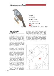
Distribución (Mapa 89)<br />
Los Llanos <strong>de</strong> Sandona, sur <strong>de</strong> Colombia (Eigenmann 1922).<br />
Cauca: quebrada Las Tallas y río Esmita, río Patía. Tolima: quebrada Barbona (4º 17’ 35.5’’ N 75º 0.2’ 15.5’’ W);<br />
quebrada Cay sector bajo (4° 27’ 58.9’’ N 75° 15’ 51.2’’ W); río Combeima (García-Melo 2005); quebradas Las<br />
Lajas (4º 11’ 4.1’’ N 74º 30’ 36’’ W), Guauditas (4º 10’ 58.8’’ N 74º 32.2’ 28.9’’ W), Juan Lopitos (4º 10’ 58.8’’ N 74º<br />
32’ 28.9’’ W) y La Volcana, municipio <strong>de</strong> Icononzo; quebrada Gallego, río An<strong>de</strong>s, municipio <strong>de</strong> Ibagué.<br />
INSTITUTO <strong>DE</strong> INVESTIGACIÓN <strong>DE</strong> RECURSOS BIOLÓGICOS ALEXAN<strong>DE</strong>R VON HUMBOLDT<br />
113