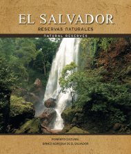
Rio Lempa | Riqueza y Majestuosidad

You also want an ePaper? Increase the reach of your titles
YUMPU automatically turns print PDFs into web optimized ePapers that Google loves.
HOND<br />
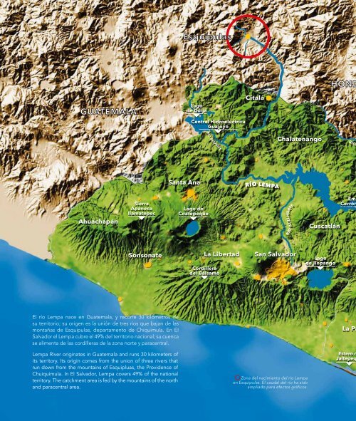
Esquipulas<br />
GUATEMALA<br />
Lago<br />
de Güija<br />
Central Hidroeléctrica<br />
Guajoyo<br />
Citalá<br />
RÍO DESAGÜE<br />
Chalatenango<br />
RÍO S<br />
Santa Ana<br />
RÍO LEMPA<br />
Ahuachapán<br />
Sierra<br />
Apaneca<br />
Ilamatepec<br />
Lago de<br />
Coatepeque<br />
RÍO<br />
ACELHUATE<br />
Cuscatlán<br />
Emb<br />
Cerrón<br />
Sonsonate<br />
La Libertad<br />
Cordillera<br />
del Bálsamo<br />
San Salvador<br />
Lago<br />
de Ilopango<br />
El río <strong>Lempa</strong> nace en Guatemala, y recorre 30 kilómetros de<br />
su territorio; su origen es la unión de tres ríos que bajan de las<br />
montañas de Esquipulas, departamento de Chiquimula. En El<br />
Salvador el <strong>Lempa</strong> cubre el 49% del territorio nacional; su cuenca<br />
se alimenta de las cordilleras de la zona norte y paracentral.<br />
<strong>Lempa</strong> River originates in Guatemala and runs 30 kilometers of<br />
its territory. Its origin comes from the union of three rivers that<br />
run down from the mountains of Esquipluas, the Providence of<br />
Chuiquimula. In El Salvador, <strong>Lempa</strong> covers 49% of the national<br />
territory. The catchment area is fed by the mountains of the north<br />
and paracentral area.<br />
Zona del nacimiento del río <strong>Lempa</strong><br />
en Esquipulas. El caudal del río ha sido<br />
ampliado para efectos gráficos.<br />
La Pa<br />
Estero d<br />
Jaltepeq