R E N A U D â G I Q U E L L O - Loeb Larocque
R E N A U D â G I Q U E L L O - Loeb Larocque
R E N A U D â G I Q U E L L O - Loeb Larocque

You also want an ePaper? Increase the reach of your titles
YUMPU automatically turns print PDFs into web optimized ePapers that Google loves.
two early mappings of the west coast of North America, the first after Visscher, the second after Plancius’<br />
world map. Both show the Straits of Anian, Quivera, Baja and a similarly projected east-west coastline. The<br />
larger map includes more detail along the coastline and in the Sierra Nevada Mountains, as well as a truer<br />
orientation of Baja California. Diderot’s map were one of the first surveys of comparative cartography, tackling<br />
a number of the early misconceptions of the west coast of North America and the North-eastern Asian<br />
Coastline. - Schwartz & Ehrenberg, plate 76.<br />
57 KITCHIN, Th. Mexico oder Neu Spanien zu Campens Entdekkung von America. Londres,<br />
ca. 1786. Infimes rousseurs. - A few brown spots, with folds as issued. 280 x 380 mm.<br />
200 - 250 ¤<br />
wo From Robertson’s “Geschichte von America”. German version of Kitchin’s map with an inset of Mexico City.<br />
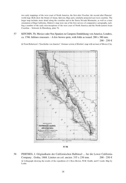
N o 58<br />
58 PERTHES, J. Originalkarte der Californischen Halbinsel ... fur die Lower California<br />
Company . Gotha, 1868. Limites en col. ancien. 335 x 230 mm. 200 - 250 ¤<br />
wo Lithograph showing the results of the expedition of J. Ross Brown, W.M. Grabb, and F. Loehr. Map by<br />
Loehr.<br />
18