R E N A U D â G I Q U E L L O - Loeb Larocque
R E N A U D â G I Q U E L L O - Loeb Larocque
R E N A U D â G I Q U E L L O - Loeb Larocque
You also want an ePaper? Increase the reach of your titles
YUMPU automatically turns print PDFs into web optimized ePapers that Google loves.
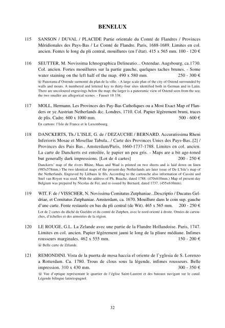
BENELUX<br />
115 SANSON / DUVAL / PLACIDE Partie orientale du Comté de Flandres / Provinces<br />
Méridionales des Pays-Bas / Le Comté de Flandre. Paris, 1688-1689. Limites en col.<br />
ancien. Fentes le long du pli central, mouillures (en l’état). 415 x 565 mm. 100 - 120 ¤<br />
116 SEUTTER, M. Novissima Ichnographica Delineatio... Ostendae. Augsbourg, ca.1730.<br />
Col. ancien. Fortes mouillures sur la partie gauche, quelques taches brunes. - Some<br />
water staining on the left half of the map. 490 x 580 mm. 250 - 300 ¤<br />
wo Panorama d’Ostende surmonté du plan de la ville. - A large scale plan of the city of Ostend surrounded by<br />
walls and moats. A numbered and lettered key to thirty-four sites identified both in German and in Latin.<br />
There are uncoloured engravings below the map; the larger is a panoramic view of Ostend seen from the sea;<br />
the two smaller are allegorical scenes. - Fauser 10 338.<br />
117 MOLL, Hermann. Les Provinces des Pay-Bas Catholiques ou a Most Exact Map of Flanders<br />
or ye Austrian Netherlands &c. Londres, 1710. Col. Papier légèrement bruni, traces<br />
de plis. Cadre. 600 x 1000 mm. 500 - 600 ¤<br />
En cartons: l’Isle de France et le Luxembourg.<br />
118 DANCKERTS, Th./ L’ISLE, G. de / DEZAUCHE / BERNARD. Accuratissima Rheni<br />
Inferioris Mosae et Mosellae Tabula.. / Carte des Provinces Unies des Pays-Bas..[2] /<br />
Provinces des Pais Bas.. Amsterdam/Paris, 1660-1737-1788. Limites en col. ancien.<br />
La carte de Danckerts est entoilée, le papier un peu gris. - Maps are a bit age-toned<br />
but generally dark impressions. [Lot de 4 cartes] 200 - 250 ¤<br />
Danckerts’ map of the rivers Rhine, Maas and Waal is printed on two sheets and is laid down on linen<br />
(985x578mm.) The two identical maps of the present-day Netherlands are later issue of De L’Isle’s map of<br />
the Netherlands. Engraved by Lièbaux le fils. According to the cartouche also information of Cassini and<br />
Snel van Royen was used. With the address of Ph. Buache, dated 1788. (470x610mm.) Map of present-day<br />
Belgium was prepared by Nicolas de Fer, and re-issued by Bernard, dated 1737. (455x610mm).<br />
119 WIT, F. de / VISSCHER, N. Novissima Comitatus Zutphaniae...Descriptio / Ducatus Geldriae,<br />
et Comitatus Zutphaniae. Amsterdam, ca. 1670. Mouillure dans le coin sup. gauche<br />
d’une carte. Fente restaurée en bas du pli central (de Wit). 465 x 565 mm. 200 - 250 ¤<br />
Lot de 2 cartes du dûché de Gueldre et du comté de Zutphen, avec le nord orienté à droite. Ornées de cartouches,<br />
d’échelles et des armoiries de la région.<br />
120 LE ROUGE, G.L. La Zelande avec une partie de la Flandre Hollandoise. Paris, 1747.<br />
Limites en col. ancien. Papier légèrement jauni le long de la pliure médiane. Infimes<br />
rousseurs marginales. 462 x 555 mm. 150 - 200 ¤<br />
wo Belle carte de Zélande.<br />
121 REMONDINI. Vista de la puerta de mosa haccia el oriente de l’yglesia de S. Lorenzo<br />
a Rotterdam. Ca. 1780. Trous de clous sous la légende, infimes rousseurs. Belle<br />
impression. 310 x 430 mm. 300 - 350 ¤<br />
wo Vue d’optique représentant le quartier de l’église Saint-Laurent et des bateaux navigant sur le canal.<br />
Légende bilingue latin/espagnol.<br />
32


