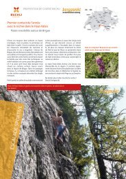
Proposition de Course 04.2022 – Ski de haute montagne dans le Saastal
- No tags were found...

You also want an ePaper? Increase the reach of your titles
YUMPU automatically turns print PDFs into web optimized ePapers that Google loves.
PROPOSITION DE COURSE BÄCHLI<br />
<strong>Ski</strong> <strong>de</strong> <strong>haute</strong> <strong>montagne</strong> <strong>dans</strong> <strong>le</strong> <strong>Saastal</strong><br />
Avec un détour et un plat <strong>de</strong> pâtes en Italie<br />
<strong>Saastal</strong><br />
Le début <strong>de</strong> l’hiver a été quelque peu chaotique.<br />
Non qu’il ait manqué <strong>de</strong> poudreuse, <strong>le</strong><br />
vent est souvent venu jouer <strong>le</strong>s troub<strong>le</strong>-fête.<br />
Nous sommes donc bien décidés à ne pas laisser<br />
passer l’occasion d’une bel<strong>le</strong> course en<br />
<strong>haute</strong> <strong>montagne</strong>. Glacier, gros sel, f<strong>le</strong>urs, parfum<br />
<strong>de</strong> mélèze ainsi qu’une portion <strong>de</strong> bonne<br />
humeur : <strong>de</strong>s ingrédients indispensab<strong>le</strong>s pour<br />
un final exigeant mais revigorant <strong>–</strong> que <strong>de</strong>man<strong>de</strong>r<br />
<strong>de</strong> plus ?<br />
Nous commençons cette course <strong>de</strong> plusieurs<br />
jours avec un agréab<strong>le</strong> voyage jusqu’à Saas-<br />
Fee, où nous passons la nuit. Tôt <strong>le</strong> <strong>le</strong>n<strong>de</strong>main<br />
nous prenons <strong>le</strong> premier funiculaire jusqu’à<br />
Mittelallalin, sortons <strong>de</strong> la ga<strong>le</strong>rie et commençons<br />
la course par une <strong>de</strong>scente. Le premier<br />
sommet est <strong>le</strong> Fluchhorn, une superbe <strong>montagne</strong><br />
<strong>de</strong> ski <strong>de</strong> randonnée. Pour la <strong>de</strong>uxième<br />
journée, nous relions la Britanniahütte à la<br />
Cresta di Stenigalchi (Steinchalchhorn). Après<br />
la traversée du Monte Moropass et une longue<br />
<strong>de</strong>scente vers l’Italie, nous atteignons Macugnaga,<br />
où nous logeons à l’hôtel, plaisirs culinaires<br />
inclus. Le troisième jour sous la majestueuse<br />
face est du Mont Rose, jusqu’au Pizzo<br />
Bianco, est particulièrement intense. Descente<br />
et trajet en téléphérique jusqu’au Monte Moropass,<br />
où nous passons la <strong>de</strong>rnière nuit <strong>dans</strong><br />
<strong>le</strong> sympathique Rifugio Oberto Maroli. Ensuite,<br />
montée sur <strong>le</strong> Stellihorn par Galmen. Pour<br />
finir : <strong>de</strong>scente à Saas-Almagell, en compagnie<br />
du parfum <strong>de</strong>s mélèzes. Daniel, bergpunkt<br />
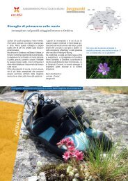
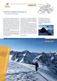
Après une course printanière,<br />
rien <strong>de</strong> tel qu’étancher sa soif en<br />
admirant <strong>le</strong> magnifique paysage,<br />
aérer ses chaussures et laisser<br />
vagabon<strong>de</strong>r son esprit.<br />
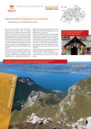
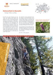
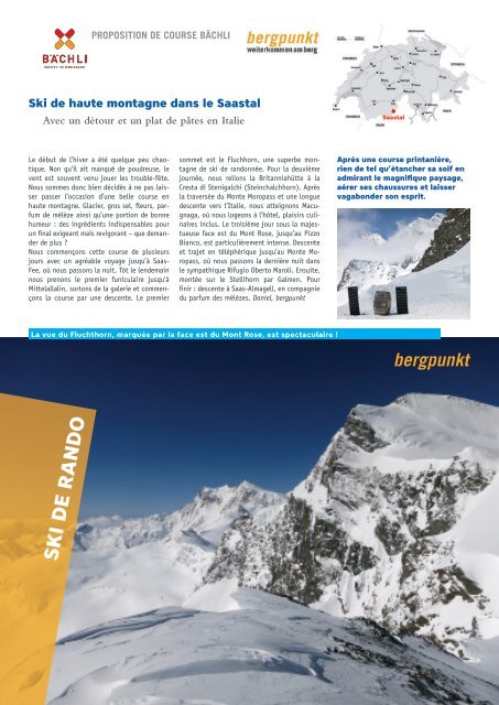
La vue du Fluchthorn, marquée par la face est du Mont Rose, est spectaculaire !<br />
SKI DE RANDO
INFOS EN BREF<br />
<strong>Ski</strong> <strong>de</strong> <strong>haute</strong> <strong>montagne</strong> <strong>dans</strong> <strong>le</strong> <strong>Saastal</strong><br />
Voyage / point <strong>de</strong> départ / arrivée Voyage al<strong>le</strong>r jusqu’à Saas-Fee (1803 m). Retour <strong>de</strong>puis Saas-Almagell (1671 m).<br />
Horaire : www.cff.ch<br />
Données <strong>de</strong> la course<br />
Description / hébergement<br />
Fluchthorn 3794 m : montée 1100 m, 4h / <strong>de</strong>scente 1200 m / PD+<br />
Steinchalchhorn P. 3325 : montée 1550 m, 5-6h / <strong>de</strong>scente à Alpe Bill (1700 m) 2850 m / AD-<br />
Pizzo Bianco 3215 m : montée 1320 m, 4-5h / <strong>de</strong>scente à Macugnaga 2100 m / D<br />
Stellihorn 3436 m : montée 1600 m, 6-7h / <strong>de</strong>scente 1820 m / AD<br />
Jour 1: Fluchthorn 3794 m - Britanniahütte:<br />
Saas-Fee <strong>–</strong> Felskinn Bahn, métro alpin jusqu’à la sortie <strong>dans</strong> la ga<strong>le</strong>rie. Descente au Hohlaubg<strong>le</strong>tscher. Montée<br />
au Fluchthorn et <strong>de</strong>scente jusqu’à 2880 m. Montée à la Britanniahütte (britannia.ch).<br />
Infos hôtels/remontées mécaniques Saas-Fee : saas-fee.ch. Les remontées mécaniques <strong>de</strong> Saas-Fee fonctionnent<br />
au printemps jusqu’au 18.04.22. Informations détaillées par téléphone : tél. +41 27 958 11 00<br />
Jour 2: Steinchalchhorn P. 3325 - Macugnaga:<br />
Courte <strong>de</strong>scente jusqu’à l’Allaling<strong>le</strong>tscher. Montée au Hangen<strong>de</strong> G<strong>le</strong>tscher Joch (3284 m). Descente au<br />
Schwarzbergg<strong>le</strong>tscher et montée au Steinchalchhorn. Descente jusqu’à Tällibo<strong>de</strong>n (env. 2300 m). Montée<br />
au Monte Moropass (env. 2900 m). De là, <strong>de</strong>scente vers l’Italie jusqu’à l’Alpe Bill (1700 m). En cas <strong>de</strong> fort<br />
enneigement, possib<strong>le</strong> jusqu’à Macugnaga (1300 m), sinon utiliser <strong>le</strong> téléphérique <strong>de</strong>puis l’Alpe Bill.<br />
Hôtels/infos Macugnaga : visitossola.it/poi/macugnaga-monte-rosa/<br />
Jour 3: Pizzo Bianco 3215 m - Rifugio Oberto-Maroli:<br />
Remontée mécanique jusqu’au Belve<strong>de</strong>re (1904 m). Passer <strong>de</strong>vant <strong>le</strong> Rifugio Zamboni-Zappa CAI et suivre<br />
<strong>le</strong> couloir rai<strong>de</strong> <strong>de</strong> Locceciuse jusqu’à l’arête nord. Ici, passer au versant est et rejoindre <strong>le</strong> Pizzo Bianco,<br />
puis re<strong>de</strong>scendre. Depuis Macugnaga, en téléphérique jusqu’au Monte Moropass et passer la nuit au Rifugio<br />
Oberto-Maroli. Tél. +39 0324 65544, mail : valcot.rifugio@gmail.com, (https://www.montemoropass.it)<br />
Jour 4: Stellihorn 3436 m - Saas Almagell:<br />
Courte montée jusqu’au Monte Moropass ou au Jo<strong>de</strong>rhorn (3035 m). Descente à Tällibo<strong>de</strong>n (env. 2480 m).<br />
Montée par Galmen jusqu’à la brèche au sud-est du Galmenhorn et <strong>de</strong>scendre par <strong>le</strong>s pentes nord jusqu’aux<br />
a<strong>le</strong>ntours <strong>de</strong> Rotherd (env. 2400 m). Montée au Stellihorn et <strong>de</strong>scente par <strong>le</strong> Nol<strong>le</strong>ng<strong>le</strong>tscher et <strong>le</strong> Furggtälli<br />
jusqu’à Furggstal<strong>de</strong>n (1902 m) ou Saas Almagell (1671 m). Détails selon la carte nationa<strong>le</strong>.<br />
Exigences / conditions<br />
Matériel / cartes<br />
Conseil<br />
<strong>Ski</strong> <strong>de</strong> <strong>haute</strong> <strong>montagne</strong> sur <strong>de</strong>s glaciers <strong>dans</strong> un cadre alpin. Montée au sommet, en partie à pied avec crampons<br />
et pio<strong>le</strong>ts, encor<strong>de</strong>ment éventuel<strong>le</strong>ment nécessaire.<br />
Les glaciers doivent être suffisamment enneigés et la couverture neigeuse doit être stab<strong>le</strong>.<br />
Équipement <strong>de</strong> ski <strong>de</strong> <strong>haute</strong> <strong>montagne</strong> avec DVA, pel<strong>le</strong> et son<strong>de</strong>, baudrier, matériel <strong>de</strong> glacier, pio<strong>le</strong>ts, crampons,<br />
cor<strong>de</strong>, lampe fronta<strong>le</strong> (<strong>le</strong> pique-nique peut être complété à Macugnaga).<br />
Cartes : pour une vue d’ensemb<strong>le</strong>, carte <strong>de</strong> ski <strong>de</strong> randonnée 284 Mischabel ou sur map.geo.admin.ch.<br />
App avec cartes hors ligne (p. ex. White Risk, swisstopo)<br />
Le smartphone pour s’orienter en <strong>montagne</strong> : bergpunkt.ch/apps<br />
Randonnées à ski printanières et coaching ski <strong>de</strong> <strong>haute</strong> <strong>montagne</strong> : bergpunkt.ch<br />
Respecter <strong>le</strong>s zones <strong>de</strong> tranquillité Zones <strong>de</strong> tranquillité et sites <strong>de</strong> protection <strong>de</strong> la faune :<br />
wildruhezonen.ch, nature-loisirs.ch/zones-<strong>de</strong>-tranquillite<br />
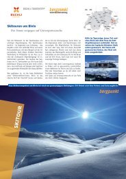
Corno Rosso (Rothorn), Steinchalchhorn et Roffelhörner <strong>dans</strong> <strong>le</strong>ur manteau d’hiver.
CARTE <strong>–</strong> 1<br />
<strong>Ski</strong> <strong>de</strong> <strong>haute</strong> <strong>montagne</strong> <strong>dans</strong> <strong>le</strong> <strong>Saastal</strong><br />
Jour 1<br />
Jour 4<br />
Jour 2<br />
Échel<strong>le</strong> 1: 50 000
CARTE <strong>–</strong> 2<br />
<strong>Ski</strong> <strong>de</strong> <strong>haute</strong> <strong>montagne</strong> <strong>dans</strong> <strong>le</strong> <strong>Saastal</strong><br />
Jour 2<br />
Jour 3<br />
Echel<strong>le</strong>: 1: 50 000<br />
0 500 1000 1500m<br />
Massstab 1: 50'000<br />
Gedruckt am 14.02.2022 15:13 MEZ<br />
https://s.geo.admin.ch/9623efcf83<br />
www.geo.admin.ch ist ein Portal zur Einsicht von geolokalisierten Informationen, Daten und Diensten, die von öffentlichen Einrichtungen zur Verfüg<br />
gestellt wer<strong>de</strong>n<br />
Haftung: Obwohl die Bun<strong>de</strong>sbehör<strong>de</strong>n mit al<strong>le</strong>r Sorgfalt auf die Richtigkeit <strong>de</strong>r veröffentlichten Informationen achten, kann hinsichtlich <strong>de</strong>r inhaltlich<br />
Richtigkeit, Genauigkeit, Aktualität, Zuverlässigkeit und Vollständigkeit dieser Informationen keine Gewähr<strong>le</strong>istung übernommen wer<strong>de</strong>n.Copyright,<br />
Bun<strong>de</strong>sbehör<strong>de</strong>n <strong>de</strong>r Schweizerischen Eidgenossenschaft. http://www.disclaimer.admin.ch<br />
© swisstopo, BAFU, public.geo.admin.ch<br />
Fluchthorn et Strahlhorn <strong>dans</strong> <strong>le</strong> so<strong>le</strong>il du matin.<br />
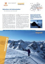
Poudreuse <strong>de</strong> printemps, Britanniahütte en vue.<br />
Impressum<br />
Layout/photos<br />
© Daniel Silbernagel, topoverlag.ch<br />
Cartes © swisstopo