EN-05-Whittier-Rosemead Bike Path 03-14-13.pdf - Watershed ...
EN-05-Whittier-Rosemead Bike Path 03-14-13.pdf - Watershed ...
EN-05-Whittier-Rosemead Bike Path 03-14-13.pdf - Watershed ...

Create successful ePaper yourself
Turn your PDF publications into a flip-book with our unique Google optimized e-Paper software.
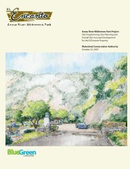
THE EMERALD NECKLACE / Phase 1 Projects <strong>03</strong>/<strong>14</strong>/2013<br />
The project site is located between the Rio Hondo and the San Gabriel Rivers in the <strong>Whittier</strong><br />
Narrows Recreation Area. Legg Lake is located northeast of the proposed project. <strong>Whittier</strong><br />
Narrows is both bisected and ringed with roads that are inhospitable for recreational users on<br />
bicycle or on foot; and many amenities within the <strong>Whittier</strong> Narrows Recreation Area are difficult<br />
to get to without a car. Once visitors arrive by car at Legg Lake, it is equally difficult to connect<br />
to the trails and open space attractions on the perimeter.<br />
San Gabriel Blvd. and Durfee Ave. border the project area on the south and separate the active<br />
areas of <strong>Whittier</strong> Narrows from the natural area around Lario Creek and the Zone 1 ditch. The<br />
site is adjacent to <strong>Rosemead</strong> Blvd. a State Route that is heavily used, and forms a major barrier<br />
to access into Legg Lake from the Rio Hondo side.<br />
From the San Gabriel River Trail access to the intersection at Durfee Ave. and <strong>Rosemead</strong> Blvd.<br />
is via the Siphon Road spur; the bicycle path continues on to the northern portion of the Rio<br />
Hondo <strong>Bike</strong> <strong>Path</strong> diagonally across the intersection. While the western entry to Legg Lake is in<br />
sight from this busy intersection there is no safe route to travel on except the road shoulder and<br />
emergency lane of <strong>Rosemead</strong> Blvd.<br />
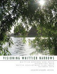
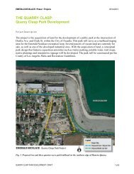
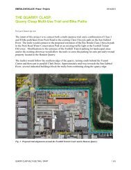
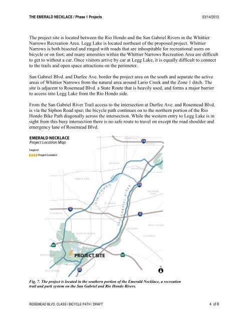
Fig. 7. The project is located in the southern portion of the Emerald Necklace, a recreation<br />
trail and park system on the San Gabriel and Rio Hondo Rivers.<br />
ROSEMEAD BLVD. CLASS I BICYCLE PATH / DRAFT 4 of 8