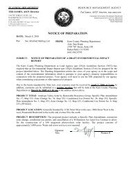
Rising Tree Wind Farm Project Notice of Preparation - County of Kern
Rising Tree Wind Farm Project Notice of Preparation - County of Kern
Rising Tree Wind Farm Project Notice of Preparation - County of Kern

You also want an ePaper? Increase the reach of your titles
YUMPU automatically turns print PDFs into web optimized ePapers that Google loves.
KERN COUNTY PLANNING & COMMUNITY DEVELOPMENT DEPARTMENT<br />
RISING TREE WIND ENERGY PROJECT<br />
(h) Portions <strong>of</strong> the project site are located within an A Zone (100-year) Flood Hazard Area as delineated<br />
on the Federal Emergency Management Agency's (FEMA) Digital Flood Insurance Rate<br />
Maps (DFIRM). The project requests the overlay <strong>of</strong> the Floodplain (FP) Combining District over<br />
portions <strong>of</strong> the project located within the A Zone. The purpose <strong>of</strong> the FP Combining District is to<br />
protect public health and safety and minimize property damage by designating areas that are<br />
potentially subject to flooding by establishing reasonable restrictions on land use. While the<br />
project does not include the placement <strong>of</strong> structures within a 100-year flood hazard zone, the<br />
potential for project structures to redirect or impede flood flows within a floodplain zone will be<br />
evaluated in the EIR/EIS.<br />
(i) The project would not be not located within an area that is subject to flooding due to failure <strong>of</strong> a<br />
levee or dam. However, portions <strong>of</strong> the project site are located within an A Zone (100-year) Flood<br />
Hazard Area as delineated on the Federal Emergency Management Agency's (FEMA) Digital<br />
Flood Insurance Rate Maps (DFIRM). Therefore, the potential for project structures to be<br />
impacted by flood flows within this floodplain zone will be evaluated in the EIR/EIS.<br />
(j) The <strong>Project</strong> is not located near an ocean or enclosed body <strong>of</strong> water, and would not be subject to<br />
inundation by seiche or tsunami. Portions <strong>of</strong> the <strong>Project</strong> are within the <strong>County</strong>’s Steep Slope<br />
Physical Constraints Overlay. Mudflows are events where saturated earth and surface materials<br />
are transported downhill under the force <strong>of</strong> gravity. Mudflow events are the result <strong>of</strong> a combination<br />
<strong>of</strong> factors, including soil type, precipitation, and slope. As a result <strong>of</strong> super-saturation, soil and<br />
rock materials may become unstable and slide downslope. The potential for <strong>Project</strong> structures to<br />
be inundated by mudflow will be addressed in the EIR/EIS.<br />
July 2011 36 Initial Study/<strong>Notice</strong> <strong>of</strong> <strong>Preparation</strong>