

2008 ISGS Annual Report - University of Illinois at Urbana-Champaign
2008 ISGS Annual Report - University of Illinois at Urbana-Champaign
2008 ISGS Annual Report - University of Illinois at Urbana-Champaign

You also want an ePaper? Increase the reach of your titles
YUMPU automatically turns print PDFs into web optimized ePapers that Google loves.
<strong>of</strong> heavy industry, residential development, and numerous dumping<br />
grounds for industrial and municipal waste. In 1893, for example, the<br />
Army Corps <strong>of</strong> Engineers reported th<strong>at</strong> a milling company loc<strong>at</strong>ed <strong>at</strong><br />
the mouth <strong>of</strong> the Calumet River deposited so much slag and dredge<br />
th<strong>at</strong> the area around it grew <strong>at</strong> a r<strong>at</strong>e <strong>of</strong> four acres per year.<br />
Land degrad<strong>at</strong>ion continued into the 1980s as steel mills closed, cre<strong>at</strong>ing<br />
numerous brownfields, and there were further plans to continue<br />
filling in most <strong>of</strong> the lake to provide land for priv<strong>at</strong>e developers. About<br />
th<strong>at</strong> time, though, environmental groups began to promote conserv<strong>at</strong>ion<br />
and cleanup. The most significant strides began in 1996 with <strong>at</strong>tempts<br />
to establish Calumet Ecological Park. In 2001, a new Calumet<br />
initi<strong>at</strong>ive was announced th<strong>at</strong> advoc<strong>at</strong>ed the restor<strong>at</strong>ion and enhancement<br />
<strong>of</strong> open spaces while revitalizing economic opportunities.<br />
The current land use <strong>of</strong> the quadrangle is public parks, ecological<br />
restor<strong>at</strong>ion areas, industrial holdings, waste disposal and contamin<strong>at</strong>ed<br />
sites, infrastructure development, and residential and commercial<br />
establishments, all on top <strong>of</strong> filled and n<strong>at</strong>ural land. Once the <strong>ISGS</strong><br />
has mapped the geology in a detailed 3-D view, contamin<strong>at</strong>ed problem<br />
areas will be deline<strong>at</strong>ed, engineering properties <strong>of</strong> fill and n<strong>at</strong>ural<br />
m<strong>at</strong>erials will be identified to assist in construction designs and<br />
hazard avoidance, and large-scale groundw<strong>at</strong>er flow models will be<br />
developed, which may assist in pumpand-tre<strong>at</strong><br />
decontamin<strong>at</strong>ion processes.<br />
This inform<strong>at</strong>ion could lead to the<br />
implement<strong>at</strong>ion by decision makers <strong>of</strong><br />
cost-effective plans with future lower<br />
liabilities for economic development,<br />
environmental protection, and remedi<strong>at</strong>ion<br />
and redevelopment.<br />
The mapping <strong>of</strong> the Lake Calumet<br />
Quadrangle will first involve the careful<br />
review and compil<strong>at</strong>ion <strong>of</strong> existing<br />
geologic maps and other d<strong>at</strong>a for the<br />
study area, including subsurface d<strong>at</strong>a<br />
from thousands <strong>of</strong> existing w<strong>at</strong>er-well<br />
logs on file <strong>at</strong> the <strong>ISGS</strong> and from<br />
engineering borings for found<strong>at</strong>ions,<br />
highways, bridges, utilities, and remedi<strong>at</strong>ion<br />
activities. Then explor<strong>at</strong>ory<br />
drilling and geophysical activities will be conducted to better understand<br />
the depth, thickness, distribution, character, and continuity <strong>of</strong><br />
subsurface n<strong>at</strong>ural and fill deposits. All d<strong>at</strong>a (including old maps) will<br />
be put into electronic form<strong>at</strong>s and entered into the <strong>ISGS</strong> Geographic<br />
Inform<strong>at</strong>ion Systems (GIS) d<strong>at</strong>abase, and 3-D views <strong>of</strong> the geology<br />
will be constructed. Proposed maps will show the (1) distribution, elev<strong>at</strong>ion,<br />
and thickness <strong>of</strong> the various glacial, postglacial, and artificial<br />
fill deposits in the study area; (2) topography <strong>of</strong> the bedrock surface;<br />
and (3) bedrock lithology. Once these maps are completed, interpretive<br />
maps for aquifer sensitivity and engineering conditions and other<br />
maps can be developed.<br />
The mapping <strong>of</strong> the Lake Calumet Quadrangle will be a multi-year<br />
effort with partial funding by the GLGMC, but most funding will come<br />
from St<strong>at</strong>e <strong>of</strong> <strong>Illinois</strong> appropri<strong>at</strong>ions to the <strong>ISGS</strong>. Additional federal<br />
and st<strong>at</strong>e dollars would enhance d<strong>at</strong>a collection and significantly<br />
reduce the time required to complete the mapping effort.<br />
Geology Department Contribution<br />
Enhances Outcrop Studies<br />
A Leica reflectorless total st<strong>at</strong>ion with integr<strong>at</strong>ed scanner and robotic<br />
surveyor and accompanying advanced GPS receivers are graciously<br />
being made available to the <strong>ISGS</strong> by pr<strong>of</strong>essor Jim Best <strong>of</strong> the <strong>University</strong><br />
<strong>of</strong> <strong>Illinois</strong> Geology Department. Chris Stohr <strong>at</strong> the <strong>ISGS</strong> will<br />
process <strong>ISGS</strong> inform<strong>at</strong>ion and familiarize the Geology Department<br />
staff with the use <strong>of</strong> this advanced technology.<br />
14<br />
The <strong>ISGS</strong> is using the equipment for detailed document<strong>at</strong>ion and<br />
analysis <strong>of</strong> outcrops for preparing three-dimensional maps <strong>of</strong> facies,<br />
lithologic contacts, and textural changes.<br />
Using this equipment, Chris Stohr, Steve Brown, and Don Keefer<br />
already have photographed glacial deposits exposed <strong>at</strong> the Wedron<br />
Silica facility in LaSalle County, <strong>Illinois</strong>. The borrowed instruments<br />
should improve the inform<strong>at</strong>ion obtained in this three-dimensional<br />
geologic mapping project. Additionally, the equipment benefits the<br />
students who are being trained in the use <strong>of</strong> these st<strong>at</strong>e-<strong>of</strong>-the-art<br />
instruments for geologic investig<strong>at</strong>ions.<br />
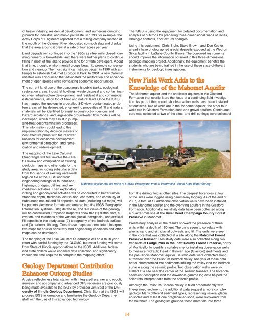
New Field Work Adds to the<br />
Knowledge <strong>of</strong> the Mahomet Aquifer<br />
The Mahomet aquifer and the shallower aquifers in the Glasford<br />
Form<strong>at</strong>ion th<strong>at</strong> overlie it are the focus <strong>of</strong> a continuing field investig<strong>at</strong>ion.<br />
As part <strong>of</strong> the project, six observ<strong>at</strong>ion wells have been installed<br />
<strong>at</strong> four sites. Two <strong>of</strong> wells are in the Mahomet aquifer; the other four<br />
wells are in Glasford Form<strong>at</strong>ion sand and gravel aquifers. Continuous<br />
core was collected <strong>at</strong> two <strong>of</strong> the sites, and drill cuttings were collected<br />
Mahomet aquifer drill site north <strong>of</strong> Ludlow. Photograph from Al Wehrmann, <strong>Illinois</strong> St<strong>at</strong>e W<strong>at</strong>er Survey.<br />
from the drilling fluid <strong>at</strong> other sites. The deepest boreholes <strong>at</strong> four<br />
<strong>of</strong> the sites were logged using gamma-ray logging. As <strong>of</strong> the end <strong>of</strong><br />
2007, a total <strong>of</strong> 17 additional observ<strong>at</strong>ion wells have been installed<br />
in the Mahomet aquifer and the overlying aquifers in the Glasford<br />
Form<strong>at</strong>ion. Additionally, resistivity d<strong>at</strong>a have been collected along<br />
a quarter-mile line <strong>at</strong> the River Bend <strong>Champaign</strong> County Forest<br />
Preserve in Mahomet.<br />
Preliminary analysis <strong>of</strong> the results showed the presence <strong>of</strong> three<br />
units within a depth <strong>of</strong> 150 feet. The units seem to correl<strong>at</strong>e with<br />
alluvial sand and silt, glacial outwash, and till. The units were seen<br />
in the core th<strong>at</strong> was collected <strong>at</strong> a site along the Mahomet Forest<br />
Preserve transect. Resistivity d<strong>at</strong>a were also collected along two<br />
transects <strong>at</strong> Lodge Park in the Pi<strong>at</strong>t County Forest Preserve, north<br />
<strong>of</strong> Monticello, to identify a suitable site for installing observ<strong>at</strong>ion wells<br />
to measure hydraulic head in Illinoian age (Glasford) sediments and<br />
the pre-<strong>Illinois</strong> Mahomet aquifer. Seismic d<strong>at</strong>a were collected along<br />
a transect over the Pesotum Bedrock Valley. Analysis <strong>of</strong> these d<strong>at</strong>a<br />
better characterized the sediments infilling the valley and the bedrock<br />
surface along the seismic pr<strong>of</strong>ile. Two observ<strong>at</strong>ion wells were installed<br />
<strong>at</strong> a site near the center <strong>of</strong> the seismic transect. The borehole<br />
sediment description and the downhole gamma log d<strong>at</strong>a helped the<br />
scientists interpret d<strong>at</strong>a from the seismic pr<strong>of</strong>ile.<br />
Although the Pesotum Bedrock Valley is filled predominantly with<br />
fine-grained sediment, the additional d<strong>at</strong>a suggest a more complex<br />
geology. Many different sediment types, representing several glacial<br />
episodes and <strong>at</strong> least one preglacial episode, were recovered from<br />
the borehole. The geologists grouped these m<strong>at</strong>erials into three


